Embed Size (px)
Citation preview
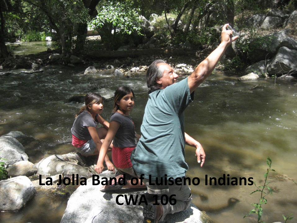
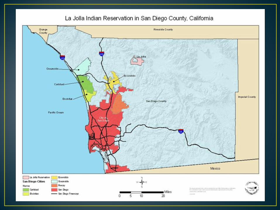
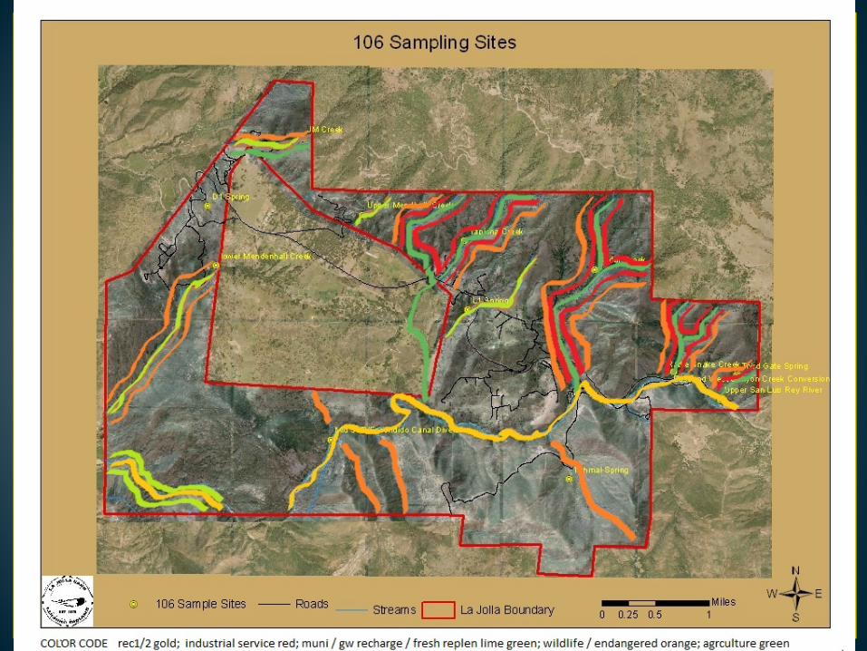
La Jolla Band of Luiseno Indians CWA 106
Topics
• La Jolla Reservation Watershed • Program Funding • Program Tasks & Activities • Data Management & Reporting • Outreach & Collaborative Efforts • So Cal Inter Tribal BMI Stream Team • Deficiencies
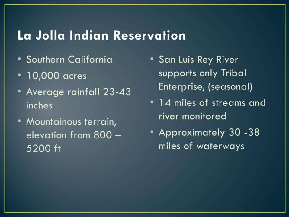
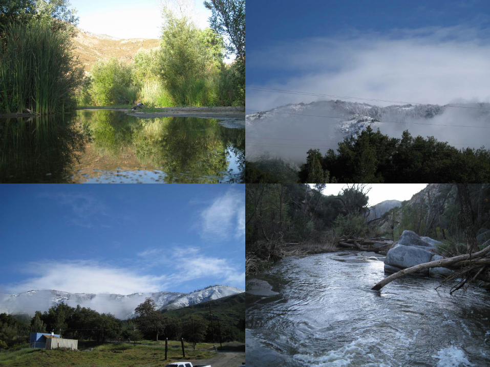
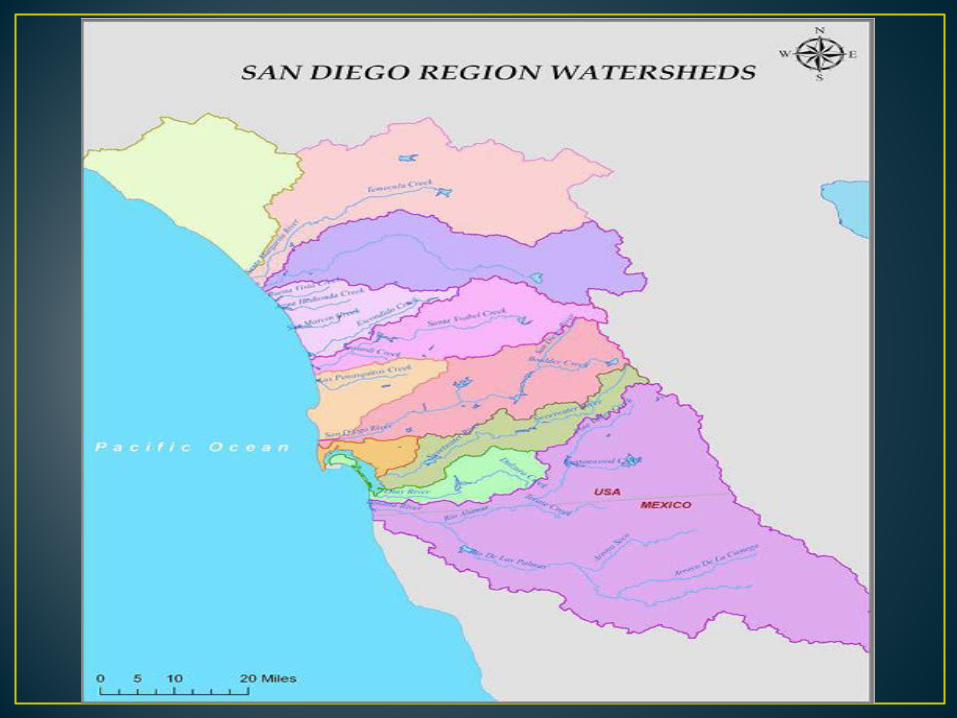
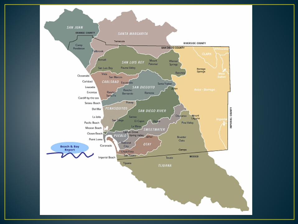
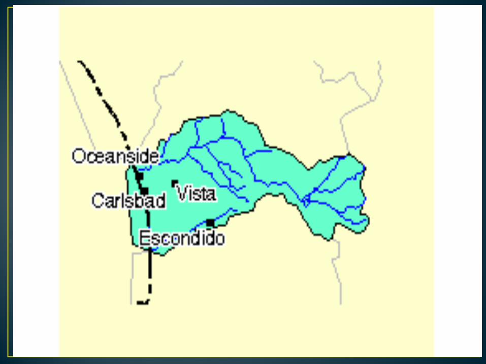
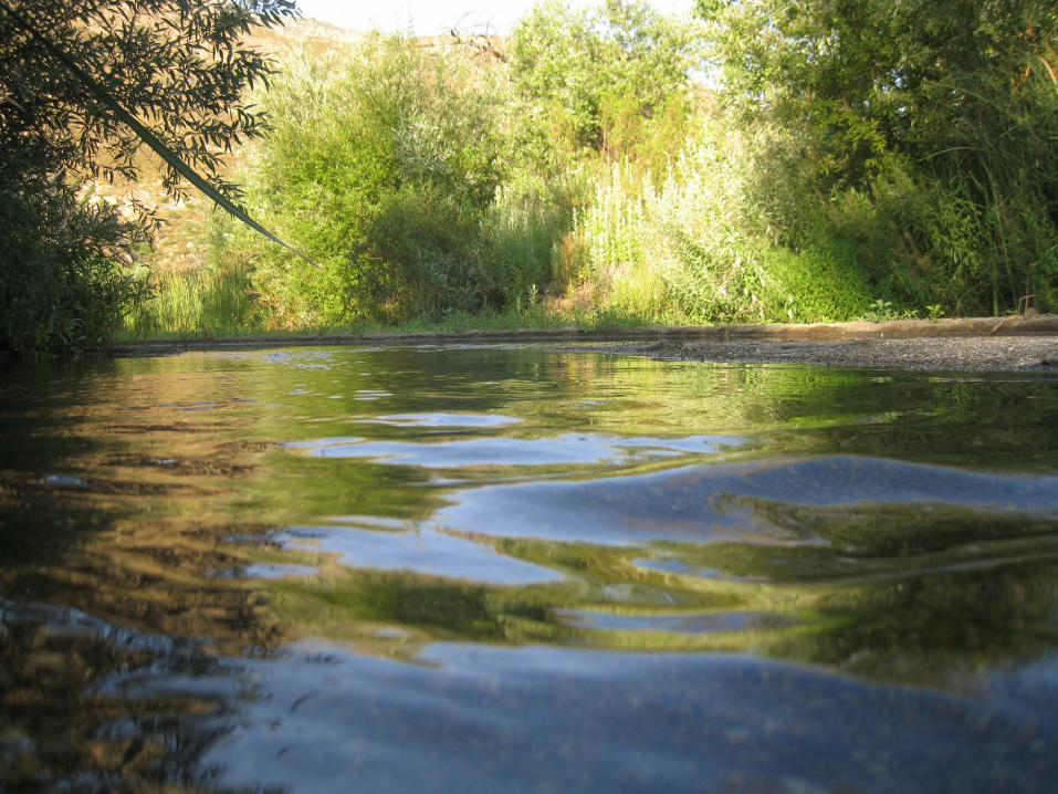
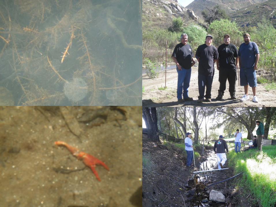
La Jolla Indian Reservation
• Southern California • 10,000 acres • Average rainfall 23-43
inches • Mountainous terrain,
elevation from 800 – 5200 ft
• San Luis Rey River supports only Tribal Enterprise, (seasonal)
• 14 miles of streams and river monitored
• Approximately 30 -38 miles of waterways


CWA 106 Program Funding
• USEPA CWA 106 Funding • 2011 PPG with NPS • Native Environmental Protection Coalition (NAEPC) • USEPA GAP / 319 NPS can assist with minimal activities to
support CWA 106 • PPG can open up for funding to be shared amongst programs
CWA 106 Program Funding
• Tribal match can be comprised of in kind services. In Kind can be Tribal Council Meetings, internet, office rental, water services, donations, volunteers,
• Tribal match can be comprised of in kind services. In Kind can be Tribal Council Meetings, internet, office rental, water services, donations, volunteers,

CWA 106 Program Budget
• Salary / Fringe • Indirect • Supplies • Lab Supplies • Outreach • Travel • Mileage • Training
• Monitoring • Equipment • Instrument maintenance • Consumables • Office / internet /
utilities / phone • Audit • Building / Vehicle R&M
CWA 106 Program Tasks
• Consider amount of funds to support the tasks • Consider completing documents in another Program, (GAP /
NPS / SWAP ) • Create tasks that can be accomplished, some tasks may be on
going for more than one FY • Water monitoring • Data management • Training • Reporting
CWA 106 Program Activities
• CWA 106 Water Pollution Control Program (WPCP) for 10 years
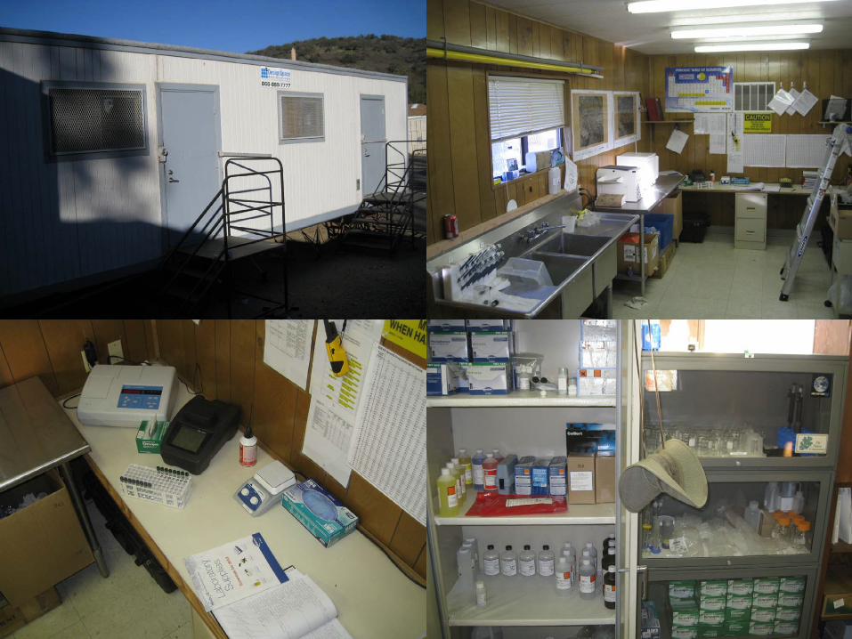
• Training • Equipment • Acquiring baseline data • Tribal Lab established
2010 • Conduct data reports in
WQX format
• Completed USEPA Approved Quality Assurance Project Plan (QAPP)
• Annual Water Quality Assessment Report (WQAR) for USEPA
• Established collaborative Inter Tribal Benthic Macroinvertebrate (BMI) Stream Team

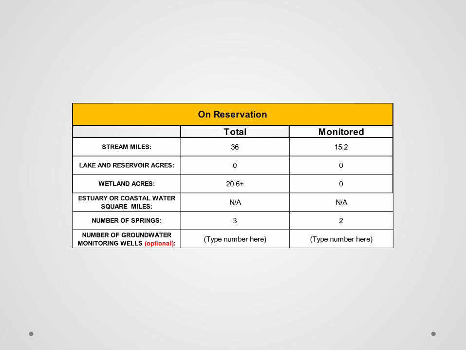
On Reservation
Total MonitoredSTREAM MILES: 36 15.2
LAKE AND RESERVOIR ACRES: 0 0
WETLAND ACRES: 20.6+ 0
ESTUARY OR COASTAL WATER SQUARE MILES: N/A N/A
NUMBER OF SPRINGS: 3 2
NUMBER OF GROUNDWATER MONITORING WELLS (optional): (Type number here) (Type number here)

SWUSLR SWUSLR FIELD 08/17/2010 Field Msr/Obs Water 2010-08-17 09;47;00
SWEWCC SWEWCC FIELD 08/17/2010 Field Msr/Obs Water 2010-08-17 10;42;00
SWSLREWCCC SWSLREWCCC FIELD / / 2010 Field Msr/Obs Water
SWSLRCGC SWSLRCGC FIELD / / 2010 Field Msr/Obs Water
SWCGC SWCGC FIELD 08 /17 / 2010 Field Msr/Obs Water 2010-08-17 11;06;00
SWSLRTSC SWSLRTSC FIELD / /2010 Field Msr/Obs Water
LJLTS LJLTS FIELD / / 2010 Field Msr/Obs Water
LJUTS LJUTS FIELD 00/00/2010 Field Msr/Obs Water
SWSLRRV SWSLRRV FIELD / / 2010 Field Msr/Obs Water
LJSL1 LJSL1 FIELD //2010 Field Msr/Obs Water
SWYC SWYC FIELD 08/16/2010 Field Msr/Obs Water 2010-08-16 13;07;00
SWRC SWRC FIELD 08/17/2010 Field Msr/Obs Water 2010-08-17 10;16;00
SWSLRRCCC SWSLRRCCC FIELD / / 2010 Field Msr/Obs Water
SWCC SWCC FIELD 08/17/2010 Field Msr/Obs Water 2010-08-17 12;05;00
SWLCC SWLCC FIELD 08/17/ 2010 Field Msr/Obs Water 2010-08-17 11;28;00
SWSLRCCC SWSLRCCC FIELD 08 / 17 / 2010 Field Msr/Obs Water 2010-08-17 11;35;00
LJSD1 LJSD1 FIELD Field Msr/Obs Water
SWUM SWUM FIELD 08/16/2010 Field Msr/Obs Water 2010-08-16 12;40;00
SWLM SWLM FIELD 08/16/2010 Field Msr/Obs Water 2010-08-16 10;23;00
SWWM SWWM FIELD / / 2010 Field Msr/Obs Water
SWJM SWJM FIELD 08/16/2010 Field Msr/Obs Water 2010-08-16 10;59;00
SWNDT SWNDT FIELD / / 2010 Field Msr/Obs Water
SWK SWK FIELD 08/18/2010 Field Msr/Obs Water 2010-08-18 12;27;00
SWSLRO SWSLRO FIELD 08/18/2010 Field Msr/Obs Water 2010-08-18 10;38;00
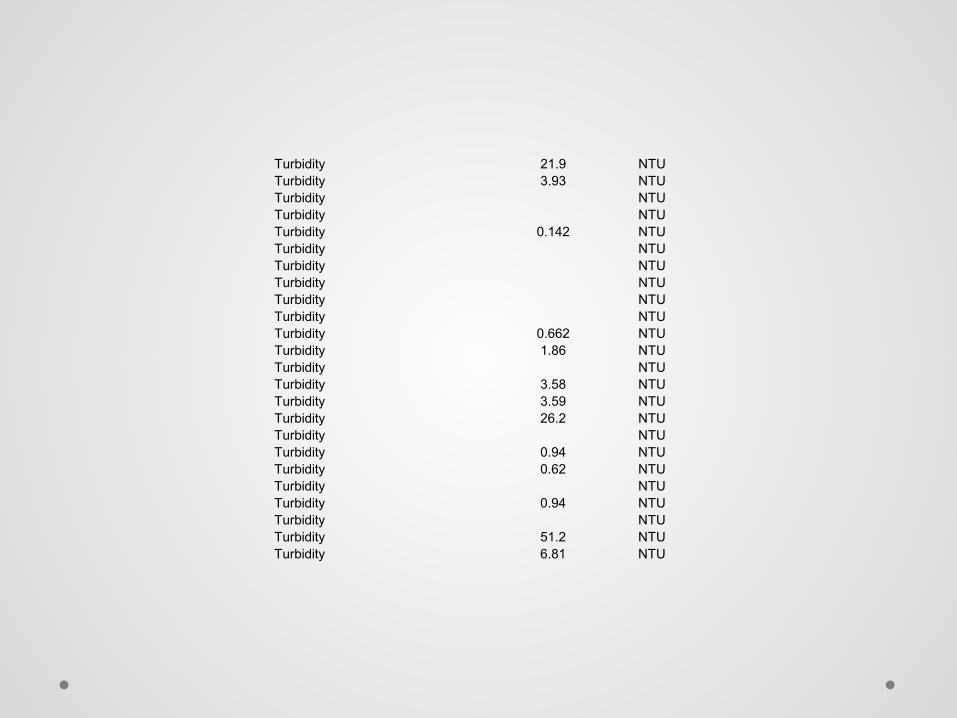
Turbidity 21.9 NTU Turbidity 3.93 NTU Turbidity NTU Turbidity NTU Turbidity 0.142 NTU Turbidity NTU Turbidity NTU Turbidity NTU Turbidity NTU Turbidity NTU Turbidity 0.662 NTU Turbidity 1.86 NTU Turbidity NTU Turbidity 3.58 NTU Turbidity 3.59 NTU Turbidity 26.2 NTU Turbidity NTU Turbidity 0.94 NTU Turbidity 0.62 NTU Turbidity NTU Turbidity 0.94 NTU Turbidity NTU Turbidity 51.2 NTU Turbidity 6.81 NTU
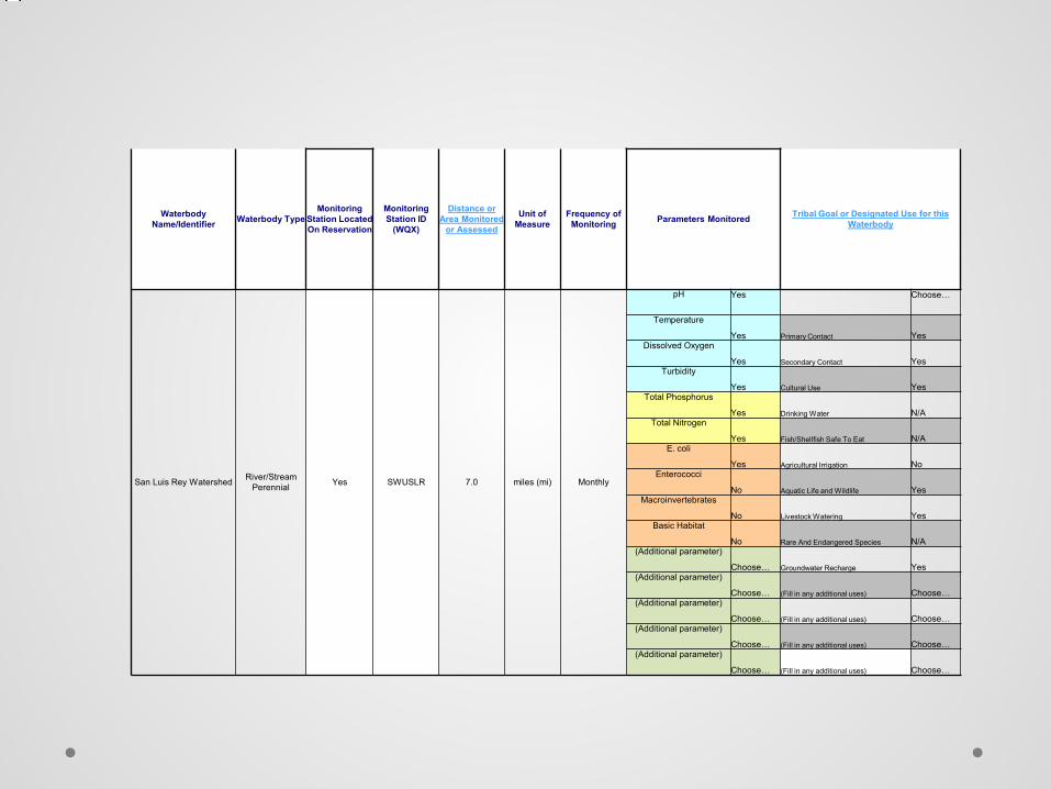
Waterbody Name/Identifier Waterbody Type
Monitoring Station Located On Reservation
Monitoring Station ID
(WQX)
Distance or Area Monitored
or Assessed
Unit of Measure
Frequency of Monitoring Parameters Monitored Tribal Goal or Designated Use for this
Waterbody
San Luis Rey Watershed River/Stream Perennial Yes SWUSLR 7.0 miles (mi) Monthly
pH Yes
Choose…
Temperature
Yes Primary Contact Yes Dissolved Oxygen
Yes Secondary Contact Yes Turbidity
Yes Cultural Use Yes Total Phosphorus
Yes Drinking Water N/A Total Nitrogen
Yes Fish/Shellfish Safe To Eat N/A E. coli
Yes Agricultural Irrigation No Enterococci
No Aquatic Life and Wildlife Yes Macroinvertebrates
No Livestock Watering Yes Basic Habitat
No Rare And Endangered Species N/A (Additional parameter)
Choose… Groundwater Recharge Yes (Additional parameter)
Choose… (Fill in any additional uses) Choose… (Additional parameter)
Choose… (Fill in any additional uses) Choose… (Additional parameter)
Choose… (Fill in any additional uses) Choose… (Additional parameter)
Choose… (Fill in any additional uses) Choose…
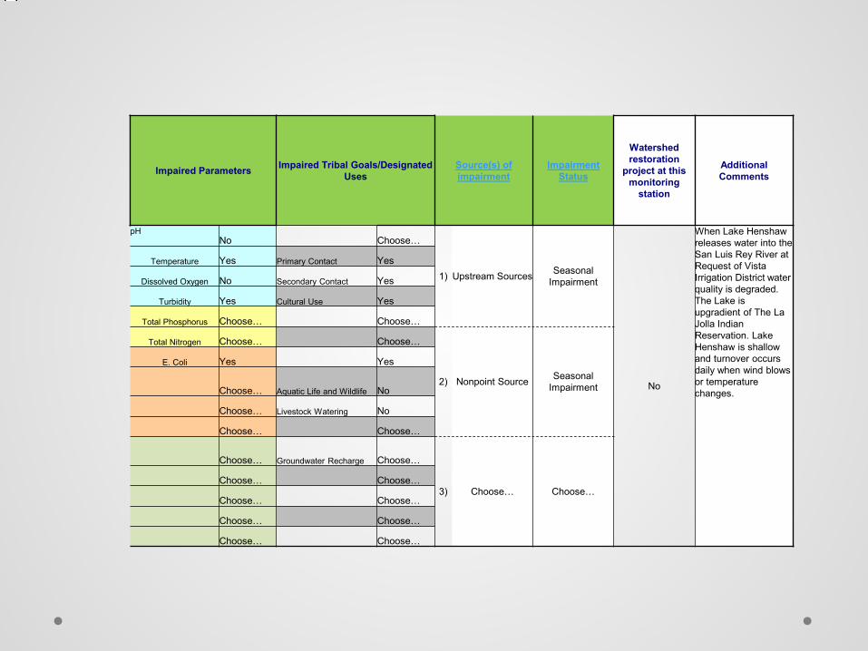
Impaired Parameters Impaired Tribal Goals/Designated Uses
Source(s) of impairment
Impairment Status
Watershed restoration
project at this monitoring
station
Additional Comments
pH No Choose…
1) Upstream Sources Seasonal Impairment
No
When Lake Henshaw releases water into the San Luis Rey River at Request of Vista Irrigation District water quality is degraded. The Lake is upgradient of The La Jolla Indian Reservation. Lake Henshaw is shallow and turnover occurs daily when wind blows or temperature changes.
Temperature Yes Primary Contact Yes
Dissolved Oxygen No Secondary Contact Yes
Turbidity Yes Cultural Use Yes
Total Phosphorus Choose… Choose…
Total Nitrogen Choose… Choose…
2) Nonpoint Source Seasonal Impairment
E. Coli Yes Yes
Choose… Aquatic Life and Wildlife No
Choose… Livestock Watering No
Choose… Choose…
Choose… Groundwater Recharge Choose…
3) Choose… Choose…
Choose… Choose…
Choose… Choose…
Choose… Choose…
Choose… Choose…
-2.50
0.00
2.50
5.00
7.50
10.00
12.50
15.00
17.50
20.00
22.50
4/23/10 5/13/10 6/2/10 6/22/10 7/12/10 8/1/10 8/21/10 9/10/10 9/30/10 10/20/10
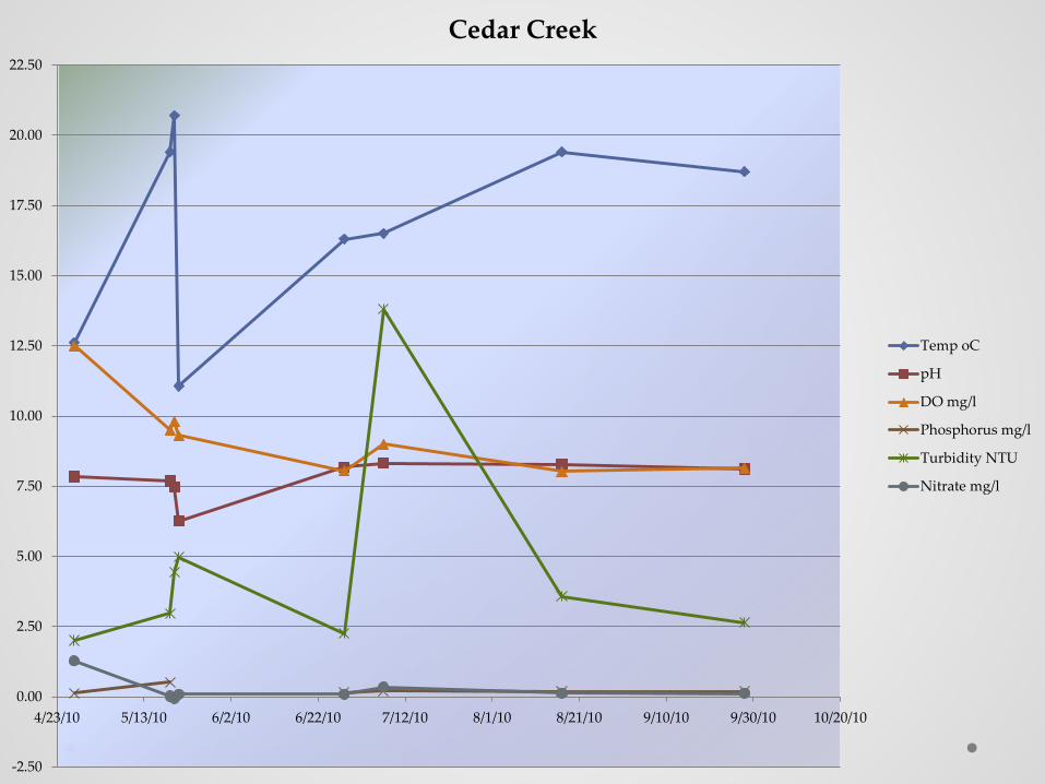
Cedar Creek
Temp oC
pH
DO mg/l
Phosphorus mg/l
Turbidity NTU
Nitrate mg/l
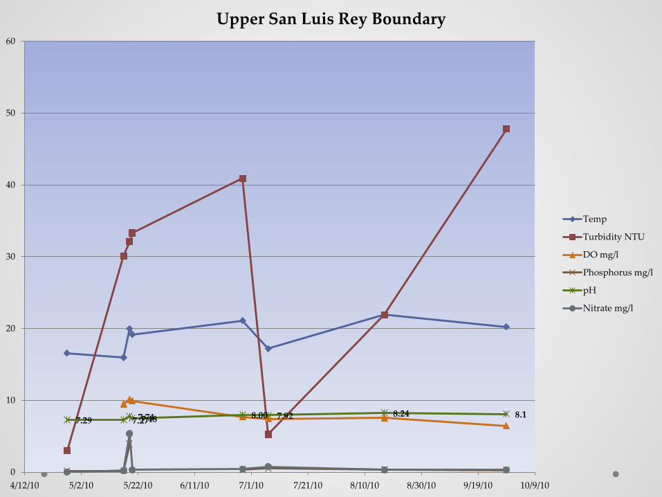
7.29 7.27 7.74 7.48 8.00 7.92 8.24 8.1
0
10
20
30
40
50
60
4/12/10 5/2/10 5/22/10 6/11/10 7/1/10 7/21/10 8/10/10 8/30/10 9/19/10 10/9/10
Upper San Luis Rey Boundary
Temp
Turbidity NTU
DO mg/l
Phosphorus mg/l
pH
Nitrate mg/l

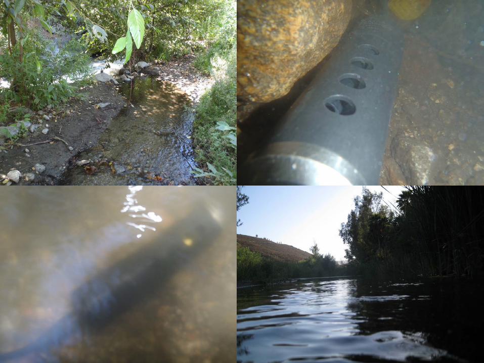
Field Sheets / log book
La Jolla Band of Luiseño Indians Environmental Protection Office
Site ID Date / Time Field Technicians Site Description Field Instruments Sample Collection Time
Weather Description
Date Most Recent Precipitation
FIELD PARAMETERS
Ph TEMP DO (mg/l) DO (%) Conductivity TDS Ammonia (mg/l) Nitrate (mg/l) Bp Elevation Wind Speed Ambient Temp Wet Length Wet Width Water Depth Water Flow
LAB PARAMETERS
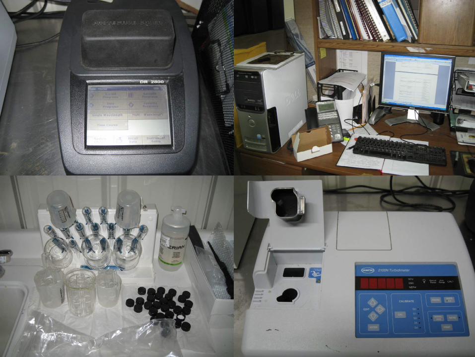
PARAMETER RESULT ANALYSIS INSTRUMENT TIME
Turbidity NTU;s
HACH 2100N Turbidimeter
Nitrate mg/l HACH DR2800 Phosphorus mg/l
HACH DR2800
Total Coliform Colilert MPN Fecal Coliform Colilert MPN
RIPARIAN DESCRIPTION:
COMMENTS:
SITE PHOTOS:
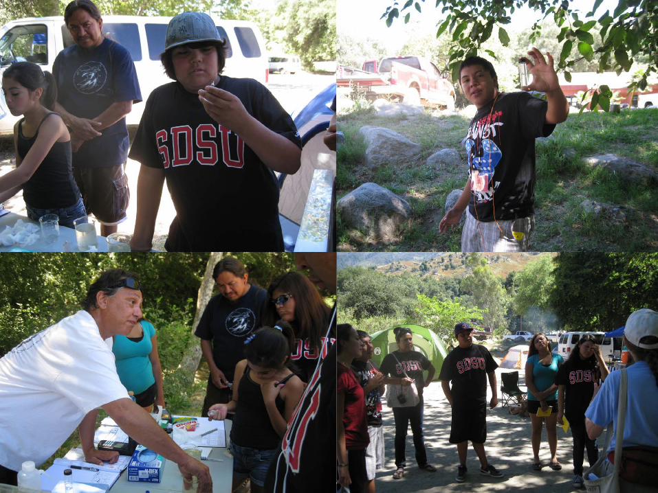
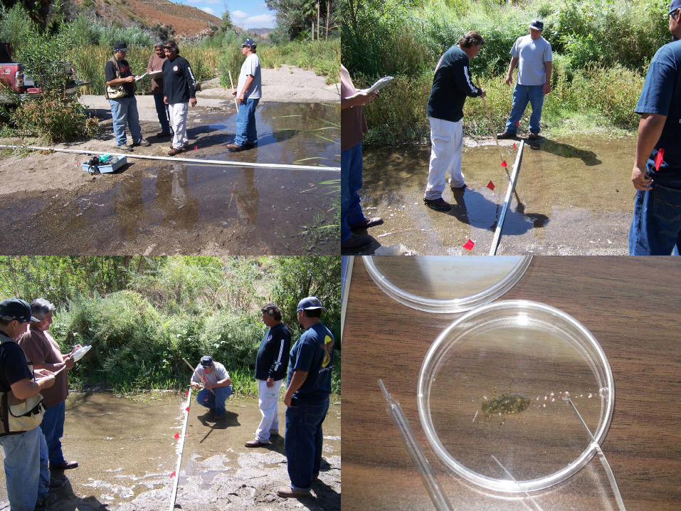
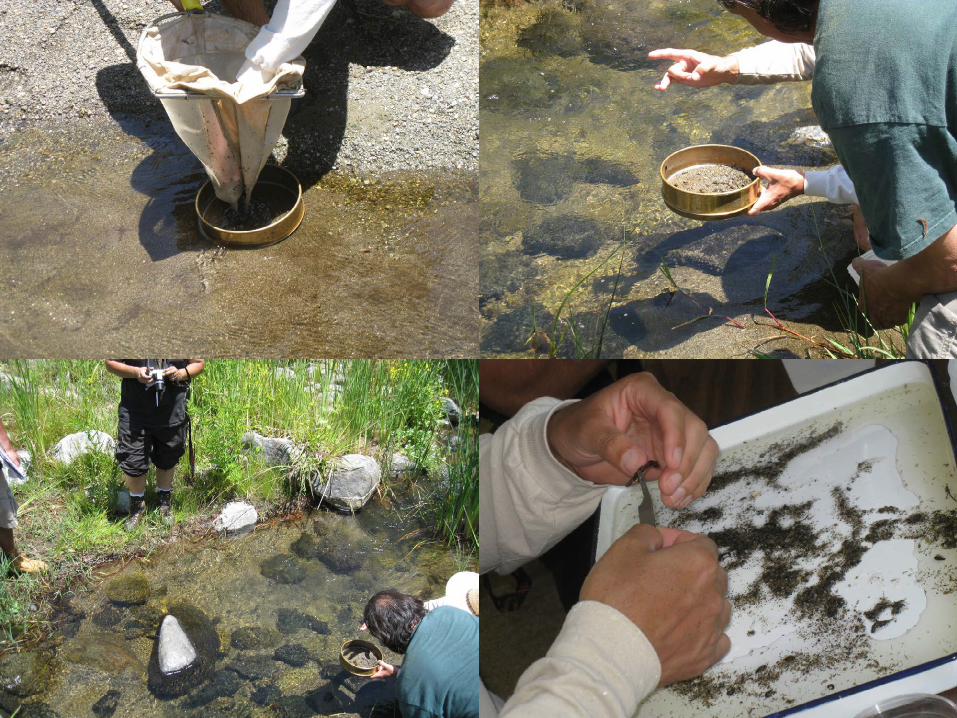
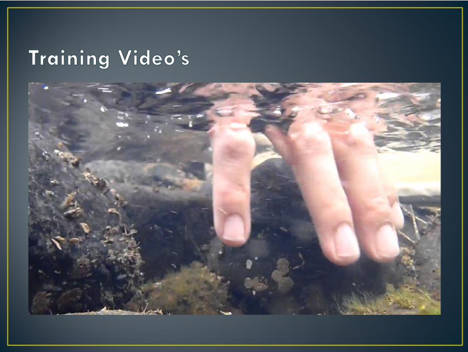
So Cal Inter Tribal BMI Stream Team
• Inter Tribal Collaborative Team of 6 Tribes • Established August 11, 2010 • Training according to Source Water Ambient Monitoring
Protocol, (SWAMP) • On site trainings at various reservations • Staff collected first sample in April on reservation
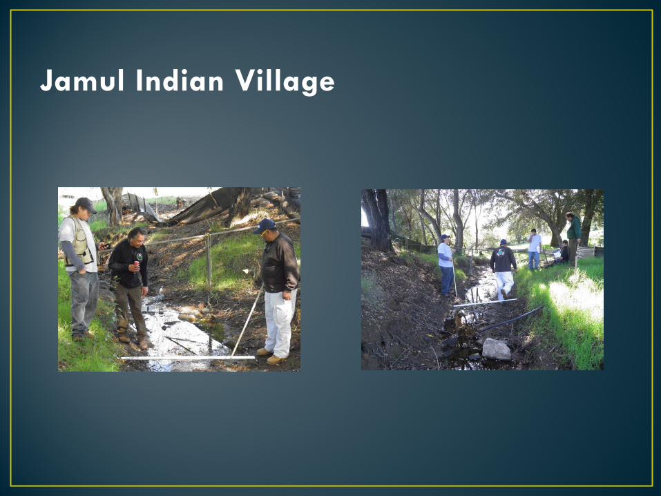
Jamul Indian Village
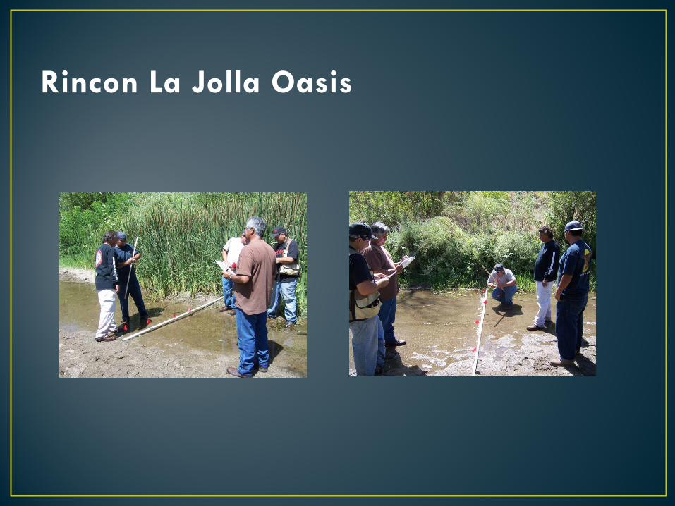
Rincon La Jolla Oasis
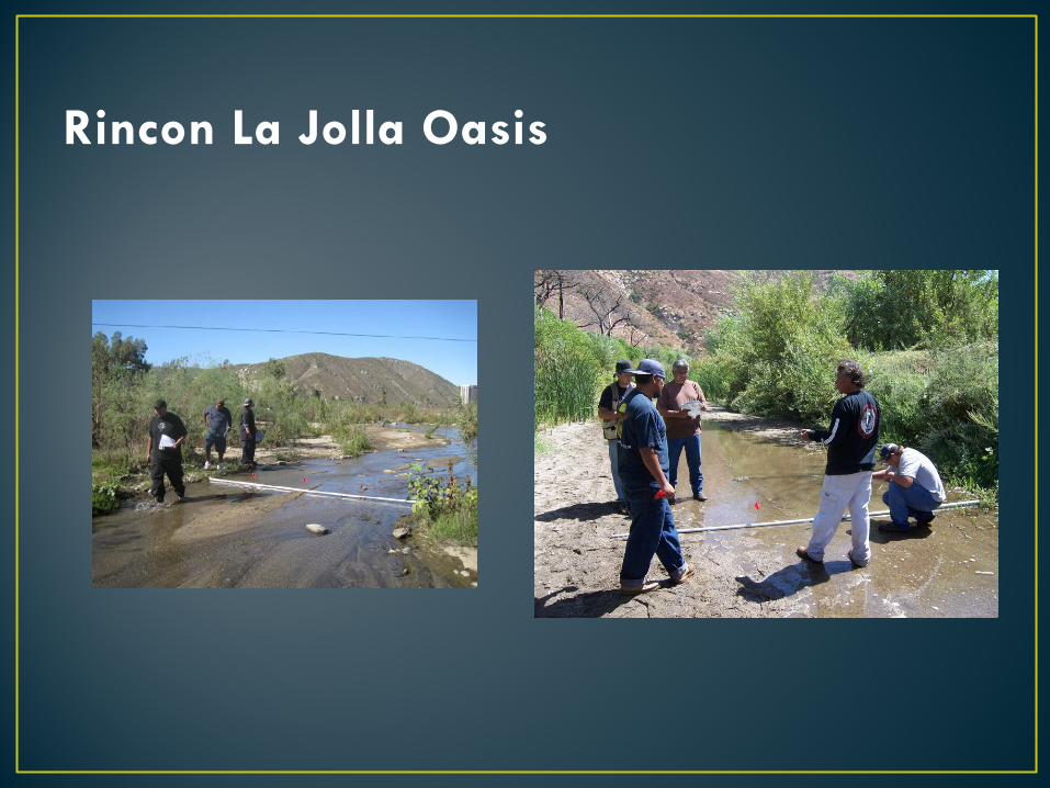
Rincon La Jolla Oasis
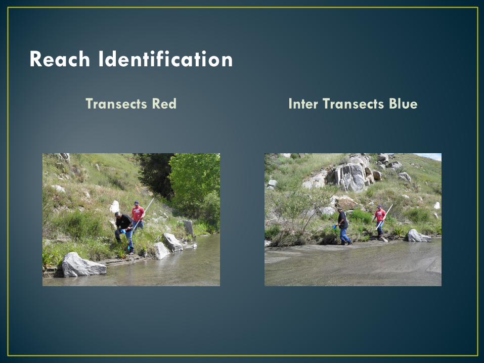
Reach Identification
Transects Red Inter Transects Blue

BMI Sample Collection
Rock / Cobble Cleaning Rock / Cobble Cleaning
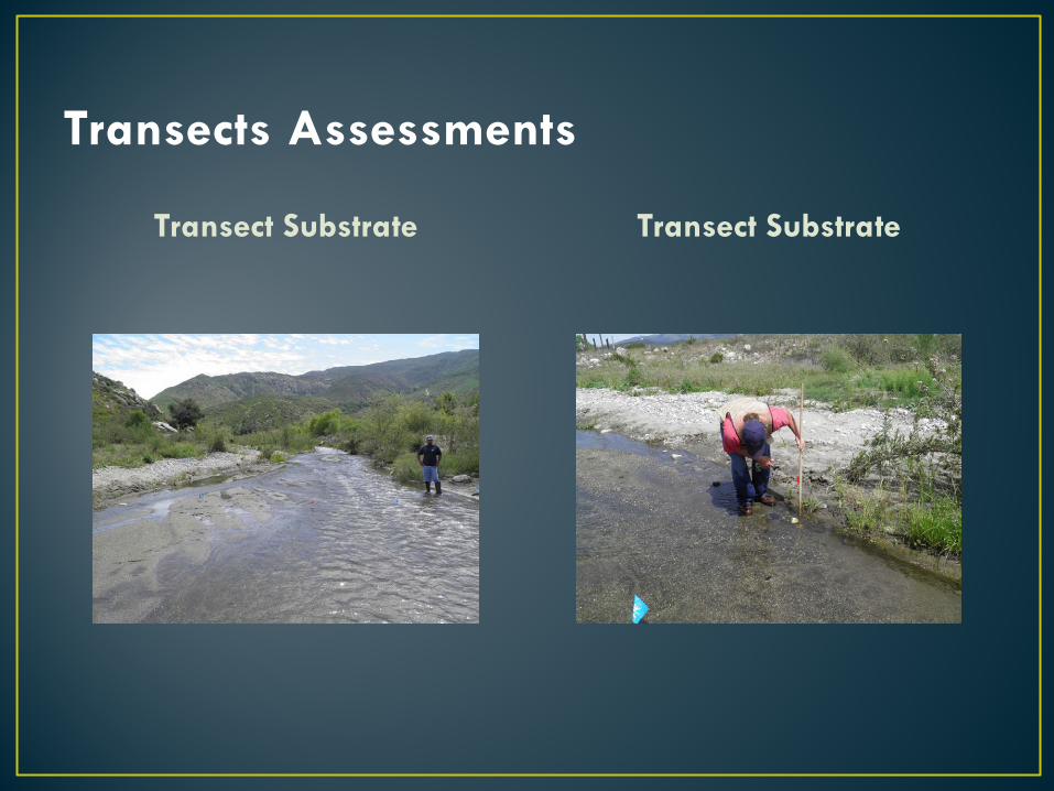
Transects Assessments
Transect Substrate Transect Substrate

Riparian Vegetation
Trees and Saplings >5m High All Vegetation
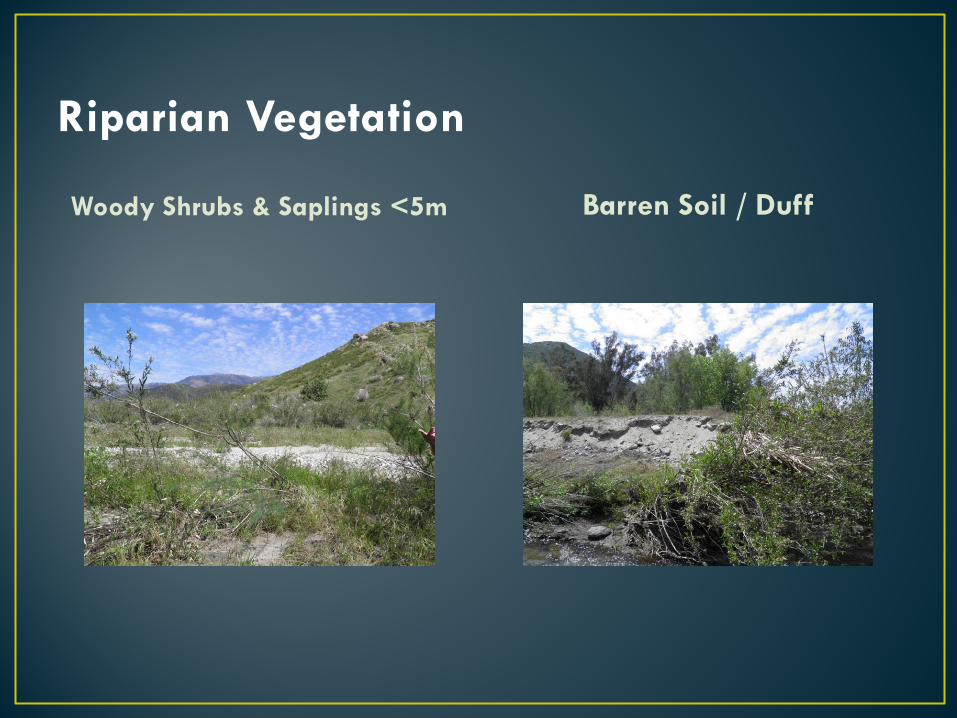
Riparian Vegetation
Woody Shrubs & Saplings <5m Barren Soil / Duff
Riparian Vegetation
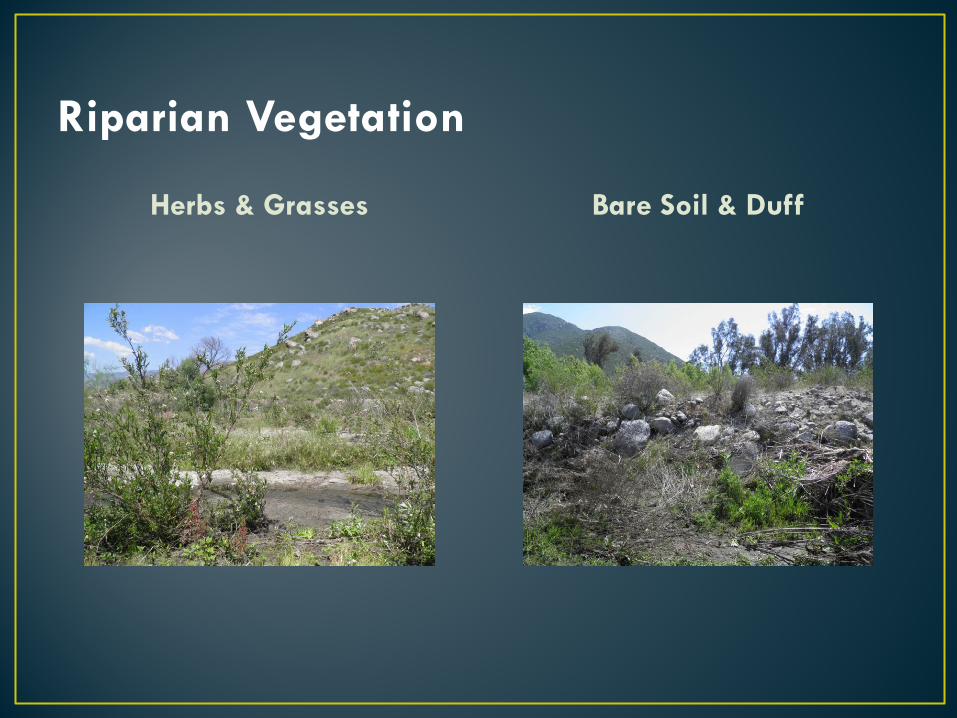
Herbs & Grasses Bare Soil & Duff
Instream Habitat Complexity
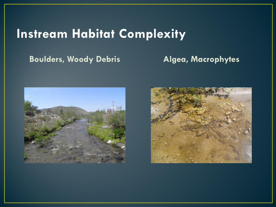
Boulders, Woody Debris Algea, Macrophytes

Instream Habitat Complexity
Overhanging Vegetation Undercut Banks
Densiometer Readings
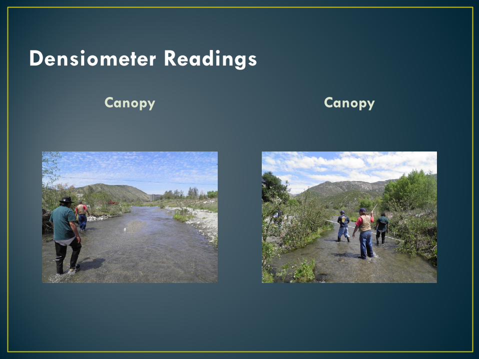
Canopy Canopy
Human Influence
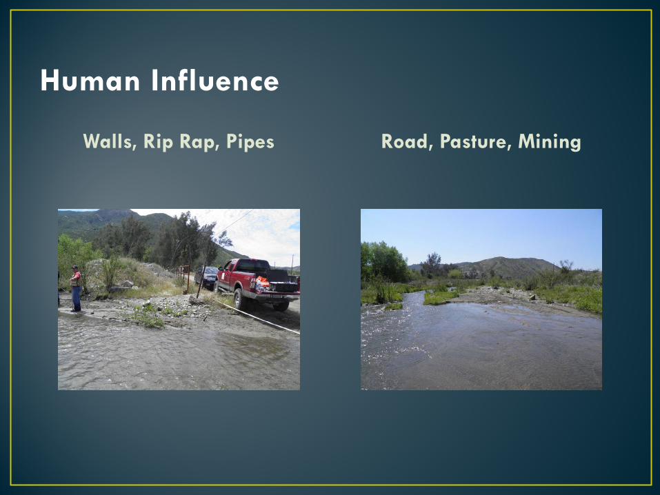
Walls, Rip Rap, Pipes Road, Pasture, Mining

Bank Stability
Vulnerable Eroded Stable
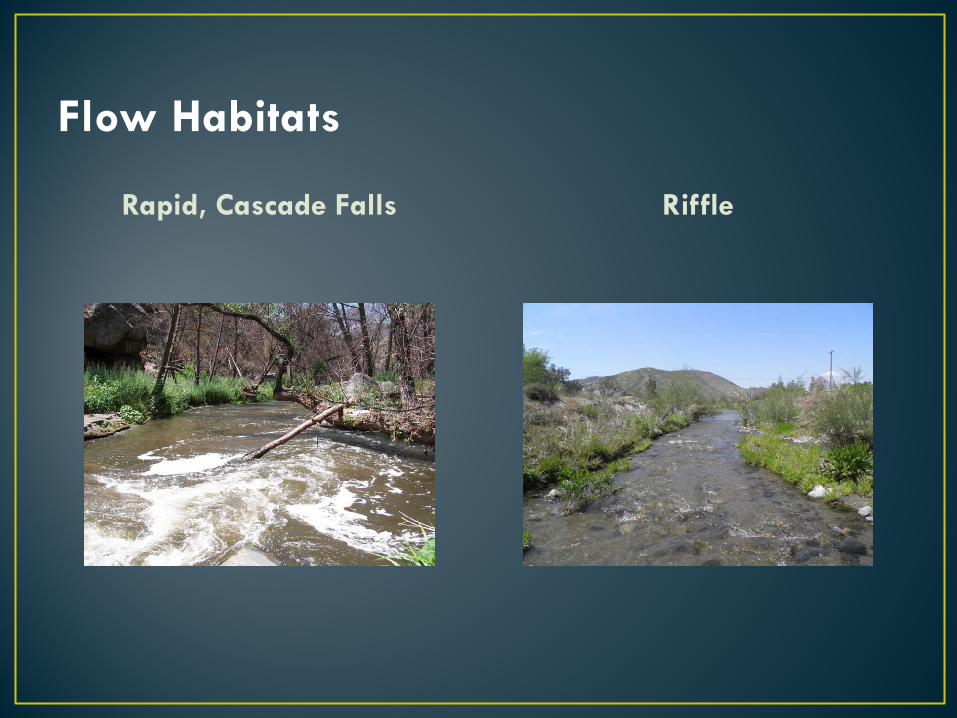
Flow Habitats
Rapid, Cascade Falls Riffle
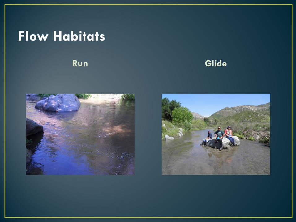
Flow Habitats
Run Glide
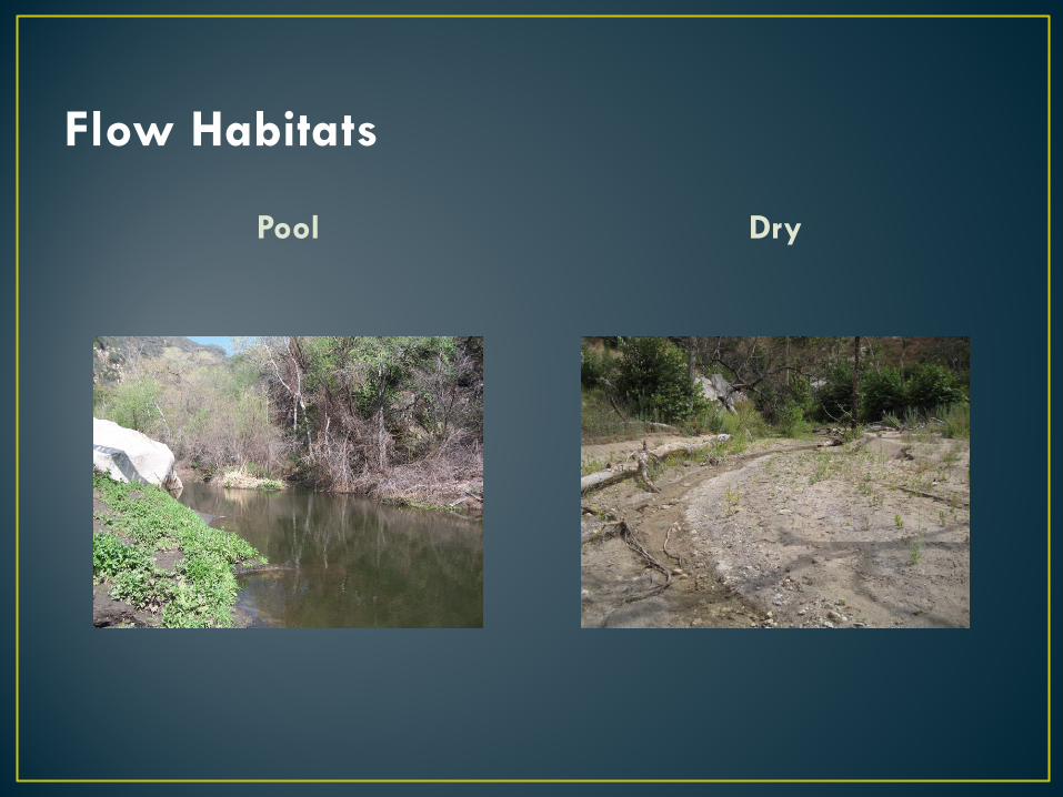
Flow Habitats
Pool Dry
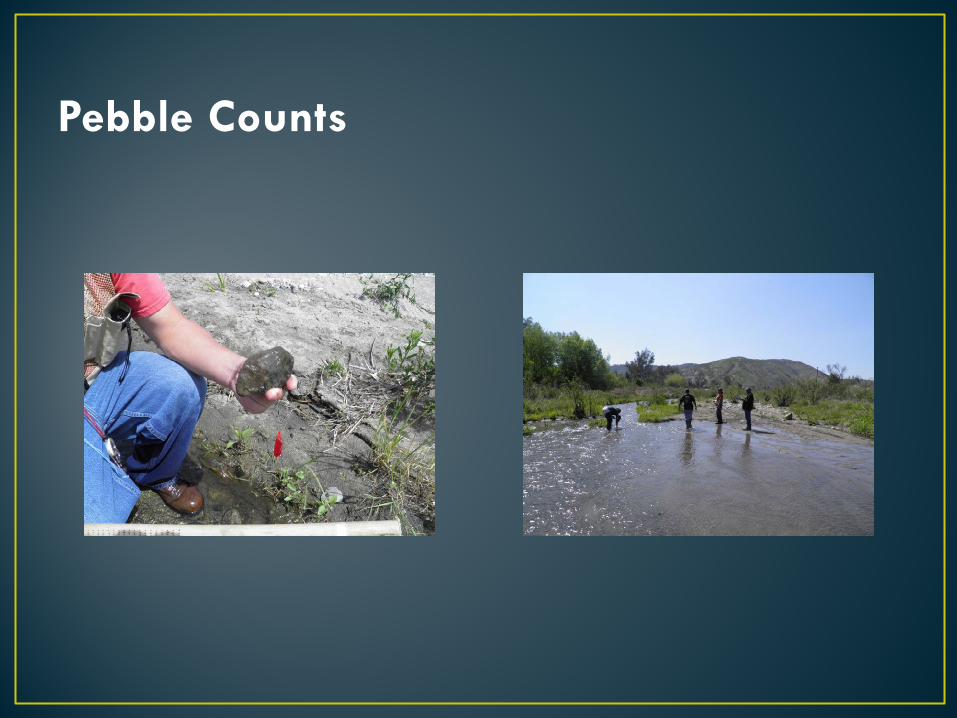
Pebble Counts
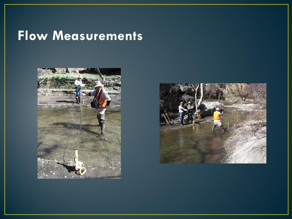
Flow Measurements
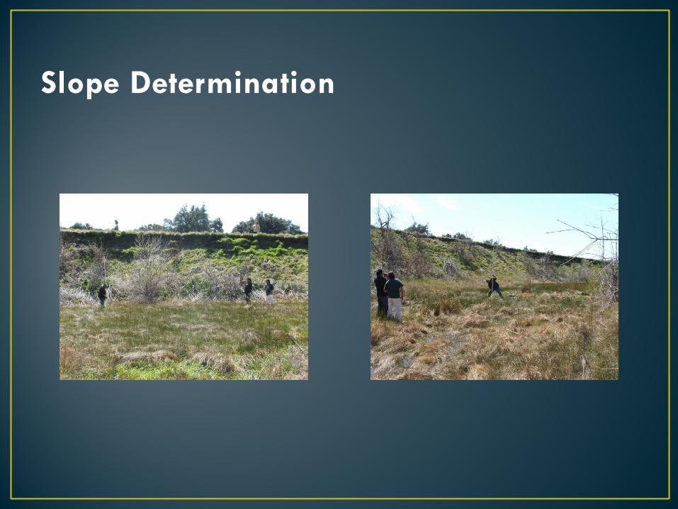
Slope Determination
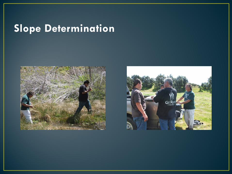
Slope Determination
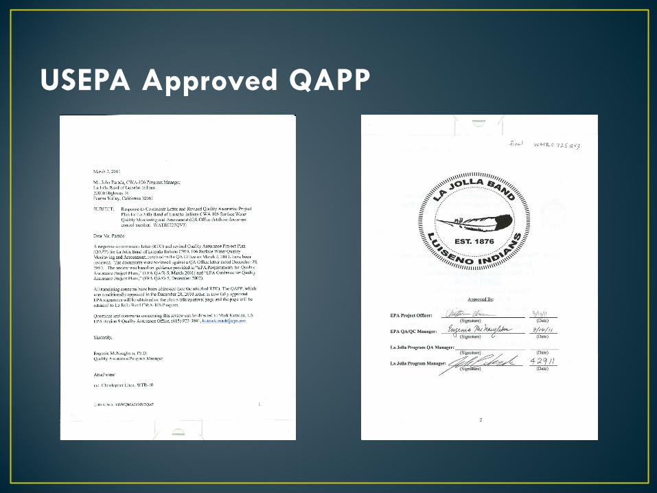
USEPA Approved QAPP
CWA 106 Program Deficiencies
• Staff turnover • Insufficient amount of legally valid, and baseline data • Insufficient funding to conduct adequate monitoring • Identified water quality concerns cannot be confirmed due to
lack of funding • Equipment unavailable to conduct analysis adequately for
coliform
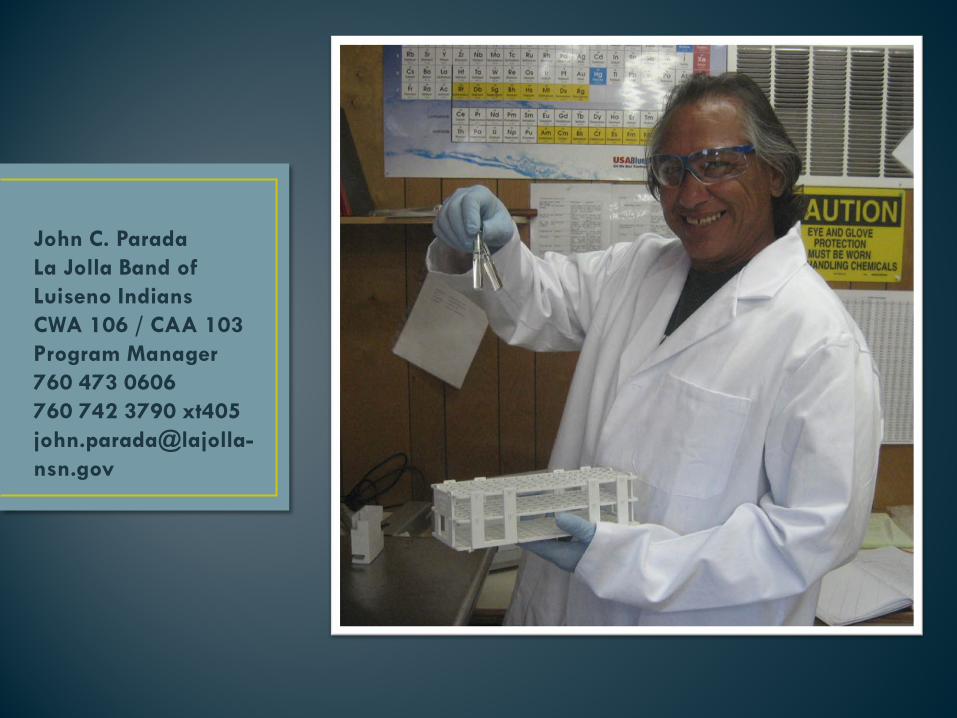
John C. Parada La Jolla Band of Luiseno Indians CWA 106 / CAA 103 Program Manager 760 473 0606 760 742 3790 xt405 [email protected]