Embed Size (px)
Citation preview

Introduction to the ArcGIS API for JavaScript
Andy Gup – @agup
Derek Swingley – @derekswingley

Agenda
• History • A Simple App • Dev Environment • Layers and Widgets • Styling Graphics and New Tech • Debugging Tips and Tricks #esrijs
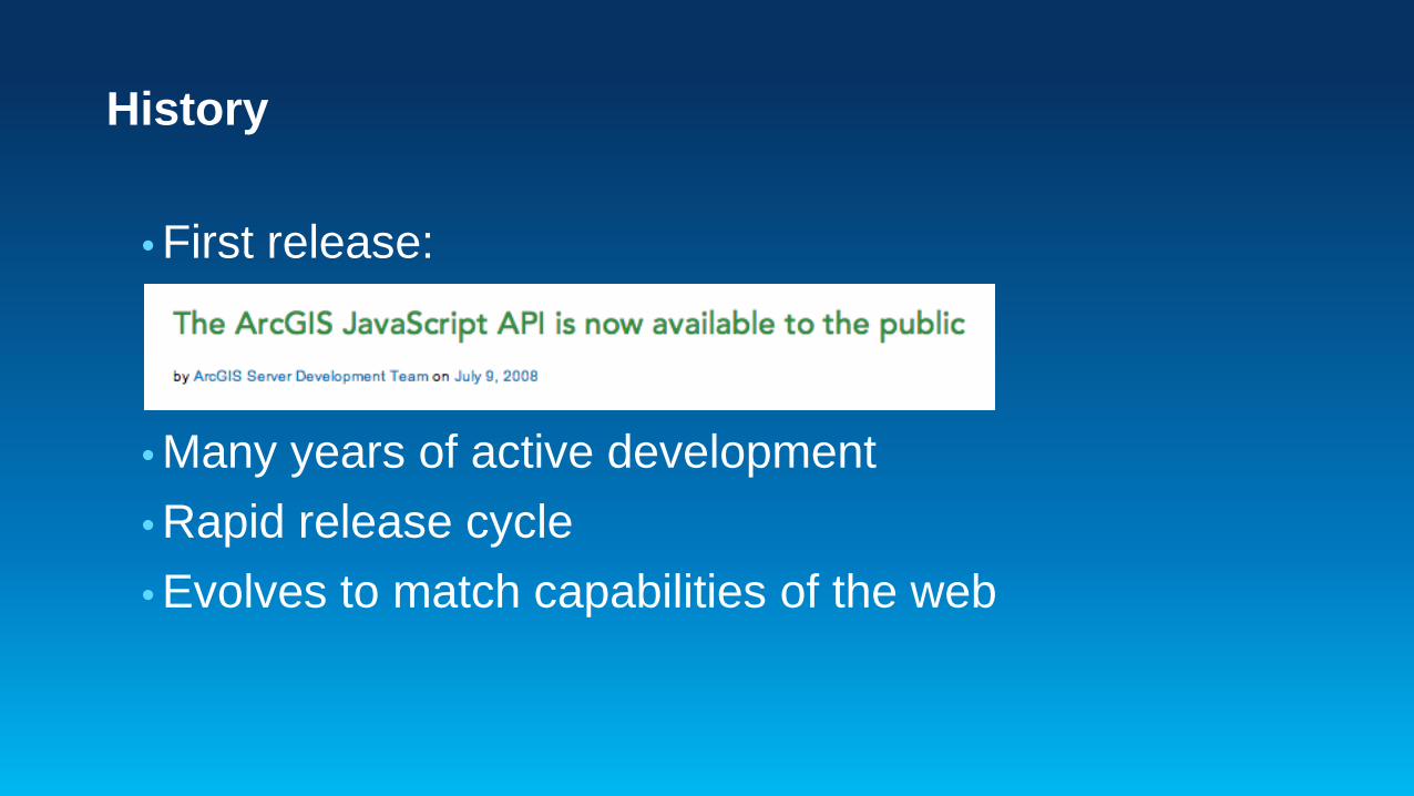
History
• First release: • Many years of active development • Rapid release cycle • Evolves to match capabilities of the web

What can it do?
• Interactive maps • ArcGIS Online basemaps • Widgets: Geocoder, Home, Locate, etc. • Analysis: GP, location analytics, geoenrichment • …explore the samples

Supported Environments

Get the API
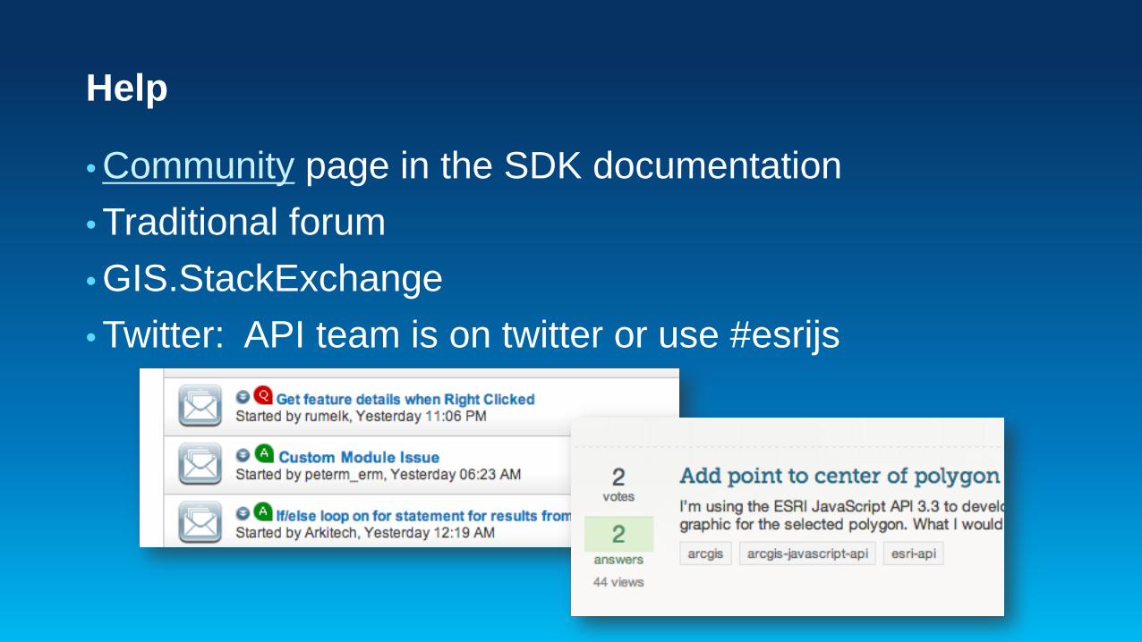
Help
• Community page in the SDK documentation • Traditional forum • GIS.StackExchange • Twitter: API team is on twitter or use #esrijs
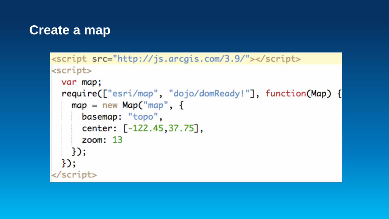
Create a map

Create a map…using ArcGIS.com

Hello World Map

Layers
• Feature Layer • Tiled • Dynamic • KML • CSV
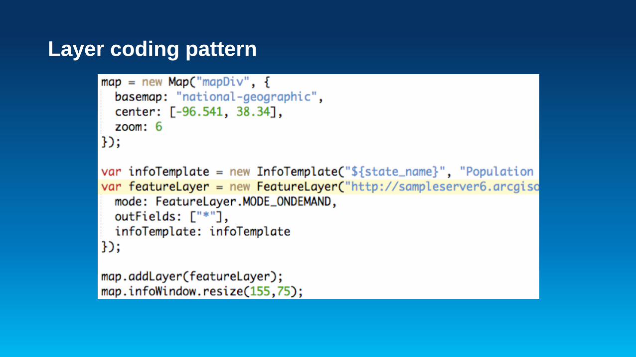
Layer coding pattern
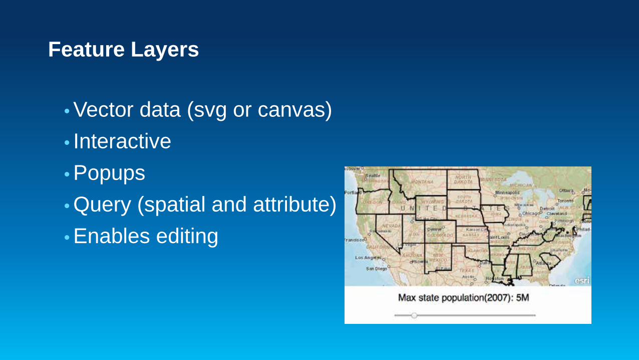
Feature Layers
• Vector data (svg or canvas) • Interactive • Popups • Query (spatial and attribute) • Enables editing

Feature Layers

Widgets
• Application framework • Single purpose • Reusable / sharable • Examples
- Directions Widget - Geocoding Widget
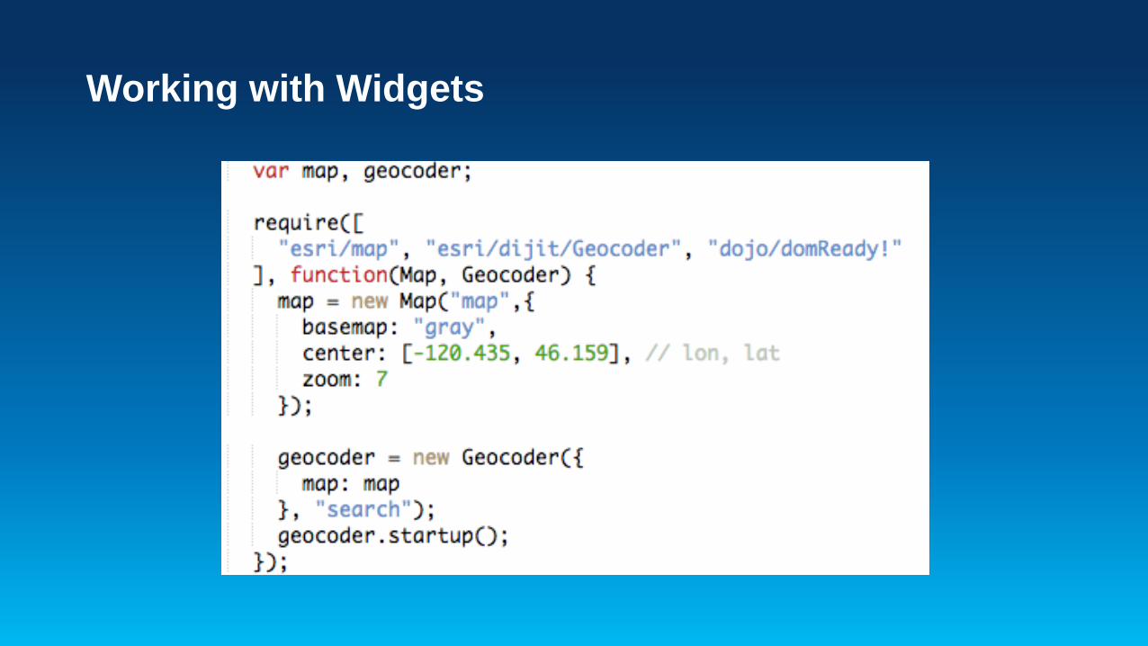
Working with Widgets

Geocoding, Directions
Widget demos

Custom Styling for…
• Graphics • Map zoom buttons • Widgets • Popups

Customizing Popups
• PopupTemplate • Custom themes • Sprites

Popup outside the map
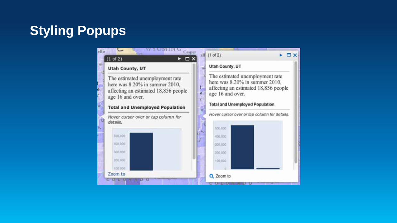
Styling Popups

Mobile Popups

Mobile Popups

Custom popups
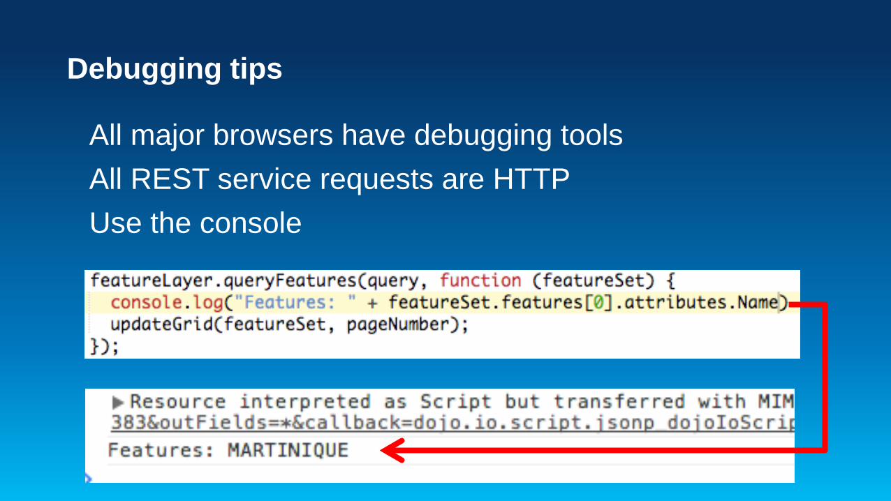
Debugging tips
All major browsers have debugging tools All REST service requests are HTTP Use the console

Debugging demo
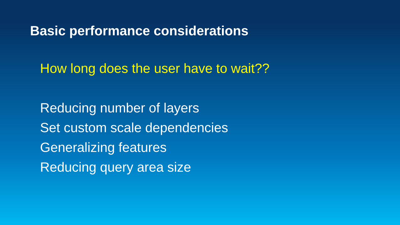
Basic performance considerations
How long does the user have to wait?? Reducing number of layers Set custom scale dependencies Generalizing features Reducing query area size
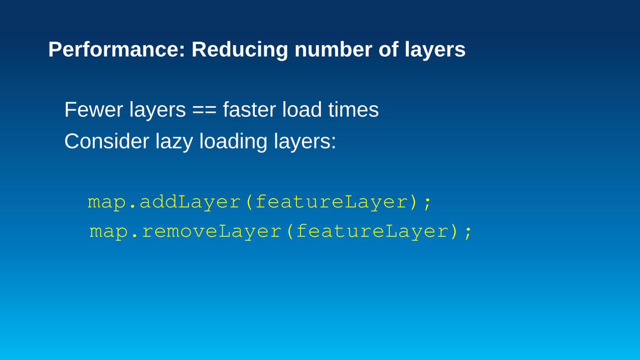
Performance: Reducing number of layers
Fewer layers == faster load times Consider lazy loading layers: map.addLayer(featureLayer); map.removeLayer(featureLayer);
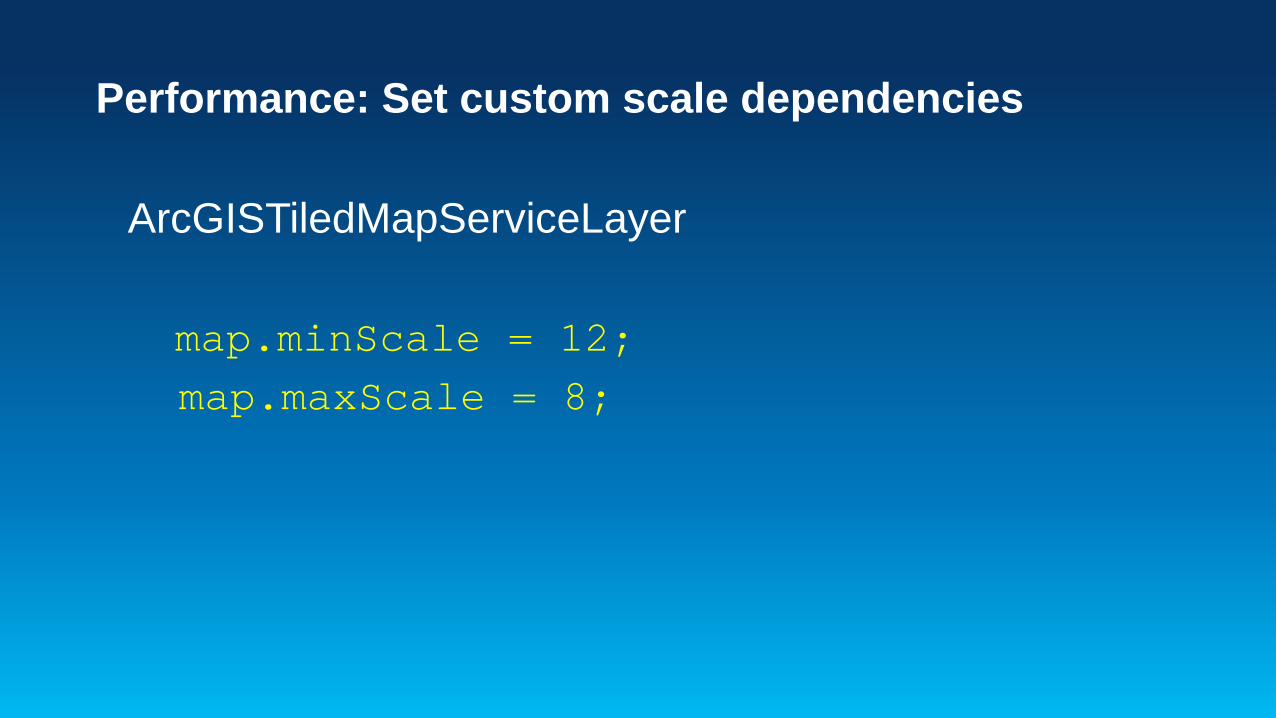
Performance: Set custom scale dependencies
ArcGISTiledMapServiceLayer map.minScale = 12; map.maxScale = 8;

Performance: Generalizing features
How dense is a polygon or polyline? Can you use point clustering?
getMaxAllowableOffset
setMaxAllowableOffset
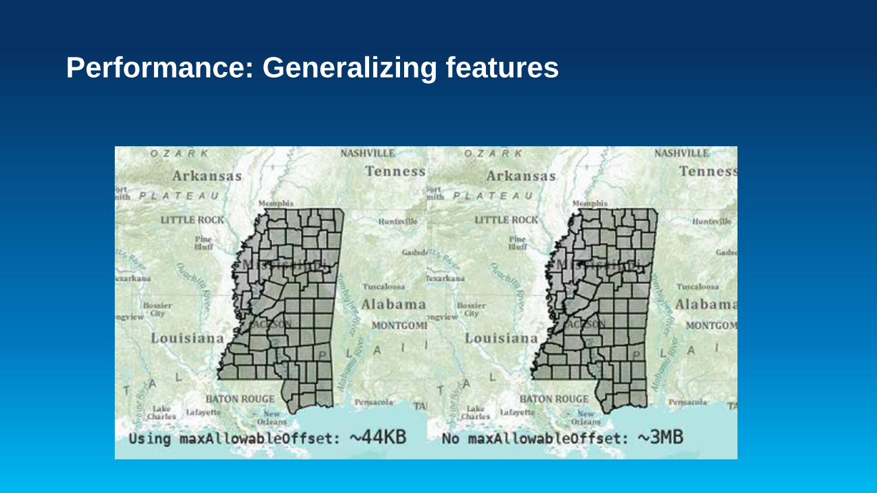
Performance: Generalizing features
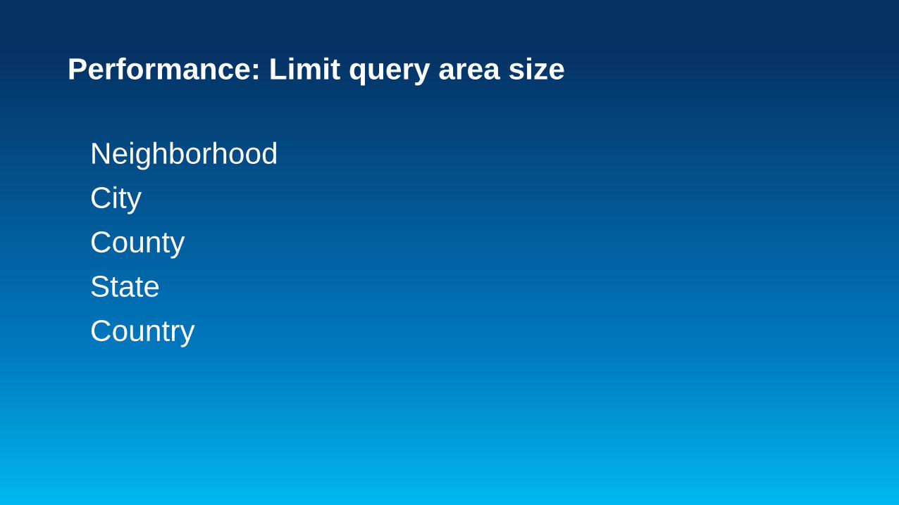
Performance: Limit query area size
Neighborhood City County State Country
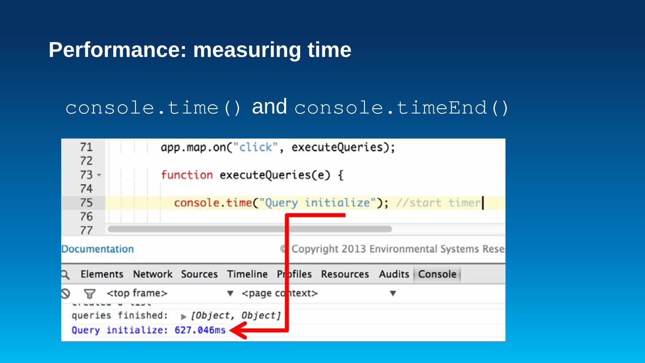
Performance: measuring time
console.time() and console.timeEnd()

IDEs
Notepad++ Aptana Sublime (Mac) WebStorm

Github demo

JavaScript sessions!

Session Survey: http://esriurl.com/7517
Andy Gup – @agup Derek Swingley – @derekswingley