Embed Size (px)
Citation preview
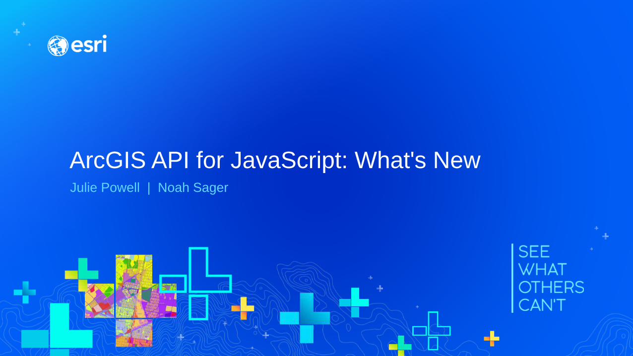
ArcGIS API for JavaScript: What's NewJulie Powell | Noah Sager
Welcome!
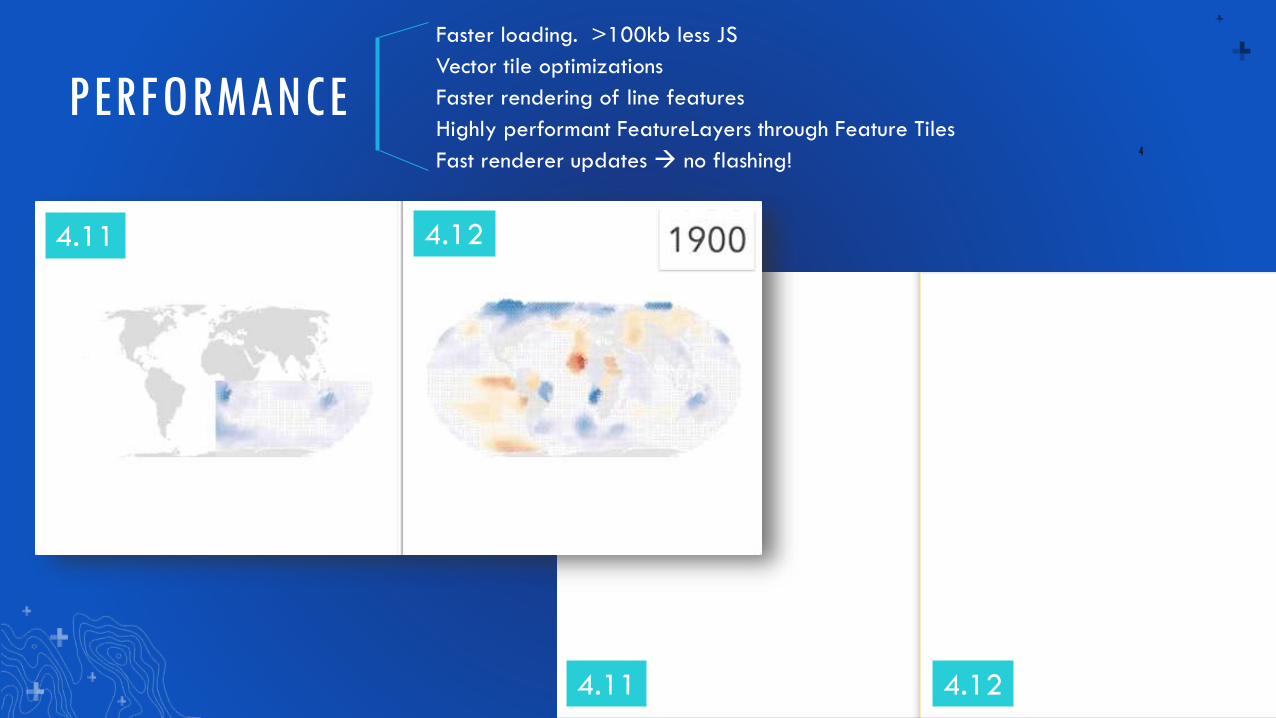
PERFORMANCE
Faster loading. >100kb less JS
Vector tile optimizations
Faster rendering of line features
Highly performant FeatureLayers through Feature Tiles
Fast renderer updates → no flashing!4
4.11 4.12
4.11 4.12
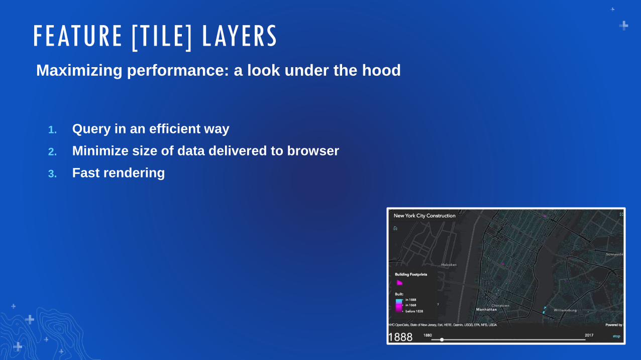
Maximizing performance: a look under the hood
1. Query in an efficient way
2. Minimize size of data delivered to browser
3. Fast rendering
FEATURE [TILE] LAYERS
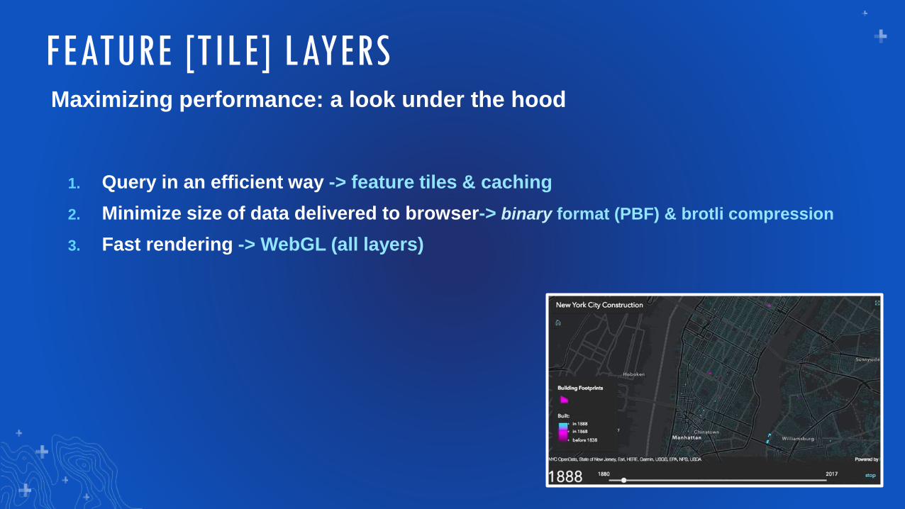
Maximizing performance: a look under the hood
1. Query in an efficient way -> feature tiles & caching
2. Minimize size of data delivered to browser-> binary format (PBF) & brotli compression
3. Fast rendering -> WebGL (all layers)
FEATURE [TILE] LAYERS
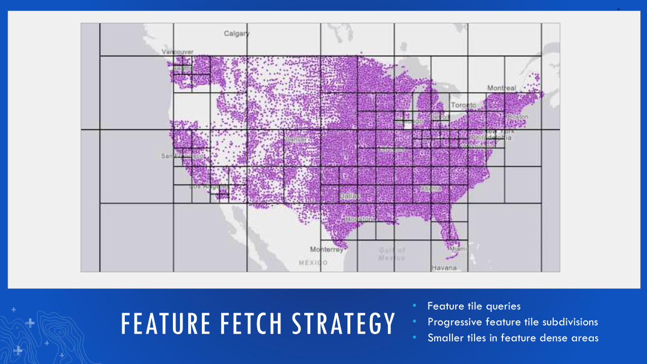
FEATURE FETCH STRATEGY• Feature tile queries
• Progressive feature tile subdivisions
• Smaller tiles in feature dense areas
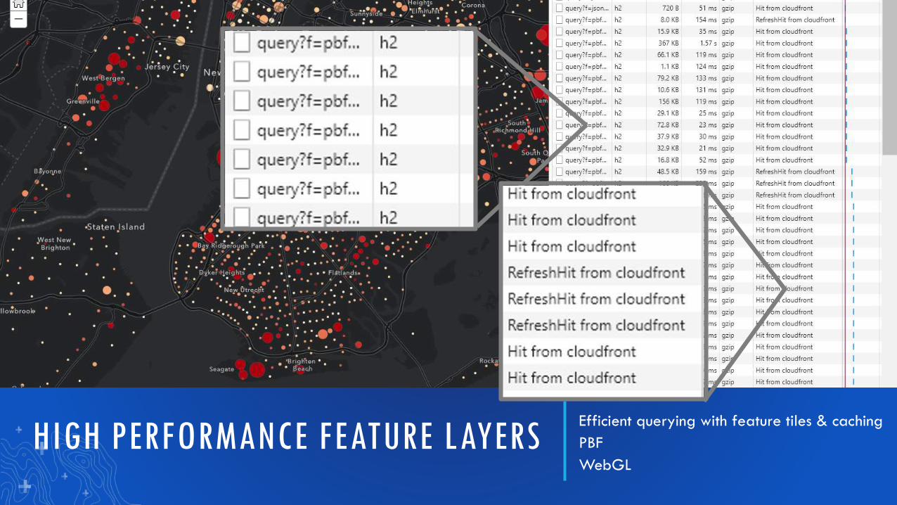
HIGH PERFORMANCE FEATURE LAYERSEfficient querying with feature tiles & caching
PBF
WebGL
PERFORMANCEImproved integrated mesh performance
Fast feature layers
9
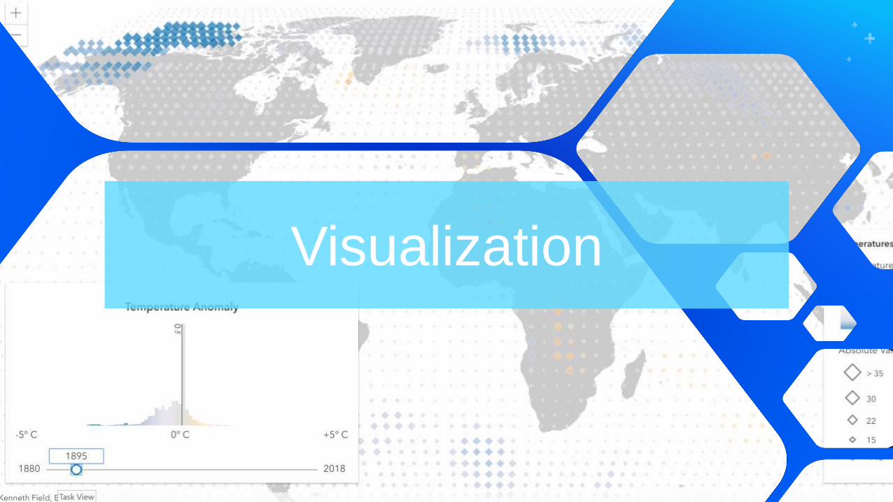
Visualization
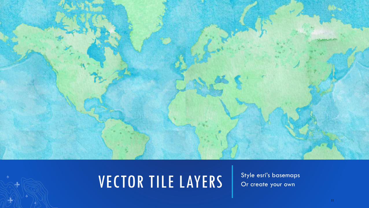
VECTOR TILE LAYERSStyle esri’s basemaps
Or create your own
11
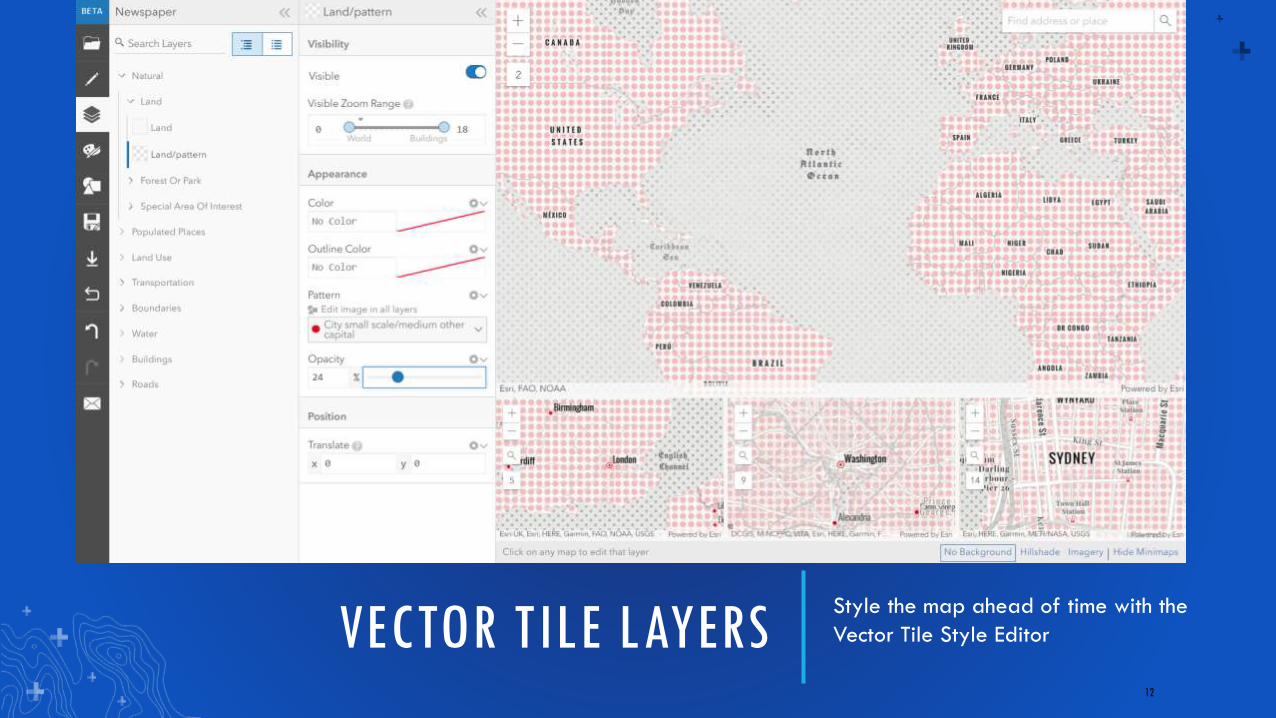
VECTOR TILE LAYERSStyle the map ahead of time with the
Vector Tile Style Editor
12
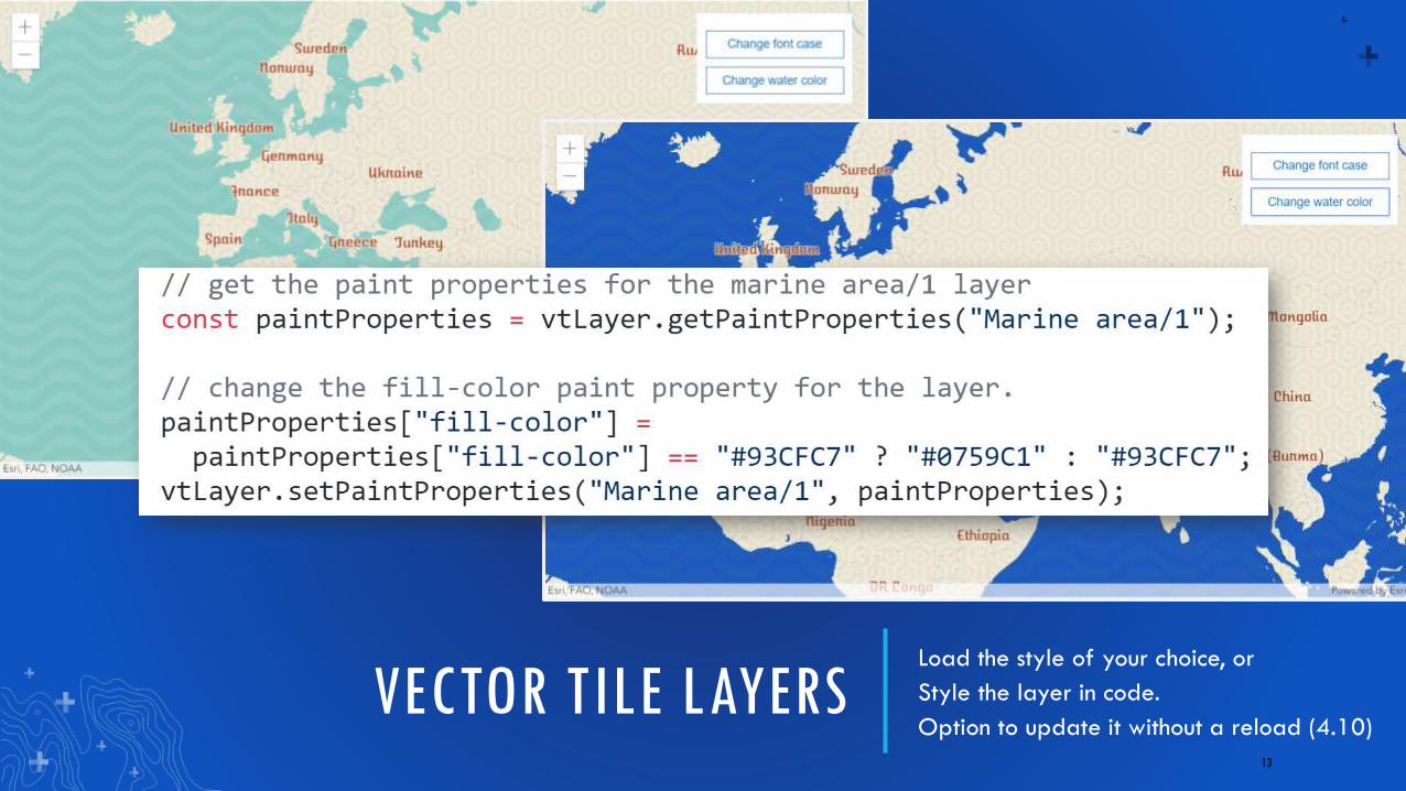
VECTOR TILE LAYERSLoad the style of your choice, or
Style the layer in code.
Option to update it without a reload (4.10)
13
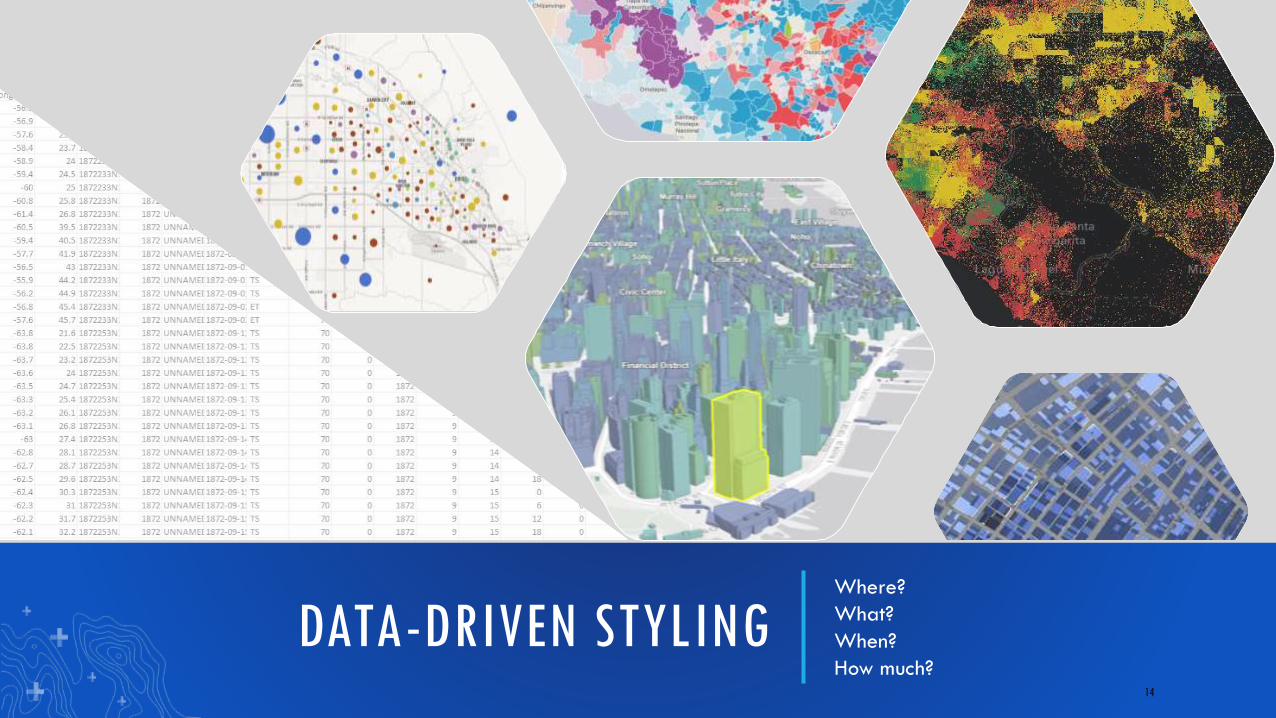
DATA-DRIVEN STYLINGWhere?
What?
When?
How much?14
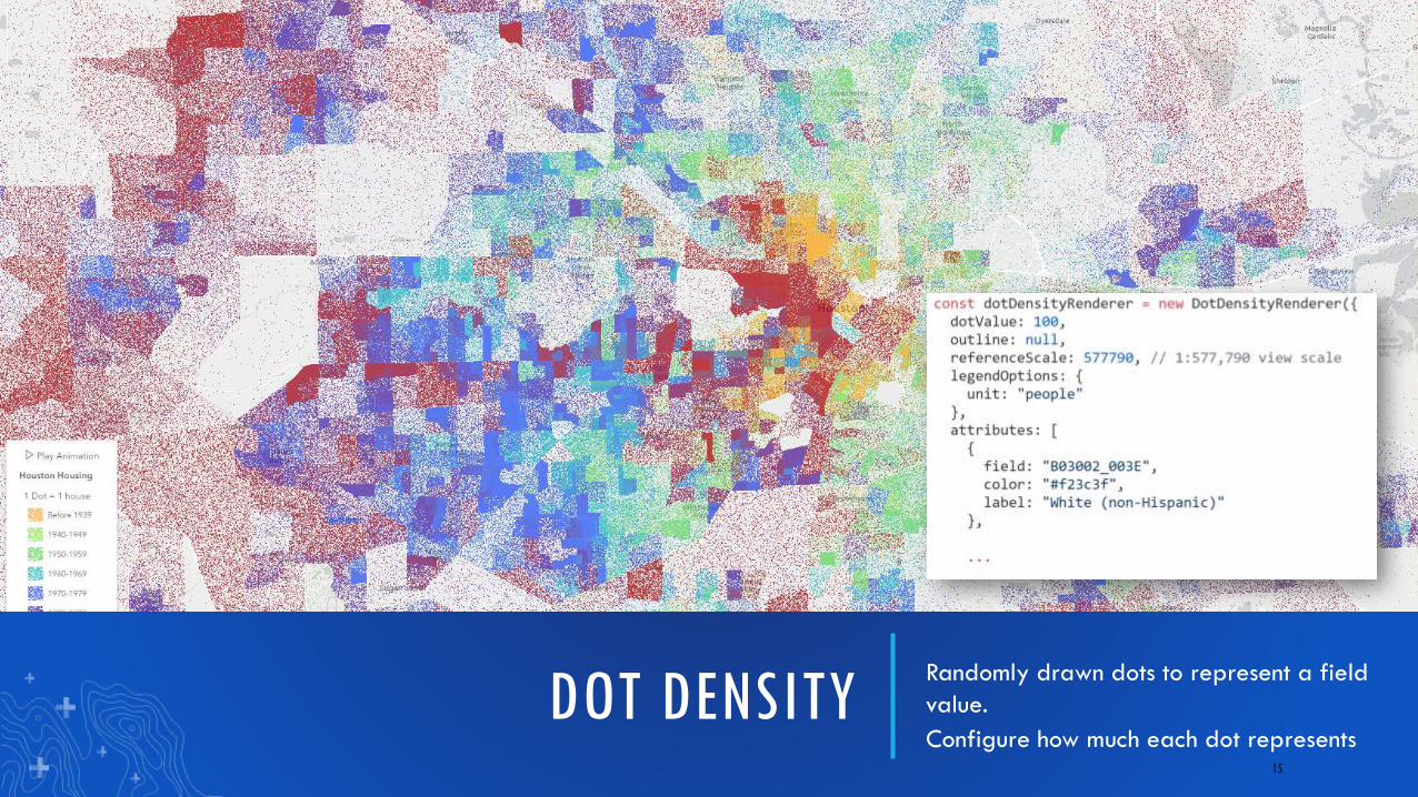
DOT DENSITYRandomly drawn dots to represent a field
value.
Configure how much each dot represents15
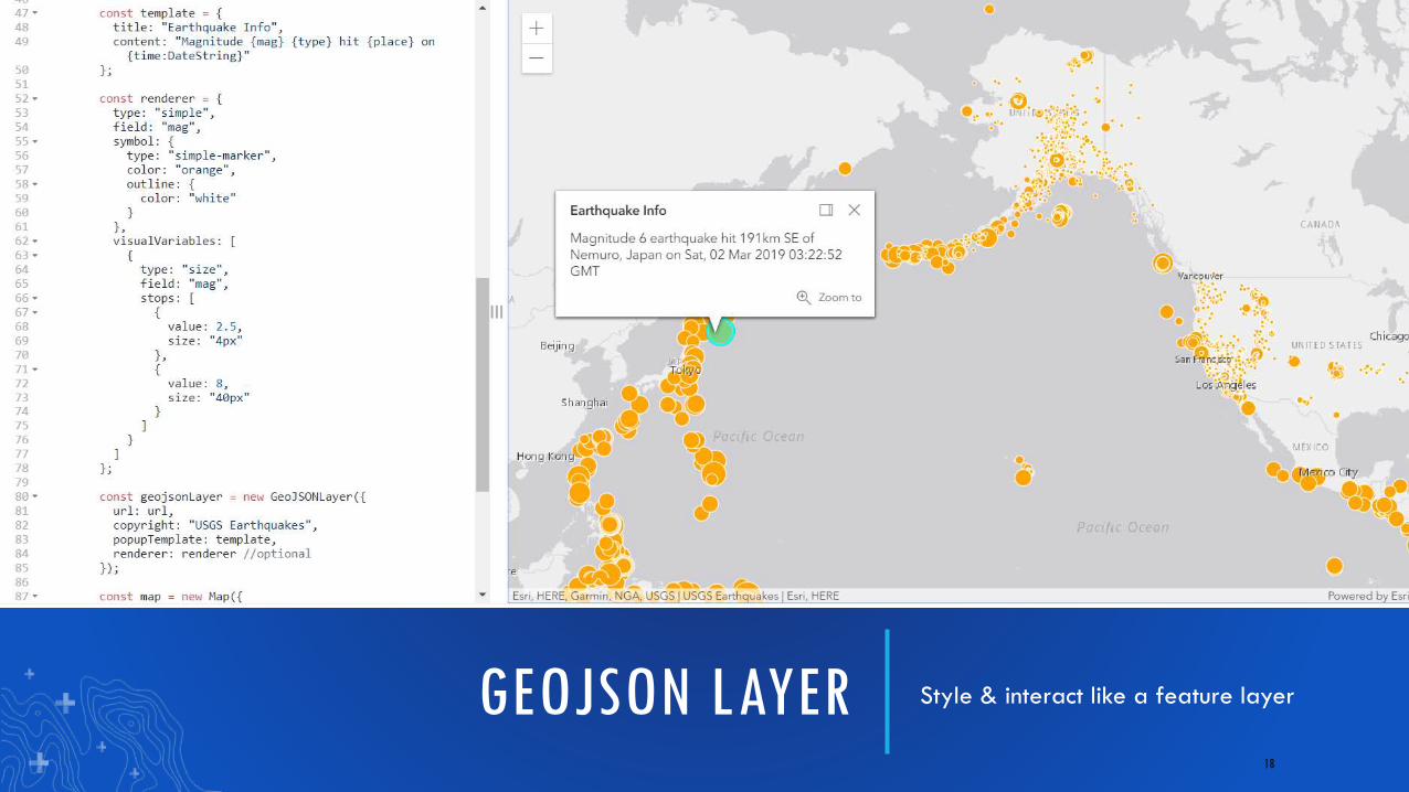
GEOJSON LAYER Style & interact like a feature layer
18
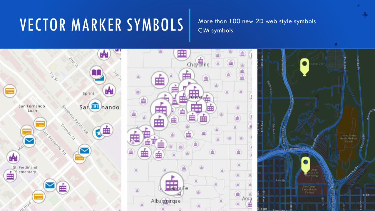
VECTOR MARKER SYMBOLS More than 100 new 2D web style symbols
CIM symbols
19
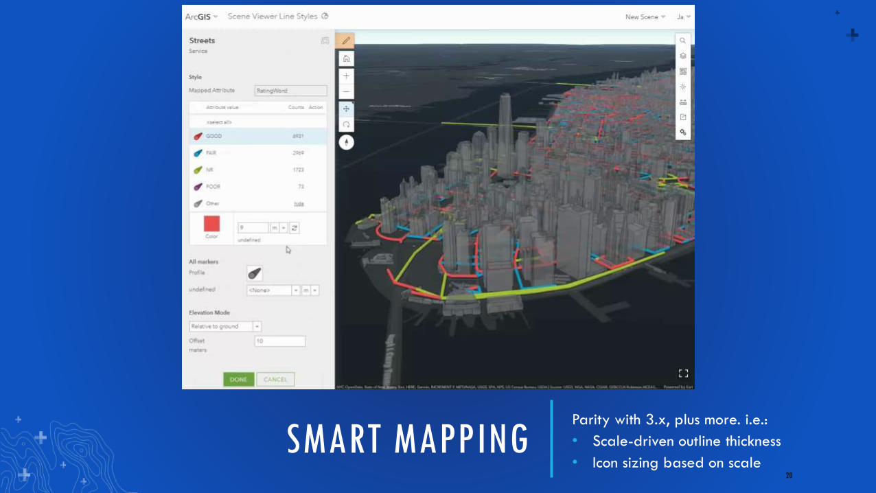
SMART MAPPINGParity with 3.x, plus more. i.e.:
• Scale-driven outline thickness
• Icon sizing based on scale20
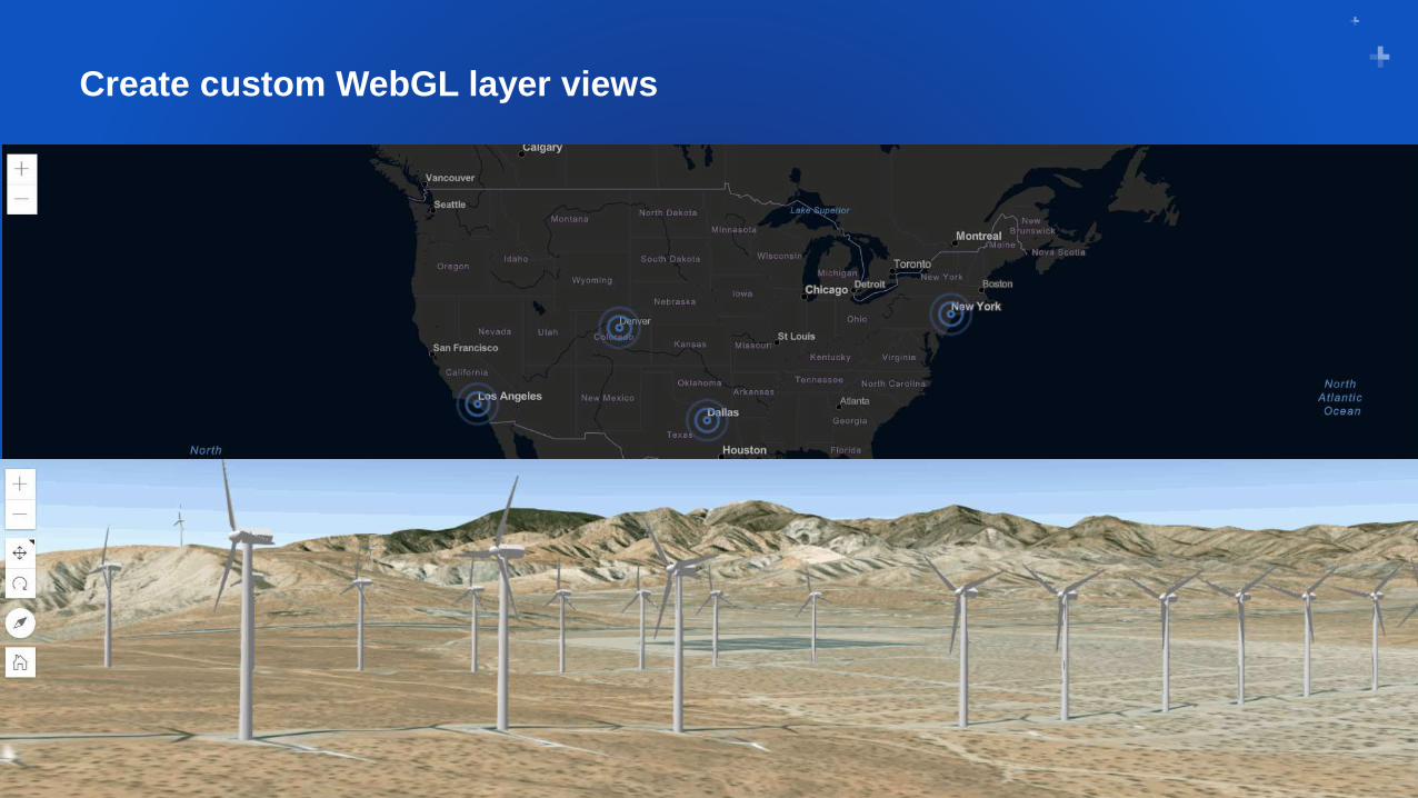
Create custom WebGL layer views
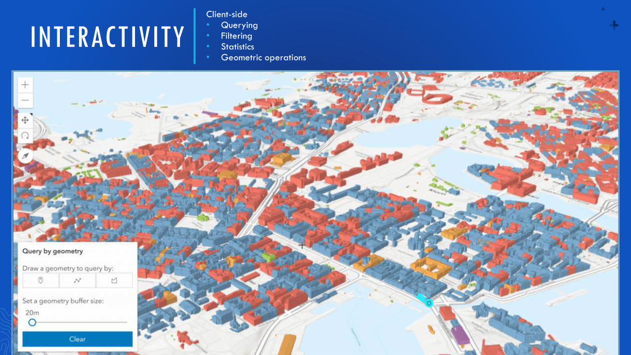
INTERACTIVITYClient-side • Querying• Filtering• Statistics• Geometric operations
22
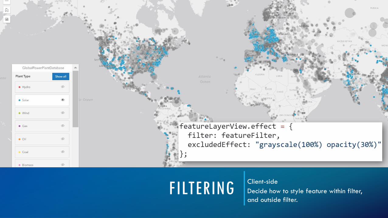
FILTERINGClient-side
Decide how to style feature within filter,
and outside filter.
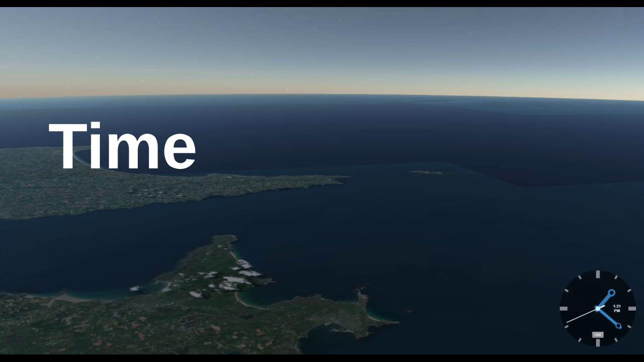
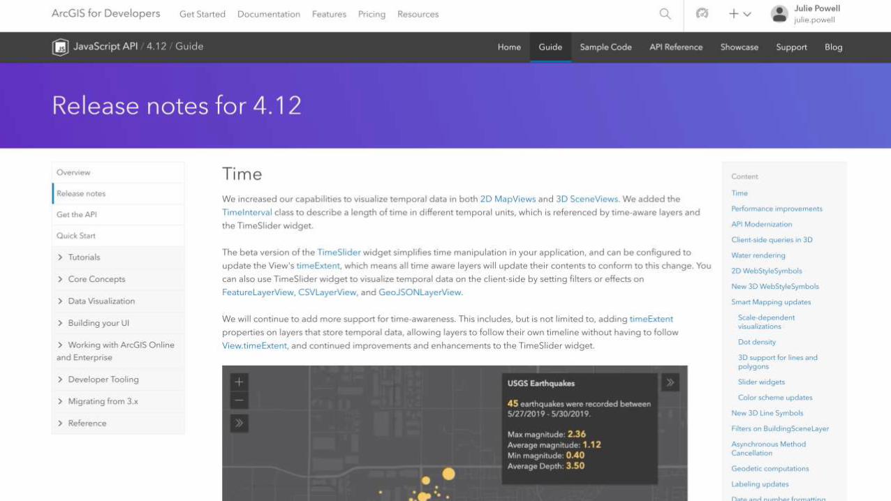
Time
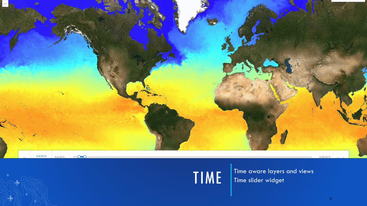
TIME Time aware layers and views
Time slider widget
25
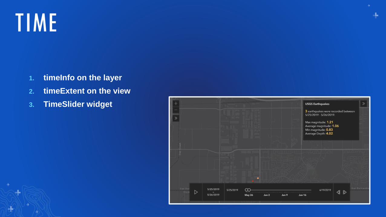
1. timeInfo on the layer
2. timeExtent on the view
3. TimeSlider widget
TIME
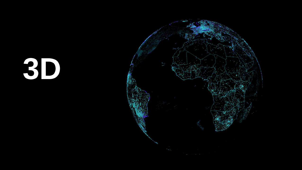
3D
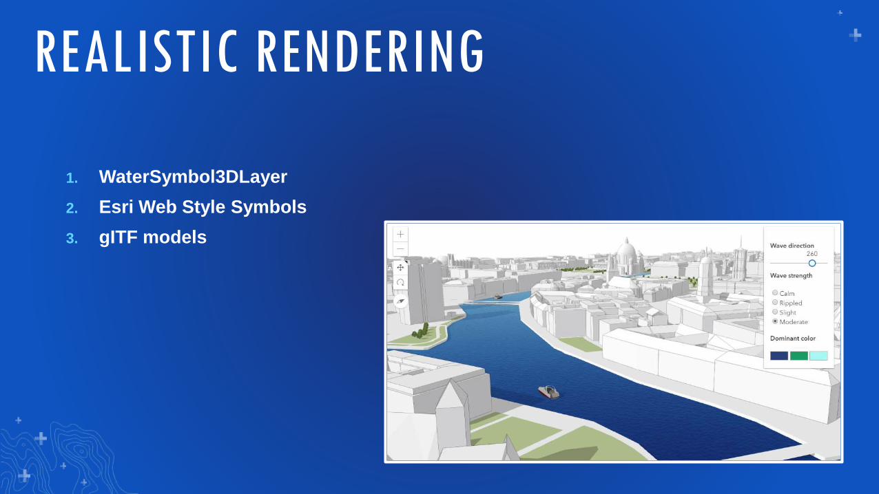
1. WaterSymbol3DLayer
2. Esri Web Style Symbols
3. gITF models
REALISTIC RENDERING
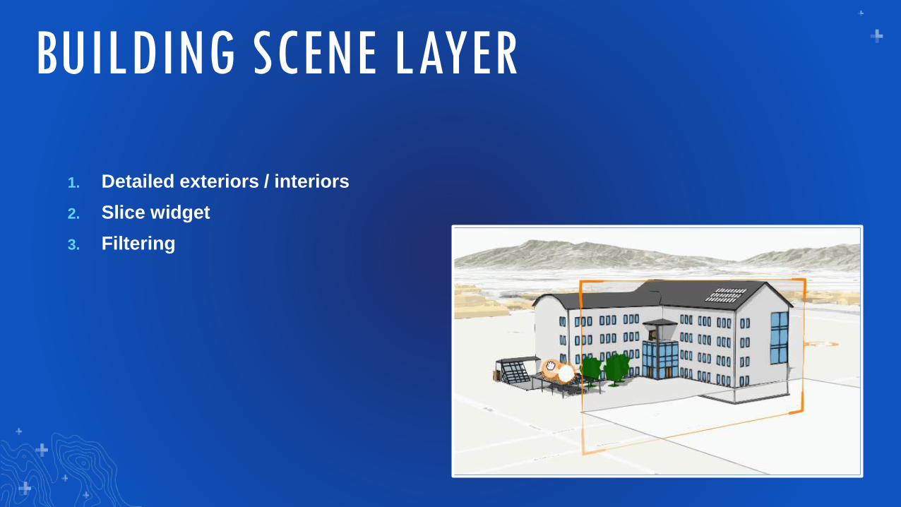
1. Detailed exteriors / interiors
2. Slice widget
3. Filtering
BUILDING SCENE LAYER
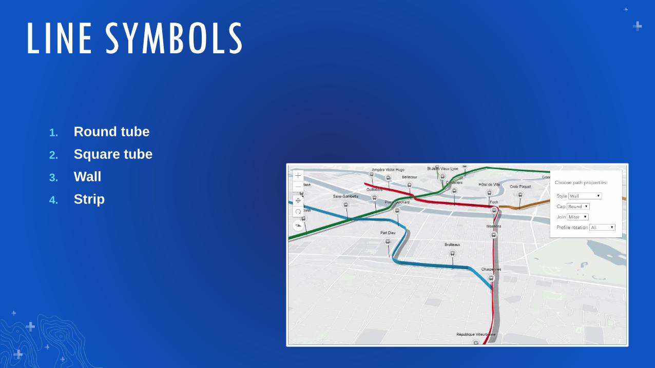
1. Round tube
2. Square tube
3. Wall
4. Strip
LINE SYMBOLS

Widgets
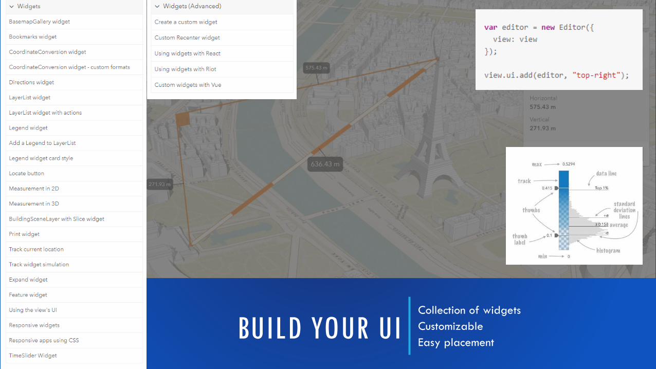
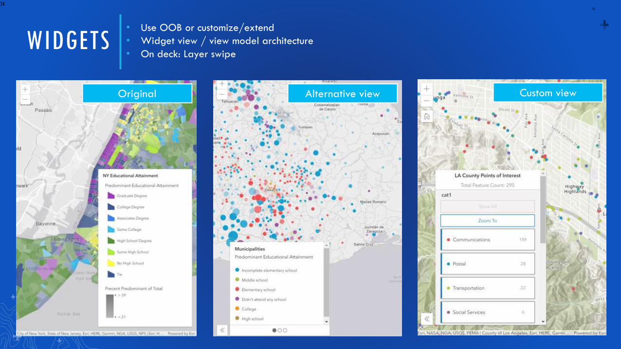
BUILD YOUR UICollection of widgets
Customizable
Easy placement
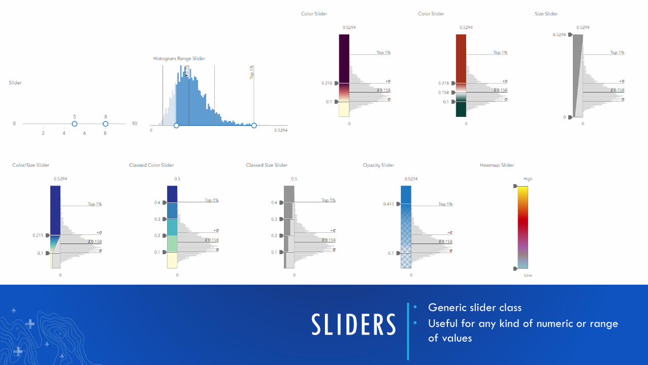
SLIDERS• Generic slider class
• Useful for any kind of numeric or range
of values
WIDGETS
34
• Use OOB or customize/extend
• Widget view / view model architecture
• On deck: Layer swipe
Original Alternative view Custom view
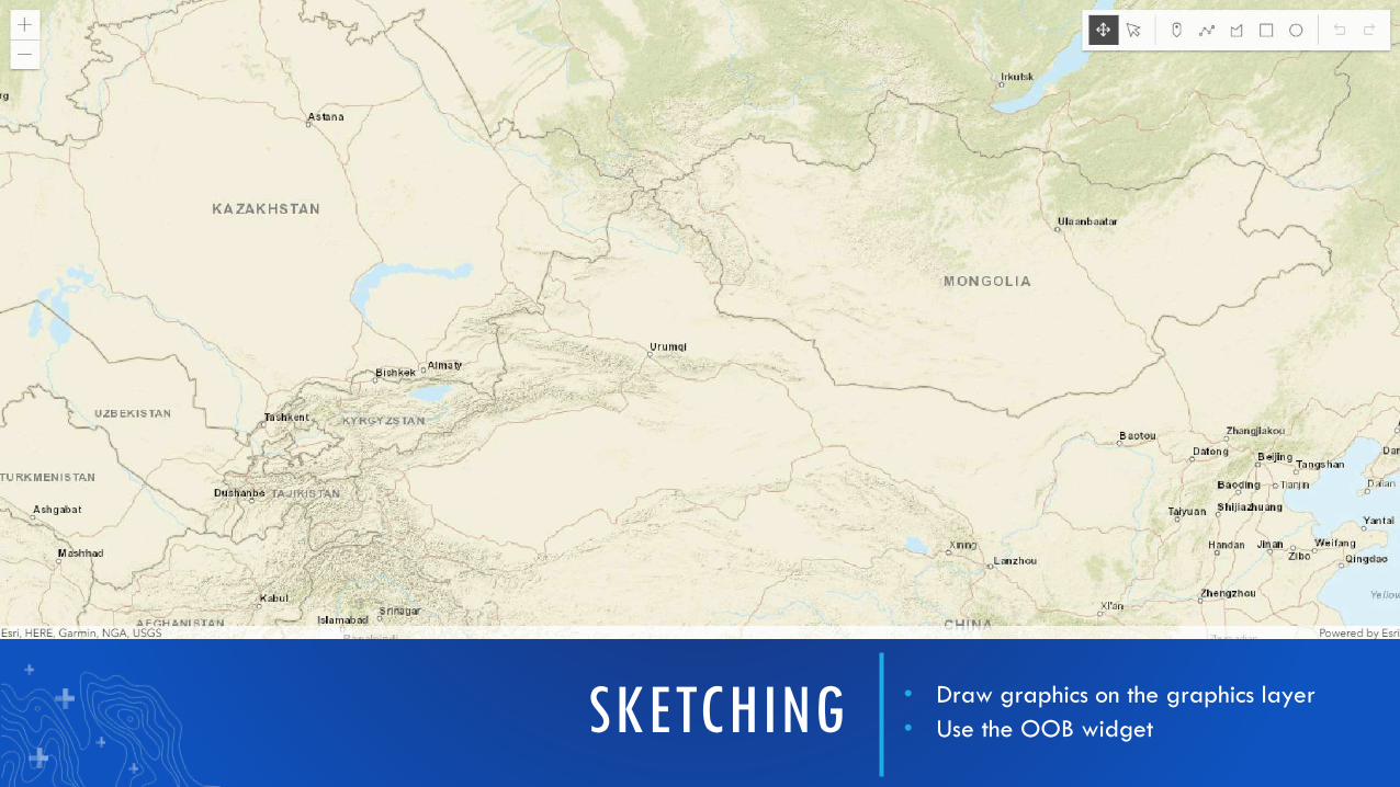
SKETCHING • Draw graphics on the graphics layer
• Use the OOB widget
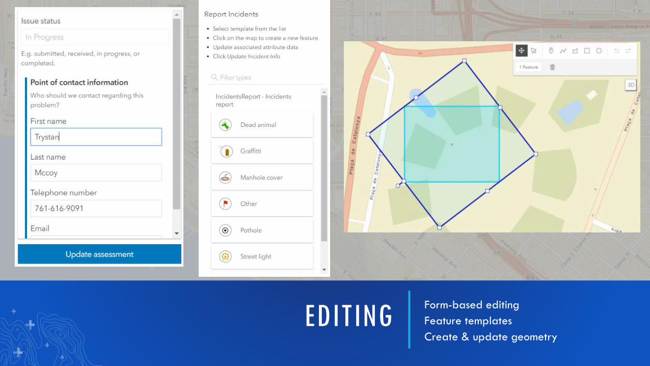
EDITINGForm-based editing
Feature templates
Create & update geometry
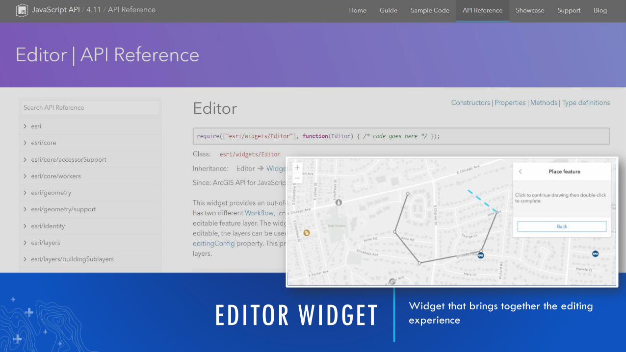
EDITOR WIDGETWidget that brings together the editing
experience
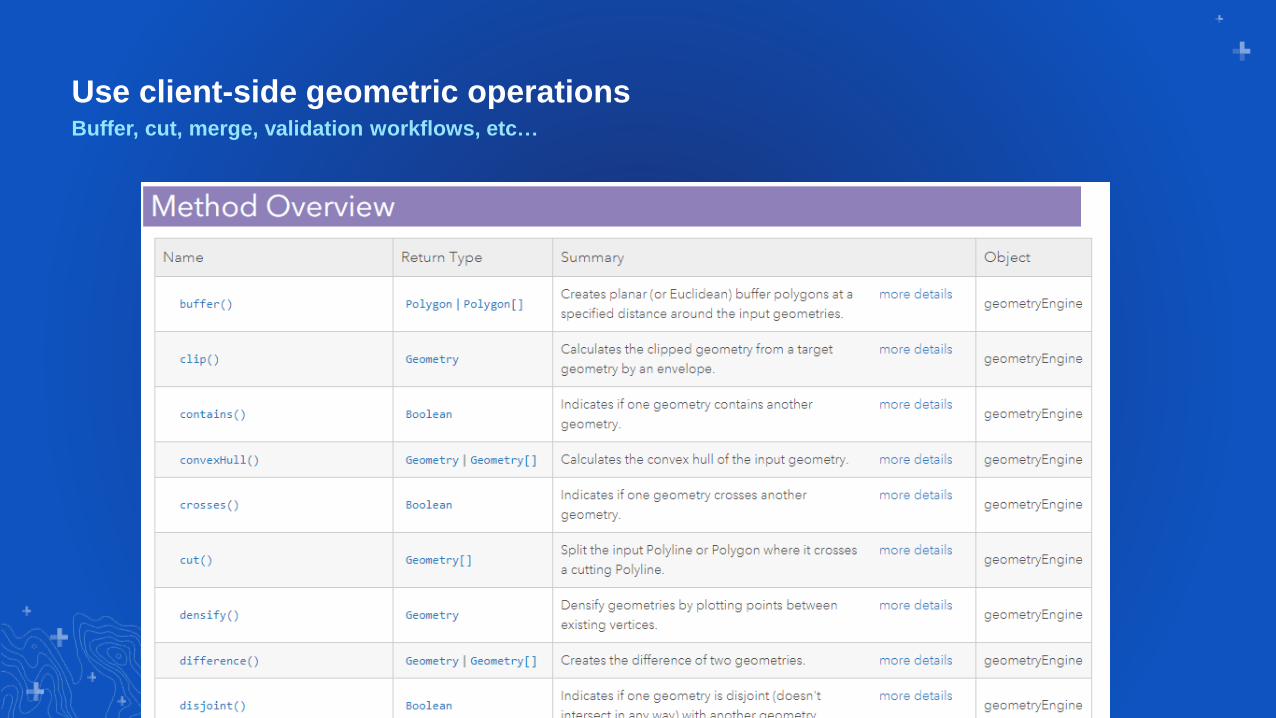
Use client-side geometric operationsBuffer, cut, merge, validation workflows, etc…
Tooling

Plan your week… http://esriurl.com/uc2019webdev
Share your apps and suggestions with us…
• Your apps!
• Your impressions on the latest API
• Ideas for next UC or Developer Summit related to web development
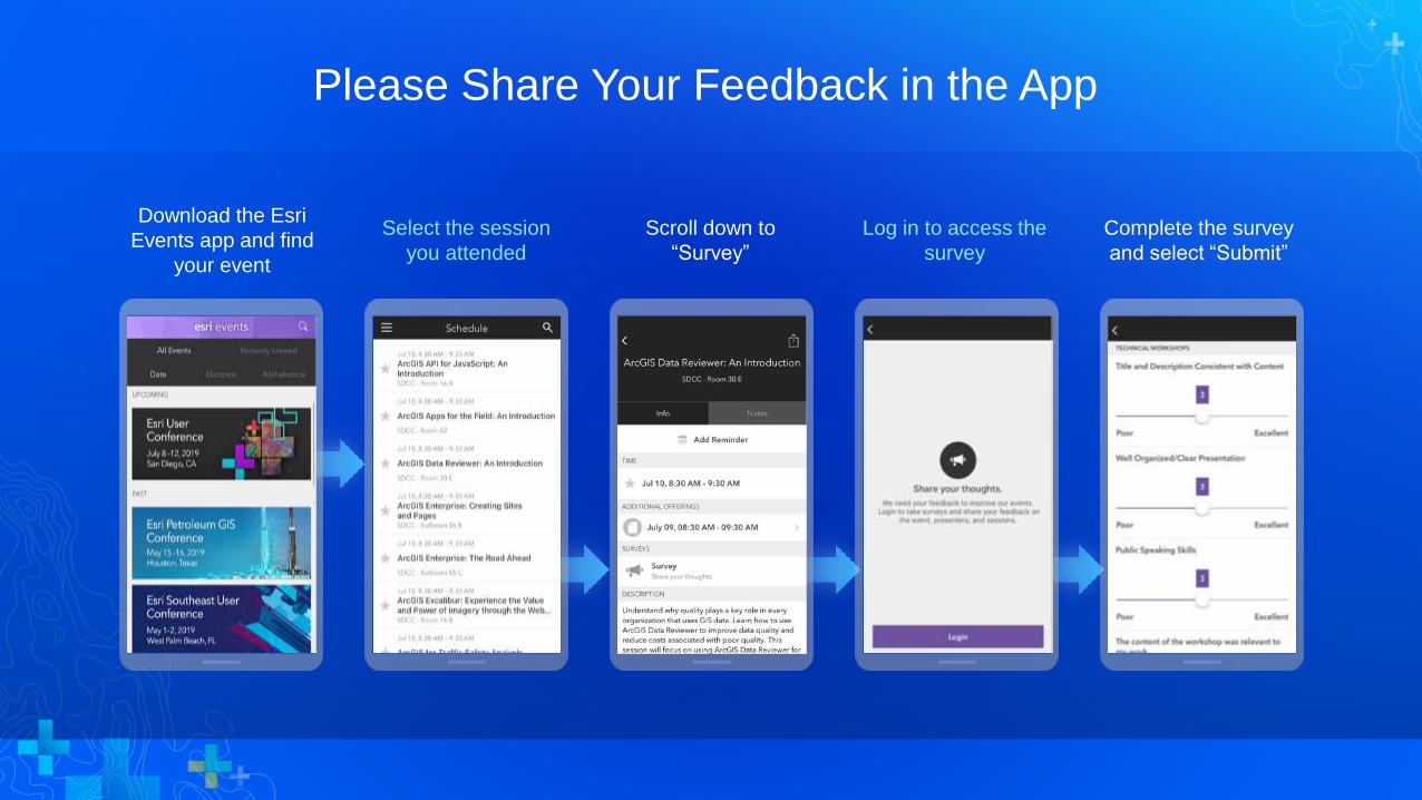
Please Share Your Feedback in the App
Download the Esri
Events app and find
your event
Select the session
you attended
Scroll down to
“Survey”
Log in to access the
survey
Complete the survey
and select “Submit”


Section Subhead
Section Header
Presenter(s)
Demo Title