Embed Size (px)
Citation preview

www.fugro.com
Don Ventura and Paul Seaton – Fugro
RSAHC, Riyadh,
Mar 2013
Integration of MBES and ALB
for ENC Charting Surveys and
Capacity Building Issues
www.fugro.com
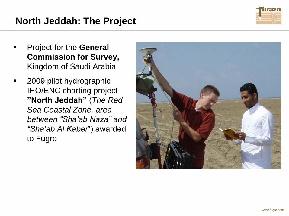
North Jeddah: The Project
Project for the General
Commission for Survey,
Kingdom of Saudi Arabia
2009 pilot hydrographic
IHO/ENC charting project
”North Jeddah” (The Red
Sea Coastal Zone, area
between “Sha’ab Naza” and
“Sha’ab Al Kaber”) awarded
to Fugro
www.fugro.com
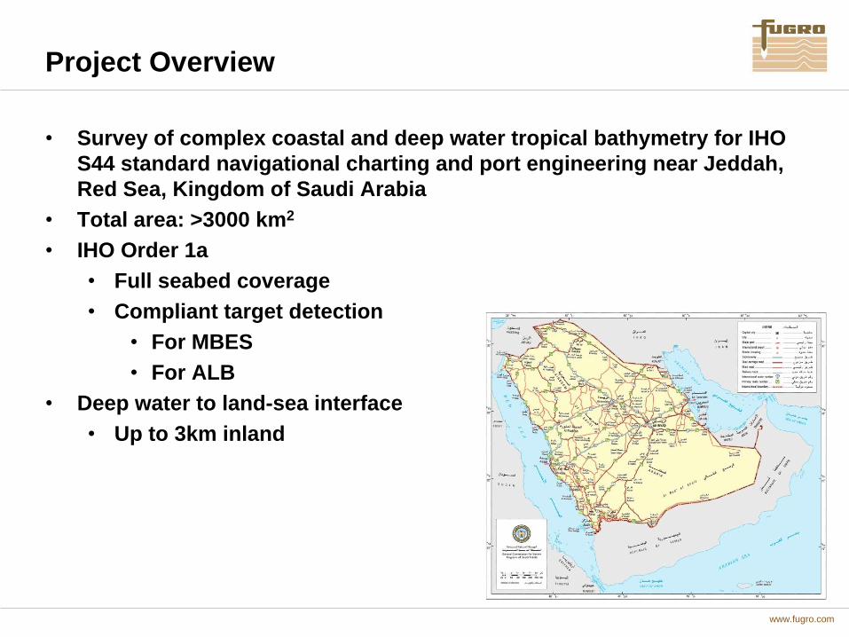
Project Overview
• Survey of complex coastal and deep water tropical bathymetry for IHO
S44 standard navigational charting and port engineering near Jeddah,
Red Sea, Kingdom of Saudi Arabia
• Total area: >3000 km2
• IHO Order 1a
• Full seabed coverage
• Compliant target detection
• For MBES
• For ALB
• Deep water to land-sea interface
• Up to 3km inland

www.fugro.com
Project Overview
Integration of :
Vessel-mounted Multibeam Echo Sounding (MBES) and Single-beam
Echo sounding (SBES) bathymetric survey
Airborne Light Detection and Ranging (ALB) LiDAR bathymetric
survey
Additional (but not limited to) remote sensing:
Side scan sonar
Metocean – (Tide and current measurement)
Water quality
Geotechnical evaluation
Geodetic Control and Datum transfer survey

www.fugro.com
North Jeddah: Acquisition Overview
Total Project surveyed area:
3852 km2
MBES: 2635 km2 (Area 2)
LIDAR: 1517 km2 (Area 1)
Mar-June 2010 data
acquisition period

www.fugro.com
Essential Elements
Communication – effective meetings, internet
application, briefings and handovers
Procedure - common task-focus and safe practices.
Delegation – diverse task-sharing and liaison within the
Project Group
Coordinated Client relationship building – with ready
Client access to both the survey team and Contractor
Management in a mutually progressive consulting
process.
Project Challenges

www.fugro.com
Merge and Final Products
Higher data point resolution for MBES systems over
bathymetric LiDAR.
High standard deviation values in any overlap avoided
by trimming LiDAR data to an agreed overlap
boundary before delivery for merge with MBES data.
CARIS HIPS was used to incorporate both MBES and
LiDAR data within the project structure.
Application of final tidal modelling and any geodetic
adjustment applied to one final, fully- incorporated
data set.
MBES/LiDAR Data

www.fugro.com
MBES:
3 vessels
5 MBES systems
Full ocean depth range
Side-scan sonar; Magnetometer
112% utilization (i.e. 12% above
planned efficiency target)
Fully compliant acquisition program
97% Acquisition in 5 weeks of
operation
North Jeddah: Vessel Acquisition
www.fugro.com
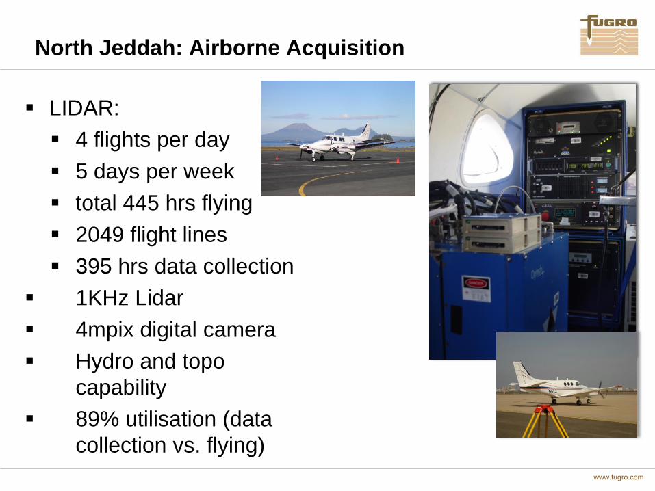
North Jeddah: Airborne Acquisition
LIDAR:
4 flights per day
5 days per week
total 445 hrs flying
2049 flight lines
395 hrs data collection
1KHz Lidar
4mpix digital camera
Hydro and topo
capability
89% utilisation (data
collection vs. flying)

www.fugro.com
North Jeddah Project: Chart Data Progression

www.fugro.com
North Jeddah: Chart Comparison
Complex reef morphology

www.fugro.com
Larger drying
coral approx.
100x200m
North Jeddah: Chart Comparison

www.fugro.com
North Jeddah: Chart Comparison
Eliza
Shoals

www.fugro.com
View south from Tuwwal showing both
terrestrial and bathymetric LiDAR Coverage
(from the SHOALS 1000 system)
North Jeddah: Chart Comparison

www.fugro.com
North Jeddah: High Resolution MBES
Deep to Shallow Water on ‘sea-mount’
Seamount Feature shoaling from 355m to 2m

www.fugro.com
North Jeddah: Wreck inspection - LIDAR

www.fugro.com
North Jeddah: Wreck Investigation - Imagery

www.fugro.com
North Jeddah: Wreck investigation – MBES

www.fugro.com
Integration
…So a synergous approach to the survey
with all sensors utilized in concert can
provide seamless data from deep sea to
several kilometres inland and detect all
critical features in between

www.fugro.com
In-Service Support for National H.O.s
• In-Service Support (ISS) is another
collaborative model between Industry and
hydrographic agencies possessing survey
assets of their own
• Several business models already
established globally for ISS
• Australian Hydrographic Service is perhaps
the most copied
• Fugro is long-standing technical contractor
to the AHS (since 1992)
• Assets wholly owned by client
• Expertise in planning, operation,
maintenance and production of both system
and associated data provided by incumbent
contractor
• Collaborative approach for all elements of
survey encourages building of long-term,
sustainable capacity for host nation

www.fugro.com
Education Element of Capacity Building
• This is an essential component of CB
• Fundamental to maintenance of a national core
competency
• Beneficial for employer and employee alike
• Can be difficult and costly to deliver for certain
regions with current education paradigm in survey
industry
• Industry, Academia and Govt. have taken steps to
address this global issue

www.fugro.com
A Global Hydrographic Industry problem
• A remote, deployed workforce
• How do you get your people to a basic (safe) standard of education and training?
• How do you maintain or improve this level of understanding?

www.fugro.com
Distance learning hydrographic
surveying courses
Flexible learning that fits around
working patterns and location
University level qualifications and
professional body recognition
Individual CPD modules, undergraduate
and postgraduate qualifications
Concept of the Hydrographic Academy

www.fugro.com
Current Hydrographic Academy partners

www.fugro.com
The TLP is born
• Creation of the Total Learning Package
• ALL Teaching materials on interactive USB Stick
• Online resources
• Discussion groups
• SCOLAR (Submitting Coursework OnLine and
Remotely)
• Skype and Email; Webinar etc.
• Tutor support provided via e-comms

www.fugro.com
www.plymouth.ac.uk/hydro
HA Webpage

www.fugro.com
Graph of registered interest*
Oceanology
International 2012
*All registrations as of 23/05/12
Announcement

www.fugro.com
Ease of access
• Whole module self-contained on a USB stick
• No need for an internet connection
• Tutor support by email/Skype
• Online discussion area

• Five steps to a
degree and
professional body
recognition
Register your interest @
www.plymouth.ac.uk/hydro
Work with a tutor to build the right progression
route, tailored to suit your requirements
Join the course!
Complete the lectures, practical surveying
sessions afloat and build your portfolio
Graduate with Plymouth University and gain
professional body recognition
www.fugro.com
Thank You