Embed Size (px)
Citation preview
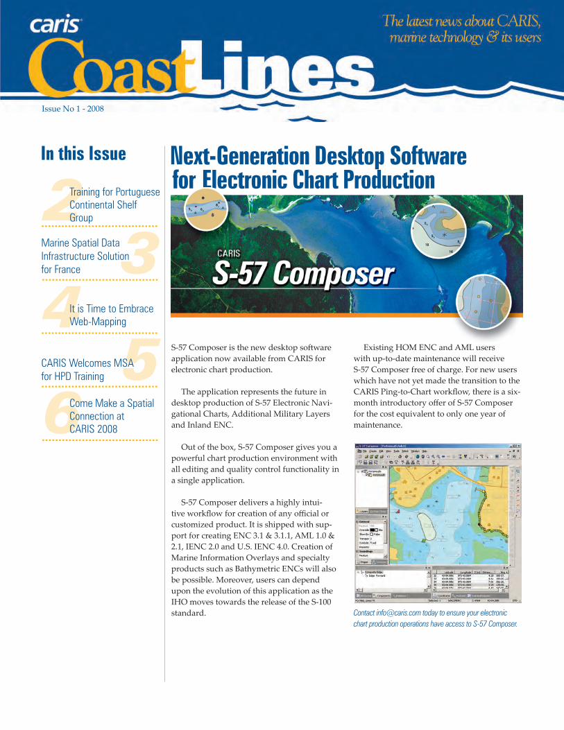
Next-Generation Desktop Software for Electronic Chart Production
3
56
In this Issue
2Training for Portuguese Continental Shelf Group...................................
Marine Spatial Data Infrastructure Solution for France...................................
Issue No 1 - 2008
4It is Time to Embrace Web-Mapping
Come Make a Spatial Connection at CARIS 2008
...................................
...................................
CARIS Welcomes MSA for HPD Training
...................................
S-57 Composer is the new desktop software application now available from CARIS for electronic chart production.
The application represents the future in desktop production of S-57 Electronic Navi-gational Charts, Additional Military Layers and Inland ENC.
Out of the box, S-57 Composer gives you a powerful chart production environment with all editing and quality control functionality in a single application.
S-57 Composer delivers a highly intui-tive workflow for creation of any official or customized product. It is shipped with sup-port for creating ENC 3.1 & 3.1.1, AML 1.0 & 2.1, IENC 2.0 and U.S. IENC 4.0. Creation of Marine Information Overlays and specialty products such as Bathymetric ENCs will also be possible. Moreover, users can depend upon the evolution of this application as the IHO moves towards the release of the S-100 standard.
Existing HOM ENC and AML users with up-to-date maintenance will receive S-57 Composer free of charge. For new users which have not yet made the transition to the CARIS Ping-to-Chart workflow, there is a six-month introductory offer of S-57 Composer for the cost equivalent to only one year of maintenance.
Contact [email protected] today to ensure your electronic chart production operations have access to S-57 Composer.

During November 2007, the Peruvian Navy and CARIS undertook the task of integrating the HPD system into the Dirección de Hidrografía y Nave-gación (DHN) line of chart production.
A long time CARIS user, DHN has taken a long step in further moving its charting opera-tions to a database driven environment. CARIS made available Mr. Gustavo Puente, an HPD expert, to DHN for an extended period of time. The design of a joint strategy prior to the imple-mentation was key to the success of the integra-tion. A series of meetings took place at CARIS and DHN to study the current situation, determine the appropriate course of action and streamline a complete strategy. The positive outcome was only possible due to the involvement and full com-mitment of DHN at all levels, from the directors to the cartographers. The Peruvian team, led by Cmdr. Jose Gianella from DHN and Gustavo Puente from CARIS, spent 20 days of hands-on HPD work, from Oracle™ installation to perform-ing Quality Controls on ENCs and Paper Charts, using the HPD suite of tools.
As a result, DHN now has a group of staff organized in three teams, each with specific responsibilities while working on the Source Edi-tor, ENC Editor and Paper Chart Editor. Besides working on production, the teams are charged with documenting their operations, so they can have a Standard Operating Procedures manual that can help lower the learning curve when new staff join the teams or staff is shifted to other departments. The Hydrographic Office expects to continue to expand their use of CARIS HPD for the coming year.
Without a doubt, this will make DHN a leader in the adoption of a new trend in chart production in Latin America and the world.
Issue No 1, 2008
Through distribution of this publication, CARIS intends to keep its users informed with the latest in develop-
ment, tips, industry news and company events. If there are any features or columns that you would like to see more
of, please let us know. Guest articles and contributions are also welcome. To be
added to our mailing list or to submit your article
ideas, contact Sheri Flanagan at:Tel: +1-506-458-8533 Fax: +1-506-459-3849
E-mail: [email protected]
2....................................................................................................................................................................................................................................................................................................................................................................................................................................................................................................................................................................................................................................................................................................................................................................................................................................................................................................................
CARIS CoastLines - Issue 1, 2008
Our Offices
Global HeadquartersCARIS
(Fredericton, Canada)Tel +1-506-458-8533Fax +1-506-459-3849
CARIS USA(Washington, United States)
Tel +1-202-544-3994Fax +1-202-544-8330
CARIS BV(Heeswijk, The Netherlands)
Tel +31-0-413-296-010Fax +31-0-413-296-012
CARIS ASIA PACIFIC(Adelaide, Australia)
Tel l +61-0-8-8235-6345Fax +61-0-8-8235-6336
www.caris.com
Coast Lines, the Coast Lines logo, CARIS, the CARIS logo and all CARIS products
are trademarks or registered trademarks of CARIS. Other brands and product names are trademarks of their respective holders.
© 2008 CARIS. All rights reserved.
A week of introductory HIPS and SIPS train-ing was conducted in October 2007 for the Task Group for the Extension of the Continental Shelf (Estrutura de Missao para a Extensao da Plata-forma Continental (EMEPC)) at its facilities in Paço de Arcos, Portugal.
A new CARIS user, the Task Group is closely related to the Portuguese Hydro-
graphic Office and has been es-tablished to prepare Portugal’s
continental shelf claim.
The training was led by CARIS BV Hydro-graphic Survey and GIS Specialist, Mr. Björn van Vliet and covered multibeam, side scan sonar, singlebeam and calibration.
Please visit www.emepc.gov.pt to learn more about the Task Group.
Training for Portuguese Continental Shelf Group
Peru Boosts Chart Production with HPD
Cmdr. Jose Gianella and CARIS expert Gustavo Puente (centre) and DHN staff.
s

CARIS is pleased to announce it has been awarded a contract by the Service Hy-drographique et Océanographique de la Marine (SHOM) to deliver a Marine Spa-tial Data Infrastructure (MSDI) to access its hydrographic information. CherSoft as a subcontractor will supply a tide data-base as part of the solution.
The week-long launch of the project occurred in mid-February with focused meetings on project strategy and ben-efi ts. Through this contract, referred to as INFRAGEOS-H (Infrastructure Géospa-tiale du SHOM for Hydrographic data), CARIS will deliver a technological infra-structure built on CARIS bathymetric and
hydrographic data management soft ware, Bathy DataBASE, CARIS Hydrographic Production Database, and Web-mapping soft ware, Spatial Fusion Enterprise, and the CherSoft tide database to produce this MSDI.
The MSDI will be a central, interoper-able source for all SHOM hydrographic geospatial information. The data and information housed in the MSDI will be accessible at SHOM, from the regional hydrographic units and even in the fi eld by survey platforms.
In its beginning, this MSDI will maintain Bathymetry, Navigational Aids
and Tide data in the central database. It will be accessible through thick desktop clients for quality control purposes, via industry standard formats like IHO S-57 and Bathymetric Att ributed Grid (BAG), or via thin web clients for browse and download purposes utilizing Open Geo-spatial Consortium, Inc.® (OGC) formats like WMS and WFS.
Potential for future discovery of the data to ex-ist in the MSDI was paramount to SHOM. To aid this data discovery ISO 19115 metadata will be captured for the information that is to reside under the MSDI.
3.....................................................................................................................................................................................................................................................................................................................................................................................................................................................................................................................................................................................................................................................................................................................................................................................
We Have Achieved ISO 9001:2000 CertificationCARIS has achieved ISO 9001:2000 cer-tifi cation. A globally recognized quality management standard developed by the International Organization for Stan-dardization (ISO), ISO 9001:2000 applies to organizations that design, develop, manufacture, install and service products. To achieve certifi cation, companies must have a comprehensive quality manage-ment system that addresses all areas of its operation.
“This recognition communicates to our customers, worldwide, that they are working with an organization that prides itself in incorporating the very best practices and processes in the industry to
consistently meet or exceed their needs,” said Dr. Salem Masry, President and Chief Executive Offi cer at CARIS.
“Customer satisfaction has always been a keystone of our corporate values and our highest priority. Achieving ISO 9001:2000 certifi cation is further evidence of the unwavering commitment CARIS has in providing customers with soft ware and services that they can have com-plete confi dence in when working with operation-critical spatial data in the fi elds of land management, municipal planning, seafl oor and ocean mapping and chart production.”
CARIS Quality Assurance Manager, Richard Bird added, “Our commitment to total quality improvement principles has been essential to the culture of CARIS since the beginning. Obtaining certifi cation is a clear validation of our dedication to continuous improvement in everything we do and assuring the highest quality soft ware and services in the industry.”
Time to start web-mapping with Spatial Fusion Enterprise
Share data within your organization • and with other agencies
Combine multiple data sources in a • single interface
Access your hydrographic and • topographic data via the Web
Support your national spatial data • infrastructure
.....................................................................................................................................................................................................................................................................................................................................................................................................................................................................................................................................................................................................................................................................................................................................................................................
Marine Spatial Data Infrastructure Solution for France
The INFRAGEOS-H project was launched at the Établissement Principal du Service Hydrographique et Océanographique de la Marine (SHOM), in Brest, France in mid-February.
s

For most “Web-mapping” congers up initial thoughts of planning your vacation road trip in Mapquest or of query-ing your address in Google Earth.
Web-mapping however, means so much more to CARIS users. The Web has become an effi cient
mechanism for distributing and accessing spatial information and the benefi ts of applying this technology in marine and hydrographic applications are indisputable.
Users of marine data collect, access and store spatial and non-spatial data from a number of sources and formats. These may include imagery, charts, bathymet-ric surfaces, statistics, points of interest,
reports, infrastructure data, etc. Combin-ing these data resources within a visual and spatial environment increases your analytic capabilities exponentially.
Furthermore, the logical extension of any data management system is the in-teroperable distribution of those resources across your organization, your clients and other related agencies who need your data. This will improve service delivery and provide new workfl ow and produc-tion effi ciencies.
Spatial Fusion Enterprise is the CARIS web-mapping soft ware. It provides an interface to spatial data, including hydro-graphic information and bathymetric data. Through the Web interface the user would have the ability to view, query and select data sources.
Contact us at [email protected] to sched-ule a demonstration of Spatial Fusion En-terprise and explore the possible benefi ts of web-mapping to your organization today.
4CARIS CoastLines - Issue 1, 2008
.....................................................................................................................................................................................................................................................................................................................................................................................................................................................................................................................................................................................................................................................................................................................................................................................
Bangladesh Navy Digital Chart and ENC Production Training The Bangladesh Navy Hydrographic and Oceanographic Centre (BNHOC) recently completed four weeks of training on Digital Chart Production and S-57 ENC production using CARIS soft ware at its facilities in Chitt agong.
The soft ware and training were delivered as part of a project which has provided BNHOC with the ability to produce S-57 ENC’s and has improved their digital chart production capabilities. The project was brought to a successful conclusion thanks in part to our close working relationship with Mr. N.H. Khan, CARIS strategic alliance in Bangladesh. BNHOC previously received training on CARIS GIS and CARIS SIPS in 2004.
Over the coming months BNHOC will migrate their digital chart produc-tion from the current system to CARIS GIS. Once complete, HOM ENC will be
utilized to produce S-57 ENC’s from the completed digital charts.
The hydrographic department of the Bangladesh Navy (BN) has been in operation since 1980; one year aft er the BN Hydrographic School (BNHS) was established. The BN Chart Depot was established in 1985 and started producing nautical charts from acquired data. In 2001, the BN Chart Depot was renamed the ‘BN Hydrographic and Oceanograph-ic Center’ (BNHOC) to provide shore based support to the survey units.
BNHOC is situated on the Naval Base in Chitt agong and is responsible for sur-vey related activities including: coordina-tion of survey activities; the verifi cation of fi eld data; production and distribution of nautical charts and publications in accordance with SOLAS regulations and IMO/IHO conventions; data storage and
tidal prediction. BNHOC is staff ed by 29 survey offi cers and 200 sailors as well as civilians and utilizes four survey ships in the coastal area.
As an IHO member state Bangladesh maintains close bilateral relationships with several nations including France, India, Italy, UK and USA. In addition, BNHS provides IHO Accredited Hy-drography Course Category B training to foreign navy offi cers.
It is Time to Embrace Web-Mapping
Time to start web-mapping with Spatial Fusion Enterprise
Share data within your organization • and with other agencies
Combine multiple data sources in a • single interface
Access your hydrographic and • topographic data via the Web
Support your national spatial data • infrastructure
.....................................................................................................................................................................................................................................................................................................................................................................................................................................................................................................................................................................................................................................................................................................................................................................................
CARIS strategic alliance in Bangladesh. BNHOC previously received training on CARIS GIS and CARIS SIPS in 2004.
Over the coming months BNHOC will migrate their digital chart produc-tion from the current system to CARIS GIS. Once complete, HOM ENC will be

CARIS CoastLines - Issue 1, 20085
Sixteen delegates from the China Mari-time Safety Administration (MSA) were welcomed to CARIS global headquarters in Canada for two intensive weeks of training on HPD January 10-26, 2008.
The training is part of a sale made by CARIS to MSA in late 2007. The purchase includes 112 licenses of CARIS HPD Source Editor, Paper Chart Editor and
ENC Editor as well as seven weeks of training. The balance of the training will be hosted at MSA facilities at a later date.
HPD will be implemented at all three MSA regional hydrographical centres in Tianjin, Guangzhou and Shanghai, which undertake the surveying and charting of the Bohai Sea, Yellow Sea, East China Sea and South China Sea respectively.
This initial training will cover the set-up, system administration and manage-ment of HPD across the three offi ces, data preparation as well as an introduction to the Source Editor and the Paper and ENC Editors. During the training, delegates traveled to the Canadian Hydrographic Service Quebec Region offi ce to learn about their HPD implementation and workfl ows.
HPD will allow MSA to move from a fi le-based environment to a seamless enterprise system with unique database-driven functionality that will take their hydrographic data management and production to the next level in collabora-tion and effi ciency.
CARIS Welcomes MSA for HPD Training
Introducing New Plot Composition ToolsA new comprehensive and intuitive plot-ting toolkit has been developed by CARIS and is being rolled out in numerous upcoming product releases.
HIPS 6.1 Service Pack 2 will be the fi rst release to include the tools followed by Bathy DataBASE, Notebook and Carta among others.
The ability to effi ciently produce ap-pealing paper products that illustrate the raster and vector geospatial information displayed is a common requirement for individuals and organizations that com-pile and manage geospatial information.
Through this new plot composi-tion tools we are able to off er users improved and expanded printing functions across all of our products.
New plot composition capabilities include:
New GUI layout and design with • intuitive controls to guide the user from plot creation to fi nal output
Layout and confi gure plot objects • and chart furniture such as:
Data View Ports for the dis- –play of geo-referenced or CARIS application dataNorth Arrows and Compass Roses –Scale Bars –Block text and OLE Objects –Images and screen captures –Markup (lines, shapes, etc.) –
Arrange plot object draw or-• der, alignment or dimensions with the click of a butt on
Confi gure Data View Ports• Add raster and vector data formats –supported by CARIS applications
GeoTIFF, BDB, JPEG 2000, S-57, • Shapefi les, AutoCAD, Other...
‘Capture’ the CARIS application –data views through close
integration with the parent CARIS applicationAdd Geographic or Grid/ –Projection BoardersConfi gure data views to be –‘north-up’ or rotatedConfi gure the data display –with dynamic pan, zoom, layer and property controls
Dynamically switch between the data • View Port and the plot ‘paper space’
Add plot Markup such as • labels, lines and shapes
Save plot templates • for use time and time again
Output the plot to any con-• fi gured printer/plott er and/or save the plot session, save to image and other outputs.
Contact us at [email protected] to schedule a demonstration of the new plot composition tools in HIPS and SIPS.
............................................................................................................................................................................................................................................................................ ...........................................................................................................................................................................................................................................................................
MSA is the latest among dozens of nations to adopt CARIS HPD and its unique database-driven approach to data management and production.
s

6............................................................................................................................................................................................................................................................................ ...........................................................................................................................................................................................................................................................................
MOU with Lloyd’s Marine Intelligence UnitA Memorandum of Understanding has been signed between CARIS and Lloyd’s Marine Intelligence Unit (Lloyd’s MIU) to collaborate on an integrated solution that combines Lloyd’s Online Services with CARIS geospatial soft ware solutions.
CARIS has seen an increasing demand among its clients for a system that inte-grates vessel tracking information with marine geospatial data.
Simultaneously, Lloyd’s MIU has expanded its target market to include a focus on the port and waterway industry. This industry is increasingly using geo-
spatial applications and it is anticipated that off ering a solution enabling Lloyd’s MIU Online Services through the client’s geospatial application will increase its use and benefi t.
Both CARIS and Lloyd’s MIU feel that off ering products that can be integrated with each other will improve the client experience and hopefully result in further market penetration.
Update your Software TrainingThe CARIS 2008 Program offers seven,
two-day hands on educational ses-
sions. Conducted using latest-version
CARIS software, these sessions present
a low-cost training option to keep up-
to-date with technology tips and tricks
and product enhancements. Visit www.
caris.com/caris2008 to learn more.
Come Make a Spatial Connection at CARIS 2008 Call for Papers
Free registration for speakers! Proposal submission deadline is May 12, 2008.
The organizing committ ee for CARIS 2008 invites interested parties to submit proposals for papers to be read at this international event.
Proposals should focus on challenges, case studies and application solutions relevant to CARIS soft ware with a specifi c emphasis on data sharing, workfl ow man-agement and interoperability.
Visit www.caris.com/caris2008 for infor-mation on how to participate.
Papers are sought in, but not limited to, the following areas:
Geospatial Standards
National Spatial Data Infrastructure•
Open Geospatial Consortium, Inc.• ® Standards
Land Information Management
Land Registries•
Multifunctional Land Information • Management
E-Submission •
Integrated Approach to Land • Administration
Hydrographic Survey Operations
Data Collection and Processing•
Uncertainty Management in • Hydrography
Compilation and Management of • Bathymetry
Bathymetric Surfaces •
Electronic Charting
Database-Driven Cartographic/Hy-• drographic Production
Standards S100, MIO, IENC•
ENC Versus DNC• ®
Encryption•
Ports and Waterways
Port & Harbour Information Integra-• tion
Port ENC •
Port Effi ciencies using Geospatial • Information
Law of the Sea
Maritime Boundary Delimitation•
Article 76 Submission•
Desktop Study and Results •