Embed Size (px)
Citation preview

Hrishi
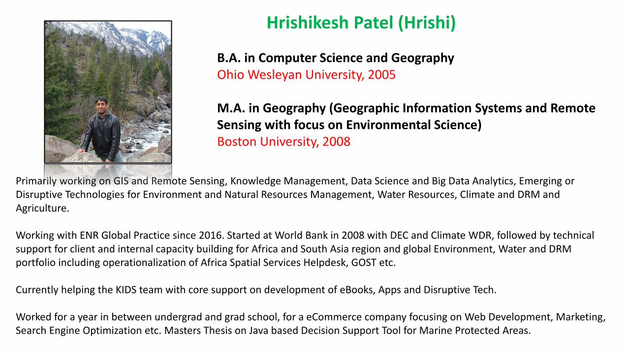
Hrishikesh Patel (Hrishi)
B.A. in Computer Science and GeographyOhio Wesleyan University, 2005
M.A. in Geography (Geographic Information Systems and Remote Sensing with focus on Environmental Science)Boston University, 2008
Primarily working on GIS and Remote Sensing, Knowledge Management, Data Science and Big Data Analytics, Emerging or Disruptive Technologies for Environment and Natural Resources Management, Water Resources, Climate and DRM and Agriculture.
Working with ENR Global Practice since 2016. Started at World Bank in 2008 with DEC and Climate WDR, followed by technical support for client and internal capacity building for Africa and South Asia region and global Environment, Water and DRM portfolio including operationalization of Africa Spatial Services Helpdesk, GOST etc.
Currently helping the KIDS team with core support on development of eBooks, Apps and Disruptive Tech.
Worked for a year in between undergrad and grad school, for a eCommerce company focusing on Web Development, Marketing, Search Engine Optimization etc. Masters Thesis on Java based Decision Support Tool for Marine Protected Areas.
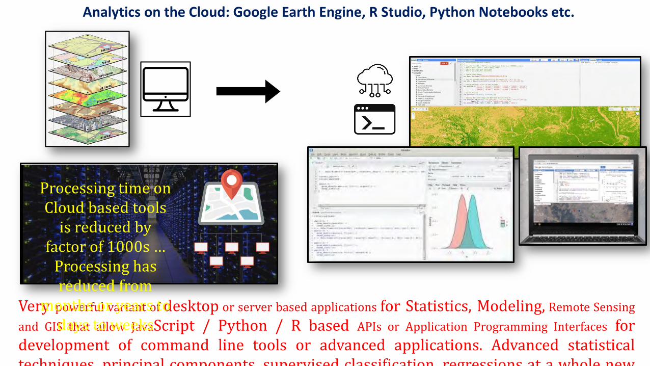
Very powerful variant of desktop or server based applications for Statistics, Modeling, Remote Sensingand GIS that allow JavaScript / Python / R based APIs or Application Programming Interfaces fordevelopment of command line tools or advanced applications. Advanced statisticaltechniques principal components supervised classification regressions at a whole new
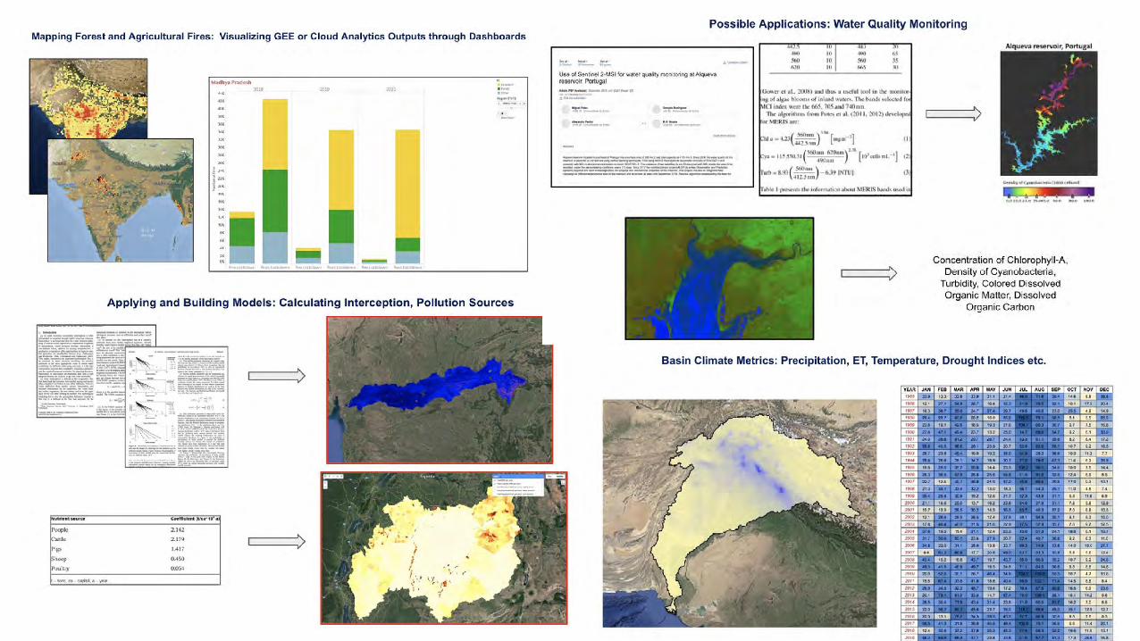
Analytics on the Cloud: Google Earth Engine, R Studio, Python Notebooks etc.
Processing time on Cloud based tools
is reduced by factor of 1000s …
Processing has reduced from
months or years to days to weeks
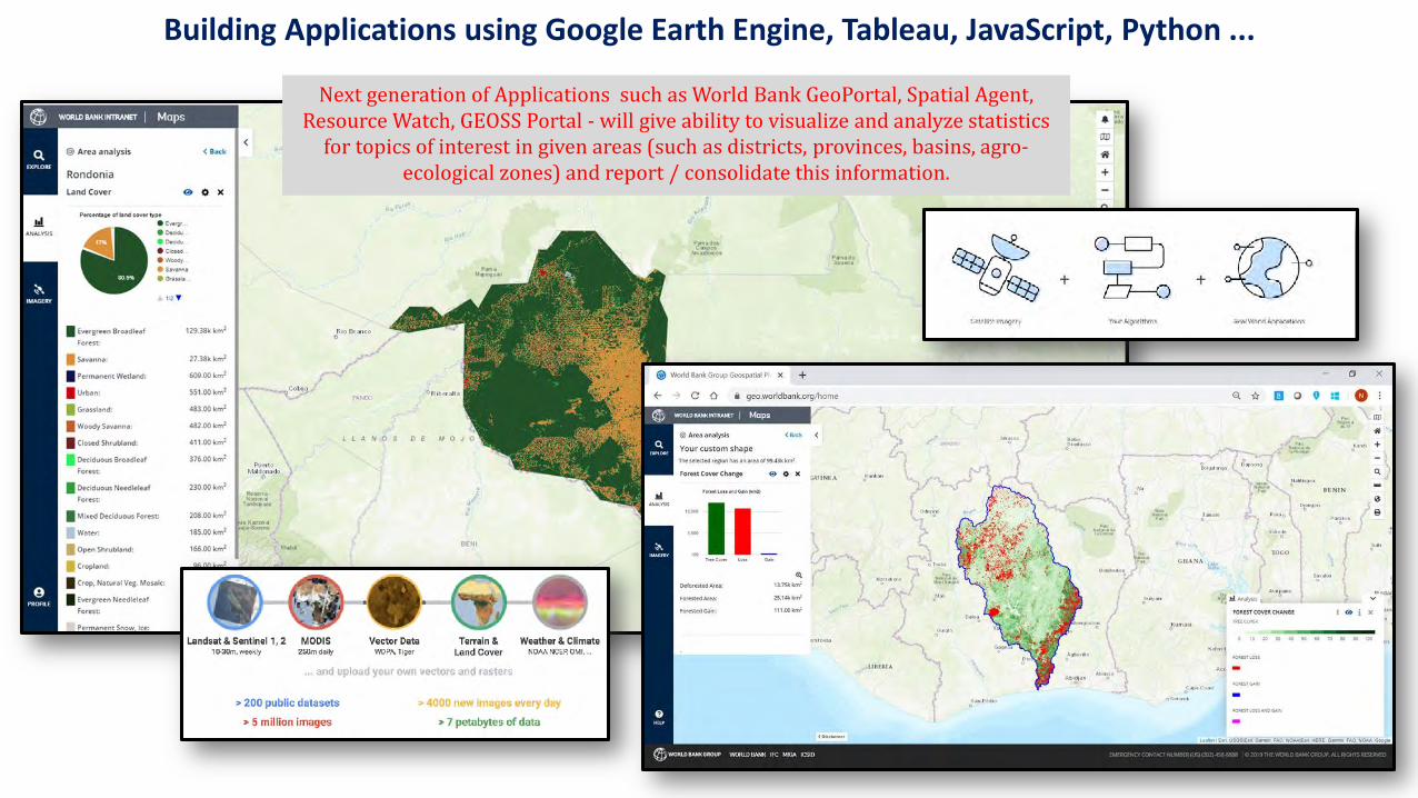
Building Applications using Google Earth Engine, Tableau, JavaScript, Python ...
Next generation of Applications such as World Bank GeoPortal, Spatial Agent, Resource Watch, GEOSS Portal - will give ability to visualize and analyze statistics
for topics of interest in given areas (such as districts, provinces, basins, agro-ecological zones) and report / consolidate this information.
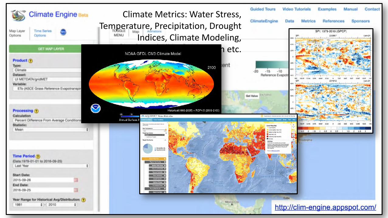
Climate Metrics: Water Stress, Temperature, Precipitation, Drought
Indices, Climate Modeling, Evapotranspiration etc.
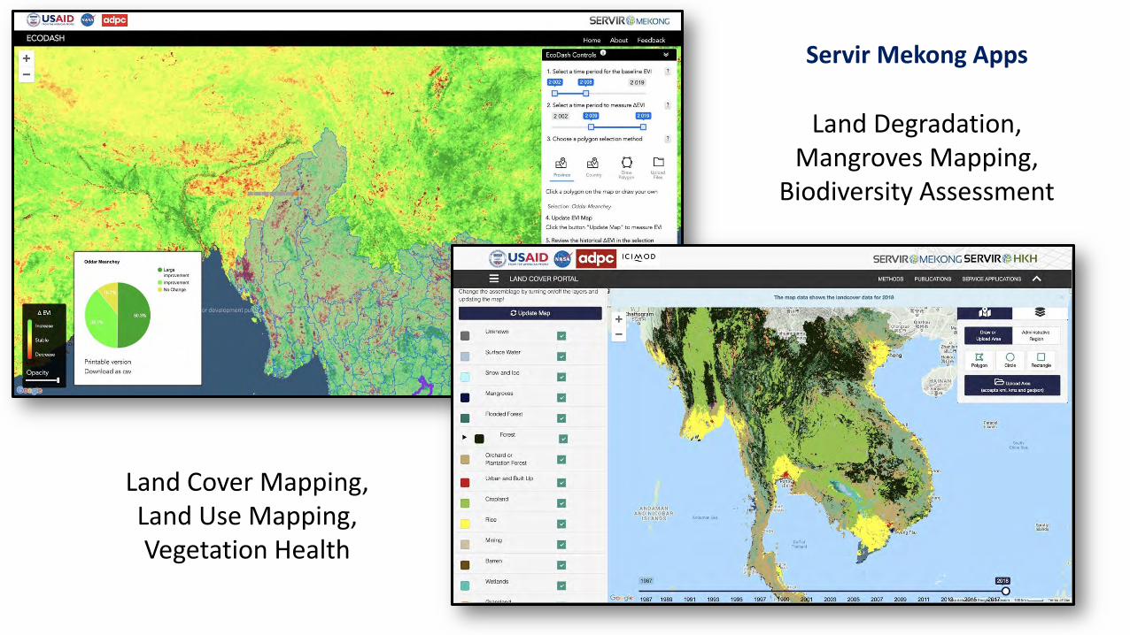
Land Cover Mapping, Land Use Mapping, Vegetation Health
Land Degradation, Mangroves Mapping,
Biodiversity Assessment
Servir Mekong Apps
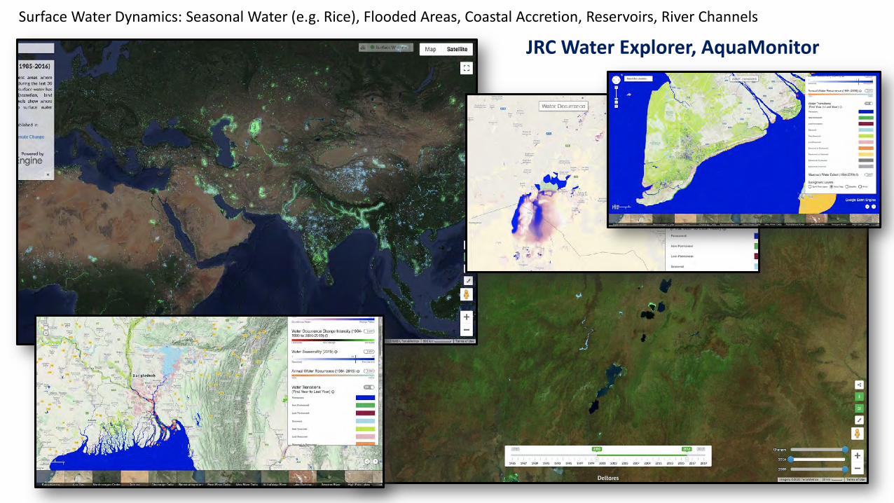
Surface Water Dynamics: Seasonal Water (e.g. Rice), Flooded Areas, Coastal Accretion, Reservoirs, River Channels
JRC Water Explorer, AquaMonitor
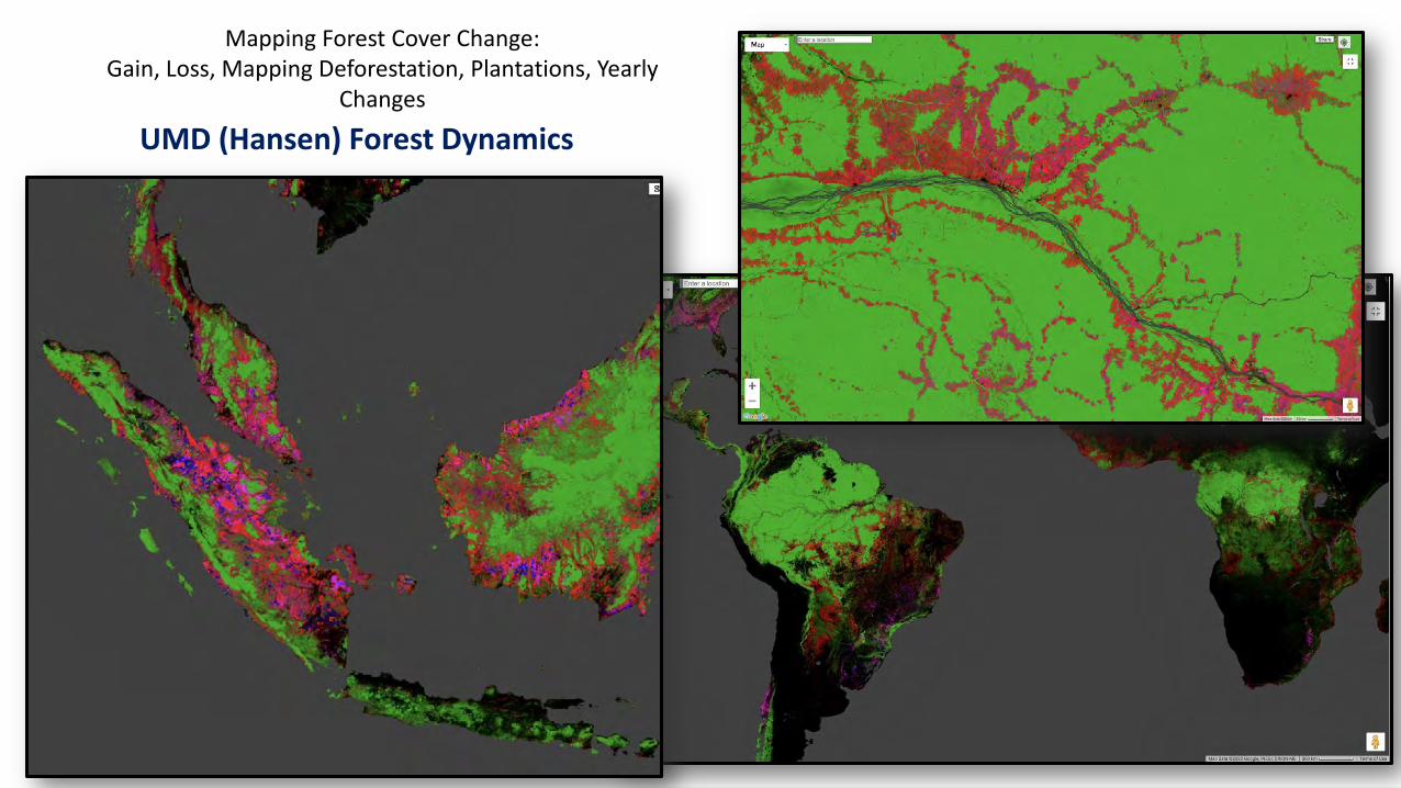
Mapping Forest Cover Change: Gain, Loss, Mapping Deforestation, Plantations, Yearly
Changes
UMD (Hansen) Forest Dynamics
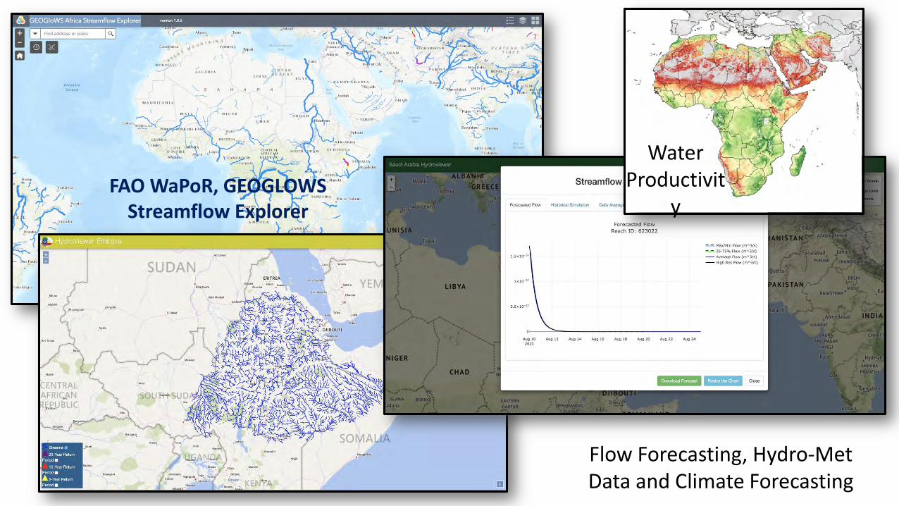
Flow Forecasting, Hydro-Met Data and Climate Forecasting
Water Productivit
yFAO WaPoR, GEOGLOWS
Streamflow Explorer
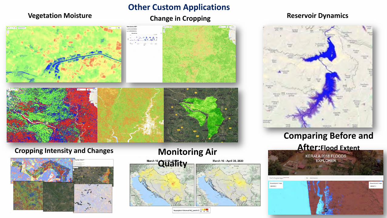
Cropping Intensity and Changes
Change in CroppingVegetation Moisture Reservoir Dynamics
Comparing Before and After:Flood ExtentMonitoring Air
Quality
Other Custom Applications