Embed Size (px)
Citation preview
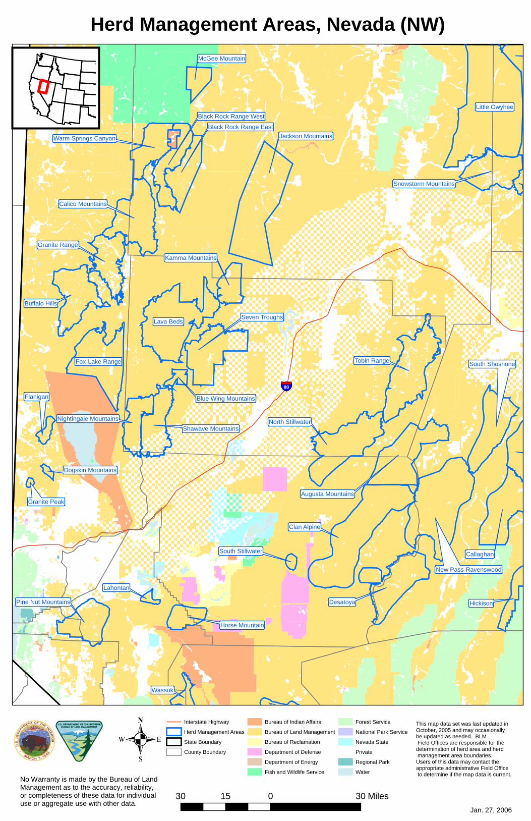
Little Owyhee
Clan Alpine
Lava Beds
Desatoya
Callaghan
North Stillwater
Buffalo Hills
Fox-Lake Range
Seven Troughs
Tobin Range
Jackson Mountains
New Pass-Ravenswood
Calico Mountains
Augusta Mountains
South Shoshone
Granite Range
Pine Nut Mountains
Shawave Mountains
Snowstorm Mountains
Hickison
Warm Springs Canyon
Black Rock Range East
Black Rock Range West
Nightingale Mountains
Horse Mountain
Kamma Mountains
Wassuk
McGee Mountain
Flanigan
Lahontan
Blue Wing Mountains
South Stillwater
Dogskin Mountains
Granite Peak
§̈¦80
Herd Management Areas, Nevada (NW)
Interstate Highway
Herd Management Areas
State Boundary
County Boundary
Bureau of Indian Affairs
Bureau of Land Management
Bureau of Reclamation
Department of Defense
Department of Energy
Fish and Wildlife Service
Forest Service
National Park Service
Nevada State
Private
Regional Park
Water
.30 0 3015 Miles
Jan. 27, 2006
No Warranty is made by the Bureau of Land Management as to the accuracy, reliability, or completeness of these data for individual use or aggregate use with other data.
This map data set was last updated in October, 2005 and may occasionally be updated as needed. BLM Field Offices are responsible for the determination of herd area and herd management area boundaries. Users of this data may contact the appropriate administrative Field Office to determine if the map data is current.