Embed Size (px)
Citation preview
Has
EO
foun
d its
cus
tom
ers?
Results of GLC2000 Legend WorkshopNovember 2000
JRC / Ispra
Has
EO
foun
d its
cus
tom
ers?
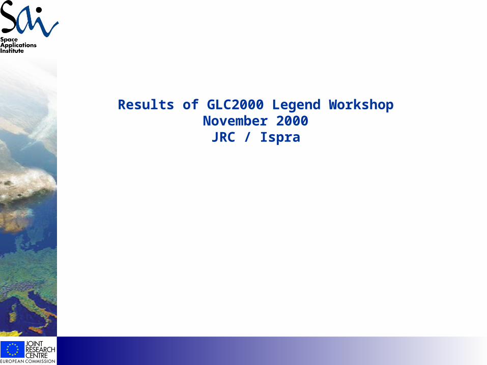
Conclusions GLC2000 Legend Workshop
Land cover information is required
• assessment of land resources• forest inventories• hydrological models• vegetation - atmosphere interaction models
a) for different purposes b) at different geographical (management and planning ) levels
thematic information range •from few land cover classes (forest / non-forest) •to large number of classes•from few discrete classes•to a continuous range of values
• global• regional• sub-regional• local
Has
EO
foun
d its
cus
tom
ers?
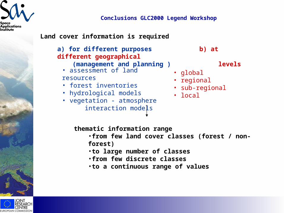
Objective of the GLC2000 project at global level: to map the distribution and the extent of main land cover classes
different information needs at global level- the legend should take this into account
Data set should provide a baseline• for assessment & monitoring land cover change in a global context• input for global climate modeling• reference data for the implementation of international conventions
• uniform and consistent data set• comparable across regions and countries• defined reference year: 2000• compatibility to IGPB classes
Conclusions GLC2000 Legend Workshop
Has
EO
foun
d its
cus
tom
ers?
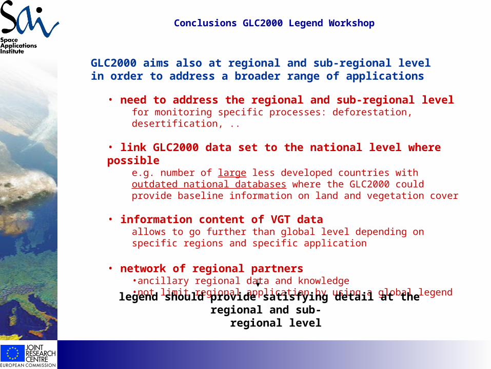
• need to address the regional and sub-regional levelfor monitoring specific processes: deforestation, desertification, ..
• link GLC2000 data set to the national level where possiblee.g. number of large less developed countries with outdated national databases where the GLC2000 could provide baseline information on land and vegetation cover
• information content of VGT data allows to go further than global level depending on specific regions and specific application
• network of regional partners •ancillary regional data and knowledge•not limit regional application by using a global legend
GLC2000 aims also at regional and sub-regional level in order to address a broader range of applications
Conclusions GLC2000 Legend Workshop
legend should provide satisfying detail at the regional and sub- regional level
Has
EO
foun
d its
cus
tom
ers?
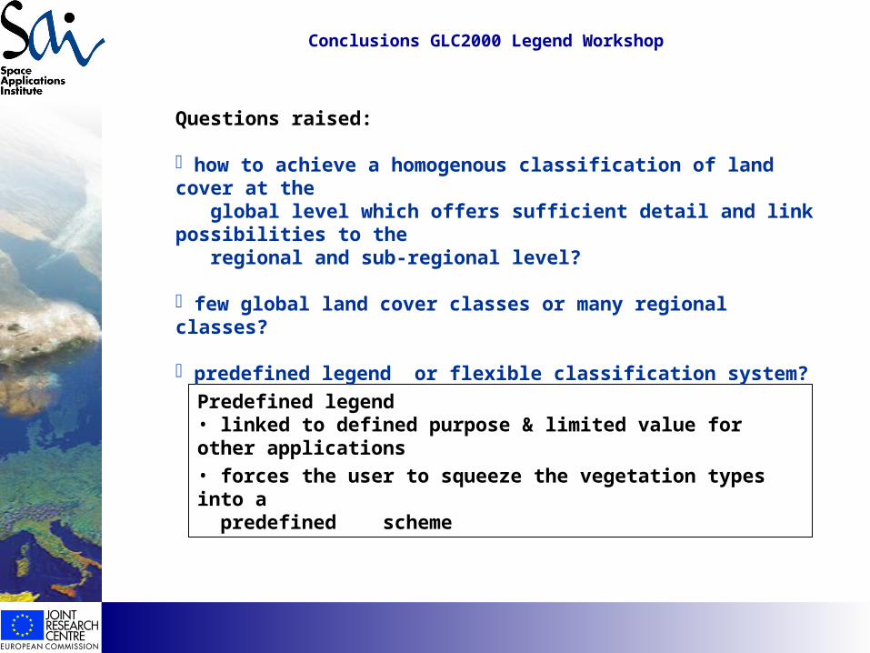
Predefined legend• linked to defined purpose & limited value for other applications• forces the user to squeeze the vegetation types into a predefined scheme
Questions raised:
how to achieve a homogenous classification of land cover at the global level which offers sufficient detail and link possibilities to the regional and sub-regional level?
few global land cover classes or many regional classes?
predefined legend or flexible classification system?
Conclusions GLC2000 Legend Workshop
Has
EO
foun
d its
cus
tom
ers?
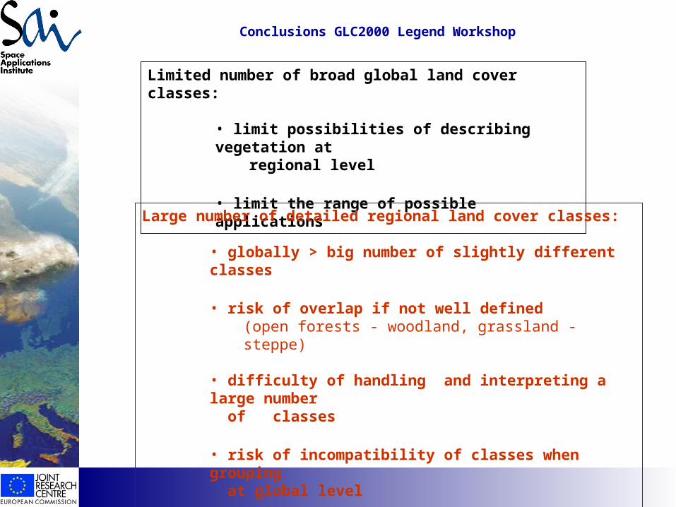
Limited number of broad global land cover classes:
• limit possibilities of describing vegetation at regional level
• limit the range of possible applications
Large number of detailed regional land cover classes:
• globally > big number of slightly different classes
• risk of overlap if not well defined (open forests - woodland, grassland - steppe)
• difficulty of handling and interpreting a large number of classes
• risk of incompatibility of classes when grouping at global level
Conclusions GLC2000 Legend Workshop
Has
EO
foun
d its
cus
tom
ers?
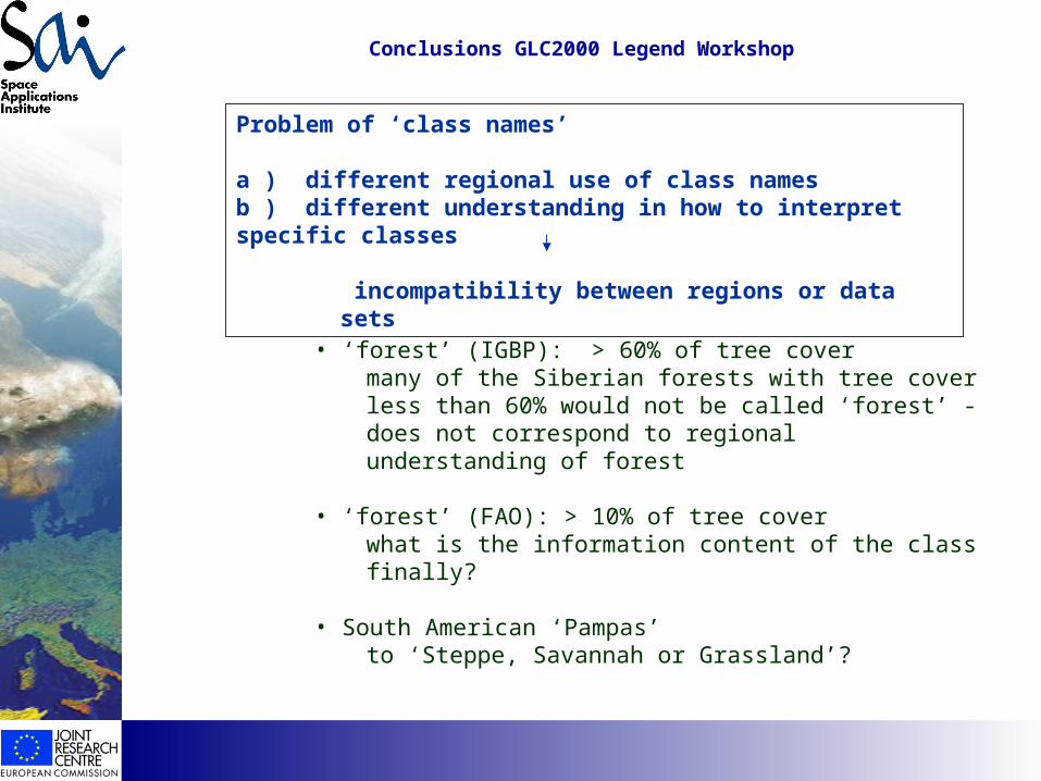
Problem of ‘class names’
a ) different regional use of class names b ) different understanding in how to interpret specific classes
incompatibility between regions or data sets
• ‘forest’ (IGBP): > 60% of tree covermany of the Siberian forests with tree cover less than 60% would not be called ‘forest’ - does not correspond to regional understanding of forest
• ‘forest’ (FAO): > 10% of tree cover what is the information content of the class finally?
• South American ‘Pampas’ to ‘Steppe, Savannah or Grassland’?
Conclusions GLC2000 Legend Workshop
Has
EO
foun
d its
cus
tom
ers?
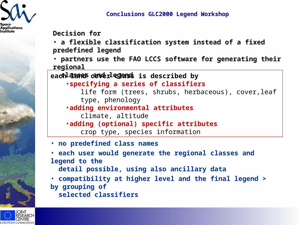
Decision for • a flexible classification system instead of a fixed predefined legend• partners use the FAO LCCS software for generating their regional classes and legend
each land cover class is described by•specifying a series of classifiers
life form (trees, shrubs, herbaceous), cover,leaf type, phenology•adding environmental attributes
climate, altitude•adding (optional) specific attributes
crop type, species information
• no predefined class names• each user would generate the regional classes and legend to the detail possible, using also ancillary data• compatibility at higher level and the final legend > by grouping of selected classifiers
Conclusions GLC2000 Legend Workshop
Has
EO
foun
d its
cus
tom
ers?
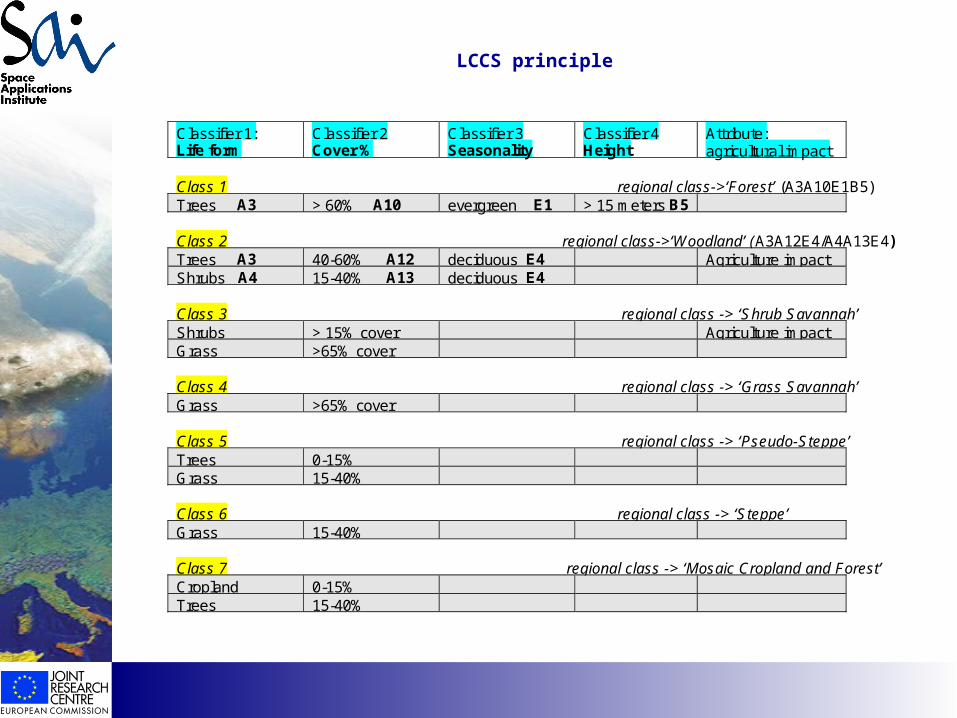
LCCS principle
Classifier 1:Life form
Classifier 2Cover %
Classifier 3Seasonality
Classifier 4Height
Attribute:agricultural impact
Class 1 regional class->‘Forest’ (A3A10E1B5)Trees A3 > 60% A10 evergreen E1 > 15 meters B5
Class 2 regional class->‘Woodland’ (A3A12E4/A4A13E4)Trees A3 40-60% A12 deciduous E4 Agriculture impactShrubs A4 15-40% A13 deciduous E4
Class 3 regional class -> ‘Shrub Savannah’Shrubs > 15% cover Agriculture impactGrass >65% cover
Class 4 regional class -> ‘Grass Savannah’Grass >65% cover
Class 5 regional class -> ‘Pseudo-Steppe’Trees 0-15%Grass 15-40%
Class 6 regional class -> ‘Steppe’Grass 15-40%
Class 7 regional class -> ‘Mosaic Cropland and Forest’Cropland 0-15%Trees 15-40%
Has
EO
foun
d its
cus
tom
ers?
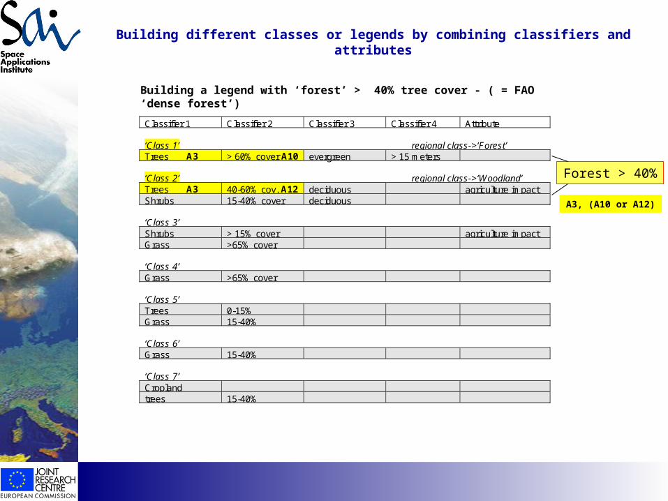
Building different classes or legends by combining classifiers and attributes
Classifier 1 Classifier 2 Classifier 3 Classifier 4 Attribute
‘Class 1’ regional class->‘Forest’Trees A3 > 60% cover A10 evergreen > 15 meters
‘Class 2’ regional class->‘Woodland’Trees A3 40-60% cov. A12 deciduous agriculture impactShrubs 15-40% cover deciduous
‘Class 3’Shrubs > 15% cover agriculture impactGrass >65% cover
‘Class 4’Grass >65% cover
‘Class 5’Trees 0-15%Grass 15-40%
‘Class 6’Grass 15-40%
‘Class 7’Croplandtrees 15-40%
Building a legend with ‘forest’ > 40% tree cover - ( = FAO ‘dense forest’)
Forest > 40%
A3, (A10 or A12)
Has
EO
foun
d its
cus
tom
ers?
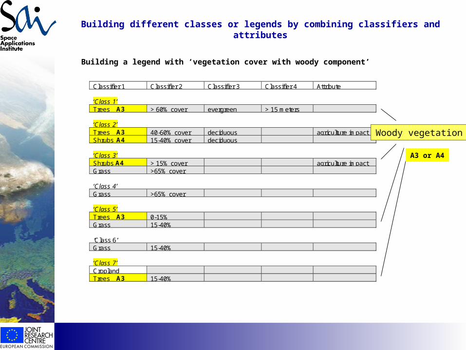
Building different classes or legends by combining classifiers and attributes
Classifier 1 Classifier 2 Classifier 3 Classifier 4 Attribute
‘Class 1’Trees A3 > 60% cover evergreen > 15 meters
‘Class 2’Trees A3 40-60% cover deciduous agriculture impactShrubs A4 15-40% cover deciduous
‘Class 3’Shrubs A4 > 15% cover agriculture impactGrass >65% cover
‘Class 4’Grass >65% cover
‘Class 5’Trees A3 0-15%Grass 15-40%
‘Class 6’Grass 15-40%
‘Class 7’CroplandTrees A3 15-40%
Building a legend with ‘vegetation cover with woody component’
Woody vegetation
A3 or A4
Has
EO
foun
d its
cus
tom
ers?
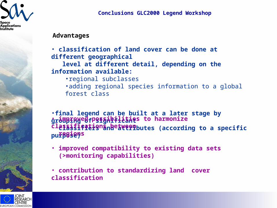
• classification of land cover can be done at different geographical level at different detail, depending on the information available:
•regional subclasses •adding regional species information to a global forest class
•final legend can be built at a later stage by grouping of significant classifiers and attributes (according to a specific purpose)
Advantages
• improved possibilities to harmonize classifications between regions
• improved compatibility to existing data sets (>monitoring capabilities)
• contribution to standardizing land cover classification
Conclusions GLC2000 Legend Workshop
Has
EO
foun
d its
cus
tom
ers?
Conclusions GLC2000 Legend Workshop
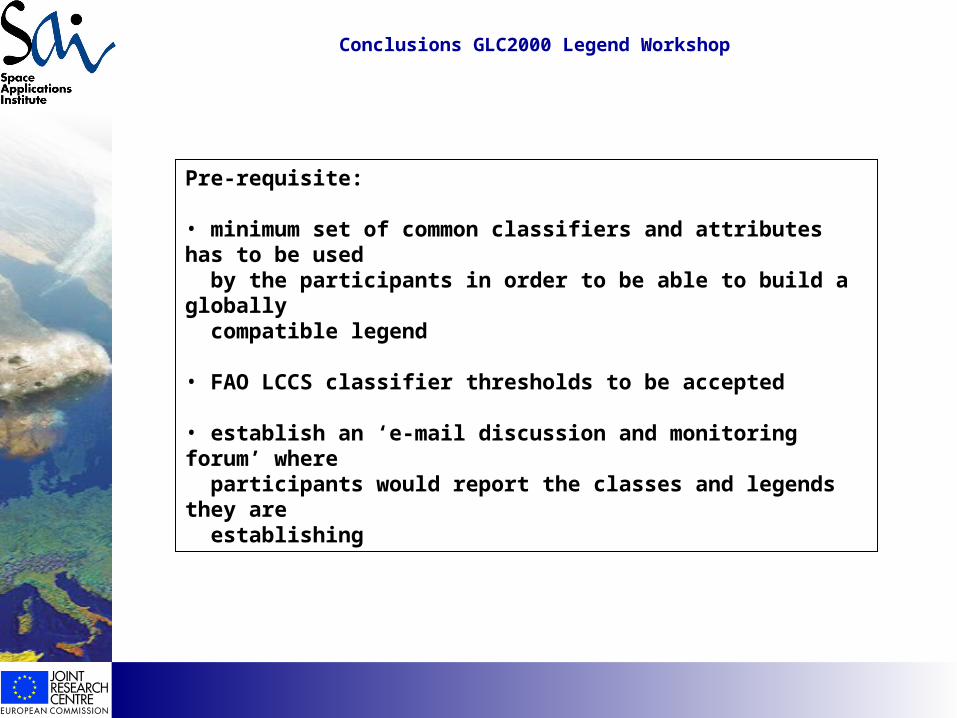
Pre-requisite:
• minimum set of common classifiers and attributes has to be used by the participants in order to be able to build a globally compatible legend
• FAO LCCS classifier thresholds to be accepted
• establish an ‘e-mail discussion and monitoring forum’ where participants would report the classes and legends they are establishing
Has
EO
foun
d its
cus
tom
ers?
based on SPOT VGT added ancillary data based SPOT VGT or ancillary data
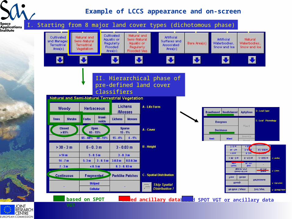
Example of LCCS appearance and on-screen
I. Starting from 8 major land cover types (dichotomous phase)
II. Hierarchical phase of pre-defined land cover classifiers
Has
EO
foun
d its
cus
tom
ers?
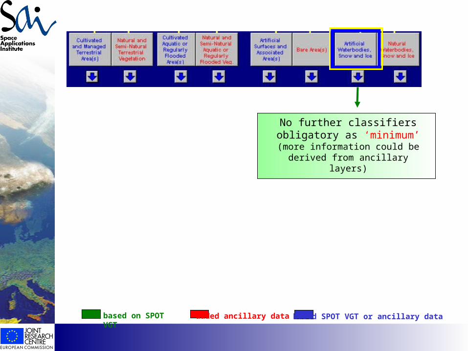
based on SPOT VGT added ancillary data based SPOT VGT or ancillary data
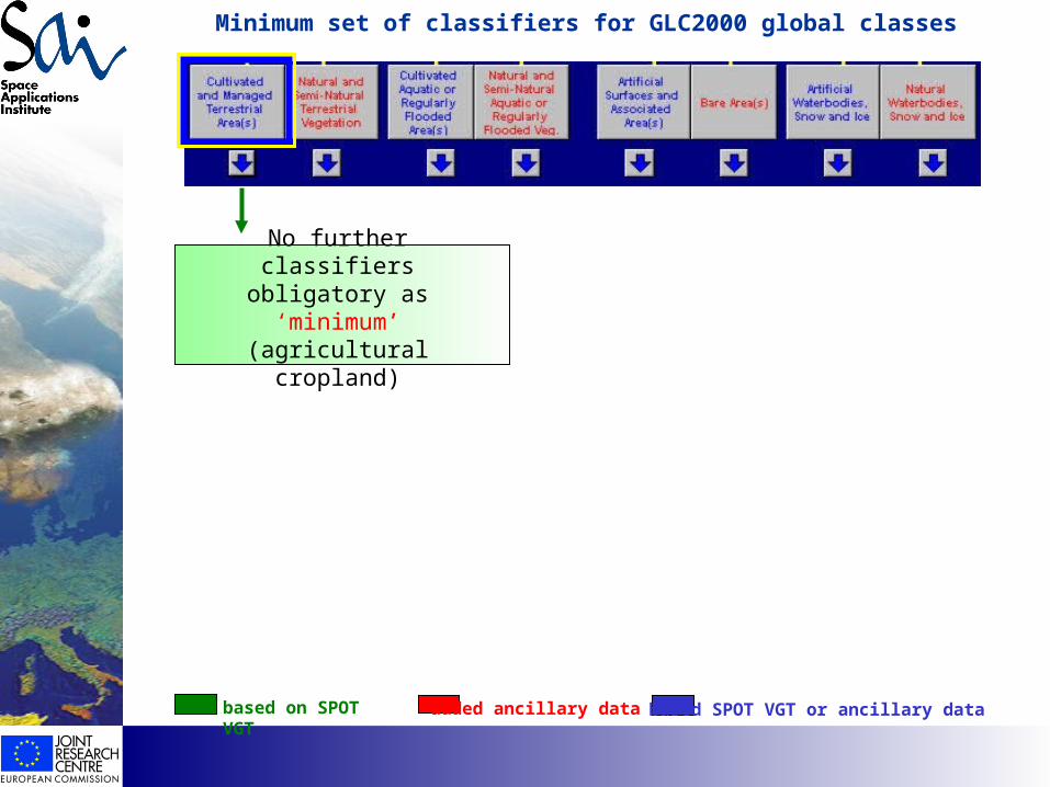
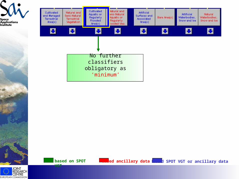
No further classifiers obligatory as ‘minimum’(agricultural cropland)
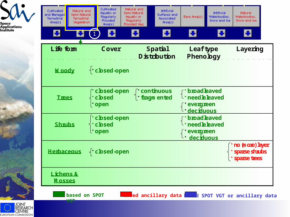
Minimum set of classifiers for GLC2000 global classes
Has
EO
foun
d its
cus
tom
ers? Life form Cover Spatial
DistributionLeaf type
PhenologyLayering
Woody closed-open
Trees closed-open closed open
continuous fragmented
broadleaved needleleaved evergreen deciduous
Shrubs closed-open closed open
broadleaved needleleaved evergreen deciduous
Herbaceous closed-open no (more) layer sparse shrubs sparse trees
Lichens &Mosses
1
based on SPOT VGT added ancillary data based SPOT VGT or ancillary data

Has
EO
foun
d its
cus
tom
ers?
Life form Cover SpatialDistribution
Leaf typePhenology
Layering
Woody sparse
Trees sparse
Shrubs sparse
Herbaceous sparse
2
based on SPOT VGT added ancillary data based SPOT VGT or ancillary data
Has
EO
foun
d its
cus
tom
ers?
based on SPOT VGT added ancillary data based SPOT VGT or ancillary data
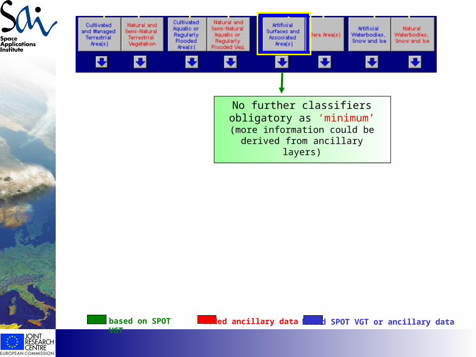
No further classifiers obligatory as ‘minimum’
Has
EO
foun
d its
cus
tom
ers?
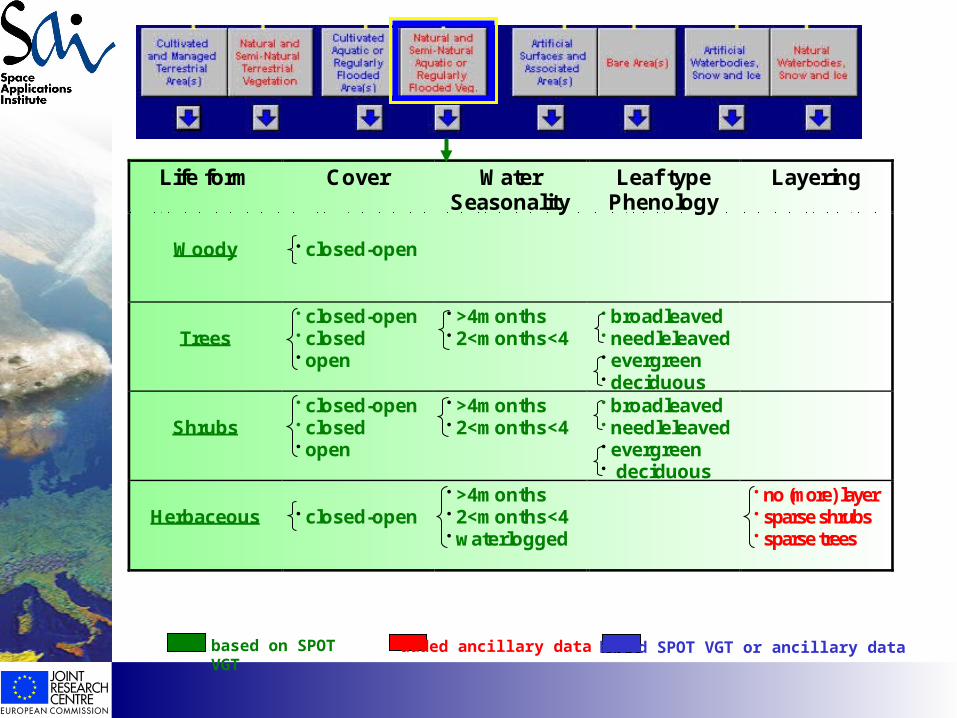
Life form Cover WaterSeasonality
Leaf typePhenology
Layering
Woody closed-open
Trees closed-open closed open
>4months 2<months<4
broadleaved needleleaved evergreen deciduous
Shrubs closed-open closed open
>4months 2<months<4
broadleaved needleleaved evergreen deciduous
Herbaceous closed-open >4months 2<months<4 waterlogged
no (more) layer sparse shrubs sparse trees
based on SPOT VGT added ancillary data based SPOT VGT or ancillary data
Has
EO
foun
d its
cus
tom
ers?
based on SPOT VGT added ancillary data based SPOT VGT or ancillary data
No further classifiers obligatory as ‘minimum’
(more information could be derived from ancillary layers)
Has
EO
foun
d its
cus
tom
ers?
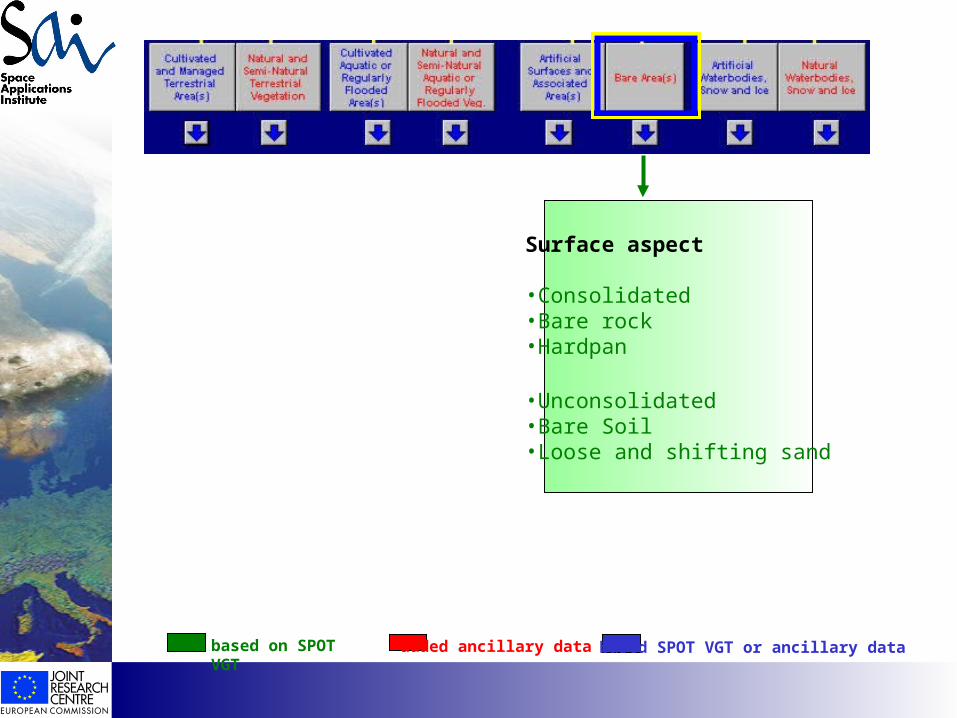
Surface aspect
•Consolidated•Bare rock•Hardpan
•Unconsolidated•Bare Soil•Loose and shifting sand
based on SPOT VGT added ancillary data based SPOT VGT or ancillary data
Has
EO
foun
d its
cus
tom
ers?
No further classifiers obligatory as ‘minimum’
(more information could be derived from ancillary layers)
based on SPOT VGT added ancillary data based SPOT VGT or ancillary data
Has
EO
foun
d its
cus
tom
ers?
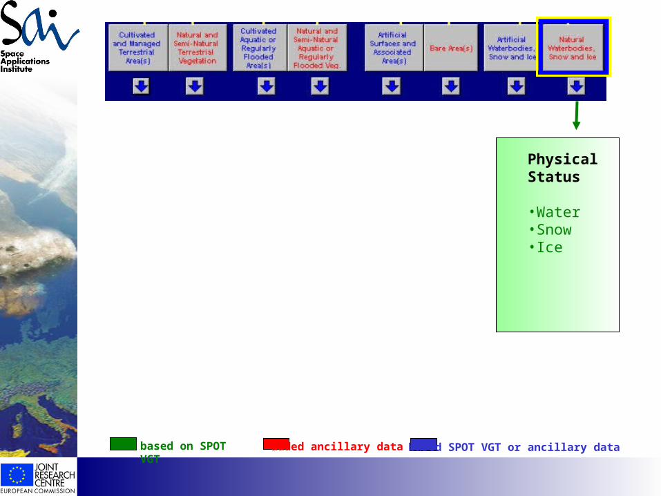
Physical Status
•Water•Snow•Ice
based on SPOT VGT added ancillary data based SPOT VGT or ancillary data
Has
EO
foun
d its
cus
tom
ers?
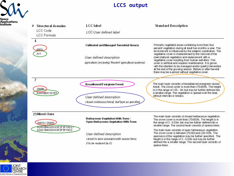
LCCS output