Embed Size (px)
Citation preview

1 GROUNDWATER MONITORING IN THE ONSHORE PETROLEUM AND GEOTHERMAL INDUSTRY – GUIDELINE
DRAFT GUIDELINE GROUNDWATER MONITORING IN THE
ONSHORE PETROLEUM AND GEOTHERMAL INDUSTRY
December 2015

1 GROUNDWATER MONITORING IN THE ONSHORE PETROLEUM AND GEOTHERMAL INDUSTRY – GUIDELINE
CONTENTS
1 Introduction ......................................................................................................... 2
2 Purpose .............................................................................................................. 2
3 Scope ................................................................................................................ 3
4 Guidance ............................................................................................................ 4
4.1 Activities requiring groundwater monitoring .............................................. 4
4.2 Review of existing information .................................................................. 5
4.3 Designing a monitoring program .............................................................. 8
4.4 Interpreting monitoring data ..................................................................... 16
4.5 Provision of information ............................................................................ 17
5 References .......................................................................................................... 19
2 GROUNDWATER MONITORING IN THE ONSHORE PETROLEUM AND GEOTHERMAL INDUSTRY – GUIDELINE
1 INTRODUCTIONGroundwater resources have both environmental values (ie. ecosystem health condition) and beneficial uses (eg. potable water supply or for agricultural, recreational or industrial use). Protection of these values and uses relies on an understanding of the groundwater resource and maintaining or improving existing water quality and quantity.
Most onshore petroleum wells in Western Australia will intersect groundwater resources while targeting oil and gas in deeper geological formations. Petroleum wells are constructed to rigorous standards to ensure that the environment, including groundwater resources, is protected. As with all industries and land uses, it is acknowledged that risks do exist and these must be appropriately regulated and mitigated.
It is also acknowledged that there is a high level of public concern and interest in protecting groundwater resources – irrespective of quality or use. Once in operation, questions may arise as to whether petroleum activities are impacting groundwater quality and quantity. Groundwater monitoring data can help provide answers in this regard. Given the sheer size of Western Australia, there are many aquifers where the quality and quantity of water remains largely unknown. The information obtained through groundwater monitoring will also be used to enhance the knowledge of the State’s groundwater resources.
Petroleum activities (both surface and subsurface activities) have several potential risk sources and pathways relating to groundwater resources. By far the most immediate of these risks occurs at the surface with the management of hydrocarbons, chemicals and wastewater. Minor subsurface risks include contamination from well integrity failure or accidental subsurface chemical movement from the well through fractures, or other conduits, into aquifers.
While the petroleum industry acknowledges these risks do exist, the combination of robust regulations and industry best practice mitigation ensure that these risks are minimised to ‘As Low As Reasonably Practicable’ (ALARP). As such, the risk of groundwater contamination is extremely low.
Notwithstanding, groundwater monitoring is considered good practice for the onshore petroleum industry and provides evidence to counter future claims of groundwater contamination. It also provides reassurance to local communities, stakeholders and landholders that their groundwater resources are being actively monitored to demonstrate that there has not been any impact.
2 PURPOSEThis Guideline has been prepared by the Department of Mines and Petroleum (DMP) in consultation with the Department of Water. It aims to establish good practice requirements for groundwater monitoring for onshore petroleum and geothermal activities in Western Australia. The guideline is not intended to be applied prescriptively, but rather applied on a case by case basis using a risk based approach.
Baseline monitoring is used to establish groundwater conditions before petroleum activities commence and, when used in conjunction with surveillance monitoring, to determine if groundwater quality or quantity is affected by petroleum activities.

3 GROUNDWATER MONITORING IN THE ONSHORE PETROLEUM AND GEOTHERMAL INDUSTRY – GUIDELINE
The purpose of this Guideline is to provide guidance to operators about:
• identifyingsituationswheregroundwatermonitoringisconsideredappropriateforonshorepetroleum activities
• outliningthegeneralrequirementsandconsiderationsthatcanbeappliedtogroundwatermonitoring using a risk based approach.
3 SCOPEThis Guideline applies to monitoring of groundwater resources for onshore petroleum or geothermal activities regulated under the Petroleum and Geothermal Energy Resources Act 1967, the Petroleum and Geothermal Energy Resources (Environment) Regulations 2012 and the Petroleum and Geothermal Energy Resources (Resource Management and Administration) Regulations 2015.
In this Guideline, reference to the term ‘petroleum activities’ collectively refers to both petroleum and geothermal activities including:
• drilling
• wellconstruction
• wellwork-over
• injection
• wellproductiontesting
• hydraulicfracturestimulation
• constructionandinstallationofafacility
• operationormodificationofafacility
• storageandprocessingofpetroleum
• decommissioningofawellorfacility.
In the context of this Guideline, ‘baseline groundwater monitoring’ refers to the measurement of groundwater levels and collection of groundwater samples from aquifers to determine water quality prior to the commencement of petroleum activities. It does not include monitoring of produced water, surface waters, wastewater storage or discharge, or monitoring of discharge or emissions from petroleum and geothermal activities.
Monitoring that occurs after commencement of a petroleum activity is not considered to be representative of ‘baseline’ conditions and is instead referred to as ‘surveillance’ monitoring. Any data collected after commencement of a petroleum activity should be directly compared to baseline data and relevant standards to determine whether changes have occurred.
It should be noted that there is a fundamental difference between ‘water bores’ and petroleum ‘wells’. Water bores are constructed to access groundwater. In contrast, petroleum ‘wells’ are more robust structures, designed to transfer petroleum and geothermal resources from deeper geological formations to the surface while preventing any contact with groundwater.

4 GROUNDWATER MONITORING IN THE ONSHORE PETROLEUM AND GEOTHERMAL INDUSTRY – GUIDELINE
This Guideline does not remove or negate other monitoring requirements required under other laws, regulations or policies. In some cases, Ministerial conditions may also form part of a project’s approval which identify specific groundwater monitoring requirements (eg. approvals under the Environmental Protection Act 1986).
This Guideline does not prevent the use of innovative approaches that can alternatively meet the overall objectives of groundwater monitoring for onshore petroleum and geothermal projects. Innovative approaches allow flexibility and will be considered on a case by case basis.
Other types of environmental monitoring may be required in an environment plan on a case-by-casebasis,underr.14ofthePetroleumandGeothermalEnergyResources(Environment) Regulations 2012, to evaluate potential environmental impacts and risks to specific environmental values and sensitivities.
4 GUIDANCE
4.1 Activities requiring groundwater monitoring Groundwatermonitoringrequirementsaredeterminedonacase-by-casebasis,depending on the scale and nature of the petroleum activity, the level of risk, and the sensitivity and values attributed to the surrounding environment (including aquifers). Petroleum activities with a higher risk of adversely impacting groundwater resources or sensitive environments will require a more intensive baseline groundwater monitoring program. This could consist of multiple monitoring bores at various locations and depths in the aquifer, together with higher frequency sampling and additional chemical parameters.
An intensive groundwater monitoring program is likely to be considered appropriate for petroleum activities in areas with:
• potablewatersuppliessuchasproximitytoaPublicDrinkingWaterSourceArea(PDWSA), PDWSA water bore or an Aboriginal community drinking water bore
• environmentalsensitivitiessuchasproximitytoconservationwetlands,groundwater dependent ecosystems, waterways or areas protected by statutory mechanisms, such as State forest, national parks, nature reserves, etc.
• certaingeologyhavingpotentialtorapidlymobilegroundwatercontaminantssuchas faults and karst geology
• importantgroundwatervaluesandbeneficialuses(currentandfuture)wherethegroundwater resource has important social or economic values (such as local water supply, stock water, irrigation water, or is used to support nearby wetlands or recreational areas)
• socialfactorswherethesiteislocatedinproximitytopopulatedareas,culturallysignificant areas and/or there is significant public concern or perceived risks
• higheroperationalriskswheretheproposedpetroleumactivityhasahighlevelofcomplexity, uncertainty or risk.

5 GROUNDWATER MONITORING IN THE ONSHORE PETROLEUM AND GEOTHERMAL INDUSTRY – GUIDELINE
A less intensive groundwater monitoring program may be appropriate for low risk petroleum activities and where low risks to the environment and community are identified.
There may also be some petroleum activities where groundwater monitoring is not considered appropriate. For example:
• seismic,geologicalandaerialsurveys
• constructionandoperationofpipelines
• wheretherearenosensitiveorwater-dependentenvironmentsinthevicinityoftheproposed activity
• smallscalegeothermalwells(iflicensedbyDepartmentofWater)
• whereexistingdataissufficienttodeterminethebaseline.
Development of an appropriate groundwater monitoring program is likely to require the advice of a suitably qualified hydrogeologist or other appropriate professional. Advice should be sought from the Department of Water and other relevant departments where appropriate (eg. water service providers, health or environment agencies).
The Environmental Protection Authority (EPA) may also require baseline information on groundwater during the environmental impact assessment process under the Environmental Protection Act 1986. Environmental Protection Bulletin No.22 Hydraulic fracturing for onshore natural gas from shale and tight rocks (available at www.epa.wa.gov.au) provides further details on the EPA’s information requirements.
An existing groundwater monitoring program should be revised where a petroleum activity is transitioning from an exploration into a production phase. New groundwater monitoring bores may be needed to consider additional or cumulative risks to groundwater from field development and/or from production facilities.
4.2 Review of existing informationPrior to constructing a groundwater monitoring bore, a review of existing information available for the site and surrounding areas should be undertaken (commonly referred to as a desktop review). This will allow petroleum operators and regulators to develop an understanding of the existing groundwater quality, current and historical land uses and any potential contamination pathways and sensitive receptors. This assists with the effective design of the baseline groundwater monitoring program and assessment of results.
The review may include, but not be limited to, the following:
• locationandsitedescription
• currentandhistoricallandandwateruses
• hydrogeologicalandhydrologicalsetting
• existingboresandavailablemonitoringdata.

6 GROUNDWATER MONITORING IN THE ONSHORE PETROLEUM AND GEOTHERMAL INDUSTRY – GUIDELINE
The type of information that may be considered as part of the review is outlined in the following sections.
Location and site descriptionThis includes a description and maps of:
• thelocationwherethepetroleumactivitieswilltakeplaceatthesurfaceandin thesub-surface
• aquifersthatareintersectedbytheproposedactivities(andconnectedaquifers)
• featuresthatmaycreatepotentialpathwaysordynamicwaterflow(eg.faults,abandoned bores, karst limestone)
• identificationofthenearesttowns,populationcentresorproperties
• adescriptionofthesurroundingenvironment,includingsurfacewaters(eg.waterways, floodplains, wetlands), culturally important areas, sensitive environments (eg. groundwater dependent ecosystems such as wetlands and cave systems) and protected areas (eg. PDWSAs, State forest, national parks, nature reserves, or other areas under statutory protection.
Current and historical land usesCurrent and historical activities conducted at the site should be listed and, where possible, located on a site plan. This includes an analysis of any land uses that have the potential to contaminate groundwater resources in the vicinity of the proposed petroleum activities.
Particular consideration should be given to land uses that contribute or provide a pathway for pollutants, including existing wells (groundwater or petroleum), agriculture, mining, industrial or commercial land uses, feedlots, scrap or storage yards, petrol stations, waste dump/landfill, waste processing facilities/septic systems, etc.).
Up-gradientlandusescouldalsobeinvestigated,asthesecanhavepotentialtocontribute pollutants over time. Landholder consultation is important in this regard.
Reference should be made to the contaminated sites database at the Department of Environment Regulation to determine if there are any known contaminated sites in vicinity of the proposed activities.
Licensed and, where possible, unlicensed groundwater users (eg. stock and domestic/garden bores, PDWSA water bores or Aboriginal community drinking water bores) should be identified on maps and/or tables.
Consultation with neighbouring landholders will be required to identify unlicensed private bores, especially those potentially used as a private water supply. Information on the location of licensed water bores can be obtained from the Department of Water. It can also provide advice such as locations of water resources, depths of aquifers, appropriate monitoring locations, parameters and sampling regimes. Consultation with public water service providers, such as the Water Corporation, is required where activities are situated in proximity (5km) to public water bores in PDWSAs.

7 GROUNDWATER MONITORING IN THE ONSHORE PETROLEUM AND GEOTHERMAL INDUSTRY – GUIDELINE
Hydrogeological and hydrological settingPetroleum operators need to develop an understanding of the geology, hydrogeology, hydrology and environment of the proposal area. This culminates in the development of a conceptual model of the area.
Specific information, where available, includes:
• thedistributionofgeologicalformations,unconfinedandconfinedaquifers,aquitardsand aquicludes present in the area
• aquifercharacteristicsincludingtransmissivity,permeabilityandwaterquality
• lateralandverticalvariationinwaterlevels/pressures,groundwaterflowdirectionsandrates of flow
• thelocationofrechargeanddischargeareasforaquifers
• interconnectionbetweenaquifers
• existingsurfacewaterresources
• potentialgroundwater-dependentecosystems
• springsandsoaks
• locationofexistingfaults,fractures,solutionchannelsorothergeologicalfeatures
• abstractionvolumesandtargetaquifersforlicensedandunlicensedwaterbores.
This information should be presented in written form and supported using maps and figures where appropriate.
Existing water bores and monitoring dataExisting groundwater monitoring data should be gathered and analysed as part of the initial desktop review for the proposed operations, with the aim of:
• characterisingandassessingthegroundwaterchemistryofgroundwaterresourcesprior to the proposed operations, including identifying existing groundwater contamination
• collectingandassessingdataonwaterlevelsandpressuresingroundwaterresources
• identifyinggroundwatermonitoringsitesanddatathatissuitableforuseinthebaseline monitoring program
• identifyingboresthatneedtobeprotectedandrequirebaselinemonitoring(eg.private and public drinking water bores, including PDWSA water bores and Aboriginal community drinking water bores).
Where data is not available within the area of proposed activities and potential impacts it may be possible to obtain relevant regional data from connected aquifers.
Existing landholder water bores can also be used for the baseline monitoring program if they are suitable and available to access. A preliminary assessment of bore suitability for

8 GROUNDWATER MONITORING IN THE ONSHORE PETROLEUM AND GEOTHERMAL INDUSTRY – GUIDELINE
monitoring should be undertaken. This should include construction details of wells (eg. depth, casing sizes, materials, screen locations and size, grouting/formation packing, etc.), their lithological and geophysical logs, and other key data such as static water levels/pressures.
4.3 Designing a monitoring programThis Guideline focuses on aspects of designing a groundwater monitoring program relevant to onshore petroleum activities. Other literature is available on more general aspects of groundwater monitoring such as Groundwater Sampling and Analysis – A Field Guide (Geoscience Australia, 2009). Many aspects of designing a ‘baseline’ monitoring program are directly relevant to a ‘surveillance’ monitoring program.
A groundwater monitoring program should include the following key aspects:
• objectivesformonitoring
• commencementanddurationofmonitoring
• monitoringsitesandboredesign
• frequencyofmonitoring
• samplingequipmentandmethods
• watermonitoringparameters.
ObjectivesThe monitoring objectives should be clearly stated in the monitoring program. They help to define the requirements for monitoring and inform the planning and design of the broader monitoring program.
The overriding objective for baseline monitoring in relation to petroleum activities is to establish a reference groundwater condition (ie. benchmark), so that any future potential impacts from petroleum activities can be measured against the original reference condition (ie. comparison against the reference condition).
Any other objectives should be realistic in terms of identifying and measuring changes in groundwater quality and quantity, and reflect desired outcomes for groundwater resources, groundwater values and the environment. Further guidance can be obtained from the National Water Quality Management Strategy: Guidelines for groundwater quality protection in Australia (Australian Government, 2013).
Commencement and duration The design of a baseline monitoring program should consider the expected spatial and temporal variations in the parameters to be monitored. The Australian guidelines for monitoring groundwater recommend two years of baseline water quality sampling to adequately characterise groundwater variability (ANZECC and ARMCANZ, 2000). This allows for some understanding of annual variation in groundwater levels and in water quality parameter concentrations between wet and dry seasons.
9 GROUNDWATER MONITORING IN THE ONSHORE PETROLEUM AND GEOTHERMAL INDUSTRY – GUIDELINE
Understanding natural variation is important for distinguishing natural fluctuations from a change due to contamination.
While two years of baseline groundwater monitoring is considered useful to understand extremes in annual variation, this may not be practical for some petroleum exploration activities where:
• thegroundwaterborewillbeusedasawatersupplyforthepetroleumactivityandwill be inherently linked to petroleum regulatory approvals
• landaccessagreementshavenotbeenfinalised
• theexactlocationofthepetroleumwellorfacilityisnotconfirmed.
Notwithstanding, a groundwater monitoring bore should be constructed with baseline samples collected as soon as reasonably practicable following approvals, landholder agreements and prior to commencing the spudding of a new petroleum or geothermal well (or construction of a facility). This will ensure that baseline samples can be obtained well before petroleum activities commence.
Baseline monitoring technically ends once drilling starts or a facility becomes operational (ie. storing or processing hydrocarbons). Cessation of the baseline monitoring program does not mean the groundwater monitoring program should discontinue – monitoring at the same bore/s should continue, but in the form of ‘surveillance’ monitoring to detect any change compared to the baseline condition or relevant standard over time.
Surveillance groundwater monitoring should continue for at least the duration of the petroleum activity. For petroleum wells where there have been no external well failures or serious spill incidents, then monitoring can cease following well decommissioning. For petroleum wells where there has been an external well failure or a serious spill incident prior to decommissioning, then monitoring should continue for two years post well decommissioning to account for any potential lag in groundwater movement from the well to the monitoring bore.
Relevant approvalsApproval to either construct a new bore or to monitor an existing groundwater bore on public land is subject to approval from the relevant Government authority. For example, bores located in national parks will require approval from the Department of Parks and Wildlife. The operator should seek approval in writing from the relevant authority. For new bores on public land, the relevant Government authority will advise on relevant approvals required.
Approval to construct a new bore on private land for the purpose of monitoring groundwater is subject to agreement with the landholder. New bores installed on private land for the sole purpose of groundwater monitoring are exempt from the 26D construction permit, the 5C water allocation licence under the Rights in Water Irrigation Act 1914 and approvals under the petroleum environment regulations, but will still require landholder consent. This allows the operator to construct monitoring bores well in advance of planned petroleum activities to develop a baseline understanding of

10 GROUNDWATER MONITORING IN THE ONSHORE PETROLEUM AND GEOTHERMAL INDUSTRY – GUIDELINE
groundwater and to aid in developing models. If at any time in the future, the operator wants the monitoring bore to become a water supply bore, then a 5C water allocation licence must be sought.
Similarly, approval to access and use existing groundwater bores on private land for monitoring purposes is subject to landholder approval only.
Approval to either construct a new or use an existing bore on private land can be negotiated with the landholder and incorporated into the landholder access agreement (further details at APPEA et al., 2015). This allows an opportunity for private landholders to have their groundwater bores tested and to provide reassurance that their water supply is being actively monitored and protected.
Where approval is sought to construct a new bore on private land for the dual purposes of providing a water supply and for monitoring groundwater (associated with a petroleum activity), it will require:
• a26DpermittoconstructawaterboreundertheRights in Water Irrigation Act 1914 from the Department of Water
• a5CwaterallocationlicenceundertheRights in Water Irrigation Act 1914 from the Department of Water
• approvalviaanenvironmentplanunderthePetroleumandGeothermalEnergyResources (Environment) Regulations 2012.
This may limit the time available to undertake baseline groundwater monitoring prior to commencing petroleum activities.
Details of any bores and groundwater monitoring program should be included within an environment plan for the relevant petroleum activity to be assessed under the Petroleum and Geothermal Energy Resources (Environment) Regulations 2012.
Production activities include requirements for baseline groundwater monitoring (r. 14), details of which should be included in the field management plan which is regulated under the Petroleum and Geothermal Energy Resources (Resource Management and Administration) Regulations 2015.
Monitoring sites and bore designThe number and location of baseline groundwater monitoring bores needs to be determined on a case by case basis, but will primarily depend on the level of risk associated with the proposed petroleum activity and the sensitivity and values of the surrounding environment and groundwater values. The scale of petroleum activities (eg. processing plants, multiple wells, or field development programs) may also influence the number and location of groundwater monitoring bores. The Department of Water can provide advice in this regard.
Some activities may require deep and shallow monitoring bores depending on the depths of aquifers that are currently being utilised (or are likely to be utilised in the future). Bores may also need to be drilled to different depths to monitor water quality

11 GROUNDWATER MONITORING IN THE ONSHORE PETROLEUM AND GEOTHERMAL INDUSTRY – GUIDELINE
parameters that have various densities and/or solubilities in water. Some chemicals float on groundwater, some mix within the aquifer and others will sink to the bottom of the aquifer.
As a minimum requirement, it is recommended to locate at least one monitoring boredown-gradient(ie.hydraulicgradient)oftheproposedpetroleumactivities. Where external factors are likely to influence groundwater over the duration of thepetroleumactivity(ie.nearbylanduse),anup-gradientmonitoringboreisappropriate to characterise groundwater moving through the petroleum site (Department of Water, 2006).
Additional monitoring bores with flow meter logs may be needed to determine the direction of groundwater flow where flow direction remains unknown. This would requiremultiplebores(ideallythree)spreadoutradiallyandequi-distantfromthepetroleum well.
The location of new monitoring bores generally depends on hydrogeological factors but shouldbeascloseaspracticableto,anddown-gradientofthepetroleumwelltoallowearly detection of any contamination, but no closer than 15 metres for safety reasons. The Petroleum and Resources Safety Divisions within DMP should be contacted to discuss any safety aspects in relation to the bore location on site.
The exact location of the bore should also consider other factors, such as layout of site infrastructure, proximity to vehicle tracks, and proximity to unlined drainage sumpsorsoak-wells.Ifthemonitoringboreislocatedtoofarawayfromthepetroleumwell, there is also a greater risk that other external factors will affect groundwater quality or that surveillance monitoring will not detect any potential well leaks within a suitable timeframe.
Water bores must be drilled in accordance with the Minimum Construction Requirements for Water Bores in Australia (National Uniform Drillers Licensing Committee, 2012).
Where available, details of existing water monitoring bores should be provided including construction details (eg. depth, casing sizes, materials, screen locations and size, grouting/formation packing, etc.), lithological and geophysical logs, and other key data such as static water levels and existing water quality data. The bores also need to be constructed from materials that would not influence the water quality parameters of interest.
Frequency of monitoringThe frequency of groundwater monitoring is determined on a case by case basis and undertaken in accordance with monitoring objectives and professional advice.
Monitoring frequency is usually related to how dynamic the monitored environment is (ie. how fast hydrological or chemical changes are likely to occur). In aquifers, the rate of change in water quality and water levels is generally slow compared to surface waters, although in unconfined aquifers, seasonal variations in groundwater chemistry and water levels are common. Groundwater abstraction and tidal influences in coastal

12 GROUNDWATER MONITORING IN THE ONSHORE PETROLEUM AND GEOTHERMAL INDUSTRY – GUIDELINE
areas can also affect water levels. In most confined aquifers, changes in water quality over several weeks are normally minimal.
Frequency of monitoring also depends on chemical parameters being monitored. Highly water soluble chemicals (including salts) are mobile in groundwater and will requiremonthlymonitoring.Incontrast,insolubleorsoil-bindingchemicals(includinghydrocarbonsandpersistentchemicals)arelessvariableovertimeandhalf-yearlymonitoring may be acceptable.
Monthly sampling is a typical initial baseline frequency for areas where little is known about groundwater quality and it is necessary to establish baseline groundwater quality and levels.
Once petroleum activities commence ‘baseline’ monitoring transitions into ‘surveillance’ monitoring. Quarterly sampling is adequate for surveillance monitoring where the general objective is to track any deviation from the baseline condition over time. The frequency of ‘surveillance’ monitoring may also be tailored to suit the type of petroleum activity being undertaken. For example, more frequent monitoring when hydraulic fracturing is occurring, or less frequent monitoring when a well or facility is in care and maintenance.
Sampling equipment and methodsThe DMP encourages petroleum operators to engage an appropriately qualified consultant or independent professional to undertake the monitoring program. Independence is important where there are public trust issues around transparency or there may be potential liabilities regarding surrounding land uses and related contamination issues.
Sampling equipment and methods are to be consistent with Australian/New Zealand Standards (AS/NZS 5667, Water quality – Sampling). The method of pumping groundwatertoobtainasample(eg.bailing,highflowpumpingorlow-flowpurgepumping) is determined by the water quality parameters of interest.
Water levels/pressures should be measured within aquifers at the same time as water samples are collected. It may be appropriate, or easier in some cases, to install continuous recording data loggers.
Water monitoring parametersChemical analysis of water quality is an integral part of the baseline groundwater monitoring program. If particular chemicals are required outside of the general parameter suite, the DMP will inform the petroleum operator, or include them as conditions of approval.
Sampling should be undertaken in accordance with the Australian Standard (AS/NZS 5667) using a National Association of Testing Authorities (NATA) registered laboratory toundertakechemicalanalysesusingNATA-accreditedanalysismethods.IfaNATAregistered laboratory is not available, evidence to support data quality should be presented in the report.

13 GROUNDWATER MONITORING IN THE ONSHORE PETROLEUM AND GEOTHERMAL INDUSTRY – GUIDELINE
Field analysis parameters are measured to help characterise groundwater quality and to help interpret changes in groundwater quality. A list of parameters is included in Table 1 as a suggested minimum.
A flow cell should be used to measure field analysis parameters (ie. with no air contact) at the time that samples are collected during the baseline monitoring program. Water levels can be measured manually or using a data logger.
Table 1: General field analysis parameters.
Field analysis parameters
Water level (m AHD) – water levels / pressures should be measured within aquifers, surfacewatersystemsandgroundwater-dependentecosystemsatthesametimeaswater samples are collected. It may be appropriate, or easier in some cases, to install continuous recording data loggers.
Temperature (°C)
Conductivity – compensated to 25°C, or if uncompensated – report the value measured and the temperature; report complete units (e.g. mS/cm, not mS)
pH
Redox potential (Eh)
Dissolved oxygen (mg/L and %DO)
Bicarbonate (HCO3–)
The list of water quality parameters for laboratory analysis presented in this Guideline is generic (Table 2). It is not mandatory for operators to sample all parameters. The parameters selected for a groundwater monitoring program should be determined on a case-by-casebasisusingtheresultsfromthedesktopreviewandriskassessment.
Results of the desktop review should help to identify relevant current and historical land uses, environmental sensitivities and groundwater values and uses which will influence which parameters should be selected. For example, where historical land uses indicate some potential risk for groundwater contamination, a range of parameters may need to be sampled depending on that previous land use (including parameters outside the suite of chemical parameters presented in Table 2).
Results of the risk assessment (undertaken via an environment plan) should also provide information about which parameters are related to the current petroleum activity and can pose a risk to the environment or human health. This information can help to determine specific parameters that should be included in the monitoring program.

14 GROUNDWATER MONITORING IN THE ONSHORE PETROLEUM AND GEOTHERMAL INDUSTRY – GUIDELINE
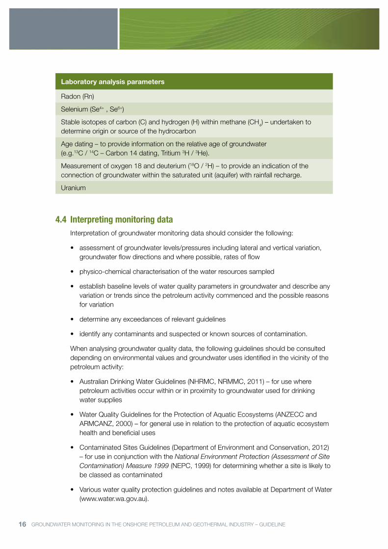
Table 2: Potential water quality parameters for laboratory analysis.
Laboratory analysis parameters
Physico-chemical:
Total dissolved solids – determined gravimetrically @ 180°C
Turbidity
Total hardness (as CaCO3)
Total alkalinity (as CaCO3)
Hydroxide (as CaCO3)
Total Nitrogen (mg/L)
Total Kjeldahl Nitrogen (TKN) (mg/L)
Total Phosphorus (TP)
Ions:
Calcium (Ca 2+)
Magnesium (Mg2+)
Sodium (Na+)
Potassium (K+)
Ammonia (NH4+)
Phosphate (PO43–)
Carbonate (CO32–)
Bicarbonate (HCO3–)
Chloride (Cl–)
Sulphate (SO42–)
Nitrite (NO2–)
Nitrate (NO3–)
Silica (SiO2)
Hydrocarbons:
Methane
Ethane
Propane
Total Recoverable Hydrocarbons (TRH)
Benzene
Toluene
Ethylbenzene

15 GROUNDWATER MONITORING IN THE ONSHORE PETROLEUM AND GEOTHERMAL INDUSTRY – GUIDELINE
Laboratory analysis parameters
Xylene
Phenol
Polycyclic Aromatic Hydrocarbons (PAH)
Volatile Organic Compounds (VOC)
Metals: (Filter and acidify samples in field)
Aluminium
Arsenic
Barium
Beryllium
Boron
Cadmium
Chromium
Cobalt
Iron
Lead
Manganese
Mercury
Molybdenum
Nickel
Selenium
Vanadium
Zinc
Other parameters as appropriate (for example)
Arsenic (As3+ , As5+)
Bromide (Br–)
Chromium (Cr3+ , Cr6+)
Iron (Fe2+)
Fluoride
Lithium (Li+)
Naturally Occurring Radioactive Material (NORM)
Pesticides – organochlorines / organophosphates
16 GROUNDWATER MONITORING IN THE ONSHORE PETROLEUM AND GEOTHERMAL INDUSTRY – GUIDELINE
Laboratory analysis parameters
Radon (Rn)
Selenium (Se4+ , Se6+)
Stable isotopes of carbon (C) and hydrogen (H) within methane (CH4) – undertaken to determine origin or source of the hydrocarbon
Age dating – to provide information on the relative age of groundwater (e.g.13C / 14C – Carbon 14 dating, Tritium 3H / 3He).
Measurement of oxygen 18 and deuterium (18O / 2H) – to provide an indication of the connection of groundwater within the saturated unit (aquifer) with rainfall recharge.
Uranium
4.4 Interpreting monitoring dataInterpretation of groundwater monitoring data should consider the following:
• assessmentofgroundwaterlevels/pressuresincludinglateralandverticalvariation,groundwater flow directions and where possible, rates of flow
• physico-chemicalcharacterisationofthewaterresourcessampled
• establishbaselinelevelsofwaterqualityparametersingroundwateranddescribeanyvariation or trends since the petroleum activity commenced and the possible reasons for variation
• determineanyexceedancesofrelevantguidelines
• identifyanycontaminantsandsuspectedorknownsourcesofcontamination.
When analysing groundwater quality data, the following guidelines should be consulted depending on environmental values and groundwater uses identified in the vicinity of the petroleum activity:
• AustralianDrinkingWaterGuidelines(NHRMC,NRMMC,2011)–forusewherepetroleum activities occur within or in proximity to groundwater used for drinking water supplies
• WaterQualityGuidelinesfortheProtectionofAquaticEcosystems(ANZECCandARMCANZ, 2000) – for general use in relation to the protection of aquatic ecosystem health and beneficial uses
• ContaminatedSitesGuidelines(DepartmentofEnvironmentandConservation,2012)– for use in conjunction with the National Environment Protection (Assessment of Site Contamination) Measure 1999 (NEPC, 1999) for determining whether a site is likely to be classed as contaminated
• VariouswaterqualityprotectionguidelinesandnotesavailableatDepartmentofWater(www.water.wa.gov.au).

17 GROUNDWATER MONITORING IN THE ONSHORE PETROLEUM AND GEOTHERMAL INDUSTRY – GUIDELINE
Analysis and interpretation of the data should indicate any abnormalities, peculiarities or information necessary to interpret the data (eg. problems encountered with the operation of monitoring equipment). This includes identifying whether the water quality parameter was below analytical limits.
Results should be compared to the appropriate guideline for water quality and presented in tables, highlighting any results that exceed the guideline value. When operations commence, surveillance monitoring data should be interpreted against baseline data to determine whether there has been any significant change in groundwater conditions and the possible reasons for that change.
As a matter of urgency, DMP, the Department of Water, the Department of Health, the Department of Environment Regulation and relevant water service providers must be contacted where any exceedances of drinking water guidelines (ie. in relation to a potable water supply) or contaminated site guidelines are identified from groundwater monitoring.
4.5 Provision of InformationSubmitting reports to DMP
The groundwater monitoring report should be submitted to DMP’s, Environment Division ([email protected]). The report should include results of the desktop review, relevant details of the monitoring bore, the monitoring data and a summary analysis of those results.
Where baseline monitoring data has been collected and a report compiled prior to approval for a related petroleum activity, it can be submitted as an appendix to an environmentplan.Otherwise,thereportcanbesubmittedpost-approval.
Surveillance groundwater monitoring data (collected during and/or post activity) should be submitted with a summary analysis of results compared to baseline groundwater data, via annual environmental reports to DMP. An incident report should be submitted to DMP where groundwater contamination has been identified.
For the purposes of reporting, groundwater monitoring data should be presented in tables and graphical format (with raw data in appendix and summary data in the body of report). Bore construction details should also be provided in the appendix, including bore diagrams, geophysical logs, geological logs, etc.
Submitting data to the Department of Water
Operators are encouraged to submit raw groundwater monitoring data to the Department of Water ([email protected]) as the Government’s custodians of groundwater data and information.
All submitted data must have sufficient metadata to clearly and unambiguously identify every attribute, for example:
1. Measurement location coordinates in latitude and longitude in decimal degrees with a minimum of six significant decimal places in GDA94.
18 GROUNDWATER MONITORING IN THE ONSHORE PETROLEUM AND GEOTHERMAL INDUSTRY – GUIDELINE
2. For each set of analyses:
• laboratorynameandaddress
• siteandsampleidentification(ie.sitename,samplenumber)
• samplingdetails(date,time,depth/referencepoint,topofcasing/groundlevel,collection method, collection instrument)
• sampletreatmentdetails(filtered/unfiltered,preservationsuchasHNO3)
• analyticalmethodcodeforeachanalyte
• unitsforeachanalyte
• howaresultisexpressedforeachanalyte(e.g.asNorasCaCO3)
• theformofeachanalyte,ifapplicable(ie.totalorfiltered)
• thelimitofreportingordetectionlimitforeachanalyte.
For field results include site, date, time and sample details as above, on a suitable form. This also needs to include, for each bore sampled, a record of pumping time and stable water quality parameters (EC, temperature, pH, dissolved oxygen and redox potential) prior to taking a sample. This provides evidence that the groundwater sample is representative of the water being sampled from the aquifer. Also, document the instrument used to measure each parameter, specify the parameter being measured and the units reported for each result.
Submitting reports to the landholder
In the interest of encouraging a positive stakeholder relationship, the operator is encouraged to provide the groundwater monitoring report to the landholder. The terms of the operator releasing the report to the landholder can be negotiated in the land access agreement.
19 GROUNDWATER MONITORING IN THE ONSHORE PETROLEUM AND GEOTHERMAL INDUSTRY – GUIDELINE
5 REFERENCESANZECC and ARMCANZ (2000) Australian and New Zealand Guidelines for Fresh and Marine Water Quality, Volume 1: the guidelines, Australian Government, October 2000.
APPEA, WAFF, PGA, Vegetables WA (2015). Farming Land Access Agreement Template: for petroleum exploration activities under the Petroleum and Geothermal Energy Resources Act 1967, www.appea.com.au, October 2015.
AS/NZS (1998) Water quality—sampling—guidance on sampling of groundwater, Australian Standard / New Zealand Standard 5667.11: (Standards Australia 1998).
Australian Government (2013). Guidelines for groundwater quality protection in Australia; National Water Quality Management Strategy.
Department of Environment and Conservation (2010) Assessment Levels for Soil, Sediment and Water, Contaminated Sites Management Series, Department of Environmental Regulation, www.der.wa.gov.au, February 2010.
Department of Mines and Petroleum (2012) Guidelines for the preparation and submission of an environment plan, www.dmp.wa.gov.au, 28 August 2012.
Department of Water (2006) Groundwater monitoring bores, Water Quality Protection Note 30, www.water.wa.gov.au, February 2006.
DNV (Det Norske Veritas) (2013) Risk Management of Shale Gas Developments and Operations, RecommendedPracticeDNV-RP-U301,January2013.
Geoscience Australia (2009) Groundwater sampling and analysis – a field guide, Record 2009/27, Commonwealth of Australia.
National Environmental Protection Council (NEPC) (1999) National Environment Protection Measure (Assessment of Site Contamination) Measure (NEPM); Schedule B(1) – Guideline on Investigation Levels for Soil and Groundwater.
NHRMC, NRMMC (2011) Australian Drinking Water Guidelines: Paper 6 National Water Quality Management Strategy, version 2.0 updated December 2013, National Health and Medical Research Council, National Resource Management Ministerial Council, Commonwealth of Australia, Canberra.
National Uniform Drillers Licensing Committee (2012) Minimum construction requirements for water bores in Australia, 3rd edition, February 2012.

20 GROUNDWATER MONITORING IN THE ONSHORE PETROLEUM AND GEOTHERMAL INDUSTRY – GUIDELINE
Government of Western AustraliaDepartment of Mines and Petroleum
Mineral House, 100 Plain StreetEast Perth, Western Australia 6004
Tel: +61 8 9222 3333Fax: +61 8 9222 3862
Email: [email protected]: www.dmp.wa.gov.au
Published December 2015DMPDEC15_4073