Embed Size (px)
Citation preview

GIS Education in Finnish Upper Secondary Schools
Simo
Tolvanen, MA
Geography and Biology lecturerKauhajoki
Upper Secondary School
Finland
Photo: Simo Tolvanen

Finland in Brief• Geographic location: north of
60o
N• Nature: Mostly boreal
coniferous forest, lakes and
swamps• Finland is a member of The
European Union since 1995• Population: about 5,3 million,
very sparsely populated• GPD per capita: $ 34 800 (12 th),
HDI: 0,95 (11 th)• Education is free to everybody
from kindergarten to university– High quality of compulsory
science education according to
OECD’s PISA
survey: Finland had
the highest score of the 57
participating countries
Source of the map: Wikipedia
Photo: Simo Tolvanen

Source: Ministry of Educationhttp://www.oph.fi/english/
• About 400 upper secondary schools (one of
which is my school, Kauhajoki
Upper Secondary)• In them about 120 000
students
Photo: Simo Tolvanen

GIS and the National Curriculum of Geography
• GIS was added to the National Curriculum of
General Upper Secondary Schools in 2005• The basic principles and applications of GIS are
taught in every upper secondary school (grades
10‐12)– A compulsory course includes the very basics (not in
all schools)
– More theory is learned and GIS is also applied on an
optional course on Area Study
• One course consists of about 35 lessons and homework
• Since 2006 there have been questions on GIS in
the geography section of the National
Matriculatioin
Examination
additional motivation for students and teachers to study GIS
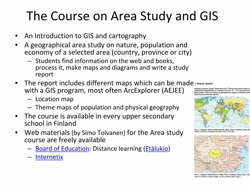
The Course on Area Study and GIS • An Introduction to GIS and cartography• A geographical area study on nature, population and
economy of a selected area (country, province or city)– Students find information on the web and books,
process it, make maps and diagrams and write a study
report
• The report includes different maps which can be made
with a GIS program, most often ArcExplorer
(AEJEE)
– Location map– Theme maps of population and physical geography
• The course is available in every upper secondary
school in Finland
• Web materials (by Simo
Tolvanen) for the Area study
course are freely available – Board of Education: Distance learning (Etälukio)– Internetix

The Finnish web materials for the Area study course 1/3
Photo: Simo Tolvanen

The Finnish web materials for the Area study
course 2/3

The Finnish web materials for the Area study course 3/3
Special GIS Courses and Virtual Courses
• About 10 upper secondary schools offer a
Special GIS and Cartography course– More GIS theory and working with GIS software in
a computer lab
• The Area Study and GIS Special courses are
also available as virtual web courses
in several
virtual school‐networks in different areas of
Finland• The virtual web courses include
– Study material, assignments, exercises and web
links
– Timetable of the course and instructions for
students
– Tools for interaction between teacher and
students– A tool for submitting the assignments

GIS in the Finnish geography shcool books
• A short one‐page introduction to GIS is included in 1 out of 3 different
books for the two compulsory geography courses
• The books for the Area Study Course have more theory and practice on GIS and
– 2 out of 3 different books include a CD with ArcExplorer
(AEJEE) software and
data• Local Finnish and global ESRI’s
GIS datasets
in .shp
–format
• A book for the Special GIS course in the upper secondary schools

The Virtual School Project on Developing GIS Education
• Funded by the National Board of
Education and the schools• Started in 2002 and ended in 2007• 4 participating teachers from 4
different schools around Finland• The project included
– Training the active teachers, who
then trained other teachers– Developing The GIS Education Portal– Developing new methods for teaching
geography with GIS
• Using GIS to produce maps on the Area
Study course
• Using GIS to learn better the basic
concepts on the compulsory courses
National Board of Education
The ”GIS‐team”
in 2005

The Finnish GIS Education Portal
• Teaching material– Slideshows for
classroom use– Assignments and
activities– Background material in
PDF‐format– Web links with
teaching hints• Information about the
GIS education project– GIS training
• For teachers and students
• In use since 2002

Supplementary GIS Training for Teachers
• GIS was added to the national geography curriculum in 2005 as a new topic
• Many geography teachers didn’t even know what it
meant a few years ago need for supplementary training– Several one‐day and longer
courses a year arranged by• Universities• The teachers from the GIS
education development project
Photos: Simo Tolvanen
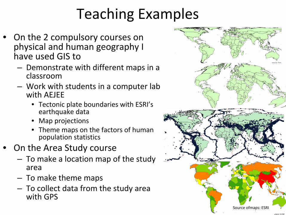
Teaching Examples• On the 2 compulsory courses on
physical and human geography I
have used GIS to– Demonstrate with different maps in a
classroom
– Work with students in a computer lab
with AEJEE
• Tectonic plate boundaries with ESRI’s
earthquake data
• Map projections• Theme maps on the factors of human
population statistics
• On the Area Study course– To make a location map of the study
area
– To make theme maps– To collect data from the study area
with GPS
Source ofmaps: ESRI

GIS day in Kauhajoki
Upper Secondary School in 2007
Photos: Simo Tolvanen