Embed Size (px)
Citation preview

The Five Themes of Geography
The Five Themes
Location• Absolute Location: Exact position o Bodwell High School is located at north
latitude 49.313985,and 123.1008539 west longitude
• Latitude: “FATitude” horizontal lines of measurement• Longitude: vertical lines of
measurement
Location• Relative Location: less exact –
described by time, direction or distance from one place to another
• Ms. Stewart lives about 12 km from BHS • I’m about 45 minutes away from home (in
traffic) or 20 minutes away (in no traffic)

• Why is Kelowna a transportation and service center?
Place• Physical Characteristics of place include things
like:o Landformso bodies of watero soilo mineral deposits
• Cultural Characteristics include things like: o First nations people using tree bark to make
blankets
Regions • Regions are areas that share common
characteristics, such as:• government• landforms• climate
Regions
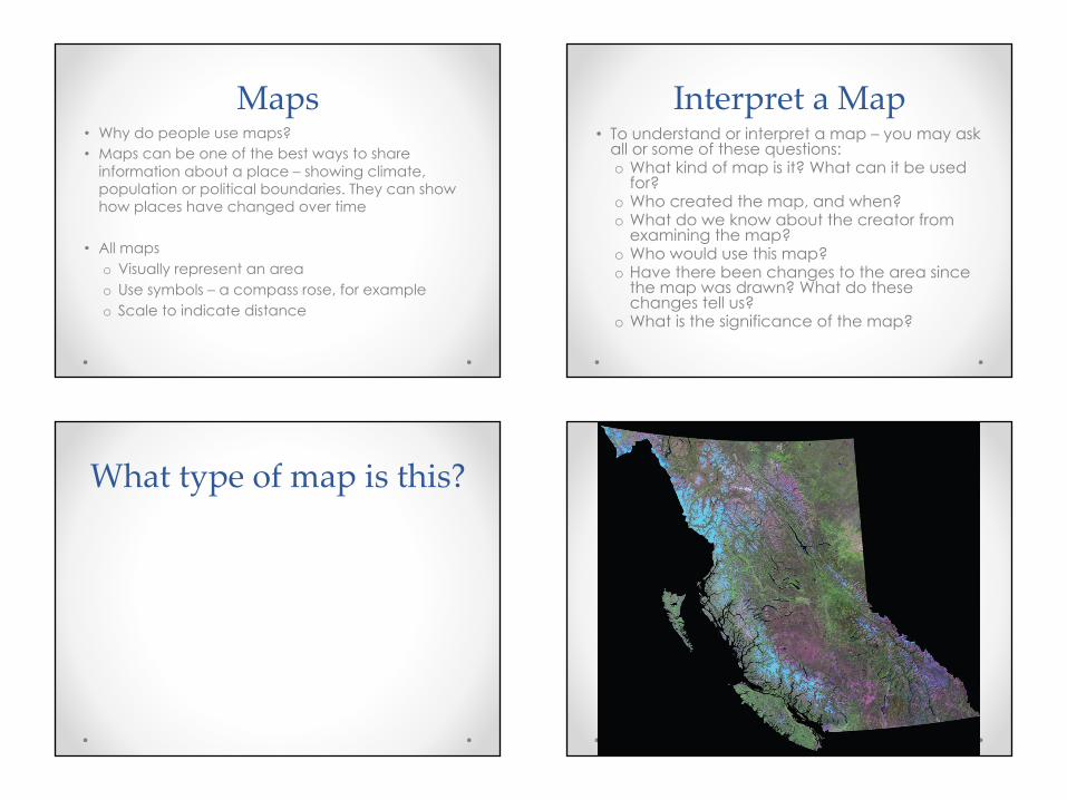
• Can you point out any regions from this satellite image of BC?

Types of Regions: Movement• How do people interact with each
other in the 21st century?
• Ideas, People and Objects can move very quickly in the 21st century.
• How and why?
Human / Environment Interaction
• The interactions between humans and the environment
• Geographers ask:o How do dams, roads, industry, and housing
developments change an environment?o How have land use choices affected our ability
to buy food grown near our homes?o How has information technology changed where
people work?o How does the moving of an industrial plant from
one community to another affect the people in those two communities?
Questions:• Summarize the main idea from each of the
five themes of geography
• Brainstorm a list of the ways people (from the past until today) have affected the landscape of our local area.o What are the long term and short term
effects of these activities on the environment?
Maps• Why do people use maps?• Maps can be one of the best ways to share
information about a place – showing climate, population or political boundaries. They can show how places have changed over time
• All maps o Visually represent an areao Use symbols – a compass rose, for exampleo Scale to indicate distance
Interpret a Map• To understand or interpret a map – you may ask
all or some of these questions:o What kind of map is it? What can it be used
for?o Who created the map, and when?o What do we know about the creator from
examining the map?o Who would use this map?o Have there been changes to the area since
the map was drawn? What do these changes tell us?
o What is the significance of the map?
What type of map is this?

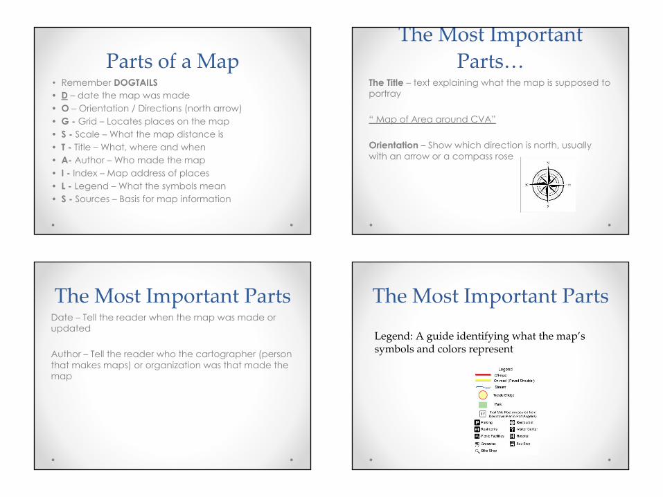
Parts of a Map• Remember DOGTAILS• D – date the map was made• O – Orientation / Directions (north arrow)• G - Grid – Locates places on the map• S - Scale – What the map distance is• T - Title – What, where and when• A- Author – Who made the map• I - Index – Map address of places• L - Legend – What the symbols mean• S - Sources – Basis for map information
The Most Important Parts…
The Title – text explaining what the map is supposed to portray
“ Map of Area around CVA”
Orientation – Show which direction is north, usually with an arrow or a compass rose
The Most Important PartsDate – Tell the reader when the map was made or updated
Author – Tell the reader who the cartographer (person that makes maps) or organization was that made the map
The Most Important Parts
Legend: A guide identifying what the map’s symbols and colors represent

The Most Important PartsScale: This shows the relationship between distance on a map and actual distance on the earth
Types of Scales:
Verbal Words One centimeter equals one kilometer
Number Ratio or fraction 1:63, 3:60Graphic Divided bar or
line (like a ruler) showing miles or kilometers
0 500 kilometers
Small Scale and Large Scale Maps
A Small Scale Map:
A map that shows a large area in not much details (ie. A map of the world)
A Large Scale Map:A map that shows a small area in a lot of detail (ie. A map of a neighbourhood)
Activity1. Draw a map of your school and its surroundings• You can choose to make a SMALL SCALE or a
LARGE SCALE map• Use different sources of information to construct
your map • Include all of “The Most Important Parts” on your
map
2. On a separate piece of paper – Look at the 5 themes of geography – how can maps be used to study each theme?