Embed Size (px)
Citation preview

WHINBERRY VIEW
RAWTENSTALL
FLOOD RISK ASSESSMENT
For BE Boys Todd Carr Road Waterfoot Rossendale Lancashire BB4 9SJ
October 2014

Whinberry View, Rawtenstall Flood Risk Assessment
FRA237 ‐ Flood Risk Assessment ‐ ii ‐
This page has been intentionally left blank

Whinberry View, Rawtenstall Flood Risk Assessment
FRA237 ‐ Flood Risk Assessment ‐ iii ‐
WHINBERRY VIEW RAWTENSTALL
FLOOD RISK ASSESSMENT
Document Tracking Sheet Document Reference: FRA237
Revision: 2.3
Date of revision: October 2014
Report status: Final
Prepared by: ____________________________________ Christopher Pickles
Engineering Technician
Checked by: ____________________________________ Richard Nicholas BEng (Hons) MBA Associate
Authorised by: ____________________________________
Robert Ankers Director
Revision History: Rev.: Date: Status: Prepared by: Checked by: Issued by: 2.3 24 October 2014 Final CP RDN CP 2.2 14 July 2014 Final CP MDP CP 2.1 10 July 2014 Final CP MDP CP 2.0 08 November 2013 Final RDN MDP RDN 1.0 24 October 2013 Draft CP/RDN JC RDN

Whinberry View, Rawtenstall Flood Risk Assessment
FRA237 ‐ Flood Risk Assessment ‐ iv ‐
This page has been intentionally left blank

Whinberry View, Rawtenstall Flood Risk Assessment
FRA237 ‐ Flood Risk Assessment ‐ v ‐
EXECUTIVE SUMMARY This Flood Risk Assessment was commissioned by BE Boys, referred to hereafter as ‘the client’. This Flood Risk Assessment has been prepared to support the detailed planning application for the construction of 29no. residential dwellings complete with access, external works, footpaths, car parking, external lighting, landscaping, boundary walls, fencing, external services and drainage; in addition this report satisfies the mandatory requirements of the Code for Sustainable Homes.
The Environment Agency’s flood mapping data identifies that the site is located within Flood Zone 1. The residential nature of the development proposals means the classification of the site is ‘more vulnerable’ from the NPPF Table 2 and this is considered an appropriate development type within Flood Zone 1. The Flood Risk Assessment has reviewed all sources of flood risk to both the proposed development and to the existing adjacent development as a result of the proposals, including; fluvial, tidal, pluvial, groundwater, sewers and flooding from artificial sources. The development is accessible for emergency access and egress during times of extreme flooding as the 100 year floodplain does not extend into the proposed development area. In light of the relatively low flood risk from all of the sources reviewed the principle focus of the Flood Risk Assessment is on the effective management of surface water drainage. Based on the ground conditions identified, it can be considered that infiltration drainage is unlikely to be able to provide a suitable means of surface water disposal for the flows generated by the proposed development. At present it is understood that the site positively drained to the public sewer network and it is proposed that this continue; but at a reduced rate of discharge mimicking the pre‐development rates. The maximum allowable rate of discharge and the drainage strategy has been agreed with United Utilities. This report has been prepared in consultation with the relevant interested parties and incorporates their comments where possible. The Flood Risk Assessment is considered to be commensurate with the development proposals and in summary, the development can be considered appropriate in accordance with the NPPF.
Whinberry View, Rawtenstall Flood Risk Assessment
FRA237 ‐ Flood Risk Assessment ‐ vi ‐
CONTENTS Document Tracking Sheet .............................................................................................................. iii
EXECUTIVE SUMMARY ................................................................................................................. v
Figures & Tables .............................................................................................................................. 7 Specialist Software .......................................................................................................................... 7 Abbreviations & Acronyms ............................................................................................................... 7
1.0 INTRODUCTION .................................................................................................................. 8
1.1 Planning Policy Context ....................................................................................................... 8 1.2 Site Context .......................................................................................................................... 8 1.3 Consultation ......................................................................................................................... 8
2.0 EXISTING SITE SITUATION ............................................................................................... 9
2.1 Location ................................................................................................................................ 9 2.2 Existing and Historical Land Use ......................................................................................... 9 2.3 Topographical Survey .......................................................................................................... 9
3.0 DEVELOPMENT PROPOSALS ......................................................................................... 10
3.1 Nature of the development ................................................................................................. 10
4.0 SOURCES OF FLOOD RISK ............................................................................................. 11
4.1 Fluvial Flood Risk ............................................................................................................... 11 4.2 Tidal Flood Risk ................................................................................................................. 11 4.3 Artificial Sources of Flood Risk .......................................................................................... 12 4.4 Pluvial Flood Risk ............................................................................................................... 12 4.5 Groundwater Flood Risk .................................................................................................... 13 4.6 Sewer Flood Risk ............................................................................................................... 13 4.7 Strategic Flood Risk Assessment (SFRA) Information....................................................... 13 4.8 Historical and Anecdotal Flooding Information ................................................................... 13 4.9 Flood Risk Vulnerability Classification and Flood Zone Compatibility ................................ 14 4.10 Mitigation Measures ........................................................................................................... 14 4.11 Residual Risks ................................................................................................................... 14
5.0 SURFACE WATER MANAGEMENT ................................................................................. 15
5.1 Pre-development Surface Water Run-off ........................................................................... 15 5.2 Post-development Surface Water Run-off ......................................................................... 15 5.3 Sustainable Drainage Systems (SuDS) ............................................................................. 15 5.4 Methods of Surface Water Management ........................................................................... 16 5.5 Discharge via Infiltration ..................................................................................................... 16 5.6 Discharge to Watercourse .................................................................................................. 17 5.7 Discharge to Sewer ............................................................................................................ 17 5.8 Climate Change ................................................................................................................. 17
6.0 FOUL WATER MANAGEMENT ......................................................................................... 19
7.0 SUMMARY AND CONCLUSIONS ..................................................................................... 20
8.0 RECOMMENDATIONS ...................................................................................................... 21
BIBLIOGRAPHY & REFERENCES ............................................................................................... 22
APPENDIX A: LOCATION PLAN ........................................................................................... 23
APPENDIX B: TOPOGRAPHIC SURVEY ............................................................................. 25

Whinberry View, Rawtenstall Flood Risk Assessment
FRA237 ‐ Flood Risk Assessment ‐ vii ‐
APPENDIX C: PROPOSED PLANNING LAYOUT ................................................................ 27
APPENDIX D: EA FLOODING INFORMATION & CORRESPONDENCE ............................. 29
APPENDIX E: FEH CATCHMENT DATA & DESCRIPTORS ................................................ 31
APPENDIX F: NPPF TECHNICAL GUIDANCE EXTRACTS................................................. 33
APPENDIX G: WATER COMPANY RECORDS & CORRESPONDENCE ............................ 35
APPENDIX H: LA CORRESPONDENCE .............................................................................. 37
APPENDIX I: SURFACE WATER RUN-OFF CALCULATIONS ........................................... 39
APPENDIX J: IMPERMEABLE AREAS PLANS .................................................................... 41
APPENDIX K: SFRA INFORMATION .................................................................................... 43
APPENDIX L: STORMWATER STORAGE ESTIMATES ...................................................... 45
APPENDIX N: NOTES OF LIMITATION ................................................................................ 47
Figures & Tables
Figure 1: Aerial Photograph of site (Google Earth 2013) .................................................................. 9
Figure 2: Planning Layout Extract (Nicol Thomas 2014) ................................................................. 10
Figure 3: Flood Zone Map Extract (Environment Agency 2013) ...................................................... 11
Figure 4: Reservoir Flood Map Extract (Environment Agency 2013) ............................................... 12
Specialist Software
Flood Estimation Handbook FEH CD‐ROM (v.3.0) – Determination of Catchment Descriptors and depths of rainfall
MicroDrainage WinDES (v.12.6.1) – Calculation of Greenfield run‐off rates IH124/ICP‐SUDS, Greenfield run‐off volumes, rates of rainfall and stormwater storage estimates
Abbreviations & Acronyms
AEP Annual Exceedance Probability mAOD Metres Above Ordnance Datum
BGL Below Ground Level NGR National Grid Reference
BGS British Geological Survey NPPF National Planning Policy Framework
CC Climate Change NSRI National Soils Resources Institute
EA Environment Agency OS Ordnance Survey
FEH Flood Estimation Handbook QSE Quick Storage Estimate
FRA Flood Risk Assessment RBC Rossendale Borough Council
FZ Flood Zone SFRA Strategic Flood Risk Assessment
Ha Hectare SuDS Sustainable Urban Drainage Systems
IDB Internal Drainage Board TWL Top Water Level
LCC Lancashire County Council UKCIP United Kingdom Climate Impacts Programme
LLFA Lead Local Flood Authority UU United Utilities
LPA Local Planning Authority

Whinberry View, Rawtenstall Flood Risk Assessment
FRA237 ‐ Flood Risk Assessment ‐ 8 ‐
1.0 INTRODUCTION
1.1 Planning Policy Context 1.1.1 All forms of flooding and their impact on the natural and built environment are material
planning considerations. The National Planning Policy Framework (NPPF) sets out the Government’s objectives for the planning system, and how planning should facilitate and promote sustainable patterns of development, avoiding flood risk and accommodating the impacts of climate change.
1.1.2 Government policy with respect to development in flood risk areas is contained within the NPPF
and the supporting Technical Guidance. 1.1.3 This Flood Risk Assessment satisfies the mandatory requirements of the Code for Sustainable
Homes.
1.2 Site Context 1.2.1 The Flood Risk Assessment has been prepared for the planning application but will also satisfy
the mandatory requirements of the Code SUR1; for the construction of 29no. residential dwellings complete with access, external works, footpaths, car parking, external lighting, landscaping, boundary walls, fencing, external services and drainage.
1.3 Consultation 1.3.1 The preparation of this report has been undertaken in consultation with the following interested
parties; Rossendale Borough Council (RBC), Lancashire County Council (LCC), the Environment Agency (EA) and United Utilities (UU).
1.3.2 The Local Planning Authority (LPA), Rossendale Borough Council, have been consulted as part of
the preparation of this report; RBC also acts as the Lead Local Flood Authority (LLFA). The NPPF advises that the LPA should consult with the Environment Agency who will provide advice and guidance on flood issues at a strategic level and in relation to planning applications.
1.3.3 The Environment Agency was contacted to discuss the nature and extent of information to be
provided in this Flood Risk Assessment (FRA) and for any background knowledge of flood risk specific to the site (correspondence is included in Appendix D).
1.3.4 United Utilities Developer Services were contacted to discuss whether UU have any historical
flooding issues in the area or any background knowledge on flood risk specific to the site (correspondence is included in Appendix G).
1.3.5 Rossendale Borough Council (RBC) and Lancashire County Council (LCC) were contacted to
discuss the nature and extent of information to be provided in this Flood Risk Assessment (FRA) and for any background knowledge of flood risk specific to the site (correspondence is included in Appendix H).

Whinberry View, Rawtenstall Flood Risk Assessment
FRA237 ‐ Flood Risk Assessment ‐ 9 ‐
2.0 EXISTING SITE SITUATION
2.1 Location 2.1.1 The development is accessed just off Whinberry View, Rawtenstall. The Ordnance Survey
National Grid Reference (OS NGR) for the site is 381966 (Easting), 422719 (Northing) and the nearest postcode is BB4 7PA. The site location plan is shown in Appendix A.
2.1.2 The site is bounded; to the north by undeveloped land, to the east by existing residential
development, to the south by Bacup Road and to the west by Co‐Operation Street with residential dwellings beyond.
2.1.3 The total site area is approximately 0.751ha, the site is considered to be 0.284ha (38%)
impermeable for the purposes of determining the pre‐development surface water run‐off.
Figure 1: Aerial Photograph of site (Google Earth 2013)
Aerial view of the proposed development area
2.2 Existing and Historical Land Use 2.2.1 The site was previously a care home and an aerial photograph is shown above in Figure 1.
2.3 Topographical Survey 2.3.1 The site falls from the northeast to the southwest. A full and detailed topographic survey is
included in appendix B.

Whinberry View, Rawtenstall Flood Risk Assessment
FRA237 ‐ Flood Risk Assessment ‐ 10 ‐
3.0 DEVELOPMENT PROPOSALS
3.1 Nature of the development 3.1.1 The development proposed is for the construction of 29no. residential dwellings complete with
access, external works, footpaths, car parking, external lighting, landscaping, boundary walls, fencing, external services and drainage.
3.1.2 The pertinent planning drawings are included in Appendix C; an extract of the development
proposal is shown in Figure 2 (below). 3.1.3 The total site area is approximately 0.751ha and pre‐development is considered to be 0.284ha
impermeable (38%); the proposed impermeable area of the development is approximately 0.449ha (60%) of the total site area.
Figure 2: Planning Layout Extract (Nicol Thomas 2014)

Whinberry View, Rawtenstall Flood Risk Assessment
FRA237 ‐ Flood Risk Assessment ‐ 11 ‐
4.0 SOURCES OF FLOOD RISK
4.1 Fluvial Flood Risk 4.1.1 Information relating to the flood risk at the site has been obtained from the Environment
Agency’s (EA) website and online Flood Map, an extract of which is shown in Figure 3 (below). 4.1.2 Examination of the Flood Map shows that the site is located within Flood Zone 1; Appendix D
shows the online flood map and statement in full.
Figure 3: Flood Zone Map Extract (Environment Agency 2013) 4.1.3 The EA provided water levels data from the River Irwell & Limy Water study (2011); the adjacent
node (ea0140IRWE_0386u) has modelled top water levels of 170.65mAOD and 172.20mAOD for the 1%AEP (1 in 100 year) and the 0.1%AEP (1 in 1000 year) storm events respectively. Review of the topographic survey shows that even the 0.1%AEP floodplain does not extent into the proposed development area. The lowest proposed Finished Floor level is 172.800mAOD (plots 19 and 20), this is significantly elevated relative to even the 0.1%AEP storm event.
4.2 Tidal Flood Risk 4.2.1 Due to the distance from the coast and estuarine waterways the risk of flooding from tidal
sources is considered low.
Legend; ______ Flood Zone 2 ______ Flood Zone 3
Proposed Development Location

Whinberry View, Rawtenstall Flood Risk Assessment
FRA237 ‐ Flood Risk Assessment ‐ 12 ‐
4.3 Artificial Sources of Flood Risk 4.3.1 The proposed development is indicated to be at flood risk from reservoirs on the EA’s online
Reservoir Flood Map; the extent of the flood risk from reservoirs is indicated by the green shading in Figure 4 (subsequent page).
4.3.2 It should be noted that the risk of catastrophic failure is considered to be very low, as the
reservoirs are such major United Utilities assets it is understood that there are appropriate maintenance regimes and regular reviews undertaken confirming integrity of the embankments.
Figure 4: Reservoir Flood Map Extract (Environment Agency 2013) 4.3.3 There are no canals within the immediate vicinity of the proposed development that present a
flood risk to the site.
4.4 Pluvial Flood Risk 4.4.1 Intense rainfall that is unable to soak into the ground or enter drainage systems can run‐off land
and result in flooding. Local topography and the land use can have a strong influence on the direction and depth of flow. Large catchment areas are particularly prone to this type of flooding. The volume and rate of overland flow from land can be exacerbated if development increases the percentage of impermeable area.
4.4.2 The topography of the development and surrounding area means there is little likelihood of
significant flows impacting on the proposed development or on land and property adjacent to the development. The only flows that are likely to be present on site are from direct rainfall on areas of hardstanding.
Proposed Development Location
Legend; ______ Reservoir Flood Risk
Whinberry View, Rawtenstall Flood Risk Assessment
FRA237 ‐ Flood Risk Assessment ‐ 13 ‐
4.4.3 Any overland flows generated by the proposed development must be carefully controlled; safe
avenues of overland flow away from the existing and proposed buildings are advised.
4.5 Groundwater Flood Risk 4.5.1 In general terms groundwater flooding can occur from three main sources: ‐ raised water tables,
seepage and percolation and groundwater recovery or rebound. 4.5.2 If groundwater levels are naturally close to the surface then this can present a flood risk during
times of intense rainfall. 4.5.3 Seepage and percolation occur where embankments above ground level hold water. In these
cases water travels through the embankment material and emerges on the opposite side of the embankment. At present there are no reported problems with groundwater flooding.
4.5.4 Groundwater recovery / rebound occurs where the water table has been artificially depressed
by abstraction. When the abstraction stops the water table makes a recovery to its original level. There is the potential for groundwater flooding in low lying areas where groundwater levels have been depressed below their pre‐pumping conditions, where these were at or close to ground level. As with the seepage scenario the likelihood of flooding from this source is low.
4.5.5 The EA’s online mapping data indicates that the site is at high groundwater vulnerability from a
minor aquifer. No historical groundwater flooding of the site has been identified during consultation with the various interested parties; however setting Finished Floor Levels a minimum of 150mm above the external levels following any re‐grade should mitigate any risk of flooding from this source.
4.6 Sewer Flood Risk 4.6.1 In urban areas, rainwater is frequently drained into surface water sewers or sewers containing
both surface and waste water known as ‘combined sewers’. Foul water flooding often occurs in areas prone to overland flow and can result when the sewer is overwhelmed by heavy rainfall and will continue until the water drains away. It can also occur when the sewer becomes blocked or is of inadequate capacity, this could lead to there being a high risk of internal property flooding with contaminated water.
4.6.2 Consultation with United Utilities and Lancashire County Council has not highlighted any
historical records of public sewer flooding of properties in the vicinity as a result of overloaded sewers.
4.7 Strategic Flood Risk Assessment (SFRA) Information 4.7.1 The SFRA indicates that the site is within Flood Zone 1; no specific flood risks to the proposed
development area have been identified.
4.8 Historical and Anecdotal Flooding Information 4.8.1 An Internet based search for flooding events did not recall any historical flooding in the
immediate site area.

Whinberry View, Rawtenstall Flood Risk Assessment
FRA237 ‐ Flood Risk Assessment ‐ 14 ‐
4.8.2 Consultation with various interested parties also failed to highlight any historical flooding to the
development area.
4.9 Flood Risk Vulnerability Classification and Flood Zone Compatibility 4.9.1 The development is ‘residential’ in its nature and as such is classified as ‘more vulnerable’ in
Table 1: Flood Risk Vulnerability Classification within the Technical Guidance to the National Planning Policy Framework, Table 2: Flood Risk Vulnerability and Flood Zone ‘Compatibility’ within the NPPF confirms that this type of land use is appropriate for Flood Zone 1.
4.10 Mitigation Measures 4.10.1 No specific flood risk mitigation measures are proposed as the development is located within
Flood Zone 1. 4.10.2 Setting Finished Floor Levels a minimum of 150mm above the external levels following any re‐
grade should mitigate any risk of flooding from a variety of sources. 4.10.3 As with any development it is advised that external levels fall away from property to minimise
the risk of internal flooding from a variety of sources. 4.10.4 As with any development overland flows generated by the proposed development must be
carefully controlled; safe avenues of overland flow away from any existing and proposed buildings are advised.
4.11 Residual Risks 4.11.1 The development is accessible for emergency access and egress during times of extreme
flooding as the 100 year floodplain does not extend into the proposed development. 4.11.2 Any overland flows generated by the proposed development must be carefully controlled; safe
avenues of overland flow away from the existing and proposed dwellings are advised. 4.11.3 As with any drainage system blockages within either the foul or surface water system have the
potential to cause flooding or disruption. It is important that should any drainage systems not be offered for adoption to either the Water Company or the Local Authority then an appropriate maintenance regime be scheduled with an appropriate management company for these private drainage systems.

Whinberry View, Rawtenstall Flood Risk Assessment
FRA237 ‐ Flood Risk Assessment ‐ 15 ‐
5.0 SURFACE WATER MANAGEMENT
5.1 Pre‐development Surface Water Run‐off 5.1.1 For the purposes of determining the existing rate of surface water run‐off the site is considered
to be Brownfield; the total area of the site is 0.751ha (hectares). 5.1.2 The surface water run‐off rates have been calculated using the Modified Rational Method and
rainfall catchment characteristics from the Flood Estimation Handbook (FEH), details of which are included Appendix E.
5.1.3 The existing impermeable area of site generates a peak run‐off rate of 39.4l/s based on an area
of 0.284ha and a rainfall intensity of 50mm/hr. 5.1.4 The approximate surface water run‐off volume generated by the total site area based on the 1 in
100 year return period storm event is 365.8m3; estimated using the FEH rainfall catchment characteristics (6hr duration event).
5.2 Post‐development Surface Water Run‐off 5.2.1 The residential nature of the development proposals means that there will be a slight increase in
the impermeable area of the site from 0.284ha to approximately 0.449ha, resulting in a slight increase in both the volume and the peak rate of surface water run‐off if flows are unrestricted.
5.2.2 The proposed impermeable area will be approximately 0.449ha, approximately 60% of the total
development area. 5.2.3 The approximate surface water run‐off volume generated by the impermeable area that is
positively drained, based on the 1 in 100 year return period storm event with a 30% allowance for climate change is 441.9m3; estimated using the FEH rainfall catchment characteristics (6hr duration event).
5.3 Sustainable Drainage Systems (SuDS) 5.3.1 In accordance with the NPPF, Sustainable Drainage Systems (SuDS) should be specified wherever
possible to manage surface water. This in turn reduces the burden downstream on both watercourses and sewerage systems.
5.3.2 SuDS have the ability to address three core objectives; water quantity, water quality and
amenity value. With the appropriate system specified, all three core objectives can be satisfied. Where possible, peak surface water discharge rates to watercourses and sewers should be reduced.
5.3.3 Preference should always be given to SuDS over the traditional methods of buried sewers
wherever possible and practical. Runoff from car parking areas and roads could be conveyed through swales, permeable pavements, bio‐retention areas and petrol interceptors to provide a degree of treatment before flows are carried to public sewers.

Whinberry View, Rawtenstall Flood Risk Assessment
FRA237 ‐ Flood Risk Assessment ‐ 16 ‐
5.3.4 Opportunities should be taken to provide soft landscaping where at all possible on site to assist in minimising surface water run‐off. Added benefits include biodiversity and visual enhancements.
5.3.5 The exact type of SuDS will be determined at the detailed design stage.
5.4 Methods of Surface Water Management 5.4.1 At present the site is predominantly Brownfield; the total site area is ha and is considered to be
38% impermeable (0.284ha). 5.4.2 The proposed impermeable area of the development is approximately 0.449ha of the total site
area, this equates to 60% of the total site area; of this only 0.255ha (34%) is domestic impermeable area the remainder is highway.
5.4.3 There are three methods that have been reviewed for the management and discharge of surface
water detailed below; these may be applied individually or collectively to form a complete strategy. They should be applied in the order of priority listed below.
Discharge via infiltration
Discharge to watercourse
Discharge to sewerage system
5.5 Discharge via Infiltration 5.5.1 Any impermeable areas that can drain to soakaway or an alternative method of infiltration
would significantly improve the sustainability of any surface water systems. 5.5.2 The British Geology Survey (BGS) mapping data indicates that ground conditions are as follows: ‐
1:50 000 scale bedrock geology description: Pennine Lower Coal Measures Formation ‐ Sandstone. Sedimentary Bedrock formed approximately 312 to 313 million years ago in the Carboniferous Period. Local environment previously dominated by swamps, estuaries and deltas. Setting: swamps, estuaries and deltas. These rocks were formed in marginal coastal plains with lakes and swamps periodically inundated by the sea; or estuaries and deltas, and shallow seas. 1:50 000 scale superficial deposits description: Till, Devensian ‐ Diamicton. Superficial Deposits formed up to 2 million years ago in the Quaternary Period. Local environment previously dominated by ice age conditions. Setting: ice age conditions. These rocks were formed in cold periods with Ice Age glaciers scouring the landscape and depositing moraines of till with outwash sand and gravel deposits from seasonal and post glacial meltwaters.
5.5.3 The National Soil Resources Institute (NSRI) identifies the soils in this location as; slowly permeable, seasonally wet, acid loamy and clayey soils. Drainage is considered to be impeded.
5.5.4 Based on the ground conditions identified, it can be considered that infiltration drainage is
unlikely to provide a suitable means of surface water disposal for the flows generated by the proposed development. If infiltration is to be pursued as a possible method of surface water

Whinberry View, Rawtenstall Flood Risk Assessment
FRA237 ‐ Flood Risk Assessment ‐ 17 ‐
drainage then further investigation is advised, with soakaway testing to BRE365 in specific locations where infiltration may be feasible.
5.6 Discharge to Watercourse 5.6.1 There is no watercourse within close proximity to the development that would provide a
suitable outfall from the proposed development.
5.7 Discharge to Sewer 5.7.1 At present the surface water run‐off generated by the site is understood to discharge to the
adjacent UU public sewer network. A copy of United Utilities sewer records is included in Appendix G.
5.7.2 It is proposed that if infiltration is not viable then discharge of the surface water run‐off
generated by the proposed development should continue to be discharged to the watercourse mimicking the pre‐development rates of run‐off.
5.7.3 As the surface water run‐off is being increased as a result of the introduction of increased
impermeable areas, it is necessary to restrict the post‐development rate of run‐off to the pre‐development greenfield rate of run‐off for all storm events up to and including the 100 year event.
5.7.4 The pre‐development annual peak rate of discharge is calculated to be 14.9l/s using the
Modified Rational method for the impermeable areas (using FEH rainfall characteristics). 5.6.5 The pre‐development 100 year return period peak rate of discharge is calculated to be 39.4l/s
using the Modified Rational method for the impermeable areas (based on 50mm/hr). 5.6.6 United Utilities have agreed the drainage design principles and confirmed that the maximum
allowable rate of surface water discharge is 31.4l/s. 5.6.7 Restricting the rate of surface water discharge can be achieved using a Hydrobrake® or similar
approved product. 5.6.8 Restricting the rate of discharge for the surface water generates a storage requirement during
the extreme rainfall events. For the annual storm event storage requirements are estimated to be between 13 and 32cu.m when restricting flows to 14.9l/s. During the 100 year return period storm event with an allowance of 30% to account for climate change the storage requirements are estimated to be between 140 and 228cu.m when restricting flows to 31.4l/s.
5.6.9 The stormwater storage figures quoted above are estimates only and the detailed drainage
design will determine with accuracy the stormwater storage requirements. This attenuated volume of stormwater could be stored within a pond or within tank sewers (over‐sized pipes).
5.8 Climate Change 5.8.1 There are indications that the climate in the UK is changing significantly and it is widely believed
that the nature of climate change will vary greatly by region. Current expert opinion indicates

Whinberry View, Rawtenstall Flood Risk Assessment
FRA237 ‐ Flood Risk Assessment ‐ 18 ‐
the likelihood that future climate change would produce more frequent short duration and high intensity rainfall events with the addition of more frequent periods of long duration rainfall.
5.8.2 The NPPF Technical Guidance Table 5 states that the recommended national precautionary
sensitivity ranges for increase of peak rainfall intensity is 30% until 2115. It is widely believed that the impact of climate change means there is likely to be a long term increase in the average sea levels, with an expectation that sea levels will rise gradually.
5.8.3 An increase in flood water levels means that future flooding events will occur more frequently and will have a greater impact.
5.8.4 Any increase in the level of flood risk to the proposed development from climate change is likely
to be related to the increase in rainfall intensity and duration and its impact upon the surface water drainage system.
5.8.5 Climate Change should be accounted for within the design and it is recommended that an
increase in peak rainfall intensity of 30% is allowed for.

Whinberry View, Rawtenstall Flood Risk Assessment
FRA237 ‐ Flood Risk Assessment ‐ 19 ‐
6.0 FOUL WATER MANAGEMENT 6.1 At present any foul water flows from the site are understood to discharge to the public sewer
network and it is proposed that this be continued. 6.2 Based on the proposals for the construction of up to 29no. residential apartments the
approximate peak foul water flows generated by the residential development are approximately 1.1l/s. This is based on 4000 litres per dwelling per 24 hours; the guidance contained within Sewers for Adoption (SfA).
6.3 It is proposed that the foul water generated by the development continue to discharge to the
public sewer network, this has been agreed in principle with United Utilities. A copy of the sewer records and correspondence is included in Appendix G.

Whinberry View, Rawtenstall Flood Risk Assessment
FRA237 ‐ Flood Risk Assessment ‐ 20 ‐
7.0 SUMMARY AND CONCLUSIONS 7.1 The Flood Risk Assessment has been prepared for the planning application but will also satisfy
the mandatory requirements of the Code SUR1; for the construction of 29no. residential dwellings complete with access, external works, footpaths, car parking, external lighting, landscaping, boundary walls, fencing, external services and drainage.
7.2 The preparation of this report has been undertaken in consultation with the following interested
parties; Rossendale Borough Council, Lancashire County Council the Environment Agency and United Utilities.
7.3 The residential nature of the development proposals means the classification of the site is ‘more
vulnerable’ from the NPPF Table 2 and this is considered an appropriate development type within Flood Zone 1.
7.4 The Flood Risk Assessment (FRA) has reviewed all sources of flood risk to both the proposed
development and to the existing adjacent development as a result of the proposals, including; fluvial, tidal, pluvial, groundwater, sewers and flooding from artificial sources.
7.5 An Internet based search for flooding events did not recall any historical flooding in the
immediate site area. Consultation with United Utilities, Rossendale Borough Council, Lancashire County Council and the Environment Agency has not highlighted any historical records of flooding in the vicinity of the proposed development.
7.6 As a result of the relatively low flood risk from all of the sources reviewed, the principle focus of
the Flood Risk Assessment is on the effective management of surface water drainage. 7.7 Based on the ground conditions identified, it can be considered that infiltration drainage is
unlikely to be able to provide a suitable means of surface water disposal for the flows generated by the proposed development. It may be possible to use infiltration as a part solution; however soakaway testing to BRE365 in specific locations where this may be practical will be required to determine feasibility.
7.8 At present it is understood that the site positively drained to the public sewer network and it is
proposed that this continue; rates and volume of discharge will be restricted to pre‐development rates and the drainage strategy has been agreed with United Utilities.
7.9 The development is accessible for emergency access and egress during times of extreme
flooding as the 100 year floodplain does not extend into the proposed development area. 7.10 As with any drainage system blockages within either the foul or surface water sewer systems
have the potential to cause flooding or disruption. 7.11 The Flood Risk Assessment is considered to be commensurate with the development proposals
and in summary, the development can be considered appropriate in accordance with the NPPF.

Whinberry View, Rawtenstall Flood Risk Assessment
FRA237 ‐ Flood Risk Assessment ‐ 21 ‐
8.0 RECOMMENDATIONS 8.1 Opportunities should be taken to provide soft landscaping where at all possible on site to assist
in minimising surface water run‐off. Added benefits include biodiversity and visual enhancements.
8.2 Any overland flows generated by the proposed development must be directed away from
residential properties; safe avenues of overland flow are advised. 8.3 It is proposed that surface water flows generated by the development continue to discharge to
the existing public sewer network.

Whinberry View, Rawtenstall Flood Risk Assessment
FRA237 ‐ Flood Risk Assessment
BIBLIOGRAPHY & REFERENCES CIRIA 522: Sustainable urban drainage systems – design manual for England and Wales (2000). CIRIA 523: Sustainable urban drainage systems – best practice manual (2001). CIRIA 609: Sustainable drainage systems. Hydraulic, structural and water quality advice (2004). CIRIA 624: Development and flood risk – guidance for the construction industry (2004). CIRIA 635: Designing for exceedance in urban drainage: Good practice (2006). CIRIA 644: Building Greener (2007). CIRIA 697: The SUDS manual (2007). Flood Risk to People – Phase 2 (FD2321/TR2), DEFRA and the Environment Agency (2006). Flood estimation for small catchments: Institute of Hydrology Report No.124, NERC (1994). Flood Estimation Handbook, Centre for Ecology and Hydrology (1999). National Planning Policy Framework (NPPF), CLG (2012). Planning Policy Statement 25: Development and Flood Risk (2006). Sewers for Adoption 7th Edition, WRc (2012). Technical Guidance to the National Planning Policy Framework, CLG (2012).
Web‐based references Bingmaps – http://www.bing.com/Maps/ British Geological Survey – http://www.bgs.ac.uk/opengeoscience/home.html Chronology of British Hydrological Events – www.dundee.ac.uk/ CIRIA – http://www.ciria.org/ Cranfield University – http://www.landis.org.uk/soilscapes/ Environment Agency – www.environment‐agency.gov.uk/ FloodProBE – http://www.floodprobe.eu/ Flood Forum – http://www.floodforum.org.uk/ Flood London – http://www.floodlondon.com/ Flood Resilience Group – http://www.floodresiliencegroup.org/frg/ Google Maps – http://maps.google.co.uk/ London Resilience – http://www.londonprepared.gov.uk/ Shire Group of IDB’s – http://www.shiregroup‐idbs.gov.uk/default.asp Streetmap – http://www.streetmap.co.uk/ US Army Corps of Engineers – http://www.hec.usace.army.mil/software/hec‐ras/ United Utilities – http://www.unitedutilities.com/default.aspx Watertight International – http://www.watertightinternational.com/

Whinberry View, Rawtenstall Flood Risk Assessment
FRA237 ‐ Flood Risk Assessment
APPENDIX A: LOCATION PLAN
This page has been left intentionally blank

LOCATION PLAN
Whinberry View, Rawtenstall
OS X (Eastings) 381966 OS Y (Northings) 422719 Nearest Post Code BB4 7PA Lat (WGS84) N53:42:02 (53.700591) Long (WGS84) W2:16:29 (-2.274633) LR SD819227 mX -253211 mY 7079192

Whinberry View, Rawtenstall Flood Risk Assessment
FRA237 ‐ Flood Risk Assessment
APPENDIX B: TOPOGRAPHIC SURVEY
This page has been left intentionally blank

1
7
1
.7
2
1
7
1
.8
5
1
7
1
.9
1
1
7
2
.0
5
1
7
2
.
0
8
1
7
2
.
1
5
1
7
2
.1
3
1
7
2
.
2
5
1
7
2
.
3
7
1
7
2
.
4
5
1
7
2
.
6
7
1
7
2
.
8
2
1
7
2
.
9
3
1
7
3
.
0
6
173.1
6
1
7
3
.
2
1
1
7
3
.
3
1
173.2
6
1
7
3
.
2
0
1
7
2
.
9
5
1
7
2
.
9
0
1
7
2
.
8
1
1
7
2
.5
6
1
7
2
.
4
0
1
7
2
.4
1
1
7
2
.2
5
1
7
2
.
2
2
1
7
2
.
1
3
1
7
2
.1
5
1
7
2
.0
7
1
7
1
.9
8
1
7
1
.8
6
1
7
1
.8
9
1
7
1
.9
6
1
7
2
.1
6
1
7
2
.1
8
1
7
2
.1
6
1
7
1
.1
8
1
7
1
.1
8
1
7
1
.5
5
1
7
1
.9
9
IC
IC
CL171.64
CL172.08
FL172.22
172.16
172.03
1
7
1
.8
9
1
7
2
.0
1
1
7
2
.0
4
1
7
2
.0
2
WS
T
FH
GS
T
RS
BO
L
CT
V
CT
V
CB
BO
L
CT
V
FL172.30
IC
CL172.12
G
171.86
GS
T
WS
T
CT
V
1
7
1
.8
1
IC
CL172.07
PT
IC
CL172.01
BO
L
BO
L
GS
T
BS
1
7
2
.1
3
1
7
1
.5
4
1
7
1
.0
7
1
7
1
.3
8
1
7
1
.0
5
1
7
1
.
6
4
1
7
2
.
3
2
172.60
1
7
2
.5
2
1
7
2
.4
3
1
7
1
.9
2
1
7
1
.7
5
1
7
1
.
9
7
1
7
2
.4
3
1
7
2
.5
6
1
7
2
.6
9
1
7
2
.
8
8
1
7
2
.
9
9
1
7
3
.1
6
1
7
3
.3
1
1
7
3
.
1
3
1
7
3
.
0
2
1
7
2
.8
6
1
7
2
.6
5
1
7
2
.5
3
1
7
2
.2
0
1
7
1
.9
8
1
7
2
.0
5
1
7
2
.3
5
1
7
2
.
6
5
1
7
2
.
9
0
1
7
2
.
9
4
1
7
3
.
0
0
1
7
3
.0
5
173.12
173.29
173.34
173.21
173.12
1
7
3
.2
2
173.63
LP
173.08
173.05
172.80
RS
BT
CB
LP
CB
G
RS
G2.2
PT
MH
CL172.62
BT
MH
CL172.20
MH
CL172.21
CT
V
G
172.07
GS
T
MH
CL171.83
1
7
1
.8
8
1
7
2
.0
1
1
7
2
.1
5
1
7
2
.2
7
1
7
2
.3
9
1
7
3
.
2
1
1
7
3
.
1
2
1
7
2
.
8
8
1
7
2
.
7
7
1
7
2
.
6
2
1
7
2
.
5
2
1
7
2
.4
5
1
7
2
.
3
7
1
7
2
.
3
8
1
7
2
.
4
3
1
7
2
.
4
9
1
7
2
.
6
4
1
7
2
.
8
2
1
7
3
.
0
2
1
7
3
.
2
6
1
7
2
.
4
7
1
7
2
.
5
3
1
7
2
.
6
1
1
7
2
.
7
4
1
7
2
.
9
2
1
7
3
.
1
2
1
7
3
.
3
7
1
7
3
.
3
3
1
7
3
.
2
2
1
7
3
.
0
1
1
7
2
.
8
8
1
7
2
.
7
3
1
7
2
.6
3
1
7
2
.
5
5
1
7
2
.
4
8
TB
RS
MH
CL172.81
1
7
3
.
2
4
1
7
3
.
2
7
1
7
3
.3
2
173.33
1
7
3
.3
5
1
7
3
.3
7
1
7
3
.3
9
1
7
3
.
3
6
1
7
3
.
2
8
1
7
3
.
2
0
1
7
2
.
9
8
1
7
2
.
7
8
1
7
2
.
6
0
1
7
2
.
4
9
1
7
2
.
4
0
1
7
2
.
3
4
1
7
2
.
2
7
1
7
2
.
2
5
172.31
1
7
2
.
3
8
1
7
2
.
5
4
1
7
2
.
7
3
1
7
2
.
9
4
1
7
3
.
1
4
1
7
3
.
3
2
1
7
3
.
3
5
1
7
3
.
4
1
1
7
3
.5
3
1
7
3
.
5
6
1
7
3
.
7
3
1
7
3
.
8
1
1
7
3
.
9
2
1
7
3
.9
8
1
7
4
.
0
7
1
7
4
.
0
9
1
7
4
.
1
5
1
7
4
.
1
7
1
7
4
.2
1
174.15
1
7
4
.1
6
1
7
4
.2
3
174.2
5
1
7
4
.2
6
1
7
4
.
2
6
1
7
4
.
2
3
1
7
4
.
1
5
1
7
4
.
1
7
1
7
4
.1
0
1
7
4
.
0
1
1
7
3
.
9
3
1
7
3
.
7
9
1
7
3
.
6
6
1
7
3
.6
2
1
7
3
.
4
8
1
7
3
.
4
4
1
7
3
.
4
1
1
7
3
.
2
2
1
7
3
.
0
2
1
7
2
.
8
2
1
7
2
.
6
4
1
7
2
.
4
6
172.41
1
7
2
.
3
5
1
7
2
.
3
8
1
7
2
.
4
5
1
7
2
.
5
1
1
7
2
.
5
9
1
7
2
.
7
2
1
7
2
.
9
0
1
7
3
.
1
0
1
7
3
.
3
1
1
7
3
.
4
9
1
7
3
.
6
8
1
7
3
.7
2
1
7
3
.7
0
1
7
3
.6
7
1
7
3
.5
2
1
7
3
.
4
4
1
7
3
.
3
4
1
7
3
.
3
1
1
7
2
.
9
6
1
7
2
.
8
6
1
7
2
.7
5
1
7
2
.
7
8
1
7
2
.
6
5
1
7
2
.
5
8
1
7
2
.
4
2
1
7
2
.4
4
1
7
2
.
4
7
1
7
2
.
6
4
1
7
2
.
8
2
1
7
3
.
0
7
1
7
3
.
1
3
1
7
3
.1
2
1
7
3
.
1
2
1
7
3
.
1
2
G
G
173.14
172.76
BT
TP
G2.5
G2.0
G3.7
IC
CL173.55
IC
CL173.31
NP
LP
G
172.46
RS
NP
CB
CT
V
BT
NP
172.61
172.69
173.08
173.14
173.28
173.55
G1.0
G1.4
MG
G1.3
IC
CL173.83
172.8
0
1
7
2
.
7
9
1
7
3
.
0
6
1
7
3
.
2
9
1
7
3
.
4
1
1
7
3
.
6
0
1
7
3
.
8
7
1
7
4
.
0
6
1
7
3
.
5
7
1
7
3
.
4
4
1
7
3
.
3
2
1
7
3
.
1
4
1
7
2
.9
4
1
7
2
.
7
4
1
7
2
.
5
4
1
7
2
.
1
6
1
7
2
.
6
5
IC
CL172.66
1
7
3
.
9
7
1
7
4
.
1
0
1
7
4
.1
2
DR
DR
DR
DR
DR
1
7
4
.
1
5
1
7
4
.
1
5
1
7
4
.
1
4
1
7
3
.
5
0
1
7
3
.
0
5
1
7
3
.
4
7
173.45
1
7
3
.
3
1
1
7
3
.
3
0
1
7
3
.
6
3
173.65
173.25
1
7
3
.
2
8
1
7
3
.
6
6
1
7
4
.
0
7
1
7
3
.
3
0
1
7
3
.
0
5
173.0
0
1
7
3
.
0
4
1
7
3
.
0
0
1
7
2
.
9
0
172.8
7
1
7
2
.
9
0
1
7
2
.
8
9
1
7
2
.
7
8
1
7
3
.
8
2
(174.00)
1
7
4
.
1
2
1
7
4
.
1
3
IC
CL174.08
IC
CL173.93
173.80
G1.8
G1.2
G1.7
G1.4
GS
V
(173.55)
BE
NC
H
1
7
2
.
8
1
1
7
2
.
8
1
1
7
2
.
8
0
1
7
2
.8
0
MG
BT
1
7
2
.
8
4
1
7
2
.
9
8
1
7
3
.
0
7
1
7
3
.1
2
1
7
3
.1
6
1
7
3
.2
4
172.9
4
172.92
1
7
3
.0
0
1
7
2
.
9
6
1
7
2
.
8
5
172.9
0
1
7
2
.
8
6
DR
G
173.72
IC
CL173.93
G
173.76
1
7
3
.
8
4
1
7
2
.
4
0
1
7
2
.
4
8
1
7
2
.
7
6
1
7
2
.
8
4
172.90
1
7
2
.
9
5
1
7
2
.
9
8
1
7
3
.0
2
1
7
3
.
0
6
1
7
3
.
1
3
1
7
3
.
2
3
1
7
3
.3
3
WS
T
WS
T
FH
DR
1
7
3
.
2
8
1
7
3
.
1
1
1
7
2
.
9
8
1
7
2
.
8
1
1
7
2
.
6
0
1
7
2
.
4
3
1
7
2
.
1
2
1
7
2
.
1
2
FH
FH
WS
V
WS
T
G
LP
RS
PB
G
172.17
WS
T
WS
T
WS
T
WS
T
WS
T
WS
T
DR
G
172.57
WS
T
WS
T
WS
T
G
172.89
WS
T
G
G
173.16
172.77
LP
IC
CL172.71
LP
WS
T
WS
T
IC
CL173.37
1
7
3
.
2
6
1
7
3
.
2
0
1
7
3
.
1
4
1
7
3
.
1
1
1
7
3
.
0
8
1
7
3
.
2
1
1
7
3
.
0
4
1
7
3
.
0
2
1
7
3
.2
0
1
7
2
.9
7
1
7
3
.
1
8
1
7
2
.
9
1
1
7
2
.
9
0
1
7
2
.
8
4
1
7
3
.
0
2
1
7
2
.
8
3
1
7
2
.
7
8
1
7
2
.
8
6
1
7
2
.
8
3
1
7
2
.
8
0
1
7
2
.
6
9
1
7
2
.
7
2
1
7
2
.
6
7
1
7
2
.
6
2
1
7
2
.
6
0
1
7
2
.
6
1
1
7
2
.
6
0
1
7
2
.
5
1
1
7
2
.
5
9
EA
VE
S
178.32
RID
GE
181.76
EA
VE
S
179.16
RID
GE
182.66
EA
VE
S
EA
VE
S
EA
VE
S
EA
VE
S
EA
VE
S
174.40
174.26
174.08
174.37
174.26
(173.57)
(173.28)
(173.43)
(173.56)
(173.64)
(173.92)
O
T
O
T
O
T
O
T
O
T
OT
OT
O
T
O
T
O
T
O
T
O
T
O
T
O
T
O
T
O
T
O
T
O
T
O
T
O
T
O
T
O
T
(176.25)
RID
GE
178.72
EA
VE
S
176.91
RID
GE
184.61
RID
GE
184.30
EA
VE
S
181.71
EA
VE
S
178.62
RID
GE
181.64
1
7
2
.
1
9
1
7
2
.
1
4
1
7
3
.
1
3
1
7
3
.
1
0
1
7
2
.
9
1
1
7
2
.
6
5
1
7
2
.
6
0
1
7
2
.
0
9
1
7
1
.9
8
1
7
1
.9
9
1
7
2
.1
1
1
7
2
.
1
2
1
7
2
.
1
5
1
7
2
.
2
2
1
7
2
.
2
4
1
7
2
.
3
1
1
7
2
.
3
4
1
7
2
.
4
2
1
7
2
.
5
2
1
7
2
.
5
4
1
7
2
.
6
8
1
7
2
.
7
0
1
7
2
.
7
0
1
7
2
.
6
4
1
7
2
.
4
9
1
7
2
.
3
9
1
7
2
.
2
6
1
7
2
.
1
3
1
7
2
.
0
0
1
7
1
.
8
2
1
7
1
.7
6
1
7
1
.8
6
1
7
1
.
8
5
1
7
2
.
0
7
1
7
2
.
1
9
1
7
2
.
3
2
1
7
2
.
4
7
1
7
2
.
5
8
1
7
2
.
6
9
1
7
2
.6
8
1
7
2
.
5
7
1
7
2
.
4
6
1
7
2
.
2
0
1
7
2
.0
7
1
7
1
.7
7
1
7
2
.
7
1
1
7
2
.
5
5
1
7
2
.
4
3
1
7
2
.
3
1
1
7
2
.
2
1
1
7
2
.
1
1
1
7
1
.
9
5
1
7
1
.
8
7
1
7
1
.9
1
1
7
2
.0
1
1
7
2
.1
21
7
2
.
2
4
1
7
2
.
3
2
1
7
2
.
3
9
1
7
2
.
5
3
1
7
2
.6
9
1
7
2
.
7
6
1
7
2
.
9
0
1
7
3
.
1
1
1
7
3
.
2
1
1
7
3
.
2
0
1
7
3
.
2
8
1
7
3
.
4
1
1
7
3
.
3
7
1
7
3
.
4
6
1
7
3
.
5
7
1
7
3
.
7
5
WS
T
G
CT
V
G
G
171.95
171.88
CT
V
CT
V
CT
V
CT
V
MH
CL172.34
G
G
172.27
172.30
CT
V
CT
V
LP
CT
V
172.51
EA
VE
S
EA
VE
S
178.86
178.94
(173.01)
(172.86)
(172.72)
(172.74)
(172.60)
DR
BE
NC
H
BE
NC
H
(173.71)
RS
RS
1
7
4
.
1
6
1
7
4
.
1
6
1
7
4
.
1
5
1
7
3
.
4
4
1
7
3
.
2
2
1
7
3
.
0
8
1
7
3
.
2
1
BT
LP
CT
V
IC
CL173.22
1
7
3
.
1
8
1
7
3
.
1
9
1
7
3
.
1
6
1
7
3
.
1
9
1
7
3
.
1
7
1
7
3
.
2
6
BT
G1.4
G1.1
IC
CL173.27
IC
CL173.24
DR
IC
CL173.24
PT
DR
FL173.40
1
7
3
.
2
1
1
7
3
.
1
2
1
7
3
.1
8
1
7
3
.
1
3
1
7
2
.
9
8
1
7
3
.
2
9
1
7
3
.
2
1
1
7
3
.
1
5
MG
G
172.15
G
172.29
1
7
3
.
6
6
1
7
3
.
7
0
1
7
3
.
8
2
1
7
4
.
6
1
1
7
5
.
4
1
1
7
6
.
0
2
176.02
1
7
6
.
0
9
1
7
5
.
5
2
1
7
4
.
7
2
1
7
3
.
9
0
1
7
3
.
7
9
1
7
3
.
6
8
1
7
4
.
1
3
1
7
4
.
6
9
1
7
5
.
5
0
175.99
176.25
1
7
6
.5
3
1
7
7
.
9
3
1
7
7
.
6
7
1
8
2
.
0
6
MG
MG
MG
EA
VE
S
179.46
RID
GE
182.08
RID
GE
184.61
EA
VE
S
182.00
EA
VE
S
178.59
RID
GE
179.76
1
7
6
.
2
3
1
7
2
.
6
3
1
7
2
.
5
0
1
7
2
.
3
8
1
7
2
.
2
9
1
7
2
.
1
7
1
7
2
.
0
3
1
7
1
.
8
8
1
7
1
.
7
8
1
7
1
.8
1
1
7
1
.
9
0
1
7
2
.0
2
1
7
2
.
1
5
1
7
2
.
2
8
1
7
2
.
3
6
1
7
2
.
5
0
1
7
2
.
6
0
1
7
2
.
7
1
1
7
2
.
8
5
1
7
3
.
0
0
1
7
3
.
1
0
1
7
3
.
1
8
1
7
3
.
2
5
1
7
3
.
3
1
1
7
3
.
3
5
1
7
3
.
4
4
1
7
3
.
5
5
1
7
3
.
7
4
1
7
4
.
0
0
1
7
4
.
9
1
1
7
5
.
5
3
RID
GE
185.25
EA
VE
S
182.05
EA
VE
S
179.10
RID
GE
180.86
KO
173.28
LP
WS
T
1
7
3
.
2
2
1
7
3
.
1
9
1
7
3
.
2
1
MG
IC
CL173.22
1
7
3
.
3
4
1
7
3
.
1
9
1
7
3
.
1
4
1
7
3
.
2
4
1
7
3
.
3
4
1
7
3
.
3
6
1
7
3
.
3
3
1
7
3
.
2
8
1
7
3
.
2
4
IC
CL173.32
DR
1
7
3
.
4
0
1
7
3
.
4
1
1
7
3
.
3
4
(173.87)
DR
DR
DR
DR
DR
DR
IC
CL173.29
173.29
173.25
1
7
3
.1
9
1
7
3
.
2
2
1
7
3
.
3
4
1
7
3
.
4
5
1
7
3
.
3
3
1
7
3
.3
2
173.34
173.3
9
1
7
3
.
3
4
173.41
1
7
3
.
3
8
EA
VE
S
178.35
RID
GE
180.98
G
173.19
DR
IC
CL173.32
FL173.38
1
7
3
.
2
3
1
7
3
.
2
3
MG
1
7
4
.
1
0
1
7
3
.
8
5
1
7
3
.
5
8
1
7
3
.
6
0
1
7
3
.
3
8
1
7
3
.
3
6
1
7
3
.
3
3
1
7
3
.
2
3
IC
CL173.25
1
7
3
.2
5
G1.7
G1.5
173.60
173.51
173.38
1
7
4
.
4
7
1
7
4
.
4
1
1
7
6
.
3
8
1
7
5
.
4
4
1
7
6
.
0
0
1
7
6
.
7
9
173.50
RID
GE
RID
GE
RID
GE
183.04
181.60
180.73
EA
VE
S
EA
VE
S
EA
VE
S
177.02
177.65
179.02
1
7
3
.
2
1
1
7
3
.
2
1
1
7
3
.1
8
1
7
3
.2
3
1
7
3
.3
2
1
7
3
.3
5
173.39
1
7
3
.4
4
1
7
3
.
4
3
1
7
3
.
4
6
1
7
3
.
3
3
1
7
3
.3
6
173.36
1
7
3
.
1
3
1
7
3
.
1
6
1
7
3
.
2
8
1
7
3
.
2
0
1
7
3
.
5
4
(174.06)
173.53
MG
G0.5
G0.5
G1.3
1
7
3
.
5
6
1
7
3
.
7
8
1
7
3
.
7
7
1
7
3
.
6
8
1
7
4
.
1
7
1
7
3
.
5
3
1
7
3
.
3
2
1
7
3
.
4
5
1
7
3
.
7
7
DR
1
7
3
.
7
9
1
7
3
.
8
7
1
7
4
.
1
6
1
7
4
.
2
3
1
7
4
.
4
9
MG
G0.4
G0.8
G0.5
G1.0
173.90
G0.3
G1.3
G1.3
MG
174.72
1
7
4
.
3
8
1
7
4
.2
9
1
7
4
.4
5
1
7
4
.
1
1
1
7
4
.
0
7
1
7
4
.
0
9
1
7
4
.
0
9
DR
IC
CL174.22
IC
CL174.19
IC
CL174.11
1
7
3
.
8
5
1
7
4
.
0
0
1
7
4
.
0
6
1
7
4
.
0
6
1
7
4
.
1
5
1
7
4
.
1
2
1
7
4
.
1
1
DR
DR
DR
IC
CL174.14
174.31
174.62
174.84
176.46
180.07
177.96
177.16
179.74
177.70
1
7
4
.
2
9
1
7
4
.
3
0
DR
1
7
4
.
2
0
1
7
4
.
1
5
1
7
4
.
1
7
1
7
3
.
9
7
1
7
3
.
9
7
1
7
3
.
9
7
1
7
3
.
9
4
1
7
3
.
9
8
1
7
3
.
9
7
1
7
4
.
1
1
1
7
4
.
0
9
1
7
4
.
0
9
GIP
DR
1
7
4
.
1
4
(175.10)
1
7
4
.
1
4
1
7
4
.
1
6
1
7
4
.
1
5
G0.6
1
7
4
.1
3
1
7
4
.
1
5
1
7
4
.
1
6
IC
CL174.28
IC
CL174.14
IC
CL174.14
175.90
1
7
5
.
1
2
1
7
5
.3
1
1
7
5
.
0
1
1
7
4
.
8
9
1
7
4
.8
4
1
7
4
.
7
3
1
7
4
.
5
4
1
7
4
.
5
2
1
7
4
.
2
5
174.27
1
7
4
.
2
9
1
7
4
.
2
6
1
7
4
.
2
1
(176.16)
RID
GE
176.47
GS
T
1
7
4
.
1
9
1
7
3
.
9
6
1
7
3
.
9
5
1
7
4
.
0
3
1
7
4
.
0
2
1
7
4
.
1
1
1
7
4
.
1
6
1
7
4
.
1
0
1
7
4
.
1
6
1
7
4
.
2
8
1
7
4
.
1
6
DR
DR
FL174.29
1
7
4
.
1
4
1
7
4
.
2
9
1
7
4
.
2
9
1
7
4
.
0
6
1
7
4
.
0
3
1
7
4
.
1
1
G0.6
G0.6
G0.6
G0.6
G0.6
1
7
4
.1
5
1
7
4
.
1
6
174.53
175.07
1
7
4
.
0
7
1
7
4
.
0
5
1
7
4
.
1
1
1
7
4
.
1
7
1
7
4
.
0
5
1
7
4
.
0
0
FL173.99
IC
CL174.10
G
IC
CL174.09
IC
CL174.09
DR
OP
0.100Ø
IL174.17
GS
T
DR
G
174.11
1
7
4
.
1
9
1
7
4
.
1
7
1
7
4
.
1
7
1
7
4
.
1
6
1
7
4
.
1
6
1
7
4
.
1
8
1
7
4
.
2
0
1
7
4
.
1
7
1
7
4
.
1
7
1
7
4
.
1
7
1
7
4
.
1
8
1
7
4
.
1
9
1
7
4
.
1
6
1
7
4
.
1
3
1
7
4
.
1
7
1
7
4
.
1
7
1
7
4
.
1
6
1
7
4
.
0
9
1
7
4
.
1
5
1
7
4
.
1
5
1
7
4
.
1
1
1
7
4
.
1
4
1
7
4
.
1
6
1
7
4
.
1
3
1
7
4
.
1
6
1
7
4
.
1
8
1
7
4
.
1
8
1
7
4
.
1
3
1
7
4
.
1
5
1
7
4
.
1
6
1
7
4
.
1
6
1
7
4
.
1
6
1
7
4
.
1
6
1
7
4
.
1
9
1
7
4
.
1
8
1
7
4
.
1
7
1
7
4
.
1
4
174.14
174.15
O
T
O
T
O
T
O
T
O
T
O
T
BE
NC
H
1
7
4
.
1
8
1
7
4
.
2
0
1
7
4
.
2
0
1
7
4
.
1
6
(174.42)
1
7
4
.
1
8
1
7
4
.
2
0
1
7
4
.
5
8
1
7
4
.
1
2
1
7
4
.
1
6
1
7
4
.
1
8
1
7
4
.
7
0
1
7
4
.
7
1
1
7
4
.
7
1
1
7
4
.
7
1
IC
CL174.20
DR
DR
DR
DR
IC
CL174.19
DR
IC
CL174.19
IC
CL174.18
IC
CL174.20
1
7
4
.
2
1
1
7
4
.
0
3
1
7
4
.
1
3
1
7
4
.
1
0
DR
1
7
4
.
1
5
1
7
4
.
1
5
G0.4
G1.6
DR
SO
1
SO
2
SO
3
SO
11
SO
12
SO
13
SO
14
SO
15
1
7
3
.
2
0
1
7
3
.
2
0
IL172.77
IL172.65
IL172.87
IL172.89
IL172.95
IL172.71
IL172.50
IL172.40
IL172.35
IL172.72
IL172.69
IL171.69
IL171.70
IL171.34
IL172.00
IL170.75
IL172.70
IL170.15
IL171.07
IL172.92
IL173.28
IL173.12
IL172.89
IL172.43
IC
CL174.19
IL173.15
IL172.54
IL172.71
IL173.10
IL173.54
IL172.98
IL173.62
IL173.31
TP
IC
CL173.07
BT
B
R
IC
K
W
A
L
L
C
O
N
C
P
A
V
IN
G
TA
RM
AC
P
A
V
IN
G
TA
RM
AC
CO
BB
LE
S
B
R
IC
K
W
A
LL
GR
AS
S
TA
RM
AC
GR
AS
S
TA
RM
AC
TA
RM
AC
TA
RM
AC
C
\
B
PA
VIN
G
GR
AS
S
I\R
B
R
I
C
K
W
A
L
L
B
R
I
C
K
W
A
L
L
S
T
E
P
S
TA
RM
AC
GR
AS
S
B
R
I
C
K
S
W
B
W
B
R
I
C
K
B
W
C
\B
1
.8
m
H
PA
VIN
G
P
A
V
I
N
G
P
A
V
I
N
G
P
A
V
I
N
G
P
A
V
I
N
G
CO
NC
P
A
V
I
N
G
P
A
V
I
N
G
P
A
V
I
N
G
PA
VIN
G
PA
VIN
G
GR
AS
S
GR
AS
S
GR
AS
S
GR
AS
S
GR
AS
S
GR
AS
S
GR
AS
S
GR
AS
S
GR
AS
S
GR
AS
S
GR
AS
S
S
W
S
T
O
N
E
W
A
L
L
TA
RM
AC
T
A
R
M
A
C
GR
AS
S
BR
ICK
WA
LL
GR
AS
S
PA
VIN
G
C
\
BP
\
R
1
.
2
m
H
1
.
2
m
H
P
A
V
I
N
G
P
A
V
I
N
G
PA
VIN
G
P
\
R
1
.
2
m
H
GR
AS
S
C
\
B
1
.
8
m
H
P
\W
1
.2
m
H
B
R
I
C
K
W
A
L
L
S
T
O
N
E
CO
NC
TA
RM
AC
P
\
R
1
.
6
m
H
B
W
C
\
B
1
.
6
m
H
S
W
P\R 1.0mH
B
R
I
C
K
R
T
W
P
\
R
1
.
0
m
H
.
5
C
\
B
1
.
5
m
H
PA
VIN
G
C
\
B
1
.
8
m
H
GR
AS
S
P
\
W
1
.
0
m
H
B
R
I
C
K
W
A
L
L
B
W
GR
AS
S
PA
VIN
G
P
\
R
1
.
0
m
H
P
\
R
1
.
0
m
H
C
O
N
C
GR
AS
S
C
\B
S
T
E
P
S
B
R
I
C
K
W
A
L
L
B
W
B
W
B
R
I
C
K
W
A
L
L
B
W
P
\
R
1
.
2
m
H
PA
VIN
G
CO
NC
D
.C
P
A
V
I
N
G
P
A
V
I
N
G
D
.
C
1
.0
m
H
P
\
R
S
T
E
P
S
1
.8
m
H
S
T
E
P
S
W
A
L
L
W
A
L
L
W
A
L
L
2
.
5
m
H
C
O
-
O
P
E
R
A
T
I
O
N
S
T
R
E
E
T
W
H
E
A
T
H
O
L
M
E
S
T
R
E
E
T
NO
A
CC
ES
S
SH
ED
DE
NS
E V
EG
ET
AT
IO
N
GA
RA
GE
PA
VIO
RS
C
O
N
C
PA
VIN
G
EX
IS
TIN
G
GA
RA
GE
KA
SH
MIR
H
OU
SE
EX
IS
TIN
G
GA
RA
GE
No. 27
No. 26
AR
EA
S
UR
VE
YE
D R
EM
OT
ELE
Y
UN
AB
LE
T
O S
UR
VE
Y F
ULLY
T
E
M
P
O
R
A
R
Y
F
E
N
C
E
L
I
N
E
GR
AS
S
GA
S
HS
E
TA
RM
AC
TA
RM
AC
CA
R P
AR
K
AS
OK
A
RE
ST
AU
RA
NT
D
.C
B
A
C
U
P
R
O
A
D
NIN
O'S
RE
ST
AU
RA
NT
CE
LLA
R
LIG
HT
No. 4
No. 3
RO
UN
DA
BO
UT
No .2
NO
. 4
No. 6
D
.
C
TA
RM
AC
SH
ED
ST
EP
GR
AS
S
PA
VIO
RS
PA
VIN
G
C
O
N
C
W
A
L
L
P
/
R
WH
IN
BE
RR
Y V
IE
W
C
O
N
C
PA
VIO
RS
BO
UN
DA
RY
S
HO
WN
D
AS
HE
D IS
A
SS
UM
ED
,
UN
AB
LE
T
O S
UR
VE
Y W
IT
HO
UT
E
XT
EN
SIV
E
SIT
E C
LE
AR
AN
CE
D
UE
T
O D
EN
SE
V
EG
ET
AT
IO
N.
BO
UN
DA
RY
P
OS
IT
IO
N S
HO
ULD
B
E C
HE
CK
ED
PR
IO
R T
O C
ON
ST
RU
CT
IO
N.
1
0
0
Ø
1
0
0
Ø
2
2
5
Ø
2
2
5
Ø
3
0
0
Ø
CA
TC
HP
IT
1
0
0
Ø
1
0
0
Ø
NO
F
LO
W
1
0
0
Ø
1
0
0
Ø
1
0
0
Ø
SW
1
0
0
Ø
1
0
0
Ø
SW
1
0
0
Ø
1
0
0
Ø
1
0
0
Ø
1
0
0
Ø
FW
SW
1
0
0
Ø
1
0
0
Ø
FW
1
0
0
Ø
1
0
0
Ø
1
0
0
Ø
1
0
0
Ø
1
5
0
Ø
1
5
0
Ø
1
5
0
Ø
1
5
0
Ø
150Ø
100Ø
1
5
0
Ø
2
2
5
Ø
2
2
5
Ø
2
2
5
Ø
2
2
5
Ø
SW
1
0
0
Ø
WA
TE
R
PIP
E
PLA
ST
IC
UT
L
UT
L
UT
L
SW
1
0
0
Ø
2
2
5
Ø
1
0
0
Ø
SW
SW
1
0
0
Ø
1
0
0
Ø
100Ø
100Ø
FW
/S
W
4
0
0
Ø
2
2
5
Ø
1
5
0
Ø
1
5
0
Ø
1
5
0
Ø
400Ø
NO
F
LO
W
1
0
0
Ø
1
0
0
Ø
SW
UT
L
1
0
0
Ø
1
0
0
Ø
SW
SW
1
0
0
Ø
1
0
0
Ø
1
0
0
Ø
1
0
0
Ø
1
0
0
Ø
1
0
0
Ø
1
0
0
Ø
1
0
0
Ø
1
0
0
Ø
SW
1
0
0
Ø
1
0
0
Ø
100Ø
100Ø
SW
SW
SW
100Ø
100Ø
1
0
0
Ø
1
0
0
Ø 1
0
0
Ø
1
0
0
Ø
1
0
0
Ø
1
0
0
Ø
1
0
0
Ø
FW
FW
1
0
0
Ø
1
0
0
Ø
1
0
0
Ø
1
0
0
Ø
1
0
0
Ø
FW
UT
L
Rawtenstall
Whinberry View
A0 13H035/001 A
Sheet Size & Drg Number & Revision
13H035
Sep 13
1:200
Job Number
Scale(s)
Date
Checked
Drawn
Surveyor
Topographical Survey of Land at:
Drawing Title
MG
AC
CW
WSV.........Water Stop Valve (mains)
WST.........Water Stop Tap (domestic)
UTL.........Unable to Lift (MH,IC etc)
TP..........Telecommunications Pole
TLB.........Traffic Light Control Box
TIE.........Anchor Point (Masts/Poles)
HV..........High Voltage
Ht..........Height
I/R.........Iron Railing
EL SUB STN..Electricity Sub Station
ETL.........Electricity Transmission Line
FH..........Fire Hydrant
FL..........Floor Level
FP..........Flagpole
G*.*........Girth (of tree)
G...........Gulley
GP..........Guide Post
GSV.........Gas Stop Valve
HSE.........Housing
EL..........Eaves Level
ELB.........Electricity Box
EP..........Electricity Pole
ER..........Earth Rod
F/B.........Flower Bed
FFL.........Finished Floor Level
U/C.........Under Construction
WO..........Wash Out
WM..........Water Meter
WL..........Water Level
W/M.........Wire Mesh
VP..........Vent Pipe
VDP.........Vehicle Detector Pad
U/G.........Underground
TPIT........Trial Pit
TMC.........Tarmac
TM..........Ticket Machine
TL..........Traffic Light
TFR.........Taken From Records
STANDARD REFERENCE & ABBREVIATIONS
TBM.........Temporary Bench Mark
SV..........Stop Valve (unspecified)
OSBM........Ordnance Survey Bench Mark
B/W.........Barbed Wire
KO..........Kerb Outlet
EIC.........Electricity Inspection Cover
Cul.........Culvert
D.C.........Drainage Channel
DP..........Down Pipe
DR..........Drain
ECP.........Electricity Cable Pit
EJ..........Expansion Joint
EJB.........Electricity Junction Box
CL..........Cover Level
CM..........Cable Marker
COL.........Column
CONC........Concrete
CP..........Catch Pit
CTV.........Cable Television
CW..........Concrete Block Wall
Chy.........Chimney
SVP.........Soil Vent Pipe
TCB.........Telephone Call Box
TB..........Traffic Bollard
SoL.........Soffit Level
SW..........Stone Wall
SP..........Sign Post
SL..........Sump Level
SAP.........Sapling
RWP.........Rain Water Pipe
RTW.........Retaining Wall
RS..........Road Sign
RE..........Rodding Eye
PT..........Post or Pillar
PP..........Petrol Pump
Bar.........Barrier
Bol.........Bollard
C/B.........Close Boarded
C/I.........Corrugated Iron
C/P.........Chestnut Paling
CB..........Control Box
CCTV........Closed Circuit TV
CD..........Cable Duct
CH/L........Chain Link
BB..........Belisha Beacon
BH..........Borehole
BL..........Bed Level
BS..........Bus Stop
BT Box......British Telecom Box
BT..........British Telecom IC
BW..........Brick Wall
O/H.........Overhead
PB..........Pillar Box
PC..........Pedestrian Crossing
PAV.........Paving
P/W.........Post & Wire
P/R.........Post & Rail
P/C.........Post & Chain
O/P.........Open Paling
NP..........Street Name Plate
MP,MS.......Mile Post or Stone
MKR.........Marker
MH..........Manhole
MG..........Multi-Girth
LP..........Lamp Post
LB..........Letter Box
(AR)........Assumed Route
AV..........Air Valve
IL..........Invert Level
IC..........Inspection Cover
with local authority records before use
Drainage information must be verified
Survey Operations Limited 2013
Note:
N
Reproduction in whole or in part by any means
is prohibited without the prior permission of
Survey Operations Limited.
approval of Survey Operations Ltd.
used for Construction without the written
Mapping purposes only and should not be
Survey Control Markers established for
Client
Nicol Thomas
heights.
Levels in parenthesis indicate top of wall
All levels relate to Ordnance Datum,
Grid. Orientation to National Grid.
The survey is plotted on a plane local
OS National GPS Network.
achieved using the
grid. All levels relate to Ordnance Datum,
A - 10/09/13 - Orientation now to national
Revision - Date - Description
achieved using the OS National GPS Network.

Whinberry View, Rawtenstall Flood Risk Assessment
FRA237 ‐ Flood Risk Assessment
APPENDIX C: PROPOSED PLANNING LAYOUT
This page has been left intentionally blank

1500
2000
2000
2000
D0
9.1
0.1
4H
igh
wa
y m
od
ific
atio
ns
AD
OP
TE
D A
CC
ES
S C
OU
RT
BLO
CK
PA
VE
D P
RIV
AT
E S
HA
RE
D
AC
CE
SS
CO
UR
T / D
RIV
EW
AY
29
28
27
27
26
25
24
23
22
21
24
23
26
25
A
A
29
10
C
C
C
B1
0.0
7.1
4B
ou
nd
ary
Wa
ll a
dja
ce
nt
plo
t 2
0 a
me
nd
ed
.S
tre
ets
ca
pe
X-X
ad
de
d
X
Site
Are
a e
xte
nd
ed
to
in
co
rpo
rate
16
6 B
acu
p R
oa
d3
0.0
9.1
4C
171.7
2
171.8
5
171.9
1
172.0
5
172.1
5
172.2
5
172.4
5
172.6
7
172.9
3
173.21
FL172.2
2
FL172.3
0
171.8
8
172.2
7
173.2
1
172.8
8
172.6
2
172.3
7172.4
9
172.8
2
173.2
6
173.2
4
173.3
5
172.9
8
172.7
8
172.6
0
172.3
4
172.2
7
173.6
2
173.41
172.3
8
172.9
6
172.8
6
172.7
8
172.47
172.64
173.07
173.7
2
EA
VE
S178.3
2
RID
GE
181.7
6
EA
VE
S179.1
6
RID
GE
182.6
6
EA
VE
S174.2
6
RID
GE
184.3
0
EA
VE
S181.7
1
EA
VE
S178.6
2
RID
GE
181.6
4
171.9
1
172.1
2
EA
VE
S
EA
VE
S
178.8
6
178.9
4
174.61
175.41
176.0
2
176.09
175.52
174.72
EA
VE
S178.5
9
171.8
1
172.0
2
174.91
173.1
9
173.2
5
173.3
4
173
.41
173.3
8
RID
GE
RID
GE
RID
GE
183.0
4
181.6
0
180.7
3
EA
VE
S
EA
VE
S
EA
VE
S
177.0
2
177.6
5
179.0
2
TA
RM
AC
No.
27
No.
26
CA
R P
AR
K
AS
OK
AR
ES
TA
UR
AN
T
NIN
O'S
RE
ST
AU
RA
NT
No.
4
No.
3
RO
UN
DA
BO
UT
No .
2
NO
. 4
TA
RM
AC
AD
AM
OF
F S
TR
EE
T P
AR
KIN
G
9
10
RA
WT
EN
ST
AL
LW
HIN
BE
RR
Y V
IEW
PR
OP
OS
ED
RE
SID
EN
TIA
L D
EV
EL
OP
ME
NT
PR
OP
OS
ED
SIT
E L
AY
OU
T
BO
L
CB
BO
L
PT
BO
L
BO
L
BS
LP
CB
LP
CB
PT
TB
LP
CB
LP
PB
LP
LP
LP
4
C
C
C
B
B
A
A
A
A
A
A
A
A
A
A
A
A
B
B
B
B
A
A
6
7
8
8
21
17
13
20
19
181
7
16
15
14
13
12
11
7
5
3
2
BA
CU
P R
OA
D
CO-OPERATION STREET
N
1
15
16
Not
e: F
loor
are
as m
easu
red
are
gros
s ex
clud
ing
wal
l fin
ishe
s
80.4
Sq.
Met
res
80.4
Sq.
Met
res
92.7
Sq.
Met
res
92.7
Sq.
Met
res
92.7
Sq.
Met
res
92.7
Sq.
Met
res
80.4
Sq.
Met
res
80.4
Sq.
Met
res
80.4
Sq.
Met
res
80.4
Sq.
Met
res
80.4
Sq.
Met
res
80.4
Sq.
Met
res
80.4
Sq.
Met
res
80.4
Sq.
Met
res
80.4
Sq.
Met
res
80.4
Sq.
Met
res
80.4
Sq.
Met
res
80.4
Sq.
Met
res
92.7
Sq.
Met
res
92.7
Sq.
Met
res
104.
3 S
q.M
etre
s10
4.3
Sq.
Met
res
104.
3 S
q.M
etre
s10
4.3
Sq.
Met
res
104.
3 S
q.M
etre
s10
4.3
Sq.
Met
res
104.
3 S
q.M
etre
s80
.4 S
q.M
etre
s80
.4 S
q.M
etre
s
SC
HE
DU
LE
OF
AC
CO
MM
OD
AT
ION
- - - - - - - - - - - - - - - - - - - - - - - - - - - - -
3 B
ed 5
Per
son
Hou
se3
Bed
5 P
erso
n H
ouse
3 B
ed 5
Per
son
Hou
se3
Bed
5 P
erso
n H
ouse
3 B
ed 5
Per
son
Hou
se3
Bed
5 P
erso
n H
ouse
3 B
ed 5
Per
son
Hou
se3
Bed
5 P
erso
n H
ouse
3 B
ed 5
Per
son
Hou
se3
Bed
5 P
erso
n H
ouse
3 B
ed 5
Per
son
Hou
se3
Bed
5 P
erso
n H
ouse
3 B
ed 5
Per
son
Hou
se3
Bed
5 P
erso
n H
ouse
3 B
ed 5
Per
son
Hou
se3
Bed
5 P
erso
n H
ouse
3 B
ed 5
Per
son
Hou
se3
Bed
5 P
erso
n H
ouse
3 B
ed 5
Per
son
Hou
se3
Bed
5 P
erso
n H
ouse
4 B
ed 7
Per
son
Hou
se4
Bed
7 P
erso
n H
ouse
4 B
ed 7
Per
son
Hou
se4
Bed
7 P
erso
n H
ouse
4 B
ed 7
Per
son
Hou
se4
Bed
7 P
erso
n H
ouse
4 B
ed 7
Per
son
Hou
se3
Bed
5 P
erso
n H
ouse
3 B
ed 5
Per
son
Hou
se
Plo
t 1
Plo
t 2P
lot 3
Plo
t 4P
lot 5
Plo
t 6
Plo
t 7P
lot 8
Plo
t 9P
lot 1
0P
lot 1
1P
lot 1
2P
lot 1
3 P
lot 1
4P
lot 1
5P
lot 1
6P
lot 1
7P
lot 1
8 P
lot 1
9P
lot 2
0P
lot 2
1P
lot 2
2P
lot 2
3P
lot 2
4P
lot 2
5P
lot 2
6P
lot 2
7P
lot 2
8P
lot 2
9
Car
Par
king
Rat
io -
200
%
865
Sq.
Ft
865
Sq.
Ft
997
Sq.
Ft
997
Sq.
Ft
997
Sq.
Ft
997
Sq.
Ft
865
Sq.
Ft
865
Sq.
Ft
865
Sq.
Ft
865
Sq.
Ft
865
Sq.
Ft
865
Sq.
Ft
865
Sq.
Ft
865
Sq.
Ft
865
Sq.
Ft
865
Sq.
Ft
865
Sq.
Ft
865
Sq.
Ft
997
Sq.
Ft
997
Sq.
Ft
1122
Sq.
Ft
1122
Sq.
Ft
1122
Sq.
Ft
1122
Sq.
Ft
1122
Sq.
Ft
1122
Sq.
Ft
1122
Sq.
Ft
865
Sq.
Ft
865
Sq.
Ft
Re
vis
ion
:(Job number)
1:2
00
@A
1
Wh
inb
err
y V
iew
, R
aw
ten
sta
ll
B &
E B
OY
S
Date:
Dra
wn by/ c
hecked by:
Scale:
Dra
wing N
umber:
Dra
wing title:
Client:
Job:
tho
ma
s
M2
81
4.P
L.2
0
Pro
po
se
d S
ite
La
you
t
10
.09
.13
Re
visi
on
nicol
Do
no
t sc
ale
fro
m th
is d
raw
ing
. A
ll d
ime
nsi
on
s m
ust
be
ch
ecke
d a
nd
verifie
d b
efo
re p
rep
arin
g p
rod
uctio
n d
raw
ing
s o
r co
mm
en
cin
g w
ork
s.T
his
dra
win
g a
nd
its
de
sig
n is
th
e c
op
yrig
ht o
f N
ico
l T
ho
ma
s L
tda
nd
ma
y n
ot b
e r
ep
rod
uce
d in
an
y fo
rm w
ha
tso
eve
r w
itho
ut th
eir
prio
r e
xpre
ss w
ritte
n c
on
sen
t.
nic
ol th
om
as
arc
hite
cts
p
roje
ct m
an
ag
ers
co
nst
ructio
n c
ost
co
nsu
lta
nts
C
DM
co
-ord
ina
tors
Re
gis
tere
d in
En
gla
nd
an
d W
ale
s. R
eg
No
. 2
14
06
39
Q
ua
lity
Ass
ure
d to
BS
EN
IS
O 9
00
1:1
99
4 C
ert
ifica
te N
um
be
r G
B 4
72
3
He
ysid
e H
ou
se B
lacksh
aw
La
ne
H
eys
ide
R
oyt
on
O
ldh
am
O
L2
6N
St:0
17
06
29
00
88
f:
01
70
6 2
90
09
9 e
:old
ha
m@
nic
olth
om
as.
co
m
Als
o a
t B
irm
ing
ha
m (
Re
gis
tere
d o
ffic
e)
De
tails
Da
te
PR
OP
OS
ED
K
ER
B L
INE
FO
RM
ER
K
ER
B L
INE
GA
BIO
N R
ET
AIN
ING
ST
RU
CT
UR
E
EX
IST
ING
RE
TA
INE
D B
AN
KIN
G
TR
EE
S T
O B
E R
EM
OV
ED
NE
W T
RE
E P
LA
NT
ING
PR
OP
OS
ED
LE
VE
LS
TU
RF
ED
AR
EA
S G
RA
DE
D T
O S
UIT
S
ITE
TO
PO
GR
AP
HY
PR
EC
AS
T C
ON
CR
ET
E P
AV
ING
BLO
CK
PA
VE
D P
AR
KIN
G B
AY
S
LE
GE
ND
RE
TA
ININ
G W
ALLS
TA
RM
AC
AD
AM
HIG
HW
AY
175.1
0
174.8
0
174.5
0
175.2
5
175.5
0
175.2
0
175.2
0
174.7
5
174.5
0
174.1
0
173.7
0
173.6
5
173.2
0
172.9
5
173.8
0
172.8
0
BA
NK
ST
AB
ILIS
AT
ION
TO
S.E
NG
INE
ER
S D
ET
AIL
S
BA
NK
ST
AB
ILIS
AT
ION
TO
S.E
NG
INE
ER
S D
ET
AIL
S+
176.5
0
176.5
3
177.9
3
177.6
7
182.0
6
+17
7.00
+17
8.00
+17
9.00
+17
9.00
+177.00
+178.00
Po
sts
- 1
00
x1
00
tim
be
r P
alin
gs -
10
0x1
9 w
ith
25
mm
ga
pF
ixin
g R
ails
-1
00
x5
0
N.T.S.
N.T.S.
Elevation
Plan
Alte
rna
te 2
5m
m g
ap
s
50
0x5
00
x8
75
mm
de
ep
co
ncre
te p
ad
.
10
0x1
00
tim
be
r o
r co
nc. p
osts
at
20
00
c/s
.
75
mm
ga
p b
etw
ee
n b
otto
mo
f fe
nce
& g
rou
nd
le
ve
l
FE
NC
E T
YP
E -
B
500x500x875mm
deep
concrete pad.
Po
sts
- 1
00
x1
00
tim
be
r P
alin
gs -
10
0x1
9
Fix
ing
Ra
ils -
10
0x5
0A
ll tim
be
r to
be
da
rk s
tain
ed
Plan
Elevation
FE
NC
E T
YP
E -
A
30
0m
m H
igh
gra
ve
l b
oa
rd
ALL N
EW
GA
TE
S A
RE
TO
BE
LO
CK
AB
LE
AN
D G
IVE
850M
M C
LE
AR
OP
EN
ING
175.5
0
RO
OF
:S
late
Gre
y C
oncre
te tiles, M
arley M
odern
or
sim
ilar
appro
ved
WA
LL:
Main
wallin
g to b
e r
ed-m
ulti fa
cin
g b
rickw
ork
with
featu
re r
endere
d p
anels
WIN
DO
W:
Hig
h p
erf
orm
ance g
rey p
vc-u
with d
ouble
gla
zed s
eale
d u
nits
RA
INW
AT
ER
GO
OD
SB
lack p
vc-u
.S
UR
FA
CE
TR
EA
TM
EN
TS
:A
s d
eta
iled.
Mate
rial S
pecific
ation
D
A1
3.0
2.1
4T
ree
fro
m h
igh
wa
y re
mo
ve
d.
X
FF
L174.5
0
116
PR
OP
OS
ED
ST
RE
ET
SC
AP
E X
- XF
FL
173.7
0
TO
P O
F
HL G
AB
ION
177.0
0T
OP
OF
LL G
AB
ION
176.5
0
173.6
0
174.2
0
174.5
5
174.3
5

Whinberry View, Rawtenstall Flood Risk Assessment
FRA237 ‐ Flood Risk Assessment
APPENDIX D: EA FLOODING INFORMATION & CORRESPONDENCE
This page has been left intentionally blank


7th
No
ve
mb
er
20
13
PR
RS
TH
03
73
Ma
p R
efe
ren
ce
Mo
de
l N
od
e R
efe
ren
ce
Ea
stin
gN
ort
hin
gD
ata
1.3
3 %
AE
P (
1 in
75
ye
ar)
1 %
AE
P (
1 in
10
0 y
ea
r)0
.1 %
AE
P (
1 in
10
00
ye
ar)
Mo
de
lled
Wa
ter
Le
ve
l (m
ao
d)
17
5.4
51
75
.82
17
6.3
2
Mo
de
lled
Flo
w (
cu
me
cs)
58
.99
71
.79
90
.97
Mo
de
lled
Wa
ter
Le
ve
l (m
ao
d)
17
2.5
11
72
.61
17
2.7
4
Mo
de
lled
Flo
w (
cu
me
cs)
59
.16
74
.01
10
1.0
1
Mo
de
lled
Wa
ter
Le
ve
l (m
ao
d)
17
2.5
71
72
.72
17
3.0
0
Mo
de
lled
Flo
w (
cu
me
cs)
49
.66
58
.91
78
.96
Mo
de
lled
Wa
ter
Le
ve
l (m
ao
d)
17
0.0
51
70
.65
17
2.2
0
Mo
de
lled
Flo
w (
cu
me
cs)
59
.39
74
.37
2.7
5
Mo
de
lled
Wa
ter
Le
ve
l (m
ao
d)
16
9.1
51
69
.43
16
9.9
6
Mo
de
lled
Flo
w (
cu
me
cs)
59
.36
74
.21
10
5.4
8
Mo
de
l d
ata
ta
ke
n f
rom
th
e R
ive
r Ir
we
ll &
Lim
y W
ate
r stu
dy 2
01
1
No
tes:
AE
P -
An
nu
al E
xce
ed
en
ce
Pro
ba
bili
ty
m a
od
- m
etr
es a
bo
ve
ord
na
nce
da
tum
cu
me
cs -
cu
bic
me
tre
s p
er
se
co
nd
*Clim
ate
Ch
an
ge
Sce
na
rio
- 2
0%
in
cre
ase
in
flo
w
521 3 4
ea
01
40
IRW
E0
8_
05
68
d
ea
01
40
IRW
E0
8_
05
03
u
ea
01
40
IRW
E0
8_
03
86
u
ea
01
40
IRW
E0
8_
02
56
382156
382038
381972
381880
381758
ea
01
40
IRW
E0
8_
06
94
u422540
422564
422595
422661
422693

10/31/13 Environment Agency - What's in your backyard?
maps.environment-agency.gov.uk/wiyby/wiybyController?topic=floodmap&layerGroups=default&lang=_e&ep=map&scale=11&x=381966&y=422719 1/2
Data search Text only versionMap legend
Click on the map to seewhat is the Risk of Floodingat a particular location.
Flood Maps
Flooding from rivers orsea without defences
Extent of extreme flood
Flood defences(Not all may be shown*)
Areas benefiting fromflood defences(Not all may be shown*)
Main rivers
Cymraeg About us Jobs Contact us Sitemap Help | Search Enter keywords here
Enter a postcode or place name:
Other topics for this area...
Risk of Flooding from Rivers and Sea
Risk of Flooding from Rivers andSea
Map of X: 381,966; Y: 422,719 at scale 1:10,000
Customers in Wales - From 1 April 2013 Natural Resources Wales (NRW) will take over the responsibil ities of the Environment Agency in Wales.© Environment Agency copyright and database rights 2013. © Ordnance Survey Crown copyright. All rights reserved. Environment Agency, 100026380.
Contains Royal Mail data © Royal Mail copyright and database right 2013.This service is designed to inform members of the public, in l ine with our terms and conditions. For business or commercial use, please contact us.
More about flooding:
Information Warning: Newport, South Wales
We are aware of problems with the flood map for the Newport area. Please contact your local Natural Resources Wales office for accurate information. We are currently working to correct this information. Natural Resources Wales Website
Understanding the flood map
A more detailed explanation to help you understand the flood map shown above.
Current flood warnings
We provide flood warnings online 24 hours a day. Find out the current flood warning status in your local area.
Flood map - your questions answered
Answers to commonly asked questions about the flood map.
* Legend Information: Flood defences and the areas benefiting from them are gradually being added throughupdates. Please contact your local environment agency office for further details.

10/31/13 Environment Agency - What's in your backyard?
maps.environment-agency.gov.uk/wiyby/wiybyController?ep=query&floodrisk=0&lang=_e&topic=floodmap&floodX=381952&floodY=422734 1/1
Author: The Environment Agency | [email protected] updated: 17th October 2013
Cymraeg About us Jobs Contact us Sitemap Help | Search Enter keywords here
Interactive Maps
Follow us : YouTube Tw itter Flickr Facebook RSS feeds
Privacy policy | Terms and conditions | Accessibility | About us | Jobs | Contact us | Sitemap | Help © Environment Agency 2013
Flood Risk for X:381952, Y:422734
Be prepared
We do not have an assessment of flood risk for the area which you have selected. This may be because the areaselected is outside the floodplain. It could also be because we have been unable to assess the likelihood of floodingfor this area because we did not have sufficient information (this applies to fewer than 1% of the properties inEngland and Wales in the flood outline)
For a fuller explanation of flood likelihood, click here.
Be aware:
Our maps only cover flooding from rivers and the sea. Flooding can occur at any time and in any place fromsources such as rising ground water levels, burst water mains, road drains, run-off from hillsides, seweroverflows etc.Click here to find out more.To find out how to be prepared for all types of flooding go to our Floodline pages or call Floodline on tel: 0845988 1188.The information on the likelihood of flooding is not intended to be used by people applying for planningpermission for new developments. To find out how the Flood Map can help when planning a new development,click here.

10/31/13 Environment Agency - What's in your backyard?
maps.environment-agency.gov.uk/wiyby/wiybyController?topic=reservoir&layerGroups=default&lang=_e&ep=map&scale=11&x=381966&y=422719 1/2
Data search Text only versionMap legend
Click within the extent offlooding to see whichreservoirs affect this area
Risk of Flooding fromReservoirs
Maximum extent offlooding
Cymraeg About us Jobs Contact us Sitemap Help | Search Enter keywords here
Enter a postcode or place name:
Other topics for this area...
Risk of Flooding from Reservoirs
Risk of Flooding from Reservoirs
Map of X: 381,966; Y: 422,719 at scale 1:10,000
Customers in Wales - From 1 April 2013 Natural Resources Wales (NRW) will take over the responsibil ities of the Environment Agency in Wales.© Environment Agency copyright and database rights 2013. © Ordnance Survey Crown copyright. All rights reserved. Environment Agency, 100026380.
Contains Royal Mail data © Royal Mail copyright and database right 2013.This service is designed to inform members of the public, in l ine with our terms and conditions. For business or commercial use, please contact us.
More about reserv oir f looding:
This map shows the largest area that might be flooded if a reservoir were to fail and release the water it holds.Since this is a worst case scenario, it's unlikely that any actual flood would be this large.
Click within a green shaded area to find details of the reservoirs that could cause flooding in that area, and the localauthority.
The reservoir flood map displays information for large reservoirs holding over 25,000 cubic meters of water. It doesnot display information for smaller reservoirs or for reservoirs commissioned after reservoir mapping began in spring2009. The map also does not display information about how likely any area is to be flooded or about the depth orspeed of the flood waters.
How safe are reservoirs?
Reservoir flooding is extremely unlikely to happen. There has been no loss of life in the UK from reservoir floodingsince 1925. All large reservoirs must be inspected and supervised by reservoir panel engineers. As the enforcementauthority for the Reservoirs Act 1975 in England, we ensure that reservoirs are inspected regularly and essentialsafety work is carried out.
However, in the unlikely event that a reservoir dam failed, a large volume of water would escape at once and floodingcould happen with little or no warning. If you live or work in an area that could be affected, you should plan inadvance what you would do in an emergency. You may need to evacuate immediately. Consider where you wouldgo to safety, and be ready to follow the advice of emergency services.
To find out about local emergency plans, contact the local authority listed when you click in the green shaded areaon the map. Be aware that they may not be able to give you any specific information immediately as developingreservoir emergency plans is a new responsibility.

10/31/13 Environment Agency - What's in your backyard?
maps.environment-agency.gov.uk/wiyby/wiybyController?latest=true&topic=reservoir&ep=query&lang=_e&x=381955.4166666667&y=422750.75&scale=11&l… 1/2
Cymraeg About us Jobs Contact us Sitemap Help | Search Enter keywords here
Interactive Maps
Risk of Flooding from Reserv oirs
Below are the reservoirs that could affect this area.
Page 1 of 1 (2 results for selected location)
Cowpe
Reservoir Owner: United Utilities Water plc
Reservoir location(grid reference):384140, 420278
Environment AgencyArea: South Area inNorth West Region
LocalAuthority:LancashireCounty
Additional Comments: If you havequestions about local emergencyplans for this reservoir you shouldcontact the named Local Authority
View map
Cloughbottom
Reservoir Owner: United Utilities Water plc
Reservoir location(grid reference):384617, 426715
Environment AgencyArea: South Area inNorth West Region
LocalAuthority:LancashireCounty
Additional Comments: If you havequestions about local emergencyplans for this reservoir you shouldcontact the named Local Authority
View map
More about reserv oir f looding:
This map shows the largest area that might be flooded if a reservoir were to fail and release the water it holds.Since this is a worst case scenario, it's unlikely that any actual flood would be this large.
Click within a green shaded area to find details of the reservoirs that could cause flooding in that area, and the localauthority.
The reservoir flood map displays information for large reservoirs holding over 25,000 cubic meters of water. It doesnot display information for smaller reservoirs or for reservoirs commissioned after reservoir mapping began in spring2009. The map also does not display information about how likely any area is to be flooded or about the depth orspeed of the flood waters.
How safe are reservoirs?
Reservoir flooding is extremely unlikely to happen. There has been no loss of life in the UK from reservoir floodingsince 1925. All large reservoirs must be inspected and supervised by reservoir panel engineers. As the enforcementauthority for the Reservoirs Act 1975 in England, we ensure that reservoirs are inspected regularly and essentialsafety work is carried out.
However, in the unlikely event that a reservoir dam failed, a large volume of water would escape at once and floodingcould happen with little or no warning. If you live or work in an area that could be affected, you should plan inadvance what you would do in an emergency. You may need to evacuate immediately. Consider where you wouldgo to safety, and be ready to follow the advice of emergency services.
To find out about local emergency plans, contact the local authority listed when you click in the green shaded areaon the map. Be aware that they may not be able to give you any specific information immediately as developingreservoir emergency plans is a new responsibility.

10/31/13 Environment Agency - What's in your backyard?
maps.environment-agency.gov.uk/wiyby/wiybyController?topic=fwa&layerGroups=default&lang=_e&ep=map&scale=11&x=381966&y=422719#x=381966&y=… 1/2
Data search Text only versionMap legend
Click on an area for details.
Flood Warning Areas
Areas where we issueflood warnings
Flood Alert Areas
Areas where we issueflood alerts
River level monitoring(hi-flows)
River level monitoring(hi-flows)
River and Sea levels
River and Sea levels
Cymraeg About us Jobs Contact us Sitemap Help | Search Enter keywords here
Enter a postcode or place name:
Other topics for this area...
Flood Warning Areas
Flood Warning
Map of X: 381,966; Y: 422,719 at scale 1:10,000
Customers in Wales - From 1 April 2013 Natural Resources Wales (NRW) will take over the responsibil ities of the Environment Agency in Wales.© Environment Agency copyright and database rights 2013. © Ordnance Survey Crown copyright. All rights reserved. Environment Agency, 100026380.
Contains Royal Mail data © Royal Mail copyright and database right 2013.This service is designed to inform members of the public, in l ine with our terms and conditions. For business or commercial use, please contact us.
More about Flood Warnings:
Flood Warning Areas
If your home or business is within a purple shaded area on the map then you can receive free flood warnings. Weissue flood warnings to specific areas when flooding is expected. If you receive a flood warning you shouldtake immediate action.
For futher information visit our Flood warning pages.
Flood Alert Areas
If your home or business is within a pink shaded area on the map then you can receive free flood alerts. We issueflood alerts when flooding is possible. In many areas we issue flood alerts for flooding from rivers, the sea andgroundwater. If you receive a flood alert you should be prepared for flooding and to take action.
It is very difficult to predict the exact location of flooding from groundwater as it is often related to local geology. Wecan’t say for definite which properties are at risk from groundwater flooding. To help people we provide flood alertsfor large areas that could be affected if groundwater levels were high.
For futher information visit our Flood warning pages.
Riv er Lev els
River level monitoring sensors are placed in the waters at key points and measure changes in water level. This datais recorded at 15 minute intervals; it's then sent back to our offices to be published online at least once a day. Theinformation may be updated more frequently to meet operational needs, for example when water levels are high.This is the most up to date information available about river and sea levels.
For futher information visit our River and Sea Levels pages.

10/31/13 Environment Agency - What's in your backyard?
maps.environment-agency.gov.uk/wiyby/wiybyController?topic=groundwater&layerGroups=default&lang=_e&ep=map&scale=1&x=381965.99999999994&y=… 1/2
Data search Text only versionMap legend
Groundwater sourceprotection zones
Inner zone(Zone 1)
Outer zone(Zone 2)
Total catchment(Zone 3)
Special interest(Zone 4)
Aquifer Maps -Superficial DepositsDesignation
Principal
Secondary A
Secondary B
Secondary(undifferentiated)
Unknown (lakes andlandslip)
Aquifer Maps - BedrockDesignation
Principal
Secondary A
Secondary B
Secondary(undifferentiated)
GroundwaterVulnerability Zones
Major Aquifer High
Major AquiferIntermediate
Major Aquifer Low
Minor Aquifer High
Minor AquiferIntermediate
Minor Aquifer Low
Cymraeg About us Jobs Contact us Sitemap Help | Search Enter keywords here
Enter a postcode or place name:
Other topics for this area...
Groundwater
Groundwater
X: 381,966;Y: 422,719 at scale 1:10,000
Customers in Wales - From 1 April 2013 Natural Resources Wales (NRW) will take over the responsibil ities of the Environment Agency in Wales.© Environment Agency copyright and database rights 2013. © Ordnance Survey Crown copyright. All rights reserved. Environment Agency, 100026380.
Contains Royal Mail data © Royal Mail copyright and database right 2013.This service is designed to inform members of the public, in l ine with our terms and conditions. For business or commercial use, please contact us.
More about Groundwater
Brit ish Geological Surv ey Aquifer data:
The Aquifer Extents are not displayed at scales greater than 1:75,000 (Ordnance Survey 1:250,000 scale) as thedata was only modelled to this level and is not accurate pass this.
New BGS Aquifer Designation Maps
From 1st April 2010 new aquifer designations replace the old system of classifying aquifers as Major, Minor andNon-Aquifer. This new system is in line with our Groundwater Protection Policy (GP3) and the Water FrameworkDirective (WFD) and is based on British Geological Survey mapping.
Groundwater Source Protection Zones data:
The Source Protection Zones are not displayed at scales greater than 1:20,000 (Ordnance Survey 1:50,000 scale)as the data was only modelled to this level and is not accurate pass this. They should not be compared againstfield boundaries.
Groundwater Source Protection Zones
Groundwater provides a third of our drinking water. We ensure that your water is safe to drink defining SourceProtection Zones. These zones help to monitor the risk of contamination from any activities that might causepollution in the area.
Facts and figures of our groundwater resources
Find out more about groundwater and groundwater levels.

1
Chris Pickles
From: Chris PicklesSent: 30 October 2013 12:30 PMTo: [email protected]: Whinberry View, RowtenstallAttachments: Location Plan.pdf
To whom it may concern, Whinberry View, Rowtenstall BB4 7PA Please could you provide product 4. In addition, please could you confirm whether you have any information that you feel would be valuable to a Flood Risk Assessment for the above site (location plan attached), including details of historical flooding; this would be greatly appreciated. Please do not hesitate to contact me on the details below to discuss further should you require additional information or clarification. Kind regards
Christopher Pickles
Engineering Technician
Betts Associates Ltd
Old Marsh Farm Barns, Welsh Road, Sealand, Flintshire, CH5 2LY
T ‐ 01244 288178
F ‐ 01244 288516
chris.pickles@betts‐associates.co.uk
www.betts‐associates.co.uk
CIVIL | STRUCTURAL | GEO‐ENVIRONMENTAL | TECHNICAL DUE DILIGENCE
FLOOD RISK MANAGEMENT | STRUCTURAL SURVEYS | PARTY WALL DUTIES | ECOLOGY
ELECTRONICALLY TRANSMITTED INFORMATION
This electronic transmission is strictly confidential and intended solely for the addressee. It may contain information which is covered by legal, professional or other privilege. If you are not the intended addressee, you must not disclose, copy or take any action in reliance of this transmission. If you have received this transmission in error, please notify us as soon as possible. All emails transmitted by Betts Associates are virus checked. This does not guarantee that transmissions are virus free. Reference should always be made to the hard copy of any electronically transmitted files. Electronic data does not constitute contract documentation. Use of the content of our files is at your own risk. You remain responsible for anything produced using all or part of the data supplied.

Whinberry View, Rawtenstall Flood Risk Assessment
FRA237 ‐ Flood Risk Assessment
APPENDIX E: FEH CATCHMENT DATA & DESCRIPTORS
This page has been left intentionally blank

Slaidburn
Gisburn
ChatburnCowling
Hurst Green
Kildwick
Stanbury
Mytholmroyd
Lumb
Laycock
Cragg
Low Bradley
Chisley
Newton
Diggle
Tintwistle
Astley
East Marton
Thornton-in-Craven
Kelbrook
Wycoller
Walshaw
Walsden
Portsmouth
Chatterton
Uppermill
Paythorne
Summerseat
Rimington
Foulridge
Belthorn
Barley
Mereclough
Helmshore
Barrow
Hapton
Langho Read
Cheetwood
Patricroft
Daubhill
Blackley
Astley Bridge
Broughton
Top of Hebers
Hindle Fold
Nappa
Copley
Heyrod
Widdop
Bank Newton
Salesbury
Skipton
Todmorden
Stretford
Clitheroe
Prestwich
Darwen
Hyde
Nelson
Barnoldswick
Colne
Rawtenstall
Failsworth
Accrington
Whalley Brierfield
Littleborough
Worsley
Walkden
HeywoodShaw
Ramsbottom
Irlam
Mossley
Bacup
Whitworth
Rishton
Burnley
Oldham
BoltonBury
Rochdale
Manchester
4 00 000m
4 00 000m
4 00 000m
4 00 000m
4 05 000m
4 54 000m4 05
000m4 54 000m
66 68 70 72 74 76 78 80 82 84 86 88 90 92 94 96 98 0293
95
97
02
04
06
08
10
12
14
16
18
20
22
24
26
28
30
32
34
36
38
40
42
44
46
48
50
52
66 68 70 72 74 76 78 80 82 84 86 88 90 92 94 96 98 02 04
93
95
97
02
04
06
08
10
12
14
16
18
20
22
24
26
28
30
32
34
36
38
40
42
44
46
48
50
52
0 52.5Kilometres 381900 422650 [SD 81900 22650]
Printed from FEH
CD-RO
M 3 at 13:54 on 31-O
ct-2013.©
NERC (CEH
). © Crown copyright. ©
AA
. 2009. All rights reserved.

VERSION FEH CD‐ROM Version 3 exported at 13:53:42 GMT Thu 31‐Oct‐13
CATCHMENT GB 381900 422650 SD 81900 22650
AREA 46.49
ALTBAR 326
ASPBAR 266
ASPVAR 0.16
BFIHOST 0.48
DPLBAR 7.15
DPSBAR 115.1
FARL 0.967
LDP 12.77
PROPWET 0.57
RMED‐1H 11.5
RMED‐1D 42.8
RMED‐2D 59.6
SAAR 1411
SAAR4170 1421
SPRHOST 33.59
URBCONC1990 0.514
URBEXT1990 0.0392
URBLOC1990 0.764
C ‐0.0255
D1 0.38783
D2 0.41333
D3 0.42093
E 0.30576
F 2.51342
C(1 km) ‐0.025
D1(1 km) 0.386
D2(1 km) 0.473
D3(1 km) 0.392
E(1 km) 0.302
F(1 km) 2.513

DESIGN RAINFALL DEPTHS


Whinberry View, Rawtenstall Flood Risk Assessment
FRA237 ‐ Flood Risk Assessment
This page has been left intentionally blank

Whinberry View, Rawtenstall Flood Risk Assessment
FRA237 ‐ Flood Risk Assessment
APPENDIX F: NPPF TECHNICAL GUIDANCE EXTRACTS
This page has been left intentionally blank


Whinberry View, Rawtenstall Flood Risk Assessment
FRA237 ‐ Flood Risk Assessment
APPENDIX G: WATER COMPANY RECORDS & CORRESPONDENCE
This page has been left intentionally blank

1
Chris Pickles
From: Chris PicklesSent: 30 October 2013 12:27 PMTo: 'Neil.O'[email protected]'Subject: Whinberry View, RowtenstallAttachments: Location Plan.pdf
To whom it may concern,
Whinberry View, Rowtenstall BB4 7PA
Please could you confirm whether you have any information that you feel would be valuable to a Flood RiskAssessment for the above site (location plan attached), including details of historical flooding; this would be greatlyappreciated.
Please do not hesitate to contact me on the details below to discuss further should you require additionalinformation or clarification.
Kind regards
Christopher Pickles
Engineering Technician
Betts Associates Ltd
Old Marsh Farm Barns, Welsh Road, Sealand, Flintshire, CH5 2LY
T 01244 288178
F 01244 288516
chris.pickles@betts associates.co.uk
www.betts associates.co.uk
CIVIL | STRUCTURAL | GEO ENVIRONMENTAL | TECHNICAL DUE DILIGENCE
FLOOD RISK MANAGEMENT | STRUCTURAL SURVEYS | PARTY WALL DUTIES | ECOLOGY
ELECTRONICALLY TRANSMITTED INFORMATION
This electronic transmission is strictly confidential and intended solely for the addressee. It may contain information which is covered by legal, professional or other privilege. If you are not the intended addressee, you must not disclose, copy or take any action in reliance of this transmission. If you have received this transmission in error, please notify us as soon as possible. All emails transmitted by Betts Associates are virus checked. This does not guarantee that transmissions are virus free. Reference should always be made to the hard copy of any electronically transmitted files. Electronic data does not constitute contract documentation. Use of the content of our files is at your own risk. You remain responsible for anything produced using all or part of the data supplied.

UU
Map
s fo
r S
afe
Dig
Cop
yrig
ht U
U 2
012.
Thi
s pl
an is
bas
ed o
n th
e O
rdna
nce
Sur
vey
Map
with
the
sanc
tion
of th
e C
ontr
olle
r of
H.M
. Sta
tiona
ry O
ffice
. C
row
n an
d U
nite
d U
tiliti
es W
ater
cop
yrig
hts
are
rese
rved
. Una
utho
rised
rep
rodu
ctio
n w
ill in
frin
ge th
ese
copy
right
s.
The
pos
ition
of
the
und
ergr
ound
app
arat
us s
how
n o
n th
is p
lan
is a
ppro
xim
ate
onl
y a
nd is
giv
en in
acc
orda
nce
with
the
bes
t in
form
atio
n c
urre
ntly
ava
ilabl
e. T
he a
ctua
l pos
ition
s m
ay b
e d
iffer
ent
from
thos
e s
how
n o
n th
e p
lan
and
priv
ate
ser
vice
pip
es m
ay b
e s
how
n b
y a
blu
e b
roke
n li
ne. U
nite
d U
tiliti
es W
ater
will
not
acc
ept
liabi
lity
for
any
dam
age
caus
ed b
y th
e ac
tual
pos
ition
bei
ng d
iffer
ent f
rom
thos
e sh
own.
Dat
e:
Sca
le A
pp
rox
:11
/09/
2013
14:3
7:23
1477
.339
7624
9754
Ext
ract
fro
m m
aps
of
Un
ited
Uti
litie
s' U
nd
erg
rou
nd
Ass
ets
Cen
tre
:38
1942
X:
Y:
4227
38

1
Richard Nicholas
From: Martin PocockSent: 01 November 2013 15:05To: Richard NicholasSubject: FW: ref 110 - 12/9 - FW: Whinberry View, Bacup Road, RawtenstallAttachments: sea94 Wastewater_predevelopment_enquiry.pdf; Location Plan.pdf; Existing
catchment calcs 11.09.13.pdf; Existing Catchment.pdf; Proposed catchment.pdf; ICP suds 11.09.13.pdf
Importance: High
From: Perry, Graham [mailto:[email protected]]Sent: 12 September 2013 14:47 To: Martin Pocock Cc: Wastewater Developer Services Subject: FW: ref 110 - 12/9 - FW: Whinberry View, Bacup Road, Rawtenstall Importance: High
Hello Martin
Having reviewed your proposal I can confirm that foul will be allowed to drain freely into the public combined / foulsewer while surface water must be restricted to 31.4 l/s which must connect to the public surface water sewer onBacup Road if you need to connect to the public sewer at all.
Thanks
Graham PerryDevelopment EngineerDeveloper Services and PlanningBusiness OperationsUnited UtilitiesT: 01925 679405 (internal 79405)unitedutilities.com
From: Wastewater Developer Services Sent: 12 September 2013 08:43 To: Perry, Graham Subject: ref 110 - 12/9 - FW: Whinberry View, Bacup Road, Rawtenstall Importance: High
From: Martin Pocock [mailto:[email protected]]Sent: 11 September 2013 14:53 To: Planning Liaison Cc: Perry, Graham; Daniel Connolly Subject: Whinberry View, Bacup Road, Rawtenstall Importance: High
Graham
Trust you are well.

2
I have attached a pre development enquiry form for 23 unit scheme on a brownfield site.We are proposing to utilise the existing connections.I would be grateful if you could review and confirm the surface water discharge rate.The proposed site will have a section agreement.
Regards
Martin Pocock BEng(Hons) CEng MICE C.WEM MCIWEM
Betts AssociatesTechnical Director
Head Office Tel: – 01244 288178 Fax: – 01244 288516 Mobile: – 07792 460043
STRUCTURAL CIVIL GEO-ENVIRONMENTAL FLOOD RISK ANALYSIS STRUCTURAL SURVEYS PARTY WALL DUTIES ECOLOGY
Please consider the environment before printing this email.
ELECTRONICALLY TRANSMITTED INFORMATION
This electronic transmission is strictly confidential and intended solely for the addressee. It may contain information which is covered by legal, professional or other privilege. If you are not the intended addressee, you must not disclose, copy or take any action in reliance of this transmission. If you have received this transmission in error, please notify us as soon as possible. All emails transmitted by Betts Associates are virus checked. This does not guarantee that transmissions are virus free. Reference should always be made to the hard copy of any electronically transmitted files. Electronic data does not constitute contract documentation. Use of the content of our files is at your own risk. You remain responsible for anything produced using all or part of the data supplied.
========================================================================================================================
The information contained in this e-mail is intended only for the individual to whom it is addressed. It may contain legally privileged or confidential information or otherwise be exempt from disclosure. If you have received this Message in error or there are any problems, please notify the senderimmediately and delete the message from your computer. You must not use, disclose, copy or alter this message for any unauthorised purpose. Neither United Utilities Group PLC nor any of its subsidiaries will be liable for any direct, special, indirect or consequential damages as a result of any virus beingpassed on, or arising from the alteration of the contents of this message by a third party.
United Utilities Group PLC, Haweswater House, Lingley Mere Business Park, Lingley Green Avenue, Great Sankey, Warrington, WA5 3LP Registered in England and Wales. Registered No 6559020
www.unitedutilities.comwww.unitedutilities.com/subsidiaries

Your Ref: SEA94/MDP
Our Ref: 13/ 962575
Date: 11/09/2013
BETTS ASSOCIATES LTDOLD MARSH FARM BARNSWELSH ROAD
SEALANDCH5 2LY
FAO:
Dear Sirs
Location:
I acknowledge with thanks your request dated
Please find enclosed plans showing the approximate position of our apparatus known to be in thevicinity of this site.I attach General Condition Information sheets, which details contact numbers for additional services(i.e. new supplies, connections, diversions) which we are unable to deal with at this office. In additionyou should ensure they are made available to anyone carrying out any works which may affect ourapparatus.
Martin Pocock
04/09/13 for information on the location of our services.
Yours Faithfully,
Sue McManus Operations Manager Property Searches
Property SearchesGround Floor Grasmere HouseLingley Mere Business ParkGreat SankeyWarringtonWA5 3LP
DX 715568 Warrington7Telephone 0870 751 0101
Fax Number 0870 7510102
United Utilities Water PLCRegistered in England & Wales No. 2366678Registered Office: Haweswater House,Lingley Mere Business Park, Lingley Green Avenue,Great Sankey, Warrington, WA5 3LP
UUWaterPLC/005/09-09
United Utilites Water PLC
If you have any queries regarding this matter please telephone us on 0870 7510101.
I trust the above meets with you requirements and look forward to hearing from you should you needanything further.

These provisions apply to the public sewerage, water distribution and telemetry systems (including sewerswhich are the subject of an agreement under Section 104 of the Water Industry Act 1991 and mains installedin accordance with the agreement for the self construction of water mains) (UUW apparatus) of United UtilitiesWater PLC (“UUW”).
TERMS AND CONDITIONS:
1. This Map and any information supplied with it is issued subject to the provisions contained below, to theexclusion of all others and no party relies upon any representation, warranty, collateral contract or otherassurance of any person (whether party to this agreement or not) that is not set out in this agreement or thedocuments referred to in it.
2. This Map and any information supplied with it is provided for general guidance only and no representation,undertaking or warranty as to its accuracy, completeness or being up to date is given or implied.
3. In particular, the position and depth of any UUW apparatus shown on the Map are approximate only. UUWstrongly recommends that a comprehensive survey is undertaken in addition to reviewing this Map todetermine and ensure the precise location of any UUW apparatus. The exact location, positions and depthsshould be obtained by excavation trial holes.
4. The location and position of private drains, private sewers and service pipes to properties are not normallyshown on this Map but their presence must be anticipated and accounted for and you are strongly advised tocarry out your own further enquiries and investigations in order to locate the same.
5. The position and depth of UUW apparatus is subject to change and therefore this Map is issued subject toany removal or change in location of the same. The onus is entirely upon you to confirm whether any changesto the Map have been made subsequent to issue and prior to any works being carried out.
6. This Map and any information shown on it or provided with it must not be relied upon in the event of anydevelopment, construction or other works (including but not limited to any excavations) in the vicinity of UUWapparatus or for the purpose of determining the suitability of a point of connection to the sewerage or otherdistribution systems.
7. No person or legal entity, including any company shall be relieved from any liability howsoever andwhensoever arising for any damage caused to UUW apparatus by reason of the actual position and/or depthsof UUW apparatus being different from those shown on the Map and any information supplied with it.
8. If any provision contained herein is or becomes legally invalid or unenforceable, it will be taken to besevered from the remaining provisions which shall be unaffected and continue in full force and affect.
9. This agreement shall be governed by English law and all parties submit to the exclusive jurisdiction of theEnglish courts, save that nothing will prevent UUW from bringing proceedings in any other competentjurisdiction, whether concurrently or otherwise.
TERMS AND CONDITIONS - WASTERWATER & WATER DISTRIBUTION PLANS
Copyright © United Utilities Water PLC 2011-08-02

5
73
1
21
98
7
6
5
4
3
DC
11
10
Plo
t
Tem
p
Plo
t
Sup
ply
Plo
t 3
Plo
t 1
PLO
T 2
PLO
T 1
Plo
t Fla
t
Plot 9-11
PLO
TS
1&
2
The
Will
ow
BA
CU
P R
OA
D
arn
Fol
d
Bow
ness
Ga
rag
e
(AN
DR
EW
WA
LSH
)SIT
E
GR
EE
NB
AN
K (
HU
RS
TW
OO
D)
SIT
E
Plo
t Uni
t Raw
ten
stal
l Hea
lth C
entr
e
D
!!
!
!
!
!
!!
!
!!
!!!
!
!
!
!
!
!
!
!!
!
!
!
!
!
!
!
!
!
!
!
!
!
!
!
!
!
!
!
! !
!
!
!
!
!
!
!
!
!
!
! !
!!!!!
!!
!!
!
!
!
!!
!!
!
!
!!
!
!
!
!
!
!
!
!
!
!!
!
!
!
!
!
!!
!
!
!!
!
!
!
!
!
!
! ! !
!
!
WW
W
W
WW
WW
W
a
a
a
q
q
q
11
35
Wo
od
lan
ds
1
2
4
5
Path (um)
Pat
h
Su
bw
ay
13
22
3
WHEATHOLME STREET
55
1
Arn
da
le
Co
ttag
es
115
All
otm
en
t G
ard
en
s
92
23
Bri
dg
e
FALL BARN FOLD
He
alt
h C
en
tre
8
22
Pla
yin
g F
ield
ALDERWOOD
Th
e B
ou
nd
ary
Terraces
ED & Ward Bdy
15
4
143a
243
57
14
Hal
l Car
r
Sp
rin
gs
Sta
tio
n
27
NE
WC
HU
RC
H R
OA
D
26
2
Dam Top
Und
Wa
rd B
dy
ED Bdy
Wa
rd B
dy
23
Pa
vil
ion
2
18
12
20
1
10
CP
Sh
elt
er
2
Ch
imn
ey
3
1
1PLANTATION STREET
BA
CU
P R
OA
D
17
0.4
m
CO-OPERATION STREET
209a
Sp
rin
g
15
6
3
We
ir
ROAD
82
22
14
9
LB
14
Mill
Cot
tag
es
118
Albe
rt T
erra
ce
Ho
us
e
Gas
Ho
lde
r
19
9
2
Wh
inbe
rry
Vie
w
51
Weir
Sp
rin
g
Gre
en
ba
nk
Ga
rde
ns
FAL
LBA
RN
RO
AD
Def
GREENBANK
GR
AN
GE
RO
AD
9
WO
RS
WIC
K G
RE
EN
6
12
13
El S
ub
Sta
Ga
rag
e
296
14
Rid
ing
Sc
ho
ol
22
5
Ch
err
y T
ree
Un
ion
13
Fa
ll B
arn
BO
CH
OLT
WA
Y
ED and Ward
Bdy
7
Pla
yin
g
GREENBANK STREET
22
7
LEVER STREET
16
3
Sp
rin
g
2
111
69
27
290
10
4
ALDER AVENUE
PARK
13
GRANGE CLOSE
45
Wo
rsw
ick
Ho
us
e
49
Sur
ge
ry
143
ROSE VALE STREET
2
20
3.3
m
1
166
22
1
28
123
Pa
th (
um
)
Ga
s H
old
er
133
1
3
Gar
den
ers
Riv
er I
rwe
ll
Ro
ss
en
da
le V
all
ey
20
7
15
20
8
255
23
5
245 to 251
Fie
lds
23
17
5
Terr
ace
7
211a
3
2
21
12
13
4
18
7
CR
CR
Un
d
600
x 9
50 B
R
950
x 60
0 B
R
300
VC
225 VC930
x 6
20 B
R
950
x 6
00 B
R
600
x 95
0 B
R
225
VC
150 VC30
0 V
C
100
VC
375
CO
300
CO
300
CO
300 VC
225 VC
300
VC
225 VC
225 VC
300
VC
225 VC
150
VC
150
VC
225
VC
300 VC
300 VC
225 VC
225
VC
150
VC225 VC
225
VC
225 VC
300 VC
450 VC22
5 V
C
150
VC
375 VC
750 B
R
150
VC
150
VC
225
VC
225
VC
150 VC
225
VC
150
VC
150 VC
T5907
T5807
T6806
T6907
T6906
T7713
T6710
T6709
T9901
T9702
T8902
T8717
T8709 T8701
T7903
T7902
T7710 T770
9
T7707
T7701
T6903
T6901
T6803
T6801
T6704
T6703
T6701
T5804
T5802
T5705
T5703
T5701
T9606
T5905
T5806
T6805
T6905
T5906
T8610
T8609
T8802
T9903
T8608
T9902
T9603
T8801 T860
6
T6902
T6804
T6707
T8607
T9705
T9704
T9703
T9601
T9502
T9501
T8901
T8710
T8605
T8603
T8602
T8601
T7801
T7711T770
5
T7704
T7604
T7603
T7602
T7601
T6706
T6702
T6604
T6603
T6601
T5904
T5903
T5902
T5901
T5801
T5706
T5607
T5603
T5602
T5601
T9701
T8702
T8706
T8705
T6705
T5704
Sca
le:
1:
12
50
Da
te:
11/0
9/2
01
3
SD
81
22
NE
OS
Sh
ee
t N
o:
Thi
s p
lan
is b
ased
upo
n th
e O
rdn
ance
Sur
vey
ma
p w
ith
the
san
ctio
n of
the
Co
ntro
ller
of H
.M.S
tatio
nary
Offi
ce.
Una
utho
rised
rep
rod
uctio
n in
frin
ges
copy
right
.
C
row
n C
opy
right
pre
serv
ed.
Re
fno
Co
ve
rF
un
cIn
ve
rtS
ize
.xS
ize
.yS
ha
pe
Ma
tl
Pri
nte
d B
y: G
are
th H
ind
ley
Sca
le:
1:
12
50
Da
te:
11/0
9/2
01
3
SD
81
22
NE
OS
Sh
ee
t N
o:
14
9N
od
es
Sh
ee
t1
1o
f
Gra
dL
en
gth
Re
fno
Co
ve
rF
un
cIn
ve
rtS
ize
.xS
ize
.yS
ha
pe
Ma
tlG
rad
Le
ng
th
SE
WE
R R
EC
OR
DS
LE
GE
ND
MA
NH
OL
E F
UN
CT
ION
FO
SW
CO
Fou
lS
urf
ace
Wa
ter
Co
mbi
ned
OV
Ove
rflo
w
SE
WE
R S
HA
PE
CI
Cir
cula
r
EG
Eg
g
OV
Ova
l
FT
Fla
t Top
RE
Re
ctan
gula
r
SQ
Sq
uare
TR
Trap
ezo
ida
l
AR
Arc
h
BA
Ba
rrel
HO
Ho
rseS
hoe
UN
Un
spec
ifie
d
SE
WE
R M
AT
ER
IAL
AC
Asb
est
os
Cem
ent
BR
Bri
ck
CI
Ca
st Ir
onS
IS
pun
Iro
n
CO
Co
ncre
te
CS
BC
onc
rete
Seg
men
t Bol
ted
CS
UC
onc
rete
Seg
men
t Unb
olte
d
CC
Co
ncre
te B
ox C
ulv
ert
ed
DI
Du
ctile
Iro
n
GR
CG
lass
Rei
nfo
rced
Con
cret
e
GR
PG
lass
Rei
nfo
rced
Pla
stic
PS
CP
last
ic/S
tee
l Com
posi
te
PV
CP
oly
viny
l Ch
lorid
e
PE
Po
lye
thyl
ene
RP
Re
info
rced
Pla
stic
Mat
rix
ST
Ste
el
VC
Vitr
ified
Cla
y
PP
Po
lyp
ropy
lene
PF
Pitc
h F
ibre
MA
CM
ason
ry, C
ours
ed
MA
RM
ason
ry, R
and
om
UU
nsp
ecifi
ed
WA
ST
E W
AT
ER
SY
MB
OL
OG
Y
AB
AN
DO
NE
D P
IPE
5601
169.
88FO
167
.47
375
C
IC
O35
.11
056
0217
0.18
FO
1
67.6
830
0
CI
VC
10.2
656
0317
0.54
FO
1
67.8
730
0
CI
VC
20.0
20
5605
169.
63FO
167
.15
300
C
IV
C28
.44
056
0716
8.81
FO
57
0116
8.41
SW
165
.73
375
C
IV
C20
.22
057
0216
8.39
FO
57
0316
8.44
SW
165
.89
450
C
IV
C12
.81
057
0416
8.66
CO
57
0516
8.74
SW
57
0616
9FO
167
.94
150
C
IV
C20
058
0117
0.47
FO
1
68.7
715
0
CI
VC
50.6
058
0217
1.84
SW
58
0317
3.45
FO
1
71.7
615
0
CI
VC
37.9
40
5804
173.
56S
W
1
71.9
322
5
CI
VC
20.6
40
5806
FO
58
07
SW
59
0118
8.74
FO
186.
522
5
CI
VC
43.0
50
5902
189.
15FO
187
.04
225
C
IV
C9.
220
5903
190.
05FO
188
.22
225
C
IV
C24
059
0418
6.9
FO
59
0518
6.63
SW
185
.01
225
C
IV
C22
059
06
FO
0
150
C
IV
C15
.63
259
07
SW
66
0117
0.67
FO
1
67.9
430
0
CI
VC
36.1
30
6603
170.
54FO
168
.52
300
C
IV
C48
.37
066
0417
0.75
FO
1
68.6
730
0
CI
VC
31.6
20
6701
169.
87S
W
1
69.0
422
5
CI
VC
62.0
70
6702
169.
89FO
16
8.2
225
C
IV
C24
.08
067
0316
9.31
SW
67
0416
9.3
SW
67
0516
9.34
CO
166
.04
600
950
EG
BR
360
6706
169.
47FO
168
.02
225
C
IV
C32
.25
067
07
FO
0
225
C
IV
C28
.16
1067
0916
9.47
SW
67
10
SW
68
0117
7.47
SW
175
.77
225
C
IV
C40
.58
068
0217
7.37
FO
1
75.6
615
0
CI
VC
40.5
30
6803
181.
55S
W
1
79.7
222
5
CI
VC
42.0
20
6804
181.
44FO
179
.52
150
C
IV
C42
.18
068
05
FO
68
06
SW
69
0118
4.12
SW
181
.58
225
C
IV
C39
.63
069
0218
4.05
FO
1
81.4
415
0
CI
VC
39.0
50
6903
193.
08S
W
1
91.5
122
5
CI
VC
140.
290
6905
FO
69
06
SW
0
150
C
IV
C20
.14
469
07
SW
0
150
C
IV
C16
.22
376
0117
0.81
FO
168.
630
0
CI
VC
26.9
30
7602
170.
81FO
168
.64
300
C
IV
C27
.46
076
0317
0.82
FO
1
68.7
430
0
CI
VC
24.0
20
7604
170.
82FO
168
.89
300
C
IV
C22
.02
077
0117
0.45
SW
169
.49
225
C
IV
C60
.21
077
0217
0.56
FO
1
67.7
222
5
CI
VC
63
7703
170.
53C
O
1
66.9
160
095
0E
GB
R62
.07
077
0417
0.72
FO
1
69.4
515
0
CI
VC
36.0
10
7705
171.
07FO
169
.37
225
C
IV
C47
.76
077
0617
0.85
CO
77
0717
9.97
SW
77
0917
1.06
SW
170
.24
225
C
IV
C55
.44
077
1017
1.08
SW
170
.26
225
C
IV
C5
277
1117
1.1
FO
1
70.0
315
0
CI
VC
29.6
10
7713
170.
72S
W
78
0117
1.48
FO
1
70.4
422
5
CI
VC
42.5
20
7901
187.
27FO
183
.91
150
C
IV
C32
.65
079
0218
7.65
SW
184
.42
150
C
IV
C16
.49
7903
189.
75S
W
1
88.0
915
0
CI
VC
23.6
086
0117
0.89
FO
1
69.0
830
0
CI
VC
27.2
90
8602
170.
89FO
169
.08
300
C
IV
C3.
610
8603
170.
93FO
169
.25
300
C
IC
O13
.42
886
0517
1.2
FO
169.
430
0
CI
VC
15.2
69
8606
173.
06FO
171
.89
225
C
IV
C16
.12
086
0717
0.33
FO
1
69.1
122
5
CI
VC
27.2
20
8608
170.
91FO
169
.16
300
C
IC
O6.
323
8609
FO
86
1017
2.79
FO
87
0117
1.62
SW
170
.63
225
C
IV
C53
.15
087
0217
1.72
CO
169
.44
225
C
IV
C24
.52
087
0517
2.26
CO
87
0617
1.33
CO
167
.51
600
950
EG
BR
44.7
20
8708
171.
5S
W
1
70.5
515
0
CI
VC
14.3
28
8709
171.
83S
W
1
70.9
215
0
CI
VC
28.4
60
8710
172.
48FO
171
.11
300
C
IV
C68
.98
087
1217
1.67
CO
0
930
620
EG
BR
13.7
83
8713
172.
39S
W
1
71.1
315
0
CI
VC
31.6
20
8714
171.
89S
W
87
1617
2.27
SW
169
.92
375
C
IV
C58
.13
087
1717
1.4
SW
170
.41
150
C
IV
C44
.27
087
1817
1.65
CO
88
0117
7.59
FO
010
0
CI
VC
51.8
650
8802
183.
54FO
182
.06
100
C
IV
C22
.58
089
0120
2.41
FO
89
0220
2.45
SW
201
.18
150
C
IV
C13
.15
695
0117
2.6
FO
1
70.6
530
0
CI
VC
57.6
30
9502
172.
89FO
171
.74
300
C
IV
C14
.21
896
0117
1.73
FO
96
0317
3.61
FO
1
71.4
922
5
CI
VC
23.2
60
9604
173.
64C
O
1
70.2
960
095
0E
GB
R41
.23
096
0617
3.47
SW
170
.06
760
770
EG
BR
34.0
60
9701
172.
62C
O
1
68.2
895
060
0E
GB
R19
.92
097
0217
2.82
SW
171
.35
225
C
IV
C18
.68
097
0317
2.76
FO
1
70.1
830
0
CI
VC
15.3
997
0417
3.17
FO
1
70.2
630
0
CI
VC
16.7
69
9705
173.
42FO
170
.79
300
C
IV
C20
.25
099
0120
3.55
SW
202
.47
150
C
IV
C68
.95
099
0220
3.69
FO
99
03
FO
0
300
C
IV
C93
.64
3256
08
FO
57
07
CO
57
08
SW
58
05
SW
67
13
FO
67
14
SW
67
15
SW
69
04
SW
77
14
FO
77
16
SW
77
17
FO
86
12
FO
86
13
FO
86
14
FO
86
15
FO
86
16
SW
87
21
FO
87
22
CO
87
25
FO
87
29
CO
87
30
CO
96
07
FO
0
150
C
IV
C46
.439
9608
S
W
96
09
CO
96
10
CO
96
11
SW
96
12
SW
97
06
SW
56
04
FO
66
02
FO
67
08
FO
67
11
SW
77
08
FO
78
02
FO
87
03
FO
87
04
FO
87
07
FO
87
11
FO
87
15
CO
87
19
CO
0
950
600
EG
BR
22.8
687
20
CO
96
05
CO
170
.22
900
600
EG
BR
3.29
1

1
PLO
T
Plo t
1
Plot 2
48,2
50
Plo
t 1-3
Cro
ss
Far
m B
arn
D
!
!
!
!
!
!
!
!
! !
!
!
!
! !
!
!
!
!
!
!
!
!
!
! !
!
!
!
!
!
!
!!
!
!
!
!
!
!
!
!
!
! !
!
!
!
!
!
!
!
!
!
!
!!
!
!
!
!
!
!
!
!!
!
!
!!
!
!
!
!
!!
!
!
!
! ! !
!
!
!!
!
!
!
!
!
!
!
!
!
!
!
!
!
!
!
!!
!!
!
!
!
!
!
!
!
!
f
W WW
W
W
W
W
W
a
u u
a
a
u
a a
a
q
q
q
q
q
8
31
Va
lley
20
CLO
SE
20
3.9
m
15
All
otm
en
t
LAN
E
21
465
44
9
14
2
409 405
18
3.8
m
238
Ro
se
425
Bri
dg
e
BARN
Riv
er I
rwe
ll
8
Ba
lla
de
n C
ou
rt
Ho
us
e
Spr
ing
17
6.2
m
Co
t
368
171
CONWAY
WAY
Ho
tel
RO
AD
Vie
w2
13
.7m
Unio
n Te
rrac
e
ROAD
21 17
Ho
use
Sum
me
rlea
s
515
45
5
61 57
Ha
ll
STREET
Pe
el
Ba
rn
13
27
Ho
us
e
FS
214a
226
1
3
DO
BB
IN
Ga
rde
ns
407 403
Ch
ap
el
17
4.7
m
10
Sp
rin
g C
roft
Wo
rks
43
3
420
LANE
Clo
ug
h
1
378
Arm
s
LANE
435
1
Gar
age
33
21
4.6
m
DOB
BIN
15
Re
cto
ry
CL
OU
GH
FO
LD
23
2
28
Th
e O
ld
24
Pla
nta
tio
n B
arn
183
1
All
otm
en
t
5 1
16
2
2
EASTWOOD CRESCENT
45 41
4
228
4
BA
CU
P
216
TC
B
Spring Hill
RO
AD
Ma
rl V
iew
Ho
us
e
19
1 3
212
Sp
rin
gh
ill
390
Wo
rks
157
Th
e
6
Co
tta
ge
We
ir
EDGE
7
20
RO
AD
El Sub Sta
230
1
21
0.6
m
3
(PH
)
411
2
6
PC
NE
WC
HU
RC
H
Wo
rks
HILL
All
otm
en
t G
ard
en
s
The
HIG
HE
R
9
445
Dobbi
n Fo
ld
Farm
Ash
wor
th3
Pla
nta
tio
n
7
15
Ho
us
e
2
232
CR
ES
CE
NT
214
254
248
47 43
Su
b S
ta
Path
1
LOW
ER
CL
OU
GH
FO
LD
TC
B
Sp
rin
g
Wo
rks
396
END
Lit
ch
ford
Th
e C
roft
Sp
rin
g H
ill
Lo
dg
e4
68
459
4
12
19
2
63 59
1
Sh
aw
Ho
us
e
Pla
yg
rou
nd
The
War
ren
212a
El
16
14
6
210a
7
3
236
Cottage
Sp
rin
g
Bu
ng
alo
w
LAMBTON
410
FALL
Re
d L
ion
Sp
rin
g H
ill
(PH
)
2
Ma
rl P
its
Sp
ort
s C
om
ple
x
Th
e
4
Wo
rks
422
4
46
2
8
Cro
ss
Sin
ks
NORTH ROAD
258
19
8.4
m
Gre
enhi
ll
Do
bbin
1
220a
18
7 3
Ga
rde
ns
LB
21
0.9
m
23 19
2
1
Iss
ue
s
Sh
elt
er
Iss
ue
s
EASTWOOD STREET
210
Su
ns
et
388a
Hill
9
CL
OU
GH
FO
LD
La
wn
Ed
ge
Ho
us
e
14
2
469
Fa
rm
14
268
Cro
ss
Co
tta
ge
24
Ga
rde
ns
Pla
yin
g F
ield
Pe
el
Ed
ge
1
Ro
sse
nd
ale
220
9
222
All
otm
en
t
Co
urt
5
PEEL
Co
ttag
es
400
Co
tta
ge
PATR
ICK
VICTORIA
441
Ch
urc
h
145
GATES
Riv
er I
rwe
ll
388
El
Su
b S
ta
300
VC
300
CO
150
VC
600
x 95
0 BR
950
x 62
0 B
R
225 VC
900
x 60
0 B
R
960
x 61
0 BR
100
VC
0 VC
300
VC
600
x 95
0 B
R
225
VC
300
VC
300 VC
225
VC
300
VC
150
VC
225
VC
100 VC
300 CO
300
CO
225 VC30
0 V
C
300
VC
225 VC
100
VC
150
VC
225 V
C
225
VC
225
VC
600 MAR
600 x 760 MAR
150 VC
225
VC
300 V
C
600
MA
R
100
VC
939 CO
375 VC
600 VC
150
VC
225 VC
225
VC
150 VC
150
VC
375 VC
150
VC
150 VC
225 VC
150
VC
150
VC
T4708
T1609
T3504
T2508
T3709 T372
0
T2807
T2806
T4810
T4809
T2702
T3705
T4703
T4702
T4701
T4704
T3713
T3704
T3602
T3604
T2504
T0605
T0702
T0604
T1607
T0505T050
8
T0503
T0901
T0903
T4713
T4712
T1603
T1608
T4806
T3702
T3703T3714T380
1
T2802
T3803
T2804
T2803
T3802T480
1
T4805
T4802T480
7T4901
T3902
T1901
T0701
T4902
T4706
T3715
T3901
T1612
T3503
T0501
T0502T050
4T050
7
T1501
T2501
T1602
T1601
T2505
T1502
T2510
T2503
T2604
T2605
T2606
T2608T260
9
T3612
T0904
T0902
T3505T361
1T3717
T2602
T2611
T0506
T1503
Sca
le:
1:
12
50
Da
te:
11/0
9/2
01
3
SD
82
22
NW
OS
Sh
ee
t N
o:
Thi
s p
lan
is b
ased
upo
n th
e O
rdn
ance
Sur
vey
ma
p w
ith
the
san
ctio
n of
the
Co
ntro
ller
of H
.M.S
tatio
nary
Offi
ce.
Una
utho
rised
rep
rod
uctio
n in
frin
ges
copy
right
.
C
row
n C
opy
right
pre
serv
ed.
Re
fno
Co
ve
rF
un
cIn
ve
rtS
ize
.xS
ize
.yS
ha
pe
Ma
tl
Pri
nte
d B
y: G
are
th H
ind
ley
Sca
le:
1:
12
50
Da
te:
11/0
9/2
01
3
SD
82
22
NW
OS
Sh
ee
t N
o:
15
5N
od
es
Sh
ee
t1
1o
f
Gra
dL
en
gth
Re
fno
Co
ve
rF
un
cIn
ve
rtS
ize
.xS
ize
.yS
ha
pe
Ma
tlG
rad
Le
ng
th
SE
WE
R R
EC
OR
DS
LE
GE
ND
MA
NH
OL
E F
UN
CT
ION
FO
SW
CO
Fou
lS
urf
ace
Wa
ter
Co
mbi
ned
OV
Ove
rflo
w
SE
WE
R S
HA
PE
CI
Cir
cula
r
EG
Eg
g
OV
Ova
l
FT
Fla
t Top
RE
Re
ctan
gula
r
SQ
Sq
uare
TR
Trap
ezo
ida
l
AR
Arc
h
BA
Ba
rrel
HO
Ho
rseS
hoe
UN
Un
spec
ifie
d
SE
WE
R M
AT
ER
IAL
AC
Asb
est
os
Cem
ent
BR
Bri
ck
CI
Ca
st Ir
onS
IS
pun
Iro
n
CO
Co
ncre
te
CS
BC
onc
rete
Seg
men
t Bol
ted
CS
UC
onc
rete
Seg
men
t Unb
olte
d
CC
Co
ncre
te B
ox C
ulv
ert
ed
DI
Du
ctile
Iro
n
GR
CG
lass
Rei
nfo
rced
Con
cret
e
GR
PG
lass
Rei
nfo
rced
Pla
stic
PS
CP
last
ic/S
tee
l Com
posi
te
PV
CP
oly
viny
l Ch
lorid
e
PE
Po
lye
thyl
ene
RP
Re
info
rced
Pla
stic
Mat
rix
ST
Ste
el
VC
Vitr
ified
Cla
y
PP
Po
lyp
ropy
lene
PF
Pitc
h F
ibre
MA
CM
ason
ry, C
ours
ed
MA
RM
ason
ry, R
and
om
UU
nsp
ecifi
ed
WA
ST
E W
AT
ER
SY
MB
OL
OG
Y
AB
AN
DO
NE
D P
IPE
0501
178.
15C
O
05
0217
7.97
CO
05
0317
7.89
SW
176
.54
150
C
IV
C19
.24
005
0417
7.13
CO
05
0517
6.96
SW
05
0617
5.93
CO
173
.15
300
C
IV
C26
.08
005
0717
6.59
CO
05
0817
6.53
SW
174
.98
150
C
IV
C26
.57
006
0117
4.9
CO
172
.69
225
C
IV
C21
.65
006
0217
3.81
SW
171
.84
450
C
IC
O9.
220
0603
173.
89FO
06
0417
3.67
SW
172
.67
150
C
IV
C5
206
0517
5.16
SW
06
0617
5.2
CO
07
0117
7.28
FO
1
73.4
622
5
CI
VC
44.2
80
0702
177.
15S
W
1
73.2
722
5
CI
VC
23.7
70
0901
203.
39S
W
09
0220
8.09
CO
205
.06
300
C
IV
C80
.06
009
0321
0.21
SW
209
.01
150
C
IV
C70
.94
009
0421
0.73
CO
15
0117
5.96
CO
15
0217
6.2
CO
15
03
CO
0
300
C
IV
C24
.74
916
0117
5.88
CO
16
0217
5.39
CO
16
0317
5.12
FO
16
0417
5.37
CO
173
.48
225
C
IV
C17
016
0517
5.47
CO
16
0617
5.55
CO
16
0717
5.6
SW
174
.38
150
C
IV
C45
.62
016
0817
6.01
FO
1
74.8
215
0
CI
VC
29.5
50
1609
176
SW
174
.48
225
C
IV
C38
.48
016
1217
5.63
FO
1
72.9
322
5
CI
VC
15.2
38
1901
211.
99FO
207
.22
300
C
IV
C61
.61
025
0117
6.41
CO
173
.84
300
C
IC
O58
.86
025
0317
7.25
CO
173
.18
600
950
EG
BR
29.7
70
2504
177.
05S
W
1
74.4
990
063
0E
GB
R10
.77
625
0517
7.05
CO
173
.06
960
610
EG
BR
23.0
20
2506
177.
19S
W
1
74.4
330
070
0R
EM
AR
5.66
325
0817
7.34
SW
25
0917
8.33
CO
25
1017
6.66
CO
172
.61
600
950
EG
BR
38.9
50
2511
FO
25
1217
7.79
SW
176
.89
150
C
IV
C4.
472
2514
S
W
030
0
CI
VC
19.8
3526
0118
0.56
CO
178
.59
225
C
IV
C29
.83
026
0218
0.94
CO
178
.81
150
C
IV
C8.
64
2604
179.
82C
O
26
0518
2.1
CO
26
0618
6.45
CO
26
0718
8.36
CO
26
0819
2.96
CO
26
0919
5.2
CO
26
1118
8.64
CO
187
.76
100
C
IV
C10
527
0121
0.29
FO
2
09.0
615
0
CI
VC
41.6
30
2702
210.
29S
W
2
09.4
115
0
CI
VC
40.7
20
2801
211.
26FO
28
0221
3.24
FO
28
0321
3.5
FO
2
10.5
830
0
CI
VC
38.9
028
0421
2.34
FO
28
0621
3.24
SW
212
.67
100
C
IV
C32
.65
028
0721
1.26
SW
35
0217
8.71
CO
35
03
CO
0
225
C
IV
C16
.86
535
04
SW
0
150
C
IV
C12
.04
1335
0517
9.55
CO
0
150
C
IV
C26
.25
1035
0717
7.78
FO
1
75.3
630
0
CI
CO
7.81
036
0218
5.61
SW
36
0418
8.08
SW
186
.69
225
C
IV
C17
.03
936
1119
7.93
CO
195
.64
300
C
IV
C22
.80
3612
196.
6C
O
37
0220
3.74
FO
37
0320
5.86
FO
37
0420
9.9
SW
208
.09
150
C
IV
C13
.89
637
0520
8.38
SW
204
.41
225
C
IV
C10
.63
537
0620
8.61
SW
37
0821
0.02
FO
37
0921
0.13
SW
20
8.9
150
C
IV
C19
.72
037
1020
9.57
FO
37
1120
9.44
FO
37
1220
8.71
FO
37
1320
8.98
SW
37
1420
9.03
FO
37
15
FO
0
225
C
IV
C32
.82
1937
1720
1.08
CO
199
.08
225
C
IV
C12
.81
637
1920
9.57
SW
208
.22
150
C
IV
C11
.40
3720
210.
02S
W
38
0120
9.83
FO
38
0220
9.85
FO
38
0321
1.05
FO
39
0121
1.97
FO
2
10.0
215
0
CI
VC
23.7
10
3902
212.
29FO
47
0120
9.62
SW
47
0220
9S
W
2
07.4
122
5
CI
VC
39.4
50
4703
208.
55S
W
47
0421
0.45
SW
208
.69
150
C
IV
C42
.88
047
0620
7.19
FO
2
04.7
122
5
CI
VC
36.2
40
4708
S
W
47
09
SW
15
0
CI
VC
13.4
4
47
11
FO
47
12
FO
47
13
FO
15
0
CI
VC
9.64
48
0121
0.01
FO
48
0221
0.12
FO
48
0321
0.21
FO
48
0521
4.39
FO
48
0621
5.37
FO
2
12.8
215
0
CI
VC
29
4807
211.
15FO
48
0921
0.12
SW
208
.17
375
C
IV
C21
.59
048
1021
4.39
SW
213
.16
225
C
IV
C72
.28
049
0121
3.75
FO
022
5
CI
VC
31.8
314
4902
214.
64FO
214
.24
150
C
IV
C15
.23
705
11
CO
0
C
IV
C4.
03
0607
C
O
07
03
SW
16
10
CO
16
11
FO
25
17
SW
0
150
C
IV
C37
.12
1625
18
SW
25
19
SW
25
20
CO
25
21
SW
25
23
SW
25
24
CO
25
25
FO
25
26
FO
26
12
CO
26
13
SW
28
05
FO
28
08
SW
35
09
CO
0
150
C
IV
C46
.82
1437
21
SW
0
600
C
IM
AR
72.2
134
3722
S
W
060
0
CI
VC
19.2
411
3723
S
W
015
0
CI
VC
43.4
218
3726
FO
37
28
SW
47
05
SW
48
12
FO
05
10
CO
25
07
FO
25
13
SW
176
.97
300
C
IV
C16
925
15
FO
25
16
CO
26
03
CO
35
01
FO
36
01
SW
36
03
FO
36
05
SW
36
06
SW
37
01
FO
3718
C
O
030
0
CI
VC
55.5
531
3729
FO
48
08
SW
48
11
FO
37
07
SW
0
939
C
IC
O27
.46
7

Please ensure that a copy of these conditions is passed to your representative and contractor on site.
1. United Utilities provides the approximate locations of its sewers according to its records. These records are not necessarily accurate or complete nor do they normally show the positions of every sewer culvert or drain, private connections from properties to the public sewers or the particulars of any private system. No person or company shall be relieved from liability for any damage caused by reason of the actual positions and/or depths being different from those indicated. The records do indicate the position of the nearest known public sewer from which the likely length of private connections can be estimated together with the need for any off site drainage rights or easements.
2. Special requirements relative to our sewers may be indicated. United Utilities employees or its contractors will visit any site at reasonable notice to assist in the location of its underground sewers and advise any precautions that may be required to obviate any damage. To arrange a visit or for further information regarding new supplies, connections, diversions, costing, or any notification required under these General Conditions, please call us on 0845746 2200.
3. Where public sewers are within a site which is to be developed and do not take any drainage from outside the area, they are from an operational viewpoint redundant. The developer must identify all redundant sewers affected by the development and apply to United Utilities in writing for these sewers to be formally closed. The developer shall bear all related costs of the physical abandonment work.
4. Public sewers within the site that are still live outside the area will be subject to a “Restricted Building zone”. This would normally be a surface area equivalent to the depth of the sewer measured from the centre line of the sewer on either side. No construction will be permitted within that zone. The developer should also note that deep and wide rooted trees must not be planted in close proximity to live sewers. Access to public sewers must be maintained at all times and no interference to manholes will be permitted during construction work.
5. Where there is a public sewer along the line of a proposed development/building, arrangements shall be made by the developer at his cost to divert the sewer around the development. Where this is not possible and as a last resort, a “Building Over Agreement” will need to be completed under section 18 of the Building Act 1984. The developer shall design building foundations to ensure that no additional loading is transferred to the sewer and submit such details both to the Local Authority’s Building Control Officer and to United Utilities for approval/acceptance. United Utilities on a rechargeable basis would normally undertake all aspects of design work associated with the diversion of any part of the operational wastewater network. For further advice please call asset protection on 01925678 306
6. Where there is a non-main river watercourse/culvert passing through the site, the landowner has the responsibility of a riparian owner for the watercourse/culvert and is responsible for the maintenance of the fabric of the culvert and for all works involved in maintaining the unrestricted flow through it. Building over the watercourse/culvert is not recommended. The developer must contact the local authority before any works are carried out on the watercourse/culvert. Where it is necessary to discharge surface water from the site into the watercourse/culvert the developer shall make an assessment of the available capacity of the watercourse/culvert (based on a 1 in 50 year event) and ensure that the additional flow to be discharged into the watercourse/culvert will not cause any flooding. In appropriate cases, flooding may be prevented by on-site storage. The developer shall submit the relevant details required to substantiate his development proposals. Details of any outfall proposed shall also be submitted to the Environment Agency, PO Box 12, Richard Fairclough House, Knutsford Road, Warrington, Cheshire, WA4 1HT for their approval.
7. Where there is a main river watercourse/culvert passing through the site, the developer shall submit all proposals affecting the river to the Environment Agency at the address stated in paragraph 6 for approval/acceptance.

8. Your attention is drawn also to the following:
• Private drains or sewers which may be within the site. On 1 October 2011 all privately owned sewers and lateral drains which communicate with (that is drain to) an existing public sewer as at 1 July 2011 will become the responsibility of the sewerage undertaker. This includes private sewers upstream of pumping stations that have yet to transfer, but excludes lengths of sewer or drain that are the subject of an on-going appeal or which have been excluded from transfer as a result of an appeal or which are on or under land opted-out by a Crown body. The transfer specifically excludes sewers and lateral drains owned by a railway undertaker. Sewers upstream of such assets, however, are transferred. Such assets may not be recorded on the public sewer record currently as it was not a requirement to keep records of previously private sewers and drains.
• Applications to make connections to the public sewer. The developer must write to United Utilities requesting an application form that must be duly completed and returned. No works on the public sewer shall be carried out until a letter of consent is received from United Utilities.
• Sewers for adoption. If an agreement for the adoption of sewers under Section 104 of the Water Industry Act 1991 is being contemplated, a submission in accordance with “Sewers for Adoption”, Seventh Edition, published by the Water Research Centre (2001) Plc, Henley Road, Medmenham, PO Box 16, Marlow, Buckinghamshire, SL7 2HD will be required, taking into consideration any departures from the general guide stipulated by United Utilities.
• Further consultation with United Utilities. Developers wishing to seek advice or clarification regarding sewer record information provided should contact United Utilities to arrange an appointment. A consultation fee may be charged, details of which will be made available at the time of making an appointment.
9. Combined sewers, foul sewers, surface water sewers, and pumped mains. These are shown separately in a range of colours or markings to distinguish them on our drawings, which are extracts from the statutory regional sewer map. A legend and key is provided on each extract for general use, although not all types of sewer will be shown on every extract.
Combined sewers shown coloured red carries both surface water and foul sewage, especially in areas where there is no separate surface water sewerage system.
Foul sewers coloured brown may also carry surface water and there may be no separate surface water system indicated in the immediate area. Both combined and foul sewers carry wastewater to our treatment works before it can safely be returned to the environment.
Surface water sewers coloured blue on our drawings are intended only to carry uncontaminated surface water (e.g. rainfall from roofs, etc) and they usually discharge into local watercourses. It is important for the protection of the environment and water quality that only uncontaminated surface water is connected to the surface water sewers. Improper connections to surface water sewers from sink wastes, washing machines and other domestic use of water can cause significant pollution of watercourses.
Pumped mains, rising mains and sludge mains will all be subject to pumping pressures and are neither suitable nor available for making new connections.
Highway drains, when included, show as blue and black dashed lines. Highway drains are not assetsbelonging to United Utilities and are the responsibility oflocal authorities.
10. For information regarding future proposals for construction of company apparatus please write to United Utilities, PO Box 453, Warrington, WA5 3QN.
11. For information regarding easements, deeds, grants or wayleaves please write to United Utilities Property Solutions, Coniston Buildings, Lingley Mere Business Park, Lingley Green Avenue, Great Sankey, Warrington WA5 3UU (Tel: 01925 731 365).
Conditions and in

Whinberry View, Rawtenstall Flood Risk Assessment
FRA237 ‐ Flood Risk Assessment
This page has been left intentionally blank

Whinberry View, Rawtenstall Flood Risk Assessment
FRA237 ‐ Flood Risk Assessment
APPENDIX H: LA CORRESPONDENCE
This page has been left intentionally blank

1
Chris Pickles
From: Chris PicklesSent: 30 October 2013 12:23 PMTo: '[email protected]'Subject: Whinberry View, RowtenstallAttachments: Location Plan.pdf
To whom it may concern, Whinberry View, Rowtenstall BB4 7PA Please could you confirm whether you have any information that you feel would be valuable to a Flood Risk Assessment for the above site (location plan attached), including details of historical flooding; this would be greatly appreciated. Please do not hesitate to contact me on the details below to discuss further should you require additional information or clarification. Kind regards
Christopher Pickles
Engineering Technician
Betts Associates Ltd
Old Marsh Farm Barns, Welsh Road, Sealand, Flintshire, CH5 2LY
T ‐ 01244 288178
F ‐ 01244 288516
chris.pickles@betts‐associates.co.uk
www.betts‐associates.co.uk
CIVIL | STRUCTURAL | GEO‐ENVIRONMENTAL | TECHNICAL DUE DILIGENCE
FLOOD RISK MANAGEMENT | STRUCTURAL SURVEYS | PARTY WALL DUTIES | ECOLOGY
ELECTRONICALLY TRANSMITTED INFORMATION
This electronic transmission is strictly confidential and intended solely for the addressee. It may contain information which is covered by legal, professional or other privilege. If you are not the intended addressee, you must not disclose, copy or take any action in reliance of this transmission. If you have received this transmission in error, please notify us as soon as possible. All emails transmitted by Betts Associates are virus checked. This does not guarantee that transmissions are virus free. Reference should always be made to the hard copy of any electronically transmitted files. Electronic data does not constitute contract documentation. Use of the content of our files is at your own risk. You remain responsible for anything produced using all or part of the data supplied.

1
Chris Pickles
From: Adrian Smith <[email protected]>Sent: 30 October 2013 3:00 PMTo: Chris PicklesCc: Gwen MarlowSubject: FW: Whinberry View, RowtenstallAttachments: Location Plan.pdf
Dear Chris The mapping I have available does not show flooding affecting this particular site though there are risk areas within75 metres both south and east. I have asked colleagues who are more familiar with historic flood data to contact you if they are aware of anything that may affect this location. Thanks Adrian Smith Forward Planning Rossendale BC Room 119 Business Centre Futures Park Bacup Lancashire OL13 0BB 01706 252419 [email protected] www.rossendale.gov.uk
‐ From: Chris Pickles [mailto:chris.pickles@betts-associates Fears Raised as Bank Announces Branch Closure – Barclays has assured staff that there will be no redundancies as a result of the decision, which was taken due to ‘low customer use’. Haslingden Councillor Gladys Sandiford has raised concerns over the decision; “This is another thing disappearing from the high street. People will now have to travel away from Haslignden to get their money out of the bank.”
.co.uk] Sent: 30 October 2013 12:23 To: Forward Planning Subject: Whinberry View, Rowtenstall To whom it may concern, Whinberry View, Rowtenstall BB4 7PA

2
Please could you confirm whether you have any information that you feel would be valuable to a Flood Risk Assessment for the above site (location plan attached), including details of historical flooding; this would be greatly appreciated. Please do not hesitate to contact me on the details below to discuss further should you require additional information or clarification. Kind regards
Christopher Pickles
Engineering Technician
Betts Associates Ltd
Old Marsh Farm Barns, Welsh Road, Sealand, Flintshire, CH5 2LY
T ‐ 01244 288178
F ‐ 01244 288516
chris.pickles@betts‐associates.co.uk
www.betts‐associates.co.uk
CIVIL | STRUCTURAL | GEO‐ENVIRONMENTAL | TECHNICAL DUE DILIGENCE
FLOOD RISK MANAGEMENT | STRUCTURAL SURVEYS | PARTY WALL DUTIES | ECOLOGY
ELECTRONICALLY TRANSMITTED INFORMATION
This electronic transmission is strictly confidential and intended solely for the addressee. It may contain information which is covered by legal, professional or other privilege. If you are not the intended addressee, you must not disclose, copy or take any action in reliance of this transmission. If you have received this transmission in error, please notify us as soon as possible. All emails transmitted by Betts Associates are virus checked. This does not guarantee that transmissions are virus free. Reference should always be made to the hard copy of any electronically transmitted files. Electronic data does not constitute contract documentation. Use of the content of our files is at your own risk. You remain responsible for anything produced using all or part of the data supplied.
Disclaimer The information contained in this communication from [email protected] sent on 2013-10-30 at 15:00:13 is confidential and may be legally privileged. It is intended solely for use by [email protected] and others authorised to receive it. If you are not [email protected] you are hereby notified that any disclosure, copying, distribution or taking action in reliance of the contents of this information is strictly prohibited and may be unlawful.
As a public body, Rossendale Borough Council may be required to disclose this email or any response to it under the Freedom of Information Act 2000, unless the information in it is covered by one of the exemptions in the Act. Please immediately contact the sender if you have received this message in error. If you are not the intended recipient, please contact us immediately, delete the message from your computer

1
Chris Pickles
From: Chris PicklesSent: 30 October 2013 12:20 PMTo: '[email protected]'Subject: Whinberry View, RowtenstallAttachments: Location Plan.pdf
To whom it may concern, Whinberry View, Rowtenstall BB4 7PA Please could you confirm whether you have any information that you feel would be valuable to a Flood Risk Assessment for the above site (location plan attached), including details of historical flooding; this would be greatly appreciated. Please do not hesitate to contact me on the details below to discuss further should you require additional information or clarification. Kind regards
Christopher Pickles
Engineering Technician
Betts Associates Ltd
Old Marsh Farm Barns, Welsh Road, Sealand, Flintshire, CH5 2LY
T ‐ 01244 288178
F ‐ 01244 288516
chris.pickles@betts‐associates.co.uk
www.betts‐associates.co.uk
CIVIL | STRUCTURAL | GEO‐ENVIRONMENTAL | TECHNICAL DUE DILIGENCE
FLOOD RISK MANAGEMENT | STRUCTURAL SURVEYS | PARTY WALL DUTIES | ECOLOGY
ELECTRONICALLY TRANSMITTED INFORMATION
This electronic transmission is strictly confidential and intended solely for the addressee. It may contain information which is covered by legal, professional or other privilege. If you are not the intended addressee, you must not disclose, copy or take any action in reliance of this transmission. If you have received this transmission in error, please notify us as soon as possible. All emails transmitted by Betts Associates are virus checked. This does not guarantee that transmissions are virus free. Reference should always be made to the hard copy of any electronically transmitted files. Electronic data does not constitute contract documentation. Use of the content of our files is at your own risk. You remain responsible for anything produced using all or part of the data supplied.

1
Chris Pickles
From: ENV Flood Risk Management <[email protected]>Sent: 30 October 2013 12:21 PMTo: Chris PicklesSubject: Auto Reply
Thank you for contacting the Flood Risk Management Team at Lancashire County Council. Your enquiry has been logged and will be dealt with by our Technical Staff as soon as possible. Should you have any questions, please contact the Flood Risk Management Team on 01772 535924
Want to stop smoking? Call your Stop Smoking Service: North Lancashire: 01524 845145 East, Central and West Lancashire: 0800 328 6297 or visit http://www.smokefree.nhs.uk/Stoptober
********************
This e-mail contains information intended for the addressee only.
It may be confidential and may be the subject of legal and/or professional privilege.
If you are not the addressee you are not authorised to disseminate, distribute, copy or use this e-mail or any attachment to it.
The content may be personal or contain personal opinions and unless specifically stated or followed up in writing, the content cannot be taken to form a contract or to be an expression of the County Council's position.
Lancashire County Council reserves the right to monitor all incoming and outgoing email.
Lancashire County Council has taken reasonable steps to ensure that outgoing communications do not contain malicious software and it is your responsibility to carry out any checks on this email before accepting the email and opening attachments.

Whinberry View, Rawtenstall Flood Risk Assessment
FRA237 ‐ Flood Risk Assessment
APPENDIX I: SURFACE WATER RUN‐OFF CALCULATIONS
This page has been left intentionally blank

Betts Associates Ltd Page 1
Old Marsh Farm Barns Whinberry View
Welsh Road Rawtenstall
Sealand Flintshire ...
Date 31.10.2013 Designed by CP
File Checked by RDN
Micro Drainage Network 2013.1.1
Rainfall profile
©1982-2013 Micro Drainage Ltd
Storm duration (mins) 360
FEH DataC(1km) -0.025D1(1km) 0.386D2(1km) 0.473D3(1km) 0.392E(1km) 0.302F(1km) 2.513
Peak Intensity (mm/hr) 16.102Ave. Intensity (mm/hr) 4.108Return Period (years) 1
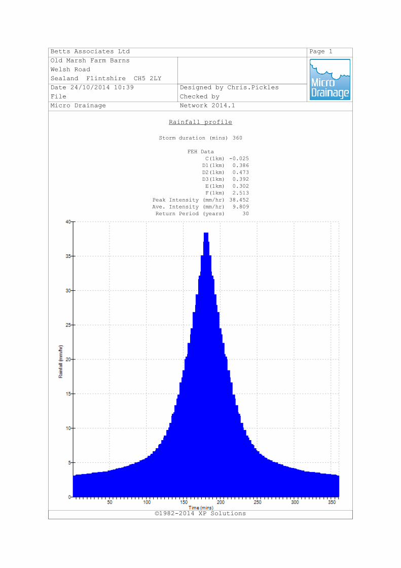
Betts Associates Ltd Page 1
Old Marsh Farm Barns
Welsh Road
Sealand Flintshire CH5 2LY
Date 24/10/2014 10:39 Designed by Chris.Pickles
File Checked by
Micro Drainage Network 2014.1
Rainfall profile
©1982-2014 XP Solutions
Storm duration (mins) 360
FEH DataC(1km) -0.025D1(1km) 0.386D2(1km) 0.473D3(1km) 0.392E(1km) 0.302F(1km) 2.513
Peak Intensity (mm/hr) 38.452Ave. Intensity (mm/hr) 9.809Return Period (years) 30
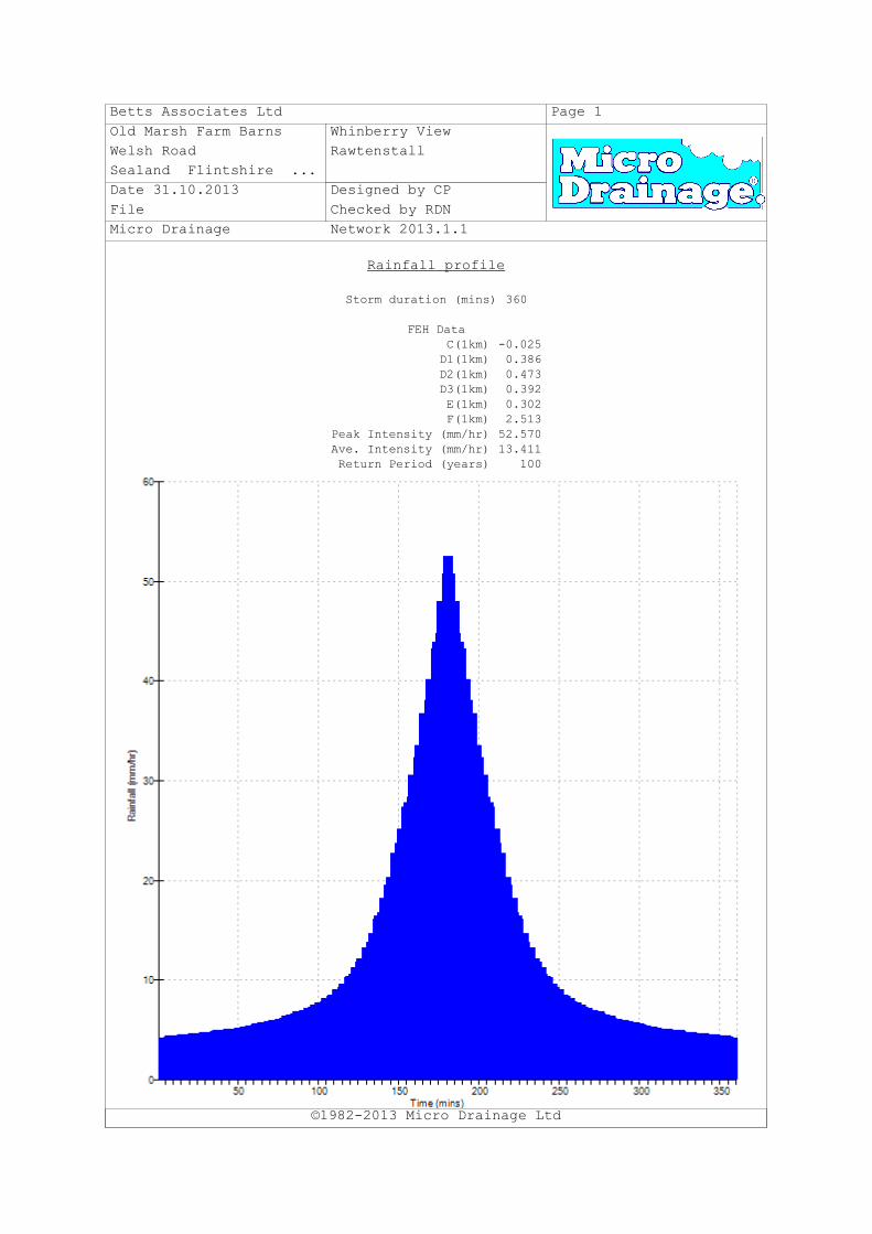
Betts Associates Ltd Page 1
Old Marsh Farm Barns Whinberry View
Welsh Road Rawtenstall
Sealand Flintshire ...
Date 31.10.2013 Designed by CP
File Checked by RDN
Micro Drainage Network 2013.1.1
Rainfall profile
©1982-2013 Micro Drainage Ltd
Storm duration (mins) 360
FEH DataC(1km) -0.025D1(1km) 0.386D2(1km) 0.473D3(1km) 0.392E(1km) 0.302F(1km) 2.513
Peak Intensity (mm/hr) 52.570Ave. Intensity (mm/hr) 13.411Return Period (years) 100

Betts Associates Ltd Page 1
Old Marsh Farm Barns
Welsh Road
Sealand Flintshire CH5 2LY
Date 24/10/2014 10:45 Designed by Chris.Pickles
File Checked by
Micro Drainage Source Control 2014.1
ICP SUDS Mean Annual Flood
©1982-2014 XP Solutions
Input
Return Period (years) 1 Soil 0.336Area (ha) 0.467 Urban 0.000SAAR (mm) 1411 Region Number Region 10
Results l/s
QBAR Rural 2.5QBAR Urban 2.5
Q1 year 2.2
Q1 year 2.2Q30 years 4.2Q100 years 5.1

Betts Associates Ltd Page 1
Old Marsh Farm Barns
Welsh Road
Sealand Flintshire CH5 2LY
Date 24/10/2014 10:46 Designed by Chris.Pickles
File Checked by
Micro Drainage Source Control 2014.1
Greenfield Runoff Volume
©1982-2014 XP Solutions
FEH Data
Return Period (years) 1Storm Duration (mins) 360
Site Location GB 381900 422650 SD 81900 22650C(1km) -0.025D1(1km) 0.386D2(1km) 0.473D3(1km) 0.392E(1km) 0.302F(1km) 2.513
Areal Reduction Factor 1.00Area (ha) 0.467SAAR (mm) 1411
CWI 124.285SPR Host 33.590
URBEXT (1990) 0.0392
Results
Percentage Runoff (%) 34.29Greenfield Runoff Volume (m³) 39.471

Betts Associates Ltd Page 1
Old Marsh Farm Barns
Welsh Road
Sealand Flintshire CH5 2LY
Date 24/10/2014 10:47 Designed by Chris.Pickles
File Checked by
Micro Drainage Source Control 2014.1
Greenfield Runoff Volume
©1982-2014 XP Solutions
FEH Data
Return Period (years) 100Storm Duration (mins) 360
Site Location GB 381900 422650 SD 81900 22650C(1km) -0.025D1(1km) 0.386D2(1km) 0.473D3(1km) 0.392E(1km) 0.302F(1km) 2.513
Areal Reduction Factor 1.00Area (ha) 0.467SAAR (mm) 1411
CWI 124.285SPR Host 33.590
URBEXT (1990) 0.0392
Results
Percentage Runoff (%) 40.15Greenfield Runoff Volume (m³) 150.865

SURFACE WATER RUN‐OFF CALCULATION SHEET
Development Whinberry View, Rawtenstall
Project No. FRA237
Revision 1.1 Completed by CP
Date 24.10.2014 Checked by RDN
Areas Catchment Charateristics
Total Site 0.751 ha SAAR 1411 mm
Development Area (for SW Strategy)* 0.751 ha SPR 33.6 %
Existing Impermeable 0.284 ha 38% i1 16.1 mm/hr
Existing Impermeable (for SW Strategy) 0.284 ha 38% i30 38.4 mm/hr
Existing Pervious 0.467 ha 62% i100 52.5 mm/hr
Existing Pervious (for SW Strategy) 0.467 ha 62% d1 13.4 mm
Proposed Impermeable (total) 0.449 ha 60% d100 75.7 mm
Proposed Impermeable (domestic only) ha
Run‐off Rates Volumes
Pre‐development Pre‐development
1yr 12.7 l/s 1yr 38.1 cu.m
30yr 30.3 l/s 100yr 215.0 cu.m
100yr 41.4 l/s 1yr 39.4 cu.m
50mm/hr 39.4 l/s 100yr 150.8 cu.m
1yr 2.2 l/s 1yr 77.5 cu.m
30yr 4.2 l/s 100yr 365.8 cu.m
100yr 5.1 l/s
QBar 2.5 l/s Post‐development
1yr 14.9 l/s * 1yr 60.2 cu.m
30yr 34.5 l/s 100yr+CC 441.9 cu.m
100yr 46.5 l/s * 1yr cu.m
Post‐development 100yr+CC cu.m
1yr 20.1 l/s
30yr 47.9 l/s ‐21% ‐76.1 cu.m
100yr+CC 85.1 l/s cu.m
1yr l/s
30yr l/s
100yr+CC l/s
Quick storage Estimate
low high mean Imp. Area (ha) Max. Discharge (l/s) Rainfall CC
Return Period 1yr 13 32 22.5 0.449 14.9 FEH 0
Return Period 30yr 0 0.449 FEH 0
Return Period 100yr+CC 140 228 184 0.449 31.4 FEH 30%
Return Period 1yr 11 34 22.5 0.449 14.9 FSR 0
Return Period 30yr 0 0.449 FSR 0
Return Period 100yr+CC 91 183 137 0.449 31.4 FSR 30%
* Development Area (for SW strategy) is reduced as infiltration is being applied as a partial solution
Impermeable
Pervious
Total
Impermeable
Pervious
Total
Impermeable (total)
Impermeable (domestic only)
Reduction (total)
Reduction (domestic only)
Impermeable (total)
Impermeable (domestic only)

Whinberry View, Rawtenstall Flood Risk Assessment
FRA237 ‐ Flood Risk Assessment
APPENDIX J: IMPERMEABLE AREAS PLANS
This page has been left intentionally blank

1
7
1
.7
2
1
7
1
.8
5
1
7
1
.9
1
1
7
2
.0
5
1
7
2
.
0
8
1
7
2
.
1
5
1
7
2
.1
3
1
7
2
.
2
5
1
7
2
.
3
7
1
7
2
.
4
5
1
7
2
.
6
7
1
7
2
.
8
2
1
7
2
.
9
3
1
7
3
.
0
6
173.1
6
1
7
3
.
2
1
1
7
3
.
3
1
173.2
6
1
7
3
.
2
0
1
7
2
.
9
5
1
7
2
.
9
0
1
7
2
.
8
1
1
7
2
.5
6
1
7
2
.
4
0
1
7
2
.4
1
1
7
2
.2
5
1
7
2
.
2
2
1
7
2
.
1
3
1
7
2
.1
5
1
7
2
.0
7
1
7
1
.9
8
1
7
1
.8
6
1
7
1
.8
9
1
7
1
.9
6
1
7
2
.1
6
1
7
2
.1
8
1
7
2
.1
6
1
7
1
.1
8
1
7
1
.1
8
1
7
1
.5
5
1
7
1
.9
9
IC
IC
CL
17
1.6
4
CL
17
2.0
8
FL
17
2.2
2
17
2.1
6
17
2.0
3
1
7
1
.8
9
1
7
2
.0
1
1
7
2
.0
4
1
7
2
.0
2
WS
T
FH
GS
T
RS
BO
L
CT
V
CT
V
CB
BO
L
CT
V
FL
17
2.3
0
IC
CL
17
2.1
2
G
17
1.8
6
GS
T
WS
T
CT
V
1
7
1
.8
1
IC
CL
17
2.0
7
PT
IC
CL
17
2.0
1
BO
L
BO
L
GS
T
BS
1
7
2
.1
3
1
7
1
.5
4
1
7
1
.0
7
1
7
1
.3
8
1
7
1
.0
5
1
7
1
.
6
4
1
7
2
.
3
2
172.60
1
7
2
.5
2
1
7
2
.4
3
1
7
1
.9
2
1
7
1
.7
5
1
7
1
.9
7
1
7
2
.4
3
1
7
2
.5
6
1
7
2
.6
9
1
7
2
.
8
8
1
7
2
.
9
9
1
7
3
.1
6
1
7
3
.3
1
1
7
3
.
1
3
1
7
3
.
0
2
1
7
2
.8
6
1
7
2
.6
5
1
7
2
.5
3
1
7
2
.2
0
1
7
1
.9
8
1
7
2
.0
5
1
7
2
.3
5
1
7
2
.
6
5
1
7
2
.
9
0
1
7
2
.
9
4
1
7
3
.
0
0
1
7
3
.0
5
173.12
173.29
173.34
173.21
173.12
1
7
3
.2
2
17
3.6
3
LP
17
3.0
8
17
3.0
5
17
2.8
0
RS
BT
CB
LP
CB
G
RS
G2
.2
PT
MH
CL
17
2.6
2
BT
MH
CL
17
2.2
0
MH
CL
17
2.2
1
CT
V
G
17
2.0
7
GS
T
MH
CL
17
1.8
3
1
7
1
.8
8
1
7
2
.0
1
1
7
2
.1
5
1
7
2
.2
7
1
7
2
.3
9
1
7
3
.
2
1
1
7
3
.
1
2
1
7
2
.
8
8
1
7
2
.
7
7
1
7
2
.
6
2
1
7
2
.
5
2
1
7
2
.4
5
1
7
2
.
3
7
1
7
2
.
3
8
1
7
2
.
4
3
1
7
2
.
4
9
1
7
2
.
6
4
1
7
2
.
8
2
1
7
3
.
0
2
1
7
3
.
2
6
1
7
2
.
4
7
1
7
2
.
5
3
1
7
2
.
6
1
1
7
2
.
7
4
1
7
2
.
9
2
1
7
3
.
1
2
1
7
3
.
3
7
1
7
3
.
3
3
1
7
3
.
2
2
1
7
3
.
0
1
1
7
2
.
8
8
1
7
2
.
7
3
1
7
2
.6
3
1
7
2
.
5
5
1
7
2
.
4
8
TB
RS
MH
CL
17
2.8
1
1
7
3
.
2
4
1
7
3
.
2
7
1
7
3
.3
2
173.33
1
7
3
.3
5
1
7
3
.3
7
1
7
3
.3
9
1
7
3
.
3
6
1
7
3
.
2
8
1
7
3
.
2
0
1
7
2
.
9
8
1
7
2
.
7
8
1
7
2
.
6
0
1
7
2
.
4
9
1
7
2
.
4
0
1
7
2
.
3
4
1
7
2
.
2
7
1
7
2
.
2
5
172.31
1
7
2
.
3
8
1
7
2
.
5
4
1
7
2
.
7
3
1
7
2
.
9
4
1
7
3
.
1
4
1
7
3
.
3
2
1
7
3
.
3
5
1
7
3
.
4
1
1
7
3
.5
3
1
7
3
.
5
6
1
7
3
.
7
3
1
7
3
.
8
1
1
7
3
.
9
2
1
7
3
.9
8
1
7
4
.
0
7
1
7
4
.
0
9
1
7
4
.
1
5
1
7
4
.
1
7
1
7
4
.2
1
174.1
5
1
7
4
.1
6
1
7
4
.2
3
174.2
5
1
7
4
.2
6
1
7
4
.
2
6
1
7
4
.
2
3
1
7
4
.
1
5
1
7
4
.
1
7
1
7
4
.1
0
1
7
4
.
0
1
1
7
3
.
9
3
1
7
3
.
7
9
1
7
3
.
6
6
1
7
3
.6
2
1
7
3
.
4
8
1
7
3
.
4
4
1
7
3
.
4
1
1
7
3
.
2
2
1
7
3
.
0
2
1
7
2
.
8
2
1
7
2
.
6
4
1
7
2
.
4
6
172.41
1
7
2
.
3
5
1
7
2
.
3
8
1
7
2
.
4
5
1
7
2
.
5
1
1
7
2
.
5
9
1
7
2
.
7
2
1
7
2
.
9
0
1
7
3
.
1
0
1
7
3
.
3
1
1
7
3
.
4
9
1
7
3
.
6
8
1
7
3
.7
2
1
7
3
.7
0
1
7
3
.6
7
1
7
3
.5
2
1
7
3
.
4
4
1
7
3
.
3
4
1
7
3
.
3
1
1
7
2
.
9
6
1
7
2
.
8
6
1
7
2
.7
5
1
7
2
.
7
8
1
7
2
.
6
5
1
7
2
.
5
8
1
7
2
.
4
2
1
7
2
.4
4
1
7
2
.
4
7
1
7
2
.
6
4
1
7
2
.
8
2
1
7
3
.
0
7
1
7
3
.
1
3
1
7
3
.1
2
1
7
3
.
1
2
1
7
3
.
1
2
G
G
17
3.1
4
17
2.7
6
BT
TP
G2
.5
G2
.0
G3
.7
IC
CL
17
3.5
5
IC
CL
17
3.3
1
NP
LP
G
17
2.4
6
RS
NP
CB
CT
V
BT
NP
17
2.6
1
17
2.6
9
17
3.0
8
17
3.1
4
17
3.2
8
17
3.5
5
G1
.0
G1
.4
MG
G1
.3
IC
CL
17
3.8
3
172.8
0
1
7
2
.
7
9
1
7
3
.
0
6
1
7
3
.
2
9
1
7
3
.
4
1
1
7
3
.
6
0
1
7
3
.
8
7
1
7
4
.
0
6
1
7
3
.
5
7
1
7
3
.
4
4
1
7
3
.
3
2
1
7
3
.
1
4
1
7
2
.9
4
1
7
2
.
7
4
1
7
2
.
5
4
1
7
2
.
1
6
1
7
2
.
6
5
IC
CL
17
2.6
6
1
7
3
.
9
7
1
7
4
.
1
0
1
7
4
.
1
2
DR
DR
DR
DR
DR
1
7
4
.
1
5
1
7
4
.
1
5
1
7
4
.
1
4
1
7
3
.
5
0
1
7
3
.
0
5
1
7
3
.
4
7
173.45
1
7
3
.
3
1
1
7
3
.
3
0
1
7
3
.
6
3
173.6
5
173.2
5
1
7
3
.
2
8
1
7
3
.
6
6
1
7
4
.
0
7
1
7
3
.
3
0
1
7
3
.
0
5
173.0
0
1
7
3
.
0
4
1
7
3
.
0
0
1
7
2
.
9
0
172.8
7
1
7
2
.
9
0
1
7
2
.
8
9
1
7
2
.
7
8
1
7
3
.
8
2
(1
74
.0
0)
1
7
4
.
1
2
1
7
4
.
1
3
IC
CL
17
4.08
IC
CL
17
3.93
17
3.8
0
G1.8
G1
.2
G1
.7
G1
.4
GS
V
(1
73
.5
5)
BE
NC
H
1
7
2
.
8
1
1
7
2
.
8
1
1
7
2
.
8
0
1
7
2
.
8
0
MG
BT
1
7
2
.
8
4
1
7
2
.
9
8
1
7
3
.
0
7
1
7
3
.
1
2
1
7
3
.1
6
1
7
3
.2
4
172.94
172.92
1
7
3
.0
0
1
7
2
.
9
6
1
7
2
.
8
5
172.9
0
1
7
2
.
8
6
DR
G
17
3.7
2
IC
CL
17
3.9
3
G
17
3.7
6
1
7
3
.
8
4
1
7
2
.
4
0
1
7
2
.
4
8
1
7
2
.
7
6
1
7
2
.
8
4
17
2.9
0
1
7
2
.
9
5
1
7
2
.
9
8
1
7
3
.0
2
1
7
3
.
0
6
1
7
3
.
1
3
1
7
3
.
2
3
1
7
3
.3
3
WS
T
WS
T
FH
DR
1
7
3
.
2
8
1
7
3
.
1
1
1
7
2
.
9
8
1
7
2
.
8
1
1
7
2
.
6
0
1
7
2
.
4
3
1
7
2
.
1
2
1
7
2
.
1
2
FH
FH
WS
V
WS
T
G
LP R
S
PB
G
17
2.1
7
WS
T
WS
T
WS
T
WS
T
WS
T
WS
T
DR
G
17
2.5
7
WS
T
WS
T
WS
T
G
17
2.8
9
WS
T
G
G
17
3.1
6
17
2.7
7
LP
IC
CL
17
2.7
1
LP
WS
T
WS
T
IC
CL
17
3.3
7
1
7
3
.
2
6
1
7
3
.
2
0
1
7
3
.
1
4
1
7
3
.
1
1
1
7
3
.
0
8
1
7
3
.
2
1
1
7
3
.
0
4
1
7
3
.
0
2
1
7
3
.2
0
1
7
2
.9
7
1
7
3
.
1
8
1
7
2
.
9
1
1
7
2
.
9
0
1
7
2
.
8
4
1
7
3
.
0
2
1
7
2
.
8
3
1
7
2
.
7
8
1
7
2
.
8
6
1
7
2
.
8
3
1
7
2
.
8
0
1
7
2
.
6
9
1
7
2
.
7
2
1
7
2
.
6
7
1
7
2
.
6
2
1
7
2
.
6
0
1
7
2
.
6
1
1
7
2
.
6
0
1
7
2
.
5
1
1
7
2
.
5
9
EA
VE
S
17
8.3
2
RID
GE
18
1.7
6
EA
VE
S
17
9.1
6
RID
GE
18
2.6
6
EA
VE
S
EA
VE
S
EA
VE
S
EA
VE
S
EA
VE
S
17
4.4
0
17
4.2
6
17
4.0
8
17
4.3
7
17
4.2
6
(1
73
.5
7)
(1
73
.2
8)
(1
73
.4
3)
(1
73
.5
6)
(1
73
.6
4)
(1
73
.9
2)
O
T
O
T
O
T
O
T
OT
OT
O
T
O
T
O
T
O
T
O
T
O
T
O
T
O
T
O
T
O
T
O
T
(1
76
.2
5)
RID
GE
17
8.7
2
EA
VE
S
17
6.9
1
RID
GE
18
4.6
1
RID
GE
18
4.3
0
EA
VE
S
18
1.7
1
EA
VE
S
17
8.6
2
RID
GE
18
1.6
4
1
7
2
.
1
9
1
7
2
.1
4
1
7
3
.
1
3
1
7
3
.
1
0
1
7
2
.
9
1
1
7
2
.
6
5
1
7
2
.
6
0
1
7
2
.
0
9
1
7
1
.9
8
1
7
1
.9
9
1
7
2
.1
1
1
7
2
.
1
2
1
7
2
.
1
5
1
7
2
.
2
2
1
7
2
.
2
4
1
7
2
.
3
1
1
7
2
.
3
4
1
7
2
.
4
2
1
7
2
.
5
2
1
7
2
.
5
4
1
7
2
.
6
8
1
7
2
.
7
0
1
7
2
.
7
0
1
7
2
.
6
4
1
7
2
.
4
9
1
7
2
.
3
9
1
7
2
.
2
6
1
7
2
.
1
3
1
7
2
.
0
0
1
7
1
.
8
2
1
7
1
.7
6
1
7
1
.8
6
1
7
1
.
8
5
1
7
2
.
0
7
1
7
2
.
1
9
1
7
2
.
3
2
1
7
2
.
4
7
1
7
2
.
5
8
1
7
2
.
6
9
1
7
2
.
6
8
1
7
2
.
5
7
1
7
2
.
4
6
1
7
2
.
2
0
1
7
2
.0
7
1
7
1
.7
7
1
7
2
.
7
1
1
7
2
.
5
5
1
7
2
.
4
3
1
7
2
.
3
1
1
7
2
.
2
1
1
7
2
.
1
1
1
7
1
.
9
5
1
7
1
.
8
7
1
7
1
.9
1
1
7
2
.
0
1
1
7
2
.1
21
7
2
.
2
4
1
7
2
.
3
2
1
7
2
.
3
9
1
7
2
.
5
3
1
7
2
.6
9
1
7
2
.
7
6
1
7
2
.
9
0
1
7
3
.
1
1
1
7
3
.
2
1
1
7
3
.
2
0
1
7
3
.
2
8
1
7
3
.
4
1
1
7
3
.
3
7
1
7
3
.
4
6
1
7
3
.
5
7
1
7
3
.
7
5
WS
T
G
CT
V
G
G
17
1.9
5
17
1.8
8
CT
V
CT
V
CT
V
CT
V
MH
CL
17
2.3
4
G
G
17
2.2
7
17
2.3
0
CT
V
CT
V
LP
CT
V
17
2.5
1
EA
VE
S
EA
VE
S
17
8.8
6
17
8.9
4
(1
73
.0
1)
(1
72
.8
6)
(1
72
.7
2)
(1
72
.7
4)
(1
72
.6
0)
DR
BE
NC
H
BE
NC
H
(1
73
.7
1)
RS
RS
1
7
4
.
1
6
1
7
4
.
1
6
1
7
4
.
1
5
1
7
3
.
4
4
1
7
3
.
2
2
1
7
3
.
0
8
1
7
3
.
2
1
BT
LP
CT
V
IC
CL
17
3.2
2
1
7
3
.
1
8
1
7
3
.
1
9
1
7
3
.
1
61
7
3
.
1
9
1
7
3
.
1
7
1
7
3
.
2
6
BT
G1
.4
G1
.1
IC
CL1
73
.2
7
IC
CL
17
3.24
DR
IC
CL1
73
.2
4
PT
DR
FL
173
.4
0
1
7
3
.
2
1
1
7
3
.
1
2
1
7
3
.1
8
1
7
3
.
1
3
1
7
2
.
9
8
1
7
3
.
2
9
1
7
3
.
2
1
1
7
3
.
1
5
MG
G
17
2.1
5
G
17
2.2
9
1
7
3
.
6
6
1
7
3
.
7
0
1
7
3
.
8
2
1
7
4
.
6
1
1
7
5
.
4
1
1
7
6
.
0
2
17
6.0
2
1
7
6
.
0
9
1
7
5
.
5
2
1
7
4
.
7
2
1
7
3
.
9
0
1
7
3
.
7
9
1
7
3
.
6
8
1
7
4
.
1
3
1
7
4
.
6
9
1
7
5
.
5
0
17
5.9
9176.25
1
7
6
.5
3
1
7
7
.
9
3
1
7
7
.
6
7
1
8
2
.
0
6
MG
MG
MG
EA
VE
S
17
9.4
6
RID
GE
18
2.08
RID
GE
18
4.6
1
EA
VE
S
18
2.0
0
EA
VE
S
17
8.5
9
RID
GE
17
9.7
6
1
7
6
.
2
3
1
7
2
.
6
3
1
7
2
.
5
0
1
7
2
.
3
8
1
7
2
.
2
9
1
7
2
.
1
7
1
7
2
.
0
3
1
7
1
.
8
8
1
7
1
.
7
8
1
7
1
.
8
1
1
7
1
.
9
0
1
7
2
.0
2
1
7
2
.
1
5
1
7
2
.
2
8
1
7
2
.
3
6
1
7
2
.
5
0
1
7
2
.
6
0
1
7
2
.
7
1
1
7
2
.
8
5
1
7
3
.
0
0
1
7
3
.
1
0
1
7
3
.
1
8
1
7
3
.
2
5
1
7
3
.
3
1
1
7
3
.
3
5
1
7
3
.
4
4
1
7
3
.
5
5
1
7
3
.
7
4
1
7
4
.
0
0
1
7
4
.
9
1
1
7
5
.
5
3
RID
GE
18
5.2
5
EA
VE
S
18
2.0
5
EA
VE
S
17
9.1
0
RID
GE
18
0.8
6
KO
17
3.2
8
LP
WS
T
1
7
3
.
2
2
1
7
3
.
1
9
1
7
3
.
2
1
MG
IC
CL
17
3.2
2
1
7
3
.
3
4
1
7
3
.
1
9
1
7
3
.
1
4
1
7
3
.
2
4
1
7
3
.
3
4
1
7
3
.
3
6
1
7
3
.
3
3
1
7
3
.
2
8
1
7
3
.
2
4
IC
CL
17
3.3
2
DR
1
7
3
.
4
0
1
7
3
.
4
1
1
7
3
.
3
4
(1
73
.8
7)
DR
DR
DR
DR
DR
DR
IC
CL
17
3.29
173.29
173.25
1
7
3
.1
9
1
7
3
.
2
2
1
7
3
.
3
4
1
7
3
.
4
5
1
7
3
.
3
3
1
7
3
.3
2
173.34
173.3
9
1
7
3
.
3
4
17
3.4
1
1
7
3
.
3
8
EA
VE
S
178
.3
5
RID
GE
18
0.9
8
G
17
3.19
DR
IC
CL
17
3.3
2F
L1
73
.3
8
1
7
3
.
2
3
1
7
3
.
2
3
MG
1
7
4
.
1
0
1
7
3
.
8
5
1
7
3
.
5
8
1
7
3
.
6
0
1
7
3
.
3
8
1
7
3
.
3
6
1
7
3
.
3
3
1
7
3
.
2
3
IC
CL
17
3.2
5
1
7
3
.2
5
G1
.7
G1
.5
173.60
173.51
173.38
1
7
4
.
4
7
1
7
4
.
4
1
1
7
6
.
3
8
1
7
5
.
4
4
1
7
6
.
0
0
1
7
6
.
7
9
17
3.50
RID
GE
RID
GE
RID
GE
18
3.0
4
18
1.60
18
0.7
3
EA
VE
S
EA
VE
S
EA
VE
S
17
7.0
2
17
7.6
5
17
9.0
2
1
7
3
.
2
1
1
7
3
.
2
1
1
7
3
.1
8
1
7
3
.2
3
1
7
3
.3
2
1
7
3
.3
5
173.39
1
7
3
.4
4
1
7
3
.
4
3
1
7
3
.
4
6
1
7
3
.
3
3
1
7
3
.3
6
173.3
6
1
7
3
.
1
3
1
7
3
.
1
6
1
7
3
.
2
8
1
7
3
.
2
0
1
7
3
.
5
4
(1
74
.06
)
173.53
MG
G0.5
G0
.5
G1
.3
1
7
3
.
5
6
1
7
3
.
7
8
1
7
3
.
7
7
1
7
3
.
6
8
1
7
4
.
1
7
1
7
3
.
5
3
1
7
3
.
3
2
1
7
3
.
4
5
1
7
3
.
7
7
DR
1
7
3
.
7
9
1
7
3
.
8
7
1
7
4
.
1
6
1
7
4
.
2
3
1
7
4
.
4
9
MG
G0
.4
G0
.8
G0
.5
G1
.0
17
3.9
0
G0
.3
G1
.3
G1
.3
MG
17
4.7
2
1
7
4
.
3
8
1
7
4
.2
9
1
7
4
.4
5
1
7
4
.
1
1
1
7
4
.
0
7
1
7
4
.
0
9
1
7
4
.
0
9
DR
IC
CL
174
.2
2
IC
CL
17
4.1
9
IC
CL
174
.1
1
1
7
3
.
8
5
1
7
4
.
0
0
1
7
4
.
0
6
1
7
4
.
0
6
1
7
4
.
1
5
1
7
4
.
1
2
1
7
4
.
1
1
DR
DR
DR
IC
CL
174
.1
4
17
4.3
1
174
.6
2
17
4.8
4
176
.4
6
18
0.0
7
177
.9
6
17
7.1
6
17
9.7
4
17
7.7
0
1
7
4
.
2
9
1
7
4
.
3
0
DR
1
7
4
.
2
0
1
7
4
.
1
5
1
7
4
.
1
7
1
7
3
.
9
7
1
7
3
.
9
7
1
7
3
.
9
7
1
7
3
.
9
4
1
7
3
.
9
8
1
7
3
.
9
7
1
7
4
.
1
1
1
7
4
.
0
9
1
7
4
.
0
9
GIP
DR
1
7
4
.
1
4
(1
75
.1
0)
1
7
4
.
1
4
1
7
4
.
1
6
1
7
4
.
1
5
G0
.6
1
7
4
.
1
3
1
7
4
.
1
5
1
7
4
.
1
6
IC
CL
17
4.2
8
IC
CL
17
4.14
IC
CL
17
4.1
4
175.90
1
7
5
.
1
2
175.31
1
7
5
.
0
1
1
7
4
.
8
9
1
7
4
.8
4
1
7
4
.
7
3
1
7
4
.
5
4
1
7
4
.
5
2
1
7
4
.
2
5
174.27
1
7
4
.
2
9
1
7
4
.
2
6
1
7
4
.
2
1
(17
6.1
6)
RID
GE
17
6.4
7
GS
T
1
7
4
.
1
9
1
7
3
.
9
6
1
7
3
.
9
5
1
7
4
.
0
3
1
7
4
.
0
2
1
7
4
.
1
1
1
7
4
.
1
6
1
7
4
.
1
0
1
7
4
.
1
6
1
7
4
.
2
8
1
7
4
.
1
6
DR
DR
FL
17
4.2
9
1
7
4
.
1
4
1
7
4
.
2
9
1
7
4
.
2
9
1
7
4
.
0
6
1
7
4
.
0
3
1
7
4
.
1
1
G0
.6
G0
.6
G0
.6
G0
.6
G0
.6
1
7
4
.1
5
1
7
4
.
1
6
17
4.5
3
17
5.0
7
1
7
4
.
0
7
1
7
4
.
0
5
1
7
4
.
1
1
1
7
4
.
1
7
1
7
4
.
0
5
1
7
4
.
0
0
FL
17
3.9
9
IC
CL
17
4.1
0
G
IC
CL1
74.0
9
IC
CL
174
.0
9
DR
OP
0.100Ø
IL
17
4.17
GS
T
DR
G
17
4.11
1
7
4
.
1
9
1
7
4
.
1
7
1
7
4
.
1
7
1
7
4
.
1
6
1
7
4
.
1
6
1
7
4
.
1
8
1
7
4
.
2
0
1
7
4
.
1
7
1
7
4
.
1
7
1
7
4
.
1
7
1
7
4
.
1
8
1
7
4
.
1
9
1
7
4
.
1
6
1
7
4
.
1
3
1
7
4
.
1
7
1
7
4
.
1
7
1
7
4
.
1
6
1
7
4
.
0
9
1
7
4
.
1
5
1
7
4
.
1
5
1
7
4
.
1
1
1
7
4
.
1
4
1
7
4
.
1
6
1
7
4
.
1
3
1
7
4
.
1
6
1
7
4
.
1
8
1
7
4
.
1
8
1
7
4
.
1
3
1
7
4
.
1
5
1
7
4
.
1
6
1
7
4
.
1
6
1
7
4
.
1
6
1
7
4
.
1
6
1
7
4
.
1
9
1
7
4
.
1
8
1
7
4
.
1
7
1
7
4
.
1
4
174
.1
4
174
.1
5
O
T
O
T
O
T
O
T
BE
NC
H
1
7
4
.
1
8
1
7
4
.
2
0
1
7
4
.
2
0
1
7
4
.
1
6
(1
74
.42
)
1
7
4
.
1
8
1
7
4
.
2
0
1
7
4
.
5
8
1
7
4
.
1
2
1
7
4
.
1
6
1
7
4
.
1
8
1
7
4
.
7
0
1
7
4
.
7
1
1
7
4
.
7
1
1
7
4
.
7
1
IC
CL
17
4.2
0
DR
DR
DR
DR
IC
CL
17
4.1
9
DR
IC
CL1
74
.1
9
IC
CL
17
4.1
8
IC
CL
174
.2
0
1
7
4
.
2
1
1
7
4
.
0
3
1
7
4
.
1
3
1
7
4
.
1
0
DR
1
7
4
.
1
5
1
7
4
.
1
5
G0
.4
G1
.6
DR
SO
1
SO
2
SO
3
SO
11
SO
12
SO
13
SO
14
SO
15
1
7
3
.
2
0
1
7
3
.
2
0
IL
17
2.7
7
IL
17
2.6
5
IL
17
2.8
7
IL
17
2.8
9
IL
17
2.95
IL
17
2.7
1
IL
17
2.50
IL
172
.4
0
IL
17
2.3
5
IL
17
2.7
2
IL
17
2.69
IL1
71.6
9
IL
171
.7
0
IL
17
1.3
4
IL
17
2.0
0
IL
17
0.7
5
IL
17
2.7
0
IL
17
0.1
5
IL
17
1.0
7
IL
17
2.9
2
IL
17
3.2
8
IL1
73
.1
2
IL1
72.8
9
IL1
72
.43
IC
CL
17
4.1
9
IL
17
3.1
5
IL
17
2.54
IL
172
.7
1
IL
17
3.1
0
IL1
73
.5
4
IL1
72
.9
8
IL1
73
.6
2
IL
17
3.3
1
TP
IC
CL
17
3.0
7
BT
B
R
IC
K
W
A
L
L
C
O
N
C
P
A
V
I
N
G
TA
RM
AC
P
A
V
IN
G
TA
RM
AC
CO
BB
LE
S
B
R
IC
K
W
A
LL
GR
AS
S
TA
RM
AC
GR
AS
S
TA
RM
AC
TA
RM
AC
TA
RM
AC
C
\
B
PA
VIN
G
GR
AS
S
I\R
B
R
I
C
K
W
A
L
L
B
R
I
C
K
W
A
L
L
S
T
E
P
S
TA
RM
AC
GR
AS
S
B
R
I
C
K
S
W
B
W
B
R
I
C
K
B
W
C
\B
1
.8
m
H
PA
VIN
G
P
A
V
I
N
G
P
A
V
I
N
G
P
A
V
I
N
G
P
A
V
I
N
G
CO
NC
P
A
V
I
N
G
P
A
V
I
N
G
P
A
V
I
N
G
PA
VIN
G
PA
VIN
G
GR
AS
S
GR
AS
S
GR
AS
S
GR
AS
S
GR
AS
S
GR
AS
S
GR
AS
S
GR
AS
S
GR
AS
S
GR
AS
S
GR
AS
S
S
W
S
T
O
N
E
W
A
L
L
TA
RM
AC
T
A
R
M
A
C
GR
AS
S
BR
ICK
WA
LL
GR
AS
S
PA
VIN
G
C
\
BP
\
R
1
.
2
m
H
1
.
2
m
H
P
A
V
I
N
G
P
A
V
I
N
G
PA
VIN
G
P
\
R
1
.
2
m
H
GR
AS
S
C
\
B
1
.
8
m
H
P
\W
1
.2
m
H
B
R
I
C
K
W
A
L
L
S
T
O
N
E
CO
NC
TA
RM
AC
P
\
R
1
.
6
m
H
B
W
C
\
B
1
.
6
m
H
S
W
P\R 1.0mH
B
R
I
C
K
R
T
W
P
\
R
1
.
0
m
H
.
5
C
\
B
1
.
5
m
H
PA
VIN
G
C
\
B
1
.
8
m
H
GR
AS
S
P
\
W
1
.
0
m
H
B
R
I
C
K
W
A
L
L
B
W
GR
AS
S
PA
VIN
G
P
\
R
1
.
0
m
H
P
\
R
1
.
0
m
H
C
O
N
C
GR
AS
S
C
\B
S
T
E
P
S
B
R
I
C
K
W
A
L
L
B
W
B
W
B
R
I
C
K
W
A
L
L
B
W
P
\
R
1
.
2
m
H
PA
VIN
G
CO
NC
D
.
C
P
A
V
I
N
G
P
A
V
I
N
G
D
.
C
1
.0
m
H
P
\
R
S
T
E
P
S
1
.8
m
H
S
T
E
P
S
W
A
L
L
W
A
L
L
W
A
L
L
2
.
5
m
H
C
O
-
O
P
E
R
A
T
I
O
N
S
T
R
E
E
T
W
H
E
A
T
H
O
L
M
E
S
T
R
E
E
T
NO
A
CC
ES
S
SH
ED
DE
NS
E V
EG
ET
AT
IO
N
GA
RA
GE
PA
VIO
RS
C
O
N
C
PA
VIN
G
EX
IS
TIN
G
GA
RA
GE
KA
SH
MIR
H
OU
SE
EX
IS
TIN
G
GA
RA
GE
No. 27
No. 26
AR
EA
S
UR
VE
YE
D R
EM
OT
EL
EY
UN
AB
LE
T
O S
UR
VE
Y F
UL
LY
T
E
M
P
O
R
A
R
Y
F
E
N
C
E
L
I
N
E
GR
AS
S
GA
S
HS
E
TA
RM
AC
TA
RM
AC
CA
R P
AR
K
AS
OK
A
RE
ST
AU
RA
NT
D
.C
B
A
C
U
P
R
O
A
D
NIN
O'S
RE
ST
AU
RA
NT
CE
LL
AR
LIG
HT
No
. 4
No. 3
RO
UN
DA
BO
UT
No .2
NO
. 4
No
. 6
D
.
C
TA
RM
AC
SH
ED
ST
EP
GR
AS
S
PA
VIO
RS
PA
VIN
G
C
O
N
C
W
A
L
L
P
/
R
WH
IN
BE
RR
Y V
IE
W
C
O
N
C
PA
VIO
RS
BO
UN
DA
RY
S
HO
WN
D
AS
HE
D IS
A
SS
UM
ED
,
UN
AB
LE
T
O S
UR
VE
Y W
IT
HO
UT
E
XT
EN
SIV
E
SIT
E C
LE
AR
AN
CE
D
UE
T
O D
EN
SE
V
EG
ET
AT
IO
N.
BO
UN
DA
RY
P
OS
IT
IO
N S
HO
UL
D B
E C
HE
CK
ED
PR
IO
R T
O C
ON
ST
RU
CT
IO
N.
1
0
0
Ø
1
0
0
Ø
2
2
5
Ø
2
2
5
Ø
3
0
0
Ø
CA
TC
HP
IT
1
0
0
Ø
1
0
0
Ø
NO
F
LO
W
1
0
0
Ø
1
0
0
Ø
1
0
0
Ø
SW
1
0
0
Ø
1
0
0
Ø
SW
1
0
0
Ø
1
0
0
Ø
1
0
0
Ø
1
0
0
Ø
FW
SW
1
0
0
Ø
1
0
0
Ø
FW
1
0
0
Ø
1
0
0
Ø
1
0
0
Ø
1
0
0
Ø
1
5
0
Ø
1
5
0
Ø
1
5
0
Ø
1
5
0
Ø
150Ø
100Ø
1
5
0
Ø
2
2
5
Ø
2
2
5
Ø
2
2
5
Ø
2
2
5
Ø
SW
1
0
0
Ø
WA
TE
R
PIP
E
PL
AS
TIC
UT
L
UT
L
UT
L
SW
1
0
0
Ø
2
2
5
Ø
1
0
0
Ø
SW
SW
1
0
0
Ø
1
0
0
Ø
100Ø
100Ø
FW
/S
W
4
0
0
Ø
2
2
5
Ø
1
5
0
Ø
1
5
0
Ø
1
5
0
Ø
400Ø
NO
F
LO
W
1
0
0
Ø
1
0
0
Ø
SW
UT
L
1
0
0
Ø
1
0
0
Ø
SW
SW
1
0
0
Ø
1
0
0
Ø
1
0
0
Ø
1
0
0
Ø
1
0
0
Ø
1
0
0
Ø
1
0
0
Ø
1
0
0
Ø
1
0
0
Ø
SW
1
0
0
Ø
1
0
0
Ø
100Ø
100Ø
SW
SW
SW
100Ø
100Ø
1
0
0
Ø
1
0
0
Ø
1
0
0
Ø
1
0
0
Ø
1
0
0
Ø
1
0
0
Ø
1
0
0
Ø
FW
FW
1
0
0
Ø
1
0
0
Ø
1
0
0
Ø
1
0
0
Ø
1
0
0
Ø
FW
UT
L
DO
N
OT
S
CA
LE
PR
EL
IM
IN
AR
Y
P2
10
0F
RA
23
7
IM
PE
RM
EA
BL
E A
RE
AS
P
LA
N
PR
E-D
EV
EL
OP
ME
NT
RA
WT
EN
ST
AL
L
WH
IN
BE
RR
Y V
IE
W
NO
TE
S
TOTAL SITE AREA - 7513m²
EXISTING IMPERMEABLE AREA - 2846m² (38%)
P1
31.10.2013
CP
PR
ELIM
IN
AR
Y IS
SU
E F
OR
R
EV
IE
W R
DN
P2
23.10.2014
CP
UP
DA
TE
D T
O R
EF
LE
CT
R
EV
IS
ED
B
OU
ND
AR
Y R
DN

X
FL
17
2.2
2
FL
17
2.3
0
17
3.7
2
EA
VE
S
17
8.3
2
RID
GE
18
1.7
6
EA
VE
S
17
9.1
6
RID
GE
18
2.6
6
EA
VE
S
17
4.2
6
RID
GE
18
4.3
0
EA
VE
S
18
1.7
1
EA
VE
S
17
8.6
2
RID
GE
18
1.6
4
EA
VE
S
EA
VE
S
17
8.8
6
17
8.9
4
17
6.0
2
EA
VE
S
17
8.5
9
RID
GE
RID
GE
RID
GE
18
3.0
4
18
1.6
0
18
0.7
3
EA
VE
S
EA
VE
S
EA
VE
S
17
7.0
2
17
7.6
5
17
9.0
2
BO
L
CB
BO
L
PT
BO
L
BO
L
BS
LP
CB
LP
CB
PT
TB
LP
CB
LP
PB
LP
LP
LP
Note: F
loor areas m
easured are gross excluding w
all finishes
80.4 S
q.M
etres
80.4 S
q.M
etres
92.7 S
q.M
etres
92.7 S
q.M
etres
92.7 S
q.M
etres
92.7 S
q.M
etres
80.4 S
q.M
etres
80.4 S
q.M
etres
80.4 S
q.M
etres
80.4 S
q.M
etres
80.4 S
q.M
etres
80.4 S
q.M
etres
80.4 S
q.M
etres
80.4 S
q.M
etres
80.4 S
q.M
etres
80.4 S
q.M
etres
80.4 S
q.M
etres
80.4 S
q.M
etres
92.7 S
q.M
etres
92.7 S
q.M
etres
104.3 S
q.M
etres
104.3 S
q.M
etres
104.3 S
q.M
etres
104.3 S
q.M
etres
104.3 S
q.M
etres
104.3 S
q.M
etres
104.3 S
q.M
etres
80.4 S
q.M
etres
80.4 S
q.M
etres
SC
HE
DU
LE
O
F A
CC
OM
MO
DA
TIO
N
3 B
ed 5 P
erson H
ouse
3 B
ed 5 P
erson H
ouse
3 B
ed 5 P
erson H
ouse
3 B
ed 5 P
erson H
ouse
3 B
ed 5 P
erson H
ouse
3 B
ed 5 P
erson H
ouse
3 B
ed 5 P
erson H
ouse
3 B
ed 5 P
erson H
ouse
3 B
ed 5 P
erson H
ouse
3 B
ed 5 P
erson H
ouse
3 B
ed 5 P
erson H
ouse
3 B
ed 5 P
erson H
ouse
3 B
ed 5 P
erson H
ouse
3 B
ed 5 P
erson H
ouse
3 B
ed 5 P
erson H
ouse
3 B
ed 5 P
erson H
ouse
3 B
ed 5 P
erson H
ouse
3 B
ed 5 P
erson H
ouse
3 B
ed 5 P
erson H
ouse
3 B
ed 5 P
erson H
ouse
4 B
ed 7 P
erson H
ouse
4 B
ed 7 P
erson H
ouse
4 B
ed 7 P
erson H
ouse
4 B
ed 7 P
erson H
ouse
4 B
ed 7 P
erson H
ouse
4 B
ed 7 P
erson H
ouse
4 B
ed 7 P
erson H
ouse
3 B
ed 5 P
erson H
ouse
3 B
ed 5 P
erson H
ouse
865 S
q.F
t
865 S
q.F
t
997 S
q.F
t
997 S
q.F
t
997 S
q.F
t
997 S
q.F
t
865 S
q.F
t
865 S
q.F
t
865 S
q.F
t
865 S
q.F
t
865 S
q.F
t
865 S
q.F
t
865 S
q.F
t
865 S
q.F
t
865 S
q.F
t
865 S
q.F
t
865 S
q.F
t
865 S
q.F
t
997 S
q.F
t
997 S
q.F
t
1122 S
q.F
t
1122 S
q.F
t
1122 S
q.F
t
1122 S
q.F
t
1122 S
q.F
t
1122 S
q.F
t
1122 S
q.F
t
865 S
q.F
t
865 S
q.F
t
nico
lnicol thom
as
architects project m
anagers construction cost consultants C
DM
PR
OP
OS
ED
KE
RB
L
IN
E
FO
RM
ER
KE
RB
L
IN
E
LE
GE
ND
BA
NK
S
TA
BILIS
AT
IO
N
TO
S
.E
NG
IN
EE
RS
D
ET
AILS
BA
NK
S
TA
BILIS
AT
IO
N
TO
S
.E
NG
IN
EE
RS
D
ET
AILS
+176.50
Palings - 100x19 w
ith 25m
m gap
N.T
.S.
N.T
.S.
Alternate 25m
m gaps
100x100 tim
ber
or conc. posts at
2000 c/s.
75m
m gap betw
een bottom
of fence &
ground level
16000
300m
m H
igh gravel board
ALL N
EW
G
AT
ES
A
RE
T
O B
E LO
CK
AB
LE
AN
D G
IV
E 850M
M C
LE
AR
O
PE
NIN
G
RO
OF
:
Sla
te
G
re
y C
on
cre
te
tiles, M
arle
y M
od
ern
o
r sim
ila
r
ap
pro
ve
d
WA
LL
:
Ma
in
w
allin
g to
b
e re
d-m
ulti fa
cin
g b
rickw
ork w
ith
fe
atu
re
re
nd
ere
d p
an
els
WIN
DO
W:
Hig
h p
erfo
rm
an
ce
g
re
y p
vc-u
w
ith
d
ou
ble
gla
ze
d se
ale
d u
nits
RA
IN
WA
TE
R G
OO
DS
Bla
ck p
vc-u
.
SU
RF
AC
E T
RE
AT
ME
NT
S:
As d
eta
ile
d.
Ma
te
ria
l S
pe
cifica
tion
X
FF
L
174.50
1
PR
OP
OS
ED
S
TR
EE
TS
CA
PE
X
- X
TO
P O
F
HL G
AB
IO
N
177.00
TO
P O
F
LL G
AB
IO
N
176.50
RA
WT
EN
ST
AL
L
WH
IN
BE
RR
Y V
IE
W
PR
OP
OS
ED
R
ES
ID
EN
TIA
L D
EV
EL
OP
ME
NT
PR
OP
OS
ED
S
IT
E L
AY
OU
T
DO
N
OT
S
CA
LE
PR
EL
IM
IN
AR
Y
P4
10
1F
RA
23
7
IM
PE
RM
EA
BL
E A
RE
AS
P
LA
N
PO
ST
-D
EV
EL
OP
ME
NT
RA
WT
EN
ST
AL
L
WH
IN
BE
RR
Y V
IE
W
NO
TE
S
TOTAL SITE AREA - 7513m²
PR
OP
OS
ED
IM
PE
RM
EA
BLE
A
RE
A -
ROAD - 1932m²
ROOF - 1659m²
DRIVE - 900m²
TOTAL IMPERMEABLE AREA - 4491m² (60%)
P1
31.10.2013
CP
PR
ELIM
IN
AR
Y IS
SU
E F
OR
R
EV
IE
W R
DN
P2
10.07.2014
CP
UP
DA
TE
D T
O R
EF
LE
CT
R
EV
IS
ED
LA
YO
UT
R
DN
P3
14.07.2014
CP
UP
DA
TE
D T
O R
EF
LE
CT
C
HA
NG
ES
T
O LA
YO
UT
R
DN
P4
23.10.2014
CP
UP
DA
TE
D T
O R
EF
LE
CT
R
EV
IS
ED
B
OU
ND
AR
Y R
DN

Whinberry View, Rawtenstall Flood Risk Assessment
FRA237 ‐ Flood Risk Assessment
This page has been left intentionally blank

Whinberry View, Rawtenstall Flood Risk Assessment
FRA237 ‐ Flood Risk Assessment
APPENDIX K: SFRA INFORMATION
This page has been left intentionally blank


Whinberry View, Rawtenstall Flood Risk Assessment
FRA237 ‐ Flood Risk Assessment
APPENDIX L: STORMWATER STORAGE ESTIMATES
This page has been left intentionally blank

STORMWATER STORAGE ESTIAMATES
FEH


FSR


Whinberry View, Rawtenstall Flood Risk Assessment
FRA237 ‐ Flood Risk Assessment
This page has been left intentionally blank

Whinberry View, Rawtenstall Flood Risk Assessment
FRA237 ‐ Flood Risk Assessment
APPENDIX M: NOTES OF LIMITATION The data essentially comprised a study of available documented information from various sources together with discussions with relevant authorities and other interested parties. There may also be circumstances at the site that are not documented. The information reviewed is not exhaustive and has been accepted in good faith as providing representative and true data pertaining to site conditions. If additional information becomes available which might impact our l conclusions, we request the opportunity to review the information, reassess the potential concerns and modify our opinion if warranted. It should be noted that any risks identified in this report are perceived risks based on the available information. This report was prepared by Betts Associates Ltd for the sole and exclusive use of the titled client in response to particular instructions. Any other parties using the information contained in this report do so at their own risk and any duty of care to those parties is excluded. This document has been prepared for the titled project only and should any third party wish to use or rely upon the contents of the report, written approval from Betts Associates Ltd must be sought. Betts Associates Ltd accepts no responsibility or liability for the consequences of this document being used for the purpose other than that for which it was commissioned and for this document to any other party other than the person by whom it was commissioned.