Embed Size (px)
Citation preview

November 15, 2017
Forest Stewardship Plan for the
Ecological Restoration of
Coulter Creek
Heritage Park
November 2017
Prepared by: Ethan Finch and Aleighsha Akin, Forest Stewardship Interns;
Arno Bergstrom, Kitsap County Community Forester In partnership with
Community members, park stewards and stakeholders

2
ACKNOWLEDGEMENTS
Kitsap County Staff
Jim Dunwiddie, Director of Parks
Arno Bergstrom, Community Forester
Steven Starlund, Park and Open Space Planner
Dori Leckner, Parks Superintendent
Lori Raymaker, Stewardship Coordinator
Aleighsha Akin, Forest Stewardship Intern
Ethan Finch, Forest Stewardship Intern
Contributing Community Partners, Park Stewards and Stakeholders
Larry Walker
Al Ruedebusch
Chris Peer
Jeff Kidston
Greg Tinius
Terry Hubbard
Roland Null
Denise Kilkenny-Tittle
Ken Brown
Roger Gay
John Grinter
Forest Stewardship Committee (a sub-committee of the Parks Advisory Board)
Paul Larson
Art Schick
Frank Stricklin

3
John Willett
Other Partners & Stakeholders
Washington DNR Forest Practices, Forester – Aileen Nichols
Washington DNR Forest Practices, Forester – Richard Woods
Washington Department of Fish & Wildlife, Biologist – Brittany Gordon
Washington Department of Ecology, Water Quality – Bob Penhale
American Forest Management, Forester – Gus Gerrits
Suquamish Tribe – Debbie Kay

4
FOREST RESTORATION - VISION FOR COULTER CREEK HERITAGE PARK
VISION: Coulter Creek Heritage Park (CCHP) is an ecologically complex, diverse, and healthy forest that provides optimum fish & wildlife habitat for a wide range of animal species. Coulter Creek Heritage Park currently has a range of forest types from simple monoculture, Christmas tree and tree farm plantations, to more complex natural second growth forests. There are older, mature, individual legacy trees scattered throughout this 1200 acre park. The approach will be to use forest ecosystem restoration, a process that considers the environment as a complex system functioning as a whole. Because this park will see increased use by the surrounding community, restoration must also consider the social values of the community. Forest ecosystem restoration will rely heavily on partnership with park stewards and community members as well as private, tribal, local, state, and federal government stakeholders. The park is also at the headwaters of the Coulter Creek watershed. The ecosystem restoration approach will be to:
Work with nature: Work with native plant species that have evolved and adapted to our temperate climate and are competitive and resistant to disease and insects.
Enhance fish and wildlife habitat: Structurally diverse forests provide the best habitat for the greatest number of wildlife species. A diverse forest habitat also includes dead and dying tree for snags and large woody debris.
Diversify plant species: Forests comprised of mixed native tree species improve habitat, aesthetics, and the value of both timber and non-timber assets and better support diverse wildlife populations.
Recognize the connection between all plants, fungi and animals: all creatures contribute to a healthy and dynamic forest ecosystem.
Protect water as a vital resource: Healthy, vibrant forest ecosystems are the best and least costly option for maintaining high water quality and for the management of surface and storm water runoff.
Consider that human park users are part of the system and critical to the decision making about the future of the park.
CCHP FOREST RESTORATION GOALS
A successfully implemented forest restoration program for the Coulter Creek Heritage Park will need to meet four basic goals, established in the 2012 Kitsap County Resolution 169 – Integrated Forest Stewardship Plan, and which are closely related and not mutually exclusive. These program goals are:
Enhance natural forest ecosystem complexity and health
Protect and enhance soil, forest hydrology, and fish and wildlife habitat
Be biologically, socially and economically self-sustaining
Provide safe, reasonable and appropriate public access to County forestlands
The long range outcome of the forest restoration program is: Kitsap County will realize the full range of benefits and values of the Coulter Creek Heritage Park in a manner consistent with the County’s overarching goal of a growing community where natural resources and systems are sustained for the benefit of current and future generations. Because multiple funding sources were used for the acquisition of the Coulter Creek Heritage Park, all grant requirements, including any deeds of right to land use with covenants that must be followed. Every effort should be made to minimize the potential for human-wildlife conflicts. This can be done through appropriate siting of trails (away from areas likely to be frequented by bears such as streams during salmon spawning season, maintenance of wildlife corridors and buffers, siting of trails outside areas likely to be inundated by beaver dams), appropriate maintenance of picnic areas and dumpsters, and requirements to keep dogs on-leash.

5
CCHP FOREST ECOSYSTEM RESTORATION STRATEGY
Eighty percent of the forest stands in Coulter Creek Heritage Park, established by the previous landowner, McCormick Timber Company, lack the vegetative diversity of a naturally developed forest in Western Washington. These are dense stands with a significant absence of understory vegetation needed for wildlife. The restoration strategy is to increase the amount of light reaching the forest floor, enhance wildlife habitat and forest health by mitigating these past management practices. This will be accomplished by:
Non-conventionally (restorative) thinning the over-stocked conifer stands.
Planting a variety of shade tolerant tree species to improve forest habitat diversity.
Controlling invasive species and noxious weeds.
Monitoring and managing areas with diseased and danger trees. Upgrading culverts to larger sizes to restore hydrologic connectivity.
Abandonment of trails/roads that are not needed.
CCHP contains a high percentage of Douglas fir trees in the early, stem exclusion development stage (30-70 years). This is a critical growth period where these trees are under extreme stress and are vulnerable to root rot, insect infestations and catastrophic fire. Restoration thinning operations will preserve the largest trees, reduce stand density, and improve habitat diversity, tree health, resilience, longevity, and reduce wildfire risk.
WHY USE RESTORATION THINNING?
Restoration thinning is a recommended restoration practice for overstocked conifer plantations including those within riparian and wetland management zones in Western Washington1. Operationally called variable density thinning (VDT), restorative thinning is specifically recommended for young dense Douglas fir plantations. Restoration thinning is most beneficial in Douglas fir stands that are less than 50 years of age because of anticipated high growth rates2. Unlike conventional thinning, restoration thinning can maintain or accelerate dead wood production1. This is accomplished by leaving all or most of the dead wood as part of the thinning prescription. The approach is to use VDT to create variation in the forest landscape by selecting strong individual trees, crafting tree clumps, skips and openings that closely mimic natural forest conditions2. As much as possible, hardwoods and non-Douglas fir conifer tree species will be reserved as leave trees. Healthy, diverse forests contain dead trees. Properly implemented, VDT will result in continued stand mortality that will continue to contribute dead wood within the forest uplands, riparian and wetland areas. Thinning prescriptions will also call for the artificial creation of snags. Snags can be potentially hazardous to park patrons in high use areas and require attention. However, downed trees and logs on the forest floor and remote snags provide important food, protective cover, and nesting sites for wildlife and are essential components of a forest ecosystem.
1 Spies, Thomas, Michael Pollock, Gordon Reeves and Tim Beechie. 2013. Effects of Riparian Thinning on Wood Recruitment: A scientific Synthesis. Science Review Team Wood Recruitment Subgroup, Forest Sciences Laboratory, Corvallis, OR 2 Kerr, Andy, and Derek Churchill. 2012. Ecological Appropriate Restoration Thinning in the Northwest Forest Plan Area. Conservation Northwest, Geos Institute, Klamath-Siskiyou Wildlands Center and Oregon Wild. Seattle, WA.

6
RESOURCE CATEGORY I : FOREST HEALTH
a) Existing resource condition: As indicated, historic management practices in the park have greatly diminished overall habitat and species diversity. In addition, laminated root rot, pine blister rust, bark beetle infestation, armillaria root rot, and heart rot can be found in scattered areas of the park. Invasive plant species, notably Scotch broom, Himalayan blackberry, English ivy and holly, infect many areas of the park.
b) Resources protection measures: Plot analyses have identified areas that need prophylactic care and/or diseased tree removal. Fire risk will also be addressed, see Appendix 5: Fire Risk Reduction.
c) Stewardship practice recommendations: Measurement and identification of root rot pockets is ongoing. With the help of the Kitsap County Noxious Weed Control Program, staff and stewards will manage invasive species. Refer to Appendix 2: Forest Stand Conditions/Prescriptions for detailed information about the health of individual mapping units (stands) in the park. Pre-commercial and restoration thinning will be employed to diversify the most of the park’s nearly pure 30-70 year old Douglas fir stands. Several of the old Christmas tree plantations will respond to thinning; but most densely socked plantation will need to be totally renovated.
RESOURCE CATEGORY I I : FOREST TREE INVENTORY
a) Existing resource condition: Mapping unit inventory data was collected over the past 4 years. Some minor tree species that were not noted in the inventory occur in small patches and in riparian areas.
b) Resources protection measures: Replanting/under-planting has and will continue to occur in areas where it is deemed appropriate. For instance, in a root rot pocket, after diseased trees are removed, resistant species would be planted. Where restoration thinning is done shade tolerant trees will be planted to increase tree diversity. If a meadow is desired, little replanting of trees would occur.
c) Stewardship practice recommendations: Restoration thinning will be required in most areas of the park due to the nature and condition of the Douglas fir plantations. The ultimate goal of the restoration thinning is to achieve more complex and diverse forest. There are currently seven forest habitat conditions are in the park.
CURRENT ECOLOGICAL CONDITION
Twenty-six forest mapping units have been delineated within the Coulter Creek Stewardship project area of interest. These units are segmented based on age, species composition and past harvest history (Appendix 1). Walking through the forest, the changes in forest structure are sometimes subtle due to soils change or where human or natural disturbances have occurred. Each stand has been mapped, documented, inventoried and given an ecological classification/habitat listed in the following Table 1:
Table 1 – Forest Ecological Classification/Habitats
Simple Canopy Trees of uniform age, spacing, height with a single canopy and lacking tree species diversity. Often single species plantations.
Complex or Differentiated Canopy
Trees of different height, age, species and spacing. Canopy stratification to some extent, some mature trees (70-200 years old)
Old Growth - Legacy
Defined as trees 200 years and older. Mix of shade tolerant understory trees and shrubs, decadent trees, snags, logs on the forest floor and canopy stratification
Meadow Existing open areas, sometimes artificially maintained, as an ecotone for raptors and bats. Size often limited to 1-2 acres.
7
Hardwood Patch Clumps of hardwood trees species including Red Alder, Big Leaf Maple, birch, Madrona, cascara, aspen and willow. Patches are small (1/4 to 1 acre) where conifers are removed to benefit wildlife.
Wetlands (WA Forest Practices wetland typing system) – Management Zone (WMZ)
TYPE A: An area of 1/4th acre or more covered by open water seven consecutive days between April 1 and October 1st
.TYPE B: An open area of 1/4th acre or more that is vegetated with water tolerant plants and or shrubs. Forested Wetland: A wetland with tree crown closure of 70% or more with mature trees.
Riparian - Management Zone (RMZ)
Those areas that interface land to streams. There are multiple unnamed stream, springs and tributaries in the park.
Restoration thinning is recommended for 24 out of 26 map units in the park due to the current overstocked condition of these Douglas fir plantations. Appendix 2 provides specific stand data, describes the current condition and provides a prescription.
RESOURCE CATEGORY I I I : PROTECTING SOILS
a) Existing resource condition: Soils vary greatly throughout the park. Refer to Appendix 3 for Soil Types for specific stand maps and information. This inventory shows that most of the park has average soil site quality.
b) Resources protection measures: Specify the use of low ground pressure harvesting equipment to minimize site disturbance and soil compaction during restoration thinning. Monitor and maintain roads, ditches and culverts to protect against erosion. Use only existing roads; no new road construction.
c) Stewardship practice recommendations: Disturbance of the forest floor and surrounding trees is inevitable during restoration thinning. But all care will be taken to minimize these occurrences by utilizing preexisting forest roads and skid trails. Harvest contractors will be required to use low impact felling and forwarding methods to minimize damage to forest soils.
Restoration thinning will be done using low ground pressure harvesting equipment to minimize site disturbance and soil compaction. Roads, ditches and culverts will be monitored and maintained to guard against erosion. Operations will use only existing roads; no new roads will be constructed; and old roads will be removed/abandoned. See Appendix 4 – Roads and Culverts.
RESOURCE CATEGORY IV: WATER QUALITY, RIPA RIAN, AND WETLAND AREAS
The Kitsap Peninsula needs to maintain open spaces, wetlands and forest for aquifer recharge. With Coulter Creek Heritage Park being located at the headwaters of the Coulter Creek watershed, the park contains critical habitat for fish and wildlife while providing an essential hydrological function. The parks forests and wetlands absorb rain water, thereby reducing run off, and slowly releasing this water into Coulter Creek and ultimately the Puget Sound. The Washington Department of Fish and Wildlife has identified Coulter Creek as it highest priority steam in Kitsap County.
Coulter Creek Heritage Park provides the headwaters of the Coulter Creek watershed. The Coulter Creek watershed contains some of the most diverse and abundant salmonid populations in the west sound. (Of the streams that WDFW surveys in the West Sound watersheds lead entity, Coulter has the highest numbers of Chinook and the highest salmonid diversity). The park is crucial for regulating hydrology, maintaining water quality, contributing large wood, etc.

8
Streams
a) Existing resource condition: Coulter Heritage Park has 6 miles of streams. Appendix 1 maps of these features.
To improve the accuracy of the historic stream typing by the Washington Department of Natural Resources, GPS waypoints have been collected for all fish bearing streams in the park.
b) Resource protection measures: The Washington Forest Practices Act (FPA) requires riparian buffers, called Riparian Management Zones (RMZs), to protect riparian functions and resources along Type F (fish-bearing), Type Np (non-fish-bearing, perennial) and Type Ns (non-fish-bearing, seasonal) streams.
c) Stewardship practice recommendations: Follow the policy adopted by resolution by the Kitsap Board of Commissioner in June 2015: Policy for the Protection and Restoration of Riparian and Wetland Management Zones in Kitsap County Parks.
Wetlands
a) Existing resource condition: There are wetlands associated with stream channels, groundwater seeps, and enclosed landscape depressions within CCHP. Many are shrub-dominated wetlands, and there is at least one large open-water wetland created by a series of beaver dams, associated with the main stem of Coulter Creek. The forests surrounding these wetlands are dominated by large diameter Douglas fir, western red cedar and red alder. See Appendix 1 – Map of streams and wetlands.
b) Resource protection measures: The Washington Forest Practices Act (FPA) requires wetland buffers, called Wetland Management Zones (WMZs), to protect wetlands greater than one-half acre with open water (Type A wetlands), and non-forested wetlands greater than one-half acre that are vegetated with water-tolerant plants (Type B wetlands). The FPA does not require a WMZ for forested wetlands. Additional resources protection will be provided to all wetlands in the park while encompassing the minimum requirements under Washington FPA rules.
c) Stewardship practice recommendations: Follow the policy adopted by resolution by the Kitsap Board of Commissioner in June 2015: Policy for the Protection and Restoration of Riparian and Wetland Management Zones in Kitsap County Parks (Appendix 6).
RESOURCE CATEGORY V: FISH AND WILDLIFE HABITAT
a) Existing resource condition: Mapping Units 1, 5, 7, 8, 9, 10, 11, 12, 13, 14, 15, 16, 17, 18, 20, 21, 22, 23, 24, 25, and 26 have large diameter conifers (>20 inches) considered priority habitats by the Washington State Department of Fish and Wildlife, most being located next to streams and wetlands in the park. The remaining mapping units are dominated by young, dense, Douglas fir stands. Most riparian and wetland areas are dominated by with the largest of the conifers, primarily Douglas fir and western red cedar. Some baseline surveys of current bird populations have been conducted by a member of Audubon.
b) Resources protection measures: These priority habitats will be left undisturbed. RMZ and WMZ buffers will exclude log extraction operations. Restoration thinning (non-conventional) will be used exclusively outside of the RMZ and WMZ buffers. Flagged RMZ and WMZ buffers largely exceed the minimum requirements. Non-conforming culverts will be replace or remove during road/trail abandonment; new trails will be sited outside buffers.

9
c) Stewardship practice recommendations: The science behind the State’s and County’s protection of sensitive areas is adequate in most locations; however, we have the luxury of exceeding minimum requirements in the park. It is better to err on the side of caution when sensitive fish and wildlife habitat is at risk. Therefore restoration thinning will be conducted using a cut-to-length (CTL) harvesting system. CTL is ecologically the best harvesting system available; yet is less efficient and produces less net revenue return compared to conventional thinning systems. Conduct bird surveys after restoration thinning and on regular intervals to determine changes over time. Beaver to be given priority over trails because of the value of beavers to salmon; this has been particularly demonstrated when dams are located high in the watershed.
RESTORATION THINNING FOR WILDLIFE
Thinning for wildlife involves creating more space between leave trees. The final number of leave trees per acre is based on established thinning guidelines (Table 1) for optimum wildlife habitat enhancement.
The number of leave tree per acre range (100 to 120) will be determined in the field using the average diameter of the leave trees to calculate the relative density (RD) to optimize the desired wildlife habitat condition. Larger trees need more space; and wide-spacing provides increased light to the forest floor stimulating understory plants and creating a more diverse habitat for wildlife. RD will be used to determine the thinning density or the number of leave trees per acre. The goal will be an average RD of 35. Leave trees will be sampled and measured to determine the RD using the following guideline and methodology:
Table 1: Thinning guidelines for Wildlife
Relative Density (RD) for Wildlife
Lower Limit – RD 25
Upper Limit – RD 45
Avg. Leave Tree DBH (inches)
Trees/Acre (TPA)
Avg. Tree Spacing (Feet)
Trees/Acre (TPA)
Avg. Tree Spacing (Feet)
6 312 11 561 8
7 248 13 446 8
8 203 14 365 10
9 170 16 306 10
10 145 17 261 11
11 126 18 226 12
12 110 19 198 13
13 98 21 176 14
14 88 22 158 15
15 79 23 142 15
16 72 24 129 16
17 65 25 118 17
18 60 26 108 18
19 55 28 100 18
20 51 29 92 19
21 48 30 86 20
22 44 31 80 21
23 42 32 75 21

10
Relative Density (RD) is a descriptive term that relates to the density of a timber stand to a fully stocked level. An ideal RD for wildlife habitat is between 25 and 45. Mathematically, RD = Standing Basal Area (BA) in square feet per acre divided by the square root of the quadratic average of DBH in inches. The quadratic average is the square root of the average squared diameters. For smaller areas, a simple average DBH can work about as well as the quadratic average in calculating RD. Basal area (BA) is equal to the sum of the cross sectional area of trees at breast height on an acre of land. It is also equal to the BA of the average diameter multiplied by the trees per acre (TPA). To convert tree DBH to BA, square the DBH and multiply by 0.0054. Thus an average tree diameter of 10 inches would have a basal area equal to (10 X 10 X 0.054) or 0.54 square feet. Excerpted from Washington State University Extension EB2000 “Silviculture for Washington Family Forest”3
RESOURCE CATEGORY VI: THREATENED AND ENDANGERED SPECIES
a) Existing resource condition: No threatened or endangered species have been observed in the park at this
time. However, there are small areas that have been designated by the state as potential marbled
murrelet habitat. Puget Sound steelhead are federally threatened and potentially present in the park;
spawning is documented within the Coulter Creek watershed. Coulter Creek is designated critical habitat
for listed steelhead. Puget Sound Chinook are present lower in the watershed and are also federally listed
as threatened.
b) Resources protection measures: Restoring the health of the park forests may provide scarce habitat for endangered or threatened species. Culvert removal or replacement will restore fish access and provide viable, healthy salmon habitat within the park.
c) Stewardship practice recommendations: As per county policy, restoration thinning is recommended along with the management of diseased trees, under-planting with native tree species and removal of invasive species to improve forest health and to create habitat for endangered or threatened species. The RMAPS will be used to maintain forest roads and replace and repair culverts and provide further protection to critical habitat in RMZs. Some existing forest roads in the park will be abandoned with culverts removed to restore natural stream flows. This will require extensive resources and inter-agency cooperation.
RESOURCE CATEGORY VII : HISTORIC AND CULTURAL RESOURCES
a) Existing resource condition: The first humans to enjoy the beauty and natural resources of the Coulter Creek Heritage Park were Native Americans, who arrived sometime between 10,000 and 15,000 years ago. While no evidence of Native American habitation has been found in the park, but it is likely that local tribes used the park gathering and hunting.
Certainly the watersheds would have been crucial to salmonid rearing thousands of years ago. Streams that are crossed by Sunnyslope and Lake Flora Roads have inadequate culverts and other obstructions that currently block fish access. Ancient tribal members were grateful for the abundance of fish that used these streams.
3 Hanley, Donald P. and David Baumgartner. Silviculture for Washington Family Forests. 2005. Washington State University Extension Bulletin 2000. Pullman, WA.

11
The next groups of humans to use the park were early loggers and pioneers starting in the 1850’s in Kitsap County, taking advantage of homesteading acts to create farms. Hunters, trappers, and local outdoors enthusiasts have taken advantage of the service forest roads to access what is now a public park. Residents in the area recount using the McCormick lands for various recreational purposes for multiple generations.
a) Resources protection measures: No evidence of sensitive historical or cultural use has been found in the
park. Local Tribes have expressed interest in the management and harvesting of traditional plants and cedar bark.
b) Stewardship practice recommendations: Metal debris has been found and disturbed land harkening back to the early days of logging in the park. If the debris is innocuous, it is usually left in place as a reminder to visitors of the working forest that once echoed to the sounds of misery whips and double-bit axes. Other debris including garbage and abandoned vehicles, tires and parts have been removed by park volunteers. So far only a few old growth stumps found in the park.
RESOURCE CATEGORY VII I : AESTHETICS AND RECREATION
a) Existing resource condition: Besides being a sanctuary for wildlife, a valuable aquifer regenerator, and a protected place to grow late seral stage forests, CCHP will provide various opportunities for citizens to enjoy their park. A planning process will be implemented in March 2018 to: manage this 1100-acre forested landscape for open space, wildlife habitat, public access and recreational opportunities. Planning will: first assess the landscape characteristic and natural resource attributes, and consider opportunities to restore a more natural lowland forest ecosystem within a previously tree-farmed (monoculture) landscape; then determine compatible recreational activities and facilities, and their relationship to this recovering forested landscape.
b) Resources protection measures: Kiosks will be built at yet to-be-determined parking and trail access points. All forest roads will be maintained or abandoned according to state standards including culvert replacement or removal for abandoned sections. Since most of the trails are forest roads, maintaining the integrity of the forest will be needed to ensure culverts, water bars and ditches are functioning properly. Trails that have or will be built are subject to the same standard of public resource protection. New trails in CCHP will be built and maintained to trail standards per the Kitsap County Parks Department.
c) Stewardship practice recommendations: Continue to develop public access and parking at entry points to the park. Some of these old forest roads will be maintained for use during forest restoration thinning projects and for fire safety. Some portions of the forest roads maybe abandoned for use by vehicles and maintained as park trails. Efforts to control invasive and noxious weeds along park trails are a priority and will continue. The Parks Department will work with the Kitsap County Noxious Weed Control Program to create an invasive species management plan. The future CCHP volunteer stewards will have a trails/roads subcommittee which will create a trail plan in order to deter un-authorized trail construction.
RESOURCE CATEGORY IX: SPECIAL FOREST PRODUCTS
a) Existing resource condition: Brush harvesting of salal and evergreen huckleberry provide a source of revenue for Kitsap County Parks, specifically CCHP projects. Kitsap County maintains a contract with a brush

12
harvesting company, which is up for bid every three years. Following County Policy, Citizens can also harvest mushrooms in the park for personal use.
b) Resources protection measures: Activities of illegal, non-permitted brush pickers have occasionally caused problems in the park. Litter and debris from pickers will to be managed through the enforcement of guidelines and rules by lease holder and Kitsap County Forester.
c) Stewardship practice recommendations: One of the best safeguards against illegal brush picking is to have an active contract with a legitimate brush harvesting company. After all, legitimate pickers only make money if the resource their company has paid for is not abused, which often happens in the case of illegal picking. Contractor activities will be monitored for impact on the park environment.
STEWARDSHIP TIMELINE
The goal is to conduct forest restoration practices over the entire park over a ten year period. Much of the park would benefit from restoration thinning. Under planting shade tolerant native trees will continue in red alder dominated riparian areas and in areas that have been restoratively thinned.
RESTORATION THINNING OPERATIONS
Kitsap County and its consultant, American Forest Management, work closely together to manage all aspects of the restoration thinning operations including estimating yield projections, selecting subcontractors and marketing the logs. The harvest contractors that work in the park will be selected based on several criteria including their ability to extract the logs with the least amount of disturbance to forest and existing forest road system. Contractors will exclusively use low-impact harvest machinery which will tread lightly on the forest floor. Logs will be harvested using the cut-to-length method which leaves tree slash evenly spread on the forest floor to decay. The slash also serves as a “carpet” for the machinery to drive on thus reducing soil disturbance. All sensitive areas such as park trails, riparian areas, and wetlands will be marked with boundary tape. Blue paint will be used mark the trees for harvest. Parks staff and stewards will mark 100% of the take trees with the goal of leaving the best and strongest trees which will improve the overall health and habitat of the forest. To enhance and preserve habitat the contractor will be required to leave snags, avoid disturbing stumps, and large woody debris that exist in the Park. The harvest contractor will also be required to create five snags per acre by topping trees at the maximum height their equipment will reach. Ideal snags will be at least 16” in diameter and a minimum of 20 feet tall.

13
APPENDIX 1 – MAPPING UNITS

14
APPENDIX 2: CURRENT FOREST - CONDITIONS/PRESCRIPTIONS
Map Unit # Species Age Acres Trees/Acre
1 Douglas Fir 63 14 200
% Stocking Site Index
Volume MBF Per Acre
Relative Density (RD)
Average Diameter Douglas fir
100 110 38 66 15.4
Map Unit # Species Age Acres Trees/Acre
2 Douglas fir 35 8 280+
% Stocking Site Index
Volume MBF Per Acre
Relative Density (RD)
Average Diameter Douglas fir
100 110 11 70
Map Unit # Species Age Acres Trees/Acre
3 Douglas fir 35/28 10 210/1000
% Stocking Site Index
Volume MBF Per Acre
Relative Density (RD)
Average Diameter Douglas fir
>100 110 6 38
Unit Description - Simple Canopy
This stand is a Douglas fir plantation with an average DBH of 15.4 inches. It still is in the stem exclusion stage of forest development. Idea relative density is between 35 and 40. This stand doesn’t provide the best habitat for wildlife. Unit Prescription
With a relative density of 66, implement restoration thinning to release the biggest and best trees and bring the RD down to 35.
Unit Description - Simple Canopy This stand is a young dense Douglas fir plantation with an average DBH of 9.8 inches. It is in the stem exclusion stage of forest development. Idea relative density is between 35 and 40. This stand doesn’t provide the best habitat for wildlife. Unit Prescription
With a RD of 70, implement restoration thinning to release the biggest and best trees and bring the RD down to 35.
Unit Description - Simple Canopy
This stand is a young dense Douglas fir plantation with an average DBH of 9 inches. A portion of the unit is an old Christmas tree planation with over 1,000 trees per acre. It is in the stem exclusion stage of forest development.
Unit Prescription Restoratively thin those areas of the unit that are spaced at 210 trees per acre; Convert the former Christmas tree plantations to a natural conifer stand. Reducing competition will improve tree vigor and allow light to reach the forest floor; stimulate the reestablishment of understory vegetation; begin providing enhanced wildlife habitat. Under planting of cedar to create 2nd canopy would add much needed species diversity and horizontal structure.

15
Map Unit # Species Age Acres Trees/Acre
4 DF 35 30 200
% Stocking Site Index
Volume MBF Per Acre
Relative Density (RD)
Average Diameter Douglas fir
100+ 110 11 29 10
Map Unit # Species Age Acres Trees/Acre
5 Douglas fir 70 45 193
% Stocking Site Index
Volume MBF Per Acre
Relative Density (RD)
Average Diameter Douglas fir
100+ 110 18 54 11.4
Map Unit # Species Age Acres Trees/Acre
6 Douglas fir 67 60 50/180
% Stocking Site Index
Volume MBF Per Acre
Relative Density (RD)
Average Diameter Douglas fir
50/100+ 109 21 37 17.8
Unit Description - Simple Canopy
This stand is a young dense Douglas fir plantation with an average DBH of 9.8 inches. It is in the stem exclusion stage of forest development. The relative density is low, but thinning is needed to reduce competition and enhance wildlife habitat.
Unit Prescription
Implement restoration thinning to release the biggest most diverse trees species. Reducing competition will improve tree vigor and
allow light to reach the forest floor; stimulate the reestablishment of understory vegetation; begin providing enhanced wildlife habitat. Under planting of cedar to create 2nd canopy would add much needed species diversity and horizontal structure.
Unit Description - Simple Canopy Unit 5 is the typical Douglas fir plantation found throughout CCHP. Overstocked, this unit has vast areas where there is little or no understory vegetation and the competition for light, moisture and nutrients causes the entire plantation to be stressed and increasingly vulnerable to attack by diseases, insects and fire. Idea relative density is between 35 and 40. This stand doesn’t provide the best habitat for wildlife.
Unit Prescription
Implement restoration thinning (VDT) leaving between 100 and 140 trees per acre. This spacing would reduce competition, improve tree vigor and allow light to reach the forest floor; stimulate the reestablishment of understory vegetation; begin providing enhanced wildlife habitat. Under planting of cedar to create 2nd canopy would add much needed species diversity and horizontal structure.
Unit Description - Simple Canopy Only the perimeter of this unit is overstocked and with approximately 50 trees per acre, this unit is an example of a high grade harvest where most of the large valuable timber was removed. The very open tree spacing provides better wildlife habitat than the overstocked CCHP units of the same age. Brush species are thriving and are of the highest quality.
Unit Prescription The perimeter of this unit, approximately 20 acres is overstocked, implement restoration thinning (VDT) on these acres leaving between 100 and 140 trees per acre.

16
Map Unit # Species Age Acres Trees/Acre
7 Douglas fir 70 70 200
% Stocking Site Index
Volume MBF Per Acre
Relative Density (RD)
Average Diameter Douglas fir
100+ 110 36.7 69 16.1
Map Unit # Species Age Acres Trees/Acre
8 DF 35 59 274
% Stocking Site Index
Volume MBF Per Acre
Relative Density (RD)
Average Diameter Douglas fir
100 110 23 49 10.3
Map Unit # Species Age Acres Trees/Acre
9 DF 68 52 210
% Stocking Site Index
Volume MBF Per Acre
Relative Density (RD)
Average Diameter Douglas fir
100 110 19 49 11.4
Unit Description - Simple Canopy Overstocked, this unit has areas where there is little or no understory vegetation and the competition for light, moisture and nutrients causes the entire plantation to be stressed and increasingly vulnerable to attack by diseases, insects and fire. Idea relative density is between 35 and 40. This stand doesn’t provide the best habitat for wildlife. RD is high, so reducing the trees per acre would improve wildlife habitat.
Unit Prescription Implement restoration thinning (VDT) leaving between 100 and 140 trees per acre. The average diameter of leave trees would be approximately 20 inches. This spacing would reduce competition, improve tree vigor and allow light to reach the forest floor; stimulate the reestablishment of understory vegetation; begin providing enhanced wildlife habitat. Under plant cedar and hemlock to create 2nd canopy adding much needed species diversity and vertical stand structure.
Unit Description – Simple Canopy Unit 8, is the borders Lake Flora Rd and looks like it was originally established for Christmas trees. Units provides below average wildlife habitat and the competition for light, moisture and nutrients causes the entire plantation to be stressed and increasingly vulnerable to attack by diseases, insects and fire. Idea relative density is between 35 and 40. This stand doesn’t provide the best habitat for wildlife.
Unit Prescription The RD of 49 is high; implementing restoration thinning (VDT) leaving between 100 and 140 trees per acre with a target RD of 35.
Unit Description – Simple Canopy
Overstocked, this unit has areas where there is little or no understory vegetation and the competition for light, moisture and nutrients causes the entire plantation to be stressed and increasingly vulnerable to attack by diseases, insects and fire. Idea relative density is between 35 and 40. This stand doesn’t provide the best habitat for wildlife.
Unit Prescription
The RD of 49 is high: Implement restoration thinning (VDT) leaving 100+ trees per acre with a target RD of 35.

17
Map Unit # Species Age Acres Trees/Acre
10 Douglas fir 68 62 200
% Stocking Site Index
Volume MBF Per Acre
Relative Density (RD)
Average Diameter Douglas fir
100+ 110 37 72 15
Map Unit # Species Age Acres Trees/Acre
11 DF 40/70 39 192
% Stocking Site Index
Volume MBF Per Acre
Relative Density (RD)
Average Diameter Douglas fir
100 110 18 41 11.5
Map Unit # Species Age Acres Trees/Acre
12 Douglas fir 35 55 217
% Stocking Site Index
Volume MBF Per Acre
Relative Density (RD)
Average Diameter Douglas fir
100+ 110 17.5 41 10.2
Unit Description - Simple Canopy
Overstocked, this unit has areas where there is little or no understory vegetation and the competition for light, moisture and nutrients causes the entire plantation to be stressed and increasingly vulnerable to attack by diseases, insects and fire. Unit provides below average wildlife habitat. Idea relative density is between 35 and 40. RD is very high, this stand doesn’t provide the best habitat for wildlife.
Unit Prescription
Implement restoration thinning (VDT) leaving between 100 and 140 trees per acre. The average diameter of leave trees would be approximately 18 inches. This spacing would reduce competition, improve tree vigor and allow light to reach the forest floor; stimulate the reestablishment of understory vegetation; begin providing enhanced wildlife habitat.
Unit Description - Simple Canopy
Overstocked, this unit has areas where there is little or no understory vegetation and the competition for light, moisture and nutrients causes the entire plantation to be stressed and increasingly vulnerable to attack by diseases, insects and fire. Unit provides below average wildlife habitat. Idea relative density is between 35 and 40. This stand doesn’t provide the best habitat for wildlife.
Unit Prescription
The RD of 41 is nearing a high level; Implement restoration thinning (VDT) leaving between 100 and 140 trees per acre.
Unit Description - Simple Canopy
Unit 12 is nearly 100 percent conifer with Douglas fir occupying 90 percent of the area. This is a monoculture Douglas fir plantation like others located at CCHP. Overstocked, this unit has vast areas where there is little or no understory vegetation and the competition for light, moisture and nutrients causes the entire plantation to be stressed and increasingly vulnerable to attack by diseases, insects and fire. Unit provides below average wildlife habitat. Idea relative density is between 35 and 40. This stand doesn’t provide the best habitat for wildlife.
Unit Prescription
Except for riparian and wetland areas, the unit needs restoration thinning (VDT) leaving 100 trees per acre. The average diameter of leave trees would be approximately 14 inches. Improved spacing would reduce competition, improve tree vigor and allow light to reach the forest floor; stimulate the reestablishment of understory vegetation; and begin providing enhanced wildlife habitat. Under plant of cedar and hemlock to create 2nd canopy would add much needed species diversity and vertical canopy structure.

18
Map Unit # Species Age Acres Trees/Acre
13 Douglas fir 46/78 29 223
% Stocking Site Index
Volume MBF Per Acre
Relative Density (RD)
Average Diameter Douglas fir
100+ 110 25.6 69 12.7
Map Unit # Species Age Acres Trees/Acre
14 Douglas fir 30/65 61 255
% Stocking Site Index
Volume MBF Per Acre
Relative Density (RD)
Average Diameter Douglas fir
100+ 110 19.5 58 12.4
Map Unit # Species Age Acres Trees/Acre
15 Douglas fir 46/78 47 223
% Stocking Site Index
Volume MBF Per Acre
Relative Density (RD)
Average Diameter Douglas fir
100+ 110 25.6 69 12.7
Unit Description - Simple Canopy This stand is occupied by typical Douglas fir plantation found throughout CCHP. Overstocked, this unit has vast areas where there is little or no understory vegetation and the competition for light, moisture and nutrients causes the entire plantation to be stressed and increasingly vulnerable to attack by diseases, insects and fire. Unit provides below average wildlife habitat. Idea relative density is between 35 and 40. This stand doesn’t provide the best habitat for wildlife.
Unit Prescription
Implement restoration thinning (VDT) leaving 100+ trees per acre. The average diameter of leave trees would be approximately 15 inches. This spacing would reduce competition, improve tree vigor and allow light to reach the forest floor; stimulate the reestablishment of understory vegetation; begin providing enhanced wildlife habitat. Under plant of cedar and hemlock to create 2nd canopy would add much needed species diversity and vertical canopy structure.
Unit Description - Simple Canopy
Overstocked, this unit has vast areas where there is little or no understory vegetation and the competition for light, moisture and nutrients causes the entire plantation to be stressed and increasingly vulnerable to attack by diseases, insects and fire. Unit provides below average wildlife habitat. Idea relative density is between 35 and 40. This stand doesn’t provide the best habitat for wildlife.
Unit Prescription
Implement restoration thinning (VDT) leaving 100+ trees per acre. The average leave tree will have a diameter of 15 inches. Increased tree spacing would reduce competition, improve tree vigor and allow light to reach the forest floor; stimulate the reestablishment of understory vegetation; begin providing enhanced wildlife habitat. Under plant of cedar and hemlock to create 2nd canopy would add much needed species diversity and vertical canopy structure.
Unit Description - Simple Canopy
Unit 13 is an older, well stocked Douglas fir plantation. The canopy has closed enough that the few established shade tolerant trees, cedar and hemlock saplings, have limited light for growth. With the high single canopy this stand provide can only meet the needs of a limited number of wildlife species. Idea relative density is between 35 and 40. This stand doesn’t provide the best habitat for wildlife.
Unit Prescription
Implement restoration thinning (VDT) leaving between 100+ per acre. The average diameter of leave trees would be approximately 15 inches. Increased tree spacing would reduce competition, improve tree vigor and allow more light to reach the forest floor; stimulate the reestablishment of understory vegetation; begin providing enhanced wildlife habitat. Under plant of cedar and hemlock would help create 2nd canopy would add much needed species diversity and vertical canopy structure.

19
Map Unit # Species Age Acres Trees/Acre
16 Douglas fir 40/68 27 150
% Stocking Site Index
Volume MBF Per Acre
Relative Density (RD)
Average Diameter Douglas fir
80 110 18 19 16
Unit Description - Simple Canopy
This is an understocked unit on a steep that borders Coulter Creek to the east and the BPA easement on the west. Even though some portions of the unit would benefit from restoration thinning the extension amount of riparian buffers limits access. The western portion of the unit provides below average wildlife habitat.
Unit Prescription
Monitor and tree health and control invasive plants.

20
Map Unit # Species Age Acres Trees/Acre
17 Douglas fir 70 49 200
% Stocking
Site Index
Volume MBF Per Acre
Relative Density (RD)
Average Diameter Douglas fir
100 110 15 48 14
Map Unit # Species Age Acres Trees/Acre
19 D fir 32 36 300
% Stocking Site Index
Volume MBF Per Acre
Relative Density (RD)
Average Diameter Douglas fir
100+ 110 15 41 8.5
Map Unit # Species Age Acres Trees/Acre
18 DF 70 33 118
% Stocking Site Index
Volume MBF Per Acre
Relative Density (RD)
Average Diameter Douglas fir
60/180 110 11.6 30 15.4
Unit Description - Simple Canopy
This an understocked Douglas fir plantation that has a lush understory of salal and evergreen huckleberry brush. The last timber harvest by the previous landowner created a very open forest condition that provides above average wildlife habitat. Twenty to thirty percent of the unit has pockets of overstocked Douglas fir. Conifer seedlings /sapling are prevalent in areas of full sunlight and are filling in the unit, providing increased stand structure and diversity. Idea relative density is between 35 and 40. This stand doesn’t provide the best habitat for wildlife.
Unit Prescription
The RD of 48Implement restoration thinning.
Unit Description - Simple Canopy This an understocked Douglas fir plantation that has a lush understory of salal and evergreen huckleberry brush. The last timber harvest by the previous landowner created a very open forest condition that provides above average wildlife habitat. Twenty to thirty percent of the unit has pockets of overstocked Douglas fir. Conifer seedlings /sapling are prevalent in areas of full sunlight and are filling in the unit, providing increased stand structure and diversity.
Unit Prescription
This unit doesn’t need restoration thinning.
Unit Description - Simple Canopy
This one of the youngest Douglas fir plantations in the park. Overstocked, this unit has vast areas where there is little or no understory vegetation and the competition for light, moisture and nutrients causes the entire plantation to be stressed and increasingly vulnerable to attack by diseases, insects and fire. Idea relative density is between 35 and 40. This stand doesn’t provide the best habitat for wildlife.
Unit Prescription
Implement restoration thinning (VDT) leaving between 100 and 140 trees per acre with an RD target of 35.

21
Map Unit # Species Age Acres Trees/Acre
20 D fir 70 81 113
% Stocking Site Index
Volume MBF Per Acre
Relative Density (RD)
Average Diameter Douglas fir
60/180 110 11.6 30 15.4
Map Unit # Species Age Acres Trees/Acre
22 D fir 70 81 60
% Stocking Site Index Soil Type
Volume MBF Per Acre
Relative Density (RD)
Average Diameter Douglas fir
60/180 110 11.6 20 15.4
Map Unit # Species Age Acres Trees/Acre
21 DF 61 31 200
% Stocking Site Index
Volume MBF Per Acre
Relative Density (RD)
Average Diameter Douglas fir
100+ 110 24.6 51 13
Unit Description - Simple Canopy
Areas of this unit are understocked (Douglas fir plantation) with a lush understory of salal and evergreen huckleberry brush. The last timber harvest by the previous landowner created a very open forest condition that provides above average wildlife habitat. Thirty to forty percent of the unit is overstocked with Douglas fir. Conifer seedlings /sapling are prevalent in areas of full sunlight and are filling in the unit, providing increased stand structure and diversity.
Unit Prescription
Most of this unit doesn’t need restoration thinning. Implement restoration thinning in overstocked areas stimulate the reestablishment of understory vegetation; begin providing enhanced wildlife habitat.
Unit Description - Simple Canopy
Overstocked, this unit has areas where there is little or no understory vegetation and the competition for light, moisture and nutrients causes the entire plantation to be stressed and increasingly vulnerable to attack by diseases, insects and fire. Idea relative density is between 35 and 40. This stand doesn’t provide the best habitat for wildlife.
Unit Prescription
The RD of 51 is high for quality wildlife habitat: Implement restoration thinning (VDT) leaving 100+ trees per acre and a target RD of 35.
Unit Description – Simple Canopy This an understocked Douglas fir plantation that has a lush understory of salal and evergreen huckleberry brush. The last timber harvest by the previous landowner created a very open forest condition that provides above average wildlife habitat. Twenty to thirty percent of the unit has pockets of overstocked Douglas fir. Conifer seedlings /sapling are prevalent in areas of full sunlight and are filling in the unit, providing increased stand structure and diversity.
Unity Prescription This unit doesn’t need restoration thinning.

22
Map Unit # Species Age Acres Trees/Acre
23 D fir 61 61 200
% Stocking Site Index
Soil Type
Volume (MBF) Per
Acre
Relative Density
(RD)
Average Diameter
Douglas fir
100 110 24.6 51 13
Map Unit # Species Age Acres Trees/Acre
24 Douglas fir 70 55.5 180
% Stocking Site Index Volume (MBF)
Per Acre
Relative Density
(RD)
Average Diameter
Douglas fir
100 110 26.5 51 13.9
Map Unit # Species Age Acres Trees/Acre
25 Douglas fir 70 35 180
% Stocking Site Index Volume (MBF)
per Acre
Relative Density
(RD)
Average Diameter
Douglas fir
200 110 26.4 55 13.7
Unit Description - Simple Canopy Overstocked, this unit has areas where there is little or no understory vegetation and the competition for light, moisture and nutrients causes the entire plantation to be stressed and increasingly vulnerable to attack by diseases, insects and fire. Idea relative density is between 35 and 40. This stand doesn’t provide the best habitat for wildlife.
Unit Prescription The RD of 51 is high; Implement restoration thinning (VDT) leaving 100+ trees per acre with a target RD of 35.
Unit Description - Simple Canopy Overstocked, this unit has areas where there is little or no understory vegetation and the competition for light, moisture and nutrients causes the entire plantation to be stressed and increasingly vulnerable to attack by diseases, insects and fire. Idea relative density is between 35 and 40. This stand doesn’t provide the best habitat for wildlife.
Unity Prescription The RD is high; Implement restoration thinning (VDT) leaving 100+ trees per acre and a target RD of 35.
Unit Description - Simple Canopy Overstocked, this unit has areas where there is little or no understory vegetation and the competition for light, moisture and nutrients causes the entire plantation to be stressed and increasingly vulnerable to attack by diseases, insects and fire. Idea relative density is between 35 and 40. This stand doesn’t provide the best habitat for wildlife.
Unit Prescription The RD is very high; Implement restoration thinning (VDT) leaving 100+ trees per acre with a target RD of 35.

23
Map Unit # Species Age Acres Trees/Acre
26 Douglas fir 70 115 220
% Stocking Site Index Volume (MBF)
Per Acre
Relative Density
(RD)
Average Diameter
Douglas fir
100 110 27 57 13.1
Unity Description – Simple Canopy Overstocked, this unit has areas where there is little or no understory vegetation and the competition for light, moisture and nutrients causes the entire plantation to be stressed and increasingly vulnerable to attack by diseases, insects and fire. Idea relative density is between 35 and 40. This stand doesn’t provide the best habitat for wildlife.
Unit Prescription
The RD is very high; Implement restoration thinning (VDT) leaving 100+ trees per acre and a target RD of 35.

24
APPENDIX 3: SOILS

25

26
Coulter Creek Heritage Park – USDA Soil Map Unit Symbols **
1 Alderwood very gravelly sandy loam: 0 to 6 percent slopes. Twenty to 40 inches to dense material; moderately well drained;
and depth to water table between 16 and 36 inches. The vegetation is conifers and hardwoods.
2 Alderwood very gravelly sandy loam: 6 to 15 percent slopes. Twenty to 40 inches to dense material; moderately well drained;
and depth to water table between 16 and 36 inches. The vegetation is conifers and hardwoods.
3 Alderwood very gravelly sandy loam: 15 to 30 percent. Twenty to 40 inches to dense material; moderately well drained; and
depth to water table between 16 and 36 inches. The vegetation is conifers and hardwoods. Due to the steepness of slope, this area
of the park will be “skipped” in terms of restoration thinning.
14 Harstine gravelly sandy loam: 0 to 6 percent slopes. Twenty-five to 40 inches to dense material; moderately well drained; and
depth to water table between 24 and 39 inches. The vegetation is conifers and hardwoods.
15 Harstine gravelly sandy loam: 6 to 15 percent slopes. Twenty-five to 40 inches to dense material; moderately well drained; and
depth to water table between 24 and 39 inches. The vegetation is conifers and hardwoods.
16 Harstine gravelly sandy loam: 15 to 30 percent slopes. Twenty-five to 40 inches to dense material; moderately well drained; and
depth to water table between 24 and 39 inches. The vegetation is conifers and hardwoods.
32 McKenna gravelly loam: 0 to 6, percent slopes. Twenty-eight to 40 inches to dense material; poorly drained; depth to water
table is 0 inches.
45 Ragnar fine sandy loam: 6 to 15 percent slope respectively. Twenty to 40 inches to restrictive material; this is a deep, well-
drained soil on terraces and uplands and was formed in glacial outwash. Native vegetation is conifers and hardwoods with a site
index* for Douglas fir of 167.
50 Shalcar muck
* Site index is the height of a dominant example of the titled tree species in 100 years.
** USDA Natural Resources Conservation Service – Online Web Soil Survey.

27
APPENDIX 4: FOREST ROADS, RMAP’S
Forest Roads Owners of forestland are responsible for properly constructing and maintaining forest roads to protect fish habitat and water quality. Kitsap County has inherited the forest roads in the CCHP that were constructed by McCormick Timber Company for commercial timber and Christmas tree operations. In order to keep these forest roads, most which are also used as trails, we must comply with state law. The Forest and Fish law is part of the Forest Practices Regulations of Washington State. The intent of the law is the reduction of silt pollution and runoff into streams and rivers. Forest road prisms are hard on streams when forgotten culverts become plugged creating wash out forest roadbeds, and deposit tons of silt in streams. The goal is to keep most of the existing forest roads in the park for natural resource management, and use as trails: providing access for people with disabilities, running trails, and access routes for ingress/egress during emergencies. In order to do this we must comply with the law by having approved RMAPs check list in accordance with the small landowner rules. The unit map show locations of existing forest roads.
FOREST ROAD MAINTENANCE PLAN (RMAP) There are approximately 15 miles of forest roads within the project area that will need to be maintained or formally abandoned. Public use of motorized vehicles is not allowed in the park. The only motorized traffic on the forest roads will be authorized maintenance vehicles (tractors, graders etc.), contractor vehicles (brush pickers and harvest contractors for example) and emergency vehicles. Where possible, runoff will be quickly returned to the forest floor as sheet flow by emphasizing out-sloping.
The following activities are necessary under DNR RMAPs rules.
1. An inventory of all park culverts will be maintained. This inventory has been completed. 2. GPS coordinates will be noted for each culvert. This has been completed 3. Culvert location monuments/markers will be placed at each culvert crossing be tall enough to be visible from the
forest road prism and be inscribed with a unique ID #. 4. Forest road prism culvert inspection will occur each August/September to prepare for winter rains. 5. Ditches along all maintained forest roads shall be freed from obstructions that impede water flow. 6. Moss, duff, and grasses in ditches should remain undisturbed: for added water energy distribution, water
absorption, and head cut reduction. 7. Forest roads shall be sloped so that water is directed to the forest floor. See WAC 222-24 8. Where beaver activity is present, frequent checks must be made to prevent washouts. 9. Where possible, roads in beaver-frequented areas will be abandoned, removed, and/or relocated. 10. As forest roads are needed for scheduled forest restoration thinning projects, they will be prepared to withstand
use by trucks or other equipment. 11. Forest roads that are scheduled to be abandoned will follow FPA rules.

28
CULVERTS TO BE REPLACED
Culverts that block fish passage must be removed or replaced with bridges or arched culverts. The goal is to ensure stream crossings allow fish passage for all life stages of fish. Culverts can sometimes block juvenile fish by creating a
strong laminar flow that prevents upstream migration of juvenile Coho, Steelhead, and cutthroat. Culverts block returning adult salmon when they are perched higher than the fish can jump. Replacement culverts must be a minimum of 18” in diameter and must meet current WDFW and DNR design standards.
Currently, anadromous fish are present in the western side of the park, and are utilizing the park’s wetland habitat; other
streams/wetlands in the park may also meet criteria for fish use.
All forest roads and culverts need annual maintenance. Maintenance typically consists of clearing and cleaning culverts and ditches of debris and vegetative growth. Graded forest road surfaces restore the proper movement of water off the forest road surface and to prevent rutting and head cuts. Forest roads and culverts should be inspected before the fall rainy season and after any periods or record rainfall. A spring inspection will help identify problems that need attention during summer dry season.
November 15, 2017
APPENDIX 5: FIRE RISK REDUCTION
Fire Risk Reduction Strategies for Coulter Creek Heritage Park
The objective of fire risk mitigation in the park is to reduce the potential for a crown fire. Because we cannot control the weather or change the topography of the park we are left with control and distribution of fire fuels as our only viable option for reducing the intensity of a fire. If successful, this strategy would not prevent fire, which is a natural part of the environment, but reduce the fire’s intensity by limiting it to a ground fire or surface fire. Reducing the potential for a fire to occur and creating a defensible space are other options that are compatible with long range goals and objectives for this park. Ground fires: least damaging and limited to duff with no visible flames (smoldering) Surface fires: produce a flame front and can be destructive Crown fires: most destructive with flames spreading from tree crown to tree crown Recognition of the role of fire in maintaining natural ecosystems (4) Historical records show that wildfires have been a part of the natural environment for many centuries before the arrival of Europeans. A single fire that occurred on the Olympic Peninsula circa 1700, burned from near the Elwha southerly to the Hood Canal as far south as Belfair. Wildfires create new forests and contribute to the diversity of plants and habitats. Integrating Fire Management with Ecosystem Management In addition to increasing plant and habitat diversity, employing Variable Density Thinning (thinning from below) reduces the potential for a crown fire by increasing the spacing between tree crowns. Thinning from below canopy retains larger more vigorous and fire resistant trees and raises the base of tree crowns reducing ladder fuels. “The common denominator is fuel (5)
• Reduce surface fuels. • Increase the height to the base of tree crowns. • Increase spacing between tree crowns. • Keep larger trees of more fire-resistant species. • Promote more fire-resistant forests at the landscape level by reducing fuels both vertically
and horizontally.”
4 Fire Management for the 21st Century, James K Agee. Creating a Forestry for the 21st Century Kohm/Franklin
5 PNW 618 A Pacific Northwest Extension Publication. Oregon State University, University of Idaho, Washington State University

30
Following these principles accomplishes three goals:
1. Reduces the intensity of a fire, making it easier for firefighters to suppress. 2. Increases the odds that the forest will survive a fire. Small trees, shrubs, and other
understory vegetation may be injured or killed, but larger trees in the stand will only be scorched, and soil damage also will be reduced.
3. Reduces the extent of restoration activities needed, such as replanting or erosion control measures.
Specifics:
1. Access.
Maintain access for firefighting personnel and equipment.
2. Fuel Reduction Zones
Reduce fuel loading along trails by chipping or scattering. Control Scotch broom along existing service forest roads and the power line right-of-way.
3. Shaded Fuel Breaks
Take advantage of topography and enhance moist areas by removing dead wood and ladder fuels while leaving groundcover to increase moisture retention reducing the potential for a fire. 4. Mineral Soil Firebreaks Maintain a minimum of 30 foot crown separation across existing forest roads and reduce fuels (noxious weeds and dead wood).

31
Appendix 6: Policy for the Protection and Restoration of Riparian and Wetland Management Zones in Kitsap County Parks
The Kitsap County Forest Stewardship program is conducting restoration thinning in County parks within 200 feet of streams and wetlands; for that reason it is important to establish a program specific policy for the protection and restoration of riparian and wetland management zones (RMZ/WMZ).
Non-conventional thinning in overstocked stands is a recommended practice within riparian and wetland management zones in Western Washington6. The Kitsap County Forest Stewardship program exclusively uses non-conventional thinning. Operationally called variable density thinning (VDT), this type of ecological restoration thinning is specifically recommended for young dense Douglas fir plantations and advances the forest health and habitat goals of the Kitsap County Forest Stewardship program. Why Use Ecological Restoration Thinning? Restoration thinning is most beneficial in young (typically less than 50 years of age) dense conifer stands because of anticipated high growth rates2. Unlike conventional thinning, restoration thinning can maintain or accelerate dead wood production1. This is accomplished by leaving all or most of the dead wood as part of the thinning prescription. The approach is to use VDT to create variation in the forest landscape by crafting tree clumps, skips and openings that closely mimic natural forest conditions7. Additionally, all non-Douglas fir tree species in the management zones are reserved as leave trees.
Healthy, diverse forests contain dead trees. Properly implemented, VDT will result in continued stand mortality that will continue to contribute dead wood to streams and wetlands. Thinning prescriptions will also call for the artificial creation of snags. Studies show that ninety-five percent of near-stream wood inputs come from within 82 to 148 feet of a stream; Shorter distance occur in young, shorter stands and longer distances occur in older and taller stands1. Therefore RMZs will increase over time.
The Washington Forest Practices Rules do address the RMZ and WMZ requirements for Western Washington, but given the ecological health and habitat goals for county parks, the Forest Stewardship Program elects to increase protection for both wetlands and riparian areas. The Kitsap County Forest Stewardship Program policies for RMZ and WMZ are to be followed unless a site specific adaptive management prescription is approved by the Forest Stewardship Committee and the Kitsap County Community Forester. Under no circumstance can the WMZ or RMZ be less than what is required under the Washington Forest Practice Rules.
6 Spies, Thomas, Michael Pollock, Gordon Reeves and Tim Beechie. 2013. Effects of Riparian Thinning on Wood Recruitment: A scientific Synthesis. Science Review Team Wood Recruitment Subgroup, Forest Sciences Laboratory, Corvallis, OR. 7 Kerr, Andy, and Derek Churchill. 2012. Ecological Appropriate Restoration Thinning in the Northwest Forest Plan Area. Conservation Northwest, Geos Institute, Klamath-Siskiyou Wildlands Center and Oregon Wild. Seattle, WA.

32
Wetland Management Zones
In Kitsap County Parks, all wetlands are important regardless of their size and will be protected
by a minimum buffer, with no harvest or use of equipment within the wetland management
zone. Within wetland management zones all restoration thinning will be limited to low-impact
harvest systems, specifically a cut-to-length (CTL) harvest system.
The WMZ will be measured horizontally from the edge or the point where the non-forested
wetland becomes a forested wetland as determined by the method described in the Forest
Practices Board Manual, Section 8 – Guidelines for Wetland Delineation. The delineation shall
be of an average width as described per wetland type in the red columns. Forest Practices
require that the WMZ not be less than the minimum nor more than the maximum (as shown in
the red columns of Table A).
For Kitsap County Parks, the minimum WMZ for Type A and B wetlands (blue column of Table
A) is basically equal to the WA FPA average width; thereby providing twice the protection. In
WMZ’s that exceed the KC Parks Minimum width, a total of 100 to 140 leave trees per acres
greater than six inches dbh will remain; fifty of which will be greater that twelve inches dbh
including 10 trees greater than twenty inches dbh, where they exist.
For Kitsap County Parks, Type B wetlands under ¼ acre and all forested wetlands will be
protected with the no-harvest WMZ widths shown in the blue column of Table A.
Table A: Policy for Wetland Management Zone (WMZ) Protection
Forest Practices – Wetland Type with buffers showing additional park requirements. Wetland Type Acres WA FPA
Maximum Width
WA FPA Average Width
WA FPA Minimum Width No Harvest
KC Parks Minimum Width
No Harvest
A (including bogs *) Greater Than 5 200′ 100’ 50′ 100′
A (including bogs *) . 5 to 5 100′ 50’ 50′ 100′
A (Bogs only) . 25 to .5 100′ 50’ 25′ 50′ B Greater than 5 100′ 50’ 25′ 50′ B 0.5 to 5 No WMZ No WMZ 25′ 50′
B 0.25 to 0.5 No WMZ No WMZ 25′ 50′ B < 0.25 No WMZ No WMZ No WMZ 50’
Forested n/a No WMZ No WMZ No WMZ 50’
The columns highlighted in red represent WMZ no harvest zones under Forest Practices; the blue columns specify the Kitsap County Forest Stewardship Program WMZ policy for enhanced wetland management zone protection in Kitsap County Parks.

33
Riparian Management Zones Decisions regarding Riparian Management Zone (RMZ) are more complicated than WMZ’s as there are many options based on the presence or absence of: fish, cultural resources, threatened or endangered species, seasonal or perennial stream flow and stand age and density. Generally, rules in the Washington Forest Practices law protect fish bearing waters (Type F and S) quite well. The 4a Option (Tables B), no harvest within the inner zone or a small landowner “Alternative Plan” (Table C) will be used by the Forest Stewardship Program for the young plantation stands bordering streams in Kitsap County Parks. The Kitsap County Forest Stewardship Program manages park forests for forest health and wildlife, as opposed to previous management for fiber production. With the exclusive use of restoration thinning (thinning from below), and leaving more trees per acre than the required minimums, the prescription will significantly preserve forest hydrology and provide for the recruitment of deadwood. By more than doubling the leave trees, required under Forest Practices Rules, beyond the no harvest in the Inner Zone (Option 4a in Tables B) there is no need to increase the core and inner zone buffers. The columns highlighted in red represent FPA no harvest zones; blue columns indicate the Kitsap County Forest Stewardship Program policy for enhanced riparian management zone protection in Kitsap County Parks.
Tables B: Policy for Type S/F Stream Protection - No-Harvest Inner Zone
Type “S” (Shoreline) and “F” (Fish bearing) Streams 4a No Inner Zone Harvest - Buffer Width by Site Class (Stream <10 feet)
Site Class
WA FPA Core Zone No Harvest
WA FPA Inner Stream < 10’ No Harvest
Total Buffer Width
No Harvest
WA FPA Outer Zone TPA Minimum
Kitsap County Forest Stewardship Program
Outer Zone Average TPA
I 50’ 83’ 133’ 20 100 to 140
II 50’ 63’ 113’ 20 100 to 140
III 50’ 43’ 93’ 20 100 to 140
IV 50’ 23’ 73’ 20 100 to 140
V 50’ 10’ 60’ 20 100 to 140
4a No Inner Zone Harvest - Buffer Width by Site Class (Stream > 10 feet)
Site Class
WA FPA Core Zone No Harvest
WA FPA Inner Stream > 10’ No Harvest
Total Buffer Width
No Harvest
WA FPA Outer Zone TPA Minimum
Kitsap County Forest Stewardship Program
Outer Zone Average TPA
I 50’ 100’ 150’ 20 100 to 140
II 50’ 78’ 128’ 20 100 to 140
III 50’ 55’ 105’ 20 100 to 140
IV 50’ 33’ 83’ 20 100 to 140
V 50’ 18’ 68’ 20 100 to 140

34
Table C: Policy for Type S/F Stream Protection Using Alternate Plan
Small Landowner Alternate Plan – Type S & F Stream Fixed Width, No Harvest, by Site Class Site Class
WA FPA - No Harvest
Core Zone Kitsap County Forest
Stewardship Program - Minimum No Harvest
Core Zone
Kitsap County Forest Stewardship Program
Average TPA For Outer Zone
I 145’ 145’ 100 to 140 II 118’ 118’ 100 to 140 III 101’ 101’ 100 to 140 IV 82’ 82’ 100 to 140 V 75’ 75’ 100 to 140
Both perennial and seasonal streams need protection. Because the Kitsap County Forest Stewardship Program manages park forests for ecological diversity and wildlife, restoration thinning will significantly enhance forest hydrology and provide for the recruitment of deadwood into Type Np and Ns streams. The blue column in Table(s) D indicate the buffer widths for Type Np and Ns streams under the Kitsap County Integrated Forest Stewardship Policy for Kitsap County Parks.
Tables D: Policy for Np/Ns Stream Protection No-Harvest Buffer
Type “Np” (Non-Fish Perennial) Streams
From S or F Stream Length of Np Stream
WA FPA- No Harvest Width Np
Kitsap County Forest Stewardship Program –
Minimum No Harvest Buffers
Length > 1000, First 500’ 50’ 50’
Length <1000, First 300’ 50’ 50’
Length < 300’ 50’ 50’
Beyond 1,000’ 0’ with 30’ ELZ 50’
All Sensitive Sites 50 to 56’ 50 to 60’
Type “Ns” (Non-Fish Seasonal) Streams
WA FPA- No Harvest Buffer Width for Ns Stream
WA FPA Type Ns Restriction
Kitsap County Forest Stewardship Program Buffer Minimum No Harvest Buffer
0’ 30’ ELZ 50’

35
Thinning for Wildlife in Wetlands and Riparian Management Zones
The number of leave trees per acre for all restoration thinning in and adjacent to riparian and wetland management zones is based on established thinning guidelines for optimum wildlife habitat enhancement.
The trees per acre range (100 to 140) will be determined in the field using the average diameter of the leave trees to calculate the relative density (RD) too optimize the desired wildlife habitat condition. Large trees need more space, more space means more light on the forest floor stimulating understory plants thereby creating diverse habitat for wildlife. RD will be used to determine the thinning density or the number of leave trees per acre. The density goal will be an average RD of 35. Leave trees will be sampled and measured to determine the RD using the following guideline and methodology (Table E):
Table E: Thinning guidelines for Wildlife
Relative Density (RD) for Wildlife
Lower Limit – RD 25
Upper Limit – RD 45
Avg. Leave Tree DBH (inches)
Trees/Acre (TPA)
Avg. Tree Spacing (Feet)
Trees/Acre (TPA)
Avg. Tree Spacing (Feet)
6 312 11 561 8
7 248 13 446 8
8 203 14 365 10
9 170 16 306 10
10 145 17 261 11
11 126 18 226 12
12 110 19 198 13
13 98 21 176 14
14 88 22 158 15
15 79 23 142 15
16 72 24 129 16
17 65 25 118 17
18 60 26 108 18
19 55 28 100 18
20 51 29 92 19
21 48 30 86 20
22 44 31 80 21
23 42 32 75 21

36
Relative Density (RD) is a descriptive term that relates to the density of a timber stand to a fully stocked level. An ideal RD for wildlife habitat is between 25 and 45. Mathematically, RD = Standing Basal Area (BA) in square feet per acre divided by the square root of the quadratic average of DBH in inches. The quadratic average is the square root of the average squared diameters. For smaller areas, a simple average DBH can work about as well as the quadratic average in calculating RD. Basal area (BA) is equal to the sum of the cross sectional area of trees at breast height on an acre of land. It is also equal to the BA of the average diameter multiplied by the trees per acre (TPA). To convert tree DBH to BA, square the DBH and multiply by 0.005454. Thus an average tree diameter of 10 inches would have a basal area equal to (10 X 10 X 0.005454) or 0.5454 square feet.
Excerpted from Washington State University Extension
EB2000 “Silviculture for Washington Family Forest”8
8 Hanley, Donald P. and David Baumgartner. Silviculture for Washington Family Forests. 2005. Washington State University Extension Bulletin 2000. Pullman, WA.
37
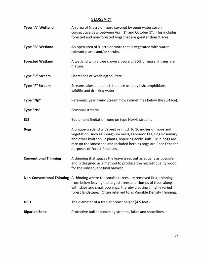
GLOSSARY
Type “A” Wetland An area of ½ acre or more covered by open water seven consecutive days between April 1st and October 1st. This includes forested and non-forested bogs that are greater than ¼ acre.
Type “B” Wetland An open area of ¼ acre or more that is vegetated with water tolerant plants and/or shrubs. Forested Wetland A wetland with a tree crown closure of 30% or more, if trees are mature. Type “S” Stream Shorelines of Washington State Type “F” Stream Streams lakes and ponds that are used by fish, amphibians, wildlife and drinking water Type “Np” Perennial, year round stream flow (sometimes below the surface). Type “Ns” Seasonal streams ELZ Equipment limitation zone on type Np/Ns streams Bogs A unique wetland with peat or muck to 16 inches or more and
vegetation, such as sphagnum moss, Labrador Tea, Bog Rosemary and other hydrophilic plants, requiring acidic soils. True bogs are rare on the landscape and Included here as bogs are Poor Fens for purposes of Forest Practices.
Conventional Thinning A thinning that spaces the leave trees out as equally as possible
and is designed as a method to produce the highest quality wood for the subsequent final harvest.
Non-Conventional Thinning A thinning where the smallest trees are removed first, thinning
from below leaving the largest trees and clumps of trees along with skips and small openings; thereby creating a highly varied forest landscape. Often referred to as Variable Density Thinning.
DBH The diameter of a tree at breast height (4.5 feet) Riparian Zone Protective buffer bordering streams, lakes and shorelines.

38
Relative Density A descriptive term that relates to the density of a timber stand to a fully stocked level. An ideal RD for wildlife habitat is between 25 and 45. Wetland Mtg Zones Buffer bordering wetlands.