Embed Size (px)
Citation preview

GKS-ISP The Study on Formulation of Spatial Planning for GERBANGKERTOSUSILA (GKS) Zone in East Java Province
22
Waru
Tarik
Ngoro
Sooko
Krian
Babat
Cerme
Socah
Gempol
Sedati
Manyar
Sidayu
Gresik
Labang
Paciran
Klampis
Brondong
Mojosari
Sidoarjo
Surabaya
Menganti
Lamongan
SepanjangDriyorejo
Bangkalan
Tanah Merah
Kota Mojokerto
Tambakoso Wilangon
B06Forest
Distribution 2008
0 10 20 305km
GKS-ISPThe Study on
Formulation of Spatial Planningfor GKS ZoneBawean Island
LegendForestKab./Kota Boundary
GKS-ISP The Study on Formulation of Spatial Planning for GERBANGKERTOSUSILA (GKS) Zone in East Java Province
23
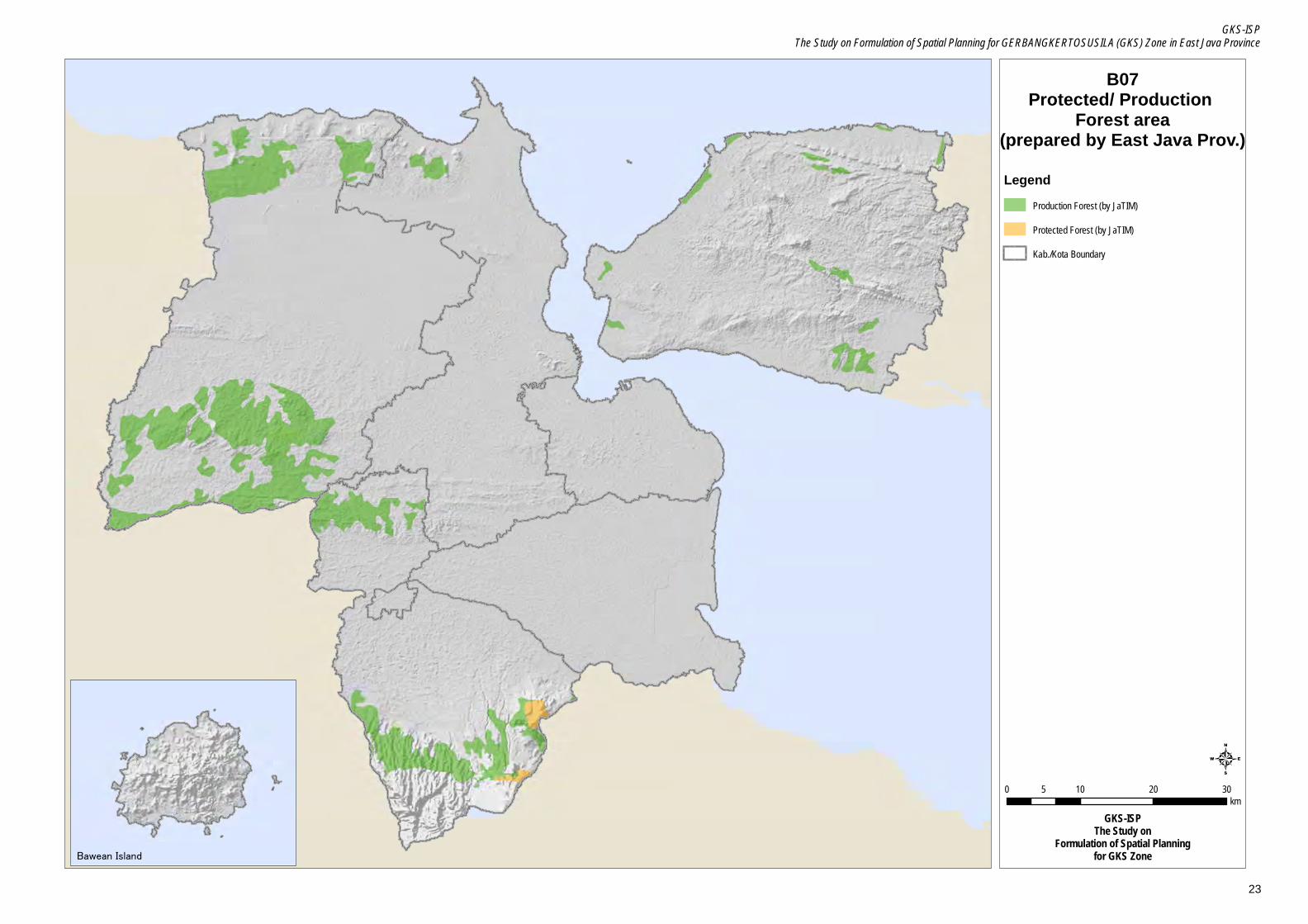
B07Protected/ Production
Forest area(prepared by East Java Prov.)
0 10 20 305km
GKS-ISPThe Study on
Formulation of Spatial Planningfor GKS ZoneBawean Island
LegendProduction Forest (by JaTIM)
Protected Forest (by JaTIM)
Kab./Kota Boundary

GKS-ISP The Study on Formulation of Spatial Planning for GERBANGKERTOSUSILA (GKS) Zone in East Java Province
24
B08Water Catchment area
(prepared by East Java Prov.)
0 10 20 305km
GKS-ISPThe Study on
Formulation of Spatial Planningfor GKS ZoneBawean Island
LegendWater Catchment (by JaTIM)
Kab./Kota Boundary
GKS-ISP The Study on Formulation of Spatial Planning for GERBANGKERTOSUSILA (GKS) Zone in East Java Province
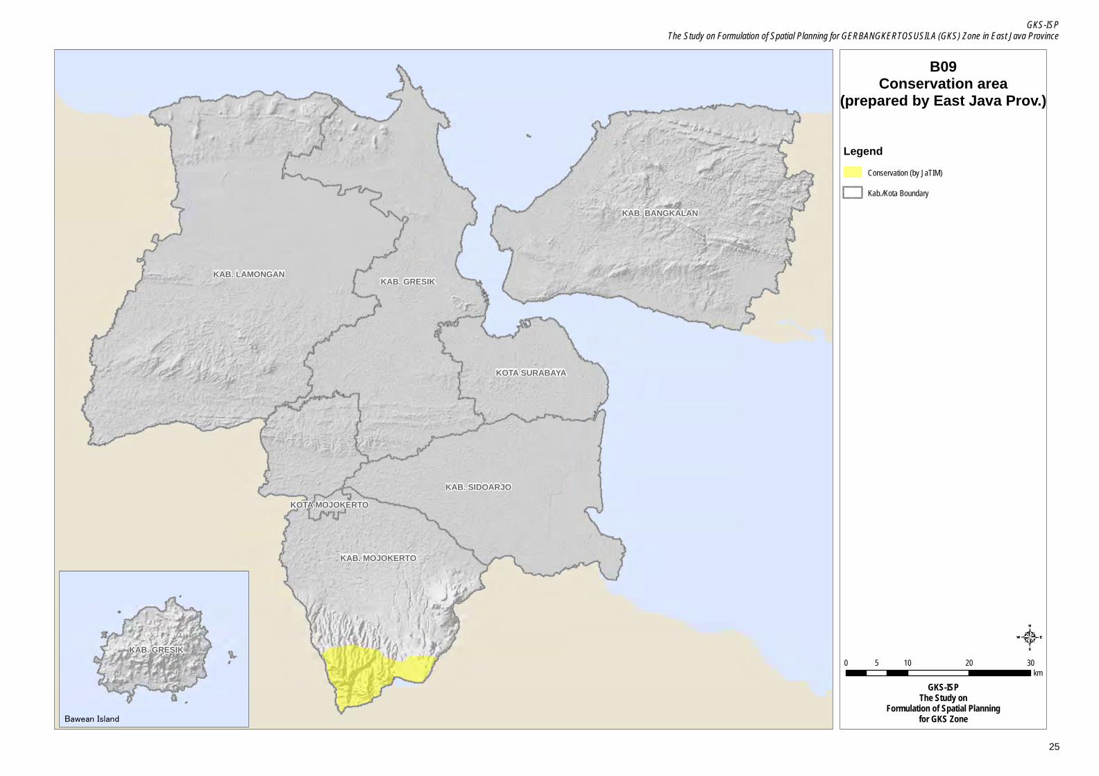
25
KAB. LAMONGAN KAB. GRESIK
KAB. BANGKALAN
KAB. MOJOKERTO
KAB. SIDOARJO
KOTA SURABAYA
KOTA MOJOKERTO
B09Conservation area
(prepared by East Java Prov.)
0 10 20 305km
GKS-ISPThe Study on
Formulation of Spatial Planningfor GKS Zone
KAB. GRESIK
Bawean Island
LegendConservation (by JaTIM)
Kab./Kota Boundary

GKS-ISP The Study on Formulation of Spatial Planning for GERBANGKERTOSUSILA (GKS) Zone in East Java Province
26
KAB. LAMONGAN KAB. GRESIK
KAB. BANGKALAN
KAB. MOJOKERTO
KAB. SIDOARJO
KOTA SURABAYA
KOTA MOJOKERTO
B10Flood Potential Zone
(prepared by East Java Prov.)
0 10 20 305km
GKS-ISPThe Study on
Formulation of Spatial Planningfor GKS Zone
KAB. GRESIK
Bawean Island
LegendFlood Potential area
Kab./Kota Boundary

GKS-ISP The Study on Formulation of Spatial Planning for GERBANGKERTOSUSILA (GKS) Zone in East Java Province
27
B11Assessment of Land Elevation
0 10 20 305km
GKS-ISPThe Study on
Formulation of Spatial Planningfor GKS ZoneBawean Island
LegendElevation
High : 3119
Low : -28
Kab./Kota Boundary

GKS-ISP The Study on Formulation of Spatial Planning for GERBANGKERTOSUSILA (GKS) Zone in East Java Province
28
B12Assessment of Slope Condition
0 10 20 305km
GKS-ISPThe Study on
Formulation of Spatial Planningfor GKS ZoneBawean Island
LegendSlope(%)
7.98.1 - 1818.1 - 3030.1 - 121.9
Kab./Kota Boundary