Embed Size (px)
Citation preview
Flood Modeling In A Box Michael Bufkin, Founder and Chief Solution Architect
2 ® Copyright 2008 TerraGo Technologies. All rights reserved.
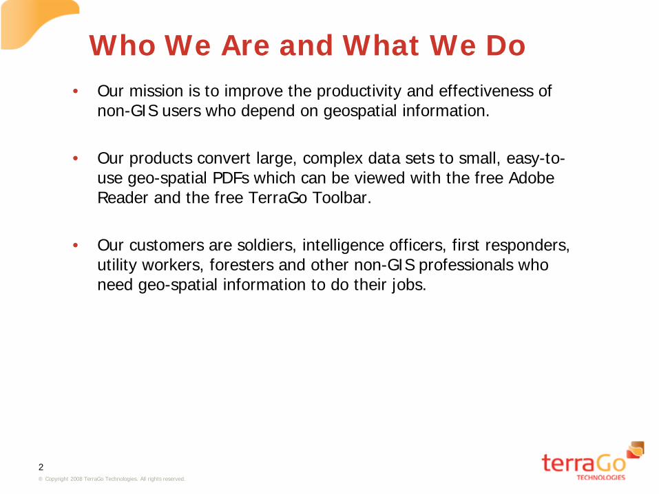
Who We Are and What We Do • Our mission is to improve the productivity and effectiveness of
non-GIS users who depend on geospatial information. • Our products convert large, complex data sets to small, easy-to-
use geo-spatial PDFs which can be viewed with the free Adobe Reader and the free TerraGo Toolbar.
• Our customers are soldiers, intelligence officers, first responders,
utility workers, foresters and other non-GIS professionals who need geo-spatial information to do their jobs.
3 ® Copyright 2008 TerraGo Technologies. All rights reserved.
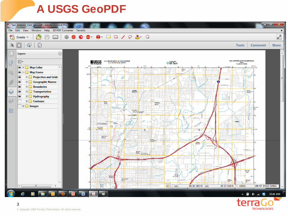
A USGS GeoPDF
4 ® Copyright 2008 TerraGo Technologies. All rights reserved.
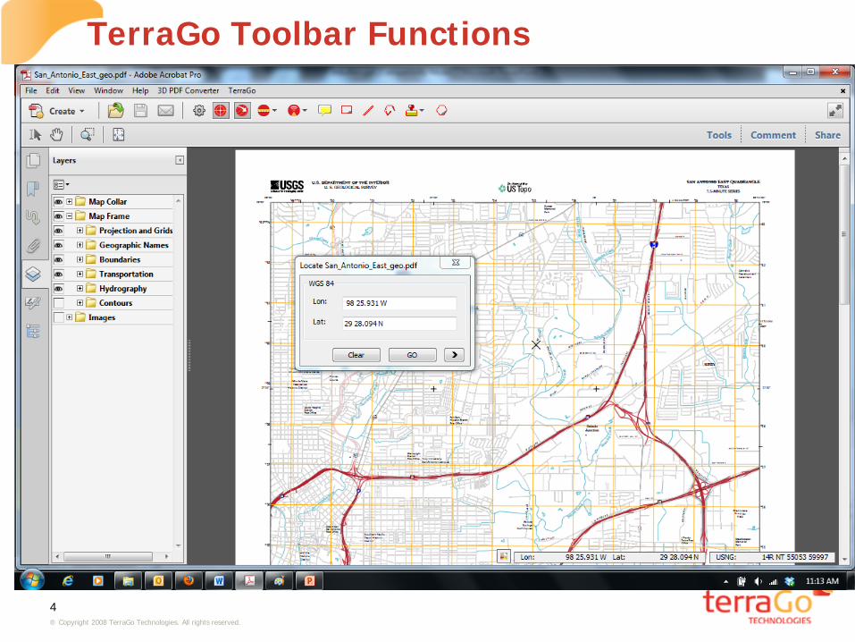
TerraGo Toolbar Functions
5 ® Copyright 2008 TerraGo Technologies. All rights reserved.
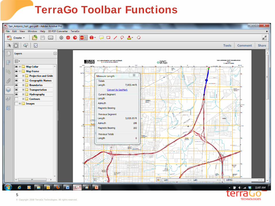
TerraGo Toolbar Functions
6 ® Copyright 2008 TerraGo Technologies. All rights reserved.
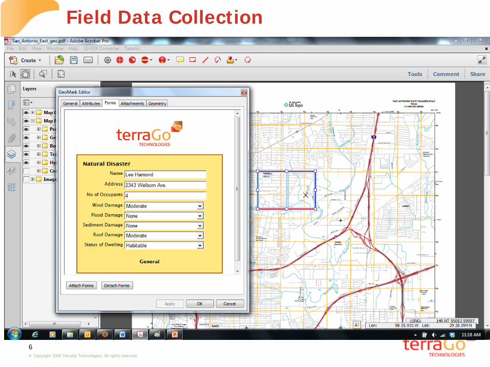
Field Data Collection

7 ® Copyright 2008 TerraGo Technologies. All rights reserved.
GeoJavaScript and Web Services
8 ® Copyright 2008 TerraGo Technologies. All rights reserved.
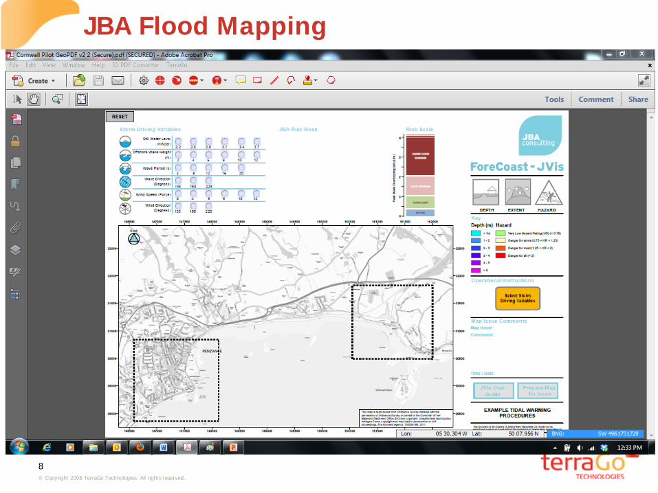
JBA Flood Mapping
9 ® Copyright 2008 TerraGo Technologies. All rights reserved.
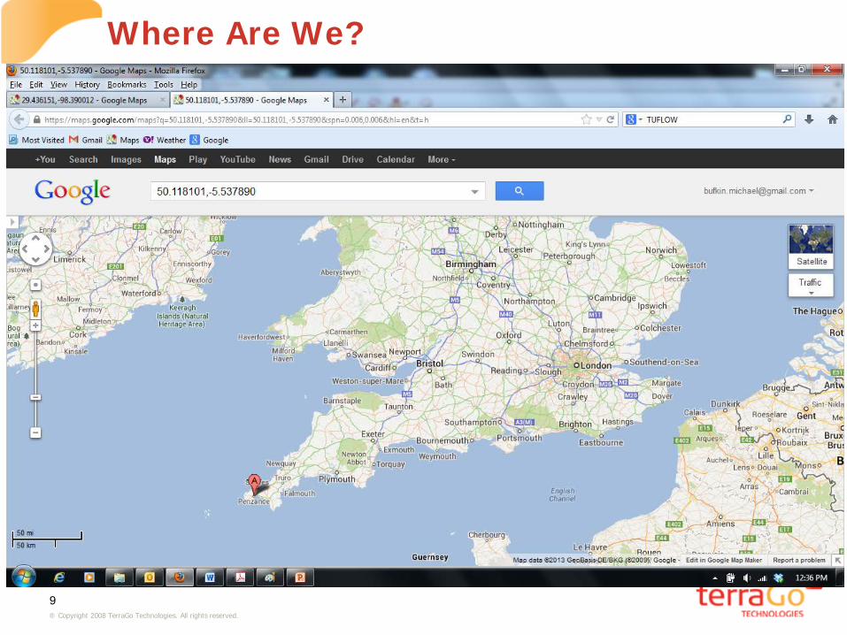
Where Are We?

10 ® Copyright 2008 TerraGo Technologies. All rights reserved.
JBA Flood Mapping

11 ® Copyright 2008 TerraGo Technologies. All rights reserved.
JBA Flood Mapping
12 ® Copyright 2008 TerraGo Technologies. All rights reserved.
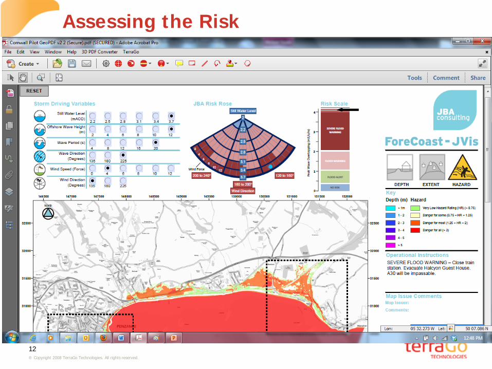
Assessing the Risk
13 ® Copyright 2008 TerraGo Technologies. All rights reserved.
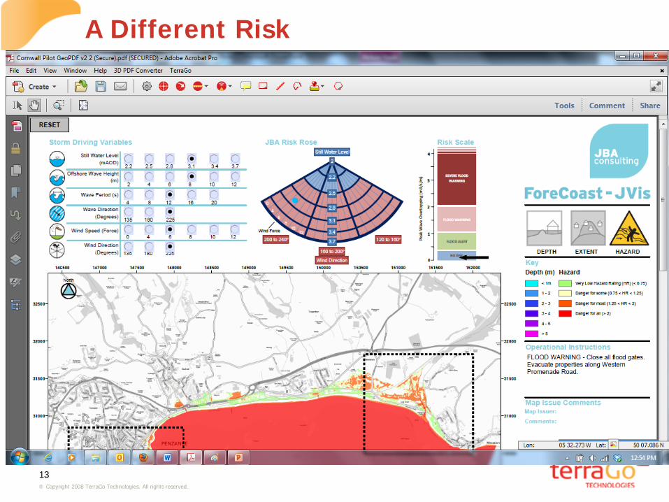
A Different Risk
14 ® Copyright 2008 TerraGo Technologies. All rights reserved.
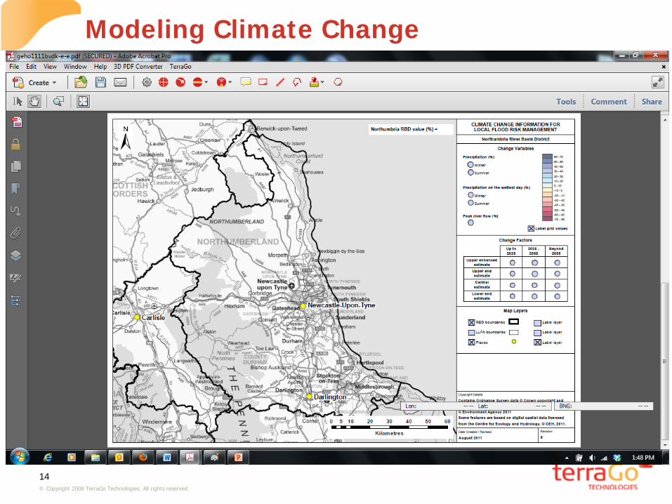
Modeling Climate Change
15 ® Copyright 2008 TerraGo Technologies. All rights reserved.
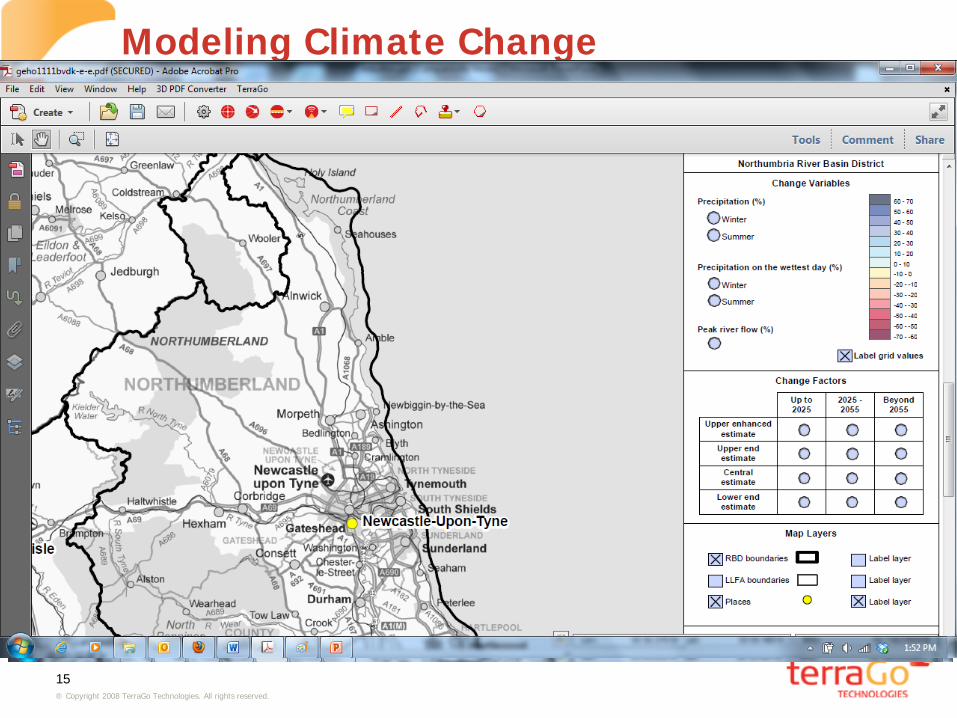
Modeling Climate Change

16 ® Copyright 2008 TerraGo Technologies. All rights reserved.
Winter Rain In 2030

17 ® Copyright 2008 TerraGo Technologies. All rights reserved.
Modeling Climate Change
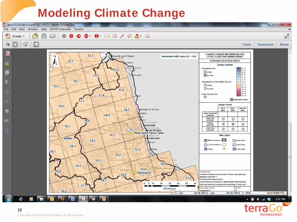
18 ® Copyright 2008 TerraGo Technologies. All rights reserved.
Modeling Climate Change

19 ® Copyright 2008 TerraGo Technologies. All rights reserved.
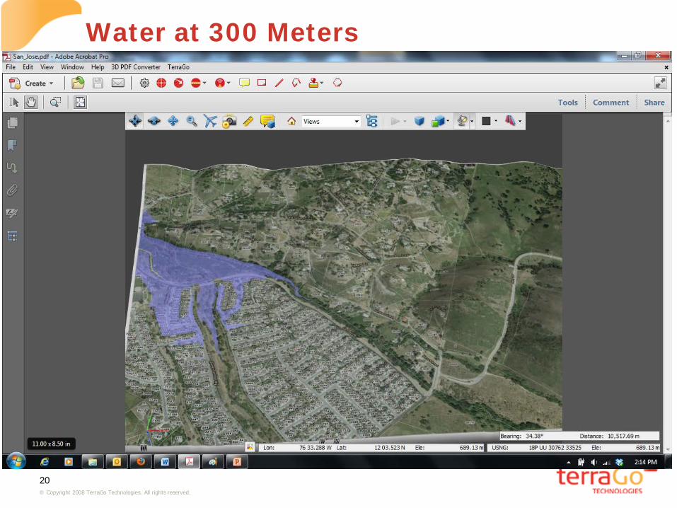
A 3D Flood Map of San Jose
20 ® Copyright 2008 TerraGo Technologies. All rights reserved.
Water at 300 Meters

21 ® Copyright 2008 TerraGo Technologies. All rights reserved.
Water At 303 Meters
22 ® Copyright 2008 TerraGo Technologies. All rights reserved.
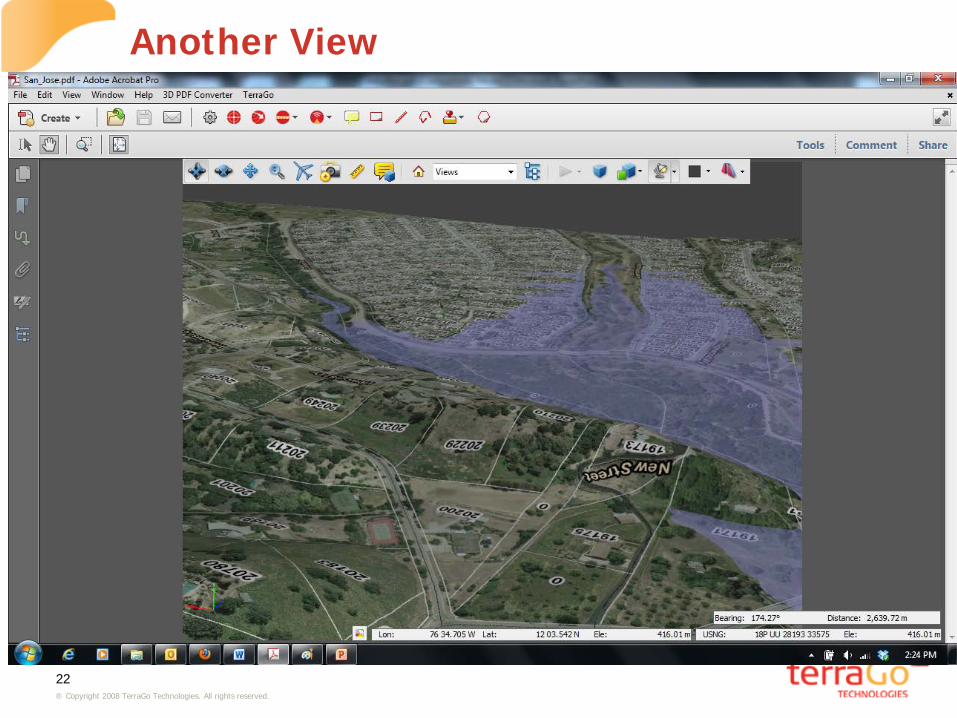
Another View

23 ® Copyright 2008 TerraGo Technologies. All rights reserved.
The Atchafalaya River

24 ® Copyright 2008 TerraGo Technologies. All rights reserved.
The Atchafalaya At 7.62 Meters
25 ® Copyright 2008 TerraGo Technologies. All rights reserved.
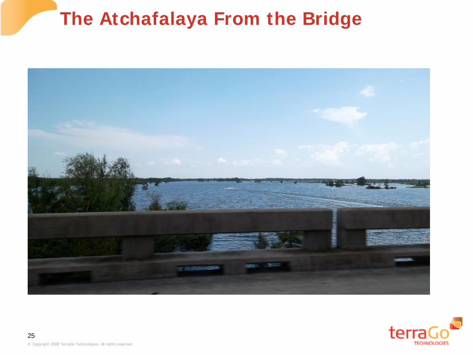
The Atchafalaya From the Bridge
26 ® Copyright 2008 TerraGo Technologies. All rights reserved.
Takeaways • GeoPDF can be used to distribute GIS data to users with the free
Adobe Reader and the free TerraGo Toolbar. • It is possible to embed applications within GeoPDFs. • JBA consulting has embedded both flood modeling and climate change
prediction with GeoPDF. • 3D GeoPDF can be used to display the impact of flooding on terrain.
Questions?