Embed Size (px)
Citation preview
First phase of implementing geotagged photos in Croatia
2018 IACS workshop, 28-30.05.2018, Vilnius, Lithuania
Mladen Majcen – LPIS Department
Content
• Croatia / LPIS characteristics
• Business process & responsibilities
• Accuracy and spatial displacement
• Open questions
• Recommendation / SW requirements
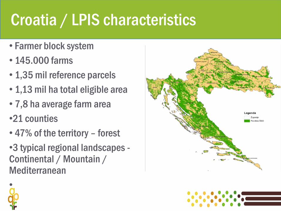
Croatia / LPIS characteristics
• Farmer block system
• 145.000 farms
• 1,35 mil reference parcels
• 1,13 mil ha total eligible area
• 7,8 ha average farm area
•21 counties
• 47% of the territory – forest
•3 typical regional landscapes -Continental / Mountain / Mediterranean
•
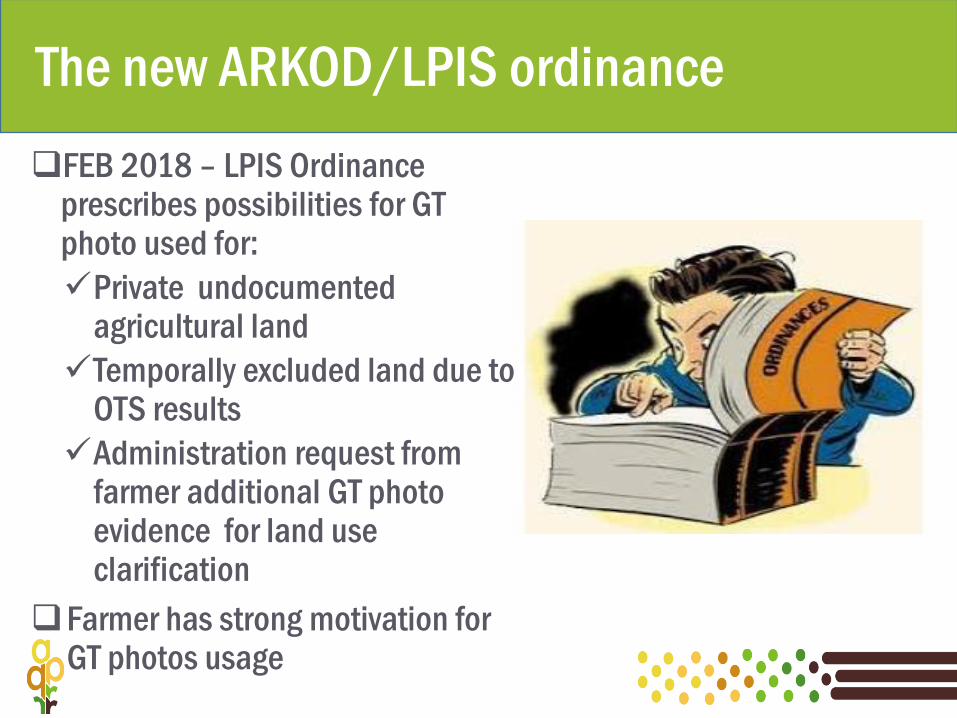
The new ARKOD/LPIS ordinance
FEB 2018 – LPIS Ordinance prescribes possibilities for GT photo used for:
Private undocumented agricultural land
Temporally excluded land due to OTS results
Administration request from farmer additional GT photo evidence for land use clarification
Farmer has strong motivation for GT photos usage

Plan B –principles and goals
Since we didn’t have enough time to develop application, manual approach was the only solution
Should be as simple as possible
Without cost for external contractor
Ensure evidence that farmer has been informed about GT photo task
Monitoring of the whole process
Data compatibilities with
Phase 2 – when the application will be developed
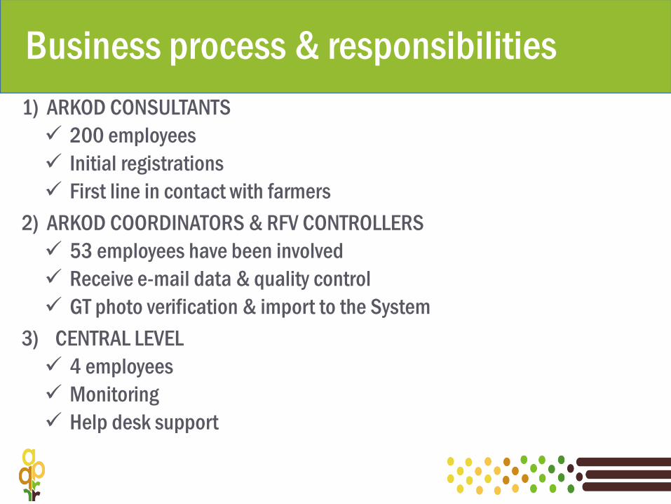
Business process & responsibilities
1) ARKOD CONSULTANTS
200 employees
Initial registrations
First line in contact with farmers
2) ARKOD COORDINATORS & RFV CONTROLLERS
53 employees have been involved
Receive e-mail data & quality control
GT photo verification & import to the System
3) CENTRAL LEVEL
4 employees
Monitoring
Help desk support
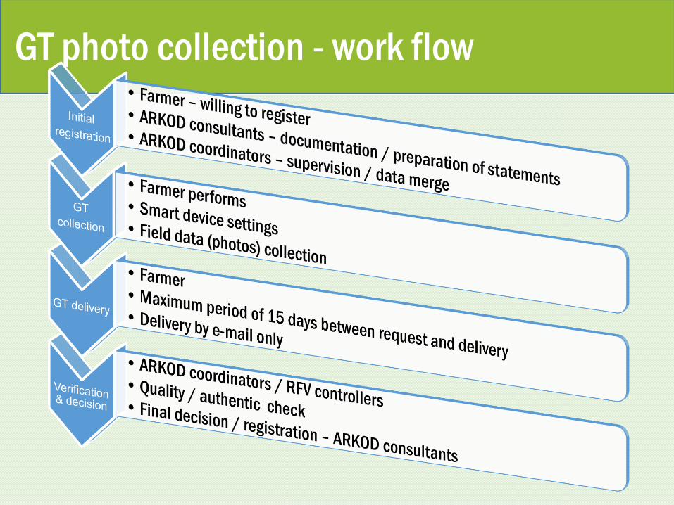
GT photo collection - work flow
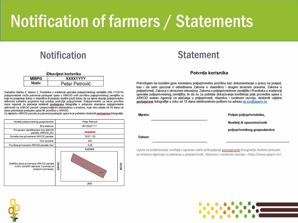
Notification of farmers / Statements
Notification Statement
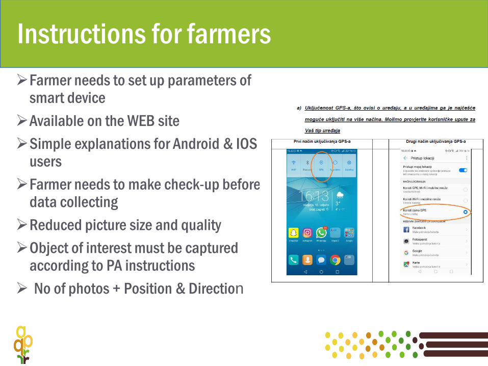
Instructions for farmers
Farmer needs to set up parameters of smart device
Available on the WEB site
Simple explanations for Android & IOS users
Farmer needs to make check-up before data collecting
Reduced picture size and quality
Object of interest must be captured according to PA instructions
No of photos + Position & Direction
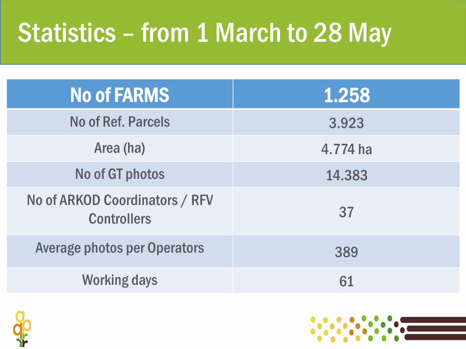
Statistics – from 1 March to 28 May
No of FARMS 1.258
No of Ref. Parcels 3.923
Area (ha) 4.774 ha
No of GT photos 14.383
No of ARKOD Coordinators / RFV
Controllers 37
Average photos per Operators 389
Working days 61
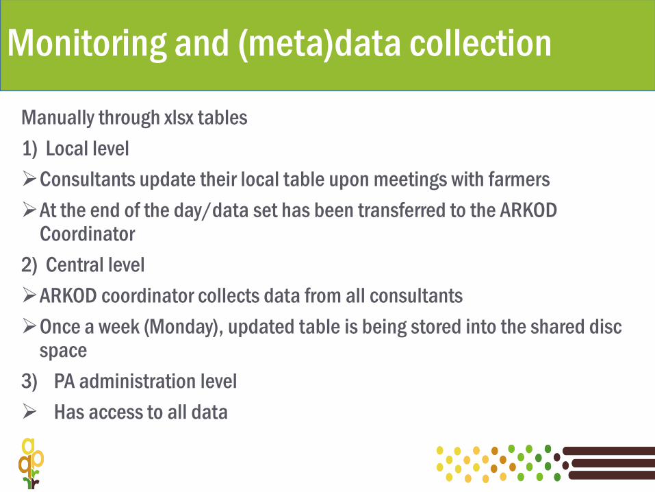
Monitoring and (meta)data collection
Manually through xlsx tables
1) Local level
Consultants update their local table upon meetings with farmers
At the end of the day/data set has been transferred to the ARKOD Coordinator
2) Central level
ARKOD coordinator collects data from all consultants
Once a week (Monday), updated table is being stored into the shared disc space
3) PA administration level
Has access to all data
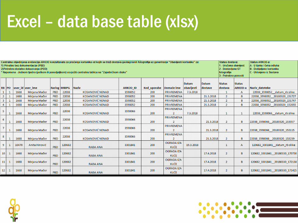
Excel – data base table (xlsx)
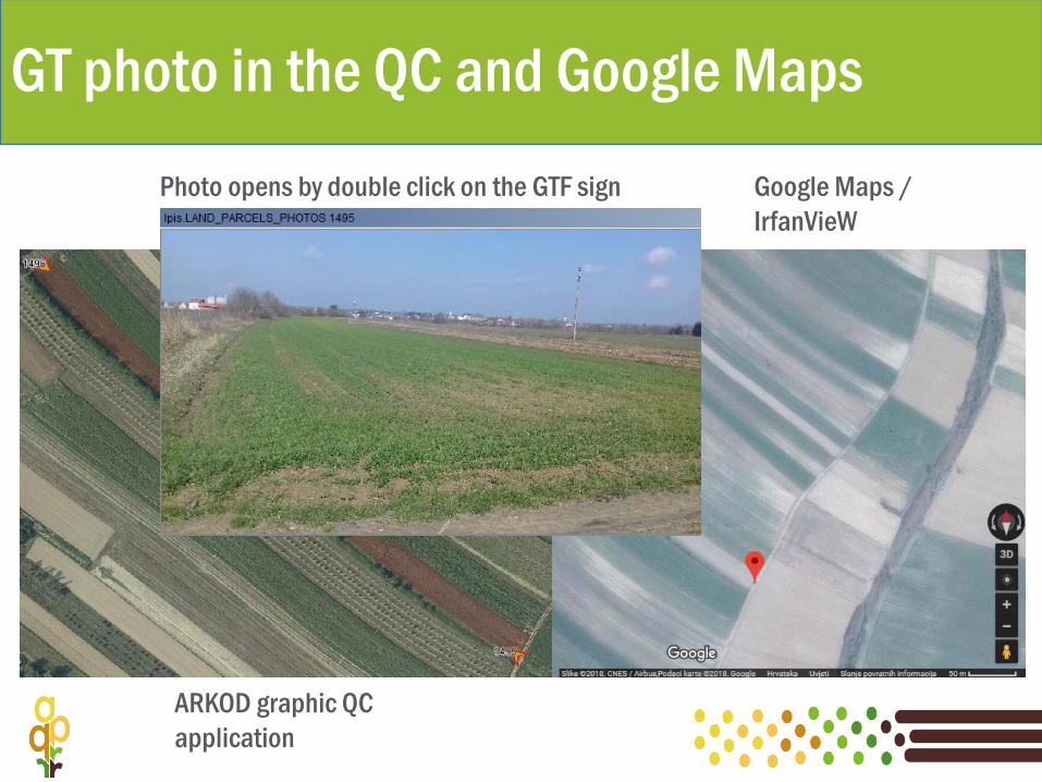
GT photo in the QC and Google Maps
ARKOD graphic QC
application
Google Maps /
IrfanVieW
Photo opens by double click on the GTF sign
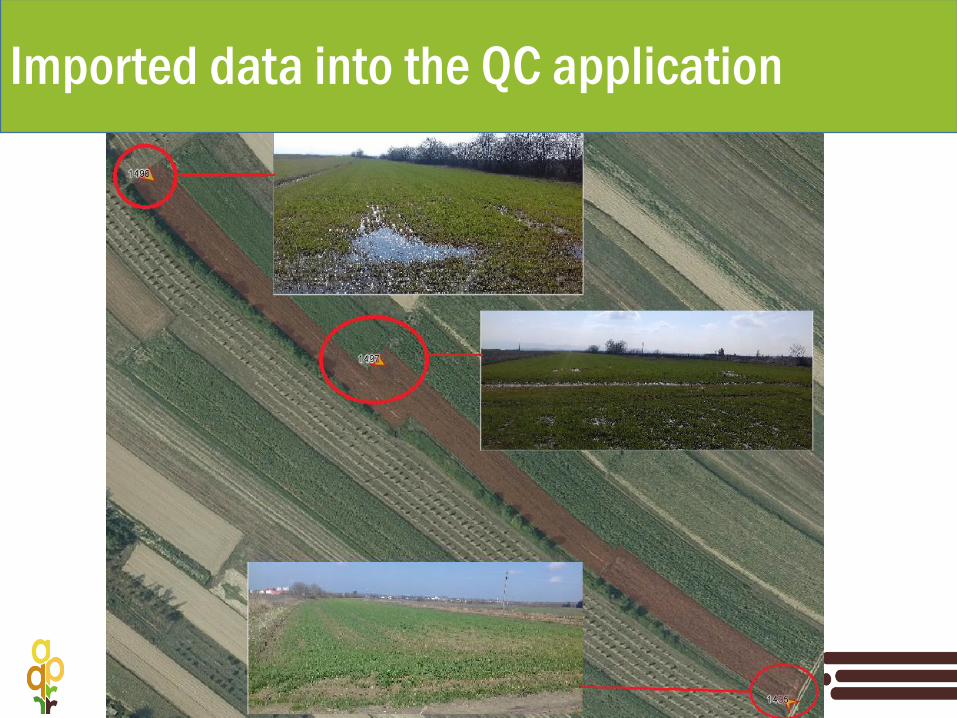
Imported data into the QC application
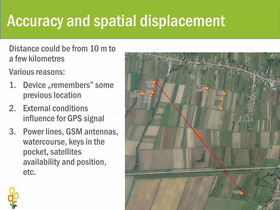
Accuracy and spatial displacement
Distance could be from 10 m to a few kilometres
Various reasons:
1. Device „remembers” some previous location
2. External conditions influence for GPS signal
3. Power lines, GSM antennas, watercourse, keys in the pocket, satellites availability and position, etc.
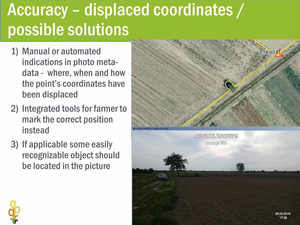
Accuracy – displaced coordinates / possible solutions1) Manual or automated
indications in photo meta-data - where, when and how the point’s coordinates have been displaced
2) Integrated tools for farmer to mark the correct position instead
3) If applicable some easily recognizable object should be located in the picture
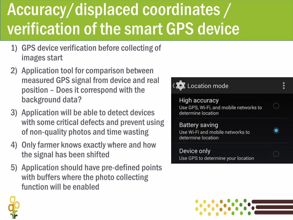
Accuracy/displaced coordinates / verification of the smart GPS device1) GPS device verification before collecting of
images start
2) Application tool for comparison between measured GPS signal from device and real position – Does it correspond with the background data?
3) Application will be able to detect devices with some critical defects and prevent using of non-quality photos and time wasting
4) Only farmer knows exactly where and how the signal has been shifted
5) Application should have pre-defined points with buffers where the photo collecting function will be enabled

Open questions
1) GT photo collection - farmer’s motivation or obligation?
2) Verification and validation of GPS accuracy?
3) Managing the large amount of photos –how to use automation?
4) Efficient way how to store, maintain and archive the huge amount of GT photos?
5) Time consuming and needs for human resources during the whole process of photo verification / evaluation / administration?
Recommendation/SW requirements
1) Begins with the establishment of GT photo integration into the IACS as soon as possible
2) Fundamental application requirements:
1) Manage through the „Farmer tool” application
2) On-line share of information PA /Farmer (application /e-mail / SMS / WhatsApp / Viber /…)
3) Farmer’s confirmation / feedback
4) IACS data available (spatial layers & alphanumerical)
5) GPS /Camera remote - settings
6) Mode for GPS accuracy verification test
7) Pre defined points of interest / data collection / and orientation of the camera
AGENCIJA ZA PLAĆANJA U POLJOPRIVREDI, RIBARSTVU I RURALNOM RAZVOJU
Ulica grada Vukovara 269d
10 000 Zagreb
+385 1 6002 700 (centrala)
+385 1 6002 742 (informiranje)
www.apprrr.hr
Thank you for your attention