Embed Size (px)
Citation preview

_____________________________________________________________________________
FINAL INTEGRATED FEASIBILITY REPORT
AND ENVIRONMENTAL IMPACT STATEMENT
COASTAL STORM DAMAGE REDUCTION
BOGUE BANKS, CARTERET COUNTY
NORTH CAROLINA
APPENDIX N
VALUE ENGINEERING
US Army Corps of Engineers Wilmington District

U.S. ARMY CORPS OF ENGINEERS WILMINGTON DISTRICT
113670 - INTEGRATED FEASIBILITY REPORT AND
DRAFT ENVIRONMENTAL IMPACT STATEMENT BOGUE BANKS, CARTERET COUNTY
NORTH CAROLINA
VALUE ENGINEERING REPORT
September 2013
N - 1 Bogue Banks, Carteret County, NC, Final Feasibility Report and Environmental Impact Statement

2
DOD SERVICE: USACE VALUE ENGINEERING OFFICER: C. Lee Danley, PE, LEED AP CONTROL NO: CESAW 13-8
REPORT INFORMATION
VALUE ENGINEERING FIRM: U. S. Army Corps of Engineers Jacksonville District 701 San Marco Blvd Jacksonville, FL 32232-0019 (904) 232-1903
VALUE ENGINEERING WORKSHOP CONDUCTED: 16-17 September 2013 VALUE ENGINEERING STUDY TEAM LEADER: Jimmy Matthews, PE, CVS VALUE ENGINEERING STUDY TEAM MEMBERS: Team member names and contact information are in Appendix B.
POINTS OF CONTACT: C. Lee Danley, PE, LEED AP
Value Engineering Officer 69 Darlington Avenue Wilmington, NC 28403-1343 (910) 251-4562 Office
STUDY RESULTS: Evidence of Unfettered Creativity: 47 ideas generated, several ideas were combined into single proposals and comments Number of Proposals: n/a Number of Accepted Proposals: n/a Number of Recommendations: 11 Number of Recommendations Accepted: 7
N - 2 Bogue Banks, Carteret County, NC, Final Feasibility Report and Environmental Impact Statement
3
TABLE OF CONTENTS
INTRODUCTION ............................................................................................................................................. 5
PROJECT DESCRIPTION (ON DATE OF VE STUDY, 16-18SEP13) .................................................................... 5
VALUE METHODOLOGY................................................................................................................................. 7
STUDY RESULTS AND RECOMMENDATIONS ................................................................................................. 9
DECISION DOCUMENT VALUE ENGINEERING CERTIFICATION ................................................................... 11
APPENDIX A: VALUE ENGINEERING WORKSHOP AGENDA ......................................................................... 12
APPENDIX B: WORKSHOP PARTICIPANT ROSTER ....................................................................................... 15
APPENDIX C: FUNCTION ANALYSIS ............................................................................................................ 16
APPENDIX D: CREATIVITY AND EVALUATION .............................................................................................. 17
APPENDIX E: PROPOSAL AND RECOMMENDATION DOCUMENTATION .................................................... 18
N - 3 Bogue Banks, Carteret County, NC, Final Feasibility Report and Environmental Impact Statement

4
This page is blank by intention.
N - 4 Bogue Banks, Carteret County, NC, Final Feasibility Report and Environmental Impact Statement

5
INTRODUCTION
This Value Engineering (VE) Report documents the completion of the Integrated Feasibility Report and Draft Environmental Impact Statement (DEIS), Coastal Storm Damage Reduction, Bogue Banks, Carteret County, North Carolina, Draft Report, August 2013 edition value analysis. The report and DEIS are near the Alternative Formulation Briefing stage of completion. Value improvements proposed herein will be addressed during further report and DEIS refinements and/or the Preconstruction, Engineering and Design Phase of project development.
PROJECT DESCRIPTION (on date of VE Study, 16-18Sep13)
The purpose of the subject feasibility study is to evaluate coastal storm damage reduction at Bogue Banks, a 25.4-mile long barrier island located on North Carolina’s central coast in Carteret County. The study team integrated representatives of Federal, State, and local governments, in the effort to identify cost-effective, publicly acceptable, and environmentally and technically sound alternatives to reduce damages within the towns and to the adjacent shoreline. The study effort identifies a National Economic Development (NED) plan, which is the plan that maximizes net benefits to the nation through reduction of future storm damages. The tentatively selected plan is the NED plan (Alternative 9), which has the following dimensions (an ‘x’ indicates that the project template does not contain a Federally maintained dune feature):
The NED plan consists of an 119,670 ft (22.7 miles) long main beach fill, with a consistent berm profile across the entire area, and dune expansion in certain portions (approximately 5.9 miles of the project). The main beach fill is bordered on either side by a 1,000 ft tapered transition zone berm. Sand for the beach fill would be delivered from offshore borrow areas by dredge. The project would be eligible to be renourished every three years following initial construction, in order to build the project back up to the authorized dimensions. Material for the project would be dredged from three offshore borrow locations. The plan is incrementally justified. The plan provides an estimated average annual $11,511,000 in coastal storm damage reduction benefits and $3,432,000 in recreation benefits, at an average annual cost of $6,583,500 a year, and has a Benefit Cost Ratio of 2.3 to 1. In addition, if implemented the project would enhance the beach strand available for recreation use and provide and maintain habitat for a variety of plants and animals.
ReachesLength
(ft)
Landward
Dune Slope
(X:1)
Max Dune
Elevation (ft)
Dune
Width (ft)
Seaward
Dune Slope
(X:1)
Berm
Height (ft)
Berm
Width (ft)
Berm
Seaward
Slope (X:1)
4-10 4,876 4 16 95 -4 5.5 50 -1511-15 5,633 4 15 45 -4 7 50 -1516-21 6,891 4 20 10 -4 7 50 -1522-92 82,053 4 x x -4 7 50 -15
93-110 15,274 4 18 40 -4 5.5 50 -15111-117 4,943 4 x x -4 5.5 50 -15
N - 5 Bogue Banks, Carteret County, NC, Final Feasibility Report and Environmental Impact Statement

6
The estimated First Cost of the plan is $37,469,000, which would be cost-shared 65% Federal and 35% non-Federal. Operations and maintenance costs are estimated at $75,000 a year and would be a 100% non-Federal responsibility. The project includes a 3 year renourishment cycle (16 total renourishments) with an estimated cost of $14,370,000 per renourishment. Renourishments would be cost shared at 50% Federal and 50% non-Federal. A vicinity map is on the following page.
Vicinity map, including potential offshore borrow locations (Y, U, and Q2).
N - 6 Bogue Banks, Carteret County, NC, Final Feasibility Report and Environmental Impact Statement
7
VALUE METHODOLOGY
This report documents the VE workshop conducted 16-18 September 2013. The workshop was conducted using the six-phase Value Engineering Job Plan as sanctioned by USACE and the Society of American Value Engineers International (SAVE). This process, as explained below, was executed as part of daily activities as described in the Workshop Agenda exhibited in Appendix A. The VE Team was comprised of USACE Team Members from the Jacksonville and Wilmington Districts. The roster is located in Appendix B. The VE Workshop culminated in the development phase where ideas were captured and refined into recommendations. Recommendations are topics that warrant consideration but theirs savings were not computable (quantitative) with current information. Appendix E contains the related documentation. Information Phase At the beginning of the study, the project team presents current planning and design status of the project. This includes a general overview and various project requirements. Project details are presented as appropriate. Discussion with the VE Team enhances the Team’s knowledge and understanding of the project. Function Analysis Phase Key to the VE process is the Function Analysis. Analyzing the functional requirements of a project is essential to assuring an owner that the project has been designed to meet the stated criteria and its need and purpose. The analysis of these functions is a primary element in a value study, and is used to create ideas and develop proposals. This procedure is beneficial to the team, as it forces the participants to think in terms of functions. For this study, team members developed a function list and then considered the list in regards to the report’s recommended plan features. This facilitated a deeper understanding of the project. The function analysis is presented in Appendix C. Creativity Phase The Creativity Phase involves identifying and listing creative ideas. During this phase, the team participates in a brainstorming session to identify as many means as possible to provide the necessary project functions. Judgment of the ideas is not permitted in order to generate a broad range of ideas. The creative phase continues through the other phases as ideas can, and often times do, create other ideas. Evaluation Phase The purpose of the Evaluation Phase was to systematically assess the potential impacts of ideas generated during the Creativity Phase relative to their potential for value improvement. Each idea is evaluated in terms of its potential impact to cost and overall project performance. Once each idea is fully evaluated, it is given a rating to identify whether it would be carried forward and/or developed as an alternative, combined with other ideas, presented as a design suggestion, dismissed from further consideration or that it is already being done by Project Delivery Team. Appendix D lists those ideas
N - 7 Bogue Banks, Carteret County, NC, Final Feasibility Report and Environmental Impact Statement

8
with their evaluation disposition. The appendix tables also display the evolution of ideas from creation through their embodiment into recommendations. Development Phase During the Development Phase, ideas passing evaluation are expanded and developed into recommendations. The development process considers such things as the impact to performance, cost, constructability, and schedule of the alternative concepts relative to the baseline concept. This analysis is prepared as appropriate for each alternative, and the information may include an initial cost and/or life cycle cost comparisons. Each alternative or idea describes the baseline concept and proposed changes and includes a technical discussion. Presentation Phase The VE Workshop concluded with a preliminary presentation of the value team’s assessment of the project and value alternatives and ideas. The presentation provides an opportunity for the owner, project team, and stakeholders to preview the alternatives and develop an understanding of the rationale behind them. The presentation is also used to refine proposal justification to include the corporate perspective.
N - 8 Bogue Banks, Carteret County, NC, Final Feasibility Report and Environmental Impact Statement

9
STUDY RESULTS AND RECOMMENDATIONS
The VE team developed several recommendations that warrant more detailed investigation. Appendix E contains the related documentation. Related cost avoidance will be developed for awarded contract)s) and reported in the Value Engineering Reporting System (VERS). Should ideas/comments result in additional quantifiable cost avoidance, those ideas/comments will be documented as proposals and appended to this report. In general, VE team recommendations centered on:
Developing contract alternatives to complete the project in one dredging season;
Reducing costs with additional borrow sources and placement strategies; and
Improving constructability.
RECOMMENDATIONS
The following recommendations have been evaluated by the PDT and the action noted as adopted or not adopted. Also noted is whether the recommendation will be addressed in the report, the Preconstruction, Engineering and Design Phase (PED) or both.
NO. 1 – Evaluate additional navigation channel borrow source concepts – Adopted. To be further evaluated during the PED Phase. NO. 2 - Multiple Dredging Plant Options to Complete the Project – Adopted. The District has decided to accept this recommendation and evaluate further during PED. However, adoption of the use of the inlets will not be pursued. NO. 3 - Nearshore Placement Strategies – Not Adopted. The District has decided not to adopt this recommendation. Environmental concerns with double handling, grain size compatibility, potentially significant negative effects on storm damage risk reduction outputs associated with delay in benefit realization. Design concerns associated with segmentation of berm and dune protective features along the project shoreline. NO. 4 - Further Investigate The Geotechnical Data To Optimize Material Within The Borrow Areas and To Locate Borrow Areas Closer To The Project – Adopted. To be further evaluated during the PED Phase. NO. 5 - Dune Stabilization Utilizing Sand Fencing, Vegetation Planting, and Woody Debris – Adopted. To be further evaluated during the PED Phase – Adopted. To be further evaluated during the PED Phase. NO. 6 - Evaluate Removing Shoreline Segment R23 – R36 From the Project – Not Adopted. The District has decided not to adopt this recommendation. The graphics above illustrate the beach and nearshore conditions within the 2.5 mile beach segment in question. The bottom graphic indicates that the existing berm width along this area currently approximates the design template for the project, which is the reason that initial placement volumes are not required and subsequent renourishment volumes are comparatively low relative to the remainder of the project area. However, as future storms erode the existing shoreline in this area, expected future structural damages result in CSDR outputs between reaches 22 and 36 that are high enough on which to justify Federal interest in a project without consideration of recreational outputs. Only two 800-foot long subreaches are not justified based on
N - 9 Bogue Banks, Carteret County, NC, Final Feasibility Report and Environmental Impact Statement

10
CSDR outputs alone, and as these are non-contiguous it is not feasible from a construction standpoint to remove these from the overall project plan.
0
10,000
20,000
30,000
40,000
50,000
60,000
70,000
80,000
90,000
1 4 7 10 13 16 19 22 25 28 31 34 37 40 43 46 49 52 55 58 61 64 67 70 73 76 79 82 85 88 91 94 97 100103106109112115
Vo
lum
e (C
Y)
Reach
Projected Volume by Reach
Initial Placement Volume Average Renourishment Cycle Placement (C.Y.)
N - 10 Bogue Banks, Carteret County, NC, Final Feasibility Report and Environmental Impact Statement

11
No. 7 - Revisit the advance nourishment option for life cycle cost – Adopted. To be further evaluated during the PED Phase. NO. 8 - Extension of Environmental/Dredging Window Outside of Dec 15 through March 31 – Adopted. This recommendation has already been incorporated into the document. Should the situation arise in which the contractor needs to extend into the environmental windows, clearance to do so would be sought from the environmental agencies. NO. 9 - Investigate and Evaluate Brandt Island as a Borrow Area for The Project – Not Adopted. Based on the disadvantages described in the recommendation the District does not wish to adopt this recommendation. Several evaluations have been completed previously concerning beneficial use of this material with no positive outcome due to cost and environmental constraints due to compatibility issues. NO. 10 - Solicitation Options to Expedite Schedule and Reduce Construction Costs – Adopted. This District will adopt this recommendation and pursue during the contracting phase of the project. NO. 11 - Feeder Points (Sand Engine) – Not Adopted. The District has decided not to adopt this recommendation. Although this is a novel idea, there are many limitations in modeling of sand migration and project benefits. Individual “sand engines” would have to be models for particular wave actions at each location. Currently no along shore models are available to complete this.
DECISION DOCUMENT VALUE ENGINEERING CERTIFICATION
This VE report satisfies the requirements of ER 11-1-321, Army Programs Value Engineering for decision document VE Certification.
N - 11 Bogue Banks, Carteret County, NC, Final Feasibility Report and Environmental Impact Statement

12
APPENDIX A: VALUE ENGINEERING WORKSHOP AGENDA
N - 12 Bogue Banks, Carteret County, NC, Final Feasibility Report and Environmental Impact Statement

13
VALUE ENGINEERING WORKSHOP AGENDA INTEGRATED FEASIBILITY REPORT AND DRAFT EIS AND OPERATIONS PHASES
BOGUE BANKS, CARTERET COUNTY, NORTH CAROLINA 16-17 SEP 2013
Meeting Location: Virtual and Jacksonville District Office, Design Team Room 388, 3E
Call-in number: USA Toll-Free: 877-336-1274
Access Code: 7299267 Security Code: 0916
Web Meeting Address: https://www.webmeeting.att.com
Meeting Number: 8773361274 Access Code: 7299267
* The first time you use the Web Meeting Service, you will need to download the client software. Web Meeting HELP & Software Downloads
can be found at: https://www.webmeeting.att.com* 16Sep13: 0855-0900 Attendees Call In and Establish Web Meeting Connections 0900-0915 Introductions and Web Meeting Rules 0915-0930 Workshop Purpose and VE Scope and Activities – Jimmy Matthews 0930-1020 Report and Project Overview – PDT 1020-1030 Break 1030-1100 Function Analysis – Jimmy Matthews 1100-1200 Creativity Phase – VE Team 1200-1245 Lunch 1245-1400 Evaluation Phase and Day 1 Wrap-up – VE Team 17Sep13: 0900-1000 Complete Evaluation Phase- J Matthews 1000-1030 Recommendation and Comment Development Assignments: - J Matthews
1030-1330 Complete the Development Phase – VE Team
1330-1400 Workshop Wrap Up and Completion Schedule - J Matthews
N - 13 Bogue Banks, Carteret County, NC, Final Feasibility Report and Environmental Impact Statement

14
18-19Sep13 0900-1600 Complete Development Phase 20Sep13: 1000-1100 Provide draft VE Report and Conduct Decision Makers Briefing 24Sep13: Complete Final VE Report
N - 14 Bogue Banks, Carteret County, NC, Final Feasibility Report and Environmental Impact Statement

15
APPENDIX B: WORKSHOP PARTICIPANT ROSTER
N - 15 Bogue Banks, Carteret County, NC, Final Feasibility Report and Environmental Impact Statement

Value Engineering Workshop - Bogue Banks CSDR Feasibility Report
16-20 Sep 2013
Virtual
Name Office Phone E-mail (@usace.army.mil) 16
-Se
p-1
3
17
-Se
p-1
3
18
-Se
p-1
3
19
-Se
p-1
3
20
-Se
p-1
3
Jimmy Matthews CESAJ-EN-Q (904)232-2087 [email protected] x x x x
Matthew Schrader CESAJ-PD-PN (904) 232-2043 [email protected] x x x
Pam Castens CESAW-PM-C (910) 251-4671 [email protected] x x
Chris Moore CESAW-PM-C (910) 251-4483 [email protected] x x x
Kevin Conner CESAW-TS-EW (910) 251-4867 [email protected] x x x
Doug Piatkowski CESAW-TS-PE (910) 251-4908 [email protected] x x
Lee Danley CESAW-TS-ED (910) 251-4562 [email protected] x x x x
Paul Sadowski CESAW-TS-C (910) 251-4464 [email protected] x x x
Erin Williams CESAW-TS-EG (202) 761-4692 [email protected] x x x
Justin Bashaw CESAW-TS-PE (910) 251-4581 [email protected] x x
Attendance
Sheet __ of __N - 16 Bogue Banks, Carteret County, NC, Final Feasibility Report and Environmental Impact Statement

16
APPENDIX C: FUNCTION ANALYSIS
N - 17 Bogue Banks, Carteret County, NC, Final Feasibility Report and Environmental Impact Statement

BUILDING STRONG® US ARMY CORPS OF ENGINEERS | Jacksonville District
BOGUE BANKS, NC- FUNCTION LIST
Reduce Storm/Hurricane Damage Identify/Distribute Sand Sources Target Affordability
Maintain Sand in coastal system Vegetate dunes Control Cost Growth
Protect Property/Infrastructure Distribute Sand (Pipe/Truck) Reduce Processes
Minimize Erosion Impacts Protect Environmental Habitat Reduce Bureaucracy Minimize wave attack &
inudation Increase public access and
parking
Enhance Beach/Shoreline Minimize Environmental Impacts Incentivize innovation
Add Beachfill Monitor Impacts Incentivize productivity
Develop Sand Delivery/Placement Options
Satisfy User
Promote Competition
Continue as a disposal option Attract User
N - 18 Bogue Banks, Carteret County, NC, Final Feasibility Report and Environmental Impact Statement

17
APPENDIX D: CREATIVITY AND EVALUATION
N - 19 Bogue Banks, Carteret County, NC, Final Feasibility Report and Environmental Impact Statement

Idea
Idea
Group Action Created Ideas
1 Coordinate with navigation disposal (dual source of funding)
2 Use pipeline on edges and hopper in the middle portion of the project
3 Use combination of pipeline and hopper (contractor selection)
4
Use channel as a borrow source (can dredge deeper under shore protection
authority)
5 Evaluate the near shore placement further
6 near shore as borrow
7 near shore as a feeder beach
8 evaluate Bogue Inlet as a deep excavation for borrow
9 evaluate geotech information
10 included sand fencing
11 consider different species for vegetating the dunes
12 drop a section of nourishment from R21 to R27
13 show how R21 to R27 is justified incrementally
14 compare R21 to R27 to lack of access and parking (cost of parking and x-overs)
15
evaluate separable non-structural measures for the peak damage areas shown on
slide 8
16 add a combination of structural non-structural measures to the plan mix
17 revisit the advance nourishment option for life cycle cost
18 evaluate use of debris (old x-mass trees) for stability of dune
19 evaluate extension of environmental windows
20 evaluate extension with risk parameters
21
include into the recommended plan the equivalent 933 provision to move
material from the channels to the high eroding areas
22 inclusion of structures to stabilize fill and increase nourishment interval
23 evaluate Brandt Island as borrow
24 evaluate Brandt Island as source for near shore
25 include an enhancement area for threatened/protected species into the project
26 increase dune dimensions in order to increase nourishment interval
27 utilize Corps dredges for near shore options
28 evaluate dunes for optimization of benefits
29 evaluate dunes for raising dune height in the high damage areas
30 evaluate inclusion of dual dunes in more locations
31 evaluate 3 hopper dredges for the project
32 look for closer borrow locations
33 add an incentive clause in the contract to complete the project within the window
34 use of multiple hoppers, one for the borrow and one for the pump out
35 idea 34 with double handling
36 idea 34 with use of spider barge
37
build feeder points (some points with larger berms and let coastal process spread
the sand naturally)
38
match up contract with navigation contracts for same plant (navigation portion
may not be beach compatible but could save from mobilization cost)
39 use non uniform beach widths, wider at the higher damage areas
40 utilize nodal point for construction sequence
BOGUE BANKS VE - Created Ideas
CreativityN - 20 Bogue Banks, Carteret County, NC, Final Feasibility Report and Environmental Impact Statement

Idea
Idea
Group Action Created Ideas
BOGUE BANKS VE - Created Ideas
41 optimize placement direction vs net transport direction
42 consider recreation for project layout
43
option of 2 different pricing to allow extension of windows, one price for within
window, one price for requirements included for extension of one month in either
direction of window
44
take material from the navigation channel with finer material take offshore and
wash material to meet specification for fines for beach placment
45 look at slope for beach
46
optimize the borrow sites for the highest allowable "coarse material" i.e.optimize
the dredge plan
47 dredge the nearshore
CreativityN - 21 Bogue Banks, Carteret County, NC, Final Feasibility Report and Environmental Impact Statement

16-Sep-13
Idea
Idea
Group Action
Already Being Done or Eliminate, Idea Group = 0.00; Keep Idea, Idea Group =
Number; Combine into another idea, Idea Group = N.ii POC
22 0.00 BD inclusion of structures to stabilize fill and increase nourishment interval
25 0.00 include an enhancement area for threatened/protected species into the project
26 0.00 BD increase dune dimensions in order to increase nourishment interval
28 0.00 BD evaluate dunes for optimization of benefits
29 0.00 BD evaluate dunes for raising dune height in the high damage areas
30 0.00 BD evaluate inclusion of dual dunes in more locations
39 0.00 BD use non uniform beach widths, wider at the higher damage areas
42 0.00 consider recreation for project layout
15 0.00 BD
evaluate separable non-structural measures for the peak damage areas shown on
slide 8
16 0.00 BD add a combination of structural non-structural measures to the plan mix
1 1.00 Coordinate with navigation disposal (dual source of funding)
Lee/Matt/
Paul
4 1.04
Use channel as a borrow source (can dredge deeper under shore protection
authority)
8 1.08 evaluate Bogue Inlet as a deep excavation for borrow
21 1.21
include into the recommended plan the equivalent 933 provision to move
material from the channels to the high eroding areas
38 1.38
match up contract with navigation contracts for same plant (navigation portion
may not be beach compatible but could save from mobilization cost)
44 1.44
take material from the navigation channel with finer material take offshore and
wash material to meet specification for fines for beach placment
2 2.00 Use pipeline on edges and hopper in the middle portion of the project Paul/Lee
3 2.03 Use combination of pipeline and hopper (contractor selection)
27 2.27 utilize Corps dredges for near shore options
31 0.00 BD evaluate 3 hopper dredges for the project
34 2.34 use of multiple hoppers, one for the borrow and one for the pump out
35 2.35 idea 34 with double handling
36 2.36 idea 34 with use of spider barge
5 5.00 Evaluate the near shore placement further Matt
6 5.06 near shore as borrow
7 5.07 near shore as a feeder beach
47 5.47 dredge the nearshore
9 9.00 evaluate geotech information Erin/Lee
32 9.32 look for closer borrow locations
45 9.45 look at slope for beach
46 9.46
optimize the borrow sites for the highest allowable "coarse material" i.e.optimize
the dredge plan (overfill ratio)
10 10.00 included sand fencing Justin
11 10.11 consider different species for vegetating the dunes
18 10.18 evaluate use of debris (old x-mass trees) for stability of dune
12 12.00 drop a section of nourishment from R21 to R27
Matt/Erin
/Kevin
13 12.13 show how R21 to R27 is justified incrementally
14 12.14 compare R21 to R27 to lack of access and parking (cost of parking and x-overs)
17 0.00 BD revisit the advance nourishment option for life cycle cost
BOGUES BANK VE - Evaluated and Grouped Ideas
Evaluation and GroupedN - 22 Bogue Banks, Carteret County, NC, Final Feasibility Report and Environmental Impact Statement

Idea
Idea
Group Action
Already Being Done or Eliminate, Idea Group = 0.00; Keep Idea, Idea Group =
Number; Combine into another idea, Idea Group = N.ii POC
19 19.00 evaluate extension of environmental windows Justin
20 19.20 evaluate extension of dredging window with specific parameters
23 23.00 evaluate Brandt Island as borrow Erin
24 23.24 evaluate Brandt Island as source for near shore
33 33.00
add an incentive clause in the contract to complete the project within the
window Paul
43 33.43
option of 2 different pricing to allow extension of windows, one price for within
window, one price for requirements included for extension of one month in
either direction of window
37 37.00
build feeder points (some points with larger berms and let coastal process
spread the sand naturally) Matt
40 37.40 utilize nodal point for construction sequence
41 37.41 optimize placement direction vs net transport direction
Evaluation and GroupedN - 23 Bogue Banks, Carteret County, NC, Final Feasibility Report and Environmental Impact Statement

16-Sep-13
IdeaIdea
GroupRecom.
No. Created Ideas POC
1 1.00 1 Coordinate with navigation disposal (dual source of funding)
Lee/Matt/P
aul
4 1.04
Use channel as a borrow source (can dredge deeper under shore protection
authority)
8 1.08 evaluate Bogue Inlet as a deep excavation for borrow
21 1.21
include into the recommended plan the equivalent 933 provision to move
material from the channels to the high eroding areas
38 1.38
match up contract with navigation contracts for same plant (navigation portion
may not be beach compatible but could save from mobilization cost)
44 1.44
take material from the navigation channel with finer material take offshore and
wash material to meet specification for fines for beach placment
2 2.00 2 Use pipeline on edges and hopper in the middle portion of the project Paul/Lee
3 2.03 Use combination of pipeline and hopper (contractor selection)
27 2.27 utilize Corps dredges for near shore options
31 2.31 evaluate 3 hopper dredges for the project
34 2.34 use of multiple hoppers, one for the borrow and one for the pump out
35 2.35 idea 34 with double handling
36 2.36 idea 34 with use of spider barge
5 5.00 3 Evaluate the near shore placement further Matt
6 5.06 near shore as borrow
7 5.07 near shore as a feeder beach
47 5.47 dredge the nearshore
9 9.00 4 evaluate geotech information Erin/Lee
32 9.32 look for closer borrow locations
45 9.45 look at slope for beach
46 9.46
optimize the borrow sites for the highest allowable "coarse material" i.e.optimize
the dredge plan (overfill ratio)
10 10.00 5 included sand fencing Justin
11 10.11 consider different species for vegetating the dunes
18 10.18 evaluate use of debris (old x-mass trees) for stability of dune
12 12.00 6 drop a section of nourishment from R21 to R27
Matt/Erin/
Kevin
13 12.13 show how R21 to R27 is justified incrementally
14 12.14 compare R21 to R27 to lack of access and parking (cost of parking and x-overs)
17 17.00 7 revisit the advance nourishment option for life cycle cost Lee
19 19.00 8 evaluate extension of environmental windows Justin
20 19.20 evaluate extension of dredging window with specific parameters
23 23.00 9 evaluate Brandt Island as borrow Erin
24 23.24 evaluate Brandt Island as source for near shore
33 33.00 10
add an incentive clause in the contract to complete the project within the
window Paul
43 33.43
option of 2 different pricing to allow extension of windows, one price for within
window, one price for requirements included for extension of one month in
either direction of window
37 37.00 11
build feeder points (some points with larger berms and let coastal process
spread the sand naturally) Matt
40 37.40 utilize nodal point for construction sequence
41 37.41 optimize placement direction vs net transport direction
BOGUES BANK VE - Recommendations
DevelopmentN - 24 Bogue Banks, Carteret County, NC, Final Feasibility Report and Environmental Impact Statement

18
APPENDIX E: PROPOSAL AND RECOMMENDATION DOCUMENTATION
N - 25 Bogue Banks, Carteret County, NC, Final Feasibility Report and Environmental Impact Statement

1
RECOMMEDNATION NO. 1 (1.00, 1.04, 1.08, 1.21, 1.38, 1.44): Evaluate Additional Navigation Channel Borrow Source Concepts PROPOSED RECOMMENDATION: There are several possible navigation channel reaches that could supply sand for beach fill. The recommendations proposes that all possible navigation materials be considered and evaluated for beach fill. ADVANTAGES: (IF APPLICABLE) Two programs could benefit, navigation and shore protection. DISADVANTAGES: (IF APPLICABLE) Consent from agencies would be required to allow off road dump trucks to haul material on the beach. JUSTIFICATION: (IF APPLICABLE) The benefits and related cost need additional evaluations. However, the benefits to pursue these concepts warrant further investigation.
DETERMINATION: (PDT Responses)
N - 26 Bogue Banks, Carteret County, NC, Final Feasibility Report and Environmental Impact Statement

2
RECOMMEDNATION NO. 2 (2.00, 2.03, 2.27, 2.31, 2.34, 2.35, 2.36): Multiple Dredging Plant Options to Complete the Project PROPOSED RECOMMENDATION: The purpose of this recommendation is to investigate the multiple ways in which floating plant can be utilized in project completion to maximize potential bidders while minimizing construction costs. The current construction plan is to utilize 2 or 3 hopper dredges to obtain material from the offshore borrow sources below. These hoppers will utilize the borrow sources as they choose and bring the material to undefined pump out locations to build the beach profile.
CURRENT PROPOSED BORROW SOURCES (Y, U, Q2)
This current plan requires a large investment of a contractor’s hopper fleet and also eliminates contractors with only hydraulic cutter head or bucket and barge plant from the bidding pool. Ensuring the plans and specifications are written as to not restrict the contractor’s means and methods would be the most effective approach to alleviating the concerns of this recommendation. The first approach would be to utilize inlet borrow sources with hydraulic cutter heads pumping inland a single hopper dredge obtaining material from the aforementioned borrow sources Y, U, or Q2 to a single discharge point in the center of the island. The diagram below illustrates this option.
N - 27 Bogue Banks, Carteret County, NC, Final Feasibility Report and Environmental Impact Statement

3
An alternative means that would not require a hopper dredge would require the use of a spider barge. In this scenario the hydraulic cutter head would remain at the borrow source and pump material into a scow via the spider barge.
Hydraulic Cutter Head Dredge Loading a Scow Via Spider Barge
This same principal could be executed with a bucket and barge stationed at the borrow source and loading a scow which is then towed to the pump out location.
N - 28 Bogue Banks, Carteret County, NC, Final Feasibility Report and Environmental Impact Statement

4
Loading a scow with via bucket operation.
The scow would then be towed to the pump out location and material removed from the scow and piped to the beach via a hydraulic pump out shown below.
Pumping out a loaded scow
Another option which could be utilized by a company only owning hydraulic cutter head equipment would be to discharge material as far down the beach as practical from the inlet borrow sources and have off road dump trucks transport the material to the final template location. This option is not feasible for the initial construction due to the limited quantity of material in the inlet borrow sources, but is viable for the renourishment projects. This option would also require agreement from environmental agencies and the cost of hauling down the beach may make it impractical.
N - 29 Bogue Banks, Carteret County, NC, Final Feasibility Report and Environmental Impact Statement

5
There is current litigation between the Corps and local municipalities regarding the near shore disposal area. Utilizing the near shore as a multiple handing staging area or for Government Plant was not seen as one of the more economic solutions to the project. ADVANTAGES: (IF APPLICABLE) Ensuring the plans and specifications are written as to not restrict the contractor’s means and methods would be the most effective approach to maximize potential bidders while minimizing construction costs. DISADVANTAGES: (IF APPLICABLE) Consent from agencies would be required to allow off road dump trucks to haul material on the beach. JUSTIFICATION: (IF APPLICABLE) Having plans and specifications are written as to not restrict the contractor’s means and methods should increase the number of competitive bids. This historically has provided the Government with the most competitive prices in construction. However it is difficult to quantify a cost savings without knowing the availability of plant at bid time.
DETERMINATION: (PDT Responses)
N - 30 Bogue Banks, Carteret County, NC, Final Feasibility Report and Environmental Impact Statement

6
RECOMMEDNATION NO. 3 (5.06, 5.07, 5.47): Nearshore Placement Strategies PROPOSED RECOMMENDATION: Use of a nearshore placement area may present some cost effective options for getting beach quality sand to the project area rather than relying solely on dredging offshore borrow ares with hopper dredges as outlined in the feasibility study (Figure 1). One option is to use the nearshore placement area for placement of material from navigation or upland disposal area sources with a maximum of 20% fines. May need modeling or ERDC assistance to predict transport of “beach quality” sand to the beach to provide benefits. Another option is to permit a new nearshore placement area closer to the beach in order to increase shore protection functions of nearshore fill. A third option is to evaluate the potential of nearshore area as “storage” for fill: using a hopper dredge at offshore borrow areas and bottom dumping in the nearshore, then delivering to the beach by other methods.
Figure 1: Offshore borrow areas outlined in the Feasibility Study and currently permitted nearshore placement area.
EXISTING SITUATION, PROCESS, ACTIVITITY OR DESIGN: (IF APPLICABLE) Sand placed in the nearshore undergoes natural sorting processes where fines are winnowed out and beach quality sand is transported toward shore. This process is highly dependent on location/depth of placement, wave climate, and other processes.
N - 31 Bogue Banks, Carteret County, NC, Final Feasibility Report and Environmental Impact Statement

7
The current nearshore placement area is located in approximately 20 ft water depth. SAW noted that material placed here slowly moves toward shore. There are potential sand sources (upland disposal areas, Bogue Inlet, and Beaufort Inlet) that may not have “beach quality” sand but do have sand that can be placed in the nearshore at lower costs and provide some shore protection benefit. If a nearshore placement area can be permitted closer to the beach (there would be depth limitations on plant), greater shore protection benefits could be possible. The nearshore can also serve as a “storage” area for sand. Material dredged offshore by hopper dredges can be bottom dumped in the nearshore, then transferred to the beach by other plant. ADVANTAGES: (IF APPLICABLE) Beneficial use of navigation material. Increasing capacity in upland disposal area. Cost savings resulting from use of less plant and allowing natural processes to sort/distribute dredged material. DISADVANTAGES: (IF APPLICABLE) Nearshore placement does not give project an “immediate” beach, potentially not providing forecasted shore protection benefits and/or recreational benefits. Nearshore placement may have permitting issues and environmental effects related to turbidity. ACTIVITIES TO IMPLEMENT: (IF APPLICABLE) Evaluate sediment transport in the nearshore to identify location/timing of placement for maximum sorting and transport to the beach. ERDC is currently doing a lot of research on this (Julie Rosati and Tanya Beck). Investigate potential for a nearshore placement area closer to the beach. Evaluate sediment quality in DMMA and inlets to determine volume of nearshore compatible material available per year. Estimate cost savings resulting from nearshore placement (cost savings to navigation, storm damage reduction, and increasing capacity in upland disposal areas). JUSTIFICATION: (IF APPLICABLE) Nearshore placement could reduce costs. Demonstrates integration of storm damage reduction and navigation projects throughout the entire coastal system. Beneficial use of dredged material should result in cost savings to both HSDR and Navigation business lines.
DETERMINATION: (PDT Responses)
N - 32 Bogue Banks, Carteret County, NC, Final Feasibility Report and Environmental Impact Statement

8
RECOMMEDNATION NO. 4 (9.32, 9.45, 9.46): Further investigate the geotechnical data to optimize material within the borrow areas and to locate borrow areas closer to the project. PROPOSED RECOMMENDATION:
The Bogue Banks CSDR project borrow areas (Q2, U, and Y) extend between 1-5 miles offshore at depths between -40’ and -57’. Currently, the proposed plan will utilize hopper dredges to obtain the borrow material. The distance of some of the material within the borrow areas will increase the time and cost of dredging the material. To reduce the time and costs it is recommended that borrow areas located closer to the project are found and that the material is within the borrow areas are optimized to for construction, i.e. the overfill ratio and the slope of the project.
EXISTING SITUATION, PROCESS, ACTIVITITY OR DESIGN: (IF APPLICABLE)
The NED plan consists of an 119,670 ft (22.7 miles) long main beach fill, with a consistent berm profile across the entire area, and dune expansion in certain portions (approximately 5.9 miles of the project). This plan will require an estimated 2.45 million cubic yards of borrow material during initial construction, and about 1.07 million cubic yards during each renourishment cycle, which would occur every 3 years. During the 50 year project, this would equate to 16 total renourishment events. In total, it is estimated that 19.55 million cubic yards of material are needed for initial construction and subsequent nourishments during the 50 year project. To obtain the quantity of material needed three borrow areas (Q2, U, and Y) have been selected for the project. Small subset areas in borrow areas N, P, R, T, and Z appear to have compatible material but not the needed quantity. The subset borrow areas along with areas within the project nearshore could be further investigated during PED to determine if there is enough compatible material to propose as an option to the dredge contractor along to borrows Q2, U, and Y.
N - 33 Bogue Banks, Carteret County, NC, Final Feasibility Report and Environmental Impact Statement

9
Figure 1. Vibracore borings and borrow areas within the Bogue Banks CSDR project. ADVANTAGES: (IF APPLICABLE) The investigation of additional borrow areas may locate compatible material that is closer to the project location. These areas could be included as an option to the dredging contractor to use at his/her discretion. In addition, optimization of the placement of the material within the project may assist in reducing the costs. It is recommended that the borrow areas containing the coarser sediment are utilized for constructing the project slopes as coarse sand beaches have steeper gradients than fine sand beaches because they have less surface backwash and therefore less seaward movement of the grains. DISADVANTAGES: (IF APPLICABLE) Additional time and there will be an increase in the cost during PED for investigating the additional subsets within the borrow areas N, P, R, T, and Z and along the project nearshore. ACTIVITIES TO IMPLEMENT: (IF APPLICABLE) JUSTIFICATION: (IF APPLICABLE) Utilizing borrow areas closer to the project may reduce the dredging costs for the project. Also, optimizing the placement of material (i.e. coarse sand on the slopes) may assist in maintaining the project between nourishments.
DETERMINATION: (PDT Responses)
N - 34 Bogue Banks, Carteret County, NC, Final Feasibility Report and Environmental Impact Statement

10
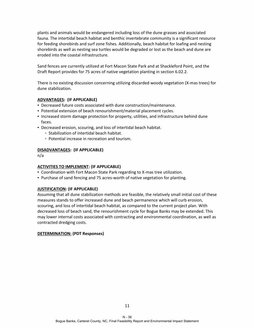
RECOMMEDNATION NO. 5 (10.00, 10.11, 10.18): Dune Stabilization Utilizing Sand Fencing, Vegetation Planting, and Woody Debris PROPOSED RECOMMENDATION: In order to minimize scouring, erosion, property damage, and intertidal habitat loss, the team recommends that measures be implemented to stabilize existing and created/modified dunes. Proposed methods of dune stabilization include sand fencing, vegetating dunes with native, dune-building plant species, and possible utilization of debris (such as discarded X-mas trees) to add strength to the dune mound structure. These methods may be combined to increase effectiveness. Sand fences combine wood strips and metal wire to create a flexible fence designed to allow windblown sand to accumulate on either side (Figure 1). Although already in place at Fort Macon State Park and at Shackleford Point (as described in section 1.08 of the Draft Report), it may be advantageous to employ sand fences in other project areas. At Bogue Banks, specifically, dunes are most commonly vegetated with American beach grass (Ammophila breviligulata), panic grass (Panicum amarum) sea oats (Uniola paniculata), broom straw (Andropogon virginicus) and salt meadow hay (Spartina patens). One or more of these species would likely be utilized in vegetating created/modified dunes (Figure 2). Dune vegetation is further discussed in section 6.02.2 of the Draft Report. The vegetative cover would extend from the landward toe of the dune to the seaward intersection with the berm for the length of the dune. Plant spacing guidelines would follow the recommendations provided by the North Carolina Sea Grant, The Dune Book (Nash and Rogers, 2003). Fort Macon State Park, in Atlantic Beach, collects discarded X-mas trees for use in dune restoration and stabilization. The trees function as both shelter for native plants to grow under, and as a means of windblown sand collection. This method of dune stabilization is used in conjunction with sand fencing (Figure 3). Through coordination with the Park, this woody debris may offer benefit to the project.
Figure 1. Sand Fence Figure 2. Dune Vegetation Figure 3. X-mas Trees EXISTING SITUATION, PROCESS, ACTIVITITY OR DESIGN: (IF APPLICABLE) Based on the calculated average erosion rate per year, it is anticipated that a good portion of the beach would continue to erode from the existing condition back into the dune. Once the beach has eroded back into the dune, escarpments would likely occur resulting in wave reflection off the escarpment with subsequent increased erosion, scouring, and loss of intertidal beach habitat. As the beach and dune complex erode back important habitat for a variety of
N - 35 Bogue Banks, Carteret County, NC, Final Feasibility Report and Environmental Impact Statement
11
plants and animals would be endangered including loss of the dune grasses and associated fauna. The intertidal beach habitat and benthic invertebrate community is a significant resource for feeding shorebirds and surf zone fishes. Additionally, beach habitat for loafing and nesting shorebirds as well as nesting sea turtles would be degraded or lost as the beach and dune are eroded into the coastal infrastructure. Sand fences are currently utilized at Fort Macon State Park and at Shackleford Point, and the Draft Report provides for 75 acres of native vegetation planting in section 6.02.2. There is no existing discussion concerning utilizing discarded woody vegetation (X-mas trees) for dune stabilization. ADVANTAGES: (IF APPLICABLE) ▪ Decreased future costs associated with dune construction/maintenance. ▪ Potential extension of beach renourishment/material placement cycles. ▪ Increased storm damage protection for property, utilities, and infrastructure behind dune
faces. ▪ Decreased erosion, scouring, and loss of intertidal beach habitat. ▫ Stabilization of intertidal beach habitat. ▫ Potential increase in recreation and tourism. DISADVANTAGES: (IF APPLICABLE) n/a ACTIVITIES TO IMPLEMENT: (IF APPLICABLE) ▪ Coordination with Fort Macon State Park regarding to X-mas tree utilization. ▪ Purchase of sand fencing and 75 acres-worth of native vegetation for planting. JUSTIFICATION: (IF APPLICABLE) Assuming that all dune stabilization methods are feasible, the relatively small initial cost of these measures stands to offer increased dune and beach permanence which will curb erosion, scouring, and loss of intertidal beach habitat, as compared to the current project plan. With decreased loss of beach sand, the renourishment cycle for Bogue Banks may be extended. This may lower internal costs associated with contracting and environmental coordination, as well as contracted dredging costs. DETERMINATION: (PDT Responses)
N - 36 Bogue Banks, Carteret County, NC, Final Feasibility Report and Environmental Impact Statement

12
RECOMMEDNATION NO. 6 (12.13, 12.14): Evaluate removing shoreline segment R23 – R36 from the project PROPOSED RECOMMENDATION: Evaluate the justification for including nourishment between Reach 23 – Reach 36 for the TSP. If TSP is not justified in this roughly 2.5 mile segment, and no constructability issues result from dropping it from the TSP, total project costs could be reduced and Federal cost share could increase based on current parking availability (noted that sponsor intends to eventually provide parking in this segment).
EXISTING SITUATION, PROCESS, ACTIVITITY OR DESIGN: (IF APPLICABLE) Total damages from approximately Reach 23 to Reach 36 (R23 – R36) are significantly lower than the rest of the study area (Figure 1). Table 5.6 in the study indicates that the majority of benefits (>50%) used to justify this segment are recreational. At approximately 1,000 linear feet per reach, this segment of low damages represents 13,000 feet of shoreline, or nearly 2.5 miles. This is a significant length of shoreline and could likely be removed from the TSP without impacting constructability.
Figure 1: Note low damages from Reach 23 to Reach 36. A ROM cost for alternative implementation should be compared to Future Without Project (FWOP) damages to demonstrate that the segment is likely justified. For R23-R36, recreational benefits may have to be included in the comparison in order to justify the segment. SAJ employed the following method on a similar project: A project’s Benefit-to-Cost Ratio (B/C Ratio) must be greater than 1.0 in order for an alternative to be justified and implementable (i.e.
N - 37 Bogue Banks, Carteret County, NC, Final Feasibility Report and Environmental Impact Statement

13
the benefits must be greater than the costs). Benefits equal damages prevented. In Figure 2, damages are used as a proxy for benefits. Using the value of without project damages as a substitute for the benefits will overestimate the benefit provided by any alternative since this assumes that 100 percent of damages have been averted. Therefore if the ROM cost of implementing an alternative is equal to, or less than, the without project damages, the B/C ratio can be assumed to approximate 1 and the alternative may be justified. Error! Reference source not found. displays the costs per linear foot of alternatives in addition to damages along the shoreline for each of the three SLC scenarios. Wherever damages are far below an alternatives ROM cost, it is assumed that the alternative would not be justified along that shoreline length. Wherever damages are near or above ROM costs along a stretch of shoreline of sufficient length for an alternative to be realistically implemented, it is assumed that the alternative may be justified and it is carried forward. . The cost of a measure’s implementation may vary depending on the Sea Level Change scenario used for design. Because of this it is important to note that there is uncertainty around the future costs, and alternatives with costs just above projected damages should not be screened out prematurely.
Figure 2: Present Value Damages vs ROM Costs for alternatives ADVANTAGES: (IF APPLICABLE) This comparison not only helps in screening, but it also serves to scale an alternative, showing what shoreline lengths may have enough FWOP damages to justify implementation. The mthod
N - 38 Bogue Banks, Carteret County, NC, Final Feasibility Report and Environmental Impact Statement
14
also demonstrates use of Sea Level Change guidance during plan formulation which could improve acceptance. A significant portion of this segment does not have adequate parking per Appendix I of the feasibility study. The study states that the sponsor intends to provide parking in areas currently without. However, if parking cannot be provided in this segment, dropping it from the TSP would improve the Federal percentage of the cost share. DISADVANTAGES: (IF APPLICABLE) Some additional time will be required for this analysis. Sponsor may be unhappy with dropping a segment. If this segment is dropped from the TSP and nourishment takes place to the east and west, end losses from the east and west would reduce constructed beach widths on adjacent beaches as sand is transported into the segment “gap”. ACTIVITIES TO IMPLEMENT: (IF APPLICABLE) Complete a ROM cost analysis to justify including this section of the project. Verify that segment is justified, even with majority of benefits coming from recreation. JUSTIFICATION: (IF APPLICABLE) DETERMINATION: (PDT Responses)
N - 39 Bogue Banks, Carteret County, NC, Final Feasibility Report and Environmental Impact Statement

15
RECOMMEDNATION NO. 7 (17.00): Revisit the advance nourishment option for life cycle cost PROPOSED RECOMMENDATION: This recommendation calls for revisiting project advance nourishment to better life cycle costing. JUSTIFICATION: (IF APPLICABLE) The benefits and related cost need additional evaluations. However, the benefits to pursue these concepts warrant further investigation.
DETERMINATION: (PDT Responses)
N - 40 Bogue Banks, Carteret County, NC, Final Feasibility Report and Environmental Impact Statement

16
RECOMMEDNATION NO. 8 (19.00, 19.20): Extension of Environmental/Dredging Window Outside of Dec 15 through March 31 PROPOSED RECOMMENDATION: Should additional time be required by the Contractor to complete dredging work associated with this project, the planned Dec 15 through March 31 dredging and environmental window would be extended. Any proposed extension would be closely coordinated with applicable stakeholder agencies to ensure any threatened and/or endangered species potentially present in the project area would be adversely affected. EXISTING SITUATION, PROCESS, ACTIVITITY OR DESIGN: (IF APPLICABLE) Hopper dredging operations for the project would work in accordance with the 1997 National Marine Fisheries Service (NMFS) South Atlantic Regional Biological Opinion (SARBO) for the continued hopper dredging of channels and borrow areas in the Southeastern United States or any superseding SARBO that is prepared by NMFS. Under the 1997 SARBO, the NMFS does not place a window on hopper dredging operations from Pawley’s Island, South Carolina, through North Carolina. However, for other projects within the vicinity of Bogue Banks, both the USACE South Atlantic Division (SAD) office and South Atlantic Wilmington (SAW) District office have, to the extent practicable, recommended hopper dredging during cold water months when sea turtle abundance is typically low. Specifically, for navigation maintenance dredging at Morehead City Harbor (located at the northern limit of the study area), SAW traditionally recommends hopper dredging during the coldest water months from 1 January to 31 March due to historically high sea turtle abundance and subsequent risk of entrainment within the channel during warmer months. For this project, the anticipated duration needed for initial construction, utilizing 2 hopper dredges is approximately 105 days. This duration factors-in contingency and weather days. In order to minimize sea turtle entrainment risk, the initial construction hopper dredging will be planned for between Dec 15 through March 31 when water temperatures are cold and sea turtle abundance is low. Though the initial construction window is two weeks earlier than that traditionally implemented by SAW for dredging at Morehead City Harbor, it is not anticipated that this earlier start would result in any greater risk of impact due to annual variation in water temperatures and sea turtle abundance and the lower entrainment risk of hopper dredging within the proposed offshore borrow area. ADVANTAGES: (IF APPLICABLE) ▪ Assurance of completion of dredging, despite delays which may place completion outside the
planned Dec 15 through March 31 window. ▫ Assurance of recreation benefits associated with increased beach availability and tourism. ▪ Should an environmental window extension be necessary, acceptance of a window extension
will allow for completion of the mission as well as saved costs in future mobilization/demobilization.
▪ A longer construction window may increase bid-availability of the project and result in less expensive bids.
DISADVANTAGES: (IF APPLICABLE)
N - 41 Bogue Banks, Carteret County, NC, Final Feasibility Report and Environmental Impact Statement

17
▪ Environmental window extension request beyond planned dates may not be received well by USFWS as multiple environmental window extensions have recently requested, associated with other USACE projects.
ACTIVITIES TO IMPLEMENT: (IF APPLICABLE) ▪ Coordination of potential environmental dredging window extension with USFWS. JUSTIFICATION: (IF APPLICABLE) Assuming that an environmental dredging window extension is feasible and necessary, the potential project savings in avoiding additional Contractor mobilization/demobilization costs are sizeable. Additionally, allowing for project completion prior to the recreation season may allow for economic benefits to the project area in terms of increased tourism. DETERMINATION: (PDT Responses)
N - 42 Bogue Banks, Carteret County, NC, Final Feasibility Report and Environmental Impact Statement

18
RECOMMEDNATION NO. 9 (23.00, 23.24): Investigate and evaluate Brandt Island as a borrow area for the project. PROPOSED RECOMMENDATION: Brandt Island should be evaluated as a potential borrow area for the Bogue Banks CSDR project as sediment from within the channel and turning basin are stored in this location. EXISTING SITUATION, PROCESS, ACTIVITITY OR DESIGN: (IF APPLICABLE) Maintenance of the inner harbor has been conducted on a bi-annual basis utilizing a pipeline dredge that carries sediment from these areas to the confined disposal site of Brandt Island (Figure 1). In the past, inner harbor material has also been piped directly to Bogue Banks beaches concurrently with Brandt Island pump-outs during major construction improvements.
Figure 1. Location of the channel and Brant Island. As part of the Morehead City DMMP, the material on Brant Island was evaluated. The evaluation determined that the material was not beach quality. Additionally, methods of sorting the
N - 43 Bogue Banks, Carteret County, NC, Final Feasibility Report and Environmental Impact Statement

19
material to produce quality beach material were evaluated and it was determined to not be cost effective. ADVANTAGES: (IF APPLICABLE) Utilizing material from Brandt Island would assist in providing space for more material to be pumped-out of the channel and it would benefit the CSDR project by its’ close location to a portion of the project (i.e., the north end). DISADVANTAGES: (IF APPLICABLE) The Morehead City DMMP determined that the quality of the material on Brant Island does not meet the beach quality standards set by USACE. To satisfy USACE standards the material would need to be sorted and that has previously been determine to not be cost effective. In addition, the map in Figure 2 appears to show limited available material at Brant Island. Material for this project would likely have to come directly from the channel and turning basin instead of from Brant Island.
Figure 2. View of Brant Island provided from Google maps (taken sometime in 2013). ACTIVITIES TO IMPLEMENT: (IF APPLICABLE) None, the material has already been evaluated. JUSTIFICATION: (IF APPLICABLE) DETERMINATION: (PDT Responses)
N - 44 Bogue Banks, Carteret County, NC, Final Feasibility Report and Environmental Impact Statement

20
RECOMMEDNATION NO. 10 (33.00 & 33.43): Solicitation options to expedite schedule and reduce construction costs. PROPOSED RECOMMENDATION: The purpose of this recommendation is to investigate the multiple ways in which the solicitation can be structured to expedite schedule and reduce construction costs. The examples discussed below are assuming a 15 December through 31 March dredging window due to turtle activity. The first option would be to add an incentive clause to the solicitation if the contractor would complete all initial construction prior to 31 March of the award year. From the perspective of being good stewards of the American tax dollar, the use of additional Federal funds to expedite the work which benefits a small community would not be practical. The Non-Federal Stakeholders would have a vested interest to have all work completed by 31 March to have the beach open for tourist season and berm/dune construction ready for hurricane season. The use of an incentive clause must also be approached from a safety perspective. This large project that requires multiple dredges, miles of pipeline, and numerous pieces of earthmoving equipment that would put the prime contractor’s daily overhead rate near $150,000 per day. Since the Contractor is already heavily invested to ensure early completion, it could be reasonably assumed that if an incentive was placed on the contract, the company would pass those benefits down to the employees in the field to increase production. Only the Captain has the authority to decide if weather is too severe to conduct dredging operation. A large financial incentive by the Government may cloud the Captain’s judgment and result in an accident. The second option would be to adjust the solicitation CLIN structure. One option would provide a price to complete all work within the 15 December through 31 March dredging window. The second option would be to complete all work between 1 November and 31 May and would require the contractor to provide additional turtle monitoring during November, April, and May. The mindset of this option is that by allowing more flexibility in the contract duration, more contractors would be available to bid on the work, resulting in more competitive pricing. There are numerous downsides to this approach. This may result in ongoing construction during the Memorial Day weekend, which would have financial impact on the local communities. There is also potential, even with turtle monitoring, of having negative impact on a nest or having a turtle take. To be allowed to work outside the established environmental window, the Government would need to request approval from outside agencies prior to solicitation. Requesting this approval prior to work starting would give the impression to the outside agencies that the Corps of Engineers has little respect for the principals behind the Environmental Windows and is only concerned with the financial savings on the dredging contract. In addition to potential negative publicity, this would result in a hampered partnership with the outside agencies.
N - 45 Bogue Banks, Carteret County, NC, Final Feasibility Report and Environmental Impact Statement

21
ADVANTAGES: (IF APPLICABLE) Early completion and/or reduced construction costs. DISADVANTAGES: (IF APPLICABLE) Safety concerns for both crew and environment and hindering partnering relationships with outside agencies. JUSTIFICATION: (IF APPLICABLE)
DETERMINATION: (PDT Responses)
N - 46 Bogue Banks, Carteret County, NC, Final Feasibility Report and Environmental Impact Statement

22
RECOMMEDNATION NO. 11 (37.40, 37.41): Feeder Points (Sand Engine) PROPOSED RECOMMENDATION: Explore the potential of constructing feeder points along the TSP shoreline. Nodal points could be ideal locations for a feeder point, dubbed a “sand engine” by the Dutch (http://www.vanoord.com/activities/sand-motor) (Figure 1). Construction of one point, or multiple smaller points, could be possible.
Figure 1: Feeder point (Sand Engine) construction in the Netherlands.
EXISTING SITUATION, PROCESS, ACTIVITITY OR DESIGN: (IF APPLICABLE) The idea is that rather than continuously moving pipeline and plant down the beach to construct a uniform berm width, pipeline is kept in one location to form a sand point and natural shoreline processes transport the sand along the shoreline (Figure 2). Since sand is transported both east and west from nodal points along the project shoreline, these could be ideal locations for a feeder point.
N - 47 Bogue Banks, Carteret County, NC, Final Feasibility Report and Environmental Impact Statement

23
Figure 2: migration of sand point constructed in the Netherlands (http://www.seacityresearchnet.com/archives/tag/sand-engine) ERDC’s Engineering With Nature (EWN) program (http://el.erdc.usace.army.mil/ewn) has researched feeder beaches, and NAD has some experience with actual construction. SAJ has also constructed a large feeder beach in the 1970’s (Figure 3).
N - 48 Bogue Banks, Carteret County, NC, Final Feasibility Report and Environmental Impact Statement

24
Figure 3: SAJ feeder beach construction near nodal point south of the St. Johns River entrance channel in 1972 ADVANTAGES: (IF APPLICABLE) Cost savings due to less plant required and less plant activity. Potential to create temporary surfing resources and recreational benefits. Some resource agencies may prefer this method. DISADVANTAGES: (IF APPLICABLE) Permitting issues related to filling farther seaward at feeder points. Potential resource impacts. Migration of fill is dependent on natural sediment transport, therefore the entire project shoreline would not have immediate benefit of full project construction. Creation of smaller, multiple points could mitigate some of these disadvantages. ACTIVITIES TO IMPLEMENT: (IF APPLICABLE) Coordinate with resource agencies and evaluate permitting requirements to place a feeder point. Evaluate potential placement areas (nodal points could be ideal) and model fill migration. Estimate resulting cost savings.
N - 49 Bogue Banks, Carteret County, NC, Final Feasibility Report and Environmental Impact Statement

25
JUSTIFICATION: (IF APPLICABLE) Resulting costs savings could be significant. Some resource agencies may prefer natural fill migration as opposed to mechanical berm construction. DETERMINATION: (PDT Responses)
N - 50 Bogue Banks, Carteret County, NC, Final Feasibility Report and Environmental Impact Statement