Embed Size (px)
Citation preview

Making and using maps with mixed-media!
EY–KS2 Anthony Barlow, Senior Lecturer in Primary
Geography, University of Roehampton
Welcome to the GA Conference 2012
Do you think you know what a map is? Think again! Encourage thinking skills by using a range of different techniques, including ICT, to help pupils re-tell real, imagined and fantasy journeys.
You will make your own talk string or journey stick and see how a range of 3D junk-art techniques can bring your local area to life!
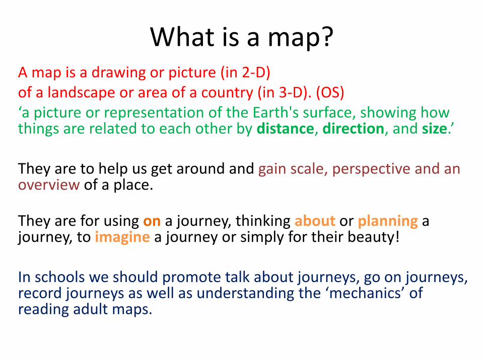
What is a map? A map is a drawing or picture (in 2-D) of a landscape or area of a country (in 3-D). (OS) ‘a picture or representation of the Earth's surface, showing how things are related to each other by distance, direction, and size.’ They are to help us get around and gain scale, perspective and an overview of a place. They are for using on a journey, thinking about or planning a journey, to imagine a journey or simply for their beauty! In schools we should promote talk about journeys, go on journeys, record journeys as well as understanding the ‘mechanics’ of reading adult maps.

Our map menu!
Journey sticks
Journey talk strings
Nested hierarchies
Sound mapping Affective mapping
Junk mapping
Using images to create maps
Shoebox miniworlds
Mapping journeys
Collage maps
Linear maps of a street
Myriorama - endless landscapes!
Using OS maps
Using audio and video to link to mapping!
Making map games
Mapping physical features
Maps from literacy
Powerpoint maps

Pupils in control: Mapping using different views
Let’s make a map of our classroom!
The classroom
Photos Anthony Barlow

What did we include? Miss out? Can you draw in some symbols for what we missed? Photos Anthony Barlow

Can you find these round the school!
Here are a sequence of cards – can you put them on a map and match them to a place? Photos Anthony Barlow

Journey sticks
Use a twig, masking tape or card. Photos Anthony Barlow
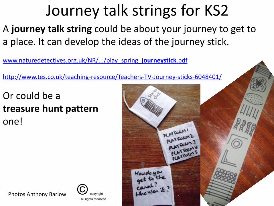
Journey talk strings for KS2 A journey talk string could be about your journey to get to a place. It can develop the ideas of the journey stick. www.naturedetectives.org.uk/NR/.../play_spring_journeystick.pdf http://www.tes.co.uk/teaching-resource/Teachers-TV-Journey-sticks-6048401/
Or could be a treasure hunt pattern one!
Photos Anthony Barlow

Moving outdoors
Sound mapping
Photos Anthony Barlow

How do you feel around school?
Affective (feelings) mapping
Photos Anthony Barlow

http://www.geography.org.uk/download/PRglobalaffective2.pdf
http://www.softhook.com/NewOakDriving.pdf
Image removed for copyright reasons – see below

http://stockport.emotionmap.net/ http://www.christiannold.com/about
Images removed for copyright reasons – see below

The local area
Junk mapping
Courtesy of St Peter’s Smithills Dean CE Primary School, Bolton 2009
Photos Anthony Barlow

Mapping physical features From fieldwork or photographs
Courtesy of St Peter’s Smithills Dean CE Primary School, Bolton 2009
Photos Anthony Barlow

The amazing imaginary world of children:
Mapping using materials near to hand
Courtesy of St Peter’s Smithills Dean CE Primary School, Bolton 2009
Photos Anthony Barlow

Using images: Local area talkboard
You could do this for your school/area you have explored at a much smaller scale.
Match with the aerial map What can you see?
What’s not included?
Images removed for copyright reasons – Image was a collection of images from a Google search or from a site such as Geograph, much like a collage.

Theme maps: What’s good,
what can be improved?
http://www.geography.org.uk/projects/younggeographers/
Courtesy of St Peter’s Smithills Dean CE Primary School, Bolton 2009
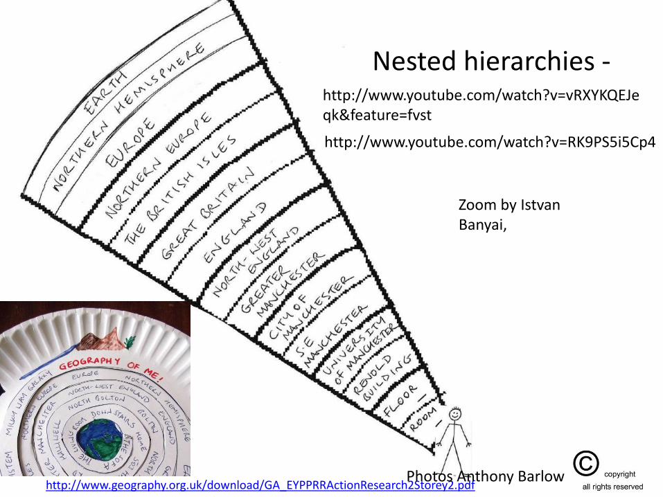
Nested hierarchies -
http://www.geography.org.uk/download/GA_EYPPRRActionResearch2Storey2.pdf
http://www.youtube.com/watch?v=vRXYKQEJeqk&feature=fvst
http://www.youtube.com/watch?v=RK9PS5i5Cp4
Zoom by Istvan Banyai,
Photos Anthony Barlow

Pupil work
Attribution: Screen shots taken from Pat Pavelka video on You Tube: http://www.youtube.com/watch?v=ABT2Yg52nGw

Zooming into images!
http://www.willpearson.co.uk/high_resolution.php
http://www.willpearson.co.uk/featured-high-resolution/london-in-detail/

Other useful resources
ISBN: 0613607759
Pupil’s own book done on PC
http://www.youtube.com/watch?v=Thqf82LIxOI
Create a detailed picture in Word. Use the Zoom function. Print screen to copy to clipboard. Paste into Powerpoint and put on consecutive pages.

Make a myriorama!
From: http://www.mediatinker.com/blog/upload/2007/04/myriorama-tutorial.pdf
Good for storytelling, vocabulary and language development

Using video to support fieldwork and creative mapmaking
• Magical mapping – transform the everyday

Can you find each of the objects? What did I include? What did I miss out? Can you create the key? Can you make your own version of the map? Can you think of your own descriptions of an object? Can you draw a version of the map that has symbols to represent the different places?
Photos Anthony Barlow

Monopoly Mapping!
Courtesy of St Peter’s Smithills Dean CE Primary School, Bolton 2009 Photos Anthony Barlow

Comic Life - Create a cartoon version of your trip!
www.plasq.com
Courtesy of St Peter’s Smithills Dean CE Primary School, Bolton 2009

My Walks
http://nuweb.northumbria.ac.uk/mywalks/Pictures/.Audio/kye%20walk%201.mp3
http://nuweb.northumbria.ac.uk/mywalks/intro.php
What is 'Mywalks'? 'Mywalks' is about (re-)engaging with our immediate urban, day-to-day, city, country, local, taken-for-granted environments and geographies through the medium of photography and audiography.
Photos Anthony Barlow

Composite maps from literacy descriptions
Photos Anthony Barlow

Powerpoint maps with hyperlinks
http://www.geography.org.uk/projects/primaryhandbook/mapsandstories/4-7
Courtesy of St Peter’s Smithills Dean CE Primary School, Bolton 2009

www.ordnancesurvey.org.uk/opendata
Using maps

Understanding maps
Oxfam: Mapping our world http://www.oxfam.org.uk/education/resources/mapping_our_world/mapping_our_world/