Embed Size (px)
Citation preview

Explore Laser Scanning in As-Built Survey
Vijay Chowdhary
SE: BIM/CIM

Headquarters are based in Lake Mary, Florida, Korntal-Münchingen, Germany and Singapore.
Subsidiaries are located in Australia, Brazil, China, France, Germany, India, Italy, Japan, Korea,
Malaysia, Mexico, Netherlands, Philippines, Poland, Portugal, Singapore, Spain, Switzerland,
Thailand, Turkey, United Kingdom, USA.
EMEA Headquarters Korntal-Münchingen, Germany
APAC Headquarters Singapore
Global Headquarters
Lake Mary, Florida
The world leader in portable 3-D measurement and imaging technology
About FARO

Product
FARO Focus S FARO SITECO
Mobile Mapping
FARO Scan Localizer
Indoor Mapping

How do Scanner Work
Captures millions of 3D points in minutes
Produces a "copy" of high-density reality
vertical angle horizontal angle distance measurement
300° 360°

Laser Scanner – Data Output
• Point Clouds?
• How are these “point clouds” are used ?

Why Laser Scanning? As-built surveys Applications
• Architecture • Construction • Engineering • Civil/Survey • Heritage

As-b
uil
t C
ivil
/Su
rve
y
Topographic Survey
Roadway Cross Sections
Volume Measurements (stockpiles, earthwork)
Bridge As-builts / Culvert As-builts
Surface Analysis
Ground Surface Extraction (DTM)
Applications – Civil/Survey
Creating your As-built Civil / Survey Deliverables

As-b
uil
t A
rch
ite
ctu
re
Building Documentation (2D plans, profiles, elevations)
Facade Documentation
Roof Documentation
Scan-To-BIM (intelligent Building Models)
Clash Detection / Coordination / Layout
Surface deformation and/or scan vs. BIM Analysis
Applications - Architecture

Co
ns
tru
cti
on
QA
/QC
Construction Site Survey
Deformation Analysis of Building elements
Concrete Flatness and Monitoring
Steel Deflection
Construction Monitoring
Applications – Construction QA/QC
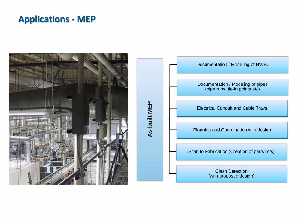
As-b
uil
t M
EP
Documentation / Modeling of pipes (pipe runs, tie-in points etc)
Documentation / Modeling of HVAC
Electrical Conduit and Cable Trays
Planning and Coordination with design
Clash Detection (with proposed design)
Scan to Fabrication (Creation of parts lists)
Applications - MEP

As-b
uil
t P
lan
t
Documentation / Modeling of pipes (pipe runs, tie-in points etc)
Documentation / Modeling of structural steel
Volume Calculation of tanks
Deformation Analysis for tanks
Layout / Planning / Coordination with design
Clash Detection (with proposed design)
Scan to Fabrication (Creation of parts lists)
Applications - Plant
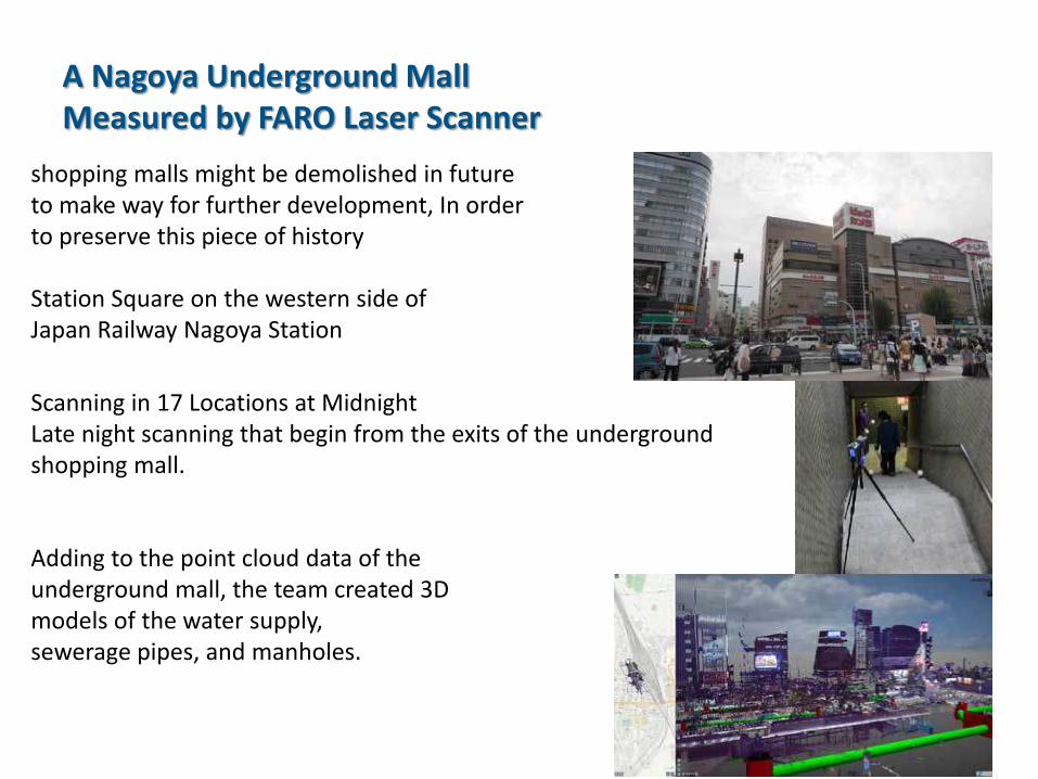
A Nagoya Underground Mall Measured by FARO Laser Scanner
shopping malls might be demolished in future to make way for further development, In order to preserve this piece of history Station Square on the western side of Japan Railway Nagoya Station
Scanning in 17 Locations at Midnight Late night scanning that begin from the exits of the underground shopping mall.
Adding to the point cloud data of the underground mall, the team created 3D models of the water supply, sewerage pipes, and manholes.

Providing a Laser Scanning Solution
Point cloud data of the railway platform.
As the Government contemplates doubling existing railway lines, the research results will influence future railway infrastructure strategies for India.
Point Cloud Point Cloud + Mesh Model Mesh Model

SIPPR Engineering Group Co., Ltd
Applications • Digital modeling of factory site • Retrofit of factory equipment, and pipeline • Engineering calculations
Benefits • Improved work efficiency • Accurate data collection • Wide-ranging engineering applicability with BIM technology
With increasing technological advancements to 3D laser scanning and (BIM), AEC industry is witnessing a scientific and technological revolution since the introduction of CAD. One notable application is the deployment of 3D laser scanning to measure any complex construction environment – regardless which stage a project is at.
Terrain reconstruction Calculation of earthwork volume
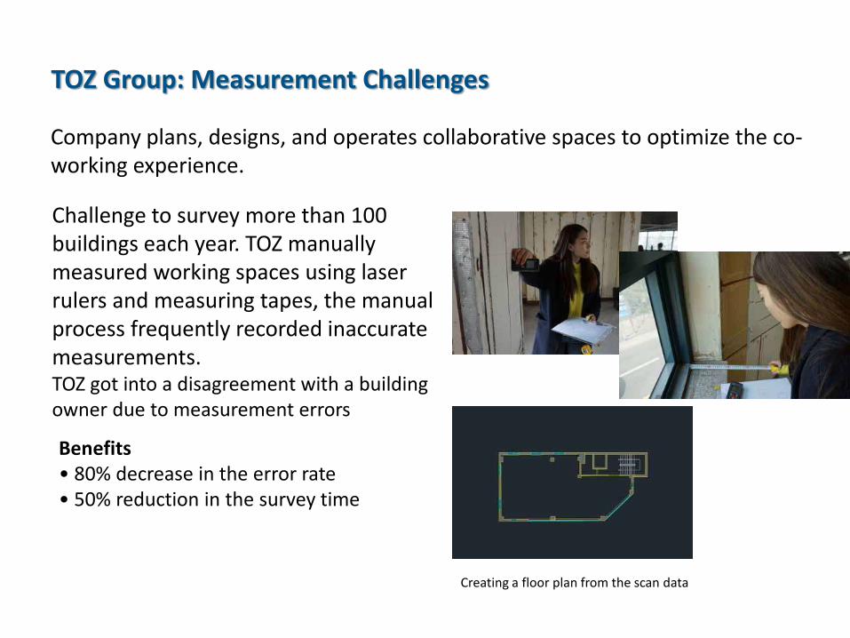
TOZ Group: Measurement Challenges
Company plans, designs, and operates collaborative spaces to optimize the co-working experience.
Challenge to survey more than 100 buildings each year. TOZ manually measured working spaces using laser rulers and measuring tapes, the manual process frequently recorded inaccurate measurements. TOZ got into a disagreement with a building owner due to measurement errors
Benefits • 80% decrease in the error rate • 50% reduction in the survey time
Creating a floor plan from the scan data

Application Example

Thank You