Embed Size (px)
Citation preview

ERDAS IMAGINE
Anders Nesse
1

Erdas Imagine
2

Different versions
3
● Essential
● Advantage
● Professional
● Photogrammetry
● SAR/Radar
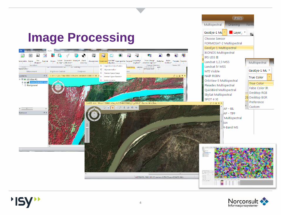
Image Processing
4

Photogrammetry
5
● Aerial Images
● UAV
● Satellitt
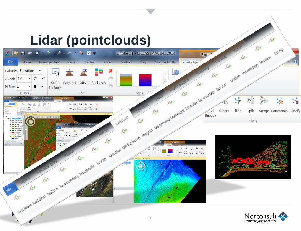
Lidar (pointclouds)
6

Terrain modelling, relieff, 3D…
7

3D…
8

SAR Radar
9

Spatial Modeler
10
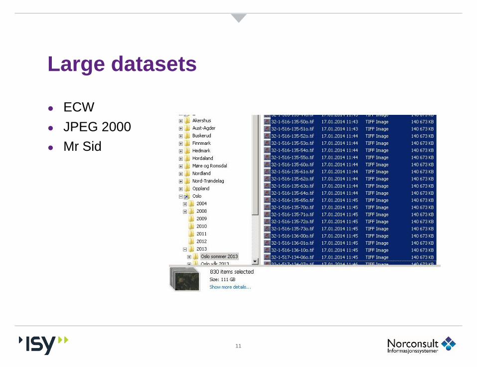
Large datasets
11
● ECW
● JPEG 2000
● Mr Sid

Large datasets
12

Oslo 2013
● From 830 Tiff files a 140 Mb, in total 111 GB
● to 1 ECW 17 Gb
● ca 6,5 * compression (low compression)
● Can be used in GeoMedia, Arc GIS, AutoCAD, MicroStation, TATUK, Q_Gis, Global Mapper, MS Office +++
13
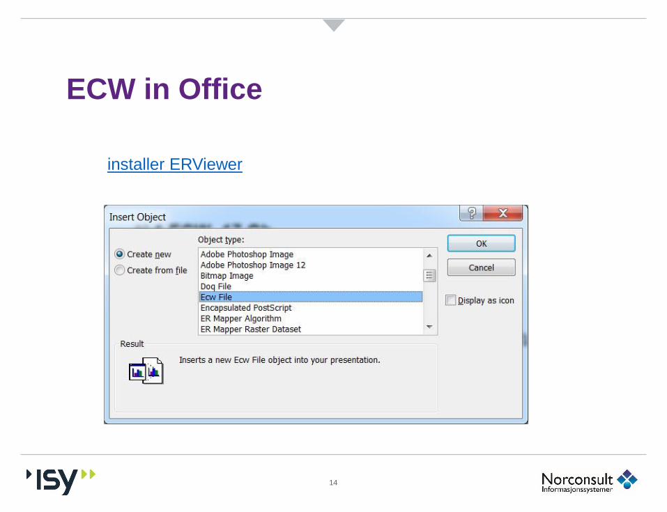
ECW in Office
14
installer ERViewer

ERDAS IMAGINE
Thanks for your attention
15