Embed Size (px)
Citation preview

EENNVVIIRROONNMMEENNTTAALL AASSSSEESSSSMMEENNTT RREEGGIISSTTRRAATTIIOONN
VVIICCTTOORRIIAA SSTTRREEEETT CCUULLVVEERRTT UUPPGGRRAADDEE
CCIITTYY OOFF EEDDMMUUNNDDSSTTOONN
Our File No.: 618-16-C5
July 2017

Prepared for:
Prepared by:
TABLE OF CONTENTS
11.. TTHHEE PPRROOPPOONNEENNTT .................................................................................................................................................................................................................................................... 11
11..11 NNAAMMEE OOFF PPRROOPPOONNEENNTT .............................................................................................................................................................................................................................................. 11
11..22 AADDDDRREESSSS OOFF PPRROOPPOONNEENNTT .................................................................................................................................................................................................................................... 11
11..33 CCHHIIEEFF EEXXEECCUUTTIIVVEE OOFFFFIICCEERR ............................................................................................................................................................................................................................ 11
11..44 PPRRIINNCCIIPPAALL CCOONNTTAACCTT PPEERRSSOONNSS FFOORR TTHHEE PPUURRPPOOSSEESS OOFF TTHHEE EENNVVIIRROONNMMEENNTTAALL IIMMPPAACCTT
AASSSSEESSSSMMEENNTT .................................................................................................................................................................................................................................................................................................. 11
11..55 PPRROOPPEERRTTYY OOWWNNEERRSSHHIIPP .......................................................................................................................................................................................................................................... 11
22.. TTHHEE UUNNDDEERRTTAAKKIINNGG .......................................................................................................................................................................................................................................... 33
22..11 NNAAMMEE OOFF TTHHEE UUNNDDEERRTTAAKKIINNGG ...................................................................................................................................................................................................................... 33
22..22 BBAACCKKGGRROOUUNNDD ...................................................................................................................................................................................................................................................................... 33
22..33 PPRROOJJEECCTT OOVVEERRVVIIEEWW .................................................................................................................................................................................................................................................... 44
22..44 PPUURRPPOOSSEE//RRAATTIIOONNAALLEE//NNEEEEDD FFOORR TTHHEE UUNNDDEERRTTAAKKIINNGG ............................................................................................................................................ 66
22..55 PPRROOJJEECCTT LLOOCCAATTIIOONN .................................................................................................................................................................................................................................................... 66
22..66 SSIITTIINNGG CCOONNSSIIDDEERRAATTIIOONNSS .................................................................................................................................................................................................................................... 77
22..77 PPHHYYSSIICCAALL CCOOMMPPOONNEENNTTSS AANNDD DDIIMMEENNSSIIOONNSS OOFF TTHHEE UUNNDDEERRTTAAKKIINNGG ................................................................................................ 77
22..88 CCOONNSSTTRRUUCCTTIIOONN,, OOPPEERRAATTIIOONN AANNDD MMAAIINNTTEENNAANNCCEE DDEETTAAIILLSS .................................................................................................................... 1122
22..88..11 CCoonnssttrruuccttiioonn SSeeqquueennccee ..................................................................................................... 12 22..88..22 CCoonnssttrruuccttiioonn SScchheedduullee ...................................................................................................... 12
22..99 RREEGGUULLAATTOORRYY AAPPPPRROOVVAALLSS............................................................................................................................................................................................................................ 1122
22..1100 AALLTTEERRNNAATTIIVVEE DDEESSIIGGNN CCOONNSSIIDDEERRAATTIIOONNSS ............................................................................................................................................................................ 1133
33.. DDEESSCCRRIIPPTTIIOONN OOFF TTHHEE EEXXIISSTTIINNGG EENNVVIIRROONNMMEENNTT .............................................................................................................................. 1144
3.1 PHYSICAL AND NATURAL FEATURES .................................................................... 14 44.. EENNVVIIRROONNMMEENNTTAALL AASSSSEESSSSMMEENNTT OOFF PPOOTTEENNTTIIAALL IIMMPPAACCTTSS .......................................................................................... 1199
44..11 SSUURRFFAACCEE WWAATTEERR ................................................................................................................................................................................................................................................ 2200
44..22 FFIISSHH HHAABBIITTAATT .................................................................................................................................................................................................................................................................... 2211
55.. AACCCCIIDDEENNTTSS AANNDD UUNNPPLLAANNNNEEDD EEVVEENNTTSS .............................................................................................................................................................. 2222
66.. CCUUMMUULLAATTIIVVEE EEFFFFEECCTTSS .......................................................................................................................................................................................................................... 2233
77.. PPUUBBLLIICC IINNVVOOLLVVEEMMEENNTT ........................................................................................................................................................................................................................ 2244
88.. FFIIRRSSTT NNAATTIIOONNSS ...................................................................................................................................................................................................................................................... 2255
99.. AAPPPPRROOVVAALL OOFF TTHHEE UUNNDDEERRTTAAKKIINNGG .............................................................................................................................................................................. 2266
1100.. FFUUNNDDIINNGG.............................................................................................................................................................................................................................................................................. 2277
1111.. CCLLOOSSIINNGG SSTTAATTEEMMEENNTT .............................................................................................................................................................................................................................. 2288

1122.. RREEFFEERREENNCCEESS CCIITTEEDD ...................................................................................................................................................................................................................................... 2299
APPENDICES
Appendix A – Large Site Diagrams
Appendix B – Site Photos
Appendix C – Consultation Template
Appendix D – Natech Bathymetry Report
LIST OF FIGURES
Figure 1.0 – Project Location
Figure 2.0 – Project Overview
Figure 3.0 – Technical Drawing C1
Figure 4.0 – Technical Drawing C4
Figure 5.0 – Technical Drawing C5
Figure 6.0 – Site Location Wetland Mapping (GeoNB Map View)
Figure 7.0 – Environmentally Significant Areas Locations
LIST OF TABLES
Table 1 – Potential Project-Environment Interactions Matrix

EEXXEECCUUTTIIVVEE SSUUMMMMAARRYY
The City of Edmundston has identified inadequacies with various culverts on McRae Brook, a tributary of
the Madawaska River. The confluence of these watercourses is located adjacent to the culvert at 993
Victoria Street, within the municipal limits. In order to mitigate flooding at this location and stream
crossings upstream, the City has been replacing culverts on McRae Brook as part of a larger culvert
replacement project. Victoria Street is the final culvert to be upgraded as part of this program.
The proposed project involves the installation of six (6) 1200 mm round, concrete culverts beneath
Victoria Street, but slightly above the invert of an existing 1200 mm culvert. This will allow proper
passage of water from McRae Brook during periods of high flows. This will also allow the installation of
these culverts while maintaining fish passage through the original culvert. The culverts will be installed
by trenching and a traffic detour will be in place. Furthermore, city water and wastewater infrastructure
under Victoria Street will be removed and reinstated as part of the work.
Given the positive net effect on stream flows and the proposed mitigation measures, no adverse
environmental impacts are anticipated from the proposed project.
ii)

EENNVVIIRROONNMMEENNTTAALL AASSSSEESSSSMMEENNTT RREEGGIISSTTRRAATTIIOONN
VViiccttoorriiaa SSttrreeeett CCuullvveerrtt UUppggrraaddee 11
11.. TTHHEE PPRROOPPOONNEENNTT
11..11 NNAAMMEE OOFF PPRROOPPOONNEENNTT
The proponent is the City of Edmundston.
11..22 AADDDDRREESSSS OOFF PPRROOPPOONNEENNTT
City of Edmundston
7 Canada Road
Edmundston, NB E3V 1T7
11..33 CCHHIIEEFF EEXXEECCUUTTIIVVEE OOFFFFIICCEERR
Marc Michaud
Chief Administrative Officer
11..44 PPRRIINNCCIIPPAALL CCOONNTTAACCTT PPEERRSSOONNSS FFOORR TTHHEE PPUURRPPOOSSEESS OOFF TTHHEE EENNVVIIRROONNMMEENNTTAALL IIMMPPAACCTT
AASSSSEESSSSMMEENNTT
For Edmundston
Mr. Georges Roy, P.Eng. FEC
Director of Development (and Engineering)
City of Edmundston
7 chemin Canada Road
Edmundston, NB E3V 1T7
Phone: (506) 739-2125
Email: [email protected]
For Roy Consultants
Jeff David, P.Eng.
Roy Consultants
1080 Champlain Street
Unit 13
Dieppe, NB E1A 8L8
Phone: 852-4979
Email: [email protected]
11..55 PPRROOPPEERRTTYY OOWWNNEERRSSHHIIPP
The project will be located on the following properties.

EENNVVIIRROONNMMEENNTTAALL AASSSSEESSSSMMEENNTT RREEGGIISSTTRRAATTIIOONN
VViiccttoorriiaa SSttrreeeett CCuullvveerrtt UUppggrraaddee 22
Property Description Property Owner
PID 35297761
993 rue Victoria Street
Gilles Guimond
Louise Vienneau Guimond
Rue Victoria Street City of Edmundston
PID 35186584
980 rue Victoria Street Raymond Plourde

EENNVVIIRROONNMMEENNTTAALL AASSSSEESSSSMMEENNTT RREEGGIISSTTRRAATTIIOONN
VViiccttoorriiaa SSttrreeeett CCuullvveerrtt UUppggrraaddee 33
22.. TTHHEE UUNNDDEERRTTAAKKIINNGG
22..11 NNAAMMEE OOFF TTHHEE UUNNDDEERRTTAAKKIINNGG
The name of the Undertaking is Victoria Street Culvert Upgrade.
22..22 BBAACCKKGGRROOUUNNDD
The City of Edmundston manages infrastructure projects within the City planning area, including culvert
installation and maintenance.
McRae Brook is a tributary of the Madawaska River north of Edmundston Centre, of which water levels
are partially impacted by the Madawaska Dam located approximately 4.9 kilometres downstream, near
Madawaska. Flooding of upstream properties has occurred above this location in the past, most recently
on the June 29, 2016.
The municipality is in the process of replacing undersized culverts on McRae Brook upstream of the
Victoria Street culvert, to prevent flow constrictions, flooding and road deterioration from erosion at these
sites. To complete the McRae Brook program, the Victoria Street crossing over McRae Brook must also
be upgraded to allow passage of water during periods of high flows and to prevent flooding at this
location.
The project involves the installation of additional culverts adjacent to the existing culvert, thereby
allowing fish passage to continue throughout the installation.
Photo No. 1: Victoria Street at McRae Brook (Google Earth)

EENNVVIIRROONNMMEENNTTAALL AASSSSEESSSSMMEENNTT RREEGGIISSTTRRAATTIIOONN
VViiccttoorriiaa SSttrreeeett CCuullvveerrtt UUppggrraaddee 44
22..33 PPRROOJJEECCTT OOVVEERRVVIIEEWW
The City of Edmundston is proposing to upgrade the McRae Brook stream crossing at Victoria Street by
installing six (6) additional culverts adjacent to the existing culvert at a slightly higher invert.
The proposed culvert upgrade will be located within the footprint of the existing Victoria Street right-of-
way (ROW) and will also be located on two private properties. The City has met with these property
owners to discuss the project and associated encroachments. To correct existing stability and erosion
issues, the road base will also be widened within McRae Brook at the toe-of-slope by reconstructing the
embankment with competent fill and adding clean rip rap.
The culverts will be installed by trenching with excavators, according to the following sequence of work:
Installation of temporary water control works (TWCW), sediment control measures and detour
signage;
Electrofishing and removal of fish from work area;
Installation and commissioning of temporary watermain bypass line, relocated forcemain and sanitary
sewer bypass pumping;
Installation of culverts;
Placement of culvert pipe end protection;
Removal of TWCW;
Reinstallation of city service infrastructure noted above;
Completion of roadway, private property reinstatement and detour signage;
Removal of sediment control measures following stabilization of disturbed surfaces.

EENNVVIIRROONNMMEENNTTAALL AASSSSEESSSSMMEENNTT RREEGGIISSTTRRAATTIIOONN
VViiccttoorriiaa SSttrreeeett CCuullvveerrtt UUppggrraaddee 55
Photo No. 2: Upstream Side of Victoria Street Culvert
EENNVVIIRROONNMMEENNTTAALL AASSSSEESSSSMMEENNTT RREEGGIISSTTRRAATTIIOONN
VViiccttoorriiaa SSttrreeeett CCuullvveerrtt UUppggrraaddee 66
22..44 PPUURRPPOOSSEE//RRAATTIIOONNAALLEE//NNEEEEDD FFOORR TTHHEE UUNNDDEERRTTAAKKIINNGG
The McRae Brook culvert under Victoria Street is undersized and does not properly convey water to the
Madawaska River during periods of high flows (heavy precipitation events and spring freshet). The
required upgrading of upstream culverts, which are currently under construction, will increase the
flooding risk.
The installation of six additional culverts will reduce the risk of flooding during present and future high
flows in McRae Brook. The widening of the Victoria Street toe-of-slope will correct road stability
concerns at this site, preventing erosion of the road subsurface and thereby preventing water quality issues
in the future.
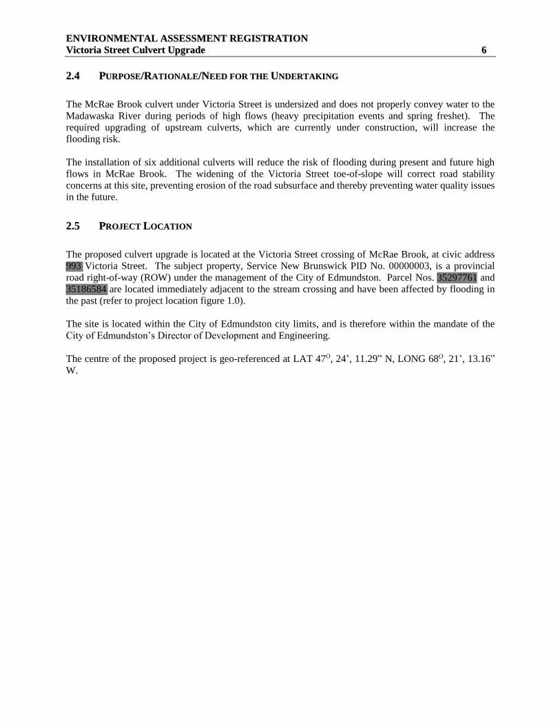
22..55 PPRROOJJEECCTT LLOOCCAATTIIOONN
The proposed culvert upgrade is located at the Victoria Street crossing of McRae Brook, at civic address
993 Victoria Street. The subject property, Service New Brunswick PID No. 00000003, is a provincial
road right-of-way (ROW) under the management of the City of Edmundston. Parcel Nos. 35297761 and
35186584 are located immediately adjacent to the stream crossing and have been affected by flooding in
the past (refer to project location figure 1.0).
The site is located within the City of Edmundston city limits, and is therefore within the mandate of the
City of Edmundston’s Director of Development and Engineering.
The centre of the proposed project is geo-referenced at LAT 47O, 24’, 11.29” N, LONG 68O, 21’, 13.16”
W.

EENNVVIIRROONNMMEENNTTAALL AASSSSEESSSSMMEENNTT RREEGGIISSTTRRAATTIIOONN
VViiccttoorriiaa SSttrreeeett CCuullvveerrtt UUppggrraaddee 77
Figure 1: Project Location
The overall footprint of the project development area is approximately 2,000 square metres, located at the
confluence of McRae Brook and the Madawaska River. The site is bordered to the east by forested
parcels and to the west by the Madawaska River. North and south of the site is primarily residential
development along Victoria Street.
No regulated wetlands are located within, or adjacent to, the project footprint.
22..66 SSIITTIINNGG CCOONNSSIIDDEERRAATTIIOONNSS
The project site is a necessity due to existing conditions in McRae Brook and the Madawaska River.
Alternative sites were not considered as relocating the project is not possible.
22..77 PPHHYYSSIICCAALL CCOOMMPPOONNEENNTTSS AANNDD DDIIMMEENNSSIIOONNSS OOFF TTHHEE UUNNDDEERRTTAAKKIINNGG
The drainage basin upstream of Victoria Street has an approximate area of 247 ha, an approximate
average slope of 6% and an approximate weighted curve number of 83. The estimated peak flow
generated by a 100 year +20% storm is 15.8 m3/s.
EENNVVIIRROONNMMEENNTTAALL AASSSSEESSSSMMEENNTT RREEGGIISSTTRRAATTIIOONN
VViiccttoorriiaa SSttrreeeett CCuullvveerrtt UUppggrraaddee 88
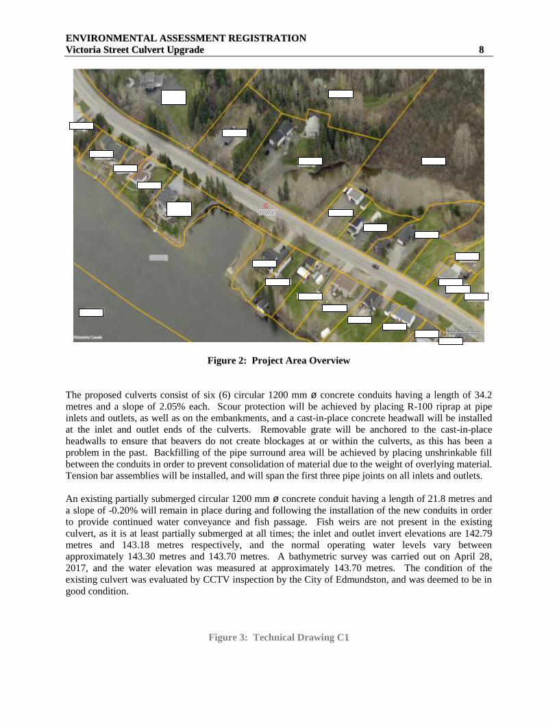
Figure 2: Project Area Overview
The proposed culverts consist of six (6) circular 1200 mm ø concrete conduits having a length of 34.2
metres and a slope of 2.05% each. Scour protection will be achieved by placing R-100 riprap at pipe
inlets and outlets, as well as on the embankments, and a cast-in-place concrete headwall will be installed
at the inlet and outlet ends of the culverts. Removable grate will be anchored to the cast-in-place
headwalls to ensure that beavers do not create blockages at or within the culverts, as this has been a
problem in the past. Backfilling of the pipe surround area will be achieved by placing unshrinkable fill
between the conduits in order to prevent consolidation of material due to the weight of overlying material.
Tension bar assemblies will be installed, and will span the first three pipe joints on all inlets and outlets.
An existing partially submerged circular 1200 mm ø concrete conduit having a length of 21.8 metres and
a slope of -0.20% will remain in place during and following the installation of the new conduits in order
to provide continued water conveyance and fish passage. Fish weirs are not present in the existing
culvert, as it is at least partially submerged at all times; the inlet and outlet invert elevations are 142.79
metres and 143.18 metres respectively, and the normal operating water levels vary between
approximately 143.30 metres and 143.70 metres. A bathymetric survey was carried out on April 28,
2017, and the water elevation was measured at approximately 143.70 metres. The condition of the
existing culvert was evaluated by CCTV inspection by the City of Edmundston, and was deemed to be in
good condition.
Figure 3: Technical Drawing C1

EENNVVIIRROONNMMEENNTTAALL AASSSSEESSSSMMEENNTT RREEGGIISSTTRRAATTIIOONN
VViiccttoorriiaa SSttrreeeett CCuullvveerrtt UUppggrraaddee 99
Figure 3: Technical Drawing C1
EENNVVIIRROONNMMEENNTTAALL AASSSSEESSSSMMEENNTT RREEGGIISSTTRRAATTIIOONN
VViiccttoorriiaa SSttrreeeett CCuullvveerrtt UUppggrraaddee 1100
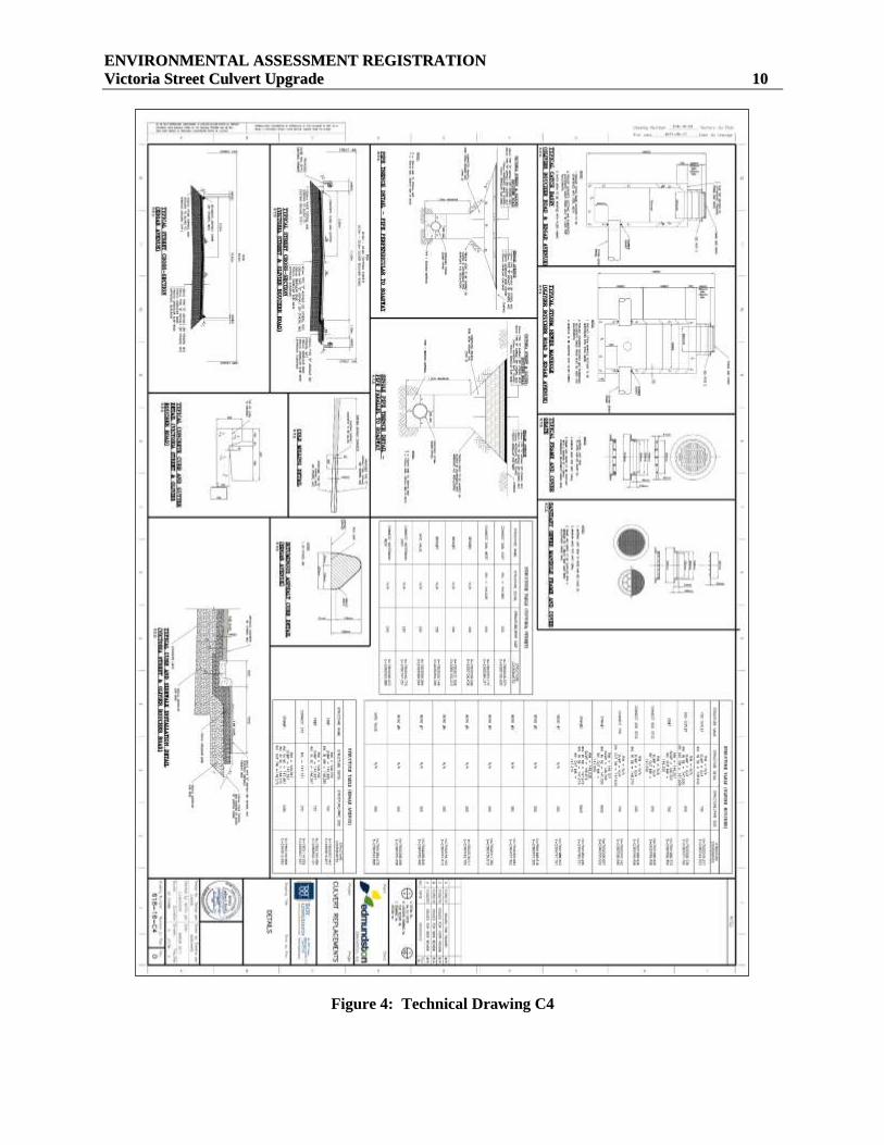
Figure 4: Technical Drawing C4
EENNVVIIRROONNMMEENNTTAALL AASSSSEESSSSMMEENNTT RREEGGIISSTTRRAATTIIOONN
VViiccttoorriiaa SSttrreeeett CCuullvveerrtt UUppggrraaddee 1111
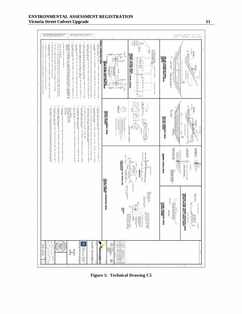
Figure 5: Technical Drawing C5
EENNVVIIRROONNMMEENNTTAALL AASSSSEESSSSMMEENNTT RREEGGIISSTTRRAATTIIOONN
VViiccttoorriiaa SSttrreeeett CCuullvveerrtt UUppggrraaddee 1122
22..88 CCOONNSSTTRRUUCCTTIIOONN,, OOPPEERRAATTIIOONN AANNDD MMAAIINNTTEENNAANNCCEE DDEETTAAIILLSS
The installation of the six culverts will be completed through the following construction sequence:
22..88..11 CCoonnssttrruuccttiioonn SSeeqquueennccee
Installation of temporary water control works;
Installation of sediment control measures;
Electrofishing and removal of fish from work area;
Installation and commissioning of temporary watermain bypass line;
Installation of detour signage;
Installation and backfill of culverts starting downstream up to approximately centreline of road;
Installation of relocated forcemain;
Installation of temporary sanitary sewer bypass pumping;
Installation and backfill of remaining culverts;
Placement of culvert pipe end protection;
Removal of temporary water control works;
Reinstallation of sanitary sewer and removal of temporary bypass pumping;
Reinstallation and commissioning of watermain and removal of temporary watermain bypass line;
Completion of roadway and private property reinstatement;
Removal of detour signage;
Removal of sediment control measures following stabilization of disturbed surfaces.
22..88..22 CCoonnssttrruuccttiioonn SScchheedduullee
Construction of the Victoria Street Culvert Upgrade is scheduled to begin as soon as regulatory approval
(Certificate of Determination) is granted. The tendering process has already been completed, the contract
has been awarded, and the necessary materials have been acquired.
The construction is anticipated to be completed in 6 weeks, provided that there are no significant weather-
related delays.
22..99 RREEGGUULLAATTOORRYY AAPPPPRROOVVAALLSS
The Province of New Brunswick’s Department of Environment and Local Government (DELG) regulates
any alteration within 30m of a watercourse or wetland, including the installation of culverts, through the
Watercourse and Wetland Alteration Regulation and permitting process.
In instances where a culvert may also impact an item under Schedule A of the Environmental Impact
Assessment (EIA) Regulation, the project must be registered for an Environmental Impact Assessment
(EIA) as well as obtain WAWA permit, in addition to any municipal permits and approvals. In this
instance, the Department of Environment and Local Government has identified the subject site section of
Victoria Street as a causeway as per Item i) of Schedule A “all causeways and multiple-span bridges”,
and the installation of six additional culverts as a significant modification to a causeway.
EENNVVIIRROONNMMEENNTTAALL AASSSSEESSSSMMEENNTT RREEGGIISSTTRRAATTIIOONN
VViiccttoorriiaa SSttrreeeett CCuullvveerrtt UUppggrraaddee 1133
22..1100 AALLTTEERRNNAATTIIVVEE DDEESSIIGGNN CCOONNSSIIDDEERRAATTIIOONNSS
The 6-culvert design was chosen after assessing alternative options for this site:
Null Alternative: The null alternative is not an option; if the current situation at Victoria Street is not
corrected, the area will experience flooding at an even greater scale than has previously occurred. This
could result in property damage, damages to private structures, and to Victoria Street.
Bridge Option: A bridge option was reviewed; however, this would have required a complete excavation
of the existing section of Victoria Street, the rerouting of McRae Brook and installation of significant
water control structures in McRae Brook and Madawaska River, the suspension and protection of
municipal utilities to the underside of the bridge, the excavation of virgin ground and the installation of
significant bridge abutment structures on both sides of the watercourse. Based on these factors, the
increased construction time, the potential for environmental impacts, and the prohibitive cost, this option
was discarded.
Box Culvert Option: A concrete box culvert option was also assessed. The installation of a box culvert
would require the use of a crane, requiring the temporary removal of overhead power lines and
subsequent suspension of power services. This option was deemed to be more cost prohibitive than the
proposed round culvert upgrade, and not feasible due to the issues associated with the overhead power
lines. As such, this option was discarded.
Preferred Option: The proposed installation of multiple culverts was chosen due to the ease of installation
(using standard equipment), the short timeline required for project completion, the avoidance of removing
overhead power lines, and the least prohibitive cost.

EENNVVIIRROONNMMEENNTTAALL AASSSSEESSSSMMEENNTT RREEGGIISSTTRRAATTIIOONN
VViiccttoorriiaa SSttrreeeett CCuullvveerrtt UUppggrraaddee 1144
33.. DDEESSCCRRIIPPTTIIOONN OOFF TTHHEE EEXXIISSTTIINNGG EENNVVIIRROONNMMEENNTT
3.1 PHYSICAL AND NATURAL FEATURES
General
The subject site consists of the Victoria Street right-of-way in Edmundston, Madawaska County, New
Brunswick where it crosses McRae Brook. The confluence of McRae Brook and the Madawaska River is
adjacent to (west of) Victoria Street at this location.
McRae Brook is approximately 15 metres in width upstream of the crossing and approximately 45 metres
in width downstream; however, it should be noted that this width is due to the impoundment of the
downstream Madawaska Dam, and narrows significantly approximately 150m upstream.
Geology
Geology in the area is not applicable to this project. The project will take place within the constructed
(man-made) sub-layers of Victoria Street.
Topography
The portion of Victoria Street at the project site is flat, sloping to either side (east and west) at a 1:1 slope.
McRae Brook has relatively gentle slopes on either side at this location, due in part to the residences on
either side.
Surface Water
According to GeoNB Map Viewer, there are no regulated wetlands within the proposed project footprint.
There is one (1) Provincially Significant Wetland (PSW), Boucher Lake, approximately 1 km upstream
and east of the site; however, this is not anticipated to be impacted by the project.
The subject site is located adjacent to the confluence of Madawaska River and McRae Brook; however,
the water level at the subject site is impacted by the existing Madawaska Dam downstream at Queen
Street.
The confluence of the Madawaska River and Saint John River is approximately 5.5 kilometres south of
the subject site.
The McRae Brook drainage basin upstream of Victoria Street has an approximate area of 247 ha, an
approximate average slope of 6% and an approximate weighted curve number of 83. The estimated peak
flow generated by a 100 year +20% storm is 15.8 m3/s.

EENNVVIIRROONNMMEENNTTAALL AASSSSEESSSSMMEENNTT RREEGGIISSTTRRAATTIIOONN
VViiccttoorriiaa SSttrreeeett CCuullvveerrtt UUppggrraaddee 1155
Figure 6: Site Location and Wetland Mapping (GeoNB Map View).
Groundwater
Nearby residences are serviced by the City of Edmundston’s water and sewer services.
Vegetation
The site location contains common vegetation species at the edge of Victoria Street, primarily speckled
alder (Alnus incana) and willow (Salix spp), immature white pine (Pinus strobus), trembling aspen
(Populus tremuloides), balsam fir (Abies balsamea), red maple (Acer rubrum), white birch (Betula
papyrifera) and mountain ash (Sorbus aucuparia). Only the vegetation within the footprint of the culvert
installations within the ROW will be removed for the purpose of the project.
Wildlife and Wildlife Habitat
The subject site is located in an urban area within the City of Edmundston and is not considered suitable
habitat for most common wildlife species.
Based on previous culvert installations, McRae Brook is known to contain Creek Chub (Semotilus
atromaculatus), White Sucker (Catostomus commersoni) and Ninespine Stickleback (Pungitius
pungitius).

EENNVVIIRROONNMMEENNTTAALL AASSSSEESSSSMMEENNTT RREEGGIISSTTRRAATTIIOONN
VViiccttoorriiaa SSttrreeeett CCuullvveerrtt UUppggrraaddee 1166
Migratory Birds
According to the Canadian Wildlife Service, “Under Section 6 of the Migratory Birds Regulations
(MBR), no person shall disturb, destroy or take a nest or egg of a migratory bird; or to be in possession of
a live migratory bird, or its carcass, skin, nest or egg, except under authority of a permit. It is important to
note that under the current MBR, no permits can be issued for the incidental take of migratory birds
caused by development projects or other economic activities. Furthermore, Section 5.1 of the MBCA
describes prohibitions related to deposit of substances harmful to migratory birds:
“5.1 (1) No person or vessel shall deposit a substance that is harmful to migratory birds, or permit such a
substance to be deposited, in waters or an area frequented by migratory birds or in a place from which the
substance may enter such waters or such an area.
(2) No person or vessel shall deposit a substance or permit a substance to be deposited in any place if the
substance, in combination with one or more substances, results in a substance — in waters or an area
frequented by migratory birds or in a place from which it may enter such waters or such an area — that is
harmful to migratory birds.”
The City of Edmundston recognizes that it is the responsibility of the proponent to ensure that activities
comply with the MBCA and regulations.
The site is anticipated to contain typical, common bird species for an urban area; however, the project is
not anticipated to impact migratory birds.
Species at Risk
Canada’s Species at Risk Act (SARA) is one of three major components in the Government of Canada
Strategy for the Protection of Species at Risk. It is designed as a key tool for the conservation and
protection of Canada’s biological diversity and fulfils an important commitment under the United Nations
Convention on Biological Diversity. New Brunswick also has a Species at Risk Act, which complements
the federal Act.
The purpose of SARA is to:
A. Prevent wildlife species from becoming extinct or extirpated (lost from the wild in Canada);
B. Help in the recovery of extirpated, endangered or threatened species; and
C. Ensure that species of special concern do not become endangered or threatened.
The project is not anticipated to impact species at risk.
Environmentally Significant Areas
A review of the Nature Trust NB Environmentally Significant Area (ESA) database found several ESAs
within a 5 km radius of the subject site; however, the closest ESA sites are:
ESA #214 Etang McRae:
This small bog pond of 1.6 hectare is the focus of much attention among local naturalists. It serves as a
good representative of bog habitat, which is rare in this part of the province. It is also home to several
plant species that are uncommon or rare in the northern part of the province. These include: Small

EENNVVIIRROONNMMEENNTTAALL AASSSSEESSSSMMEENNTT RREEGGIISSTTRRAATTIIOONN
VViiccttoorriiaa SSttrreeeett CCuullvveerrtt UUppggrraaddee 1177
Cranberry (Vaccinium oxycoccus); American Watershield (Brasenia schreberi); Water-arum (Calla
palustris); Common Duckweed (Lemna minor); Yellow Loosestrife (Lysimachia terrestris). At least 68
species of birds have been observed here.
This wetland is located approximately 1 km upstream of the subject site and is not anticipated to be
impacted by the project.
ESA #218 Madawaska River Sandspit: This ESA is located on the west (opposite) bank of the
Madawaska River. Known as good migratory waterfowl habitat. Ice scouring and flooding are
probably the main natural disturbances. This site is suitable for plants associated with gravel strands.
The rare plants Muhlenbergia richardsonis and Schizachyrium scoparium (Michx.) Nash, have been
reported near here at Clair on a river strand. Another rare plant to look for at this site is Potamogeton
pectinatus.
This site is not anticipated to be impacted by the project.
Figure 7: Environmentally Significant Area Locations
Archaeological Resources
Based on the subject site (a man-made road structure), no archaeological resources are anticipated to be
encountered or impacted by the project.
ESA 218
ESA 214 Project Site

EENNVVIIRROONNMMEENNTTAALL AASSSSEESSSSMMEENNTT RREEGGIISSTTRRAATTIIOONN
VViiccttoorriiaa SSttrreeeett CCuullvveerrtt UUppggrraaddee 1188
Land Use
The project is proposed on land owned by the City of Edmundston which serves as an existing road
ROW, as well as on two parcels of private land. No Land Gazette flags were identified within the subject
site or adjacent properties.
No land use issues or conflicts are anticipated from the project, as the private land owners on which the
work will take place have been contacted and are in agreement with the proposed work.
Transportation
The subject site is an existing municipal roadway, necessary for efficient traffic flow in the area. The
work will require closure of the road and a traffic detour will be implemented for the duration of the
project. The NB Department of Transportation and Infrastructure is aware of this requirement.

EENNVVIIRROONNMMEENNTTAALL AASSSSEESSSSMMEENNTT RREEGGIISSTTRRAATTIIOONN
VViiccttoorriiaa SSttrreeeett CCuullvveerrtt UUppggrraaddee 1199
44.. EENNVVIIRROONNMMEENNTTAALL AASSSSEESSSSMMEENNTT OOFF PPOOTTEENNTTIIAALL IIMMPPAACCTTSS
Based on the project description and the existing environment, the following Valued Environmental
Components (VECs) were identified for the EIA:
a) Surface Water Quality
b) Fish Habitat
c) Transportation
A qualitative rating system was used to evaluate the potential for interactions between the project and the
environment. A rating was given to each Valued Environmental Component (VEC) based on a rating
system according to professional judgment and experience of the consultant.
0 = No interaction anticipated.
1 = Interaction occurs; however, it is unlikely to result in a significant environmental effect even
without mitigation, or it is unlikely to be significant because of mitigation measures.
2 = Interaction could potentially result in an environmental effect.
Where there is a potential for project-VEC interaction (ratings of 1 or 2), further discussion is provided in
the following sections. For issues where there is limited interaction (ratings 0 or 1), a rationale is
provided and the issue is not discussed further in the present report. Potential project-environment
interactions are presented in Table 8.
Table 1: Potential Project-Environment Interactions Matrix
Activities
Potential VEC
Construction
/ Installation
of the
Physical
Work
Operation
/ Maintenance
of the
Physical
Work
Decommissioning
/ Abandonment
of the Physical
Work
Accidents and
Unplanned
Events
Biophysical
Surface Water 2 0 1 1
Fish Habitat 1 0 1 1
Socio-Economic
Transportation 2 0 1 1
The potential VECs that have a rating of zero for all activities indicate that the particular VEC is not
present within or in proximity to the project’s footprint. The rationales for excluding these VECs from
further assessment are discussed in the following sections.
Significance of potential environmental effects is also evaluated in this section, based on a consideration
of four (4) characteristics of the project-VEC interaction:
1. Likelihood: What is the likelihood of the impact on the VEC?
2. Spatial scale: How large an area/how many of the VEC will be impacted?
3. Duration of impact: How long will the VEC be impacted? and

EENNVVIIRROONNMMEENNTTAALL AASSSSEESSSSMMEENNTT RREEGGIISSTTRRAATTIIOONN
VViiccttoorriiaa SSttrreeeett CCuullvveerrtt UUppggrraaddee 2200
4. Mitigation: What mitigation measures can be employed to minimize the impact, and how
efficient?
4.1 SURFACE WATER
The proposed project will be completed within the footprint of the McRae Brook/Madawaska River
confluence.
Existing Conditions:
At present, the Victoria Street culvert is partially to completely submerged and inadequate (undersized)
for conveying increased water flows in McRae Brook during periods of high water flows.
The water level immediately upstream of the site is affected by the Madawaska Dam, located
approximately 5 km downstream. However, during periods of high flows, the upstream properties’ water
levels increase significantly and flooding occurs.
The proponent has applied for a WAWA permit to undertake work within 30 m of a watercourse.
Furthermore, the project is the final culvert in a larger program of culvert replacements on McRae Brook
designed to prevent localized flooding and road erosion created from undersized culverts.
Project-VEC Interactions, Potential Environmental Effects:
Environmental Impact 1: Excavation may result in sediments reaching the watercourse.
The installation of the six (6) culverts will be conducted by trenching, using an excavator from road level.
This may result in sediments from the road sub-compacted layers reaching the watercourse during
excavation, which may adversely impact water quality if not properly mitigated.
Recommended Mitigation 1:
Work will take place “in the dry”;
Work will take place during the summer low-flow period;
In the event of a sustained, heavy precipitation period, work will be delayed until conditions return to
favourable;
Material and equipment will be stockpiled outside of the 30 m watercourse buffer where practical;
Equipment will be refueled outside of the 30 m watercourse buffer zone;
All site work, excavation, culvert installation, backfilling, placement of rip-rap, etc. will be completed
according to a signed and stamped engineer’s design – and as per the NB WAWA Technical
Guidelines. This will include, but not be limited to, the use of clean, non-toxic materials and standard
sediment and erosion controls such as the placement of geotextile fabric fences.
Significance of Potential Impacts
Based on the temporary nature of the project, the work is anticipated to take place “in the dry”, and the
use of the mitigation measures noted above, water quality impacts are considered unlikely and not
significant.

EENNVVIIRROONNMMEENNTTAALL AASSSSEESSSSMMEENNTT RREEGGIISSTTRRAATTIIOONN
VViiccttoorriiaa SSttrreeeett CCuullvveerrtt UUppggrraaddee 2211
4.2 FISH HABITAT
The proposed project will be completed within the footprint of the McRae Brook/Madawaska River
confluence.
Existing Conditions:
Although a fish habitat survey has not been completed for this project, it can reasonably be assumed that
McRae Brook and Madawaska River contain fish and fish habitat. Electrofishing previously conducted
on McRae Brook identified three species: Creek Chub, White Sucker and Ninespine Stickleback.
Project-VEC Interactions, Potential Environmental Effects:
Environmental Impact 1: Placement of rip rap along the toe-of-slope may impact approximately 250
square metres of fish habitat.
Environmental Impact 2: The excavation of Victoria Street may result in increased sedimentation in
McRae Brook and the Madawaska River, which may impact fish habitat.
Environmental Impact 3: The project may impede fish passage during the 6-week construction period.
Recommended Mitigation 1:
The area to be impacted will be limited to the smallest area necessary to strengthen the roadway from
future flooding, thereby reducing the potential for future excavations within the McRae Brook
watercourse. The work area will be electrofished and individual fish will be removed/released outside of
the work site. Fish species identified will be recorded and compiled.
Recommended Mitigation 2:
Standard erosion and sediment controls will be implemented throughout the construction process, based
on a stamped engineer’s design and as per the WAWA Technical Guidelines.
Recommended Mitigation 3:
The excavation will be conducted from street level, adjacent to the existing culvert, and will not require
excavation of the watercourse, nor alter or impact the existing culvert, which will be maintained in place
for fish passage during construction.
Significance of Potential Impacts
Based on the minimal area of fish habitat potentially impacted and the mitigation measures to be
employed during construction, potential impacts to fish habitat are considered unlikely and not
significant.

EENNVVIIRROONNMMEENNTTAALL AASSSSEESSSSMMEENNTT RREEGGIISSTTRRAATTIIOONN
VViiccttoorriiaa SSttrreeeett CCuullvveerrtt UUppggrraaddee 2222
55.. AACCCCIIDDEENNTTSS AANNDD UUNNPPLLAANNNNEEDD EEVVEENNTTSS
The City of Edmundston and its contractors will adhere to all WorkSafe NB and other applicable health,
safety and environmental legislation to ensure the construction and installation of the proposed culvert
upgrade are completed in an environmentally responsible and safe manner.
Only licensed, insured and qualified contractors will be employed for the construction and commissioning
of the project, under the supervision of Roy Consultants and City of Edmundston engineers.
Petroleum products or any other deleterious substances will not be dumped on the ground or in the water,
or handled or stored in a careless manner.
All necessary precautions will be taken to avoid spills and contamination to the soil and water when
handling petroleum products on site and during fuelling and servicing of vehicles and equipment.
Vehicles and equipment will be maintained in good working order to prevent leaks on site.
Appropriate emergency spill response equipment will be maintained on site.
All spills or leaks will be promptly contained, cleaned-up and reported to regulatory authorities.
Employees will be briefed in the use of spill kits and appropriate emergency reporting procedures.
Should contaminated soils be encountered during construction activities, they will be managed in
accordance with applicable federal and/or provincial requirements (i.e. New Brunswick Guideline for the
Management of Contaminated Sites (July 2012)).
Vehicles and equipment will be maintained in good working order to prevent leaks on site.
Municipal employees and all contractors working on site will be required to maintain and wear personal
protective equipment (PPE) at all times.
All required health and safety equipment will be kept on site and in good working order, including a first
aid kit and any other necessary health and safety equipment.
Only employees properly skilled and trained shall be employed in the construction, operation and
maintenance of the project. All appropriate employee certification shall be maintained in good standing.
All workers on site shall be properly trained and insured as per the requirements of WorkSafe NB and the
Occupational Health and Safety Act (OHSA).
All accidents shall be reported to WorkSafe NB and, where necessary, protocols developed to avoid
future, similar occurrences.

EENNVVIIRROONNMMEENNTTAALL AASSSSEESSSSMMEENNTT RREEGGIISSTTRRAATTIIOONN
VViiccttoorriiaa SSttrreeeett CCuullvveerrtt UUppggrraaddee 2233
66.. CCUUMMUULLAATTIIVVEE EEFFFFEECCTTSS
The construction of the proposed project will correct an undersized culvert, which if not completed will
be creating impacts upstream on McRae Brook, namely flooding of the riparian area and possible erosion
of infrastructure during high flows.
Based on the minimal potential adverse environmental impacts, the existing project footprint and the
anticipated restorative benefits of the project, no cumulative effects assessment was required for this
project.

EENNVVIIRROONNMMEENNTTAALL AASSSSEESSSSMMEENNTT RREEGGIISSTTRRAATTIIOONN
VViiccttoorriiaa SSttrreeeett CCuullvveerrtt UUppggrraaddee 2244
77.. PPUUBBLLIICC IINNVVOOLLVVEEMMEENNTT
The City of Edmundston has advised the following neighbouring landowners of the proposed culvert
upgrade project:
Gilles Guimond (PID Nos. 35297761 and 35165364);
Raymond Plourde (PID No. 35186584), and
Denise Morneault and Ronald Chassé (PID No. 35250109)
Meetings with landowners took place on site during the tender process on April 10, 2017, and June 6
2017. Refer to Appendix D for a landowner agreement template. Each landowner will complete the form
and submit to the City prior to initiating work on their property.
No objections to the project were raised and feedback towards the project has been positive.
The project will be advertised on local radio and newspapers, the City of Edmundston Website and
Facebook page. DTI is already aware of, and working with the City for the detours for other culvert sites
and is aware of the project.

EENNVVIIRROONNMMEENNTTAALL AASSSSEESSSSMMEENNTT RREEGGIISSTTRRAATTIIOONN
VViiccttoorriiaa SSttrreeeett CCuullvveerrtt UUppggrraaddee 2255
88.. FFIIRRSSTT NNAATTIIOONNSS
The proposed project is located on municipal and private land. Given that the project is within city limits,
is a maintenance project and no archaeological resources are anticipated to be encountered or impacted,
no involvement with First Nations was undertaken by the proponent and no impacts to First Nations are
anticipated as a result of this project.
EENNVVIIRROONNMMEENNTTAALL AASSSSEESSSSMMEENNTT RREEGGIISSTTRRAATTIIOONN
VViiccttoorriiaa SSttrreeeett CCuullvveerrtt UUppggrraaddee 2266
99.. AAPPPPRROOVVAALL OOFF TTHHEE UUNNDDEERRTTAAKKIINNGG
The following permits, approvals and authorizations are anticipated for the project to include, but not be
limited to:
a) Certificate of Determination – DELG
b) Watercourse and Wetland Alteration Permit – DELG

EENNVVIIRROONNMMEENNTTAALL AASSSSEESSSSMMEENNTT RREEGGIISSTTRRAATTIIOONN
VViiccttoorriiaa SSttrreeeett CCuullvveerrtt UUppggrraaddee 2277
1100.. FFUUNNDDIINNGG
The proposed project is funded by the City of Edmundston, the Province of New Brunswick, and the
Government of Canada under the Clean Water and Wastewater Fund.

EENNVVIIRROONNMMEENNTTAALL AASSSSEESSSSMMEENNTT RREEGGIISSTTRRAATTIIOONN
VViiccttoorriiaa SSttrreeeett CCuullvveerrtt UUppggrraaddee 2288
1111.. CCLLOOSSIINNGG SSTTAATTEEMMEENNTT
This environmental impact assessment identified Valued Environmental Components, which may
potentially be impacted by the proposed culvert upgrade and identified potential adverse effects, which
may occur from the development of the project. Significance was determined based on four criteria:
likelihood, scale, duration and proposed mitigation.
All VECs were assessed and identified as either not impacted by the project, or the impacts were
considered not significant based on the above criteria.
This report was prepared by Roy Consultants for the exclusive use of the City of Edmundston. The
information contained herein may not be republished or relied upon for any other purpose or by any other
third party without the express written notice of the author.
EENNVVIIRROONNMMEENNTTAALL AASSSSEESSSSMMEENNTT RREEGGIISSTTRRAATTIIOONN
VViiccttoorriiaa SSttrreeeett CCuullvveerrtt UUppggrraaddee 2299
1122.. RREEFFEERREENNCCEESS CCIITTEEDD
Flora of North America, 2008. www.foranorthamerica.org.
Important Bird Areas Canada. www.ibacanada.com.
Natech, 2017. Bathymetric Survey of the Madawaska River near the Culvert Replacement Location on
Victoria Street. Natech Environmental Services Inc. April 28, 2017.
Nature Trust NB Environmentally Significant Areas (ESA) Database.
New Brunswick, 1987. Environmental Impact Assessment Regulation (87-83) O.C. 87-558.
New Brunswick, 2012. A Guide to Environmental Impact Assessment in New Brunswick. Environment
and Local Government. April 2012.
New Brunswick, 1973. Clean Environment Act. R.S.N.B. 1973, c. C-6.
New Brunswick. Service New Brunswick. NBGIC Parcel Data, 2009. Real Property Information PID
numbers.
Service New Brunswick, 2017. GeoNB Map Viewer.

APPENDIX A:
Large Technical Diagrams
TP1-Rev0
C1 rev0
C2 rev0
C3 rev0
C4 rev0
C5 rev0

CITY OF EDMUNDSTON
···

∅


APPENDIX B:
Site Photos
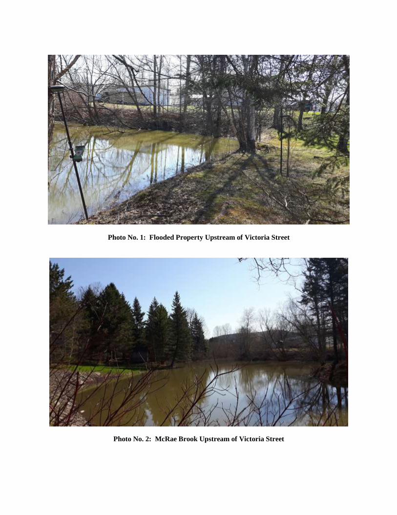
Photo No. 1: Flooded Property Upstream of Victoria Street
Photo No. 2: McRae Brook Upstream of Victoria Street
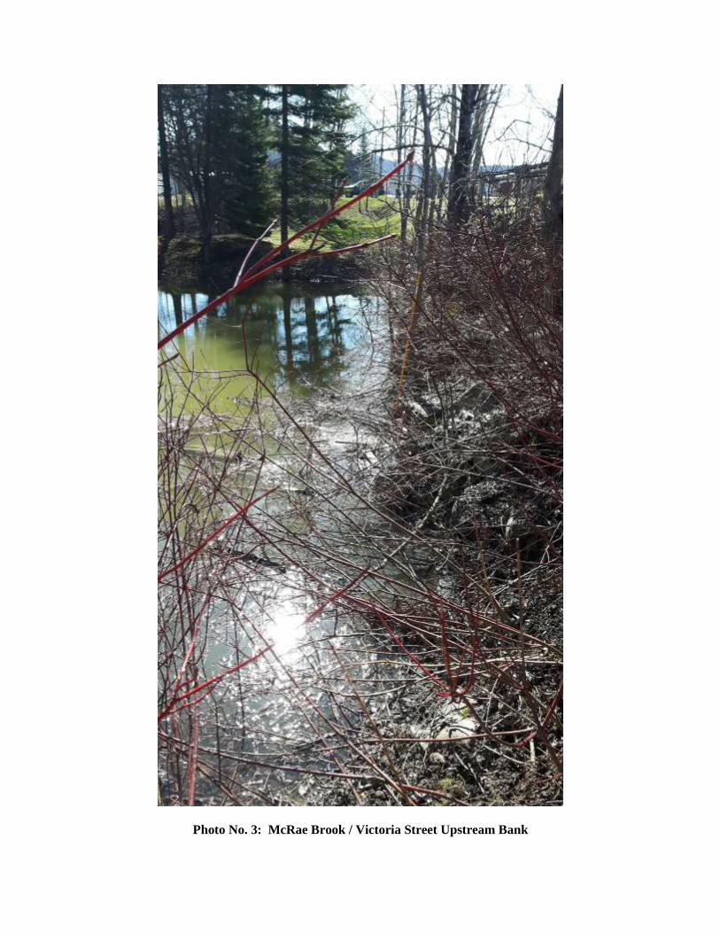
Photo No. 3: McRae Brook / Victoria Street Upstream Bank

Photo No. 4: Upstream Property (North Bank of McRae Brook)
Photo No. 5: Madawaska River (Victoria Street in Foreground)
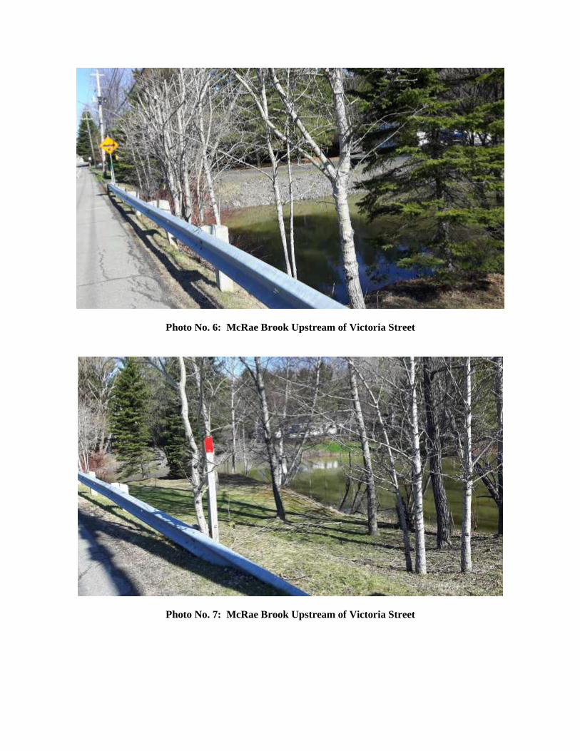
Photo No. 6: McRae Brook Upstream of Victoria Street
Photo No. 7: McRae Brook Upstream of Victoria Street
APPENDIX C:
Consultation Template

LES PARTIES CONVIENNENT, CHACUN EN CONTREPARTIE DES ENGAGEMENTS PRÉVUS À LA PRÉSENTE CONVENTION, À CE QUI SUIT :
1. Le propriétaire permet expressément à la Municipalité, ses employés, agents, mandataires ou entrepreneurs contractuels indépendants à entrer et empiéter sur sa propriété pendant toute la durée desdits travaux de construction;
2. La municipalité s’engage de libérer dès que possible la propriété du propriétaire à la fin desdits travaux de construction, et de remettre, dans la mesure du
possible, la propriété 35186584 du propriétaire dans un état qui est similaire
ou meilleur à sa condition d’avant lesdits travaux de construction.
3. La municipalité s’engage à replacer à ses frais toute borne de terrain qui pourrait être déplacé durant les travaux.
PROPRIÉTAIRE SIGNÉ, SCELLÉ ET REMIS en ) présence de : ) ) ) Raymond Plourde ) ) )
Ville d’Edmundston SIGNÉ, SCELLÉ ET REMIS en ) présence de : ) ) ) ) ) ) Incl. : Photos du site avant les travaux

APPENDIX D:
NATECH Bathymetry Report

Environmental Services Inc. 2492 Route 640, Hanwell, N.B. E3E 2C2 ph.: (506) 455-1085 fax.: (506) 455-1088
April 28, 2017
Mr. Jeffrey David, ing./P.Eng.
Roy Consultants Engineering Services
1080, Rue Champlain, unite 13
Dieppe, NB
E1A 8L8
Re: Bathymetric Survey of the Madawaska River near
the culvert replacement location on Victoria Street
Dear Jeff:
As requested, we surveyed the bathymetry of the small cove on the edge
Madawaska River (on the Southwest side of Victoria Street), on April 25, 2017. We also
surveyed the small water body on the opposite side of the culvert. Figure 1 shows where
these sites are located.
1. Methodology
Bottom depths were determined using a manned boat equipped with a GPS and a 200 kHz
echo sounder. The shoreline was traced based on aerial photography. The elevation of
the water level was surveyed using a Total Station, and referenced to the geodetic
benchmark provided by you (#26294, X: 2360632.827m, Y: 7601650.221m, Z: 150.011m)

Locations surveyed
FILE:
FIGURE:
DATE:
SCALE:
Bathymetric Survey
Victoria Street, Edmundston
Location map
Environmental Services Inc.2492 Route 640, Hanwell, NB, E3E 2C2
ph: (506) 455 1085, fax (506) 455 1088 1
2017/04/28 RED-17-01
-

Scale:
Date: Date:
Echelle:
Project No.:
Sheet No.: N de la feuille:
N du projet
2492 Route 640., Hanwell, N.B.
Ph: (506) 455-1085 Fax: (506) 455-1088
AS SHOWN FIGURE 3
MADAWASAKA RIVER
VICTORIA STREETTOP OF CULVERTELEV. = 144.10M
TOP OF CULVERTELEV. = 144.19M
WATER LEVEL ON APRIL 25, 2017ELEV. = 143.63M
WATER LEVEL ON APRIL 25, 2017ELEV. = 143.68M
51015202530354045 0 5 10 15 20 25 30
141
140
139
138
144
145
146
147
148
149
150
143
142
141
140
139
138
144
145
146
147
148
149
150
143
142
Bathymetric Survey
Victoria Street, Edmundston
Cross-section
RED-17-012017/04/28

Area upstream of culvert
FILE:
FIGURE:
DATE:
SCALE:
Bathymetric Survey
Victoria Street, Edmundston
Photographs taken on April 25, 2017
Environmental Services Inc.2492 Route 640, Hanwell, NB, E3E 2C2
ph: (506) 455 1085, fax (506) 455 1088 5
Upstream end of culvert
2017/04/28 RED-17-01
-
Area upstream of culvert