Embed Size (px)
Citation preview
feus•ROL
emedialfanning/
it ^ ..-j*.. • . ^^
nvestcaton>wfe£»:'^-(fi^**^
earnfcEM/FIT)
gS"1'1' "i""
ONE II
•*KW ' ••" - ? T - - »^--'^'r ' .' F , • ^ ,,Jfffh "f;-.; : • • • ' - . • :
lONTRACT^NO.*~ 8-01-6692
2MKHILL
nvirtonment
REMEDIAL ACTIONMASTER PLAN
Marion/BraggMarion, Indiana
01-5VB9.0
,^f-'i »f- "-«&?*¥ '' " '* jJr&UAv ''
^•sragass™ "~T fl
*^ss£>^ j*v' p!r*'-i' -';HWffijf.-'W •Villfef*¥ai:,^-.- J V

TABLE OF CONTENTS
REMEDIAL ACTION MASTER PLAN. MARION/BRAGG' MARION, INDIANA* 01-5VB9.0
| EXECUTIVE SUMMARY iGeneral iSite Location i
I Problem Statement i' Remedial Activities ii
Cost Estimate and Schedule iiiT! . 1.0 INTRODUCTION 1-1
1.1 Remedial Action Master Plan 1-11.1.1 Definition and Purpose 1-1
; 1.1.2 General Approach 1-11.2 Description and Background Information 1-3
1.2.1 Site Description 1-3* 1.2.2 Site History 1-6* 1.2.3 Remedial Action to Date 1-8
1.3 Environmental Setting 1-81.3.1 Physiography 1-8
i 1.3.2 Geology 1-81.3.3 Hydrology 1-81.3.4 Geohydrology 1-91.3.5 Air Quality 1-91.3.6 Ecology 1-9
t 1.3.7 Socioeconomics 1-101.4 Assessment of Potential Impacts 1-10
1.4.1 Public Health and Safety 1-101.4.2 Environment 1-11
* 1.4.3 Socioeconomics 1-11i
2.0 DATA SUMMARIZATION 2-12.1 Hazardous Material Characterization 2-1
, 2.1.1 Groundwater 2-1i 2.1.2 Surface Water 2-1
2.2 Data Limitations 2-1
* 3.0 REMEDIAL ACTIVITIES 3-13.1 Overall Approach and Rationale 3-1
I 3.2 Initial Remedial Measures 3-2j 3.3 Remedial Investigation/Feasibility Study 3-2
3.3.1 Objectives 3-2T 3.3.2 Scope of Work 3-3', 3.3.3 Estimated Costs, Schedule, and1 Deliverables 3-23
I 3.4 Source Control Remedial Actions 3-27j 3.4.1 Objective 3-27
3.4.2 Remedial Action Alternatives 3-283.4.3 Cost Estimates/Schedule 3-28
I 3.5 Offsite Remedial Actions 3-28* 3.5.1 Objective 3-28
3.5.2 Remedial Action Alternatives 3-29f 3.5.3 Cost Estimates/Schedule 3-291
4.0 COMMUNITY RELATIONS ASSESSMENT 4-1
. 4.1 Community Relations Background 4-14.1.1 History of Community Relations
Activities 4-14.1.2 Community Relations Issues 4-2
4 4.1.3 Community Relations Participants 4-34.2 Community Relations Objectives and
Techniques 4-4[ 4.2.1 Objectives 4-4
4.2.2 Techniques 4-5*: Appendix A Site Visit Memorandum
Appendix B Site Chronology
iFIGURES
F
i I Approximate Schedule for Remedial Investigation/Feasibility Study Activities vi
F
1-1 Location Map 1-4
1-2 Vicinity Map 1-5
1-3 Site Map 1-7
2-1 Approximate Locations of Existing Monitoringi Wells 2-2
» 3-1 Approximate Locations of Proposed NewMonitoring Wells 3-9
i3-2 Approximate Schedule for Remedial Investigation/
! Feasibility Study Activities 3-26

TABLES
I Estimated Costs for Remedial Investigation/Feasibility Study Activities iv
I 2-1 Groundwater Test Results 2-3
I 2-2 River Water Test Results 2-4
3-1 Estimated Costs for Remedial Investigation/• Feasibility Study Activities 3-24
/CVR24/023

EXECUTIVE SUMMARY
I GENERAL
j This document is a remedial action master plan (RAMP) forthe Marion/Bragg landfill site at Marion, Indiana. A RAMP
f is a document prepared to identify, define, and schedule asequence of activities necessary to select and implement
f remedial actions at an uncontrolled hazardous waste site.
f SITE LOCATION
iThe Marion/Bragg landfill site is located near Central Avenue
V
' on the southeast edge of Marion, Grant County, Indiana. Theapproximately 40-acre site is in a relatively flat area in
| the flood plain of the Mississinewa River. The landfill wasonce an old gravel pit and was subsequently used for disposal
f of various wastes until operations ceased in 1975.i
r PROBLEM STATEMENTi
State reports indicate that the landfill may have receivedapproximately 1400 drums per month of various industrialwastes for at least a two-year period. It has beenestimated that 30,000 drums remain buried on the site. Atleast some of the drums are known to have contained
\ hazardous materials such as acetone, thinners, solvents,plasticizers, lead, and cadmium. The threat of groundwater
[ contamination is the primary concern since about 3,000people reportedly live within a one-mile radius of the siteand draw their water from a shallow aquifer.
Leachate and leachate-stained areas have been observed on• the southeast side of the site. The landfill's location on

I the edge of the Mississinewa River causes concern about poten-• tial contamination of the river and its biota. From the. site, the river flows northward through Marion and eventually( into the Wabash, Ohio, and Mississippi Rivers.
[ REMEDIAL ACTIVITIES
I Upon review of the Marion/Bragg document file, and after acursory site visit and discussions with USEPA and Indiana
f State Board of Health (ISBH) officials, it has been deter-' mined that no Initial Remedial Measures (IRM's) appeari necessary at this time to limit exposure or threat of expo-i sure to significant health or environmental hazards. There-
fore, no IRM's are recommended.
A feasibility study (FS) will be required to identify, screen,ij and evaluate remedial action alternatives. The data and
information in the document file are insufficient to fullycharacterize the contamination present and to develop viableremedial action alternatives. Therefore, a remedial inves-
I tigation (RI) comprising selected additional data gatheringi activities is required prior to conducting the feasibility
study.<i
The RI/FS recommended for Marion/Bragg includes six activ-ities , each consisting of several defined tasks. Theseactivities are:
Ti
o Preparation of Work Plan
1' o Remedial Investigation
!i o Remedial Investigation Report
T
> o Evaluation of Remedial Action Alternatives
ii . .11

I o Feasibility Study Report
- o Project Management
COST ESTIMATE AND SCHEDULE
Order-of-magnitude cost estimates for conducting the RI/FSI activities recommended in this RAMP are presented in Table I
! A preliminary schedule for conducting these activities is* presented on Figure I.
/CVR24/016
ill

Table IESTIMATED COSTS FOR REMEDIAL INVESTIGATION/
FEASIBILITY STUDY ACTIVITIES
Activity
1 WORK PLAN PREPARATION
1-1 Kickoff Meeting1-2 Quality Assurance Plan1-3 Site Health and Safety Plan1-4 Records Search1-5 Work Plan
Subtotals
2 REMEDIAL INVESTIGATION
2-1 Site Map2-2 Resistivity Survey2-3 Hydrogeologic Study2-4 Groundwater Sampling and
Analysis2-5 River Water Sampling and
Analysis2-6 Leachate and Pond Water
Sampling and Analysis
Subtotals
3 REMEDIAL INVESTIGATION REPORT
3-1 Assess Site Hazards3-2 Remedial Investigation
Report
3-3 Review Meeting3-4 Public Meetings
Subtotals
Order-of-Magnitude Cost ($?Engineering Expense
$ 1,200 $ 8001,200 0
0 02,000 4003,200 400
$
$
$
i
S
7,600
1,6002,00012,200
17,200
13,200
10,000
56,200
2,000
8,400
2,0001,200
$ 1,600
$ 400300700
4,400
3,300
2,300
$11,400
$ 0
900
1,000600
Subcontract Total
$ o0
1,00000
$ 1,000
$ 2 , 800*5 , 60031,500°
0
0
0
$ 39,900
$ 0
000
$ 2,0001,2001,0002,4003,600
$ 10,200
$ 4,8007,90044,400
21,600
16,500
12,300
$107,500
$ 2,000
9,3003,0001,800
$ 13,600 $ 2,500 $ 16,100

Table I, ContinuedESTIMATED COSTS FO*R REMEDIAL INVESTIGATION/
FEASIBILITY STUDY ACTIVITIES
Activity
4 EVALUATION OF REMEDIALACTION ALTERNATIVES
4-1 Development of PotentialRemedial Actions
4-2 Review Meeting4-3 Data Evaluation4-4 Evaluation of Treatment
Options4-5 Comparison of Alternative
Remedial Actions
Subtotals
5 FEASIBILITY STUDY REPORT
5-1 Draft Report5-2 Review Meeting5-3 Community/Public Meetings5-4 Final Report
Subtotal
6 PROJECT MANAGEMENT
6-1 Execution6-2 Close Out
Subtotals
TOTALS
Order-of-Magnitude Cost ($)Engineering Expense
$ 2,000 $ 02,400 1,0001,600 0
$
$
$
$
10,000
10,000
26,000
27,000800
1,2002,600
31,600
13,0003,200
1,00
1,400
$ 3,400
$ 2,700500600400
$ 4,200
$ 1,400400
Subcontract Total
$ 7,500d00
0
0
$ 7,500
$ 0000
$ o
$ o0
$ 9,5003,4001,600
11,000
11,400
$ 36,900
$ 29,7001,3001,8003,000
$ 35,800
$ 14,4003,600
$ 16,200 $ 1,800 $ 0 $ 18,000
$151,200 $24,900 $ 48,400 $224,500
Includes costs for performing control survey and aerial photography work.
Includes costs for performing resistivity field work and initial data reductionQ
Includes costs for drilling and developing wells.
Includes costs for conducting the endangerment assessment.
/CVR24/015

WORK PLANPREPARATION
REMEDIAL INVESTIGATION FEASIBILITY STUDY
KICKOFF MEETINGQAPLAN IH&SPLAN IRECORDS SEARCHWORK PLAN
HYDROGEOLOGIC STUDYQROUNDWATER SAMPLING & ANALYSISRIVERWATER SAMPLING & ANALYSISLEACHATE & POND WATER
SAMPLING & ANALYSIS
GROUNDWATER SAMPLING AND ANALYSIS (AS REQ D)RIVERWATER SAMPLING AND ANALYSIS (AS REQ D)
ASSESS HAZARDSREVIEW MEETINGREMEDIAL INVESTIGATION REPORT
PROJECT MANAGEMENT
IDEVELOP POTENTIAL REMEDIAL ACTIONSREVIEW MEETING IDATA EVALUATION |EVALUATION OF TREATMENT 0*>TIONS
COMPARISON OF ALTERNATIVE5
REVIEW MEETINGFEASIBILITY STUDY REPORT
COMMUNITY RELATIONS
10 12TIME (MONTHS)
14 16 18 20 22
TIME ALLOTTED FOR PREPARATIONOF BID DOCUMENTS, PROCUREMENTOF BIDS AND SELECTION OF CONTRACTOR. FIGURE I
W6501900
APPROXIMATE SCHEDULE FORREMEDIAL INVESTIGATION/FEASIBILITY STUDY ACTIVITIES

v 1.0 INTRODUCTION!1.1 REMEDIAL ACTION MASTER PLAN
1.1.1 Definition and Purposefii
A remedial action master plan (RAMP) is a document preparedf to identify, define, and schedule a sequence of activities
necessary to select and implement remedial actions at an» uncontrolled hazardous waste site. It is based on existingt information; no new data is generated during preparation of
t a RAMP. This RAMP for the Marion /Bragg site is based upon^ the National Oil and Hazardous Substances Contingency Plan
promulgated by the U.S. Environmental Protection Agency on»j July 16, 1982 (47 FR 31180-31243).*
"• 1.1.2 General Approachi
I The approach presented in this RAMP is based on three types* of remedial activities:
1i o Initial remedial measure (IRM) . This action begins
before the final selection of an appropriate reme-I dial action. It must be feasible and necessary to
limit exposure or threat of exposure to a sign if i-*
cant health or environmental hazard.n
" o Source control remedial action. Taken at or near* the original sources of the hazardous substancest or contaminated materials, whenever inadequatei natural or man-made barriers exist to retard migra-
tion.
to Offsite remedial action. Taken to mitigate the
feffects of hazardous waste contamination which has
1migrated beyond the site. Offsite remedial actions
1-1

I may be inappropriate if the degree of offsite con-tamination does not pose a health or safety hazard.
I Before remedial activities can be implemented, sufficientinformation and data must exist and be available to allow
j development, screening, evaluation, and selection of alterna-tive remedial actions, and design and construction of the
J selected approach. The RAMP process provides for the genera-tion and collection of necessary data and information, and
1 development and evaluation of potential remedial actionsthrough remedial investigation/feasibility study (RI/FS)
. activities. The RI and FS are usually conducted as a sin-4 gle, two-phased project.
J A remedial investigation is a field-oriented effort to gatherdata to:
T
o Characterize contamination present»i* o Develop viable remedial action alternatives.
1j o Provide a data base for evaluating remedial actionalternatives in the feasibility study.
5iA feasibility study evaluates alternative remedial actions
j based on cost, engineering feasibility, and environmentalimpacts and recommends the most cost-effective, site-specific
] solutions. The approach to REM/FIT feasibility studies isbased on the National Oil and Hazardous Substances PollutionContingency Plan and includes the following activities:
o Establish site objectives.
o Identify viable remedial action alternatives
1-2

Tti
v o Pre-screen the alternatives based on cost, environ-I mental considerations, and engineering feasibility
54 o Perform a detailed evaluation of remaining alter-
natives, again examining cost, environmental con-f siderations, and engineering feasibility.
f o Select the most cost-effective alternatives fori
the site.w
* The selected alternatives are then defined in terms of a. conceptual design for continued action by the U.S. Army[ Corps of Engineers or by the state.
»The overall approach presented in this RAMP has been struc-tured so as to accomplish project objectives in a rapid,
< cost-efficient manner. Remedial investigation activitiesi
(sampling, analysis, and survey work) are recommended onlyT when existing information is inadequate to identify and12 evaluate remedial actions.»i 1.2 DESCRIPTION AND BACKGROUND INFORMATION
?i 1.2.1 Site Description
! The Marion/Bragg landfill site is located on the southeastedge of Marion, Indiana, between Central Road and the Missis-
] sinewa River in the northwest quarter of Section 16, Town-ship 24 North, Range 8 East, of Grant County. Its locationis shown on Figures 1-1 and 1-2.
The Mississinewa River is the dominant hydrological featureof the area. The site is an old gravel pit which was sub-sequently used for disposal of various wastes. In general
1-311

MARION
LSINDIANA
0 5 10 15 20 25
SCALE IN MILES
FIGURE 1-1SITE LOCATION
MARION/BRAGG LANDFILLMARION, INDIANA
N
W65019.00

^^Mn^^^^^^^^&'^Mz^k^^^^=^m
W-Igf»^^._^—->*——•—T-." ^ v!'<iw 'V.—.i _.-t-_. Lfv«-v«»"nrii s "V ">'?,i -ii O\ i - i '
FIGURE 1-2
SITE VICINITYMARION/BRAGG LANDFILL hp X
MARION. INDIANA (j, '
R. 8 E

i the landfill extends to within approximately 15 to 20 feet» of the river's edge. There is an operating asphalt plant tof the northwest of the site. An approximate site map of thei area is presented on Figure 1-3.
j The landfill area is poorly covered with sandy material.There are numerous places where debris, including 55-gallon
f drums, protrude from the fill. Leachate from the landfillhas been observed seeping into the river.
f
1.2.2 Site History
?4 The Marion/Bragg refuse disposal site was operated by Delmer
Bragg for the disposal of various waste materials, reportedly< including toxic chemicals. Periodic inspections by the
Indiana State Board of Health during the early 1970fs indi-: cated that operations at the site were continually beingi
conducted in an unacceptable manner. Among the deficiencies! noted were the acceptance for disposal of hazardous or pro-* hibited wastes, including acetone, plasticizers, lacquer« thinners, enamels, cadmium, and lead. These materials were1 reportedly disposed of at the rate of approximately 1,400
drums per month for a period of 2 years. About 30,000 drums\ are believed to be buried at the site.
*; In June 1975, Waste Reduction Systems, a division of Decatur
Salvage, Inc., constructed a transfer station on the premises] in order to transfer municipal refuse to an approved landfill
in Wabash. The landfilling operation then came to an end.fi By 1980 the site had been closed and all remaining refuse. had been covered. Refer to Appendix B, Site Chronology, for| a more detailed presentation of the history of the site.
1-6

W65019.00
FIGURE 1-3SITE MAP
MARION/BRAGG LANDFILLMARION, INDIANA
(NOT TO SCALE)

1.2.3 Remedial Action To Date
Remedial action to date has included installation of three,shallow monitoring wells, and limited groundwater and riverwater sampling and analysis.
1.3 ENVIRONMENTAL SETTING
1.3.1 Physiography
i1 Marion lies within the physiographic unit known as the Tiptonv Till Plain. This is a nearly flat to gently rolling glacial<1 plain that encompasses the central third of Indiana from the
Ohio border to the Illinois border.
1.3.2 Geologyfi«
The surficial geology of the site consists of gravel, sand,! and silt, mostly valley-train materials and alluvium, with
less than 2-percent slope.
i According to a 1982 report by Indiana's Geological Survey,. bedrock is approximately 100 to 200 feet below the surfacej in the vicinity of the site. The upper bedrock is primarily
sedimentary rock of Silurian age, consisting of limestone,i dolomitic limestone, dolomite, and some shale. Lower bed-
rock layers are of Ordovician, Cambrian, and Precambrian! age. The total thickness of this layered sequence of bed-
rock throughout Grant County is approximately 3,500 feet.
1.3.3 Hydrology
Grant County lies in the Wabash River drainage basin. TheMississinewa River, adjacent to the Marion/Bragg landfillsite, and a major tributary of the Wabash, provides drainage
1-8

f for most of the County. Since 1923, when regular record-I keeping began, flow extremes in the Mississinewa River have
ranged from a maximum of 25,000 cfs to a minimum of 3.4 cfs.I Maximum recorded flood stage was reached in 1913, when flood-
water rose to an elevation of about 800 feet MSL near Fourth! Street in Marion. Many areas adjacent to the river, including
portions of the site, are subject to flooding.
1.3.4 Geohydrology
Ii According to information currently available, at least two
aquifers are located beneath the site. The shallow aquiferj is unconfined. When the three existing monitoring wells
were drilled in June, 1982, the shallow aquifer was encoun-*: tered beneath 17.5 to 35.8 feet of sand and gravel. (Refusei
materials were encountered to a depth of about 25 feet in! one boring.) According to the Indiana Geological Survey's
1982 report, a deep aquifer is considered to exist in the
1 upper 200 feet of bedrock. The City of Marion obtains itsdrinking water from a tributary of the subsurface Teays Val-ley aquifer system.
I
1.3.5 Air Quality]
Current information from USEPA indicates that Grant County! is listed as an attainment area for all criteria pollutants.
f 1.3.6 Ecology
. The areas near the site contain openland, woodland, and wet-!| land habitats. Trees indigenous to the region include pri-
marily hardwood trees such as birch, maple, oak, hickory,\ and poplar. Examples of typical openland wildlife include
bobwhite, quail, ringneck pheasant, meadowlark, field sparrow,1 dove, cottontail rabbit, red fox, and woodchuck. Typical
1-9

f woodland wildlife species include ruffled grouse, turkey,it woodcock, thrush, vireo, scarlet tanager, red, gray, and fox
squirrels, red and gray foxes, opossum, whitetail deer, andIj racoon. Ducks, Canada geese, rails, herons, beaver, and
muskrat are familiar examples of wetland wildlife.1i
1.3.7 Socioeconomics
* Grant County is primarily rural, with the City of MarionI being the major population center. Marion is a typical,* growing, small manufacturing city spilling into surrounding
farmland. It reportedly has normal growth-related problemsi of water supply, mineral-resource and energy needs, sewage
disposal, and solid-waste disposal. Major industrial em-fj ployers include Fisher Body (CMC) , RCA Corp. , Foster-Forbes,
and Anaconda Erickson. The 1980 population figures for Marionand Grant County were 35,874 and 80,934, respectively. Ap-proximately 3,000 people reportedly live within a 1-mileradius of the Marion/Bragg refuse disposal site.
1
i
f 1.4 ASSESSMENT OF POTENTIAL IMPACTS
i
1.4.1 Public Health and Safetyf ——————————————————————— " —
The primary threats to public health resulting from previous; operations at the Marion/Bragg site appear to be potential
contamination of groundwater and surface water caused byJ hazardous chemicals leaching into nearby aquifers and the* Mississinewa River. Unconfirmed reports suggest that over
t 38,000 people may be served by the aquifer of concern withinii a 2-mile radius of the site. Waters of the Mississinewa
River flow northward through the City of Marion, and eventu-i ally into the Wabash, Ohio, and Mississippi Rivers. The
ponds on the site are not open to the public but reportedly
1-10

I receive limited use for fishing and other recreational pur-* poses.
Ii 1.4.2 Environment
j Aquatic life in the Mississinewa River could be adverselyimpacted by leaching of toxic chemicals and/or heavy metals
f into the river. Bioaccumulative affects could also threateni
wildlife higher in the food chain.
4 1.4.3 Socioeconomics
1I Diffusion of hazardous contaminants to downgradient areas in
groundwater or surface waters could have significant socioeco-i nomic impacts. Contamination of the Mississinewa River could
adversely affect its usability for recreational purposes.
!Contamination of groundwater aquifers could render localwells unfit for use. Based on information currently avail-
1 able, it does not appear that local industries would be seri-ously impacted.
/CVR24/012
1-11

5 2.0 DATA SUMMARIZATIONi, 2.1 HAZARDOUS MATERIAL CHARACTERIZATION
i2.1.1 Groundwater, ———————————————
iiThree wells were drilled in June 1982, in the approximatelocations shown on Figure 2-1. The wells were sampled in
4July 1982, and analyzed for organic and inorganic contami-
7 nants. The test results are summarized in Table 2-1.*i
< 2.1.2 Surface Waterti
Mississinewa River samples were collected upstream and down-] stream of the site in May 1982, and analyzed for organic and
inorganic pollutants. The test results are summarized in*Table 2-2.i
'; At the same time, a leachate stream was observed flowingfrom the site to the river. The document file contains no
i data regarding contaminant levels present in the leachate.4
2.2 DATA LIMITATIONS
4.
The following data limitations were noted during the develop-j ment of this RAMP:
' o The document file contains references to the likelyexistence of buried drums on the site. The number
| and contents of buried drums, as well as the nature* and quantity of any other buried hazardous materials,* are unknown.
2-1

W65019 00
FIGURE 2-1APPROXIMATE LOCATIONS OF EXISTING MONITORING WELLS
MARION/BHAGG LANDFILLMARION, INDIANA
(NOT TO SCALE!

Table 2-1GROUNDWATER TEST RESULTS(Sample Date: 7/14/82)
Inorganics (mg/1) Al^ Bei Fe_ Mn Zn As Pb
Well A 0.86 ND 3.9 0.85 0.12 ND 0.008Well B ND ND 0.05 ND 0.05 0.02 0.050Well C 4.7 1.6 19 0.37 0.21 ND 0.027
ND: Not detected
Organics (pg/1)
Well A Well B Well C
*0.10—heptachlor*0.15—heptachlor epoxide*0.26—alpha-BHC*0.19—gamma-BHC*0.37—delta-BHCunidentified C hydrocarbon1,1-bicyhlohexyl1 unidentified acid1 unidentified B/N
2 unidentified acids1 unidentified ether1 unidentified B/N
**anthracene* *phenanthrenediethylphthalatebutyl-2-methylpropyl phthalate
1 unidentified acid2 unidentified B/N's3 unidentified B/Nhydrocarbons
*Not confirmed by GCMS**Unresolved
/CVR34/022-1

Table 2-2RIVER WATER TEST RESULTS(Sample date: 5/4/82)
Inorganics (pg/1)
Upstream
Downstream
Al
310
310
Cr
31
19
Fe
460
640
Mn
62
75
CN
50
Organics
Upstream
None Identified
Downstream
None Identified
CVR24/022-2

o Insufficient groundwater samples have beencollected and analyzed to define the nature andextent of groundwater contamination.
o Inadequate information is available to fully charac-terize subsurface conditions at the site; i.e.,depth of bedrock, definition of aquifer zones,movement of aquifer(s), piezometric surface andgroundwater gradients, and general permeability ofaquifers.
o No information is available to define theintegrity of the landfill cover.
o No data is available regarding the nature of con-taminated leachate.
o The areal and depth limits of the landfilling opera-tion have not been defined.
o No information is available to define the natureand extent of any soil contamination present.
o A topographic map of the site is not available.
o Insufficient river samples have been collected andanalyzed to define the potential effects of thesite on the river.
o No data is available to determine what impact thesite may be having on river aquatic life.
/CVR24/024
2-5

i
3.0 REMEDIAL ACTIVITIES
3.1 OVERALL APPROACH AND RATIONALE
The overall approach to remedial activities at the Marion/Bragg site is described below. Based on information currentlyavailable, it appears that no initial actions are necessaryto limit exposure or threat of exposure to a significanthealth or environmental hazard. Therefore, no IRM's havebeen identified. The RI/FS effort for developing sourcecontrol and/or offsite remedial actions has been focused onareas which currently warrant attention, based on availableinformation.
Uncertainties currently exist concerning the nature and mag-nitude of hazardous waste contamination problems at the Marion/Bragg site. It has been reported that more than 30,000drums could be buried on the site. The contents, locations,
* and depths of the buried drums are unknown. Because thesite served for many years as a sanitary landfill, many large,
1 metallic objects are probably buried onsite. Therefore, itis believed that standard magnometer and/or ground penetrat-
!
ing radar surveying techniques would be inadequate and incon-clusive to determine buried drum locations and quantities.In fact, it would seem that the only way to conclusively
j define the amount and nature of buried wastes, could be tore-excavate the site and sample the excavated materials.
] Existing data does not appear to justify such a drastic andcostly an undertaking. Therefore, magnetometer and/or ground
| penetrating radar surveys are not recommended at this time.I
r Rather than recommending investigative activities geared* toward characterizing buried waste materials, this RAMP pro-
w poses investigations which will determine the nature andI amounts of whatever contaminants may be leaving the site.
f
3-1

m This approach will provide data to better assess the scopei of the hazardous waste problem in terms of contaminants mi-
grating offsite. This objective will be accomplished during?^ the remedial investigation by conducting a hydrogeologic
study, groundwater and surface water monitoring programs,| and a leachate monitoring program. These activities will
determine what levels of, and by what routes, hazardousI materials are leaving the site.
!
During the feasibility study, data generated during the re-medial investigation phase will be evaluated to identify
T viable remedial actions. If the remedial investigation shows^ dangerous levels of hazardous contaminants to be emanating
from the site, alternatives will be identified and evaluatedr
to contain and/or treat the hazardous pollutants. A concep-i
tual design will be prepared for the selected remedial action1 alternative. If dangerous levels of hazardous pollutants
are not shown to be leaving the site, the feasibility studymay only recommend continued monitoring.
3.2 INITIAL REMEDIAL MEASURES
Based on information currently available, it appears that noinitial actions are necessary to limit exposure or threat ofexposure to a significant health or environmental hazard.Therefore, no IRM's have been identified.
3.3 REMEDIAL INVESTIGATION/FEASIBILITY STUDY
1 3-3.1 Objectives
fObjectives of the remedial investigation/feasibility studyare as follows:
fft
3-2

y o Determine whether contamination is spreading fromt the site to nearby areas.
I o Define the hydrogeologic conditions that exist atthe site.
o Identify and evaluate viable remedial actions to1 deal with hazardous contamination problems caused
by the site.f* o Recommend and prepare a conceptual design for the, most cost-effective, viable remedial action..]
o If a suitable remedial action to deal with the, spread of hazardous contaminants from the site*
cannot be identified, recommend and prepare acourse of action to define the hazardous contami-nants contained within the landfill.
?
* 3.3.2 Scope of Work
31 Following are a series of activities and tasks which consti-
tute the RI/FS scope of work.
Activity 1—Work Plan PreparationiTask 1-1—Conduct Kickoff Meeting
1<* Upon receipt of the work assignment and following its review,» a project team will be assembled. A meeting will then be* held between the EPA site project officer and other agency
personnel and appropriate members of the project team. Ob-I jectives of this kickoff meeting will be to:
so Introduce respective team members.
3-3

I o Discuss project objectives, goals, and overallapproach
{ o Obtain relevant data
1 . .o Review sensitive issues
} o Establish channels of communication and reporting
I Task 1-2—Prepare Quality Assurance Plan
. A site-specific quality assurance project plan will be de-i veloped that incorporates, by reference, the appropriate
portions of the REM/FIT quality assurance project plan. Thef« plan will include any other needs specific to the work assign-
ment or requested by EPA as a result of extraordinary project] requirements.
Task 1-3—Prepare Site Health and Safety Plan
Earlier REM/FIT activities established that a site healthand safety plan was not necessary for the RAMP initial sitevisit because visitors would not be exposed to significanthazards. Before remedial investigation activities are begun,the need for a site health and safety plan will be re-examinedwith regard to the specific activities to be conducted. Ifnecessary, an appropriate site health and safety plan willbe prepared.
Task 1-4—Conduct Records Search
Extensively searching out and/or generating data is not with-in the scope of the RAMP preparation process. Therefore, arecords search will be conducted to provide additional
3-4

, background data regarding the site for use during subsequentj RI/FS activities. The search will utilize such sources as:
I o U.S. Geological Survey publications
! o U.S. Soil Conservation Service publications
J o State geological survey (or equivalent) publica-tions
I* o National Oceanic and Atmospheric Administrationt publications
4
o Local health department records•&
o U.S. Weather Bureau recordsXI
o Local water well recordst
' o University publications
lj o State highway department aerial photography
j Task 1-5 — Prepare Work Plan
I A draft work plan will be prepared and submitted for EPAreview no later than 15 working days following the kickoff
! meeting. This work plan will incorporate information ob-* tained in Tasks 1-1 through 1-4 and will be structured to• achieve project goals and objectives as identified by EPAi and the state. The final work plan will be submitted within
5 working days after receipt of written Agency comments onthe draft plan.
3-5

fiJ Activity 2—Remedial Investigationi
All sampling and testing conducted during Activity 2 willj conform to guidelines in the User's Guide to the U.S. EPA
Contract Laboratory Program (CLP), prepared by the Samplei Management Office of CLP and published in August 1982.*
f Task 2-1—Prepare Site Map
? A site map will be prepared showing elevations and locationsi1 of all pertinent physical features and facilities. Suchf information is necessary for developing, screening, and se-; lecting remedial actions as well as for the actual design
and implementation of the remedial actions.
4A legal description of the property boundaries will be re-
\ searched in the county and/or city records and verified inithe field. The intent is not to perform a property boundary
T survey, but to confirm boundaries so that subsequent remedial* investigation activities and remedial actions will not carry? over into neighboring properties without appropriate permissioni
A topographic survey of the site limits will be performed,i tying horizontal distances of appropriate physical features
and facilities to the property boundary and vertical ele-<
vations to National Geodetic Vertical Datum (mean sea level).i
Accuracy will be within 0.5 feet horizontal and 0.1 feet! vertical. A topographic map will be produced showing 2-foot' contours and with a scale of 1 inch = 100 feet.!
I Typical features and facilities that will be included are:
|j o Locations of buildings, ponds, process facilities,
fences, and other prominent fixtures on or adjacentto the site.
3-6

I
ii o Elevations and locations of roads servicing thei site.
i' o Invert elevations and locations of drainage ditches
j o Invert elevations of any culverts servicing thedrainage ditches.
* o Surface elevations of all standing water.
Ti Task 2-2—Conduct Resistivity Survey
TAn electrical resistivity survey will be performed to assistin the evaluation of subsurface stratigraphy, depth to bed-rock, and the presence and lateral extent of groundwatercontamination. Results of the survey must be correlated
| with information obtained from nearby monitoring wells. Aminimum of four resistivity lines are proposed; two approxi-
* mately parallel to the direction of groundwater flow and two* approximately perpendicular. Location of the lines will
depend upon existence and location of surface and buriedJ utility lines, fences, and surface debris.
j At the conclusion of the resistivity survey, a technicalmemorandum will be prepared to present results and to make
| recommendations for conducting subsequent investigative ac-tivities.
w
* Task 2-3—Conduct Hydrogeologic Study
fi The objective of this task is to conduct a hydrogeologic
study that will:
o Define the depth(s) and gradient(s) of theaquifer(s) underlying the site.
3-7

. o Characterize the geological strata and confining* zones underlying the site.
I o Determine whether the groundwater is contaminatedand if it is migrating from the site to adjacentareas or deeper aquifers.
f o Provide hydrogeologic data for use in developingand evaluating potential future remedial actions.
?i o Provide a groundwater monitoring network to detectt any future changes in groundwater quality.i*
Data on the design, location, and construction of the threet' existing onsite monitoring wells and other local wells will*
be identified and evaluated. These data include construction] records of the existing monitoring wells, local wells and
deep wells in the adjacent area. The present status ofexisting wells will be determined by inspection in the field.
1 Technical specifications and contracting documents will beprepared for the drilling, casing, and developing of addi-tional monitoring wells. For cost estimating purposes, ithas been assumed that two additional shallow and two addi-tional deep monitoring wells will be required in the approx-imate locations shown on Figure 3-1. The number and loca-tions of new monitoring wells will need to be reappraised
1 after the resistivity survey has been conducted. Bids willi* be obtained from qualified contractors before awarding a* contract.i
Drilling and well design will be done per existing EPA,| state, and local regulations. Well elevations will be tied
to the project datum. Static water elevations will be de-termined after proper well development and aquifer
3-8

LEGEND
0 EXISTING MONITORING WELLO PROPOSED NEW SHALLOW WELL
$ PROPOSED NEW DEEP WELL
FIGURES-!APPROXIMATE LOCATIONS OF PROPOSED NEW MONITORING WELLS
W65019 00
MARION/BRAGG LANDFILLMARION. INDIANA
(NOT TO SCALE)

Iiv equilibrium have occurred. When drilling each well, suffi-4I cient formation samples will be collected for grain size
analysis and lithology determinations.
At each site selected for a monitoring well cluster, an 8-inch\ test hole will be drilled, and sufficient formation samplesa
collected to the depth of the deepest monitoring zone. EachJ interval will be properly developed by jetting and/or surging
and the static water elevation determined after aquiferf stabilization.
„ A report of the well installation will be prepared to pro-t vide documentation of data obtained during the well instal-
lation program. These data will include drillers logs, geo-physical logs, formation sample analyses, water qualityanalyses, and water level elevations. Well constructionprofiles and location data, hydrogeologic profiles, contami-nant concentration maps and profiles, and a potentiometricsurface map complete with flow gradient will be presented.
Task 2-4—Conduct Groundwater Sampling and Analysis Program
Following installation, development, and stabilization ofj the monitoring wells discussed in Task 2-3, a sampling and
analysis program will be conducted. The objective of thej program will be to provide groundwater quality data to help
characterize and define the presence of any pollutants andt location of any contaminant plume. These data will be used
to plan further remedial investigation activities or tot select alternative remedial actions.<i
t One groundwater sample will be collected from each new well^ and each existing well, on a quarterly basis for one year.
Samples will also be collected from private wells adjacentto the site. If analysis of the initial set of groundwater
3-10

!
samples indicates no contamination or only limited contami-nation, the groundwater sampling program will be reviewedand the level of effort for the task may be revised.
!The elevation of the groundwater surface in each monitoring
** well will be recorded at the time of sample collection.
I Each groundwater sample will be analyzed for all inorganicand organic parameters identified in the User's Guide to
t U.S. EPA Contract Laboratory Program (CLP). The test re-* suits will assist in determining the level of existing
contamination and the degree of treatment necessary. ForT
* cost estimating purposes, it has been assumed that samplesfrom all seven wells (three existing and four new) will be
1 collected in each of the first two quarters, and that a50 percent effort will be conducted during the next two
I quarters. Based on this assumption, a total of 21 ground-water samples will be collected during the RI/FS.
All samples are expected to be "low concentration" samplesaccording to the CLP criteria. Samples will not be takenuntil the well bore has been voided a minimum of five timesthe well bore volume and the aquifer allowed to reach equili-brium.
Task 2-5—Conduct River Water and Sediment Sampling andAnalysis Program
A river water and sediment sampling and analysis programwill be conducted to determine what effect the site is havingon river water quality. River water and sediment sampleswill be collected immediately upstream and immediately down-stream of the site, on a quarterly basis, for 1 year. Thiswill provide information to assess how the site is impacting
3-111i

river water quality as runoff and groundwater characteristicsvary seasonally.
One river water and sediment grab sample will be collectedimmediately upstream and one will be collected immediately
i downstream of the site. If analysis of the initial riverwater and sediment samples indicates that no dangerous con-
| tamination is present, the sampling program will be reviewed* and the level of effort for the task may be revised.
!I Each river water sample will be analyzed for all inorganic
and organic parameters identified in the User's Guide to[ U.S. EPA Contract Laboratory Program (CLP). For cost esti-
mating purposes, it has been assumed that a total of eight»river water and sediment samples will be collected during
&the RI/FS. All samples are expected to be "low concentra-tion" samples according to the CLP criteria.
a
? At the conclusion of the sampling and analysis program, a* technical memorandum will be prepared presenting the test_ results and evaluating the effects of the site on the river.
Task 2-6—Conduct Leachate and Pond Water Sampling and AnalysisProgram
A leachate and pond water and pond sediments sampling andanalysis program will be conducted to determine whether haz-ardous contaminants are exiting the site in the leachate, orwhether the onsite ponds have been contaminated by hazardousmaterials. One set of wet weather and one set of dry weathersamples will be collected and analyzed.
Dry and wet weather water samples will be collected fromeach of the two large ponds. No data currently exists toindicate that the ponds are contaminated. However, because
3-12

I they are used for fishing and other recreational activities,it is necessary to ascertain whether the ponds have become
_ contaminated by hazardous materials either dumped directly1 into them or contained in the shallow aquifer. One composite
water sample will be collected from each pond. Each composite! sample will consist of three grab samples: one taken just
below the water surface, one at approximate mid-depth, andI one just above the pond bottom. One bottom sediment sample
will also be collected from each pond. Each composite water
!sample and sediment sample will be analyzed for all inorganicand organic parameters identified in the User's Guide to
. U.S. EPA Contract Laboratory Program (CLP).i
Leachate from the landfill has been observed flowing intoI the river on many occasions, including the RAMP initial site
visit (see Appendix A) . No data currently exists regarding1 the leachate, and it is not known whether it contains hazar-
dous contaminants. It also is not definitely known how manyT leachate streams flow from the site to the river. Therefore,' it will be necessary to locate and sample each leachate stream
I and adjacent soil to determine what hazardous contaminantsmay be leaving the site by this route. Two sets of leachatestream grab samples will be collected, one during dry weather
J conditions (if possible) and one during wet weather conditions.Each set will contain one grab sample from each leachate
] stream. Each sample will be analyzed for all inorganic andorganic parameters identified in the User's Guide to U.S.
! EPA Contract Laboratory Program (CLP) .
f For cost estimating purposes, it has been assumed that fouri pond water and sediment samples and six leachate samples
will be collected, and that two site visits will be required.| All samples are expected to be "low concentration" samples
according to the CLP criteria.
ia
3-13

• Activity 3 — Remedial Investigation Report4
Task 3-1 — Assess Site Hazards
IAll remedial investigation data collected during Activity 2
I will be evaluated to determine whether contamination at thesite presents a hazard to human health or welfare, or to the
I environment.ft
f Existing standards will be reviewed to formulate conclusions* and recommendations regarding the hazard potential of the. Marion/Bragg site.
Task 3-2 — Prepare Remedial Investigation Report
iA draft remedial investigation report will be prepared to
] consolidate and summarize the data collected during the re-medial investigation. The report will include a discussion
I of the findings of the remedial investigation and the hazard• assessment. It will also identify any data limitations that
1 still remain and recommend additional investigative activitiesas appropriate. (For cost estimating purposes, it has beenassumed that no additional investigative activities will be
] required.) It will discuss specific remedial action objec-tives at the site and preliminarily identify potential reme-
1 dial action alternatives to be addressed in the feasibilitystudy.
?i* Task 3-3 — Review Meeting
fI Following review of the draft remedial investigation report,
a review meeting will be held with EPA and other appropriateI agency personnel. The purpose of the meeting will be to:
3-14T
*

o Discuss the findings of the remedial investigationand the hazard assessment.
o Establish specific remedial action objectives.
I o Preliminarily identify and discuss potential reme-dial action alternatives to be addressed in the
? feasibility study.i
^ o Determine whether any further investigative activi-* ties are required.
7ii The final remedial investigation report will be prepared and
submitted to EPA within 10 working days following receipt ofj EPA's written comments on the draft report.
Task 3-4—Conduct Public Meetings
Following completion of the final RI report and its reviewby EPA, public meetings will be conducted. The purpose of
I the meetings will be to inform concerned citizens of thefindings of the remedial investigation and to obtain theircomments and reactions.
Activity 4—Evaluation of Remedial Action Alternatives
The objective of this activity will be to evaluate alterna-tive remedial actions on the basis of economic, environmen-tal, and engineering criteria and to select an alternativeor combination of alternatives for conceptual design andimplementation. The level of detail developed to facilitatethese evaluations will be sufficient only to identify compar-ative or relative, not absolute, differences between alter-natives.
3-15
!
Task 4-1 — Development of Potential Remedial Actions
A list of potential remedial actions will be developed in^ coordination with the site project officer and other key
agency personnel. The viability of the various alternatives; will be qualitatively evaluated as they relate to the project
objectives and the following criteria:
fo Ability to control onsite release or to mitigate
s offsite impacts (high, medium, low).
, o Adverse environmental impacts of each alternativeA (high, medium, low)
tj o Feasibility, applicability and reliability of reme-
dial action method for location and conditions ofrelease (yes , no, potential)1
o Preliminary cost estimate indicator (high, low,medium) for both capital and operation and mainte-nance costs
The no-action alternative will be included in the evaluationas a baseline alternative and may be viable if the site isdetermined to not be a threat, if the other remedial actionspresent a greater danger than the hazard itself, if an appro-priate engineering solution is not available technically, or
!if the cost of the remedy outweighs the benefits achieved.An "Endangerment Assessment" will be performed of the risksassociated with the no-action alternative to evaluate thesuitability of this approach.
3-16

I Task 4-2—Review Meeting
A meeting will be held with the Site Project Officer and| other key personnel to discuss the list of available poten-
tial remedial action alternatives and to narrow the list tof a maximum of 5 to 7 alternatives for further evaluation.i
J Task 4-3—Data Evaluation
H After selecting remedial action alternatives for furtheri evaluation, all of the field investigation studies completed
before and during the remedial investigation will be reviewed.If necessary to fully evaluate the cost, the constructability,applicability, or reliability of any alternative, additional
TJ engineering studies will be recommended. It has been assumed
at this time that no additional studies will be required.
ITask 4-4—Evaluation of Treatment Options
* If treatment of soils, sediments, groundwater, or surface. water is included as a potential remedial action alterna-1 tive, a technical assessment of feasible treatment options
will be conducted. Based on the nature of contaminants pre-] sent, a listing of potentially applicable unit processes
will be developed.i
A literature search and technology assessment will be con-1 ducted to document literature reports of applicable treat-" ment methods. Reported performance of each unit operation. being considered will be compared to the nature of wastes atI the site and with projected effluent quality requirements.
The technology assessment will address the potential produc-i tion of reject sludge streams and/or degradation by-products
and the relative costs of each of the considered technologies
3-17

. Basic component diagrams will be prepared for each feasiblei alternative, including sizing criteria, loading rates, effi-
ciency of contaminant removal, and other basic information.Major equipment needs and utility requirements will be esti-
amated. Conceptual site layout drawings (11" x 17") will be
| prepared for each feasible alternative.
» Task 4-5——Comparison of Alternative Remedial Actionsit Screening criteria will be selected to assess the remedial* action alternatives. The factors addressed in developing
the screening criteria will include:
o Economic. The capital and long-term operationaland maintenance (O&M) costs will be estimated anda present worth value determined for cost compari-
] son of alternatives.*
o Environmental Effects. The adverse impacts of thei alternatives, the adequacy of source control, and, the acceptable mitigation of danger to public health; and welfare and the environment will be identified.
Included in the criteria will be public acceptabil-j ity and institutional issues (e.g., implementation4
capability).1I
o Engineering. The alternative must be technically^ feasible in light of site location and conditions,^ must be applicable to the project needs, and mustr be a reliable method of solving the problem.ii
The remedial action alternatives will be screened according'. to these criteria.
3-18

1 Construction and operating and maintenance costs will beestimated for the remaining feasible remedial action alterna-tives. The comparative cost impacts of health and safety
I requirements on construction and continuing operation andmaintenance will be included in the cost estimates. The
] cost estimates prepared for this task will be order-of-magni-tude level.
*
Economic analyses will be conducted, considering the proba-f ble capital costs, O&M costs and the time value of money.iI. The community relations and environmental effects of alter-i natives will be assessed based on the project-specific en-
vironmental effects screening criteria.
1The engineering aspects of the alternatives will be assessed
J on the basis of acceptable engineering practices.1
T Following the individual evaluations, all of the assessments* will be compiled, the alternatives ranked within each assess-* ment category, and overall rankings prepared reflecting all* three categories (environmental, economic, and engineering).
The ranking will be based on professional judgment derivedj from data evaluations and will reflect the EPA, state, local,
and public input received. A decision matrix will be usedi' in evaluating alternatives.
! Activity 5—Feasibility Study Report
| Task 5-1—Preparation of Draft Report
A draft report summarizing the data developed during Activity] 4 and documenting the alternative remedial actions assessment
process will be prepared and submitted to EPA for review.
3-19

!
The report will recommend and include a conceptual designfor one alternative or a combination of alternatives. Theconceptual design will be the mechanism by which the selectedremedial alternative(s) are defined for the next lead agency.The following elements will be included in the conceptualdesign:
o Summary of Selected Remedy
- Description of remedy and rationale for selec-tion
- Performance expectations
- Site topographic map and preliminary layouts
- Preliminary design criteria and rationale
- Preliminary process diagrams
- General operation and maintenance require-ments
Long-term monitoring requirements
o Summary of Remedial Investigation and Impact onSelected Remedy
t>1 o Design/Implementation Precautions
!1 - Special technical problems
Additional engineering data requiredi - Permits and regulatory requirements
Access, easements, rights-of-wayw
'. - Health and safety requirementsi
Community relations strategy
3-20

I o Cost Estimates and Schedules4
Implementation cost estimate (Order of magni-* tude, +50%, -30%)*
T* - Preliminary annual O&M cost estimate and dura-
tion^
* - Project schedule (design, construction, permitT and access)4
Task 5-2 — Draft Report Review Meetingi«
A draft report review meeting will be scheduled after sub-: mittal of the draft report. The review meeting will be used*
as a forum for discussion of the draft report and as an input* process for additional data.*
Task 5-3—Community/Public Meetings
Community/public meetings should be held following a reviewof the draft report with EPA personnel. The purpose of themeetings would be to inform concerned citizens of the find-ings of the feasibility study and to obtain their commentsand reactions.
Task 5-4—Preparation of Final Feasibility Study Report
Following receipt of written review comments and EPA approvalof the recommended remedial action(s), a final report willbe prepared and submitted to EPA.
Activity 6—Project Management
The Zone II REM/FIT contract is designed to investigate anddevelop solutions for hazardous waste sites involving people
3-21

* from Federal, state, and local agencies and various private* concerns. The program includes intensive reporting require-
ments and, because of potential litigation at the sites,j[ rigorous documentation requirements.
i To ensure the cost-effective compliance of RI/FS activitieswith various applicable policies and procedures, project
\ management efforts play a key role in the successful com-pletion of an assignment.
* The following tasks outline the project management efforts, required for completion of an RI/FS work assignment.
Task 6-1—Execution
During the execution of a work assignment, the followingdeliverables must be prepared and activities conducted:
* o Selecting, coordinating, and scheduling staff.*
o Managing the assigned work.iT o Preparing monthly technical and financial status
reports.
| o Providing budget and schedule control.
' o Monitoring of documentation and document control* requirements.
k o Monitoring subcontractors.
j o Reviewing graphics standards for compliance withEPA standards.
Preparing technical task plans.
3-22

f
• o Preparing technical task completion memos.k
_ o Preparing a sampling and analysis plan and coor-dinatingRegion V.
4 dinating sampling and analysis work with USEPA
fio Implementing REM/FIT quality assurance program for
J project deliverables.I
? Task 6-2—Close Outi
, At the completion of the work assignment, the following de-* liverables must be prepared and activities completed:
*o Preparation of work assignment completion report.
fo Review of project budget.
«
* o Review of project schedule.)n
» 3.3.3 Estimated Costs, Schedule, and Deliverables*„ Table 3-1 presents estimated costs for the Marion/Bragg RI/FS,1I activities.
«A preliminary schedule for the RI/FS activities is shown inFigure 3-2.
<r
4 The following deliverables will be provided for the activi-* ties outlined in the RI/FS scope of work:
3-23

Table 3-1ESTIMATED COSTS FOR REMEDIAL INVESTIGATION/
FEASIBILITY STUDY ACTIVITIES
Activity
1 WORK PLAN PREPARATION
1-1 Kickoff Meeting1-2 Quality Assurance Plan1-3 Site Health and Safety Plan1-4 Records Search1-5 Work Plan
Subtotals
2 REMEDIAL INVESTIGATION
2-1 Site Map2-2 Resistivity Survey2-3 Hydrogeologic Study2-4 Groundwater Sampling and
Analysis2-5 River Water Sampling and
Analysis2-6 Leachate and Pond Water
Sampling and Analysis
Subtotals
3 REMEDIAL INVESTIGATION REPORT
3-1 Assess Site Hazards3-2 Remedial Investigation
Report
3-3 Review Meeting3-4 Public Meetings
Subtotals
Qrder-of-Magnitude Cost (?)Engineering Expense
$ 1,200 $ 8001,200 0
0 02,000 4003,200 400
$
$
$
'
$
7,600
1,6002,00012,200
17,200
13,200
10,000
56,200
2,000
8,400
2,0001,200
$ 1,600
$ 400300700
4,400
3,300
2,300
$11,400
$ 0
900
1,000600
Subcontract Total
$ 00
1,00000
$ 1,000
$ 2,800*5,60031,500°
0
0
0
$ 39,900
$ 0
000
$ 2,0001,2001,0002,4003,600
$ 10,200
$ 4,8007,90044,400
21,600
16,500
12,300
$107,500
$ 2,000
9,3003,0001,800
$ 13,600 $ 2,500 $ 16,100
3-24

Table 3-1, ContinuedESTIMATED COSTS FOR REMEDIAL INVESTIGATION/
FEASIBILITY STUDY ACTIVITIES
Activity
4 EVALUATION OF REMEDIALACTION ALTERNATIVES
4-1 Development of PotentialRemedial Actions
4-2 Review Meeting4-3 Data Evaluation4-4 Evaluation of Treatment
Options4-5 Comparison of Alternative
Remedial Actions
Subtotals
5 FEASIBILITY STUDY REPORT
5-1 Draft Report5-2 Review Meeting5-3 Community/Public Meetings5-4 Final Report
Subtotal
6 PROJECT MANAGEMENT
6-1 Execution6-2 Close Out
Subtotals
TOTALS
Order-of-Magnitude Cost ($)Engineering Expense
$ 2,000 $ 02,400 1,0001,600 0
$
$
$
$
10,000
10,000
26,000
27,000800
1,2002,600
31,600
13,0003,200
1,00
1,400
$ 3,400
$ 2,700500600400
$ 4,200
$ 1,400400
Subcontract Total
$ 7,500d
00
0
0
$ 7,500
$ 0000
$ 0
$ 00
$ 9,5003,4001,600
11,000
11,400
$ 36,900
$ 29,7001,3001,8003,000
$ 35,800
$ 14,4003,600
$ 16,200 $ 1,800 $ 0 $ 18,000
$151,200 $24,900 $ 48,400 $224,500
Includes costs for performing control survey and aerial photography work.
Includes costs for performing resistivity field work and initial data reduction'Includes costs for drilling and developing wells.Includes costs for conducting the endangerment assessment.
3-25

1^ WORK PLANf PREPARATION
<* Wlw —
KICKOFf ME!QA PLAHH&SPL>N 1RECORDS SEXWORK PLAN
:TING
kRCH
_-• —HYDRCGROUPRIVERLEACH
SAM
REMEDIAL
—— -•>GEOLOGIC STIDWATER SAMWATER SAMPLATE & POND W'LING & ANAL
UDYPLING & AfING & ANAATERYSIS
FEASIBILITY STUDY
GROUNDWATER SAMPLING AND ANALYSIS (AS REQ'D)RIVERWATER SAMPLING AND ANALYSf'5 <*S REQ'D)
ASSESS HAZARDSREVIEW MEETINGREMEDIAL INVESTIGATION REPORT
PROJECT MANAGEMENT
COMMUNITY RELATIONS
IDEVELOP POTENTIAL REMEDIAL ACTIONS)REVIEW MEETINGDATA EVALUATIONEVALUATION OF TREATMENT OPTIONSCOMPARISON OF ALTERNATIVESREVIEW MEETINGFEASIBILITY STUDY REPORT
10 12TIME (MONTHS)
14 16 18 20 22
TIME ALLOTTED FOR PREPARATIONOF BID DOCUMENTS. PROCUREMENTOF BIDS AND SELECTION OF CONTRACTOR. FIGURE 3-2
APPROXIMATE SCHEDULE FORREMEDIAL- INVESTIGATION/FEASIBILITY STUDY ACTIVITIES
W6501900

Activity
Activity 1
Deliverables
Activity 2
Activity 3
Activity 5
o Quality assurance project plano Site health and safety plan (if
required)o Draft work plan for EPA reviewo Final work plan
o Resistivity survey technicalmemorandum
o Draft remedial investigation reportfor EPA review
o Final remedial investigation report
o Draft feasibility study reportfor EPA review
o Final feasibility study report
Activity 6 o See Section 3.3.2—Activity 6
3.4 SOURCE CONTROL REMEDIAL ACTIONS
3.4.1 Objective
Source control remedial actions include measures to preventor eliminate contamination by either containing the hazard-ous wastes in place or removing them from the site. Appro-priate actions can be formulated only after sufficient datahave been generated through the remedial investigation activi-ties to determine the extent and nature of the contamination,to determine whether a significant public health hazard orenvironmental problem exists at the site, and to develop anappropriate site and vicinity model. Source control remedialactions may not be appropriate if hazardous substances havealready migrated off the site or are adequately contained.
3-27
f 3.4.2 Remedial Action AlternativesiI Alternative source control remedial actions that may be appro-i priate for the Marion/Bragg site include:
j o Extensive monitoring of the site with no removalor containment activities.
\
o Removal of buried contaminants and/or contaminatedJ soils offsite to a hazardous waste landfill.i
T o Chemical/physical fixation of the wastes and con-1 tainment of the contaminated materials in-place
using a slurry wall, cap, and/or leachate monitor-ing and collection system.
' o Scarifying and/or removing contaminated sedimentor soils and encapsulation onsite or transport
i offsite for disposal at a hazardous waste land-* fill.Ti 3.4.3 Cost Estimates/Schedule
Sufficient data are not available to estimate costs orschedule source control remedial action alternatives at this
. point. Following completion of the tasks listed in Sec-tion 3.3 of this RAMP, cost estimates and tentative imple-
: mentation schedules will be prepared for the suggestedactions.
f1 3.5 OFFSITE REMEDIAL ACTIONS
i 3.5.1 Objective
IT
Offsite remedial actions include measures to mitigate theeffects of hazardous waste contamination that has migrated
3-28

? beyond the site boundaries. Appropriate actions can be for-^ mulated and analyzed only after sufficient data have beenr generated through the remedial investigation activities to[ determine the extent and nature of the offsite contamination
and to determine whether or not a significant public healthI hazard or environmental problem exists offsite. Offsite
control remedial actions may not be appropriate if the de-j gree of offsite contamination does not pose a health or
safety hazard.1• 3.5.2 Remedial Action Alternatives
It Depending on the results of the remedial investigation acti-
vities, the following offsite remedial actions may be appro-J priate for the Marion/Bragg site.
T o Extensive offsite monitoring with no other miti-•
gative measures.1
o Containment of the site with no removal of hazard-f ous materials.i_ o Removal of contaminated groundwater by pumping andi treatment.
o Removal of contaminated soils and/or sediments for•disposal at an approved landfill.
w
io Collection of contaminated leachate for treatment
? or appropriate disposal.if 3.5.3 Cost Estimates/Schedule
iSufficient data are not available to estimate costs orrschedule offsite remedial action alternatives at this point.i
1i
3-29

Following completion of the tasks listed in Section 3.3 ofthis RAMP, cost estimates and tentative implementationschedules will be prepared for the suggested actions.
/CVR24/017
3-30

IiI 4.0 COMMUNITY RELATIONS ASSESSMENTi
j This community relations assessment describes past and cur-i rent community and agency activities associated with the
Marion/Bragg site. The purpose of the assessment is to pro-j vide an understanding of the existing and potential interest
in the site by the general public and local and state agencies' Major participants and issues to consider in developing a
Community Relations Plan are identified in the following] discussion. EPA, Region V, will be responsible for develop-
ing and implementing the final Community Relations Plan.ii This assessment is based on: 1) a review of EPA and Indiana, State Board of Health files on the Marion/Bragg site, in-
cluding newspaper articles, and 2) personal interviews withthe following individuals:*\
4o David D. Lamm, Director, and Chris Oppy, Land Pol-
lution Control Division, Indiana State Board of* Health.
* o Keith Sonner, General Sanitarian, Grant CountyT Health Departmenti
o Betty Pence, Executive Director, Area Plan Commis-sion, Grant County
4.1 COMMUNITY RELATIONS BACKGROUNDi —————————————————————————————————
J 4.1.1. History of Community Relations Activities
, The Marion/Bragg site has generated minimal public interest1 or involvement. Few inquiries have been made by the public,
even after the media announcement of Marion/Bragg as a Super-i fund site. Most public inquiries after release of the
4-1

i
f National Priority List were by the media, which primarilyj* contacted the Indiana State Board of Health.
vi Media coverage has been minimal. The Marion Chronicle
Tribune covered the problems at the site in the mid 1970's.* The listing of Marion/Bragg on the National Priority List
was also reported.f\
The first references to the Marion/Bragg site in Indiana\ State Board of Health files is an inspection report made in1 February 1971. The deficiencies noted included lack of appro-I priate cover and blowing paper and litter. Between 1971 andi January 1975, several inspections at the site indicated that
these basic problems had not been resolved. Fires at thesite were a recurring problem.
*\ In February 1975, it was announced that the Marion/Bragg
landfill was closed. Local residents, Ms. Gillespie, and] Ms. Cartwright both wrote to the Indiana State Board ofA Health thanking them for closing the landfill. Both lettersf cited the problems that the ISBH had already noted: blowing* trash, smoke from fire, improper coverage for the fill and, general unsightliness of the dump.
tA letter from Vicky Braglin, Taylor University, requested?information on Marion/Bragg landfill for a class project in*late 1975. The Indiana State Board of Health responded tothis letter in late November providing a history of the ac-tivities of the site. This is the only record in available
I files of citizen inquiry about the site.i
i
f 4.1.2 Community Relations Issuesii
Since the Marion/Bragg landfill was closed in 1975 there has9
* been very little public concern expressed about the site.
4-2

* Citizen complaints included smoke and odors from fires at* the site, presence of rats, and blowing trash from trucks^ delivering refuse.t
Citizen concerns raised from the improper operation of the< dump appear to have been satisfied with its closing. Accord-
ing to the County Health Department, no complaints have beenj received about the landfill over the last 3-1/2 years.
One reason for the lack of interest is that there is no* knowledge of what is actually contained in the site. Shouldi more information become available it may spark citizen inter-i est. Another reason is that the landfill is located in an, area not heavily traveled or densely developed.
Local officials have requested information about upcomingsite activities. They have also requested that the GrantCounty Health Department be informed prior to site visits.
i4.1.3 Community Relations Participants
* The Area Plan Commission for Grant County was involved in, approving the Marion/Bragg landfill. They also participatedi in seeking alternate methods of solid waste disposal. A
transfer station was constructed near the Marion/Bragg site.Eventually, Grant County selected a new landfill site.
i The Grant County Health Department received complaints aboutthe Marion Bragg landfill during the period when it was opera-
! ting. Major complaints included the presence of rats, blow-ing trash from improperly covered trucks hauling trash, and
? occasional fires.1
4-3

f» 4.2 COMMUNITY RELATIONS OBJECTIVES AND TECHNIQUES
4.2.1 Objectivest
Objectives of community relations activities at Marion/BraggfI should include the following:
f o Establish contact with the Grant County Health1 Department, Area Plan Commission, the City ofj Marion, and ISBH officials and provide continual* progress updates throughout the site work and thef remedial action period.4
o Inform nearby residents, businesses, the generalpublic, elected officials and media of the dates,activities, and purpose of any major field workand particularly any work that will directly af-fect individuals or their property.
»4 o Handle all media and public inquiries through a
single central contact. The USEPA, Region V,4 should supervise the release of all information to
the media.?4
o Provide information, especially results of techni-*cal studies, in a manner that is understandable
iand useful to all interested parties.
»
* o Provide the public and agencies an opportunity tof comment on the alternatives identified by the fea-1 sibility study before selection of final corrective
actions. A 3-week comment period will be provided| for review of the draft feasibility study report.
4-4

It
f o Identify and respond to changes in community or4 public concerns throughout the site work.
fi 4.2.2 Techniques
J At this time, USEPA is expected to be the lead agency forthe Marion/Bragg site. Thus, the Community Relations Plan
I will be implemented by the EPA, Region V. Specific staffresponsibilities will be identified in the Community Rela-
l tions Plan. The techniques listed below are suggested meth-ods to meet the community relations objectives outlined in
T the previous section. Project staff must remain sensitive to• community attitudes and revise the plan as conditions re-, quire.
o Initial Local Officials Briefingii
An initial briefing of the Grant County Health; Department, Area Plan Commission, City of Marion,
and ISBH officials should occur before any actionis taken on the site work. This briefing may takeplace in person or over the telephone. The brief-
» ing should describe the steps and purposes of theplanned site investigation and activities.
o Grant County Health Department
\ The Grant County Health Department and City ofi
Marion should be consulted continually throughoutJ the site work. They should be given the oppor-
tunity to provide input during the planning, analy-i sis, and decisionmaking activities. They should1 also be given the opportunity to review all find-
ings and information prior to releasing any infor-, mation to the public.
4-5

f o Property Owner Notificationt
I All individuals owning property within or near theI site boundaries should be formally notified by
letter of any onsite work before it is started.I Also, all property owners should be formally noti-
fied of any information that is about to be issuedI in press releases.
f o Agency Contacts
* Periodically throughout the site work, the locali agencies listed above should be contacted about
ongoing activities. This contact can be an in-l formal telephone call to keep local officials up
to date and to determine if any public concerns ori interests have emerged. Several other public offi-
cials may be added to this list as they indicateI interest. In addition, these agencies should be
notified of the planned community relations activi-j ties and any information about to be made available* to the public.
f^ o Press Releases
I Press releases and media coverage are expected tobe the major avenue for informing the general pub-
! lie. The releases should be issued at major prog-ress points. At a minimum, press releases shouldbe issued at the beginning of the onsite investiga-tions; at the completion of the remedial inves-tigation, draft feasibility study report, and finalfeasibility study report; and prior to any remedialmeasures being taken.
4-6

Public Review
I Prior to selection of final remedial actions, thedraft feasibility study report should be made avail-able for a three week public review period. Thisreview will allow input from all interested parties,including public interest and environmental groups,public agencies and officials, and individuals.The final remedial investigation and feasibilitystudy reports should also be made available forpublic review at local health department offices.
Public Information Meetings
A public meeting should be held after the finalremedial investigation report is completed. Asecond public meeting will be held after the draftfeasibility study report is completed.
/CVR24/018
4-7

PICTURE DESCRIPTIONS
1. Near entrance road
2 & 3. Southern-most pond
4. Partially buried crushed drum
5. Poorly covered fill area
6. Leaked drum
7. Solidified substance protruding from fill
8. Debris in brush near river's edge
9. Well near river's edge
10. Crushed drum
11. 12, & 13. Mississinewa River
14 & 15. Leachate along bank of Mississinewa
16. North pond and asphalt plant
17. Monitoring well north of site
18 & 19. Portion of covered landfill
20 & 21. North pond
22. Debris near shore of north pond
23. North pond
24. Poorly covered fill area south of north pond
mw/CVC3/021

III

•r

I


APPENDIX A
SITE VISIT MEMORANDUM

HEHOBJUDOH CH2MHHILL
I TO: File
FROM: John Martinsenj Remedial Site Project Manager
DATE: May 20, 1983
1 RE: Marion/Bragg Site VisitMarion, Indiana
[ PROJECT: W65019.0C
COPIES: Michael O1Toole/EPA—Region Vj Chris Oppy/ISBH—Indianapolis
5 On May 16, 1983, Chris Oppy of the Indiana State Board ofi Health and I conducted a site visit of the Bragg landfill in
Marion, Indiana. We entered the site by foot via a dirtf road off Central Read. A cable had been extended acrossi this dirt road to prevent unauthorized vehicles from enter-
ing. We observed no signs indicating hazards or instructingoutsiders to keep away. The area can also apparently be
! entered from the Gillespie property to the south.
We walked generally eastward approximately 1,000 feet* towards the Mississinewa River. The site is an old graveli and sand pit area. There are two large ponds and at least
one or two smaller ones, all apparently formed during pastf gravel and sand excavating operations.i
Numerous places were observed along the Mississinewa Riverwhere purple leachate was seeping from the bank into theriver. All leachate seeps observed were extremely small
* flows. In general, the landfill extended to within approxi-mately 15 to 20 feet of the river's edge.
?j Along the river's edge, immediately adjacent to the fill
area, we observed an old uncapped well (approximatelyv 10-inch diameter; steel casing), and a newer well. The new1 well had a 4-inch PVC riser extending approximately 2 feet
above the ground and a locked cap. There was no identifica-tion on either well.
!* The precise perimeter of the Bragg landfill operation was
not discernible. There appear to be isolated spots betweenf Central Road and the river where refuse and debris had beent dumped and covered.

MEMORANDUM to FilePage 2May 20, 1983W65019.00
I The landfill area is poorly covered with sandy material.I There are numerous places where debris, including 55-gallon
drums protrude from the fill. Many of the drums observed
I had leaked a green and/or black material which is now solid-ified.
i Portions of the area are apparently used for recreationalj purposes (fishing, boating, archery practice) on a
restricted basis. There was a picnic table and row boatlocated along the shore of the northern-most pond. There is
! an operating asphalt plant just north of the fill area.» Rejected sand fines from this operation are routed to the
northern-most pond.
I There is a small Indiana State Highway Department testinglab located along Central Road near the entrance to the
( site. On exiting the area we spoke with an employee at this\ facility who indicated that a well located at the lab was
used for test purposes, but not for drinking water. Thiswell is available for sampling and analysis if we wish. He
I also stated that the Highway Department had no maps of the* area from Central Road to the river.
* No imminent hazards to public health, safety, or thei environment were readily obvious. Chris and I agreed that
no initial remedial measures appear necessary or justifi-f able.
The attached photographs were taken during the site visit.
i mw/CVC3/001
r
s

APPENDIX B
SITE CHRONOLOGY

I MARION/BRAGGi
SITE CHRONOLOGY
The following site chronology is intended to serve as a general summaryand order of events of known activities at or concerning the Marion/Bragg site. It is a date-by-date compilation of information obtained byreviewing CH2M HILL files containing available correspondence, reports,and documents pertinent to the site. For cross reference purposes, eachentry has been labeled with a document number. This number reflects itssource of origin in the CH2M HILL files. In addition, each entry hasbeen assigned a key word to quickly characterize the type of event dis-cussed in the entry.
Date Document Number Key Word
02/04/71 006 Site DataInspection of site made by Indiana State Board of Health (ISBH).
' 02/26/71 006 Site Data; ISBH recommends to Delmer Bragg, the landfill operator, that he locate
another sanitary landfill site, and abandon the existing site as soon as. possible. Other recommendations include covering top and sides of site: with 2 feet of relatively impermeable soil, and installing fencing.
01/26/72 008 Site DataInspection of site conducted by ISBH. The following deficiencies arenoted:
o Soils not of a type to prevent leachingo Distance from water not adequateo Base of operations not adequately above groundwater
table, trenching, or filling too deep to avoidcontamination of groundwater
o Refuse dumped in water.i
Closure of the site is recommended.
COF2/040/043Page 1

I
05/09/72 009 Site DataInspection of site made by ISBH and Grant County Health Department. Thefollowing deficiencies are noted in addition to those noted during theJanuary 26 inspection:
o Cover not applied dailyo Sewage dumped in landfill
05/23/72 010 Site DataISBH advises Delmer Bragg of deficiencies noted during May 9 inspection,and recommends abandonment of site as soon as possible.
09/26/72 Oil Site Data! _ Inspection of site made by ISBH and Grant County Health Department,• Deficiencies noted include:
J o No approval4 o No permit
o Cover not adequate» o Size of working face too large• o Accumulation of salvage materials
o Surface drainage problemso Insect problems
I o Refuse dumped in water
10/20/72 012 Site DataISBH advises Raymond Burns, Mayor of Marion, of deficiencies notedduring the September 26 inspection. The letter also indicates thatoperations at the site are continuing in an unacceptable manner, andthat use of the site should be discontinued by January 1, 1973.
12/11/72 013 Site DataInspection of site made by ISBH.
; 12/18/72 014 Site DataDelmer Bragg responds to the ISBH letters of May 23, 1972, andOctober 20, 1972, indicating his intent to phase out the site in 1973
COF2/040/043Page 2

f 02/07/73 015 Site Datai Clifford Bragg, Grant County Sanitarian, indicates to ISBH his desire
for approval of a landfill operation in an abandoned gravel pitI southeast of the existing site. ISBH indicates that the site is not| acceptable and that the search for a new landfill site should be
broadened to encompass an area within about a 10-mile radius of Marion
02/12/73 016 Site DataJohn R. Snell Engineers, Inc. acting on behalf of the Marion UtilityService Board, asks ISBH for permission to dispose of liquid digestersludge at the Bragg landfill site on an emergency basis.
03/20/73 018 Site Data1 ISBH approves the digester sludge proposal offered by John R. Snell* Engineers, Inc., subject to certain specified conditions.
07/31/73 021 Site DataMayor W. Ray Burns of Marion requests ISBH approval of a proposed newdisposal site.
08/01/73 022 Generators/Waste InventoryAn inspection of the Bragg site is conducted by ISBH. Deficienciesnoted are similar to those noted during previous inspections.Additional deficiencies noted include odor, acceptance of hazardous orprohibited wastes, and leaching.
08/09/73 023 Site DataISBH advises Marion Mayor W. Ray Burns that the proposed new disposalsite is unacceptable because the soil contains too much granularmaterial and sufficient cover material is not available.
08/09/73 023 Site DataISBH advises Delmer Bragg of observations made during the August 1inspection and requests plans for phasing out the site.
COF2/040/043Page 3

08/20/73 025 Generators/Waste InventoryIn a meeting with ISBH, Delmer Bragg indicates that he is acceptingsludge for disposal from General Tire, containing acetone, plasticizers,lacquer thinners, and enamels. He is also accepting sludge from RCA,containing cadmium and lead.
10/25/73 026 Generators/Waste InventoryBragg is informed by ISBH that he should not receive any volatileliquids for disposal, or any wastes from RCA. Based on soilsinformation presented by Bragg, he is not granted authorization toexpand his operation into the adjacent, abandoned gravel pit. He istold that operations at the existing site must cease by March 1, 1974.
02/01/74 027 Generators/Waste InventoryAn inspection of the site by ISBH reveals that liquid waste is stillbeing accepted. The overall operation is rated as unacceptable and thesite is rated as poor.
02/22/74 028 Legal ActionISBH advises Delmer Bragg of the results of the February 1 inspectionand requests the status of plans to end operations at the site byMarch 1, 1974.
i 04/03/74 029 Site DataAn inspection of the site is conducted by ISBH. Deficiencies are
f similar to those noted earlier.ii
] 05/23/74 030 Legal Action* ISBH advises Delmer Bragg of the results of the May 3 inspection and
reminds him that March 1 had been the deadline for cessation off operations at the site. Bragg is requested to respond in writing withini 2 weeks, with plans to correct this violation of the Refuse Disposal
Act.
07/25/74 031 Site Dataj An inspection of the site is conducted by ISBH. Deficiencies are• similar to those noted earlier.
Ii
COF2/040/043Page 4
10/21/74 034 Legal ActionThe Area Board of Zoning Appeal of Grant County approves a BraggConstruction, Inc. and Burley Gillespie Estate Special Exceptionpetition for a sanitary landfill to be zoned Industrial Reserve andFlood Plain on 102 acres, with certain specified restrictions.
12/12/74 036 Site DataAn inspection of the site is conducted by ISBH. Deficiencies aresimilar to those noted earlier.
J 12/17/74 037 Site DataMarion Mayor, W. Ray Burns, requests Indiana Stream Pollution ControlBoard approval of the proposed 102-acre sanitary landfill site.
I
| 12/30/74 038 Site Datai ISBH advises Mayor Burns of the general unsuitability of the proposed
site for refuse disposal because of granular soils and insufficient| availability of cover materials, and recommends locating a site more
distant from the Mississinewa River.
• 01/02/75 039 Site DataISBH reiterates its 12/30/74 position to Mayor Burns and transmits a
1 copy of Regulation SPC 18.i
j 01/03/75 040 Legal ActionISBH advises Delmer Bragg of the results of its December 12 inspectionand indicates that operations at the site are in violation of the
j Environmental Management Act and the Refuse Disposal Act. Bragg isI instructed to cease all dumping operations at the site by February 15,
1975.
01/21/75 041 Legal ActionThe State Department of Natural Resources (DNR) advises Mayor Burns thatconstruction has begun on a new sanitary landfill without Natural
[ Resource Commission approval, and in direct violation of Indiana Statelaw. DNR indicates that all construction activity must ceaseimmediately, and remain stopped until proper approval is received.
COF2/040/043Page 5

01/28/75 043 Site DataDelmer Bragg informs ISBH that the planned closing date for the existinglandfill is June 1, 1975.
01/30/75 044, 045 Legal Actionj ISBH informs Delmer Bragg and Mayor Burns that a time extension to allow• the dump to continue operating beyond the February 15 closure deadline
is not warranted.fif 02/14/75 047 Site DataJ A meeting is held in the office of the Mayor, at which it is agreed that
a plan will be submitted to the Stream Pollution Control Board byFebruary 28, 1975 stating an interim plan for transporting refuse to an
j approved sanitary landfill. The closure deadline for the Bragg landfill• is extended to February 28, 1975.
02/26/75 048 Site Data
1 Mayor Burns requests that the Stream Pollution Control Board (SPCB)grant an extension beyond the February 28, 1975 closure deadline.
!* 03/17/75 049 Site Data
The SPCB advises Mayor Burns that a limited time extension will be* forthcoming only upon documentation of prompt advertising for. satisfactory bid specifications for the transfer station.
05/29/75 050 Legal ActionThe SPCB advises Delmer Bragg that his operation is still in violationof the Environmental Management Act of 1971 and the Refuse Disposal Act
I of 1971 and that disposal operations must cease by July 1, 1975. ByAugust 15, 1975, all refuse on site must be compacted and covered with a
f minimum of 2 feet of clay-type soil, the site seeded, and a plot planfor the site submitted to the County and City Recorders Office.
COF2/040/043Page 6

06/18/75 052 Site DataMayor Burns informs the SPCB that as of June 17, the City of Marion hasentered into a contract with Waste Reduction Systems to construct atransfer station at the Bragg site and transfer refuse to an approvedlandfill in Wabash. He requests an operating extension from July 1 toSeptember 1, 1975, and compaction and seeding date extension toOctober 15, 1975.
f 08/15/75 053 Site Data1 ISBH conducts an inspection of the site. Deficiencies are similar to
those noted earlier.
04/06/76 057 Site DataISBH conducts an inspection of Waste Reduction Systems transfer station.Numerous operating deficiencies are noted and it is recommended that thesite be permanently closed.
* 04/14/76 058 Site Dataj ISBH advises Waste Reduction Systems of the results of its April 6,
1976, inspection and indicates that operation must be brought into, compliance by April 26, 1976.
06/30/77 061 Site DataISBH conducts an inspection of the Marion Transfer Station. Severaldiscrepancies are noted and the operation is termed unacceptable. Thisis scheduled to be the last day of operation since the City has decidedto haul refuse to Graves Sanitary Landfill.
01/14/80 062 Site DataISBH conducts an inspection of the Marion Transfer Station site anddetermines that the site has been closed in a satisfactory manner.
03/24/80 062 Site DataISBH advises Waste Reduction Systems of the results of its 1/14/80inspection.
COF2/040/043Page 7
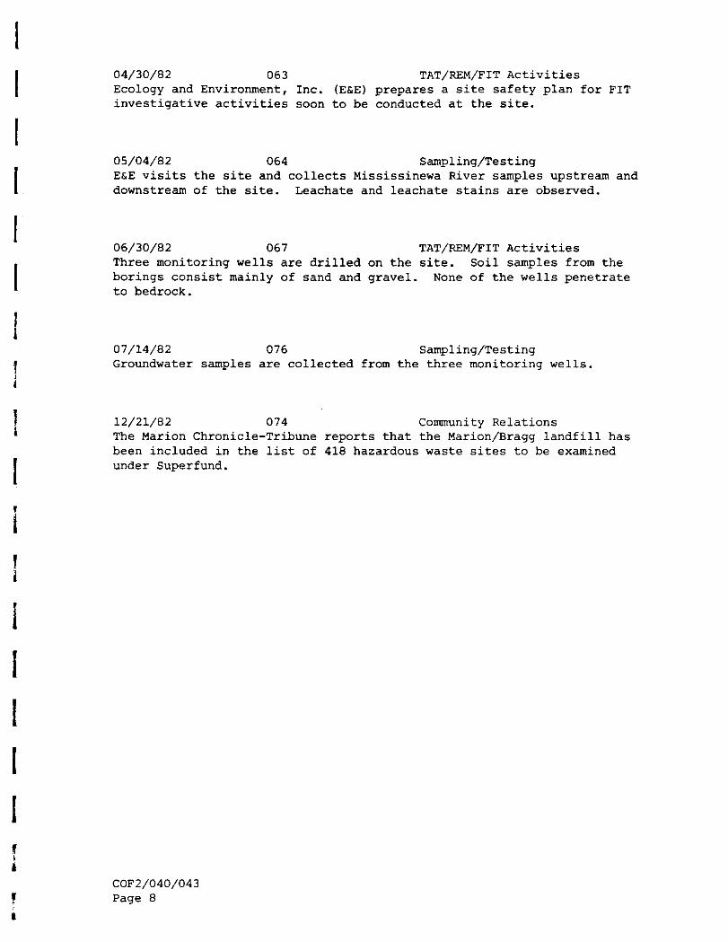
04/30/82 063 TAT/REM/FIT ActivitiesEcology and Environment, Inc. (E&E) prepares a site safety plan for FITinvestigative activities soon to be conducted at the site.
05/04/82 064 Sampling/TestingE&E visits the site and collects Mississinewa River samples upstream anddownstream of the site. Leachate and leachate stains are observed.
06/30/82 067 TAT/REM/FIT ActivitiesThree monitoring wells are drilled on the site. Soil samples from theborings consist mainly of sand and gravel. None of the wells penetrateto bedrock.
07/14/82 076 Sampling/TestingGroundwater samples are collected from the three monitoring wells.
12/21/82 074 Community RelationsThe Marion Chronicle-Tribune reports that the Marion/Bragg landfill hasbeen included in the list of 418 hazardous waste sites to be examinedunder Superfund.
COF2/040/043Page 8