Embed Size (px)
Citation preview
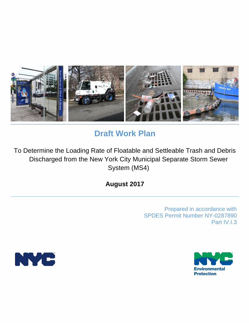
Draft Work Plan
To Determine the Loading Rate of Floatable and Settleable Trash and Debris
Discharged from the New York City Municipal Separate Storm Sewer
System (MS4)
August 2017
Prepared in accordance with SPDES Permit Number NY-0287890
Part IV.I.3
August 2017 i
Table of Contents
1.0 INTRODUCTION ......................................................................................................... 1
2.0 REVIEW OF METHODOLOGIES TO DETERMINE LOADING RATES ....................... 1
2.1 Los Angeles County, California ................................................................................ 2
2.2 Baltimore City and County, Maryland ....................................................................... 2
2.3 Washington, District of Columbia .............................................................................. 3
2.4 San Francisco, California ......................................................................................... 3
2.5 New York City, New York ......................................................................................... 4
3.0 ADVANTAGES AND DISADVANTAGES OF DIFFERENT METHODOLOGIES .......... 5
3.1 Metrics for Floatables Quantity and Loading Rates .................................................. 5
3.2 Inclusion of Various Factors Affecting Floatables Loading Rate ............................... 6
4.0 PROPOSED METHODOLOGY FOR NEW YORK CITY .............................................. 7
4.1 Overview of Proposed Approach .............................................................................. 7
4.2 Justification for Proposed Approach ......................................................................... 8
4.3 Methodology to Implement Proposed Approach ....................................................... 9
5.0 REFERENCES ...........................................................................................................16
Draft Work Plan
August 2017 1
1.0 INTRODUCTION
The City of New York’s (City) Municipal Separate Storm Sewer System (MS4) Permit
requires the development of a floatable and settleable trash and debris (herein referred
to as “floatables”) management program as part of the Stormwater Management Program
(SWMP). In particular, the MS4 Permit requires the submission of a work plan “to
determine the loading rate of floatable and settleable trash and debris discharged,
including land-based sources, from the MS4 to waterbodies listed as impaired for
floatables” (New York State Department of Environmental Conservation, 2015). This work
plan includes a literature search of methods employed by other municipalities, the
proposed methodology for New York City, and a discussion as to why the selected
method is best for conditions in New York City.
2.0 REVIEW OF METHODOLOGIES TO DETERMINE LOADING
RATES
The City has conducted a literature review of methods employed by other municipalities
to determine the loading rate of floatables from separate storm sewer systems. As the
control of floatables is not a common provision of MS4 permits, and trash TMDLs are
similarly infrequent, only a few municipalities have attempted to determine a floatables
loading rate. Those municipalities with published methodologies include San Francisco,
Los Angeles County, Baltimore City and County, and Washington, D.C. Each of these
municipalities is subject to trash TMDLs except San Francisco, and each of these
municipalities has calculated loading rates that include both MS4 and combined sewer
areas, except Los Angeles, which includes MS4 only. Additionally, the City has studied
the loading rate of floatables in connection with combined sewer overflows (CSOs).
In general, each municipality conducted field monitoring to determine representative
floatables loading rates for various land use types, and then applied those representative
rates by land use in each catchment area to generate the overall annual loading rate by
area. Municipalities selected this method because associating floatables loading rates
with land use provided a logical way to extrapolate loading rates from readily available
information. However, some municipalities found that land use alone was not a good
predictor of loading rate, and attempted to account for other factors such as median
income, proximity to “downtown” (high commuter activity) areas, frequency of street
sweeping and rainfall. Table 1 summarizes the different methods that each of the other
municipalities used to determine loading rates. The following sections provide additional
information about the methods used by each municipality.

Draft Work Plan
August 2017 2
Table 1. Factors Included in Determination of Floatables Loading Rate
Municipality Metric Field
Sampling Land Use
Median Income Rainfall
Street Sweeping
Los Angeles, CA Volume Yes Yes No No No
Baltimore City, MD Weight Yes Yes No Yes (2) No
Baltimore County, MD Weight Yes Yes No Yes (2) No
Washington, D.C. Weight Yes Yes No Yes (2) No
San Francisco, CA Volume Yes Yes Yes (1) Yes (3) Yes (3)
Notes: (1) Used in conjunction with certain land use types (2) Monitoring period rates per inch of rainfall normalized to long-term annual rainfall (3) Application of ratio of frequency of rainfall and street sweeping
2.1 Los Angeles County, California
Los Angeles utilized a method to determine floatables loading rates based on land use.
Field monitoring was performed between 2002 and 2004 at about 175 sites, with each
site consisting of two to four storm-drain inlet structures fitted with full-capture devices
(perforated plates) designed to prevent any items larger than 5 mm from exiting the
structure for hourly intensities up to the one-year return period. Each site was
characterized according to land use in its catchment area, with five land use categories:
industrial, commercial, open/parks, high-density residential, and low-density residential.
Field monitoring involved quantifying the uncompressed volume of trash accumulated in
the structure since the prior cleanout, with sediment and vegetation excluded. Los
Angeles expressed the observed loading rate for each site as gallons per day of
accumulation per acre of catchment.
2.2 Baltimore City and County, Maryland
Baltimore City and Baltimore County determined floatables loading rates using a method
based upon the Los Angeles method. However, Baltimore City and Baltimore County
followed different field monitoring practices and, as described below, reduced the
calculation method to reflect just two land-use types, urban and non-urban (forest).
Baltimore City monitored five stormwater outfall locations to represent two of the City’s
three major watersheds. No stations were sampled in the Baltimore Harbor watershed
due to lack of accessibility, high wet-weather flows, and limitations regarding the
catchments available for characterization. Field monitoring involved collecting trash
accumulated in capture devices at each outfall every two weeks. Field crews separated
trash from vegetation, drained liquid from containers, and allowed the trash to air dry
before measuring the trash weight. Baltimore City then calculated the observed loading
rate for each outfall as weight of floatables per day of accumulation per acre of catchment.
Draft Work Plan
August 2017 3
Baltimore County monitored trash generated over a one-year period at 17 stormwater
management facilities (detention ponds) and at 20 in-stream sites. The County selected
in-stream sites based on their suitability for monitoring stormwater trash, safe access, and
the upstream area being predominately one land use category. Monitoring at in-stream
sites involved marking out a 500-foot section of the stream from which field crews
collected all trash at the start of the study and then on a monthly basis. In addition to
excluding vegetative debris, draining all liquids from containers, and allowing the trash to
air dry, the field crews also separated the trash into five categories (plastic bottles, glass
bottles, aluminum cans, bulk “dumped” items, and other). Field crews measured dry
weight for each category and counted the number of items in each of the bottle and can
categories.
Baltimore County expressed the observed loading rates for each site as gallons per day
of accumulation per acre of catchment. Variability between sites led Baltimore to consider
just two land use categories: urban and non-urban (forest).
2.3 Washington, District of Columbia
Washington, D.C. utilized a floatables loading rate methodology similar to that of Los
Angeles and Baltimore. Using this methodology, D.C. conducted field monitoring at 10
outfall locations and 30 in-stream locations. Field crews collected trash from nets installed
on the monitored outfalls after each storm event, and from 500-foot segments along the
in-stream sites on a quarterly basis. Field crews quantified the visible trash, excluding
vegetative debris, emptying liquids from containers, and allowing the trash to air dry. Field
crews also separated the trash into 44 item-type categories and counted each. D.C. then
calculated an estimate of total weight based on standardized weights for each item type.
Each site was characterized according to its catchment’s predominant upstream land use,
based on seven different land use categories (roadways, institutional, commercial,
industrial, high-density residential, low-density residential, and open space/parks). For
each site, D.C. calculated the observed loading rate as the accumulated trash weight per
acre per inch of rainfall during the accumulation period, and then developed average
loading rates for each land use category. D.C. then calculated the overall loading rate by
applying each land use category’s loading rate (in terms of trash weight per acre of that
land use per inch of rainfall) for the total acreage of that land use in the municipality and
for the total long-term average rainfall (inches per year).
2.4 San Francisco, California
San Francisco utilized a floatables loading rate methodology that, while based upon land
use, also accounted for other drivers such as income level, site-specific factors, and the
relative frequency of street sweeping and rainfall.

Draft Work Plan
August 2017 4
Field monitoring involved 159 stormwater inlet structures, each draining a catchment with
at least 70 percent of its area representing one of 10 different categories: low-, mid-, and
high-income retail; low-, mid-, and high-income residential; industrial; commercial; urban
park; and schools. Each monitored site was retrofitted with a full-capture device
(perforated plate) designed to prevent any items larger than 5 mm from exiting the
structure for hourly intensities up to the one-year return period. During the monitoring
period, field crews cleaned out all accumulated material from the inlet structure, allowed
it to air dry, and separated it into eight material/item categories (plastic recyclable
beverage containers, plastic single-use bags, plastic foam food ware, plastic other, paper,
metal, other trash, and non-trash debris such as sediment and vegetation). Field crews
would then measure the dry weight, uncompressed volume, and item counts (for trash
categories).
San Francisco generated field monitoring results by site and by catchment category. Initial
results indicated that there was a high variability of observed loading rates, even within a
particular catchment category. San Francisco interpreted this to mean that its calculation
method had not taken into account other driving factors. In order to account for this
variability, San Francisco refined the method to distinguish between the monitored “trash-
loading rate” from the catchment to the receiving water and the “trash-generation rates”
within the catchment. The difference between the two is the “trash-interception rate,”
whereby some of the generated trash is captured via street sweeping or other controls,
preventing material from discharging to the receiving water. Only trash remaining on the
street is available for rainfall to transport to the stormwater inlet structures. San Francisco
adjusted the loading rates to account for these processes by applying a factor based upon
the relative frequency of street sweeping and rainfall in each catchment area.
In calibrating the refined method’s results for trash-loading rate, San Francisco
incorporated other refinements to manually adjust for geographic variations in loading
rates. San Francisco conducted a final, limited validation of the refined method using
floatables loading measurements for one cleanout period at two sites.
2.5 New York City, New York
As documented in its 2005 Citywide Comprehensive Floatables Plan - Modified Facility
Planning Report, New York City Department of Environmental Protection (DEP)
performed floatables monitoring to identify the sources of floatables pollution in New York
Harbor and to understand the processes affecting how the City generates and controls
floatables. While there are many ways floatables can reach a waterway including, but not
limited to, illegal dumping, shoreline activities, direct disposal or wind action, this study
determined that floatables discharging from the storm sewer system are consistent with
street litter. However, this conclusion would need to be looked at further as other studies
have found that the amount of floatables entering the storm sewer system is rainfall
Draft Work Plan
August 2017 5
dependent but does not necessarily depend on the source (Walker and Wong, December
1999). The amount of trash that enters the sewer system depends on the energy available
to re-mobilize and transport deposited litter on street surfaces rather than the amount of
litter deposited on street surfaces.
The 2005 DEP study also concluded that land use was not a good predictor of street-litter
levels. Based upon various field studies, DEP developed a model capable of calculating
floatables loadings from combined and/or separately sewered areas. This model is based
upon the following primary inputs for a given catchment:
1. Street-litter generation rate, in terms of quantity (item count, weight, or visible area) per year. This rate was calculated for study-baseline conditions using a build-up/wash-off submodel given:
a. Average annual litter level, in terms the City’s “Street & Sidewalk Cleanliness Ratings”
b. Street-sweeping schedule (and litter-removal efficiency of sweeping) c. Annual occurrences of storms with at least 0.2 inches of rainfall (and litter-
transport efficiency of such storms to flush litter into catch basins) 2. Total length of curb in the catchment 3. Percentage of hooded and non-hooded catch basins in catchment (and
associated floatables-removal efficiency of each) 4. Percentage of catchment that is tributary to end-of-pipe controls such as booms
or nets (and associated floatables-removal efficiency of each)
During implementation of its catch basin hooding program, DEP applied this model to
track the floatables loading rate, relative to baseline conditions, on an annual basis. Along
with other measures, such as yields at end-of-pipe facilities and observed levels of
floatables at various locations in New York Harbor and along shorelines, the model results
satisfied annual reporting requirements associated with the CSO control program.
3.0 ADVANTAGES AND DISADVANTAGES OF DIFFERENT
METHODOLOGIES
The survey of municipalities that estimate floatables loading rates revealed a range of
methods, from simple, per-day rates based solely on urban or non-urban land uses, to
complex calculations based on multiple catchment categories including land use and
median income, and adjusted to account for street-sweeping frequency and rainfall.
Differences between the methodologies do offer advantages and disadvantages. This
section describes some of the key areas in which the methodologies differ and the
advantages and disadvantages of the different approaches.
3.1 Metrics for Floatables Quantity and Loading Rates
The metric(s) selected for characterization of floatables is an important aspect related to
the methodology selected to determine the floatables loading rate. Floatables refers to a
Draft Work Plan
August 2017 6
class of varied materials that is not easily quantified and for which there is no “standard
method” of analysis. Metrics used to quantify floatables include item counts, volume,
drained weight, and visible surface-area measurements. Once collected, floatables are
most easily described in terms of volumes or weights. However, weight metrics are
susceptible to skewing from lightweight materials (such as polystyrene) and heavier
materials (such as glass or wet materials). Volume metrics can also be skewed by large-
area / small-volume materials (such as plastic sheeting) or the presence of natural
materials (such as leaves) that are not the target of a floatables loading rates estimate,
but these instances are typically less likely or, in the case of leaves, limited to a relatively
short period of time.
Another difference in the commonly applied metric for loading rate is whether to express
the rate in terms of “per day” or “per inch of rain.” Some municipalities, such as San
Francisco, Washington D.C., and New York, see a clear relationship between loading
rates and rainfall. Other municipalities, such as Los Angeles, do not see a significant
correlation between loading rates and rainfall. While differences in weather patterns may
in part explain this situation, direct deposition of litter into catch basins (such as by
pedestrians and/or mechanical street sweeping equipment) and the practice of
associating per-day catch basin accumulations with per-day discharges may be the
reasons for this apparent discrepancy. To some extent, expressing loading rates as an
annual average helps to even out seasonal variations in wet weather and the associated
variation in loading rates.
3.2 Inclusion of Various Factors Affecting Floatables Loading Rate
Other municipalities’ studies to monitor and analyze floatables loading rates clearly
demonstrated that floatables loading rates are highly variable from site to site and over
time. The most comprehensive studies acknowledged that the primary factors affecting
loading rates are litter-generation rates, litter-removal rates, and rainfall, while secondary
factors include population, land use, street-sweeping methods and frequency, storm-
sewer infrastructure (such as numbers and types of catch basins), and storm-sewer
maintenance activities (such as catch basin cleaning). Because litter-generation rates are
dependent upon human behavior, public education and enforcement of anti-littering laws,
as well as litter-basket deployment and servicing, can also affect loading rates.
The studies also indicated that the relationships between the various factors can be
dynamic and difficult to characterize. The simplest methods determine loading rates
solely on the basis of land use. The advantage of this approach is that land use is a readily
available parameter. Baltimore’s approach to land use was simplest, using only two
categories for catchment land use (urban and non-urban). Los Angeles, Washington D.C.,
and San Francisco utilized up to seven different land use categories. Although the intent

Draft Work Plan
August 2017 7
of using multiple land uses was to explain more of the variation in loading rates between
different sites, most studies acknowledged that land use alone is a poor predictor of
loading rate.
Some municipalities attempted to account for additional factors in their calculation of
loading rate. San Francisco performed a correlation analysis and determined that adding
median income level to further distinguish catchment land use improved the predictive
capability of its method. San Francisco and Washington D.C. determined that accounting
for rainfall also improved the results. San Francisco recognized that accounting for street
sweeping and rainfall frequency also improved the prediction of loading rate from the
catch basins because these actions directly impact the portion of litter on the streets that
is captured via sweeping versus flushed into the catch basins.
The primary differences between the methods adopted to determine loading rate were
the factors used to differentiate the loading rates from site to site, and over time. The
simplest methods based loading rates solely on land use, while the most complex
methods attempted to account for other factors, such as median income, street sweeping
frequency and rainfall. DEP’s approach was unique among this group because DEP
based its method on measures of street litter level, rather than on land use as a surrogate
for street litter level.
4.0 PROPOSED METHODOLOGY FOR NEW YORK CITY
This section presents an overview of the approach that the City proposes to determine
the floatables loading rate from MS4 outfalls to floatables-impaired waterbodies, a
justification for the proposed approach, and specifics on the methodology to implement
the proposed approach. Per the Program Development Compliance Schedule in Part
IV.O of the City’s MS4 Permit, the City will submit a schedule for completing the floatables
loading rate determination within three months after DEC approves the final work plan.
4.1 Overview of Proposed Approach
The City’s proposed methodology is a hybrid approach that combines field measurements
and model analysis. Using this approach, the City proposes to take field measurements
of floatables discharged from catch basins representing various categories of sites that
comprise the MS4 drainage areas. This data can then be used to extrapolate a floatables
loading rate. In conjunction with field measurements, the City will use an updated version
of DEP’s existing floatables model to check the results of the field monitoring and to
account for downstream in-water controls such as booms. Figure 1 below describes
schematically the application of the existing floatables model to the City’s MS4.

Draft Work Plan
August 2017 8
Street Catch Basin Sewer Waterway
PedestriansVehicles
Improper Trash Management
Street Sweeping
PedestriansVehicles
Catch Basin Cleaning
In-line and End-Of-Pipe
Capture
Sources
Proper Disposal
In-Water Capture
Figure 1. Schematic of MS4 Floatables Sources, Transport, Controls and Fate
4.2 Justification for Proposed Approach
As described in Section 3.0, the approaches utilized by other municipalities for
determining floatables loading rates involve a range of complexities in terms of
methodologies and factors affecting loading rates. The City’s proposed approach, which
combines the field measurement component of approaches utilized by other
municipalities with the work done by DEP in the past, is suitable for determining floatables
loading rates based on the following reasons:
Considers factors beyond land. Other municipalities found that land use alone was not a good predictor of floatables loading rate. Where the surveyed municipalities characterized the monitored sites based on catchment land use, the City would select monitoring sites based upon important factors already understood to impact floatables discharge rates from catch basins in New York City. These factors include catchment characteristics (such as litter levels) and catch-basin attributes (such as presence of a hood).
Utilizes institutional knowledge and already developed tools. DEP has previously studied floatables sources and effectiveness of existing floatables controls. Through a combination of field studies and modeling, DEP has developed

Draft Work Plan
August 2017 9
both an understanding of processes and models to estimate the impact of those processes on floatables loading rates.
Provides opportunities to update previous assessments. Through targeted, focused field studies, the City can update its understanding of how floatables discharge rates are related to differences in certain factors such as street litter levels and existing floatables controls.
Isolates floatables contribution at the entry point to the MS4. The proposed field monitoring will focus on characterizing the type and quantity of floatables entering the MS4 from the catch basins. This methodology avoids logistical difficulties and inaccuracies associated with monitoring outfalls in tidal systems, and allows characteristics of floatables to be determined for different areas.
4.3 Methodology to Implement Proposed Approach
In summary, the City’s proposed methodology involves the following steps:
1. Selection of representative sites at which to conduct field monitoring 2. Field monitoring using proposed metrics to measure floatables discharge rates
from catch basin sites comprising the various site categories within New York City’s MS4 areas
3. Analysis of field measurements to determine unit loading rates by site category 4. Establishment of weather and other conditions suitable for calculation of floatables
loadings from MS4 areas 5. Application of unit loading rates to individual catch basins, and summation of the
results by MS4 outfall and by waterbody, for each waterbody designated as impaired due to floatables.
The following sections describe each of these steps in detail.
4.3.1 SELECTION OF REPRESENTATIVE SITES FOR FIELD MONITORING
In order to represent the full range of factors affecting floatables generation, interception,
and loading for MS4 areas in New York City, the City has developed 20 site categories to
be included in the field monitoring program. Each site category represents a unique
combination of several different representative classes of catchment characteristics and
catch basin attributes, or a unique land use.
Catchment Characteristics
Catchment characteristics include street-litter level and street-sweeping frequency.
Street-litter levels directly impact the quantity of floatable material available for discharge
into catch basins, and so monitoring sites will be selected to represent each of three
different street-litter levels (high, medium, low). Because street-sweeping frequency
directly impacts the portion of street litter that is captured versus carried into catch basins
during storms, the City will also select monitoring sites to represent each of three different

Draft Work Plan
August 2017 10
street-sweeping frequencies. Preliminary analysis suggests categories of high, medium,
and low frequency may be appropriate, but these may change on further analysis of MS4
areas. For example, categories of high, medium/low, and none may better represent
conditions in the MS4. Together with rainfall conditions, street-sweeping frequency and
street-litter level represent the secondary factors from which street-litter generation can
be gauged.
Catch Basin Attributes
The catch basin attribute that most directly impacts the discharge rate of floatables to
storm sewers (and hence to receiving waters) is the presence of hoods. Catch basin
hoods are designed to prevent sewer gases from venting through the catch basin.
Because the hoods shield the catch basin’s pipe outlet, they also prevent floatable items
from entering the sewer system. Where present, catch basin hoods are effective at
retaining floatables in catch basins; therefore, monitoring sites will be selected to
represent both hooded and unhooded catch basins.
Land Use
Finally, the City will include two additional categories to represent catch basins located
within certain land uses. These land use categories include arterial highways under the
jurisdiction of the New York City Department of Transportation (DOT) and parks under
the jurisdiction of New York City Department of Parks and Recreation (DPR). The
proposed work plan includes monitoring of catch basins located in these land uses to
characterize representative loading rates from catch basins in these site categories.
Catch basins along arterial highways and within parks may not share characteristics with
standard DEP designs and maintenance practices. As a result, none of the other site
category criteria may be representative of these catch basins. Additionally, limited
information about litter levels is available in these areas. The catch basins in these areas
were not included in previous DEP floatables studies because they were not previously
subject to SPDES permit requirements on floatables control. However, these catch basins
are now covered by the MS4 Permit and are therefore included in this methodology.
Site Categories for Field Monitoring
Table 2 lists the 20 site categories proposed for the field monitoring program. With three
different catch basin sites per category, the proposed field monitoring program will include
60 monitored sites.

Draft Work Plan
August 2017 11
Table 2. Site Categories for Monitoring MS4 Catch Basin Discharges
Category Catch Basin Attributes
Street Litter Level
Street Sweeping Frequency
Site Count per Category
1 Hooded High High 3
2 Hooded High Med 3
3 Hooded High Low 3
4 Hooded Med High 3
5 Hooded Med Med 3
6 Hooded Med Low 3
7 Hooded Low High 3
8 Hooded Low Med 3
9 Hooded Low Low 3
10 Unhooded High High 3
11 Unhooded High Med 3
12 Unhooded High Low 3
13 Unhooded Med High 3
14 Unhooded Med Med 3
15 Unhooded Med Low 3
16 Unhooded Low High 3
17 Unhooded Low Med 3
18 Unhooded Low Low 3
19 Arterial Highway Typical N/A 3
20 Within Parks Typical N/A 3
Total number of catch basin sites to monitor
60
The City will select specific sites for the field monitoring program based upon a
combination of desktop analyses and field verification. Desktop analysis will identify
candidate areas based upon information made available to DEP. Areas with high,
medium, and low litter levels will be identified based on geographical assessments (“heat
maps”) developed using information including:
1. Recent, annual-average Street & Sidewalk Cleanliness Ratings data, which indicate the relative quantity of litter based on visual ratings conducted twice per month on about five percent of city blockfaces by the New York City Mayor’s Office of Operations
2. Litter information from the Street Conditions Observation Unit (SCOUT) of the Mayor’s Office of Operations
3. Catch-basin cleaning frequency and similar information that DEP logs, which can be used to track the build-up of debris in DEP catch basins.
The City will identify MS4 areas with different street sweeping frequencies based on
mechanical sweeper routes and schedules maintained by the New York City Department
of Sanitation (DSNY), information concerning sweeping in Business Improvement
Districts (BIDs) in MS4 areas, and, as applicable, information concerning sweeping

Draft Work Plan
August 2017 12
programs such as Ready Willing and Able (RWA). Similarly, the City will use DEP’s catch
basin database to identify individual catch basins with hoods or no hoods. Finally, the City
will also apply desktop analyses to identify potentially suitable catch basin locations along
arterial roadways and within parks that drain directly to priority waterbodies that are
impaired for floatables.
In order to confirm the suitability of candidate sites for inclusion in the monitoring program,
the City will visit each site to ensure that it can perform sampling safely and that site
conditions match the intended category.
4.3.2 FIELD MONITORING AND METRICS
The City proposes a field monitoring program that will quantify floatables loading rates
using suitable metrics. These metrics include a definition of floatables, methods of
quantifying floatables in a manner allowing for scalability, and expression of rates in terms
of suitable time-periods. This section describes each of these metrics, as well as the
general sampling procedure.
Definition of Floatables
The City’s MS4 permit refers to control of “floatable and settleable trash and debris.” This
language is consistent with the definition of floatables that DEP adopted for prior
floatables studies. As defined in DEP’s 2005 Citywide Comprehensive Floatables Plan -
Modified Facility Planning Report, floatables are “manmade materials, such as plastics,
papers, or other products which when improperly disposed of onto streets [or] into catch
basins […] can ultimately find their way to [waterbodies] and may create nuisance
conditions with regard to aesthetics, recreation, navigation, and waterbody ecology […].”
For clarity, it is noted that “floatables” include materials that are settleable as well as those
that may float on the water surface or are neutrally buoyant, and acknowledged that such
materials may float or sink depending on the ambient conditions to which they are subject.
In this context, “floatables” does not include natural materials, vegetation, oil and grease,
or sediments and small particles.
Floatables Metric
The City proposes to express floatables quantity in terms of volume. Volume is the most
appropriate floatables metric for three important reasons. First, volume is already
established as a metric associated with trash (as collected in garbage cans, dumpsters,
trucks, barges, and landfills). Second, volume describes both the visual and spatial impact
of floatables, and can better represent the impact on wildlife than weight. Third, unlike
item count or surface area, volume is relatively simple to measure in large quantities, and
is not as susceptible as weight to skewing due to complicating factors such as water

Draft Work Plan
August 2017 13
content, heavy material such as glass bottles, or light material such as Styrofoam
containers. As in prior studies, the City proposes to record other measures, such as
weight, item counts, etc., for purposes of establishing typical relationships between
metrics.
Rate Metrics for Time Period
New York City proposes expressing loading rates in terms of annual average periods.
Expressing the loading rate as an annual average helps to normalize seasonal and
weather-related variations. Nevertheless, year-to-year variations in loading rate will occur
due to differences in the number, timing, and intensity, of storm events. As a result,
describing loading rates based on long-term average rainfall patterns will help to highlight
the impact of operational factors (such as littering behavior, street sweeping practices,
and catch basin retrofits) on year-to-year changes in loading rates.
Field Monitoring Protocols
New York City proposes field monitoring protocols to capture floatables in catch basin
discharges to the MS4 using mesh strainer baskets deployed in MS4 manholes, as
depicted schematically in Figure 2. Field crews will collect samples with a frequency
suitable to characterize accumulated amounts in dry periods and in wet periods.
Floatables collected from each site will be separately sorted to remove sediment and
vegetation, quantified at a central processing site, and recorded. This protocol is
consistent with the techniques used in DEP’s previous floatables study. The City will
select a monitoring period that allows for a minimum of 10 storms with at least 0.2 inches
of rainfall to be monitored and seasonal differences to be captured.
Figure 2. Sampling of Catch Basin Discharges to Sewer

Draft Work Plan
August 2017 14
4.3.3 ANALYSIS TO DETERMINE UNIT LOADING RATE BY SITE CATEGORY
In order to develop a unit loading rate that can be scaled appropriately, the results of the
field monitoring program will require analyses to normalize the size of the catchment
upstream of the monitored site as well as the number of days and/or amount of rainfall
during the accumulation period. The City will calculate unit loading rates for each site
category.
As indicated in DEP’s previous floatables investigations, the length of curb (curb feet) in
a catchment more closely correlates to floatables load than the area (acreage) of the
catchment does. This is not surprising, because most street litter is located within 18
inches of the curb1, and because most streets are crowned, with slopes downward to
either side of the street, so that drainage is toward and along the curb to the catch basin.
As a result, the City proposes using catchment curb length to normalize the measured
discharge.
Similarly, the City anticipates that days of accumulation between qualifying storm events
will correlate to the quantity of material discharged, and therefore proposes using days of
accumulation (or inversely, frequency of qualifying storms) to normalize the measured
discharge. As a result, these analyses will require information regarding rainfall during the
accumulation period at each monitored site. For this purpose, the City proposes to utilize
the nearest-available rain gauge from the rain-gauge networks maintained by the National
Weather Service, DEP, USGS, and other reputable organizations, as well as radar rainfall
information available from the National Weather Service.
The City will analyze the resulting unit (normalized) loading rates to confirm scalability
and adherence to scientific principles (such as mass balance) and relationships
established during prior floatables studies (such as relative capture in hooded versus
unhooded catch basins).
Given an MS4 catch basin’s site category’s unit loading rate, catchment size (curb miles),
and rainfall pattern (long-term average year), the catch basin’s overall floatables load can
then be calculated. The following two steps describe that process.
4.3.4 ESTABLISH CONDITIONS FOR CALCULATION OF LOADING RATE
While measured loading rates reflect conditions during the field monitoring program, the
expression of loading rates from particular MS4 outfalls or to particular waterbodies will
be most useful if applied using certain conditions that may be used as a baseline for
1 New York City Law requires the adjacent property owner to clean the curb area 18” into the street.

Draft Work Plan
August 2017 15
comparison in the future. For this purpose, the City proposes using long-term average
rainfall patterns, as determined from National Weather Service rain-gauge data and as
applied using the model. The City can also use the model to specify other conditions,
such as degree of catch basin hooding, street-litter levels, etc., as necessary, to develop
an appropriate baseline condition.
4.3.5 CALCULATION OF LOADING RATE
In order to calculate the total floatables loading rate for a specific priority waterbody for
floatables, DEP proposes the following:
1. For each catch basin in the MS4 area a. Identify the unit loading rate corresponding to that catch basin’s site
category. Unit loading rate is expressed in terms of floatables volume per length of curb per days of accumulation (or per number of storms) per year.
b. Apply the unit loading rate for that catch basin to calculate the annual floatables load, in terms of volume, by multiplying the unit loading rate by:
i. The length of curb in the catch basin’s catchment. ii. The number of days of accumulation (or number of storms) in the
baseline year. 2. Sum the calculated loading rates for each catch basin to determine the total
loading rate for the MS4 outfall. This will be a total volume per year.
To calculate the total floatables loading rate from MS4 areas to a particular waterbody,
the above procedure would be repeated for each MS4 outfall discharging to the
waterbody, and then the sum of these would then represent the total MS4 loading rate to
the waterbody.
After developing the unit loading rates as described in the preceding section, DEP will
analyze available information on both existing and historical conditions regarding New
York City’s floatables-control actions. The current level of floatables control in MS4 areas
reflects changes implemented in various New York City programs, such as the catch
basin hooding program (completed in 2010 but ongoing per SPDES permit requirements)
and the recently launched annual catch basin inspection program (required by City local
law through the end of fiscal year 2019), as well as enhanced street-sweeping programs
and extensive public education and media campaigns. The City will evaluate the impact
of these programs on MS4 loading rates before making a recommendation of a particular
baseline loading rate year, against which progress toward a reduction goal will be
assessed.

Draft Work Plan
August 2017 16
5.0 REFERENCES
BASMAA, 2014. “2014 San Francisco Bay Area Stormwater Trash Generation Rates,
Final Technical Report.” Bay Area Stormwater Management Agencies Association
(BASMAA), June 20, 2014.
CRWQCB, 2007. “Trash Total Maximum Daily Loads for the Los Angeles River
Watershed,” California Regional Water Quality Control Board, August 9, 2007.
DEP, 2005. “Citywide Comprehensive Floatables Plan - Modified Facility Planning
Report,” prepared by HydroQual Engineers & Scientists, P.C. for the City of New York
Department of Environmental Protection, Bureau of Environmental Engineering, July 29,
2005.
DOEE, 2010. “Total Maximum Daily Loads of Trash for the Anacostia River Watershed,
Montgomery and Prince George’s Counties, Maryland and the District of Columbia,”
District of Columbia Department of the Energy and Environment, September 8, 2010.
MDE, 2014. “Total Maximum Daily Loads of Trash and Debris for the Middle Branch and
Northwest Branch Portions of the Patapsco River Mesohaline Tidal Chesapeake Bay
Segment, Baltimore City and County, Maryland,” Maryland Department of the
Environment, December 3, 2014.
New York State Department of Environmental Conservation, 2015. “State Pollutant
Discharge Elimination System Discharge Permit” issued to the City of New York for the
Municipal Separate Storm Sewer Systems of New York City, effective August 1, 2015.
Walker, T.A., Wong, T.H.F., 1999. “Effectiveness of Street Sweeping for Stormwater
Pollution Control, Technical Report,” Report 99/08, Cooperative Research Centre for
Catchment Hydrology, December 1999.