Embed Size (px)
Citation preview
Current applications of GIS in Wildfire

Remote Sensing
• Used for a wide array of projects– Satellites• Vegetation greeness used to calculate post fire severity• Looking for new fire starts
• At wildfire incidents– Airplane • Aerial photography -Help calculate perimeters and
acreage• Infrared pictures to look for the last hot spots

Landfire
Incident Action Plan
• Prepared every day– Distributed at morning briefings– Contains assignments for the day
• Daily updates of maps, created by GIS specialist– Fire perimeter– Acreage– Division breaks– GPS units play an integral role in collecting data
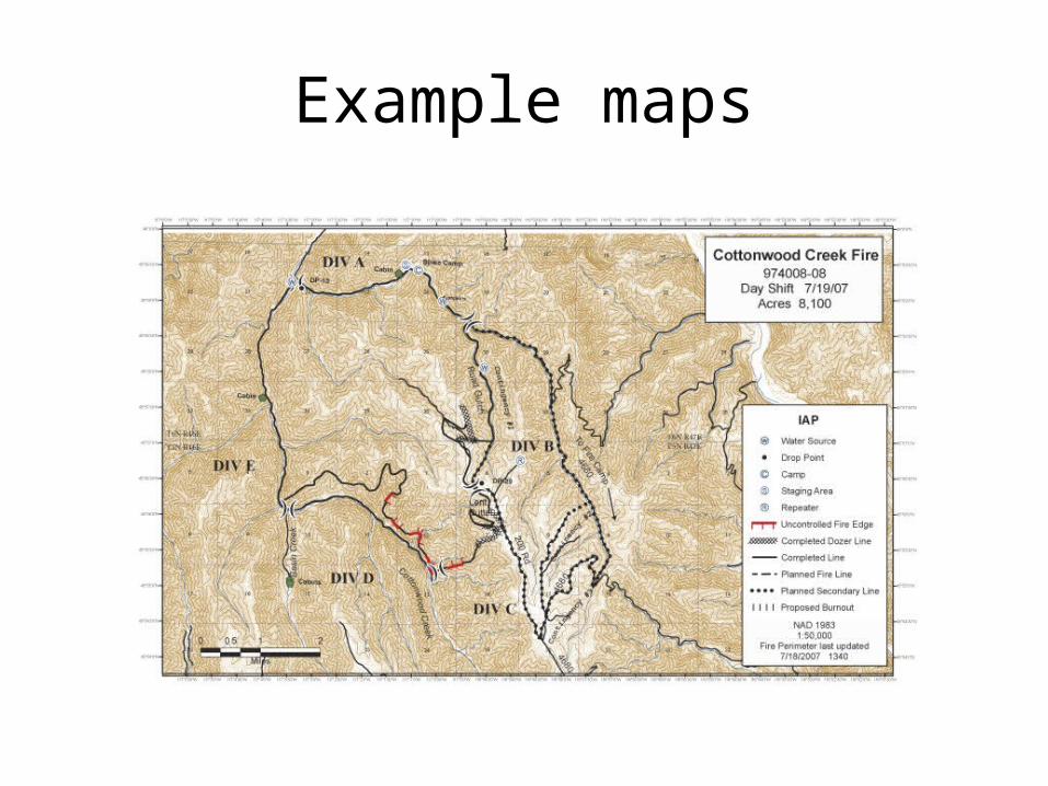
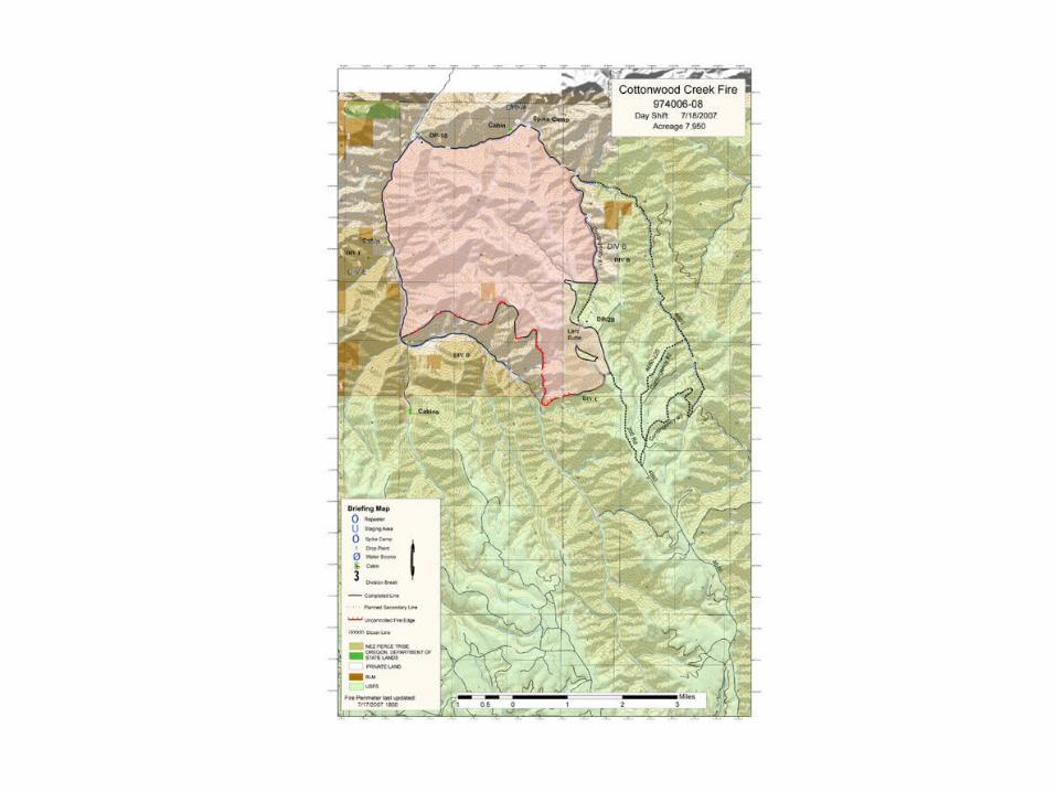
Example maps
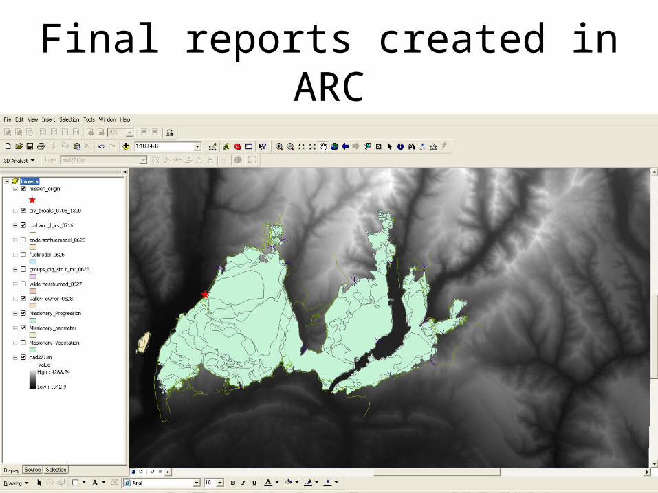
Final reports created in ARC
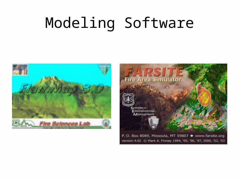
Modeling Software
Limitations
• All models that predict fire behavior are based off of the same equation.
• There are too many variables in the real world to accurately predict fire behavior and movement.
• Recreating past fires with a model is difficult even with all the available information. – It takes years of experience and manipulating data
to accurately depict a historic fire.
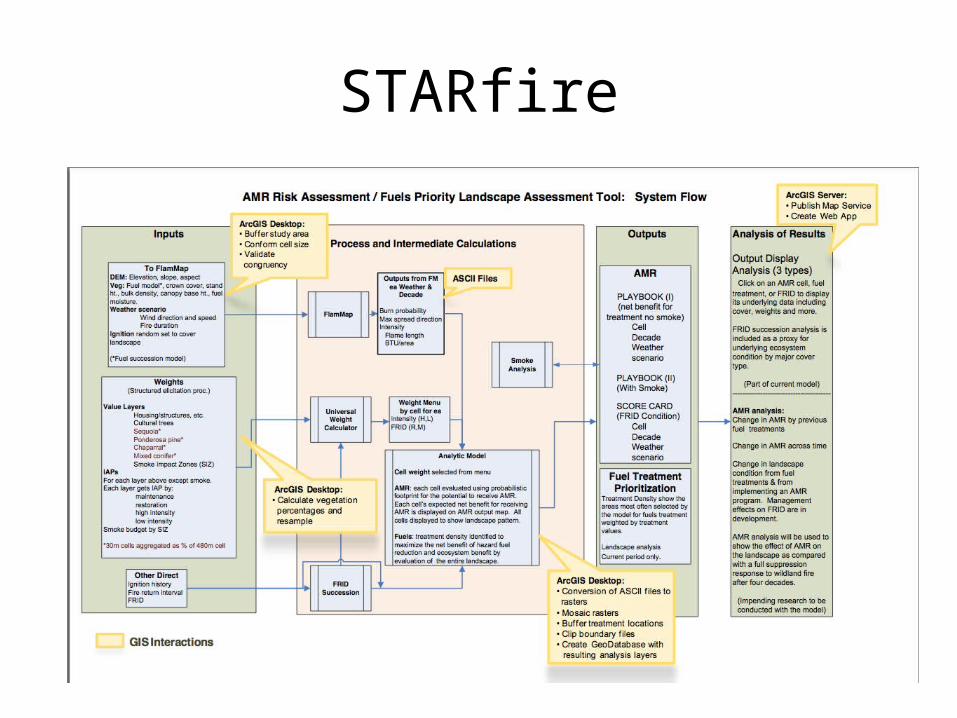
STARfire