Embed Size (px)
Citation preview
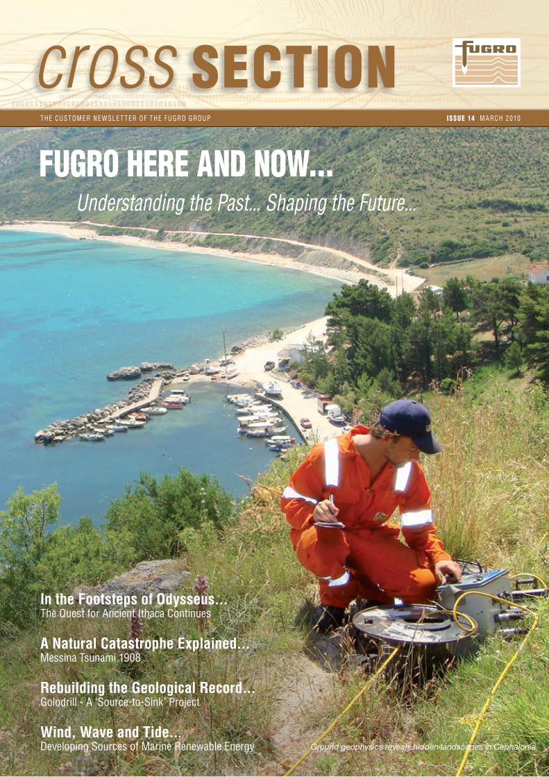
cross SECTIONT H E CUS T O M ER N E W SL E T T ER O F T H E F U GRO GROUP I S S U E 14 M A RCH 2 010
Ground geophysics reveals hidden landscapes in Cephalonia
FUGRO HERE AND NOW...Understanding the Past... Shaping the Future...
In the Footsteps of Odysseus...The Quest for Ancient Ithaca Continues A Natural Catastrophe Explained...Messina Tsunami 1908 Rebuilding the Geological Record...Golodrill - A ‘Source-to-Sink’ Project
Wind, Wave and Tide...Developing Sources of Marine Renewable Energy

But how could this ever be possible? The Thinia isthmus, now joining Paliki to the rest of Cephalonia, is around six kilometres long by two kilometres wide and rises to about 180 metres above sea level. Yet, if Thinia was submerged about 3,000 years ago, Paliki would fit precisely the description of Ithaca in The Odyssey, Homer’s epic poem of Odysseus’ journey home from Troy.
With sponsorship from Fugro, consultant Robert Bittlestone, together with John Underhill, Professor of Stratigraphy at the University of Edinburgh, and James Diggle, Professor of Classics at Cambridge, formed the ‘Odysseus Unbound’ organisation, in an attempt to uncover the truth about the location of the historic island kingdom of Homer’s hero*.
Geological mapping reveals that most of Thinia’s surface consists of loose rockfall material brought down by frequent eathquakes, some occurring within living memory. Robert Bittlestone poses the key question: “Despite this clear evidence of extensive, ancient and modern landslips, can we be sure that there is not a bridge of solid bedrock underneath, joining the Paliki peninsula to the rest of the island, somewhere above sea level? If there is, then this could represent a serious objection to the proposition that Paliki is ancient Ithaca”.
Helicopter Electromagnetic (HEM) Survey
To test for the existence of such a rock bridge, Fugro Airborne Surveys flew a helicopter, equipped with electromagnetic instruments, to map the resistivity and magnetic signature of the entire Thinia isthmus. The results are presented below.
If the yellow-coloured areas, mainly depicting loose rockfall material with low resistivity, are removed from the image, there is a very clear suggestion that there was formerly an open marine channel separating the Paliki peninsula from the rest of Cephalonia - an inlet narrowing towards its Southern end.
A borehole has been drilled at that Southern location, identifying traces of recent marine organisms around 40 metres beneath the land surface. “But a crucial problem remains”, remarks Robert Bittlestone. “The maximum penetration of the airborne electromagnetic technique is limited to about 100 metres. Could there still be a deeply buried bedrock land bridge at that point, somewhere between 100 metres and 180 metres below ground level?”
Ground-based Resistivity, Gravity and Seismic Measurements
To explore deeper, Fugro Aperio, specialists in ground geophysics, acquired closely spaced resistivity, gravimetric and seismic measurements along the whole length of the isthmus.
LOCATING ITHACATHE CONTINUING SEARCH FOR THE ISLAND KINGDOM OF ODYSSEUS
Many assume that Ithaki, one of the Ionian Islands, is the site of ancient Ithaca, home to Odysseus, Greek hero of the Trojan war. However, some experts claim that the Paliki Peninsula, on nearby Cephalonia, conforms more closely to descriptions of Odysseus’ homeland - and crucially was once itself an island.
8 *See > http://www.crosssection-online.com/imag/CSIssue08/19.htm
PALIKI
THINIA (ISTHMUS)
THINIA (ISTHMUS)
PALIKI
PALIKI
THINIA (ISTHMUS)
CEPHALONIA
ITHAKI
Oldest Cretaceous rocks
landslide and rockfall debris dating from 126,000 years ago until the present day
More recent Miocene material
The surface geology of Thinia, looking South
Survey helicopter and electromagnetic sensor ready for take-off

“If a channel infill mechanism is indeed plausible, why would the channel not have been filled much earlier?” James asks.
High resolution marine geophysical and hydrographic surveys, completed by Fugro Oceansismica, yielded data that helped to address these questions.
The bathymetric results reveal that water depths in the gulf near Thinia range from 10 to 20 metres. However, this has to be considered in light of variations in sea-level over time. After the last Ice Age, sea levels rose rapidly, reaching a level 15 metres lower than today, about 8,000 years ago. So, at that time dry land existed in the gulf and the present isthmus. As sea levels continued to rise, water could have penetrated the Thinia valley from each end, reaching the centre around 6,000 years ago - separating Paliki from the rest of Cephalonia by a shallow seaway, bordered by steep hillsides.
Oceansismica’s marine geophysical reflection profiling indicates that this newly formed seaway may have been a relatively temporary feature. The sea probably began to erode the mountainsides, destabilising their sharply sloping internal ‘bedding planes’. At the same time, periodic earthquakes triggered catastrophic high volume rockfalls and had the effect of uplifting much of the island, thereby making the seaway a few metres shallower. “Once a few major landslides and uplifts had blocked the channel, successive rockfalls came down on top, to create the landscape of rubble that we see today”, suggested Robert Bittlestone.
“Although these land-based analyses do not rule out the possibility of a former marine channel, the presence of several marl deposits and also some quarried limestone strata in the central area is enigmatic”, summarises John Underhill. “Do these represent material that has always been in place, or could these anomalous deposits have descended from the mountainsides as relatively intact massive blocks..?”
The possibility of massive slabs of rock sliding into the valley may initially appear fanciful, but it is not as unlikely as it seems. Just six kilometres to the North-east of the Thinia isthmus is the world-famous ‘Myrtos Beach’. Here, a million-ton block of limestone is known to be creeping slowly down the cliffs. If the same geological mechanism has been at work in the Thinia isthmus itself, then the large sections of marl and quarried limestone revealed by the land-based surveys may have come down from the adjacent mountainsides within the last few thousand years.
Marine-based Seismic Survey
“Even if we can prove that the rockfall debris extends right down to sea level, how can we be sure that all of it dates from as recently as the last 3,000 years”? questions James Diggle.
The fault line that passes through the Thinia valley is known to have triggered a major earthquake every 50 years or so, on average, since records began back in the mediaeval period. This process has clearly been going on for many thousands of years.
The resulting analyses reveal a complex pattern of varying resistivities and gravity signatures at the location where the apparent channel is narrowest and where the elevation above sea level is around 180 metres.
9email > [email protected] > www.odysseus-unbound.org
Research Priorities for 2010A marine sampling programme is planned, with new boreholes in the shallow waters of the gulf and also in the alluvial deposits along the adjacent coastline. These are intended to test the above conclusions and, at key locations, to calibrate the dates and distances of marine retreat and subsequent ingress. A series of land boreholes is also proposed at specific sites along the Thinia valley. Continuous core samples will be extracted and analysed for evidence of loose rockfall material rather than solid bedrock.
The ‘silver bullet’ test will be a deep borehole at the highest central area of Thinia. The objective will be to analyse the cores around sea level for evidence of recent marine organisms. “If we can demonstrate traces of marine life buried 180 metres below the centre of Thinia, at a distance of about three kilometres from the sea - and if we can date these via standard carbon-14 tests to a period of around 3,000 years ago, then this will represent conclusive evidence that our central hypothesis is valid”, summarised Robert Bittlestone.
The next chapter of the odyssey promises to be an exciting one...
Marine seismic survey in the gulf south of Thinia
Marine geophysical profiles reveal landslide features, glacial erosion surfaces and recent infill in the gulf near Thinia
Land-based gravimetric and resistivity survey of central Thinia isthmus
MIOCENE MARL LIMESTONE
LIMESTONE PETRIKATA LAKE
PALAEO LIMESTONE
LIMESTONE OR CONGLOMERATE
QUARRY