Embed Size (px)
Citation preview

Regeneration department
Tooley StreetConservation area appraisal
July 2003
www.southwark.gov.uk

2

Regeneration Department Tooley Street Conservation Area
3
1 Introduction 7
1.1 Purpose 71.2 Arrangement of the document 71.3 Tooley Street North and South Conservation Areas 71.4 Planning History 8
2 Historical Background 11
3 The Character and Appearance of the Area 16
3.1 Broad Context 11
3.2 Sub area 1 – Hay’s Wharf 213.3 Sub area 2 – Tooley Street West 243.4 Sub area 3 – St John’s Churchyard 263.5 Sub area 4 – Tooley Street East 27
4 Audit 28
4.1 Listed buildings 284.2 Archaeology 344.3 Environmental improvements 344.4 Improvements to buildings 354.5 Potential development sites 35
5 Guidelines 37
5.1 Introduction 375.2 Development form and urban morphology 385.3 Public Realm 405.4 Improvements and repairs 41

4

Regeneration Department Tooley Street Conservation Area
5
Sub area 1: Hay’s Wharf Sub area 2: West Tooley Street Sub area 3: St John’s Churchyard Sub area 4: East Tooley Street
Figure 1 Tooley Street North and South Conservation Areas and sub-areas: 1:5,000

6

7
Introduction
1.1 Purpose
1.1.1. The purpose of this statement is to provide an account of the Tooley Street Conservation Areas and a clear indication of the Borough Council’s approach to their preservation and enhancement. It is intended to assist and guide all those involved in development and change in the areas, and will be used by the council in assessing the design of development proposals.
1.1.2. The statutory definition of a Conservation Area is an “area of special architectural or historic interest, the character or appearance of which it is desirable to preserve or enhance.” Conservation Areas are normally centred on listed buildings and pleasant groups of other buildings, open space, or an historic street pattern. A town space or features of archaeological interest may also contribute to the special character of an area. It is, however, the character of areas, rather than individual buildings, that such a designation seeks to preserve or enhance. The most recent legislation dealing with Conservation Areas is the Planning (Listed Buildings and Conservation Areas) Act, 1990 (Sections 69 to 78).
1.1.3. Planning legislation requires that special attention shall be paid to the desirability of preserving or enhancing the character or appearance of the Conservation Area. In doing this the emphasis will be on control rather than prevention, to allow the area to remain alive and prosperous but at the same time to ensure that any new development accords with its special architectural and visual qualities.
1.1.4. This statement has been prepared following guidance given by English Heritage in their note “Conservation Area Appraisals”.
1.2 Arrangement of this document
1.1.2. This appraisal covers both the Tooley Street North and the Tooley Street South Conservation Areas. The boundaries are indicated on Figure 1. Following the Introduction, Section 2 provides a brief history of the areas and their development. Section 3 starts with a broad appraisal of their character and appearance, with reference to the range of materials, details and building types to be found in the areas. Section 3 then goes on to describe each sub-area with specific reference to architectural and historic qualities, views and townscape, the character and relationship of public and green spaces, and any elements that detract from the Conservation Areas. Section 4 provides an audit of the features of special interest of the areas, including listed
1. Introduction
Tooley Street Conservation Area

8
buildings, particular groups of unlisted buildings, and trees, planting and other streetscape elements. Section 5 provides guidelines for future development and change in the Conservation Areas.
1.3 Tooley Street North and South Conservation Areas
Location1.3.1. Tooley Street (the A200) links the southern ends of London Bridge and Tower Bridge. London Bridge Station is located at its west end, and the railway viaduct running out eastwards from it forms a significant barrier and defines the southern edge of the Conservation Areas. The River Thames provides an even clearer edge to the north.
Topography1.3.2. Topographically, the dominant feature of the area is obviously the River Thames. Historically the area was low lying and prone to flood, and the ancient route followed by Borough High Street to London Bridge was a raised causeway through otherwise marshy land. Centuries of development have built upon the natural levels, but the risk at high water has always remained and flood defences are a feature of riverside development.
Sub Areas within the Conservation Area1.3.3. For the purpose of description in this appraisal, the Conservation Areas area divided into sub-areas as indicated in Figure 1. These are described in more detail in 3.1.17 and following sections below.
1.4 Planning History
1.4.1. The Tooley Street South Conservation Area was originally designated in June 1988 under the Civic Amenities Act 1967. Tooley Street North Conservation Area was designated in February 1991. This appraisal deals with both designations in one report.
Unitary Development Plan Policies1.4.2. The Unitary Development Plan for the London Borough of Southwark was adopted in 1995. There are three policies in the Plan that relate to the conservation, protection and enhancement of areas of character, buildings, ancient monuments, historic areas, parks and gardens of environmental quality, architectural interest and historical importance.
POLICY E.4.1: Conservation Areas1.4.3. ‘Where appropriate, the Council will designate new Conservation Areas and extend existing Conservation Areas. The Council will seek to preserve and enhance the character and appearance of Conservation Areas. The Council will prepare guidelines to identify their special qualities. Identification of the special architectural and historic qualities of an area will be based on detailed analysis of the area. This will include the architectural and historic quality, character and coherence of the buildings and the contribution which they make to the special interest of the area.’
POLICY E.4.2: Proposals Affecting Conservation Areas1.4.4. ‘Conservation Area Consent for demolition in Conservation Areas will not normally be granted except where certain conditions are met. These conditions are as follows:i) The design of any new development or
alteration demonstrates that a high priority has been given to the objective of positively preserving or enhancing the character or appearance of the Conservation Area;
ii) There are acceptable and detailed plans for the site of the building to be demolished or partially demolished. Demolition is not to be undertaken before a contract for the carrying out of the works of redevelopment has been made, and planning permission has been granted for the development.’

Tooley Street Conservation Area
9
Introduction
POLICY E.4.3: Conditions for Planning Permission in Conservation Areas 1.4.5. ‘Planning permission for proposals affecting Conservation Areas will not normally be granted except where certain conditions are met. These conditions are as follows:i) The design of any new development or
alteration demonstrates that a high priority has been given to the objective of positively preserving or enhancing the character or appearance of the Conservation Area;
ii) Proposals should pay special regard to historic building lines, scale, height, and massing, traditional patterns of frontages, vertical or horizontal emphasis, plot widths and detailed design e.g. the scale and spacing of window opening, and the nature and quality of materials;
iii) Schemes should be drawn up in detail (outline applications will normally not be accepted);
iv) Drawings of the proposals should show the proposed development in its setting and indicate any trees to be retained, lost or replaced,
v) A proposal for a site adjacent to or outside a Conservation Area will be unacceptable if it would have a significant adverse impact on the character and appearance of the Conservation Area;
vi) The proposed use will not adversely affect the character or appearance of the Conservation Area.’
1.4.6. The Unitary Development Plan is currently under review. A First Draft of the new plan has been placed on deposit. It is expected that the new plan will be adopted late in 2004. The new draft Unitary Development Plan, also known as “The Southwark Plan”, is supported by a number of supplementary planning guidance documents relating to different themes – including design and heritage conservation – and for differenent areas.
Policy 4.3.1: Supplementary Planning Guidance Clean and Green1.4.7. In exercising its powers under the Planning Acts 9 and Part 1 of the Historic Buildings and Ancient Monuments Act 1953, the council must pay special attention to the desirability of preserving or enhancing the character of appearance of its conservation areas. In Southwark this requirement is satisfied in a number of ways including the formation of conservation policy (UDP), production of supplementary planning guidance and character assessments, and in assessment of applications for planning permission and Conservation Area Consent.
Policy 4.3.2: Supplementary Planning Guidance Clean and Green1.4.8. The Council is required from time to time to formulate and publish proposals for the preservation and enhancement of its conservation areas, and to undertake local public consultation on such proposals
Policy 6.2: Information Requirements1.4.9. Outline proposals are not acceptable for any applications affecting listed buildings or conservation areas. Design statements will be required with all applications affecting listed buildings or conservation areas. The statement should describe how the proposal will preserve or enhance the conservation area or listed building. More information on Design Statements is available in Council’s design and sustainability SPG’s. Consent will nto be granted for any demolition or alterations with detail proposals for:i) The protection of any retained fabric;ii) An acceptable replacement scheme;iii) Work requiring listed building consent
without a detailed statement setting out the justification, design approach and methods for the work

10
1.4.10. Information on the review of the Unitary Development Plan, including electronic versions of the plan and supplementary planning guidance, can be found on the Council’s website at www.southwark.gov.uk/udp
Further Information This document is not exhaustive, and further advice and information can be obtained from the Planning Department, London Borough of Southwark.

Tooley Street Conservation Area
11
Historical Background
Origins2.1.1. The history of Tooley Street is closely connected to the parish of St Olave. The Viking invasions of Eastern England in the ninth century had resulted in settlement of Danes in London, and the early 11th century saw a second wave of unrest with claims on the Anglo Saxon throne from the Kings of Norway and Denmark. In one of many raids along English river estuaries, the Norse King, Olaf, reached the City in 1014 destroying London Bridge and defeating Danish resistance.
2.1.2. Subsequently Olaf was honoured by the dedication of a Church to him near the site, St Olave’s, which became established as the parish name for the next nine hundred years. By the mid-16th century, the spoken name had become corrupted to “St. Towlles”, and it is recorded as such in Hogenberg’s map from the reign of Queen Mary (1553 to 1558). “Tooley” derives from this pronunciation.
2. Historical Background
Figure 2 Hogenberg’s map (1550s) showing Tooley Street as Battle Bridge.
2.1.3 Tooley Street itself was a key route from the river crossing at London Bridge eastwards to the inner dock area of the pool of London. In Hogenberg’s map, the route is called Battle Bridge and the area between it and river is already shown fully developed. The name Battle Bridge would be preserved in Battlebridge Lane, which now runs between Tooley Street and the river on the east side of the Hay’s Galleria.

12
Post 16002.1.4. By the 17th century the economic strength of the Tooley Street wharves was well established. This stretch of the River Thames was known as “London’s larder”, being the primary storage area for butter, cheese and, later, canned meat. Pickle Herring Street is a late surviving name that refers to one of these businesses. In 1651 Alexander Hay took over property which became known as Hay’s Dock. The business expanded steadily, and the company eventually owned many warehouses along the river.
2.1.5. From Brett-James’s 1927 reconstruction of the street layout in 1603, it is evident that a street ran behind the warehouses from Shad Thames in the east to Pickle Herring Street serving the wharves, with a grid of access streets connecting back to Tooley Street. Bermondsey Street was also fully developed on its present alignment, with a grid pattern of streets on the South side of Tooley Street. The name St Olave’s Street was still in use east of the important Bermondsey street junction in 1748.
19th century industrialisation
2.1.6. By the 19th century there were vast riverside developments, now controlled by John Humphery, with a great deal of the construction undertaken by William Cubitt. The Hay’s Wharf complex was built between 1851 and 1857, primarily for the storage of tea, around a wet dock. It was widely considered to be the best development of its kind in London at the time. The risk of fire in the wharves was always significant, and the new buildings were among the first to be designed with a deliberately fireproof construction, using incombustible floors of brick arches on cast iron beams.
Figure 3 (left) The Conservation Area overlaid on Brett-James’ 1929 map representing the area in 1603. Tooley Street is shown fully developed.
Figure 4 (right) The Conservation Area overlaid on Alex Hogg’s 1748 map. The arrival of the railway would transform the area in the next century.

Regeneration Department Tooley Street Conservation Area
13
2.1.7. Despite this, the buildings were badly damaged in the Great Fire of Tooley Street in 1861. A large area of wharves caught alight, and despite the efforts of the London Fire Engines Establishment, the fire lasted for two weeks and killed more people than the Great Fire of 1666. Subsequently the London Fire Brigade was established. Hay’s Wharf survived the fire, but Cotton’s Wharf next door was entirely destroyed. Apart from Hay’s Wharf, only 29 to 33 Tooley Street (1840) survived the fire.
2.1.8. The area was quickly rebuilt following the fire. W. Snook and H. Stock were the architects responsible for many of the new buildings until the late 1880s. Cotton’s Wharf was the most substantial, but only the south-east corner of the complex (47 and 49 Tooley Street) remains. Number 27 Tooley Street, with a fine a river frontage, was taken over by the London Bridge Hospital.
2.1.9. The River Thames was crowded with barges and ferries and congestion on the river and over London Bridge led to the building of two new crossings; the short-lived Tower Subway for pedestrians (1869) and Tower Bridge (1894). To the south of Tooley Street, the London and Greenwich Railway began construction of a viaduct to London Bridge Station in 1834 as part of the first rail lines to reach London. It was eventually taken over and fully completed with the addition of other lines by 1850 by the South Eastern Railway. The viaduct’s arches were used for warehousing bonded goods.
2.1.10. The building of the railway in the 19th century disrupted the existing street pattern, although many street links were retained through long tunnels under the viaduct and station. This has resulted in a very distinctive townscape of lonely brick vaults, with a somewhat dark and intimidating character, for which this part of London has become well known.
2.1.11. Despite the commercial success of the warehouse businesses, there were serious problems of poverty, overcrowding and poor sanitation amongst those living in the area. New tenement blocks were built at Devon Mansions in 1875 along the south side of Tooley Street as part of the solution. The establishment of London Bridge station and the engineering of the substantial viaduct approaches to it, and a continuing expansion of business premises, also contributed to the clearance of slum housing and a general reduction in the residential population in the area.
Figure 5 Tea being distributed from the bonded warehouses at Hay’s Wharf.
Figure 6 29 to 33 Tooley Street was one of the few commercial buildings to have survived the Great Fire of Tooley Street in 1861.

14
20th century
2.1.12. By 1928 St. Olave’s parish was too small to exist on its own, and was combined with St Mary Magdalene in Bermondsey. The historic church of St. Olave was demolished and its wrought iron altar placed in the south aisle of St Mary Magdalene. In 1965, by Act of Parliament, Bermondsey was joined with the Metropolitan Boroughs of Camberwell and Southwark to form the London Borough of Southwark.
2.1.13. From 1900 the economy of the area began a move from warehousing towards more general commerce, often related to shipping. Commercial buildings at 17 to 25 Tooley Street (Emblem House, formerly Colonial House), and 15 Tooley Street, for the Bennett Steamship Company, are exuberant in their detailing, reflecting the prosperity of their owners. St. Olaf House was completed in 1931 for the management of Hay’s Wharf, on the site of the old church in art-deco style.
2.1.14. A number of warehouses were lost to bombing during the Second World War and others in the decades after to office redevelopment, such as the Cotton Centre on the site of the former wharf. In spite of this, the storing of tea, butter, cheese etc continued in the area until the 1970s. Then, with the change in the shipping industry to large container vessels, warehousing moved out of the
Figure 7 The Conservation Areas overlaid on the 1896 Ordnance Survey map drawn shortly after the completion of Tower Bridge, but prior to the extension of Tower Bridge Road past St John’s Church. There is continuous river frontage from London Bridge to Tower Bridge comprised almost entirely of wharves and warehouses.

Regeneration Department Tooley Street Conservation Area
15
area to the deeper water port at Tilbury Docks near the mouth of the Thames, leading to the loss of warehouse businesses and buildings in Tooley Street.
2.1.15. Another significant wartime casualty was the church of St John Horselydown (Nicholas Hawksmoor and John James 1727), destroyed by bombing along with many warehouses nearby. The churchyard had been made a public garden in 1882 providing a valuable amenity in an area deficient in open space. Nasmith House (London City Mission) was built on the foundations of the church in 1976.
2.1.16. The listing of buildings in the 1970s and 80s arrested the loss of the architectural heritage of the area, but it has retained much less of the true London docks character that exists, for example, east of Tower Bridge. Changes to residential and particularly to office uses, and the infilling and roofing of Hay’s Wharf have altered the area’s character hugely. These changes of use have helped to maintain a small part of its earlier fabric however.
2.1.17. The riverside in such a central location in London is increasingly becoming a focus of public and civic interest. In the 1980s and 90s, the river walk was developed as an important recreational amenity. The early years of the 21st century have seen the completion of the headquarters of the Greater London Assembly on vacant land east of Hay’s Galleria, north of the Conservation Area.

16
3.1. Broad Context
3.1.1. The Tooley Street Conservation Areas have an essential relationship to the open space of the River Thames, and at Hay’s Wharf they form the key urban edge of the south side of the river viewed from the City. East of Hay’s Wharf the area is set back from the riverside, where post-war clearance has left extensive redevelopment areas. These cleared areas are now being developed.
3.1.2. The original designation of the area in two Conservation Areas reflects the difference between the riverside parts and the remainder. There is also a strong difference between its east and west ends: these differences are an expression of both building groups and special identity areas. On the western side, the Conservation Areas are bounded by the busy commercial area of Borough High Street: at the eastern end they adjoin the historic dockland townscapes of the Tower Bridge Conservation Area. These two areas are the main gateways into the Conservation Areas. To the south, the railway into London Bridge Station defines the southern boundary and the Bermondsey Street Conservation Area.
3.2.3. The Tooley Street Conservation Areas are based on a tightly defined riverside area hemmed in by London Bridge, Tower Bridge and its approach, and the railway viaduct into London Bridge Station. The Conservation Area designations do not cover all of it, but the area does form a very distinctive and identifiable quarter in the centre of the city. In addition, there are broad open spaces on the north side of Tooley Street, between it and the river, which fall outside the Conservation Areas. These open areas are currently being developed and this will change the appearance of Tooley Street immensely. As well as St. John’s churchyard, Potter’s Fields Park adjoins the Conservation area.
Local Materials and Details3.1.4. Although the scale of buildings varies along Tooley Street, there is a good deal of consistency in materials and aspects of detailing that reflect the relatively brief development period between the middle and end of the 19th century, when most of the remaining older buildings were constructed. The common elements are: • Yellow London stock brick as the basic construction material, or
red facings in certain buildings; • Portland / artificial stone or stucco dressings; • Facades are designed on Classical principles, usually with parapet
roofs to provide a horizontal cornice;
3. The Character and Appearance of the Area

Regeneration Department Tooley Street Conservation Area
17
• Rusticated or arcaded ground floors with shop fronts to retail buildings.
3.1.5. Most of the warehouse buildings retain a plain simplicity, but that in some of the later buildings a little more decoration is apparent. Even so, the devices used are an expression of structure rather than simply applied decoration. In other buildings structural strengthening is subtly apparent in the brick patterns of large relieving arches spanning whole elevations, and everywhere iron wall-anchors express the internal structure, tying massive walls to heavy load-bearing floors.
Building types3.1.6. The main building elements within the Conservation Area are:-• Large 7-9 storey river front blocks between Hay’s Galleria and St.
Olaf House;• The massive vaulted brick structure of the London Bridge railway
viaduct along the southern boundary of the area;• 4-5 storey buildings that formed the main frontage to Tooley
Street, with shops/trading at street level: this frontage is now discontinuous on the north side;
• 6-7 storey mansion blocks at the east end of the area on the south side of the street;
• Nasmith House: modernist building constructed on the plinth of the former St. John’s church in its churchyard setting;
Warehouse buildings3.1.7. Hay’s Wharf was built as the most advanced concept of warehouse design, but the basic principles are simply expressed in the largest buildings at Hay’s Galleria and the London Bridge Hospital riverside block. The simple warehouse architecture of regularly spaced windows in rectangular brick facades is modulated just enough with simple brick detailing to produce strong but elegant overall form. In the case of Hay’s Galleria, the addition of a roof storey, set back behind the parapet and bulky plants rooms disrupt the horizontal roofline, and are visible even from the street.Municipal and commercial buildings3.1.8. Other buildings on Tooley Street at Hay’s Wharf, and buildings of a public character at the eastern end of the conservation area, develop Classical themes in more elaborate styles. Nevertheless, underlying the wealth of detail is a very strong and ordered form that
Figure 8 (right) The Counting House and Hay’s Galleria from Tooley Street.
Figure 9 (left) The plain simplicity of the London Bridge Hospital and typical warehouse detailing.

18
is composed on similar geometric principles to the plainer warehouse buildings. Both Classical and revivalist styles (e.g. Gothic) are used, with decorative features related to horizontal and vertical structural elements such as lintels, floor levels, columns and buttresses. Much is made of the corners of buildings where possible, exploiting the greater potential for three-dimensional inventiveness that they offer.Classical cornices and friezes express the horizontal levels of floors, lintels and parapets, while columns and pilasters imply the structural support. Openings are grouped orthogonally within this grid, and decoration is used to emphasise the important elements, such as entrances or significant rooms.
3.1.10. The proportions of the main elevational elements and groups of elements tend to be taller than they are wide. The proportion of window to wall area is controlled visually by the detail of surrounds and pediments, helping to exaggerate the apparent area of windows without losing the visual strength of masonry. Thus the impressive weight of these buildings is balanced by the lightness of detail.
Simpler commercial buildings3.1.11. Much of the central section of Tooley Street is of simple three and four storey buildings that are valuable as “background architecture” to provide the scale and character of the street and the setting of more prominent landmark buildings. Again, they use a simple modular approach, perhaps with a higher window-to-wall ratio in later buildings. Some relief to the regularity is provided with patterned brickwork and simplified cornices, pediments, etc.
3.1.12. In others (e.g. 90-114 Tooley Street), ground floor interest is provided by shop fronts, whose separating pilasters and fascia end consoles still remain. Above, plainly detailed sash windows and decorative brickwork retain a simple quiet rhythm.
Mansion blocks3.1.13. Mansion blocks are organised in a similar way. The building type generates a repetitive pattern of domestic scale sash windows, and at Devon Mansions the design organises them within a simple arrangement of string courses and cornices, providing balancing
Figure 10 (left) No. 15 Tooley Street for the Bennett Steamship Company (1908) with artificial stone ornamentation.
Figure 11 (right) The terracotta-faced Colonial House no. 17-25 Tooley Street (1903).
Figure 12 The plain simplicity of 134 to 150 Tooley Street.

Regeneration Department Tooley Street Conservation Area
19
vertical elements with splayed window bays and stone quoins. Interest at street level comes from street railings that protect half-basements and the main entrances to the buildings.
Street surfaces3.1.14. Its role as a major traffic route has deprived Tooley Street of its original street surfaces in favour of asphalt. Granite kerbs remain in many places, but elsewhere most setts have been replaced or covered by asphalt, and stone flags with concrete. However Counter Street, for example, has been repaved with new materials in this traditional arrangement in association with the Hay’s Galleria redevelopment.
Incidental features3.1.15. The riverside walk has been much enhanced by the use of high quality paving materials, lighting and river wall detailing. Polished granite, heavy steel balustrade and hard wood capping give a robust appearance that nevertheless allows a view of the river.
3.1.16. At the London Bridge City Pier, the floating landing stage and other features, as well as structures that go with riverside activity contribute to its special identity. The lightness of the pavilions and other structures give an informal character appropriate to the leisure uses, which the riverside now provides.
Figure 13 Devon Mansions Fair Street.
Figure 14 Counter Street has recently been repaved in traditional materials.
Figure 15 Plaza at London Bridge City Pier.
20
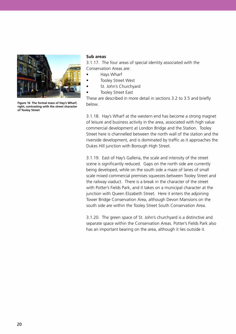
Sub areas3.1.17. The four areas of special identity associated with the Conservation Areas are:• Hays Wharf• Tooley Street West• St. John’s Churchyard• Tooley Street EastThese are described in more detail in sections 3.2 to 3.5 and briefly below.
3.1.18. Hay’s Wharf at the western end has become a strong magnet of leisure and business activity in the area, associated with high value commercial development at London Bridge and the Station. Tooley Street here is channelled between the north wall of the station and the riverside development, and is dominated by traffic as it approaches the Dukes Hill junction with Borough High Street.
3.1.19. East of Hay’s Galleria, the scale and intensity of the street scene is significantly reduced. Gaps on the north side are currently being developed, while on the south side a maze of lanes of small scale mixed commercial premises squeezes between Tooley Street and the railway viaduct. There is a break in the character of the street with Potter’s Fields Park, and it takes on a municipal character at the junction with Queen Elizabeth Street. Here it enters the adjoining Tower Bridge Conservation Area, although Devon Mansions on the south side are within the Tooley Street South Conservation Area.
3.1.20. The green space of St. John’s churchyard is a distinctive and separate space within the Conservation Areas. Potter’s Fields Park also has an important bearing on the area, although it lies outside it.
Figure 16 The formal mass of Hay’s Wharf, right, contrasting with the street character of Tooley Street

Regeneration Department Tooley Street Conservation Area
21
3.2 Sub area 1 – Hay’s Wharf
3.2.1. The western end of the sub area is dominated by traffic. Looking eastwards from Duke Street Hill into the area, a pedestrian bridge from London Bridge Station into the Cotton’s Centre is a distracting feature that closes off the view of the street at its narrowest point. The elaborate facades of listed buildings on the north side are vital to maintain the quality of the street environment here. Their curving alignment leads the eye into the main length of Tooley Street and to the arcade of Hay’s Galleria.
3.2.2. The north wall of the London Bridge Station undercroft is by comparison a dark and forbidding element. Nevertheless, new developments within the station are helping to lighten the character of the undercroft, using its unique built form to provide interest and greater permeability into the station environment.
3.2.3. The river elevation of the Hay’s Wharf area is of enormous importance in London. Access to it is down angled steps from London Bridge via The Queen’s Walk, which runs behind the supporting columns of Number One London Bridge.
3.2.4. Viewed from the north bank, the Hay’s Wharf area presents a solid block of development from London Bridge to the Crown Court at Battle Bridge Lane. The bulk of Number One London Bridge and the point block of Guys hospital behind it tend to dominate the western end: these buildings are outside the Conservation Areas. The consistent 6-7 storey height of the three listed buildings - Hay’s Galleria, London Bridge Hospital, and St Olaf House - is very evident, as is the intrusion of the upper three storeys of the Cottons Centre between them. London Bridge Hospital and St Olaf House retain their clean uncluttered rooflines and this river view emphasises the importance of maintaining original skylines.
3.2.5. Within the blocks, there is a range of intimate spaces, from the bustle and café character of Hay’s Galleria, to the quite precious and private drive-through to the entrance of St Olaf House. The intensity and richness of the art deco detail of the building at its entrance is unique and is one of the most valuable features of the sub area.
Figure 17 (left) Looking east towards Tooley Street from traffic dominated Duke Hill Street.
Figure 18 (right) Looking east along Tooley Street. The Cotton Centre bridge interrupts the view.
Figure 19 London Bridge Hospital and St Olaf House as seen from London Bridge City Pier.

22
Views and Townscape3.2.6. The riverside location allows many viewing opportunities over the river to the frontage and skyline of the City of London, both from public areas on the river embankment and from private locations within buildings. Conversely, there are also innumerable views to the area from the north side of the river. The most significant views are from the London Bridge City Pier in a 180º arc northwards, taking in the whole of The City and to the north embankment of the Thames – including Billingsgate Fish Market Building. There is also a key view from the London Bridge City Pier to London Bridge and through it to the succession of arches of bridges upstream, and in reverse to Hay’s Wharf from London Bridge.
3.2.7. Within the sub area there are important views Into Tooley Street from Duke Street Hill to the end of the South Eastern Railway Offices and glimpses into smaller urban spaces and through railway arches from Tooley Street.
3.2.8. There are a number of landmarks within the area by which people orientate themselves or identify their location, and which are focal points in views – they are not necessarily the architectural highlights. London Bridge City Pier, with the plaza in front of the Cotton’s Centre, is a focus for activity on the riverside walk. The arched roof and curving former dock of Hay’s Galleria are the most notable features of the Hay’s Wharf group viewed from London Bridge and the north bank of the River Thames, while Elgin’s Gate at the Tooley Street frontage of the Galleria complex forms a pinch-point with the end of the South Eastern Railway offices.
Figure 20 (left) The ever-changing skyline of the City of London from London Bridge City Pier. Billingsgate Fish Market is in the middle ground.
Figure 21 (right) View through London Bridge from London Bridge City Pier. The dome of St Paul’s Cathedral can be seen on the right.
Figure 22 View of Bridge Yard from Tooley Street.
Figure 23 Stainer Street under London Bridge Station from Tooley Street. The area was traditionally associated with these dark and forbidding spaces.
Figure 24 The façade of 51 to 57(Elgin’s Gate) dominates Tooley Street.

Regeneration Department Tooley Street Conservation Area
23
Key spaces3.2.9. Urban interest, particularly of the Hay’s Wharf area, is raised by small incidental spaces between buildings. There is a quiet, private character to small spaces like Hay’s Lane, Middle Yard and Bridge Yard, accessed between tight openings onto the main street frontage. Hay’s Galleria, too, although private and roofed over, has become an important city space, where interest is created by its curving form and the building structures that enclose it.
3.2.10. The riverside has been developed as an important city resource, providing a pedestrian and leisure route between London Bridge and Tower Bridge. A focus of activity has developed at London Bridge City Pier, with pavilions, high-quality paving and urban trees.
Negative features3.2.11. At the London Bridge end of Tooley Street, the effect of high redevelopment values is evident in the intensive scale of redevelopment that has occurred at the Cottons Centre and Number One London Bridge. These massive buildings maximise floor areas with very deep floor plates that require mechanical ventilation to be habitable. Clearly this approach to space planning represents a threat to the more modest proportions of older buildings like St. Olaf House.
3.2.12. The Tooley Street area has been subject to many pressures historically, which has created disjointed development of varying quality. The high value of sites by London Bridge led to large-scale redevelopment in the 1970s in abstract modernist architectural forms that largely failed to respond to the special character of the surroundings or to create space of a human scale. Traffic, too, has become a general intrusion into the sub area.
Figure 25 Incidental spaces between buildings like Hay’s Lane were once more common in the area.
Figure 26 Although the Cotton Centre has limited impact on Tooley Street itself, the impact on the river skyline between London Bridge Hospital and Hay’s Wharf is greater.

24
Elements that continue to detract from the quality of the sub area include:• Traffic management works throughout, especially at Duke Street Hill;• The diagonally braced pedestrian foot bridge from London Bridge Station to the Cotton Centre;• Conversions to some of the viaduct arches for commercial use: the main problems are to do with signage and pedestrian access and congestion on the footway;• Intrusion of railway gantries and safety railings above the railway arches, and the stained and crumbling appearance of some of the brickwork;• Broken and poor quality street and footway surfaces common throughout the Conservation Areas.
3.3 Sub area 2 – Tooley Street West
3.3.1 East of Hay’s Galleria, building heights reduce to an average of 4 storeys, and Tooley Street takes on a more relaxed character. There is more pedestrian space, traffic is less intrusive, and occasional street trees soften the impact of buildings, while contributing with them to the scale of the street. In this visually less intense environment, buildings can stand out from the background for their detail: for example the Shipwright’s Arms, the Great Wall Restaurant, the gothic revival Fire Station, and The King of Belgium pub (now ‘The Elusive Camel’). The clearance of buildings on the north side of the street has temporarily unbalanced it, leaving only the fire station and Boord’s former distillery offices between Battle Bridge Lane and Vine Lane. The ‘More London’ development under construction will, however, dramatically change the appearance of the north side of the street and has the potential to reinstate the line of the original street frontage.
Townscape and views3.3.2. Views to and from the sub area include the view from Tooley Street through Potter’s Fields Park to Tower Bridge. A new view to Tower Bridge is to be created through the ‘More London’ development from Tooley Street near to Battle Bridge Lane.
3.3.3. Important views within the sub area include from Tooley Street to the junction with Queen Elizabeth Street, featuring the civic space in front of Lambeth College and the end of Devon Mansions. There are also glimpses through railway arches to adjacent areas.
Figure 27 The relaxed character of Tooley Street at Shand Street.
Figure 28 (left) South Eastern Railway offices with its improbably narrow western end.
Figure 29 (right) Shipwright’s Arms at the junction of Bermondsey Street

Regeneration Department Tooley Street Conservation Area
25
• There are a number of local landmarks within the sub-area that are the focus of views. The distinctive narrow western end of the South Eastern Railway offices catches the eye in views from London Bridge along Tooley Street. Corner buildings have a particular importance, and the Shipwright’s Arms is notable for its position, colour and decoration at a key (and historic) corner with Bermondsey Street. The King of Belgium (now called ‘The Elusive Camel’) is another fine London Pub, dated 1897, of 3 storeys plus a dominant gabled attic storey. It forms a very strong corner on Druid Street, and mitigates the indifferent quality of the St Olave’s Estate housing block adjacent to it in Fair Street.
3.3.4. Tooley Street itself is linear in character creates no strong spaces in the area. Visually, the junction with Bermondsey Street is significant for the angle at which it meets Tooley Street, with buildings responding directly to this geometry. New spaces are to be created with the ‘More London’ development, the largest of which will be at Bermondsey Street on the north side of Tooley Street.
Negative elements3.3.5. Development of the 1980s and 90s has been able to mitigate some of the impacts of the large scale 1970s development (see 3.2.11 above) by creating high-quality public space on the riverside. It has taken longer, however, for the less high-profile parts of the Conservation Area, particularly the central section, to attract the investment necessary to improve it. Some gaps remain, and some buildings remain at risk, although prospects for regeneration are now good with the ‘More London’ development.
3.3.6. Following the demolition of much of the north side of Tooley Street, it will be vital that the replacement buildings create a strong and active street frontage. The pattern of block – gap – block should be continued and new development should respect historic building lines to reinforce the spatial containment of Tooley Street. If buildings are set back, street trees should be used to provide this containment of the street and re-establish a sense of enclosure.
3.3.7. Elements that continue to detract from the quality of the sub area include:• Open yard adjacent to the Shipwrights Arms and viaduct,
Bermondsey Street;• Fenced yards and parking areas, adjacent to Lion Court,
Magdalene Street;

26
• Vacant site, 116 to 120 Tooley Street;• Signage associated with the ‘War Museum’ in the South Eastern
Railway Building• Broken and poor quality street and footway surfaces common
throughout the Conservation Areas.
3.4 Sub area 3 – St John’s Churchyard
3.4.1. The key frontage of St John’s Churchyard is onto Tower Bridge Road, which is addressed by Nasmith House and the former vicarage, no. 10 Fair Street. The vicarage is the oldest surviving building in the conservation area, dating to the early 18th century, and with the front of Nasmith House and the tall plane trees surrounding it, it forms a quiet leafy close beside Tower Bridge Road. Tower Bridge Road itself is heavily trafficked: the churchyard is visually separated from these surroundings behind its railings, and its green space provides welcome quiet relief.
Townscape and views3.4.2. St. John’s Churchyard is a very mature green environment, and provides a most important relief to the dense urban environment that surrounds it. It is an important setting for elements within it, such as the fountain and playground, which have fallen into disuse, and the war memorial. Nasmith House is the focal point of the churchyard, but is notable for its setting rather than the modern structure built over the crypt of the former church. Otherwise there are limited views into and out of the sub-area.
3.4.3. The railings that surround the churchyard on all sides separate it perceptually from the intrusion of outside noise, traffic on Tower Bridge Road in particular, and so contain the immediate quiet quality of the space. The mature trees also provide scale and containment, and the presence of high buildings and structures beyond the immediate environment provides another level of definition: Devon Mansions and the railway viaduct, visible through the trees, are of special significance in this respect.Negative elements3.4.3. Elements that continue to detract from the quality of the sub area include:• Wire mesh fencing to the playground, Fair Street; • Graffiti on the rear of Nasmith House, St John’s Churchyard;
Figure 30 (left) Church hall, no. 9 Fair Street.
Figure 31 (right )The vicarage, no. 10 Fair Street.
Figure 32 Nasmith House is built on the plinth of the 18th century St John Horselydown church.
Figure 33 Fair Street entrance to St John’s Churchyard. The space is well defined with railings and the mature trees create a sense of enclosure.

Regeneration Department Tooley Street Conservation Area
27
• The derelict and overgrown southeast corner of St John’s Churchyard.
• Broken and poor quality street and footway surfaces (which are common throughout the Conservation Areas).
3.5 Sub area 4 – Tooley Street East
3.5.1. Except for Devon Mansions, the eastern part of Tooley Street lies in the Tower Bridge Conservation Area. The location is of special significance as a major nodal point in this part of the city, where Tooley Street crosses the approach to Tower Bridge. It has evolved with a strong municipal character, created by public buildings such as Lambeth College and the law courts east of Tower Bridge Road. Again, these are outside the Conservation Area, but have a strong bearing on the character of this end of Tooley Street.
Townscape and views3.5.2. The eastern end of the Conservation Area is part of the linear street-space of Tooley Street. The location is most strongly identified by the landmark public building of Lambeth College in the adjacent Tower Bridge Conservation Area defining city space at junction of Queen Elizabeth Street. The end elevation of Devon Mansions provides a strong visual marker for the municipal space between the buildings and Lambeth College in views eastward along Tooley Street.
3.5.3. At the junction of Queen Elizabeth Street at the eastern end of the Conservation Area, the angles of the intersecting streets create a distinctive triangular space between Devon Mansions and Lambeth College, with the statue of Colonel Samuel Bourne Bevington, first mayor of Bermondsey, as its focus. The space itself is in the adjoining Tower Bridge Conservation Area.
3.5.4. St John’s Churchyard is the most significant green space in the area. In addition, Potter’s Fields Park, although it lies outside the Conservation Areas, has a significant influence on the character of Tooley Street. Its railings and mature trees maintain continuity of the street frontage between St John’s Tavern and the complex of Lambeth College. It also allows a key visual link to Tower Bridge.
Negative elements• The main negative points relate to the boundary with St. John’s
Churchyard on Fair Street (see 3.4.4 above).
Figure 34 (left) The central tower of Lambeth College.
Figure 35 (right) Devon Mansions at the junction of Tooley Street, Fair Street and Queen Elizabeth Street.
Figure 36 View through Potter’s Fields Park from Tooley Street to Tower Bridge.

28
4.1 Listed buildings
4.1.1. The list of buildings of special architectural or historic interest for Southwark was updated in September 1998. Detailed list descriptions are available from the Council. The listed buildings in the Conservation Areas fall into three main groups:· All of the block from St. Olaf House to Hay’s
Galleria, excluding the Cottons Centre;· Key corner buildings on Tooley Street (nos. 88,
115-21 and 139);· Buildings associated with St. John’s
Churchyard (9 and 10 Fair Street).
4.1.2. The most significant of the thirteen listed buildings in the Conservation Areas is the Grade II* St. Olaf House in the Hay’s Wharf sub area. The listings also include the iron railway bridge structure over Joiner Street, part of London Bridge Station.
4. Audit
Figure 37 The Art Deco St Olaf House (1931) was built on the site of the 11th century church dedicated to Olave, King of Norway.

Regeneration Department Tooley Street Conservation Area
29
Figure 38 The listed Joiner Street Bridge over one of the entrances to London Bridge Underground Station.
Key Unlisted Buildings and Building Groups4.1.3. The main defining elements of the Conservation Areas are groups of buildings that combine into frontages that define streets, spaces and views. Often this group value of buildings is as important as the individual characteristics of listed buildings, and the scale, containment and background character that they provide is essential to the character of the Conservation Areas. The following descriptions include listed buildings in key groups.
Sub Area 1 – Hay’s Wharf• 15 to 25 Tooley Street: listed buildings
which include no. 15 with an elevation onto the small triangular plaza in front of St. Olaf House. 17 to 25 are an elaborate buff terracotta-faced building, 5 storeys like no. 15;
• 29 to 33 Tooley Street: also listed, 4 storeys with shop fronts. With 15 to 25 they provide important containment of the street, facing the viaduct on the south side;
• Southern Eastern Railway viaduct: including the listed iron bridge over Joiner Street, provides very distinctive containment of the south side of Tooley Street;
• 47 to 49 and 51 to 57 Tooley Street: 4-5 storey yellow brick warehouses with strongly arcaded ground floor, grouped with Hay’s Galleria to form a key section of the street elevation, and facing the corner onto Battle Bridge Lane.

30
Sub Area 2 – Tooley Street West • 64 to 88 Tooley Street (South Eastern Railway offices and
Shipwright’s Arms): very distinctive 5 storey structure tapering to an improbably narrow width at the west end - facing virtually a screen wall to the railway viaduct. The Shipwright’s Arms pub (listed) marks the angle to Bermondsey Street;
• 90 to 104 Tooley Street: 3-4 storey west part of block between Bermondsey Street and Bursar Street. No. 90, The Great Wall Restaurant, is particularly notable, with a curved facade in the angle of Bermondsey Street;
Listed Buildings
Buildings that make a positive contribution
Figure 39 Listed buildings and buildings that make a positive contribution to Hay’s Wharf.

Regeneration Department Tooley Street Conservation Area
31
• 134 to 150 Tooley Street: block between Magdalen Street and Shand Street, dominated by 136 to 148 Magdalen House - a 5 storey factory building now converted to offices. There are 3 and 4 storey corner shop blocks at each end;
• 154 to 172 Tooley Street: 4 and 5 storey block between Shand Street and Barnham Street, in 3 groups. 154 is a former pub (The Britannia) in red brick with Portland Stone detailing; 156 to 164 and 166 to 172 are simple brick factory / stone buildings, all now converted to offices;
• Devon Mansions (174 to 184 Tooley Street): 6 storey mansion blocks, very important with groups described above in defining street edge and scale;
• 155 to 173 Tooley Street: 3 storey block between Vine Lane and Weavers Lane, west end is the Antigallican Pub, east end is the St. Johns Tavern, a strong 4 storey corner building overlooking Potter’s Field Park. This is the only remaining group on the north side of Tooley Street, and is important in relation to the blocks described above in defining street width and character.
Listed Buildings
Buildings that make a positive contribution
Figure 40 Listed buildings and buildings that make a positive contribution to Tooley Street West.

32
Sub Area 3 – St John’s Churchyard
• 9 and 10 Fair Street: the listed hall and rectory are the only remaining buildings that help define the character of the churchyard in the absence of the original church.
Listed Buildings
Buildings that make a positive contribution
Figure 41 Listed buildings and buildings that make a positive contribution to St John’s Churchyard.

Regeneration Department Tooley Street Conservation Area
33
Sub Area 4 – Tooley Street East
• Devon Mansions (54 to 108 Tooley Street): 6 storey mansion blocks, as above, very important in defining the triangular space between Tooley Street and Queen Elizabeth Street, facing Lambeth College.
Listed Buildings
Buildings that make a positive contribution
Figure 42 Listed buildings and buildings that make a positive contribution to Tooley Street East.

34
4.2 Archaeology.
4.2.1. The Conservation Area lies within the Archaeological Priority Zone of Borough/Bermondsey/Riverside as defined in the UDP adopted in July 1995.
4.2.2. Archaeological investigations have produced information about the Roman settlement, part of which lies buried beneath the western extent of the Conservation Area. To the east of Hays Galleria, the area was marshy and interspersed with water channels, until the eyot of Horselydown was reached at the eastern extent of the Conservation Area. Archaeological investigations here have revealed evidence of prehistoric and some limited Roman activity, curtailed by episodic flooding until the post-medieval period when the low-lying land was reclaimed and utilised by a variety of initially small-scale industries. Of note was the production of 17th-century delftware in nearby Potters Fields.
4.2.3. The Council’s existing and draft archaeological policies focus on the preservation of scheduled ancient monuments and important archaeological remains in situ. Where this cannot be achieved, archaeological investigation may be acceptable in some cases. Full consideration of archaeological matters is imperative where proposals for development and environmental improvements are initiated. The Council’s Archaeology Officer should be consulted at the earliest stages of project development.
4.3 Environmental improvements
4.3.1. The Conservation Areas are seeing continued improvement of both buildings and street environment. Possible improvement schemes in the area include work to be undertaken by private owners, by the local authority, and possibly in partnership. Property redevelopments should include the improvement to the adjacent public realm wherever possible.
4.3.2. Fuller development briefs may be appropriate in some instances: the following note summarise their potential.
St. John’s Churchyard4.3.3. The churchyard appears to be an underused local facility. The equipment has been removed from the playground, and the area has been allowed to fall into disrepair. Investment in a landscape and improvement scheme could revive its local amenity value.

Regeneration Department Tooley Street Conservation Area
35
4.4 Improvements to buildings
64 to 84 Tooley Street - South Eastern Railway Offices4.4.1. This most distinctive building appears to be in only partial occupation. Complete renovation would greatly enhance the quality of the street opposite Hay’s Galleria. Signage associated with the ‘War Museum’ located in the western end of the building detracts from its appearance and undermines the quality of the street. Signage on the narrow end of the building is particularly intrusive.
4.5 Potential development sites
4.5.1. The Conservation Areas include a number of buildings in need of re-use and / or repair as described above. In the main, the buildings themselves should remain, and any changes considered in the light of the guidance set out above. In some instances there is a case to be made for new buildings, either to fill gaps in the urban fabric, or to replace poor elements with more appropriate design.
4.5.2. The following examples are noted:
North Tooley Street to the River Thames4.5.3. Although the bulk of the area to the east of Hay’s Wharf is outside the Conservation Areas, the Tooley Street frontage is not, and it is essential that development of the whole site gives appropriate consideration to it. The listed buildings remain and it must be recognised that the context for which they were originally conceived and designed was as part of a continuous street frontage. The network of lanes that formerly served the site now remain only as street corners on Tooley Street, but still represent notable design opportunities in the spirit of the earlier pattern of city blocks. The ‘More London’ development is currently under construction in this area.
Corner of Bursar Street4.5.4. A demolished building has provided the opportunity to reconstruct the corner, which connects with the previously continuous façade of 92 to 114 Tooley Street. This row itself is discontinuous, since the upper floors of 108 and 110 have been removed. They could be restored to their original three-storey height as part of the scheme.
Figure 43 This former public house is one of the few remaining existing buildings on the north side of Tooley Street and forms part of an important group. The Greater London Assembly appears alien in this pqarticular view, however, the More London Development will form a new backdrop to these buildings.
Figure 44 Open site on the corner of Bursar Street and Tooley Street.

36
2 to 12 Bermondsey Street4.5.5. The open site south of the Shipwright’s Arms could accommodate a three-storey frontage block to screen the railway viaduct. The site opposite on the corner of Magdalene Street has been recently developed for housing.
18 to 27 Magdalene Street4.5.6. This is an example of a number of yards behind Tooley Street that have potential for street frontage development to infill gaps in the urban fabric. Lion Court, a new adjacent development, is recent residential scheme of this kind.
Figure 45 Open site adjacent to the Shipwright’s Arms, Bermondsey Street.

Regeneration Department Tooley Street Conservation Area
37
5.1 Introduction
Purpose of this guidance section5.1.1. This section of the report draws out from the appraisal those themes that are essential to the Conservation Areas’ historical character, to which new development and improvement should pay heed. It is not intended to provide a prescriptive methodology for new design in the area or to exclude innovation.
5.1.2. It should also be noted that architectural style, in terms of the design of elevations, selection of materials, detailing and so on, is only part of the concern. Equally important are townscape issues of mass, overall form, building placement relative to the public realm, creation and preservation of views and vistas, quality of boundary treatments, and visual impacts of utility areas such as parking, servicing and site access.
5.1.3. Clearance of the north side of Tooley Street has created the opportunity and the need to construct new buildings. There is no objection in principle to good new building design in the Conservation Areas in contemporary styles, and the following design guidance seeks to promote modern design of quality, as well as to preserve and reflect the historical character of the areas. Consulting the Council5.1.4. The Council’s conservation officer should be consulted prior to undertaking any alterations to the exterior of buildings within the Conservation Areas and it is likely that planning permission and / or Conservation Area consent to demolish will be required for most significant works. Where a building is listed, there are stricter controls on what the owner can and cannot do. Most works to a listed building, whether internal or external, will require listed building consent where they are considered to affect the special architectural or historic interest of the building. Replacement of listed structures will usually prove unacceptable, and replacement of unlisted structures will normally only be entertained where existing buildings do not make a positive contribution to the character and appearance of the Conservation Area and the proposal can be shown to positively preserve or enhance that character and appearance. If unauthorised work is carried out the Council can enforce against it.
5 Guidelines

38
5.1.5 The following guidance provides some indication of the most appropriate approach to common problems and development pressures within the area. It is always wise to seek advice from the Council’s planning and conservation officers before considering any building work.
5.2 Development form and urban morphology
5.2.1. Renewal is taking place throughout the area as new development, redevelopment, alteration and renovation. In some cases poor development in relatively recent times will give the opportunity for redevelopment that can respond more sensitively to the special character of the Conservation Areas. New development should be seen as an opportunity to enhance the Conservation Areas.
Street and plot patterns5.2.2. Some very significant redevelopment opportunities exist in the North Conservation Area east of Hay’s Wharf, and other opportunities in the streets across Tooley Street in the South Conservation Area. Although the ‘More London’ scheme is already under construction north of Tooley Street, it is important that the overall form of all new development is in keeping with the morphological characteristics of the area.
5.2.3. Two main morphologies have been identified:• A grid of narrow streets formerly of 19th century warehouses
that extended over most of the Conservation Areas; this is incomplete now on the north side of Tooley Street following clearance, although the junctions of the original lanes into the area remain;
• A “metropolitan townscape” in Tooley Street itself, in which the line of a broader street, building façades and some avenue trees express its importance as a major city route. There is the potential for reinstatement of city blocks on the north side of the street, preserving the access points of the original lanes and restoring the rhythm of the earlier street frontage.
Building form5.2.4. As well as the major redevelopment opportunities north of Tooley Street which borders the North Conservation Area, there are also opportunities within the South Conservation Area for new development in streets south of Tooley Street. The general characteristics of dockland development found in the area are:

Regeneration Department Tooley Street Conservation Area
39
• Full development of the site to its edges with buildings;• Narrow accesses, if any, to the centre of the site for servicing• Tall elevations, minimum three storeys and, on Tooley street itself,
four or five;• Plain flat façades with little modulation on plan, except in some
cases for superficial details such as brick pilasters or panels.• Simple “blocky” building masses.
5.2.5. There is no reason why new buildings should not follow this basic discipline, observing the scale of the earlier buildings by reference to ordering elements such as string-courses and structural spacing. Overall heights of buildings and their position on the street need to conform to the established street “envelope”, but the manner of expression can be entirely contemporary.
5.2.6. Replacement of listed structures will usually prove unacceptable, and replacement of unlisted structures will normally only be considered where existing buildings do not make a positive contribution to the character and appearance of the Conservation Area and the proposal can be shown to positively preserve or enhance that character and appearance.
New design in the Conservation Areas5.2.7. Unlike dockland areas east of Tower Bridge, there are no strong examples of contemporary design that fit well into the street scene of the Conservation Areas. The refurbishment of Hay’s Galleria entailed the reconstruction of large parts of the earlier complex, notably the ferro-concrete river ends of the former dock, borrowing details from the original Snook and Stocks designs.
5.2.8. Elsewhere along the river, the success of contemporary design in the conservation area comes not from imitating the style of 19th century warehouses, but in building on the unique townscape opportunities of density and height that the development pattern affords. The most effective contemporary designs are those which employ a crisp simplicity of form and materials, echoing the functionality of the earlier environment in a modern idiom. By consciously adopting a clear design ethos, such examples sit more happily in the Conservation Areas than, for example, more complex and self-consciously retrospective designs.
Figure 46 Hay’s Wharf before conversion and how it looks today as Hay’s Galleria.

40
5.3 Public Realm
5.3.1. In this context the public realm includes everything visible from publicly accessible areas, including both street spaces and any areas up to the front elevations of buildings. The essential components of the public realm that development and improvement should address are:• Boundaries and frontages that define its edges;• The surfaces and design of the space itself• Trees, street furniture and other artefacts in the space.
Boundaries5.3.2. Throughout, the form of Tooley Street is strongly linear with buildings are sited right on the street boundary so that the quality of building façades is most important. Design should avoid creating any intermediate areas between buildings and the street itself. Such areas are important around the former St John Church, but brick walls and railings are the key to enclosing street space and separating external areas. Where, exceptionally, boundary separations are required, brick walls and railings should be used rather than fencing.
Ground surfaces5.3.3 Limited street improvement schemes have been implemented in the Conservation Areas (e.g. Counter Street as part of the Hay’s Galleria development). These schemes should be extended to cover both areas, and new development schemes should be expected to make a contribution to their own immediate public street space. The range of materials in use is limited, and should remain so for new work, based on granite kerbs and sett paving and natural flagstones. Brick and clay paviours are not part of the historic street scene and should be used with discretion.
Trees and street furniture5.3.4. Trees are of importance in “bulking out” some of the key spaces in the Conservation Areas (e.g. Potter’s Fields) and to define lines of sight and movement (e.g. Tooley Street east). There is scope for new street trees in relation to new development and public realm improvement, particularly along Tooley Street itself. Semi-mature specimens planted with tree guards are to be preferred to saplings, to have greater resistance to damage and a stronger visual impact.A modern street furniture range has been adopted for the Conservation Areas, and its use should be extended throughout. Simple street lamp designs will usually be most effective, practical yet not utilitarian in style, appropriate to the Conservation Areas’ industrial heritage, and avoiding “Victoriana” clichés.
Figure 47 Where they exist, historic paving materials should always be properly reinstated (Shipwright Yard).

Regeneration Department Tooley Street Conservation Area
41
5.4 Improvements and repairs
Materials5.4.1. Choice and use of materials can have a significant effect on the character and appearance of the Conservation Area. It is therefore important that materials are appropriate for the building and for the Conservation Area. Care should be taken to ensure that original materials are retained wherever possible, and if replacements are necessary because of decay or damage, materials are chosen to match the originals as closely as possible in both appearance and performance. 5.4.2. The use of natural, traditional materials will be encouraged and expected, particularly on listed buildings. Artificial modern materials such as concrete tiles, artificial slates, UPVC windows etc., generally look out of place, and may have differing behavioural characteristics to natural materials. Some materials, such as concrete tiles, can lead to problems with the building’s structure as their weight may exceed the loading for which the roof trusses and internal walls were designed. Where such inappropriate materials have been used in the past, their replacement with more sympathetic traditional materials and detailing, where possible, will be encouraged.
Maintenance5.4.3. Repair works can prove costly and may require authorisation, which can cause delays. It is therefore far better to ensure that regular maintenance is undertaken, thus preventing unnecessary decay and damage and the resultant costs and problems. Works such as the regular repainting of woodwork and timber, clearing out of debris in rainwater pipes and gutters, cutting back of vegetation in close proximity to buildings, repointing of failed mortar, and refixing of loose roof slates are all in themselves relatively minor tasks that will not require authorisation but which may lead to much more complex and expensive works if left unattended.
Windows and Doors5.4.4. Where original elements exist they should wherever possible be retained in situ and repaired. The characteristic style of windows and doors is described in section 3.1. Such windows and doors that remain appear mostly to be in reasonable condition and require no more than regular maintenance.
Figure 48 The old fire station has recently been restored to a high standard.

42
5.4.5. All external joinery should be painted, which is the traditional finish. Stained or varnished timber finishes are inappropriate in the Conservation Areas. Most window frames are painted white, although white may not have been their original colour; however repainting in garish colours would be inappropriate.
5.4.6. At the same time, there is the opportunity to introduce more colour, in the repainting of doors and retained mechanical features. Subdued and darker shades of red, green or blue can provide a highlighting theme, without being garish.
5.4.7. Replacement windows to listed buildings need to match the original glazing bars and detail of the originals. Where the existing windows or doors are however later alterations that detrimentally affect the character or appearance of a building, the Council will consider their replacement with appropriate traditional designs. The use of modern materials such as aluminium or UPVC is inappropriate and not acceptable on historic buildings.
Roofs5.4.8. Where possible, original roof coverings should be retained and if necessary repaired with slate to match the existing. Where re-roofing is unavoidable because of deterioration of the existing roof covering or inappropriate later works, the use of natural slate will usually be required. The use of more modern materials such as concrete tiles and artificial slate is unacceptable, and their greater weight can lead to damage and deterioration of the roof structure if inappropriately used. Natural roof slates should be used on listed buildings and either natural or good quality reconstituted slate on unlisted buildings in the Conservation Areas. Natural slates have a better appearance and weather gradually and evenly over time: most artificial slates weather badly with streaking and leaching of colour and adverse effects on the overall appearance of the building.
5.4.9. In order to preserve the historic skyline of the Conservation Areas, further roof extensions and changes to the basic roof form are generally unacceptable. This is particularly important in respect of long views to the skyline of the North Conservation Area from the river.
5.4.10 Where they exist, original chimney stacks and pots should always be retained and repaired if necessary. The reinstatement of appropriately designed replacement chimney pots where these have been lost will be encouraged.

Regeneration Department Tooley Street Conservation Area
43
Brickwork5.4.11 The painting or rendering of original untreated brickwork should be avoided and is usually considered unacceptable. Where damaged bricks are to be replaced or new work undertaken, bricks should be carefully selected to match those existing in texture, size and colour and should be laid in an appropriate bond to match the existing.
5.4.12. The most dominant visual components of the brick façades are the bricks themselves, rather than the pointing. Traditional bricks were a slightly larger format than metric bricks and were often laid in softer lime based mortar in a thinner bed, which reduced the appearance of the joints relative to the bricks. Repointing should only be undertaken where necessary to prevent further damage to a building’s structure and should be kept to a minimum. Usually a lime based mortar mix no stronger than 1:1:6 (cement: lime: sand) is recommended and this should be coloured with sand to match the original mix. Joints should be flush or slightly recessed (not weather struck or raised) and finished neatly and cleanly with the mortar brushed back to expose the edges of adjacent bricks.
5.4.13 Cleaning of brickwork is a specialist task, which may dramatically alter the appearance of a building. If undertaken incorrectly cleaning may lead to permanent damage to the bricks and ultimately the structure of a building. Advice should be sought from the Council before attempting such a task.