Embed Size (px)
Citation preview
1
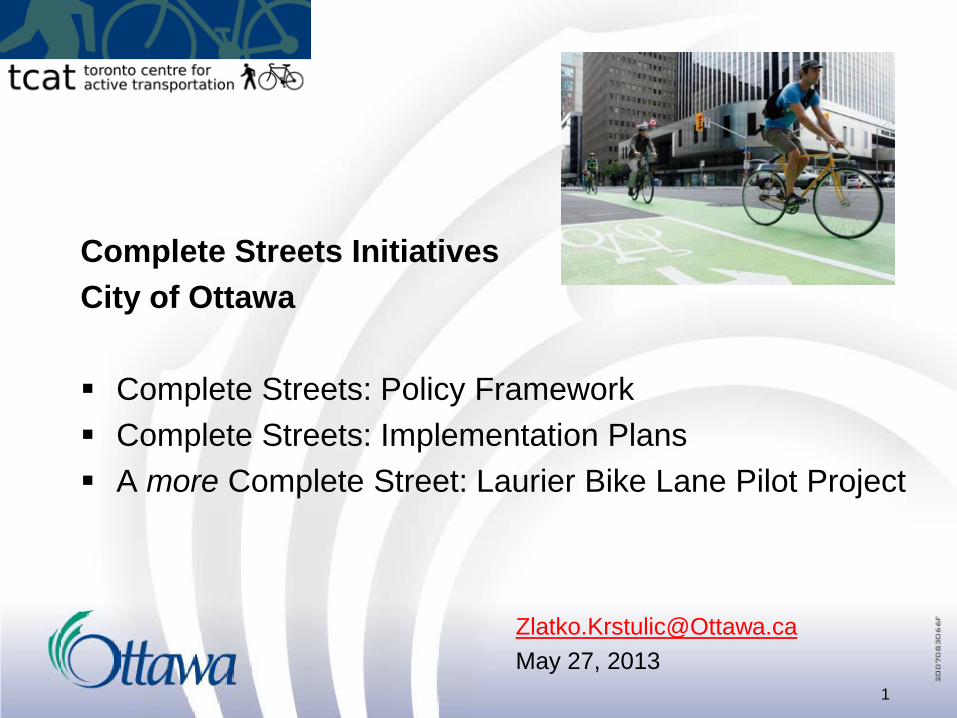
Complete Streets Initiatives City of Ottawa Complete Streets: Policy Framework Complete Streets: Implementation Plans A more Complete Street: Laurier Bike Lane Pilot Project
[email protected] May 27, 2013

Cycling Mode-Share Trends
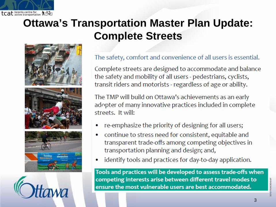
Ottawa’s Transportation Master Plan Update: Complete Streets
3

Comfortable Cycling Routes All City infrastructure projects will strive to deliver the highest practical level
of comfort for cyclists, with the lowest Level of Traffic Stress. Tradeoffs between all modes are inevitable.
4

Transportation: Safe and Efficient Infrastructure
New approach for infrastructure based on peak period instead of peak hour
Greater focus on person trips instead of vehicle trips
New policies for maximum road and intersection widths
Friday, May 31, 2013 5

Active Transportation - Cycling
• New Cycling Plan Vision Statement that places greater emphasis on bike-transit integration
• New “cross-town bikeways” for route continuity and priority implementation
• Prioritize cycling connections to rapid transit and key employment and educational nodes
• Greater emphasis on cycling safety and education
• Permit new cycling facility types (e.g. segregated bike lane)
• New winter cycling network plan
Friday, May 31, 2013 6

Perspectives on Intersection Design
7
“To reach local shops and the library I must cross Hazeldean road which is 6 lanes at the nearest crossing to my house It is quite dangerous to cross these intersections with 3 young children. For that reason, I am often forced to use my car for trips that are as little as 2-3 km, when I would much rather walk or bike” comment by Ottawa resident, Feb. 2013

8
Complete Streets Plan for the Core (“Downtown Moves” project)
$1B+ Investment in Light Rail (incl. a
downtown tunnel) frees up road space in the core
Downtown streets serve over 100,000
people who work in Ottawa’s compact high-density central area
Number of downtown residents will double by 2031
Increased level of service for pedestrians is
essential for success of the Light Rail project

9
Downtown Street Conditions
Queen Street, west of Elgin Street

10
Queen St (west of O’Connor St) - Before Street Demonstrations

11
Queen St (west of O’Connor St) - After

12
Albert St (at Lyon St) - Before

13
Albert St (at Lyon St) - After Street Demonstrations

Mackenzie King Bridge - Before
14

Mackenzie King Bridge - After
15

April 2010- Start the selection process
July 2011- Lanes open (two year Pilot)
July 2013- Pilot to be reviewed (Retain, modify, or remove?)
2013/2014- Incorporate into East-West Bikeway
16
The Laurier Segregated Bike Lanes
“I’ve travelled around North America and the world, segregated bike lanes are old news,” Watson said. “I hope we can make it permanent, and if there are some minor tweaks that might accommodate some residents at the Bronson end, we can do that.” Mayor Jim Watson- Ottawa Citizen May 7, 2013

Corridor Selection Process
Examine the Advantages and Challenges in Designing, Implementing, and Using Segregated Bike Lane Facilities
Review of International Best Practices for Segregated Bike Lane Design and Implementation
** WE ARE HERE **
Detailed Design of Pilot Corridor
Public Consultation
33 Potential Corridors
3 Potential Corridors
Selected Corridor LAURIER AVE.
Preliminary Screening
Stage 1 Evaluation
Stage 2 Evaluation
Stage 3 Evaluation (Vélo Québec)
12 Potential Corridors
Construction of Pilot Project
Maintenance and Monitoring of Pilot Project
Step # 1: Project Initiation
Step # 2: Choosing a Corridor
Step # 3: Developing the Pilot Project
Public Consultation
Functional Designs for Pilot Corridor

Route Evaluation

Intersections: Yield signs, Left-turn bike boxes, Advance signal phase, No-right-turns-on-reds for motor vehicles
Functional Design
Laurier at Lyon

Functional Design (Elgin to Metcalfe)

March 2013 21
Count and Communicate
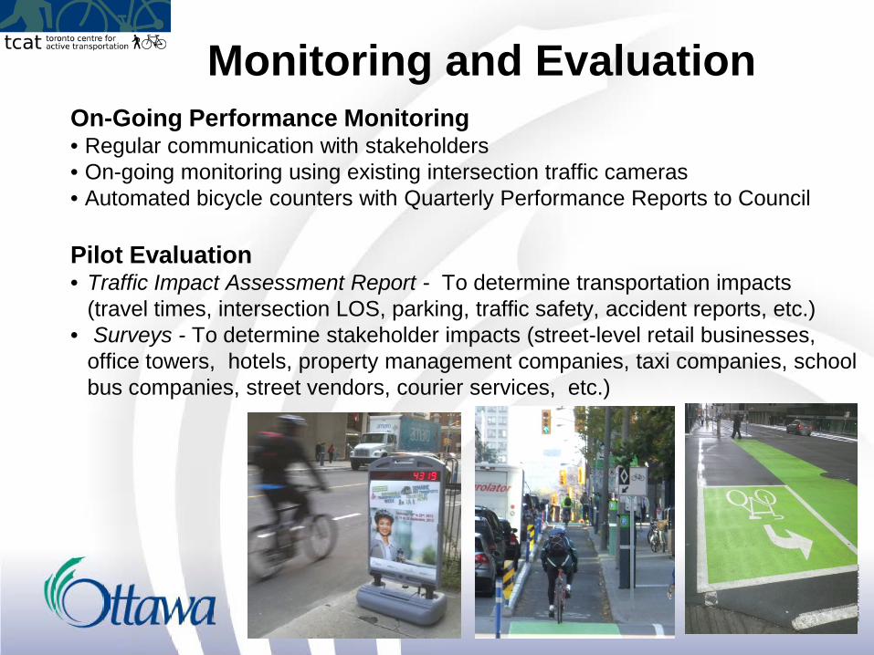
Monitoring and Evaluation On-Going Performance Monitoring • Regular communication with stakeholders • On-going monitoring using existing intersection traffic cameras • Automated bicycle counters with Quarterly Performance Reports to Council Pilot Evaluation • Traffic Impact Assessment Report - To determine transportation impacts
(travel times, intersection LOS, parking, traffic safety, accident reports, etc.) • Surveys - To determine stakeholder impacts (street-level retail businesses,
office towers, hotels, property management companies, taxi companies, school bus companies, street vendors, courier services, etc.)

Laurier-Lessons Learned.. “Pilot Project” status a key enabler
• Motorist yield to cyclists on right • Green pavement markings
Build as raised cycle track vs. pre-cast curb) • Vertical vs. horizontal separation minimizes cross section needed • Only one curb on each side better accommodates mobility devices • Fewer flex posts needed.
Use flex-posts with spring loaded bases • more durable and therefore require less maintenance
Full time data collection was essential • Shows on-going use of facility • Allows for comparison with other routes
23

Future of Bike Tracks in Ottawa
Underway.... Laurier Pilot (2011 -retrofit) Churchill (2014 road re-build) Beechwood (2014 development block)
Under consideration... Main Street (pending EA) Albert (post Light Rail) Downtown Moves (post Light Rail)

For additional information… • Cycling eNewsletter
o News for Ottawa Cyclists |Nouvelles pour les cyclistes d'Ottawa
• Laurier Segregated Bike Lanes o Ottawa.ca/Bikelane
• Downtown Moves o ottawa.ca/en/city-hall/public-consultations/downtown-moves
25