Embed Size (px)
Citation preview
CITY OF PATTERSON
Planning Commission Staff Report
Mitigated Negative Declaration #21-01
Rogers Road Bridge Replacement over Delta Mendota Canal Project
June 24, 2021
PROJECT SUMMARY
A public hearing request to adopt a Mitigated Negative Declaration for the Rogers Road Bridge
Replacement at Delta Mendota Canal Project. The bridge is located 0.5 miles north of the
intersection of Rogers Road and Sperry Avenue. This project would replace the 110-foot-long
reinforced concrete T-beam bridge with a new 2-lane, 41-foot wide by 135-foot-long single span
bridge. In addition, the bridge substructure (foundations and abutment walls) will be constructed
to accommodate an ultimate bridge width of 65-feet (for the future widening of Rogers Road to a
four-lane facility). The road approaches to the bridge will not be widened, but right-of-way is
required to accommodate new access roads and detention basins to the Delta Mendota Canal.
APPLICANT AND SITE INFORMATION
Applicant/Owner: City of Patterson
Location: Rogers Road Bridge over Delta Mendota Canal
Environmental Review: Mitigated Negative Declaration
Present Land Use: Public roadway
Surrounding Land Uses: Agricultural (irrigated open land); residential (RV
home park); vacant but planned light industrial
Recommendation: Adoption
PROJECT DESCRIPTION
The Rogers Road Bridge was built in 1949. It was inspected by Caltrans Department of
Transportation and deemed as Functionally Obsolete (FO). The bridge has an inventory rating of
21.1 metric tons and an operation grating of 35.3 tons. Flowing water is present in the lined
channel under all spans. Sporadic pattern cracks are present throughout the AC approaches at
both ends of the bridge. Various piers have lightly abraded concrete throughout with moderate
abrasion at the waterline. The Rogers Road Bridge Project is needed to improve public safety
and necessary to meet Caltrans’s Highway Bridge Program Requirements.
Request for consideration of a Mitigated Negative Declaration for the construction and
operation of the following improvements:
▪ Replace the 110-foot-long T-beam bridge with a new 2-lane, 41-foot wide by 135-foot-
long single span bridge.
▪ Construct bridge substructure (foundations and abutment walls) to accommodate a bridge
width of 65-feet (for the future widening of Rogers Road to a four-lane facility).

FINDINGS
To adopt the Mitigated Negative Declaration, the Planning Commission must find the following:
1. The project will not adversely affect water or air quality or increase noise levels; 2. The project will not have adverse impacts on the flora and fauna of the area; 3. The project will not degrade the aesthetic quality of the area; 4. The project will not have adverse impacts on traffic or land use; 5. In addition, the project will not:
a. Create impacts which have the potential to degrade the quality of the
environment;
b. Create impacts which achieve short-term to the disadvantage of long-term
environmental goals;
c. Create impacts for a project which are individually limited, but cumulatively
considerable;
d. Create environmental effects which will cause substantial adverse effects on
human beings, either directly or indirectly;
ALTERNATIVE ACTIONS
1. Determine that the findings for the Mitigated Negative Declaration can be made, and motion to adopt Mitigated Negative Declaration # 21-01.
2. Determine that the findings for the Mitigated Negative Declaration can be made, and motion to adopt Mitigated Negative Declaration # 21-01 subject to the revisions submitted by the Commission.
3. Determine that the findings for the Mitigated Negative Declaration cannot be made and motion to deny Mitigated Negative Declaration # 21-01.
RECOMMENDATION
Staff recommends that the Planning Commission make the required findings and adopt
Resolution # 2021-03 adopting Mitigated Negative Declaration # 21-01.
Respectfully submitted,
Tiffany Rodriguez Tiffany Rodriguez, Capital Projects Manager
Attachments:
Resolution 2021-03
Proposed Mitigated Negative Declaration/Initial Study
Rogers Road Bridge over Delta Mendota Canal
Public Notice

RESOLUTION 2021-03
A RESOLUTION OF THE PLANNING COMMISSION OF THE CITY OF PATTERSON
ADOPTING A MITIGATED NEGATIVE DECLARATION FOR THE ROGERS ROAD
BRIDGE REPLACEMENT OVER DELTA MENDOTA CANAL, LOCATED 0.5 MILES
NORTH OF THE INTERSECTIONS OF ROGERS ROAD AND SPERRY AVENUE.
WHEREAS, the City of Patterson has submitted an application for construction and
operation of the Rogers Road Bridge Replacement over Delta Mendota Canal Project, Consisting:
Replacing the 110-foot-long T-beam bridge with a new 2-lane, 41-foot wide by 135-foot-long
single span bridge, and constructing bridge substructure (foundations and abutment walls) to
accommodate a bridge width of 65-feet (for the future widening of Rogers Road to a four-lane
facility);
WHEREAS, Patterson City staff conducted a full analysis of the project to ensure
compliance with the City’s General Plan, Zoning Code, and other applicable laws, regulations,
and standards;
WHEREAS, the Planning Division completed an environmental assessment for the project in
accordance with the California Environmental Quality Act (CEQA), and determined that the
project would not result in a significant impact to the environment and a Mitigated Negative
Declaration was prepared accordingly;
WHEREAS, the Planning Commission of the City of Patterson conducted a duly noticed
public hearing on June 24, 2021, and;
WHEREAS, based on its independent review and analysis, the staff analysis, oral and
written testimony, and the draft mitigated negative declaration, the Planning Commission finds,
after due study, deliberation and public hearing that the following circumstances exist:
1. The project will not adversely affect water or air quality or increase noise levels; 2. The project will not have adverse impacts on the flora and fauna of the area; 3. The project will not degrade the aesthetic quality of the area; 4. The project will not have adverse impacts on traffic or land use; 5. In addition, the project will not:
a. Create impacts which have the potential to degrade the quality of the environment;
b. Create impacts which achieve short-term to the disadvantage of long-term environmental goals;
c. Create impacts for a project which are individually limited, but
cumulatively considerable; d. Create environmental effects which will cause substantial adverse effects on
human beings, either directly or indirectly;
The Mitigated Negative Declaration was prepared in compliance with CEQA and the CEQA
Guidelines and reflects the independent judgment and analysis of the City of Patterson.
NOW, THEREFORE, BE IT RESOLVED by the Planning Commission of the City of
Patterson as follows:
1. The Planning Commission hereby adopts the Rogers Road Bridge Replacement over Delta
Mendota Canal Mitigated Negative Declaration.
2. The Planning Commission hereby adopts the Mitigation Monitoring and Reporting Program
contained in the Rogers Road Bridge Replacement over Delta Mendota Canal Mitigated
Negative Declaration, Appendix A.
The foregoing resolution was introduced at a regular meeting of the Planning Commission
of the City of Patterson, held on the 24th day of June 2021, by Commissioner _____________, who
moved its adoption, which motion was duly seconded by Commissioner _____________, and it
was upon roll call carried and the resolution adopted by the following vote:
AYES:
NOES:
EXCUSED:
APPROVED:
______________________________
Ron West, Chairperson
City of Patterson Planning Commission
ATTEST:
__________________________________
Denise Melo, Secretary
City of Patterson Planning Commission
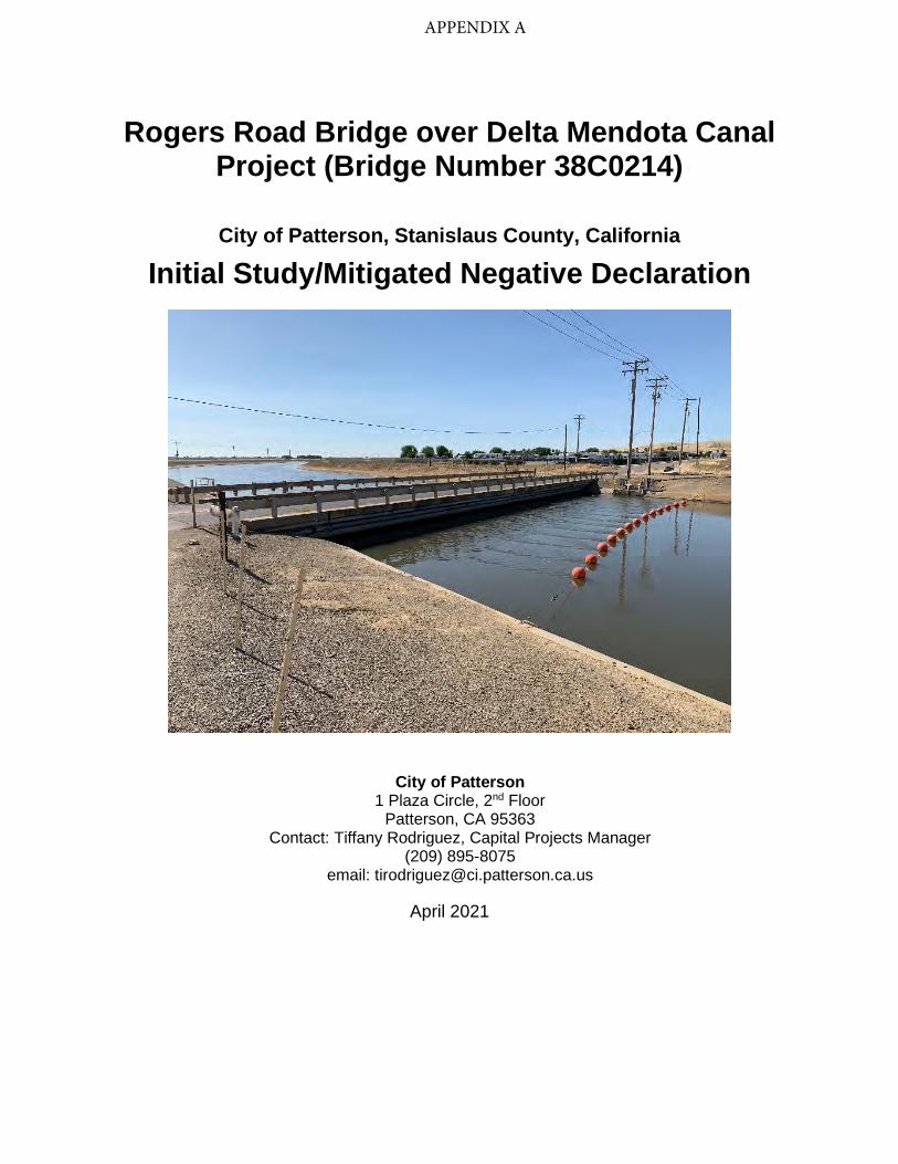
Rogers Road Bridge over Delta Mendota Canal Project (Bridge Number 38C0214)
City of Patterson, Stanislaus County, California
Initial Study/Mitigated Negative Declaration
City of Patterson 1 Plaza Circle, 2nd Floor
Patterson, CA 95363 Contact: Tiffany Rodriguez, Capital Projects Manager
(209) 895-8075 email: [email protected]
April 2021
APPENDIX A

Page intentionally blank
Proposed Mitigated Negative Declaration City of Patterson
Rogers Road Bridge over Delta Mendota Canal Project (Existing Bridge Number 38C0214)
(New Bridge Number 38C0353)
INTRODUCTION
This document has been prepared to evaluate the Rogers Road Bridge over Delta Mendota Canal Project (also referred to as “proposed Project” or “Project”) for compliance under the California Environmental Quality Act (CEQA). The City of Patterson (City) is the lead agency responsible for complying with the provisions of CEQA.
PROJECT DESCRIPTION
The City of Patterson (City) is proposing to replace the existing Rogers Road Bridge over the Delta Mendota Canal (Br. No. 38C0214) (Project), located approximately 3 miles west of the center of the City. The Project would replace the 110-foot-long, reinforced concrete (RC) T-beam bridge with a new 2-lane, 41-foot wide by 135-foot long single span bridge. The Project will construct the bridge substructure (foundations and abutment walls) to accommodate an ultimate bridge width of 65-feet (for a future widening of Rogers Road to a four-lane facility). The road approaches to the bridge will not be widened, but right of way will be needed to accommodate new access roads to the Delta-Mendota Canal.
FINDINGS
As lead agency for compliance with CEQA requirements, the City finds that the proposed Project would be implemented without causing a significant adverse impact on the environment, based on the analysis presented in this Initial Study/ Mitigated Negative Declaration (IS/MND). Mitigation measures for potential impacts associated with biological resources, cultural resources, geology & soils, hazardous materials, noise, and transportation, would be implemented as part of the proposed Project through adoption of a mitigation monitoring and reporting program.
DETERMINATION
On the basis of this evaluation, the City concludes: The proposed Project does not have the potential to degrade the quality of the
environment, substantially reduce the habitat of a fish or wildlife species, cause a fish or wildlife population to drop below self-sustaining levels, threaten to eliminate a plant

or animal community, substantially reduce the number or restrict the range of a rare or endangered species, or eliminate important examples of the major periods of California history or prehistory.
The proposed Project would not achieve short-term environmental goals to the disadvantage of long-term environmental goals.
The proposed Project would not have impacts that are individually limited, but cumulatively considerable.
The proposed Project would not have environmental effects that would cause substantial adverse effects on human beings, either directly or indirectly.
No substantial evidence exists to demonstrate that the proposed Project would have a substantive negative effect on the environment.
This document has been prepared to provide the opportunity for interested agencies and the public to provide comment. Pending public review and approval by the Planning Commission, this MND will be filed pursuant to CEQA Guidelines §15075. Written comments should be submitted to the City of Patterson Engineering Department at 1 Plaza, P.O. Box 667, Patterson, CA 95363, attention: Tiffany Rodriquez, by 5:00 p.m. on May 7, 2021.
April 5, 2021
Signature Fernando Ulloa City Engineer
Date

Rogers Road Bridge Project Initial Study/Mitigated Negative Declaration i
Table of Contents
1.0 Introduction .......................................................................................................... 1
1.1 Project Overview .................................................................................................. 1 1.2 Purpose of this Document .................................................................................... 1 1.3 Public Review Process ......................................................................................... 1 1.4 City Approval Process .......................................................................................... 1 1.5 Organization of the Initial Study and Mitigated Negative Declaration .................... 1 1.6 Environmental Factors Potentially Affected .......................................................... 2
2.0 Project Description ............................................................................................... 5
2.1 Project Location .................................................................................................... 5 2.2 Background and Setting ....................................................................................... 5 2.3 Project Purpose and Need.................................................................................. 10 2.4 Project Design .................................................................................................... 10 2.5 Other Build Alternatives Considered but Eliminated from Further Consideration 16 2.6 No-Project Alternative ......................................................................................... 18 2.7 Permits and Approvals Needed .......................................................................... 18
3.0 Environmental Checklist ..................................................................................... 20
3.1 Aesthetics ........................................................................................................... 20 3.2 Agriculture and Forestry Resources ................................................................... 23 3.3 Air Quality ........................................................................................................... 27 3.4 Biological Resources .......................................................................................... 30 3.5 Cultural Resources ............................................................................................. 43 3.6 Energy ................................................................................................................ 47 3.7 Geology and Soils .............................................................................................. 48 3.8 Greenhouse Gas Emissions ............................................................................... 52 3.9 Hazards and Hazardous Materials ...................................................................... 53 3.10 Hydrology and Water Quality .............................................................................. 58 3.11 Land Use and Planning ...................................................................................... 62 3.12 Mineral Resources ............................................................................................. 63 3.13 Noise .................................................................................................................. 64 3.14 Population and Housing ..................................................................................... 67 3.15 Public Services ................................................................................................... 68 3.16 Recreation .......................................................................................................... 70 3.17 Transportation .................................................................................................... 71 3.18 Tribal Cultural Resources ................................................................................... 75 3.19 Utilities and Service Systems ............................................................................. 77 3.20 Wildfire ............................................................................................................... 79 3.21 Mandatory Findings of Significance .................................................................... 81
4.0 List of Preparers ...................................................................................................... 83
5.0 References.............................................................................................................. 84
Rogers Road Bridge Project Initial Study/Mitigated Negative Declaration ii
List of Figures Figure 1. Project Vicinity ............................................................................................................. 7
Figure 2. Project Location ........................................................................................................... 8
Figure 3. Proposed Project......................................................................................................... 12
Figure 4. Proposed Bridge ......................................................................................................... 13
Figure 5. Farmland Impacts ...................................................................................................... 25
Figure 6. Vegetation Community/Land Cover Types in the Project Area ................................... 32
Figure 7. Rogers Road Detour .................................................................................................. 72
List of Tables Table 1. Proposed Construction Equipment .............................................................................. 16
Table 2. Air Quality Thresholds of Significance – Criteria Pollutants ......................................... 28
Table 3. Vegetation Community/Land Cover Type within the Project Area ................................ 31
Table 4. Soil Map Units within the Project Area ......................................................................... 49
List of Appendices Appendix A Mitigation Monitoring and Reporting Program
Appendix B Site Photos

Rogers Road Bridge Project Initial Study/Mitigated Negative Declaration iii
Acronyms and Abbreviations AASHTO American Association of State Highway and Transportation Officials AB Assembly Bill ACM asbestos containing material ADA Americans with Disabilities Act ADL aerially deposited lead ADT Average daily traffic APE Area of Potential Effects BMPs Best Management Practices BSA Biological Study Area CalFire California Department of Forestry and Fire Protection Caltrans California Department of Transportation CCIC Central California Information Center CCR California Code of Regulations CDFW California Department of Fish and Wildlife CDOC California Department of Conservation CEQA California Environmental Quality Act cfs cubic feet per second CIDH cast-in-drilled-hole City City of Patterson CVP Central Valley Project CWA Clean Water Act dB decibel dBA A-weighted decibel DTSC California Department of Toxic Substances Control DWR California Department of Water Resources EDR Environmental Data Resources FEMA Federal Emergency Management Agency FESA Federal Endangered Species Act FIRM Flood Insurance Rate Map FMMP Farmland Mapping and Monitoring Program FT Federally Endangered GHG greenhouse gas HBP Highway Bridge Program I-5 Interstate-5 ISA Initial Site Assessment IS/MND Initial Study/Mitigated Negative Declaration LBP lead-based paint

Rogers Road Bridge Project Initial Study/Mitigated Negative Declaration iv
LCP lead-containing paint Leq equivalent continuous sound level Lmax maximum sound level MMRP Mitigation Monitoring and Reporting Program MRZ Mineral Resource Zone MS4 Municipal Separate Storm Sewer System NAHC Native American Heritage Commission NASA National Aeronautics and Space Administration NES Natural Environment Study NOI Notice of Intent NRCS National Resources Conservation Service NRHP National Register of Historic Places O&M operations and maintenance PCB polychlorinated biphenyls PM2.5 particulate matter less than 2.5 microns in diameter PM10 particulate matter less than 10 microns in diameter Project Rogers Road Bridge Replacement Project RC reinforced concrete REC recognized environmental condition ROW Right-of-Way RV recreational vehicle SI&A Structural Inventory and Appraisal SJVAPCD San Joaquin Valley Air Pollution Control District SLDMWA San Luis & Delta-Mendota Water Authority SSC Species of Special Concern ST State Threatened STIP State Transportation Improvement Program SWPPP Stormwater Pollution Prevention Plan SWRCB State Water Resources Control Board TPH total petroleum hydrocarbons TPHd total petroleum hydrocarbons diesel TPHg total petroleum hydrocarbons gasoline TPHmo total petroleum hydrocarbons motor oil U.S. United States USBR U.S. Bureau of Reclamation USFWS U.S. Fish and Wildlife Service USGS United States Geological Survey
Rogers Road Bridge Project Initial Study/Mitigated Negative Declaration 1
1.0 Introduction
1.1 Project Overview The City of Patterson (City) is proposing to replace the existing Rogers Road Bridge over the Delta Mendota Canal (Existing Br. No. 38C0214, New Br. No. 38C0353) (Project), located approximately 3 miles west of the center of the City. The Project would replace the 110-foot-long, reinforced concrete (RC) T-beam bridge with a new 2-lane, 41-foot wide by 135-foot long single span bridge. The Project will construct the bridge substructure (foundations and abutment walls) to accommodate an ultimate bridge width of 65-feet (for a future widening of Rogers Road to a four-lane facility). The road approaches to the bridge will not be widened, but right of way will be needed to accommodate new access roads to the Delta-Mendota Canal.
1.2 Purpose of this Document The purpose of this Initial Study/Mitigated Negative Declaration (IS/MND) is to disclose environmental impacts that may result from the proposed Project. This IS/MND assesses the environmental effects of the proposed Project, as required by California Environmental Quality Act (CEQA), and is in compliance with state CEQA Guidelines (14 California Code of Regulations [CCR] Section 15000, et seq.), which requires that all state and local government agencies consider the environmental consequences of projects over which they have discretionary authority before acting on those projects.
1.3 Public Review Process This IS/MND is being circulated for a 30-day public review period to all individuals who have requested a copy and appropriate resource agencies. Pursuant to Executive Order N-80-20 signed September 23, 2020, this report has been filed with the State Clearinghouse and is available on the City’s website (www.ci.patterson.ca.us). A Notice of Intent (NOI) is also being distributed to all property owners of record identified by the Assessor’s office as having property within 300 feet of the proposed Project. The NOI identifies where the document is available for public review and invites interested parties to provide written comments for incorporation into the final IS/MND.
1.4 City Approval Process After comments are received from the public and reviewing agencies, the Planning Commission must adopt the IS/MND and approve the mitigation monitoring and reporting program (MMRP) (Appendix A) before it can approve the proposed Project.
1.5 Organization of the Initial Study and Mitigated Negative Declaration This IS/MND is organized into the following chapters:

Rogers Road Bridge Project Initial Study/Mitigated Negative Declaration 2
Chapter 1 – Project Overview and Background: provides summary information about the proposed Project, describes the public review process for the IS/MND, and includes the CEQA determination for the proposed Project.
Chapter 2 – Project Description: contains a detailed description of the proposed Project.
Chapter 3 – Environmental Checklist: provides an assessment of proposed Project impacts by resource topic. The Environmental Checklist form, from Appendix G of the State CEQA Guidelines, is used to make one of the following conclusions for impacts from the proposed Project:
A conclusion of no impact is used when it is determined that the proposed Project would have no impact on the resource area under evaluation.
A conclusion of less than significant impact is used when it is determined that the proposed Project’s adverse impacts to a resource area would not exceed established thresholds of significance.
A conclusion of less than significant impact with mitigation is used when it is determined that mitigation measures would be required to reduce the proposed Project’s adverse impacts below established thresholds of significance.
A conclusion of potentially significant impact is used when it is determined that the proposed Project’s adverse impacts to a resource area potentially cannot be mitigated to a level that is less than significant.
Mitigation measures, if necessary, are noted following each impact discussion. Chapter 4 – List of Preparers: identifies the individuals who contributed to the environmental document. Chapter 5 – References Cited: identifies the information sources used in preparing this document. Appendices – Contains the MMRP and representative photos.
1.6 Environmental Factors Potentially Affected Impacts to the environmental factors below are evaluated using the checklist included in Chapter 3. The City determined that the environmental factors checked below would be less than significant with implementation of mitigation measures. It was determined that the unchecked factors would have a less-than-significant impact or no impact.
Aesthetics Agriculture and Forestry Air Quality
Biological Resources Cultural Resources Energy
Geology/Soils Greenhouse Gas Emissions
Hazards and Hazardous Materials
Hydrology/Water Quality
Land Use/Planning Mineral Resources
Noise Population/Housing Public Services
Recreation Transportation/Traffic Tribal Cultural Resources
Utilities/Service Systems
Wildfire Mandatory Findings of Significance

Rogers Road Bridge Project Initial Study/Mitigated Negative Declaration 3
DETERMINATION: On the basis of this initial evaluation:
I find that the proposed Project COULD NOT have a significant effect on the environment, and a NEGATIVE DECLARATION will be prepared.
I find that although the proposed Project COULD have a significant effect on the environment, there will not be a significant effect in this case because revisions in the proposed Project have been made by or agreed to by the proposed Project proponent. A MITIGATED NEGATIVE DECLARATION will be prepared.
I find that the proposed Project MAY have a significant effect on the environment, and an ENVIRONMENTAL IMPACT REPORT is required.
I find that the proposed Project MAY have a “potentially significant impact” or “potentially significant unless mitigated” impact on the environment, but at least one effect 1) has been adequately analyzed in an earlier document pursuant to applicable legal standards, and 2) has been addressed by mitigation measures based on the earlier analysis as described on attached sheets. An ENVIRONMENTAL IMPACT REPORT is required, but it must analyze only the effects that remain to be addressed.
I find that although the proposed Project could have a significant effect on the environment, because all potentially significant effects (a) have been analyzed adequately in an earlier EIR or NEGATIVE DECLARATION pursuant to applicable standards, and (b) have been avoided or mitigated pursuant to that earlier EIR or NEGATIVE DECLARATION, including revisions or mitigation measures that are imposed upon the proposed Project, nothing further is required.
April 5, 2021 Fernando Ulloa Date City Engineer

Rogers Road Bridge Project Initial Study/Mitigated Negative Declaration 4
Page intentionally blank

Rogers Road Bridge Project Initial Study/Mitigated Negative Declaration 5
2.0 Project Description The proposed Project would replace the Rogers Road Bridge over the Delta Mendota Canal in the City of Patterson, as described in detail below.
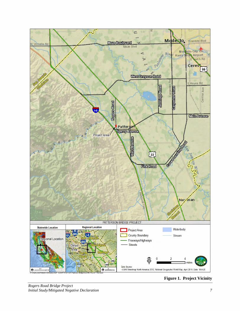
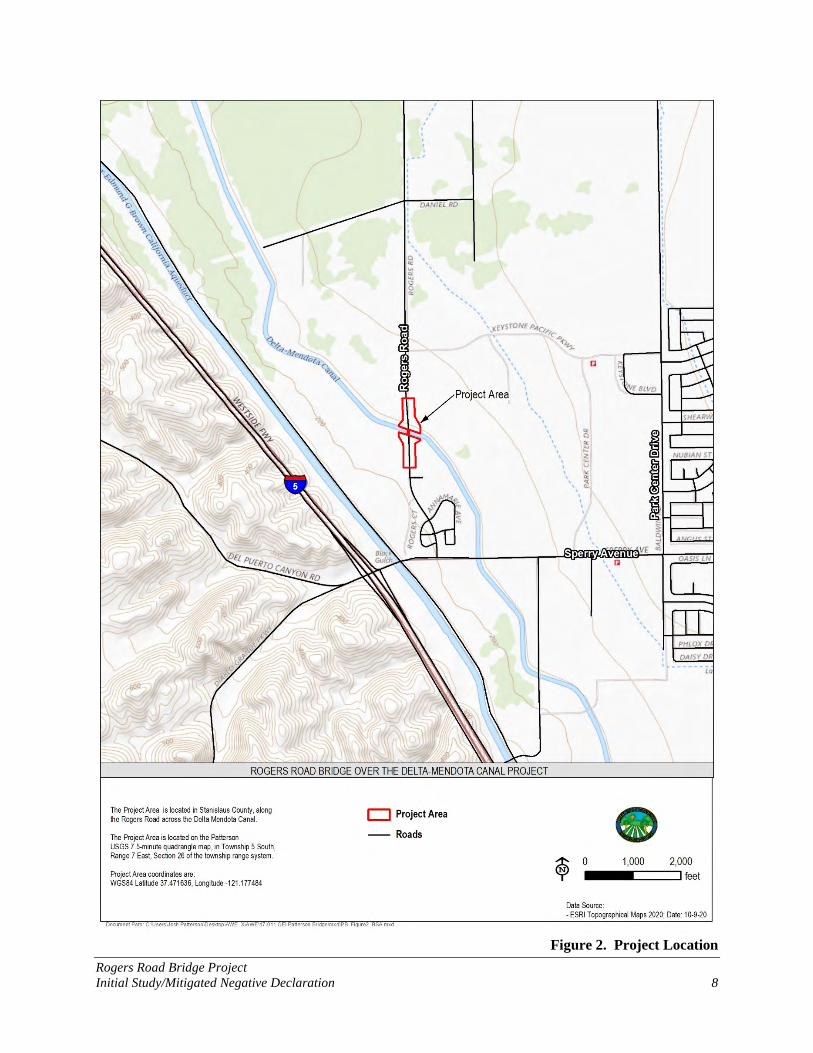
2.1 Project Location The Project is located in the western portion of the City of Patterson, Stanislaus County, California (Figure 1). The existing two-lane bridge on Rogers Road is 0.7 miles northeast of the Interstate-5 (I-5)/Sperry Road Intersection. The Project is located within the Patterson U.S. Geological Survey (USGS) 7.5-minute quadrangle map, in Township 5 South, Range 7 East, Section 26 (Figure 2).
2.2 Background and Setting 2.2.1. Existing Bridge
The existing Rogers Road Bridge over the Delta Mendota Canal is a 110-foot-long, reinforced concrete T-beam structure. Constructed in 1949, the bridge consists of three spans (35 feet, 40 feet, and 35 feet) supported on reinforced concrete pier walls and reinforced concrete diaphragm abutments. The bridge is 28-feet 8-inches wide and accommodates two 12-foot lanes without shoulders and two non-standard 2-foot 4-inches wide concrete curbs with non-standard steel railings.
The existing bridge is in poor condition. California Department of Transportation (Caltrans) Structures Maintenance and Investigations Division inspects local agency bridges every two years and subsequently writes a report summarizing the bridge’s status. The latest available routine inspection for this bridge was completed on January 17, 2019, and notes the following:
Moderate surface abrasion on the pier walls,
1/16-inch wide, full-height, vertical cracks on most of the intermediate diaphragms above Piers 2 and 3,
A 12-inch incipient spall below Bay 2 and a 12-inch diameter by 1-inch deep spall below Bay 3,
On top of Pier 3, there is a 16-foot long by 1/8-inch wide vertical crack with an incipient spall below Bay 1 and a 1/16-inch wide by 6.6-foot long horizontal crack below Bays 4 and 5, and
The asphalt approach is cracking with impending potholing.
Diagonal cracks on the exterior girders at the corners of the bridge.
Various crack on the concrete curbs and post of barrier.

Rogers Road Bridge Project Initial Study/Mitigated Negative Declaration 6
An underwater inspection was performed by Caltrans in 2014 and noted only minor abrasion on the piers and the previous spalling noted above.
Rogers Road Bridge Project Initial Study/Mitigated Negative Declaration 7
Figure 1. Project Vicinity
Rogers Road Bridge Project Initial Study/Mitigated Negative Declaration 8
Figure 2. Project Location
Rogers Road Bridge Project Initial Study/Mitigated Negative Declaration 9
Included in each Caltrans inspection report is a Structural Inventory and Appraisal Report (SI&A Sheet) summarizing all aspects of the bridge. The Rogers Road Bridge has been previously rated Functionally Obsolete due to an inadequate deck width and has an overall sufficiency rating of 52.8 (2019 Caltrans Bridge Inspection Report).
2.2.2. Existing Roadway
Rogers Road at the Project site is classified as a Major Collector and is not considered part of the National Highway System. The current average daily traffic (ADT) (2018) is 4,807 vehicles per day (per City traffic count) and the future ADT (2040) is projected to be 12,545 vehicles per day (Stantec Memo August 3, 2017). The road also provides access to the operations and maintenance (O&M) roads of the Delta-Mendota Canal.
The area is in transition from rural to urban, with light industrial and commercial development occurring along Rogers Road. For purposes of establishing AASHTO based design criteria for this facility, the road is characterized as suburban within the urban collector classification. The posted speed just north of the bridge is 35 mph, which is consistent with AASHTO design speed range of 35 to 50 mph for an Urban or Suburban Collector (AASHTO 6.3.1.1).
2.2.3. The Delta Mendota Canal
The Delta-Mendota Canal was constructed in 1951 and is owned by the U.S. Bureau of Reclamation (USBR) and operated by the San Luis & Delta-Mendota Water Authority (SLDMWA). The Delta-Mendota Canal carries water southeasterly from the Bill Jones Pumping Plant (formerly the Tracy Pumping Plant) along the west side of the San Joaquin Valley for municipal and environmental irrigation supply. The Delta-Mendota Canal is about 117 miles long and terminates at the Mendota Pool, about 30 miles west of Fresno.
2.2.4. Site Constraints and Design Considerations
The profile of Rogers Road is relatively flat. There is minimal clearance from the bridge girder/soffit to the Delta-Mendota Canal; the existing vertical clearance does not meet current requirements of the SLDMWA.
Current SLDMWA access restrictions and environmental protection requirements may prevent rehabilitating the existing bridge to meet current bridge and roadway design standards. This is due to two key factors including:
Access within the Delta-Mendota Canal channel to make modifications to the existing pier walls and abutments is no longer allowed by SLDMWA due to the critical operations of the Delta-Mendota Canal and the impacts of lowering flow or temporarily taking the Delta-Mendota Canal out of service.
Rogers Road Bridge Project Initial Study/Mitigated Negative Declaration 10
For Delta-Mendota Canal maintenance and inspections, current design guidance from SLDMWA require a minimum 3-foot-square window (measured from the edge of the canal liner) in front of each abutment.
For any bridge replacement options, SLDMWA requires that the new bridge clear span the entire Delta-Mendota Canal without any supports constructed within the canal. Foundations must be located to minimize interaction between the proposed structure and the existing channel, and construction methods must ensure protection of the canal from potential distortion/distress during construction.
2.3 Project Purpose and Need The purpose of this Project is to replace the existing bridge with a new structure and approach roadway to meet current design and safety standards for bridges and roads to improve safety and operation of the facility.
The Project is needed because the bridge does not meet current standards for width, and it lacks approach guard railing that meets current safety standards. There is also a gap in the existing sidewalk through the Project area which should be filled in with new sidewalk to provide continuous Americans with Disabilities Act (ADA) compliant pedestrian access from Keystone Pacific Parkway to Sperry Road.
2.4 Project Design The City proposes to replace an existing bridge on Rogers Road crossing over the Delta-Mendota Canal in the City of Patterson, Stanislaus County, California. The Project would be constructed along the existing road alignment. The Project would include the following elements:
Construct a new 41-foot wide by 135-foot long single span bridge over the Delta-Mendota Canal;
Construct the bridge substructure (foundations and abutment walls) to accommodate an ultimate bridge width of 65-feet (for a future widening of Rogers Road to a four-lane facility)
Removal of a portion of the existing bridge;
Raise the road elevation to provide minimum required clearance over the Delta-Mendota Canal (for maintenance activities);
Reconstruct Rogers Road, adding sidewalk on the east side of the road, modifications to drainage systems, and utility relocations from approximately 450-feet south of the bridge to approximately 700-feet north of the bridge.
Reconstruct canal maintenance access roads at all four corners of the bridge;
Construct approach railing meeting current safety standards;

Rogers Road Bridge Project Initial Study/Mitigated Negative Declaration 11
Reconstruct a portion of the driveway for the Kit Fox Mobile Home Park;
Construct a sidewalk from the end of the existing sidewalk south of the bridge to the driveway north of the bridge
Figure 3 and 4 shows the conceptual design for the proposed Project.
2.4.1. Bridge Type
The structure type being considered is precast prestressed concrete. Structure depths considered will range from 6 feet to 7 feet. Due to criteria established by the SLDMWA/USBR, the bridge replacement options will be required to clear span the entire canal and canal lining without any supports constructed within the canal. Foundations will be located behind the existing top of channel to minimize interaction between the proposed structure and the existing channel. During construction, the Canal will require protection from potential distortion/distress arising from construction activities.
A 135-foot-long, single span precast pretensioned California wide flange concrete girder is the most viable bridge structural option for this project site. This girder is desirable due to reduced vertical profile and elimination of falsework. These factors are needed to meet the SLDMWA requirements for clear spanning the canal and vertical clearance. The structural elements are precast off-site and then delivered and erected after the abutments are constructed. The wide flange girder alternative is less expensive than a similar precast box girder alternative and more efficient than a precast bulb T-girder alternative.
The bridge structure likely will be supported by concrete seat type abutments founded on cast-in-drilled hole (CIDH) concrete piles. Based on geotechnical investigation, site conditions appear most suitable for deep foundations, and because driven piles are prohibited on this site per the SLDMWA requirements, CIDH piles are recommended.
2.4.2. Bridge Demolition
The existing bridge is a 110-foot-long, reinforced concrete T-beam structure consisting of 3 spans (35 feet, 40 feet, and 35 feet) supported on reinforced concrete pier walls and reinforced concrete diaphragm abutments. The existing bridge will be removed as part of the bridge replacement project, with the exception of the reinforced concrete pier walls which will remain in place (in the canal) per SLDMWA requirements. Depending on the new roadway profile selected for the project, the existing bridge may be modified and used as falsework or temporary platform for construction of new bridge prior to its removal.

Rogers Road Bridge Project Initial Study/Mitigated Negative Declaration 12
Figure 3. Proposed Project

Rogers Road Bridge Project Initial Study/Mitigated Negative Declaration 13
Figure 4. Proposed Bridge

Rogers Road Bridge Project Initial Study/Mitigated Negative Declaration 14
2.4.3. Roadway Geometry and Profile
The proposed roadway width for this project is one 12-foot lane in each direction, 4-foot shoulders, and a 6-foot sidewalk on the east side of the road that will connect the existing sidewalk south of the bridge to the driveway north of the bridge. The total proposed bridge width to be constructed with this project is 41-feet. Highway Bridge Program (HBP) funding that has been authorized for this project will pay for the bridge to be replaced at this width.
The City proposes to construct the bridge substructure (foundations and abutment walls) to accommodate an ultimate bridge width of 65-feet (for a future widening of Rogers Road to a four-lane facility). The benefits of constructing the full width abutments during this initial construction phase to accommodate the future widening are:
Complete all work that impacts the SLDMWA at one time, thereby eliminating the need to go back and construct within the canal levees and modify levee access roads when Rogers Road is widened to four lanes.
Minimize future utility relocations to the extent practicable by planning utility relocations now to avoid conflicts with the future construction phase.
Realize a cost savings through economy of scale by constructing the full (future) width foundation with one project.
Realize additional cost savings by reducing future cost escalations (by constructing more of the future bridge width earlier).
Under the anticipated environmental and SLDMWA requirements mentioned earlier, a replacement bridge will have new profile up to approximately 8 feet higher than existing bridge, which will provide 3-foot clearance from the canal lining to the bridge soffit. This significantly higher profile (Figure 4) will control the length of the roadway approach work required for the project. Impacts of the higher profile include:
Canal access roads and the mobile home park driveway will need to be raised to conform to the new Rogers Road profile.
Utilities adjacent to the canal and bridge would be affected.
Right of way and temporary construction easements will need to be acquired to construct the fill slopes.
The bridge will include terminal system approach rail at all four corners of the bridge meeting Federal safety standard requirements. The levee access roads will be reconstructed to conform to the new road profile and be shifted away from the canal to clear the approach railing.

Rogers Road Bridge Project Initial Study/Mitigated Negative Declaration 15
2.4.4. Drainage
Currently, most stormwater within the project limits sheet flows off the road into pervious ground. There is a curb and gutter along the east side of the road south of the bridge that is collected into a storm drain. Proposed changes to the drainage system include collecting stormwater in a concrete gutter and discharging to the City's existing storm drain system or to detention basins or bioretention swales (Figure 4), as required by the City's Municipal Separate Storm Sewer System (MS4) permit for water quality treatment and/or hydromodification. Stormwater would either percolate into ground water or be discharged into the City’s storm drain system from these detention basins or bio retention swales. Sizing and locations of these facilities would be determined in final design. Potential areas for these features are included in the mapped Project area. Increasing the capacity of the existing storm drain system is not expected to be part of this Project.
2.4.5. Detour
It is anticipated that the bridge will be constructed by using a full road closure with temporary detour on existing roads in the vicinity. The advantage of the full road closure is that construction time can be reduced by up to 20%. The anticipated detour would be along Sperry Avenue to Park Center Drive to Keystone Pacific Parkway to Rogers Road. The closure of Rogers Road during construction will be coordinated with Emergency Response officials. With a detour in place, the contractor will have access to the project site from both embankments and can stage construction from the existing roadway on both sides of the canal.
2.4.6. Utilities
The Project will require relocation of overhead and underground utilities. Poles carrying electric, phone and cable/communication lines will be relocated as needed. Existing waterlines and a gas line attached to the existing bridge will need to be relocated to the new bridge. Temporary relocation may be required to maintain service. An existing sewer line that runs along Rogers Road (under the canal) will either be protected in place or relocated if necessary.
There is an active turnout on the canal which supplies non-potable water from the canal to a development near Sperry Ave. This turnout is immediately adjacent to the southwest corner of the new bridge abutment. The turnout can likely be protected in place through the use of shoring and minor modifications to the abutment design. The turnout is licensed by the USBR to the Del Puerto Water District and service by the SLDMWA will need to be maintained in accordance with this license agreement during and after construction. Coordination with all utility owners will occur during preliminary and final design of the Project.
2.4.7. Construction Schedule and Equipment
Construction is currently planned for 2022 or 2023 and is expected to take 8 to 10 months in one construction season. With a detour in place, the contractor will have access to the project site from

Rogers Road Bridge Project Initial Study/Mitigated Negative Declaration 16
both embankments and can stage construction from the existing roadway on both sides of the canal. Excavators, dozers, cranes, pavers, dump trucks, concrete trucks, concrete pumps, pile drilling equipment, pile driving hammers, and pile driving equipment may be required to construct the Project (Table 1). Other equipment may also be employed during Project construction.
Table 1. Proposed Construction Equipment
Equipment Construction Purpose Asphalt concrete paver Paving roadways
Backhoe Soil manipulation and drainage work
Bobcat Fill distribution
Bulldozer/loader Earthwork construction, cleaning and grubbing
Concrete pump trucks Bridge construction
Concrete ready-mix trucks Bridge construction
Crane Bridge construction
Dump truck Fill material delivery/surplus removal
Excavator with bucket Soil manipulation
Excavator with hydraulic ram Rock excavation for bridge footings
Front –end loader Dirt or gravel manipulation
Grader Ground leveling
Haul truck Earthwork construction; clearing and grubbing
Paver Roadway paving
Pile driving hammers and equipment Bridge and wall pile construction
Pile drill rig Bridge and wall pile construction
Roller/compactor Earthwork construction
Scraper Earthwork construction; clearing and grubbing
Truck with seed sprayer Landscaping
Water truck Dust control, compaction
Once the road has been closed and traffic detoured, the existing bridge superstructure will be fully removed. The existing piers will remain in place per the SLDMWA requirements. The existing abutments will be partially removed to facilitate vertical clearance to the new bridge; it is anticipated that the abutment portions below the canal lining will remain in place to prevent any damage to the canal lining. Some issues that may affect demolition include the water level in the canal, and the prevention of debris from falling in the water. The bridge technical specifications will require the contractor to develop a demolition plan and debris containment plan to be submitted for review and approval. The contractor will also have to install bracing systems from the existing piers to the new abutments to prevent the existing pier walls from tipping over, as required by SLDMWA guidelines.
2.5 Other Build Alternatives Considered but Eliminated from Further Consideration
The following section describes alternatives that were considered during Project planning but were eliminated from further consideration.

Rogers Road Bridge Project Initial Study/Mitigated Negative Declaration 17
2.5.1. Bridge Rehabilitation Alternative
At the time of HBP programming, the existing bridge was Functionally Obsolete with a Sufficiency Rating of 63.2, making it eligible for rehabilitation. However, SLDMWA requirements do not allow construction work within the limits of the canal. Rehabilitation was considered impractical because all rehabilitation alternatives would require work within the channel and would not provide the clearances required by SLDMWA. Therefore, rehabilitation alternatives were eliminated from further study. Caltrans agreed with this assessment and the bridge was re-programmed as a replacement project in fall of 2019.
2.5.2. Two-Lane Alternative without Accommodation for Future Widening
Caltrans programmed the project for a 2-lane bridge replacement, without accommodation for future widening. Under this alternative, the City would construct the replacement 2-lane structure to bring the project up to current design and safety standards, which includes two 12-foot lanes, two 4-foot shoulders, one 6-foot-2-inch sidewalk, and barriers. However, this alternative would not accommodate the City’s General Plan and approved State Transportation Improvement Program (STIP) planned widening Rogers Road to four lanes. The City rejected this alternative in favor of the proposed Project, which will construct the bridge substructure (foundations and abutment walls) to accommodate an ultimate bridge width of 65-feet (for a future widening of Rogers Road to a four-lane facility).
2.5.3. Cast-in-place Concrete Superstructure
Bridges with cast-in-place concrete superstructure would require temporary supports (falsework) in the canal. Due to criteria established by the SLDMWA/USBR, the bridge replacement options will be required to clear span the entire canal and canal lining without any supports constructed within the canal. Therefore, alternatives using cast-in-place concrete superstructure were eliminated from consideration.
2.5.4. Precast Concrete Box Girder
Although a precast box girder would meet the requirement to clear span the canal, the SLDMWA has required a vertical clearance over the canal that requires significant increase in the road profile. Wide flange girders (proposed Project) will more easily satisfy the vertical clearance requirements, so other precast superstructures such as box girders have been eliminated from further consideration.
2.5.5. Single-span Steel Girder
A single span steel girder is also considered for this site due to the efficient nature of wide flange girders. This steel girder has many of the same construction benefits of the proposed Project’s wide flange concrete girder, is slightly more efficient, but is more expensive. For this reason, it is considered less desirable than the wide flange concrete girder proposed.

Rogers Road Bridge Project Initial Study/Mitigated Negative Declaration 18
2.6 No-Project Alternative The No-Build Alternative (No Project) maintains the existing bridge over the Delta-Mendota Canal. The existing bridge has been experiencing several structural deficiencies and has been deemed to be functionally obsolete. Under the No-Build Alternative, the existing issues at the bridge would likely worsen and could pose a threat to roadway safety and may result in bridge or road materials entering the canal.
2.7 Permits and Approvals Needed Upon completion of final design for the proposed Project, the following agencies will be contacted to obtain their jurisdictional permits or approvals.
U.S. Fish and Wildlife Service (USFWS) – Federal Endangered Species Act Section 7 informal consultation
USBR – Project Design Review and Approval, Temporary Construction Permit, Modified Roadway Easement Authorization
SLDMWA – Project Design Review and Approval

Rogers Road Bridge Project Initial Study/Mitigated Negative Declaration 19
Page intentionally blank

Rogers Road Bridge Project Initial Study/Mitigated Negative Declaration 20
3.0 Environmental Checklist This checklist identifies physical, biological, and community factors that might be affected by the proposed Project. If it is determined that a particular impact to the environment could occur, the checklist must indicate whether the impact is Potentially Significant, Less Than Significant with Mitigation, or Less Than Significant. In many cases, background studies performed in connection with the Project indicate No Impacts and therefore do not require further discussion. Where there is a need for clarifying discussion, the discussion is included following the applicable checklist questions. The questions in this form are intended to encourage the thoughtful assessment of impacts and do not represent thresholds of significance.
3.1 Aesthetics
Potentially Significant
Impact
Less-Than-Significant
with Mitigation
Incorporation
Less-Than-Significant
Impact No
Impact
1. Aesthetics
Except as provided in Public Resources Code Section 21099, would the project:
a) Have a substantial adverse effect on a scenic vista?
b) Substantially damage scenic resources, including, but not limited to, trees, rock outcroppings, and historic
buildings within a state scenic highway?
c) In non-urbanized areas, substantially degrade the existing visual character or quality of public views of the site and its surroundings? (Public views are those that are experienced from publicly accessible vantage point). If the project is in an urbanized area, would the project conflict with applicable zoning and other regulations governing scenic quality?
d) Create a new source of substantial light or glare which would adversely affect day or nighttime views in the
area?
Environmental Setting
The proposed Project is located within the City of Patterson, Stanislaus County and is governed by the City of Patterson General Plan (City of Patterson 2010). The proposed Project area is in transition from rural to urban, with light industrial and commercial development occurring along Rogers Road north and south of the bridge. Rogers Road is a narrow collector road that connects Sperry Avenue in the south to the West Patterson Business Park and to State Highway 33 in the

Rogers Road Bridge Project Initial Study/Mitigated Negative Declaration 21
north. The Project is within the western portion of the City of Patterson and crosses the Delta-Mendota Canal. The Kit Fox Recreational Vehicle (RV) Park is located southeast of the bridge. Other surrounding land uses are currently agricultural land. The Delta-Mendota Canal bisects the Project area, and the O&M levee roads parallel the canal. The Delta-Mendota Canal is not considered a scenic resource in this area because it has highly engineered levees and no vegetation. Elevation within the Project area ranges from 180 to 195 feet above mean sea level. The topography is generally flat. Representative photographs of the Project area are provided in Appendix B.
Impacts and Mitigation Measures
a. Would the project have a substantial adverse effect on a scenic vista?
The proposed Project would result in minor visual changes to the existing Rogers Road corridor. These changes would include lane widening, new sidewalks, a higher vertical clearance over the Delta-Mendota Canal, and new approaches to the canal O&M roads. These changes would have a negligible impact on the existing visual character of the Rogers Road corridor. The viewer groups affected by these changes include roadway travelers and nearby residents at the Kit Fox RV Park. Rogers Road is not a designated Scenic Road and does not provide scenic views or vistas. The Project would have no impact on a scenic vista.
Mitigation Measures: None required.
b. Would the project substantially damage scenic resources, including but not limited to trees, rock outcroppings, and historic buildings within a state scenic highway?
The Project is not within a state scenic highway. The nearest scenic highway is I-5 through Stanislaus County, which is an “officially designated” state scenic highway and is located about 0.7 mile west of the Project (Caltrans 2020a). The proposed Project is not easily visible from I-5. Post-project conditions and views from I-5 would not differ from pre-project conditions given the distance from I-5 to the Project, the fleeting views for high-speed I-5 travelers, and the dominance of other landscape features within the I-5 scenic corridor (e.g., adjacent hills to the west, and farmlands and developed commercial and industrial structures to the east). The Project would not affect scenic resources within a state scenic highway or diminish the views that make I-5 eligible for scenic status. Additionally, there are no trees, rock outcroppings or historic buildings that classify as notable scenic resources within the proposed project area. Therefore, no impact to the state scenic highway would occur.
Mitigation Measures: None required.
c) Would the project, in non-urbanized areas, substantially degrade the existing visual character or the quality of public views of the site and its surroundings? If the project is in

Rogers Road Bridge Project Initial Study/Mitigated Negative Declaration 22
an urbanized area, would the project conflict with applicable zoning and other regulations governing scenic quality?
The proposed Project will comply with the City’s goals, policies, and strategies with regards to public roads and surrounding planned land use development. Namely, the Project will comply with the following City of Patterson General Plan (City of Patterson 2010) Transportation Element policies:
Policy T-1.4 City standards for streets Policy T-7.1 Safe pedestrian and bike pathways
Additionally, the Project is consistent with planned development in the City’s Canals Expansion Area and Northern Expansion Area. By constructing the bridge substructure (foundations and abutment walls) to accommodate an ultimate bridge width of 65 feet, the Project supports a future widening of Rogers Road to a four-lane facility consistent with City plans and policies for planned industrial, commercial, and residential development, as planned in the General Plan.
The Project is designed to maintain roadway safety by rehabilitating a “Structurally Deficient” bridge while maintaining the existing scenic character along Rogers Road. The Project will comply with all applicable zoning requirements and regulations and is consistent with General Plan development and transportation policies. Therefore, the impact would be considered less than significant.
Mitigation Measures: None required.
d. Would the Project create a new substantial source of light or glare which would adversely affect day or nighttime views in the area?
The proposed Project would not include installation of new lighting elements in an area in which there is currently no lighting. Night construction work is not planned. Therefore, the Project would have no impact on light or glare.
Mitigation Measures: None required.

Rogers Road Bridge Project Initial Study/Mitigated Negative Declaration 23
3.2 Agriculture and Forestry Resources
Potentially Significant
Impact
Less-Than-Significant
with Mitigation
Incorporation
Less-Than-Significant
Impact No
Impact
2. Agriculture and Forestry Resources
In determining whether impacts to agricultural resources are significant environmental effects, lead agencies may refer to the California Agricultural Land Evaluation and site Assessment Model prepared by the California Department of Conservation (DOC) as an optional model to use in assessing impacts on agriculture and farmland. In determining whether impacts to forest resources, including timberland, are significant environmental effects, lead agencies may refer to information compiled by the California Department of Forestry and Fire Protection regarding the state’s inventory of forest land, including the Forest Range Assessment Project and Forest Legacy Assessment project; and forest carbon measurement methodology provided in Forest Protocols adopted by the California Air Resources Board. Would the project:
a) Convert Prime Farmland, Unique Farmland, or Farmland of Statewide Importance (Farmland), as shown on the maps prepared pursuant to the Farmland Mapping and Monitoring Program of the California Resources Agency, to non-agricultural uses?
b) Conflict with existing zoning for agricultural use, or a Williamson Act contract?
c) Conflict with existing zoning for, or cause rezoning of, forest land (as defined in Public Resources Code section 12220(g)), timberland (as defined by Public Resources Code section 4526), or timberland zoned Timberland Production (as defined by Government
Code section 51104(g))?
d) Result in the loss of forest land or conversion of forest land to non-forest use?
e) Involve other changes in the existing environment which, due to their location or nature, could result in conversion of Farmland to non-agricultural use or conversion of forest land to non-forest use?
Environmental Setting
The City of Patterson prepared a Farmland Conversion Technical Memorandum for the Project (AWE 2020a). Results of that study are presented below.
The California Department of Conservation’s (CDOC) Farmland Mapping and Monitoring Program (FMMP) (CDOC 2018) maps most of the Project area as farmland of local importance and grazing land (Figure 5). Although portions of the existing Delta-Mendota Canal and Rogers Road right-of-way are also mapped as farmland of local importance and grazing land, these public parcels are used for water conveyance and transportation and do not support agricultural production.
Rogers Road Bridge Project Initial Study/Mitigated Negative Declaration 24
Zoning on adjacent parcels is AG: Irrigated Open Land; C(v): Vacant Commercial (Highway/Service Commercial); CI(v): Vacant M-1, M-2 or C-M (Industrial or Commercial); and P: Public/Quasi-public (Figure 5). The parcel northeast of the bridge zoned for CI(v) is still in agricultural production, although future planned land use would convert this parcel to developed use. The parcel zoned C(v) is the Kit Fox RV Park southeast of the bridge. Parcels west of the bridge are zoned AG and mapped as farmland of local importance. One of these adjacent parcels (APN 021-025-026) is under a Williamson Act contract.
The project has been designed to minimize right of way (ROW) acquisition outside the City’s roadway easement to the extent possible. The City will acquire an easement from USBR across the canal and for the sidewalk improvements on the east side. A small area from adjoining parcels to the northeast and possibly the northwest of the bridge would be required for the O&M road reconstruction; any right-of-way purchases for the maintenance road would be deeded to the USBR after construction is complete. Temporary construction easements would be needed from the USBR and all parcels adjacent to the approach road improvements and O&M road reconstruction.
Impacts and Mitigation Measures
a. Would the Project convert Prime Farmland, Unique Farmland, or Farmland of Statewide Importance (Farmland), as shown on the maps prepared pursuant to the FMMP of the California Resources Agency, to non-agricultural uses?
The Project would result in the permanent acquisition and temporary use of farmland of local importance within three parcels (Accessor’s Parcel Number [APN] 021-025-028, 021-025-026, and 021-085-027) along the roadway edge to accommodate the new approach road width, associated drainage improvements (retention basins), contoured slopes, and realigned levee access roads leading up to and along the canal (see Figure 5). Areas that are temporarily affected by construction would return to agricultural production.
The permanent impact acreage is estimated as less than an acre, which represents less than 0.0001% of the available farmland in Stanislaus County. Stanislaus County reported 944,370 actively farmed or harvested acres in 2018 (Stanislaus County Agricultural Commissioner 2018). Removing these narrow sections of land from adjacent fields would not impair the short- or long-term agricultural productivity of these lands or otherwise harm existing farmland investments. Therefore, the Project would have a less than significant impact on agricultural lands.
Mitigation Measures: None required.

Rogers Road Bridge Project Initial Study/Mitigated Negative Declaration 25
Figure 5. Farmland Impacts
Rogers Road Bridge Project Initial Study/Mitigated Negative Declaration 26
b. Would the Project conflict with any existing zoning for agricultural use, or a Williamson Act contract?
The replacement of the existing bridge would not conflict with agricultural zoning in the Project vicinity. The areas needed for permanent acquisition from AG-zoned parcels consists of a small, linear, roadside strip of land west of Rogers Road. The parcel northwest of the bridge (APN 021-025-026) is under a Williamson Act contract but is zoned C(v) for future commercial use. A narrow strip of linear, roadside land immediately adjacent to Rogers Road would be needed of this Williamson Act parcel. The area that would be converted from agricultural use is a negligible portion of this larger agricultural parcel. In relation to the amount of land under Williamson Act contracts in the County (nearly 685,000 acres), the losses due to the proposed Project would be nominal. Removing narrow sections of land from adjacent fields would not impair the short- or long-term agricultural productivity of these lands and does not conflict with existing zoning for agricultural use. Therefore, this impact is considered less than significant.
Mitigation Measures: None required.
c and d. Would the Project conflict with existing zoning for, or cause rezoning of, forest land, timberland, or timberland zoned Timberland Production; or result in the loss of forest land or conversion of forest land to non-forest use?
There is no forestland, timberland, or areas zoned for timberland production in the proposed Project vicinity. There would be no impact.
Mitigation Measures: None required.
e. Would the Project involve other changes in the existing environment which, due to their location or nature, could result in conversion of Farmland to non-agricultural use or conversion of forest land to non-forest use?
As described under questions a and b, the proposed Project would have a negligible direct impact on the conversion of agricultural land.
The Project has been designed to support a future Rogers Road widening to four traffic lanes. The Project would therefore accommodate future changes in roadway capacity, which could induce growth and conversion of agricultural lands. Future widening of Rogers Road would be subject to new CEQA review and approval. The City of Patterson General Plan (City of Patterson 2010) creates a land use blueprint for long-term growth through 2030 and 2040. The proposed widening of Rogers Road is included in the 2010 General Plan Circulation Element. The future widening of Rogers Road in the Project area is needed to alleviate projected traffic congestion due to anticipated, planned development trends. Implementation of the Project is not anticipated to increase planned development trends in the City of Patterson or stimulate growth beyond what the General Plan has anticipated.
Rogers Road Bridge Project Initial Study/Mitigated Negative Declaration 27
The Project would have a less than significant impact on projected conversion of farmland to non-agricultural use.
Mitigation Measures: None required.
3.3 Air Quality
Potentially Significant
Impact
Less-Than-Significant
with Mitigation
Incorporation
Less-Than-Significant
Impact No
Impact
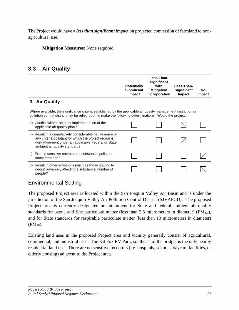
3. Air Quality
Where available, the significance criteria established by the applicable air quality management district or air pollution control district may be relied upon to make the following determinations. Would the project:
a) Conflict with or obstruct implementation of the applicable air quality plan?
b) Result in a cumulatively considerable net increase of any criteria pollutant for which the project region is non-attainment under an applicable Federal or State ambient air quality standard?
c) Expose sensitive receptors to substantial pollutant concentrations?
d) Result in other emissions (such as those leading to odors) adversely affecting a substantial number of people?
Environmental Setting
The proposed Project area is located within the San Joaquin Valley Air Basin and is under the jurisdiction of the San Joaquin Valley Air Pollution Control District (SJVAPCD). The proposed Project area is currently designated nonattainment for State and federal ambient air quality standards for ozone and fine particulate matter (less than 2.5 micrometers in diameter) (PM2.5), and for State standards for respirable particulate matter (less than 10 micrometers in diameter) (PM10).
Existing land uses in the proposed Project area and vicinity generally consist of agricultural, commercial, and industrial uses. The Kit Fox RV Park, southeast of the bridge, is the only nearby residential land use. There are no sensitive receptors (i.e. hospitals, schools, daycare facilities, or elderly housing) adjacent to the Project area.

Rogers Road Bridge Project Initial Study/Mitigated Negative Declaration 28
Impacts and Mitigation Measures
a and b. Would the project conflict with or obstruct implementation of the applicable air quality plan; or result in a cumulatively considerable net increase of any criteria pollutant for which the project region is non-attainment under an applicable Federal or State ambient air quality standard?
Air pollutant emissions associated with the proposed Project would occur over the short term from construction. No increase in long-term emissions is anticipated since the project would not increase roadway capacity. Therefore, no new long-term regional emissions would result from implementation of the proposed project.
Proposed projects that generate emissions in excess of the SJVAPCD’s recommended significance thresholds (SJVAPCD 2015) would be considered to potentially conflict with or obstruct implementation of the applicable air quality plan, result or contribute substantially to an existing or projected air quality violation, including increases in emissions for which the region is designated non-attainment, and/or result in a cumulatively considerable net increase of any criteria pollutant for which the project region is non-attainment under an applicable federal or State ambient air quality standard (including releasing emissions that exceed quantitative thresholds for ozone precursors). When establishing their CEQA Thresholds of Significance, SJVAQCD identified air quality thresholds of significance for criteria pollutants (Table 2).
Table 2. Air Quality Thresholds of Significance – Criteria Pollutants
Pollutant/Precursor
Construction Emissions
Operational Emissions
Permitted Equipment and Activities
Non-Permitted Equipment and Activities
Emissions (tpy) Emissions (tpy) Emissions (tpy)
CO 100 100 100
NOx 10 10 10
ROG 10 10 10
SOx 27 27 27
PM10 15 15 15
PM2.5 15 15 15
CO = Carbon monoxide; NOx = oxides of nitrogen; ROG = reactive organic gases; SOx = oxides of sulfide; PM10 = particulate matter less than 10 microns; PM2.5 = particulate matter less than 2.5 microns. tpy = tons per year
Source: SJVAPCD 2015

Rogers Road Bridge Project Initial Study/Mitigated Negative Declaration 29
Implementation of the proposed Project would not result in long-term increases of mobile-source emissions. Replacing the bridge would not result in significant long-term increases in vehicle trips in the area. Therefore, the Project would not change operational emission levels.
Construction activities would result in short-term increases in emissions from the use of heavy machinery, soil disturbance, materials used in construction and construction traffic. Construction activities are expected to take 8-10 months. Emissions would consist of fugitive dust, mainly from ground-disturbance, as well as reactive organic compounds and nitrogen oxides emissions from equipment operations and vehicle use. Emissions would be short-term and are expected to remain localized and dissipate within the immediate vicinity. Additionally, these emissions would be minimized through the implementation of fugitive dust emission control measures as required through the proposed Project’s conformity to Caltrans Standard Specification Sections 14-9.02 “Air Pollution Control” and 14-9.03 “Dust Control,” as well as the SJVAPCD Regulation VIII and Rule 8021 for Construction, Demolition, Excavation, Extraction, and Other Earthmoving Activities (SJVAPCD 2004). The Project will have a less than significant impact on Air Quality.
Mitigation Measures: None required.
c. Would the project expose sensitive receptors to substantial pollutant concentrations?
There are no sensitive receptors located in the Project area vicinity. Implementation of the proposed Project would not result in the long-term operation of any stationary emission sources and therefore would not result in long-term increases in exposure of sensitive receptors to localized pollutant concentrations. Construction activities may result in temporary increases of construction-generated emissions, which are short-term, lasting only as long as construction activities occur. These emissions would be temporary and limited to the immediate area surrounding the construction site. Therefore, the proposed Project would have no impact on sensitive receptors.
Mitigation Measures: None required.
d. Would the project result in other emissions, such as those leading to odors adversely affecting a substantial number of people?
Minor sources of odors would be present during construction from diesel engines, which may be considered offensive to some individuals. However, because odors would be temporary and would disperse rapidly with distance from the source, construction-generated odors would not result in frequent objectionable odorous emissions. This impact is less than significant.
Mitigation Measures: None required.
Rogers Road Bridge Project Initial Study/Mitigated Negative Declaration 30
3.4 Biological Resources
Potentially Significant
Impact
Less-Than-Significant
with Mitigation
Incorporation
Less-Than-Significant
Impact No
Impact
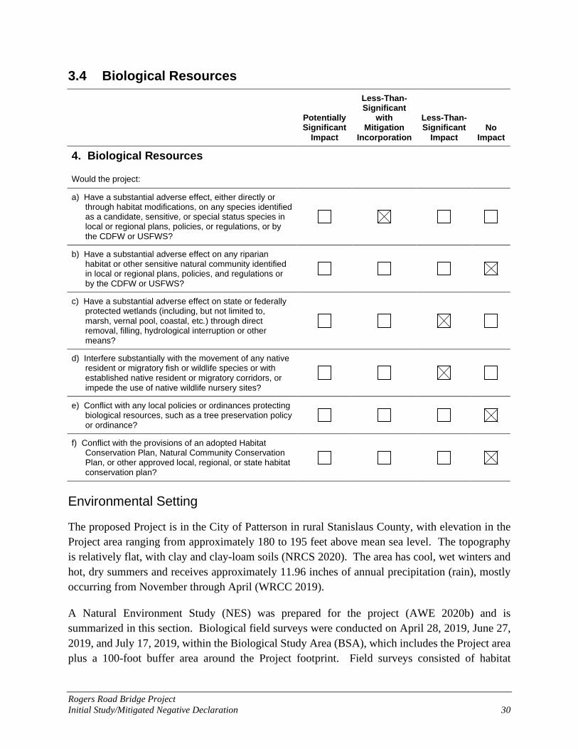
4. Biological Resources
Would the project:
a) Have a substantial adverse effect, either directly or through habitat modifications, on any species identified as a candidate, sensitive, or special status species in local or regional plans, policies, or regulations, or by the CDFW or USFWS?
b) Have a substantial adverse effect on any riparian habitat or other sensitive natural community identified in local or regional plans, policies, and regulations or by the CDFW or USFWS?
c) Have a substantial adverse effect on state or federally protected wetlands (including, but not limited to, marsh, vernal pool, coastal, etc.) through direct removal, filling, hydrological interruption or other means?
d) Interfere substantially with the movement of any native resident or migratory fish or wildlife species or with established native resident or migratory corridors, or impede the use of native wildlife nursery sites?
e) Conflict with any local policies or ordinances protecting biological resources, such as a tree preservation policy or ordinance?
f) Conflict with the provisions of an adopted Habitat Conservation Plan, Natural Community Conservation Plan, or other approved local, regional, or state habitat conservation plan?
Environmental Setting
The proposed Project is in the City of Patterson in rural Stanislaus County, with elevation in the Project area ranging from approximately 180 to 195 feet above mean sea level. The topography is relatively flat, with clay and clay-loam soils (NRCS 2020). The area has cool, wet winters and hot, dry summers and receives approximately 11.96 inches of annual precipitation (rain), mostly occurring from November through April (WRCC 2019).
A Natural Environment Study (NES) was prepared for the project (AWE 2020b) and is summarized in this section. Biological field surveys were conducted on April 28, 2019, June 27, 2019, and July 17, 2019, within the Biological Study Area (BSA), which includes the Project area plus a 100-foot buffer area around the Project footprint. Field surveys consisted of habitat

Rogers Road Bridge Project Initial Study/Mitigated Negative Declaration 31
mapping, wildlife and botanical surveys, and wetland delineation fieldwork to determine potential waters of the U.S. and waters of the State.
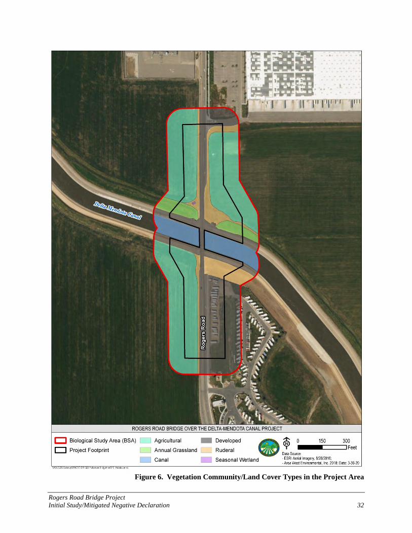
The BSA supports six generalized vegetation community/land cover types, consisting of four upland communities (developed, ruderal, annual grassland, and agricultural) and two aquatic communities (canal and seasonal wetland) (Figure 6 and Table 3).
Table 3. Vegetation Community/Land Cover Type within the Project Area Vegetation Community/
Land Cover Type Acres within the
Biological Study Area Acres within the Project
Footprint Developed 6.146 3.482
Ruderal 1.871 1.424
Annual Grassland 0.783 0.462
Agricultural 8.564 3.586
Canal 1.563 0
Seasonal Wetland 0.006 0.006
Total 18.932 8.959
Impacts and Mitigation Measures
a. Will the project have a substantial adverse effect, either directly or through habitat modifications, on any species identified as a candidate, sensitive, or special status species in local or regional plans, policies, or regulations, or by the CDFW or USFWS?
No special-status plant species were observed during protocol-level botanical surveys conducted during the appropriate blooming period for special-status plant species with potential to occur in the Project area. Therefore, the proposed Project would not affect any special-status plant species.
The following special-status wildlife have potential to occur within the Project area:
San Joaquin coachwhip (Masticophis flagellum ruddocki) (Species of Special Concern [SSC])
Burrowing owl (Athene cunicularia) (SSC)
Loggerhead shrike (Lanius ludovicianus) (SSC)
American badger (Taxidea taxus) (SSC)
San Joaquin kit fox (Vulpes macrotis mutica) (Federally Endangered [FE]/State Threatened [ST])
Habitat for migratory birds and nesting raptors is also present. A discussion of potential impacts on habitats and special-status species is provided below.
Rogers Road Bridge Project Initial Study/Mitigated Negative Declaration 32
Figure 6. Vegetation Community/Land Cover Types in the Project Area

Rogers Road Bridge Project Initial Study/Mitigated Negative Declaration 33
Potential Impacts to Special-status Reptiles
San Joaquin coachwhip (SCC) could use open fields and ruderal roadsides for dispersal, foraging, and basking habitat, while mammalian burrows along the levees could provide suitable refuge. Impacts to potential habitat for San Joaquin coachwhip could result from grading, vegetation clearing activities, movement of construction equipment and crews, and due to additional impervious surface. However, over the long term, the site would continue to function for San Joaquin coachwhip as it does currently, and the overall habitat conditions would not change. Additionally, impacts to San Joaquin coachwhip individuals could occur if the species is present during construction activities. Impacts to habitat and individuals would be avoided through implementation of Mitigation Measures BIO-1, BIO-3, BIO-6, and BIO-7. All biological resources mitigation measures are described at the end of this impact discussion.
Potential Impacts to Special-status Mammals
American badger (SCC) and San Joaquin kit fox (FE/ST) could potentially occur in the Project area. American badger could occur in annual grassland, agricultural, or ruderal habitats with friable soil in the BSA. California ground squirrel burrow complexes, primarily in the annual grassland strip along the northern slope of the levee, may provide habitat for badgers.
Although no evidence of use was observed during surveys, San Joaquin kit fox could den and/or forage in the annual grassland strips on the north side of the Delta-Mendota Canal that have California ground squirrel burrows. Many of the observed burrows are 4 inches or greater, which could be suitable for kit fox den use, but no canid scat was observed at burrow entrances (just ground squirrel scat) during a survey conducted in June 2019. The habitat at the project site occurs in narrow strips and is discontinuous with larger tracts of annual grasslands west of the California Aqueduct and I-5. San Joaquin kit fox could disperse along maintenance roads on either side of the Delta-Mendota Canal. Based on the number of burrows present within the Project area, and their isolation from other annual grasslands, it is unlikely that there is a sufficient prey base present within the Project area to support San Joaquin kit fox. Nevertheless, San Joaquin kit fox may be present within the Project area while migrating between the areas with abundant prey outside the Project area. The closest record for the San Joaquin kit fox is 0.4 miles southwest of the Project area (CDFW 2020). The project is located outside of critical habitat for San Joaquin kit fox.
Construction of the new bridge, widening the existing roadway and construction of associated facilities (maintenance road access, sidewalks, shoulders, and detention basins or bioretention swales) would result in the permanent removal of approximately 0.133 acre of annual grassland and 0.731 acre of ruderal habitat. Construction activities would also result in the removal of small mammal burrows, reducing the availability of potential den sites for San Joaquin kit fox and potential badger habitat. During construction, San Joaquin kit fox and American badger could be exposed to increased human activity, if present.

Rogers Road Bridge Project Initial Study/Mitigated Negative Declaration 34
Although the Project would result in the permanent removal of a small amount of potential habitat in ruderal and annual grassland areas, over the long term, the site would continue to function for San Joaquin kit fox and American badger as it currently functions and may be improved. For canal maintenance and inspections, current design guidance from SLDMWA requires a minimum 3-foot-square window (measured from the edge of the canal liner) in front of each abutment. The higher vertical alignment of the proposed bridge would provide increased clearance between the bridge abutments and edge of the canal, improving conditions for kit fox and other species using the Delta-Mendota Canal for north-south dispersing. A Biological Assessment submitted to USFWS evaluating potential Project impacts to kit fox determined that the Project may affect but is not likely to adversely affect San Joaquin kit fox; the USFWS concurred with this finding on February 17, 2021 (Sloan 2021). Potential impacts to mammals would be avoided by implementation of Mitigation Measures BIO-1, BIO-3, BIO-6, and BIO-10.
Potential Impacts to Special-status and Migratory Birds
Two species designated as SSC by the California Department of Fish and Wildlife (CDFW) could potentially occur in the Project area—loggerhead shrike and burrowing owl. No loggerhead shrikes or evidence of loggerhead shrike use (i.e. feathers or impaled prey) were observed during surveys conducted in April, June, or July 2019. However, a loggerhead shrike nest was observed adjacent to the survey area in 2002, in tumbleweeds piled against the fence on the western side of the Delta-Mendota Canal (CDFW 2020). Although the Project area does not provide ideal nesting habitat, it can be assumed that loggerhead shrikes could nest and forage within the Project area in any given year.
Burrowing owl could potentially occur in the Project area, though overall the Project area has a low potential to support burrowing owls because of the tall grass (up to 3 feet high), which decreases visibility and foraging opportunities for burrowing owl.
Additionally, migratory birds or raptors could potentially nest in the bridge structure or on the ground within or adjacent to the Project Area.
Grading, vegetation clearing activities, and movement of construction equipment and crews could result in temporary impacts to potential burrowing owl foraging habitat and potential nesting or foraging habitat for loggerhead shrike and migratory birds and raptors. However, the Project would not change the overall habitat conditions and over the long term, the site would continue to function as it does currently for burrowing owl, loggerhead shrike, and other migratory birds and raptors. Direct impacts to individual burrowing owls, loggerhead shrikes, or migratory birds and raptors could occur if individuals are present during construction activities.
Potential impacts to burrowing owls, loggerhead shrikes, and migratory birds and raptors, and their habitat, would be avoided through Mitigation Measures BIO-1, BIO-3, and BIO-6, BIO-8, and BIO-11 described at the end of this impact discussion.
Rogers Road Bridge Project Initial Study/Mitigated Negative Declaration 35
Impacts to special-status wildlife species would be less than significant with implementation of mitigation measures.
Mitigation Measures:
Mitigation Measure BIO-1: Conduct Worker Environmental Awareness Training Before any work occurs in the Project footprint, including equipment staging, all construction personnel shall participate in an environmental awareness training regarding special-status species and sensitive habitats present in the Project footprint. If new construction personnel are added to the Project, they must receive the mandatory training before starting work. The training shall be provided to all personnel and will discuss sensitive resources (i.e., waters of the U.S. and State), special-status species and their habitat to be avoided during Project construction, and list applicable permit conditions identified by state and federal agencies to protect these resources.
Mitigation Measure BIO-2: Install Temporary Fencing Around Seasonal Wetland The City shall ensure that temporary environmentally sensitive area fencing (brightly colored construction fencing, sediment fencing, or comparable) is installed between the work area and the seasonal wetland before any ground-disturbing activity occurs within the Project footprint. Construction personnel and construction activity shall remain within the defined project boundary and avoid areas identified as environmentally sensitive by the fencing. No earth disturbing activity shall be allowed until the fencing is in place. The fencing shall be checked regularly and maintained until all construction is complete.
Mitigation Measure BIO-3: Restore Temporarily Disturbed Areas All exposed soil resulting from project activities shall be stabilized immediately after final grading is completed in any given area. Soil stabilization may include, but is not limited to, seeding with a native grass seed mix, placement of temporary or permanent erosion control materials, and placement of rock. These areas will be properly protected from washout and erosion using appropriate erosion control devices. Potential erosion control devices or methods include coir netting, fiber rolls and hydroseeding.
Mitigation Measure BIO-4: Implement Water Quality Best Management Practices (BMPs) Before any ground-disturbing activities, the contractor (with City approval) shall prepare and implement a Stormwater Pollution Prevention Plan (SWPPP) (as required under the State Water Resources Control Board’s (SWRCB) Construction General Permit Order 2009-0009-DWQ [and as amended by most current order(s)] and by the City’s Municipal Separate Storm Sewer System (MS4) Phase II permit for water quality treatment and/or hydromodification), that includes erosion control measures and construction waste containment measures to ensure that waters of the state are protected during and after Project construction. The SWPPP shall include site design to minimize storm water runoff into the Delta-Mendota Canal and the seasonal wetland.
Rogers Road Bridge Project Initial Study/Mitigated Negative Declaration 36
The SWPPP shall be prepared with the following objectives: (a) to identify pollutant sources, including sources of sediment, that may affect the quality of stormwater discharges from the construction of the proposed Project; (b) to identify BMPs to reduce or eliminate pollutants in stormwater discharges and authorized non-stormwater discharges from the Project during construction; (c) to outline and provide guidance for BMP monitoring; (d) to identify proposed project discharge points and receiving waters; to address post-construction BMP implementation and monitoring; and (f) to address sedimentation, siltation, and turbidity.
The SWPPP will require BMPs including, but are not limited to:
Install sediment fencing, fiber rolls, or other equivalent erosion and sediment control measures between the designated work area and the Delta-Mendota Canal, as necessary, to ensure that construction debris and sediment do not inadvertently leave the construction footprint.
Cover or otherwise stabilize all exposed soil 48 hours prior to potential precipitation events of greater than 0.5 inch.
To avoid impacts to special-status amphibians and reptiles, no plastic monofilament netting will be used in erosion control materials.
No refueling, servicing, or maintenance of mobile equipment shall take place within 100 feet of aquatic habitat.
All machinery used during construction of the Project shall be properly maintained and cleaned to prevent spills and leaks that could contaminate soil or water.
Spill containment kits will be maintained onsite at all times during construction operations and/or staging or fueling of equipment. Any spills or leaks from construction equipment (i.e., fuel, oil, hydraulic fluid, and grease) shall be cleaned up in accordance with applicable local, state, and/or federal regulations.
Concrete waste and water from curing operations will be collected in washouts and will be disposed of and not allowed into water courses.
Mitigation Measure BIO-5: Avoid Spread of Invasive Species The following mitigation measures shall be implemented, as appropriate, to avoid the spreading of invasive plant species throughout the Project area during construction activities:
All hay, straw, hay bales, straw bales, seed, mulch or other material used for erosion control or landscaping on the Project site shall be certified weed free.
All equipment brought to the Project site for construction shall be thoroughly cleaned of all dirt and vegetation prior to entering the site, in order to prevent importing noxious weeds.

Rogers Road Bridge Project Initial Study/Mitigated Negative Declaration 37
All material brought to the site, including rock, gravel, road base, sand, and topsoil, shall be free of noxious weed seeds and propagules.
Mitigation Measure BIO-6: General Construction Measures to Protect Wildlife The following general construction measures shall be implemented in order to avoid impacts to biological resources during construction of the proposed Project:
To the extent possible, construction personnel shall minimize the work area footprint and the duration at a work area site.
Construction personnel shall use existing paved and unpaved roads to access the work area where present. Vehicles and equipment shall be parked on pavement, existing roads, and previously disturbed areas to the maximum extent feasible.
Trash dumping, littering, open fires (such as barbecues), hunting, and pets shall be prohibited in work areas.
To avoid entrapment of wildlife, all excavated steep-walled holes or trenches more than 4 inches deep will be provided with one or more escape ramps constructed of earth fill or wooden planks at the end of each workday. If escape ramps cannot be provided, then holes or trenches will be covered with plywood or similar materials. Providing escape ramps or covering open trenches will prevent injury or mortality of wildlife resulting from falling into trenches and becoming trapped. The trenches will be thoroughly inspected for the presence of special-status species at the beginning of each workday. Any species observed shall be allowed to voluntarily move outside of the work area on its own.
If any special-status species are observed in the Project Area during construction, construction will cease until the species is allowed to move out of harm’s way on their own accord.
If any special-status species is observed within the project area, cannot move out of harm’s way on their own accord, field crews shall contact the City of Patterson Construction Manager, who will report the sighting to the appropriate agency (USFWS and/or CDFW), and have a qualified biologist come onsite to assess the situation. The biologist will have authority to stop activities until appropriate corrective measures have been completed or it is determined that the individual will not be harmed. Capture and relocation of trapped or injured species can only be attempted by qualified biologists in coordination with the appropriate regulatory agency.
Mitigation Measure BIO-7: Preconstruction Survey for Special-status Reptiles Within 48-hours prior to the start of construction activities, the Project footprint will be surveyed for special-status reptiles, including San Joaquin coachwhip, by a qualified biologist. Surveys will be repeated if a lapse in construction activity of two weeks or greater has occurred. If a snake or other reptile is encountered during construction, activities shall cease until the animal moves out of harms’ way on their own accord. If necessary, a qualified biologist will relocate San Joaquin
Rogers Road Bridge Project Initial Study/Mitigated Negative Declaration 38
coachwhip in coordination with CDFW. If possible, project construction will occur during the active period for the coachwhip (March through October). Direct mortality of snakes is not anticipated because snakes are expected to actively move and avoid danger.
Mitigation Measure BIO-8: Burrowing Owl Protection The following measures shall be implemented in order to avoid impacts to burrowing owl during construction of the proposed Project.
A biologist shall conduct a preconstruction survey for burrowing owls within potential burrowing owl habitat in the Project footprint and a 500-foot buffer, no more than 14 days prior to start of Project construction activities. The preconstruction survey shall follow the methods described in Appendix D of the CDFW Staff Report on Burrowing Owl Mitigation (CDFW 2012).
If the biologist finds an active burrowing owl burrow, the biologist shall establish a buffer around the site. The buffer location shall be based on the CDFW Staff Report on Burrowing Owl Mitigation (2012) or the distance at which the biologist, in consultation with CDFW, determines that burrowing owls would not be harassed by the proposed Project.
If the survey finds an active burrowing owl nest in an area that cannot be avoided due to spatial restrictions, burrowing owls may be passively relocated in accordance with the CDFW Staff Report on Burrowing Owl Mitigation (2012). This requires that passive relocation occur following approval from the agencies, outside of the nesting season, and after an agency-approved biologist determined that owls have not begun laying eggs or there is not young of the year present. Per CDFW 2012, passive relocation would include the installation of one-way doors within the burrow to let owls escape, but not allow them to re-enter the burrow. Once the owls have been excluded from the burrow, it shall be collapsed by hand by an agency-approved biologist. If passive relocation is necessary, artificial or natural burrows should be in close proximity (100 meters) from the eviction site. If owls reappear on site, field crews shall notify the City Construction Manager and Project Biologist.
If passive relocation is necessary, City of Patterson will mitigate for impacts to burrowing owl habitat in consultation with CDFW and such that the habitat acreage, number of burrows, and burrowing owls impacted are replaced based on the information provided in Appendix A of the CDFW Staff Report on Burrowing Owl Mitigation (2012).
Mitigation Measure BIO-9: Conduct a Preconstruction Nesting Migratory Bird and Raptor Survey If construction ground disturbance or vegetation removal will occur during the breeding season for migratory birds and raptors (generally February through August), the City shall retain a qualified biologist to conduct a preconstruction nesting bird and raptor survey prior to (within one week of) the start of construction activities (including equipment mobilization and materials

Rogers Road Bridge Project Initial Study/Mitigated Negative Declaration 39
storage). The preconstruction nesting bird and raptor surveys shall be conducted between February 1 and August 31 within the designated Project footprint. Surveys for raptor nests will also extend 1,250 feet from the Project footprint, where access is feasible, to ensure that nesting raptors are not affected by construction disturbances. Where property access has not been granted or access is limited by topography or site conditions, the surveying biologist shall use binoculars to scan any suitable nesting substrate for potential raptor nests from accessible roads.
If an active bird or raptor nest is identified within the construction work area or an active raptor nest is identified within 1,250 feet from the construction work area, a no-disturbance buffer shall be established around the nest to avoid disturbance of the nesting birds or raptors until a qualified biologist determines that the young have fledged and are foraging on their own. The extent of these buffers shall be determined by the biologist and shall depend on the species identified, level of noise or construction disturbance, line-of-sight between the nest and the disturbance, ambient levels of noise and other disturbances, and other topographic or artificial barriers. In addition to the establishment of buffers, other avoidance measures may include monitoring of the nest during construction and restricting the type of work that can be conducted near the nest site. If no active nests are found during the preconstruction surveys, then no additional mitigation is required.
Mitigation Measure BIO-10: Measures to Protect San Joaquin Kit Fox The following measures are included in the USFWS’s “Standard Recommendations for the Protection of the San Joaquin Kit Fox Prior to or During Ground Disturbance” dated June 1999 (USFWS 1999). At a minimum, the following measures will be taken to reduce adverse effects to San Joaquin kit fox and their habitat:
Project-related vehicles should observe a 20-mph speed limit in the Project area, except on city and county roads and State and Federal highways; this is particularly important at night when San Joaquin kit fox are most active. Off-road traffic outside of the Project area should be prohibited.
To prevent inadvertent entrapment of San Joaquin kit fox or other animals during the construction phase of a project, all excavated, steep-walled holes or trenches more than 2 feet deep should be covered at the close of each working day by plywood or similar materials, or provided with one or more escape ramps constructed of earth fill or wooden planks. Before such holes or trenches are filled, they should be thoroughly inspected for trapped animals.
San Joaquin kit fox are attracted to den-like structures such as pipes and may enter stored pipe becoming trapped or injured. All construction pipes, culverts, or similar structures with a diameter of 4 in or greater that are stored at a construction site for one or more overnight period should be thoroughly inspected for San Joaquin kit fox before the pipe is subsequently buried, capped, or otherwise used or moved in any way. If a San Joaquin kit fox is discovered inside a pipe, that section of pipe should not be moved until the USFWS

Rogers Road Bridge Project Initial Study/Mitigated Negative Declaration 40
and CDFW have been consulted. Caltrans, as the federal lead agency, will notify the USFWS. The City will be responsible for notifying CDFW.
All food-related trash items such as wrappers, cans, bottles, and food scraps should be disposed of in closed containers and removed daily from the Project area.
No firearms shall be allowed in the Project area.
To prevent harassment, mortality of San Joaquin kit fox or destruction of dens by dogs or cats, no pets should be permitted in the Project area.
Use of rodenticides and herbicides in project areas should be restricted. This is necessary to prevent primary or secondary poisoning of San Joaquin kit fox and the depletion of prey populations on which they depend. All uses of such compounds should observe label and other restrictions mandated by the U.S. Environmental Protection Agency, California Department of Food and Agriculture, and other State and Federal legislation, as well as additional project-related restrictions deemed necessary by the USFWS. If rodent control must be conducted, zinc phosphide should be used because of proven lower risk to San Joaquin kit fox.
A representative shall be appointed by the Project proponent who will be the contact source for any employee or contractor who might inadvertently kill or injure a San Joaquin kit fox or who finds a dead, injured, or entrapped individual. The representative will be identified during the employee education program. The representative's name and telephone number shall be provided to the USFWS and CDFW.
An employee education program shall be conducted for San Joaquin kit fox. The program shall consist of a brief presentation by persons knowledgeable in kit fox biology and legislative protection to explain endangered species concerns to contractors, their employees, and agency personnel involved in the project. The program should include the following: a description of the San Joaquin kit fox and its habitat needs; an explanation of the status of the species and its protection under the FESA and California Endangered Species Act; and a list of measures being taken to reduce impacts to the species during project construction and implementation. A fact sheet conveying this information should be prepared for distribution to the abovementioned people and anyone else who may enter the Project area.
Upon completion of the Project, all areas subject to temporary ground disturbances, including storage and staging areas, temporary roads, etc., should be recontoured (if necessary), and revegetated to promote restoration of the area to pre-project conditions. An area subject to "temporary" disturbance means any area that is disturbed during the project, but that after project completion will not be subject to further disturbance and has the potential to be revegetated.

Rogers Road Bridge Project Initial Study/Mitigated Negative Declaration 41
In the event that a San Joaquin kit fox or its sign is observed in the Project area, or it is otherwise determined that San Joaquin kit fox may be affected by the proposed Project during work, Caltrans must be notified immediately to determine whether additional consultation is necessary. If necessary, Caltrans will contact the Sacramento Field Office of the USFWS and the local CDFW office.
Mitigation Measure BIO-11: Nesting Bird Exclusion If construction will occur during the nesting season (February 1 to September 30), exclusionary devices will be installed around the undersides of the bridge before February 1 of the construction year to prevent new nests from being formed, and/or prevent the reoccupation of existing nests. The City or their contractor would do the following:
Remove all existing unoccupied nests on the bridge during the non-nesting season (October 1 - January 31).
Keep the bridge free of nests, using exclusionary devices or other approved methods, until completion of construction activities.
Inspect the bridge for nesting activity a minimum of three days per week; no two days of inspection would be consecutive. A weekly log would be submitted to the Project biologist. The contractor would continue inspections until bridge construction activities have been completed. If an exclusion device were found to be ineffective or defective, the contractor would complete repairs to the device within 24 hours. If birds were found trapped in an exclusion device, the contractor would immediately remove the birds in accordance with USFWS and CDFW guidelines.
Submit for approval working drawings or written proposals of any exclusion devices, procedures, or methods to the Project biologist before installing them. The method of installing exclusion devices would not damage any features of the bridge structures. Approval by the Project biologist of the working drawings and inspection performed by the Project biologist would in no way relieve the contractor of full responsibility for deterring nesting.
b. Would the project have a substantial adverse effect on any riparian habitat or other sensitive natural community identified in local or regional plans, policies, and regulations or by the CDFW or USFWS?
The Project area does not contain any riparian habitat or other sensitive natural community identified in local or regional plans, policies, and regulations or by CDFW or USFWS. There would be no impact.
Mitigation Measures: None required.
Rogers Road Bridge Project Initial Study/Mitigated Negative Declaration 42
c. Would the project have a substantial adverse effect on federally-protected wetlands as defined by Section 404 of the federal CWA (including, but not limited to, marsh, vernal pool, coastal, etc.) through direct removal, filling, hydrological interruption or other means?
The aquatic resources delineation for the Project identified two aquatic features within the BSA—a seasonal wetland and the Delta-Mendota Canal. The seasonal wetland habitat exhibits wetland indicators for vegetation, soils, and hydrology but does not qualify as a water of the U.S. because it is a non-adjacent wetland. The Delta-Mendota Canal does not qualify as Waters of the U.S. under the new federal Clean Water Act (CWA) 2020 Navigable Waters Protection Rule. Both these resources qualify as Waters of the State.
Both of the aquatic features would be avoided and protected during the Project. Mitigation Measure BIO-2 requires that temporary fencing is installed around the seasonal wetland to ensure it is protected during construction. All Project work would occur outside of the canal channel and no work would occur within the canal. Implementation of water quality measures described under Mitigation Measure BIO-4 would prevent potential Project impacts to water quality. The Project would have no temporary or permanent impacts to the seasonal wetland or canal. Impacts would be less than significant.
Mitigation Measures: Although not required, the following measures, described above, would further reduce this less-than-significant impact.
Mitigation Measure BIO-2: Install Temporary Fencing Around Seasonal Wetland Mitigation Measure BIO-4: Implement Water Quality Best Management Practices (BMPs) d. Would the project interfere substantially with the movement of any native resident or migratory fish or wildlife species or with established native resident or migratory corridors, or impede the use of native wildlife nursery sites?
As described under Question a, San Joaquin kit fox and other wildlife species may use the Delta-Mendota Canal for north-south dispersing. During Project construction, due to temporary disturbance from construction noise and human presence, wildlife would be deterred from moving or dispersing through the Project area. Wildlife could continue to migrate through existing habitat adjacent to the Project area. For canal maintenance and inspections, current design guidance from SLDMWA requires a minimum 3-foot-square window (measured from the edge of the canal liner) in front of each abutment. The higher vertical alignment of the proposed bridge would provide increased clearance between the bridge abutments and edge of the canal, improving conditions for kit fox and other species using the Delta-Mendota Canal for movement or migration. After completion of the Project, there would be no other substantial change to conditions for dispersing or migrating species. Therefore, impacts would be less than significant.
Mitigation Measures: None required.
Rogers Road Bridge Project Initial Study/Mitigated Negative Declaration 43
e. Would the Project conflict with any local policies or ordinances protecting biological resources, such as a tree preservation policy or ordinance?
The project would not conflict with local policies or ordinances protecting biological resources. There would be no impact.
Mitigation Measures: None required.
f. Would the project conflict with the provisions of an adopted Habitat Conservation Plan, Natural Community Conservation Plan, or other approved local, regional, or state habitat conservation plan?
There are no adopted Habitat Conservation Plans, Natural Community Conservations Plans or other approved local, regional, or state habitat conservation plans that overlap with the proposed Project area. Therefore, the proposed Project would have no impact.
Mitigation Measures: None required.
3.5 Cultural Resources
Potentially Significant
Impact
Less-Than-Significant
with Mitigation
Incorporation
Less-Than-Significant
Impact No
Impact
5. Cultural Resources
Would the project:
a) Cause a substantial adverse change in the significance of a historical resource pursuant to §15064.5?
b) Cause a substantial adverse change in the significance of an archaeological resource as defined in §15064.5?
c) Disturb any human remains, including those interred outside of formal cemeteries?
Environmental Setting
To identify the potential for cultural resources to be affected by the proposed Project, a cultural resources inventory was conducted for the Project area, consisting of a records search, background research, review of historic-era maps, written contact with Native American groups and related agencies, and onsite fieldwork (GEI Consultants, Inc. 2020a).
A cultural records search was requested and obtained from the Central California Information Center (CCIC) of the California Historical Resources Information System. The records search included the Area of Potential Effects (APE) and a 0.5-mile radius around the APE. The CCIC identified one recorded built historical resource located within the APE: The Delta-Mendota Canal.
Rogers Road Bridge Project Initial Study/Mitigated Negative Declaration 44
The CCIC records search identified no archaeological resources in the APE or the 0.5-mile study area.
An intensive pedestrian survey was conducted on February 19, 2020, to identify potential historic properties in the APE. No surface prehistoric or historic-era archaeological resources were located in the APE during the pedestrian survey (GEI Consultants, Inc. 2020b). Based on a review of the area’s landforms, topography, geology, soils, and hydrology, the APE has a very low sensitivity for buried archaeological resources (GEI Consultants, Inc. 2020b).
Rogers Road Bridge
The existing Rogers Road bridge (Bridge Number 38C-0214), constructed in 1949, is a reinforced concrete bridge that crosses the Delta Mendota Canal and travels in a north/south direction. The existing bridge is a 110-foot-long, reinforced concrete T-beam structure, consisting of three spans (35 feet, 40 feet, and 35 feet) supported on reinforced concrete pier walls and reinforced concrete diaphragm abutments. The bridge is 28-feet 8-inches wide and accommodates two 12-foot lanes without shoulders and two non-standard 2-foot 4-inches wide concrete curbs with non-standard steel railings. Metal guardrails flank the east and west lanes. The bridge was built in 1949 to cross the newly constructed Delta Mendota canal. It is one of several bridges built during that period when the canal was completed.
The Rogers Road Bridge (38C-0214) has previously been determined by Caltrans to be a Category 5 bridge, not eligible for listing on the California or National Register of Historic Places (Caltrans 2020b). The bridge is typical of reinforced concrete bridges constructed in the first half of the 20th century and is not an early, large, or otherwise distinctive example of this type of bridge (GEI Consultants, Inc. 2020c).
Pursuant to Section 15064.5(a)(2)-(3) of the CEQA, using criteria outlined in Section 5024.1 of the California Public Resources Code, the Rogers Road Bridge is not eligible for the California Register of Historical Resources. The bridge does not have important associations with significant historic events, patterns, or trends of development; is not associated with the lives of persons important to history; is not an important example of type, period, or method of construction; does not represent high artistic value; and is not a likely source of important information about historic construction materials or technologies. Therefore, the Rogers Road Bridge is not a historical resource under CEQA.
Delta Mendota Canal
The Delta Mendota Canal was completed as part of the Central Valley Project (CVP). The CVP, which began construction of critical facilities in 1937, greatly influenced California’s agricultural economy and was an important component to flood control in California. Critical elements of the CVP’s early projects included Shasta Dam (completed in 1945), which became the second largest
Rogers Road Bridge Project Initial Study/Mitigated Negative Declaration 45
concrete dam in the U.S.; the Friant Kern Canal (completed in 1951), which carries water from the San Joaquin River more than 150 miles south to Bakersfield; and the Delta-Mendota Canal (completed in 1952), which is approximately 117 miles long and serves as a major component of the CVP. The Delta-Mendota Canal functions along with the Tracy (C.W. Bill Jones) Pumping Plant in transferring water from the Sacramento River to irrigate thousands of acres of agricultural land in the San Joaquin Valley. The canal terminates at the Mendota Pool outside of Fresno. (GEI Consultants, Inc. 2020c)
The Delta-Mendota Canal was previously determined eligible for the National Register of Historic Places (NRHP) and is therefore also considered a historical resource for the purposes of CEQA. The Delta-Mendota Canal is eligible under NRHP Criterion A and C for its association with the CVP as well as the agricultural development of California. The canal also is listed as a contributing resource for a multiple property nomination prepared for the CVP and submitted by the U.S. Bureau of Reclamation. (GEI Consultants, Inc. 2020c)
Pursuant to Section 15064.5(a)(2)-(3) of the CEQA, using criteria outlined in Section 5024.1 of the California Public Resources Code, the Delta-Mendota Canal is eligible for the California Register of Historical Resources and is a historical resource under CEQA.
Impacts and Mitigation Measures
a. Would the project cause a substantial adverse change in the significance of a historical resource as defined in §15064.5?
The Delta Mendota Canal is eligible for the California Register of Historical Resources, and therefore meets the criteria as a CEQA historical resource. A Finding of No Adverse Effect was prepared for the Project (GEI Consultants, Inc. 2020d) and consultation with the State Historic Preservation Officer (SHPO) is ongoing. The proposed Project would reconstruct the Rogers Road Bridge that crosses the Delta Mendota Canal. The bridge replacement would not result in modification to the canal itself and would be constructed along the existing road alignment. During construction, the canal would require protection from potential distortion/distress arising from construction activities, as required by SLDMWA requirements and described in Chapter 2.
Based on the activities proposed, the Project would not cause an adverse change in the significance of the Delta Mendota Canal. The Project would not:
affect the function or design of the Delta Mendota Canal; cause the physical destruction, alteration or removal of the canal; impact the canal’s historic design or use; or introduce new elements into the canal’s setting that could diminish the historical
significance of the canal.
Rogers Road Bridge Project Initial Study/Mitigated Negative Declaration 46
The integrity and character-defining features of the canal would remain in place and the elements that make the Delta Mendota Canal an important historical resource would be unchanged. Therefore, the Project would have a less than significant impact on this historical resource.
Mitigation Measures: None required.
b. Would the project cause a substantial adverse change in the significance of an archaeological resource as defined in §15064.5?
No archaeological resources listed on or eligible for the California Register of Historical Resources, or that meet other criteria of significance under CEQA Section 15064.5, were identified within the proposed Project area. If previously unidentified cultural materials are unearthed during construction, the contractor will follow Caltrans’ policy that work be halted in that area until a qualified archaeologist can assess the significance of the find. Therefore, the Project would have a less than significant impact on archaeological resources.
Mitigation Measures: None required. The following standard measure, consistent with Caltrans standard policy for unanticipated cultural resource discoveries, is recommended.
Mitigation Measure CUL-1: Protect Discovered Cultural Subsurface Resources. If any evidence of prehistoric cultural resources (freshwater shells, beads, bone tool remnants or an assortment of bones, soil changes including subsurface ash lens or soil darker in color than surrounding soil, lithic materials such as flakes, tools or grinding rocks, etc.) or historical cultural resources (adobe foundations or walls, structures and remains with square nails, refuse deposits or bottle dumps, often associated with wells or old privies) are observed during ground disturbing activities, all work must immediately cease within 50 feet of the find, the City and Caltrans must be notified, and a qualified archaeologist must be consulted to assess the significance of the cultural materials. If the find is determined to be potentially significant, the archaeologist, in consultation with the City and—if the find is prehistoric or Native American in nature—appropriate Native American group(s), shall develop and implement a treatment plan with an emphasis toward preservation in place.
c. Would the project disturb any human remains, including those interred outside of formal cemeteries?
No human remains have been previously encountered in the vicinity of the proposed Project. However, this does not preclude the potential for discovering buried human remains during ground disturbance associated with construction of the proposed Project. Although unlikely, if human remains are discovered during proposed Project construction, California Health and Safety Code regulations shall be followed, as required by law. Potential impacts resulting from disturbance of human remains during Project construction are considered less than significant.
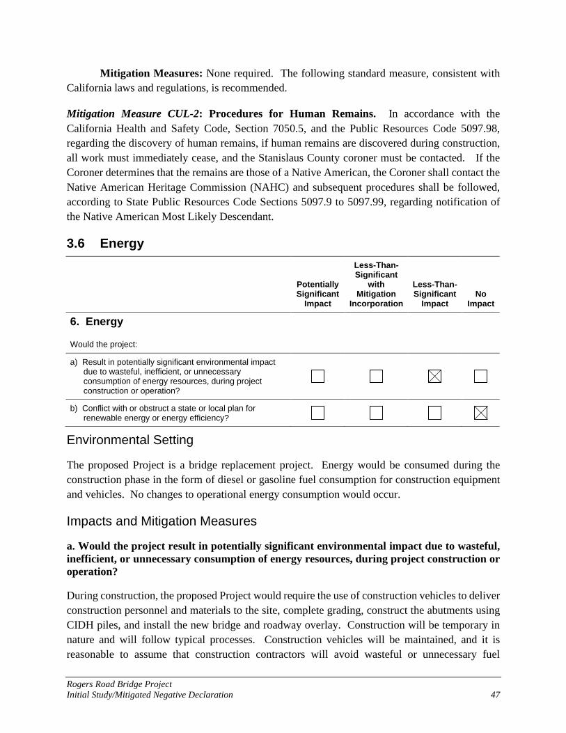
Rogers Road Bridge Project Initial Study/Mitigated Negative Declaration 47
Mitigation Measures: None required. The following standard measure, consistent with California laws and regulations, is recommended.
Mitigation Measure CUL-2: Procedures for Human Remains. In accordance with the California Health and Safety Code, Section 7050.5, and the Public Resources Code 5097.98, regarding the discovery of human remains, if human remains are discovered during construction, all work must immediately cease, and the Stanislaus County coroner must be contacted. If the Coroner determines that the remains are those of a Native American, the Coroner shall contact the Native American Heritage Commission (NAHC) and subsequent procedures shall be followed, according to State Public Resources Code Sections 5097.9 to 5097.99, regarding notification of the Native American Most Likely Descendant.
3.6 Energy
Potentially Significant
Impact
Less-Than-Significant
with Mitigation
Incorporation
Less-Than-Significant
Impact No
Impact
6. Energy
Would the project:
a) Result in potentially significant environmental impact due to wasteful, inefficient, or unnecessary consumption of energy resources, during project construction or operation?
b) Conflict with or obstruct a state or local plan for renewable energy or energy efficiency?
Environmental Setting
The proposed Project is a bridge replacement project. Energy would be consumed during the construction phase in the form of diesel or gasoline fuel consumption for construction equipment and vehicles. No changes to operational energy consumption would occur.
Impacts and Mitigation Measures
a. Would the project result in potentially significant environmental impact due to wasteful, inefficient, or unnecessary consumption of energy resources, during project construction or operation?
During construction, the proposed Project would require the use of construction vehicles to deliver construction personnel and materials to the site, complete grading, construct the abutments using CIDH piles, and install the new bridge and roadway overlay. Construction will be temporary in nature and will follow typical processes. Construction vehicles will be maintained, and it is reasonable to assume that construction contractors will avoid wasteful or unnecessary fuel

Rogers Road Bridge Project Initial Study/Mitigated Negative Declaration 48
consumption to reduce construction costs and wastes. Therefore, the proposed Project would not involve the wasteful, inefficient, or unnecessary consumption of energy resources during construction. This impact would be considered less than significant to construction conditions.
During project operation, the proposed Project would retain its existing use as a transportation facility and would not include changes to the roadway capacity at this time. Therefore, the proposed Project is not expected to cause any operational change in the number of vehicle miles traveled and would not lead to inefficient or unnecessary consumption of energy resources. There would be no impact to operational conditions.
Mitigation Measures: None required.
b. Would the project conflict with or obstruct a state or local plan for renewable energy or energy efficiency?
The proposed Project is a transportation project and does not include any energy-consuming features. Therefore, the proposed project would have no impact.
Mitigation Measures: None required.
3.7 Geology and Soils
Potentially Significant
Impact
Less-Than-Significant
with Mitigation
Incorporation
Less-Than-Significant
Impact No
Impact
7. Geology and Soils
Would the project:
a) Directly or indirectly cause potential substantial adverse effects, including the risk of loss, injury, or death involving:
i) Rupture of a known earthquake fault, as delineated in the most recent Alquist-Priolo Earthquake Fault Zoning Map issued by the State Geologist for the area or based on other substantial evidence of a known fault? Refer to Division of Mines & Geology Special Publication 42.
ii) Strong seismic ground shaking?
iii) Seismic-related ground failure, including liquefaction?
iv) Landslides?
b) Result in substantial soil erosion or the loss of topsoil?
c) Be located on a geologic unit or soil that is unstable, or that would become unstable as a result of the project,

Rogers Road Bridge Project Initial Study/Mitigated Negative Declaration 49
Potentially Significant
Impact
Less-Than-Significant
with Mitigation
Incorporation
Less-Than-Significant
Impact No
Impact and potentially result in on- or off-site landslide, lateral spreading, subsidence, liquefaction, or collapse?
d) Be located on expansive soils, as defined in Table 18-1-B of the Uniform Building Code (1994), creating substantial direct or indirect risks to life or property?
e) Have soils incapable of adequately supporting the use of septic tanks or alternate wastewater disposal systems where sewers are not available for the disposal of wastewater?
f) Directly or indirectly destroy a unique paleontological resource or site or unique geologic feature?
Environmental Setting
The proposed Project area is located in the City of Patterson, Stanislaus County, California, within the physiographic unit referred to as the Great Valley, and near the boundary of the Coast Ranges Province and Great Valley Province. The Great Valley is a trough in which sediments have been deposited almost continuously since the Jurassic (about 160 million years ago) (CDOC 2002). Geologic mapping indicates that the area is underlain by Quarternary alluvium fan deposits, which are Quaternary alluvial sediments deposited by streams that drain from the Coast Ranges (CDOC 1993). Two soil map units are present within the Project area (Table 4; [NRCS 2019a]).
Table 4. Soil Map Units within the Project Area Soil Map Unit Symbol and
Name Parent Material Soil Profile
Depth to Restrictive
Layer (inches)
Drainage Class
K factor
Capay clay, 0 to 1 percent slopes
Clayey alluvium derived from sedimentary rock
0 to 60 inches: clay Greater than 80 inches
Moderately well
drained 0.24
Stomar clay loam, 0 to 2 percent slopes
Alluvium from sedimentary rock
0 to 11 inches: clay loam 11 to 38 inches: clay 38 to 60 inches: clay loam
Greater than 80 inches
Well drained
0.32
Source: National Resources Conservation Service (NRCS) 2019
Erosion K factor indicates the susceptibility of a soil to sheet and rill erosion by water. Values of K range from 0.02 to 0.69. Low K values are approximately 0.02 to 0.24, moderate K values are approximately 0.25 to 0.45, and high K values typically exceed 0.45 (U.S. Department of Agriculture 2001). Other factors being equal, the higher the K factor value, the more susceptible the soil is to sheet and rill erosion by water (NRCS 2019). Overall, soils in the Project area have a low to moderate K factor erosion hazard rating.
Rogers Road Bridge Project Initial Study/Mitigated Negative Declaration 50
Several known faults exist within Stanislaus County, located in the western part of the County and in the Diablo Range west of I-5 (Stanislaus County 2015). The more significant faults that could influence the Project site include the Great Valley 07 (Orestimba) Fault (4.4 miles from the Project), Ortigalita Fault Zone (16.2 miles from the Project), and San Andreas Fault (45 miles from the Project) (WRECO 2020).
Impacts and Mitigation Measures
a, i-iv. Would the project expose people or structures to potential substantial adverse effects, including the risk of loss, injury, or death involving: rupture of a known earthquake fault; strong seismic ground shaking; seismic-related ground failure, including liquefaction; or landslides?
The Project area is not within an active fault zone, and the potential for secondary seismic related effects such as liquefaction, lateral spreading, surface fault rupture, settlement, and slope instability are all considered negligible at this Project site (WRECO 2020). The Project would not expose people or structures to additional risk associated with seismic activity or liquefaction. Replacement of the existing bridge has been designed using Caltrans’ seismic design criteria, and the bridge would improve bridge safety and seismic stability compared to existing conditions. The Project would have no impact.
Mitigation Measures: None required.
b. Would the project result in substantial soil erosion or the loss of topsoil?
Soils in the Project area have a low to moderate erosion potential (NRCS 2019). Construction of the proposed Project would involve minor site grading and earthmoving activities, which would expose soils at the site and could result in soil erosion. Soil erosion and topsoil loss would be limited by implementing standard construction practices and BMPs for erosion and sediment control, consistent with Caltrans Standard Specifications and through implementation of Mitigation Measure BIO-3 Restore Temporarily Disturbed Areas. Because erosion control and pollution prevention BMPs would be implemented, the proposed Project has limited potential to result in substantial soil erosion or loss of topsoil. This impact would be considered less than significant.
Mitigation Measures: None required.
c. Would the project be located on a geologic unit or soil that is unstable, or that would become unstable as a result of the project, and potentially result in on- or off-site landslide, lateral spreading, subsidence, liquefaction, or collapse?
The proposed Project area is not located within an active fault zone or active liquefaction zone. The Project is not located on a geologic unit or soil that is unstable or that would become unstable as a result of the proposed Project. The potential for liquefaction, lateral spreading, surface fault

Rogers Road Bridge Project Initial Study/Mitigated Negative Declaration 51
rupture, settlement, and slope instability are all considered negligible at this Project site (WRECO 2020). The proposed Project would have no impact.
Mitigation Measures: None required.
d. Would the project be located on expansive soils, as defined in Table 18-1-B of the Uniform Building Code (1994), creating substantial risks to life or property?
Soils in the proposed Project area are classified by the Natural Resources Conservation Service (NRCS) as clay or clay loam to a depth of 60 inches (NRCS 2020). The Project would improve bridge safety compared to existing conditions; it would not create substantial risks to life and property or construct new housing on expansive soils. The Project would not create a new substantial risk to life or property; it would have no impact.
Mitigation Measures: None required.
e. Would the proposed project have soils incapable of adequately supporting the use of septic tanks or alternate wastewater disposal systems where sewers are not available for the disposal of wastewater?
No septic tanks or alternative wastewater disposal systems are proposed as part of the Project. There would be no impact.
Mitigation Measures: None required.
f. Would the proposed project directly or indirectly destroy a unique paleontological resource or site or unique geologic feature?
Paleontological sensitivity of the site is tied to the underlying geologic unit. Fossils are typically found in sedimentary rocks, which are formed by the deposition of sediment on the earth’s surface. This site is underlain by Quarternary alluvium fan deposits, stream channel deposits and alluvial and fluvial fan deposits formed during the Holocene geologic period (CDOC 1991). The sediments within the Project area, except in areas of artificial fill, have a potential to contain paleontological resources. If previously unidentified paleontological resources are unearthed during construction, the contractor will follow Caltrans’ policy that work be halted in that area until a qualified specialist can assess the significance of the find. Therefore, the Project would have a less than significant impact on paleontological resources.
Mitigation Measures: None required. The following standard measure, consistent with Caltrans standard policy for unanticipated paleontological resource discoveries, is recommended.
Mitigation Measure GEO-1: Protect Discovered Paleontological Resources. If any evidence of paleontological resources is inadvertently unearthed during construction, all work will cease within 50-feet of the discovery, the City of Patterson will be notified, and a qualified paleontologist
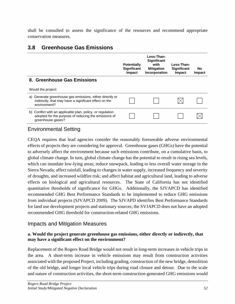
Rogers Road Bridge Project Initial Study/Mitigated Negative Declaration 52
shall be consulted to assess the significance of the resources and recommend appropriate conservation measures.
3.8 Greenhouse Gas Emissions
Potentially Significant
Impact
Less-Than-Significant
with Mitigation
Incorporation
Less-Than-Significant
Impact No
Impact
8. Greenhouse Gas Emissions
Would the project:
a) Generate greenhouse gas emissions, either directly or indirectly, that may have a significant effect on the environment?
b) Conflict with an applicable plan, policy, or regulation adopted for the purpose of reducing the emissions of greenhouse gases?
Environmental Setting
CEQA requires that lead agencies consider the reasonably foreseeable adverse environmental effects of projects they are considering for approval. Greenhouse gases (GHGs) have the potential to adversely affect the environment because such emissions contribute, on a cumulative basis, to global climate change. In turn, global climate change has the potential to result in rising sea levels, which can inundate low-lying areas; reduce snowpack, leading to less overall water storage in the Sierra Nevada; affect rainfall, leading to changes in water supply, increased frequency and severity of droughts, and increased wildfire risk; and affect habitat and agricultural land, leading to adverse effects on biological and agricultural resources. The State of California has not identified quantitative thresholds of significance for GHGs. Additionally, the SJVAPCD has identified recommended GHG Best Performance Standards to be implemented to reduce GHG emissions from individual projects (SJVAPCD 2009). The SJVAPD identifies Best Performance Standards for land use development projects and stationary sources; the SVJAPCD does not have an adopted recommended GHG threshold for construction-related GHG emissions.
Impacts and Mitigation Measures
a. Would the project generate greenhouse gas emissions, either directly or indirectly, that may have a significant effect on the environment?
Replacement of the Rogers Road Bridge would not result in long-term increases in vehicle trips in the area. A short-term increase in vehicle emissions may result from construction activities associated with the proposed Project, including grading, construction of the new bridge, demolition of the old bridge, and longer local vehicle trips during road closure and detour. Due to the scale and nature of construction activities, the short-term construction-generated GHG emissions would
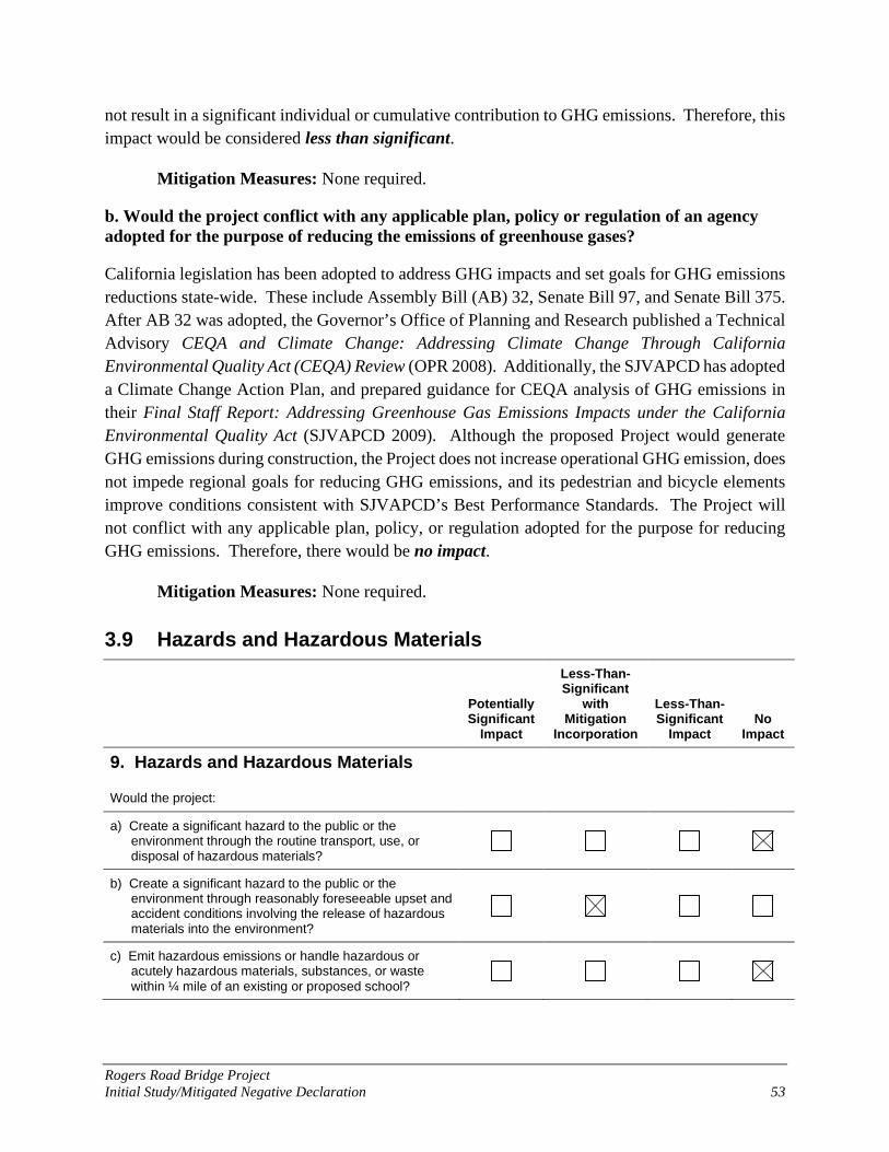
Rogers Road Bridge Project Initial Study/Mitigated Negative Declaration 53
not result in a significant individual or cumulative contribution to GHG emissions. Therefore, this impact would be considered less than significant.
Mitigation Measures: None required.
b. Would the project conflict with any applicable plan, policy or regulation of an agency adopted for the purpose of reducing the emissions of greenhouse gases?
California legislation has been adopted to address GHG impacts and set goals for GHG emissions reductions state-wide. These include Assembly Bill (AB) 32, Senate Bill 97, and Senate Bill 375. After AB 32 was adopted, the Governor’s Office of Planning and Research published a Technical Advisory CEQA and Climate Change: Addressing Climate Change Through California Environmental Quality Act (CEQA) Review (OPR 2008). Additionally, the SJVAPCD has adopted a Climate Change Action Plan, and prepared guidance for CEQA analysis of GHG emissions in their Final Staff Report: Addressing Greenhouse Gas Emissions Impacts under the California Environmental Quality Act (SJVAPCD 2009). Although the proposed Project would generate GHG emissions during construction, the Project does not increase operational GHG emission, does not impede regional goals for reducing GHG emissions, and its pedestrian and bicycle elements improve conditions consistent with SJVAPCD’s Best Performance Standards. The Project will not conflict with any applicable plan, policy, or regulation adopted for the purpose for reducing GHG emissions. Therefore, there would be no impact.
Mitigation Measures: None required.
3.9 Hazards and Hazardous Materials
Potentially Significant
Impact
Less-Than-Significant
with Mitigation
Incorporation
Less-Than-Significant
Impact No
Impact
9. Hazards and Hazardous Materials
Would the project:
a) Create a significant hazard to the public or the environment through the routine transport, use, or disposal of hazardous materials?
b) Create a significant hazard to the public or the environment through reasonably foreseeable upset and accident conditions involving the release of hazardous materials into the environment?
c) Emit hazardous emissions or handle hazardous or acutely hazardous materials, substances, or waste
within ¼ mile of an existing or proposed school?

Rogers Road Bridge Project Initial Study/Mitigated Negative Declaration 54
Potentially Significant
Impact
Less-Than-Significant
with Mitigation
Incorporation
Less-Than-Significant
Impact No
Impact
d) Be located on a site which is included on a list of hazardous materials sites compiled pursuant to Government Code §65962.5 and, as a result, would it create a significant hazard to the public or to the
environment?
e) For a project located within an airport land use plan or, where such a plan has not been adopted, within two miles of a public airport or a public use airport, would the project result in a safety hazard or excessive noise
for people residing or working in the project area?
f) Impair implementation of or physically interfere with an adopted emergency response plan or emergency evacuation plan?
g) Expose people or structures, either directly or indirectly, to a significant risk of loss, injury, or death involving
wildland fires?
Environmental Setting
The following information regarding the Project area and potential impacts related to hazardous materials is taken from the Phase I Initial Site Assessment (ISA) prepared by WRECO for the proposed Project (WRECO 2020).
A review of Environmental Data Resources (EDR) Database Record, California Department of Toxic Substances Control and State Water Quality Control Board databases found no active site records within 1,000 feet of the Project. Recognized environmental conditions (RECs) are present in the Project vicinity. A REC is the presence or likely presence of hazardous substances or petroleum substances in or on a property under conditions that indicate an existing release, a past release, or a material threat of a release of any hazardous substances or petroleum products into structures on the property or into the ground, groundwater, or surface water of the property.
The Project area has a long history of agricultural use, which may be a source of hazardous materials through application of pesticides or herbicides resulting in residual pesticides in shallow soils. The bridge and roadway may contain hazardous materials such as lead-based paint (LBP) and asbestos containing materials (ACM). Vehicle emissions through operational use can be a source of aerially deposited lead (ADL) from vehicle exhaust.
The ISA (WRECO 2020) identifies the following potential RECs within the Project vicinity: Potential LBP and ACM within the bridge materials; Potential lead-containing paint (LCP) from yellow traffic striping; Potential for ADL from vehicle emissions in shallow soil adjacent to the roadway around
the Project area;

Rogers Road Bridge Project Initial Study/Mitigated Negative Declaration 55
Potential organochlorine and organophosphorus pesticides, arsenic, lead and mercury (metals) from the surrounding agricultural areas;
Potential polychlorinated biphenyls (PCB) and heavy metals from powerlines and transformers on utility poles along the west side of the bridge and a power station northwest of the Project area; and
Potential contaminants including total petroleum hydrocarbons (TPH) from the RV park to the southwest.
Naturally occurring asbestos is not present in the Project area (WRECO 2020).
The nearest public school is Apricot Valley Elementary School, located on Henley Parkway, about 6 miles east of the Project area. The proposed Project is not located within 2 miles of a public or public use airport or in the vicinity or a private air strip. The nearest airport is the National Aeronautics and Space Administration (NASA) Crows Landing Airfield, located approximately 9 miles south of the Project.
Impacts and Mitigation Measures
a. Would the project create a significant hazard to the public or the environment through the routine transport, use, or disposal of hazardous materials?
The proposed Project is not expected to involve the routine transport, use, or disposal of hazardous materials; there is no reasonably foreseeable accident involving the release of hazardous materials. There would be no impact.
Mitigation Measures: None required.
b. Would the project create a significant hazard to the public or the environment through reasonably foreseeable upset and accident conditions involving the release of hazardous materials into the environment?
During construction, the Project has the potential to encounter hazardous substances (potential RECs) as described above. Due to the age of the bridge, there is potential for LBP and ACM within the bridge structure. If LBP or ACM are present, lead abatement or asbestos removal would be required prior to bridge demolition. Also, roadway improvements may require the removal of yellow traffic striping, which may contain LCP. Sampling, removal, and disposal would be consistent with Caltrans Standard Specifications and Standard Special Provisions.
To evaluate potential ADL from the historical use of leaded gasoline in the surface and near-surface soils within the Project footprint, soil sampling for total lead is recommended. If ADL is present, construction activities involving ground disturbance would require a Lead Compliance Plan consistent with Caltrans Standard Special Provisions.
To address the potential for organochlorine and organophosphorus pesticides, arsenic, lead and mercury (metals) from surrounding agricultural use, soil sampling for herbicides, pesticides, and
Rogers Road Bridge Project Initial Study/Mitigated Negative Declaration 56
heavy metals within the Project footprint is recommended. Sampling, removal, and disposal would be consistent with the California Department of Toxic Substances Control (DTSC) Interim Guidance for Sampling Agricultural Properties (Third Revision), dated August 7, 2008 (DTSC 2008).
To evaluate the potential for petroleum hydrocarbons generated from the RV park, the ISA recommends soil sampling within the Project footprint for TPH as gasoline (TPHg), TPH diesel (TPHd), and TPH motor oil (TPHmo) (WRECO 2020). Depending on sampling results, the Project will follow Caltrans Standard Specifications and Standard Special Provisions for sampling, removal, and disposal of petroleum-contaminated soils.
Since the Project has the potential to encounter hazardous substances during construction, this impact is considered less than significant with implementation of the following mitigation measures.
Mitigation Measures:
Mitigation Measure HAZ-1: Conduct Phase II Soil and Materials Sampling and Implement Contamination Removal Activities as Needed. Soil sampling for total lead, pesticides, heavy metals, and TPH shall be conducted in the Project footprint before construction begins. Materials sampling for ACM and LBP on the bridge shall be completed before demolition. A workplan to conduct a Phase II site assessment shall be submitted to City of Patterson for review and approval prior to field activities.
Analytical results from soil and materials samples obtained during Phase II screening will be compared to state and federal standards to evaluate reuse and/or disposal requirements for contaminated soils and materials. The Project will implement Caltrans Standard Specifications and Standard Special Provisions for sampling, removal, and disposal of contaminated soils and materials.
Mitigation Measure HAZ-2: Implement Lead Compliance Plan. If sampling determines elevated lead levels in soils or materials, the Contractor shall prepare and implement a project-specific Lead Compliance Plan (8 CCR 1532.1, the “Lead in Construction” standard) to reduce worker exposure to lead-impacted soil and lead-containing paint. The plan would include protocols for environmental and personnel monitoring, requirements for personal protective equipment, other health and safety protocols and procedures for the handling of lead-impacted sol, and requirements for disposal of lead-containing paint in traffic striping and on the existing bridge. The plan would be consistent with Caltrans Standard Special Provisions for removal of LBP and LCP from structures and traffic striping.
Rogers Road Bridge Project Initial Study/Mitigated Negative Declaration 57
Mitigation Measure HAZ-3: Implement Asbestos Compliance Plan. If sampling determines ACM on the bridge, the Contractor shall prepare and implement an Asbestos Compliance Plan consistent with Caltrans Standard Special Provisions.
c. Would the project emit hazardous emissions or handle hazardous or acutely hazardous materials, substances, or waste within ¼ mile of an existing or proposed school?
There are no schools located with ¼ mile of the proposed Project. Therefore, there would be no impact.
Mitigation Measures: None required.
d. Would the project be located on a site which is included on a list of hazardous materials sites compiled pursuant to Government Code §65962.5 and, as a result, would it create a significant hazard to the public or to the environment?
The proposed Project is not located on a site which is included on a list of hazardous materials sites. Therefore, there would be no impact.
Mitigation Measures: None required.
e. For a project located within an airport land use plan or, where such a plan has not been adopted, within two miles of a public airport or a public use airport, would the project result in a safety hazard or excessive noise for people residing or working in the project area?
There are no airports located within 2 miles of the Project area. Therefore, there would be no impact.
Mitigation Measures: None required.
f. Would the project impair implementation of or physically interfere with an adopted emergency response plan or emergency evacuation plan?
During construction, all traffic across the bridge will be rerouted via a detour. Emergency Services will be notified of the road closures and will be updated with the status of the Project. Response times are not expected to substantially increase due to the roadway closure. Therefore, the Project would have a less than significant impact on emergency response providers. See also Sections 3.15 Public Services and 3.17 Transportation.
Mitigation Measures: None required.
g. Would the project expose people or structures to a significant risk of loss, injury, or death involving wildland fires, including where wildlands are adjacent to urbanized areas or where residences are intermixed with wildlands?
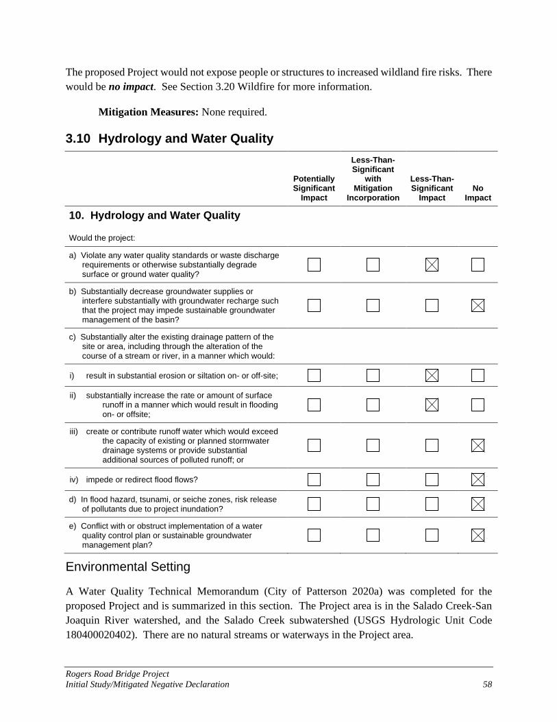
Rogers Road Bridge Project Initial Study/Mitigated Negative Declaration 58
The proposed Project would not expose people or structures to increased wildland fire risks. There would be no impact. See Section 3.20 Wildfire for more information.
Mitigation Measures: None required.
3.10 Hydrology and Water Quality
Potentially Significant
Impact
Less-Than-Significant
with Mitigation
Incorporation
Less-Than-Significant
Impact No
Impact
10. Hydrology and Water Quality
Would the project:
a) Violate any water quality standards or waste discharge requirements or otherwise substantially degrade surface or ground water quality?
b) Substantially decrease groundwater supplies or interfere substantially with groundwater recharge such that the project may impede sustainable groundwater management of the basin?
c) Substantially alter the existing drainage pattern of the site or area, including through the alteration of the course of a stream or river, in a manner which would:
i) result in substantial erosion or siltation on- or off-site;
ii) substantially increase the rate or amount of surface runoff in a manner which would result in flooding on- or offsite;
iii) create or contribute runoff water which would exceed the capacity of existing or planned stormwater drainage systems or provide substantial additional sources of polluted runoff; or
iv) impede or redirect flood flows?
d) In flood hazard, tsunami, or seiche zones, risk release of pollutants due to project inundation?
e) Conflict with or obstruct implementation of a water quality control plan or sustainable groundwater management plan?
Environmental Setting
A Water Quality Technical Memorandum (City of Patterson 2020a) was completed for the proposed Project and is summarized in this section. The Project area is in the Salado Creek-San Joaquin River watershed, and the Salado Creek subwatershed (USGS Hydrologic Unit Code 180400020402). There are no natural streams or waterways in the Project area.

Rogers Road Bridge Project Initial Study/Mitigated Negative Declaration 59
The Project area is located within the San Joaquin Valley – Delta-Mendota Groundwater Subbasin, which is part of the San Joaquin Valley Groundwater Basin (California Department of Water Resources [DWR] 2020). The Delta-Mendota Groundwater Subbasin encompasses 1,170 square miles in Western Fresno, Madera, Merced, and Stanislaus Counties (Michael Brandman Associates, 2012) and has been identified by the DWR as critically over-drafted (DWR 2020).
Groundwater in the Delta-Mendota Subbasin occurs in three zones, including a lower zone, an upper zone, and a shallow zone. The lower zone contains fresh water in the lower section of the Tulare Formation. The upper zone contains a confined, semi-confined, and unconfined water in the upper section of the Tulare Formation and younger deposits. The shallow zone contains unconfined water within approximately 25 ft of the land surface (WRECO 2019).
Drinking water for the City of Patterson is provided by the City through groundwater, which is pumped from seven deep underground water wells (City of Patterson 2010).
The Project area is located within the 06099C0731E Flood Insurance Rate Map (FIRM). The nearest floodplain is approximately 1.5 miles east of the Project and is associated with Salado Creek. The boundary of a 100-year floodplain is used to demarcate flood hazards and indicates the geographic area having a one percent chance of being flooded in any given year. The Delta-Mendota Canal levees are marked on the Federal Emergency Management Agency FEMA FIRM Map.
As described in the Biological Resources section, the aquatic resources delineation for the Project identified two aquatic features—a seasonal wetland and canal (Delta-Mendota Canal). The seasonal wetland habitat exhibits wetland indicators for vegetation, soils, and hydrology. The canal is described further below.
Delta-Mendota Canal The Delta-Mendota Canal was constructed in 1951 and is operated by the USBR and the SLDMWA. The Delta-Mendota Canal originates in the Sacramento-San Joaquin Delta (Delta) at the C.W. Bill Jones Pumping Plant (formerly the Tracy Pumping Plant), located approximately 32.5 miles northwest of the BSA near the City of Tracy. The Delta-Mendota Canal, an engineered canal and part of the Central Valley Project, carries water along the west side of the San Joaquin Valley for irrigation supply and to replace San Joaquin River water stored at Friant Dam. The Delta-Mendota Canal travels south for 117 miles from the Jones Pumping Plant to the Mendota Pool, a small reservoir at the confluence of the San Joaquin River and Fresno Slough. The Delta-Mendota Canal capacity starts at 4,600 cubic feet per second (cfs) in the northernmost section, decreases to 4,200 cfs upstream of the O’Neill Forebay, and is 3,200 cfs at the Mendota Pool. (USBR and Western Area Power Administration 2009)
The Delta-Mendota Canal is hydrologically connected to the San Joaquin River through the Newman Wasteway, which flows from west to east with its headgate on the Delta-Mendota Canal

Rogers Road Bridge Project Initial Study/Mitigated Negative Declaration 60
approximately 14 miles south of the Project. The USBR has used the Delta-Mendota Canal and Newman Wasteway to recirculate Central Valley Project water pumped from the Delta back into the San Joaquin River to improve flow and water quality in the San Joaquin River. (USBR 2005)
Impacts and Mitigation Measures
a. Would the project violate any water quality standards or waste discharge requirements or otherwise substantially degrade surface or ground water quality?
The proposed Project includes minor ground disturbance that will expose soil and could result in accelerated erosion, which could affect water quality in downstream water bodies by increasing turbidity and/or sedimentation. The proposed Project could also result in the degradation of water quality from runoff of petroleum-based products associated with equipment and vehicles used during construction. Implementation of standard erosion and sediment control practices, as described in Measure BIO-4, would minimize these potential impacts and ensure that the proposed Project does not violate any water quality standards or waste discharge requirements. These BMPs prevent discharge from the site of soil or construction wastes or debris, including contaminants from construction materials, tools, and equipment. Standard BMPs may include, but are not limited to, installing sediment fencing, fiber rolls, or other erosion and sediment control measures between the designated work area and aquatic features; stabilizing all exposed soil prior to potential precipitation events; and using vehicle tracking control. Therefore, the proposed Project would have a less than significant impact.
Mitigation Measures: Although not required, the following measure would further reduce this less-than-significant impact.
Mitigation Measure BIO-4: Implement Water Quality Best Management Practices (BMPs)
b. Would the project substantially decrease groundwater supplies or interfere substantially with groundwater recharge such that the project may impede sustainable groundwater management of the basin?
Though the Project will increase the amount of impervious surface, this change is negligible. There would be an increase in impervious surface area by approximately 0.3 acre due to the wider bridge and roadway approaches, sidewalk, curbs, and gutters. Stormwater would be collected in a concrete gutter and discharged to the City's existing storm drain system. Detention basins or bioretention swales are planned, as required by the City's MS4 permit for water quality treatment and/or hydromodification. The proposed Project is not expected to interfere with groundwater recharge in the Project area. Therefore, the proposed Project would have no impact on groundwater resources.
Mitigation Measures: None required.
Rogers Road Bridge Project Initial Study/Mitigated Negative Declaration 61
c. Would the project substantially alter the existing drainage pattern of the site or area, including through the alteration of the course of a stream or river or through the addition of impervious surfaces, in a manner which would: result in substantial erosion or siltation on- or off-site, substantially increase the rate or amount of surface runoff in a manner which would result in flooding on- or off-site, create or contribute runoff water which would exceed the capacity of existing or planned stormwater drainage systems or provide substantial additional sources of polluted runoff, or impede or redirect flood flows?
The proposed Project would not substantially alter the existing drainage pattern of the site in a manner that would result in significant erosion, siltation, or flooding on- or off-site. The negligible expansion of impervious surfaces will not increase the rate or volume of surface water. The proposed Project would not create or contribute runoff water that would exceed the capacity of stormwater drainage systems, provide additional sources of polluted runoff, or impede or redirect flood flows.
For these reasons, the potential impacts of the proposed Project resulting from altered drainage patterns would be considered less than significant.
Mitigation Measures: None required.
d. Would the project, in flood hazard, tsunami, or seiche zones, risk release of pollutants due to project inundation?
The proposed Project is not within the boundary of the 100-year flood hazard area and does not include any features that would release pollutants or expose people and property to flooding in the event of inundation. There is no risk of tsunami or seiche at this inland location. Therefore, the Project will have no impact.
Mitigation Measures: None required.
e. Would the project conflict with or obstruct implementation of a water quality control plan or sustainable groundwater management plan?
A Water Quality Technical Memorandum (AWE 2020c) was completed for the proposed Project to evaluate potential Project impacts to water quality, including compliance with the San Joaquin River Basin Water Quality Control Plan. The proposed Project would not conflict with or obstruct implementation of a water quality control plan or sustainable groundwater management plan. The proposed Project will have no impact.
Mitigation Measures: None required.
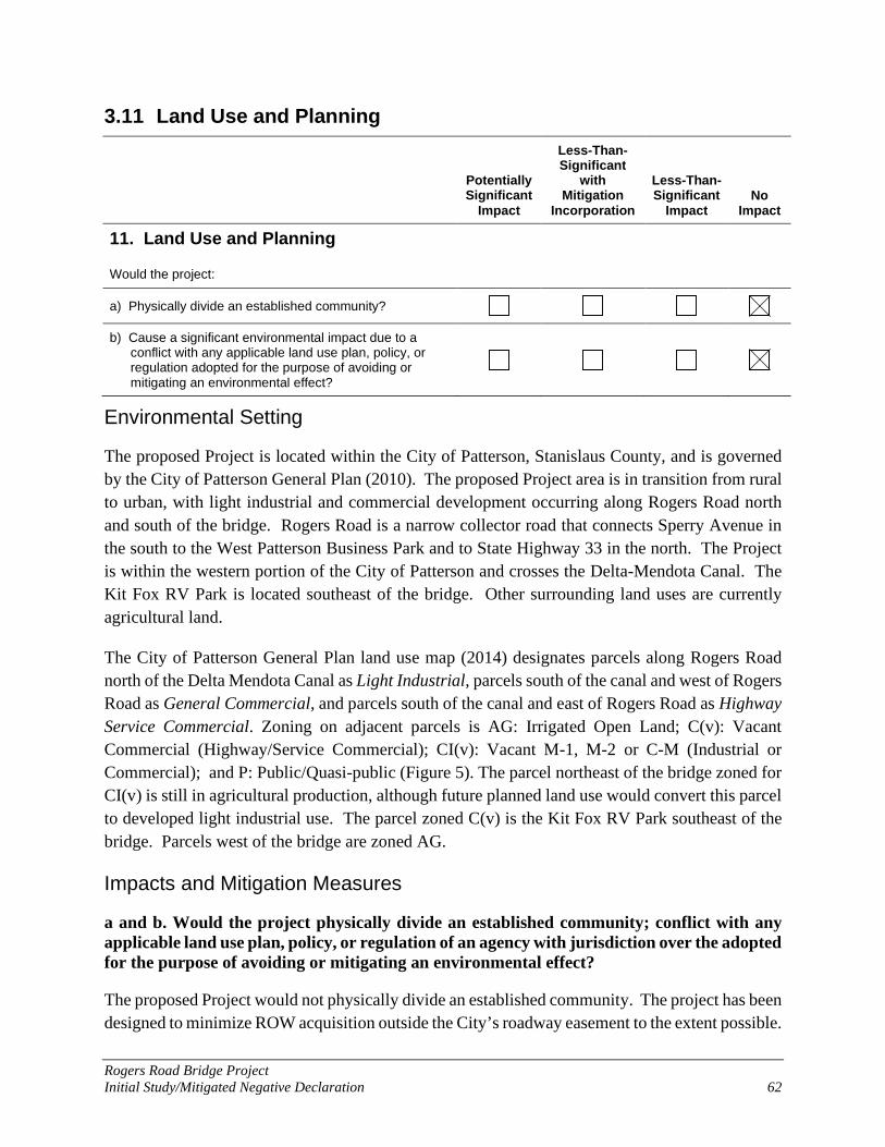
Rogers Road Bridge Project Initial Study/Mitigated Negative Declaration 62
3.11 Land Use and Planning
Potentially Significant
Impact
Less-Than-Significant
with Mitigation
Incorporation
Less-Than-Significant
Impact No
Impact
11. Land Use and Planning
Would the project:
a) Physically divide an established community?
b) Cause a significant environmental impact due to a conflict with any applicable land use plan, policy, or regulation adopted for the purpose of avoiding or mitigating an environmental effect?
Environmental Setting
The proposed Project is located within the City of Patterson, Stanislaus County, and is governed by the City of Patterson General Plan (2010). The proposed Project area is in transition from rural to urban, with light industrial and commercial development occurring along Rogers Road north and south of the bridge. Rogers Road is a narrow collector road that connects Sperry Avenue in the south to the West Patterson Business Park and to State Highway 33 in the north. The Project is within the western portion of the City of Patterson and crosses the Delta-Mendota Canal. The Kit Fox RV Park is located southeast of the bridge. Other surrounding land uses are currently agricultural land.
The City of Patterson General Plan land use map (2014) designates parcels along Rogers Road north of the Delta Mendota Canal as Light Industrial, parcels south of the canal and west of Rogers Road as General Commercial, and parcels south of the canal and east of Rogers Road as Highway Service Commercial. Zoning on adjacent parcels is AG: Irrigated Open Land; C(v): Vacant Commercial (Highway/Service Commercial); CI(v): Vacant M-1, M-2 or C-M (Industrial or Commercial); and P: Public/Quasi-public (Figure 5). The parcel northeast of the bridge zoned for CI(v) is still in agricultural production, although future planned land use would convert this parcel to developed light industrial use. The parcel zoned C(v) is the Kit Fox RV Park southeast of the bridge. Parcels west of the bridge are zoned AG.
Impacts and Mitigation Measures
a and b. Would the project physically divide an established community; conflict with any applicable land use plan, policy, or regulation of an agency with jurisdiction over the adopted for the purpose of avoiding or mitigating an environmental effect?
The proposed Project would not physically divide an established community. The project has been designed to minimize ROW acquisition outside the City’s roadway easement to the extent possible.

Rogers Road Bridge Project Initial Study/Mitigated Negative Declaration 63
The City will acquire an easement from USBR across the canal and for the sidewalk improvements on the east side. A small area from adjoining parcels to the northeast and possibly the northwest of the bridge would be required for the O&M road reconstruction; any right-of-way purchases for the maintenance road would be deeded to the USBR after construction is complete. Temporary construction easements would be needed from the USBR and all parcels adjacent to the approach road improvements and O&M road reconstruction.
The proposed Project will comply with the City’s goals, policies, and strategies with regards to public roads and surrounding planned land use development. Namely, the Project will comply with the following City of Patterson General Plan (City of Patterson 2010) Transportation Element policies:
Policy T-1.4 City standards for streets Policy T-7.1 Safe pedestrian and bike pathways
Additionally, the Project is consistent with planned development in the City’s Canals Expansion Area and Northern Expansion Area. By constructing the bridge substructure (foundations and abutment walls) to accommodate an ultimate bridge width of 65-feet, the Project supports a future widening of Rogers Road to a four-lane facility consistent with City plans and policies for planned industrial, commercial, and residential development, as planned in the General Plan.
The Project is designed to maintain roadway safety by rehabilitating a Structurally Deficient bridge. The Project will comply with all applicable zoning requirements and regulations and is consistent with General Plan development and transportation policies. For these reasons, there would be no impact.
Mitigation Measures: None required.
3.12 Mineral Resources
Potentially Significant
Impact
Less-Than-Significant
with Mitigation
Incorporation
Less-Than-Significant
Impact No
Impact
12. Mineral Resources
Would the project:
a) Result in the loss of availability of a known mineral resource that would be of future value to the region and the residents of the State?
b) Result in the loss of availability of a locally important mineral resource recovery site delineated on a local general plan, specific plan, or other land use plan?

Rogers Road Bridge Project Initial Study/Mitigated Negative Declaration 64
Environmental Setting
Mineral resources in Stanislaus County consist of aggregate materials including sand and gravel. The Stanislaus County General Plan Conservation and Open Space Element (Stanislaus County 2015) includes goals and policies to encourage and support mineral resource extraction and identifies Mineral Resource land use designation. The proposed Project area is located within Mineral Resource Zone (MRZ) 3a, which includes areas of known mineral occurrences of undetermined significance (CDOC 1993).
Impacts and Mitigation Measures
a and b. Would the project result in the loss of availability of a known mineral resource that would be of future value to the region and the residents of the State; or result in the loss of availability of a locally-important mineral resource recovery site delineated on a local general plan, specific plan, or other land use plan?
There are no known mineral resources associated with the proposed Project area. There would be no impact.
Mitigation Measures: None required.
3.13 Noise
Potentially Significant
Impact
Less-Than-Significant
with Mitigation
Incorporation
Less-Than-Significant
Impact No
Impact
13. Noise
Would the project result in:
a) Generation of a substantial temporary or permanent increase in ambient noise levels in the vicinity of the project in excess of standards established in the local general plan or noise ordinance, or applicable standards of other agencies?
b) Generation of excessive groundborne vibration or groundborne noise levels?
c) For a project located within the vicinity of a private airstrip or an airport land use plan or, where such a plan has not been adopted, within two miles of a public airport or public use airport, would the project expose people residing in or working in the project area to excessive noise levels?

Rogers Road Bridge Project Initial Study/Mitigated Negative Declaration 65
Environmental Setting
A construction noise technical memorandum was prepared for the Project (Ambient 2020) and is summarized in the following section.
Ambient noise levels in the project area are primarily influenced by vehicular traffic on Rogers Road and I-5. Short-term noise measurements were conducted on April 23, 2020. Two noise measurements were conducted along Rogers Road, to the north and south of the existing bridge. Based on these measurements, the ambient noise levels north and south of the existing bridge are 62.6 A-weighted decibel (dBA) equivalent continuous sound level (Leq) and 64.4 dBA Leq, respectively. The nearest noise-sensitive land use is the Kit Fox RV Park, which is located adjacent to and east of Rogers Road, approximately 275 feet to the southeast of the existing bridge.
The City of Patterson Noise Control Ordinance (City of Patterson Municipal Code, Chapter 6.44, Section 6.44.090) identifies limitations for noise-generating construction activities. Construction activities in a residential zone, or within a radius of 500 feet of a residential zone, are typically limited to between the hours between 7:00 a.m. and 6:00 p.m. Caltrans Standard Specifications includes specifications for the control of noise and vibration associated with construction activities. Caltrans Standard Specifications, Section 14-8.02, Noise Control, requires that noise from construction activities not exceed 86 dBA maximum sound level (Lmax) at 50 feet from the job site between the hours of 9:00 p.m. and 6:00 a.m. (Caltrans 2018).
Impacts and Mitigation Measures
a and b. Would the Project result in generation of a substantial temporary or permanent increase in ambient noise levels in the vicinity of the project in excess of standards established in the local general plan or noise ordinance, or applicable standards of other agencies; or generation of excessive groundborne vibration or groundborne noise levels?
The proposed Project would not result in long-term changes in vehicle traffic, noise, or groundborne vibration compared to existing conditions along Rogers Road. Therefore, noise generated by the proposed Project would be limited to short-term construction activities.
During construction of the project, noise from construction activities may intermittently dominate the noise environment in the immediate area of construction. Noise generated by construction equipment, including earth movers and material handling equipment, can reach high levels, but diminishes in volume with distance. Noise produced by construction equipment decreases at a rate of about 6 decibels (dB) per doubling of distance from the source. Based on this attenuation rate, the distances to the nearest RV parking space, typical construction noise levels, and assuming multiple pieces of equipment could potentially operate simultaneously, the highest predicted average-hourly noise levels at the nearest RV parking space would range from approximately 73 to 83 dBA Leq. Instantaneous noise levels could reach levels up to approximately 86 dBA Lmax for
Rogers Road Bridge Project Initial Study/Mitigated Negative Declaration 66
brief periods of time. Actual noise levels will vary depending on various factors, including the type and number of pieces of equipment used and duration of use. (Ambient 2020)
In comparison to ambient daytime noise levels, construction-generated noise levels would be intermittently detectable to occupants within the nearby RV park. Activities occurring during the more noise-sensitive nighttime hours would be of particular concern given the potential for increased levels of annoyance and sleep disruption to RV occupants. The Project would be constructed in compliance with the City’s noise standards and Caltrans Standard Specifications Section 14-8.02, which both limit night-time construction activities. Therefore, this impact is considered less than significant.
Mitigation Measures: None required. The following measure, consistent with Caltrans standard noise policy and City of Patterson Noise Control Ordinance, is recommended.
Mitigation Measure NOISE-1: Implement Construction Noise Reduction Measures. Noise-generating construction activities shall conform to the provisions in Section 14-8.02, "Noise Control," of the Caltrans Standard Specifications and City of Patterson Noise Control Ordinance. These policies require the following mandatory noise abatement measures:
Per Caltrans Section 14-8.02 Noise Control, do not exceed 86 dBA Lmax at 50 feet from the job site activities from 9:00 p.m. to 6:00 a.m.
Per City of Patterson Noise Control Ordinance, construction activities in a residential zone, or within a radius of 500 feet of a residential zone, shall be limited to between the hours between 7:00 a.m. and 6:00 p.m., unless activities are required to occur without interruption or must occur outside those hours for worker safety.
In addition to compliance with the measures listed above, implementing the following recommended measures also would help minimize temporary construction noise impacts:
Internal combustion engines shall be equipped with a muffler of a type recommended by the manufacturer.
Portable/stationary equipment (e.g., generators, compressors) shall be located at the furthest distance from the nearby RV park.
Construction equipment and haul trucks should be turned off when not in use.
The Kit Fox RV Park shall be notified in writing a minimum of two weeks prior to initiation of project construction. The notification shall, at a minimum, identify the anticipated project construction schedule, noise abatement measures to be implemented, and the name and phone number of a designated construction liaison to be contacted regarding construction-related information/noise complaints. A sign with the telephone number to be called regarding construction-related information/complaints shall be posted at the project site.
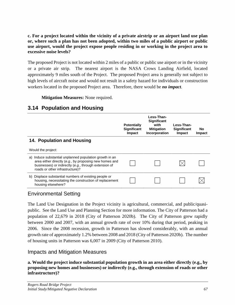
Rogers Road Bridge Project Initial Study/Mitigated Negative Declaration 67
c. For a project located within the vicinity of a private airstrip or an airport land use plan or, where such a plan has not been adopted, within two miles of a public airport or public use airport, would the project expose people residing in or working in the project area to excessive noise levels? The proposed Project is not located within 2 miles of a public or public use airport or in the vicinity or a private air strip. The nearest airport is the NASA Crows Landing Airfield, located approximately 9 miles south of the Project. The proposed Project area is generally not subject to high levels of aircraft noise and would not result in a safety hazard for individuals or construction workers located in the proposed Project area. Therefore, there would be no impact.
Mitigation Measures: None required.
3.14 Population and Housing
Potentially Significant
Impact
Less-Than-Significant
with Mitigation
Incorporation
Less-Than-Significant
Impact No
Impact
14. Population and Housing
Would the project:
a) Induce substantial unplanned population growth in an area either directly (e.g., by proposing new homes and businesses) or indirectly (e.g., through extension of roads or other infrastructure)?
b) Displace substantial numbers of existing people or housing, necessitating the construction of replacement
housing elsewhere?
Environmental Setting
The Land Use Designation in the Project vicinity is agricultural, commercial, and public/quasi-public. See the Land Use and Planning Section for more information. The City of Patterson had a population of 22,679 in 2018 (City of Patterson 2020b). The City of Patterson grew rapidly between 2000 and 2007, with an annual growth rate of over 10% during that period, peaking in 2006. Since the 2008 recession, growth in Patterson has slowed considerably, with an annual growth rate of approximately 1.2% between 2008 and 2018 (City of Patterson 2020b). The number of housing units in Patterson was 6,007 in 2009 (City of Patterson 2010).
Impacts and Mitigation Measures
a. Would the project induce substantial population growth in an area either directly (e.g., by proposing new homes and businesses) or indirectly (e.g., through extension of roads or other infrastructure)?
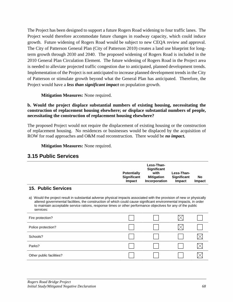
Rogers Road Bridge Project Initial Study/Mitigated Negative Declaration 68
The Project has been designed to support a future Rogers Road widening to four traffic lanes. The Project would therefore accommodate future changes in roadway capacity, which could induce growth. Future widening of Rogers Road would be subject to new CEQA review and approval. The City of Patterson General Plan (City of Patterson 2010) creates a land use blueprint for long-term growth through 2030 and 2040. The proposed widening of Rogers Road is included in the 2010 General Plan Circulation Element. The future widening of Rogers Road in the Project area is needed to alleviate projected traffic congestion due to anticipated, planned development trends. Implementation of the Project is not anticipated to increase planned development trends in the City of Patterson or stimulate growth beyond what the General Plan has anticipated. Therefore, the Project would have a less than significant impact on population growth.
Mitigation Measures: None required.
b. Would the project displace substantial numbers of existing housing, necessitating the construction of replacement housing elsewhere; or displace substantial numbers of people, necessitating the construction of replacement housing elsewhere?
The proposed Project would not require the displacement of existing housing or the construction of replacement housing. No residences or businesses would be displaced by the acquisition of ROW for road approaches and O&M road reconstruction. There would be no impact.
Mitigation Measures: None required.
3.15 Public Services
Potentially Significant
Impact
Less-Than-Significant
with Mitigation
Incorporation
Less-Than-Significant
Impact No
Impact
15. Public Services
a) Would the project result in substantial adverse physical impacts associated with the provision of new or physically altered governmental facilities, the construction of which could cause significant environmental impacts, in order to maintain acceptable service rations, response times or other performance objectives for any of the public services:
Fire protection?
Police protection?
Schools?
Parks?
Other public facilities?

Rogers Road Bridge Project Initial Study/Mitigated Negative Declaration 69
Environmental Setting
In the Project area, fire response is provided by the City of Patterson Fire Department, which has two fire stations in Patterson. Fire Station 1 is located on West Las Palmas Avenue near the City center and Fire Station 2 is located on Keystone Pacific Parkway. Further, a California Department of Forestry and Fire Protection (CalFire) station is located along Sperry Avenue near the intersection with Park Center Drive. Police services are provided by Patterson Police Services, a division of the Stanislaus County Sheriff’s Department. The City’s police station is located on South Del Puerto Avenue, near the City center. Medical and urgent care facilities are located closer to the City center. Public education is provided by the Patterson Unified School District. There are no public schools or parks in the immediate vicinity of the Project. The nearest public school is Apricot Valley Elementary School, located on Henley Parkway, about 6 miles east of the Project area. Neighborhood and community parks are also located in residential areas east of Baldwin Road, more than 2 miles from the Project.
Impacts and Mitigation Measures
a. Would the project result in substantial adverse physical impacts associated with the provision of new or physically altered governmental facilities, need for new or physically altered governmental facilities, the construction of which could cause significant environmental impacts, in order to maintain acceptable service ratios, response times or other performance objectives for fire protection, police protection, schools, parks, or other public facilities?
The proposed Project would not result in the need for new or altered government facilities.
During construction, all traffic across the bridge will be rerouted via a detour. Signage will be placed along Sperry Avenue and Rogers Road warning the travelling public about the road closure. The maximum detour length is 2.7 miles (6-minute detour without traffic). Emergency Services will be notified of the road closures and will be updated with the status of the Project. Response times are not expected to substantially increase due to the roadway closure. The detour may affect response time from Fire Station 2 to the travel center commercial area along Rogers Road near the intersection of Rogers Road and Sperry Avenue. Response times to other portions of the City and by all other emergency providers would not be affected. With advanced notification of the road closure, and availability of alternative routes during construction, the project would not adversely affect emergency services and response times. Traffic control systems and detour signage will comply with state standards. Therefore, the Project would have a less than significant impact on emergency response providers. The Project would have no impact on other public services and facilities such as parks and schools.

Rogers Road Bridge Project Initial Study/Mitigated Negative Declaration 70
Mitigation Measures: None required. The following transportation mitigation measure, consistent with City of Patterson and Caltrans standard policy for traffic control during construction, is recommended. This measure is described in Section 3.17 Transportation.
Mitigation Measure TRA-1: Traffic Control Plan and Notification of Detour.
3.16 Recreation
Potentially Significant
Impact
Less-Than-Significant
with Mitigation
Incorporation
Less-Than-Significant
Impact No
Impact
16. Recreation
Would the project:
a) Increase the use of existing neighborhood and regional parks or other recreational facilities such that substantial physical deterioration of the facility would occur or be accelerated?
b) Include recreational facilities or require the construction or expansion of recreational facilities that might have an adverse physical effect on the environment?
Environmental Setting
There are no public parks in the immediate vicinity of the Project. Neighborhood and community parks are located in residential areas east of Baldwin Road, more than 2 miles from the Project. There is no formal fishing access to the Delta Mendota Canal at this location, though informal fishing activity occurs along the canal.
Impacts and Mitigation Measures
a and b. Would the project increase the use of existing neighborhood and regional parks or other recreational facilities such that substantial physical deterioration of the facility would occur or be accelerated; or include recreational facilities or require the construction or expansion of recreational facilities that might have an adverse physical effect on the environment?
The proposed Project would not increase the use of any recreational facilities and does not include recreational facilities. The Project would not result in long-term changes in recreation or require the construction of new recreational facilities. During construction, informal fishing access to the Delta Mendota Canal in the immediate Rogers Road construction area would be closed, which would have a negligible impact on regional recreation opportunities. Construction would not affect upstream or downstream water levels or recreation access elsewhere along the canal. The
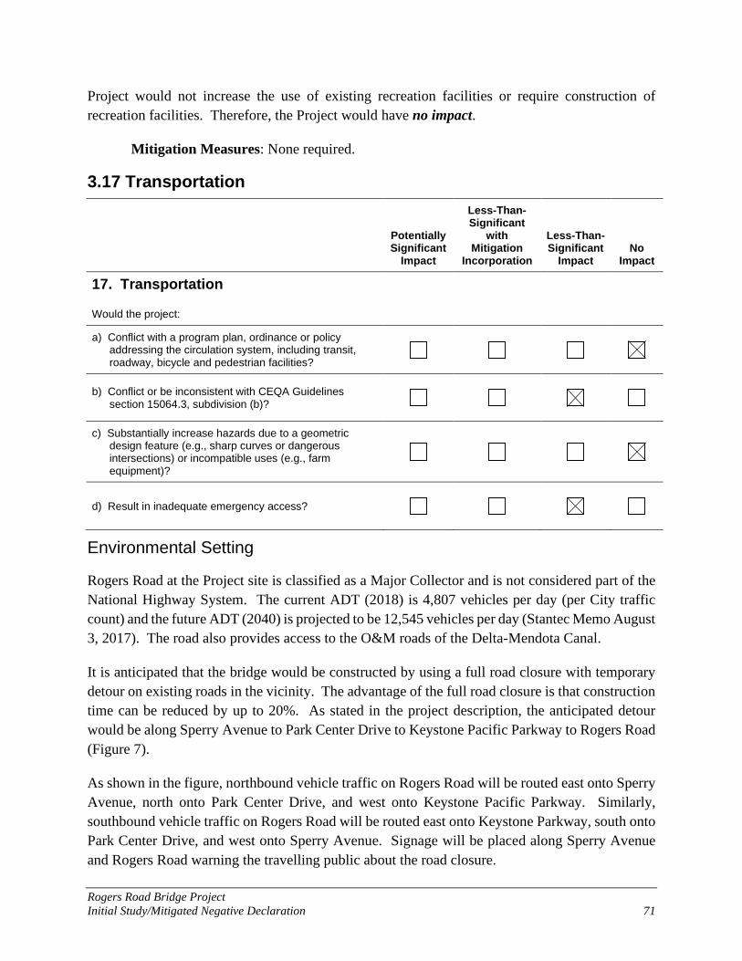
Rogers Road Bridge Project Initial Study/Mitigated Negative Declaration 71
Project would not increase the use of existing recreation facilities or require construction of recreation facilities. Therefore, the Project would have no impact.
Mitigation Measures: None required.
3.17 Transportation
Potentially Significant
Impact
Less-Than-Significant
with Mitigation
Incorporation
Less-Than-Significant
Impact No
Impact
17. Transportation
Would the project:
a) Conflict with a program plan, ordinance or policy addressing the circulation system, including transit, roadway, bicycle and pedestrian facilities?
b) Conflict or be inconsistent with CEQA Guidelines section 15064.3, subdivision (b)?
c) Substantially increase hazards due to a geometric design feature (e.g., sharp curves or dangerous intersections) or incompatible uses (e.g., farm equipment)?
d) Result in inadequate emergency access?
Environmental Setting
Rogers Road at the Project site is classified as a Major Collector and is not considered part of the National Highway System. The current ADT (2018) is 4,807 vehicles per day (per City traffic count) and the future ADT (2040) is projected to be 12,545 vehicles per day (Stantec Memo August 3, 2017). The road also provides access to the O&M roads of the Delta-Mendota Canal.
It is anticipated that the bridge would be constructed by using a full road closure with temporary detour on existing roads in the vicinity. The advantage of the full road closure is that construction time can be reduced by up to 20%. As stated in the project description, the anticipated detour would be along Sperry Avenue to Park Center Drive to Keystone Pacific Parkway to Rogers Road (Figure 7).
As shown in the figure, northbound vehicle traffic on Rogers Road will be routed east onto Sperry Avenue, north onto Park Center Drive, and west onto Keystone Pacific Parkway. Similarly, southbound vehicle traffic on Rogers Road will be routed east onto Keystone Parkway, south onto Park Center Drive, and west onto Sperry Avenue. Signage will be placed along Sperry Avenue and Rogers Road warning the travelling public about the road closure.

Rogers Road Bridge Project Initial Study/Mitigated Negative Declaration 72
Figure 7. Rogers Road Detour

Rogers Road Bridge Project Initial Study/Mitigated Negative Declaration 73
The maximum detour length is 2.7 miles (6-minute detour without traffic). The closure of Rogers Road during construction would be coordinated with Emergency Response officials.
Impacts and Mitigation Measures
a. Would the project conflict with a program plan, ordinance or policy addressing the circulation system, including transit, roadway, bicycle and pedestrian facilities?
The proposed Project does not conflict with the Circulation Element of the City of Patterson General Plan (2010) or any other applicable plan, ordinance, or policy. As noted in the City’s General Plan and the approved STIP, Rogers Road is projected to be widened to four lanes in the future. The Project will construct the bridge substructure (foundations and abutment walls) to accommodate an ultimate bridge width of 65-feet (for a future widening of Rogers Road to a four-lane facility). Therefore, the Project accommodates this future widening consistent with local and regional plans. The Project provides a community benefit consistent with local transportation plans by improving bridge safety and by expanding pedestrian and bicycle facilities in the Project area. Therefore, the Project would have no impact.
Mitigation Measures: None required.
b. Would the project conflict or be inconsistent with CEQA Guidelines section 15064.3, subdivision (b)?
The bridge replacement is not expected to increase nor reduce the number of vehicle trips in the Project area. Construction activities would be expected to result in a negligible temporary increase in vehicle trips to the Project area by construction personnel. The proposed Project is consistent with CEQA Guidelines §15064.3(b) in that transportation projects that reduce or have no impact on vehicle miles traveled should be presumed to cause a less than significant transportation impact. Therefore, this impact is considered less than significant.
Mitigation Measures: None required.
c. Would the project substantially increase hazards due to a geometric design feature (e.g., sharp curves or dangerous intersections) or incompatible uses (e.g., farm equipment)?
The purpose of the proposed Project is to remove a potentially hazardous feature, a “Functionally Obsolete” bridge. The proposed Project would therefore solve existing hazards and have no impact.
Mitigation Measures: None required.
d. Would the project result in inadequate emergency access?
Emergency Services will be notified of the road closures and will be updated with the status of the Project. Response times are not expected to substantially increase due to the roadway closure.

Rogers Road Bridge Project Initial Study/Mitigated Negative Declaration 74
The detour may affect response time from Fire Station 2 to the travel center commercial area along Rogers Road near the intersection of Rogers Road and Sperry Avenue. Response times to other portions of the City and by all other emergency providers would not be affected. With advanced notification of the road closure, and availability of alternative routes during construction, the project would not adversely affect emergency services and response times. Therefore, the Project would have a less than significant impact on emergency access and response times.
Mitigation Measures: None required. The following mitigation measure, consistent with City of Patterson and Caltrans standard policy for traffic control during construction, is recommended.
Mitigation Measure TRA-1: Traffic Control Plan and Notification of Detour. The following measures shall be completed by the Contractor, consistent with City of Patterson and Caltrans standard guidance for traffic control during construction.
Emergency service providers shall be notified of construction activities, informed of the full road closure, and provided details of detour routes during construction.
Traffic detours shall be announced to residents and roadway users well in advance of construction and closure of the bridge.
Traffic detour signage shall be installed before construction begins and throughout construction so that drivers can avoid the Project area entirely.
The Contractor shall prepare a traffic control plan for the City’s review and approval before construction begins.

Rogers Road Bridge Project Initial Study/Mitigated Negative Declaration 75
3.18 Tribal Cultural Resources
Potentially Significant
Impact
Less-Than-Significant
with Mitigation
Incorporation
Less-Than-Significant
Impact No
Impact
18. Tribal Cultural Resources
a) Would the project cause a substantial adverse change in the significance of a tribal cultural resource, defined in Public Resources Code section 21074 as either a site, feature, place, cultural landscape that is geographically defined in terms of the size and scope of the landscape, sacred place, or object with cultural value to a California Native American tribe, and that is:
i) Listed or eligible for listing in the California Register of Historical Resources, or in a local register of historical resources as defined in Public Resources Code section 5020.1(k), or
ii) A resource determined by the lead agency, in its discretion and supported by substantial evidence, to be significant pursuant to criteria set forth in subdivision (c) of Public Resources Code Section 5024.1. In applying the criteria set forth in subdivision (c) of Public Resource Code Section 5024.1, the lead agency shall consider the significance of the resource to a California Native American tribe.
Environmental Setting
The NAHC was contacted on September 9, 2020, to request a search of the Sacred Lands file and a list of interested Native American individuals and parties in Stanislaus County. The NAHC replied on September 28, 2020, and reported that no recorded Sacred Land was within or adjacent to the project. The NAHC also provided a list of Native American contacts.
The City of Patterson, as the lead state agency responsible for CEQA compliance, sent letters to the NAHC list and California Native American Tribes that are traditionally and culturally affiliated with the area or have previously expressed interest in projects in the City of Patterson.
An email response was received from Katherine Perez of the Nototomne Cultural Preservation of the Northern Valley Yokut/ Ohlone/ Bay Mewuk/ Patwin. Ms. Perez stated that they are unaware of cultural sensitivity in the Project area. Ms. Perez also recommended that the City implement standard precautionary mitigation measures to address tribal cultural resources, including the following:
Project redesign and construction planning to avoid tribal cultural resources when present Tribal cultural resource awareness training for construction crews Monitoring of construction activities by Native American monitors

Rogers Road Bridge Project Initial Study/Mitigated Negative Declaration 76
Site inspection by Native American Monitor within the first five days of ground-breaking activity
Procedures for inadvertent discoveries of tribal cultural resources during construction and consultation with tribal representatives.
No other responses have been received to date.
Impacts and Mitigation Measures
a, i and ii. Would the project cause a substantial adverse change in the significance of a tribal cultural resource, defined in Public Resources Code section 21074 as either a site, feature, place, cultural landscape that is geographically defined in terms of the size and scope of the landscape, sacred place, or object with cultural value to a California Native American tribe, and that is Listed or eligible for listing in the California Register of Historical Resources, or in a local register of historical resources as defined in Public Resources Code section 5020.1(k), or a resource determined by the lead agency, in its discretion and supported by substantial evidence, to be significant pursuant to criteria set forth in subdivision (c) of Public Resources Code Section 5024.1. In applying the criteria set forth in subdivision (c) of Public Resource Code Section 5024.1, the lead agency shall consider the significance of the resource to a California Native American tribe.
No tribal cultural resources were located during the background search, survey and through outreach with Native American representatives. The Project would have no impact on tribal cultural resources.
Mitigation Measures: None required. The following standard measures, described in Section 3.5 Cultural Resources, are recommended.
Mitigation Measure CUL-1: Protect Discovered Cultural Subsurface Resources.
Mitigation Measure CUL-2: Procedures for Human Remains.

Rogers Road Bridge Project Initial Study/Mitigated Negative Declaration 77
3.19 Utilities and Service Systems
Potentially Significant
Impact
Less-Than-Significant
with Mitigation
Incorporation
Less-Than-Significant
Impact No
Impact
19. Utilities and Service Systems Would the project:
a) Require or result in the relocation or construction of new or expanded water, wastewater treatment, or storm water drainage, electric power, natural gas, or telecommunications facilities, the constriction or relocation of which could cause significant environmental effects?
b) Have sufficient water supplies available to serve the project and reasonably foreseeable future development
during normal, dry, and multiple dry years?
c) Result in a determination by the wastewater treatment provider that serves or may serve the project that it has adequate capacity to serve the project’s projected demand in addition to the provider’s existing
commitments?
d) Generate solid waste in excess of State or local standards, or in excess of the capacity of local infrastructure, or otherwise impair the attainment of solid waste reduction goals?
e) Comply with federal, state, and local management and reduction statutes and regulations related to solid waste?
Environmental Setting
Utilities within the Project area include overhead power lines, overhead cable and phone lines, waterlines and a gas line attached to the existing bridge, an underground sewer line that runs underneath the Delta-Mendota Canal, and a canal turnout (or “delivery gate”).
Impacts and Mitigation Measures
a. Would the project require or result in the relocation or construction of new or expanded water, wastewater treatment, or storm water drainage, electric power, natural gas, or telecommunications facilities, the constriction or relocation of which could cause significant environmental effects?
The Project includes modifications to stormwater drainage systems along Rogers Road. Proposed changes to the drainage system include collecting stormwater in a concrete gutter and discharging to the City's existing storm drain system or to detention basins or bioretention swales, as required by the City's MS4 permit for water quality treatment and/or hydromodification. These changes would not require expansion of the City’s existing storm drain system. The Project would not

Rogers Road Bridge Project Initial Study/Mitigated Negative Declaration 78
require the construction of other new utilities nor would it require new water or wastewater services.
The proposed Project would require relocation of some utilities in the Project area. The City has informed respective utility owners of the proposed project and requested mapping and location information. The water lines and gas line attached to the existing bridge are expected to be relocated. An overhead electric pole carrying electric, phone and cable/communication line southwest of the bridge will require relocation. The sewer line under the canal is not anticipated to require relocation for construction. The canal turnout is currently integrated into the canal lining southwest of the bridge, and the City intends to protect the turnout facility in place. Relocating water lines, gas line and power poles could cause minimal delays in service during relocation. Customers affected by temporary disruptions to service will be notified prior to utility relocations. Coordination with all utility owners would continue during preliminary and final design of the project. Therefore, the impact would be less than significant.
Mitigation Measures: None required.
b, c. Would the project have sufficient water supplies available to serve the project and reasonably foreseeable future development during normal, dry, and multiple dry years; result in a determination by the wastewater treatment provider that serves or may serve the project that it has adequate capacity to serve the project’s projected demand in addition to the provider’s existing commitments?
The Project would not require water or wastewater services. Therefore, there would be no impact.
Mitigation Measures: None required.
d, e. Would the project generate solid waste in excess of State or local standards, or in excess of the capacity of local infrastructure, or otherwise impair the attainment of solid waste reduction goals; comply with federal, state, and local management and reduction statutes and regulations related to solid waste?
Construction activities would generate solid waste that may require off-site disposal. Solid waste would be disposed of at a permitted facility. All solid waste generated during construction of the proposed Project would be collected by the contractor and disposed of in accordance with applicable local, state and federal regulations. The proposed Project will only generate a small amount of solid waste; therefore, construction-related impacts on solid waste services will be less than significant.
Mitigation Measures: None required.

Rogers Road Bridge Project Initial Study/Mitigated Negative Declaration 79
3.20 Wildfire
Potentially Significant
Impact
Less-Than-Significant
with Mitigation
Incorporation
Less-Than-Significant
Impact No
Impact
20. Wildfire If located in or near state responsibility areas or lands classified as very high hazard severity zones, would the project:
a) Substantially impair an adopted emergency response plan or emergency evacuation plan?
b) Due to slope, prevailing winds, and other factors, exacerbate wildfire risks, and thereby expose project occupants to, pollutant concentrations from a wildfire or the uncontrolled spread of a wildfire?
c) Require the installation or maintenance of associated infrastructure (such as roads, fuel breaks, emergency water sources, power lines or other utilities) that may exacerbate fire risk or that may result in temporary or ongoing impacts to the environment?
d) Expose people or structures to significant risks, including downslope or downstream flooding or landslides, as a result of runoff, post-fire slope instability, or drainage changes?
Environmental Setting
The City of Patterson is served by the City of Patterson Fire Department, which has two fire stations in Patterson. Fire Station 1 is located on West Las Palmas Avenue near the City center and Fire Station 2 is located on Keystone Pacific Parkway. Further, a CalFire station is located along Sperry Avenue near the intersection with Park Center Drive. The City is not within a Fire Hazard Severity Zone (CalFire 2020a). The Diablo Hills west of I-5 are designated as a Moderate, High, or Very High Fire Hazard Severity Zone and in August 2020, more than 396,000 acres of these hills burned east of Patterson and I-5 during the SCU Lightning Complex fire (CalFire 2020b). However, the Project area is east of this zone and is not a high fire risk zone. The City of Patterson General Plan (2010) Public Services Element and Health and Safety Element include goals and policies for fire protection and prevention within the City.
Impacts and Mitigation Measures
a. Substantially impair an adopted emergency response plan or emergency evacuation plan?
The proposed Project will not impair the adopted emergency response plan. Temporary traffic detours and associated delays may occur during construction which could result in reduced response times for emergency responders. However, all emergency, transit agencies, and local residents will be notified of the construction work. See Section 3.15 Public Services and 3.17

Rogers Road Bridge Project Initial Study/Mitigated Negative Declaration 80
Transportation for more information about temporary impacts to emergency providers and response times. Therefore, impacts will be less than significant.
Mitigation Measures: None required.
b. Due to slope, prevailing winds, and other factors, exacerbate wildfire risks, and thereby expose project occupants to, pollutant concentrations from a wildfire or the uncontrolled spread of a wildfire?
The proposed Project will not exacerbate wildfire risk, expose residents to pollutant concentrations from a wildfire or the uncontrolled spread of a wildfire. Therefore, there would be no impact.
Mitigation Measures: None required.
c. Require the installation or maintenance of associated infrastructure (such as roads, fuel breaks, emergency water sources, power lines or other utilities) that may exacerbate fire risk or that may result in temporary or ongoing impacts to the environment?
The proposed Project would replace the existing bridge, establishing safer vehicular travel and pedestrian use. The Project does not require the installation or maintenance of associated infrastructure that could exacerbate wildfire risk. Therefore, there will be no impact.
Mitigation Measures: None required.
d. Expose people or structures to significant risks, including downslope or downstream flooding or landslides, as a result of runoff, post-fire slope instability, or drainage changes?
The proposed Project will not expose people or structures to significant risks. As mentioned above, the Project involves the replacement of a bridge, which will allow for safer vehicular travel and pedestrian use. Therefore, there will be no impact.
Mitigation Measures: None required.

Rogers Road Bridge Project Initial Study/Mitigated Negative Declaration 81
3.21 Mandatory Findings of Significance
Potentially Significant
Impact
Less-Than-Significant
with Mitigation
Incorporation
Less-Than-Significant
Impact No
Impact
21. Mandatory Findings of Significance
Would the project:
a) Does the project have the potential to substantially degrade the quality of the environment, substantially reduce the habitat of a fish or wildlife species, cause a fish or wildlife population to drop below self-sustaining levels, threaten to eliminate a plant or animal community, substantially reduce the number or restrict the range of a rare or endangered plant or animal or eliminate important examples of the major periods of California history or prehistory?
b) Does the project have impacts that are individually limited, but cumulatively considerable? ("Cumulatively considerable" means that the incremental effects of a project are considerable when viewed in connection with the effects of past projects, the effects of other current projects, and the effects of probable future projects)
c) Does the project have environmental effects that will cause substantial adverse effects on human beings, either directly or indirectly?
Impacts and Mitigation Measures
a. Does the project have the potential to degrade the quality of the environment, substantially reduce the habitat of a fish or wildlife species, cause a fish or wildlife population to drop below self-sustaining levels, threaten to eliminate a plant or animal community, reduce the number or restrict the range of a rare or endangered plant or animal or eliminate important examples of the major periods of California history or prehistory?
As described previously in this IS/MND, implementation of mitigation measures identified in the Biological Resources section would ensure that proposed Project implementation would not substantially reduce the habitat of a fish or wildlife species, cause a fish or wildlife population to drop below self-sustaining levels, threaten to eliminate a plant or animal community, or reduce the number or restrict the range of rare or endangered plants or animals. Furthermore, mitigation measures identified in the Cultural Resources section would ensure that the proposed Project would not significantly affect previously undiscovered resources or eliminate important examples of the major periods of California history or prehistory.
Given the existing conditions of the Project area, the fact that potential impacts to biological and cultural resources would primarily occur during construction, and that measures have been

Rogers Road Bridge Project Initial Study/Mitigated Negative Declaration 82
identified to reduce these temporary impacts, the overall potential of the proposed Project to degrade the environment is considered less than significant with mitigation.
b. Does the project have impacts that are individually limited, but cumulatively considerable?
Section 15064(h)(1) of CEQA Guidelines states that the lead agency shall consider whether the cumulative impact is significant, and the incremental effects of the project are cumulatively considerable. The lead agency may determine that a project’s incremental contribution would be less-than-cumulatively considerable when one or more of the following occur: 1) the contribution would be rendered less-than-cumulatively considerable through implementation of mitigation measures; 2) the project would comply with the requirements of a previously approved plan or mitigation program that provides specific requirements that would avoid or substantially lessen the project’s cumulative effects; and/or 3) the project’s incremental effects would be so small that the environmental conditions would be essentially the same regardless of whether the project is implemented.
Past, present, and reasonably foreseeable future projects in the vicinity of the proposed Project include the Sperry Road I-5 interchange project, proposed commercial and industrial development in the Project vicinity, and the future widening of Rogers Road to a four-lane facility. Potential impacts associated with the proposed Project are primarily short-term (construction-related) and shall be mitigated to less-than-significant levels. Long-term incremental effects of the proposed Project are so small that local environmental conditions (e.g., traffic, noise, air quality) would be essentially the same regardless of whether the project is implemented. Any future development project in the Project vicinity will be subject to the same laws and regulations as the proposed Project. Therefore, the proposed Project’s incremental contribution to cumulative conditions would be less-than-cumulatively considerable. The Project would have less than significant cumulative impact.
c. Does the project have environmental effects that will cause substantial adverse effects on human beings, either directly or indirectly?
Potential adverse effects to human beings could occur as a result of construction activities. Potential impacts would include temporary increases in noise and traffic detours for emergency service providers. These impacts would be short-term and would cease upon completion of the construction process. Potential adverse effects on human beings as a result of the proposed Project are considered less than significant.

Rogers Road Bridge Project Initial Study/Mitigated Negative Declaration 83
4.0 List of Preparers The Public Review Draft IS/MND for the proposed Project was prepared by Area West Environmental, Inc. in cooperation with the City of Patterson. The following individuals contributed to this IS/MND.
City of Patterson
Tiffany Rodriguez, P.E., Capital Projects Manager, Engineering, Building and Capital Projects Department
Fernando Ullo, P.E., City Engineer, Director Engineering, Building and Capital Projects
Area West Environmental, Inc.
Aimee Dour-Smith, Senior Environmental Planner
Cory Brinkman, Environmental Planner
Corinne Munger, Biologist
Saraah Kantner Reid, Environmental Planner
Quincy Engineering
Carolyn Davis, P.E.
Mark Reno, P.E.

Rogers Road Bridge Project Initial Study/Mitigated Negative Declaration 84
5.0 References Ambient Air Quality and Noise Consulting. 2020. Construction Noise & Groundborne Vibration
Technical Memorandum for the Rogers Road over the Delta-Mendota Canal Bridge Replacement Project. May 8, 2020.
Area West Environmental, Inc. 2020a. Farmland Conversion Impact Analysis for the Rogers Road over Delta Mendota Canal Bridge Replacement Project (Br. No. 38C0214). March 30, 2020.
______.2020b. Natural Environment Study for the Rogers Road over Delta Mendota Canal Bridge Project (Br. No. 38C0214) BRLS-5244(032). August 2020.
AWE. See Area West Environmental, Inc.
Calfire. See California Department of Forestry and Fire Protection
California Department of Conservation, Division of Mines and Geology. 1993. Mineral land classification of Stanislaus County, California. Special report 173.
______.2002. California Geological Survey, California Geomorphic Provinces. Accessed September 2020. Available online: <https://www.conservation.ca.gov/cgs/Documents/Publications/CGS-Notes/CGS-Note-36.pdf >.
.2018. Division of Land Resource Protection, Farmland Mapping and Monitoring Program - Stanislaus County map. Accessed March 2020. Available online: <https://www.conservation.ca.gov/dlrp/fmmp/Pages/Stanislaus.aspx>.
California Department of Fish and Wildlife. 2012. Staff Report on Burrowing Owl Mitigation. State of California, Natural Resources Agency. March 7, 2012.
______.2020. California Natural Diversity Data Base (CNDDB). Available at: http://www.dfg.ca.gov/biogeodata/cnddb/mapsanddata.asp. Accessed March 2020.
California Department of Forestry and Fire Protection. 2020a. California Fire Hazard Severity Zone Viewer. Accessed September 2020; available online at: https://gis.data.ca.gov/datasets/789d5286736248f69c4515c04f58f414
______.2020b. CalFire Incidents Report and Mapping. Accessed September 2020; available online at: https://www.fire.ca.gov/incidents/
California Department of Toxic Substances Control. 2008. Interim Guidance for Sampling Agricultural Properties (Third Revision). August 7, 2008. Available at: https://dtsc.ca.gov/wp-content/uploads/sites/31/2020/06/Ag-Guidance-Rev-3-August-7-2008-2_Accessible.pdf
Rogers Road Bridge Project Initial Study/Mitigated Negative Declaration 85
California Department of Transportation. 2018. Standard Specifications. Available at website url: https://dot.ca.gov/-/media/dot-media/programs/design/documents/2018-stdspecs.pdf.
______.2020a. California's Scenic Highway Mapping System Accessed September 2020. Available online: <http://www.dot.ca.gov/hq/LandArch/16_livability/scenic_highways/>.
. 2020b. Caltrans Statewide Bridge Inventory. Accessed April 2020. Available online: <https://dot.ca.gov/programs/environmental-analysis/cultural-studies/california-historical-bridges-tunnels#surveys>.
California Department of Water Resources. 2020. B118 Basin Boundary Description 2016-
5_22_07 Delta Mendota. Available at: https://water.ca.gov/-/media/DWR-Website/Web-Pages/Programs/Groundwater-Management/Bulletin-118/Files/2016-Basin-Boundary-Descriptions/5_022_07_DeltaMendota.pdf. Accessed September 2020. Published Date: March 3, 2020.
Caltrans. See California Department of Transportation CDFW. California Department of Fish and Wildlife CDOC. California Department of Conservation California Office of Planning and Research. 2008. Technical Advisory CEQA AND CLIMATE
CHANGE: Addressing Climate Change Through California Environmental Quality Act (CEQA) Review. Available at: https://opr.ca.gov/docs/june08-ceqa.pdf. Accessed October 2020. Published Date: June 19, 2008.
City of Patterson. 2010. The City of Patterson 2010 General Plan. Available online: https://www.ci.patterson.ca.us/145/General-PlanCity-Maps. Accessed October 2019.
______.2014. General Plan Map and Zoning Map. Available at: https://www.ci.patterson.ca.us/145/General-PlanCity-Maps.
______.2020a. Water Quality Technical Memorandum for the Rogers Road Over Delta-Mendota Canal Bridge Project (Br. No. 38C0214). June 2020.
______.2020b. City of Patterson Demographics. Accessed September 2020; available online at: https://www.ci.patterson.ca.us/256/Population
DTSC. See California Department of Toxic Substances Control DWR. See California Department of Water Resources GEI Consultants, Inc. 2020a. Historic Property Survey Report for the Rogers Road Bridge over
Delta-Mendota Canal Project.

Rogers Road Bridge Project Initial Study/Mitigated Negative Declaration 86
______.2020b. Archaeological Survey Report for the Rogers Road Bridge over Delta Mendota Canal Bridge Project. Prepared for City of Patterson.
______.2020c. Historic Resources Evaluation Report for the Rogers Road Bridge over Delta Mendota Canal Bridge Project. Prepared for the City of Patterson.
______.2020d. Finding of No Adverse Effect for the Rogers Road over Delta Mendota Canal Bridge Project. Prepared for the City of Patterson.
Michael Brandman Associates. 2012. Draft Environmental Impact Report for West Patterson Business Park Expansion Project. https://www.ci.patterson.ca.us/DocumentCenter/View/386/West-Patterson-Business-Park-Expansion-Project-Draft-Environmental-Impact-Report-PDF. Last accessed: September 2020.
Natural Resources Conservation Service. 2019. Web Soil Survey. Available: <http://web
soilsurvey.nrcs.usda.gov/app/WebSoilSurvey.aspx>. Accessed October 2019
NRCS. See Natural Resources Conservation Service.
OPR. See California Office of Planning and Research.
San Joaquin Valley Air Pollution Control District. 2004. Rule 8021: Construction, Demolition, Excavation, Extraction, and Other Earthmoving Activities (Adopted November 15, 2001; Amended August 19, 2004). Accessed online: http://www.valleyair.org/rules/currntrules/r8021.pdf.
______.2009. Final Staff Report: Addressing Greenhouse Gas Emissions Impacts under the California Environmental Quality Act. December 17, 2009. Available online: https://www.valleyair.org/Programs/CCAP/CCAP_idx.htm
______.2015. Air Quality Thresholds of Significance – Criteria Pollutants. March 19, 2015. Accessed September 2020 at: http://www.valleyair.org/transportation/ceqa_idx.htm
SJVAPCD. See San Joaquin Valley Air Pollution Control District
Sloan, Justin. 2021. Letter from Justin Sloan, U.S. Fish and Wildlife Service Acting Chief, San Joaquin Valley Division, to Dominic Vitali, California Department of Transportation, District 10 Environmental Branch Chief. Informal Consultation on the Rogers Road over Delta-Mendota Canal Bridge Replacement Project (BRLS-5244(032)), Stanislaus County, California (USFWS File #08ESMP00-2021-I-0785).
Stanislaus County. 2015. Stanislaus County General Plan. Accessed September 2020. Available at: <http://www.stancounty.com/planning/pl/general-plan.shtm>
Stanislaus County Agricultural Commissioner. 2018. Stanislaus County Agricultural Report 2018. Available online: http://stanag.org/pdf/cropreport/cropreport2018.pdf. Accessed March 20, 2020.

Rogers Road Bridge Project Initial Study/Mitigated Negative Declaration 87
U.S. Bureau of Reclamation and Western Area Power Administration. 2009. Delta-Mendota Canal/ California Aqueduct Intertie, Final Environmental Impact Statement. Central Valley Project, California. November 2009.
U.S. Bureau of Reclamation. 2005. Recirculation Pilot Study Final Report, Stanislaus County, Mid-Pacific Region. June.
USBR. See U.S. Bureau of Reclamation
USDA. See U.S. Department of Agriculture.
U.S. Department of Agriculture 2001. Revised Universal Soil Loss Equation, Version 2, (RUSLE2) Handbook. May 2001.
U.S. Fish and Wildlife Service. 1999. Standardized Recommendations for Protection of the San Joaquin Kit Fox Prior to or During Ground Disturbance. Prepared by the Sacramento Fish and Wildlife Office June 1999. Available at https://www.fws.gov/ventura/docs/species/ protocols/sjkf/sanjoaquinkitfox_protection.pdf Accessed March 2020.
Western Regional Climate Center. 2019. Modesto, California. Available at: https://wrcc.dri.edu/cgi-bin/cliMAIN.pl?ca7339. Accessed December 2019.
WRCC. See Western Regional Climate Center
WRECO. 2019. Draft Initial Site Assessment for the Rogers Road Over Delta-Mendota Canal Bridge Project (Br. No. 38C0214). December 2019.
______.2020. Draft Preliminary Foundation Report for the Rogers Road over Delta Mendota
Canal Bridge Project.
USFWS. See U.S. Fish and Wildlife Service

Appendix A. Mitigation Monitoring and Reporting Program

Page intentionally blank
Rogers Road Bridge Project A-1 Mitigation Monitoring and Reporting Program
Appendix A – Mitigation Monitoring and Reporting Program
Introduction This mitigation monitoring and reporting program summarizes identified mitigation measures, implementation schedule, and responsible parties for the Rogers Road Bridge Replacement Project (Project). The City of Patterson (City) will use this mitigation monitoring and reporting program to ensure that identified mitigation measures, adopted as a condition of project approval, are implemented appropriately. This monitoring program meets the requirements of CEQA Guidelines Section 14074(d), which mandates preparation of monitoring provisions for the implementation of mitigation assigned as part of project approval or adoption.
Mitigation Implementation and Monitoring
The City will be responsible for monitoring the implementation of mitigation measures designed to minimize impacts associated with the proposed Project. While the City has ultimate responsibility for ensuring implementation, others may be assigned the responsibility of actually implementing the mitigation. The City will retain the primary responsibility for ensuring that the proposed Project meets the requirements of this mitigation plan and other permit conditions imposed by participating regulatory agencies.
The City will designate specific personnel who will be responsible for monitoring implementation of the mitigation that will occur during Project construction. The designated personnel will be responsible for submitting documentation and reports to the City on a schedule consistent with the mitigation measures and in a manner necessary for demonstrating compliance with mitigation requirements. The City will ensure that the designated personnel have authority to require implementation of mitigation requirements and will be capable of terminating project construction activities found to be inconsistent with mitigation objectives or project approval conditions.
The City and its appointed contractor will also be responsible for ensuring that its construction personnel understand their responsibilities for adhering to the performance requirements of the mitigation plan and other contractual requirements related to the implementation of mitigation as part of Project construction. In addition to the prescribed mitigation measures, the following table lists each environmental resource area being affected, the party responsible for ensuring implementation of the mitigation measure, and the corresponding monitoring and reporting requirement.
Mitigation Enforcement
The City will be responsible for enforcing mitigation measures. If alternative measures are identified that would be equally effective in mitigating the identified impacts, implementation of these alternative measures will not occur until agreed upon by the City.

Rogers Road Bridge Project A-2 Mitigation Monitoring and Reporting Program
Final Mitigation Monitoring and Reporting Program Impact Area Mitigation Measure Responsible
Party Implementation
Timing Monitoring Activity
Biological Resources
Mitigation Measure BIO-1: Conduct Worker Environmental Awareness Training (WEAT). Before any work occurs in the Project footprint, including equipment staging, all construction personnel shall participate in an environmental awareness training regarding special-status species and sensitive habitats present in the Project footprint. If new construction personnel are added to the Project, they must receive the mandatory training before starting work. The training shall be provided to all personnel and will discuss sensitive resources (i.e., waters of the U.S. and State), special-status species and their habitat to be avoided during Project construction, and list applicable permit conditions identified by state and federal agencies to protect these resources.
Qualified Biologist and Contractor
Prior to construction
Contractor will submit WEAT sign-in sheets to the City. The City will confirm completion of WEAT at the onset of construction activities.
Mitigation Measure BIO-2: Install Temporary Fencing Around Seasonal Wetland. The City shall ensure that temporary environmentally sensitive area fencing (brightly colored construction fencing) is installed between the work area and the seasonal wetland before any ground-disturbing activity occurs within the Project footprint. Construction personnel and construction activity shall remain within the defined project boundary and avoid areas identified as environmentally sensitive by the fencing. No earth disturbing activity shall be allowed until the fencing is in place. The fencing shall be checked regularly and maintained until all construction is complete.
Contractor to install fencing
Prior to construction
City representative will check fencing/flagging regularly. Maintenance and repairs will be completed by Contractor.
Mitigation Measure BIO-3: Restore Temporarily Disturbed Areas. All exposed soil resulting from project activities shall be stabilized immediately after final grading is completed in any given area. Soil stabilization may include, but is not limited to, seeding with a native grass seed mix, placement of temporary or permanent erosion control materials, and placement of rock. These areas will be properly protected from washout and erosion using appropriate erosion control devices. Potential erosion control devices or methods include coir netting, fiber rolls and hydroseeding.
Contractor Following completion of construction.
The City will inspect post-Project conditions to ensure temporarily disturbed areas have been restored.

Rogers Road Bridge Project A-3 Mitigation Monitoring and Reporting Program
Final Mitigation Monitoring and Reporting Program Impact Area Mitigation Measure Responsible
Party Implementation
Timing Monitoring Activity
Mitigation Measure BIO-4: Implement Water Quality Best Management Practices (BMPs). Before any ground-disturbing activities, the City or contractor (with City approval) shall prepare and implement a Stormwater Pollution Prevention Plan (SWPPP) (as required under the SWRCB’s General Construction Permit Order 2009-0009-DWQ [and as amended by most current order(s)] and the City’s Municipal Separate Storm Sewer System (MS4) Phase II permit for water quality treatment and/or hydromodification), that includes erosion control measures and construction waste containment measures to ensure that waters of the state are protected during and after Project construction. The SWPPP shall include site design to minimize storm water runoff into the Delta-Mendota Canal and the seasonal wetland.
The SWPPP shall be prepared with the following objectives: (a) to identify pollutant sources, including sources of sediment, that may affect the quality of stormwater discharges from the construction of the proposed Project; (b) to identify BMPs to reduce or eliminate pollutants in stormwater discharges and authorized non-stormwater discharges from the Project during construction; (c) to outline and provide guidance for BMP monitoring; (d) to identify proposed project discharge points and receiving waters; to address post-construction BMP implementation and monitoring; and (f) to address sedimentation, siltation, and turbidity. The SWPPP will require BMPs including, but are not limited to: Install sediment fencing, fiber rolls, or other equivalent erosion and
sediment control measures between the designated work area and the Delta-Mendota Canal, as necessary, to ensure that construction debris and sediment do not inadvertently leave the construction footprint.
Cover or otherwise stabilize all exposed soil 48 hours prior to potential precipitation events of greater than 0.5 inch.
To avoid impacts to special-status amphibians and reptiles, no plastic monofilament netting will be used in erosion control materials.
Contractor Prior to and during construction
The City will ensure that all Water Quality BMPs are being followed according to the SWPPP.

Rogers Road Bridge Project A-4 Mitigation Monitoring and Reporting Program
Final Mitigation Monitoring and Reporting Program Impact Area Mitigation Measure Responsible
Party Implementation
Timing Monitoring Activity
No refueling, servicing, or maintenance of mobile equipment shall take place within 100 feet of aquatic habitat.
All machinery used during construction of the Project shall be properly maintained and cleaned to prevent spills and leaks that could contaminate soil or water.
Spill containment kits will be maintained onsite at all times during construction operations and/or staging or fueling of equipment. Any spills or leaks from construction equipment (i.e., fuel, oil, hydraulic fluid, and grease) shall be cleaned up in accordance with applicable local, state, and/or federal regulations.
Concrete waste and water from curing operations will be collected in washouts and will be disposed of and not allowed into water courses.
Mitigation Measure BIO-5: Avoid Spread of Invasive Species. The following mitigation measures shall be implemented, as appropriate, to avoid the spreading of invasive plant species throughout the Project area during construction activities:
All hay, straw, hay bales, straw bales, seed, mulch or other material used for erosion control or landscaping on the Project site shall be certified weed free.
All equipment brought to the Project site for construction shall be thoroughly cleaned of all dirt and vegetation prior to entering the site, in order to prevent importing noxious weeds.
All material brought to the site, including rock, gravel, road base, sand, and topsoil, shall be free of noxious weed seeds and propagules.
Contractor During construction
City representative will check implementation measures regularly. Maintenance and repairs will be completed by Contractor.

Rogers Road Bridge Project A-5 Mitigation Monitoring and Reporting Program
Final Mitigation Monitoring and Reporting Program Impact Area Mitigation Measure Responsible
Party Implementation
Timing Monitoring Activity
Mitigation Measure BIO-6: General Construction Measures to Protect Wildlife. The following general construction measures shall be implemented in order to avoid impacts to biological resources during construction of the proposed Project:
To the extent possible, construction personnel shall minimize the work area footprint and the duration at a work area site.
Construction personnel shall use existing paved and unpaved roads to access the work area where present. Vehicles and equipment shall be parked on pavement, existing roads, and previously disturbed areas to the maximum extent feasible.
Trash dumping, littering, open fires (such as barbecues), hunting, and pets shall be prohibited in work areas.
To avoid entrapment of wildlife, all excavated steep-walled holes or trenches more than 4 inches deep will be provided with one or more escape ramps constructed of earth fill or wooden planks at the end of each workday. If escape ramps cannot be provided, then holes or trenches will be covered with plywood or similar materials. Providing escape ramps or covering open trenches will prevent injury or mortality of wildlife resulting from falling into trenches and becoming trapped. The trenches will be thoroughly inspected for the presence of special-status species at the beginning of each workday. Any species observed shall be allowed to voluntarily move outside of the work area on its own.
If any special-status species are observed in the Project Area during construction, construction will cease until the species is allowed to move out of harm’s way on their own accord.
If any special-status species is observed within the project area, cannot move out of harm’s way on their own accord, field crews shall contact the City of Patterson Construction Manager, who will
Contractor During construction
Contractor will report to the City instances of wildlife species observed in the Project area and provide a description of how disturbance and harm was avoided.

Rogers Road Bridge Project A-6 Mitigation Monitoring and Reporting Program
Final Mitigation Monitoring and Reporting Program Impact Area Mitigation Measure Responsible
Party Implementation
Timing Monitoring Activity
report the sighting to the appropriate agency (USFWS and/or CDFW), and have a qualified biologist come onsite to assess the situation. The biologist will have authority to stop activities until appropriate corrective measures have been completed or it is determined that the individual will not be harmed. Capture and relocation of trapped or injured species can only be attempted by qualified biologists in coordination with the appropriate regulatory agency.
Mitigation Measure BIO-7: Preconstruction Survey for Special-status Reptiles. Within 48-hours prior to the start of construction activities, the Project footprint will be surveyed for special-status reptiles, including San Joaquin coachwhip, by a qualified biologist. Surveys will be repeated if a lapse in construction activity of two weeks or greater has occurred. If a snake or other reptile is encountered during construction, activities shall cease until the animal moves out of harms’ way on their own accord. If necessary, a qualified biologist will relocate San Joaquin coachwhip in coordination with CDFW. If possible, project construction will occur during the active period for the coachwhip (March through October). Direct mortality of snakes is not anticipated because snakes are expected to actively move and avoid danger.
Qualified Biologist
Prior to construction
The City will submit results of preconstruction reptile surveys to Caltrans and permitting agencies.
Mitigation Measure BIO-8: Burrowing Owl Protection. The following measures shall be implemented in order to avoid impacts to burrowing owl during construction of the proposed Project.
A biologist shall conduct a preconstruction survey for burrowing owls within potential burrowing owl habitat in the Project footprint and a 500-foot buffer, no more than 14 days prior to start of Project construction activities. The preconstruction survey shall follow the methods described in Appendix D of the CDFW Staff Report on Burrowing Owl Mitigation (CDFW 2012).
Qualified Biologist
Prior to construction
The City will submit results of preconstruction nesting bird and raptor surveys to Caltrans and coordinate with CDFW on appropriate buffers if nesting birds and raptors are located during surveys.
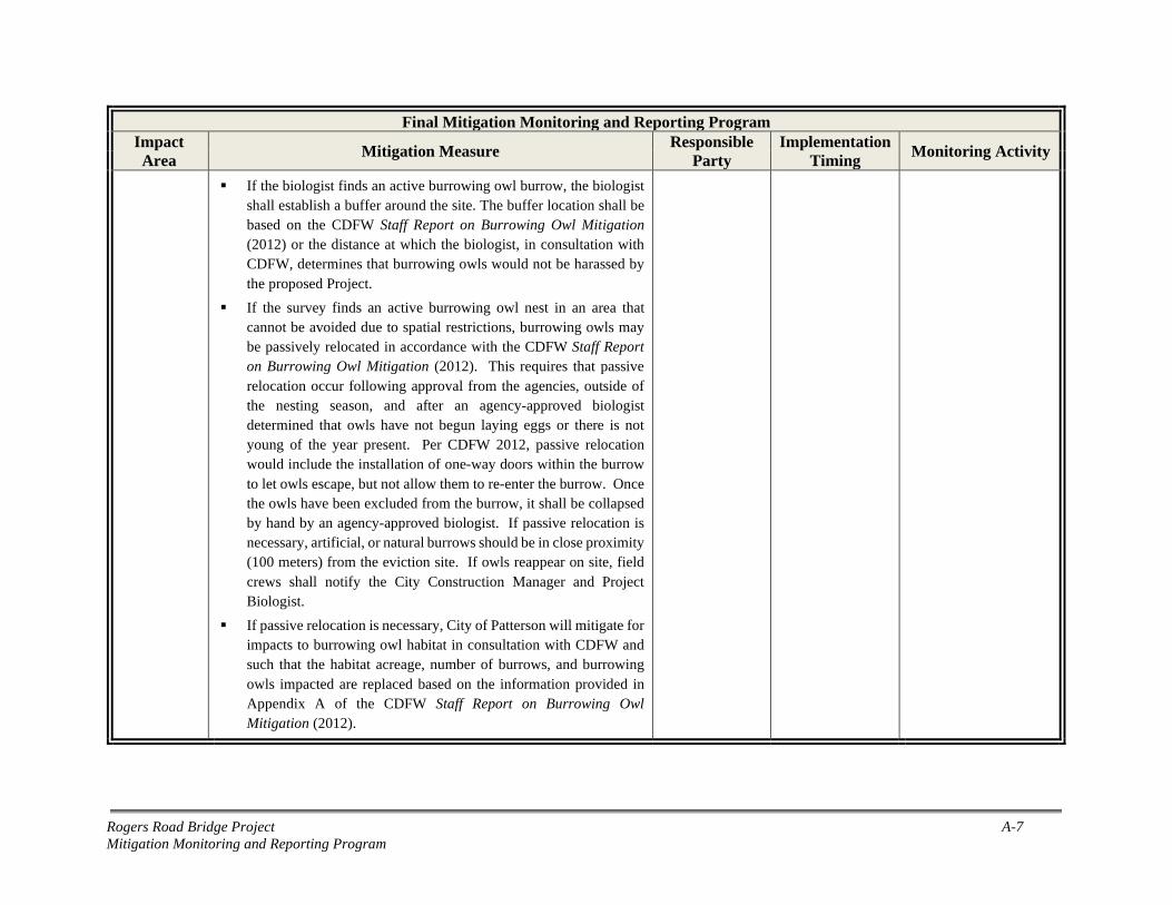
Rogers Road Bridge Project A-7 Mitigation Monitoring and Reporting Program
Final Mitigation Monitoring and Reporting Program Impact Area Mitigation Measure Responsible
Party Implementation
Timing Monitoring Activity
If the biologist finds an active burrowing owl burrow, the biologist shall establish a buffer around the site. The buffer location shall be based on the CDFW Staff Report on Burrowing Owl Mitigation (2012) or the distance at which the biologist, in consultation with CDFW, determines that burrowing owls would not be harassed by the proposed Project.
If the survey finds an active burrowing owl nest in an area that cannot be avoided due to spatial restrictions, burrowing owls may be passively relocated in accordance with the CDFW Staff Report on Burrowing Owl Mitigation (2012). This requires that passive relocation occur following approval from the agencies, outside of the nesting season, and after an agency-approved biologist determined that owls have not begun laying eggs or there is not young of the year present. Per CDFW 2012, passive relocation would include the installation of one-way doors within the burrow to let owls escape, but not allow them to re-enter the burrow. Once the owls have been excluded from the burrow, it shall be collapsed by hand by an agency-approved biologist. If passive relocation is necessary, artificial, or natural burrows should be in close proximity (100 meters) from the eviction site. If owls reappear on site, field crews shall notify the City Construction Manager and Project Biologist.
If passive relocation is necessary, City of Patterson will mitigate for impacts to burrowing owl habitat in consultation with CDFW and such that the habitat acreage, number of burrows, and burrowing owls impacted are replaced based on the information provided in Appendix A of the CDFW Staff Report on Burrowing Owl Mitigation (2012).
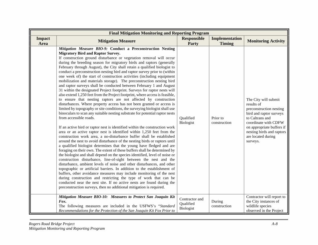
Rogers Road Bridge Project A-8 Mitigation Monitoring and Reporting Program
Final Mitigation Monitoring and Reporting Program Impact Area Mitigation Measure Responsible
Party Implementation
Timing Monitoring Activity
Mitigation Measure BIO-9: Conduct a Preconstruction Nesting Migratory Bird and Raptor Survey. If construction ground disturbance or vegetation removal will occur during the breeding season for migratory birds and raptors (generally February through August), the City shall retain a qualified biologist to conduct a preconstruction nesting bird and raptor survey prior to (within one week of) the start of construction activities (including equipment mobilization and materials storage). The preconstruction nesting bird and raptor surveys shall be conducted between February 1 and August 31 within the designated Project footprint. Surveys for raptor nests will also extend 1,250 feet from the Project footprint, where access is feasible, to ensure that nesting raptors are not affected by construction disturbances. Where property access has not been granted or access is limited by topography or site conditions, the surveying biologist shall use binoculars to scan any suitable nesting substrate for potential raptor nests from accessible roads.
If an active bird or raptor nest is identified within the construction work area or an active raptor nest is identified within 1,250 feet from the construction work area, a no-disturbance buffer shall be established around the nest to avoid disturbance of the nesting birds or raptors until a qualified biologist determines that the young have fledged and are foraging on their own. The extent of these buffers shall be determined by the biologist and shall depend on the species identified, level of noise or construction disturbance, line-of-sight between the nest and the disturbance, ambient levels of noise and other disturbances, and other topographic or artificial barriers. In addition to the establishment of buffers, other avoidance measures may include monitoring of the nest during construction and restricting the type of work that can be conducted near the nest site. If no active nests are found during the preconstruction surveys, then no additional mitigation is required.
Qualified Biologist
Prior to construction
The City will submit results of preconstruction nesting bird and raptor surveys to Caltrans and coordinate with CDFW on appropriate buffers if nesting birds and raptors are located during surveys.
Mitigation Measure BIO-10: Measures to Protect San Joaquin Kit Fox. The following measures are included in the USFWS’s “Standard Recommendations for the Protection of the San Joaquin Kit Fox Prior to
Contractor and Qualified Biologist
During construction
Contractor will report to the City instances of wildlife species observed in the Project

Rogers Road Bridge Project A-9 Mitigation Monitoring and Reporting Program
Final Mitigation Monitoring and Reporting Program Impact Area Mitigation Measure Responsible
Party Implementation
Timing Monitoring Activity
or During Ground Disturbance” dated June 1999 (USFWS 1999). At a minimum, the following measures will be taken to reduce adverse effects to San Joaquin kit fox and their habitat:
Project-related vehicles should observe a 20-mph speed limit in the project area, except on county roads and State and Federal highways; this is particularly important at night when San Joaquin kit fox are most active. Off-road traffic outside of the Project Area should be prohibited.
To prevent inadvertent entrapment of San Joaquin kit fox or other animals during the construction phase of a project, all excavated, steep-walled holes or trenches more than 2 feet deep should be covered at the close of each working day by plywood or similar materials, or provided with one or more escape ramps constructed of earth fill or wooden planks. Before such holes or trenches are filled, they should be thoroughly inspected for trapped animals.
San Joaquin kit fox are attracted to den-like structures such as pipes and may enter stored pipe becoming trapped or injured. All construction pipes, culverts, or similar structures with a diameter of 4 in or greater that are stored at a construction site for one or more overnight period should be thoroughly inspected for San Joaquin kit fox before the pipe is subsequently buried, capped, or otherwise used or moved in any way. If a San Joaquin kit fox is discovered inside a pipe, that section of pipe should not be moved until the USFWS and CDFW have been consulted. Caltrans, as the federal lead agency, will notify the USFWS. The City will be responsible for notifying CDFW.
All food-related trash items such as wrappers, cans, bottles, and food scraps should be disposed of in closed containers and removed daily from the Project Area.
No firearms shall be allowed in the Project Area.
area and provide a description of how disturbance and harm was avoided. If San Joaquin kit fox is discovered in the Project work limits and adjacent areas during the construction period, the City will report conditions and initiate correspondence with Caltrans, CDFW, and USFWS.
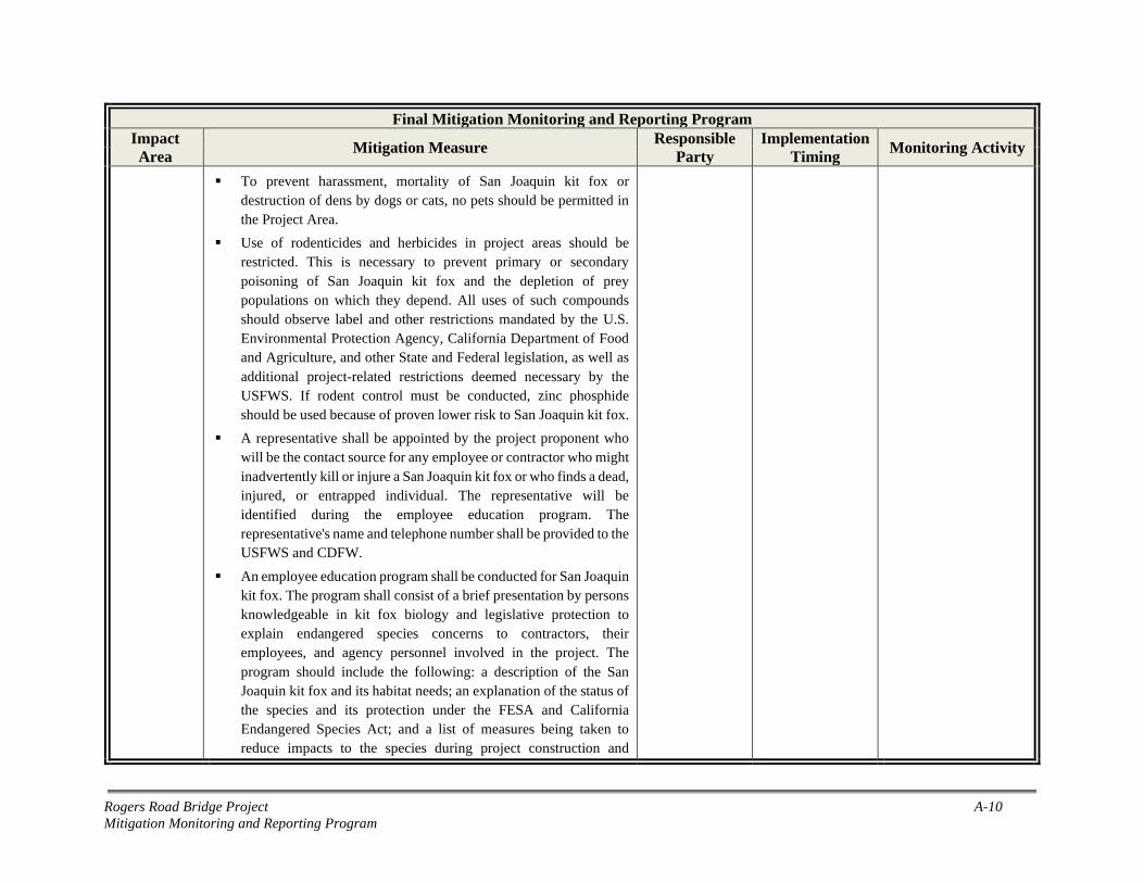
Rogers Road Bridge Project A-10 Mitigation Monitoring and Reporting Program
Final Mitigation Monitoring and Reporting Program Impact Area Mitigation Measure Responsible
Party Implementation
Timing Monitoring Activity
To prevent harassment, mortality of San Joaquin kit fox or destruction of dens by dogs or cats, no pets should be permitted in the Project Area.
Use of rodenticides and herbicides in project areas should be restricted. This is necessary to prevent primary or secondary poisoning of San Joaquin kit fox and the depletion of prey populations on which they depend. All uses of such compounds should observe label and other restrictions mandated by the U.S. Environmental Protection Agency, California Department of Food and Agriculture, and other State and Federal legislation, as well as additional project-related restrictions deemed necessary by the USFWS. If rodent control must be conducted, zinc phosphide should be used because of proven lower risk to San Joaquin kit fox.
A representative shall be appointed by the project proponent who will be the contact source for any employee or contractor who might inadvertently kill or injure a San Joaquin kit fox or who finds a dead, injured, or entrapped individual. The representative will be identified during the employee education program. The representative's name and telephone number shall be provided to the USFWS and CDFW.
An employee education program shall be conducted for San Joaquin kit fox. The program shall consist of a brief presentation by persons knowledgeable in kit fox biology and legislative protection to explain endangered species concerns to contractors, their employees, and agency personnel involved in the project. The program should include the following: a description of the San Joaquin kit fox and its habitat needs; an explanation of the status of the species and its protection under the FESA and California Endangered Species Act; and a list of measures being taken to reduce impacts to the species during project construction and

Rogers Road Bridge Project A-11 Mitigation Monitoring and Reporting Program
Final Mitigation Monitoring and Reporting Program Impact Area Mitigation Measure Responsible
Party Implementation
Timing Monitoring Activity
implementation. A fact sheet conveying this information should be prepared for distribution to the abovementioned people and anyone else who may enter the Project Area.
Upon completion of the Project, all areas subject to temporary ground disturbances, including storage and staging areas, temporary roads, etc., should be recontoured (if necessary), and revegetated to promote restoration of the area to pre-project conditions. An area subject to "temporary" disturbance means any area that is disturbed during the project, but that after project completion will not be subject to further disturbance and has the potential to be revegetated.
In the event that a San Joaquin kit fox or its sign is observed in the Project Area, or it is otherwise determined that San Joaquin kit fox may be affected by the proposed Project during work, Caltrans must be notified immediately to determine whether additional consultation is necessary. If necessary, Caltrans will contact the Sacramento Field Office of the USFWS and the local CDFW office.
Mitigation Measure BIO-11: Nesting Bird Exclusion. If construction will occur during the nesting season (February 1 to September 30), exclusionary netting will be installed around the undersides of the bridge before February 1 of the construction year to prevent new nests from being formed, and/or prevent the reoccupation of existing nests. The City or their contractor would do the following:
Remove all existing unoccupied nests on the bridge during the non-nesting season (October 1 - January 31).
Keep the bridge free of nests, using exclusionary devices or other approved methods, until completion of construction activities.
Inspect the bridge for nesting activity a minimum of three days per week; no two days of inspection would be consecutive. A weekly log would be submitted to the Project biologist. The contractor
Contractor or City
Prior to construction
The Contractor will document exclusionary methods and submit inspection log; City will send documentation to Caltrans and coordinate with CDFW, if required.

Rogers Road Bridge Project A-12 Mitigation Monitoring and Reporting Program
Final Mitigation Monitoring and Reporting Program Impact Area Mitigation Measure Responsible
Party Implementation
Timing Monitoring Activity
would continue inspections until bridge construction activities have been completed. If an exclusion device were found to be ineffective or defective, the contractor would complete repairs to the device within 24 hours. If birds were found trapped in an exclusion device, the contractor would immediately remove the birds in accordance with USFWS and CDFW guidelines.
Submit for approval working drawings or written proposals of any exclusion devices, procedures, or methods to the Project biologist before installing them. The method of installing exclusion devices would not damage any features of the bridge structures. Approval by the Project biologist of the working drawings and inspection performed by the Project biologist would in no way relieve the contractor of full responsibility for deterring nesting.
Cultural and Tribal Cultural Resources
Mitigation Measure CUL-1: Protect Discovered Cultural Subsurface Resources. If any evidence of prehistoric cultural resources (freshwater shells, beads, bone tool remnants or an assortment of bones, soil changes including subsurface ash lens or soil darker in color than surrounding soil, lithic materials such as flakes, tools or grinding rocks, etc.) or historical cultural resources (adobe foundations or walls, structures and remains with square nails, refuse deposits or bottle dumps, often associated with wells or old privies) are observed during ground disturbing activities, all work must immediately cease within 50 feet of the find, the City and Caltrans must be notified, and a qualified archaeologist must be consulted to assess the significance of the cultural materials. If the find is determined to be potentially significant, the archaeologist, in consultation with the City and—if the find is prehistoric or Native American in nature—appropriate Native American group(s), shall develop and implement a treatment plan with an emphasis toward preservation in place.
Contractor and Qualified Archaeologist
During construction (upon discovery)
Contractor will report and document any discovered subsurface resources to the City and Caltrans, who will take appropriate additional measures, as needed.

Rogers Road Bridge Project A-13 Mitigation Monitoring and Reporting Program
Final Mitigation Monitoring and Reporting Program Impact Area Mitigation Measure Responsible
Party Implementation
Timing Monitoring Activity
Mitigation Measure CUL-2: Procedures for Human Remains. In accordance with the California Health and Safety Code, Section 7050.5, and the Public Resources Code 5097.98, regarding the discovery of human remains, if human remains are discovered during construction, all work must immediately cease, and the Stanislaus County coroner must be contacted. If the Coroner determines that the remains are those of a Native American, the Coroner shall contact the Native American Heritage Commission (NAHC) and subsequent procedures shall be followed, according to State Public Resources Code Sections 5097.9 to 5097.99, regarding notification of the Native American Most Likely Descendant.
Contractor During construction (upon discovery)
Contractor will report and document any discovered human remains to the Stanislaus County coroner, the City and Caltrans, who will take appropriate additional measures, as needed.
Hazardous Materials
Mitigation Measure HAZ-1: Conduct Phase II Soil and Materials Sampling and Implement Contamination Removal Activities as Needed. Soil sampling for total lead, pesticides, heavy metals, and TPH shall be conducted in the Project footprint before construction begins. Materials sampling for ACM and LBP on the bridge shall be completed before demolition. A workplan to conduct a Phase II site assessment shall be submitted to City of Patterson for review and approval prior to field activities.
Analytical results from soil and materials samples obtained during Phase II screening will be compared to state and federal standards to evaluate reuse and/or disposal requirements for contaminated soils and materials. The Project will follow Caltrans Standard Specifications and Standard Special Provisions for sampling, removal, and disposal of contaminated soils and materials.
Contractor Prior to Construction and bridge demolition
The Contractor will conduct sampling for hazardous materials and provide the results to the City and Caltrans.
Mitigation Measure HAZ-2: Implement Lead Compliance Plan. If sampling determines elevated lead levels in soils or materials, the Contractor shall prepare a project-specific Lead Compliance Plan (8 CCR 1532.1, the “Lead in Construction” standard) to reduce worker exposure to lead-impacted soil and lead-containing paint. The plan would include protocols for environmental and personnel monitoring, requirements for personal protective equipment, other health and safety
Contractor During construction (if needed)
The City will be provided with a Lead Compliance Plan if needed and the Contractor will implement the plan.
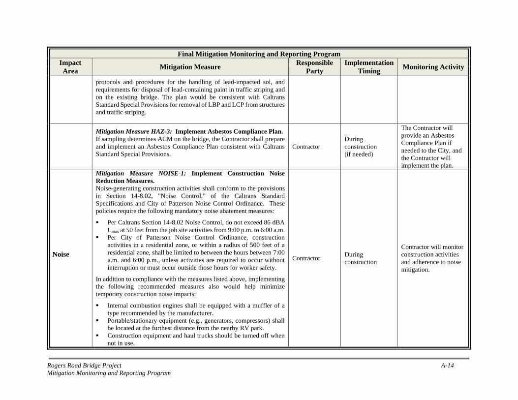
Rogers Road Bridge Project A-14 Mitigation Monitoring and Reporting Program
Final Mitigation Monitoring and Reporting Program Impact Area Mitigation Measure Responsible
Party Implementation
Timing Monitoring Activity
protocols and procedures for the handling of lead-impacted sol, and requirements for disposal of lead-containing paint in traffic striping and on the existing bridge. The plan would be consistent with Caltrans Standard Special Provisions for removal of LBP and LCP from structures and traffic striping.
Mitigation Measure HAZ-3: Implement Asbestos Compliance Plan. If sampling determines ACM on the bridge, the Contractor shall prepare and implement an Asbestos Compliance Plan consistent with Caltrans Standard Special Provisions.
Contractor During construction (if needed)
The Contractor will provide an Asbestos Compliance Plan if needed to the City, and the Contractor will implement the plan.
Noise
Mitigation Measure NOISE-1: Implement Construction Noise Reduction Measures. Noise-generating construction activities shall conform to the provisions in Section 14-8.02, "Noise Control," of the Caltrans Standard Specifications and City of Patterson Noise Control Ordinance. These policies require the following mandatory noise abatement measures:
Per Caltrans Section 14-8.02 Noise Control, do not exceed 86 dBA Lmax at 50 feet from the job site activities from 9:00 p.m. to 6:00 a.m.
Per City of Patterson Noise Control Ordinance, construction activities in a residential zone, or within a radius of 500 feet of a residential zone, shall be limited to between the hours between 7:00 a.m. and 6:00 p.m., unless activities are required to occur without interruption or must occur outside those hours for worker safety.
In addition to compliance with the measures listed above, implementing the following recommended measures also would help minimize temporary construction noise impacts:
Internal combustion engines shall be equipped with a muffler of a type recommended by the manufacturer.
Portable/stationary equipment (e.g., generators, compressors) shall be located at the furthest distance from the nearby RV park.
Construction equipment and haul trucks should be turned off when not in use.
Contractor During construction
Contractor will monitor construction activities and adherence to noise mitigation.

Rogers Road Bridge Project A-15 Mitigation Monitoring and Reporting Program
Final Mitigation Monitoring and Reporting Program Impact Area Mitigation Measure Responsible
Party Implementation
Timing Monitoring Activity
The Kit Fox RV Park shall be notified in writing a minimum of two weeks prior to initiation of project construction. The notification shall, at a minimum, identify the anticipated project construction schedule, noise abatement measures to be implemented, and the name and phone number of a designated construction liaison to be contacted regarding construction-related information/noise complaints. A sign with the telephone number to be called regarding construction-related information/complaints shall be posted at the project site.
Traffic
Mitigation Measure TRA-1: Traffic Control Plan and Notification of Detour. The following measures shall be completed by the Contractor, consistent with City of Patterson and Caltrans standard guidance for traffic control during construction.
Emergency service providers shall be notified of construction activities, informed of the full road closure, and provided details of detour routes during construction.
Traffic detours shall be announced to residents and roadway users well in advance of construction and closure of the bridge.
Traffic detour signage shall be installed before construction begins and throughout construction so that drivers can avoid the Project area entirely.
The Contractor shall prepare a traffic control plan for the City’s review and approval before construction begins.
Contractor Prior to Construction
Contractor will submit Traffic Control Plan to City for approval, including notification plans.

Rogers Road Bridge Project A-16 Mitigation Monitoring and Reporting Program
Page intentionally blank

Rogers Road Bridge Project Site Photos
Appendix B. Site Photos

Rogers Road Bridge Project Site Photos
Page intentionally blank

Rogers Road Bridge Project Site Photos B-1
View of Rogers Road, facing north.
View of Rogers Road, facing south.

Rogers Road Bridge Project Site Photos B-2
View of the Delta-Mendota Canal, facing northwest.
View of the Rogers Road Bridge over the Delta-Mendota Canal, facing northwest.
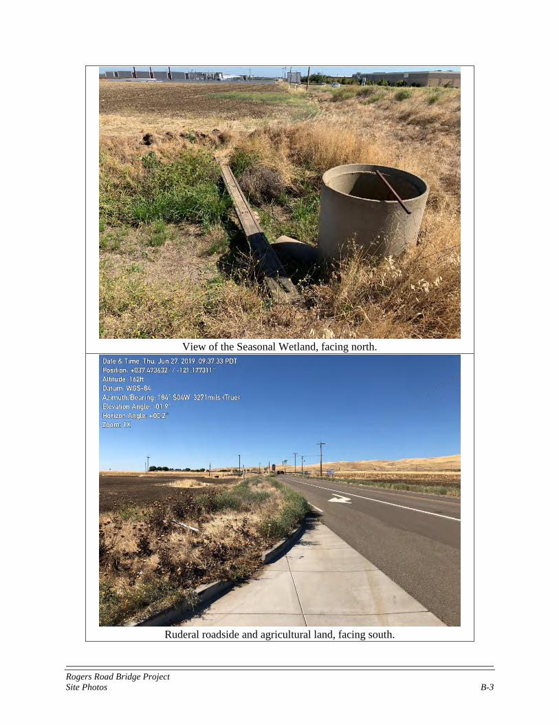
Rogers Road Bridge Project Site Photos B-3
View of the Seasonal Wetland, facing north.
Ruderal roadside and agricultural land, facing south.

Rogers Road Bridge Project Site Photos B-4
Page intentionally blank