Embed Size (px)
Citation preview
CCAANNDDYY LLAANNDD
A Study of Ohio TopographyA Study of Ohio Topography
Tim Herrmann, Haley Todd, Justin Yeazell Tim Herrmann, Haley Todd, Justin Yeazell GEO 204GEO 204
Dr. Michael SandyDr. Michael SandyApril 25, 2007 April 25, 2007
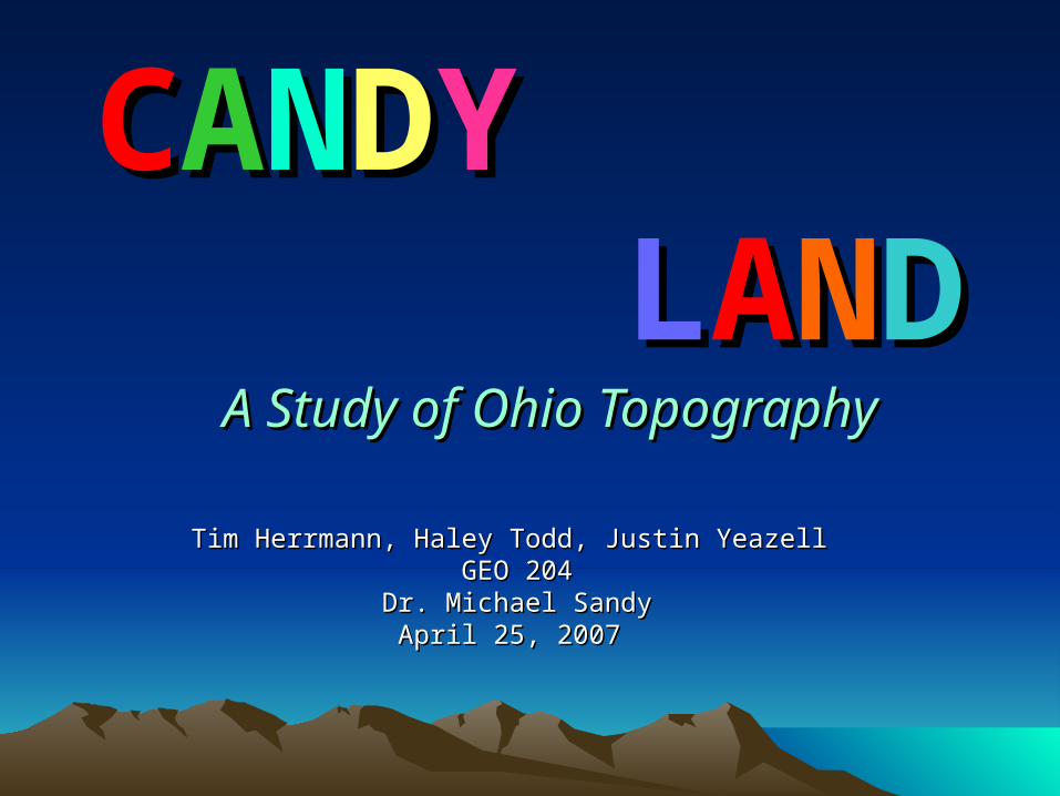
Lesson OverviewLesson Overview
• Review of Previous Material
• Study Key Aspects of a Map
• Explore a Map of Ohio’s Topography
• Create our own Maps of Ohio’s Topography with Candy
• Assessment
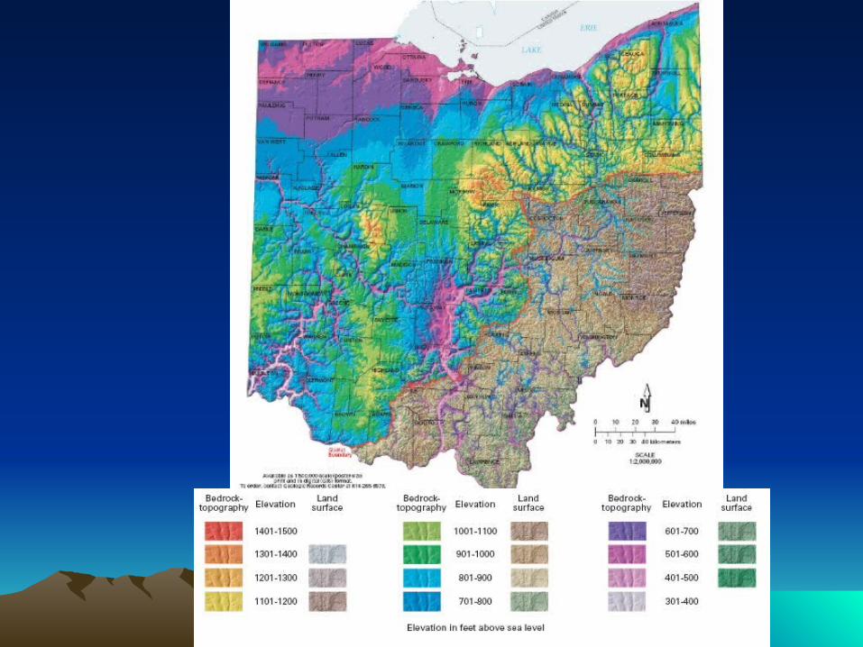
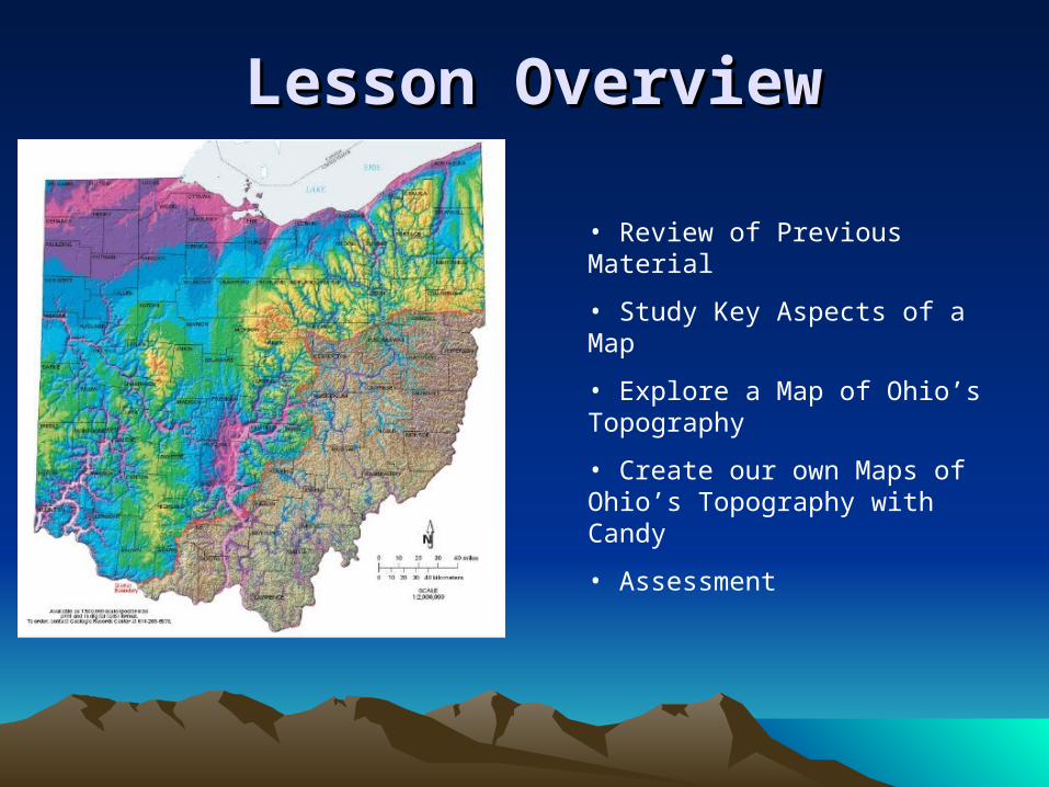
Geology Bedrock Map SymbolsGeology Bedrock Map Symbols• General Political Information:
– roads, towns, buildings, counties, borders
• Topography: – Contour lines that connect areas of equal elevation
• Water: – Lakes, rivers, and oceans are shown in blue.
• Rock Formations: – Each rock formation has a different color. – Contacts between different types of rocks are shown as thin black lines,
except when rock formations are separated by a fault, which is shown as a thick black line.
• Other Requirements:– Title, Key, Scale, Cardinal Direction
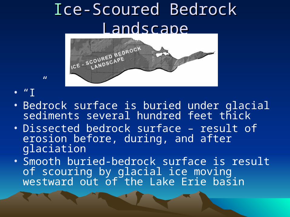
IIce-Scoured Bedrock Landscapece-Scoured Bedrock Landscape
• “I”• Bedrock surface is buried under glacial sediments
several hundred feet thick• Dissected bedrock surface – result of erosion
before, during, and after glaciation• Smooth buried-bedrock surface is result of
scouring by glacial ice moving westward out of the Lake Erie basin
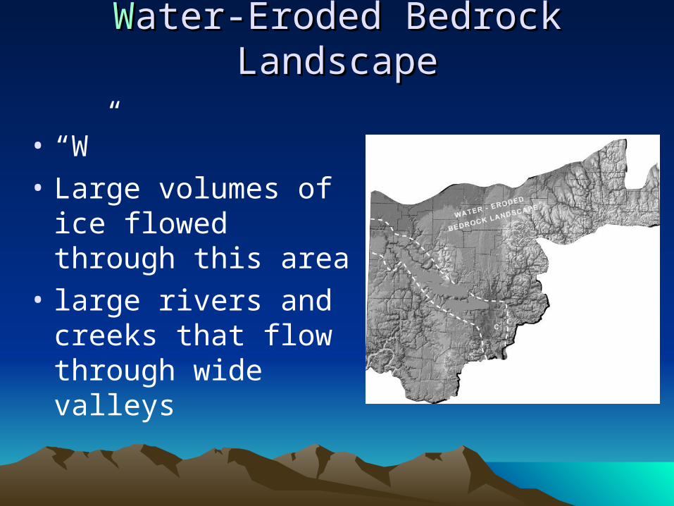
WWater-Eroded Bedrock Landscapeater-Eroded Bedrock Landscape
• “W”
• Large volumes of ice flowed through this area
• large rivers and creeks that flow through wide valleys
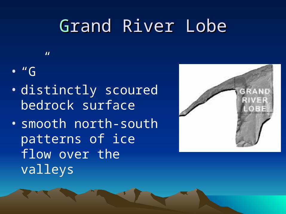
GGrand River Loberand River Lobe
• “G”
• distinctly scoured bedrock surface
• smooth north-south patterns of ice flow over the valleys
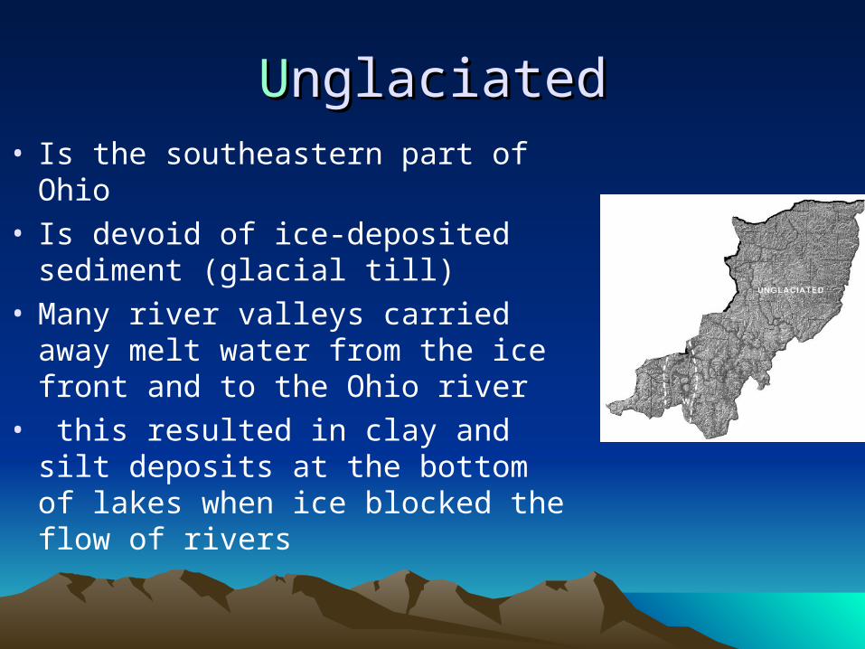
UUnglaciatednglaciated• Is the southeastern part of Ohio• Is devoid of ice-deposited sediment
(glacial till) • Many river valleys carried away
melt water from the ice front and to the Ohio river
• this resulted in clay and silt deposits at the bottom of lakes when ice blocked the flow of rivers
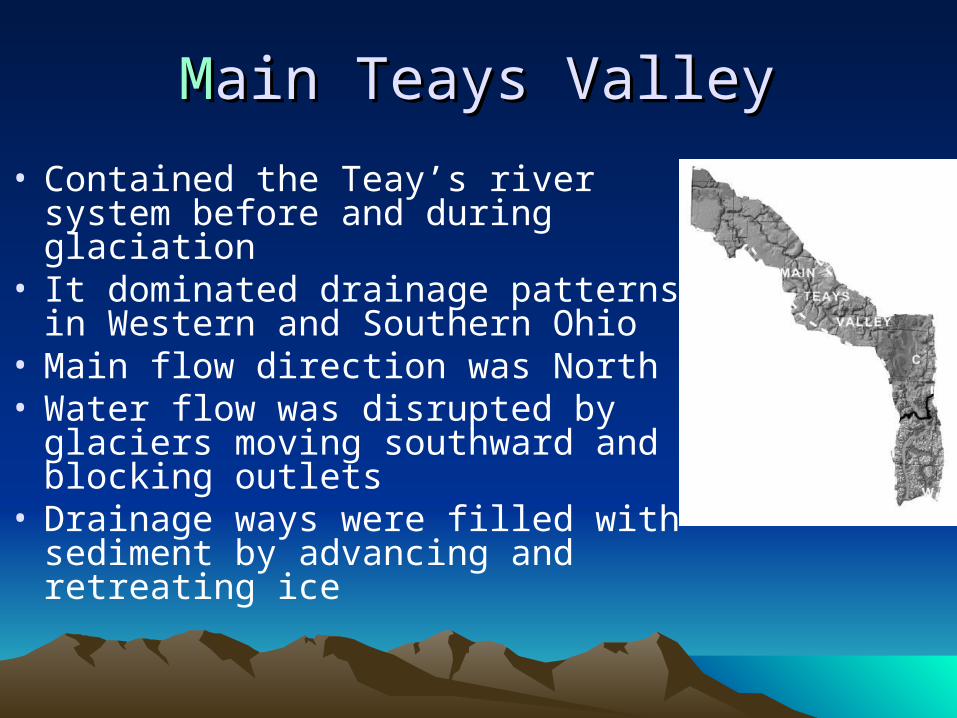
• Contained the Teay’s river system before and during glaciation
• It dominated drainage patterns in Western and Southern Ohio
• Main flow direction was North • Water flow was disrupted by glaciers
moving southward and blocking outlets
• Drainage ways were filled with sediment by advancing and retreating ice
MMain Teays Valley ain Teays Valley

Create Your Create Your CCAANNDDYY LLAANNDD• Be sure to include:
– Key based on the topography map shown
• Explain varying colors and heights– Title– Cardinal directions– Label each area & acronym
• Ice-Scourged Bedrock• Water-Eroded Bedrock • Grand River Lobe• Unglaciated• Main Teays Valley
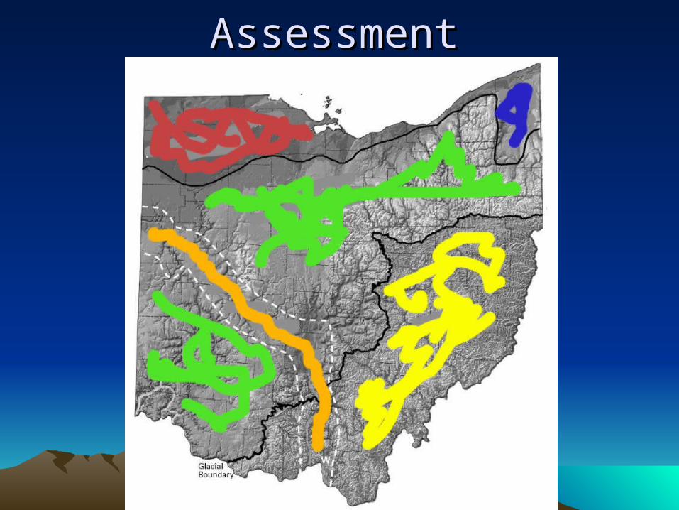
AssessmentAssessment