Embed Size (px)
Citation preview

Building a New GIS County Boundary File
Gibson CountyGibson County

Boundaries, Cadastral, PLSS Workgroup
• Surveyor’s Office GIS (2005) Full time County GIS Director (2010) Full-time County GIS Director (2010) Need for an updated County boundary Utili ing S r e or Office GPS field data Utilizing Surveyor Office GPS field data Establishing a basis for our digital cadastre
◘ Sections, Townships, Ranges, Political Townships, Voting , p , g , p , gDistricts, City Limits, Subdivisions, Lot Lines, Parcels, and more…
John E. Howe
Gibson County GIS [email protected]

Southwest Indiana

Gibson County – Revised Statutes of Indiana, 1851-1852, vol 1:176

Gibson County – Revised Statutes of Indiana, 1851-1852, vol 1:176

Gibson County – Revised Statutes of Indiana, 1851-1852, vol 1:176

Gibson County – Revised Statutes of Indiana, 1851-1852, vol 1:176

Gibson County – River Scales (White River)

Gibson County – River Scales (Wabash River)
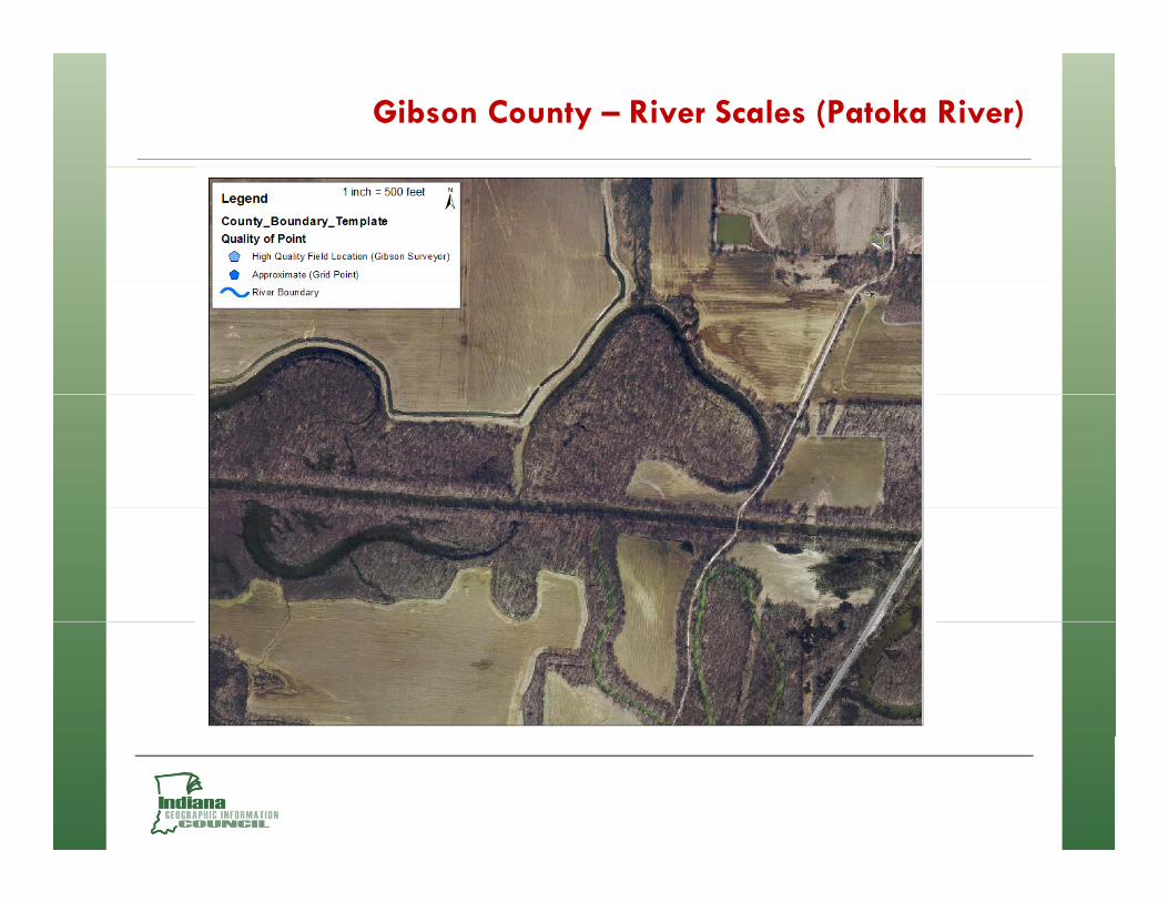
Gibson County – River Scales (Patoka River)

Gibson County – River Scales (Patoka River)

Gibson County – River Scales (Patoka River)

Gibson County – River Scales (Patoka River)

Gibson County – River Scales (Patoka River)

Thank you


![gfkmf–gf]S;fg lx;fj Plss[t cfo Aoo lx;fj](https://img.dokumen.tips/doc/110x75/619614ac08ead35ad641591c/gfkmfgfsfg-lxfj-plsst-cfo-aoo-lxfj.jpg)
