Embed Size (px)
Citation preview

Strengthening regional cooperation Strengthening regional cooperation for disaster risk reduction and for disaster risk reduction and
sustainable developmentsustainable development
Broadening and Deepening the Space and GIS Applications for Disaster Risk
Reduction and Sustainable development in Asia-Pacific Region
Keran Wang Information and Communications Technology and Disaster
Risk Reduction Division (IDD), UNESCAP
Chengdu Forum on UN-GGIM15-17 October 2013, Chengdu, China
Strengthening regional cooperation Strengthening regional cooperation for disaster risk reduction and for disaster risk reduction and
sustainable developmentsustainable development
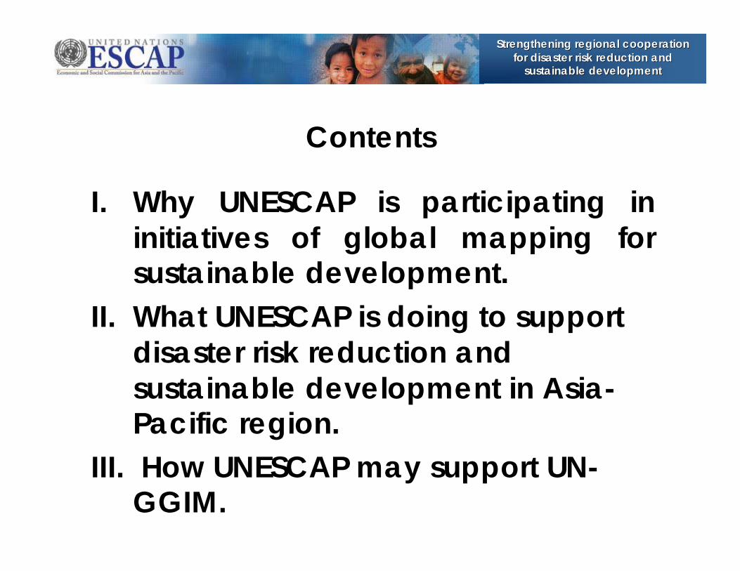
Contents
I. Why UNESCAP is participating in initiatives of global mapping for sustainable development.
II. What UNESCAP is doing to support disaster risk reduction and sustainable development in Asia-Pacific region.
III. How UNESCAP may support UN-GGIM.

Strengthening regional cooperation Strengthening regional cooperation for disaster risk reduction and for disaster risk reduction and
sustainable developmentsustainable development
62 Governments 62 Governments –– 58 within the 58 within the region, i.e., from Turkey in the west to region, i.e., from Turkey in the west to Kiribati in the east, and from the Kiribati in the east, and from the Russian Federation in the north to Russian Federation in the north to New Zealand in the south.New Zealand in the south.
ESCAPESCAP’’s regional strategy on space s regional strategy on space and GIS applications focuses on and GIS applications focuses on promoting the regional/subpromoting the regional/sub--regional regional cooperative mechanisms and cooperative mechanisms and substantive programmes for effective substantive programmes for effective support disaster risk reduction and support disaster risk reduction and sustainable development.sustainable development.
I. Why ESCAP is participating in initiatives of global mapping for sustainable development
Policy analysis
Technical Cooperation Projects
Advisory Services
Capacity Building

Strengthening regional cooperation Strengthening regional cooperation for disaster risk reduction and for disaster risk reduction and
sustainable developmentsustainable development
green jobs and social inclusion energy access, efficiency and sustainability Food security & sustainable agriculture sound water management sustainable cities sustainable management of the oceans improved resilience and disaster preparedness
7 Priority Areas ESCAP’s Regional Cooperative Mechanism for Drought Monitoring and Early Warning
RESAP networks for Education and Training for remote sensing & GIS applications in agricylture and food security
Harmonizing the regional/international cooperation mechanisms (International Charter, Sentinel Asia, UNITAR, UNSPIDER) in support of more effectice disaster reponse to the member Countries
Networking with RESAP members for access to satellite data in the event of major disasters
Building the capacity for geo-spatial disaster information in the specific context of countries with spacial needs.
RESAP networks for Education and Training for space applications in DRR/M
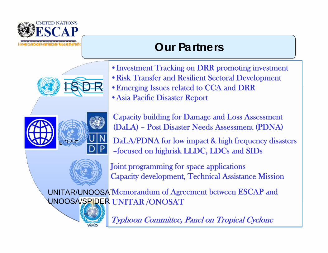
Joint programming for space applicationsCapacity development, Technical Assistance Mission
Capacity building for Damage and Loss Assessment (DaLA) – Post Disaster Needs Assessment (PDNA)
DaLA/PDNA for low impact & high frequency disasters –focused on highrisk LLDC, LDCs and SIDs
•Investment Tracking on DRR promoting investment •Risk Transfer and Resilient Sectoral Development•Emerging Issues related to CCA and DRR•Asia Pacific Disaster Report
ECLAC
Typhoon Committee, Panel on Tropical Cyclone
Our PartnersOur Partners
UNITAR/UNOOSATUNOOSA/SPIDER
Memorandum of Agreement between ESCAP and UNITAR /ONOSAT
Strengthening regional cooperation Strengthening regional cooperation for disaster risk reduction and for disaster risk reduction and
sustainable developmentsustainable development
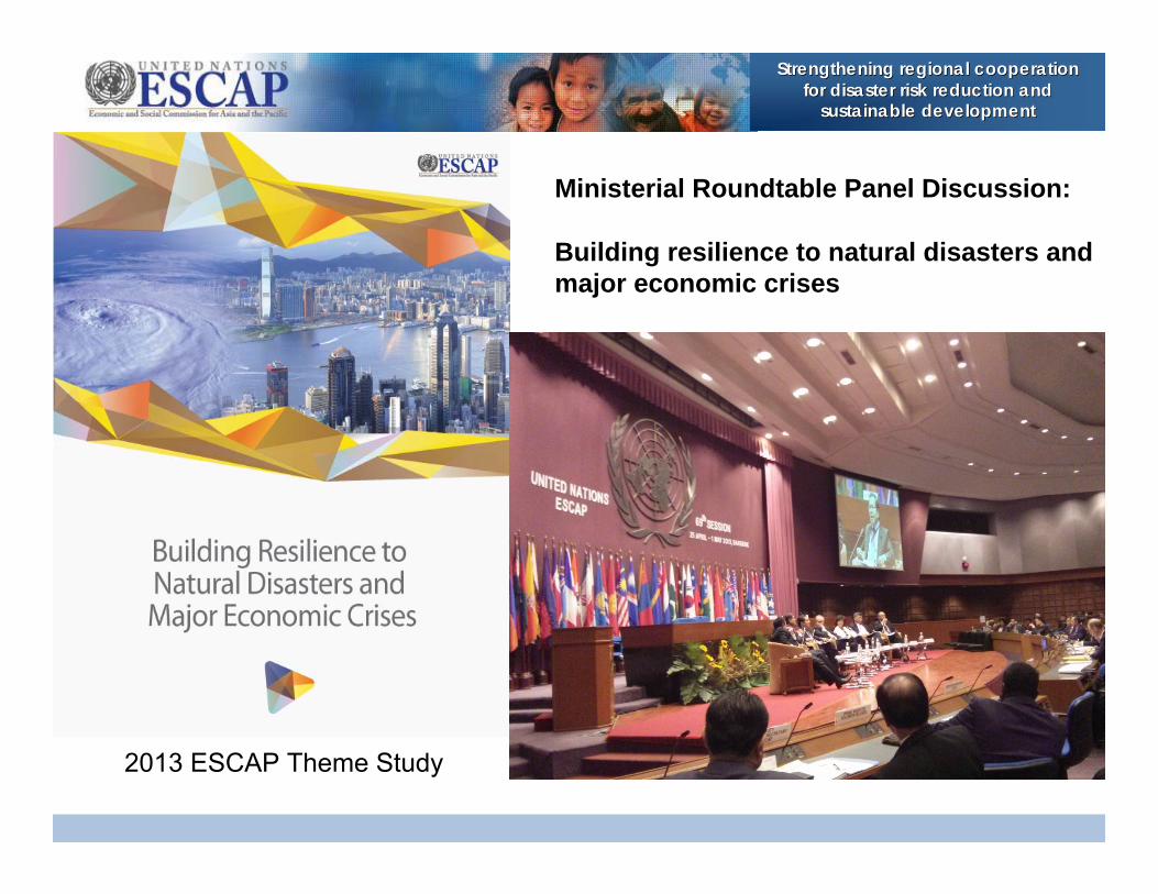
Ministerial Roundtable Panel Discussion:
Building resilience to natural disasters and major economic crises
2013 ESCAP Theme Study

Strengthening regional cooperation Strengthening regional cooperation for disaster risk reduction and for disaster risk reduction and
sustainable developmentsustainable development
• Asia-Pacific is the most disaster prone region in the world
• …and the most affected
People affected (per 1,000 population)
Africa
Latin America and
Caribbean
North America
Europe
Asia Pacific
00.10.20.30.40.50.6
People affected
Africa
Latin America and
Caribbean
North America
Asia Pacific
Europe
0 500,000 1,000,000 1,500,000 2,000,000 2,500,000
Disasters by region (1980-2011)
020406080
100120140160180200
1980 1982 1984 1986 1988 1990 1992 1994 1996 1998 2000 2002 2004 2006 2008 2010
Asia Pacific Africa Latin America and Caribbean North America Europe

Strengthening regional cooperation Strengthening regional cooperation for disaster risk reduction and for disaster risk reduction and
sustainable developmentsustainable development
- Economic losses from disasters are rising globally
- …and low-income countries are the most affected
0
50
100
150
200
250
300
350
1980 1982 1984 1986 1988 1990 1992 1994 1996 1998 2000 2002 2004 2006 2008 2010
Economic damage (Billion dollars 2005) Expon. (Economic damage (Billion dollars 2005))
China: Drought
Japan: Great East Japan Earthquake
China: Sichuan Earthquake
Turkey: Earthquake
United States: Katrina Storm
Japan: Kobe Earthquake
Algeria: El Asnam Earthquake
Iran: Manjil-RudbarEarthquake
Japan: Chūetsu Earthquake
Spain: Floods
Economic damage (%GDP) (2006-2010)
Low income
Lower middle income
Upper middle income
High income
0.0 0.2 0.4 0.6 0.8 1.0 1.2

Strengthening regional cooperation Strengthening regional cooperation for disaster risk reduction and for disaster risk reduction and
sustainable developmentsustainable development
Building Resilience
“The capacity of countries and their people to withstand, adapt to, and recover from natural disasters and major economic crises – so that their people can continue to lead the kind of lives they value.”
Regional Cooperation
Community Resilience
Land, Water, Energy
Critical Infrastructure
Financial Cooperation
Supply Chains
Economics of Resilience
“The capacity of countries and their people to withstand, adapt to, and recover from natural disasters and major economic crises – so that their people can continue to lead the kind of lives they value.”
Regional Cooperation
Community Resilience
Critical Infrastructure
Economics of Resilience

Strengthening regional cooperation Strengthening regional cooperation for disaster risk reduction and for disaster risk reduction and
sustainable developmentsustainable development
II. What ESCAP is doing for supporting disaster risk reduction and sustainable development in the Asia-Pacific region
Strengthening regional cooperation Strengthening regional cooperation for disaster risk reduction and for disaster risk reduction and
sustainable developmentsustainable development
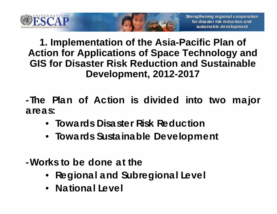
1. Implementation of the Asia-Pacific Plan of Action for Applications of Space Technology and GIS for Disaster Risk Reduction and Sustainable
Development, 2012-2017
-The Plan of Action is divided into two major areas:
• Towards Disaster Risk Reduction• Towards Sustainable Development
-Works to be done at the• Regional and Subregional Level• National Level
Strengthening regional cooperation Strengthening regional cooperation for disaster risk reduction and for disaster risk reduction and
sustainable developmentsustainable development
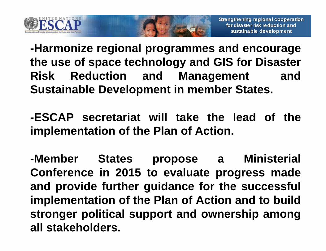
-Harmonize regional programmes and encourage the use of space technology and GIS for Disaster Risk Reduction and Management and Sustainable Development in member States.
-ESCAP secretariat will take the lead of the implementation of the Plan of Action.
-Member States propose a Ministerial Conference in 2015 to evaluate progress made and provide further guidance for the successful implementation of the Plan of Action and to build stronger political support and ownership among all stakeholders.

Strengthening regional cooperation Strengthening regional cooperation for disaster risk reduction and for disaster risk reduction and
sustainable developmentsustainable development
2. Regional Space Applications Programme (RESAP)
Space applications for disaster risk reduction and management is addressed by ESCAP in both sectoral and multi-sectoral approaches, through its flagship programme---The Regional Space Applications Programme for Sustainable Development for Asia the Pacific (RESAP) .
RESAP aims to promote the use of space applications for inclusive, resilient and sustainable development in Asia and the Pacific.
Strengthens regional cooperation and networking of the space agencies in the region.
- Rapid disaster mapping- Capacity development- Operational Drought Monitoring and Early Warning
Mechanism, start from Mongolia

Strengthening regional cooperation Strengthening regional cooperation for disaster risk reduction and for disaster risk reduction and
sustainable developmentsustainable development
14
3. Asia-Pacific Gateway for Disaster Risk Reduction and Development
Professional Resources
TechnicalServices
Experts Directory
Networks of
Communities
Discussion forums / helpdesk
www.drrgateway.net

Strengthening regional cooperation Strengthening regional cooperation for disaster risk reduction and for disaster risk reduction and
sustainable developmentsustainable development
4. Community of Practices and online expert networks
Strengthening regional cooperation Strengthening regional cooperation for disaster risk reduction and for disaster risk reduction and
sustainable developmentsustainable development
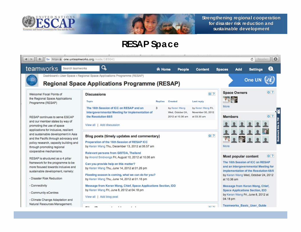
RESAP Space
Strengthening regional cooperation Strengthening regional cooperation for disaster risk reduction and for disaster risk reduction and
sustainable developmentsustainable development
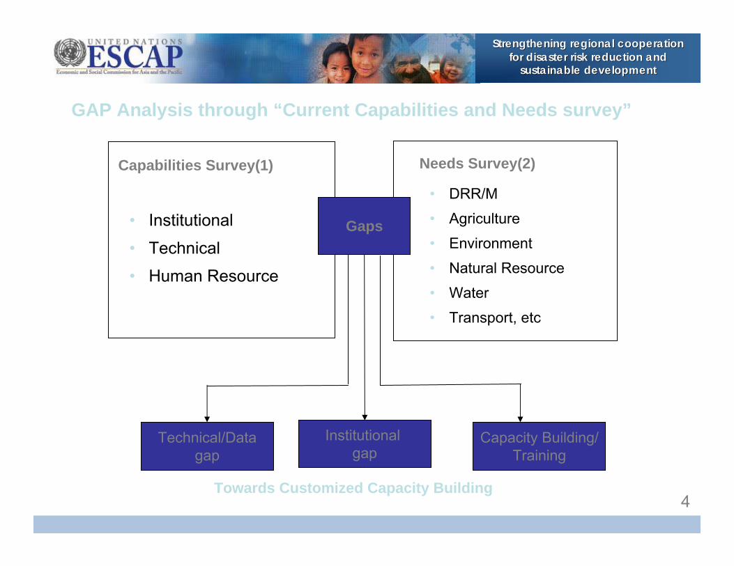
• Institutional
• Technical
• Human Resource
Capabilities Survey(1)
Gaps
Technical/Datagap
Institutional gap
Capacity Building/Training
Towards Customized Capacity Building
• DRR/M
• Agriculture
• Environment
• Natural Resource
• Water
• Transport, etc
Needs Survey(2)
GAP Analysis through “Current Capabilities and Needs survey”
4

Strengthening regional cooperation Strengthening regional cooperation for disaster risk reduction and for disaster risk reduction and
sustainable developmentsustainable development
18
5. ESCAP initiative: Improving disaster risk preparedness in the Asia-Pacific region
ESCAP has embarked on a UNDA project entitled “Improving disaster risk preparedness in the ESCAP region”.
Aims to support the establish and use geo-reference/geospatial information at national level and strengthen the capacity of governments of CSNs in accessing up-to-date and accurate socioeconomic data with satellite imagery in disaster-affected areas.
Enhances the capacity of ESCAP member states towards managing the disaster risks more efficiently and effectively, and reduce losses, and build resilience to hazards through the use/sharing of standardized geo-spatial information among and within the countries.

Strengthening regional cooperation Strengthening regional cooperation for disaster risk reduction and for disaster risk reduction and
sustainable developmentsustainable development
19
Developed the prototype of the national geo-DRM portals for Mongolia, Cook Islands, Kyrgyzstan, CSNs in SAARC members and other countries. The computer-based platform combines data management with map display, allowing planners and emergency managers to graphically display hazard impact areas, and relate them to people and property at risk.
Promote the collaboration and partnership with UNOSAT, UNISDR, UNDP, UNOCHA and subregional organizations (SAARC DMC, ASEAN AHA, SOPAC), to develop geo-DRM portal based on existing knowledge networks.
Capacity development activities: more than 200 decision makers,project managers and practitioners have been trained in last twoyears.
Provided technical assistance to Mongolia, Cook Islands for customizing the geo-portal. More will be conducted in Kyrgyzstan, Afghanistan, Bangladesh, Nepal and Fiji before the end of 2013.

Strengthening regional cooperation Strengthening regional cooperation for disaster risk reduction and for disaster risk reduction and
sustainable developmentsustainable development
-Support the initiatives and activities from the Asia-Pacific perspective.
-Joint projects on using space and GIS for disaster risk management and inclusive, sustainable and resilient development.
-Rapid Mapping of disasters, including urban hazard and disasters.
-Capacity building for developing countries in the region.
III. How ESCAP may support UN-GGIM

Strengthening regional cooperation Strengthening regional cooperation for disaster risk reduction and for disaster risk reduction and
sustainable developmentsustainable development
Pilot project proposed for implementation of the Asia-Pacific Regional Plan of Action :
Information sharing towards integrated geographic information systems and
disaster/hazard mapping in rapid urbanization areas, 2014-2016

Strengthening regional cooperation Strengthening regional cooperation for disaster risk reduction and for disaster risk reduction and
sustainable developmentsustainable development
Country Status of GIS Infrastucture
12 countries need data sharing and18 countries has GIS data, but only
7 countries have National Geo-Spatial Data Information (SDI) systems
Number of Countries

Strengthening regional cooperation Strengthening regional cooperation for disaster risk reduction and for disaster risk reduction and
sustainable developmentsustainable development
Country Status of GIS Infrastucture 23 countries have some sort of hazard maps,
but 5 countries do not have Capital hazard maps
Number of Countries

Strengthening regional cooperation Strengthening regional cooperation for disaster risk reduction and for disaster risk reduction and
sustainable developmentsustainable development
-Developing countries face challenges in sharing information and lack of necessary critical information in DRR/M. -Implementation plan needs a pilot project in two or three countries in the region to showcase the use of space and GIS for DRR/M. Pilot project aims to:•Develop a dataset toward Integrated GIS;•Make disaster area maps if disaster occurs;•Make hazard maps for disaster preparation;•Contribute to risk reduction in rapid urbanization.

Strengthening regional cooperation Strengthening regional cooperation for disaster risk reduction and for disaster risk reduction and
sustainable developmentsustainable development
-Decision making of disaster response activities needs evidenced-based and updated information between NDMA and other stakeholders including the mapping agencies.
-GIS experts are recently encountering challenges to utilize various and sepcific information, and consolidate all related data in one Integrated GIS platform.
-The platform will cover not only the disaster data but also the critical socio-economic information.

Strengthening regional cooperation Strengthening regional cooperation for disaster risk reduction and for disaster risk reduction and
sustainable developmentsustainable development
Rapid Urbanization-Rapid urbanization may increase the risk of catastrophe due to the rapid increased population and lack of plan and preparedness.
-City services, managements, emergency rescue and recover needs actual land use information and other related socio-economic information.
-Activity of information sharing towards Integrated GIS is to standardize actual data for the preparation to reduce disaster risk and management and promote sustainable development in the highly urbanized area.

Strengthening regional cooperation Strengthening regional cooperation for disaster risk reduction and for disaster risk reduction and
sustainable developmentsustainable development
Draft Project Plan-to be discussed in the High Level Decision Maker Meeting from 26-28 November 2013
Methods :Two or three countries implement a pilot project.
Schedule:From 1/12/2013 to 31/12/2016

Strengthening regional cooperation Strengthening regional cooperation for disaster risk reduction and for disaster risk reduction and
sustainable developmentsustainable developmentContents of Draft Implementation Plan1) Information Sharing(1) Metadata Request (2) Metadata Collection (3) Data Standardization(4) Metadata Catalogue Distribution (5) Actual Data Acquisition
2) Disaster Risk Reduction and Management(1) Disaster Area Map Production if Disaster Occurs (2) Hazard Map Production of Rapid Urbanization Area
3) Assessment(1) Country Assessment……..(mid of 2016)(2) Regional Assessment….. (end of 2016)

Strengthening regional cooperation Strengthening regional cooperation for disaster risk reduction and for disaster risk reduction and
sustainable developmentsustainable development
Thank you for your kind attention.