Embed Size (px)
Citation preview
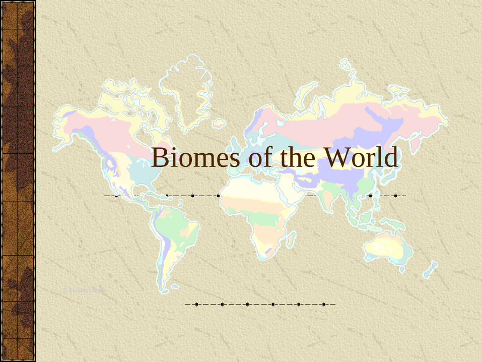
Biomes of the World

How does the physical environment influence communities and ecosystems?
Hoodoos in Cappadocia, Turkey
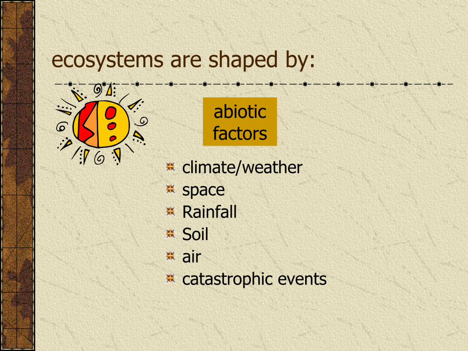
ecosystems are shaped by:
climate/weather
space
Rainfall
Soil
air
catastrophic events
abiotic factors
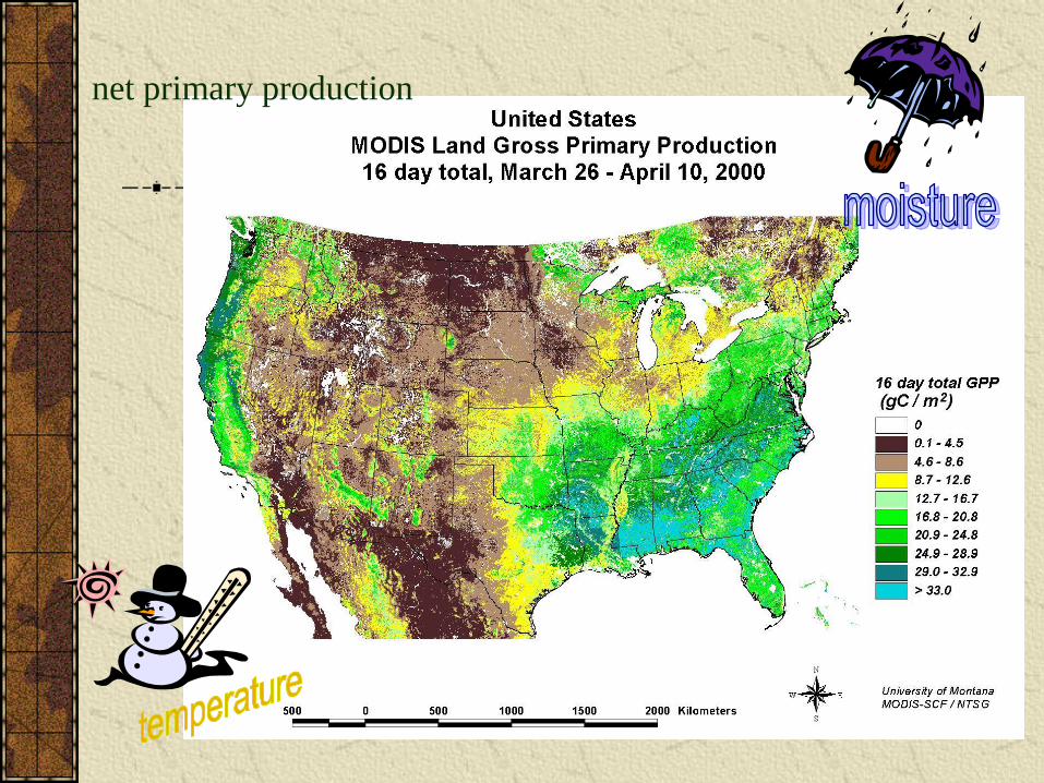
net primary production
Ecosystems
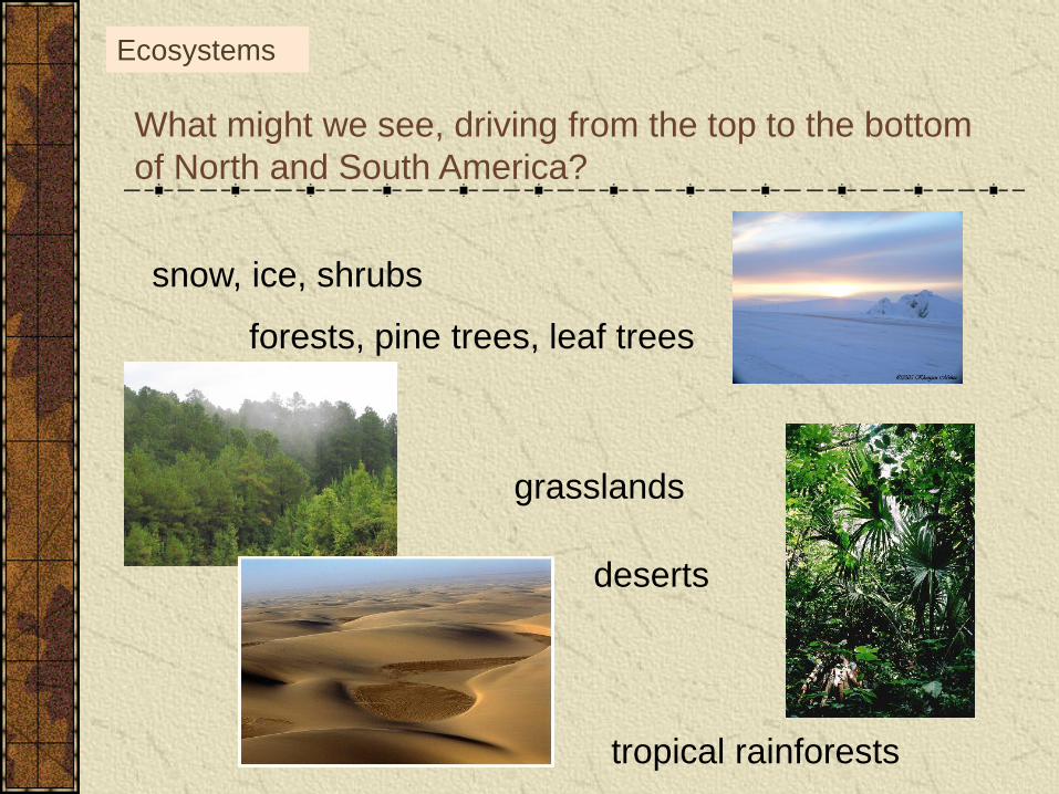
What might we see, driving from the top to the bottom
of North and South America?
snow, ice, shrubs
forests, pine trees, leaf trees
deserts
grasslands
tropical rainforests
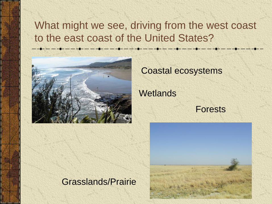
What might we see, driving from the west coast
to the east coast of the United States?
Coastal ecosystems
Wetlands
Grasslands/Prairie
Forests
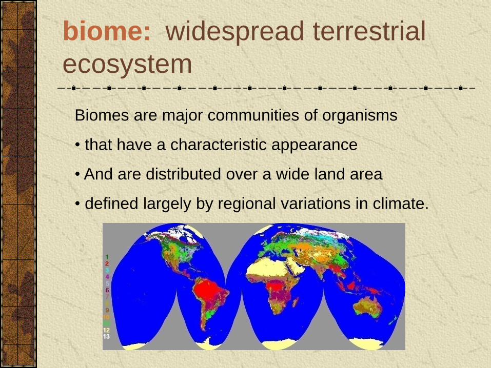
biome: widespread terrestrial
ecosystem
Biomes are major communities of organisms
• that have a characteristic appearance
• And are distributed over a wide land area
• defined largely by regional variations in climate.
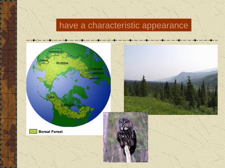
have a characteristic appearance
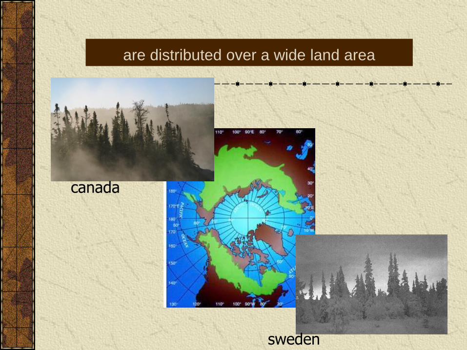
are distributed over a wide land area
sweden
canada
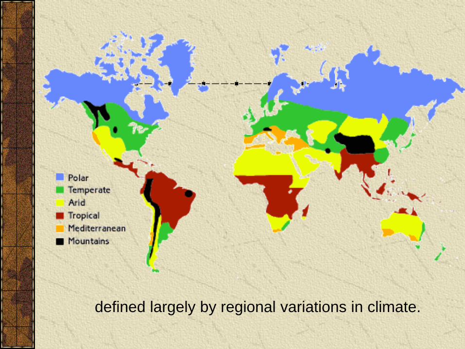
defined largely by regional variations in climate.
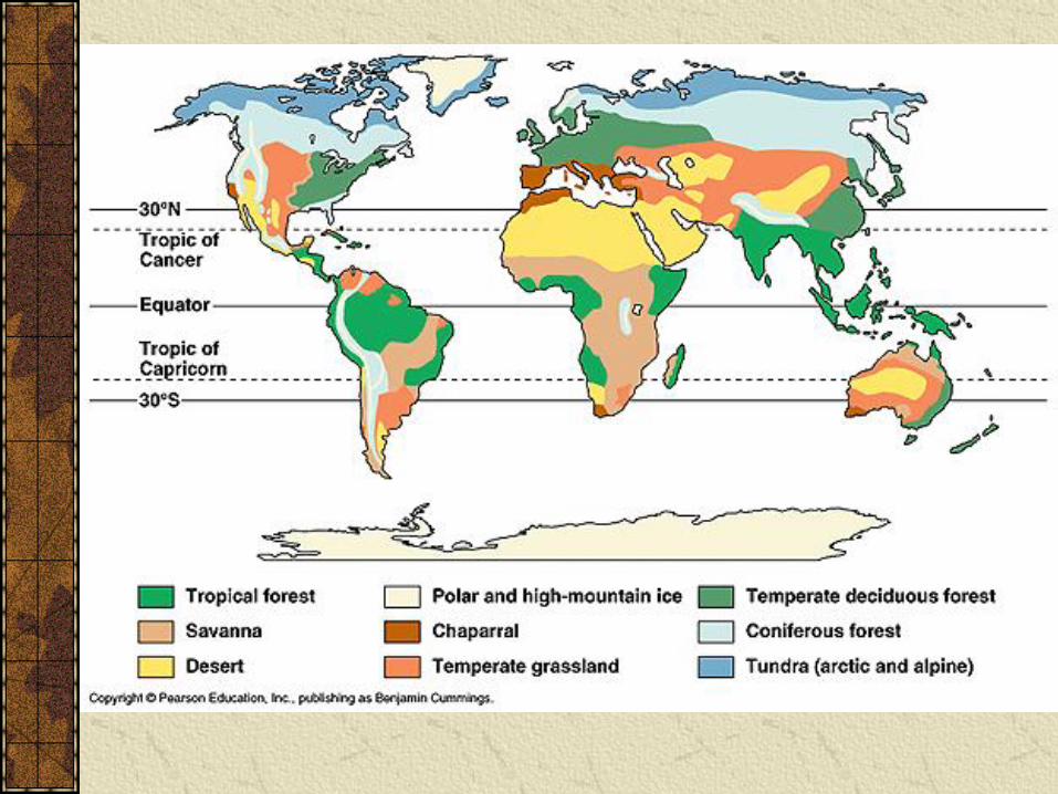
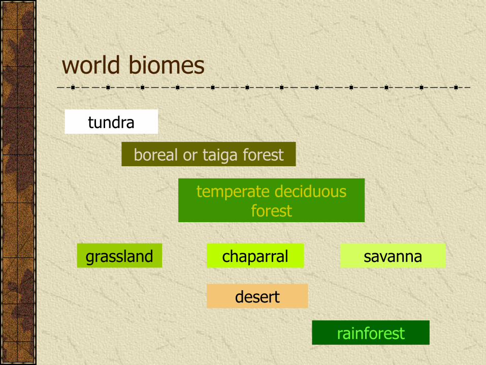
world biomes
rainforest
temperate deciduous forest
chaparral
boreal or taiga forest
grassland savanna
desert
tundra

Why do we find biomes distributed across the landscape in such a way?
Why are deserts in North Africa
and Rainforests on the Equator?
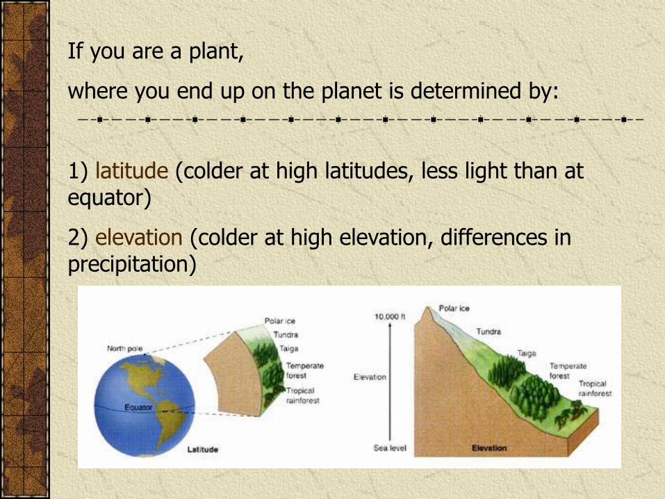
If you are a plant,
where you end up on the planet is determined by:
1) latitude (colder at high latitudes, less light than at equator)
2) elevation (colder at high elevation, differences in precipitation)

The distribution of biomes on earth is influenced by annual patterns of temperature and rainfall
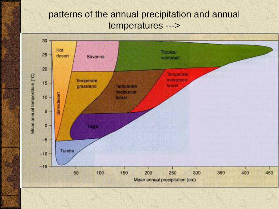
patterns of the annual precipitation and annual
temperatures --->
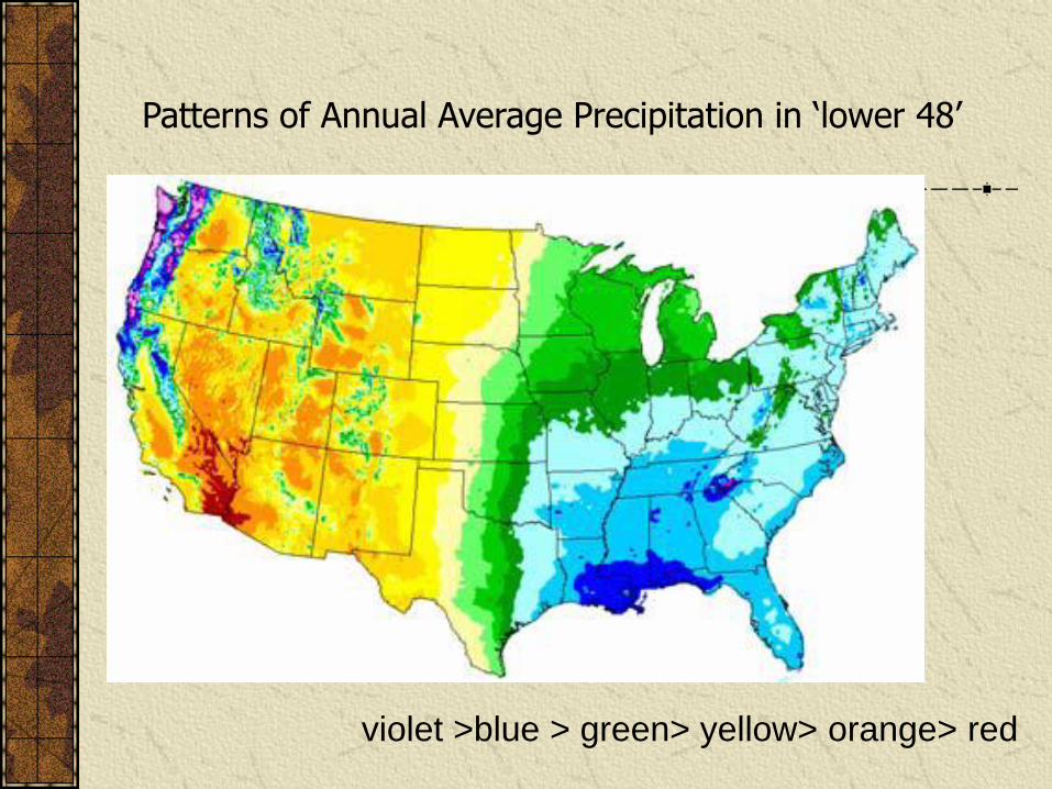
Patterns of Annual Average Precipitation in ‘lower 48’
violet >blue > green> yellow> orange> red

Map of Average HOTTEST JULY Temperature
red >orange > yellow> green> blue> violet
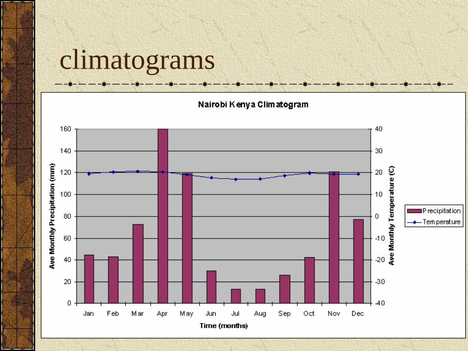
climatograms

Biomes of western Washington
http://www.mgbnet.net/index.html
biome information
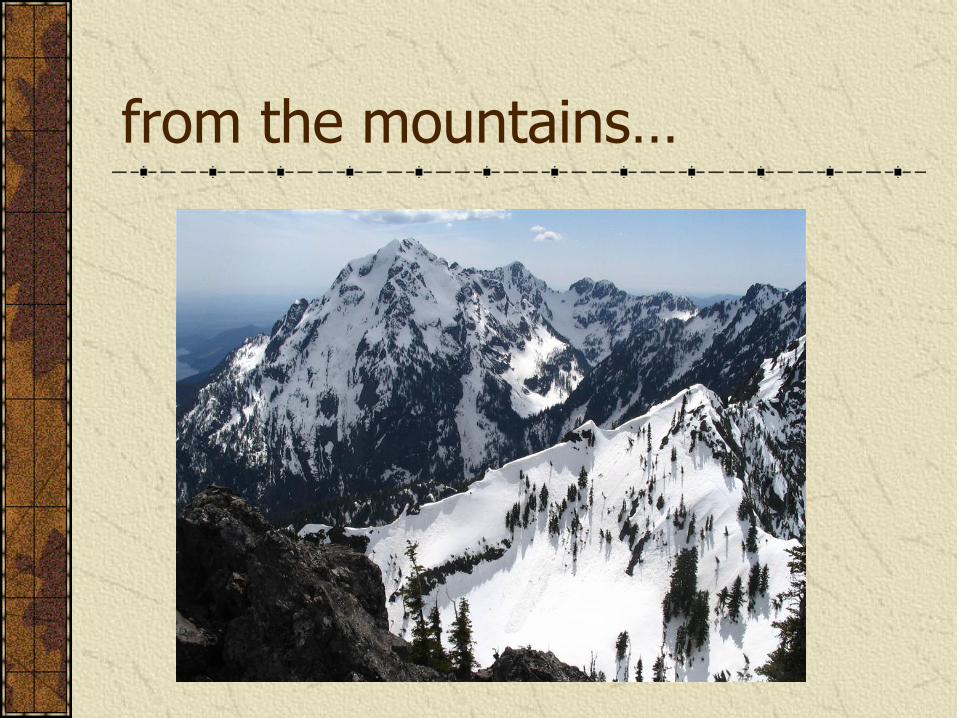
from the mountains…
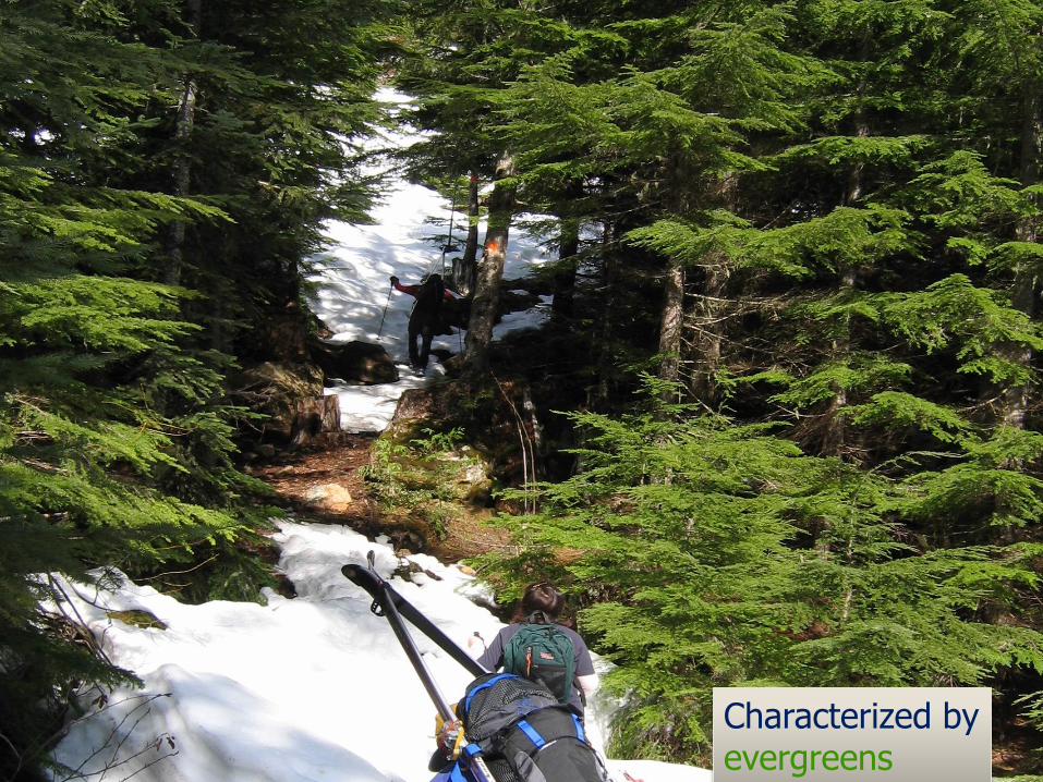
Characterized by evergreens

Temperate: rarely below 0 °C
(32 ◦F) but generally cooler
Precipitation: drought in
summer, LOTS of rain in winter
TEMPERATE PACIFIC NORTHWEST
FORESTS
Forest type dominated by conifers, which can grow over 100m, over 800 years old!
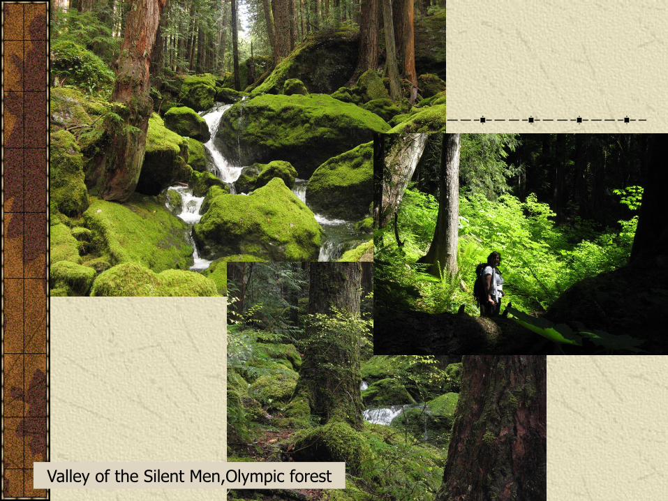
Valley of the Silent Men,Olympic forest
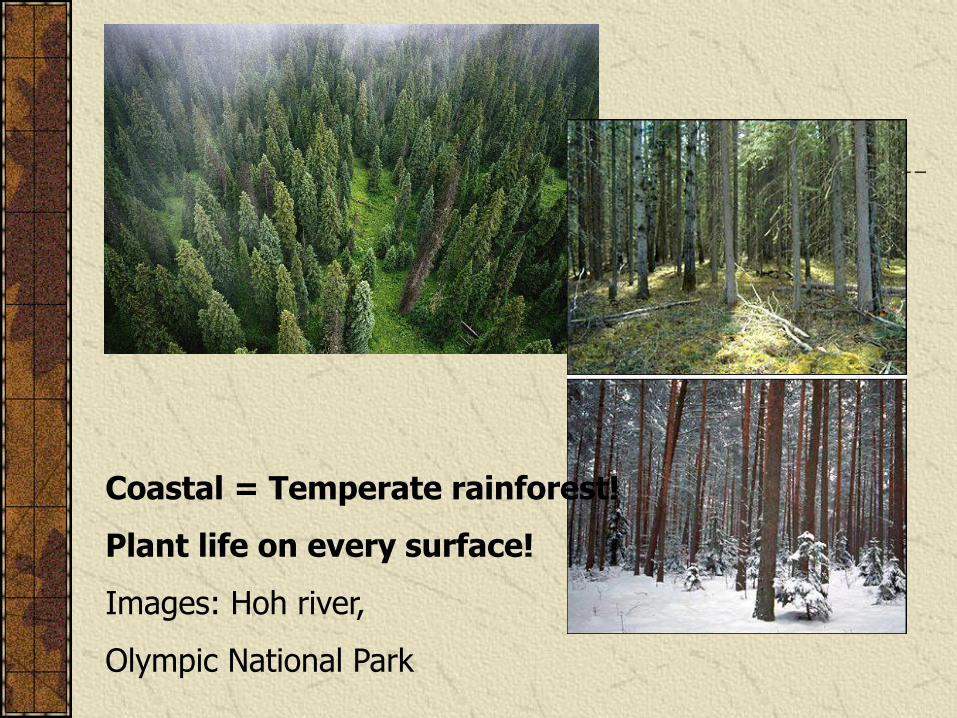
Coastal = Temperate rainforest!
Plant life on every surface!
Images: Hoh river,
Olympic National Park
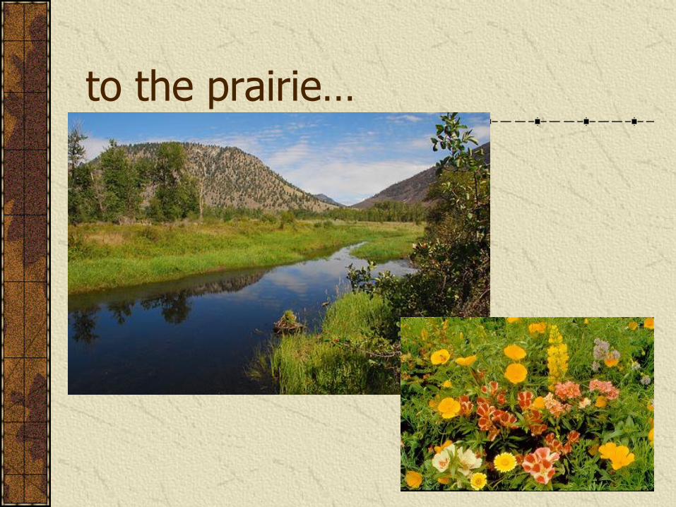
to the prairie…
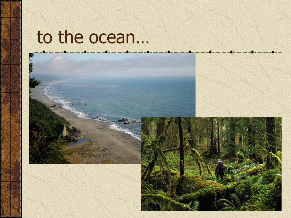
to the ocean…
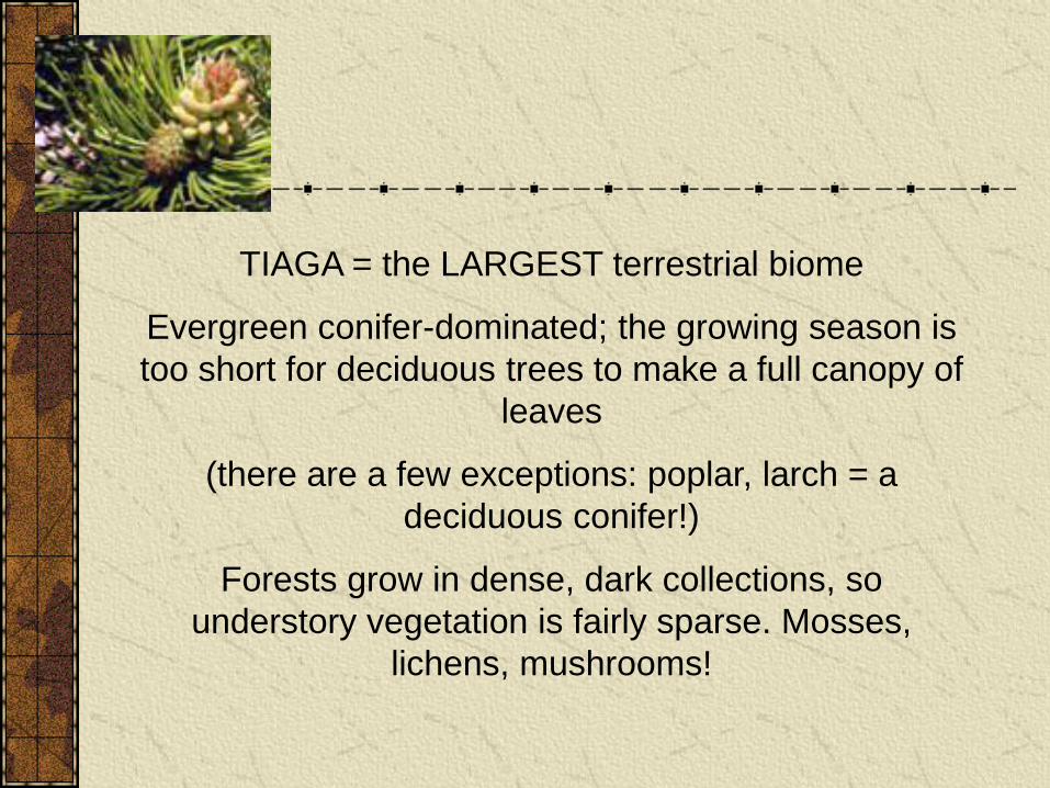
TIAGA = the LARGEST terrestrial biome
Evergreen conifer-dominated; the growing season is
too short for deciduous trees to make a full canopy of
leaves
(there are a few exceptions: poplar, larch = a
deciduous conifer!)
Forests grow in dense, dark collections, so
understory vegetation is fairly sparse. Mosses,
lichens, mushrooms!
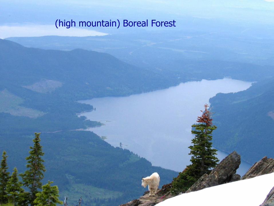
(high mountain) Boreal Forest
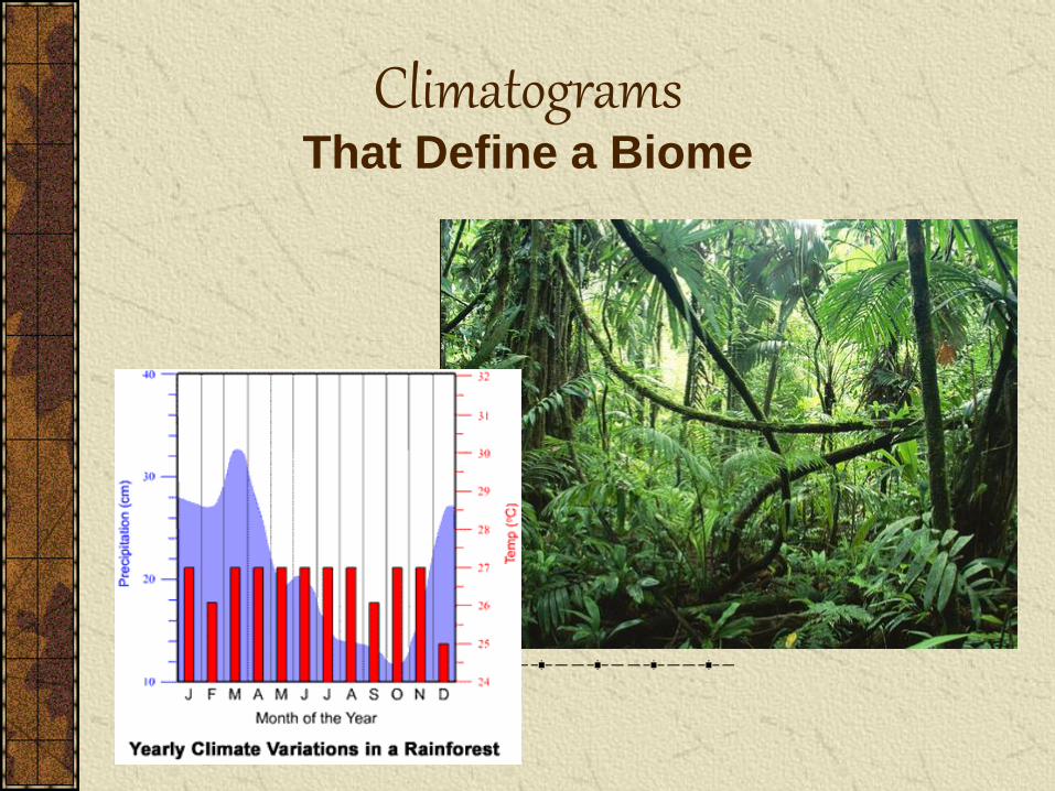
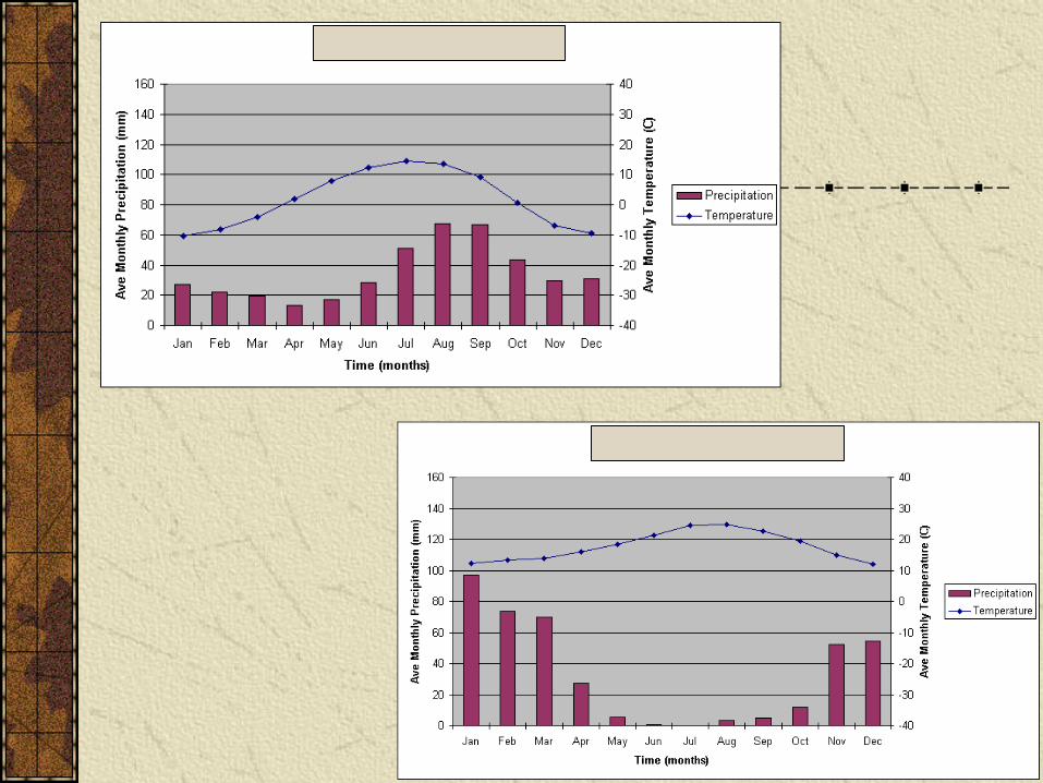
Climatograms That Define a Biome
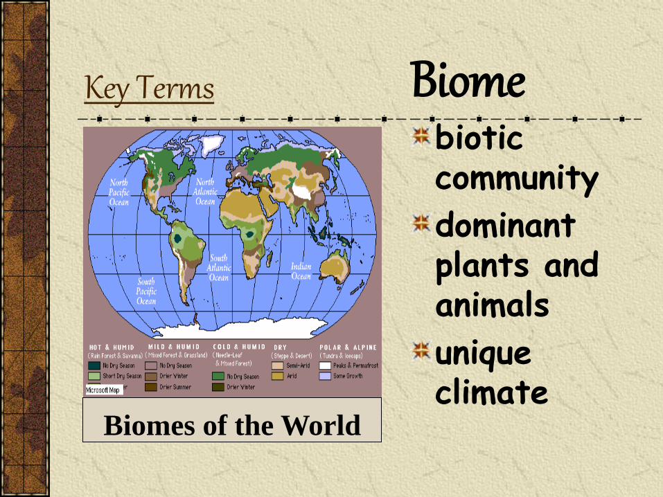
Key Terms Biome biotic community
dominant plants and animals
unique climate
Biomes of the World
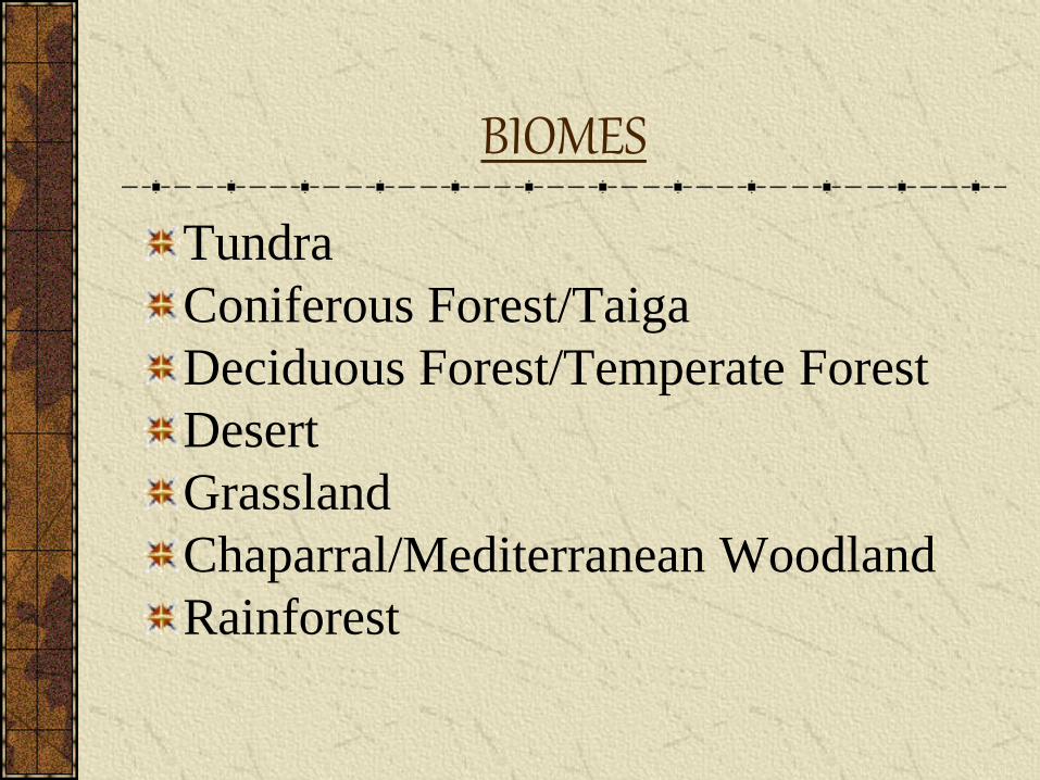
BIOMES
Tundra
Coniferous Forest/Taiga
Deciduous Forest/Temperate Forest
Desert
Grassland
Chaparral/Mediterranean Woodland
Rainforest
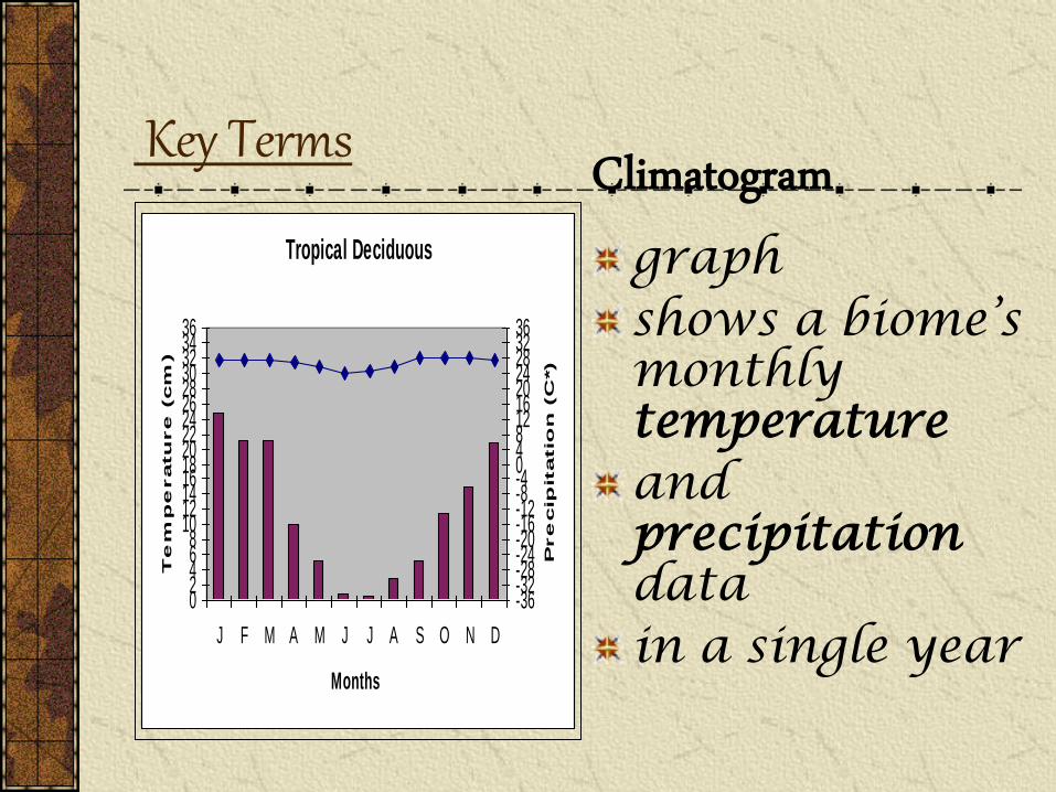
Key Terms Climatogram graph shows a biome’s monthly temperature and precipitation data in a single year
Tropical Deciduous
02468
1012141618202224262830323436
J F M A M J J A S O N D
Months
Te
mp
eratu
re
(cm
)
-36-32-28-24-20-16-12-8-404812162024283236
Pre
cip
itatio
n (C
*)
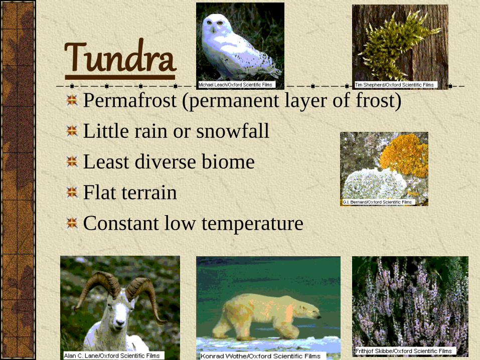
Permafrost (permanent layer of frost)
Little rain or snowfall
Least diverse biome
Flat terrain
Constant low temperature
Tundra
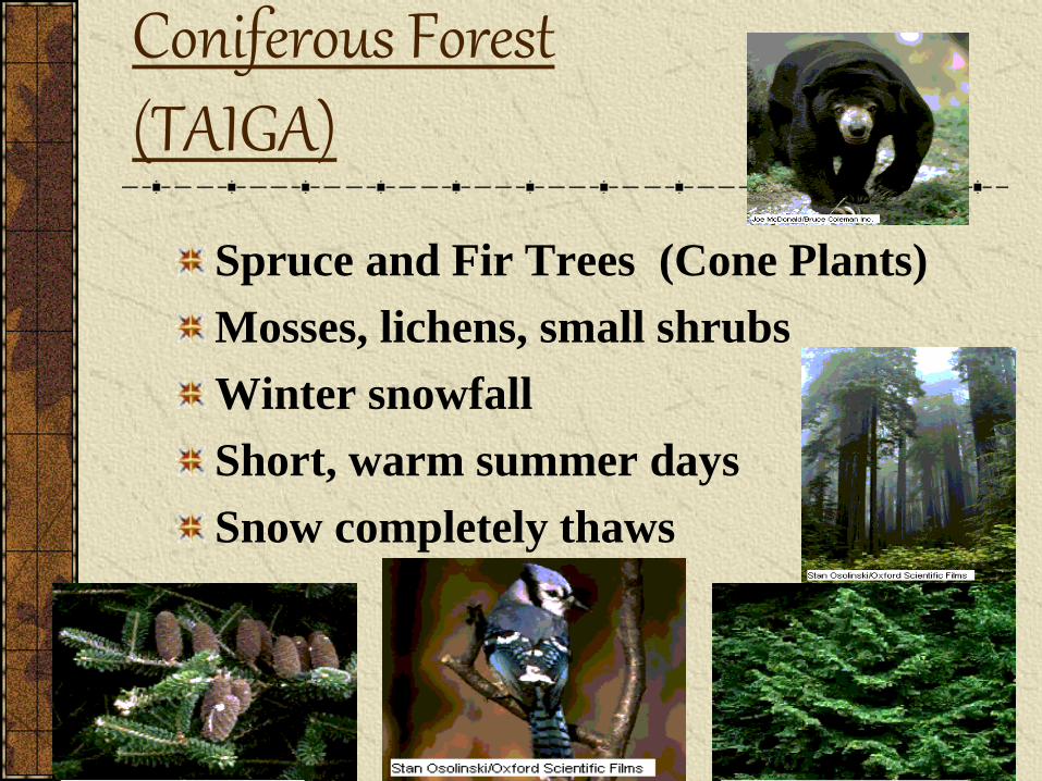
Coniferous Forest (TAIGA)
Spruce and Fir Trees (Cone Plants)
Mosses, lichens, small shrubs
Winter snowfall
Short, warm summer days
Snow completely thaws
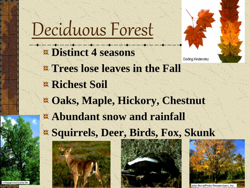
Deciduous Forest Distinct 4 seasons
Trees lose leaves in the Fall
Richest Soil
Oaks, Maple, Hickory, Chestnut
Abundant snow and rainfall
Squirrels, Deer, Birds, Fox, Skunk
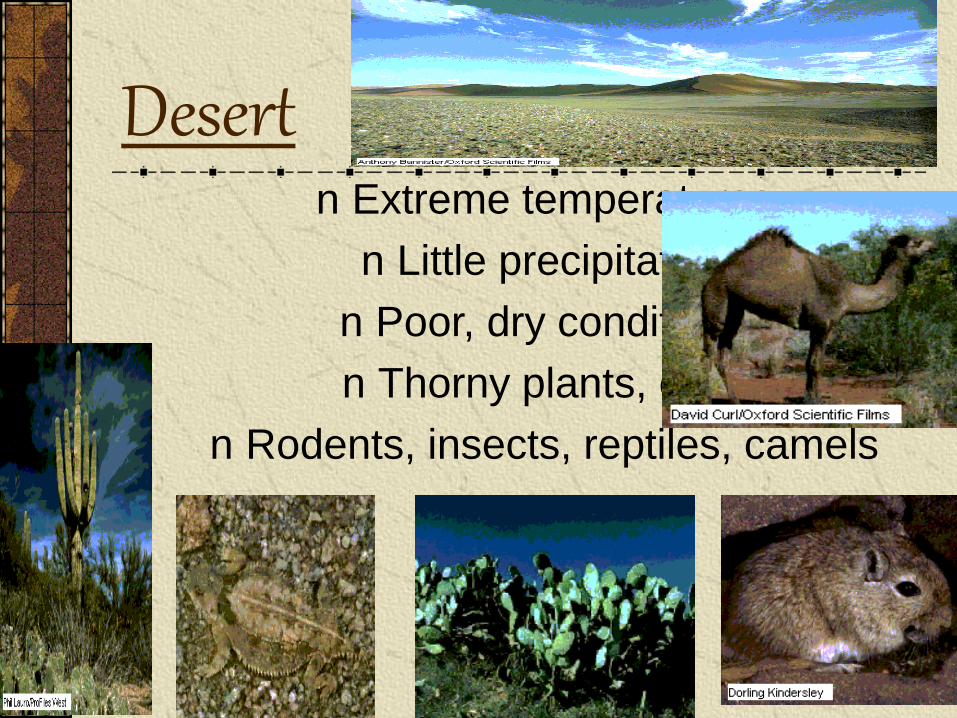
Desert
n Extreme temperatures
n Little precipitation
n Poor, dry conditions
n Thorny plants, cacti
n Rodents, insects, reptiles, camels
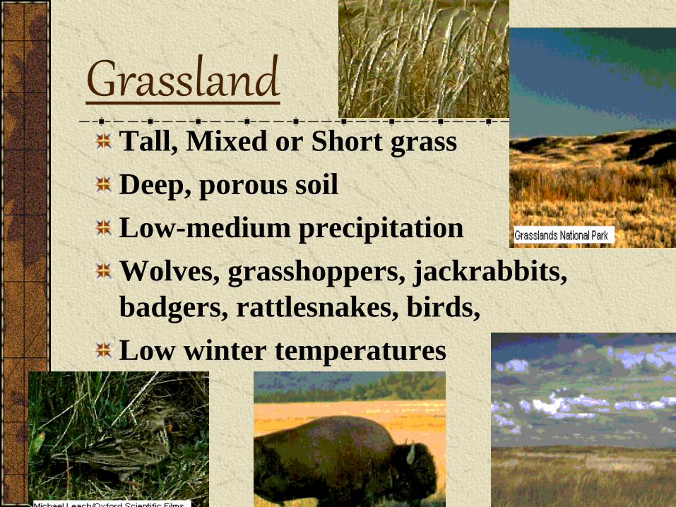
Grassland Tall, Mixed or Short grass
Deep, porous soil
Low-medium precipitation
Wolves, grasshoppers, jackrabbits,
badgers, rattlesnakes, birds,
Low winter temperatures
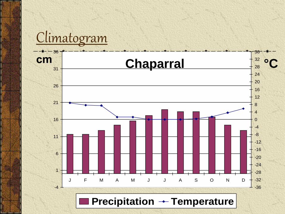
Climatogram
-4
1
6
11
16
21
26
31
36
J F M A M J J A S O N D
-36
-32
-28
-24
-20
-16
-12
-8
-4
0
4
8
12
16
20
24
28
32
36
Precipitation Temperature
Chaparral °C
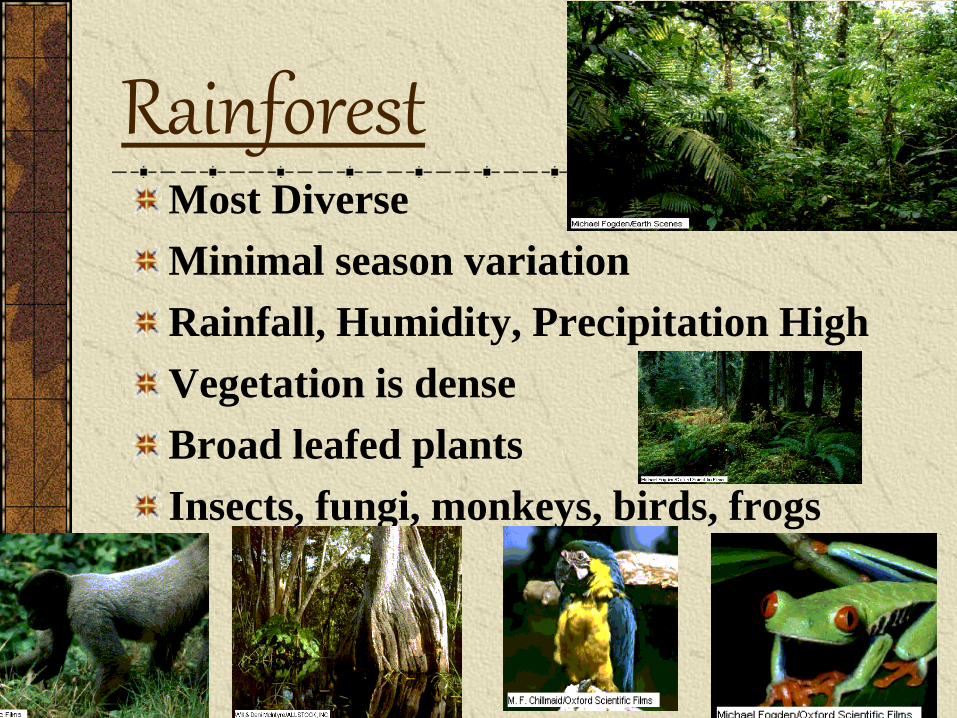
Rainforest Most Diverse
Minimal season variation
Rainfall, Humidity, Precipitation High
Vegetation is dense
Broad leafed plants
Insects, fungi, monkeys, birds, frogs
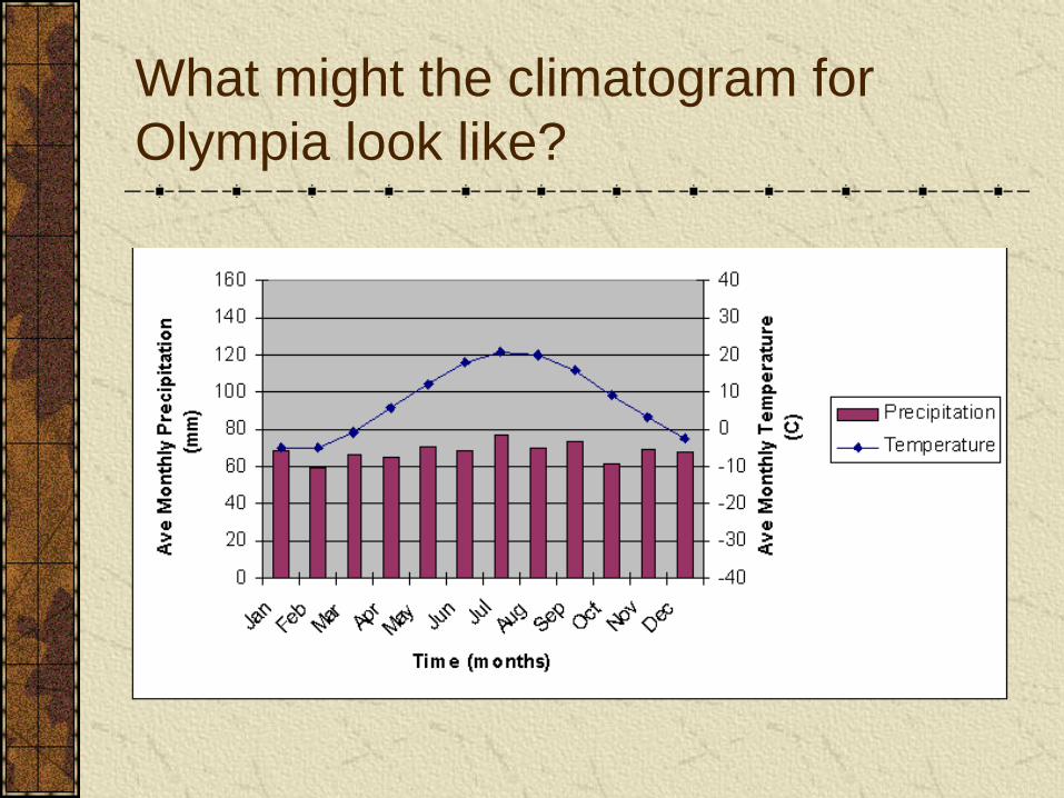
What might the climatogram for
Olympia look like?
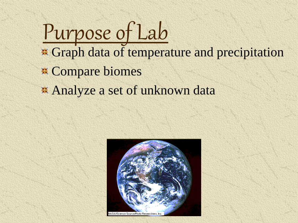
Purpose of Lab Graph data of temperature and precipitation
Compare biomes
Analyze a set of unknown data
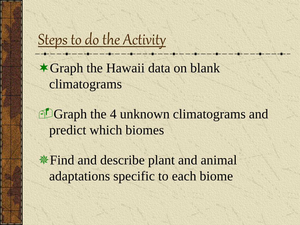
Steps to do the Activity
Graph the Hawaii data on blank
climatograms
Graph the 4 unknown climatograms and
predict which biomes
Find and describe plant and animal
adaptations specific to each biome