Embed Size (px)
Citation preview
10/8/2013
1
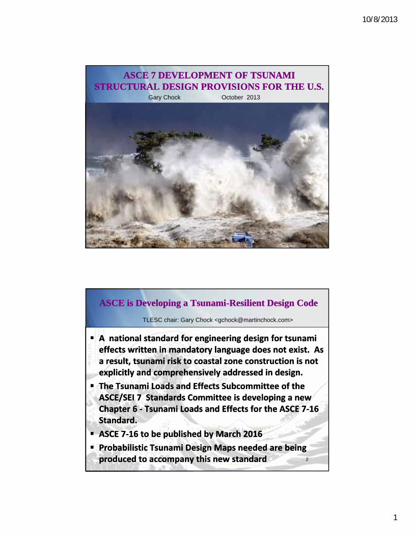
ASCE 7 DEVELOPMENT OF TSUNAMI STRUCTURAL DESIGN PROVISIONS FOR THE U.S.
ASCE 7 DEVELOPMENT OF TSUNAMI STRUCTURAL DESIGN PROVISIONS FOR THE U.S.
April 2013
Status & Hazard
Mapping
April 2013
Status & Hazard
Mapping
Gary Chock
Gary Chock October 2013
1
ASCE is Developing a Tsunami-Resilient Design CodeASCE is Developing a Tsunami-Resilient Design Code
A national standard for engineering design for tsunami effects written in mandatory language does not exist. As a result, tsunami risk to coastal zone construction is not explicitly and comprehensively addressed in design.
The Tsunami Loads and Effects Subcommittee of the ASCE/SEI 7 Standards Committee is developing a new Chapter 6 ‐ Tsunami Loads and Effects for the ASCE 7‐16 Standard.
ASCE 7‐16 to be published by March 2016
Probabilistic Tsunami Design Maps needed are being produced to accompany this new standard
TLESC chair: Gary Chock <[email protected]>
2
10/8/2013
2
Meetings with Alaska StakeholdersMeetings with Alaska Stakeholders
July 30-31, 2013 University of Alaska Fairbanks Geophysical Institute and AEIC
[Dmitry Nicolsky and Elena Suleimani]
Ervin Petty, Tsunami Program Manager, DMVA
Cindi Preller, NWS Tsunami Program Manager for the Alaska Region and Tsunami Warning Center
Peter Haeussler, USGS AK
Charles Mueller, USGS CO (Seismic Hazard Model for Alaska)
Structural Engineers Association of Alaska
Upcoming Opportunities:
April 30- May 2, 2014 Seismological Society of America
July 21-25, 2014 10th National Conference on Earthquake Engineering
3
Special Alaska considerationsSpecial Alaska considerations
Near-Field Seismic Sources and detailed slip deformation modeling at the plate interface
Subsidence within the plate rupture zone
Digital Elevation Model high-resolution accuracy
Co-seismic underwater Rockfall/Landslides in fjords leads to numerous local tsunami there as well as the regional tsunami
USGS Earthquake Hazards Science Center to update Alaska seismic models and seismic maps in 2014
Collaboration with USGS and ASCE seismologists and tsunami modelers to develop appropriate Hazard-Consistent Tsunami scenarios
4

10/8/2013
3
Physiographic features and crustal faults used in the hazard calculations (red).
(Wesson and others, USGS OFR 2007-1043)
5
Large Historical Earthquakes
(Wesson and others, USGS OFR 2007-1043)
6
10/8/2013
4
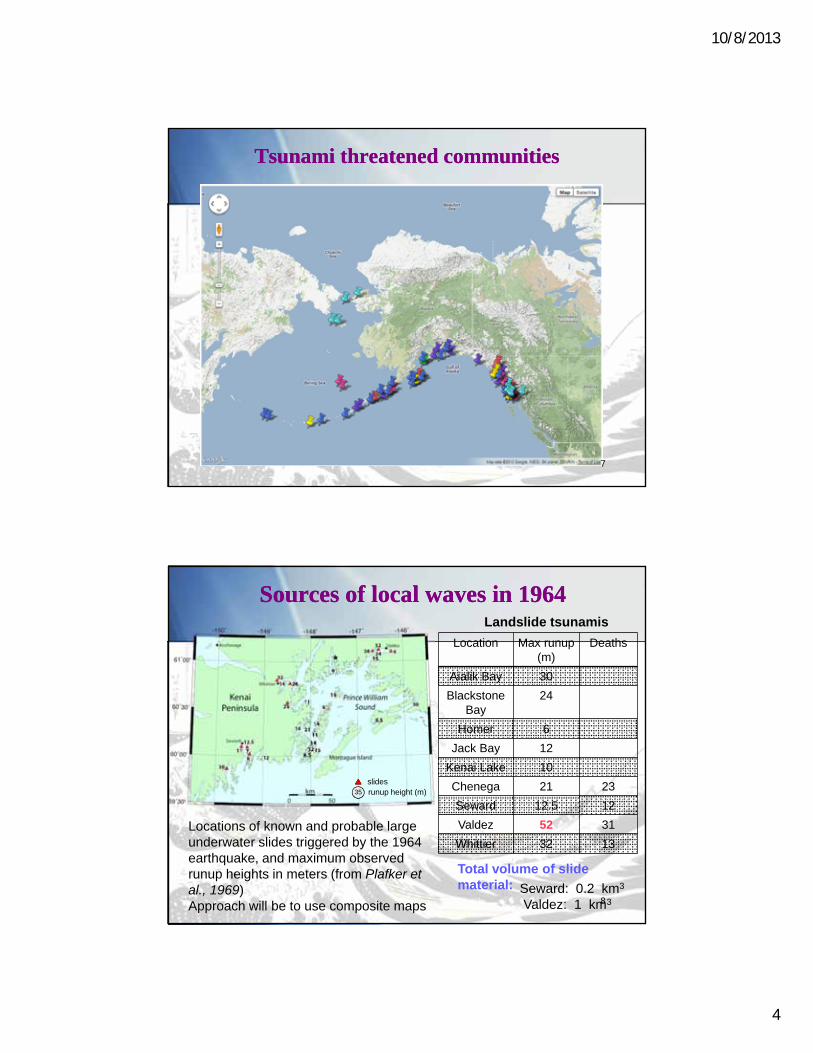
Tsunami threatened communitiesTsunami threatened communities
7
Sources of local waves in 1964Sources of local waves in 1964
Location Max runup(m)
Deaths
Aialik Bay 30
Blackstone Bay
24
Homer 6
Jack Bay 12
Kenai Lake 10
Chenega 21 23
Seward 12.5 12
Valdez 52 31
Whittier 32 13
Total volume of slide material: Seward: 0.2 km3
Valdez: 1 km3
Locations of known and probable large underwater slides triggered by the 1964 earthquake, and maximum observed runup heights in meters (from Plafker et al., 1969)Approach will be to use composite maps
Landslide tsunamis
35
slidesrunup height (m)
8
10/8/2013
5
Post-Disaster Observations
Design and Construction Practice
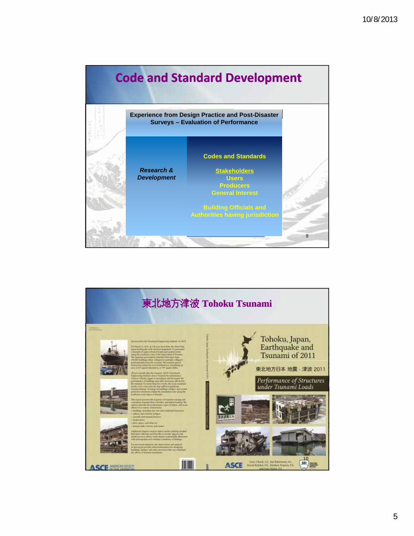
Code and Standard DevelopmentCode and Standard Development
Research & Development
Codes and Standards
StakeholdersUsers
ProducersGeneral Interest
Building Officials and Authorities having jurisdiction
Experience from Design Practice and Post-Disaster Surveys – Evaluation of Performance
9
東北地方津波 Tohoku Tsunami 東北地方津波 Tohoku Tsunami
10
10/8/2013
6
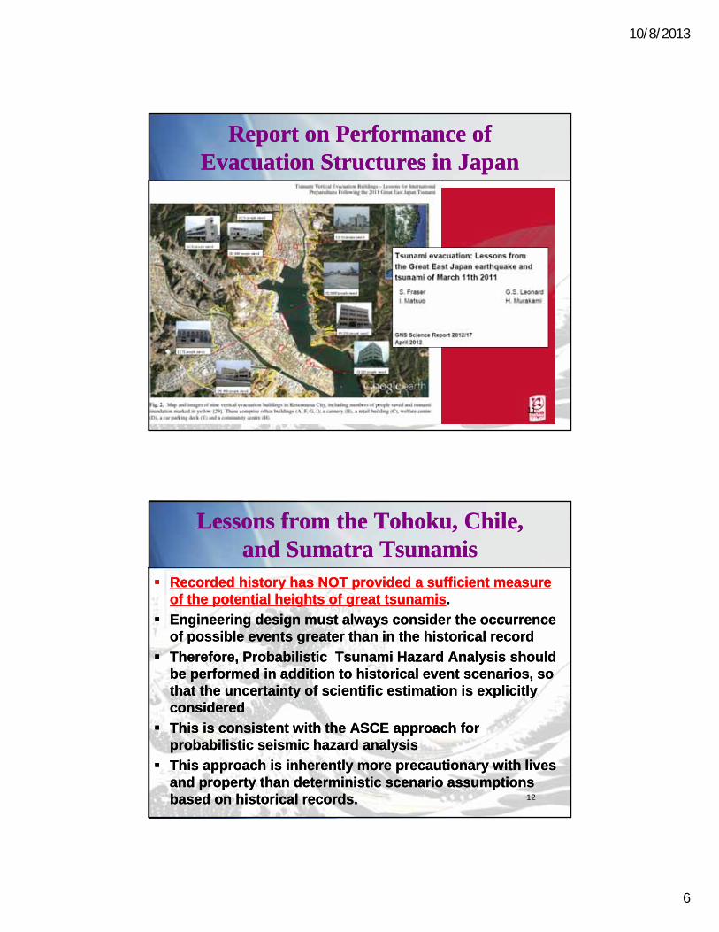
Report on Performance of Evacuation Structures in Japan
Report on Performance of Evacuation Structures in Japan
By Fraser, Leonard, Matsuo and Murakami
GNS Science Report 2012/17, April 2012
This follow-up report of evacuation sites provided additional survivor details for many sites visited by Chock and others of the ASCE Tsunami Reconnaissance Team
By Fraser, Leonard, Matsuo and Murakami
GNS Science Report 2012/17, April 2012
This follow-up report of evacuation sites provided additional survivor details for many sites visited by Chock and others of the ASCE Tsunami Reconnaissance Team
11
Lessons from the Tohoku, Chile, and Sumatra Tsunamis
Lessons from the Tohoku, Chile, and Sumatra Tsunamis
Recorded history has NOT provided a sufficient measure of the potential heights of great tsunamis.
Engineering design must always consider the occurrence of possible events greater than in the historical record
Therefore, Probabilistic Tsunami Hazard Analysis should be performed in addition to historical event scenarios, so that the uncertainty of scientific estimation is explicitly considered
This is consistent with the ASCE approach for probabilistic seismic hazard analysis
This approach is inherently more precautionary with lives and property than deterministic scenario assumptions based on historical records.
Recorded history has NOT provided a sufficient measure of the potential heights of great tsunamis.
Engineering design must always consider the occurrence of possible events greater than in the historical record
Therefore, Probabilistic Tsunami Hazard Analysis should be performed in addition to historical event scenarios, so that the uncertainty of scientific estimation is explicitly considered
This is consistent with the ASCE approach for probabilistic seismic hazard analysis
This approach is inherently more precautionary with lives and property than deterministic scenario assumptions based on historical records. 12
10/8/2013
7
Tsunami-Resilient Design StrategyTsunami-Resilient Design Strategy
Select a site appropriate and necessary for the structure
Select an appropriate structural system and perform seismic design first
Determine flow depth and velocities at the site based on a probabilistic tsunami hazard analysis
Check robustness of expected strength within the inundation height to resist hydrodynamic forces
Check resistance of lower elements for hydrodynamic pressures and debris impacts to avoid progressive collapse
Foundations to resist scour
Elevate critical equipment as necessary
Select a site appropriate and necessary for the structure
Select an appropriate structural system and perform seismic design first
Determine flow depth and velocities at the site based on a probabilistic tsunami hazard analysis
Check robustness of expected strength within the inundation height to resist hydrodynamic forces
Check resistance of lower elements for hydrodynamic pressures and debris impacts to avoid progressive collapse
Foundations to resist scour
Elevate critical equipment as necessaryVisual 20.1313
6.1 General Requirements
6.2 Definitions
6.3 Symbols and Notation
6.4 Tsunami Risk Categories
6.5 Hazard Level of the Maximum Considered Tsunami
6.6 Flow Parameters Based on Runup
6.7 Site‐Specific Probabilistic Tsunami Hazard Analysis
6.8 Structural Design Procedure for Tsunami Effects
6.9 Hydrostatic Loads
6.10 Hydrodynamic Loads
6.11 Debris Impact Loads
6.12 Foundation Design
6.13 Structural countermeasures for reduced loading on buildings
6.14 Special Occupancy Structures
6.15 Designated Nonstructural Systems (Stairs, Life Safety MEP)
6.16 Non‐building critical facility structures
C6 Commentary and References
Scope of the ASCE Tsunami Design Provisions2016 edition of the ASCE 7 Standard, Minimum Design Loads
for Buildings and Other Structures
Scope of the ASCE Tsunami Design Provisions2016 edition of the ASCE 7 Standard, Minimum Design Loads
for Buildings and Other Structures
14
10/8/2013
8
Critical Facilities and Lifelines are Essential for Community ResilienceCritical Facilities and Lifelines are Essential for Community Resilience
Critical Facilities o Maintain the public’s health and safetyo e.g., hospitals, police, fire, and emergency medical
services buildings, essential government buildings, ports, airports, water supply, wastewater treatment plants, power generating stations
Lifelineso Power, transportation systems, and storage,
treatment, and distribution systems of water and fuel, IT services and communications, and sewage systems
Visual 21.1515
Consequence Guidance on Risk Categories of Buildings Per ASCE 7
Consequence Guidance on Risk Categories of Buildings Per ASCE 7
Risk Category I Up to 2 persons affected(e.g., agricultural and minor storage facilities, etc.)
Risk Category II Approximately 3 to 300 persons affected(e.g., Office buildings, condominiums, hotels, etc.)
Risk Category III Approximately 300 to 5,000+ affected
(e.g., Public assembly halls, arenas, high occupancyeducational facilities, public utility facilities, etc.)
Risk Category IV Over 5,000 persons affected
(e.g., hospitals and emergency shelters, emergencyoperations centers, first responder facilities, air trafficcontrol, toxic material storage, etc.)
Visual 20.1616

10/8/2013
9
Tsunami Risk Category Design Criteria
Tsunami Risk Category Design Criteria
Not applicable to any buildings within the scope of the International Residential Code; Not applicable to light-frame residential construction
Not applicable to any Risk Category I buildings
Not applicable to any Risk Category II structures up to ~65 feet in height
Applicable to all Risk Category III and IV buildings and structures, and only Risk Category II buildings greater than ~65 ft height
Economic impact is anticipated to be very nominal to western states since most buildings subject to these requirements will be designed to Seismic Design Category D or greater (design for inelastic ductility).
Not applicable to any buildings within the scope of the International Residential Code; Not applicable to light-frame residential construction
Not applicable to any Risk Category I buildings
Not applicable to any Risk Category II structures up to ~65 feet in height
Applicable to all Risk Category III and IV buildings and structures, and only Risk Category II buildings greater than ~65 ft height
Economic impact is anticipated to be very nominal to western states since most buildings subject to these requirements will be designed to Seismic Design Category D or greater (design for inelastic ductility). 17
Example Illustration of a Local Design Map at a Reference Site Example Illustration of a Local Design Map at a Reference Site
18
10/8/2013
10
Tsunami Disaster Resilience by DesignTsunami Disaster Resilience by Design
Establish maps in the ASCE 7 design standard that are based on engineering reliability, rather than leaving local planners to use arbitrary deterministic maps
Application to design and community planning and resilience before a tsunami event.
After a tsunami, it will have even more significance as means to plan and evaluate what is appropriate in reconstruction, and to enable FEMA funding of Building Back Better.
A new accomplishment that will directly improve the leadership position of the US to effectively influence international codes and standards related to community resilience and sustainable infrastructure.
Establish maps in the ASCE 7 design standard that are based on engineering reliability, rather than leaving local planners to use arbitrary deterministic maps
Application to design and community planning and resilience before a tsunami event.
After a tsunami, it will have even more significance as means to plan and evaluate what is appropriate in reconstruction, and to enable FEMA funding of Building Back Better.
A new accomplishment that will directly improve the leadership position of the US to effectively influence international codes and standards related to community resilience and sustainable infrastructure. 19
Strategy for Two-Stages of Map Development
Strategy for Two-Stages of Map Development
A new generation of tsunami inundation hazard maps for the design of critical structures is required
ASCE has a role in rectifying consistency with criteria for other extreme loading, and establishing the probabilistic inundation hazard maps (and standardization of map style and format).[1 year ending in 2014]
Later development of consistent local probabilistic inundation maps would then follow by the states under the federal National Tsunami Hazard Mitigation Program (NTHMP) or other programs available to the states[Five years leading up to 2019]
20
10/8/2013
11
Mapping Tasks funded by ASCEMapping Tasks funded by ASCE
ASCE SEI and COPRI have supported the Tsunami Committee work since 2/2011 and is now involved in the national map development. By the end of 2014 it is estimated that over $300,000 will have been invested by ASCE
Probabilistic Tsunami Hazard Analysis of Offshore Wave Height
Probabilistic design maps for major populated/ regions
The effort to develop the offshore probabilistic tsunami parameters and governing hazard-consistent tsunami scenarios for each community’s regional analysis is a key linchpin to enable the local code adoption of the tsunami design provisions.
ASCE SEI and COPRI have supported the Tsunami Committee work since 2/2011 and is now involved in the national map development. By the end of 2014 it is estimated that over $300,000 will have been invested by ASCE
Probabilistic Tsunami Hazard Analysis of Offshore Wave Height
Probabilistic design maps for major populated/ regions
The effort to develop the offshore probabilistic tsunami parameters and governing hazard-consistent tsunami scenarios for each community’s regional analysis is a key linchpin to enable the local code adoption of the tsunami design provisions. 21
Request for Sponsorship of Local State Maps developed with ASCE review
Request for Sponsorship of Local State Maps developed with ASCE review
2014LocalMap‐2015Benchmarking perProbabilisticCriteriaDevelopmentofhigherresolution10‐meterprobabilisticdesignmapsforPMELreferencesites.Thiseffortestablishesreferencebenchmarkingforthelaterdevelopmentofconsistentlocalprobabilisticinundationmaps.ThiswillalsoprovideverificationthatthemapformatsthatcomplywiththeASCE7Standard.
a. California11referencesites
b. Oregon 5referencesites
c. Washington5referencesites
d. Hawaii 8referencesites
e. Alaska 4referencesites
Funding needed: Federal Planning Grants are one means of funding
2014LocalMap‐2015Benchmarking perProbabilisticCriteriaDevelopmentofhigherresolution10‐meterprobabilisticdesignmapsforPMELreferencesites.Thiseffortestablishesreferencebenchmarkingforthelaterdevelopmentofconsistentlocalprobabilisticinundationmaps.ThiswillalsoprovideverificationthatthemapformatsthatcomplywiththeASCE7Standard.
a. California11referencesites
b. Oregon 5referencesites
c. Washington5referencesites
d. Hawaii 8referencesites
e. Alaska 4referencesites
Funding needed: Federal Planning Grants are one means of funding22
10/8/2013
12
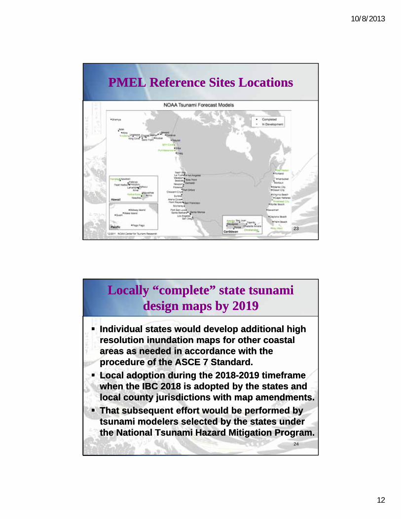
PMEL Reference Sites LocationsPMEL Reference Sites Locations
23
Locally “complete” state tsunami design maps by 2019
Locally “complete” state tsunami design maps by 2019
Individual states would develop additional high resolution inundation maps for other coastal areas as needed in accordance with the procedure of the ASCE 7 Standard.
Local adoption during the 2018-2019 timeframe when the IBC 2018 is adopted by the states and local county jurisdictions with map amendments.
That subsequent effort would be performed by tsunami modelers selected by the states under the National Tsunami Hazard Mitigation Program.
24
10/8/2013
13
SummarySummary
ASCE is completing tsunami design provisions for critical facilities, to be incorporated in ASCE 7-16
This Standard would be referenced by the IBC 2018 reqts
Design criteria is probabilistic and consistent with seismic provisions, and embodied in tsunami design zone maps
Development and adoption of maps takes several stages
ASCE 7-16 overall maps (by ASCE) to be completed by the end of 2014
Local Reference Site Maps needed to benchmark state model compliance with ASCE criteria by 2015 –
funding consideration for Alaska project implementation
“Complete” (as necessary) coastline tsunami design zone maps in accordance with ASCE criteria by 2019, to be managed by states
25
The ASCE Tsunami Loads and Effects SubcommitteeComments to: Gary Chock, Chair [email protected]
The ASCE Tsunami Loads and Effects SubcommitteeComments to: Gary Chock, Chair [email protected]
26