Embed Size (px)
Citation preview

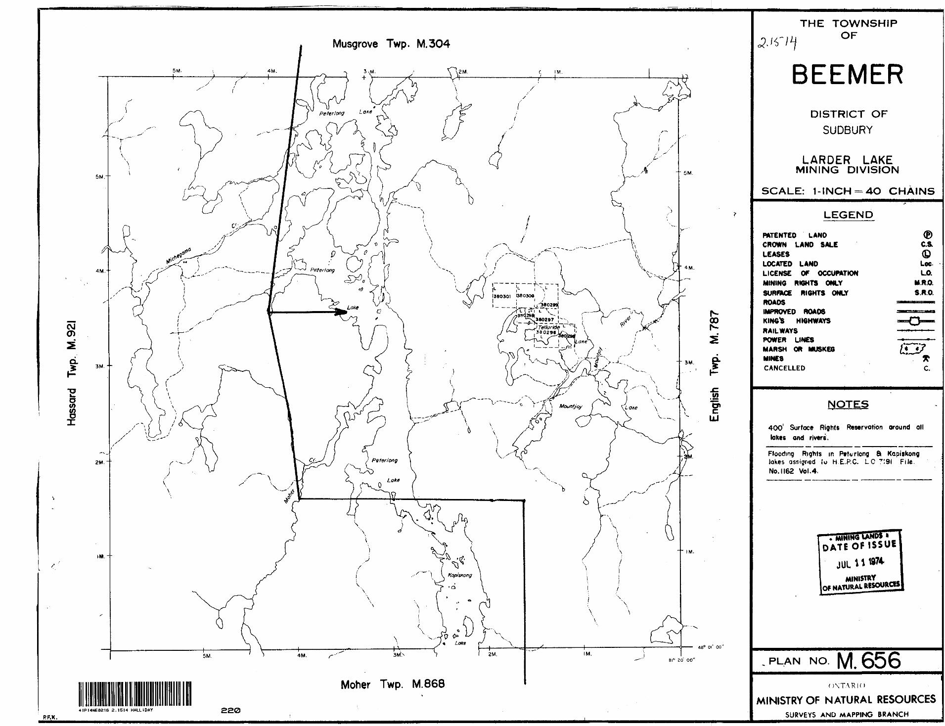
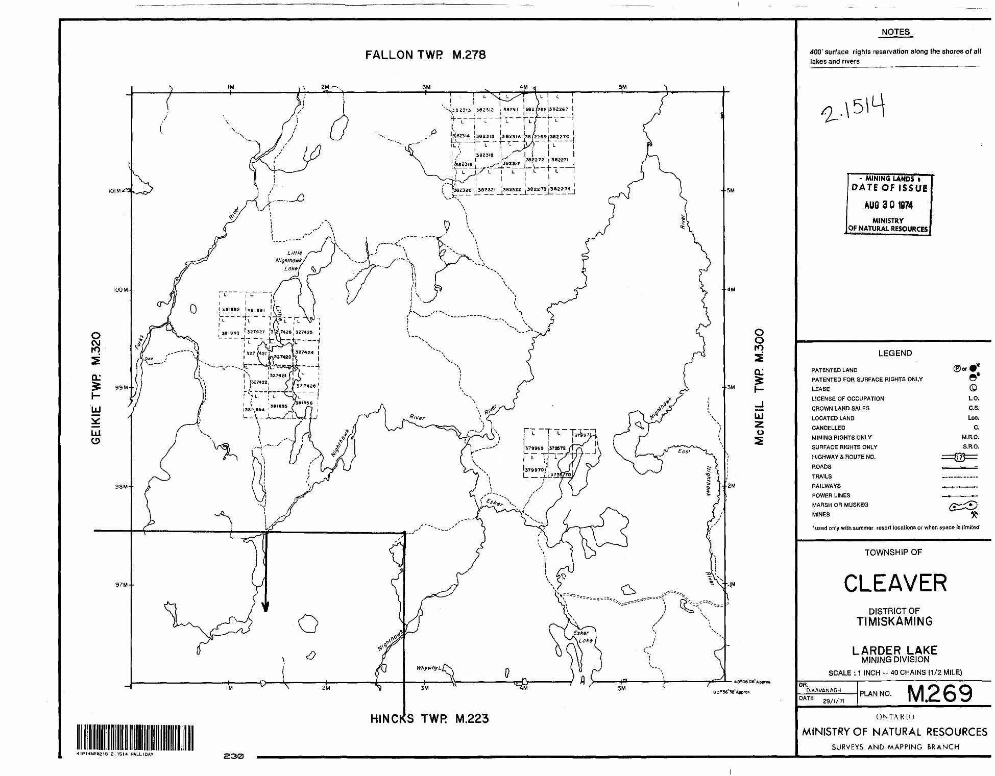
41P14NE0216 8.1514 HALLIDAY
JUL.8 1974
PROJECTS UNIT
010
AIRBORNE ELECTROMAGNETIC SURVEY
GRANGES EXPLORATION CANADA AB
ENGLISH TOWNSHIP AREA
FILE NO: 15027
QuestorSurveysLimited,20CansoRd.,Rexdale,Ontario,Canada.

l- l -
l l l l l
l l
!
l
INTRODUCTION
l This report contains our interpretation of the
results of an airborne electrfcmagnetic survey, flown in————————————————————————————A.
the English Township Area, Ontario, on September 11, 12,
m 13, 14, 16 and 17, 1973. A brief description of the sur
vey procedure together with recommendations for ground
l follow-ufe is included.
The sujrgg^^oj^a^jj^^l^^l^eiiii.les and was per
il formed by Questor Surveys^Limited. The survey aircraft was
ta a Shorts Sky van, CF-QSL and the operating^base was Timmins,
Ontario.
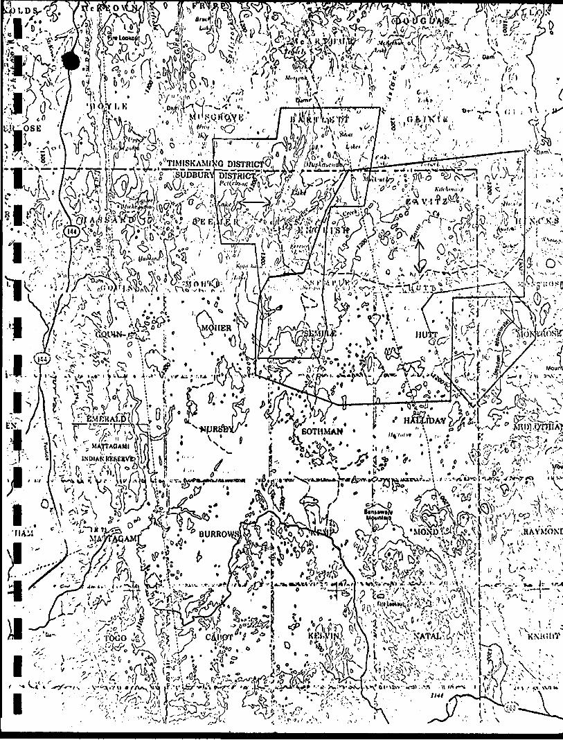
m The area outline is shown on the 1:250,000 N.T.S.
maps 42A and 4IP at the end of this report.
MAP COMPILATION
The base maps are uncontrolled mosaics constructed
from Ontario Department of Lands and Forests l" * 1/4 mile
photographs. The mosaics were reproduced at a scale of l"
equals 1320 feet on stable transparent film from which white
prints can be made.
Flight path .recovery wagLflccojoaaLlfiJied bv comparison
of the prints of the 35mm film with the mosaic in order to
locate the fiducial points. These points are approximately
one mile apart.

- 2 -
SURVEY PROCEDURE
~" Terrain clearance was maintained as close t
l feet as possible, with the E.M.Bird at approximately 150
feet above the ground. A normal S-pattern flight path
l using approximately one mile turns was used. The equipment
operator logged the flight details and monitored the instru
ments .
l A line spacing of 1/8 mile was used.
l
l
l
l
l
l l
l
l
l
l l
l l
INTERPRETATION AND RECOMMENDATIONS
References: Aeromagnetic Sheets 41 P/14 6 42 A/3.
Ontario Preliminary Geology Map No.P 151.
Ontario Preliminary Geology Map No.P 141.
Ontario Preliminary Geology Map No.P 490 Semple T.P.
Ontario Preliminary Geology Map No,P 454 English T.P.
Ontario Preliminary Geology Map No.P 455 Zavitz T.P.
Ontario Preliminary Geology Map No.P 491 Hutt T.P.
A considerable amount of work has been done in these
survey areas and a great many of the conductors that have been
outlined have been drilled in the past. However, from the ref
erences listed above, it would appear that there are still some
good targets that have not been tested. The apparent weak
anomalies may also be significant and should be given some
attention whether they have been discussed or not. It is felt
that most, of the INPUT anomalies that have been plotted have
their source in bedrock.
The area is underlain by interstratified metavolcanic
sequences and in Hutt Township, rhyolite interbeds are often
associated with narrow lenses and zones of graphitic schists

l - 3 -
lm 4fc and slate containing disseminated to massive pyrite with minor
pyrrhotite and chalcopyrite. Discontinuous narrow lenses of
l low-grade iron formation, also occur within the area and these
respond electromagnetically in some areas.
l Serpentinized peridotite is also prevalent, espec-
M ially in Zavitz Township and in places this peridotite is a
fair INPUT conductor. However, it would not respond well to
l conventional ground E.M. systems unless there are discrete
sulphide lenses present,
l - Even though conductor Zones 6, 7, 9, 10 f 11 and 14
'H in Area 2 appear to be discrete conductors, they are on strikel ——~""""— and are apparently associated with an iron formation which
l trends north-south through the area. Similarly, Zones 8, 12
and 13.-are on strike and are associated with a minor iron. —i J formation again tending north-south.
l— The following is a discussion of various conductor
™ systems, some of which have apparently been explained by pre-
•j vious work but are left in for the sake of completeness. An
investigation of the assessment files should be made to ensure
l that these conductors have been explained with confidence and
they can also be used as a guide to explaining the other zones.
l It is difficult to rank these zones with regard to
m priority selection in the ground follow-up, but Zones 10 and
^14. in J^cej^l, do stand out as top priority targets, provided
l that they have not been previously explained.
ii^
i

ll
- 4 -
AREA 1.
l Zone l
The two anomalies (1G and 2D) which make up this
l conductor are weak but appear to have their source in bedrock.
m Since they are bedrock anomalies and in an area of felsic
volcanic rocks, ground work is suggested. There is no evi-
l dence of previous work.
Zone 2
l ' This conductor^which lies on the border between
l li l i l i i i
i
l this long conductor, and sulphides are suspected to be a cause.
m There is some magnetic correlation at the east end of this
zone. The two anomaly responses on the south lines and one on
l
Halliday and Midlothian Townships is weak but appears to have
its source in bedrock. Ground work is recommended. Felsic
volcanics have been mapped in the area.
Zone 3
Anomaly intercept 6A appears isolated but the adja
cent lines do not extend far enough south to intersect the
anticipated conductor axis. A value of 9mhos has been cal
culated for this anomaly. Ground work is suggested.
Zone 4
This short conductor which parallels zone 5 to the
north i exhibits moderate conductivity and has some magnetic
correlation. Since this zone does not appear to have been
worked on and it is a short discrete conductor, it should be
investigated.
Zone 5
Good conductivity-thickness anomalies characterize

l
l
i k l l iji
the north indicate a dip to the north. It is recommended that
both ends of the conductor be investigated.
Zone 6
A horizontal loop survey is suggested to be carried
out over this cluster of anomaj.ies, in an effort to resolve
l and further evaluate the zone. Moderate to good conductivity-
i thickness values are shown by the anomalies and there is mag-
l
B
netic correlation with some of the anomalies. Sulphides are
expected to be present.
Zone 7'H\m The poor definition of anomaly 4 3A, probably resulted
from striking the conductor at a poor coupling angle. Poss-
I ibly a fold exists in the conductor at this location. An
m orientation survey is suggested prior to line cutting to
ensure the optimum coupling angle in a ground survey. There
l is some small indirect magnetic association with the zone
suggesting that minor sulphides are a cause. Ground work is
l recommended.
l. Zone 8
™ This zone is discussed under Zone 50; Area 3. Better
definition resulted in the other direction.
Zone 9
Discussed under Zone 53i Area 3.

l
l
AREA 2.
Zone l
ll l
Diamond drilling by Spirit Lake Mines on this cluster
l of good conductivity-thickness anomalie,s indicate that pyrite
and some chalcopyrite is the cause of the conductivity. This
B zone within the mafic and felsic metavolcanics has been intru-
M ded by a diabase dike; hence the discontinuity in the middle
of the conductive zone. Since this zone has obviously been
l explained, no further work is recommended.
Zone 2
l This single line conductor lying to the east of the
m zone is weak but appears to have its source in bedrock. The
weakness of this anomaly may be due to a poor coupling angle,
l ie., the strike of the conductor axis is in question. Since
the conductor does not appear to have been worked on and lies
l within a good geologic environment, ground work is recommended.
B Zone 3
Considerable diamond drilling by Daniel Mining Company
l in j-967, intersected some pyrite and nickel mineralization.
The poor conductivity-thickness anomalies indicate that massive
l sulphides do not exist and the E.M. responses are probably due
— to disseminated sulphides within the peridotite. No further
" work is recommended.
l Zone 4
Discussed under jone 22; Area 3, this anomaly is
l poorly defined in this direction.
ll Zone 5
M The anomalies in this zone are weak but apparently
™ of bedrock origin. Minor sulphides could be the cause. Ground
l work is recommended ̂ on a low priority basis.
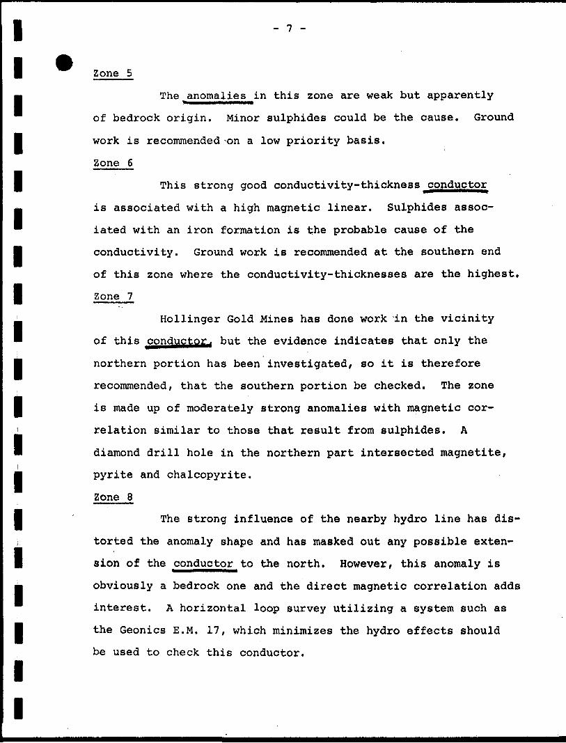
Zone 6
l This strong good conductivity-thickness ̂ conductor
. is associated with a high magnetic linear. Sulphides assoc-
™ iated with an iron formation is the probable cause of the
l conductivity. Ground work is recommended at the southern end
of this zone where the conductivity-thicknesses are the highest,
l Zone 7
' Hollinger Gold Mines has done work In the vicinity
™ of this ^onductor. but the evidence indicates that only the
|| northern portion has been investigated, so it is therefore
recommended, that the southern portion be checked. The zone
l is made up of moderately strong anomalies with magnetic cor-
i relation similar to those that result from sulphides. A
B diamond drill hole in the northern part intersected magnetite,i
pyrite and chalcopyrite.lZone 8
l The strong influence of the nearby hydro line has dis-
i. torted the anomaly shape and has masked out any possible exten-
I sion of the conductor to the north. However, this anomaly is
M obviously a bedrock one and the direct magnetic correlation adds
interest. A horizontal loop survey utilizing a system such as
l the Geonics E.M. 17, which minimizes the hydro effects should
be used to check this conductor.
l
l

l'
L*i
Zone 9
The regional magnetics indicate that this conductor
l is on the same horizon as Zones 6- 7. 10 and 11., all of which
B are associated with an iron formation. No further work is
" suggested on this section.
l Zone 10
Conigo Mines Ltd. , has worked on this portion of
I - the iron formation and magnetite, pyrrhotite and pyrite have
i been found in trenches. These sulphides are obviously the
i l l h ll formation and on strike with Zones 8 and 13. The anomalies
L are somewhat distorted due to the proximity of the strong
hydro line. Ground work on a low priority is recommended.
l Zone 13
cause of the conductivity. The conductive zone does not
correspond to the peak of the high magnetic anomaly suggest
ing that the conductor is caused by sulphides on the flank
of the iron formation.
Zone 11
This is a further extension of the iron formation.
Possibly intercepts 138A and B^should be included in ground
work.
Zone 12
This conductor is apparently associated with an iron
Similar to Zone 12, this conductor is associated
with the iron formation. Ground work is recommended to cover
anomalies 165A and 166A^ which are strong, good conductivity-
thickness anomalies.

ll
- 9 -
Zone 14
This conductive zone is an extension of Zone 11
l and ground work should be carried out to include anomaly 164A.
H Zone 15
Vertical diamond drill holes have intersected mag-
I
l l l
i
l l l l
l
l
notite, pyrrhotite and pyrite in the vicinity of this
iAREA 3.
but apparently no work has been done on intercepts 14OA and
141B,which are moderate conductivity-thickness anomalies.
Ground work is therefore suggested to cover these intercepts,
Massive and porphyritic dacite have been mapped in the area.
The weak intermittent zone within the confines of
Muskasenda Lake are poor conductivity-thickness anomalies
reflecting lake bottom conductivity.
^ Zone l Same as Zone 1; Area 2.
Zone 2 Same as Zone 6; Area 2.j MMMMMMMMMBV
l Zone 3 Same as
Zone 4 Same as Zone 9 f Area 2.
Zone 5
This is the same as Zone 8 ;^ Area, JSi however, more
anomalies^ have been intersected and it would appear that there
are two conductors present striking east-west. The anomalies
are well defined in this direction because there is poor coup
ling with the hydro line.

l - 10 -
l ^P* Zone 6
This zone may be connected to ZoneS but the hydro
l line has masked any possible anomalies which may exist between
m the two zones. The anomalies are distorted but they are def-
inate bedrock responses. Similar to Zone 5 , it has to be
i i l i
Zone 7 Same as Zone 14; Area
l regarded highly in a ground program.
l
l
k k l l
i
Zone 8 Same as Zone 15 f Area 2.
Zone 9
The shape of this single intercept is severely dis
torted from the hydro influence but it appears to have a gen
uine bedrock source. Similar to Zones 5 ancLJL, this conductor
will be difficult to assess on the ground because of the prox
imity of the hydro line, however, an attempt should be made.
Felsic metavolcanics and an iron formation has been mapped
immediately to the east of the anomaly.
Zone 10
The conductor has to be regarded as a high priority
^ target because it is isolated, has good conductivity-thickness
" values and it is in a good geologic environment, ie., inter-
I mediate to felsic volcanics. Apparently no previous work has
been done on the conductor,
l Zone 11
Some work has been done in the past by Phelps Dodge
in this area but the diamond drill holes do not plot on the
same location as the E.M.anoma^es. For this reason, a fur
ther investigation is required. Moderate conductivity-thick
ness values have been calculated for the anomalies and there
is some magnetic association with the intercepts.

lIntermediate metavolcanics have been mapped in the area.
Zone 12
l Diamond drilling by Hollinger on the western por-
•j tion of this zone revealed pyrite and graphite; however,
there is no indication that the eastern part, which appears
l to be discontinuous with the western part has been investi
gated. As a result, an investigation is warranted. The
l zone appears to be made up of at least two parallel conductors
M of varying strength. Intermediate to felsic metavolcanics
* have been mapped in the vicinity.
l Zone 13
The conductivity-thickness product is consistent
l l l l
li
along the strike of this curved conductor^lying within the
intermediate and felsic metavolcanics. Considerable diamond
drilling by Hollinger has intersected pyrite, graphite and
some chalcopyrite and it would appear that sufficient work
has been done to adequately explain the conductor.
Zone 14
This conductor which is lying near the contact of
the massive andesite and rhyolitic flows exhibits excellent
l conductivity-thickness values. Since the conductor is isolated
and is similar to those that result from massive sulphides, it
l has to be regarded as an excellent target.
Zones 15 and 16
These two zones are probably connected but the hydro
line has masked out any possible bedrock conductor indications
between the two zones. The conductor is caused by sulphides
within the peridotite rather than the serpentinized peridotite

li i
l l
i l i
- 12 -
itself.
Diamond drilling has been done on the western
portion and some pyrite has been intersected but apparently
no work has been done on the eastern and longer portion
(Zone 16) .
l The double anomaly response on some of the south
lines indicates a dip to the north rather than two separate
l conductors. Ground work on a medium priority basis is sug-
m gested on Zone 16.
Zone 17
l Apparently no previous work has been done on this
conductive zone which parallels Zone 16, and which lies within———————————— ——————the intermediate metavolcanics. Ground work is recommended.
B Zone 18
™ Minor sulphides near the contact of the felsic
and intermediate metavolcanics are possibly the cause of the
conductor. There is some magnetic association with the con
ductor.
Zone 19
™ These anomalies are weak poor conductivity-thicknessl
l value responses, however, they appear to indicate a bedrock
conductor. Possibly minor sulphides along a fault zone are
l the source. Ground work on a low priority is suggested,
i Zone 20 Same as Zone 5; Area 2.
Zone 21
This single intercept conductor is weak and exhibits
a poor conductivity-thickness value. A low priority is given
to the conductor.

l
l l
- 13 -
Zone 22
Apparently no previous work has been done on this
l conductor which lies within the intermediate metavolcanics
but close to the contact with the serpentinized peridotite.
l A good conductivity-thickness value has been calculated for
m intercept 2 04H . Ground work is definately warranted.
Zone 23 Discussed under Zone 3 ; Area 2 .
l Zone 24
The poor conductivity anomalies in this zone are
l probably caused by serpentinized peridotite, or minor sulphides
. within the peridotite. Diamond drilling in the area has re-
™ vealed nickel mineralization. No further work is recommended.
l Zone 25
Amax has apparently drilled this conductor and inter-
J sected pyrite and pyrrhotite within the felsic volcanics. The
— conductivity-thickness values which have been approximated for
" the anomalies are representative of a sulphide zone, but since
l the conductor has apparently been explained, no further work
is suggested.
l Zone 26
^ Mineralization has been noted in trenches in the
" vicinity of this weak INPUT conductor, but from the responses
m it is apparent that this zone is quite small and the mineral
ization is disseminated. The conductor lies in complex geology
l of intermediate and felsic metavolcanics and serpentinized
ultrabasic rocks.

k i
- 14 -
i l l l
i
l li l l i
Zones 27 and 28
The anomaly, intercepts of these two zones exhibit
l poo;: to moderate conductivity-width values with some erratic
m magnetic correlation. Pyrite has been trenched in the vic
inity of conductor 28, however, Zone 27 does not appear to
l have been investigated. Intermediate and felsic metavolcanics
have been mapped in the area,
l Zone 29
j Intercept 216.CL is a reasonably strong fair conduc-
B tivity-thickness value ainomalv^ with no magnetic correlation;
l whereas the adjacent anomalies are of a poorer quality.
Ground work is recommended.
Zones 30 and 31
These two zones are probably the same conductor * but
the hydro line has obliterated any intercepts between the two.
Amax Exploration has drilled some holes and has obviously
explained the conductor. Pyrite, pyrrhotite with some copper
mineralization has been encountered. The anomalies are strong
and are representative of massive sulphides. No further work
is recommended.
Zone 32
Graphite may be the cause of this strong multiple
^onductinq zone within the sediments. However, a horizontal
loop E.M. survey is suggested to further define and evaluate
the zone for massive sulphide possibilities.

l
l
- 15 -
Zone 33
Ground work is recommended on a medium priority
l basis on this arcuate conductor,
l Zones 34 and 35
These moderate conductivity-thickness JSigffigjjigg,
l which are associated with high magnetics are probably caused
by serpentinized peridotite which has been mapped in the area,
l Zones 36 and 37
— Ground work is recommended on a medium priority basis
* on these two zones
Zone 38
This large mass of annn^i -j^g I-JOQ within the acid
l metavolcanics and graphitic schists and slates containing
m massive pyrite and pyrrhotite is the obvious explanation of
B the conduction. It is recommended that the higher conduc-
I tivity-width anomalies be investigated.
Zones 39 and 40
l
l
l
l
l
massive pyrite and pyrrhotite in a bed of cherty rhyolite
l breccia which also contains copper. The anomalies are not
strong but are obviously bedrock and the coincident magnetic
These two zones are in a similar environment to Zone
38 and graphite and massive sulphides are probably the cause.
Zone 39 should be investigated.
Zone 41
This zone is a marginal bedrock conductor but it
should be considered in a ground program. Minor sulphides
beneath the overburden could be the cause.
Zone 42
Voyager Exploration has encountered disseminated to

l
i l i l i l l i il
il ^^ anomalies are probably due to pyrrhotite. Since the conductor
has been explained, no further work is recommended.
Zone 43
l The conductivity-width values vary from poor to good
along the strike of this long conductor. Portions of this
l horizon have been investigated and copper and silver have
— been encountered; however, pyrite and pyrrhotite would appear
* to be the main constituents of the conductor. Possibly the
west end of the conductor should be investigated where it
appears that no previous work has been done.
Zone 44
There is no evidence that any previous work has been
done on this strong multiple conducting zone within the felsic
volcanics. The anomalies are strong and similar to those that
result from massive sulphides. Ground work is definately war
ranted on the entire zone.
Zone 45
This zone should be regarded as a high priority tar
get. Good conductivity-thickness values have been calculated
for the responses and are similar to what would be expected
from massive sulphides. Chalcopyrite has been encountered
directly to the south in association with Zone 43, therefore,
if this zone has not been tested, it is a good target.
Zone 46m
Since this zone is not part of a long conductor,
exhibits good conductivity and has some magnetic association,
it is a good sulphide target. Pyrrhotite and pyrite have been
noted in the felsic metavolcanics nearby.
l

l l l l
- 17 -
Zones 47 and 48
Apparently diamond drilling has explained these
moderately strong conductors.. Pyrite and graphite have been
observed in the drill core.
Zone 49
l Pyrite and graphite have been encountered in a
diamond drill hole on this conductor. Therefore, no further
l work is recommended,
l Zone 50
Sulphides could be the cause of this bedrock con-
I ductor with some flanking magnetic correlation. Ground work
is recommended,
l Zone 51
m No further work is suggested on this zone because
it has obviously been explained. Pyrite and graphite have
l been encountered in the diamond drill holes.
Zone 52
g This good conductivity-thickness response does not
l
l
l l l l
appear to have been explained in previous work. Ground work
is warranted.
Zone 53
Ground work is suggested on a medium to low priority
basis on this double conductor zone. Interbedded mafic, inter-
mediate and felsic metavolcanics have been mapped in the vicinity.

l l l l l l l l l l l l l l l l l l l
- 18 -
Zone 54
A horizontal loop survey is suggested on this mul
tiple conducting zone within the rhyolite. Massive sulphides
are expected to be the cause.
D. Watson

ll
APPENDIX
l
&UIPMENT•••••••PHI^^MHBMIMt
The aircraft are equipped with Mark VI INPUT (R)
l airborne E.M. systems and Barringer AM-10^L or AM-101A
m proton precession magnetometers. Radar altimeters are
used for vertical control. The outputs of these instru-
I ments together with fiducial timing marks are recorded
by means of galvanometer type recorders using light
l sensitive paper. Thirty-five millimeter continuous
strip cameras are used to record the actual flight path.
(I) BARRINGER/QUESTOR MARK VI INPUT (R) SYSTEM
The Induced Pulse Transient (INPUT) system is l 1
f particularly well suited to the problems of overburden
— penetration. Currents are induced into the ground by
™ means of a pulsed primary electromagnetic field which
l is generated in a transmitting loop around the aircraft*
By using half sine wave current pulses and a loop of
J large turns-area, the high output power needed for deep
B penetration is achieved.
" The induced current in a conductor produces a
l secondary electromagnetic field which is detected and
measured after the termination of each primary pulse.
g Detection is accomplished by means of a receiving coil
towed behind the aircraft on four hundred feet of cable,
l l l

(ii)
and the received signal is processed and recorded by
l equipment in the aircraft. Since the measurements are
in the time domain rather than the frequency domain
l common to continuous wave systems, interference effects
m of the primary transmitted field are eliminated. The
secondary field is in the form of a decaying voltage
l transient originating in time at the termination of the
transmitted pulse. The amplitude of the transient is,
l of course, proportional to the amount of Current induced
j into the conductor and, in turn, this current is propor
tional to the dimensions, the conductivity and the depth
l beneath the aircraft.
The rate of decay of the transient is inversely
l proportional to conductivity. By sampling the decay
m curve at six different time intervals^ and recording
the amplitude of each sample, an estimate of the rela-
I tive conductivity can be obtained. By this means, it
is possible to discriminate between the effects due to
l conductive near-surface materials such as swamps and
g lake bottom silts, and those due. to genuine bedrock
sources. The transients due to strong conductors such
l as sulphides exhibit long decay curves and are therefore
commonly recorded on all six channels. Sheet-like sur
face materials, on the other hand, have short decay
. curves and will normally only show a response in the
™ first two or three channels.
l
l l

(iii)
l l l l l i l i i i l l lM l l l l
The samples, or gates, are positioned at 260, 480,li.
755 , 1100, 1575 and 2100 mi^rg-^f conds after the cessation
of the pulse. The widths of the gates are 225, 225, 320 ,
410 , 500 and 540 micro-seconds respectively.
For homogeneous conditions i the transient decay
will be exponential and the time constant of decay is
equal to the time difference at two successive sampling
points divided by the log ratio of the amplitudes at
these points.
(II) BARRINGER AM- 104 OR AM-101A PROTON PRECESSION MAGNETOMETER
The magnetometers which measure the total magnetic
field have a sensitivity of 5 gammas and a range from
20/000 gammas to 100.000 gammas.
Because of the high intensity field produced by
the INPUT transmitter, the magnetometer results are re
corded on a time-sharing basis. The magnetometer head is
energized while the transmitter is on, but the read-out
is obtained during a short period when the transmitter is
off. Using this technique, the head is energized for 1.15
seconds and then the transmitter is switched off for 0.15
seconds while the precession frequency is being recorded
and converted to gammas. Thus a magnetic reading is taken
every 1.3 seconds .

li l l l l l l l l l l l l l l l l l
(iv)
DATA PRESENTATION
The symbols used to designate the anomalies are
shown in the legend on each map sheet, and the anomalies
on each line are lettered in alphabetic^
direction of flight. Their locations are plotted with
reference to the fiducial numbers on the analog record.
A sample record is included to indicate the method
used for correcting the position of the E.M. Bird and
to identify the parameters that are recorded.
All the anomaly locations, magnetic correlations,
conductivity-thickness values and the amplitudes of
channel number 2 are listed on the data sheets accom
panying the final maps.
GENERAL INTERPRETATION
The INPUT system will respond to conductive overr
burden and near-surface horizontal conducting layers in
addition to bedrock conductors. Differentiation is based
on the rate of transient decay, magnetic correlation and
the anomaly shape together with the conductor pattern and
topography.
Power lines sometimes produce spurious anomalies
but these can be identified by reference to the monitor
channel.

i i i i i i i i i i i i i i i i i i i
(v)
Railroad and pipeline responses are recognized by
studying the film strips.
Graphite or carbonaceous material exhibits a wide
range of conductivity. When long conductors without
magnetic correlation are located on or parallel to
known faults or photographic linears, graphite is most
likely the cause.
Contact zones can often be predicted when anomaly
trends coincide with the lines of maximum gradient along
a flanking magnetic anomaly. It is unfortunate that
graphite can also occur as relatively short conductors
and produce attractive looking anomalies. With no other
information than the airborne results, these must be ex
amined on the ground,
Serpentinized peridotites often produce anomalies
with a character that is fairly easy to recognize. The
conductivity which is probably caused in part by magnetite/
is fairly low so that the anomalies often have a fairly
large response on channel #1; they decay rapidly, and
they have strong magnetic correlation. INPUT E.M. anom
alies over massive magnetites show a relationship to the
total Fe content. Below 25 - 3(^ f very little or no re
sponse at all is obtained, but as the percentage increases
the anomalies become quite strong with a characteristic
rate of decay which is usually greater than that produced
by massive sulphides.

l (vi)
l *m Commercial sulphide ore bodies are rare, and those
l that respond to airborne survey methods usually have
medium to high conductivity. Limited lateral dimensions
Jj are to be expected and many have magnetic correlation
— caused by magnetite or pyrrhotite. Provided that the
' ore bodies do not occur within formational conductive
l zones as mentioned above/ the anomalies caused by them
will usually be recognized on an E.M. map as priority^
g targets.
l l l l l l l l l l l l

Power Lint Monitor•M^
l
*
4 Input EM * channels
i
EMAmplitudeiOOOp.p.m.
— 500' Radio
— 400* Altimeter
— 500'
Magnetometer Fine Scale 100 Gamma*
Magnetometer Coarse Scale
5000 Gamma
Fiducial Timing Mark
ote.Ml
Anomaly Location
Representative INPUT,Magnetometer and Altimeter Recording

i7^*^?*^'** - ' -y***i-*v#S(*fir-i 'Til '-fit-''" '
CcrUUvO "tkiL
43-izo-Z 43-
45063t3 63
•Z
Z- 933Z-Z-
h
!3
G
A-351
cJM •-if.'.
^^^••^^^;c :4 ~' ^KV/""* '
o.. ,. •-... .j... '..- '
i:f--.'.:i ( :.X.:v-" :-;-H-^ :VV'. L , 4ji ^MiJ'' , '/fJ-'T' .'4 ; ' , .'
?R ^^'^.^j^if.-^-.^i.-r-^^v. ; ;-; -i-. ; '' Jr ''' l''i'' "' "
^^^mm^^W * it*l^^^: rv-:/^.?^^.^;^'^-,''- - ffP^!^^

r File.
O GEOPHYSICAL - GEOLOGICAL - GEOCHEMICAL TECHNICAL DATA STATEMENT
TO BE ATTACHED AS AN APPENDIX TO TECHNICAL REPORTFACTS SHOWN HERE NEED NOT BE REPEATED IN REPORT
TECHNICAL REPORT MUST CONTAIN INTERPRETATION. CONCLUSIONS ETC.
Type of Survey Airborne Electromagnetic Township or *™-" English TWP. Area ————
CImm SEE ATTACHED LIST
Author of Report———P, Watson.20 Cnnso Road. Rexdale. Ontario
Covering Dates of Survey.
Total Miles of Line cut. —(linccutting to office)
SPECIAL PROVISIONS CREDITS REQUESTED
ENTER 40 days (includes line cutting) for first survey.ENTER 20 days for each additional survey using same grid.
Geophysical—Electromagnetic.—Magnetometer—.—Radiometric———Other—————.
DAYS per claim
Geological.Geochemical.
AIRBORNE CREDITS (Special provision credits do not apply to airborne surveys)
Magnetometer____Electromagnetic 40 Radiometric
MINING CLALMS TRAVERSED List numerically
(number)
•fi
.Electromagnetic 40 (enter days per claim)
: July 4.1974 SIGNATURE:.Author^f Report J
PROJECTS SECTION Res. Geol. ———,———
"T
Qualifications.Previous Surveys
Checked by. .date.
GEOLOGICAL BRANCH.
Approved by_L. .date.
GEOLOGICAL BRANCH.
Approved by. -date.TOTAL CLAIMS.

CLAIM HOLDERS LIST
Simon Ouellet Roger Laramee Adrien Cote Luc Proulx Irenee Cyr Pierre Proulx Georges Lacoursieres Roland Sevigny Roland LeBlanc Jos MowattEdouard Morrissette
Fernand Dicaire

AIRBORNE SURVEYS
Type of survey(s) Airborne Electromagnetic
Instrument(s) Induced Pulse Transient System.
Accuracy ________m____________-————.
Aircraft used Shorts Skvvan
Sensor altitude 150 feet above ground.
Navigation and flight path recovery method Radar altimeters,Fiducial Timing by galvanometer type recorders and 35 mm continuous
strip cameras. Aircraft altitude 400 feet_____Line spacing 1/8 mile.
Miles flown over total area 2195 Over claims only 234.5

®*P 36o e
P:
P3bc P3kc P3&1
(S^* S&L
i :^ ^L i.t. inL^^Z
.1
f
/B
Q /B
/A
M M
3e
-^
13
*?t
3&7&&S
-^
2- tt? of Z
327
367 tt
L.
l
3 # W/ .T
^ 3&7/3J i- 387/3ZL 367X 3^ '^ 3&7X3?
^337/36
3^7/4 o 3#7
t. 387
l 307/^3
A1
/Uf
307 /^f
M
M
M
M
/l
M
M
P 36-7/70
P 3^7/77
^307/73
'/76
30*7/79
s-; 119
S W?/0s
03 tt? /g
t. 327/07 L~'fo7J00 L
M
M AT
x//
c
3^7/^7
a
A /Ba/s s
s te
e^ '567200 b ^?071uo/ *?
^7^3
(L) -36732
Z
1-387340
/S
8e e.E Se
t- ^3*73
7 ^^ 8
x^ 3673 ^f
38-7^6
^367^73
f
M.

'3,
3872
387 3V
367 M4
'i-C
X//M*
X//
307 x//x// i x//
ve?
i///3073^-2- 307 &-S
367 aP^P
36'?
7
38-? 3 3B
o
38 7 JUS /vT 2.30734 j///
xv/iX// i
X// //*
b
35^-2-
36.7
307
//--c
^
"7 370 367 37 y
^ 36573-^ 307376 ^3*373-7-7
t 3^7 37^
U. i
3^7
'i ~
^ ^01363 jo
^-36273^-7
3^7 39
3^7 390
307
pp p
t
L "309 ̂ i L "3874 4? "7
L
L. LL

387479
38748*
L ,'
L "36 7487L 387488
L
U 3 87^ f S
6.e
s e
e 8e i e ' s
e666e g
6e
3S7
38)76*716 l
LL 387^10
f,6 se i
L 38-?t ̂ 86734
L
sea 790
n"
X//
CO
eft
f

CH2.AMP1-1
'm1tB
11111111111111111
^ 001A^ 001B
001COOID001E00 IF001Q00 1H002A002B002C002D002E00 3A004A00 5 A006A006B
01 3A
017A020A021A021B022A02 3A02 3B024A024B024C02 5A02 SB025C026A026B026C027A027S02 TC027-0028A028B029A029B029 C029 D029 E030 A030B030C030D030E031A031B031C031D031E031F
898.45898.57898*80898*90899*23899*53899*8?900*40910*29910*52911*039 1 1 * 28911*98891*12925*3494T.03901.03901*50
,
15*39
42*9224.2379.1679.3441*5298*2498*3654.3358*7058.77
121*20121.50125*2771.9076.2376.36
143.19143*39147.40147.6088.7093*05
159.05159*30163*25163*46163*82106*90107*431 1 1 * 69111.79112*90174.23174.401 78 . 69178.82179.05179.20
333443343424332353
2
242343234 .44366444465654455456552566654
6558934829146315
123
l
1524
113346674
1838
5997
268
3915109
20IS
629443840
27
5635233112
2122212422
NC937
NC291
NC
NC3
NC134
NC35252
14196732
H1220
7336766
15S5
NC86
1011
54
0.000.000*000.000*000.00o.oo
900*40910*25910*45
0*000*00
911.800*000*00
947*050*000*00
0*00
0*0024*3078*950*000*000*000*000*000.00
58.800.000.000*000*000*000*00
143.100.000.000.000*00
93.050.00
159.250.000.000.00
106*95107.50111.70
0.00113.10174.15
0*000*000*00
179.000.00
0000000
101010
00
2000
1000
0
02525
000000
10000000
100000
100
15000
501525
06015
000
800

11''iiiiiiiiiiiiiiiii
ANOM
032Al 032B
033A033B033C 033D 033E033F034A 034B034C034D 034E034F035A035B 035C035D035E 035F035G036A 036B 036C036D037A 037B037C037D 037E 037F038A038B 038 C038 D038E 038F 039A039B 039 C 040A040B040C 040D041A041B 041CAAPAW"* C* ri
042B042C 04 3 A043B043C 043D044A044B 044C044D044E
FID CHS CH2.AMP
129.73 6134*48 4 188.64 4188.88 5189.46 4 189.93 2 194*58 6194* TO 6150.77 6 151.12 5151*32 4151*43 6 156.20 3156*50 3203*30 5203*52 5 204*02 4208*94 5209*05 5 209 * 50 5209*67 5166*40 6 166*90 6 171*58 3172*00 6217*47 4 218*00 4218*27 4222*88 4 223*09 5 223*70 3182*21 3182.46 5 182.56 6187*23 2187.50 3 188.00 5 233.32 3233*50 4 237.90 5 197.63 4197.90 4202*75 3 202*93 3211*50 4211.90 4 216.60 4246.84 3247*15 4251*73 4 225.73 5230.40 3230.62 5 231.05 4259.70 4259.87 4 260.03 3260.17 3260*43 3
7837
1010
1 422886 138
15 67
1314 103934 211017 18
732111398
24 25
33 38
26
17 44
38 1316
5 6
3415 1626
15 10
320
669 433
MHOS
13S 2
102
NC 998 59
10 21
128 266 86
15 14
283 134 8 214 6
NC2 4 24 4 34l 124 4233
1046 563 114
MAG VALUE
129.65134*50 188.70
0.00189.30 189.85 194.65o.oo150*75
0.00151.35
0*00 156*05
0*000*000*00
203*65208*85
0.00 0*00
209.60166.50
0*00 171*50
0.00217.60
0.00218.40222.65 223.00 223*80182*15
0*00 0*000*00
187*50 0*00
233.400.00 0.00
197.500.00
202.60 0.000.00
211.75 216*65246*85247*05251*70
0*000.00
230.70 0*000.000*00
260*050*00
260*50
7045
1300
30 15
1000
40 0
1000
25000
20500 0
2020
0 200
030 0
38040 25 4030
0 00
135 0
1600 0
300
60 00
35 18040
20030
00
520 000
10500
260

1111111111111111111
ANGM
044F
045B046A046B047A047B048A048 B049A049 B053A053B
059A068A068B069A069 B069 C070A0708070C070D070E071A071B072A072B072C072D072E073A073B074A074B075A09 6 A09 6B
09 7A098A099A100A101A102A103A104A105A105B106 A107AMA12A12B13A14A16A17A
FID
260.62245*28245.68258.40258*90271*19271*64269.80269.97279.35279.88837*60837.87
861*16921.03924*86984.20984.36988.23933.21933.50937*88937*97938.20996.33996.47945.90946.09949*90951*34951*44
9.009.28
960.65965*69
21*48100.73100.82
166*52113*28181*95125*48199*20137*32216*90152*98234.57234*65169.93252.53288.90219.37219.43307.68237*04254.84354*66
CHS
2343333446432
3236543266655323665222344
5543233644234453234
CH2.AMP
248853363
55779
222
168731
29251395422
3223
8112477
81083233
14362349
123187
MHOS
NC24233326
1222
NC
7NC
212
744
NC1214121111
2NC
7121813NCNCNC
377
21H97
NC47
145
10NC
495
137
NC37
MAG
0.000*00
245*75258.45258*95271*05271.45269*70
0*00279*20279*60
0*00837*90
0*00921*05924*90984*20
0*00988*30
0*00933*55
0*00937*95
0.000.00
996*550.00
946*10950*20951.35
0.000.009.35
960.65965.55
21*500.00
100.85
166*55113*35182*00125*50199*20137.45216*90153*05234.35234.65169.95252*55288.90219.40
0.00307.75237*10254*90354*65
VALUE
0
250250200210340270
0240500
03000
080
190300
025
075
0650
00
10000
401500
75000
150070
24020
01100
1000860560430400500250300250120330490460520
0130
401270800
1-3

1111111111111l11111
,. ANOM
A118A M21A
189 A130A130B131A131B132A138B133A133B133C134A134B135A136A136B137A137BI38A138B
139 AUOA140B141A141B142A142B142CUSA144AU4BU4CUSAUSBU6AU6BUTAUTBUTC148 A148B148CUSD149 A149B149 C150A1SOB153A156A160A161A162A163A163B163C163D
FID
872*98 399.62495*8740 T* 29407*40521.28522.57431*26431*40546*1054T* 1 1548*80451*42454*50573*32478.9548 1 . 50595*30598*02503*43503*52
620*16525*44528 * 52645*50648*30552*89552*99555*32670.85576*07579.85586*49691*90693.20601*13602.62712* TOT12.80714*14625*33626*88627*04629 * 20731*40733*03734.60651.10654.96765.48722*00772.53823*39791.89809.34810*90811.00812.53
CHS
3 45554545324222224555
4435433224322346454433222432223343352
CH2.AMP
3 4B9
11766
103282232l4897
564
1044422
153228
1114
412
67442224622153
1964
142
MHOS
13 96
129496
117
NC4
NCNCNCNCNC
97
1814
797
10923
NCNC
4l
NCNC
28
10119S574
NCNCNC184
NCNCNC
53533
10NC
MAG
273*05 399.65495.70
0*00407*60521.10522.60
o.oo431.60546.00547*30548.80451*60454*65573.20478.9048 1 . 60595.35598.05
0.00503*50
620.20525*25528*55645*55648 * 50
0*00553*00555*45670*95
0*00579*95586*50691.90
0*000*00
602.600*00
712*850*00
625*20626*85
0*00629.20731.25733.05734.90650*80655*05765*40722*10772*45823*50791*80809*25
0*00811*00
0*00
VALUE
11012003000
035002370
3200
10001100
904040
200020
340230380
300
260
250140300360400
0400100280
0100
30300
00
3900
2200
1200700
110150
3012501080
1709590
130180180140
01170
0
1-4

1iiiii
iiiiiiiiiiiiiii
ANOM
164AM64B
165A165B166A166B166C166RA166RB167A171A172A1?3A174 A17*B175A1T5B1T6A1T7A1T7B178A176B179A179B180A180B181A182A182B182C182D183A183B184A18 4B184C184D18 5A186A186B18 7A190A190B190C191A191B191C19SA192B192C192D192E192F192G19 2H19SJ19 3A19 3B193C
FID CHS CH2.AMP
838^88840*40 826*76828*51843.50845*22845*32856.49856.09316.07362.40376.43323*13394.63394.70412*51413*00336*6343). 66431*90347.76353*47450.57450.70364.70364.86475*53382.53362.69382.83383*26496*12496*43400.96401*23401*40401*54517*49419*60419.73540*97456*60457*60465*70590*70591*0659 1 . 50475*95476*47476.74476*88485*99486*16486*24486*34486*64608.41608.77618*30
63646443523266645666564456656535634554233322436523455554642
163
214
32574
17121
252419
510211222
974
335
1224101814
32018
25
109
14563
104245
6724
2347
101112
318
52
MHOS
154
141112
3579
NC7
NC161211
36
129
11111814
61018101511
746
H73673
NC111
NCNC
9155
NC467
119
13683
NC
MAG
838.90840.55 826*75828*50643.50845*25
0.00856*55856*10316*10362*45376*45323*15
0.00394.75
0*00413.05336.65431*75
0*00347*95353*85450*40
0*000*00
365*10475*25
0*000*00
382*80363*30496*00496*30
0*00401.25
0*000*00
517*70419.55
0.00541.10456*65457*75465*75
0*000*000*00
475*900*000*000*000*00
486*200*000*00
486*65608 * SO608*75618*20
VALUE
1150220 500730850750
0560
1000110380180700
01700
01500
701200
0100
14002500
00
8090
00
2080
10090
0200
00
140170
0270
1050370280
000
20000000
120000
50700
50170

11i1111111111111111
ANOM
19 4A%9/lB
194C194D194E 19 5A19 5B196A196B196C196D19 7A 197B197C19 7D 19 7E197F1970197H197J197K198A 198B198C1980199A199B200A200B200C200D200E 200F201A201B201C201D201E201F201Q202A202B 202C202D202E202F20 3A203B203C 203D203E203F203G204A204B204C204D204E204F
FID
496*75497.00498.55508.25508 . 44 648.04649.33518.40519.80530.69530.82667*29 668.05668.14668.62 668.72677*306T7.80679*83680*87661*07542*39 543.06555*07555.24707*83713*39565.70566*16566*59568*60568*93 569*63745.32746.10746*49746.79749.10749 . 38749*73591.64592.44 592.90593.23594*40595*70779.31780.10780*50 78 1 . 78781.91783.50783.90620.33620.70621.04622.47622.66624.14
CH!
44233 2552354 4556222323 3563555233 2333334535 4334233 3533434454
MAG VALUE1-6
15152322
5315
3263799
122252333
1212
3109
1124
1322
118428
143
12943
202934
1144345
1078
4 4
NC 4 7
NC 5 4
NC78
14466
12 NC NC NC
7NC
4 l 9
12 4
11 6 6
NC 2 2
NC 7 l1224749334 3
NC l 7 7 9 7 7 623372
496.750.00
498*500*00
508*50 648.05
0.000.00
519.85 530.70
0.00 667*50
0*00 668*10 668.70
0*00 677*20
0*00 679.70 680*95
0*00 542*25 542*95 555*05 555*25 707*65 713*40
0*00 566*10
0*000*00
568*85 569*55 745*10 746*10
0*00 746*70 748*90
0*00 749.75 591*80 592*40 592*65 593*25 594*20 595*65
0*000*00
780* 350.000*000*00
784.100*00
620.65O.QO
622*300.00
624*10
2500 O
60 O
170160
OO
280150
O470
O900410
O1500
O300130
O200460440100
55800
O410
O O
25002000
253000
O3000
700O
1000200
1200160
3040
3500 O O
4000 O O O
1800 O
900 O
130O
2000

11111l1111111111111
, ANOM
f4G4H
204J80 5A20SB205C205D206A206B206C206D206E206F206G20 7 A20 7B207C207D20 7E207F207G207H20 7 J208A208 B208 C208 D208 E208 F208 G208H208 J209A209 B209 C209 D209 E209 F2IOA210B2IOC2UA2MB211C2I1D211E211F211G21 1HS11J212A212B812C212D21 3A213B213C21 3D213E
FID
624*93625*05625*58813*97816*51816*80818*50650*40650*64650*72650*96652*52656*80657*10838*33847*00847*10848*33852.70852*90854*20854*60855*18682*10682*60682*70682*94684*15689*43689 * 6069 T* 64697*80884*01866*78866*90889*47889.65890*96T15.02716*60721*92911.03911.16912.20912.45918.49921*80924*50924*67928.82751*30755.16755* 80760.70950.60955.24957*94958*18958.33
CHS
45333343334433433323233345343455222236533554642223333643332
CH2.AMP
483244642279664433232637682
103
129522222
2618
39
2312
7164132
10334
15142432
MHOS
912
4271527325314213
NC4
NC312577414
1110NCNCNCNC
210
841982
129
NCNCNC
2341
134314
NC
MAG
0.00625.10625*55813*95
0*00816*90818*70
0*000*000*000*00
652*35656*70
0*00838*35847*00
0.00848.15852.80
0.000*000*000*00
682.050.00
682.700.00
684*200.00
689.80697*70697*85
0*00866*65886.90889.50889*85891*05715.20716*30722.30
0.00911*35
0*00912*50
0.00921.95924.45
0.00928.80751*40755*30
0.000*00
950.900.00
957.900.000*00
VALUE
0110520270
0550200
0000
630150
0290200
0300
600000
100
200
700
160310
500
6050
1504508060
470260
0500
070
03055
0402590
00
1600
5000
1-7

111111111111l111111
ANOM
213F
^213G 21 3HS M A214B214C 2 MD21 /IE214F 21 5ASI SB215C215D21 SE21 5F21 SG 216A216B216C 216D216E216F217ft21TB217C217D 21 ?E2i?F217G217H21 7J218A818B 218C218D218E 218F218Q218H218J218X219A219B 219C2190219E 219F219G219H219J219K219L219M 219N220A220B220C220D220E
FID
960. 58960. T2 961*40765*45786.97789.38 792*60792.87795.99 994.50995*29999.09999*20
0.7-32.492.73
820.00820*15821.82 826.30827.0282T.90
32*3033*2833.9334.09 36.2838.7939*0540*5840*90
855.73856.93 856.13857*60860*00 860*09862.21863*00864*00870.88
60*8861*24 61*4661.5768. 82 69*0969.9270.0977.2677.5077.6077.80 77.98
892.71893.11893.44894.06897*13
CH
33 2223 322 2522335 645 3622656 4434666 443 4563244 442 3S56665 666623
3322222322
1622
1017171323182
4112
38B16 6 8 3
299071241594107
40 4 2 5 43434 10 14 24 23 21 20 17 59 41 13
l 7
l l
NCNCNC
72
NCNCNC
7NCNC
2l9S387
10NCNC102116
5433695337479l
NC 7 4 6 8
NC 2
1011 11 11 106
125
20 11 NC
2
0*000.00
961*50785*60786*65789.35792.70
0.00795.85994*65
0.00999.05
0.000.002.450.000.00
820.300.000.000.00
828.000.00
33.500.00
34.3036.500.000.00
40.550.000.000.00
856.100*000*000.00
862.00863*40
0.00871.05
60*9561*350*000*00
68*600*000*000.000*00
77.550*000*000*000.00
893.050*00
894.10897*15
VALUE
OO
20015
8009020
O1030
10 O
1300 O O
30 O O
45 O O O
35 O
50 O
160130
OO
40 O O O
55 O O O
530310
O12025
100OO
350 O O O O
50 O O O O
80 O
8040

1111111111111111111
ANOM
^leoG220H220J220K221A281B221C221D221E221F2810281H22 1J22 IK82 1L22 1M221N221P222A822B222C222D222E222F2286222H222J222K222L223A223B283C223D823E223F224A824B224C224D224E224F284022 5A88 5B285C885D226A226B226 C286D28 7A227B227C227D227E227F2270287H
FID CHS CK2.AMP
900*13 6 32900.27901*02907.90909.1096.9097.09
105*53105. T3106.22106.40106.50106.67109*78113*69113*92114*13114.50114*63930*53930*70931*07931.39935*08935*23937.80938.20938.70938.80939.18143.30143.63143.83150.38150.60150.87967*07967*58968*03971.70978.80974.33974.801 78 . 28180.13186.50187.80
3*874.184*484.88
214.88815*08215*28218*53883*32883.53283.80823.94
4422324445464366566665253635444434666488558536666244424466
922
11227739
111983
2663232617436814
2172
32277
169
128
1023833119
21
30164
186
27262732
46
1181
11263661
MHOS
1133
NCNC
2NC
22664
1094
1016
310189
168
NC18
2927722323
1912132
NCNC
34
NC80
88101718NC
232
NC4l
8715
MAG
0.000.000.00
907.90o.oo0.000.000*000*00
106*050*000*000.00
109.90113*70
0.000.00
114*400.000.000.00
930.95931*60935*15
0*00937*85
0*00938*65938*85
0.000.00
143*70143*95150*35
0*000*000.00
967.40968.00
0*000.00
974.250.000.00
180.25186*80
0.003*950*000*004*950*00
215*050*000*00
223*400.000*000.00
VALUE
000
2000000
65000
70210
00
60000
55520
300
500
8040
00
2080
1250000
302850
00
13000
4501380
030
00
7800
1000
60000
1-9

1111111iiiiiiiiiiii
ANOM
228 A|B28B
228 C228 D228 E228 F228 G228H228 J228 K229 A229 B229 C229 D229 E229 F229 G229H229 J230A230B230C230D231A231B231C231D231E231F231G231H231J232A232B232C232D232E232F232G23 3A233B233C2330233E233F233G233H234A234B234C234D234E234F234G234H234J235A23 SB235C
FID
41.7342*0542.3842.6042.7943.0043.3947*8050.8451.00
251.03251*18252.14252.48252.63259.06259.28259.48259.8079.0979.4085*8387.33
286*40286*48286*6028 T* 98288.27293.57293*82294.87295.08115*98117.29120.69122.53123.98124.11124*22322*60323*58323*70324.05324*29326*33329*80331*22152*76154*22157*561 59 . 491 59 * 72160*00160*78160*90161*60358.43359.63360*62
CHS
56666642555435645543565663352334454645634456353333644352346
CH2.AMP
16129433243011
214253012
46
208
121298
1934251820
43
11348
103520
930
41212
365
1624
713
4336
558
158
14127
44
MHOS
78
151510
63
NC884229
1048931678
1112
735
NC225283
1349
131576818213262415
NC25
11
MAG
41*800*000*000*000*000.000.000.000*000*00
250*950*00
252*050*00
252*800*00
259*20259*50
0*0079.050*00
85*750*000*00
286*550*000.00
288.400*000.00
294.950.00
116*150*000.00
122.350*000*00
124*250*00
323.350*000*00
324*550*000.00
331.15152.75154.20157.60159.25
0*000*000*00
160*90161*65358*40
0*00360*60
VALUE
40000000000
200
300
5300
20100
250
50000
5000
60000
500
3500
75000
300
9000
72000
302020
180640
000
3010020
090
1'1
111111111111l1111
ANOM
^2350^2 36 A
236B236C236D236E237A237B237-C238A238B238 C239A239B239 C239 D240A240B240C240D240E241A242A24 3A24 3B244A244B245A245B245C245D245E246A246B246C246D24 7A247824?C24 70247C247?2473247H246A248 B248 C248 D248 E248 F249A249 B249 C249 D249 E249 F250A250B250C
FID CHS CH2.AMP
362.84188.49196.19197.00197.33198.16396.73396*92405.10224.70232.58232.92432.56433.03438.75440.98260*32260*49262*64262*80268*43481*97298.70523*40523.56333*22335*00557*38561.00561.17563*03563*33368.95369.40371.30379.40590*30590*42592* 26600.21600*46600.62600*83600*96405*20405*42405*90406*00414*20415*90620*30622*55622.68629*88630*60630*90442.49442*73443.33
25433433663352554556366553626544646465233664556524244656444
31514
43848
3747124
102
1912
71620152
15341912
593
237
91010312326191812
18
10B
402110154726
Q16
249
441331
71062
MHOS
NC7223421
1217
126
NC13
5576
212
1314
682
12NC2512
34
131
125
108
NC11
1310
367
126
NC4
NC97
1257432
MAO VALUE
0*00188*45196*25196*90
0*00198*00396*65397*05
0*00224*85232*50233*00432*50433*10
0*00440*95
0.00260.75
0.000.000.000*000*00
523*150.00
332*900*000*000*000.000.00
563*250*00
369*250.00
379*40590.25
0.00592*30
0.000.00
600.650.00
601*050*00
405*45405*75
0*00414*05
0*00620*45622*55622*80
0*000.00
630.800.000.000*00
020
25060
0703055
030
1503030
1900
1200
10000000
2000
9000000
750
700
30500
57000
1000
150
2050
0840
060
200370
00
15000
1-11

1111111111111111111
ANOM
o5oD^isOE
250F250G250H250J250K250L250M251A251B251C251D251E251F251G251H251J251K251L252A252B252C252D252E252F252G252H252J253A253B253C253D253E253F2530253H254A254B254C254D254E255A255B255C255D255E255F255G256A256B256C256D256E256F257A2578257C257D
FID CHS
443. 49443.83443*92448*30448.80449.27450*80451*86453.27650*72650*90651.60652*23653*08653*18654*57654*80655*08660*18660.33491.90492*10492*27498*30500*10501.13501.97502.77503.16680.88681*43681*67683*38684.74684.93690*23690*38528*62534.50536*18537*65537.93712.79T13.16713*53T15.80716*03721.10721.22566.28566*38572.18574.56575*30575.76742.68T42.93743.60745*37
64423362333335533366654453442233234556532332223454453243432
CH2.AMP
911111
133
232875255
14642
50988725141010
67
11123324
101522421043431325
111912
920
6343632
MHOS
2333
NC14
17NC
22233
105222767525
10173
NCNC
44
NC45
107
1010
2NC
71
NCNCNC
53838
102
NC4763
NC
MAG VALUE
0*000*000*00
448.300.00
449.30450.70
0.000*000*000*000*00
652.50652*90653*40
0*000*00
655*050*00
660*25o.oo0*000*00
49 8. 30499.90
0.00502.25
0*000.000.00
68 l . 400.00
683*500.000.000.000.000.000.00
536*05537*50537.80712*85713*10713*70
0*000*000.000.000.000.000.00
574.60575.15
0.00742.70743.05743.35745*25
000
300
15330
00000
50066090
00
100
20000
2090
050
000
600
110000000
651508050
180900
0000000
60020
02075
500250
1-12

1111111111111111111
ANOM
rt57E*57F
257G257H258A258B258C258 D258 E258F259 A259 B259 C259 D259 E259 F259 G260A260B260C260D260E260F261A261B261C261D261E262A262B262C262D262E262F262G26 2H262J26 3A26 3B263C26 3D263E26 3F26 3G26 3H26 4 A264B264C264D264E264F264G265A265B26 5C265D266A266B266C
FID CHS CH2.AMP
745.93746. 10751.39751.51602.33603.28604*01604.39605.97606.53773.10773.20773.83775.15775.27775.42775.60632*33632.57633.90634.10634.49636.25796.73796.99798.36798.48798*80662*33662.46663*37663.57663*78664*05665*33665*67665*98819*84820*00820*43821*60821*70821*90822*00823*06693*28693*43694* 18694*52694*92696*56696* 80843*60843*96844* 11845*60724*84725. 12725.30
44445254634435666354663334535533466364644444455354364354455
69
101617
213
615
2444
16371420
236
54724
8249
228
1613
67
195511
211
311
41420129
2840149
1653
25636
109
1117
MHOS
5525
12NC
85
107993
108
1110
773
1016
323352481138
142
13599434335727
121
1453
164354
MAG
0.000.000.000*000.00
603.400*00
604*35605*85606*80
0*00773*25774*05
0*00775*25775*50
0*000*000*000*00
634*25634*55636*00796*65
0*00798*15798*45798.95662*35
0.00663.15663*55
0*00663*95
0.00665*55666*20819.75
0*00820.45
0*000.00
821.850.00
822.800.00
693*65694.10
0.00694*85696*65697*10843*75
0*00844*20845*55724*90
0.00o.oo
VALUE
00000
400
2807090
065
11000
190280
0000
80200
1050120
065759020
013040
030
01100
175110
01050
00
600
500
13020
035
130125330
01100
30200
00
1-13

l'1
11111111111111111
wO W ^J
^((•O O M
266F26 7A26 7B267-C267D267E267F268A268B268 C268 D268 E269A269 B269 C269 D269 E269 F269 G269H269 J270A27OB270C27OD270E27OF2700270H270J271 A271B271C271D271E271F271 G27iH271J271K272A272B272C272D272E272F27SG273A273B273C273D273E273F273G273H2 7* A274B
727*06727*50738*22865*70866*00866*62866*84868*99669*15755*77-757*68758.08759.27759.40890.07890*14891*23891.35891.75892.80892.90893*40893.52778.58778.88779.30779 . 52780.74781.13782.58782.72787*17909*69913.73913*93914.90915.02915*20915*30916*52916.70917.23801.66801.89802.22803*29803*63803*98805*239 38 . 50938.80940*00940*10940.50941.38941.65941.77825*04825*23
23363233434566665535534644646663333555545454536543366334633
355
224266876
39745247461523
71419
4101114
42313457612234447
1218
832
612
423
5199
10349
13397
1845
NC34
174
NC334254
24161112
472
1111
33
131991
121082112
1216
8119529452
1311
312
1111
117923
727. 150*00
728*30865.75
0.00866.55
0.000.00
869.10755*55757*70
0*000*00
759.450.00
890*150.000.00
891.95892.75892*90
0.00893.50778.45778.85
0.00779.45780*75
0.00782*60
0*00787*30909.60913*80
0*00914*75o.oo
0*000.000.00
916*750*00
801*750*00
802*15803*30
0*00804*25
0*000*000*00
940*000.00
940.35941*45941*70
0*000*000*00
2300
3080
020
00
410160190
00
1100
13000
1070600
600
1905555
01250
1000
500
8080150
6300000
11000
2600
800190
0600
000
1100
540160180
000

1111111111111111111
. ANOM4
^274D274E2T4F274G27-4H275A275B275C275D275E275F2 76 A276B276C27-6D276E2 77 A277B277C277D277E277F277G27^H278A276B278C278D278E279A279B279C279 D280 A28 OB28 1A28 IB28 1C28 ID28 2 A28 2B28 3A28 3B28 3C28 4 A28 4B28 4C28 4D28 4E28 5A28 SB28 5C28 5D28 6 A29 3A
FID
825.50825*80826*53826*70827*03628*56962*90963*22964*38964*54964*89965*88848.92849.37849.99850.35851.72986.78986.90987.05988.05988.30988.60989. 15989.55873.60873.94874.50874.83876.10
10*4010.5412*4312*60
896*87899.19225.72225*92226*13226.30921.12921.57945.36945*80947.87249.95250.58250*75251.08251.24969.30969.60971.00971*60995*11288.82
CHS CH2.AMP
3 23226624444343456566332334425655334644446664223352323322
423
5814
179
1084
133
141035
81918
342468
201
12511010
339
234B56
68173724
2134
102324
1042
MHOS
21
NCNC1215NC
77742213
1010
78
1142
NC2222
NC5
181010
333
119666
13964
NCNC
326
NC1
NC31
NCNC
MAQ VALUE
825*40 250825*90
0*00826*75827*25
0.00963*00o.oo964.30
0.00964.60965.75849.00849.45850*00
0*00852*00
0*00986*90
0.000*000.00
988.55989.05989.45873.60874.05874.55
0*000.000.000.000.00
12.75896.70
0.00225*70
0*00226.10226.35921*00921.80945*25945.75947*80250*15
0*00250*65251*10251.30969.20969.70971.10971.55995.15288.80
1900
730120
025
040
0530
75420140450
060
030
000
350170410330110400
00000
540200
070
0570
6012090
350190
10470
03008090
24050302015
135
1-15
Same as 253F

1l1 1
1111111111111
t*
*
^ ANOM
7A23C29F 37DX37FX41D 47BX55A9 7 AX102B104B115A122A 128A128B136AX 155A162B198CX 199BX202G207BX209AX 209AY213J214DX216CX231K232EX 233BX235CX243C243D 2 4 SAX246DX256AX 261CX 263J265E265F 267EX2 6 SAX268BX 5fiQRX
FID CHS
962.84098.62164.00 218.45223.31216.90 271.40896.36166.43137.50153.09333.56316.74 382.40382.54475.80 785.45793.50545.89 709.82596.79838.60875.16 875.28965.75792.05820.39295.25123.18 322.93360.36525.39525.56 553.00629.63566.00 797.18 823.24846.60846.76 867.14755.54756.32 891.60
233 243 3243622 222 2422322 223342 2333 243 2 433 242 3
CH2.AMP
132 274 3232912 222 2
1024222 222632 2667 173 2 822 242 3
MHOS
NC77
NC42 1
NC147
11NCNC NCNCNC NC4
NC NC7
NCNC NCNC735
NC NC332
NC44
NC 477
NC4
NC 3
MAG
0.000.00
164.25 0.000.00
217.29 0.00
896.350.000.000.00
333.50316.85
0.000.00
475.90 785.40793.45545.85 709.80
0.000.00
875.20 0.000.000.000.000.000.00
322.750.000.00
525.60 553.00
0.000.00
797.25 823.20846.50846.75 867.35
0.00756.45
0.00
VALUE
00
50 00
100 0
150000
230580
00
20 90
9201600 1700
00
140 000000
1500
60 6500
800 15
11070
15000
550 0

CM
HUTT Twp. M-943
———L—~-H.-l L, i L. l L
353658 1393697L
IL. i
353656 l353S55
293571 t 293570293663 l 298949
9X- - ____U™.
416,780 l .V- Annie
29894L l 298948
293575 l 291998 255464 | 255465293564 l 299423^.:" 299430
2920001 2^92001
413144 |4I3I5I
L. ' L
4 ' 5 " 32004.320.4(3145 ' 413150 1413195
L
299792' 527367 1413146 Ul3K9 .413192 J 4lS I5S
413115 413116 413123 "'3124 ,4I3I3I ——— ———. ^
l 332711 ! 54, 5 l ^N i h
c^r-r/*——~-
413126 |4!3I29 l 413134 1413137 1415142413110 , 413 II 3 '413118 .41312 l-—— - T- - --i — - hL. iL l L. l L L. -.L- "L. i".,
4I3I28\ '413138 UlSI 36413111 i 41 3UZ j4l3H9 1413 120 |*I3IZ7 ^
L i L. i L. (L. i L. L \. * 1 \332739 l 33273.' * l332740 i ^JS* ~^~
L
|4I3\IB8 413169 l3l66 l 4DI73-- .^
413199 1443164 [4131 67 (413172 l 413175
413161 l 413162 j 413169413178 413169 413180 .41*193
30"
47* 50' 35"
MOND Twp. M-870
41P14NG6216 2. ISM HALLIDAY 200
NOTES
400' surface rights reservation along the shores of all lakes and rivers.
- MINING LANDS iDATE OF ISSUE
SEP-3 1874MINISTRY
OF NATURAL RESOURCES
LEGEND
PATENTED LANDPATENTED FOR SURFACE RIGHTS ONLYLEASE
LICENSE OF OCCUPATION
CROWN LAND SALES
LOCATED LAND
CANCELLED
MINING RIGHTS ONLY
SURFACE RIGHTS ONLY
HIGHWAY a ROUTE NO.
ROADS
TRAILS
RAILWAYS
POWER UNES
MARSH OR MUSKEG
MINES R
*used only with summer resort locations or when space is limited
TOWNSHIP OF
HALLIDAYDISTRICT OF
SUDBURY
LARDER LAKEMINING DIVISION
SCALE : l INCH - 40 CHAINS (1/2 MILE)DR. R.W.N
DATE . 2,71.PLAN NO. M-910
ONTARIO
MINISTRY OF NATURAL RESOURCESSURVEYS AND MAPPING BRANCH

McArthur Tp. -M. 298
O ro
cu> oen
382747 '382746 |1J402 2 94 4 O 2/2 931 402288 f' ^
83057 ' 83056— — — J- — —
[7.8219 fc, "O" , 59088 D ~ ~VT~ ~ T ~ ~ ~
•m.3827511^ ' S 1 75186 ,\75I85
1357177 382750.,?
English Tp. -M.78741P14NE02I6 2.1514 HALLIDAY 210
K. K.
THE TOWNSHIP OF
BARTLETTDISTRICT OF
TIMISKAMING
PORCUPINE MINING DIVISION
SCALE:I-INCH-4O CHAINS
LEGEND
PATENTED LANDCROWN LAND SALELEASESLOCATED LANDLICENSE OF OCCUPATIONMINING RIGHTS ONLYSURFACE RIGHTS ONLYROADSIMPROVED ROADSKING'S HIGHWAYSRAILWAYSPOWER LINESMARSH OR MUSKEGMINESCANCELLEDPATENTED S.R.O.
or (g) C.S.©Loc.L.O.
M.R.O. S.R.O.
NOTES
400' Surface Rights Reservation along the shores of all lakes and rivers.
PLAN NO.-M-262
. ONTARIO
MINISTRY OF NATURAL RESOURCESSURVEYS AND MAPPING BRANCH
Musgrove Twp. M.304
OJ O)
o.
o(O (Oo
N- 00
.52"5*c
LU
480 Ol' 00"
Bl" 20' 00"
Moher Twp. M. 868
41P14NE0216 2.1514 HALLIDAY 22ORF.K,
THE TOWNSHIP OF
BEEMERDISTRICT OF
SUDBURY
LARDER LAKE MINING DIVISION
SCALE: 1-INCH-4O CHAINS
LEGEND
PATENTED LANDCROWN LAND SALELEASESLOCATED LANDLICENSE OF OCCUPATIONMINING RIGHTS ONLYSURFACE RIGHTS ONLYROADSIMPROVED ROADSKING'S HIGHWAYSRAILWAYSPOWER LINESMARSH OR MUSKEGMINESCANCELLED
C.S
NOTES
400' Surface Rights Reservation around all lakes and rivers.
Flooding Rights tn Peterlong 8k Kapiskong lakes assigned .'y H.E.P.C. L 0^191 File. No.1162 Vol.4.
DATE OF ISSUE
MINISTRY OFNATURALRKOURCB
PLAN NO . 656
o\T\Rlo
MINISTRY OF NATURAL RESOURCESSURVEYS AND MAPPING BRANCH
FALLON TWP M.278
--13623(3 362312 382311
l l3BJ2269 1382270,
4- -4 — — i~ - — — —i
[&5.2-? 1?-!- ..-^"i 3a231T l W - 4- - ——— ' i L \7\ l L , L r L l
[ |
Little Nighthowk
Lake
i381B 93 '327427 J3\2\7426 ! 327425 |
, 3799TO iL —— J
Oom
o:h-
UJzo
48*06'06"Approx.
80 056'36"Approx
S TWR M.223
4IPI4NE6216 2.1514 HALLIDAY 230
NOTES
400* surface rights reservation along the shores of all lakes and rivers.
- MINING LANDS iDATE OF ISSUE
AUQ 3 O 1074MINISTRY
OF NATURAL RESOURCES
LEGEND
PATENTED LANDPATENTED FOR SURFACE RIGHTS ONLYLEASE
LICENSE OF OCCUPATION
CROWN LAND SALES
LOCATED LAND
CANCELLED
MINING RIGHTS ONLY
SURFACE RIGHTS ONLY
HIGHWAY i ROUTE NO.
ROADS
TRAILS
RAILWAYS
POWER LINES
MARSH OR MUSKEG
MINES
*used only with summer resort locations or when space Is limited
TOWNSHIP OF
CLEAVERDISTRICT OF
TIMISKAMING
LARDER LAKEMINING DIVISION
SCALE : 1 INCH - 40 CHAINS (1/2 MILE)DR.
D.KflVANAGHDATE 29/I/7I
PLAN NO. M269ONTARIO
MINISTRY OF NATURAL RESOURCESSURVEYS AND MAPPING BRANCH

5
l
Q.
(DE(D O)
CD
Bartlett Twp.-M.262
\ IM____
i li^yfe8^75^l /\ /j /V
fflxixi
f- i-;
38TI9B '387197 3BT244
XXX XX XXX
Semple Twp.- M. 1100
O)CO
l ci
N
DM
THE TOWNSHIP OF
ENGLISHDISTRICT OF
SUDBURY ,
LARDER LAKEMINING DIVISION
SCALE:1-INChM4O CHAINS
LEGEND
PATENTED LANDCROWN LAND SALELEASESLOCATED LAND "" -LICENSE OF OCCUPATIONMINING RIGHTS' ONLY 'SURFACE RIGHTS ONLYROADSIMPROVED ROADSKING'S HIGHWAYSRAILWAYSPOWER LINESMARSH OR MUSKEGMINESCANCELLED
c.s.
NOTES
This township l\es within the TEMAGAMI PROVINCIAL FOREST
400' Surface Rights Reservation ar'oynd oil lakes and -rivers.
"". MINING LANDS *DATE OF ISSUE
SEP " 3 1874MINISTRY
OF NATURAL RESOURCES,. i ^*^mf*i*^*i^ "'
PLAN NO.- M.787r IN'T \ T? l r)
MINISTRY OF NATURAL RESOURCESAND MAKING BRANCH
41PI4NE6216 2.15M HALLIDAY
74
1307771 lx)T766 l 30776S 307760 3O7759'
'* ̂ ^30777A 1507769 1^307768 13O776S i 5O7762 |307797* " ~"~ "~
i; !:^.;-}-
Pi v ' (" ' v YS,i;.;':i Y^-'
; ' 1 ''''
1:1 : v,l, : - . y M:''- ;!' : -';:^ ; ^^#.L^,- :T:"tfc:-.^tr;'^1 i'f^- i ; w^ f ! !:t '..;,f;^;;^: V. Y ,4?; S^^Sffilv^^ff ̂ |j|' K^f
,-
PLAN NO
ONTARIO
MINISTRY OF NATURALSURVEYS AND MAPPING BRANCH.

C eaver Twp. McNeil Twp.
McWtmoms•"^
L
Esker Cr. 74755 I37475^_l 374749 ti ~^A"^"7 -^^ ''
374757 (373965 1374731-L r—-f—r- i i i
j l 3739661374738 j i 374752 l
40(299 1401673 , 374019
IL L iL
— ._L K- ~ J L~ I~~~
j^373485 .401298 4OI297 401296
(L , L l
382484 i 382485 1382486
1 Montrose Twp.B. ISM HALLIDAY
THE TOWNSHIP
HINCKSDISTRICT OF TIMISKAMING
LARDER LAKE MINING DIVISION
SCALE 1-INCH* 40 CHAINS
LEGENDPATENTED LANDCROWN LAND SALELEASESLOCATED LANDLICENSE OF OCCUPATIONMINING RIGHTS ONLYSURFACE RIGHTS ONLYROADSIMPROVED ROADSKING'S HIGHWAYSRAILWAYS POWER LINES MARSH OR MUSKEG MINES
NOTES400 Surface rights reservation around all lakes and rivers.
* MINING UNDTs DATE OF ISSUE
JUL 111974MINISTRY
OF NATURAL RESOURCES
PLAN NO- M.223ONTARIO
MINISTRY OF NATURAL RESOURCESAND MAPPING BkANCH

O O
Q.
H
UJ-l Q.
UJ (O
ZAVITZ TWP. M-II89
HALLIDAY TWP. M-910
41P14NE621B 2.1514 HALLIDAY 270
NOTES
400' surface rights reservation along the shores of all lakes and rivers.
n A T i- -T •*t™1'* * DATE OF ISSUE
LEGEND
PATENTED LANDPATENTED FOR SURFACE RIGHTS ONLYLEASE
LICENSE OF OCCUPATION
CROWN LAND SALES
LOCATED LAND
CANCELLED
MINING RIGHTS ONLY
SURFACE RIGHTS ONLY
HIGHWAY A ROUTE NO.
ROADS
TRAILS
RAILWAYS
POWER LINES
MARSH OR MUSKEG
MINES ^
'used only with summer resort locations or when space Is limited
TOWNSHIP OF
HUTTDISTRICT OFSUDBURY
LARDER LAKEMINING DIVISION
SCALE : 1 INCH 40 CHAINS (1/2 MILE)DR. R. NOBLE
DATE MAY 5, 7IPLAN NO. M-943
ONTARIO
MINISTRY OF NATURAL RESOURCESSURVEYS AND MAPPING B^ANC;

MONTROSE TWP. (M.237)i^T "l 4M. 3 1/2 mV-\^ 3M.
5I/2M
Boot Boy
647388646 'J 358 7 13583
Sifofa L~. iL '36(6994 '366993/366996 .L 1. XL '
MR37Z939 1372941 13316
P 298904 298909
81 M,--293226 ' 293Z2S l 293224
1293217) , 293216 , 293219
367006 4738747385 Z0030
^ 297603129796811297969/1297970
--~ 367007 l 47390 l47389ST-47BB8 316446i T r **W4
L Marshall L 'u- -- -l- -367015 i 367013 l 3617009354172 , 367019 ( 367017
l 297921 l 297920 1/297919 IO40 3OI039 l354173 l 367020 | 367018J.
363531 i 363952 l 363353363524 ' 363523 , 363326
365544 365545 363547-——----"-- ———————r——
363548 l 363649 , 363550 l
MT. COLLINS 1700'
306793 j 306796 j 306797 | 30879B
RAYMOND TWR (M.244)
41P14NE*216 2.1514 HALLIDAY 280
THE TOWNSHIPOF
MIDLOTHIANDISTRICT OF
TIMISKAMING
LARDER LAKEMINING DIVISION
SCALE: 1-INCH-4O CHAINS
LEGEND
PATENTED LANDCROWN LAND SALELEASESLOCATED LANDLICENSE OF OCCUPATIONMINING RIGHTS ONLYSURFACE RIGHTS ONLYROADSIMPROVED ROADSKING'S HIGHWAYSRAILWAYSPOWER LINESMARSH OR MUSKEGMINESCANCELLED
C.S.
Loc.L.O.
M.R.O. S.R.O.
NOTES
400'surface rights reservation along the shores of all takes and rivers.
Areas withdrawn from staking under Section43 of the Mining Act ( R s o mo).
Order NO. File Date DispositionW.44/74 143762 8/8/74 S.R.O.
.DATE OF ISSUE
2 8 1974MINISTRY
NATORALRESOURCK
PLAN NO. M. 23 5
ONTARIO
MINISTRY OF NATURAL RESOURCESSURVEYS AND MAPPING BRANCH

o*00 l
CL *
Oo
BEEMER TWP. M-656
o o
a. *UJ.jQ.ZUJ CO
81*20'
47*55' 45"
APPROX.
NURSEY TWP. M-I03I
41PMNE02I6 2.1514 HALLIDAY S30
NOTES
400' surface rights reservation along trie shores of all lakes and rivers.
Flooding rights to H.E.P.C. on Kapiskong Laketo contour elevation 113'
L.0.7191 File-1162, Vol.4
T MININGDATE OF ISSUE
SEP *31974MINISTRY
OF NATURAL RESOURCES
LEGEND
PATENTED LANDPATENTED FOR SURFACE RIGHTS ONLY
LEASE
LICENSE OF OCCUPATION
CROWN LAND SALES
LOCATED LAND
CANCELLED
MINING RIGHTS ONLY
SURFACE RIGHTS ONLY
HIGHWAY a ROUTE NO.
ROADS
TRAILS
RAILWAYS
POWER LINES
MARSH OR MUSKEG
MINES *R
'used only with summer resort locations or when space is limited
TOWNSHIP OF 7.-I5H
MOHERDISTRICT OFSUDBURY
LARDER LAKEMINING DIVISION
SCALE :1 INCH 40 CHAINS (1/2 MILE)DR. R.W. NOBLE
DATE MAR. 31, 71.PLAN NO. M-868
ON i -\KIO
MINISTRY OF NATURAL RESOURCESSURVEYS AND MAPPING BRANCH
Hincks Twp.
'S M
. .3814^ 3ft7l06 1*87107 38710*
387161 38716
Bannockburn387087J 367(066 (38/70B9 387090 J3870ID .SOIV9IJ J3B1UWI
(387094 1387093 (387092-I- — ———— ~
387137 l^'^^B^~~L . T L^ i u -
^ \^N34 1387135 |3B7I38 .387141 X \—__ . .—. .- . J ___ -__ l ,___ ___1^ __^ ___ * —— \i
i T i i L ' L ^ T~~ ^m* ' VL^ *. w--i *. x i v^x ^
M5JL8"^LI —-u2^ki ~i~ ~ ~ r±~*Ast ii3M1W!360I66-!A^13*0.6
Q.
JDoO
oOD
IM
Midlothian Twp.4IP14NEC216 2.1514 HALLIDAY 300
THE TOWNSHIP OF
MONTROSEDISTRICT OF TIMISKAMING
LARDER LAKE MINING DIVISION
SCALE : HNCH-40 CHAINS
LEGENDPATENTED LANDCROWN LAND SALELEASESLOCATED LANDLICENSE OF OCCUPATIONMINING RIGHTS ONLYSURFACE RIGHTS ONLYROADSIMPROVED ROADSKING'5 HIGHWAYSRAILWAYSPOWER LINESMARSH OR MUSKEGMINES
C.S.©
Loc.LO.
M.R.O. SR.O.
oj;
NOTES400' Surface rights re&ervation around all takes qnd* rivers.
- MINING LANDS aDATE OF ISSUE
JUL 1 1MINISTRY
OF NATURAL RESOURCES
PLAN NO- M. 237ONTARIO
MINISTRY OF NATURAL RESOURCESSURVEYS AND MAPPING BRANCH

FRIPP TWP. M.28I
5M.- -
AM.
inC\J
^
mH LU
3 M.
O O
L - - - -L?™?2 - l P ""l P ~ l i "l.966100 , 366103 l|
ei" 2o'oi"
BEEMER TWP. M.656
48" 06 l?
41P14NE0216 2.1514 HALLIDAY 310
THF TOWNSHIP OF
MUSGROVEDISTRICT OF
TIMISKAMING
PORCUPINEMINING DIVISION
SCALE: 1-INCH 40 CHAINS
LFGEND
PATENTED LANDCROWN LAND SALE
LEASESLOCATED LANDi ICENSf-r OF OCCUPATIONMINING RiCHTS ONLYSURFACE RIGHTS ONLV
ROADSIMPROVED ROADSKING'S HIGHWAYSRAILWAYS
POWER LINES
MARSH OR MUSKEGMINESCANCELLED
NOTES400' Surface Rights Reservation around all lakes and rivers.
Flooding R'^hts ( n Peterlong T M'ca lakes attuned to H E P C LO 719!
File 1162 Vj; 4
.MINING IAND5 "DATC OF ISSUE
JUL 1 1MINISTRY
Of NATURAL RBOURCiS
PLAN NO M. 304
ONTARIO
MINISTRY OF NATURAL RESOURCESSURVEYS AND MAPPING BRANCH

00 CO GO
(T UJX O
ENGLISH TWP. M-787
387056.3^7057L
3BW8
ei 0 12'is"
SOTHMAN TWP. M-II2I
NOTES
400' surface rights reservation along the shores of all lakes and rivers.
. MINING LANDS 9
DATE OF ISSUE
SEP "3 1974MINISTRY
OF NATURAL RESOURCES
LEGEND
PATENTED LAND
PATENTED FOR SURFACE RIGHTS ONLYLEASELICENSE OF OCCUPATION
CROWN LAND SALES
LOCATED LAND
CANCELLED
MINING RIGHTS ONLY
SURFACE RIGHTS ONLY
HIGHWAY S ROUTE NO.
ROADS
TRAILS
RAILWAYS
POWER LINES
MARSH OR MUSKEG
MINES ft
'used only with summer resort locations or when space is limited
TOWNSHIP OF
SEMPLEDISTRICT OFSUDBURY
LARDER LAKEMINING DIVISION
SCALE ; 1 INCH 40 CHAINS (1 12 MILE)DR. R.W. NOBLEDATE APR. 22, 71
PLAN NO. M-l 100ONTARIO
MINISTRY OF NATURAL RESOURCESSURVEYS AND MAPPING BRANCH
41PMNE0216 2.1514 HALLIDAY 320

ro O
i ci5 I-
(Din
Semple Twp.-M.liOO
(318550 2 *-x lr ~ - 7 | L~ ~ r fc--.T -V
360469 3804881
3Z758Q l 3678ZO l , 367821
'242422 1242423
1 l l2662891 266288 | 266287
242*05 1242904--Xt^-L7-L nra j 1528*1 ^
- . .1213690 hSothman
299791 299790" 'l 1296936 1896937
4- ILl ' S 1296930 1296939
//.Mining Ac c* 11 RoadFilt No. 126.14 2M
Kemp Twp.-M.966K. Kol
41PMNEW16 2.1514 HALLIDAY 330
THE TOWNSHIP OF
SOTHMANDISTRICT OF
SUDBURY
LARDER LAKE MINING DIVISION
SCALE:1-INCH^4O CHAINS
LEGEND
PATENTED LANDCROWN LAND SALELEASESLOCATED LANDLICENSE OF OCCUPATIONMINING RIGHTS ONLYSURFACE RIGHTS ONLYROADSIMPROVED ROADSKING'S HIGHWAYSRAILWAYSPOWER LINESMARSH OR MUSKEGMINESCANCELLED
NOTES
400* surface rights reservation along the shores of all lakes and rivers.
Flooding Rights- L.O. 7191 File N* 1162 vol. 4.
- MINING LANDS JDATE OF ISSUE
JUL 11 1974MINISTRY
OF NATURAL RESOURCES
PLAN NO. M-II2I
ONTARIO
MINISTRY OF NATURAL RESOURCE*SURVEYS AND MAPPING BRANCH

THE TOWNSHIPor 'Geikie Twp.( M.
, CAVANA a, WATSON OUS.
iDISTlWGT OFSUDBURY
LARDER LAKE DIVISJON
SCALE: WNCH 4fl
LOCATEDLICENSE ;0F 6CCUPATIQM? MINING EIGHTSSURFACE RlSHTfi ONLY ROADSIMPROVED R&AQS,
1 "i"L0 L 29170* i ̂ s? POWER LINES MARSH ,pR
-^ *w tf
;—Tjr-tL1371,81 /|,'353IW
OFJSSl/E
*3lB7Sr -
-t - '-*\t^ f^L
397321 t387320 3B71OO 367S99 *-
3B7063 l 367064 387N065 - —J ~-
L. ". T. 351322 354315 3S43I6
354321 l 354075 '3^.1317 i ,38l3lt
PLAN NO
Hutt Twp.(M.943)MINISTRY OF NATURAL RESOURCES
SURVEYS AND MAPPING BRANCH
41P14NE0216 2.1514 HALLIDAY

350

"W
l i
4IP14NE0E16 2.1514 HALLIDAY360
•^•KiAfcM-————- m- y i .j .
l52W-~*~.....
MUSG GLISHBEEMERTP
—r"""?1 t'/i', , " ^!;^'*f-;:'^@S

• l ' t***fc.*-~l|lMIIII ^ll n
F
t. '
BEEMER
11PUNE02IB 2.1514 HALLIDAY 370

l.)
X
tr.
S t
4IP14NE0216 a.1514 HALLIDAY
BARTLETT
pie TPi"
380
X fc* ; j

(HJTft'TI
f-*'..,*
S 2 S\**/ —— 00 N
O'. ̂
' jCO ^ CO 2LO JO N GOo o o oCO C\J CM
, i W JO* h . /n?
41P14NE8216 2,1514 HALLIDAY 330•fli^^atMa^a-^f'^JK-i^irfi!^^^ ; ' .-''Will

.VJ.'^ i'. r "j' rf"J ' '• -^--''''-'
fi. -i.il' W Ir," '•l*
T.L293
Z CO 2 CO00 O) O — (MLO If) CD CD CDOJ (M OJ C\J CM
LO COCD COOJ CJ
r:* v*yj®^\^ Sfc'iK"W' *
.1*.
IS) r
cv;
n
4IPI4NE8216 2.1514 HALLIDAY
,' ' l'
400
t
c: f a i m s h e i ci o t hers

l i fir. T'"' Ml' f f *"~-——*"m J —"— .T-j-K**t.A. ..31 .^I ,^ T i^r'Nar I ^- jo-vi-fi
107E I06W

ijjsit, .nMW"i****au.*

E TT

ODm roea : OJ c\i