Embed Size (px)
Citation preview

UNITED STATES DEPARTMENT OF THE INTERIOR
GEOLOGICAL SURVEY
A SUMMARY OF ENVIRONMENTAL GEOLOGIC STUDIES ON
THE SOUTHEASTERN UNITED STATES ATLANTIC OUTER CONTINENTAL SHELF
1977 - 1978
Peter Popenoe
Final report submitted to the U.S. BUREAU OF LAND MANAGEMENT
under Memorandum of Understanding AA551-MU8-13
U.S. Geological Survey Open-File Report 81-583
This report is preliminary and has not been reviewed for conformity with U.S. Geological Survey editorial standards. Any use of trade names is for descriptive purposes only and does not imply endorsement by the USGS,
1981

Table of Contents
Page
Introduction and scope. ....................... 1
Relation to benchmark contractors .................. 3
Acknowledgements. .......................... 6
Fieldwork .............................. 8
Geologic and environmental setting. ................. 8
Significant findings and conclusions of the USGS-BLM
environmental geologic studies, FY-1978 .............. 22
Components and pathways of seston flux of the Georgia Embayment . . 23
210Pb in sediment cores from the Atlantic Continental Shelf:
Estimates of rates of sediment mixing .............. 24
Sediments and sedimentary processes as interpreted from piston
cores and grab samples from the continental slope of the
southeastern United States. ................... 25
Piston core and surficial sediment investigations of the
Florida-Hatteras Slope and inner Blake Plateau. ......... 29
Ocean bottom survey of the Georgia Bight. ............. 32
Seismic stratigraphy of the northern and central Blake Plateau. . . 33
An assessment of potential geologic hazards of the northern
and central Blake Plateau .................... 35
References cited. .......................... 38
A SUMMARY OF ENVIRONMENTAL GEOLOGIC STUDIES ON
THE SOUTHEASTERN UNITED STATES ATLANTIC OUTER CONTINENTAL SHELF
1977 - 1978
Peter Popenoe
INTRODUCTION AND SCOPE
The growing need to find and develop new energy resources has led
to increased interest in the petroleum potential of the Atlantic Outer
Continental Shelf (OCS). In 1953 the Outer Continental Shelf Lands Act
established federal jurisdiction over the OCS area and charged the
Secretary of Interior with the responsibility for the administration of
the mineral exploration and development of these lands. The Secretary
of Interior authorized the Bureau of Land Management (BLM) to lease
tracks for resource development. In 1969, the National Environmental
Policy Act was passed requiring that all federal agencies utilize a
systematic interdisciplinary approach to assess the social and
environmental effects of any major federal action, such as the leasing
and development of the OCS. The BLM responded to this mandate by
instituting and funding Environmental Assessment Teams, marine
environmental data acquisition and analyses studies, literature surveys,
socio-economic analyses studies, and public conferences and special
studies leading to comprehensive Environmental Impact Statements (EIS).
As part of this environmental assessment effort, in 1976 the BLM
entered into an agreement with the U.S. Geological Survey (USGS) to
undertake geological oceanography studies on the southeastern Atlantic
shelf, one of three designated Atlantic OCS target areas for petroleum
exploration. The investigations of the southeastern OCS were requested
and funded by the BLM Environmental Assessment Division, New Orleans

office and were detailed in a Memorandum of Understanding
(MOU AA550-MU6-56). Results of the first year and one-half of study,
fiscal years 1976 and 1977 (FY-76/77), were released as NTIS report
PB300-820 and as two USGS open-file reports (Popenoe, 1980a and b).
This summary report covers the second year's studies, the fieldwork for
which was conducted during the period 1 October 1977 to 30 September
1978 (FY-78) in accordance with MOU AA551-MU8-13, and the full details
of which are published in Popenoe (1980c).
The general purpose of the BLM Environmental Studies Program is
1) to provide information about the OCS environment that will enable the
Department and the Bureau to make sound management decisions regarding
the development of mineral resources of the federal OCS; 2) acquire
information which will enable BLM to answer questions about the impact
of oil and gas exploration and development on the marine environment;
3) establish a basis for predicting the impact of oil and gas
development activities on frontier areas; and 4) acquire impact data
that may result in modification of leasing regulations, operating
regulations, or OCS operating orders to permit more efficient resource
recovery with maximum environmental protection.
The specific objectives of the USGS-BLM geologic research program
for FY-78 were 1) to determine the sedimentation rates and processes on
the upper slope and inner Blake Plateau; 2) to determine the
distribution, areal extent, and nature of geological features supportive
of biological communities; 3) to monitor the transport of bottom
sediment across the OCS, evaluate its possible effect on pollution
transfer across the seabed and the potential of sediment as a pollution
sink, determine the implications of erosion/deposition on pipeline
emplacement, and aid the interpretation of chemical, biological, and

physical data; 4) to determine the concentration levels of chosen trace
metals and silica in three chemically defined fractions of the suspended
particulate matter (seston); 5) to study the shelf edge and slope near
areas of oil and gas interest, and the northern portion of the Blake
Plateau for evidence of slope instability and other geologic hazards;
and 6) to determine the depth and rate of sediment mixing caused by
large storms and/or benthic organisms and where possible to estimate the
rate of active sediment accumulation.
The comprehensive final report (Popenoe, 1981a) and its appendices
(Popenoe, 1981b) summarize in detail the methods, techniques,
instruments, and procedures utilized in accomplishing these objectives,
and the results, interpretations, and conclusions based thereon. This
report is a brief summary of the larger final report, but in no way
covers all of the results of the individual studies. Chapters covering
specific objectives are summarized in table 1. Not included in the
final report or this summary, however, are the results of a tripod and
current-meter study of sediment transport. Fieldwork for this task
continued into FY-79 under MOU AA551-MU9-8 and it was deemed desirable
to combine the analyses from these two periods of observation into one
data synthesis based on the longer period of observation. Accordingly,
results of these studies will be reported in the final report under MOU
AA551-MU9-8.
•
RELATION TO BENCHMARK CONTRACTORS
The USGS has maintained communication and cooperation with the
contractors for various BLM funded environmental studies at a series of
conferences and Administrative Council meetings convened on a quarterly
basis by BLM. These meetings have been hosted by Science Applications,
Inc. (SAI), the prime contractor for physical oceanography. Attending
these meetings were project managers of the various study elements

Table
1.
Chap
ters
addressing aspects
of specific ob
ject
ives
of the
envi
ronm
enta
l
hazards
program
for
FY-78.
Object
ives
1.
Dete
rmin
e the
sedimentation
rate
s an
d processes
on the
uppe
r sl
ope
and
inner
Blake
Plat
eau.
2.
Determine
the
distri
buti
on,
areal
extent,
and
natu
re of
geological featur
es supportive of biological co
mmun
itie
s.
3.
To monitor
the
tran
spor
t of bo
ttom
se
dime
nt ac
ross
the
OCS.
4.
To ev
alua
te th
e ef
fect
of sediment transport
on po
llut
ion
transfer across the
seabed.
5.
To determine
the
impl
icat
ions
of er
osio
n-de
posi
tion
on
pipeline em
plac
ement.
6.
To determine
the
conc
entr
atio
n le
vels
of ch
osen
trace
meta
ls and
silica
in three
chemically defined
frac
tion
s
of the
suspended
part
icul
ate
matter.
7.
To study
the
shel
f edge and
slop
e an
d the
nort
hern
Blake
Plateau
for
eviden
ce of slope
inst
abil
ity
and
othe
r
geologic ha
zard
s.
8.
To determine
the
dept
h an
d rate of sediment mi
caused by large
storms an
d/or
be
nthi
c organisms
and
to estimate th
e rate of ac
tive
sediment accumulation.
Cha
pter
456
7 8
Tri
pod
Stu
dy
X
XX
X
X
X
XX
X
X
XX
X
X
X
X

Table
1.
Chapters addressing aspects
of specific ob
ject
ives
of th
e en
viro
nmet
nal
hazards
program
for
FY-78. (C
onti
nued
)
Subo
bjec
tive
s
A.
To ge
olog
ical
ly m
ap the
shal
low
stratigraphy
of th
e shelf
and
Blak
e Pl
atea
u as
an a
id in
rig
or pipeline placement
and
aquifer
stud
ies.
B.
To map
the
nature and
distribution o
f slumps
and
othe
r ha
zard
s or
co
nstr
aint
s to
petroleum
exploration
on th
e sl
ope
and
Blak
e Pl
atea
u.
Chapter
456
7 8
Tripod
stud
y
X
X
X
X

within the BLM program including SAI (physical oceanography and
archeological resource studies), NASA (satellite oceanography), NDBO
(data buoys), JACOR (model evaluation), and USFWS (ecological studies).
Also attending were representatives of the coastal states, North
Carolina, South Carolina, Georgia, and Florida; Environmental Protection
Agency; Department of Energy; USGS Conservation Division; and other
state and federal agencies. During meetings a free exchange of data has
taken place and mutual problems have been discussed.
ACKNOWLEDGEMENTS
The investigations reported herein were carried out mainly by
personnel of the USGS, Woods Hole, Massachusetts and Raleigh, North
Carolina, or by subcontractors at the University of Georgia Skidaway
Institute of Oceanography, and the University of South Florida. The
principal investigators for each study element, their affiliation, and
their contribution to the final report (Popenoe, 1980C) are listed in
table 2.
The overall program was managed by Peter Popenoe, USGS. In
addition to the principal investigators and other scientists working
with them, many other scientists and technical staff members supported
the cruises that collected the geological oceanographic data. Special
thanks are extended to Nancy Soderberg for the monumental job of typing
the final report.
Key personnel of BLM who conceived and supported the environmental
geological program and aided in its direction included Tom Ahlfeld,
Acting Chief, Branch of Environmental Studies; Paul Lubetkin,
Contracting Officer; Ed Wood and Murray Brown, Contracting Officer's
Authorized Representatives (COAR); Douglas Elvers, Chief of the New

Table
2.
Role
s of
key
pa
rtic
ipan
ts.
Chap
ter
Titl
e
1 Introduction
Components and
path
ways
of
seston
flux
of
the
Geor
gia
emba
ymen
t
210
Pb in
se
dime
nt co
res
from the
Atla
ntic
Co
ntin
enta
l Sh
elf:
estimates
of ra
tes
of se
dime
nt mi
Sedi
ment
s and
sedi
ment
ary
processes
as in
terp
rete
d fr
om pi
ston
cores
and
grab
sa
mple
s fr
om th
e continental
slop
e
of the
sout
heas
tern
United States
Pist
on core an
d surficial
sediment
inve
stig
atio
ns of th
e Fl
orid
a-Ha
tter
as
Slop
e an
d inner
Blak
e Pl
atea
u
Ocean
bott
om survey of
Geor
gia
Bight
Seis
mic
stra
tigr
aphy
of th
e no
rthe
rn
and
cent
ral
Blake
Plat
eau
As assessment of
po
tent
ial
geol
ogic
haza
rds
of the
nort
hern
and ce
ntra
l
Blak
e Pl
atea
u
Principal
investigator
Peter
Pope
noe,
editor
Larr
y J.
Do
yle
Mich
ael
H. Bo
thne
r
Appl
icat
ion
U.S.
Ge
olog
ical
Su
rvey
Woods
Hole
, MA 0
2543
Univ
ersi
ty of
So
uth
Flor
ida
St.
Petersburg,
FL 33701
U.S. Geological Su
rvey
Woods
Hole,
MA 0
2543
Larr
y J.
Doyle
Univ
ersi
ty of
So
uth
Flor
ida
St.
Petersburg,
FL 33
701
Orrin
H. Pilkey
Vern
on J
. He
nry,
Jr
.
Pete
r Po
peno
e
Peter
Pope
noe
U.S. Geological Survey an
d
Duke Un
iver
sity
Durham,
NC
20776
Univ
ersi
ty of
Ge
orgi
a
Skid
away
In
stit
ute
Savannah,
GA 31406
U.S. Ge
olog
ical
Survey
Woods
Hole,
MA
02543
U.S. Ge
olog
ical
Survey
Woods
Hole,
MA
0254
3

Orleans Office Environmental Assessment Division; and Jesse L. Hunt,
Project Inspector.
FIELDWORK
Table 3 summarizes cruise data, samples taken, and observations
made on USGS-BLM cruises. Field data were gathered on 13 cruises, all
totally or partially funded by the BLM. Field samples utilized by L.J.
Doyle for the study of sediments and sedimentary processes on the slope
were supplied by George Keller, AOML-NOAA, for use by this study. These
piston cores were collected from the NOAA Platform RESEARCHER in 1976.
A track chart for the R/V COLUMBUS ISELIN cruise CI 7-78-3, the
principal USGS-BLM geophysical cruise in the southeastern Atlantic and
for the geophysical cruises reported for FY-77 (Popenoe, 1980a, b) is
shown in figure 1. Sample location of vibracores and hydraulically
210 damped gravity cores obtained for Pb analyses is shown in figure 2,
and location of tracklines used in the study of reefs and hard grounds
is shown in figure 3.
GEOLOGIC AND ENVIRONMENTAL SETTING
The southeastern Atlantic OCS consists of two major bathymetric
areas (fig. 4); a shallow, flat-bottomed inner shelf (Florida-Hatteras
Shelf) where water depths are less than 100 metres (m) and an
intermediate depth plateau (Blake Plateau) where depths range from 350
to 1,000 m. A gently sloping transition zone, the Florida-Hatteras
Slope, connects the shelf to the plateau, a steeply dipping slope called
the Blake Escarpment south of the Blake Spur and called the continental
slope north of the Blake Spur, connects the Blake Plateau to the deep
ocean floor. The lease areas of Sale 43 lie in the Georgia Bight on the
Florida-Hatteras Shelf. This area is within the offshore extension of

Tabl
e 3«
Su
mmar
y of cruises
cond
ucte
d in
su
ppor
t of th
e US
GS-B
LM Environmental Pr
ogra
m, FY
-78.
Cruise I.D.
Date
s Pu
rpos
e Nu
mber
Na
viga
tion
Ch
ief
scie
ntis
t
R/V
FAY
005
R/V
FAY
026
R/V
PIER
CE
R/V
EAST
WARD
E-
2E-7
8
R/V
OCEA
NUS
R/V
COLU
MBUS
ISELIN
Tug WH
ITEF
OOT
R/V
BLUE
FIN
R/V
STAT
E ARROW
Subm
ersi
ble
"DIAPHUS"
31 Oc
t -
7 Nov
1975
16 Oc
t -
25 Oc
t 1976
15 No
v
2 Ap
r
25 No
v 1977
13 Ap
r 1978
2 Fe
b
10 Apr
6 Fe
b 1978
15 Apr
1978
13 Ju
l -
14 Jul
1978
26 Jun
24 Jul
14 A
ug
11 Se
p
15 Au
g
30 Jun
1978
4 Au
g 1978
25 Aug
1978
22 Se
p 1978
19 Au
g 1978
R/V
COLU
MBUS
IS
ELIN
CI
7-78-3
29 Se
p -
19 Oc
t 19
78
hydr
auli
call
y da
mped
gr
avit
y co
re
21
vibracore
21
vibracore
20
hydraulically
damp
ed gr
avit
y core
15
sest
on sa
mple
s 38
rock dr
edge
12
pist
on co
re
42
box
dred
ge
26
12-k
Hz pr
ofil
es
300
km
5 in
3 ai
r-gu
n pr
ofil
es
300 km
tripod deployment
2
tripod de
ploy
ment
1
tripod re
cove
ry
2
tripod deployment
2
tripod re
cove
ry
1
3.5-
kHz
tune
d transducer
2,163
km
Unib
oom
2,228
km
side-scan
sona
r 2,
255
km
unde
rwat
er-t
owed
TV
550
km
sub
dive
s 22
surf
ace
sali
nity
sa
mple
s 44
XBT'
s 38
seismic-reflection 40
-in
air
gun
(2)
3,570
km
mini
spar
ker
3,487
km
3.5-
kHz
tune
d tr
ansd
ucer
3,565
km
Lora
n-C
H.J. Kn
ebel
Int. Nav. Sy
stem
O.
H. Pi
lkey
Lora
n-C
Lora
n-C
Lora
n-C
Lora
n-C
Lora
n-C
Lora
n-C
Lora
n-C
L.J.
Doyle
M.W.
Ayers
Brad
ford
Bu
tman
Brad
ford
Bu
tman
W.J.
St
rahl
e
V.J. Henry, Jr
.
M.M.
Ba
ll
Int. Na
v. Sy
stem
Peter
Pope
noe

Figure 1. Track chart showing the location of traverses on which high-
resolution seismic-refleciton data were gathered in FY-77 and
FY-78. Solid lines show traverses on which data were collected
in FY-77 and analyses reported in Popenoe (1980a, b). Dashed
lines show traverses collected from the R/V COLUMBUS ISELIN
cruise, 29 September to 19 October 1978, and the analyses of
these data are reported herein. The small block of traverses
shown with solid lines on the northern Blake Plateau southwest
of drill hole ASP 5 was collected on the R/V FAY 025 cruise in
FY-77 as part of a resource analyses effort. The hazards
analyses of these data are also reported herein.
10

34°
8276
°
Fi

Figure 2. Locations of hydraulically damped gravity cores, vibracores, and
210 piston cores analyzed for their Pb profiles.
12

,40°
AH
89
-134.x
-"""
"-""
*
»-H
J
V f
-98
*A
TT
B9-
iM
35*
80
°70°
Fig
ure
2

Figure 3. Location of tracklines on which data were collected by the University
of Georgia July 1978 to May 1979 for studies of reefs and hard grounds,
bottom morphology, and geologic hazards.
14

Figure 3
TRACK LINE, MAP-GEOPHYSICAL TRAVERSE LINESI OCS SALE N.. 43
I PROPOSED OCS SALE No. 56
•32«
15

Figure 4. Index map showing gross physiography of the southeastern shelf
and Blake Plateau and the location of the basin and platform
areas.
16

Figure 4
35° -
34° -Zones of baserrter subsidence
27
26
17

the southeast Georgia Embayment, a seaward opening basin that extends
into the coast between the Carolina Platform off North Carolina and the
Florida Platform underlying northern Florida (fig. 4)(Klitgord and
Behrendt, 1979). The Florida-Hatteras Shelf is formed by a thick wedge
of Tertiary sediments which have prograded out to the Gulf Stream, but
have been checked in further advance by the strong currents of the Gulf
Stream (Paull and Dillon, 1980).
The Blake Plateau, part of the area being offered in Lease Sale 56,
lies beneath and east of the Gulf Stream. During the Tertiary Period,
sediment accumulation on the plateau has not kept pace with subsidence
because the Gulf Stream acted as a barrier to sediment transport from
land. The plateau is underlain chiefly by sediments older than
Paleocene, and has only a thin section of later Tertiary sediment,
chiefly pelagic muds rained down from biologic production in the
overlying waters.
Thicknesses of Cretaceous, Tertiary, and Quaternary sediments
within the southeast Georgia Embayment aggregate more than 3.4 km. The
Blake Plateau is underlain by two deep sedimentary basins, the Blake
Plateau Basin and the Carolina Trough (Dillon and others, 1979a and b;
Klitgord and Behrendt, 1979; Folger and others, 1980). These deep
basins (stippled on fig. 4) which contain 10 to 14 km of sediment
chiefly of Jurassic to Paleocene age have no physiographic expression.
Because of the greater thickness and greater age of the marine sediments
in the Blake Plateau Basin and Carolina Trough, they appear to offer a
greater petroleum potential than the sediments of the southeast Georgia
Embayment. Drilling in these basins will present more technical and
environmental problems, however, both because of greater water depths
and strong currents.
18

The surface of the Florida-Hatteras Shelf is almost entirely
covered by a thin layer of sand, generally less than 5 m in thickness,
which contains both a component of pre-Holocene, residual quartz sand
derived from the last sea-level transgression (Hollister, 1973) and a
component of modern calcareous sand (Pilkey and others, 1980).
Texturally, these sands are primarily in the 2 to .250 mm range (-1 to
2 0); they are generally finer near the coast and on the slope than in
the mid-to-outer shelf area (Milliman, 1972; Hollister, 1973; Pilkey and
others, 1980). Shelf sands are generally well sorted and reworked by
epifauna and currents so that little fine-grained material is available
for resuspension. Very little new material is being added to the shelf
sediment cover by the river outflow (Doyle and others, 1980; Pilkey and
others, 1980). Most suspended material that is not trapped in estuaries
bypasses the shelf to be deposited on the slope or swept away by the
Gulf Stream or its counter current, ultimately to be deposited on the
continental rise.
In some places the thin sand cover of the shelf is absent and a
harder, more indurated substrate of cemented sand is exposed. These
scattered areas of hard bottom range from relatively smooth outcrop to
rough bottoms with relief of up to 15 m. The exposed or nearly exposed
hard bottoms generally are covered by a variety of sessile
invertebrates; thus hard-bottom areas are areas of biologic production
because the attaching organisms and the rough bottom offer both shelter
and forage for fish, Crustacea, and other bottom-dwelling life.
Live-bottom areas are productive recreational and commercial fishing
grounds. Where the bottom has more than several metres of relief and is
broken, live-bottom areas are called reefs. The most prominent reefs
occur near the top of the slope where they are known as the shelf-edge
19

ridge or reef system. Few such areas have been studied in detail; the
most important studies are reported by Macintyre (1970), Macintyre and
Milliman (1970), Hunt (1974), Continental Shelf Associates, Inc.
(1979), and Henry and Giles (1980).
The bottom of the northern Blake Plateau is capped by lag
phosphorite gravels and by manganese nodules precipitated from the
seawater (Stetson and others, 1969; Macintyre and Milliman, 1970;
Manheim and others, in press). The bottom on the western and northern
Blake Plateau is characterized by a series of deep elongate and
flat-bottomed erosional depressions (Pratt and Heezen, 1964; Uchupi,
1967; Stetson and others, 1969) particularly on the Charleston Bump, the
prominent bathymetric high on the northern Blake Plateau, where rocks as
old as Cretaceous are exposed at the surface (Paull and others, 1980;
Paull and Dillon, 1980). This erosion is exclusively scour by the Gulf
Stream and other currents. Bottom roughness beneath the Gulf Stream is
enhanced by large conical and elongate banks formed by deepwater corals
(Stetson and others, 1962; Ayers and Pilkey, chapter 5, this report).
The surface of the southern Blake Plateau is generally smooth, capped by
a thin layer of foraminiferal ooze, limestone, and calcarenitic sand.
The shallow subbottom stratigraphy of the shelf, slope, and Blake
Plateau has been studied principally by means of seismic refraction and
reflection, and by shallow core sampling. The principal early studies
(Ewing and others, 1966; Emery and Zarudski, 1967; Uchupi, 1967 and
1970) correlated subsurface offshore units with Coastal Plain
stratigraphy, however, the two most comprehensive later studies
accomplished under BLM sponsorship (Paull and Dillon, 1980; Pinet and
others, chapter 7, this report), correlated seismic intervals and
horizons to stratigraphic units determined in offshore wells (McCollum
20

and Herrick, 1964; Bunce and others, 1965; JOIDES, 1965; Hathaway and
others, 1976; Schlee, 1977; Poag, 1978; Hathaway and others, 1979).
These studies also made the first attempts at seismic stratigraphy based
on detailed networks of traverses. In seismic stratigraphic studies
seismic sequences, or groups of relatively concordant reflections which
are bounded by seismic discontinuities, are mapped around the seismic
network. The geometry of reflections and reflection character are
interpreted as to the original depositional environment. In many cases
the interpreted sequences can be dated and the depositional environment
verified with faunal information from core data.
The deeper stratigraphy of the shelf, slope, and Blake Plateau has
been studied by interpretation of common-depth-point (CDP) seismic
profiles. The most recent of these studies include those of Grow and
Markyl (1977), Dillon and Paull (1978), Buffler and others (1979),
Dillon and others (1979a and b), and Folger and others (1980). The
deepest well drilled into southeastern shelf sediments (COST GE-1) was
drilled in the southeast Georgia Embayment to basement in 1977 (Scholle,
1977).
21

SIGNIFICANT FINDINGS AND CONCLUSIONS
OF THE USGS - BLM
ENVIRONMENTAL GEOLOGIC STUDIES
FY-1978
22

Components and pathways of seston flux of the Georgia Embayment
L.J. Doyle, P.R. Betzer, Z. Clayton and M.A. Peacock
(Chapter 2)
Sampling of suspended sediments (seston) was carried out in a grid
of 29 stations on five transects across the Florida-Hatteras Shelf and
slope between Cape Canaveral, Florida and Cape Fear, North Carolina.
Water samples were selected from samples collected and analyzed for
suspended sediments under the BLM program of FY-77 (Doyle and others,
1980). Stations occupied and vessels used were those of Texas
Instruments, Inc. during their physical, biological, and chemical
sampling cruises. Shallow stations were sampled near top and bottom and
deeper stations were sampled near top, middle, and near-bottom during
cruises in spring, summer, fall, and winter. This project was mainly a
characterization study to establish trace-metal levels of seston as a
check in evaluating future pollution levels. Seasonal seston samples
were analyzed for the weak acid soluble Cd, Cu, Fe, Pb, and amorphous
silica and refractory Al, Cd, Cu, Fe, Pb, and Si.
Results show that highest concentrations of suspended load and thus
of trace metals occur nearshore in the winter, no doubt due to both a
relatively high runoff of turbid river water and storm resuspended
material. Suspended load values in summer and fall are also quite high,
but the relative concentrations of trace metals at these seasons
indicate that high load values are generally related to biologic
productivity, except nearshore. Lead showed the highest values near
Cape Fear suggesting a possible source in Pamlico Sound. A seaward
decrease of aluminum silicates, amorphous silica, and weak acid soluble
cadmium, copper, iron, lead, and refractory iron is typical throughout
23
the year. These trace metals in suspended material evidently are
contributed by outflow from rivers and estuaries and by resuspended
bottom sediments in nearshore high energy zones.
210——'Pb in sediment cores from the Atlantic Continental Shelf;
Estimates of rates of sediment mixing
M.H. Bothner and P.P. Johnson
(Chapter 3)
Lead-210 is a naturally occurring short-lived isotope with a
half-life of 22.3 years. The isotope is rained down from the
atmospheric decay of radon-222 and is deposited on the surface layer of
shelf sediments where it is mixed into the sediments by both biological
processes and by physical processes of erosion and deposition. By
210 examining the mixing rate of Pb and the depth of biological mixing in
marine sediments, an estimate can be made of the biological mixing
coefficient. Knowledge of the biological mixing coefficient and of the
depth of mixing will help us to predict the fate of contaminants added
to the continental shelf such as dredge spoils, drilling muds, and other
210 pollutants. From Pb studies we can also gain knowledge of which
areas of the shelf are undergoing erosion or deposition at the present
time.
Four sediment cores were collected on the southeastern shelf with
an apparatus designed to not disturb the surficial layer of sediments.
These cores, along with 14 cores taken from the north and mid-Atlantic
210 shelves were analyzed for Pb distribution.
Results show that shelf sediments are typically mixed to a depth of
20 to 28 cm. The upper 9 cm are generally relatively rapidly mixed by
both organisms and currents; the upper 5 cm are generally mixed in about
24

5 years. Below 10 cm a slower rate of mixing chiefly due to biological
processes is generally apparent.
Cores from the southeast Georgia Embayment show a general decrease
210 of Pb with depth but the decrease does not follow the theoretical
concentration curve, suggesting deep and rapid mixing by currents.
These results suggest that pollutants would be similarly mixed. The
only site found to be actively accumulating sediments in the study area,
thus a modern sink for fine-grained sediments and for pollutants, was an
area of mud south of Martha's Vineyard. The source of these sediments
is probably the Georges Bank, an area found to be undergoing active
erosion.
Sediments and sedimentary processes as interpreted
from piston cores and grab samples from
the continental slope of the southeastern United States
L.J. Doyle, F.M. Wall, and P. Schroeder
(Chapter 4)
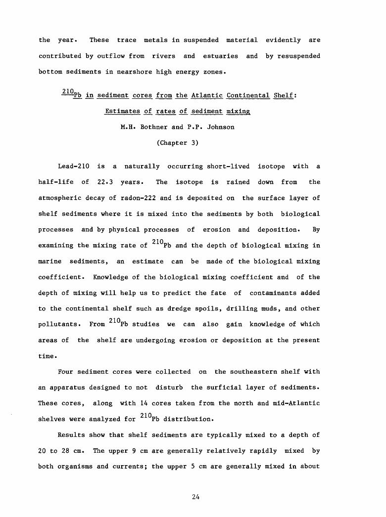
Forty-four piston cores up to 6m in length from 15 transects
across the Florida-Hatteras and continental slope, and 17 grab samples,
all from the continental slope or rise, were studied (fig. 5). Samples
were analyzed for texture, percent CaCO~, total organic carbon, and clay
mineralogy. This study was made to determine compositional
characteristics of slope sediments; the depositional processes that
affect slope sediment composition; the role and relationship of the
adjacent continental shelf in furnishing sediment to the slope; and the
pollution sink potential of the slope sediments.
Texturally, sediments of the Florida-Hatteras Slope range in size
from sand to clay, most samples being in the fine to very fine sand
25
Figure 5. Location map of piston core and grab sample sites studied for
compositional characteristics of slope sediments.
26

Figure 5
STATION LOCATION
MAP
• CORING SITEo GRAB SITE
22 TRANSECT SITE
29.
77"
27*
78*30» 83' 29" 82
27

range with the finer fraction increasing downslope. Silt and clay are
important constituents near the base of the slope. North of Cape
Hatteras fine-grain sediments dominate the surface of the upper rise.
Calcium carbonate content of slope sediments is high south of
Hatteras, and highest on the Florida Shelf. A transition zone exists
approximately between Jacksonville and Cape Hatteras where quartz sand
and carbonate sand, consisting chiefly of shell hash and planktonic
foraminifera tests, are mixed. North of Hatteras, quartz sand of
terrigenous origin is dominant.
The size distribution and the compositions indicate that most slope
sediments result from shelf-edge spillover caused by large storms or by
Gulf Stream incursions on the shelf. Most sands are not deposited in
graded beds but at a few sites samples of graded sediments suggest that
turbidity currents may have transported sediment downslope. Some slope
sediments show evidence of gas, probably methane.
Slope sediments show clear evidence of bioturbation, a process
which probably helps eliminate the fine-grained component. Some
resuspended fines swept away by Gulf Stream currents are redeposited
through fecal pellet formation, which combined with a rain of planktonic
foraminifera tests, form a hemipelagic detrital component downslope.
The presence of a volumetrically significant fine fraction, particularly
in downslope areas, suggests that pollutants which become involved with
the fine-grained component will be deposited with it. The formation and
rapid deposition of fecal pellets may serve to accelerate this process.
28

Piston core and surficial sediment investigations of
the Florida-Hatteras Slope and inner Blake Plateau
M.W. Ayers and O.K. Pilkey
(Chapter 5)
Forty-two piston cores and 200 surficial samples from the
Florida-Hatteras Slope and inner Blake Plateau were examined (fig. 6).
Sediment composition and texture in these cores indicates that
shelf-edge spillover probably resulting from high wave energy during
storms and by Gulf Stream incursions on the shelf is the dominant
sediment transport process on the slope, although slumping and density
current deposition also occur. In contrast, sediments on the inner
Blake Plateau are mainly residual from erosion of pre-Holocene units
that outcrop or subcrop on the plateau, or are biogenic derived from
normal pelagic processes.
Slumping on the Florida-Hatteras Slope is rare and only one large
slump mass has been reported (Popenoe, 1980a, b). Seismic-reflection
2 surveying of the slump mass shows that it covers an area of 135 km , has
8 3 a volume of 1.3 x 10 m and is located at the base of the slope between
the 400 and 500 m isobaths at lat 32°N. and long 79°W. Core data from
near the toe of the slump and radiometric ages of sediments recovered
beneath the slump suggest a post-Pleistocene age for the feature.
Six species of deepwater corals were recovered from the plateau,
however, only two species are of the colonial variety which build coral
banks. Radiocarbon dates on corals show that corals have existed on the
plateau since at least late Pleistocene time.
29

Figure 6. Location of rock dredge (circles) and piston core (dots) from
the slope and inner Blake Plateau studies for compositional
variations and depositional process studies.
30

Figure 6
APPARENT AGE OFOUTCROPPINGSEDIMENT
HOLOCENE
PLEISTOCENE
PLIOCENE
MIOCENE
OLIGOCENE
EOCENE
PALEOCENE
CRETACEOUS
31

Ocean bottom survey of the Georgia Bight
V.J. Henry, Jr., C.J. McCreery, F.D. Foley,
and D.R. Kendall
(Chapter 6)
3.5-kHz tuned transducer, Uniboom seismic-reflection, side-scan
sonar, and underwater-towed television surveys were made along dip-line
traverses spaced 10 km apart (fig. 3) across the Georgia and northern
Florida Shelf to determine the occurrence and distribution of
biologically sensitive areas (reefs/live bottoms) and hazardous shallow
geological features (channels, faults, scour, etc.). A series of eight
maps were prepared depicting: A) texture/bed forms; B) hard bottom/live
bottom; C) shallow subsurface geology; and D) biota observed by
closed-circuit TV along the traverses.
Surface textural character of bottom sediment was discernible from
sonograms. In most instances coarse textures indicate outcrops of hard
bottoms often supporting live bottoms. Fine-grained sediments are
generally associated with a thin, mobile veneer of sand which makes up
much of the surface of the shelf. A variety of mobile bed forms were
discernible and mapped. These include ripples, megaripples, reticulated
bottom, areas of local scour, or bioturbation.
At least two shallow subsurface reflectors cut by channels and
cut-and-fill structures are discernible throughout the area in the
shallow subsurface. These erosional surfaces probably reflect subareal
exposure of the shelf during low sea-level stands, perhaps in
Use of brand names in this report is for descriptive purposes only and
does not constitute endorsement by the U.S. Geological Survey.
32

mid-Pliocene and mid-Miocene time. Larger channels, up to 40 m in
depth, are associated with the deeper reflector, while smaller channels
and cut-and-fill structures are associated with the shallower reflector.
The deeper channels are discontinuous and probably reflect tidal
channels cut during stillstands of sea level. Shallower channels have
apparently been erased by the sea-level transgression.
Reefs and hard-ground areas are discontinuously scattered across
the shelf. Hard bottoms of moderate relief (up to 2 m), many of which
are also live bottoms, are most common between the 15 and 30 m isobaths
and in most cases are related to outcrop of a strong subsurface
reflector. High-relief hard bottoms (3 to 15 m) occur mainly near the
shelf edge between the 30 and 100 m isobaths. Both types of hard
bottoms are typified by blocky, irregular rock outcrops with sand filled
cracks and joints.
Sesimic stratigraphy of the northern and central Blake Plateau
P.R. Pinet, P. Popenoe, S.M. McCarthy, and M.L. Otter
(Chapter 7)
Over 4,700 km of single-channel air-gun, sparker, and 3.5 kHz
seismic-reflection profiles, gathered chiefly on the R/V COLUMBUS ISELIN
cruise but supplemented by data from the R/V FAY 17, 18 and 25 cruises,
were examined and interpreted for seismic stratigraphic units. Cruise
tracks are shown in figure 1. Ages of reflection units are provided by
correlation of these units with drill hole core intervals from three
well sites on the Blake Plateau and on correlations with seismic
sequences mapped by Paull and Dillon (1980) for the Florida-Hatteras
Shelf and inner Blake Plateau.
Cretaceous strata are divided into four major units. A basal
33

Albian sequence of general transparent seismic character indicating
marine carbonate deposition underlies both the northern and southern
plateau. North of 31 N. three progradational sequences, a
Coniacian-Turonian sequence, a Santonian sequence, and a
Campanian-Maestrichtian sequence overlie the Albian. Seismic character
indicates that these rocks are chiefly clastic and were deposited in
shelf and continental slope environments. They dip generally eastward
reflecting subsidence of the margin into the Carolina Trough. South of
31 N. the Cretaceous units are chiefly of transparent seismic character
and are interpreted as deepwater carbonate facies rocks. These rocks
dip generally landward reflecting subsidence along the western Blake
Plateau Basin; they rise to the east towards the Blake Escarpment where
an Albian-Aptian reef complex forms a prominent subsurface topographic
high.
Three thin sequences whose ages are inferred to be Paleocene,
Eocene-Oligocene, and post-Oligocene comprise the Cenozoic section.
These units are generally deepwater deposits of foraminiferal ooze,
limestone, and calcarenitic sand reflecting sediment starvation on the
outer Blake Plateau caused by the Gulf Stream barrier to sediment
transport from land.
From Paleocene to Recent time the Gulf Stream has been the dominant
force in shaping the southeastern margin, controlling the sedimentation
patterns and the location of the shelf edge.
Structure contour and isopach or unit thickness maps are
constructed for all units. These maps will be useful in predicting
aquifer locations, cavernous limestone units, foundation support
characteristics, and other environmental parameters for petroleum
exploration and production plans.
34

An assessment of potential geologic hazards of
the northern and central Blake Plateau
P.R. Pinet, P. Popenoe, M.L. Otter, and S.M. McCarthy
(Chapter 8)
A geologic hazards map of the Blake Plateau (fig. 5) constructed
from analyses of seismic-reflection data shows that faults are not
common except near the Blake Escarpment where considerable slumping of
slope sediments is observed. Cut-and-fill structures, scour channels,
steep topography, and deepwater reefs are ubiquitous but pose no
insurmountable problems to drilling operations. Four features noted
will pose problems in exploration and development of petroleum resources
off the Blake Plateau.
The first, and perhaps most difficult problem is presented by the
powerful currents of the Gulf Stream which sweep the plateau's surface
and have excavated numerous scour depressions and channels in the past.
Second, bottom simulating reflectors were noted in water depths of below
800 m, these reflectors probably indicate a frozen gas hydrate layer in
the shallow subbottom. Amplitude anomalies of reflectors (bright spots)
beneath the frozen layer strongly suggest large pockets of shallow gas
which could result in blowouts, fire, and rig loss, if penetrated
without proper precautions. Shallow gas trapped beneath the clathrate
layer was also noted overlying salt diapirs on the upper rise. This
environmental hazard must be considered in exploration plans of these
potential petroleum structures. Third, reflector configurations of
Paleocene limestone units in the southern part of the survey area
suggest massive solution features. Solution features could result in
loss of drilling fluid, loss of drill stem, or unstable platform
35

Figure 7. Geologic hazards map of the central and northern Blake Plateau.
Figure locations refer to illustrations in Chapter 8 of Popenoe
(1980c).
36

Figure 7
79°—T~
78° 77°
33
32°
30°
EXPLANATION——— Seismic reflection track line
(g) Seismic line number ISELIN Cruise leg 3
© Seismic line number FAY Cruise 025
-<J>- Well or core hole
GEOLOGIC HAZARDS
EKI'H Cut and fill channeling of submarine
C/?3 Possible deep-water coral reef, thicket,
KSS Zone of subsurface faults
JVXA Scoured sand (?) surface
© Probable diapir
^r-^j Landward edge of slump mass field
K Fault Displacement >IOm - point ..•••'on downthrown side ..•'
" Updip limit of detected clathrrjte.-'
33°N
FIG. 10
$^
1X 8f-ASP3
innrooryigjj\ t\,
32°
_L_ 79" _L_ 78°i
77°
37

support. Fourth, the great water depths on the outer plateau are at the
frontier of exploration and production technology at the present time.
REFERENCES CITED
Buffler, R.T., Watkins, J.S., and Dillon, W.P., 1979. Geology of the
offshore Southeast Georgia Embayment U.S. Atlantic continental
margin, based on multichannel seismic reflection profiles, in
Watkins, J.S., Montadert, L. and Dickerson, P.W., eds., Geological
and Geophysical Investigations of Continental Margins: American
Association of Petroleum Geologists Memoir 29, p. 11-25.
Bunce, E.T., Emery K.O., Gerard, R.D., Knott, S.T., Lidz, L., Saito, T.,
and Schlee, J., 1965, Ocean drilling on the continental margin:
Science, v. 150, no. 3697, p. 704-716.
Continental Shelf Associates, Inc., 1979, South Atlantic hard bottom
study: U.S. Department of Commerce National Technical Information
Service report PB300-821.
Dillon, W.P., and Paull, C.K., 1978, Interpretation of multichannel
seismic reflection profiles off the coasts of South Carolina and
Georgia: U.S. Geological Survey Miscellaneous Field Studies Map
MF-936.
Dillon, W.P., Paull, C.K., Buffler, R.T., and Fail, J.-P., 1979a,
Structure and development of the Southeast Georgia Embayment and
northern Blake Plateau, Preliminary Analysis: American Association
of Petroleum Geologists Memoir 29, p. 27-41.
Dillon, W.P., Paull, C.K., Dahl, A.G., and Patterson, W., 1979b,
Structure of the continental margin near the COST GE-1 drillsite
from a common depth point seismic reflection profile, in Scholle,
P.A., ed., Geological Studies on the COST GE-1 Well, U.S. South
38

Atlantic Outer Continental Shelf Area: U.S. Geological Survey
Circular 800, p. 97-108.
Doyle, L.J., Betzer, P.R., Peacock, M.A., and Wall, F., 1980, Seston of
the Southwest Georgia Embayment, jji Popenoe, Peter, ed., Final
report environmental studies, Southeastern United States Atlantic
Outer Continental Shelf, 1977, geology: U.S. Geological Survey
Open-File Report 80-146, p. 2-1 to 2-37.
Emery, K.O., and Zarudzki, E.F.K., 1967, Seismic reflection profiles
along the drill holes on the continental margin off Florida: U.S.
Geological Survey Professional Paper 581-A, 8 p.
Ewing, J., Ewing, M., and Leyden, R., 1966, Seismic-profiler survey of
Blake Plateau: American Association of Petroleum Geologists
Bulletin 50, p. 1948-1971.
Folger, D.W., Dillon, W.P., Grow, J.A., Klitgord, K.D., and Schlee,
J.S., 1980, Evolution of the Atlantic Continental Margin of the
United States, in Talwoni, M., Hay, W., and Ryan, W.B.F., eds.,
Deep drilling results in the Atlantic Ocean: Continental margins
and paleoenvironment: American Geophysical Union Maurice Ewing
Series 3, p. 87-108.
Grow, J.A., and Markyl, R.G., 1977, IPOD-USGS multichannel seismic
reflection profile from Cape Hatteras to the mid-Atlantic ridge:
Geology, v. 5, no. 10, p. 625-630.
Hathaway, J.C., Schlee, J.S., Poag, C.W., Valentine, P.C., Weed, E.G.A.,
Bothner, M.H., Kohout, F.A., Manheim, F.T., Schoer, R., Miller,
R.E., and Schultz, D.M., 1976, Preliminary summary of the 1976
Atlantic margin coring project of the U.S. Geological Survey: U.S.
Geological Survey Open-File Report 76-884, 218 p.
Hathaway, J.C., Poag, C.W., Valentine, P.C., Miller, R.E., Schultz,
39

D.M., Manheim, F.T., Kohout, F.A., Bothner, M.H., Sangrey, D.A.,
1979, U.S. Geological Survey Core Drilling on the Atlantic Shelf:
Science, v. 206, no. 4418, p. 515-527.
Henry, V.J., and Giles, R.T., 1980, Distribution and occurrence of reefs
and hard grounds in the Georgia Bight, in Popenoe, Peter, ed.,
Final report on environmental studies, southeastern United States
Atlantic Outer Continental Shelf, 1977, Geology: U.S. Geological
Survey Open-File Report 80-146, p. 8-1 to 8-36.
Hollister, C.D., 1973, Atlantic Continental Shelf and Slope of the
United States-Texture of surface sediments from New Jersey to
southern Florida: U.S. Geological Professional Paper 529-M, 23 p.
Hunt, J.L., 1974, The geology and origin of Grays Reef, Georgia
continental shelf: unpublished Master's Thesis, University of
Georgia, Athens, Georgia, 75 p.
JOIDES (Joint Oceanographic Institution's Deep Earth Sampling Program),
1965, Ocean drilling on the continental margin: Science, v. 150,
p. 705-716.
Klitgord, K.D., and Behrendt, J.C., 1979, Basin structure of the U.S.
Atlantic Continental Margin, in Watkins, J.S., Montadert, L., and
Dickerson, P.W., eds., Geological and Geophysical Investigations of
Continental Margins: American Association of Petroleum Geologists
Memoir 29, p. 85-112.
Macintyre, I.G., 1970, New data on the occurrence of tropical reef
corals on the North Carolina continental shelf: Elisha Mitchell
Science Society, v. 86, no. 4, 178 p., 67th Annual Meeting of the
North Carolina Academy of Science, May 1-2, Raleigh, North
Carolina.
Macintyre, I.G., and Milliman, J.D., 1970, Physiographic features of the
40

outer continental shelf and upper slope, Atlantic continental
margin, southeastern United States: Geological Society of America
Bulletin, v. 81, no. 9, p. 2577-2598.
Manheim, F.T., Pratt, R.M., McF.arlin, P.F., 1980, Composition and origin
of marine phosphorites of the southeastern margin of the United
States: SEPM special volume, Marine Phosphorites, in press.
McCollum, M.J., and Herrick, S.M., 1964, Offshore extension of the Upper
Eocene to recent stratigraphic sequence in southeastern Georgia, in
Geological Research, 1964: U.S. Geological Survey Professional
Paper 501-C, p. C61-C63.
Milliman, J.D., 1972, Atlantic continental shelf and slope of the United
States: petrology of the sand fraction - northern New Jersey to
southern Florida: U.S. Geological Survey Professional Paper 529-J,
40 p.
Paull, C.K., and Dillon, W.P., 1980, Structure, stratigraphy, and
geologic history of the Florida-Hatteras shelf and inner Blake
Plateau: American Association of Petroleum Geologists Bulletin
v. 64, no. 3, p. 339-358.
Paull, O.K., Popenoe, P., Dillon, W.P., and McCarthy, S.M., 1980,
Geologic subcrop map of the Florida-Hatteras shelf, slope, and
inner Blake Plateau: U.S. Geological Survey Map MF-1171.
Pilkey, O.K., Keer, F., and Keer, S., 1980, Surficial sediments of the
Atlantic southeastern United States continental shelf, in Popenoe,
Peter, ed., Final report-environmental studies Southeastern United
States Atlantic Outer Continental Shelf, 1977, Geology: U.S.
Geological Survey Open-File Report 80-146, p. 5-1 to 5-40.
Poag, C.W., 1978, Stratigraphy of the Atlantic continental shelf and
slope of the United States: in Annual Review of Earth and Planetary
41

Sciences, v. 6, p. 251-280.
Popenoe, Peter, 1980a, Final report—Environmental studies, Southeastern
United States Atlantic Outer Continental Shelf, 1977, Geology, U.S.
Geological Survey Open-File Report 80-146, 651 p.
Popenoe, Peter, 1980b, Final executive summary report—Environmental
studies, Southeastern United States Atlantic Outer Continental
Shelf, 1977: U.S. Geological Survey Open-File Report 80-147, 52 p.
Popenoe, Peter, 1981a, Environmental geologic studies on the
Southeastern Atlantic Outer Continental Shelf, 1977-1978: U.S.
Geological Survey Open-File Report 81-852-A, 457 p. p.
Popenoe, Peter, 1981b, Appendices of environmental geologic studies on
the southeastern Atlantic Outer Continental Shelf, 1977-1978: U.S.
Geological Survey Open-File Report 81-852B, 343 p.
Pratt, R.M., and Heezen, B.C., 1964, Topography of the Blake Plateau:
Deep-Sea Res., v. 11, p. 721-728.
Schlee, J., 1977, Stratigraphy and Tertiary development of the drill
holes on the continental margin off Flordia: U.S. Geological
Survey Professional Paper 581-F, p. 25.
Scholle, P.A., ed., 1979, Geological studies of the COST GE-1 well,
United States South Atlantic Outer Continental Shelf: U.S.
Geological Survey Circular 800, 144 p.
Stetson, T.R., Squires, D.F., and Pratt, R.M., 1962, Coral banks
occurring in deep water on the Blake Plateau: American Museum
Novitates, no. 2114, 39 p.
Stetson, T.R., Uchupi, E., and Milliman, J.D., 1969, Surface and
subsurface morphology of two small areas of the Blake Plateau:
Transactions - Gulf Coast Association of Geological Societies,
v. 19, p. 131-142.
42

Uchupi, E., 1967, The continental margin south of Cape Hatteras, North
Carolina: Shallow structure: Southeastern Geology, v. 8,
p. 155-177.
Uchupi, E., 1970, Atlantic continental shelf and slope of the United
States-shallow structure: U.S. Geological Survey Professional
Paper 529-1, 44 p.
U.S. Geological Survey, 1979, Popenoe, Peter, ed., South Atlantic Outer
Continental Shelf geological studies, FY 1976, geology: U.S.
Department of Commerce National Technical Information Service
Report PB300-820, 562 p.
43


![JSS UNIVERSITY · 2:00 PM- 3:30 PM Environmental Studies Environmental Studies Environmental Studies Environmental Studies (1381) (138]) (1381) (1381) Centre](https://img.dokumen.tips/doc/110x75/5b6fc5ce7f8b9aad128c7c84/jss-university-200-pm-330-pm-environmental-studies-environmental-studies.jpg)