Embed Size (px)
Citation preview

1
6. FACTORS INFLUENCING THE
SUBURBANIZATION OF THE MODERN
AMERICAN METROPOLIShttp://www.youtube.com/watch?v=P8JidxDkg0k
2
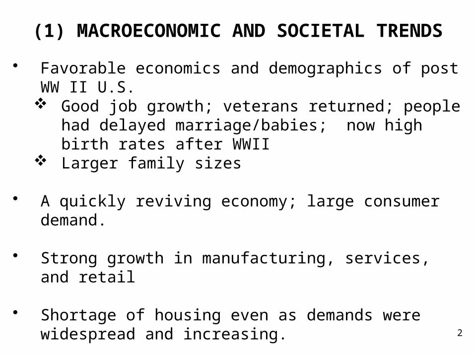
(1) MACROECONOMIC AND SOCIETAL TRENDS
• Favorable economics and demographics of post WW II U.S. Good job growth; veterans returned; people had delayed
marriage/babies; now high birth rates after WWII Larger family sizes
• A quickly reviving economy; large consumer demand. • Strong growth in manufacturing, services, and retail • Shortage of housing even as demands were widespread
and increasing. • Large demand for housing in family-friendly neighborhoods.
3
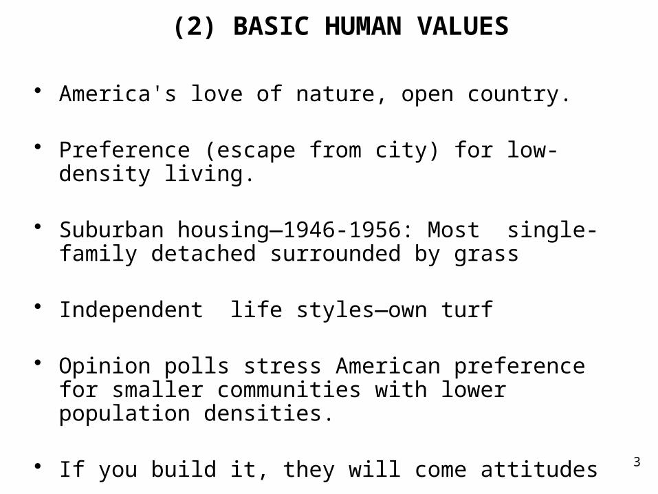
(2) BASIC HUMAN VALUES
• America's love of nature, open country. • Preference (escape from city) for low-density living.
• Suburban housing—1946-1956: Most single-family detached surrounded by grass
• Independent life styles—own turf • Opinion polls stress American preference for smaller
communities with lower population densities. • If you build it, they will come attitudes

4
(3) PHILOSOPHY OF LAND AS A COMMODITY
• Land thought of as commodity as opposed to public goodNational parks, wildlife preserves
• Maximizing resale value, rather than its value for long-term
use within a community. • Less concern for land as a public good or as a national
resource. • Tacit acceptance by far too many elected officials of an idea
of land ownership carrying with it the "right," more correctly the privilege, for the owner to use it in any way he or she sees fit, regardless of its societal effect.

5
• Few assessments of the benefits and costs that accompany development.
Resulting environmental problems: building on flood
prone land (e.g., New Orleans).
Poor building code enforcement as came to known as a result of the damage from Hurricane Andrew in 1992.
Bond issues needed to pay for infrastructure additions, improvements for schools or general operating budget increases for police and fire protection to more intangible effects, like loss of quality of life and increased environmental problems.
• Contrast with: Sustainable development—balancing economic goals with preserving environmental quality.

6
Critics of “Land as Commodity”
• A planner, Dennis O'Harrow in 1958:
"Our chief trouble is that the planning commission is very largely composed of, and certainly dominated by, realtors, developers, and large property owners. To them land is a commodity, the owner of which is entitled to squeeze out the last possible dollar. They hardly realize that land is a national resource, and that every parcel is vested with a public interest."

7
Exemplar: Mass produced suburban tract house of Levittown (Long Island, N.Y.—1946-1951)
• Developers preferred cheap land at the metro fringe. • Developer profit from quick turnover of land.• Land acquired in large parcels, subdivided, and sold off.• In 1946, Levitt family (father & sons) purchased 4,000 acres
of Long Island potato fields• Built 17,400 four-room, one-story houses, 750 sq. ft.• Largest housing development by single builder in U.S. history• Cookie cutter, standardized mass produced single-family
detached house• Built on concrete slabs with prefabricated components (off-
site) with similar interior plans—completed in 1951• But inexpensive: under $10,000, preapproved for FHA
mortgages—often cheaper than renting city apartment.http://tigger.uic.edu/~pbhales/Levittown/building.html

An aerial view of Levittown, N.Y., one of America’s first planned suburbs, in 1948
8

9

10

11
(4) ZONING WITHOUT COMPREHENSIVE PLANNING
• Planning is focused on the future and establishes a community’s long-range goals, objectives, and policies regarding the use, development, and conservation of land.
It is a guide for action.Where a community has been, where it wants to go, and
how it can get there.What type of development a community wants.How everything fits together (land use, transportation,
natural environment, growth targets). Implies an orderly step-by-step process.

12
Zoning Ordinances Adopted Without Having Comprehensive Long Range Planning of Land-
Use Designs and Their Public Costs• Zoning is one tool that helps a community implement a plan. • Divides an area into geographic districts subject to different
regulations regarding type and intensity of land use.Which parcels of land belong in particular zoning districtBuilding height controlsBuilding setback controls.Building lots tied to specific land usesDistance between land use types: residence, business,
industry
13
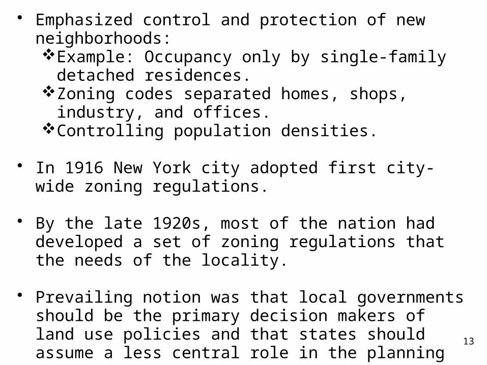
• Emphasized control and protection of new neighborhoods:Example: Occupancy only by single-family detached
residences.Zoning codes separated homes, shops, industry, and
offices.Controlling population densities.
• In 1916 New York city adopted first city-wide zoning regulations.
• By the late 1920s, most of the nation had developed a set of zoning regulations that the needs of the locality.
• Prevailing notion was that local governments should be the primary decision makers of land use policies and that states should assume a less central role in the planning process.
• Delegated powers to zone by municipalities but within their geographic limits.

14
• Courts gave strong support to notion that local communities could control their own zoning and land use activities:
• In 1926 landmark U.S. Supreme Court decision, Village of Euclid v. Ambler Realty Co. (in Ohio).Village had zoned an area of land held by Ambler Reality
as a residential neighborhood. Ambler argued that it would lose money if the land could not be leased to industrial users.
Euclid won.Local zoning ordinances and regulations would be
presumed to be legal until challenged successfully in the courts. Local governments responsible for enforcement.
• Many cities then adopted comprehensive zoning ordinances that were not, however, accompanied by comprehensive long-range planning.

15
Local Perspective Is Contradiction to Comprehensive Planning Given Multitude of Local
Governments In Metropolitan Region
• Greater Los Angeles consists of well over a hundred cities and five counties.
• Metropolitan Atlanta has 46 cities and 7 counties. • How can so many governmental jurisdictions possibly
coordinate their actions to control growth—which has loyalty to no single governmental body?
• Thus, real estate developers play one jurisdiction off another. • Always one local government that wishes to entice
development with liberal zoning, tax abatements, road and sewer improvements.

16
Comprehensive Planning Comes Only Later
• Only much later in 1970s, do state governments hesitatingly begin to engage in comprehensive planning.
• Before they had left control of land uses almost exclusively to local governments.
• These efforts often have minimal effects.• Only by 1980s, did states fully appreciate the effects of
sprawl and threats to open/natural land.• First attempts in Florida and New Jersey to reform growth
management at the state level.• In 1997, Maryland became first state to establish smart
growth program—define at end of this topic.Limitations on new construction in communities affected
by sprawlRehabilitation of existing buildings
17
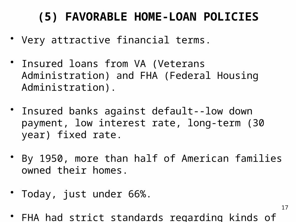
(5) FAVORABLE HOME-LOAN POLICIES
• Very attractive financial terms. • Insured loans from VA (Veterans Administration) and FHA
(Federal Housing Administration). • Insured banks against default--low down payment, low
interest rate, long-term (30 year) fixed rate. • By 1950, more than half of American families owned their
homes. • Today, just under 66%.
• FHA had strict standards regarding kinds of properties it would insure mortgages.

18
FHA Loans: Suburban and White Bias• Rested in large part on the racial characteristics of the
neighborhood and surrounding area.
• Primarily limited to race-restricted (for whites) housing. • African-American households excluded from FHA-
subsidized suburbs—1945-1965. • Denied access to booming suburban economy—lasting
impact on social geography of the metropolitan area.
19
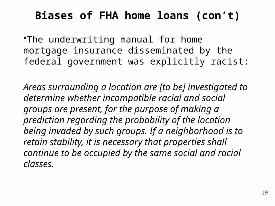
Biases of FHA home loans (con’t)
•The underwriting manual for home mortgage insurance disseminated by the federal government was explicitly racist:
Areas surrounding a location are [to be] investigated to determine whether incompatible racial and social groups are present, for the purpose of making a prediction regarding the probability of the location being invaded by such groups. If a neighborhood is to retain stability, it is necessary that properties shall continue to be occupied by the same social and racial classes.

FHA Loans: Suburban and White Bias• FHA refused to insure mortgages in older houses in older
established neighborhoods.
• Favored single- vs. multifamily constructed dwellings.
• In the 2 decades following World War II, bulk of FHA mortgage insurance issued for homes in the suburbs.
• Favored new homes over renovation loans. • Non FHA mortgages had much less favorable loan terms.
FHA loans favored development in the newest suburbs.
E.g. From 1934 to 1960 FHA insured more than 5 times as many mortgages in suburban St. Louis county than city of St. Louis.
Washington D.C. suburbs, 7 to 1 vs. city capital.20

21
(6) FEDERAL TAX LEGISLATION
• Our Federal Tax Code is not just means to collect money to pay for services and infrastructure outside the private sector realm.
• Creates social policy—form of social engineering. • Federal income tax provisions offered enormous incentives
for real estate development: consumers and buildersE.g., interest paid on mortgage loan is tax deductible.
• Effectively made the cost of buying a home cheaper.
• Favored suburban developments; central city renters had no property tax to deduct.

22
(7) COPIOUS HIGHWAY CONSTRUCTION
• Suburbanization heavily shaped by the radial network of arterials and freeways emanating from the city downtown often linked by expressways that girdled the central city.
• As of 1945, no comprehensive national system of roads. • The Interstate Highway Act of 1956. • Biggest public works program in U.S. history • $130 billion over a thirteen year period. (since 1956, total cost
of building and repairing is approx. $505 billion. • Resulted in construction of some 41,000 miles of highway

23

24
Financing
• Was helped financed by revenue from gasoline taxes.Then, 3 cents per gallon.Now, 18.4 cents per gallon.
• Federal government paid 90% of the construction costs.
• 2000 miles of highway built prior to 1956 (e.g., Penn Turnpike and NY Thruway were incorporated into the Interstate system).
• Majority completed by 1970s • Discouraged local communities from paying for transit
development.

25
Interstate Highway System Spatially Restructured the U.S. Economy
• Dispersed and decentralized the population and population-serving activities.
• Urban interstates primarily turned into commuter roads
serving suburbia. • Access to downtown facilitated. • Retail activities lead the way: regional shopping center. • Manufacturing firms and businesses (offices) discovered they
could operate more efficiently in the suburbs.
26
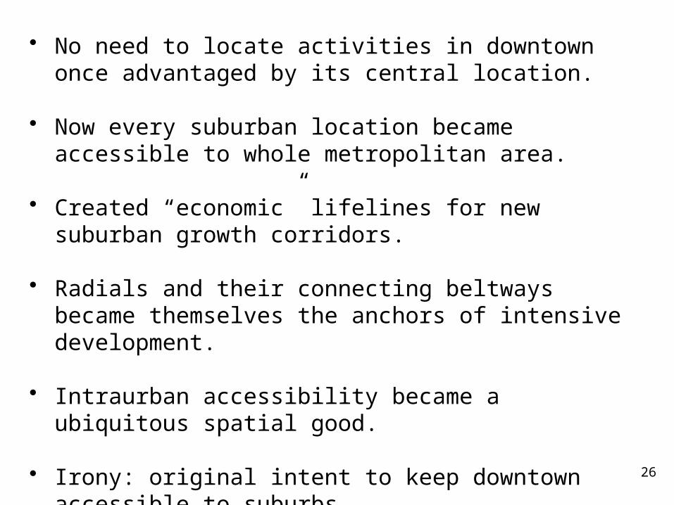
• No need to locate activities in downtown once advantaged by its central location.
• Now every suburban location became accessible to whole
metropolitan area.
• Created “economic” lifelines for new suburban growth corridors.
• Radials and their connecting beltways became themselves
the anchors of intensive development. • Intraurban accessibility became a ubiquitous spatial good. • Irony: original intent to keep downtown accessible to
suburbs.

27
A Cynical Interpretation: Planner, Herbert Smith, in 1991• "As has been seen over the past forty-five years, Congress and the
Bureau of Public Roads, working with autocratic state highway departments, superimposed this escape-route program on the cities without their planning agencies having any say about what the result might be to their cities.
• The result was about the same as if the federal and state agencies had taken a razor and opened the most vital artery of the life-sustaining support system of those cities, permitting the blood to flow without hindrance. No longer was there any restraint for those who, for one reason or another, preferred to escape the city for what developers depicted as "open country, freedom of life style" in the suburban and ex-urban areas.
• The consequences were that those forces greatly enlarged and accelerated unguided urban sprawl, created an environment spawning suburban shopping malls which sucked the lifeblood from established business districts, and, most importantly, did more to change land use planning and development in those cities than years of planning could prevent or undo.
• It boggles the mind to think what that $130 billion could have done to preserve our established cities had it been made available to provide rapid mass-transit systems worked carefully into each city's future-oriented comprehensive planning.

28
An Amazingly Correct Prophecy
• By Frank Lloyd Wright (June 8, 1867 – April 9, 1959), one of the world's most prominent and influential architects.
• In 1906 this visionary wrote:
"The outcome of the cities will depend on the race between the automobile and the elevator, and anyone who bets on the elevator is crazy.“
• Kenneth Jackson (suburbs historian): Highway spending has eclipsed transit spending by a 5-to-1 margin during past 6 decades (1949-present).
• Downsides:Construction devastated many urban neighborhoodsTurned into “Main Streets” of postwar suburbiaEver-growing congestion

29
Specific Effects of Interstate Highway Network• For manufacturing activities, a new marriage of transport
trucks and highways for the moving of freight.• Manufacturers were no longer bound to the constraints of
rail transportation and restricted location choices.Able to located anywhere on the urban expressway
networkLess important to locate near rail terminal/city docks
because of transportation costsIntra-city truck made it easy for a firm to locate on the
periphery of the city, where land was plentiful & cheap• Shipments don’t have to go between train terminals.
With trucks, shipments can travel from door to door.• Shift from multistory urban factories to more efficient single
story buildings favored by newer manufacturing processesMoved to industrial parks
30
Effects of Interstate Highway Network (con’t)
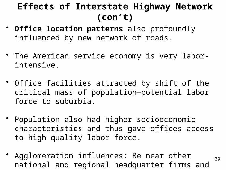
• Office location patterns also profoundly influenced by new network of roads.
• The American service economy is very labor-intensive. • Office facilities attracted by shift of the critical mass of
population—potential labor force to suburbia. • Population also had higher socioeconomic characteristics
and thus gave offices access to high quality labor force.
• Agglomeration influences: Be near other national and regional headquarter firms and supporting service companies.

31
Effects of Interstate Highway Network (con’t)
• Employees delighted to have access to suburban shopping centers; on-site personal and professional services (banking, postal, dining, beauty parlor, health, and recreational facilities).
• Prettier views • More and easier parking: Cost of building parking spaces is
lower in the suburbsthan high-rise or subterranean garages of the city.
• People are also willing to live near office complexes now. • Telecommunication advances allowed wide geographic
separation of office functions in different places.

32
( 8) SCHOOL DESEGREGATION• Supreme Court's decision: Brown v. Board of Education in
1954 in Topeka Kansas. • Ruled state-sanctioned segregated schools were unequal. • Before that, segregation flourished under the “separate but
equal doctrine:” segregation by government was allowed as long as facilities were equal, based on a 1896 ruling.
• In 1954, 17 states required racial segregation in the public schools and 4 more allowed it.
• Despite ruling, change was neither swift nor sweeping. • Rather, Blacks gradually began filing lawsuits to integrate
schools, bolstered by additional court rulings mandating desegregation.

33
• Passage of the Civil Rights Act of 1964, which gave HEW (now HHS-- Health and Human Services) the authority to withhold federal aid from school districts not in compliance with efforts to eliminate racially segregated school systems.
• Filing of anti-segregation suits in the federal courts became more common practice throughout country
• Federal judges forced school districts to achieve better racial
integration by court-mandated busing. • Court-mandated busing primarily in the central cores of cities
and especially in the South, although later in other regions. • Between 1967 and 1972 school desegregation efforts were
especially frequent in southern states.
• Schools in the rapidly growing suburbs more often left to their own devices.

34
• Courts more reluctant to force desegregation on schools in suburbs outside central cities.
• Between 1968 and 1972, major changes took place in racial composition of nation’s largest school systems.
• Whites became minority—As in Chicago, Philadelphia, Detroit,
Cleveland, St. Louis -- Reflected “white flight.” • Scholars like James Coleman argued in 1975 that school
desegregation and busing accelerated white flight to suburbs. • Whites moved to suburbs because they didn't want their
children to be bused away from a neighborhood school and placed in integrated classrooms OR have blacks bused to white schools.
• The demand for private school education in suburbs also
increased.

35
(9) DISADVANTAGES OF THE CITY
• Challenges of assembling small parcels of land into meaningful sites (building a large Walmart or Sam’s)
• Higher building costs (stricter zoning, land use laws)• Higher costs for businesses (insurance, private security)• More difficult access to highway on-ramps and off-ramps• Poverty; poor schools; less available employee skills• Antibusiness attitudes• Urban riots of the 1960s: fueled by poverty concentrations,
persistent unemployment, poor housing, racial prejudice of African Americans—Watts district Los Angeles, Newark, Detroit; riots after 1968 assassination of Martin Luther King.
http://www.cnbc.com/id/101095397
36
OVERVIEW: A HOST OF EXPLANATIONS TO EXPLAIN SUBURBANIZATION OF PEOPLE AND JOBS
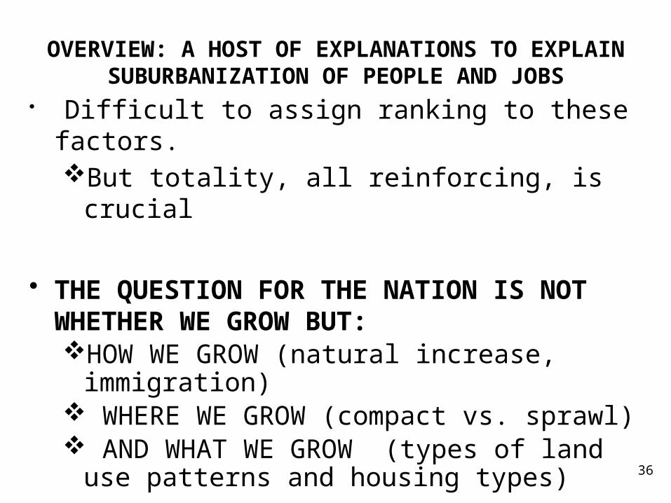
• Difficult to assign ranking to these factors.But totality, all reinforcing, is crucial
• THE QUESTION FOR THE NATION IS NOT WHETHER WE GROW BUT:HOW WE GROW (natural increase, immigration) WHERE WE GROW (compact vs. sprawl) AND WHAT WE GROW (types of land use
patterns and housing types)

37
“DEVELOPMENT/GROWTH” PLAYERS? (from Anthony Downs)
• Anti- or slow-growth advocates and environmentalistsUpset by the impacts of suburban sprawl.
Unlimited outward and "leapfrog“ low-density development.
Large-scale conversion of open space and environmentally sensitive lands to urban uses.
Worsening traffic congestion and air pollution caused by more intensive use of automotive vehicles for ground travel
Costly requirements to expand roads, sewers, water systems, and other infrastructures outward rather than repairing and using those already in place.
Want to slow down outward expansion and cut dependence on private automobiles.
Also, selfish reason—keep home prices rising.

38
Operationalizing “Smart Growth
• Groups trying to change the status quo of “suburban sprawl” advocate for “SMART GROWTH” policies (a few examples): Place limits on the outward extension of further growth
(urban growth boundaries, utility service boundaries). Load infrastructure costs of growth onto new
developments—builders, new occupants (impact fees). Reduce dependency on private automotive vehicles,
especially one-person cars,Create pedestrian-friendly communitiesShift money from road building to transit and bicycle
paths.

39
Operationalizing Smart Growth (con’t)
Promote compact, mixed-used development in the form of higher-than-prevailing residential densities and mixing residential & nonresidential uses—especially retail and services—in primarily residential neighborhoods(e.g., Tioga community in Gainesville) to minimize use
of cars and encourage pedestrians.
Place more control of land-use decisions in the hands of regional government entities (less control for local governments).
Preserve large amounts of open space and protect the
quality of the environment.

40
“DEVELOPMENT/GROWTH” PLAYERS (con’t)
• Inner-city advocates (city mayors, downtown business leaders, community organizations, & city planners)Upset about resources being drained from the inner city by
our outward growth process. Want more redevelopment in central city and older suburban core areas.
• Better-growth advocates (include many citizens who are not passionate members of the other three groups)Want to accommodate reasonable growth but want to
reduce some of its negative impacts.

“DEVELOPMENT/GROWTH” PLAYERS (con’t)
• Pro-growth advocates (home builders, developers, chambers of commerce, and landowners)Not much upset by sprawl and want to expedite outward
expansion to fully accommodate future growth. Argue that in less restrictively regulated housing markets—
that is, in NOT smart growth communities, housing is more affordable.
41

Smart Growth: Florida Style
• Growth Management Act of 1986Designed to curb sprawl and force developers and local
gov’ts to make sure basic services (roads, utilities, parks, schools) kept pace with growth
Local jurisdictions required to adopt comprehensive land use plans stipulating where development could/couldn’t occur
Subject to approval by state’s Department of Community Affairs (DCA)
Could challenge local government approvals (new housing, new infrastructure, environmental damage)
• 2011, Republican government, governor Rick Scott behind legislature’s repeal of most growth management lawsEliminated DCA; leave growth management decisions up to
local governments; state’s role only advisory42


![Factors tht affect recruitment[ppt]](https://img.dokumen.tips/doc/110x75/54541a88b1af9f84228b493f/factors-tht-affect-recruitmentppt.jpg)