Embed Size (px)
Citation preview

1
Use of Mesoscale and Ensemble Modeling for Predicting Heavy
Rainfall Events
Use of Mesoscale and Ensemble Modeling for Predicting Heavy
Rainfall Events
Dave Ondrejik
Warning Coordination Meteorologist

2
Weather ModelsWeather Models
• Why use computer models to help forecast?
– Weather affects nearly everyone nearly every day
– Weather forecasts are issued:
• to save lives
• Reduce property damage
• reduce crop damage
• to let the general public know what to expect
– Forecasts are often utilized to make many important decisions on a daily basis

3
Computer Weather Forecasts:The Basics
Computer Weather Forecasts:The Basics
•Computers are used to solve mathematical equations.
•There are 7 equations of motion that govern how the atmosphere “should” behave
•The basic input for computer models are…..
– OBSERVATIONS
•Must have good info going into the models or you get bad info out
– GIGO – Garbage In Garbage Out!
4
Computer Weather Forecasts: The basics
Computer Weather Forecasts: The basics
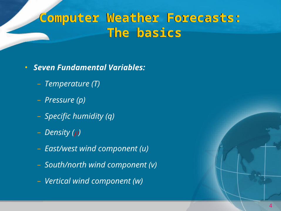
• Seven Fundamental Variables:
– Temperature (T)
– Pressure (p)
– Specific humidity (q)
– Density ()
– East/west wind component (u)
– South/north wind component (v)
– Vertical wind component (w)

5
Equations of motion
East-west wind
North-south wind
Temperature
Humidity
Continuity of mass
Surface pressure
Slide courtesy of Tom Hamill, NOAA-CIRES Climate Diagnostics Center

6
The First Step in ForecastingThe First Step in Forecasting
• Model uses previous run’s forecast as “first guess”
– Today’s AM Model is initialized first with Last Night’s 12-hr forecast
• First guess gets modified by real observations
• Q: Why not go right with the real observations?
– Irregularly-spaced obs are ‘too rough’ to work
– Starting Data Fields need to be smooth and in balance with wind and pressure patterns

7
Model Initialization: The 1st step
Model Initialization: The 1st step
8
Model Initialization: The 1st step
Model Initialization: The 1st step
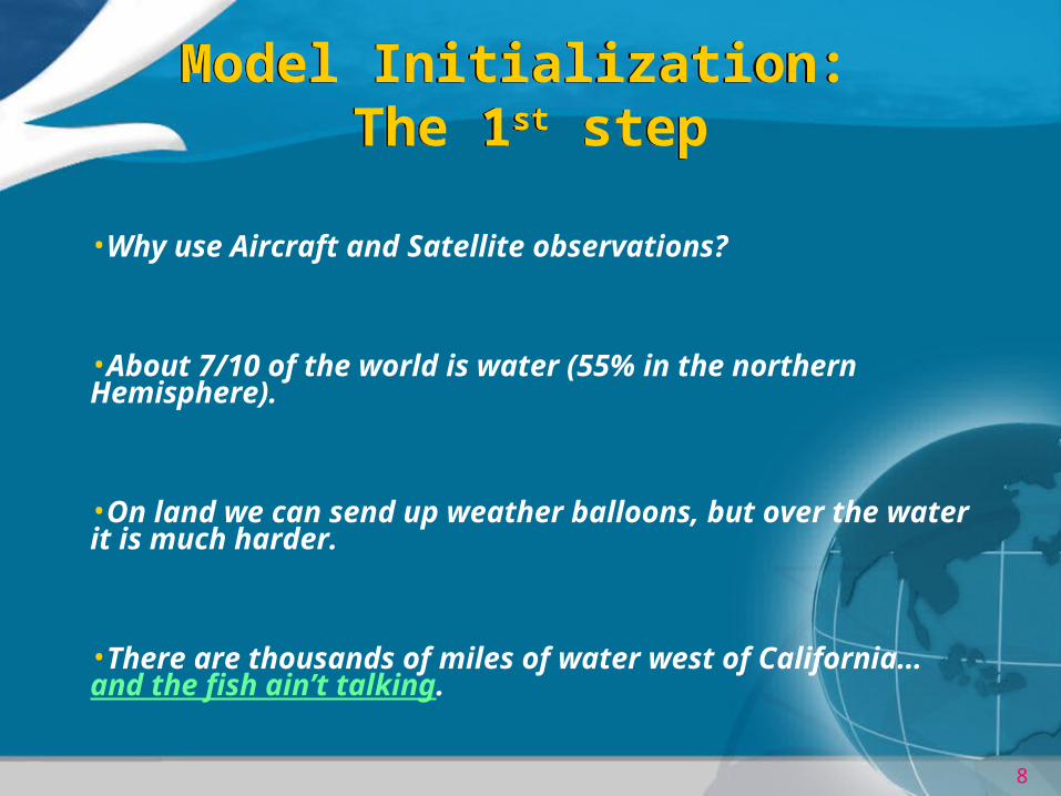
•Why use Aircraft and Satellite observations?
•About 7/10 of the world is water (55% in the northern Hemisphere).
•On land we can send up weather balloons, but over the water it is much harder.
•There are thousands of miles of water west of California… and the fish ain’t talking.

9
The First Step in ForecastingThe First Step in Forecasting
There are more point then shown…but they must be evenly spaced.

10
Model InitializationModel Initialization
Surface Data
Observations arenot at points. Wilkes-Barre and Scranton do notfall on grid points.
We cannot have anobservation at every city, town or grid point location.

11
Model InitializationModel Initialization
Surface Data

12
Model InitializationModel Initialization
Surface Data
This is reasonable based onobservations…however it isnot exact.

13
A lot happens inside a grid boxA lot happens inside a grid box
Approximatesize of one grid box
Source: accessmaps.com
Denver
Rocky Mountains
Slide courtesy of Tom Hamill, NOAA-CIRES Climate Diagnostics Center

14
Model CalculationsModel Calculations
•How many calculations do we make?
• There are 2500 grid points
• Calculate at 50 layers
• Every 6.5 minutes
• For all 7 equations of motion
• Out for over 10 days
• EQUALS over 250 Billion calculations
•That means each US citizen would have to do about 1000 calculations/day if we didn’t use computers.

15
Model CalculationsModel Calculations
• Are these model calculations exact???
• No – due to current computer power (and we do have some of the most powerful computers in the world!), we must round off the computations at 2 digits to the right of the decimal
– i.e. 2.49 instead of 2.481359871048615793
• Huge errors are possible due to rounding alone!!
• After calculations are completed, you contour your results and you have pretty maps!

16
ETA FORECASTETA FORECAST

17
Why Ensemble?Why Ensemble?
• Creates a method used to improve medium and long-range forecasts
• Produces a model forecast from the same model or a couple models run many times
• The initial model conditions are slightly different for each run to represent the "uncertainties" and "errors" inherent in the observations used to initialize the model
– “Butterfly effect”
• If, at the end, all model runs produce a similar forecast, then a forecaster can have greater confidence in the model prediction.

18
Why Ensemble?Why Ensemble?
• A type of consensus forecast as you can ensemble different models to come up with a “best guess”.
• They help to identify those events that are possible.

19
Why Ensemble?Why Ensemble?
• Ensembles are based on the 12 runs of a single model
• These runs include
– the operational run,
– a control version of the model (run at lower resolution),
– and 5 pairs (positive and negative) of bred perturbation runs.

20
Why Ensemble?Why Ensemble?
• Output is similar to daily model outputs.
• Helps provide more confidence in the forecast compared to a single model run.
– Model runs historically differ from one run to another.

21
Model ForecastsModel Forecasts

22
Ensemble Forecast for Dec 4, 2000Ensemble Forecast for Dec 4, 2000

23
Ensemble ExampleEnsemble Example
a.b.
Figure 2. Observed snowfall a) visible satellite image valid at 1545 UTC 4 December 2000 and b) the total analyzed snowfall (cm) showing the region of heavy snowfall in eastern North Carolina and extreme southeastern Virginia.

24
And of course, there’s always that tried and true method of forecasting!!
And of course, there’s always that tried and true method of forecasting!!
Flip a coin!

25
EnsemblesEnsembles
• For more information on Ensembles and to see ensemble output, see:
– http://eyewall.met.psu.edu/ensembles/


![T emperate deciduous forest [Meteorologist]](https://img.dokumen.tips/doc/110x75/56816301550346895dd37963/t-emperate-deciduous-forest-meteorologist.jpg)