Embed Size (px)
Citation preview

Mass Wasting

Introduction: What is Mass Wasting?(1)
Mass wasting is the downslope movement ofregolith and masses of rock under the pull of gravity.
Mass wasting is a basic part of the rock cycle.– Weathering, mass-wasting, and other aspects of erosion
constitute a continuum of interacting processes.

Introduction: What is Mass Wasting?(2)
Under most conditions, a slope evolves toward anangle that allows the quantity of regolith reachingany point from upslope to be balanced by thequantity that is moving downslope: a steady-statecondition.
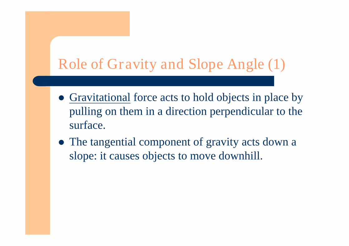
Role of Gravity and Slope Angle (1)
Gravitational force acts to hold objects in place bypulling on them in a direction perpendicular to thesurface.
The tangential component of gravity acts down aslope: it causes objects to move downhill.
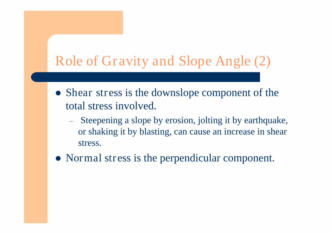
Role of Gravity and Slope Angle (2)
Shear stress is the downslope component of thetotal stress involved.– Steepening a slope by erosion, jolting it by earthquake,
or shaking it by blasting, can cause an increase in shearstress.
Normal stress is the perpendicular component.
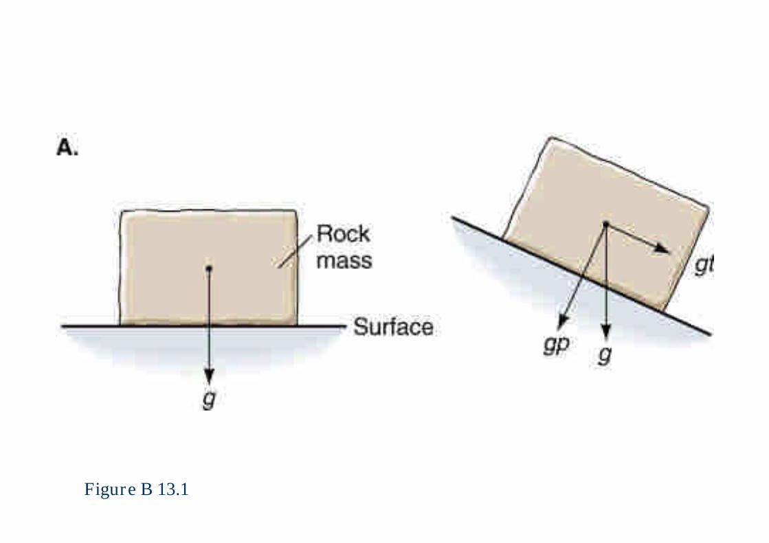
Figure B 13.1

Figure B 13.1 Where are the problems in this slide?
The Role of Water (1)
Water is almost always present within rock andregolith near the Earth’s surface.
Unconsolidated sediments behave in different waysdepending on whether they are dry or wet.
Capillary attraction is the attraction that results fromsurface tension.– This force tends to hold the wet sand together as a
cohesive mass.
The Role of Water (2)
If sand, silt, or clay becomes saturated with water,and the fluid pressure of this water rises above acritical limit, the fine-grained sediment will losestrength and begin to flow.
If the voids along a contact between two rockmasses of low permeability are filled with water, thewater pressure bears part of the weight of theoverlying rock mass, thereby reducing friction alongthe contact.

The Role of Water (3)
Failure is the collapse of a rock mass due toreduced friction.– An analogous situation is hydroplaning, in which a
vehicle driven on extremely wet pavements loses control.
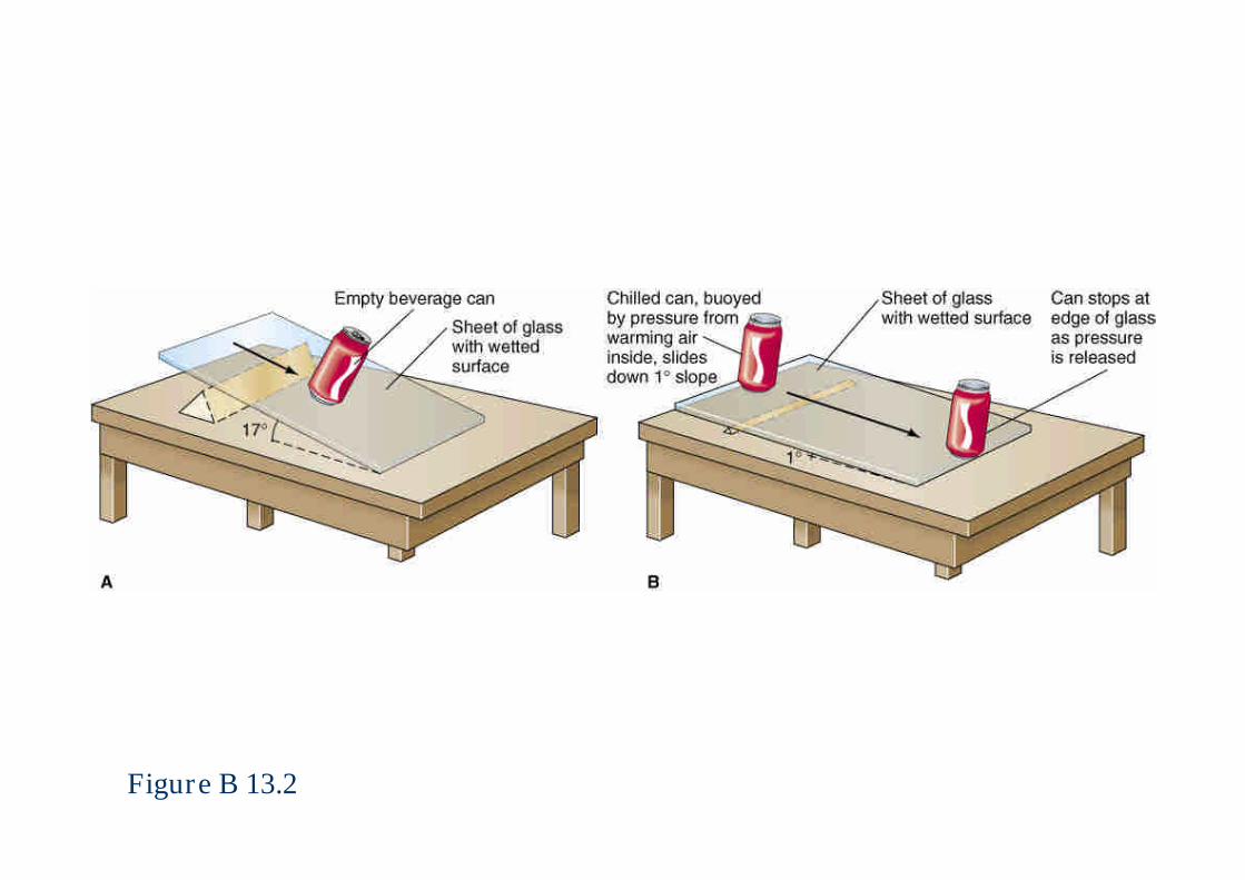
Figure B 13.2
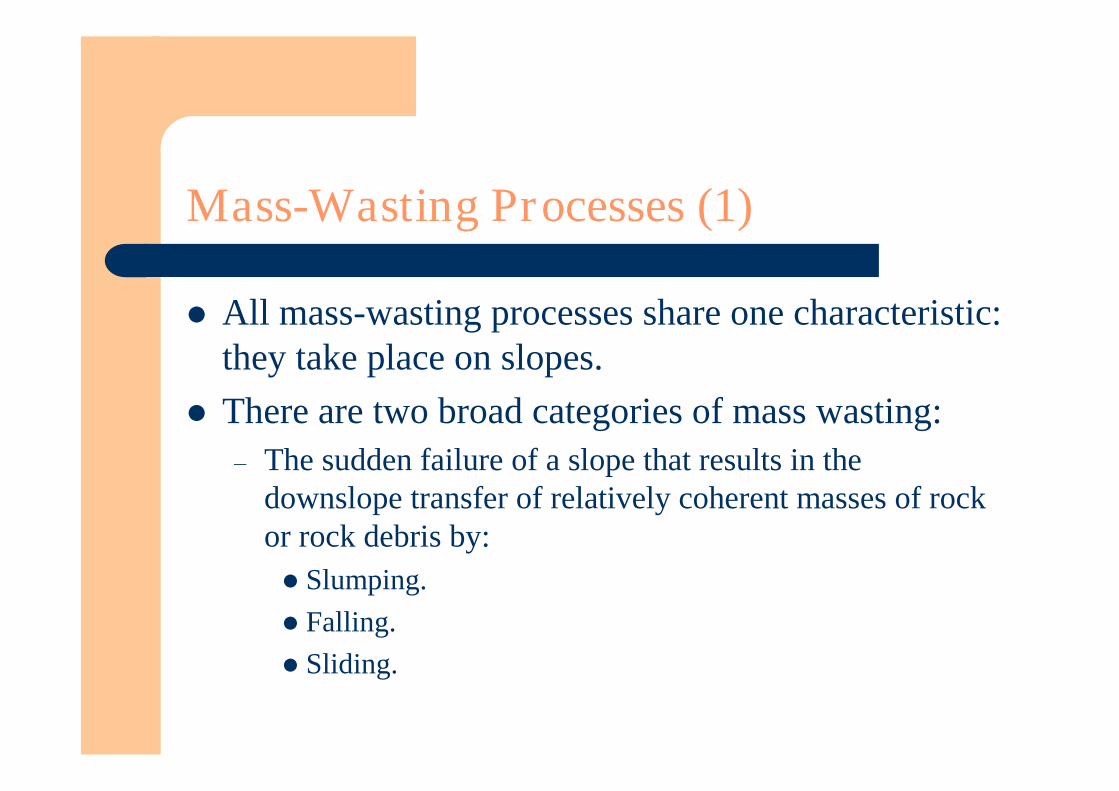
Mass-Wasting Processes (1)
All mass-wasting processes share one characteristic:they take place on slopes.
There are two broad categories of mass wasting:– The sudden failure of a slope that results in the
downslope transfer of relatively coherent masses of rockor rock debris by:Slumping.Falling.Sliding.
Mass-Wasting Processes (2)
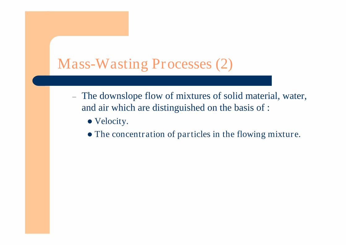
– The downslope flow of mixtures of solid material, water,and air which are distinguished on the basis of :Velocity.The concentration of particles in the flowing mixture.
Slope Failures
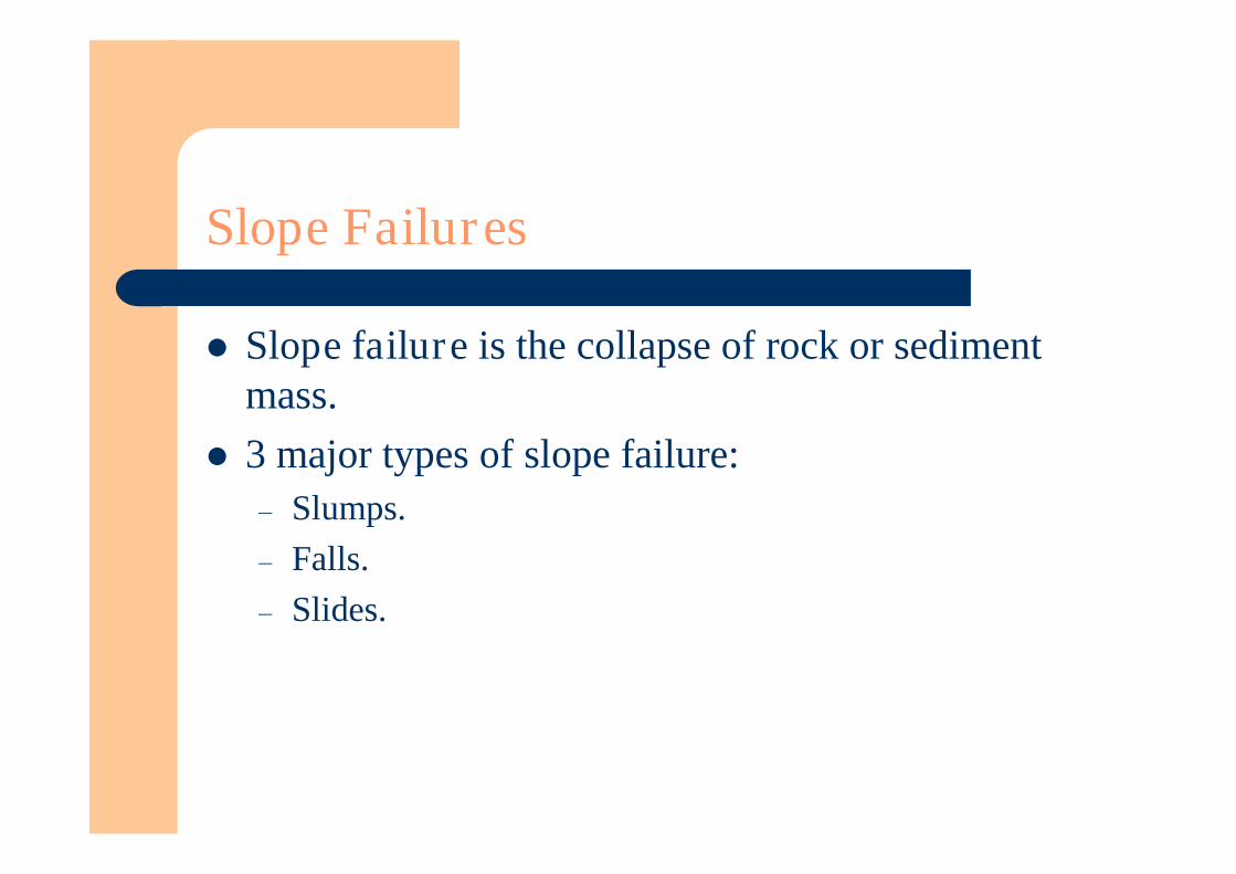
Slope failure is the collapse of rock or sedimentmass.
3 major types of slope failure:– Slumps.– Falls.– Slides.
Slumps
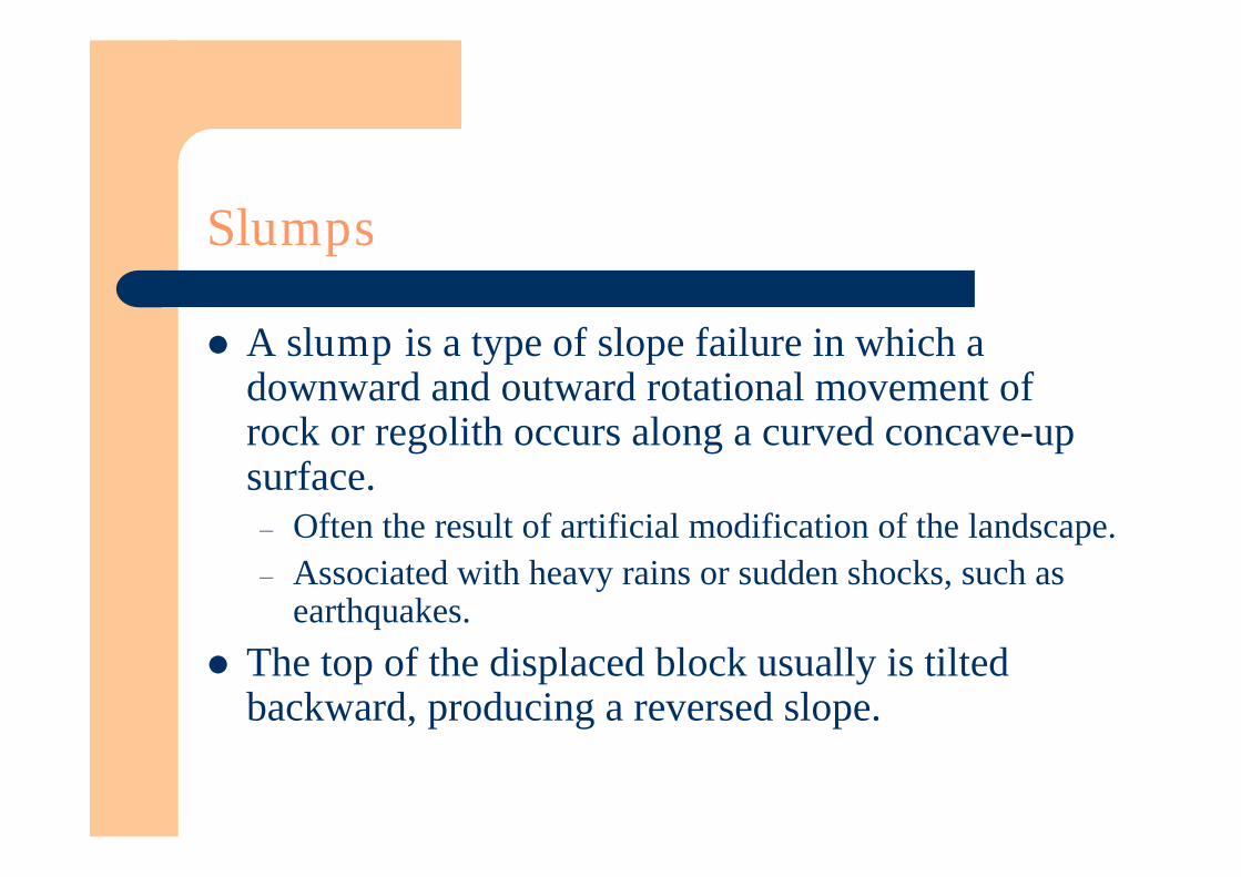
A slump is a type of slope failure in which adownward and outward rotational movement ofrock or regolith occurs along a curved concave-upsurface.– Often the result of artificial modification of the landscape.– Associated with heavy rains or sudden shocks, such as
earthquakes. The top of the displaced block usually is tilted
backward, producing a reversed slope.

Figure 13.2

Rockfalls and Debris Falls (1)
Rockfall is the free falling of detached bodies ofrock.
It is common in precipitous mountainous terrain,where debris forms conspicuous deposits at the baseof steep slopes.
As a rock falls, its speed increases.– V = 2 gh, where:– g = the acceleration due to gravity.– h = the distance of fall.– v = the velocity.
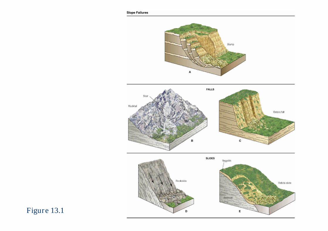
Figure 13.1
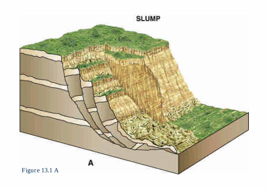
Figure 13.1 A
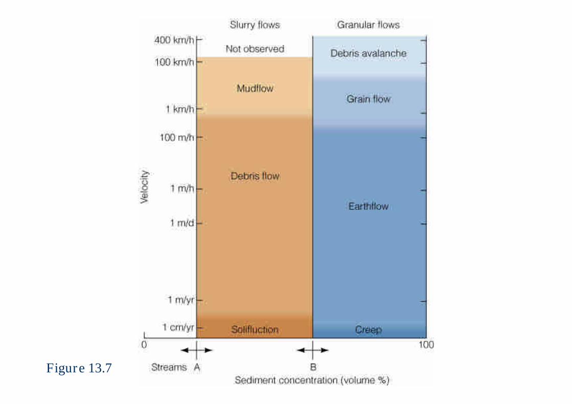
Figure 13.7
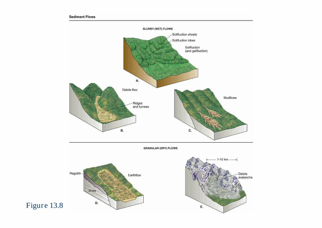
Figure 13.8
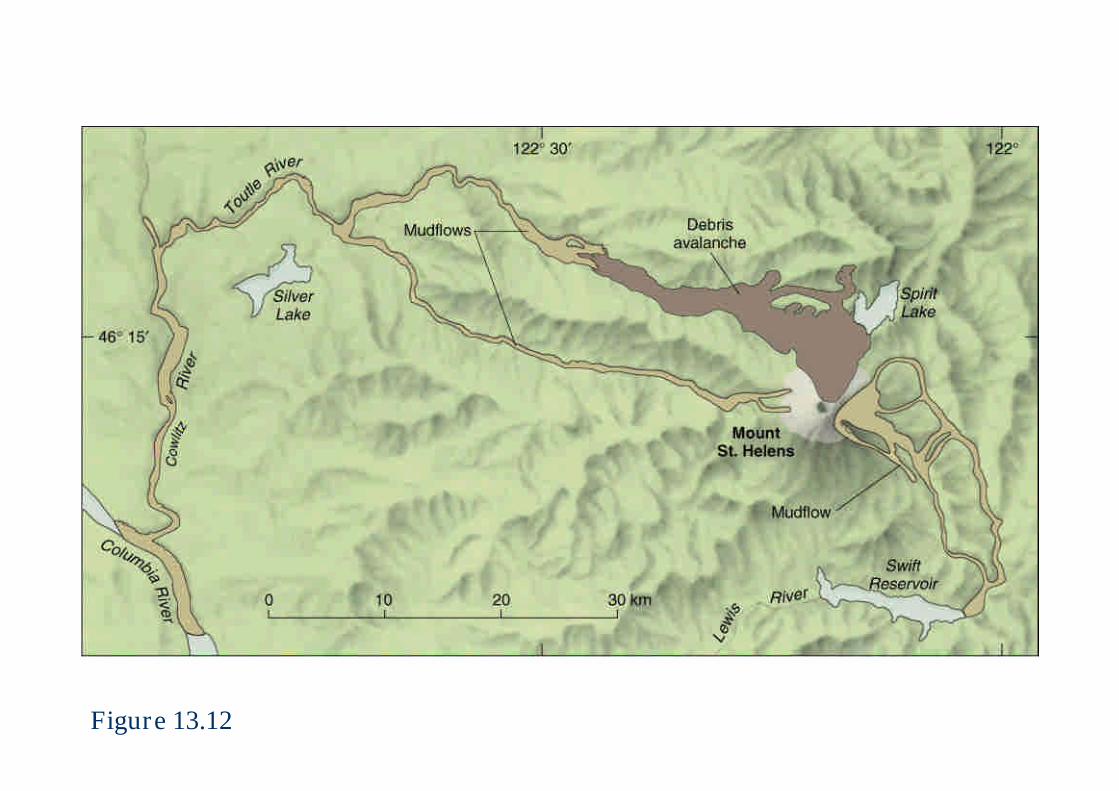
Figure 13.12
Rockfalls and Debris Falls (2)
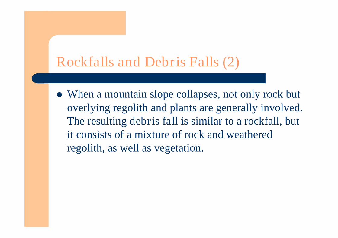
When a mountain slope collapses, not only rock butoverlying regolith and plants are generally involved.The resulting debris fall is similar to a rockfall, butit consists of a mixture of rock and weatheredregolith, as well as vegetation.

Rockfalls and Debris Falls (3)
Rockslides:– Involve the rapid displacement of masses of rock or
sediment along an inclined surface, such as a beddingplane.
– Are common in high mountains where steep slopesabound.
– Typically range in size from sand grains to large boulders.– Forms talus, a body of debris sloping outward from the
cliff. The angle of repose (the angle at which the debris remains
stable) typically lies between 30o and 37o.

Figure 13.5

Figure 13.6
Sediment Flows (1)
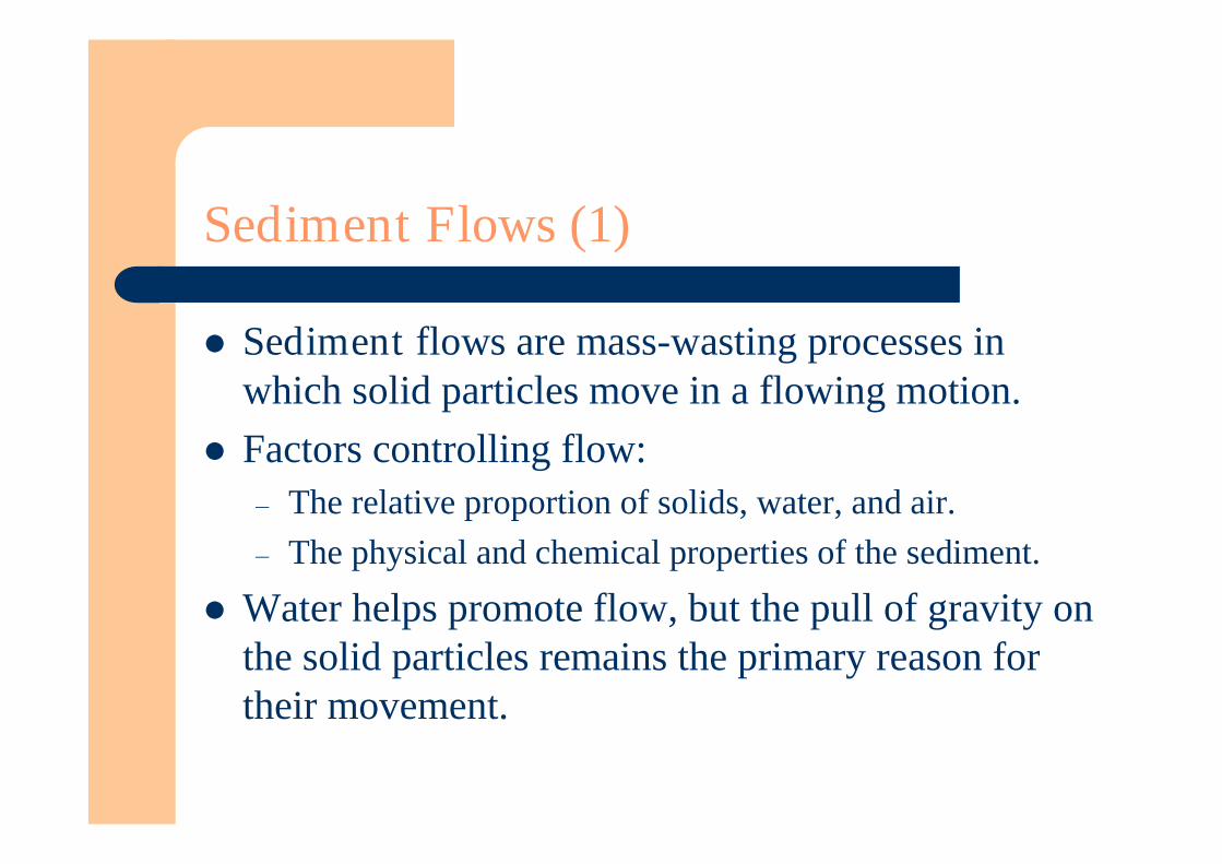
Sediment flows are mass-wasting processes inwhich solid particles move in a flowing motion.
Factors controlling flow:– The relative proportion of solids, water, and air.– The physical and chemical properties of the sediment.
Water helps promote flow, but the pull of gravity onthe solid particles remains the primary reason fortheir movement.
Sediment Flows (2)
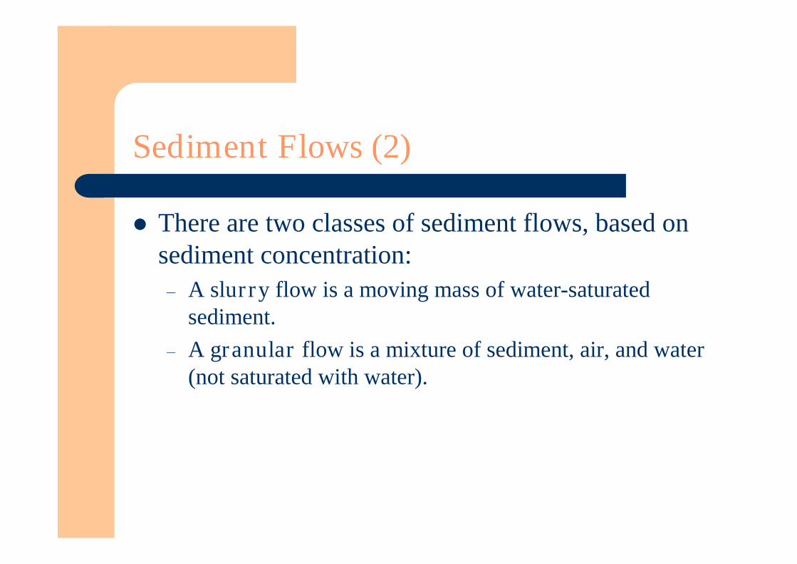
There are two classes of sediment flows, based onsediment concentration:– A slurry flow is a moving mass of water-saturated
sediment.– A granular flow is a mixture of sediment, air, and water
(not saturated with water).
Creep (1)
Creep is a very slow type of granular flow. It is measured in millimeters or centimeters per year. Rates tend to be higher on steep slopes than on
gentle slopes. Rates tend to increase as soil moisture increases.
– However, in wet climates vegetation density alsoincreases and the roots of plants tend to inhibit creep.
Creep (2)
Loose, incoherent deposits on slopes that aremoving mainly by creep are called colluvium.– Particles are angular and lack obvious sorting.
Alluvium tends to consist of rounded particles,sorted and deposited in layers.
Slurry Flows (1)
The nonsorted or poorly sorted sediment mixture in slurryflows is often so dense that large boulders can be suspendedin it.
There are several key types of slurry flows.– Solifluction:
The very slow downslope movement of saturated soil and regolith. Rates of movement are less than about 30 cm/yr. Creates distinctive surface features:
– Lobes.– Sheets of debris.
Occurs on hill slopes in temperate and tropical latitudes, Regolith remains saturated with water for long intervals.
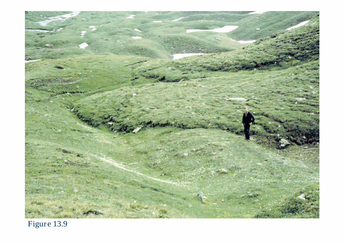
Figure 13.9
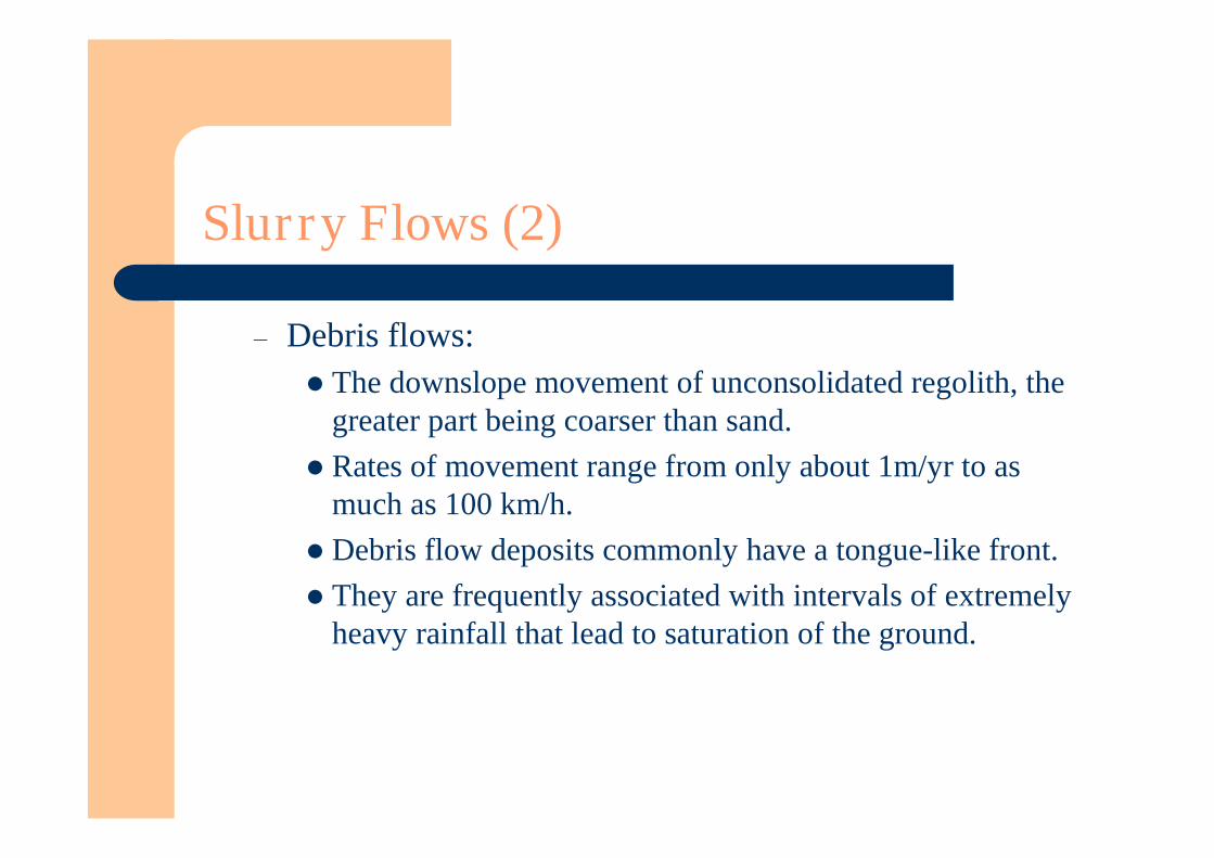
Slurry Flows (2)
– Debris flows:The downslope movement of unconsolidated regolith, the
greater part being coarser than sand.Rates of movement range from only about 1m/yr to as
much as 100 km/h.Debris flow deposits commonly have a tongue-like front.They are frequently associated with intervals of extremely
heavy rainfall that lead to saturation of the ground.
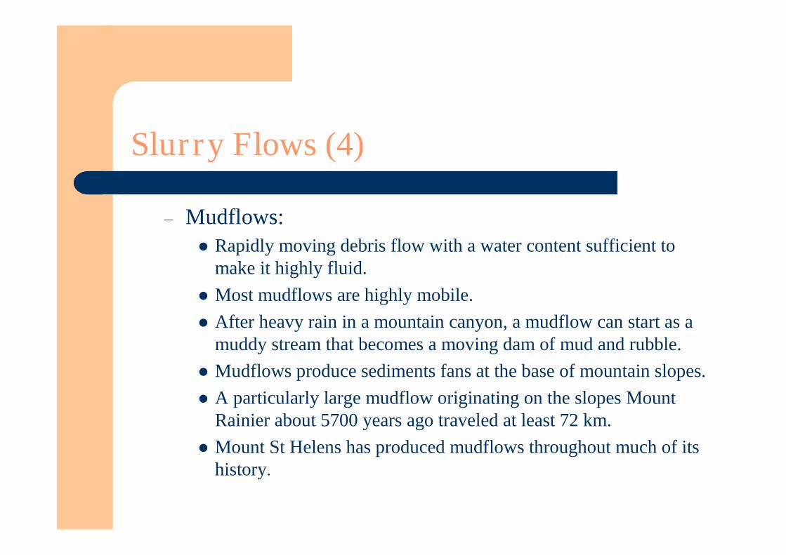
Slurry Flows (4)
– Mudflows:Rapidly moving debris flow with a water content sufficient to
make it highly fluid.Most mudflows are highly mobile.After heavy rain in a mountain canyon, a mudflow can start as a
muddy stream that becomes a moving dam of mud and rubble.Mudflows produce sediments fans at the base of mountain slopes.A particularly large mudflow originating on the slopes Mount
Rainier about 5700 years ago traveled at least 72 km.Mount St Helens has produced mudflows throughout much of its
history.

Figure 13.10A

Figure 13.10B
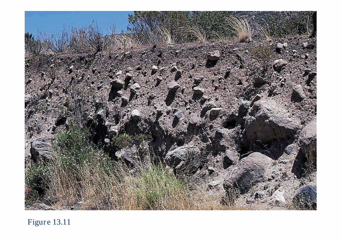
Figure 13.11

Granular Flows
The sediment of granular flows is largely dry.Granular flows have a velocity in the range of about
1 cm/day to several hundred m/h. They are often made up of weak regolith.
– Predominantly silt and clay-sized particles.
They occur on gentle to moderately steep slopes (2o
to 35o).

Figure 13.13

Figure 13.14

Earthflows (1)
Earthflows are the most common mass-wastingprocess.
At the top of a typical earthflow is a steep scarp. In a longitudinal profile from head (top) to toe
(leading edge), an earthflow is concave upward nearthe head and convex upward near the toe.
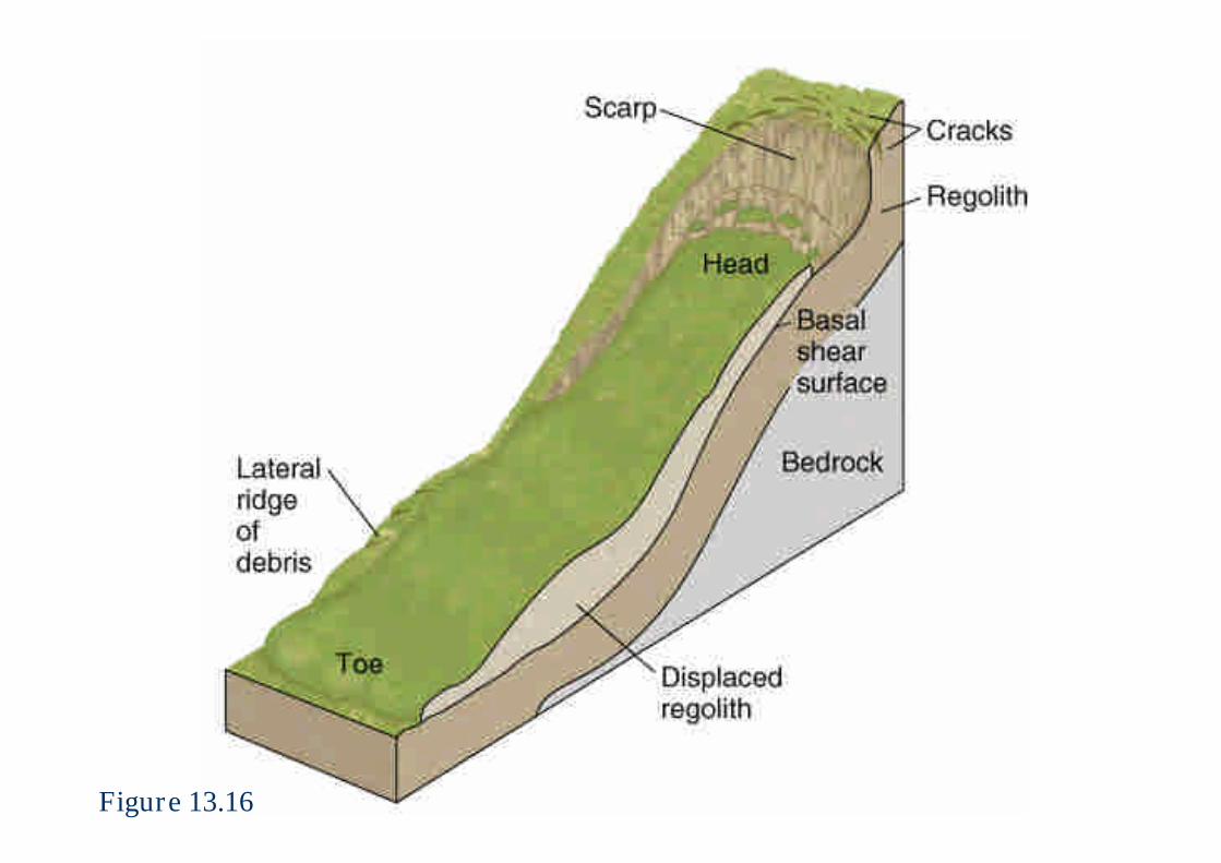
Figure 13.16

Earthflows (2)
A special type of earthflow called liquefactionoccurs in wet, highly porous sediment consisting ofclay to sand-size particles weakened by anearthquake.– An abrupt shock increases shear stress and may cause a
momentary buildup of water pressure in pore spaceswhich decreases the shear strength.
– A rapid fluidization of the sediment causes abrupt failure.
Grain Flows
Grain flows are the movement of a dry or nearlydry granular sediment with air filling the porespaces.– Sand flowing down the dune face.
Velocities of the moving sediments typically rangebetween 0.1 and 35m/s.
Debris Avalanches
A debris avalanche is a huge mass of falling rockand debris that breaks up, pulverizes on impact, andthen continues to travel downslope.
The flanks of steep stratovolcanoes are especiallysusceptible to collapse that can lead to theproduction of debris avalanches.– Such a collapse occurred about 300,000 years ago at Mount
Shasta.– The volume of the landslide on Mount St. Helens was about
ten times smaller than that of the Mount Shasta event.
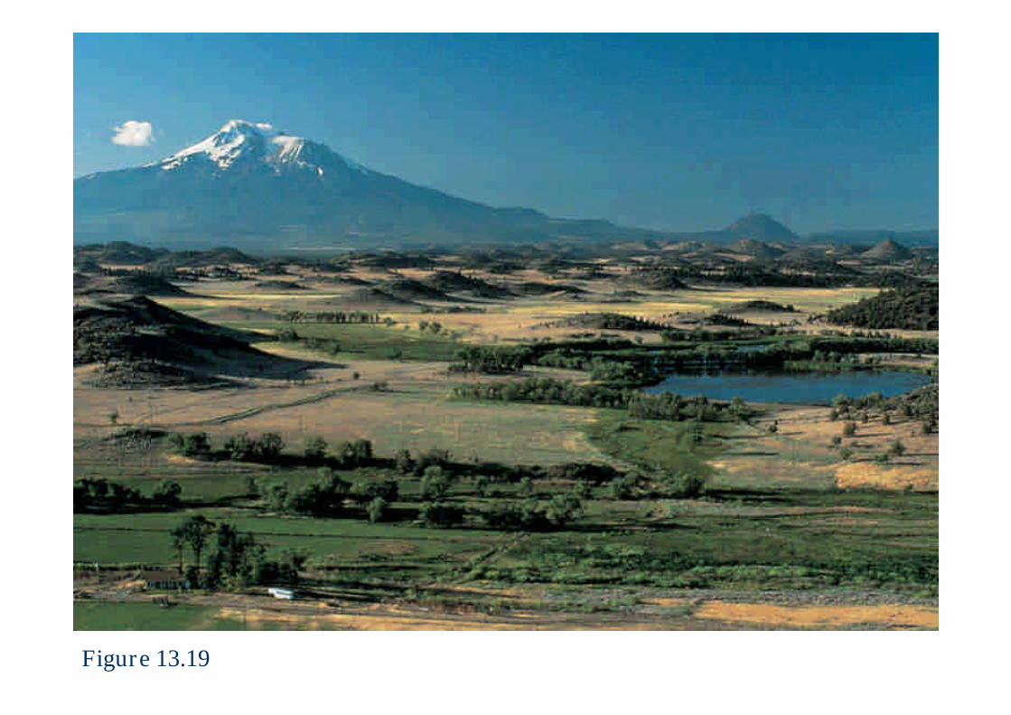
Figure 13.19
Mass Wasting In Cold Climates
When water freezes, it increases in volume. Frost heaving is the lifting of regolith by the
freezing of contained water.– It strongly influences downslope creep of regolith in cold
climates.– As the ground thaws, the regolith returns to a more
natural state.– Some horizontal movement takes place.– Repeated episodes of freezing and thawing produces
progressive downslope creep.

Figure 13.20
Gelifluction (1)
In cold regions underlain year-round by frozenground, a thin surface layer thaws in summer andthen refreezes in winter.
During the summer, this thawed layer becomessaturated with meltwater and is very unstable,especially on hillsides.
As gravity pulls the thawed sediment slowlydownslope, distinctive lobes and sheets of debris areproduced.
Gelifluction (2)
This process, known as gelifluction, is similar tosolifluction in temperate and tropical climates;
Rates of movement are low, generally less than 10cm/yr.
Rock Glaciers (1)
Characteristic feature of many cold, relatively drymountain regions, is a tongue or lobe of ice-cemented rock debris that moves slowly downslopein a manner similar to glaciers.
Active rock glaciers may reach a thickness of 50 mor more and advance at rates of up to about 5 m/yr.
Especially common in high interior mountainranges like the Swiss Alps, the Argentine Andes,and the Rocky Mountains.
Mass Wasting Under Water (1)
Mass wasting under water is an extremely commonand widespread means of sediment transport on theseafloor and in lakes.
Is a gravity-induced movement of rock andsediment.
Slides and sediment flows are extremely active onthe Mississippi delta front.
Vast areas of the seafloor are disrupted bysubmarine slumps, slides, and flows in the WesternNorth Atlantic.
Mass Wasting Under Water (2)
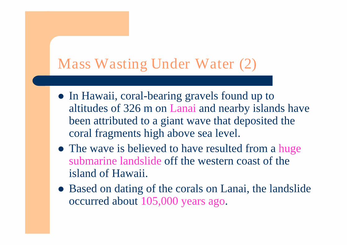
In Hawaii, coral-bearing gravels found up toaltitudes of 326 m on Lanai and nearby islands havebeen attributed to a giant wave that deposited thecoral fragments high above sea level.
The wave is believed to have resulted from a hugesubmarine landslide off the western coast of theisland of Hawaii.
Based on dating of the corals on Lanai, the landslideoccurred about 105,000 years ago.
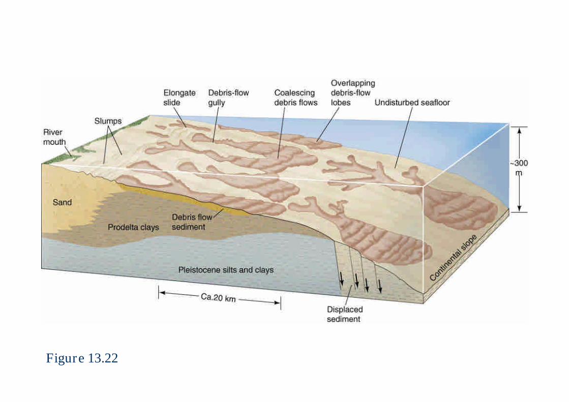
Figure 13.22

Figure 13.23
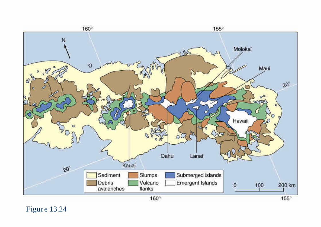
Figure 13.24
What triggers Mass-Wasting Events? (1)
Shocks, such as an earthquake, may release so muchenergy that slope failures of many types and sizesare triggered simultaneously.
Slope modification by human activities, such asoccurs in road cuts, creates artificially steep slopesthat are much less stable than the more gentleoriginal slopes.
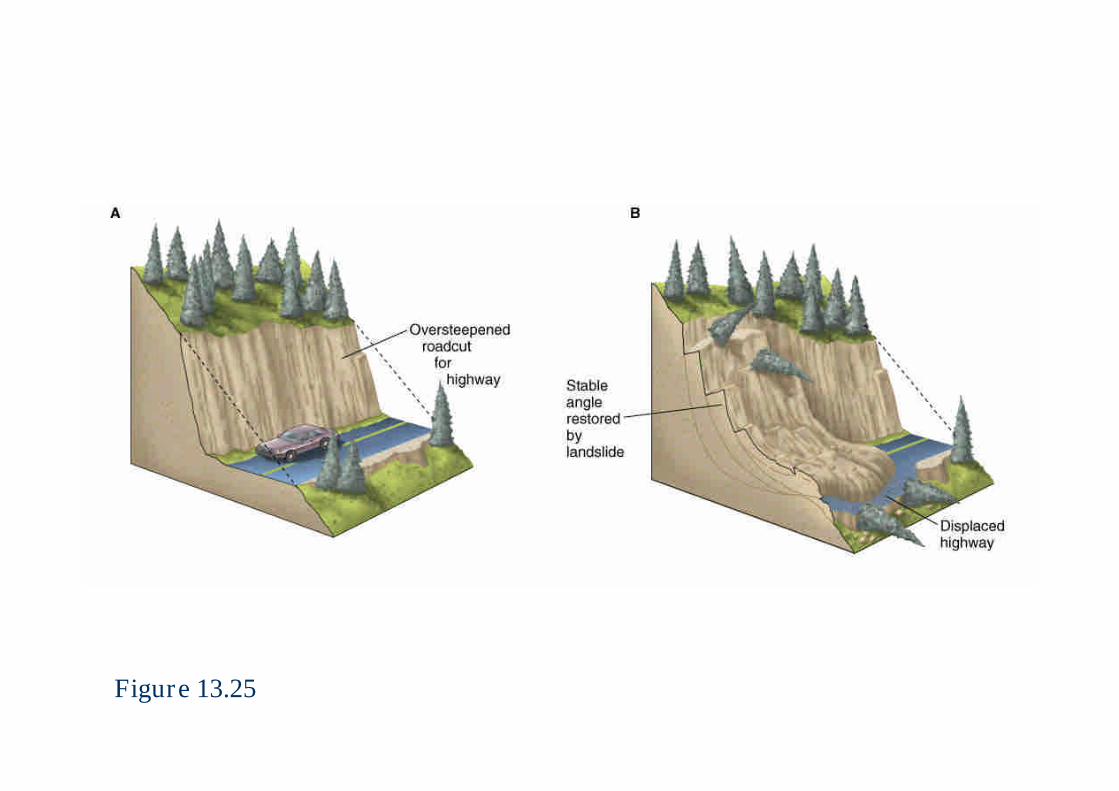
Figure 13.25

What triggers Mass-Wasting Events? (2)
Undercutting action of a stream along its bank orsurf action along a coast can trigger landslides.
Exceptional precipitation coupled with meltingsnow is an ideal trigger for slope failure.– The Gros Ventre River basin of western Wyoming.
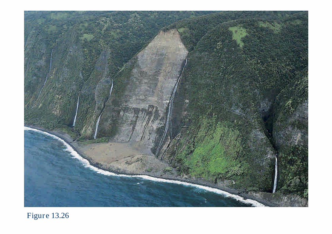
Figure 13.26
What triggers Mass-Wasting Events? (3)
Volcanic eruptions may produce largevolumes of water, released when summitglaciers and snowfields melt during eruptionof hot lavas or pyroclastic debris.– Mudflows or debris flows can be produced that move
rapidly downslope and often continue for manykilometers downvalley.
Submarine slope failures on continental slopes anddelta fronts can promote the formation of largesubmarine landslides.
Hazards To Life And Property
In the United States alone, landslides in a typicalyear cause more than $1 billion in economic loosesand 25 to 50 deaths.
Careful planning can often reduce or even eliminatethe impact of mass-wasting processes on humanenvironment.
Slopes subject to creep can be stabilized by drainingor pumping water from saturated sediment.
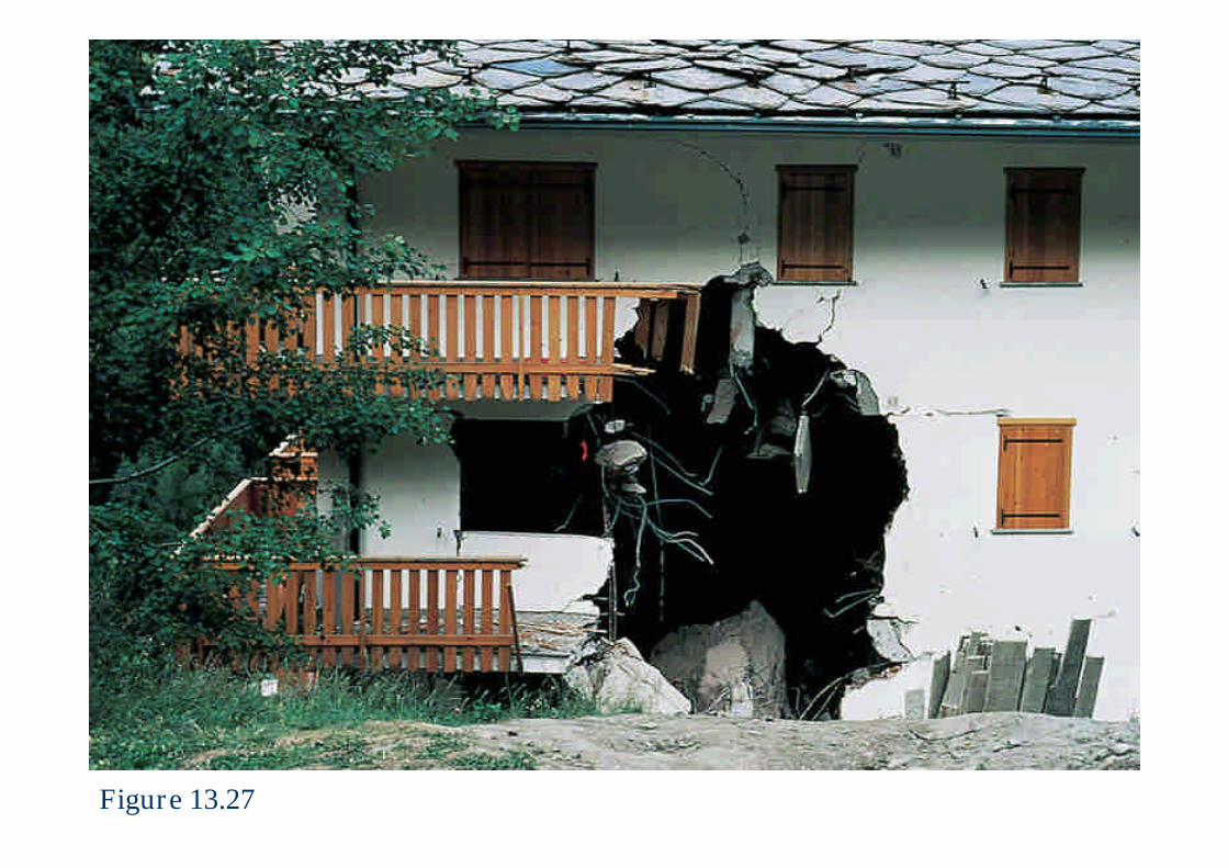
Figure 13.27
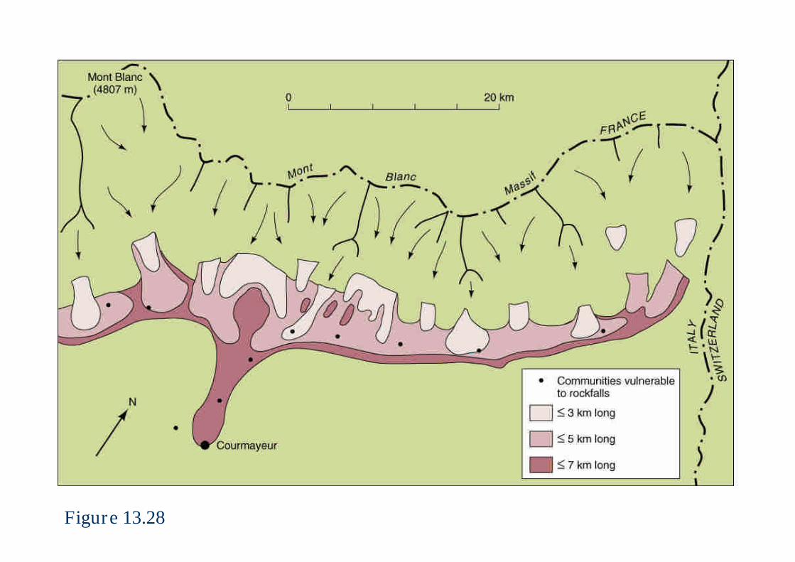
Figure 13.28
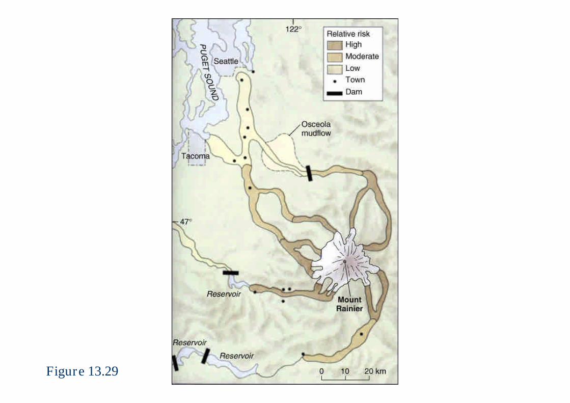
Figure 13.29
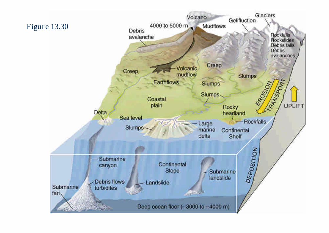
Figure 13.30
Landslides and Plate Tectonics
The world’s major historic and prehistoriclandslides tend to cluster along belts that lie close tothe boundaries between converging lithosphericplates.
They do so for two main reasons:– First, the world’s highest mountain chains lie at or near
plate boundaries.– Second, it is along the boundaries between plates, where
plate margins slide past or over one another, that mostlarge earthquakes occur.
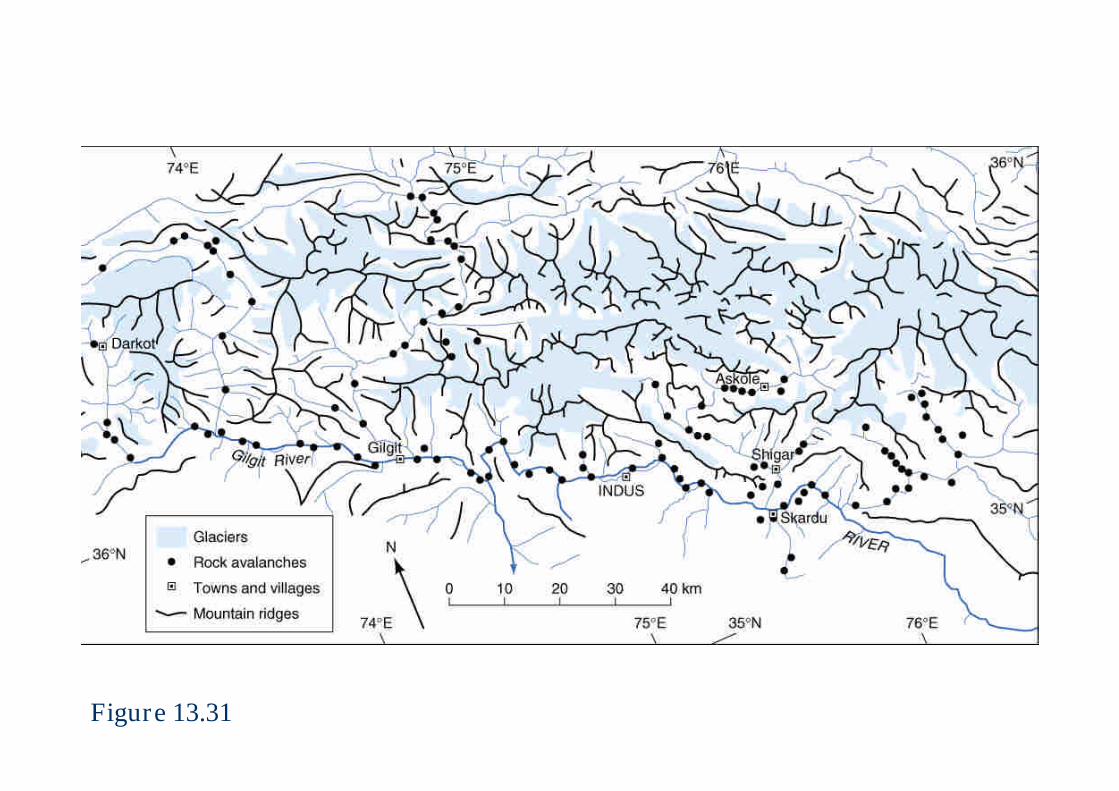
Figure 13.31
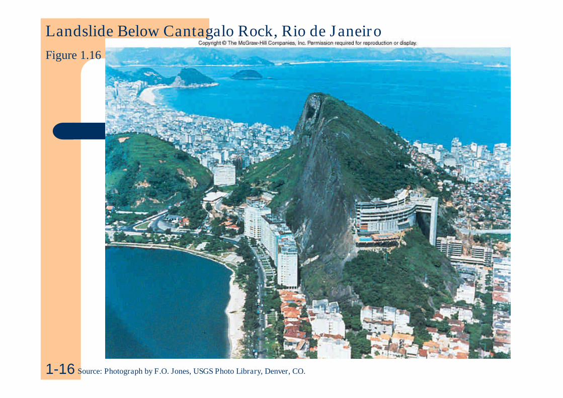
Landslide Below Cantagalo Rock, Rio de JaneiroFigure 1.16
1-16 Source: Photograph by F.O. Jones, USGS Photo Library, Denver, CO.