Embed Size (px)
Citation preview

1 Copyright © 2011, Oracle and/or its affiliates. All rights reserved.

2 Copyright © 2011, Oracle and/or its affiliates. All rights reserved.
Oracle Spatial Technologies: Location Analysis for Better Business Solutions Jayant Sharma Siva Ravada Director, Prod. Mgmt. Director, Prod. Development
ORACLE PRODUCT
LOGO

3 Copyright © 2011, Oracle and/or its affiliates. All rights reserved.

4 Copyright © 2011, Oracle and/or its affiliates. All rights reserved.
Latin America 2011 December 6–8, 2011 Tokyo 2012
April 4–6, 2012

5 Copyright © 2011, Oracle and/or its affiliates. All rights reserved.
Oracle OpenWorld Bookstore
• Visit the Oracle OpenWorld Bookstore for a fabulous selection of books on many of the conference topics and more!
• Bookstore located at Moscone West, Level 2 • All Books at 20% Discount
6 Copyright © 2011, Oracle and/or its affiliates. All rights reserved.
The following is intended to outline our general product direction. It is intended for information purposes only, and may not be incorporated into any contract. It is not a commitment to deliver any material, code, or functionality, and should not be relied upon in making purchasing decisions. The development, release, and timing of any features or functionality described for Oracle’s products remains at the sole discretion of Oracle.
7 Copyright © 2011, Oracle and/or its affiliates. All rights reserved.
Agenda
• Overview of Spatial • New Features in 11gR2 • Overview of Fusion Middleware MapViewer • New Features in FMW MapViewer • Discussion

8 Copyright © 2011, Oracle and/or its affiliates. All rights reserved.
Oracle’s Spatial Technologies Location Analysis for Better Business solutions

9 Copyright © 2011, Oracle and/or its affiliates. All rights reserved.
• Business data that contains or describes location – Street and postal address (constituents, customers, warehouse) – Sales data (sales territory, customer registration, etc.) – Assets (cell tower, fire hydrant, electrical transformer, etc.) – Geographic features (roads, rivers, parks, etc.)
• Anything connected to a physical location • Every database in the world contains some form of
business data that can be leveraged using spatial technologies
What is spatial data?

10 Copyright © 2011, Oracle and/or its affiliates. All rights reserved.
Spatial Information Has Many Uses
Information Type Uses
Address Map customers, stores, and business relationships
Roads, facilities, infrastructure … Logistics planning, trace and manage fixed or mobile assets
Administrative areas (zip, tax, county, floodplain, real estate, sales territories...)
Summarize, Drill down, Map key performance indicators
Satellite imagery, 3D models Risk assessment, engineering planning, asset maintenance

11 Copyright © 2011, Oracle and/or its affiliates. All rights reserved.
Usage across industries Local Government
• Jurisdiction
• Tax assessment, zoning
• Public facility planning
Financial Services
• Insurance risk assessment
• Mortgage, loan portfolio analysis
• Retail branch site, service analysis
Consumer Packaged Goods
• Product line market share analysis
• Vending machine location, product mix
• Marketing, promotions analytics
Healthcare
• Service area, patient origination analysis
• Provider network analysis
• Tracking spread of disease
Real Estate
• Appraisal/Risk assessment
• Community, neighborhood profiles
• Tenant mix analysis
Transportation, Utilities
• Asset management
• Workforce scheduling, management
• Network and service planning
12 Copyright © 2011, Oracle and/or its affiliates. All rights reserved.
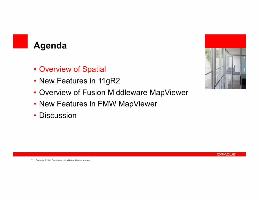
Natively manage all spatial content
Data
Points Lines
Polygons
Satellite Imagery Topologies 3D
f1
f2 n1 n2
e1
e2 e3
e4
Networks
Web Services (OGC)
Geocoding Routing
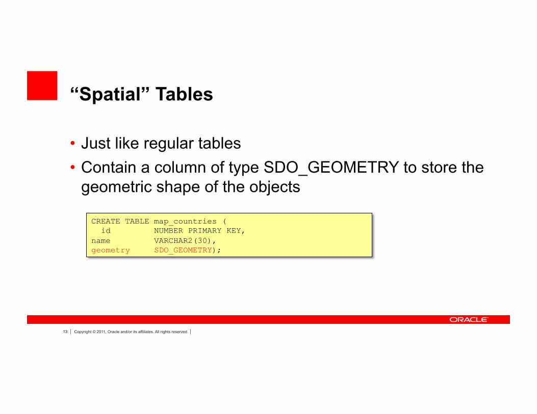
13 Copyright © 2011, Oracle and/or its affiliates. All rights reserved.
“Spatial” Tables
• Just like regular tables • Contain a column of type SDO_GEOMETRY to store the
geometric shape of the objects
CREATE TABLE map_countries ( id NUMBER PRIMARY KEY, name VARCHAR2(30), geometry SDO_GEOMETRY);
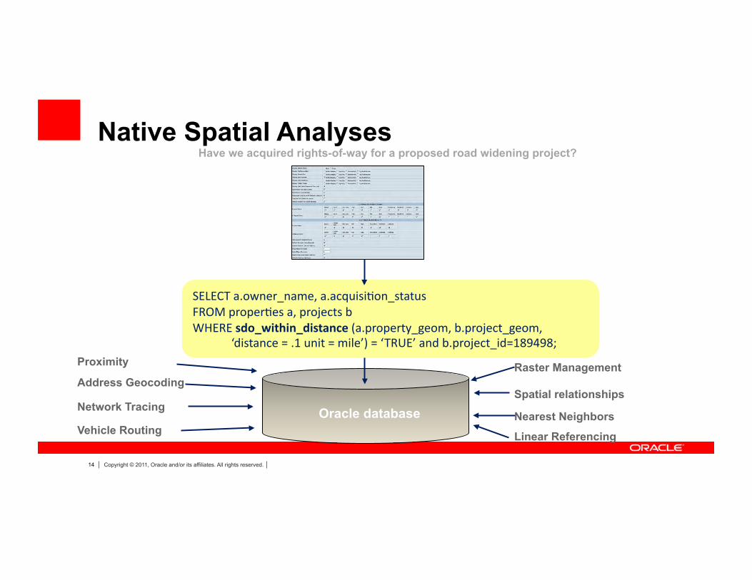
14 Copyright © 2011, Oracle and/or its affiliates. All rights reserved.
Native Spatial Analyses
Address Geocoding
Linear Referencing
Raster Management
Oracle database Vehicle Routing
SELECT a.owner_name, a.acquisi6on_status FROM proper6es a, projects b WHERE sdo_within_distance (a.property_geom, b.project_geom, ‘distance = .1 unit = mile’) = ‘TRUE’ and b.project_id=189498;
Have we acquired rights-of-way for a proposed road widening project?
Network Tracing Spatial relationships
Proximity
Nearest Neighbors
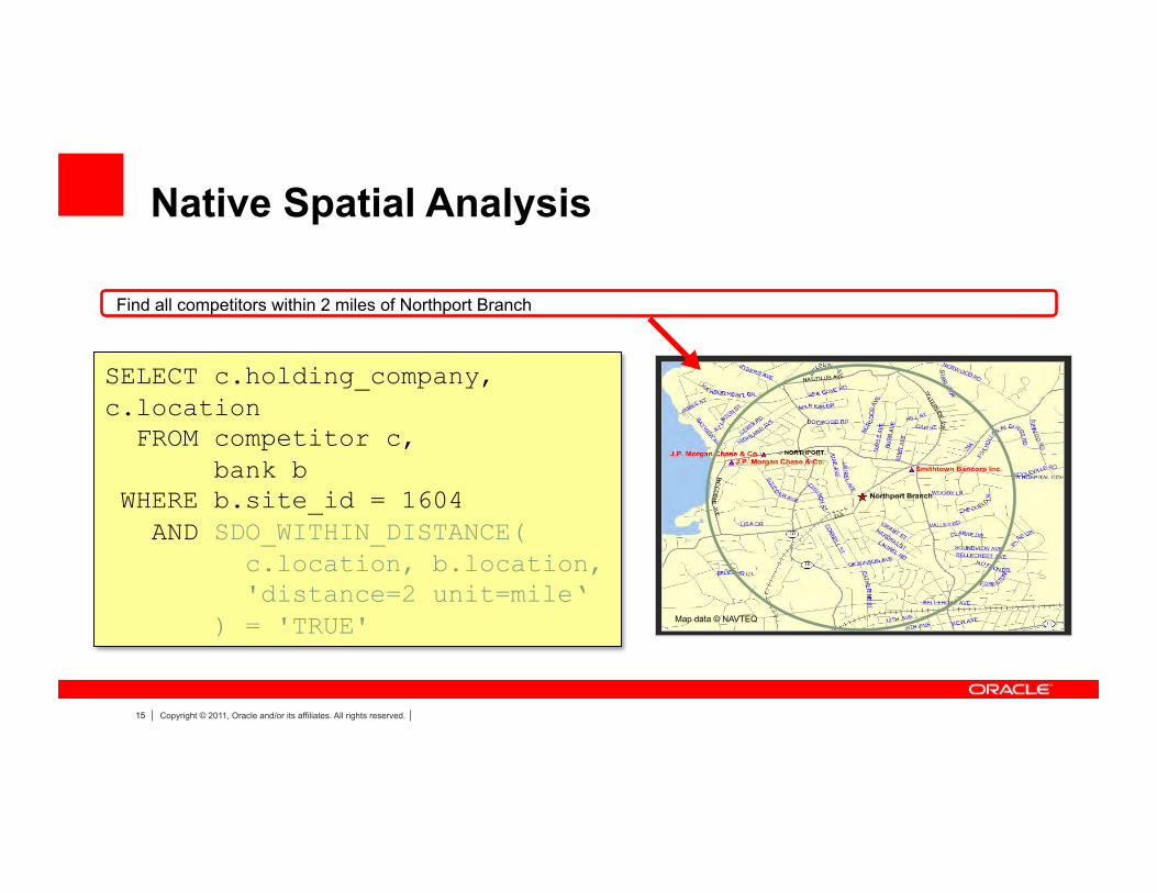
15 Copyright © 2011, Oracle and/or its affiliates. All rights reserved.
Map data © NAVTEQ
Native Spatial Analysis
SELECT c.holding_company, c.location FROM competitor c, bank b WHERE b.site_id = 1604 AND SDO_WITHIN_DISTANCE( c.location, b.location, 'distance=2 unit=mile‘ ) = 'TRUE'
Find all competitors within 2 miles of Northport Branch

16 Copyright © 2011, Oracle and/or its affiliates. All rights reserved.
Oracle Locator vs Spatial
Topology Data Model Linear Referencing System
Spa6al Analy6c Func6ons
OGC Web Services
Native Spatial datatype Native Spatial index
Basic spatial queries Full projection support
GeoRaster Geocoder Routing Engine 3D Misc advanced spatial analyses
Oracle Locator
Oracle Spatial Option
Oracle Database
Enumerated in detail in the online Locator doc
http://download.oracle.com/docs/cd/B28359_01/appdev.111/b28400/sdo_locator.htm#i632018

17 Copyright © 2011, Oracle and/or its affiliates. All rights reserved.
OBIEE 11g
© 2010, NAVTEQ
Oracle Fusion CRM Sales
Phase Forward U6li6es Network Management System U6li6es Outage Analy6cs
Spatially Enabled Oracle Apps and Tools Oracle SQL Developer Oracle BI 11g Mobile

18 Copyright © 2011, Oracle and/or its affiliates. All rights reserved.
Oracle Exadata Extreme Performance for Spa8al Workloads
• Oracle Spatial is architected to exploit the processing power, bandwidth, and parallelism of the Exadata Database Machine
• Only Oracle Spatial is part of the Oracle Database kernel
• Spatial operations can be performed in up to 2 Terabytes of Database System Global Area memory

19 Copyright © 2011, Oracle and/or its affiliates. All rights reserved.
Agenda
• Overview of Spatial • New Features in 11gR2 • Overview of Fusion Middleware MapViewer • New Features in FMW MapViewer • Discussion

20 Copyright © 2011, Oracle and/or its affiliates. All rights reserved.
SPATIAL ENGINE
21 Copyright © 2011, Oracle and/or its affiliates. All rights reserved.
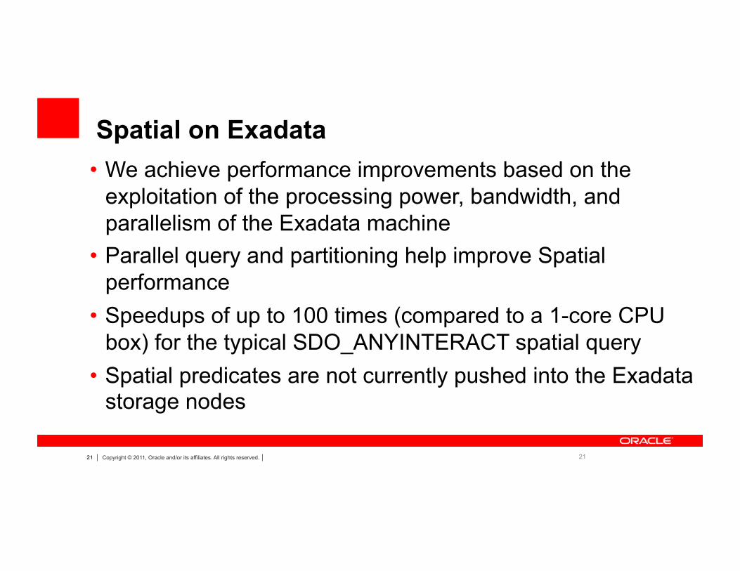
Spatial on Exadata
21
• We achieve performance improvements based on the exploitation of the processing power, bandwidth, and parallelism of the Exadata machine
• Parallel query and partitioning help improve Spatial performance
• Speedups of up to 100 times (compared to a 1-core CPU box) for the typical SDO_ANYINTERACT spatial query
• Spatial predicates are not currently pushed into the Exadata storage nodes

22 Copyright © 2011, Oracle and/or its affiliates. All rights reserved.
Fast Coordinate System Transformations
22
• SDO_CS.Transform is upto 10 times faster in 11gR2 – This speedup is seen if 1000s of transformations are done in a
session – This is typical for mapping applications where themes are
transformed at run time to match the base map SRID
• In the prior releases, the transformation context was created for each transform() call – now we use that context between transform() calls with the same
source and traget SRIDs
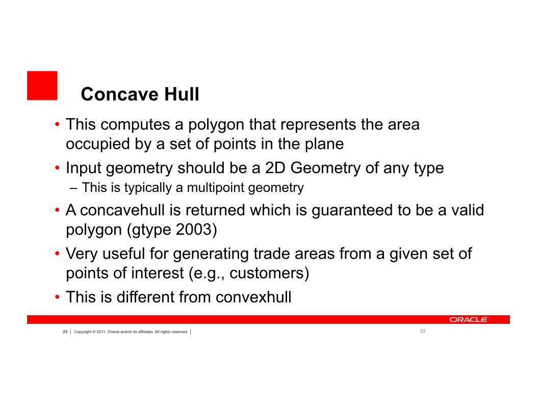
23 Copyright © 2011, Oracle and/or its affiliates. All rights reserved. 23
• This computes a polygon that represents the area occupied by a set of points in the plane
• Input geometry should be a 2D Geometry of any type – This is typically a multipoint geometry
• A concavehull is returned which is guaranteed to be a valid polygon (gtype 2003)
• Very useful for generating trade areas from a given set of points of interest (e.g., customers)
• This is different from convexhull
Concave Hull
24 Copyright © 2011, Oracle and/or its affiliates. All rights reserved.
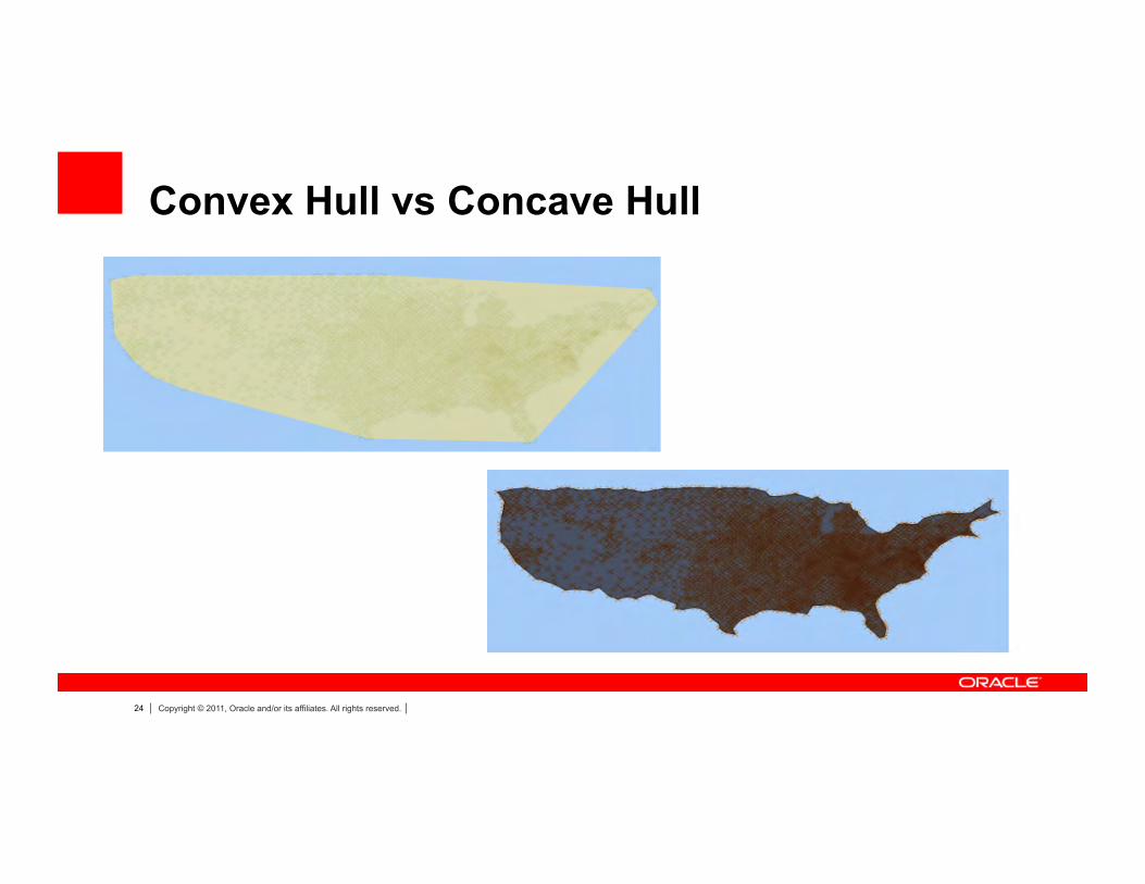
Convex Hull vs Concave Hull
25 Copyright © 2011, Oracle and/or its affiliates. All rights reserved.
Transparent support for TTS
25
• Cross-Endian support for TTS and Spatial Index • SDO_UTIL.PREPARE_FOR_TTS Deprecated
– When spatial data is transported as TTS, there is no need to do any special processing for Spatial indexes
– This applies to any TTS export done with 11gR2 database
• SDO_UTIL. INITIALIZE_INDEXES_FOR_TTS now automatically fixes the index if the TTS export is done in a different endian format than the target format

26 Copyright © 2011, Oracle and/or its affiliates. All rights reserved.
SQLDEVELOPER

27 Copyright © 2011, Oracle and/or its affiliates. All rights reserved.
SQL Developer Support for Spatial
• Support for Spatial Data Management – Metadata creation – Index creation – Validating the Spatial data – MapViewer metadata support
• Support for Spatial Data Querying – Query results can be viewed graphically
28 Copyright © 2011, Oracle and/or its affiliates. All rights reserved.
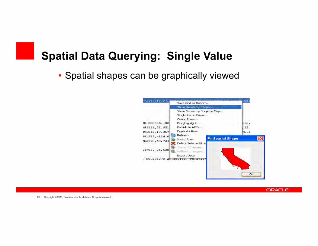
Spatial Data Querying: Single Value • Spatial shapes can be graphically viewed

29 Copyright © 2011, Oracle and/or its affiliates. All rights reserved.
Spatial data querying: Map View Display
• Secondary queries are overlaid
Here we show the counties in California over the States layer
30 Copyright © 2011, Oracle and/or its affiliates. All rights reserved.
NETWORK DATA MODEL

31 Copyright © 2011, Oracle and/or its affiliates. All rights reserved.
Oracle Spatial Network Data Model • An open data model to store and analyze network data. • Network analyses include:
• Shortest path • Nearest neighbor • Within cost • Minimum cost spanning tree • Traveling salesman problem • Reachable/Reaching nodes • K-shortest paths
32 Copyright © 2011, Oracle and/or its affiliates. All rights reserved.
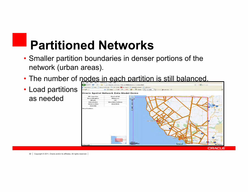
Partitioned Networks • Smaller partition boundaries in denser portions of the
network (urban areas). • The number of nodes in each partition is still balanced. • Load partitions
as needed

33 Copyright © 2011, Oracle and/or its affiliates. All rights reserved.
Sample Application: Shortest Path Analysis 747 Howard Street, San Francisco, CA 1099 Lombard Street, San Francisco, CA
5% on link 1234567 10% on link 89101112
Path consisting 500 nodes [….] and 499 links [….]
Street Addresses
Network Nodes and Links
Path Represented in Nodes and Links
Geocoder
NDM Analysis API: Shortest Path
Path Displayed On Map
Path geometry is …. Path Geometry
NDM Network IO API: Read Spatial Path
Oracle Maps Java Script API

35 Copyright © 2011, Oracle and/or its affiliates. All rights reserved.
NDM Customization - Network constraints
- Trucking restrictions - Turn restrictions - Avoid toll road - Avoid/use Highway
- Multiple Cost calculators - Travel distance - Travel time - Local/Highway/Scenic Drive preference - Penalty of road under construction/traffic congestion
- Goal nodes - Restaurants within 10 min’s drive
36 Copyright © 2011, Oracle and/or its affiliates. All rights reserved.
Multiple Cost Support in Path Analysis
• Path/Subpath analysis now supports multiple costs in a single analysis
• First cost is the one NDM optimizes • Second cost can be returned as an accumulated
value • Examples
– Shortest distance paths with travel time – Fastest paths with travel distance
37 Copyright © 2011, Oracle and/or its affiliates. All rights reserved.
Hierarchical A* shortest path Analysis
• Support A* shortest path algorithm • Provide user defined heuristic cost function • Support hierarchical shortest path analysis • Better performance than Dijkstra Algorithm as less
number of nodes are explored – Uses much less memory than Dijkstra

38 Copyright © 2011, Oracle and/or its affiliates. All rights reserved.
Traveling Sales Man (TSP) Analysis
• Minimum cost tour that includes all given nodes • Support Points on Network as nodes to be visited • Node visit order can be enforced using network
constraints • This is useful scheduling problems where a service
representative has to visit a number of customers
39 Copyright © 2011, Oracle and/or its affiliates. All rights reserved.
Drive Time Polygon Generation
• A spatial representation (polygon) based on minimum cost network coverage
• Concavehull polygon or convexhull polygon (accuracy and performance)
• Example – Compute Drive Time Polygon (with travel time as link cost) from
a service station – Use the polygon to determine if a given address can be reached
within a given time using point in polygon operation

40 Copyright © 2011, Oracle and/or its affiliates. All rights reserved.
Routing with Traffic Patterns • Fastest Routes are based on speed limits
– Not very accurate during rush hours – A good non-rush route can be the worst rush route!
• Traffic Patterns are historical traffic speeds on roads – Can be further classified as speeds on Mon-Thur. Fri. Sat. Sun.
holidays, and special events at 15 min, 30 min, 60 min intervals.
• Need to add temporal dimension (start time) in routing with traffic patterns

41 Copyright © 2011, Oracle and/or its affiliates. All rights reserved.
Routing with Traffic Patterns • Model Traffic Patterns as user data in NDM
– Neutral traffic pattern metadata and schema – Generate traffic pattern user data automatically – Currently Support NavTeq Traffic Patterns
• Link Cost is now a time-dependent function returning actual travel time – Start time determines which set of traffic pattern
• (M-T,Fri.Sat. Sun. Holidays) – Link distance/Link speed limit (for non-covered links) – Actual Speeds from traffic patterns (interval in a day) – Actual Travel Time = Link Distance/Actual Speed

42 Copyright © 2011, Oracle and/or its affiliates. All rights reserved.
Routing with Traffic Patterns Fastest Routes at different Start Times
10 PM
8 AM

43 Copyright © 2011, Oracle and/or its affiliates. All rights reserved.
3D SUPPORT

44 Copyright © 2011, Oracle and/or its affiliates. All rights reserved.
3D in Spatial 11g
– SDO_GEOMETRY (3D)
– SDO_TIN
– SDO_POINT_CLOUD 3D C
OO
RD
INAT
E S
YS
TEM
S
Types Building Models,..
Surface Modeling
Scene, Object Modeling
Efficient
Storage
Query
Analysis

45 Copyright © 2011, Oracle and/or its affiliates. All rights reserved.
SDO_GEOMETRY • Points, Lines • Simple Surfaces
– All points of a surface lie in a 3D plane
• Composite surfaces – Has one or more connected simple surfaces – Simple surfaces cannot cross
• Simple Solids – Composed of closed surfaces – Can have interior surfaces
• Composite Solids – Consists of n connected simple solids – Representation might be easier
• Multi-points, -lines, -surfaces, -solids – Multi-solid is different from composite solid
46 Copyright © 2011, Oracle and/or its affiliates. All rights reserved.
SDO_TIN

47 Copyright © 2011, Oracle and/or its affiliates. All rights reserved.
Raw LiDAR Point Cloud Color-scaled by elevation (red= high – blue=low)
Gate House
Spillway
Bridge

48 Copyright © 2011, Oracle and/or its affiliates. All rights reserved.
RGB 3D Point Cloud

49 Copyright © 2011, Oracle and/or its affiliates. All rights reserved.
GEORASTER

50 Copyright © 2011, Oracle and/or its affiliates. All rights reserved.
GeoRaster • A data type to store raster data
– Satellite images, remote sensing data, digital elevation models
– An XML schema to store Metadata
• Functionality – storage and indexing of raster data – Generate resolution pyramid – query and analysis – delivery to external consumers
• Publish as JPEG, GIFF images

51 Copyright © 2011, Oracle and/or its affiliates. All rights reserved.
ETL tool – the GDAL GeoRaster Driver
• GDAL is the best open source geospatial ETL tool/API for raster data – natively supports import/export to/from SDO_GEORASTER and
many formats including GeoTIFF, JPEG2000, ECW, NITF, HDF, NetCDF, ERDAS IMG, USGS DEM, SPOT.
– C/C++, Java, Python API for accessing GeoRaster – many tools. Two of the important ones are:
• gdal_translate – utility to translate raster formats to/from GeoRaster objects
• gdalinfo – utility to view information about a raster, such as a GeoRaster object
52 Copyright © 2011, Oracle and/or its affiliates. All rights reserved.
Georeferencing Using GCP • Georeferencing is the process of mapping pixels on the image to
ground coordinates • GCP: stands for Ground Control Points • GCP Model: GeoRaster supports a generic GCP model. In the
current release, 2D cell coordinates, 2D and 3D model coordinates are supported.
• GCP Storage: GeoRaster defines a GCP XML schema and can (optionally) store GCP natively in the metadata of GeoRaster objects.
• GCP Manipulation: GeoRaster provides a set of update and query functions to manipulate GCP’s and related data
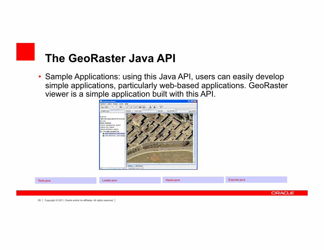
53 Copyright © 2011, Oracle and/or its affiliates. All rights reserved.
The GeoRaster Java API
• Sample Applications: using this Java API, users can easily develop simple applications, particularly web-based applications. GeoRaster viewer is a simple application built with this API.
Tools.java Viewer.java Loader.java Exporter.java
54 Copyright © 2011, Oracle and/or its affiliates. All rights reserved.
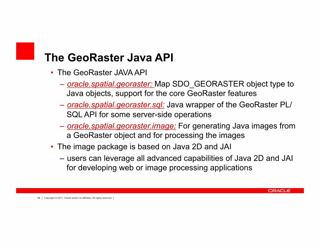
The GeoRaster Java API • The GeoRaster JAVA API
– oracle.spatial.georaster: Map SDO_GEORASTER object type to Java objects, support for the core GeoRaster features
– oracle.spatial.georaster.sql: Java wrapper of the GeoRaster PL/SQL API for some server-side operations
– oracle.spatial.georaster.image: For generating Java images from a GeoRaster object and for processing the images
• The image package is based on Java 2D and JAI – users can leverage all advanced capabilities of Java 2D and JAI
for developing web or image processing applications
55 Copyright © 2011, Oracle and/or its affiliates. All rights reserved.
• SDO_GEOR.reproject: transform from one projection to another • All oracle spatial coordinate systems are supported • Five re-sampling methods are supported • NN, Bilinear, Cubic, Avarage4 and Average16.
• Supports two options • Reproject persistently: reproject a GeoRaster object and store the
result as a new GeoRaster. • Reproject on-the-fly: equivalent to getRasterSubset except the
window-based cropping result is transformed into a different projection. The result is stored as a single BLOB.
Raster CS Transformations

56 Copyright © 2011, Oracle and/or its affiliates. All rights reserved.
From: SRID 26986 "NAD83 / Massachusetts Island"
To: SRID 26988 "NAD83 / Michigan North"
sdo_geor.reproject ( gr1, 'resampling=cubic', ‘blocksize=(256,256,3) interleaving=BIP', 26988, gr2 );
Raster Reprojection Example

57 Copyright © 2011, Oracle and/or its affiliates. All rights reserved.
Polygon-based Raster Clipping
SDO_GEOR.getRasterSusbet – Lets users clip the query result along the polygon (irregular)
boundary
58 Copyright © 2011, Oracle and/or its affiliates. All rights reserved.
Agenda
• Overview of Spatial • New Features in 11gR2 • Overview of Fusion Middleware MapViewer • New Features in FMW MapViewer • Discussion

59 Copyright © 2011, Oracle and/or its affiliates. All rights reserved.
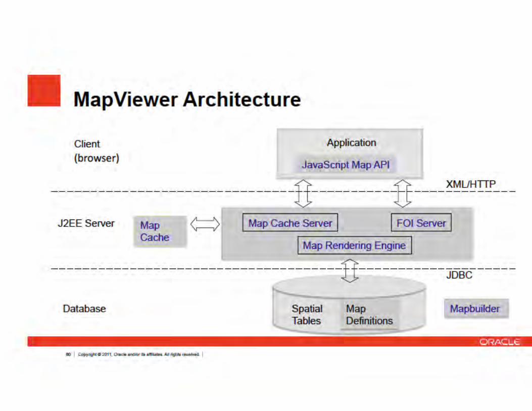
• A J2EE component (.ear) for developing web mappingapplications. Usually deployed in WLS. Free (with iAS,WLS, or ADF runtime)
• Renders data from Oracle Spatial (also WMS,WFS, .shp). Background can be from 3rd party providers
• JavaScript, Java, and XML APIs for web mappingapplications
Oracle Fusion Middleware MapViewer
61 Copyright © 2011, Oracle and/or its affiliates. All rights reserved.
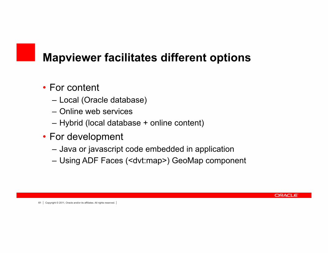
Mapviewer facilitates different options
• For content – Local (Oracle database) – Online web services – Hybrid (local database + online content)
• For development – Java or javascript code embedded in application – Using ADF Faces (<dvt:map>) GeoMap component

62 Copyright © 2011, Oracle and/or its affiliates. All rights reserved.
MapViewer renders application data on a map

63 Copyright © 2011, Oracle and/or its affiliates. All rights reserved.
Or application data on background maps from online services

64 Copyright © 2011, Oracle and/or its affiliates. All rights reserved.
It lets users display and interact with BI content
65 Copyright © 2011, Oracle and/or its affiliates. All rights reserved.
SOME NEW FEATURES IN MAPVIEWER
66 Copyright © 2011, Oracle and/or its affiliates. All rights reserved.
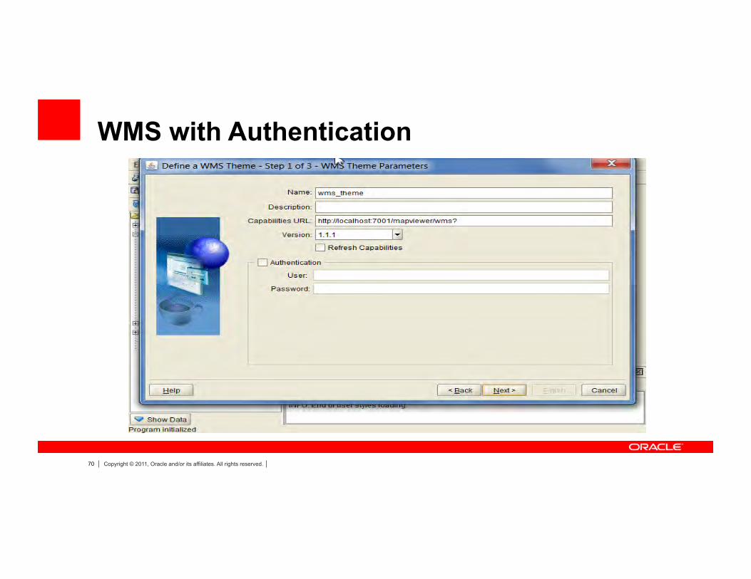
Some new features • FOI aggregation • Opacity for layers, themes, FOIs • External tile layers via metadata • Support for WMS with Authentication • MVFoiGroup (set visibility, opacity as a group)
67 Copyright © 2011, Oracle and/or its affiliates. All rights reserved.
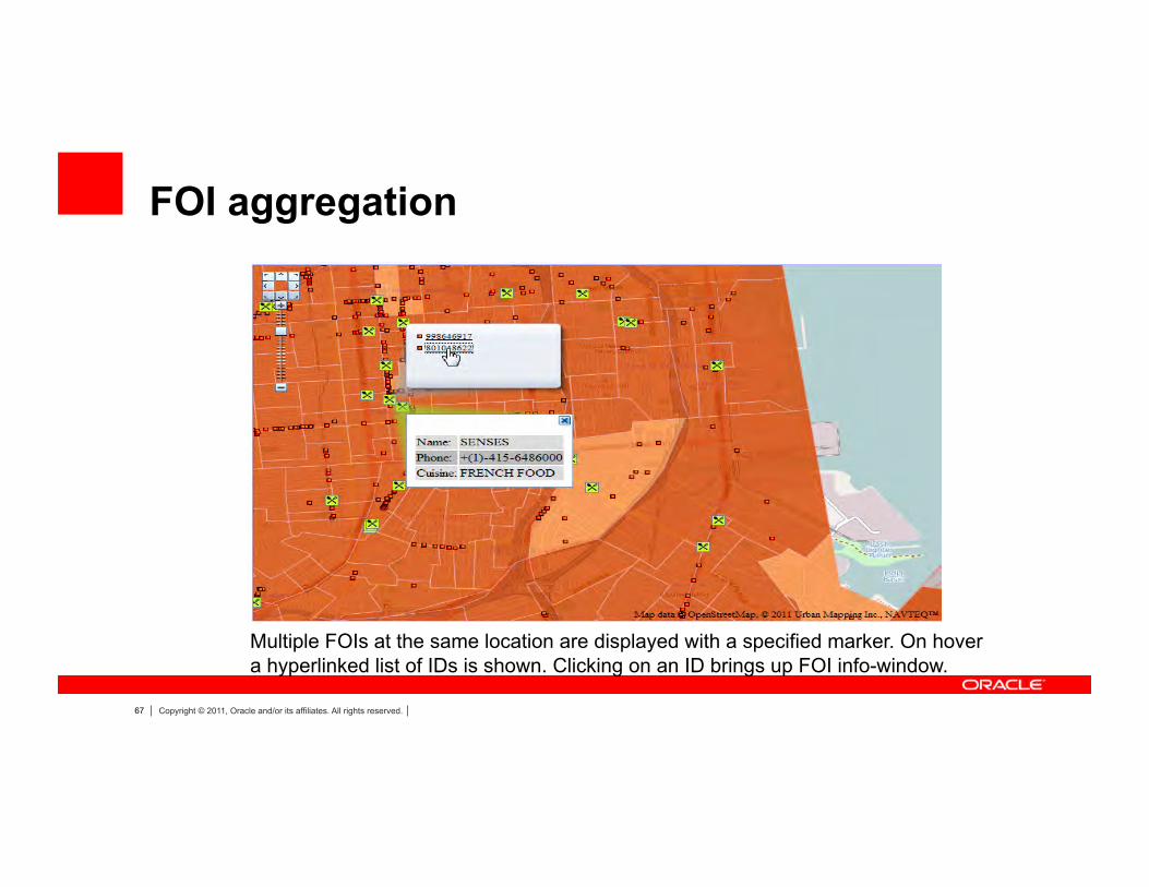
FOI aggregation
Multiple FOIs at the same location are displayed with a specified marker. On hover a hyperlinked list of IDs is shown. Clicking on an ID brings up FOI info-window.

68 Copyright © 2011, Oracle and/or its affiliates. All rights reserved.
Theme or FOI Opacity

69 Copyright © 2011, Oracle and/or its affiliates. All rights reserved.
Background maps via metadata
GUI op8on to select map source in MapViewer
Enter clientID obtained from Google Maps Enterprise
70 Copyright © 2011, Oracle and/or its affiliates. All rights reserved.
WMS with Authentication

71 Copyright © 2011, Oracle and/or its affiliates. All rights reserved.
Summary
• Location information is a key part of managing any business
• Oracle applications, analysis and reporting tools can query, manage, and display location information
• Useful across various industries: e.g. public sector, banking, insurance, retail, telecomm, healthcare
• Maps convey complex information and context compactly and effectively

72 Copyright © 2011, Oracle and/or its affiliates. All rights reserved.
The preceding is intended to outline our general product direction. It is intended for information purposes only, and may not be incorporated into any contract. It is not a commitment to deliver any material, code, or functionality, and should not be relied upon in making purchasing decisions. The development, release, and timing of any features or functionality described for Oracle’s products remains at the sole discretion of Oracle.

73 Copyright © 2011, Oracle and/or its affiliates. All rights reserved.
Q&A

74 Copyright © 2011, Oracle and/or its affiliates. All rights reserved.

75 Copyright © 2011, Oracle and/or its affiliates. All rights reserved.