Embed Size (px)
Citation preview
Killarney featured in the OS map has a long history
of human settlement.
By Aisling Boyhan 6A1
Killarney Before Time… Prehistoric Killarney
Killarney's unique history began with the last Ice Age. A single ice sheet covered the entire region. As it
melted, it sculpted Killarney's magnificent peaks Carrantoohill, Crohane, Tomies, Torc, and Mangerton.
Pushing aside huge boulders and gravel, it created the winding passes of Moll's Gap and the Gap of
Dunloe. The retreating ice also formed dark, mysterious loughs. The Long Range (Upper Lake, Muckross
Lake, and Lough Leane), Lough Guitane, and the Devil's Punch Bowl are all glacial remnants. On the
humorous side, it left the geological joke Cnoc An Cappeen, "the rock with a hat", just outside Kenmare.
Erosion over long periods has continued to form other beauty spots. The Upper Lake, Muckross Lake,
and Lough Leane briefly combine at the Meeting of the Waters, creating a mass of small ripples before
parting again. Water draining from the Devil's Punch Bowl is responsible for the spectacular Torc
Waterfall, while mountain streams join and tumble down at O'Sullivan's Cascade. Time brought climatic
change and great plant growth as well. Although today Killarney has one of the few remaining oak woods
in Europe, the county was once covered with these mighty trees. With ample fresh water, wood, and
plentiful animal life, it was only a matter of time before man arrived.
The first residents of the Killarney area were the Bronze Age Beaker Folk, from around
2000 BC. They mined copper on Ross Island and also left the open-air temple at
Lissyvigeen. The Beaker Folk led a prosperous life with strong trade ties to the Continent.
Beaten gold collars, or lunula, have been found at Mangerton and were common exports at
the time. Although substantial finds of bronze weapons have been found in outlying areas,
the Beaker Folk were generally peaceful farmers. Beginning in 500 BC, successive waves of
invaders culturally changed the Killarney area. Pictish tribes from the north of Ireland were
the first invaders. They practised polyandry and had matrilineal succession. According to
legend, the ruling tribe in Killarney was descended from Queen Mebh's son Cair and was
known as the Ciarraige. It is from this name that 'Kerry' is derived. Despite conquering the
Beaker Folk, the Picts soon became subjects to the next invasion group for a number of
centuries. The Ciarraige then moved and rose again in the sixth century to rule all of North
Kerry. It is believed that St. Brendan the Navigator was desended from the Ciarraige.
In approximately 400 BC, the next wave came with the arrival of the Fir Bolg or Iverni.
The name Fir Bolg means, "bag men." One explanation often given for this name is that
they exported Irish earth to the Greeks to protect their cities from snakes. Expert
stonemasons, the Fir Bolg created the stone forts Staigue, Cahergall, and Leacanabuaile
centuries later. They also developed Ogham script, fine examples of which can be found
near Killarney. The O'Shea and O'Falvey names are traced to the Fir Bolg. These were a
Celtic people, who gave Ireland some of its richest legends. The tales of Cuchulainn,
Deirdre, and Curoi are all attributed to them; it is thought that the great Irish saga 'Tain' tells
of the Fir Bolg's battles with the next invasion group, the Gaels.
The Gaels - who later called themselves the Milesians - arrived in 100 BC. Although a
fierce, warring race, it still took them 500 years to dominate the other two groups and
eventually settle their power base around Killarney. From then on, Killarney rulers were
called Eoganacht Locha Lein. Centuries later both the O'Sullivan and O'Donoghue families
claimed Milesian descent.

Three Periods of Irish Settlement Feature in the OS map of Killarney
New Stone Age, 3500BC: We can see evidence of Cairns and Standing Stones at V 865 898 and V 902 894.
Iron Age, 600BC: Evidence of Ogham Stones at V 969909 Norman Period 909 869
Norman Period 1100-1500 AD: There is visible evidence of castles and an abbey at V 915 883 and V 895 935
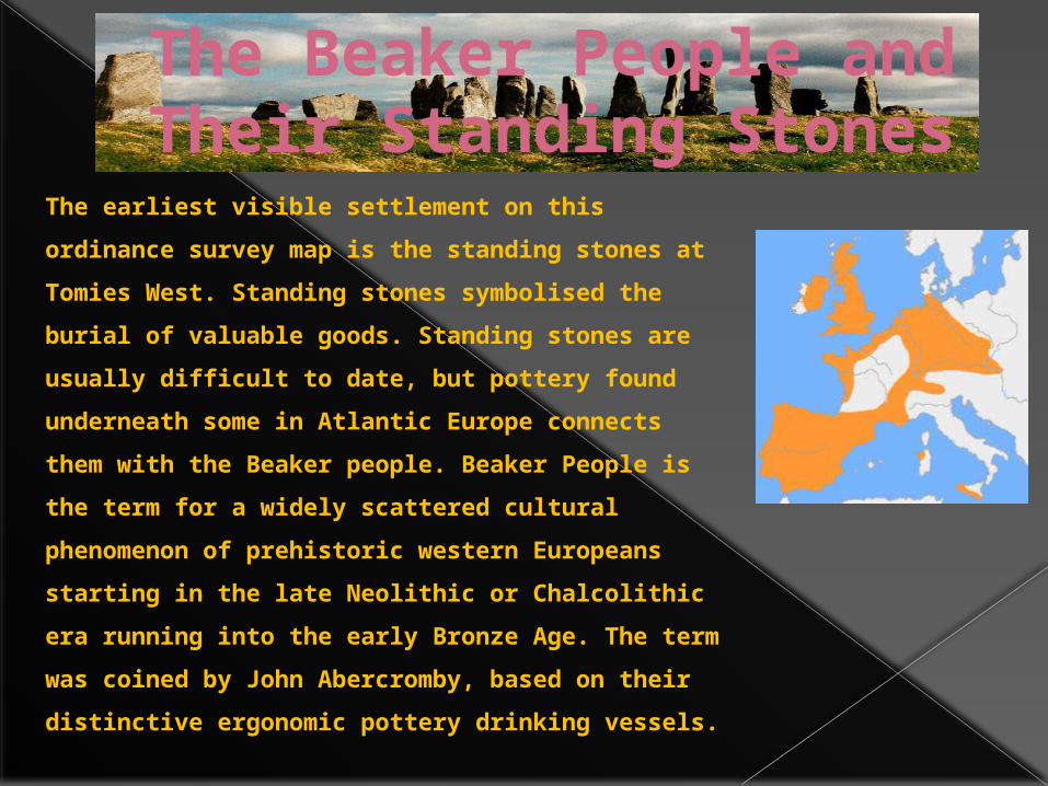
The Beaker People and Their Standing Stones
The earliest visible settlement on this ordinance survey
map is the standing stones at Tomies West. Standing
stones symbolised the burial of valuable goods.
Standing stones are usually difficult to date, but
pottery found underneath some in Atlantic Europe
connects them with the Beaker people. Beaker People is
the term for a widely scattered cultural phenomenon of
prehistoric western Europeans starting in the late
Neolithic or Chalcolithic era running into the early
Bronze Age. The term was coined by John
Abercromby, based on their distinctive ergonomic
pottery drinking vessels.
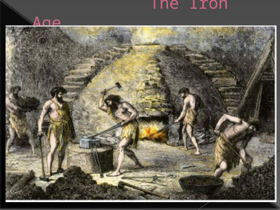
The Iron Age
The Iron Age in KillarneyThe map reader can see the presence of Ogham Stones in Dunloe Lower. Ogham stones were invented in the Iron Age. Ogham stones symbolised an Early Medieval alphabet used primarily to write the Old Irish language, and the Brythonic languages. Ogham is sometimes called the "Celtic Tree Alphabet", based on a high medieval Bríatharogam tradition of ascribing names of trees to the individual letters. There are roughly 400 surviving ogham inscriptions on stone monuments throughout Ireland and western Britain; the bulk of them are in the south of Ireland, in Counties Kerry, Cork and Waterford. The largest number outside of Ireland is in Pembrokeshire in Wales. The remainder are mostly in south-eastern Ireland, Scotland, Orkney Isles, the Isle of Man, and England around the Devon/Cornwall border. The vast majority of the inscriptions consist of personal names.
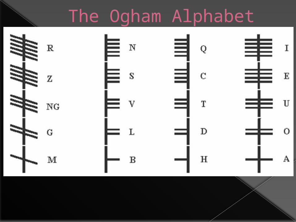
The Ogham Alphabet
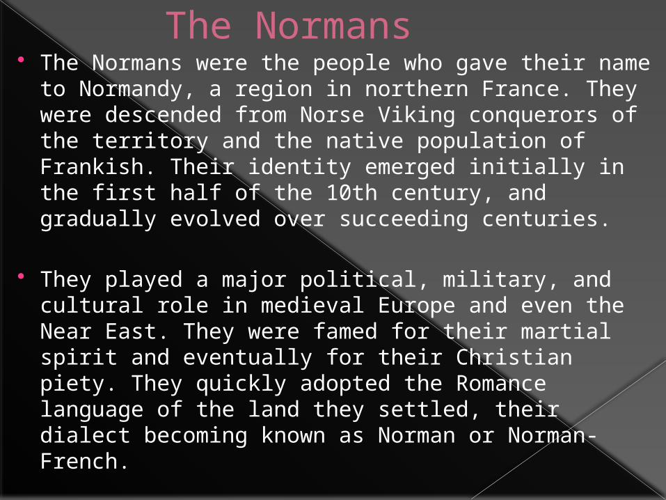
The Normans The Normans were the people who gave their name to
Normandy, a region in northern France. They were descended from Norse Viking conquerors of the territory and the native population of Frankish. Their identity emerged initially in the first half of the 10th century, and gradually evolved over succeeding centuries.
They played a major political, military, and cultural role in medieval Europe and even the Near East. They were famed for their martial spirit and eventually for their Christian piety. They quickly adopted the Romance language of the land they settled, their dialect becoming known as Norman or Norman-French.
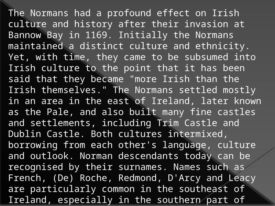
The Normans had a profound effect on Irish culture and history after their invasion at Bannow Bay in 1169. Initially the Normans maintained a distinct culture and ethnicity. Yet, with time, they came to be subsumed into Irish culture to the point that it has been said that they became "more Irish than the Irish themselves." The Normans settled mostly in an area in the east of Ireland, later known as the Pale, and also built many fine castles and settlements, including Trim Castle and Dublin Castle. Both cultures intermixed, borrowing from each other's language, culture and outlook. Norman descendants today can be recognised by their surnames. Names such as French, (De) Roche, Redmond, D'Arcy and Leacy are particularly common in the southeast of Ireland, especially in the southern part of County Wexford where the first Norman settlements were established. Other Norman names such as Furlong predominate there. Another common Norman-Irish name was Morell (Murrell) derived from the French Norman name Morel. Other names beginning with Fitz (from the Norman for son) indicate Norman ancestry. These included Fitzgerald, FitzGibbons (Gibbons) dynasty, and Fitzmaurice.

…..Next Stop Killarney…..


![Killarney Club Newsletter [March]](https://img.dokumen.tips/doc/110x75/568bcc161a28ab777e8f4af9/killarney-club-newsletter-march.jpg)

![Killarney Club Newsletter [February]](https://img.dokumen.tips/doc/110x75/568c47901a28ab49168e7225/killarney-club-newsletter-february.jpg)

