Embed Size (px)
Citation preview
WEATHER REPORTING MESSAGES MÉTÉOROLOGIQUES МЕТЕОРОЛОГИЧЕСКИЕ СООБЩЕНИЯ INFORMES METEOROLOGICOS
VOLUME/TOM/VOLUMEN D
INFORMATION FOR SHIPPING RENSEIGNEMENTS POUR LA NAVIGATION MARITIME CATALOGUE DES BULLETINS MÉTÉOROLOGIQUES МЕТЕОРОЛОГИЧЕСКИЕ СООБЩЕНИЯ ИHФOPMAЦИЯ ДЛЯ CYДOXOДCTBA INFORMACIÓN PARA LA NAVEGACIÓN MARÍTIMA
2014 Edition (with amendments 29 May 2018)
World Meteorological Organization Organisation météorologique mondiale
Всемирная Метеорологическая Организация Organización Meteorológica Mundial
WMO/OMM/BMO No. 9
Weather Climate Water

WEATHER REPORTING MESSAGES MÉTÉOROLOGIQUES МЕТЕОРОЛОГИЧЕСКИЕ СООБЩЕНИЯ INFORMES METEOROLOGICOS
VOLUME/TOM/VOLUMEN D
INFORMATION FOR SHIPPING RENSEIGNEMENTS POUR LA NAVIGATION MARITIME CATALOGUE DES BULLETINS MÉTÉOROLOGIQUES МЕТЕОРОЛОГИЧЕСКИЕ СООБЩЕНИЯ ИHФOPMAЦИЯ ДЛЯ CYДOXOДCTBA INFORMACIÓN PARA LA NAVEGACIÓN MARÍTIMA
World Meteorological Organization Organisation météorologique mondiale
Всемирная Метеорологическая Организация Organización Meteorológica Mundial
WMO/OMM/BMO No. 9
COPYRIGHT
© World Meteorological Organization
The right of publication in print, electronic and any other form and in any language is reserved by WMO. Short extracts from WMO publications may be reproduced without authorization, provided that the complete source is clearly indicated. Editorial correspondence and requests to publish, reproduce or translate this publication in part or in whole should be addressed to:
Chairperson, Publications Board World Meteorological Organization (WMO) 7 bis, avenue de la Paix P.O. Box No. 2300 CH-1211 Geneva 2, Switzerland
Tel.: +41 (0) 22 730 84 03Fax: +41 (0) 22 730 80 40E-mail: [email protected]
NOTE: The designations employed in WMO publications and the presentation of material in this publication do not imply the expression of any opinion whatsoever on the part of the Secretariat of WMO concerning the legal status of any country, territory, city or area, or of its authorities, or concerning the delimitation of its frontiers or boundaries. Opinions expressed in WMO publications are those of the authors and do not necessarily reflect those of WMO.
The mention of specific companies or products does not imply that they are endorsed or recommended by WMO in preference to others of a similar nature which are not mentioned or advertised."
© Organisation météorologique mondiale
L’OMM se réserve le droit de publication en version imprimée ou électronique ou sous toute autre forme et dans n’importe quelle langue. De courts extraits des publications de l’OMM peuvent être reproduits sans autorisation, pour autant que la source complète soit clairement indiquée. La correspondance relative au contenu rédactionnel et les demandes de publication, reproduction ou traduction partielle ou totale de la présente publication doivent être adressées au:
Président du Comité des publications Organisation météorologique mondiale (OMM) 7 bis, avenue de la Paix Case postale 2300 CH-1211 Genève 2, Suisse
Tél.: +41 (0) 22 730 84 03Fax: +41 (0) 22 730 80 40Courriel: [email protected]
NOTE: Les appellations employées dans les publications de l’OMM et la présentation des données qui y figurent n’impliquent, de la part du Secrétariat de l’Organisation météorologique mondiale, aucune prise de position quant au statut juridique des pays, territoires, villes ou zones, ou de leurs autorités, ni quant au tracé de leurs frontières ou limites.
Les opinions exprimées dans les publications de l’OMM sont celles de leurs auteurs et ne reflètent pas nécessairement celles de l’OMM. De plus, la mention de certaines sociétés ou de certains produits ne signifie pas que l’OMM les cautionne ou les recommande de préférence à d’autres sociétés ou produits de nature similaire dont il n’est pas fait mention ou qui ne font l’objet d’aucune publicité.
© Всемирная Метеорологическая Организация
Право на опубликование в печатной, электронной или какой-либо иной форме на каком-либо языке сохраняется за ВМО. Небольшие выдержки из публикаций ВМО могут воспроизводиться без разрешения при условии четкого указания источника в полном объеме. Корреспонденция редакционного характера и запросы в отношении частичного или полного опубликования, воспроизведения или перевода настоящей публикации (статей) следует направлять по адресу:
Chairperson, Publications Board World Meteorological Organization (WMO) 7 bis, avenue de la Paix P.O. Box No. 2300 CH-1211 Geneva 2, Switzerland
Teл.: +41 (0) 22 730 84 03Факс: +41 (0) 22 730 80 40Э-почта: [email protected]
ПРИМЕЧАНИЕ Обозначения, употребляемые в публикациях ВМО, а также изложение материала в настоящей публикации не означают выражения со стороны Секретариата ВМО какого бы то ни было мнения в отношении правового статуса какой-либо страны, территории, города или района или их властей, а также в отношении делимитации их границ или ырубежей.
Мнения, выраженные в публикациях ВМО, принадлежат авторам и не обязательно отражают точку зрения ВМО. Упоминание отдельных компаний или какой-либо продукции не означает, что они одобрены или рекомендованы ВМО и что им отдается предпочтение перед другими аналогичными, но не упомянутыми или не прорекламированными компаниями или продукцией.
© Organización Meteorológica Mundial
La OMM se reserva el derecho de publicación en forma impresa, electrónica o de otro tipo y en cualquier idioma. Pueden reproducirse pasajes breves de las publicaciones de la OMM sin autorización siempre que se indique claramente la fuente completa. La correspondencia editorial, así como todas las solicitudes para publicar, reproducir o traducir la presente publicación (o artículos) parcial o totalmente deberán dirigirse al:
Director de la Junta de publicaciones Organización Meteorológica Mundial (OMM) 7 bis, avenue de la Paix Case postale 2300 CH-1211 Ginebra 2, Suiza
Tél.: +41 (0) 22 730 84 03Fax: +41 (0) 22 730 80 40Correo electrónico: [email protected]
NOTA: Las denominaciones empleadas en las publicaciones de la OMM y la forma en que aparecen presentados los datos que contienen no entrañan, de parte de la Secretaría de la Organización, juicio alguno sobre la condición jurídica de ninguno de los países, territorios, ciudades o zonas citados o de sus autoridades, ni respecto de la delimitación de sus fronteras o límites.
Las opiniones expresadas en las publicaciones de la OMM son las de los autores y no reflejan necesariamente las de la Organización. La mención de determinados productos o sociedades mercantiles no implica que la OMM los favorezca o recomiende con preferencia a otros análogos que no semencionan ni se anuncian.
No. 9 - Volume D ¦ Page i
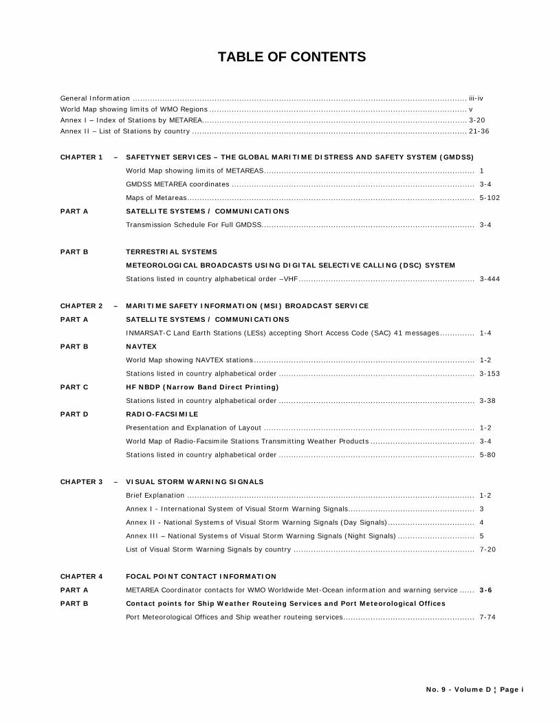
TABLE OF CONTENTS
General Information ....................................................................................................................................... iii-iv World Map showing limits of WMO Regions ........................................................................................................ v Annex I – Index of Stations by METAREA ........................................................................................................... 3-20 Annex II – List of Stations by country ............................................................................................................... 21-36
CHAPTER 1 – SAFETYNET SERVICES – THE GLOBAL MARITIME DISTRESS AND SAFETY SYSTEM (GMDSS)
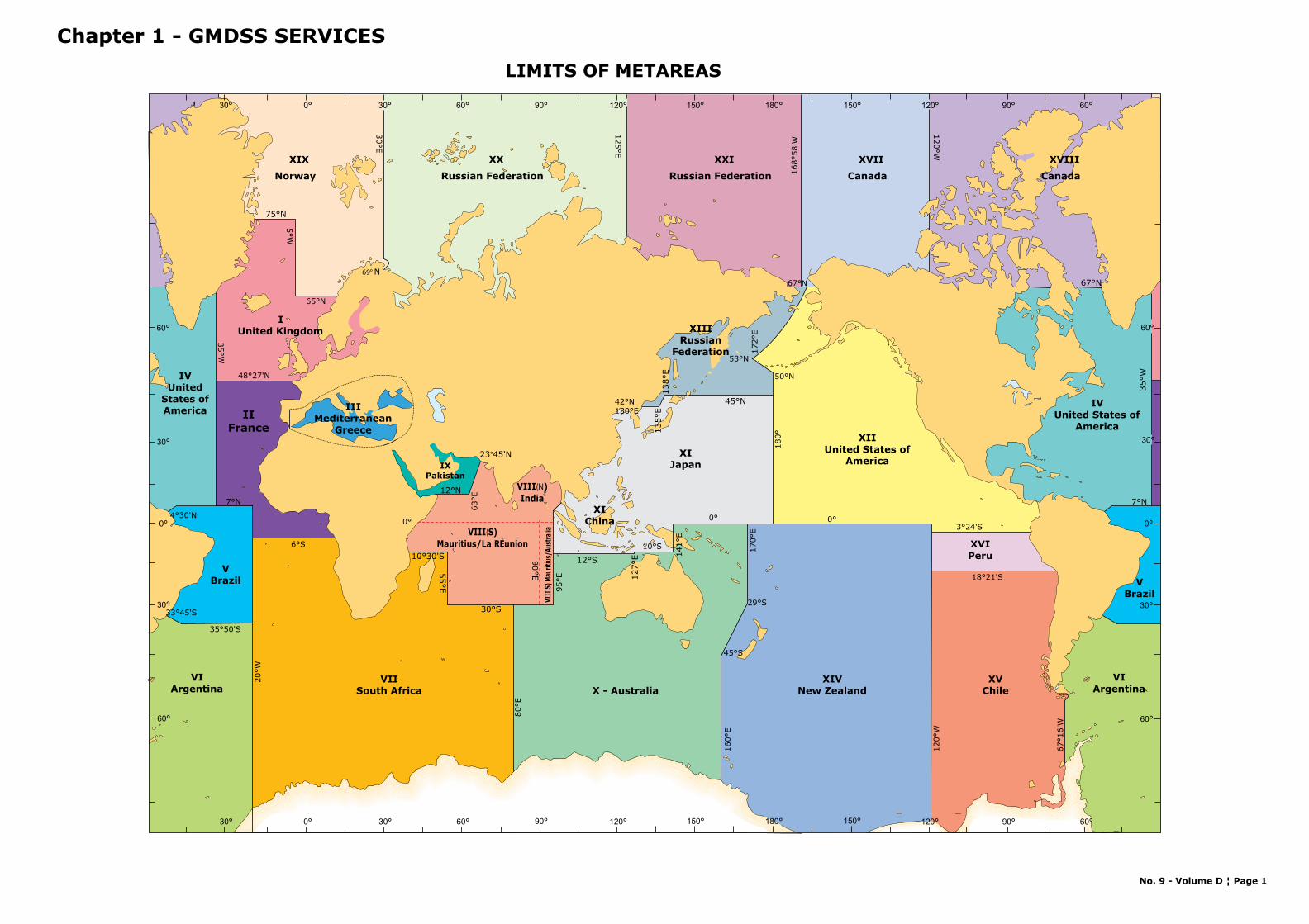
World Map showing limits of METAREAS ..................................................................................... 1
GMDSS METAREA coordinates .................................................................................................. 3-4
Maps of Metareas .................................................................................................................... 5-102
PART A SATELLITE SYSTEMS / COMMUNICATIONS
Transmission Schedule For Full GMDSS ...................................................................................... 3-4
PART B TERRESTRIAL SYSTEMS
METEOROLOGICAL BROADCASTS USING DIGITAL SELECTIVE CALLING (DSC) SYSTEM
Stations listed in country alphabetical order –VHF ....................................................................... 3-444
CHAPTER 2 – MARITIME SAFETY INFORMATION (MSI) BROADCAST SERVICE
PART A SATELLITE SYSTEMS / COMMUNICATIONS
INMARSAT-C Land Earth Stations (LESs) accepting Short Access Code (SAC) 41 messages .............. 1-4
PART B NAVTEX
World Map showing NAVTEX stations ......................................................................................... 1-2
Stations listed in country alphabetical order ............................................................................... 3-153
PART C HF NBDP (Narrow Band Direct Printing)
Stations listed in country alphabetical order ............................................................................... 3-38
PART D RADIO-FACSIMILE
Presentation and Explanation of Layout ..................................................................................... 1-2
World Map of Radio-Facsimile Stations Transmitting Weather Products .......................................... 3-4
Stations listed in country alphabetical order ............................................................................... 5-80
CHAPTER 3 – VISUAL STORM WARNING SIGNALS
Brief Explanation .................................................................................................................... 1-2
Annex I - International System of Visual Storm Warning Signals ................................................... 3
Annex II - National Systems of Visual Storm Warning Signals (Day Signals) ................................... 4
Annex III – National Systems of Visual Storm Warning Signals (Night Signals) ............................... 5
List of Visual Storm Warning Signals by country ......................................................................... 7-20
CHAPTER 4 FOCAL POINT CONTACT INFORMATION
PART A METAREA Coordinator contacts for WMO Worldwide Met-Ocean information and warning service ...... 3-6
PART B Contact points for Ship Weather Routeing Services and Port Meteorological Offices
Port Meteorological Offices and Ship weather routeing services ..................................................... 7-74

No. 9 - Volume D ¦ Page iii
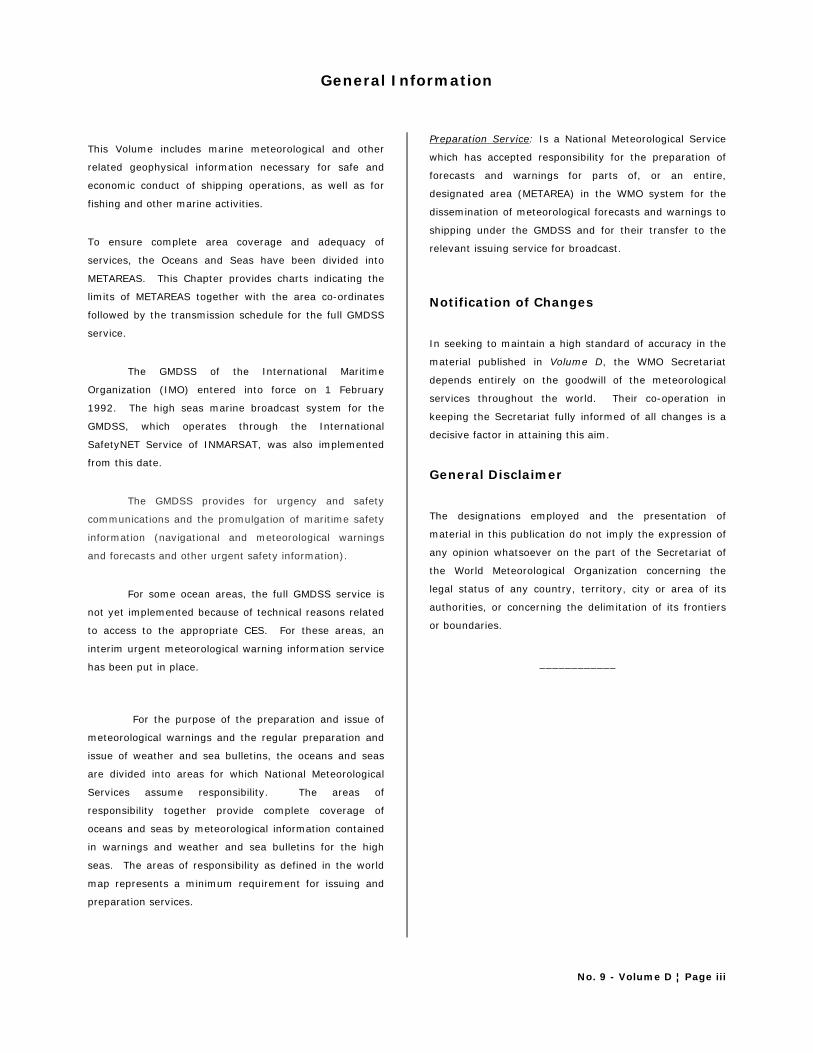
General Information
This Volume includes marine meteorological and other
related geophysical information necessary for safe and
economic conduct of shipping operations, as well as for
fishing and other marine activities.
To ensure complete area coverage and adequacy of
services, the Oceans and Seas have been divided into
METAREAS. This Chapter provides charts indicating the
limits of METAREAS together with the area co-ordinates
followed by the transmission schedule for the full GMDSS
service.
The GMDSS of the International Maritime
Organization (IMO) entered into force on 1 February
1992. The high seas marine broadcast system for the
GMDSS, which operates through the International
SafetyNET Service of INMARSAT, was also implemented
from this date.
The GMDSS provides for urgency and safety
communications and the promulgation of maritime safety
information (navigational and meteorological warnings
and forecasts and other urgent safety information).
For some ocean areas, the full GMDSS service is
not yet implemented because of technical reasons related
to access to the appropriate CES. For these areas, an
interim urgent meteorological warning information service
has been put in place.
For the purpose of the preparation and issue of
meteorological warnings and the regular preparation and
issue of weather and sea bulletins, the oceans and seas
are divided into areas for which National Meteorological
Services assume responsibility. The areas of
responsibility together provide complete coverage of
oceans and seas by meteorological information contained
in warnings and weather and sea bulletins for the high
seas. The areas of responsibility as defined in the world
map represents a minimum requirement for issuing and
preparation services.
Preparation Service: Is a National Meteorological Service
which has accepted responsibility for the preparation of
forecasts and warnings for parts of, or an entire,
designated area (METAREA) in the WMO system for the
dissemination of meteorological forecasts and warnings to
shipping under the GMDSS and for their transfer to the
relevant issuing service for broadcast.
Notification of Changes
In seeking to maintain a high standard of accuracy in the
material published in Volume D, the WMO Secretariat
depends entirely on the goodwill of the meteorological
services throughout the world. Their co-operation in
keeping the Secretariat fully informed of all changes is a
decisive factor in attaining this aim.
General Disclaimer
The designations employed and the presentation of
material in this publication do not imply the expression of
any opinion whatsoever on the part of the Secretariat of
the World Meteorological Organization concerning the
legal status of any country, territory, city or area of its
authorities, or concerning the delimitation of its frontiers
or boundaries.
____________

0 20 40 60 80 100 120 140 160 18020406080120 100140160
0
20
40
60
80
20
40
60
0
20
40
60
80
20
40
60
0 20 40 60 80 100 120 140 160 18020406080120 100140160
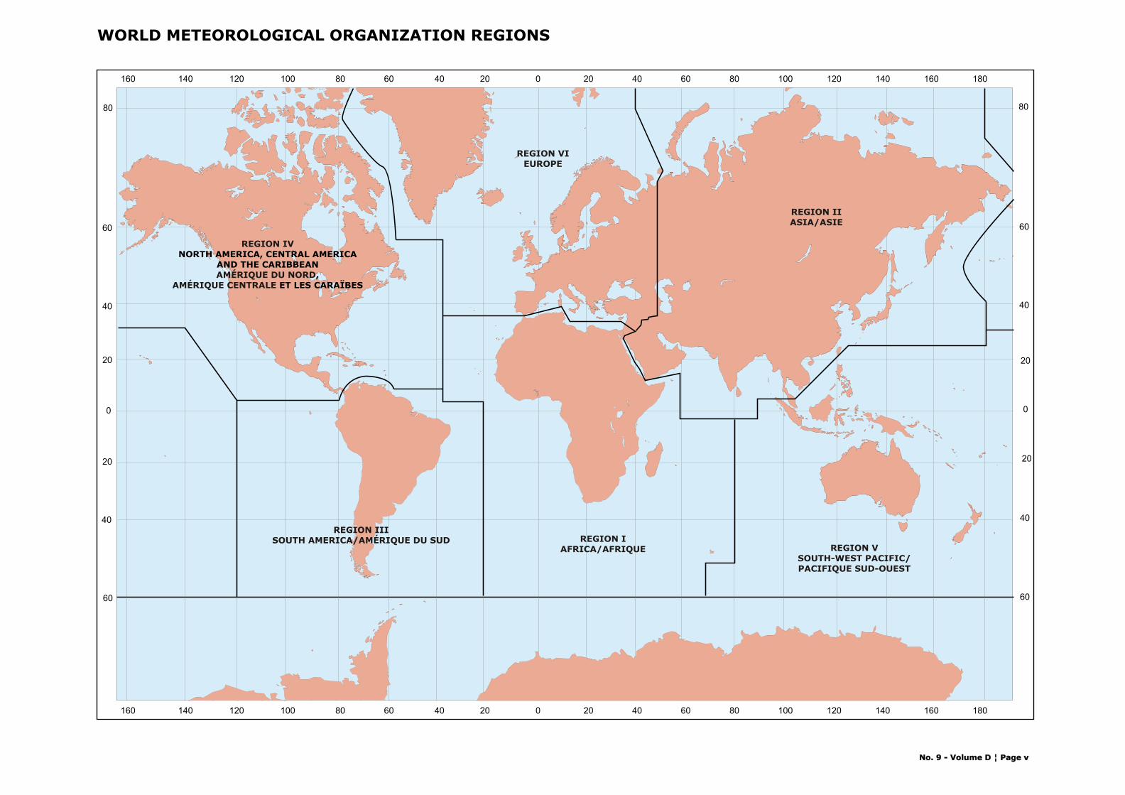
REGION IAFRICA/AFRIQUE
REGION IIISOUTH AMERICA/AMÉRIQUE DU SUD
REGION VIEUROPE
REGION IIASIA/ASIE
REGION VSOUTH-WEST PACIFIC/PACIFIQUE SUD-OUEST
WORLD METEOROLOGICAL ORGANIZATION REGIONS
REGION IV
AMÉRIQUE DU NORDAMÉRIQUE CENTRALE
NORTH AMERICA, CENTRAL AMERICAAND THE CARIBBEAN
, ET LES CARAÏBES
No. 9 - Volume D ¦ Page vNo. 9 - Volume D ¦ Page v
ANNEX I
INDEX OF STATIONS BY METAREA
ANNEX II
INDEX OF STATIONS BY COUNTRY

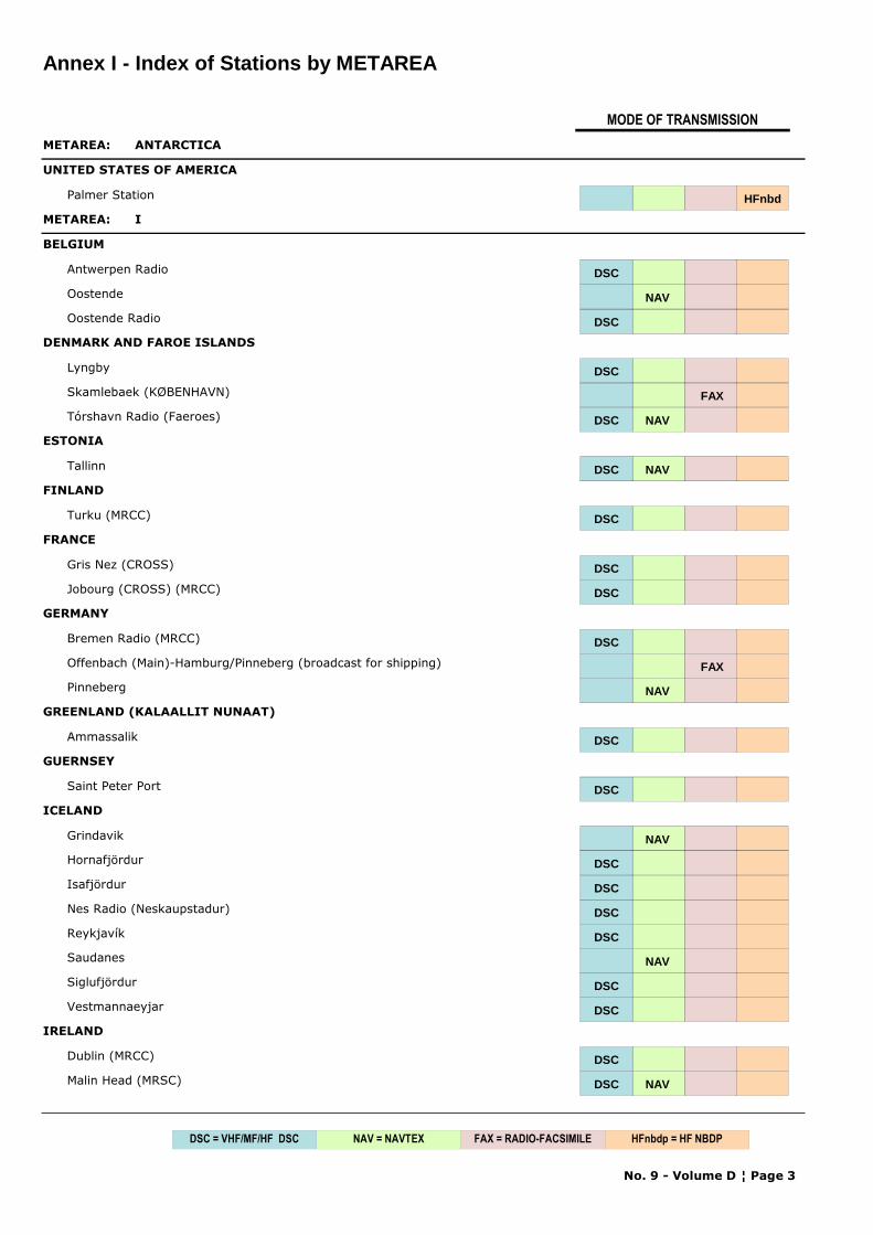
Annex I - Index of Stations by METAREA
MODE OF TRANSMISSION
METAREA: ANTARCTICA
UNITED STATES OF AMERICA
Palmer Station HFnbd
METAREA: I
BELGIUM
Antwerpen Radio DSC
Oostende NAV
Oostende Radio DSC
DENMARK AND FAROE ISLANDS
Lyngby DSC
Skamlebaek (KØBENHAVN) FAX
Tórshavn Radio (Faeroes) DSC NAV
ESTONIA
Tallinn DSC NAV
FINLAND
Turku (MRCC) DSC
FRANCE
Gris Nez (CROSS) DSC
Jobourg (CROSS) (MRCC) DSC
GERMANY
Bremen Radio (MRCC) DSC
Offenbach (Main)-Hamburg/Pinneberg (broadcast for shipping) FAX
Pinneberg NAV
GREENLAND (KALAALLIT NUNAAT)
Ammassalik DSC
GUERNSEY
Saint Peter Port DSC
ICELAND
Grindavik NAV
Hornafjördur DSC
Isafjördur DSC
Nes Radio (Neskaupstadur) DSC
Reykjavík DSC
Saudanes NAV
Siglufjördur DSC
Vestmannaeyjar DSC
IRELAND
Dublin (MRCC) DSC
Malin Head (MRSC) DSC NAV
No. 9 - Volume D ¦ Page 3
NAV = NAVTEX FAX = RADIO-FACSIMILEDSC = VHF/MF/HF DSC HFnbdp = HF NBDP
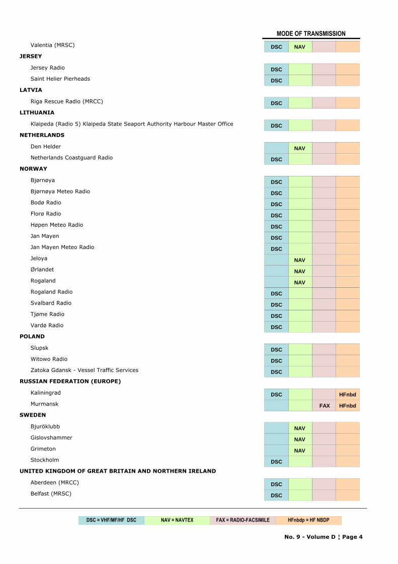
MODE OF TRANSMISSION
Valentia (MRSC) DSC NAV
JERSEY
Jersey Radio DSC
Saint Helier Pierheads DSCDSC
LATVIA
Riga Rescue Radio (MRCC) DSC
LITHUANIA
Klaipeda (Radio 5) Klaipeda State Seaport Authority Harbour Master Office DSC
NETHERLANDS
Den Helder NAV
Netherlands Coastguard Radio DSC
NORWAY
Bjørnøya DSC
Bjørnøya Meteo Radio DSC
Bodø Radio DSC
Florø Radio DSC
Høpen Meteo Radio DSC
Jan Mayen DSC
Jan Mayen Meteo Radio DSC
Jeloya NAV
Ørlandet NAV
Rogaland NAV
Rogaland Radio DSC
Svalbard Radio DSC
Tjøme Radio DSC
Vardø Radio DSC
POLAND
Slupsk DSC
Witowo Radio DSC
Zatoka Gdansk - Vessel Traffic Services DSC
RUSSIAN FEDERATION (EUROPE)
Kaliningrad DSC HFnbd
Murmansk FAX HFnbd
SWEDEN
Bjuröklubb NAV
Gislovshammer NAV
Grimeton NAV
Stockholm DSC
UNITED KINGDOM OF GREAT BRITAIN AND NORTHERN IRELAND
Aberdeen (MRCC) DSC
Belfast (MRSC) DSC
No. 9 - Volume D ¦ Page 4
NAV = NAVTEX FAX = RADIO-FACSIMILEDSC = VHF/MF/HF DSC HFnbdp = HF NBDP
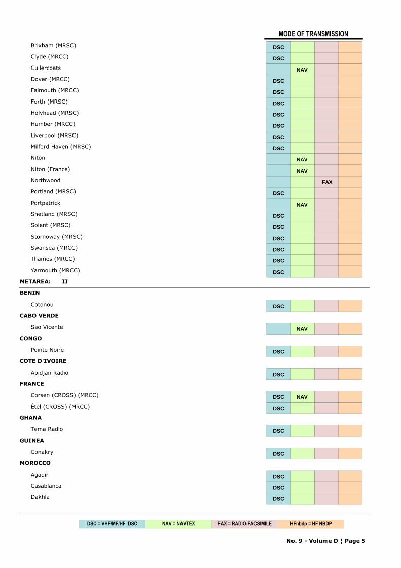
MODE OF TRANSMISSION
Brixham (MRSC) DSC
Clyde (MRCC) DSC
Cullercoats NAV
Dover (MRCC) DSC
Falmouth (MRCC) DSC
Forth (MRSC) DSC
Holyhead (MRSC) DSC
Humber (MRCC) DSC
Liverpool (MRSC) DSC
Milford Haven (MRSC) DSC
Niton NAV
Niton (France) NAV
Northwood FAX
Portland (MRSC) DSC
Portpatrick NAV
Shetland (MRSC) DSC
Solent (MRSC) DSC
Stornoway (MRSC) DSC
Swansea (MRCC) DSC
Thames (MRCC) DSC
Yarmouth (MRCC) DSC
METAREA: II
BENIN
Cotonou DSC
CABO VERDE
Sao Vicente NAV
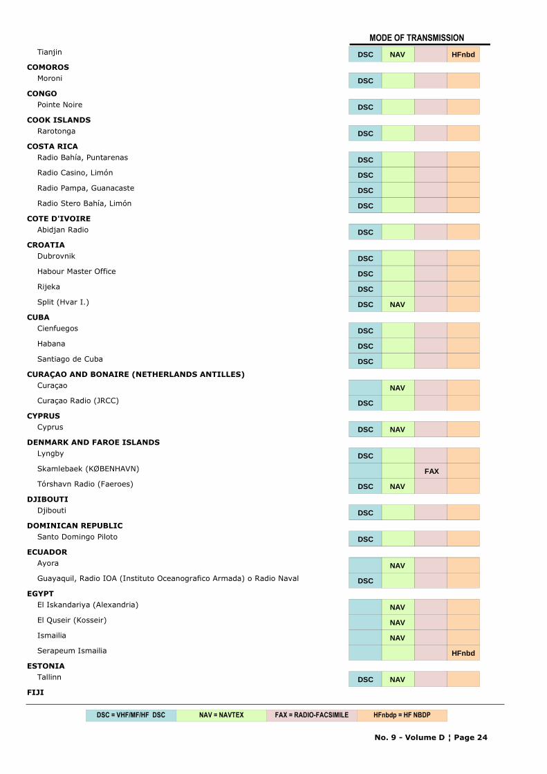
CONGO
Pointe Noire DSC
COTE D'IVOIRE
Abidjan Radio DSC
FRANCE
Corsen (CROSS) (MRCC) DSC NAV
Étel (CROSS) (MRCC) DSC
GHANA
Tema Radio DSC
GUINEA
Conakry DSC
MOROCCO
Agadir DSC
Casablanca DSC
Dakhla DSC
No. 9 - Volume D ¦ Page 5
NAV = NAVTEX FAX = RADIO-FACSIMILEDSC = VHF/MF/HF DSC HFnbdp = HF NBDP
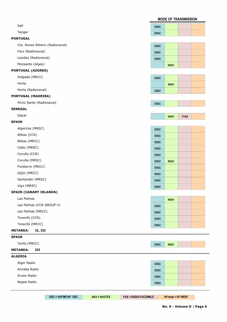
MODE OF TRANSMISSION
Safi DSC
Tanger DSC
PORTUGAL
Cte. Nunes Ribeiro (Radionaval) DSC
Faro (Radionaval) DSC
Leixões (Radionaval) DSC
Monsanto (Alges) NAV
PORTUGAL (AZORES)
Delgada (MRCC) DSC
Horta NAV
Horta (Radionaval) DSC
PORTUGAL (MADEIRA)
Porto Santo (Radionaval) DSC
SENEGAL
Dakar NAV FAX
SPAIN
Algeciras (MRSC) DSC
Bilbao (CCR) DSC
Bilbao (MRCC) DSC
Cádiz (MRSC) DSC
Coruña (CCR) DSC
Coruña (MRSC) DSC NAV
Finisterre (MRCC) DSC
Gijón (MRCC) DSC
Santander (MRSC) DSC
Vigo (MRSC) DSC
SPAIN (CANARY ISLANDS)
Las Palmas NAV
Las Palmas (CCR GROUP V) DSC
Las Palmas (MRCC) DSC
Tenerife (CCR) DSC
Tenerife (MRCC) DSC
METAREA: II, III
SPAIN
Tarifa (MRCC) DSC NAV
METAREA: III
ALGERIA
Alger Radio DSC
Annaba Radio DSC
Arzew Radio DSC
Bejaia Radio DSC
No. 9 - Volume D ¦ Page 6
NAV = NAVTEX FAX = RADIO-FACSIMILEDSC = VHF/MF/HF DSC HFnbdp = HF NBDP
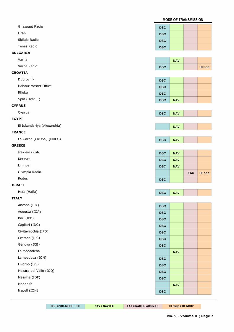
MODE OF TRANSMISSION
Ghazouet Radio DSC
Oran DSC
Skikda Radio DSC
Tenes Radio DSC
BULGARIA
Varna NAV
Varna Radio DSC HFnbd
CROATIA
Dubrovnik DSC
Habour Master Office DSC
Rijeka DSC
Split (Hvar I.) DSC NAV
CYPRUS
Cyprus DSC NAV
EGYPT
El Iskandariya (Alexandria) NAV
FRANCE
La Garde (CROSS) (MRCC) DSC NAV
GREECE
Irakleio (Kriti) DSC NAV
Kerkyra DSC NAV
Limnos DSC NAV
Olympia Radio FAX HFnbd
Rodos DSC
ISRAEL
Hefa (Haifa) DSC NAV
ITALY
Ancona (IPA) DSC
Augusta (IQA) DSC
Bari (IPB) DSC
Cagliari (IDC) DSC
Civitavecchia (IPD) DSC
Crotone (IPC) DSC
Genova (ICB) DSC
La Maddalena NAV
Lampedusa (IQN) DSC
Livorno (IPL) DSC
Mazara del Vallo (IQQ) DSC
Messina (IDF) DSC
Mondolfo NAV
Napoli (IQH) DSC
No. 9 - Volume D ¦ Page 7
NAV = NAVTEX FAX = RADIO-FACSIMILEDSC = VHF/MF/HF DSC HFnbdp = HF NBDP
MODE OF TRANSMISSION
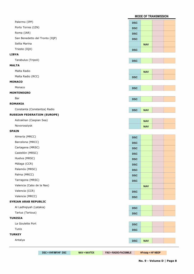
Palermo (IPP) DSC
Porto Torres (IZN) DSC
Roma (IAR) DSC
San Benedetto del Tronto (IQP) DSC
Sellia Marina NAV
Trieste (IQX) DSC
LIBYA
Tarabulus (Tripoli) DSC
MALTA
Malta Radio NAV
Malta Radio (RCC) DSC
MONACO
Monaco DSC
MONTENEGRO
Bar DSC
ROMANIA
Constanta (Constantza) Radio DSC NAV
RUSSIAN FEDERATION (EUROPE)
Astrakhan (Caspian Sea) NAV
Novorossiysk NAV
SPAIN
Almería (MRCC) DSC
Barcelona (MRCC) DSC
Cartagena (MRSC) DSC
Castellón (MRSC) DSC
Huelva (MRSC) DSC
Málaga (CCR) DSC
Palamós (MRSC) DSC
Palma (MRCC) DSC
Tarragona (MRSC) DSC
Valencia (Cabo de la Nao) NAV
Valencia (CCR) DSC
Valencia (MRCC) DSC
SYRIAN ARAB REPUBLIC
Al Ladhiqiyah (Latakia) DSC
Tartus (Tartous) DSC
TUNISIA
La Goulette Port DSC
Tunis DSC
TURKEY
Antalya DSC NAV
No. 9 - Volume D ¦ Page 8
NAV = NAVTEX FAX = RADIO-FACSIMILEDSC = VHF/MF/HF DSC HFnbdp = HF NBDP
MODE OF TRANSMISSION
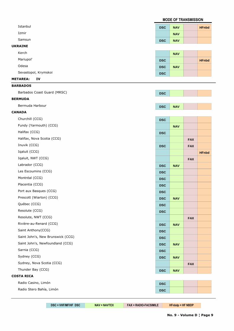
Istanbul DSC NAV HFnbd
Izmir NAV
Samsun DSC NAV
UKRAINE
Kerch NAV
Mariupol' DSC HFnbd
Odesa DSC NAV
Sevastopol, Krymskoi DSC
METAREA: IV
BARBADOS
Barbados Coast Guard (MRSC) DSC
BERMUDA
Bermuda Harbour DSC NAV
CANADA
Churchill (CCG) DSC
Fundy (Yarmouth) (CCG) NAV
Halifax (CCG) DSC
Halifax, Nova Scotia (CCG) FAX
Inuvik (CCG) DSC FAX
Iqaluit (CCG) HFnbd
Iqaluit, NWT (CCG) FAX
Labrador (CCG) DSC NAV
Les Escoumins (CCG) DSC
Montréal (CCG) DSC
Placentia (CCG) DSC
Port aux Basques (CCG) DSC
Prescott (Wiarton) (CCG) DSC NAV
Québec (CCG) DSC
Resolute (CCG) DSC
Resolute, NWT (CCG) FAX
Rivière-au-Renard (CCG) DSC NAV
Saint Anthony(CCG) DSC
Saint John's, New Brunswick (CCG) DSC
Saint John's, Newfoundland (CCG) DSC NAV
Sarnia (CCG) DSC
Sydney (CCG) DSC NAV
Sydney, Nova Scotia (CCG) FAX
Thunder Bay (CCG) DSC NAV
COSTA RICA
Radio Casino, Limón DSC
Radio Stero Bahía, Limón DSC
No. 9 - Volume D ¦ Page 9
NAV = NAVTEX FAX = RADIO-FACSIMILEDSC = VHF/MF/HF DSC HFnbdp = HF NBDP
MODE OF TRANSMISSION
CUBA
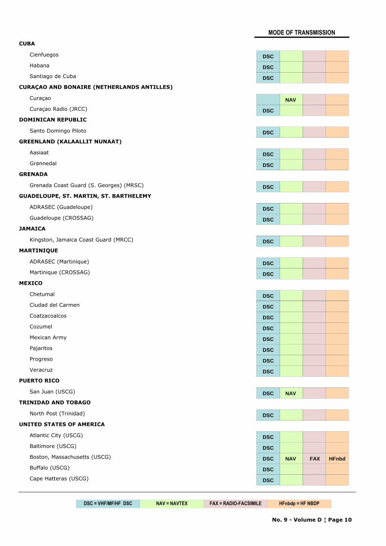
Cienfuegos DSC
Habana DSC
Santiago de Cuba DSC
CURAÇAO AND BONAIRE (NETHERLANDS ANTILLES)
Curaçao NAV
Curaçao Radio (JRCC) DSC
DOMINICAN REPUBLIC
Santo Domingo Piloto DSC
GREENLAND (KALAALLIT NUNAAT)
Aasiaat DSC
Grønnedal DSC
GRENADA
Grenada Coast Guard (S. Georges) (MRSC) DSC
GUADELOUPE, ST. MARTIN, ST. BARTHELEMY
ADRASEC (Guadeloupe) DSC
Guadeloupe (CROSSAG) DSC
JAMAICA
Kingston, Jamaica Coast Guard (MRCC) DSC
MARTINIQUE
ADRASEC (Martinique) DSC
Martinique (CROSSAG) DSC
MEXICO
Chetumal DSC
Ciudad del Carmen DSC
Coatzacoalcos DSC
Cozumel DSC
Mexican Army DSC
Pajaritos DSC
Progreso DSC
Veracruz DSC
PUERTO RICO
San Juan (USCG) DSC NAV
TRINIDAD AND TOBAGO
North Post (Trinidad) DSC
UNITED STATES OF AMERICA
Atlantic City (USCG) DSC
Baltimore (USCG) DSC
Boston, Massachusetts (USCG) DSC NAV FAX HFnbd
Buffalo (USCG) DSC
Cape Hatteras (USCG) DSC
No. 9 - Volume D ¦ Page 10
NAV = NAVTEX FAX = RADIO-FACSIMILEDSC = VHF/MF/HF DSC HFnbdp = HF NBDP
MODE OF TRANSMISSION
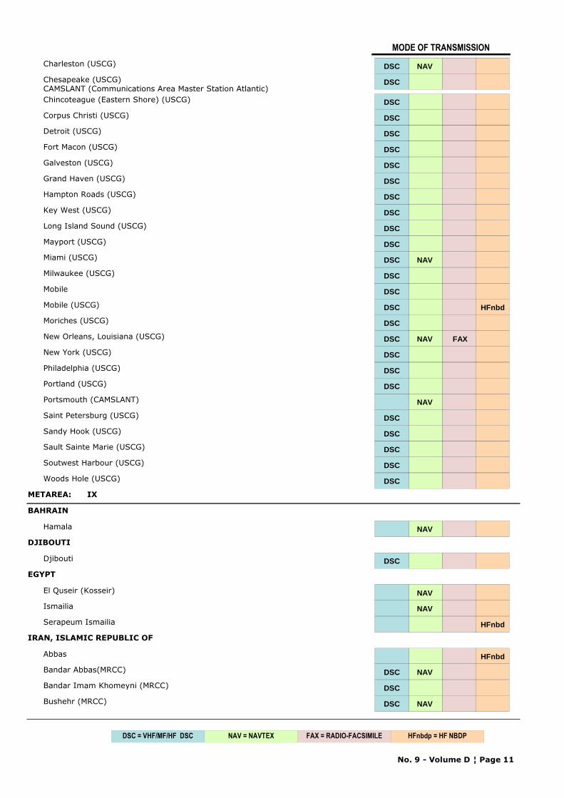
Charleston (USCG) DSC NAV
Chesapeake (USCG)CAMSLANT (Communications Area Master Station Atlantic)
DSC
Chincoteague (Eastern Shore) (USCG) DSC
Corpus Christi (USCG) DSC
Detroit (USCG) DSC
Fort Macon (USCG) DSC
Galveston (USCG) DSC
Grand Haven (USCG) DSC
Hampton Roads (USCG) DSC
Key West (USCG) DSC
Long Island Sound (USCG) DSC
Mayport (USCG) DSC
Miami (USCG) DSC NAV
Milwaukee (USCG) DSC
Mobile DSC
Mobile (USCG) DSC HFnbd
Moriches (USCG) DSC
New Orleans, Louisiana (USCG) DSC NAV FAX
New York (USCG) DSC
Philadelphia (USCG) DSC
Portland (USCG) DSC
Portsmouth (CAMSLANT) NAV
Saint Petersburg (USCG) DSC
Sandy Hook (USCG) DSC
Sault Sainte Marie (USCG) DSC
Soutwest Harbour (USCG) DSC
Woods Hole (USCG) DSC
METAREA: IX
BAHRAIN
Hamala NAV
DJIBOUTI
Djibouti DSC
EGYPT
El Quseir (Kosseir) NAV
Ismailia NAV
Serapeum Ismailia HFnbd
IRAN, ISLAMIC REPUBLIC OF
Abbas HFnbd
Bandar Abbas(MRCC) DSC NAV
Bandar Imam Khomeyni (MRCC) DSC
Bushehr (MRCC) DSC NAV
No. 9 - Volume D ¦ Page 11
NAV = NAVTEX FAX = RADIO-FACSIMILEDSC = VHF/MF/HF DSC HFnbdp = HF NBDP
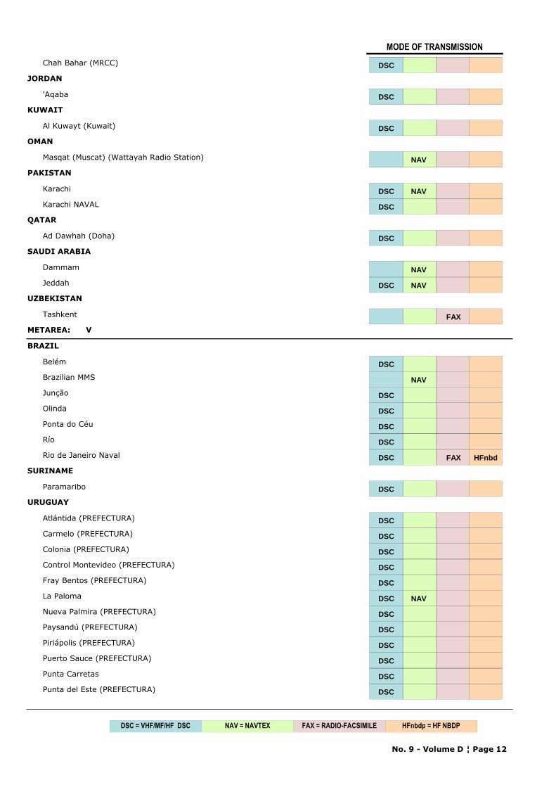
MODE OF TRANSMISSION
Chah Bahar (MRCC) DSC
JORDAN
'Aqaba DSC
KUWAIT
Al Kuwayt (Kuwait) DSC
OMAN
Masqat (Muscat) (Wattayah Radio Station) NAV
PAKISTAN
Karachi DSC NAV
Karachi NAVAL DSC
QATAR
Ad Dawhah (Doha) DSC
SAUDI ARABIA
Dammam NAV
Jeddah DSC NAV
UZBEKISTAN
Tashkent FAX
METAREA: V
BRAZIL
Belém DSC
Brazilian MMS NAV
Junção DSC
Olinda DSC
Ponta do Céu DSC
Río DSC
Rio de Janeiro Naval DSC FAX HFnbd
SURINAME
Paramaribo DSC
URUGUAY
Atlántida (PREFECTURA) DSC
Carmelo (PREFECTURA) DSC
Colonia (PREFECTURA) DSC
Control Montevideo (PREFECTURA) DSC
Fray Bentos (PREFECTURA) DSC
La Paloma DSC NAV
Nueva Palmira (PREFECTURA) DSC
Paysandú (PREFECTURA) DSC
Piriápolis (PREFECTURA) DSC
Puerto Sauce (PREFECTURA) DSC
Punta Carretas DSC
Punta del Este (PREFECTURA) DSC
No. 9 - Volume D ¦ Page 12
NAV = NAVTEX FAX = RADIO-FACSIMILEDSC = VHF/MF/HF DSC HFnbdp = HF NBDP
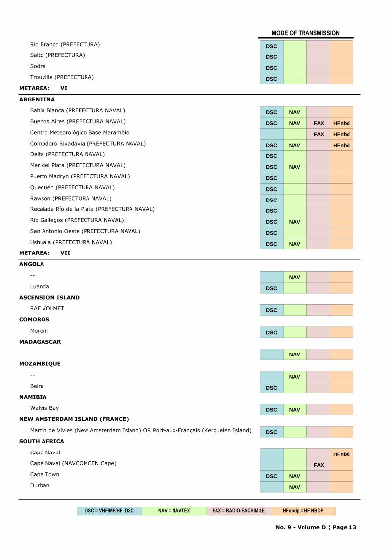
MODE OF TRANSMISSION
Rio Branco (PREFECTURA) DSC
Salto (PREFECTURA) DSC
Sodre DSC
Trouville (PREFECTURA) DSC
METAREA: VI
ARGENTINA
Bahía Blanca (PREFECTURA NAVAL) DSC NAV
Buenos Aires (PREFECTURA NAVAL) DSC NAV FAX HFnbd
Centro Meteorológico Base Marambio FAX HFnbd
Comodoro Rivadavia (PREFECTURA NAVAL) DSC NAV HFnbd
Delta (PREFECTURA NAVAL) DSC
Mar del Plata (PREFECTURA NAVAL) DSC NAV
Puerto Madryn (PREFECTURA NAVAL) DSC
Quequén (PREFECTURA NAVAL) DSC
Rawson (PREFECTURA NAVAL) DSC
Recalada Río de la Plata (PREFECTURA NAVAL) DSC
Rio Gallegos (PREFECTURA NAVAL) DSC NAV
San Antonio Oeste (PREFECTURA NAVAL) DSC
Ushuaia (PREFECTURA NAVAL) DSC NAV
METAREA: VII
ANGOLA
-- NAV
Luanda DSC
ASCENSION ISLAND
RAF VOLMET DSC
COMOROS
Moroni DSC
MADAGASCAR
-- NAV
MOZAMBIQUE
-- NAV
Beira DSC
NAMIBIA
Walvis Bay DSC NAV
NEW AMSTERDAM ISLAND (FRANCE)
Martin de Vivies (New Amsterdam Island) OR Port-aux-Français (Kerguelen Island) DSC
SOUTH AFRICA
Cape Naval HFnbd
Cape Naval (NAVCOMCEN Cape) FAX
Cape Town DSC NAV
Durban NAV
No. 9 - Volume D ¦ Page 13
NAV = NAVTEX FAX = RADIO-FACSIMILEDSC = VHF/MF/HF DSC HFnbdp = HF NBDP
MODE OF TRANSMISSION
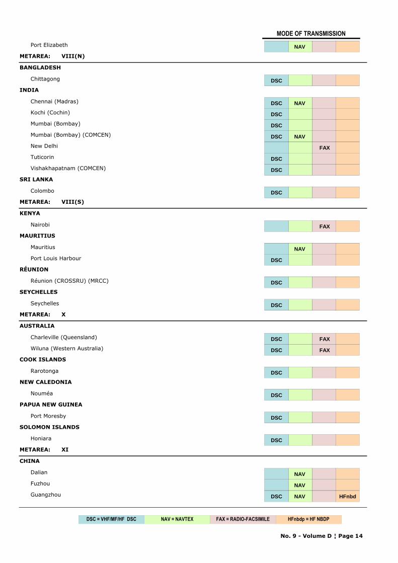
Port Elizabeth NAV
METAREA: VIII(N)
BANGLADESH
Chittagong DSC
INDIA
Chennai (Madras) DSC NAV
Kochi (Cochin) DSC
Mumbai (Bombay) DSC
Mumbai (Bombay) (COMCEN) DSC NAV
New Delhi FAX
Tuticorin DSC
Vishakhapatnam (COMCEN) DSCDSC
SRI LANKA
Colombo DSC
METAREA: VIII(S)
KENYA
Nairobi FAX
MAURITIUS
Mauritius NAV
Port Louis Harbour DSC
RÉUNION
Réunion (CROSSRU) (MRCC) DSC
SEYCHELLES
Seychelles DSC
METAREA: X
AUSTRALIA
Charleville (Queensland) DSC FAX
Wiluna (Western Australia) DSC FAX
COOK ISLANDS
Rarotonga DSC
NEW CALEDONIA
Nouméa DSC
PAPUA NEW GUINEA
Port Moresby DSC
SOLOMON ISLANDS
Honiara DSC
METAREA: XI
CHINA
Dalian NAV
Fuzhou NAV
Guangzhou DSC NAV HFnbd
No. 9 - Volume D ¦ Page 14
NAV = NAVTEX FAX = RADIO-FACSIMILEDSC = VHF/MF/HF DSC HFnbdp = HF NBDP
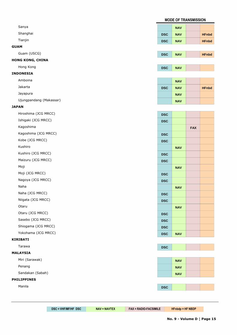
MODE OF TRANSMISSION
Sanya NAV
Shanghai DSC NAV HFnbd
Tianjin DSC NAV HFnbd
GUAM
Guam (USCG) DSC NAV HFnbd
HONG KONG, CHINA
Hong Kong DSC NAV
INDONESIA
Amboina NAV
Jakarta DSC NAV HFnbd
Jayapura NAV
Ujungpandang (Makassar) NAV
JAPAN
Hiroshima (JCG MRCC) DSC
Ishigaki (JCG MRCC) DSC
Kagoshima FAX
Kagoshima (JCG MRCC) DSC
Kobe (JCG MRCC) DSC
Kushiro NAV
Kushiro (JCG MRCC) DSC
Maizuru (JCG MRCC) DSC
Moji NAV
Moji (JCG MRCC) DSC
Nagoya (JCG MRCC) DSC
Naha NAV
Naha (JCG MRCC) DSC
Niigata (JCG MRCC) DSC
Otaru NAV
Otaru (JCG MRCC) DSC
Sasebo (JCG MRCC) DSC
Shiogama (JCG MRCC) DSC
Yokohama (JCG MRCC) DSC NAV
KIRIBATI
Tarawa DSC
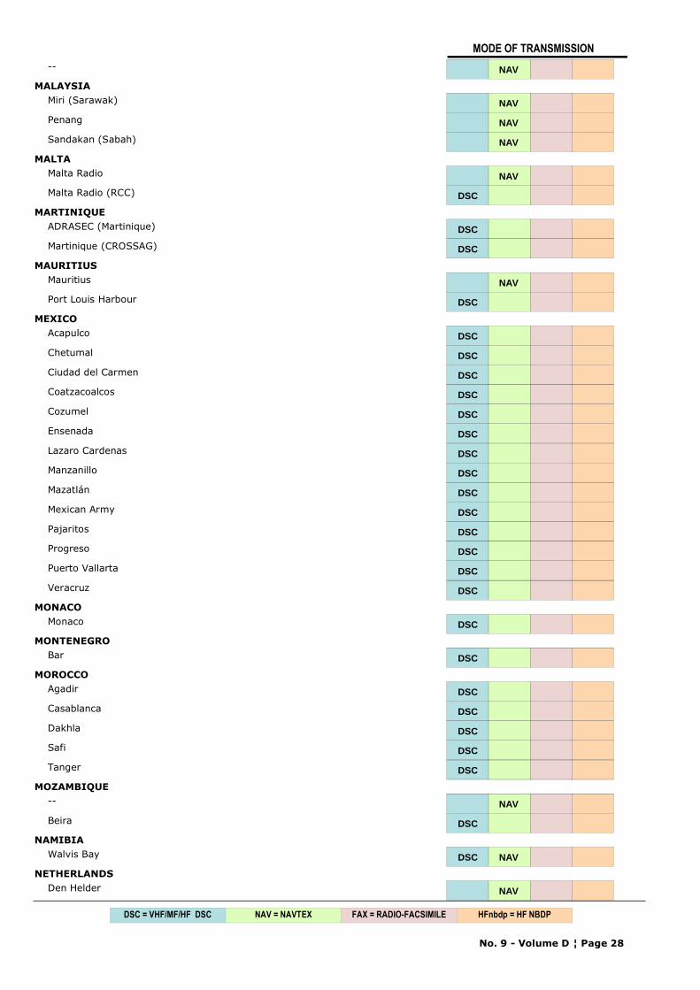
MALAYSIA
Miri (Sarawak) NAV
Penang NAV
Sandakan (Sabah) NAV
PHILIPPINES
Manila DSC
No. 9 - Volume D ¦ Page 15
NAV = NAVTEX FAX = RADIO-FACSIMILEDSC = VHF/MF/HF DSC HFnbdp = HF NBDP
MODE OF TRANSMISSION
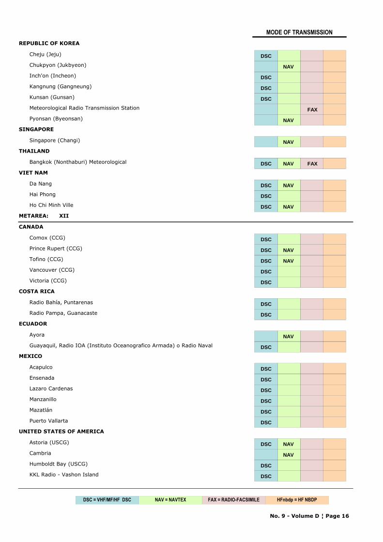
REPUBLIC OF KOREA
Cheju (Jeju) DSC
Chukpyon (Jukbyeon) NAV
Inch'on (Incheon) DSC
Kangnung (Gangneung) DSC
Kunsan (Gunsan) DSC
Meteorological Radio Transmission Station FAX
Pyonsan (Byeonsan) NAV
SINGAPORE
Singapore (Changi) NAV
THAILAND
Bangkok (Nonthaburi) Meteorological DSC NAV FAX
VIET NAM
Da Nang DSC NAV
Hai Phong DSC
Ho Chi Minh Ville DSC NAV
METAREA: XII
CANADA
Comox (CCG) DSC
Prince Rupert (CCG) DSC NAV
Tofino (CCG) DSC NAV
Vancouver (CCG) DSC
Victoria (CCG) DSC
COSTA RICA
Radio Bahía, Puntarenas DSC
Radio Pampa, Guanacaste DSC
ECUADOR
Ayora NAV
Guayaquil, Radio IOA (Instituto Oceanografico Armada) o Radio Naval DSC
MEXICO
Acapulco DSC
Ensenada DSC
Lazaro Cardenas DSC
Manzanillo DSC
Mazatlán DSC
Puerto Vallarta DSC
UNITED STATES OF AMERICA
Astoria (USCG) DSC NAV
Cambria NAV
Humboldt Bay (USCG) DSC
KKL Radio - Vashon Island DSC
No. 9 - Volume D ¦ Page 16
NAV = NAVTEX FAX = RADIO-FACSIMILEDSC = VHF/MF/HF DSC HFnbdp = HF NBDP
MODE OF TRANSMISSION
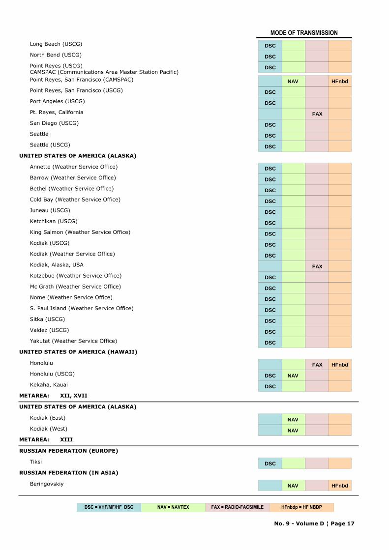
Long Beach (USCG) DSC
North Bend (USCG) DSC
Point Reyes (USCG)CAMSPAC (Communications Area Master Station Pacific)
DSC
Point Reyes, San Francisco (CAMSPAC) NAV HFnbd
Point Reyes, San Francisco (USCG) DSC
Port Angeles (USCG) DSC
Pt. Reyes, California FAX
San Diego (USCG) DSC
Seattle DSC
Seattle (USCG) DSC
UNITED STATES OF AMERICA (ALASKA)
Annette (Weather Service Office) DSC
Barrow (Weather Service Office) DSC
Bethel (Weather Service Office) DSC
Cold Bay (Weather Service Office) DSC
Juneau (USCG) DSC
Ketchikan (USCG) DSC
King Salmon (Weather Service Office) DSC
Kodiak (USCG) DSC
Kodiak (Weather Service Office) DSC
Kodiak, Alaska, USA FAX
Kotzebue (Weather Service Office) DSC
Mc Grath (Weather Service Office) DSC
Nome (Weather Service Office) DSC
S. Paul Island (Weather Service Office) DSC
Sitka (USCG) DSC
Valdez (USCG) DSC
Yakutat (Weather Service Office) DSC
UNITED STATES OF AMERICA (HAWAII)
Honolulu FAX HFnbd
Honolulu (USCG) DSC NAV
Kekaha, Kauai DSC
METAREA: XII, XVII
UNITED STATES OF AMERICA (ALASKA)
Kodiak (East) NAV
Kodiak (West) NAV
METAREA: XIII
RUSSIAN FEDERATION (EUROPE)
Tiksi DSC
RUSSIAN FEDERATION (IN ASIA)
Beringovskiy NAV HFnbd
No. 9 - Volume D ¦ Page 17
NAV = NAVTEX FAX = RADIO-FACSIMILEDSC = VHF/MF/HF DSC HFnbdp = HF NBDP
MODE OF TRANSMISSION
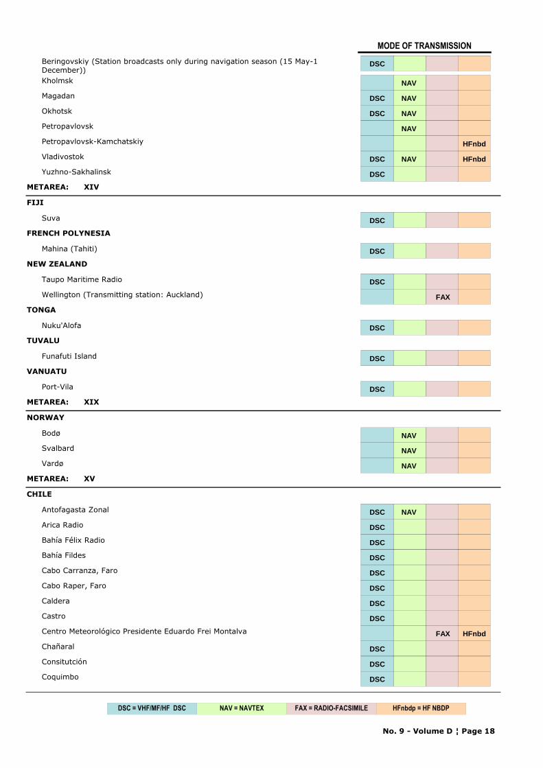
Beringovskiy (Station broadcasts only during navigation season (15 May-1 December))
DSC
Kholmsk NAV
Magadan DSC NAV
Okhotsk DSC NAV
Petropavlovsk NAV
Petropavlovsk-Kamchatskiy HFnbd
Vladivostok DSC NAV HFnbd
Yuzhno-Sakhalinsk DSC
METAREA: XIV
FIJI
Suva DSC
FRENCH POLYNESIA
Mahina (Tahiti) DSC
NEW ZEALAND
Taupo Maritime Radio DSC
Wellington (Transmitting station: Auckland) FAX
TONGA
Nuku'Alofa DSC
TUVALU
Funafuti Island DSC
VANUATU
Port-Vila DSC
METAREA: XIX
NORWAY
Bodø NAV
Svalbard NAV
Vardø NAV
METAREA: XV
CHILE
Antofagasta Zonal DSC NAV
Arica Radio DSC
Bahía Félix Radio DSC
Bahía Fildes DSC
Cabo Carranza, Faro DSC
Cabo Raper, Faro DSC
Caldera DSC
Castro DSC
Centro Meteorológico Presidente Eduardo Frei Montalva FAX HFnbd
Chañaral DSC
Consitutción DSC
Coquimbo DSC
No. 9 - Volume D ¦ Page 18
NAV = NAVTEX FAX = RADIO-FACSIMILEDSC = VHF/MF/HF DSC HFnbdp = HF NBDP
MODE OF TRANSMISSION
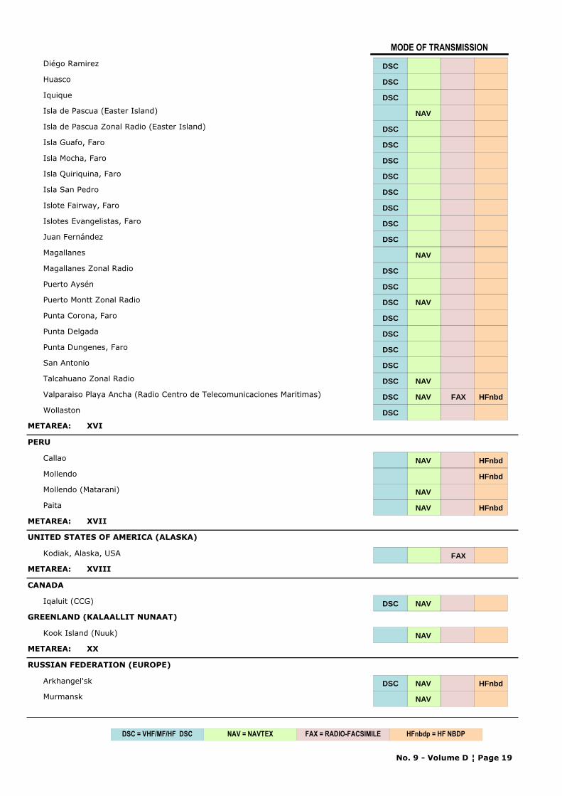
Diégo Ramirez DSC
Huasco DSC
Iquique DSC
Isla de Pascua (Easter Island) NAV
Isla de Pascua Zonal Radio (Easter Island) DSC
Isla Guafo, Faro DSC
Isla Mocha, Faro DSC
Isla Quiriquina, Faro DSC
Isla San Pedro DSC
Islote Fairway, Faro DSC
Islotes Evangelistas, Faro DSC
Juan Fernández DSC
Magallanes NAV
Magallanes Zonal Radio DSC
Puerto Aysén DSC
Puerto Montt Zonal Radio DSC NAV
Punta Corona, Faro DSC
Punta Delgada DSC
Punta Dungenes, Faro DSC
San Antonio DSC
Talcahuano Zonal Radio DSC NAV
Valparaiso Playa Ancha (Radio Centro de Telecomunicaciones Maritimas) DSC NAV FAX HFnbd
Wollaston DSC
METAREA: XVI
PERU
Callao NAV HFnbd
Mollendo HFnbd
Mollendo (Matarani) NAV
Paita NAV HFnbd
METAREA: XVII
UNITED STATES OF AMERICA (ALASKA)
Kodiak, Alaska, USA FAX
METAREA: XVIII
CANADA
Iqaluit (CCG) DSC NAV
GREENLAND (KALAALLIT NUNAAT)
Kook Island (Nuuk) NAV
METAREA: XX
RUSSIAN FEDERATION (EUROPE)
Arkhangel'sk DSC NAV HFnbd
Murmansk NAV
No. 9 - Volume D ¦ Page 19
NAV = NAVTEX FAX = RADIO-FACSIMILEDSC = VHF/MF/HF DSC HFnbdp = HF NBDP
MODE OF TRANSMISSION
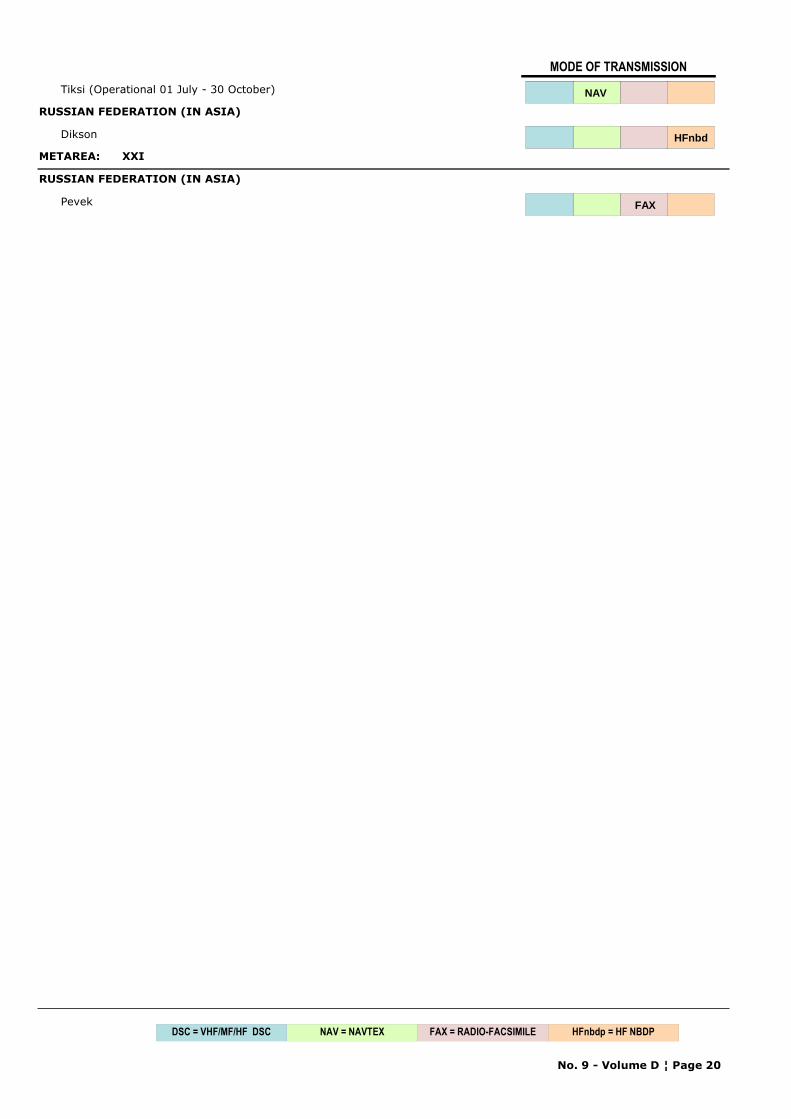
Tiksi (Operational 01 July - 30 October) NAV
RUSSIAN FEDERATION (IN ASIA)
Dikson HFnbd
METAREA: XXI
RUSSIAN FEDERATION (IN ASIA)
Pevek FAX
No. 9 - Volume D ¦ Page 20
NAV = NAVTEX FAX = RADIO-FACSIMILEDSC = VHF/MF/HF DSC HFnbdp = HF NBDP
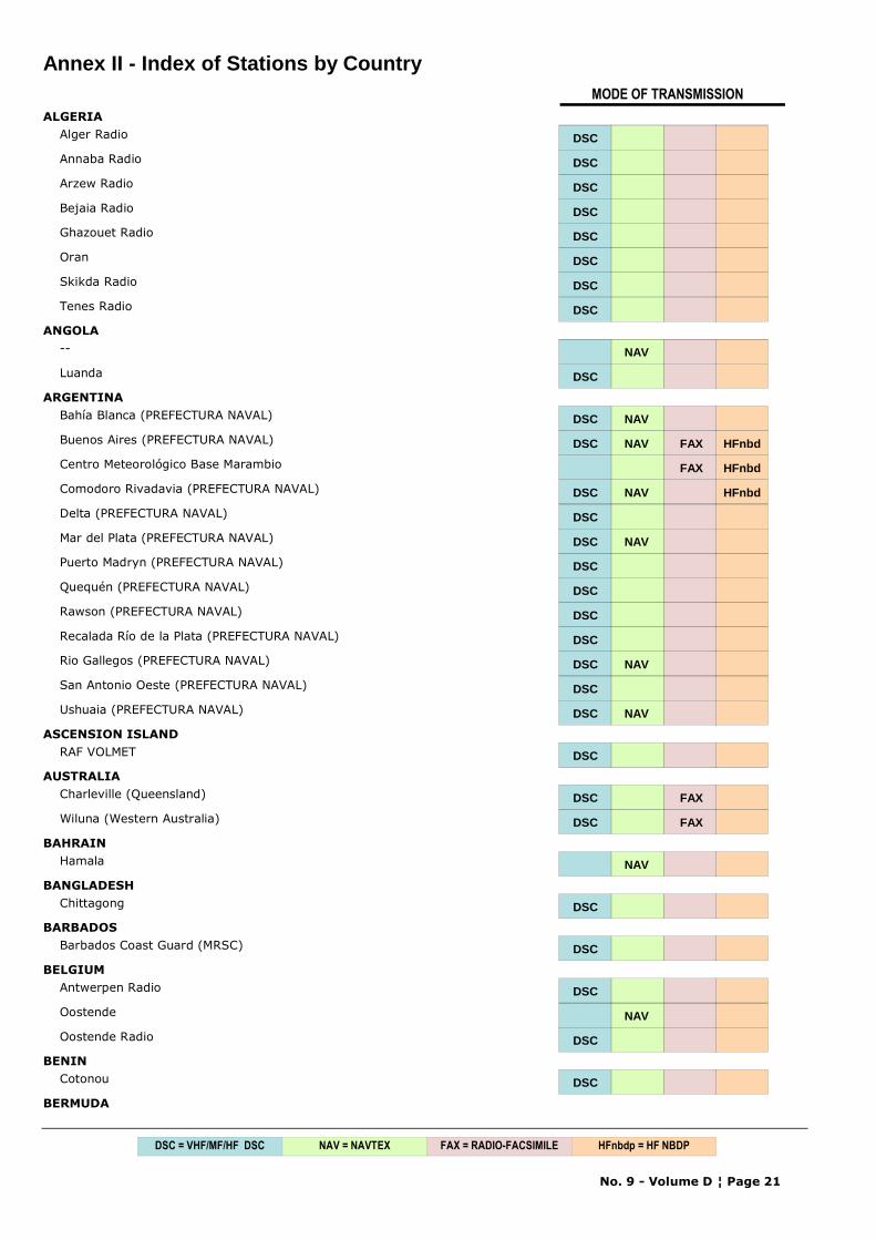
Annex II - Index of Stations by CountryMODE OF TRANSMISSION
ALGERIAAlger Radio DSC
Annaba Radio DSC
Arzew Radio DSC
Bejaia Radio DSC
Ghazouet Radio DSC
Oran DSC
Skikda Radio DSC
Tenes Radio DSC
ANGOLA-- NAV
Luanda DSC
ARGENTINABahía Blanca (PREFECTURA NAVAL) DSC NAV
Buenos Aires (PREFECTURA NAVAL) DSC NAV FAX HFnbd
Centro Meteorológico Base Marambio FAX HFnbd
Comodoro Rivadavia (PREFECTURA NAVAL) DSC NAV HFnbd
Delta (PREFECTURA NAVAL) DSC
Mar del Plata (PREFECTURA NAVAL) DSC NAV
Puerto Madryn (PREFECTURA NAVAL) DSC
Quequén (PREFECTURA NAVAL) DSC
Rawson (PREFECTURA NAVAL) DSC
Recalada Río de la Plata (PREFECTURA NAVAL) DSC
Rio Gallegos (PREFECTURA NAVAL) DSC NAV
San Antonio Oeste (PREFECTURA NAVAL) DSC
Ushuaia (PREFECTURA NAVAL) DSC NAV
ASCENSION ISLANDRAF VOLMET DSC
AUSTRALIACharleville (Queensland) DSC FAX
Wiluna (Western Australia) DSC FAX
BAHRAINHamala NAV
BANGLADESHChittagong DSC
BARBADOSBarbados Coast Guard (MRSC) DSC
BELGIUMAntwerpen Radio DSC
Oostende NAV
Oostende Radio DSC
BENINCotonou DSC
BERMUDA
No. 9 - Volume D ¦ Page 21
NAV = NAVTEX FAX = RADIO-FACSIMILEDSC = VHF/MF/HF DSC HFnbdp = HF NBDP
MODE OF TRANSMISSION
Bermuda Harbour DSC NAV
BRAZILBelém DSC
Brazilian MMS NAV
Junção DSC
Olinda DSC
Ponta do Céu DSC
Río DSC
Rio de Janeiro Naval DSC FAX HFnbd
BULGARIAVarna NAV
Varna Radio DSC HFnbd
CABO VERDESao Vicente NAV
CANADAChurchill (CCG) DSC
Comox (CCG) DSC
Fundy (Yarmouth) (CCG) NAV
Halifax (CCG) DSC
Halifax, Nova Scotia (CCG) FAX
Inuvik (CCG) DSC FAX
Iqaluit (CCG) HFnbd
Iqaluit (CCG) DSC NAV
Iqaluit, NWT (CCG) FAX
Labrador (CCG) DSC NAV
Les Escoumins (CCG) DSC
Montréal (CCG) DSC
Placentia (CCG) DSC
Port aux Basques (CCG) DSC
Prescott (Wiarton) (CCG) DSC NAV
Prince Rupert (CCG) DSC NAV
Québec (CCG) DSC
Resolute (CCG) DSC
Resolute, NWT (CCG) FAX
Rivière-au-Renard (CCG) DSC NAV
Saint Anthony(CCG) DSC
Saint John's, New Brunswick (CCG) DSC
Saint John's, Newfoundland (CCG) DSC NAV
Sarnia (CCG) DSC
Sydney (CCG) DSC NAV
Sydney, Nova Scotia (CCG) FAX
Thunder Bay (CCG) DSC NAV
Tofino (CCG) DSC NAV
Vancouver (CCG) DSC
No. 9 - Volume D ¦ Page 22
NAV = NAVTEX FAX = RADIO-FACSIMILEDSC = VHF/MF/HF DSC HFnbdp = HF NBDP
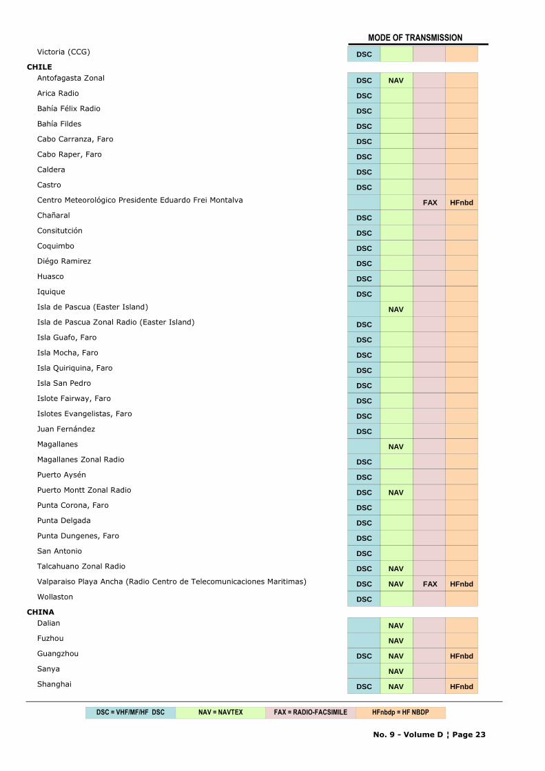
MODE OF TRANSMISSION
Victoria (CCG) DSC
CHILEAntofagasta Zonal DSC NAV
Arica Radio DSC
Bahía Félix Radio DSC
Bahía Fildes DSC
Cabo Carranza, Faro DSC
Cabo Raper, Faro DSC
Caldera DSC
Castro DSC
Centro Meteorológico Presidente Eduardo Frei Montalva FAX HFnbd
Chañaral DSC
Consitutción DSC
Coquimbo DSC
Diégo Ramirez DSC
Huasco DSC
Iquique DSC
Isla de Pascua (Easter Island) NAV
Isla de Pascua Zonal Radio (Easter Island) DSC
Isla Guafo, Faro DSC
Isla Mocha, Faro DSC
Isla Quiriquina, Faro DSC
Isla San Pedro DSC
Islote Fairway, Faro DSC
Islotes Evangelistas, Faro DSC
Juan Fernández DSC
Magallanes NAV
Magallanes Zonal Radio DSC
Puerto Aysén DSC
Puerto Montt Zonal Radio DSC NAV
Punta Corona, Faro DSC
Punta Delgada DSC
Punta Dungenes, Faro DSC
San Antonio DSC
Talcahuano Zonal Radio DSC NAV
Valparaiso Playa Ancha (Radio Centro de Telecomunicaciones Maritimas) DSC NAV FAX HFnbd
Wollaston DSC
CHINADalian NAV
Fuzhou NAV
Guangzhou DSC NAV HFnbd
Sanya NAV
Shanghai DSC NAV HFnbd
No. 9 - Volume D ¦ Page 23
NAV = NAVTEX FAX = RADIO-FACSIMILEDSC = VHF/MF/HF DSC HFnbdp = HF NBDP
MODE OF TRANSMISSION
Tianjin DSC NAV HFnbd
COMOROSMoroni DSC
CONGOPointe Noire DSC
COOK ISLANDSRarotonga DSC
COSTA RICARadio Bahía, Puntarenas DSC
Radio Casino, Limón DSC
Radio Pampa, Guanacaste DSC
Radio Stero Bahía, Limón DSC
COTE D'IVOIREAbidjan Radio DSC
CROATIADubrovnik DSC
Habour Master Office DSC
Rijeka DSC
Split (Hvar I.) DSC NAV
CUBACienfuegos DSC
Habana DSC
Santiago de Cuba DSC
CURAÇAO AND BONAIRE (NETHERLANDS ANTILLES)Curaçao NAV
Curaçao Radio (JRCC) DSC
CYPRUSCyprus DSC NAV
DENMARK AND FAROE ISLANDSLyngby DSC
Skamlebaek (KØBENHAVN) FAX
Tórshavn Radio (Faeroes) DSC NAV
DJIBOUTIDjibouti DSC
DOMINICAN REPUBLICSanto Domingo Piloto DSC
ECUADORAyora NAV
Guayaquil, Radio IOA (Instituto Oceanografico Armada) o Radio Naval DSC
EGYPTEl Iskandariya (Alexandria) NAV
El Quseir (Kosseir) NAV
Ismailia NAV
Serapeum Ismailia HFnbd
ESTONIATallinn DSC NAV
FIJI
No. 9 - Volume D ¦ Page 24
NAV = NAVTEX FAX = RADIO-FACSIMILEDSC = VHF/MF/HF DSC HFnbdp = HF NBDP
MODE OF TRANSMISSION
Suva DSC
FINLANDTurku (MRCC) DSC
FRANCECorsen (CROSS) (MRCC) DSC NAV
Étel (CROSS) (MRCC) DSC
Gris Nez (CROSS) DSC
Jobourg (CROSS) (MRCC) DSC
La Garde (CROSS) (MRCC) DSC NAV
FRENCH POLYNESIAMahina (Tahiti) DSC
GERMANYBremen Radio (MRCC) DSC
Offenbach (Main)-Hamburg/Pinneberg (broadcast for shipping) FAX
Pinneberg NAV
GHANATema Radio DSC
GREECEIrakleio (Kriti) DSC NAV
Kerkyra DSC NAV
Limnos DSC NAV
Olympia Radio FAX HFnbd
Rodos DSC
GREENLAND (KALAALLIT NUNAAT)Aasiaat DSC
Ammassalik DSC
Grønnedal DSC
Kook Island (Nuuk) NAV
GRENADAGrenada Coast Guard (S. Georges) (MRSC) DSC
GUADELOUPE, ST. MARTIN, ST. BARTHELEMYADRASEC (Guadeloupe) DSC
Guadeloupe (CROSSAG) DSC
GUAMGuam (USCG) DSC NAV HFnbd
GUERNSEYSaint Peter Port DSC
GUINEAConakry DSC
HONG KONG, CHINAHong Kong DSC NAV
ICELANDGrindavik NAV
Hornafjördur DSC
Isafjördur DSC
Nes Radio (Neskaupstadur) DSC
No. 9 - Volume D ¦ Page 25
NAV = NAVTEX FAX = RADIO-FACSIMILEDSC = VHF/MF/HF DSC HFnbdp = HF NBDP
MODE OF TRANSMISSION
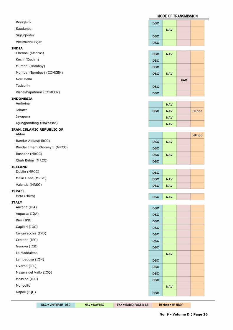
Reykjavík DSC
Saudanes NAV
Siglufjördur DSC
Vestmannaeyjar DSC
INDIAChennai (Madras) DSC NAV
Kochi (Cochin) DSC
Mumbai (Bombay) DSC
Mumbai (Bombay) (COMCEN) DSC NAV
New Delhi FAX
Tuticorin DSC
Vishakhapatnam (COMCEN) DSCDSC
INDONESIAAmboina NAV
Jakarta DSC NAV HFnbd
Jayapura NAV
Ujungpandang (Makassar) NAV
IRAN, ISLAMIC REPUBLIC OFAbbas HFnbd
Bandar Abbas(MRCC) DSC NAV
Bandar Imam Khomeyni (MRCC) DSC
Bushehr (MRCC) DSC NAV
Chah Bahar (MRCC) DSC
IRELANDDublin (MRCC) DSC
Malin Head (MRSC) DSC NAV
Valentia (MRSC) DSC NAV
ISRAELHefa (Haifa) DSC NAV
ITALYAncona (IPA) DSC
Augusta (IQA) DSC
Bari (IPB) DSC
Cagliari (IDC) DSC
Civitavecchia (IPD) DSC
Crotone (IPC) DSC
Genova (ICB) DSC
La Maddalena NAV
Lampedusa (IQN) DSC
Livorno (IPL) DSC
Mazara del Vallo (IQQ) DSC
Messina (IDF) DSC
Mondolfo NAV
Napoli (IQH) DSC
No. 9 - Volume D ¦ Page 26
NAV = NAVTEX FAX = RADIO-FACSIMILEDSC = VHF/MF/HF DSC HFnbdp = HF NBDP
MODE OF TRANSMISSION
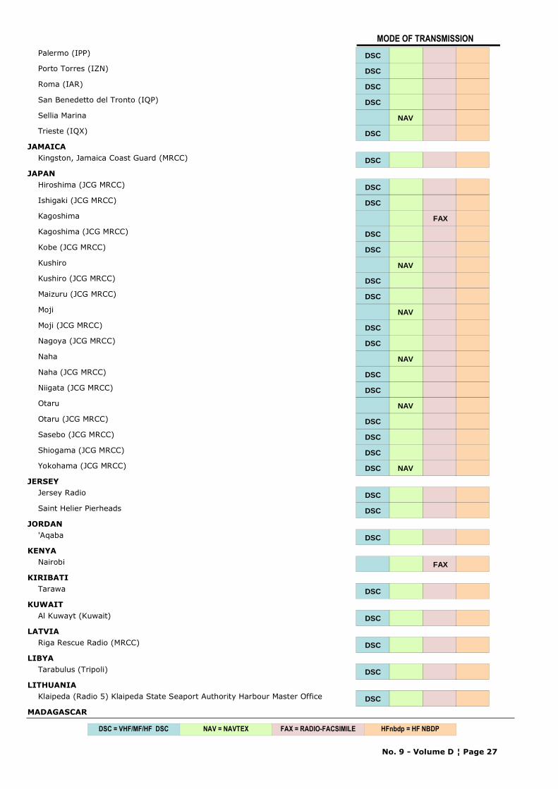
Palermo (IPP) DSC
Porto Torres (IZN) DSC
Roma (IAR) DSC
San Benedetto del Tronto (IQP) DSC
Sellia Marina NAV
Trieste (IQX) DSC
JAMAICAKingston, Jamaica Coast Guard (MRCC) DSC
JAPANHiroshima (JCG MRCC) DSC
Ishigaki (JCG MRCC) DSC
Kagoshima FAX
Kagoshima (JCG MRCC) DSC
Kobe (JCG MRCC) DSC
Kushiro NAV
Kushiro (JCG MRCC) DSC
Maizuru (JCG MRCC) DSC
Moji NAV
Moji (JCG MRCC) DSC
Nagoya (JCG MRCC) DSC
Naha NAV
Naha (JCG MRCC) DSC
Niigata (JCG MRCC) DSC
Otaru NAV
Otaru (JCG MRCC) DSC
Sasebo (JCG MRCC) DSC
Shiogama (JCG MRCC) DSC
Yokohama (JCG MRCC) DSC NAV
JERSEYJersey Radio DSC
Saint Helier Pierheads DSCDSC
JORDAN'Aqaba DSC
KENYANairobi FAX
KIRIBATITarawa DSC
KUWAITAl Kuwayt (Kuwait) DSC
LATVIARiga Rescue Radio (MRCC) DSC
LIBYATarabulus (Tripoli) DSC
LITHUANIAKlaipeda (Radio 5) Klaipeda State Seaport Authority Harbour Master Office DSC
MADAGASCAR
No. 9 - Volume D ¦ Page 27
NAV = NAVTEX FAX = RADIO-FACSIMILEDSC = VHF/MF/HF DSC HFnbdp = HF NBDP
MODE OF TRANSMISSION
-- NAV
MALAYSIAMiri (Sarawak) NAV
Penang NAV
Sandakan (Sabah) NAV
MALTAMalta Radio NAV
Malta Radio (RCC) DSC
MARTINIQUEADRASEC (Martinique) DSC
Martinique (CROSSAG) DSC
MAURITIUSMauritius NAV
Port Louis Harbour DSC
MEXICOAcapulco DSC
Chetumal DSC
Ciudad del Carmen DSC
Coatzacoalcos DSC
Cozumel DSC
Ensenada DSC
Lazaro Cardenas DSC
Manzanillo DSC
Mazatlán DSC
Mexican Army DSC
Pajaritos DSC
Progreso DSC
Puerto Vallarta DSC
Veracruz DSC
MONACOMonaco DSC
MONTENEGROBar DSC
MOROCCOAgadir DSC
Casablanca DSC
Dakhla DSC
Safi DSC
Tanger DSC
MOZAMBIQUE-- NAV
Beira DSC
NAMIBIAWalvis Bay DSC NAV
NETHERLANDSDen Helder NAV
No. 9 - Volume D ¦ Page 28
NAV = NAVTEX FAX = RADIO-FACSIMILEDSC = VHF/MF/HF DSC HFnbdp = HF NBDP
MODE OF TRANSMISSION
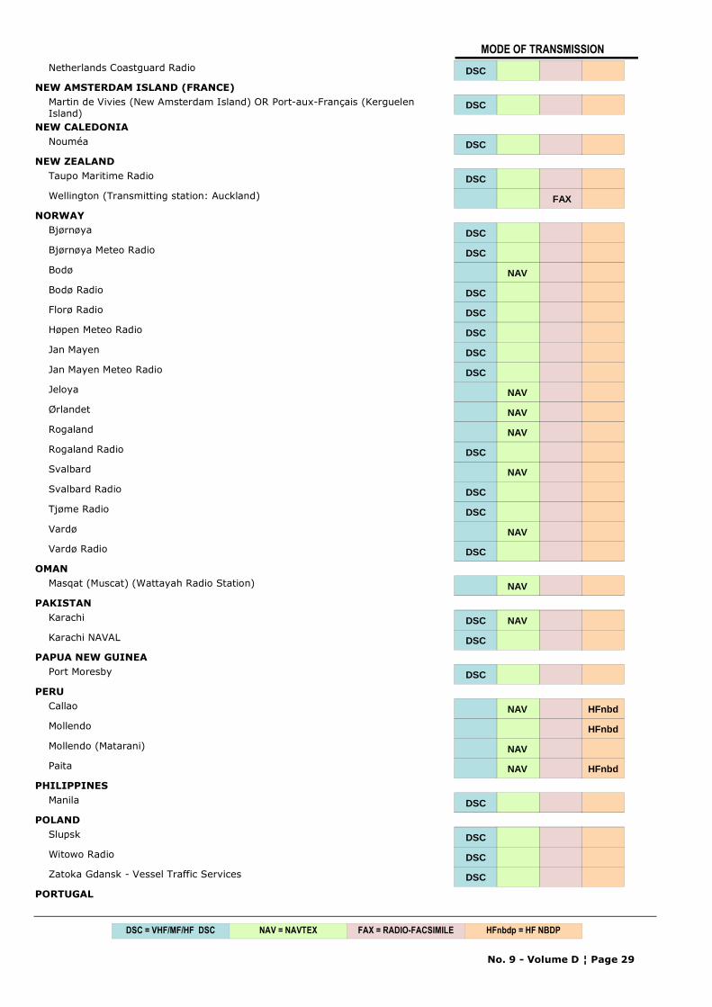
Netherlands Coastguard Radio DSC
NEW AMSTERDAM ISLAND (FRANCE)Martin de Vivies (New Amsterdam Island) OR Port-aux-Français (Kerguelen Island)
DSC
NEW CALEDONIANouméa DSC
NEW ZEALANDTaupo Maritime Radio DSC
Wellington (Transmitting station: Auckland) FAX
NORWAYBjørnøya DSC
Bjørnøya Meteo Radio DSC
Bodø NAV
Bodø Radio DSC
Florø Radio DSC
Høpen Meteo Radio DSC
Jan Mayen DSC
Jan Mayen Meteo Radio DSC
Jeloya NAV
Ørlandet NAV
Rogaland NAV
Rogaland Radio DSC
Svalbard NAV
Svalbard Radio DSC
Tjøme Radio DSC
Vardø NAV
Vardø Radio DSC
OMANMasqat (Muscat) (Wattayah Radio Station) NAV
PAKISTANKarachi DSC NAV
Karachi NAVAL DSC
PAPUA NEW GUINEAPort Moresby DSC
PERUCallao NAV HFnbd
Mollendo HFnbd
Mollendo (Matarani) NAV
Paita NAV HFnbd
PHILIPPINESManila DSC
POLANDSlupsk DSC
Witowo Radio DSC
Zatoka Gdansk - Vessel Traffic Services DSC
PORTUGAL
No. 9 - Volume D ¦ Page 29
NAV = NAVTEX FAX = RADIO-FACSIMILEDSC = VHF/MF/HF DSC HFnbdp = HF NBDP
MODE OF TRANSMISSION
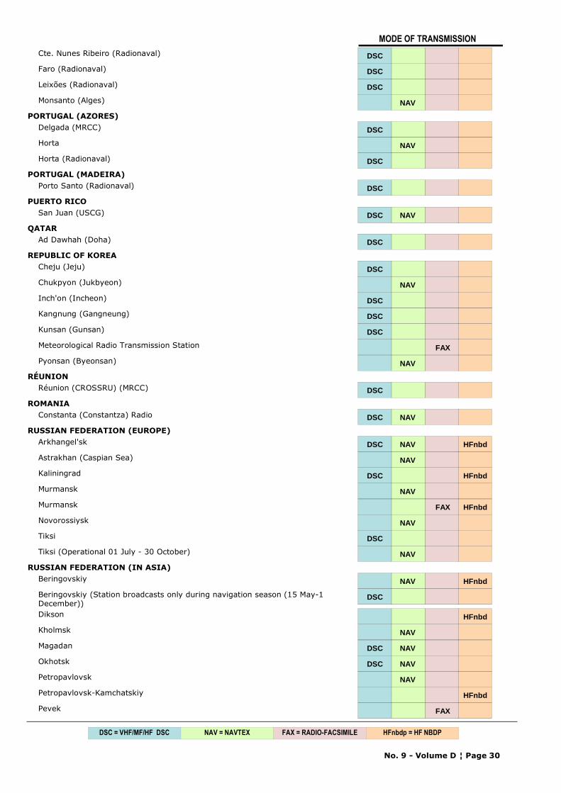
Cte. Nunes Ribeiro (Radionaval) DSC
Faro (Radionaval) DSC
Leixões (Radionaval) DSC
Monsanto (Alges) NAV
PORTUGAL (AZORES)Delgada (MRCC) DSC
Horta NAV
Horta (Radionaval) DSC
PORTUGAL (MADEIRA)Porto Santo (Radionaval) DSC
PUERTO RICOSan Juan (USCG) DSC NAV
QATARAd Dawhah (Doha) DSC
REPUBLIC OF KOREACheju (Jeju) DSC
Chukpyon (Jukbyeon) NAV
Inch'on (Incheon) DSC
Kangnung (Gangneung) DSC
Kunsan (Gunsan) DSC
Meteorological Radio Transmission Station FAX
Pyonsan (Byeonsan) NAV
RÉUNIONRéunion (CROSSRU) (MRCC) DSC
ROMANIAConstanta (Constantza) Radio DSC NAV
RUSSIAN FEDERATION (EUROPE)Arkhangel'sk DSC NAV HFnbd
Astrakhan (Caspian Sea) NAV
Kaliningrad DSC HFnbd
Murmansk NAV
Murmansk FAX HFnbd
Novorossiysk NAV
Tiksi DSC
Tiksi (Operational 01 July - 30 October) NAV
RUSSIAN FEDERATION (IN ASIA)Beringovskiy NAV HFnbd
Beringovskiy (Station broadcasts only during navigation season (15 May-1 December))
DSC
Dikson HFnbd
Kholmsk NAV
Magadan DSC NAV
Okhotsk DSC NAV
Petropavlovsk NAV
Petropavlovsk-Kamchatskiy HFnbd
Pevek FAX
No. 9 - Volume D ¦ Page 30
NAV = NAVTEX FAX = RADIO-FACSIMILEDSC = VHF/MF/HF DSC HFnbdp = HF NBDP
MODE OF TRANSMISSION
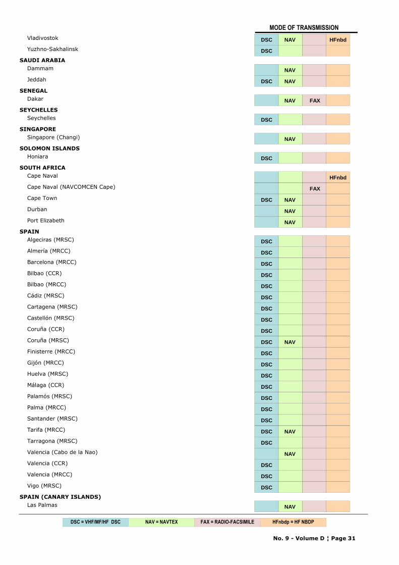
Vladivostok DSC NAV HFnbd
Yuzhno-Sakhalinsk DSC
SAUDI ARABIADammam NAV
Jeddah DSC NAV
SENEGALDakar NAV FAX
SEYCHELLESSeychelles DSC
SINGAPORESingapore (Changi) NAV
SOLOMON ISLANDSHoniara DSC
SOUTH AFRICACape Naval HFnbd
Cape Naval (NAVCOMCEN Cape) FAX
Cape Town DSC NAV
Durban NAV
Port Elizabeth NAV
SPAINAlgeciras (MRSC) DSC
Almería (MRCC) DSC
Barcelona (MRCC) DSC
Bilbao (CCR) DSC
Bilbao (MRCC) DSC
Cádiz (MRSC) DSC
Cartagena (MRSC) DSC
Castellón (MRSC) DSC
Coruña (CCR) DSC
Coruña (MRSC) DSC NAV
Finisterre (MRCC) DSC
Gijón (MRCC) DSC
Huelva (MRSC) DSC
Málaga (CCR) DSC
Palamós (MRSC) DSC
Palma (MRCC) DSC
Santander (MRSC) DSC
Tarifa (MRCC) DSC NAV
Tarragona (MRSC) DSC
Valencia (Cabo de la Nao) NAV
Valencia (CCR) DSC
Valencia (MRCC) DSC
Vigo (MRSC) DSC
SPAIN (CANARY ISLANDS)Las Palmas NAV
No. 9 - Volume D ¦ Page 31
NAV = NAVTEX FAX = RADIO-FACSIMILEDSC = VHF/MF/HF DSC HFnbdp = HF NBDP
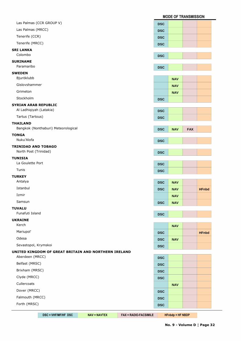
MODE OF TRANSMISSION
Las Palmas (CCR GROUP V) DSC
Las Palmas (MRCC) DSC
Tenerife (CCR) DSC
Tenerife (MRCC) DSC
SRI LANKAColombo DSC
SURINAMEParamaribo DSC
SWEDENBjuröklubb NAV
Gislovshammer NAV
Grimeton NAV
Stockholm DSC
SYRIAN ARAB REPUBLICAl Ladhiqiyah (Latakia) DSC
Tartus (Tartous) DSC
THAILANDBangkok (Nonthaburi) Meteorological DSC NAV FAX
TONGANuku'Alofa DSC
TRINIDAD AND TOBAGONorth Post (Trinidad) DSC
TUNISIALa Goulette Port DSC
Tunis DSC
TURKEYAntalya DSC NAV
Istanbul DSC NAV HFnbd
Izmir NAV
Samsun DSC NAV
TUVALUFunafuti Island DSC
UKRAINEKerch NAV
Mariupol' DSC HFnbd
Odesa DSC NAV
Sevastopol, Krymskoi DSC
UNITED KINGDOM OF GREAT BRITAIN AND NORTHERN IRELANDAberdeen (MRCC) DSC
Belfast (MRSC) DSC
Brixham (MRSC) DSC
Clyde (MRCC) DSC
Cullercoats NAV
Dover (MRCC) DSC
Falmouth (MRCC) DSC
Forth (MRSC) DSC
No. 9 - Volume D ¦ Page 32
NAV = NAVTEX FAX = RADIO-FACSIMILEDSC = VHF/MF/HF DSC HFnbdp = HF NBDP
MODE OF TRANSMISSION
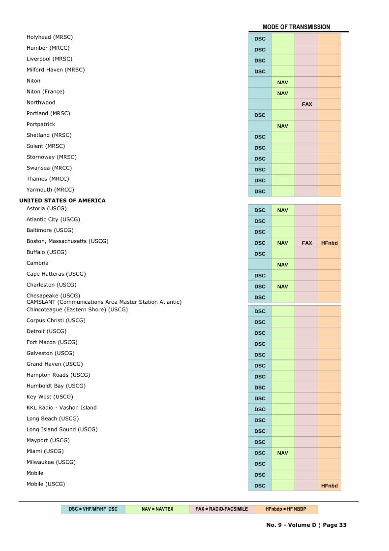
Holyhead (MRSC) DSC
Humber (MRCC) DSC
Liverpool (MRSC) DSC
Milford Haven (MRSC) DSC
Niton NAV
Niton (France) NAV
Northwood FAX
Portland (MRSC) DSC
Portpatrick NAV
Shetland (MRSC) DSC
Solent (MRSC) DSC
Stornoway (MRSC) DSC
Swansea (MRCC) DSC
Thames (MRCC) DSC
Yarmouth (MRCC) DSC
UNITED STATES OF AMERICAAstoria (USCG) DSC NAV
Atlantic City (USCG) DSC
Baltimore (USCG) DSC
Boston, Massachusetts (USCG) DSC NAV FAX HFnbd
Buffalo (USCG) DSC
Cambria NAV
Cape Hatteras (USCG) DSC
Charleston (USCG) DSC NAV
Chesapeake (USCG)CAMSLANT (Communications Area Master Station Atlantic)
DSC
Chincoteague (Eastern Shore) (USCG) DSC
Corpus Christi (USCG) DSC
Detroit (USCG) DSC
Fort Macon (USCG) DSC
Galveston (USCG) DSC
Grand Haven (USCG) DSC
Hampton Roads (USCG) DSC
Humboldt Bay (USCG) DSC
Key West (USCG) DSC
KKL Radio - Vashon Island DSC
Long Beach (USCG) DSC
Long Island Sound (USCG) DSC
Mayport (USCG) DSC
Miami (USCG) DSC NAV
Milwaukee (USCG) DSC
Mobile DSC
Mobile (USCG) DSC HFnbd
No. 9 - Volume D ¦ Page 33
NAV = NAVTEX FAX = RADIO-FACSIMILEDSC = VHF/MF/HF DSC HFnbdp = HF NBDP
MODE OF TRANSMISSION
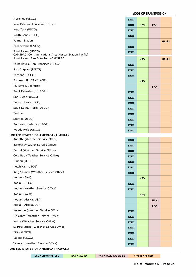
Moriches (USCG) DSC
New Orleans, Louisiana (USCG) DSC NAV FAX
New York (USCG) DSC
North Bend (USCG) DSC
Palmer Station HFnbd
Philadelphia (USCG) DSC
Point Reyes (USCG)CAMSPAC (Communications Area Master Station Pacific)
DSC
Point Reyes, San Francisco (CAMSPAC) NAV HFnbd
Point Reyes, San Francisco (USCG) DSC
Port Angeles (USCG) DSC
Portland (USCG) DSC
Portsmouth (CAMSLANT) NAV
Pt. Reyes, California FAX
Saint Petersburg (USCG) DSC
San Diego (USCG) DSC
Sandy Hook (USCG) DSC
Sault Sainte Marie (USCG) DSC
Seattle DSC
Seattle (USCG) DSC
Soutwest Harbour (USCG) DSC
Woods Hole (USCG) DSC
UNITED STATES OF AMERICA (ALASKA)Annette (Weather Service Office) DSC
Barrow (Weather Service Office) DSC
Bethel (Weather Service Office) DSC
Cold Bay (Weather Service Office) DSC
Juneau (USCG) DSC
Ketchikan (USCG) DSC
King Salmon (Weather Service Office) DSC
Kodiak (East) NAV
Kodiak (USCG) DSC
Kodiak (Weather Service Office) DSC
Kodiak (West) NAV
Kodiak, Alaska, USA FAX
Kodiak, Alaska, USA FAX
Kotzebue (Weather Service Office) DSC
Mc Grath (Weather Service Office) DSC
Nome (Weather Service Office) DSC
S. Paul Island (Weather Service Office) DSC
Sitka (USCG) DSC
Valdez (USCG) DSC
Yakutat (Weather Service Office) DSC
UNITED STATES OF AMERICA (HAWAII)
No. 9 - Volume D ¦ Page 34
NAV = NAVTEX FAX = RADIO-FACSIMILEDSC = VHF/MF/HF DSC HFnbdp = HF NBDP
MODE OF TRANSMISSION
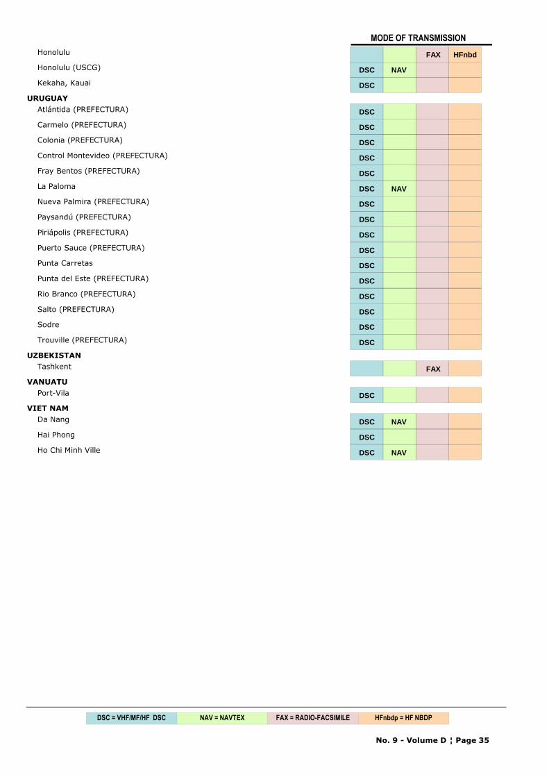
Honolulu FAX HFnbd
Honolulu (USCG) DSC NAV
Kekaha, Kauai DSC
URUGUAYAtlántida (PREFECTURA) DSC
Carmelo (PREFECTURA) DSC
Colonia (PREFECTURA) DSC
Control Montevideo (PREFECTURA) DSC
Fray Bentos (PREFECTURA) DSC
La Paloma DSC NAV
Nueva Palmira (PREFECTURA) DSC
Paysandú (PREFECTURA) DSC
Piriápolis (PREFECTURA) DSC
Puerto Sauce (PREFECTURA) DSC
Punta Carretas DSC
Punta del Este (PREFECTURA) DSC
Rio Branco (PREFECTURA) DSC
Salto (PREFECTURA) DSC
Sodre DSC
Trouville (PREFECTURA) DSC
UZBEKISTANTashkent FAX
VANUATUPort-Vila DSC
VIET NAMDa Nang DSC NAV
Hai Phong DSC
Ho Chi Minh Ville DSC NAV
No. 9 - Volume D ¦ Page 35
NAV = NAVTEX FAX = RADIO-FACSIMILEDSC = VHF/MF/HF DSC HFnbdp = HF NBDP

CHAPTER 1
SAFETYNET SERVICES
GMDSS GLOBAL MARITIME DISTRESS AND SAFETY SYSTEM

90°180°150°120°90° 150° 120° 60°
30°
60°
0°0°
30°
60°
60°90°120°150°180°150°120°90°60°30°0°30°
60°
30°
30°
60°
60°30°0°30°
7°N
35°50'S
7°N
20°W
67°1
6'W
120°
W
18°21'S
35°W
0°
180°
50°N
160°
E
80°E
12°S
0°
95°E 12
7°E
10°S
141°
E
29°S
172°
E
45°S
3°24'S
135°
E
45°N
67°N
53°N
10°30'S
55°E
30°S
12°N
63°E
0°
23 45 N° '
48°27'N
5°W
65°N
75°N
35°W
30°E
125°E
168°
58'W
120°W
67°N
6°S
IIIMediterranean
Greece
XVII
Canada
XVIII
Canada
XIX
Norway
XX
Russian Federation
XXI
Russian Federation
IVUnited
States ofAmerica
VBrazil V
Brazil
XIJapan
VIISouth Africa
VIArgentina
VIArgentinaX - Australia
XIVNew Zealand
I United Kingdom
VIIIIndia
(N)
VIII
SMa
uriti
us/A
ustra
lia(
)
VIII SMauritius/La union
( )RÈ
XIChina
XIIIRussian
Federation
XIIUnited States of
America
IVUnited States of
America
IXPakistan
XVIPeru
XVChile
90E°
IIFrance
33°45'S
4°30'N
170°
E
69°N
42°N130°E
138°
E
LIMITS OF METAREAS
Chapter 1 - GMDSS SERVICES
No. 9 - Volume D ¦ Page 1

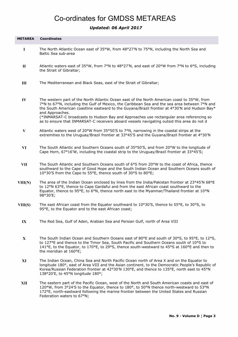
Co-ordinates for GMDSS METAREASUpdated: 06 April 2017
METAREA Coordinates
I The North Atlantic Ocean east of 35°W, from 48°27’N to 75°N, including the North Sea and Baltic Sea sub-area
II Atlantic waters east of 35°W, from 7°N to 48°27’N, and east of 20°W from 7°N to 6°S, including the Strait of Gibraltar;
III The Mediterranean and Black Seas, east of the Strait of Gibraltar;
IV The western part of the North Atlantic Ocean east of the North American coast to 35°W, from 7°N to 67°N, including the Gulf of Mexico, the Caribbean Sea and the sea area between 7°N and the South American coastline eastward to the Guyana/Brazil frontier at 4°30’N and Hudson Bay* and Approaches.(*INMARSAT-C broadcasts to Hudson Bay and Approaches use rectangular area referencing so as to ensure that INMARSAT-C receivers aboard vessels navigating outsid this area do not d
V Atlantic waters west of 20°W from 35°50’S to 7°N, narrowing in the coastal strips at the extremities to the Uruguay/Brazil frontier at 33°45’S and the Guyana/Brazil frontier at 4°30’N
VI The South Atlantic and Southern Oceans south of 35°50’S, and from 20°W to the longitude of Cape Horn, 67°16’W, including the coastal strip to the Uruguay/Brazil frontier at 33°45’S;
VII The South Atlantic and Southern Oceans south of 6°S from 20°W to the coast of Africa, thence southward to the Cape of Good Hope and the South Indian Ocean and Southern Oceans south of 10°30’S from the Cape to 55°E, thence south of 30°S to 80°E;
VIII(N) The area of the Indian Ocean enclosed by lines from the India/Pakistan frontier at 23°45’N 68°E to 12°N 63°E, thence to Cape Gardafui and from the east African coast southward to the Equator, thence to 95°E, to 6°N, thence north east to the Myanmar/Thailand frontier at 10°N 98°30’E;
VIII(S) The east African coast from the Equator southward to 10°30’S, thence to 55°E, to 30°S, to 95°E, to the Equator and to the east African coast;
IX The Red Sea, Gulf of Aden, Arabian Sea and Persian Gulf, north of Area VIII
X The South Indian Ocean and Southern Oceans east of 80°E and south of 30°S, to 95°E, to 12°S, to 127°E and thence to the Timor Sea, South Pacific and Southern Oceans south of 10°S to 141°E, to the Equator, to 170°E, to 29°S, thence south-westward to 45°S at 160°E and then to the meridian at 160°E;
XI The Indian Ocean, China Sea and North Pacific Ocean north of Area X and on the Equator to longitude 180°, east of Area VIII and the Asian continent, to the Democratic People’s Republic of Korea/Russian Federation frontier at 42°30’N 130°E, and thence to 135°E, north east to 45°N 138°20’E, to 45°N longitude 180°;
XII The eastern part of the Pacific Ocean, west of the North and South American coasts and east of 120°W, from 3°24’S to the Equator, thence to 180°, to 50°N thence north-westward to 53°N 172°E, north-eastward following the marine frontier between the United States and Russian Federation waters to 67°N;
No. 9 - Volume D ¦ Page 3
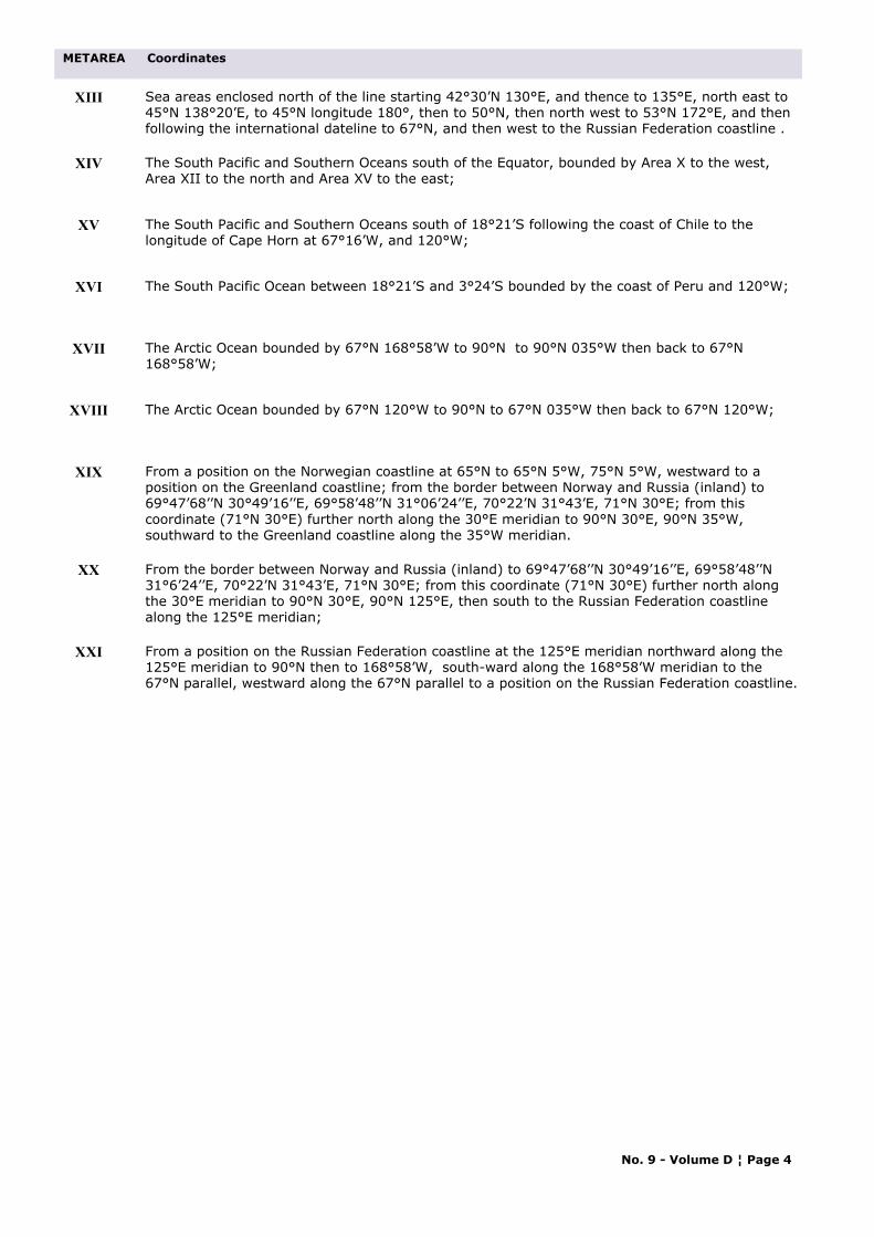
METAREA Coordinates
XIII Sea areas enclosed north of the line starting 42°30’N 130°E, and thence to 135°E, north east to 45°N 138°20’E, to 45°N longitude 180°, then to 50°N, then north west to 53°N 172°E, and then following the international dateline to 67°N, and then west to the Russian Federation coastline .
XIV The South Pacific and Southern Oceans south of the Equator, bounded by Area X to the west, Area XII to the north and Area XV to the east;
XV The South Pacific and Southern Oceans south of 18°21’S following the coast of Chile to the longitude of Cape Horn at 67°16’W, and 120°W;
XVI The South Pacific Ocean between 18°21’S and 3°24’S bounded by the coast of Peru and 120°W;
XVII The Arctic Ocean bounded by 67°N 168°58’W to 90°N to 90°N 035°W then back to 67°N 168°58’W;
XVIII The Arctic Ocean bounded by 67°N 120°W to 90°N to 67°N 035°W then back to 67°N 120°W;
XIX From a position on the Norwegian coastline at 65°N to 65°N 5°W, 75°N 5°W, westward to a position on the Greenland coastline; from the border between Norway and Russia (inland) to 69°47’68’’N 30°49’16’’E, 69°58’48’’N 31°06’24’’E, 70°22’N 31°43’E, 71°N 30°E; from this coordinate (71°N 30°E) further north along the 30°E meridian to 90°N 30°E, 90°N 35°W, southward to the Greenland coastline along the 35°W meridian.
XX From the border between Norway and Russia (inland) to 69°47’68’’N 30°49’16’’E, 69°58’48’’N 31°6’24’’E, 70°22’N 31°43’E, 71°N 30°E; from this coordinate (71°N 30°E) further north along the 30°E meridian to 90°N 30°E, 90°N 125°E, then south to the Russian Federation coastline along the 125°E meridian;
XXI From a position on the Russian Federation coastline at the 125°E meridian northward along the 125°E meridian to 90°N then to 168°58’W, south-ward along the 168°58’W meridian to the 67°N parallel, westward along the 67°N parallel to a position on the Russian Federation coastline.
No. 9 - Volume D ¦ Page 4
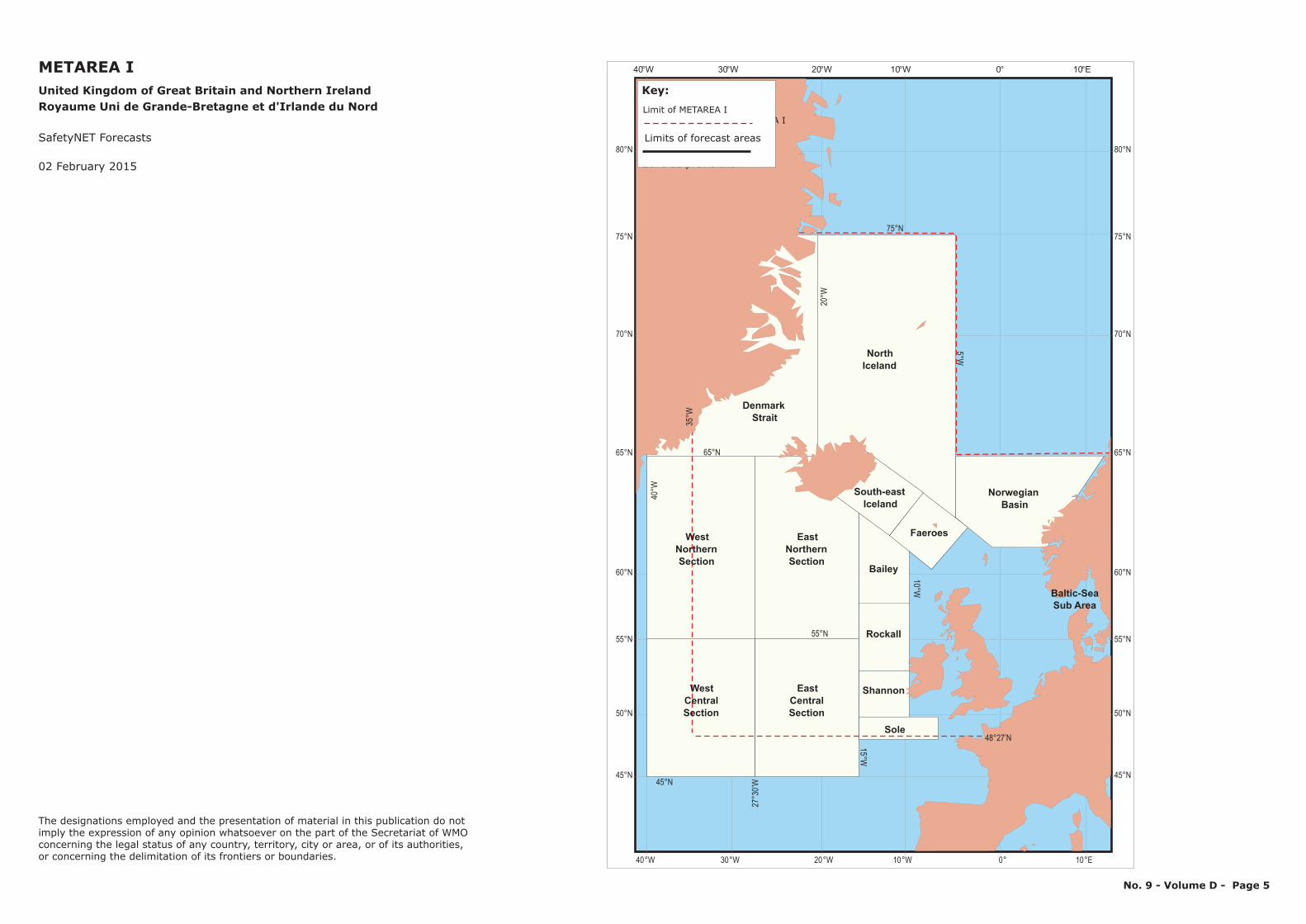
METAREA IUnited Kingdom of Great Britain and Northern IrelandRoyaume Uni de Grande-Bretagne et d'Irlande du Nord
SafetyNET Forecasts
No. 9 - Volume D - Page 5
02 February 2015
40°W 20°W30°W 0° 10°E10°W
60°N
65°N
70°N
55°N
50°N
75°N
45°N
80°N
40°W 20°W30°W 0° 10°E10°W
60°N
65°N
70°N
55°N
50°N
75°N
45°N
80°N
Key/Légende
Zone couverte par le METAREA I
Zone de prévisions
Limit of METAREA I
Limits of forecast areas
Key:
35°W
75°N
10°W
5°W
20°W
48°27’N
27°3
0’W
40°W
55°N
65°N
45°N
15°W
Sub AreaBaltic-Sea
SectionNorthern
EastCentralSection
NorthernEast
Section
Faeroes
South-east
WestCentralSection
West
Sole
Rockall
Bailey
NorthIceland
DenmarkStrait
NorwegianBasinIceland
Shannon
The designations employed and the presentation of material in this publication do notimply the expression of any opinion whatsoever on the part of the Secretariat of WMOconcerning the legal status of any country, territory, city or area, or of its authorities, or concerning the delimitation of its frontiers or boundaries.
1
1
1
1
1
1
1
22
2
2
2
2
2
4
4
4
4
4
3
3
3
3
3
3
3
5
5
5
5
5
5
6
6
6
6
Kattegat
Skaggerak
6
5
6
8° 9∞ 10° 11° 12° 13° 14° 15° 16°
8° 9° 10° 11° 12° 13° 14° 15° 16°
57°
56°
55°
57°
56°
55°
6
SWEDEN
DENMARKRanders
Aarhus
EsbjergKolding
Flensburg
Odense
Kalundborg
Fyn
3PortShipping route number
4
4
5
GG
Aalborg
FF
HH
EE
AA
CC
DD
BB1
4
3
2
6
Kobenhavn
Stigsnae
Sjaelland
Ronne
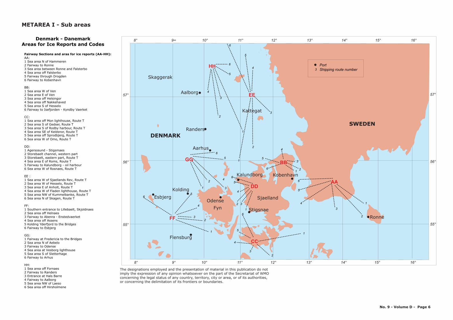
Denmark - DanemarkAreas for Ice Reports and Codes
AA:1 Sea area N of Hammeren 2 Fairway to Ronne 3 Sea area between Ronne and Falsterbo4 Sea area off Falsterbo 5 Fairway through Drogden 6 Fairway to Kobenhavn
BB:1 Sea area W of Ven 2 Sea area E of Ven 3 Sea area off Helsingor4 Sea area off Nakkehaved 5 Sea area S of Hesselo 6 Fairway to Isefjorden - Kyndby Vaerket
CC:1 Sea area off Mon lighthouse, Route T 2 Sea area S of Gedser, Route T 3 Sea area S of Rodby harbour, Route T4 Sea area SE of Keldsnor, Route T 5 Sea area off Sprodbjerg, Route T 6 Sea area W of Omo, Route T
Fairway Sections and aras for ice reports (AA-HH):
DD:1 Agersosund - Stigsmaes 2 Storebaelt channel, western part 3 Storebaelt, eastern part, Route T4 Sea area E of Roms, Route T 5 Fairway to Kalundborg - oil harbour 6 Sea area W of Rosnaes, Route T
EE :1 Sea area W of Sjaellands Rev, Route T 2 Sea area W of Hesselo, Route T 3 Sea area E of Anholt, Route T4 Sea area W of Fladen lighthouse, Route T 5 Sea area NW of Kummelbanke, Route T 6 Sea area N of Skagen, Route T
FF:1 Southern entrance to Lillebaelt, Skjoldnaes 2 Sea area off Helnaes 3 Fairway to Abenra - Enstedvaerket4 Sea area off Assens 5 Kolding Yderfjord to the Bridges 6 Fairway to Esbjerg
GG:1 Fairway at Fredericia to the Bridges 2 Sea area N of Aebelo 3 Fairway to Odense4 Sea area at Vesborg lighthouse 5 Sea area S of Sletterhage 6 Fairway to Arhus
HH:1 Sea area off Fornaes 2 Fairway to Randers 3 Entrance at Hals Barre4 Fairway to Aalborg 5 Sea area NW of Laeso 6 Sea area off Hirsholmene
METAREA I - Sub areas
The designations employed and the presentation of material in this publication do notimply the expression of any opinion whatsoever on the part of the Secretariat of WMOconcerning the legal status of any country, territory, city or area, or of its authorities, or concerning the delimitation of its frontiers or boundaries.
No. 9 - Volume D - Page 6
15° 10 5 0 5 10 15° ° ° ° ° °
15° 10 5 0 5 10 15° ° ° ° ° °
60°60°
55°
50°50°
TYSKEBUGT9
FISKER8
VESTLIGESTERSO O
3
ISLANDSRYGGEN 25
FUGLOY24
MUNKEGRUND23
YTRI22
BAELTHAVETOG SUNDET
4
KATTEGAT5
OSTERSOEN OMKRING
BORNHOLM2
SKAGERRAK6
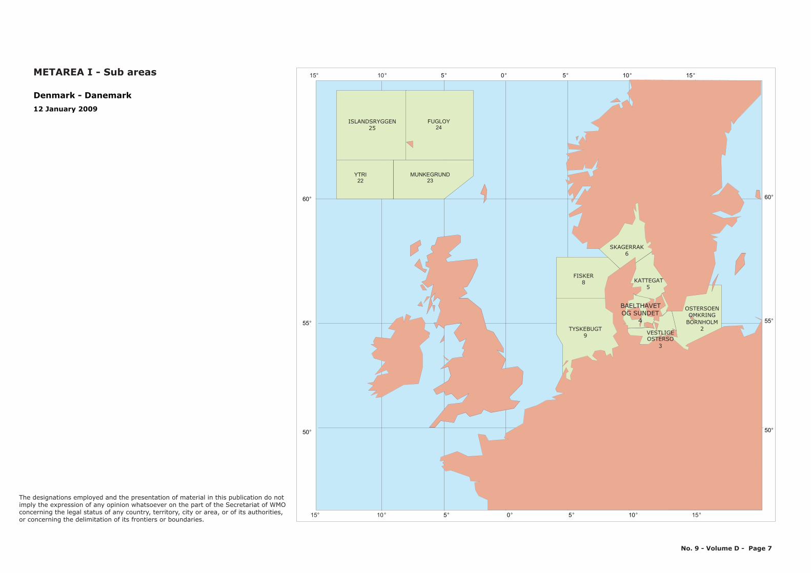
Denmark - Danemark12 January 2009
55°
METAREA I - Sub areas
The designations employed and the presentation of material in this publication do notimply the expression of any opinion whatsoever on the part of the Secretariat of WMOconcerning the legal status of any country, territory, city or area, or of its authorities, or concerning the delimitation of its frontiers or boundaries.
No. 9 - Volume D - Page 7
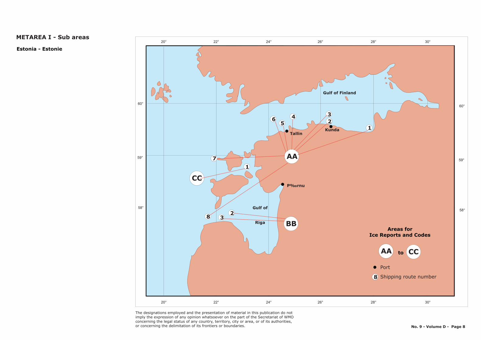
Estonia - Estonie20° 22° 24° 26° 28° 30°
20° 22° 24° 26° 28° 30°
58°
60°
59°
P‰rnu
TallinKunda
Gulf of Finland
AA7
5
8
46
CC1
23
Gulf of
Riga
123
BB
58°
60°
59°
Areas forIce Reports and Codes
toAA CC
Port
8 Shipping route number
METAREA I - Sub areas
The designations employed and the presentation of material in this publication do notimply the expression of any opinion whatsoever on the part of the Secretariat of WMOconcerning the legal status of any country, territory, city or area, or of its authorities, or concerning the delimitation of its frontiers or boundaries. No. 9 - Volume D - Page 8
FINLAND
SWEDEN
NORWAY
60°
65°
15° 20° 25°
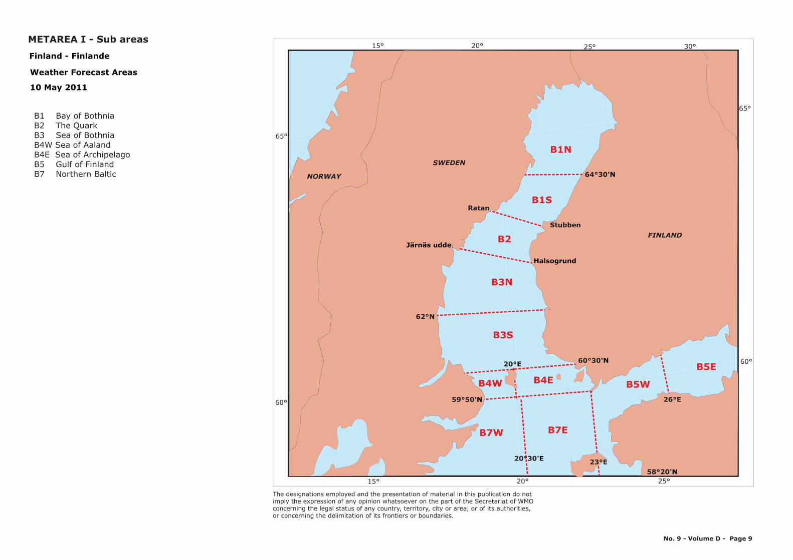
B7W
B1N
B3N
15° 20° 25° 30°
65°
Finland - Finlande
Weather Forecast Areas
10 May 2011
B1 Bay of BothniaB2 The QuarkB3 Sea of BothniaB4W Sea of AalandB4E Sea of Archipelago B5 Gulf of FinlandB7 Northern Baltic
B2
B1S
B4W B4E
60°
B3S
B7E
B5E
B5W26°E
64°30'N
59°50'N
58°20'N23°E20°30'E
60°30'N20°E
Stubben
Ratan
Järnäs udde
Halsogrund
62°N
METAREA I - Sub areas
The designations employed and the presentation of material in this publication do notimply the expression of any opinion whatsoever on the part of the Secretariat of WMOconcerning the legal status of any country, territory, city or area, or of its authorities, or concerning the delimitation of its frontiers or boundaries.
No. 9 - Volume D - Page 9
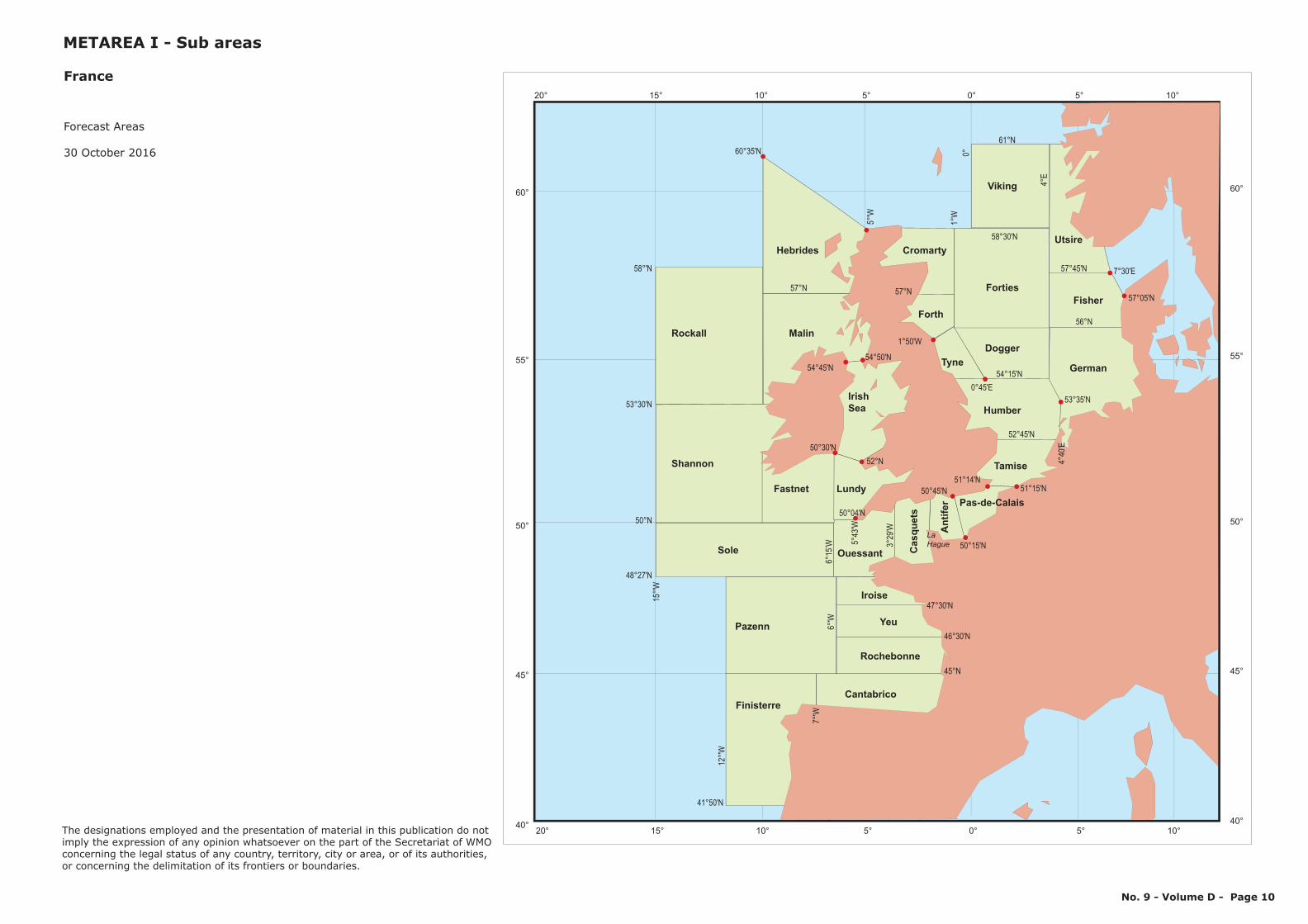
Forecast Areas
30 October 2016
France
METAREA I - Sub areas
No. 9 - Volume D - Page 10
52°45'N
58°30'N
57°N
56°N
61°N
54°15'N
4°E
1°W
0°
46°30'N
47°30'N
41°50'N
45°N
48°27'N
50°N
53°30'N
58°'N
60°35'N
51°15'N
50°15'N
50°45'N
57°N
12
°'W
15
°'W
5°'W
57°45'N
53°35'N
4°4
0'E
7°'W
6°'W
6°1
5’W 3
°2
9'W
50°04'N
5°4
3'W
54°45'N
54°50'N
1°50'W
7°30'E
57°05'N
0°45'E
51°14'N
52°N
50°30'N
60°
55°
50°
45°
40°
20° 15° 10° 5° 0° 5° 10°
60°
55°
50°
45°
40°
20° 15° 10° 5° 0° 5° 10°
Forth
Tyne
Forties
Fisher
Dogger
Humber
German
Tamise
Pas-de-Calais
Viking
Cromarty
Rockall
Shannon
Sole
Finisterre
Hebrides
Malin
Fastnet Lundy
Irish
Sea
Ouessant Casquets
Cantabrico
Antifer
Utsire
Pazenn
Rochebonne
Yeu
Iroise
La
Hague
The designations employed and the presentation of material in this publication do notimply the expression of any opinion whatsoever on the part of the Secretariat of WMOconcerning the legal status of any country, territory, city or area, or of its authorities, or concerning the delimitation of its frontiers or boundaries.
10° 0° 10°
10° 0° 10°
50°
40°
50°
40°
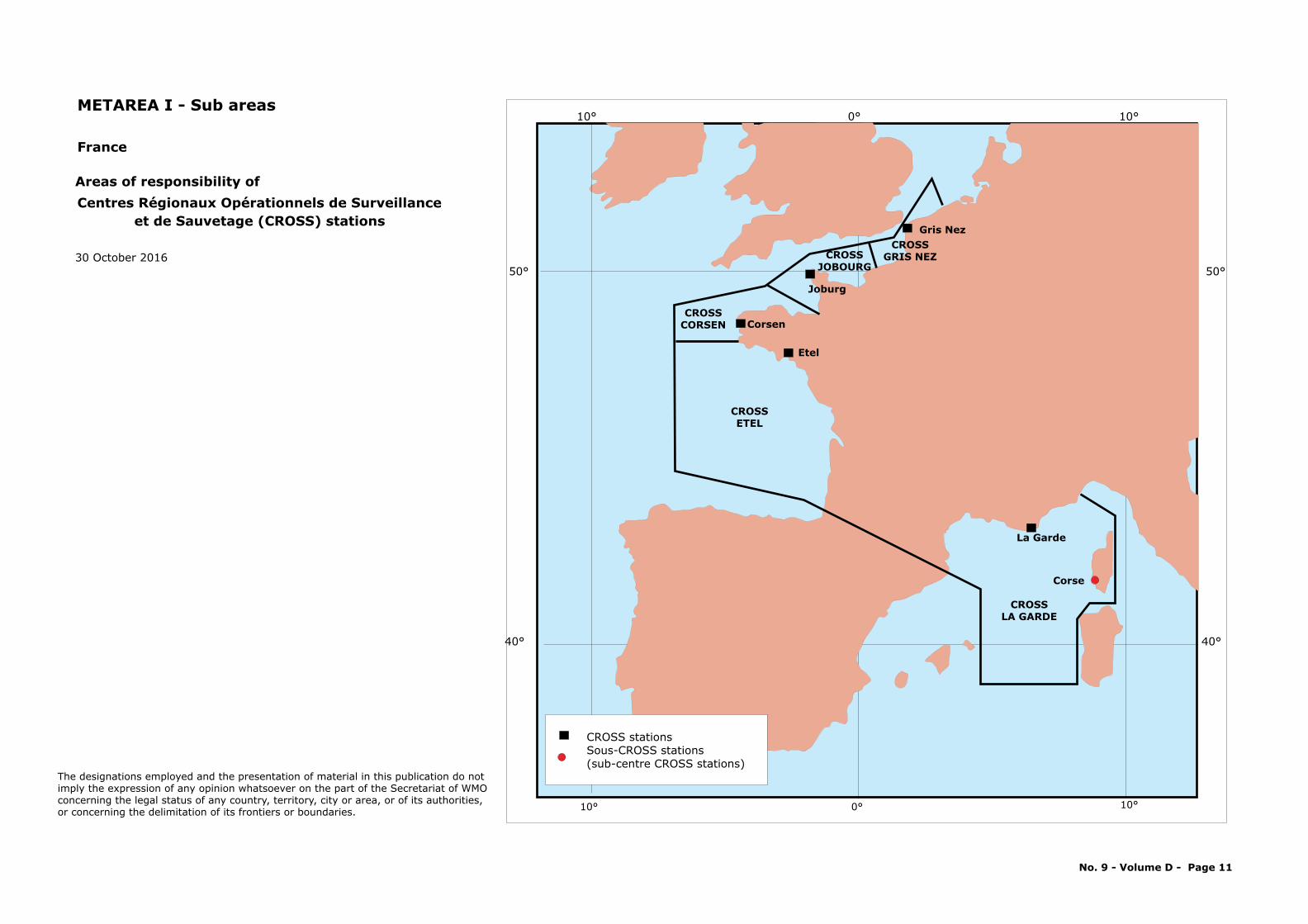
La Garde
CROSSLA GARDE
Corse
Corsen
Etel
Joburg
Gris Nez
CROSSETEL
CROSSCORSEN
CROSSJOBOURG
CROSSGRIS NEZ
CROSS stationsSous-CROSS stations (sub-centre CROSS stations)
France
Areas of responsibility ofCentres Régionaux Opérationnels de Surveillance
et de Sauvetage (CROSS) stations
METAREA I - Sub areas
No. 9 - Volume D - Page 11
30 October 2016
The designations employed and the presentation of material in this publication do notimply the expression of any opinion whatsoever on the part of the Secretariat of WMOconcerning the legal status of any country, territory, city or area, or of its authorities, or concerning the delimitation of its frontiers or boundaries.
30 20 10 0 10 20 30
30 20 10 0 10 20 30
20
40
60
80
70
50
30
20
40
60
80
70
50
30
A1
A3
A4
A7
A8
A9
A6A5
N12
N11
B1
A26*
B2
B3
B14
N1A10*
A20*
A11A21*
N2
N3
N9
N10
N4
N8
B13
B4 B5
B6
B7
B9
B10B11
B12
B8
M3
M2
M1
M4 M5
M6
M7
M9
A2
65°
60°
65°
60°50° 40°
50° 40°
Greenland
III
Route
Nord
kap -
Svinö
y
Route Pentlands - Kap Farvel
Route Gibraltar - Port
Said
*O
nly
if re
quire
d
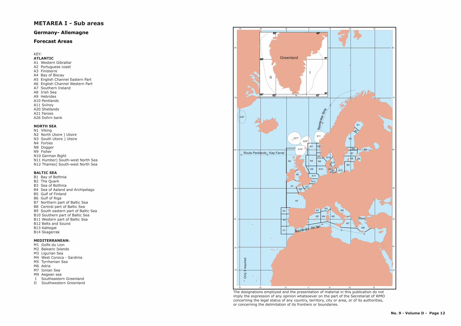
Germany- Allemagne
Forecast Areas
KEY: ATLANTIC A1 Western GibraltarA2 Portuguese coastA3 Finisterre
A5 English Channel Eastern PartA6 English Channel Western PartA7 Southern IrelandA8 Irish SeaA9 HebridesA10 Pentlands
N11 Humber) South-west North SeaN12 Thames) South-west North Sea
B1 Bay of BothniaB2 The QuarkB3 Sea of BothniaB4 Sea of Aaland and ArchipelagoB5 Gulf of FinlandB6 Gulf of RigaB7 Northern part of Baltic SeaB8 Central part of Baltic SeaB9 South eastern part of Baltic SeaB10 Southern part of Baltic SeaB11 Western part of Baltic SeaB12 Belts and SoundB13 KattegatB14 Skagerrak
M1 Golfe du LionM2 Balearic IslandsM3 Ligurian SeaM4 West Corsica - SardiniaM5 Tyrrhenian SeaM6 AdriaM7 Ionian SeaM9 Aegean sea I Southeastern GreenlandII Southwestern Greenland
A11 SvínoyA20 ShetlandsA21 FaroesA26 Dohrn bank
N1 VikingN2 North Utsire ) UtsireN3 South Utsire ) UtsireN4 FortiesN8 DoggerN9 FisherN10 German Bight
NORTH SEA
BALTIC SEA
MEDITERRANEAN:
A4 Bay of Biscay
METAREA I - Sub areas
The designations employed and the presentation of material in this publication do notimply the expression of any opinion whatsoever on the part of the Secretariat of WMOconcerning the legal status of any country, territory, city or area, or of its authorities, or concerning the delimitation of its frontiers or boundaries.
No. 9 - Volume D - Page 12
102030405060
102030405060
60
70
65
75
13
14
12
1
2
3
10
11
9
8
7 6
5
4
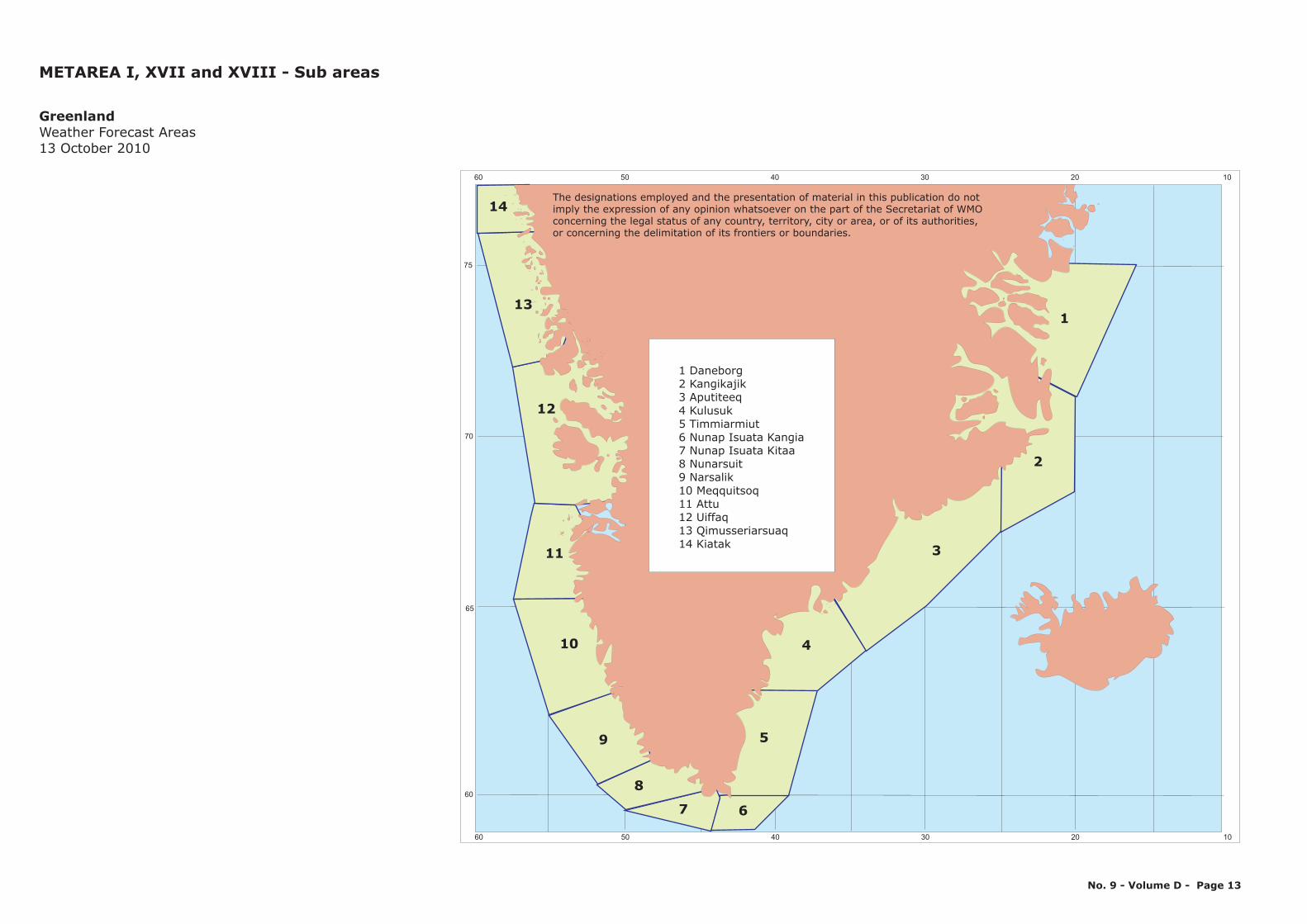
1 Daneborg2 Kangikajik3 Aputiteeq4 Kulusuk5 Timmiarmiut6 Nunap Isuata Kangia7 Nunap Isuata Kitaa8 Nunarsuit9 Narsalik10 Meqquitsoq11 Attu12 Uiffaq13 Qimusseriarsuaq14 Kiatak
GreenlandWeather Forecast Areas13 October 2010
METAREA I, XVII and XVIII - Sub areas
The designations employed and the presentation of material in this publication do notimply the expression of any opinion whatsoever on the part of the Secretariat of WMOconcerning the legal status of any country, territory, city or area, or of its authorities, or concerning the delimitation of its frontiers or boundaries.
No. 9 - Volume D - Page 13
50° 40° 30° 20° 10° 0°
50° 40° 30° 20° 10° 0°
70°
60°
70°
60°
Sudvesturdjúp Sudurdjúp Sudausturdjúp
Vesturdjúp
Faereyjadjúp
Austurdjúp
Nordurdjúp
91
3
2
45 6
7
8
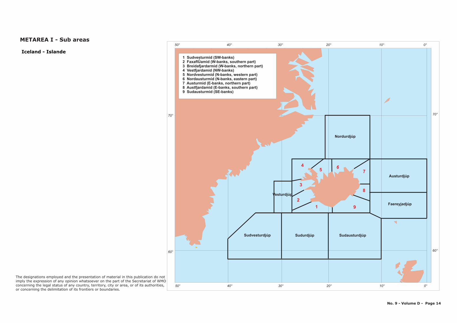
Iceland - Islande1 Sudvesturmid (SW-banks)2 FaxaflÛamid (W-banks, southern part)3 Breidafjardarmid (W-banks, northern part)4 Vestfjardamid (NW-banks)5 Nordvesturmid (N-banks, western part)6 Nordausturmid (N-banks, eastern part)7 Austurmid (E-banks, northern part)8 Austfjardamid (E-banks, southern part)9 Sudausturmid (SE-banks)
No. 9 - Volume D - Page 14
METAREA I - Sub areas
The designations employed and the presentation of material in this publication do notimply the expression of any opinion whatsoever on the part of the Secretariat of WMOconcerning the legal status of any country, territory, city or area, or of its authorities, or concerning the delimitation of its frontiers or boundaries.
Rossan Point
Sherkin Island
Mace Head
Kinsale EnergyGas Platform
The designations employed and the presentation of material in this publication do notimply the expression of any opinion whatsoever on the part of the Secretariat of WMOconcerning the legal status of any country, territory, city or area, or of its authorities, or concerning the delimitation of its frontiers or boundaries.
M1
M4
M2
M5
M3
M6
IrishSea
L. Derg
L. ReeL. Corrib
L. Mask
L. Allen
L. Key
Anglesey
Isle ofMan
Belfast Lough
Carlingford Lough
Strangford Lough
Bloody ForelandFair Head
Erris Head
Slyne Head
Loop Head
Mizen Head
Hook Head
Carnsore Point
Wicklow Head
Dungarvan
Howth Head
Malin Head
Belmullet
Valentia
Roche's Point
Dublin Airport
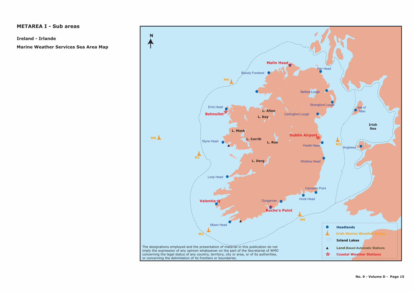
Ireland - Irlande
Marine Weather Services Sea Area Map
METAREA I - Sub areas
No. 9 - Volume D - Page 15
N
-Based Automatic Stations
Headlands
Irish Marine Weather Buoys
Inland Lakes
Land
Coastal Weather Stations
Antwerpen
Sloehavn
Dordrecht
Rotterdam
Amsterdam
Den Helder
Harlingen
Delfzijl
GG
FF
4
EE
DD
CCNorth Sea
BBAA
Ijsselmeer
NETHERLANDS
BELGIUM
Key/Légende :
PortShipping route number
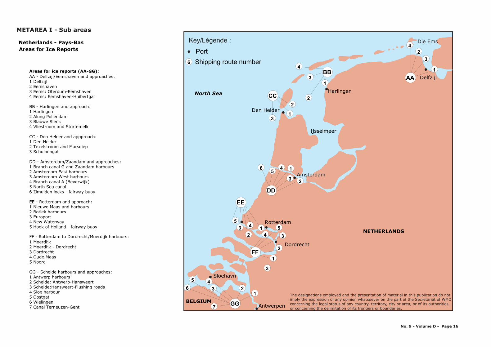
Die EmsNetherlands - Pays-BasAreas for Ice Reports
AA - Delfzijl/Eemshaven and approaches:1 Delfzijl 2 Eemshaven 3 Eems: Oterdum-Eemshaven4 Eems: Eemshaven-Huibertgat
BB - Harlingen and approach:1 Harlingen 2 Along Pollendam 3 Blauwe Slenk4 Vliestroom and Stortemelk
CC - Den Helder and appproach:1 Den Helder 2 Texelstroom and Marsdiep 3 Schulpengat
DD - Amsterdam/Zaandam and approaches:1 Branch canal G and Zaandam harbours 2 Amsterdam East harbours 3 Amsterdam West harbours4 Branch canal A (Beverwijk) 5 North Sea canal 6 IJmuiden locks - fairway buoy
Areas for ice reports (AA-GG):
EE - Rotterdam and approach:1 Nieuwe Maas and harbours 2 Botlek harbours 3 Europort4 New Waterway 5 Hook of Holland - fairway buoy
FF - Rotterdam to Dordrecht/Moerdijk harbours:1 Moerdijk 2 Moerdijk - Dordrecht 3 Dordrecht4 Oude Maas 5 Noord
GG - Schelde harbours and approaches:1 Antwerp harbours 2 Schelde: Antwerp-Hansweert 3 Schelde:Hansweert-Flushing roads4 Sloe harbour5 Oostgat6 Wielingen7 Canal Terneuzen-Gent
METAREA I - Sub areas
No. 9 - Volume D - Page 16
53 1
2
2
3
4
1
35
1
2356 4
31
22
13
4
42
3
1
2345
6
7
1
6
The designations employed and the presentation of material in this publication do notimply the expression of any opinion whatsoever on the part of the Secretariat of WMOconcerning the legal status of any country, territory, city or area, or of its authorities, or concerning the delimitation of its frontiers or boundaries.
15° 10 5 0 5 10 15° °∞ ° ° ° °
15° 10 5 0 5 10 15° ° ° ° ° °
60°60°
55°55°
50°50°
61°N
52°45'N
56°N
58°30'N
58°N
7°10'E
54°15'N
1°W
Viking
Forties
Dogger
Humber
Thames
Dover
GermanBight
Fisher
Vlissingen
Hoek van HollandIjmuiden
Terschelling
Netherlands - Pays-Bas
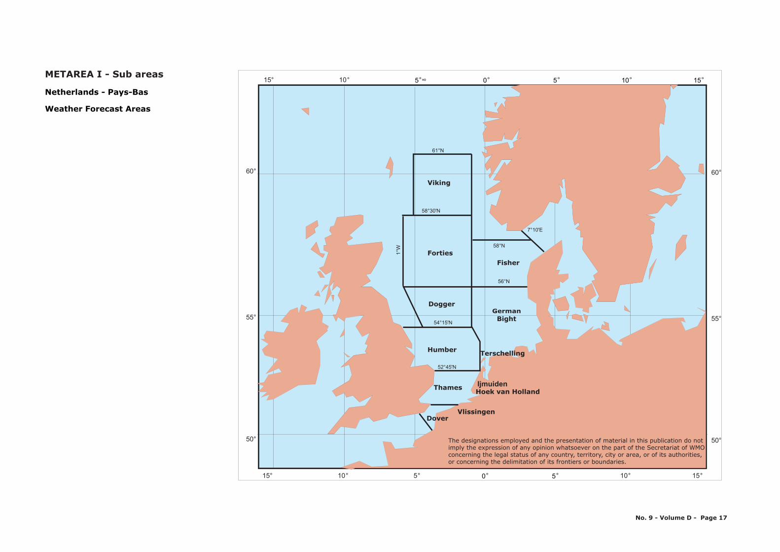
No. 9 - Volume D - Page 17
Weather Forecast Areas
METAREA I - Sub areas
The designations employed and the presentation of material in this publication do notimply the expression of any opinion whatsoever on the part of the Secretariat of WMOconcerning the legal status of any country, territory, city or area, or of its authorities, or concerning the delimitation of its frontiers or boundaries.
N1
N4
4
5
12
3
6
78
1512
22
14
13
0
10
9
11
N8 N10
B14
N9
N3
N2
31
23
21
20
19
16
18
17
2829
30
26 25 24
Jan Mayen
Kapp Nord
S rkappo
Bj rn yao o
Alesund
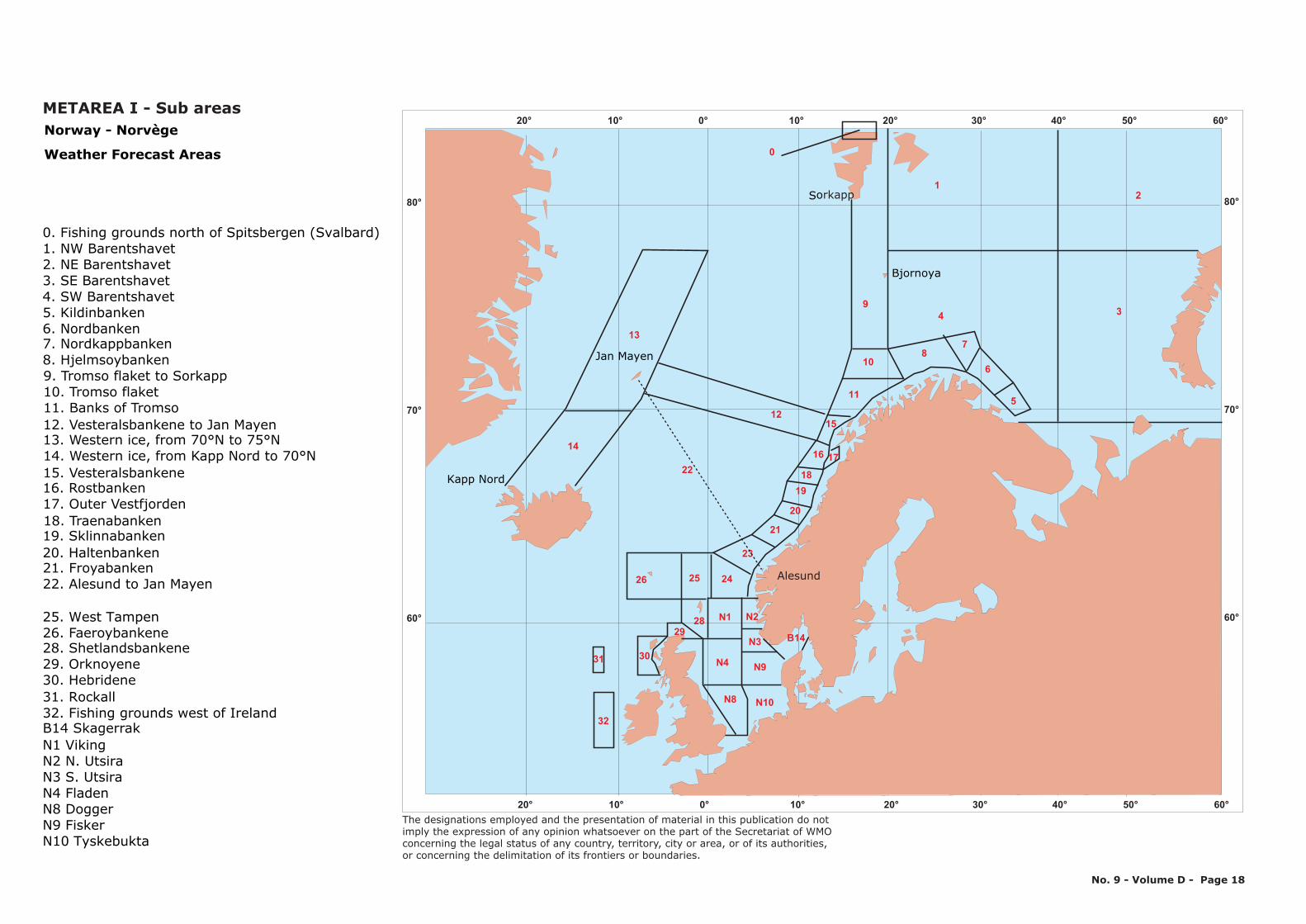
Norway - Norvège
0. Fishing grounds north of Spitsbergen (Svalbard)1. NW Barentshavet2. NE Barentshavet3. SE Barentshavet4. SW Barentshavet5. Kildinbanken6. Nordbanken7. Nordkappbanken8. Hjelmsoybanken9. Tromso flaket to Sorkapp10. Tromso flaket11. Banks of Tromso12. Vesteralsbankene to Jan Mayen13. Western ice, from 70°N to 75°N14. Western ice, from Kapp Nord to 70°N15. Vesteralsbankene16. Rostbanken17. Outer Vestfjorden18. Traenabanken19. Sklinnabanken20. Haltenbanken21. Froyabanken22. Alesund to Jan Mayen
25. West Tampen26. Faeroybankene28. Shetlandsbankene29. Orknoyene30. Hebridene31. Rockall32. Fishing grounds west of IrelandB14 SkagerrakN1 VikingN2 N. UtsiraN3 S. UtsiraN4 FladenN8 DoggerN9 FiskerN10 Tyskebukta
32
METAREA I - Sub areas
No. 9 - Volume D - Page 18
Weather Forecast Areas
80°
70°
60°
20° 10° 0° 10° 20° 30° 40° 50° 60°
80°
70°
60°
20° 10° 0° 10° 20° 30° 40° 50° 60°
The designations employed and the presentation of material in this publication do notimply the expression of any opinion whatsoever on the part of the Secretariat of WMOconcerning the legal status of any country, territory, city or area, or of its authorities, or concerning the delimitation of its frontiers or boundaries.
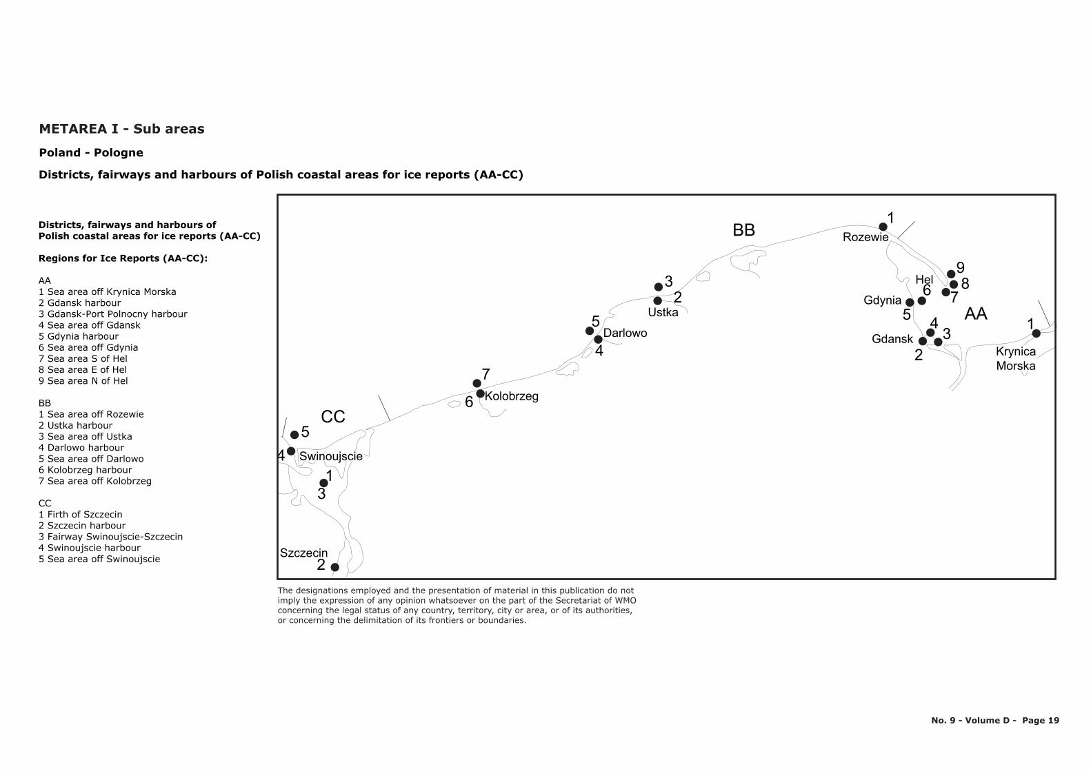
BB
CC
AA
7
6
54
13
2
5
4
32
1
98
765
2
43 1
Gdansk
Gdynia
Rozewie
Ustka
Darlowo
Kolobrzeg
Szczecin
Hel
Swinoujscie
KrynicaMorska
Poland - Pologne
Districts, fairways and harbours of Polish coastal areas for ice reports (AA-CC)
Districts, fairways and harbours of Polish coastal areas for ice reports (AA-CC)
Regions for Ice Reports (AA-CC):
AA1 Sea area off Krynica Morska2 Gdansk harbour 3 Gdansk-Port Polnocny harbour4 Sea area off Gdansk 5 Gdynia harbour 6 Sea area off Gdynia7 Sea area S of Hel 8 Sea area E of Hel 9 Sea area N of Hel
BB1 Sea area off Rozewie 2 Ustka harbour 3 Sea area off Ustka4 Darlowo harbour 5 Sea area off Darlowo 6 Kolobrzeg harbour7 Sea area off Kolobrzeg
CC1 Firth of Szczecin 2 Szczecin harbour 3 Fairway Swinoujscie-Szczecin4 Swinoujscie harbour 5 Sea area off Swinoujscie
METAREA I - Sub areas
No. 9 - Volume D - Page 19
The designations employed and the presentation of material in this publication do notimply the expression of any opinion whatsoever on the part of the Secretariat of WMOconcerning the legal status of any country, territory, city or area, or of its authorities, or concerning the delimitation of its frontiers or boundaries.
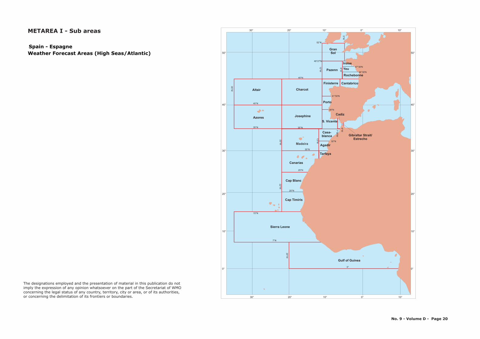
30° 20° 10° 0° 10°
30° 20° 10° 0° 10°
50°
40°
30°
20°
10°
0°
50°
40°
30°
20°
10°
0°
Canarias
Azores
Altair
Pazenn
GranSol
Charcot
S. Vicente
Madeira
Josephine
0°
7°N
25°N
20°N
30°N
22°W22°W
20°W
35°W
12°W
6°W5°W
7°W
13°W
15°N
35°N 35°N
40°N
45°N
48°27'N
52°N
Yeu
Rochebonne
CantabricoFinisterre
Porto
Cadiz
Gibraltar Strait/Estrecho
Iroise
41°50'N
39°N
7°30'W
6°W
Casa-blanca
Agadir
Tarfaya
46°30'N
32°N
47°30'N
Spain - EspagneWeather Forecast Areas (High Seas/Atlantic)
Cap Blanc
Gulf of Guinea
Sierra Leone
Cap Timiris
No. 9 - Volume D - Page 20
METAREA I - Sub areas
The designations employed and the presentation of material in this publication do notimply the expression of any opinion whatsoever on the part of the Secretariat of WMOconcerning the legal status of any country, territory, city or area, or of its authorities, or concerning the delimitation of its frontiers or boundaries.
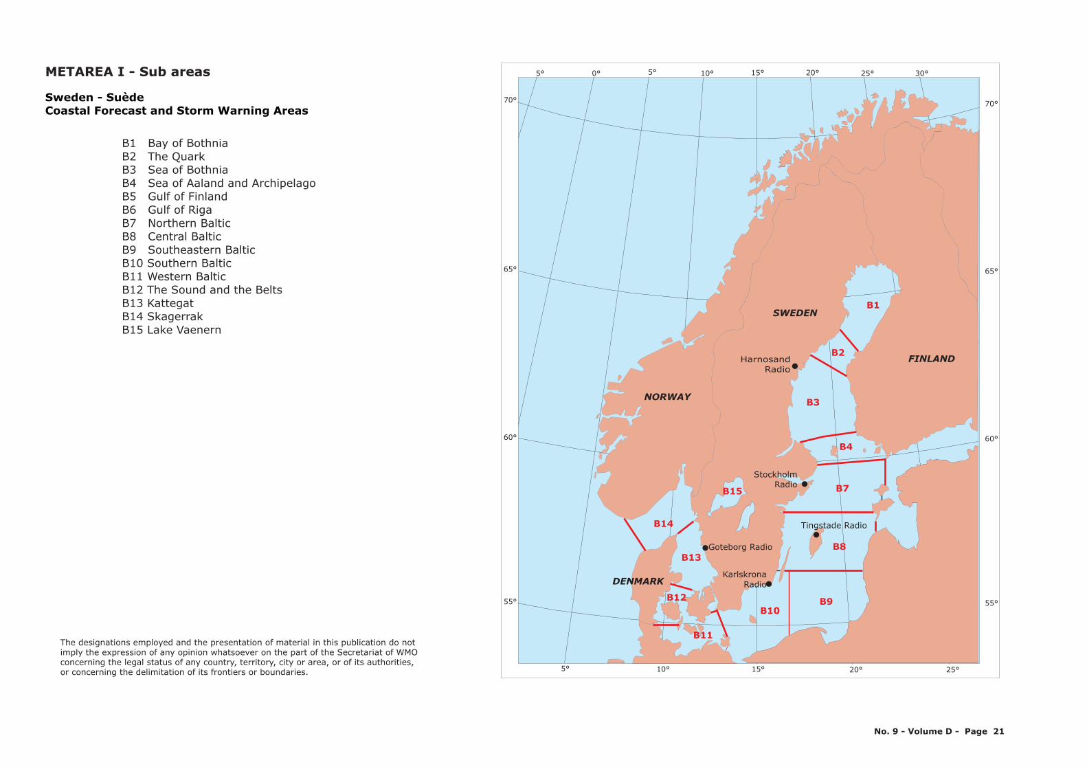
FINLAND
SWEDEN
NORWAY
DENMARK
Stockholm Radio
Goteborg Radio
KarlskronaRadio
B15
60°
65°
55°
15°10°5° 20° 25°
B13
B12
B11
B9B10
B8
B7
B1
B2
B4
B14
Harnosand Radio
B3
15°10°5° 20° 25° 30°5° 0°
70°70°
65°
60°
55°
Tingstade Radio
Sweden - SuèdeCoastal Forecast and Storm Warning Areas
B1 Bay of BothniaB2 The QuarkB3 Sea of BothniaB4 Sea of Aaland and Archipelago B5 Gulf of FinlandB6 Gulf of RigaB7 Northern Baltic B8 Central Baltic B9 Southeastern BalticB10 Southern BalticB11 Western BalticB12 The Sound and the BeltsB13 Kattegat B14 SkagerrakB15 Lake Vaenern
METAREA I - Sub areas
No. 9 - Volume D - Page 21
The designations employed and the presentation of material in this publication do notimply the expression of any opinion whatsoever on the part of the Secretariat of WMOconcerning the legal status of any country, territory, city or area, or of its authorities, or concerning the delimitation of its frontiers or boundaries.
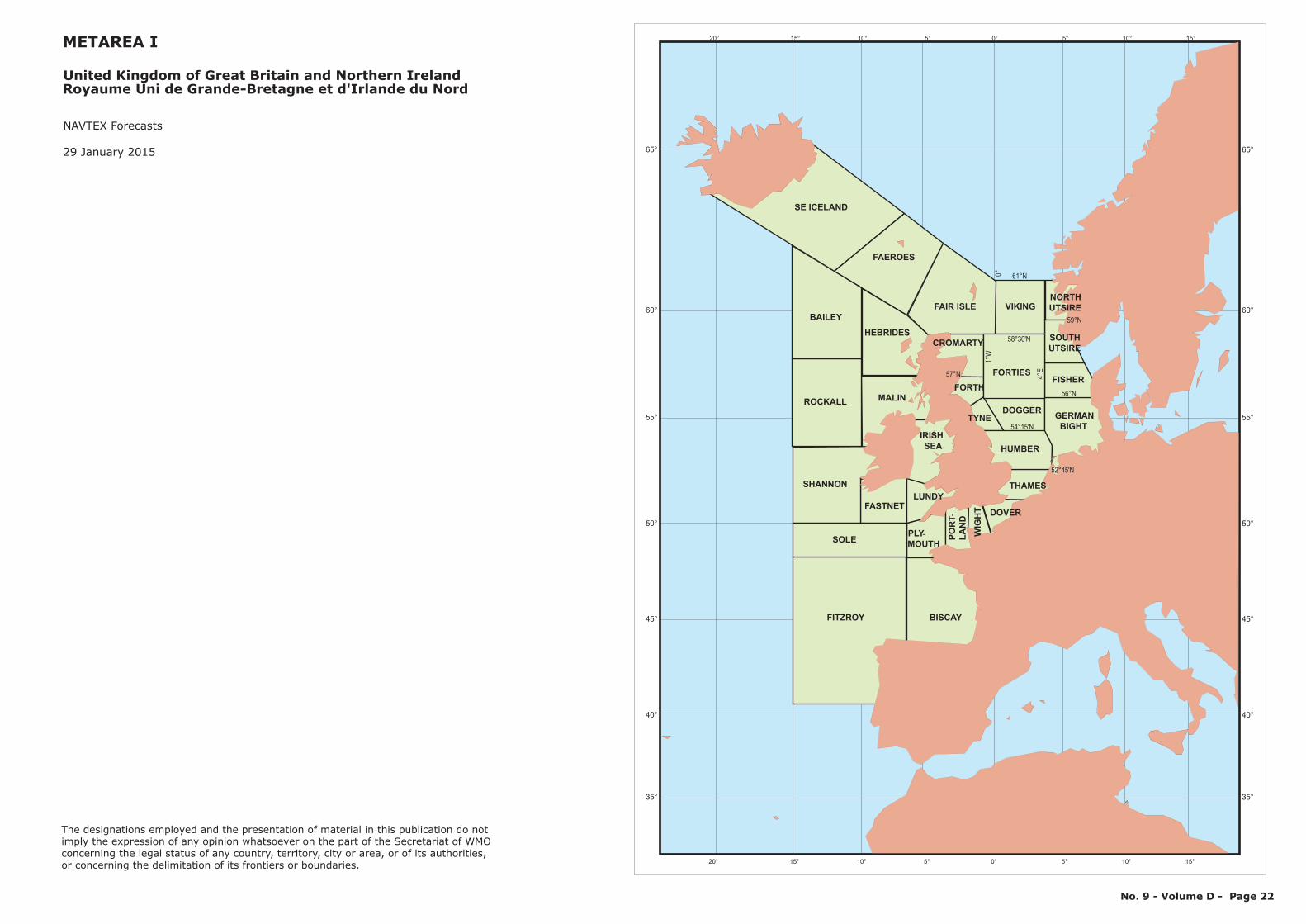
-
Royaume Uni de Grande-Bretagne et d'Irlande du Nord
NAVTEX Forecasts
29 January 2015
United Kingdom of Great Britain and Northern Ireland
METAREA I
No. 9 - Volume D - Page 22
52°45'N
58°30'N
59°N
57°N
56°N
61°N
54°15'N
4°E
1°W
0°
65°
60°
55°
50°
45°
40°
35°
20° 15° 10° 5° 0° 5° 10° 15°
65°
60°
55°
50°
45°
40°
35°
20° 15° 10° 5° 0° 5° 10° 15°
FORTH
TYNE
SE ICELAND
FAEROES
FAIR ISLE
FORTIESFISHER
NORTHUTSIRE
DOGGER
HUMBER
GERMANBIGHT
THAMES
DOVER
VIKING
CROMARTY
BAILEY
ROCKALL
SHANNON
SOLE
FITZROY
HEBRIDES
MALIN
FASTNETLUNDY
IRISHSEA
PLYMOUTH
POR
T-LA
ND
BISCAY
WIG
HT
SOUTHUTSIRE
The designations employed and the presentation of material in this publication do notimply the expression of any opinion whatsoever on the part of the Secretariat of WMOconcerning the legal status of any country, territory, city or area, or of its authorities, or concerning the delimitation of its frontiers or boundaries.
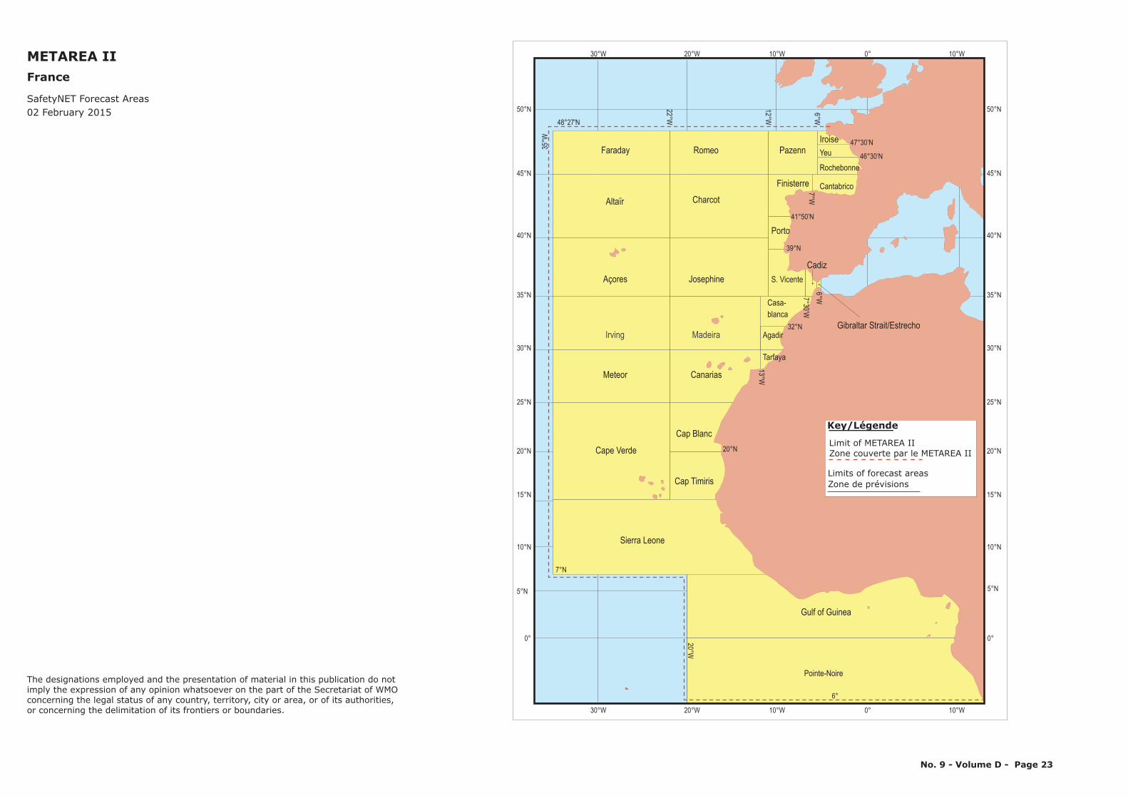
Pointe-Noire
Gulf of Guinea
Cadiz
Agadir
Tarfaya
Casa-blanca
S. Vicente
Gibraltar Strait/Estrecho
Cantabrico
Yeu
Rochebonne
IroiseFaraday
Charcot
Cape Verde
Meteor
Irving
Açores
Altaïr
Madeira
Josephine
Cap Blanc
Cap Timiris
Canarias
Sierra Leone
PazennRomeo
Porto
Finisterre
6°
20°W
35°W
48°27'N
7°N
22°W
12°W
6°W
47°30’N
46°30’N
7°W
39°N
6°W7°30’W32°N
41°50’N
20°N
13°W
METAREA IIFrance
02 February 2015SafetyNET Forecast Areas
Limit of METAREA IIZone couverte par le METAREA II
Limits of forecast areas
Key/Légende
Zone de prévisions
No. 9 - Volume D - Page 23
25°N
45°N
35°N
15°N
0°
50°N
40°N
30°N
20°N
10°N
0°
30°W 20°W 10°W 0° 10°W
25°N
45°N
35°N
15°N
50°N
40°N
30°N
20°N
10°N
30°W 20°W 10°W 0° 10°W
5°N 5°N
The designations employed and the presentation of material in this publication do notimply the expression of any opinion whatsoever on the part of the Secretariat of WMOconcerning the legal status of any country, territory, city or area, or of its authorities, or concerning the delimitation of its frontiers or boundaries.
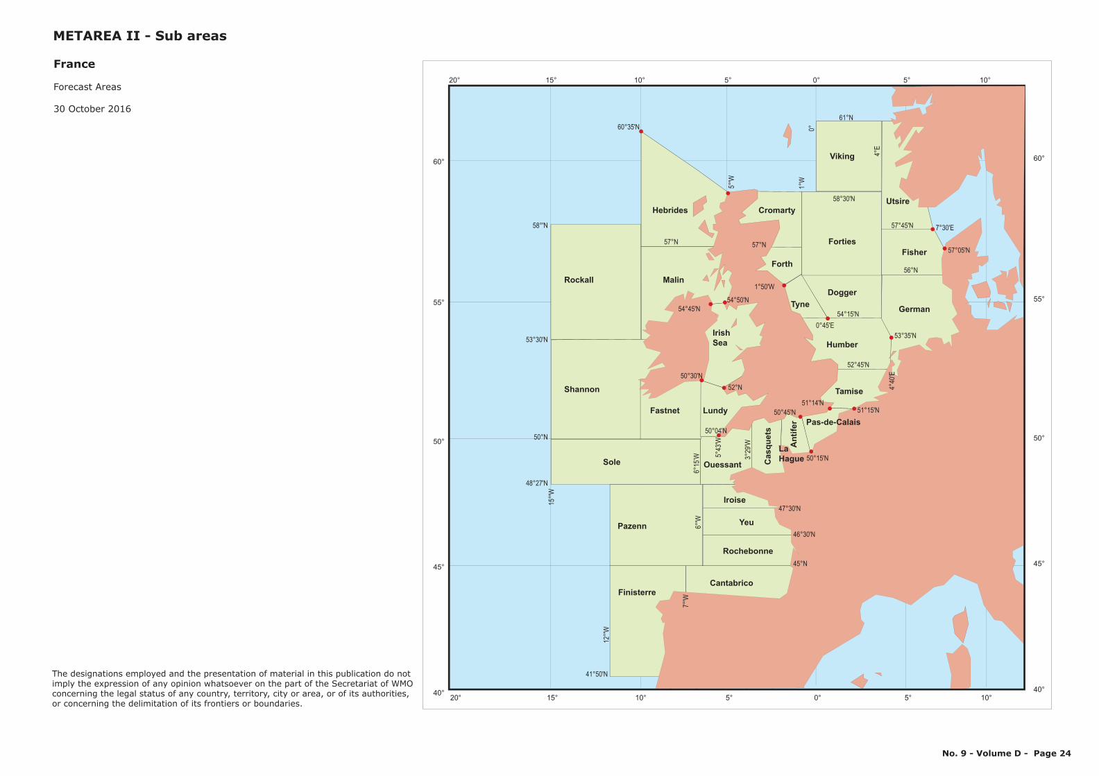
Forecast Areas
30 October 2016
France
METAREA II - Sub areas
No. 9 - Volume D - Page 24
52°45'N
58°30'N
57°N
56°N
61°N
54°15'N
4°E
1°W
0°
46°30'N
47°30'N
41°50'N
45°N
48°27'N
50°N
53°30'N
58°'N
60°35'N
51°15'N
50°15'N
50°45'N
57°N
12
°'W
15
°'W
5°'W
57°45'N
53°35'N
4°4
0'E
7°'W
6°'W
6°1
5’W 3
°2
9'W
50°04'N
5°4
3'W
54°45'N
54°50'N
1°50'W
7°30'E
57°05'N
0°45'E
51°14'N
52°N
50°30'N
60°
55°
50°
45°
40°
20° 15° 10° 5° 0° 5° 10°
60°
55°
50°
45°
40°
20° 15° 10° 5° 0° 5° 10°
Forth
Tyne
Forties
Fisher
Dogger
Humber
German
Tamise
Pas-de-Calais
Viking
Cromarty
Rockall
Shannon
Sole
Finisterre
Hebrides
Malin
Fastnet Lundy
Irish
Sea
Ouessant Casquets
Cantabrico
Antifer
Utsire
Pazenn
Rochebonne
Yeu
Iroise
La
Hague
The designations employed and the presentation of material in this publication do notimply the expression of any opinion whatsoever on the part of the Secretariat of WMOconcerning the legal status of any country, territory, city or area, or of its authorities, or concerning the delimitation of its frontiers or boundaries.

10° 0° 10°
10° 0° 10°
50°
40°
50°
40°
La Garde
CROSSLA GARDE
Corse
Corsen
Etel
Joburg
Gris Nez
CROSSETEL
CROSSCORSEN
CROSSJOBOURG
CROSSGRIS NEZ
CROSS stationsSous-CROSS stations (sub-centre CROSS stations)
France
Areas of responsibility of
Centres Régionaux Opérationnels de Surveillance et de Sauvetage (CROSS) stations
METAREA II
No. 9 - Volume D - Page 25
The designations employed and the presentation of material in this publication do notimply the expression of any opinion whatsoever on the part of the Secretariat of WMOconcerning the legal status of any country, territory, city or area, or of its authorities, or concerning the delimitation of its frontiers or boundaries.
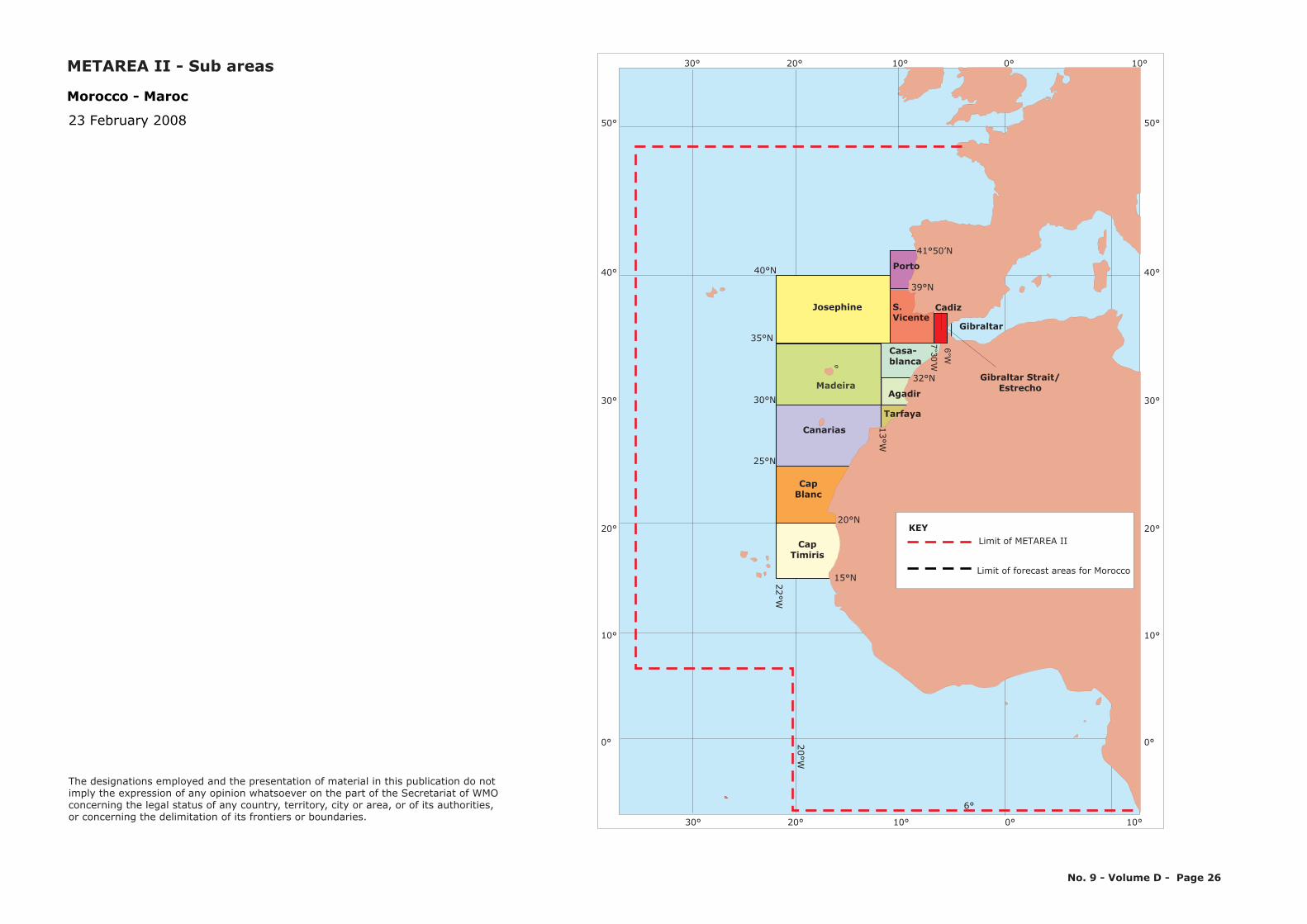
30° 20° 10° 0° 10°
6°
20°W
Madeira
Josephine
CapBlanc
CapTimiris
25°N
30°N
35°N
40°N
Canarias
Agadir
Tarfaya
Porto
39°N
S.Vicente
Gibraltar
6°W7°30’W
Gibraltar Strait/Estrecho
32°N
Casa-blanca
41°50’N
20°N
13°W
30° 20° 10° 0° 10°
50°
40°
30°
20°
10°
0°
50°
40°
30°
20°
10°
0°
Cadiz
22°W
15°N
Morocco - Maroc
23 February 2008
Limit of METAREA II
Limit of forecast areas for Morocco
KEY
No. 9 - Volume D - Page 26
The designations employed and the presentation of material in this publication do notimply the expression of any opinion whatsoever on the part of the Secretariat of WMOconcerning the legal status of any country, territory, city or area, or of its authorities, or concerning the delimitation of its frontiers or boundaries.
METAREA II - Sub areas
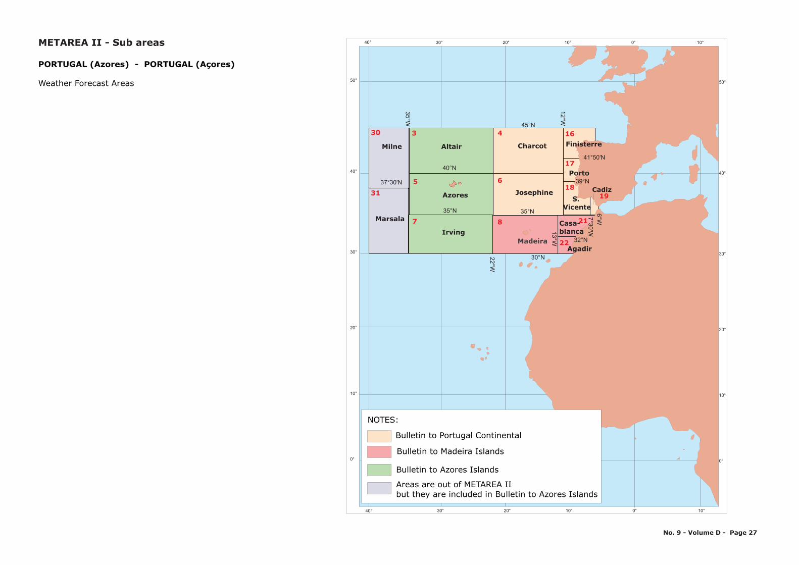
30° 20° 10° 0° 10°
30° 20° 10° 0° 10°
50°
40°
30°
20°
10°
0°
50°
40°
30°
20°
10°
0°
Azores
Irving
AltairMilne
Marsala
Charcot
Madeira
Josephine
30°N22°W
35°W
12°W
7°W
13°W
35°N
37°30'N
35°N
40°N
45°N
Finisterre
Porto
41°50'N
39°N
7°30'W6°W
Casa-blanca
Agadir32°N
40°
40°
S. Vicente
4
6
330
315
7 8 21
22
16
17
18
PORTUGAL (Azores) - PORTUGAL (Açores)
Weather Forecast Areas
Cadiz19
No. 9 - Volume D - Page 27
Bulletin to Portugal Continental
Bulletin to Madeira Islands
Bulletin to Azores Islands
Areas are out of METAREA IIbut they are included in Bulletin to Azores Islands
NOTES:
METAREA II - Sub areas
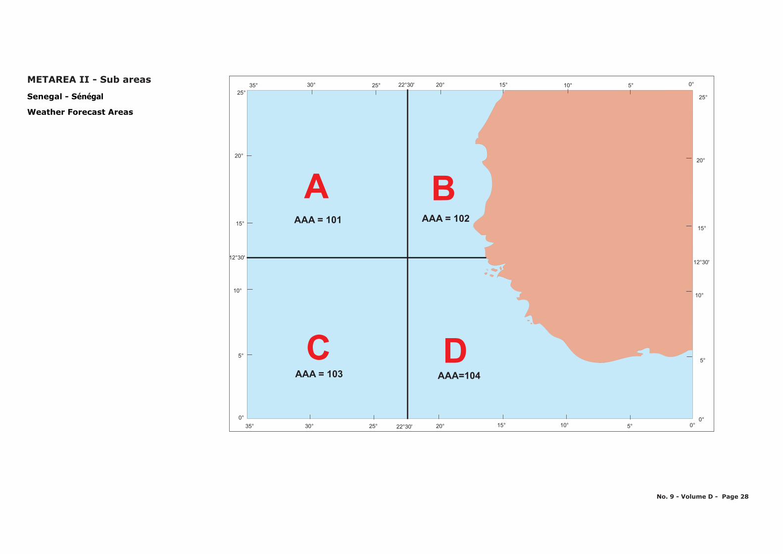
A B
C DAAA=104AAA = 103
AAA = 101 AAA = 102
30° 25° 20°22 30'° 15° 10° 5° 0°35°0° 0°
5°5°
10°10°
15°15°
12 30'°12 30'°
20°20°
25°25°
35° 30° 25° 22 30'° 20° 15° 10° 5° 0°
Senegal - Sénégal
Weather Forecast Areas
No. 9 - Volume D - Page 28
METAREA II - Sub areas
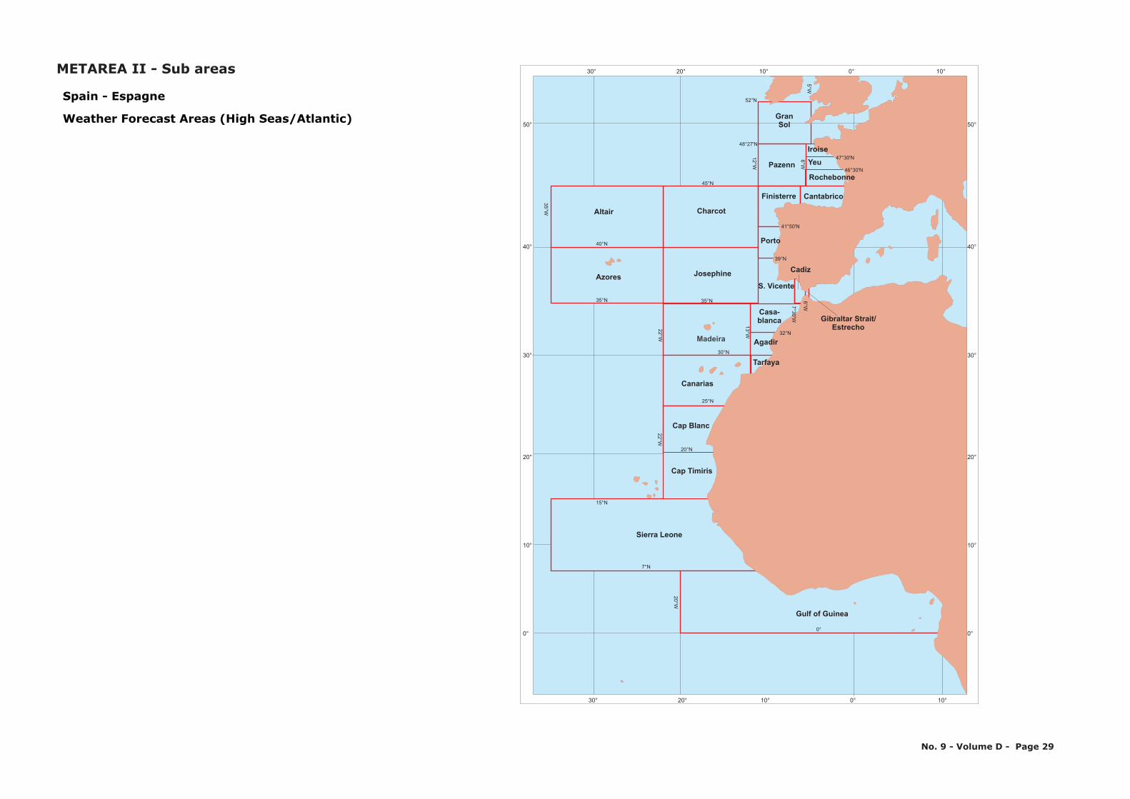
30° 20° 10° 0° 10°
30° 20° 10° 0° 10°
50°
40°
30°
20°
10°
0°
50°
40°
30°
20°
10°
0°
Canarias
Azores
Altair
Pazenn
GranSol
Charcot
S. Vicente
Madeira
Josephine
0°
7°N
25°N
20°N
30°N
22°W22°W
20°W
35°W
12°W
6°W5°W
7°W
13°W
15°N
35°N 35°N
40°N
45°N
48°27'N
52°N
Yeu
Rochebonne
CantabricoFinisterre
Porto
Cadiz
Gibraltar Strait/Estrecho
Iroise
41°50'N
39°N
7°30'W
6°W
Casa-blanca
Agadir
Tarfaya
46°30'N
32°N
47°30'N
Spain - Espagne
Weather Forecast Areas (High Seas/Atlantic)
Cap Blanc
Gulf of Guinea
Sierra Leone
Cap Timiris
No. 9 - Volume D - Page 29
METAREA II - Sub areas
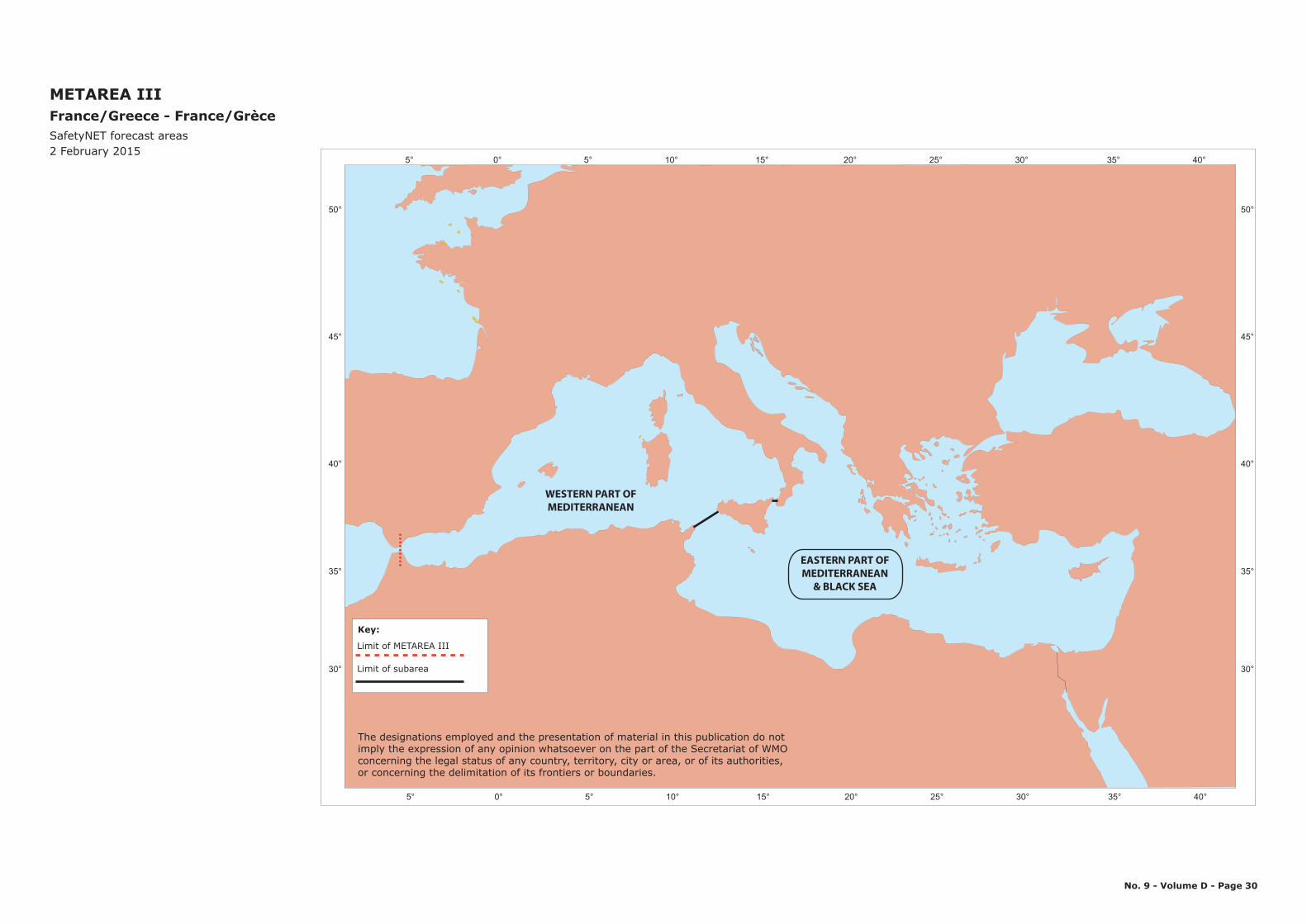
5° 0° 5° 10° 15° 20° 25° 30° 35° 40°
50°
45°
40°
35°
30°
METAREA IIIFrance/Greece - France/GrèceSafetyNET forecast areas2 February 2015
5° 0° 5° 10° 15° 20° 25° 30° 35° 40°
50°
45°
40°
35°
30°
No. 9 - Volume D - Page 30
EASTERN PART OFMEDITERRANEAN
& BLACK SEA
WESTERN PART OFMEDITERRANEAN
The designations employed and the presentation of material in this publication do notimply the expression of any opinion whatsoever on the part of the Secretariat of WMOconcerning the legal status of any country, territory, city or area, or of its authorities, or concerning the delimitation of its frontiers or boundaries.
Limit of METAREA III
Limit of subarea
Key:
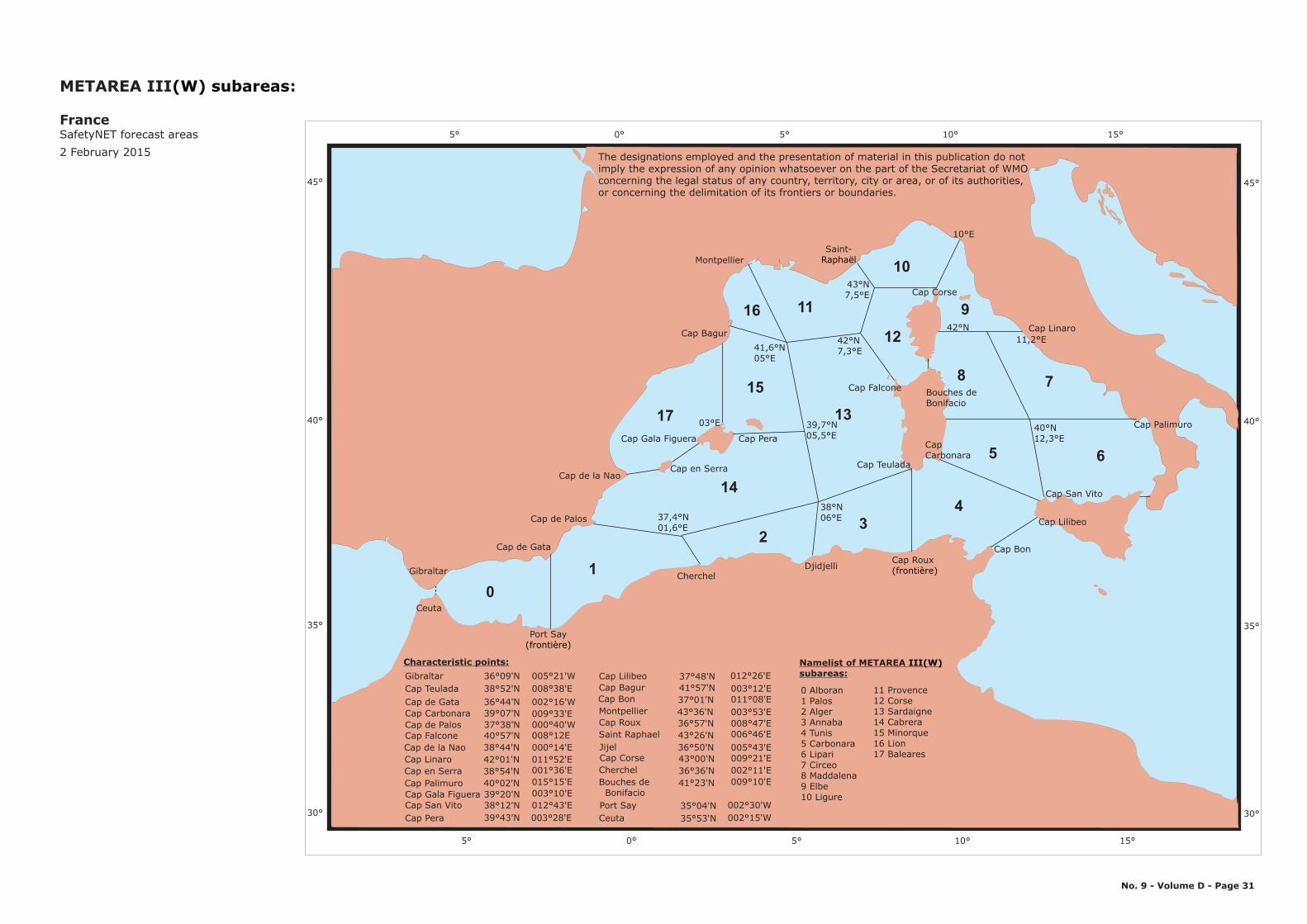
7
6
8
9
10
11
12
13
14
15
01
23
4
5
16
17
10°E
15°10°5°0°5°
45°
40°
35°
30°
Gibraltar
Ceuta
Cap de Gata
Port Say(frontière)
Cap de Palos
CherchelDjidjelli
Cap Roux(frontière)
Cap Bon
Cap Lilibeo
Cap San Vito
Cap Palimuro
Cap Linaro
Montpellier
Cap de la Nao
Cap Bagur
Saint-Raphaël
37,4°N01,6°E
Cap en Serra
03°E
41,6°N05°E
38°N06°E
39,7°N05,5°E
42°N7,3°E
42°N
Cap Corse
Cap Gala Figuera Cap Pera
Cap Teulada
CapCarbonara
Bouches deBonifacio
40°N12,3°E
11,2°E
43°N7,5°E
45°
40°
35°
30°
15°10°5°0°5°
(W) subareasMETAREA III :
FranceSafetyNET forecast areas2 February 2015
No. 9 - Volume D - Page 31
Cap Falcone
GibraltarCap TeuladaCap de GataCap CarbonaraCap de PalosCap FalconeCap de la NaoCap LinaroCap en SerraCap PalimuroCap Gala FigueraCap San VitoCap Pera
36°09'N 005°21'W 38°52'N 008°38'E36°44'N 002°16'W
009°33'E39°07'N 000°40'W 37°38'N 008°12E40°57'N 000°14'E 38°44'N 011°52'E42°01'N 001°36'E 38°54'N 015°15'E40°02'N 003°10'E 39°20'N 012°43'E38°12'N
003°28'E 39°43'N 002°15'W
012°26'ECap Lilibeo 37°48'N 003°12'E Cap Bagur 41°57'N
011°08'ECap Bon 37°01'N Montpellier 003°53'E 43°36'NCap Roux 008°47'E36°57'NSaint RaphaelJijelCap CorseCherchelBouches de BonifacioPort SayCeuta
006°46'E 43°26'N 005°43'E36°50'N 009°21'E43°00'N 002°11'E36°36'N 009°10'E41°23'N
002°30'W35°04'N35°53'N
0 Alboran1 Palos2 Alger3 Annaba4 Tunis5 Carbonara6 Lipari7 Circeo8 Maddalena9 Elbe10 Ligure
Namelist of METAREA subareas:
III(W)
11 Provence12 Corse13 Sardaigne14 Cabrera15 Minorque16 Lion17 Baleares
Characteristic points:
The designations employed and the presentation of material in this publication do notimply the expression of any opinion whatsoever on the part of the Secretariat of WMOconcerning the legal status of any country, territory, city or area, or of its authorities, or concerning the delimitation of its frontiers or boundaries.
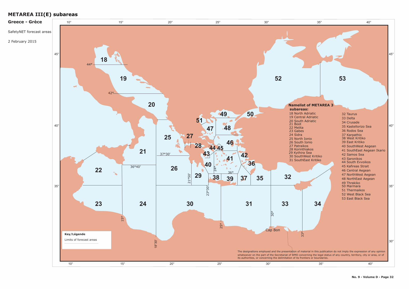
45°
40°
35°
5219
20
25
21
24 30 31
2629
18
22
23 33
32
34
3537
36
38 39
40
4344
41 42
49 5051
28 46
47 48
METAREA III(E) subareasGreece - Grèce
2 February 2015
45
Cap Bon
45°
40°
35°
30°
53
Limits of forecast areas
Key/Légende
32 Taurus33 Delta34 Crusade35 Kastellorizo Sea36 Rodos Sea37 Karpathio38 West Kritiko39 East Kritiko40 SouthWest Aegean41 SouthEast Aegean Ikario42 Samos Sea43 Saronikos44 South Evvoikos45 Kafireas Strait46 Central Aegean47 NorthWest Aegean48 NorthEast Aegean49 Thrakiko50 Marmara51 Thermaikos52 West Black Sea53 East Black Sea
No. 9 - Volume D - Page 32
33°
18°3
0'
25°
30°
15°
36°40’
21°5
0'
23°3
0’
36°24°
27
37°30'
44°
42°
Namelist of METAREA 3 subareas:
The designations employed and the presentation of material in this publication do not imply the expression of any opinionwhatsoever on the part of the Secretariat of WMO concerning the legal status of any country, territory, city or area, or of its authorities, or concerning the delimitation of its frontiers or boundaries.
29 Kythira Sea
25 North Ionio26 South Ionio27 Patraikos28 Korinthiakos
30 SouthWest Kritiko31 SouthEast Kritiko
19 Central Adriatic20 South Adriatic21 Boot22 Melita23 Gabes24 Sidra
18 North Adriatic
10° 15° 20° 25° 30° 35° 40°
10° 15° 20° 25° 30° 35° 40°
SafetyNET forecast areas
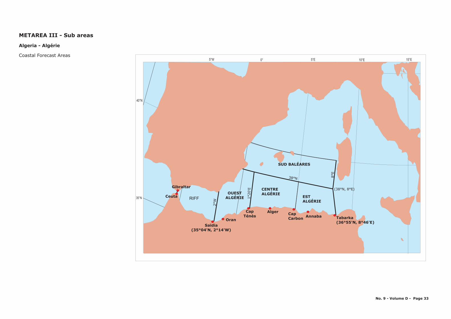
10°E5°E0°5°W
35 N°
40 N°
15 E°
RIFFOUEST
ALGÉRIE
CENTREALGÉRIE
SUD BALÉARES
ESTALGÉRIE
Tabarka(36°55'N, 8°46'E)
Annaba
(38°N, 8°E)Gibraltar
Ceuta
38°N
1°20
'E
8°E
2°W
CapCarbon
AlgerCapTénès
OranSaïdia
(35°04'N, 2°14'W)
Algeria - Algérie
Coastal Forecast Areas
METAREA III - Sub areas
No. 9 - Volume D - Page 33
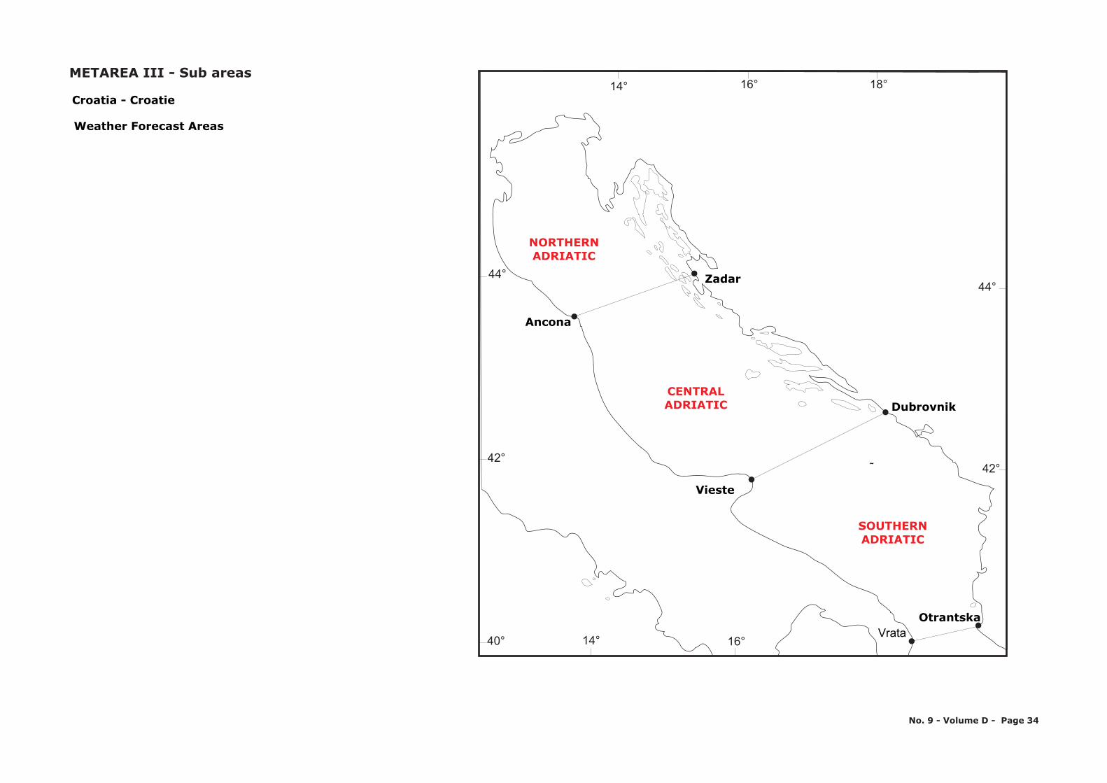
NORTHERNADRIATIC
CENTRALADRIATIC
SOUTHERNADRIATIC
Ancona
Zadar
Vieste
Dubrovnik
OtrantskaVrata
˜
40°
42°
44°
14° 16° 18°
44°
42°
16°14°
Croatia - Croatie
Weather Forecast Areas
No. 9 - Volume D - Page 34
METAREA III - Sub areas
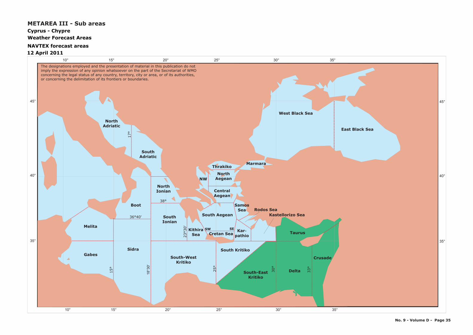
10° 15° 20° 25° 30° 35°
10° 15° 20° 25° 30° 35°
45 °
40 °
35°
45 °
40 °
35°
Melita
GabesSidra
NorthIonian
Boot
South Kritiko
Delta
Crusade
Taurus
South Ionian
South-WestKritiko
SouthAdriatic
North Adriatic
East Black Sea
West Black Sea
18°3
0'
15°
25°
30°
33°
2330
'°
35°
38°
36 40'°
Cyprus - ChypreWeather Forecast Areas
NAVTEX forecast areas12 April 2011
17°
Thrakiko
NWNorth
Aegean
CentralAegean
SamosSea
Marmara
South-EastKritiko
Karpathio
-
Kastellorizo SeaRodos Sea
SW SE
South Aegean
KithiraSea Cretan Sea
METAREA III - Sub areas
The designations employed and the presentation of material in this publication do notimply the expression of any opinion whatsoever on the part of the Secretariat of WMOconcerning the legal status of any country, territory, city or area, or of its authorities, or concerning the delimitation of its frontiers or boundaries.
No. 9 - Volume D - Page 35
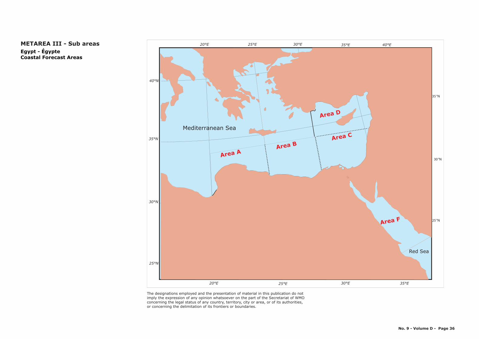
Red Sea
Mediterranean Sea
30 N°
35 N°
25 N°
35 E°30 E°25 E°20 E° 40 E°
30°N
35 N°
25 N°
40 N°
35 E°30 E°25 E°20 E°
Area AArea B
Area C
Area D
Area F
Egypt - ÉgypteCoastal Forecast Areas
METAREA III - Sub areas
No. 9 - Volume D - Page 36
The designations employed and the presentation of material in this publication do notimply the expression of any opinion whatsoever on the part of the Secretariat of WMOconcerning the legal status of any country, territory, city or area, or of its authorities, or concerning the delimitation of its frontiers or boundaries.
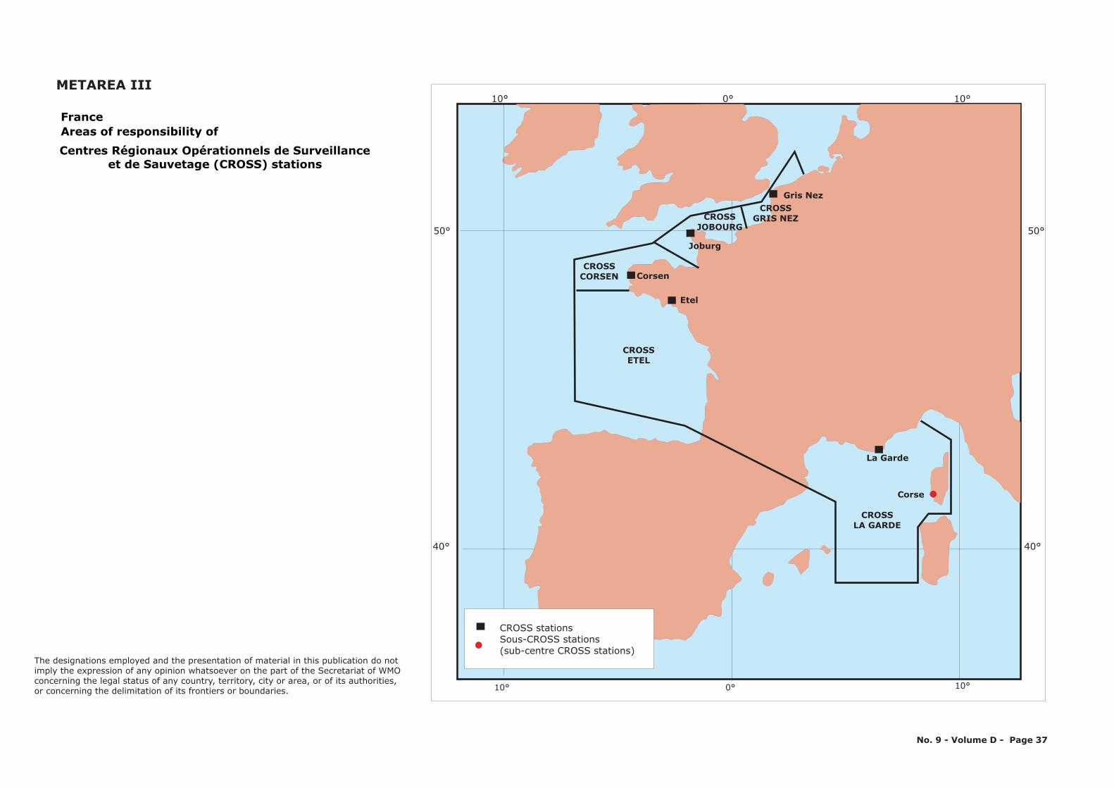
10° 0° 10°
10° 0° 10°
50°
40°
50°
40°
La Garde
CROSSLA GARDE
Corse
Corsen
Etel
Joburg
Gris Nez
CROSSETEL
CROSSCORSEN
CROSSJOBOURG
CROSSGRIS NEZ
CROSS stationsSous-CROSS stations (sub-centre CROSS stations)
FranceAreas of responsibility ofCentres Régionaux Opérationnels de Surveillance
et de Sauvetage (CROSS) stations
METAREA III
No. 9 - Volume D - Page 37
The designations employed and the presentation of material in this publication do notimply the expression of any opinion whatsoever on the part of the Secretariat of WMOconcerning the legal status of any country, territory, city or area, or of its authorities, or concerning the delimitation of its frontiers or boundaries.
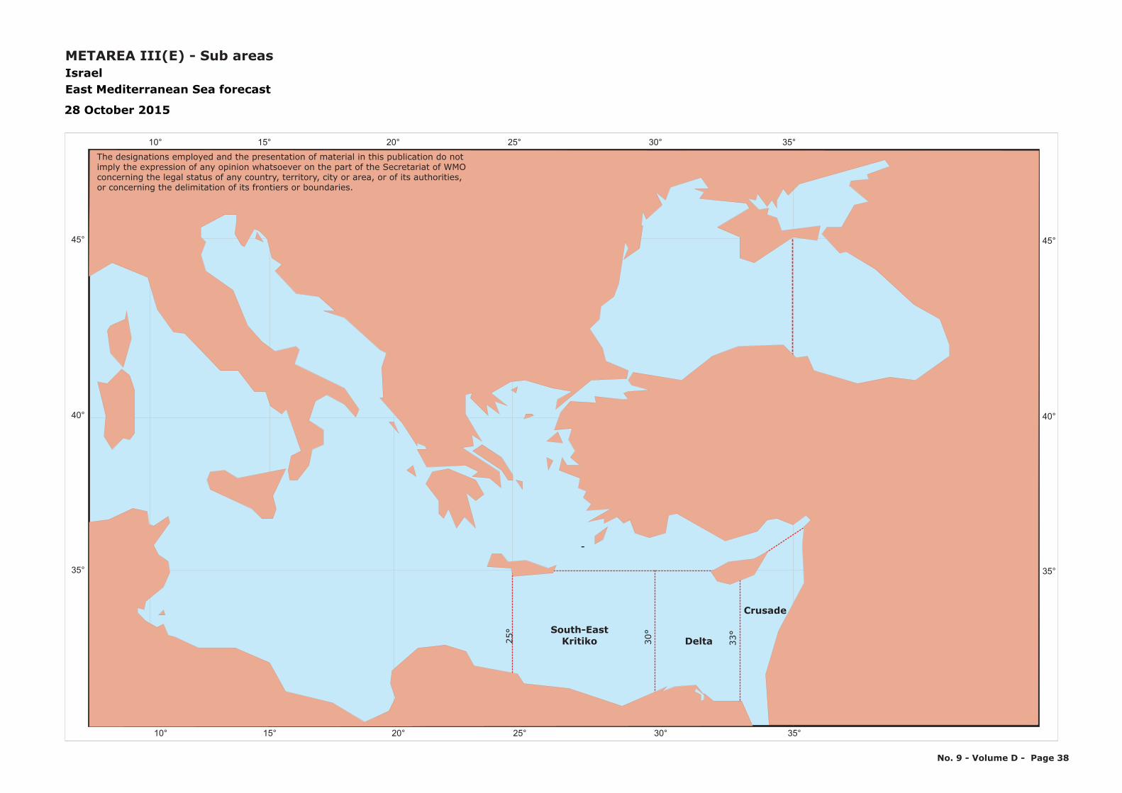
10° 15° 20° 25° 30° 35°
10° 15° 20° 25° 30° 35°
45 °
40 °
35°
45 °
40 °
35°
Delta
Crusade
25°
30°
33°
35°
IsraelEast Mediterranean Sea forecast
28 October 2015
South-EastKritiko
-
METAREA III(E) - Sub areas
The designations employed and the presentation of material in this publication do notimply the expression of any opinion whatsoever on the part of the Secretariat of WMOconcerning the legal status of any country, territory, city or area, or of its authorities, or concerning the delimitation of its frontiers or boundaries.
No. 9 - Volume D - Page 38
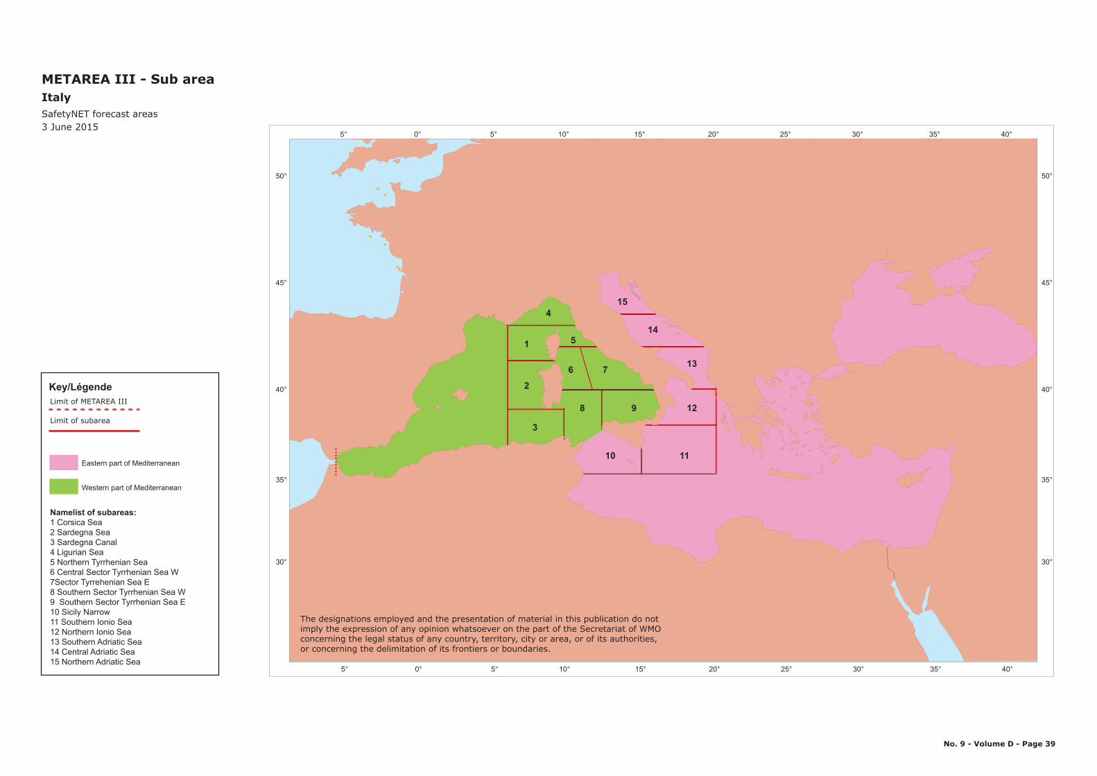
5° 0° 5° 10° 15° 20° 25° 30° 35° 40°
50°
45°
40°
35°
30°
5° 0° 5° 10° 15° 20° 25° 30° 35° 40°
50°
45°
40°
35°
30°
4
1
2
3
5
6 7
8 9 12
13
14
15
10 11
No. 9 - Volume D - Page 39
METAREA III - Sub areaItalySafetyNET forecast areas3 June 2015
The designations employed and the presentation of material in this publication do notimply the expression of any opinion whatsoever on the part of the Secretariat of WMOconcerning the legal status of any country, territory, city or area, or of its authorities, or concerning the delimitation of its frontiers or boundaries.
Western part of Mediterranean
Eastern part of Mediterranean
Namelist of subareas:1 Corsica Sea2 Sardegna Sea3 Sardegna Canal4 Ligurian Sea5 Northern Tyrrhenian Sea6 Central Sector Tyrrhenian Sea W7Sector Tyrrehenian Sea E8 Southern Sector Tyrrhenian Sea W9 Southern Sector Tyrrhenian Sea E10 Sicily Narrow11 Southern Ionio Sea12 Northern Ionio Sea13 Southern Adriatic Sea14 Central Adriatic Sea15 Northern Adriatic Sea
Key/LégendeLimit of METAREA III
Limit of subarea
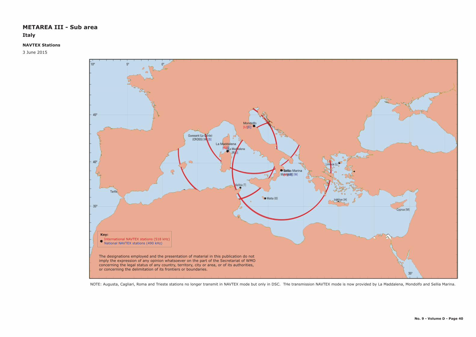
METAREA III - Sub areaItaly
NAVTEX Stations
3 June 2015
The designations employed and the presentation of material in this publication do notimply the expression of any opinion whatsoever on the part of the Secretariat of WMOconcerning the legal status of any country, territory, city or area, or of its authorities, or concerning the delimitation of its frontiers or boundaries.
No. 9 - Volume D - Page 40
NOTE: Augusta, Cagliari, Roma and Trieste stations no longer transmit in NAVTEX mode but only in DSC. THe transmission NAVTEX mode is now provided by La Maddalena, Mondolfo and Sellia Marina.
International NAVTEX stations (518 kHz)Key:
National NAVTEX stations (490 kHz)
Sellia Marina[V][W]
Mondolfo[U][E]
La Maddalena[R][I]
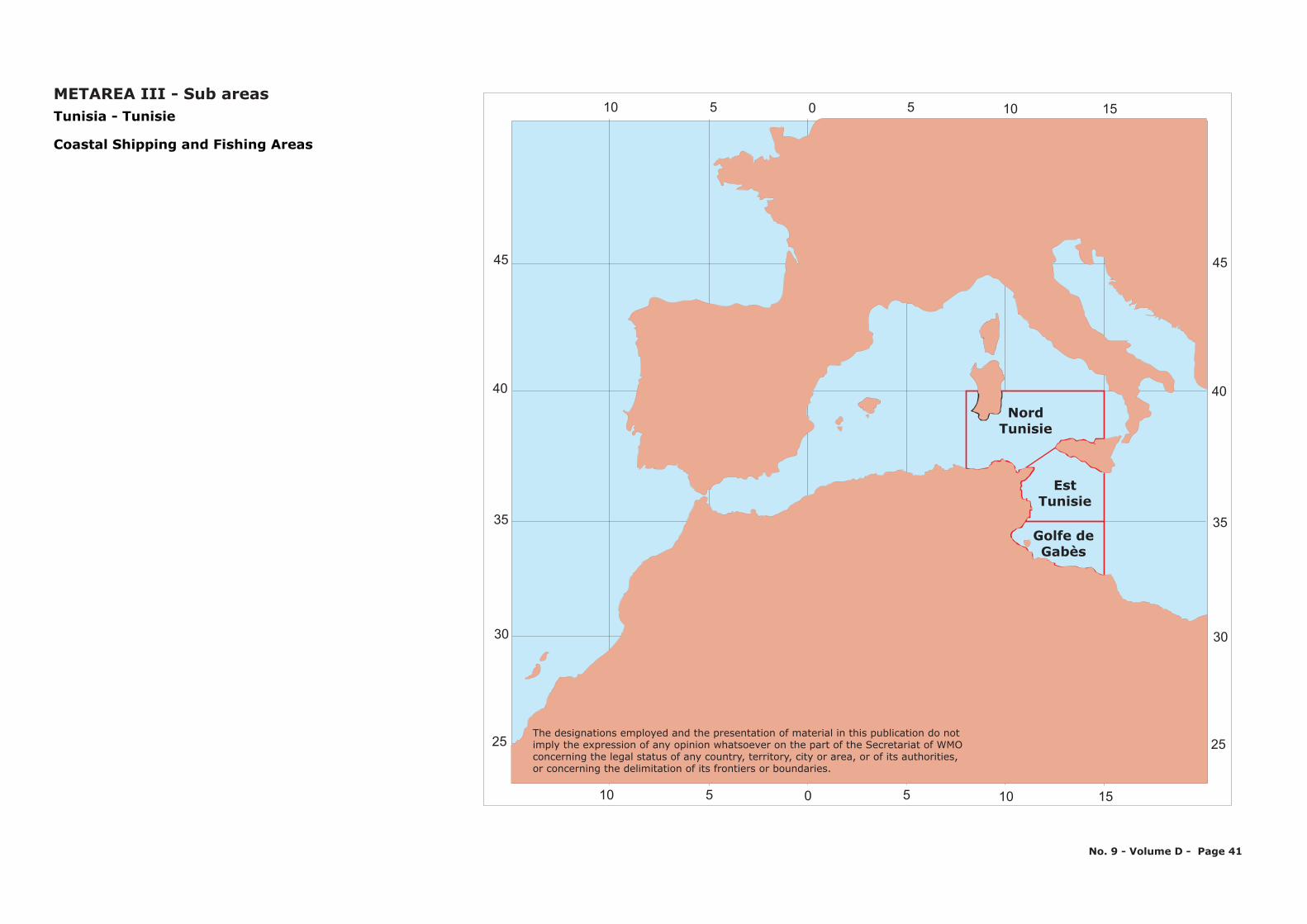
45
Nord Tunisie
EstTunisie
Golfe de Gabès
8°
151050510
151050510
35
30
25
40
45
35
30
25
40
T - unisia unisieT
Coastal Shipping and Fishing Areas
METAREA III - Sub areas
No. 9 - Volume D - Page 41
The designations employed and the presentation of material in this publication do notimply the expression of any opinion whatsoever on the part of the Secretariat of WMOconcerning the legal status of any country, territory, city or area, or of its authorities, or concerning the delimitation of its frontiers or boundaries.
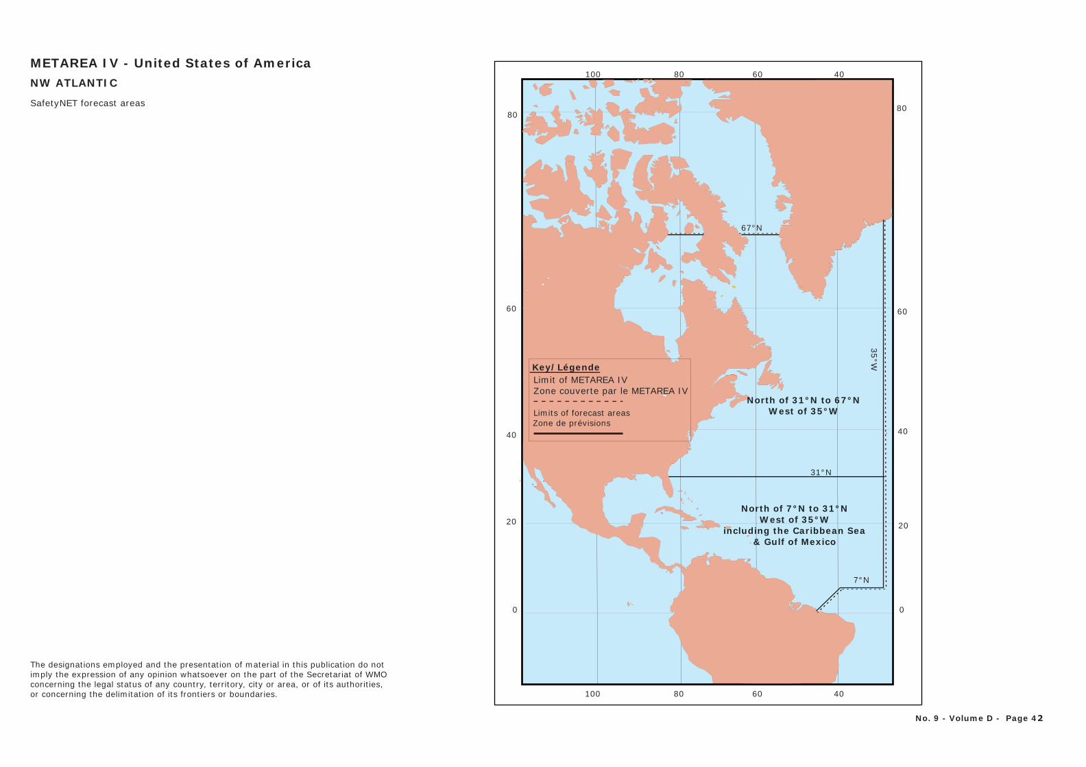
0
20
40
60
80
0
20
40
60
80
67°N
North of 31°N to 67°NWest of 35°W
North of 7°N to 31°NWest of 35°W
including the Caribbean Sea& Gulf of Mexico
7°N
31°N
35°W
406080100
406080100
Limit of METAREA IVZone couverte par le METAREA IV
Limits of forecast areas
METAREA IV - United States of AmericaNW ATLANTIC
Zone de prévisions
SafetyNET forecast areas
Key/Légende
No. 9 - Volume D - Page 42
The designations employed and the presentation of material in this publication do notimply the expression of any opinion whatsoever on the part of the Secretariat of WMOconcerning the legal status of any country, territory, city or area, or of its authorities, or concerning the delimitation of its frontiers or boundaries.
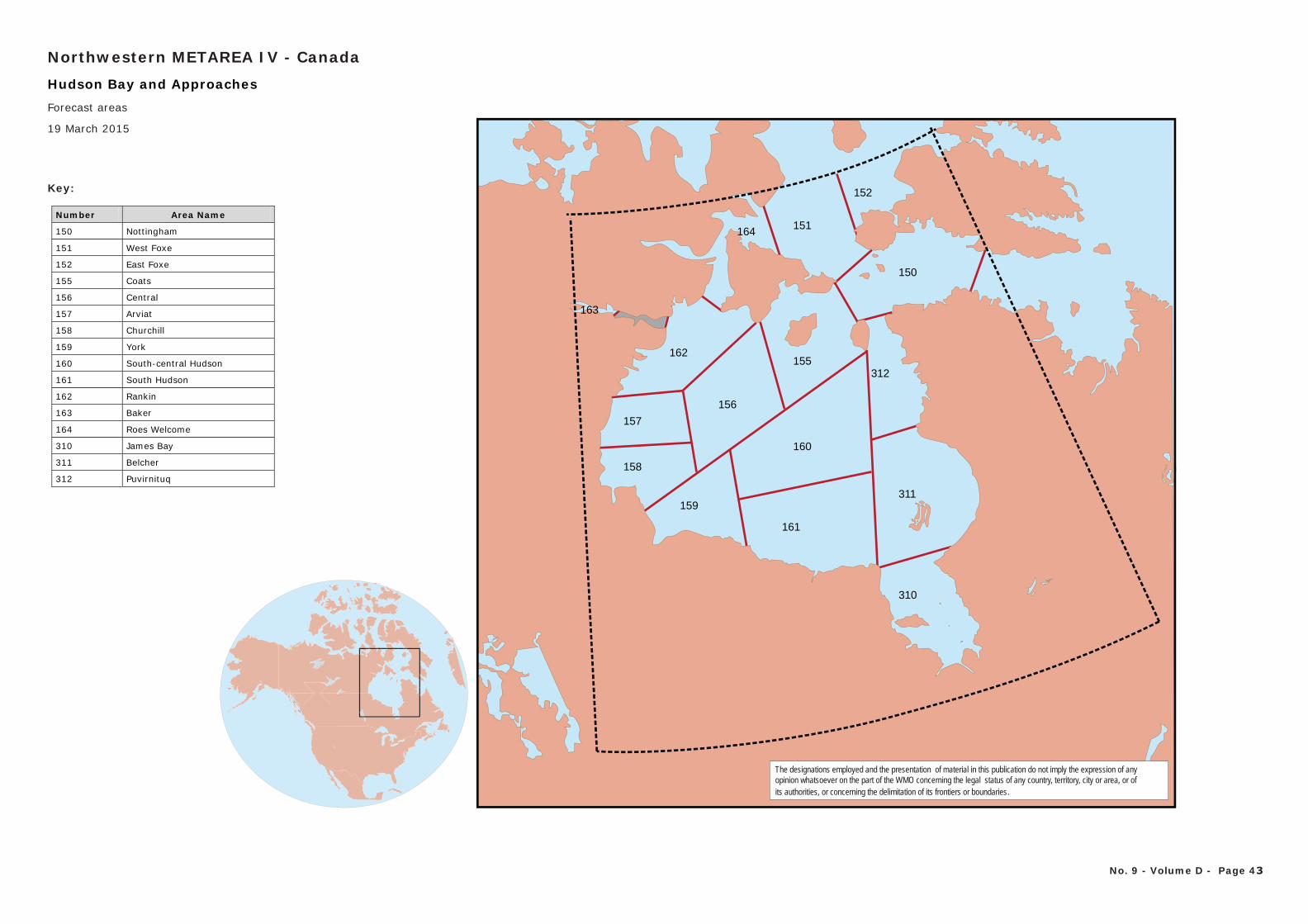
152
151
155
160
311
161
157
158
156
162
163
164
312
310
150
159
Key:
Number Area Name
150 Nottingham
151 West Foxe
152 East Foxe
155 Coats
156 Central
157 Arviat
158 Churchill
159 York
160 South-central Hudson
161 South Hudson
162 Rankin
163 Baker
164 Roes Welcome
310 James Bay
311 Belcher
312 Puvirnituq
The designations employed and the presentation of material in this publication do not imply the expression of any opinion whatsoever on the part of the WMO concerning the legal status of any country, territory, city or area, or ofits authorities, or concerning the delimitation of its frontiers or boundaries.
Hudson Bay and Approaches
Northwestern METAREA IV - Canada
No. 9 - Volume D - Page 43
Forecast areas
19 March 2015
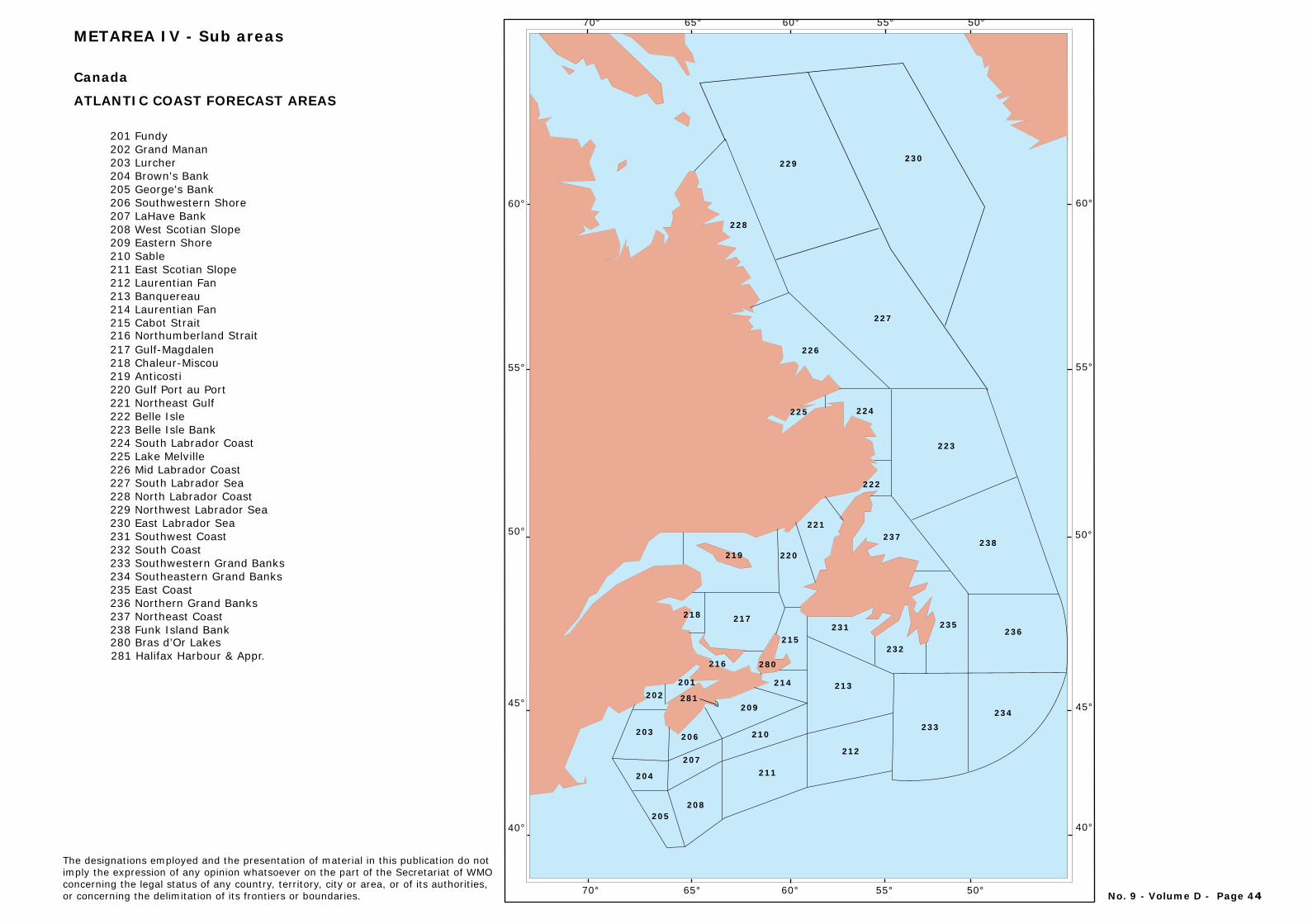
60°
55°
50°
45°
40°
60°
55°
50°
45°
40°
219
218
216
217
201202
203
204
206
207
208205
281209
210
211
214
280
215231
213
212
233234
232
236235
237238
222
221
220
223
224225
226
228
229 230
227
70° 65° 60° 55° 50°
70° 65° 60° 55° 50°
Canada
ATLANTIC COAST FORECAST AREAS
201 Fundy202 Grand Manan203 Lurcher204 Brown's Bank205 George's Bank206 Southwestern Shore207 LaHave Bank208 West Scotian Slope209 Eastern Shore210 Sable211 East Scotian Slope212 Laurentian Fan213 Banquereau 214 Laurentian Fan215 Cabot Strait216 Northumberland Strait217 Gulf-Magdalen218 Chaleur-Miscou219 Anticosti220 Gulf Port au Port221 Northeast Gulf222 Belle Isle223 Belle Isle Bank224 South Labrador Coast225 Lake Melville226 Mid Labrador Coast227 South Labrador Sea228 North Labrador Coast229 Northwest Labrador Sea230 East Labrador Sea231 Southwest Coast232 South Coast233 Southwestern Grand Banks234 Southeastern Grand Banks235 East Coast236 Northern Grand Banks237 Northeast Coast238 Funk Island Bank280 Bras d’Or Lakes281 Halifax Harbour & Appr.
METAREA IV - Sub areas
No. 9 - Volume D - Page 44
The designations employed and the presentation of material in this publication do notimply the expression of any opinion whatsoever on the part of the Secretariat of WMOconcerning the legal status of any country, territory, city or area, or of its authorities, or concerning the delimitation of its frontiers or boundaries.
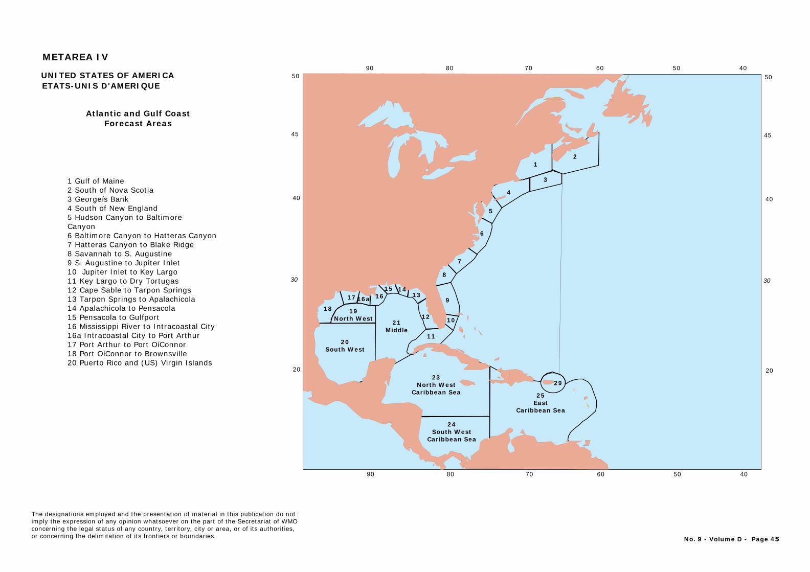
24South West
Caribbean Sea
23North West
Caribbean Sea
20South West
18
17 16a 1615 14
13
12
11
19North West 21
Middle10
9
8
7
6
5
4
1
3
2
29
25East
Caribbean Sea
608090 70 50 40
20
40
50
30
45
608090 70 50 40UNITED STATES OF AMERICAETATS-UNIS D'AMERIQUE
Atlantic and Gulf CoastForecast Areas
1 Gulf of Maine2 South of Nova Scotia3 Georgeís Bank4 South of New England5 Hudson Canyon to Baltimore Canyon6 Baltimore Canyon to Hatteras Canyon7 Hatteras Canyon to Blake Ridge8 Savannah to S. Augustine9 S. Augustine to Jupiter Inlet10 Jupiter Inlet to Key Largo11 Key Largo to Dry Tortugas12 Cape Sable to Tarpon Springs13 Tarpon Springs to Apalachicola14 Apalachicola to Pensacola15 Pensacola to Gulfport16 Mississippi River to Intracoastal City16a Intracoastal City to Port Arthur17 Port Arthur to Port OíConnor18 Port OíConnor to Brownsville20 Puerto Rico and (US) Virgin Islands
20
40
50
30
45
METAREA IV
No. 9 - Volume D - Page 45
The designations employed and the presentation of material in this publication do notimply the expression of any opinion whatsoever on the part of the Secretariat of WMOconcerning the legal status of any country, territory, city or area, or of its authorities, or concerning the delimitation of its frontiers or boundaries.
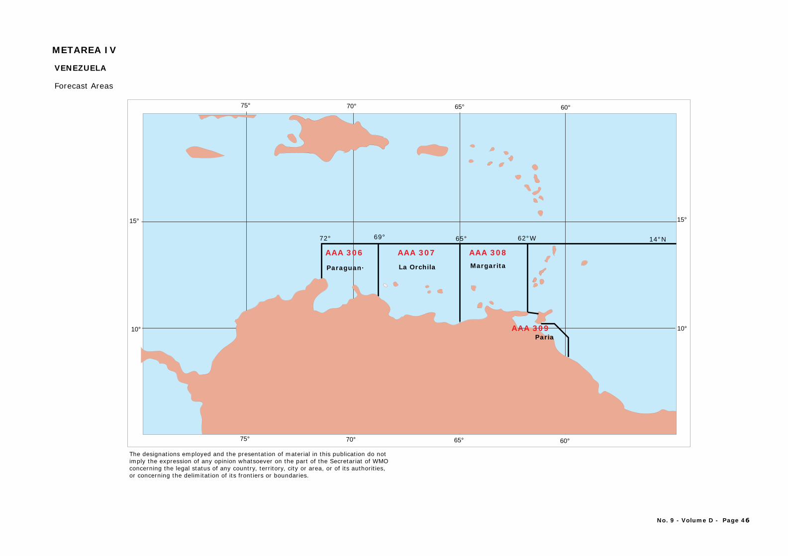
75° 70° 65° 60°
75° 70° 65° 60°
10°
15°
10°
15°
14°N72° 69° 65° 62°W
AAA 306
Paraguan·
AAA 307
La Orchila
AAA 308 Margarita
VENEZUELA
Forecast Areas
PariaAAA 309
No. 9 - Volume D - Page 46
The designations employed and the presentation of material in this publication do notimply the expression of any opinion whatsoever on the part of the Secretariat of WMOconcerning the legal status of any country, territory, city or area, or of its authorities, or concerning the delimitation of its frontiers or boundaries.
METAREA IV
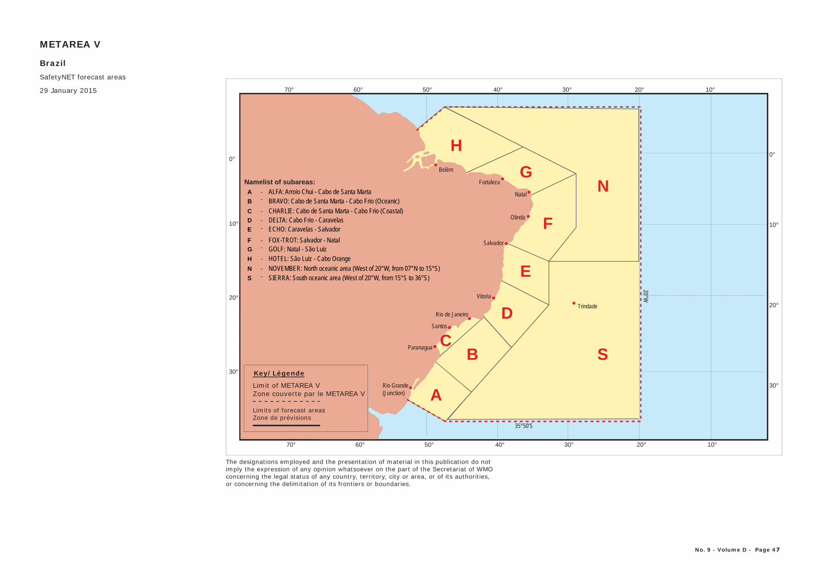
BrazilSafetyNET forecast areas
29 January 2015 70° 60° 50° 40° 30° 20° 10°
0°
10°
20°
30°
0°
10°
20°
30°
70° 60° 50° 40° 30° 20° 10°
METAREA V
ALFA: Arroio Chui - Cabo de Santa MartaBRAVO: Cabo de Santa Marta - Cabo Frio (Oceanic)CHARLIE: Cabo de Santa Marta - Cabo Frio (Coastal)DELTA: Cabo Frio - CaravelasECHO: Caravelas - SalvadorFOX-TROT: Salvador - NatalGOLF: Natal - São LuizHOTEL: São Luiz - Cabo OrangeNOVEMBER: North oceanic area (West of 20°W, from 07°N to 15°S)SIERRA: South oceanic area (West of 20°W, from 15°S to 36°S)
No. 9 - Volume D - Page 47
A
B
D
C
S
N
E
F
G
H
--
-
-
--
-
--
-
Namelist of subareas:
Key/Légende
Limit of METAREA VZone couverte par le METAREA V
Limits of forecast areasZone de prévisions
35°50’S
20°W
Trindade
Rio Grande(Junction)
Paranagua
Santos
Rio de Janeiro
Vitoria
Salvador
Olinda
Natal
Fortaleza
Belèm
The designations employed and the presentation of material in this publication do notimply the expression of any opinion whatsoever on the part of the Secretariat of WMOconcerning the legal status of any country, territory, city or area, or of its authorities, or concerning the delimitation of its frontiers or boundaries.
N
H
G
F
E
D
B
A
SC
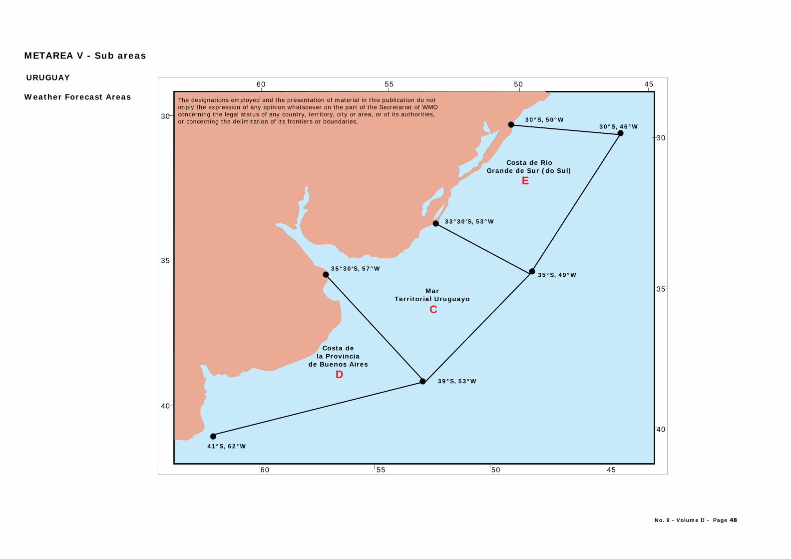
30
35
40
60 55 50 45
60 55 50 45
30
35
40
Costa de Rio Grande de Sur (do Sul)
E
MarTerritorial Uruguayo
C
Costa de la Provincia
de Buenos Aires
D
41°S, 62°W
39°S, 53°W
35°S, 49°W
30°S, 46°W30°S, 50°W
35°30'S, 57°W
33°30'S, 53°W
URUGUAY
Weather Forecast Areas
METAREA V - Sub areas
No. 9 - Volume D - Page 48
The designations employed and the presentation of material in this publication do notimply the expression of any opinion whatsoever on the part of the Secretariat of WMOconcerning the legal status of any country, territory, city or area, or of its authorities, or concerning the delimitation of its frontiers or boundaries.
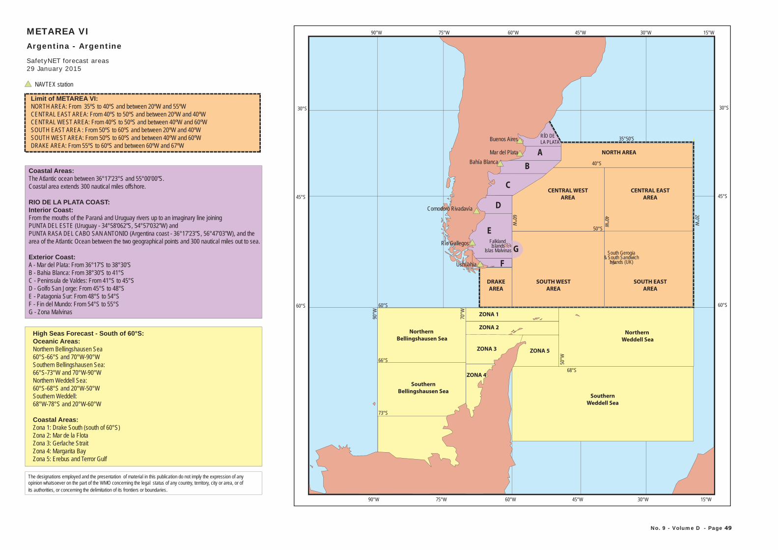
60°W75°W90°W 45°W 30°W
60°S
45°S
35°50’S
15°W
30°S
20°W
60°S
F
DRAKE
AREA
SOUTH EAST
AREA
South Gerogia& South Sandwich
Islands (UK)
SOUTH WEST
AREA
A
B
CENTRAL EAST
AREA
CENTRAL WEST
AREA
40°S
C
NORTH AREA
D
E
Northern
Bellingshausen Sea
Southern
Bellingshausen Sea
Northern
Weddell Sea
ZONA 1
ZONA 2
ZONA 4
ZONA 5ZONA 3
Southern
Weddell Sea
60°S
66°S
73°S
40°W
60°W
90°W
70°W
50°W
68°S
50°S
Coastal Areas:The Atlantic ocean between 36°17’23°S and 55°00’00”S.Coastal area extends 300 nautical miles offshore.
RIO DE LA PLATA COAST:Interior Coast:From the mouths of the Paraná and Uruguay rivers up to an imaginary line joining PUNTA DEL ESTE (Uruguay - 34°58'062”S, 54°57'032”W) and PUNTA RASA DEL CABO SAN ANTONIO (Argentina coast - 36°17'23"S, 56°47'03"W), and the area of the Atlantic Ocean between the two geographical points and 300 nautical miles out to sea.
Exterior Coast:A - Mar del Plata: From 36°17’S to 38°30’SB - Bahia Blanca: From 38°30’S to 41°SC - Peninsula de Valdes: From 41°S to 45°SD - Golfo San Jorge: From 45°S to 48°SE - Patagonia Sur: From 48°S to 54°SF - Fin del Mundo: From 54°S to 55°SG - Zona Malvinas
High Seas Forecast - South of 60°S:Oceanic Areas:Northern Bellingshausen Sea60°S-66°S and 70°W-90°WSouthern Bellingshausen Sea:66°S-73°W and 70°W-90°WNorthern Weddell Sea:60°S-68°S and 20°W-50°WSouthern Weddell:68°W-78°S and 20°W-60°W
Coastal Areas:Zona 1: Drake South (south of 60°S)Zona 2: Mar de la FlotaZona 3: Gerlache StraitZona 4: Margarita BayZona 5: Erebus and Terror Gulf
60°S
45°S
30°S
60°W75°W90°W 45°W 30°W 15°WMETAREA VIArgentina - Argentine
SafetyNET forecast areas
Ushuahia
Río Gallegos
Comodoro Rivadavía
Bahía BlancaMar del Plata
Buenos Aires RÍO DELA PLATA
Limit of METAREA VI:NORTH AREA: From 35ºS to 40ºS and between 20ºW and 55ºWCENTRAL EAST AREA: From 40ºS to 50ºS and between 20ºW and 40ºW CENTRAL WEST AREA: From 40ºS to 50ºS and between 40ºW and 60ºW SOUTH EAST AREA : From 50ºS to 60ºS and between 20ºW and 40ºW SOUTH WEST AREA: From 50ºS to 60ºS and between 40ºW and 60ºW DRAKE AREA: From 55ºS to 60ºS and between 60ºW and 67ºW
NAVTEX station
No. 9 - Volume D - Page 49
The designations employed and the presentation of material in this publication do not imply the expression of any opinion whatsoever on the part of the WMO concerning the legal status of any country, territory, city or area, or ofits authorities, or concerning the delimitation of its frontiers or boundaries.
Falkland Islands
Islas Malvinas G
29 January 2015
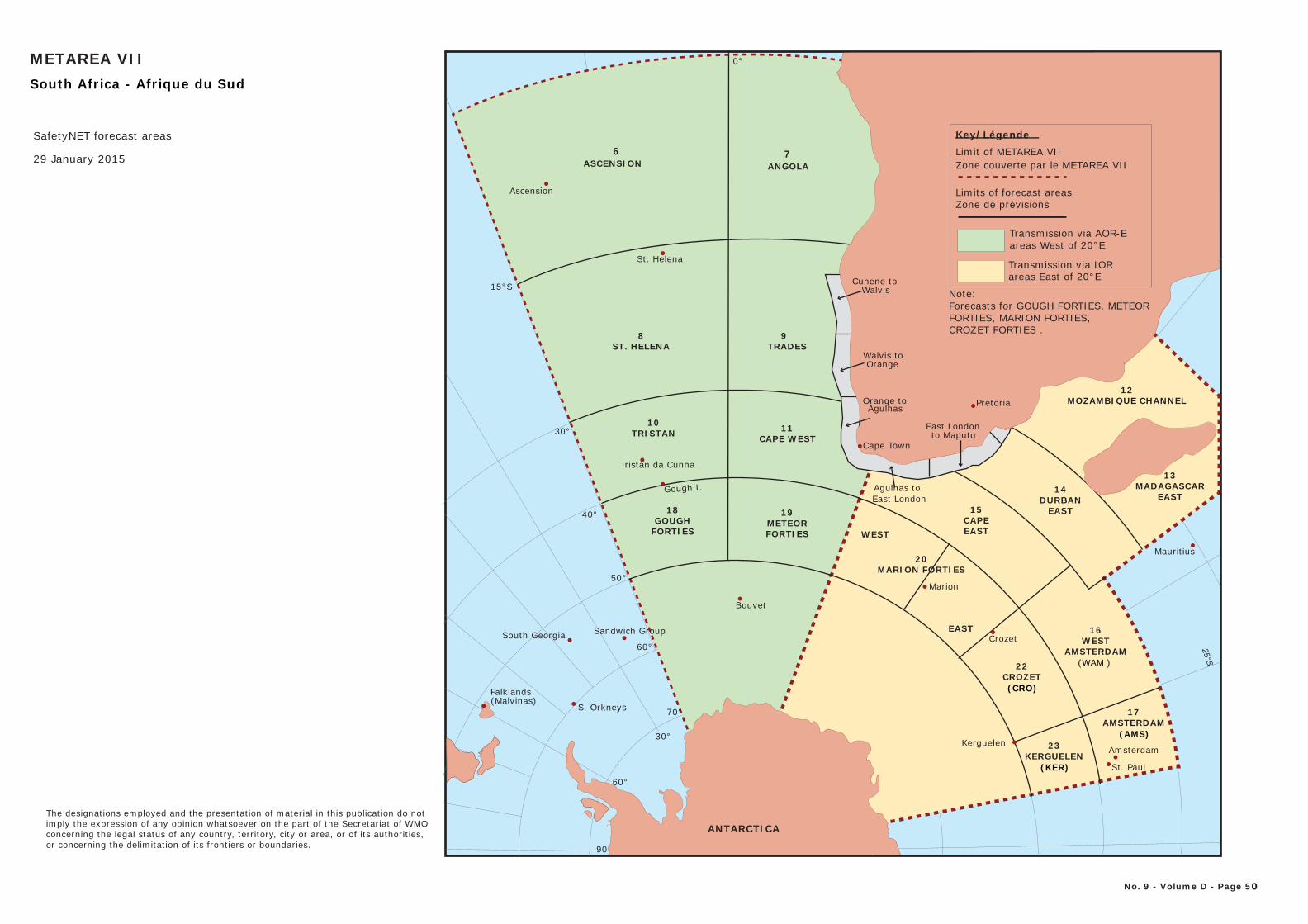
METAREA VII
SafetyNET forecast areas
No. 9 - Volume D - Page 50
29 January 2015
South Africa - Afrique du Sud S
25°
0°
15°S
40°
30°
50°
60°
70°
90 90
0°
60° 60°
30° 30°
6
19
7
13
18
20
22
23
10 11
98
14
15
16
17
12
CROZET FORTIES .
Note: Forecasts for GOUGH FORTIES, METEOR FORTIES, MARION FORTIES,
Key/Légende
Limit of METAREA VIIZone couverte par le METAREA VII
Limits of forecast areasZone de prévisions
Transmission via AOR-Eareas West of 20°E
Transmission via IORareas East of 20°E
The designations employed and the presentation of material in this publication do notimply the expression of any opinion whatsoever on the part of the Secretariat of WMOconcerning the legal status of any country, territory, city or area, or of its authorities, or concerning the delimitation of its frontiers or boundaries.
ANTARCTICA
St. Paul
KerguelenAmsterdam
Agulhas to East London
CROZET(CRO)
KERGUELEN(KER)
CAPE WEST
TRADES
CAPEEAST
WESTAMSTERDAM
(WAM )
AMSTERDAM(AMS)
Mauritius
Gough I.
Marion
Crozet
Bouvet
South Georgia
S. Orkneys
Falklands (Malvinas)
Cunene toWalvis
Walvis toOrange
Orange to Agulhas
East Londonto Maputo
Cape Town
Pretoria
GOUGHFORTIES
METEORFORTIES
MARION FORTIES
TRISTAN
Sandwich Group
Tristan da Cunha
DURBANEAST
MOZAMBIQUE CHANNEL
MADAGASCAREAST
WEST
EAST
Ascension
St. Helena
ST. HELENA
ASCENSION ANGOLA
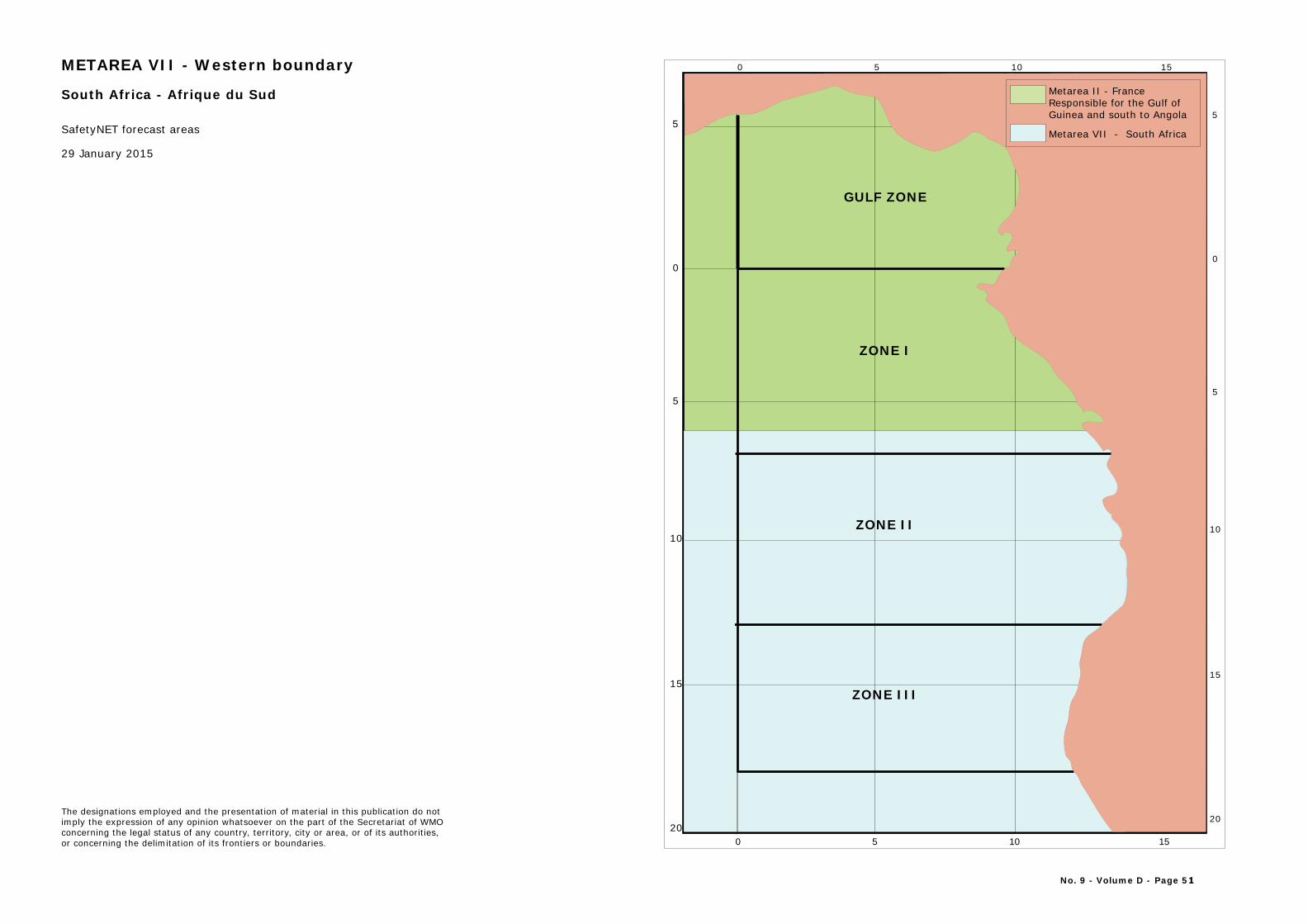
5
0
5
10
15
20
5
0
5
10
15
20
10 1550
10 1550
No. 9 - Volume D - Page 51
ZONE III
GULF ZONE
ZONE I
ZONE II
Africa
Metarea II - FranceResponsible for the Gulf ofGuinea and south to Angola
Metarea VII - South Africa
METAREA VII - Western boundary
29 January 2015
The designations employed and the presentation of material in this publication do notimply the expression of any opinion whatsoever on the part of the Secretariat of WMOconcerning the legal status of any country, territory, city or area, or of its authorities, or concerning the delimitation of its frontiers or boundaries.
South Africa - Afrique du Sud
SafetyNET forecast areas
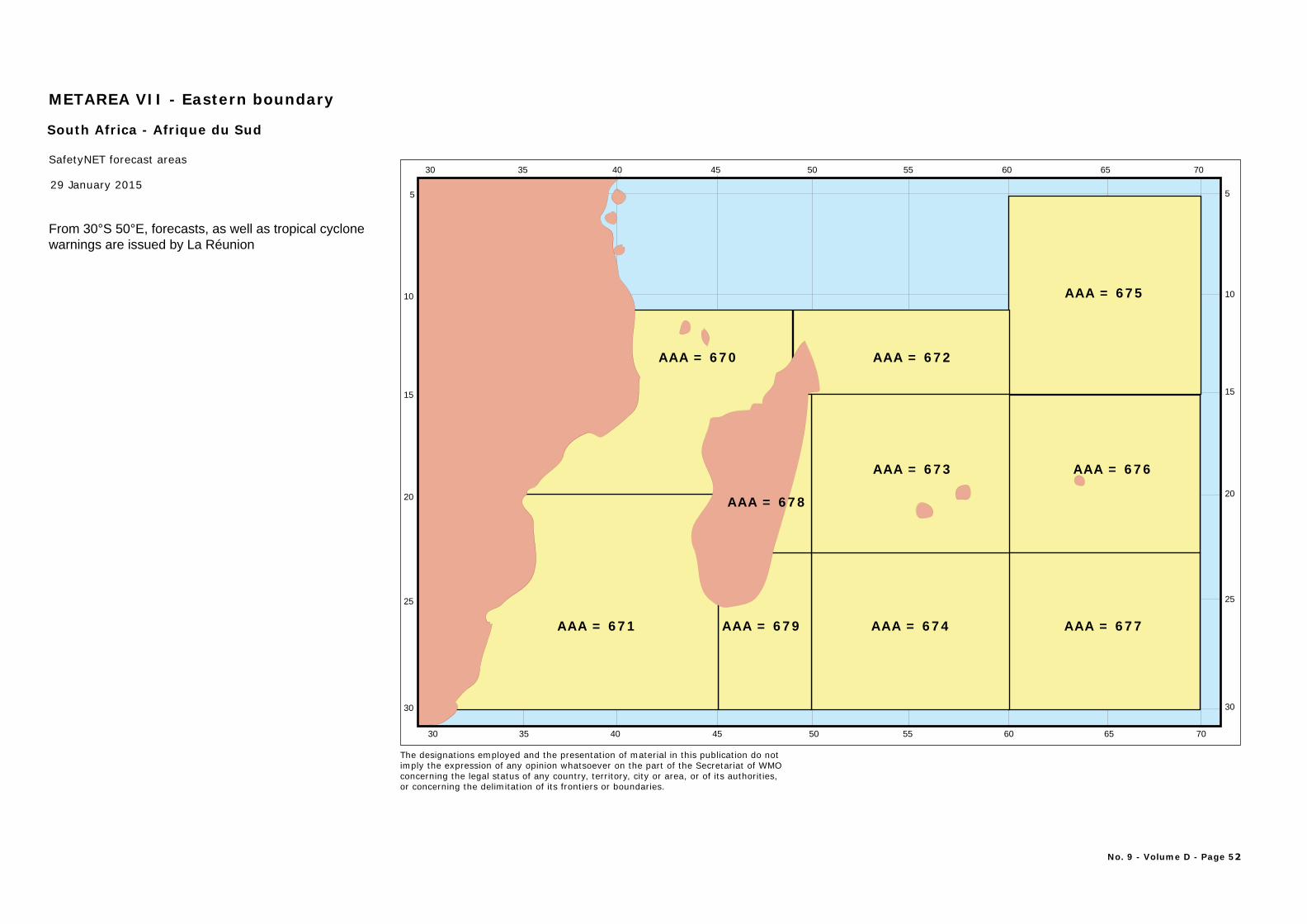
5
10
15
20
25
30
5
10
15
20
25
30
30
30
35
35
40
40
45
45
50
50
55
55
60
60
65
65
70
70
AAA = 675
AAA = 671 AAA = 674 AAA = 677
AAA = 676
AAA = 679
AAA = 670 AAA = 672
AAA = 673
AAA = 678
No. 9 - Volume D - Page 52
METAREA VII - Eastern boundary
SafetyNET forecast areas
29 January 2015
South Africa - Afrique du Sud
From 30°S 50°E, forecasts, as well as tropical cyclonewarnings are issued by La Réunion
The designations employed and the presentation of material in this publication do notimply the expression of any opinion whatsoever on the part of the Secretariat of WMOconcerning the legal status of any country, territory, city or area, or of its authorities, or concerning the delimitation of its frontiers or boundaries.
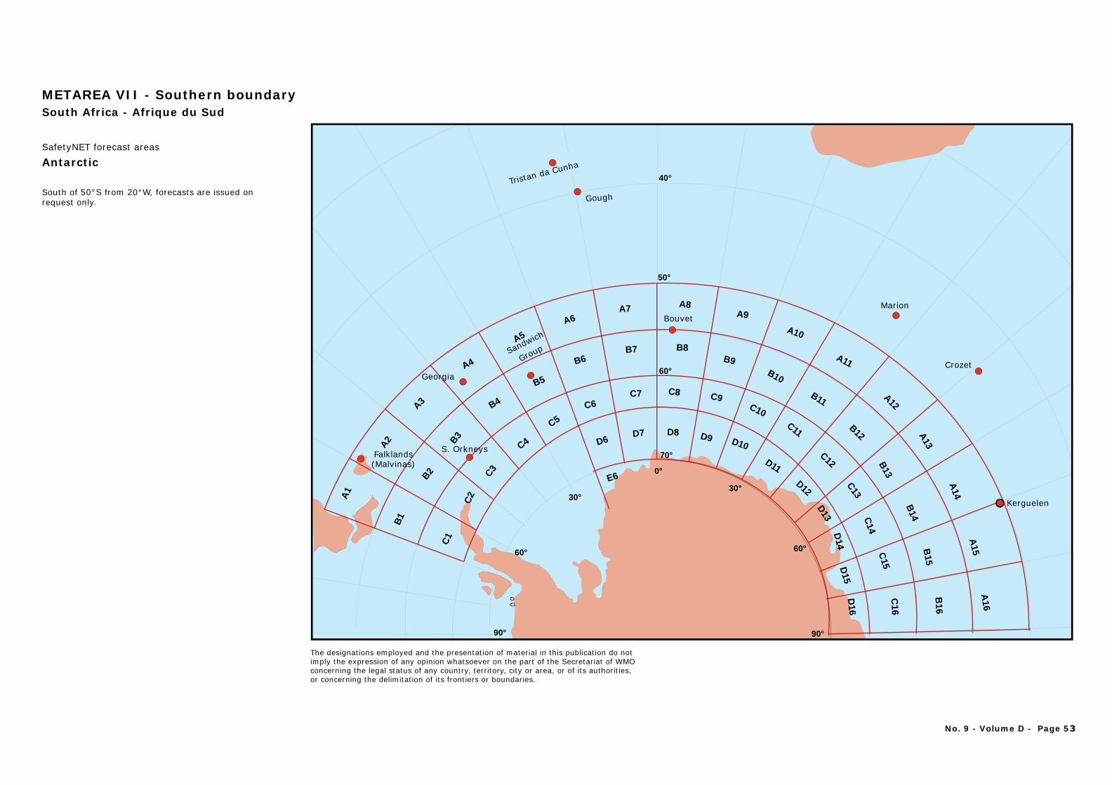
Antarctic
METAREA VII - Southern boundarySouth Africa - Afrique du Sud
South of 50°S from 20°W, forecasts are issued on request only.
The designations employed and the presentation of material in this publication do notimply the expression of any opinion whatsoever on the part of the Secretariat of WMOconcerning the legal status of any country, territory, city or area, or of its authorities, or concerning the delimitation of its frontiers or boundaries.
No. 9 - Volume D - Page 53
50°
40°
60°
70°
Tristan da Cunha
Gough
Marion
Crozet
Kerguelen
Sandwich
Group
Bouvet
Georgia
S. OrkneysFalklands (Malvinas)
90° 90°
0°
60° 60°
30°30°
D6D7 D8 D9 D10
D11
D12
D13
D14
D15
D16
E6
A1
A2
A3
A4
A5
A6A7 A8
A9
A10
A11
A12
A13
A14
A15
A16
B1
B2
B3
B4
B5
B6B7 B8
B9B10
B11
B12
B13
B14
B15
B16
C1
C2
C3
C4
C5
C6C7 C8
C10C11
C9
C12
C13
C14
C15
C16
SafetyNET forecast areas
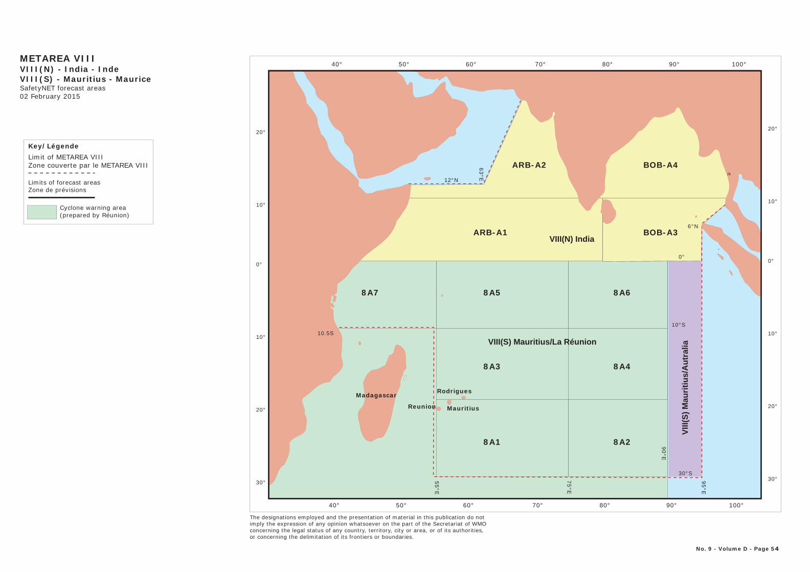
40° 50° 60° 70° 80° 90° 100°
20°
10°
0°
10°
20°
30°
20°
10°
0°
10°
20°
30°
40° 50° 60° 70° 80° 90° 100°
Madagascar Rodrigues
MauritiusReunion
8A1 8A2
8A3
8A7 8A5
8A4
8A6
ARB-A1 BOB-A3
ARB-A2 BOB-A4
VIII
(S)
Mau
riti
us/
Au
tral
iaVIII(S) Mauritius/La Réunion
VIII(N) India
METAREA VIIIVIII(N) - India - IndeVIII(S) - Mauritius - MauriceSafetyNET forecast areas02 February 2015
No. 9 - Volume D - Page 54
10°S
95°E
75°E
12°N
6°N
30°S
0°
63°E
55°E
10.5S
90°EKey/LégendeLimit of METAREA VIIIZone couverte par le METAREA VIII
Limits of forecast areasZone de prévisions
Cyclone warning area(prepared by Réunion)
The designations employed and the presentation of material in this publication do notimply the expression of any opinion whatsoever on the part of the Secretariat of WMOconcerning the legal status of any country, territory, city or area, or of its authorities, or concerning the delimitation of its frontiers or boundaries.
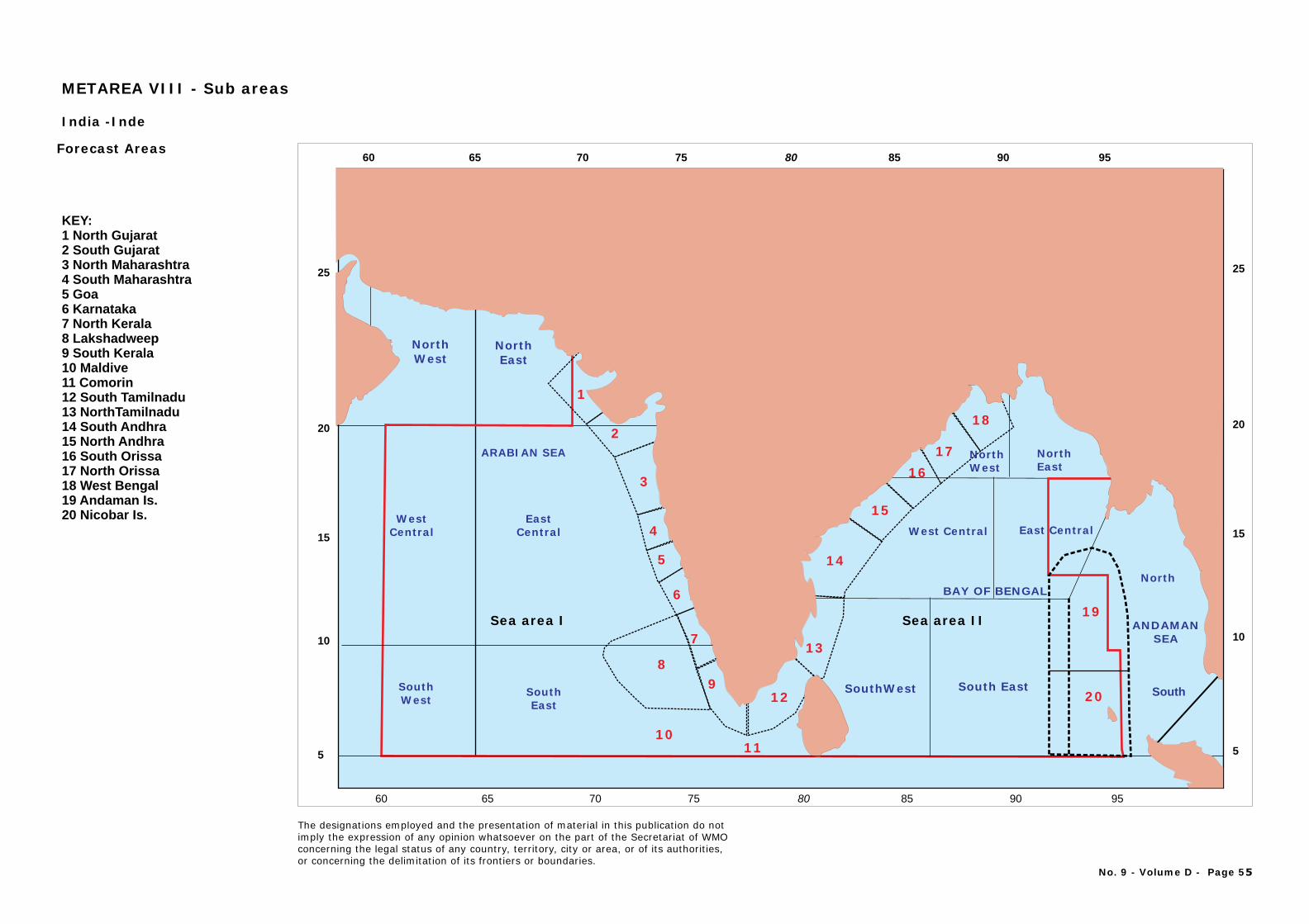
1
2
3
4
5
6
7
89
1011
12
13
14
1617
19
20
15
18
NorthWest
NorthEast
North
SouthSouthWest
SouthEast
WestCentral
EastCentral
ARABIAN SEA
SouthWest South East
Sea area I
West Central East Central
NorthWest
NorthEast
ANDAMANSEA
BAY OF BENGAL
Sea area II
KEY:1 North Gujarat 2 South Gujarat 3 North Maharashtra 4 South Maharashtra 5 Goa 6 Karnataka 7 North Kerala 8 Lakshadweep 9 South Kerala 10 Maldive 11 Comorin12 South Tamilnadu13 NorthTamilnadu14 South Andhra15 North Andhra16 South Orissa17 North Orissa18 West Bengal19 Andaman Is.20 Nicobar Is.
India -Inde
Forecast Areas
METAREA VIII - Sub areas
No. 9 - Volume D - Page 55
The designations employed and the presentation of material in this publication do notimply the expression of any opinion whatsoever on the part of the Secretariat of WMOconcerning the legal status of any country, territory, city or area, or of its authorities, or concerning the delimitation of its frontiers or boundaries.
8060 65 70 75 85 90 95
8060 65 70 75 85 90 95
20
25
15
10
5
20
25
15
10
5
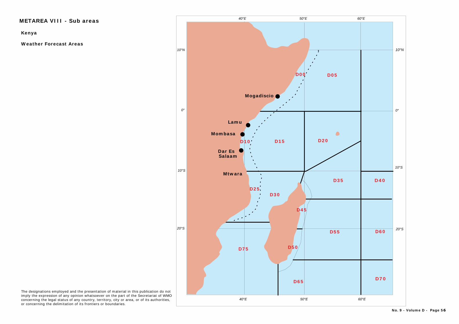
10°N
0°
10°S
20°S
D30
D15 D20
D35
D25
Mtwara
Lamu
Mombasa
Dar Es Salaam
Mogadiscio
D05
10°N
0°
10°S
20°S
40°E 50°E 60°E
40°E 50°E 60°E
D75
D65 D70
D55 D60
D40
D45
D50
D10
D00
Kenya
Weather Forecast Areas
No. 9 - Volume D - Page 56
The designations employed and the presentation of material in this publication do notimply the expression of any opinion whatsoever on the part of the Secretariat of WMOconcerning the legal status of any country, territory, city or area, or of its authorities, or concerning the delimitation of its frontiers or boundaries.
METAREA VIII - Sub areas
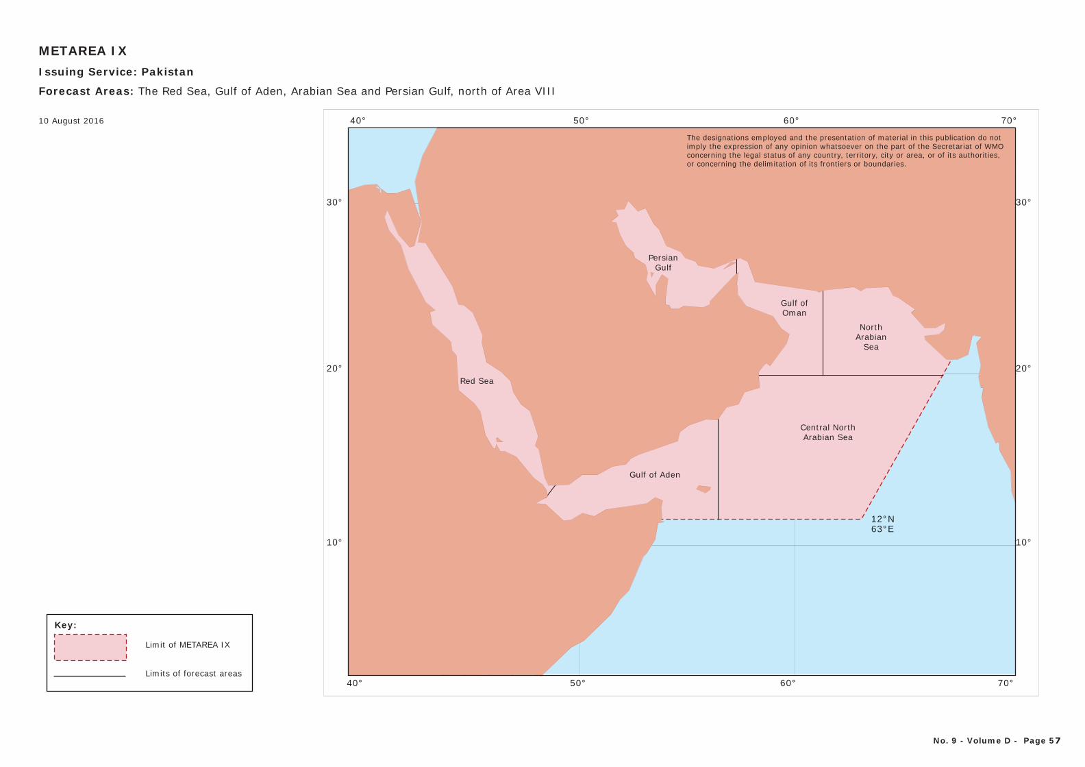
50° 60°
10°
20°
40°
30°
70°
10°
20°
30°
50° 60°40° 70°
12°N63°E
Gulf of Aden
Central NorthArabian Sea
Gulf ofOman
NorthArabian
Sea
Red Sea
PersianGulf
The designations employed and the presentation of material in this publication do notimply the expression of any opinion whatsoever on the part of the Secretariat of WMOconcerning the legal status of any country, territory, city or area, or of its authorities, or concerning the delimitation of its frontiers or boundaries.
Key:
Limit of METAREA IX
Limits of forecast areas
METAREA IXIssuing Service: Pakistan
Forecast Areas: The Red Sea, Gulf of Aden, Arabian Sea and Persian Gulf, north of Area VIII
No. 9 - Volume D - Page 57
10 August 2016
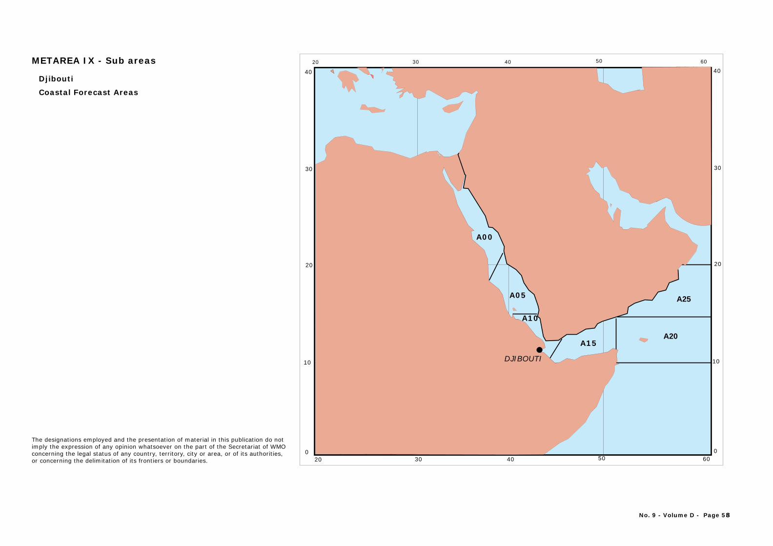
0
10
20
30
40
0
10
20
30
40
504020 30 60
504020 30 60
A00
A05
A15
A25
A20
DJIBOUTI
A10
Djibouti
Coastal Forecast Areas
METAREA IX - Sub areas
No. 9 - Volume D - Page 58
The designations employed and the presentation of material in this publication do notimply the expression of any opinion whatsoever on the part of the Secretariat of WMOconcerning the legal status of any country, territory, city or area, or of its authorities, or concerning the delimitation of its frontiers or boundaries.
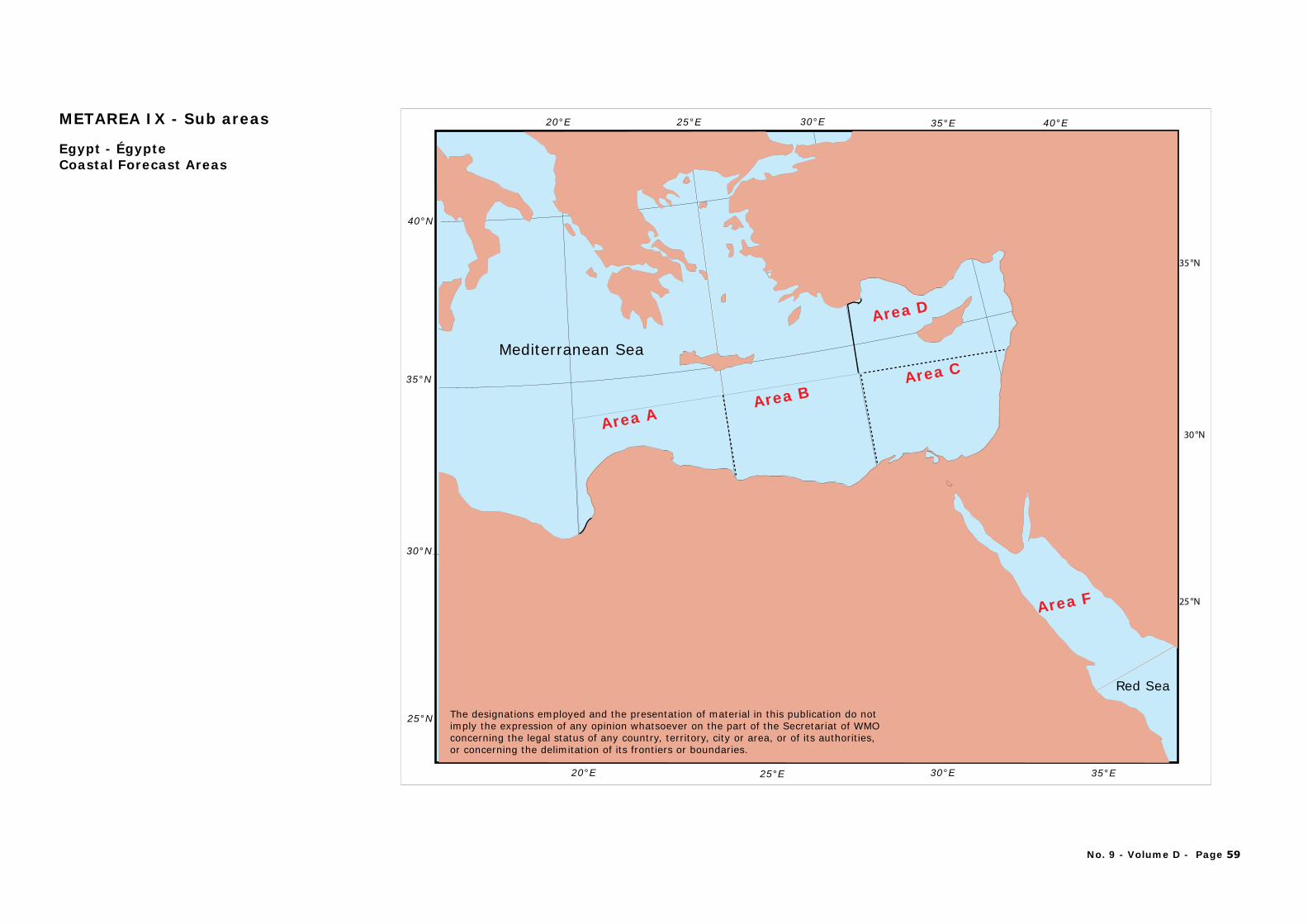
Red Sea
Mediterranean Sea
30 N°
35 N°
25 N°
35 E°30 E°25 E°20 E° 40 E°
30°N
35 N°
25 N°
40 N°
35 E°30 E°25 E°20 E°
Area AArea B
Area C
Area D
Area F
Egypt - ÉgypteCoastal Forecast Areas
METAREA IX - Sub areas
No. 9 - Volume D - Page 59
The designations employed and the presentation of material in this publication do notimply the expression of any opinion whatsoever on the part of the Secretariat of WMOconcerning the legal status of any country, territory, city or area, or of its authorities, or concerning the delimitation of its frontiers or boundaries.
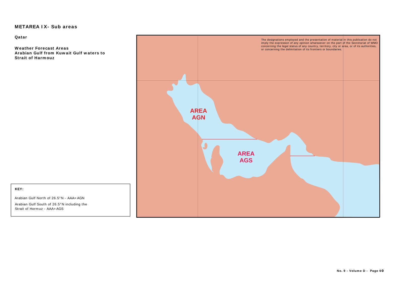
The designations employed and the presentation of material in this publication do notimply the expression of any opinion whatsoever on the part of the Secretariat of WMOconcerning the legal status of any country, territory, city or area, or of its authorities, or concerning the delimitation of its frontiers or boundaries.
KEY:
Arabian Gulf North of 26.5°N - AAA=AGN
Arabian Gulf South of 26.5°N including theStrait of Hormuz - AAA=AGS
No. 9 - Volume D - Page 60
AREAAGN
AREAAGS
The designations employed and the presentation of material in this publication do notimply the expression of any opinion whatsoever on the part of the Secretariat of WMOconcerning the legal status of any country, territory, city or area, or of its authorities, or concerning the delimitation of its frontiers or boundaries.
METAREA IX- Sub areas
Qatar
Weather Forecast Areas Arabian Gulf from Kuwait Gulf waters to Strait of Harmouz
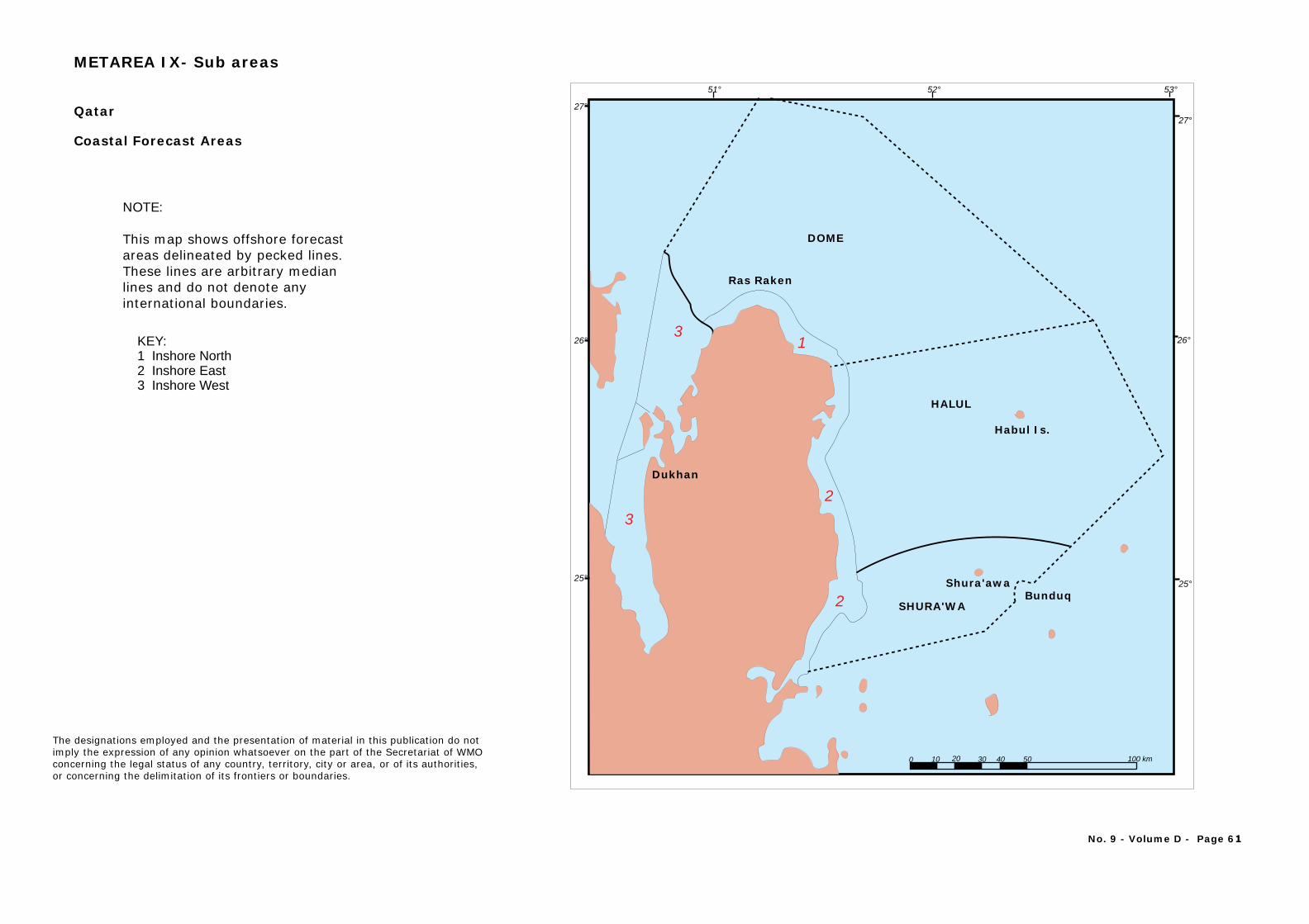
QATAR
Salwa
Khor Al Obdid
Abu Samid
Doha
Khor
Ras Laffan
Ras Raken
HALUL
Habul Is.
SHURA'WA
Shura'awaBunduq
Dukhan
DOME
27°
0 10 20 30 40 50 100 km
51° 52° 53°
25° 25°
26°
27°
26° 13
32
2
KEY: 1 Inshore North 2 Inshore East 3 Inshore West
Qatar
Coastal Forecast Areas
NOTE:
This map shows offshore forecastareas delineated by pecked lines. These lines are arbitrary medianlines and do not denote any international boundaries.
No. 9 - Volume D - Page 61
The designations employed and the presentation of material in this publication do notimply the expression of any opinion whatsoever on the part of the Secretariat of WMOconcerning the legal status of any country, territory, city or area, or of its authorities, or concerning the delimitation of its frontiers or boundaries.
METAREA IX- Sub areas
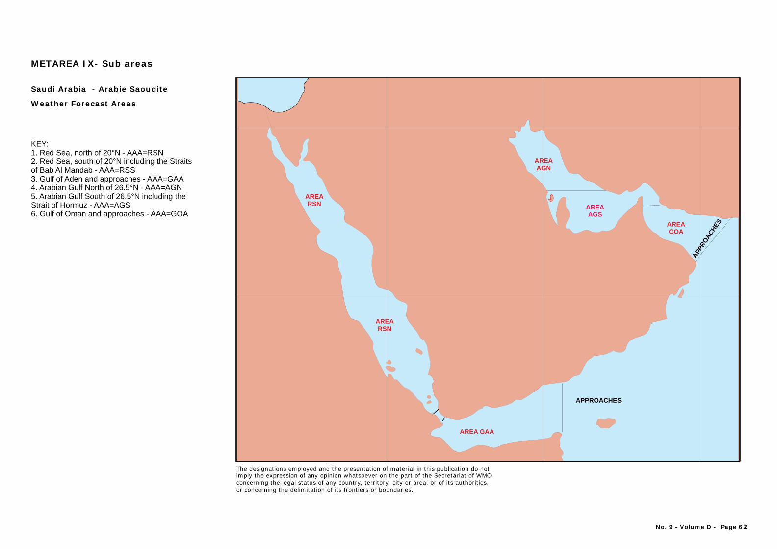
AREA RSN
APPROACHES
AREAAGN
AREAAGS
AREAGOA
APP
RO
AC
HES
AREA GAA
KEY: 1. Red Sea, north of 20°N - AAA=RSN2. Red Sea, south of 20°N including the Straitsof Bab Al Mandab - AAA=RSS3. Gulf of Aden and approaches - AAA=GAA4. Arabian Gulf North of 26.5°N - AAA=AGN5. Arabian Gulf South of 26.5°N including theStrait of Hormuz - AAA=AGS6. Gulf of Oman and approaches - AAA=GOA
Saudi Arabia rabie Saoudite - A
Weather Forecast Areas
AREA RSN
No. 9 - Volume D - Page 62
The designations employed and the presentation of material in this publication do notimply the expression of any opinion whatsoever on the part of the Secretariat of WMOconcerning the legal status of any country, territory, city or area, or of its authorities, or concerning the delimitation of its frontiers or boundaries.
METAREA IX- Sub areas
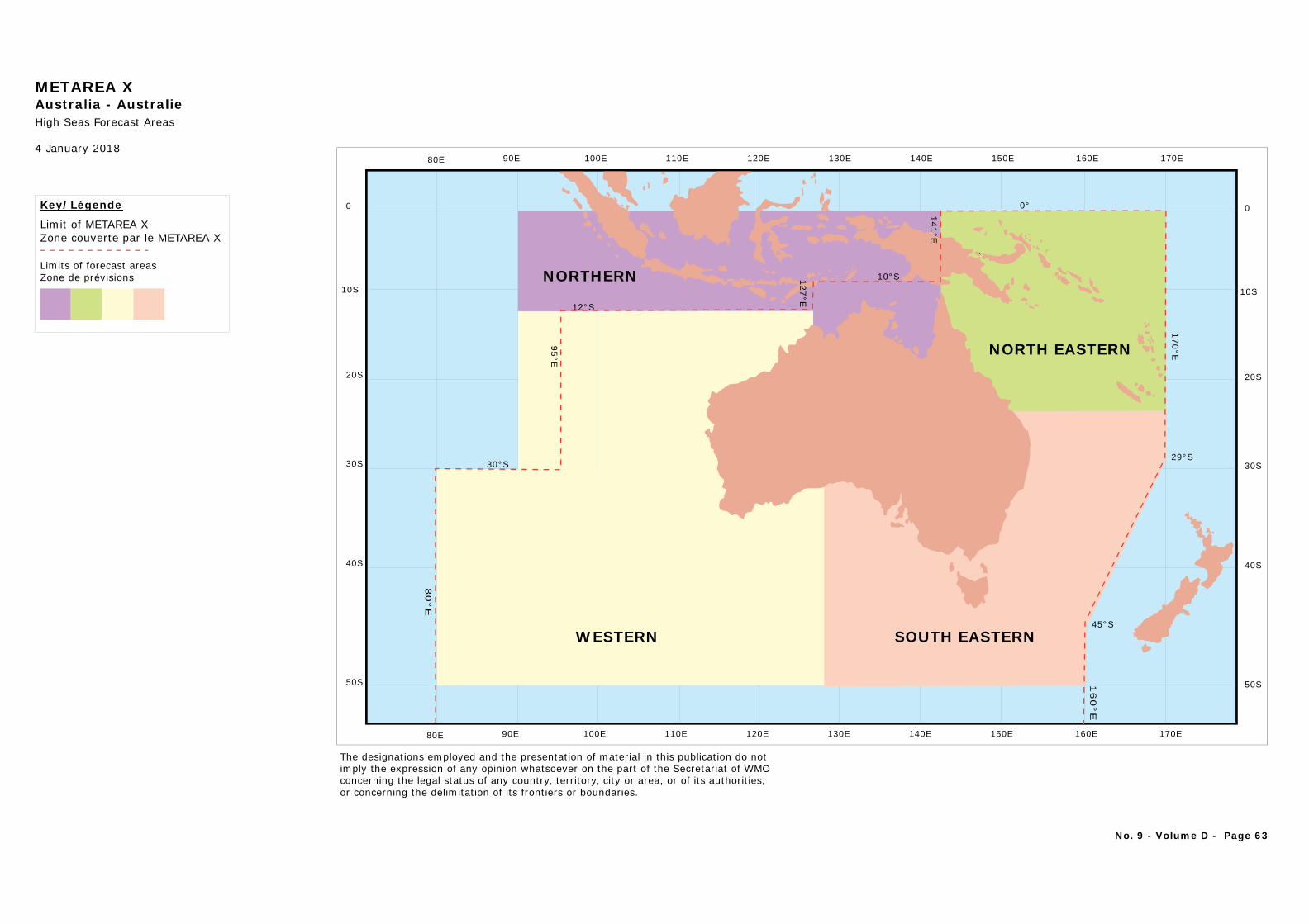
METAREA XAustralia - AustralieHigh Seas Forecast Areas
4 January 2018
Key/Légende
Limit of METAREA XZone couverte par le METAREA X
Limits of forecast areasZone de prévisions
No. 9 - Volume D - Page 63
20S
10S
0
30S
40S
50S
170E150E 160E140E130E120E110E100E90E80E
170E150E 160E140E130E120E110E100E90E80E
20S
10S
0
30S
40S
50S
The designations employed and the presentation of material in this publication do notimply the expression of any opinion whatsoever on the part of the Secretariat of WMOconcerning the legal status of any country, territory, city or area, or of its authorities, or concerning the delimitation of its frontiers or boundaries.
0°
170°E
12°S
30°S
10°S
95°E
80°E
160°E
127°E
141°E
29°S
45°S
NORTHERN
NORTH EASTERN
SOUTH EASTERNWESTERN
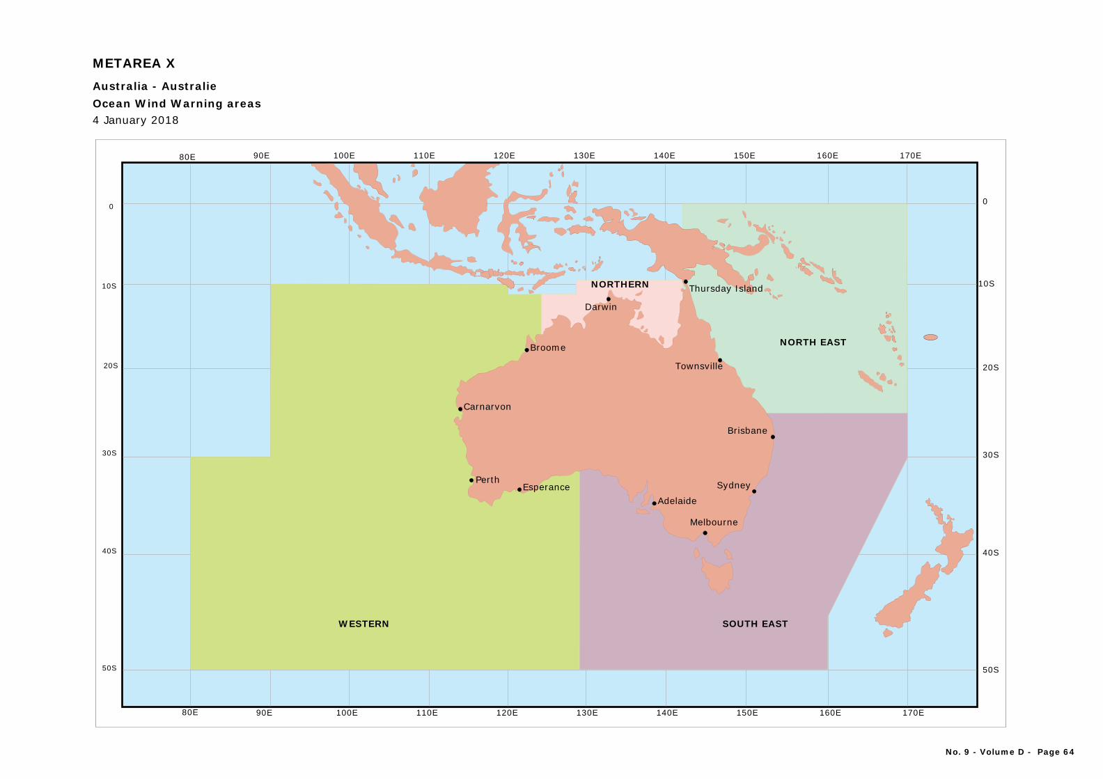
Townsville
Sydney
Melbourne
Brisbane
Thursday Island
Broome
AdelaideEsperance
Darwin
Perth
Carnarvon
SOUTH EAST
NORTH EAST
WESTERN
NORTHERN
20S
10S
0
30S
40S
50S
20S
10S
0
30S
40S
50S
170E150E 160E140E130E120E110E100E90E80E
170E150E 160E140E130E120E110E100E90E80E
Ocean Wind Warning areas
METAREA X
Australia - Australie
4 January 2018
No. 9 - Volume D - Page 64
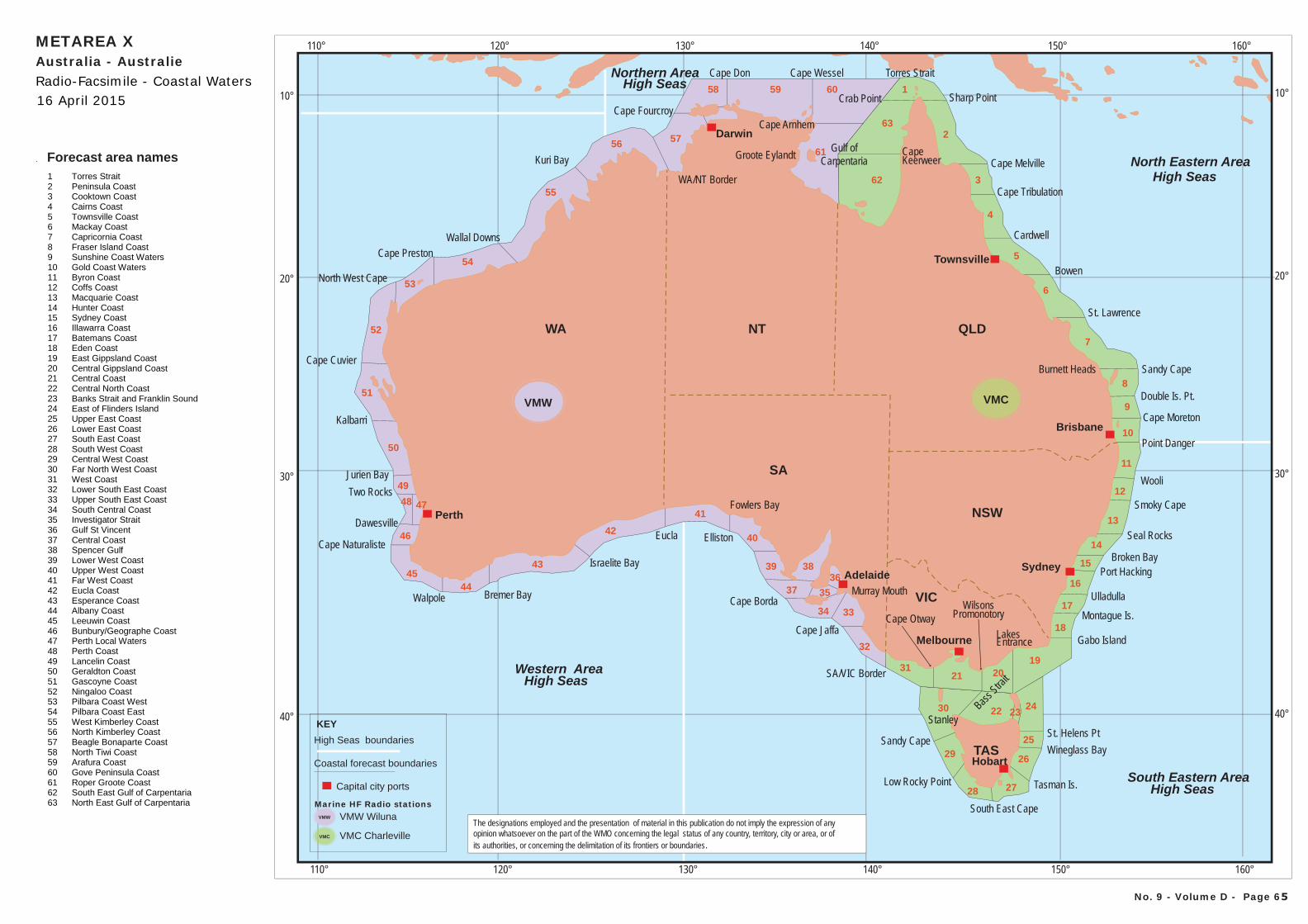
Western AreaHigh Seas
Northern AreaHigh Seas
North Eastern AreaHigh Seas
South Eastern AreaHigh Seas
110° 120° 130° 140° 150° 160°
110° 120° 130° 140° 150° 160°
10°
20°
30°
40°
10°
20°
30°
40°
Darwin
Brisbane
Sydney
Melbourne
Adelaide
Perth
Hobart
Townsville
VMCVMW
Forecast area names1 Torres Strait 2 Peninsula Coast 3 Cooktown Coast 4 Cairns Coast 5 Townsville Coast 6 Mackay Coast 7 Capricornia Coast 8 Fraser Island Coast 9 Sunshine Coast Waters 10 Gold Coast Waters 11 Byron Coast 12 Coffs Coast 13 Macquarie Coast 14 Hunter Coast 15 Sydney Coast 16 Illawarra Coast 17 Batemans Coast 18 Eden Coast 19 East Gippsland Coast 20 Central Gippsland Coast 21 Central Coast 22 Central North Coast 23 Banks Strait and Franklin Sound 24 East of Flinders Island 25 Upper East Coast 26 Lower East Coast 27 South East Coast 28 South West Coast 29 Central West Coast 30 Far North West Coast 31 West Coast 32 Lower South East Coast 33 Upper South East Coast 34 South Central Coast 35 Investigator Strait 36 Gulf St Vincent 37 Central Coast 38 Spencer Gulf 39 Lower West Coast 40 Upper West Coast 41 Far West Coast 42 Eucla Coast 43 Esperance Coast 44 Albany Coast 45 Leeuwin Coast 46 Bunbury/Geographe Coast 47 Perth Local Waters 48 Perth Coast 49 Lancelin Coast 50 Geraldton Coast 51 Gascoyne Coast 52 Ningaloo Coast 53 Pilbara Coast West 54 Pilbara Coast East 55 West Kimberley Coast 56 North Kimberley Coast 57 Beagle Bonaparte Coast 58 North Tiwi Coast 59 Arafura Coast 60 Gove Peninsula Coast 61 Roper Groote Coast 62 South East Gulf of Carpentaria 63 North East Gulf of Carpentaria
The designations employed and the presentation of material in this publication do not imply the expression of any opinion whatsoever on the part of the WMO concerning the legal status of any country, territory, city or area, or ofits authorities, or concerning the delimitation of its frontiers or boundaries.
TAS
WA QLD
NSW
SA
NT
VIC
Cape ArnhemCape Fourcroy
Sandy Cape
Low Rocky Point
South East Cape
Tasman Is.
Wineglass BaySt. Helens Pt
Stanley
Ulladulla
Montague Is.
Port HackingBroken Bay
Seal Rocks
Smoky Cape
Wooli
Sandy Cape
Double Is. Pt.
St. Lawrence
Bowen
Cardwell
Cape Wessel
Kuri Bay
Wallal DownsCape Preston
North West Cape
Kalbarri
Jurien Bay
Bremer Bay
Elliston
Cape Jaffa
Gulf ofCarpentaria
Cape Moreton
Point Danger
Gabo Island
Cape Tribulation
SA/VIC Border
Cape OtwayWilsons
Promonotory
LakesEntrance
Eucla
Israelite BayCape Naturaliste
Dawesville
Two Rocks
Cape Cuvier
Cape Don
Walpole Cape Borda
Burnett Heads
CapeKeerweer Cape Melville
Sharp Point
Torres Strait
Groote Eylandt
WA/NT Border
Fowlers Bay
Murray Mouth
Bass Strai
t
Crab Point
Coastal forecast boundaries
High Seas boundaries
VMW Wiluna
VMC Charleville
Capital city ports
KEY
VMC
Marine HF Radio stationsVMW
1
2
41
42
43
4445
55
61
62
56 57
52
53
54
6
5
7
8
9
10
11
12
13
14
15
16
21
19
24
31
32
3334
3839
37 35
36
40
28 27
26
25
2230
29
20
23
17
18
63
59
3
4
51
50
49
48 47
46
58 60
No. 9 - Volume D - Page 65
Radio-Facsimile - Coastal Waters16 April 2015
METAREA XAustralia - Australie
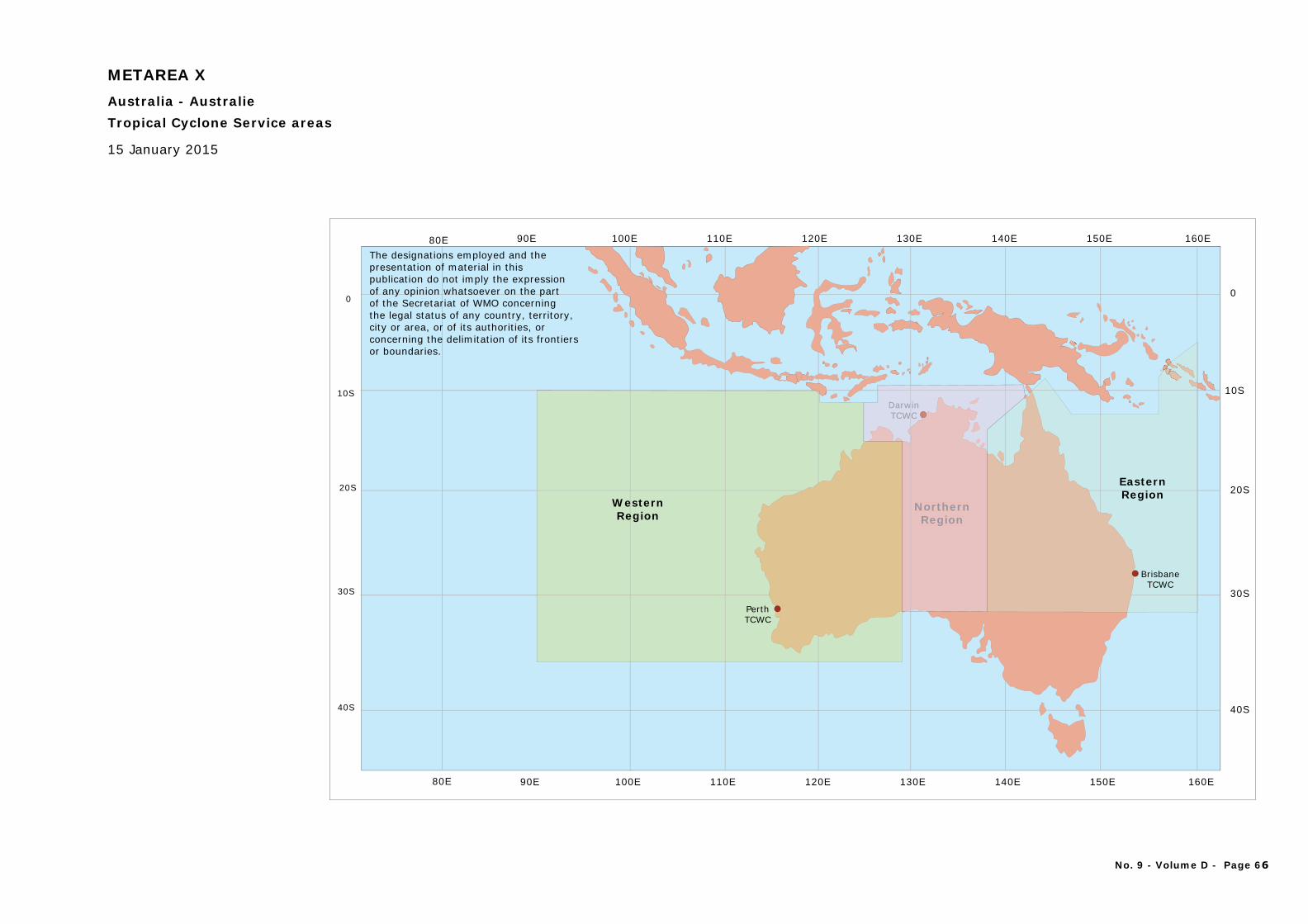
20S
10S
0
30S
40S
20S
10S
0
30S
40S
150E 160E140E130E120E110E100E90E80E
150E 160E140E130E120E110E100E90E80E
Tropical Cyclone Service areas
15 January 2015
METAREA XAustralia - Australie
The designations employed and thepresentation of material in this publication do not imply the expression of any opinion whatsoever on the part of the Secretariat of WMO concerningthe legal status of any country, territory, city or area, or of its authorities, or concerning the delimitation of its frontiers or boundaries.
WesternRegion
PerthTCWC
EasternRegion
NorthernRegion
DarwinTCWC
BrisbaneTCWC
NorthernRegion
winC
DarwTCW
No. 9 - Volume D - Page 66
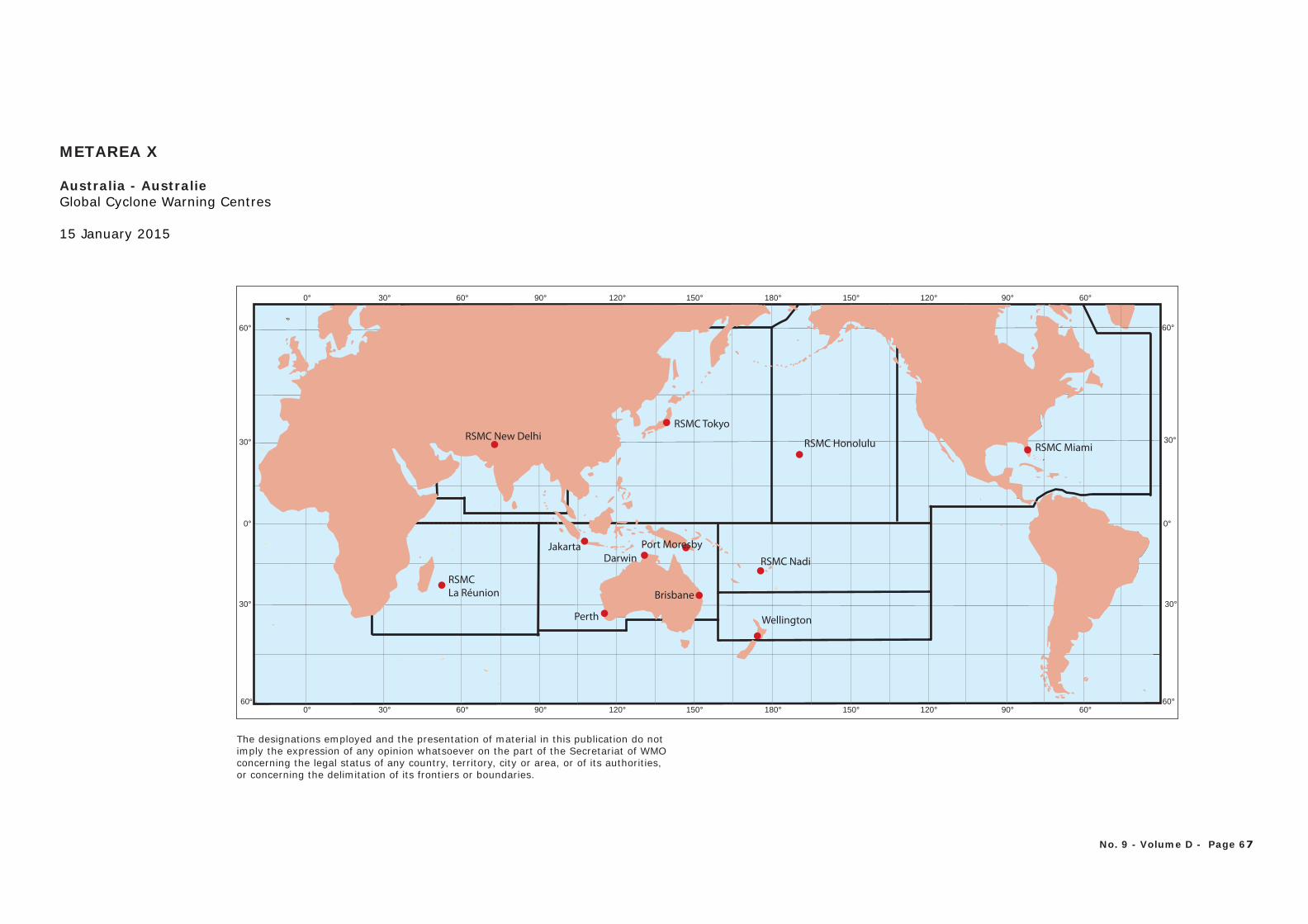
30°
60°
0°0°
60°60°90°120°150°180°150°120°90°60°30°0°
30°
30°
60°
30°
60°
60°90°120°150°180°150°120°90°60°30°0°
RSMCLa Réunion
RSMC Nadi
RSMC Tokyo
RSMC Honolulu
Port MoresbyJakarta
Perth
Darwin
Brisbane
RSMC New DelhiRSMC Miami
Wellington
Global Cyclone Warning Centres
15 January 2015
METAREA X
Australia - Australie
No. 9 - Volume D - Page 67
The designations employed and the presentation of material in this publication do notimply the expression of any opinion whatsoever on the part of the Secretariat of WMOconcerning the legal status of any country, territory, city or area, or of its authorities, or concerning the delimitation of its frontiers or boundaries.
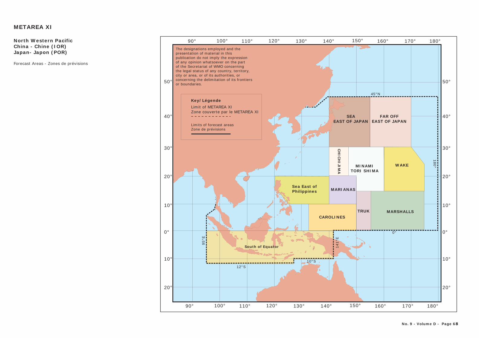
CHINA
THAILAND
MONGOLIA
0°
100°
10°
20°
30°
40°
50°
10°
20°
110° 120° 130° 140° 150°90° 160° 170° 180°
12°S
95°E
10°S
141°
E
0°
180°
45°N
0°
10°
20°
30°
40°
50°
10°
20°
100° 110° 120° 130° 140° 150°90° 160° 170° 180°
Key/LÈgende
Limit of METAREA XIZone couverte par le METAREA XI
METAREA XI
North Western PacificChina - Chine (IOR)Japan- Japon (POR)
Forecast Areas - Zones de prévisions
South of Equator
TRUKCAROLINES
MARIANAS
MARSHALLS
CH
ICH
IJIMA
SEAEAST OF JAPAN
FAR OFFEAST OF JAPAN
MINAMITORI SHIMA
WAKE
Sea East ofPhilippines
Key/LégendeLimit of METAREA XIZone couverte par le METAREA XI
Limits of forecast areasZone de prévisions
The designations employed and thepresentation of material in this publication do not imply the expression of any opinion whatsoever on the part of the Secretariat of WMO concerningthe legal status of any country, territory, city or area, or of its authorities, or concerning the delimitation of its frontiers or boundaries.
No. 9 - Volume D - Page 68
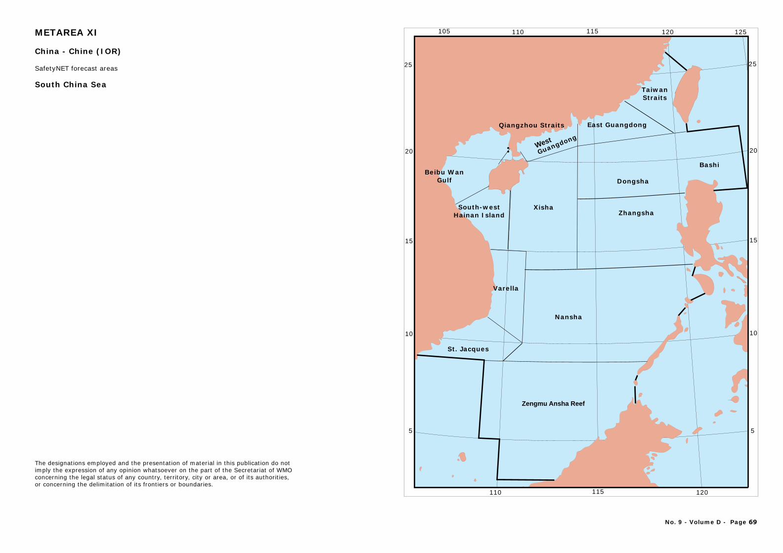
Zengmu Ansha Reef
Nansha
XishaSouth-west Hainan Island
Beibu WanGulf
West
Guangdong
East Guangdong
TaiwanStraits
Qiangzhou Straits
Zhangsha
Dongsha
St. Jacques
Varella
Bashi
25
20
15
10
5
25
20
15
10
5
105 110 115 120 125
110 115 120
¨
South China Sea
No. 9 - Volume D - Page 69
The designations employed and the presentation of material in this publication do notimply the expression of any opinion whatsoever on the part of the Secretariat of WMOconcerning the legal status of any country, territory, city or area, or of its authorities, or concerning the delimitation of its frontiers or boundaries.
METAREA XI
China - Chine (IOR)
SafetyNET forecast areas
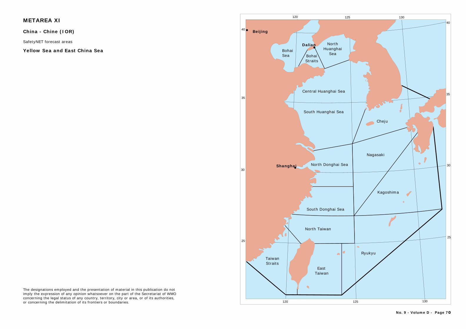
Bohai Sea
North Huanghai
Sea
Central Huanghai Sea
South Huanghai Sea
North Donghai Sea
South Donghai Sea
Nagasaki
North Taiwan
Taiwan Straits
EastTaiwan
Ryukyu
Kagoshima
Cheju
Bohai Straits
40
35
30
25
40
35
30
25
120 125 130
120 125 130
Dalian
Shanghai
Beijing
Yellow Sea and East China Sea
The designations employed and the presentation of material in this publication do notimply the expression of any opinion whatsoever on the part of the Secretariat of WMOconcerning the legal status of any country, territory, city or area, or of its authorities, or concerning the delimitation of its frontiers or boundaries.
No. 9 - Volume D - Page 70
METAREA XI
China - Chine (IOR)
SafetyNET forecast areas
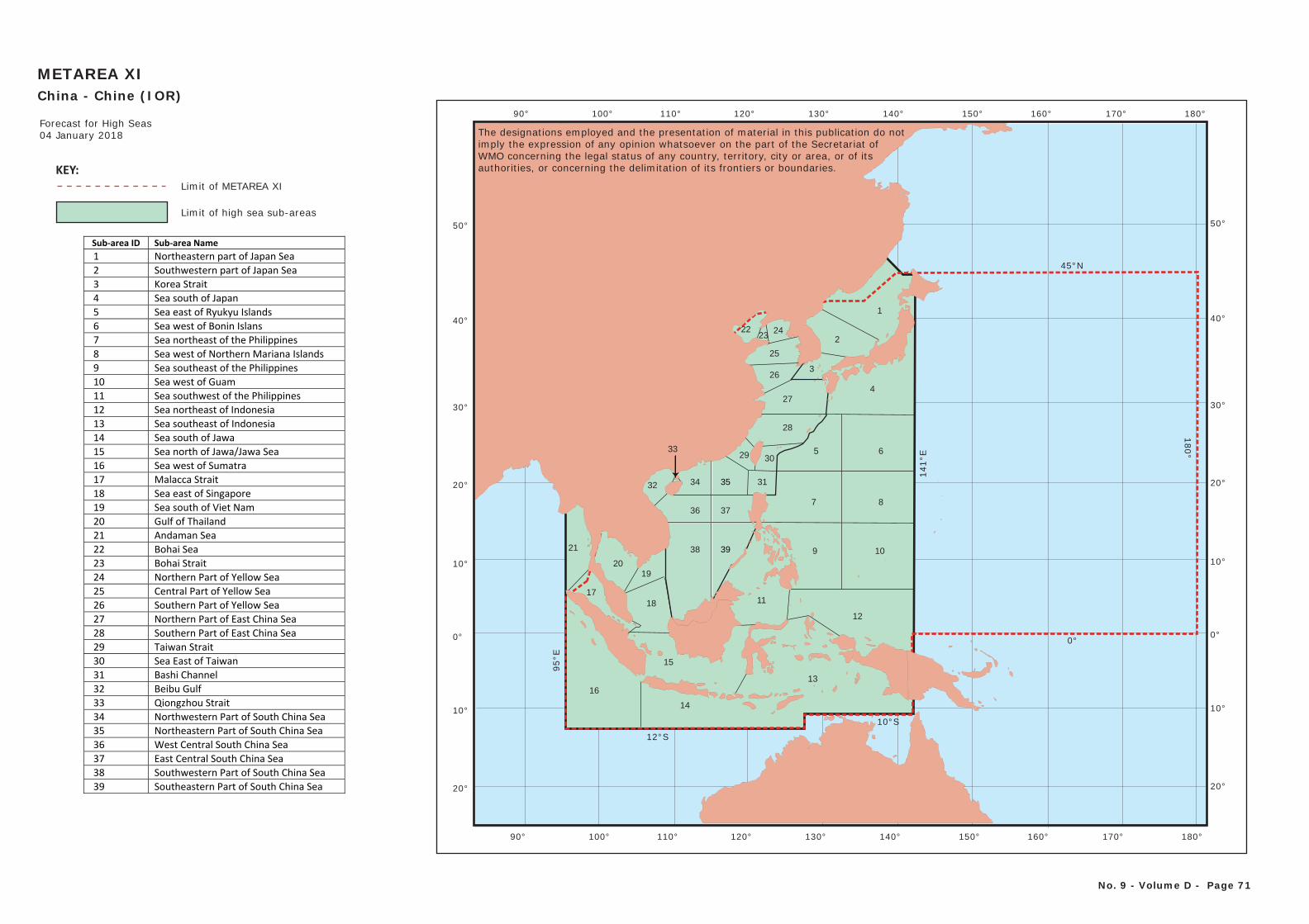
METAREA XIChina - Chine (IOR)
No. 9 - Volume D - Page 71
Forecast for High Seas04 January 2018
0°
100°
10°
20°
30°
40°
50°
10°
20°
110° 120° 130° 140° 150°90° 160° 170° 180°
0°
10°
20°
30°
40°
50°
10°
20°
100° 110° 120° 130° 140° 150°90° 160° 170° 180°
17
21
2019
16
15
14
13
12
4
65
87
9 10
11
1
2
3
18
Sub-area ID Sub-area Name 1 Northeastern part of Japan Sea 2 Southwestern part of Japan Sea 3 Korea Strait 4 Sea south of Japan 5 Sea east of Ryukyu Islands 6 Sea west of Bonin Islans 7 Sea northeast of the Philippines 8 Sea west of Northern Mariana Islands 9 Sea southeast of the Philippines 10 Sea west of Guam 11 Sea southwest of the Philippines 12 Sea northeast of Indonesia 13 Sea southeast of Indonesia 14 Sea south of Jawa 15 Sea north of Jawa/Jawa Sea 16 Sea west of Sumatra 17 Malacca Strait 18 Sea east of Singapore 19 Sea south of Viet Nam 20 Gulf of Thailand 21 Andaman Sea 22 Bohai Sea 23 Bohai Strait 24 Northern Part of Yellow Sea 25 Central Part of Yellow Sea 26 Southern Part of Yellow Sea 27 Northern Part of East China Sea 28 Southern Part of East China Sea 29 Taiwan Strait 30 Sea East of Taiwan 31 Bashi Channel 32 Beibu Gulf 33 Qiongzhou Strait 34 Northwestern Part of South China Sea 35 Northeastern Part of South China Sea 36 West Central South China Sea 37 East Central South China Sea 38 Southwestern Part of South China Sea 39 Southeastern Part of South China Sea
KEY:Limit of METAREA XI
Limit of high sea sub-areas
38 39
36 37
32
33
34
2223
24
25
26
27
28
35
29 30
31
The designations employed and the presentation of material in this publication do notimply the expression of any opinion whatsoever on the part of the Secretariat of WMO concerning the legal status of any country, territory, city or area, or of its authorities, or concerning the delimitation of its frontiers or boundaries.
12°S
95°E
10°S
141°
E
180°
45°N
0°
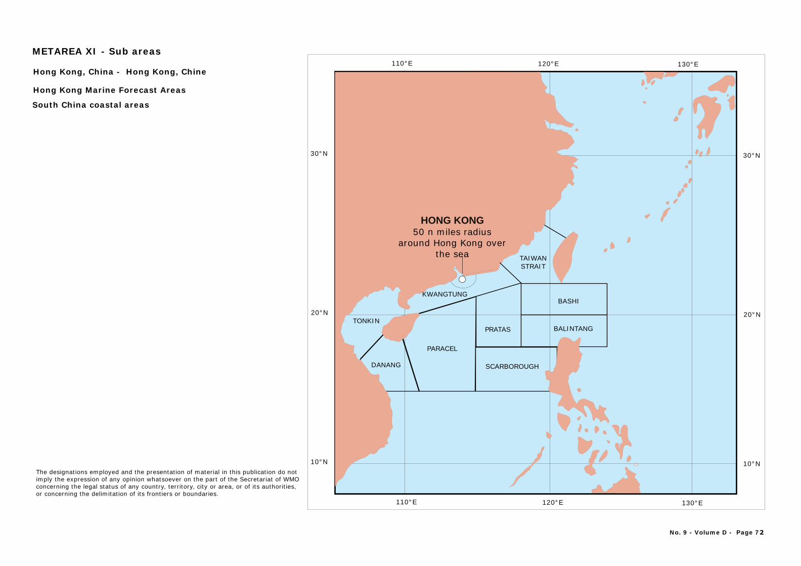
110°E 120°E 130°E
10°N
20°N
30°N
DANANG
PARACEL
TONKIN
KWANGTUNG
TAIWANSTRAIT
SCARBOROUGH
PRATAS
BASHI
BALINTANG
110°E 120°E 130°E
10°N
20°N
30°N
HONG KONG50 n miles radius
around Hong Kong over the sea
Hong Kong, China -
Hong Kong Marine Forecast Areas
South China coastal areas
Hong Kong, Chine
No. 9 - Volume D - Page 72
The designations employed and the presentation of material in this publication do notimply the expression of any opinion whatsoever on the part of the Secretariat of WMOconcerning the legal status of any country, territory, city or area, or of its authorities, or concerning the delimitation of its frontiers or boundaries.
METAREA XI - Sub areas
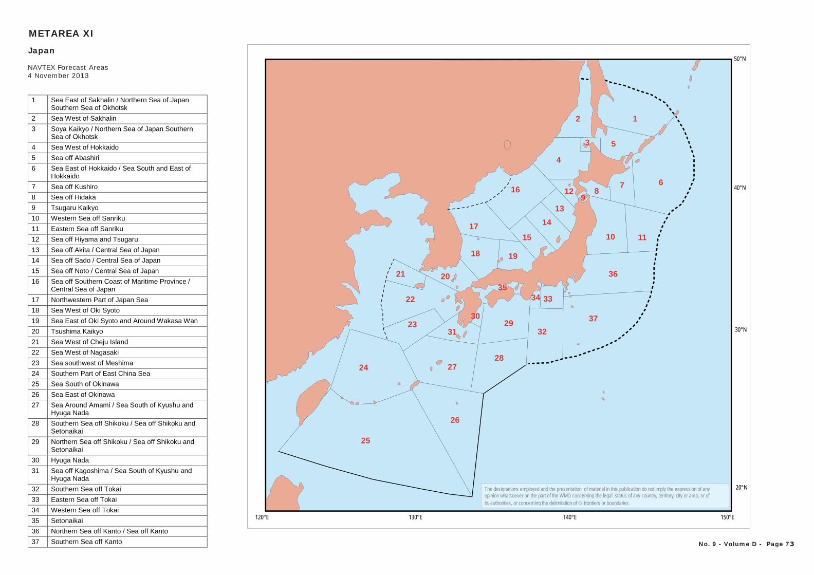
130°E 140°E 150°E120°E
20°N
30°N
40°N
50°N
12
3
4
5
678
1110
912
13
14
15
16
17
18 19
2021
22
23
24
25
26
2728
2930
31 32
333435
36
37
1 Sea East of Sakhalin / Northern Sea of Japan Southern Sea of Okhotsk
2 Sea West of Sakhalin
3 Soya Kaikyo / Northern Sea of Japan Southern Sea of Okhotsk
4 Sea West of Hokkaido
5 Sea off Abashiri
6 Sea East of Hokkaido / Sea South and East of Hokkaido
7 Sea off Kushiro
8 Sea off Hidaka
9 Tsugaru Kaikyo
10 Western Sea off Sanriku
11 Eastern Sea off Sanriku
12 Sea off Hiyama and Tsugaru
13 Sea off Akita / Central Sea of Japan
14 Sea off Sado / Central Sea of Japan
15 Sea off Noto / Central Sea of Japan
16 Sea off Southern Coast of Maritime Province / Central Sea of Japan
17 Northwestern Part of Japan Sea
18 Sea West of Oki Syoto
19 Sea East of Oki Syoto and Around Wakasa Wan
20 Tsushima Kaikyo
21 Sea West of Cheju Island
22 Sea West of Nagasaki
23 Sea southwest of Meshima
24 Southern Part of East China Sea
25 Sea South of Okinawa
26 Sea East of Okinawa
27 Sea Around Amami / Sea South of Kyushu and Hyuga Nada
28 Southern Sea off Shikoku / Sea off Shikoku and Setonaikai
29 Northern Sea off Shikoku / Sea off Shikoku and Setonaikai
30 Hyuga Nada
31 Sea off Kagoshima / Sea South of Kyushu and Hyuga Nada
32 Southern Sea off Tokai
33 Eastern Sea off Tokai
34 Western Sea off Tokai
35 Setonaikai
36 Northern Sea off Kanto / Sea off Kanto
37 Southern Sea off Kanto
METAREA XI
Japan
NAVTEX Forecast Areas4 November 2013
No. 9 - Volume D - Page 73
The designations employed and the presentation of material in this publication do not imply the expression of any opinion whatsoever on the part of the WMO concerning the legal status of any country, territory, city or area, or ofits authorities, or concerning the delimitation of its frontiers or boundaries.
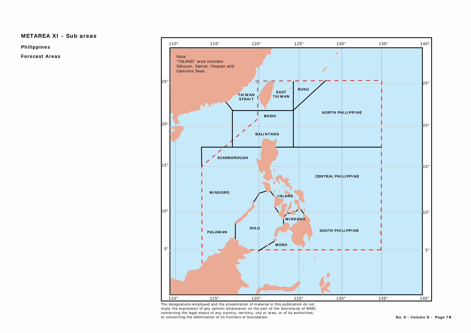
PALAWANSULU
MORO
MINDORO
CENTRAL PHILIPPINE
SCARBOROUGH
NORTH PHILIPPINE
BALINTANG
BASHI
EASTTAIWAN
RUKU
SOUTH PHILIPPINE
120° 130° 140°110° 115° 125° 135°
25°
20°
10°
15°
5°
25°
20°
10°
15°
5°
120° 130° 140°110° 115° 125° 135°
TAIWANSTRAIT
MINDANO
INLAND
Philippines
Forecast Areas Note: “INLAND” area includesSibuyan, Samar, Visayan and Camotes Seas.
No. 9 - Volume D - Page 74
The designations employed and the presentation of material in this publication do notimply the expression of any opinion whatsoever on the part of the Secretariat of WMOconcerning the legal status of any country, territory, city or area, or of its authorities, or concerning the delimitation of its frontiers or boundaries.
METAREA XI - Sub areas
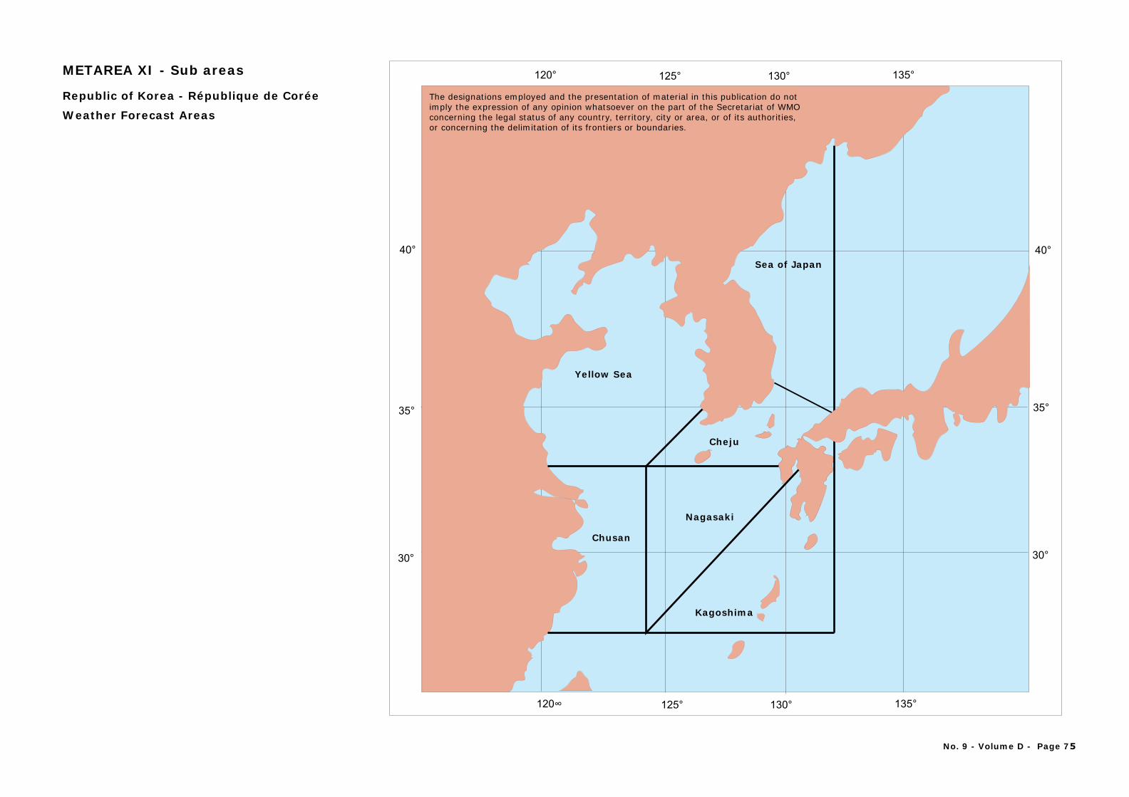
30° 30°
35° 35°
40° 40°
Cheju
Nagasaki
Chusan
Yellow Sea
Sea of Japan
Kagoshima
120° 125° 130° 135°
120∞ 125° 130° 135°
Republic of Korea - République de Corée
Weather Forecast Areas
METAREA XI - Sub areas
No. 9 - Volume D - Page 75
The designations employed and the presentation of material in this publication do notimply the expression of any opinion whatsoever on the part of the Secretariat of WMOconcerning the legal status of any country, territory, city or area, or of its authorities, or concerning the delimitation of its frontiers or boundaries.
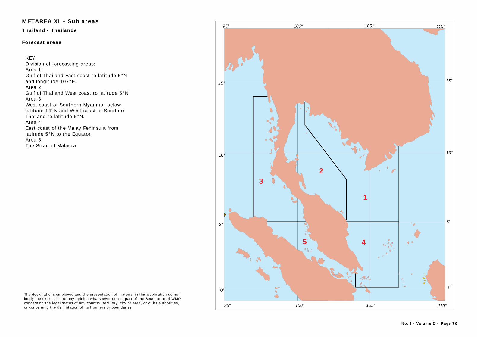
95° 100° 105° 110°
95° 100° 105° 110°
1
2
3
45
5°5°
15°15°
10°10°
0°0°
T - Thailand ha landeï
Forecast areas
KEY:Division of forecasting areas:Area 1:Gulf of Thailand East coast to latitude 5°N and longitude 107°E.Area 2Gulf of Thailand West coast to latitude 5°NArea 3:West coast of Southern Myanmar below latitude 14°N and West coast of Southern Thailand to latitude 5°N.Area 4:East coast of the Malay Peninsula from latitude 5°N to the Equator.Area 5:The Strait of Malacca.
No. 9 - Volume D - Page 76
The designations employed and the presentation of material in this publication do notimply the expression of any opinion whatsoever on the part of the Secretariat of WMOconcerning the legal status of any country, territory, city or area, or of its authorities, or concerning the delimitation of its frontiers or boundaries.
METAREA XI - Sub areas
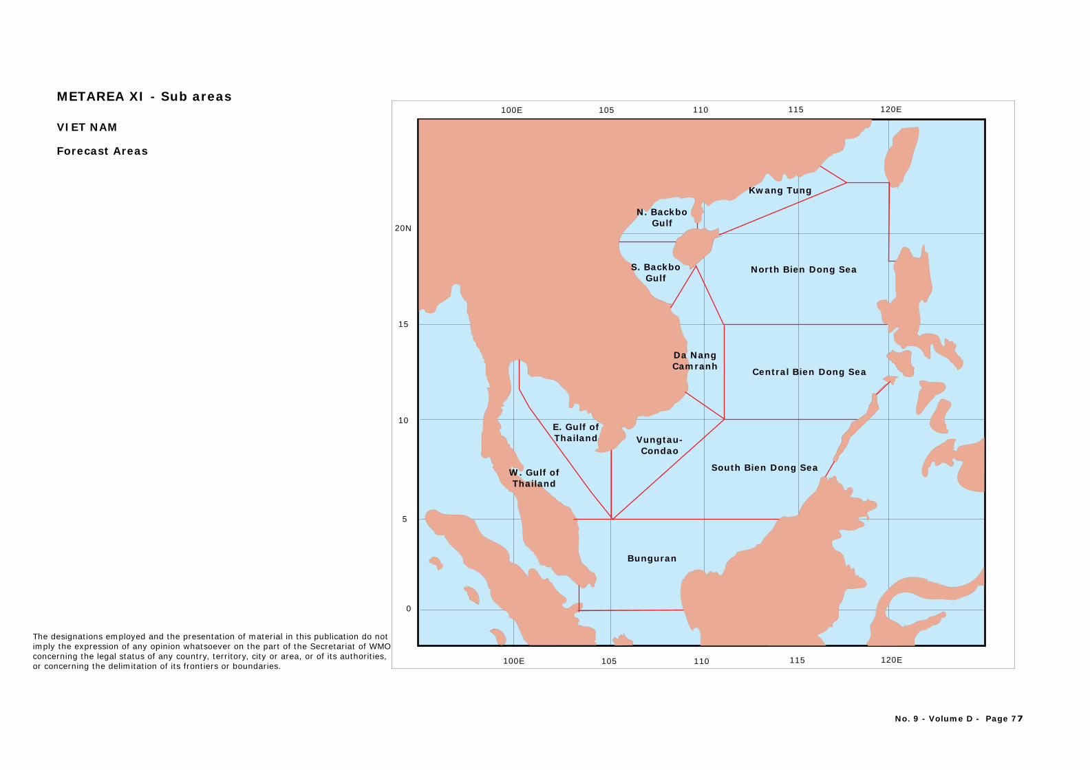
120E115110105100E
0
5
10
15
20N
105 110 115 120E100E
N. BackboGulf
S. BackboGulf
Kwang Tung
Da Nang Camranh
Vungtau-Condao
E. Gulf ofThailand
W. Gulf ofThailand
North Bien Dong Sea
Central Bien Dong Sea
South Bien Dong Sea
Bunguran
VIET NAM
Forecast Areas
No. 9 - Volume D - Page 77
The designations employed and the presentation of material in this publication do notimply the expression of any opinion whatsoever on the part of the Secretariat of WMOconcerning the legal status of any country, territory, city or area, or of its authorities, or concerning the delimitation of its frontiers or boundaries.
METAREA XI - Sub areas
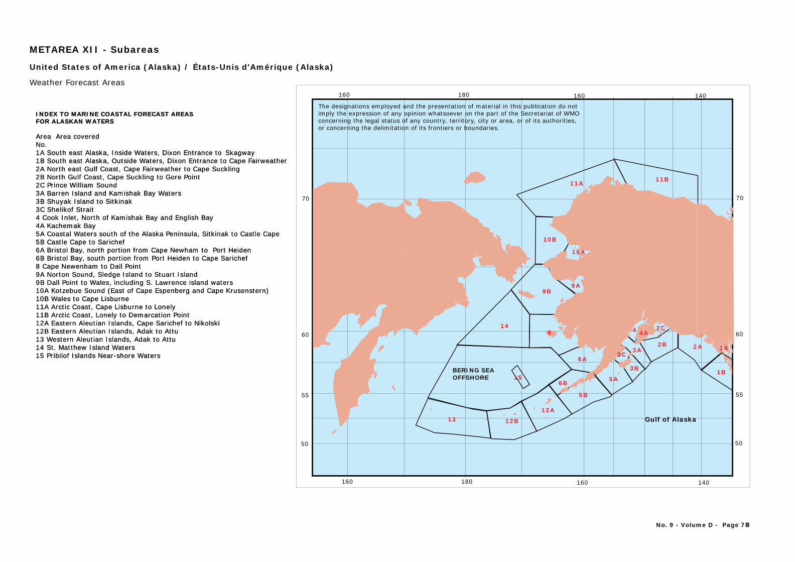
1312A
148
6A
9B
10B
11A
3B
3A2B
6B
Gulf of Alaska
BERING SEAOFFSHORE
Area Area coveredNo.1A South east Alaska, Inside Waters, Dixon Entrance to
2A North east Gulf Coast, Cape Fairweather to Cape Suckling2B North Gulf Coast, Cape Suckling to Gore Point2C Prince William Sound3A Barren Island and Kamishak Bay Waters
4A Kachemak Bay5A Coastal Waters south of the Alaska Peninsula, Sitkinak to Castle Cape5B Castle Cape to Sarichef6A Bristol Bay, north portion from Cape Newham to Port Heiden6B Bristol Bay, south portion from Port Heiden to Cape Sarichef8 Cape Newenham to Dall Point9A Norton Sound, Sledge Island to Stuart Island9B Dall Point to Wales, including S. Lawrence island waters10A Kotzebue Sound (East of Cape Espenberg and Cape Krusenstern)10B Wales to Cape Lisburne11A Arctic Coast, Cape Lisburne to Lonely11B Arctic Coast, Lonely to Demarcation Point12A Eastern Aleutian Islands, Cape Sarichef to Nikolski12B 13 Western Aleutian Islands, Adak to Attu14 St. Matthew Island Waters15 Pribilof Islands Near-shore Waters
INDEX TO MARINE COASTAL FORECAST AREASFOR ALASKAN WATERS
Skagway1B South east Alaska, Outside Waters, Dixon Entrance to Cape Fairweather
3B Shuyak Island to Sitkinak3C Shelikof Strait4 Cook Inlet, North of Kamishak Bay and English Bay
Eastern Aleutian Islands, Adak to Attu
United States of America (Alaska) / États-Unis d'Amérique (Alaska)
Weather Forecast Areas
5A
5B
12B
11B
15
9A
3C
10A
4A4 2C
2A
1B
1A
METAREA XII - Subareas
60
50
70
55
140160180160
60
50
70
55
140160180160
Area Area coveredNo.1A South east Alaska, Inside Waters, Dixon Entrance to
2A North east Gulf Coast, Cape Fairweather to Cape Suckling2B North Gulf Coast, Cape Suckling to Gore Point2C Prince William Sound3A Barren Island and Kamishak Bay Waters
4A Kachemak Bay5A Coastal Waters south of the Alaska Peninsula, Sitkinak to Castle Cape5B Castle Cape to Sarichef6A Bristol Bay, north portion from Cape Newham to Port Heiden6B Bristol Bay, south portion from Port Heiden to Cape Sarichef8 Cape Newenham to Dall Point9A Norton Sound, Sledge Island to Stuart Island9B Dall Point to Wales, including S. Lawrence island waters10A Kotzebue Sound (East of Cape Espenberg and Cape Krusenstern)10B Wales to Cape Lisburne11A Arctic Coast, Cape Lisburne to Lonely11B Arctic Coast, Lonely to Demarcation Point12A Eastern Aleutian Islands, Cape Sarichef to Nikolski12B 13 Western Aleutian Islands, Adak to Attu14 St. Matthew Island Waters15 Pribilof Islands Near-shore Waters
INDEX TO MARINE COASTAL FORECAST AREASFOR ALASKAN WATERS
Skagway1B South east Alaska, Outside Waters, Dixon Entrance to Cape Fairweather
3B Shuyak Island to Sitkinak3C Shelikof Strait4 Cook Inlet, North of Kamishak Bay and English Bay
Eastern Aleutian Islands, Adak to Attu
No. 9 - Volume D - Page 78
The designations employed and the presentation of material in this publication do notimply the expression of any opinion whatsoever on the part of the Secretariat of WMOconcerning the legal status of any country, territory, city or area, or of its authorities, or concerning the delimitation of its frontiers or boundaries.
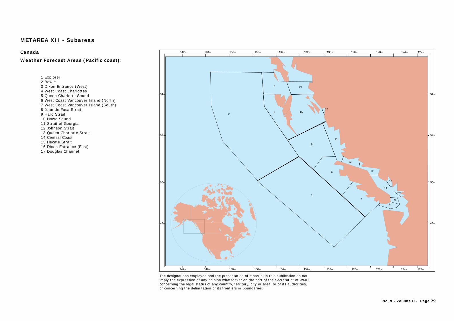
2
3 16
154
5
14
6
17
8
11
9
12
13
10
17
Explorer12 Bowie3 Dixon Entrance (West)4 West Coast Charlottes5 Queen Charlotte Sound6 West Coast Vancouver Island (North)7 West Coast Vancouver Island (South)8 Juan de Fuca Strait 9 Haro Strait10 Howe Sound11 Strait of Georgia12 Johnson Strait13 Queen Charlotte Strait 14 Central Coast 15 Hecate Strait16 Dixon Entrance (East)17 Douglas Channel
Canada
Weather Forecast Areas (Pacific coast):
No. 9 - Volume D - Page 79
The designations employed and the presentation of material in this publication do notimply the expression of any opinion whatsoever on the part of the Secretariat of WMOconcerning the legal status of any country, territory, city or area, or of its authorities, or concerning the delimitation of its frontiers or boundaries.
METAREA XII - Subareas
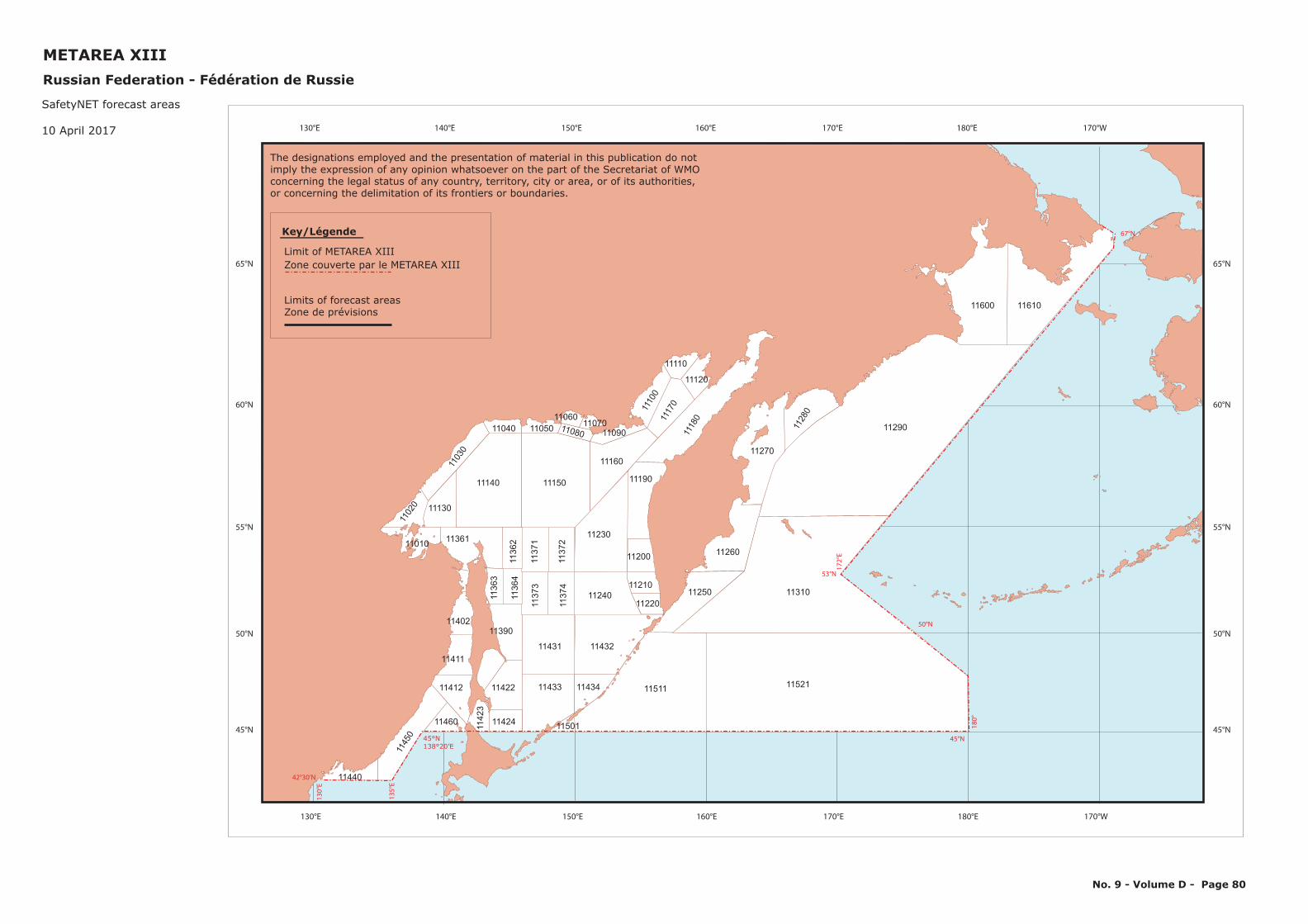
No. 9 - Volume D - Page 80
11440
1145
0
11422
11140
1103
0
11040
11511 11521
1131011250
11260
11270
1143211431
11150
11160
11361
11402
11411
11433 11434
11240
11230
11190
11412
11460
11390
11130
11200
11210
11220
1118
01117
01110
0
1128
0
1136
3
1136
2
1137
1
1137
211
374
1137
3
1136
4
1142
3
11424 11501
11290
11600 11610
1105011060
110701109011080
11110
11120
1102
0
11010
42°30’N
135°E
45°N
53°N
172°E
67°N
180°
130°E
45°N138°20’E
50°N
Limit of METAREA XIIIZone couverte par le METAREA XIII
Limits of forecast areasZone de prévisions
Key/Légende
130°E 140°E 150°E 160°E 170°E 180°E 170°W
130°E 140°E 150°E 160°E 170°E 180°E 170°W
65°N
60°N
55°N
50°N
45°N
65°N
60°N
55°N
50°N
45°N
The designations employed and the presentation of material in this publication do notimply the expression of any opinion whatsoever on the part of the Secretariat of WMOconcerning the legal status of any country, territory, city or area, or of its authorities, or concerning the delimitation of its frontiers or boundaries.
METAREA XIIIRussian Federation - Fédération de Russie
SafetyNET forecast areas
10 April 2017
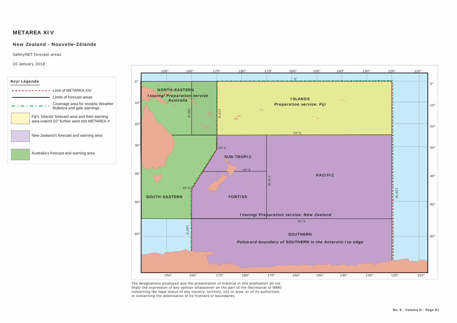
150° 160° 170° 180° 170° 160° 150° 140° 130° 110°120°
150° 160° 170° 180° 170° 160° 150° 140° 130° 110°120°
0°
10°
20°
30°
40°
50°
60°
0°
10°
20°
30°
40°
50°
60°
0°
120°W
25°S
40°S
45°S
29°S
160°E
170°W
160°E
55°S
170°E
FORTIES
SUB-TROPIC
PACIFIC
ISLANDS
Poleward boundary of SOUTHERN is the Antarctic Ice edge
SOUTHERN
Preparation service: Fiji
Issuing/Preparation service: New Zealand
NORTH-EASTERNIssuing/Preparation service
Australia
SOUTH-EASTERN
METAREA XIV
New Zealand - Nouvelle-Zélande
SafetyNET forecast areas
10 January 2018
No. 9 - Volume D - Page 81
The designations employed and the presentation of material in this publication do notimply the expression of any opinion whatsoever on the part of the Secretariat of WMOconcerning the legal status of any country, territory, city or area, or of its authorities, or concerning the delimitation of its frontiers or boundaries.
Fiji’s ‘Islands’ forecast area and their warningarea extend 10° further west into METAREA X
New Zealand’s forecast and warning area
Australia’s forecast and warning area
Key/Légende
Limit of METAREA XIV
Limits of forecast areas
Coverage area for oceanic WeatherBulletins and gale warnings
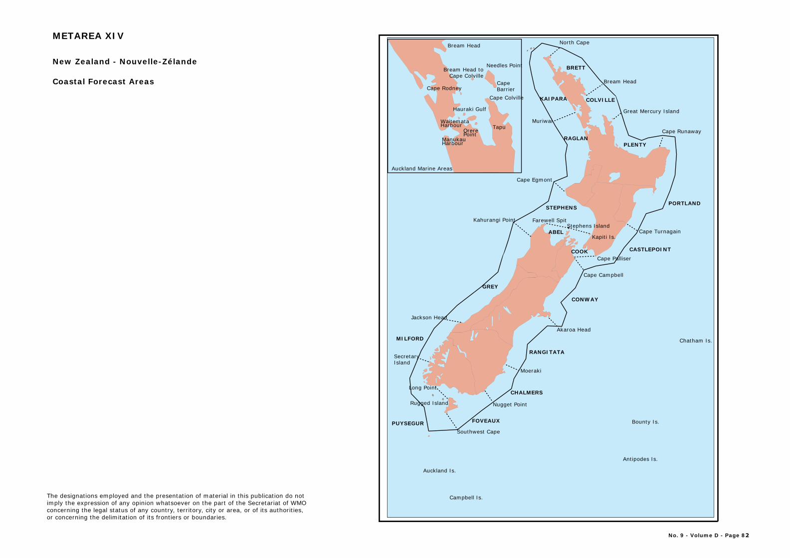
Nugget Point
Moeraki
Akaroa Head
Cape Palliser
Jackson Head
SecretaryIsland
Muriwai
Cape Egmont
North Cape
Bream Head
Cape Runaway
Cape Turnagain
Auckland Is.
Campbell Is.
Antipodes Is.
Bounty Is.
Chatham Is.
Farewell SpitStephens Island
Kapiti Is.
Long Point
Cape Campbell
Southwest Cape
Rugged Island
Great Mercury Island
BRETT
CONWAY
CASTLEPOINT
COLVILLE
PLENTY
FOVEAUX
KAIPARA
RAGLAN
STEPHENS
ABEL
GREY
MILFORD
PUYSEGUR
CHALMERS
PORTLAND
RANGITATA
Kahurangi Point
Bream Head
Needles Point
CapeBarrier
TapuOrerePoint
Cape Colville
Cape Rodney
Waitemata Harbour
ManukauHarbour
COOK
Bream Head to Cape Colville
Hauraki Gulf
Auckland Marine Areas
New Zealand - Nouvelle-Zélande
Coastal Forecast Areas
METAREA XIV
The designations employed and the presentation of material in this publication do notimply the expression of any opinion whatsoever on the part of the Secretariat of WMOconcerning the legal status of any country, territory, city or area, or of its authorities, or concerning the delimitation of its frontiers or boundaries.
No. 9 - Volume D - Page 82
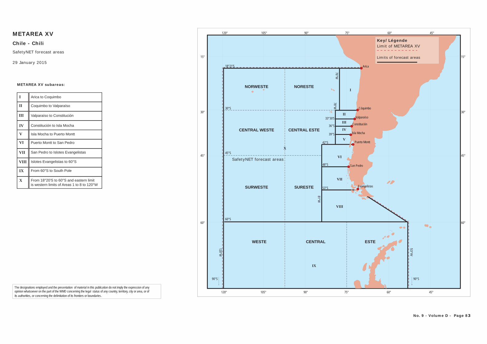
15°
30°
45°
60°
120° 105° 90° 75° 60° 45°
15°
30°
45°
60°
120° 105° 90° 75° 60° 45°
90°S 90°S
Arica
San Pedro
Cóquimbo
Puerto Montt
Isla Mocha
Constitución
Valparaíso
53°W
120°W
78°W76°W
81°W
33°30'S
36°S
39°S
42°S
48°S
53°S
60°S
18°21'S
30°S
45°S
Evangelistas
ESTE
X
IX
VIII
I
VII
VI
II
III
IV
V
CENTRAL ESTE
WESTE
SURWESTE
CENTRAL WESTE
NORWESTE NORESTE
SURESTE
CENTRAL
METAREA XVChile - ChiliSafetyNET forecast areas
29 January 2015
The designations employed and the presentation of material in this publication do not imply the expression of any opinion whatsoever on the part of the WMO concerning the legal status of any country, territory, city or area, or ofits authorities, or concerning the delimitation of its frontiers or boundaries.
Key/LégendeLimit of METAREA XV
Limits of forecast areas
No. 9 - Volume D - Page 83
METAREA XV subareas:
Valparaíso to Constitución
Constitución to Isla Mocha
Isla Mocha to Puerto Montt
Puerto Montt to San Pedro
San Pedro to Islotes Evangelistas
Islotes Evangelistas to 60°S
From 60°S to South Pole
From 18°20'S to 60°S and eastern limitis western limits of Areas 1 to 8 to 120°W
Arica to Coquimbo
Coquimbo to Valparaíso
I
II
X
IX
VIII
VII
VI
V
IV
III
SafetyNET forecast areas
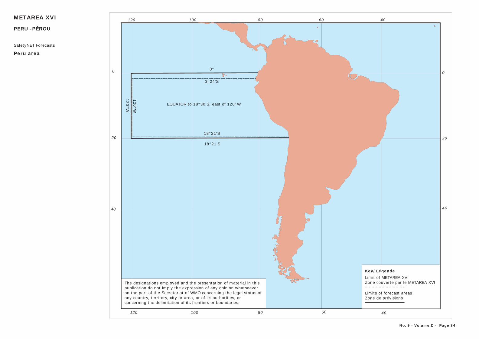
406080120 100
0
20
40
406080120 100
0
20
40
EQUATOR to 18°30'S, east of 120°W
120°W
0°
3°24'S
18°21'S
METAREA XVI
Peru area
SafetyNET Forecasts
120°W
18°21'S
The designations employed and the presentation of material in thispublication do not imply the expression of any opinion whatsoever on the part of the Secretariat of WMO concerning the legal status of any country, territory, city or area, or of its authorities, or concerning the delimitation of its frontiers or boundaries.
Key/LégendeLimit of METAREA XVIZone couverte par le METAREA XVI
Limits of forecast areasZone de prévisions
No. 9 - Volume D - Page 84
PERU -PÉROU

The designations employed and the presentation of material in this publication do not imply the expression of any opinion whatsoever on the part of the WMO concerning the legal status of any country, territory, city or area, or ofits authorities, or concerning the delimitation of its frontiers or boundaries.
110°W 100°W 90°W 80°W 70°W
60°W
50°W
40°W
30°W
20°W
10°W
0°
130°W
120°W
180°
170°W
160°W
150°W
140°W
80°
70°
60°
METAREA XVII and XVIII
CanadaNorthern and Arctic waters
No. 9 - Volume D - Page 85
19 March 2015
NP
120°
W
35°W
67°N
METAREA
XVII
METAREA
XVIII
168°58’W
67°N035°W
67°N168°58’W
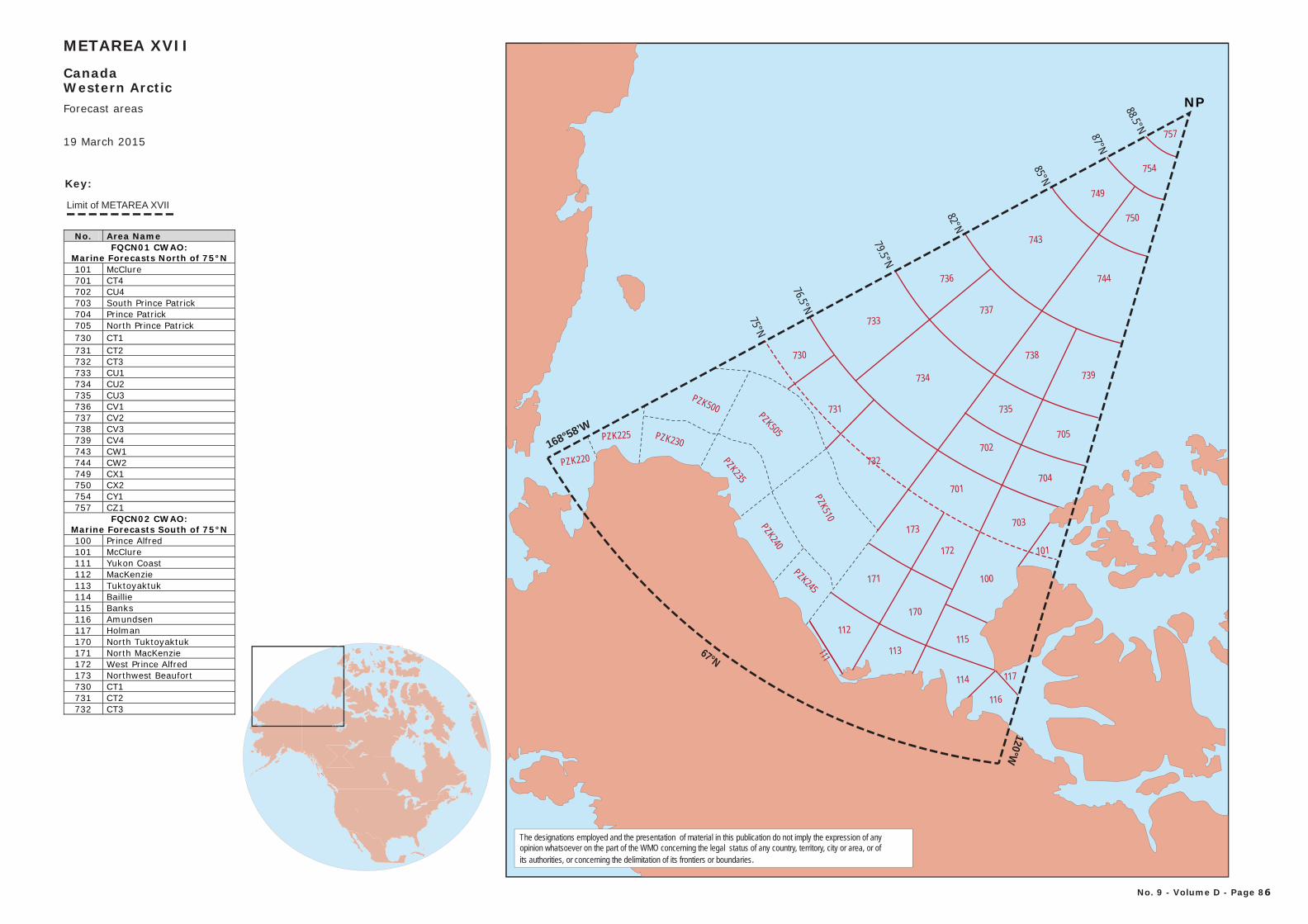
No. Area Name FQCN01 CWAO:
Marine Forecasts North of 75°N 101 McClure 701 CT4 702 CU4 703 South Prince Patrick 704 Prince Patrick 705 North Prince Patrick 730 CT1 731 CT2 732 CT3 733 CU1 734 CU2 735 CU3 736 CV1 737 CV2 738 CV3 739 CV4 743 CW1 744 CW2 749 CX1 750 CX2 754 CY1 757 CZ1
FQCN02 CWAO: Marine Forecasts South of 75°N 100 Prince Alfred 101 McClure 111 Yukon Coast 112 MacKenzie 113 Tuktoyaktuk 114 Baillie 115 Banks 116 Amundsen 117 Holman 170 North Tuktoyaktuk 171 North MacKenzie 172 West Prince Alfred 173 Northwest Beaufort 730 CT1 731 CT2 732 CT3
The designations employed and the presentation of material in this publication do not imply the expression of any opinion whatsoever on the part of the WMO concerning the legal status of any country, territory, city or area, or ofits authorities, or concerning the delimitation of its frontiers or boundaries.
Limit of METAREA XVII
Key:
METAREA XVII
CanadaWestern Arctic
No. 9 - Volume D - Page 86
19 March 2015
Forecast areas
PZK220
PZK510
PZK505
PZK500
PZK225 PZK230
PZK235
PZK240
PZK245
733
734
737
736
743
749
754
757
730
731
732
173
171
701
702
735
738
172
170
100
703
704
705
739
744
115112
113
114
116
111
117
750
10175°N
76.5°N
79.5°N
82°N
85°N
87°N
88.5°N
168°58’W
67°N
120°W
NP
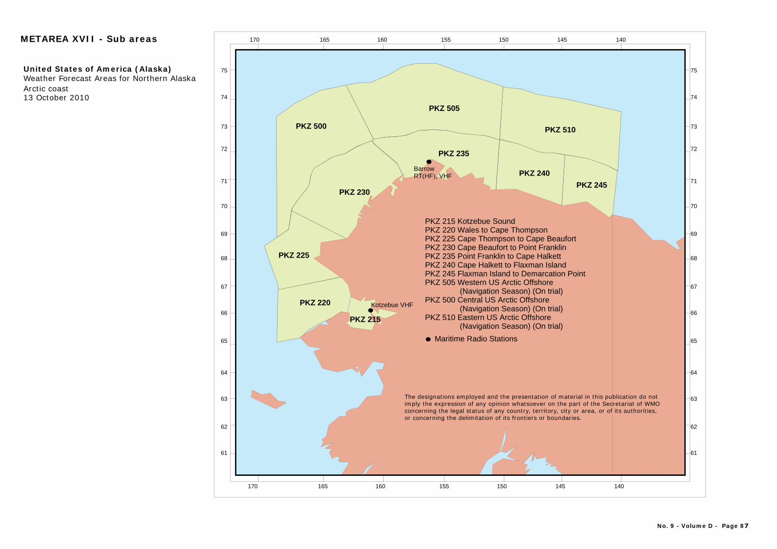
140160170 145150155165
70
65
75
61
62
63
64
66
67
68
69
71
72
73
74
PKZ 510
PKZ 245
PKZ 240
PKZ 235
PKZ 505
PKZ 500
PKZ 230
PKZ 225
PKZ 220
PKZ 215
PKZ 215 Kotzebue SoundPKZ 220 Wales to Cape ThompsonPKZ 225 Cape Thompson to Cape BeaufortPKZ 230 Cape Beaufort to Point FranklinPKZ 235 Point Franklin to Cape HalkettPKZ 240 Cape Halkett to Flaxman IslandPKZ 245 Flaxman Island to Demarcation PointPKZ 505 Western US Arctic Offshore
PKZ 500 Central US Arctic Offshore
PKZ 510 Eastern US Arctic Offshore
(Navigation Season) (On trial)
(Navigation Season) (On trial)
(Navigation Season) (On trial)
United States of America (Alaska)Weather Forecast Areas for Northern Alaska Arctic coast13 October 2010
Kotzebue VHF
BarrowRT , VHF( )HF
Maritime Radio Stations
140160170 145150155165
70
65
75
61
62
63
64
66
67
68
69
71
72
73
74
METAREA XVII - Sub areas
No. 9 - Volume D - Page 87
The designations employed and the presentation of material in this publication do notimply the expression of any opinion whatsoever on the part of the Secretariat of WMOconcerning the legal status of any country, territory, city or area, or of its authorities, or concerning the delimitation of its frontiers or boundaries.
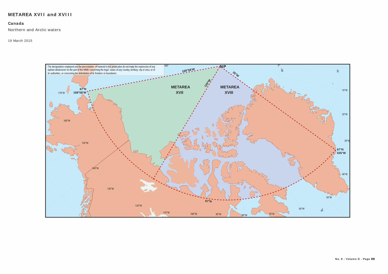
The designations employed and the presentation of material in this publication do not imply the expression of any opinion whatsoever on the part of the WMO concerning the legal status of any country, territory, city or area, or ofits authorities, or concerning the delimitation of its frontiers or boundaries.
110°W 100°W 90°W 80°W 70°W
60°W
50°W
40°W
30°W
20°W
10°W
0°
130°W
120°W
180°
170°W
160°W
150°W
140°W
80°
70°
60°
METAREA XVII and XVIII
CanadaNorthern and Arctic waters
No. 9 - Volume D - Page 88
19 March 2015
NP
120°
W
35°W
67°N
METAREA
XVII
METAREA
XVIII
168°58’W
67°N035°W
67°N168°58’W
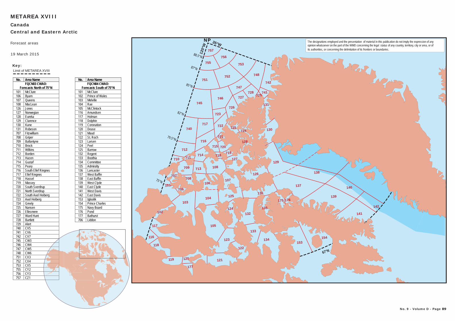
67°N
75°N
120°
W
79.5°N
82°N
85°N
87°N
88.5°N
35°WNP
Limit of METAREA XVIII
Key:755
756
752
753
751
747
740717
103104
712
105
134
121
153
119
116
117
118
123
745746
723
726
727
716
137140
139
141
142
138
748
742
741728
129
130
131
122
177
120
102
713
124
125
126
136
108
127
722
757
714
715
719
710
709
708
101
707
706
132
133
135
729
725
720
721
106107
718
154
175 176
711
724
128
METAREA XVIIICanadaCentral and Eastern Arctic
No. 9 - Volume D - Page 89
19 March 2015
Forecast areas
No. Area Name FQCN03 CWAO:
Forecasts North of 75°N 101 McClure 106 Byam 107 Queens 108 MacLean 126 Jones 127 Norwegian 128 Eureka 129 Clarence 130 Kane 131 Robeson 707 Fitzwilliam 708 Griper 709 Ballantyne 710 Brock 711 Wilkins 712 Borden 713 Hazen 714 Gustaf 715 Peary 716 South Ellef Ringnes 717 Ellef Ringnes 718 Hassel 719 Massey 720 South Sverdrup 721 North Sverdrup 722 South Axel Heiberg 723 Axel Heiberg 724 Greely 725 Nansen 726 Ellesmere 727 Ward Hunt 728 Bartlett 729 Alert 740 CV5 741 CV6 742 CV7 745 CW3 746 CW4 747 CW5 748 CW6 751 CX3 752 CX4 753 CX5 755 CY2 756 CY3 757 CZ1
No. Area Name FQCN04 CWAO:
Forecasts South of 75°N 101 McClure 102 Prince of Wales 103 Melville 104 Rae 105 McClintock 116 Amundsen 117 Holman 118 Dolphin 119 Coronation 120 Dease 121 Maud 122 St. Roch 123 Larsen 124 Peel 125 Barrow 132 Regent 133 Boothia 134 Committee 135 Admiralty 136 Lancaster 137 West Baffin 138 East Baffin 139 West Clyde 140 East Clyde 141 West Davis 142 East Davis 153 Igloolik 154 Prince Charles 175 Navy Board 176 Pond 177 Bathurst 706 Liddon
The designations employed and the presentation of material in this publication do not imply the expression of any opinion whatsoever on the part of the WMO concerning the legal status of any country, territory, city or area, or ofits authorities, or concerning the delimitation of its frontiers or boundaries.
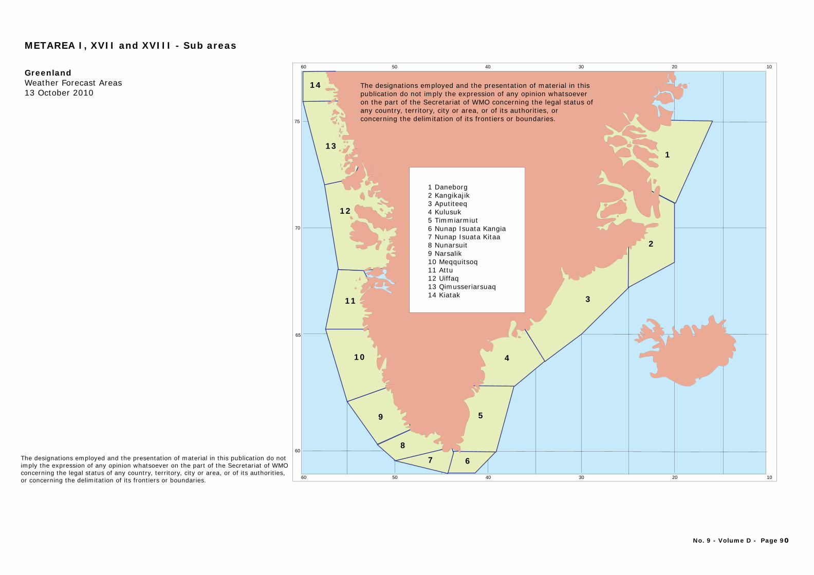
102030405060
102030405060
60
70
65
75
13
14
12
1
2
3
10
11
9
8
7 6
5
4
1 Daneborg2 Kangikajik3 Aputiteeq4 Kulusuk5 Timmiarmiut6 Nunap Isuata Kangia7 Nunap Isuata Kitaa8 Nunarsuit9 Narsalik10 Meqquitsoq11 Attu12 Uiffaq13 Qimusseriarsuaq14 Kiatak
GreenlandWeather Forecast Areas13 October 2010
The designations employed and the presentation of material in thispublication do not imply the expression of any opinion whatsoever on the part of the Secretariat of WMO concerning the legal status of any country, territory, city or area, or of its authorities, or concerning the delimitation of its frontiers or boundaries.
METAREA I, XVII and XVIII - Sub areas
No. 9 - Volume D - Page 90
The designations employed and the presentation of material in this publication do notimply the expression of any opinion whatsoever on the part of the Secretariat of WMOconcerning the legal status of any country, territory, city or area, or of its authorities, or concerning the delimitation of its frontiers or boundaries.
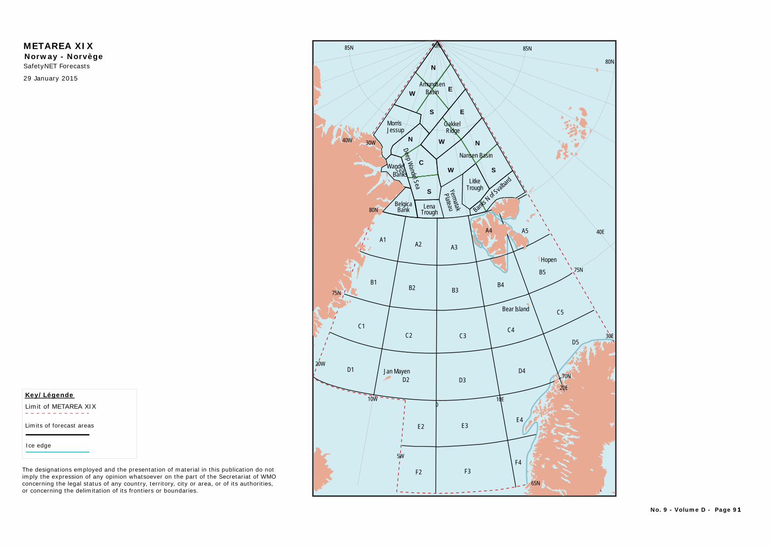
METAREA XIX
SafetyNET Forecasts
Key/Légende
Limit of METAREA XIX
Limits of forecast areas
Norway - Norvège
Ice edge
The designations employed and the presentation of material in this publication do notimply the expression of any opinion whatsoever on the part of the Secretariat of WMOconcerning the legal status of any country, territory, city or area, or of its authorities, or concerning the delimitation of its frontiers or boundaries.
29 January 2015
No. 9 - Volume D - Page 91
N
EW
S
WNN
E
S
S
CW
LenaTrough
A1A2 A3
B1B2 B3
B4
A4 A5
B5
C1C2 C3
C4
C5
D1D2 D3
D4
D5
E2 E3E4
F2 F3F4
AmundsenBasin
MorrisJessup
Gakkel Ridge
LitkeTrough
Wandel
BelgicaBank
Deep Wandel Sea
Banks
Nansen Basin
Sea
Yermatak
Plateau Banks N
of Sval
bard
Jan Mayen
Bear Island
Hopen
80N
40E
90N
40W 30W
10W
30E
20E
20W
80N
85N85N
75N
75N
70N
65N
10E0
5W
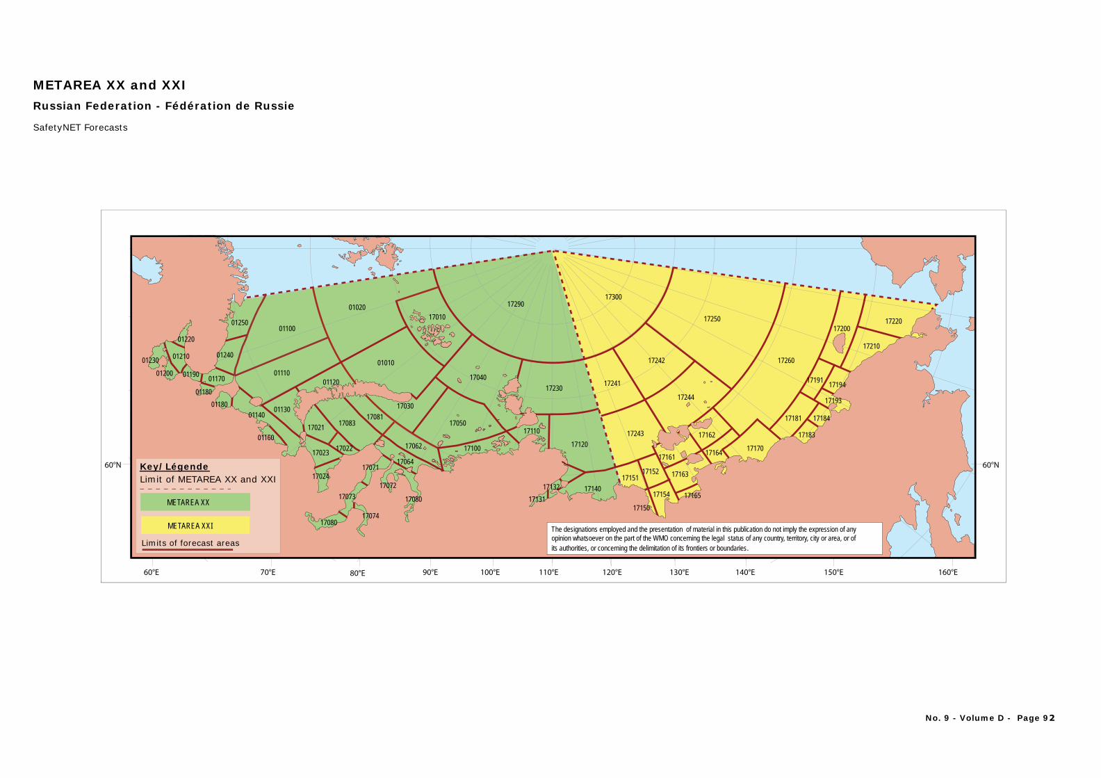
60°N
60°E 70°E 80°E 90°E 100°E 110°E 120°E 130°E 140°E 150°E 160°E
60°N
0125001100
01020
0101001110
17010
17083
17290
01220
01230 01210
01200
01240
01170
01180
17024
01180 0113001140
0116017021
01120
17064
1708117050
17040
17030
17022 1710017023
17080
17073
17074
17072
17071
17062 17120
17140
17110
1713117132
17230
17080
17300
17241
17242
17250
17260
17244
17243
1715117152
17161
17162
17164 17170
17163
17154 1716517150
17181
17191 17194
17193
17184
17183
17200
17210
17220
01190
METAREA XX and XXIRussian Federation - Fédération de Russie
The designations employed and the presentation of material in this publication do not imply the expression of any opinion whatsoever on the part of the WMO concerning the legal status of any country, territory, city or area, or ofits authorities, or concerning the delimitation of its frontiers or boundaries.
SafetyNET Forecasts
Key/LégendeLimit of METAREA XX and XXI
Limits of forecast areas
METAREA XX
METAREA XXI
No. 9 - Volume D - Page 92
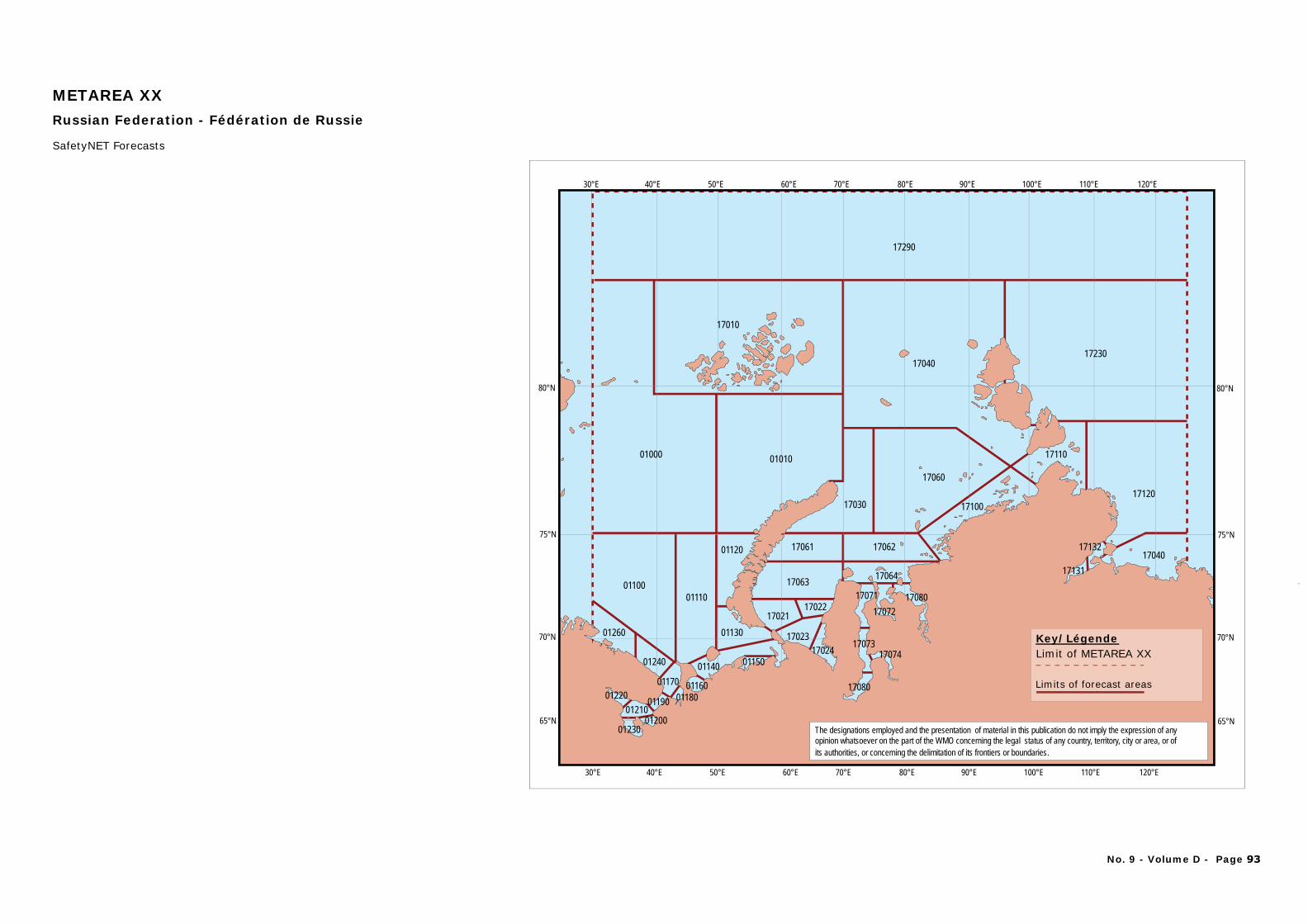
17290
17040
01000
01100
01010
01120
01110
01240
01260
0121001220
0120001230
01190 0118001170
01140 01150
01160
0113017021
17063
17061
17023
17022
17062
17064
17060
17024
17080
1707417073
1707217071 17080
17030 17100
17110
17120
1704017132
17131
17230
17010
80°N
75°N
70°N
65°N
80°N
75°N
70°N
65°N
30°E 40°E 50°E 60°E 70°E 80°E 90°E 100°E 110°E 120°E
30°E 40°E 50°E 60°E 70°E 80°E 90°E 100°E 110°E 120°E
METAREA XXRussian Federation - Fédération de Russie
SafetyNET Forecasts
The designations employed and the presentation of material in this publication do not imply the expression of any opinion whatsoever on the part of the WMO concerning the legal status of any country, territory, city or area, or ofits authorities, or concerning the delimitation of its frontiers or boundaries.
Key/LégendeLimit of METAREA XX
Limits of forecast areas
No. 9 - Volume D - Page 93
PART A
SATELLITE SYSTEMS / COMMUNICATIONS
This table outlines the SafetyNet schedule for routine Met-Ocean Maritime Safety Information bulletins (forecasts and warnings). These bulletins form part of the World Meteorological Organisation’s Worldwide Met-Ocean Information and Warning Service (WWMIWS). Met-Ocean warnings may be broadcast at any time initially, with updates provided at regular intervals until they are no longer required. The times specified are for forecasts issued for METAREA domains, otherwise a footnote is provided to indicate information about these additional services.

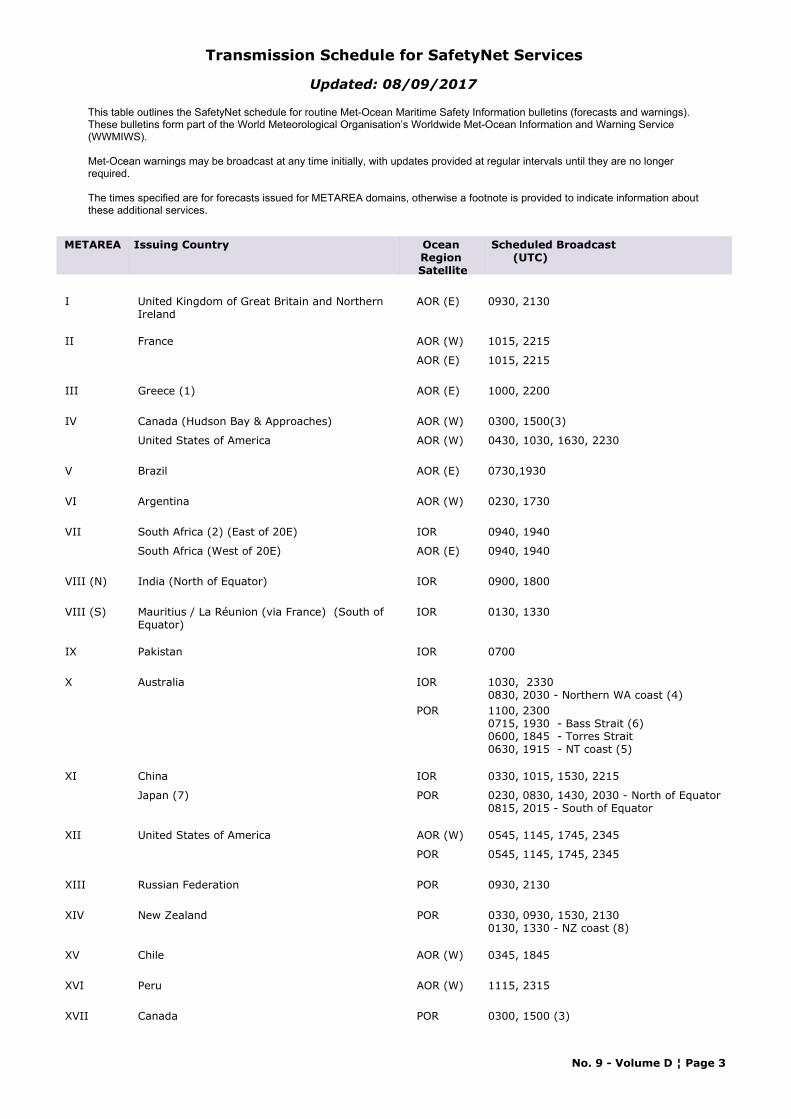
Transmission Schedule for SafetyNet Services
This table outlines the SafetyNet schedule for routine Met-Ocean Maritime Safety Information bulletins (forecasts and warnings). These bulletins form part of the World Meteorological Organisation’s Worldwide Met-Ocean Information and Warning Service (WWMIWS).
Met-Ocean warnings may be broadcast at any time initially, with updates provided at regular intervals until they are no longer required.
The times specified are for forecasts issued for METAREA domains, otherwise a footnote is provided to indicate information about these additional services.
Updated: 08/09/2017
Ocean Region Satellite
Issuing CountryMETAREA Scheduled Broadcast (UTC)
I United Kingdom of Great Britain and Northern Ireland
AOR (E) 0930, 2130
II France AOR (W) 1015, 2215
AOR (E) 1015, 2215
III Greece (1) AOR (E) 1000, 2200
IV Canada (Hudson Bay & Approaches) AOR (W) 0300, 1500(3)
United States of America AOR (W) 0430, 1030, 1630, 2230
V Brazil AOR (E) 0730,1930
VI Argentina AOR (W) 0230, 1730
VII South Africa (2) (East of 20E) IOR 0940, 1940
South Africa (West of 20E) AOR (E) 0940, 1940
VIII (N) India (North of Equator) IOR 0900, 1800
VIII (S) Mauritius / La Réunion (via France) (South of Equator)
IOR 0130, 1330
IX Pakistan IOR 0700
X Australia IOR 1030, 23300830, 2030 - Northern WA coast (4)
POR 1100, 23000715, 1930 - Bass Strait (6)0600, 1845 - Torres Strait0630, 1915 - NT coast (5)
XI China IOR 0330, 1015, 1530, 2215
Japan (7) POR 0230, 0830, 1430, 2030 - North of Equator0815, 2015 - South of Equator
XII United States of America AOR (W) 0545, 1145, 1745, 2345
POR 0545, 1145, 1745, 2345
XIII Russian Federation POR 0930, 2130
XIV New Zealand POR 0330, 0930, 1530, 21300130, 1330 - NZ coast (8)
XV Chile AOR (W) 0345, 1845
XVI Peru AOR (W) 1115, 2315
XVII Canada POR 0300, 1500 (3)
No. 9 - Volume D ¦ Page 3
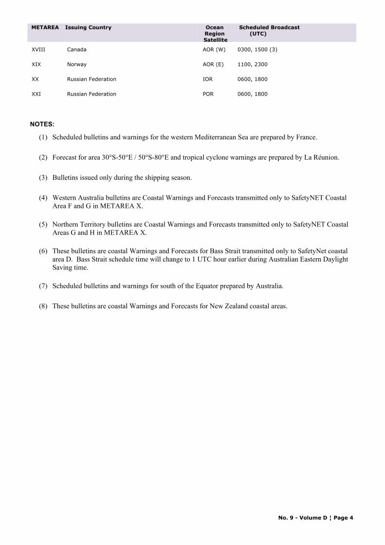
Ocean Region Satellite
Issuing CountryMETAREA Scheduled Broadcast (UTC)
XVIII Canada AOR (W) 0300, 1500 (3)
XIX Norway AOR (E) 1100, 2300
XX Russian Federation IOR 0600, 1800
XXI Russian Federation POR 0600, 1800
NOTES:
(1) Scheduled bulletins and warnings for the western Mediterranean Sea are prepared by France.
(2) Forecast for area 30°S-50°E / 50°S-80°E and tropical cyclone warnings are prepared by La Réunion.
(3) Bulletins issued only during the shipping season.
(4) Western Australia bulletins are Coastal Warnings and Forecasts transmitted only to SafetyNET Coastal Area F and G in METAREA X.
(5) Northern Territory bulletins are Coastal Warnings and Forecasts transmitted only to SafetyNET Coastal Areas G and H in METAREA X.
(6) These bulletins are coastal Warnings and Forecasts for Bass Strait transmitted only to SafetyNet coastal area D. Bass Strait schedule time will change to 1 UTC hour earlier during Australian Eastern Daylight Saving time.
(7) Scheduled bulletins and warnings for south of the Equator prepared by Australia.
(8) These bulletins are coastal Warnings and Forecasts for New Zealand coastal areas.
No. 9 - Volume D ¦ Page 4
PART B
TERRESTRIAL SYSTEMS
METEOROLOGICAL BROADCASTS USING
DIGITAL SELECTIVE CALLING (DSC) SYSTEM


ALGERIA
METAREA: III
Area Covered: North Africa and Western Mediterranean.
Region: IPosition: 36°40'N 03°18'E
7TA24-hour watch
Call Sign:
Maritime Radio Station: Alger Radio
Mode Of Transmission ID Frequency Area Position Hours of OperationRemote Transmitting SiteVHF A 161,825 MHz 36°40'N 03°18'E H24
RT (MF) B 1 792 kHz 36°40'N 03°18'E H24
Broadcast Times Frequency ID Contents of Broadcast Language/Code Form
0730, 2330 A Weather forecast for shipping for Alboran, Palos, Algiers, Cabrera, Sardinia, Annaba.Weather forecast for Algerian Coasts : Saidia-Cherchel-Algiers-TabarkaSpecial Marine Weather Bulletin repeated each hour before the beginning of validity, and each 2 hours during validity, and each ½ hour in case of storm or more.
French, English
0903, 1703 B Weather forecast for shipping for Alboran, Palos, Algiers, Cabrera, Sardinia and Annaba. Weather forecast for Algerian Coasts : Saidia-Cherchel-Algiers-TabarkaSpecial Marine Weather Bulletin repeated each hour before the beginning of validity, and each 2 hours during validity, and each ½ hour in case of storm or more.
French, English
No. 9 - Volume D ¦ Page 3
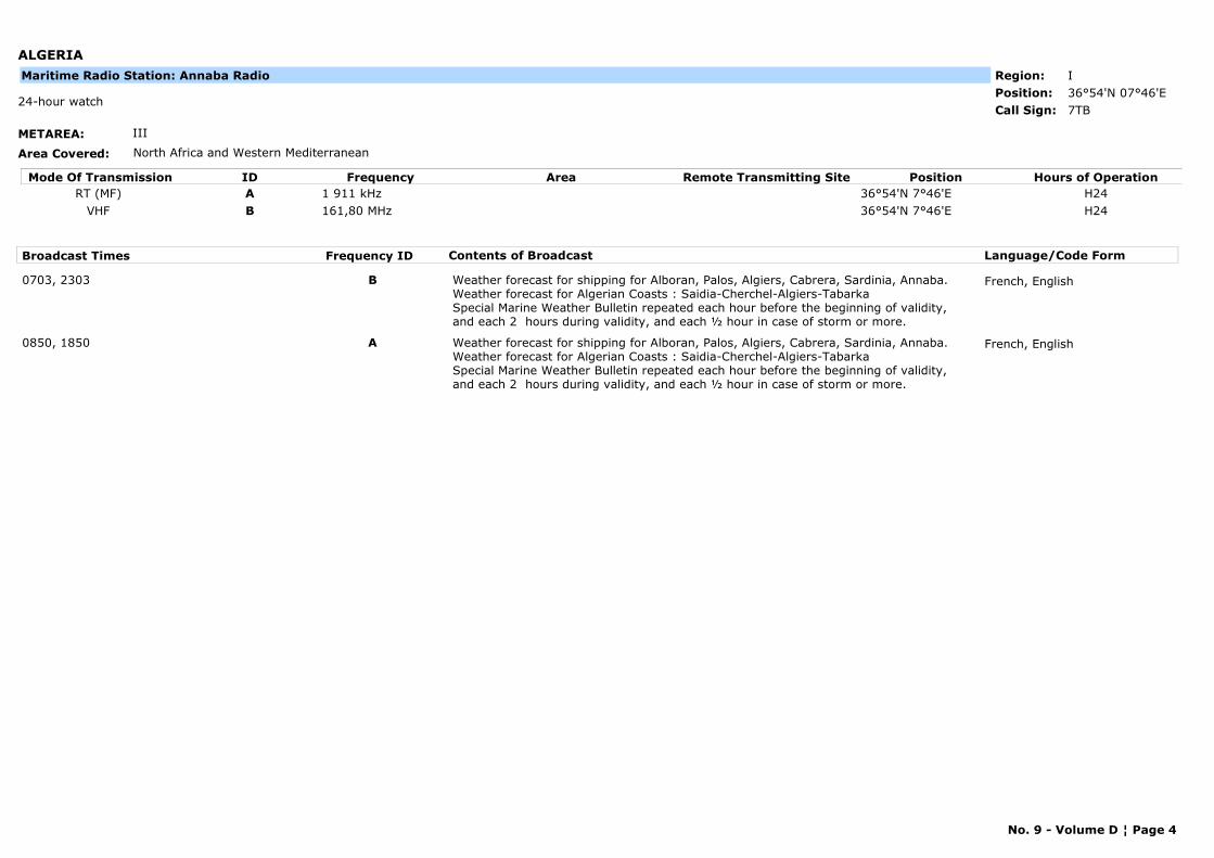
ALGERIA
METAREA: III
Area Covered: North Africa and Western Mediterranean
Region: IPosition: 36°54'N 07°46'E
7TB24-hour watch
Call Sign:
Maritime Radio Station: Annaba Radio
Mode Of Transmission ID Frequency Area Position Hours of OperationRemote Transmitting SiteRT (MF) A 1 911 kHz 36°54'N 7°46'E H24
VHF B 161,80 MHz 36°54'N 7°46'E H24
Broadcast Times Frequency ID Contents of Broadcast Language/Code Form
0703, 2303 B Weather forecast for shipping for Alboran, Palos, Algiers, Cabrera, Sardinia, Annaba.Weather forecast for Algerian Coasts : Saidia-Cherchel-Algiers-TabarkaSpecial Marine Weather Bulletin repeated each hour before the beginning of validity, and each 2 hours during validity, and each ½ hour in case of storm or more.
French, English
0850, 1850 A Weather forecast for shipping for Alboran, Palos, Algiers, Cabrera, Sardinia, Annaba.Weather forecast for Algerian Coasts : Saidia-Cherchel-Algiers-TabarkaSpecial Marine Weather Bulletin repeated each hour before the beginning of validity, and each 2 hours during validity, and each ½ hour in case of storm or more.
French, English
No. 9 - Volume D ¦ Page 4
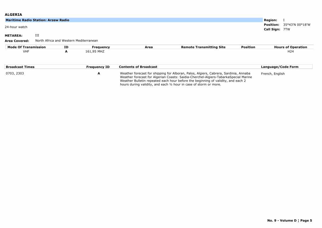
ALGERIA
METAREA: III
Area Covered: North Africa and Western Mediterranean
Region: IPosition: 35°43'N 00°18'W
7TW24-hour watch
Call Sign:
Maritime Radio Station: Arzew Radio
Mode Of Transmission ID Frequency Area Position Hours of OperationRemote Transmitting SiteVHF A 161,95 MHZ H24
Broadcast Times Frequency ID Contents of Broadcast Language/Code Form
0703, 2303 A Weather forecast for shipping for Alboran, Palos, Algiers, Cabrera, Sardinia, Annaba Weather forecast for Algerian Coasts: Saidia-Cherchel-Algiers-TabarkaSpecial Marine Weather Bulletin repeated each hour before the beginning of validity, and each 2 hours during validity, and each ½ hour in case of storm or more.
French, English
No. 9 - Volume D ¦ Page 5

ALGERIA
METAREA: III
Area Covered: North Africa and Western Mediterranean
Region: IPosition: 36°14'N 05°06'E
7TG08h-18h watch
Call Sign:
Maritime Radio Station: Bejaia Radio
Mode Of Transmission ID Frequency Area Position Hours of OperationRemote Transmitting SiteVHF A 161.90 MHz h24
Broadcast Times Frequency ID Contents of Broadcast Language/Code Form
0733, 2333 A Weather forecast for shipping for Alboran, Palos, Algiers, Cabrera, Sardinia, Annaba.Weather forecast for Algerian Coasts : Saidia-Cherchel-Algiers-TabarkaSpecial Marine Weather Bulletin repeated each hour before the beginning of validity, and each 2 hours during validity, and each ½ hour in case of storm or more.
French, English
No. 9 - Volume D ¦ Page 6
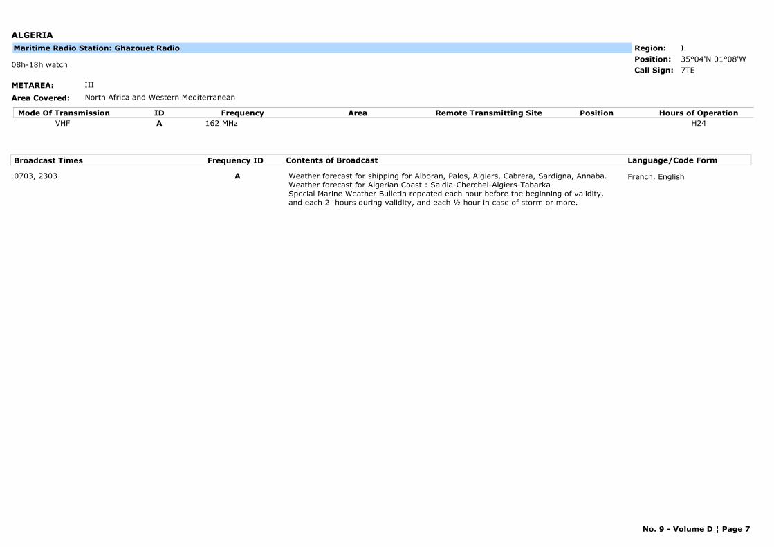
ALGERIA
METAREA: III
Area Covered: North Africa and Western Mediterranean
Region: IPosition: 35°04'N 01°08'W
7TE08h-18h watch
Call Sign:
Maritime Radio Station: Ghazouet Radio
Mode Of Transmission ID Frequency Area Position Hours of OperationRemote Transmitting SiteVHF A 162 MHz H24
Broadcast Times Frequency ID Contents of Broadcast Language/Code Form
0703, 2303 A Weather forecast for shipping for Alboran, Palos, Algiers, Cabrera, Sardigna, Annaba.Weather forecast for Algerian Coast : Saidia-Cherchel-Algiers-TabarkaSpecial Marine Weather Bulletin repeated each hour before the beginning of validity, and each 2 hours during validity, and each ½ hour in case of storm or more.
French, English
No. 9 - Volume D ¦ Page 7
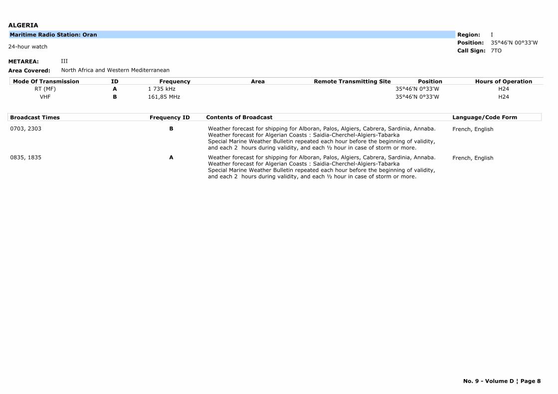
ALGERIA
METAREA: III
Area Covered: North Africa and Western Mediterranean
Region: IPosition: 35°46'N 00°33'W
7TO24-hour watch
Call Sign:
Maritime Radio Station: Oran
Mode Of Transmission ID Frequency Area Position Hours of OperationRemote Transmitting SiteRT (MF) A 1 735 kHz 35°46'N 0°33'W H24
VHF B 161,85 MHz 35°46'N 0°33'W H24
Broadcast Times Frequency ID Contents of Broadcast Language/Code Form
0703, 2303 B Weather forecast for shipping for Alboran, Palos, Algiers, Cabrera, Sardinia, Annaba.Weather forecast for Algerian Coasts : Saidia-Cherchel-Algiers-TabarkaSpecial Marine Weather Bulletin repeated each hour before the beginning of validity, and each 2 hours during validity, and each ½ hour in case of storm or more.
French, English
0835, 1835 A Weather forecast for shipping for Alboran, Palos, Algiers, Cabrera, Sardinia, Annaba.Weather forecast for Algerian Coasts : Saidia-Cherchel-Algiers-TabarkaSpecial Marine Weather Bulletin repeated each hour before the beginning of validity, and each 2 hours during validity, and each ½ hour in case of storm or more.
French, English
No. 9 - Volume D ¦ Page 8
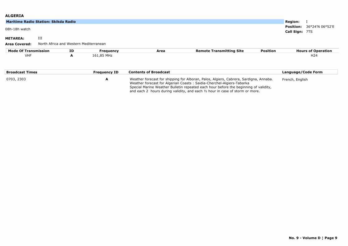
ALGERIA
METAREA: III
Area Covered: North Africa and Western Mediterranean
Region: IPosition: 36°24'N 06°52'E
7TS08h-18h watch
Call Sign:
Maritime Radio Station: Skikda Radio
Mode Of Transmission ID Frequency Area Position Hours of OperationRemote Transmitting SiteVHF A 161,85 MHz H24
Broadcast Times Frequency ID Contents of Broadcast Language/Code Form
0703, 2303 A Weather forecast for shipping for Alboran, Palos, Algiers, Cabrera, Sardigna, Annaba.Weather forecast for Algerian Coasts : Saidia-Cherchel-Algiers-TabarkaSpecial Marine Weather Bulletin repeated each hour before the beginning of validity, and each 2 hours during validity, and each ½ hour in case of storm or more.
French, English
No. 9 - Volume D ¦ Page 9

ALGERIA
METAREA: III
Area Covered: North Africa and Western Mediterranean
Region: IPosition: 36°30'N 01°19'E
7TN08h-18h watch
Call Sign:
Maritime Radio Station: Tenes Radio
Mode Of Transmission ID Frequency Area Position Hours of OperationRemote Transmitting SiteVHF A 161,80 MHz H24
Broadcast Times Frequency ID Contents of Broadcast Language/Code Form
0733, 2333 A Weather forecast for shipping for Alboran, Palos, Algiers, Cabrera, Sardigna, Annaba.Weather forecast for Algerian Coast : Saidia-Cherchel-Algiers-TabarkaSpecial Marine Weather Bulletin repeated each hour before the beginning of validity, and each 2 hours during validity, and each ½ hour in case of storm or more.
French, English
No. 9 - Volume D ¦ Page 10
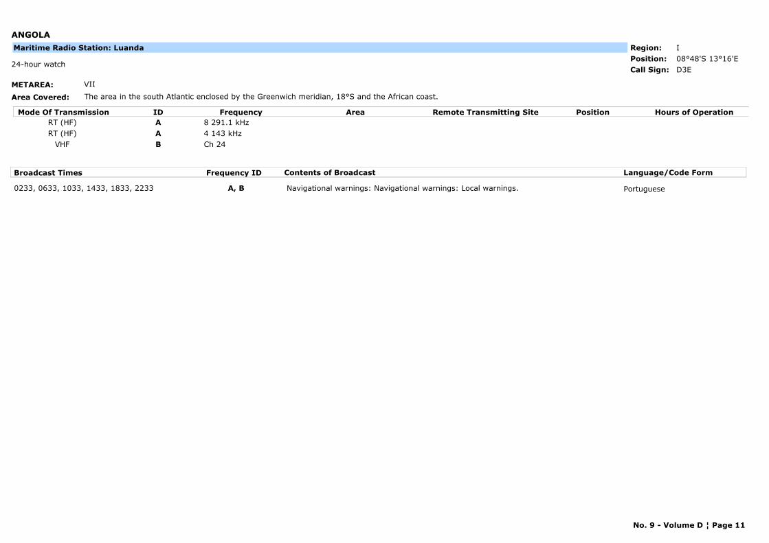
ANGOLA
METAREA: VII
Area Covered: The area in the south Atlantic enclosed by the Greenwich meridian, 18°S and the African coast.
Region: IPosition: 08°48'S 13°16'E
D3E24-hour watch
Call Sign:
Maritime Radio Station: Luanda
Mode Of Transmission ID Frequency Area Position Hours of OperationRemote Transmitting SiteRT (HF) A 8 291.1 kHzRT (HF) A 4 143 kHz
VHF B Ch 24
Broadcast Times Frequency ID Contents of Broadcast Language/Code Form
0233, 0633, 1033, 1433, 1833, 2233 A, B Navigational warnings: Navigational warnings: Local warnings. Portuguese
No. 9 - Volume D ¦ Page 11
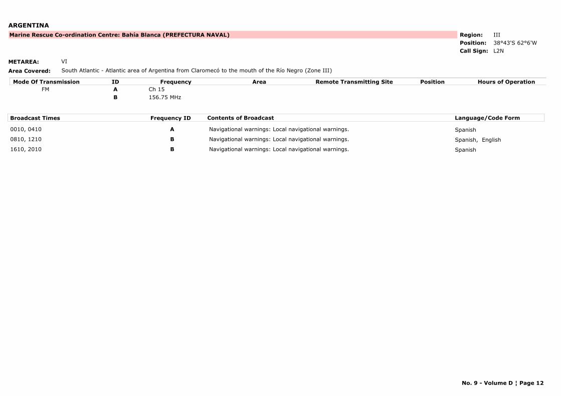
ARGENTINA
METAREA: VI
Area Covered: South Atlantic - Atlantic area of Argentina from Claromecó to the mouth of the Río Negro (Zone III)
Region: IIIPosition: 38°43'S 62°6'W
Marine Rescue Co-ordination Centre: Bahía Blanca (PREFECTURA NAVAL)
L2NCall Sign:
Mode Of Transmission ID Frequency Area Position Hours of OperationRemote Transmitting SiteFM A Ch 15
B 156.75 MHz
Broadcast Times Frequency ID Contents of Broadcast Language/Code Form
0010, 0410 A Navigational warnings: Local navigational warnings. Spanish
0810, 1210 B Navigational warnings: Local navigational warnings. Spanish, English
1610, 2010 B Navigational warnings: Local navigational warnings. Spanish
No. 9 - Volume D ¦ Page 12
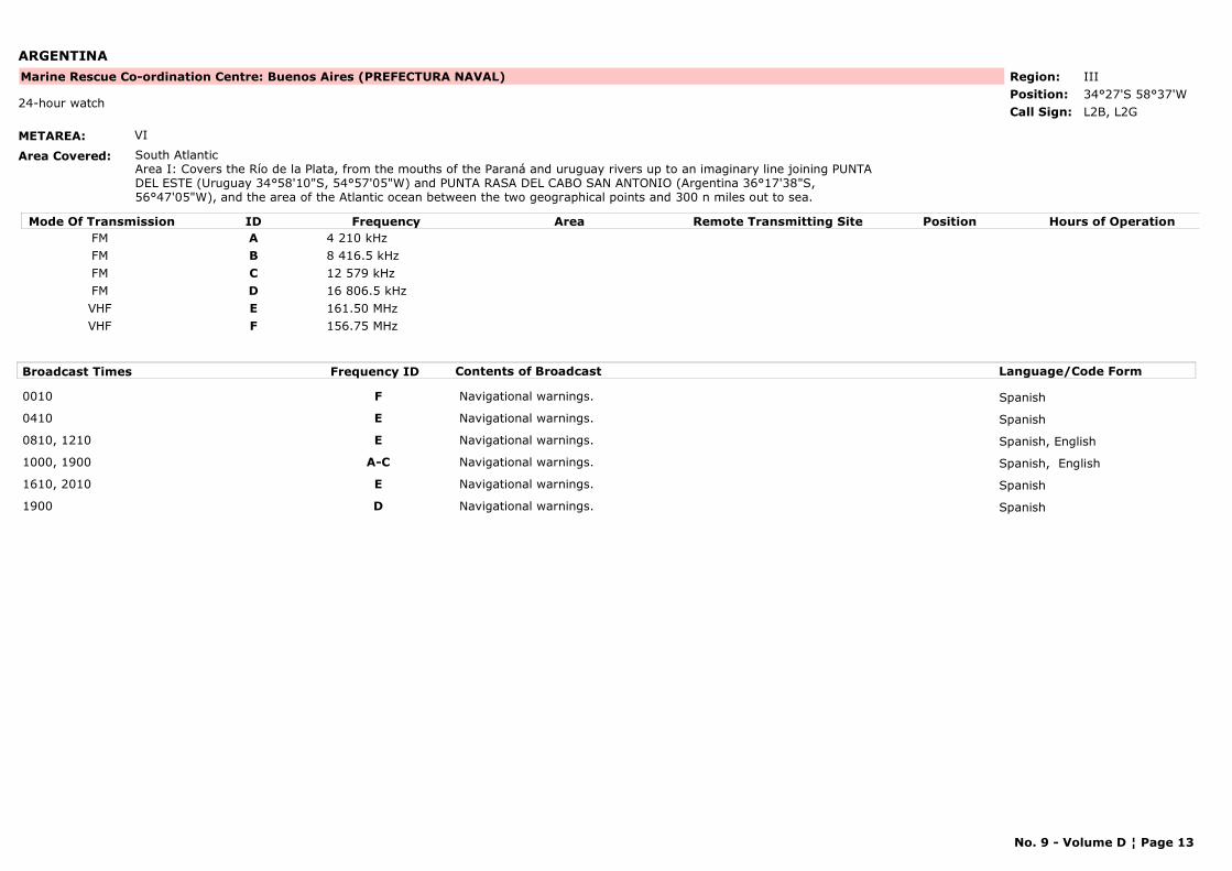
ARGENTINA
METAREA: VI
Area Covered: South AtlanticArea I: Covers the Río de la Plata, from the mouths of the Paraná and uruguay rivers up to an imaginary line joining PUNTA DEL ESTE (Uruguay 34°58'10"S, 54°57'05"W) and PUNTA RASA DEL CABO SAN ANTONIO (Argentina 36°17'38"S, 56°47'05"W), and the area of the Atlantic ocean between the two geographical points and 300 n miles out to sea.
Region: IIIPosition: 34°27'S 58°37'W
Marine Rescue Co-ordination Centre: Buenos Aires (PREFECTURA NAVAL)
L2B, L2G24-hour watch
Call Sign:
Mode Of Transmission ID Frequency Area Position Hours of OperationRemote Transmitting SiteFM A 4 210 kHzFM B 8 416.5 kHzFM C 12 579 kHzFM D 16 806.5 kHzVHF E 161.50 MHzVHF F 156.75 MHz
Broadcast Times Frequency ID Contents of Broadcast Language/Code Form
0010 F Navigational warnings. Spanish
0410 E Navigational warnings. Spanish
0810, 1210 E Navigational warnings. Spanish, English
1000, 1900 A-C Navigational warnings. Spanish, English
1610, 2010 E Navigational warnings. Spanish
1900 D Navigational warnings. Spanish
No. 9 - Volume D ¦ Page 13
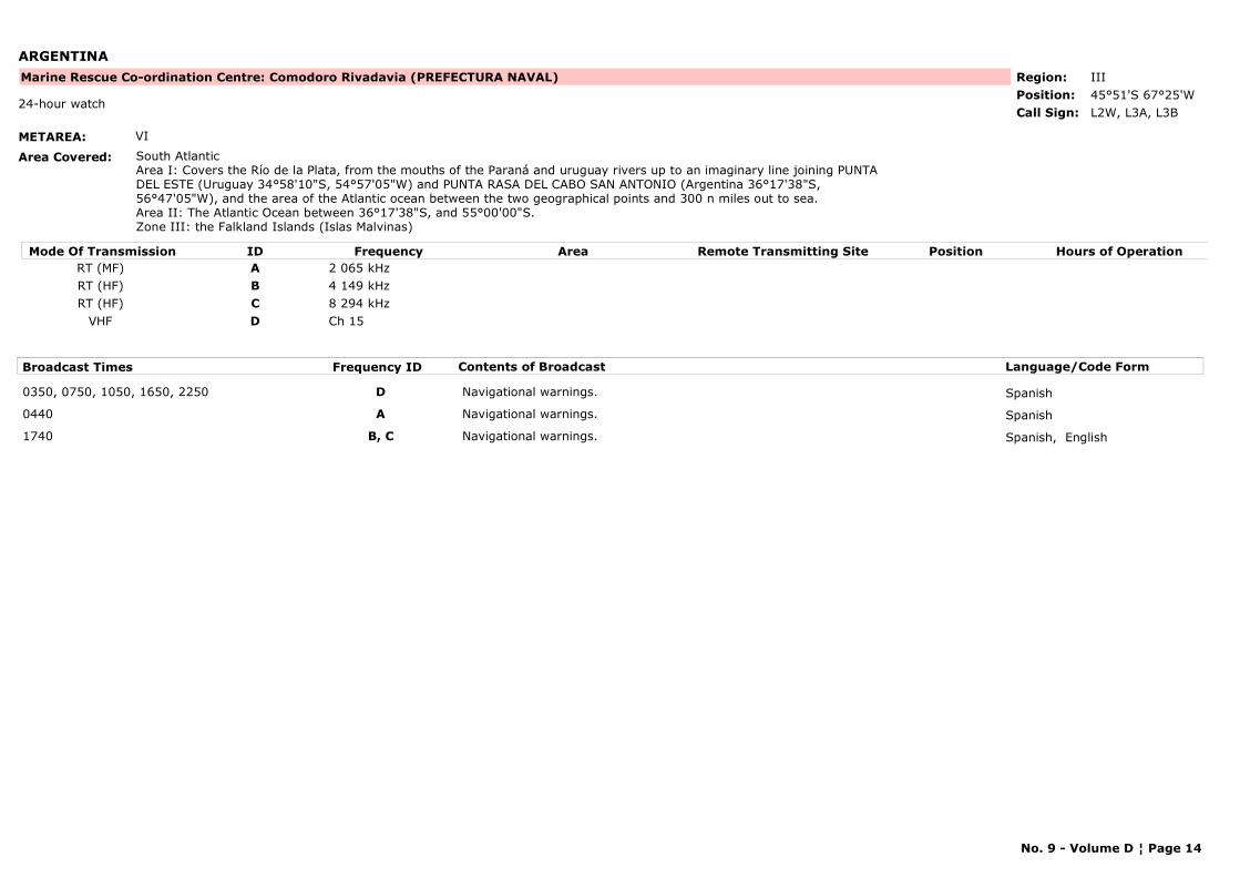
ARGENTINA
METAREA: VI
Area Covered: South AtlanticArea I: Covers the Río de la Plata, from the mouths of the Paraná and uruguay rivers up to an imaginary line joining PUNTA DEL ESTE (Uruguay 34°58'10"S, 54°57'05"W) and PUNTA RASA DEL CABO SAN ANTONIO (Argentina 36°17'38"S, 56°47'05"W), and the area of the Atlantic ocean between the two geographical points and 300 n miles out to sea.Area II: The Atlantic Ocean between 36°17'38"S, and 55°00'00"S.Zone III: the Falkland Islands (Islas Malvinas)
Region: IIIPosition: 45°51'S 67°25'W
Marine Rescue Co-ordination Centre: Comodoro Rivadavia (PREFECTURA NAVAL)
L2W, L3A, L3B24-hour watch
Call Sign:
Mode Of Transmission ID Frequency Area Position Hours of OperationRemote Transmitting SiteRT (MF) A 2 065 kHzRT (HF) B 4 149 kHzRT (HF) C 8 294 kHz
VHF D Ch 15
Broadcast Times Frequency ID Contents of Broadcast Language/Code Form
0350, 0750, 1050, 1650, 2250 D Navigational warnings. Spanish
0440 A Navigational warnings. Spanish
1740 B, C Navigational warnings. Spanish, English
No. 9 - Volume D ¦ Page 14

ARGENTINA
METAREA: VI
Area Covered:
Region: IIIPosition:
Marine Rescue Co-ordination Centre: Delta (PREFECTURA NAVAL)
L9OCall Sign:
Mode Of Transmission ID Frequency Area Position Hours of OperationRemote Transmitting SiteA 161.775 MHz
Broadcast Times Frequency ID Contents of Broadcast Language/Code Form
H24, 00, 15, 30, 45 A Navigational warnings. Spanish, English
No. 9 - Volume D ¦ Page 15
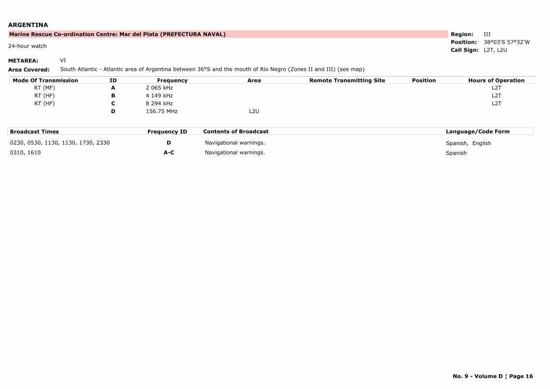
ARGENTINA
METAREA: VI
Area Covered: South Atlantic - Atlantic area of Argentina between 36°S and the mouth of Río Negro (Zones II and III) (see map)
Region: IIIPosition: 38°03'S 57°32'W
Marine Rescue Co-ordination Centre: Mar del Plata (PREFECTURA NAVAL)
L2T, L2U24-hour watch
Call Sign:
Mode Of Transmission ID Frequency Area Position Hours of OperationRemote Transmitting SiteRT (MF) A 2 065 kHz L2TRT (HF) B 4 149 kHz L2TRT (HF) C 8 294 kHz L2T
D 156.75 MHz L2U
Broadcast Times Frequency ID Contents of Broadcast Language/Code Form
0230, 0530, 1130, 1130, 1730, 2330 D Navigational warnings. Spanish, English
0310, 1610 A-C Navigational warnings. Spanish
No. 9 - Volume D ¦ Page 16
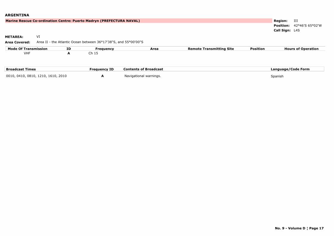
ARGENTINA
METAREA: VI
Area Covered: Area II - the Atlantic Ocean between 36°17'38"S, and 55°00'00"S
Region: IIIPosition: 42°46'S 65°02'W
Marine Rescue Co-ordination Centre: Puerto Madryn (PREFECTURA NAVAL)
L4SCall Sign:
Mode Of Transmission ID Frequency Area Position Hours of OperationRemote Transmitting SiteVHF A Ch 15
Broadcast Times Frequency ID Contents of Broadcast Language/Code Form
0010, 0410, 0810, 1210, 1610, 2010 A Navigational warnings. Spanish
No. 9 - Volume D ¦ Page 17
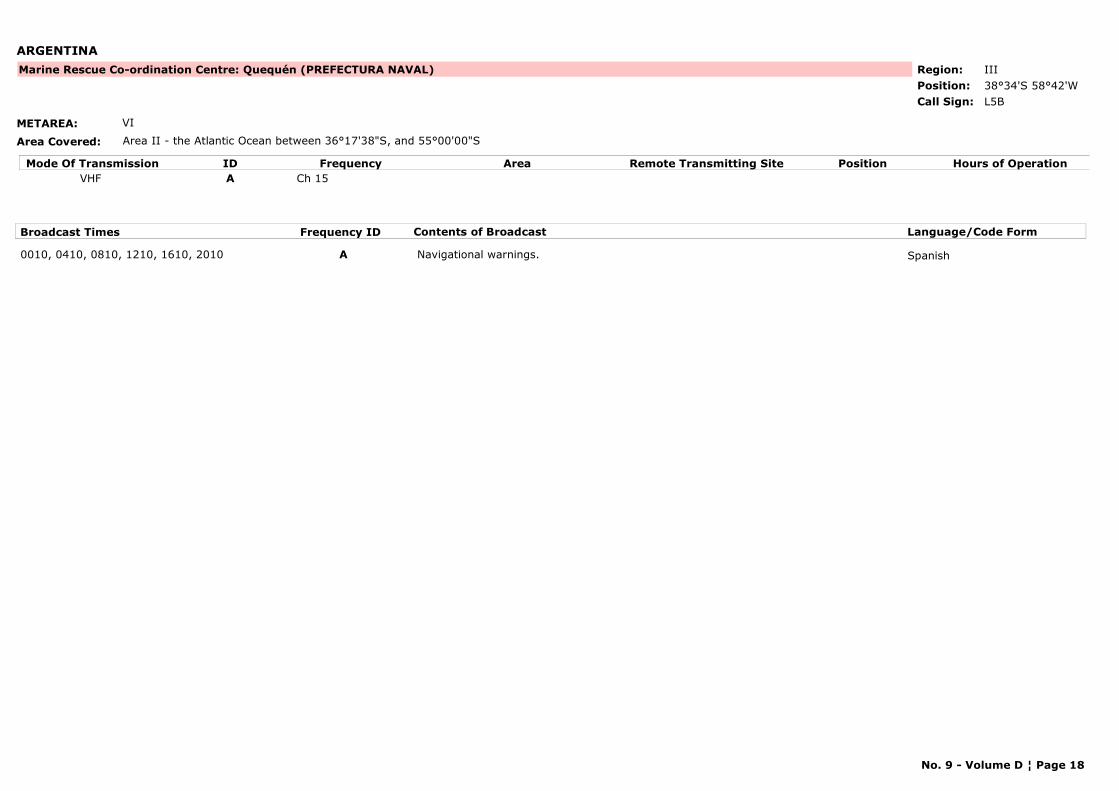
ARGENTINA
METAREA: VI
Area Covered: Area II - the Atlantic Ocean between 36°17'38"S, and 55°00'00"S
Region: IIIPosition: 38°34'S 58°42'W
Marine Rescue Co-ordination Centre: Quequén (PREFECTURA NAVAL)
L5BCall Sign:
Mode Of Transmission ID Frequency Area Position Hours of OperationRemote Transmitting SiteVHF A Ch 15
Broadcast Times Frequency ID Contents of Broadcast Language/Code Form
0010, 0410, 0810, 1210, 1610, 2010 A Navigational warnings. Spanish
No. 9 - Volume D ¦ Page 18
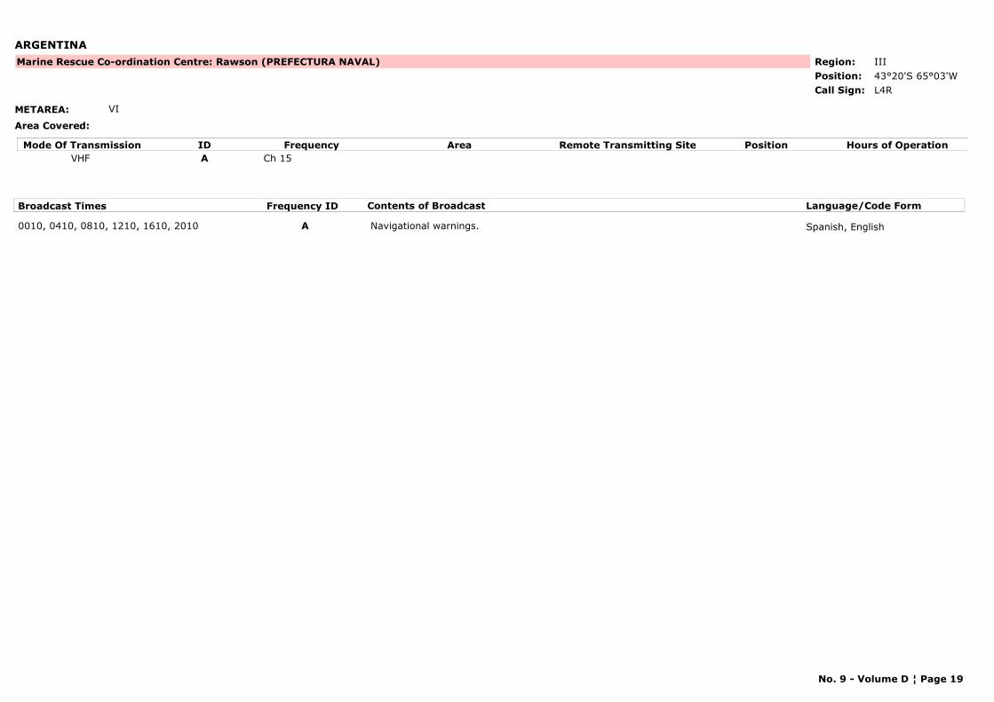
ARGENTINA
METAREA: VI
Area Covered:
Region: IIIPosition: 43°20'S 65°03'W
Marine Rescue Co-ordination Centre: Rawson (PREFECTURA NAVAL)
L4RCall Sign:
Mode Of Transmission ID Frequency Area Position Hours of OperationRemote Transmitting SiteVHF A Ch 15
Broadcast Times Frequency ID Contents of Broadcast Language/Code Form
0010, 0410, 0810, 1210, 1610, 2010 A Navigational warnings. Spanish, English
No. 9 - Volume D ¦ Page 19
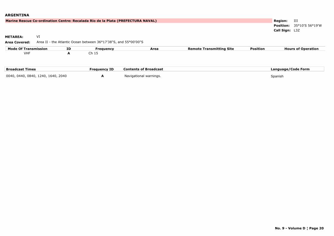
ARGENTINA
METAREA: VI
Area Covered: Area II - the Atlantic Ocean between 36°17'38"S, and 55°00'00"S
Region: IIIPosition: 35°10'S 56°19'W
Marine Rescue Co-ordination Centre: Recalada Río de la Plata (PREFECTURA NAVAL)
L3ZCall Sign:
Mode Of Transmission ID Frequency Area Position Hours of OperationRemote Transmitting SiteVHF A Ch 15
Broadcast Times Frequency ID Contents of Broadcast Language/Code Form
0040, 0440, 0840, 1240, 1640, 2040 A Navigational warnings. Spanish
No. 9 - Volume D ¦ Page 20
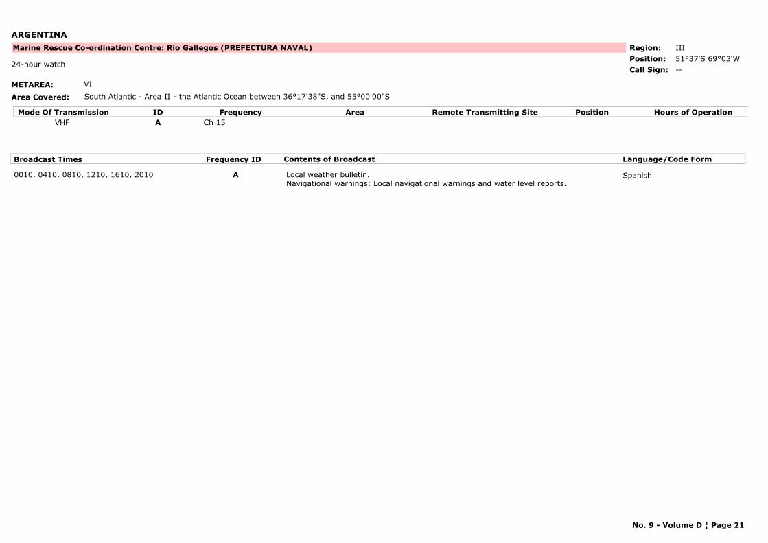
ARGENTINA
METAREA: VI
Area Covered: South Atlantic - Area II - the Atlantic Ocean between 36°17'38"S, and 55°00'00"S
Region: IIIPosition: 51°37'S 69°03'W
Marine Rescue Co-ordination Centre: Rio Gallegos (PREFECTURA NAVAL)
--24-hour watch
Call Sign:
Mode Of Transmission ID Frequency Area Position Hours of OperationRemote Transmitting SiteVHF A Ch 15
Broadcast Times Frequency ID Contents of Broadcast Language/Code Form
0010, 0410, 0810, 1210, 1610, 2010 A Local weather bulletin. Navigational warnings: Local navigational warnings and water level reports.
Spanish
No. 9 - Volume D ¦ Page 21
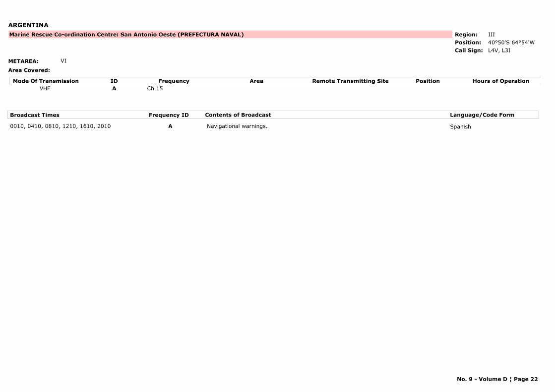
ARGENTINA
METAREA: VI
Area Covered:
Region: IIIPosition: 40°50'S 64°54'W
Marine Rescue Co-ordination Centre: San Antonio Oeste (PREFECTURA NAVAL)
L4V, L3ICall Sign:
Mode Of Transmission ID Frequency Area Position Hours of OperationRemote Transmitting SiteVHF A Ch 15
Broadcast Times Frequency ID Contents of Broadcast Language/Code Form
0010, 0410, 0810, 1210, 1610, 2010 A Navigational warnings. Spanish
No. 9 - Volume D ¦ Page 22
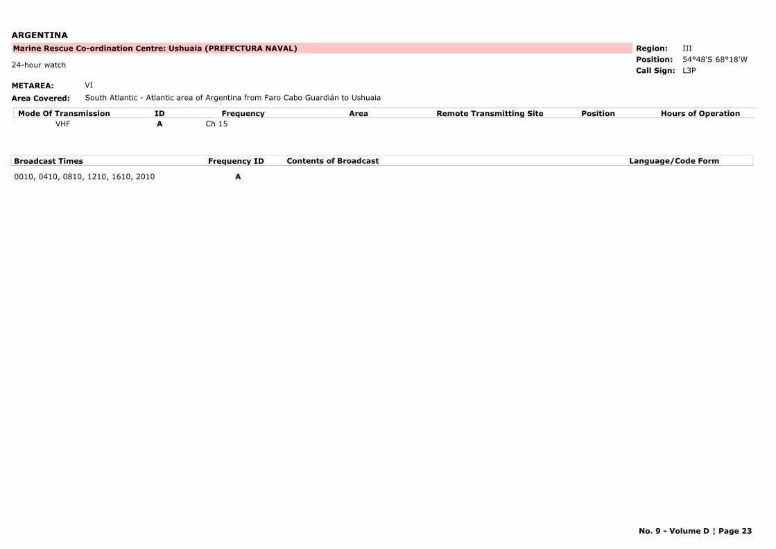
ARGENTINA
METAREA: VI
Area Covered: South Atlantic - Atlantic area of Argentina from Faro Cabo Guardián to Ushuaia
Region: IIIPosition: 54°48'S 68°18'W
Marine Rescue Co-ordination Centre: Ushuaia (PREFECTURA NAVAL)
L3P24-hour watch
Call Sign:
Mode Of Transmission ID Frequency Area Position Hours of OperationRemote Transmitting SiteVHF A Ch 15
Broadcast Times Frequency ID Contents of Broadcast Language/Code Form
0010, 0410, 0810, 1210, 1610, 2010 A
No. 9 - Volume D ¦ Page 23
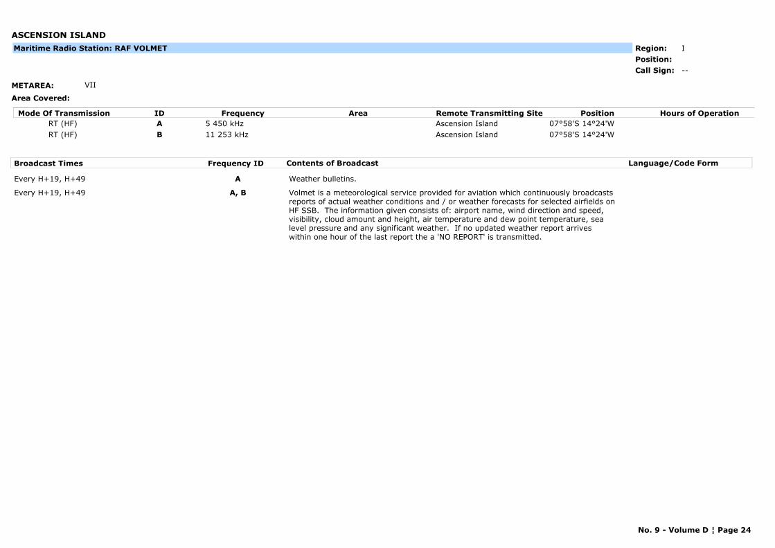
ASCENSION ISLAND
METAREA: VII
Area Covered:
Region: IPosition:
--Call Sign:
Maritime Radio Station: RAF VOLMET
Mode Of Transmission ID Frequency Area Position Hours of OperationRemote Transmitting SiteRT (HF) A 5 450 kHz Ascension Island 07°58'S 14°24'WRT (HF) B 11 253 kHz Ascension Island 07°58'S 14°24'W
Broadcast Times Frequency ID Contents of Broadcast Language/Code Form
Every H+19, H+49 A Weather bulletins.
Every H+19, H+49 A, B Volmet is a meteorological service provided for aviation which continuously broadcasts reports of actual weather conditions and / or weather forecasts for selected airfields on HF SSB. The information given consists of: airport name, wind direction and speed, visibility, cloud amount and height, air temperature and dew point temperature, sea level pressure and any significant weather. If no updated weather report arrives within one hour of the last report the a 'NO REPORT' is transmitted.
No. 9 - Volume D ¦ Page 24
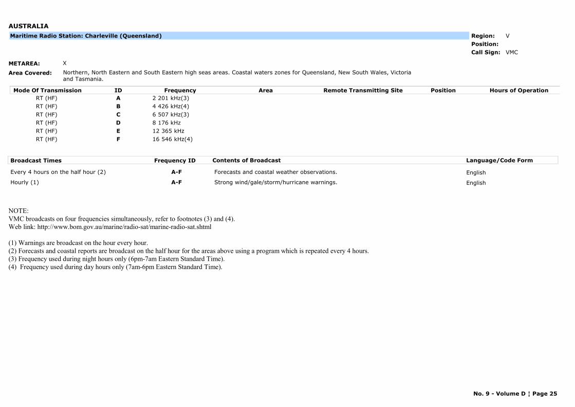
AUSTRALIA
METAREA: X
Area Covered: Northern, North Eastern and South Eastern high seas areas. Coastal waters zones for Queensland, New South Wales, Victoria and Tasmania.
Region: VPosition:
VMCCall Sign:
Maritime Radio Station: Charleville (Queensland)
Mode Of Transmission ID Frequency Area Position Hours of OperationRemote Transmitting SiteRT (HF) A 2 201 kHz(3)RT (HF) B 4 426 kHz(4)RT (HF) C 6 507 kHz(3)RT (HF) D 8 176 kHzRT (HF) E 12 365 kHzRT (HF) F 16 546 kHz(4)
Broadcast Times Frequency ID Contents of Broadcast Language/Code Form
Every 4 hours on the half hour (2) A-F Forecasts and coastal weather observations. English
Hourly (1) A-F Strong wind/gale/storm/hurricane warnings. English
NOTE: VMC broadcasts on four frequencies simultaneously, refer to footnotes (3) and (4).Web link: http://www.bom.gov.au/marine/radio-sat/marine-radio-sat.shtml
(1) Warnings are broadcast on the hour every hour.(2) Forecasts and coastal reports are broadcast on the half hour for the areas above using a program which is repeated every 4 hours.(3) Frequency used during night hours only (6pm-7am Eastern Standard Time).(4) Frequency used during day hours only (7am-6pm Eastern Standard Time).
No. 9 - Volume D ¦ Page 25
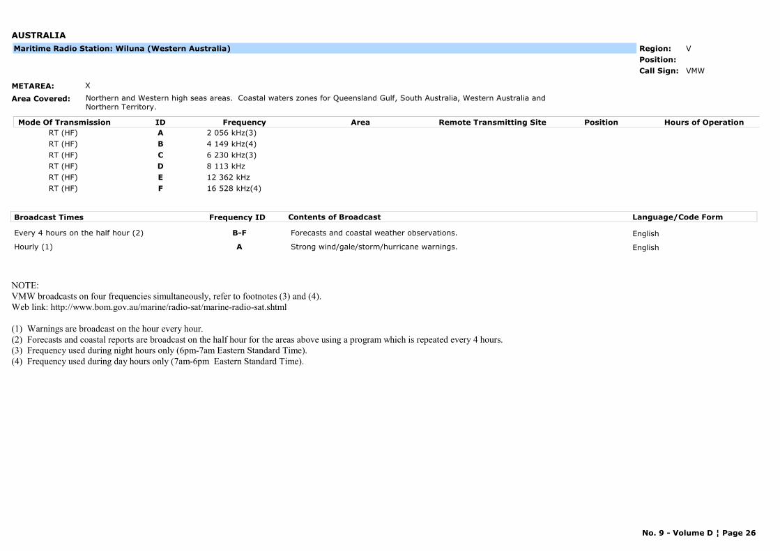
AUSTRALIA
METAREA: X
Area Covered: Northern and Western high seas areas. Coastal waters zones for Queensland Gulf, South Australia, Western Australia and Northern Territory.
Region: VPosition:
VMWCall Sign:
Maritime Radio Station: Wiluna (Western Australia)
Mode Of Transmission ID Frequency Area Position Hours of OperationRemote Transmitting SiteRT (HF) A 2 056 kHz(3)RT (HF) B 4 149 kHz(4)RT (HF) C 6 230 kHz(3)RT (HF) D 8 113 kHzRT (HF) E 12 362 kHzRT (HF) F 16 528 kHz(4)
Broadcast Times Frequency ID Contents of Broadcast Language/Code Form
Every 4 hours on the half hour (2) B-F Forecasts and coastal weather observations. English
Hourly (1) A Strong wind/gale/storm/hurricane warnings. English
NOTE: VMW broadcasts on four frequencies simultaneously, refer to footnotes (3) and (4).Web link: http://www.bom.gov.au/marine/radio-sat/marine-radio-sat.shtml
(1) Warnings are broadcast on the hour every hour.(2) Forecasts and coastal reports are broadcast on the half hour for the areas above using a program which is repeated every 4 hours.(3) Frequency used during night hours only (6pm-7am Eastern Standard Time).(4) Frequency used during day hours only (7am-6pm Eastern Standard Time).
No. 9 - Volume D ¦ Page 26
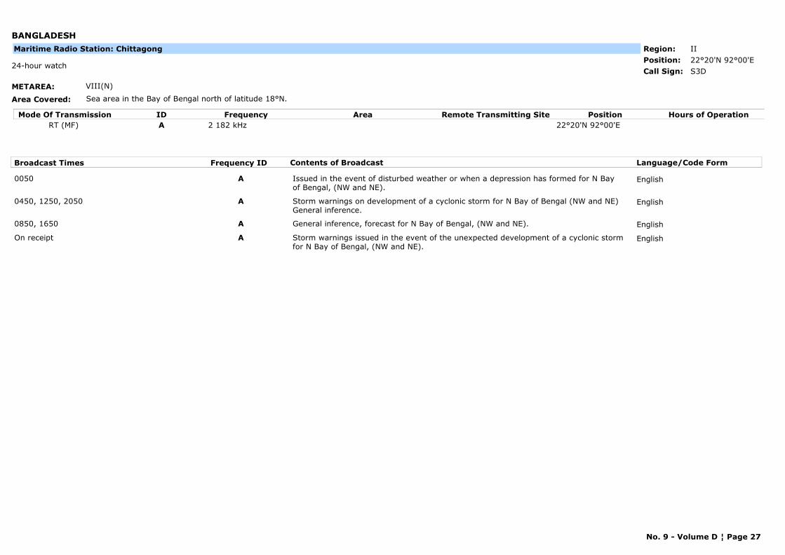
BANGLADESH
METAREA: VIII(N)
Area Covered: Sea area in the Bay of Bengal north of latitude 18°N.
Region: IIPosition: 22°20'N 92°00'E
S3D24-hour watch
Call Sign:
Maritime Radio Station: Chittagong
Mode Of Transmission ID Frequency Area Position Hours of OperationRemote Transmitting SiteRT (MF) A 2 182 kHz 22°20'N 92°00'E
Broadcast Times Frequency ID Contents of Broadcast Language/Code Form
0050 A Issued in the event of disturbed weather or when a depression has formed for N Bay of Bengal, (NW and NE).
English
0450, 1250, 2050 A Storm warnings on development of a cyclonic storm for N Bay of Bengal (NW and NE) General inference.
English
0850, 1650 A General inference, forecast for N Bay of Bengal, (NW and NE). English
On receipt A Storm warnings issued in the event of the unexpected development of a cyclonic storm for N Bay of Bengal, (NW and NE).
English
No. 9 - Volume D ¦ Page 27
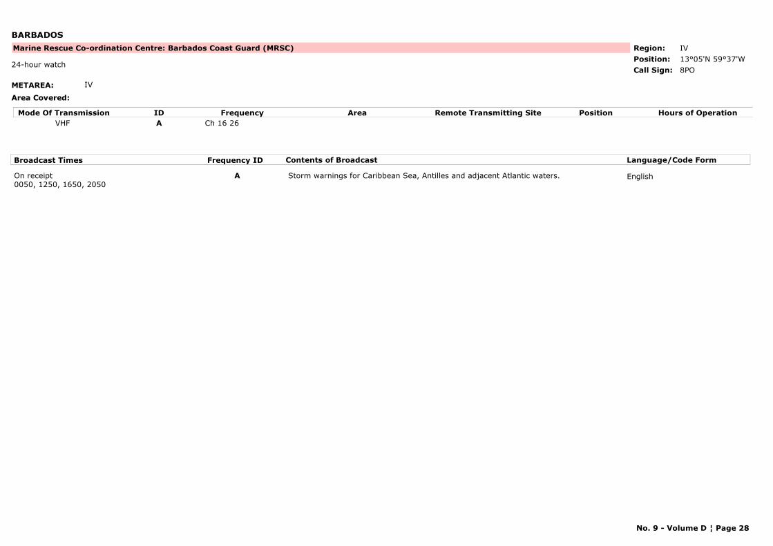
BARBADOS
METAREA: IV
Area Covered:
Region: IVPosition: 13°05'N 59°37'W
Marine Rescue Co-ordination Centre: Barbados Coast Guard (MRSC)
8PO24-hour watch
Call Sign:
Mode Of Transmission ID Frequency Area Position Hours of OperationRemote Transmitting SiteVHF A Ch 16 26
Broadcast Times Frequency ID Contents of Broadcast Language/Code Form
On receipt0050, 1250, 1650, 2050
A Storm warnings for Caribbean Sea, Antilles and adjacent Atlantic waters. English
No. 9 - Volume D ¦ Page 28
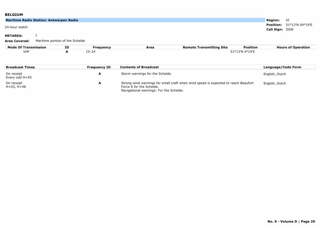
BELGIUM
METAREA: I
Area Covered: Maritime portion of the Schelde
Region: VIPosition: 51°13'N 04°19'E
OSW24-hour watch
Call Sign:
Maritime Radio Station: Antwerpen Radio
Mode Of Transmission ID Frequency Area Position Hours of OperationRemote Transmitting SiteVHF A Ch 24 51°13'N 4°19'E
Broadcast Times Frequency ID Contents of Broadcast Language/Code Form
On receiptEvery odd H+05
A Storm warnings for the Schelde. English, Dutch
On receiptH+03, H+48
A Strong wind warnings for small craft when wind speed is expected to reach Beaufort Force 6 for the Schelde. Navigational warnings: For the Schelde.
English, Dutch
No. 9 - Volume D ¦ Page 29
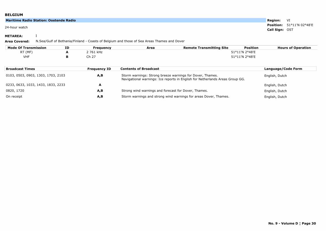
BELGIUM
METAREA: I
Area Covered: N.Sea/Gulf of Bothania/Finland - Coasts of Belgium and those of Sea Areas Thames and Dover
Region: VIPosition: 51°11'N 02°48'E
OST24-hour watch
Call Sign:
Maritime Radio Station: Oostende Radio
Mode Of Transmission ID Frequency Area Position Hours of OperationRemote Transmitting SiteRT (MF) A 2 761 kHz 51°11'N 2°48'E
VHF B Ch 27 51°11'N 2°48'E
Broadcast Times Frequency ID Contents of Broadcast Language/Code Form
0103, 0503, 0903, 1303, 1703, 2103 A,B Storm warnings: Strong breeze warnings for Dover, Thames. Navigational warnings: Ice reports in English for Netherlands Areas Group GG.
English, Dutch
0233, 0633, 1033, 1433, 1833, 2233 A English, Dutch
0820, 1720 A,B Strong wind warnings and forecast for Dover, Thames. English, Dutch
On receipt A,B Storm warnings and strong wind warnings for areas Dover, Thames. English, Dutch
No. 9 - Volume D ¦ Page 30
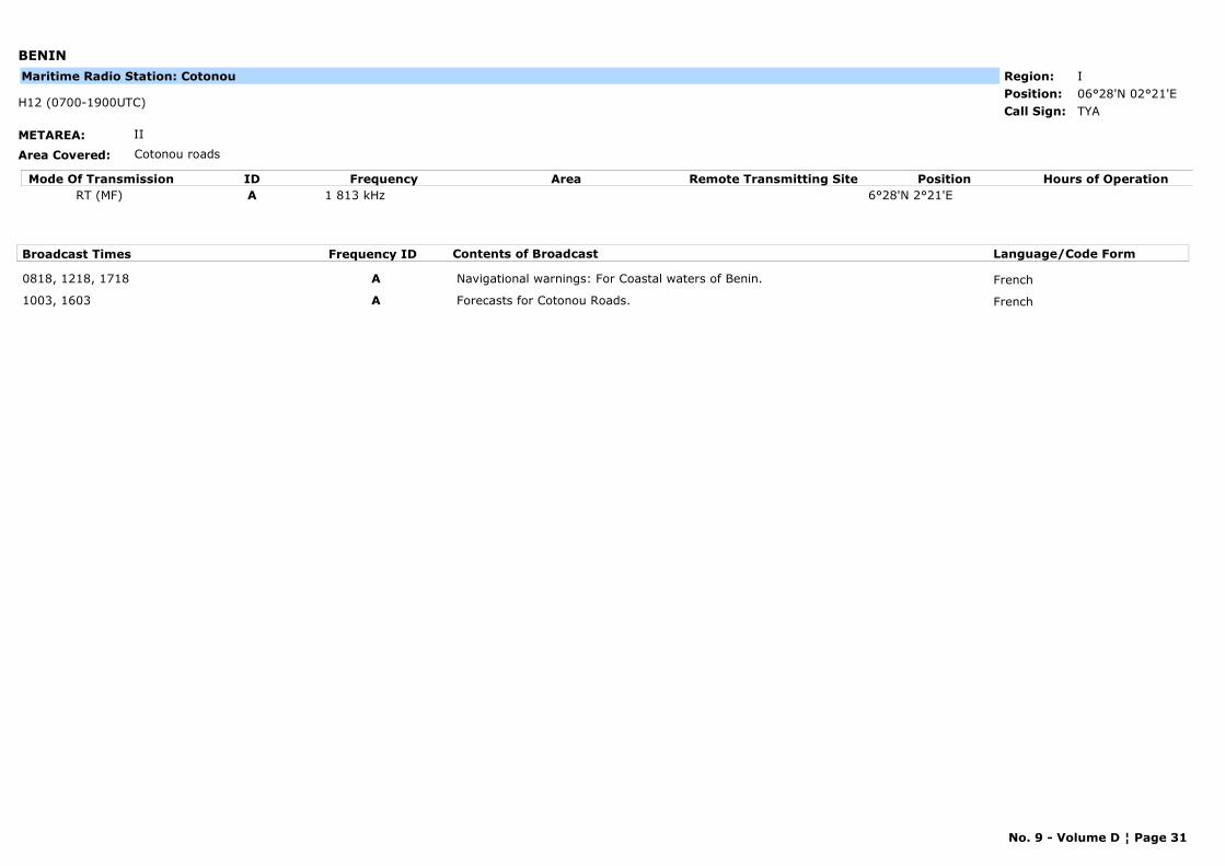
BENIN
METAREA: II
Area Covered: Cotonou roads
Region: IPosition: 06°28'N 02°21'E
TYAH12 (0700-1900UTC)
Call Sign:
Maritime Radio Station: Cotonou
Mode Of Transmission ID Frequency Area Position Hours of OperationRemote Transmitting SiteRT (MF) A 1 813 kHz 6°28'N 2°21'E
Broadcast Times Frequency ID Contents of Broadcast Language/Code Form
0818, 1218, 1718 A Navigational warnings: For Coastal waters of Benin. French
1003, 1603 A Forecasts for Cotonou Roads. French
No. 9 - Volume D ¦ Page 31
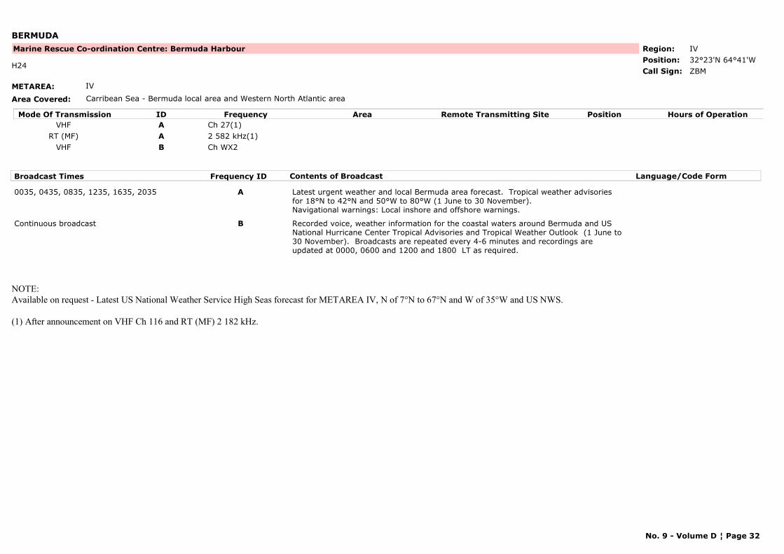
BERMUDA
METAREA: IV
Area Covered: Carribean Sea - Bermuda local area and Western North Atlantic area
Region: IVPosition: 32°23'N 64°41'W
Marine Rescue Co-ordination Centre: Bermuda Harbour
ZBMH24
Call Sign:
Mode Of Transmission ID Frequency Area Position Hours of OperationRemote Transmitting SiteVHF A Ch 27(1)
RT (MF) A 2 582 kHz(1)VHF B Ch WX2
Broadcast Times Frequency ID Contents of Broadcast Language/Code Form
0035, 0435, 0835, 1235, 1635, 2035 A Latest urgent weather and local Bermuda area forecast. Tropical weather advisories for 18°N to 42°N and 50°W to 80°W (1 June to 30 November).Navigational warnings: Local inshore and offshore warnings.
Continuous broadcast B Recorded voice, weather information for the coastal waters around Bermuda and US National Hurricane Center Tropical Advisories and Tropical Weather Outlook (1 June to 30 November). Broadcasts are repeated every 4-6 minutes and recordings are updated at 0000, 0600 and 1200 and 1800 LT as required.
NOTE: Available on request - Latest US National Weather Service High Seas forecast for METAREA IV, N of 7°N to 67°N and W of 35°W and US NWS.
(1) After announcement on VHF Ch 116 and RT (MF) 2 182 kHz.
No. 9 - Volume D ¦ Page 32
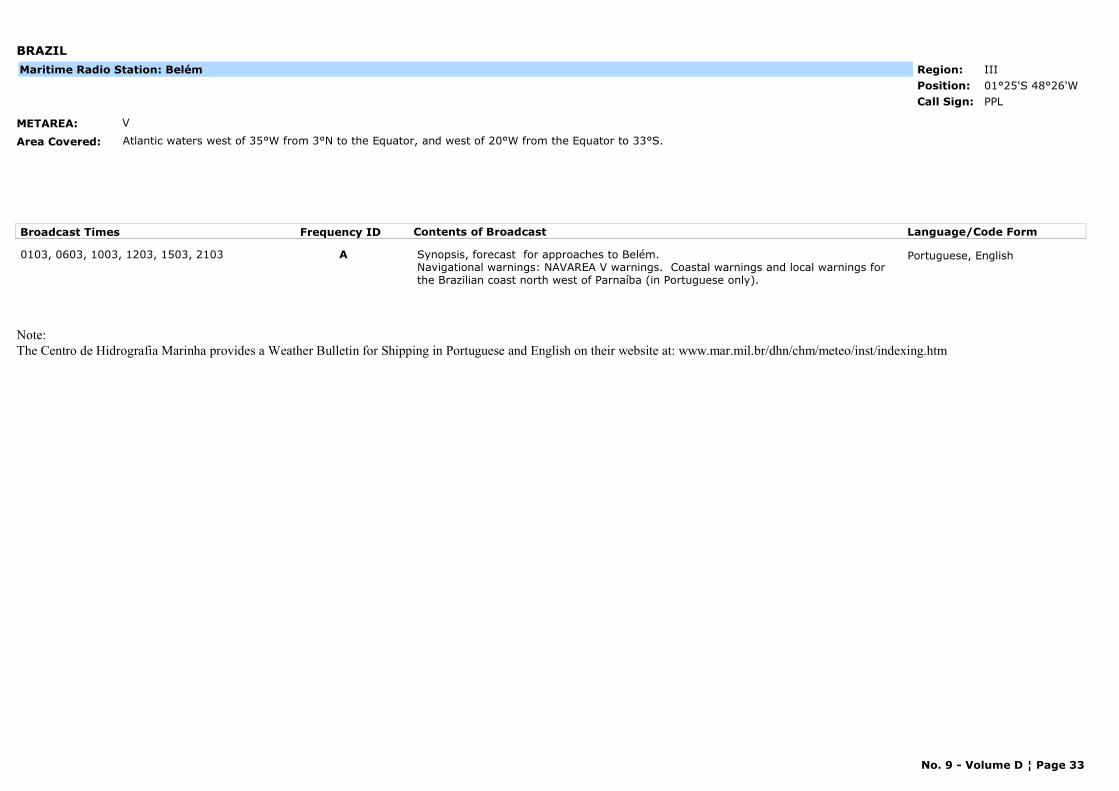
BRAZIL
METAREA: V
Area Covered: Atlantic waters west of 35°W from 3°N to the Equator, and west of 20°W from the Equator to 33°S.
Region: IIIPosition: 01°25'S 48°26'W
PPLCall Sign:
Maritime Radio Station: Belém
Broadcast Times Frequency ID Contents of Broadcast Language/Code Form
0103, 0603, 1003, 1203, 1503, 2103 A Synopsis, forecast for approaches to Belém. Navigational warnings: NAVAREA V warnings. Coastal warnings and local warnings for the Brazilian coast north west of Parnaíba (in Portuguese only).
Portuguese, English
Note:The Centro de Hidrografia Marinha provides a Weather Bulletin for Shipping in Portuguese and English on their website at: www.mar.mil.br/dhn/chm/meteo/inst/indexing.htm
No. 9 - Volume D ¦ Page 33
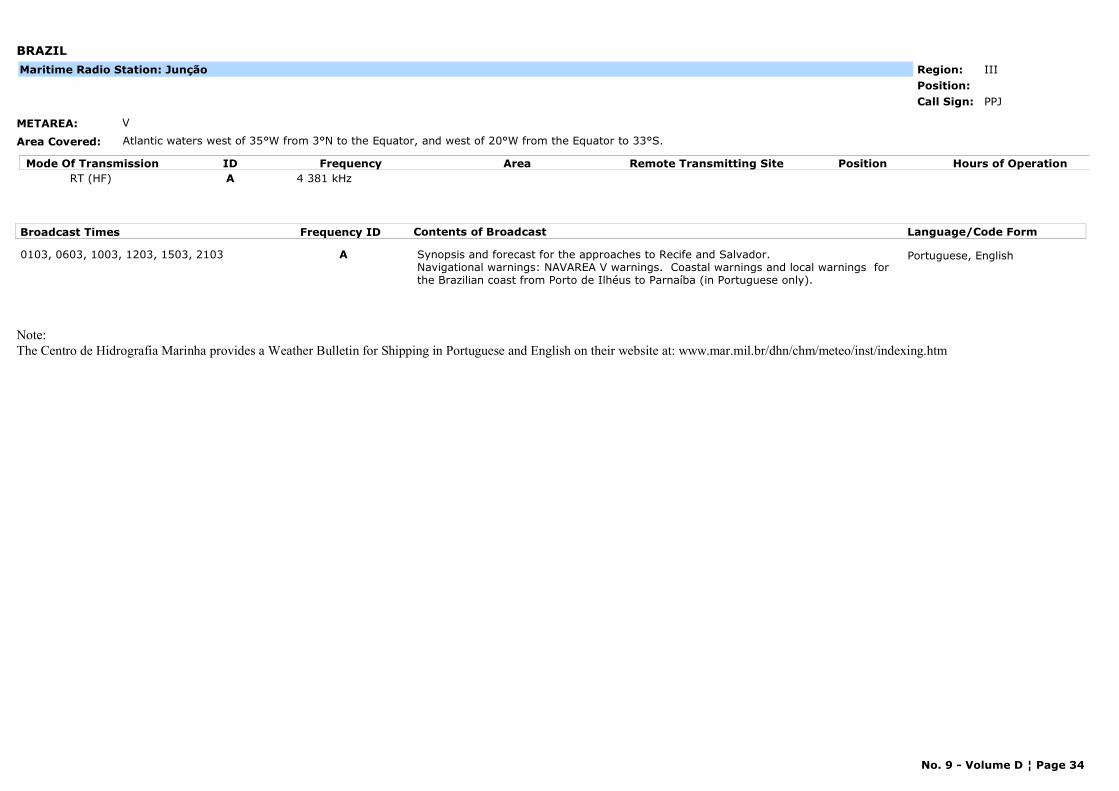
BRAZIL
METAREA: V
Area Covered: Atlantic waters west of 35°W from 3°N to the Equator, and west of 20°W from the Equator to 33°S.
Region: IIIPosition:
PPJCall Sign:
Maritime Radio Station: Junção
Mode Of Transmission ID Frequency Area Position Hours of OperationRemote Transmitting SiteRT (HF) A 4 381 kHz
Broadcast Times Frequency ID Contents of Broadcast Language/Code Form
0103, 0603, 1003, 1203, 1503, 2103 A Synopsis and forecast for the approaches to Recife and Salvador. Navigational warnings: NAVAREA V warnings. Coastal warnings and local warnings for the Brazilian coast from Porto de Ilhéus to Parnaíba (in Portuguese only).
Portuguese, English
Note:The Centro de Hidrografia Marinha provides a Weather Bulletin for Shipping in Portuguese and English on their website at: www.mar.mil.br/dhn/chm/meteo/inst/indexing.htm
No. 9 - Volume D ¦ Page 34

BRAZIL
METAREA: V
Area Covered: Atlantic waters west of 35°W from 3°N to the Equator, and west of 20°W from the Equator to 33°S.
Region: IIIPosition:
--Call Sign:
Maritime Radio Station: Olinda
Mode Of Transmission ID Frequency Area Position Hours of OperationRemote Transmitting SiteRT (HF) A 4 369 kHz
Broadcast Times Frequency ID Contents of Broadcast Language/Code Form
0103, 0603, 1003, 1203, 1503, 2103 A Synopsis and forecast for the approaches to Recife and Salvador.Navigational warnings: NAVAREA V warnings. Coastal warnings and local warnings ifor the Brazilian coast from Porto de Ilhéus to Parnaíba (in Portuguese only).
Portuguese, English
Note:The Centro de Hidrografia Marinha provides a Weather Bulletin for Shipping in Portuguese and English on their website at: www.mar.mil.br/dhn/chm/meteo/inst/indexing.htm
No. 9 - Volume D ¦ Page 35

BRAZIL
METAREA: V
Area Covered: Atlantic waters west of 35°W from 3°N to the Equator, and west of 20°W from the Equator to 33°S.
Region: IIIPosition:
--Call Sign:
Maritime Radio Station: Ponta do Céu
Mode Of Transmission ID Frequency Area Position Hours of OperationRemote Transmitting SiteVHF A Ch 16
Broadcast Times Frequency ID Contents of Broadcast Language/Code Form
0000, 1200, 1800On request
A Navigational warnings: Local navigational wwarnings for Río Amazonas.
Note:The Centro de Hidrografia Marinha provides a Weather Bulletin for Shipping in Portuguese and English on their website at: www.mar.mil.br/dhn/chm/meteo/inst/indexing.htm
No. 9 - Volume D ¦ Page 36
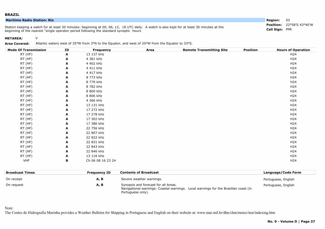
BRAZIL
METAREA: V
Area Covered: Atlantic waters west of 35°W from 3°N to the Equator, and west of 20°W from the Equator to 33°S.
Region: IIIPosition: 22°58'S 43°40'W
PPRStation keeping a watch for at least 30 minutes: beginning at 00, 06, 12, 18 UTC daily. A watch is also kept for at least 30 minutes at the beginning of the nearest "single operator period following the standard synoptic hours Call Sign:
Maritime Radio Station: Río
Mode Of Transmission ID Frequency Area Position Hours of OperationRemote Transmitting SiteRT (HF) A 13 137 kHz H24RT (HF) A 4 381 kHz H24RT (HF) A 4 402 kHz H24RT (HF) A 4 411 kHz H24RT (HF) A 4 417 kHz H24RT (HF) A 8 773 kHz H24RT (HF) A 8 779 kHz H24RT (HF) A 8 782 kHz H24RT (HF) A 8 800 kHz H24RT (HF) A 8 806 kHz H24RT (HF) A 4 366 kHz H24RT (HF) A 13 131 kHz H24RT (HF) A 17 272 kHz H24RT (HF) A 17 278 kHz H24RT (HF) A 17 302 kHz H24RT (HF) A 17 386 kHz H24RT (HF) A 22 756 kHz H24RT (HF) A 22 807 kHz H24RT (HF) A 22 822 kHz H24RT (HF) A 22 831 kHz H24RT (HF) A 22 843 kHz H24RT (HF) A 22 846 kHz H24RT (HF) A 13 116 kHz H24
VHF B Ch 06 08 16 23 24 H24
Broadcast Times Frequency ID Contents of Broadcast Language/Code Form
On receipt A, B Severe weather warnings. Portuguese, English
On request A, B Synopsis and forecast for all Areas.Navigational warnings: Coastal warnings. Local warnings for the Brazilian coast (in Portuguese only).
Portuguese, English
Note:The Centro de Hidrografia Marinha provides a Weather Bulletin for Shipping in Portuguese and English on their website at: www.mar.mil.br/dhn/chm/meteo/inst/indexing.htm
No. 9 - Volume D ¦ Page 37
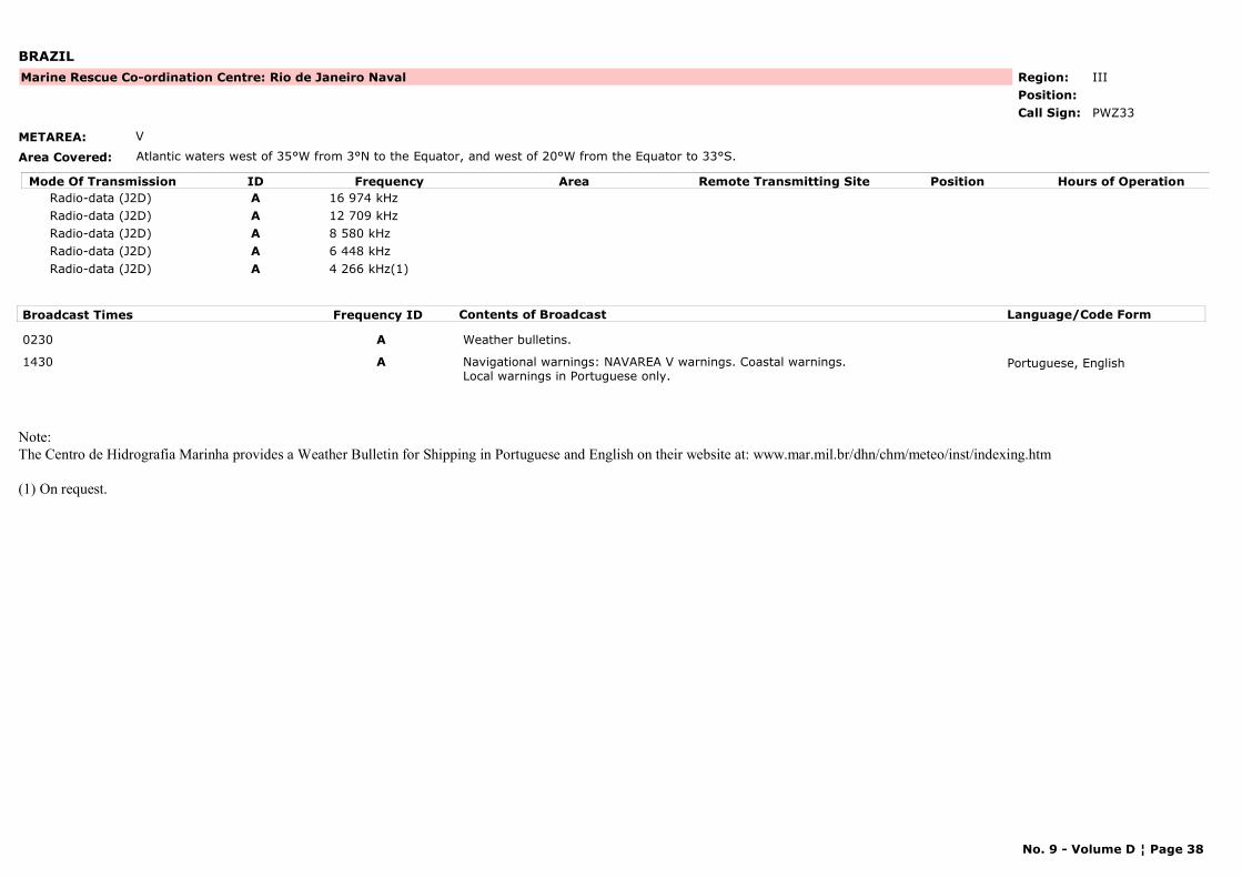
BRAZIL
METAREA: V
Area Covered: Atlantic waters west of 35°W from 3°N to the Equator, and west of 20°W from the Equator to 33°S.
Region: IIIPosition:
Marine Rescue Co-ordination Centre: Rio de Janeiro Naval
PWZ33Call Sign:
Mode Of Transmission ID Frequency Area Position Hours of OperationRemote Transmitting SiteRadio-data (J2D) A 16 974 kHzRadio-data (J2D) A 12 709 kHzRadio-data (J2D) A 8 580 kHzRadio-data (J2D) A 6 448 kHzRadio-data (J2D) A 4 266 kHz(1)
Broadcast Times Frequency ID Contents of Broadcast Language/Code Form
0230 A Weather bulletins.
1430 A Navigational warnings: NAVAREA V warnings. Coastal warnings. Local warnings in Portuguese only.
Portuguese, English
Note:The Centro de Hidrografia Marinha provides a Weather Bulletin for Shipping in Portuguese and English on their website at: www.mar.mil.br/dhn/chm/meteo/inst/indexing.htm
(1) On request.
No. 9 - Volume D ¦ Page 38
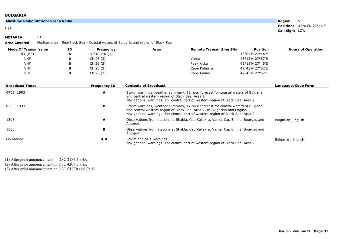
BULGARIA
METAREA: III
Area Covered: Mediterranean Sea/Black Sea - Coastal waters of Bulgaria and region of Black Sea
Region: VIPosition: 43°04'N 27°46'E
LZWH24
Call Sign:
Maritime Radio Station: Varna Radio
Mode Of Transmission ID Frequency Area Position Hours of OperationRemote Transmitting SiteRT (MF) A 3 740 kHz (1) 43°04'N 27°46'E
VHF B Ch 26 (3) Varna 43°15'N 27°57'EVHF B Ch 26 (3) Peak Kitka 42°18'N 27°45'EVHF B Ch 26 (3) Cape Kaliakra 42°43'N 27°52'EVHF B Ch 26 (3) Cape Emine 42°43'N 27°52'E
Broadcast Times Frequency ID Contents of Broadcast Language/Code Form
0703, 1903 A Storm warnings, weather summary, 12 hour forecast for coastal waters of Bulgaria and central western region of Black Sea, Area 2.Navigational warnings: For central part of western region of Black Sea, Area 2.
0733, 1933 B Storm warnings, weather summary, 12 hour forecast for coastal waters of Bulgaria and central western region of Black Sea, Area 2. In Bulgarian and English.Navigational warnings: For central part of western region of Black Sea, Area 2.
1303 A Observations from stations at Shabla, Cap Kaliakra, Varna, Cap Emine, Bourgas and Ahtopol.
Bulgarian, English
1333 B Observations from stations at Shabla, Cap Kaliakra, Varna, Cap Emine, Bourgas and Ahtopol.
On receipt A,B Storm and gale warnings. Navigational warnings: For central part of western region of Black Sea, Area 2.
Bulgarian, English
(1) After prior announcement on DSC 2187.5 kHz.(2) After prior announcement on DSC 4207.5 kHz.(3) After prior announcement on DSC CH 70 and Ch 16.
No. 9 - Volume D ¦ Page 39
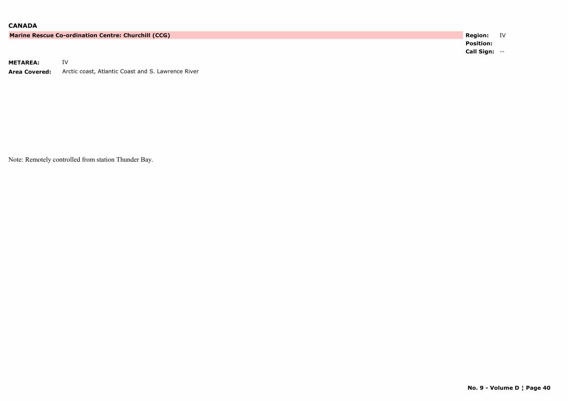
CANADA
METAREA: IV
Area Covered: Arctic coast, Atlantic Coast and S. Lawrence River
Region: IVPosition:
Marine Rescue Co-ordination Centre: Churchill (CCG)
--Call Sign:
Note: Remotely controlled from station Thunder Bay.
No. 9 - Volume D ¦ Page 40
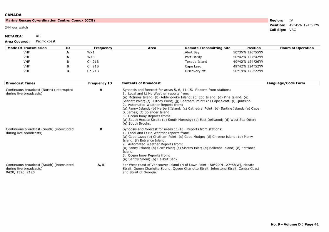
CANADA
METAREA: XII
Area Covered: Pacific coast
Region: IVPosition: 49°45'N 124°57'W
Marine Rescue Co-ordination Centre: Comox (CCG)
VAC24-hour watch
Call Sign:
Mode Of Transmission ID Frequency Area Position Hours of OperationRemote Transmitting SiteVHF A WX1 Alert Bay 50°35'N 126°55'WVHF A WX3 Port Hardy 50°42'N 127°42'WVHF B Ch 21B Texada Island 49°42'N 124°26'WVHF B Ch 21B Cape Lazo 49°42'N 124°52'WVHF B Ch 21B Discovery Mt. 50°19'N 125°22'W
Broadcast Times Frequency ID Contents of Broadcast Language/Code Form
Continuous broadcast (North) (interrupted during live broadcasts)
A Synopsis and forecast for areas 5, 6, 11-15. Reports from stations:1. Local and Lt Ho Weather reports from: (a) McInnes Island; (b) Addenbroke Island; (c) Egg Island; (d) Pine Island; (e) Scarlett Point; (f) Pultney Point; (g) Chatham Point; (h) Cape Scott; (i) Quatsino.2. Automated Weather Reports from:(a) Fanny Island; (b) Herbert Island; (c) Cathedral Point; (d) Sartine Island; (e) Cape S. James; (f) Solander Island.3. Ocean buoy Reports from:(a) South Hecate Strait; (b) South Moresby; (c) East Dellwood; (d) West Sea Otter; (e) South Brooks.
Continuous broadcast (South) (interrupted during live broadcasts)
B Synopsis and forecast for areas 11-13. Reports from stations:1. Local and Lt Ho Weather reports from: (a) Cape Lazo; (b) Chatham Point; (c) Cape Mudge; (d) Chrome Island; (e) Merry Island; (f) Entrance Island.2. Automated Weather Reports from:(a) Fanny Island; (b) Grief Point; (c) Sisters Islet; (d) Ballenas Island; (e) Entrance Island.3. Ocean buoy Reports from:(a) Sentry Shoal; (b) Halibut Bank.
Continuous broadcast (South) (interrupted during live broadcasts)0420, 1520, 2120
A, B For West coast of Vancouver Island (N of Lawn Point - 50°20'N 127°58'W), Hecate Strait, Queen Charlotte Sound, Queen Charlotte Strait, Johnstone Strait, Centra Coast and Strait of Georgia.
No. 9 - Volume D ¦ Page 41
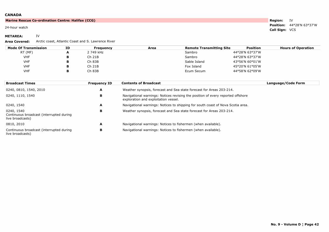
CANADA
METAREA: IV
Area Covered: Arctic coast, Atlantic Coast and S. Lawrence River
Region: IVPosition: 44°28'N 63°37'W
Marine Rescue Co-ordination Centre: Halifax (CCG)
VCS24-hour watch
Call Sign:
Mode Of Transmission ID Frequency Area Position Hours of OperationRemote Transmitting SiteRT (MF) A 2 749 kHz Sambro 44°28'N 63°37'W
VHF B Ch 21B Sambro 44°28'N 63°37'WVHF B Ch 83B Sable Island 43°56'N 60°01'WVHF B Ch 21B Fox Island 45°20'N 61°05'WVHF B Ch 83B Ecum Secum 44°58'N 62°09'W
Broadcast Times Frequency ID Contents of Broadcast Language/Code Form
0240, 0810, 1540, 2010 A Weather synopsis, forecast and Sea state forecast for Areas 203-214.
0240, 1110, 1540 B Navigational warnings: Notices revising the position of every reported offshore exploration and exploitation vessel.
0240, 1540 A Navigational warnings: Notices to shipping for south coast of Nova Scotia area.
0240, 1540Continuous broadcast (interrupted during live broadcasts)
B Weather synopsis, forecast and Sea state forecast for Areas 203-214.
0810, 2010 A Navigational warnings: Notices to fishermen (when available).
Continuous broadcast (interrupted during live broadcasts)
B Navigational warnings: Notices to fishermen (when available).
No. 9 - Volume D ¦ Page 42
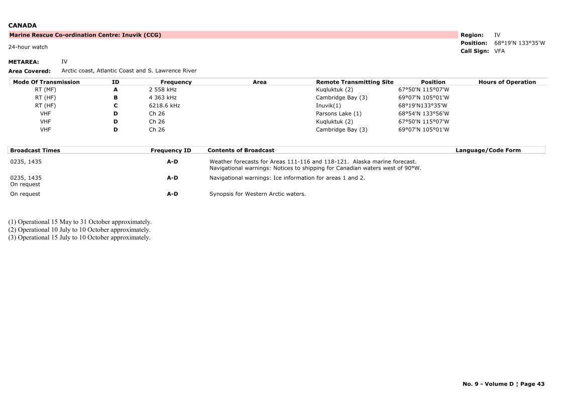
CANADA
METAREA: IV
Area Covered: Arctic coast, Atlantic Coast and S. Lawrence River
Region: IVPosition: 68°19'N 133°35'W
Marine Rescue Co-ordination Centre: Inuvik (CCG)
VFA24-hour watch
Call Sign:
Mode Of Transmission ID Frequency Area Position Hours of OperationRemote Transmitting SiteRT (MF) A 2 558 kHz Kuqluktuk (2) 67°50'N 115°07'WRT (HF) B 4 363 kHz Cambridge Bay (3) 69°07'N 105°01'WRT (HF) C 6218.6 kHz Inuvik(1) 68°19'N133°35'W
VHF D Ch 26 Parsons Lake (1) 68°54'N 133°56'WVHF D Ch 26 Kuqluktuk (2) 67°50'N 115°07'WVHF D Ch 26 Cambridge Bay (3) 69°07'N 105°01'W
Broadcast Times Frequency ID Contents of Broadcast Language/Code Form
0235, 1435 A-D Weather forecasts for Areas 111-116 and 118-121. Alaska marine forecast.Navigational warnings: Notices to shipping for Canadian waters west of 90°W.
0235, 1435On request
A-D Navigational warnings: Ice information for areas 1 and 2.
On request A-D Synopsis for Western Arctic waters.
(1) Operational 15 May to 31 October approximately.(2) Operational 10 July to 10 October approximately.(3) Operational 15 July to 10 October approximately.
No. 9 - Volume D ¦ Page 43
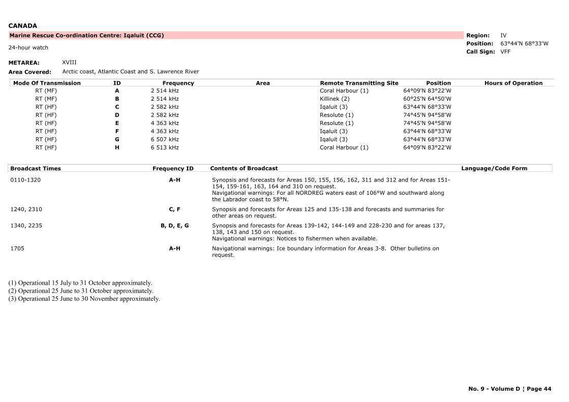
CANADA
METAREA: XVIII
Area Covered: Arctic coast, Atlantic Coast and S. Lawrence River
Region: IVPosition: 63°44'N 68°33'W
Marine Rescue Co-ordination Centre: Iqaluit (CCG)
VFF24-hour watch
Call Sign:
Mode Of Transmission ID Frequency Area Position Hours of OperationRemote Transmitting SiteRT (MF) A 2 514 kHz Coral Harbour (1) 64°09'N 83°22'WRT (MF) B 2 514 kHz Killinek (2) 60°25'N 64°50'WRT (HF) C 2 582 kHz Iqaluit (3) 63°44'N 68°33'WRT (HF) D 2 582 kHz Resolute (1) 74°45'N 94°58'WRT (HF) E 4 363 kHz Resolute (1) 74°45'N 94°58'WRT (HF) F 4 363 kHz Iqaluit (3) 63°44'N 68°33'WRT (HF) G 6 507 kHz Iqaluit (3) 63°44'N 68°33'WRT (HF) H 6 513 kHz Coral Harbour (1) 64°09'N 83°22'W
Broadcast Times Frequency ID Contents of Broadcast Language/Code Form
0110-1320 A-H Synopsis and forecasts for Areas 150, 155, 156, 162, 311 and 312 and for Areas 151-154, 159-161, 163, 164 and 310 on request.Navigational warnings: For all NORDREG waters east of 106°W and southward along the Labrador coast to 58°N.
1240, 2310 C, F Synopsis and forecasts for Areas 125 and 135-138 and forecasts and summaries for other areas on request.
1340, 2235 B, D, E, G Synopsis and forecasts for Areas 139-142, 144-149 and 228-230 and for areas 137, 138, 143 and 150 on request.Navigational warnings: Notices to fishermen when available.
1705 A-H Navigational warnings: Ice boundary information for Areas 3-8. Other bulletins on request.
(1) Operational 15 July to 31 October approximately.(2) Operational 25 June to 31 October approximately.(3) Operational 25 June to 30 November approximately.
No. 9 - Volume D ¦ Page 44
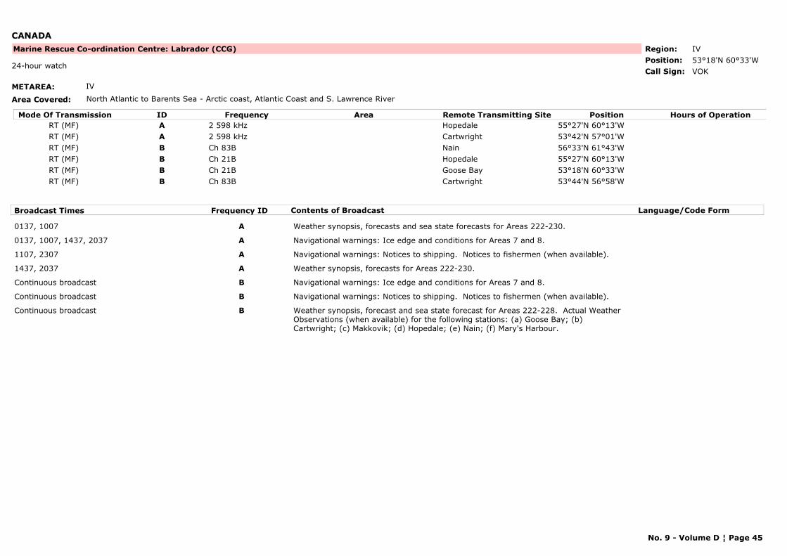
CANADA
METAREA: IV
Area Covered: North Atlantic to Barents Sea - Arctic coast, Atlantic Coast and S. Lawrence River
Region: IVPosition: 53°18'N 60°33'W
Marine Rescue Co-ordination Centre: Labrador (CCG)
VOK24-hour watch
Call Sign:
Mode Of Transmission ID Frequency Area Position Hours of OperationRemote Transmitting SiteRT (MF) A 2 598 kHz Hopedale 55°27'N 60°13'WRT (MF) A 2 598 kHz Cartwright 53°42'N 57°01'WRT (MF) B Ch 83B Nain 56°33'N 61°43'WRT (MF) B Ch 21B Hopedale 55°27'N 60°13'WRT (MF) B Ch 21B Goose Bay 53°18'N 60°33'WRT (MF) B Ch 83B Cartwright 53°44'N 56°58'W
Broadcast Times Frequency ID Contents of Broadcast Language/Code Form
0137, 1007 A Weather synopsis, forecasts and sea state forecasts for Areas 222-230.
0137, 1007, 1437, 2037 A Navigational warnings: Ice edge and conditions for Areas 7 and 8.
1107, 2307 A Navigational warnings: Notices to shipping. Notices to fishermen (when available).
1437, 2037 A Weather synopsis, forecasts for Areas 222-230.
Continuous broadcast B Navigational warnings: Ice edge and conditions for Areas 7 and 8.
Continuous broadcast B Navigational warnings: Notices to shipping. Notices to fishermen (when available).
Continuous broadcast B Weather synopsis, forecast and sea state forecast for Areas 222-228. Actual Weather Observations (when available) for the following stations: (a) Goose Bay; (b) Cartwright; (c) Makkovik; (d) Hopedale; (e) Nain; (f) Mary's Harbour.
No. 9 - Volume D ¦ Page 45
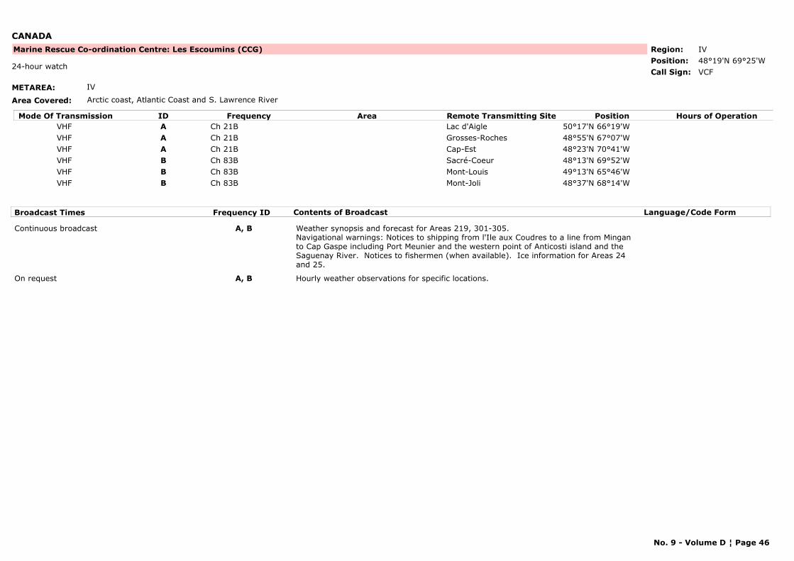
CANADA
METAREA: IV
Area Covered: Arctic coast, Atlantic Coast and S. Lawrence River
Region: IVPosition: 48°19'N 69°25'W
Marine Rescue Co-ordination Centre: Les Escoumins (CCG)
VCF24-hour watch
Call Sign:
Mode Of Transmission ID Frequency Area Position Hours of OperationRemote Transmitting SiteVHF A Ch 21B Lac d'Aigle 50°17'N 66°19'WVHF A Ch 21B Grosses-Roches 48°55'N 67°07'WVHF A Ch 21B Cap-Est 48°23'N 70°41'WVHF B Ch 83B Sacré-Coeur 48°13'N 69°52'WVHF B Ch 83B Mont-Louis 49°13'N 65°46'WVHF B Ch 83B Mont-Joli 48°37'N 68°14'W
Broadcast Times Frequency ID Contents of Broadcast Language/Code Form
Continuous broadcast A, B Weather synopsis and forecast for Areas 219, 301-305.Navigational warnings: Notices to shipping from l'Ile aux Coudres to a line from Mingan to Cap Gaspe including Port Meunier and the western point of Anticosti island and the Saguenay River. Notices to fishermen (when available). Ice information for Areas 24 and 25.
On request A, B Hourly weather observations for specific locations.
No. 9 - Volume D ¦ Page 46
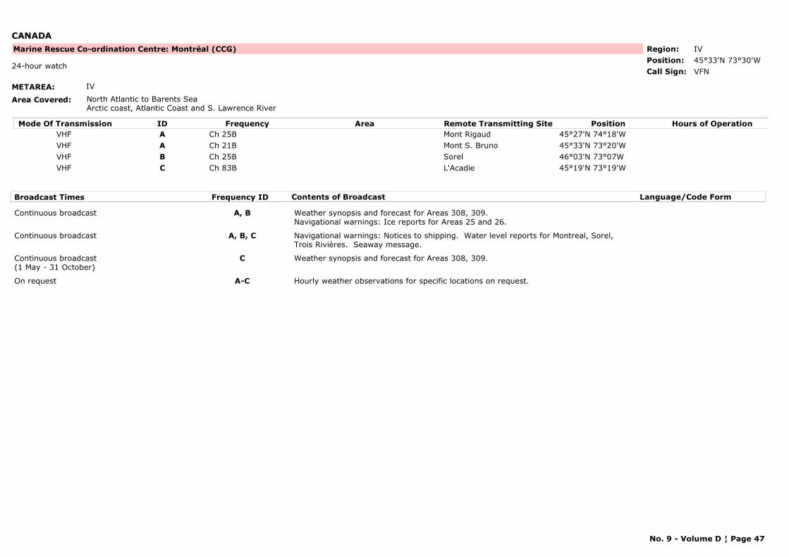
CANADA
METAREA: IV
Area Covered: North Atlantic to Barents SeaArctic coast, Atlantic Coast and S. Lawrence River
Region: IVPosition: 45°33'N 73°30'W
Marine Rescue Co-ordination Centre: Montréal (CCG)
VFN24-hour watch
Call Sign:
Mode Of Transmission ID Frequency Area Position Hours of OperationRemote Transmitting SiteVHF A Ch 25B Mont Rigaud 45°27'N 74°18'WVHF A Ch 21B Mont S. Bruno 45°33'N 73°20'WVHF B Ch 25B Sorel 46°03'N 73°07WVHF C Ch 83B L'Acadie 45°19'N 73°19'W
Broadcast Times Frequency ID Contents of Broadcast Language/Code Form
Continuous broadcast A, B Weather synopsis and forecast for Areas 308, 309.Navigational warnings: Ice reports for Areas 25 and 26.
Continuous broadcast A, B, C Navigational warnings: Notices to shipping. Water level reports for Montreal, Sorel, Trois Rivières. Seaway message.
Continuous broadcast(1 May - 31 October)
C Weather synopsis and forecast for Areas 308, 309.
On request A-C Hourly weather observations for specific locations on request.
No. 9 - Volume D ¦ Page 47
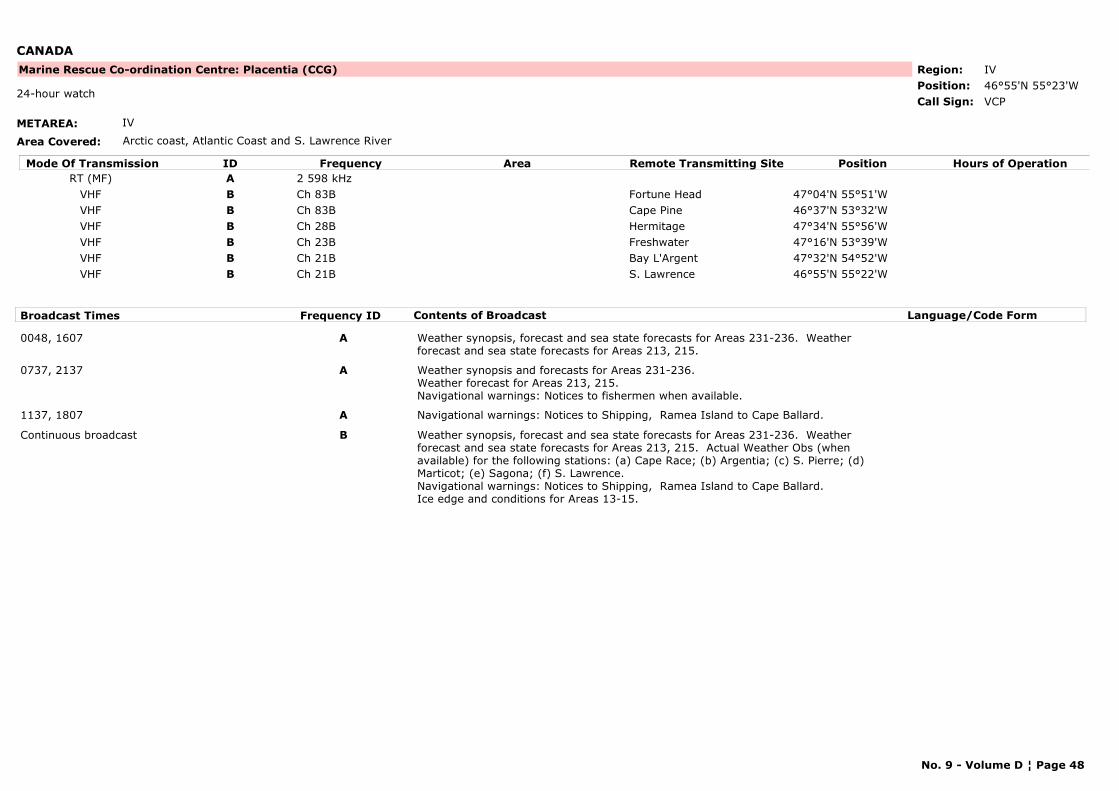
CANADA
METAREA: IV
Area Covered: Arctic coast, Atlantic Coast and S. Lawrence River
Region: IVPosition: 46°55'N 55°23'W
Marine Rescue Co-ordination Centre: Placentia (CCG)
VCP24-hour watch
Call Sign:
Mode Of Transmission ID Frequency Area Position Hours of OperationRemote Transmitting SiteRT (MF) A 2 598 kHz
VHF B Ch 83B Fortune Head 47°04'N 55°51'WVHF B Ch 83B Cape Pine 46°37'N 53°32'WVHF B Ch 28B Hermitage 47°34'N 55°56'WVHF B Ch 23B Freshwater 47°16'N 53°39'WVHF B Ch 21B Bay L'Argent 47°32'N 54°52'WVHF B Ch 21B S. Lawrence 46°55'N 55°22'W
Broadcast Times Frequency ID Contents of Broadcast Language/Code Form
0048, 1607 A Weather synopsis, forecast and sea state forecasts for Areas 231-236. Weather forecast and sea state forecasts for Areas 213, 215.
0737, 2137 A Weather synopsis and forecasts for Areas 231-236.Weather forecast for Areas 213, 215.Navigational warnings: Notices to fishermen when available.
1137, 1807 A Navigational warnings: Notices to Shipping, Ramea Island to Cape Ballard.
Continuous broadcast B Weather synopsis, forecast and sea state forecasts for Areas 231-236. Weather forecast and sea state forecasts for Areas 213, 215. Actual Weather Obs (when available) for the following stations: (a) Cape Race; (b) Argentia; (c) S. Pierre; (d) Marticot; (e) Sagona; (f) S. Lawrence.Navigational warnings: Notices to Shipping, Ramea Island to Cape Ballard.Ice edge and conditions for Areas 13-15.
No. 9 - Volume D ¦ Page 48
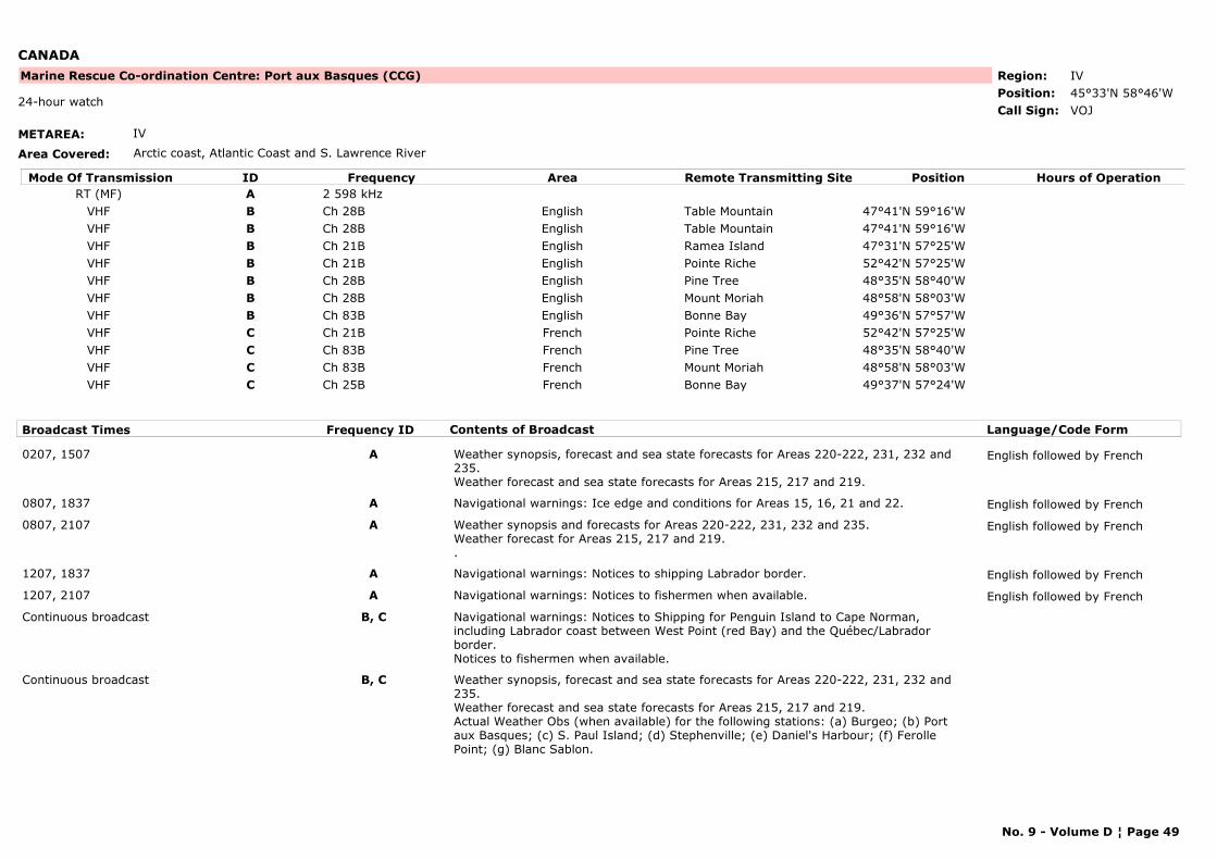
CANADA
METAREA: IV
Area Covered: Arctic coast, Atlantic Coast and S. Lawrence River
Region: IVPosition: 45°33'N 58°46'W
Marine Rescue Co-ordination Centre: Port aux Basques (CCG)
VOJ24-hour watch
Call Sign:
Mode Of Transmission ID Frequency Area Position Hours of OperationRemote Transmitting SiteRT (MF) A 2 598 kHz
VHF B Ch 28B English Table Mountain 47°41'N 59°16'WVHF B Ch 28B English Table Mountain 47°41'N 59°16'WVHF B Ch 21B English Ramea Island 47°31'N 57°25'WVHF B Ch 21B English Pointe Riche 52°42'N 57°25'WVHF B Ch 28B English Pine Tree 48°35'N 58°40'WVHF B Ch 28B English Mount Moriah 48°58'N 58°03'WVHF B Ch 83B English Bonne Bay 49°36'N 57°57'WVHF C Ch 21B French Pointe Riche 52°42'N 57°25'WVHF C Ch 83B French Pine Tree 48°35'N 58°40'WVHF C Ch 83B French Mount Moriah 48°58'N 58°03'WVHF C Ch 25B French Bonne Bay 49°37'N 57°24'W
Broadcast Times Frequency ID Contents of Broadcast Language/Code Form
0207, 1507 A Weather synopsis, forecast and sea state forecasts for Areas 220-222, 231, 232 and 235.Weather forecast and sea state forecasts for Areas 215, 217 and 219.
English followed by French
0807, 1837 A Navigational warnings: Ice edge and conditions for Areas 15, 16, 21 and 22. English followed by French
0807, 2107 A Weather synopsis and forecasts for Areas 220-222, 231, 232 and 235.Weather forecast for Areas 215, 217 and 219..
English followed by French
1207, 1837 A Navigational warnings: Notices to shipping Labrador border. English followed by French
1207, 2107 A Navigational warnings: Notices to fishermen when available. English followed by French
Continuous broadcast B, C Navigational warnings: Notices to Shipping for Penguin Island to Cape Norman, including Labrador coast between West Point (red Bay) and the Québec/Labrador border.Notices to fishermen when available.
Continuous broadcast B, C Weather synopsis, forecast and sea state forecasts for Areas 220-222, 231, 232 and 235.Weather forecast and sea state forecasts for Areas 215, 217 and 219.Actual Weather Obs (when available) for the following stations: (a) Burgeo; (b) Port aux Basques; (c) S. Paul Island; (d) Stephenville; (e) Daniel's Harbour; (f) Ferolle Point; (g) Blanc Sablon.
No. 9 - Volume D ¦ Page 49

CANADA
No. 9 - Volume D ¦ Page 50
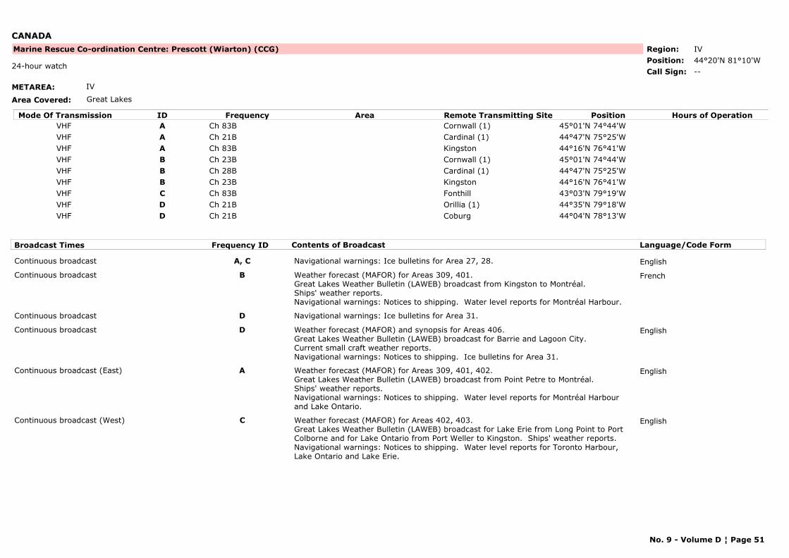
CANADA
METAREA: IV
Area Covered: Great Lakes
Region: IVPosition: 44°20'N 81°10'W
Marine Rescue Co-ordination Centre: Prescott (Wiarton) (CCG)
--24-hour watch
Call Sign:
Mode Of Transmission ID Frequency Area Position Hours of OperationRemote Transmitting SiteVHF A Ch 83B Cornwall (1) 45°01'N 74°44'WVHF A Ch 21B Cardinal (1) 44°47'N 75°25'WVHF A Ch 83B Kingston 44°16'N 76°41'WVHF B Ch 23B Cornwall (1) 45°01'N 74°44'WVHF B Ch 28B Cardinal (1) 44°47'N 75°25'WVHF B Ch 23B Kingston 44°16'N 76°41'WVHF C Ch 83B Fonthill 43°03'N 79°19'WVHF D Ch 21B Orillia (1) 44°35'N 79°18'WVHF D Ch 21B Coburg 44°04'N 78°13'W
Broadcast Times Frequency ID Contents of Broadcast Language/Code Form
Continuous broadcast A, C Navigational warnings: Ice bulletins for Area 27, 28. English
Continuous broadcast B Weather forecast (MAFOR) for Areas 309, 401.Great Lakes Weather Bulletin (LAWEB) broadcast from Kingston to Montréal.Ships' weather reports.Navigational warnings: Notices to shipping. Water level reports for Montréal Harbour.
French
Continuous broadcast D Navigational warnings: Ice bulletins for Area 31.
Continuous broadcast D Weather forecast (MAFOR) and synopsis for Areas 406.Great Lakes Weather Bulletin (LAWEB) broadcast for Barrie and Lagoon City.Current small craft weather reports.Navigational warnings: Notices to shipping. Ice bulletins for Area 31.
English
Continuous broadcast (East) A Weather forecast (MAFOR) for Areas 309, 401, 402.Great Lakes Weather Bulletin (LAWEB) broadcast from Point Petre to Montréal.Ships' weather reports.Navigational warnings: Notices to shipping. Water level reports for Montréal Harbour and Lake Ontario.
English
Continuous broadcast (West) C Weather forecast (MAFOR) for Areas 402, 403.Great Lakes Weather Bulletin (LAWEB) broadcast for Lake Erie from Long Point to Port Colborne and for Lake Ontario from Port Weller to Kingston. Ships' weather reports.Navigational warnings: Notices to shipping. Water level reports for Toronto Harbour, Lake Ontario and Lake Erie.
English
No. 9 - Volume D ¦ Page 51
CANADA
NOTE: When continuous broadcasts are not in service, schedules broadcasts will be made at Traffic List times.
(1) Operational 1 April - 31 December.
No. 9 - Volume D ¦ Page 52
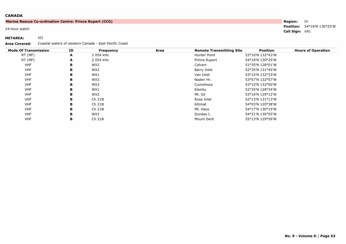
CANADA
METAREA: XII
Area Covered: Coastal waters of western Canada - East Pacific Coast
Region: IVPosition: 54°18'N 130°25'W
Marine Rescue Co-ordination Centre: Prince Rupert (CCG)
VAJ24-hour watch
Call Sign:
Mode Of Transmission ID Frequency Area Position Hours of OperationRemote Transmitting SiteRT (MF) A 2 054 kHz Hunter Point 53°16'N 132°43'WRT (MF) A 2 054 kHz Prince Rupert 54°18'N 130°25'W
VHF B WX2 Calvert 51°35'N 128°01'WVHF B WX2 Barry Inlet 52°35'N 131°45'WVHF B WX1 Van Inlet 53°15'N 132°33'WVHF B WX3 Naden Hr. 53°57'N 132°57'WVHF B WX3 Cumshewa 53°10'N 132°00'WVHF B WX1 Klemtu 52°35'N 128°34'WVHF B WX2 Mt. Gil 53°16'N 129°12'WVHF B Ch 21B Rose Inlet 52°13'N 131°13'WVHF B Ch 21B Kitimat 54°03'N 120°38'WVHF B Ch 21B Mt. Hays 54°17'N 130°19'WVHF B WX2 Dundas I. 54°31'N 130°55'WVHF B Ch 21B Mount Dent 55°13'N 129°59'W
No. 9 - Volume D ¦ Page 53
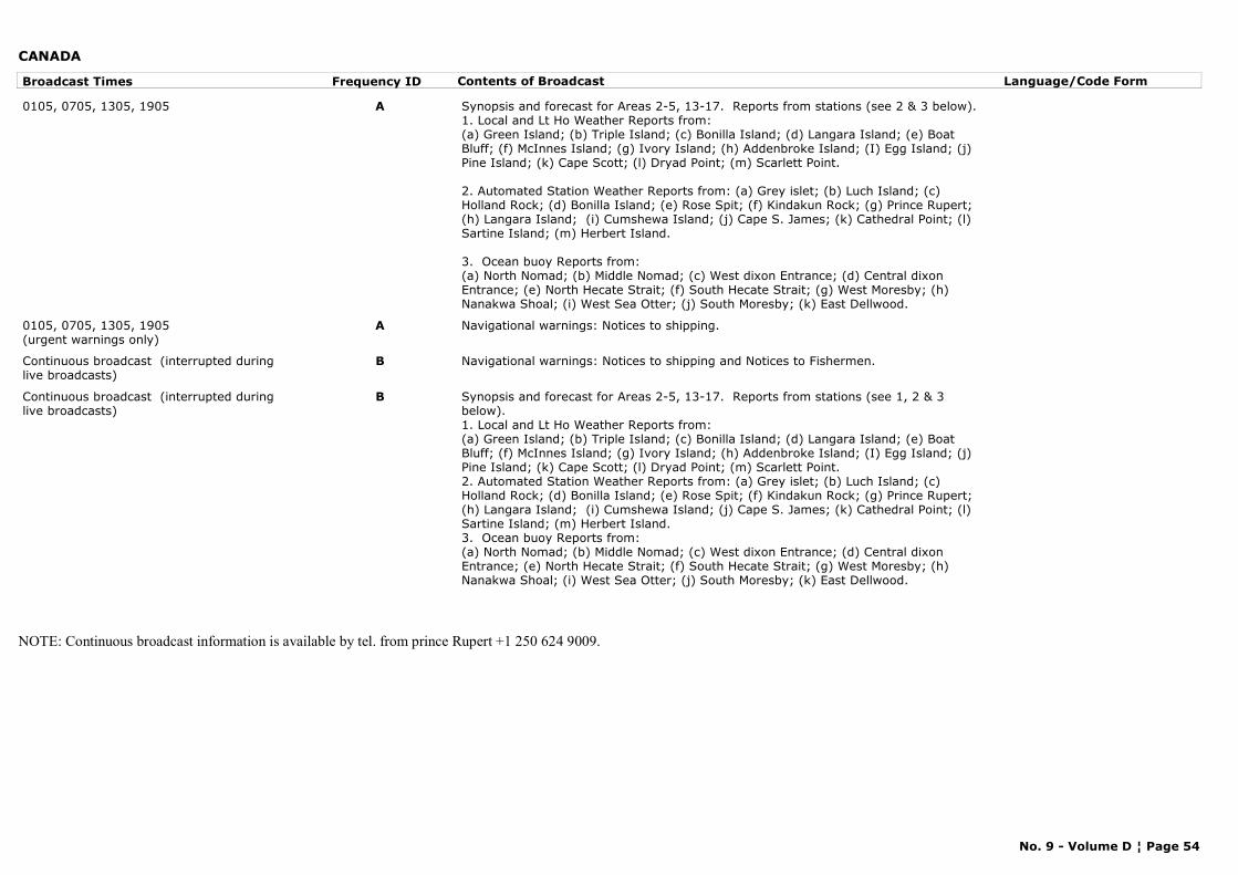
CANADA
Broadcast Times Frequency ID Contents of Broadcast Language/Code Form
0105, 0705, 1305, 1905 A Synopsis and forecast for Areas 2-5, 13-17. Reports from stations (see 2 & 3 below).1. Local and Lt Ho Weather Reports from:(a) Green Island; (b) Triple Island; (c) Bonilla Island; (d) Langara Island; (e) Boat Bluff; (f) McInnes Island; (g) Ivory Island; (h) Addenbroke Island; (I) Egg Island; (j) Pine Island; (k) Cape Scott; (l) Dryad Point; (m) Scarlett Point.
2. Automated Station Weather Reports from: (a) Grey islet; (b) Luch Island; (c) Holland Rock; (d) Bonilla Island; (e) Rose Spit; (f) Kindakun Rock; (g) Prince Rupert; (h) Langara Island; (i) Cumshewa Island; (j) Cape S. James; (k) Cathedral Point; (l) Sartine Island; (m) Herbert Island.
3. Ocean buoy Reports from:(a) North Nomad; (b) Middle Nomad; (c) West dixon Entrance; (d) Central dixon Entrance; (e) North Hecate Strait; (f) South Hecate Strait; (g) West Moresby; (h) Nanakwa Shoal; (i) West Sea Otter; (j) South Moresby; (k) East Dellwood.
0105, 0705, 1305, 1905(urgent warnings only)
A Navigational warnings: Notices to shipping.
Continuous broadcast (interrupted during live broadcasts)
B Navigational warnings: Notices to shipping and Notices to Fishermen.
Continuous broadcast (interrupted during live broadcasts)
B Synopsis and forecast for Areas 2-5, 13-17. Reports from stations (see 1, 2 & 3 below).1. Local and Lt Ho Weather Reports from:(a) Green Island; (b) Triple Island; (c) Bonilla Island; (d) Langara Island; (e) Boat Bluff; (f) McInnes Island; (g) Ivory Island; (h) Addenbroke Island; (I) Egg Island; (j) Pine Island; (k) Cape Scott; (l) Dryad Point; (m) Scarlett Point.2. Automated Station Weather Reports from: (a) Grey islet; (b) Luch Island; (c) Holland Rock; (d) Bonilla Island; (e) Rose Spit; (f) Kindakun Rock; (g) Prince Rupert; (h) Langara Island; (i) Cumshewa Island; (j) Cape S. James; (k) Cathedral Point; (l) Sartine Island; (m) Herbert Island.3. Ocean buoy Reports from:(a) North Nomad; (b) Middle Nomad; (c) West dixon Entrance; (d) Central dixon Entrance; (e) North Hecate Strait; (f) South Hecate Strait; (g) West Moresby; (h) Nanakwa Shoal; (i) West Sea Otter; (j) South Moresby; (k) East Dellwood.
NOTE: Continuous broadcast information is available by tel. from prince Rupert +1 250 624 9009.
No. 9 - Volume D ¦ Page 54
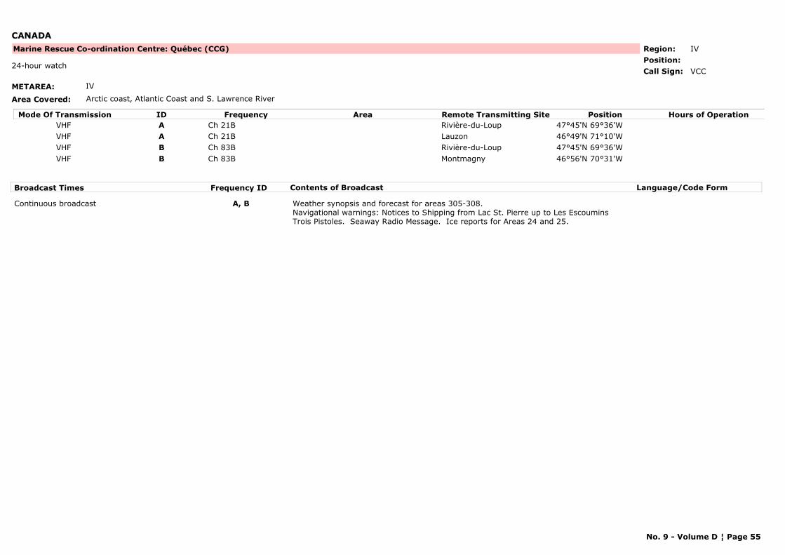
CANADA
METAREA: IV
Area Covered: Arctic coast, Atlantic Coast and S. Lawrence River
Region: IVPosition:
Marine Rescue Co-ordination Centre: Québec (CCG)
VCC24-hour watch
Call Sign:
Mode Of Transmission ID Frequency Area Position Hours of OperationRemote Transmitting SiteVHF A Ch 21B Rivière-du-Loup 47°45'N 69°36'WVHF A Ch 21B Lauzon 46°49'N 71°10'WVHF B Ch 83B Rivière-du-Loup 47°45'N 69°36'WVHF B Ch 83B Montmagny 46°56'N 70°31'W
Broadcast Times Frequency ID Contents of Broadcast Language/Code Form
Continuous broadcast A, B Weather synopsis and forecast for areas 305-308.Navigational warnings: Notices to Shipping from Lac St. Pierre up to Les Escoumins Trois Pistoles. Seaway Radio Message. Ice reports for Areas 24 and 25.
No. 9 - Volume D ¦ Page 55
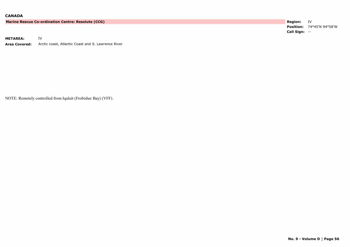
CANADA
METAREA: IV
Area Covered: Arctic coast, Atlantic Coast and S. Lawrence River
Region: IVPosition: 74°45'N 94°58'W
Marine Rescue Co-ordination Centre: Resolute (CCG)
--Call Sign:
NOTE: Remotely controlled from Iqaluit (Frobisher Bay) (VFF).
No. 9 - Volume D ¦ Page 56

CANADA
METAREA: IV
Area Covered: Arctic coast, Atlantic Coast and S. Lawrence River
Region: IVPosition: 50°11'N 66°07'W
Marine Rescue Co-ordination Centre: Rivière-au-Renard (CCG)
VCG24-hour watch
Call Sign:
Mode Of Transmission ID Frequency Area Position Hours of OperationRemote Transmitting SiteRT (MF) A 2 598 kHzRT (MF) A 2 749 kHz
VHF B Ch 25B Harrington Hr (1) 50°30'N 59°29'WVHF B Ch 83B La Romaine (1) 50°13'N 60°41'WVHF B Ch 21B Natashquan 50°09'N 61°48'WVHF B Ch 83B Havre St. Pierre 50°16'N 63°41'WVHF B Ch 25B Heath Point 49°05'N 61°02'WVHF B Ch 21B Forillon 48°50'N 64°16'WVHF B Ch 83B Newport 48°14'N 64°48'WVHF B Ch 21B Carleton 48°08'N 66°07'WVHF B Ch 21B Cap-aux-Meules 47°23'N 61°52'W
Broadcast Times Frequency ID Contents of Broadcast Language/Code Form
0437, 0847, 1407, 2317 A Weather synopsis and forecasts for Areas 215-221 and 301-303.Sea state forecasts for Areas 215, 217 and 219-221.
English followed by French
0437, 0937, 1737, 2317 A Navigational warnings: Notices to fishermen when available. English followed by French
0937, 1737 A Navigational warnings: Notices to Shipping for Gulf of S. Lawrence, S. Lawrence River, Chaleur Bay, Magdalen Islands, Prince Edward Island and Miramichi Bay.Ice reports for Areas 20 and 22-24.
English followed by French
Continuous broadcast B Navigational warnings: Notices to Shipping for Gulf of S. Lawrence including the Magdalene Islands, the coast between Sept-Iles and Blanc Sablon, the southern shore of 66°W eastward including the Baie des Chaleurs up to Miramichi beach. Notices to fishermen when available. Ice reports for Areas 20 and 22-24.
English followed by French
Continuous broadcast B Weather synopsis and forecasts for Areas 215-221 and 301-303.Sea state forecasts for Areas 215, 217 and 219-221.
English followed by French
(1) Seasonal operation 1 April to 31 December.
No. 9 - Volume D ¦ Page 57
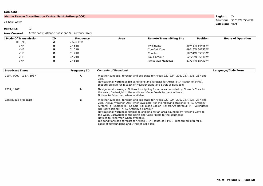
CANADA
METAREA: IV
Area Covered: Arctic coast, Atlantic Coast and S. Lawrence River
Region: IVPosition: 51°30'N 55°49'W
Marine Rescue Co-ordination Centre: Saint Anthony(CCG)
VCM24-hour watch
Call Sign:
Mode Of Transmission ID Frequency Area Position Hours of OperationRemote Transmitting SiteRT (MF) A 2 598 kHz
VHF B Ch 83B Twillingate 49°41'N 54°48'WVHF B Ch 21B Comfort Cove 49°15'N 54°53'WVHF B Ch 21B Conche 50°54'N 55°53'WVHF B Ch 21B Fox Harbour 52°22'N 55°40'WVHF B Ch 83B l'Anse aux Meadows 51°34'N 55°30'W
Broadcast Times Frequency ID Contents of Broadcast Language/Code Form
0107, 0907, 1337, 1937 A Weather synopsis, forecast and sea state for Areas 220-224, 226, 227, 235, 237 and 238.Navigational warnings: Ice conditions and forecast for Areas 8-14 (south of 54°N). Iceberg bulletin for E coast of Newfoundland and Strait of Belle Isle.
1237, 1907 A Navigational warnings: Notices to shipping for an area bounded by Flower's Cove to the west, Cartwright to the north and Cape Freels to the southeast.Notices to fishermen when available.
Continuous broadcast B Weather synopsis, forecast and sea state for Areas 220-224, 226, 227, 235, 237 and 238. Actual Weather Obs (when available) for the following stations: (a) S. Anthony Airport; (b) Englee; (c ) La Scie; (d) Blanc Sablon; (e) Mary's Harbour; (f) Twillingate; (g) Pool's Island; (h) S. Anthony's Harbour.Navigational warnings: Notices to shipping for an area bounded by Flower's Cove to the west, Cartwright to the north and Cape Freels to the southeast.Notices to fishermen when available.Ice conditions and forecast for Areas 8-14 (south of 54°N). Iceberg bulletin for E coast of Newfundland and Strait of Belle Isle.
No. 9 - Volume D ¦ Page 58
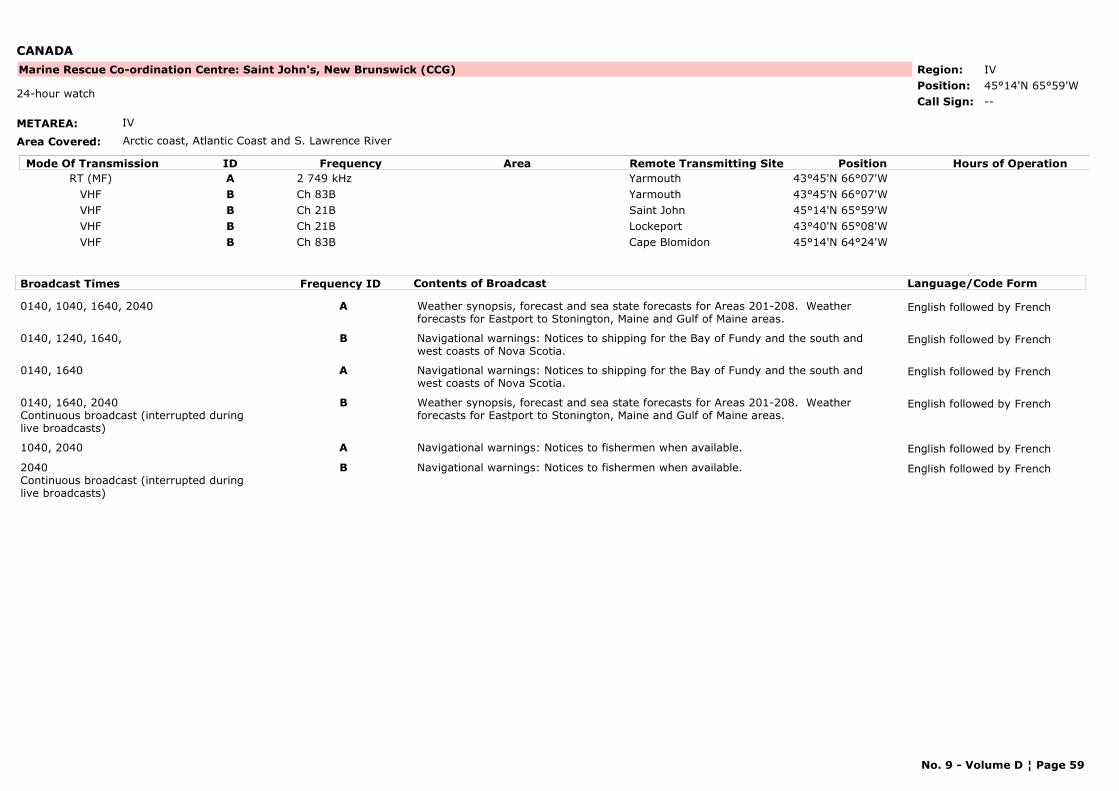
CANADA
METAREA: IV
Area Covered: Arctic coast, Atlantic Coast and S. Lawrence River
Region: IVPosition: 45°14'N 65°59'W
Marine Rescue Co-ordination Centre: Saint John's, New Brunswick (CCG)
--24-hour watch
Call Sign:
Mode Of Transmission ID Frequency Area Position Hours of OperationRemote Transmitting SiteRT (MF) A 2 749 kHz Yarmouth 43°45'N 66°07'W
VHF B Ch 83B Yarmouth 43°45'N 66°07'WVHF B Ch 21B Saint John 45°14'N 65°59'WVHF B Ch 21B Lockeport 43°40'N 65°08'WVHF B Ch 83B Cape Blomidon 45°14'N 64°24'W
Broadcast Times Frequency ID Contents of Broadcast Language/Code Form
0140, 1040, 1640, 2040 A Weather synopsis, forecast and sea state forecasts for Areas 201-208. Weather forecasts for Eastport to Stonington, Maine and Gulf of Maine areas.
English followed by French
0140, 1240, 1640, B Navigational warnings: Notices to shipping for the Bay of Fundy and the south and west coasts of Nova Scotia.
English followed by French
0140, 1640 A Navigational warnings: Notices to shipping for the Bay of Fundy and the south and west coasts of Nova Scotia.
English followed by French
0140, 1640, 2040Continuous broadcast (interrupted during live broadcasts)
B Weather synopsis, forecast and sea state forecasts for Areas 201-208. Weather forecasts for Eastport to Stonington, Maine and Gulf of Maine areas.
English followed by French
1040, 2040 A Navigational warnings: Notices to fishermen when available. English followed by French
2040Continuous broadcast (interrupted during live broadcasts)
B Navigational warnings: Notices to fishermen when available. English followed by French
No. 9 - Volume D ¦ Page 59
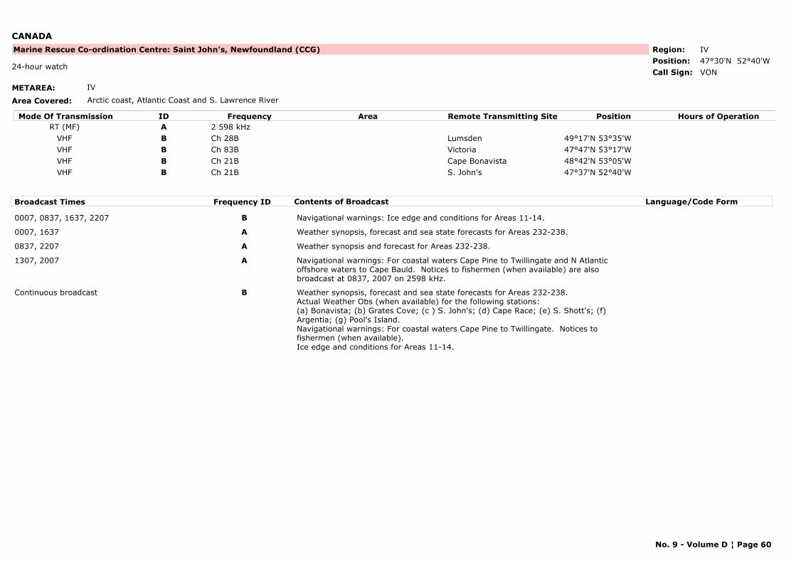
CANADA
METAREA: IV
Area Covered: Arctic coast, Atlantic Coast and S. Lawrence River
Region: IVPosition: 47°30'N 52°40'W
Marine Rescue Co-ordination Centre: Saint John's, Newfoundland (CCG)
VON24-hour watch
Call Sign:
Mode Of Transmission ID Frequency Area Position Hours of OperationRemote Transmitting SiteRT (MF) A 2 598 kHz
VHF B Ch 28B Lumsden 49°17'N 53°35'WVHF B Ch 83B Victoria 47°47'N 53°17'WVHF B Ch 21B Cape Bonavista 48°42'N 53°05'WVHF B Ch 21B S. John's 47°37'N 52°40'W
Broadcast Times Frequency ID Contents of Broadcast Language/Code Form
0007, 0837, 1637, 2207 B Navigational warnings: Ice edge and conditions for Areas 11-14.
0007, 1637 A Weather synopsis, forecast and sea state forecasts for Areas 232-238.
0837, 2207 A Weather synopsis and forecast for Areas 232-238.
1307, 2007 A Navigational warnings: For coastal waters Cape Pine to Twillingate and N Atlantic offshore waters to Cape Bauld. Notices to fishermen (when available) are also broadcast at 0837, 2007 on 2598 kHz.
Continuous broadcast B Weather synopsis, forecast and sea state forecasts for Areas 232-238. Actual Weather Obs (when available) for the following stations: (a) Bonavista; (b) Grates Cove; (c ) S. John's; (d) Cape Race; (e) S. Shott's; (f) Argentia; (g) Pool's Island.Navigational warnings: For coastal waters Cape Pine to Twillingate. Notices to fishermen (when available).Ice edge and conditions for Areas 11-14.
No. 9 - Volume D ¦ Page 60
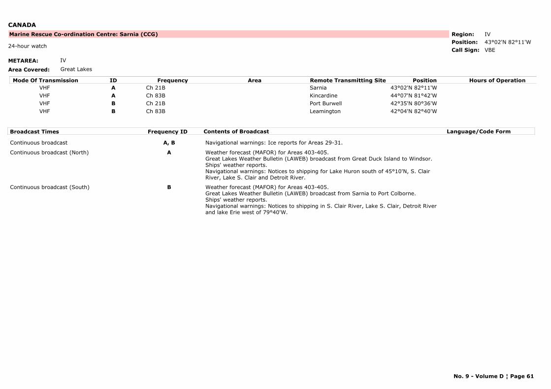
CANADA
METAREA: IV
Area Covered: Great Lakes
Region: IVPosition: 43°02'N 82°11'W
Marine Rescue Co-ordination Centre: Sarnia (CCG)
VBE24-hour watch
Call Sign:
Mode Of Transmission ID Frequency Area Position Hours of OperationRemote Transmitting SiteVHF A Ch 21B Sarnia 43°02'N 82°11'WVHF A Ch 83B Kincardine 44°07'N 81°42'WVHF B Ch 21B Port Burwell 42°35'N 80°36'WVHF B Ch 83B Leamington 42°04'N 82°40'W
Broadcast Times Frequency ID Contents of Broadcast Language/Code Form
Continuous broadcast A, B Navigational warnings: Ice reports for Areas 29-31.
Continuous broadcast (North) A Weather forecast (MAFOR) for Areas 403-405.Great Lakes Weather Bulletin (LAWEB) broadcast from Great Duck Island to Windsor.Ships' weather reports.Navigational warnings: Notices to shipping for Lake Huron south of 45°10'N, S. Clair River, Lake S. Clair and Detroit River.
Continuous broadcast (South) B Weather forecast (MAFOR) for Areas 403-405.Great Lakes Weather Bulletin (LAWEB) broadcast from Sarnia to Port Colborne.Ships' weather reports.Navigational warnings: Notices to shipping in S. Clair River, Lake S. Clair, Detroit River and lake Erie west of 79°40'W.
No. 9 - Volume D ¦ Page 61
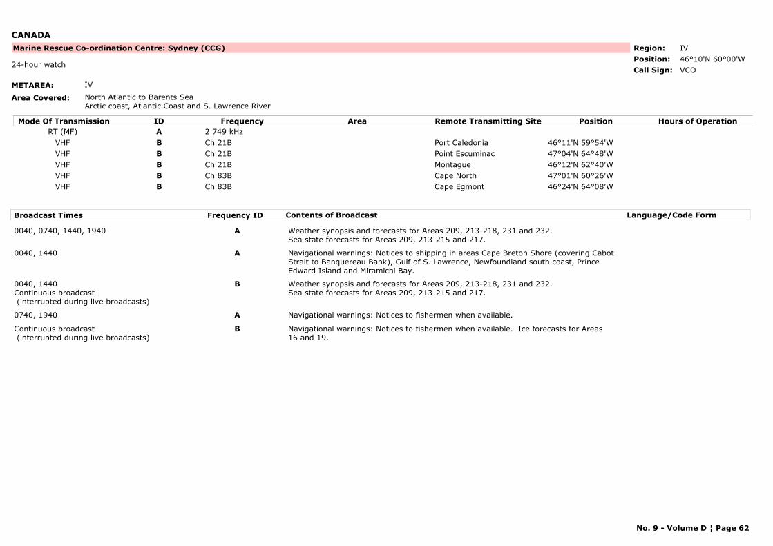
CANADA
METAREA: IV
Area Covered: North Atlantic to Barents SeaArctic coast, Atlantic Coast and S. Lawrence River
Region: IVPosition: 46°10'N 60°00'W
Marine Rescue Co-ordination Centre: Sydney (CCG)
VCO24-hour watch
Call Sign:
Mode Of Transmission ID Frequency Area Position Hours of OperationRemote Transmitting SiteRT (MF) A 2 749 kHz
VHF B Ch 21B Port Caledonia 46°11'N 59°54'WVHF B Ch 21B Point Escuminac 47°04'N 64°48'WVHF B Ch 21B Montague 46°12'N 62°40'WVHF B Ch 83B Cape North 47°01'N 60°26'WVHF B Ch 83B Cape Egmont 46°24'N 64°08'W
Broadcast Times Frequency ID Contents of Broadcast Language/Code Form
0040, 0740, 1440, 1940 A Weather synopsis and forecasts for Areas 209, 213-218, 231 and 232.Sea state forecasts for Areas 209, 213-215 and 217.
0040, 1440 A Navigational warnings: Notices to shipping in areas Cape Breton Shore (covering Cabot Strait to Banquereau Bank), Gulf of S. Lawrence, Newfoundland south coast, Prince Edward Island and Miramichi Bay.
0040, 1440Continuous broadcast (interrupted during live broadcasts)
B Weather synopsis and forecasts for Areas 209, 213-218, 231 and 232.Sea state forecasts for Areas 209, 213-215 and 217.
0740, 1940 A Navigational warnings: Notices to fishermen when available.
Continuous broadcast (interrupted during live broadcasts)
B Navigational warnings: Notices to fishermen when available. Ice forecasts for Areas 16 and 19.
No. 9 - Volume D ¦ Page 62
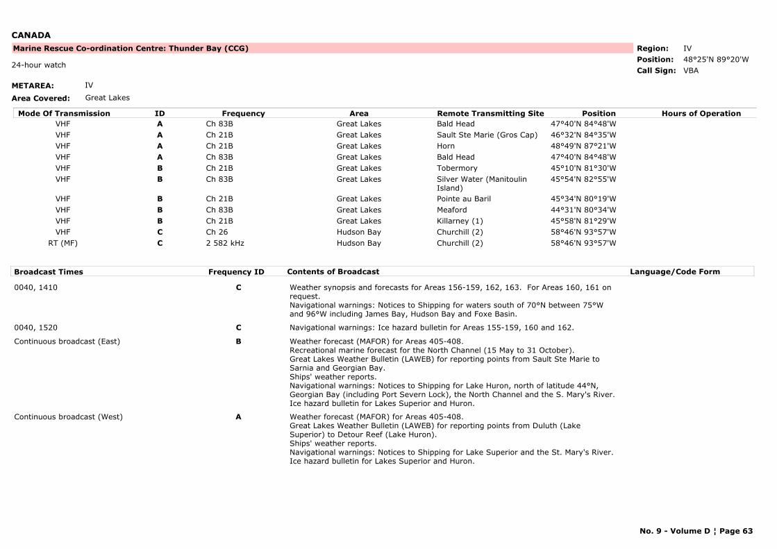
CANADA
METAREA: IV
Area Covered: Great Lakes
Region: IVPosition: 48°25'N 89°20'W
Marine Rescue Co-ordination Centre: Thunder Bay (CCG)
VBA24-hour watch
Call Sign:
Mode Of Transmission ID Frequency Area Position Hours of OperationRemote Transmitting SiteVHF A Ch 83B Great Lakes Bald Head 47°40'N 84°48'WVHF A Ch 21B Great Lakes Sault Ste Marie (Gros Cap) 46°32'N 84°35'WVHF A Ch 21B Great Lakes Horn 48°49'N 87°21'WVHF A Ch 83B Great Lakes Bald Head 47°40'N 84°48'WVHF B Ch 21B Great Lakes Tobermory 45°10'N 81°30'WVHF B Ch 83B Great Lakes Silver Water (Manitoulin
Island)45°54'N 82°55'W
VHF B Ch 21B Great Lakes Pointe au Baril 45°34'N 80°19'WVHF B Ch 83B Great Lakes Meaford 44°31'N 80°34'WVHF B Ch 21B Great Lakes Killarney (1) 45°58'N 81°29'WVHF C Ch 26 Hudson Bay Churchill (2) 58°46'N 93°57'W
RT (MF) C 2 582 kHz Hudson Bay Churchill (2) 58°46'N 93°57'W
Broadcast Times Frequency ID Contents of Broadcast Language/Code Form
0040, 1410 C Weather synopsis and forecasts for Areas 156-159, 162, 163. For Areas 160, 161 on request.Navigational warnings: Notices to Shipping for waters south of 70°N between 75°W and 96°W including James Bay, Hudson Bay and Foxe Basin.
0040, 1520 C Navigational warnings: Ice hazard bulletin for Areas 155-159, 160 and 162.
Continuous broadcast (East) B Weather forecast (MAFOR) for Areas 405-408.Recreational marine forecast for the North Channel (15 May to 31 October).Great Lakes Weather Bulletin (LAWEB) for reporting points from Sault Ste Marie to Sarnia and Georgian Bay.Ships' weather reports.Navigational warnings: Notices to Shipping for Lake Huron, north of latitude 44°N, Georgian Bay (including Port Severn Lock), the North Channel and the S. Mary's River.Ice hazard bulletin for Lakes Superior and Huron.
Continuous broadcast (West) A Weather forecast (MAFOR) for Areas 405-408.Great Lakes Weather Bulletin (LAWEB) for reporting points from Duluth (Lake Superior) to Detour Reef (Lake Huron).Ships' weather reports.Navigational warnings: Notices to Shipping for Lake Superior and the St. Mary's River.Ice hazard bulletin for Lakes Superior and Huron.
No. 9 - Volume D ¦ Page 63
CANADA
Note: When continuous broadcasts are not in service, scheduled broadcasts will be made at Traffic List times.
(1) Station in operation approximately from 1 April to 31 December.(2) Station in operation only during season of navigation (approximately from 1 July - 31 October)
No. 9 - Volume D ¦ Page 64
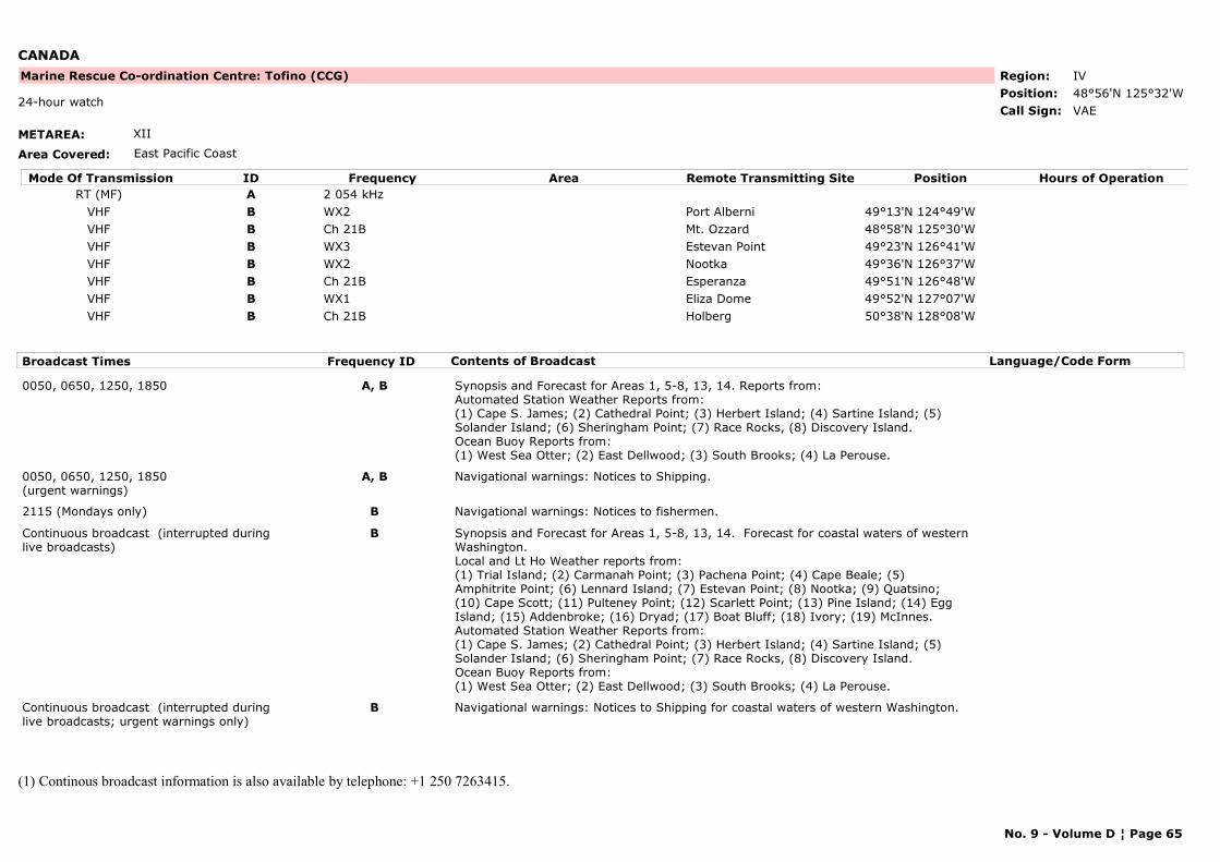
CANADA
METAREA: XII
Area Covered: East Pacific Coast
Region: IVPosition: 48°56'N 125°32'W
Marine Rescue Co-ordination Centre: Tofino (CCG)
VAE24-hour watch
Call Sign:
Mode Of Transmission ID Frequency Area Position Hours of OperationRemote Transmitting SiteRT (MF) A 2 054 kHz
VHF B WX2 Port Alberni 49°13'N 124°49'WVHF B Ch 21B Mt. Ozzard 48°58'N 125°30'WVHF B WX3 Estevan Point 49°23'N 126°41'WVHF B WX2 Nootka 49°36'N 126°37'WVHF B Ch 21B Esperanza 49°51'N 126°48'WVHF B WX1 Eliza Dome 49°52'N 127°07'WVHF B Ch 21B Holberg 50°38'N 128°08'W
Broadcast Times Frequency ID Contents of Broadcast Language/Code Form
0050, 0650, 1250, 1850 A, B Synopsis and Forecast for Areas 1, 5-8, 13, 14. Reports from:Automated Station Weather Reports from: (1) Cape S. James; (2) Cathedral Point; (3) Herbert Island; (4) Sartine Island; (5) Solander Island; (6) Sheringham Point; (7) Race Rocks, (8) Discovery Island.Ocean Buoy Reports from:(1) West Sea Otter; (2) East Dellwood; (3) South Brooks; (4) La Perouse.
0050, 0650, 1250, 1850(urgent warnings)
A, B Navigational warnings: Notices to Shipping.
2115 (Mondays only) B Navigational warnings: Notices to fishermen.
Continuous broadcast (interrupted during live broadcasts)
B Synopsis and Forecast for Areas 1, 5-8, 13, 14. Forecast for coastal waters of western Washington. Local and Lt Ho Weather reports from:(1) Trial Island; (2) Carmanah Point; (3) Pachena Point; (4) Cape Beale; (5) Amphitrite Point; (6) Lennard Island; (7) Estevan Point; (8) Nootka; (9) Quatsino; (10) Cape Scott; (11) Pulteney Point; (12) Scarlett Point; (13) Pine Island; (14) Egg Island; (15) Addenbroke; (16) Dryad; (17) Boat Bluff; (18) Ivory; (19) McInnes.Automated Station Weather Reports from: (1) Cape S. James; (2) Cathedral Point; (3) Herbert Island; (4) Sartine Island; (5) Solander Island; (6) Sheringham Point; (7) Race Rocks, (8) Discovery Island.Ocean Buoy Reports from:(1) West Sea Otter; (2) East Dellwood; (3) South Brooks; (4) La Perouse.
Continuous broadcast (interrupted during live broadcasts; urgent warnings only)
B Navigational warnings: Notices to Shipping for coastal waters of western Washington.
(1) Continous broadcast information is also available by telephone: +1 250 7263415.
No. 9 - Volume D ¦ Page 65
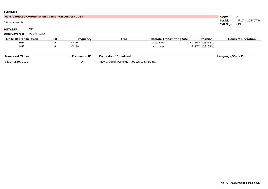
CANADA
METAREA: XII
Area Covered: Pacific coast
Region: IVPosition: 49°17'N 123°07'W
Marine Rescue Co-ordination Centre: Vancouver (CCG)
VAS24-hour watch
Call Sign:
Mode Of Transmission ID Frequency Area Position Hours of OperationRemote Transmitting SiteVHF A Ch 26 Watts Point 49°39'N 123°13'WVHF A Ch 26 Vancouver 49°17'N 123°07'W
Broadcast Times Frequency ID Contents of Broadcast Language/Code Form
0530, 1530, 2130 A Navigational warnings: Notices to Shipping.
No. 9 - Volume D ¦ Page 66
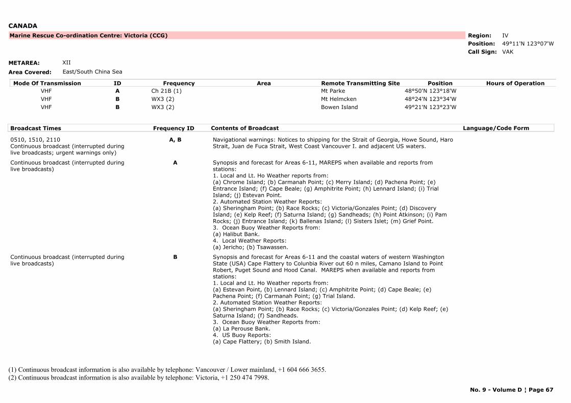
CANADA
METAREA: XII
Area Covered: East/South China Sea
Region: IVPosition: 49°11'N 123°07'W
Marine Rescue Co-ordination Centre: Victoria (CCG)
VAKCall Sign:
Mode Of Transmission ID Frequency Area Position Hours of OperationRemote Transmitting SiteVHF A Ch 21B (1) Mt Parke 48°50'N 123°18'WVHF B WX3 (2) Mt Helmcken 48°24'N 123°34'WVHF B WX3 (2) Bowen Island 49°21'N 123°23'W
Broadcast Times Frequency ID Contents of Broadcast Language/Code Form
0510, 1510, 2110Continuous broadcast (interrupted during live broadcasts; urgent warnings only)
A, B Navigational warnings: Notices to shipping for the Strait of Georgia, Howe Sound, Haro Strait, Juan de Fuca Strait, West Coast Vancouver I. and adjacent US waters.
Continuous broadcast (interrupted during live broadcasts)
A Synopsis and forecast for Areas 6-11, MAREPS when available and reports from stations: 1. Local and Lt. Ho Weather reports from:(a) Chrome Island; (b) Carmanah Point; (c) Merry Island; (d) Pachena Point; (e) Entrance Island; (f) Cape Beale; (g) Amphitrite Point; (h) Lennard Island; (i) Trial Island; (j) Estevan Point.2. Automated Station Weather Reports:(a) Sheringham Point; (b) Race Rocks; (c) Victoria/Gonzales Point; (d) Discovery Island; (e) Kelp Reef; (f) Saturna Island; (g) Sandheads; (h) Point Atkinson; (i) Pam Rocks; (j) Entrance Island; (k) Ballenas Island; (l) Sisters Islet; (m) Grief Point.3. Ocean Buoy Weather Reports from: (a) Halibut Bank.4. Local Weather Reports:(a) Jericho; (b) Tsawassen.
Continuous broadcast (interrupted during live broadcasts)
B Synopsis and forecast for Areas 6-11 and the coastal waters of western Washington State (USA) Cape Flattery to Colunbia River out 60 n miles, Camano Island to Point Robert, Puget Sound and Hood Canal. MAREPS when available and reports from stations: 1. Local and Lt. Ho Weather reports from:(a) Estevan Point, (b) Lennard Island; (c) Amphitrite Point; (d) Cape Beale; (e) Pachena Point; (f) Carmanah Point; (g) Trial Island.2. Automated Station Weather Reports:(a) Sheringham Point; (b) Race Rocks; (c) Victoria/Gonzales Point; (d) Kelp Reef; (e) Saturna Island; (f) Sandheads.3. Ocean Buoy Weather Reports from: (a) La Perouse Bank.4. US Buoy Reports:(a) Cape Flattery; (b) Smith Island.
(1) Continuous broadcast information is also available by telephone: Vancouver / Lower mainland, +1 604 666 3655.(2) Continuous broadcast information is also available by telephone: Victoria, +1 250 474 7998.
No. 9 - Volume D ¦ Page 67
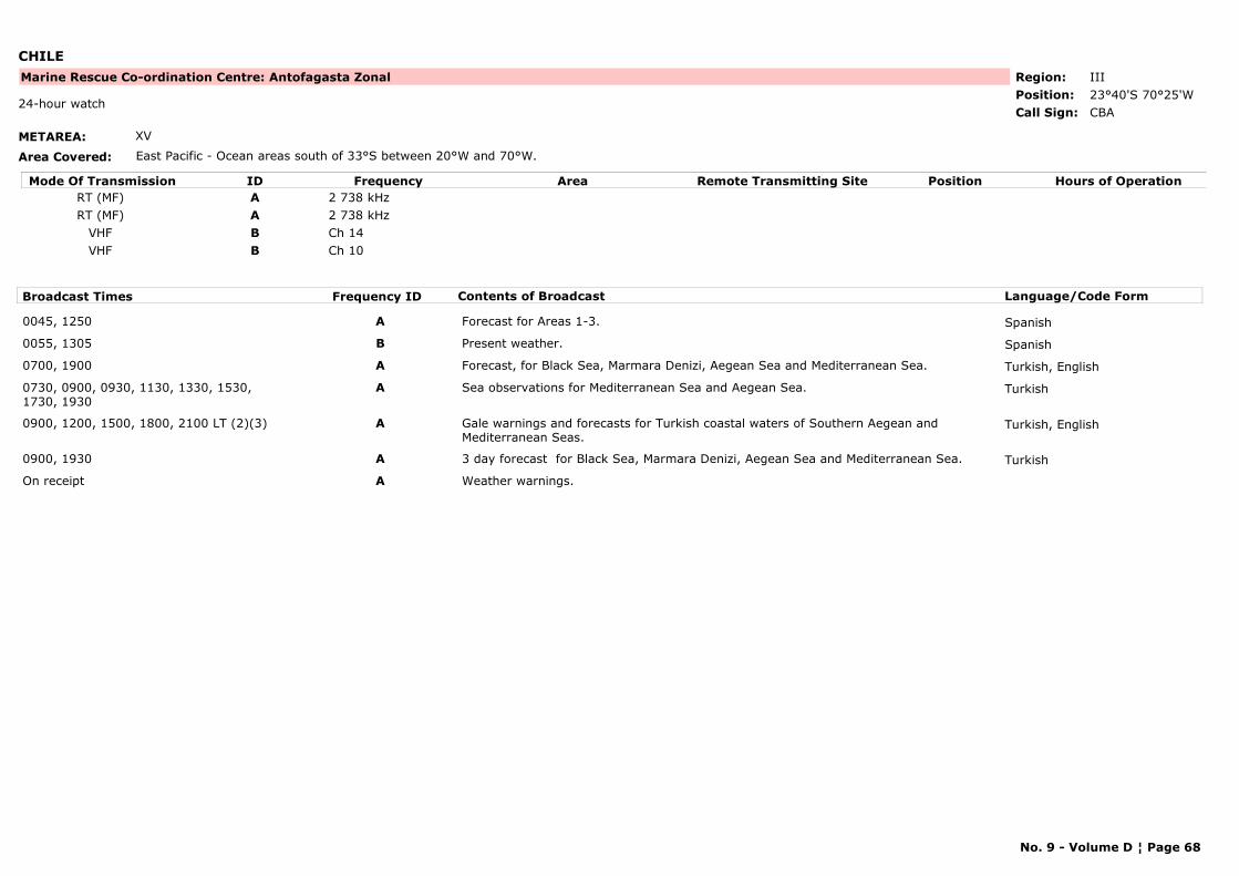
CHILE
METAREA: XV
Area Covered: East Pacific - Ocean areas south of 33°S between 20°W and 70°W.
Region: IIIPosition: 23°40'S 70°25'W
Marine Rescue Co-ordination Centre: Antofagasta Zonal
CBA24-hour watch
Call Sign:
Mode Of Transmission ID Frequency Area Position Hours of OperationRemote Transmitting SiteRT (MF) A 2 738 kHzRT (MF) A 2 738 kHz
VHF B Ch 14VHF B Ch 10
Broadcast Times Frequency ID Contents of Broadcast Language/Code Form
0045, 1250 A Forecast for Areas 1-3. Spanish
0055, 1305 B Present weather. Spanish
0700, 1900 A Forecast, for Black Sea, Marmara Denizi, Aegean Sea and Mediterranean Sea. Turkish, English
0730, 0900, 0930, 1130, 1330, 1530, 1730, 1930
A Sea observations for Mediterranean Sea and Aegean Sea. Turkish
0900, 1200, 1500, 1800, 2100 LT (2)(3) A Gale warnings and forecasts for Turkish coastal waters of Southern Aegean and Mediterranean Seas.
Turkish, English
0900, 1930 A 3 day forecast for Black Sea, Marmara Denizi, Aegean Sea and Mediterranean Sea. Turkish
On receipt A Weather warnings.
No. 9 - Volume D ¦ Page 68

CHILE
METAREA: XV
Area Covered: Ocean areas south of 33°S between 20°W and 70°W.
Region: IIIPosition: 18°29'S 70°20'W
Marine Rescue Co-ordination Centre: Arica Radio
CBACall Sign:
Mode Of Transmission ID Frequency Area Position Hours of OperationRemote Transmitting SiteRT (MF) A 2 738 kHz
VHF B Ch 14
Broadcast Times Frequency ID Contents of Broadcast Language/Code Form
0045, 1245 A Forecast for Areas 1. Spanish
0050, 1255 B Forecast for Areas 1. Spanish
No. 9 - Volume D ¦ Page 69
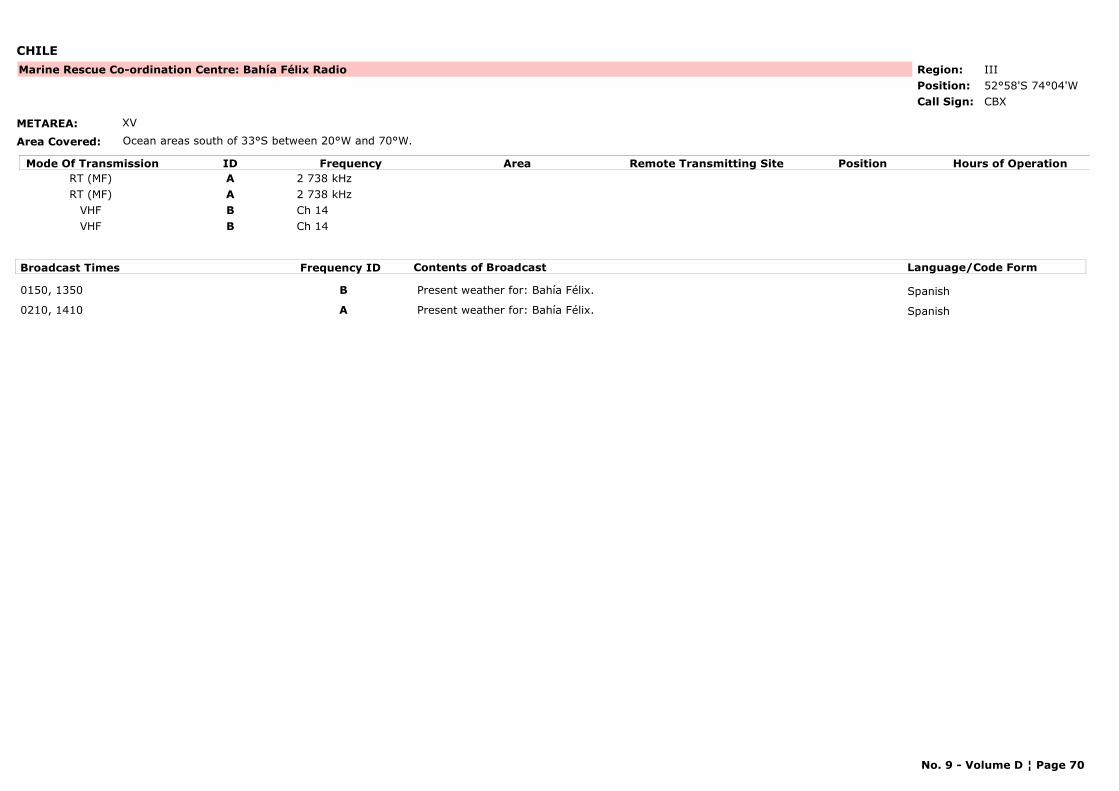
CHILE
METAREA: XV
Area Covered: Ocean areas south of 33°S between 20°W and 70°W.
Region: IIIPosition: 52°58'S 74°04'W
Marine Rescue Co-ordination Centre: Bahía Félix Radio
CBXCall Sign:
Mode Of Transmission ID Frequency Area Position Hours of OperationRemote Transmitting SiteRT (MF) A 2 738 kHzRT (MF) A 2 738 kHz
VHF B Ch 14VHF B Ch 14
Broadcast Times Frequency ID Contents of Broadcast Language/Code Form
0150, 1350 B Present weather for: Bahía Félix. Spanish
0210, 1410 A Present weather for: Bahía Félix. Spanish
No. 9 - Volume D ¦ Page 70
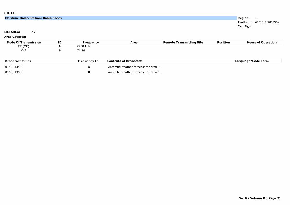
CHILE
METAREA: XV
Area Covered:
Region: IIIPosition: 62°11'S 58°55'WCall Sign:
Maritime Radio Station: Bahía Fildes
Mode Of Transmission ID Frequency Area Position Hours of OperationRemote Transmitting SiteRT (MF) A 2738 kHz
VHF B Ch 14
Broadcast Times Frequency ID Contents of Broadcast Language/Code Form
0150, 1350 A Antarctic weather forecast for area 9.
0155, 1355 B Antarctic weather forecast for area 9.
No. 9 - Volume D ¦ Page 71
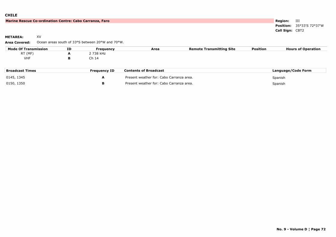
CHILE
METAREA: XV
Area Covered: Ocean areas south of 33°S between 20°W and 70°W.
Region: IIIPosition: 35°33'S 72°37'W
Marine Rescue Co-ordination Centre: Cabo Carranza, Faro
CBT2Call Sign:
Mode Of Transmission ID Frequency Area Position Hours of OperationRemote Transmitting SiteRT (MF) A 2 738 kHz
VHF B Ch 14
Broadcast Times Frequency ID Contents of Broadcast Language/Code Form
0145, 1345 A Present weather for: Cabo Carranza area. Spanish
0150, 1350 B Present weather for: Cabo Carranza area. Spanish
No. 9 - Volume D ¦ Page 72

CHILE
METAREA: XV
Area Covered: Ocean areas south of 33°S between 20°W and 70°W.
Region: IIIPosition: 46°49'S 75°38'W
Marine Rescue Co-ordination Centre: Cabo Raper, Faro
CBM2Call Sign:
Mode Of Transmission ID Frequency Area Position Hours of OperationRemote Transmitting SiteRT (MF) A 2 738 kHz
VHF B Ch 14
Broadcast Times Frequency ID Contents of Broadcast Language/Code Form
0040, 0640, 1240, 1840 A Present weather for: Cabo Cabo Raper area. Spanish
0045, 0645, 1245, 1845 B Present weather for: Cabo Cabo Raper area. Spanish
No. 9 - Volume D ¦ Page 73

CHILE
METAREA: XV
Area Covered: Ocean areas south of 33°S between 20°W and 70°W.
Region: IIIPosition: 27°04'S 70°50'W
Marine Rescue Co-ordination Centre: Caldera
CBACall Sign:
Mode Of Transmission ID Frequency Area Position Hours of OperationRemote Transmitting SiteRT (MF) A 2 738 kHz
VHF B Ch 14
Broadcast Times Frequency ID Contents of Broadcast Language/Code Form
0055, 1255 A Forecast for areas 1 & 2. Spanish
0105, 1305 B Forecast for areas 1 & 2. Spanish
No. 9 - Volume D ¦ Page 74
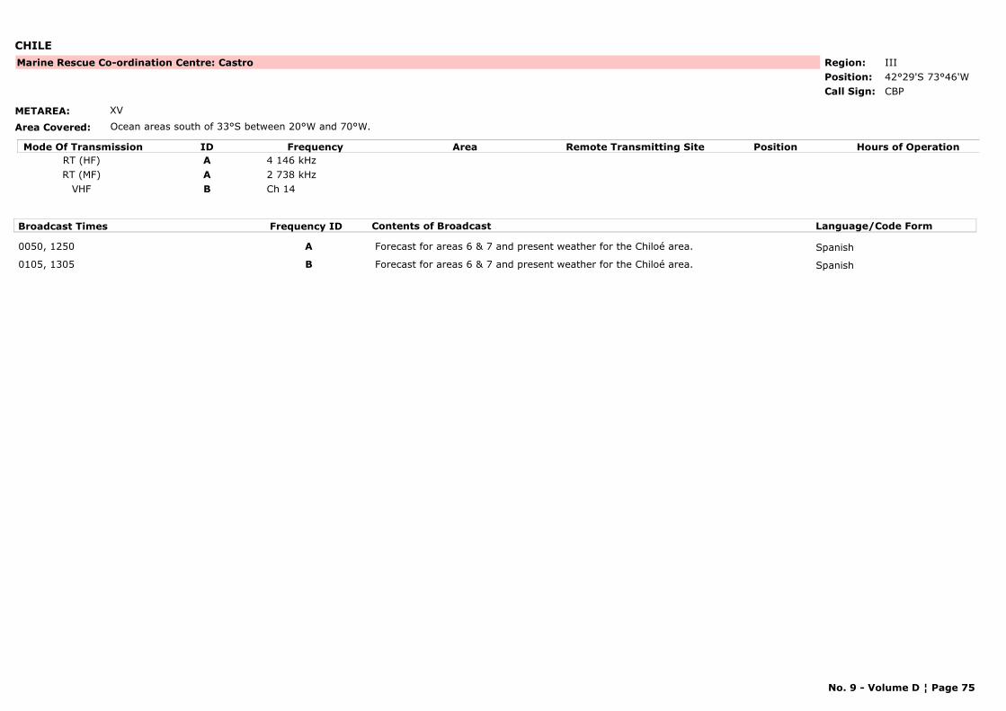
CHILE
METAREA: XV
Area Covered: Ocean areas south of 33°S between 20°W and 70°W.
Region: IIIPosition: 42°29'S 73°46'W
Marine Rescue Co-ordination Centre: Castro
CBPCall Sign:
Mode Of Transmission ID Frequency Area Position Hours of OperationRemote Transmitting SiteRT (HF) A 4 146 kHzRT (MF) A 2 738 kHz
VHF B Ch 14
Broadcast Times Frequency ID Contents of Broadcast Language/Code Form
0050, 1250 A Forecast for areas 6 & 7 and present weather for the Chiloé area. Spanish
0105, 1305 B Forecast for areas 6 & 7 and present weather for the Chiloé area. Spanish
No. 9 - Volume D ¦ Page 75
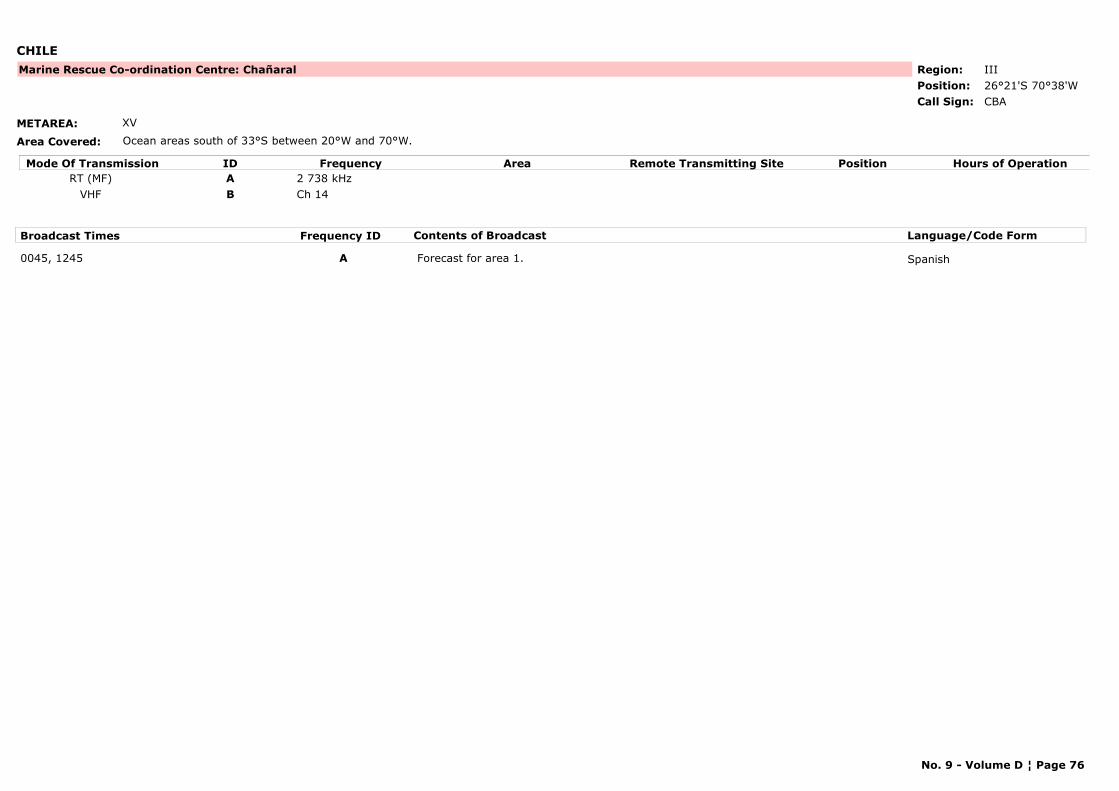
CHILE
METAREA: XV
Area Covered: Ocean areas south of 33°S between 20°W and 70°W.
Region: IIIPosition: 26°21'S 70°38'W
Marine Rescue Co-ordination Centre: Chañaral
CBACall Sign:
Mode Of Transmission ID Frequency Area Position Hours of OperationRemote Transmitting SiteRT (MF) A 2 738 kHz
VHF B Ch 14
Broadcast Times Frequency ID Contents of Broadcast Language/Code Form
0045, 1245 A Forecast for area 1. Spanish
No. 9 - Volume D ¦ Page 76
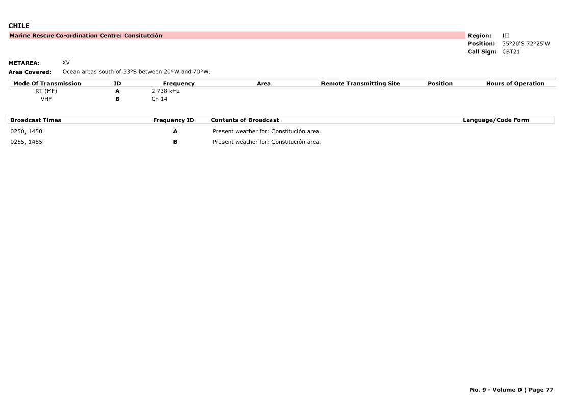
CHILE
METAREA: XV
Area Covered: Ocean areas south of 33°S between 20°W and 70°W.
Region: IIIPosition: 35°20'S 72°25'W
Marine Rescue Co-ordination Centre: Consitutción
CBT21Call Sign:
Mode Of Transmission ID Frequency Area Position Hours of OperationRemote Transmitting SiteRT (MF) A 2 738 kHz
VHF B Ch 14
Broadcast Times Frequency ID Contents of Broadcast Language/Code Form
0250, 1450 A Present weather for: Constitución area.
0255, 1455 B Present weather for: Constitución area.
No. 9 - Volume D ¦ Page 77

CHILE
METAREA: XV
Area Covered: Ocean areas south of 33°S between 20°W and 70°W.
Region: IIIPosition: 29°57'S 71°20'W
Marine Rescue Co-ordination Centre: Coquimbo
CBACall Sign:
Mode Of Transmission ID Frequency Area Position Hours of OperationRemote Transmitting SiteRT (MF) A 2 738 kHz
VHF B Ch 14
Broadcast Times Frequency ID Contents of Broadcast Language/Code Form
0045, 1245 A Forecast for area 1 & 2. Spanish
0055, 1255 B Forecast for area 1 & 2. Spanish
No. 9 - Volume D ¦ Page 78
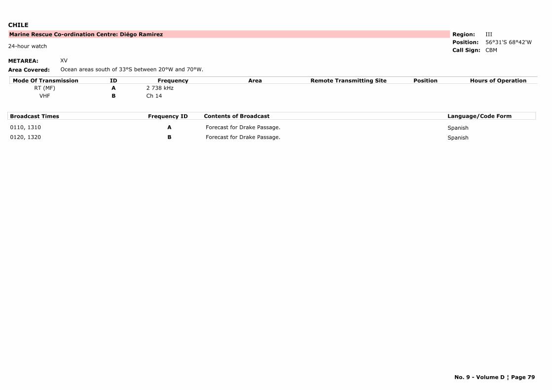
CHILE
METAREA: XV
Area Covered: Ocean areas south of 33°S between 20°W and 70°W.
Region: IIIPosition: 56°31'S 68°42'W
Marine Rescue Co-ordination Centre: Diégo Ramirez
CBM24-hour watch
Call Sign:
Mode Of Transmission ID Frequency Area Position Hours of OperationRemote Transmitting SiteRT (MF) A 2 738 kHz
VHF B Ch 14
Broadcast Times Frequency ID Contents of Broadcast Language/Code Form
0110, 1310 A Forecast for Drake Passage. Spanish
0120, 1320 B Forecast for Drake Passage. Spanish
No. 9 - Volume D ¦ Page 79
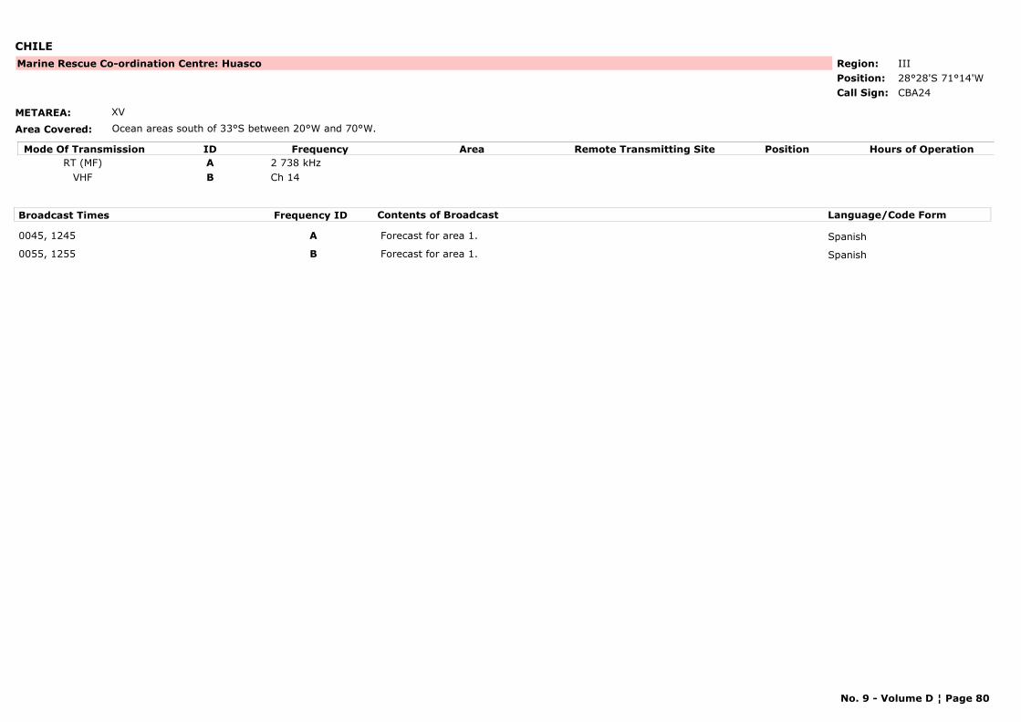
CHILE
METAREA: XV
Area Covered: Ocean areas south of 33°S between 20°W and 70°W.
Region: IIIPosition: 28°28'S 71°14'W
Marine Rescue Co-ordination Centre: Huasco
CBA24Call Sign:
Mode Of Transmission ID Frequency Area Position Hours of OperationRemote Transmitting SiteRT (MF) A 2 738 kHz
VHF B Ch 14
Broadcast Times Frequency ID Contents of Broadcast Language/Code Form
0045, 1245 A Forecast for area 1. Spanish
0055, 1255 B Forecast for area 1. Spanish
No. 9 - Volume D ¦ Page 80
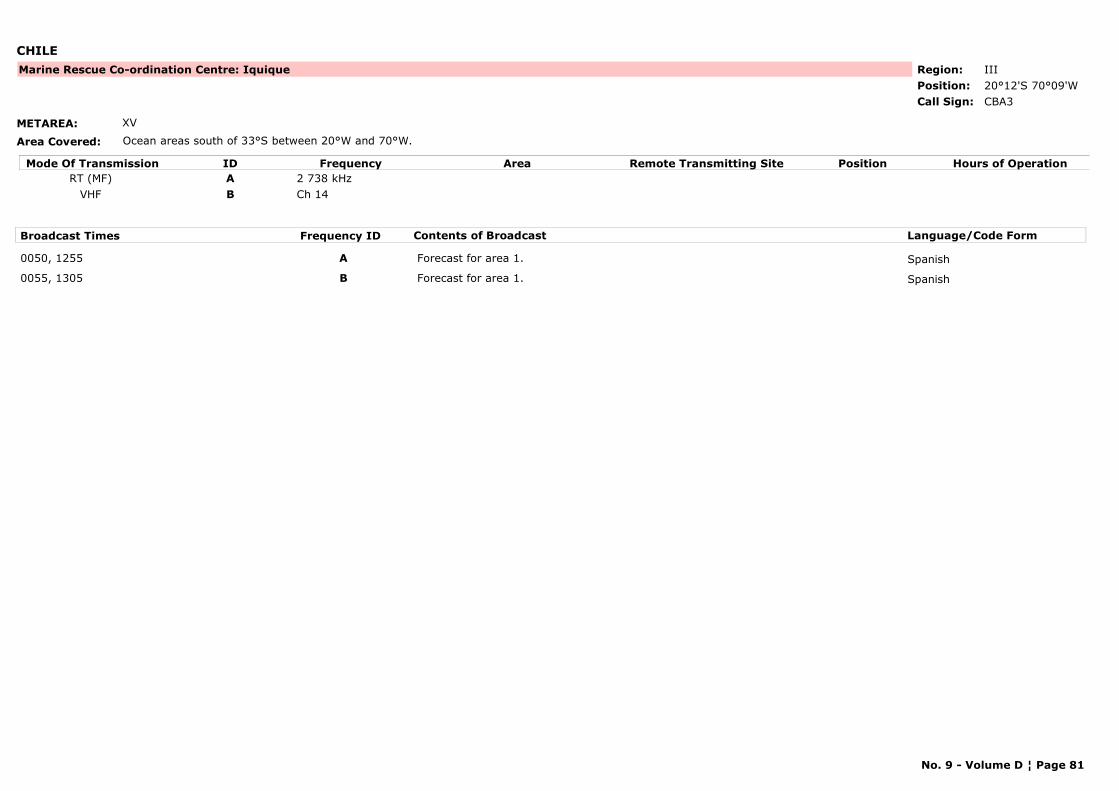
CHILE
METAREA: XV
Area Covered: Ocean areas south of 33°S between 20°W and 70°W.
Region: IIIPosition: 20°12'S 70°09'W
Marine Rescue Co-ordination Centre: Iquique
CBA3Call Sign:
Mode Of Transmission ID Frequency Area Position Hours of OperationRemote Transmitting SiteRT (MF) A 2 738 kHz
VHF B Ch 14
Broadcast Times Frequency ID Contents of Broadcast Language/Code Form
0050, 1255 A Forecast for area 1. Spanish
0055, 1305 B Forecast for area 1. Spanish
No. 9 - Volume D ¦ Page 81
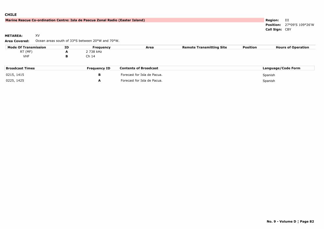
CHILE
METAREA: XV
Area Covered: Ocean areas south of 33°S between 20°W and 70°W.
Region: IIIPosition: 27°09'S 109°26'W
Marine Rescue Co-ordination Centre: Isla de Pascua Zonal Radio (Easter Island)
CBYCall Sign:
Mode Of Transmission ID Frequency Area Position Hours of OperationRemote Transmitting SiteRT (MF) A 2 738 kHz
VHF B Ch 14
Broadcast Times Frequency ID Contents of Broadcast Language/Code Form
0215, 1415 B Forecast for Isla de Pacua. Spanish
0225, 1425 A Forecast for Isla de Pacua. Spanish
No. 9 - Volume D ¦ Page 82
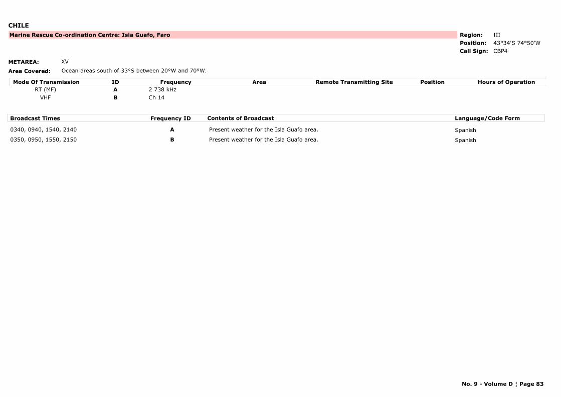
CHILE
METAREA: XV
Area Covered: Ocean areas south of 33°S between 20°W and 70°W.
Region: IIIPosition: 43°34'S 74°50'W
Marine Rescue Co-ordination Centre: Isla Guafo, Faro
CBP4Call Sign:
Mode Of Transmission ID Frequency Area Position Hours of OperationRemote Transmitting SiteRT (MF) A 2 738 kHz
VHF B Ch 14
Broadcast Times Frequency ID Contents of Broadcast Language/Code Form
0340, 0940, 1540, 2140 A Present weather for the Isla Guafo area. Spanish
0350, 0950, 1550, 2150 B Present weather for the Isla Guafo area. Spanish
No. 9 - Volume D ¦ Page 83
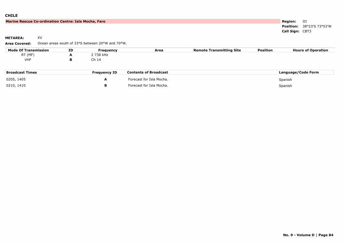
CHILE
METAREA: XV
Area Covered: Ocean areas south of 33°S between 20°W and 70°W.
Region: IIIPosition: 38°23'S 73°53'W
Marine Rescue Co-ordination Centre: Isla Mocha, Faro
CBT3Call Sign:
Mode Of Transmission ID Frequency Area Position Hours of OperationRemote Transmitting SiteRT (MF) A 2 738 kHz
VHF B Ch 14
Broadcast Times Frequency ID Contents of Broadcast Language/Code Form
0205, 1405 A Forecast for Isla Mocha. Spanish
0210, 1410 B Forecast for Isla Mocha. Spanish
No. 9 - Volume D ¦ Page 84
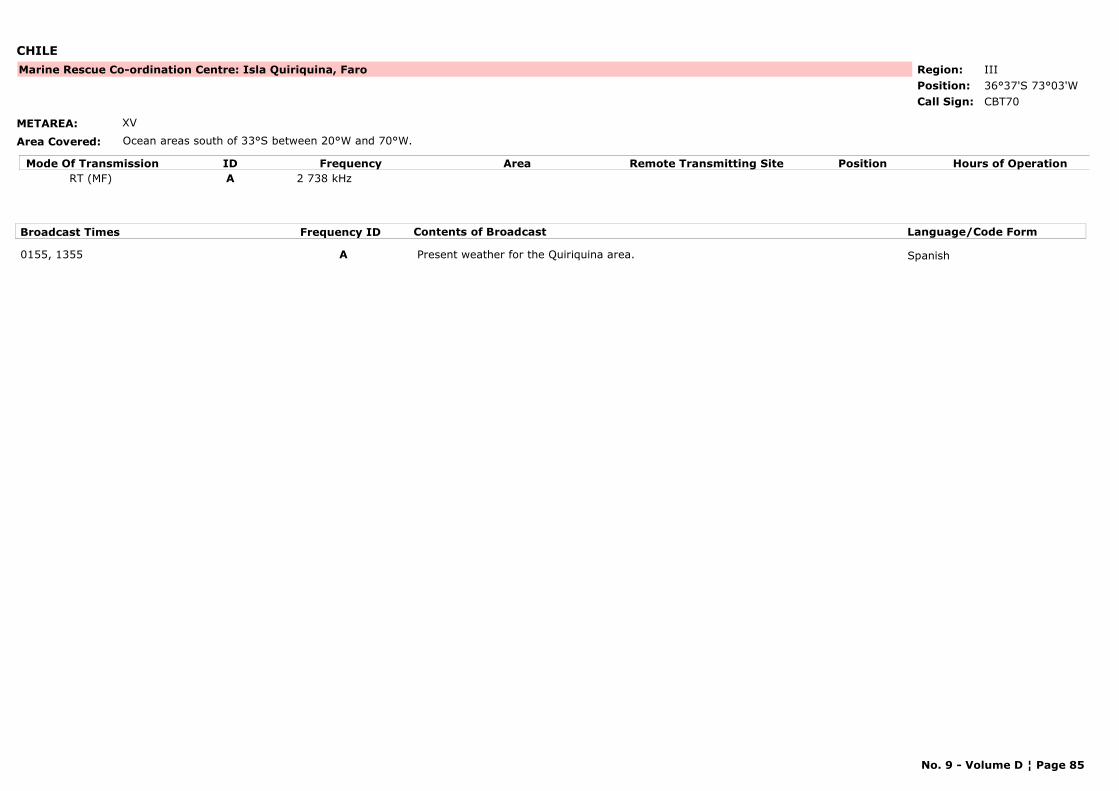
CHILE
METAREA: XV
Area Covered: Ocean areas south of 33°S between 20°W and 70°W.
Region: IIIPosition: 36°37'S 73°03'W
Marine Rescue Co-ordination Centre: Isla Quiriquina, Faro
CBT70Call Sign:
Mode Of Transmission ID Frequency Area Position Hours of OperationRemote Transmitting SiteRT (MF) A 2 738 kHz
Broadcast Times Frequency ID Contents of Broadcast Language/Code Form
0155, 1355 A Present weather for the Quiriquina area. Spanish
No. 9 - Volume D ¦ Page 85
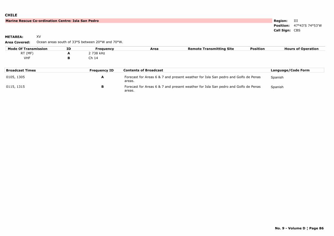
CHILE
METAREA: XV
Area Covered: Ocean areas south of 33°S between 20°W and 70°W.
Region: IIIPosition: 47°43'S 74°53'W
Marine Rescue Co-ordination Centre: Isla San Pedro
CBSCall Sign:
Mode Of Transmission ID Frequency Area Position Hours of OperationRemote Transmitting SiteRT (MF) A 2 738 kHz
VHF B Ch 14
Broadcast Times Frequency ID Contents of Broadcast Language/Code Form
0105, 1305 A Forecast for Areas 6 & 7 and present weather for Isla San pedro and Golfo de Penas areas.
Spanish
0115, 1315 B Forecast for Areas 6 & 7 and present weather for Isla San pedro and Golfo de Penas areas.
Spanish
No. 9 - Volume D ¦ Page 86
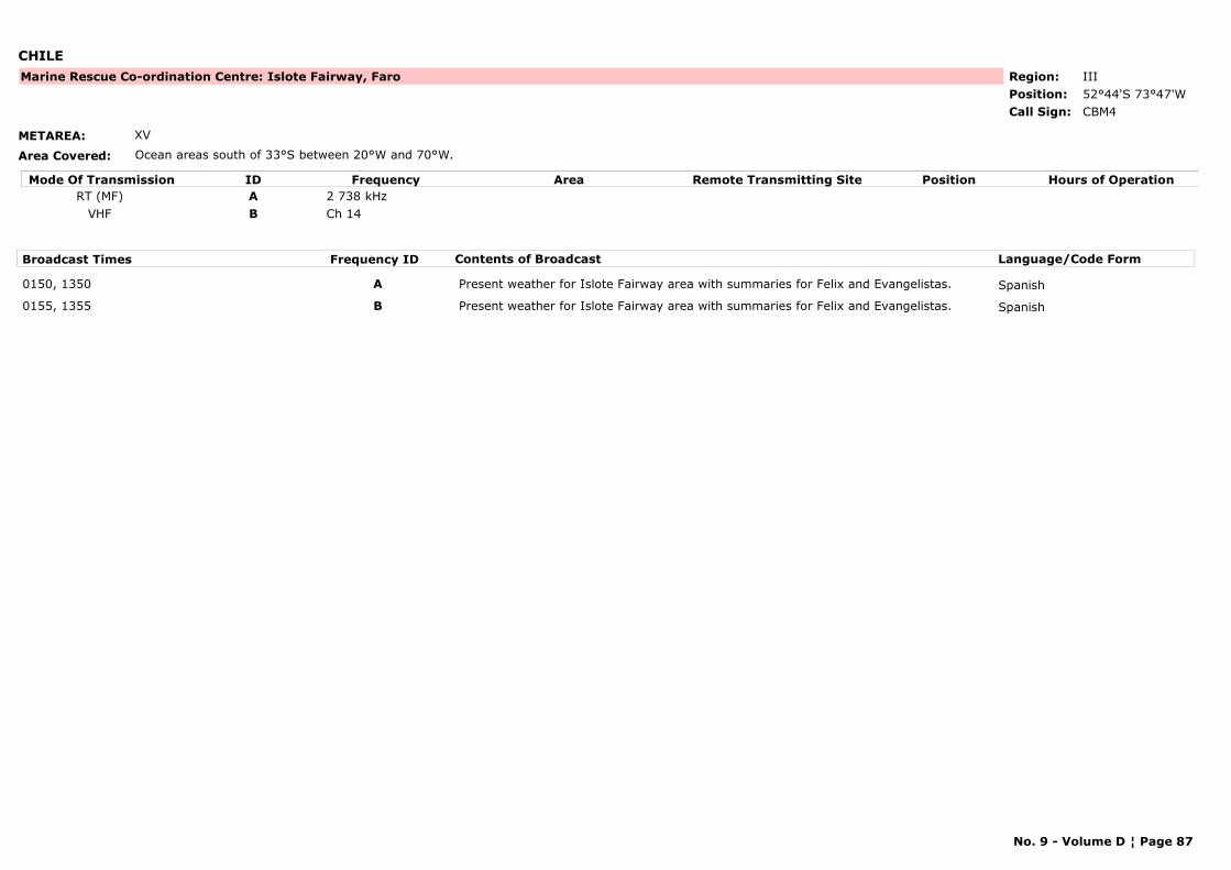
CHILE
METAREA: XV
Area Covered: Ocean areas south of 33°S between 20°W and 70°W.
Region: IIIPosition: 52°44'S 73°47'W
Marine Rescue Co-ordination Centre: Islote Fairway, Faro
CBM4Call Sign:
Mode Of Transmission ID Frequency Area Position Hours of OperationRemote Transmitting SiteRT (MF) A 2 738 kHz
VHF B Ch 14
Broadcast Times Frequency ID Contents of Broadcast Language/Code Form
0150, 1350 A Present weather for Islote Fairway area with summaries for Felix and Evangelistas. Spanish
0155, 1355 B Present weather for Islote Fairway area with summaries for Felix and Evangelistas. Spanish
No. 9 - Volume D ¦ Page 87
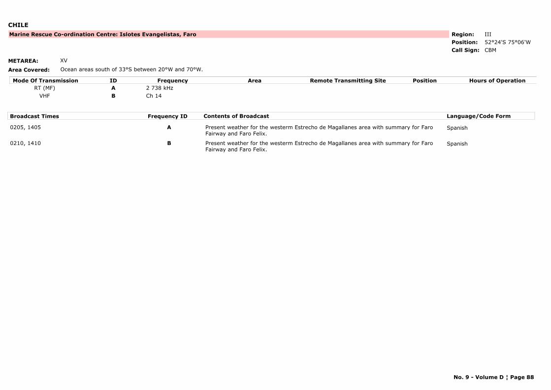
CHILE
METAREA: XV
Area Covered: Ocean areas south of 33°S between 20°W and 70°W.
Region: IIIPosition: 52°24'S 75°06'W
Marine Rescue Co-ordination Centre: Islotes Evangelistas, Faro
CBMCall Sign:
Mode Of Transmission ID Frequency Area Position Hours of OperationRemote Transmitting SiteRT (MF) A 2 738 kHz
VHF B Ch 14
Broadcast Times Frequency ID Contents of Broadcast Language/Code Form
0205, 1405 A Present weather for the westerm Estrecho de Magallanes area with summary for Faro Fairway and Faro Felix.
Spanish
0210, 1410 B Present weather for the westerm Estrecho de Magallanes area with summary for Faro Fairway and Faro Felix.
Spanish
No. 9 - Volume D ¦ Page 88
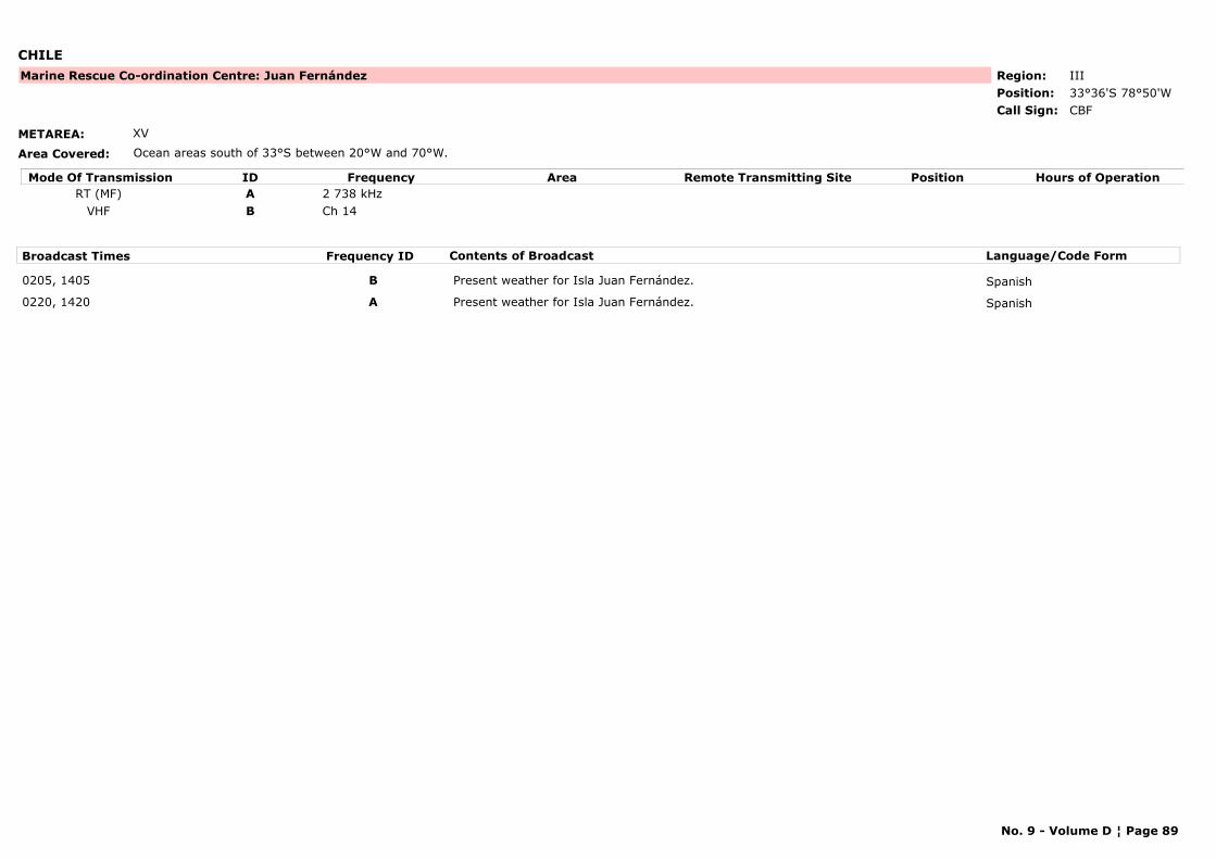
CHILE
METAREA: XV
Area Covered: Ocean areas south of 33°S between 20°W and 70°W.
Region: IIIPosition: 33°36'S 78°50'W
Marine Rescue Co-ordination Centre: Juan Fernández
CBFCall Sign:
Mode Of Transmission ID Frequency Area Position Hours of OperationRemote Transmitting SiteRT (MF) A 2 738 kHz
VHF B Ch 14
Broadcast Times Frequency ID Contents of Broadcast Language/Code Form
0205, 1405 B Present weather for Isla Juan Fernández. Spanish
0220, 1420 A Present weather for Isla Juan Fernández. Spanish
No. 9 - Volume D ¦ Page 89
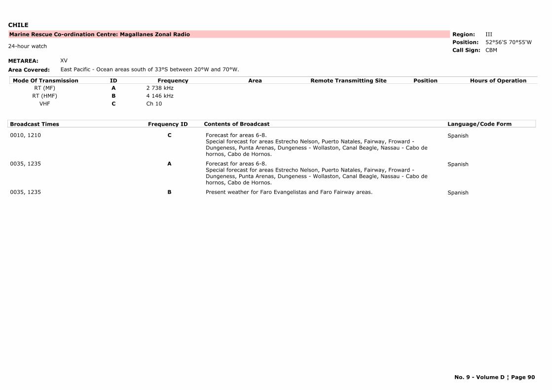
CHILE
METAREA: XV
Area Covered: East Pacific - Ocean areas south of 33°S between 20°W and 70°W.
Region: IIIPosition: 52°56'S 70°55'W
Marine Rescue Co-ordination Centre: Magallanes Zonal Radio
CBM24-hour watch
Call Sign:
Mode Of Transmission ID Frequency Area Position Hours of OperationRemote Transmitting SiteRT (MF) A 2 738 kHz
RT (HMF) B 4 146 kHzVHF C Ch 10
Broadcast Times Frequency ID Contents of Broadcast Language/Code Form
0010, 1210 C Forecast for areas 6-8. Special forecast for areas Estrecho Nelson, Puerto Natales, Fairway, Froward - Dungeness, Punta Arenas, Dungeness - Wollaston, Canal Beagle, Nassau - Cabo de hornos, Cabo de Hornos.
Spanish
0035, 1235 A Forecast for areas 6-8. Special forecast for areas Estrecho Nelson, Puerto Natales, Fairway, Froward - Dungeness, Punta Arenas, Dungeness - Wollaston, Canal Beagle, Nassau - Cabo de hornos, Cabo de Hornos.
Spanish
0035, 1235 B Present weather for Faro Evangelistas and Faro Fairway areas. Spanish
No. 9 - Volume D ¦ Page 90
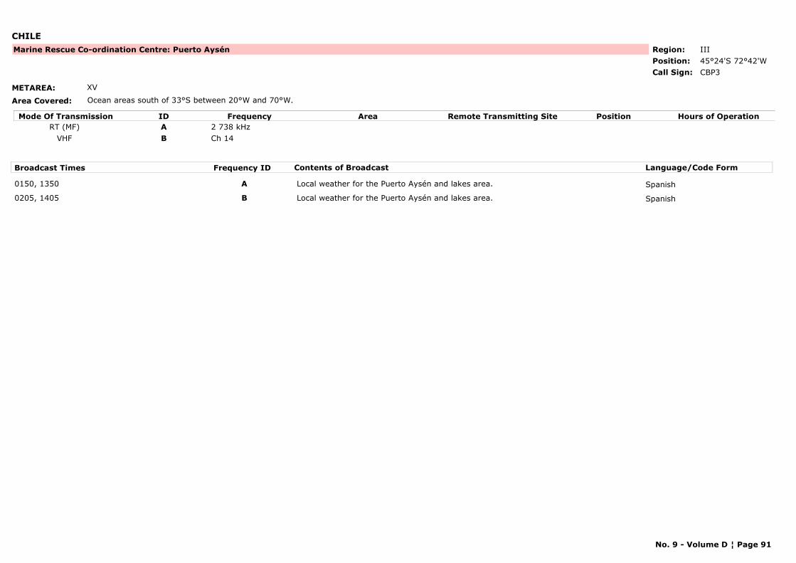
CHILE
METAREA: XV
Area Covered: Ocean areas south of 33°S between 20°W and 70°W.
Region: IIIPosition: 45°24'S 72°42'W
Marine Rescue Co-ordination Centre: Puerto Aysén
CBP3Call Sign:
Mode Of Transmission ID Frequency Area Position Hours of OperationRemote Transmitting SiteRT (MF) A 2 738 kHz
VHF B Ch 14
Broadcast Times Frequency ID Contents of Broadcast Language/Code Form
0150, 1350 A Local weather for the Puerto Aysén and lakes area. Spanish
0205, 1405 B Local weather for the Puerto Aysén and lakes area. Spanish
No. 9 - Volume D ¦ Page 91
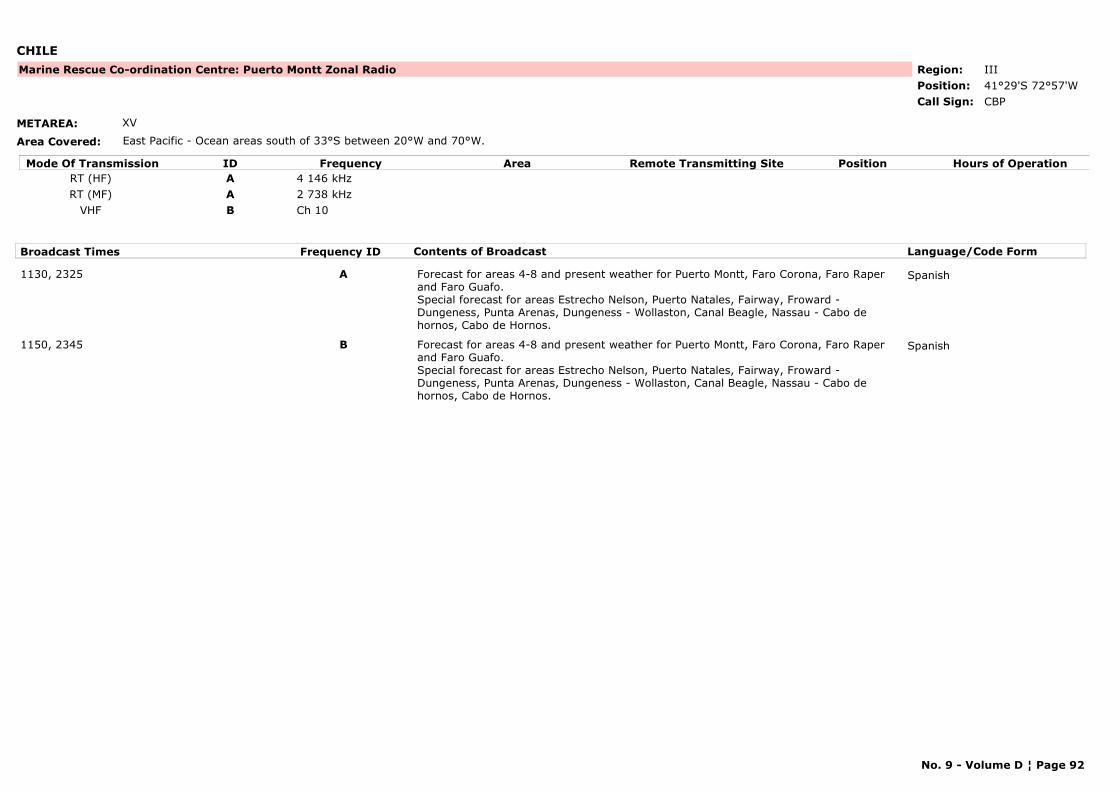
CHILE
METAREA: XV
Area Covered: East Pacific - Ocean areas south of 33°S between 20°W and 70°W.
Region: IIIPosition: 41°29'S 72°57'W
Marine Rescue Co-ordination Centre: Puerto Montt Zonal Radio
CBPCall Sign:
Mode Of Transmission ID Frequency Area Position Hours of OperationRemote Transmitting SiteRT (HF) A 4 146 kHzRT (MF) A 2 738 kHz
VHF B Ch 10
Broadcast Times Frequency ID Contents of Broadcast Language/Code Form
1130, 2325 A Forecast for areas 4-8 and present weather for Puerto Montt, Faro Corona, Faro Raper and Faro Guafo. Special forecast for areas Estrecho Nelson, Puerto Natales, Fairway, Froward - Dungeness, Punta Arenas, Dungeness - Wollaston, Canal Beagle, Nassau - Cabo de hornos, Cabo de Hornos.
Spanish
1150, 2345 B Forecast for areas 4-8 and present weather for Puerto Montt, Faro Corona, Faro Raper and Faro Guafo. Special forecast for areas Estrecho Nelson, Puerto Natales, Fairway, Froward - Dungeness, Punta Arenas, Dungeness - Wollaston, Canal Beagle, Nassau - Cabo de hornos, Cabo de Hornos.
Spanish
No. 9 - Volume D ¦ Page 92
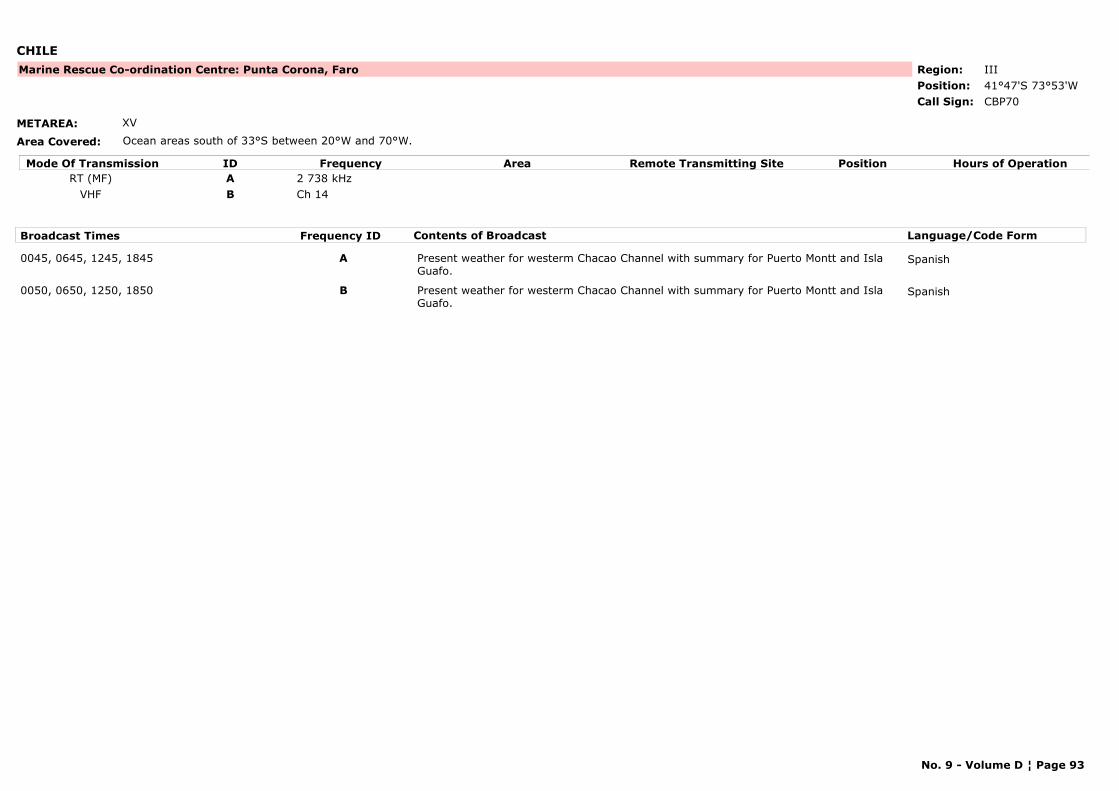
CHILE
METAREA: XV
Area Covered: Ocean areas south of 33°S between 20°W and 70°W.
Region: IIIPosition: 41°47'S 73°53'W
Marine Rescue Co-ordination Centre: Punta Corona, Faro
CBP70Call Sign:
Mode Of Transmission ID Frequency Area Position Hours of OperationRemote Transmitting SiteRT (MF) A 2 738 kHz
VHF B Ch 14
Broadcast Times Frequency ID Contents of Broadcast Language/Code Form
0045, 0645, 1245, 1845 A Present weather for westerm Chacao Channel with summary for Puerto Montt and Isla Guafo.
Spanish
0050, 0650, 1250, 1850 B Present weather for westerm Chacao Channel with summary for Puerto Montt and Isla Guafo.
Spanish
No. 9 - Volume D ¦ Page 93
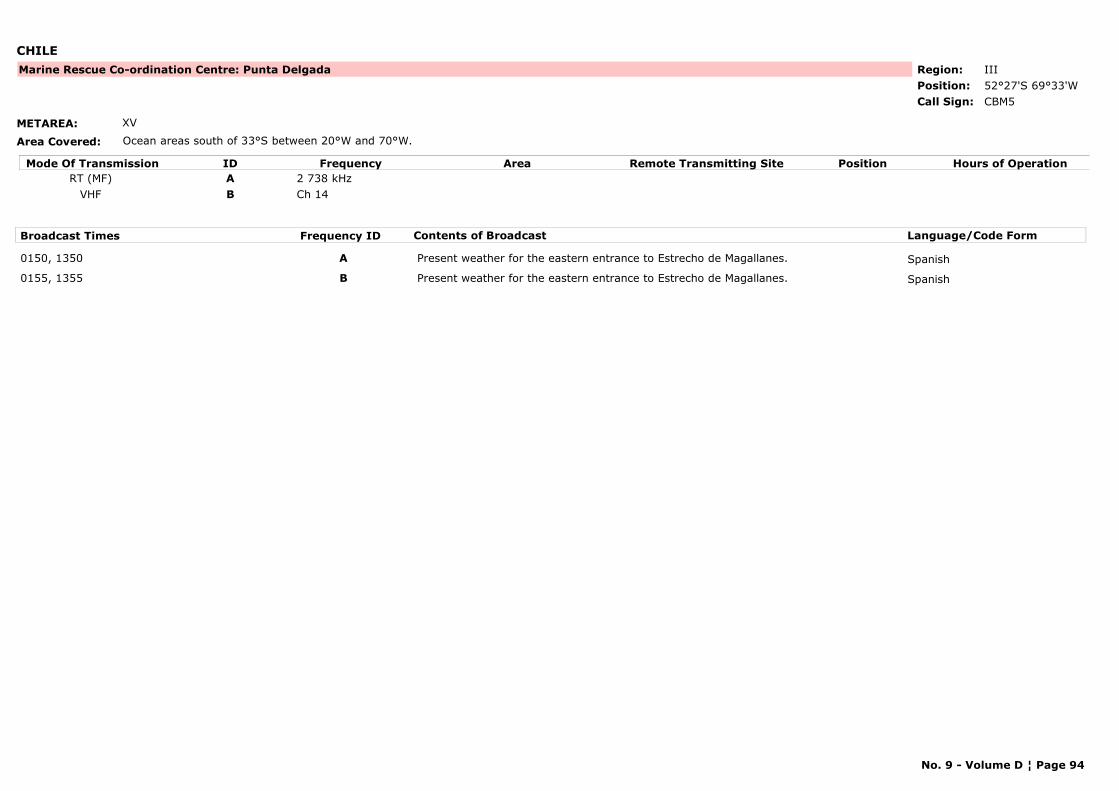
CHILE
METAREA: XV
Area Covered: Ocean areas south of 33°S between 20°W and 70°W.
Region: IIIPosition: 52°27'S 69°33'W
Marine Rescue Co-ordination Centre: Punta Delgada
CBM5Call Sign:
Mode Of Transmission ID Frequency Area Position Hours of OperationRemote Transmitting SiteRT (MF) A 2 738 kHz
VHF B Ch 14
Broadcast Times Frequency ID Contents of Broadcast Language/Code Form
0150, 1350 A Present weather for the eastern entrance to Estrecho de Magallanes. Spanish
0155, 1355 B Present weather for the eastern entrance to Estrecho de Magallanes. Spanish
No. 9 - Volume D ¦ Page 94
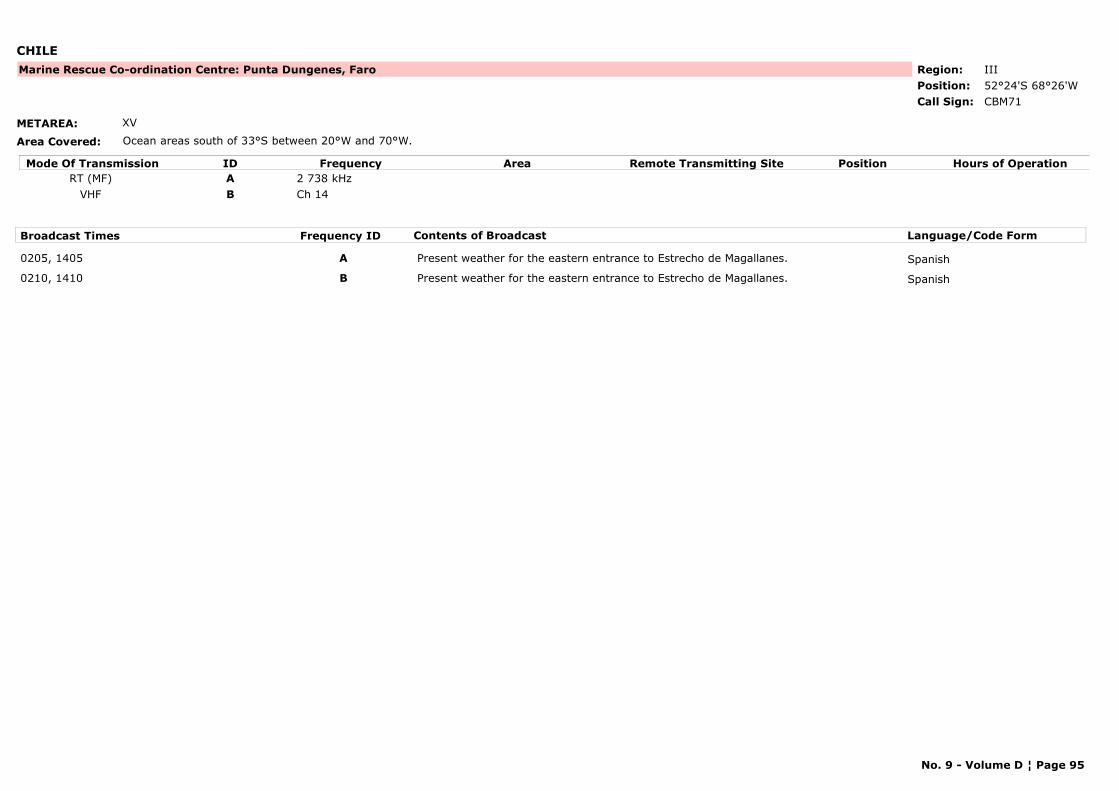
CHILE
METAREA: XV
Area Covered: Ocean areas south of 33°S between 20°W and 70°W.
Region: IIIPosition: 52°24'S 68°26'W
Marine Rescue Co-ordination Centre: Punta Dungenes, Faro
CBM71Call Sign:
Mode Of Transmission ID Frequency Area Position Hours of OperationRemote Transmitting SiteRT (MF) A 2 738 kHz
VHF B Ch 14
Broadcast Times Frequency ID Contents of Broadcast Language/Code Form
0205, 1405 A Present weather for the eastern entrance to Estrecho de Magallanes. Spanish
0210, 1410 B Present weather for the eastern entrance to Estrecho de Magallanes. Spanish
No. 9 - Volume D ¦ Page 95

CHILE
METAREA: XV
Area Covered: Ocean areas south of 33°S between 20°W and 70°W.
Region: IIIPosition: 33°35'S 71°37'W
Marine Rescue Co-ordination Centre: San Antonio
CBV22Call Sign:
Mode Of Transmission ID Frequency Area Position Hours of OperationRemote Transmitting SiteRT (MF) A 2 738 kHz
VHF B Ch 10
Broadcast Times Frequency ID Contents of Broadcast Language/Code Form
0045, 1245 A Forecast for areas 3. Spanish
0055, 1255 B Forecast for areas 3. Spanish
No. 9 - Volume D ¦ Page 96
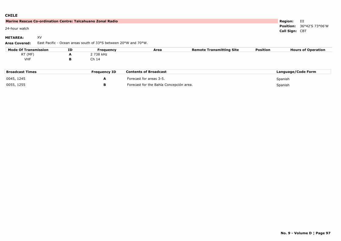
CHILE
METAREA: XV
Area Covered: East Pacific - Ocean areas south of 33°S between 20°W and 70°W.
Region: IIIPosition: 36°42'S 73°06'W
Marine Rescue Co-ordination Centre: Talcahuano Zonal Radio
CBT24-hour watch
Call Sign:
Mode Of Transmission ID Frequency Area Position Hours of OperationRemote Transmitting SiteRT (MF) A 2 738 kHz
VHF B Ch 14
Broadcast Times Frequency ID Contents of Broadcast Language/Code Form
0045, 1245 A Forecast for areas 3-5. Spanish
0055, 1255 B Forecast for the Bahía Concepción area. Spanish
No. 9 - Volume D ¦ Page 97
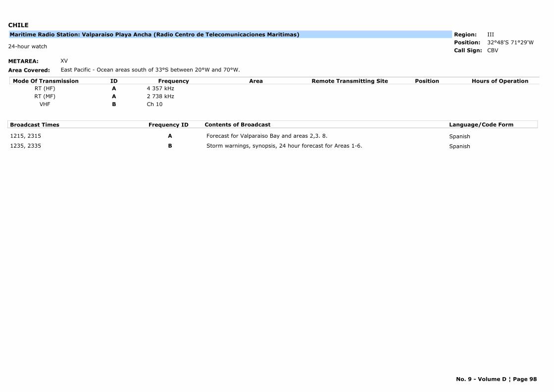
CHILE
METAREA: XV
Area Covered: East Pacific - Ocean areas south of 33°S between 20°W and 70°W.
Region: IIIPosition: 32°48'S 71°29'W
CBV24-hour watch
Call Sign:
Maritime Radio Station: Valparaiso Playa Ancha (Radio Centro de Telecomunicaciones Maritimas)
Mode Of Transmission ID Frequency Area Position Hours of OperationRemote Transmitting SiteRT (HF) A 4 357 kHzRT (MF) A 2 738 kHz
VHF B Ch 10
Broadcast Times Frequency ID Contents of Broadcast Language/Code Form
1215, 2315 A Forecast for Valparaiso Bay and areas 2,3. 8. Spanish
1235, 2335 B Storm warnings, synopsis, 24 hour forecast for Areas 1-6. Spanish
No. 9 - Volume D ¦ Page 98
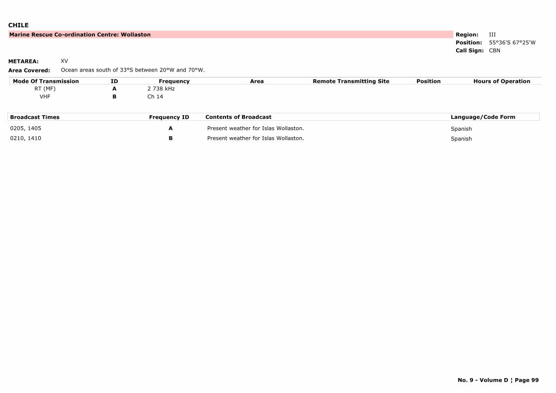
CHILE
METAREA: XV
Area Covered: Ocean areas south of 33°S between 20°W and 70°W.
Region: IIIPosition: 55°36'S 67°25'W
Marine Rescue Co-ordination Centre: Wollaston
CBNCall Sign:
Mode Of Transmission ID Frequency Area Position Hours of OperationRemote Transmitting SiteRT (MF) A 2 738 kHz
VHF B Ch 14
Broadcast Times Frequency ID Contents of Broadcast Language/Code Form
0205, 1405 A Present weather for Islas Wollaston. Spanish
0210, 1410 B Present weather for Islas Wollaston. Spanish
No. 9 - Volume D ¦ Page 99
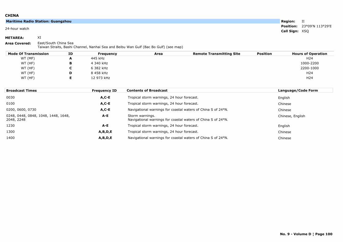
CHINA
METAREA: XI
Area Covered: East/South China SeaTaiwan Straits, Bashi Channel, Nanhai Sea and Beibu Wan Gulf (Bac Bo Gulf) (see map)
Region: IIPosition: 23°09'N 113°29'E
XSQ24-hour watch
Call Sign:
Maritime Radio Station: Guangzhou
Mode Of Transmission ID Frequency Area Position Hours of OperationRemote Transmitting SiteWT (MF) A 445 kHz H24WT (HF) B 4 340 kHz 1000-2200WT (HF) C 6 382 kHz 2200-1000WT (HF) D 8 458 kHz H24WT (HF) E 12 973 kHz H24
Broadcast Times Frequency ID Contents of Broadcast Language/Code Form
0030 A,C-E Tropical storm warnings, 24 hour forecast. English
0100 A,C-E Tropical storm warnings, 24 hour forecast. Chinese
0200, 0600, 0730 A,C-E Navigational warnings for coastal waters of China S of 24°N. Chinese
0248, 0448, 0848, 1048, 1448, 1648, 2048, 2248
A-E Storm warnings.Navigational warnings for coastal waters of China S of 24°N.
Chinese, English
1230 A-E Tropical storm warnings, 24 hour forecast. English
1300 A,B,D,E Tropical storm warnings, 24 hour forecast. Chinese
1400 A,B,D,E Navigational warnings for coastal waters of China S of 24°N. Chinese
No. 9 - Volume D ¦ Page 100
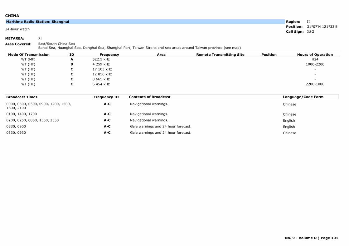
CHINA
METAREA: XI
Area Covered: East/South China SeaBohai Sea, Huanghai Sea, Donghai Sea, Shanghai Port, Taiwan Straits and sea areas around Taiwan province (see map)
Region: IIPosition: 31°07'N 121°33'E
XSG24-hour watch
Call Sign:
Maritime Radio Station: Shanghai
Mode Of Transmission ID Frequency Area Position Hours of OperationRemote Transmitting SiteWT (MF) A 522.5 kHz H24WT (HF) B 4 259 kHz 1000-2200WT (HF) C 17 103 kHz -WT (HF) C 12 856 kHz -WT (HF) C 8 665 kHz -WT (HF) C 6 454 kHz 2200-1000
Broadcast Times Frequency ID Contents of Broadcast Language/Code Form
0000, 0300, 0500, 0900, 1200, 1500, 1800, 2100
A-C Navigational warnings. Chinese
0100, 1400, 1700 A-C Navigational warnings. Chinese
0200, 0250, 0850, 1350, 2350 A-C Navigational warnings. English
0330, 0900 A-C Gale warnings and 24 hour forecast. English
0330, 0930 A-C Gale warnings and 24 hour forecast. Chinese
No. 9 - Volume D ¦ Page 101
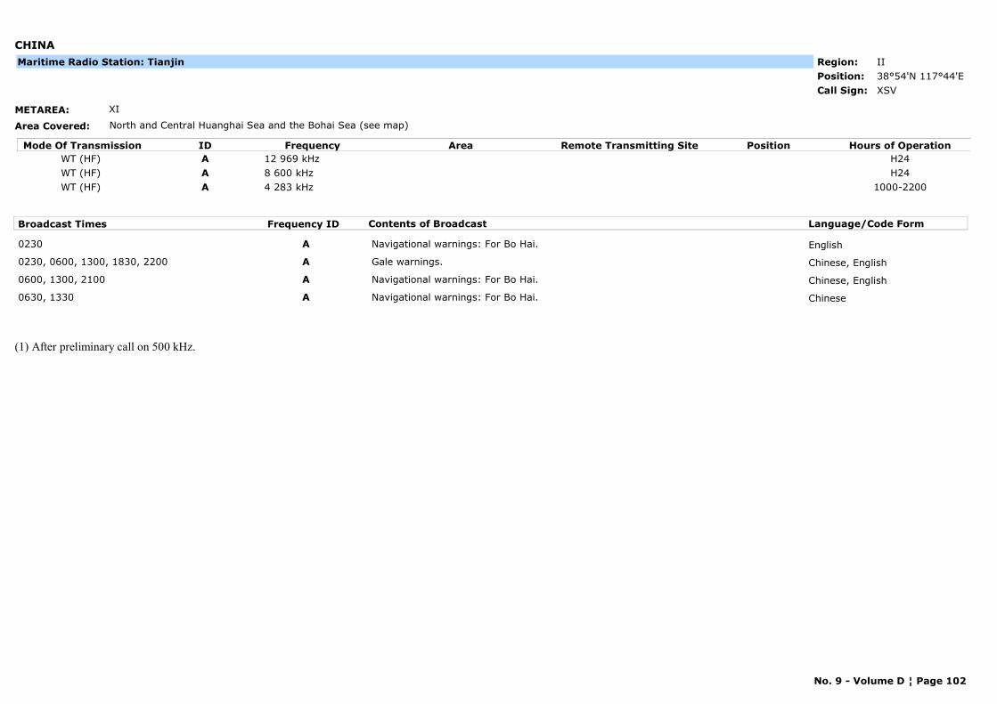
CHINA
METAREA: XI
Area Covered: North and Central Huanghai Sea and the Bohai Sea (see map)
Region: IIPosition: 38°54'N 117°44'E
XSVCall Sign:
Maritime Radio Station: Tianjin
Mode Of Transmission ID Frequency Area Position Hours of OperationRemote Transmitting SiteWT (HF) A 12 969 kHz H24WT (HF) A 8 600 kHz H24WT (HF) A 4 283 kHz 1000-2200
Broadcast Times Frequency ID Contents of Broadcast Language/Code Form
0230 A Navigational warnings: For Bo Hai. English
0230, 0600, 1300, 1830, 2200 A Gale warnings. Chinese, English
0600, 1300, 2100 A Navigational warnings: For Bo Hai. Chinese, English
0630, 1330 A Navigational warnings: For Bo Hai. Chinese
(1) After preliminary call on 500 kHz.
No. 9 - Volume D ¦ Page 102
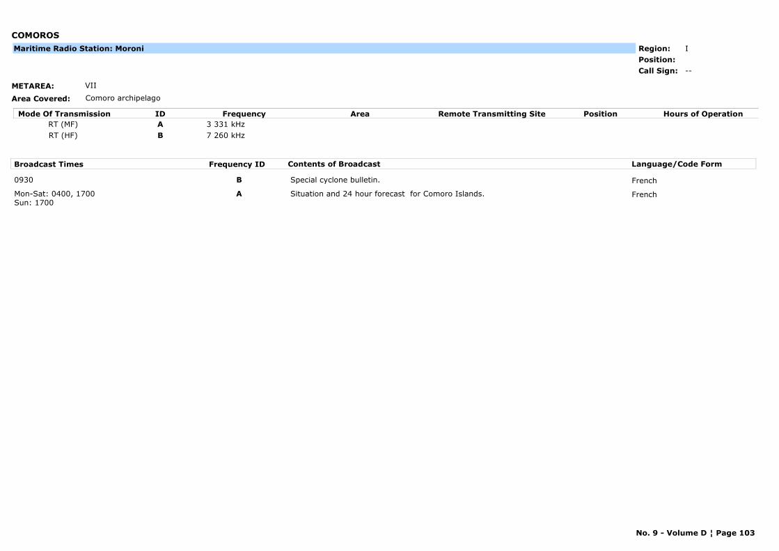
COMOROS
METAREA: VII
Area Covered: Comoro archipelago
Region: IPosition:
--Call Sign:
Maritime Radio Station: Moroni
Mode Of Transmission ID Frequency Area Position Hours of OperationRemote Transmitting SiteRT (MF) A 3 331 kHzRT (HF) B 7 260 kHz
Broadcast Times Frequency ID Contents of Broadcast Language/Code Form
0930 B Special cyclone bulletin. French
Mon-Sat: 0400, 1700Sun: 1700
A Situation and 24 hour forecast for Comoro Islands. French
No. 9 - Volume D ¦ Page 103
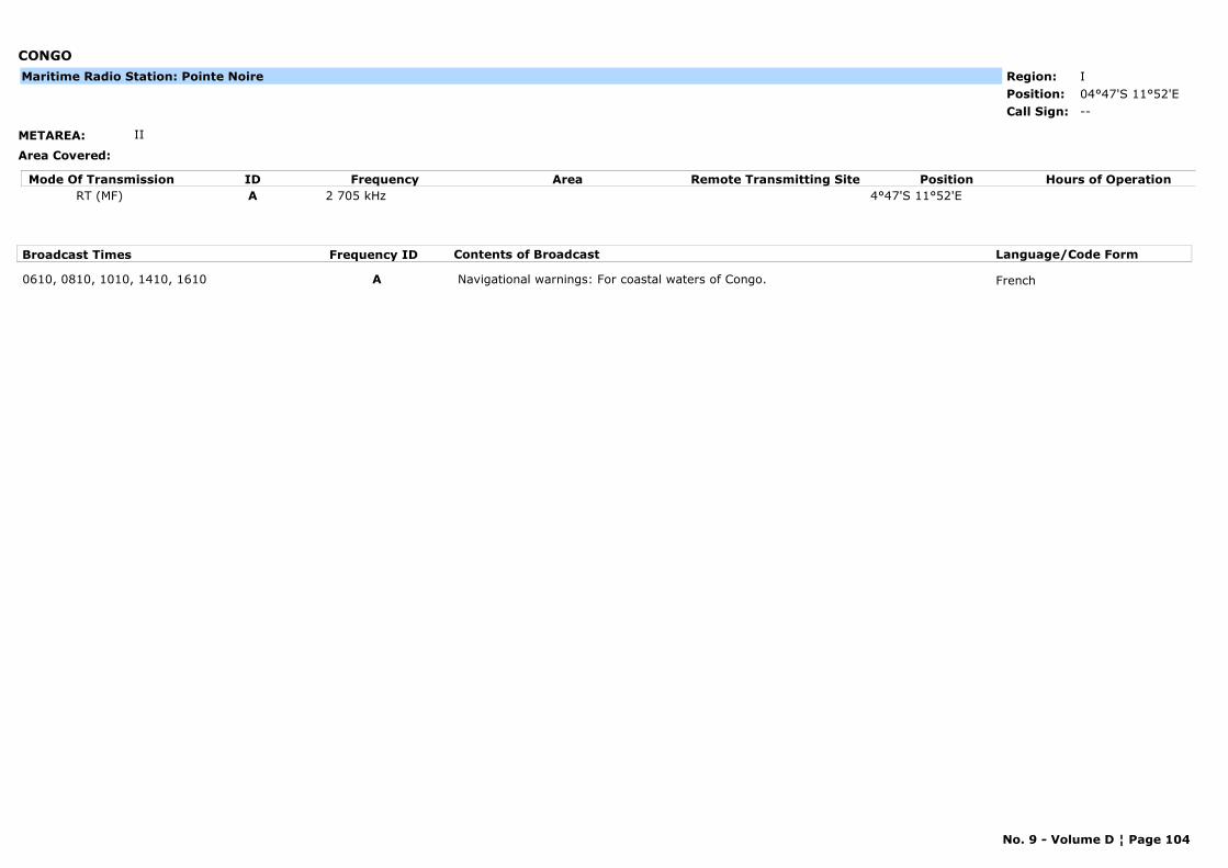
CONGO
METAREA: II
Area Covered:
Region: IPosition: 04°47'S 11°52'E
--Call Sign:
Maritime Radio Station: Pointe Noire
Mode Of Transmission ID Frequency Area Position Hours of OperationRemote Transmitting SiteRT (MF) A 2 705 kHz 4°47'S 11°52'E
Broadcast Times Frequency ID Contents of Broadcast Language/Code Form
0610, 0810, 1010, 1410, 1610 A Navigational warnings: For coastal waters of Congo. French
No. 9 - Volume D ¦ Page 104

COOK ISLANDS
METAREA: X
Area Covered:
Region: VPosition: 21°12'S 159°49'W
ZKR24-hour watch
Call Sign:
Maritime Radio Station: Rarotonga
Mode Of Transmission ID Frequency Area Position Hours of OperationRemote Transmitting SiteRT (MF) A 2 207 kHz
Broadcast Times Frequency ID Contents of Broadcast Language/Code Form
0015, 0615, 1815 A Forecast for Cook Islands coastal waters.
No. 9 - Volume D ¦ Page 105

COSTA RICA
METAREA: XII
Area Covered: (a) Coastal waters, (b) Pacific Ocean and Caribbean Sea, from 90°W to 80°W, 11°N to 5°N, including Coco island
Region: IVPosition:
--Call Sign:
Maritime Radio Station: Radio Bahía, Puntarenas
Mode Of Transmission ID Frequency Area Position Hours of OperationRemote Transmitting SiteA 107.9 MHz
Broadcast Times Frequency ID Contents of Broadcast Language/Code Form
1300, 0100 A Offshore and coastal marine forecast. Spanish
No. 9 - Volume D ¦ Page 106
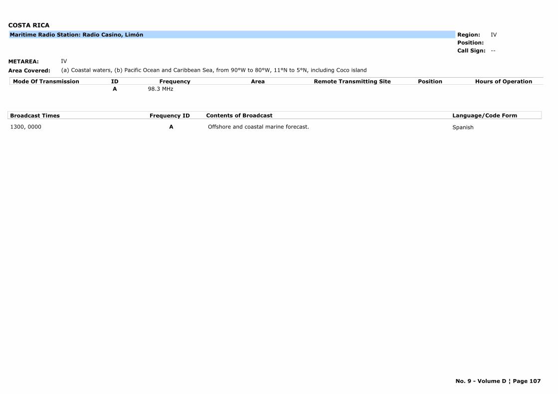
COSTA RICA
METAREA: IV
Area Covered: (a) Coastal waters, (b) Pacific Ocean and Caribbean Sea, from 90°W to 80°W, 11°N to 5°N, including Coco island
Region: IVPosition:
--Call Sign:
Maritime Radio Station: Radio Casino, Limón
Mode Of Transmission ID Frequency Area Position Hours of OperationRemote Transmitting SiteA 98.3 MHz
Broadcast Times Frequency ID Contents of Broadcast Language/Code Form
1300, 0000 A Offshore and coastal marine forecast. Spanish
No. 9 - Volume D ¦ Page 107
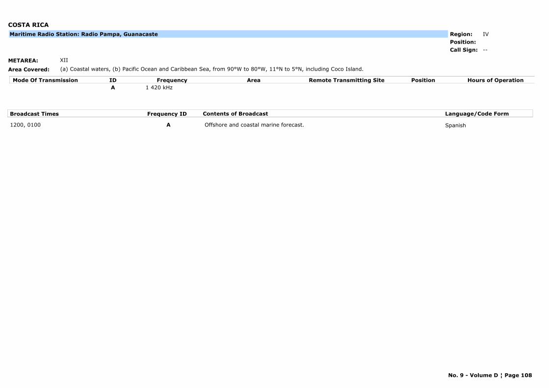
COSTA RICA
METAREA: XII
Area Covered: (a) Coastal waters, (b) Pacific Ocean and Caribbean Sea, from 90°W to 80°W, 11°N to 5°N, including Coco Island.
Region: IVPosition:
--Call Sign:
Maritime Radio Station: Radio Pampa, Guanacaste
Mode Of Transmission ID Frequency Area Position Hours of OperationRemote Transmitting SiteA 1 420 kHz
Broadcast Times Frequency ID Contents of Broadcast Language/Code Form
1200, 0100 A Offshore and coastal marine forecast. Spanish
No. 9 - Volume D ¦ Page 108

COSTA RICA
METAREA: IV
Area Covered: (a) Coastal waters, (b) Pacific Ocean and Caribbean Sea, from 90°W to 80°W, 11°N to 5°N, including Coco island
Region: IVPosition:
--Call Sign:
Maritime Radio Station: Radio Stero Bahía, Limón
Mode Of Transmission ID Frequency Area Position Hours of OperationRemote Transmitting SiteA 107.9 MHz
Broadcast Times Frequency ID Contents of Broadcast Language/Code Form
1300, 0000 A Offshore and coastal marine forecast. Spanish
No. 9 - Volume D ¦ Page 109
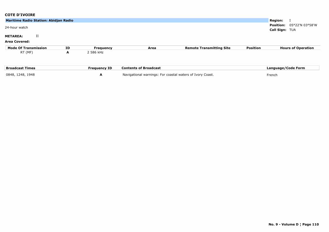
COTE D'IVOIRE
METAREA: II
Area Covered:
Region: IPosition: 05°22'N 03°58'W
TUA24-hour watch
Call Sign:
Maritime Radio Station: Abidjan Radio
Mode Of Transmission ID Frequency Area Position Hours of OperationRemote Transmitting SiteRT (MF) A 2 586 kHz
Broadcast Times Frequency ID Contents of Broadcast Language/Code Form
0848, 1248, 1948 A Navigational warnings: For coastal waters of Ivory Coast. French
No. 9 - Volume D ¦ Page 110
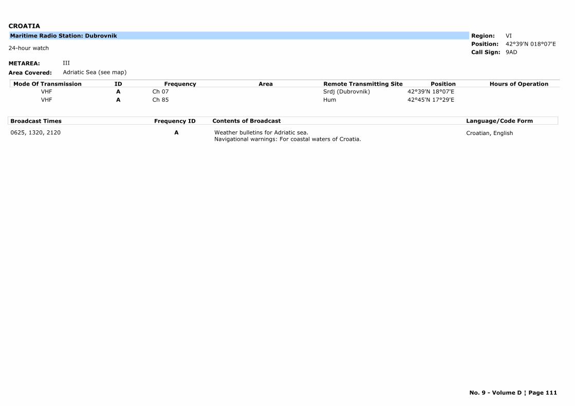
CROATIA
METAREA: III
Area Covered: Adriatic Sea (see map)
Region: VIPosition: 42°39'N 018°07'E
9AD24-hour watch
Call Sign:
Maritime Radio Station: Dubrovnik
Mode Of Transmission ID Frequency Area Position Hours of OperationRemote Transmitting SiteVHF A Ch 07 Srdj (Dubrovnik) 42°39'N 18°07'EVHF A Ch 85 Hum 42°45'N 17°29'E
Broadcast Times Frequency ID Contents of Broadcast Language/Code Form
0625, 1320, 2120 A Weather bulletins for Adriatic sea. Navigational warnings: For coastal waters of Croatia.
Croatian, English
No. 9 - Volume D ¦ Page 111
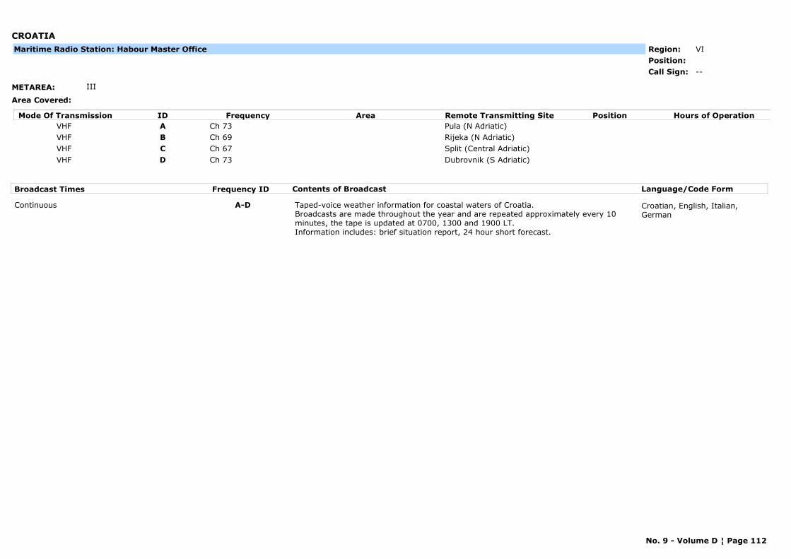
CROATIA
METAREA: III
Area Covered:
Region: VIPosition:
--Call Sign:
Maritime Radio Station: Habour Master Office
Mode Of Transmission ID Frequency Area Position Hours of OperationRemote Transmitting SiteVHF A Ch 73 Pula (N Adriatic)VHF B Ch 69 Rijeka (N Adriatic)VHF C Ch 67 Split (Central Adriatic)VHF D Ch 73 Dubrovnik (S Adriatic)
Broadcast Times Frequency ID Contents of Broadcast Language/Code Form
Continuous A-D Taped-voice weather information for coastal waters of Croatia.Broadcasts are made throughout the year and are repeated approximately every 10 minutes, the tape is updated at 0700, 1300 and 1900 LT. Information includes: brief situation report, 24 hour short forecast.
Croatian, English, Italian, German
No. 9 - Volume D ¦ Page 112
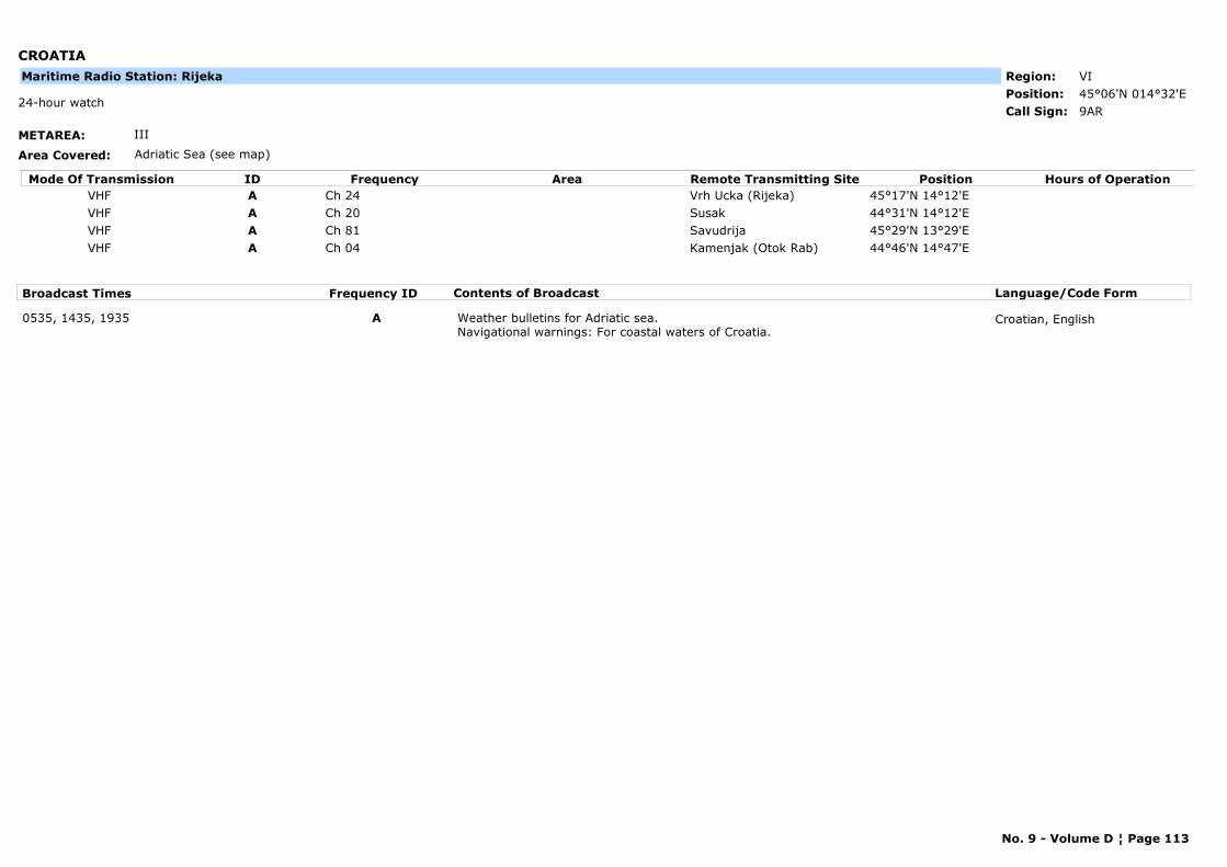
CROATIA
METAREA: III
Area Covered: Adriatic Sea (see map)
Region: VIPosition: 45°06'N 014°32'E
9AR24-hour watch
Call Sign:
Maritime Radio Station: Rijeka
Mode Of Transmission ID Frequency Area Position Hours of OperationRemote Transmitting SiteVHF A Ch 24 Vrh Ucka (Rijeka) 45°17'N 14°12'EVHF A Ch 20 Susak 44°31'N 14°12'EVHF A Ch 81 Savudrija 45°29'N 13°29'EVHF A Ch 04 Kamenjak (Otok Rab) 44°46'N 14°47'E
Broadcast Times Frequency ID Contents of Broadcast Language/Code Form
0535, 1435, 1935 A Weather bulletins for Adriatic sea. Navigational warnings: For coastal waters of Croatia.
Croatian, English
No. 9 - Volume D ¦ Page 113
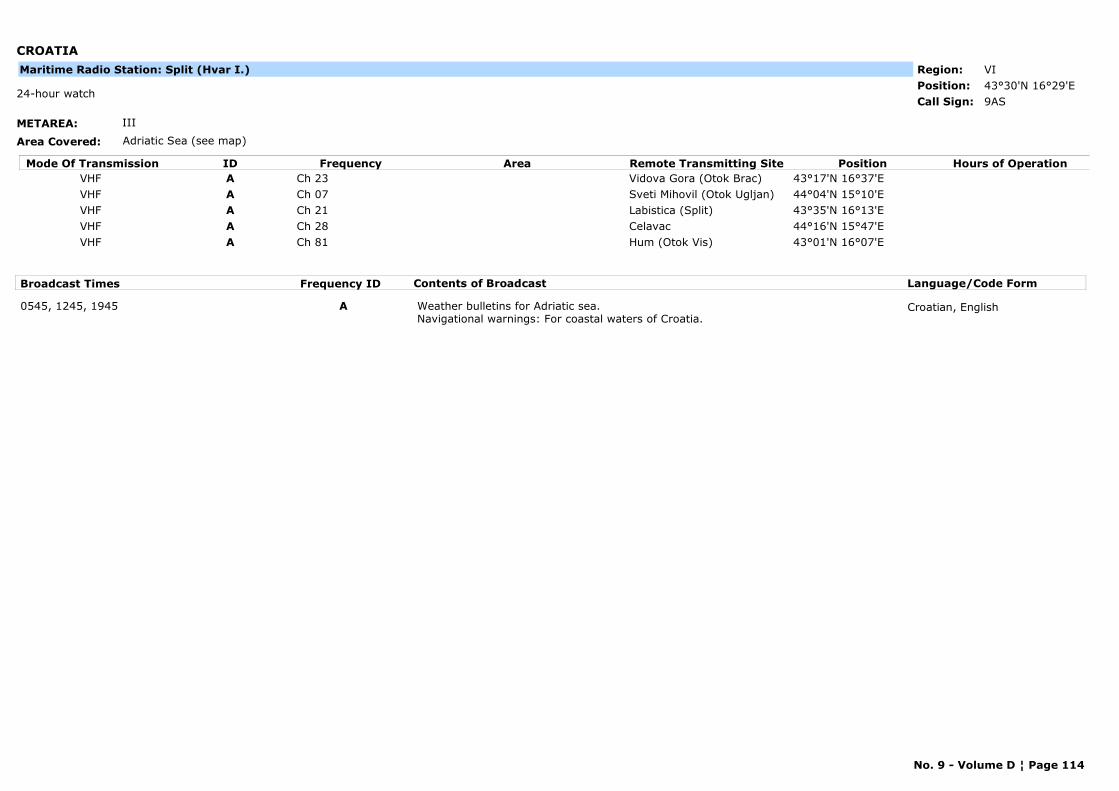
CROATIA
METAREA: III
Area Covered: Adriatic Sea (see map)
Region: VIPosition: 43°30'N 16°29'E
9AS24-hour watch
Call Sign:
Maritime Radio Station: Split (Hvar I.)
Mode Of Transmission ID Frequency Area Position Hours of OperationRemote Transmitting SiteVHF A Ch 23 Vidova Gora (Otok Brac) 43°17'N 16°37'EVHF A Ch 07 Sveti Mihovil (Otok Ugljan) 44°04'N 15°10'EVHF A Ch 21 Labistica (Split) 43°35'N 16°13'EVHF A Ch 28 Celavac 44°16'N 15°47'EVHF A Ch 81 Hum (Otok Vis) 43°01'N 16°07'E
Broadcast Times Frequency ID Contents of Broadcast Language/Code Form
0545, 1245, 1945 A Weather bulletins for Adriatic sea. Navigational warnings: For coastal waters of Croatia.
Croatian, English
No. 9 - Volume D ¦ Page 114
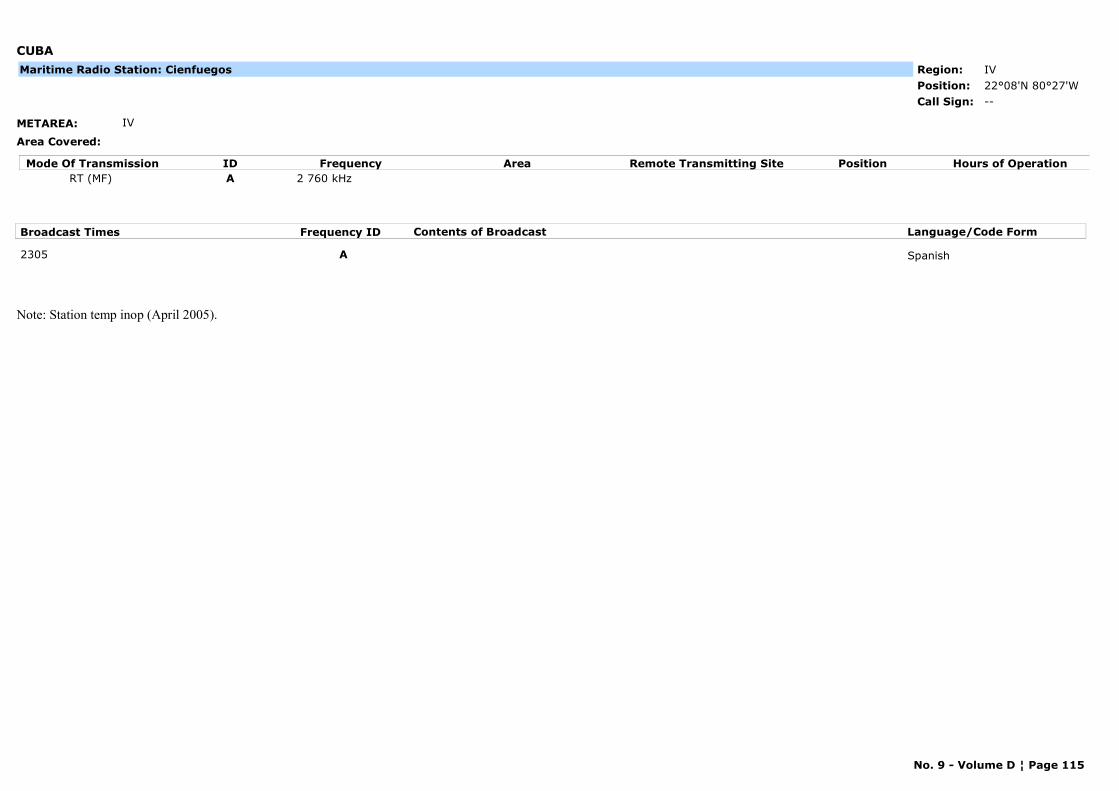
CUBA
METAREA: IV
Area Covered:
Region: IVPosition: 22°08'N 80°27'W
--Call Sign:
Maritime Radio Station: Cienfuegos
Mode Of Transmission ID Frequency Area Position Hours of OperationRemote Transmitting SiteRT (MF) A 2 760 kHz
Broadcast Times Frequency ID Contents of Broadcast Language/Code Form
2305 A Spanish
Note: Station temp inop (April 2005).
No. 9 - Volume D ¦ Page 115
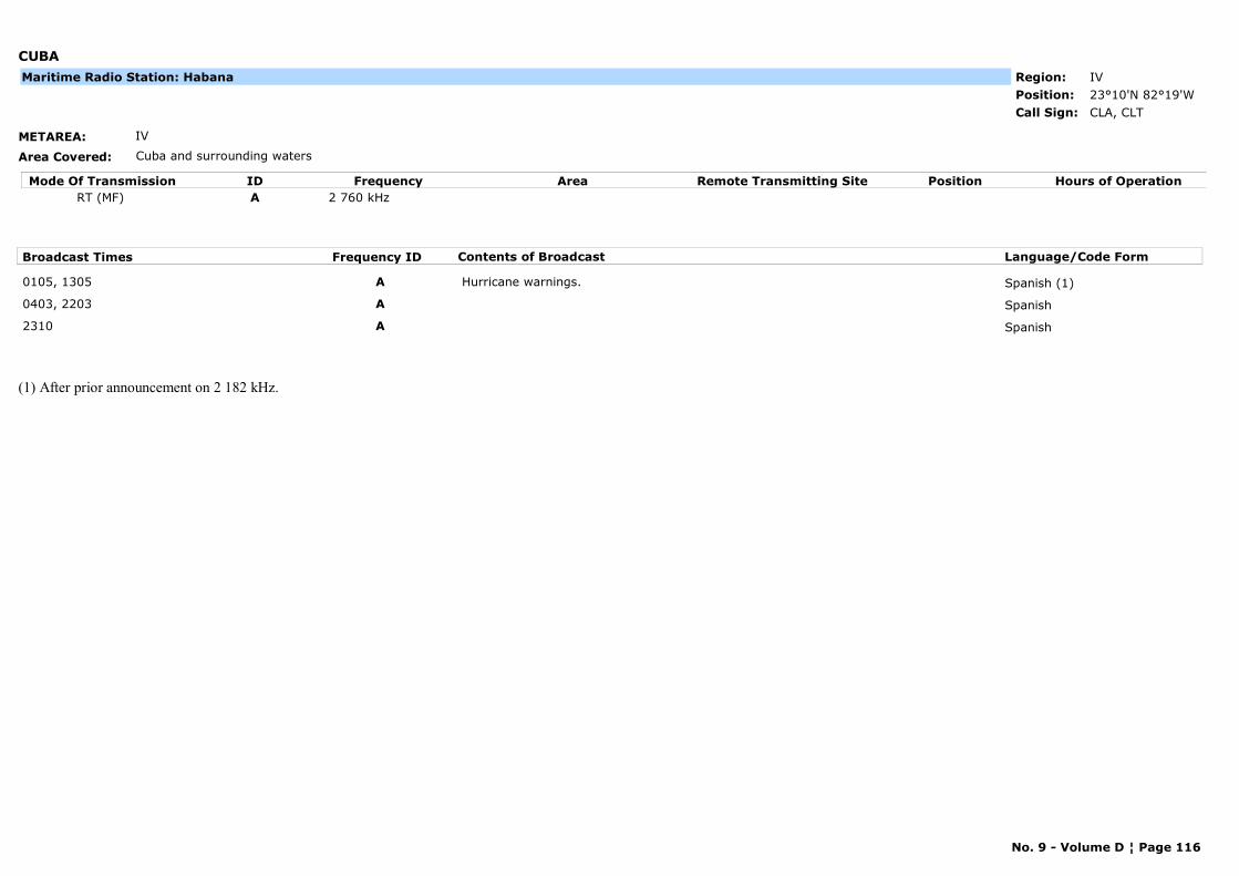
CUBA
METAREA: IV
Area Covered: Cuba and surrounding waters
Region: IVPosition: 23°10'N 82°19'W
CLA, CLTCall Sign:
Maritime Radio Station: Habana
Mode Of Transmission ID Frequency Area Position Hours of OperationRemote Transmitting SiteRT (MF) A 2 760 kHz
Broadcast Times Frequency ID Contents of Broadcast Language/Code Form
0105, 1305 A Hurricane warnings. Spanish (1)
0403, 2203 A Spanish
2310 A Spanish
(1) After prior announcement on 2 182 kHz.
No. 9 - Volume D ¦ Page 116
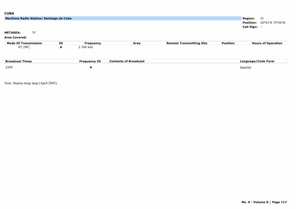
CUBA
METAREA: IV
Area Covered:
Region: IVPosition: 20°01'N 75°50'W
--Call Sign:
Maritime Radio Station: Santiago de Cuba
Mode Of Transmission ID Frequency Area Position Hours of OperationRemote Transmitting SiteRT (MF) A 2 760 kHz
Broadcast Times Frequency ID Contents of Broadcast Language/Code Form
2340 A Spanish
Note: Station temp inop (April 2005).
No. 9 - Volume D ¦ Page 117
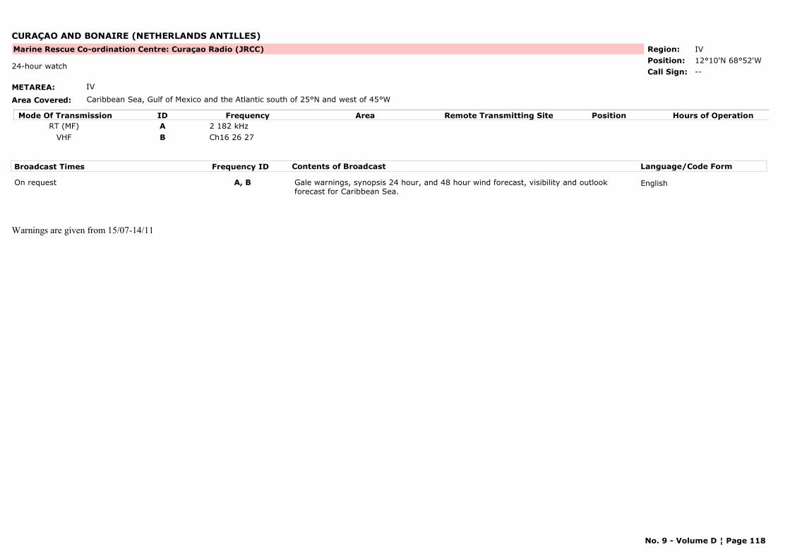
CURAÇAO AND BONAIRE (NETHERLANDS ANTILLES)
METAREA: IV
Area Covered: Caribbean Sea, Gulf of Mexico and the Atlantic south of 25°N and west of 45°W
Region: IVPosition: 12°10'N 68°52'W
Marine Rescue Co-ordination Centre: Curaçao Radio (JRCC)
--24-hour watch
Call Sign:
Mode Of Transmission ID Frequency Area Position Hours of OperationRemote Transmitting SiteRT (MF) A 2 182 kHz
VHF B Ch16 26 27
Broadcast Times Frequency ID Contents of Broadcast Language/Code Form
On request A, B Gale warnings, synopsis 24 hour, and 48 hour wind forecast, visibility and outlook forecast for Caribbean Sea.
English
Warnings are given from 15/07-14/11
No. 9 - Volume D ¦ Page 118
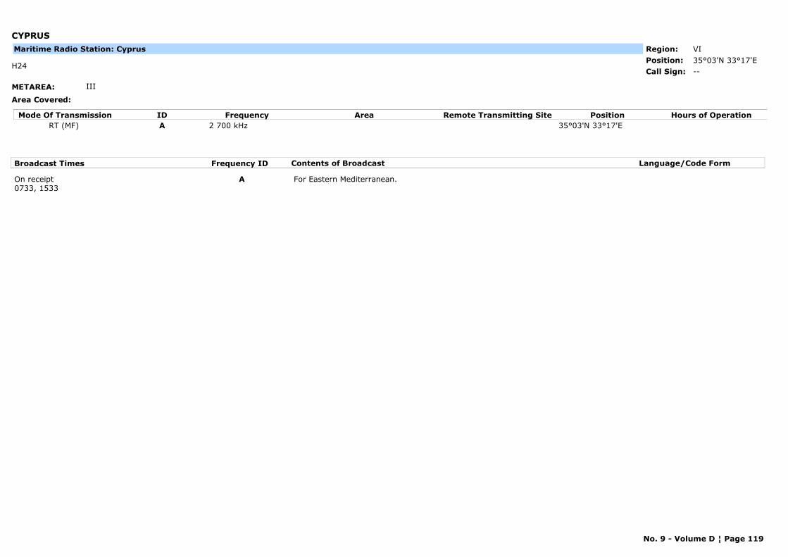
CYPRUS
METAREA: III
Area Covered:
Region: VIPosition: 35°03'N 33°17'E
--H24
Call Sign:
Maritime Radio Station: Cyprus
Mode Of Transmission ID Frequency Area Position Hours of OperationRemote Transmitting SiteRT (MF) A 2 700 kHz 35°03'N 33°17'E
Broadcast Times Frequency ID Contents of Broadcast Language/Code Form
On receipt0733, 1533
A For Eastern Mediterranean.
No. 9 - Volume D ¦ Page 119
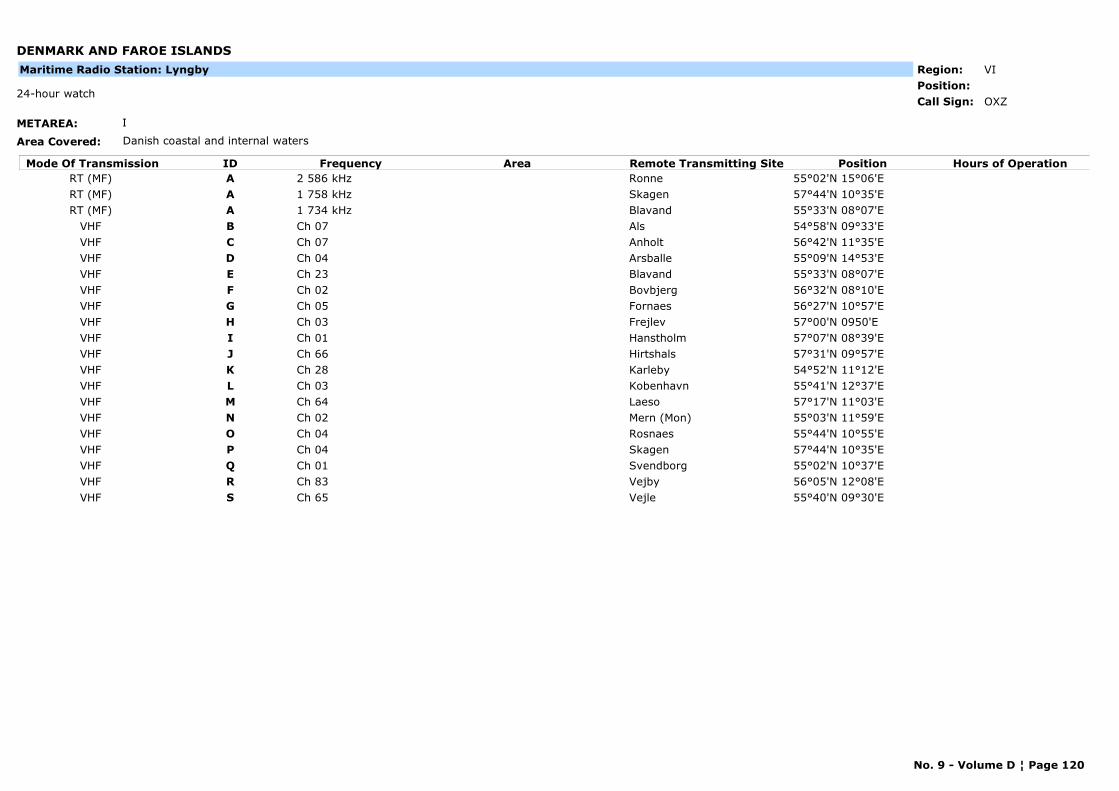
DENMARK AND FAROE ISLANDS
METAREA: I
Area Covered: Danish coastal and internal waters
Region: VIPosition:
OXZ24-hour watch
Call Sign:
Maritime Radio Station: Lyngby
Mode Of Transmission ID Frequency Area Position Hours of OperationRemote Transmitting SiteRT (MF) A 2 586 kHz Ronne 55°02'N 15°06'ERT (MF) A 1 758 kHz Skagen 57°44'N 10°35'ERT (MF) A 1 734 kHz Blavand 55°33'N 08°07'E
VHF B Ch 07 Als 54°58'N 09°33'EVHF C Ch 07 Anholt 56°42'N 11°35'EVHF D Ch 04 Arsballe 55°09'N 14°53'EVHF E Ch 23 Blavand 55°33'N 08°07'EVHF F Ch 02 Bovbjerg 56°32'N 08°10'EVHF G Ch 05 Fornaes 56°27'N 10°57'EVHF H Ch 03 Frejlev 57°00'N 0950'EVHF I Ch 01 Hanstholm 57°07'N 08°39'EVHF J Ch 66 Hirtshals 57°31'N 09°57'EVHF K Ch 28 Karleby 54°52'N 11°12'EVHF L Ch 03 Kobenhavn 55°41'N 12°37'EVHF M Ch 64 Laeso 57°17'N 11°03'EVHF N Ch 02 Mern (Mon) 55°03'N 11°59'EVHF O Ch 04 Rosnaes 55°44'N 10°55'EVHF P Ch 04 Skagen 57°44'N 10°35'EVHF Q Ch 01 Svendborg 55°02'N 10°37'EVHF R Ch 83 Vejby 56°05'N 12°08'EVHF S Ch 65 Vejle 55°40'N 09°30'E
No. 9 - Volume D ¦ Page 120
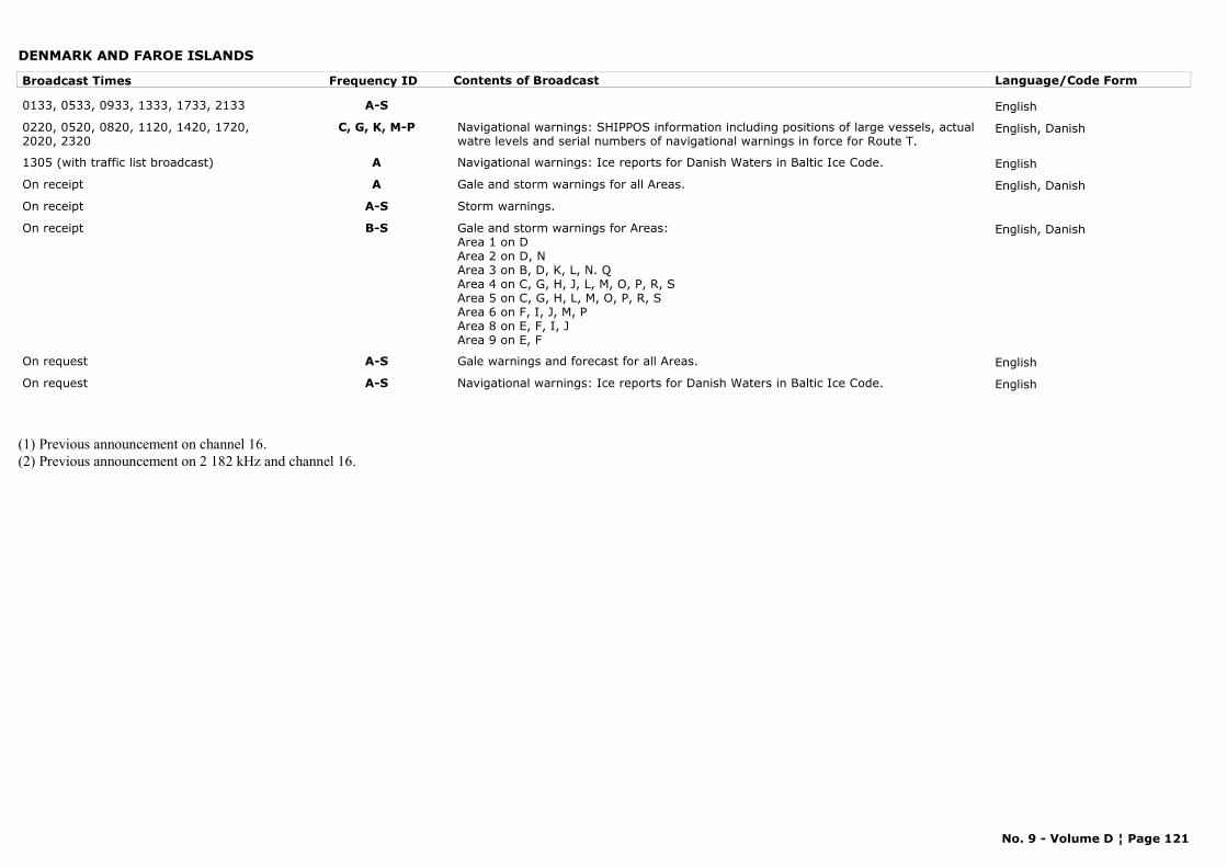
DENMARK AND FAROE ISLANDS
Broadcast Times Frequency ID Contents of Broadcast Language/Code Form
0133, 0533, 0933, 1333, 1733, 2133 A-S English
0220, 0520, 0820, 1120, 1420, 1720, 2020, 2320
C, G, K, M-P Navigational warnings: SHIPPOS information including positions of large vessels, actual watre levels and serial numbers of navigational warnings in force for Route T.
English, Danish
1305 (with traffic list broadcast) A Navigational warnings: Ice reports for Danish Waters in Baltic Ice Code. English
On receipt A Gale and storm warnings for all Areas. English, Danish
On receipt A-S Storm warnings.
On receipt B-S Gale and storm warnings for Areas:Area 1 on DArea 2 on D, NArea 3 on B, D, K, L, N. QArea 4 on C, G, H, J, L, M, O, P, R, SArea 5 on C, G, H, L, M, O, P, R, SArea 6 on F, I, J, M, PArea 8 on E, F, I, JArea 9 on E, F
English, Danish
On request A-S Gale warnings and forecast for all Areas. English
On request A-S Navigational warnings: Ice reports for Danish Waters in Baltic Ice Code. English
(1) Previous announcement on channel 16.(2) Previous announcement on 2 182 kHz and channel 16.
No. 9 - Volume D ¦ Page 121
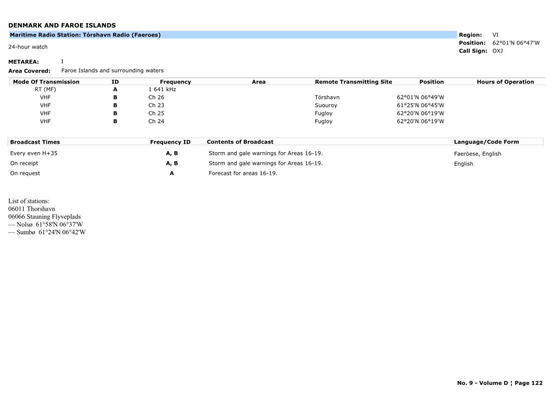
DENMARK AND FAROE ISLANDS
METAREA: I
Area Covered: Faroe Islands and surrounding waters
Region: VIPosition: 62°01'N 06°47'W
OXJ24-hour watch
Call Sign:
Maritime Radio Station: Tórshavn Radio (Faeroes)
Mode Of Transmission ID Frequency Area Position Hours of OperationRemote Transmitting SiteRT (MF) A 1 641 kHz
VHF B Ch 26 Tórshavn 62°01'N 06°49'WVHF B Ch 23 Suouroy 61°25'N 06°45'WVHF B Ch 25 Fugloy 62°20'N 06°19'WVHF B Ch 24 Fugloy 62°20'N 06°19'W
Broadcast Times Frequency ID Contents of Broadcast Language/Code Form
Every even H+35 A, B Storm and gale warnings for Areas 16-19. Faeröese, English
On receipt A, B Storm and gale warnings for Areas 16-19. English
On request A Forecast for areas 16-19.
List of stations:06011 Thorshavn 06066 Stauning Flyveplads — Nolsø 61°58'N 06°37'W— Sumbø 61°24'N 06°42'W
No. 9 - Volume D ¦ Page 122
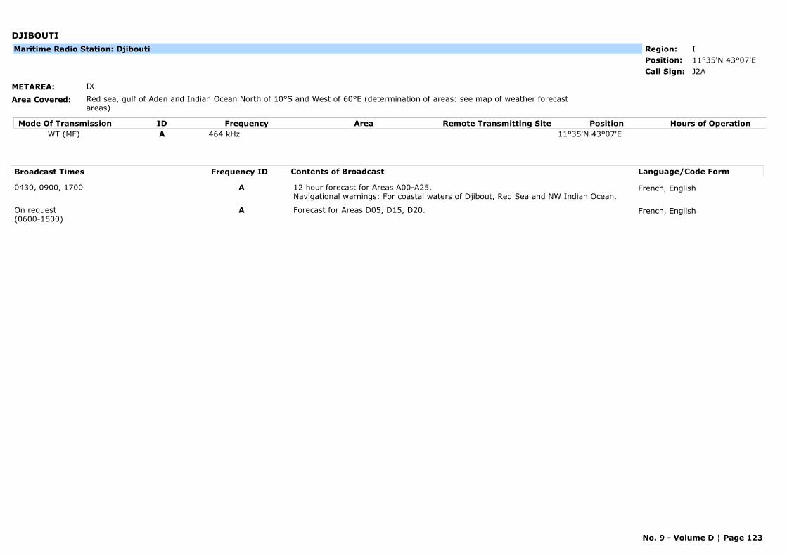
DJIBOUTI
METAREA: IX
Area Covered: Red sea, gulf of Aden and Indian Ocean North of 10°S and West of 60°E (determination of areas: see map of weather forecast areas)
Region: IPosition: 11°35'N 43°07'E
J2ACall Sign:
Maritime Radio Station: Djibouti
Mode Of Transmission ID Frequency Area Position Hours of OperationRemote Transmitting SiteWT (MF) A 464 kHz 11°35'N 43°07'E
Broadcast Times Frequency ID Contents of Broadcast Language/Code Form
0430, 0900, 1700 A 12 hour forecast for Areas A00-A25. Navigational warnings: For coastal waters of Djibout, Red Sea and NW Indian Ocean.
French, English
On request(0600-1500)
A Forecast for Areas D05, D15, D20. French, English
No. 9 - Volume D ¦ Page 123
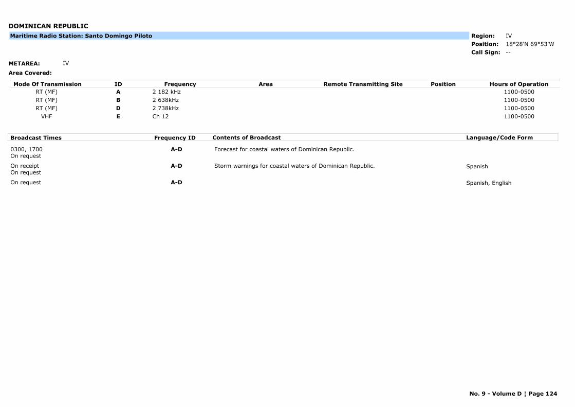
DOMINICAN REPUBLIC
METAREA: IV
Area Covered:
Region: IVPosition: 18°28'N 69°53'W
--Call Sign:
Maritime Radio Station: Santo Domingo Piloto
Mode Of Transmission ID Frequency Area Position Hours of OperationRemote Transmitting SiteRT (MF) A 2 182 kHz 1100-0500RT (MF) B 2 638kHz 1100-0500RT (MF) D 2 738kHz 1100-0500
VHF E Ch 12 1100-0500
Broadcast Times Frequency ID Contents of Broadcast Language/Code Form
0300, 1700On request
A-D Forecast for coastal waters of Dominican Republic.
On receiptOn request
A-D Storm warnings for coastal waters of Dominican Republic. Spanish
On request A-D Spanish, English
No. 9 - Volume D ¦ Page 124
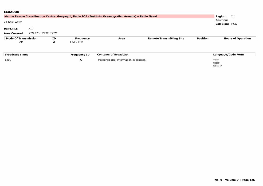
ECUADOR
METAREA: XII
Area Covered: 2°N-4°S; 79°W-95°W
Region: IIIPosition:
Marine Rescue Co-ordination Centre: Guayaquil, Radio IOA (Instituto Oceanografico Armada) o Radio Naval
HCG24-hour watch
Call Sign:
Mode Of Transmission ID Frequency Area Position Hours of OperationRemote Transmitting SiteAM A 1 515 kHz
Broadcast Times Frequency ID Contents of Broadcast Language/Code Form
1200 A Meteorological information in process. TextSHIPSYNOP
No. 9 - Volume D ¦ Page 125
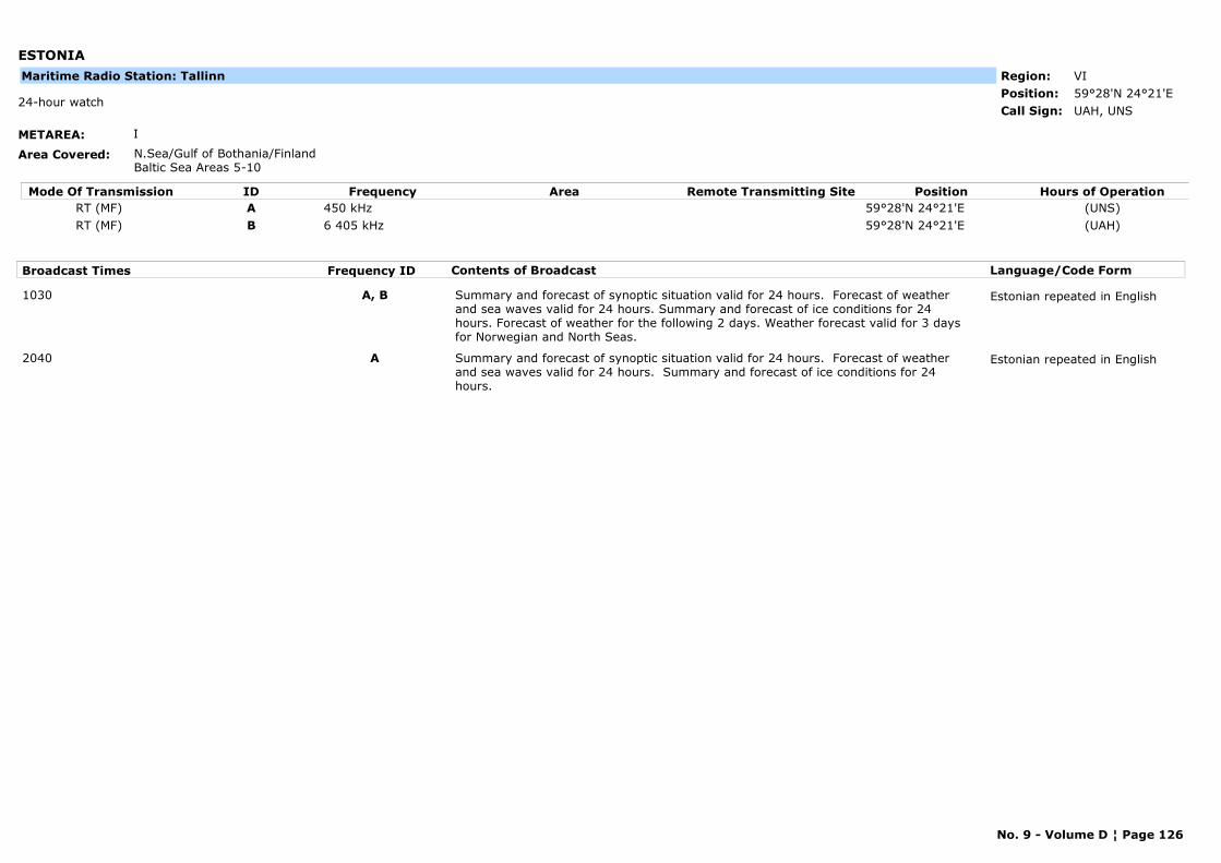
ESTONIA
METAREA: I
Area Covered: N.Sea/Gulf of Bothania/FinlandBaltic Sea Areas 5-10
Region: VIPosition: 59°28'N 24°21'E
UAH, UNS24-hour watch
Call Sign:
Maritime Radio Station: Tallinn
Mode Of Transmission ID Frequency Area Position Hours of OperationRemote Transmitting SiteRT (MF) A 450 kHz 59°28'N 24°21'E (UNS)RT (MF) B 6 405 kHz 59°28'N 24°21'E (UAH)
Broadcast Times Frequency ID Contents of Broadcast Language/Code Form
1030 A, B Summary and forecast of synoptic situation valid for 24 hours. Forecast of weather and sea waves valid for 24 hours. Summary and forecast of ice conditions for 24 hours. Forecast of weather for the following 2 days. Weather forecast valid for 3 days for Norwegian and North Seas.
Estonian repeated in English
2040 A Summary and forecast of synoptic situation valid for 24 hours. Forecast of weather and sea waves valid for 24 hours. Summary and forecast of ice conditions for 24 hours.
Estonian repeated in English
No. 9 - Volume D ¦ Page 126
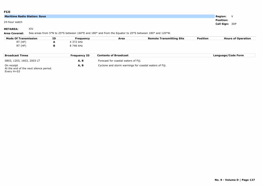
FIJI
METAREA: XIV
Area Covered: Sea areas from 5°N to 25°S between 160°E and 180° and from the Equator to 25°S between 180° and 120°W.
Region: VPosition:
3DP24-hour watch
Call Sign:
Maritime Radio Station: Suva
Mode Of Transmission ID Frequency Area Position Hours of OperationRemote Transmitting SiteRT (HF) A 4 372 kHzRT (HF) B 8 746 kHz
Broadcast Times Frequency ID Contents of Broadcast Language/Code Form
0803, 1203, 1603, 2003 LT A, B Forecast for coastal waters of Fiji.
On receiptAt the end of the next silence period.Every H+03
A, B Cyclone and storm warnings for coastal waters of Fiji.
No. 9 - Volume D ¦ Page 127
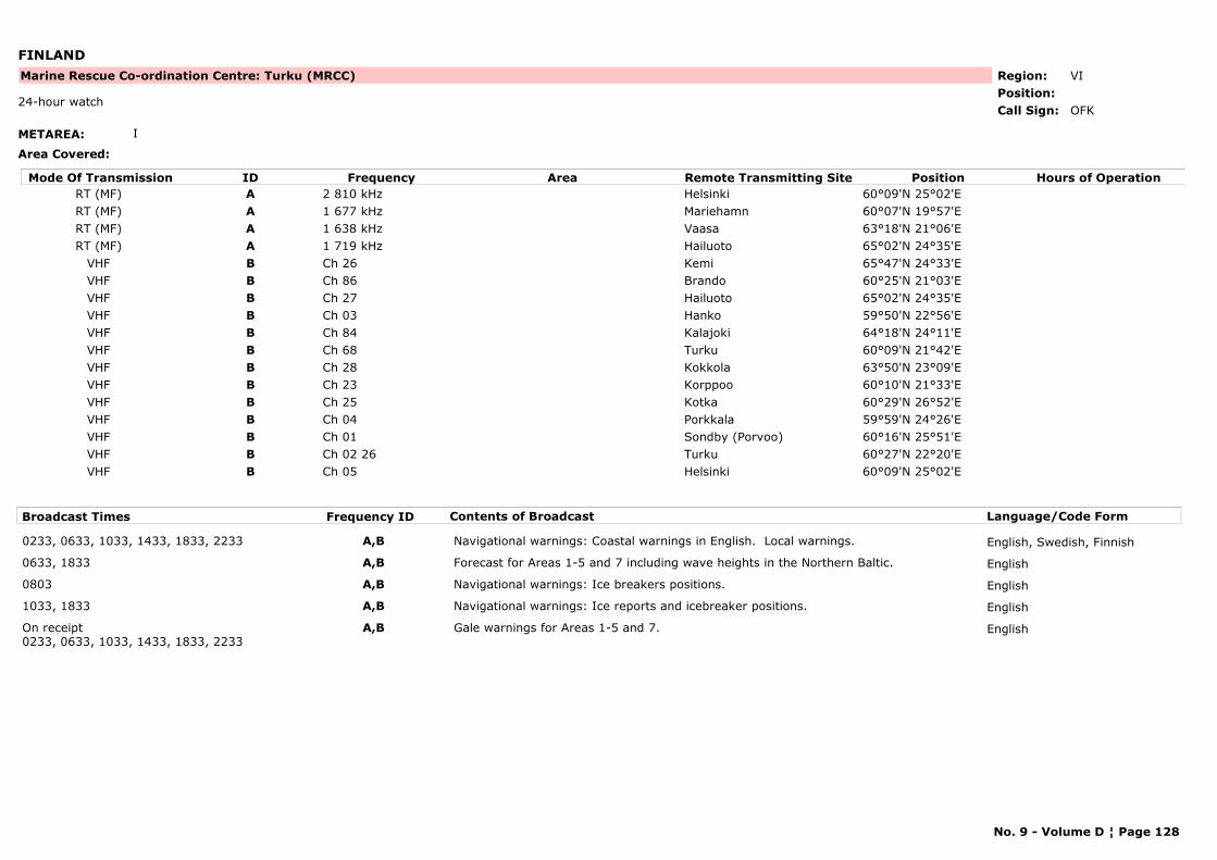
FINLAND
METAREA: I
Area Covered:
Region: VIPosition:
Marine Rescue Co-ordination Centre: Turku (MRCC)
OFK24-hour watch
Call Sign:
Mode Of Transmission ID Frequency Area Position Hours of OperationRemote Transmitting SiteRT (MF) A 2 810 kHz Helsinki 60°09'N 25°02'ERT (MF) A 1 677 kHz Mariehamn 60°07'N 19°57'ERT (MF) A 1 638 kHz Vaasa 63°18'N 21°06'ERT (MF) A 1 719 kHz Hailuoto 65°02'N 24°35'E
VHF B Ch 26 Kemi 65°47'N 24°33'EVHF B Ch 86 Brando 60°25'N 21°03'EVHF B Ch 27 Hailuoto 65°02'N 24°35'EVHF B Ch 03 Hanko 59°50'N 22°56'EVHF B Ch 84 Kalajoki 64°18'N 24°11'EVHF B Ch 68 Turku 60°09'N 21°42'EVHF B Ch 28 Kokkola 63°50'N 23°09'EVHF B Ch 23 Korppoo 60°10'N 21°33'EVHF B Ch 25 Kotka 60°29'N 26°52'EVHF B Ch 04 Porkkala 59°59'N 24°26'EVHF B Ch 01 Sondby (Porvoo) 60°16'N 25°51'EVHF B Ch 02 26 Turku 60°27'N 22°20'EVHF B Ch 05 Helsinki 60°09'N 25°02'E
Broadcast Times Frequency ID Contents of Broadcast Language/Code Form
0233, 0633, 1033, 1433, 1833, 2233 A,B Navigational warnings: Coastal warnings in English. Local warnings. English, Swedish, Finnish
0633, 1833 A,B Forecast for Areas 1-5 and 7 including wave heights in the Northern Baltic. English
0803 A,B Navigational warnings: Ice breakers positions. English
1033, 1833 A,B Navigational warnings: Ice reports and icebreaker positions. English
On receipt0233, 0633, 1033, 1433, 1833, 2233
A,B Gale warnings for Areas 1-5 and 7. English
No. 9 - Volume D ¦ Page 128
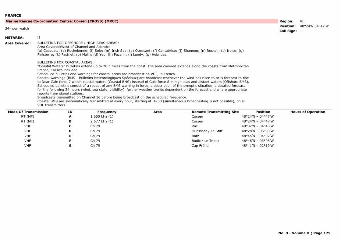
FRANCE
METAREA: II
Area Covered: BULLETINS FOR OFFSHORE / HIGH SEAS AREAS: Area Covered:West of Channel and Atlantic:
(a) Casquets; (e) Rochebonne; (i) Sole; (m) Irish Sea; (b) Ouessant; (f) Cantabrico; (j) Shannon; (n) Rockall; (c) Iroise; (g) Finisterre; (k) Fastnet; (o) Malin; (d) Yeu, (h) Pazenn; (l) Lundy; (p) Hebrides.
BULLETINS FOR COASTAL AREAS:"Coastal Waters" bulletins extend up to 20 n miles from the coast. The area covered extends along the coasts from Metropolitan France, Corsica included.Scheduled bulletins and warnings for coastal areas are broadcast on VHF, in French. Coastal warnings (BMS - Bulletins Météorologiques Spéciaux) are broadcast whenever the wind has risen to or is forecast to rise to Near Gale force 7 within coastal waters (Coastal BMS) instead of Gale force 8 in high seas and distant waters (Offshore BMS).Scheduled bulletins consist of a repeat of any BMS warning in force, a description of the synoptic situation, a detailed forecast for the following 24 hours (wind, sea state, visibility), further weather trends dependent on the forecast and where appropriate reports from signal stations.Broadcasts transmitted on Channel 16 before being broadcast on the scheduled frequency.Coastal BMS are systematically transmitted at every hour, starting at H+03 (simultaneous broadcasting is not possible), on all VHF transmitters.
Region: VIPosition: 48°24’N 04°47’W
Marine Rescue Co-ordination Centre: Corsen (CROSS) (MRCC)
--24-hour watch
Call Sign:
Mode Of Transmission ID Frequency Area Position Hours of OperationRemote Transmitting SiteRT (MF) A 1 650 kHz (1) Corsen 48°24’N – 04°47’WRT (MF) B 2 677 kHz (1) Corsen 48°24’N – 04°47’W
VHF C Ch 79 Raz 48°02’N – 04°43’WVHF D Ch 79 Ouessant / Le Stiff 48°28’N – 05°03’WVHF E Ch 79 Batz 48°45’N – 04°02’WVHF F Ch 79 Bodic / Le Trieux 48°48’N – 03°05’WVHF G Ch 79 Cap Fréhel 48°41’N – 02°19’W
No. 9 - Volume D ¦ Page 129
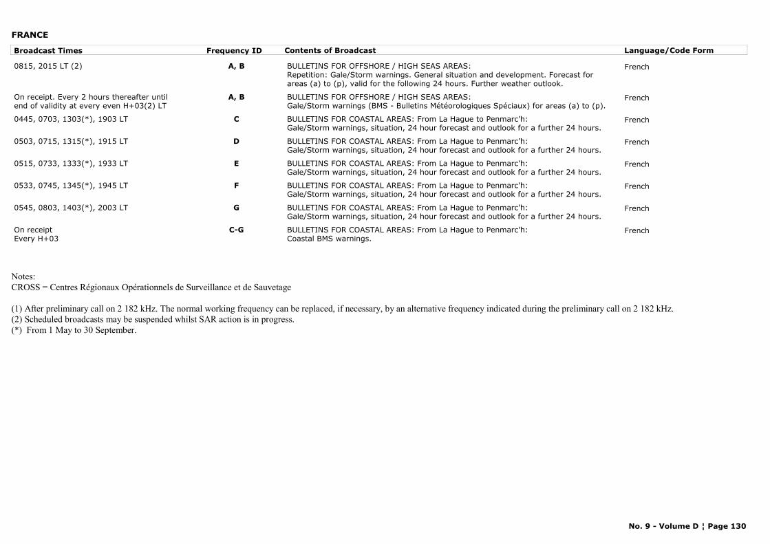
FRANCE
Broadcast Times Frequency ID Contents of Broadcast Language/Code Form
0815, 2015 LT (2) A, B BULLETINS FOR OFFSHORE / HIGH SEAS AREAS:Repetition: Gale/Storm warnings. General situation and development. Forecast for areas (a) to (p), valid for the following 24 hours. Further weather outlook.
French
On receipt. Every 2 hours thereafter until end of validity at every even H+03(2) LT
A, B BULLETINS FOR OFFSHORE / HIGH SEAS AREAS:Gale/Storm warnings (BMS - Bulletins Météorologiques Spéciaux) for areas (a) to (p).
French
0445, 0703, 1303(*), 1903 LT C BULLETINS FOR COASTAL AREAS: From La Hague to Penmarc’h: Gale/Storm warnings, situation, 24 hour forecast and outlook for a further 24 hours.
French
0503, 0715, 1315(*), 1915 LT D BULLETINS FOR COASTAL AREAS: From La Hague to Penmarc’h: Gale/Storm warnings, situation, 24 hour forecast and outlook for a further 24 hours.
French
0515, 0733, 1333(*), 1933 LT E BULLETINS FOR COASTAL AREAS: From La Hague to Penmarc’h: Gale/Storm warnings, situation, 24 hour forecast and outlook for a further 24 hours.
French
0533, 0745, 1345(*), 1945 LT F BULLETINS FOR COASTAL AREAS: From La Hague to Penmarc’h: Gale/Storm warnings, situation, 24 hour forecast and outlook for a further 24 hours.
French
0545, 0803, 1403(*), 2003 LT G BULLETINS FOR COASTAL AREAS: From La Hague to Penmarc’h: Gale/Storm warnings, situation, 24 hour forecast and outlook for a further 24 hours.
French
On receiptEvery H+03
C-G BULLETINS FOR COASTAL AREAS: From La Hague to Penmarc’h: Coastal BMS warnings.
French
Notes:CROSS = Centres Régionaux Opérationnels de Surveillance et de Sauvetage
(1) After preliminary call on 2 182 kHz. The normal working frequency can be replaced, if necessary, by an alternative frequency indicated during the preliminary call on 2 182 kHz.(2) Scheduled broadcasts may be suspended whilst SAR action is in progress.(*) From 1 May to 30 September.
No. 9 - Volume D ¦ Page 130
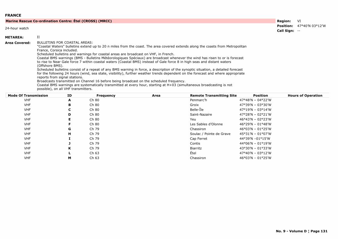
FRANCE
METAREA: II
Area Covered: BULLETINS FOR COASTAL AREAS:"Coastal Waters" bulletins extend up to 20 n miles from the coast. The area covered extends along the coasts from Metropolitan France, Corsica included.Scheduled bulletins and warnings for coastal areas are broadcast on VHF, in French. Coastal BMS warnings (BMS - Bulletins Météorologiques Spéciaux) are broadcast whenever the wind has risen to or is forecast to rise to Near Gale force 7 within coastal waters (Coastal BMS) instead of Gale force 8 in high seas and distant waters (Offshore BMS).Scheduled bulletins consist of a repeat of any BMS warning in force, a description of the synoptic situation, a detailed forecast for the following 24 hours (wind, sea state, visibility), further weather trends dependent on the forecast and where appropriate reports from signal stations.Broadcasts transmitted on Channel 16 before being broadcast on the scheduled frequency.Coastal BMS warnings are systematically transmitted at every hour, starting at H+03 (simultaneous broadcasting is not possible), on all VHF transmitters.
Region: VIPosition: 47°40’N 03°12’W
Marine Rescue Co-ordination Centre: Étel (CROSS) (MRCC)
--24-hour watch
Call Sign:
Mode Of Transmission ID Frequency Area Position Hours of OperationRemote Transmitting SiteVHF A Ch 80 Penmarc’h 47°48’N – 04°22’WVHF B Ch 80 Groix 47°39’N – 03°30’WVHF C Ch 80 Belle-Île 47°19’N – 03°14’WVHF D Ch 80 Saint-Nazaire 47°28’N – 02°21’WVHF E Ch 80 Yeu 46°43’N – 02°23’WVHF F Ch 80 Les Sables d’Olonne 46°29’N – 01°48’WVHF G Ch 79 Chassiron 46°03’N – 01°25’WVHF H Ch 79 Soulac / Pointe de Grave 45°31’N – 01°07’WVHF I Ch 79 Cap Ferret 44°39’N –01°15’WVHF J Ch 79 Contis 44°06’N – 01°19’WVHF K Ch 79 Biarritz 43°30’N – 01°33’WVHF L Ch 63 Étel 47°40’N – 03°12’WVHF M Ch 63 Chassiron 46°03’N – 01°25’W
No. 9 - Volume D ¦ Page 131
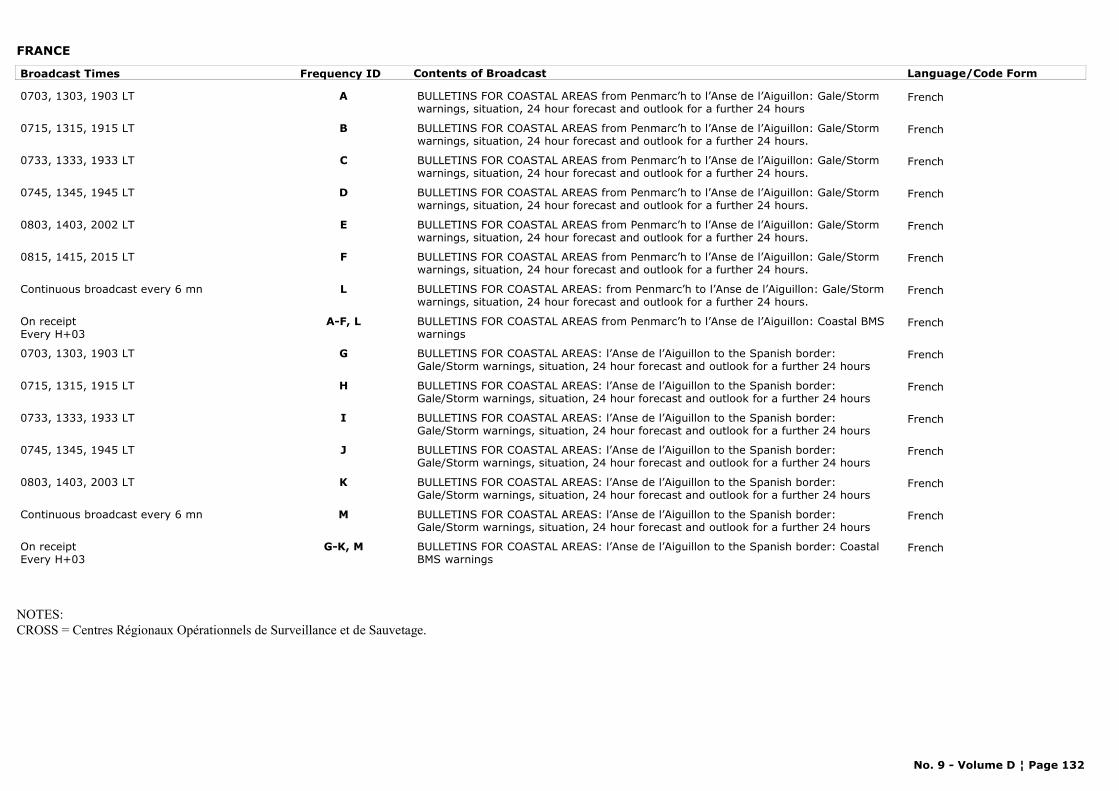
FRANCE
Broadcast Times Frequency ID Contents of Broadcast Language/Code Form
0703, 1303, 1903 LT A BULLETINS FOR COASTAL AREAS from Penmarc’h to l’Anse de l’Aiguillon: Gale/Storm warnings, situation, 24 hour forecast and outlook for a further 24 hours
French
0715, 1315, 1915 LT B BULLETINS FOR COASTAL AREAS from Penmarc’h to l’Anse de l’Aiguillon: Gale/Storm warnings, situation, 24 hour forecast and outlook for a further 24 hours.
French
0733, 1333, 1933 LT C BULLETINS FOR COASTAL AREAS from Penmarc’h to l’Anse de l’Aiguillon: Gale/Storm warnings, situation, 24 hour forecast and outlook for a further 24 hours.
French
0745, 1345, 1945 LT D BULLETINS FOR COASTAL AREAS from Penmarc’h to l’Anse de l’Aiguillon: Gale/Storm warnings, situation, 24 hour forecast and outlook for a further 24 hours.
French
0803, 1403, 2002 LT E BULLETINS FOR COASTAL AREAS from Penmarc’h to l’Anse de l’Aiguillon: Gale/Storm warnings, situation, 24 hour forecast and outlook for a further 24 hours.
French
0815, 1415, 2015 LT F BULLETINS FOR COASTAL AREAS from Penmarc’h to l’Anse de l’Aiguillon: Gale/Storm warnings, situation, 24 hour forecast and outlook for a further 24 hours.
French
Continuous broadcast every 6 mn L BULLETINS FOR COASTAL AREAS: from Penmarc’h to l’Anse de l’Aiguillon: Gale/Storm warnings, situation, 24 hour forecast and outlook for a further 24 hours.
French
On receiptEvery H+03
A-F, L BULLETINS FOR COASTAL AREAS from Penmarc’h to l’Anse de l’Aiguillon: Coastal BMS warnings
French
0703, 1303, 1903 LT G BULLETINS FOR COASTAL AREAS: l’Anse de l’Aiguillon to the Spanish border: Gale/Storm warnings, situation, 24 hour forecast and outlook for a further 24 hours
French
0715, 1315, 1915 LT H BULLETINS FOR COASTAL AREAS: l’Anse de l’Aiguillon to the Spanish border: Gale/Storm warnings, situation, 24 hour forecast and outlook for a further 24 hours
French
0733, 1333, 1933 LT I BULLETINS FOR COASTAL AREAS: l’Anse de l’Aiguillon to the Spanish border: Gale/Storm warnings, situation, 24 hour forecast and outlook for a further 24 hours
French
0745, 1345, 1945 LT J BULLETINS FOR COASTAL AREAS: l’Anse de l’Aiguillon to the Spanish border: Gale/Storm warnings, situation, 24 hour forecast and outlook for a further 24 hours
French
0803, 1403, 2003 LT K BULLETINS FOR COASTAL AREAS: l’Anse de l’Aiguillon to the Spanish border: Gale/Storm warnings, situation, 24 hour forecast and outlook for a further 24 hours
French
Continuous broadcast every 6 mn M BULLETINS FOR COASTAL AREAS: l’Anse de l’Aiguillon to the Spanish border: Gale/Storm warnings, situation, 24 hour forecast and outlook for a further 24 hours
French
On receiptEvery H+03
G-K, M BULLETINS FOR COASTAL AREAS: l’Anse de l’Aiguillon to the Spanish border: Coastal BMS warnings
French
NOTES:CROSS = Centres Régionaux Opérationnels de Surveillance et de Sauvetage.
No. 9 - Volume D ¦ Page 132
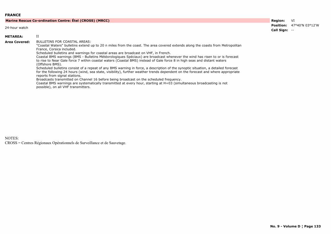
FRANCE
METAREA: II
Area Covered: BULLETINS FOR COASTAL AREAS:"Coastal Waters" bulletins extend up to 20 n miles from the coast. The area covered extends along the coasts from Metropolitan France, Corsica included.Scheduled bulletins and warnings for coastal areas are broadcast on VHF, in French. Coastal BMS warnings (BMS - Bulletins Météorologiques Spéciaux) are broadcast whenever the wind has risen to or is forecast to rise to Near Gale force 7 within coastal waters (Coastal BMS) instead of Gale force 8 in high seas and distant waters (Offshore BMS).Scheduled bulletins consist of a repeat of any BMS warning in force, a description of the synoptic situation, a detailed forecast for the following 24 hours (wind, sea state, visibility), further weather trends dependent on the forecast and where appropriate reports from signal stations.Broadcasts transmitted on Channel 16 before being broadcast on the scheduled frequency.Coastal BMS warnings are systematically transmitted at every hour, starting at H+03 (simultaneous broadcasting is not possible), on all VHF transmitters.
Region: VIPosition: 47°40’N 03°12’W
Marine Rescue Co-ordination Centre: Étel (CROSS) (MRCC)
--24-hour watch
Call Sign:
NOTES:CROSS = Centres Régionaux Opérationnels de Surveillance et de Sauvetage.
No. 9 - Volume D ¦ Page 133
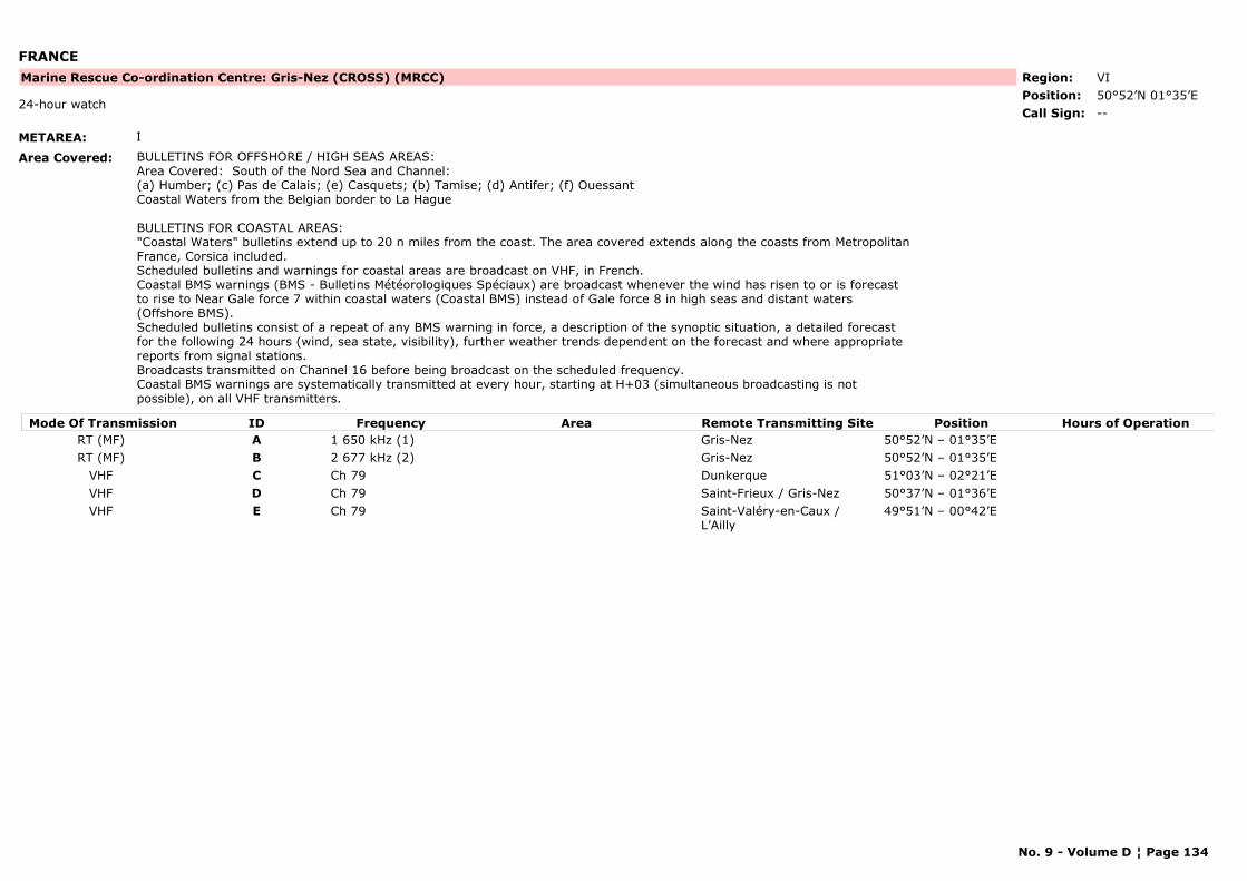
FRANCE
METAREA: I
Area Covered: BULLETINS FOR OFFSHORE / HIGH SEAS AREAS:Area Covered: South of the Nord Sea and Channel: (a) Humber; (c) Pas de Calais; (e) Casquets; (b) Tamise; (d) Antifer; (f) Ouessant Coastal Waters from the Belgian border to La Hague
BULLETINS FOR COASTAL AREAS:"Coastal Waters" bulletins extend up to 20 n miles from the coast. The area covered extends along the coasts from Metropolitan France, Corsica included.Scheduled bulletins and warnings for coastal areas are broadcast on VHF, in French. Coastal BMS warnings (BMS - Bulletins Météorologiques Spéciaux) are broadcast whenever the wind has risen to or is forecast to rise to Near Gale force 7 within coastal waters (Coastal BMS) instead of Gale force 8 in high seas and distant waters (Offshore BMS).Scheduled bulletins consist of a repeat of any BMS warning in force, a description of the synoptic situation, a detailed forecast for the following 24 hours (wind, sea state, visibility), further weather trends dependent on the forecast and where appropriate reports from signal stations.Broadcasts transmitted on Channel 16 before being broadcast on the scheduled frequency.Coastal BMS warnings are systematically transmitted at every hour, starting at H+03 (simultaneous broadcasting is not possible), on all VHF transmitters.
Region: VIPosition: 50°52’N 01°35’E
Marine Rescue Co-ordination Centre: Gris-Nez (CROSS) (MRCC)
--24-hour watch
Call Sign:
Mode Of Transmission ID Frequency Area Position Hours of OperationRemote Transmitting SiteRT (MF) A 1 650 kHz (1) Gris-Nez 50°52’N – 01°35’ERT (MF) B 2 677 kHz (2) Gris-Nez 50°52’N – 01°35’E
VHF C Ch 79 Dunkerque 51°03’N – 02°21’EVHF D Ch 79 Saint-Frieux / Gris-Nez 50°37’N – 01°36’EVHF E Ch 79 Saint-Valéry-en-Caux /
L’Ailly49°51’N – 00°42’E
No. 9 - Volume D ¦ Page 134
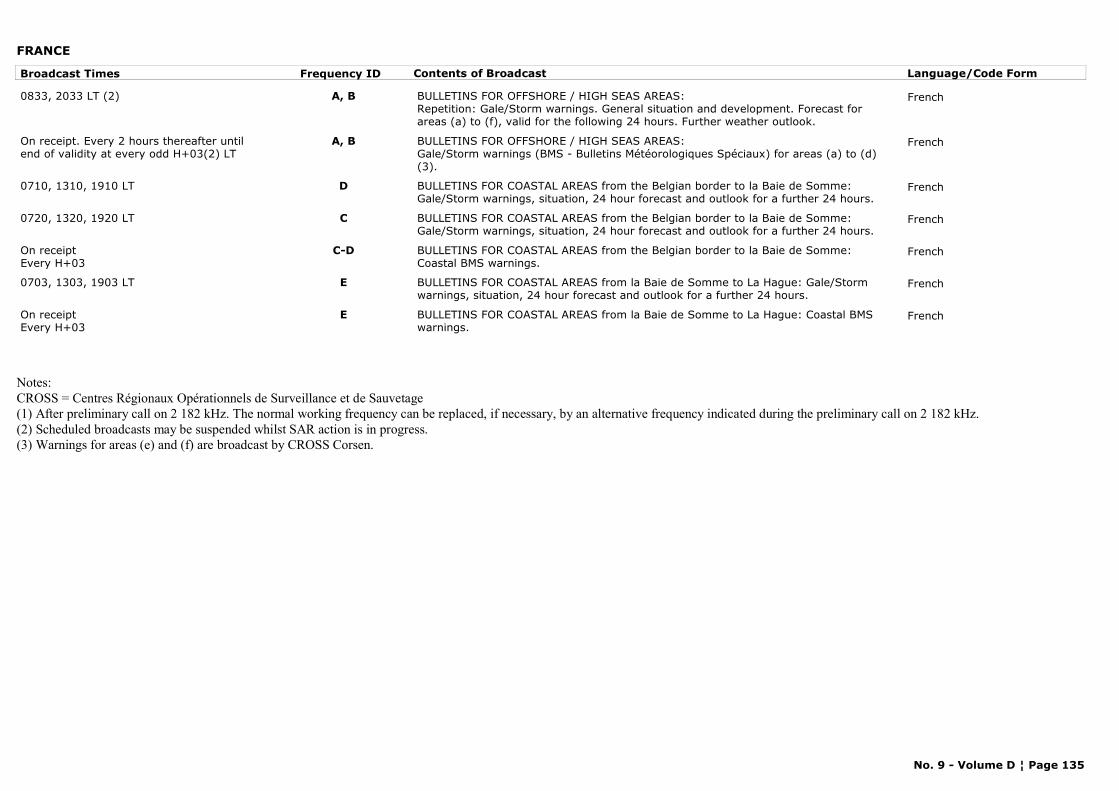
FRANCE
Broadcast Times Frequency ID Contents of Broadcast Language/Code Form
0833, 2033 LT (2) A, B BULLETINS FOR OFFSHORE / HIGH SEAS AREAS:Repetition: Gale/Storm warnings. General situation and development. Forecast for areas (a) to (f), valid for the following 24 hours. Further weather outlook.
French
On receipt. Every 2 hours thereafter until end of validity at every odd H+03(2) LT
A, B BULLETINS FOR OFFSHORE / HIGH SEAS AREAS:Gale/Storm warnings (BMS - Bulletins Météorologiques Spéciaux) for areas (a) to (d) (3).
French
0710, 1310, 1910 LT D BULLETINS FOR COASTAL AREAS from the Belgian border to la Baie de Somme: Gale/Storm warnings, situation, 24 hour forecast and outlook for a further 24 hours.
French
0720, 1320, 1920 LT C BULLETINS FOR COASTAL AREAS from the Belgian border to la Baie de Somme: Gale/Storm warnings, situation, 24 hour forecast and outlook for a further 24 hours.
French
On receiptEvery H+03
C-D BULLETINS FOR COASTAL AREAS from the Belgian border to la Baie de Somme: Coastal BMS warnings.
French
0703, 1303, 1903 LT E BULLETINS FOR COASTAL AREAS from la Baie de Somme to La Hague: Gale/Storm warnings, situation, 24 hour forecast and outlook for a further 24 hours.
French
On receiptEvery H+03
E BULLETINS FOR COASTAL AREAS from la Baie de Somme to La Hague: Coastal BMS warnings.
French
Notes:CROSS = Centres Régionaux Opérationnels de Surveillance et de Sauvetage(1) After preliminary call on 2 182 kHz. The normal working frequency can be replaced, if necessary, by an alternative frequency indicated during the preliminary call on 2 182 kHz.(2) Scheduled broadcasts may be suspended whilst SAR action is in progress.(3) Warnings for areas (e) and (f) are broadcast by CROSS Corsen.
No. 9 - Volume D ¦ Page 135
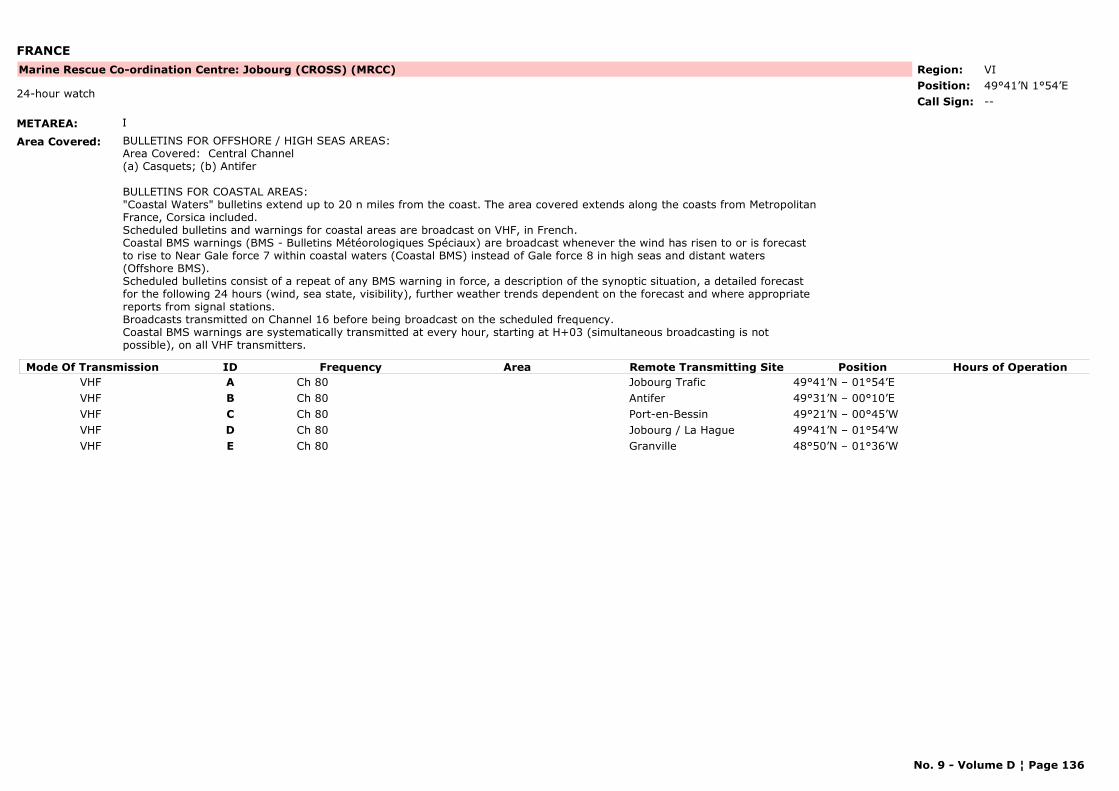
FRANCE
METAREA: I
Area Covered: BULLETINS FOR OFFSHORE / HIGH SEAS AREAS:Area Covered: Central Channel (a) Casquets; (b) Antifer BULLETINS FOR COASTAL AREAS:"Coastal Waters" bulletins extend up to 20 n miles from the coast. The area covered extends along the coasts from Metropolitan France, Corsica included.Scheduled bulletins and warnings for coastal areas are broadcast on VHF, in French. Coastal BMS warnings (BMS - Bulletins Météorologiques Spéciaux) are broadcast whenever the wind has risen to or is forecast to rise to Near Gale force 7 within coastal waters (Coastal BMS) instead of Gale force 8 in high seas and distant waters (Offshore BMS).Scheduled bulletins consist of a repeat of any BMS warning in force, a description of the synoptic situation, a detailed forecast for the following 24 hours (wind, sea state, visibility), further weather trends dependent on the forecast and where appropriate reports from signal stations.Broadcasts transmitted on Channel 16 before being broadcast on the scheduled frequency.Coastal BMS warnings are systematically transmitted at every hour, starting at H+03 (simultaneous broadcasting is not possible), on all VHF transmitters.
Region: VIPosition: 49°41’N 1°54’E
Marine Rescue Co-ordination Centre: Jobourg (CROSS) (MRCC)
--24-hour watch
Call Sign:
Mode Of Transmission ID Frequency Area Position Hours of OperationRemote Transmitting SiteVHF A Ch 80 Jobourg Trafic 49°41’N – 01°54’EVHF B Ch 80 Antifer 49°31’N – 00°10’EVHF C Ch 80 Port-en-Bessin 49°21’N – 00°45’WVHF D Ch 80 Jobourg / La Hague 49°41’N – 01°54’WVHF E Ch 80 Granville 48°50’N – 01°36’W
No. 9 - Volume D ¦ Page 136
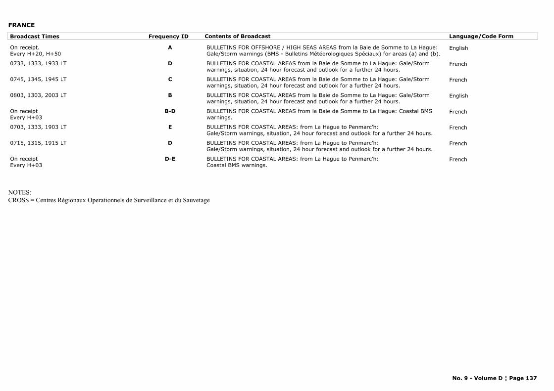
FRANCE
Broadcast Times Frequency ID Contents of Broadcast Language/Code Form
On receipt.Every H+20, H+50
A BULLETINS FOR OFFSHORE / HIGH SEAS AREAS from la Baie de Somme to La Hague: Gale/Storm warnings (BMS - Bulletins Météorologiques Spéciaux) for areas (a) and (b).
English
0733, 1333, 1933 LT D BULLETINS FOR COASTAL AREAS from la Baie de Somme to La Hague: Gale/Storm warnings, situation, 24 hour forecast and outlook for a further 24 hours.
French
0745, 1345, 1945 LT C BULLETINS FOR COASTAL AREAS from la Baie de Somme to La Hague: Gale/Storm warnings, situation, 24 hour forecast and outlook for a further 24 hours.
French
0803, 1303, 2003 LT B BULLETINS FOR COASTAL AREAS from la Baie de Somme to La Hague: Gale/Storm warnings, situation, 24 hour forecast and outlook for a further 24 hours.
English
On receiptEvery H+03
B-D BULLETINS FOR COASTAL AREAS from la Baie de Somme to La Hague: Coastal BMS warnings.
French
0703, 1333, 1903 LT E BULLETINS FOR COASTAL AREAS: from La Hague to Penmarc’h:Gale/Storm warnings, situation, 24 hour forecast and outlook for a further 24 hours.
French
0715, 1315, 1915 LT D BULLETINS FOR COASTAL AREAS: from La Hague to Penmarc’h:Gale/Storm warnings, situation, 24 hour forecast and outlook for a further 24 hours.
French
On receiptEvery H+03
D-E BULLETINS FOR COASTAL AREAS: from La Hague to Penmarc’h:Coastal BMS warnings.
French
NOTES:CROSS = Centres Régionaux Operationnels de Surveillance et du Sauvetage
No. 9 - Volume D ¦ Page 137
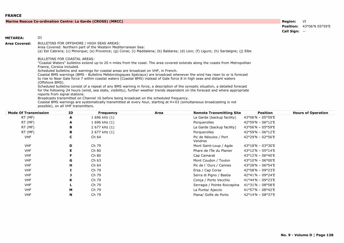
FRANCE
METAREA: III
Area Covered: BULLETINS FOR OFFSHORE / HIGH SEAS AREAS:Area Covered: Northern part of the Western Mediterranean Sea:
(a) Est Cabrera; (c) Minorque; (e) Provence; (g) Corse; (i) Maddalena; (b) Baléares; (d) Lion; (f) Ligure; (h) Sardaigne; (j) Elbe
BULLETINS FOR COASTAL AREAS:"Coastal Waters" bulletins extend up to 20 n miles from the coast. The area covered extends along the coasts from Metropolitan France, Corsica included.Scheduled bulletins and warnings for coastal areas are broadcast on VHF, in French. Coastal BMS warnings (BMS - Bulletins Météorologiques Spéciaux) are broadcast whenever the wind has risen to or is forecast to rise to Near Gale force 7 within coastal waters (Coastal BMS) instead of Gale force 8 in high seas and distant waters (Offshore BMS).Scheduled bulletins consist of a repeat of any BMS warning in force, a description of the synoptic situation, a detailed forecast for the following 24 hours (wind, sea state, visibility), further weather trends dependent on the forecast and where appropriate reports from signal stations.Broadcasts transmitted on Channel 16 before being broadcast on the scheduled frequency.Coastal BMS warnings are systematically transmitted at every hour, starting at H+03 (simultaneous broadcasting is not possible), on all VHF transmitters.
Region: VIPosition: 43°06’N 05°59’E
Marine Rescue Co-ordination Centre: La Garde (CROSS) (MRCC)
--Call Sign:
Mode Of Transmission ID Frequency Area Position Hours of OperationRemote Transmitting SiteRT (MF) A 1 696 kHz (1) La Garde (backup facility) 43°06’N – 05°59’ERT (MF) A 1 696 kHz (1) Porquerolles 42°59’N – 06°12’ERT (MF) B 2 677 kHz (1) La Garde (backup facility) 43°06’N – 05°59’ERT (MF) B 2 677 kHz (1) Porquerolles 42°59’N – 06°12’E
VHF C Ch 64 Pic de Néoulos / Port Vendres
42°29’N – 02°56’E
VHF D Ch 79 Mont Saint-Loup / Agde 43°18’N – 03°30’EVHF E Ch 80 Phare de l’île du Planier 43°12’N – 05°14’EVHF F Ch 80 Cap Camarat 43°12’N – 06°40’EVHF G Ch 63 Mont Coudon / Toulon 43°10’N – 06°00’EVHF H Ch 64 Pic de l´Ours / Cannes 43°28’N – 06°54’EVHF I Ch 79 Ersa / Cap Corse 42°58’N – 09°23’EVHF J Ch 79 Serra di Pigno / Bastia 42°41’N – 09°24’EVHF K Ch 79 Conça / Porto Vecchio 41°44’N – 09°23’EVHF L Ch 79 Serragia / Pointe Roccapina 41°31’N – 08°58’EVHF M Ch 79 La Punta/ Ajaccio 41°57’N – 08°42’EVHF N Ch 79 Piana/ Golfe de Porto 42°14’N – 08°37’E
No. 9 - Volume D ¦ Page 138
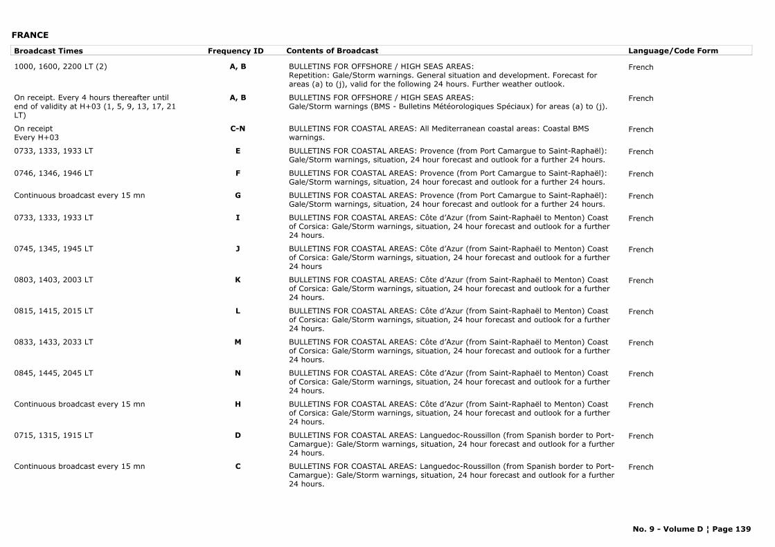
FRANCE
Broadcast Times Frequency ID Contents of Broadcast Language/Code Form
1000, 1600, 2200 LT (2) A, B BULLETINS FOR OFFSHORE / HIGH SEAS AREAS:Repetition: Gale/Storm warnings. General situation and development. Forecast for areas (a) to (j), valid for the following 24 hours. Further weather outlook.
French
On receipt. Every 4 hours thereafter until end of validity at H+03 (1, 5, 9, 13, 17, 21 LT)
A, B BULLETINS FOR OFFSHORE / HIGH SEAS AREAS:Gale/Storm warnings (BMS - Bulletins Météorologiques Spéciaux) for areas (a) to (j).
French
On receiptEvery H+03
C-N BULLETINS FOR COASTAL AREAS: All Mediterranean coastal areas: Coastal BMS warnings.
French
0733, 1333, 1933 LT E BULLETINS FOR COASTAL AREAS: Provence (from Port Camargue to Saint-Raphaël): Gale/Storm warnings, situation, 24 hour forecast and outlook for a further 24 hours.
French
0746, 1346, 1946 LT F BULLETINS FOR COASTAL AREAS: Provence (from Port Camargue to Saint-Raphaël): Gale/Storm warnings, situation, 24 hour forecast and outlook for a further 24 hours.
French
Continuous broadcast every 15 mn G BULLETINS FOR COASTAL AREAS: Provence (from Port Camargue to Saint-Raphaël): Gale/Storm warnings, situation, 24 hour forecast and outlook for a further 24 hours.
French
0733, 1333, 1933 LT I BULLETINS FOR COASTAL AREAS: Côte d’Azur (from Saint-Raphaël to Menton) Coast of Corsica: Gale/Storm warnings, situation, 24 hour forecast and outlook for a further 24 hours.
French
0745, 1345, 1945 LT J BULLETINS FOR COASTAL AREAS: Côte d’Azur (from Saint-Raphaël to Menton) Coast of Corsica: Gale/Storm warnings, situation, 24 hour forecast and outlook for a further 24 hours
French
0803, 1403, 2003 LT K BULLETINS FOR COASTAL AREAS: Côte d’Azur (from Saint-Raphaël to Menton) Coast of Corsica: Gale/Storm warnings, situation, 24 hour forecast and outlook for a further 24 hours.
French
0815, 1415, 2015 LT L BULLETINS FOR COASTAL AREAS: Côte d’Azur (from Saint-Raphaël to Menton) Coast of Corsica: Gale/Storm warnings, situation, 24 hour forecast and outlook for a further 24 hours.
French
0833, 1433, 2033 LT M BULLETINS FOR COASTAL AREAS: Côte d’Azur (from Saint-Raphaël to Menton) Coast of Corsica: Gale/Storm warnings, situation, 24 hour forecast and outlook for a further 24 hours.
French
0845, 1445, 2045 LT N BULLETINS FOR COASTAL AREAS: Côte d’Azur (from Saint-Raphaël to Menton) Coast of Corsica: Gale/Storm warnings, situation, 24 hour forecast and outlook for a further 24 hours.
French
Continuous broadcast every 15 mn H BULLETINS FOR COASTAL AREAS: Côte d’Azur (from Saint-Raphaël to Menton) Coast of Corsica: Gale/Storm warnings, situation, 24 hour forecast and outlook for a further 24 hours.
French
0715, 1315, 1915 LT D BULLETINS FOR COASTAL AREAS: Languedoc-Roussillon (from Spanish border to Port-Camargue): Gale/Storm warnings, situation, 24 hour forecast and outlook for a further 24 hours.
French
Continuous broadcast every 15 mn C BULLETINS FOR COASTAL AREAS: Languedoc-Roussillon (from Spanish border to Port-Camargue): Gale/Storm warnings, situation, 24 hour forecast and outlook for a further 24 hours.
French
No. 9 - Volume D ¦ Page 139
FRANCE
Notes:CROSS = Centres Régionaux Opérationnels de Surveillance et de Sauvetage(1) After preliminary call on 2 182 kHz. The normal working frequency can be replaced, if necessary, by an alternative frequency indicated during the preliminary call on 2 182 kHz.(2) Scheduled broadcasts may be suspended whilst SAR action is in progress.
No. 9 - Volume D ¦ Page 140
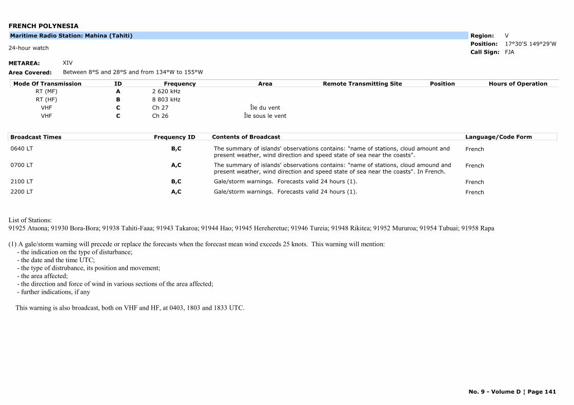
FRENCH POLYNESIA
METAREA: XIV
Area Covered: Between 8°S and 28°S and from 134°W to 155°W
Region: VPosition: 17°30'S 149°29'W
FJA24-hour watch
Call Sign:
Maritime Radio Station: Mahina (Tahiti)
Mode Of Transmission ID Frequency Area Position Hours of OperationRemote Transmitting SiteRT (MF) A 2 620 kHzRT (HF) B 8 803 kHz
VHF C Ch 27 Île du ventVHF C Ch 26 Île sous le vent
Broadcast Times Frequency ID Contents of Broadcast Language/Code Form
0640 LT B,C The summary of islands' observations contains: "name of stations, cloud amount and present weather, wind direction and speed state of sea near the coasts".
French
0700 LT A,C The summary of islands' observations contains: "name of stations, cloud amound and present weather, wind direction and speed state of sea near the coasts". In French.
French
2100 LT B,C Gale/storm warnings. Forecasts valid 24 hours (1). French
2200 LT A,C Gale/storm warnings. Forecasts valid 24 hours (1). French
List of Stations: 91925 Atuona; 91930 Bora-Bora; 91938 Tahiti-Faaa; 91943 Takaroa; 91944 Hao; 91945 Hereheretue; 91946 Tureia; 91948 Rikitea; 91952 Mururoa; 91954 Tubuai; 91958 Rapa
(1) A gale/storm warning will precede or replace the forecasts when the forecast mean wind exceeds 25 knots. This warning will mention: - the indication on the type of disturbance; - the date and the time UTC; - the type of distrubance, its position and movement; - the area affected; - the direction and force of wind in various sections of the area affected; - further indications, if any
This warning is also broadcast, both on VHF and HF, at 0403, 1803 and 1833 UTC.
No. 9 - Volume D ¦ Page 141
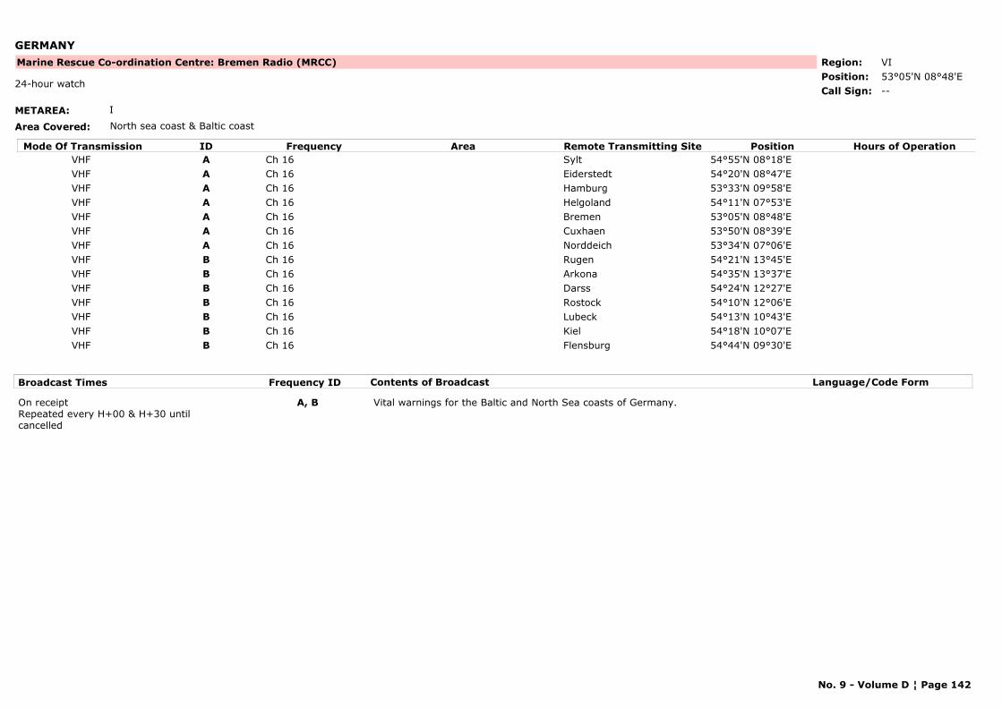
GERMANY
METAREA: I
Area Covered: North sea coast & Baltic coast
Region: VIPosition: 53°05'N 08°48'E
Marine Rescue Co-ordination Centre: Bremen Radio (MRCC)
--24-hour watch
Call Sign:
Mode Of Transmission ID Frequency Area Position Hours of OperationRemote Transmitting SiteVHF A Ch 16 Sylt 54°55'N 08°18'EVHF A Ch 16 Eiderstedt 54°20'N 08°47'EVHF A Ch 16 Hamburg 53°33'N 09°58'EVHF A Ch 16 Helgoland 54°11'N 07°53'EVHF A Ch 16 Bremen 53°05'N 08°48'EVHF A Ch 16 Cuxhaen 53°50'N 08°39'EVHF A Ch 16 Norddeich 53°34'N 07°06'EVHF B Ch 16 Rugen 54°21'N 13°45'EVHF B Ch 16 Arkona 54°35'N 13°37'EVHF B Ch 16 Darss 54°24'N 12°27'EVHF B Ch 16 Rostock 54°10'N 12°06'EVHF B Ch 16 Lubeck 54°13'N 10°43'EVHF B Ch 16 Kiel 54°18'N 10°07'EVHF B Ch 16 Flensburg 54°44'N 09°30'E
Broadcast Times Frequency ID Contents of Broadcast Language/Code Form
On receiptRepeated every H+00 & H+30 until cancelled
A, B Vital warnings for the Baltic and North Sea coasts of Germany.
No. 9 - Volume D ¦ Page 142
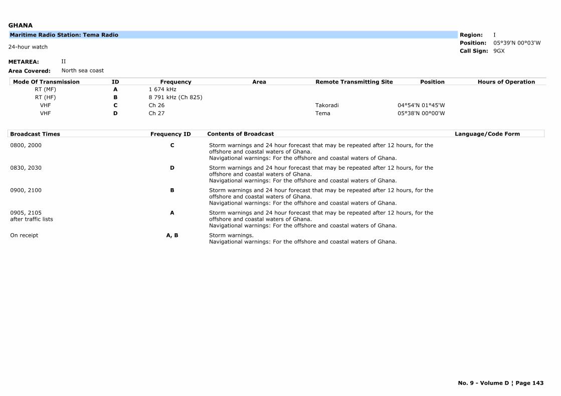
GHANA
METAREA: II
Area Covered: North sea coast
Region: IPosition: 05°39'N 00°03'W
9GX24-hour watch
Call Sign:
Maritime Radio Station: Tema Radio
Mode Of Transmission ID Frequency Area Position Hours of OperationRemote Transmitting SiteRT (MF) A 1 674 kHzRT (HF) B 8 791 kHz (Ch 825)
VHF C Ch 26 Takoradi 04°54'N 01°45'WVHF D Ch 27 Tema 05°38'N 00°00'W
Broadcast Times Frequency ID Contents of Broadcast Language/Code Form
0800, 2000 C Storm warnings and 24 hour forecast that may be repeated after 12 hours, for the offshore and coastal waters of Ghana.Navigational warnings: For the offshore and coastal waters of Ghana.
0830, 2030 D Storm warnings and 24 hour forecast that may be repeated after 12 hours, for the offshore and coastal waters of Ghana.Navigational warnings: For the offshore and coastal waters of Ghana.
0900, 2100 B Storm warnings and 24 hour forecast that may be repeated after 12 hours, for the offshore and coastal waters of Ghana.Navigational warnings: For the offshore and coastal waters of Ghana.
0905, 2105after traffic lists
A Storm warnings and 24 hour forecast that may be repeated after 12 hours, for the offshore and coastal waters of Ghana.Navigational warnings: For the offshore and coastal waters of Ghana.
On receipt A, B Storm warnings.Navigational warnings: For the offshore and coastal waters of Ghana.
No. 9 - Volume D ¦ Page 143
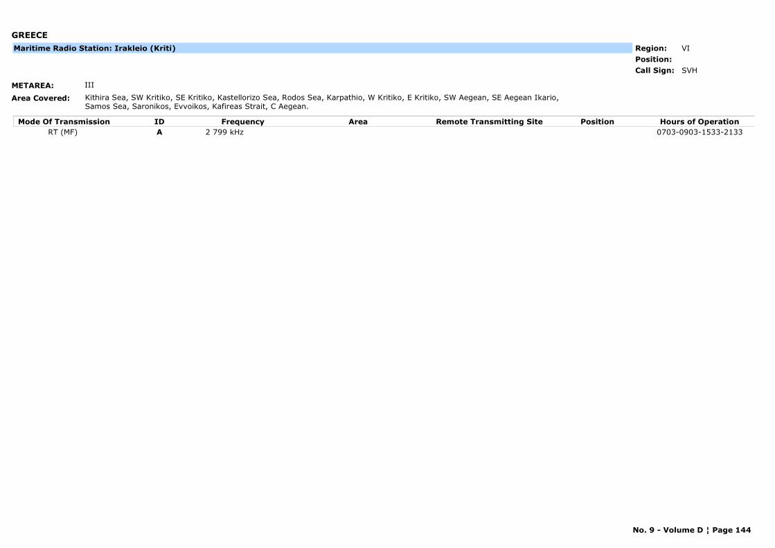
GREECE
METAREA: III
Area Covered: Kithira Sea, SW Kritiko, SE Kritiko, Kastellorizo Sea, Rodos Sea, Karpathio, W Kritiko, E Kritiko, SW Aegean, SE Aegean Ikario, Samos Sea, Saronikos, Evvoikos, Kafireas Strait, C Aegean.
Region: VIPosition:
SVHCall Sign:
Maritime Radio Station: Irakleio (Kriti)
Mode Of Transmission ID Frequency Area Position Hours of OperationRemote Transmitting SiteRT (MF) A 2 799 kHz 0703-0903-1533-2133
No. 9 - Volume D ¦ Page 144
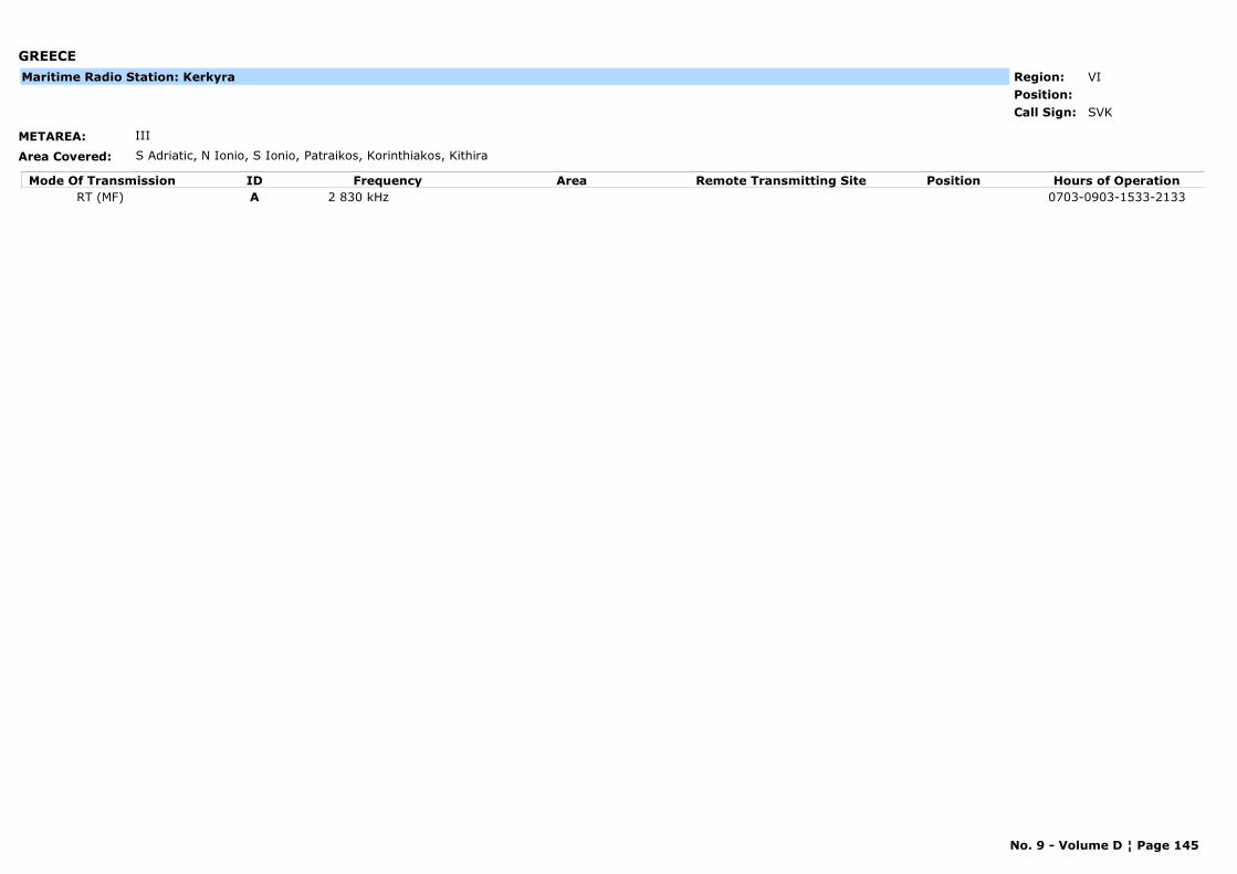
GREECE
METAREA: III
Area Covered: S Adriatic, N Ionio, S Ionio, Patraikos, Korinthiakos, Kithira
Region: VIPosition:
SVKCall Sign:
Maritime Radio Station: Kerkyra
Mode Of Transmission ID Frequency Area Position Hours of OperationRemote Transmitting SiteRT (MF) A 2 830 kHz 0703-0903-1533-2133
No. 9 - Volume D ¦ Page 145
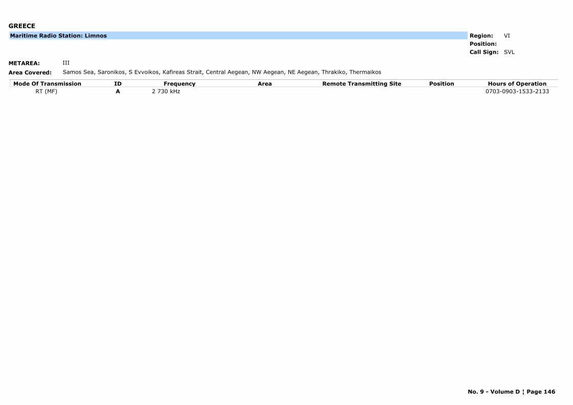
GREECE
METAREA: III
Area Covered: Samos Sea, Saronikos, S Evvoikos, Kafireas Strait, Central Aegean, NW Aegean, NE Aegean, Thrakiko, Thermaikos
Region: VIPosition:
SVLCall Sign:
Maritime Radio Station: Limnos
Mode Of Transmission ID Frequency Area Position Hours of OperationRemote Transmitting SiteRT (MF) A 2 730 kHz 0703-0903-1533-2133
No. 9 - Volume D ¦ Page 146
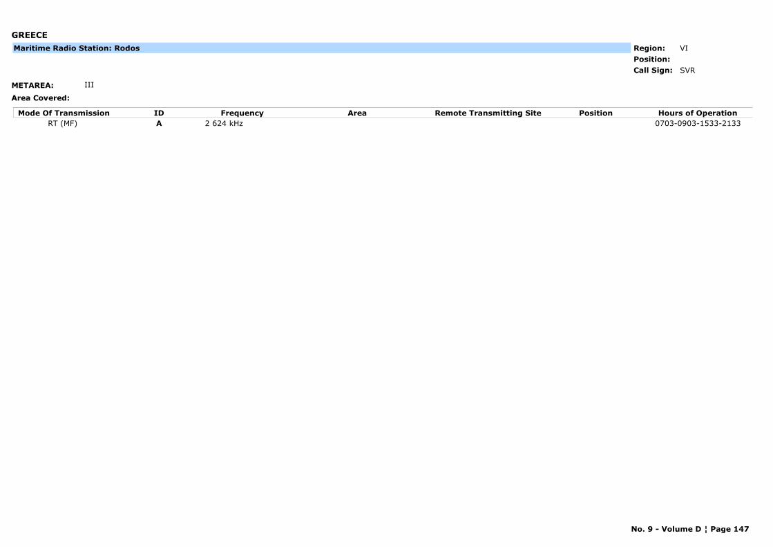
GREECE
METAREA: III
Area Covered:
Region: VIPosition:
SVRCall Sign:
Maritime Radio Station: Rodos
Mode Of Transmission ID Frequency Area Position Hours of OperationRemote Transmitting SiteRT (MF) A 2 624 kHz 0703-0903-1533-2133
No. 9 - Volume D ¦ Page 147
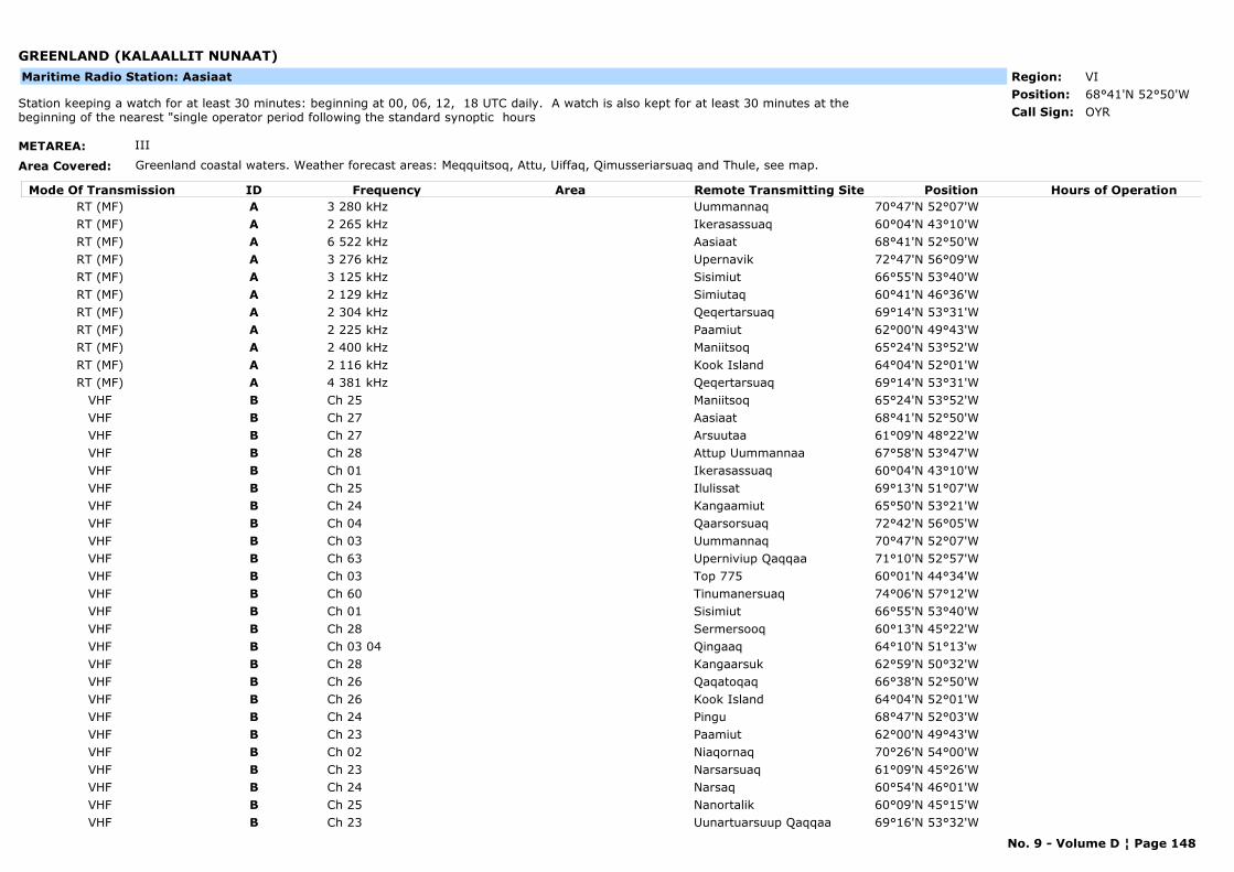
GREENLAND (KALAALLIT NUNAAT)
METAREA: III
Area Covered: Greenland coastal waters. Weather forecast areas: Meqquitsoq, Attu, Uiffaq, Qimusseriarsuaq and Thule, see map.
Region: VIPosition: 68°41'N 52°50'W
OYRStation keeping a watch for at least 30 minutes: beginning at 00, 06, 12, 18 UTC daily. A watch is also kept for at least 30 minutes at the beginning of the nearest "single operator period following the standard synoptic hours Call Sign:
Maritime Radio Station: Aasiaat
Mode Of Transmission ID Frequency Area Position Hours of OperationRemote Transmitting SiteRT (MF) A 3 280 kHz Uummannaq 70°47'N 52°07'WRT (MF) A 2 265 kHz Ikerasassuaq 60°04'N 43°10'WRT (MF) A 6 522 kHz Aasiaat 68°41'N 52°50'WRT (MF) A 3 276 kHz Upernavik 72°47'N 56°09'WRT (MF) A 3 125 kHz Sisimiut 66°55'N 53°40'WRT (MF) A 2 129 kHz Simiutaq 60°41'N 46°36'WRT (MF) A 2 304 kHz Qeqertarsuaq 69°14'N 53°31'WRT (MF) A 2 225 kHz Paamiut 62°00'N 49°43'WRT (MF) A 2 400 kHz Maniitsoq 65°24'N 53°52'WRT (MF) A 2 116 kHz Kook Island 64°04'N 52°01'WRT (MF) A 4 381 kHz Qeqertarsuaq 69°14'N 53°31'W
VHF B Ch 25 Maniitsoq 65°24'N 53°52'WVHF B Ch 27 Aasiaat 68°41'N 52°50'WVHF B Ch 27 Arsuutaa 61°09'N 48°22'WVHF B Ch 28 Attup Uummannaa 67°58'N 53°47'WVHF B Ch 01 Ikerasassuaq 60°04'N 43°10'WVHF B Ch 25 Ilulissat 69°13'N 51°07'WVHF B Ch 24 Kangaamiut 65°50'N 53°21'WVHF B Ch 04 Qaarsorsuaq 72°42'N 56°05'WVHF B Ch 03 Uummannaq 70°47'N 52°07'WVHF B Ch 63 Uperniviup Qaqqaa 71°10'N 52°57'WVHF B Ch 03 Top 775 60°01'N 44°34'WVHF B Ch 60 Tinumanersuaq 74°06'N 57°12'WVHF B Ch 01 Sisimiut 66°55'N 53°40'WVHF B Ch 28 Sermersooq 60°13'N 45°22'WVHF B Ch 03 04 Qingaaq 64°10'N 51°13'wVHF B Ch 28 Kangaarsuk 62°59'N 50°32'WVHF B Ch 26 Qaqatoqaq 66°38'N 52°50'WVHF B Ch 26 Kook Island 64°04'N 52°01'WVHF B Ch 24 Pingu 68°47'N 52°03'WVHF B Ch 23 Paamiut 62°00'N 49°43'WVHF B Ch 02 Niaqornaq 70°26'N 54°00'WVHF B Ch 23 Narsarsuaq 61°09'N 45°26'WVHF B Ch 24 Narsaq 60°54'N 46°01'WVHF B Ch 25 Nanortalik 60°09'N 45°15'WVHF B Ch 23 Uunartuarsuup Qaqqaa 69°16'N 53°32'W
No. 9 - Volume D ¦ Page 148
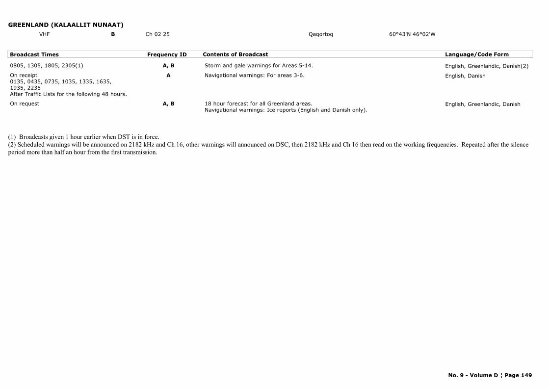
GREENLAND (KALAALLIT NUNAAT)VHF B Ch 02 25 Qaqortoq 60°43'N 46°02'W
Broadcast Times Frequency ID Contents of Broadcast Language/Code Form
0805, 1305, 1805, 2305(1) A, B Storm and gale warnings for Areas 5-14. English, Greenlandic, Danish(2)
On receipt0135, 0435, 0735, 1035, 1335, 1635, 1935, 2235After Traffic Lists for the following 48 hours.
A Navigational warnings: For areas 3-6. English, Danish
On request A, B 18 hour forecast for all Greenland areas. Navigational warnings: Ice reports (English and Danish only).
English, Greenlandic, Danish
(1) Broadcasts given 1 hour earlier when DST is in force.(2) Scheduled warnings will be announced on 2182 kHz and Ch 16, other warnings will announced on DSC, then 2182 kHz and Ch 16 then read on the working frequencies. Repeated after the silence period more than half an hour from the first transmission.
No. 9 - Volume D ¦ Page 149
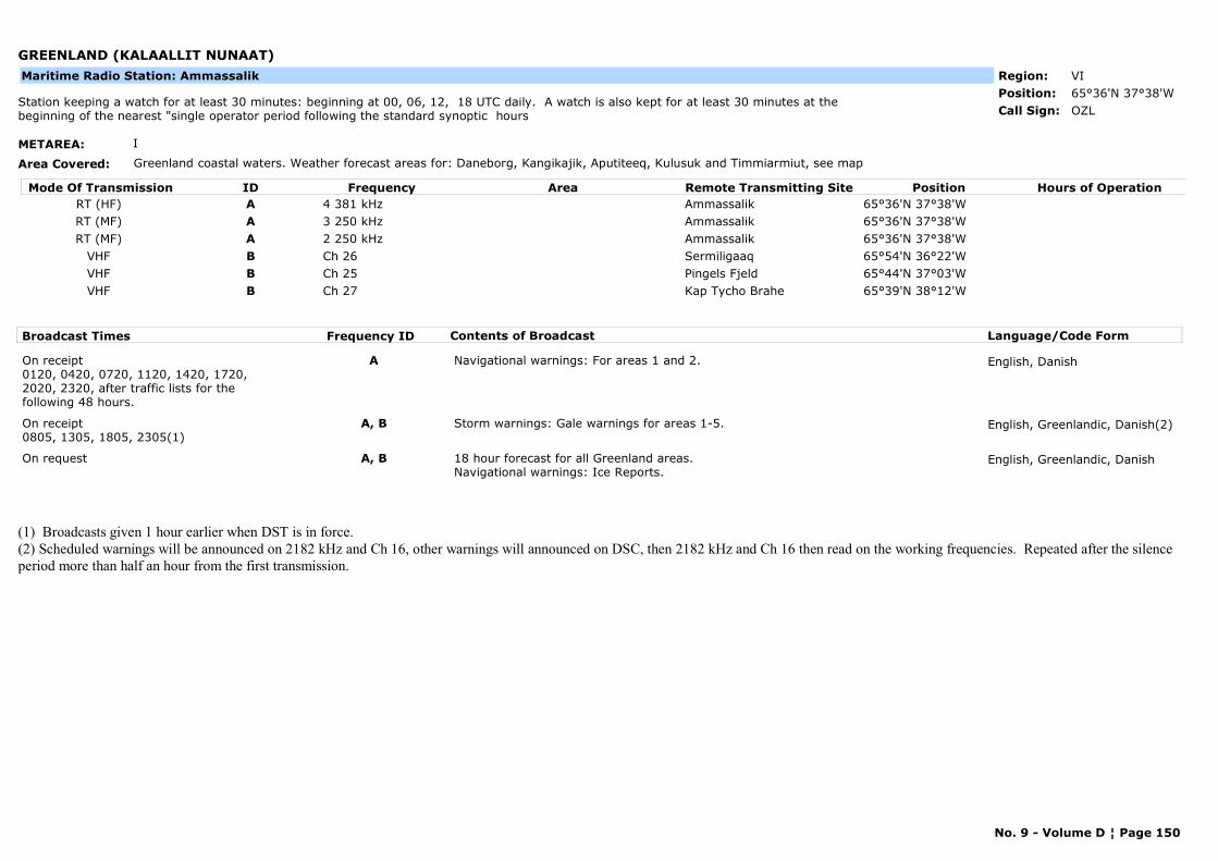
GREENLAND (KALAALLIT NUNAAT)
METAREA: I
Area Covered: Greenland coastal waters. Weather forecast areas for: Daneborg, Kangikajik, Aputiteeq, Kulusuk and Timmiarmiut, see map
Region: VIPosition: 65°36'N 37°38'W
OZLStation keeping a watch for at least 30 minutes: beginning at 00, 06, 12, 18 UTC daily. A watch is also kept for at least 30 minutes at the beginning of the nearest "single operator period following the standard synoptic hours Call Sign:
Maritime Radio Station: Ammassalik
Mode Of Transmission ID Frequency Area Position Hours of OperationRemote Transmitting SiteRT (HF) A 4 381 kHz Ammassalik 65°36'N 37°38'WRT (MF) A 3 250 kHz Ammassalik 65°36'N 37°38'WRT (MF) A 2 250 kHz Ammassalik 65°36'N 37°38'W
VHF B Ch 26 Sermiligaaq 65°54'N 36°22'WVHF B Ch 25 Pingels Fjeld 65°44'N 37°03'WVHF B Ch 27 Kap Tycho Brahe 65°39'N 38°12'W
Broadcast Times Frequency ID Contents of Broadcast Language/Code Form
On receipt0120, 0420, 0720, 1120, 1420, 1720, 2020, 2320, after traffic lists for the following 48 hours.
A Navigational warnings: For areas 1 and 2. English, Danish
On receipt0805, 1305, 1805, 2305(1)
A, B Storm warnings: Gale warnings for areas 1-5. English, Greenlandic, Danish(2)
On request A, B 18 hour forecast for all Greenland areas. Navigational warnings: Ice Reports.
English, Greenlandic, Danish
(1) Broadcasts given 1 hour earlier when DST is in force.(2) Scheduled warnings will be announced on 2182 kHz and Ch 16, other warnings will announced on DSC, then 2182 kHz and Ch 16 then read on the working frequencies. Repeated after the silence period more than half an hour from the first transmission.
No. 9 - Volume D ¦ Page 150
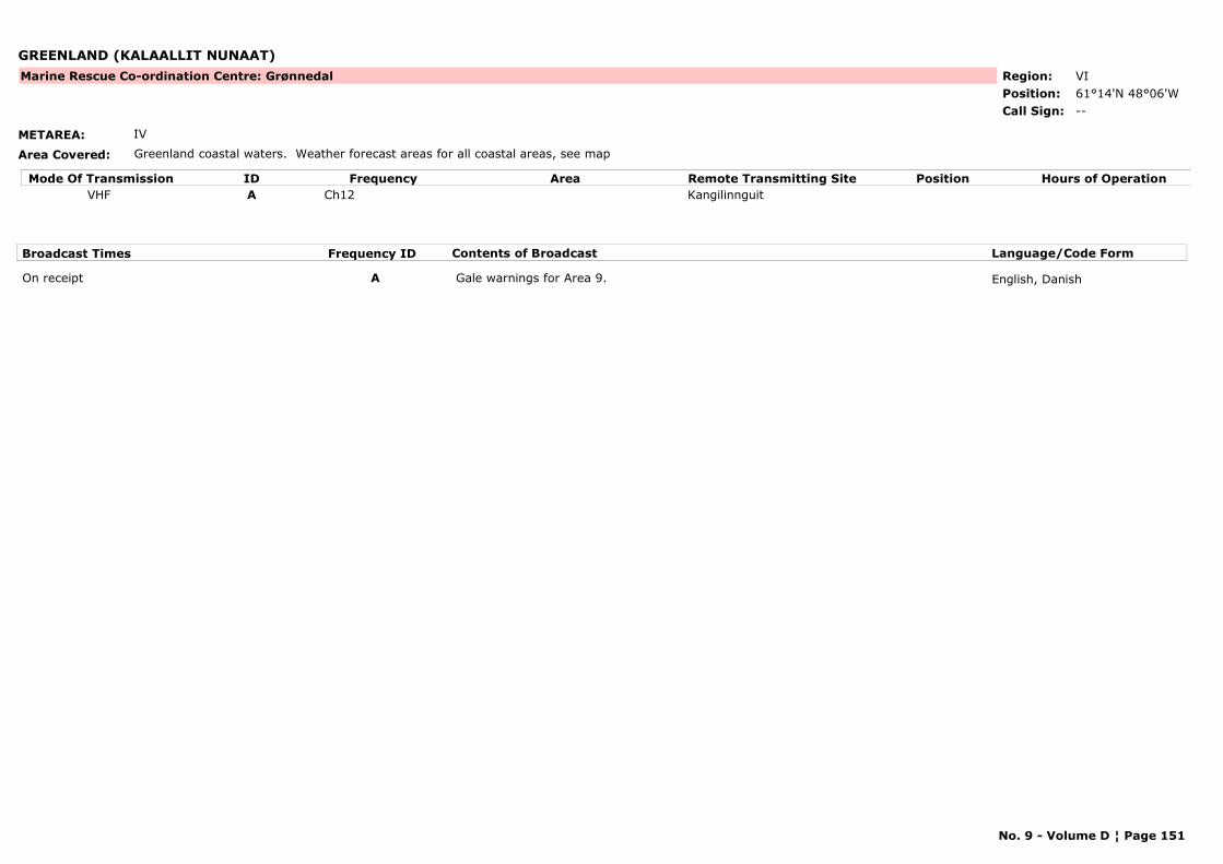
GREENLAND (KALAALLIT NUNAAT)
METAREA: IV
Area Covered: Greenland coastal waters. Weather forecast areas for all coastal areas, see map
Region: VIPosition: 61°14'N 48°06'W
Marine Rescue Co-ordination Centre: Grønnedal
--Call Sign:
Mode Of Transmission ID Frequency Area Position Hours of OperationRemote Transmitting SiteVHF A Ch12 Kangilinnguit
Broadcast Times Frequency ID Contents of Broadcast Language/Code Form
On receipt A Gale warnings for Area 9. English, Danish
No. 9 - Volume D ¦ Page 151
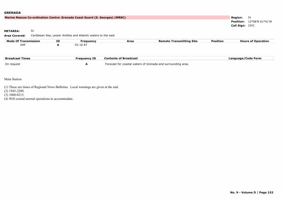
GRENADA
METAREA: IV
Area Covered: Caribbean Sea, Lesser Antilles and Atlantic waters to the east
Region: IVPosition: 12°08'N 61°41'W
Marine Rescue Co-ordination Centre: Grenada Coast Guard (S. Georges) (MRSC)
J3YCCall Sign:
Mode Of Transmission ID Frequency Area Position Hours of OperationRemote Transmitting SiteVHF A Ch 16 87
Broadcast Times Frequency ID Contents of Broadcast Language/Code Form
On request A Forecast for coastal waters of Grenada and surrounding area.
Main Station
(1) These are times of Regional News Bulletins. Local warnings are given at the end.(2) 1945-2200.(3) 1000-0215.(4) Will extend normal operations to accommodate.
No. 9 - Volume D ¦ Page 152
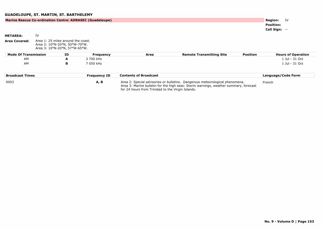
GUADELOUPE, ST. MARTIN, ST. BARTHELEMY
METAREA: IV
Area Covered: Area 1: 25 miles around the coast.Area 2: 10°N-20°N, 50°W-70°W.Area 3: 10°N-20°N, 57°W-65°W.
Region: IVPosition:
Marine Rescue Co-ordination Centre: ADRASEC (Guadeloupe)
--Call Sign:
Mode Of Transmission ID Frequency Area Position Hours of OperationRemote Transmitting SiteAM A 3 700 kHz 1 Jul - 31 OctAM B 7 050 kHz 1 Jul - 31 Oct
Broadcast Times Frequency ID Contents of Broadcast Language/Code Form
0003 A, B Area 2: Special advisories or bulletins. Dangerous meteorological phenomena.Area 3: Marine bulletin for the high seas: Storm warnings, weather summary, forecast for 24 hours from Trinidad to the Virgin Islands.
French
No. 9 - Volume D ¦ Page 153
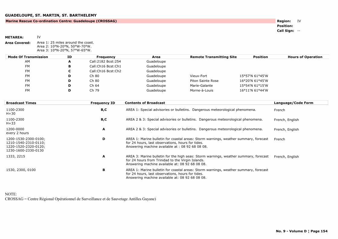
GUADELOUPE, ST. MARTIN, ST. BARTHELEMY
METAREA: IV
Area Covered: Area 1: 25 miles around the coast. Area 2: 10°N-20°N, 50°W-70°W.Area 3: 10°N-20°N, 57°W-65°W.
Region: IVPosition:
Marine Rescue Co-ordination Centre: Guadeloupe (CROSSAG)
--Call Sign:
Mode Of Transmission ID Frequency Area Position Hours of OperationRemote Transmitting SiteAM A Call:2182 Bcst:254 GuadeloupeFM B Call:Ch16 Bcst:Ch1 GuadeloupeFM C Call:Ch16 Bcst:Ch2 GuadeloupeFM D Ch 80 Guadeloupe Vieux-Fort 15°57'N 61°45'WFM D Ch 80 Guadeloupe Piton Sainte Rose 16°20'N 61°45'WFM D Ch 64 Guadeloupe Marie-Galante 15°54'N 61°15'WFM D Ch 79 Guadeloupe Morne-à-Louis 16°11'N 61°44'W
Broadcast Times Frequency ID Contents of Broadcast Language/Code Form
1100-2300H+30
B,C AREA 1: Special advisories or bulletins. Dangerous meteorological phenomena. French
1100-2300H+33
B,C AREA 2 & 3: Special advisories or bulletins. Dangerous meteorological phenomena. French, English
1200-0000every 2 hours
A AREA 2 & 3: Special advisories or bulletins. Dangerous meteorological phenomena. French, English
1200-1530-2300-0100;1210-1540-2310-0110;1220-1520-2320-0120;1230-1600-2330-0130
D AREA 1: Marine bulletin for coastal areas: Storm warnings, weather summary, forecast for 24 hours, last observations, hours for tides.Answering machine available at : 08 92 68 08 08.
French
1333, 2215 A AREA 3: Marine bulletin for the high seas: Storm warnings, weather summary, forecast for 24 hours from Trinidad to the Virgin Islands.Answering machine available at: 08 92 68 08 08.
French, English
1530, 2300, 0100 B AREA 1: Marine bulletin for coastal areas: Storm warnings, weather summary, forecast for 24 hours, last observations, hours for tides.Answering machine available at: 08 92 68 08 08.
NOTE:CROSSAG = Centre Régional Opérationnel de Surveillance et de Sauvetage Antilles Guyane)
No. 9 - Volume D ¦ Page 154
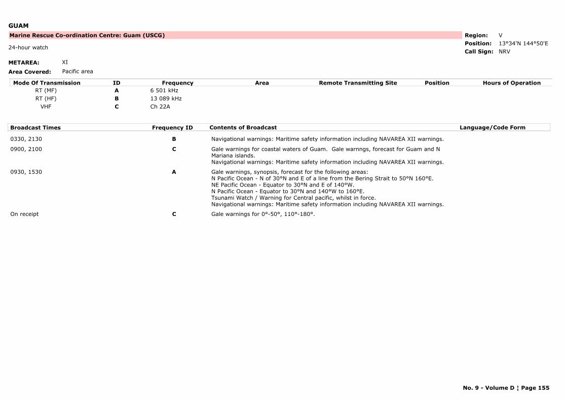
GUAM
METAREA: XI
Area Covered: Pacific area
Region: VPosition: 13°34'N 144°50'E
Marine Rescue Co-ordination Centre: Guam (USCG)
NRV24-hour watch
Call Sign:
Mode Of Transmission ID Frequency Area Position Hours of OperationRemote Transmitting SiteRT (MF) A 6 501 kHzRT (HF) B 13 089 kHz
VHF C Ch 22A
Broadcast Times Frequency ID Contents of Broadcast Language/Code Form
0330, 2130 B Navigational warnings: Maritime safety information including NAVAREA XII warnings.
0900, 2100 C Gale warnings for coastal waters of Guam. Gale warnngs, forecast for Guam and N Mariana islands.Navigational warnings: Maritime safety information including NAVAREA XII warnings.
0930, 1530 A Gale warnings, synopsis, forecast for the following areas:N Pacific Ocean - N of 30°N and E of a line from the Bering Strait to 50°N 160°E.NE Pacific Ocean - Equator to 30°N and E of 140°W.N Pacific Ocean - Equator to 30°N and 140°W to 160°E.Tsunami Watch / Warning for Central pacific, whilst in force.Navigational warnings: Maritime safety information including NAVAREA XII warnings.
On receipt C Gale warnings for 0°-50°, 110°-180°.
No. 9 - Volume D ¦ Page 155
GUERNSEY
METAREA: I
Area Covered: Channel Islands (UK)
Region: VIPosition: 49°27'N 02°32'W
--Call Sign:
Maritime Radio Station: Saint Peter Port
Mode Of Transmission ID Frequency Area Position Hours of OperationRemote Transmitting SiteRT (MF) A 1 764 kHzRT (MF) A 1 764 kHz 49°27'N 2°32'W
VHF B Ch 20 62VHF B Ch 20 62 49°27'N 2°32'W
Broadcast Times Frequency ID Contents of Broadcast Language/Code Form
On receiptOn request
A, B Navigational warnings: Local navigational warnings for Guernsey.
On receiptOn request
A, B Navigational warnings: Local navigational warnings.
On request A, B Weather bulletin for Guernsey.
On request A, B Weather bulletins for Guernsey.
No. 9 - Volume D ¦ Page 156
GUINEA
METAREA: II
Area Covered:
Region: IPosition: 09°31'N 13°43'W
--Call Sign:
Maritime Radio Station: Conakry
Mode Of Transmission ID Frequency Area Position Hours of OperationRemote Transmitting SiteRT (MF) A 1 813 kHz 09°31'N 13°43'W
Broadcast Times Frequency ID Contents of Broadcast Language/Code Form
0818 A For coastal waters of Guinea. French
No. 9 - Volume D ¦ Page 157
HONG KONG, CHINA
METAREA: XI
Area Covered: For warnings of tropical cyclones: 10°N to 30°N, 105°E to 125°E. For warnings of winds of force 8 or above: Hong Kong Marine Forecast Areas (see map).
Region: IIPosition: 22°13'N 114°15'E
VRXCall Sign:
Maritime Radio Station: Hong Kong
Mode Of Transmission ID Frequency Area Position Hours of OperationRemote Transmitting SiteRT (HF) A 8 812 kHz
Broadcast Times Frequency ID Contents of Broadcast Language/Code Form
0533, 0933, 1333(1), 2233 A Storm warnings, weather situation, 24 hour forecast of wind, significant weather and sea state for Areas 1-7, outlook for following 24 hours and latest reports from coasta weather stations.
Chinese, English
No. 9 - Volume D ¦ Page 158

ICELAND
METAREA: I
Area Covered: Coastal districts and coastal waters of Iceland between 62°30'N and 67°N, from 12°W to 26°W
Region: VIPosition: 64°15'N 15°13'W
TFTCall Sign:
Maritime Radio Station: Hornafjördur
Mode Of Transmission ID Frequency Area Position Hours of OperationRemote Transmitting SiteRT (MF) A 1 659 kHz
Broadcast Times Frequency ID Contents of Broadcast Language/Code Form
0205, 0505, 0805, 1105, 1405, 1705, 2005, 2305
A After preliminary announcement on 2182 kHz.Gale and storm warning forecast valid for 24 to 36 hours.
Icelandic repeated in English
No. 9 - Volume D ¦ Page 159
ICELAND
METAREA: I
Area Covered: Coastal districts and coastal waters of Iceland between 62°30'N and 67°N, from 12°W to 26°W
Region: VIPosition: 66°05'N 23°02'W
TFZCall Sign:
Maritime Radio Station: Isafjördur
Mode Of Transmission ID Frequency Area Position Hours of OperationRemote Transmitting SiteRT (MF) A 2 724 kHz
Broadcast Times Frequency ID Contents of Broadcast Language/Code Form
0203, 0503, 0803, 1103, 1403, 1703, 2003, 2303
A After preliminary announcement on 2 182 kHz.Gale and storm warning forecast valid for 24 to 36 hours.
Icelandic repeated in English
No. 9 - Volume D ¦ Page 160
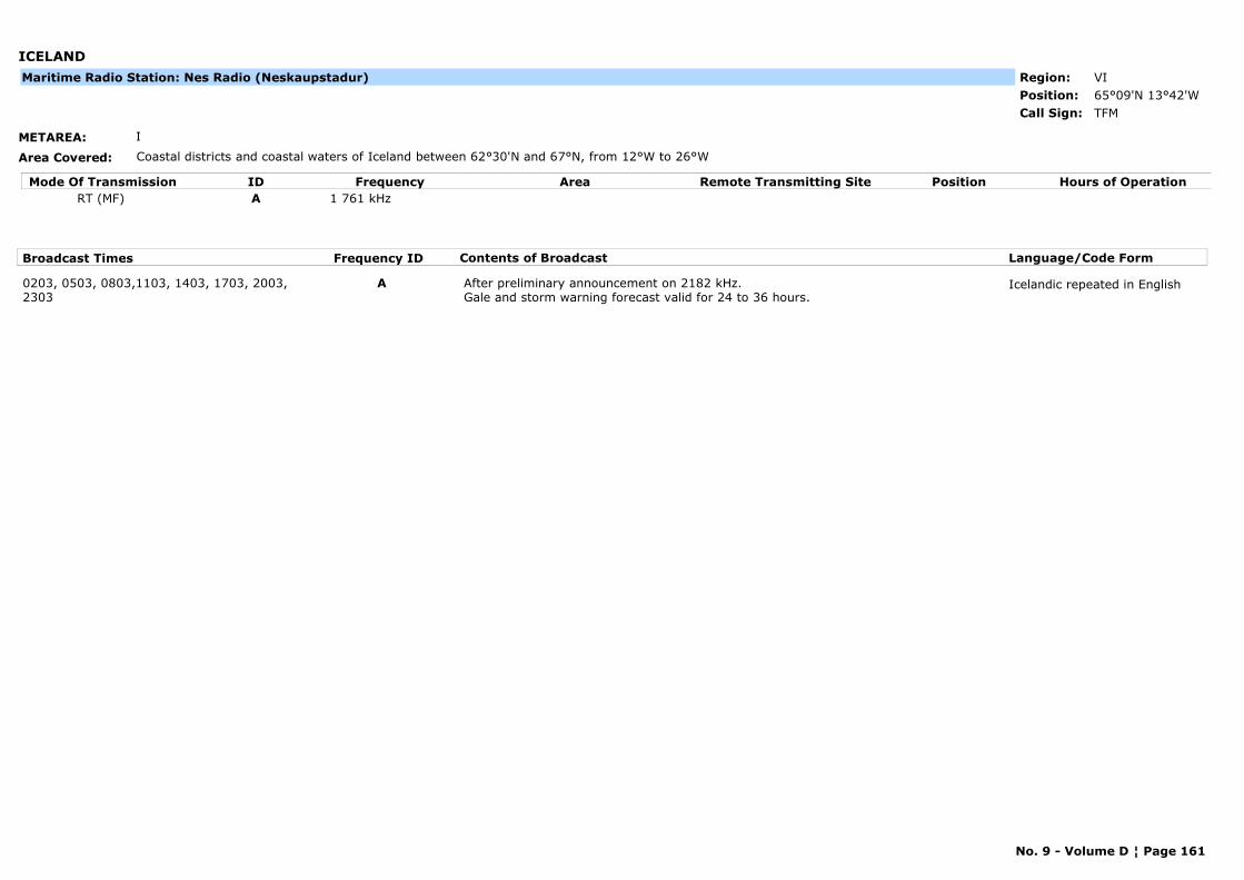
ICELAND
METAREA: I
Area Covered: Coastal districts and coastal waters of Iceland between 62°30'N and 67°N, from 12°W to 26°W
Region: VIPosition: 65°09'N 13°42'W
TFMCall Sign:
Maritime Radio Station: Nes Radio (Neskaupstadur)
Mode Of Transmission ID Frequency Area Position Hours of OperationRemote Transmitting SiteRT (MF) A 1 761 kHz
Broadcast Times Frequency ID Contents of Broadcast Language/Code Form
0203, 0503, 0803,1103, 1403, 1703, 2003, 2303
A After preliminary announcement on 2182 kHz.Gale and storm warning forecast valid for 24 to 36 hours.
Icelandic repeated in English
No. 9 - Volume D ¦ Page 161
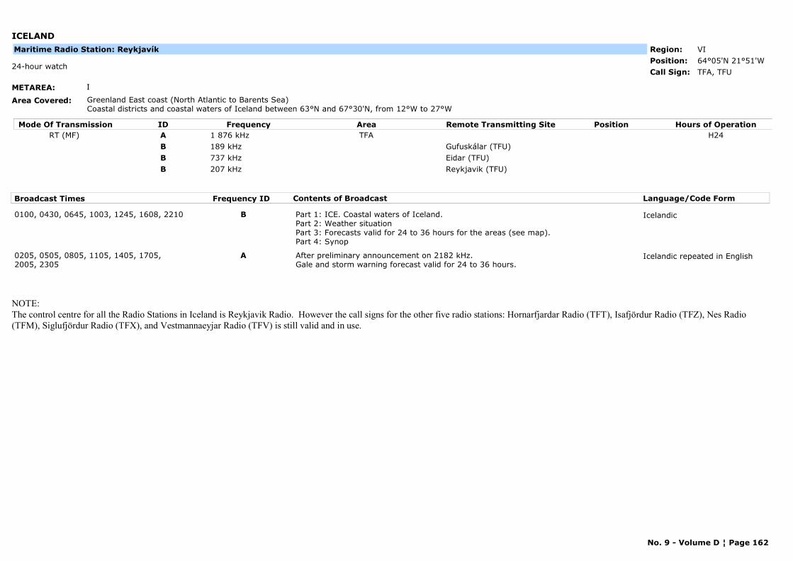
ICELAND
METAREA: I
Area Covered: Greenland East coast (North Atlantic to Barents Sea) Coastal districts and coastal waters of Iceland between 63°N and 67°30'N, from 12°W to 27°W
Region: VIPosition: 64°05'N 21°51'W
TFA, TFU24-hour watch
Call Sign:
Maritime Radio Station: Reykjavík
Mode Of Transmission ID Frequency Area Position Hours of OperationRemote Transmitting SiteRT (MF) A 1 876 kHz TFA H24
B 189 kHz Gufuskálar (TFU)B 737 kHz Eidar (TFU)B 207 kHz Reykjavik (TFU)
Broadcast Times Frequency ID Contents of Broadcast Language/Code Form
0100, 0430, 0645, 1003, 1245, 1608, 2210 B Part 1: ICE. Coastal waters of Iceland.Part 2: Weather situationPart 3: Forecasts valid for 24 to 36 hours for the areas (see map).Part 4: Synop
Icelandic
0205, 0505, 0805, 1105, 1405, 1705, 2005, 2305
A After preliminary announcement on 2182 kHz.Gale and storm warning forecast valid for 24 to 36 hours.
Icelandic repeated in English
NOTE:The control centre for all the Radio Stations in Iceland is Reykjavik Radio. However the call signs for the other five radio stations: Hornarfjardar Radio (TFT), Isafjördur Radio (TFZ), Nes Radio (TFM), Siglufjördur Radio (TFX), and Vestmannaeyjar Radio (TFV) is still valid and in use.
No. 9 - Volume D ¦ Page 162

ICELAND
METAREA: I
Area Covered: Coastal districts and coastal waters of Iceland between 63°N and 67°30'N, from 12°W to 27°W
Region: VIPosition: 66°11'N 18°57'W
TFXCall Sign:
Maritime Radio Station: Siglufjördur
Mode Of Transmission ID Frequency Area Position Hours of OperationRemote Transmitting SiteRT (MF) A 1 883 kHz
Broadcast Times Frequency ID Contents of Broadcast Language/Code Form
0205, 0505, 0805, 1105, 1405, 1705, 2005, 2305
A After preliminary announcement on 2182 kHz.Gale and storm warning forecast valid for 24 to 36 hours.
Icelandic repeated in English
No. 9 - Volume D ¦ Page 163
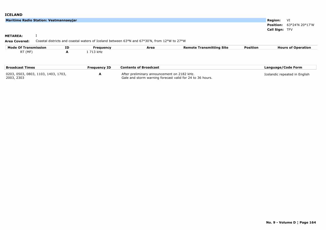
ICELAND
METAREA: I
Area Covered: Coastal districts and coastal waters of Iceland between 63°N and 67°30'N, from 12°W to 27°W
Region: VIPosition: 63°24'N 20°17'W
TFVCall Sign:
Maritime Radio Station: Vestmannaeyjar
Mode Of Transmission ID Frequency Area Position Hours of OperationRemote Transmitting SiteRT (MF) A 1 713 kHz
Broadcast Times Frequency ID Contents of Broadcast Language/Code Form
0203, 0503, 0803, 1103, 1403, 1703, 2003, 2303
A After preliminary announcement on 2182 kHz.Gale and storm warning forecast valid for 24 to 36 hours.
Icelandic repeated in English
No. 9 - Volume D ¦ Page 164
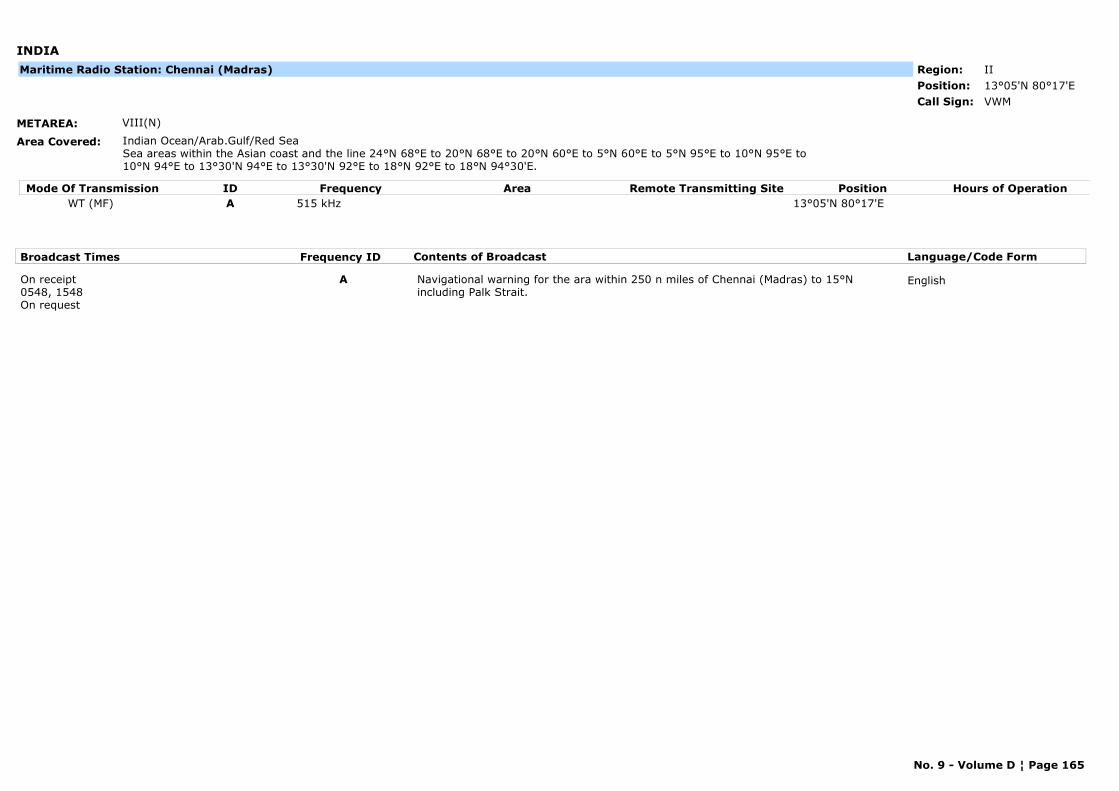
INDIA
METAREA: VIII(N)
Area Covered: Indian Ocean/Arab.Gulf/Red SeaSea areas within the Asian coast and the line 24°N 68°E to 20°N 68°E to 20°N 60°E to 5°N 60°E to 5°N 95°E to 10°N 95°E to 10°N 94°E to 13°30'N 94°E to 13°30'N 92°E to 18°N 92°E to 18°N 94°30'E.
Region: IIPosition: 13°05'N 80°17'E
VWMCall Sign:
Maritime Radio Station: Chennai (Madras)
Mode Of Transmission ID Frequency Area Position Hours of OperationRemote Transmitting SiteWT (MF) A 515 kHz 13°05'N 80°17'E
Broadcast Times Frequency ID Contents of Broadcast Language/Code Form
On receipt0548, 1548On request
A Navigational warning for the ara within 250 n miles of Chennai (Madras) to 15°N including Palk Strait.
English
No. 9 - Volume D ¦ Page 165
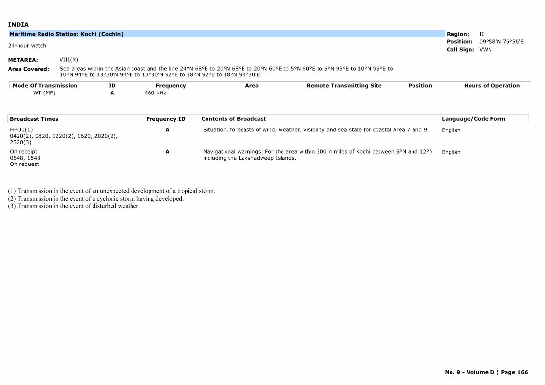
INDIA
METAREA: VIII(N)
Area Covered: Sea areas within the Asian coast and the line 24°N 68°E to 20°N 68°E to 20°N 60°E to 5°N 60°E to 5°N 95°E to 10°N 95°E to 10°N 94°E to 13°30'N 94°E to 13°30'N 92°E to 18°N 92°E to 18°N 94°30'E.
Region: IIPosition: 09°58'N 76°56'E
VWN24-hour watch
Call Sign:
Maritime Radio Station: Kochi (Cochin)
Mode Of Transmission ID Frequency Area Position Hours of OperationRemote Transmitting SiteWT (MF) A 460 kHz
Broadcast Times Frequency ID Contents of Broadcast Language/Code Form
H+00(1)0420(2), 0820, 1220(2), 1620, 2020(2), 2320(3)
A Situation, forecasts of wind, weather, visibility and sea state for coastal Area 7 and 9. English
On receipt0648, 1548On request
A Navigational warnings: For the area within 300 n miles of Kochi between 5°N and 12°N including the Lakshadweep Islands.
English
(1) Transmission in the event of an unexpected development of a tropical storm.(2) Transmission in the event of a cyclonic storm having developed.(3) Transmission in the event of disturbed weather.
No. 9 - Volume D ¦ Page 166
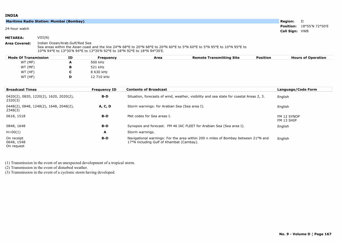
INDIA
METAREA: VIII(N)
Area Covered: Indian Ocean/Arab.Gulf/Red SeaSea areas within the Asian coast and the line 24°N 68°E to 20°N 68°E to 20°N 60°E to 5°N 60°E to 5°N 95°E to 10°N 95°E to 10°N 94°E to 13°30'N 94°E to 13°30'N 92°E to 18°N 92°E to 18°N 94°30'E.
Region: IIPosition: 18°55'N 72°50'E
VWB24-hour watch
Call Sign:
Maritime Radio Station: Mumbai (Bombay)
Mode Of Transmission ID Frequency Area Position Hours of OperationRemote Transmitting SiteWT (MF) A 500 kHzWT (MF) B 521 kHzWT (HF) C 8 630 kHzWT (HF) D 12 710 kHz
Broadcast Times Frequency ID Contents of Broadcast Language/Code Form
0420(2), 0820, 1220(2), 1620, 2020(2), 2320(3)
B-D Situation, forecasts of wind, weather, visibility and sea state for coastal Areas 2, 3. English
0448(2), 0848, 1248(2), 1648, 2048(2), 2348(3)
A, C, D Storm warnings: for Arabian Sea (Sea area I). English
0618, 1518 B-D Met codes for Sea areas I. FM 12 SYNOPFM 13 SHIP
0848, 1648 B-D Synopsis and forecast. FM 46 IAC FLEET for Arabian Sea (Sea area I). English
H+00(1) A Storm warnings.
On receipt0648, 1548On request
B-D Navigational warnings: For the area within 200 n miles of Bombay between 21°N and 17°N including Gulf of Khambat (Cambay).
English
(1) Transmission in the event of an unexpected development of a tropical storm.(2) Transmission in the event of disturbed weather.(3) Transmission in the event of a cyclonic storm having developed.
No. 9 - Volume D ¦ Page 167
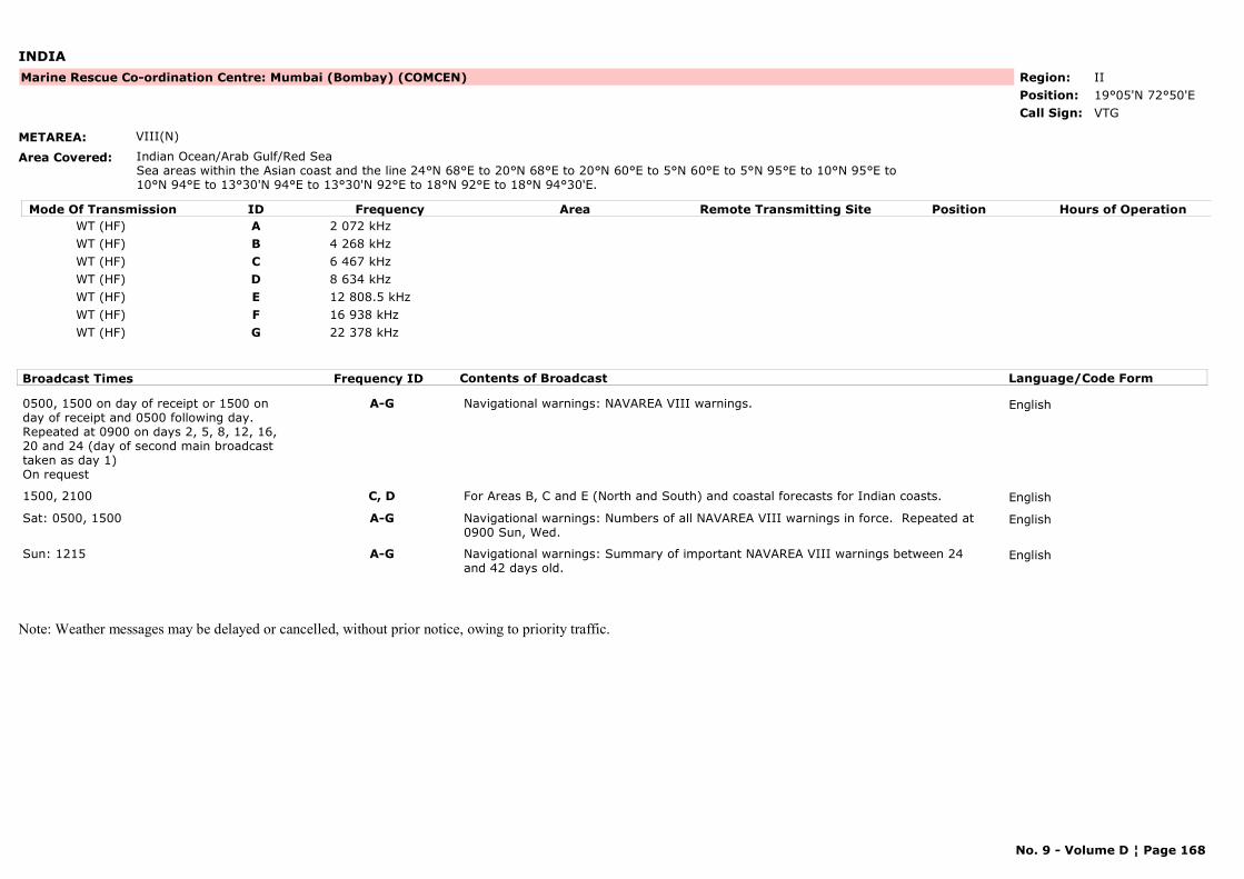
INDIA
METAREA: VIII(N)
Area Covered: Indian Ocean/Arab Gulf/Red SeaSea areas within the Asian coast and the line 24°N 68°E to 20°N 68°E to 20°N 60°E to 5°N 60°E to 5°N 95°E to 10°N 95°E to 10°N 94°E to 13°30'N 94°E to 13°30'N 92°E to 18°N 92°E to 18°N 94°30'E.
Region: IIPosition: 19°05'N 72°50'E
Marine Rescue Co-ordination Centre: Mumbai (Bombay) (COMCEN)
VTGCall Sign:
Mode Of Transmission ID Frequency Area Position Hours of OperationRemote Transmitting SiteWT (HF) A 2 072 kHzWT (HF) B 4 268 kHzWT (HF) C 6 467 kHzWT (HF) D 8 634 kHzWT (HF) E 12 808.5 kHzWT (HF) F 16 938 kHzWT (HF) G 22 378 kHz
Broadcast Times Frequency ID Contents of Broadcast Language/Code Form
0500, 1500 on day of receipt or 1500 on day of receipt and 0500 following day.Repeated at 0900 on days 2, 5, 8, 12, 16, 20 and 24 (day of second main broadcast taken as day 1)On request
A-G Navigational warnings: NAVAREA VIII warnings. English
1500, 2100 C, D For Areas B, C and E (North and South) and coastal forecasts for Indian coasts. English
Sat: 0500, 1500 A-G Navigational warnings: Numbers of all NAVAREA VIII warnings in force. Repeated at 0900 Sun, Wed.
English
Sun: 1215 A-G Navigational warnings: Summary of important NAVAREA VIII warnings between 24 and 42 days old.
English
Note: Weather messages may be delayed or cancelled, without prior notice, owing to priority traffic.
No. 9 - Volume D ¦ Page 168
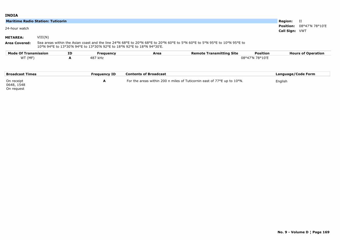
INDIA
METAREA: VIII(N)
Area Covered: Sea areas within the Asian coast and the line 24°N 68°E to 20°N 68°E to 20°N 60°E to 5°N 60°E to 5°N 95°E to 10°N 95°E to 10°N 94°E to 13°30'N 94°E to 13°30'N 92°E to 18°N 92°E to 18°N 94°30'E.
Region: IIPosition: 08°47'N 78°10'E
VWT24-hour watch
Call Sign:
Maritime Radio Station: Tuticorin
Mode Of Transmission ID Frequency Area Position Hours of OperationRemote Transmitting SiteWT (MF) A 487 kHz 08°47'N 78°10'E
Broadcast Times Frequency ID Contents of Broadcast Language/Code Form
On receipt0648, 1548On request
A For the areas within 200 n miles of Tuticornin east of 77°E up to 10°N. English
No. 9 - Volume D ¦ Page 169
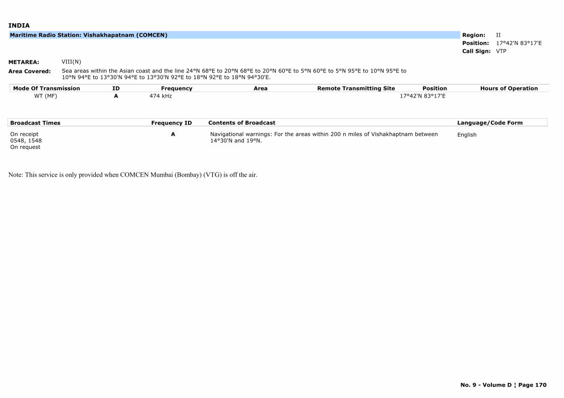
INDIA
METAREA: VIII(N)
Area Covered: Sea areas within the Asian coast and the line 24°N 68°E to 20°N 68°E to 20°N 60°E to 5°N 60°E to 5°N 95°E to 10°N 95°E to 10°N 94°E to 13°30'N 94°E to 13°30'N 92°E to 18°N 92°E to 18°N 94°30'E.
Region: IIPosition: 17°42'N 83°17'E
VTPCall Sign:
Maritime Radio Station: Vishakhapatnam (COMCEN)
Mode Of Transmission ID Frequency Area Position Hours of OperationRemote Transmitting SiteWT (MF) A 474 kHz 17°42'N 83°17'E
Broadcast Times Frequency ID Contents of Broadcast Language/Code Form
On receipt0548, 1548On request
A Navigational warnings: For the areas within 200 n miles of Vishakhaptnam between 14°30'N and 19°N.
English
Note: This service is only provided when COMCEN Mumbai (Bombay) (VTG) is off the air.
No. 9 - Volume D ¦ Page 170
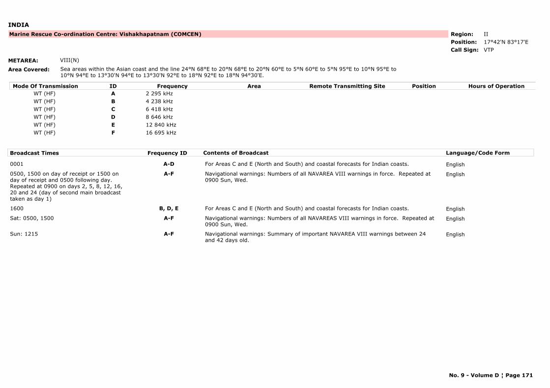
INDIA
METAREA: VIII(N)
Area Covered: Sea areas within the Asian coast and the line 24°N 68°E to 20°N 68°E to 20°N 60°E to 5°N 60°E to 5°N 95°E to 10°N 95°E to 10°N 94°E to 13°30'N 94°E to 13°30'N 92°E to 18°N 92°E to 18°N 94°30'E.
Region: IIPosition: 17°42'N 83°17'E
Marine Rescue Co-ordination Centre: Vishakhapatnam (COMCEN)
VTPCall Sign:
Mode Of Transmission ID Frequency Area Position Hours of OperationRemote Transmitting SiteWT (HF) A 2 295 kHzWT (HF) B 4 238 kHzWT (HF) C 6 418 kHzWT (HF) D 8 646 kHzWT (HF) E 12 840 kHzWT (HF) F 16 695 kHz
Broadcast Times Frequency ID Contents of Broadcast Language/Code Form
0001 A-D For Areas C and E (North and South) and coastal forecasts for Indian coasts. English
0500, 1500 on day of receipt or 1500 on day of receipt and 0500 following day.Repeated at 0900 on days 2, 5, 8, 12, 16, 20 and 24 (day of second main broadcast taken as day 1)
A-F Navigational warnings: Numbers of all NAVAREA VIII warnings in force. Repeated at 0900 Sun, Wed.
English
1600 B, D, E For Areas C and E (North and South) and coastal forecasts for Indian coasts. English
Sat: 0500, 1500 A-F Navigational warnings: Numbers of all NAVAREAS VIII warnings in force. Repeated at 0900 Sun, Wed.
English
Sun: 1215 A-F Navigational warnings: Summary of important NAVAREA VIII warnings between 24 and 42 days old.
English
No. 9 - Volume D ¦ Page 171
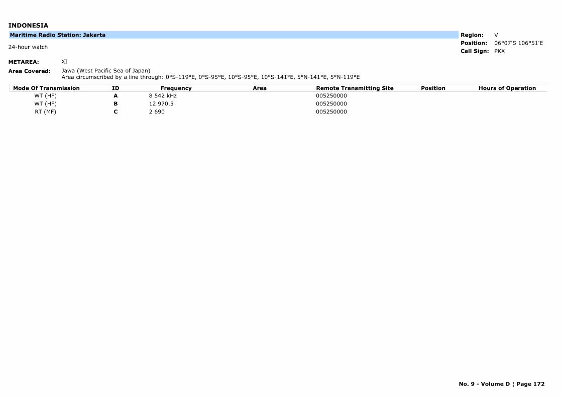
INDONESIA
METAREA: XI
Area Covered: Jawa (West Pacific Sea of Japan)Area circumscribed by a line through: 0°S-119°E, 0°S-95°E, 10°S-95°E, 10°S-141°E, 5°N-141°E, 5°N-119°E
Region: VPosition: 06°07'S 106°51'E
PKX24-hour watch
Call Sign:
Maritime Radio Station: Jakarta
Mode Of Transmission ID Frequency Area Position Hours of OperationRemote Transmitting SiteWT (HF) A 8 542 kHz 005250000WT (HF) B 12 970.5 005250000RT (MF) C 2 690 005250000
No. 9 - Volume D ¦ Page 172

IRAN, ISLAMIC REPUBLIC OF
METAREA: IX
Area Covered:
Region: IIPosition: 27°08'N 57°04'E
Marine Rescue Co-ordination Centre: Bandar Abbas(MRCC)
EQI24-hour watch
Call Sign:
Mode Of Transmission ID Frequency Area Position Hours of OperationRemote Transmitting SiteVHF A Ch 18 27°13'N 57°17'E
Broadcast Times Frequency ID Contents of Broadcast Language/Code Form
0530, 1230 A For the Strait of Hormuz and the Persian Gulf. Navigational warnings: For the Strait of Hormuz and the Persian Gulf.
English, Farsi
No. 9 - Volume D ¦ Page 173
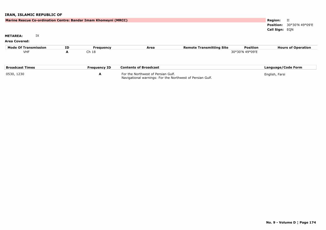
IRAN, ISLAMIC REPUBLIC OF
METAREA: IX
Area Covered:
Region: IIPosition: 30°30'N 49°09'E
Marine Rescue Co-ordination Centre: Bandar Imam Khomeyni (MRCC)
EQNCall Sign:
Mode Of Transmission ID Frequency Area Position Hours of OperationRemote Transmitting SiteVHF A Ch 18 30°30'N 49°09'E
Broadcast Times Frequency ID Contents of Broadcast Language/Code Form
0530, 1230 A For the Northwest of Persian Gulf. Navigational warnings: For the Northwest of Persian Gulf.
English, Farsi
No. 9 - Volume D ¦ Page 174
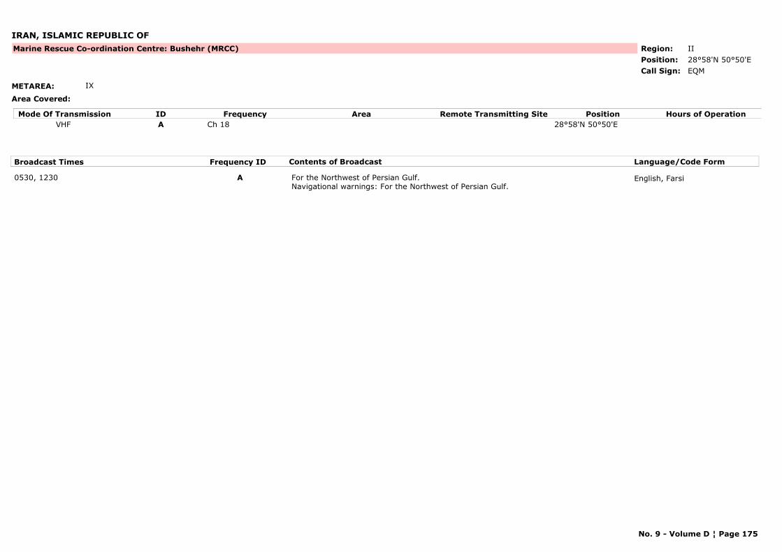
IRAN, ISLAMIC REPUBLIC OF
METAREA: IX
Area Covered:
Region: IIPosition: 28°58'N 50°50'E
Marine Rescue Co-ordination Centre: Bushehr (MRCC)
EQMCall Sign:
Mode Of Transmission ID Frequency Area Position Hours of OperationRemote Transmitting SiteVHF A Ch 18 28°58'N 50°50'E
Broadcast Times Frequency ID Contents of Broadcast Language/Code Form
0530, 1230 A For the Northwest of Persian Gulf. Navigational warnings: For the Northwest of Persian Gulf.
English, Farsi
No. 9 - Volume D ¦ Page 175
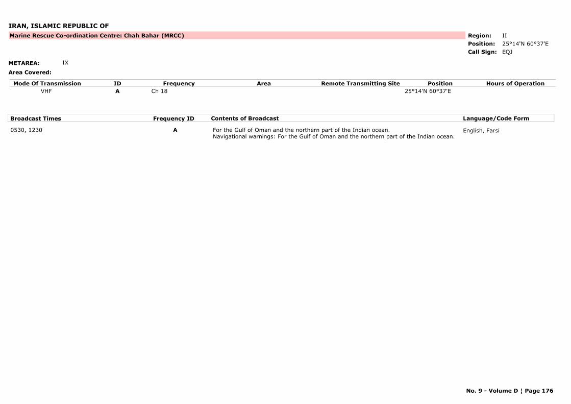
IRAN, ISLAMIC REPUBLIC OF
METAREA: IX
Area Covered:
Region: IIPosition: 25°14'N 60°37'E
Marine Rescue Co-ordination Centre: Chah Bahar (MRCC)
EQJCall Sign:
Mode Of Transmission ID Frequency Area Position Hours of OperationRemote Transmitting SiteVHF A Ch 18 25°14'N 60°37'E
Broadcast Times Frequency ID Contents of Broadcast Language/Code Form
0530, 1230 A For the Gulf of Oman and the northern part of the Indian ocean. Navigational warnings: For the Gulf of Oman and the northern part of the Indian ocean.
English, Farsi
No. 9 - Volume D ¦ Page 176
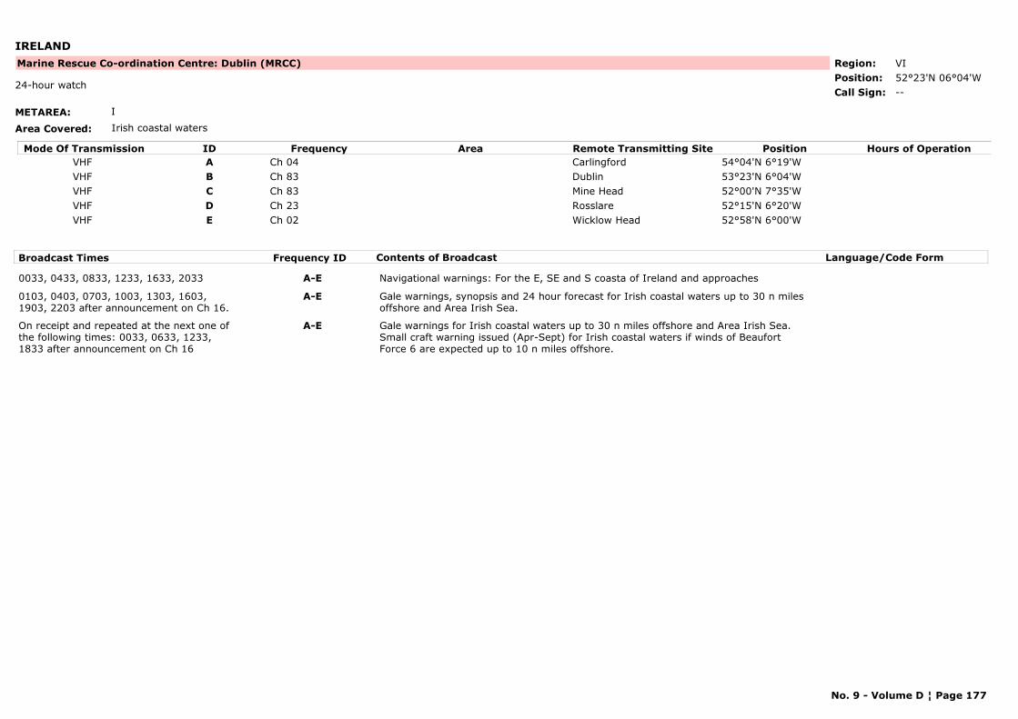
IRELAND
METAREA: I
Area Covered: Irish coastal waters
Region: VIPosition: 52°23'N 06°04'W
Marine Rescue Co-ordination Centre: Dublin (MRCC)
--24-hour watch
Call Sign:
Mode Of Transmission ID Frequency Area Position Hours of OperationRemote Transmitting SiteVHF A Ch 04 Carlingford 54°04'N 6°19'WVHF B Ch 83 Dublin 53°23'N 6°04'WVHF C Ch 83 Mine Head 52°00'N 7°35'WVHF D Ch 23 Rosslare 52°15'N 6°20'WVHF E Ch 02 Wicklow Head 52°58'N 6°00'W
Broadcast Times Frequency ID Contents of Broadcast Language/Code Form
0033, 0433, 0833, 1233, 1633, 2033 A-E Navigational warnings: For the E, SE and S coasta of Ireland and approaches
0103, 0403, 0703, 1003, 1303, 1603, 1903, 2203 after announcement on Ch 16.
A-E Gale warnings, synopsis and 24 hour forecast for Irish coastal waters up to 30 n miles offshore and Area Irish Sea.
On receipt and repeated at the next one of the following times: 0033, 0633, 1233, 1833 after announcement on Ch 16
A-E Gale warnings for Irish coastal waters up to 30 n miles offshore and Area Irish Sea. Small craft warning issued (Apr-Sept) for Irish coastal waters if winds of Beaufort Force 6 are expected up to 10 n miles offshore.
No. 9 - Volume D ¦ Page 177
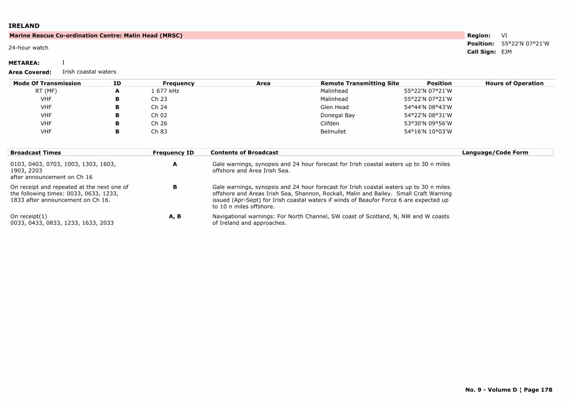
IRELAND
METAREA: I
Area Covered: Irish coastal waters
Region: VIPosition: 55°22'N 07°21'W
Marine Rescue Co-ordination Centre: Malin Head (MRSC)
EJM24-hour watch
Call Sign:
Mode Of Transmission ID Frequency Area Position Hours of OperationRemote Transmitting SiteRT (MF) A 1 677 kHz Malinhead 55°22'N 07°21'W
VHF B Ch 23 Malinhead 55°22'N 07°21'WVHF B Ch 24 Glen Head 54°44'N 08°43'WVHF B Ch 02 Donegal Bay 54°22'N 08°31'WVHF B Ch 26 Clifden 53°30'N 09°56'WVHF B Ch 83 Belmullet 54°16'N 10°03'W
Broadcast Times Frequency ID Contents of Broadcast Language/Code Form
0103, 0403, 0703, 1003, 1303, 1603, 1903, 2203after announcement on Ch 16
A Gale warnings, synopsis and 24 hour forecast for Irish coastal waters up to 30 n miles offshore and Area Irish Sea.
On receipt and repeated at the next one of the following times: 0033, 0633, 1233, 1833 after announcement on Ch 16.
B Gale warnings, synopsis and 24 hour forecast for Irish coastal waters up to 30 n miles offshore and Areas Irish Sea, Shannon, Rockall, Malin and Bailey. Small Craft Warning issued (Apr-Sept) for Irish coastal waters if winds of Beaufor Force 6 are expected up to 10 n miles offshore.
On receipt(1)0033, 0433, 0833, 1233, 1633, 2033
A, B Navigational warnings: For North Channel, SW coast of Scotland, N, NW and W coasts of Ireland and approaches.
No. 9 - Volume D ¦ Page 178
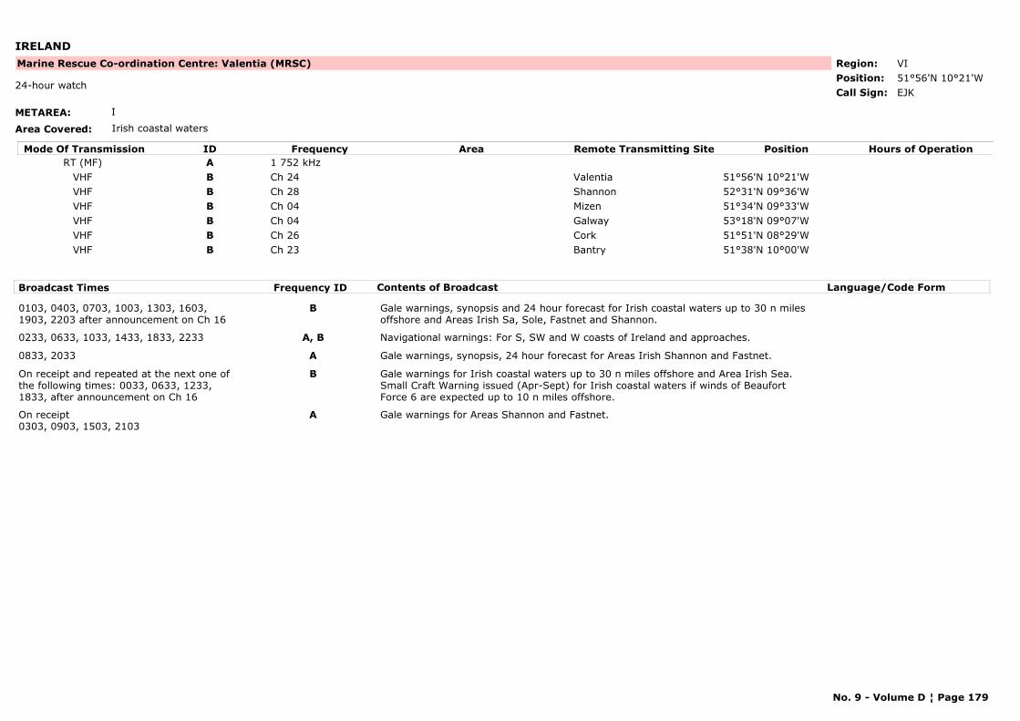
IRELAND
METAREA: I
Area Covered: Irish coastal waters
Region: VIPosition: 51°56'N 10°21'W
Marine Rescue Co-ordination Centre: Valentia (MRSC)
EJK24-hour watch
Call Sign:
Mode Of Transmission ID Frequency Area Position Hours of OperationRemote Transmitting SiteRT (MF) A 1 752 kHz
VHF B Ch 24 Valentia 51°56'N 10°21'WVHF B Ch 28 Shannon 52°31'N 09°36'WVHF B Ch 04 Mizen 51°34'N 09°33'WVHF B Ch 04 Galway 53°18'N 09°07'WVHF B Ch 26 Cork 51°51'N 08°29'WVHF B Ch 23 Bantry 51°38'N 10°00'W
Broadcast Times Frequency ID Contents of Broadcast Language/Code Form
0103, 0403, 0703, 1003, 1303, 1603, 1903, 2203 after announcement on Ch 16
B Gale warnings, synopsis and 24 hour forecast for Irish coastal waters up to 30 n miles offshore and Areas Irish Sa, Sole, Fastnet and Shannon.
0233, 0633, 1033, 1433, 1833, 2233 A, B Navigational warnings: For S, SW and W coasts of Ireland and approaches.
0833, 2033 A Gale warnings, synopsis, 24 hour forecast for Areas Irish Shannon and Fastnet.
On receipt and repeated at the next one of the following times: 0033, 0633, 1233, 1833, after announcement on Ch 16
B Gale warnings for Irish coastal waters up to 30 n miles offshore and Area Irish Sea. Small Craft Warning issued (Apr-Sept) for Irish coastal waters if winds of Beaufort Force 6 are expected up to 10 n miles offshore.
On receipt0303, 0903, 1503, 2103
A Gale warnings for Areas Shannon and Fastnet.
No. 9 - Volume D ¦ Page 179
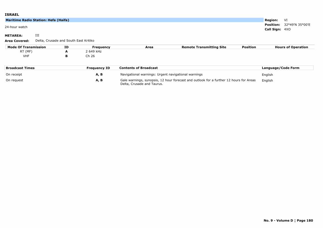
ISRAEL
METAREA: III
Area Covered: Delta, Crusade and South East Kritiko
Region: VIPosition: 32°49'N 35°00'E
4XO24-hour watch
Call Sign:
Maritime Radio Station: Hefa (Haifa)
Mode Of Transmission ID Frequency Area Position Hours of OperationRemote Transmitting SiteRT (MF) A 2 649 kHz
VHF B Ch 26
Broadcast Times Frequency ID Contents of Broadcast Language/Code Form
On receipt A, B Navigational warnings: Urgent navigational warnings English
On request A, B Gale warnings, synopsis, 12 hour forecast and outlook for a further 12 hours for Areas Delta, Crusade and Taurus.
English
No. 9 - Volume D ¦ Page 180
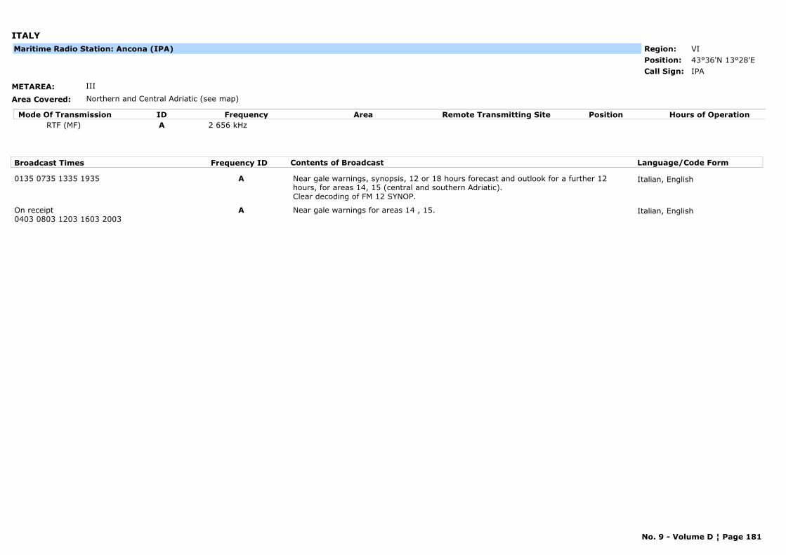
ITALY
METAREA: III
Area Covered: Northern and Central Adriatic (see map)
Region: VIPosition: 43°36'N 13°28'E
IPACall Sign:
Maritime Radio Station: Ancona (IPA)
Mode Of Transmission ID Frequency Area Position Hours of OperationRemote Transmitting SiteRTF (MF) A 2 656 kHz
Broadcast Times Frequency ID Contents of Broadcast Language/Code Form
0135 0735 1335 1935 A Near gale warnings, synopsis, 12 or 18 hours forecast and outlook for a further 12 hours, for areas 14, 15 (central and southern Adriatic).Clear decoding of FM 12 SYNOP.
Italian, English
On receipt0403 0803 1203 1603 2003
A Near gale warnings for areas 14 , 15. Italian, English
No. 9 - Volume D ¦ Page 181
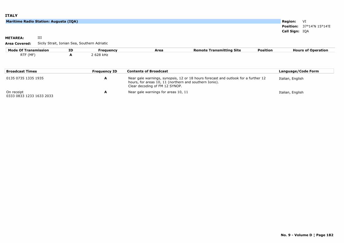
ITALY
METAREA: III
Area Covered: Sicily Strait, Ionian Sea, Southern Adriatic
Region: VIPosition: 37°14'N 15°14'E
IQACall Sign:
Maritime Radio Station: Augusta (IQA)
Mode Of Transmission ID Frequency Area Position Hours of OperationRemote Transmitting SiteRTF (MF) A 2 628 kHz
Broadcast Times Frequency ID Contents of Broadcast Language/Code Form
0135 0735 1335 1935 A Near gale warnings, synopsis, 12 or 18 hours forecast and outlook for a further 12 hours, for areas 10, 11 (northern and southern Ionio). Clear decoding of FM 12 SYNOP.
Italian, English
On receipt0333 0833 1233 1633 2033
A Near gale warnings for areas 10, 11 Italian, English
No. 9 - Volume D ¦ Page 182
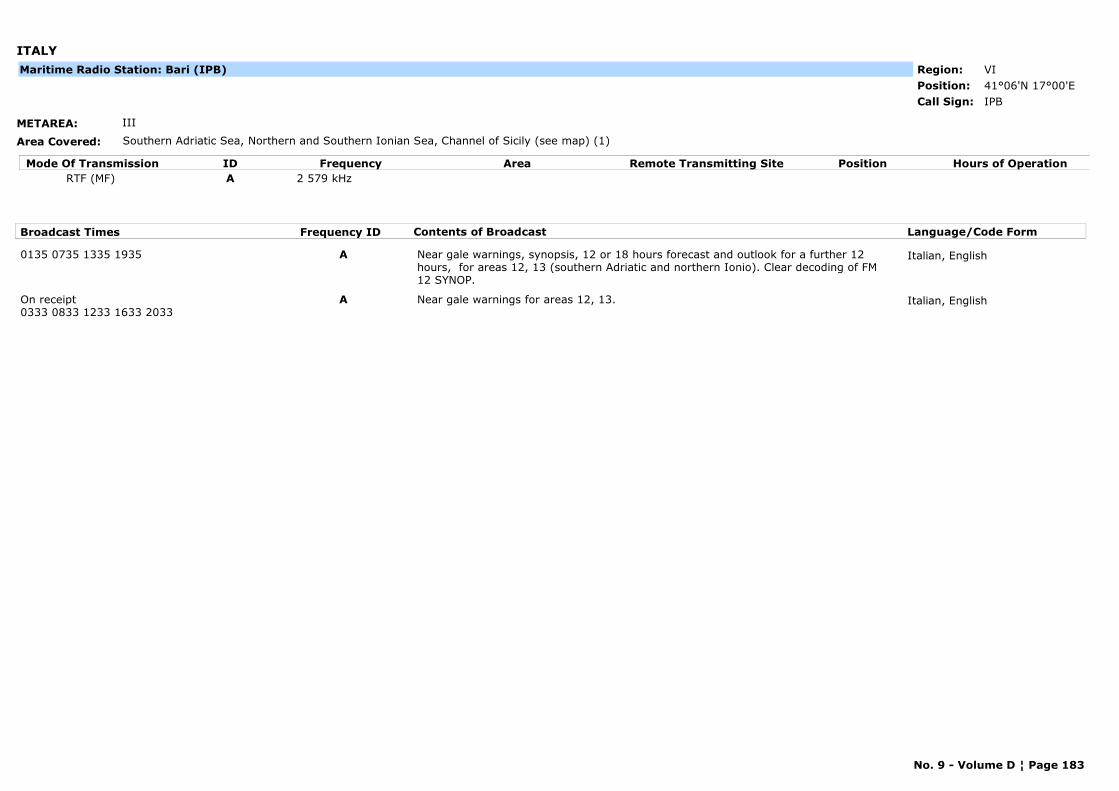
ITALY
METAREA: III
Area Covered: Southern Adriatic Sea, Northern and Southern Ionian Sea, Channel of Sicily (see map) (1)
Region: VIPosition: 41°06'N 17°00'E
IPBCall Sign:
Maritime Radio Station: Bari (IPB)
Mode Of Transmission ID Frequency Area Position Hours of OperationRemote Transmitting SiteRTF (MF) A 2 579 kHz
Broadcast Times Frequency ID Contents of Broadcast Language/Code Form
0135 0735 1335 1935 A Near gale warnings, synopsis, 12 or 18 hours forecast and outlook for a further 12 hours, for areas 12, 13 (southern Adriatic and northern Ionio). Clear decoding of FM 12 SYNOP.
Italian, English
On receipt0333 0833 1233 1633 2033
A Near gale warnings for areas 12, 13. Italian, English
No. 9 - Volume D ¦ Page 183
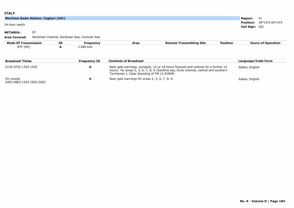
ITALY
METAREA: III
Area Covered: Sardinian Channel, Sardinian Sea, Corsican Sea
Region: VIPosition: 39°14'N 09°14'E
IDC24-hour watch
Call Sign:
Maritime Radio Station: Cagliari (IDC)
Mode Of Transmission ID Frequency Area Position Hours of OperationRemote Transmitting SiteRTF (MF) A 2 680 kHz
Broadcast Times Frequency ID Contents of Broadcast Language/Code Form
0135 0735 1335 1935 A Near gale warnings, synopsis, 12 or 18 hours forecast and outlook for a further 12 hours, for areas 2, 3, 6, 7, 8, 9 (Sardinia sea, Sicily channel, central and southern Tyrrhenian ). Clear decoding of FM 12 SYNOP.
Italian, English
On receipt0403 0803 1203 1603 2003
A Near gale warnings for areas 2, 3, 6, 7, 8, 9. Italian, English
No. 9 - Volume D ¦ Page 184
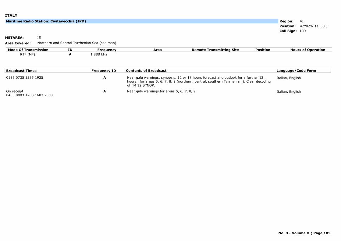
ITALY
METAREA: III
Area Covered: Northern and Central Tyrrhenian Sea (see map)
Region: VIPosition: 42°02'N 11°50'E
IPDCall Sign:
Maritime Radio Station: Civitavecchia (IPD)
Mode Of Transmission ID Frequency Area Position Hours of OperationRemote Transmitting SiteRTF (MF) A 1 888 kHz
Broadcast Times Frequency ID Contents of Broadcast Language/Code Form
0135 0735 1335 1935 A Near gale warnings, synopsis, 12 or 18 hours forecast and outlook for a further 12 hours, for areas 5, 6, 7, 8, 9 (northern, central, southern Tyrrhenian ). Clear decoding of FM 12 SYNOP.
Italian, English
On receipt0403 0803 1203 1603 2003
A Near gale warnings for areas 5, 6, 7, 8, 9. Italian, English
No. 9 - Volume D ¦ Page 185

ITALY
METAREA: III
Area Covered: Northern and Southern Ionian Sea (see map)
Region: VIPosition: 39°03'N 17°08'E
IPCCall Sign:
Maritime Radio Station: Crotone (IPC)
Mode Of Transmission ID Frequency Area Position Hours of OperationRemote Transmitting SiteRTF (MF) A 2 663 kHz
Broadcast Times Frequency ID Contents of Broadcast Language/Code Form
0135 0735 1335 1935 A Near gale warnings, synopsis, 12 or 18 hours forecast and outlook for a further 12 hours, for areas 11, 12 (northern and southern Ionio). Clear decoding of FM 12 SYNOP.
Italian, English
On receipt0333 0833 1233 1633 2033
A Near gale warnings for areas 11, 12. Italian, English
No. 9 - Volume D ¦ Page 186

ITALY
METAREA: III
Area Covered: Ligurian Sea, Northern Tyrrhenian Sea, Sea of Corsica (see map)
Region: VIPosition: 44°26'N 08°56'E
ICB24-hour watch
Call Sign:
Maritime Radio Station: Genova (ICB)
Mode Of Transmission ID Frequency Area Position Hours of OperationRemote Transmitting SiteRTF (MF) A 2 642 kHz
Broadcast Times Frequency ID Contents of Broadcast Language/Code Form
0135 0735 1335 1935 A Near gale warnings, synopsis, 12 or 18 hours forecast and outlook for a further 12 hours, for areas 1,4 ,5 (Corsica sea, Ligurian sea, northern Tyrrhenian). Clear decoding of FM 12 SYNOP.
Italian, English
On receipt0403 0803 1203 1603 2003
A Near gale warnings for areas 1,4, 5. Italian, English
No. 9 - Volume D ¦ Page 187
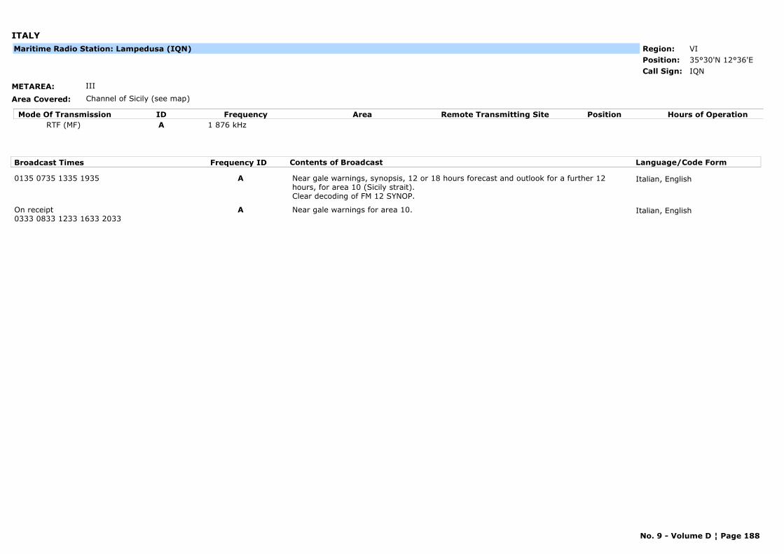
ITALY
METAREA: III
Area Covered: Channel of Sicily (see map)
Region: VIPosition: 35°30'N 12°36'E
IQNCall Sign:
Maritime Radio Station: Lampedusa (IQN)
Mode Of Transmission ID Frequency Area Position Hours of OperationRemote Transmitting SiteRTF (MF) A 1 876 kHz
Broadcast Times Frequency ID Contents of Broadcast Language/Code Form
0135 0735 1335 1935 A Near gale warnings, synopsis, 12 or 18 hours forecast and outlook for a further 12 hours, for area 10 (Sicily strait). Clear decoding of FM 12 SYNOP.
Italian, English
On receipt0333 0833 1233 1633 2033
A Near gale warnings for area 10. Italian, English
No. 9 - Volume D ¦ Page 188

ITALY
METAREA: III
Area Covered: Ligurian Sea, Northern and Central Tyrrhenian Sea (see map)
Region: VIPosition: 43°29'N 10°21'E
IPLCall Sign:
Maritime Radio Station: Livorno (IPL)
Mode Of Transmission ID Frequency Area Position Hours of OperationRemote Transmitting SiteRTF (MF) A 1 925 kHz
Broadcast Times Frequency ID Contents of Broadcast Language/Code Form
0135 0735 1335 1935 A Near gale warnings, synopsis, 12 or 18 hours forecast and outlook for a further 12 hours, for areas 4, 5, 6, 7 (Ligurian sea, northern and central Tyrrhenian).Clear decoding of FM 12 SYNOP.
Italian, English
On receipt0403 0803 1203 1603 2003
A Near gale warnings for areas 4, 5, 6, 7. Italian, English
No. 9 - Volume D ¦ Page 189
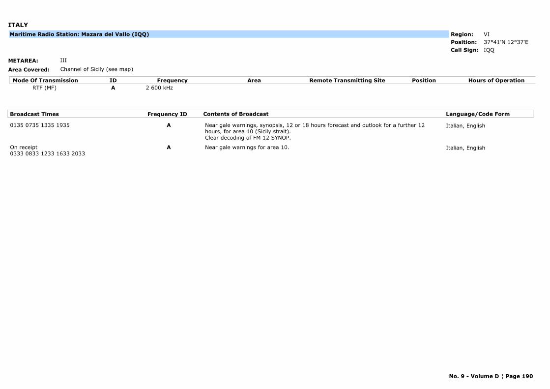
ITALY
METAREA: III
Area Covered: Channel of Sicily (see map)
Region: VIPosition: 37°41'N 12°37'E
IQQCall Sign:
Maritime Radio Station: Mazara del Vallo (IQQ)
Mode Of Transmission ID Frequency Area Position Hours of OperationRemote Transmitting SiteRTF (MF) A 2 600 kHz
Broadcast Times Frequency ID Contents of Broadcast Language/Code Form
0135 0735 1335 1935 A Near gale warnings, synopsis, 12 or 18 hours forecast and outlook for a further 12 hours, for area 10 (Sicily strait). Clear decoding of FM 12 SYNOP.
Italian, English
On receipt0333 0833 1233 1633 2033
A Near gale warnings for area 10. Italian, English
No. 9 - Volume D ¦ Page 190
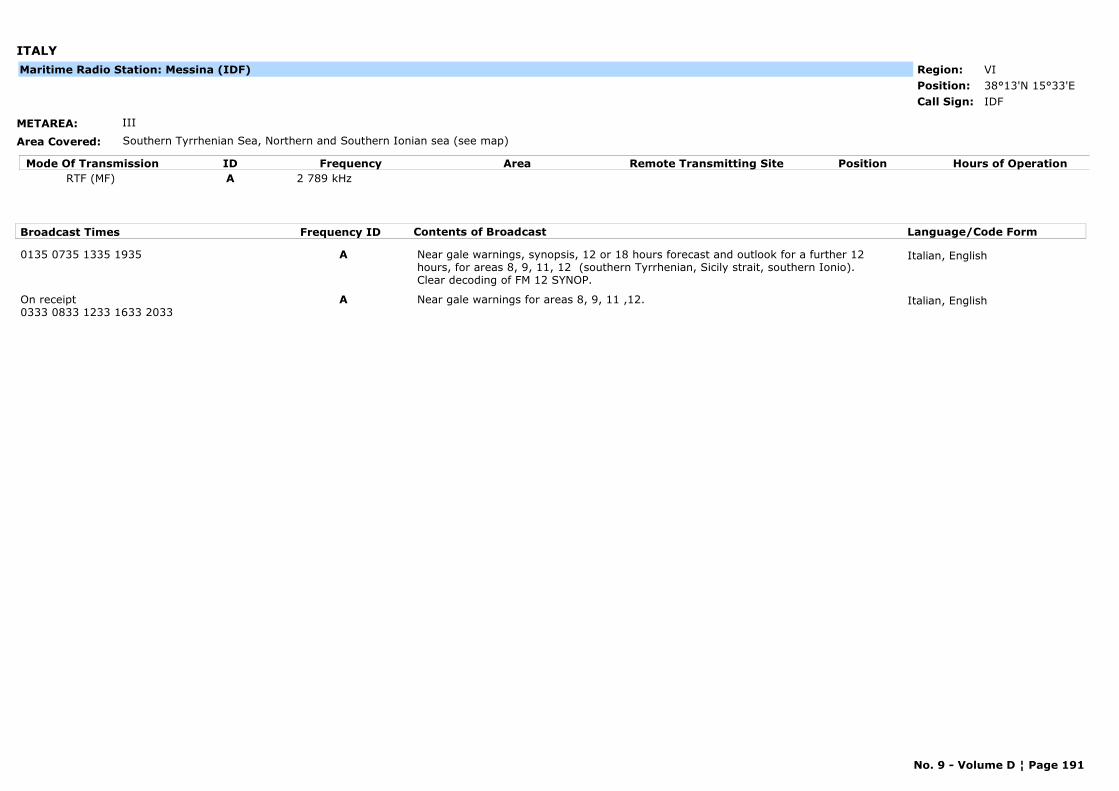
ITALY
METAREA: III
Area Covered: Southern Tyrrhenian Sea, Northern and Southern Ionian sea (see map)
Region: VIPosition: 38°13'N 15°33'E
IDFCall Sign:
Maritime Radio Station: Messina (IDF)
Mode Of Transmission ID Frequency Area Position Hours of OperationRemote Transmitting SiteRTF (MF) A 2 789 kHz
Broadcast Times Frequency ID Contents of Broadcast Language/Code Form
0135 0735 1335 1935 A Near gale warnings, synopsis, 12 or 18 hours forecast and outlook for a further 12 hours, for areas 8, 9, 11, 12 (southern Tyrrhenian, Sicily strait, southern Ionio). Clear decoding of FM 12 SYNOP.
Italian, English
On receipt0333 0833 1233 1633 2033
A Near gale warnings for areas 8, 9, 11 ,12. Italian, English
No. 9 - Volume D ¦ Page 191

ITALY
METAREA: III
Area Covered: Central and Southern Tyrrhenian Sea (see map)
Region: VIPosition: 40°51'N 14°10'E
IQH24-hour watch
Call Sign:
Maritime Radio Station: Napoli (IQH)
Mode Of Transmission ID Frequency Area Position Hours of OperationRemote Transmitting SiteRTF (MF) A 2 632 kHz
Broadcast Times Frequency ID Contents of Broadcast Language/Code Form
0135 0735 1335 1935 A Near gale warnings, synopsis, 12 or 18 hours forecast and outlook for a further 12 hours, for areas 6, 7, 8, 9 (central and southern Tyrrhenian). Clear decoding of FM 12 SYNOP.
Italian, English
On receipt0333 0833 1233 1633 2033
A Near gale warnings for areas 6, 7, 8, 9. Italian, English
No. 9 - Volume D ¦ Page 192

ITALY
METAREA: III
Area Covered: Southern Tyrrhenian Sea, Channel of Sicily (see map)
Region: VIPosition: 38°11'N 13°06'E
IPP24-hour watch
Call Sign:
Maritime Radio Station: Palermo (IPP)
Mode Of Transmission ID Frequency Area Position Hours of OperationRemote Transmitting SiteRTF (MF) A 1 852 kHz
Broadcast Times Frequency ID Contents of Broadcast Language/Code Form
0135 0735 1335 1935 A Near gale warnings, synopsis, 12 or 18 hours forecast and outlook for a further 12 hours, for areas 8, 9, 10 (southern Tyrrhenian, Sicily strait). Clear decoding of FM 12 SYNOP.
Italian, English
On receipt0333 0833 1233 1633 2033
A Near gale warnings for areas 8, 9, 10. Italian, English
No. 9 - Volume D ¦ Page 193
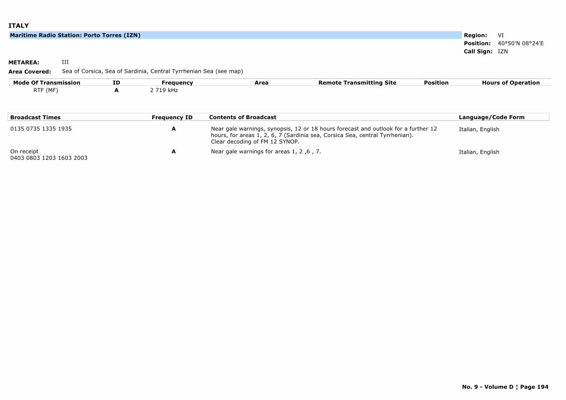
ITALY
METAREA: III
Area Covered: Sea of Corsica, Sea of Sardinia, Central Tyrrhenian Sea (see map)
Region: VIPosition: 40°50'N 08°24'E
IZNCall Sign:
Maritime Radio Station: Porto Torres (IZN)
Mode Of Transmission ID Frequency Area Position Hours of OperationRemote Transmitting SiteRTF (MF) A 2 719 kHz
Broadcast Times Frequency ID Contents of Broadcast Language/Code Form
0135 0735 1335 1935 A Near gale warnings, synopsis, 12 or 18 hours forecast and outlook for a further 12 hours, for areas 1, 2, 6, 7 (Sardinia sea, Corsica Sea, central Tyrrhenian). Clear decoding of FM 12 SYNOP.
Italian, English
On receipt0403 0803 1203 1603 2003
A Near gale warnings for areas 1, 2 ,6 , 7. Italian, English
No. 9 - Volume D ¦ Page 194
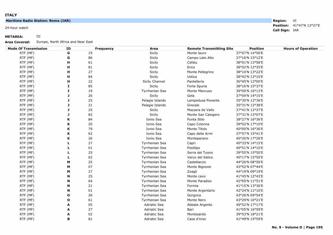
ITALY
METAREA: III
Area Covered: Europe, North Africa and Near East
Region: VIPosition: 41°47'N 12°27'E
IAR24-hour watch
Call Sign:
Maritime Radio Station: Roma (IAR)
Mode Of Transmission ID Frequency Area Position Hours of OperationRemote Transmitting SiteRTF (MF) G 19 Sicily Monte lauro 37°07’N 14°50’ERTF (MF) G 86 Sicily Campo Lato Alto 37°16’N 15°12’ERTF (MF) H 61 Sicily Cefalu 38°01’N 13°58’ERTF (MF) H 81 Sicily Erice 38°02’N 12°35’ERTF (MF) H 27 Sicily Monte Pellegrino 38°10’N 13°22’ERTF (MF) H 84 Sicily Ustica 38°42’N 13°10’ERTF (MF) H 22 Sicily Channel Pantelleria 36°45’N 12°00’ERTF (MF) I 85 Sicily Forte Spuria 38°16’N 15°37’ERTF (MF) I 19 Tyrrhenian Sea Monte Mancuso 39°00’N 16°13’ERTF (MF) J 26 Sicily Gela 37°04’N 14°15’ERTF (MF) J 25 Pelagie Islands Lampedusa Ponente 35°30’N 12°36’ERTF (MF) J 21 Pelagie Islands Grecale 35°31’N 12°38’ERTF (MF) J 25 Sicily Mazzara de Vallo 37°41’N 12°37’ERTF (MF) J 82 Sicily Monte San Calogero 37°31’N 13°07’ERTF (MF) K 84 Ionio Sea Punta Stilo 38°27’N 16°36’ERTF (MF) K 20 Ionio Sea Capo Colonna 39°02’N 17°10’ERTF (MF) K 79 Ionio Sea Monte Titolo 40°00’N 16°36’ERTF (MF) K 62 Ionio Sea Capo delle Armi 37°57’N 15°41’ERTF (MF) K 26 Ionio Sea Monteparano 40°26’N 17°26’ERTF (MF) L 27 Tyrrhenian Sea Capri 40°33’N 14°15’ERTF (MF) L 01 Tyrrhenian Sea Posillipo 40°51’N 14°10’ERTF (MF) L 25 Tyrrhenian Sea Serra del Tuono 39°55’N 15°50’ERTF (MF) L 62 Tyrrhenian Sea Varco del Salice 40°17’N 15°50’ERTF (MF) M 25 Tyrrhenian Sea Castellaccio 44°26’N 08°56’ERTF (MF) M 07 Tyrrhenian Sea Monte Bignone 43°52’N 07°44’ERTF (MF) M 27 Tyrrhenian Sea Zoagli 44°19’N 09°19’ERTF (MF) N 25 Tyrrhenian Sea Monte cavo 41°45’N 12°43’ERTF (MF) N 64 Tyrrhenian Sea Monte Paradiso 42°05’N 11°51’ERTF (MF) N 21 Tyrrhenian Sea Formia 41°15’N 13°36’ERTF (MF) N 01 Tyrrhenian Sea Monte Argentario 42°24’N 11°10’ERTF (MF) O 26 Tyrrhenian Sea Gorgona 43°26’N 09°54’ERTF (MF) O 61 Tyrrhenian Sea Monte Nero 43°29’N 10°21’ERTF (MF) A 05 Adriatic Sea Abbate Argento 40°52’N 17°17’ERTF (MF) A 27 Adriatic Sea Bari 41°05’N 16°59’ERTF (MF) A 02 Adriatic Sea Montesardo 39°53’N 18°21’ERTF (MF) B 81 Adriatic Sea Casa d’orso 41°49’N 15°59’E
No. 9 - Volume D ¦ Page 195
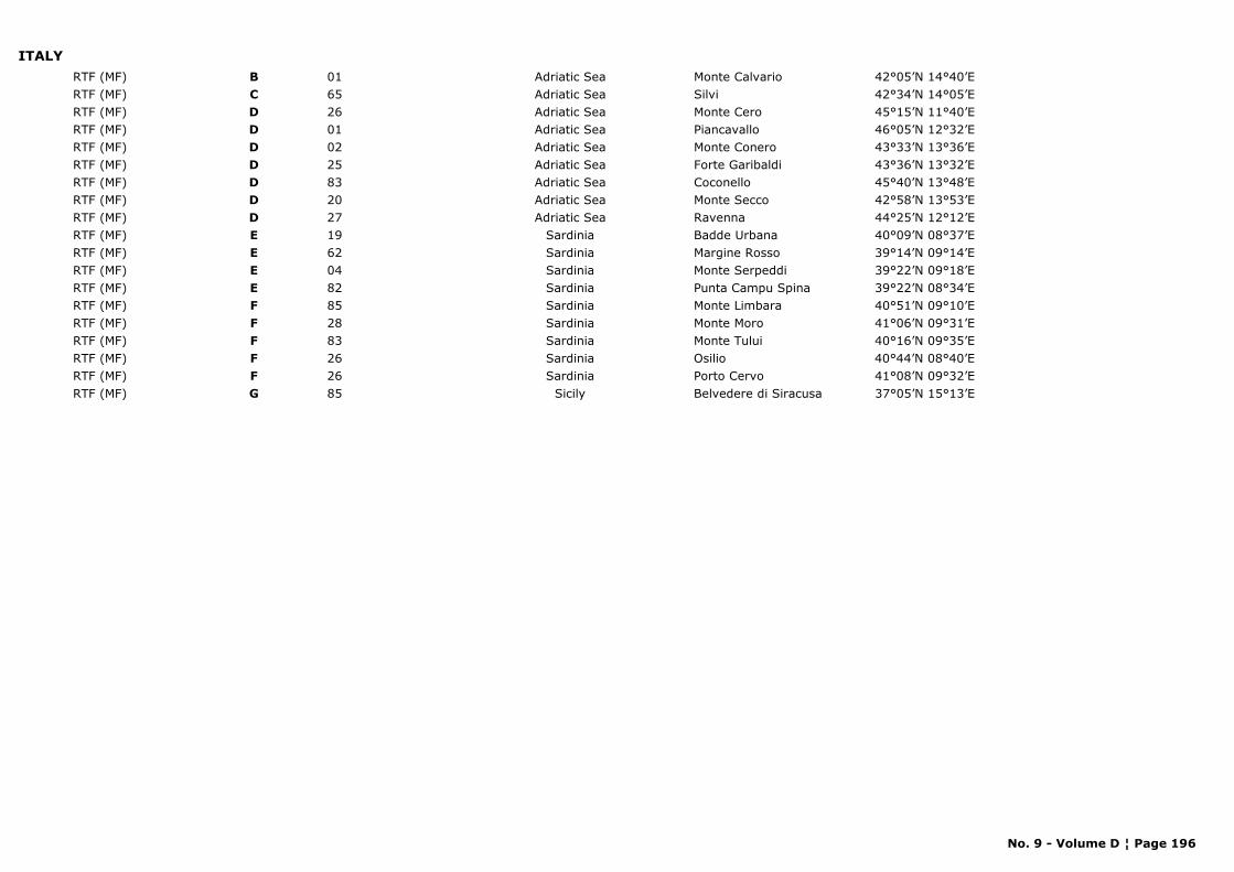
ITALYRTF (MF) B 01 Adriatic Sea Monte Calvario 42°05’N 14°40’ERTF (MF) C 65 Adriatic Sea Silvi 42°34’N 14°05’ERTF (MF) D 26 Adriatic Sea Monte Cero 45°15’N 11°40’ERTF (MF) D 01 Adriatic Sea Piancavallo 46°05’N 12°32’ERTF (MF) D 02 Adriatic Sea Monte Conero 43°33’N 13°36’ERTF (MF) D 25 Adriatic Sea Forte Garibaldi 43°36’N 13°32’ERTF (MF) D 83 Adriatic Sea Coconello 45°40’N 13°48’ERTF (MF) D 20 Adriatic Sea Monte Secco 42°58’N 13°53’ERTF (MF) D 27 Adriatic Sea Ravenna 44°25’N 12°12’ERTF (MF) E 19 Sardinia Badde Urbana 40°09’N 08°37’ERTF (MF) E 62 Sardinia Margine Rosso 39°14’N 09°14’ERTF (MF) E 04 Sardinia Monte Serpeddi 39°22’N 09°18’ERTF (MF) E 82 Sardinia Punta Campu Spina 39°22’N 08°34’ERTF (MF) F 85 Sardinia Monte Limbara 40°51’N 09°10’ERTF (MF) F 28 Sardinia Monte Moro 41°06’N 09°31’ERTF (MF) F 83 Sardinia Monte Tului 40°16’N 09°35’ERTF (MF) F 26 Sardinia Osilio 40°44’N 08°40’ERTF (MF) F 26 Sardinia Porto Cervo 41°08’N 09°32’ERTF (MF) G 85 Sicily Belvedere di Siracusa 37°05’N 15°13’E
No. 9 - Volume D ¦ Page 196
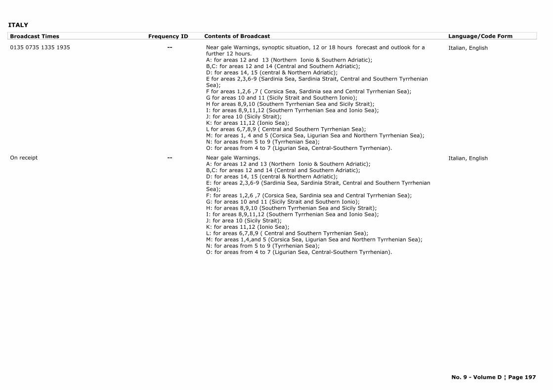
ITALY
Broadcast Times Frequency ID Contents of Broadcast Language/Code Form
0135 0735 1335 1935 -- Near gale Warnings, synoptic situation, 12 or 18 hours forecast and outlook for a further 12 hours.A: for areas 12 and 13 (Northern Ionio & Southern Adriatic); B,C: for areas 12 and 14 (Central and Southern Adriatic);D: for areas 14, 15 (central & Northern Adriatic); E for areas 2,3,6-9 (Sardinia Sea, Sardinia Strait, Central and Southern Tyrrhenian Sea); F for areas 1,2,6 ,7 ( Corsica Sea, Sardinia sea and Central Tyrrhenian Sea); G for areas 10 and 11 (Sicily Strait and Southern Ionio); H for areas 8,9,10 (Southern Tyrrhenian Sea and Sicily Strait); I: for areas 8,9,11,12 (Southern Tyrrhenian Sea and Ionio Sea);J: for area 10 (Sicily Strait); K: for areas 11,12 (Ionio Sea); L for areas 6,7,8,9 ( Central and Southern Tyrrhenian Sea); M: for areas 1, 4 and 5 (Corsica Sea, Ligurian Sea and Northern Tyrrhenian Sea); N: for areas from 5 to 9 (Tyrrhenian Sea); O: for areas from 4 to 7 (Ligurian Sea, Central-Southern Tyrrhenian).
Italian, English
On receipt -- Near gale Warnings.A: for areas 12 and 13 (Northern Ionio & Southern Adriatic); B,C: for areas 12 and 14 (Central and Southern Adriatic); D: for areas 14, 15 (central & Northern Adriatic);E: for areas 2,3,6-9 (Sardinia Sea, Sardinia Strait, Central and Southern Tyrrhenian Sea);F: for areas 1,2,6 ,7 (Corsica Sea, Sardinia sea and Central Tyrrhenian Sea); G: for areas 10 and 11 (Sicily Strait and Southern Ionio); H: for areas 8,9,10 (Southern Tyrrhenian Sea and Sicily Strait); I: for areas 8,9,11,12 (Southern Tyrrhenian Sea and Ionio Sea); J: for area 10 (Sicily Strait); K: for areas 11,12 (Ionio Sea); L: for areas 6,7,8,9 ( Central and Southern Tyrrhenian Sea); M: for areas 1,4,and 5 (Corsica Sea, Ligurian Sea and Northern Tyrrhenian Sea); N: for areas from 5 to 9 (Tyrrhenian Sea); O: for areas from 4 to 7 (Ligurian Sea, Central-Southern Tyrrhenian).
Italian, English
No. 9 - Volume D ¦ Page 197
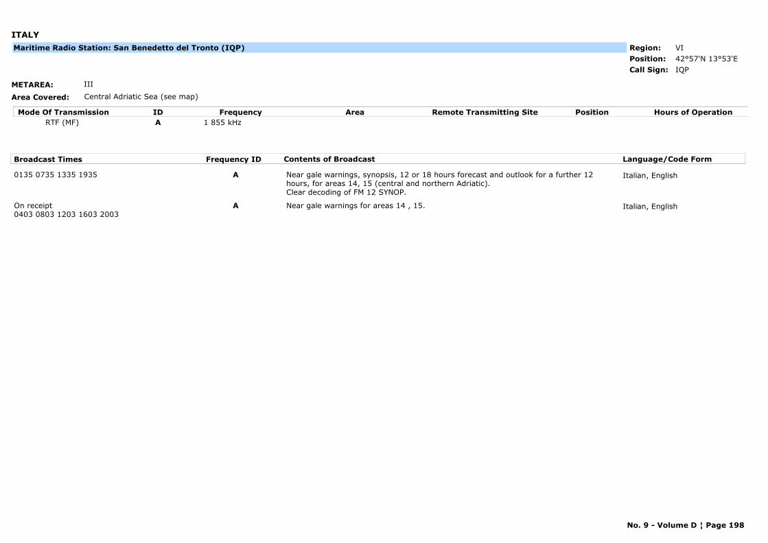
ITALY
METAREA: III
Area Covered: Central Adriatic Sea (see map)
Region: VIPosition: 42°57'N 13°53'E
IQPCall Sign:
Maritime Radio Station: San Benedetto del Tronto (IQP)
Mode Of Transmission ID Frequency Area Position Hours of OperationRemote Transmitting SiteRTF (MF) A 1 855 kHz
Broadcast Times Frequency ID Contents of Broadcast Language/Code Form
0135 0735 1335 1935 A Near gale warnings, synopsis, 12 or 18 hours forecast and outlook for a further 12 hours, for areas 14, 15 (central and northern Adriatic).Clear decoding of FM 12 SYNOP.
Italian, English
On receipt0403 0803 1203 1603 2003
A Near gale warnings for areas 14 , 15. Italian, English
No. 9 - Volume D ¦ Page 198

ITALY
METAREA: III
Area Covered: Northern and Central Adriatic Sea (see map)
Region: VIPosition: 45°41'N 13°46'E
IQX24-hour watch
Call Sign:
Maritime Radio Station: Trieste (IQX)
Mode Of Transmission ID Frequency Area Position Hours of OperationRemote Transmitting SiteRTF (MF) A 2 624 kHz
Broadcast Times Frequency ID Contents of Broadcast Language/Code Form
0135 0735 1335 1935 A Near gale warnings, synopsis, 12 or 18 hours forecast and outlook for a further 12 hours, for areas 14, 15 (central and northern Adriatic). Clear decoding of FM 12 SYNOP
Italian, English
On receipt0403 0803 1203 1603 2003
A Near gale warnings for areas 14, 15 Italian, English
No. 9 - Volume D ¦ Page 199
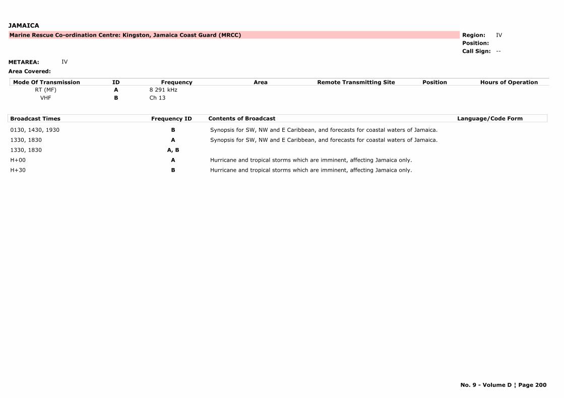
JAMAICA
METAREA: IV
Area Covered:
Region: IVPosition:
Marine Rescue Co-ordination Centre: Kingston, Jamaica Coast Guard (MRCC)
--Call Sign:
Mode Of Transmission ID Frequency Area Position Hours of OperationRemote Transmitting SiteRT (MF) A 8 291 kHz
VHF B Ch 13
Broadcast Times Frequency ID Contents of Broadcast Language/Code Form
0130, 1430, 1930 B Synopsis for SW, NW and E Caribbean, and forecasts for coastal waters of Jamaica.
1330, 1830 A Synopsis for SW, NW and E Caribbean, and forecasts for coastal waters of Jamaica.
1330, 1830 A, B
H+00 A Hurricane and tropical storms which are imminent, affecting Jamaica only.
H+30 B Hurricane and tropical storms which are imminent, affecting Jamaica only.
No. 9 - Volume D ¦ Page 200
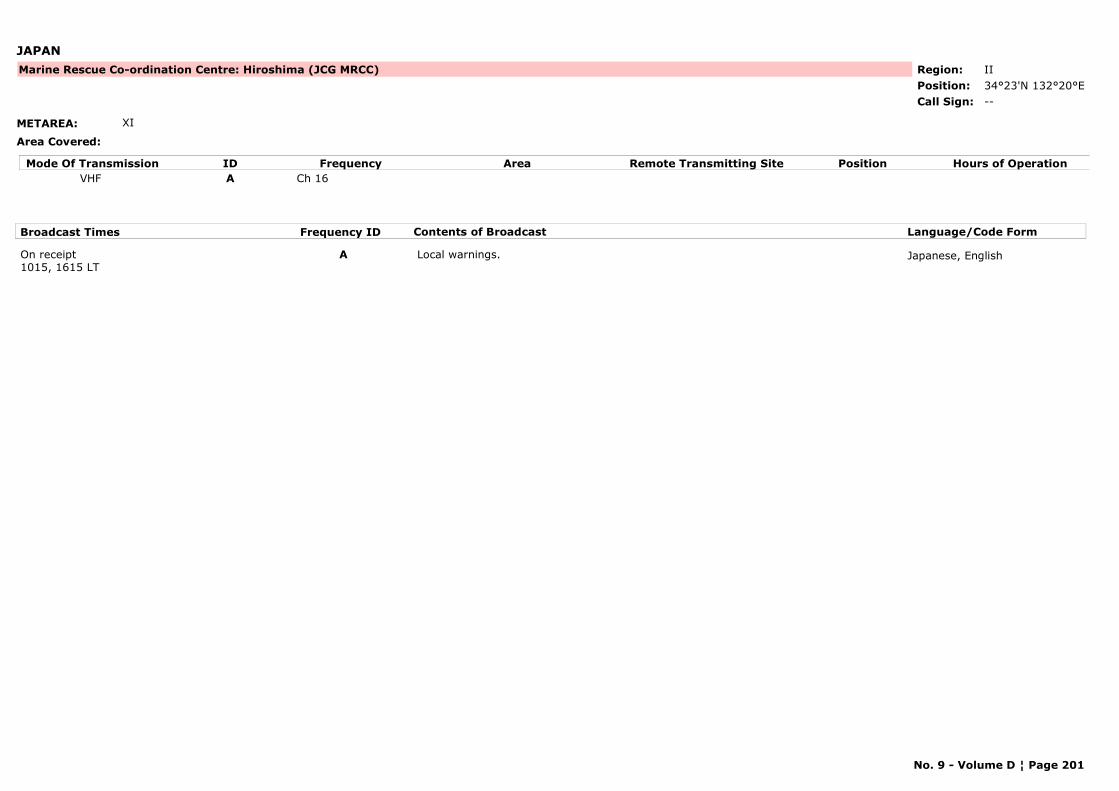
JAPAN
METAREA: XI
Area Covered:
Region: IIPosition: 34°23'N 132°20°E
Marine Rescue Co-ordination Centre: Hiroshima (JCG MRCC)
--Call Sign:
Mode Of Transmission ID Frequency Area Position Hours of OperationRemote Transmitting SiteVHF A Ch 16
Broadcast Times Frequency ID Contents of Broadcast Language/Code Form
On receipt1015, 1615 LT
A Local warnings. Japanese, English
No. 9 - Volume D ¦ Page 201
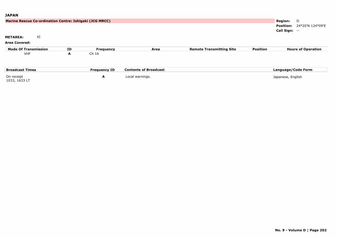
JAPAN
METAREA: XI
Area Covered:
Region: IIPosition: 24°20'N 124°09'E
Marine Rescue Co-ordination Centre: Ishigaki (JCG MRCC)
--Call Sign:
Mode Of Transmission ID Frequency Area Position Hours of OperationRemote Transmitting SiteVHF A Ch 16
Broadcast Times Frequency ID Contents of Broadcast Language/Code Form
On receipt1033, 1633 LT
A Local warnings. Japanese, English
No. 9 - Volume D ¦ Page 202
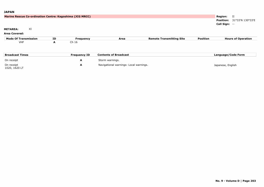
JAPAN
METAREA: XI
Area Covered:
Region: IIPosition: 31°33'N 130°33'E
Marine Rescue Co-ordination Centre: Kagoshima (JCG MRCC)
--Call Sign:
Mode Of Transmission ID Frequency Area Position Hours of OperationRemote Transmitting SiteVHF A Ch 16
Broadcast Times Frequency ID Contents of Broadcast Language/Code Form
On receipt A Storm warnings.
On receipt1020, 1620 LT
A Navigational warnings: Local warnings. Japanese, English
No. 9 - Volume D ¦ Page 203
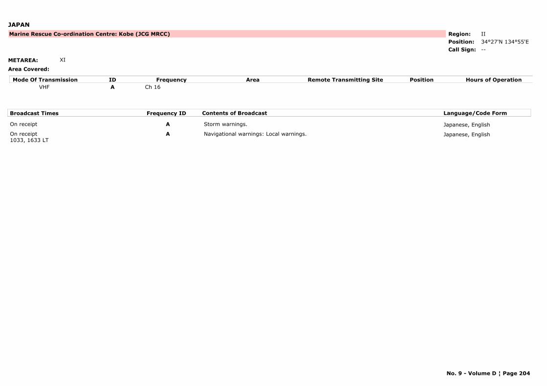
JAPAN
METAREA: XI
Area Covered:
Region: IIPosition: 34°27'N 134°55'E
Marine Rescue Co-ordination Centre: Kobe (JCG MRCC)
--Call Sign:
Mode Of Transmission ID Frequency Area Position Hours of OperationRemote Transmitting SiteVHF A Ch 16
Broadcast Times Frequency ID Contents of Broadcast Language/Code Form
On receipt A Storm warnings. Japanese, English
On receipt1033, 1633 LT
A Navigational warnings: Local warnings. Japanese, English
No. 9 - Volume D ¦ Page 204
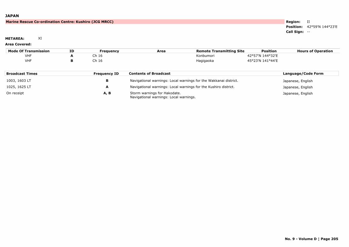
JAPAN
METAREA: XI
Area Covered:
Region: IIPosition: 42°59'N 144°23'E
Marine Rescue Co-ordination Centre: Kushiro (JCG MRCC)
--Call Sign:
Mode Of Transmission ID Frequency Area Position Hours of OperationRemote Transmitting SiteVHF A Ch 16 Konbumori 42°57'N 144°32'EVHF B Ch 16 Hagigaoka 45°23'N 141°44'E
Broadcast Times Frequency ID Contents of Broadcast Language/Code Form
1003, 1603 LT B Navigational warnings: Local warnings for the Wakkanai district. Japanese, English
1025, 1625 LT A Navigational warnings: Local warnings for the Kushiro district. Japanese, English
On receipt A, B Storm warnings for Hakodate. Navigational warnings: Local warnings.
Japanese, English
No. 9 - Volume D ¦ Page 205

JAPAN
METAREA: XI
Area Covered:
Region: IIPosition: 35°27'N 135°19'E
Marine Rescue Co-ordination Centre: Maizuru (JCG MRCC)
--Call Sign:
Mode Of Transmission ID Frequency Area Position Hours of OperationRemote Transmitting SiteVHF A Ch 16
Broadcast Times Frequency ID Contents of Broadcast Language/Code Form
1020, 1620 LT A Weather bulletins. Navigational warnings: Local warnings.
Japanese, English
On receipt A Storm warnings. Japanese, English
No. 9 - Volume D ¦ Page 206
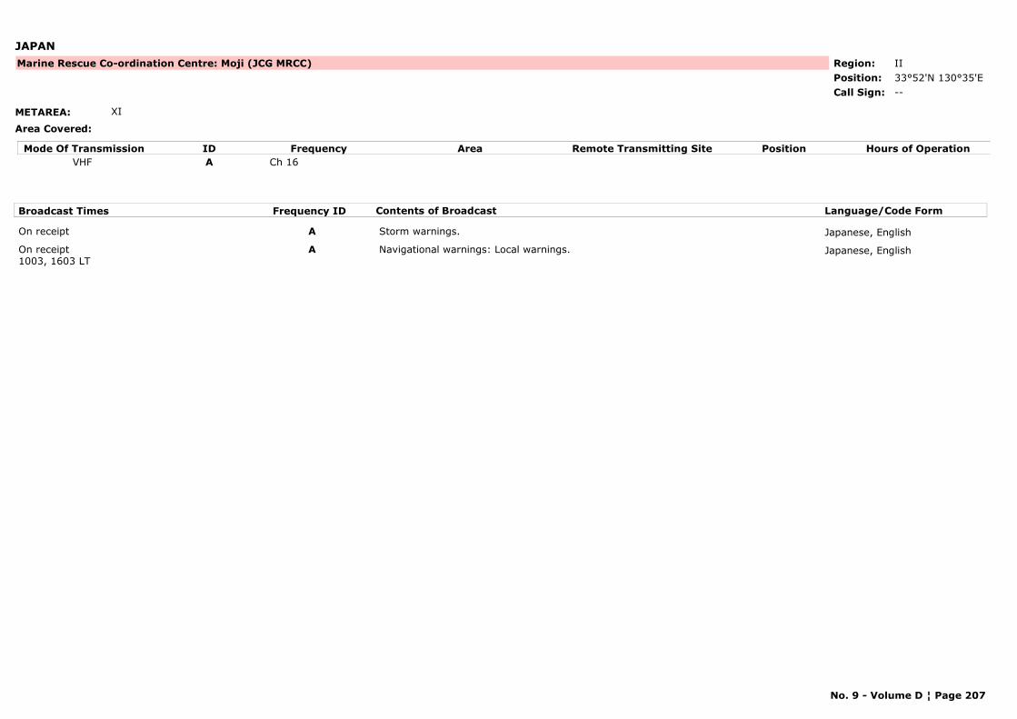
JAPAN
METAREA: XI
Area Covered:
Region: IIPosition: 33°52'N 130°35'E
Marine Rescue Co-ordination Centre: Moji (JCG MRCC)
--Call Sign:
Mode Of Transmission ID Frequency Area Position Hours of OperationRemote Transmitting SiteVHF A Ch 16
Broadcast Times Frequency ID Contents of Broadcast Language/Code Form
On receipt A Storm warnings. Japanese, English
On receipt1003, 1603 LT
A Navigational warnings: Local warnings. Japanese, English
No. 9 - Volume D ¦ Page 207

JAPAN
METAREA: XI
Area Covered:
Region: IIPosition: 35°04'N 136°40'E
Marine Rescue Co-ordination Centre: Nagoya (JCG MRCC)
--Call Sign:
Mode Of Transmission ID Frequency Area Position Hours of OperationRemote Transmitting SiteVHF A Ch 16
Broadcast Times Frequency ID Contents of Broadcast Language/Code Form
On receipt A Storm warnings. Japanese, English
On receipt1010, 1610 LT
A Navigational warnings: Local warnings. Japanese, English
No. 9 - Volume D ¦ Page 208
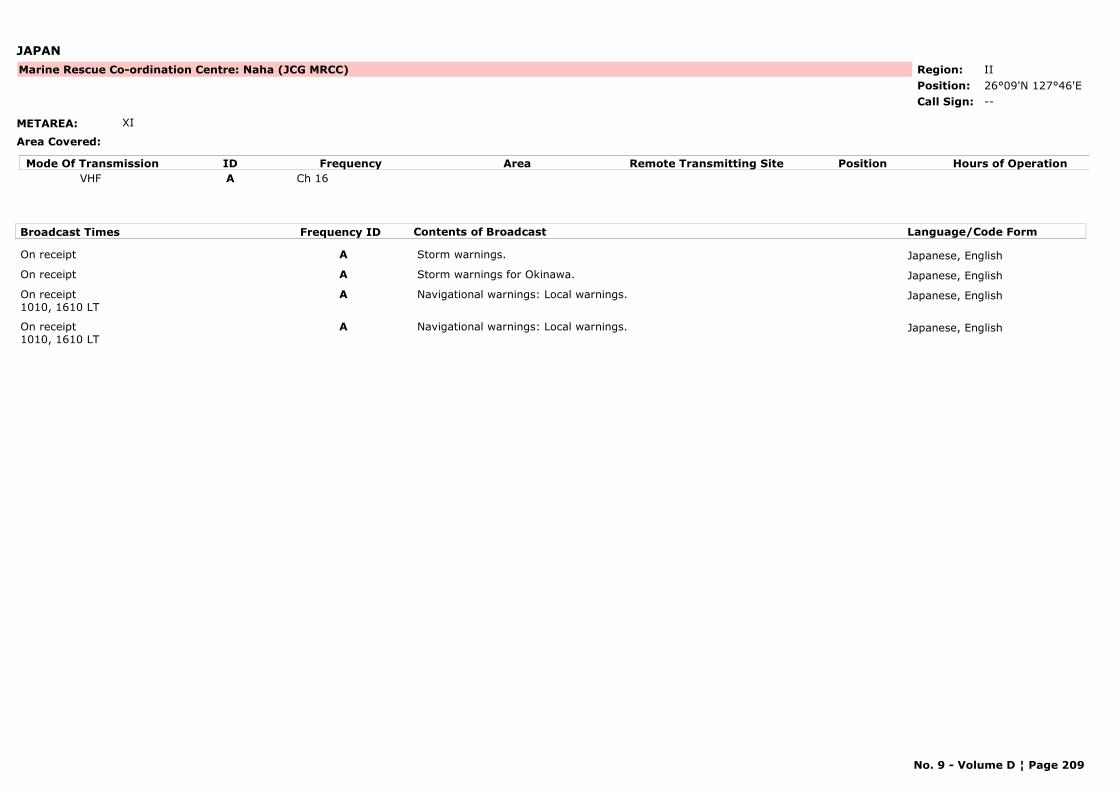
JAPAN
METAREA: XI
Area Covered:
Region: IIPosition: 26°09'N 127°46'E
Marine Rescue Co-ordination Centre: Naha (JCG MRCC)
--Call Sign:
Mode Of Transmission ID Frequency Area Position Hours of OperationRemote Transmitting SiteVHF A Ch 16
Broadcast Times Frequency ID Contents of Broadcast Language/Code Form
On receipt A Storm warnings. Japanese, English
On receipt A Storm warnings for Okinawa. Japanese, English
On receipt1010, 1610 LT
A Navigational warnings: Local warnings. Japanese, English
On receipt1010, 1610 LT
A Navigational warnings: Local warnings. Japanese, English
No. 9 - Volume D ¦ Page 209
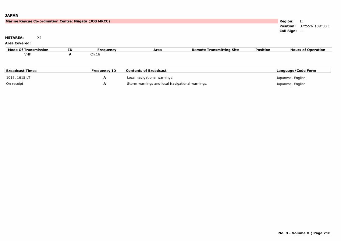
JAPAN
METAREA: XI
Area Covered:
Region: IIPosition: 37°55'N 139°03'E
Marine Rescue Co-ordination Centre: Niigata (JCG MRCC)
--Call Sign:
Mode Of Transmission ID Frequency Area Position Hours of OperationRemote Transmitting SiteVHF A Ch 16
Broadcast Times Frequency ID Contents of Broadcast Language/Code Form
1015, 1615 LT A Local navigational warnings. Japanese, English
On receipt A Storm warnings and local Navigational warnings. Japanese, English
No. 9 - Volume D ¦ Page 210
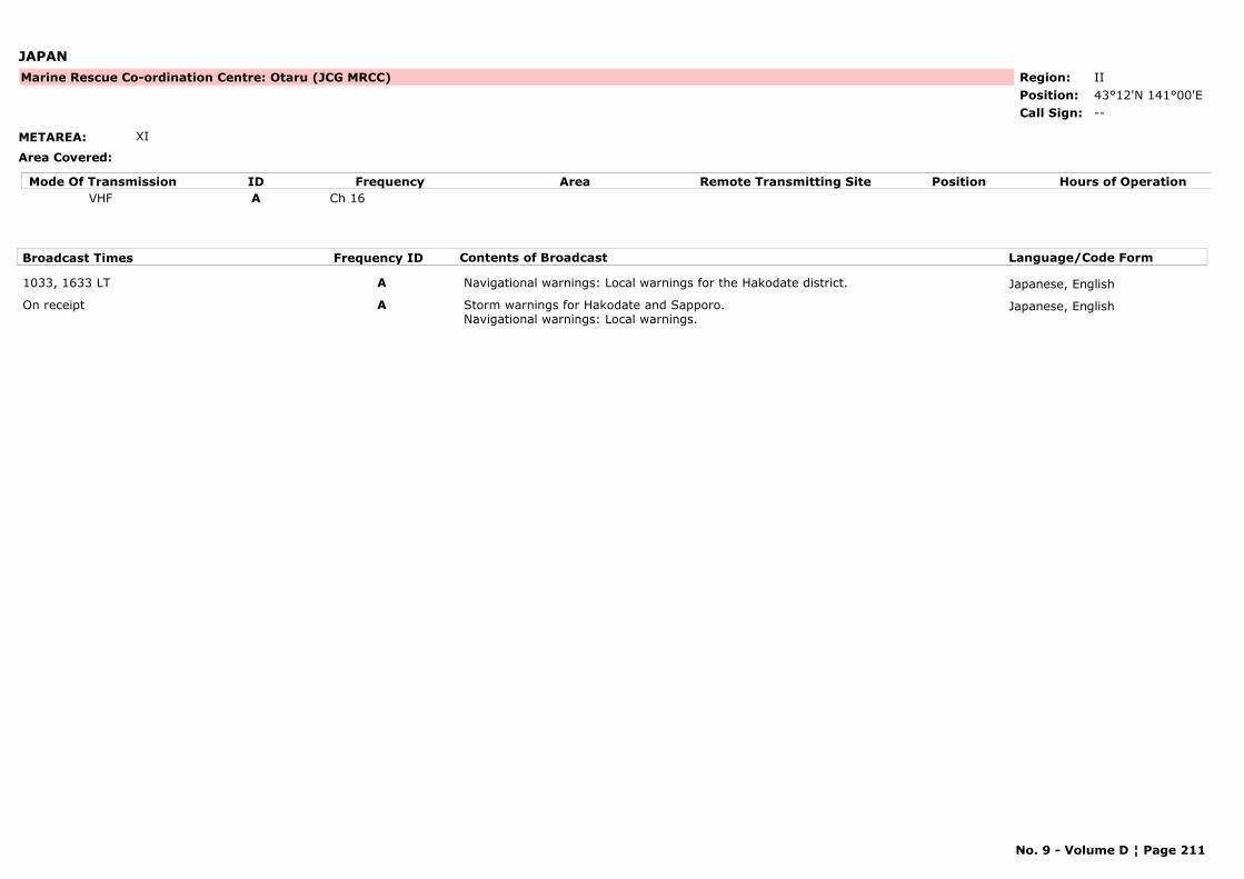
JAPAN
METAREA: XI
Area Covered:
Region: IIPosition: 43°12'N 141°00'E
Marine Rescue Co-ordination Centre: Otaru (JCG MRCC)
--Call Sign:
Mode Of Transmission ID Frequency Area Position Hours of OperationRemote Transmitting SiteVHF A Ch 16
Broadcast Times Frequency ID Contents of Broadcast Language/Code Form
1033, 1633 LT A Navigational warnings: Local warnings for the Hakodate district. Japanese, English
On receipt A Storm warnings for Hakodate and Sapporo.Navigational warnings: Local warnings.
Japanese, English
No. 9 - Volume D ¦ Page 211
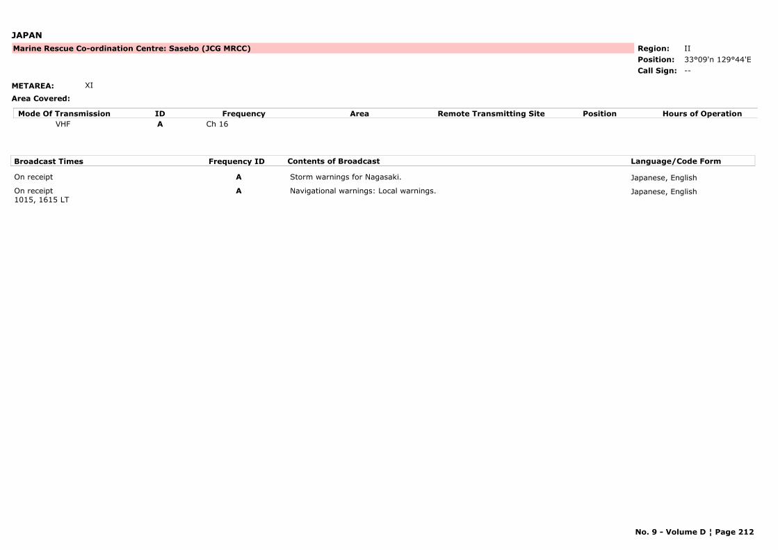
JAPAN
METAREA: XI
Area Covered:
Region: IIPosition: 33°09'n 129°44'E
Marine Rescue Co-ordination Centre: Sasebo (JCG MRCC)
--Call Sign:
Mode Of Transmission ID Frequency Area Position Hours of OperationRemote Transmitting SiteVHF A Ch 16
Broadcast Times Frequency ID Contents of Broadcast Language/Code Form
On receipt A Storm warnings for Nagasaki. Japanese, English
On receipt1015, 1615 LT
A Navigational warnings: Local warnings. Japanese, English
No. 9 - Volume D ¦ Page 212
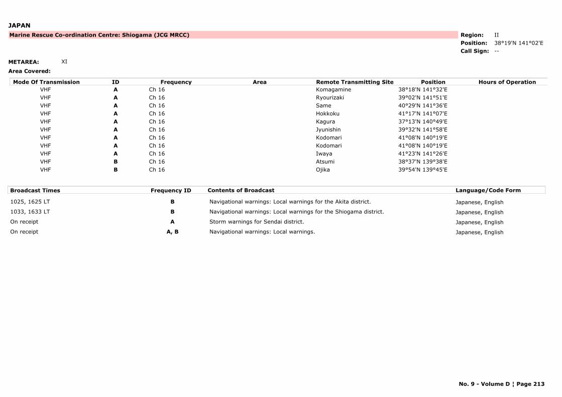
JAPAN
METAREA: XI
Area Covered:
Region: IIPosition: 38°19'N 141°02'E
Marine Rescue Co-ordination Centre: Shiogama (JCG MRCC)
--Call Sign:
Mode Of Transmission ID Frequency Area Position Hours of OperationRemote Transmitting SiteVHF A Ch 16 Komagamine 38°18'N 141°32'EVHF A Ch 16 Ryourizaki 39°02'N 141°51'EVHF A Ch 16 Same 40°29'N 141°36'EVHF A Ch 16 Hokkoku 41°17'N 141°07'EVHF A Ch 16 Kagura 37°13'N 140°49'EVHF A Ch 16 Jyunishin 39°32'N 141°58'EVHF A Ch 16 Kodomari 41°08'N 140°19'EVHF A Ch 16 Kodomari 41°08'N 140°19'EVHF A Ch 16 Iwaya 41°23'N 141°26'EVHF B Ch 16 Atsumi 38°37'N 139°38'EVHF B Ch 16 Ojika 39°54'N 139°45'E
Broadcast Times Frequency ID Contents of Broadcast Language/Code Form
1025, 1625 LT B Navigational warnings: Local warnings for the Akita district. Japanese, English
1033, 1633 LT B Navigational warnings: Local warnings for the Shiogama district. Japanese, English
On receipt A Storm warnings for Sendai district. Japanese, English
On receipt A, B Navigational warnings: Local warnings. Japanese, English
No. 9 - Volume D ¦ Page 213
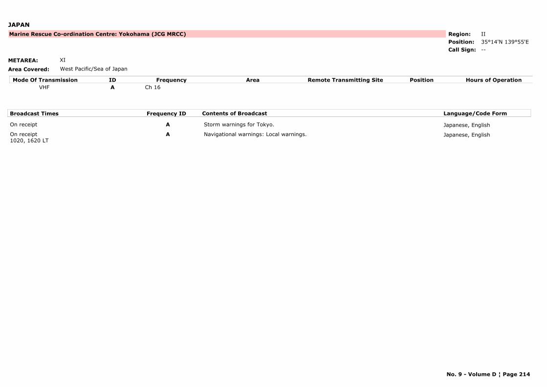
JAPAN
METAREA: XI
Area Covered: West Pacific/Sea of Japan
Region: IIPosition: 35°14'N 139°55'E
Marine Rescue Co-ordination Centre: Yokohama (JCG MRCC)
--Call Sign:
Mode Of Transmission ID Frequency Area Position Hours of OperationRemote Transmitting SiteVHF A Ch 16
Broadcast Times Frequency ID Contents of Broadcast Language/Code Form
On receipt A Storm warnings for Tokyo. Japanese, English
On receipt1020, 1620 LT
A Navigational warnings: Local warnings. Japanese, English
No. 9 - Volume D ¦ Page 214
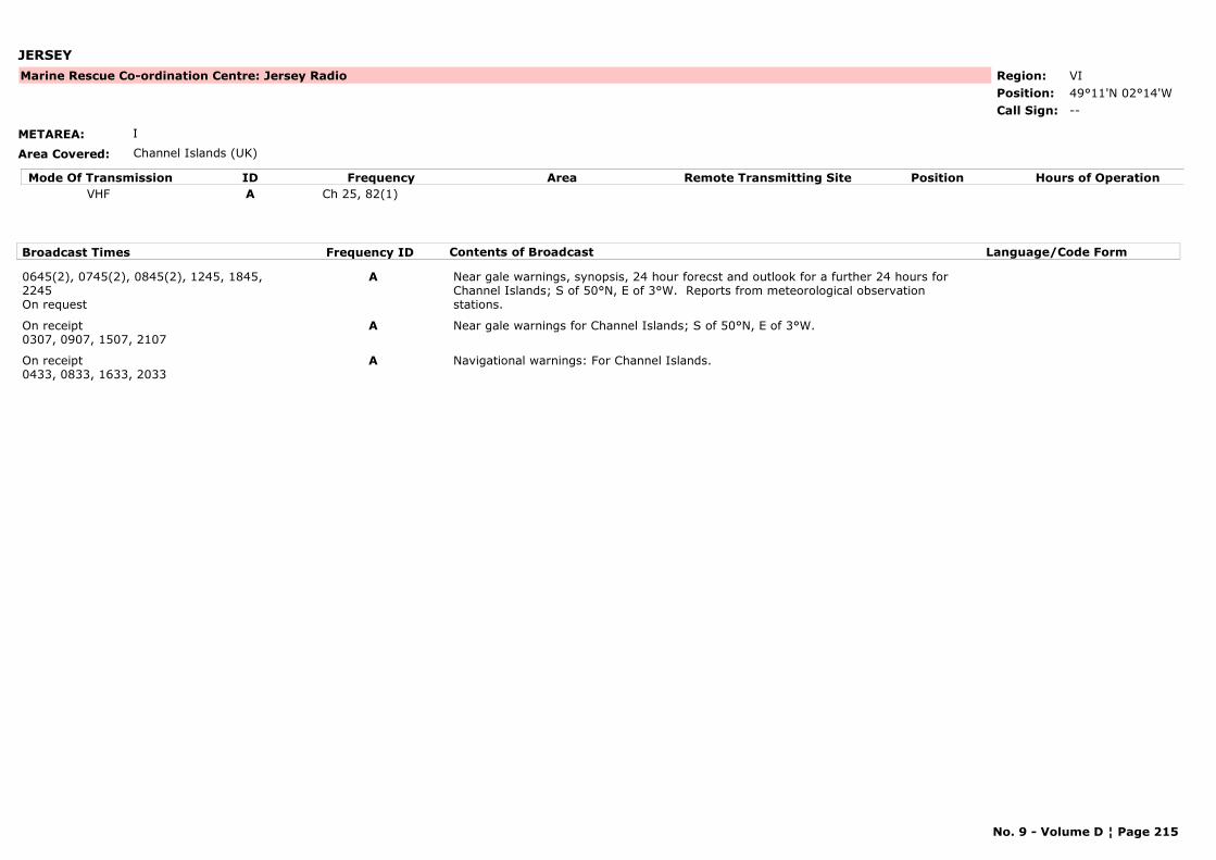
JERSEY
METAREA: I
Area Covered: Channel Islands (UK)
Region: VIPosition: 49°11'N 02°14'W
Marine Rescue Co-ordination Centre: Jersey Radio
--Call Sign:
Mode Of Transmission ID Frequency Area Position Hours of OperationRemote Transmitting SiteVHF A Ch 25, 82(1)
Broadcast Times Frequency ID Contents of Broadcast Language/Code Form
0645(2), 0745(2), 0845(2), 1245, 1845, 2245On request
A Near gale warnings, synopsis, 24 hour forecst and outlook for a further 24 hours for Channel Islands; S of 50°N, E of 3°W. Reports from meteorological observation stations.
On receipt0307, 0907, 1507, 2107
A Near gale warnings for Channel Islands; S of 50°N, E of 3°W.
On receipt0433, 0833, 1633, 2033
A Navigational warnings: For Channel Islands.
No. 9 - Volume D ¦ Page 215
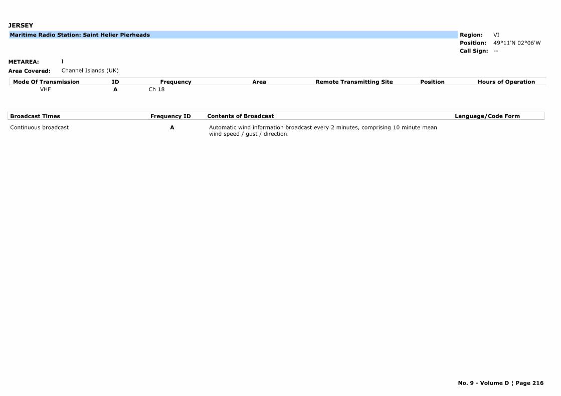
JERSEY
METAREA: I
Area Covered: Channel Islands (UK)
Region: VIPosition: 49°11'N 02°06'W
--Call Sign:
Maritime Radio Station: Saint Helier Pierheads
Mode Of Transmission ID Frequency Area Position Hours of OperationRemote Transmitting SiteVHF A Ch 18
Broadcast Times Frequency ID Contents of Broadcast Language/Code Form
Continuous broadcast A Automatic wind information broadcast every 2 minutes, comprising 10 minute mean wind speed / gust / direction.
No. 9 - Volume D ¦ Page 216
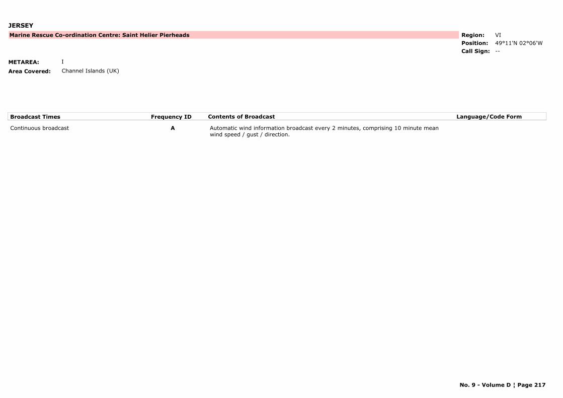
JERSEY
METAREA: I
Area Covered: Channel Islands (UK)
Region: VIPosition: 49°11'N 02°06'W
Marine Rescue Co-ordination Centre: Saint Helier Pierheads
--Call Sign:
Broadcast Times Frequency ID Contents of Broadcast Language/Code Form
Continuous broadcast A Automatic wind information broadcast every 2 minutes, comprising 10 minute mean wind speed / gust / direction.
No. 9 - Volume D ¦ Page 217
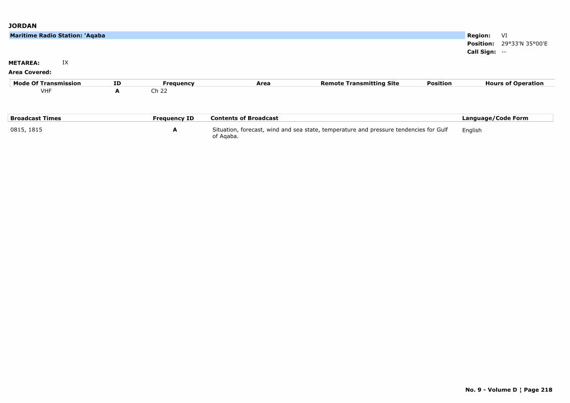
JORDAN
METAREA: IX
Area Covered:
Region: VIPosition: 29°33'N 35°00'E
--Call Sign:
Maritime Radio Station: 'Aqaba
Mode Of Transmission ID Frequency Area Position Hours of OperationRemote Transmitting SiteVHF A Ch 22
Broadcast Times Frequency ID Contents of Broadcast Language/Code Form
0815, 1815 A Situation, forecast, wind and sea state, temperature and pressure tendencies for Gulf of Aqaba.
English
No. 9 - Volume D ¦ Page 218
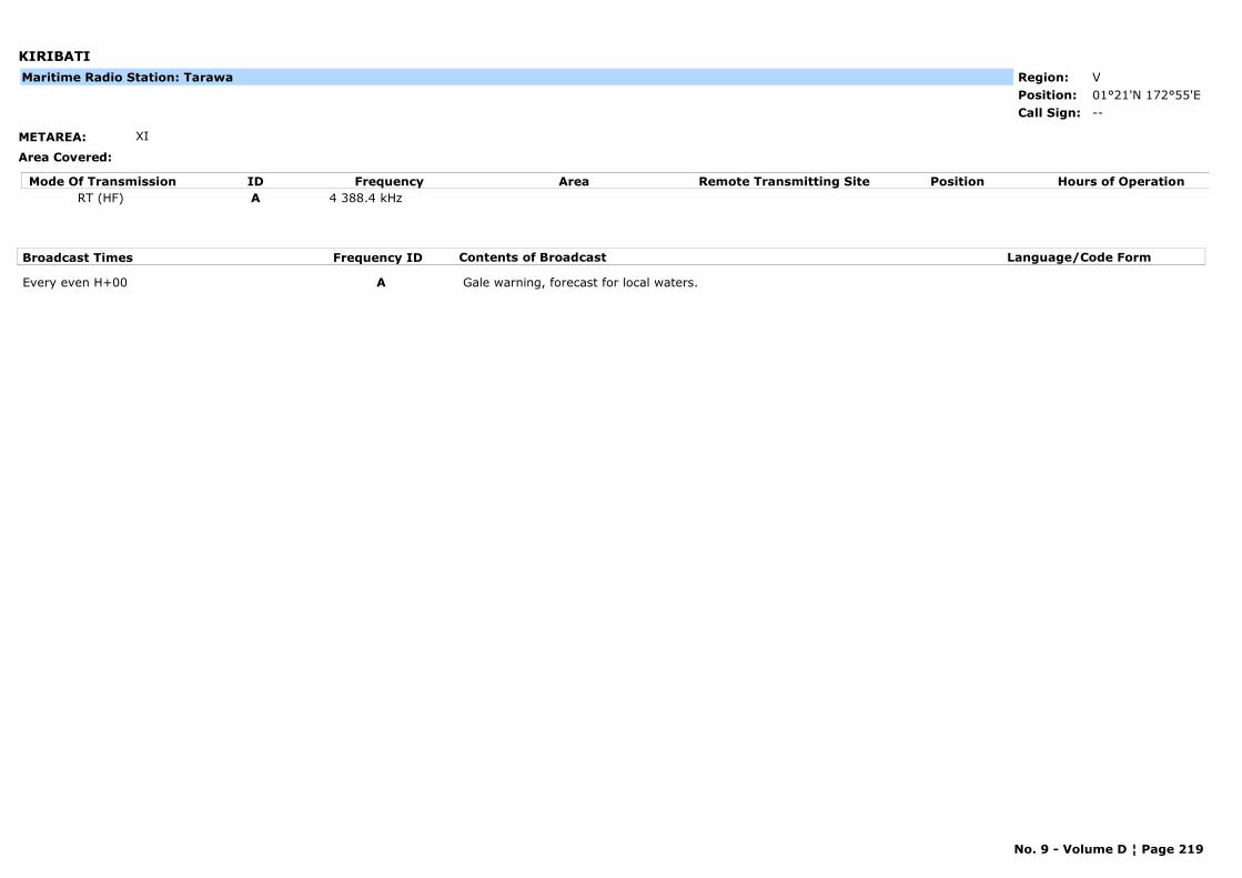
KIRIBATI
METAREA: XI
Area Covered:
Region: VPosition: 01°21'N 172°55'E
--Call Sign:
Maritime Radio Station: Tarawa
Mode Of Transmission ID Frequency Area Position Hours of OperationRemote Transmitting SiteRT (HF) A 4 388.4 kHz
Broadcast Times Frequency ID Contents of Broadcast Language/Code Form
Every even H+00 A Gale warning, forecast for local waters.
No. 9 - Volume D ¦ Page 219
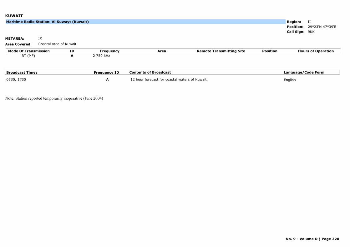
KUWAIT
METAREA: IX
Area Covered: Coastal area of Kuwait.
Region: IIPosition: 29°23'N 47°39'E
9KKCall Sign:
Maritime Radio Station: Al Kuwayt (Kuwait)
Mode Of Transmission ID Frequency Area Position Hours of OperationRemote Transmitting SiteRT (MF) A 2 750 kHz
Broadcast Times Frequency ID Contents of Broadcast Language/Code Form
0530, 1730 A 12 hour forecast for coastal waters of Kuwait. English
Note: Station reported temporarily inoperative (June 2004)
No. 9 - Volume D ¦ Page 220
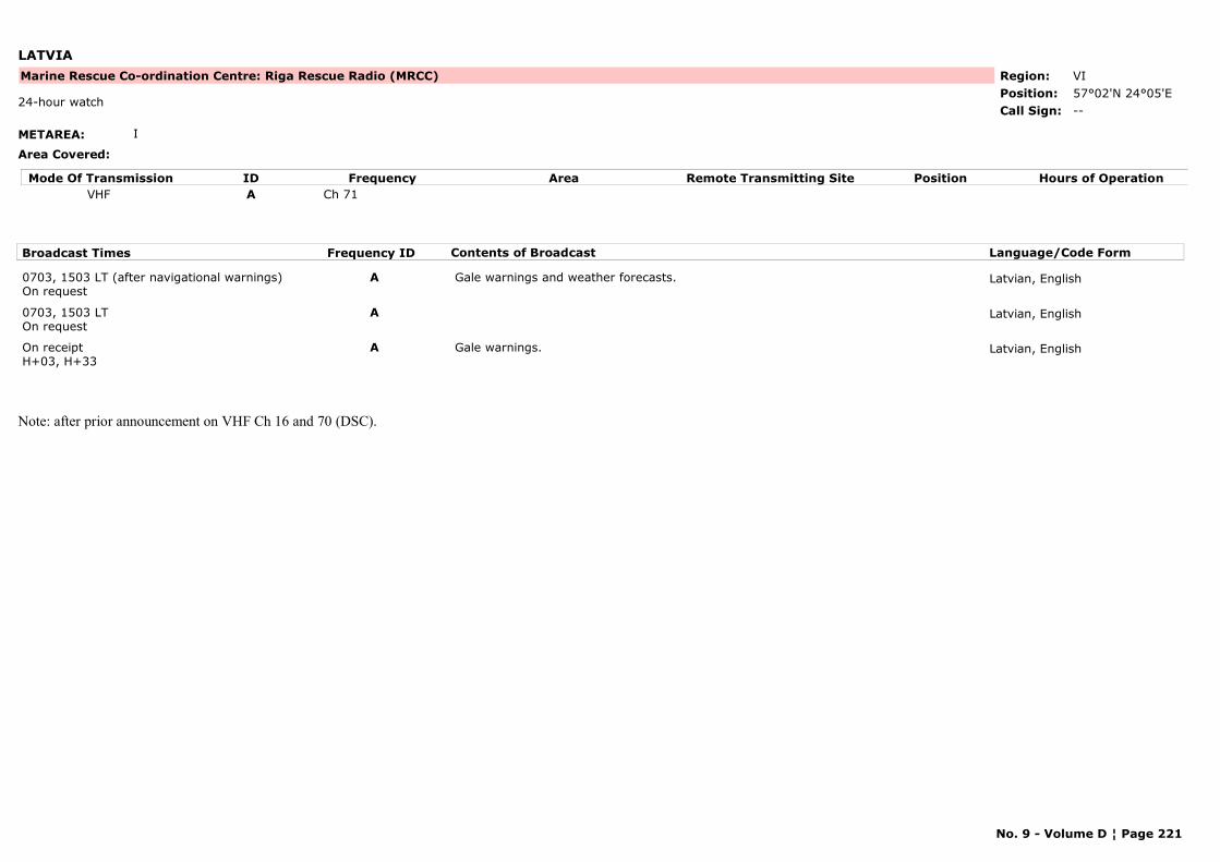
LATVIA
METAREA: I
Area Covered:
Region: VIPosition: 57°02'N 24°05'E
Marine Rescue Co-ordination Centre: Riga Rescue Radio (MRCC)
--24-hour watch
Call Sign:
Mode Of Transmission ID Frequency Area Position Hours of OperationRemote Transmitting SiteVHF A Ch 71
Broadcast Times Frequency ID Contents of Broadcast Language/Code Form
0703, 1503 LT (after navigational warnings)On request
A Gale warnings and weather forecasts. Latvian, English
0703, 1503 LTOn request
A Latvian, English
On receiptH+03, H+33
A Gale warnings. Latvian, English
Note: after prior announcement on VHF Ch 16 and 70 (DSC).
No. 9 - Volume D ¦ Page 221
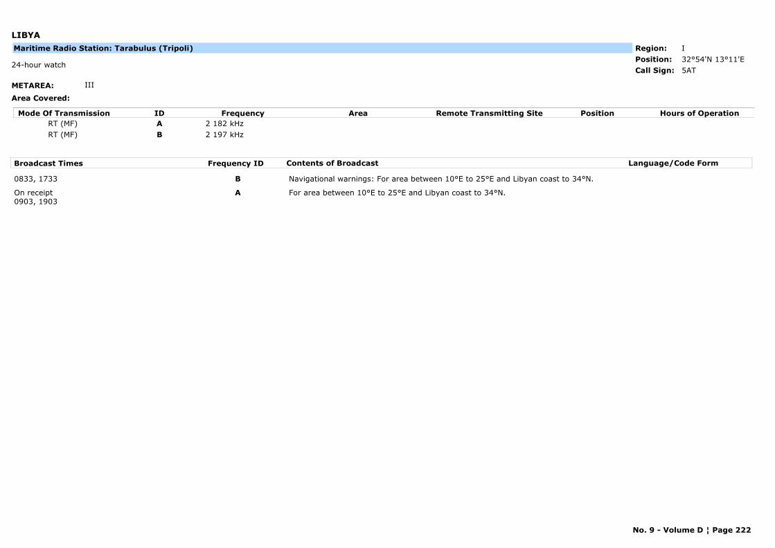
LIBYA
METAREA: III
Area Covered:
Region: IPosition: 32°54'N 13°11'E
5AT24-hour watch
Call Sign:
Maritime Radio Station: Tarabulus (Tripoli)
Mode Of Transmission ID Frequency Area Position Hours of OperationRemote Transmitting SiteRT (MF) A 2 182 kHzRT (MF) B 2 197 kHz
Broadcast Times Frequency ID Contents of Broadcast Language/Code Form
0833, 1733 B Navigational warnings: For area between 10°E to 25°E and Libyan coast to 34°N.
On receipt0903, 1903
A For area between 10°E to 25°E and Libyan coast to 34°N.
No. 9 - Volume D ¦ Page 222
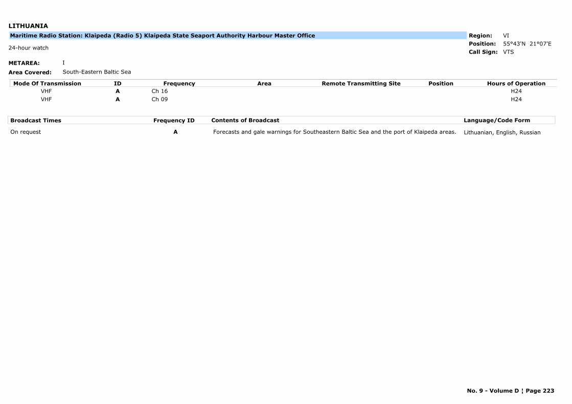
LITHUANIA
METAREA: I
Area Covered: South-Eastern Baltic Sea
Region: VIPosition: 55°43'N 21°07'E
VTS24-hour watch
Call Sign:
Maritime Radio Station: Klaipeda (Radio 5) Klaipeda State Seaport Authority Harbour Master Office
Mode Of Transmission ID Frequency Area Position Hours of OperationRemote Transmitting SiteVHF A Ch 16 H24VHF A Ch 09 H24
Broadcast Times Frequency ID Contents of Broadcast Language/Code Form
On request A Forecasts and gale warnings for Southeastern Baltic Sea and the port of Klaipeda areas. Lithuanian, English, Russian
No. 9 - Volume D ¦ Page 223
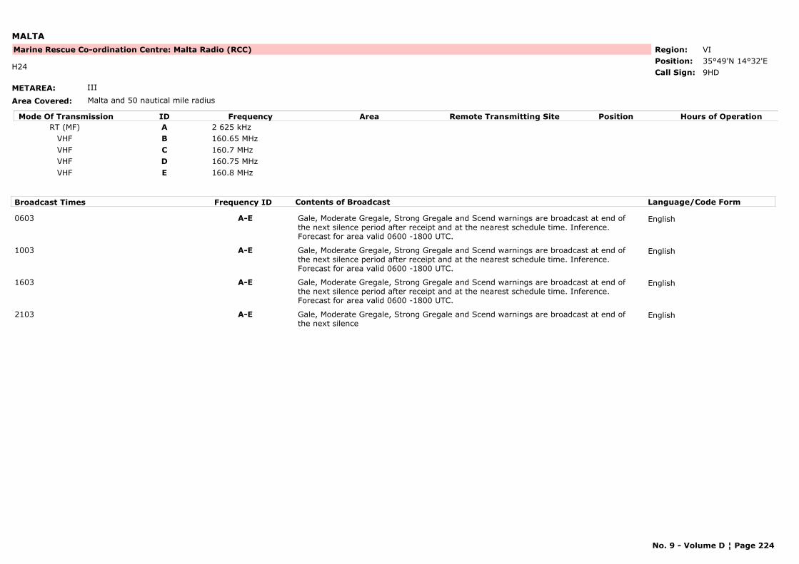
MALTA
METAREA: III
Area Covered: Malta and 50 nautical mile radius
Region: VIPosition: 35°49'N 14°32'E
Marine Rescue Co-ordination Centre: Malta Radio (RCC)
9HDH24
Call Sign:
Mode Of Transmission ID Frequency Area Position Hours of OperationRemote Transmitting SiteRT (MF) A 2 625 kHz
VHF B 160.65 MHzVHF C 160.7 MHzVHF D 160.75 MHzVHF E 160.8 MHz
Broadcast Times Frequency ID Contents of Broadcast Language/Code Form
0603 A-E Gale, Moderate Gregale, Strong Gregale and Scend warnings are broadcast at end of the next silence period after receipt and at the nearest schedule time. Inference. Forecast for area valid 0600 -1800 UTC.
English
1003 A-E Gale, Moderate Gregale, Strong Gregale and Scend warnings are broadcast at end of the next silence period after receipt and at the nearest schedule time. Inference. Forecast for area valid 0600 -1800 UTC.
English
1603 A-E Gale, Moderate Gregale, Strong Gregale and Scend warnings are broadcast at end of the next silence period after receipt and at the nearest schedule time. Inference. Forecast for area valid 0600 -1800 UTC.
English
2103 A-E Gale, Moderate Gregale, Strong Gregale and Scend warnings are broadcast at end of the next silence
English
No. 9 - Volume D ¦ Page 224
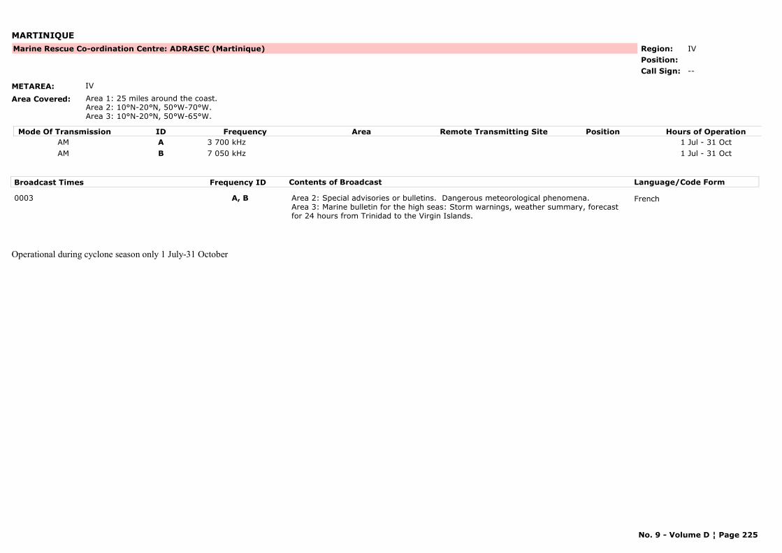
MARTINIQUE
METAREA: IV
Area Covered: Area 1: 25 miles around the coast.Area 2: 10°N-20°N, 50°W-70°W.Area 3: 10°N-20°N, 50°W-65°W.
Region: IVPosition:
Marine Rescue Co-ordination Centre: ADRASEC (Martinique)
--Call Sign:
Mode Of Transmission ID Frequency Area Position Hours of OperationRemote Transmitting SiteAM A 3 700 kHz 1 Jul - 31 OctAM B 7 050 kHz 1 Jul - 31 Oct
Broadcast Times Frequency ID Contents of Broadcast Language/Code Form
0003 A, B Area 2: Special advisories or bulletins. Dangerous meteorological phenomena.Area 3: Marine bulletin for the high seas: Storm warnings, weather summary, forecast for 24 hours from Trinidad to the Virgin Islands.
French
Operational during cyclone season only 1 July-31 October
No. 9 - Volume D ¦ Page 225
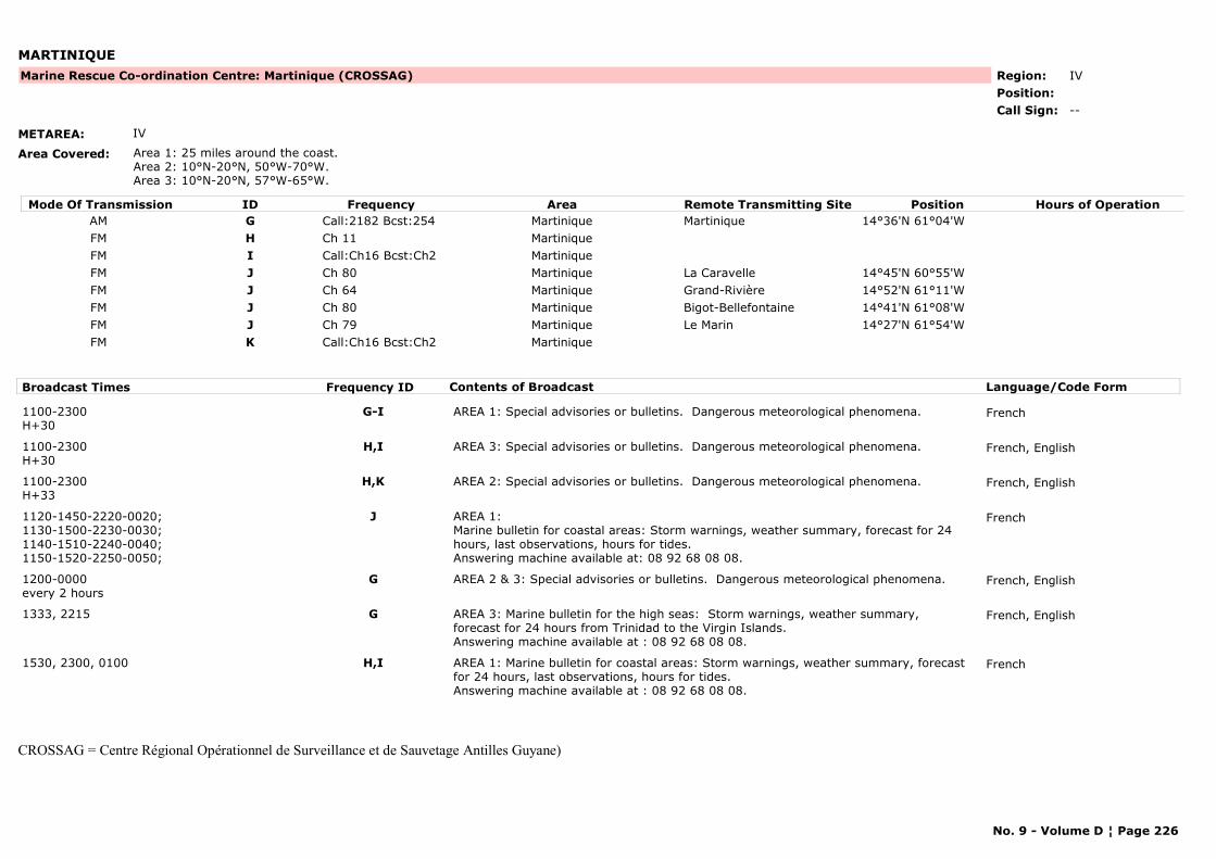
MARTINIQUE
METAREA: IV
Area Covered: Area 1: 25 miles around the coast. Area 2: 10°N-20°N, 50°W-70°W.Area 3: 10°N-20°N, 57°W-65°W.
Region: IVPosition:
Marine Rescue Co-ordination Centre: Martinique (CROSSAG)
--Call Sign:
Mode Of Transmission ID Frequency Area Position Hours of OperationRemote Transmitting SiteAM G Call:2182 Bcst:254 Martinique Martinique 14°36'N 61°04'WFM H Ch 11 MartiniqueFM I Call:Ch16 Bcst:Ch2 MartiniqueFM J Ch 80 Martinique La Caravelle 14°45'N 60°55'WFM J Ch 64 Martinique Grand-Rivière 14°52'N 61°11'WFM J Ch 80 Martinique Bigot-Bellefontaine 14°41'N 61°08'WFM J Ch 79 Martinique Le Marin 14°27'N 61°54'WFM K Call:Ch16 Bcst:Ch2 Martinique
Broadcast Times Frequency ID Contents of Broadcast Language/Code Form
1100-2300H+30
G-I AREA 1: Special advisories or bulletins. Dangerous meteorological phenomena. French
1100-2300H+30
H,I AREA 3: Special advisories or bulletins. Dangerous meteorological phenomena. French, English
1100-2300H+33
H,K AREA 2: Special advisories or bulletins. Dangerous meteorological phenomena. French, English
1120-1450-2220-0020;1130-1500-2230-0030;1140-1510-2240-0040;1150-1520-2250-0050;
J AREA 1:Marine bulletin for coastal areas: Storm warnings, weather summary, forecast for 24 hours, last observations, hours for tides.Answering machine available at: 08 92 68 08 08.
French
1200-0000every 2 hours
G AREA 2 & 3: Special advisories or bulletins. Dangerous meteorological phenomena. French, English
1333, 2215 G AREA 3: Marine bulletin for the high seas: Storm warnings, weather summary, forecast for 24 hours from Trinidad to the Virgin Islands.Answering machine available at : 08 92 68 08 08.
French, English
1530, 2300, 0100 H,I AREA 1: Marine bulletin for coastal areas: Storm warnings, weather summary, forecast for 24 hours, last observations, hours for tides.Answering machine available at : 08 92 68 08 08.
French
CROSSAG = Centre Régional Opérationnel de Surveillance et de Sauvetage Antilles Guyane)
No. 9 - Volume D ¦ Page 226
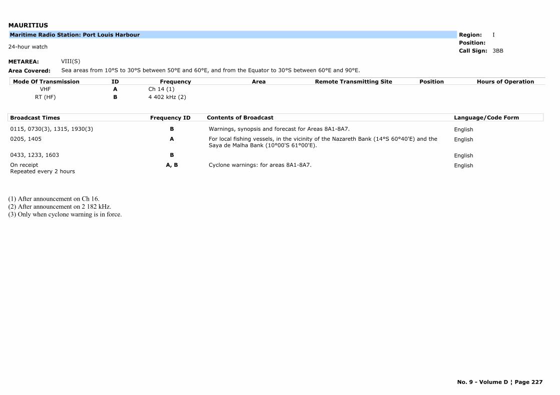
MAURITIUS
METAREA: VIII(S)
Area Covered: Sea areas from 10°S to 30°S between 50°E and 60°E, and from the Equator to 30°S between 60°E and 90°E.
Region: IPosition:
3BB24-hour watch
Call Sign:
Maritime Radio Station: Port Louis Harbour
Mode Of Transmission ID Frequency Area Position Hours of OperationRemote Transmitting SiteVHF A Ch 14 (1)
RT (HF) B 4 402 kHz (2)
Broadcast Times Frequency ID Contents of Broadcast Language/Code Form
0115, 0730(3), 1315, 1930(3) B Warnings, synopsis and forecast for Areas 8A1-8A7. English
0205, 1405 A For local fishing vessels, in the vicinity of the Nazareth Bank (14°S 60°40'E) and the Saya de Malha Bank (10°00'S 61°00'E).
English
0433, 1233, 1603 B English
On receiptRepeated every 2 hours
A, B Cyclone warnings: for areas 8A1-8A7. English
(1) After announcement on Ch 16.(2) After announcement on 2 182 kHz.(3) Only when cyclone warning is in force.
No. 9 - Volume D ¦ Page 227
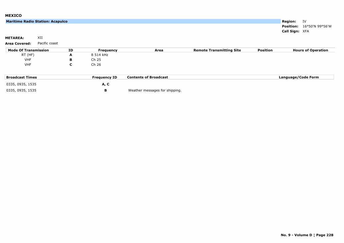
MEXICO
METAREA: XII
Area Covered: Pacific coast
Region: IVPosition: 16°50'N 99°56'W
XFACall Sign:
Maritime Radio Station: Acapulco
Mode Of Transmission ID Frequency Area Position Hours of OperationRemote Transmitting SiteRT (HF) A 8 514 kHz
VHF B Ch 25VHF C Ch 26
Broadcast Times Frequency ID Contents of Broadcast Language/Code Form
0335, 0935, 1535 A, C
0335, 0935, 1535 B Weather messages for shipping.
No. 9 - Volume D ¦ Page 228
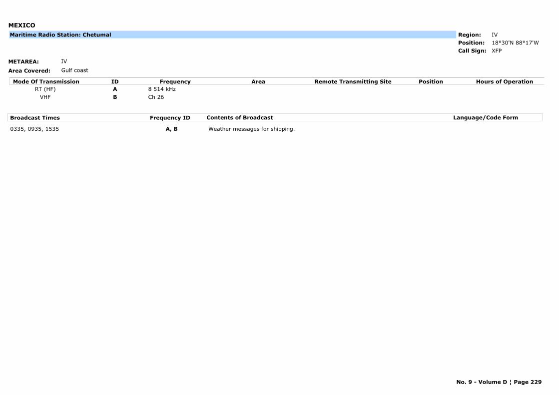
MEXICO
METAREA: IV
Area Covered: Gulf coast
Region: IVPosition: 18°30'N 88°17'W
XFPCall Sign:
Maritime Radio Station: Chetumal
Mode Of Transmission ID Frequency Area Position Hours of OperationRemote Transmitting SiteRT (HF) A 8 514 kHz
VHF B Ch 26
Broadcast Times Frequency ID Contents of Broadcast Language/Code Form
0335, 0935, 1535 A, B Weather messages for shipping.
No. 9 - Volume D ¦ Page 229
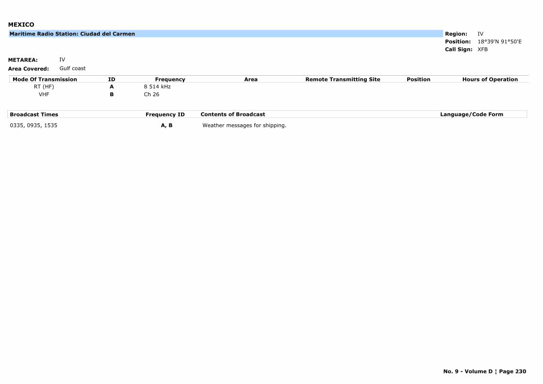
MEXICO
METAREA: IV
Area Covered: Gulf coast
Region: IVPosition: 18°39'N 91°50'E
XFBCall Sign:
Maritime Radio Station: Ciudad del Carmen
Mode Of Transmission ID Frequency Area Position Hours of OperationRemote Transmitting SiteRT (HF) A 8 514 kHz
VHF B Ch 26
Broadcast Times Frequency ID Contents of Broadcast Language/Code Form
0335, 0935, 1535 A, B Weather messages for shipping.
No. 9 - Volume D ¦ Page 230

MEXICO
METAREA: IV
Area Covered: Gulf coast
Region: IVPosition: 18°09'N 94°26'W
XFFCall Sign:
Maritime Radio Station: Coatzacoalcos
Mode Of Transmission ID Frequency Area Position Hours of OperationRemote Transmitting SiteRT (HF) A 8 514 kHz
VHF B Ch 26
Broadcast Times Frequency ID Contents of Broadcast Language/Code Form
0335, 0935, 1535 A, B Weather messages for shipping.
No. 9 - Volume D ¦ Page 231

MEXICO
METAREA: IV
Area Covered: Gulf coast
Region: IVPosition: 20°28'N 86°58'W
XFCCall Sign:
Maritime Radio Station: Cozumel
Mode Of Transmission ID Frequency Area Position Hours of OperationRemote Transmitting SiteRT (HF) A 8 514 kHz
VHF B Ch 26
Broadcast Times Frequency ID Contents of Broadcast Language/Code Form
0335, 0935, 1535 A, B Weather messages for shipping.
No. 9 - Volume D ¦ Page 232

MEXICO
METAREA: XII
Area Covered: Pacific coast
Region: IVPosition: 31°51'N 102°12'W
XFECall Sign:
Maritime Radio Station: Ensenada
Mode Of Transmission ID Frequency Area Position Hours of OperationRemote Transmitting SiteRT (HF) A 8 514 kHz
VHF B Ch 25VHF C Ch 26
Broadcast Times Frequency ID Contents of Broadcast Language/Code Form
0335, 0935, 1535 A, C
0335, 0935, 1535 B Weather messages for shipping.
No. 9 - Volume D ¦ Page 233

MEXICO
METAREA: XII
Area Covered: Pacific coast
Region: IVPosition: 17°51'N 102°12'E
--Call Sign:
Maritime Radio Station: Lazaro Cardenas
Mode Of Transmission ID Frequency Area Position Hours of OperationRemote Transmitting SiteRT (HF) A 8 514 kHz
VHF B Ch 25VHF C Ch 26
Broadcast Times Frequency ID Contents of Broadcast Language/Code Form
0335, 0935, 1535 A, C
0335, 0935, 1535 B Weather messages for shipping.
No. 9 - Volume D ¦ Page 234
MEXICO
METAREA: XII
Area Covered: Pacific coast
Region: IVPosition: 19°01'N 104°19'W
XFMCall Sign:
Maritime Radio Station: Manzanillo
Mode Of Transmission ID Frequency Area Position Hours of OperationRemote Transmitting SiteRT (HF) A 8 514 kHz
VHF B Ch 25VHF C Ch 26
Broadcast Times Frequency ID Contents of Broadcast Language/Code Form
0335, 0935, 1535 A, C
0335, 0935, 1535 B Weather messages for shipping.
No. 9 - Volume D ¦ Page 235

MEXICO
METAREA: XII
Area Covered: Pacific coast
Region: IVPosition: 23°10'N 106°26'W
XFLCall Sign:
Maritime Radio Station: Mazatlán
Mode Of Transmission ID Frequency Area Position Hours of OperationRemote Transmitting SiteRT (HF) A 8 514 kHz
VHF B Ch 25VHF C Ch 26
Broadcast Times Frequency ID Contents of Broadcast Language/Code Form
0335, 0935, 1535 A, C
0335, 0935, 1535 B Weather messages for shipping.
No. 9 - Volume D ¦ Page 236
MEXICO
METAREA: IV
Area Covered: Gulf coast
Region: IVPosition:
Marine Rescue Co-ordination Centre: Mexican Army
--Call Sign:
Mode Of Transmission ID Frequency Area Position Hours of OperationRemote Transmitting SiteVHF A Ch 12
Broadcast Times Frequency ID Contents of Broadcast Language/Code Form
0915, 1515, 2115 (subject to delays up to 30 minutes)
A Storm warnings and weather forecasts for the following regions:Region 1: from Mexico / US border to 23°N (Pta Jerez)Region 2: from 23°N (Pta Jerez) to 20°NRegion 3: from 20°N east to 93°WRegion 4: from 93°W to 87°W (Cabo Catoche)Region 5: from 22°N (Yucatan) to 18°N (Mexico / Belize border)
English
No. 9 - Volume D ¦ Page 237
MEXICO
METAREA: IV
Area Covered: Gulf coast
Region: IVPosition: 18°08'N 94°25'W
XFFCall Sign:
Maritime Radio Station: Pajaritos
Mode Of Transmission ID Frequency Area Position Hours of OperationRemote Transmitting SiteRT (HF) A 4 383.8 kHz
VHF B Ch 16 71
Broadcast Times Frequency ID Contents of Broadcast Language/Code Form
0320, 1520, 2120 B Weather forecast for Gulf of Mexico. English
0330, 1530, 2130 A Weather forecast for Gulf of Mexico. English
No. 9 - Volume D ¦ Page 238

MEXICO
METAREA: IV
Area Covered: Gulf coast
Region: IVPosition: 21°16'N 89°47'W
XFNCall Sign:
Maritime Radio Station: Progreso
Mode Of Transmission ID Frequency Area Position Hours of OperationRemote Transmitting SiteRT (HF) A 8 514 kHz
VHF B Ch 26
Broadcast Times Frequency ID Contents of Broadcast Language/Code Form
0335, 0935, 1535 A, B Weather messages for shipping.
No. 9 - Volume D ¦ Page 239
MEXICO
METAREA: XII
Area Covered: Pacific coast
Region: IVPosition: 20°46'N 105°37'W
--Call Sign:
Maritime Radio Station: Puerto Vallarta
Mode Of Transmission ID Frequency Area Position Hours of OperationRemote Transmitting SiteRT (HF) A 8 514 kHz
VHF B Ch 25VHF C Ch 26
Broadcast Times Frequency ID Contents of Broadcast Language/Code Form
0335, 0935, 1535 A, C
0335, 0935, 1535 B Weather messages for shipping.
No. 9 - Volume D ¦ Page 240

MEXICO
METAREA: IV
Area Covered: Gulf coast
Region: IVPosition: 19°07'N 96°09'W
XFUWatch kept for less than 30 minutes (station with limited hours of operation)
Call Sign:
Maritime Radio Station: Veracruz
Mode Of Transmission ID Frequency Area Position Hours of OperationRemote Transmitting SiteRT (HF) A 8 514 kHz
VHF B Ch 26
Broadcast Times Frequency ID Contents of Broadcast Language/Code Form
0335, 0935, 1535 A, B Weather messages for shipping.
No. 9 - Volume D ¦ Page 241
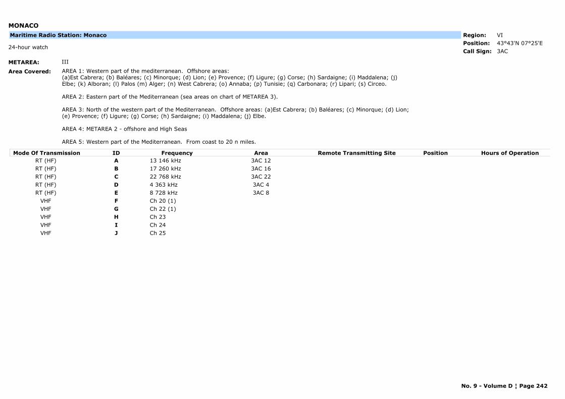
MONACO
METAREA: III
Area Covered: AREA 1: Western part of the mediterranean. Offshore areas: (a)Est Cabrera; (b) Baléares; (c) Minorque; (d) Lion; (e) Provence; (f) Ligure; (g) Corse; (h) Sardaigne; (i) Maddalena; (j) Elbe; (k) Alboran; (l) Palos (m) Alger; (n) West Cabrera; (o) Annaba; (p) Tunisie; (q) Carbonara; (r) Lipari; (s) Circeo.
AREA 2: Eastern part of the Mediterranean (sea areas on chart of METAREA 3).
AREA 3: North of the western part of the Mediterranean. Offshore areas: (a)Est Cabrera; (b) Baléares; (c) Minorque; (d) Lion; (e) Provence; (f) Ligure; (g) Corse; (h) Sardaigne; (i) Maddalena; (j) Elbe.
AREA 4: METAREA 2 - offshore and High Seas
AREA 5: Western part of the Mediterranean. From coast to 20 n miles.
Region: VIPosition: 43°43'N 07°25'E
3AC24-hour watch
Call Sign:
Maritime Radio Station: Monaco
Mode Of Transmission ID Frequency Area Position Hours of OperationRemote Transmitting SiteRT (HF) A 13 146 kHz 3AC 12RT (HF) B 17 260 kHz 3AC 16RT (HF) C 22 768 kHz 3AC 22RT (HF) D 4 363 kHz 3AC 4RT (HF) E 8 728 kHz 3AC 8
VHF F Ch 20 (1)VHF G Ch 22 (1)VHF H Ch 23VHF I Ch 24VHF J Ch 25
No. 9 - Volume D ¦ Page 242
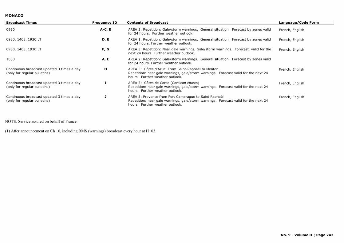
MONACO
Broadcast Times Frequency ID Contents of Broadcast Language/Code Form
0930 A-C, E AREA 3: Repetition: Gale/storm warnings. General situation. Forecast by zones valid for 24 hours. Further weather outlook.
French, English
0930, 1403, 1930 LT D, E AREA 1: Repetition: Gale/storm warnings. General situation. Forecast by zones valid for 24 hours. Further weather outlook.
French, English
0930, 1403, 1930 LT F, G AREA 3: Repetition: Near gale warnings, Gale/storm warnings. Forecast valid for the next 24 hours. Further weather outlook.
French, English
1030 A, E AREA 2: Repetition: Gale/storm warnings. General situation. Forecast by zones valid for 24 hours. Further weather outlook.
Continuous broadcast updated 3 times a day(only for regular bulletins)
H AREA 5: Côtes d'Azur: From Saint-Raphaël to Menton.Repetition: near gale warnings, gale/storm warnings. Forecast valid for the next 24 hours. Further weather outlook.
French, English
Continuous broadcast updated 3 times a day(only for regular bulletins)
I AREA 5: Côtes de Corse (Corsican coasts)Repetition: near gale warnings, gale/storm warnings. Forecast valid for the next 24 hours. Further weather outlook.
French, English
Continuous broadcast updated 3 times a day(only for regular bulletins)
J AREA 5: Provence from Port Camarague to Saint RaphaëlRepetition: near gale warnings, gale/storm warnings. Forecast valid for the next 24 hours. Further weather outlook.
French, English
NOTE: Service assured on behalf of France.
(1) After announcement on Ch 16, including BMS (warnings) broadcast every hour at H+03.
No. 9 - Volume D ¦ Page 243
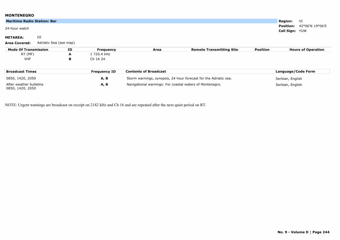
MONTENEGRO
METAREA: III
Area Covered: Adriatic Sea (see map)
Region: VIPosition: 42°06'N 19°06'E
YUW24-hour watch
Call Sign:
Maritime Radio Station: Bar
Mode Of Transmission ID Frequency Area Position Hours of OperationRemote Transmitting SiteRT (MF) A 1 720.4 kHz
VHF B Ch 16 24
Broadcast Times Frequency ID Contents of Broadcast Language/Code Form
0850, 1420, 2050 A, B Storm warnings, synopsis, 24 hour forecast for the Adriatic sea. Serbian, English
After weather bulletins0850, 1420, 2050
A, B Navigational warnings: For coastal waters of Montenegro. Serbian, English
NOTE: Urgent warnings are broadcast on receipt on 2182 kHz and Ch 16 and are repeated after the next quiet period on RT.
No. 9 - Volume D ¦ Page 244
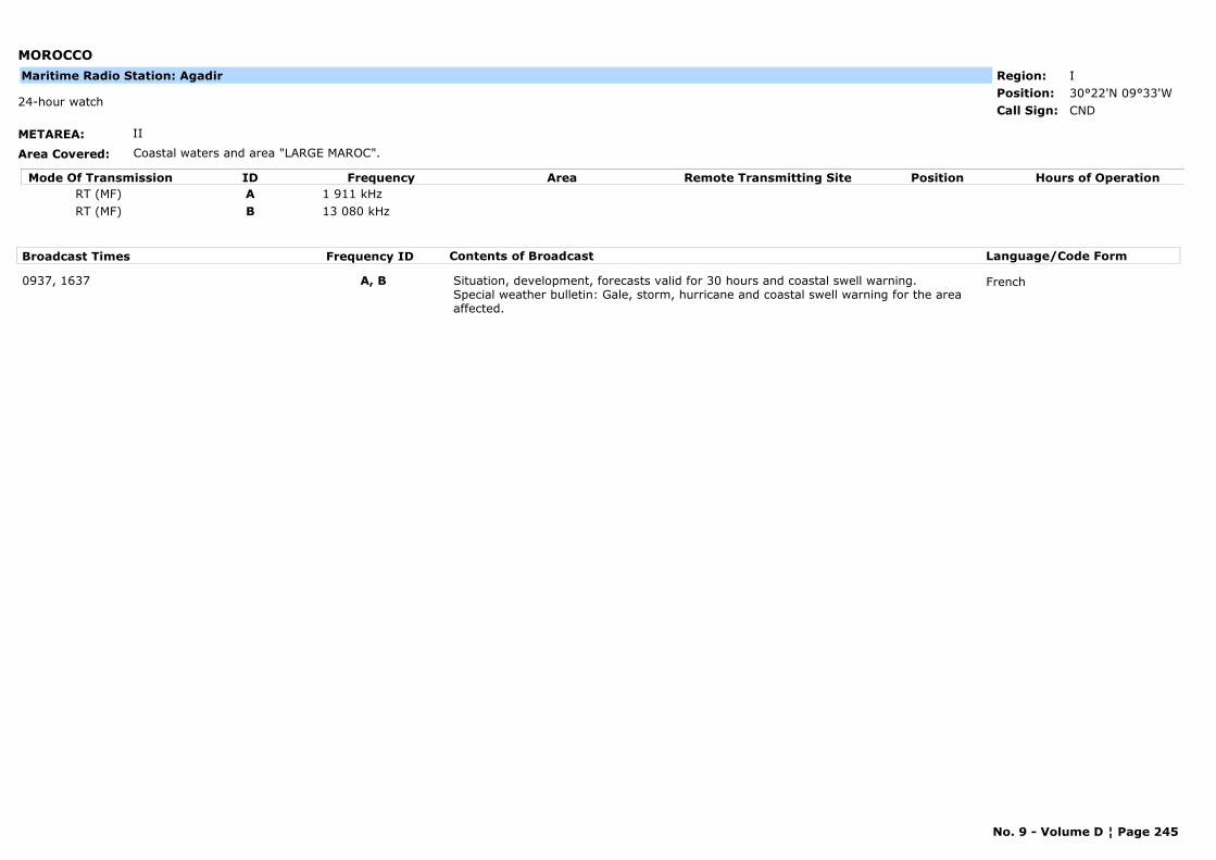
MOROCCO
METAREA: II
Area Covered: Coastal waters and area "LARGE MAROC".
Region: IPosition: 30°22'N 09°33'W
CND24-hour watch
Call Sign:
Maritime Radio Station: Agadir
Mode Of Transmission ID Frequency Area Position Hours of OperationRemote Transmitting SiteRT (MF) A 1 911 kHzRT (MF) B 13 080 kHz
Broadcast Times Frequency ID Contents of Broadcast Language/Code Form
0937, 1637 A, B Situation, development, forecasts valid for 30 hours and coastal swell warning.Special weather bulletin: Gale, storm, hurricane and coastal swell warning for the area affected.
French
No. 9 - Volume D ¦ Page 245
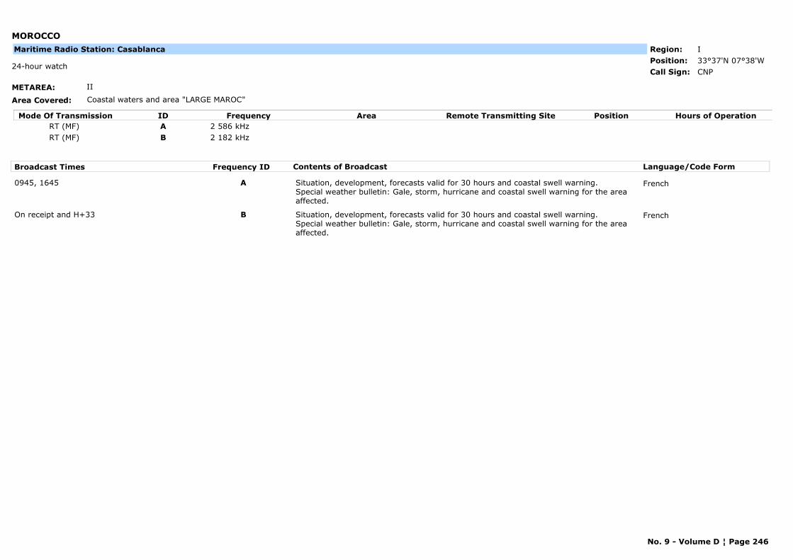
MOROCCO
METAREA: II
Area Covered: Coastal waters and area "LARGE MAROC"
Region: IPosition: 33°37'N 07°38'W
CNP24-hour watch
Call Sign:
Maritime Radio Station: Casablanca
Mode Of Transmission ID Frequency Area Position Hours of OperationRemote Transmitting SiteRT (MF) A 2 586 kHzRT (MF) B 2 182 kHz
Broadcast Times Frequency ID Contents of Broadcast Language/Code Form
0945, 1645 A Situation, development, forecasts valid for 30 hours and coastal swell warning.Special weather bulletin: Gale, storm, hurricane and coastal swell warning for the area affected.
French
On receipt and H+33 B Situation, development, forecasts valid for 30 hours and coastal swell warning.Special weather bulletin: Gale, storm, hurricane and coastal swell warning for the area affected.
French
No. 9 - Volume D ¦ Page 246
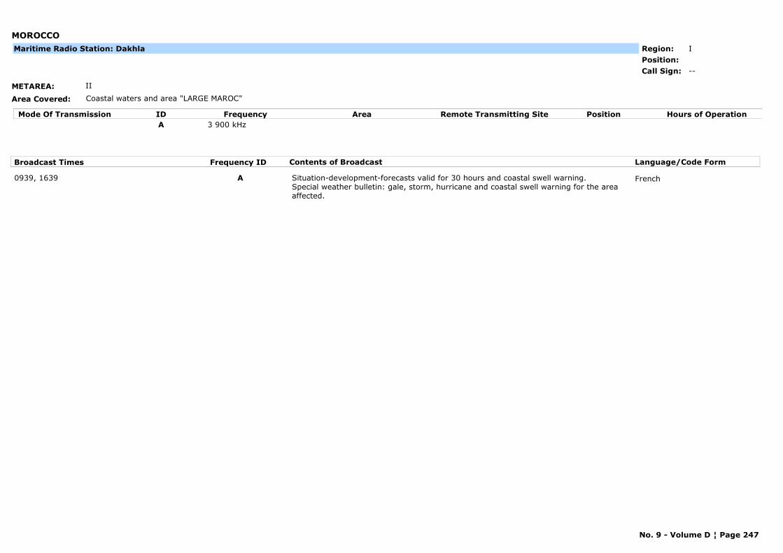
MOROCCO
METAREA: II
Area Covered: Coastal waters and area "LARGE MAROC"
Region: IPosition:
--Call Sign:
Maritime Radio Station: Dakhla
Mode Of Transmission ID Frequency Area Position Hours of OperationRemote Transmitting SiteA 3 900 kHz
Broadcast Times Frequency ID Contents of Broadcast Language/Code Form
0939, 1639 A Situation-development-forecasts valid for 30 hours and coastal swell warning.Special weather bulletin: gale, storm, hurricane and coastal swell warning for the area affected.
French
No. 9 - Volume D ¦ Page 247
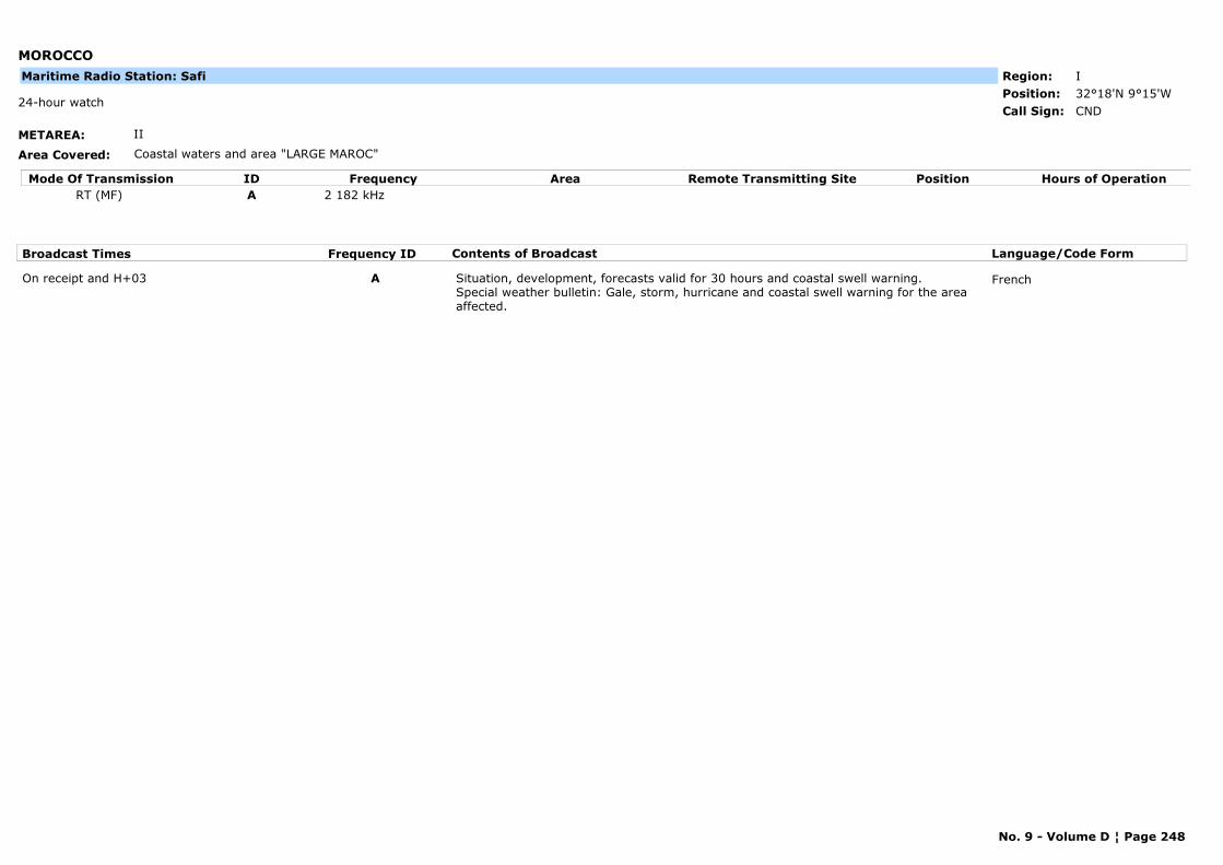
MOROCCO
METAREA: II
Area Covered: Coastal waters and area "LARGE MAROC"
Region: IPosition: 32°18'N 9°15'W
CND24-hour watch
Call Sign:
Maritime Radio Station: Safi
Mode Of Transmission ID Frequency Area Position Hours of OperationRemote Transmitting SiteRT (MF) A 2 182 kHz
Broadcast Times Frequency ID Contents of Broadcast Language/Code Form
On receipt and H+03 A Situation, development, forecasts valid for 30 hours and coastal swell warning.Special weather bulletin: Gale, storm, hurricane and coastal swell warning for the area affected.
French
No. 9 - Volume D ¦ Page 248
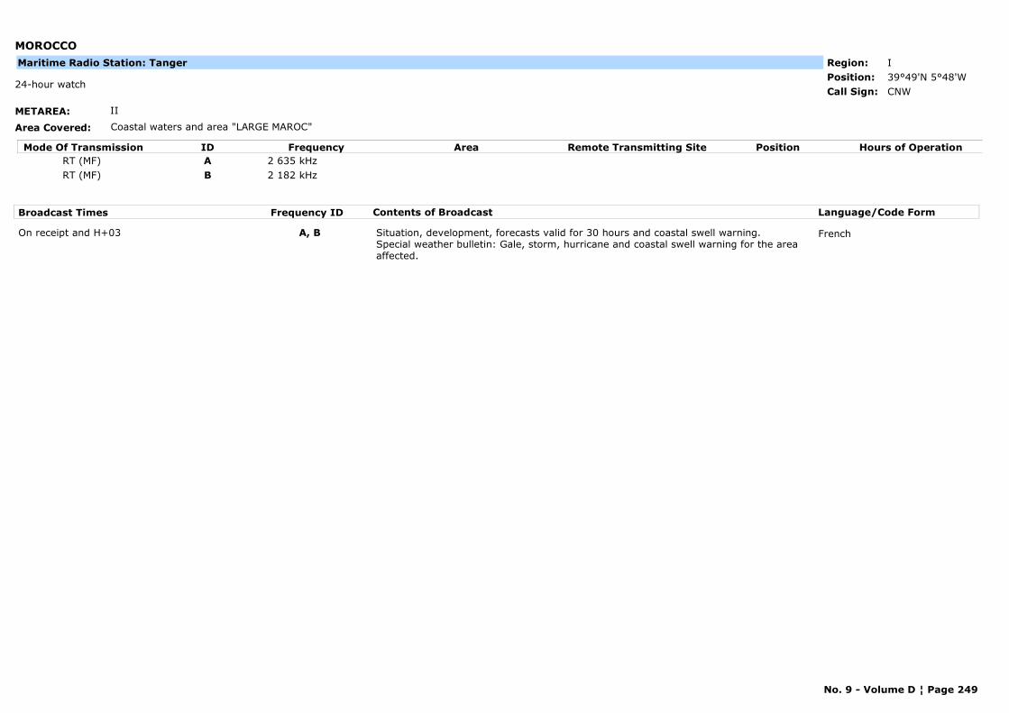
MOROCCO
METAREA: II
Area Covered: Coastal waters and area "LARGE MAROC"
Region: IPosition: 39°49'N 5°48'W
CNW24-hour watch
Call Sign:
Maritime Radio Station: Tanger
Mode Of Transmission ID Frequency Area Position Hours of OperationRemote Transmitting SiteRT (MF) A 2 635 kHzRT (MF) B 2 182 kHz
Broadcast Times Frequency ID Contents of Broadcast Language/Code Form
On receipt and H+03 A, B Situation, development, forecasts valid for 30 hours and coastal swell warning.Special weather bulletin: Gale, storm, hurricane and coastal swell warning for the area affected.
French
No. 9 - Volume D ¦ Page 249
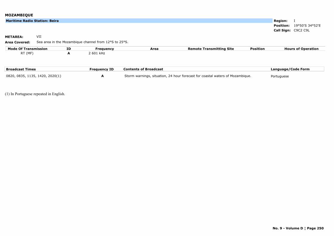
MOZAMBIQUE
METAREA: VII
Area Covered: Sea area in the Mozambique channel from 12°S to 25°S.
Region: IPosition: 19°50'S 34°52'E
C9C2 C9LCall Sign:
Maritime Radio Station: Beira
Mode Of Transmission ID Frequency Area Position Hours of OperationRemote Transmitting SiteRT (MF) A 2 601 kHz
Broadcast Times Frequency ID Contents of Broadcast Language/Code Form
0820, 0835, 1135, 1420, 2020(1) A Storm warnings, situation, 24 hour forecast for coastal waters of Mozambique. Portuguese
(1) In Portuguese repeated in English.
No. 9 - Volume D ¦ Page 250
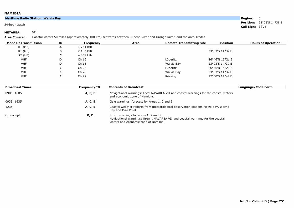
NAMIBIA
METAREA: VII
Area Covered: Coastal waters 50 miles (approximately 100 km) seawards between Cunene River and Orange River, and the area Trades
Region: IPosition: 23°03'S 14°38'E
ZSV424-hour watch
Call Sign:
Maritime Radio Station: Walvis Bay
Mode Of Transmission ID Frequency Area Position Hours of OperationRemote Transmitting SiteRT (MF) A 1 764 kHzRT (MF) B 2 182 kHz 23°03'S 14°37'ERT (HF) C 4 357 kHz
VHF D Ch 16 Lüderitz 26°46'N 15°21'EVHF D Ch 16 Walvis Bay 23°03'S 14°37'EVHF E Ch 23 Lüderitz 26°46'N 15°21'EVHF E Ch 26 Walvis Bay 23°03'S 14°37'EVHF E Ch 27 Rössing 22°30'S 14°47'E
Broadcast Times Frequency ID Contents of Broadcast Language/Code Form
0905, 1605 A, C, E Navigational warnings: Local NAVAREA VII and coastal warnings for the coastal waters and economic zone of Namibia.
0935, 1635 A, C, E Gale warnings, forecast for Areas 1, 2 and 9.
1235 A, C, E Coastal weather reports from meteorological observation stations Möwe Bay, Walvis Bay and Diaz Point
On receipt B, D Storm warnings for areas 1, 2 and 9.Navigational warnings: Urgent NAVAREA VII and coastal warnings for the coastal waters and economic zone of Namibia.
No. 9 - Volume D ¦ Page 251
NETHERLANDS
METAREA: I
Area Covered: Thames, Humber, German Bight, Dogge
Region: VIPosition:
Marine Rescue Co-ordination Centre: Netherlands Coastguard Radio
PBKH24
Call Sign:
Mode Of Transmission ID Frequency Area Position Hours of OperationRemote Transmitting SiteRT (MF) A 3 673 kHz Scheveningen 52°06'N 4°15'E
VHF B Ch 83 Woensdrecht 51°26'N 4°20'EVHF B Ch 83 West Terschelling 53°21'N 5°13'EVHF B Ch 83 Schoorl 52°43'N 4°39'EVHF B Ch 83 Renesse 51°44'N 3°49'EVHF B Ch 83 Hoorn 52°39'N 5°06'EVHF B Ch 83 Appingedam 53°20'N 6°52'EVHF B Ch 23 Westkapelle 51°32'N 3°27'EVHF B Ch 23 Schiermonnikoog 53°29'N 6°09'EVHF B Ch 23 Scheveningen 52°06'N 4°15'EVHF B Ch 23 Kornwerdezand 53°04'N5°20'EVHF B Ch 23 Den Helder 52°27'N 4°35'E
Broadcast Times Frequency ID Contents of Broadcast Language/Code Form
0333, 0733, 1133, 1533, 1933, 2333 A Near gale warnings for Areas Dover, Thames, Humber, German Bight, Dogger, Fisher, Forties and Viking.
English
0333, 0733, 1133, 1533, 1933, 2333 B Near gale warnings for Netherlands coastal waters up to 30 n miles offshore (including larger inland water districts).
English, Dutch
0805, 1305, 1905, 2305 LT B Forecast for Netherlands coastal waters up to 30 n miles offshore (including larger inland water districts).
English, Dutch
0940, 2140 A Forecast for areas Dover, Thames, Humber, German Bight, Dogger, Fisher, Forties and Viking.
English
On receipt0333, 0733, 1133, 1533, 1933, 2333
A, B Navigational warnings: In English on A.In English and Dutch on B.(NEW navigtional warnings will be announced on Ch 16, but NOT on VHF DSC unless they contain vital information).
English, Dutch
On receipt1133
A, B Navigational warnings: Ice reports. In English on A.In English and Dutch on B.(NEW navigtional warnings will be announced on Ch 16, but NOT on VHF DSC unless they contain vital information).
English, Dutch
No. 9 - Volume D ¦ Page 252
NEW AMSTERDAM ISLAND (FRANCE)
METAREA: VII
Area Covered: Area from 30°S to 50°S and 50°E to 80°E
Region: IPosition:
FJYCall Sign:
Maritime Radio Station: Martin de Vivies (New Amsterdam Island) OR Port-aux-Français (Kerguelen Island)
Mode Of Transmission ID Frequency Area Position Hours of OperationRemote Transmitting SiteA 3 885 kHz FJY4
Broadcast Times Frequency ID Contents of Broadcast Language/Code Form
On request A Marine bulletin. Forecasts valid for 24 hours. Storm warnings. French, English
No. 9 - Volume D ¦ Page 253
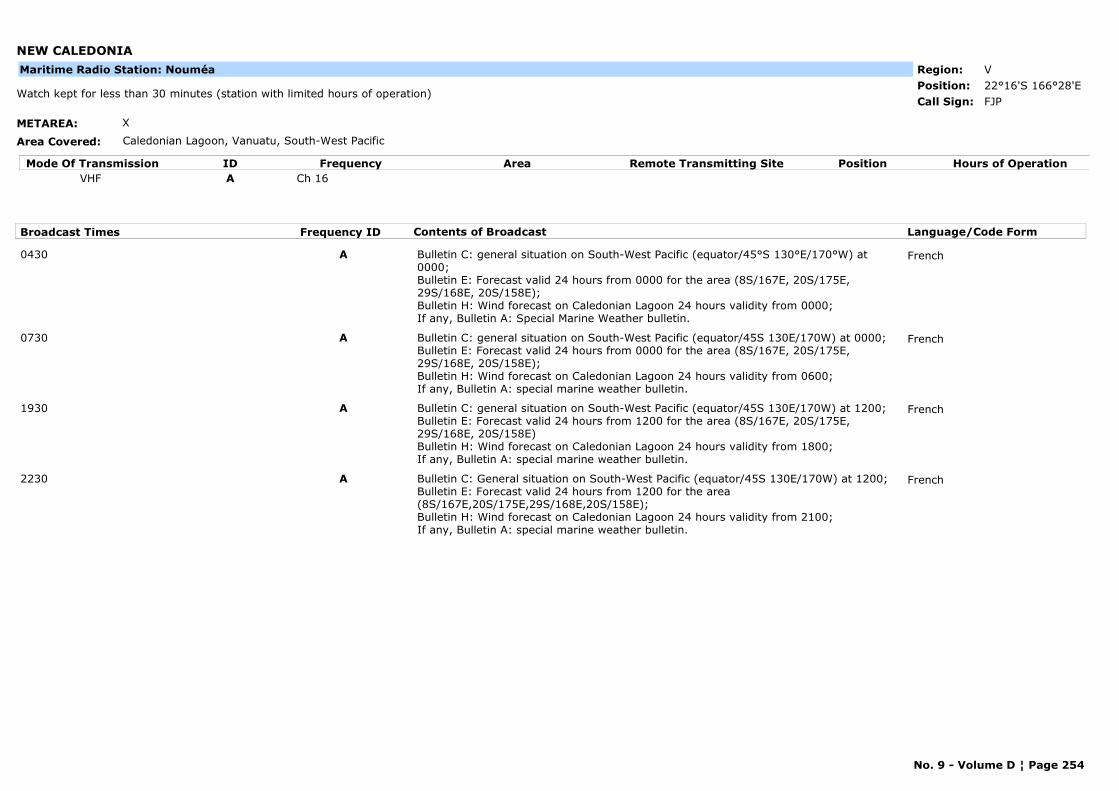
NEW CALEDONIA
METAREA: X
Area Covered: Caledonian Lagoon, Vanuatu, South-West Pacific
Region: VPosition: 22°16'S 166°28'E
FJPWatch kept for less than 30 minutes (station with limited hours of operation)
Call Sign:
Maritime Radio Station: Nouméa
Mode Of Transmission ID Frequency Area Position Hours of OperationRemote Transmitting SiteVHF A Ch 16
Broadcast Times Frequency ID Contents of Broadcast Language/Code Form
0430 A Bulletin C: general situation on South-West Pacific (equator/45°S 130°E/170°W) at 0000;Bulletin E: Forecast valid 24 hours from 0000 for the area (8S/167E, 20S/175E, 29S/168E, 20S/158E);Bulletin H: Wind forecast on Caledonian Lagoon 24 hours validity from 0000;If any, Bulletin A: Special Marine Weather bulletin.
French
0730 A Bulletin C: general situation on South-West Pacific (equator/45S 130E/170W) at 0000;Bulletin E: Forecast valid 24 hours from 0000 for the area (8S/167E, 20S/175E, 29S/168E, 20S/158E);Bulletin H: Wind forecast on Caledonian Lagoon 24 hours validity from 0600;If any, Bulletin A: special marine weather bulletin.
French
1930 A Bulletin C: general situation on South-West Pacific (equator/45S 130E/170W) at 1200;Bulletin E: Forecast valid 24 hours from 1200 for the area (8S/167E, 20S/175E, 29S/168E, 20S/158E)Bulletin H: Wind forecast on Caledonian Lagoon 24 hours validity from 1800;If any, Bulletin A: special marine weather bulletin.
French
2230 A Bulletin C: General situation on South-West Pacific (equator/45S 130E/170W) at 1200;Bulletin E: Forecast valid 24 hours from 1200 for the area (8S/167E,20S/175E,29S/168E,20S/158E);Bulletin H: Wind forecast on Caledonian Lagoon 24 hours validity from 2100;If any, Bulletin A: special marine weather bulletin.
French
No. 9 - Volume D ¦ Page 254
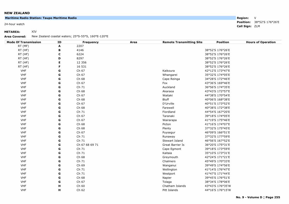
NEW ZEALAND
METAREA: XIV
Area Covered: New Zealand coastal waters; 25°S-55°S, 160°E-120°E
Region: VPosition: 38°52'S 176°26'E
ZLM24-hour watch
Call Sign:
Maritime Radio Station: Taupo Maritime Radio
Mode Of Transmission ID Frequency Area Position Hours of OperationRemote Transmitting SiteRT (MF) A 2207RT (HF) B 4146 38°52'S 176°26'ERT (HF) C 6224 38°52'S 176°26'ERT (HF) D 8297 38°52'S 176°26'ERT (HF) E 12 356 38°52'S 176°26'ERT (HF) F 16 531 38°52'S 176°26'E
VHF G Ch 67 Kaikoura 42°12'S 173°47'EVHF G Ch 67 Whangarei 35°32'S 174°05'EVHF G Ch 68 Cape Reinga 34°28'S 172°46'EVHF G Ch 67 Fox 43°36'S 169°46'EVHF G Ch 71 Auckland 36°56'S 174°35'EVHF G Ch 68 Akaraoa 43°43'S 172°57'EVHF G Ch 67 Waitaki 44°38'S 170°54'EVHF G Ch 68 Bluff 40°06'S 168°38'EVHF G Ch 67 D'Urville 40°51'S 173°52'EVHF G Ch 68 Farewell 40°38'S 172°38'EVHF G Ch 71 Fiordland 44°54'S 167°20'EVHF G Ch 67 Taranaki 39°18'S 174°05'EVHF G Ch 67 Wairarapa 41°19'S 175°46'EVHF G Ch 68 Picton 41°16'S 174°07'EVHF G Ch 68 Plenty 37°32'S 175°45'EVHF G Ch 67 Puysegur 46°09'S 166°51'EVHF G Ch 71 Runaway 37°32'S 177°59'EVHF G Ch 71 Stewart Island 46°56'S 167°52'EVHF G Ch 67 68 69 71 Great Barrier Is 36°20'S 175°31'EVHF G Ch 71 Cape Egmont 39°18'S 173°59'EVHF G Ch 71 Kaitaia 35°10'S 173°31'EVHF G Ch 68 Greymouth 42°24'S 171°21'EVHF G Ch 71 Chalmers 45°49'S 170°33'EVHF G Ch 69 Wanganui 39°49'S 174°56'EVHF G Ch 71 Wellington 41°14'S 176°47'EVHF G Ch 71 Westport 41°47'S 171°44'EVHF G Ch 68 Napier 39°45'S 176°51'EVHF G Ch 67 Tolaga 38°34'S 178°06'EVHF H Ch 60 Chatham Islands 43°43'S 176°35'WVHF H Ch 62 Pitt Islands 44°16'S 176°15'W
No. 9 - Volume D ¦ Page 255
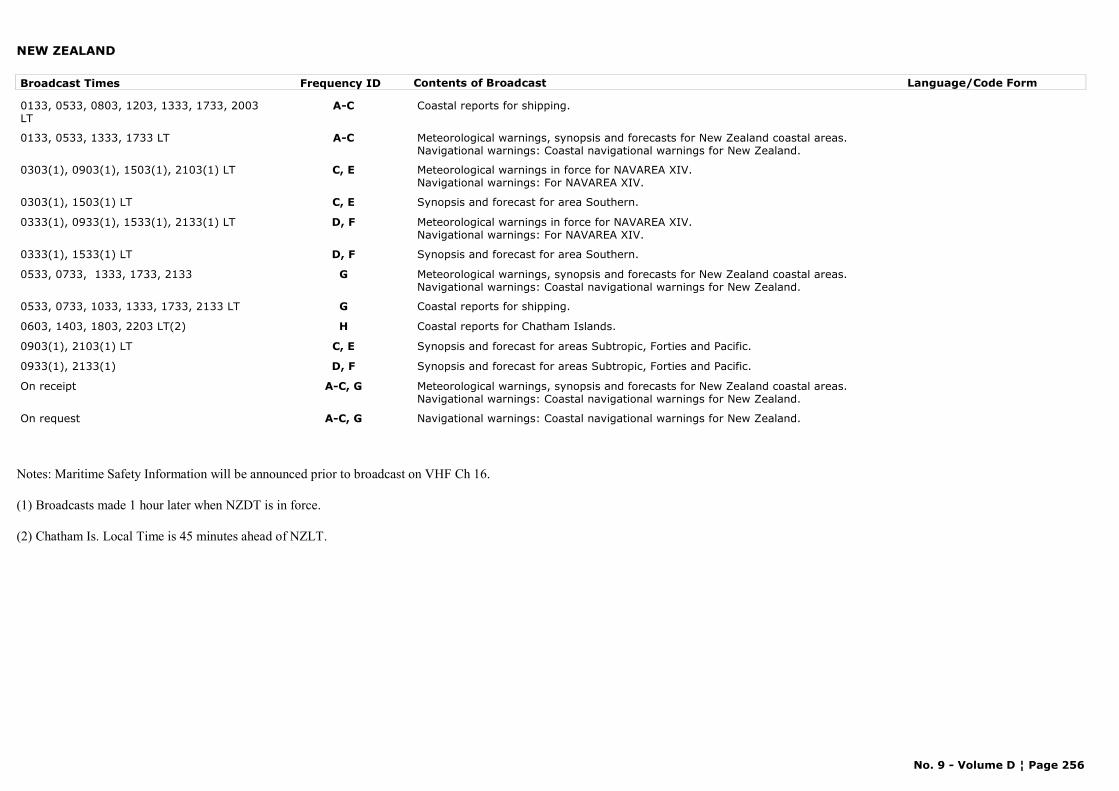
NEW ZEALAND
Broadcast Times Frequency ID Contents of Broadcast Language/Code Form
0133, 0533, 0803, 1203, 1333, 1733, 2003 LT
A-C Coastal reports for shipping.
0133, 0533, 1333, 1733 LT A-C Meteorological warnings, synopsis and forecasts for New Zealand coastal areas.Navigational warnings: Coastal navigational warnings for New Zealand.
0303(1), 0903(1), 1503(1), 2103(1) LT C, E Meteorological warnings in force for NAVAREA XIV.Navigational warnings: For NAVAREA XIV.
0303(1), 1503(1) LT C, E Synopsis and forecast for area Southern.
0333(1), 0933(1), 1533(1), 2133(1) LT D, F Meteorological warnings in force for NAVAREA XIV.Navigational warnings: For NAVAREA XIV.
0333(1), 1533(1) LT D, F Synopsis and forecast for area Southern.
0533, 0733, 1333, 1733, 2133 G Meteorological warnings, synopsis and forecasts for New Zealand coastal areas.Navigational warnings: Coastal navigational warnings for New Zealand.
0533, 0733, 1033, 1333, 1733, 2133 LT G Coastal reports for shipping.
0603, 1403, 1803, 2203 LT(2) H Coastal reports for Chatham Islands.
0903(1), 2103(1) LT C, E Synopsis and forecast for areas Subtropic, Forties and Pacific.
0933(1), 2133(1) D, F Synopsis and forecast for areas Subtropic, Forties and Pacific.
On receipt A-C, G Meteorological warnings, synopsis and forecasts for New Zealand coastal areas.Navigational warnings: Coastal navigational warnings for New Zealand.
On request A-C, G Navigational warnings: Coastal navigational warnings for New Zealand.
Notes: Maritime Safety Information will be announced prior to broadcast on VHF Ch 16.
(1) Broadcasts made 1 hour later when NZDT is in force.
(2) Chatham Is. Local Time is 45 minutes ahead of NZLT.
No. 9 - Volume D ¦ Page 256
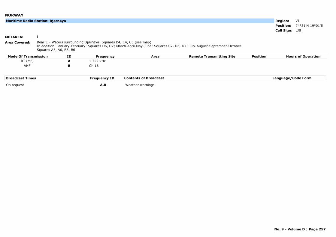
NORWAY
METAREA: I
Area Covered: Bear I. - Waters surrounding Bjørnøya: Squares B4, C4, C5 (see map)In addition: January-February: Squares D6, D7; March-April-May-June: Squares C7, D6, D7; July-August-September-October: Squares A5, A6, B5, B6
Region: VIPosition: 74°31'N 19°01'E
LJBCall Sign:
Maritime Radio Station: Bjørnøya
Mode Of Transmission ID Frequency Area Position Hours of OperationRemote Transmitting SiteRT (MF) A 1 722 kHz
VHF B Ch 16
Broadcast Times Frequency ID Contents of Broadcast Language/Code Form
On request A,B Weather warnings.
No. 9 - Volume D ¦ Page 257
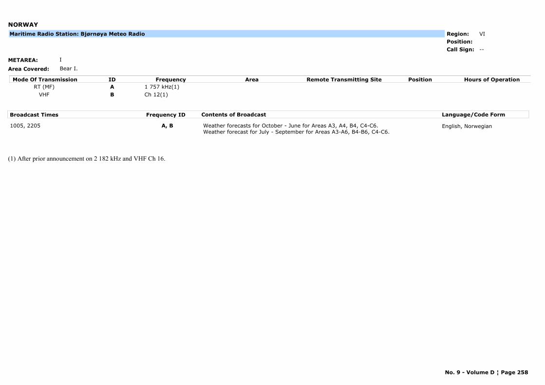
NORWAY
METAREA: I
Area Covered: Bear I.
Region: VIPosition:
--Call Sign:
Maritime Radio Station: Bjørnøya Meteo Radio
Mode Of Transmission ID Frequency Area Position Hours of OperationRemote Transmitting SiteRT (MF) A 1 757 kHz(1)
VHF B Ch 12(1)
Broadcast Times Frequency ID Contents of Broadcast Language/Code Form
1005, 2205 A, B Weather forecasts for October - June for Areas A3, A4, B4, C4-C6.Weather forecast for July - September for Areas A3-A6, B4-B6, C4-C6.
English, Norwegian
(1) After prior announcement on 2 182 kHz and VHF Ch 16.
No. 9 - Volume D ¦ Page 258
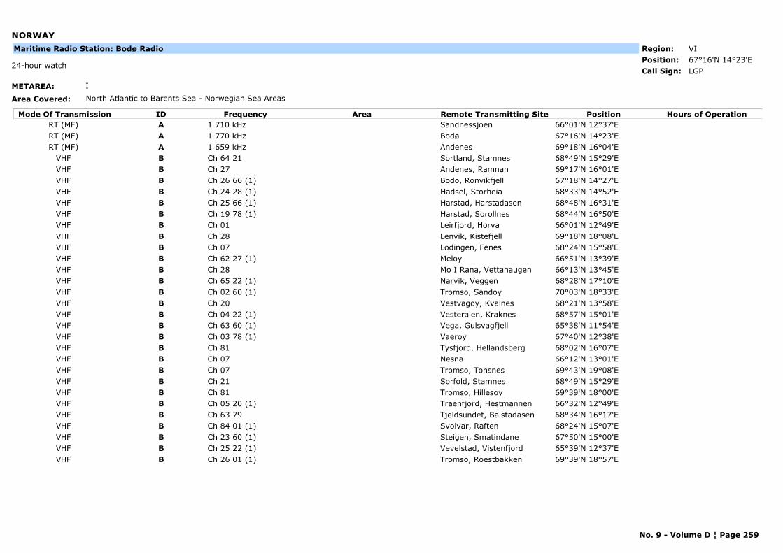
NORWAY
METAREA: I
Area Covered: North Atlantic to Barents Sea - Norwegian Sea Areas
Region: VIPosition: 67°16'N 14°23'E
LGP24-hour watch
Call Sign:
Maritime Radio Station: Bodø Radio
Mode Of Transmission ID Frequency Area Position Hours of OperationRemote Transmitting SiteRT (MF) A 1 710 kHz Sandnessjoen 66°01'N 12°37'ERT (MF) A 1 770 kHz Bodø 67°16'N 14°23'ERT (MF) A 1 659 kHz Andenes 69°18'N 16°04'E
VHF B Ch 64 21 Sortland, Stamnes 68°49'N 15°29'EVHF B Ch 27 Andenes, Ramnan 69°17'N 16°01'EVHF B Ch 26 66 (1) Bodo, Ronvikfjell 67°18'N 14°27'EVHF B Ch 24 28 (1) Hadsel, Storheia 68°33'N 14°52'EVHF B Ch 25 66 (1) Harstad, Harstadasen 68°48'N 16°31'EVHF B Ch 19 78 (1) Harstad, Sorollnes 68°44'N 16°50'EVHF B Ch 01 Leirfjord, Horva 66°01'N 12°49'EVHF B Ch 28 Lenvik, Kistefjell 69°18'N 18°08'EVHF B Ch 07 Lodingen, Fenes 68°24'N 15°58'EVHF B Ch 62 27 (1) Meloy 66°51'N 13°39'EVHF B Ch 28 Mo I Rana, Vettahaugen 66°13'N 13°45'EVHF B Ch 65 22 (1) Narvik, Veggen 68°28'N 17°10'EVHF B Ch 02 60 (1) Tromso, Sandoy 70°03'N 18°33'EVHF B Ch 20 Vestvagoy, Kvalnes 68°21'N 13°58'EVHF B Ch 04 22 (1) Vesteralen, Kraknes 68°57'N 15°01'EVHF B Ch 63 60 (1) Vega, Gulsvagfjell 65°38'N 11°54'EVHF B Ch 03 78 (1) Vaeroy 67°40'N 12°38'EVHF B Ch 81 Tysfjord, Hellandsberg 68°02'N 16°07'EVHF B Ch 07 Nesna 66°12'N 13°01'EVHF B Ch 07 Tromso, Tonsnes 69°43'N 19°08'EVHF B Ch 21 Sorfold, Stamnes 68°49'N 15°29'EVHF B Ch 81 Tromso, Hillesoy 69°39'N 18°00'EVHF B Ch 05 20 (1) Traenfjord, Hestmannen 66°32'N 12°49'EVHF B Ch 63 79 Tjeldsundet, Balstadasen 68°34'N 16°17'EVHF B Ch 84 01 (1) Svolvar, Raften 68°24'N 15°07'EVHF B Ch 23 60 (1) Steigen, Smatindane 67°50'N 15°00'EVHF B Ch 25 22 (1) Vevelstad, Vistenfjord 65°39'N 12°37'EVHF B Ch 26 01 (1) Tromso, Roestbakken 69°39'N 18°57'E
No. 9 - Volume D ¦ Page 259

NORWAY
Broadcast Times Frequency ID Contents of Broadcast Language/Code Form
1203, 23030233, 0633, 1033, 1433, 1833, 2233
A Weather forecast for coastal waters off northern Norway 65°N to 70°N and from 0°W to 10°W. Area north and north-east of Iceland and north-eastern part of Denmark Strait. Norwegian, arctic and Barents Seas north of 70°N.
English, Norwegian
On receipt0233, 0633, 1033, 1433, 1833, 2233
A, B Storm and gale warnings for coastal waters and ajoining sea areas. Navigational warnings: All navigational warnings are repeated daily at 1033 for 7 days.
English, Norwegian
On request A, B Storm and gale warnings. Navigational warnings and ice reports.
English, Norwegian
No. 9 - Volume D ¦ Page 260
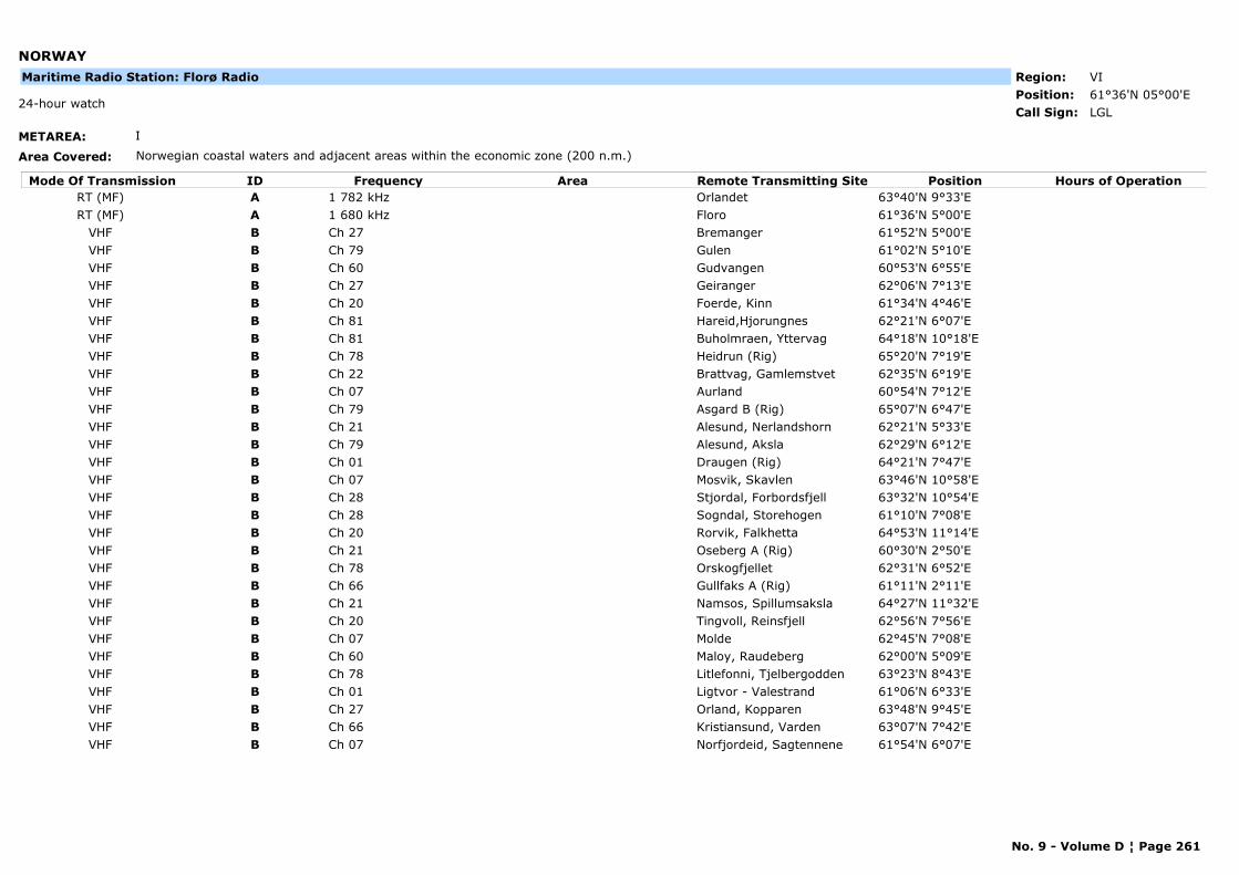
NORWAY
METAREA: I
Area Covered: Norwegian coastal waters and adjacent areas within the economic zone (200 n.m.)
Region: VIPosition: 61°36'N 05°00'E
LGL24-hour watch
Call Sign:
Maritime Radio Station: Florø Radio
Mode Of Transmission ID Frequency Area Position Hours of OperationRemote Transmitting SiteRT (MF) A 1 782 kHz Orlandet 63°40'N 9°33'ERT (MF) A 1 680 kHz Floro 61°36'N 5°00'E
VHF B Ch 27 Bremanger 61°52'N 5°00'EVHF B Ch 79 Gulen 61°02'N 5°10'EVHF B Ch 60 Gudvangen 60°53'N 6°55'EVHF B Ch 27 Geiranger 62°06'N 7°13'EVHF B Ch 20 Foerde, Kinn 61°34'N 4°46'EVHF B Ch 81 Hareid,Hjorungnes 62°21'N 6°07'EVHF B Ch 81 Buholmraen, Yttervag 64°18'N 10°18'EVHF B Ch 78 Heidrun (Rig) 65°20'N 7°19'EVHF B Ch 22 Brattvag, Gamlemstvet 62°35'N 6°19'EVHF B Ch 07 Aurland 60°54'N 7°12'EVHF B Ch 79 Asgard B (Rig) 65°07'N 6°47'EVHF B Ch 21 Alesund, Nerlandshorn 62°21'N 5°33'EVHF B Ch 79 Alesund, Aksla 62°29'N 6°12'EVHF B Ch 01 Draugen (Rig) 64°21'N 7°47'EVHF B Ch 07 Mosvik, Skavlen 63°46'N 10°58'EVHF B Ch 28 Stjordal, Forbordsfjell 63°32'N 10°54'EVHF B Ch 28 Sogndal, Storehogen 61°10'N 7°08'EVHF B Ch 20 Rorvik, Falkhetta 64°53'N 11°14'EVHF B Ch 21 Oseberg A (Rig) 60°30'N 2°50'EVHF B Ch 78 Orskogfjellet 62°31'N 6°52'EVHF B Ch 66 Gullfaks A (Rig) 61°11'N 2°11'EVHF B Ch 21 Namsos, Spillumsaksla 64°27'N 11°32'EVHF B Ch 20 Tingvoll, Reinsfjell 62°56'N 7°56'EVHF B Ch 07 Molde 62°45'N 7°08'EVHF B Ch 60 Maloy, Raudeberg 62°00'N 5°09'EVHF B Ch 78 Litlefonni, Tjelbergodden 63°23'N 8°43'EVHF B Ch 01 Ligtvor - Valestrand 61°06'N 6°33'EVHF B Ch 27 Orland, Kopparen 63°48'N 9°45'EVHF B Ch 66 Kristiansund, Varden 63°07'N 7°42'EVHF B Ch 07 Norfjordeid, Sagtennene 61°54'N 6°07'E
No. 9 - Volume D ¦ Page 261
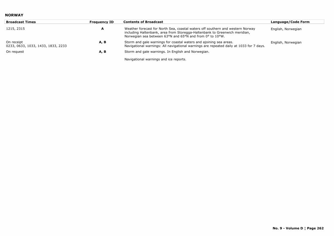
NORWAY
Broadcast Times Frequency ID Contents of Broadcast Language/Code Form
1215, 2315 A Weather forecast for North Sea, coastal waters off southern and western Norway including Haltenbank, area from Storegga-Haltenbank to Greenwich meridian, Norwegian sea between 63°N and 65°N and from 0° to 10°W.
English, Norwegian
On receipt0233, 0633, 1033, 1433, 1833, 2233
A, B Storm and gale warnings for coastal waters and ajoining sea areas.Navigational warnings: All navigational warnings are repeated daily at 1033 for 7 days.
English, Norwegian
On request A, B Storm and gale warnings. In English and Norwegian.
Navigational warnings and ice reports.
No. 9 - Volume D ¦ Page 262
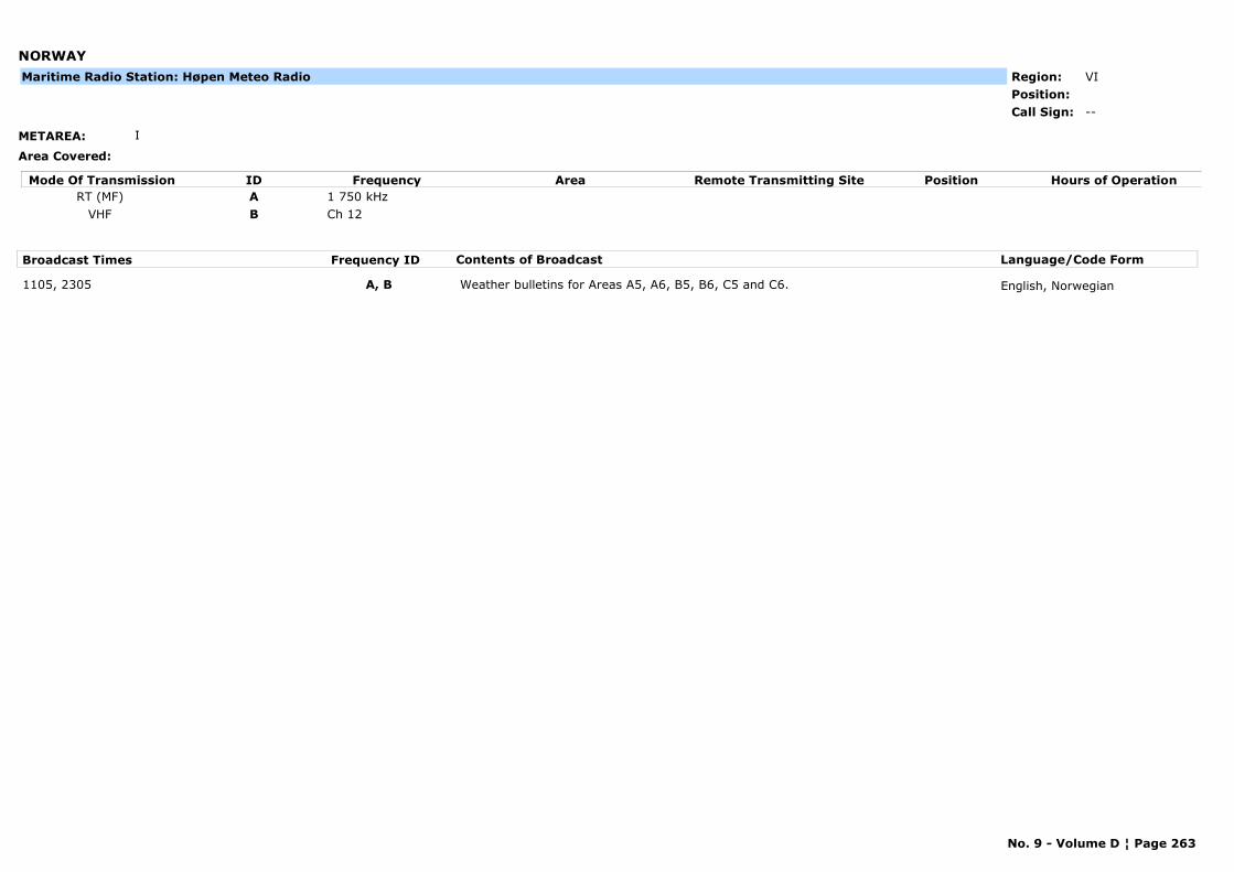
NORWAY
METAREA: I
Area Covered:
Region: VIPosition:
--Call Sign:
Maritime Radio Station: Høpen Meteo Radio
Mode Of Transmission ID Frequency Area Position Hours of OperationRemote Transmitting SiteRT (MF) A 1 750 kHz
VHF B Ch 12
Broadcast Times Frequency ID Contents of Broadcast Language/Code Form
1105, 2305 A, B Weather bulletins for Areas A5, A6, B5, B6, C5 and C6. English, Norwegian
No. 9 - Volume D ¦ Page 263
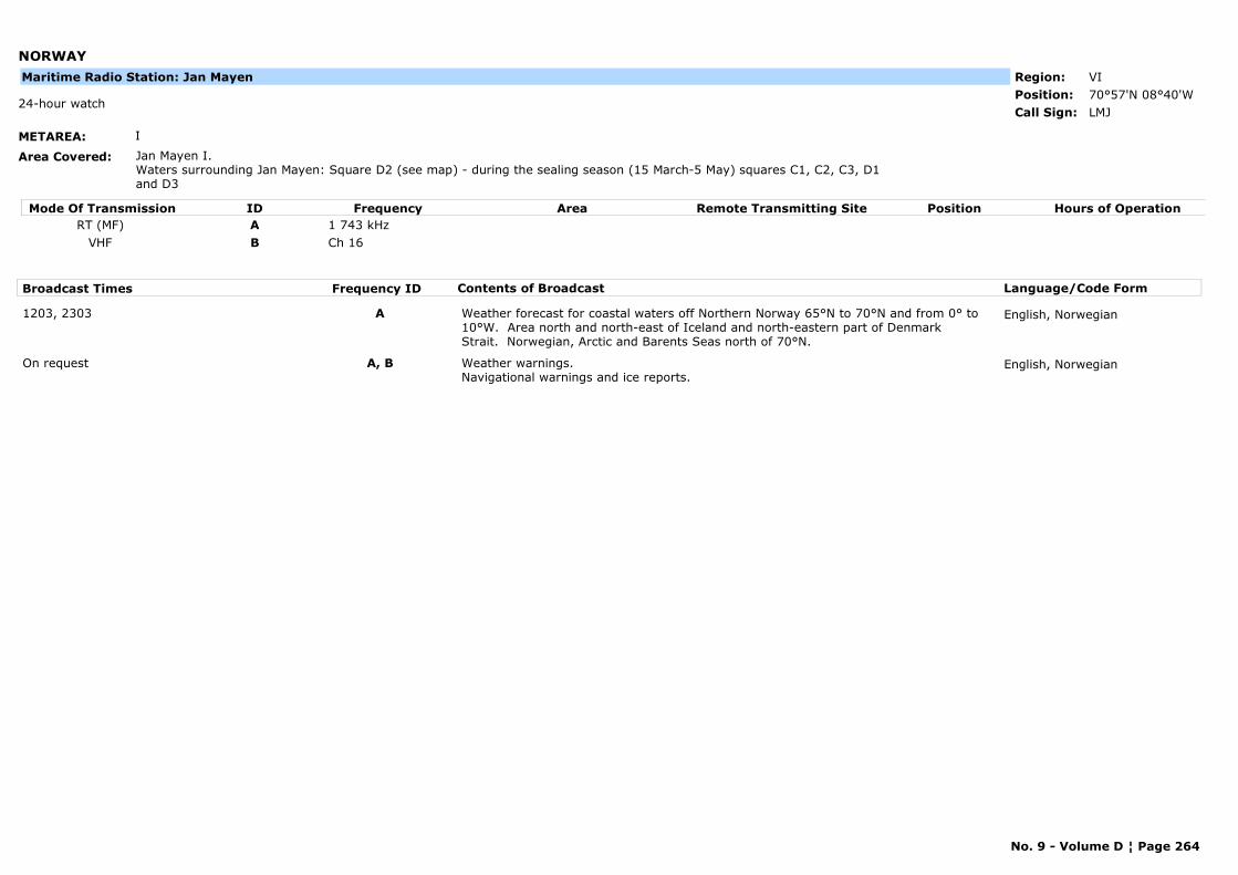
NORWAY
METAREA: I
Area Covered: Jan Mayen I.Waters surrounding Jan Mayen: Square D2 (see map) - during the sealing season (15 March-5 May) squares C1, C2, C3, D1 and D3
Region: VIPosition: 70°57'N 08°40'W
LMJ24-hour watch
Call Sign:
Maritime Radio Station: Jan Mayen
Mode Of Transmission ID Frequency Area Position Hours of OperationRemote Transmitting SiteRT (MF) A 1 743 kHz
VHF B Ch 16
Broadcast Times Frequency ID Contents of Broadcast Language/Code Form
1203, 2303 A Weather forecast for coastal waters off Northern Norway 65°N to 70°N and from 0° to 10°W. Area north and north-east of Iceland and north-eastern part of Denmark Strait. Norwegian, Arctic and Barents Seas north of 70°N.
English, Norwegian
On request A, B Weather warnings. Navigational warnings and ice reports.
English, Norwegian
No. 9 - Volume D ¦ Page 264
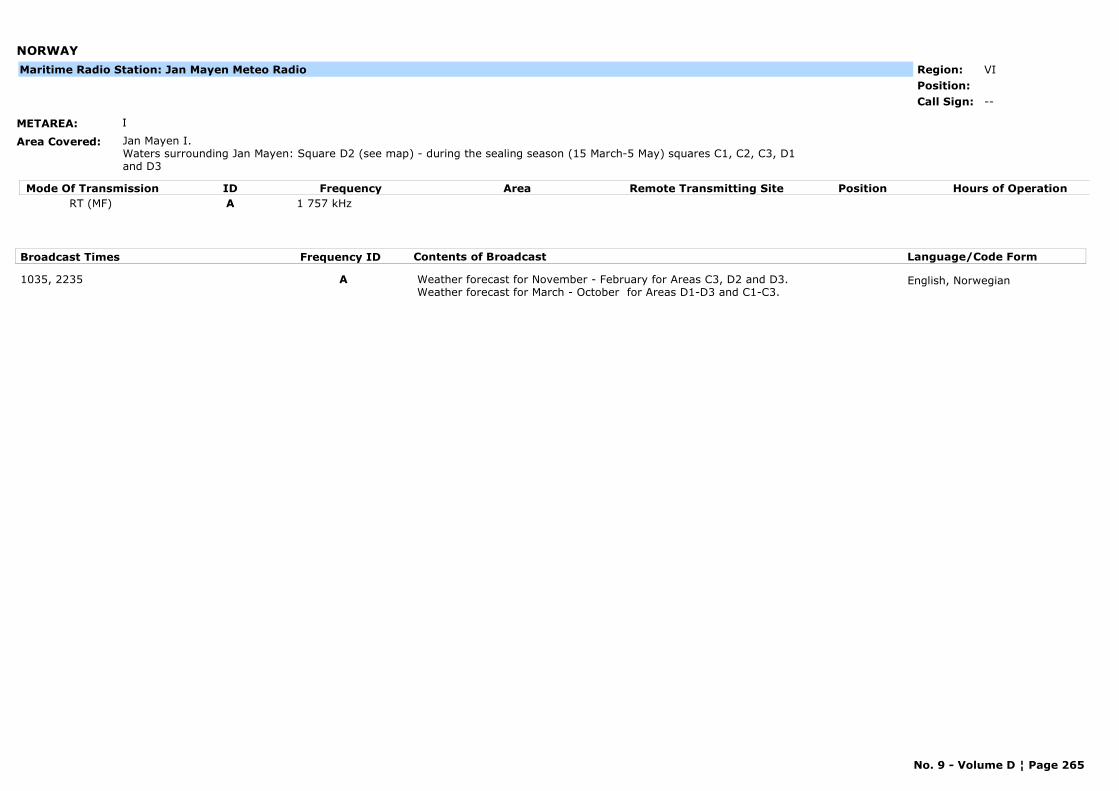
NORWAY
METAREA: I
Area Covered: Jan Mayen I.Waters surrounding Jan Mayen: Square D2 (see map) - during the sealing season (15 March-5 May) squares C1, C2, C3, D1 and D3
Region: VIPosition:
--Call Sign:
Maritime Radio Station: Jan Mayen Meteo Radio
Mode Of Transmission ID Frequency Area Position Hours of OperationRemote Transmitting SiteRT (MF) A 1 757 kHz
Broadcast Times Frequency ID Contents of Broadcast Language/Code Form
1035, 2235 A Weather forecast for November - February for Areas C3, D2 and D3.Weather forecast for March - October for Areas D1-D3 and C1-C3.
English, Norwegian
No. 9 - Volume D ¦ Page 265
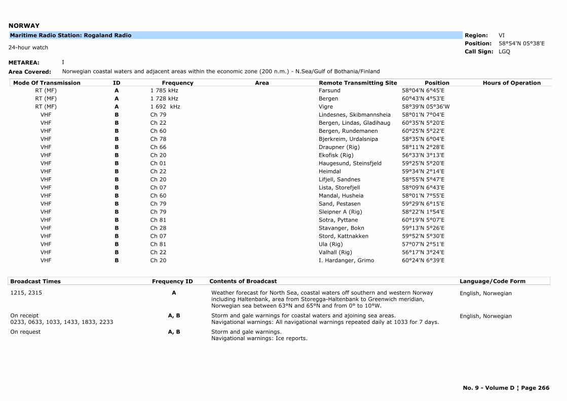
NORWAY
METAREA: I
Area Covered: Norwegian coastal waters and adjacent areas within the economic zone (200 n.m.) - N.Sea/Gulf of Bothania/Finland
Region: VIPosition: 58°54'N 05°38'E
LGQ24-hour watch
Call Sign:
Maritime Radio Station: Rogaland Radio
Mode Of Transmission ID Frequency Area Position Hours of OperationRemote Transmitting SiteRT (MF) A 1 785 kHz Farsund 58°04'N 6°45'ERT (MF) A 1 728 kHz Bergen 60°43'N 4°53'ERT (MF) A 1 692 kHz Vigre 58°39'N 05°36'W
VHF B Ch 79 Lindesnes, Skibmannsheia 58°01'N 7°04'EVHF B Ch 22 Bergen, Lindas, Gladihaug 60°35'N 5°20'EVHF B Ch 60 Bergen, Rundemanen 60°25'N 5°22'EVHF B Ch 78 Bjerkreim, Urdalsnipa 58°35'N 6°04'EVHF B Ch 66 Draupner (Rig) 58°11'N 2°28'EVHF B Ch 20 Ekofisk (Rig) 56°33'N 3°13'EVHF B Ch 01 Haugesund, Steinsfjeld 59°25'N 5°20'EVHF B Ch 22 Heimdal 59°34'N 2°14'EVHF B Ch 20 Lifjell, Sandnes 58°55'N 5°47'EVHF B Ch 07 Lista, Storefjell 58°09'N 6°43'EVHF B Ch 60 Mandal, Husheia 58°01'N 7°55'EVHF B Ch 79 Sand, Pestasen 59°29'N 6°15'EVHF B Ch 79 Sleipner A (Rig) 58°22'N 1°54'EVHF B Ch 81 Sotra, Pyttane 60°19'N 5°07'EVHF B Ch 28 Stavanger, Bokn 59°13'N 5°26'EVHF B Ch 07 Stord, Kattnakken 59°52'N 5°30'EVHF B Ch 81 Ula (Rig) 57°07'N 2°51'EVHF B Ch 22 Valhall (Rig) 56°17'N 3°24'EVHF B Ch 20 I. Hardanger, Grimo 60°24'N 6°39'E
Broadcast Times Frequency ID Contents of Broadcast Language/Code Form
1215, 2315 A Weather forecast for North Sea, coastal waters off southern and western Norway including Haltenbank, area from Storegga-Haltenbank to Greenwich meridian, Norwegian sea between 63°N and 65°N and from 0° to 10°W.
English, Norwegian
On receipt 0233, 0633, 1033, 1433, 1833, 2233
A, B Storm and gale warnings for coastal waters and ajoining sea areas. Navigational warnings: All navigational warnings repeated daily at 1033 for 7 days.
English, Norwegian
On request A, B Storm and gale warnings.Navigational warnings: Ice reports.
No. 9 - Volume D ¦ Page 266
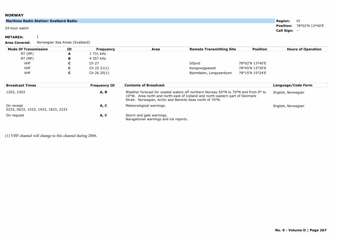
NORWAY
METAREA: I
Area Covered: Norwegian Sea Areas (Svalbard)
Region: VIPosition: 78°02'N 13°40'E
--24-hour watch
Call Sign:
Maritime Radio Station: Svalbard Radio
Mode Of Transmission ID Frequency Area Position Hours of OperationRemote Transmitting SiteRT (MF) A 1 731 kHzRT (MF) B 4 357 kHz
VHF C Ch 27 Isfjord 78°02'N 13°40'EVHF C Ch 25 21(1) Kongsvegpasset 78°45'N 13°30'EVHF C Ch 26 20(1) Bjomdalen, Longyearbyen 78°15'N 15°24'E
Broadcast Times Frequency ID Contents of Broadcast Language/Code Form
1203, 2303 A, B Weather forecast for coastal waters off northern Norway 65°N to 70°N and from 0° to 10°W. Area north and north-east of Iceland and north-eastern part of Denmark Strait. Norwegian, Arctic and Barents Seas north of 70°N.
English, Norwegian
On receipt0233, 0633, 1033, 1433, 1833, 2233
A, C Meteorological warnings. English, Norwegian
On request A, C Storm and gale warnings.Navigational warnings and ice reports.
(1) VHF channel will change to this channel during 2006.
No. 9 - Volume D ¦ Page 267
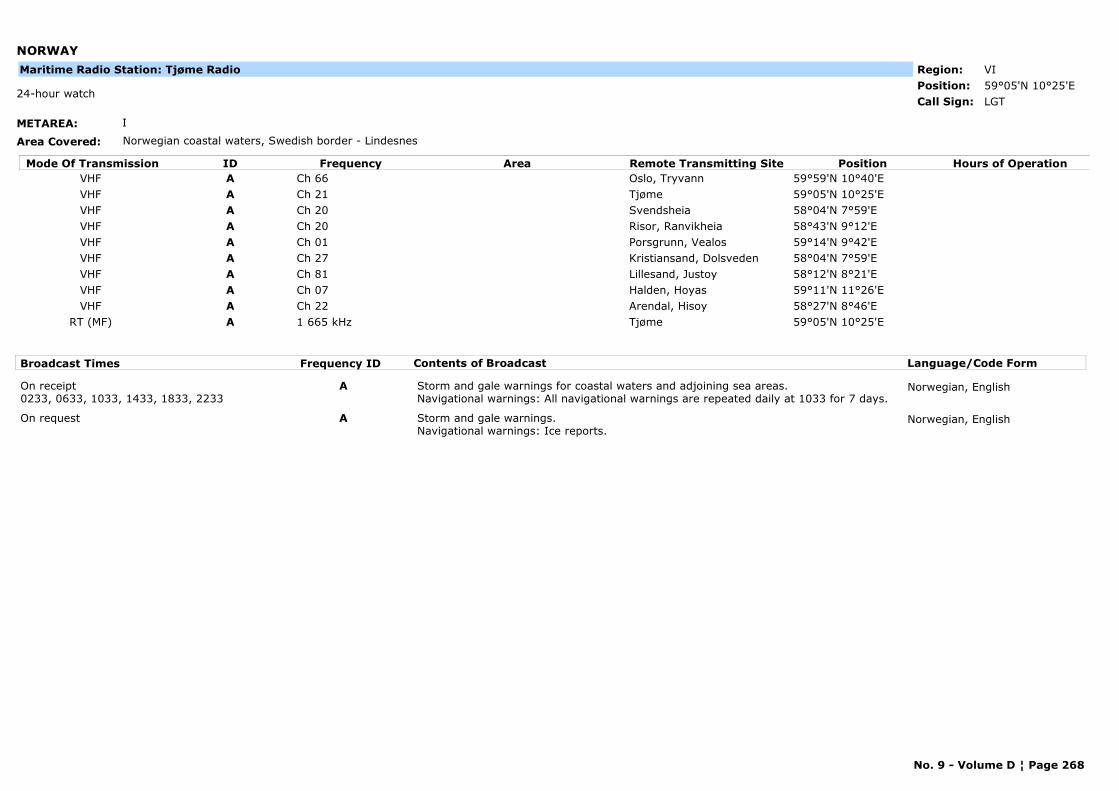
NORWAY
METAREA: I
Area Covered: Norwegian coastal waters, Swedish border - Lindesnes
Region: VIPosition: 59°05'N 10°25'E
LGT24-hour watch
Call Sign:
Maritime Radio Station: Tjøme Radio
Mode Of Transmission ID Frequency Area Position Hours of OperationRemote Transmitting SiteVHF A Ch 66 Oslo, Tryvann 59°59'N 10°40'EVHF A Ch 21 Tjøme 59°05'N 10°25'EVHF A Ch 20 Svendsheia 58°04'N 7°59'EVHF A Ch 20 Risor, Ranvikheia 58°43'N 9°12'EVHF A Ch 01 Porsgrunn, Vealos 59°14'N 9°42'EVHF A Ch 27 Kristiansand, Dolsveden 58°04'N 7°59'EVHF A Ch 81 Lillesand, Justoy 58°12'N 8°21'EVHF A Ch 07 Halden, Hoyas 59°11'N 11°26'EVHF A Ch 22 Arendal, Hisoy 58°27'N 8°46'E
RT (MF) A 1 665 kHz Tjøme 59°05'N 10°25'E
Broadcast Times Frequency ID Contents of Broadcast Language/Code Form
On receipt0233, 0633, 1033, 1433, 1833, 2233
A Storm and gale warnings for coastal waters and adjoining sea areas. Navigational warnings: All navigational warnings are repeated daily at 1033 for 7 days.
Norwegian, English
On request A Storm and gale warnings. Navigational warnings: Ice reports.
Norwegian, English
No. 9 - Volume D ¦ Page 268
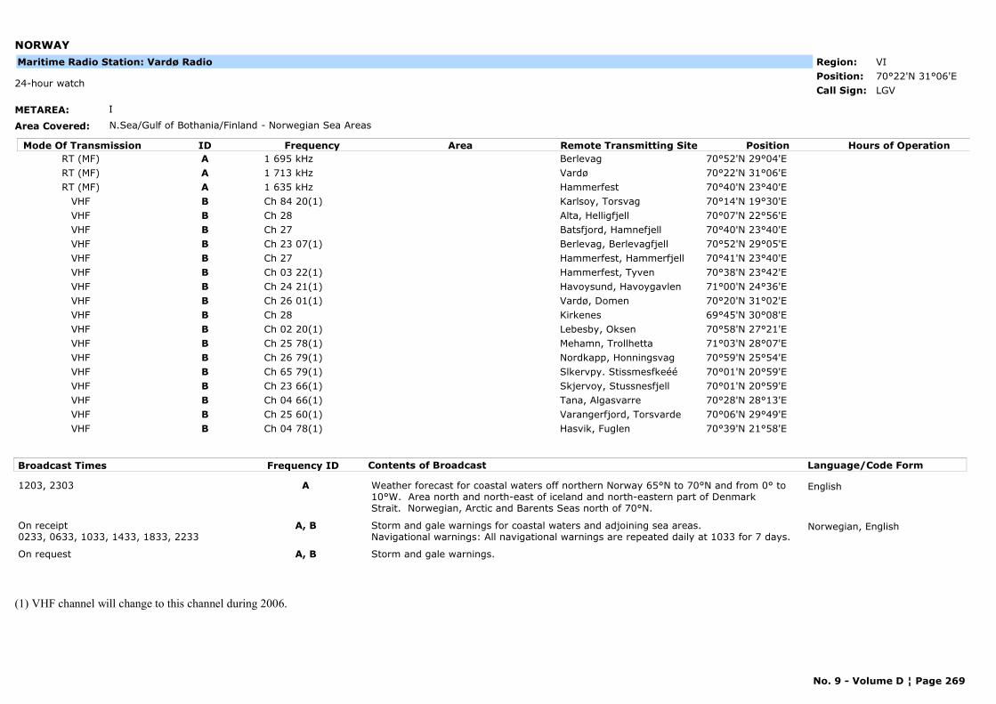
NORWAY
METAREA: I
Area Covered: N.Sea/Gulf of Bothania/Finland - Norwegian Sea Areas
Region: VIPosition: 70°22'N 31°06'E
LGV24-hour watch
Call Sign:
Maritime Radio Station: Vardø Radio
Mode Of Transmission ID Frequency Area Position Hours of OperationRemote Transmitting SiteRT (MF) A 1 695 kHz Berlevag 70°52'N 29°04'ERT (MF) A 1 713 kHz Vardø 70°22'N 31°06'ERT (MF) A 1 635 kHz Hammerfest 70°40'N 23°40'E
VHF B Ch 84 20(1) Karlsoy, Torsvag 70°14'N 19°30'EVHF B Ch 28 Alta, Helligfjell 70°07'N 22°56'EVHF B Ch 27 Batsfjord, Hamnefjell 70°40'N 23°40'EVHF B Ch 23 07(1) Berlevag, Berlevagfjell 70°52'N 29°05'EVHF B Ch 27 Hammerfest, Hammerfjell 70°41'N 23°40'EVHF B Ch 03 22(1) Hammerfest, Tyven 70°38'N 23°42'EVHF B Ch 24 21(1) Havoysund, Havoygavlen 71°00'N 24°36'EVHF B Ch 26 01(1) Vardø, Domen 70°20'N 31°02'EVHF B Ch 28 Kirkenes 69°45'N 30°08'EVHF B Ch 02 20(1) Lebesby, Oksen 70°58'N 27°21'EVHF B Ch 25 78(1) Mehamn, Trollhetta 71°03'N 28°07'EVHF B Ch 26 79(1) Nordkapp, Honningsvag 70°59'N 25°54'EVHF B Ch 65 79(1) Slkervpy. Stissmesfkeéé 70°01'N 20°59'EVHF B Ch 23 66(1) Skjervoy, Stussnesfjell 70°01'N 20°59'EVHF B Ch 04 66(1) Tana, Algasvarre 70°28'N 28°13'EVHF B Ch 25 60(1) Varangerfjord, Torsvarde 70°06'N 29°49'EVHF B Ch 04 78(1) Hasvik, Fuglen 70°39'N 21°58'E
Broadcast Times Frequency ID Contents of Broadcast Language/Code Form
1203, 2303 A Weather forecast for coastal waters off northern Norway 65°N to 70°N and from 0° to 10°W. Area north and north-east of iceland and north-eastern part of Denmark Strait. Norwegian, Arctic and Barents Seas north of 70°N.
English
On receipt0233, 0633, 1033, 1433, 1833, 2233
A, B Storm and gale warnings for coastal waters and adjoining sea areas. Navigational warnings: All navigational warnings are repeated daily at 1033 for 7 days.
Norwegian, English
On request A, B Storm and gale warnings.
(1) VHF channel will change to this channel during 2006.
No. 9 - Volume D ¦ Page 269
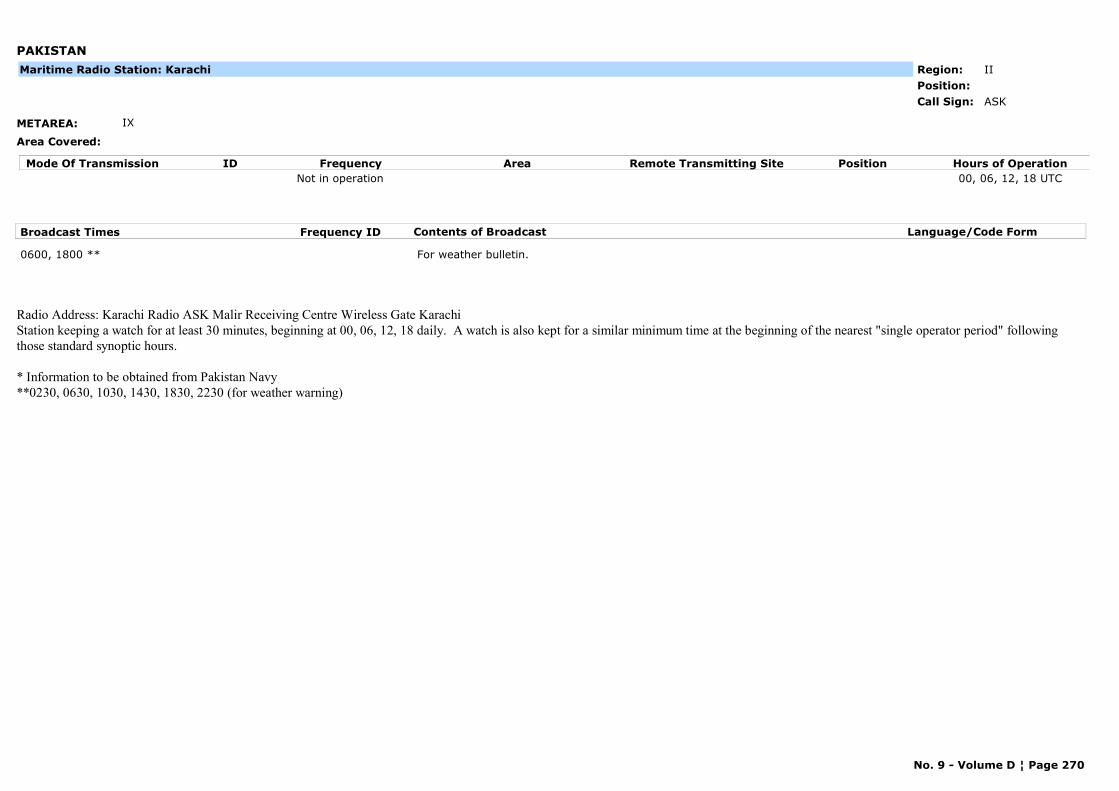
PAKISTAN
METAREA: IX
Area Covered:
Region: IIPosition:
ASKCall Sign:
Maritime Radio Station: Karachi
Mode Of Transmission ID Frequency Area Position Hours of OperationRemote Transmitting SiteNot in operation 00, 06, 12, 18 UTC
Broadcast Times Frequency ID Contents of Broadcast Language/Code Form
0600, 1800 ** For weather bulletin.
Radio Address: Karachi Radio ASK Malir Receiving Centre Wireless Gate KarachiStation keeping a watch for at least 30 minutes, beginning at 00, 06, 12, 18 daily. A watch is also kept for a similar minimum time at the beginning of the nearest "single operator period" following those standard synoptic hours.
* Information to be obtained from Pakistan Navy**0230, 0630, 1030, 1430, 1830, 2230 (for weather warning)
No. 9 - Volume D ¦ Page 270
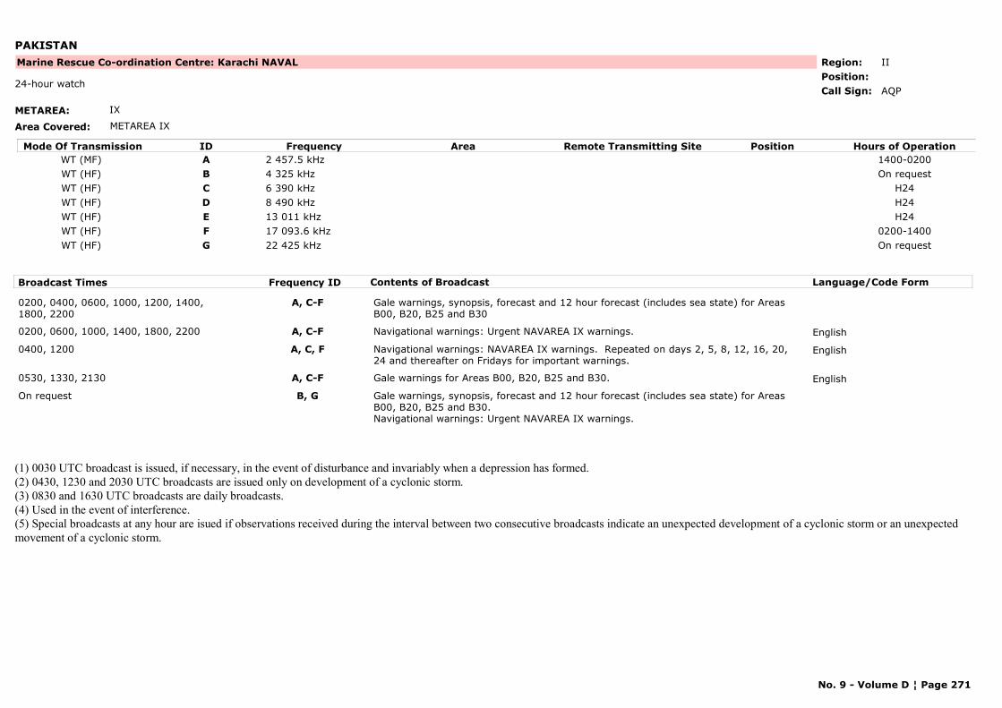
PAKISTAN
METAREA: IX
Area Covered: METAREA IX
Region: IIPosition:
Marine Rescue Co-ordination Centre: Karachi NAVAL
AQP24-hour watch
Call Sign:
Mode Of Transmission ID Frequency Area Position Hours of OperationRemote Transmitting SiteWT (MF) A 2 457.5 kHz 1400-0200WT (HF) B 4 325 kHz On requestWT (HF) C 6 390 kHz H24WT (HF) D 8 490 kHz H24WT (HF) E 13 011 kHz H24WT (HF) F 17 093.6 kHz 0200-1400WT (HF) G 22 425 kHz On request
Broadcast Times Frequency ID Contents of Broadcast Language/Code Form
0200, 0400, 0600, 1000, 1200, 1400, 1800, 2200
A, C-F Gale warnings, synopsis, forecast and 12 hour forecast (includes sea state) for Areas B00, B20, B25 and B30
0200, 0600, 1000, 1400, 1800, 2200 A, C-F Navigational warnings: Urgent NAVAREA IX warnings. English
0400, 1200 A, C, F Navigational warnings: NAVAREA IX warnings. Repeated on days 2, 5, 8, 12, 16, 20, 24 and thereafter on Fridays for important warnings.
English
0530, 1330, 2130 A, C-F Gale warnings for Areas B00, B20, B25 and B30. English
On request B, G Gale warnings, synopsis, forecast and 12 hour forecast (includes sea state) for Areas B00, B20, B25 and B30.Navigational warnings: Urgent NAVAREA IX warnings.
(1) 0030 UTC broadcast is issued, if necessary, in the event of disturbance and invariably when a depression has formed. (2) 0430, 1230 and 2030 UTC broadcasts are issued only on development of a cyclonic storm. (3) 0830 and 1630 UTC broadcasts are daily broadcasts. (4) Used in the event of interference.(5) Special broadcasts at any hour are isued if observations received during the interval between two consecutive broadcasts indicate an unexpected development of a cyclonic storm or an unexpected movement of a cyclonic storm.
No. 9 - Volume D ¦ Page 271
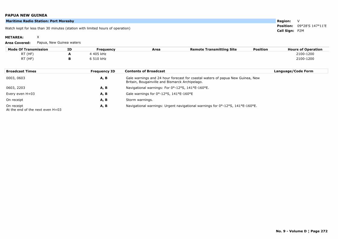
PAPUA NEW GUINEA
METAREA: X
Area Covered: Papua, New Guinea waters
Region: VPosition: 09°28'S 147°11'E
P2MWatch kept for less than 30 minutes (station with limited hours of operation)
Call Sign:
Maritime Radio Station: Port Moresby
Mode Of Transmission ID Frequency Area Position Hours of OperationRemote Transmitting SiteRT (HF) A 4 405 kHz 2100-1200RT (HF) B 6 510 kHz 2100-1200
Broadcast Times Frequency ID Contents of Broadcast Language/Code Form
0003, 0603 A, B Gale warnings and 24 hour forecast for coastal waters of papua New Guinea, New Britain, Bougainville and Bismarck Archipelago.
0603, 2203 A, B Navigational warnings: For 0°-12°S, 141°E-160°E.
Every even H+03 A, B Gale warnings for 0°-12°S, 141°E-160°E
On receipt A, B Storm warnings.
On receiptAt the end of the next even H+03
A, B Navigational warnings: Urgent navigational warnings for 0°-12°S, 141°E-160°E.
No. 9 - Volume D ¦ Page 272
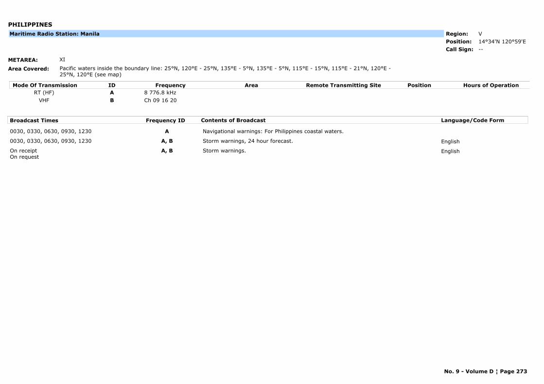
PHILIPPINES
METAREA: XI
Area Covered: Pacific waters inside the boundary line: 25°N, 120°E - 25°N, 135°E - 5°N, 135°E - 5°N, 115°E - 15°N, 115°E - 21°N, 120°E -25°N, 120°E (see map)
Region: VPosition: 14°34'N 120°59'E
--Call Sign:
Maritime Radio Station: Manila
Mode Of Transmission ID Frequency Area Position Hours of OperationRemote Transmitting SiteRT (HF) A 8 776.8 kHz
VHF B Ch 09 16 20
Broadcast Times Frequency ID Contents of Broadcast Language/Code Form
0030, 0330, 0630, 0930, 1230 A Navigational warnings: For Philippines coastal waters.
0030, 0330, 0630, 0930, 1230 A, B Storm warnings, 24 hour forecast. English
On receipt On request
A, B Storm warnings. English
No. 9 - Volume D ¦ Page 273
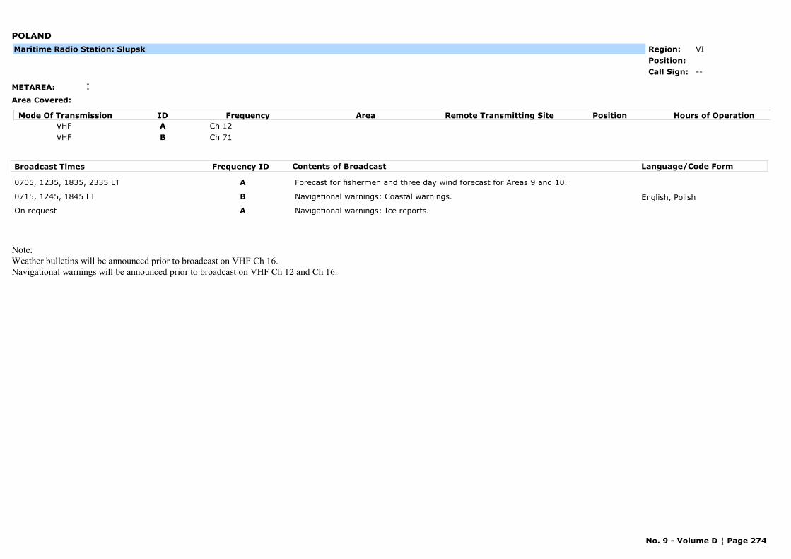
POLAND
METAREA: I
Area Covered:
Region: VIPosition:
--Call Sign:
Maritime Radio Station: Slupsk
Mode Of Transmission ID Frequency Area Position Hours of OperationRemote Transmitting SiteVHF A Ch 12VHF B Ch 71
Broadcast Times Frequency ID Contents of Broadcast Language/Code Form
0705, 1235, 1835, 2335 LT A Forecast for fishermen and three day wind forecast for Areas 9 and 10.
0715, 1245, 1845 LT B Navigational warnings: Coastal warnings. English, Polish
On request A Navigational warnings: Ice reports.
Note:Weather bulletins will be announced prior to broadcast on VHF Ch 16.Navigational warnings will be announced prior to broadcast on VHF Ch 12 and Ch 16.
No. 9 - Volume D ¦ Page 274
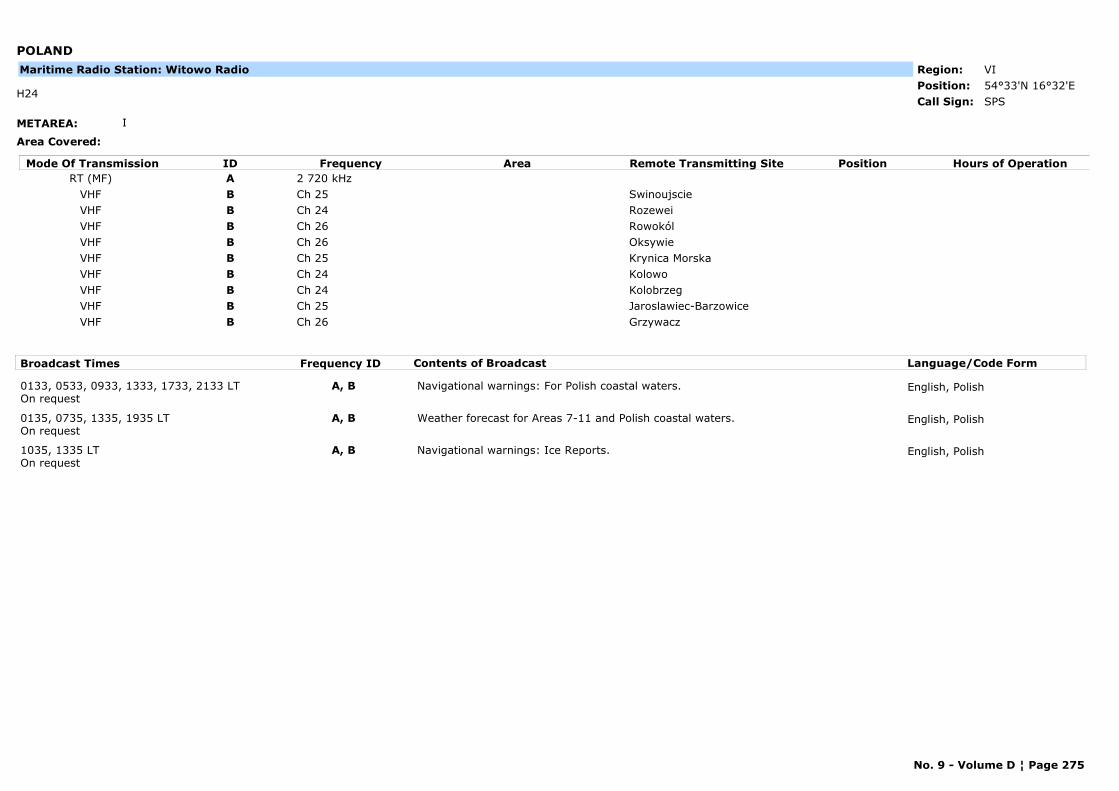
POLAND
METAREA: I
Area Covered:
Region: VIPosition: 54°33'N 16°32'E
SPSH24
Call Sign:
Maritime Radio Station: Witowo Radio
Mode Of Transmission ID Frequency Area Position Hours of OperationRemote Transmitting SiteRT (MF) A 2 720 kHz
VHF B Ch 25 SwinoujscieVHF B Ch 24 RozeweiVHF B Ch 26 RowokólVHF B Ch 26 OksywieVHF B Ch 25 Krynica MorskaVHF B Ch 24 KolowoVHF B Ch 24 KolobrzegVHF B Ch 25 Jaroslawiec-BarzowiceVHF B Ch 26 Grzywacz
Broadcast Times Frequency ID Contents of Broadcast Language/Code Form
0133, 0533, 0933, 1333, 1733, 2133 LTOn request
A, B Navigational warnings: For Polish coastal waters. English, Polish
0135, 0735, 1335, 1935 LTOn request
A, B Weather forecast for Areas 7-11 and Polish coastal waters. English, Polish
1035, 1335 LTOn request
A, B Navigational warnings: Ice Reports. English, Polish
No. 9 - Volume D ¦ Page 275
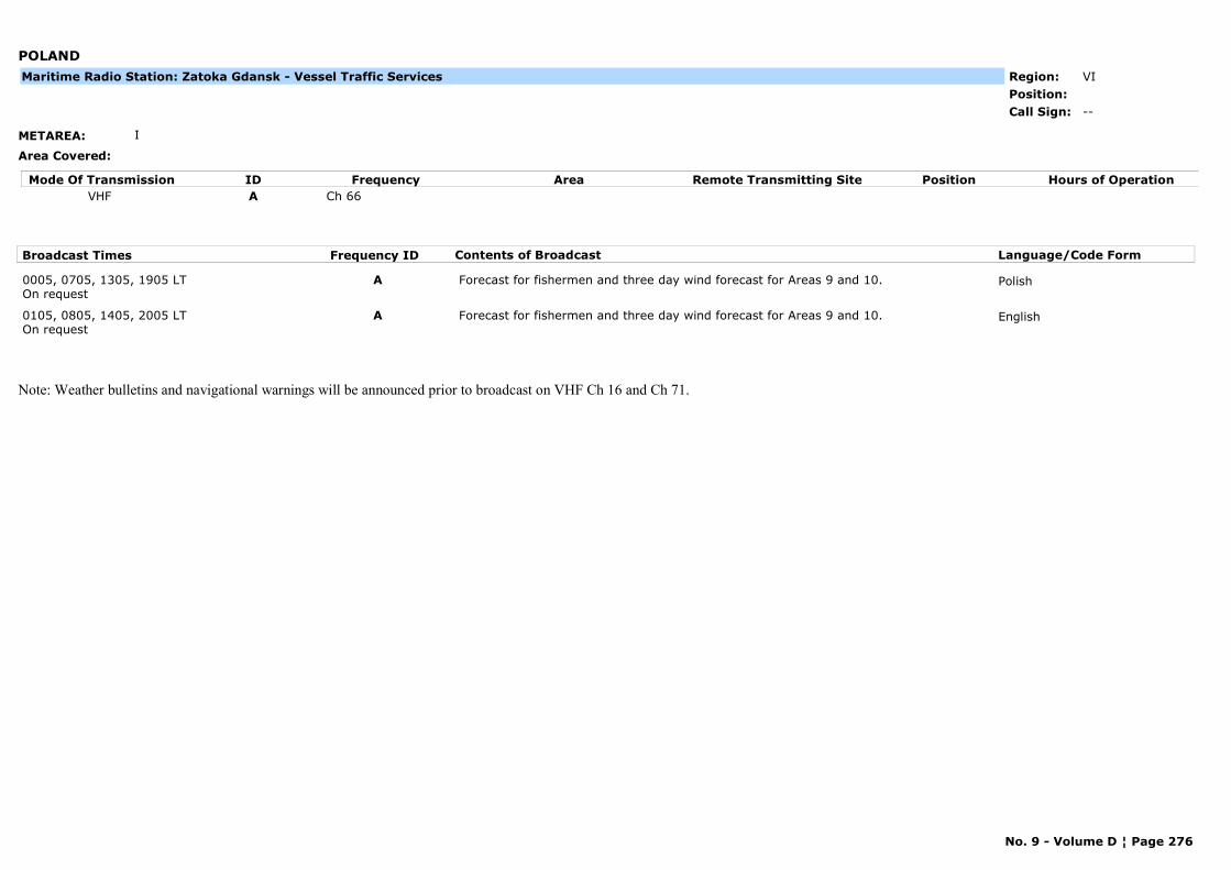
POLAND
METAREA: I
Area Covered:
Region: VIPosition:
--Call Sign:
Maritime Radio Station: Zatoka Gdansk - Vessel Traffic Services
Mode Of Transmission ID Frequency Area Position Hours of OperationRemote Transmitting SiteVHF A Ch 66
Broadcast Times Frequency ID Contents of Broadcast Language/Code Form
0005, 0705, 1305, 1905 LTOn request
A Forecast for fishermen and three day wind forecast for Areas 9 and 10. Polish
0105, 0805, 1405, 2005 LTOn request
A Forecast for fishermen and three day wind forecast for Areas 9 and 10. English
Note: Weather bulletins and navigational warnings will be announced prior to broadcast on VHF Ch 16 and Ch 71.
No. 9 - Volume D ¦ Page 276
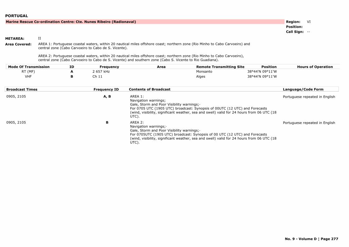
PORTUGAL
METAREA: II
Area Covered: AREA 1: Portuguese coastal waters, within 20 nautical miles offshore coast; northern zone (Rio Minho to Cabo Carvoeiro) and central zone (Cabo Carvoeiro to Cabo de S. Vicente).
AREA 2: Portuguese coastal waters, within 20 nautical miles offshore coast; northern zone (Rio Minho to Cabo Carvoeiro), central zone (Cabo Carvoeiro to Cabo de S. Vicente) and southern zone (Cabo S. Vicente to Rio Guadiana).
Region: VIPosition:
Marine Rescue Co-ordination Centre: Cte. Nunes Ribeiro (Radionaval)
--Call Sign:
Mode Of Transmission ID Frequency Area Position Hours of OperationRemote Transmitting SiteRT (MF) A 2 657 kHz Monsanto 38°44'N 09°11'W
VHF B Ch 11 Alges 38°44'N 09°11'W
Broadcast Times Frequency ID Contents of Broadcast Language/Code Form
0905, 2105 A, B AREA 1:Navigation warnings;Gale, Storm and Poor Visibility warnings;·For 0705 UTC (1905 UTC) broadcast: Synopsis of 00UTC (12 UTC) and Forecasts (wind, visibility, significant weather, sea and swell) valid for 24 hours from 06 UTC (18 UTC).
Portuguese repeated in English
0905, 2105 B AREA 2:Navigation warnings;·Gale, Storm and Poor Visibility warnings;·For 0705UTC (1905 UTC) broadcast: Synopsis of 00 UTC (12 UTC) and Forecasts (wind, visibility, significant weather, sea and swell) valid for 24 hours from 06 UTC (18 UTC).
Portuguese repeated in English
No. 9 - Volume D ¦ Page 277
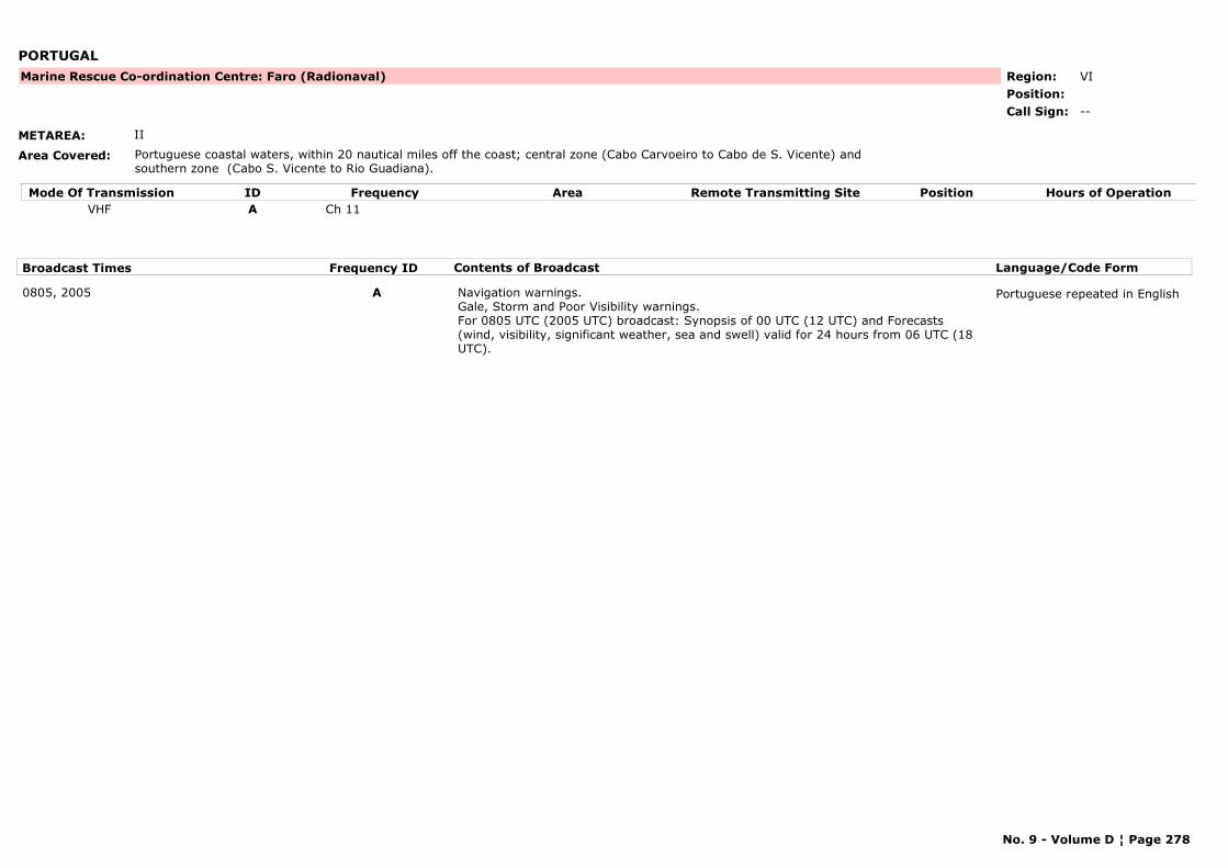
PORTUGAL
METAREA: II
Area Covered: Portuguese coastal waters, within 20 nautical miles off the coast; central zone (Cabo Carvoeiro to Cabo de S. Vicente) and southern zone (Cabo S. Vicente to Rio Guadiana).
Region: VIPosition:
Marine Rescue Co-ordination Centre: Faro (Radionaval)
--Call Sign:
Mode Of Transmission ID Frequency Area Position Hours of OperationRemote Transmitting SiteVHF A Ch 11
Broadcast Times Frequency ID Contents of Broadcast Language/Code Form
0805, 2005 A Navigation warnings. Gale, Storm and Poor Visibility warnings.For 0805 UTC (2005 UTC) broadcast: Synopsis of 00 UTC (12 UTC) and Forecasts (wind, visibility, significant weather, sea and swell) valid for 24 hours from 06 UTC (18 UTC).
Portuguese repeated in English
No. 9 - Volume D ¦ Page 278
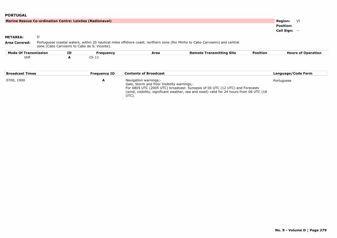
PORTUGAL
METAREA: II
Area Covered: Portuguese coastal waters, within 20 nautical miles offshore coast; northern zone (Rio Minho to Cabo Carvoeiro) and central zone (Cabo Carvoeiro to Cabo de S. Vicente).
Region: VIPosition:
Marine Rescue Co-ordination Centre: Leixões (Radionaval)
--Call Sign:
Mode Of Transmission ID Frequency Area Position Hours of OperationRemote Transmitting SiteVHF A Ch 11
Broadcast Times Frequency ID Contents of Broadcast Language/Code Form
0700, 1900 A Navigation warnings;·Gale, Storm and Poor Visibility warnings;·For 0805 UTC (2005 UTC) broadcast: Synopsis of 00 UTC (12 UTC) and Forecasts (wind, visibility, significant weather, sea and swell) valid for 24 hours from 06 UTC (18 UTC).
Portuguese
No. 9 - Volume D ¦ Page 279
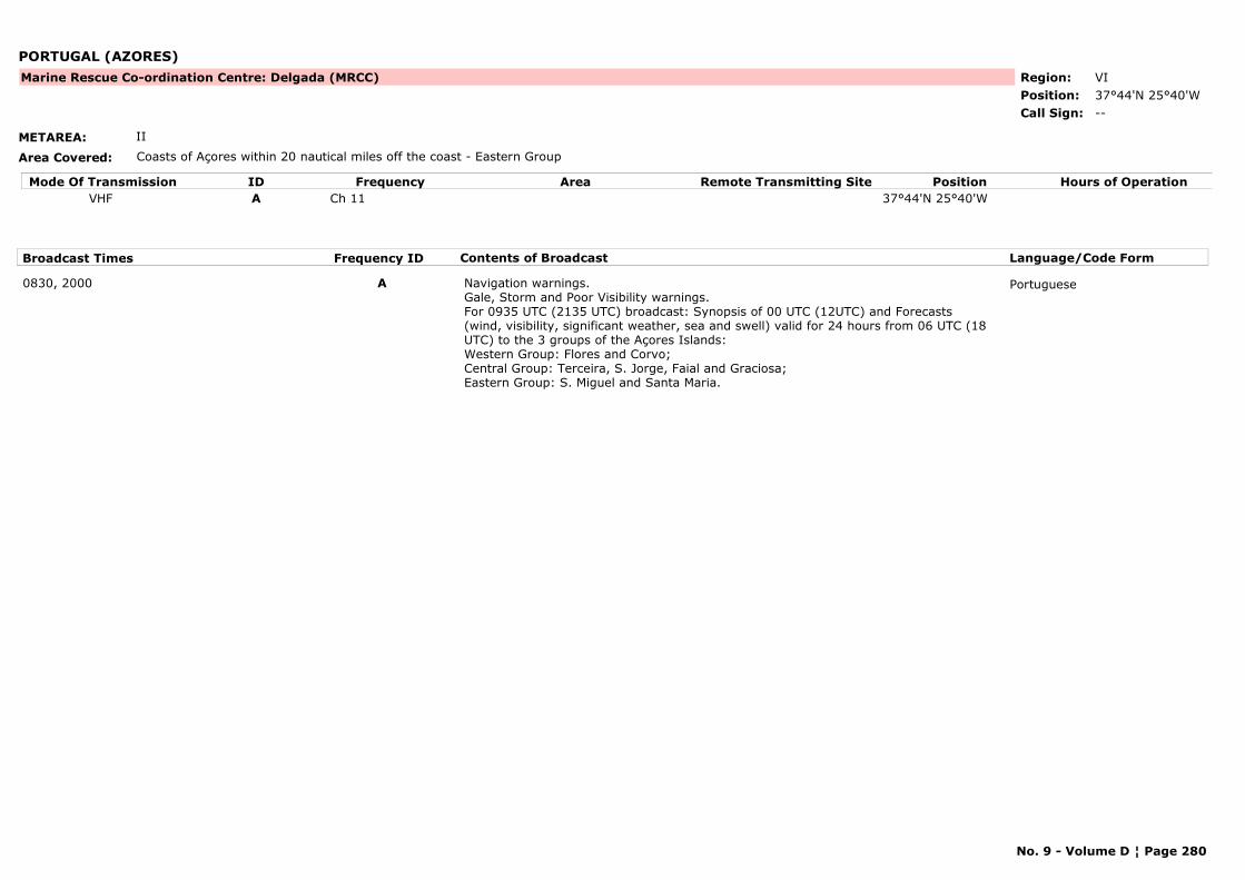
PORTUGAL (AZORES)
METAREA: II
Area Covered: Coasts of Açores within 20 nautical miles off the coast - Eastern Group
Region: VIPosition: 37°44'N 25°40'W
Marine Rescue Co-ordination Centre: Delgada (MRCC)
--Call Sign:
Mode Of Transmission ID Frequency Area Position Hours of OperationRemote Transmitting SiteVHF A Ch 11 37°44'N 25°40'W
Broadcast Times Frequency ID Contents of Broadcast Language/Code Form
0830, 2000 A Navigation warnings.Gale, Storm and Poor Visibility warnings.For 0935 UTC (2135 UTC) broadcast: Synopsis of 00 UTC (12UTC) and Forecasts (wind, visibility, significant weather, sea and swell) valid for 24 hours from 06 UTC (18 UTC) to the 3 groups of the Açores Islands:Western Group: Flores and Corvo;Central Group: Terceira, S. Jorge, Faial and Graciosa;Eastern Group: S. Miguel and Santa Maria.
Portuguese
No. 9 - Volume D ¦ Page 280
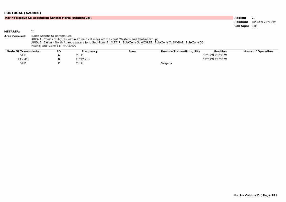
PORTUGAL (AZORES)
METAREA: II
Area Covered: North Atlantic to Barents SeaAREA 1: Coasts of Açores within 20 nautical miles off the coast Western and Central Group;AREA 2: Eastern North Atlantic waters for : Sub-Zone 3: ALTAIR; Sub-Zone 5: AÇORES; Sub-Zone 7: IRVING; Sub-Zone 30: MILNE; Sub-Zone 31: MARSALA
Region: VIPosition: 38°32'N 28°38'W
Marine Rescue Co-ordination Centre: Horta (Radionaval)
CTHCall Sign:
Mode Of Transmission ID Frequency Area Position Hours of OperationRemote Transmitting SiteVHF A Ch 11 38°32'N 28°38'W
RT (MF) B 2 657 kHz 38°32'N 28°38'WVHF C Ch 11 Delgada
No. 9 - Volume D ¦ Page 281
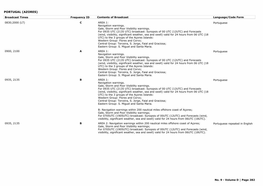
PORTUGAL (AZORES)
Broadcast Times Frequency ID Contents of Broadcast Language/Code Form
0830;2000 (LT) C AREA 1:Navigation warnings.Gale, Storm and Poor Visibility warnings.For 0935 UTC (2135 UTC) broadcast: Synopsis of 00 UTC (12UTC) and Forecasts (wind, visibility, significant weather, sea and swell) valid for 24 hours from 06 UTC (18 UTC) to the 3 groups of the Açores Islands:Western Group: Flores and Corvo;Central Group: Terceira, S. Jorge, Faial and Graciosa;Eastern Group: S. Miguel and Santa Maria.
Portuguese
0900, 2100 A AREA 1:Navigation warnings.Gale, Storm and Poor Visibility warnings.For 0935 UTC (2135 UTC) broadcast: Synopsis of 00 UTC (12UTC) and Forecasts (wind, visibility, significant weather, sea and swell) valid for 24 hours from 06 UTC (18 UTC) to the 3 groups of the Açores Islands:Western Group: Flores and Corvo;Central Group: Terceira, S. Jorge, Faial and Graciosa;Eastern Group: S. Miguel and Santa Maria.
Portuguese
0935, 2135 B AREA 1:Navigation warnings.Gale, Storm and Poor Visibility warnings.For 0935 UTC (2135 UTC) broadcast: Synopsis of 00 UTC (12UTC) and Forecasts (wind, visibility, significant weather, sea and swell) valid for 24 hours from 06 UTC (18 UTC) to the 3 groups of the Açores Islands:Western Group: Flores and Corvo;Central Group: Terceira, S. Jorge, Faial and Graciosa;Eastern Group: S. Miguel and Santa Maria.
B: Navigation warnings within 200 nautical miles offshore coast of Açores;Gale, Storm and Poor Visibility warnings;For 0705UTC (1905UTC) broadcast: Synopsis of 00UTC (12UTC) and Forecasts (wind, visibility, significant weather, sea and swell) valid for 24 hours from 06UTC (18UTC).
Portuguese
0935, 2135 B AREA 2: Navigation warnings within 200 nautical miles offshore coast of Açores;Gale, Storm and Poor Visibility warnings;For 0705UTC (1905UTC) broadcast: Synopsis of 00UTC (12UTC) and Forecasts (wind, visibility, significant weather, sea and swell) valid for 24 hours from 06UTC (18UTC).
Portuguese repeated in English
No. 9 - Volume D ¦ Page 282
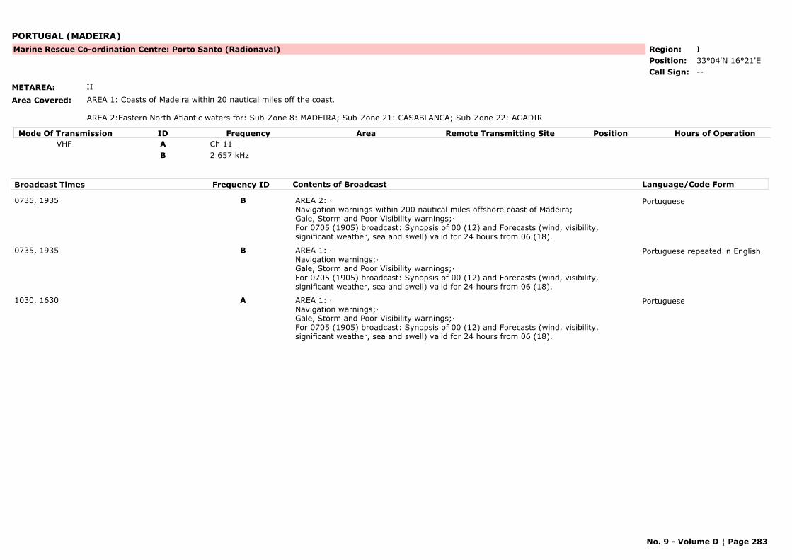
PORTUGAL (MADEIRA)
METAREA: II
Area Covered: AREA 1: Coasts of Madeira within 20 nautical miles off the coast.
AREA 2:Eastern North Atlantic waters for: Sub-Zone 8: MADEIRA; Sub-Zone 21: CASABLANCA; Sub-Zone 22: AGADIR
Region: IPosition: 33°04'N 16°21'E
Marine Rescue Co-ordination Centre: Porto Santo (Radionaval)
--Call Sign:
Mode Of Transmission ID Frequency Area Position Hours of OperationRemote Transmitting SiteVHF A Ch 11
B 2 657 kHz
Broadcast Times Frequency ID Contents of Broadcast Language/Code Form
0735, 1935 B AREA 2: ·Navigation warnings within 200 nautical miles offshore coast of Madeira;Gale, Storm and Poor Visibility warnings;·For 0705 (1905) broadcast: Synopsis of 00 (12) and Forecasts (wind, visibility, significant weather, sea and swell) valid for 24 hours from 06 (18).
Portuguese
0735, 1935 B AREA 1: ·Navigation warnings;·Gale, Storm and Poor Visibility warnings;·For 0705 (1905) broadcast: Synopsis of 00 (12) and Forecasts (wind, visibility, significant weather, sea and swell) valid for 24 hours from 06 (18).
Portuguese repeated in English
1030, 1630 A AREA 1: ·Navigation warnings;·Gale, Storm and Poor Visibility warnings;·For 0705 (1905) broadcast: Synopsis of 00 (12) and Forecasts (wind, visibility, significant weather, sea and swell) valid for 24 hours from 06 (18).
Portuguese
No. 9 - Volume D ¦ Page 283
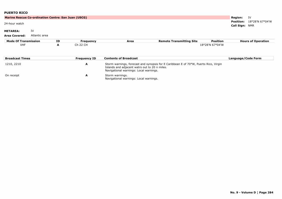
PUERTO RICO
METAREA: IV
Area Covered: Atlantic area
Region: IVPosition: 18°28'N 67°04'W
Marine Rescue Co-ordination Centre: San Juan (USCG)
NMR24-hour watch
Call Sign:
Mode Of Transmission ID Frequency Area Position Hours of OperationRemote Transmitting SiteVHF A Ch 22 CH 18°28'N 67°04'W
Broadcast Times Frequency ID Contents of Broadcast Language/Code Form
1210, 2210 A Storm warnings, forecast and synopsis for E Caribbean E of 70°W, Puerto Rico, Virgin Islands and adjacent watrs out to 20 n miles.Navigational warnings: Local warnings.
On receipt A Storm warnings.Navigational warnings: Local warnings.
No. 9 - Volume D ¦ Page 284
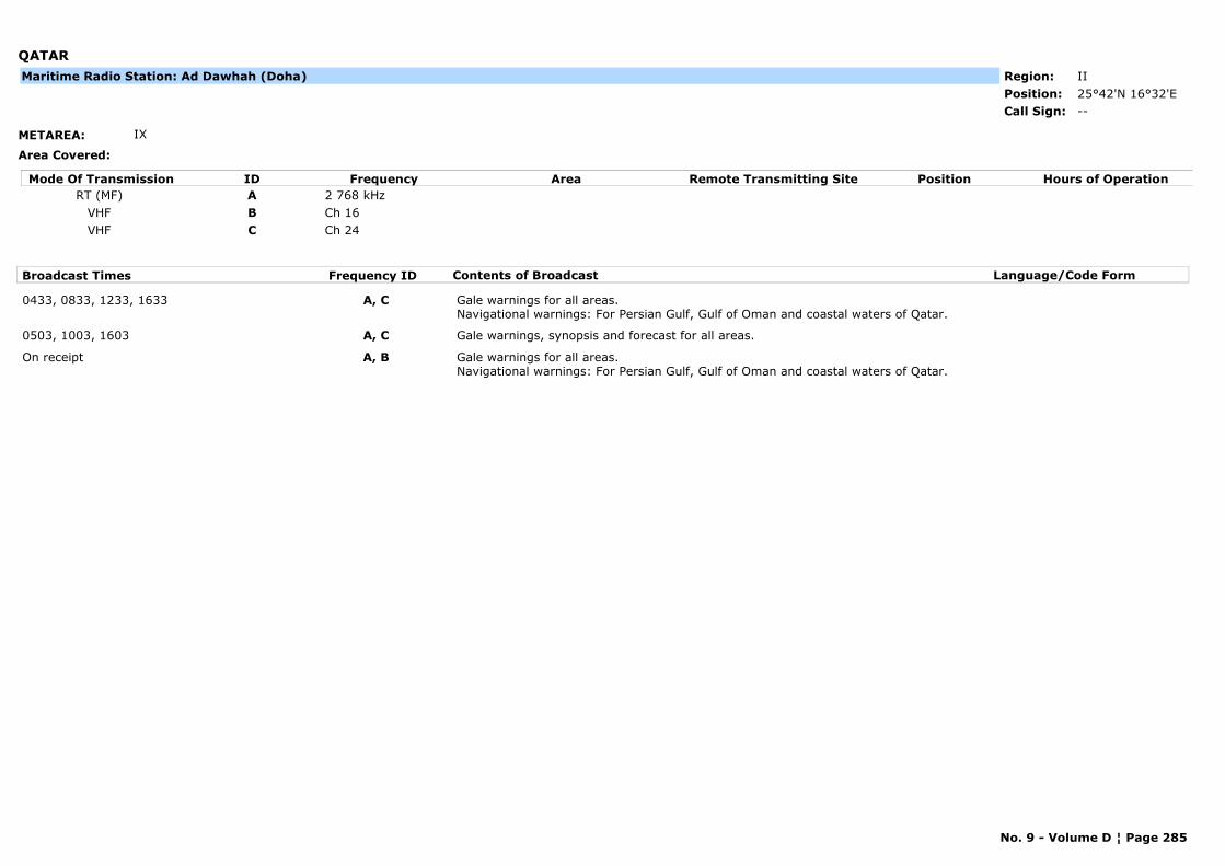
QATAR
METAREA: IX
Area Covered:
Region: IIPosition: 25°42'N 16°32'E
--Call Sign:
Maritime Radio Station: Ad Dawhah (Doha)
Mode Of Transmission ID Frequency Area Position Hours of OperationRemote Transmitting SiteRT (MF) A 2 768 kHz
VHF B Ch 16VHF C Ch 24
Broadcast Times Frequency ID Contents of Broadcast Language/Code Form
0433, 0833, 1233, 1633 A, C Gale warnings for all areas.Navigational warnings: For Persian Gulf, Gulf of Oman and coastal waters of Qatar.
0503, 1003, 1603 A, C Gale warnings, synopsis and forecast for all areas.
On receipt A, B Gale warnings for all areas.Navigational warnings: For Persian Gulf, Gulf of Oman and coastal waters of Qatar.
No. 9 - Volume D ¦ Page 285
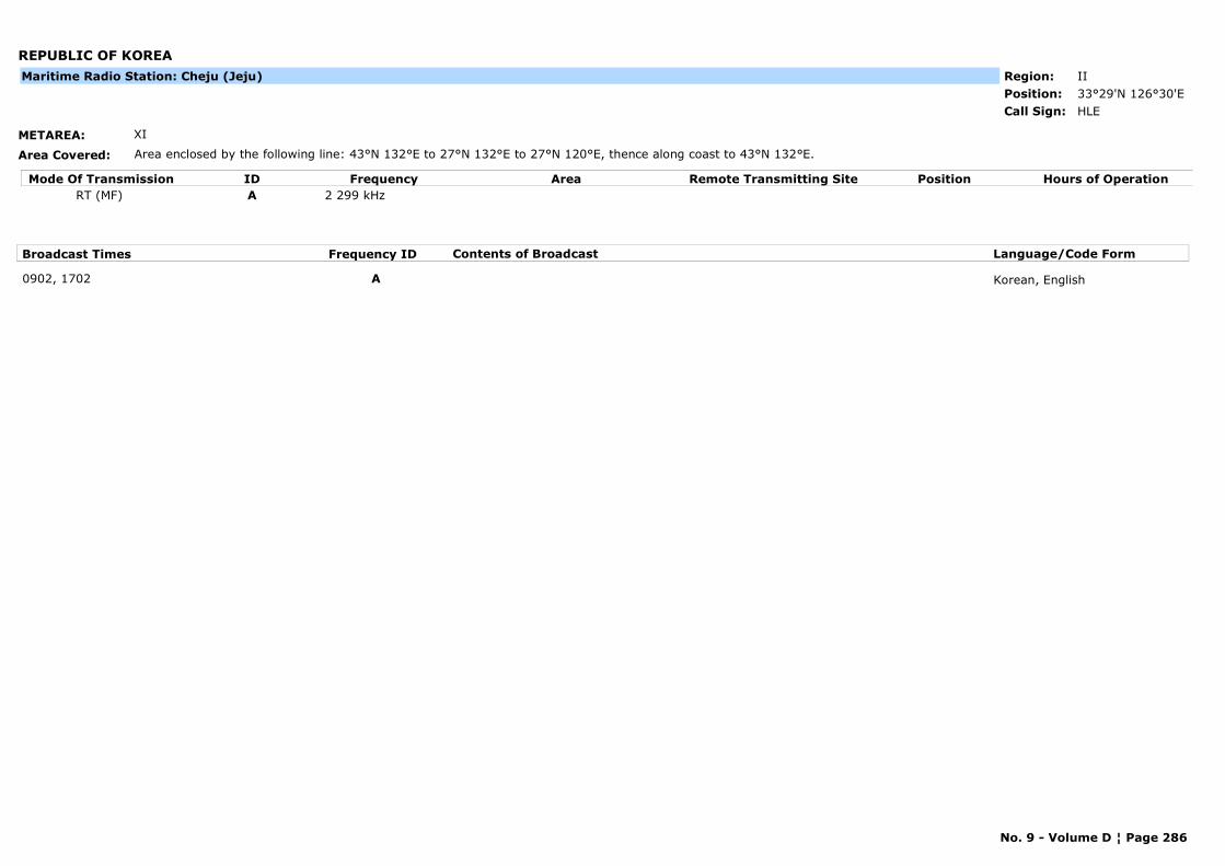
REPUBLIC OF KOREA
METAREA: XI
Area Covered: Area enclosed by the following line: 43°N 132°E to 27°N 132°E to 27°N 120°E, thence along coast to 43°N 132°E.
Region: IIPosition: 33°29'N 126°30'E
HLECall Sign:
Maritime Radio Station: Cheju (Jeju)
Mode Of Transmission ID Frequency Area Position Hours of OperationRemote Transmitting SiteRT (MF) A 2 299 kHz
Broadcast Times Frequency ID Contents of Broadcast Language/Code Form
0902, 1702 A Korean, English
No. 9 - Volume D ¦ Page 286
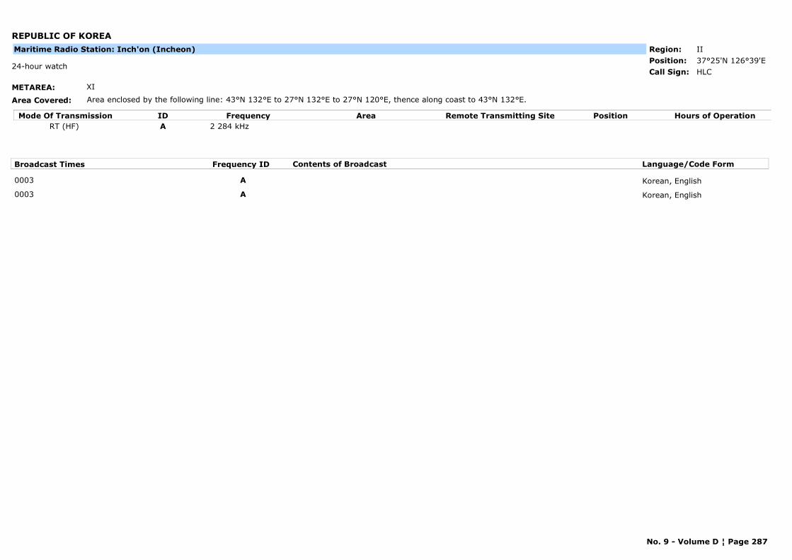
REPUBLIC OF KOREA
METAREA: XI
Area Covered: Area enclosed by the following line: 43°N 132°E to 27°N 132°E to 27°N 120°E, thence along coast to 43°N 132°E.
Region: IIPosition: 37°25'N 126°39'E
HLC24-hour watch
Call Sign:
Maritime Radio Station: Inch'on (Incheon)
Mode Of Transmission ID Frequency Area Position Hours of OperationRemote Transmitting SiteRT (HF) A 2 284 kHz
Broadcast Times Frequency ID Contents of Broadcast Language/Code Form
0003 A Korean, English
0003 A Korean, English
No. 9 - Volume D ¦ Page 287
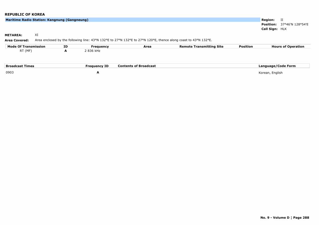
REPUBLIC OF KOREA
METAREA: XI
Area Covered: Area enclosed by the following line: 43°N 132°E to 27°N 132°E to 27°N 120°E, thence along coast to 43°N 132°E.
Region: IIPosition: 37°46'N 128°54'E
HLKCall Sign:
Maritime Radio Station: Kangnung (Gangneung)
Mode Of Transmission ID Frequency Area Position Hours of OperationRemote Transmitting SiteRT (MF) A 2 836 kHz
Broadcast Times Frequency ID Contents of Broadcast Language/Code Form
0903 A Korean, English
No. 9 - Volume D ¦ Page 288
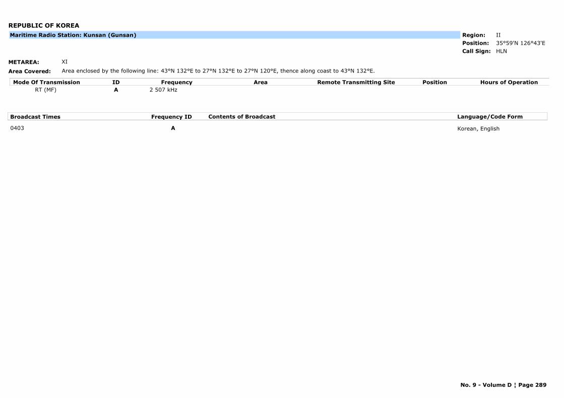
REPUBLIC OF KOREA
METAREA: XI
Area Covered: Area enclosed by the following line: 43°N 132°E to 27°N 132°E to 27°N 120°E, thence along coast to 43°N 132°E.
Region: IIPosition: 35°59'N 126°43'E
HLNCall Sign:
Maritime Radio Station: Kunsan (Gunsan)
Mode Of Transmission ID Frequency Area Position Hours of OperationRemote Transmitting SiteRT (MF) A 2 507 kHz
Broadcast Times Frequency ID Contents of Broadcast Language/Code Form
0403 A Korean, English
No. 9 - Volume D ¦ Page 289
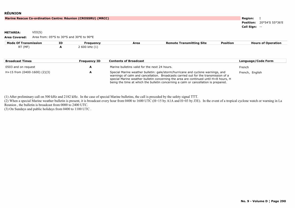
RÉUNION
METAREA: VIII(S)
Area Covered: Area from: 05°S to 30°S and 30°E to 90°E
Region: IPosition: 20°54'S 55°36'E
Marine Rescue Co-ordination Centre: Réunion (CROSSRU) (MRCC)
--Call Sign:
Mode Of Transmission ID Frequency Area Position Hours of OperationRemote Transmitting SiteRT (MF) A 2 600 kHz (1)
Broadcast Times Frequency ID Contents of Broadcast Language/Code Form
0503 and on request A Marine bulletins valid for the next 24 hours. French
H+15 from (0400-1600) (2)(3) A Special Marine weather bulletin: gale/storm/hurricane and cyclone warnings, and warnings of calm and cancellation. Broadcasts carried out for the transmission of a special Marine weather bulletin concerning the area are continued until H+8 hours, H being the time at which the bulletin concerning a calm or cancellation is prepared.
French, English
(1) After preliminary call on 500 kHz and 2182 kHz. In the case of special Marine bulletins, the call is preceded by the safety signal TTT.(2) When a special Marine weather bulletin is present, it is broadcast every hour from 0400 to 1600 UTC (H+15 by A1A and H+03 by J3E). In the event of a tropical cyclone watch or warning in La Reunion , the bulletin is broadcast from 0000 to 2400 UTC.(3) On Sundays and public holidays from 0400 to 1100 UTC .
No. 9 - Volume D ¦ Page 290
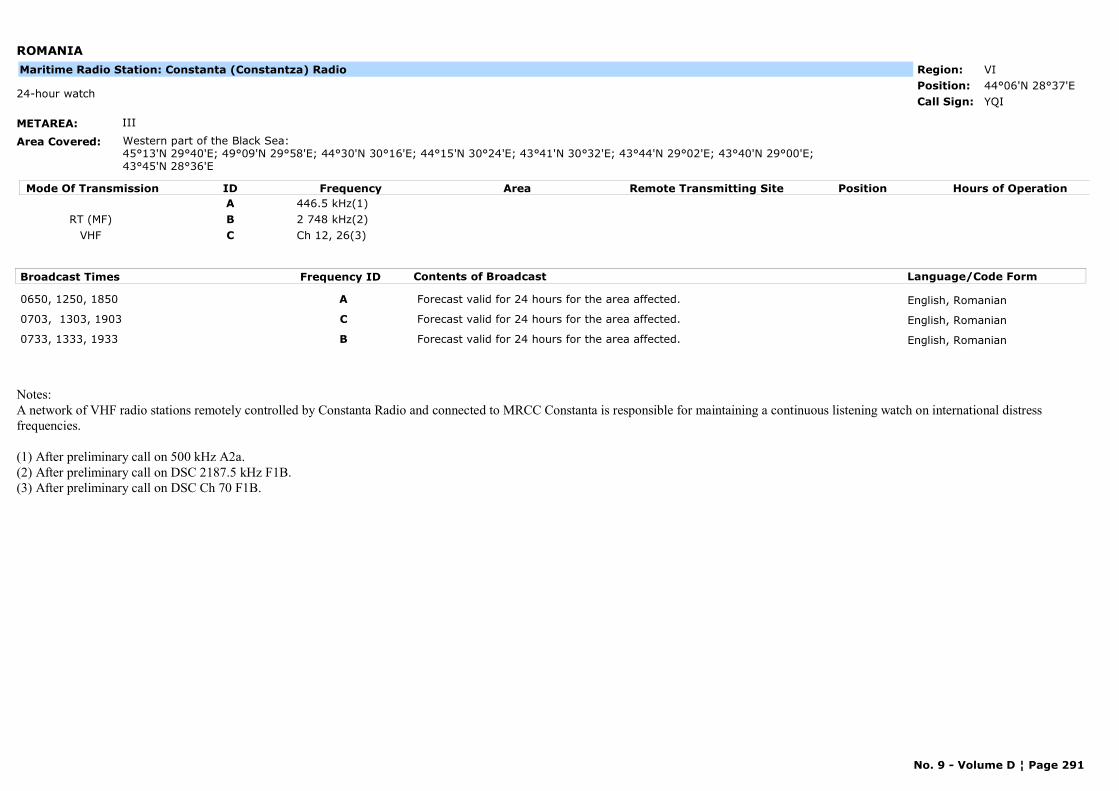
ROMANIA
METAREA: III
Area Covered: Western part of the Black Sea:45°13'N 29°40'E; 49°09'N 29°58'E; 44°30'N 30°16'E; 44°15'N 30°24'E; 43°41'N 30°32'E; 43°44'N 29°02'E; 43°40'N 29°00'E; 43°45'N 28°36'E
Region: VIPosition: 44°06'N 28°37'E
YQI24-hour watch
Call Sign:
Maritime Radio Station: Constanta (Constantza) Radio
Mode Of Transmission ID Frequency Area Position Hours of OperationRemote Transmitting SiteA 446.5 kHz(1)
RT (MF) B 2 748 kHz(2)VHF C Ch 12, 26(3)
Broadcast Times Frequency ID Contents of Broadcast Language/Code Form
0650, 1250, 1850 A Forecast valid for 24 hours for the area affected. English, Romanian
0703, 1303, 1903 C Forecast valid for 24 hours for the area affected. English, Romanian
0733, 1333, 1933 B Forecast valid for 24 hours for the area affected. English, Romanian
Notes:A network of VHF radio stations remotely controlled by Constanta Radio and connected to MRCC Constanta is responsible for maintaining a continuous listening watch on international distress frequencies.
(1) After preliminary call on 500 kHz A2a.(2) After preliminary call on DSC 2187.5 kHz F1B.(3) After preliminary call on DSC Ch 70 F1B.
No. 9 - Volume D ¦ Page 291
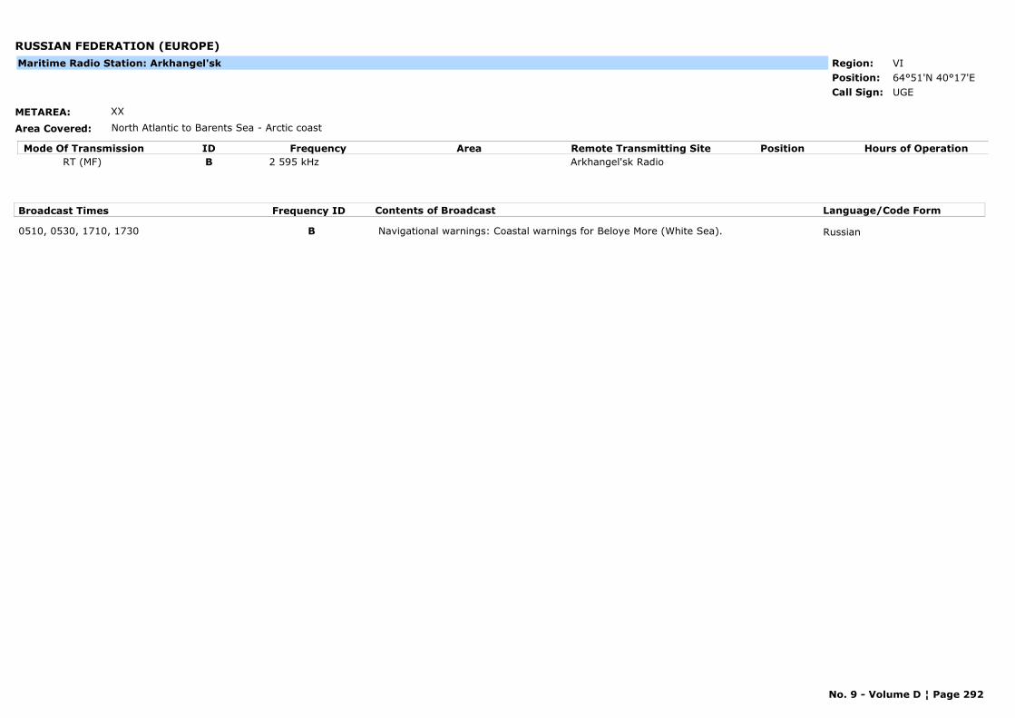
RUSSIAN FEDERATION (EUROPE)
METAREA: XX
Area Covered: North Atlantic to Barents Sea - Arctic coast
Region: VIPosition: 64°51'N 40°17'E
UGECall Sign:
Maritime Radio Station: Arkhangel'sk
Mode Of Transmission ID Frequency Area Position Hours of OperationRemote Transmitting SiteRT (MF) B 2 595 kHz Arkhangel'sk Radio
Broadcast Times Frequency ID Contents of Broadcast Language/Code Form
0510, 0530, 1710, 1730 B Navigational warnings: Coastal warnings for Beloye More (White Sea). Russian
No. 9 - Volume D ¦ Page 292
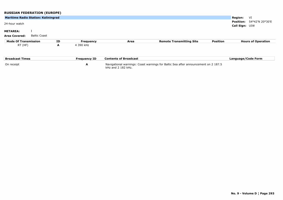
RUSSIAN FEDERATION (EUROPE)
METAREA: I
Area Covered: Baltic Coast
Region: VIPosition: 54°42'N 20°30'E
UIW24-hour watch
Call Sign:
Maritime Radio Station: Kaliningrad
Mode Of Transmission ID Frequency Area Position Hours of OperationRemote Transmitting SiteRT (HF) A 4 390 kHz
Broadcast Times Frequency ID Contents of Broadcast Language/Code Form
On receipt A Navigational warnings: Coast warnings for Baltic Sea after announcement on 2 187.5 kHz and 2 182 kHz.
No. 9 - Volume D ¦ Page 293
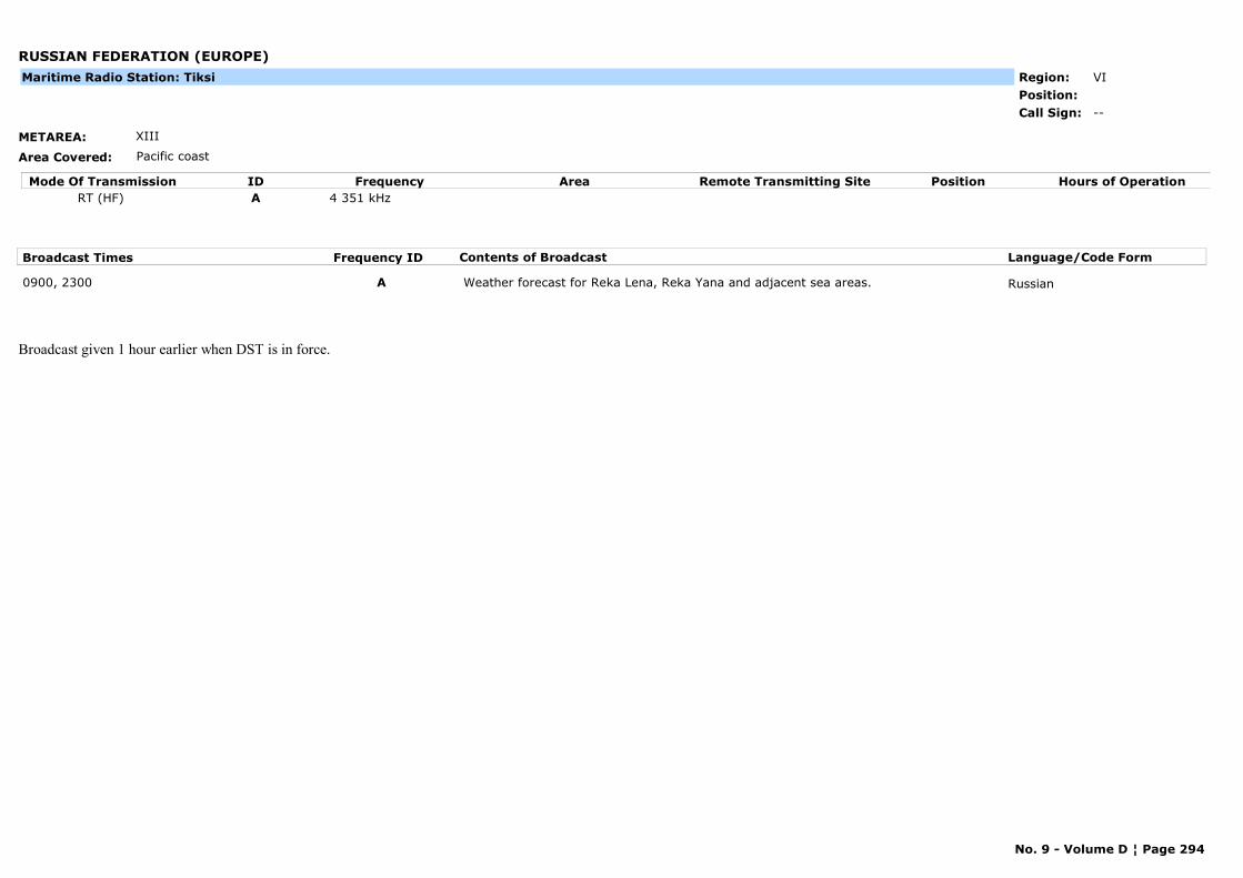
RUSSIAN FEDERATION (EUROPE)
METAREA: XIII
Area Covered: Pacific coast
Region: VIPosition:
--Call Sign:
Maritime Radio Station: Tiksi
Mode Of Transmission ID Frequency Area Position Hours of OperationRemote Transmitting SiteRT (HF) A 4 351 kHz
Broadcast Times Frequency ID Contents of Broadcast Language/Code Form
0900, 2300 A Weather forecast for Reka Lena, Reka Yana and adjacent sea areas. Russian
Broadcast given 1 hour earlier when DST is in force.
No. 9 - Volume D ¦ Page 294
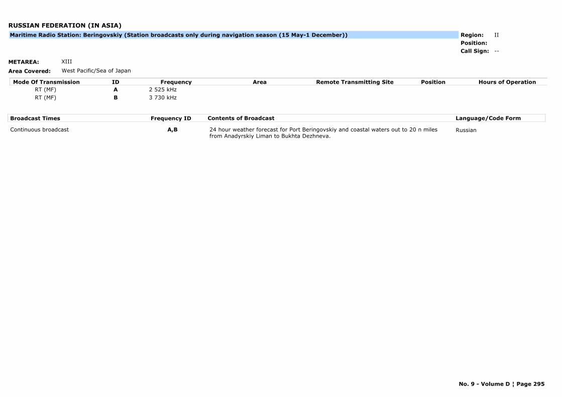
RUSSIAN FEDERATION (IN ASIA)
METAREA: XIII
Area Covered: West Pacific/Sea of Japan
Region: IIPosition:
--Call Sign:
Maritime Radio Station: Beringovskiy (Station broadcasts only during navigation season (15 May-1 December))
Mode Of Transmission ID Frequency Area Position Hours of OperationRemote Transmitting SiteRT (MF) A 2 525 kHzRT (MF) B 3 730 kHz
Broadcast Times Frequency ID Contents of Broadcast Language/Code Form
Continuous broadcast A,B 24 hour weather forecast for Port Beringovskiy and coastal waters out to 20 n miles from Anadyrskiy Liman to Bukhta Dezhneva.
Russian
No. 9 - Volume D ¦ Page 295
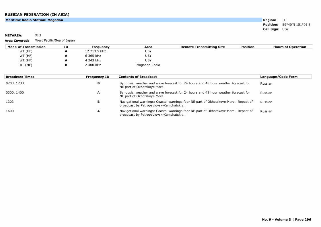
RUSSIAN FEDERATION (IN ASIA)
METAREA: XIII
Area Covered: West Pacific/Sea of Japan
Region: IIPosition: 59°40'N 151°01'E
UBYCall Sign:
Maritime Radio Station: Magadan
Mode Of Transmission ID Frequency Area Position Hours of OperationRemote Transmitting SiteWT (HF) A 12 713.5 kHz UBYWT (HF) A 6 365 kHz UBYWT (HF) A 4 243 kHz UBYRT (MF) B 2 400 kHz Magadan Radio
Broadcast Times Frequency ID Contents of Broadcast Language/Code Form
0203, 1233 B Synopsis, weather and wave forecast for 24 hours and 48 hour weather forecast for NE part of Okhotskoye More.
Russian
0300, 1400 A Synopsis, weather and wave forecast for 24 hours and 48 hour weather forecast for NE part of Okhotskoye More.
Russian
1303 B Navigational warnings: Coastal warnings fopr NE part of Okhotskoye More. Repeat of broadcast by Petropavlovsk-Kamchatskiy.
Russian
1600 A Navigational warnings: Coastal warnings fopr NE part of Okhotskoye More. Repeat of broadcast by Petropavlovsk-Kamchatskiy.
Russian
No. 9 - Volume D ¦ Page 296
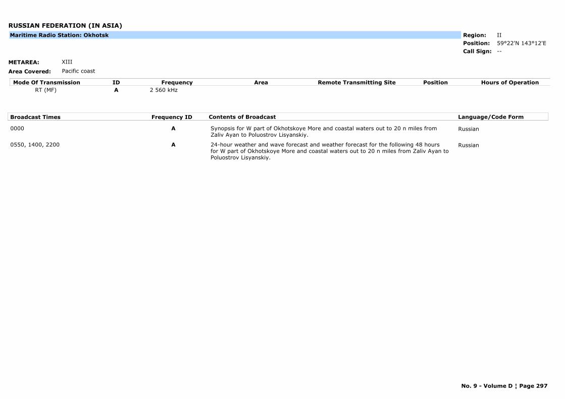
RUSSIAN FEDERATION (IN ASIA)
METAREA: XIII
Area Covered: Pacific coast
Region: IIPosition: 59°22'N 143°12'E
--Call Sign:
Maritime Radio Station: Okhotsk
Mode Of Transmission ID Frequency Area Position Hours of OperationRemote Transmitting SiteRT (MF) A 2 560 kHz
Broadcast Times Frequency ID Contents of Broadcast Language/Code Form
0000 A Synopsis for W part of Okhotskoye More and coastal waters out to 20 n miles from Zaliv Ayan to Poluostrov Lisyanskiy.
Russian
0550, 1400, 2200 A 24-hour weather and wave forecast and weather forecast for the following 48 hours for W part of Okhotskoye More and coastal waters out to 20 n miles from Zaliv Ayan to Poluostrov Lisyanskiy.
Russian
No. 9 - Volume D ¦ Page 297
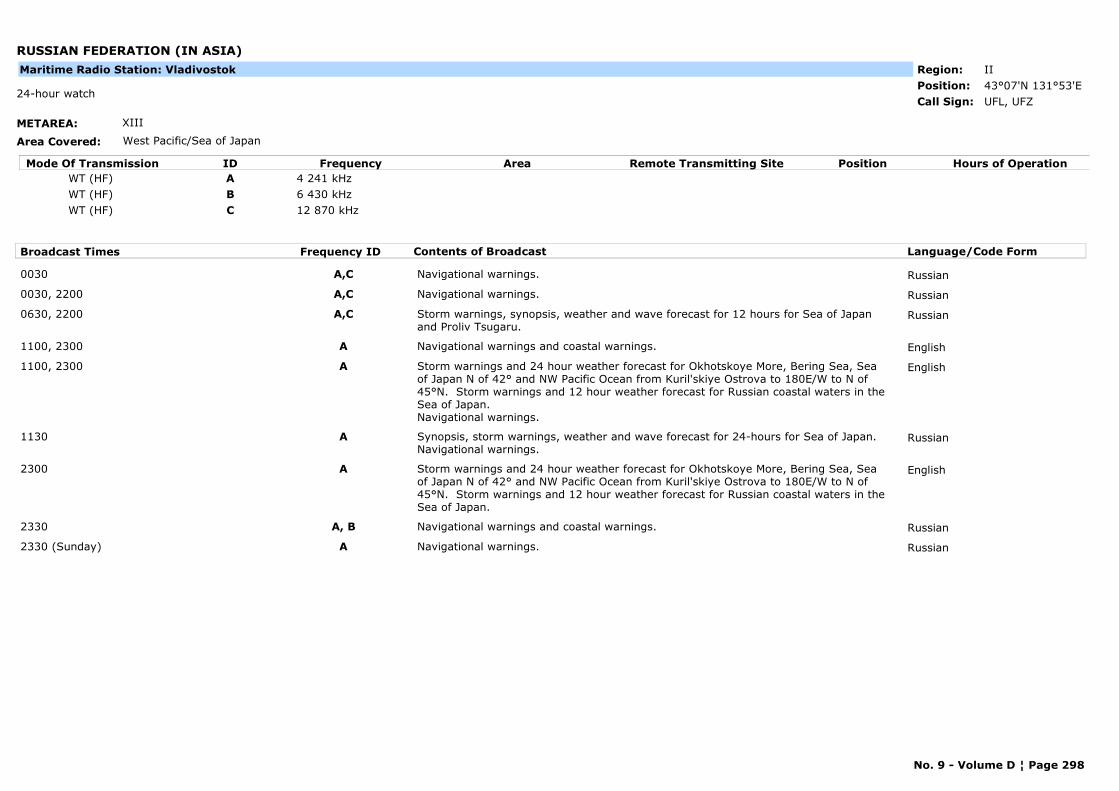
RUSSIAN FEDERATION (IN ASIA)
METAREA: XIII
Area Covered: West Pacific/Sea of Japan
Region: IIPosition: 43°07'N 131°53'E
UFL, UFZ24-hour watch
Call Sign:
Maritime Radio Station: Vladivostok
Mode Of Transmission ID Frequency Area Position Hours of OperationRemote Transmitting SiteWT (HF) A 4 241 kHzWT (HF) B 6 430 kHzWT (HF) C 12 870 kHz
Broadcast Times Frequency ID Contents of Broadcast Language/Code Form
0030 A,C Navigational warnings. Russian
0030, 2200 A,C Navigational warnings. Russian
0630, 2200 A,C Storm warnings, synopsis, weather and wave forecast for 12 hours for Sea of Japan and Proliv Tsugaru.
Russian
1100, 2300 A Navigational warnings and coastal warnings. English
1100, 2300 A Storm warnings and 24 hour weather forecast for Okhotskoye More, Bering Sea, Sea of Japan N of 42° and NW Pacific Ocean from Kuril'skiye Ostrova to 180E/W to N of 45°N. Storm warnings and 12 hour weather forecast for Russian coastal waters in the Sea of Japan.Navigational warnings.
English
1130 A Synopsis, storm warnings, weather and wave forecast for 24-hours for Sea of Japan.Navigational warnings.
Russian
2300 A Storm warnings and 24 hour weather forecast for Okhotskoye More, Bering Sea, Sea of Japan N of 42° and NW Pacific Ocean from Kuril'skiye Ostrova to 180E/W to N of 45°N. Storm warnings and 12 hour weather forecast for Russian coastal waters in the Sea of Japan.
English
2330 A, B Navigational warnings and coastal warnings. Russian
2330 (Sunday) A Navigational warnings. Russian
No. 9 - Volume D ¦ Page 298
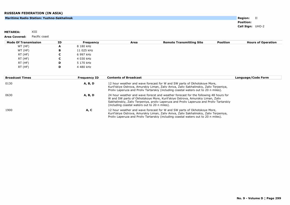
RUSSIAN FEDERATION (IN ASIA)
METAREA: XIII
Area Covered: Pacific coast
Region: IIPosition:
UHO-2Call Sign:
Maritime Radio Station: Yuzhno-Sakhalinsk
Mode Of Transmission ID Frequency Area Position Hours of OperationRemote Transmitting SiteWT (HF) A 8 180 kHzWT (HF) B 11 025 kHzRT (HF) C 6 997 kHzRT (HF) C 4 030 kHzRT (HF) D 5 170 kHzRT (HF) D 4 480 kHz
Broadcast Times Frequency ID Contents of Broadcast Language/Code Form
0130 A, B, D 12 hour weather and wave forecast for W and SW parts of Okhotskoye More, Kuril'skiye Ostrova, Amurskiy Liman, Zaliv Aniva, Zaliv Sakhalinskiy, Zaliv Terpeniya, Proliv Laperuza and Proliv Tartarskiy (including coastal waters out to 20 n miles).
0630 A, B, D 24 hour weather and wave forecst and weather forecast for the following 48 hours for W and SW parts of Okhotskoye More, Kuril'skiye Ostrova, Amurskiy Liman, Zaliv Sakhalinskiy, Zaliv Terpeniya, proliv Laperuza and Proliv Laperuza and Proliv Tartarskiy (including coastal waters out to 20 n miles).
1900 A, C 12 hour weather and wave forecast for W and SW parts of Okhotskoye More, Kuril'skiye Ostrova, Amurskiy Liman, Zaliv Aniva, Zaliv Sakhalinskiy, Zaliv Terpeniya, Proliv Laperuza and Proliv Tartarskiy (including coastal waters out to 20 n miles).
No. 9 - Volume D ¦ Page 299
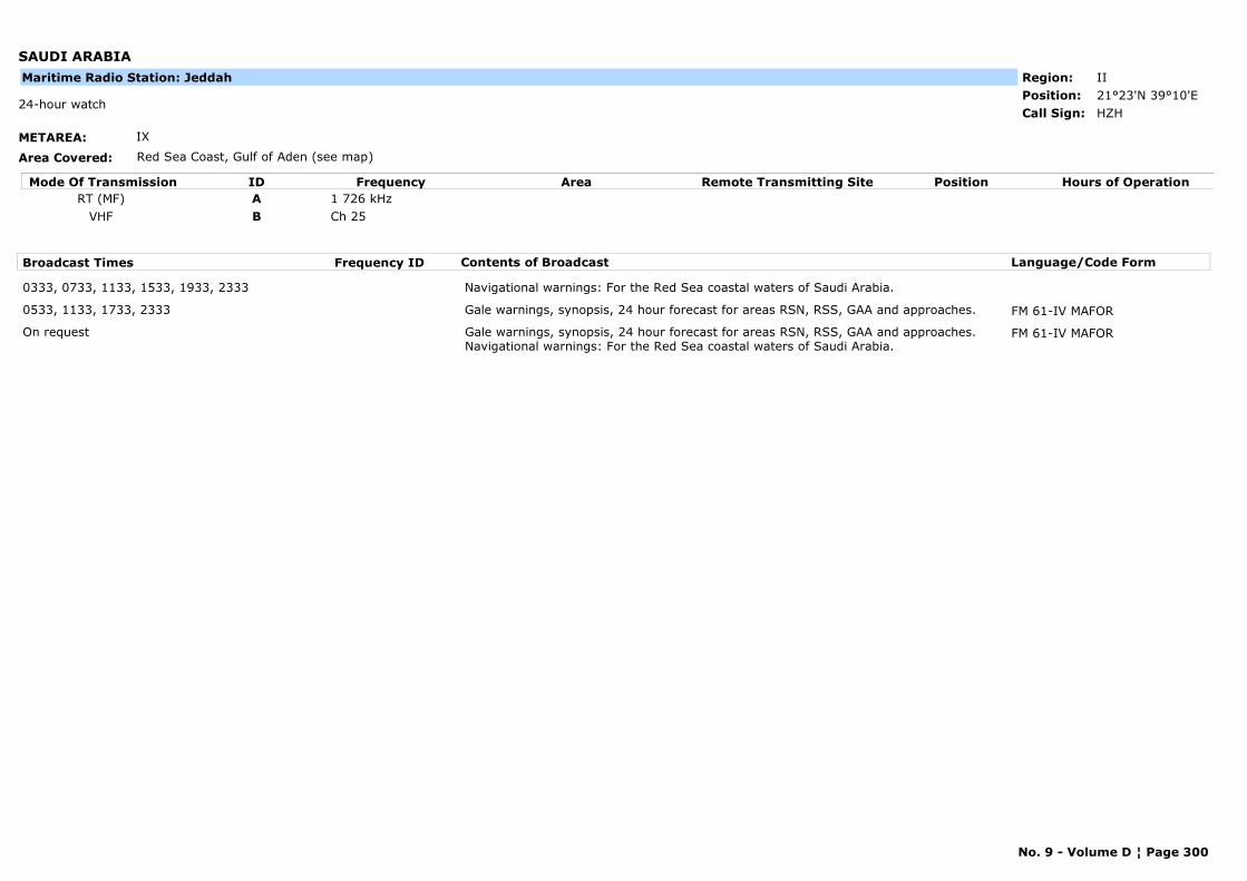
SAUDI ARABIA
METAREA: IX
Area Covered: Red Sea Coast, Gulf of Aden (see map)
Region: IIPosition: 21°23'N 39°10'E
HZH24-hour watch
Call Sign:
Maritime Radio Station: Jeddah
Mode Of Transmission ID Frequency Area Position Hours of OperationRemote Transmitting SiteRT (MF) A 1 726 kHz
VHF B Ch 25
Broadcast Times Frequency ID Contents of Broadcast Language/Code Form
0333, 0733, 1133, 1533, 1933, 2333 Navigational warnings: For the Red Sea coastal waters of Saudi Arabia.
0533, 1133, 1733, 2333 Gale warnings, synopsis, 24 hour forecast for areas RSN, RSS, GAA and approaches. FM 61-IV MAFOR
On request Gale warnings, synopsis, 24 hour forecast for areas RSN, RSS, GAA and approaches.Navigational warnings: For the Red Sea coastal waters of Saudi Arabia.
FM 61-IV MAFOR
No. 9 - Volume D ¦ Page 300
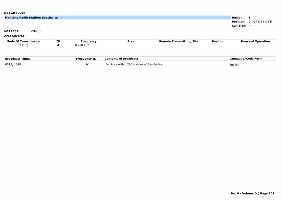
SEYCHELLES
METAREA: VIII(S)
Area Covered:
Region: IPosition: 34°37'S 55°26'E
--Call Sign:
Maritime Radio Station: Seychelles
Mode Of Transmission ID Frequency Area Position Hours of OperationRemote Transmitting SiteRT (HF) A 8 770 kHz
Broadcast Times Frequency ID Contents of Broadcast Language/Code Form
0518, 1548 A For Area within 200 n miles of Seychelles. English
No. 9 - Volume D ¦ Page 301
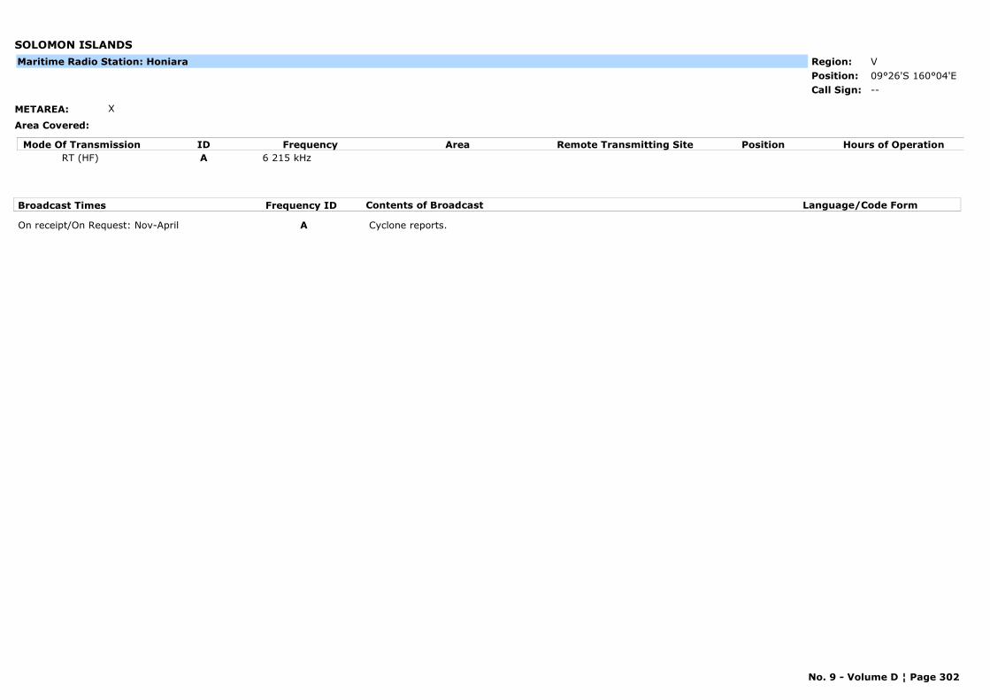
SOLOMON ISLANDS
METAREA: X
Area Covered:
Region: VPosition: 09°26'S 160°04'E
--Call Sign:
Maritime Radio Station: Honiara
Mode Of Transmission ID Frequency Area Position Hours of OperationRemote Transmitting SiteRT (HF) A 6 215 kHz
Broadcast Times Frequency ID Contents of Broadcast Language/Code Form
On receipt/On Request: Nov-April A Cyclone reports.
No. 9 - Volume D ¦ Page 302
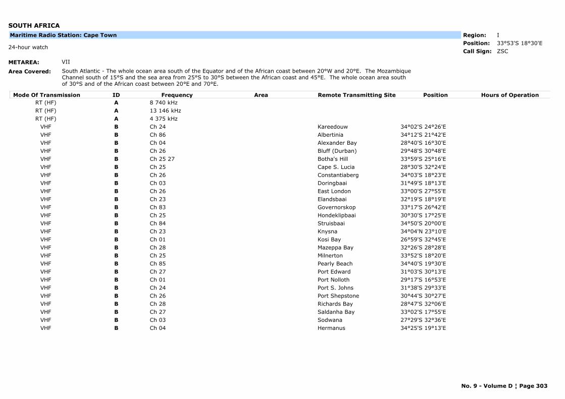
SOUTH AFRICA
METAREA: VII
Area Covered: South Atlantic - The whole ocean area south of the Equator and of the African coast between 20°W and 20°E. The Mozambique Channel south of 15°S and the sea area from 25°S to 30°S between the African coast and 45°E. The whole ocean area south of 30°S and of the African coast between 20°E and 70°E.
Region: IPosition: 33°53'S 18°30'E
ZSC24-hour watch
Call Sign:
Maritime Radio Station: Cape Town
Mode Of Transmission ID Frequency Area Position Hours of OperationRemote Transmitting SiteRT (HF) A 8 740 kHzRT (HF) A 13 146 kHzRT (HF) A 4 375 kHz
VHF B Ch 24 Kareedouw 34°02'S 24°26'EVHF B Ch 86 Albertinia 34°12'S 21°42'EVHF B Ch 04 Alexander Bay 28°40'S 16°30'EVHF B Ch 26 Bluff (Durban) 29°48'S 30°48'EVHF B Ch 25 27 Botha's Hill 33°59'S 25°16'EVHF B Ch 25 Cape S. Lucia 28°30'S 32°24'EVHF B Ch 26 Constantiaberg 34°03'S 18°23'EVHF B Ch 03 Doringbaai 31°49'S 18°13'EVHF B Ch 26 East London 33°00'S 27°55'EVHF B Ch 23 Elandsbaai 32°19'S 18°19'EVHF B Ch 83 Governorskop 33°17'S 26°42'EVHF B Ch 25 Hondeklipbaai 30°30'S 17°25'EVHF B Ch 84 Struisbaai 34°50'S 20°00'EVHF B Ch 23 Knysna 34°04'N 23°10'EVHF B Ch 01 Kosi Bay 26°59'S 32°45'EVHF B Ch 28 Mazeppa Bay 32°26'S 28°28'EVHF B Ch 25 Milnerton 33°52'S 18°20'EVHF B Ch 85 Pearly Beach 34°40'S 19°30'EVHF B Ch 27 Port Edward 31°03'S 30°13'EVHF B Ch 01 Port Nolloth 29°17'S 16°53'EVHF B Ch 24 Port S. Johns 31°38'S 29°33'EVHF B Ch 26 Port Shepstone 30°44'S 30°27'EVHF B Ch 28 Richards Bay 28°47'S 32°06'EVHF B Ch 27 Saldanha Bay 33°02'S 17°55'EVHF B Ch 03 Sodwana 27°29'S 32°36'EVHF B Ch 04 Hermanus 34°25'S 19°13'E
No. 9 - Volume D ¦ Page 303
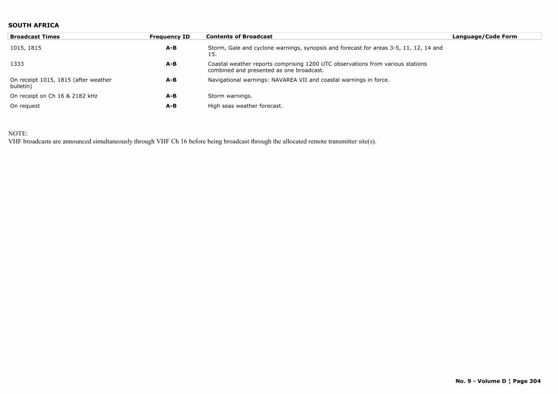
SOUTH AFRICA
Broadcast Times Frequency ID Contents of Broadcast Language/Code Form
1015, 1815 A-B Storm, Gale and cyclone warnings, synopsis and forecast for areas 3-5, 11, 12, 14 and 15.
1333 A-B Coastal weather reports comprising 1200 UTC observations from various stations combined and presented as one broadcast.
On receipt 1015, 1815 (after weather bulletin)
A-B Navigational warnings: NAVAREA VII and coastal warnings in force.
On receipt on Ch 16 & 2182 kHz A-B Storm warnings.
On request A-B High seas weather forecast.
NOTE:VHF broadcasts are announced simultaneously through VHF Ch 16 before being broadcast through the allocated remote transmitter site(s).
No. 9 - Volume D ¦ Page 304
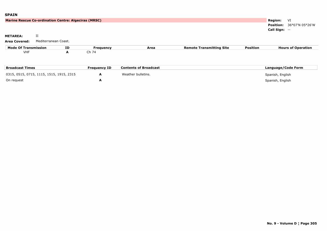
SPAIN
METAREA: II
Area Covered: Mediterranean Coast.
Region: VIPosition: 36°07'N 05°26'W
Marine Rescue Co-ordination Centre: Algeciras (MRSC)
--Call Sign:
Mode Of Transmission ID Frequency Area Position Hours of OperationRemote Transmitting SiteVHF A Ch 74
Broadcast Times Frequency ID Contents of Broadcast Language/Code Form
0315, 0515, 0715, 1115, 1515, 1915, 2315 A Weather bulletins. Spanish, English
On request A Spanish, English
No. 9 - Volume D ¦ Page 305
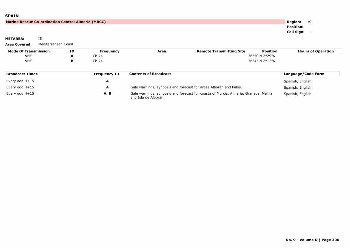
SPAIN
METAREA: III
Area Covered: Mediterranean Coast
Region: VIPosition:
Marine Rescue Co-ordination Centre: Almería (MRCC)
--Call Sign:
Mode Of Transmission ID Frequency Area Position Hours of OperationRemote Transmitting SiteVHF A Ch 74 36°50'N 2°29'WVHF B Ch 74 36°43'N 2°12'W
Broadcast Times Frequency ID Contents of Broadcast Language/Code Form
Every odd H+15 A Spanish, English
Every odd H+15 A Gale warnings, synopsis and forecast for areas Alborán and Palos. Spanish, English
Every odd H+15 A, B Gale warnings, synopsis and forecast for coasta of Murcia, Almeria, Granada, Melilla and Isla de Alborán.
Spanish, English
No. 9 - Volume D ¦ Page 306

SPAIN
METAREA: III
Area Covered: Mediterranean Coast
Region: VIPosition: 41°20'N 02°09'E
Marine Rescue Co-ordination Centre: Barcelona (MRCC)
--Call Sign:
Mode Of Transmission ID Frequency Area Position Hours of OperationRemote Transmitting SiteVHF A Ch 10
Broadcast Times Frequency ID Contents of Broadcast Language/Code Form
0500, 0900, 1400, 1900 (summer)0600, 1000, 1500, 2000, (winter)
A Weather bulletins. Spanish, English
No. 9 - Volume D ¦ Page 307
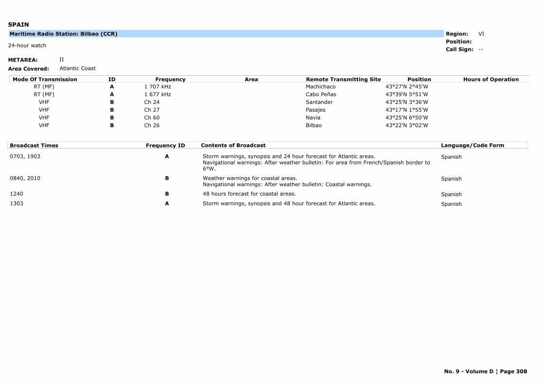
SPAIN
METAREA: II
Area Covered: Atlantic Coast
Region: VIPosition:
--24-hour watch
Call Sign:
Maritime Radio Station: Bilbao (CCR)
Mode Of Transmission ID Frequency Area Position Hours of OperationRemote Transmitting SiteRT (MF) A 1 707 kHz Machichaco 43°27'N 2°45'WRT (MF) A 1 677 kHz Cabo Peñas 43°39'N 5°51'W
VHF B Ch 24 Santander 43°25'N 3°36'WVHF B Ch 27 Pasajes 43°17'N 1°55'WVHF B Ch 60 Navia 43°25'N 6°50'WVHF B Ch 26 Bilbao 43°22'N 3°02'W
Broadcast Times Frequency ID Contents of Broadcast Language/Code Form
0703, 1903 A Storm warnings, synopsis and 24 hour forecast for Atlantic areas. Navigational warnings: After weather bulletin: For area from French/Spanish border to 6°W.
Spanish
0840, 2010 B Weather warnings for coastal areas. Navigational warnings: After weather bulletin: Coastal warnings.
Spanish
1240 B 48 hours forecast for coastal areas. Spanish
1303 A Storm warnings, synopsis and 48 hour forecast for Atlantic areas. Spanish
No. 9 - Volume D ¦ Page 308
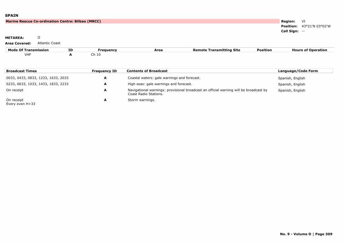
SPAIN
METAREA: II
Area Covered: Atlantic Coast
Region: VIPosition: 43°21'N 03°02'W
Marine Rescue Co-ordination Centre: Bilbao (MRCC)
--Call Sign:
Mode Of Transmission ID Frequency Area Position Hours of OperationRemote Transmitting SiteVHF A Ch 10
Broadcast Times Frequency ID Contents of Broadcast Language/Code Form
0033, 0433, 0833, 1233, 1633, 2033 A Coastal waters: gale warnings and forecast. Spanish, English
0233, 0633, 1033, 1433, 1833, 2233 A High seas: gale warnings and forecast. Spanish, English
On receipt A Navigational warnings: provisional broadcast an official warning will be broadcast by Coast Radio Stations.
Spanish, English
On receiptEvery even H+33
A Storm warnings.
No. 9 - Volume D ¦ Page 309
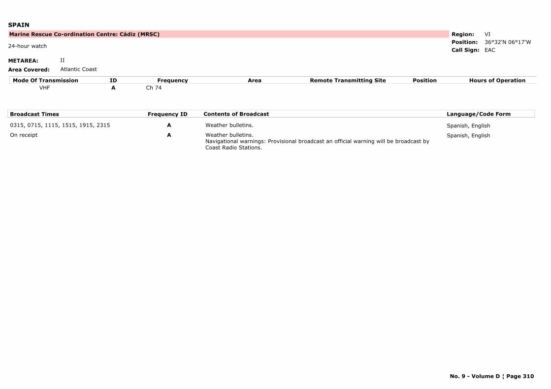
SPAIN
METAREA: II
Area Covered: Atlantic Coast
Region: VIPosition: 36°32'N 06°17'W
Marine Rescue Co-ordination Centre: Cádiz (MRSC)
EAC24-hour watch
Call Sign:
Mode Of Transmission ID Frequency Area Position Hours of OperationRemote Transmitting SiteVHF A Ch 74
Broadcast Times Frequency ID Contents of Broadcast Language/Code Form
0315, 0715, 1115, 1515, 1915, 2315 A Weather bulletins. Spanish, English
On receipt A Weather bulletins. Navigational warnings: Provisional broadcast an official warning will be broadcast by Coast Radio Stations.
Spanish, English
No. 9 - Volume D ¦ Page 310

SPAIN
METAREA: III
Area Covered: Mediterranean Coast
Region: VIPosition: 37°35'N 00°58'W
Marine Rescue Co-ordination Centre: Cartagena (MRSC)
--Call Sign:
Mode Of Transmission ID Frequency Area Position Hours of OperationRemote Transmitting SiteVHF A Ch 10
Broadcast Times Frequency ID Contents of Broadcast Language/Code Form
0115, 0515, 0915, 1315, 1715, 2115 A Weather bulletins. Spanish, English
On receipt A Navigational warnings: Provisional broadcast , an official warning will be broadcast by Coast Radio Stations.
Spanish, English
No. 9 - Volume D ¦ Page 311
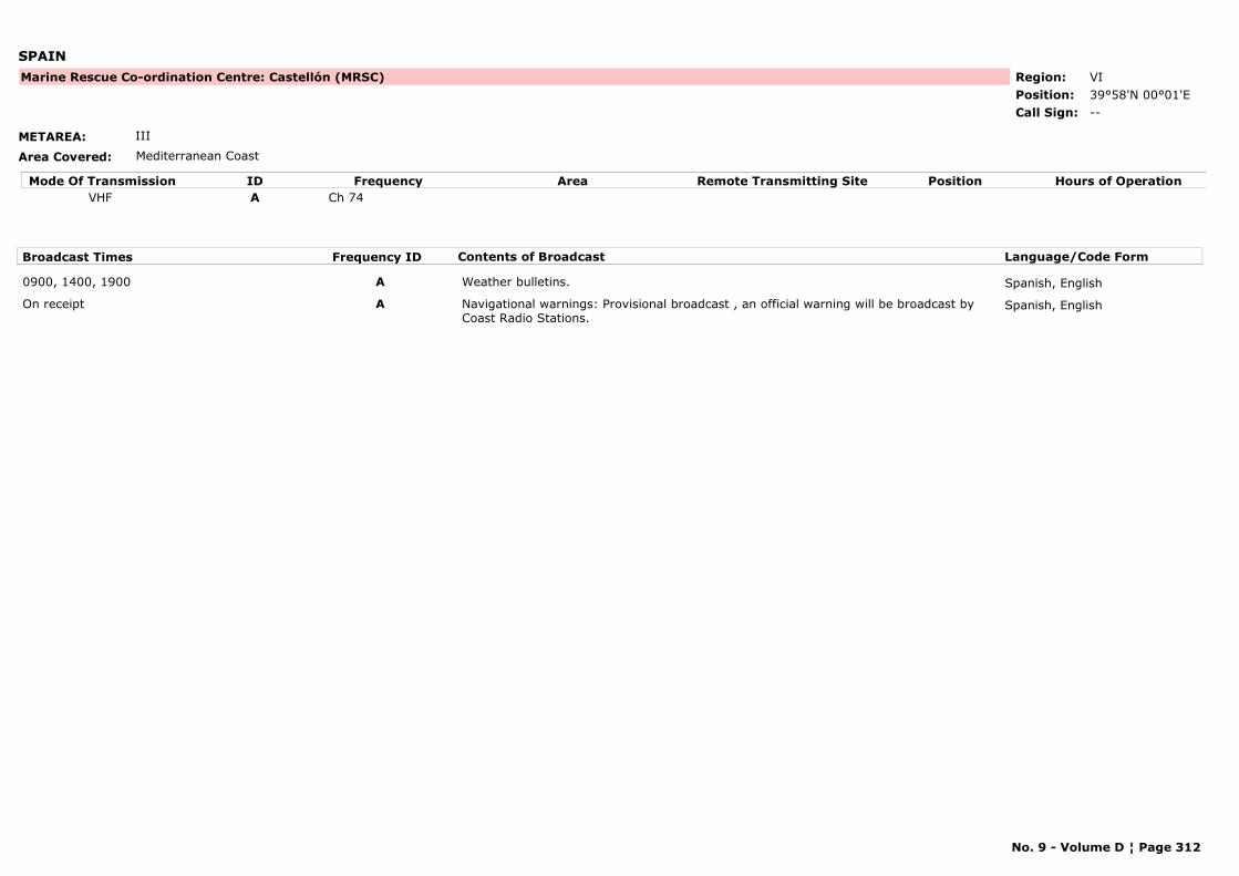
SPAIN
METAREA: III
Area Covered: Mediterranean Coast
Region: VIPosition: 39°58'N 00°01'E
Marine Rescue Co-ordination Centre: Castellón (MRSC)
--Call Sign:
Mode Of Transmission ID Frequency Area Position Hours of OperationRemote Transmitting SiteVHF A Ch 74
Broadcast Times Frequency ID Contents of Broadcast Language/Code Form
0900, 1400, 1900 A Weather bulletins. Spanish, English
On receipt A Navigational warnings: Provisional broadcast , an official warning will be broadcast by Coast Radio Stations.
Spanish, English
No. 9 - Volume D ¦ Page 312
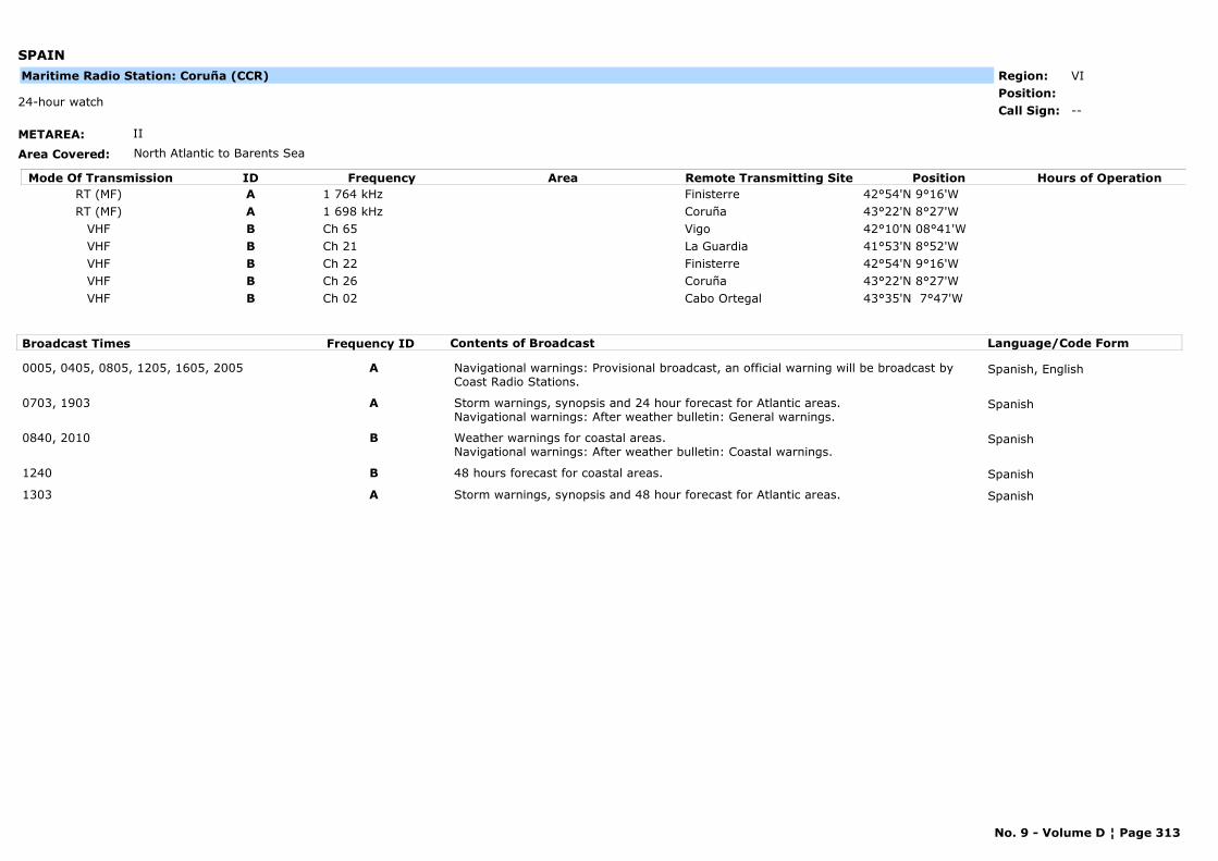
SPAIN
METAREA: II
Area Covered: North Atlantic to Barents Sea
Region: VIPosition:
--24-hour watch
Call Sign:
Maritime Radio Station: Coruña (CCR)
Mode Of Transmission ID Frequency Area Position Hours of OperationRemote Transmitting SiteRT (MF) A 1 764 kHz Finisterre 42°54'N 9°16'WRT (MF) A 1 698 kHz Coruña 43°22'N 8°27'W
VHF B Ch 65 Vigo 42°10'N 08°41'WVHF B Ch 21 La Guardia 41°53'N 8°52'WVHF B Ch 22 Finisterre 42°54'N 9°16'WVHF B Ch 26 Coruña 43°22'N 8°27'WVHF B Ch 02 Cabo Ortegal 43°35'N 7°47'W
Broadcast Times Frequency ID Contents of Broadcast Language/Code Form
0005, 0405, 0805, 1205, 1605, 2005 A Navigational warnings: Provisional broadcast, an official warning will be broadcast by Coast Radio Stations.
Spanish, English
0703, 1903 A Storm warnings, synopsis and 24 hour forecast for Atlantic areas. Navigational warnings: After weather bulletin: General warnings.
Spanish
0840, 2010 B Weather warnings for coastal areas.Navigational warnings: After weather bulletin: Coastal warnings.
Spanish
1240 B 48 hours forecast for coastal areas. Spanish
1303 A Storm warnings, synopsis and 48 hour forecast for Atlantic areas. Spanish
No. 9 - Volume D ¦ Page 313
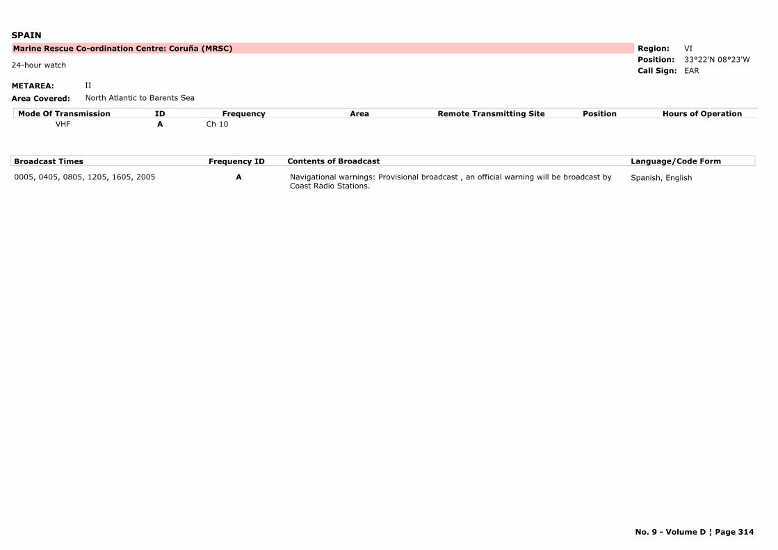
SPAIN
METAREA: II
Area Covered: North Atlantic to Barents Sea
Region: VIPosition: 33°22'N 08°23'W
Marine Rescue Co-ordination Centre: Coruña (MRSC)
EAR24-hour watch
Call Sign:
Mode Of Transmission ID Frequency Area Position Hours of OperationRemote Transmitting SiteVHF A Ch 10
Broadcast Times Frequency ID Contents of Broadcast Language/Code Form
0005, 0405, 0805, 1205, 1605, 2005 A Navigational warnings: Provisional broadcast , an official warning will be broadcast by Coast Radio Stations.
Spanish, English
No. 9 - Volume D ¦ Page 314
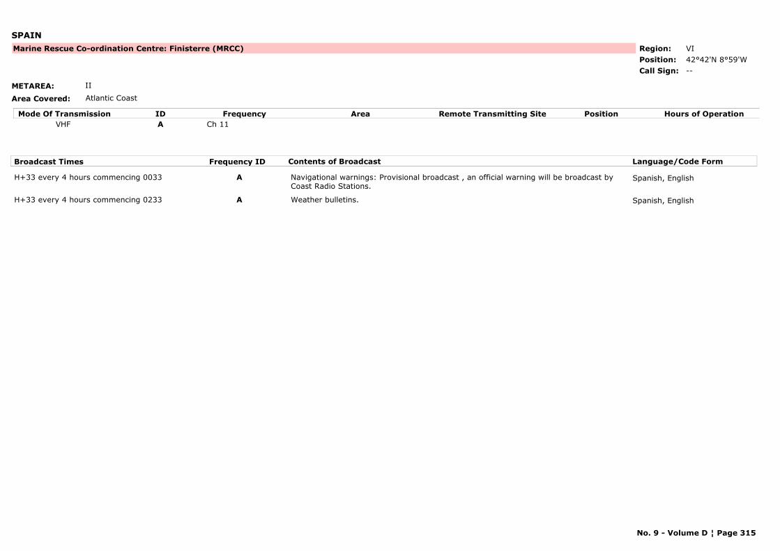
SPAIN
METAREA: II
Area Covered: Atlantic Coast
Region: VIPosition: 42°42'N 8°59'W
Marine Rescue Co-ordination Centre: Finisterre (MRCC)
--Call Sign:
Mode Of Transmission ID Frequency Area Position Hours of OperationRemote Transmitting SiteVHF A Ch 11
Broadcast Times Frequency ID Contents of Broadcast Language/Code Form
H+33 every 4 hours commencing 0033 A Navigational warnings: Provisional broadcast , an official warning will be broadcast by Coast Radio Stations.
Spanish, English
H+33 every 4 hours commencing 0233 A Weather bulletins. Spanish, English
No. 9 - Volume D ¦ Page 315
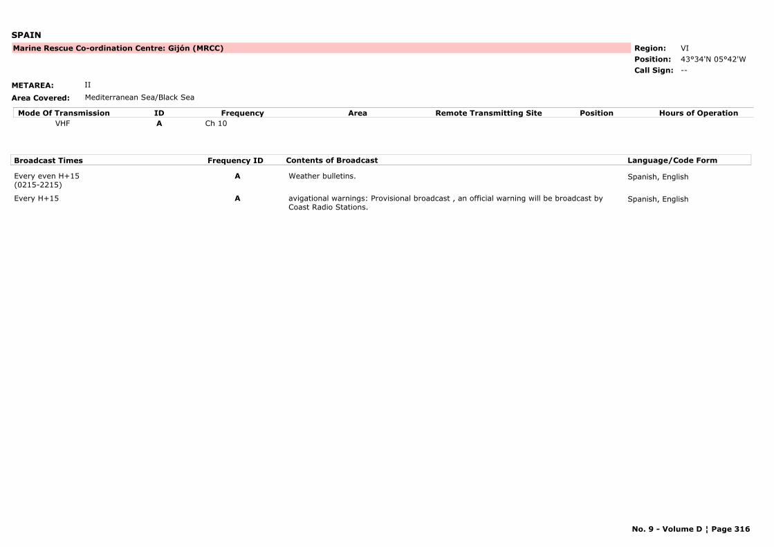
SPAIN
METAREA: II
Area Covered: Mediterranean Sea/Black Sea
Region: VIPosition: 43°34'N 05°42'W
Marine Rescue Co-ordination Centre: Gijón (MRCC)
--Call Sign:
Mode Of Transmission ID Frequency Area Position Hours of OperationRemote Transmitting SiteVHF A Ch 10
Broadcast Times Frequency ID Contents of Broadcast Language/Code Form
Every even H+15 (0215-2215)
A Weather bulletins. Spanish, English
Every H+15 A avigational warnings: Provisional broadcast , an official warning will be broadcast by Coast Radio Stations.
Spanish, English
No. 9 - Volume D ¦ Page 316
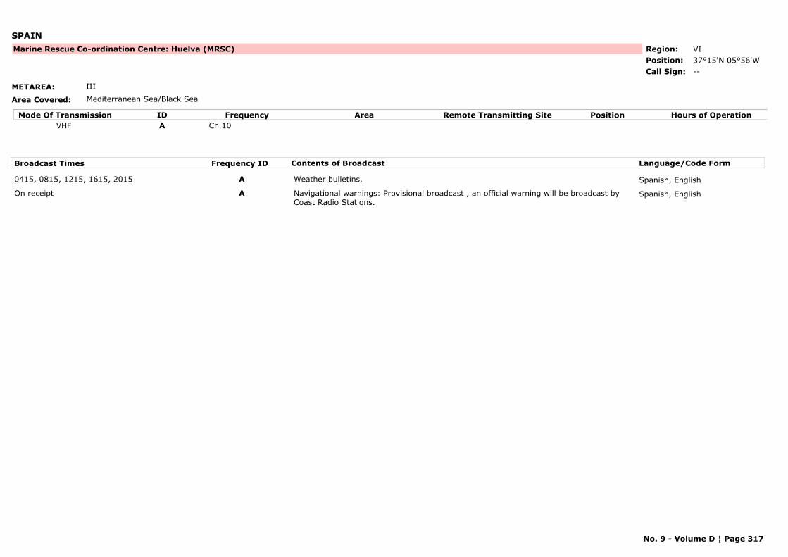
SPAIN
METAREA: III
Area Covered: Mediterranean Sea/Black Sea
Region: VIPosition: 37°15'N 05°56'W
Marine Rescue Co-ordination Centre: Huelva (MRSC)
--Call Sign:
Mode Of Transmission ID Frequency Area Position Hours of OperationRemote Transmitting SiteVHF A Ch 10
Broadcast Times Frequency ID Contents of Broadcast Language/Code Form
0415, 0815, 1215, 1615, 2015 A Weather bulletins. Spanish, English
On receipt A Navigational warnings: Provisional broadcast , an official warning will be broadcast by Coast Radio Stations.
Spanish, English
No. 9 - Volume D ¦ Page 317
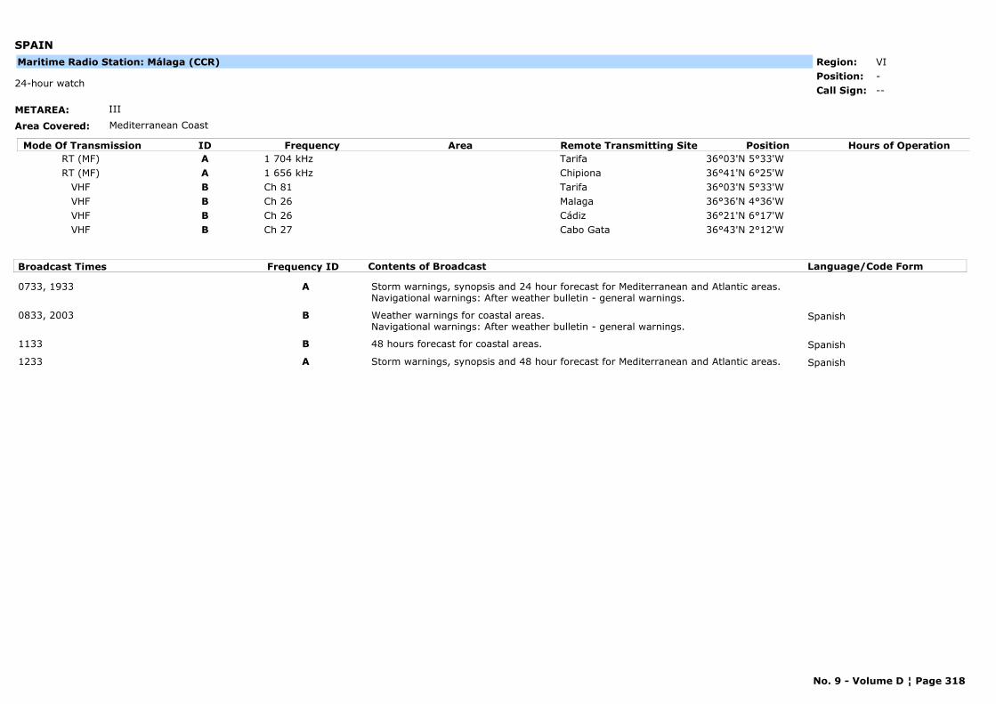
SPAIN
METAREA: III
Area Covered: Mediterranean Coast
Region: VIPosition: -
--24-hour watch
Call Sign:
Maritime Radio Station: Málaga (CCR)
Mode Of Transmission ID Frequency Area Position Hours of OperationRemote Transmitting SiteRT (MF) A 1 704 kHz Tarifa 36°03'N 5°33'WRT (MF) A 1 656 kHz Chipiona 36°41'N 6°25'W
VHF B Ch 81 Tarifa 36°03'N 5°33'WVHF B Ch 26 Malaga 36°36'N 4°36'WVHF B Ch 26 Cádiz 36°21'N 6°17'WVHF B Ch 27 Cabo Gata 36°43'N 2°12'W
Broadcast Times Frequency ID Contents of Broadcast Language/Code Form
0733, 1933 A Storm warnings, synopsis and 24 hour forecast for Mediterranean and Atlantic areas.Navigational warnings: After weather bulletin - general warnings.
0833, 2003 B Weather warnings for coastal areas. Navigational warnings: After weather bulletin - general warnings.
Spanish
1133 B 48 hours forecast for coastal areas. Spanish
1233 A Storm warnings, synopsis and 48 hour forecast for Mediterranean and Atlantic areas. Spanish
No. 9 - Volume D ¦ Page 318
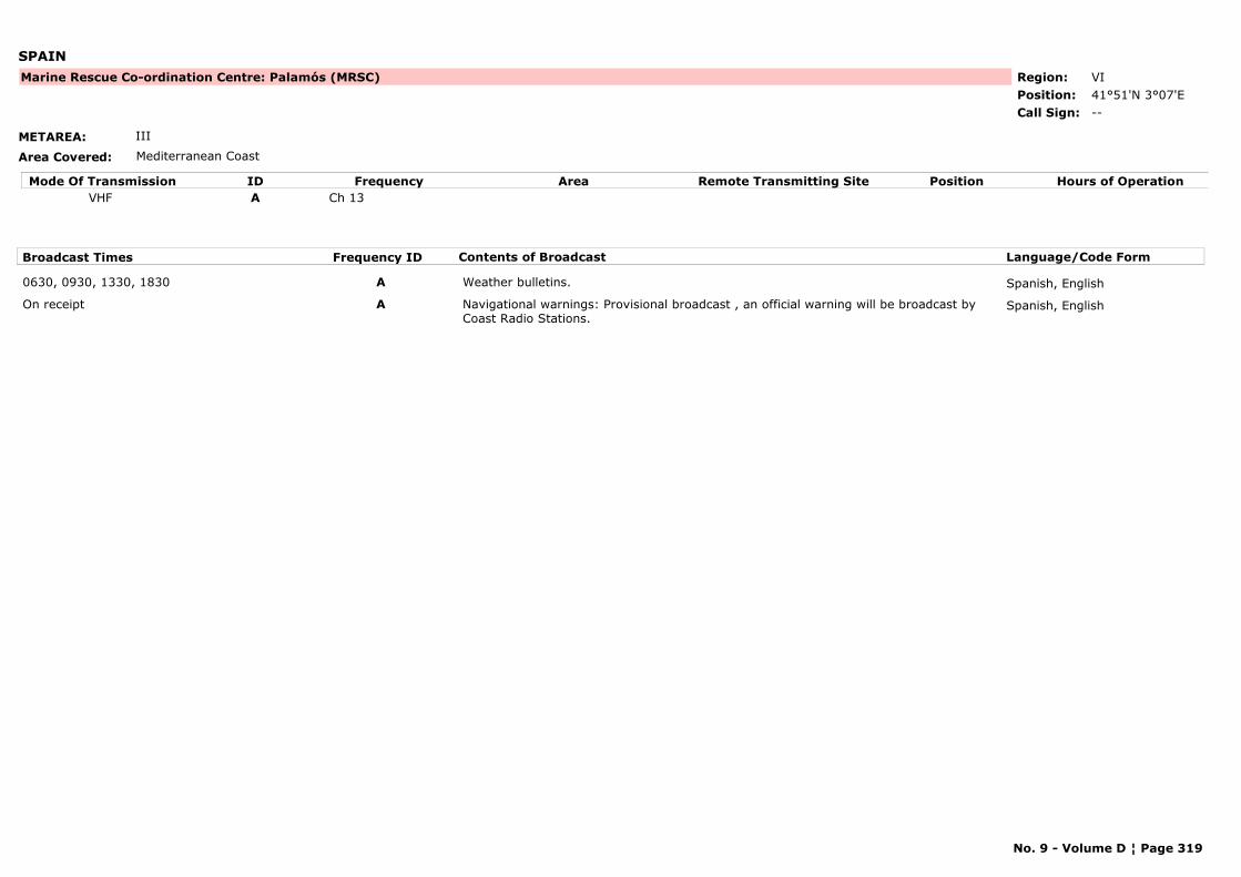
SPAIN
METAREA: III
Area Covered: Mediterranean Coast
Region: VIPosition: 41°51'N 3°07'E
Marine Rescue Co-ordination Centre: Palamós (MRSC)
--Call Sign:
Mode Of Transmission ID Frequency Area Position Hours of OperationRemote Transmitting SiteVHF A Ch 13
Broadcast Times Frequency ID Contents of Broadcast Language/Code Form
0630, 0930, 1330, 1830 A Weather bulletins. Spanish, English
On receipt A Navigational warnings: Provisional broadcast , an official warning will be broadcast by Coast Radio Stations.
Spanish, English
No. 9 - Volume D ¦ Page 319
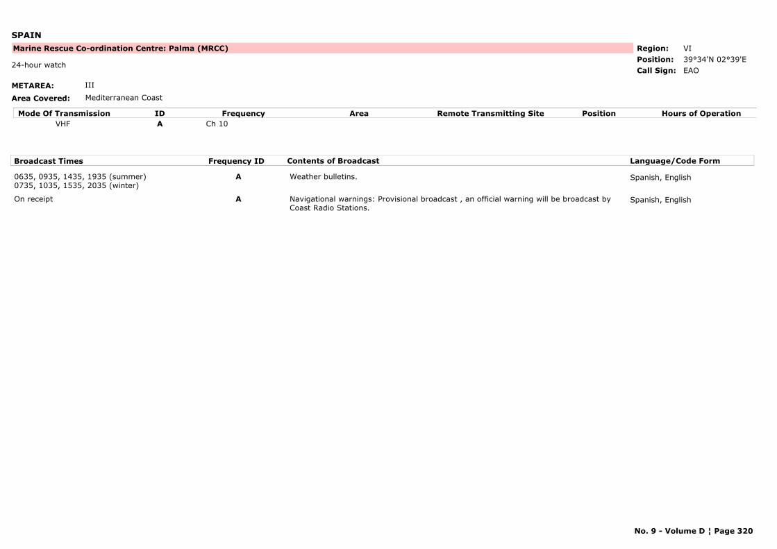
SPAIN
METAREA: III
Area Covered: Mediterranean Coast
Region: VIPosition: 39°34'N 02°39'E
Marine Rescue Co-ordination Centre: Palma (MRCC)
EAO24-hour watch
Call Sign:
Mode Of Transmission ID Frequency Area Position Hours of OperationRemote Transmitting SiteVHF A Ch 10
Broadcast Times Frequency ID Contents of Broadcast Language/Code Form
0635, 0935, 1435, 1935 (summer)0735, 1035, 1535, 2035 (winter)
A Weather bulletins. Spanish, English
On receipt A Navigational warnings: Provisional broadcast , an official warning will be broadcast by Coast Radio Stations.
Spanish, English
No. 9 - Volume D ¦ Page 320

SPAIN
METAREA: II
Area Covered: Mediterranean Sea/Black Sea
Region: VIPosition: 43°27'N 03°49'W
Marine Rescue Co-ordination Centre: Santander (MRSC)
--Call Sign:
Mode Of Transmission ID Frequency Area Position Hours of OperationRemote Transmitting SiteVHF A Ch 74
Broadcast Times Frequency ID Contents of Broadcast Language/Code Form
0045, 0045, 0845, 1245, 1645, 2045 A Navigational warnings: Provisional broadcast , an official warning will be broadcast by Coast Radio Stations.
Spanish, English
0245, 0645, 1045, 1445, 1845, 2245 A Weather bulletins. Spanish, English
No. 9 - Volume D ¦ Page 321
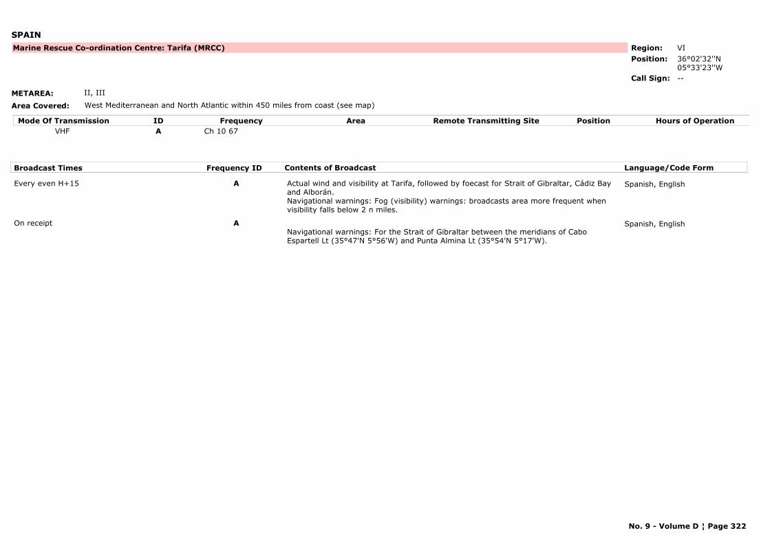
SPAIN
METAREA: II, III
Area Covered: West Mediterranean and North Atlantic within 450 miles from coast (see map)
Region: VIPosition: 36°02'32''N
05°33'23''W
Marine Rescue Co-ordination Centre: Tarifa (MRCC)
--Call Sign:
Mode Of Transmission ID Frequency Area Position Hours of OperationRemote Transmitting SiteVHF A Ch 10 67
Broadcast Times Frequency ID Contents of Broadcast Language/Code Form
Every even H+15 A Actual wind and visibility at Tarifa, followed by foecast for Strait of Gibraltar, Cádiz Bay and Alborán. Navigational warnings: Fog (visibility) warnings: broadcasts area more frequent when visibility falls below 2 n miles.
Spanish, English
On receipt ANavigational warnings: For the Strait of Gibraltar between the meridians of Cabo Espartell Lt (35°47'N 5°56'W) and Punta Almina Lt (35°54'N 5°17'W).
Spanish, English
No. 9 - Volume D ¦ Page 322
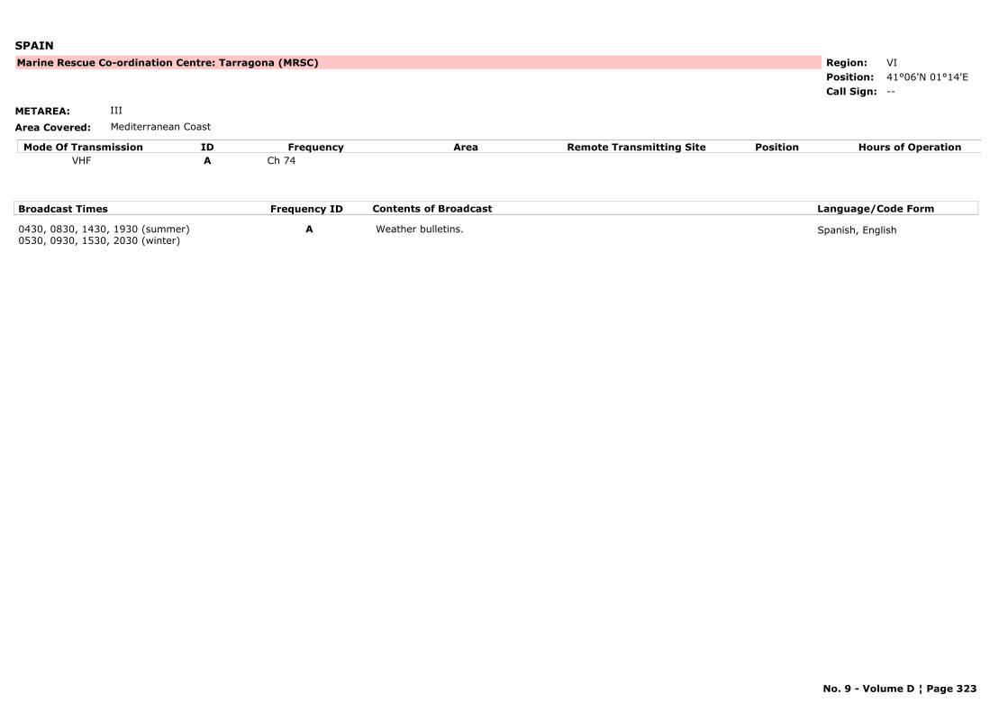
SPAIN
METAREA: III
Area Covered: Mediterranean Coast
Region: VIPosition: 41°06'N 01°14'E
Marine Rescue Co-ordination Centre: Tarragona (MRSC)
--Call Sign:
Mode Of Transmission ID Frequency Area Position Hours of OperationRemote Transmitting SiteVHF A Ch 74
Broadcast Times Frequency ID Contents of Broadcast Language/Code Form
0430, 0830, 1430, 1930 (summer)0530, 0930, 1530, 2030 (winter)
A Weather bulletins. Spanish, English
No. 9 - Volume D ¦ Page 323
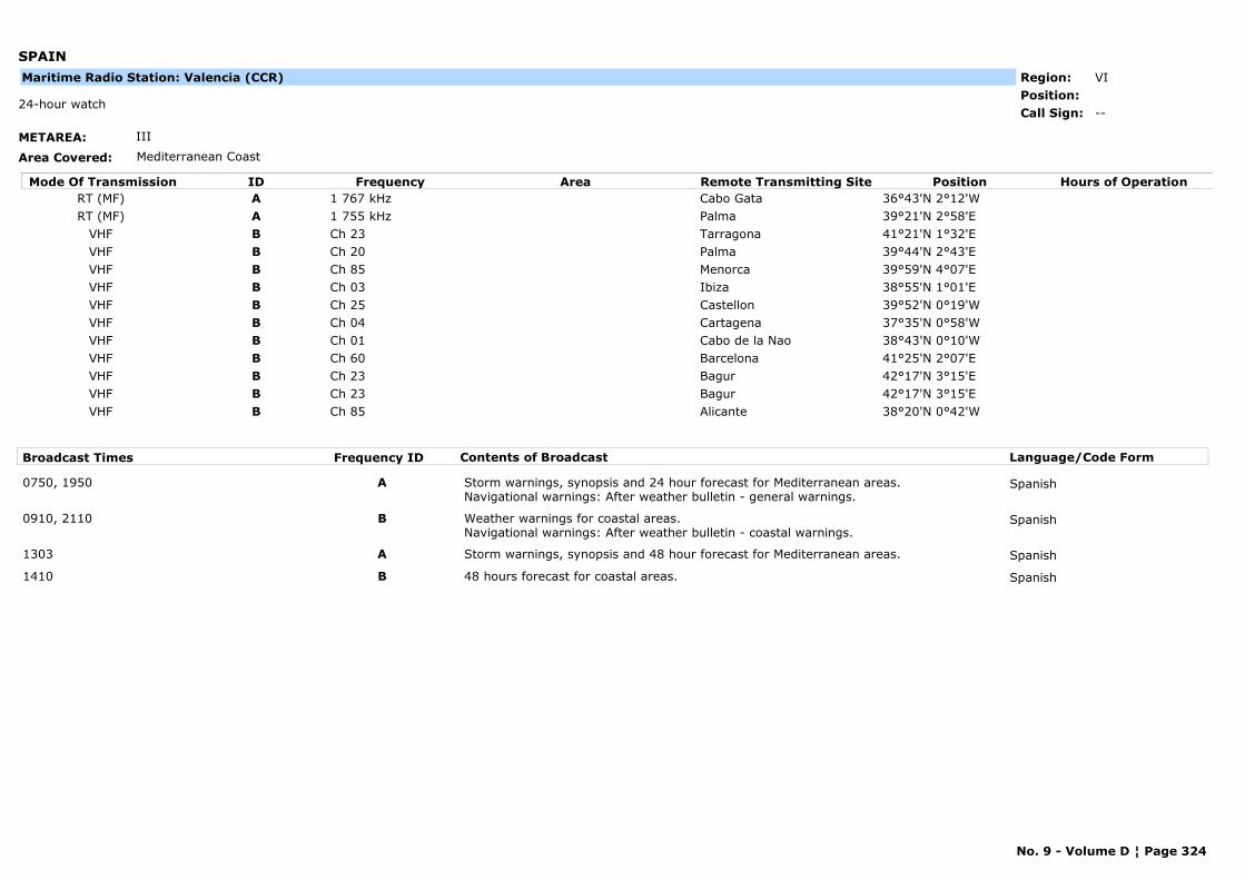
SPAIN
METAREA: III
Area Covered: Mediterranean Coast
Region: VIPosition:
--24-hour watch
Call Sign:
Maritime Radio Station: Valencia (CCR)
Mode Of Transmission ID Frequency Area Position Hours of OperationRemote Transmitting SiteRT (MF) A 1 767 kHz Cabo Gata 36°43'N 2°12'WRT (MF) A 1 755 kHz Palma 39°21'N 2°58'E
VHF B Ch 23 Tarragona 41°21'N 1°32'EVHF B Ch 20 Palma 39°44'N 2°43'EVHF B Ch 85 Menorca 39°59'N 4°07'EVHF B Ch 03 Ibiza 38°55'N 1°01'EVHF B Ch 25 Castellon 39°52'N 0°19'WVHF B Ch 04 Cartagena 37°35'N 0°58'WVHF B Ch 01 Cabo de la Nao 38°43'N 0°10'WVHF B Ch 60 Barcelona 41°25'N 2°07'EVHF B Ch 23 Bagur 42°17'N 3°15'EVHF B Ch 23 Bagur 42°17'N 3°15'EVHF B Ch 85 Alicante 38°20'N 0°42'W
Broadcast Times Frequency ID Contents of Broadcast Language/Code Form
0750, 1950 A Storm warnings, synopsis and 24 hour forecast for Mediterranean areas. Navigational warnings: After weather bulletin - general warnings.
Spanish
0910, 2110 B Weather warnings for coastal areas. Navigational warnings: After weather bulletin - coastal warnings.
Spanish
1303 A Storm warnings, synopsis and 48 hour forecast for Mediterranean areas. Spanish
1410 B 48 hours forecast for coastal areas. Spanish
No. 9 - Volume D ¦ Page 324
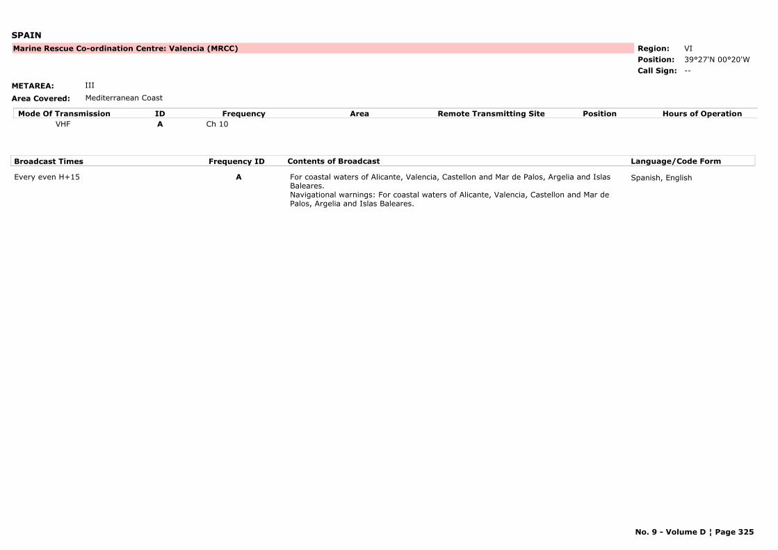
SPAIN
METAREA: III
Area Covered: Mediterranean Coast
Region: VIPosition: 39°27'N 00°20'W
Marine Rescue Co-ordination Centre: Valencia (MRCC)
--Call Sign:
Mode Of Transmission ID Frequency Area Position Hours of OperationRemote Transmitting SiteVHF A Ch 10
Broadcast Times Frequency ID Contents of Broadcast Language/Code Form
Every even H+15 A For coastal waters of Alicante, Valencia, Castellon and Mar de Palos, Argelia and Islas Baleares. Navigational warnings: For coastal waters of Alicante, Valencia, Castellon and Mar de Palos, Argelia and Islas Baleares.
Spanish, English
No. 9 - Volume D ¦ Page 325
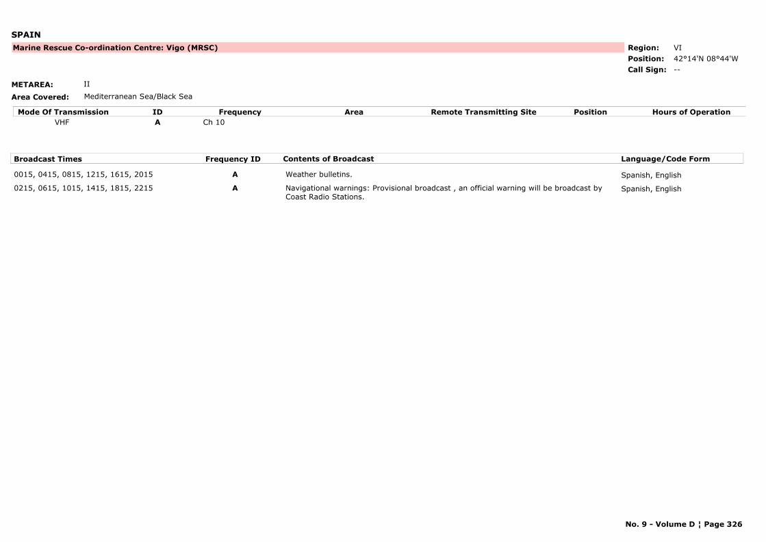
SPAIN
METAREA: II
Area Covered: Mediterranean Sea/Black Sea
Region: VIPosition: 42°14'N 08°44'W
Marine Rescue Co-ordination Centre: Vigo (MRSC)
--Call Sign:
Mode Of Transmission ID Frequency Area Position Hours of OperationRemote Transmitting SiteVHF A Ch 10
Broadcast Times Frequency ID Contents of Broadcast Language/Code Form
0015, 0415, 0815, 1215, 1615, 2015 A Weather bulletins. Spanish, English
0215, 0615, 1015, 1415, 1815, 2215 A Navigational warnings: Provisional broadcast , an official warning will be broadcast by Coast Radio Stations.
Spanish, English
No. 9 - Volume D ¦ Page 326
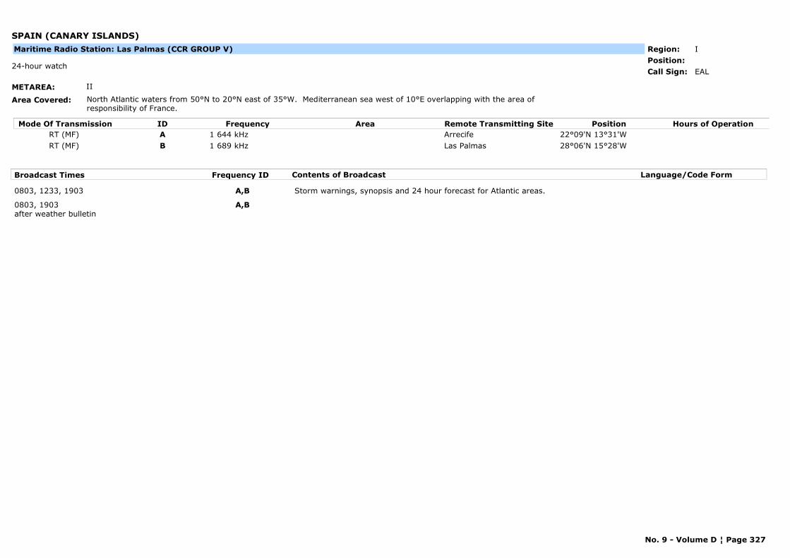
SPAIN (CANARY ISLANDS)
METAREA: II
Area Covered: North Atlantic waters from 50°N to 20°N east of 35°W. Mediterranean sea west of 10°E overlapping with the area of responsibility of France.
Region: IPosition:
EAL24-hour watch
Call Sign:
Maritime Radio Station: Las Palmas (CCR GROUP V)
Mode Of Transmission ID Frequency Area Position Hours of OperationRemote Transmitting SiteRT (MF) A 1 644 kHz Arrecife 22°09'N 13°31'WRT (MF) B 1 689 kHz Las Palmas 28°06'N 15°28'W
Broadcast Times Frequency ID Contents of Broadcast Language/Code Form
0803, 1233, 1903 A,B Storm warnings, synopsis and 24 hour forecast for Atlantic areas.
0803, 1903after weather bulletin
A,B
No. 9 - Volume D ¦ Page 327
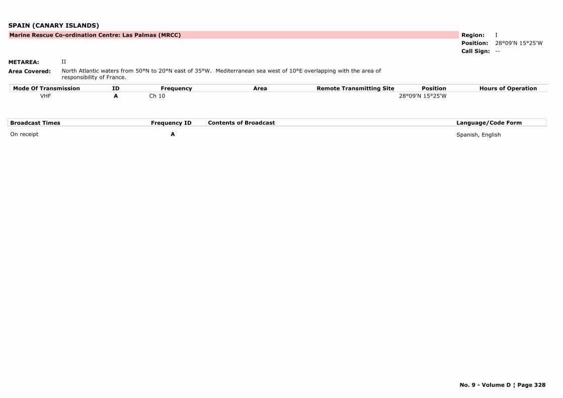
SPAIN (CANARY ISLANDS)
METAREA: II
Area Covered: North Atlantic waters from 50°N to 20°N east of 35°W. Mediterranean sea west of 10°E overlapping with the area of responsibility of France.
Region: IPosition: 28°09'N 15°25'W
Marine Rescue Co-ordination Centre: Las Palmas (MRCC)
--Call Sign:
Mode Of Transmission ID Frequency Area Position Hours of OperationRemote Transmitting SiteVHF A Ch 10 28°09'N 15°25'W
Broadcast Times Frequency ID Contents of Broadcast Language/Code Form
On receipt A Spanish, English
No. 9 - Volume D ¦ Page 328
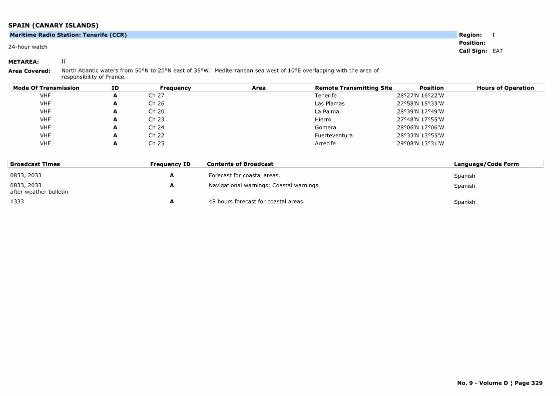
SPAIN (CANARY ISLANDS)
METAREA: II
Area Covered: North Atlantic waters from 50°N to 20°N east of 35°W. Mediterranean sea west of 10°E overlapping with the area of responsibility of France.
Region: IPosition:
EAT24-hour watch
Call Sign:
Maritime Radio Station: Tenerife (CCR)
Mode Of Transmission ID Frequency Area Position Hours of OperationRemote Transmitting SiteVHF A Ch 27 Tenerife 28°27'N 16°22'WVHF A Ch 26 Las Plamas 27°58'N 15°33'WVHF A Ch 20 La Palma 28°39'N 17°49'WVHF A Ch 23 Hierro 27°48'N 17°55'WVHF A Ch 24 Gomera 28°06'N 17°06'WVHF A Ch 22 Fuerteventura 28°33'N 13°55'WVHF A Ch 25 Arrecife 29°08'N 13°31'W
Broadcast Times Frequency ID Contents of Broadcast Language/Code Form
0833, 2033 A Forecast for coastal areas. Spanish
0833, 2033after weather bulletin
A Navigational warnings: Coastal warnings. Spanish
1333 A 48 hours forecast for coastal areas. Spanish
No. 9 - Volume D ¦ Page 329
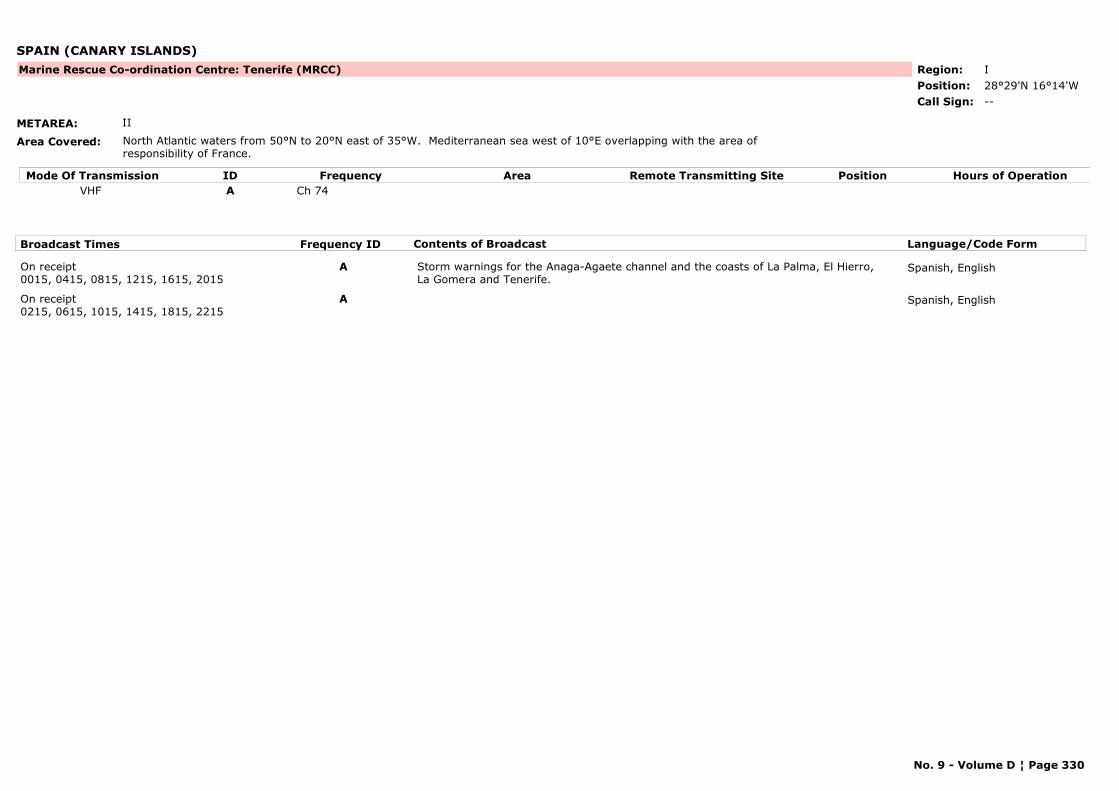
SPAIN (CANARY ISLANDS)
METAREA: II
Area Covered: North Atlantic waters from 50°N to 20°N east of 35°W. Mediterranean sea west of 10°E overlapping with the area of responsibility of France.
Region: IPosition: 28°29'N 16°14'W
Marine Rescue Co-ordination Centre: Tenerife (MRCC)
--Call Sign:
Mode Of Transmission ID Frequency Area Position Hours of OperationRemote Transmitting SiteVHF A Ch 74
Broadcast Times Frequency ID Contents of Broadcast Language/Code Form
On receipt0015, 0415, 0815, 1215, 1615, 2015
A Storm warnings for the Anaga-Agaete channel and the coasts of La Palma, El Hierro, La Gomera and Tenerife.
Spanish, English
On receipt0215, 0615, 1015, 1415, 1815, 2215
A Spanish, English
No. 9 - Volume D ¦ Page 330
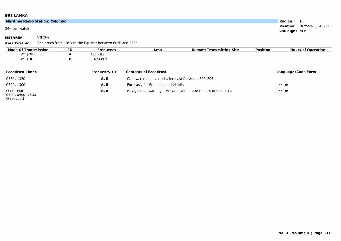
SRI LANKA
METAREA: VIII(N)
Area Covered: Sea areas from 10°N to the Equator between 60°E and 95°E.
Region: IIPosition: 06°55'N 079°53'E
4PB24-hour watch
Call Sign:
Maritime Radio Station: Colombo
Mode Of Transmission ID Frequency Area Position Hours of OperationRemote Transmitting SiteWT (MF) A 482 kHzWT (HF) B 8 473 kHz
Broadcast Times Frequency ID Contents of Broadcast Language/Code Form
0530, 1330 A, B Gale warnings, synopsis, forecast for Areas E00-E95.
0600, 1300 A, B Forecast, for Sri Lanka and vicinity. English
On receipt0600, 0900, 1330On request
A, B Navigational warnings: For area within 200 n miles of Colombo. English
No. 9 - Volume D ¦ Page 331
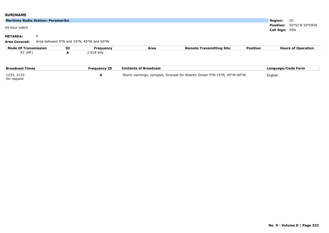
SURINAME
METAREA: V
Area Covered: Area between 5°N and 15°N, 45°W and 60°W
Region: IIIPosition: 05°51'N 55°09'W
PZN24-hour watch
Call Sign:
Maritime Radio Station: Paramaribo
Mode Of Transmission ID Frequency Area Position Hours of OperationRemote Transmitting SiteRT (MF) A 2 818 kHz
Broadcast Times Frequency ID Contents of Broadcast Language/Code Form
1233, 2133On request
A Storm warnings, synopsis, forecast for Atlantic Ocean 5°N-15°N, 45°W-60°W. English
No. 9 - Volume D ¦ Page 332
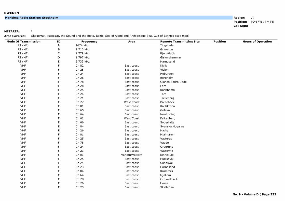
SWEDEN
METAREA: I
Area Covered: Skagerrak, Kattegat, the Sound and the Belts, Baltic, Sea of Aland and Archipelago Sea, Gulf of Bothnia (see map)
Region: VIPosition: 59°17'N 18°43'E
--Call Sign:
Maritime Radio Station: Stockholm
Mode Of Transmission ID Frequency Area Position Hours of OperationRemote Transmitting SiteRT (MF) A 1674 kHz TingstadeRT (MF) B 1 710 kHz GrimetonRT (MF) C 1 779 kHz BjuroklubbRT (MF) D 1 797 kHz GislovshammarRT (MF) E 2 733 kHz Harnosand
VHF F Ch 82 East coast KivikVHF F Ch 25 East coast VisbyVHF F Ch 24 East coast HoburgenVHF F Ch 26 East coast BorgholmVHF F Ch 78 East coast Olands Sodra UddeVHF F Ch 28 East coast FaroVHF F Ch 25 East coast KarlshamnVHF F Ch 24 East coast ToroVHF F Ch 21 East coast TrelleborgVHF F Ch 27 West Coast BarsebackVHF F Ch 81 East coast KarlskronaVHF F Ch 65 East coast GotskaVHF F Ch 64 East coast NorrkopingVHF F Ch 62 West Coast FalkenbergVHF F Ch 66 East coast SodertaljeVHF F Ch 84 East coast Svenska HogarnaVHF F Ch 26 East coast NackaVHF F Ch 81 East coast HjalmarenVHF F Ch 25 East coast VasterasVHF F Ch 78 East coast VaddoVHF F Ch 24 East coast OregrundVHF F Ch 23 East coast VastervikVHF F Ch 01 Vanern/Vattern KinnekuleVHF F Ch 25 East coast HudiksvallVHF F Ch 24 East coast SundsvallVHF F Ch 23 East coast HarnosandVHF F Ch 84 East coast KramforsVHF F Ch 64 East coast MjallomVHF F Ch 28 East coast OrnskoldsvikVHF F Ch 26 East coast UmeaVHF F Ch 23 East coast Skelleftea
No. 9 - Volume D ¦ Page 333
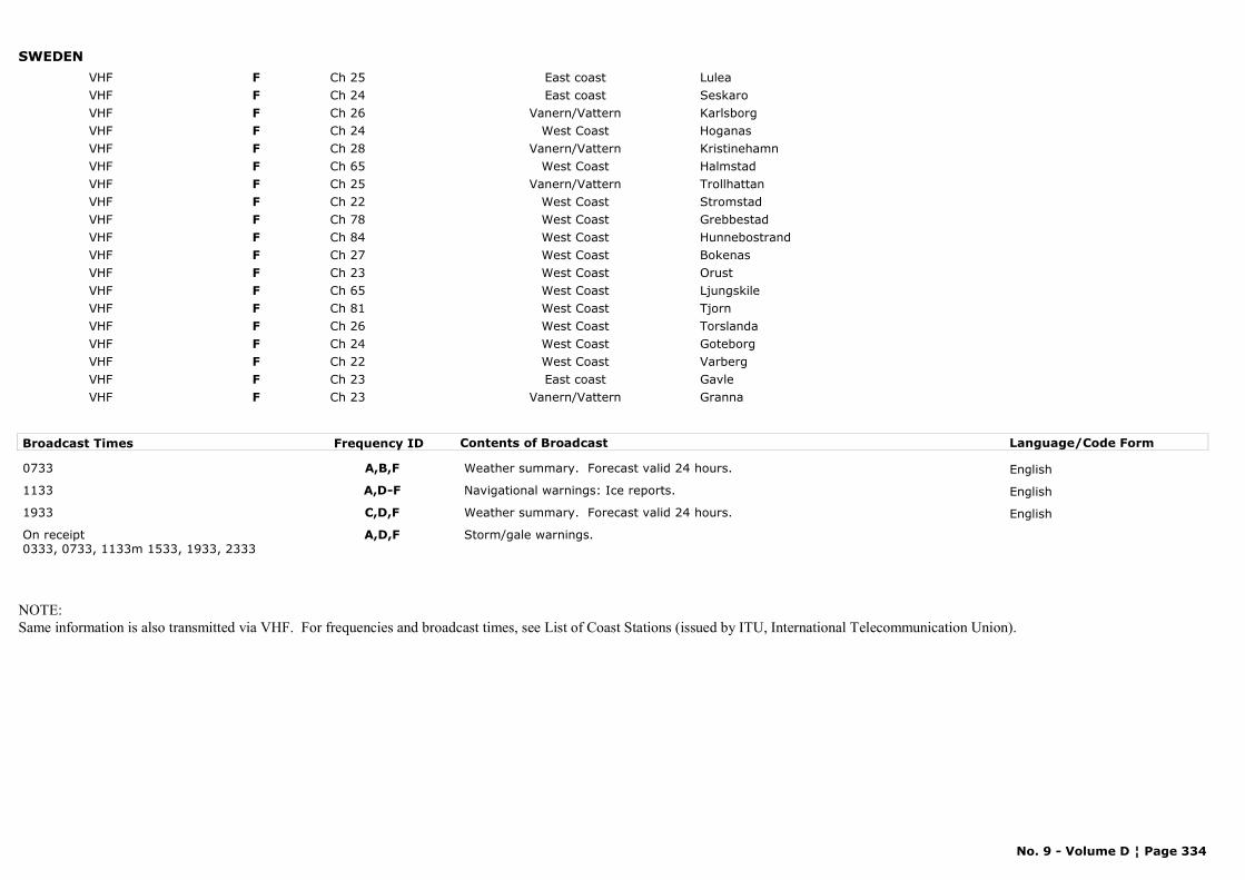
SWEDENVHF F Ch 25 East coast LuleaVHF F Ch 24 East coast SeskaroVHF F Ch 26 Vanern/Vattern KarlsborgVHF F Ch 24 West Coast HoganasVHF F Ch 28 Vanern/Vattern KristinehamnVHF F Ch 65 West Coast HalmstadVHF F Ch 25 Vanern/Vattern TrollhattanVHF F Ch 22 West Coast StromstadVHF F Ch 78 West Coast GrebbestadVHF F Ch 84 West Coast HunnebostrandVHF F Ch 27 West Coast BokenasVHF F Ch 23 West Coast OrustVHF F Ch 65 West Coast LjungskileVHF F Ch 81 West Coast TjornVHF F Ch 26 West Coast TorslandaVHF F Ch 24 West Coast GoteborgVHF F Ch 22 West Coast VarbergVHF F Ch 23 East coast GavleVHF F Ch 23 Vanern/Vattern Granna
Broadcast Times Frequency ID Contents of Broadcast Language/Code Form
0733 A,B,F Weather summary. Forecast valid 24 hours. English
1133 A,D-F Navigational warnings: Ice reports. English
1933 C,D,F Weather summary. Forecast valid 24 hours. English
On receipt0333, 0733, 1133m 1533, 1933, 2333
A,D,F Storm/gale warnings.
NOTE:Same information is also transmitted via VHF. For frequencies and broadcast times, see List of Coast Stations (issued by ITU, International Telecommunication Union).
No. 9 - Volume D ¦ Page 334
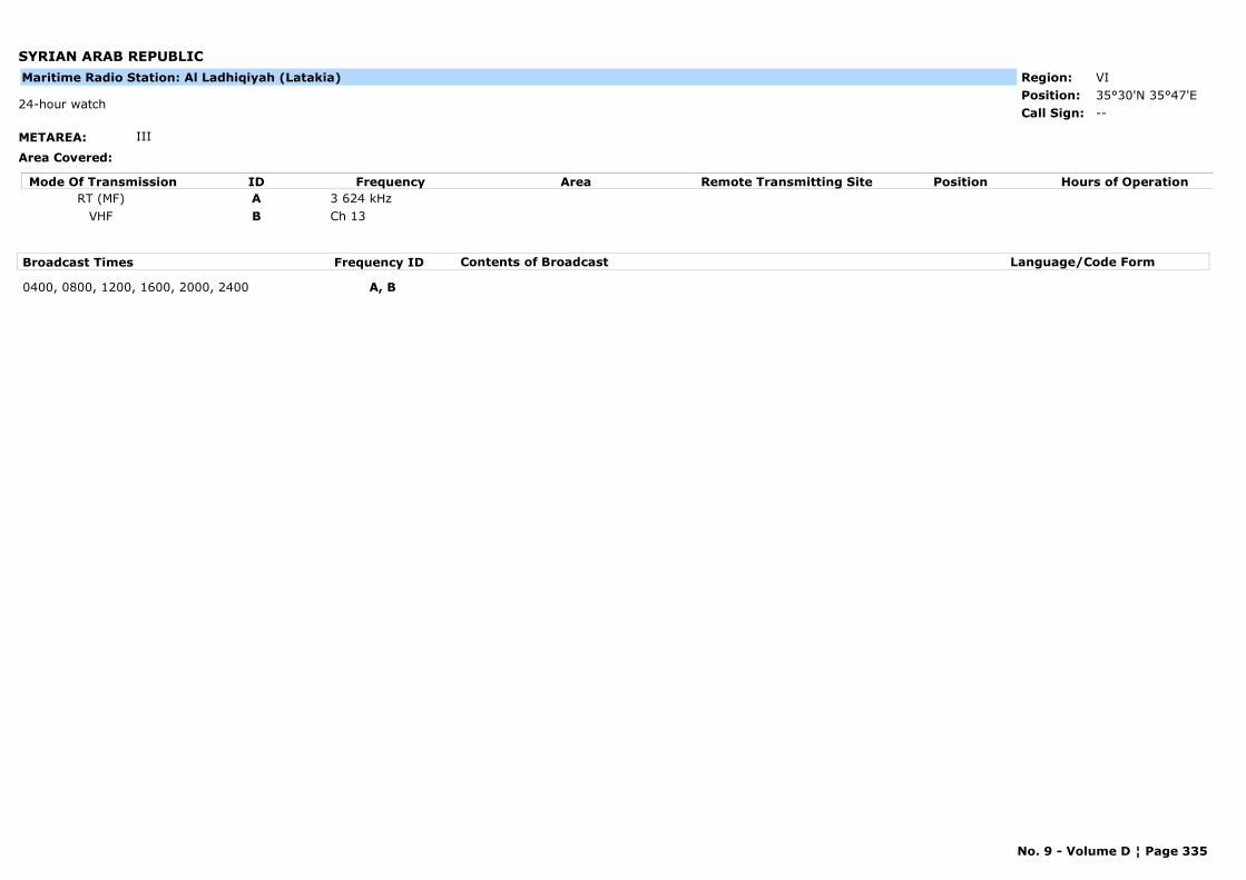
SYRIAN ARAB REPUBLIC
METAREA: III
Area Covered:
Region: VIPosition: 35°30'N 35°47'E
--24-hour watch
Call Sign:
Maritime Radio Station: Al Ladhiqiyah (Latakia)
Mode Of Transmission ID Frequency Area Position Hours of OperationRemote Transmitting SiteRT (MF) A 3 624 kHz
VHF B Ch 13
Broadcast Times Frequency ID Contents of Broadcast Language/Code Form
0400, 0800, 1200, 1600, 2000, 2400 A, B
No. 9 - Volume D ¦ Page 335
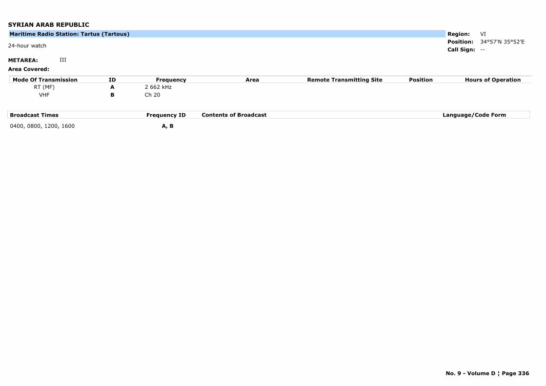
SYRIAN ARAB REPUBLIC
METAREA: III
Area Covered:
Region: VIPosition: 34°57'N 35°52'E
--24-hour watch
Call Sign:
Maritime Radio Station: Tartus (Tartous)
Mode Of Transmission ID Frequency Area Position Hours of OperationRemote Transmitting SiteRT (MF) A 2 662 kHz
VHF B Ch 20
Broadcast Times Frequency ID Contents of Broadcast Language/Code Form
0400, 0800, 1200, 1600 A, B
No. 9 - Volume D ¦ Page 336
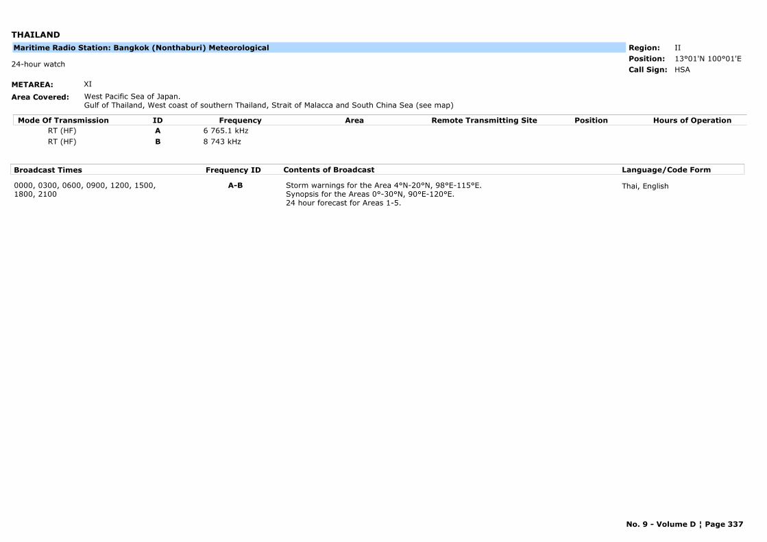
THAILAND
METAREA: XI
Area Covered: West Pacific Sea of Japan.Gulf of Thailand, West coast of southern Thailand, Strait of Malacca and South China Sea (see map)
Region: IIPosition: 13°01'N 100°01'E
HSA24-hour watch
Call Sign:
Maritime Radio Station: Bangkok (Nonthaburi) Meteorological
Mode Of Transmission ID Frequency Area Position Hours of OperationRemote Transmitting SiteRT (HF) A 6 765.1 kHzRT (HF) B 8 743 kHz
Broadcast Times Frequency ID Contents of Broadcast Language/Code Form
0000, 0300, 0600, 0900, 1200, 1500, 1800, 2100
A-B Storm warnings for the Area 4°N-20°N, 98°E-115°E.Synopsis for the Areas 0°-30°N, 90°E-120°E.24 hour forecast for Areas 1-5.
Thai, English
No. 9 - Volume D ¦ Page 337
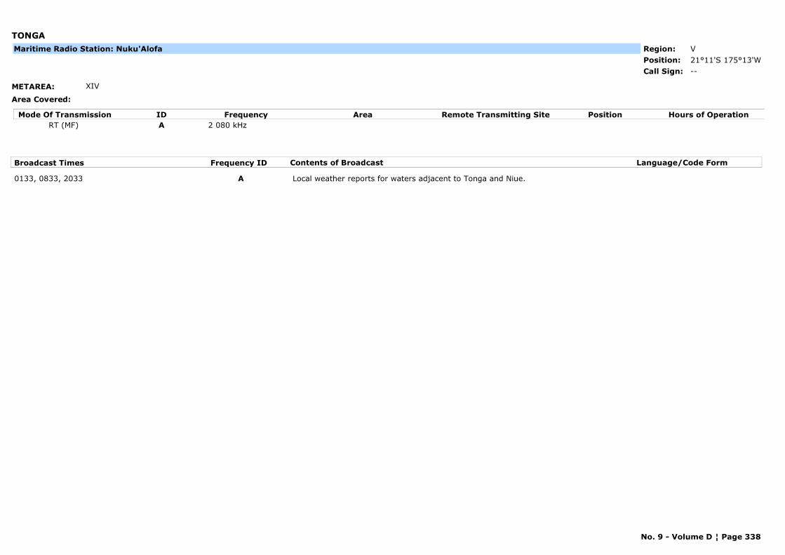
TONGA
METAREA: XIV
Area Covered:
Region: VPosition: 21°11'S 175°13'W
--Call Sign:
Maritime Radio Station: Nuku'Alofa
Mode Of Transmission ID Frequency Area Position Hours of OperationRemote Transmitting SiteRT (MF) A 2 080 kHz
Broadcast Times Frequency ID Contents of Broadcast Language/Code Form
0133, 0833, 2033 A Local weather reports for waters adjacent to Tonga and Niue.
No. 9 - Volume D ¦ Page 338
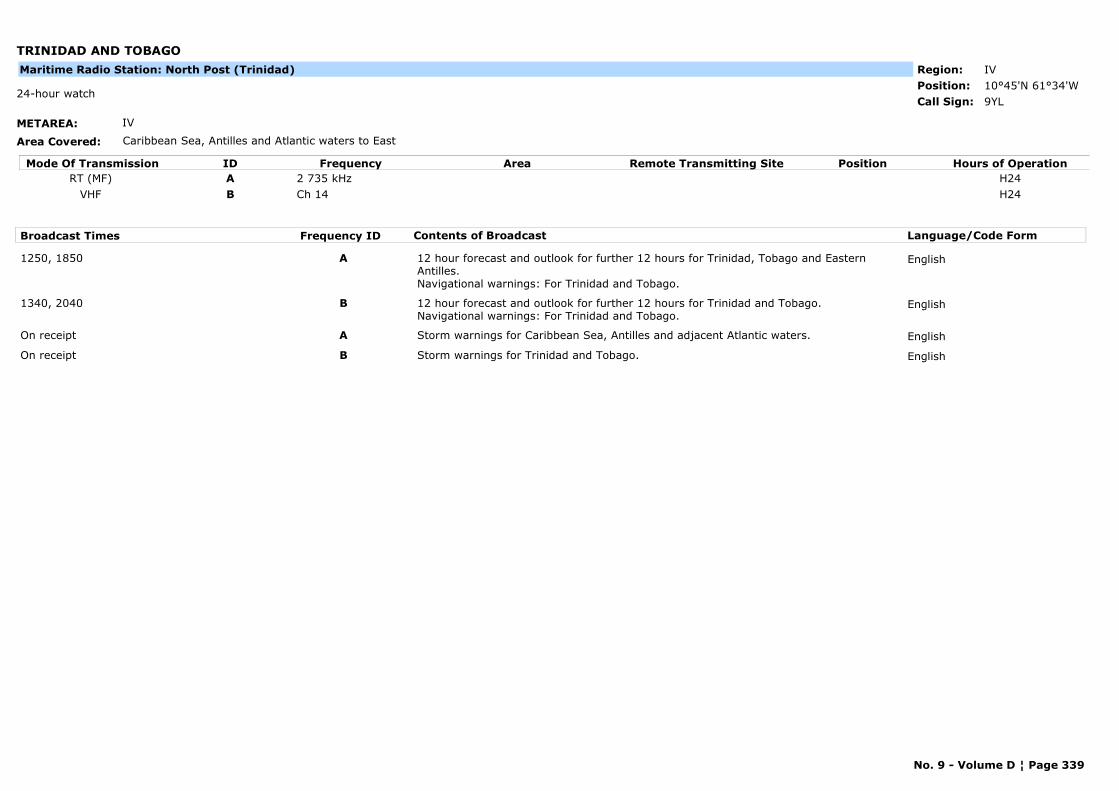
TRINIDAD AND TOBAGO
METAREA: IV
Area Covered: Caribbean Sea, Antilles and Atlantic waters to East
Region: IVPosition: 10°45'N 61°34'W
9YL24-hour watch
Call Sign:
Maritime Radio Station: North Post (Trinidad)
Mode Of Transmission ID Frequency Area Position Hours of OperationRemote Transmitting SiteRT (MF) A 2 735 kHz H24
VHF B Ch 14 H24
Broadcast Times Frequency ID Contents of Broadcast Language/Code Form
1250, 1850 A 12 hour forecast and outlook for further 12 hours for Trinidad, Tobago and Eastern Antilles. Navigational warnings: For Trinidad and Tobago.
English
1340, 2040 B 12 hour forecast and outlook for further 12 hours for Trinidad and Tobago.Navigational warnings: For Trinidad and Tobago.
English
On receipt A Storm warnings for Caribbean Sea, Antilles and adjacent Atlantic waters. English
On receipt B Storm warnings for Trinidad and Tobago. English
No. 9 - Volume D ¦ Page 339
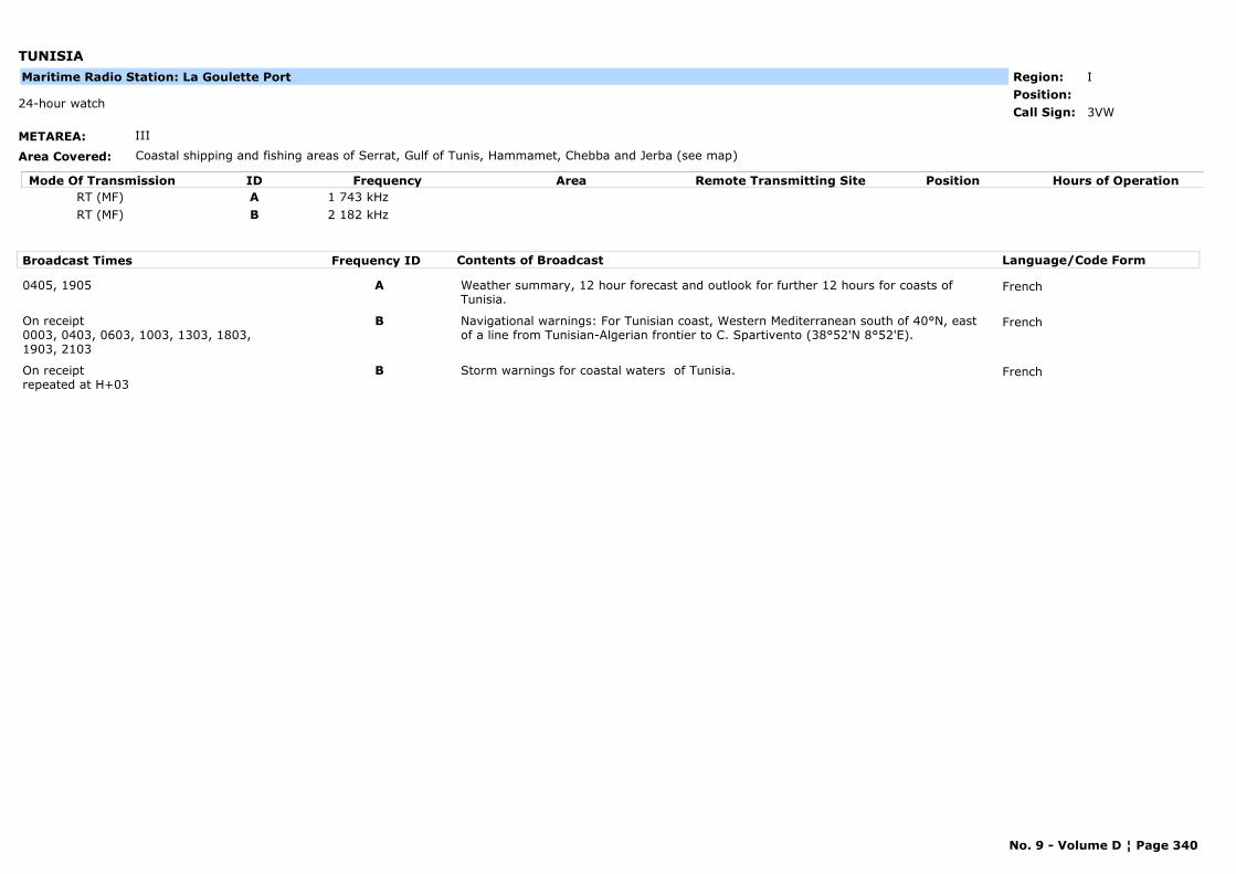
TUNISIA
METAREA: III
Area Covered: Coastal shipping and fishing areas of Serrat, Gulf of Tunis, Hammamet, Chebba and Jerba (see map)
Region: IPosition:
3VW24-hour watch
Call Sign:
Maritime Radio Station: La Goulette Port
Mode Of Transmission ID Frequency Area Position Hours of OperationRemote Transmitting SiteRT (MF) A 1 743 kHzRT (MF) B 2 182 kHz
Broadcast Times Frequency ID Contents of Broadcast Language/Code Form
0405, 1905 A Weather summary, 12 hour forecast and outlook for further 12 hours for coasts of Tunisia.
French
On receipt0003, 0403, 0603, 1003, 1303, 1803, 1903, 2103
B Navigational warnings: For Tunisian coast, Western Mediterranean south of 40°N, east of a line from Tunisian-Algerian frontier to C. Spartivento (38°52'N 8°52'E).
French
On receiptrepeated at H+03
B Storm warnings for coastal waters of Tunisia. French
No. 9 - Volume D ¦ Page 340
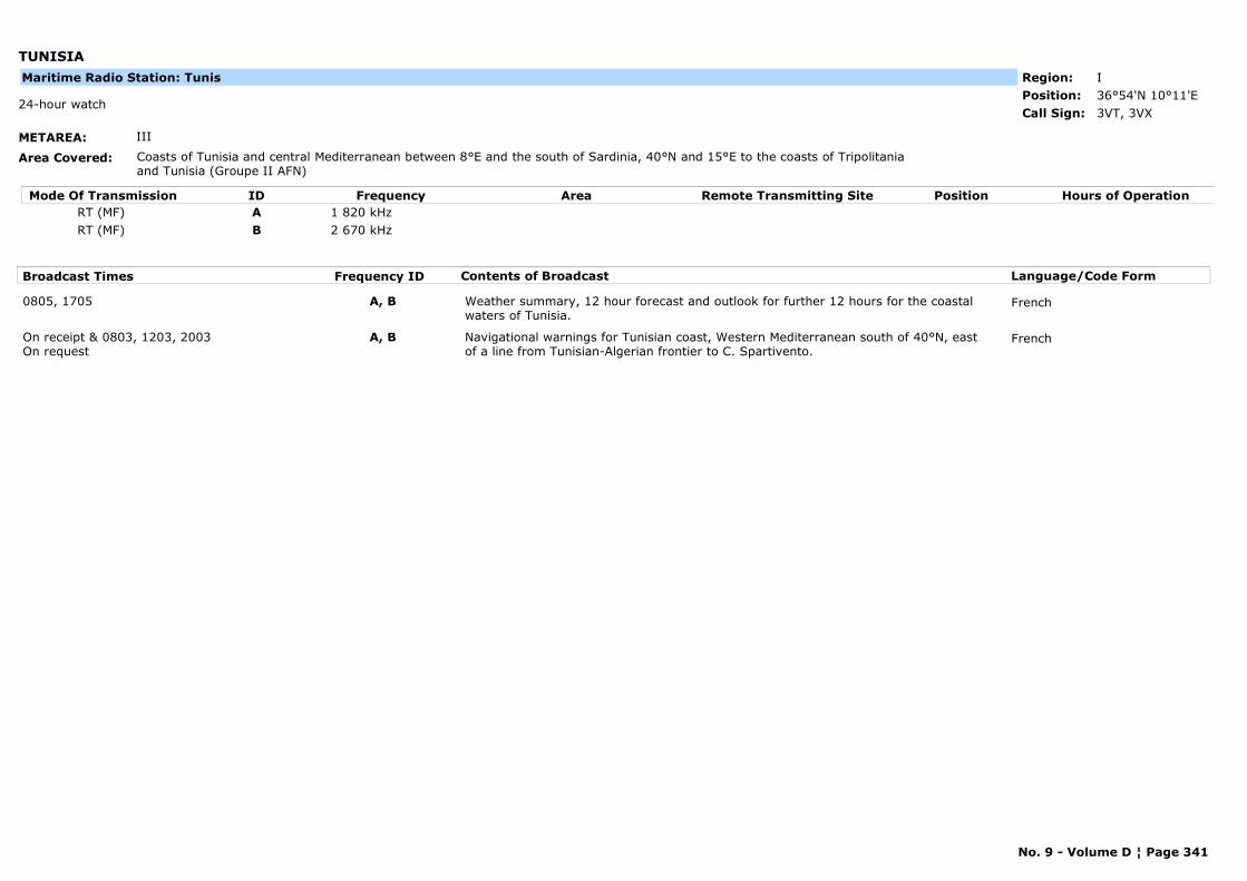
TUNISIA
METAREA: III
Area Covered: Coasts of Tunisia and central Mediterranean between 8°E and the south of Sardinia, 40°N and 15°E to the coasts of Tripolitania and Tunisia (Groupe II AFN)
Region: IPosition: 36°54'N 10°11'E
3VT, 3VX24-hour watch
Call Sign:
Maritime Radio Station: Tunis
Mode Of Transmission ID Frequency Area Position Hours of OperationRemote Transmitting SiteRT (MF) A 1 820 kHzRT (MF) B 2 670 kHz
Broadcast Times Frequency ID Contents of Broadcast Language/Code Form
0805, 1705 A, B Weather summary, 12 hour forecast and outlook for further 12 hours for the coastal waters of Tunisia.
French
On receipt & 0803, 1203, 2003On request
A, B Navigational warnings for Tunisian coast, Western Mediterranean south of 40°N, east of a line from Tunisian-Algerian frontier to C. Spartivento.
French
No. 9 - Volume D ¦ Page 341
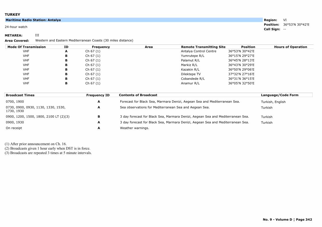
TURKEY
METAREA: III
Area Covered: Western and Eastern Mediterranean Coasts (30 miles distance)
Region: VIPosition: 36°53'N 30°42'E
--24-hour watch
Call Sign:
Maritime Radio Station: Antalya
Mode Of Transmission ID Frequency Area Position Hours of OperationRemote Transmitting SiteVHF A Ch 67 (1) Antalya Control Centre 36°53'N 30°42'EVHF B Ch 67 (1) Yumrutepe R/L 36°15'N 29°27'EVHF B Ch 67 (1) Palamut R/L 36°45'N 28°13'EVHF B Ch 67 (1) Markiz R/L 36°43'N 30°29'EVHF B Ch 67 (1) Kazakin R/L 36°50'N 29°06'EVHF B Ch 67 (1) Dilektepe TV 37°32'N 27°16'EVHF B Ch 67 (1) Cobandede R/L 36°31'N 36°15'EVHF B Ch 67 (1) Anamur R/L 36°05'N 32°50'E
Broadcast Times Frequency ID Contents of Broadcast Language/Code Form
0700, 1900 A Forecast for Black Sea, Marmara Denizi, Aegean Sea and Mediterranean Sea. Turkish, English
0730, 0900, 0930, 1130, 1330, 1530, 1730, 1930
A Sea observations for Mediterranean Sea and Aegean Sea. Turkish
0900, 1200, 1500, 1800, 2100 LT (2)(3) B 3 day forecast for Black Sea, Marmara Denizi, Aegean Sea and Mediterranean Sea. Turkish
0900, 1930 A 3 day forecast for Black Sea, Marmara Denizi, Aegean Sea and Mediterranean Sea. Turkish
On receipt A Weather warnings.
(1) After prior announcement on Ch. 16.(2) Broadcasts given 1 hour early when DST is in force.(3) Broadcasts are repeated 3 times at 5 minute intervals.
No. 9 - Volume D ¦ Page 342
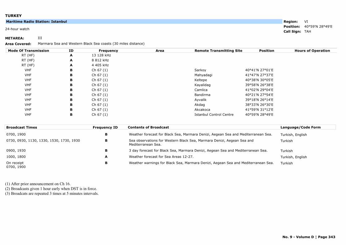
TURKEY
METAREA: III
Area Covered: Marmara Sea and Western Black Sea coasts (30 miles distance)
Region: VIPosition: 40°59'N 28°49'E
TAH24-hour watch
Call Sign:
Maritime Radio Station: Istanbul
Mode Of Transmission ID Frequency Area Position Hours of OperationRemote Transmitting SiteRT (HF) A 13 128 kHzRT (HF) A 8 812 kHzRT (HF) A 4 405 kHz
VHF B Ch 67 (1) Sarkoy 40°41'N 27°01'EVHF B Ch 67 (1) Mahyadagi 41°47'N 27°37'EVHF B Ch 67 (1) Keltepe 40°38'N 30°05'EVHF B Ch 67 (1) Kayalidag 39°58'N 26°38'EVHF B Ch 67 (1) Camlica 41°02'N 29°04'EVHF B Ch 67 (1) Bandirma 40°21'N 27°54'EVHF B Ch 67 (1) Ayvalik 39°18'N 26°14'EVHF B Ch 67 (1) Akdag 38°33'N 26°30'EVHF B Ch 67 (1) Akcakoca 41°59'N 31°12'EVHF B Ch 67 (1) Istanbul Control Centre 40°59'N 28°49'E
Broadcast Times Frequency ID Contents of Broadcast Language/Code Form
0700, 1900 B Weather forecast for Black Sea, Marmara Denizi, Aegean Sea and Mediterranean Sea. Turkish, English
0730, 0930, 1130, 1330, 1530, 1730, 1930 B Sea observations for Western Black Sea, Marmara Denizi, Aegean Sea and Mediterranean Sea.
Turkish
0900, 1930 B 3 day forecast for Black Sea, Marmara Denizi, Aegean Sea and Mediterranean Sea. Turkish
1000, 1800 A Weather forecast for Sea Areas 12-27. Turkish, English
On receipt0700, 1900
B Weather warnings for Black Sea, Marmara Denizi, Aegean Sea and Mediterranean Sea. Turkish
(1) After prior announcement on Ch 16.(2) Broadcasts given 1 hour early when DST is in force.(3) Broadcats are repeated 3 times at 5 minutes intervals.
No. 9 - Volume D ¦ Page 343
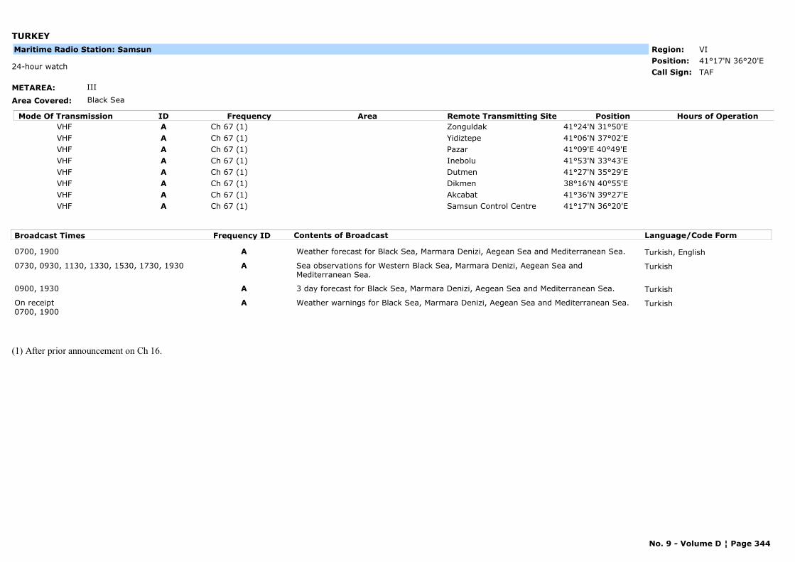
TURKEY
METAREA: III
Area Covered: Black Sea
Region: VIPosition: 41°17'N 36°20'E
TAF24-hour watch
Call Sign:
Maritime Radio Station: Samsun
Mode Of Transmission ID Frequency Area Position Hours of OperationRemote Transmitting SiteVHF A Ch 67 (1) Zonguldak 41°24'N 31°50'EVHF A Ch 67 (1) Yidiztepe 41°06'N 37°02'EVHF A Ch 67 (1) Pazar 41°09'E 40°49'EVHF A Ch 67 (1) Inebolu 41°53'N 33°43'EVHF A Ch 67 (1) Dutmen 41°27'N 35°29'EVHF A Ch 67 (1) Dikmen 38°16'N 40°55'EVHF A Ch 67 (1) Akcabat 41°36'N 39°27'EVHF A Ch 67 (1) Samsun Control Centre 41°17'N 36°20'E
Broadcast Times Frequency ID Contents of Broadcast Language/Code Form
0700, 1900 A Weather forecast for Black Sea, Marmara Denizi, Aegean Sea and Mediterranean Sea. Turkish, English
0730, 0930, 1130, 1330, 1530, 1730, 1930 A Sea observations for Western Black Sea, Marmara Denizi, Aegean Sea and Mediterranean Sea.
Turkish
0900, 1930 A 3 day forecast for Black Sea, Marmara Denizi, Aegean Sea and Mediterranean Sea. Turkish
On receipt0700, 1900
A Weather warnings for Black Sea, Marmara Denizi, Aegean Sea and Mediterranean Sea. Turkish
(1) After prior announcement on Ch 16.
No. 9 - Volume D ¦ Page 344
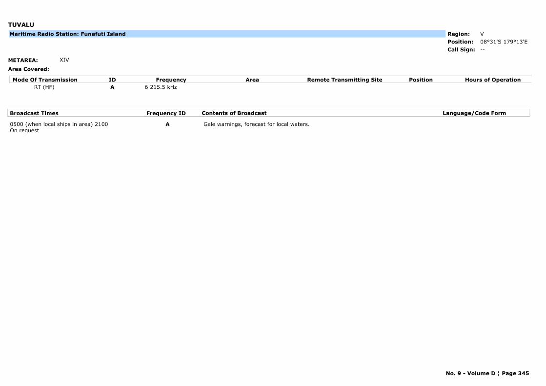
TUVALU
METAREA: XIV
Area Covered:
Region: VPosition: 08°31'S 179°13'E
--Call Sign:
Maritime Radio Station: Funafuti Island
Mode Of Transmission ID Frequency Area Position Hours of OperationRemote Transmitting SiteRT (HF) A 6 215.5 kHz
Broadcast Times Frequency ID Contents of Broadcast Language/Code Form
0500 (when local ships in area) 2100On request
A Gale warnings, forecast for local waters.
No. 9 - Volume D ¦ Page 345
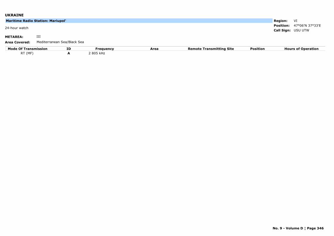
UKRAINE
METAREA: III
Area Covered: Mediterranean Sea/Black Sea
Region: VIPosition: 47°06'N 37°33'E
USU UTW24-hour watch
Call Sign:
Maritime Radio Station: Mariupol'
Mode Of Transmission ID Frequency Area Position Hours of OperationRemote Transmitting SiteRT (MF) A 2 805 kHz
No. 9 - Volume D ¦ Page 346
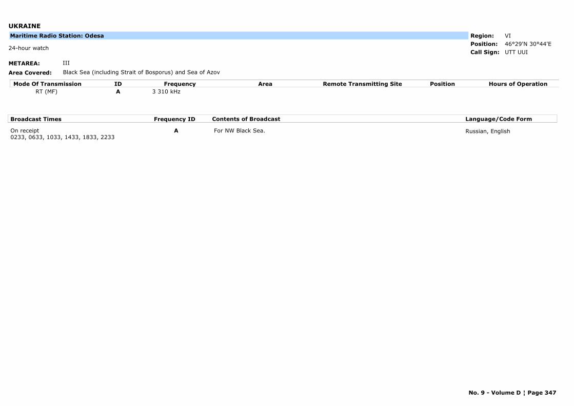
UKRAINE
METAREA: III
Area Covered: Black Sea (including Strait of Bosporus) and Sea of Azov
Region: VIPosition: 46°29'N 30°44'E
UTT UUI24-hour watch
Call Sign:
Maritime Radio Station: Odesa
Mode Of Transmission ID Frequency Area Position Hours of OperationRemote Transmitting SiteRT (MF) A 3 310 kHz
Broadcast Times Frequency ID Contents of Broadcast Language/Code Form
On receipt0233, 0633, 1033, 1433, 1833, 2233
A For NW Black Sea. Russian, English
No. 9 - Volume D ¦ Page 347
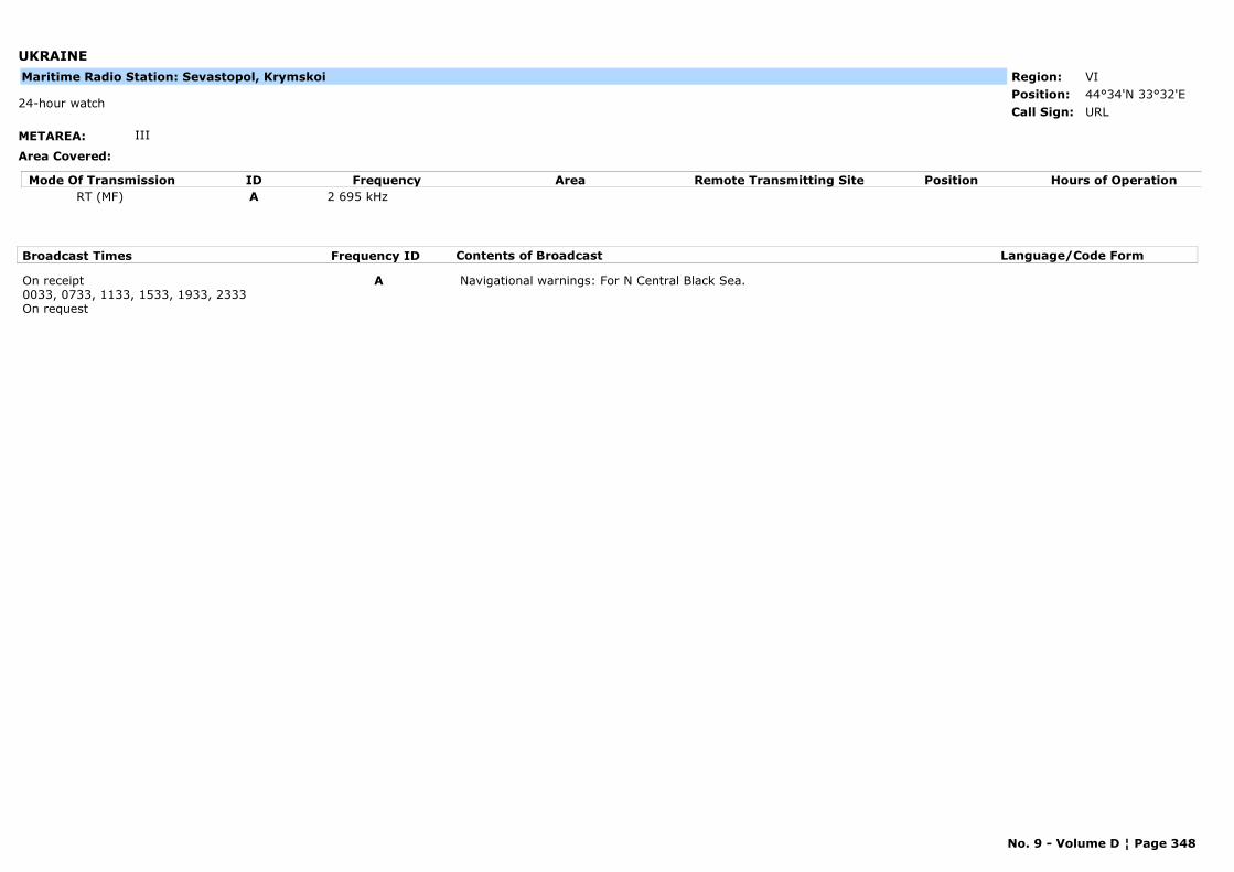
UKRAINE
METAREA: III
Area Covered:
Region: VIPosition: 44°34'N 33°32'E
URL24-hour watch
Call Sign:
Maritime Radio Station: Sevastopol, Krymskoi
Mode Of Transmission ID Frequency Area Position Hours of OperationRemote Transmitting SiteRT (MF) A 2 695 kHz
Broadcast Times Frequency ID Contents of Broadcast Language/Code Form
On receipt0033, 0733, 1133, 1533, 1933, 2333On request
A Navigational warnings: For N Central Black Sea.
No. 9 - Volume D ¦ Page 348
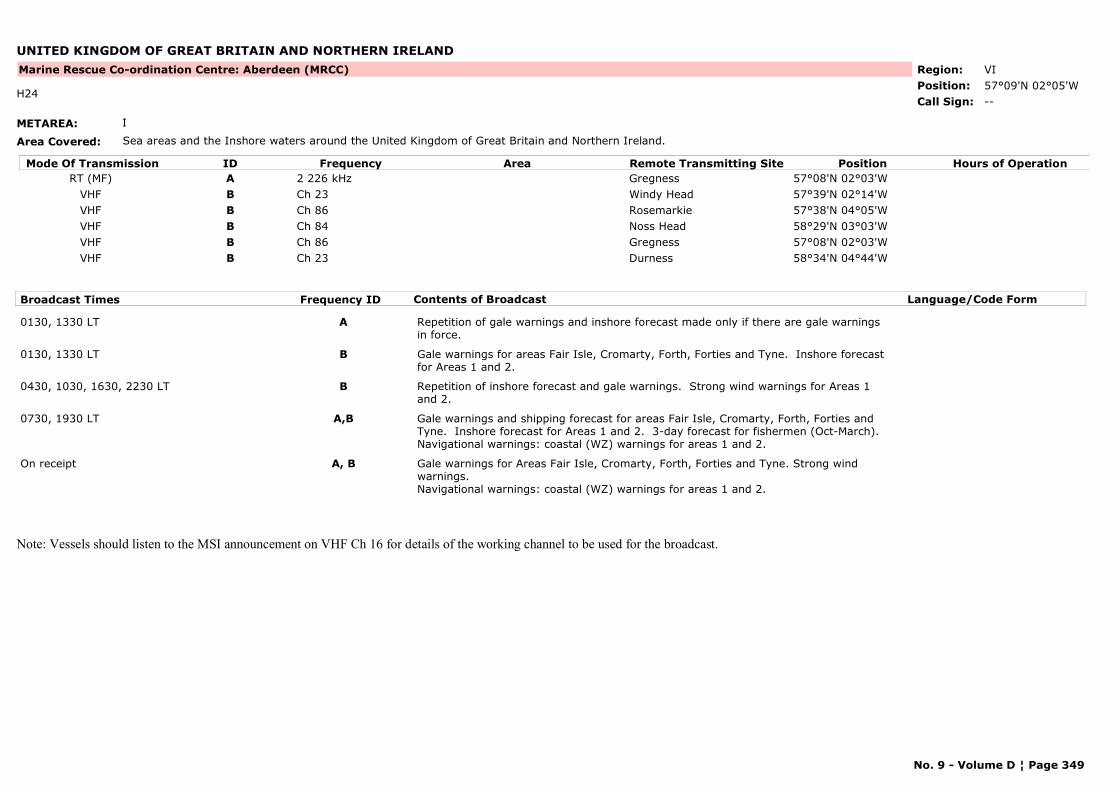
UNITED KINGDOM OF GREAT BRITAIN AND NORTHERN IRELAND
METAREA: I
Area Covered: Sea areas and the Inshore waters around the United Kingdom of Great Britain and Northern Ireland.
Region: VIPosition: 57°09'N 02°05'W
Marine Rescue Co-ordination Centre: Aberdeen (MRCC)
--H24
Call Sign:
Mode Of Transmission ID Frequency Area Position Hours of OperationRemote Transmitting SiteRT (MF) A 2 226 kHz Gregness 57°08'N 02°03'W
VHF B Ch 23 Windy Head 57°39'N 02°14'WVHF B Ch 86 Rosemarkie 57°38'N 04°05'WVHF B Ch 84 Noss Head 58°29'N 03°03'WVHF B Ch 86 Gregness 57°08'N 02°03'WVHF B Ch 23 Durness 58°34'N 04°44'W
Broadcast Times Frequency ID Contents of Broadcast Language/Code Form
0130, 1330 LT A Repetition of gale warnings and inshore forecast made only if there are gale warnings in force.
0130, 1330 LT B Gale warnings for areas Fair Isle, Cromarty, Forth, Forties and Tyne. Inshore forecast for Areas 1 and 2.
0430, 1030, 1630, 2230 LT B Repetition of inshore forecast and gale warnings. Strong wind warnings for Areas 1 and 2.
0730, 1930 LT A,B Gale warnings and shipping forecast for areas Fair Isle, Cromarty, Forth, Forties and Tyne. Inshore forecast for Areas 1 and 2. 3-day forecast for fishermen (Oct-March).Navigational warnings: coastal (WZ) warnings for areas 1 and 2.
On receipt A, B Gale warnings for Areas Fair Isle, Cromarty, Forth, Forties and Tyne. Strong wind warnings.Navigational warnings: coastal (WZ) warnings for areas 1 and 2.
Note: Vessels should listen to the MSI announcement on VHF Ch 16 for details of the working channel to be used for the broadcast.
No. 9 - Volume D ¦ Page 349
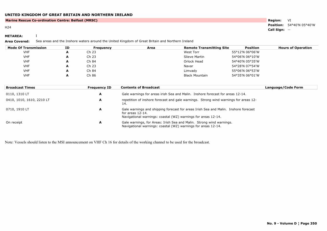
UNITED KINGDOM OF GREAT BRITAIN AND NORTHERN IRELAND
METAREA: I
Area Covered: Sea areas and the Inshore waters around the United Kingdom of Great Britain and Northern Ireland
Region: VIPosition: 54°40'N 05°40'W
Marine Rescue Co-ordination Centre: Belfast (MRSC)
--H24
Call Sign:
Mode Of Transmission ID Frequency Area Position Hours of OperationRemote Transmitting SiteVHF A Ch 23 West Torr 55°12'N 06°06'WVHF A Ch 23 Slieve Martin 54°06'N 06°10'WVHF A Ch 84 Orlock Head 54°40'N 05°35'WVHF A Ch 23 Navar 54°28'N 07°54'WVHF A Ch 84 Limvady 55°06'N 06°53'WVHF A Ch 86 Black Mountain 54°35'N 06°01'W
Broadcast Times Frequency ID Contents of Broadcast Language/Code Form
0110, 1310 LT A Gale warnings for areas irish Sea and Malin. Inshore forecast for areas 12-14.
0410, 1010, 1610, 2210 LT A repetition of inshore forecast and gale warnings. Strong wind warnings for areas 12-14.
0710, 1910 LT A Gale warnings and shipping forecast for areas Irish Sea and Malin. Inshore forecast for areas 12-14.Navigational warnings: coastal (WZ) warnings for areas 12-14.
On receipt A Gale warnings, for Areas: Irish Sea and Malin. Strong wind warnings.Navigational warnings: coastal (WZ) warnings for areas 12-14.
Note: Vessels should listen to the MSI announcement on VHF Ch 16 for details of the working channel to be used for the broadcast.
No. 9 - Volume D ¦ Page 350
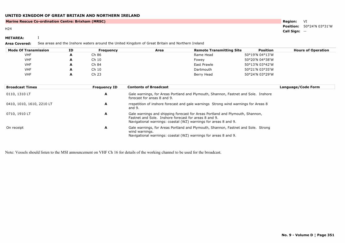
UNITED KINGDOM OF GREAT BRITAIN AND NORTHERN IRELAND
METAREA: I
Area Covered: Sea areas and the Inshore waters around the United Kingdom of Great Britain and Northern Ireland
Region: VIPosition: 50°24'N 03°31'W
Marine Rescue Co-ordination Centre: Brixham (MRSC)
--H24
Call Sign:
Mode Of Transmission ID Frequency Area Position Hours of OperationRemote Transmitting SiteVHF A Ch 86 Rame Head 50°19'N 04°13'WVHF A Ch 10 Fowey 50°20'N 04°38'WVHF A Ch 84 East Prawle 50°13'N 03°42'WVHF A Ch 10 Dartmouth 50°21'N 03°35'WVHF A Ch 23 Berry Head 50°24'N 03°29'W
Broadcast Times Frequency ID Contents of Broadcast Language/Code Form
0110, 1310 LT A Gale warnings, for Areas Portland and Plymouth, Shannon, Fastnet and Sole. Inshore forecast for areas 8 and 9.
0410, 1010, 1610, 2210 LT A rrepetition of inshore forecast and gale warnings Strong wind warnings for Areas 8 and 9.
0710, 1910 LT A Gale warnings and shipping forecast for Areas Portland and Plymouth, Shannon, Fastnet and Sole. Inshore forecast for areas 8 and 9.Navigational warnings: coastal (WZ) warnings for areas 8 and 9.
On receipt A Gale warnings, for Areas Portland and Plymouth, Shannon, Fastnet and Sole. Strong wind warnings.Navigational warnings: coastal (WZ) warnings for areas 8 and 9.
Note: Vessels should listen to the MSI announcement on VHF Ch 16 for details of the working channel to be used for the broadcast.
No. 9 - Volume D ¦ Page 351
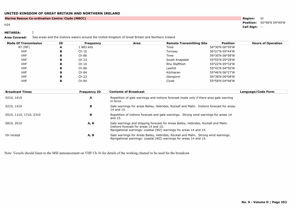
UNITED KINGDOM OF GREAT BRITAIN AND NORTHERN IRELAND
METAREA: I
Area Covered: Sea areas and the Inshore waters around the United Kingdom of Great Britain and Northern Ireland
Region: VIPosition: 55°58'N 04°49'W
Marine Rescue Co-ordination Centre: Clyde (MRCC)
--H24
Call Sign:
Mode Of Transmission ID Frequency Area Position Hours of OperationRemote Transmitting SiteRT (MF) A 1 883 kHz Tiree 56°30'N 06°59'W
VHF B Ch 10 Torosay 56°27'N 05°44'WVHF B Ch 86 Tiree 56°30'N 06°58'WVHF B Ch 23 South Knapdale 55°55'N 05°28'WVHF B Ch 10 Rhu Staffnish 55°22'N 05°32'WVHF B Ch 86 Lawhill 55°42'N 04°50'WVHF B Ch 84 Kilchiaran 55°46'N 06°27'WVHF B Ch 23 Glengorm 56°38'N 06°08'WVHF B Ch 84 Clyde 55°58'N 04°48'W
Broadcast Times Frequency ID Contents of Broadcast Language/Code Form
0210, 1410 A Repetition of gale warnings and inshore forecast made only if there area gale warning in force.
0210, 1410 B Gale warnings for areas Bailey, Hebrides, Rockall and Malin. Inshore forecast for areas 14 and 15.
0510, 1110, 1710, 2310 B Repetition of inshore forecast and gale warnings. Strong wind warnings for areas 14 and 15.
0810, 2010 A, B Gale warnings and shipping forecast for Areas Bailey, Hebrides, Rockall and Malin. Inshore forecast for areas 14 and 15.Navigational warnings: coastal (WZ) warnings for areas 14 and 15.
On receipt A, B Gale warnings for Areas Bailey, Hebrides, Rockall and Malin. Strong wind warnings.Navigational warnings: coastal (WZ) warnings for areas 14 and 15.
Note: Vessels should listen to the MSI announcement on VHF Ch 16 for details of the working channel to be used for the broadcast.
No. 9 - Volume D ¦ Page 352
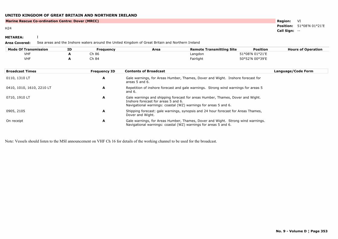
UNITED KINGDOM OF GREAT BRITAIN AND NORTHERN IRELAND
METAREA: I
Area Covered: Sea areas and the Inshore waters around the United Kingdom of Great Britain and Northern Ireland
Region: VIPosition: 51°08'N 01°21'E
Marine Rescue Co-ordination Centre: Dover (MRCC)
--H24
Call Sign:
Mode Of Transmission ID Frequency Area Position Hours of OperationRemote Transmitting SiteVHF A Ch 86 Langdon 51°08'N 01°21'EVHF A Ch 84 Fairlight 50°52'N 00°39'E
Broadcast Times Frequency ID Contents of Broadcast Language/Code Form
0110, 1310 LT A Gale warnings, for Areas Humber, Thames, Dover and Wight. Inshore forecast for areas 5 and 6.
0410, 1010, 1610, 2210 LT A Repetition of inshore forecast and gale warnings. Strong wind warnings for areas 5 and 6.
0710, 1910 LT A Gale warnings and shipping forecast for areas Humber, Thames, Dover and Wight. Inshore forecast for areas 5 and 6.Navigational warnings: coastal (WZ) warnings for areas 5 and 6.
0905, 2105 A Shipping forecast: gale warnings, synopsis and 24 hour forecast for Areas Thames, Dover and Wight.
On receipt A Gale warnings, for Areas Humber, Thames, Dover and Wight. Strong wind warnings. Navigational warnings: coastal (WZ) warnings for areas 5 and 6.
Note: Vessels should listen to the MSI announcement on VHF Ch 16 for details of the working channel to be used for the broadcast.
No. 9 - Volume D ¦ Page 353
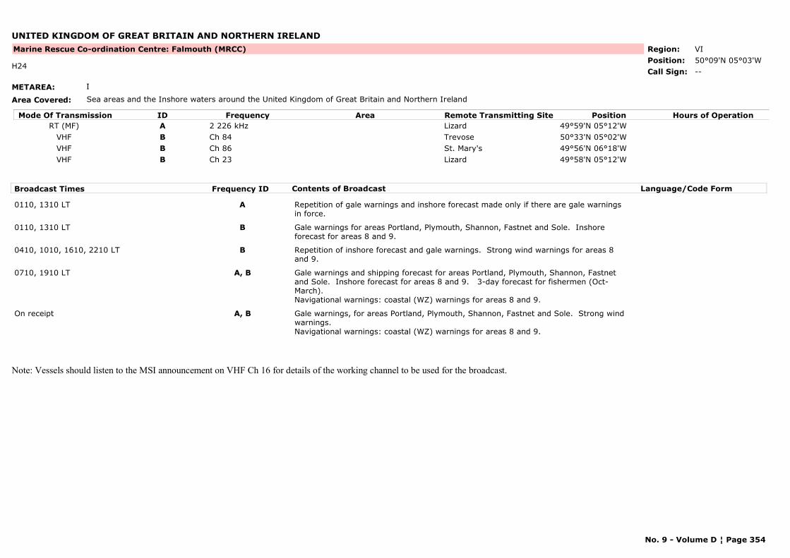
UNITED KINGDOM OF GREAT BRITAIN AND NORTHERN IRELAND
METAREA: I
Area Covered: Sea areas and the Inshore waters around the United Kingdom of Great Britain and Northern Ireland
Region: VIPosition: 50°09'N 05°03'W
Marine Rescue Co-ordination Centre: Falmouth (MRCC)
--H24
Call Sign:
Mode Of Transmission ID Frequency Area Position Hours of OperationRemote Transmitting SiteRT (MF) A 2 226 kHz Lizard 49°59'N 05°12'W
VHF B Ch 84 Trevose 50°33'N 05°02'WVHF B Ch 86 St. Mary's 49°56'N 06°18'WVHF B Ch 23 Lizard 49°58'N 05°12'W
Broadcast Times Frequency ID Contents of Broadcast Language/Code Form
0110, 1310 LT A Repetition of gale warnings and inshore forecast made only if there are gale warnings in force.
0110, 1310 LT B Gale warnings for areas Portland, Plymouth, Shannon, Fastnet and Sole. Inshore forecast for areas 8 and 9.
0410, 1010, 1610, 2210 LT B Repetition of inshore forecast and gale warnings. Strong wind warnings for areas 8 and 9.
0710, 1910 LT A, B Gale warnings and shipping forecast for areas Portland, Plymouth, Shannon, Fastnet and Sole. Inshore forecast for areas 8 and 9. 3-day forecast for fishermen (Oct-March).Navigational warnings: coastal (WZ) warnings for areas 8 and 9.
On receipt A, B Gale warnings, for areas Portland, Plymouth, Shannon, Fastnet and Sole. Strong wind warnings.Navigational warnings: coastal (WZ) warnings for areas 8 and 9.
Note: Vessels should listen to the MSI announcement on VHF Ch 16 for details of the working channel to be used for the broadcast.
No. 9 - Volume D ¦ Page 354
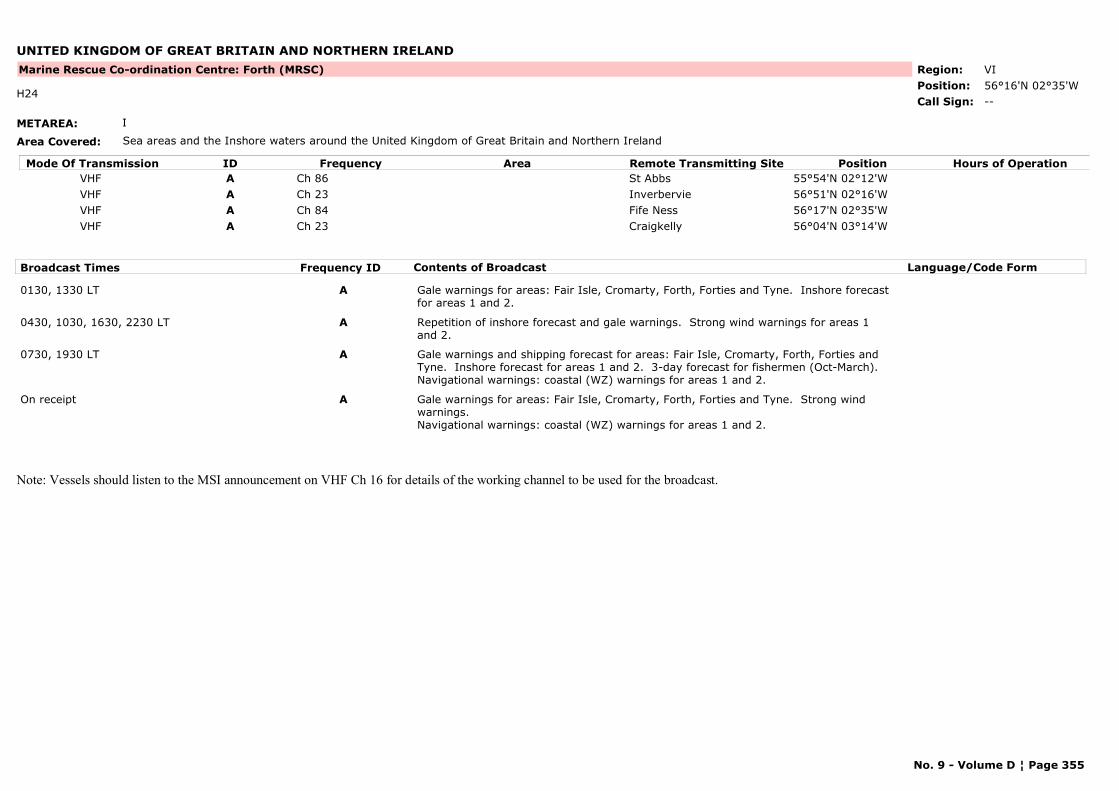
UNITED KINGDOM OF GREAT BRITAIN AND NORTHERN IRELAND
METAREA: I
Area Covered: Sea areas and the Inshore waters around the United Kingdom of Great Britain and Northern Ireland
Region: VIPosition: 56°16'N 02°35'W
Marine Rescue Co-ordination Centre: Forth (MRSC)
--H24
Call Sign:
Mode Of Transmission ID Frequency Area Position Hours of OperationRemote Transmitting SiteVHF A Ch 86 St Abbs 55°54'N 02°12'WVHF A Ch 23 Inverbervie 56°51'N 02°16'WVHF A Ch 84 Fife Ness 56°17'N 02°35'WVHF A Ch 23 Craigkelly 56°04'N 03°14'W
Broadcast Times Frequency ID Contents of Broadcast Language/Code Form
0130, 1330 LT A Gale warnings for areas: Fair Isle, Cromarty, Forth, Forties and Tyne. Inshore forecast for areas 1 and 2.
0430, 1030, 1630, 2230 LT A Repetition of inshore forecast and gale warnings. Strong wind warnings for areas 1 and 2.
0730, 1930 LT A Gale warnings and shipping forecast for areas: Fair Isle, Cromarty, Forth, Forties and Tyne. Inshore forecast for areas 1 and 2. 3-day forecast for fishermen (Oct-March).Navigational warnings: coastal (WZ) warnings for areas 1 and 2.
On receipt A Gale warnings for areas: Fair Isle, Cromarty, Forth, Forties and Tyne. Strong wind warnings.Navigational warnings: coastal (WZ) warnings for areas 1 and 2.
Note: Vessels should listen to the MSI announcement on VHF Ch 16 for details of the working channel to be used for the broadcast.
No. 9 - Volume D ¦ Page 355
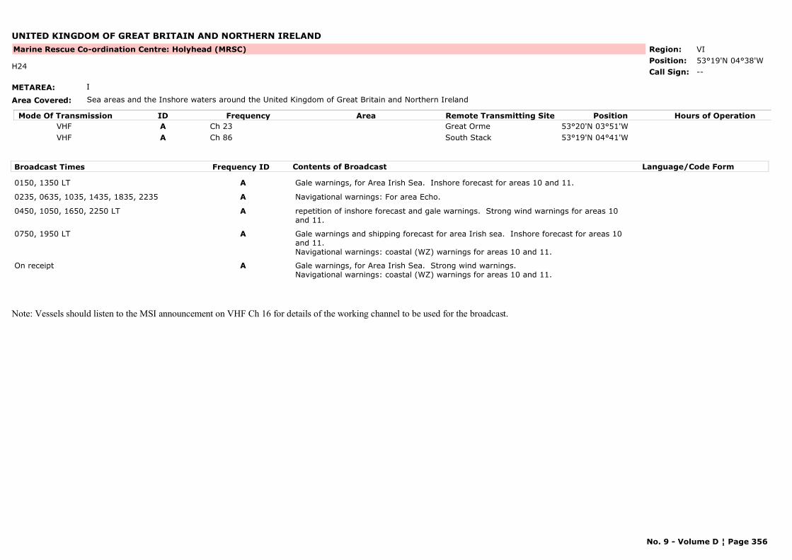
UNITED KINGDOM OF GREAT BRITAIN AND NORTHERN IRELAND
METAREA: I
Area Covered: Sea areas and the Inshore waters around the United Kingdom of Great Britain and Northern Ireland
Region: VIPosition: 53°19'N 04°38'W
Marine Rescue Co-ordination Centre: Holyhead (MRSC)
--H24
Call Sign:
Mode Of Transmission ID Frequency Area Position Hours of OperationRemote Transmitting SiteVHF A Ch 23 Great Orme 53°20'N 03°51'WVHF A Ch 86 South Stack 53°19'N 04°41'W
Broadcast Times Frequency ID Contents of Broadcast Language/Code Form
0150, 1350 LT A Gale warnings, for Area Irish Sea. Inshore forecast for areas 10 and 11.
0235, 0635, 1035, 1435, 1835, 2235 A Navigational warnings: For area Echo.
0450, 1050, 1650, 2250 LT A repetition of inshore forecast and gale warnings. Strong wind warnings for areas 10 and 11.
0750, 1950 LT A Gale warnings and shipping forecast for area Irish sea. Inshore forecast for areas 10 and 11.Navigational warnings: coastal (WZ) warnings for areas 10 and 11.
On receipt A Gale warnings, for Area Irish Sea. Strong wind warnings.Navigational warnings: coastal (WZ) warnings for areas 10 and 11.
Note: Vessels should listen to the MSI announcement on VHF Ch 16 for details of the working channel to be used for the broadcast.
No. 9 - Volume D ¦ Page 356
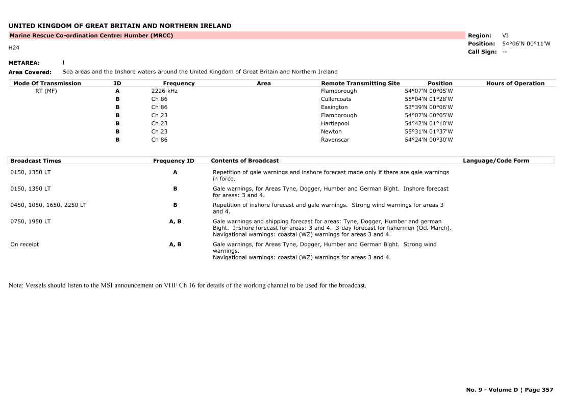
UNITED KINGDOM OF GREAT BRITAIN AND NORTHERN IRELAND
METAREA: I
Area Covered: Sea areas and the Inshore waters around the United Kingdom of Great Britain and Northern Ireland
Region: VIPosition: 54°06'N 00°11'W
Marine Rescue Co-ordination Centre: Humber (MRCC)
--H24
Call Sign:
Mode Of Transmission ID Frequency Area Position Hours of OperationRemote Transmitting SiteRT (MF) A 2226 kHz Flamborough 54°07'N 00°05'W
B Ch 86 Cullercoats 55°04'N 01°28'WB Ch 86 Easington 53°39'N 00°06'WB Ch 23 Flamborough 54°07'N 00°05'WB Ch 23 Hartlepool 54°42'N 01°10'WB Ch 23 Newton 55°31'N 01°37'WB Ch 86 Ravenscar 54°24'N 00°30'W
Broadcast Times Frequency ID Contents of Broadcast Language/Code Form
0150, 1350 LT A Repetition of gale warnings and inshore forecast made only if there are gale warnings in force.
0150, 1350 LT B Gale warnings, for Areas Tyne, Dogger, Humber and German Bight. Inshore forecast for areas: 3 and 4.
0450, 1050, 1650, 2250 LT B Repetition of inshore forecast and gale warnings. Strong wind warnings for areas 3 and 4.
0750, 1950 LT A, B Gale warnings and shipping forecast for areas: Tyne, Dogger, Humber and german Bight. Inshore forecast for areas: 3 and 4. 3-day forecast for fishermen (Oct-March).Navigational warnings: coastal (WZ) warnings for areas 3 and 4.
On receipt A, B Gale warnings, for Areas Tyne, Dogger, Humber and German Bight. Strong wind warnings.Navigational warnings: coastal (WZ) warnings for areas 3 and 4.
Note: Vessels should listen to the MSI announcement on VHF Ch 16 for details of the working channel to be used for the broadcast.
No. 9 - Volume D ¦ Page 357
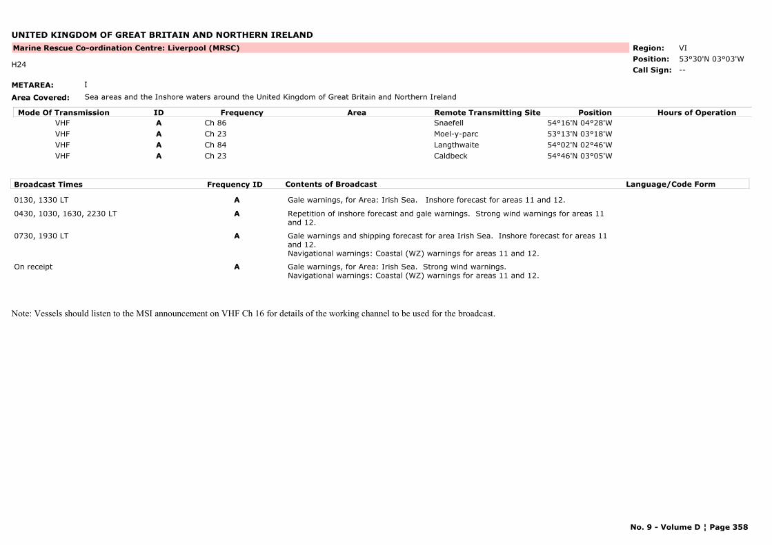
UNITED KINGDOM OF GREAT BRITAIN AND NORTHERN IRELAND
METAREA: I
Area Covered: Sea areas and the Inshore waters around the United Kingdom of Great Britain and Northern Ireland
Region: VIPosition: 53°30'N 03°03'W
Marine Rescue Co-ordination Centre: Liverpool (MRSC)
--H24
Call Sign:
Mode Of Transmission ID Frequency Area Position Hours of OperationRemote Transmitting SiteVHF A Ch 86 Snaefell 54°16'N 04°28'WVHF A Ch 23 Moel-y-parc 53°13'N 03°18'WVHF A Ch 84 Langthwaite 54°02'N 02°46'WVHF A Ch 23 Caldbeck 54°46'N 03°05'W
Broadcast Times Frequency ID Contents of Broadcast Language/Code Form
0130, 1330 LT A Gale warnings, for Area: Irish Sea. Inshore forecast for areas 11 and 12.
0430, 1030, 1630, 2230 LT A Repetition of inshore forecast and gale warnings. Strong wind warnings for areas 11 and 12.
0730, 1930 LT A Gale warnings and shipping forecast for area Irish Sea. Inshore forecast for areas 11 and 12.Navigational warnings: Coastal (WZ) warnings for areas 11 and 12.
On receipt A Gale warnings, for Area: Irish Sea. Strong wind warnings.Navigational warnings: Coastal (WZ) warnings for areas 11 and 12.
Note: Vessels should listen to the MSI announcement on VHF Ch 16 for details of the working channel to be used for the broadcast.
No. 9 - Volume D ¦ Page 358
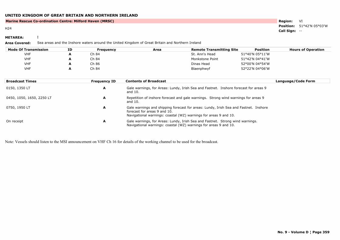
UNITED KINGDOM OF GREAT BRITAIN AND NORTHERN IRELAND
METAREA: I
Area Covered: Sea areas and the Inshore waters around the United Kingdom of Great Britain and Northern Ireland
Region: VIPosition: 51°42'N 05°03'W
Marine Rescue Co-ordination Centre: Milford Haven (MRSC)
--H24
Call Sign:
Mode Of Transmission ID Frequency Area Position Hours of OperationRemote Transmitting SiteVHF A Ch 84 St. Ann's Head 51°40'N 05°11'WVHF A Ch 84 Monkstone Point 51°42'N 04°41'WVHF A Ch 86 Dinas Head 52°00'N 04°54'WVHF A Ch 84 Blaenphwyf 52°22'N 04°06'W
Broadcast Times Frequency ID Contents of Broadcast Language/Code Form
0150, 1350 LT A Gale warnings, for Areas: Lundy, Irish Sea and Fastnet. Inshore forecast for areas 9 and 10.
0450, 1050, 1650, 2250 LT A Repetition of inshore forecast and gale warnings. Strong wind warnings for areas 9 and 10.
0750, 1950 LT A Gale warnings and shipping forecast for areas: Lundy, Irish Sea and Fastnet. Inshore forecast for areas 9 and 10.Navigational warnings: coastal (WZ) warnings for areas 9 and 10.
On receipt A Gale warnings, for Areas: Lundy, Irish Sea and Fastnet. Strong wind warnings.Navigational warnings: coastal (WZ) warnings for areas 9 and 10.
Note: Vessels should listen to the MSI announcement on VHF Ch 16 for details of the working channel to be used for the broadcast.
No. 9 - Volume D ¦ Page 359
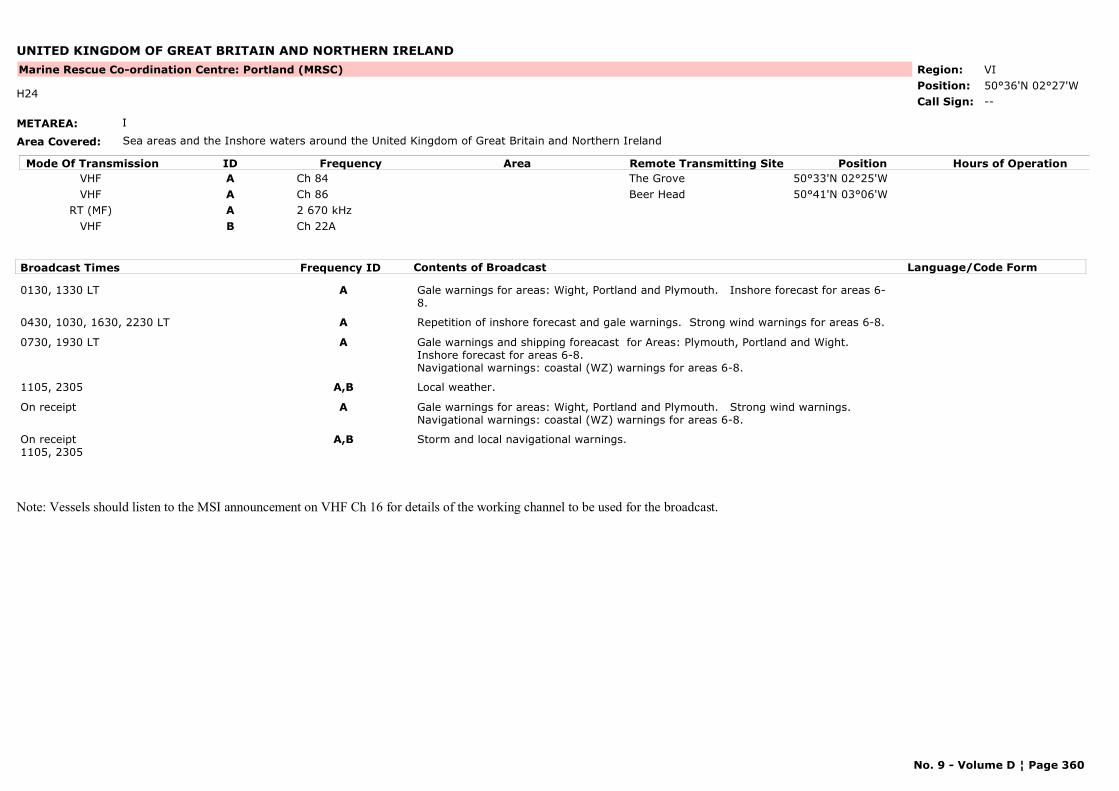
UNITED KINGDOM OF GREAT BRITAIN AND NORTHERN IRELAND
METAREA: I
Area Covered: Sea areas and the Inshore waters around the United Kingdom of Great Britain and Northern Ireland
Region: VIPosition: 50°36'N 02°27'W
Marine Rescue Co-ordination Centre: Portland (MRSC)
--H24
Call Sign:
Mode Of Transmission ID Frequency Area Position Hours of OperationRemote Transmitting SiteVHF A Ch 84 The Grove 50°33'N 02°25'WVHF A Ch 86 Beer Head 50°41'N 03°06'W
RT (MF) A 2 670 kHzVHF B Ch 22A
Broadcast Times Frequency ID Contents of Broadcast Language/Code Form
0130, 1330 LT A Gale warnings for areas: Wight, Portland and Plymouth. Inshore forecast for areas 6-8.
0430, 1030, 1630, 2230 LT A Repetition of inshore forecast and gale warnings. Strong wind warnings for areas 6-8.
0730, 1930 LT A Gale warnings and shipping foreacast for Areas: Plymouth, Portland and Wight. Inshore forecast for areas 6-8. Navigational warnings: coastal (WZ) warnings for areas 6-8.
1105, 2305 A,B Local weather.
On receipt A Gale warnings for areas: Wight, Portland and Plymouth. Strong wind warnings.Navigational warnings: coastal (WZ) warnings for areas 6-8.
On receipt1105, 2305
A,B Storm and local navigational warnings.
Note: Vessels should listen to the MSI announcement on VHF Ch 16 for details of the working channel to be used for the broadcast.
No. 9 - Volume D ¦ Page 360
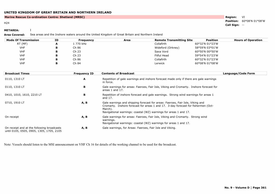
UNITED KINGDOM OF GREAT BRITAIN AND NORTHERN IRELAND
METAREA: I
Area Covered: Sea areas and the Inshore waters around the United Kingdom of Great Britain and Northern Ireland
Region: VIPosition: 60°08'N 01°08'W
Marine Rescue Co-ordination Centre: Shetland (MRSC)
--H24
Call Sign:
Mode Of Transmission ID Frequency Area Position Hours of OperationRemote Transmitting SiteRT (MF) A 1 770 kHz Collafirth 60°32'N 01°23'W
VHF B Ch 86 Wideford (Orkney) 58°59'N 03°01'WVHF B Ch 23 Saxa Vord 60°50'N 00°50'WVHF B Ch 23 Fitful Head 59°54'N 01°23'WVHF B Ch 86 Collafirth 60°32'N 01°23'WVHF B Ch 84 Lerwick 60°08'N 01°08'W
Broadcast Times Frequency ID Contents of Broadcast Language/Code Form
0110, 1310 LT A Repetition of gale warnings and inshore forecast made only if there are gale warnings in force.
0110, 1310 LT B Gale warnings for areas: Faeroes, Fair Isle, Viking and Cromarty. Inshore forecast for areas 1 and 17.
0410, 1010, 1610, 2210 LT B Repetition of inshore forecast and gale warnings. Strong wind warnings for areas 1 and 17.
0710, 1910 LT A, B Gale warnings and shipping forecast for areas: Faeroes, Fair Isle, Viking and Cromarty. Inshore forecast for areas 1 and 17. 3-day forecast for fishermen (Oct-March).Navigational warnings: coastal (WZ) warnings for areas 1 and 17.
On receipt A, B Gale warnings for areas: Faeroes, Fair Isle, Viking and Cromarty. Strong wind warnings.Navigational warnings: coastal (WZ) warnings for areas 1 and 17.
On receipt and at the following broadcasts until 0105, 0505, 0905, 1305, 1705, 2105
A, B Gale warnings, for Areas: Faeroes, Fair Isle and Viking.
Note: Vessels should listen to the MSI announcement on VHF Ch 16 for details of the working channel to be used for the broadcast.
No. 9 - Volume D ¦ Page 361
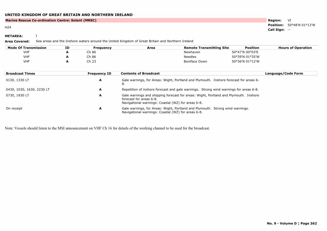
UNITED KINGDOM OF GREAT BRITAIN AND NORTHERN IRELAND
METAREA: I
Area Covered: Sea areas and the Inshore waters around the United Kingdom of Great Britain and Northern Ireland
Region: VIPosition: 50°48'N 01°13'W
Marine Rescue Co-ordination Centre: Solent (MRSC)
--H24
Call Sign:
Mode Of Transmission ID Frequency Area Position Hours of OperationRemote Transmitting SiteVHF A Ch 86 Newhaven 50°47'N 00°03'EVHF A Ch 86 Needles 50°39'N 01°35'WVHF A Ch 23 Boniface Down 50°36'N 01°12'W
Broadcast Times Frequency ID Contents of Broadcast Language/Code Form
0130, 1330 LT A Gale warnings, for Areas: Wight, Portland and Plymouth. Inshore forecast for areas 6-8.
0430, 1030, 1630, 2230 LT A Repetition of inshore forecast and gale warnings. Strong wind warnings for areas 6-8.
0730, 1930 LT A Gale warnings and shipping forecast for areas: Wight, Portland and Plymouth. Inshore forecast for areas 6-8.Navigational warnings: Coastal (WZ) for areas 6-8.
On receipt A Gale warnings, for Areas: Wight, Portland and Plymouth. Strong wind warnings.Navigational warnings: Coastal (WZ) for areas 6-8.
Note: Vessels should listen to the MSI announcement on VHF Ch 16 for details of the working channel to be used for the broadcast.
No. 9 - Volume D ¦ Page 362
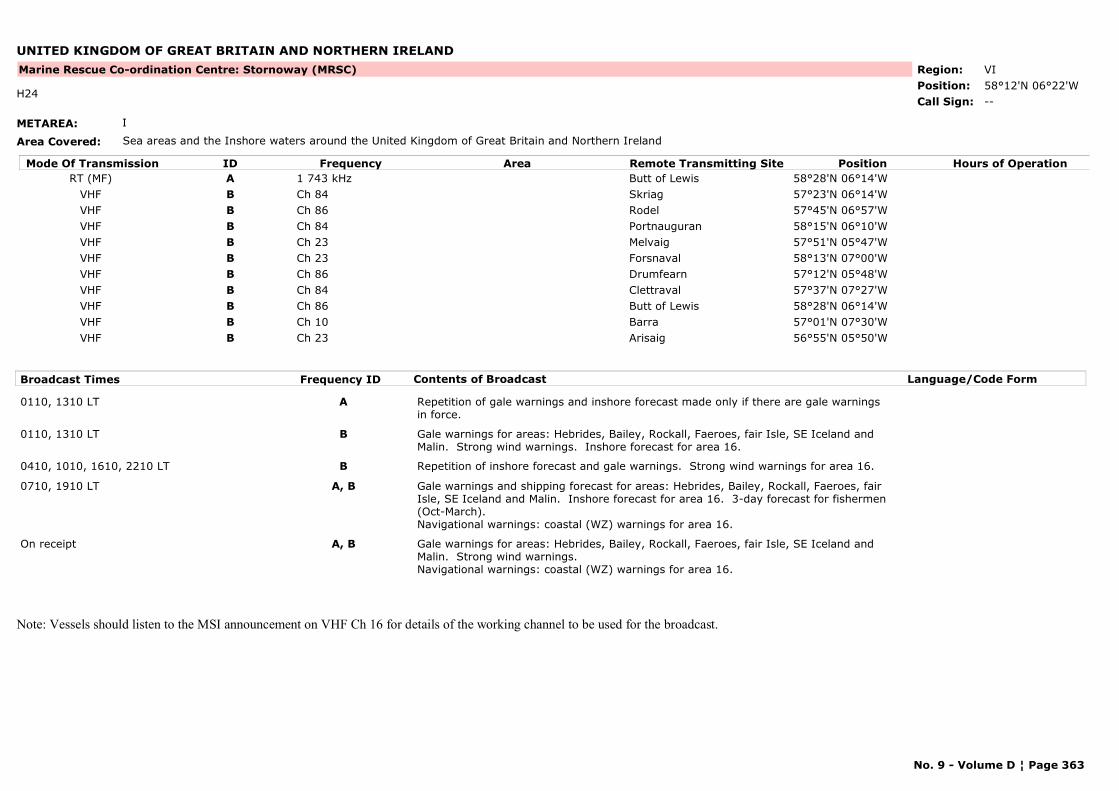
UNITED KINGDOM OF GREAT BRITAIN AND NORTHERN IRELAND
METAREA: I
Area Covered: Sea areas and the Inshore waters around the United Kingdom of Great Britain and Northern Ireland
Region: VIPosition: 58°12'N 06°22'W
Marine Rescue Co-ordination Centre: Stornoway (MRSC)
--H24
Call Sign:
Mode Of Transmission ID Frequency Area Position Hours of OperationRemote Transmitting SiteRT (MF) A 1 743 kHz Butt of Lewis 58°28'N 06°14'W
VHF B Ch 84 Skriag 57°23'N 06°14'WVHF B Ch 86 Rodel 57°45'N 06°57'WVHF B Ch 84 Portnauguran 58°15'N 06°10'WVHF B Ch 23 Melvaig 57°51'N 05°47'WVHF B Ch 23 Forsnaval 58°13'N 07°00'WVHF B Ch 86 Drumfearn 57°12'N 05°48'WVHF B Ch 84 Clettraval 57°37'N 07°27'WVHF B Ch 86 Butt of Lewis 58°28'N 06°14'WVHF B Ch 10 Barra 57°01'N 07°30'WVHF B Ch 23 Arisaig 56°55'N 05°50'W
Broadcast Times Frequency ID Contents of Broadcast Language/Code Form
0110, 1310 LT A Repetition of gale warnings and inshore forecast made only if there are gale warnings in force.
0110, 1310 LT B Gale warnings for areas: Hebrides, Bailey, Rockall, Faeroes, fair Isle, SE Iceland and Malin. Strong wind warnings. Inshore forecast for area 16.
0410, 1010, 1610, 2210 LT B Repetition of inshore forecast and gale warnings. Strong wind warnings for area 16.
0710, 1910 LT A, B Gale warnings and shipping forecast for areas: Hebrides, Bailey, Rockall, Faeroes, fair Isle, SE Iceland and Malin. Inshore forecast for area 16. 3-day forecast for fishermen (Oct-March).Navigational warnings: coastal (WZ) warnings for area 16.
On receipt A, B Gale warnings for areas: Hebrides, Bailey, Rockall, Faeroes, fair Isle, SE Iceland and Malin. Strong wind warnings. Navigational warnings: coastal (WZ) warnings for area 16.
Note: Vessels should listen to the MSI announcement on VHF Ch 16 for details of the working channel to be used for the broadcast.
No. 9 - Volume D ¦ Page 363
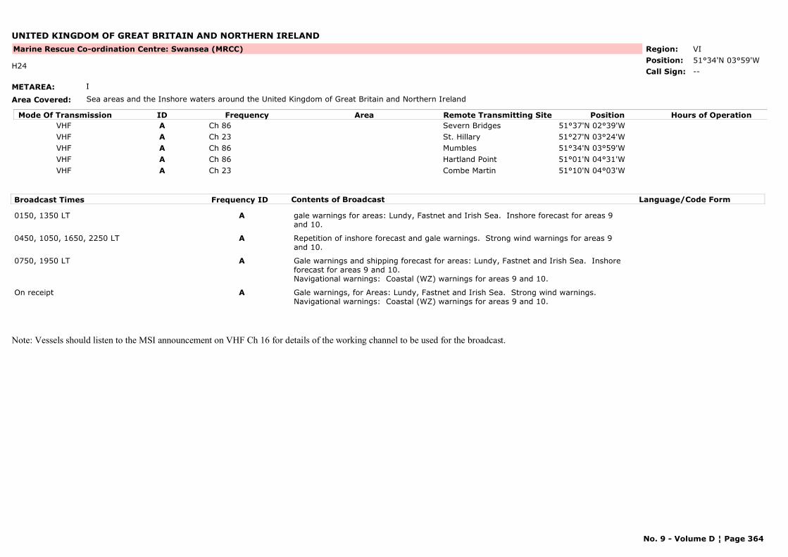
UNITED KINGDOM OF GREAT BRITAIN AND NORTHERN IRELAND
METAREA: I
Area Covered: Sea areas and the Inshore waters around the United Kingdom of Great Britain and Northern Ireland
Region: VIPosition: 51°34'N 03°59'W
Marine Rescue Co-ordination Centre: Swansea (MRCC)
--H24
Call Sign:
Mode Of Transmission ID Frequency Area Position Hours of OperationRemote Transmitting SiteVHF A Ch 86 Severn Bridges 51°37'N 02°39'WVHF A Ch 23 St. Hillary 51°27'N 03°24'WVHF A Ch 86 Mumbles 51°34'N 03°59'WVHF A Ch 86 Hartland Point 51°01'N 04°31'WVHF A Ch 23 Combe Martin 51°10'N 04°03'W
Broadcast Times Frequency ID Contents of Broadcast Language/Code Form
0150, 1350 LT A gale warnings for areas: Lundy, Fastnet and Irish Sea. Inshore forecast for areas 9 and 10.
0450, 1050, 1650, 2250 LT A Repetition of inshore forecast and gale warnings. Strong wind warnings for areas 9 and 10.
0750, 1950 LT A Gale warnings and shipping forecast for areas: Lundy, Fastnet and Irish Sea. Inshore forecast for areas 9 and 10.Navigational warnings: Coastal (WZ) warnings for areas 9 and 10.
On receipt A Gale warnings, for Areas: Lundy, Fastnet and Irish Sea. Strong wind warnings. Navigational warnings: Coastal (WZ) warnings for areas 9 and 10.
Note: Vessels should listen to the MSI announcement on VHF Ch 16 for details of the working channel to be used for the broadcast.
No. 9 - Volume D ¦ Page 364
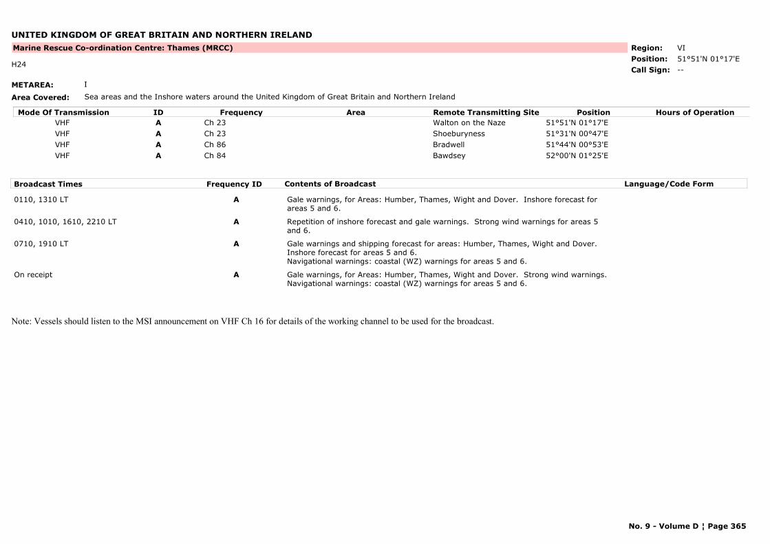
UNITED KINGDOM OF GREAT BRITAIN AND NORTHERN IRELAND
METAREA: I
Area Covered: Sea areas and the Inshore waters around the United Kingdom of Great Britain and Northern Ireland
Region: VIPosition: 51°51'N 01°17'E
Marine Rescue Co-ordination Centre: Thames (MRCC)
--H24
Call Sign:
Mode Of Transmission ID Frequency Area Position Hours of OperationRemote Transmitting SiteVHF A Ch 23 Walton on the Naze 51°51'N 01°17'EVHF A Ch 23 Shoeburyness 51°31'N 00°47'EVHF A Ch 86 Bradwell 51°44'N 00°53'EVHF A Ch 84 Bawdsey 52°00'N 01°25'E
Broadcast Times Frequency ID Contents of Broadcast Language/Code Form
0110, 1310 LT A Gale warnings, for Areas: Humber, Thames, Wight and Dover. Inshore forecast for areas 5 and 6.
0410, 1010, 1610, 2210 LT A Repetition of inshore forecast and gale warnings. Strong wind warnings for areas 5 and 6.
0710, 1910 LT A Gale warnings and shipping forecast for areas: Humber, Thames, Wight and Dover. Inshore forecast for areas 5 and 6.Navigational warnings: coastal (WZ) warnings for areas 5 and 6.
On receipt A Gale warnings, for Areas: Humber, Thames, Wight and Dover. Strong wind warnings.Navigational warnings: coastal (WZ) warnings for areas 5 and 6.
Note: Vessels should listen to the MSI announcement on VHF Ch 16 for details of the working channel to be used for the broadcast.
No. 9 - Volume D ¦ Page 365
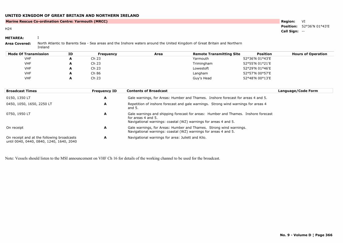
UNITED KINGDOM OF GREAT BRITAIN AND NORTHERN IRELAND
METAREA: I
Area Covered: North Atlantic to Barents Sea - Sea areas and the Inshore waters around the United Kingdom of Great Britain and Northern Ireland
Region: VIPosition: 52°36'N 01°43'E
Marine Rescue Co-ordination Centre: Yarmouth (MRCC)
--H24
Call Sign:
Mode Of Transmission ID Frequency Area Position Hours of OperationRemote Transmitting SiteVHF A Ch 23 Yarmouth 52°36'N 01°43'EVHF A Ch 23 Trimingham 52°55'N 01°21'EVHF A Ch 23 Lowestoft 52°29'N 01°46'EVHF A Ch 86 Langham 52°57'N 00°57'EVHF A Ch 23 Guy's Head 52°48'N 00°13'E
Broadcast Times Frequency ID Contents of Broadcast Language/Code Form
0150, 1350 LT A Gale warnings, for Areas: Humber and Thames. Inshore forecast for areas 4 and 5.
0450, 1050, 1650, 2250 LT A Repetition of inshore forecast and gale warnings. Strong wind warnings for areas 4 and 5.
0750, 1950 LT A Gale warnings and shipping forecast for areas: Humber and Thames. Inshore forecast for areas 4 and 5.Navigational warnings: coastal (WZ) warnings for areas 4 and 5.
On receipt A Gale warnings, for Areas: Humber and Thames. Strong wind warnings.Navigational warnings: coastal (WZ) warnings for areas 4 and 5.
On receipt and at the following broadcasts until 0040, 0440, 0840, 1240, 1640, 2040
A Navigational warnings for area: Juliett and Kilo.
Note: Vessels should listen to the MSI announcement on VHF Ch 16 for details of the working channel to be used for the broadcast.
No. 9 - Volume D ¦ Page 366
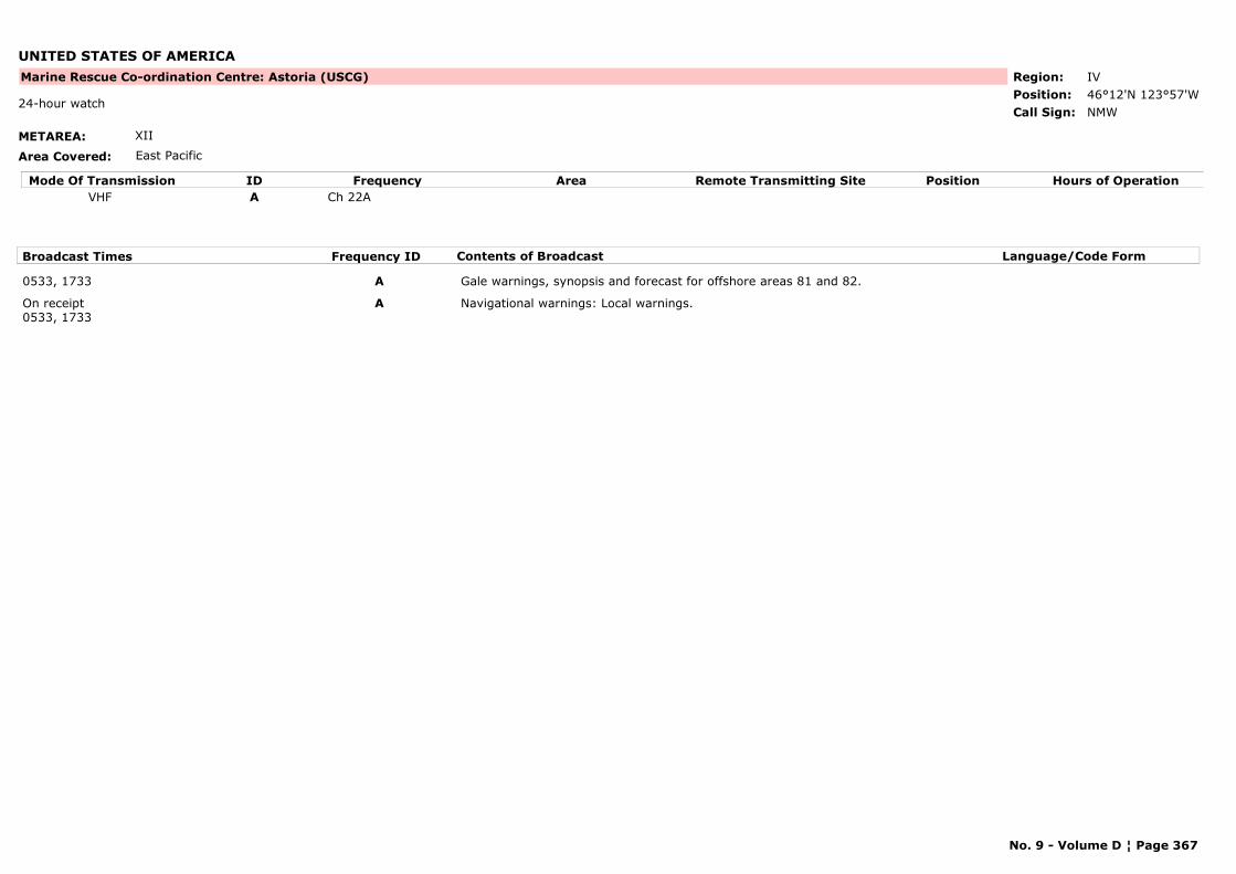
UNITED STATES OF AMERICA
METAREA: XII
Area Covered: East Pacific
Region: IVPosition: 46°12'N 123°57'W
Marine Rescue Co-ordination Centre: Astoria (USCG)
NMW24-hour watch
Call Sign:
Mode Of Transmission ID Frequency Area Position Hours of OperationRemote Transmitting SiteVHF A Ch 22A
Broadcast Times Frequency ID Contents of Broadcast Language/Code Form
0533, 1733 A Gale warnings, synopsis and forecast for offshore areas 81 and 82.
On receipt0533, 1733
A Navigational warnings: Local warnings.
No. 9 - Volume D ¦ Page 367

UNITED STATES OF AMERICA
METAREA: IV
Area Covered: Atlantic Coast
Region: IVPosition: 38°57'N 74°53'W
Marine Rescue Co-ordination Centre: Atlantic City (USCG)
--Call Sign:
Mode Of Transmission ID Frequency Area Position Hours of OperationRemote Transmitting SiteVHF A Ch 22A
Broadcast Times Frequency ID Contents of Broadcast Language/Code Form
1103, 2303 A Local weather.Navigational warnings: Local warnings.
On receipt A Storm warnings.Navigational warnings: Local warnings.
No. 9 - Volume D ¦ Page 368

UNITED STATES OF AMERICA
METAREA: IV
Area Covered: Atlantic Coast
Region: IVPosition:
Marine Rescue Co-ordination Centre: Baltimore (USCG)
--Call Sign:
Mode Of Transmission ID Frequency Area Position Hours of OperationRemote Transmitting SiteVHF A Ch 22A
Broadcast Times Frequency ID Contents of Broadcast Language/Code Form
0130, 1205 A Local weather.Navigational warnings: Local warnings.
On receipt A Storm warnings.Navigational warnings: Local warnings.
No. 9 - Volume D ¦ Page 369
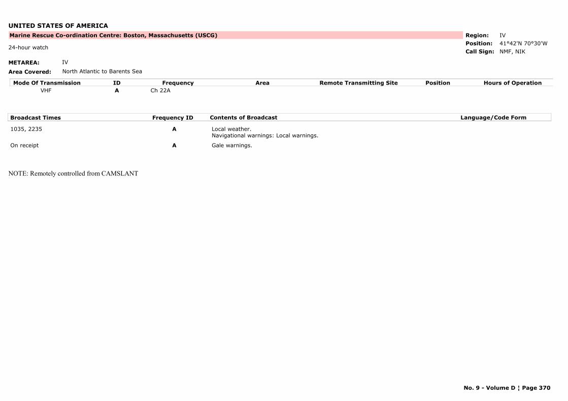
UNITED STATES OF AMERICA
METAREA: IV
Area Covered: North Atlantic to Barents Sea
Region: IVPosition: 41°42'N 70°30'W
Marine Rescue Co-ordination Centre: Boston, Massachusetts (USCG)
NMF, NIK24-hour watch
Call Sign:
Mode Of Transmission ID Frequency Area Position Hours of OperationRemote Transmitting SiteVHF A Ch 22A
Broadcast Times Frequency ID Contents of Broadcast Language/Code Form
1035, 2235 A Local weather.Navigational warnings: Local warnings.
On receipt A Gale warnings.
NOTE: Remotely controlled from CAMSLANT
No. 9 - Volume D ¦ Page 370

UNITED STATES OF AMERICA
METAREA: IV
Area Covered: Great Lakes
Region: IVPosition:
Marine Rescue Co-ordination Centre: Buffalo (USCG)
NMD47Call Sign:
Mode Of Transmission ID Frequency Area Position Hours of OperationRemote Transmitting SiteVHF A Ch 22A
Broadcast Times Frequency ID Contents of Broadcast Language/Code Form
0255, 1455 A Local weather.Navigational warnings: Local warnings.
On receipt A Gale warnings for Lakes Erie and Ontario.Navigational warnings: Local warnings.
No. 9 - Volume D ¦ Page 371

UNITED STATES OF AMERICA
METAREA: IV
Area Covered: Atlantic Coast
Region: IVPosition: 35°14'N 75°32'W
Marine Rescue Co-ordination Centre: Cape Hatteras (USCG)
NMN13Call Sign:
Mode Of Transmission ID Frequency Area Position Hours of OperationRemote Transmitting SiteVHF A Ch 22A
Broadcast Times Frequency ID Contents of Broadcast Language/Code Form
0100, 1055 A Local weather.Navigational warnings: Local warnings.
On receipt A Navigational warnings: Local warnings.
No. 9 - Volume D ¦ Page 372

UNITED STATES OF AMERICA
METAREA: IV
Area Covered: Atlantic area
Region: IVPosition: 32°47'N 79°57'W
Marine Rescue Co-ordination Centre: Charleston (USCG)
NMBCall Sign:
Mode Of Transmission ID Frequency Area Position Hours of OperationRemote Transmitting SiteVHF A Ch 22A
Broadcast Times Frequency ID Contents of Broadcast Language/Code Form
1200, 2200On receipt
A Local warnings.Navigational warnings: Local warnings.
No. 9 - Volume D ¦ Page 373
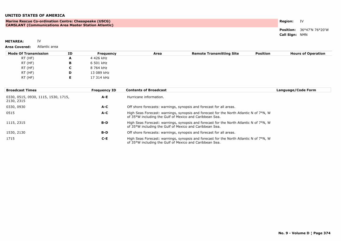
UNITED STATES OF AMERICA
METAREA: IV
Area Covered: Atlantic area
Region: IV
Position: 36°47'N 76°20'W
Marine Rescue Co-ordination Centre: Chesapeake (USCG)CAMSLANT (Communications Area Master Station Atlantic)
NMNCall Sign:
Mode Of Transmission ID Frequency Area Position Hours of OperationRemote Transmitting SiteRT (HF) A 4 426 kHzRT (HF) B 6 501 kHzRT (HF) C 8 764 kHzRT (HF) D 13 089 kHzRT (HF) E 17 314 kHz
Broadcast Times Frequency ID Contents of Broadcast Language/Code Form
0330, 0515, 0930, 1115, 1530, 1715, 2130, 2315
A-E Hurricane information.
0330, 0930 A-C Off shore forecasts: warnings, synopsis and forecast for all areas.
0515 A-C High Seas Forecast: warnings, synopsis and forecast for the North Atlantic N of 7°N, W of 35°W including the Gulf of Mexico and Caribbean Sea.
1115, 2315 B-D High Seas Forecast: warnings, synopsis and forecast for the North Atlantic N of 7°N, W of 35°W including the Gulf of Mexico and Caribbean Sea.
1530, 2130 B-D Off shore forecasts: warnings, synopsis and forecast for all areas.
1715 C-E High Seas Forecast: warnings, synopsis and forecast for the North Atlantic N of 7°N, W of 35°W including the Gulf of Mexico and Caribbean Sea.
No. 9 - Volume D ¦ Page 374
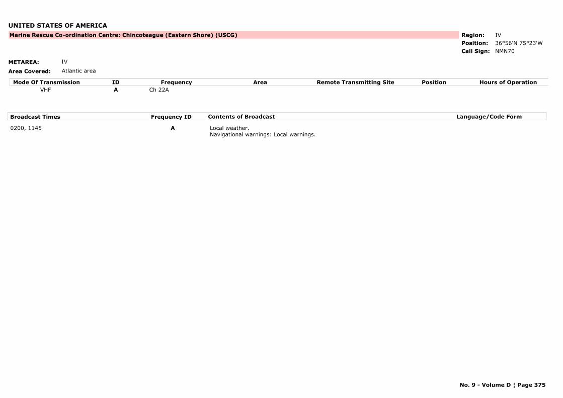
UNITED STATES OF AMERICA
METAREA: IV
Area Covered: Atlantic area
Region: IVPosition: 36°56'N 75°23'W
Marine Rescue Co-ordination Centre: Chincoteague (Eastern Shore) (USCG)
NMN70Call Sign:
Mode Of Transmission ID Frequency Area Position Hours of OperationRemote Transmitting SiteVHF A Ch 22A
Broadcast Times Frequency ID Contents of Broadcast Language/Code Form
0200, 1145 A Local weather.Navigational warnings: Local warnings.
No. 9 - Volume D ¦ Page 375
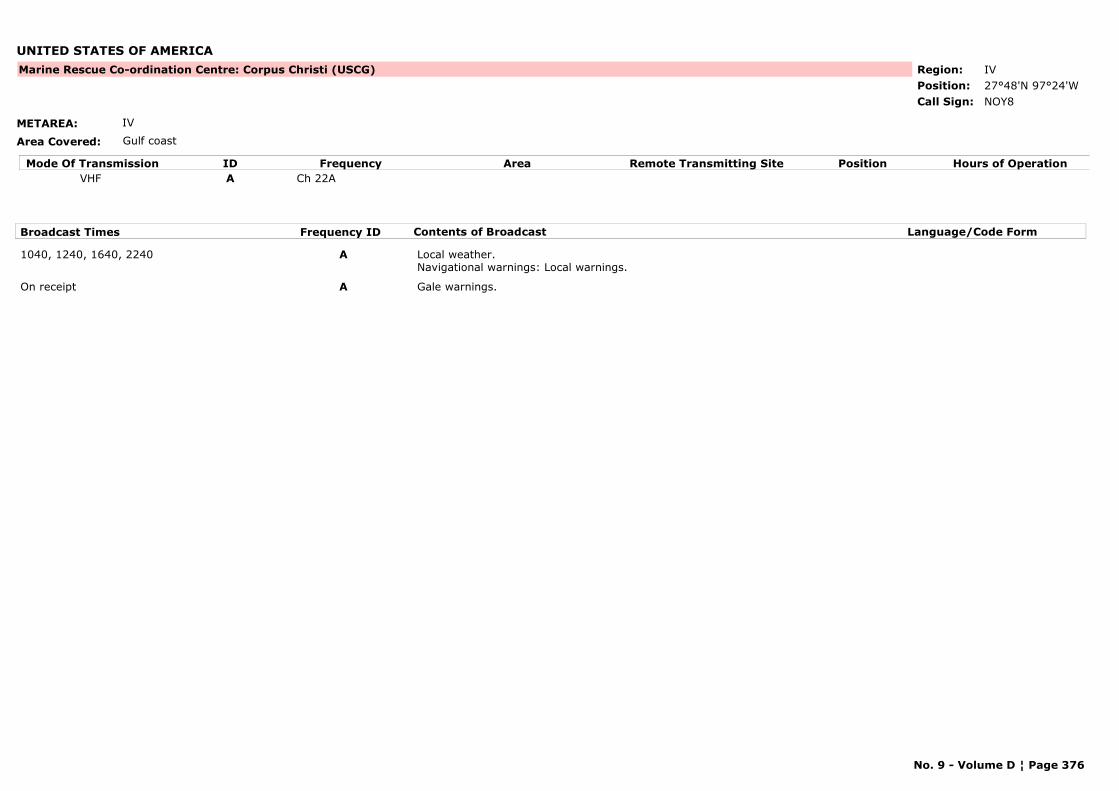
UNITED STATES OF AMERICA
METAREA: IV
Area Covered: Gulf coast
Region: IVPosition: 27°48'N 97°24'W
Marine Rescue Co-ordination Centre: Corpus Christi (USCG)
NOY8Call Sign:
Mode Of Transmission ID Frequency Area Position Hours of OperationRemote Transmitting SiteVHF A Ch 22A
Broadcast Times Frequency ID Contents of Broadcast Language/Code Form
1040, 1240, 1640, 2240 A Local weather.Navigational warnings: Local warnings.
On receipt A Gale warnings.
No. 9 - Volume D ¦ Page 376

UNITED STATES OF AMERICA
METAREA: IV
Area Covered: Great Lakes
Region: IVPosition:
Marine Rescue Co-ordination Centre: Detroit (USCG)
NMD25Call Sign:
Mode Of Transmission ID Frequency Area Position Hours of OperationRemote Transmitting SiteVHF A Ch 22A
Broadcast Times Frequency ID Contents of Broadcast Language/Code Form
0135, 1335 A Local weather.Navigational warnings: Local warnings.
On receipt A Gale warnings for Lakes Erie S. Clair and Huron.Navigational warnings: Local warnings.
No. 9 - Volume D ¦ Page 377

UNITED STATES OF AMERICA
METAREA: IV
Area Covered: Atlantic Coast
Region: IVPosition: 34°41'N 76°41'W
Marine Rescue Co-ordination Centre: Fort Macon (USCG)
--Call Sign:
Mode Of Transmission ID Frequency Area Position Hours of OperationRemote Transmitting SiteVHF A Ch 22 CG
Broadcast Times Frequency ID Contents of Broadcast Language/Code Form
0130, 1030 A Local weather.Navigational warnings: Local warnings.
On receipt A Gale warnings.Navigational warnings: Local warnings.
No. 9 - Volume D ¦ Page 378
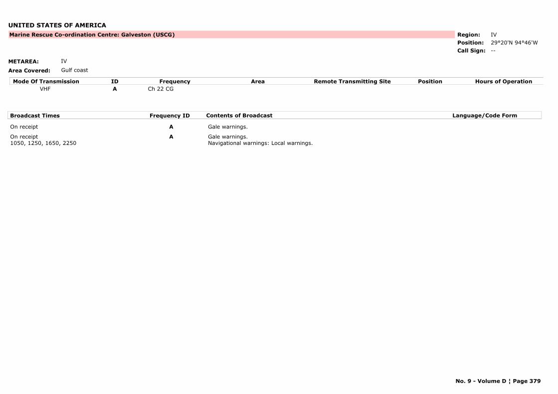
UNITED STATES OF AMERICA
METAREA: IV
Area Covered: Gulf coast
Region: IVPosition: 29°20'N 94°46'W
Marine Rescue Co-ordination Centre: Galveston (USCG)
--Call Sign:
Mode Of Transmission ID Frequency Area Position Hours of OperationRemote Transmitting SiteVHF A Ch 22 CG
Broadcast Times Frequency ID Contents of Broadcast Language/Code Form
On receipt A Gale warnings.
On receipt1050, 1250, 1650, 2250
A Gale warnings.Navigational warnings: Local warnings.
No. 9 - Volume D ¦ Page 379

UNITED STATES OF AMERICA
METAREA: IV
Area Covered: Great Lakes
Region: IVPosition:
Marine Rescue Co-ordination Centre: Grand Haven (USCG)
NMD32Call Sign:
Mode Of Transmission ID Frequency Area Position Hours of OperationRemote Transmitting SiteVHF A Ch 22A
Broadcast Times Frequency ID Contents of Broadcast Language/Code Form
0235, 1435 A Local weather.Navigational warnings: Local warnings.
No. 9 - Volume D ¦ Page 380

UNITED STATES OF AMERICA
METAREA: IV
Area Covered: Atlantic Coast
Region: IVPosition: 36°53'N 76°21'W
Marine Rescue Co-ordination Centre: Hampton Roads (USCG)
--Call Sign:
Mode Of Transmission ID Frequency Area Position Hours of OperationRemote Transmitting SiteVHF A Ch 22A
Broadcast Times Frequency ID Contents of Broadcast Language/Code Form
0230, 1120 A Local weather.Navigational warnings: Local warnings.
No. 9 - Volume D ¦ Page 381

UNITED STATES OF AMERICA
METAREA: XII
Area Covered: Pacific coast
Region: IVPosition: 40°46'N 124°03'W
Marine Rescue Co-ordination Centre: Humboldt Bay (USCG)
NMC11Call Sign:
Mode Of Transmission ID Frequency Area Position Hours of OperationRemote Transmitting SiteVHF A Ch 22A
Broadcast Times Frequency ID Contents of Broadcast Language/Code Form
1615, 2315On receipt
A Gale warnings and local weather.Navigational warnings: Local warnings.
No. 9 - Volume D ¦ Page 382
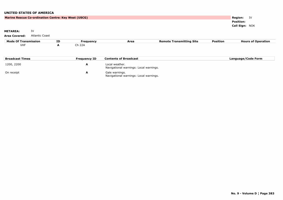
UNITED STATES OF AMERICA
METAREA: IV
Area Covered: Atlantic Coast
Region: IVPosition:
Marine Rescue Co-ordination Centre: Key West (USCG)
NOKCall Sign:
Mode Of Transmission ID Frequency Area Position Hours of OperationRemote Transmitting SiteVHF A Ch 22A
Broadcast Times Frequency ID Contents of Broadcast Language/Code Form
1200, 2200 A Local weather.Navigational warnings: Local warnings.
On receipt A Gale warnings.Navigational warnings: Local warnings.
No. 9 - Volume D ¦ Page 383
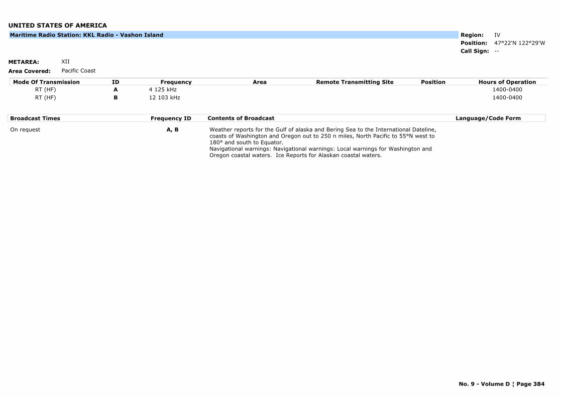
UNITED STATES OF AMERICA
METAREA: XII
Area Covered: Pacific Coast
Region: IVPosition: 47°22'N 122°29'W
--Call Sign:
Maritime Radio Station: KKL Radio - Vashon Island
Mode Of Transmission ID Frequency Area Position Hours of OperationRemote Transmitting SiteRT (HF) A 4 125 kHz 1400-0400RT (HF) B 12 103 kHz 1400-0400
Broadcast Times Frequency ID Contents of Broadcast Language/Code Form
On request A, B Weather reports for the Gulf of alaska and Bering Sea to the International Dateline, coasts of Washington and Oregon out to 250 n miles, North Pacific to 55°N west to 180° and south to Equator.Navigational warnings: Navigational warnings: Local warnings for Washington and Oregon coastal waters. Ice Reports for Alaskan coastal waters.
No. 9 - Volume D ¦ Page 384
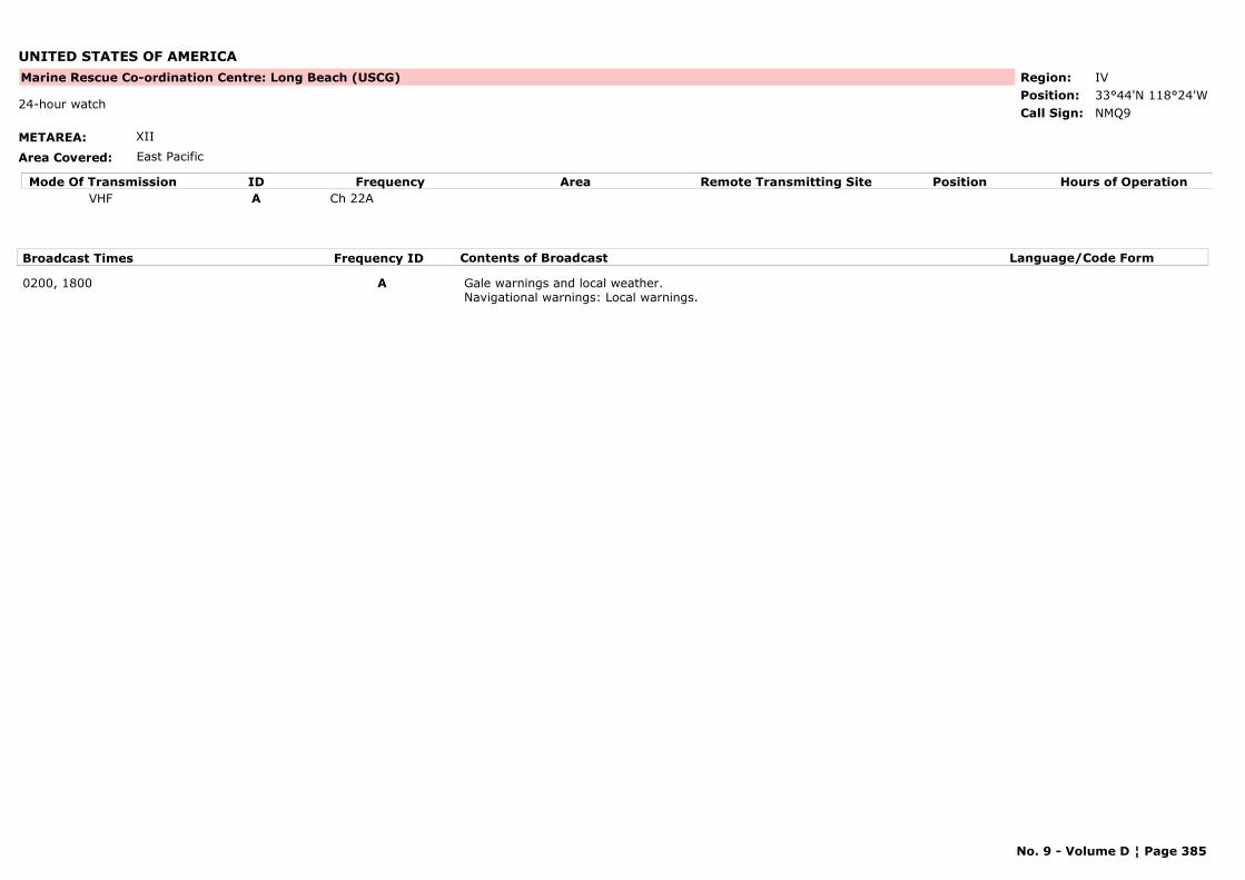
UNITED STATES OF AMERICA
METAREA: XII
Area Covered: East Pacific
Region: IVPosition: 33°44'N 118°24'W
Marine Rescue Co-ordination Centre: Long Beach (USCG)
NMQ924-hour watch
Call Sign:
Mode Of Transmission ID Frequency Area Position Hours of OperationRemote Transmitting SiteVHF A Ch 22A
Broadcast Times Frequency ID Contents of Broadcast Language/Code Form
0200, 1800 A Gale warnings and local weather.Navigational warnings: Local warnings.
No. 9 - Volume D ¦ Page 385
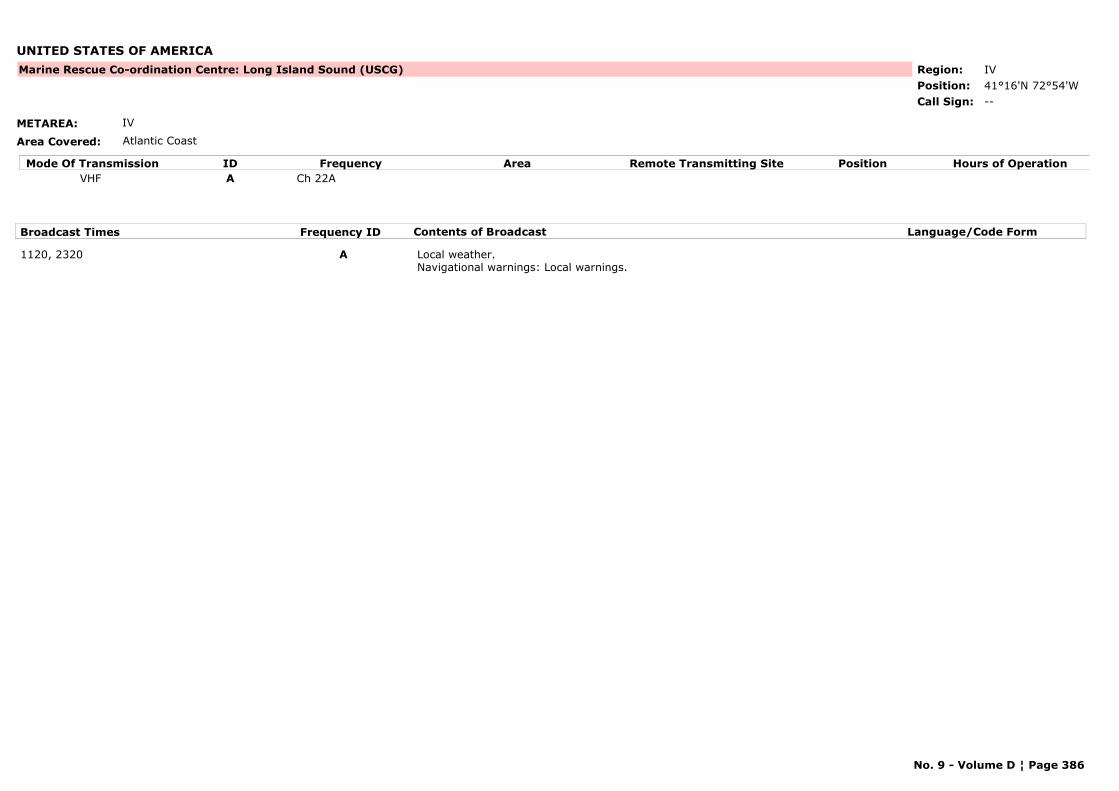
UNITED STATES OF AMERICA
METAREA: IV
Area Covered: Atlantic Coast
Region: IVPosition: 41°16'N 72°54'W
Marine Rescue Co-ordination Centre: Long Island Sound (USCG)
--Call Sign:
Mode Of Transmission ID Frequency Area Position Hours of OperationRemote Transmitting SiteVHF A Ch 22A
Broadcast Times Frequency ID Contents of Broadcast Language/Code Form
1120, 2320 A Local weather.Navigational warnings: Local warnings.
No. 9 - Volume D ¦ Page 386

UNITED STATES OF AMERICA
METAREA: IV
Area Covered: Atlantic Coast
Region: IVPosition: 30°23'N 72°54'W
Marine Rescue Co-ordination Centre: Mayport (USCG)
NMVCall Sign:
Mode Of Transmission ID Frequency Area Position Hours of OperationRemote Transmitting SiteVHF B Ch 22A
Broadcast Times Frequency ID Contents of Broadcast Language/Code Form
1215, 2215On receipt
B Gale warnings and local weather.Navigational warnings: Local warnings.
No. 9 - Volume D ¦ Page 387
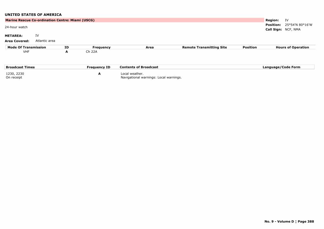
UNITED STATES OF AMERICA
METAREA: IV
Area Covered: Atlantic area
Region: IVPosition: 25°54'N 80°16'W
Marine Rescue Co-ordination Centre: Miami (USCG)
NCF, NMA24-hour watch
Call Sign:
Mode Of Transmission ID Frequency Area Position Hours of OperationRemote Transmitting SiteVHF A Ch 22A
Broadcast Times Frequency ID Contents of Broadcast Language/Code Form
1230, 2230On receipt
A Local weather.Navigational warnings: Local warnings.
No. 9 - Volume D ¦ Page 388

UNITED STATES OF AMERICA
METAREA: IV
Area Covered: Great Lakes
Region: IVPosition:
Marine Rescue Co-ordination Centre: Milwaukee (USCG)
NMP9Call Sign:
Mode Of Transmission ID Frequency Area Position Hours of OperationRemote Transmitting SiteVHF A Ch 22A
Broadcast Times Frequency ID Contents of Broadcast Language/Code Form
0255, 1455 A Local weather.Navigational warnings: Local warnings.
On receipt A Gale warnings for Lake Michigan.
No. 9 - Volume D ¦ Page 389
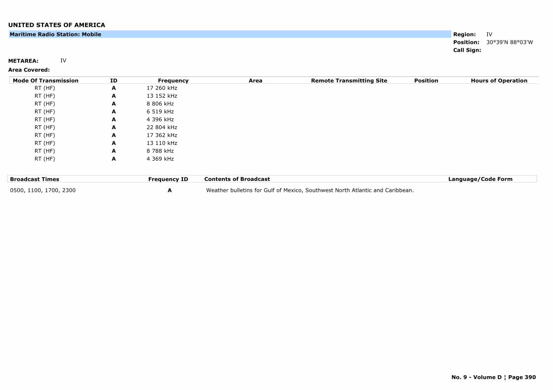
UNITED STATES OF AMERICA
METAREA: IV
Area Covered:
Region: IVPosition: 30°39'N 88°03'WCall Sign:
Maritime Radio Station: Mobile
Mode Of Transmission ID Frequency Area Position Hours of OperationRemote Transmitting SiteRT (HF) A 17 260 kHzRT (HF) A 13 152 kHzRT (HF) A 8 806 kHzRT (HF) A 6 519 kHzRT (HF) A 4 396 kHzRT (HF) A 22 804 kHzRT (HF) A 17 362 kHzRT (HF) A 13 110 kHzRT (HF) A 8 788 kHzRT (HF) A 4 369 kHz
Broadcast Times Frequency ID Contents of Broadcast Language/Code Form
0500, 1100, 1700, 2300 A Weather bulletins for Gulf of Mexico, Southwest North Atlantic and Caribbean.
No. 9 - Volume D ¦ Page 390
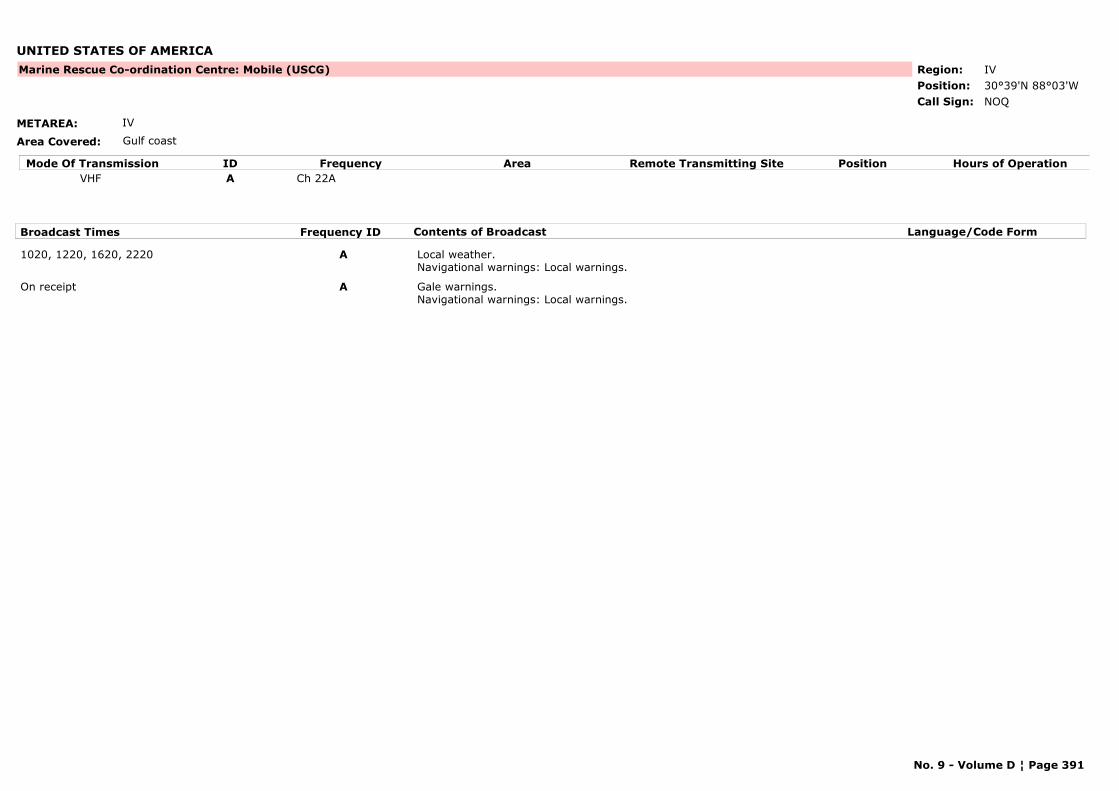
UNITED STATES OF AMERICA
METAREA: IV
Area Covered: Gulf coast
Region: IVPosition: 30°39'N 88°03'W
Marine Rescue Co-ordination Centre: Mobile (USCG)
NOQCall Sign:
Mode Of Transmission ID Frequency Area Position Hours of OperationRemote Transmitting SiteVHF A Ch 22A
Broadcast Times Frequency ID Contents of Broadcast Language/Code Form
1020, 1220, 1620, 2220 A Local weather.Navigational warnings: Local warnings.
On receipt A Gale warnings.Navigational warnings: Local warnings.
No. 9 - Volume D ¦ Page 391
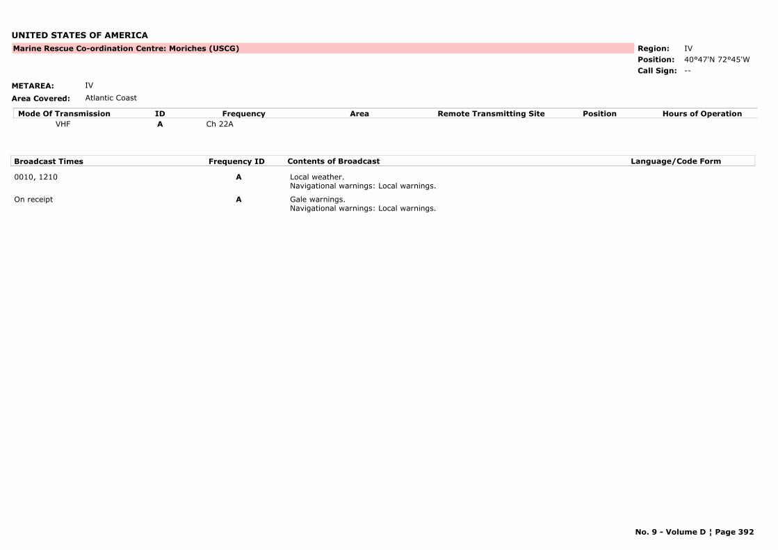
UNITED STATES OF AMERICA
METAREA: IV
Area Covered: Atlantic Coast
Region: IVPosition: 40°47'N 72°45'W
Marine Rescue Co-ordination Centre: Moriches (USCG)
--Call Sign:
Mode Of Transmission ID Frequency Area Position Hours of OperationRemote Transmitting SiteVHF A Ch 22A
Broadcast Times Frequency ID Contents of Broadcast Language/Code Form
0010, 1210 A Local weather.Navigational warnings: Local warnings.
On receipt A Gale warnings.Navigational warnings: Local warnings.
No. 9 - Volume D ¦ Page 392
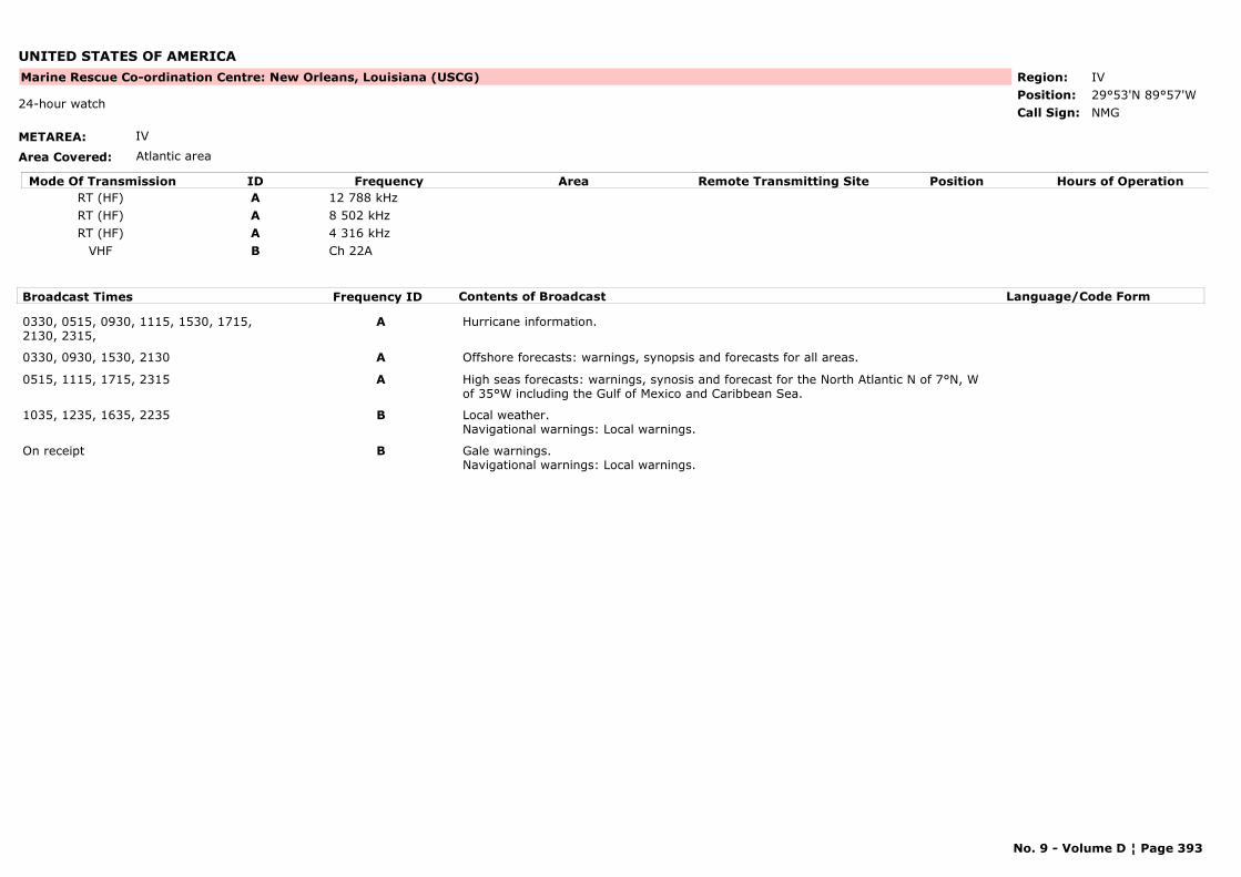
UNITED STATES OF AMERICA
METAREA: IV
Area Covered: Atlantic area
Region: IVPosition: 29°53'N 89°57'W
Marine Rescue Co-ordination Centre: New Orleans, Louisiana (USCG)
NMG24-hour watch
Call Sign:
Mode Of Transmission ID Frequency Area Position Hours of OperationRemote Transmitting SiteRT (HF) A 12 788 kHzRT (HF) A 8 502 kHzRT (HF) A 4 316 kHz
VHF B Ch 22A
Broadcast Times Frequency ID Contents of Broadcast Language/Code Form
0330, 0515, 0930, 1115, 1530, 1715, 2130, 2315,
A Hurricane information.
0330, 0930, 1530, 2130 A Offshore forecasts: warnings, synopsis and forecasts for all areas.
0515, 1115, 1715, 2315 A High seas forecasts: warnings, synosis and forecast for the North Atlantic N of 7°N, W of 35°W including the Gulf of Mexico and Caribbean Sea.
1035, 1235, 1635, 2235 B Local weather.Navigational warnings: Local warnings.
On receipt B Gale warnings.Navigational warnings: Local warnings.
No. 9 - Volume D ¦ Page 393

UNITED STATES OF AMERICA
METAREA: IV
Area Covered: Atlantic Coast
Region: IVPosition: 40°28'N 74°00'W
Marine Rescue Co-ordination Centre: New York (USCG)
KEACall Sign:
Mode Of Transmission ID Frequency Area Position Hours of OperationRemote Transmitting SiteVHF A Ch 22A
Broadcast Times Frequency ID Contents of Broadcast Language/Code Form
1050, 2250 A Local weather.Navigational warnings: Local warnings.
1050,, 2250 A Local weather.Navigational warnings: Local warnings.
No. 9 - Volume D ¦ Page 394
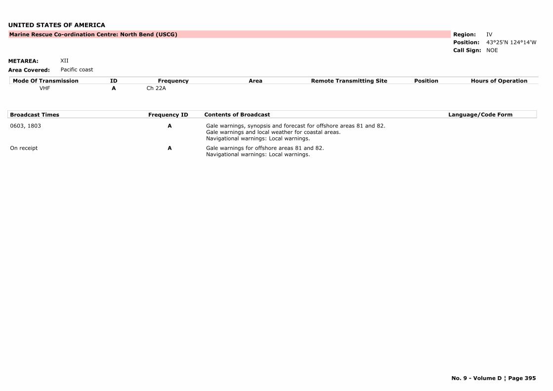
UNITED STATES OF AMERICA
METAREA: XII
Area Covered: Pacific coast
Region: IVPosition: 43°25'N 124°14'W
Marine Rescue Co-ordination Centre: North Bend (USCG)
NOECall Sign:
Mode Of Transmission ID Frequency Area Position Hours of OperationRemote Transmitting SiteVHF A Ch 22A
Broadcast Times Frequency ID Contents of Broadcast Language/Code Form
0603, 1803 A Gale warnings, synopsis and forecast for offshore areas 81 and 82.Gale warnings and local weather for coastal areas.Navigational warnings: Local warnings.
On receipt A Gale warnings for offshore areas 81 and 82.Navigational warnings: Local warnings.
No. 9 - Volume D ¦ Page 395

UNITED STATES OF AMERICA
METAREA: IV
Area Covered: Atlantic Coast
Region: IVPosition:
Marine Rescue Co-ordination Centre: Philadelphia (USCG)
--Call Sign:
Mode Of Transmission ID Frequency Area Position Hours of OperationRemote Transmitting SiteVHF A Ch 22A
Broadcast Times Frequency ID Contents of Broadcast Language/Code Form
0035, 1235 A Local weather.Navigational warnings: Local warnings.
No. 9 - Volume D ¦ Page 396
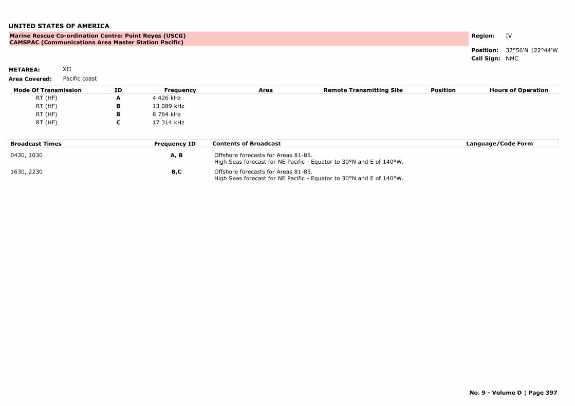
UNITED STATES OF AMERICA
METAREA: XII
Area Covered: Pacific coast
Region: IV
Position: 37°56'N 122°44'W
Marine Rescue Co-ordination Centre: Point Reyes (USCG)CAMSPAC (Communications Area Master Station Pacific)
NMCCall Sign:
Mode Of Transmission ID Frequency Area Position Hours of OperationRemote Transmitting SiteRT (HF) A 4 426 kHzRT (HF) B 13 089 kHzRT (HF) B 8 764 kHzRT (HF) C 17 314 kHz
Broadcast Times Frequency ID Contents of Broadcast Language/Code Form
0430, 1030 A, B Offshore forecasts for Areas 81-85.High Seas forecast for NE Pacific - Equator to 30°N and E of 140°W.
1630, 2230 B,C Offshore forecasts for Areas 81-85.High Seas forecast for NE Pacific - Equator to 30°N and E of 140°W.
No. 9 - Volume D ¦ Page 397
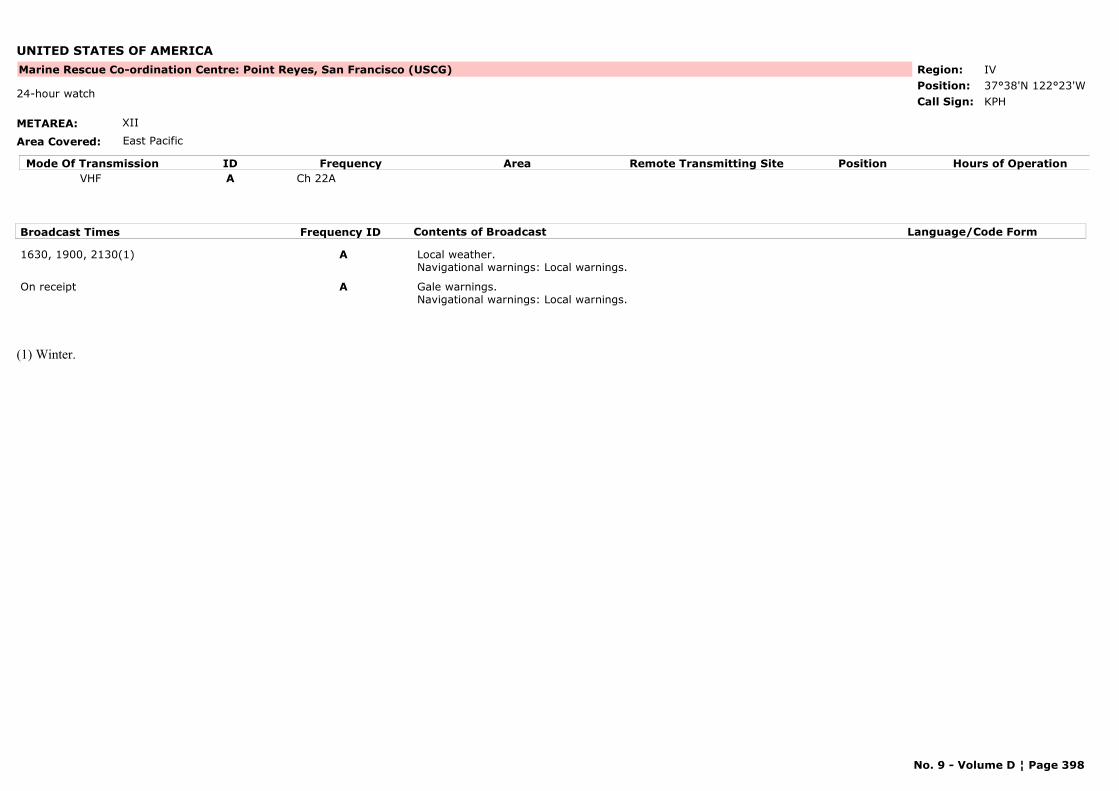
UNITED STATES OF AMERICA
METAREA: XII
Area Covered: East Pacific
Region: IVPosition: 37°38'N 122°23'W
Marine Rescue Co-ordination Centre: Point Reyes, San Francisco (USCG)
KPH24-hour watch
Call Sign:
Mode Of Transmission ID Frequency Area Position Hours of OperationRemote Transmitting SiteVHF A Ch 22A
Broadcast Times Frequency ID Contents of Broadcast Language/Code Form
1630, 1900, 2130(1) A Local weather.Navigational warnings: Local warnings.
On receipt A Gale warnings.Navigational warnings: Local warnings.
(1) Winter.
No. 9 - Volume D ¦ Page 398
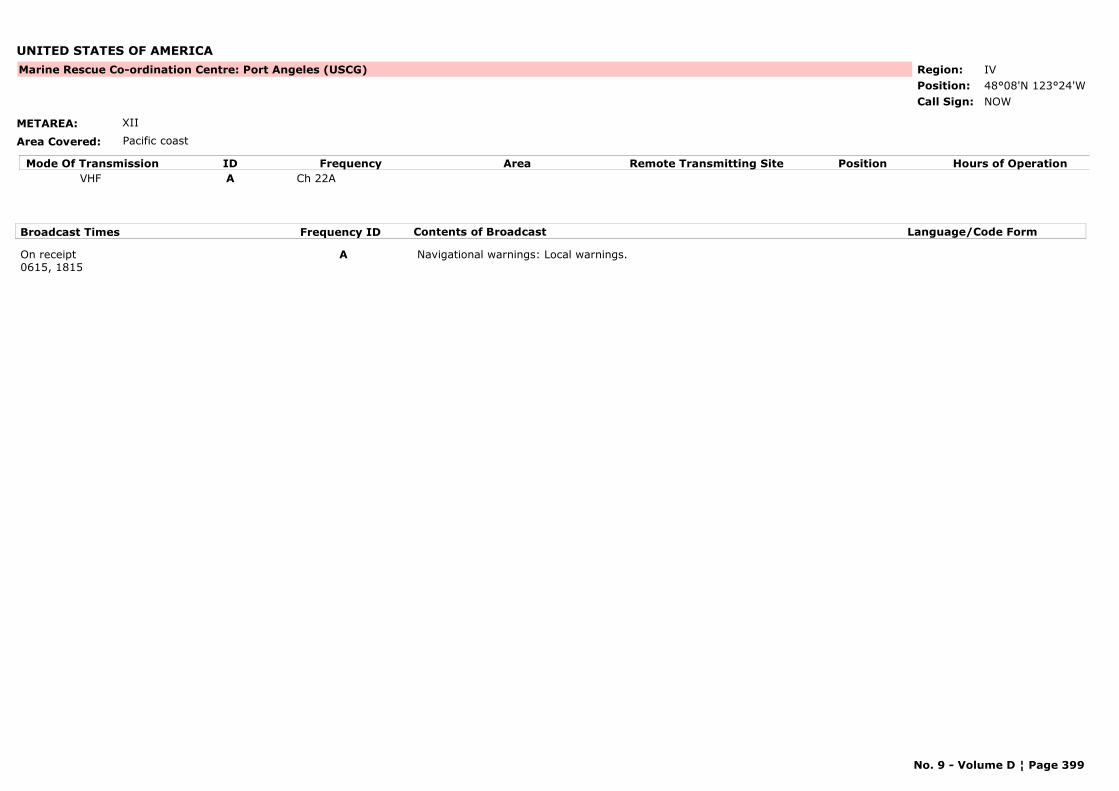
UNITED STATES OF AMERICA
METAREA: XII
Area Covered: Pacific coast
Region: IVPosition: 48°08'N 123°24'W
Marine Rescue Co-ordination Centre: Port Angeles (USCG)
NOWCall Sign:
Mode Of Transmission ID Frequency Area Position Hours of OperationRemote Transmitting SiteVHF A Ch 22A
Broadcast Times Frequency ID Contents of Broadcast Language/Code Form
On receipt0615, 1815
A Navigational warnings: Local warnings.
No. 9 - Volume D ¦ Page 399
UNITED STATES OF AMERICA
METAREA: IV
Area Covered: Pacific coast
Region: IVPosition: 43°40'N 70°15'W
Marine Rescue Co-ordination Centre: Portland (USCG)
NMF31Call Sign:
No. 9 - Volume D ¦ Page 400
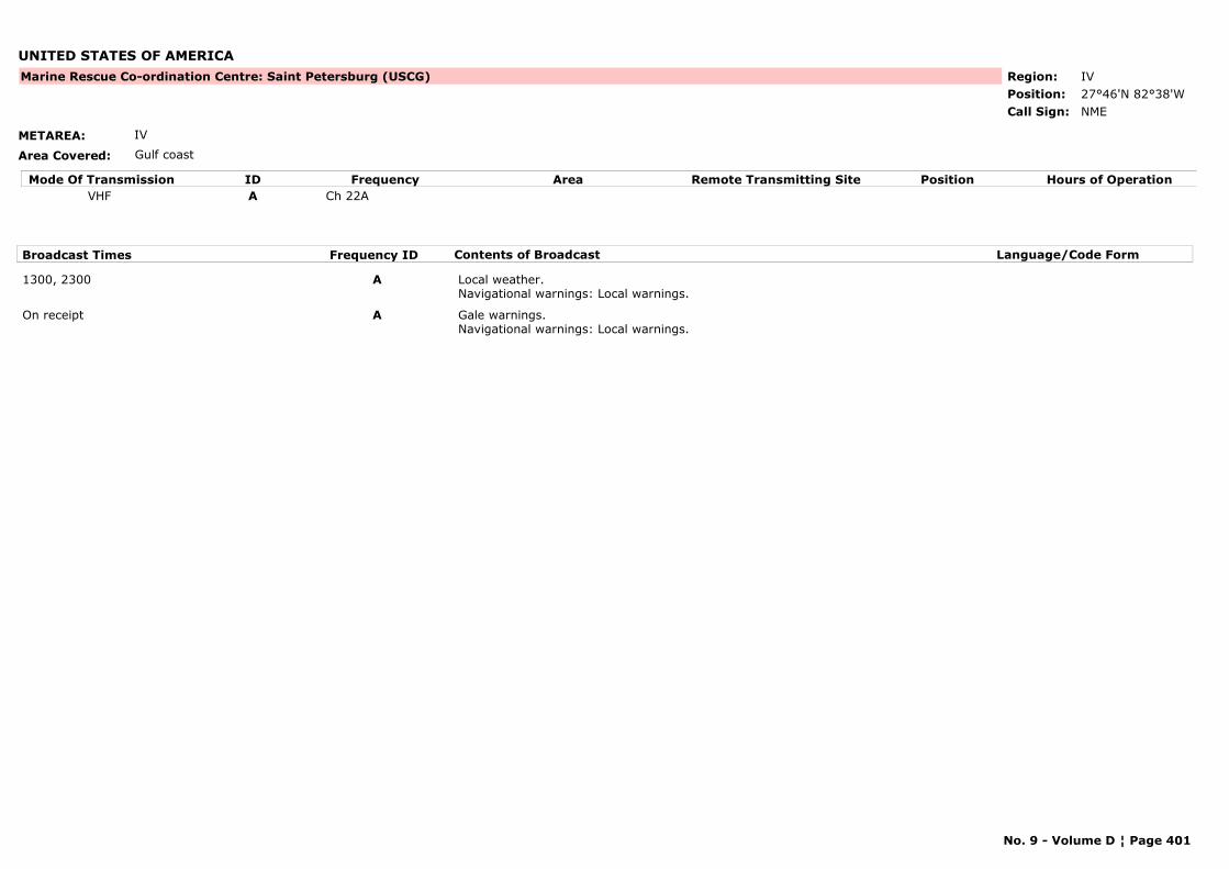
UNITED STATES OF AMERICA
METAREA: IV
Area Covered: Gulf coast
Region: IVPosition: 27°46'N 82°38'W
Marine Rescue Co-ordination Centre: Saint Petersburg (USCG)
NMECall Sign:
Mode Of Transmission ID Frequency Area Position Hours of OperationRemote Transmitting SiteVHF A Ch 22A
Broadcast Times Frequency ID Contents of Broadcast Language/Code Form
1300, 2300 A Local weather.Navigational warnings: Local warnings.
On receipt A Gale warnings.Navigational warnings: Local warnings.
No. 9 - Volume D ¦ Page 401
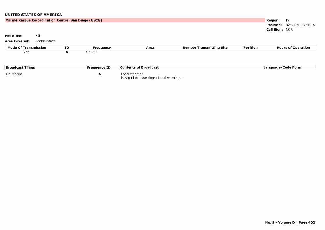
UNITED STATES OF AMERICA
METAREA: XII
Area Covered: Pacific coast
Region: IVPosition: 32°44'N 117°10'W
Marine Rescue Co-ordination Centre: San Diego (USCG)
NORCall Sign:
Mode Of Transmission ID Frequency Area Position Hours of OperationRemote Transmitting SiteVHF A Ch 22A
Broadcast Times Frequency ID Contents of Broadcast Language/Code Form
On receipt A Local weather.Navigational warnings: Local warnings.
No. 9 - Volume D ¦ Page 402
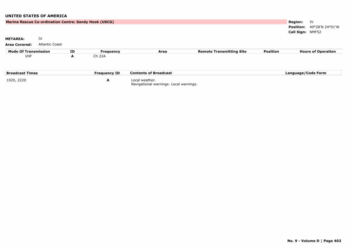
UNITED STATES OF AMERICA
METAREA: IV
Area Covered: Atlantic Coast
Region: IVPosition: 40°28'N 24°01'W
Marine Rescue Co-ordination Centre: Sandy Hook (USCG)
NMF52Call Sign:
Mode Of Transmission ID Frequency Area Position Hours of OperationRemote Transmitting SiteVHF A Ch 22A
Broadcast Times Frequency ID Contents of Broadcast Language/Code Form
1020, 2220 A Local weather.Navigational warnings: Local warnings.
No. 9 - Volume D ¦ Page 403
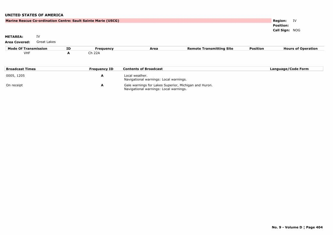
UNITED STATES OF AMERICA
METAREA: IV
Area Covered: Great Lakes
Region: IVPosition:
Marine Rescue Co-ordination Centre: Sault Sainte Marie (USCG)
NOGCall Sign:
Mode Of Transmission ID Frequency Area Position Hours of OperationRemote Transmitting SiteVHF A Ch 22A
Broadcast Times Frequency ID Contents of Broadcast Language/Code Form
0005, 1205 A Local weather.Navigational warnings: Local warnings.
On receipt A Gale warnings for Lakes Superior, Michigan and Huron.Navigational warnings: Local warnings.
No. 9 - Volume D ¦ Page 404
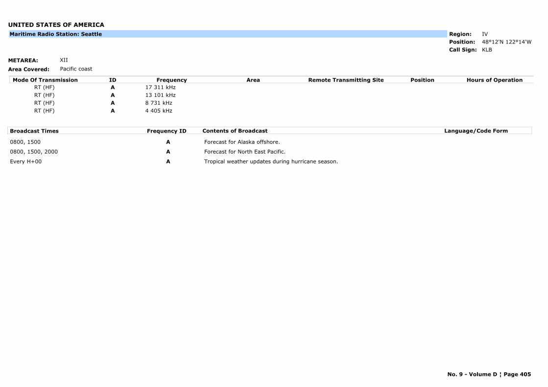
UNITED STATES OF AMERICA
METAREA: XII
Area Covered: Pacific coast
Region: IVPosition: 48°12'N 122°14'W
KLBCall Sign:
Maritime Radio Station: Seattle
Mode Of Transmission ID Frequency Area Position Hours of OperationRemote Transmitting SiteRT (HF) A 17 311 kHzRT (HF) A 13 101 kHzRT (HF) A 8 731 kHzRT (HF) A 4 405 kHz
Broadcast Times Frequency ID Contents of Broadcast Language/Code Form
0800, 1500 A Forecast for Alaska offshore.
0800, 1500, 2000 A Forecast for North East Pacific.
Every H+00 A Tropical weather updates during hurricane season.
No. 9 - Volume D ¦ Page 405

UNITED STATES OF AMERICA
METAREA: XII
Area Covered: Pacific coast
Region: IVPosition:
Marine Rescue Co-ordination Centre: Seattle (USCG)
NMW43Call Sign:
Mode Of Transmission ID Frequency Area Position Hours of OperationRemote Transmitting SiteVHF A Ch 22A
Broadcast Times Frequency ID Contents of Broadcast Language/Code Form
0630, 1830 A Local weather.Navigational warnings: Local warnings.
On receipt A Gale warnings.Navigational warnings: Local warnings.
No. 9 - Volume D ¦ Page 406
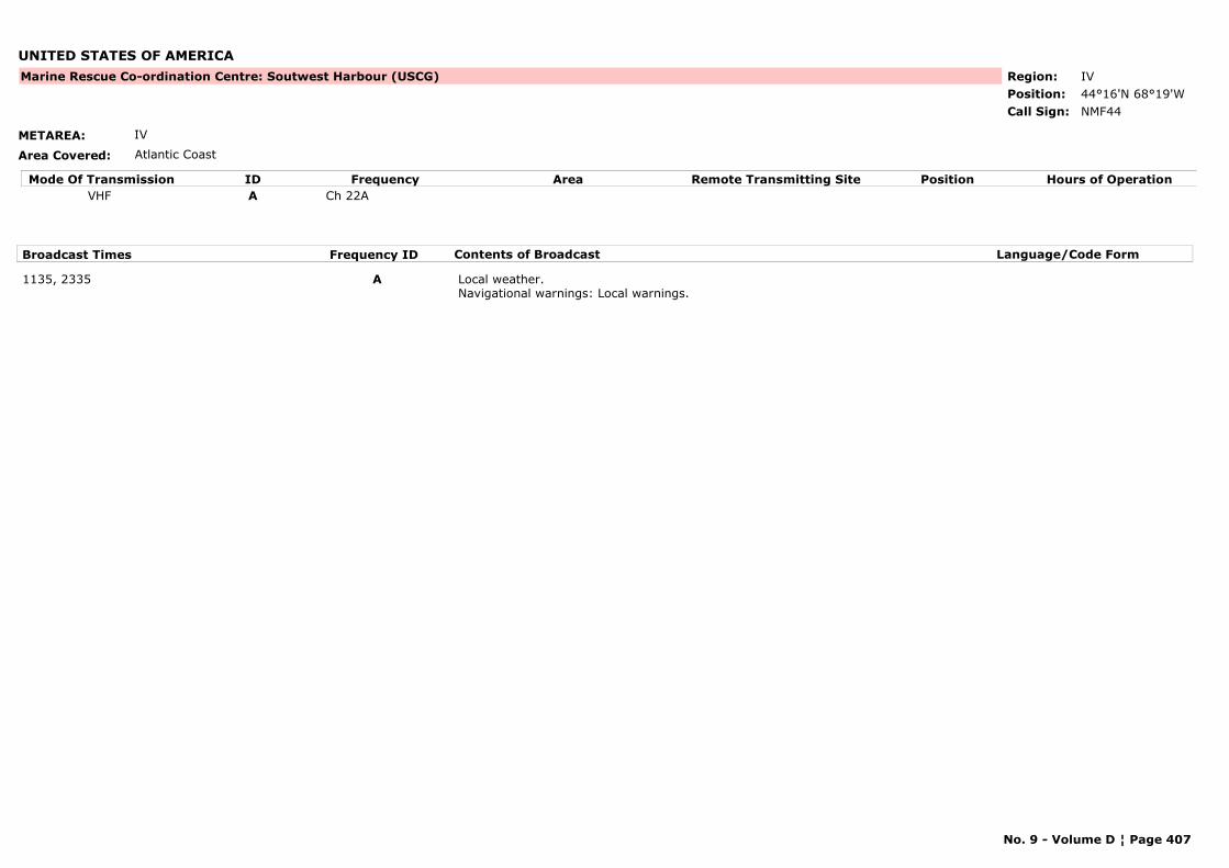
UNITED STATES OF AMERICA
METAREA: IV
Area Covered: Atlantic Coast
Region: IVPosition: 44°16'N 68°19'W
Marine Rescue Co-ordination Centre: Soutwest Harbour (USCG)
NMF44Call Sign:
Mode Of Transmission ID Frequency Area Position Hours of OperationRemote Transmitting SiteVHF A Ch 22A
Broadcast Times Frequency ID Contents of Broadcast Language/Code Form
1135, 2335 A Local weather.Navigational warnings: Local warnings.
No. 9 - Volume D ¦ Page 407

UNITED STATES OF AMERICA
METAREA: IV
Area Covered: Atlantic Coast
Region: IVPosition: 41°34'N 70°40'W
Marine Rescue Co-ordination Centre: Woods Hole (USCG)
NMF2Call Sign:
Mode Of Transmission ID Frequency Area Position Hours of OperationRemote Transmitting SiteVHF A Ch 22A
Broadcast Times Frequency ID Contents of Broadcast Language/Code Form
1005, 2205 A Local weather.Navigational warnings: Local warnings.
On receipt A Gale warnings.Navigational warnings: Local warnings.
No. 9 - Volume D ¦ Page 408
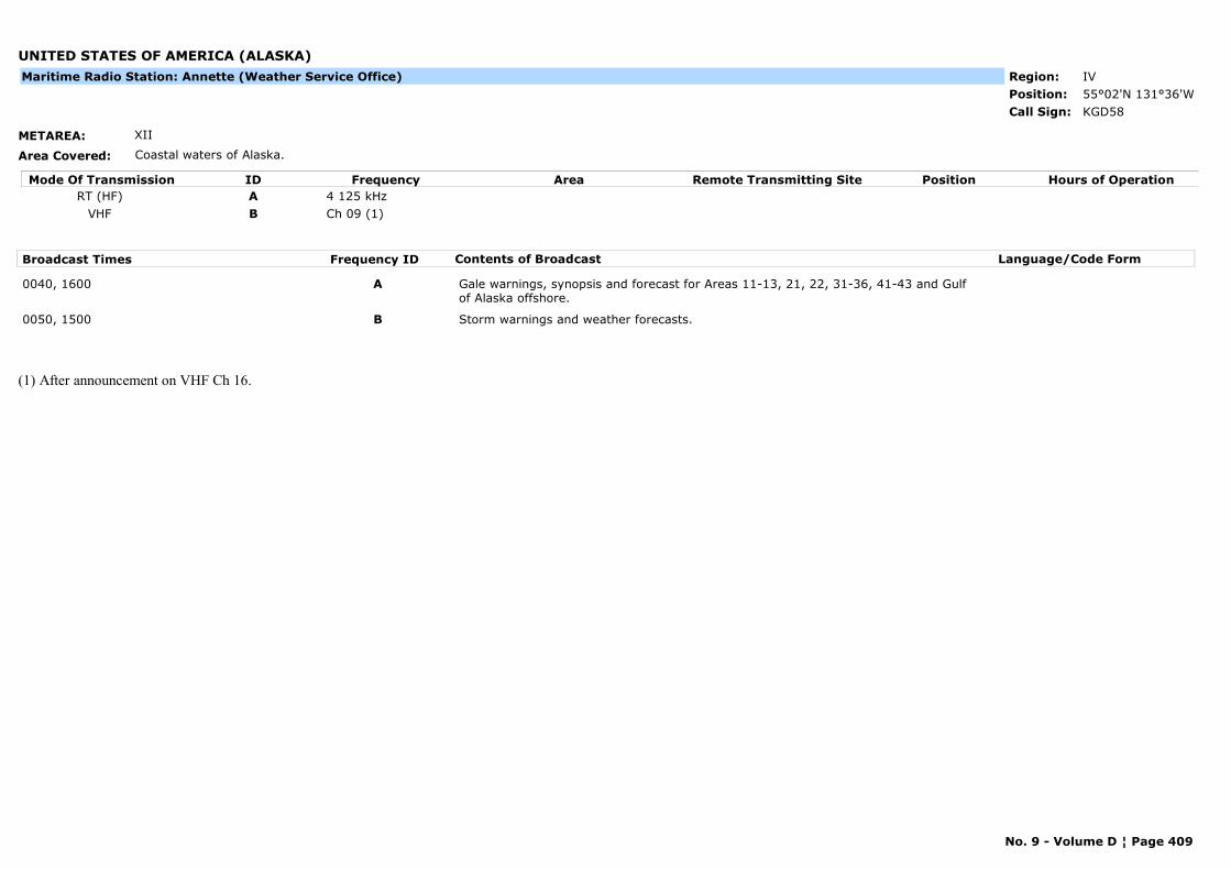
UNITED STATES OF AMERICA (ALASKA)
METAREA: XII
Area Covered: Coastal waters of Alaska.
Region: IVPosition: 55°02'N 131°36'W
KGD58Call Sign:
Maritime Radio Station: Annette (Weather Service Office)
Mode Of Transmission ID Frequency Area Position Hours of OperationRemote Transmitting SiteRT (HF) A 4 125 kHz
VHF B Ch 09 (1)
Broadcast Times Frequency ID Contents of Broadcast Language/Code Form
0040, 1600 A Gale warnings, synopsis and forecast for Areas 11-13, 21, 22, 31-36, 41-43 and Gulf of Alaska offshore.
0050, 1500 B Storm warnings and weather forecasts.
(1) After announcement on VHF Ch 16.
No. 9 - Volume D ¦ Page 409
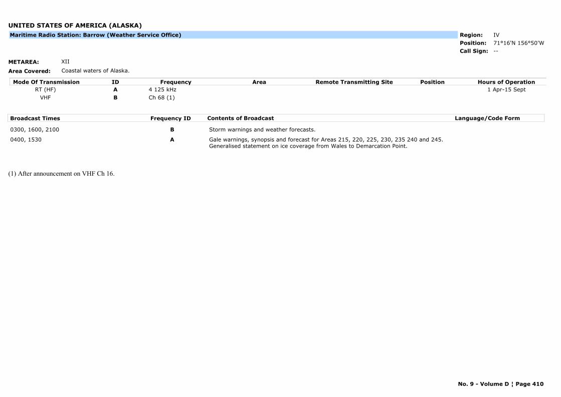
UNITED STATES OF AMERICA (ALASKA)
METAREA: XII
Area Covered: Coastal waters of Alaska.
Region: IVPosition: 71°16'N 156°50'W
--Call Sign:
Maritime Radio Station: Barrow (Weather Service Office)
Mode Of Transmission ID Frequency Area Position Hours of OperationRemote Transmitting SiteRT (HF) A 4 125 kHz 1 Apr-15 Sept
VHF B Ch 68 (1)
Broadcast Times Frequency ID Contents of Broadcast Language/Code Form
0300, 1600, 2100 B Storm warnings and weather forecasts.
0400, 1530 A Gale warnings, synopsis and forecast for Areas 215, 220, 225, 230, 235 240 and 245.Generalised statement on ice coverage from Wales to Demarcation Point.
(1) After announcement on VHF Ch 16.
No. 9 - Volume D ¦ Page 410
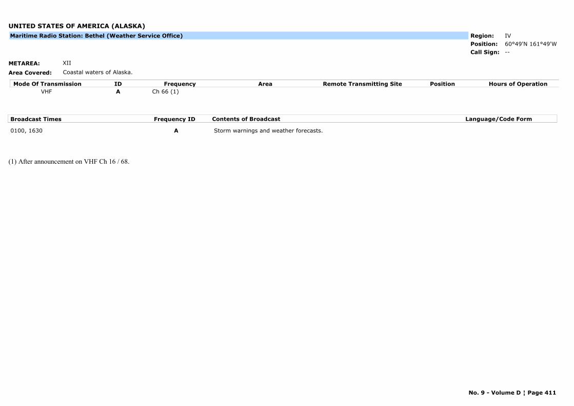
UNITED STATES OF AMERICA (ALASKA)
METAREA: XII
Area Covered: Coastal waters of Alaska.
Region: IVPosition: 60°49'N 161°49'W
--Call Sign:
Maritime Radio Station: Bethel (Weather Service Office)
Mode Of Transmission ID Frequency Area Position Hours of OperationRemote Transmitting SiteVHF A Ch 66 (1)
Broadcast Times Frequency ID Contents of Broadcast Language/Code Form
0100, 1630 A Storm warnings and weather forecasts.
(1) After announcement on VHF Ch 16 / 68.
No. 9 - Volume D ¦ Page 411

UNITED STATES OF AMERICA (ALASKA)
METAREA: XII
Area Covered: Coastal waters of Alaska.
Region: IVPosition: 55°15'N 162°46'W
KCI95Call Sign:
Maritime Radio Station: Cold Bay (Weather Service Office)
Mode Of Transmission ID Frequency Area Position Hours of OperationRemote Transmitting SiteRT (HF) A 4 125 kHz
VHF B Ch 09 (1)
Broadcast Times Frequency ID Contents of Broadcast Language/Code Form
0215, 1815 B Storm warnings and weather forecasts.
0530, 1930 A Gale warnings, synopsis and forecast for Areas 150, 155, 160, 165, 170-172, 175, 176, 179, 180 and Bearing Sea Offshore.
(1) After announcement on VHF Ch 16.
No. 9 - Volume D ¦ Page 412
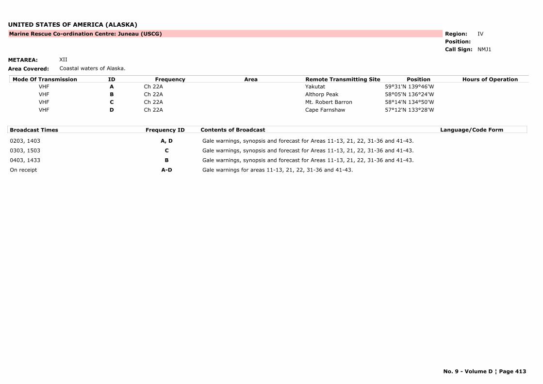
UNITED STATES OF AMERICA (ALASKA)
METAREA: XII
Area Covered: Coastal waters of Alaska.
Region: IVPosition:
Marine Rescue Co-ordination Centre: Juneau (USCG)
NMJ1Call Sign:
Mode Of Transmission ID Frequency Area Position Hours of OperationRemote Transmitting SiteVHF A Ch 22A Yakutat 59°31'N 139°46'WVHF B Ch 22A Althorp Peak 58°05'N 136°24'WVHF C Ch 22A Mt. Robert Barron 58°14'N 134°50'WVHF D Ch 22A Cape Farnshaw 57°12'N 133°28'W
Broadcast Times Frequency ID Contents of Broadcast Language/Code Form
0203, 1403 A, D Gale warnings, synopsis and forecast for Areas 11-13, 21, 22, 31-36 and 41-43.
0303, 1503 C Gale warnings, synopsis and forecast for Areas 11-13, 21, 22, 31-36 and 41-43.
0403, 1433 B Gale warnings, synopsis and forecast for Areas 11-13, 21, 22, 31-36 and 41-43.
On receipt A-D Gale warnings for areas 11-13, 21, 22, 31-36 and 41-43.
No. 9 - Volume D ¦ Page 413
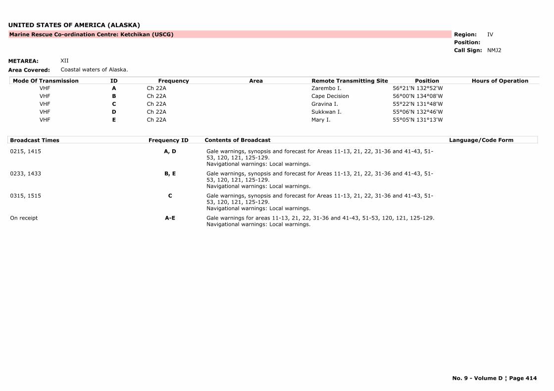
UNITED STATES OF AMERICA (ALASKA)
METAREA: XII
Area Covered: Coastal waters of Alaska.
Region: IVPosition:
Marine Rescue Co-ordination Centre: Ketchikan (USCG)
NMJ2Call Sign:
Mode Of Transmission ID Frequency Area Position Hours of OperationRemote Transmitting SiteVHF A Ch 22A Zarembo I. 56°21'N 132°52'WVHF B Ch 22A Cape Decision 56°00'N 134°08'WVHF C Ch 22A Gravina I. 55°22'N 131°48'WVHF D Ch 22A Sukkwan I. 55°06'N 132°46'WVHF E Ch 22A Mary I. 55°05'N 131°13'W
Broadcast Times Frequency ID Contents of Broadcast Language/Code Form
0215, 1415 A, D Gale warnings, synopsis and forecast for Areas 11-13, 21, 22, 31-36 and 41-43, 51-53, 120, 121, 125-129.Navigational warnings: Local warnings.
0233, 1433 B, E Gale warnings, synopsis and forecast for Areas 11-13, 21, 22, 31-36 and 41-43, 51-53, 120, 121, 125-129.Navigational warnings: Local warnings.
0315, 1515 C Gale warnings, synopsis and forecast for Areas 11-13, 21, 22, 31-36 and 41-43, 51-53, 120, 121, 125-129.Navigational warnings: Local warnings.
On receipt A-E Gale warnings for areas 11-13, 21, 22, 31-36 and 41-43, 51-53, 120, 121, 125-129.Navigational warnings: Local warnings.
No. 9 - Volume D ¦ Page 414
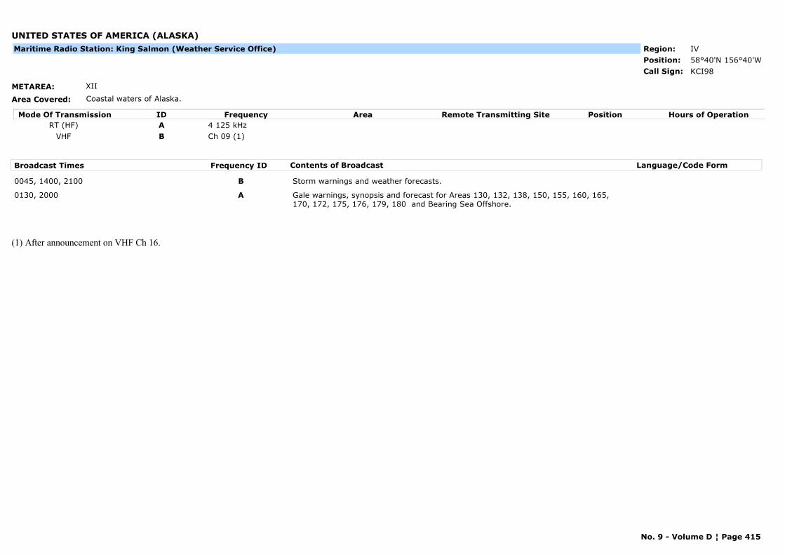
UNITED STATES OF AMERICA (ALASKA)
METAREA: XII
Area Covered: Coastal waters of Alaska.
Region: IVPosition: 58°40'N 156°40'W
KCI98Call Sign:
Maritime Radio Station: King Salmon (Weather Service Office)
Mode Of Transmission ID Frequency Area Position Hours of OperationRemote Transmitting SiteRT (HF) A 4 125 kHz
VHF B Ch 09 (1)
Broadcast Times Frequency ID Contents of Broadcast Language/Code Form
0045, 1400, 2100 B Storm warnings and weather forecasts.
0130, 2000 A Gale warnings, synopsis and forecast for Areas 130, 132, 138, 150, 155, 160, 165, 170, 172, 175, 176, 179, 180 and Bearing Sea Offshore.
(1) After announcement on VHF Ch 16.
No. 9 - Volume D ¦ Page 415
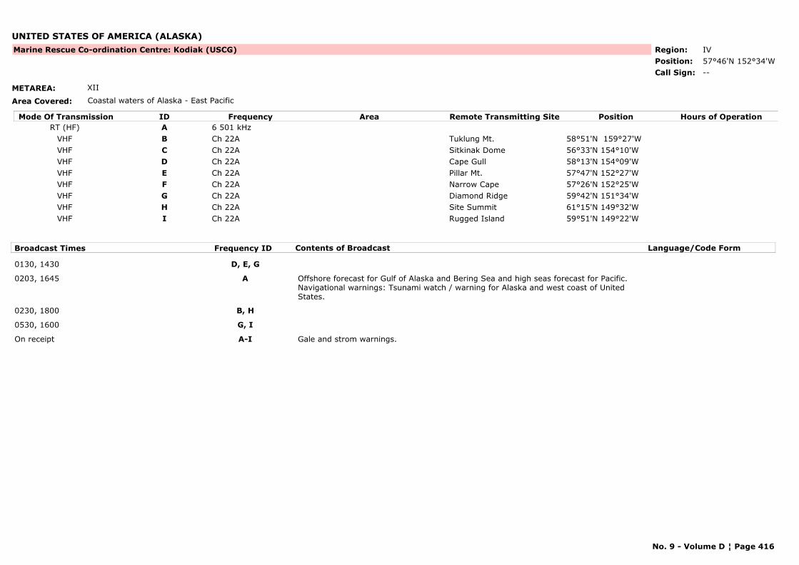
UNITED STATES OF AMERICA (ALASKA)
METAREA: XII
Area Covered: Coastal waters of Alaska - East Pacific
Region: IVPosition: 57°46'N 152°34'W
Marine Rescue Co-ordination Centre: Kodiak (USCG)
--Call Sign:
Mode Of Transmission ID Frequency Area Position Hours of OperationRemote Transmitting SiteRT (HF) A 6 501 kHz
VHF B Ch 22A Tuklung Mt. 58°51'N 159°27'WVHF C Ch 22A Sitkinak Dome 56°33'N 154°10'WVHF D Ch 22A Cape Gull 58°13'N 154°09'WVHF E Ch 22A Pillar Mt. 57°47'N 152°27'WVHF F Ch 22A Narrow Cape 57°26'N 152°25'WVHF G Ch 22A Diamond Ridge 59°42'N 151°34'WVHF H Ch 22A Site Summit 61°15'N 149°32'WVHF I Ch 22A Rugged Island 59°51'N 149°22'W
Broadcast Times Frequency ID Contents of Broadcast Language/Code Form
0130, 1430 D, E, G
0203, 1645 A Offshore forecast for Gulf of Alaska and Bering Sea and high seas forecast for Pacific.Navigational warnings: Tsunami watch / warning for Alaska and west coast of United States.
0230, 1800 B, H
0530, 1600 G, I
On receipt A-I Gale and strom warnings.
No. 9 - Volume D ¦ Page 416
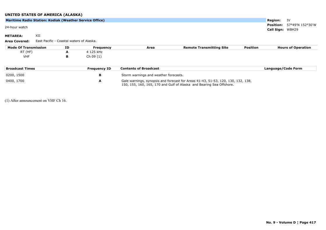
UNITED STATES OF AMERICA (ALASKA)
METAREA: XII
Area Covered: East Pacific - Coastal waters of Alaska.
Region: IVPosition: 57°49'N 152°30'W
WBH2924-hour watch
Call Sign:
Maritime Radio Station: Kodiak (Weather Service Office)
Mode Of Transmission ID Frequency Area Position Hours of OperationRemote Transmitting SiteRT (HF) A 4 125 kHz
VHF B Ch 09 (1)
Broadcast Times Frequency ID Contents of Broadcast Language/Code Form
0200, 1500 B Storm warnings and weather forecasts.
0400, 1700 A Gale warnings, synopsis and forecast for Areas 41-43, 51-53, 120, 130, 132, 138, 150, 155, 160, 165, 170 and Gulf of Alaska and Bearing Sea Offshore.
(1) After announcement on VHF Ch 16.
No. 9 - Volume D ¦ Page 417
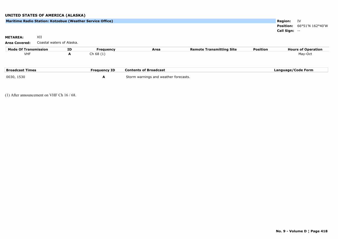
UNITED STATES OF AMERICA (ALASKA)
METAREA: XII
Area Covered: Coastal waters of Alaska.
Region: IVPosition: 66°51'N 162°40'W
--Call Sign:
Maritime Radio Station: Kotzebue (Weather Service Office)
Mode Of Transmission ID Frequency Area Position Hours of OperationRemote Transmitting SiteVHF A Ch 68 (1) May-Oct
Broadcast Times Frequency ID Contents of Broadcast Language/Code Form
0030, 1530 A Storm warnings and weather forecasts.
(1) After announcement on VHF Ch 16 / 68.
No. 9 - Volume D ¦ Page 418
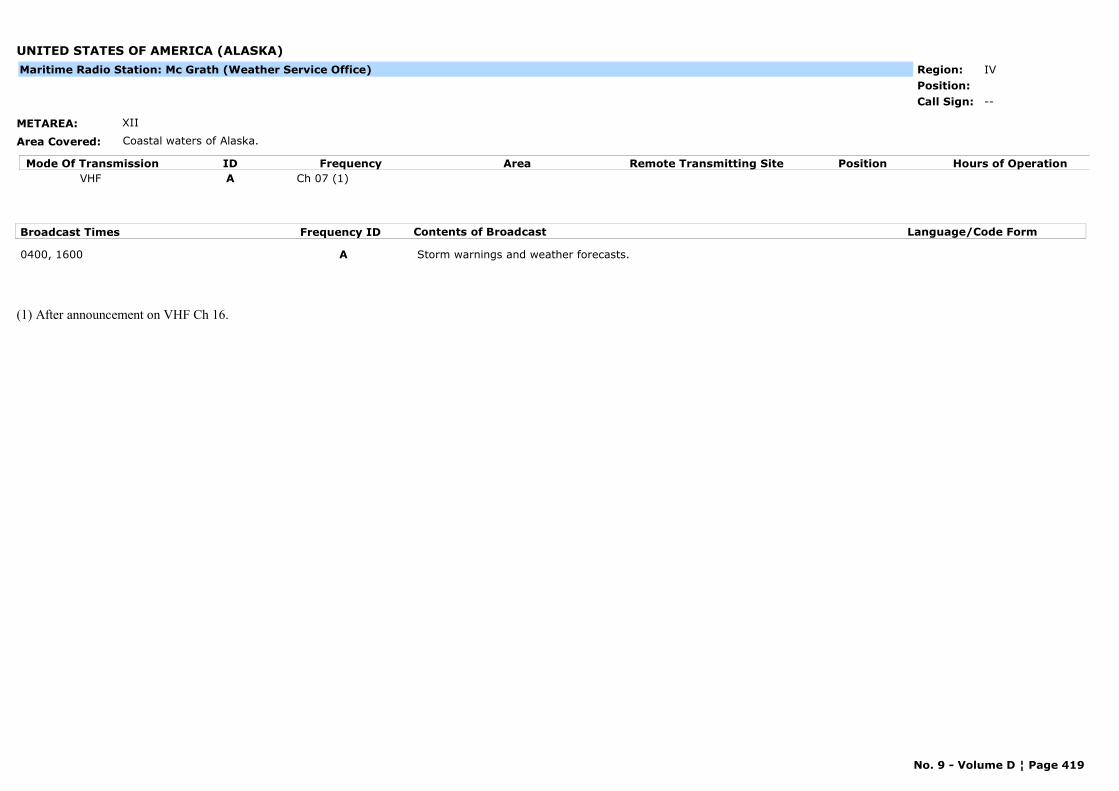
UNITED STATES OF AMERICA (ALASKA)
METAREA: XII
Area Covered: Coastal waters of Alaska.
Region: IVPosition:
--Call Sign:
Maritime Radio Station: Mc Grath (Weather Service Office)
Mode Of Transmission ID Frequency Area Position Hours of OperationRemote Transmitting SiteVHF A Ch 07 (1)
Broadcast Times Frequency ID Contents of Broadcast Language/Code Form
0400, 1600 A Storm warnings and weather forecasts.
(1) After announcement on VHF Ch 16.
No. 9 - Volume D ¦ Page 419
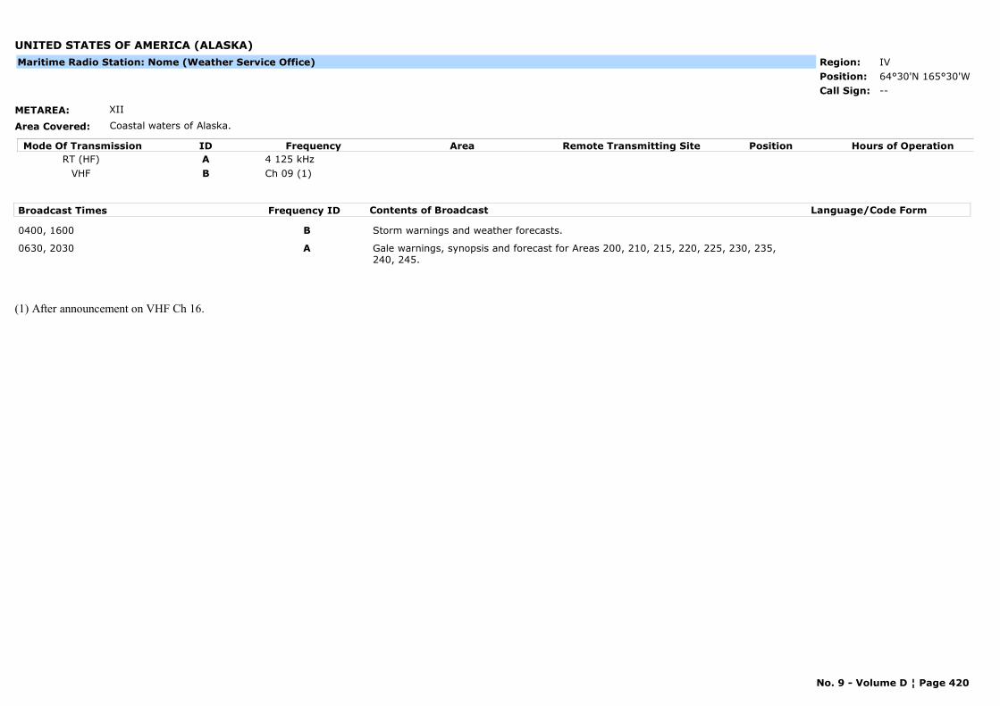
UNITED STATES OF AMERICA (ALASKA)
METAREA: XII
Area Covered: Coastal waters of Alaska.
Region: IVPosition: 64°30'N 165°30'W
--Call Sign:
Maritime Radio Station: Nome (Weather Service Office)
Mode Of Transmission ID Frequency Area Position Hours of OperationRemote Transmitting SiteRT (HF) A 4 125 kHz
VHF B Ch 09 (1)
Broadcast Times Frequency ID Contents of Broadcast Language/Code Form
0400, 1600 B Storm warnings and weather forecasts.
0630, 2030 A Gale warnings, synopsis and forecast for Areas 200, 210, 215, 220, 225, 230, 235, 240, 245.
(1) After announcement on VHF Ch 16.
No. 9 - Volume D ¦ Page 420
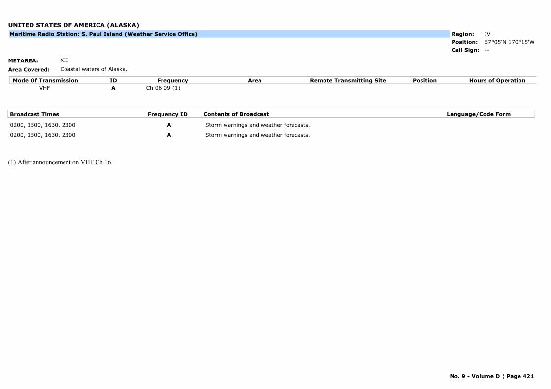
UNITED STATES OF AMERICA (ALASKA)
METAREA: XII
Area Covered: Coastal waters of Alaska.
Region: IVPosition: 57°05'N 170°15'W
--Call Sign:
Maritime Radio Station: S. Paul Island (Weather Service Office)
Mode Of Transmission ID Frequency Area Position Hours of OperationRemote Transmitting SiteVHF A Ch 06 09 (1)
Broadcast Times Frequency ID Contents of Broadcast Language/Code Form
0200, 1500, 1630, 2300 A Storm warnings and weather forecasts.
0200, 1500, 1630, 2300 A Storm warnings and weather forecasts.
(1) After announcement on VHF Ch 16.
No. 9 - Volume D ¦ Page 421

UNITED STATES OF AMERICA (ALASKA)
METAREA: XII
Area Covered: Coastal waters of Alaska.
Region: IVPosition:
Marine Rescue Co-ordination Centre: Sitka (USCG)
--Call Sign:
Mode Of Transmission ID Frequency Area Position Hours of OperationRemote Transmitting SiteVHF A Ch 22A Mud Bay 57°09'N 135°39'W
Broadcast Times Frequency ID Contents of Broadcast Language/Code Form
0103, 0903, 1350, 2103 A Gale warnings, synopsis and forecast for Areas 11-13, 21, 22, 31-36 and 41-43.Navigational warnings: Local warnings.
On receipt A Gale warnings for areas 11-13, 21, 22, 31-36 and 41-43.Navigational warnings: Local warnings.
No. 9 - Volume D ¦ Page 422
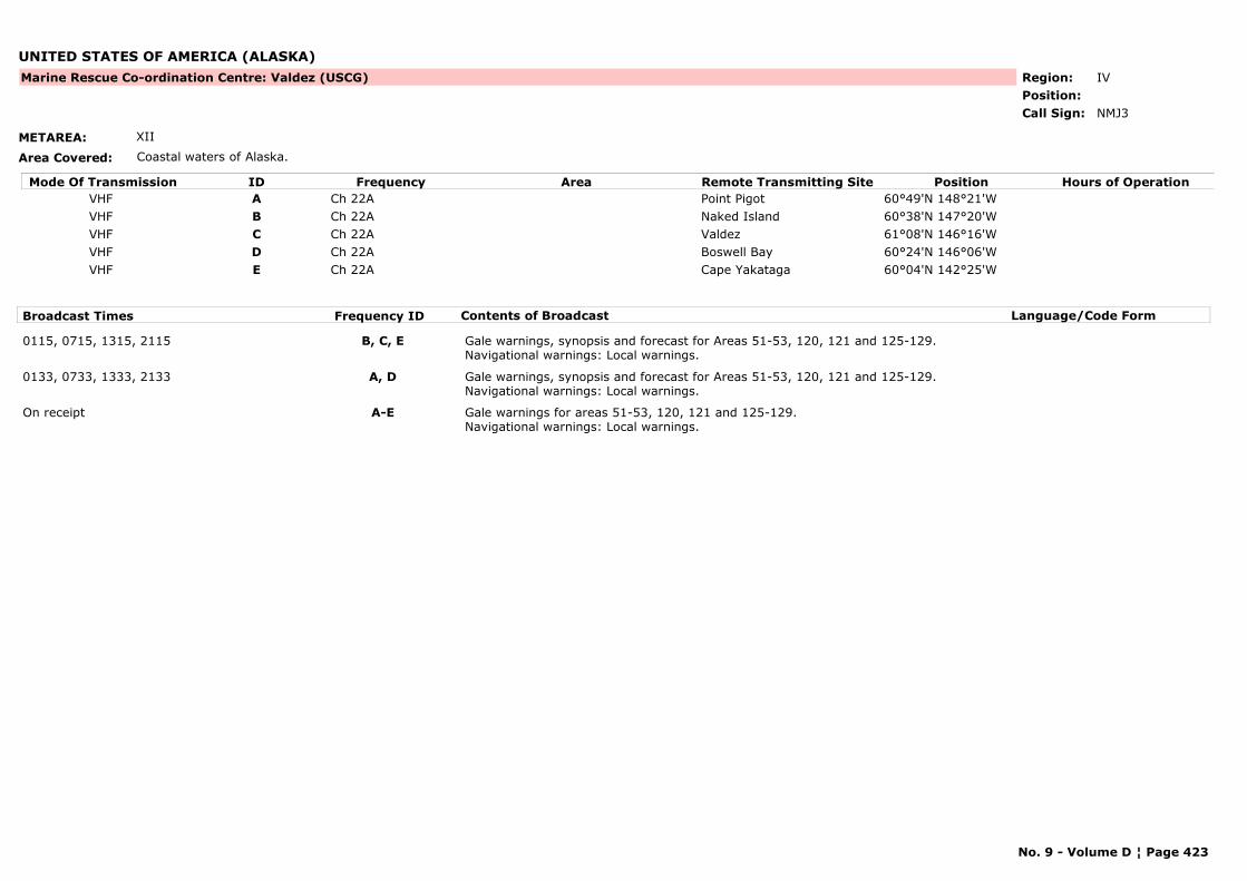
UNITED STATES OF AMERICA (ALASKA)
METAREA: XII
Area Covered: Coastal waters of Alaska.
Region: IVPosition:
Marine Rescue Co-ordination Centre: Valdez (USCG)
NMJ3Call Sign:
Mode Of Transmission ID Frequency Area Position Hours of OperationRemote Transmitting SiteVHF A Ch 22A Point Pigot 60°49'N 148°21'WVHF B Ch 22A Naked Island 60°38'N 147°20'WVHF C Ch 22A Valdez 61°08'N 146°16'WVHF D Ch 22A Boswell Bay 60°24'N 146°06'WVHF E Ch 22A Cape Yakataga 60°04'N 142°25'W
Broadcast Times Frequency ID Contents of Broadcast Language/Code Form
0115, 0715, 1315, 2115 B, C, E Gale warnings, synopsis and forecast for Areas 51-53, 120, 121 and 125-129.Navigational warnings: Local warnings.
0133, 0733, 1333, 2133 A, D Gale warnings, synopsis and forecast for Areas 51-53, 120, 121 and 125-129.Navigational warnings: Local warnings.
On receipt A-E Gale warnings for areas 51-53, 120, 121 and 125-129.Navigational warnings: Local warnings.
No. 9 - Volume D ¦ Page 423
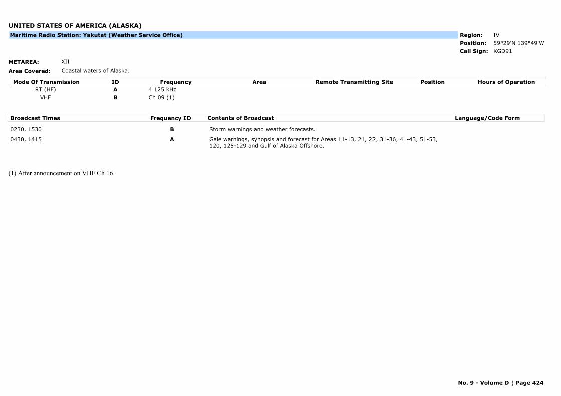
UNITED STATES OF AMERICA (ALASKA)
METAREA: XII
Area Covered: Coastal waters of Alaska.
Region: IVPosition: 59°29'N 139°49'W
KGD91Call Sign:
Maritime Radio Station: Yakutat (Weather Service Office)
Mode Of Transmission ID Frequency Area Position Hours of OperationRemote Transmitting SiteRT (HF) A 4 125 kHz
VHF B Ch 09 (1)
Broadcast Times Frequency ID Contents of Broadcast Language/Code Form
0230, 1530 B Storm warnings and weather forecasts.
0430, 1415 A Gale warnings, synopsis and forecast for Areas 11-13, 21, 22, 31-36, 41-43, 51-53, 120, 125-129 and Gulf of Alaska Offshore.
(1) After announcement on VHF Ch 16.
No. 9 - Volume D ¦ Page 424
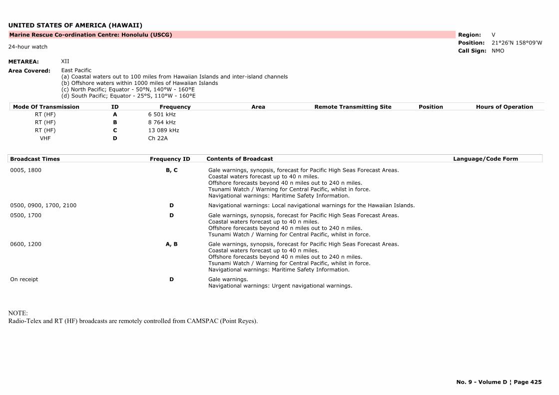
UNITED STATES OF AMERICA (HAWAII)
METAREA: XII
Area Covered: East Pacific(a) Coastal waters out to 100 miles from Hawaiian Islands and inter-island channels(b) Offshore waters within 1000 miles of Hawaiian Islands(c) North Pacific; Equator - 50°N, 140°W - 160°E(d) South Pacific; Equator - 25°S, 110°W - 160°E
Region: VPosition: 21°26'N 158°09'W
Marine Rescue Co-ordination Centre: Honolulu (USCG)
NMO24-hour watch
Call Sign:
Mode Of Transmission ID Frequency Area Position Hours of OperationRemote Transmitting SiteRT (HF) A 6 501 kHzRT (HF) B 8 764 kHzRT (HF) C 13 089 kHz
VHF D Ch 22A
Broadcast Times Frequency ID Contents of Broadcast Language/Code Form
0005, 1800 B, C Gale warnings, synopsis, forecast for Pacific High Seas Forecast Areas.Coastal waters forecast up to 40 n miles.Offshore forecasts beyond 40 n miles out to 240 n miles.Tsunami Watch / Warning for Central Pacific, whilst in force.Navigational warnings: Maritime Safety Information.
0500, 0900, 1700, 2100 D Navigational warnings: Local navigational warnings for the Hawaiian Islands.
0500, 1700 D Gale warnings, synopsis, forecast for Pacific High Seas Forecast Areas.Coastal waters forecast up to 40 n miles.Offshore forecasts beyond 40 n miles out to 240 n miles.Tsunami Watch / Warning for Central Pacific, whilst in force.
0600, 1200 A, B Gale warnings, synopsis, forecast for Pacific High Seas Forecast Areas.Coastal waters forecast up to 40 n miles.Offshore forecasts beyond 40 n miles out to 240 n miles.Tsunami Watch / Warning for Central Pacific, whilst in force.Navigational warnings: Maritime Safety Information.
On receipt D Gale warnings.Navigational warnings: Urgent navigational warnings.
NOTE: Radio-Telex and RT (HF) broadcasts are remotely controlled from CAMSPAC (Point Reyes).
No. 9 - Volume D ¦ Page 425
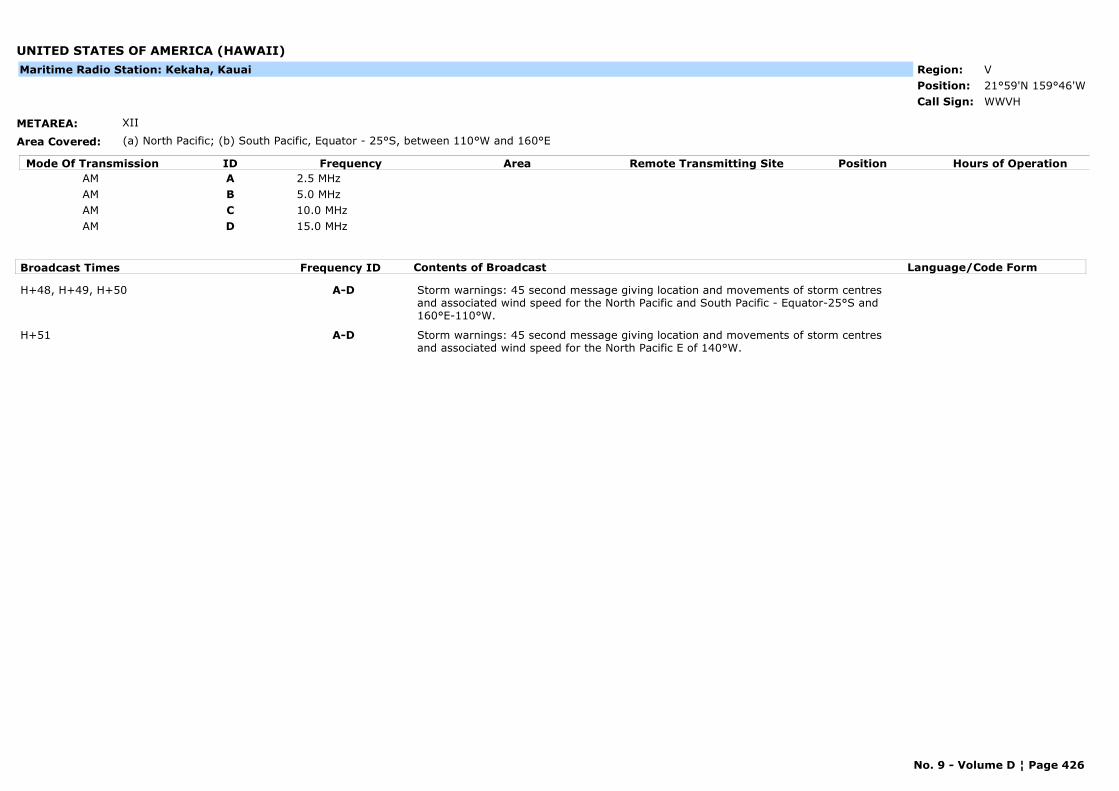
UNITED STATES OF AMERICA (HAWAII)
METAREA: XII
Area Covered: (a) North Pacific; (b) South Pacific, Equator - 25°S, between 110°W and 160°E
Region: VPosition: 21°59'N 159°46'W
WWVHCall Sign:
Maritime Radio Station: Kekaha, Kauai
Mode Of Transmission ID Frequency Area Position Hours of OperationRemote Transmitting SiteAM A 2.5 MHzAM B 5.0 MHzAM C 10.0 MHzAM D 15.0 MHz
Broadcast Times Frequency ID Contents of Broadcast Language/Code Form
H+48, H+49, H+50 A-D Storm warnings: 45 second message giving location and movements of storm centres and associated wind speed for the North Pacific and South Pacific - Equator-25°S and 160°E-110°W.
H+51 A-D Storm warnings: 45 second message giving location and movements of storm centres and associated wind speed for the North Pacific E of 140°W.
No. 9 - Volume D ¦ Page 426

URUGUAY
METAREA: V
Area Covered: -
Region: IIIPosition: 34°47'S 55°45'W
Marine Rescue Co-ordination Centre: Atlántida (PREFECTURA)
--Call Sign:
Mode Of Transmission ID Frequency Area Position Hours of OperationRemote Transmitting SiteVHF A Ch 15
Broadcast Times Frequency ID Contents of Broadcast Language/Code Form
0533, 1333, 1933 A
No. 9 - Volume D ¦ Page 427
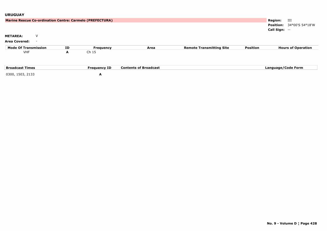
URUGUAY
METAREA: V
Area Covered: -
Region: IIIPosition: 34°00'S 54°18'W
Marine Rescue Co-ordination Centre: Carmelo (PREFECTURA)
--Call Sign:
Mode Of Transmission ID Frequency Area Position Hours of OperationRemote Transmitting SiteVHF A Ch 15
Broadcast Times Frequency ID Contents of Broadcast Language/Code Form
0300, 1503, 2133 A
No. 9 - Volume D ¦ Page 428

URUGUAY
METAREA: V
Area Covered: -
Region: IIIPosition: 34°28'S 57°51'W
Marine Rescue Co-ordination Centre: Colonia (PREFECTURA)
--Call Sign:
Mode Of Transmission ID Frequency Area Position Hours of OperationRemote Transmitting SiteVHF A Ch 15
Broadcast Times Frequency ID Contents of Broadcast Language/Code Form
0333, 1333, 2103 A Weather bulletins.
No. 9 - Volume D ¦ Page 429
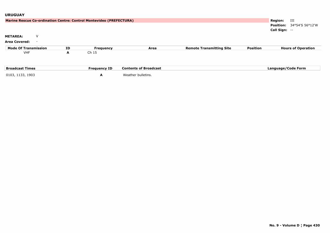
URUGUAY
METAREA: V
Area Covered: -
Region: IIIPosition: 34°54'S 56°12'W
Marine Rescue Co-ordination Centre: Control Montevideo (PREFECTURA)
--Call Sign:
Mode Of Transmission ID Frequency Area Position Hours of OperationRemote Transmitting SiteVHF A Ch 15
Broadcast Times Frequency ID Contents of Broadcast Language/Code Form
0103, 1133, 1903 A Weather bulletins.
No. 9 - Volume D ¦ Page 430

URUGUAY
METAREA: V
Area Covered: -
Region: IIIPosition: 33°07'S 58°18'W
Marine Rescue Co-ordination Centre: Fray Bentos (PREFECTURA)
--Call Sign:
Mode Of Transmission ID Frequency Area Position Hours of OperationRemote Transmitting SiteVHF A Ch 15
Broadcast Times Frequency ID Contents of Broadcast Language/Code Form
0200, 0800, 1400, 2000 A Weather bulletins.
No. 9 - Volume D ¦ Page 431
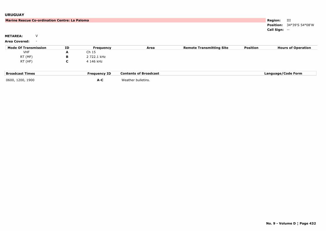
URUGUAY
METAREA: V
Area Covered: -
Region: IIIPosition: 34°39'S 54°08'W
Marine Rescue Co-ordination Centre: La Paloma
--Call Sign:
Mode Of Transmission ID Frequency Area Position Hours of OperationRemote Transmitting SiteVHF A Ch 15
RT (MF) B 2 722.1 kHzRT (HF) C 4 146 kHz
Broadcast Times Frequency ID Contents of Broadcast Language/Code Form
0600, 1200, 1900 A-C Weather bulletins.
No. 9 - Volume D ¦ Page 432
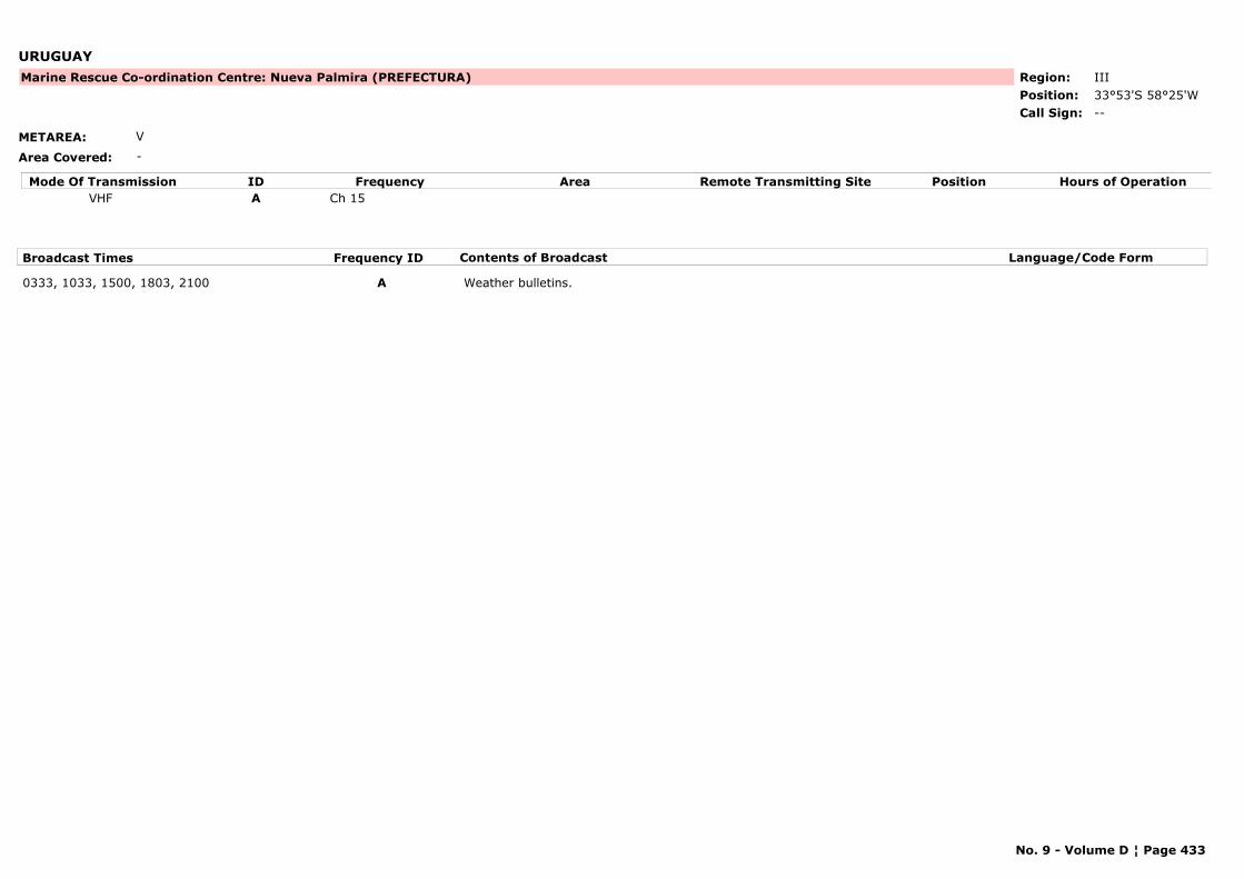
URUGUAY
METAREA: V
Area Covered: -
Region: IIIPosition: 33°53'S 58°25'W
Marine Rescue Co-ordination Centre: Nueva Palmira (PREFECTURA)
--Call Sign:
Mode Of Transmission ID Frequency Area Position Hours of OperationRemote Transmitting SiteVHF A Ch 15
Broadcast Times Frequency ID Contents of Broadcast Language/Code Form
0333, 1033, 1500, 1803, 2100 A Weather bulletins.
No. 9 - Volume D ¦ Page 433

URUGUAY
METAREA: V
Area Covered: -
Region: IIIPosition: 32°18'S 58°05'W
Marine Rescue Co-ordination Centre: Paysandú (PREFECTURA)
--Call Sign:
Mode Of Transmission ID Frequency Area Position Hours of OperationRemote Transmitting SiteVHF A Ch 15
Broadcast Times Frequency ID Contents of Broadcast Language/Code Form
0300, 0903, 2103 A Weather bulletins.
No. 9 - Volume D ¦ Page 434
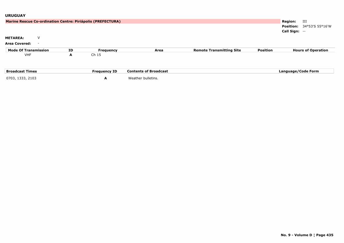
URUGUAY
METAREA: V
Area Covered: -
Region: IIIPosition: 34°53'S 55°16'W
Marine Rescue Co-ordination Centre: Piriápolis (PREFECTURA)
--Call Sign:
Mode Of Transmission ID Frequency Area Position Hours of OperationRemote Transmitting SiteVHF A Ch 15
Broadcast Times Frequency ID Contents of Broadcast Language/Code Form
0703, 1333, 2103 A Weather bulletins.
No. 9 - Volume D ¦ Page 435

URUGUAY
METAREA: V
Area Covered: -
Region: IIIPosition: 34°26'S 57°26'W
Marine Rescue Co-ordination Centre: Puerto Sauce (PREFECTURA)
--Call Sign:
Mode Of Transmission ID Frequency Area Position Hours of OperationRemote Transmitting SiteVHF A Ch 15
Broadcast Times Frequency ID Contents of Broadcast Language/Code Form
0133, 1303, 1933 A Weather bulletins.
No. 9 - Volume D ¦ Page 436
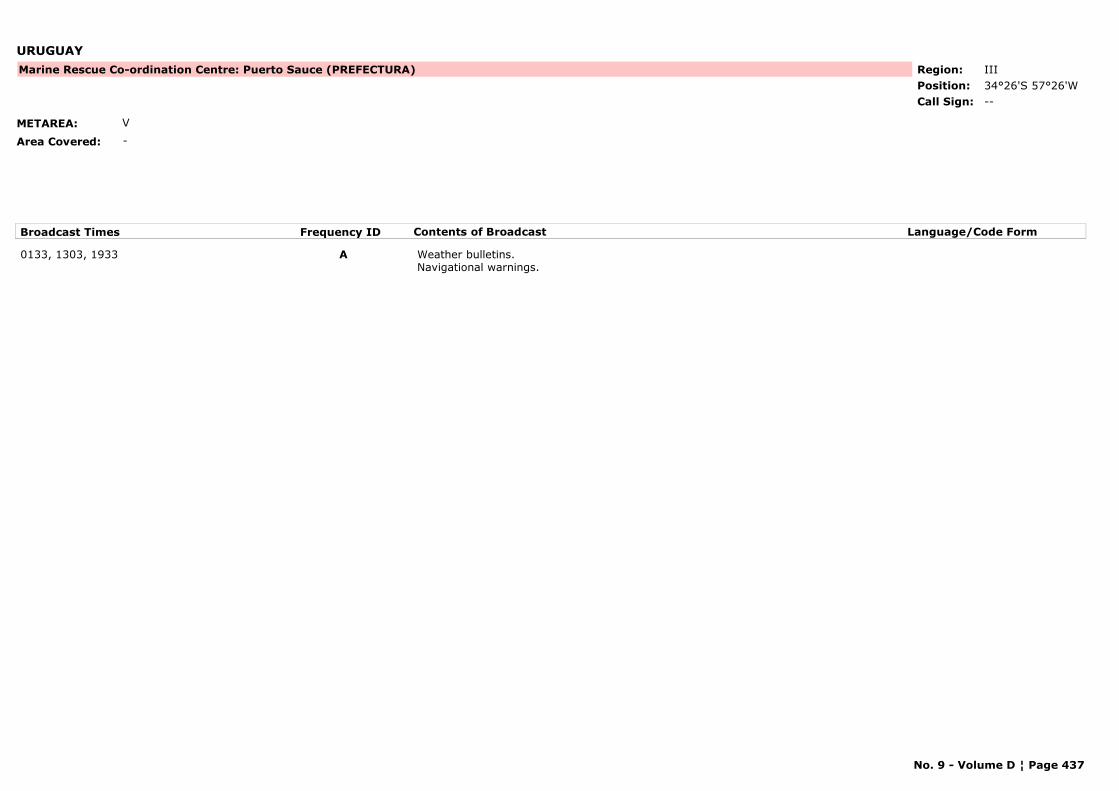
URUGUAY
METAREA: V
Area Covered: -
Region: IIIPosition: 34°26'S 57°26'W
Marine Rescue Co-ordination Centre: Puerto Sauce (PREFECTURA)
--Call Sign:
Broadcast Times Frequency ID Contents of Broadcast Language/Code Form
0133, 1303, 1933 A Weather bulletins.Navigational warnings.
No. 9 - Volume D ¦ Page 437
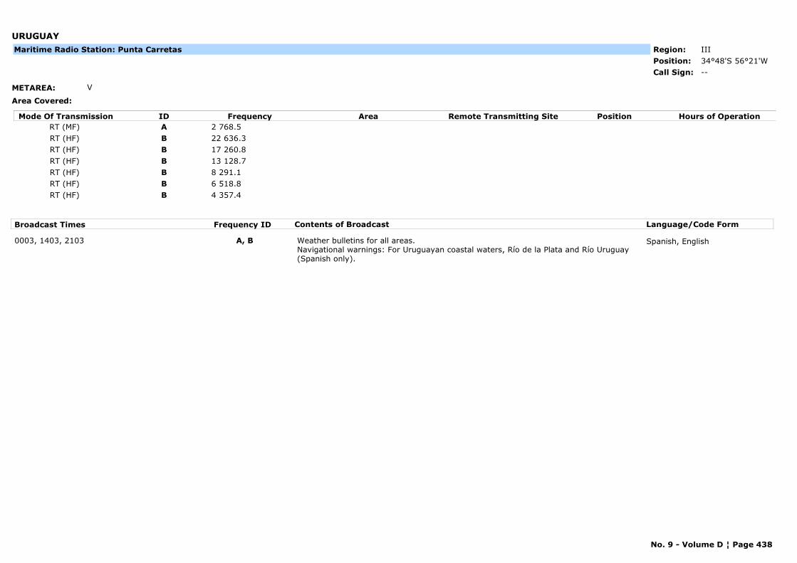
URUGUAY
METAREA: V
Area Covered:
Region: IIIPosition: 34°48'S 56°21'W
--Call Sign:
Maritime Radio Station: Punta Carretas
Mode Of Transmission ID Frequency Area Position Hours of OperationRemote Transmitting SiteRT (MF) A 2 768.5RT (HF) B 22 636.3RT (HF) B 17 260.8RT (HF) B 13 128.7RT (HF) B 8 291.1RT (HF) B 6 518.8RT (HF) B 4 357.4
Broadcast Times Frequency ID Contents of Broadcast Language/Code Form
0003, 1403, 2103 A, B Weather bulletins for all areas.Navigational warnings: For Uruguayan coastal waters, Río de la Plata and Río Uruguay (Spanish only).
Spanish, English
No. 9 - Volume D ¦ Page 438

URUGUAY
METAREA: V
Area Covered: -
Region: IIIPosition: 34°58'S 54°51'W
Marine Rescue Co-ordination Centre: Punta del Este (PREFECTURA)
--Call Sign:
Mode Of Transmission ID Frequency Area Position Hours of OperationRemote Transmitting SiteVHF A Ch 15
RT (MF) B 2 722.1 kHz
Broadcast Times Frequency ID Contents of Broadcast Language/Code Form
0133, 1503, 2133 A, B Weather bulletins.
No. 9 - Volume D ¦ Page 439
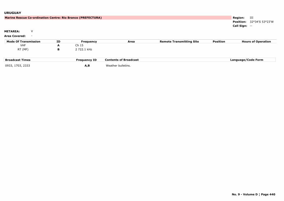
URUGUAY
METAREA: V
Area Covered: -
Region: IIIPosition: 32°34'S 53°23'W
Marine Rescue Co-ordination Centre: Rio Branco (PREFECTURA)
--Call Sign:
Mode Of Transmission ID Frequency Area Position Hours of OperationRemote Transmitting SiteVHF A Ch 15
RT (MF) B 2 722.1 kHz
Broadcast Times Frequency ID Contents of Broadcast Language/Code Form
0933, 1703, 2333 A,B Weather bulletins.
No. 9 - Volume D ¦ Page 440
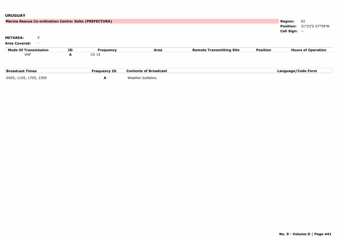
URUGUAY
METAREA: V
Area Covered: -
Region: IIIPosition: 31°23'S 57°59'W
Marine Rescue Co-ordination Centre: Salto (PREFECTURA)
--Call Sign:
Mode Of Transmission ID Frequency Area Position Hours of OperationRemote Transmitting SiteVHF A Ch 15
Broadcast Times Frequency ID Contents of Broadcast Language/Code Form
0505, 1105, 1705, 2305 A Weather bulletins.
No. 9 - Volume D ¦ Page 441
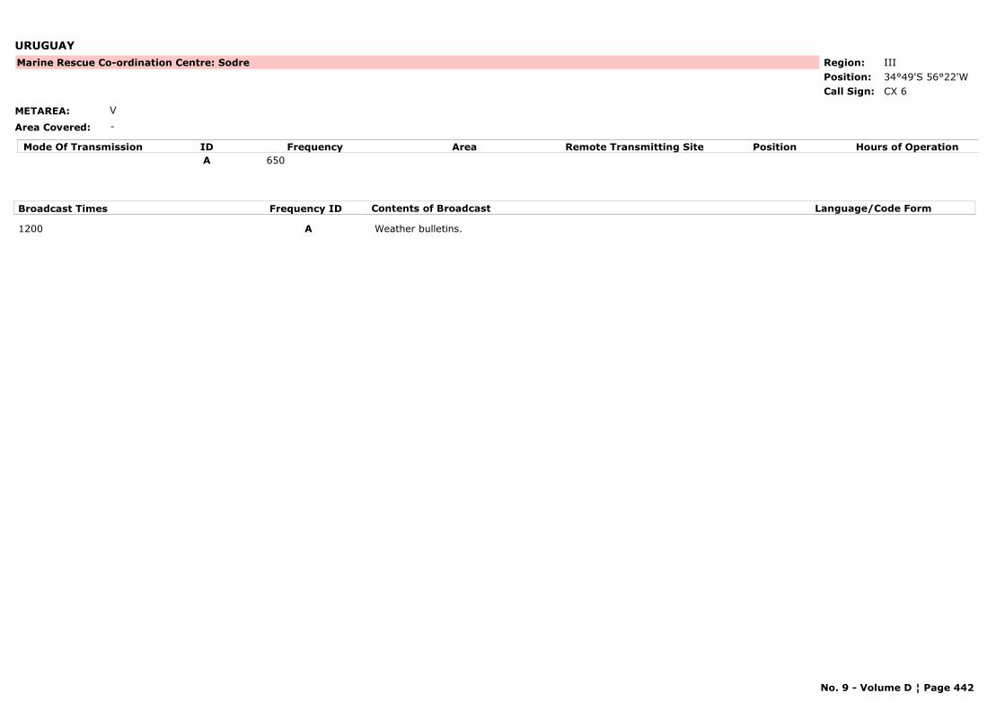
URUGUAY
METAREA: V
Area Covered: -
Region: IIIPosition: 34°49'S 56°22'W
Marine Rescue Co-ordination Centre: Sodre
CX 6Call Sign:
Mode Of Transmission ID Frequency Area Position Hours of OperationRemote Transmitting SiteA 650
Broadcast Times Frequency ID Contents of Broadcast Language/Code Form
1200 A Weather bulletins.
No. 9 - Volume D ¦ Page 442
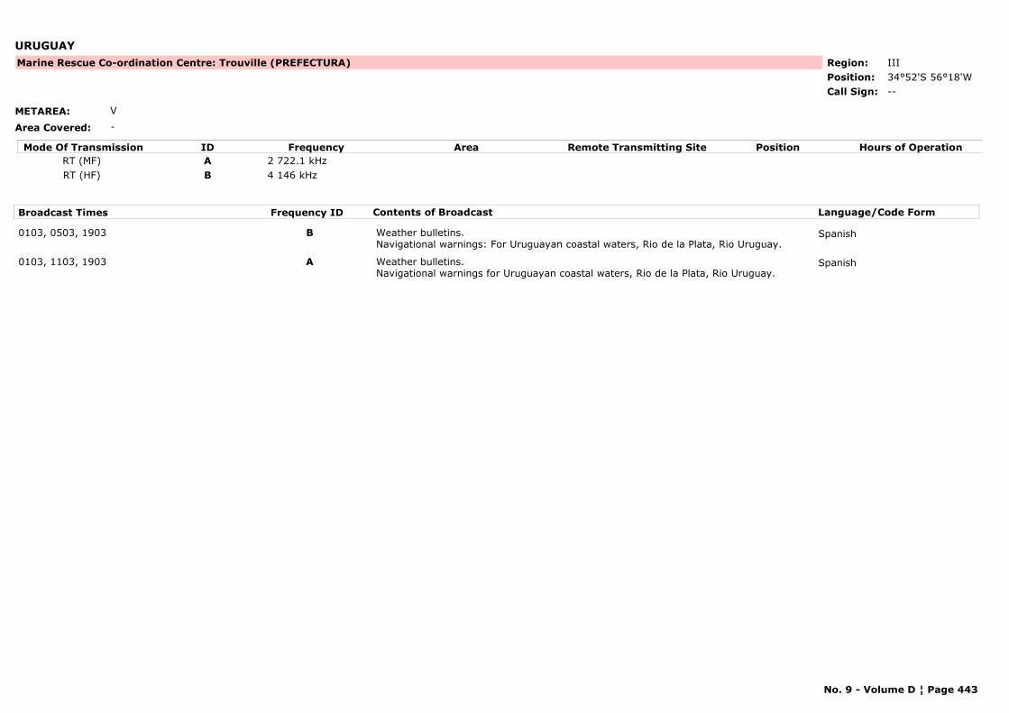
URUGUAY
METAREA: V
Area Covered: -
Region: IIIPosition: 34°52'S 56°18'W
Marine Rescue Co-ordination Centre: Trouville (PREFECTURA)
--Call Sign:
Mode Of Transmission ID Frequency Area Position Hours of OperationRemote Transmitting SiteRT (MF) A 2 722.1 kHzRT (HF) B 4 146 kHz
Broadcast Times Frequency ID Contents of Broadcast Language/Code Form
0103, 0503, 1903 B Weather bulletins.Navigational warnings: For Uruguayan coastal waters, Rio de la Plata, Rio Uruguay.
Spanish
0103, 1103, 1903 A Weather bulletins.Navigational warnings for Uruguayan coastal waters, Rio de la Plata, Rio Uruguay.
Spanish
No. 9 - Volume D ¦ Page 443
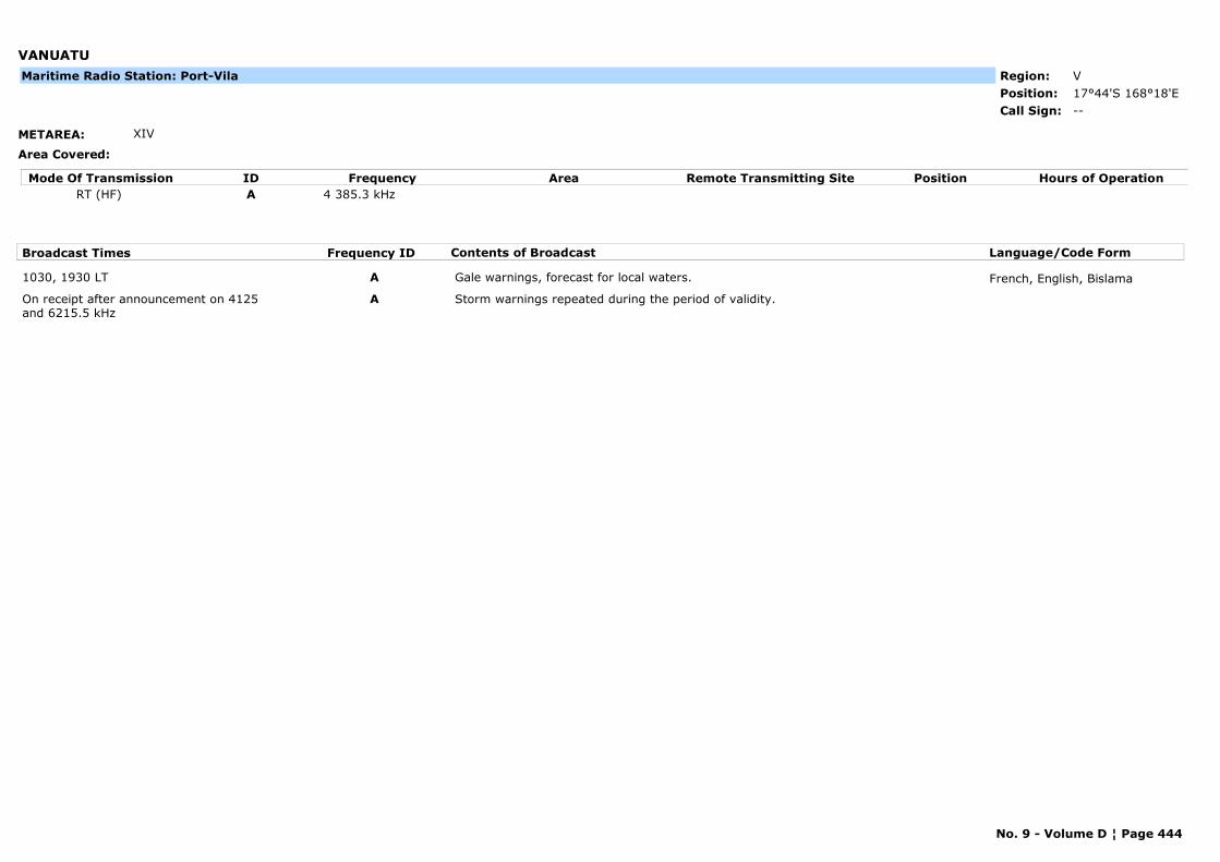
VANUATU
METAREA: XIV
Area Covered:
Region: VPosition: 17°44'S 168°18'E
--Call Sign:
Maritime Radio Station: Port-Vila
Mode Of Transmission ID Frequency Area Position Hours of OperationRemote Transmitting SiteRT (HF) A 4 385.3 kHz
Broadcast Times Frequency ID Contents of Broadcast Language/Code Form
1030, 1930 LT A Gale warnings, forecast for local waters. French, English, Bislama
On receipt after announcement on 4125 and 6215.5 kHz
A Storm warnings repeated during the period of validity.
No. 9 - Volume D ¦ Page 444
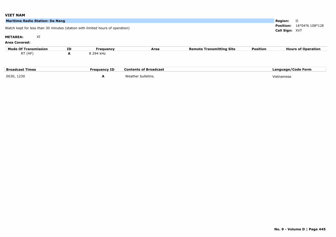
VIET NAM
METAREA: XI
Area Covered:
Region: IIPosition: 16°04'N 108°12E
XVTWatch kept for less than 30 minutes (station with limited hours of operation)
Call Sign:
Maritime Radio Station: Da Nang
Mode Of Transmission ID Frequency Area Position Hours of OperationRemote Transmitting SiteRT (HF) A 8 294 kHz
Broadcast Times Frequency ID Contents of Broadcast Language/Code Form
0030, 1230 A Weather bulletins. Vietnamese
No. 9 - Volume D ¦ Page 445
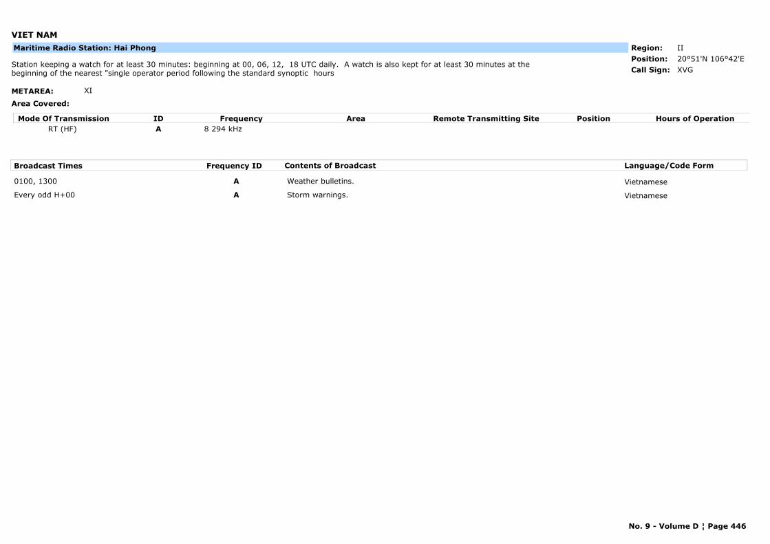
VIET NAM
METAREA: XI
Area Covered:
Region: IIPosition: 20°51'N 106°42'E
XVGStation keeping a watch for at least 30 minutes: beginning at 00, 06, 12, 18 UTC daily. A watch is also kept for at least 30 minutes at the beginning of the nearest "single operator period following the standard synoptic hours Call Sign:
Maritime Radio Station: Hai Phong
Mode Of Transmission ID Frequency Area Position Hours of OperationRemote Transmitting SiteRT (HF) A 8 294 kHz
Broadcast Times Frequency ID Contents of Broadcast Language/Code Form
0100, 1300 A Weather bulletins. Vietnamese
Every odd H+00 A Storm warnings. Vietnamese
No. 9 - Volume D ¦ Page 446
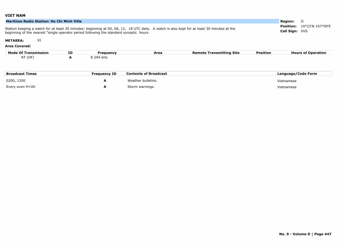
VIET NAM
METAREA: XI
Area Covered:
Region: IIPosition: 10°23'N 107°09'E
XVSStation keeping a watch for at least 30 minutes: beginning at 00, 06, 12, 18 UTC daily. A watch is also kept for at least 30 minutes at the beginning of the nearest "single operator period following the standard synoptic hours Call Sign:
Maritime Radio Station: Ho Chi Minh Ville
Mode Of Transmission ID Frequency Area Position Hours of OperationRemote Transmitting SiteRT (HF) A 8 294 kHz
Broadcast Times Frequency ID Contents of Broadcast Language/Code Form
0200, 1200 A Weather bulletins. Vietnamese
Every even H+00 A Storm warnings. Vietnamese
No. 9 - Volume D ¦ Page 447
CHAPTER 2
MARITIME SAFETY INFORMATION (MSI) BROADCAST SERVICE
PART A
SATELLITE SYSTEMS / COMMUNICATIONS
INMARSAT – C Land Earth Stations (LESs)
accepting Short Access Code (SAC) 41 messages
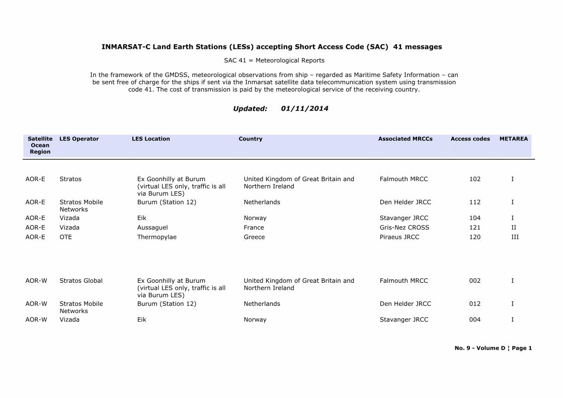
INMARSAT-C Land Earth Stations (LESs) accepting Short Access Code (SAC) 41 messages
Updated:
SAC 41 = Meteorological Reports
In the framework of the GMDSS, meteorological observations from ship – regarded as Maritime Safety Information – can be sent free of charge for the ships if sent via the Inmarsat satellite data telecommunication system using transmission
code 41. The cost of transmission is paid by the meteorological service of the receiving country.
01/11/2014
LES Location Access codesCountry LES Operator Associated MRCCs METAREASatellite
OceanRegion
United Kingdom of Great Britain and Northern Ireland
102Stratos Ex Goonhilly at Burum(virtual LES only, traffic is all via Burum LES)
Falmouth MRCC IAOR-E
Netherlands 112Stratos Mobile Networks
Burum (Station 12) Den Helder JRCC IAOR-E
Norway 104Vizada Eik Stavanger JRCC IAOR-E
France 121Vizada Aussaguel Gris-Nez CROSS IIAOR-E
Greece 120OTE Thermopylae Piraeus JRCC IIIAOR-E
United Kingdom of Great Britain and Northern Ireland
002Stratos Global Ex Goonhilly at Burum(virtual LES only, traffic is all via Burum LES)
Falmouth MRCC IAOR-W
Netherlands 012Stratos Mobile Networks
Burum (Station 12) Den Helder JRCC IAOR-W
Norway 004Vizada Eik Stavanger JRCC IAOR-W
No. 9 - Volume D ¦ Page 1
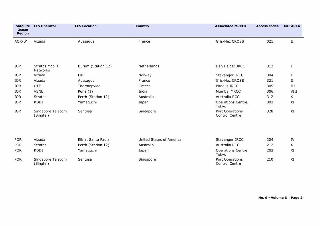
LES Location Access codesCountry LES Operator Associated MRCCs METAREASatellite
OceanRegion
France 021Vizada Aussaguel Gris-Nez CROSS IIAOR-W
Netherlands 312Stratos Mobile Networks
Burum (Station 12) Den Helder JRCC IIOR
Norway 304Vizada Eik Stavanger JRCC IIOR
France 321Vizada Aussaguel Gris-Nez CROSS IIIOR
Greece 305OTE Thermopylae Piraeus JRCC IIIIOR
India 306VSNL Pune (1) Mumbai MRCC VIIIIOR
Australia 312Stratos Perth (Station 12) Australia RCC XIOR
Japan 303KDDI Yamaguchi Operations Centre, Tokyo
XIIOR
Singapore 328Singapore Telecom (Singtel)
Sentosa Port Operations Control Centre
XIIOR
United States of America 204Vizada Eik at Santa Paula Stavanger JRCC IVPOR
Australia 212Stratos Perth (Station 12) Australia RCC XPOR
Japan 203KDDI Yamaguchi Operations Centre, Tokyo
XIPOR
Singapore 210Singapore Telecom (Singtel)
Sentosa Port Operations Control Centre
XIPOR
No. 9 - Volume D ¦ Page 2
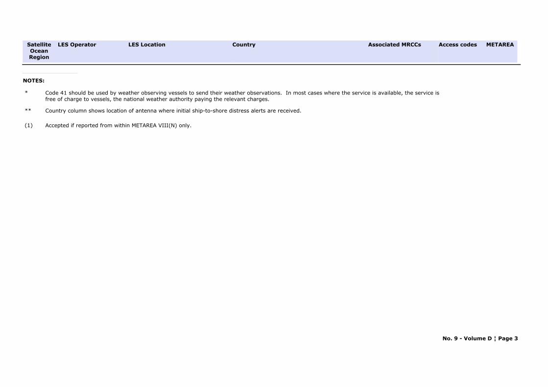
LES Location Access codesCountry LES Operator Associated MRCCs METAREASatellite
OceanRegion
NOTES:
* Code 41 should be used by weather observing vessels to send their weather observations. In most cases where the service is available, the service is free of charge to vessels, the national weather authority paying the relevant charges.
** Country column shows location of antenna where initial ship-to-shore distress alerts are received.
(1) Accepted if reported from within METAREA VIII(N) only.
No. 9 - Volume D ¦ Page 3
PART B
NAVTEX STATIONS

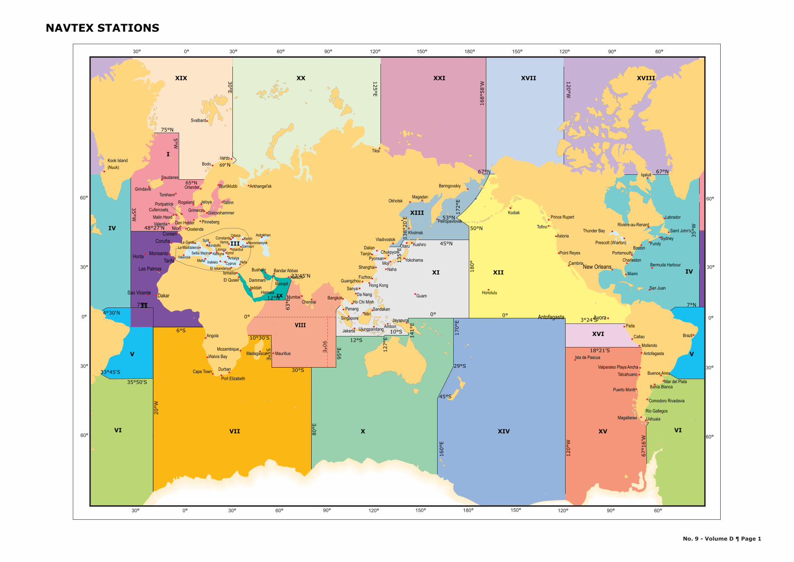
NAVTEX STATIONS
No. 9 - Volume D ¶ Page 1
30°
°
°
°
°90°°°
0°
150°120°90°60°30°0°30°
60°
30°
30°
60°
30° 60°30°0° 150°120°90° °° ° °
60°
90180 150 120° 60
0
30
60
60°120150180
5°W
75°N
20°W
35°50'S
7°N
6°S
33°45'S
4°30'N
48°27'N
65°N
35°W
N
30°E
69°
125°E
168°
58'W
120°W
67°N
'
E
0°
N°
90E
'
10°30'S
30°S
12°N
23 45
67°1
6'W
80°E
12°S95
°E 127°
E
10°S
141°
E
135°
E13
8°20
55°E
63°E
°
7°N
18°21'S
0°
50°N
0°
172°
E
3°24'S
67°N
120°
W
35°W
180°
160°
E
29°S
45°S
45°N
53°N
170°
E
Antofagasta
V
IX
III
V
VI
IV
XVIIIXVIIXIX XX XXI
II
XIII
XI
XVIVIII
XII
I
IV
VIIVI X XIV XV
Arkhangel'sk
Tiksi
Bodo
Svalbard
Vardo Kook Island (Nuuk)
Iqaluit
Kodiak
Callao
Paita
Mollendo Antofagasta
Isla de Pascua
Magallanes
Puerto Montt
Talcahuano Valparaiso Playa Ancha
Kholmsk
Magadan Okhotsk
Petropavlovsk
Vladivostok
Beringovskiy
Prince Rupert
Tofino
Ayora
Astoria
Cambria
Point Reyes
Honolulu
Dalian
FuzhouGuangzhou
Sanya
Shanghai
Tianjin
Guam
Hong Kong
Ambon Jakarta
Jayapura
Ujungpandang
Kushiro
Moji Naha
Otaru
Yokohama
MiriPenang Sandakan
Chukpyon Pyonsan
Singapore
Bangkok Da Nang
Ho Chi Minh
Hamala
El QuseirIsmailia Bandar AbbasBushehr
Masqat KarachiDammam
Jeddah
Chennai Mumbai
Mauritius
Angola
MadagascarMozambique
Walvis Bay
Cape TownPort Elizabeth
Durban
Bahía Blanca
Buenos Aires
Comodoro Rivadavia
Mar del Plata
Rio GallegosUshuaia
Brazil
Bermuda Harbour
Fundy
Labrador
Prescott (Wiarton)
Rivière-au-RenardSaint John's
SydneyThunder Bay
San Juan
Boston
Charleston
Miami New Orleans
Portsmouth
Varna Split
CyprusEl Iskandariya
La Garde
Irakleio
KerkyraLimnos
Hefa Malta
Kerch Odesa
Antalya
Istanbul Izmir
Samsun
Valencia
Astrakhan
Novorossiysk Constanta
La Maddalena Mondolfo
Sellia Marina
Sao Vicente
Corsen
Monsanto Horta
Dakar
Coruña
Tarifa Las Palmas
Oostende
TorshavnTallinn
Pinneberg
Grindavik
Saudanes
Valentia Malin Head
Den Helder
Orlandet
JeloyaRogaland
Bjuröklubb
GislovshammerGrimeton Cullercoats
Niton
Portpatrick

ANGOLA
METAREA: VII
Area Covered:
Region: WMO REGION: IPosition:
--
NOTE: NAVTEX services for Angola are available through the NAVAREA VII coordinator.
No. 9 - Volume D ¦ Page 3
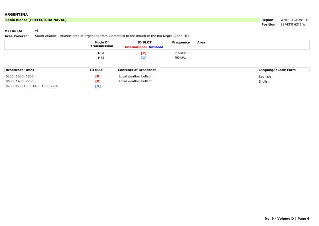
ARGENTINA
METAREA: VI
Area Covered: South Atlantic - Atlantic area of Argentina from Claromecó to the mouth of the Río Negro (Zone III)
Region: WMO REGION: IIIPosition: 38°43'S 62°6'W
Bahía Blanca (PREFECTURA NAVAL)
Mode OfTransmission
ID SLOT AreaInternational National
Frequency
MSI [P] 518 kHzMSI [D] 490 kHz
Broadcast Times ID SLOT Contents of Broadcast Language/Code Form
0230, 1030, 1830 Local weather bulletin. Spanish[P]0630, 1430, 2230 Local weather bulletin. English[P]0230 0630 1030 1430 1830 2230 [D]
No. 9 - Volume D ¦ Page 4
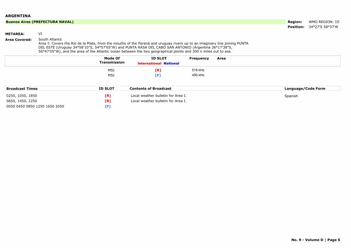
ARGENTINA
METAREA: VI
Area Covered: South AtlanticArea I: Covers the Río de la Plata, from the mouths of the Paraná and uruguay rivers up to an imaginary line joining PUNTA DEL ESTE (Uruguay 34°58'10"S, 54°57'05"W) and PUNTA RASA DEL CABO SAN ANTONIO (Argentina 36°17'38"S, 56°47'05"W), and the area of the Atlantic ocean between the two geographical points and 300 n miles out to sea.
Region: WMO REGION: IIIPosition: 34°27'S 58°37'W
Buenos Aires (PREFECTURA NAVAL)
Mode OfTransmission
ID SLOT AreaInternational National
Frequency
MSI [R] 518 kHzMSI [F] 490 kHz
Broadcast Times ID SLOT Contents of Broadcast Language/Code Form
0250, 1050, 1850 Local weather bulletin for Area I. Spanish[R]0650, 1450, 2250 Local weather bulletin for Area I.[R]0050 0450 0850 1250 1650 2050 [F]
No. 9 - Volume D ¦ Page 5
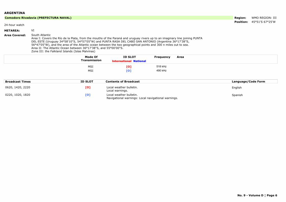
ARGENTINA
METAREA: VI
Area Covered: South AtlanticArea I: Covers the Río de la Plata, from the mouths of the Paraná and uruguay rivers up to an imaginary line joining PUNTA DEL ESTE (Uruguay 34°58'10"S, 54°57'05"W) and PUNTA RASA DEL CABO SAN ANTONIO (Argentina 36°17'38"S, 56°47'05"W), and the area of the Atlantic ocean between the two geographical points and 300 n miles out to sea.Area II: The Atlantic Ocean between 36°17'38"S, and 55°00'00"S.Zone III: the Falkland Islands (Islas Malvinas)
Region: WMO REGION: IIIPosition: 45°51'S 67°25'W
Comodoro Rivadavia (PREFECTURA NAVAL)
24-hour watch
Mode OfTransmission
ID SLOT AreaInternational National
Frequency
MSI [O] 518 kHzMSI [O] 490 kHz
Broadcast Times ID SLOT Contents of Broadcast Language/Code Form
0620, 1420, 2220 Local weather bulletin.Local warnings.
English[O]
0220, 1020, 1820 Local weather bulletin.Navigational warnings: Local navigational warnings.
Spanish[O]
No. 9 - Volume D ¦ Page 6
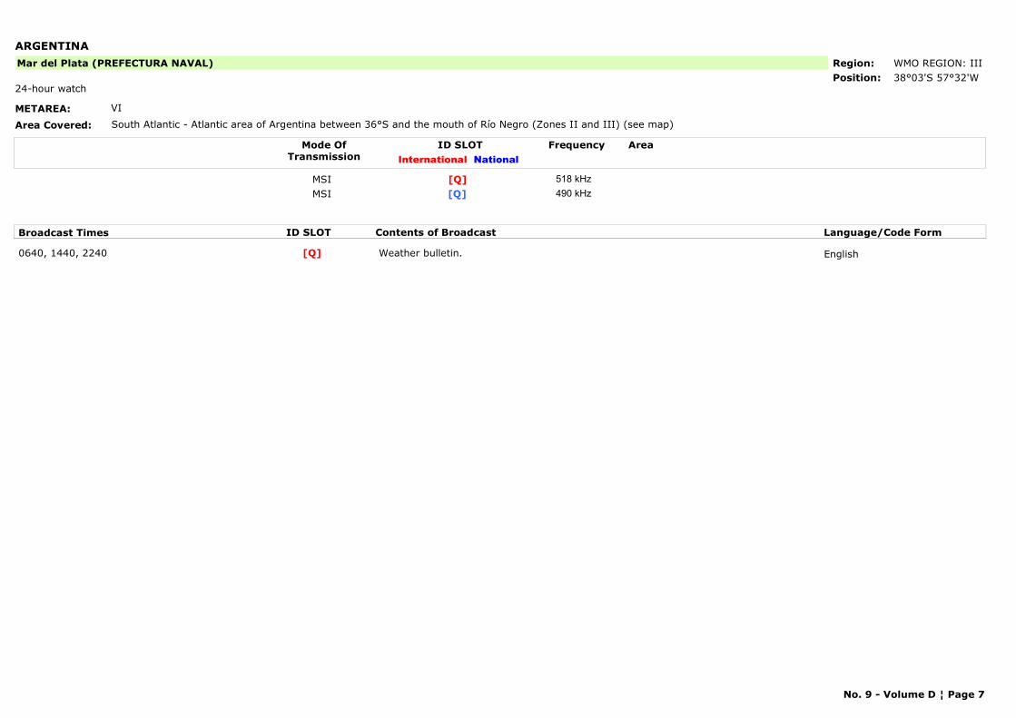
ARGENTINA
METAREA: VI
Area Covered: South Atlantic - Atlantic area of Argentina between 36°S and the mouth of Río Negro (Zones II and III) (see map)
Region: WMO REGION: IIIPosition: 38°03'S 57°32'W
Mar del Plata (PREFECTURA NAVAL)
24-hour watch
Mode OfTransmission
ID SLOT AreaInternational National
Frequency
MSI [Q] 518 kHzMSI [Q] 490 kHz
Broadcast Times ID SLOT Contents of Broadcast Language/Code Form
0640, 1440, 2240 Weather bulletin. English[Q]
No. 9 - Volume D ¦ Page 7
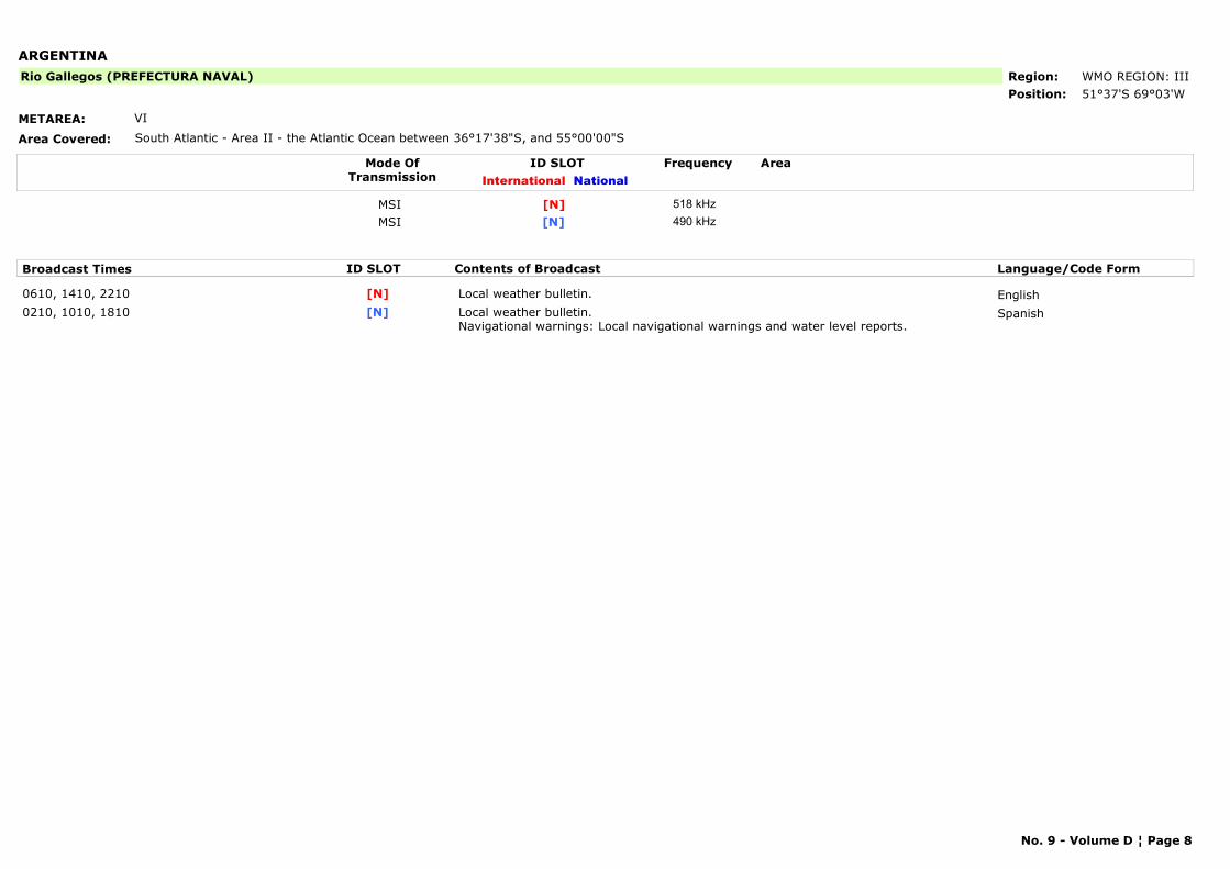
ARGENTINA
METAREA: VI
Area Covered: South Atlantic - Area II - the Atlantic Ocean between 36°17'38"S, and 55°00'00"S
Region: WMO REGION: IIIPosition: 51°37'S 69°03'W
Rio Gallegos (PREFECTURA NAVAL)
Mode OfTransmission
ID SLOT AreaInternational National
Frequency
MSI [N] 518 kHzMSI [N] 490 kHz
Broadcast Times ID SLOT Contents of Broadcast Language/Code Form
0610, 1410, 2210 Local weather bulletin. English[N]0210, 1010, 1810 Local weather bulletin.
Navigational warnings: Local navigational warnings and water level reports.Spanish[N]
No. 9 - Volume D ¦ Page 8
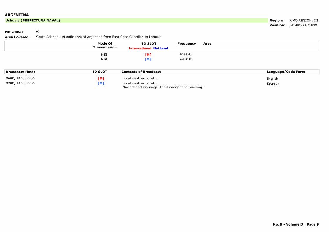
ARGENTINA
METAREA: VI
Area Covered: South Atlantic - Atlantic area of Argentina from Faro Cabo Guardián to Ushuaia
Region: WMO REGION: IIIPosition: 54°48'S 68°18'W
Ushuaia (PREFECTURA NAVAL)
Mode OfTransmission
ID SLOT AreaInternational National
Frequency
MSI [M] 518 kHzMSI [M] 490 kHz
Broadcast Times ID SLOT Contents of Broadcast Language/Code Form
0600, 1400, 2200 Local weather bulletin. English[M]0200, 1400, 2200 Local weather bulletin.
Navigational warnings: Local navigational warnings.Spanish[M]
No. 9 - Volume D ¦ Page 9
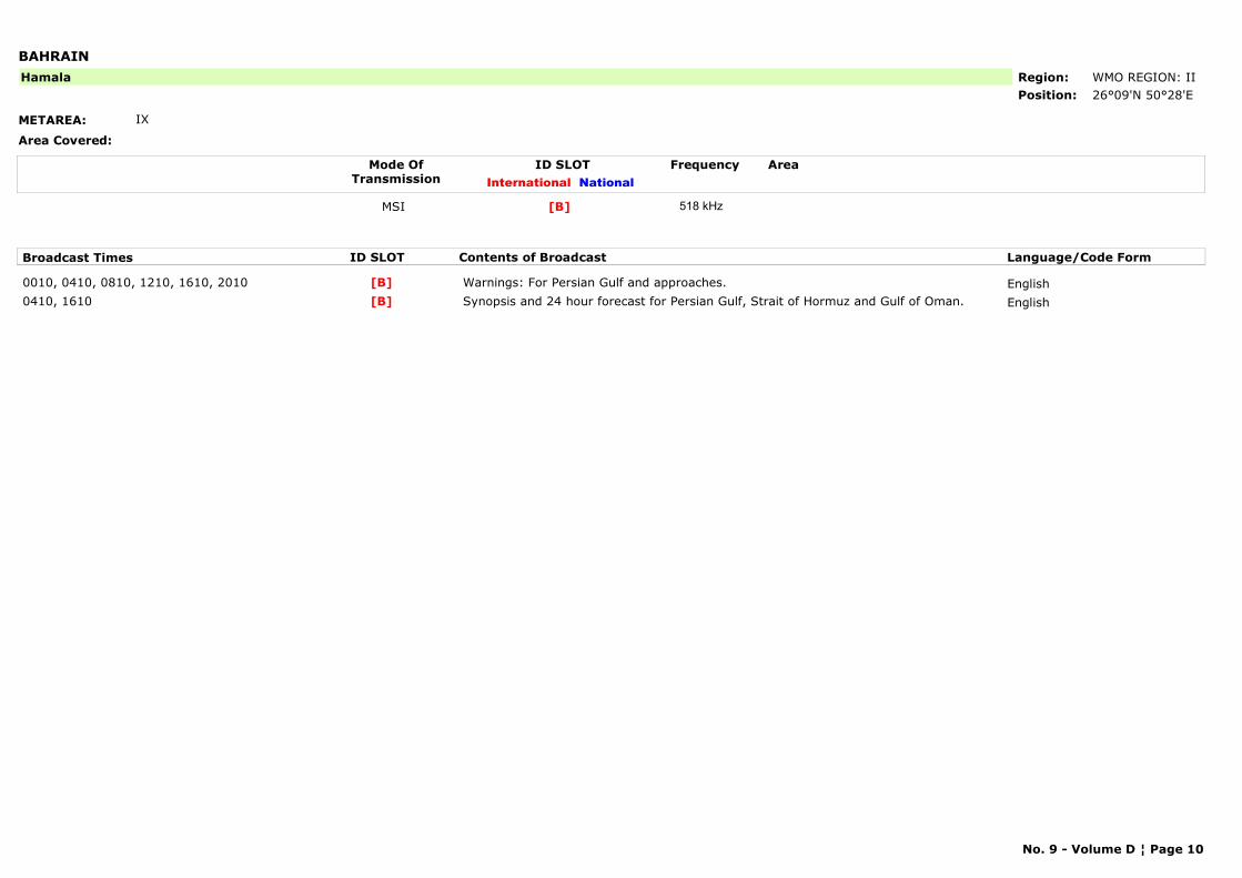
BAHRAIN
METAREA: IX
Area Covered:
Region: WMO REGION: IIPosition: 26°09'N 50°28'E
Hamala
Mode OfTransmission
ID SLOT AreaInternational National
Frequency
MSI [B] 518 kHz
Broadcast Times ID SLOT Contents of Broadcast Language/Code Form
0010, 0410, 0810, 1210, 1610, 2010 Warnings: For Persian Gulf and approaches. English[B]0410, 1610 Synopsis and 24 hour forecast for Persian Gulf, Strait of Hormuz and Gulf of Oman. English[B]
No. 9 - Volume D ¦ Page 10
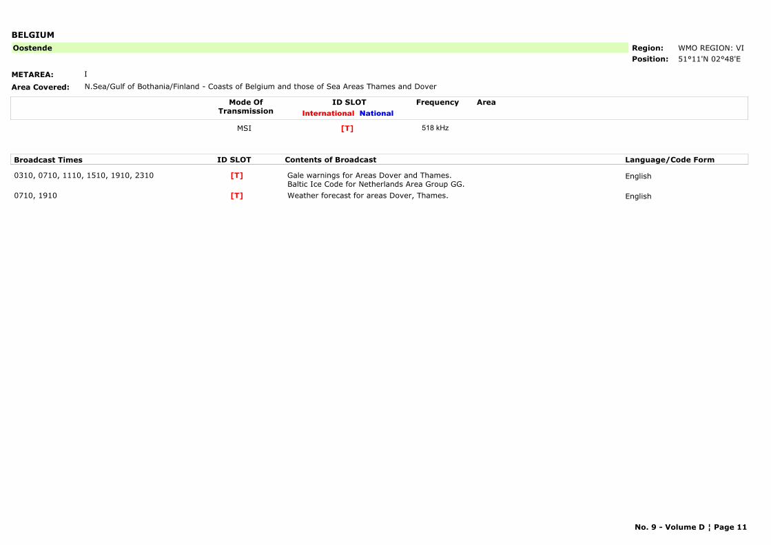
BELGIUM
METAREA: I
Area Covered: N.Sea/Gulf of Bothania/Finland - Coasts of Belgium and those of Sea Areas Thames and Dover
Region: WMO REGION: VIPosition: 51°11'N 02°48'E
Oostende
Mode OfTransmission
ID SLOT AreaInternational National
Frequency
MSI [T] 518 kHz
Broadcast Times ID SLOT Contents of Broadcast Language/Code Form
0310, 0710, 1110, 1510, 1910, 2310 Gale warnings for Areas Dover and Thames. Baltic Ice Code for Netherlands Area Group GG.
English[T]
0710, 1910 Weather forecast for areas Dover, Thames. English[T]
No. 9 - Volume D ¦ Page 11
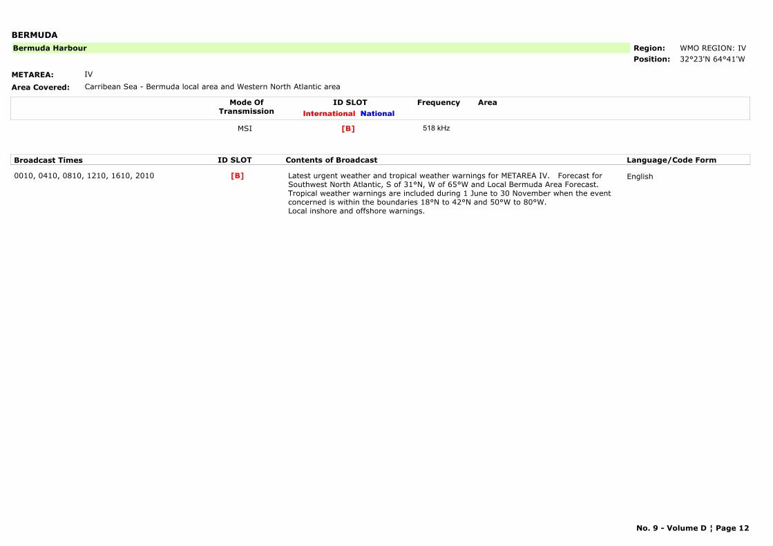
BERMUDA
METAREA: IV
Area Covered: Carribean Sea - Bermuda local area and Western North Atlantic area
Region: WMO REGION: IVPosition: 32°23'N 64°41'W
Bermuda Harbour
Mode OfTransmission
ID SLOT AreaInternational National
Frequency
MSI [B] 518 kHz
Broadcast Times ID SLOT Contents of Broadcast Language/Code Form
0010, 0410, 0810, 1210, 1610, 2010 Latest urgent weather and tropical weather warnings for METAREA IV. Forecast for Southwest North Atlantic, S of 31°N, W of 65°W and Local Bermuda Area Forecast. Tropical weather warnings are included during 1 June to 30 November when the event concerned is within the boundaries 18°N to 42°N and 50°W to 80°W. Local inshore and offshore warnings.
English[B]
No. 9 - Volume D ¦ Page 12
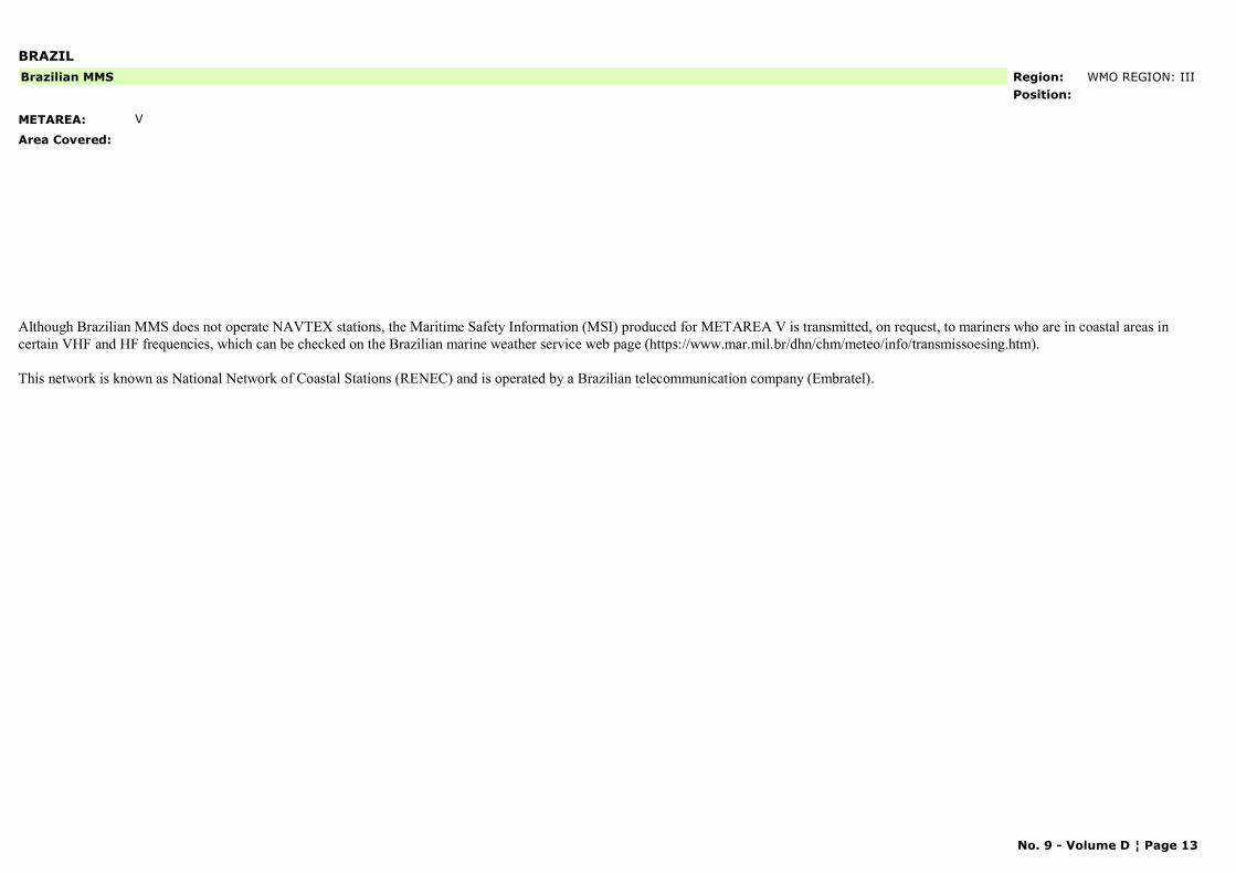
BRAZIL
METAREA: V
Area Covered:
Region: WMO REGION: IIIPosition:
Brazilian MMS
Although Brazilian MMS does not operate NAVTEX stations, the Maritime Safety Information (MSI) produced for METAREA V is transmitted, on request, to mariners who are in coastal areas in certain VHF and HF frequencies, which can be checked on the Brazilian marine weather service web page (https://www.mar.mil.br/dhn/chm/meteo/info/transmissoesing.htm).
This network is known as National Network of Coastal Stations (RENEC) and is operated by a Brazilian telecommunication company (Embratel).
No. 9 - Volume D ¦ Page 13
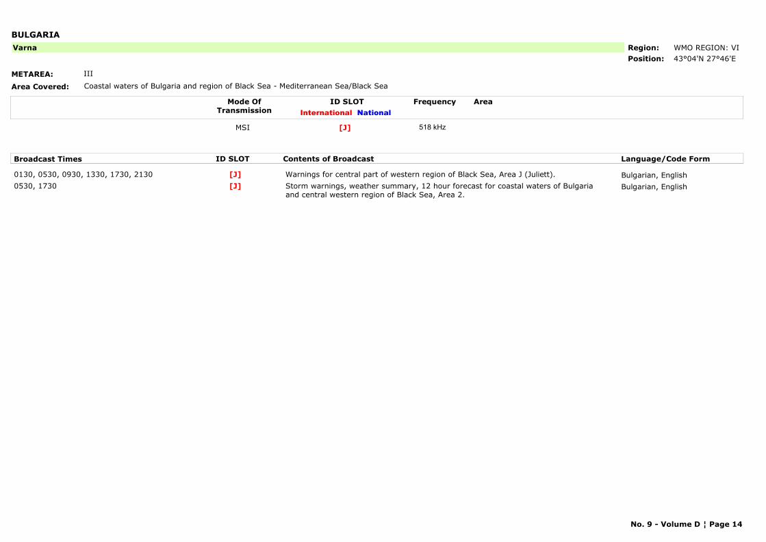
BULGARIA
METAREA: III
Area Covered: Coastal waters of Bulgaria and region of Black Sea - Mediterranean Sea/Black Sea
Region: WMO REGION: VIPosition: 43°04'N 27°46'E
Varna
Mode OfTransmission
ID SLOT AreaInternational National
Frequency
MSI [J] 518 kHz
Broadcast Times ID SLOT Contents of Broadcast Language/Code Form
0130, 0530, 0930, 1330, 1730, 2130 Warnings for central part of western region of Black Sea, Area J (Juliett). Bulgarian, English[J]0530, 1730 Storm warnings, weather summary, 12 hour forecast for coastal waters of Bulgaria
and central western region of Black Sea, Area 2.Bulgarian, English[J]
No. 9 - Volume D ¦ Page 14
CABO VERDE
METAREA: II
Area Covered:
Region: WMO REGION: IPosition:
Sao Vicente
No. 9 - Volume D ¦ Page 15
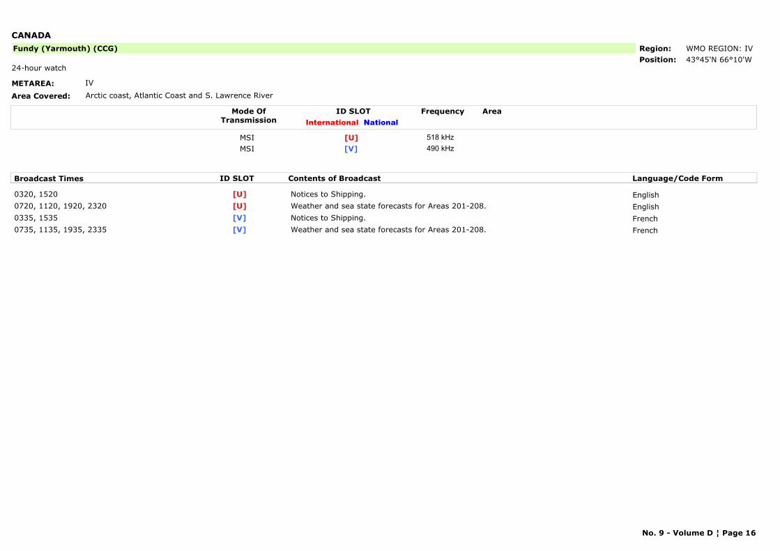
CANADA
METAREA: IV
Area Covered: Arctic coast, Atlantic Coast and S. Lawrence River
Region: WMO REGION: IVPosition: 43°45'N 66°10'W
Fundy (Yarmouth) (CCG)
24-hour watch
Mode OfTransmission
ID SLOT AreaInternational National
Frequency
MSI [U] 518 kHzMSI [V] 490 kHz
Broadcast Times ID SLOT Contents of Broadcast Language/Code Form
0320, 1520 Notices to Shipping. English[U]0720, 1120, 1920, 2320 Weather and sea state forecasts for Areas 201-208. English[U]0335, 1535 Notices to Shipping. French[V]0735, 1135, 1935, 2335 Weather and sea state forecasts for Areas 201-208. French[V]
No. 9 - Volume D ¦ Page 16
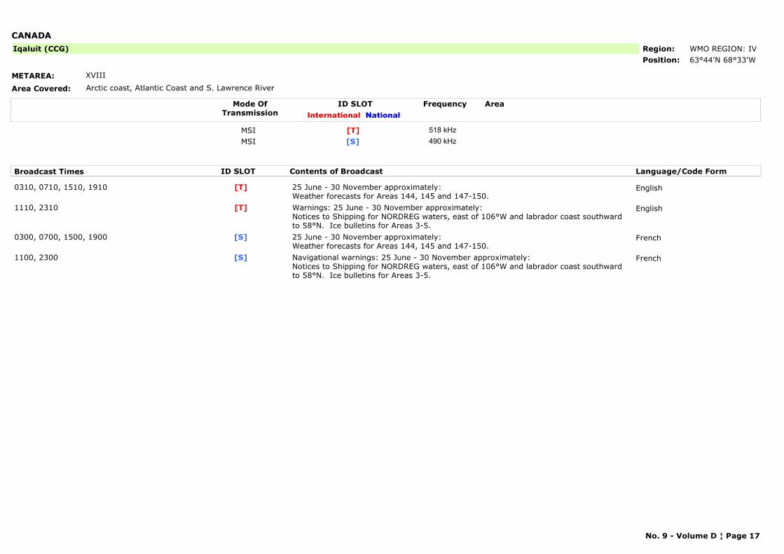
CANADA
METAREA: XVIII
Area Covered: Arctic coast, Atlantic Coast and S. Lawrence River
Region: WMO REGION: IVPosition: 63°44'N 68°33'W
Iqaluit (CCG)
Mode OfTransmission
ID SLOT AreaInternational National
Frequency
MSI [T] 518 kHzMSI [S] 490 kHz
Broadcast Times ID SLOT Contents of Broadcast Language/Code Form
0310, 0710, 1510, 1910 25 June - 30 November approximately:Weather forecasts for Areas 144, 145 and 147-150.
English[T]
1110, 2310 Warnings: 25 June - 30 November approximately:Notices to Shipping for NORDREG waters, east of 106°W and labrador coast southward to 58°N. Ice bulletins for Areas 3-5.
English[T]
0300, 0700, 1500, 1900 25 June - 30 November approximately:Weather forecasts for Areas 144, 145 and 147-150.
French[S]
1100, 2300 Navigational warnings: 25 June - 30 November approximately:Notices to Shipping for NORDREG waters, east of 106°W and labrador coast southward to 58°N. Ice bulletins for Areas 3-5.
French[S]
No. 9 - Volume D ¦ Page 17
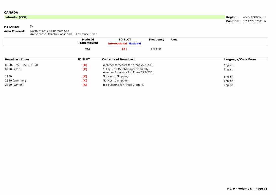
CANADA
METAREA: IV
Area Covered: North Atlantic to Barents SeaArctic coast, Atlantic Coast and S. Lawrence River
Region: WMO REGION: IVPosition: 53°42'N 57°01'W
Labrador (CCG)
Mode OfTransmission
ID SLOT AreaInternational National
Frequency
MSI [X] 518 kHz
Broadcast Times ID SLOT Contents of Broadcast Language/Code Form
0350, 0750, 1550, 1950 Weather forecasts for Areas 222-230. English[X]0910, 2110 1 July - 31 October approximately:
Weather forecasts for Areas 222-230.English[X]
1150 Notices to Shipping. English[X]2350 (summer) Notices to Shipping. English[X]2350 (winter) Ice bulletins for Areas 7 and 8. English[X]
No. 9 - Volume D ¦ Page 18
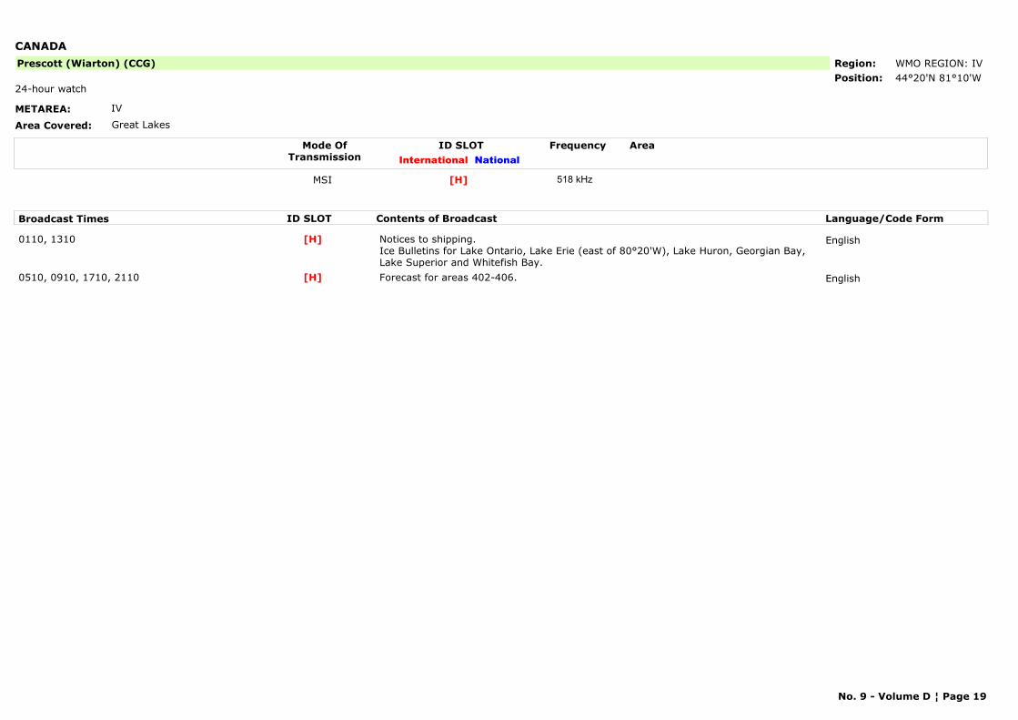
CANADA
METAREA: IV
Area Covered: Great Lakes
Region: WMO REGION: IVPosition: 44°20'N 81°10'W
Prescott (Wiarton) (CCG)
24-hour watch
Mode OfTransmission
ID SLOT AreaInternational National
Frequency
MSI [H] 518 kHz
Broadcast Times ID SLOT Contents of Broadcast Language/Code Form
0110, 1310 Notices to shipping.Ice Bulletins for Lake Ontario, Lake Erie (east of 80°20'W), Lake Huron, Georgian Bay, Lake Superior and Whitefish Bay.
English[H]
0510, 0910, 1710, 2110 Forecast for areas 402-406. English[H]
No. 9 - Volume D ¦ Page 19
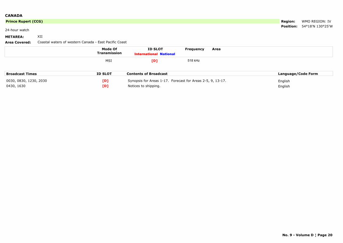
CANADA
METAREA: XII
Area Covered: Coastal waters of western Canada - East Pacific Coast
Region: WMO REGION: IVPosition: 54°18'N 130°25'W
Prince Rupert (CCG)
24-hour watch
Mode OfTransmission
ID SLOT AreaInternational National
Frequency
MSI [D] 518 kHz
Broadcast Times ID SLOT Contents of Broadcast Language/Code Form
0030, 0830, 1230, 2030 Synopsis for Areas 1-17. Forecast for Areas 2-5, 9, 13-17. English[D]0430, 1630 Notices to shipping. English[D]
No. 9 - Volume D ¦ Page 20
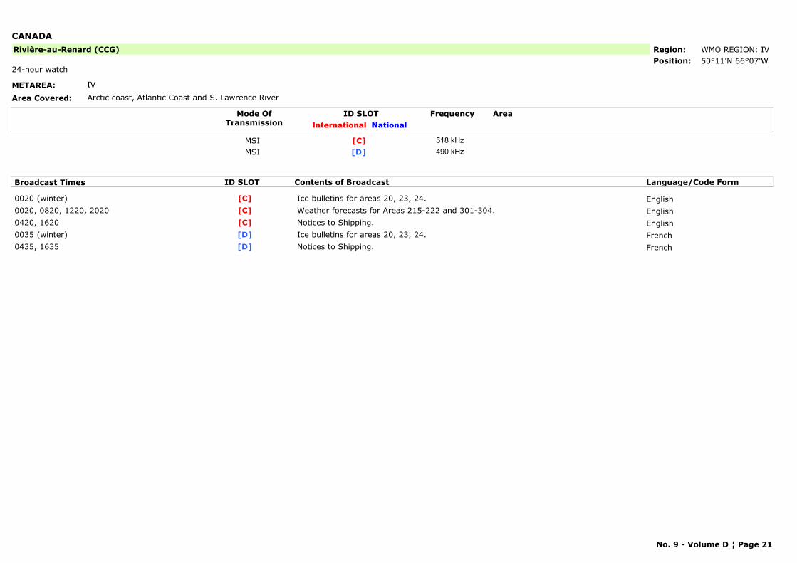
CANADA
METAREA: IV
Area Covered: Arctic coast, Atlantic Coast and S. Lawrence River
Region: WMO REGION: IVPosition: 50°11'N 66°07'W
Rivière-au-Renard (CCG)
24-hour watch
Mode OfTransmission
ID SLOT AreaInternational National
Frequency
MSI [C] 518 kHzMSI [D] 490 kHz
Broadcast Times ID SLOT Contents of Broadcast Language/Code Form
0020 (winter) Ice bulletins for areas 20, 23, 24. English[C]0020, 0820, 1220, 2020 Weather forecasts for Areas 215-222 and 301-304. English[C]0420, 1620 Notices to Shipping. English[C]0035 (winter) Ice bulletins for areas 20, 23, 24. French[D]0435, 1635 Notices to Shipping. French[D]
No. 9 - Volume D ¦ Page 21
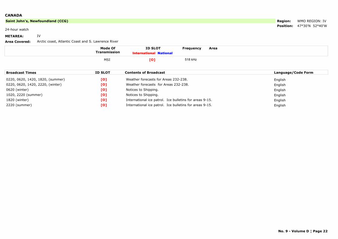
CANADA
METAREA: IV
Area Covered: Arctic coast, Atlantic Coast and S. Lawrence River
Region: WMO REGION: IVPosition: 47°30'N 52°40'W
Saint John's, Newfoundland (CCG)
24-hour watch
Mode OfTransmission
ID SLOT AreaInternational National
Frequency
MSI [O] 518 kHz
Broadcast Times ID SLOT Contents of Broadcast Language/Code Form
0220, 0620, 1420, 1820, (summer) Weather forecasts for Areas 232-238. English[O]0220, 0620, 1420, 2220, (winter) Weather forecasts for Areas 232-238. English[O]0620 (winter) Notices to Shipping. English[O]1020, 2220 (summer) Notices to Shipping. English[O]1820 (winter) International ice patrol. Ice bulletins for areas 9-15. English[O]2220 (summer) International ice patrol. Ice bulletins for areas 9-15. English[O]
No. 9 - Volume D ¦ Page 22
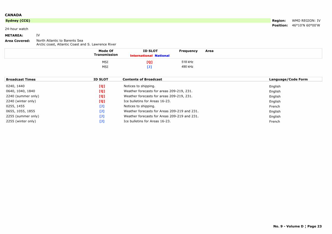
CANADA
METAREA: IV
Area Covered: North Atlantic to Barents SeaArctic coast, Atlantic Coast and S. Lawrence River
Region: WMO REGION: IVPosition: 46°10'N 60°00'W
Sydney (CCG)
24-hour watch
Mode OfTransmission
ID SLOT AreaInternational National
Frequency
MSI [Q] 518 kHzMSI [J] 490 kHz
Broadcast Times ID SLOT Contents of Broadcast Language/Code Form
0240, 1440 Notices to shipping. English[Q]0640, 1040, 1840 Weather forecasts for areas 209-219, 231. English[Q]2240 (summer only) Weather forecasts for areas 209-219, 231. English[Q]2240 (winter only) Ice bulletins for Areas 16-23. English[Q]0255, 1455 Notices to shipping. French[J]0655, 1055, 1855 Weather forecasts for Areas 209-219 and 231. English[J]2255 (summer only) Weather forecasts for Areas 209-219 and 231. English[J]2255 (winter only) Ice bulletins for Areas 16-23. French[J]
No. 9 - Volume D ¦ Page 23
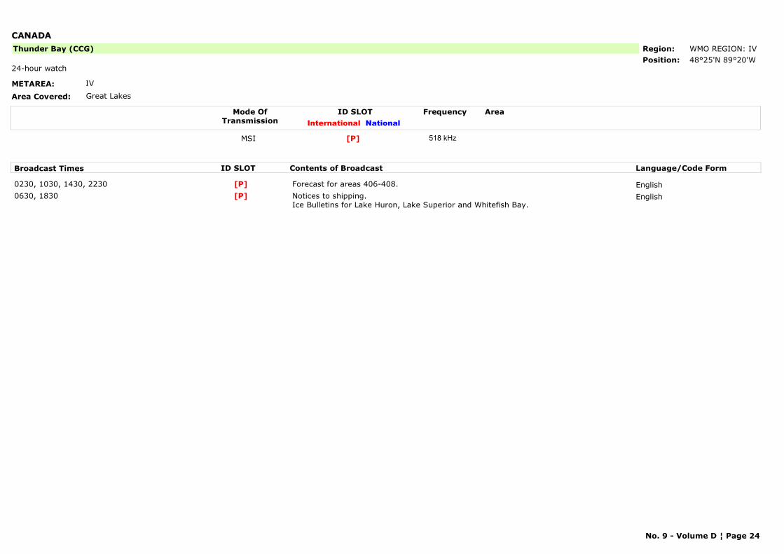
CANADA
METAREA: IV
Area Covered: Great Lakes
Region: WMO REGION: IVPosition: 48°25'N 89°20'W
Thunder Bay (CCG)
24-hour watch
Mode OfTransmission
ID SLOT AreaInternational National
Frequency
MSI [P] 518 kHz
Broadcast Times ID SLOT Contents of Broadcast Language/Code Form
0230, 1030, 1430, 2230 Forecast for areas 406-408. English[P]0630, 1830 Notices to shipping.
Ice Bulletins for Lake Huron, Lake Superior and Whitefish Bay.English[P]
No. 9 - Volume D ¦ Page 24
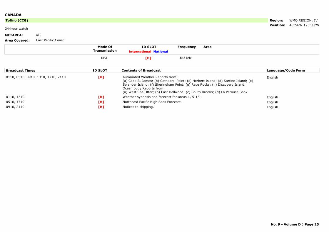
CANADA
METAREA: XII
Area Covered: East Pacific Coast
Region: WMO REGION: IVPosition: 48°56'N 125°32'W
Tofino (CCG)
24-hour watch
Mode OfTransmission
ID SLOT AreaInternational National
Frequency
MSI [H] 518 kHz
Broadcast Times ID SLOT Contents of Broadcast Language/Code Form
0110, 0510, 0910, 1310, 1710, 2110 Automated Weather Reports from: (a) Cape S. James; (b) Cathedral Point; (c) Herbert Island; (d) Sartine Island; (e) Solander Island; (f) Sheringham Point; (g) Race Rocks; (h) Discovery Island.Ocean buoy Reports from: (a) West Sea Otter; (b) East Dellwood; (c) South Brooks; (d) La Perouse Bank.
English[H]
0110, 1310 Weather synopsis and forecast for areas 1, 5-13. English[H]0510, 1710 Northeast Pacific High Seas Forecast. English[H]0910, 2110 Notices to shipping. English[H]
No. 9 - Volume D ¦ Page 25
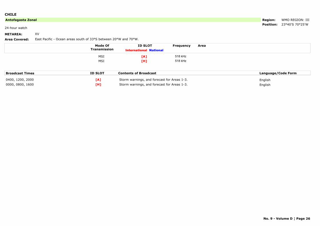
CHILE
METAREA: XV
Area Covered: East Pacific - Ocean areas south of 33°S between 20°W and 70°W.
Region: WMO REGION: IIIPosition: 23°40'S 70°25'W
Antofagasta Zonal
24-hour watch
Mode OfTransmission
ID SLOT AreaInternational National
Frequency
MSI [A] 518 kHzMSI [H] 518 kHz
Broadcast Times ID SLOT Contents of Broadcast Language/Code Form
0400, 1200, 2000 Storm warnings, and forecast for Areas 1-3. English[A]0000, 0800, 1600 Storm warnings, and forecast for Areas 1-3. English[H]
No. 9 - Volume D ¦ Page 26
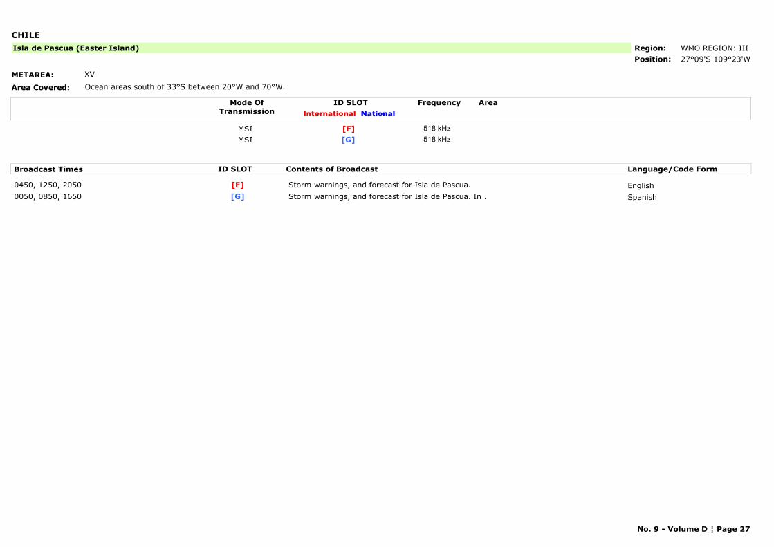
CHILE
METAREA: XV
Area Covered: Ocean areas south of 33°S between 20°W and 70°W.
Region: WMO REGION: IIIPosition: 27°09'S 109°23'W
Isla de Pascua (Easter Island)
Mode OfTransmission
ID SLOT AreaInternational National
Frequency
MSI [F] 518 kHzMSI [G] 518 kHz
Broadcast Times ID SLOT Contents of Broadcast Language/Code Form
0450, 1250, 2050 Storm warnings, and forecast for Isla de Pascua. English[F]0050, 0850, 1650 Storm warnings, and forecast for Isla de Pascua. In . Spanish[G]
No. 9 - Volume D ¦ Page 27
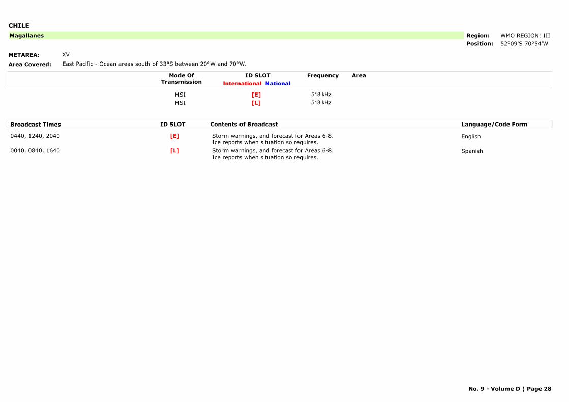
CHILE
METAREA: XV
Area Covered: East Pacific - Ocean areas south of 33°S between 20°W and 70°W.
Region: WMO REGION: IIIPosition: 52°09'S 70°54'W
Magallanes
Mode OfTransmission
ID SLOT AreaInternational National
Frequency
MSI [E] 518 kHzMSI [L] 518 kHz
Broadcast Times ID SLOT Contents of Broadcast Language/Code Form
0440, 1240, 2040 Storm warnings, and forecast for Areas 6-8. Ice reports when situation so requires.
English[E]
0040, 0840, 1640 Storm warnings, and forecast for Areas 6-8.Ice reports when situation so requires.
Spanish[L]
No. 9 - Volume D ¦ Page 28
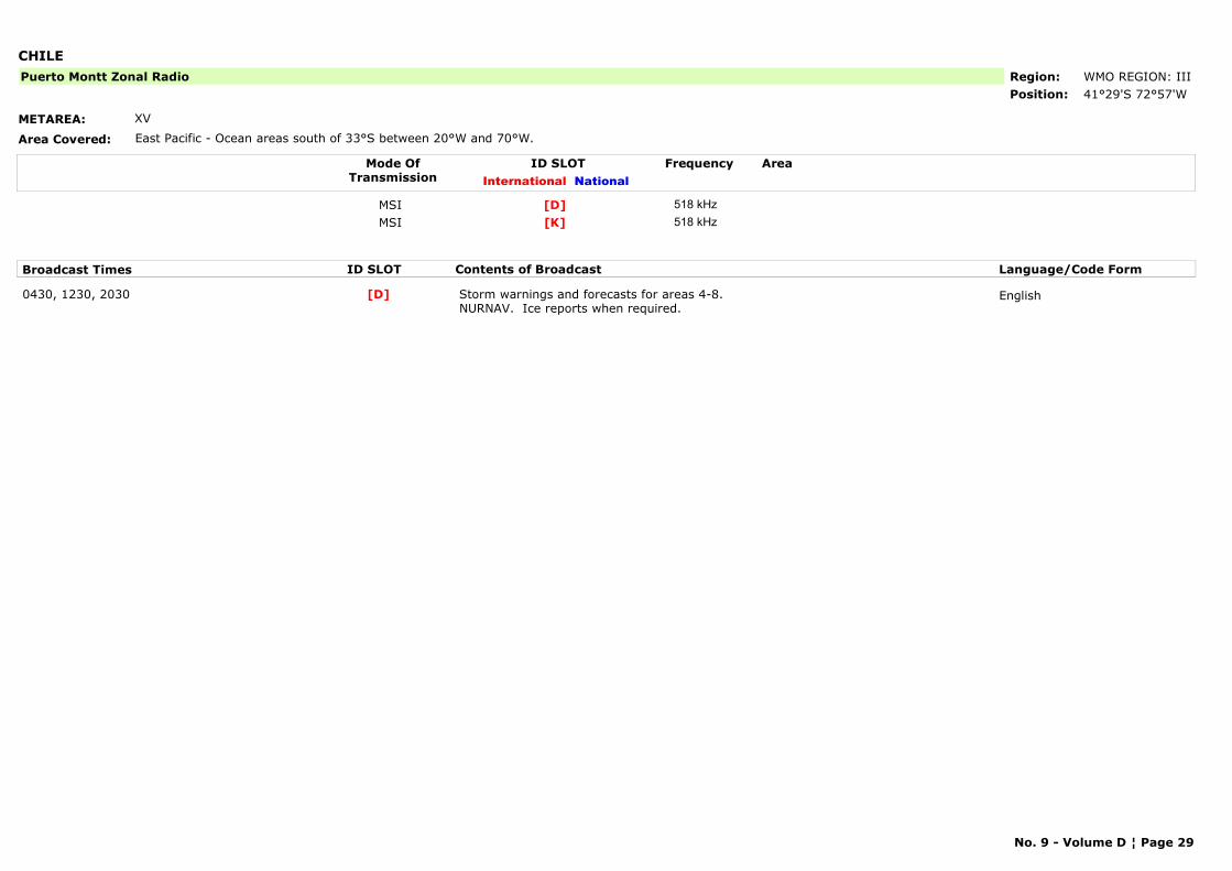
CHILE
METAREA: XV
Area Covered: East Pacific - Ocean areas south of 33°S between 20°W and 70°W.
Region: WMO REGION: IIIPosition: 41°29'S 72°57'W
Puerto Montt Zonal Radio
Mode OfTransmission
ID SLOT AreaInternational National
Frequency
MSI [D] 518 kHzMSI [K] 518 kHz
Broadcast Times ID SLOT Contents of Broadcast Language/Code Form
0430, 1230, 2030 Storm warnings and forecasts for areas 4-8. NURNAV. Ice reports when required.
English[D]
No. 9 - Volume D ¦ Page 29
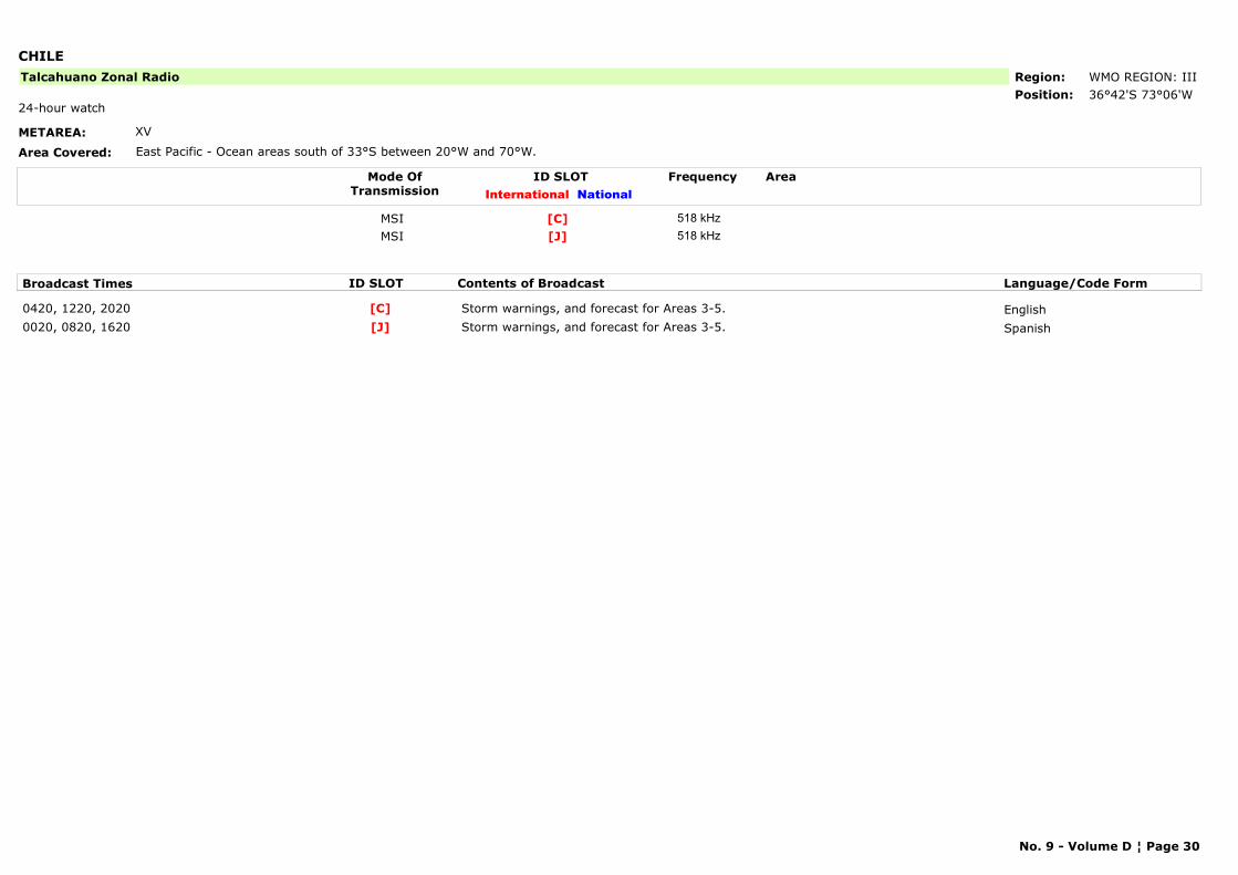
CHILE
METAREA: XV
Area Covered: East Pacific - Ocean areas south of 33°S between 20°W and 70°W.
Region: WMO REGION: IIIPosition: 36°42'S 73°06'W
Talcahuano Zonal Radio
24-hour watch
Mode OfTransmission
ID SLOT AreaInternational National
Frequency
MSI [C] 518 kHzMSI [J] 518 kHz
Broadcast Times ID SLOT Contents of Broadcast Language/Code Form
0420, 1220, 2020 Storm warnings, and forecast for Areas 3-5. English[C]0020, 0820, 1620 Storm warnings, and forecast for Areas 3-5. Spanish[J]
No. 9 - Volume D ¦ Page 30
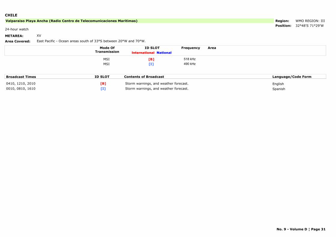
CHILE
METAREA: XV
Area Covered: East Pacific - Ocean areas south of 33°S between 20°W and 70°W.
Region: WMO REGION: IIIPosition: 32°48'S 71°29'W
Valparaiso Playa Ancha (Radio Centro de Telecomunicaciones Maritimas)
24-hour watch
Mode OfTransmission
ID SLOT AreaInternational National
Frequency
MSI [B] 518 kHzMSI [I] 490 kHz
Broadcast Times ID SLOT Contents of Broadcast Language/Code Form
0410, 1210, 2010 Storm warnings, and weather forecast. English[B]0010, 0810, 1610 Storm warnings, and weather forecast. Spanish[I]
No. 9 - Volume D ¦ Page 31

CHINA
METAREA: XI
Area Covered: East/South China Sea
Region: WMO REGION: IIPosition: 38°52'N 121°31'E
Dalian
24-hour watch
Mode OfTransmission
ID SLOT AreaInternational National
Frequency
MSI [R] 518 kHz
Broadcast Times ID SLOT Contents of Broadcast Language/Code Form
0250, 0650, 1050, 1450, 2250 Storm Warnings. English, Chinese[R]0250, 1050 Gale warnings, situation, 24 hour forecast for areas 1-4. English, Chinese[R]0650, 1450, 2250 For Areas 1-4. English, Chinese[R]
No. 9 - Volume D ¦ Page 32
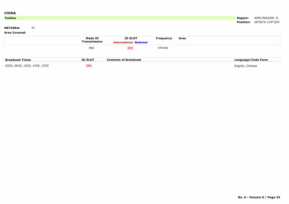
CHINA
METAREA: XI
Area Covered:
Region: WMO REGION: IIPosition: 26°02'N 119°18'E
Fuzhou
Mode OfTransmission
ID SLOT AreaInternational National
Frequency
MSI [O] 518 kHz
Broadcast Times ID SLOT Contents of Broadcast Language/Code Form
0220, 0620, 1020, 1420, 2220 English, Chinese[O]
No. 9 - Volume D ¦ Page 33
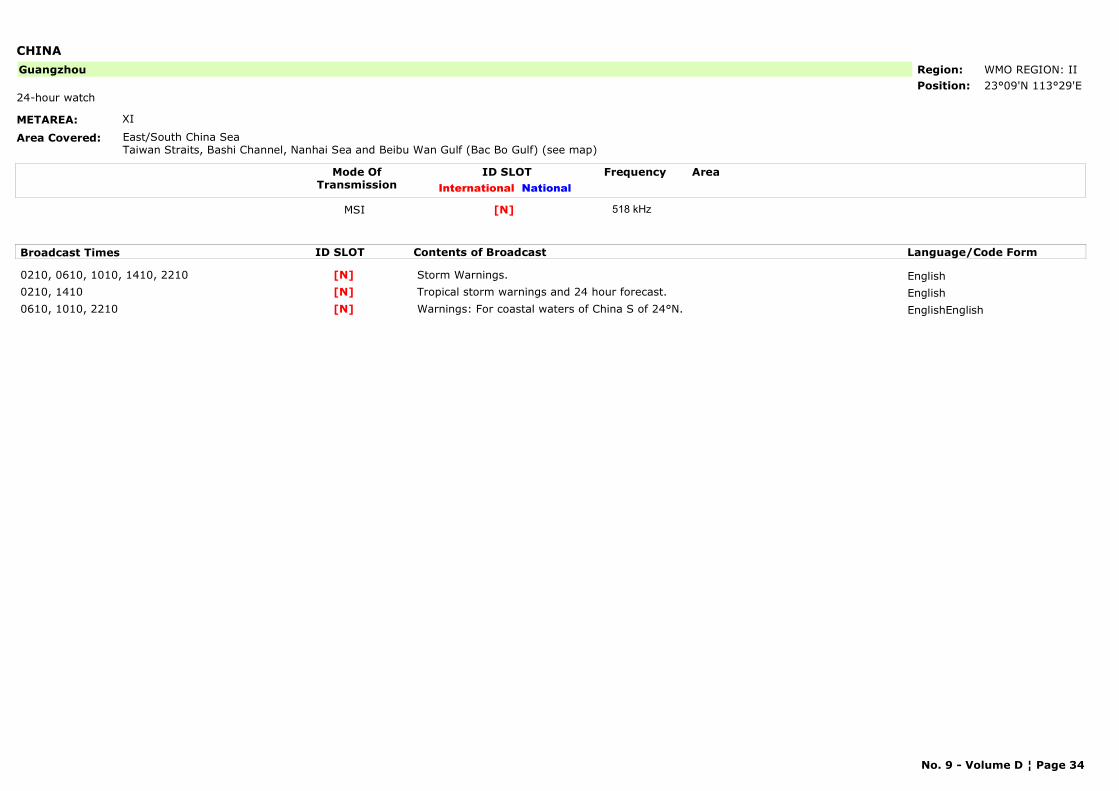
CHINA
METAREA: XI
Area Covered: East/South China SeaTaiwan Straits, Bashi Channel, Nanhai Sea and Beibu Wan Gulf (Bac Bo Gulf) (see map)
Region: WMO REGION: IIPosition: 23°09'N 113°29'E
Guangzhou
24-hour watch
Mode OfTransmission
ID SLOT AreaInternational National
Frequency
MSI [N] 518 kHz
Broadcast Times ID SLOT Contents of Broadcast Language/Code Form
0210, 0610, 1010, 1410, 2210 Storm Warnings. English[N]0210, 1410 Tropical storm warnings and 24 hour forecast. English[N]0610, 1010, 2210 Warnings: For coastal waters of China S of 24°N. EnglishEnglish[N]
No. 9 - Volume D ¦ Page 34
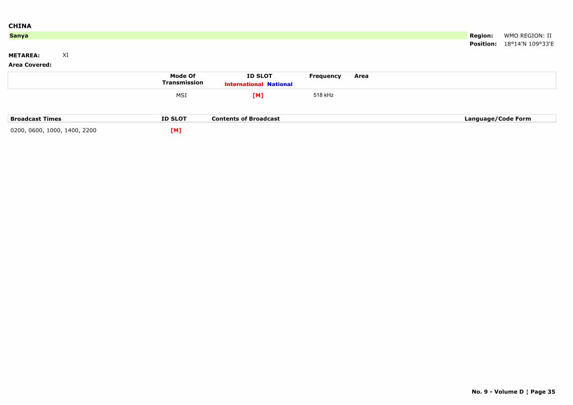
CHINA
METAREA: XI
Area Covered:
Region: WMO REGION: IIPosition: 18°14'N 109°33'E
Sanya
Mode OfTransmission
ID SLOT AreaInternational National
Frequency
MSI [M] 518 kHz
Broadcast Times ID SLOT Contents of Broadcast Language/Code Form
0200, 0600, 1000, 1400, 2200 [M]
No. 9 - Volume D ¦ Page 35
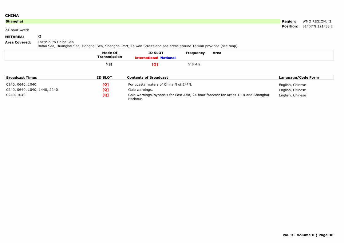
CHINA
METAREA: XI
Area Covered: East/South China SeaBohai Sea, Huanghai Sea, Donghai Sea, Shanghai Port, Taiwan Straits and sea areas around Taiwan province (see map)
Region: WMO REGION: IIPosition: 31°07'N 121°33'E
Shanghai
24-hour watch
Mode OfTransmission
ID SLOT AreaInternational National
Frequency
MSI [Q] 518 kHz
Broadcast Times ID SLOT Contents of Broadcast Language/Code Form
0240, 0640, 1040 For coastal waters of China N of 24°N. English, Chinese[Q]0240, 0640, 1040, 1440, 2240 Gale warnings. English, Chinese[Q]0240, 1040 Gale warnings, synopsis for East Asia, 24 hour forecast for Areas 1-14 and Shanghai
Harbour.English, Chinese[Q]
No. 9 - Volume D ¦ Page 36
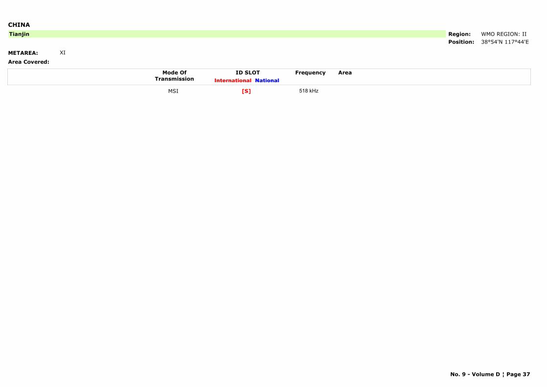
CHINA
METAREA: XI
Area Covered:
Region: WMO REGION: IIPosition: 38°54'N 117°44'E
Tianjin
Mode OfTransmission
ID SLOT AreaInternational National
Frequency
MSI [S] 518 kHz
No. 9 - Volume D ¦ Page 37
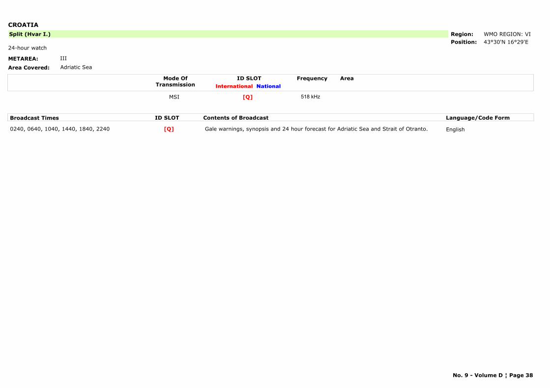
CROATIA
METAREA: III
Area Covered: Adriatic Sea
Region: WMO REGION: VIPosition: 43°30'N 16°29'E
Split (Hvar I.)
24-hour watch
Mode OfTransmission
ID SLOT AreaInternational National
Frequency
MSI [Q] 518 kHz
Broadcast Times ID SLOT Contents of Broadcast Language/Code Form
0240, 0640, 1040, 1440, 1840, 2240 Gale warnings, synopsis and 24 hour forecast for Adriatic Sea and Strait of Otranto. English[Q]
No. 9 - Volume D ¦ Page 38
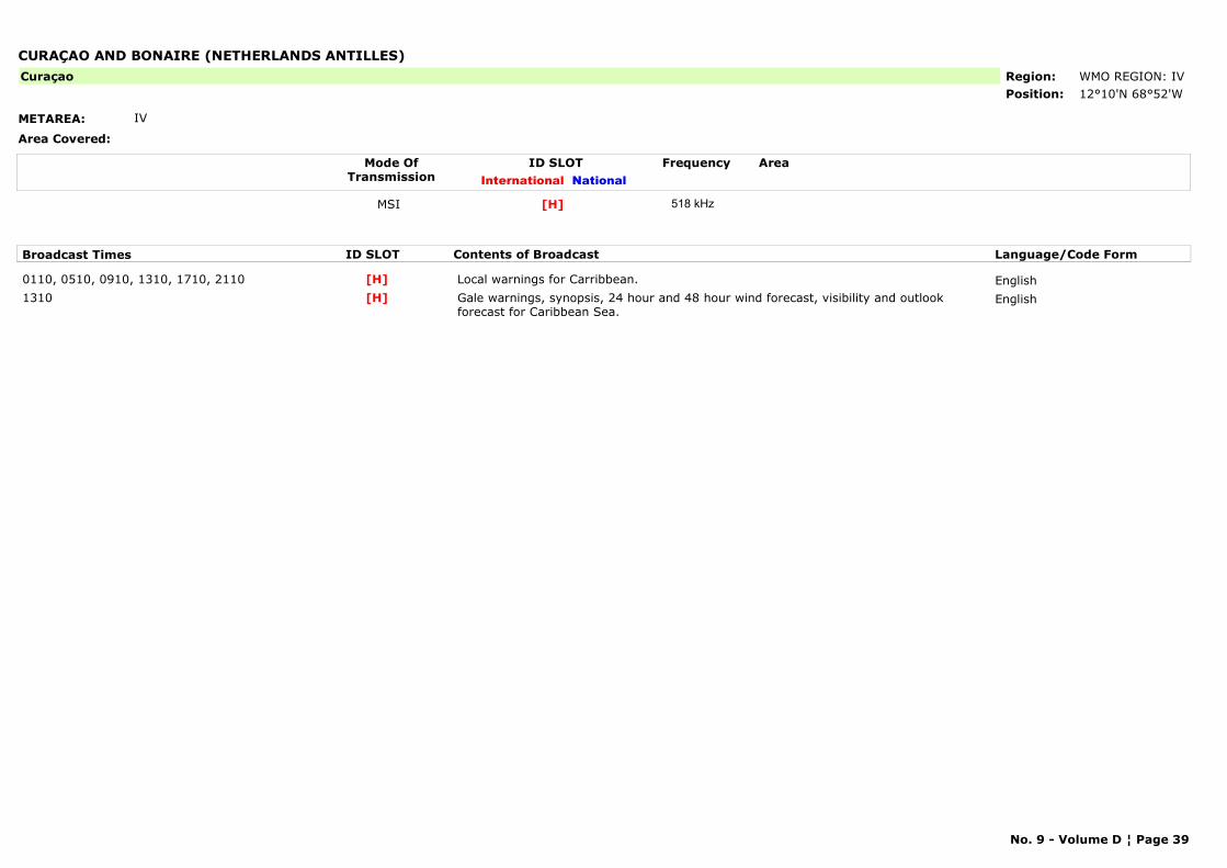
CURAÇAO AND BONAIRE (NETHERLANDS ANTILLES)
METAREA: IV
Area Covered:
Region: WMO REGION: IVPosition: 12°10'N 68°52'W
Curaçao
Mode OfTransmission
ID SLOT AreaInternational National
Frequency
MSI [H] 518 kHz
Broadcast Times ID SLOT Contents of Broadcast Language/Code Form
0110, 0510, 0910, 1310, 1710, 2110 Local warnings for Carribbean. English[H]1310 Gale warnings, synopsis, 24 hour and 48 hour wind forecast, visibility and outlook
forecast for Caribbean Sea.English[H]
No. 9 - Volume D ¦ Page 39
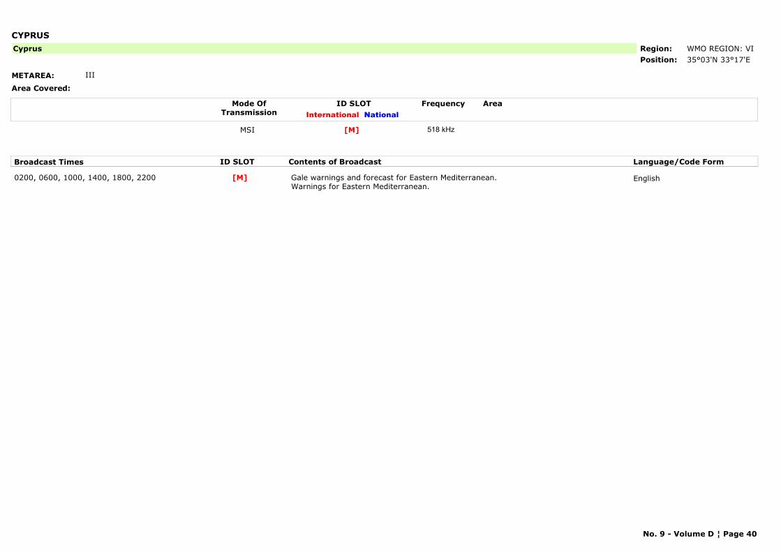
CYPRUS
METAREA: III
Area Covered:
Region: WMO REGION: VIPosition: 35°03'N 33°17'E
Cyprus
Mode OfTransmission
ID SLOT AreaInternational National
Frequency
MSI [M] 518 kHz
Broadcast Times ID SLOT Contents of Broadcast Language/Code Form
0200, 0600, 1000, 1400, 1800, 2200 Gale warnings and forecast for Eastern Mediterranean. Warnings for Eastern Mediterranean.
English[M]
No. 9 - Volume D ¦ Page 40
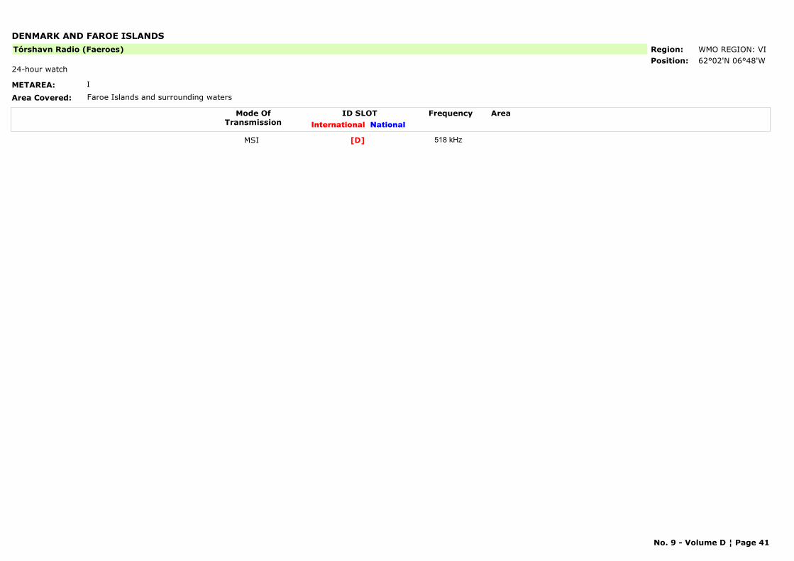
DENMARK AND FAROE ISLANDS
METAREA: I
Area Covered: Faroe Islands and surrounding waters
Region: WMO REGION: VIPosition: 62°02'N 06°48'W
Tórshavn Radio (Faeroes)
24-hour watch
Mode OfTransmission
ID SLOT AreaInternational National
Frequency
MSI [D] 518 kHz
No. 9 - Volume D ¦ Page 41
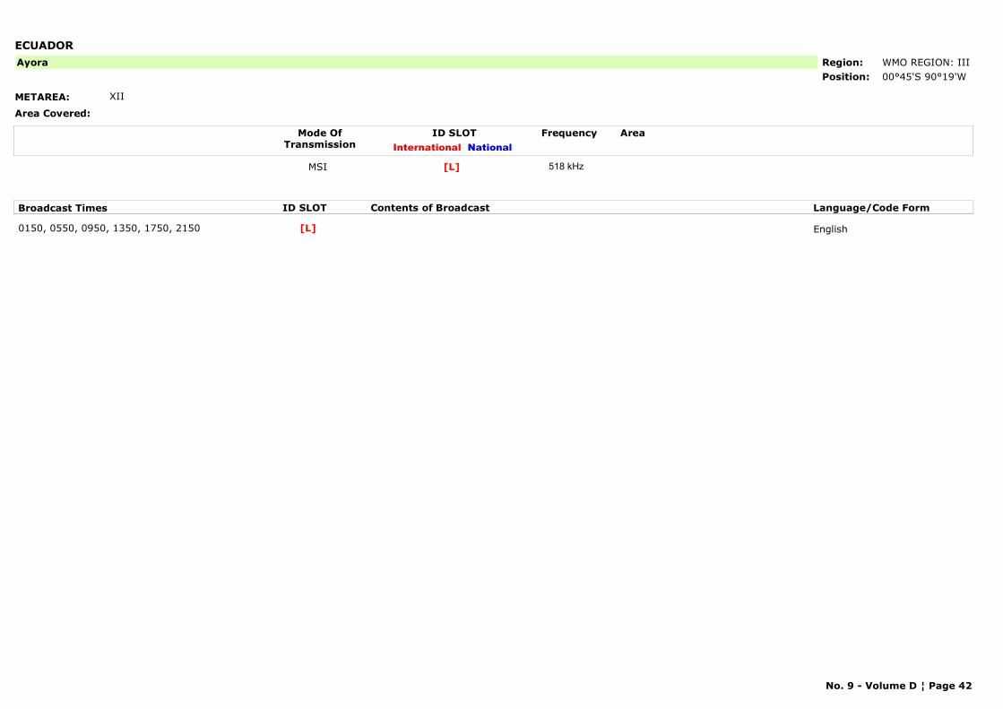
ECUADOR
METAREA: XII
Area Covered:
Region: WMO REGION: IIIPosition: 00°45'S 90°19'W
Ayora
Mode OfTransmission
ID SLOT AreaInternational National
Frequency
MSI [L] 518 kHz
Broadcast Times ID SLOT Contents of Broadcast Language/Code Form
0150, 0550, 0950, 1350, 1750, 2150 English[L]
No. 9 - Volume D ¦ Page 42
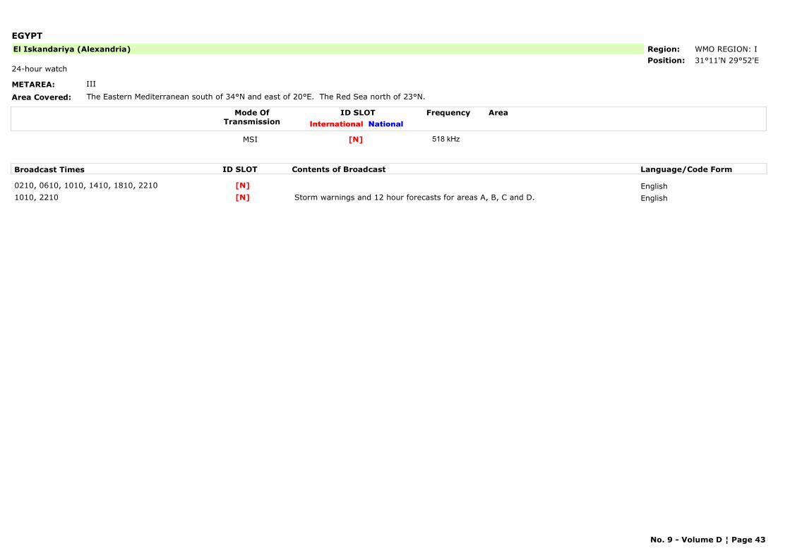
EGYPT
METAREA: III
Area Covered: The Eastern Mediterranean south of 34°N and east of 20°E. The Red Sea north of 23°N.
Region: WMO REGION: IPosition: 31°11'N 29°52'E
El Iskandariya (Alexandria)
24-hour watch
Mode OfTransmission
ID SLOT AreaInternational National
Frequency
MSI [N] 518 kHz
Broadcast Times ID SLOT Contents of Broadcast Language/Code Form
0210, 0610, 1010, 1410, 1810, 2210 English[N]1010, 2210 Storm warnings and 12 hour forecasts for areas A, B, C and D. English[N]
No. 9 - Volume D ¦ Page 43
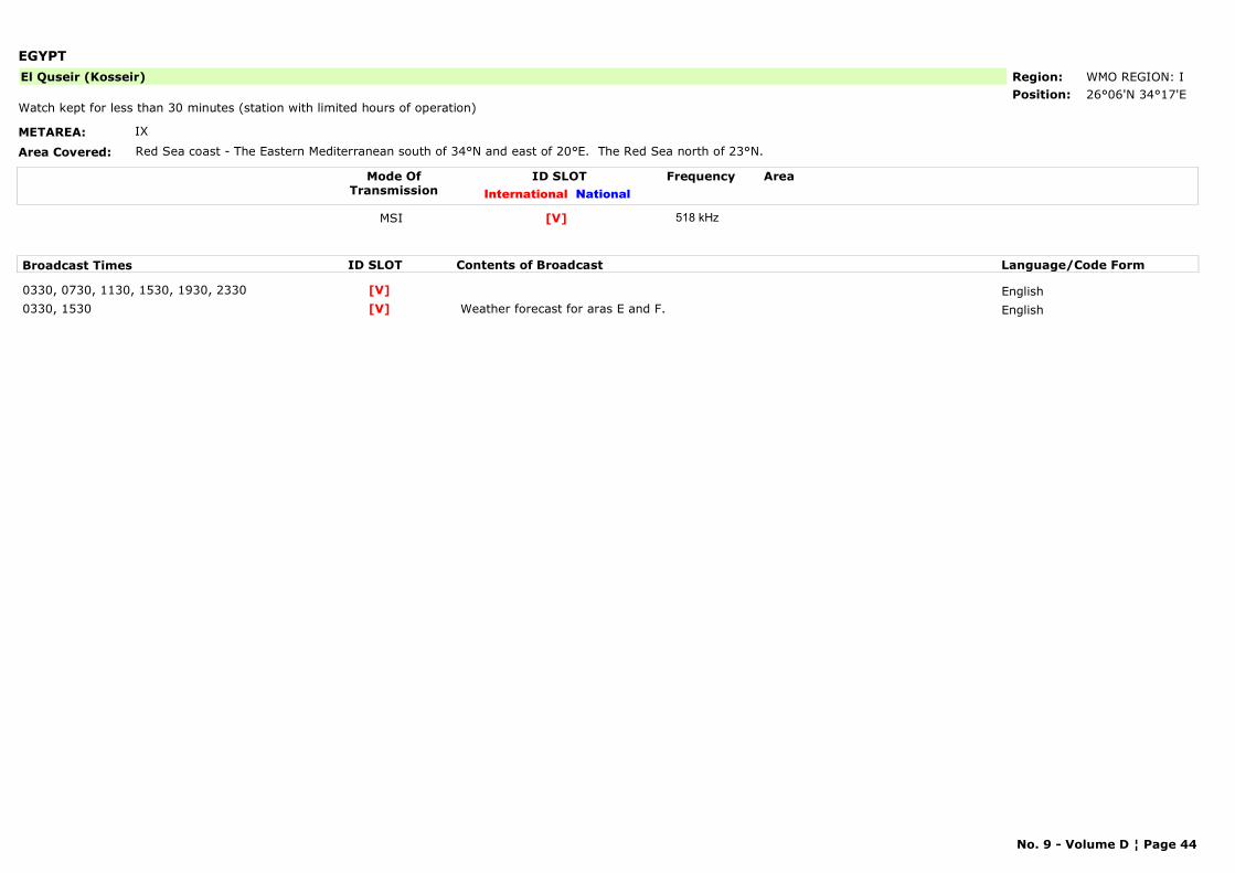
EGYPT
METAREA: IX
Area Covered: Red Sea coast - The Eastern Mediterranean south of 34°N and east of 20°E. The Red Sea north of 23°N.
Region: WMO REGION: IPosition: 26°06'N 34°17'E
El Quseir (Kosseir)
Watch kept for less than 30 minutes (station with limited hours of operation)
Mode OfTransmission
ID SLOT AreaInternational National
Frequency
MSI [V] 518 kHz
Broadcast Times ID SLOT Contents of Broadcast Language/Code Form
0330, 0730, 1130, 1530, 1930, 2330 English[V]0330, 1530 Weather forecast for aras E and F. English[V]
No. 9 - Volume D ¦ Page 44
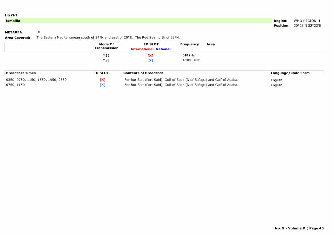
EGYPT
METAREA: IX
Area Covered: The Eastern Mediterranean south of 34°N and east of 20°E. The Red Sea north of 23°N.
Region: WMO REGION: IPosition: 30°28'N 32°22'E
Ismailia
Mode OfTransmission
ID SLOT AreaInternational National
Frequency
MSI [X] 518 kHzMSI [X] 4 209.5 kHz
Broadcast Times ID SLOT Contents of Broadcast Language/Code Form
0350, 0750, 1150, 1550, 1950, 2350 For Bur Sait (Port Said), Gulf of Suez (N of Safaga) and Gulf of Aqaba. English[X]0750, 1150 For Bur Sait (Port Said), Gulf of Suez (N of Safaga) and Gulf of Aqaba. English[X]
No. 9 - Volume D ¦ Page 45
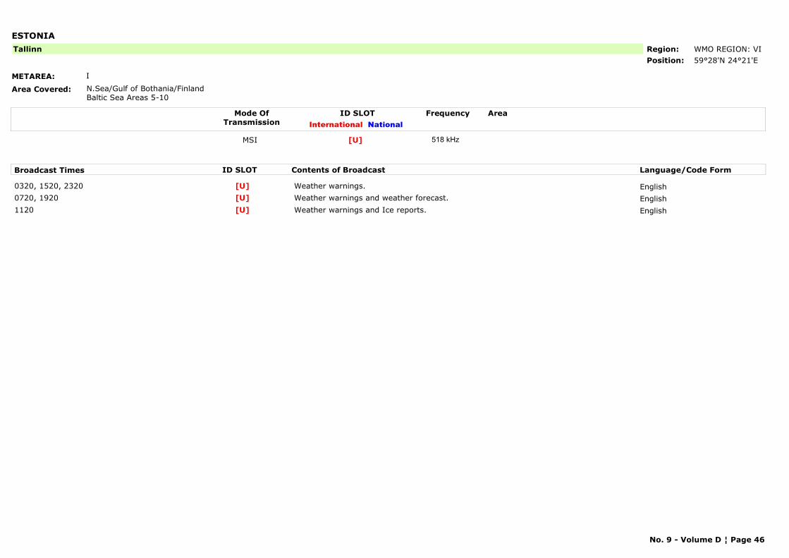
ESTONIA
METAREA: I
Area Covered: N.Sea/Gulf of Bothania/FinlandBaltic Sea Areas 5-10
Region: WMO REGION: VIPosition: 59°28'N 24°21'E
Tallinn
Mode OfTransmission
ID SLOT AreaInternational National
Frequency
MSI [U] 518 kHz
Broadcast Times ID SLOT Contents of Broadcast Language/Code Form
0320, 1520, 2320 Weather warnings. English[U]0720, 1920 Weather warnings and weather forecast. English[U]1120 Weather warnings and Ice reports. English[U]
No. 9 - Volume D ¦ Page 46
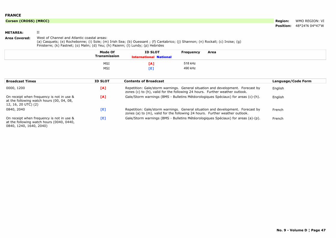
FRANCE
METAREA: II
Area Covered: West of Channel and Atlantic coastal areas:(a) Casquets; (e) Rochebonne; (i) Sole; (m) Irish Sea; (b) Ouessant ; (f) Cantabrico; (j) Shannon; (n) Rockall; (c) Iroise; (g) Finisterre; (k) Fastnet; (o) Malin; (d) Yeu; (h) Pazenn; (l) Lundy; (p) Hebrides
Region: WMO REGION: VIPosition: 48°24'N 04°47'W
Corsen (CROSS) (MRCC)
Mode OfTransmission
ID SLOT AreaInternational National
Frequency
MSI [A] 518 kHzMSI [E] 490 kHz
Broadcast Times ID SLOT Contents of Broadcast Language/Code Form
0000, 1200 Repetition: Gale/storm warnings. General situation and development. Forecast by zones (c) to (h), valid for the following 24 hours. Further weather outlook.
English[A]
On receipt when frequency is not in use & at the following watch hours (00, 04, 08, 12, 16, 20 UTC) (2)
Gale/Storm warnings (BMS - Bulletins Météorologiques Spéciaux) for areas (c)-(h). English[A]
0840, 2040 Repetition: Gale/storm warnings. General situation and development. Forecast by zones (a) to (m), valid for the following 24 hours. Further weather outlook.
French[E]
On receipt when frequency is not in use & at the following watch hours (0040, 0440, 0840, 1240, 1640, 2040)
Gale/Storm warnings (BMS - Bulletins Météorologiques Spéciaux) for areas (a)-(p). French[E]
No. 9 - Volume D ¦ Page 47
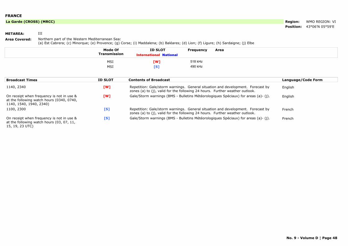
FRANCE
METAREA: III
Area Covered: Northern part of the Western Mediterranean Sea:(a) Est Cabrera; (c) Minorque; (e) Provence; (g) Corse; (i) Maddalena; (b) Baléares; (d) Lion; (f) Ligure; (h) Sardaigne; (j) Elbe
Region: WMO REGION: VIPosition: 43°06'N 05°59'E
La Garde (CROSS) (MRCC)
Mode OfTransmission
ID SLOT AreaInternational National
Frequency
MSI [W] 518 kHzMSI [S] 490 kHz
Broadcast Times ID SLOT Contents of Broadcast Language/Code Form
1140, 2340 Repetition: Gale/storm warnings. General situation and development. Forecast by zones (a) to (j), valid for the following 24 hours. Further weather outlook.
English[W]
On receipt when frequency is not in use & at the following watch hours (0340, 0740, 1140, 1540, 1940, 2340)
Gale/Storm warnings (BMS - Bulletins Météorologiques Spéciaux) for areas (a)- (j). English[W]
1100, 2300 Repetition: Gale/storm warnings. General situation and development. Forecast by zones (a) to (j), valid for the following 24 hours. Further weather outlook.
French[S]
On receipt when frequency is not in use & at the following watch hours (03, 07, 11, 15, 19, 23 UTC)
Gale/Storm warnings (BMS - Bulletins Météorologiques Spéciaux) for areas (a)- (j). French[S]
No. 9 - Volume D ¦ Page 48
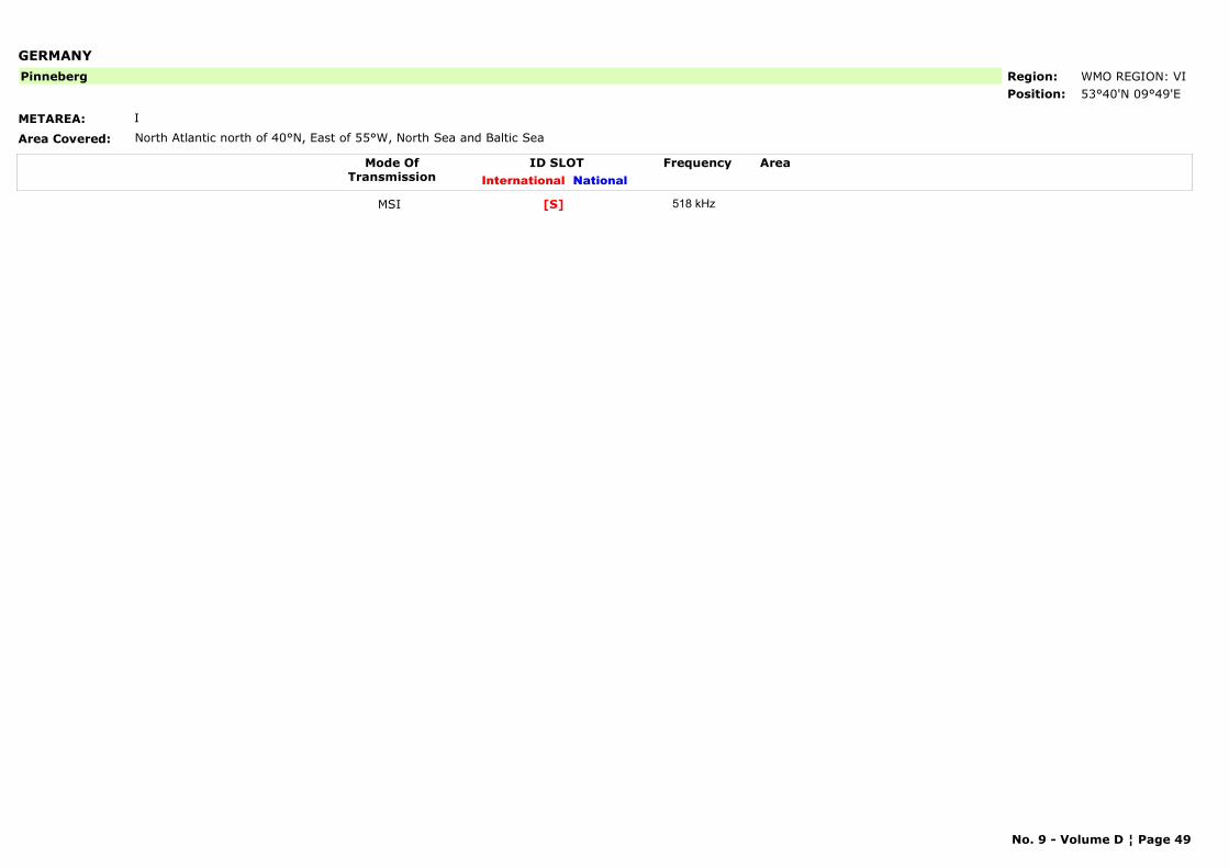
GERMANY
METAREA: I
Area Covered: North Atlantic north of 40°N, East of 55°W, North Sea and Baltic Sea
Region: WMO REGION: VI Position: 53°40'N 09°49'E
Pinneberg
Mode OfTransmission
ID SLOT AreaInternational National
Frequency
MSI [S] 518 kHz
No. 9 - Volume D ¦ Page 49
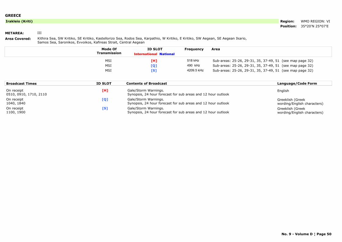
GREECE
METAREA: III
Area Covered: Kithira Sea, SW Kritiko, SE Kritiko, Kastellorizo Sea, Rodos Sea, Karpathio, W Kritiko, E Kritiko, SW Aegean, SE Aegean Ikario, Samos Sea, Saronikos, Evvoikos, Kafireas Strait, Central Aegean
Region: WMO REGION: VIPosition: 35°20'Ν 25°07'Ε
Irakleio (Kriti)
Mode OfTransmission
ID SLOT AreaInternational National
Frequency
MSI Sub-areas: 25-26, 29-31, 35, 37-49, 51 (see map page 32)[H] 518 kHzMSI Sub-areas: 25-26, 29-31, 35, 37-49, 51 (see map page 32)[Q] 490 kHzMSI Sub-areas: 25-26, 29-31, 35, 37-49, 51 (see map page 32)[S] 4209.5 kHz
Broadcast Times ID SLOT Contents of Broadcast Language/Code Form
On receipt0510, 0910, 1710, 2110
Gale/Storm Warnings.Synopsis, 24 hour forecast for sub areas and 12 hour outlook
English[H]
On receipt1040, 1840
Gale/Storm Warnings.Synopsis, 24 hour forecast for sub areas and 12 hour outlook
Greeklish (Greek wording/English characters)
[Q]
On receipt1100, 1900
Gale/Storm Warnings.Synopsis, 24 hour forecast for sub areas and 12 hour outlook
Greeklish (Greek wording/English characters)
[S]
No. 9 - Volume D ¦ Page 50
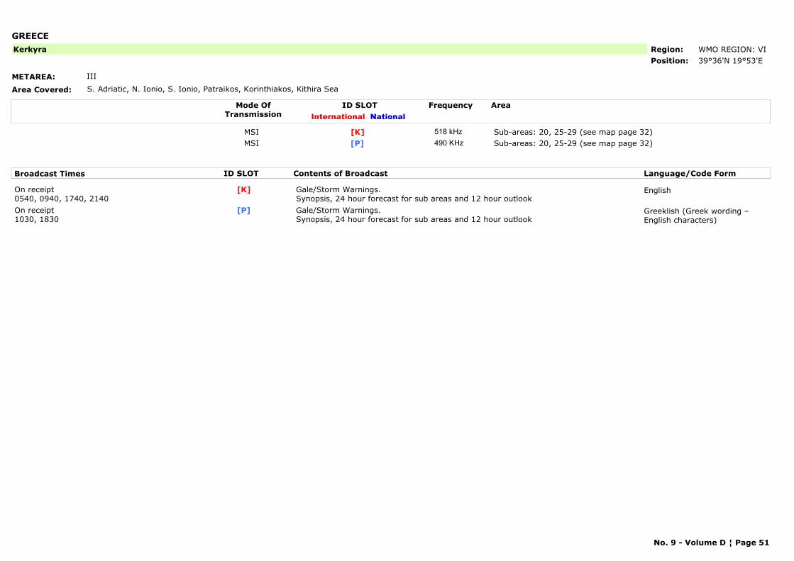
GREECE
METAREA: III
Area Covered: S. Adriatic, N. Ionio, S. Ionio, Patraikos, Korinthiakos, Kithira Sea
Region: WMO REGION: VIPosition: 39°36'Ν 19°53'Ε
Kerkyra
Mode OfTransmission
ID SLOT AreaInternational National
Frequency
MSI Sub-areas: 20, 25-29 (see map page 32)[K] 518 kHzMSI Sub-areas: 20, 25-29 (see map page 32)[P] 490 KHz
Broadcast Times ID SLOT Contents of Broadcast Language/Code Form
On receipt0540, 0940, 1740, 2140
Gale/Storm Warnings.Synopsis, 24 hour forecast for sub areas and 12 hour outlook
English[K]
On receipt1030, 1830
Gale/Storm Warnings.Synopsis, 24 hour forecast for sub areas and 12 hour outlook
Greeklish (Greek wording – English characters)
[P]
No. 9 - Volume D ¦ Page 51
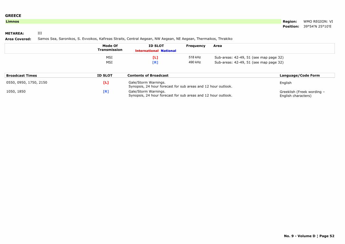
GREECE
METAREA: III
Area Covered: Samos Sea, Saronikos, S. Evvoikos, Kafireas Straits, Central Aegean, NW Aegean, NE Aegean, Thermaikos, Thrakiko
Region: WMO REGION: VIPosition: 39°54'Ν 25°10'Ε
Limnos
Mode OfTransmission
ID SLOT AreaInternational National
Frequency
MSI Sub-areas: 42-49, 51 (see map page 32)[L] 518 kHzMSI Sub-areas: 42-49, 51 (see map page 32)[R] 490 kHz
Broadcast Times ID SLOT Contents of Broadcast Language/Code Form
0550, 0950, 1750, 2150 Gale/Storm Warnings.Synopsis, 24 hour forecast for sub areas and 12 hour outlook.
English[L]
1050, 1850 Gale/Storm Warnings.Synopsis, 24 hour forecast for sub areas and 12 hour outlook.
Greeklish (Freek wording – English characters)
[R]
No. 9 - Volume D ¦ Page 52
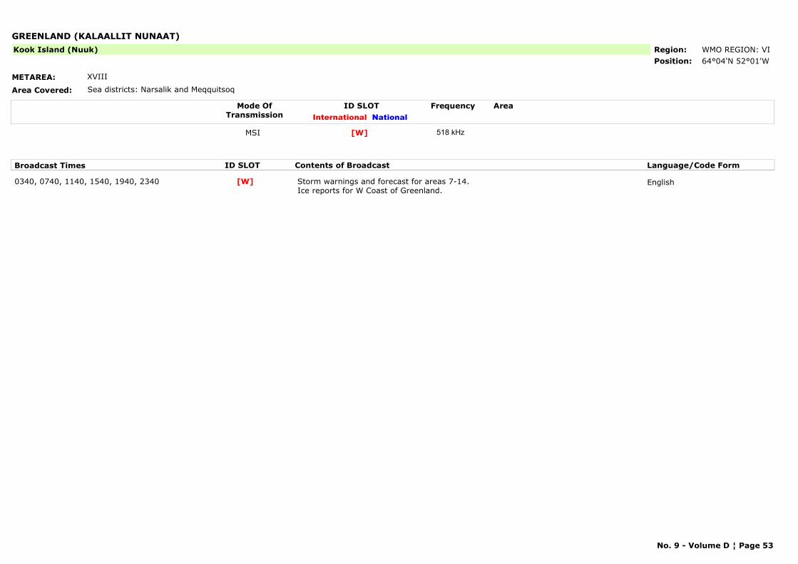
GREENLAND (KALAALLIT NUNAAT)
METAREA: XVIII
Area Covered: Sea districts: Narsalik and Meqquitsoq
Region: WMO REGION: VIPosition: 64°04'N 52°01'W
Kook Island (Nuuk)
Mode OfTransmission
ID SLOT AreaInternational National
Frequency
MSI [W] 518 kHz
Broadcast Times ID SLOT Contents of Broadcast Language/Code Form
0340, 0740, 1140, 1540, 1940, 2340 Storm warnings and forecast for areas 7-14. Ice reports for W Coast of Greenland.
English[W]
No. 9 - Volume D ¦ Page 53
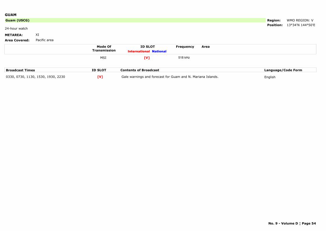
GUAM
METAREA: XI
Area Covered: Pacific area
Region: WMO REGION: VPosition: 13°34'N 144°50'E
Guam (USCG)
24-hour watch
Mode OfTransmission
ID SLOT AreaInternational National
Frequency
MSI [V] 518 kHz
Broadcast Times ID SLOT Contents of Broadcast Language/Code Form
0330, 0730, 1130, 1530, 1930, 2230 Gale warnings and forecast for Guam and N. Mariana Islands. English[V]
No. 9 - Volume D ¦ Page 54
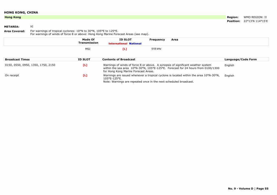
HONG KONG, CHINA
METAREA: XI
Area Covered: For warnings of tropical cyclones: 10°N to 30°N, 105°E to 125°E. For warnings of winds of force 8 or above: Hong Kong Marine Forecast Areas (see map).
Region: WMO REGION: IIPosition: 22°13'N 114°15'E
Hong Kong
Mode OfTransmission
ID SLOT AreaInternational National
Frequency
MSI [L] 518 kHz
Broadcast Times ID SLOT Contents of Broadcast Language/Code Form
0150, 0550, 0950, 1350, 1750, 2150 Warnings of winds of force 8 or above. A synopsis of significant weather system within the sea area 10°N-30°N, 105°E-125°E. Forecast for 24 hours from 0100/1300 for Hong Kong Marine Forecast Areas.
English[L]
On receipt Warnings are issued whenever a tropical cyclone is located within the area 10°N-30°N, 105°E-125°E. Note: Warnings are repeated once in the next scheduled broadcast.
English[L]
No. 9 - Volume D ¦ Page 55
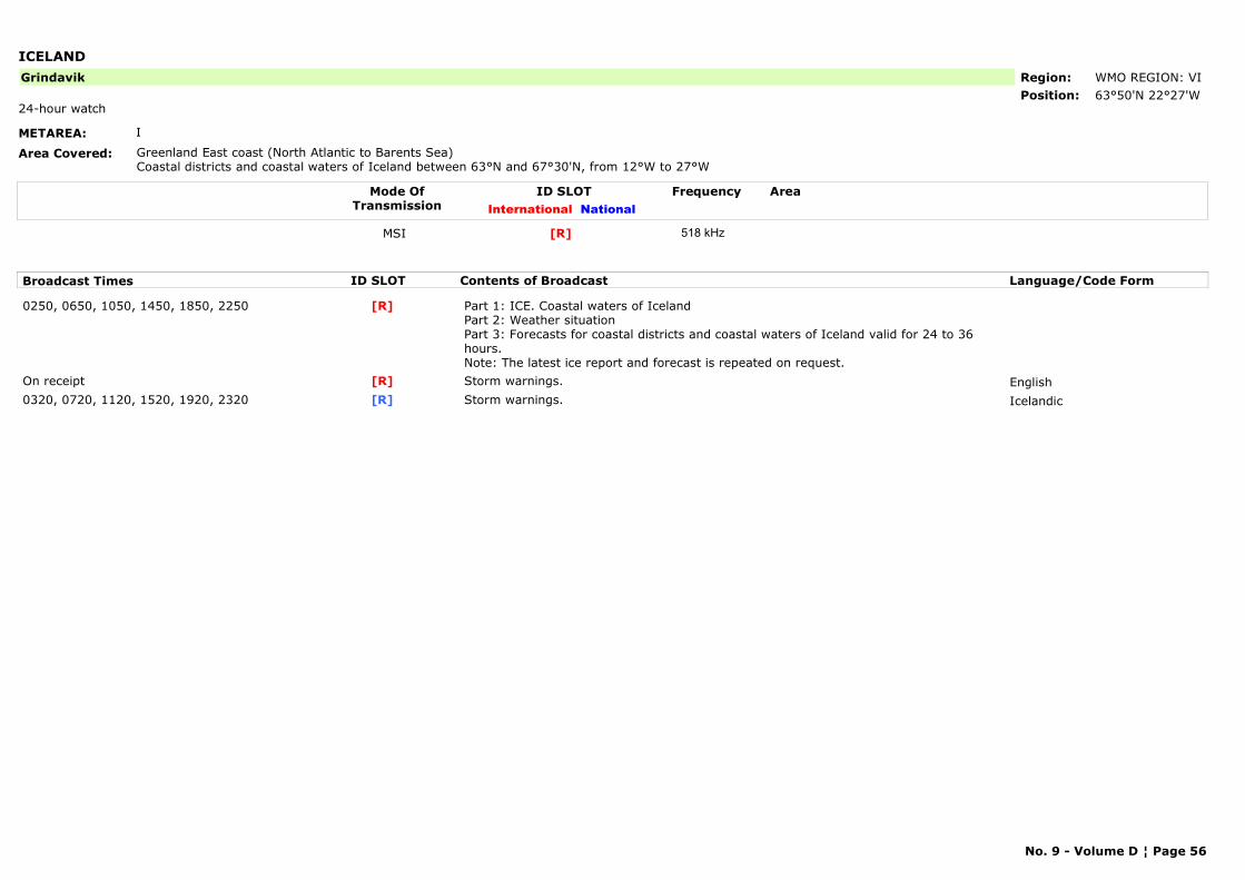
ICELAND
METAREA: I
Area Covered: Greenland East coast (North Atlantic to Barents Sea) Coastal districts and coastal waters of Iceland between 63°N and 67°30'N, from 12°W to 27°W
Region: WMO REGION: VIPosition: 63°50'N 22°27'W
Grindavik
24-hour watch
Mode OfTransmission
ID SLOT AreaInternational National
Frequency
MSI [R] 518 kHz
Broadcast Times ID SLOT Contents of Broadcast Language/Code Form
0250, 0650, 1050, 1450, 1850, 2250 Part 1: ICE. Coastal waters of IcelandPart 2: Weather situationPart 3: Forecasts for coastal districts and coastal waters of Iceland valid for 24 to 36 hours. Note: The latest ice report and forecast is repeated on request.
[R]
On receipt Storm warnings. English[R]0320, 0720, 1120, 1520, 1920, 2320 Storm warnings. Icelandic[R]
No. 9 - Volume D ¦ Page 56
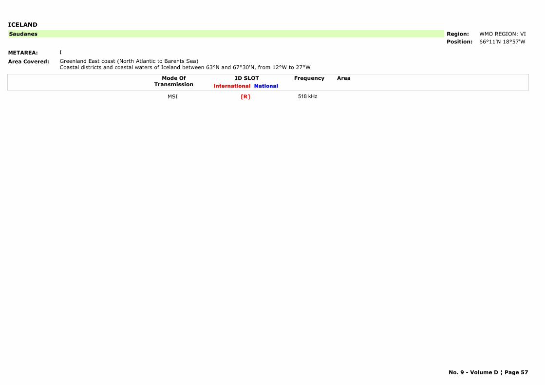
ICELAND
METAREA: I
Area Covered: Greenland East coast (North Atlantic to Barents Sea) Coastal districts and coastal waters of Iceland between 63°N and 67°30'N, from 12°W to 27°W
Region: WMO REGION: VIPosition: 66°11'N 18°57'W
Saudanes
Mode OfTransmission
ID SLOT AreaInternational National
Frequency
MSI [R] 518 kHz
No. 9 - Volume D ¦ Page 57

INDIA
METAREA: VIII(N)
Area Covered: Indian Ocean/Arab.Gulf/Red SeaSea areas within the Asian coast and the line 24°N 68°E to 20°N 68°E to 20°N 60°E to 5°N 60°E to 5°N 95°E to 10°N 95°E to 10°N 94°E to 13°30'N 94°E to 13°30'N 92°E to 18°N 92°E to 18°N 94°30'E.
Region: WMO REGION: IIPosition: 13°05'N 80°17'E
Chennai (Madras)
Mode OfTransmission
ID SLOT AreaInternational National
Frequency
MSI [P] 518 kHz
Broadcast Times ID SLOT Contents of Broadcast Language/Code Form
0230, 1030 For the Bay of Bengal coast. English[P]0630, 1830 Forecast and sometimes balloon observations for Bay of Bengal and coastal areas 13,
14.English[P]
No. 9 - Volume D ¦ Page 58
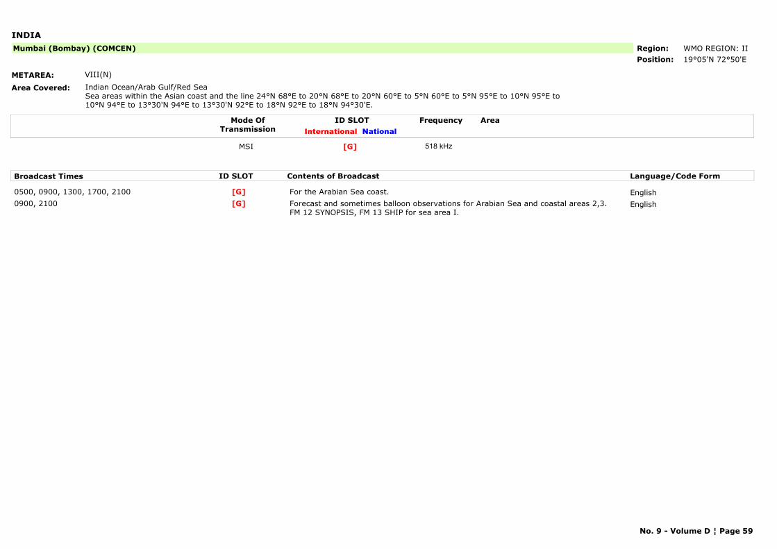
INDIA
METAREA: VIII(N)
Area Covered: Indian Ocean/Arab Gulf/Red SeaSea areas within the Asian coast and the line 24°N 68°E to 20°N 68°E to 20°N 60°E to 5°N 60°E to 5°N 95°E to 10°N 95°E to 10°N 94°E to 13°30'N 94°E to 13°30'N 92°E to 18°N 92°E to 18°N 94°30'E.
Region: WMO REGION: IIPosition: 19°05'N 72°50'E
Mumbai (Bombay) (COMCEN)
Mode OfTransmission
ID SLOT AreaInternational National
Frequency
MSI [G] 518 kHz
Broadcast Times ID SLOT Contents of Broadcast Language/Code Form
0500, 0900, 1300, 1700, 2100 For the Arabian Sea coast. English[G]0900, 2100 Forecast and sometimes balloon observations for Arabian Sea and coastal areas 2,3.
FM 12 SYNOPSIS, FM 13 SHIP for sea area I.English[G]
No. 9 - Volume D ¦ Page 59
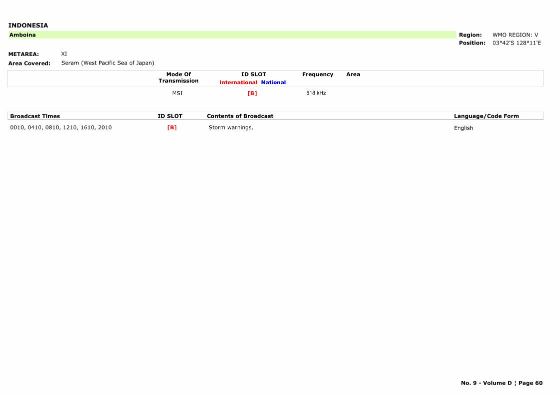
INDONESIA
METAREA: XI
Area Covered: Seram (West Pacific Sea of Japan)
Region: WMO REGION: VPosition: 03°42'S 128°11'E
Amboina
Mode OfTransmission
ID SLOT AreaInternational National
Frequency
MSI [B] 518 kHz
Broadcast Times ID SLOT Contents of Broadcast Language/Code Form
0010, 0410, 0810, 1210, 1610, 2010 Storm warnings. English[B]
No. 9 - Volume D ¦ Page 60
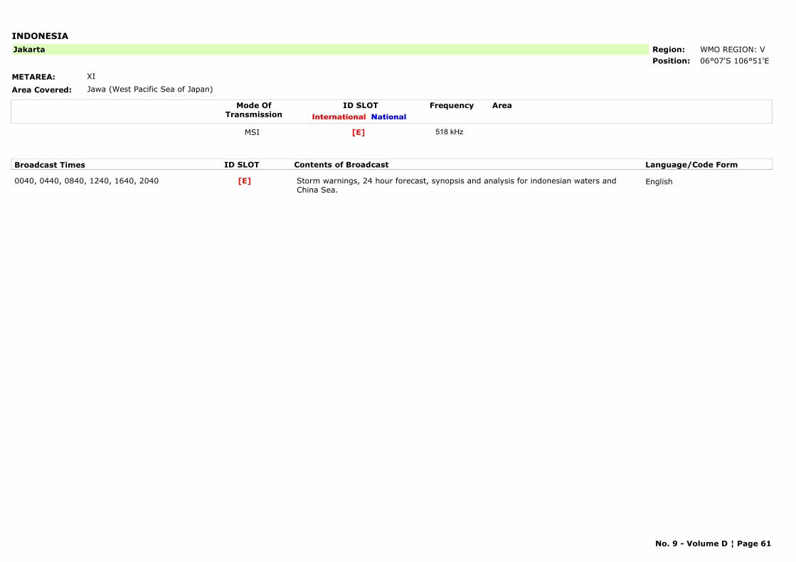
INDONESIA
METAREA: XI
Area Covered: Jawa (West Pacific Sea of Japan)
Region: WMO REGION: VPosition: 06°07'S 106°51'E
Jakarta
Mode OfTransmission
ID SLOT AreaInternational National
Frequency
MSI [E] 518 kHz
Broadcast Times ID SLOT Contents of Broadcast Language/Code Form
0040, 0440, 0840, 1240, 1640, 2040 Storm warnings, 24 hour forecast, synopsis and analysis for indonesian waters and China Sea.
English[E]
No. 9 - Volume D ¦ Page 61
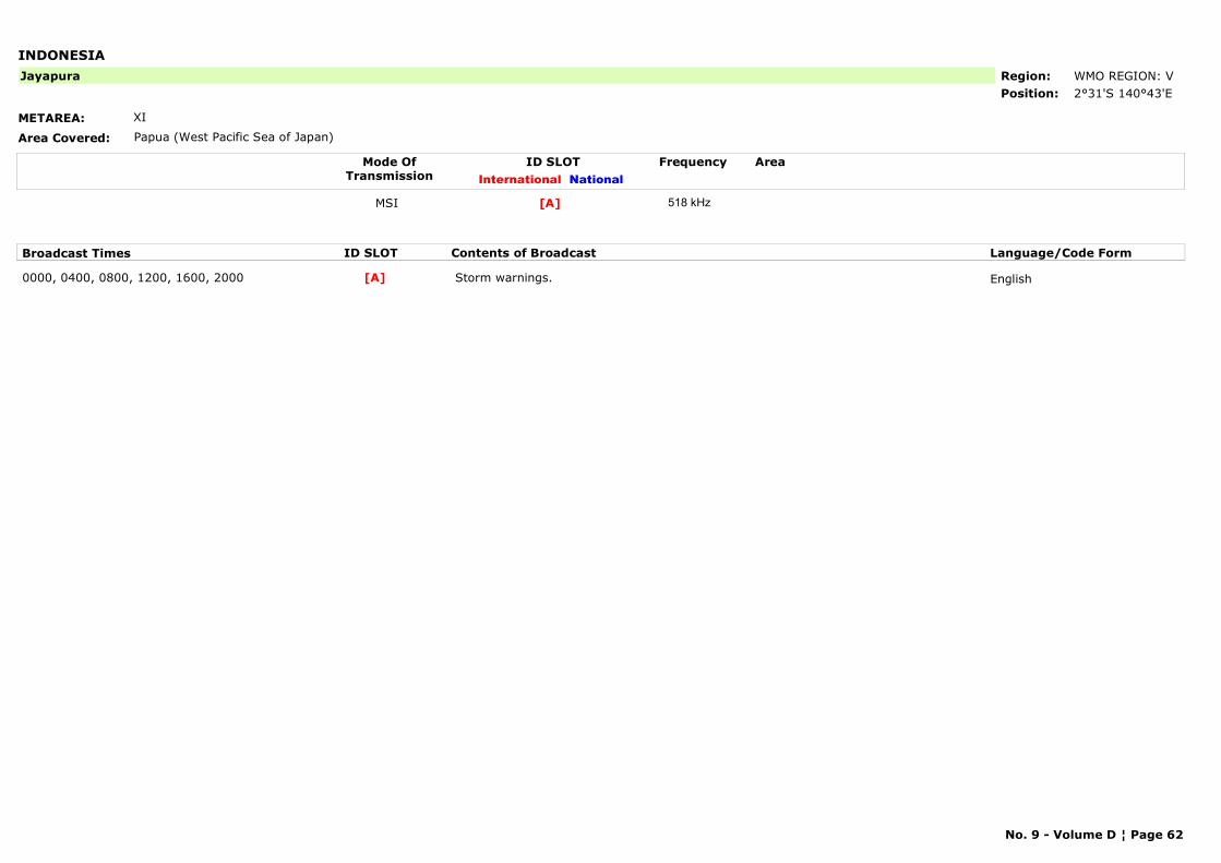
INDONESIA
METAREA: XI
Area Covered: Papua (West Pacific Sea of Japan)
Region: WMO REGION: VPosition: 2°31'S 140°43'E
Jayapura
Mode OfTransmission
ID SLOT AreaInternational National
Frequency
MSI [A] 518 kHz
Broadcast Times ID SLOT Contents of Broadcast Language/Code Form
0000, 0400, 0800, 1200, 1600, 2000 Storm warnings. English[A]
No. 9 - Volume D ¦ Page 62
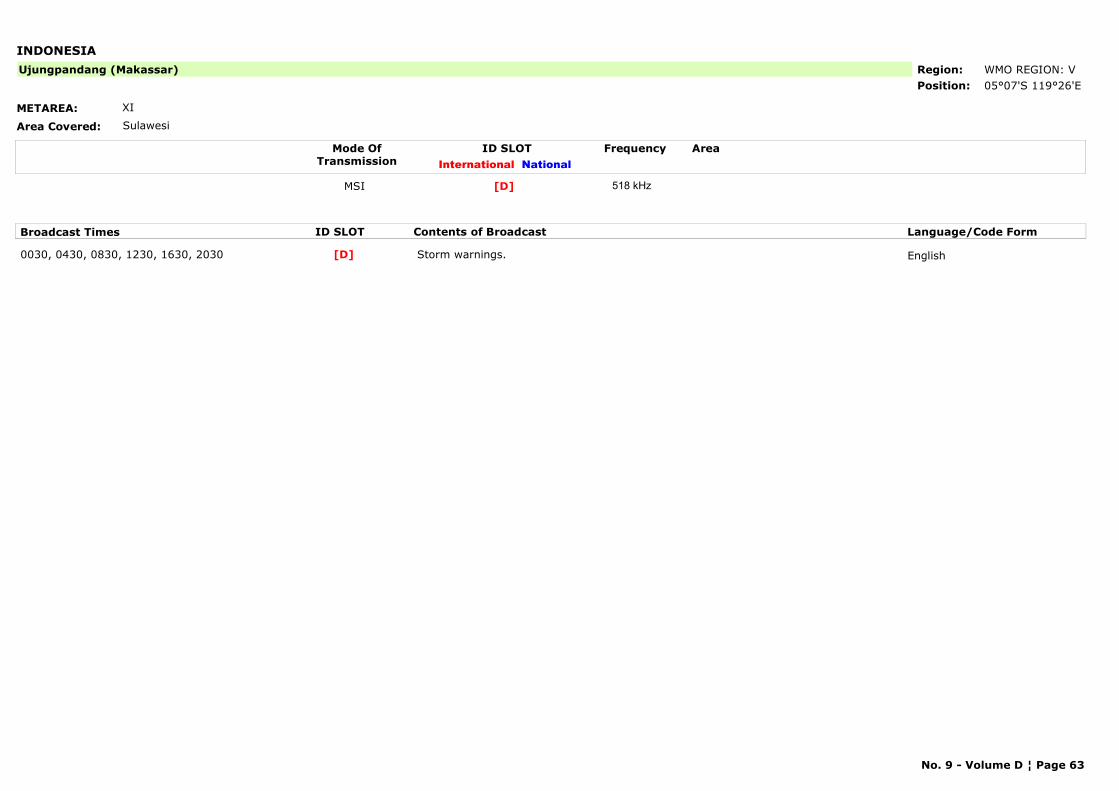
INDONESIA
METAREA: XI
Area Covered: Sulawesi
Region: WMO REGION: VPosition: 05°07'S 119°26'E
Ujungpandang (Makassar)
Mode OfTransmission
ID SLOT AreaInternational National
Frequency
MSI [D] 518 kHz
Broadcast Times ID SLOT Contents of Broadcast Language/Code Form
0030, 0430, 0830, 1230, 1630, 2030 Storm warnings. English[D]
No. 9 - Volume D ¦ Page 63
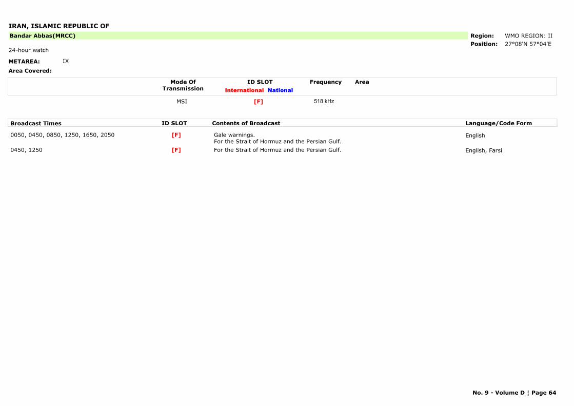
IRAN, ISLAMIC REPUBLIC OF
METAREA: IX
Area Covered:
Region: WMO REGION: IIPosition: 27°08'N 57°04'E
Bandar Abbas(MRCC)
24-hour watch
Mode OfTransmission
ID SLOT AreaInternational National
Frequency
MSI [F] 518 kHz
Broadcast Times ID SLOT Contents of Broadcast Language/Code Form
0050, 0450, 0850, 1250, 1650, 2050 Gale warnings.For the Strait of Hormuz and the Persian Gulf.
English[F]
0450, 1250 For the Strait of Hormuz and the Persian Gulf. English, Farsi[F]
No. 9 - Volume D ¦ Page 64
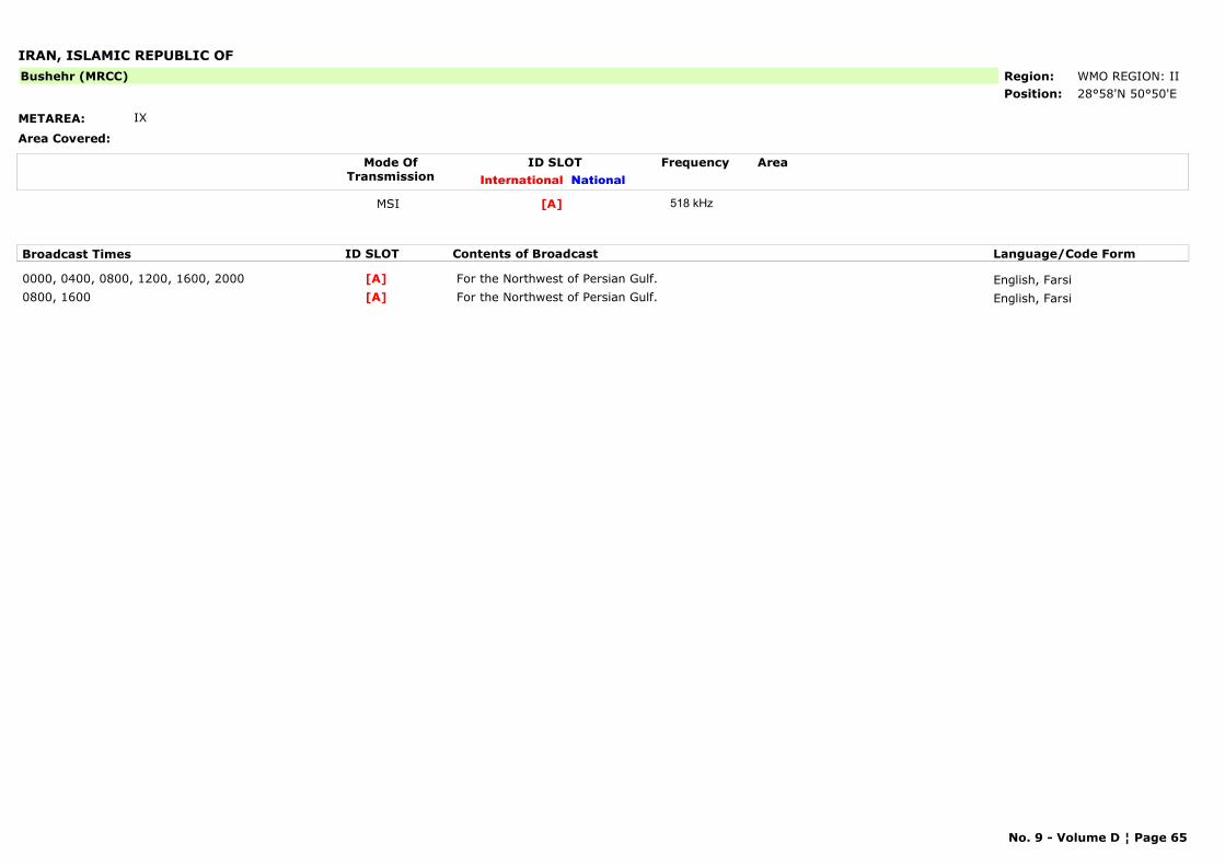
IRAN, ISLAMIC REPUBLIC OF
METAREA: IX
Area Covered:
Region: WMO REGION: IIPosition: 28°58'N 50°50'E
Bushehr (MRCC)
Mode OfTransmission
ID SLOT AreaInternational National
Frequency
MSI [A] 518 kHz
Broadcast Times ID SLOT Contents of Broadcast Language/Code Form
0000, 0400, 0800, 1200, 1600, 2000 For the Northwest of Persian Gulf. English, Farsi[A]0800, 1600 For the Northwest of Persian Gulf. English, Farsi[A]
No. 9 - Volume D ¦ Page 65
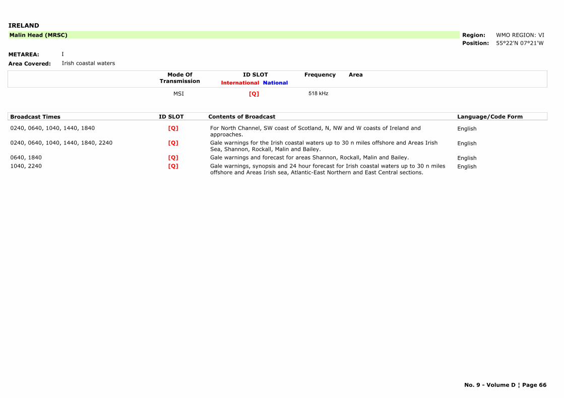
IRELAND
METAREA: I
Area Covered: Irish coastal waters
Region: WMO REGION: VIPosition: 55°22'N 07°21'W
Malin Head (MRSC)
Mode OfTransmission
ID SLOT AreaInternational National
Frequency
MSI [Q] 518 kHz
Broadcast Times ID SLOT Contents of Broadcast Language/Code Form
0240, 0640, 1040, 1440, 1840 For North Channel, SW coast of Scotland, N, NW and W coasts of Ireland and approaches.
English[Q]
0240, 0640, 1040, 1440, 1840, 2240 Gale warnings for the Irish coastal waters up to 30 n miles offshore and Areas Irish Sea, Shannon, Rockall, Malin and Bailey.
English[Q]
0640, 1840 Gale warnings and forecast for areas Shannon, Rockall, Malin and Bailey. English[Q]1040, 2240 Gale warnings, synopsis and 24 hour forecast for Irish coastal waters up to 30 n miles
offshore and Areas Irish sea, Atlantic-East Northern and East Central sections.English[Q]
No. 9 - Volume D ¦ Page 66
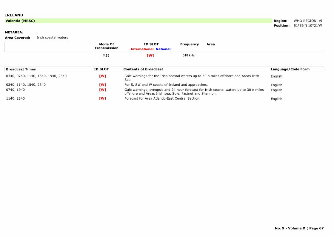
IRELAND
METAREA: I
Area Covered: Irish coastal waters
Region: WMO REGION: VIPosition: 51°56'N 10°21'W
Valentia (MRSC)
Mode OfTransmission
ID SLOT AreaInternational National
Frequency
MSI [W] 518 kHz
Broadcast Times ID SLOT Contents of Broadcast Language/Code Form
0340, 0740, 1140, 1540, 1940, 2340 Gale warnings for the Irish coastal waters up to 30 n miles offshore and Areas Irish Sea.
English[W]
0340, 1140, 1540, 2340 For S, SW and W coasts of Ireland and approaches. English[W]0740, 1940 Gale warnings, synopsis and 24 hour forecast for Irish coastal waters up to 30 n miles
offshore and Areas Irish sea, Sole, Fastnet and Shannon.English[W]
1140, 2340 Forecast for Area Atlantic-East Central Section. English[W]
No. 9 - Volume D ¦ Page 67
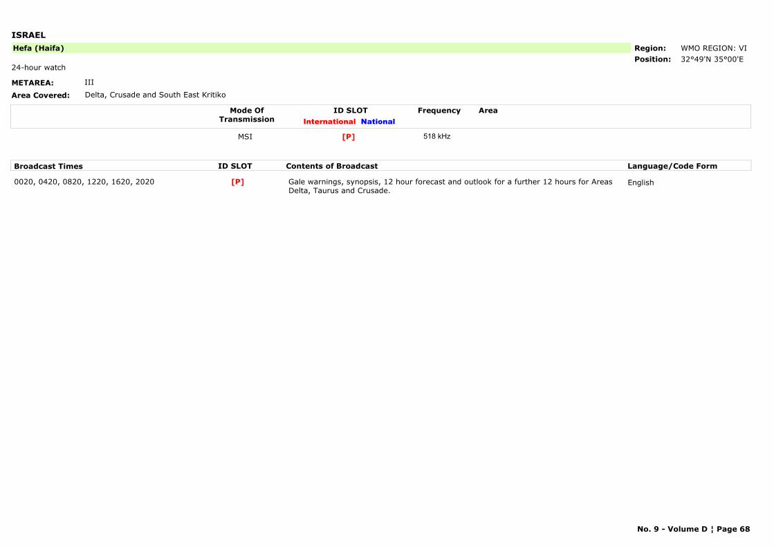
ISRAEL
METAREA: III
Area Covered: Delta, Crusade and South East Kritiko
Region: WMO REGION: VIPosition: 32°49'N 35°00'E
Hefa (Haifa)
24-hour watch
Mode OfTransmission
ID SLOT AreaInternational National
Frequency
MSI [P] 518 kHz
Broadcast Times ID SLOT Contents of Broadcast Language/Code Form
0020, 0420, 0820, 1220, 1620, 2020 Gale warnings, synopsis, 12 hour forecast and outlook for a further 12 hours for Areas Delta, Taurus and Crusade.
English[P]
No. 9 - Volume D ¦ Page 68
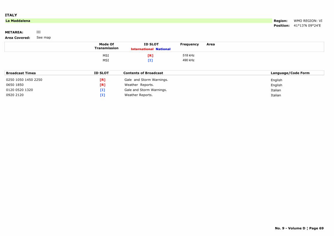
ITALY
METAREA: III
Area Covered: See map
Region: WMO REGION: VIPosition: 41°13’N 09°24’E
La Maddalena
Mode OfTransmission
ID SLOT AreaInternational National
Frequency
MSI [R] 518 kHzMSI [I] 490 kHz
Broadcast Times ID SLOT Contents of Broadcast Language/Code Form
0250 1050 1450 2250 Gale and Storm Warnings. English[R]0650 1850 Weather Reports. English[R]0120 0520 1320 Gale and Storm Warnings. Italian[I]0920 2120 Weather Reports. Italian[I]
No. 9 - Volume D ¦ Page 69
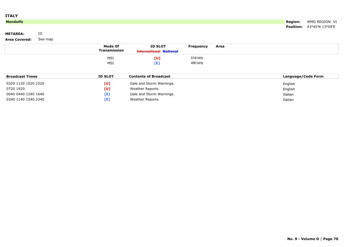
ITALY
METAREA: III
Area Covered: See map
Region: WMO REGION: VIPosition: 43°45’N 13°09’E
Mondolfo
Mode OfTransmission
ID SLOT AreaInternational National
Frequency
MSI [U] 518 kHzMSI [E] 490 kHz
Broadcast Times ID SLOT Contents of Broadcast Language/Code Form
0320 1120 1520 2320 Gale and Storm Warnings. English[U]0720 1920 Weather Reports. English[U]0040 0440 1240 1640 Gale and Storm Warnings. Italian[E]0340 1140 1540 2340 Weather Reports. Italian[E]
No. 9 - Volume D ¦ Page 70
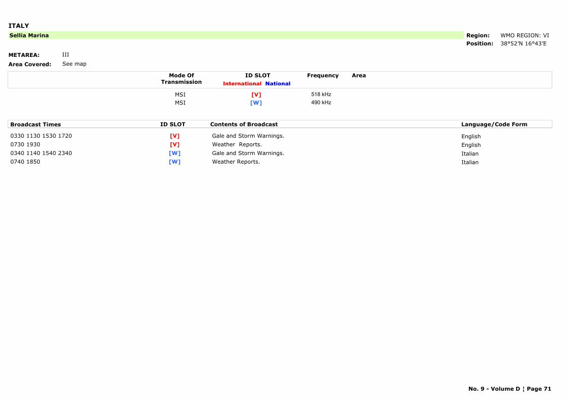
ITALY
METAREA: III
Area Covered: See map
Region: WMO REGION: VIPosition: 38°52’N 16°43’E
Sellia Marina
Mode OfTransmission
ID SLOT AreaInternational National
Frequency
MSI [V] 518 kHzMSI [W] 490 kHz
Broadcast Times ID SLOT Contents of Broadcast Language/Code Form
0330 1130 1530 1720 Gale and Storm Warnings. English[V]0730 1930 Weather Reports. English[V]0340 1140 1540 2340 Gale and Storm Warnings. Italian[W]0740 1850 Weather Reports. Italian[W]
No. 9 - Volume D ¦ Page 71
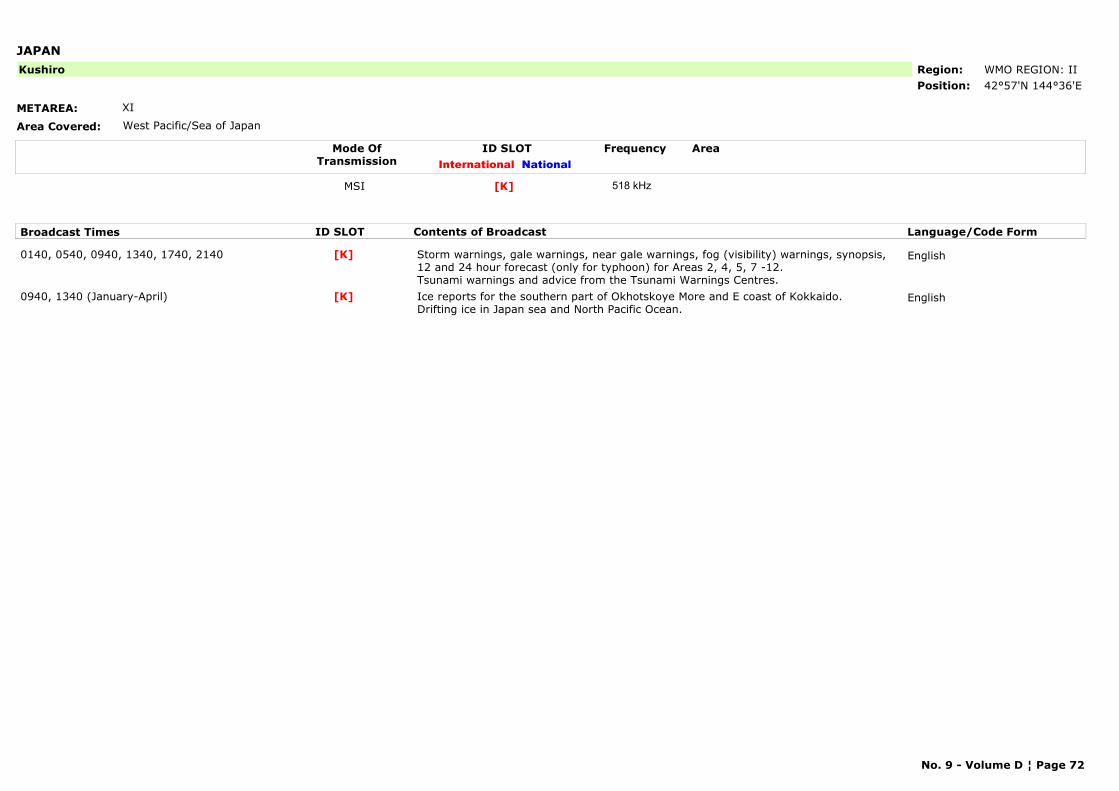
JAPAN
METAREA: XI
Area Covered: West Pacific/Sea of Japan
Region: WMO REGION: IIPosition: 42°57'N 144°36'E
Kushiro
Mode OfTransmission
ID SLOT AreaInternational National
Frequency
MSI [K] 518 kHz
Broadcast Times ID SLOT Contents of Broadcast Language/Code Form
0140, 0540, 0940, 1340, 1740, 2140 Storm warnings, gale warnings, near gale warnings, fog (visibility) warnings, synopsis, 12 and 24 hour forecast (only for typhoon) for Areas 2, 4, 5, 7 -12. Tsunami warnings and advice from the Tsunami Warnings Centres.
English[K]
0940, 1340 (January-April) Ice reports for the southern part of Okhotskoye More and E coast of Kokkaido. Drifting ice in Japan sea and North Pacific Ocean.
English[K]
No. 9 - Volume D ¦ Page 72
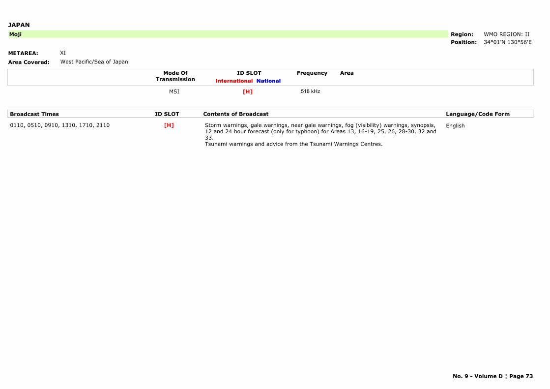
JAPAN
METAREA: XI
Area Covered: West Pacific/Sea of Japan
Region: WMO REGION: IIPosition: 34°01'N 130°56'E
Moji
Mode OfTransmission
ID SLOT AreaInternational National
Frequency
MSI [H] 518 kHz
Broadcast Times ID SLOT Contents of Broadcast Language/Code Form
0110, 0510, 0910, 1310, 1710, 2110 Storm warnings, gale warnings, near gale warnings, fog (visibility) warnings, synopsis, 12 and 24 hour forecast (only for typhoon) for Areas 13, 16-19, 25, 26, 28-30, 32 and 33. Tsunami warnings and advice from the Tsunami Warnings Centres.
English[H]
No. 9 - Volume D ¦ Page 73
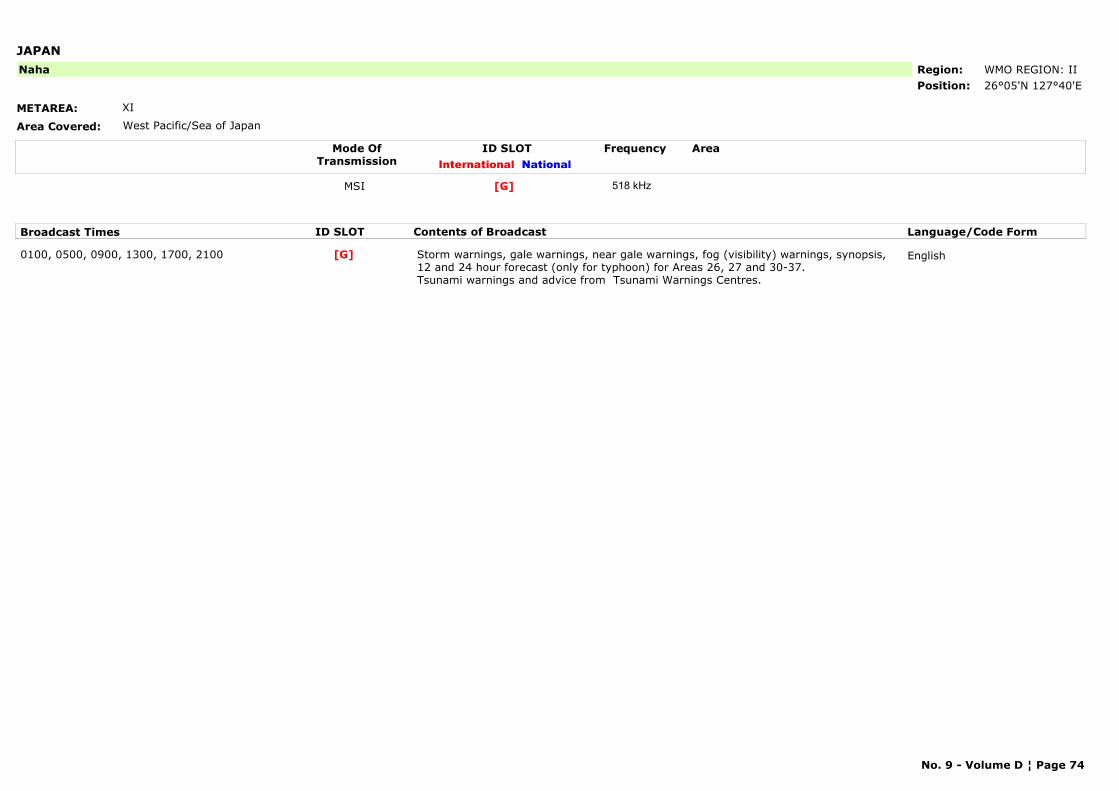
JAPAN
METAREA: XI
Area Covered: West Pacific/Sea of Japan
Region: WMO REGION: IIPosition: 26°05'N 127°40'E
Naha
Mode OfTransmission
ID SLOT AreaInternational National
Frequency
MSI [G] 518 kHz
Broadcast Times ID SLOT Contents of Broadcast Language/Code Form
0100, 0500, 0900, 1300, 1700, 2100 Storm warnings, gale warnings, near gale warnings, fog (visibility) warnings, synopsis, 12 and 24 hour forecast (only for typhoon) for Areas 26, 27 and 30-37.Tsunami warnings and advice from Tsunami Warnings Centres.
English[G]
No. 9 - Volume D ¦ Page 74
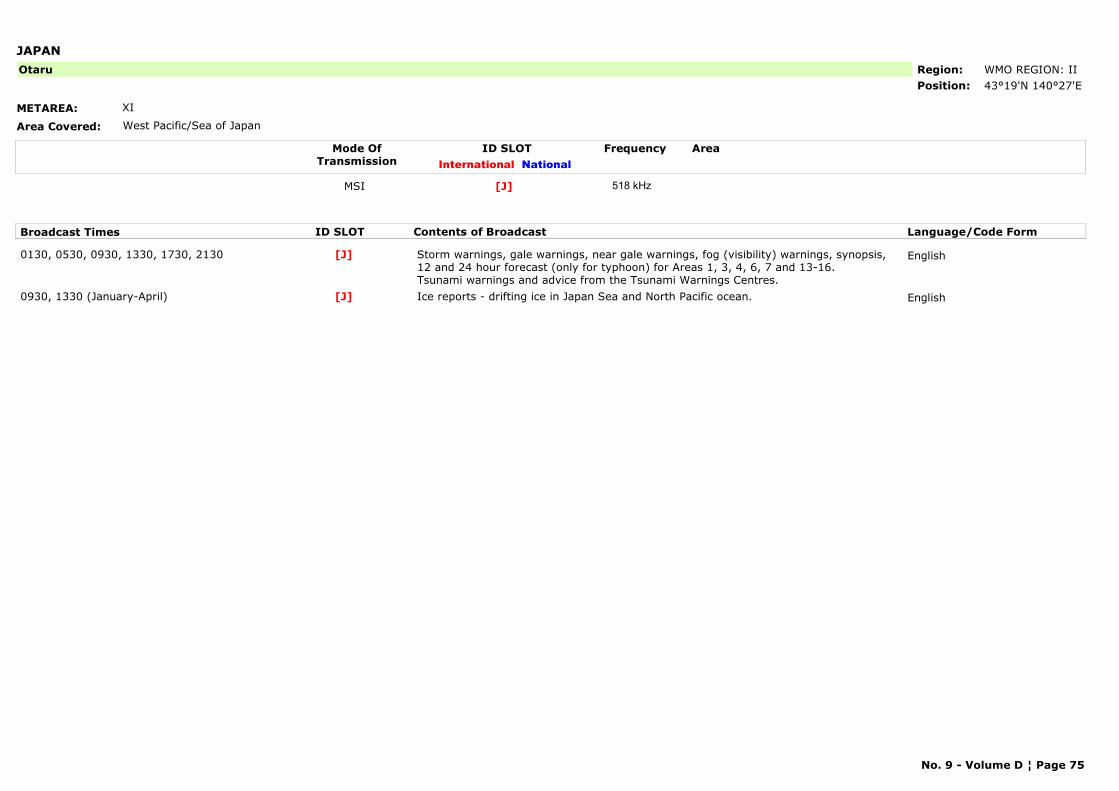
JAPAN
METAREA: XI
Area Covered: West Pacific/Sea of Japan
Region: WMO REGION: IIPosition: 43°19'N 140°27'E
Otaru
Mode OfTransmission
ID SLOT AreaInternational National
Frequency
MSI [J] 518 kHz
Broadcast Times ID SLOT Contents of Broadcast Language/Code Form
0130, 0530, 0930, 1330, 1730, 2130 Storm warnings, gale warnings, near gale warnings, fog (visibility) warnings, synopsis, 12 and 24 hour forecast (only for typhoon) for Areas 1, 3, 4, 6, 7 and 13-16. Tsunami warnings and advice from the Tsunami Warnings Centres.
English[J]
0930, 1330 (January-April) Ice reports - drifting ice in Japan Sea and North Pacific ocean. English[J]
No. 9 - Volume D ¦ Page 75
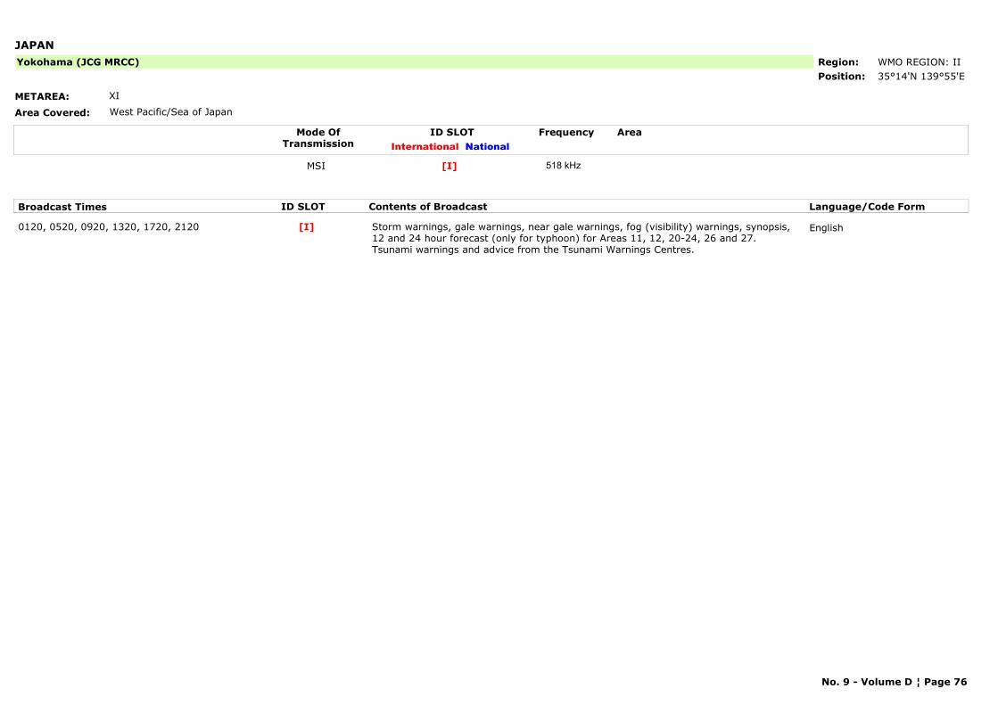
JAPAN
METAREA: XI
Area Covered: West Pacific/Sea of Japan
Region: WMO REGION: IIPosition: 35°14'N 139°55'E
Yokohama (JCG MRCC)
Mode OfTransmission
ID SLOT AreaInternational National
Frequency
MSI [I] 518 kHz
Broadcast Times ID SLOT Contents of Broadcast Language/Code Form
0120, 0520, 0920, 1320, 1720, 2120 Storm warnings, gale warnings, near gale warnings, fog (visibility) warnings, synopsis, 12 and 24 hour forecast (only for typhoon) for Areas 11, 12, 20-24, 26 and 27. Tsunami warnings and advice from the Tsunami Warnings Centres.
English[I]
No. 9 - Volume D ¦ Page 76
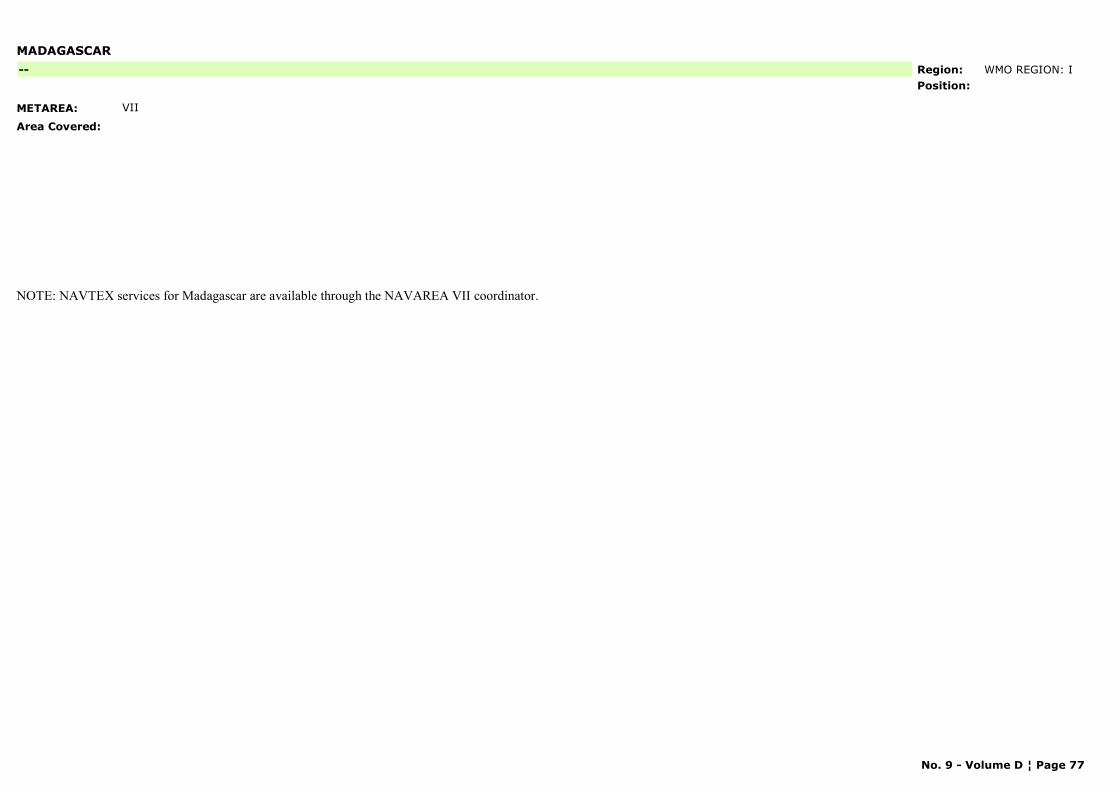
MADAGASCAR
METAREA: VII
Area Covered:
Region: WMO REGION: IPosition:
--
NOTE: NAVTEX services for Madagascar are available through the NAVAREA VII coordinator.
No. 9 - Volume D ¦ Page 77
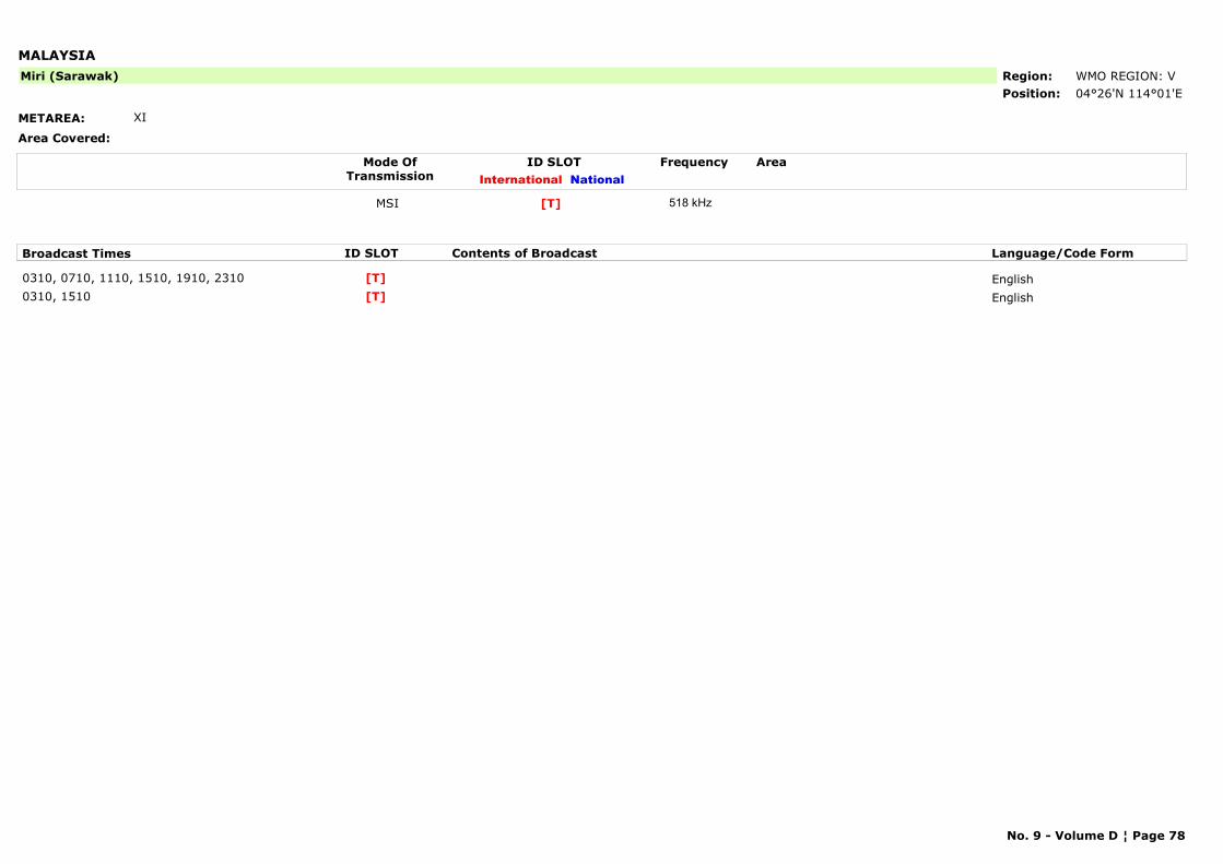
MALAYSIA
METAREA: XI
Area Covered:
Region: WMO REGION: VPosition: 04°26'N 114°01'E
Miri (Sarawak)
Mode OfTransmission
ID SLOT AreaInternational National
Frequency
MSI [T] 518 kHz
Broadcast Times ID SLOT Contents of Broadcast Language/Code Form
0310, 0710, 1110, 1510, 1910, 2310 English[T]0310, 1510 English[T]
No. 9 - Volume D ¦ Page 78
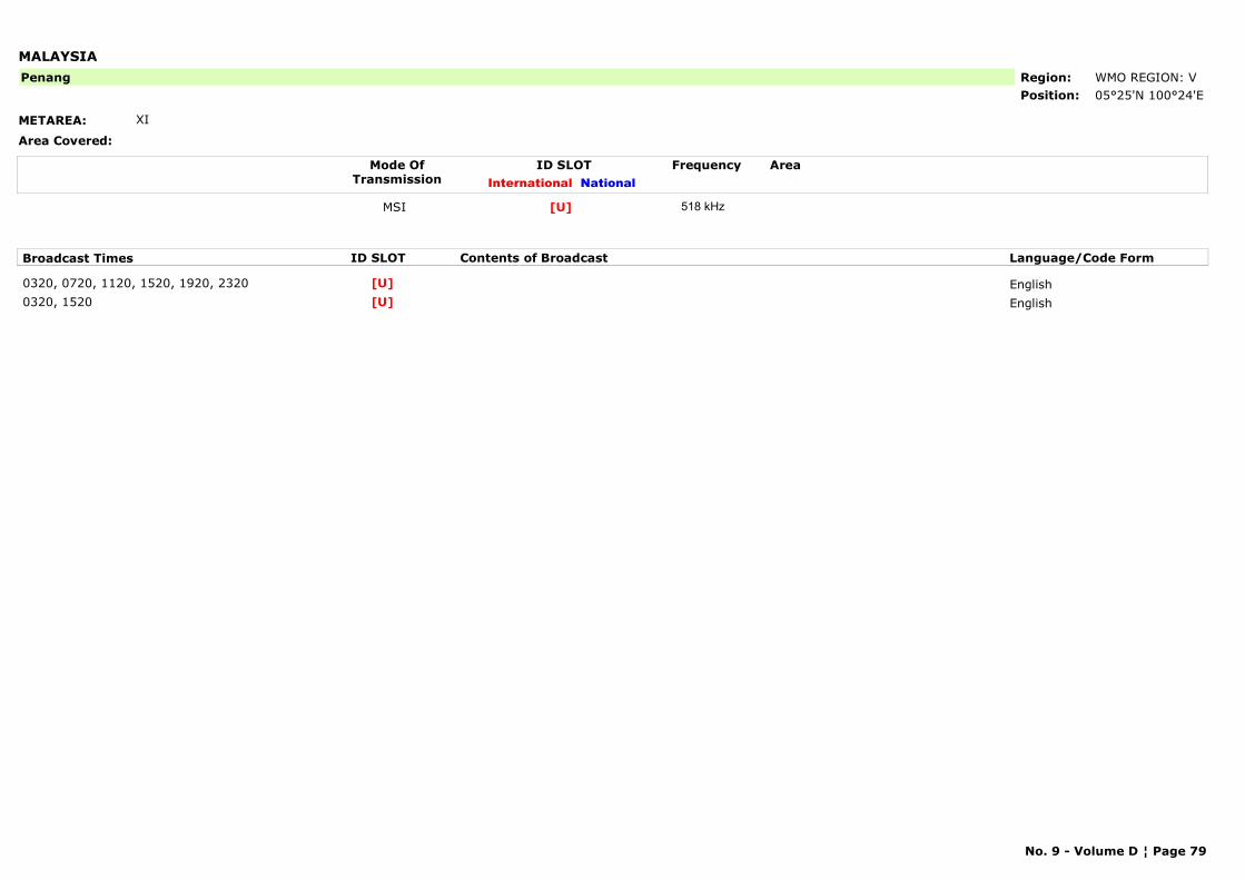
MALAYSIA
METAREA: XI
Area Covered:
Region: WMO REGION: VPosition: 05°25'N 100°24'E
Penang
Mode OfTransmission
ID SLOT AreaInternational National
Frequency
MSI [U] 518 kHz
Broadcast Times ID SLOT Contents of Broadcast Language/Code Form
0320, 0720, 1120, 1520, 1920, 2320 English[U]0320, 1520 English[U]
No. 9 - Volume D ¦ Page 79
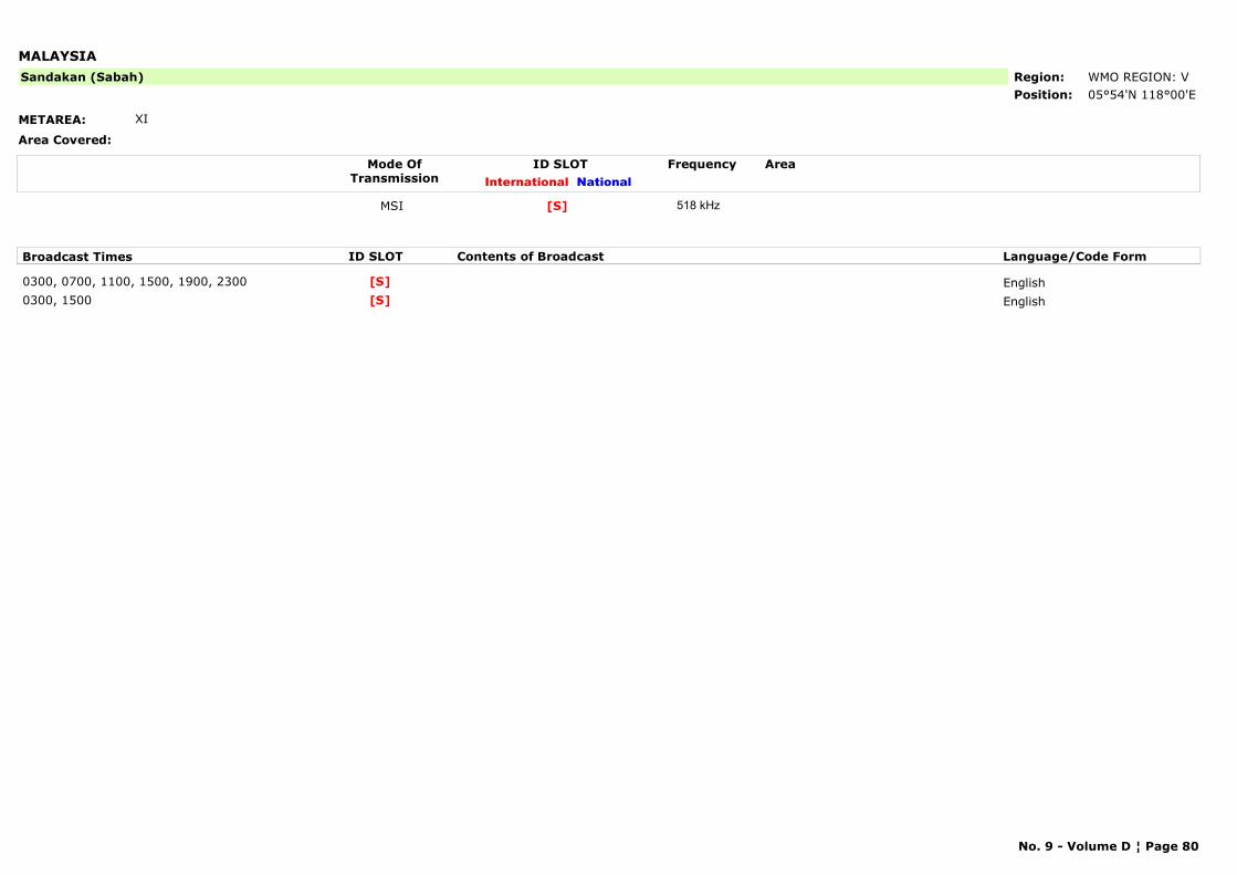
MALAYSIA
METAREA: XI
Area Covered:
Region: WMO REGION: VPosition: 05°54'N 118°00'E
Sandakan (Sabah)
Mode OfTransmission
ID SLOT AreaInternational National
Frequency
MSI [S] 518 kHz
Broadcast Times ID SLOT Contents of Broadcast Language/Code Form
0300, 0700, 1100, 1500, 1900, 2300 English[S]0300, 1500 English[S]
No. 9 - Volume D ¦ Page 80
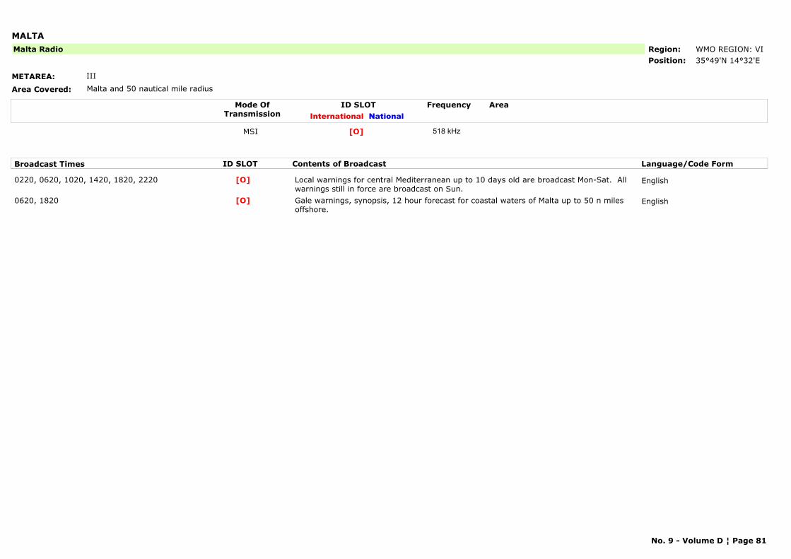
MALTA
METAREA: III
Area Covered: Malta and 50 nautical mile radius
Region: WMO REGION: VIPosition: 35°49'N 14°32'E
Malta Radio
Mode OfTransmission
ID SLOT AreaInternational National
Frequency
MSI [O] 518 kHz
Broadcast Times ID SLOT Contents of Broadcast Language/Code Form
0220, 0620, 1020, 1420, 1820, 2220 Local warnings for central Mediterranean up to 10 days old are broadcast Mon-Sat. All warnings still in force are broadcast on Sun.
English[O]
0620, 1820 Gale warnings, synopsis, 12 hour forecast for coastal waters of Malta up to 50 n miles offshore.
English[O]
No. 9 - Volume D ¦ Page 81
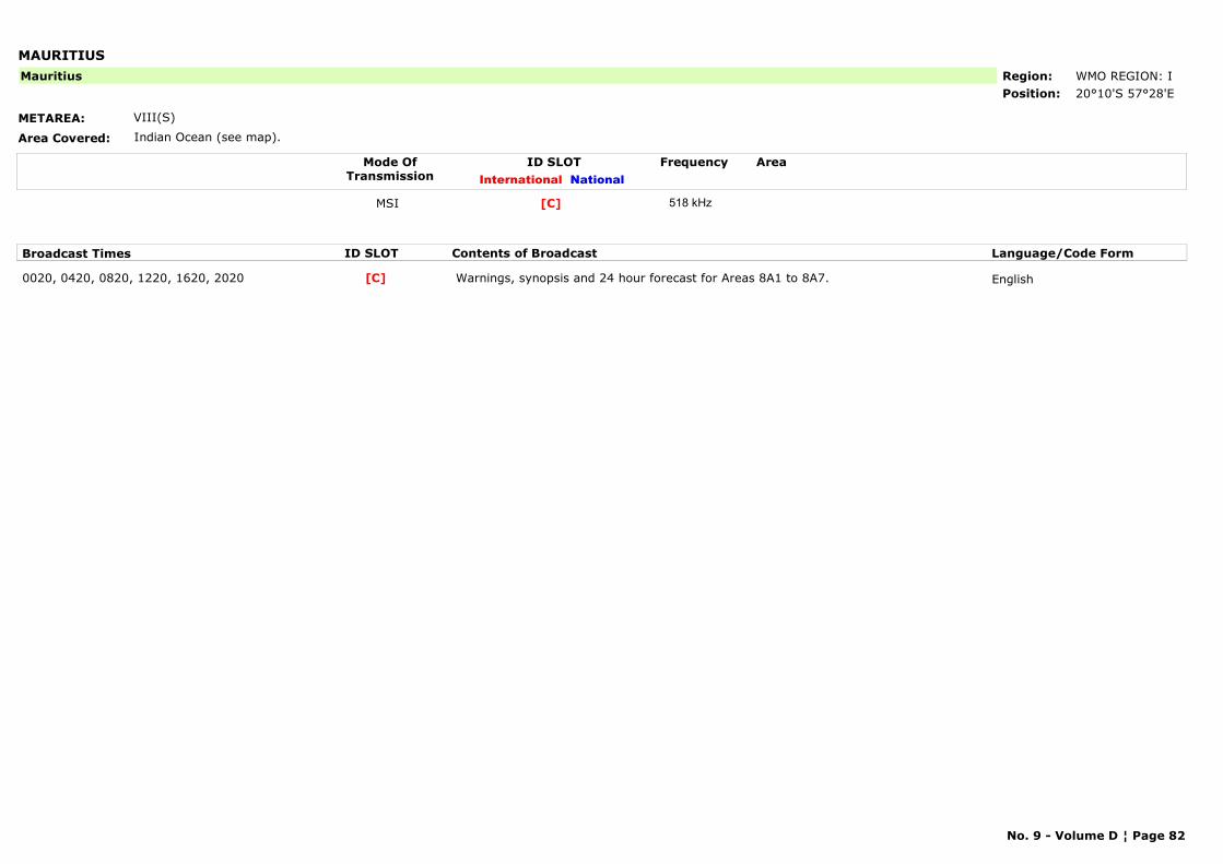
MAURITIUS
METAREA: VIII(S)
Area Covered: Indian Ocean (see map).
Region: WMO REGION: IPosition: 20°10'S 57°28'E
Mauritius
Mode OfTransmission
ID SLOT AreaInternational National
Frequency
MSI [C] 518 kHz
Broadcast Times ID SLOT Contents of Broadcast Language/Code Form
0020, 0420, 0820, 1220, 1620, 2020 Warnings, synopsis and 24 hour forecast for Areas 8A1 to 8A7. English[C]
No. 9 - Volume D ¦ Page 82
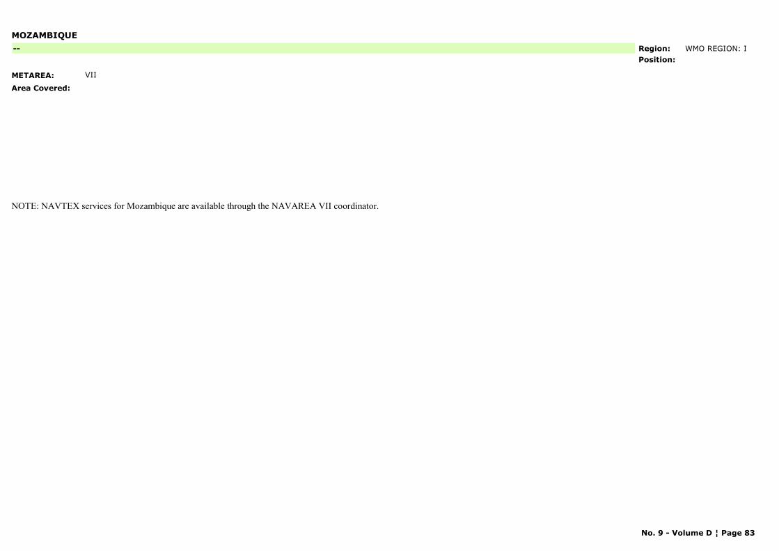
MOZAMBIQUE
METAREA: VII
Area Covered:
Region: WMO REGION: IPosition:
--
NOTE: NAVTEX services for Mozambique are available through the NAVAREA VII coordinator.
No. 9 - Volume D ¦ Page 83
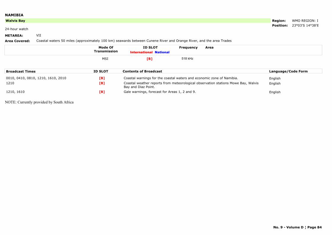
NAMIBIA
METAREA: VII
Area Covered: Coastal waters 50 miles (approximately 100 km) seawards between Cunene River and Orange River, and the area Trades
Region: WMO REGION: IPosition: 23°03'S 14°38'E
Walvis Bay
24-hour watch
Mode OfTransmission
ID SLOT AreaInternational National
Frequency
MSI [B] 518 kHz
Broadcast Times ID SLOT Contents of Broadcast Language/Code Form
0010, 0410, 0810, 1210, 1610, 2010 Coastal warnings for the coastal waters and economic zone of Namibia. English[B]1210 Coastal weather reports from meteorological observation stations Mowe Bay, Walvis
Bay and Diaz Point.English[B]
1210, 1610 Gale warnings, forecast for Areas 1, 2 and 9. English[B]
NOTE: Currently provided by South Africa
No. 9 - Volume D ¦ Page 84
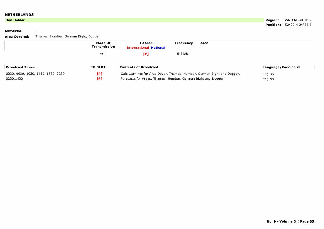
NETHERLANDS
METAREA: I
Area Covered: Thames, Humber, German Bight, Dogge
Region: WMO REGION: VIPosition: 52°27'N 04°35'E
Den Helder
Mode OfTransmission
ID SLOT AreaInternational National
Frequency
MSI [P] 518 kHz
Broadcast Times ID SLOT Contents of Broadcast Language/Code Form
0230, 0630, 1030, 1430, 1830, 2230 Gale warnings for Aras Dover, Thames, Humber, German Bight and Dogger. English[P]0230,1430 Forecasts for Areas: Thames, Humber, German Bight and Dogger. English[P]
No. 9 - Volume D ¦ Page 85
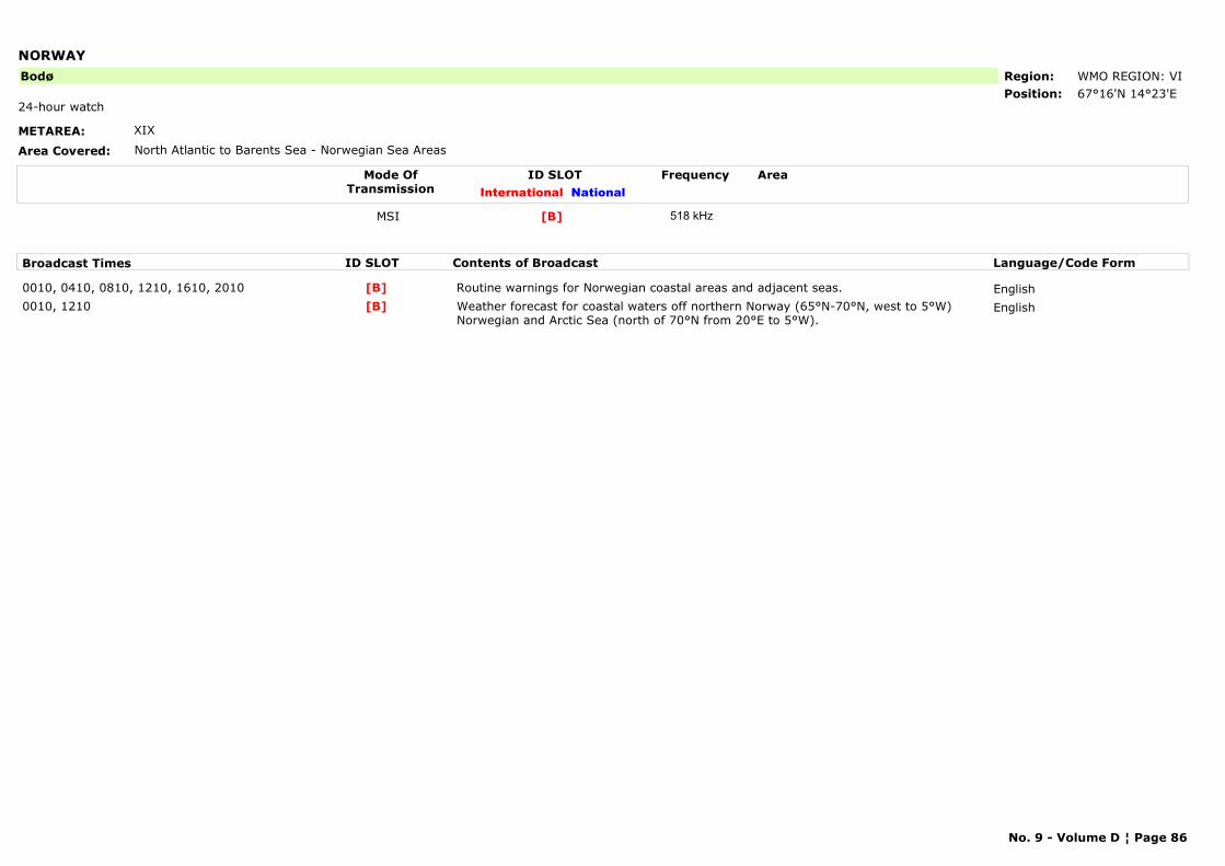
NORWAY
METAREA: XIX
Area Covered: North Atlantic to Barents Sea - Norwegian Sea Areas
Region: WMO REGION: VIPosition: 67°16'N 14°23'E
Bodø
24-hour watch
Mode OfTransmission
ID SLOT AreaInternational National
Frequency
MSI [B] 518 kHz
Broadcast Times ID SLOT Contents of Broadcast Language/Code Form
0010, 0410, 0810, 1210, 1610, 2010 Routine warnings for Norwegian coastal areas and adjacent seas. English[B]0010, 1210 Weather forecast for coastal waters off northern Norway (65°N-70°N, west to 5°W)
Norwegian and Arctic Sea (north of 70°N from 20°E to 5°W).English[B]
No. 9 - Volume D ¦ Page 86
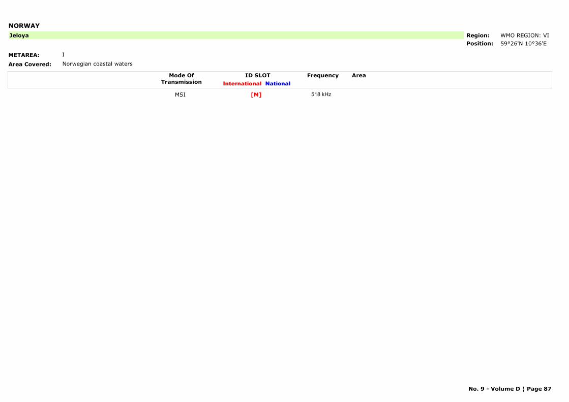
NORWAY
METAREA: I
Area Covered: Norwegian coastal waters
Region: WMO REGION: VIPosition: 59°26'N 10°36'E
Jeloya
Mode OfTransmission
ID SLOT AreaInternational National
Frequency
MSI [M] 518 kHz
No. 9 - Volume D ¦ Page 87
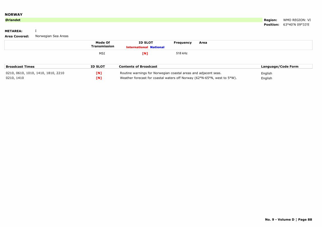
NORWAY
METAREA: I
Area Covered: Norwegian Sea Areas
Region: WMO REGION: VIPosition: 63°40'N 09°33'E
Ørlandet
Mode OfTransmission
ID SLOT AreaInternational National
Frequency
MSI [N] 518 kHz
Broadcast Times ID SLOT Contents of Broadcast Language/Code Form
0210, 0610, 1010, 1410, 1810, 2210 Routine warnings for Norwegian coastal areas and adjacent seas. English[N]0210, 1410 Weather forecast for coastal waters off Norway (62°N-65°N, west to 5°W). English[N]
No. 9 - Volume D ¦ Page 88
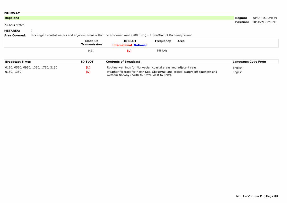
NORWAY
METAREA: I
Area Covered: Norwegian coastal waters and adjacent areas within the economic zone (200 n.m.) - N.Sea/Gulf of Bothania/Finland
Region: WMO REGION: VIPosition: 58°45'N 05°38'E
Rogaland
24-hour watch
Mode OfTransmission
ID SLOT AreaInternational National
Frequency
MSI [L] 518 kHz
Broadcast Times ID SLOT Contents of Broadcast Language/Code Form
0150, 0550, 0950, 1350, 1750, 2150 Routine warnings for Norwegian coastal areas and adjacent seas. English[L]0150, 1350 Weather forecast for North Sea, Skagerrak and coastal waters off southern and
western Norway (north to 62°N, west to 0°W).English[L]
No. 9 - Volume D ¦ Page 89
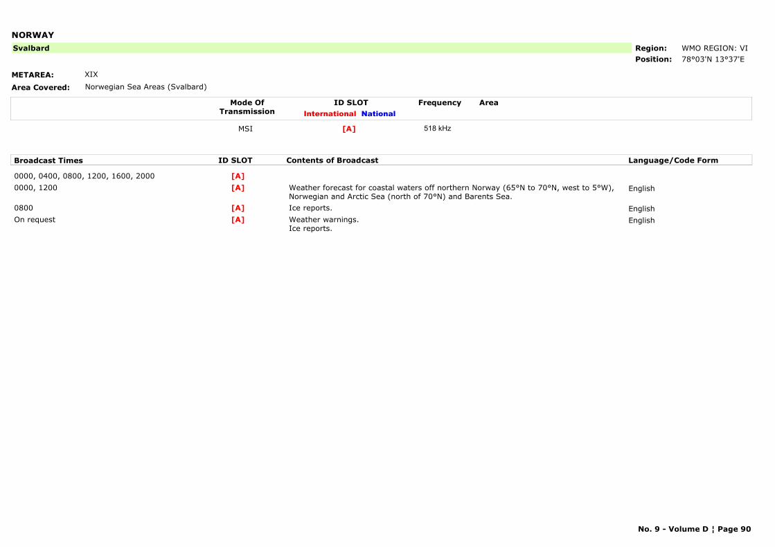
NORWAY
METAREA: XIX
Area Covered: Norwegian Sea Areas (Svalbard)
Region: WMO REGION: VIPosition: 78°03'N 13°37'E
Svalbard
Mode OfTransmission
ID SLOT AreaInternational National
Frequency
MSI [A] 518 kHz
Broadcast Times ID SLOT Contents of Broadcast Language/Code Form
0000, 0400, 0800, 1200, 1600, 2000 [A]0000, 1200 Weather forecast for coastal waters off northern Norway (65°N to 70°N, west to 5°W),
Norwegian and Arctic Sea (north of 70°N) and Barents Sea.English[A]
0800 Ice reports. English[A]On request Weather warnings.
Ice reports.English[A]
No. 9 - Volume D ¦ Page 90
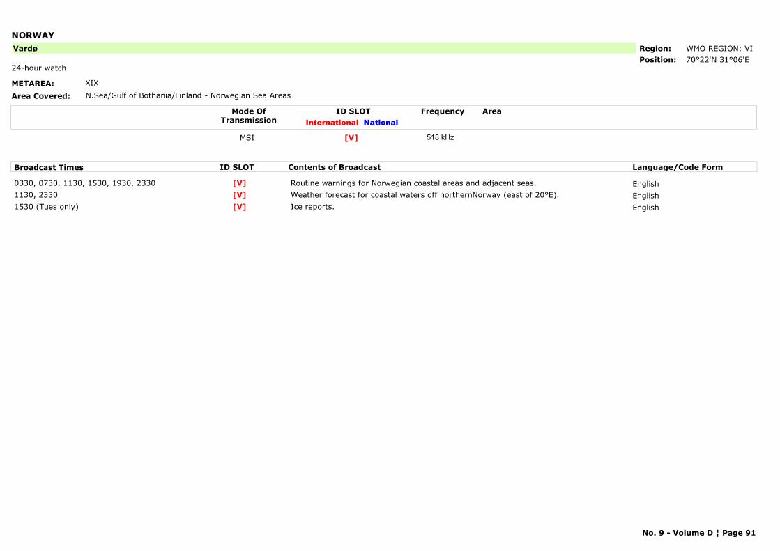
NORWAY
METAREA: XIX
Area Covered: N.Sea/Gulf of Bothania/Finland - Norwegian Sea Areas
Region: WMO REGION: VIPosition: 70°22'N 31°06'E
Vardø
24-hour watch
Mode OfTransmission
ID SLOT AreaInternational National
Frequency
MSI [V] 518 kHz
Broadcast Times ID SLOT Contents of Broadcast Language/Code Form
0330, 0730, 1130, 1530, 1930, 2330 Routine warnings for Norwegian coastal areas and adjacent seas. English[V]1130, 2330 Weather forecast for coastal waters off northernNorway (east of 20°E). English[V]1530 (Tues only) Ice reports. English[V]
No. 9 - Volume D ¦ Page 91
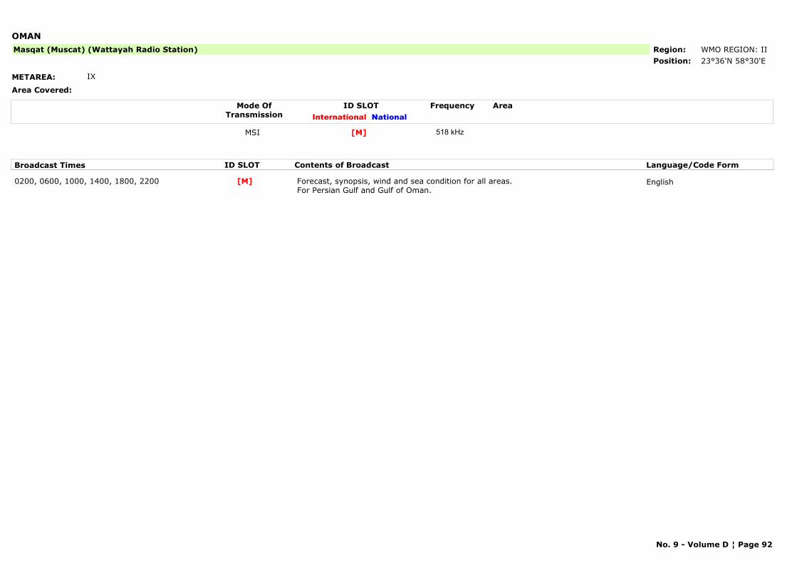
OMAN
METAREA: IX
Area Covered:
Region: WMO REGION: IIPosition: 23°36'N 58°30'E
Masqat (Muscat) (Wattayah Radio Station)
Mode OfTransmission
ID SLOT AreaInternational National
Frequency
MSI [M] 518 kHz
Broadcast Times ID SLOT Contents of Broadcast Language/Code Form
0200, 0600, 1000, 1400, 1800, 2200 Forecast, synopsis, wind and sea condition for all areas.For Persian Gulf and Gulf of Oman.
English[M]
No. 9 - Volume D ¦ Page 92
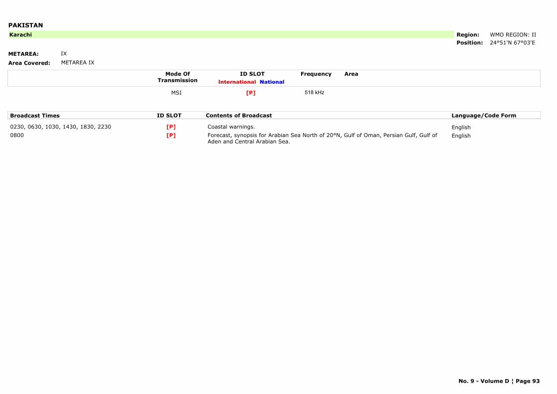
PAKISTAN
METAREA: IX
Area Covered: METAREA IX
Region: WMO REGION: IIPosition: 24°51'N 67°03'E
Karachi
Mode OfTransmission
ID SLOT AreaInternational National
Frequency
MSI [P] 518 kHz
Broadcast Times ID SLOT Contents of Broadcast Language/Code Form
0230, 0630, 1030, 1430, 1830, 2230 Coastal warnings. English[P]0800 Forecast, synopsis for Arabian Sea North of 20°N, Gulf of Oman, Persian Gulf, Gulf of
Aden and Central Arabian Sea.English[P]
No. 9 - Volume D ¦ Page 93
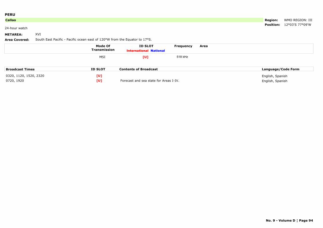
PERU
METAREA: XVI
Area Covered: South East Pacific - Pacific ocean east of 120°W from the Equator to 17°S.
Region: WMO REGION: IIIPosition: 12°03'S 77°09'W
Callao
24-hour watch
Mode OfTransmission
ID SLOT AreaInternational National
Frequency
MSI [U] 518 kHz
Broadcast Times ID SLOT Contents of Broadcast Language/Code Form
0320, 1120, 1520, 2320 English, Spanish[U]0720, 1920 Forecast and sea state for Areas I-IV. English, Spanish[U]
No. 9 - Volume D ¦ Page 94
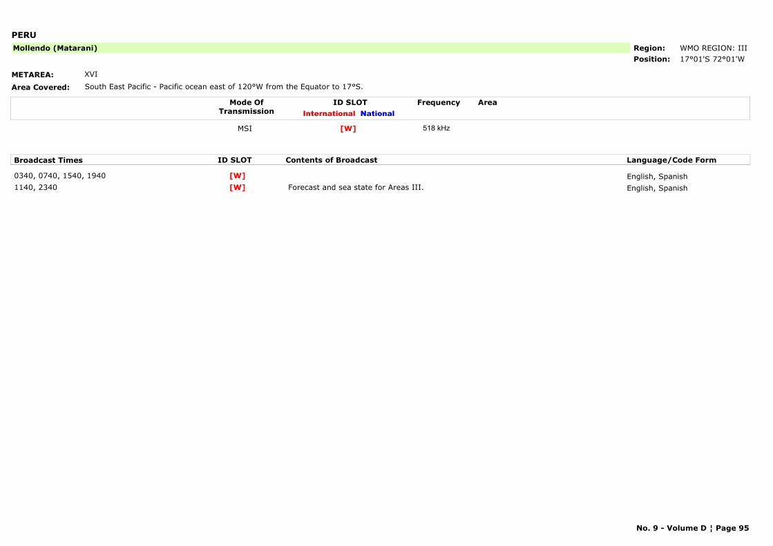
PERU
METAREA: XVI
Area Covered: South East Pacific - Pacific ocean east of 120°W from the Equator to 17°S.
Region: WMO REGION: IIIPosition: 17°01'S 72°01'W
Mollendo (Matarani)
Mode OfTransmission
ID SLOT AreaInternational National
Frequency
MSI [W] 518 kHz
Broadcast Times ID SLOT Contents of Broadcast Language/Code Form
0340, 0740, 1540, 1940 English, Spanish[W]1140, 2340 Forecast and sea state for Areas III. English, Spanish[W]
No. 9 - Volume D ¦ Page 95

PERU
METAREA: XVI
Area Covered: South East Pacific - Pacific ocean east of 120°W from the Equator to 17°S.
Region: WMO REGION: IIIPosition: 5°05'S 81°07'W
Paita
Mode OfTransmission
ID SLOT AreaInternational National
Frequency
MSI [S] 518 kHz
Broadcast Times ID SLOT Contents of Broadcast Language/Code Form
0300, 1500 Forecast and sea state for Areas I. English, Spanish[S]0700, 1100, 1900, 2300 Forecast and sea state for Areas I. English, Spanish[S]
No. 9 - Volume D ¦ Page 96
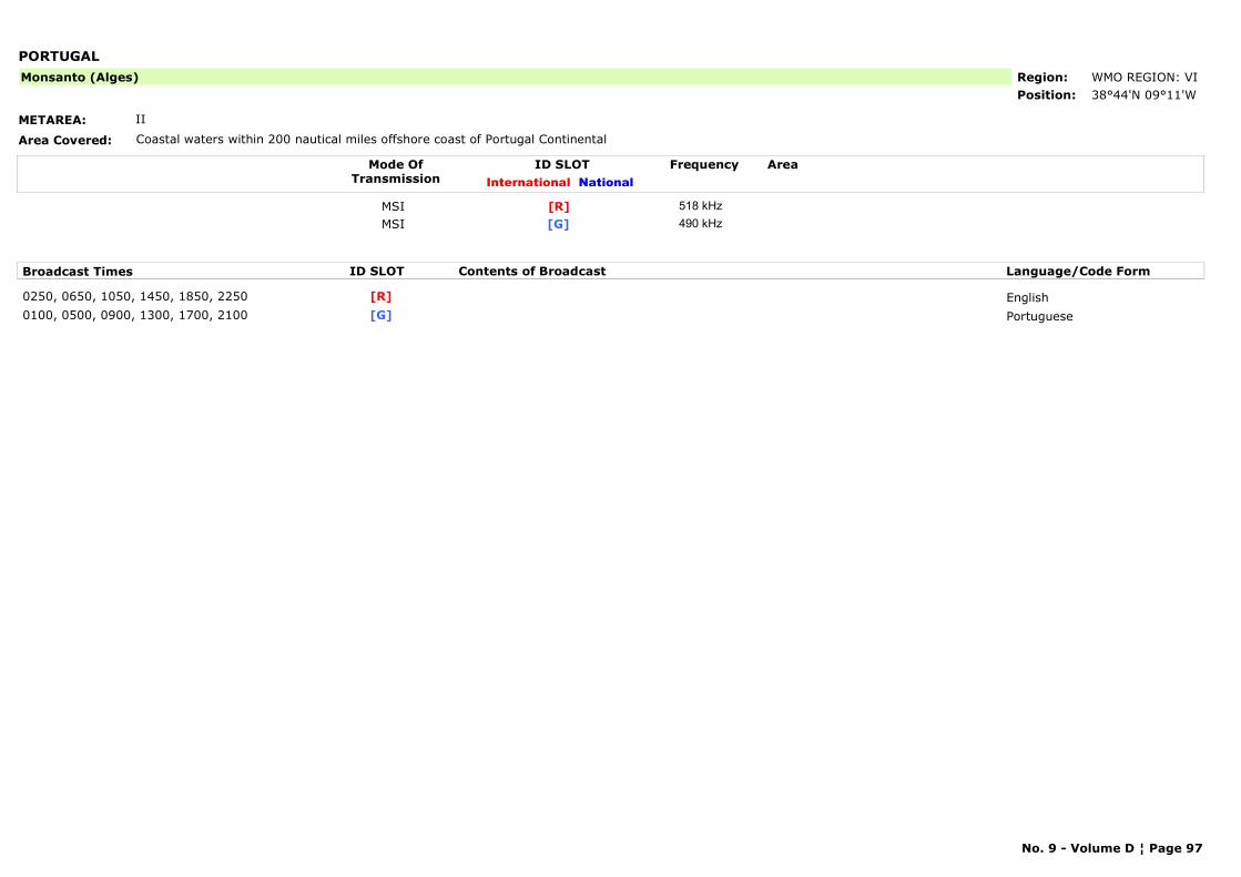
PORTUGAL
METAREA: II
Area Covered: Coastal waters within 200 nautical miles offshore coast of Portugal Continental
Region: WMO REGION: VIPosition: 38°44'N 09°11'W
Monsanto (Alges)
Mode OfTransmission
ID SLOT AreaInternational National
Frequency
MSI [R] 518 kHzMSI [G] 490 kHz
Broadcast Times ID SLOT Contents of Broadcast Language/Code Form
0250, 0650, 1050, 1450, 1850, 2250 English[R]0100, 0500, 0900, 1300, 1700, 2100 Portuguese[G]
No. 9 - Volume D ¦ Page 97
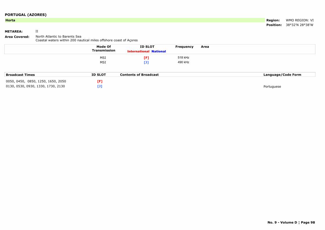
PORTUGAL (AZORES)
METAREA: II
Area Covered: North Atlantic to Barents SeaCoastal waters within 200 nautical miles offshore coast of Açores
Region: WMO REGION: VIPosition: 38°32'N 28°38'W
Horta
Mode OfTransmission
ID SLOT AreaInternational National
Frequency
MSI [F] 518 kHzMSI [J] 490 kHz
Broadcast Times ID SLOT Contents of Broadcast Language/Code Form
0050, 0450, 0850, 1250, 1650, 2050 [F]0130, 0530, 0930, 1330, 1730, 2130 Portuguese[J]
No. 9 - Volume D ¦ Page 98
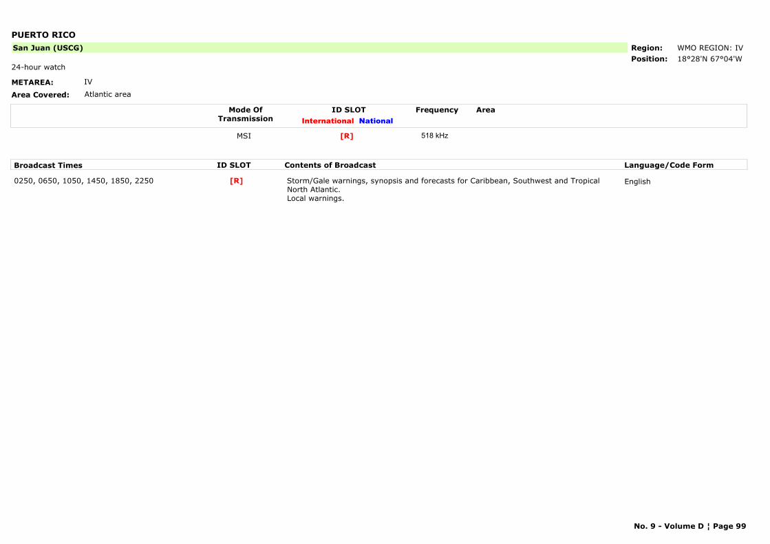
PUERTO RICO
METAREA: IV
Area Covered: Atlantic area
Region: WMO REGION: IVPosition: 18°28'N 67°04'W
San Juan (USCG)
24-hour watch
Mode OfTransmission
ID SLOT AreaInternational National
Frequency
MSI [R] 518 kHz
Broadcast Times ID SLOT Contents of Broadcast Language/Code Form
0250, 0650, 1050, 1450, 1850, 2250 Storm/Gale warnings, synopsis and forecasts for Caribbean, Southwest and Tropical North Atlantic. Local warnings.
English[R]
No. 9 - Volume D ¦ Page 99
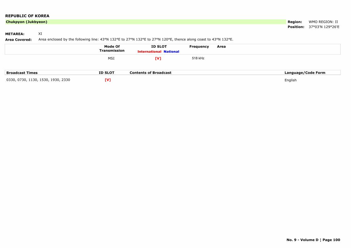
REPUBLIC OF KOREA
METAREA: XI
Area Covered: Area enclosed by the following line: 43°N 132°E to 27°N 132°E to 27°N 120°E, thence along coast to 43°N 132°E.
Region: WMO REGION: IIPosition: 37°03'N 129°26'E
Chukpyon (Jukbyeon)
Mode OfTransmission
ID SLOT AreaInternational National
Frequency
MSI [V] 518 kHz
Broadcast Times ID SLOT Contents of Broadcast Language/Code Form
0330, 0730, 1130, 1530, 1930, 2330 English[V]
No. 9 - Volume D ¦ Page 100
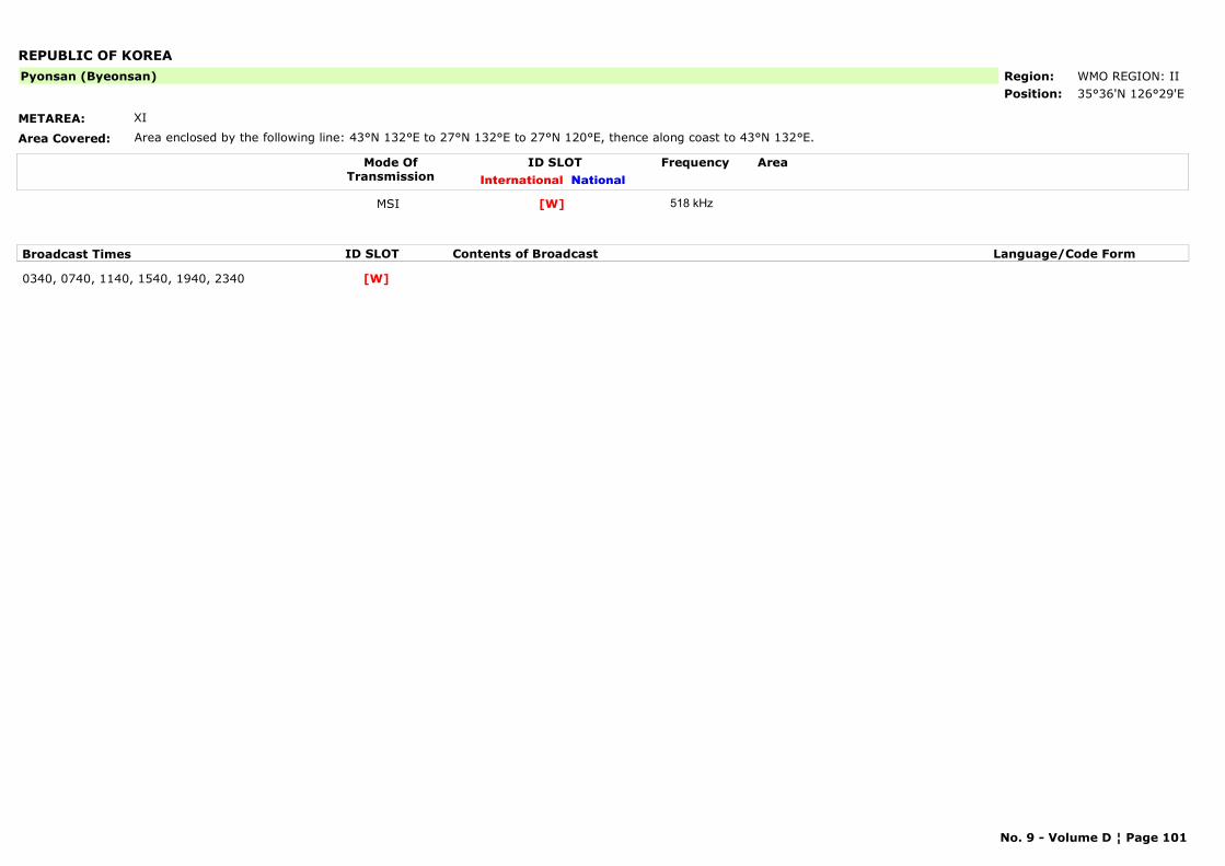
REPUBLIC OF KOREA
METAREA: XI
Area Covered: Area enclosed by the following line: 43°N 132°E to 27°N 132°E to 27°N 120°E, thence along coast to 43°N 132°E.
Region: WMO REGION: IIPosition: 35°36'N 126°29'E
Pyonsan (Byeonsan)
Mode OfTransmission
ID SLOT AreaInternational National
Frequency
MSI [W] 518 kHz
Broadcast Times ID SLOT Contents of Broadcast Language/Code Form
0340, 0740, 1140, 1540, 1940, 2340 [W]
No. 9 - Volume D ¦ Page 101
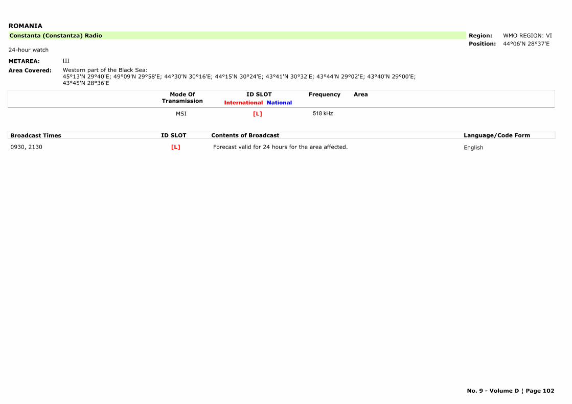
ROMANIA
METAREA: III
Area Covered: Western part of the Black Sea:45°13'N 29°40'E; 49°09'N 29°58'E; 44°30'N 30°16'E; 44°15'N 30°24'E; 43°41'N 30°32'E; 43°44'N 29°02'E; 43°40'N 29°00'E; 43°45'N 28°36'E
Region: WMO REGION: VIPosition: 44°06'N 28°37'E
Constanta (Constantza) Radio
24-hour watch
Mode OfTransmission
ID SLOT AreaInternational National
Frequency
MSI [L] 518 kHz
Broadcast Times ID SLOT Contents of Broadcast Language/Code Form
0930, 2130 Forecast valid for 24 hours for the area affected. English[L]
No. 9 - Volume D ¦ Page 102
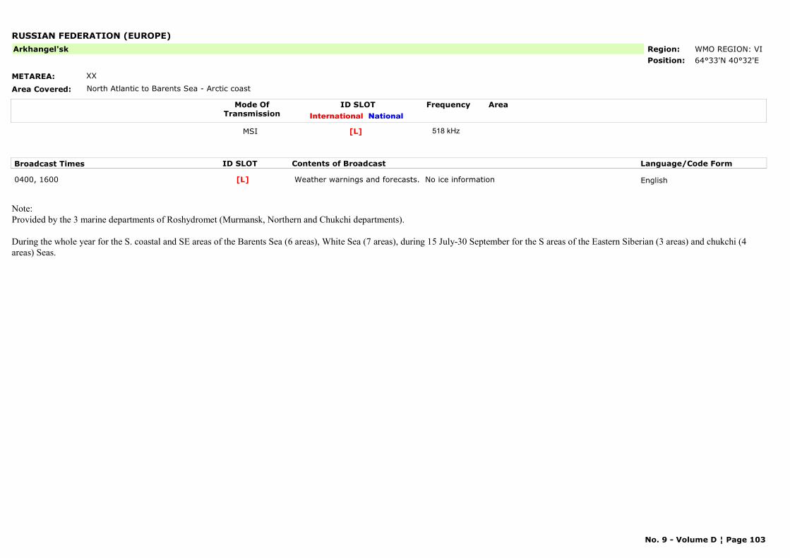
RUSSIAN FEDERATION (EUROPE)
METAREA: XX
Area Covered: North Atlantic to Barents Sea - Arctic coast
Region: WMO REGION: VIPosition: 64°33'N 40°32'E
Arkhangel'sk
Mode OfTransmission
ID SLOT AreaInternational National
Frequency
MSI [L] 518 kHz
Broadcast Times ID SLOT Contents of Broadcast Language/Code Form
0400, 1600 Weather warnings and forecasts. No ice information English[L]
Note: Provided by the 3 marine departments of Roshydromet (Murmansk, Northern and Chukchi departments).
During the whole year for the S. coastal and SE areas of the Barents Sea (6 areas), White Sea (7 areas), during 15 July-30 September for the S areas of the Eastern Siberian (3 areas) and chukchi (4 areas) Seas.
No. 9 - Volume D ¦ Page 103
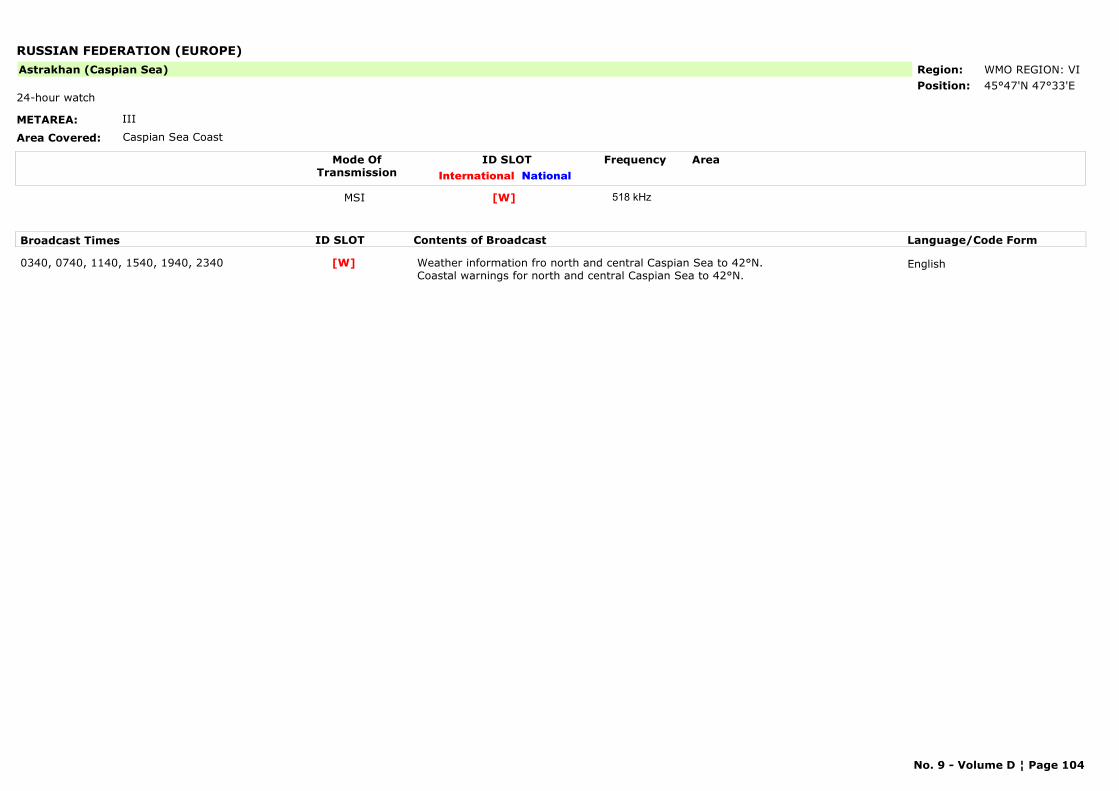
RUSSIAN FEDERATION (EUROPE)
METAREA: III
Area Covered: Caspian Sea Coast
Region: WMO REGION: VIPosition: 45°47'N 47°33'E
Astrakhan (Caspian Sea)
24-hour watch
Mode OfTransmission
ID SLOT AreaInternational National
Frequency
MSI [W] 518 kHz
Broadcast Times ID SLOT Contents of Broadcast Language/Code Form
0340, 0740, 1140, 1540, 1940, 2340 Weather information fro north and central Caspian Sea to 42°N. Coastal warnings for north and central Caspian Sea to 42°N.
English[W]
No. 9 - Volume D ¦ Page 104
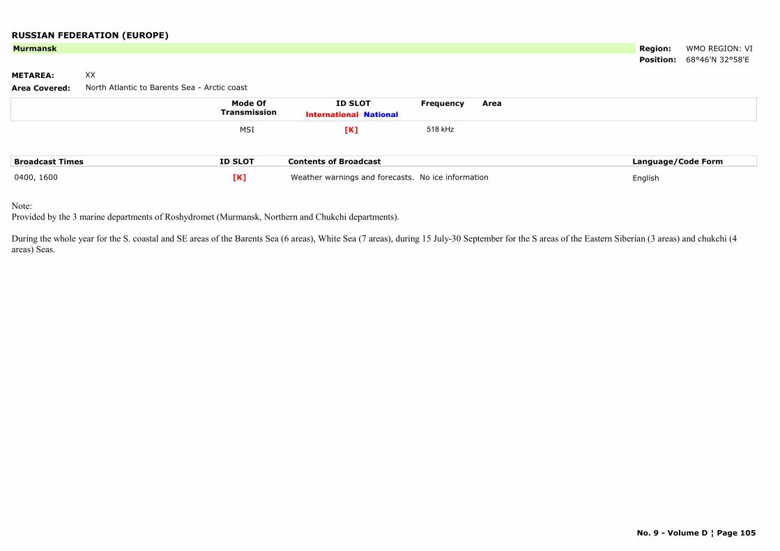
RUSSIAN FEDERATION (EUROPE)
METAREA: XX
Area Covered: North Atlantic to Barents Sea - Arctic coast
Region: WMO REGION: VIPosition: 68°46'N 32°58'E
Murmansk
Mode OfTransmission
ID SLOT AreaInternational National
Frequency
MSI [K] 518 kHz
Broadcast Times ID SLOT Contents of Broadcast Language/Code Form
0400, 1600 Weather warnings and forecasts. No ice information English[K]
Note: Provided by the 3 marine departments of Roshydromet (Murmansk, Northern and Chukchi departments).
During the whole year for the S. coastal and SE areas of the Barents Sea (6 areas), White Sea (7 areas), during 15 July-30 September for the S areas of the Eastern Siberian (3 areas) and chukchi (4 areas) Seas.
No. 9 - Volume D ¦ Page 105
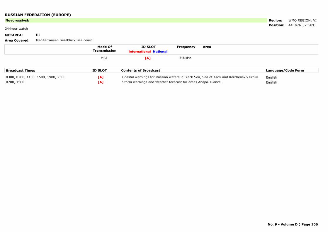
RUSSIAN FEDERATION (EUROPE)
METAREA: III
Area Covered: Mediterranean Sea/Black Sea coast
Region: WMO REGION: VIPosition: 44°36'N 37°58'E
Novorossiysk
24-hour watch
Mode OfTransmission
ID SLOT AreaInternational National
Frequency
MSI [A] 518 kHz
Broadcast Times ID SLOT Contents of Broadcast Language/Code Form
0300, 0700, 1100, 1500, 1900, 2300 Coastal warnings for Russian waters in Black Sea, Sea of Azov and Kerchenskiy Proliv. English[A]0700, 1500 Storm warnings and weather forecast for areas Anapa-Tuance. English[A]
No. 9 - Volume D ¦ Page 106
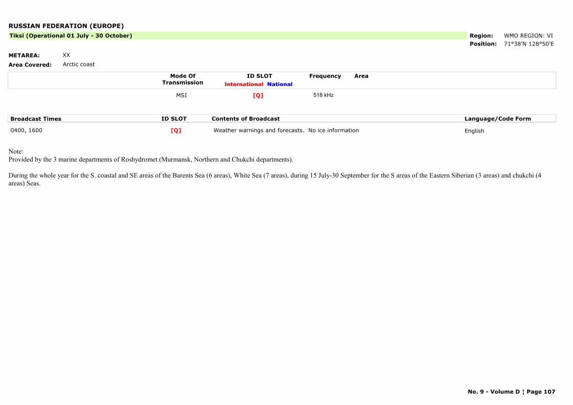
RUSSIAN FEDERATION (EUROPE)
METAREA: XX
Area Covered: Arctic coast
Region: WMO REGION: VIPosition: 71°38'N 128°50'E
Tiksi (Operational 01 July - 30 October)
Mode OfTransmission
ID SLOT AreaInternational National
Frequency
MSI [Q] 518 kHz
Broadcast Times ID SLOT Contents of Broadcast Language/Code Form
0400, 1600 Weather warnings and forecasts. No ice information English[Q]
Note: Provided by the 3 marine departments of Roshydromet (Murmansk, Northern and Chukchi departments).
During the whole year for the S. coastal and SE areas of the Barents Sea (6 areas), White Sea (7 areas), during 15 July-30 September for the S areas of the Eastern Siberian (3 areas) and chukchi (4 areas) Seas.
No. 9 - Volume D ¦ Page 107
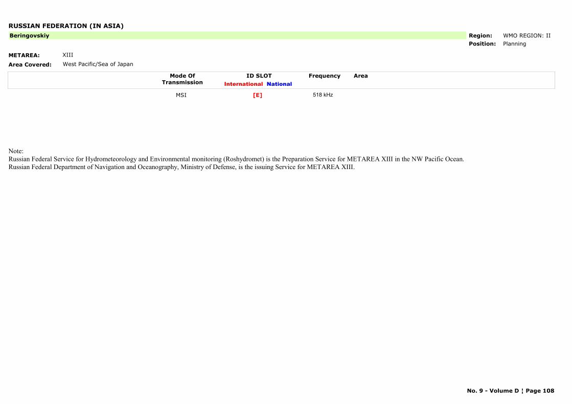
RUSSIAN FEDERATION (IN ASIA)
METAREA: XIII
Area Covered: West Pacific/Sea of Japan
Region: WMO REGION: IIPosition: Planning
Beringovskiy
Mode OfTransmission
ID SLOT AreaInternational National
Frequency
MSI [E] 518 kHz
Note: Russian Federal Service for Hydrometeorology and Environmental monitoring (Roshydromet) is the Preparation Service for METAREA XIII in the NW Pacific Ocean.Russian Federal Department of Navigation and Oceanography, Ministry of Defense, is the issuing Service for METAREA XIII.
No. 9 - Volume D ¦ Page 108
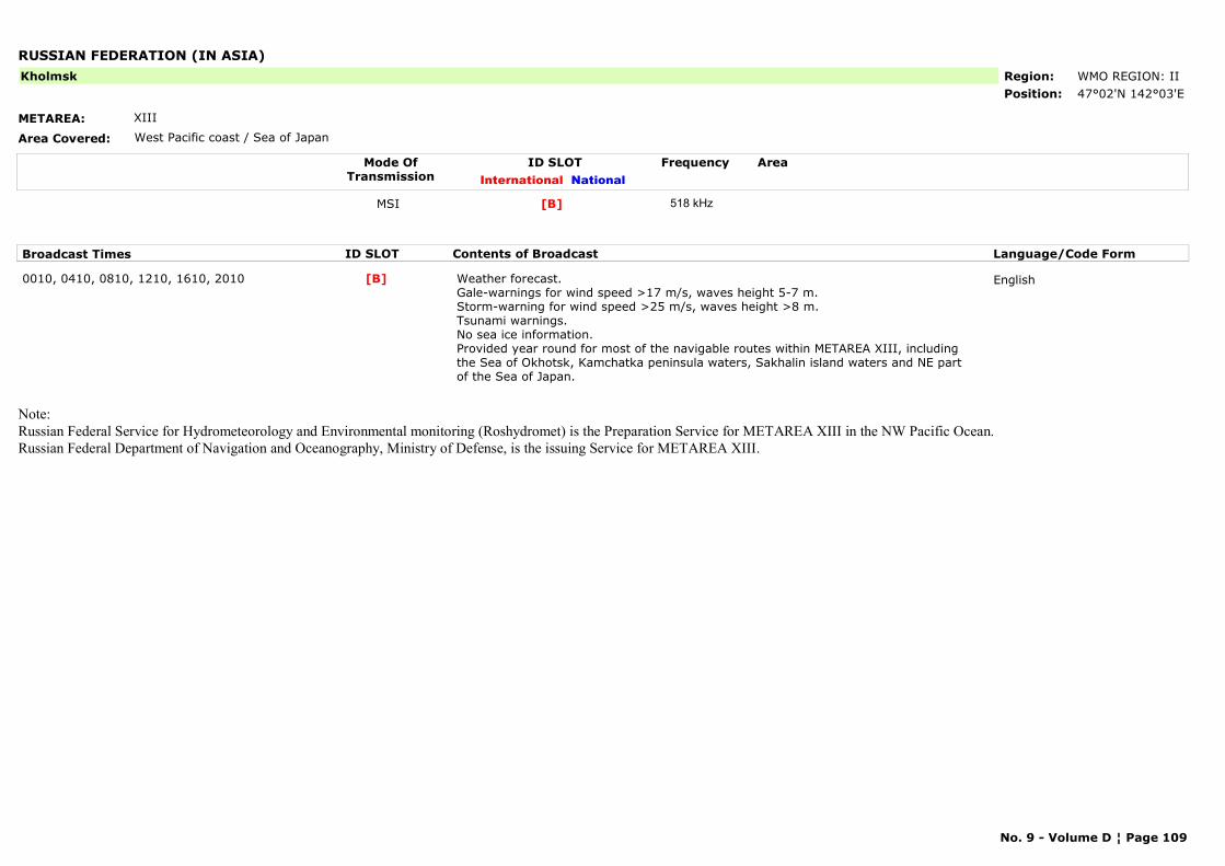
RUSSIAN FEDERATION (IN ASIA)
METAREA: XIII
Area Covered: West Pacific coast / Sea of Japan
Region: WMO REGION: IIPosition: 47°02'N 142°03'E
Kholmsk
Mode OfTransmission
ID SLOT AreaInternational National
Frequency
MSI [B] 518 kHz
Broadcast Times ID SLOT Contents of Broadcast Language/Code Form
0010, 0410, 0810, 1210, 1610, 2010 Weather forecast.Gale-warnings for wind speed >17 m/s, waves height 5-7 m. Storm-warning for wind speed >25 m/s, waves height >8 m.Tsunami warnings. No sea ice information.Provided year round for most of the navigable routes within METAREA XIII, including the Sea of Okhotsk, Kamchatka peninsula waters, Sakhalin island waters and NE part of the Sea of Japan.
English[B]
Note: Russian Federal Service for Hydrometeorology and Environmental monitoring (Roshydromet) is the Preparation Service for METAREA XIII in the NW Pacific Ocean.Russian Federal Department of Navigation and Oceanography, Ministry of Defense, is the issuing Service for METAREA XIII.
No. 9 - Volume D ¦ Page 109

RUSSIAN FEDERATION (IN ASIA)
METAREA: XIII
Area Covered: West Pacific/Sea of Japan
Region: WMO REGION: IIPosition: 59°41'N 150°09'E
Magadan
Mode OfTransmission
ID SLOT AreaInternational National
Frequency
MSI [D] 518 kHz
Broadcast Times ID SLOT Contents of Broadcast Language/Code Form
0030, 0430, 0830, 1230, 1630, 2030 Weather forecast.Gale-warnings for wind speed >17 m/s, waves height 5-7 m. Storm-warning for wind speed >25 m/s, waves height >8 m.Tsunami warnings. No sea ice information.Provided year round for most of the navigable routes within METAREA XIII, including the Sea of Okhotsk, Kamchatka peninsula waters, Sakhalin island waters and NE part of the Sea of Japan.
English[D]
Note: Russian Federal Service for Hydrometeorology and Environmental monitoring (Roshydromet) is the Preparation Service for METAREA XIII in the NW Pacific Ocean.Russian Federal Department of Navigation and Oceanography, Ministry of Defense, is the issuing Service for METAREA XIII.
No. 9 - Volume D ¦ Page 110

RUSSIAN FEDERATION (IN ASIA)
METAREA: XIII
Area Covered: Pacific coast
Region: WMO REGION: IIPosition: 59°22'N 143°12'E
Okhotsk
Mode OfTransmission
ID SLOT AreaInternational National
Frequency
MSI [G] 518 kHz
Broadcast Times ID SLOT Contents of Broadcast Language/Code Form
0100, 0500, 0900, 1300, 1700, 2100 Weather forecast.Gale-warnings for wind speed >17 m/s, waves height 5-7 m. Storm-warning for wind speed >25 m/s, waves height >8 m.Tsunami warnings. No sea ice information.Provided year round for most of the navigable routes within METAREA XIII, including the Sea of Okhotsk, Kamchatka peninsula waters, Sakhalin island waters and NE part of the Sea of Japan.
English[G]
Note: Russian Federal Service for Hydrometeorology and Environmental monitoring (Roshydromet) is the Preparation Service for METAREA XIII in the NW Pacific Ocean.Russian Federal Department of Navigation and Oceanography, Ministry of Defense, is the issuing Service for METAREA XIII.
No. 9 - Volume D ¦ Page 111
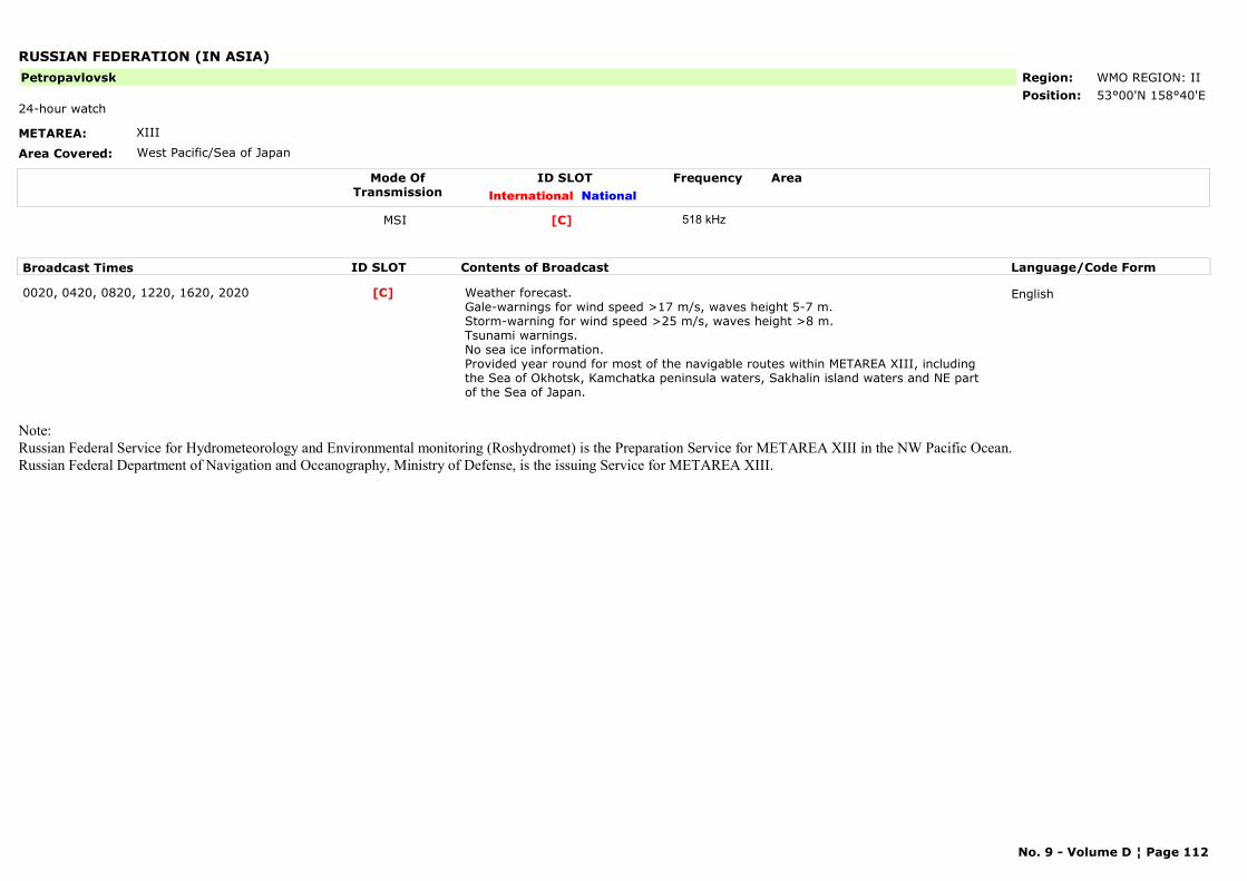
RUSSIAN FEDERATION (IN ASIA)
METAREA: XIII
Area Covered: West Pacific/Sea of Japan
Region: WMO REGION: IIPosition: 53°00'N 158°40'E
Petropavlovsk
24-hour watch
Mode OfTransmission
ID SLOT AreaInternational National
Frequency
MSI [C] 518 kHz
Broadcast Times ID SLOT Contents of Broadcast Language/Code Form
0020, 0420, 0820, 1220, 1620, 2020 Weather forecast.Gale-warnings for wind speed >17 m/s, waves height 5-7 m. Storm-warning for wind speed >25 m/s, waves height >8 m.Tsunami warnings. No sea ice information.Provided year round for most of the navigable routes within METAREA XIII, including the Sea of Okhotsk, Kamchatka peninsula waters, Sakhalin island waters and NE part of the Sea of Japan.
English[C]
Note: Russian Federal Service for Hydrometeorology and Environmental monitoring (Roshydromet) is the Preparation Service for METAREA XIII in the NW Pacific Ocean.Russian Federal Department of Navigation and Oceanography, Ministry of Defense, is the issuing Service for METAREA XIII.
No. 9 - Volume D ¦ Page 112

RUSSIAN FEDERATION (IN ASIA)
METAREA: XIII
Area Covered: West Pacific/Sea of Japan
Region: WMO REGION: IIPosition: 42°23'N 131°54'E
Vladivostok
Mode OfTransmission
ID SLOT AreaInternational National
Frequency
MSI [A] 518 kHz
Broadcast Times ID SLOT Contents of Broadcast Language/Code Form
0000, 0400, 0800, 1200, 1600, 2000 Weather forecast.Gale-warnings for wind speed >17 m/s, waves height 5-7 m. Storm-warning for wind speed >25 m/s, waves height >8 m.Tsunami warnings. No sea ice information.Provided year round for most of the navigable routes within METAREA XIII, including the Sea of Okhotsk, Kamchatka peninsula waters, Sakhalin island waters and NE part of the Sea of Japan.
English[A]
Note: Russian Federal Service for Hydrometeorology and Environmental monitoring (Roshydromet) is the Preparation Service for METAREA XIII in the NW Pacific Ocean.Russian Federal Department of Navigation and Oceanography, Ministry of Defense, is the issuing Service for METAREA XIII.
No. 9 - Volume D ¦ Page 113
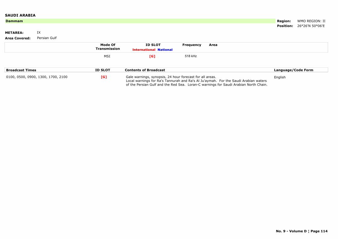
SAUDI ARABIA
METAREA: IX
Area Covered: Persian Gulf
Region: WMO REGION: IIPosition: 26°26'N 50°06'E
Dammam
Mode OfTransmission
ID SLOT AreaInternational National
Frequency
MSI [G] 518 kHz
Broadcast Times ID SLOT Contents of Broadcast Language/Code Form
0100, 0500, 0900, 1300, 1700, 2100 Gale warnings, synopsis, 24 hour forecast for all areas. Local warnings for Ra's Tannurah and Ra's Al Ju'aymah. For the Saudi Arabian waters of the Persian Gulf and the Red Sea. Loran-C warnings for Saudi Arabian North Chain.
English[G]
No. 9 - Volume D ¦ Page 114
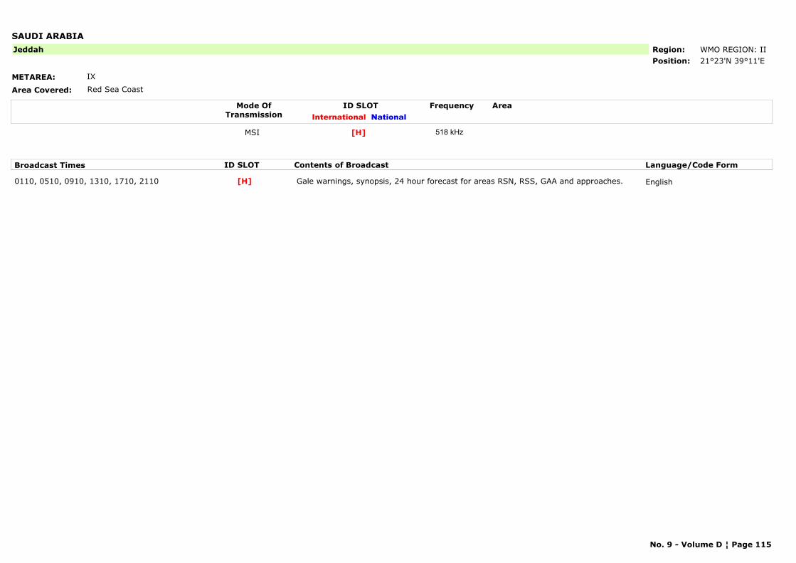
SAUDI ARABIA
METAREA: IX
Area Covered: Red Sea Coast
Region: WMO REGION: IIPosition: 21°23'N 39°11'E
Jeddah
Mode OfTransmission
ID SLOT AreaInternational National
Frequency
MSI [H] 518 kHz
Broadcast Times ID SLOT Contents of Broadcast Language/Code Form
0110, 0510, 0910, 1310, 1710, 2110 Gale warnings, synopsis, 24 hour forecast for areas RSN, RSS, GAA and approaches. English[H]
No. 9 - Volume D ¦ Page 115
SENEGAL
METAREA: II
Area Covered:
Region: WMO REGION: IPosition: 14°46'N 17°21'E
Dakar
Mode OfTransmission
ID SLOT AreaInternational National
Frequency
MSI [C] 518 kHz
No. 9 - Volume D ¦ Page 116
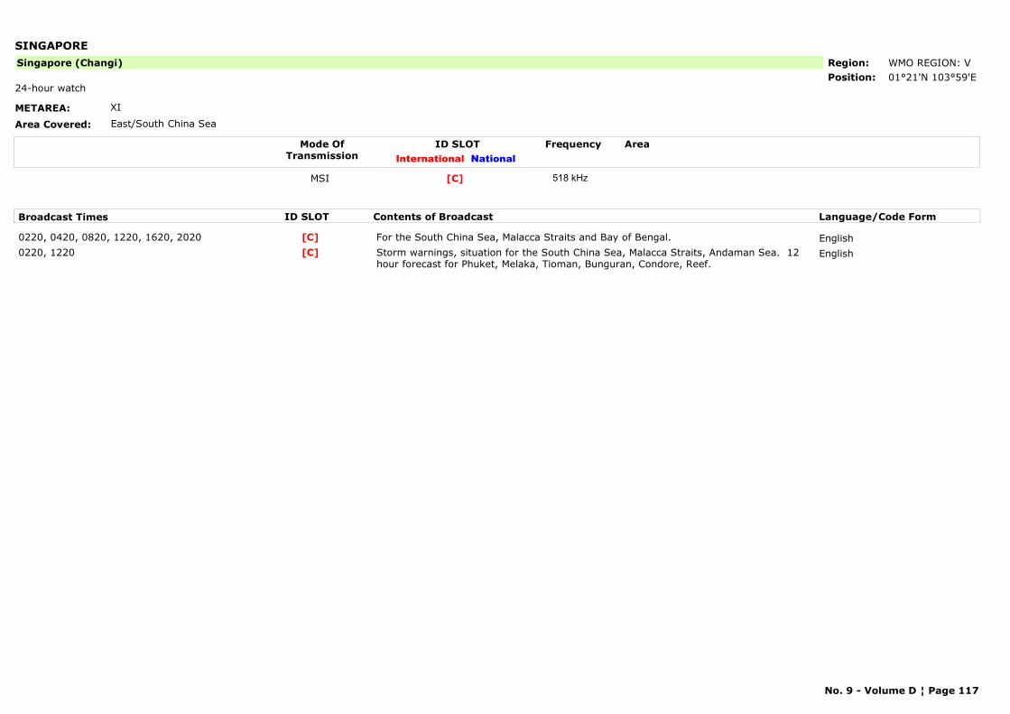
SINGAPORE
METAREA: XI
Area Covered: East/South China Sea
Region: WMO REGION: VPosition: 01°21'N 103°59'E
Singapore (Changi)
24-hour watch
Mode OfTransmission
ID SLOT AreaInternational National
Frequency
MSI [C] 518 kHz
Broadcast Times ID SLOT Contents of Broadcast Language/Code Form
0220, 0420, 0820, 1220, 1620, 2020 For the South China Sea, Malacca Straits and Bay of Bengal. English[C]0220, 1220 Storm warnings, situation for the South China Sea, Malacca Straits, Andaman Sea. 12
hour forecast for Phuket, Melaka, Tioman, Bunguran, Condore, Reef.English[C]
No. 9 - Volume D ¦ Page 117
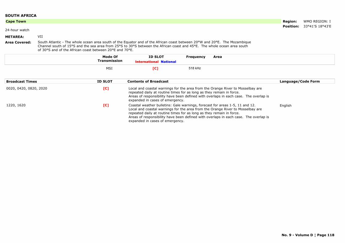
SOUTH AFRICA
METAREA: VII
Area Covered: South Atlantic - The whole ocean area south of the Equator and of the African coast between 20°W and 20°E. The Mozambique Channel south of 15°S and the sea area from 25°S to 30°S between the African coast and 45°E. The whole ocean area south of 30°S and of the African coast between 20°E and 70°E.
Region: WMO REGION: IPosition: 33°41'S 18°43'E
Cape Town
24-hour watch
Mode OfTransmission
ID SLOT AreaInternational National
Frequency
MSI [C] 518 kHz
Broadcast Times ID SLOT Contents of Broadcast Language/Code Form
0020, 0420, 0820, 2020 Local and coastal warnings for the area from the Orange River to Mosselbay are repeated daily at routine times for as long as they remain in force.Areas of responsibility have been defined with overlaps in each case. The overlap is expanded in cases of emergency.
[C]
1220, 1620 Coastal weather bulletins: Gale warnings, forecast for areas 1-5, 11 and 12. Local and coastal warnings for the area from the Orange River to Mosselbay are repeated daily at routine times for as long as they remain in force.Areas of responsibility have been defined with overlaps in each case. The overlap is expanded in cases of emergency.
English[C]
No. 9 - Volume D ¦ Page 118
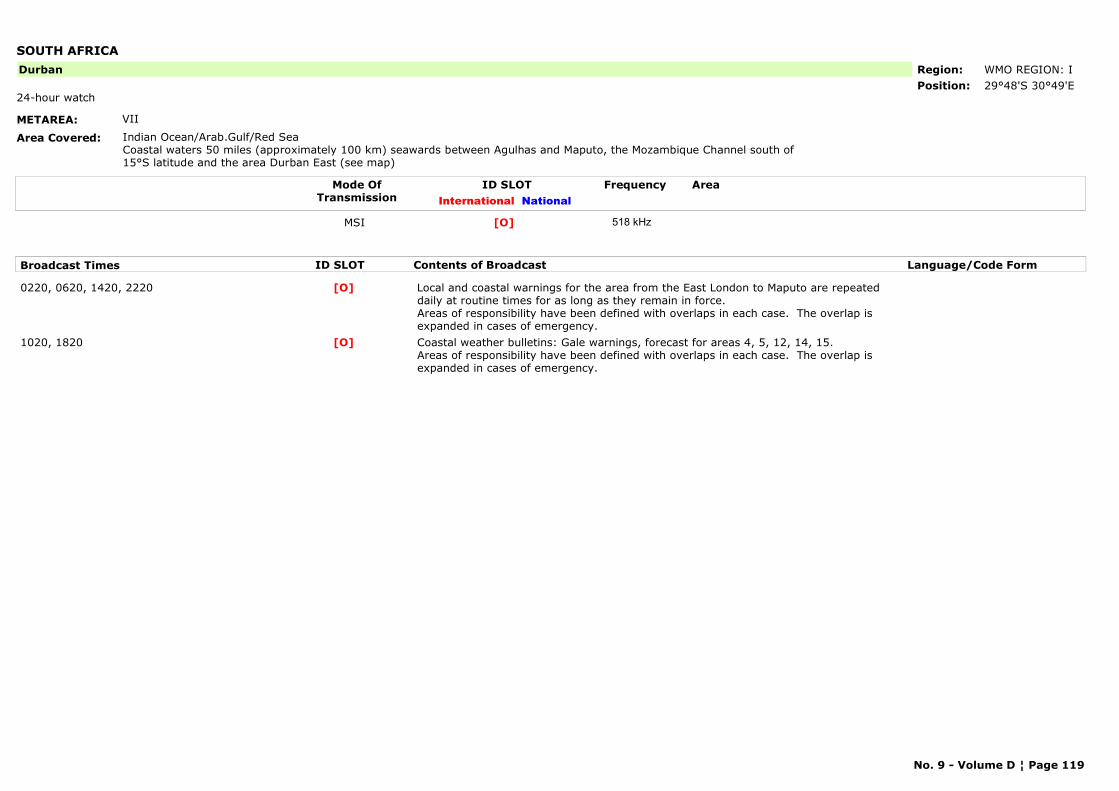
SOUTH AFRICA
METAREA: VII
Area Covered: Indian Ocean/Arab.Gulf/Red SeaCoastal waters 50 miles (approximately 100 km) seawards between Agulhas and Maputo, the Mozambique Channel south of 15°S latitude and the area Durban East (see map)
Region: WMO REGION: IPosition: 29°48'S 30°49'E
Durban
24-hour watch
Mode OfTransmission
ID SLOT AreaInternational National
Frequency
MSI [O] 518 kHz
Broadcast Times ID SLOT Contents of Broadcast Language/Code Form
0220, 0620, 1420, 2220 Local and coastal warnings for the area from the East London to Maputo are repeated daily at routine times for as long as they remain in force.Areas of responsibility have been defined with overlaps in each case. The overlap is expanded in cases of emergency.
[O]
1020, 1820 Coastal weather bulletins: Gale warnings, forecast for areas 4, 5, 12, 14, 15. Areas of responsibility have been defined with overlaps in each case. The overlap is expanded in cases of emergency.
[O]
No. 9 - Volume D ¦ Page 119

SOUTH AFRICA
METAREA: VII
Area Covered: The whole ocean area south of the Equator and of the African coast between 20°W and 20°E. The Mozambique Channel south of 15°S and the sea area from 25°S to 30°S between the African coast and 45°E. The whole ocean area south of 30°S and of the African coast between 20°E and 70°E.
Region: WMO REGION: IPosition: 34°02'S 25°33'E
Port Elizabeth
24-hour watch
Mode OfTransmission
ID SLOT AreaInternational National
Frequency
MSI [I] 518 kHz
Broadcast Times ID SLOT Contents of Broadcast Language/Code Form
0120, 0520, 1320, 2120 Local and coastal warnings for the area from the Cape Agulhas to Port Edward are repeated daily at routine times for as long as they remain in force.Areas of responsibility have been defined with overlaps in each case. The overlap is expanded in cases of emergency.
[I]
0920, 1720 Coastal weather bulletins: Gale warnings and forecasts.Local and coastal warnings for the area from the Cape Agulhas to Port Edward are repeated daily at routine times for as long as they remain in force.Areas of responsibility have been defined with overlaps in each case. The overlap is expanded in cases of emergency.
[I]
No. 9 - Volume D ¦ Page 120
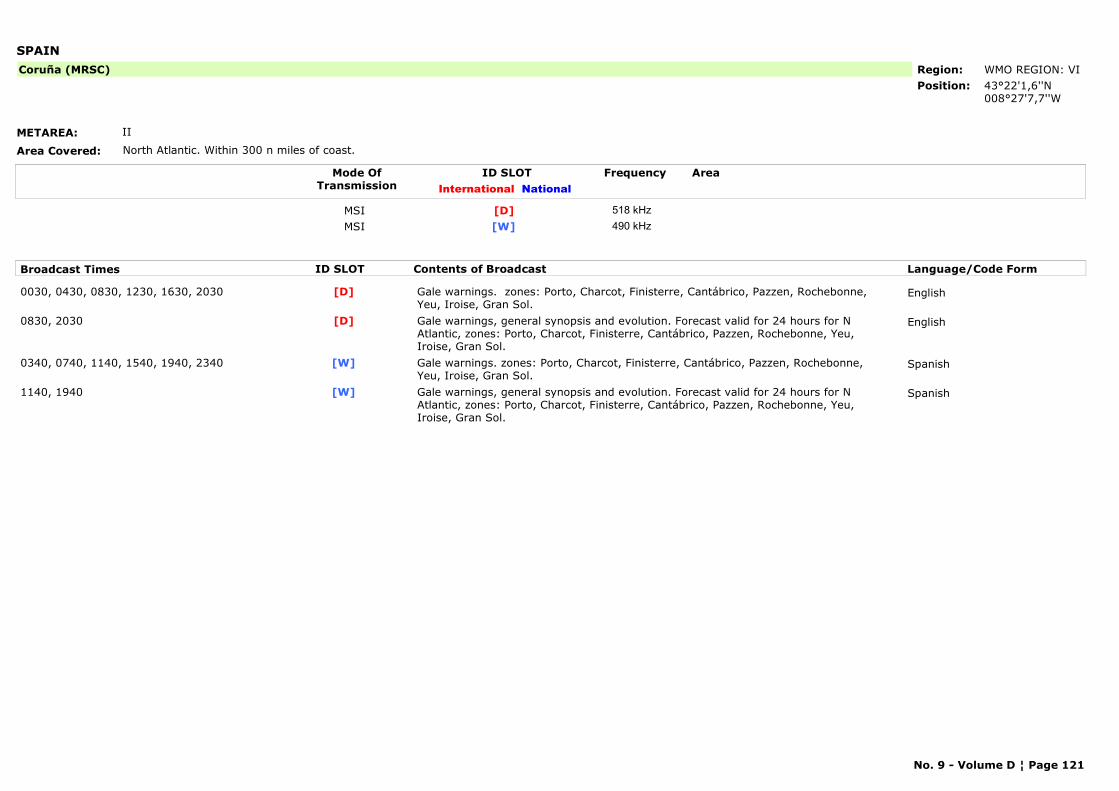
SPAIN
METAREA: II
Area Covered: North Atlantic. Within 300 n miles of coast.
Region: WMO REGION: VIPosition: 43°22'1,6''N
008°27'7,7''W
Coruña (MRSC)
Mode OfTransmission
ID SLOT AreaInternational National
Frequency
MSI [D] 518 kHzMSI [W] 490 kHz
Broadcast Times ID SLOT Contents of Broadcast Language/Code Form
0030, 0430, 0830, 1230, 1630, 2030 Gale warnings. zones: Porto, Charcot, Finisterre, Cantábrico, Pazzen, Rochebonne, Yeu, Iroise, Gran Sol.
English[D]
0830, 2030 Gale warnings, general synopsis and evolution. Forecast valid for 24 hours for N Atlantic, zones: Porto, Charcot, Finisterre, Cantábrico, Pazzen, Rochebonne, Yeu, Iroise, Gran Sol.
English[D]
0340, 0740, 1140, 1540, 1940, 2340 Gale warnings. zones: Porto, Charcot, Finisterre, Cantábrico, Pazzen, Rochebonne, Yeu, Iroise, Gran Sol.
Spanish[W]
1140, 1940 Gale warnings, general synopsis and evolution. Forecast valid for 24 hours for N Atlantic, zones: Porto, Charcot, Finisterre, Cantábrico, Pazzen, Rochebonne, Yeu, Iroise, Gran Sol.
Spanish[W]
No. 9 - Volume D ¦ Page 121
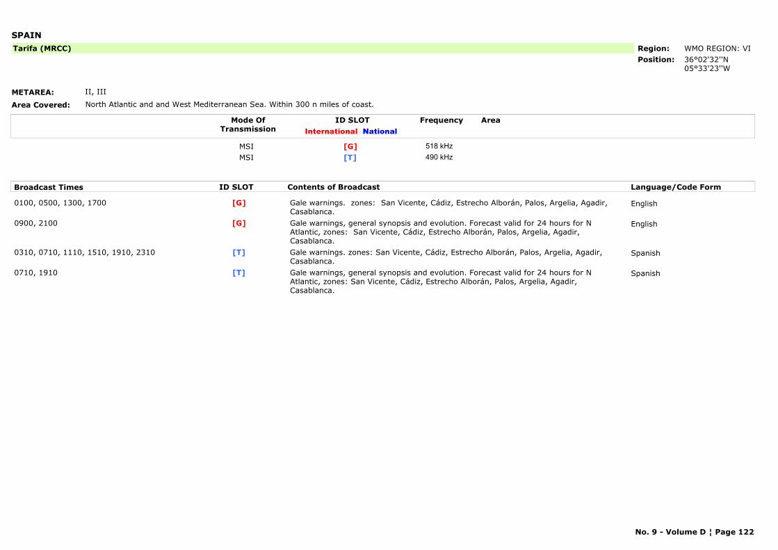
SPAIN
METAREA: II, III
Area Covered: North Atlantic and and West Mediterranean Sea. Within 300 n miles of coast.
Region: WMO REGION: VIPosition: 36°02'32''N
05°33'23''W
Tarifa (MRCC)
Mode OfTransmission
ID SLOT AreaInternational National
Frequency
MSI [G] 518 kHzMSI [T] 490 kHz
Broadcast Times ID SLOT Contents of Broadcast Language/Code Form
0100, 0500, 1300, 1700 Gale warnings. zones: San Vicente, Cádiz, Estrecho Alborán, Palos, Argelia, Agadir, Casablanca.
English[G]
0900, 2100 Gale warnings, general synopsis and evolution. Forecast valid for 24 hours for N Atlantic, zones: San Vicente, Cádiz, Estrecho Alborán, Palos, Argelia, Agadir, Casablanca.
English[G]
0310, 0710, 1110, 1510, 1910, 2310 Gale warnings. zones: San Vicente, Cádiz, Estrecho Alborán, Palos, Argelia, Agadir, Casablanca.
Spanish[T]
0710, 1910 Gale warnings, general synopsis and evolution. Forecast valid for 24 hours for N Atlantic, zones: San Vicente, Cádiz, Estrecho Alborán, Palos, Argelia, Agadir, Casablanca.
Spanish[T]
No. 9 - Volume D ¦ Page 122
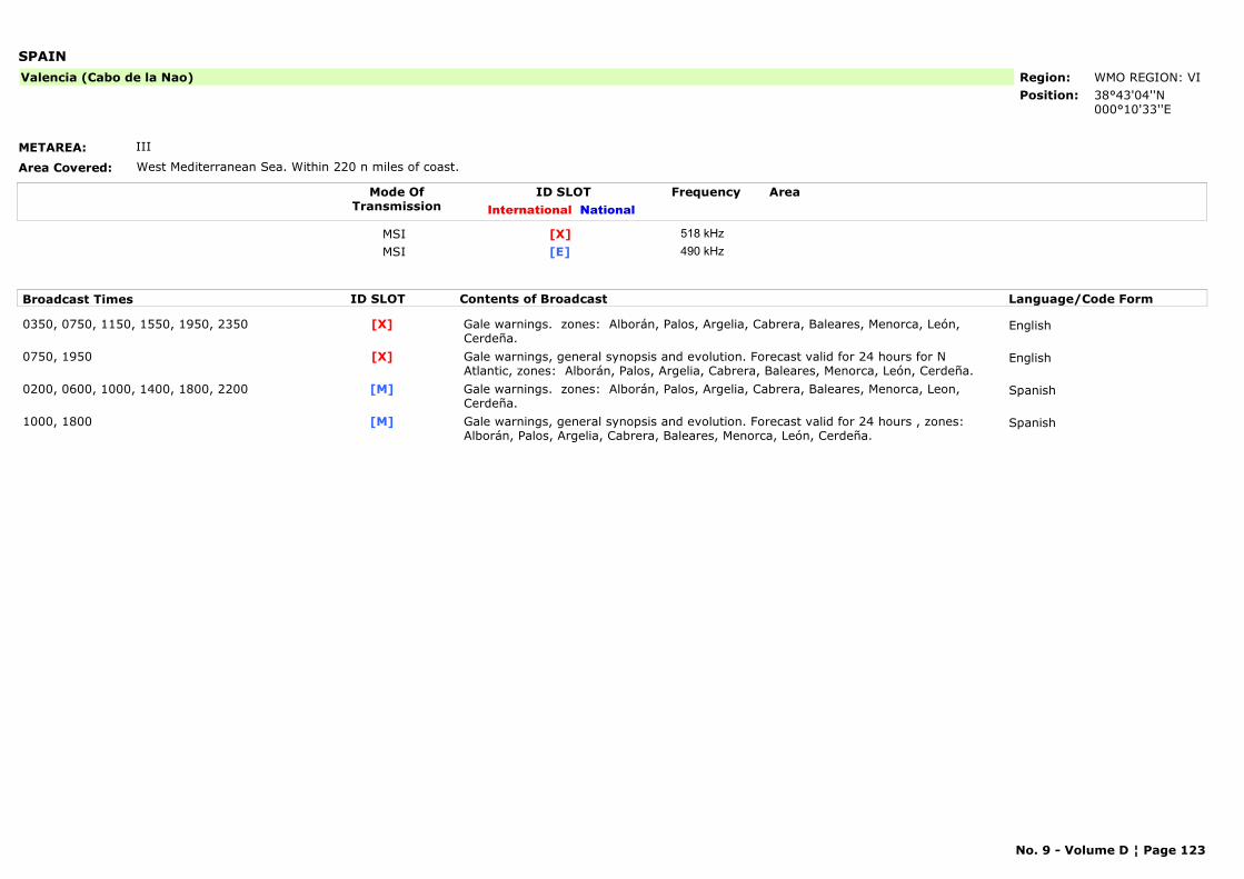
SPAIN
METAREA: III
Area Covered: West Mediterranean Sea. Within 220 n miles of coast.
Region: WMO REGION: VIPosition: 38°43'04''N
000°10'33''E
Valencia (Cabo de la Nao)
Mode OfTransmission
ID SLOT AreaInternational National
Frequency
MSI [X] 518 kHzMSI [E] 490 kHz
Broadcast Times ID SLOT Contents of Broadcast Language/Code Form
0350, 0750, 1150, 1550, 1950, 2350 Gale warnings. zones: Alborán, Palos, Argelia, Cabrera, Baleares, Menorca, León, Cerdeña.
English[X]
0750, 1950 Gale warnings, general synopsis and evolution. Forecast valid for 24 hours for N Atlantic, zones: Alborán, Palos, Argelia, Cabrera, Baleares, Menorca, León, Cerdeña.
English[X]
0200, 0600, 1000, 1400, 1800, 2200 Gale warnings. zones: Alborán, Palos, Argelia, Cabrera, Baleares, Menorca, Leon, Cerdeña.
Spanish[M]
1000, 1800 Gale warnings, general synopsis and evolution. Forecast valid for 24 hours , zones: Alborán, Palos, Argelia, Cabrera, Baleares, Menorca, León, Cerdeña.
Spanish[M]
No. 9 - Volume D ¦ Page 123
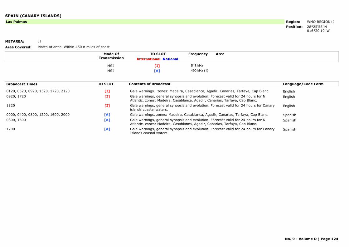
SPAIN (CANARY ISLANDS)
METAREA: II
Area Covered: North Atlantic. Within 450 n miles of coast
Region: WMO REGION: IPosition: 28°25'58''N
016°20'10''W
Las Palmas
Mode OfTransmission
ID SLOT AreaInternational National
Frequency
MSI [I] 518 kHzMSI [A] 490 kHz (1)
Broadcast Times ID SLOT Contents of Broadcast Language/Code Form
0120, 0520, 0920, 1320, 1720, 2120 Gale warnings. zones: Madeira, Casablanca, Agadir, Canarias, Tarfaya, Cap Blanc. English[I]0920, 1720 Gale warnings, general synopsis and evolution. Forecast valid for 24 hours for N
Atlantic, zones: Madeira, Casablanca, Agadir, Canarias, Tarfaya, Cap Blanc.English[I]
1320 Gale warnings, general synopsis and evolution. Forecast valid for 24 hours for Canary islands coastal waters.
English[I]
0000, 0400, 0800, 1200, 1600, 2000 Gale warnings. zones: Madeira, Casablanca, Agadir, Canarias, Tarfaya, Cap Blanc. Spanish[A]0800, 1600 Gale warnings, general synopsis and evolution. Forecast valid for 24 hours for N
Atlantic, zones: Madeira, Casablanca, Agadir, Canarias, Tarfaya, Cap Blanc.Spanish[A]
1200 Gale warnings, general synopsis and evolution. Forecast valid for 24 hours for Canary Islands coastal waters.
Spanish[A]
No. 9 - Volume D ¦ Page 124
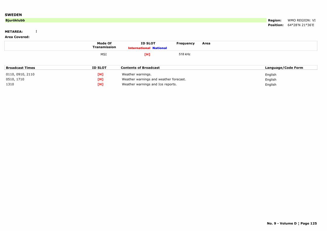
SWEDEN
METAREA: I
Area Covered:
Region: WMO REGION: VIPosition: 64°28'N 21°36'E
Bjuröklubb
Mode OfTransmission
ID SLOT AreaInternational National
Frequency
MSI [H] 518 kHz
Broadcast Times ID SLOT Contents of Broadcast Language/Code Form
0110, 0910, 2110 Weather warnings. English[H]0510, 1710 Weather warnings and weather forecast. English[H]1310 Weather warnings and Ice reports. English[H]
No. 9 - Volume D ¦ Page 125

SWEDEN
METAREA: I
Area Covered:
Region: WMO REGION: VIPosition: 55°29'N 14°19'E
Gislovshammer
Mode OfTransmission
ID SLOT AreaInternational National
Frequency
MSI [J] 518 kHz
Broadcast Times ID SLOT Contents of Broadcast Language/Code Form
0130, 0930, 2130 Warnings and weather warnings. English[J]0530, 1730(1) Weather warnings and weather forecast. English[J]1330 Weather warnings and Ice reports. English[J]
No. 9 - Volume D ¦ Page 126
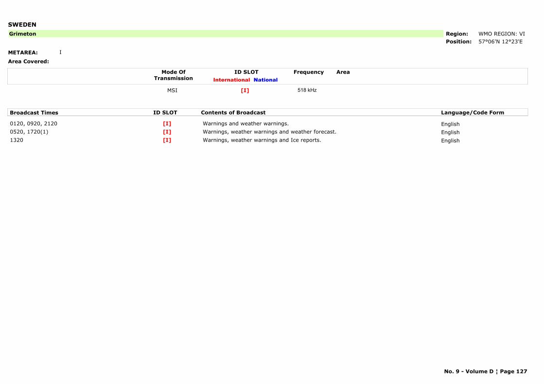
SWEDEN
METAREA: I
Area Covered:
Region: WMO REGION: VIPosition: 57°06'N 12°23'E
Grimeton
Mode OfTransmission
ID SLOT AreaInternational National
Frequency
MSI [I] 518 kHz
Broadcast Times ID SLOT Contents of Broadcast Language/Code Form
0120, 0920, 2120 Warnings and weather warnings. English[I]0520, 1720(1) Warnings, weather warnings and weather forecast. English[I]1320 Warnings, weather warnings and Ice reports. English[I]
No. 9 - Volume D ¦ Page 127
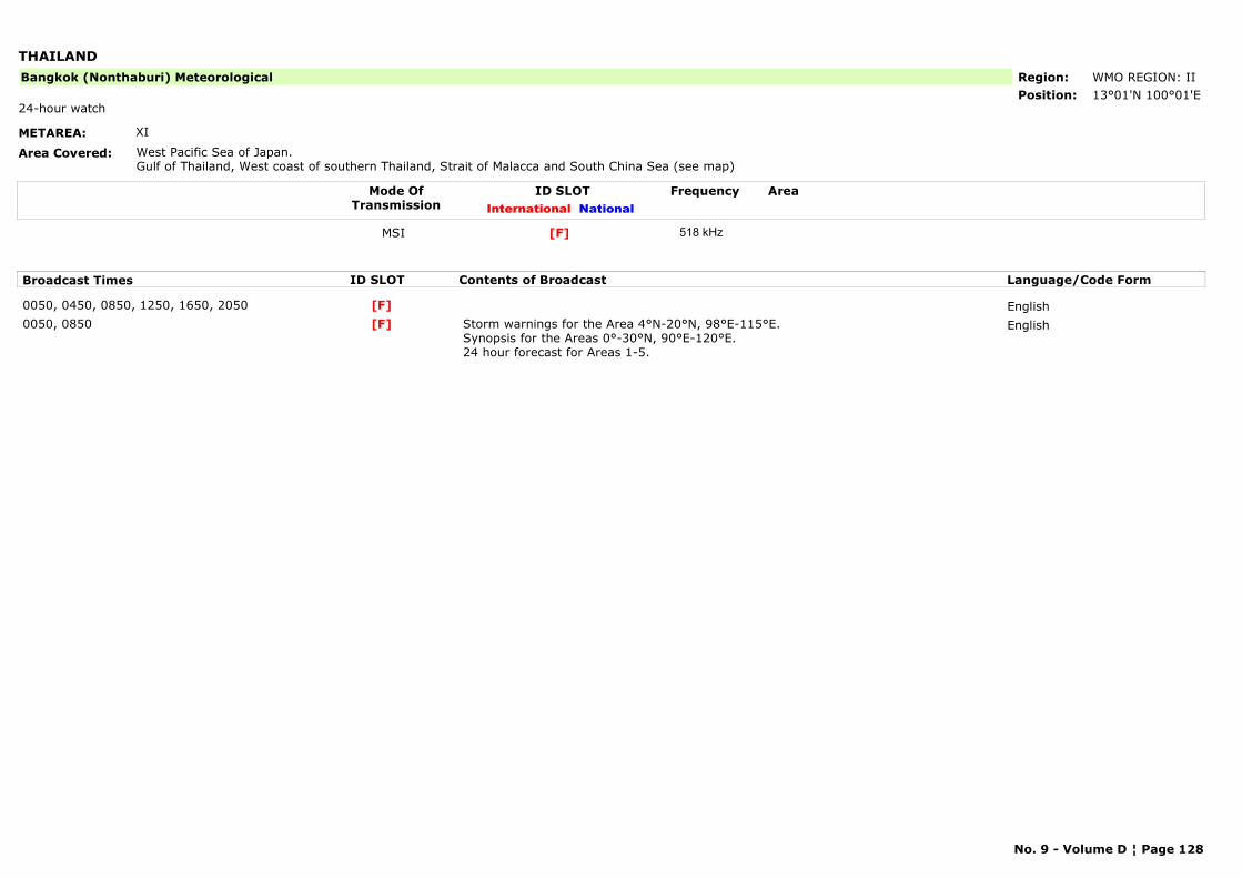
THAILAND
METAREA: XI
Area Covered: West Pacific Sea of Japan.Gulf of Thailand, West coast of southern Thailand, Strait of Malacca and South China Sea (see map)
Region: WMO REGION: IIPosition: 13°01'N 100°01'E
Bangkok (Nonthaburi) Meteorological
24-hour watch
Mode OfTransmission
ID SLOT AreaInternational National
Frequency
MSI [F] 518 kHz
Broadcast Times ID SLOT Contents of Broadcast Language/Code Form
0050, 0450, 0850, 1250, 1650, 2050 English[F]0050, 0850 Storm warnings for the Area 4°N-20°N, 98°E-115°E.
Synopsis for the Areas 0°-30°N, 90°E-120°E.24 hour forecast for Areas 1-5.
English[F]
No. 9 - Volume D ¦ Page 128
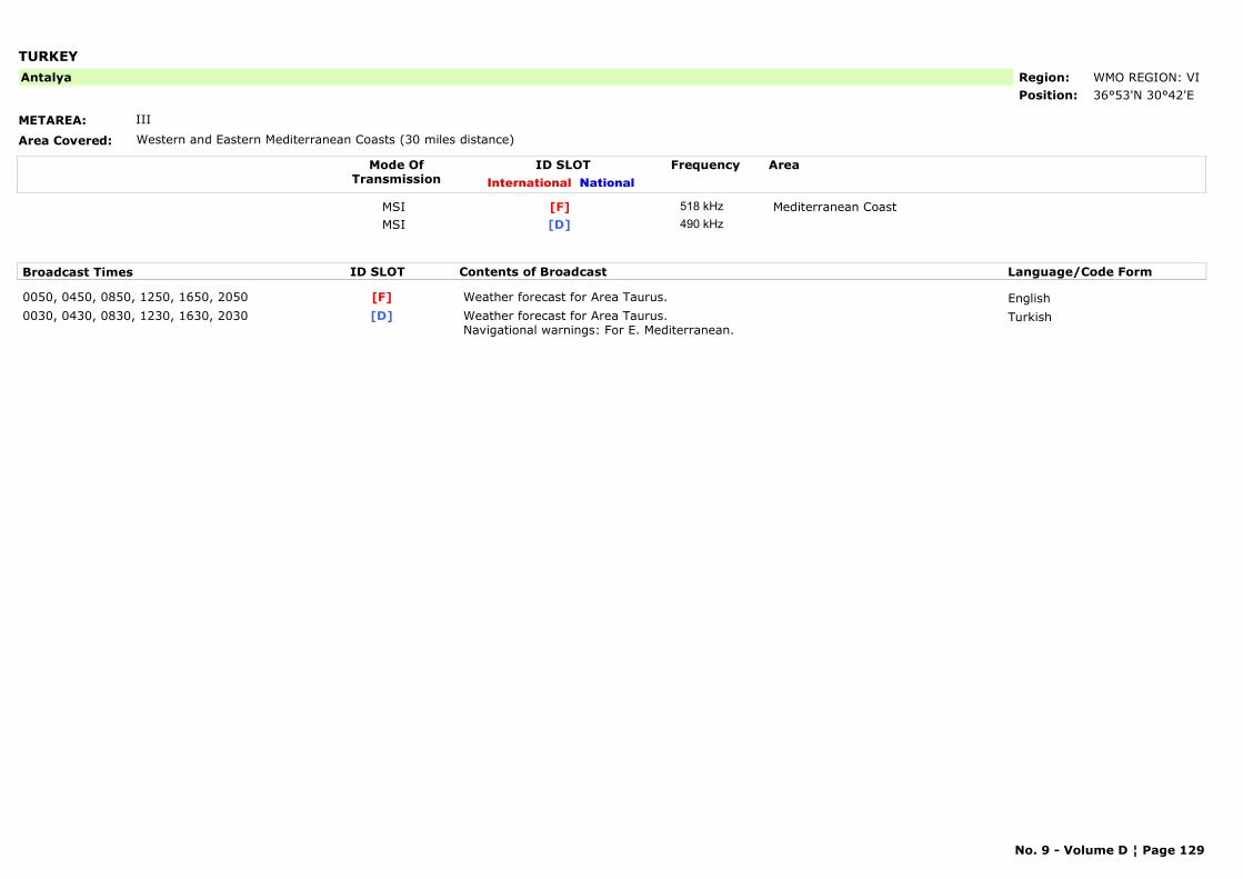
TURKEY
METAREA: III
Area Covered: Western and Eastern Mediterranean Coasts (30 miles distance)
Region: WMO REGION: VIPosition: 36°53'N 30°42'E
Antalya
Mode OfTransmission
ID SLOT AreaInternational National
Frequency
MSI Mediterranean Coast[F] 518 kHzMSI [D] 490 kHz
Broadcast Times ID SLOT Contents of Broadcast Language/Code Form
0050, 0450, 0850, 1250, 1650, 2050 Weather forecast for Area Taurus. English[F]0030, 0430, 0830, 1230, 1630, 2030 Weather forecast for Area Taurus.
Navigational warnings: For E. Mediterranean.Turkish[D]
No. 9 - Volume D ¦ Page 129
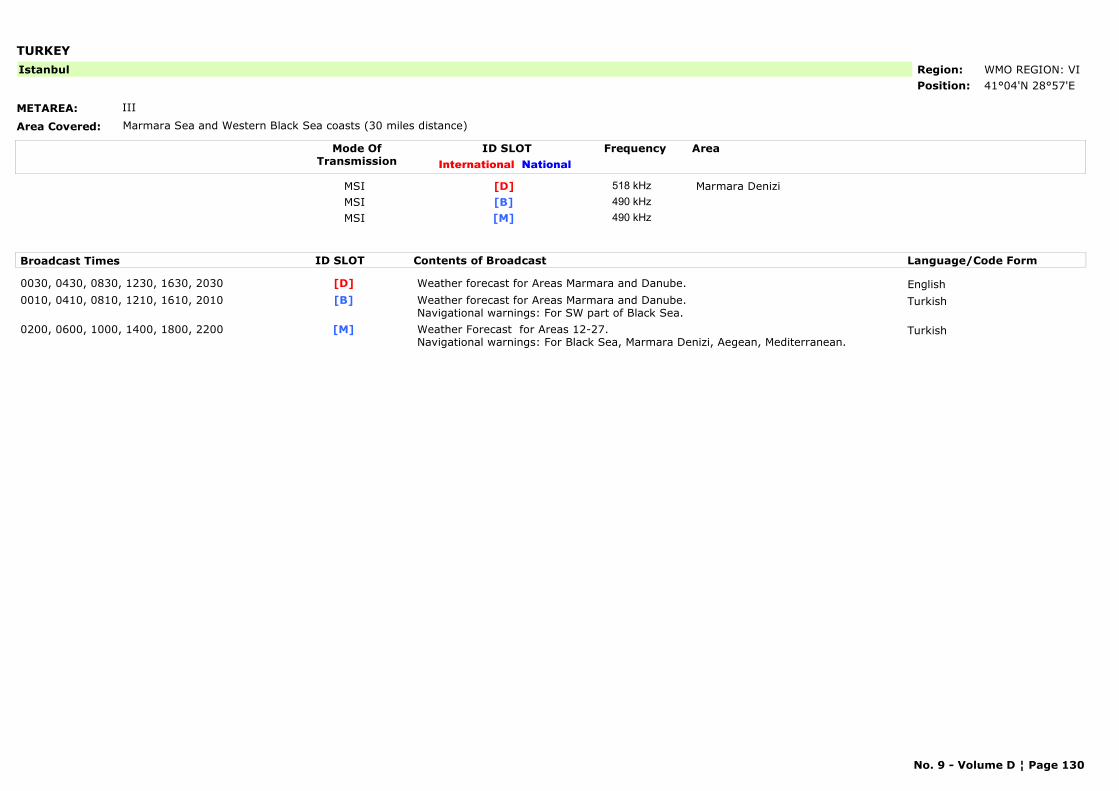
TURKEY
METAREA: III
Area Covered: Marmara Sea and Western Black Sea coasts (30 miles distance)
Region: WMO REGION: VIPosition: 41°04'N 28°57'E
Istanbul
Mode OfTransmission
ID SLOT AreaInternational National
Frequency
MSI Marmara Denizi[D] 518 kHzMSI [B] 490 kHzMSI [M] 490 kHz
Broadcast Times ID SLOT Contents of Broadcast Language/Code Form
0030, 0430, 0830, 1230, 1630, 2030 Weather forecast for Areas Marmara and Danube. English[D]0010, 0410, 0810, 1210, 1610, 2010 Weather forecast for Areas Marmara and Danube.
Navigational warnings: For SW part of Black Sea.Turkish[B]
0200, 0600, 1000, 1400, 1800, 2200 Weather Forecast for Areas 12-27. Navigational warnings: For Black Sea, Marmara Denizi, Aegean, Mediterranean.
Turkish[M]
No. 9 - Volume D ¦ Page 130
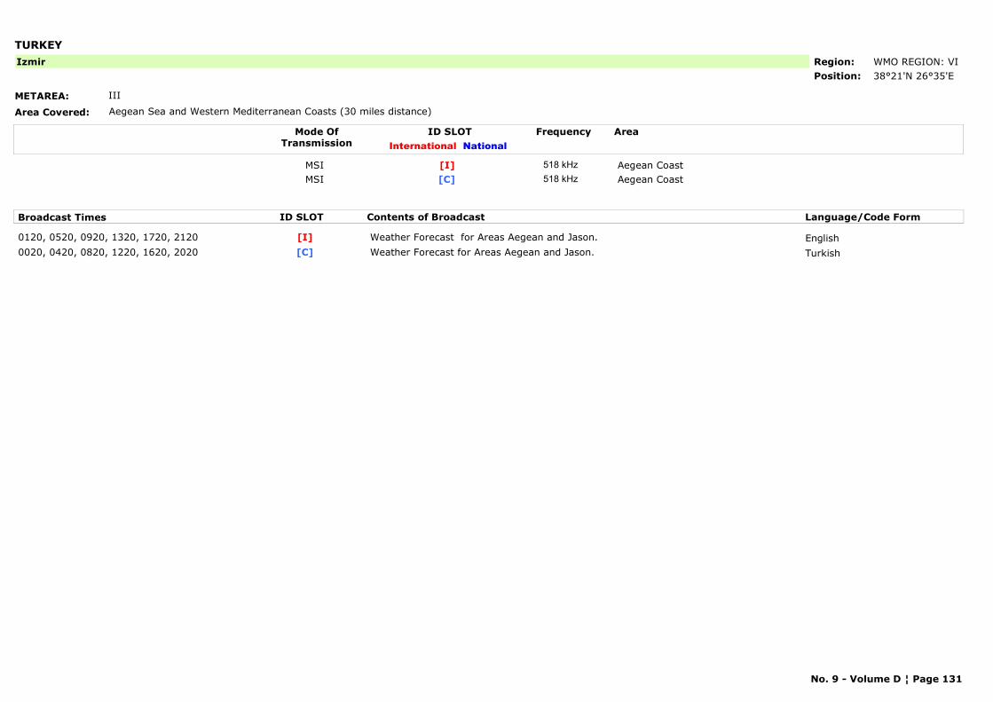
TURKEY
METAREA: III
Area Covered: Aegean Sea and Western Mediterranean Coasts (30 miles distance)
Region: WMO REGION: VIPosition: 38°21'N 26°35'E
Izmir
Mode OfTransmission
ID SLOT AreaInternational National
Frequency
MSI Aegean Coast[I] 518 kHzMSI Aegean Coast[C] 518 kHz
Broadcast Times ID SLOT Contents of Broadcast Language/Code Form
0120, 0520, 0920, 1320, 1720, 2120 Weather Forecast for Areas Aegean and Jason. English[I]0020, 0420, 0820, 1220, 1620, 2020 Weather Forecast for Areas Aegean and Jason. Turkish[C]
No. 9 - Volume D ¦ Page 131
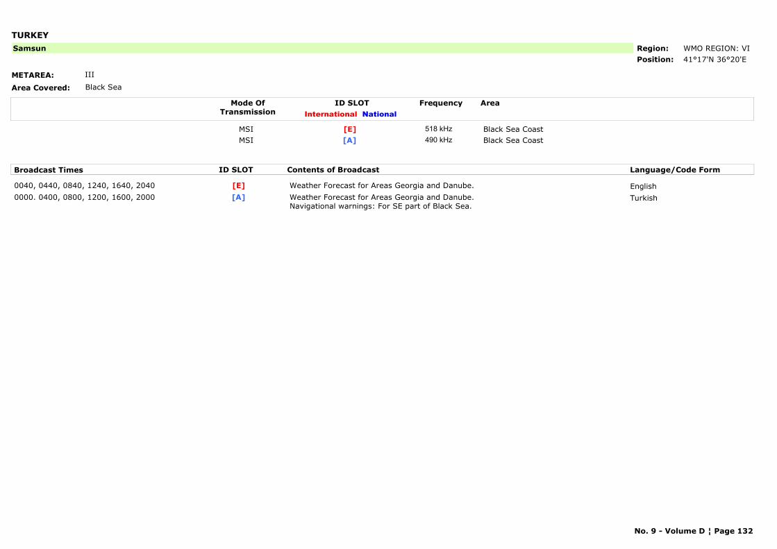
TURKEY
METAREA: III
Area Covered: Black Sea
Region: WMO REGION: VIPosition: 41°17'N 36°20'E
Samsun
Mode OfTransmission
ID SLOT AreaInternational National
Frequency
MSI Black Sea Coast[E] 518 kHzMSI Black Sea Coast[A] 490 kHz
Broadcast Times ID SLOT Contents of Broadcast Language/Code Form
0040, 0440, 0840, 1240, 1640, 2040 Weather Forecast for Areas Georgia and Danube. English[E]0000. 0400, 0800, 1200, 1600, 2000 Weather Forecast for Areas Georgia and Danube.
Navigational warnings: For SE part of Black Sea.Turkish[A]
No. 9 - Volume D ¦ Page 132
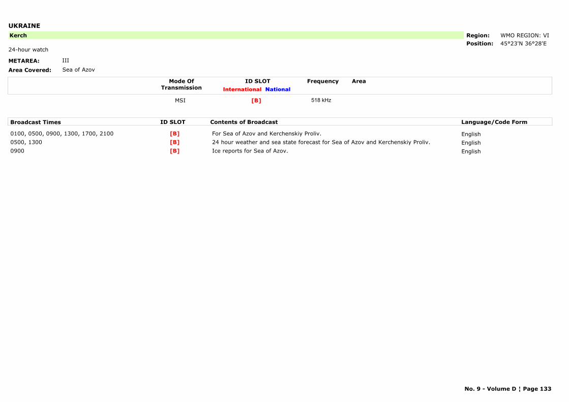
UKRAINE
METAREA: III
Area Covered: Sea of Azov
Region: WMO REGION: VIPosition: 45°23'N 36°28'E
Kerch
24-hour watch
Mode OfTransmission
ID SLOT AreaInternational National
Frequency
MSI [B] 518 kHz
Broadcast Times ID SLOT Contents of Broadcast Language/Code Form
0100, 0500, 0900, 1300, 1700, 2100 For Sea of Azov and Kerchenskiy Proliv. English[B]0500, 1300 24 hour weather and sea state forecast for Sea of Azov and Kerchenskiy Proliv. English[B]0900 Ice reports for Sea of Azov. English[B]
No. 9 - Volume D ¦ Page 133
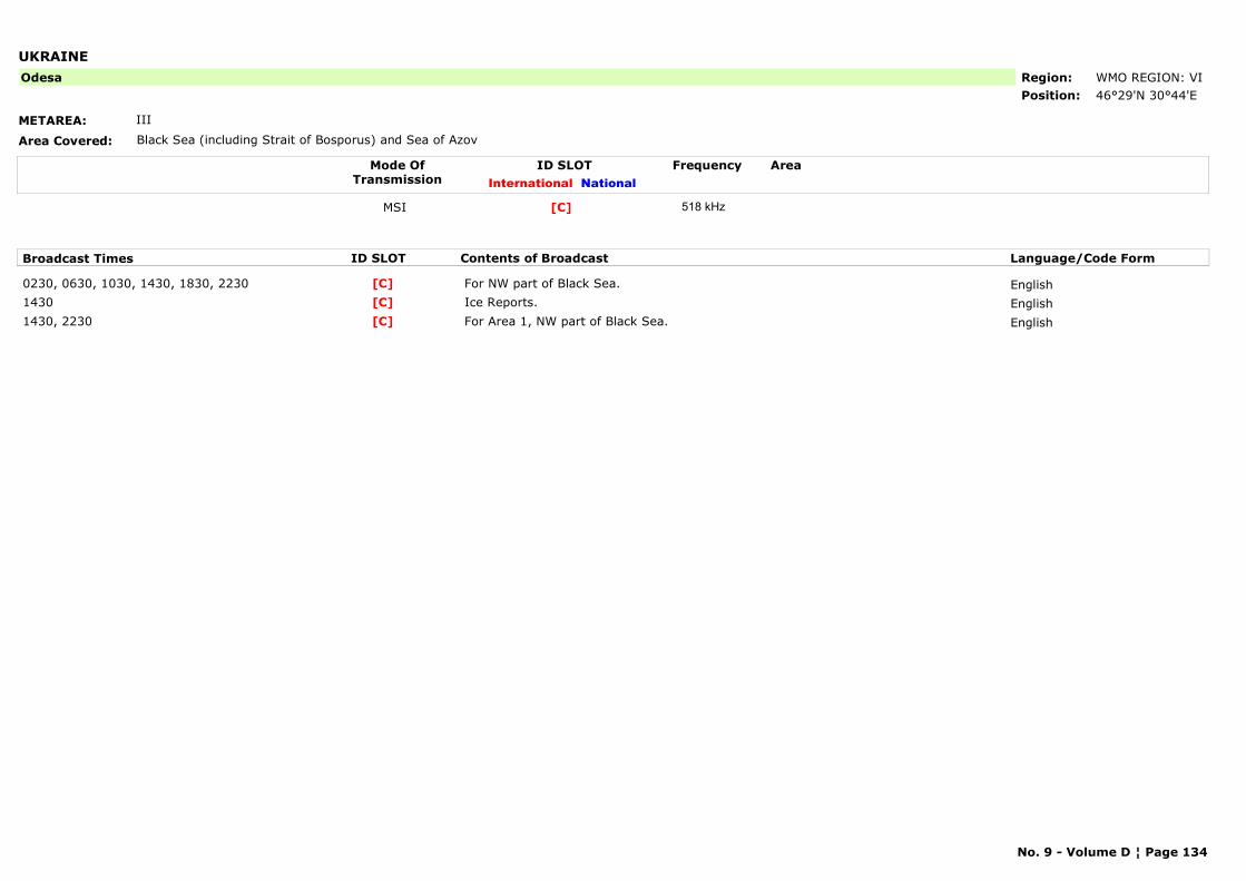
UKRAINE
METAREA: III
Area Covered: Black Sea (including Strait of Bosporus) and Sea of Azov
Region: WMO REGION: VIPosition: 46°29'N 30°44'E
Odesa
Mode OfTransmission
ID SLOT AreaInternational National
Frequency
MSI [C] 518 kHz
Broadcast Times ID SLOT Contents of Broadcast Language/Code Form
0230, 0630, 1030, 1430, 1830, 2230 For NW part of Black Sea. English[C]1430 Ice Reports. English[C]1430, 2230 For Area 1, NW part of Black Sea. English[C]
No. 9 - Volume D ¦ Page 134
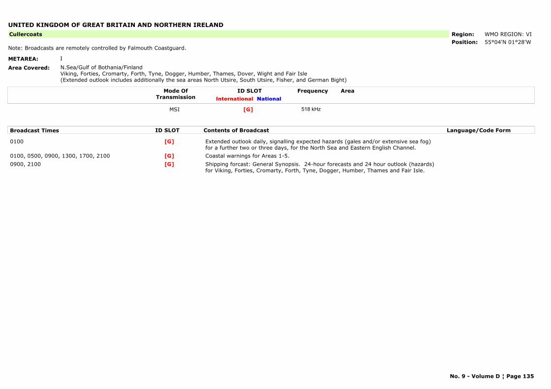
UNITED KINGDOM OF GREAT BRITAIN AND NORTHERN IRELAND
METAREA: I
Area Covered: N.Sea/Gulf of Bothania/FinlandViking, Forties, Cromarty, Forth, Tyne, Dogger, Humber, Thames, Dover, Wight and Fair Isle(Extended outlook includes additionally the sea areas North Utsire, South Utsire, Fisher, and German Bight)
Region: WMO REGION: VIPosition: 55°04'N 01°28'W
Cullercoats
Note: Broadcasts are remotely controlled by Falmouth Coastguard.
Mode OfTransmission
ID SLOT AreaInternational National
Frequency
MSI [G] 518 kHz
Broadcast Times ID SLOT Contents of Broadcast Language/Code Form
0100 Extended outlook daily, signalling expected hazards (gales and/or extensive sea fog) for a further two or three days, for the North Sea and Eastern English Channel.
[G]
0100, 0500, 0900, 1300, 1700, 2100 Coastal warnings for Areas 1-5.[G]0900, 2100 Shipping forcast: General Synopsis. 24-hour forecasts and 24 hour outlook (hazards)
for Viking, Forties, Cromarty, Forth, Tyne, Dogger, Humber, Thames and Fair Isle.[G]
No. 9 - Volume D ¦ Page 135
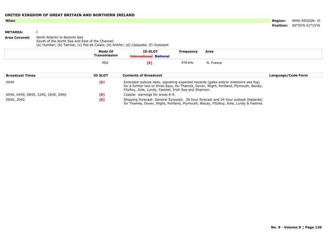
UNITED KINGDOM OF GREAT BRITAIN AND NORTHERN IRELAND
METAREA: I
Area Covered: North Atlantic to Barents SeaSouth of the North Sea and East of the Channel:(a) Humber; (b) Tamise; (c) Pas de Calais; (d) Antifer; (e) Casquets; (f) Ouessant
Region: WMO REGION: VIPosition: 50°35'N 01°15'W
Niton
Mode OfTransmission
ID SLOT AreaInternational National
Frequency
MSI N. France[E] 518 kHz
Broadcast Times ID SLOT Contents of Broadcast Language/Code Form
0040 Extended outlook daily, signalling expected hazards (gales and/or extensive sea fog) for a further two or three days, for Thames, Dover, Wight, Portland, Plymouth, Biscay, FitzRoy, Sole, Lundy, Fastnet, Irish Sea and Shannon.
[E]
0040, 0440, 0840, 1240, 1640, 2040 Coastal warnings for areas 6-9.[E]0840, 2040 Shipping Forecast: General Synopsis. 24 hour forecast and 24 hour outlook (hazards)
for Thames, Dover, Wight, Portland, Plymouth, Biscay, FItzRoy, Sole, Lundy & Fastnet.[E]
No. 9 - Volume D ¦ Page 136
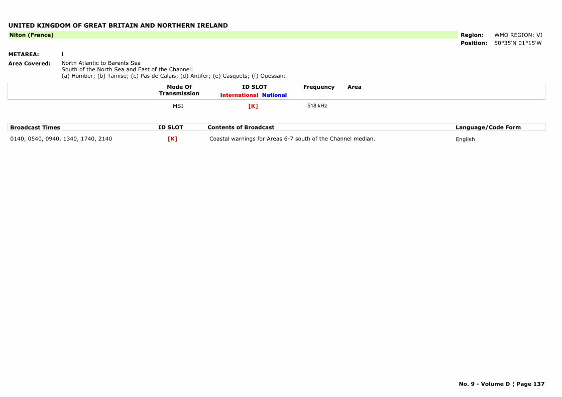
UNITED KINGDOM OF GREAT BRITAIN AND NORTHERN IRELAND
METAREA: I
Area Covered: North Atlantic to Barents SeaSouth of the North Sea and East of the Channel:(a) Humber; (b) Tamise; (c) Pas de Calais; (d) Antifer; (e) Casquets; (f) Ouessant
Region: WMO REGION: VIPosition: 50°35'N 01°15'W
Niton (France)
Mode OfTransmission
ID SLOT AreaInternational National
Frequency
MSI [K] 518 kHz
Broadcast Times ID SLOT Contents of Broadcast Language/Code Form
0140, 0540, 0940, 1340, 1740, 2140 Coastal warnings for Areas 6-7 south of the Channel median. English[K]
No. 9 - Volume D ¦ Page 137
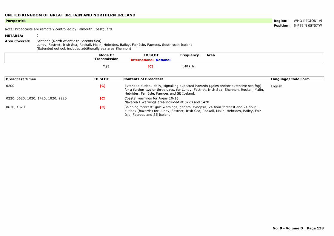
UNITED KINGDOM OF GREAT BRITAIN AND NORTHERN IRELAND
METAREA: I
Area Covered: Scotland (North Atlantic to Barents Sea)Lundy, Fastnet, Irish Sea, Rockall, Malin, Hebrides, Bailey, Fair Isle. Faeroes, South-east Iceland (Extended outlook includes additionally sea area Shannon)
Region: WMO REGION: VIPosition: 54°51'N 05°07'W
Portpatrick
Note: Broadcasts are remotely controlled by Falmouth Coastguard.
Mode OfTransmission
ID SLOT AreaInternational National
Frequency
MSI [C] 518 kHz
Broadcast Times ID SLOT Contents of Broadcast Language/Code Form
0200 Extended outlook daily, signalling expected hazards (gales and/or extensive sea fog) for a further two or three days, for Lundy, Fastnet, Irish Sea, Shannon, Rockall, Malin, Hebrides, Fair Isle, Faeroes and SE Iceland.
English[C]
0220, 0620, 1020, 1420, 1820, 2220 Coastal warnings for Areas 10-16.Navarea I Warnings area included at 0220 and 1420.
[C]
0620, 1820 Shipping forecast: gale warnings, general synopsis, 24 hour forecast and 24 hour outlook (hazards) for Lundy, Fastnet, Irish Sea, Rockall, Malin, Hebrides, Bailey, Fair Isle, Faeroes and SE Iceland.
[C]
No. 9 - Volume D ¦ Page 138
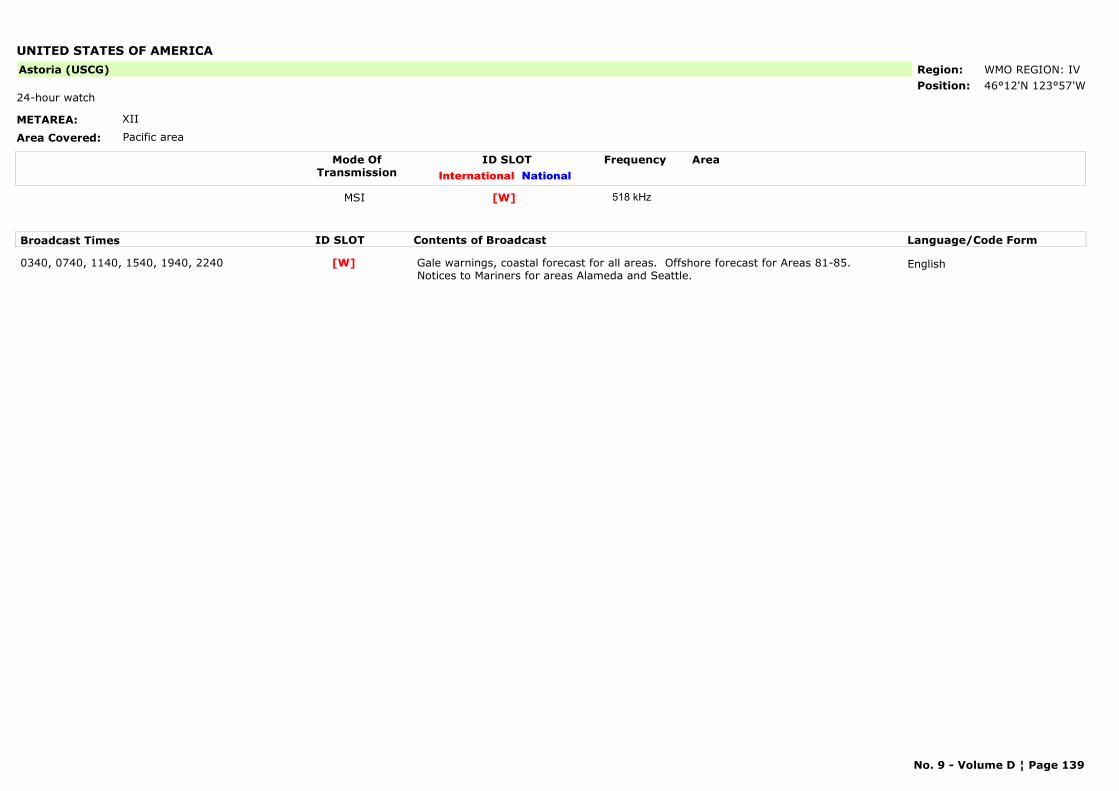
UNITED STATES OF AMERICA
METAREA: XII
Area Covered: Pacific area
Region: WMO REGION: IVPosition: 46°12'N 123°57'W
Astoria (USCG)
24-hour watch
Mode OfTransmission
ID SLOT AreaInternational National
Frequency
MSI [W] 518 kHz
Broadcast Times ID SLOT Contents of Broadcast Language/Code Form
0340, 0740, 1140, 1540, 1940, 2240 Gale warnings, coastal forecast for all areas. Offshore forecast for Areas 81-85. Notices to Mariners for areas Alameda and Seattle.
English[W]
No. 9 - Volume D ¦ Page 139
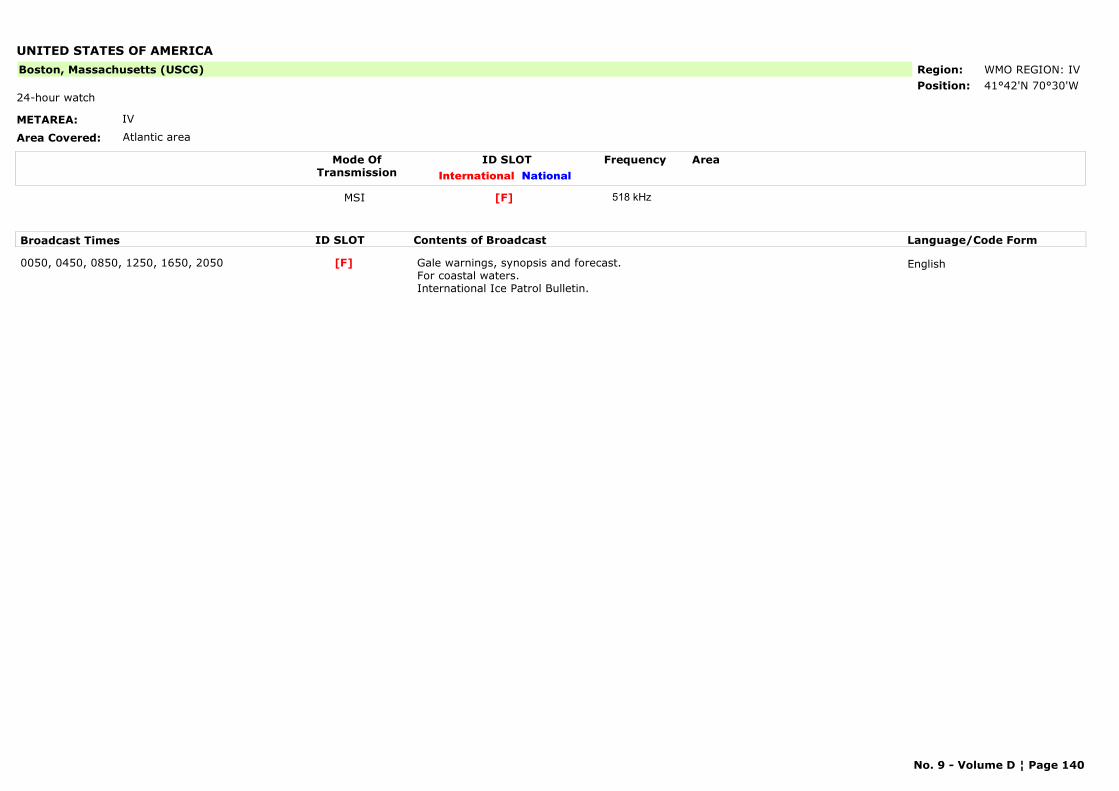
UNITED STATES OF AMERICA
METAREA: IV
Area Covered: Atlantic area
Region: WMO REGION: IVPosition: 41°42'N 70°30'W
Boston, Massachusetts (USCG)
24-hour watch
Mode OfTransmission
ID SLOT AreaInternational National
Frequency
MSI [F] 518 kHz
Broadcast Times ID SLOT Contents of Broadcast Language/Code Form
0050, 0450, 0850, 1250, 1650, 2050 Gale warnings, synopsis and forecast. For coastal waters. International Ice Patrol Bulletin.
English[F]
No. 9 - Volume D ¦ Page 140
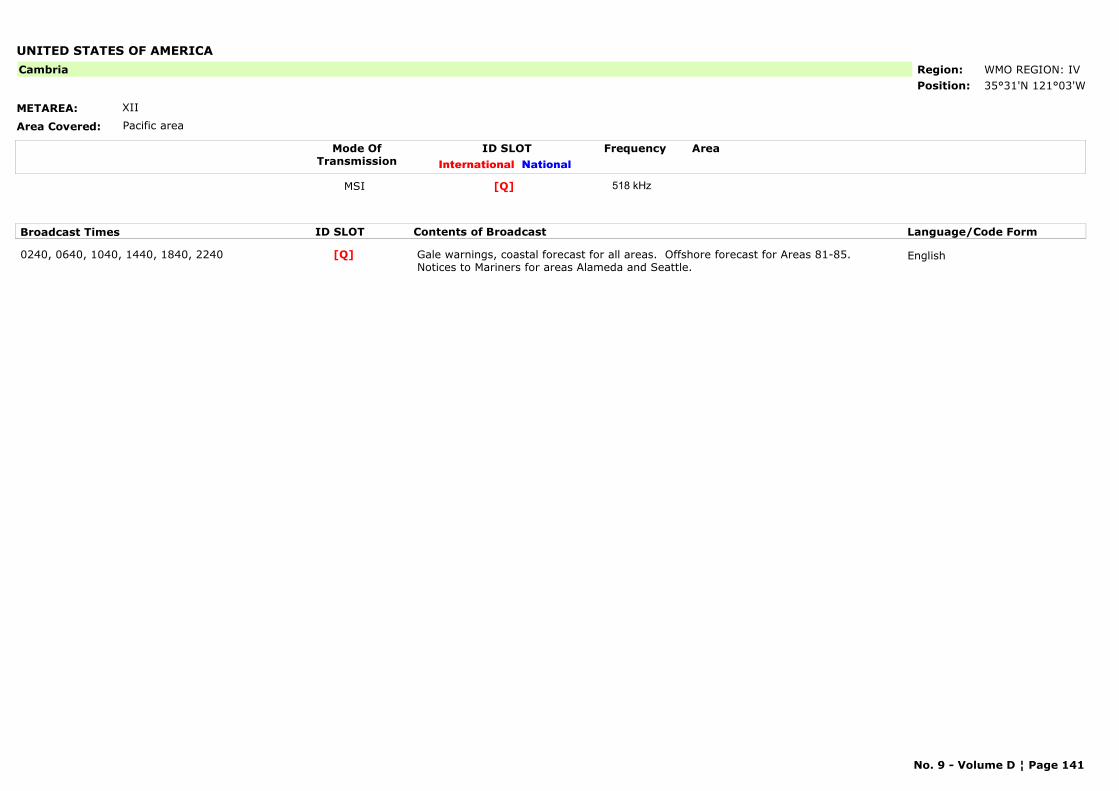
UNITED STATES OF AMERICA
METAREA: XII
Area Covered: Pacific area
Region: WMO REGION: IVPosition: 35°31'N 121°03'W
Cambria
Mode OfTransmission
ID SLOT AreaInternational National
Frequency
MSI [Q] 518 kHz
Broadcast Times ID SLOT Contents of Broadcast Language/Code Form
0240, 0640, 1040, 1440, 1840, 2240 Gale warnings, coastal forecast for all areas. Offshore forecast for Areas 81-85.Notices to Mariners for areas Alameda and Seattle.
English[Q]
No. 9 - Volume D ¦ Page 141
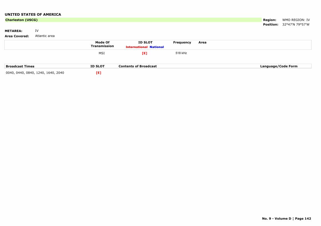
UNITED STATES OF AMERICA
METAREA: IV
Area Covered: Atlantic area
Region: WMO REGION: IVPosition: 32°47'N 79°57'W
Charleston (USCG)
Mode OfTransmission
ID SLOT AreaInternational National
Frequency
MSI [E] 518 kHz
Broadcast Times ID SLOT Contents of Broadcast Language/Code Form
0040, 0440, 0840, 1240, 1640, 2040 [E]
No. 9 - Volume D ¦ Page 142
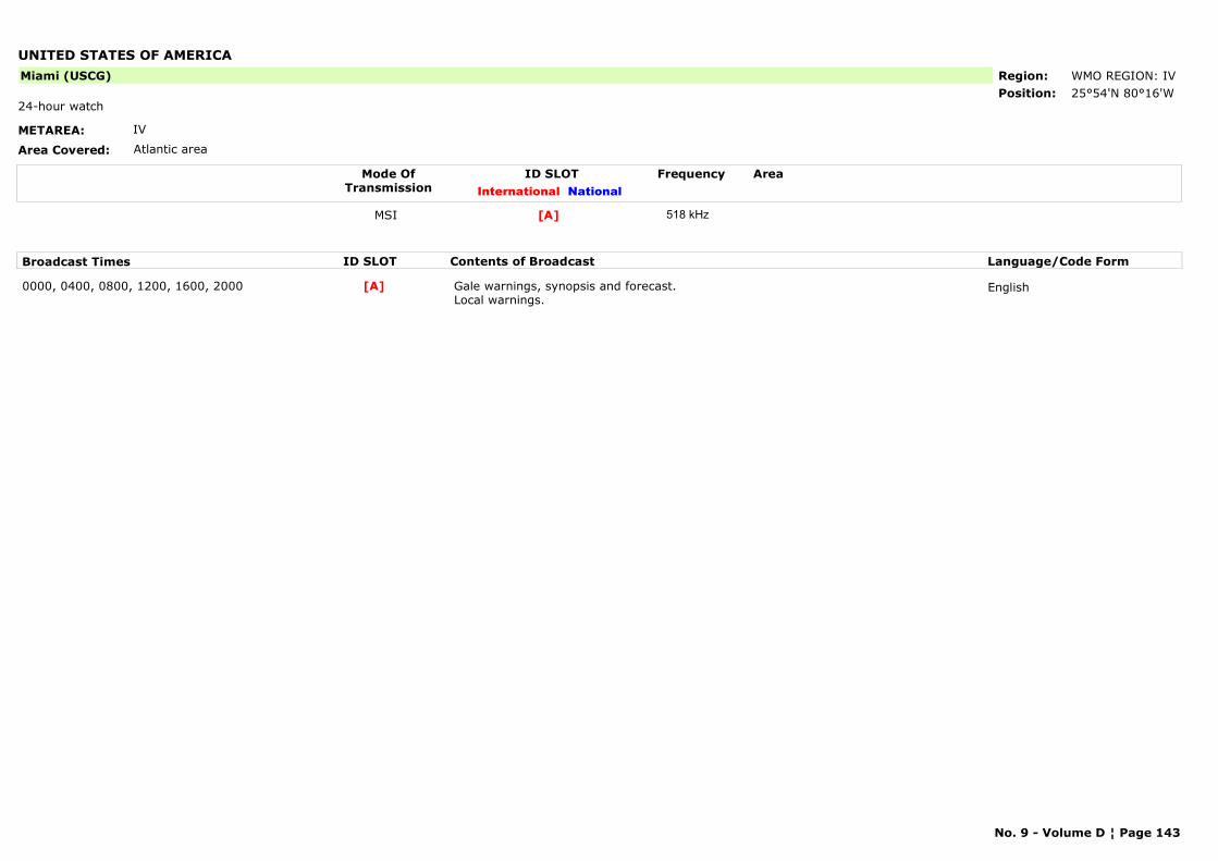
UNITED STATES OF AMERICA
METAREA: IV
Area Covered: Atlantic area
Region: WMO REGION: IVPosition: 25°54'N 80°16'W
Miami (USCG)
24-hour watch
Mode OfTransmission
ID SLOT AreaInternational National
Frequency
MSI [A] 518 kHz
Broadcast Times ID SLOT Contents of Broadcast Language/Code Form
0000, 0400, 0800, 1200, 1600, 2000 Gale warnings, synopsis and forecast. Local warnings.
English[A]
No. 9 - Volume D ¦ Page 143
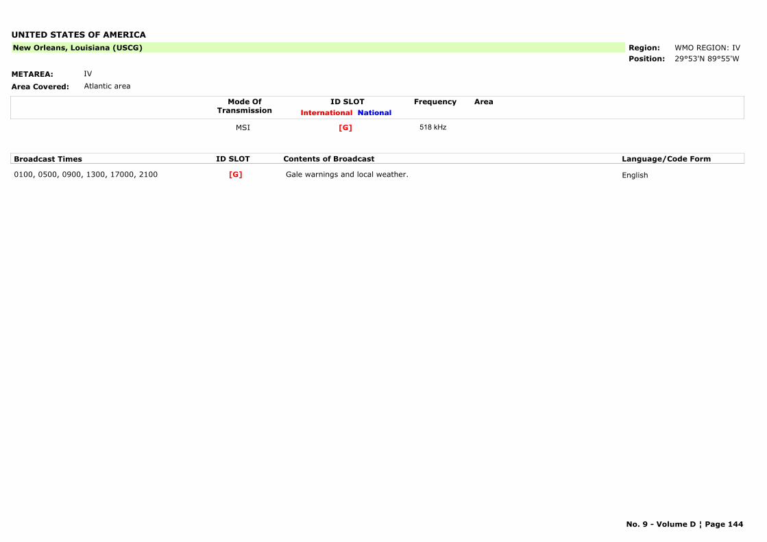
UNITED STATES OF AMERICA
METAREA: IV
Area Covered: Atlantic area
Region: WMO REGION: IVPosition: 29°53'N 89°55'W
New Orleans, Louisiana (USCG)
Mode OfTransmission
ID SLOT AreaInternational National
Frequency
MSI [G] 518 kHz
Broadcast Times ID SLOT Contents of Broadcast Language/Code Form
0100, 0500, 0900, 1300, 17000, 2100 Gale warnings and local weather. English[G]
No. 9 - Volume D ¦ Page 144
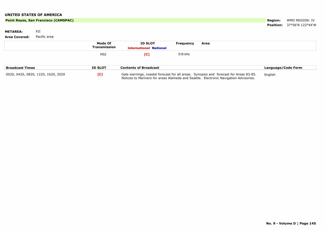
UNITED STATES OF AMERICA
METAREA: XII
Area Covered: Pacific area
Region: WMO REGION: IVPosition: 37°56'N 122°44'W
Point Reyes, San Francisco (CAMSPAC)
Mode OfTransmission
ID SLOT AreaInternational National
Frequency
MSI [C] 518 kHz
Broadcast Times ID SLOT Contents of Broadcast Language/Code Form
0020, 0420, 0820, 1220, 1620, 2020 Gale warnings, coastal forecast for all areas. Synopsis and forecast for Areas 83-85. Notices to Mariners for areas Alameda and Seattle. Electronic Navigation Advisories.
English[C]
No. 9 - Volume D ¦ Page 145
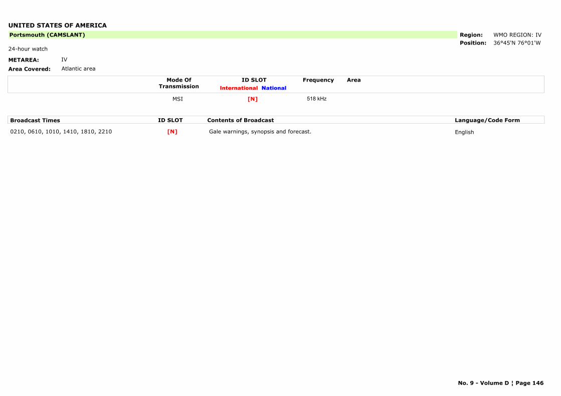
UNITED STATES OF AMERICA
METAREA: IV
Area Covered: Atlantic area
Region: WMO REGION: IVPosition: 36°45'N 76°01'W
Portsmouth (CAMSLANT)
24-hour watch
Mode OfTransmission
ID SLOT AreaInternational National
Frequency
MSI [N] 518 kHz
Broadcast Times ID SLOT Contents of Broadcast Language/Code Form
0210, 0610, 1010, 1410, 1810, 2210 Gale warnings, synopsis and forecast. English[N]
No. 9 - Volume D ¦ Page 146

UNITED STATES OF AMERICA (ALASKA)
METAREA: XII, XVII
Area Covered: Pacific area
Region: WMO REGION: IVPosition: 57°46'N 152°34'W
Kodiak (East)
Mode OfTransmission
ID SLOT AreaInternational National
Frequency
MSI Area east of Kodiak[J] 518 kHz
Broadcast Times ID SLOT Contents of Broadcast Language/Code Form
0130, 0530, 0930, 1330, 1730, 2130 Gale warnings, synopsis and forecast for Areas east of Kodiak. English[J]
No. 9 - Volume D ¦ Page 147
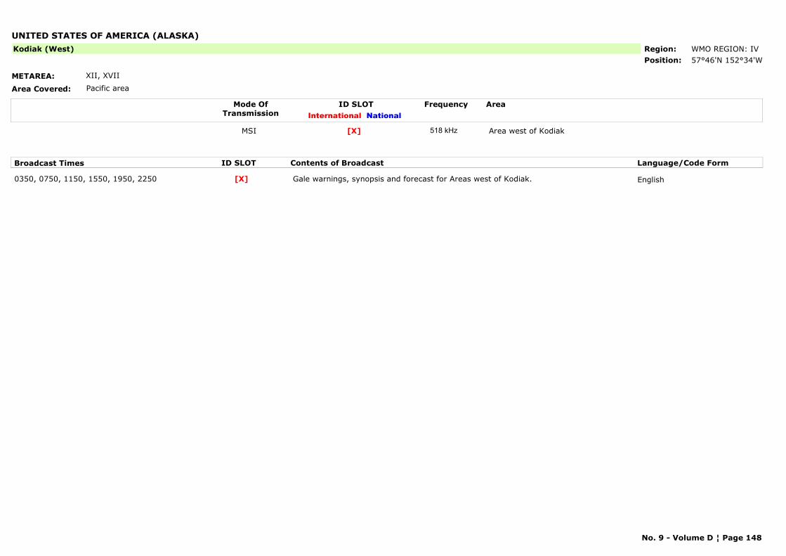
UNITED STATES OF AMERICA (ALASKA)
METAREA: XII, XVII
Area Covered: Pacific area
Region: WMO REGION: IVPosition: 57°46'N 152°34'W
Kodiak (West)
Mode OfTransmission
ID SLOT AreaInternational National
Frequency
MSI Area west of Kodiak[X] 518 kHz
Broadcast Times ID SLOT Contents of Broadcast Language/Code Form
0350, 0750, 1150, 1550, 1950, 2250 Gale warnings, synopsis and forecast for Areas west of Kodiak. English[X]
No. 9 - Volume D ¦ Page 148
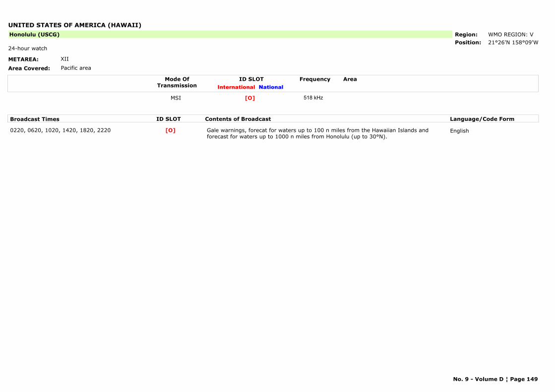
UNITED STATES OF AMERICA (HAWAII)
METAREA: XII
Area Covered: Pacific area
Region: WMO REGION: VPosition: 21°26'N 158°09'W
Honolulu (USCG)
24-hour watch
Mode OfTransmission
ID SLOT AreaInternational National
Frequency
MSI [O] 518 kHz
Broadcast Times ID SLOT Contents of Broadcast Language/Code Form
0220, 0620, 1020, 1420, 1820, 2220 Gale warnings, forecat for waters up to 100 n miles from the Hawaiian Islands and forecast for waters up to 1000 n miles from Honolulu (up to 30°N).
English[O]
No. 9 - Volume D ¦ Page 149

URUGUAY
METAREA: V
Area Covered: -
Region: WMO REGION: IIIPosition: 34°40'S 54°09'W
La Paloma
Mode OfTransmission
ID SLOT AreaInternational National
Frequency
MSI [F] 518 kHzMSI [A] 490 kHz
Broadcast Times ID SLOT Contents of Broadcast Language/Code Form
0050, 0450, 0850, 1250, 1650, 2050 Near gale warnings and local coastal forecast for areas B and C. English[F]0000, 0400, 0800, 1200, 1600, 2000 Near gale warnings and local coastal forecast for areas B and C. Spanish[A]
No. 9 - Volume D ¦ Page 150
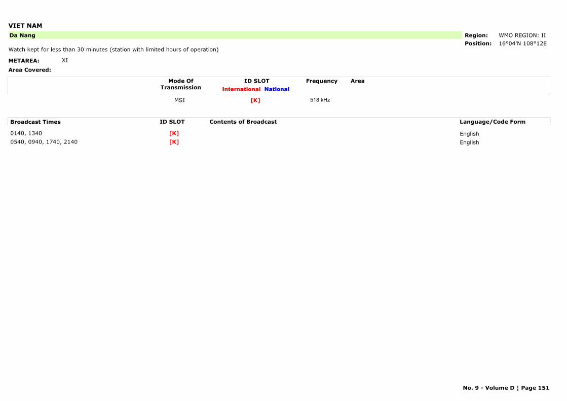
VIET NAM
METAREA: XI
Area Covered:
Region: WMO REGION: IIPosition: 16°04'N 108°12E
Da Nang
Watch kept for less than 30 minutes (station with limited hours of operation)
Mode OfTransmission
ID SLOT AreaInternational National
Frequency
MSI [K] 518 kHz
Broadcast Times ID SLOT Contents of Broadcast Language/Code Form
0140, 1340 English[K]0540, 0940, 1740, 2140 English[K]
No. 9 - Volume D ¦ Page 151
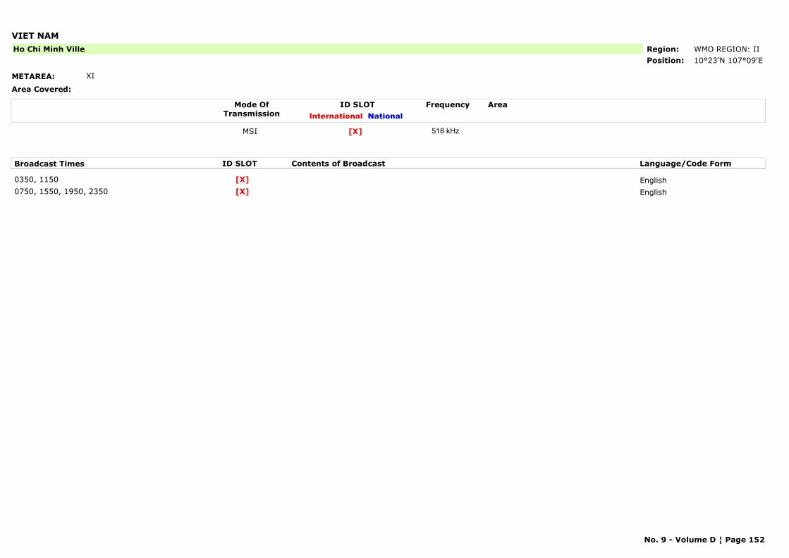
VIET NAM
METAREA: XI
Area Covered:
Region: WMO REGION: IIPosition: 10°23'N 107°09'E
Ho Chi Minh Ville
Mode OfTransmission
ID SLOT AreaInternational National
Frequency
MSI [X] 518 kHz
Broadcast Times ID SLOT Contents of Broadcast Language/Code Form
0350, 1150 English[X]0750, 1550, 1950, 2350 English[X]
No. 9 - Volume D ¦ Page 152
PART C
HF NBDP Narrow Band Direct Printing

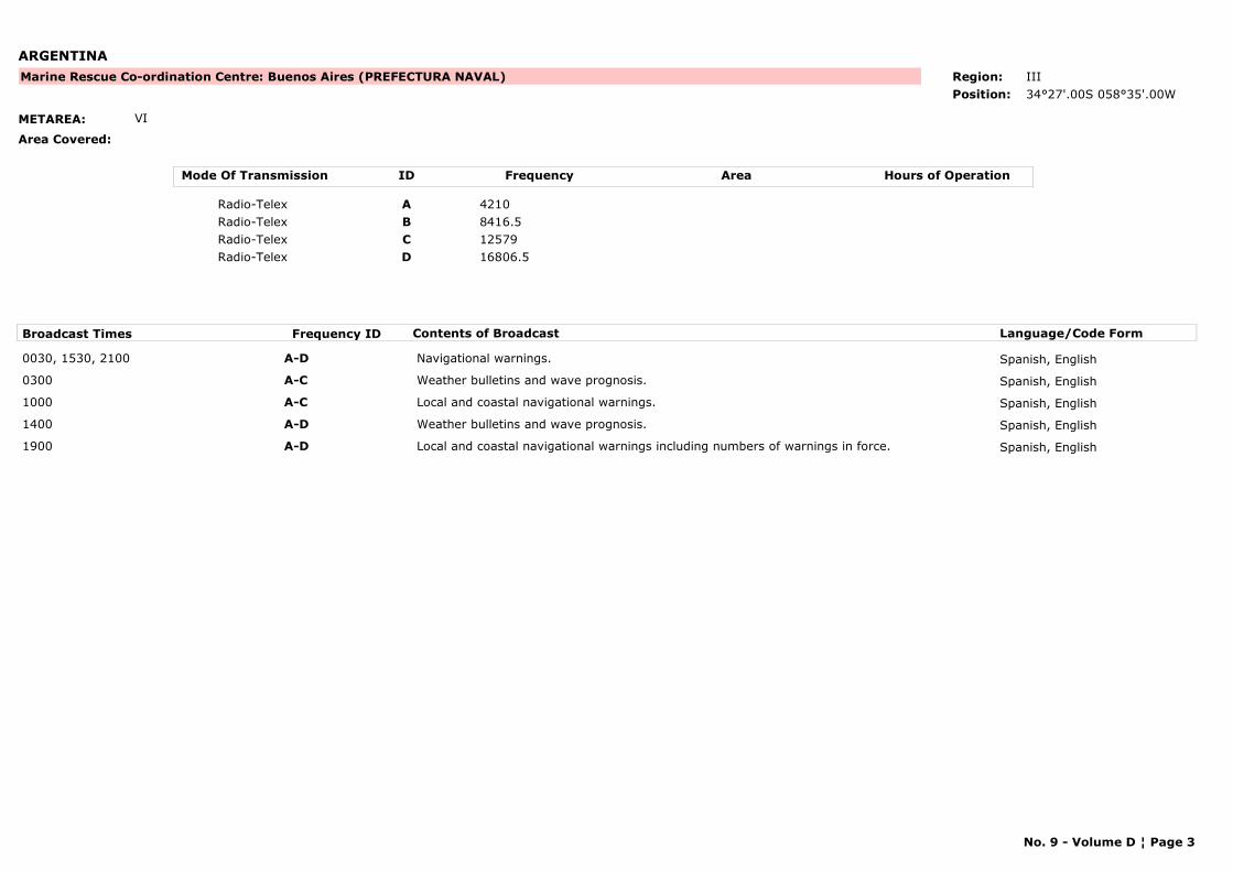
ARGENTINA
METAREA: VI
Area Covered:
Marine Rescue Co-ordination Centre: Buenos Aires (PREFECTURA NAVAL) Region: III
Position: 34°27'.00S 058°35'.00W
Mode Of Transmission ID Frequency Area Hours of Operation
Radio-Telex A 4210
Radio-Telex B 8416.5
Radio-Telex C 12579
Radio-Telex D 16806.5
Broadcast Times Frequency ID Contents of Broadcast Language/Code Form
0030, 1530, 2100 A-D Navigational warnings. Spanish, English
0300 A-C Weather bulletins and wave prognosis. Spanish, English
1000 A-C Local and coastal navigational warnings. Spanish, English
1400 A-D Weather bulletins and wave prognosis. Spanish, English
1900 A-D Local and coastal navigational warnings including numbers of warnings in force. Spanish, English
No. 9 - Volume D ¦ Page 3
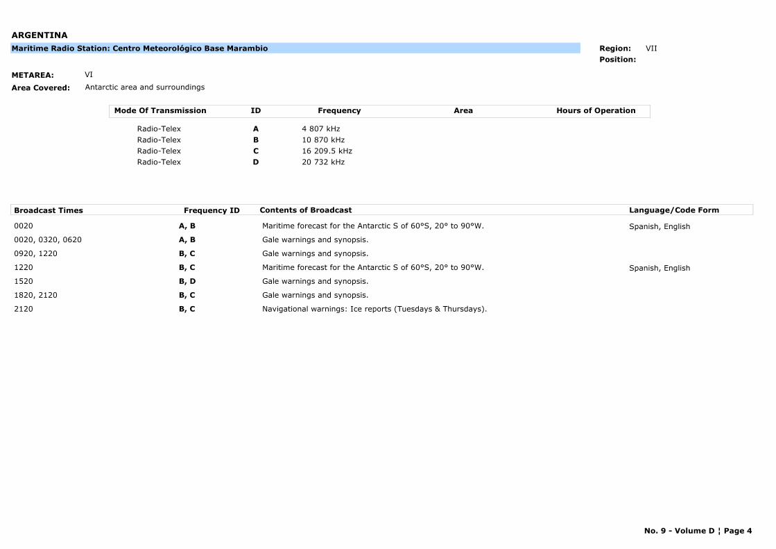
ARGENTINA
METAREA: VI
Area Covered: Antarctic area and surroundings
Maritime Radio Station: Centro Meteorológico Base Marambio Region: VII
Position:
Mode Of Transmission ID Frequency Area Hours of Operation
Radio-Telex A 4 807 kHz
Radio-Telex B 10 870 kHz
Radio-Telex C 16 209.5 kHz
Radio-Telex D 20 732 kHz
Broadcast Times Frequency ID Contents of Broadcast Language/Code Form
0020 A, B Maritime forecast for the Antarctic S of 60°S, 20° to 90°W. Spanish, English
0020, 0320, 0620 A, B Gale warnings and synopsis.
0920, 1220 B, C Gale warnings and synopsis.
1220 B, C Maritime forecast for the Antarctic S of 60°S, 20° to 90°W. Spanish, English
1520 B, D Gale warnings and synopsis.
1820, 2120 B, C Gale warnings and synopsis.
2120 B, C Navigational warnings: Ice reports (Tuesdays & Thursdays).
No. 9 - Volume D ¦ Page 4
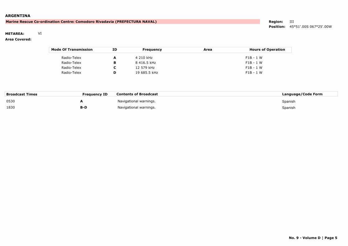
ARGENTINA
METAREA: VI
Area Covered:
Marine Rescue Co-ordination Centre: Comodoro Rivadavia (PREFECTURA NAVAL) Region: III
Position: 45°51'.00S 067°25'.00W
Mode Of Transmission ID Frequency Area Hours of Operation
Radio-Telex A 4 210 kHz F1B - 1 W
Radio-Telex B 8 416.5 kHz F1B - 1 W
Radio-Telex C 12 579 kHz F1B - 1 W
Radio-Telex D 19 685.5 kHz F1B - 1 W
Broadcast Times Frequency ID Contents of Broadcast Language/Code Form
0530 A Navigational warnings. Spanish
1830 B-D Navigational warnings. Spanish
No. 9 - Volume D ¦ Page 5
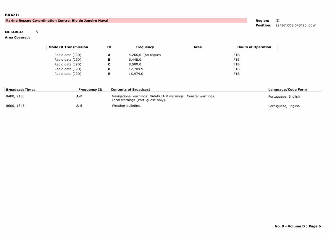
BRAZIL
METAREA: V
Area Covered:
Marine Rescue Co-ordination Centre: Rio de Janeiro Naval Region: III
Position: 22°56'.00S 043°20'.00W
Mode Of Transmission ID Frequency Area Hours of Operation
Radio data (J2D) A 4,266,0 (on reques F1B
Radio data (J2D) B 6,448.0 F1B
Radio data (J2D) C 8,580.0 F1B
Radio data (J2D) D 12,709.9 F1B
Radio data (J2D) E 16,974.0 F1B
Broadcast Times Frequency ID Contents of Broadcast Language/Code Form
0400, 2130 A-E Navigational warnings: NAVAREA V warnings. Coastal warnings. Local warnings (Portuguese only).
Portuguese, English
0600, 1845 A-E Weather bulletins. Portuguese, English
No. 9 - Volume D ¦ Page 6
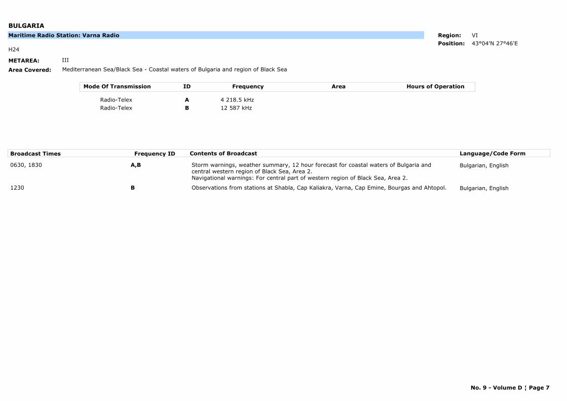
BULGARIA
METAREA: III
Area Covered: Mediterranean Sea/Black Sea - Coastal waters of Bulgaria and region of Black Sea
H24
Maritime Radio Station: Varna Radio Region: VI
Position: 43°04'N 27°46'E
Mode Of Transmission ID Frequency Area Hours of Operation
Radio-Telex A 4 218.5 kHz
Radio-Telex B 12 587 kHz
Broadcast Times Frequency ID Contents of Broadcast Language/Code Form
0630, 1830 A,B Storm warnings, weather summary, 12 hour forecast for coastal waters of Bulgaria and central western region of Black Sea, Area 2.Navigational warnings: For central part of western region of Black Sea, Area 2.
Bulgarian, English
1230 B Observations from stations at Shabla, Cap Kaliakra, Varna, Cap Emine, Bourgas and Ahtopol. Bulgarian, English
No. 9 - Volume D ¦ Page 7
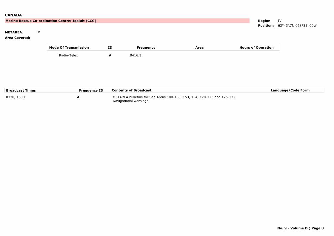
CANADA
METAREA: IV
Area Covered:
Marine Rescue Co-ordination Centre: Iqaluit (CCG) Region: IV
Position: 63°43'.7N 068°33'.00W
Mode Of Transmission ID Frequency Area Hours of Operation
Radio-Telex A 8416.5
Broadcast Times Frequency ID Contents of Broadcast Language/Code Form
0330, 1530 A METAREA bulletins for Sea Areas 100-108, 153, 154, 170-173 and 175-177.Navigational warnings.
No. 9 - Volume D ¦ Page 8
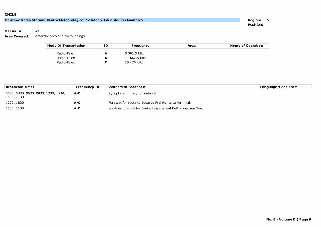
CHILE
METAREA: XV
Area Covered: Antarctic area and surroundings
Maritime Radio Station: Centro Meteorológico Presidente Eduardo Frei Montalva Region: VII
Position:
Mode Of Transmission ID Frequency Area Hours of Operation
Radio-Telex A 5 302.5 kHz
Radio-Telex B 11 662.5 kHz
Radio-Telex C 15 470 kHz
Broadcast Times Frequency ID Contents of Broadcast Language/Code Form
0030, 0330, 0630, 0930, 1230, 1530, 1830, 2130
A-C Synoptic summary for Antarctic.
1230, 1830 A-C Forecast for route to Eduardo Frei Montalva terminal.
1530, 2130 A-C Weather forecast for Drake Passage and Bellingshausen Sea.
No. 9 - Volume D ¦ Page 9
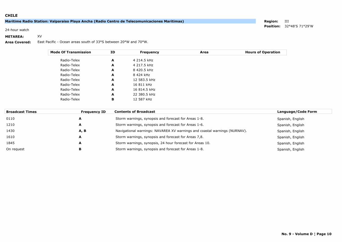
CHILE
METAREA: XV
Area Covered: East Pacific - Ocean areas south of 33°S between 20°W and 70°W.
24-hour watch
Maritime Radio Station: Valparaiso Playa Ancha (Radio Centro de Telecomunicaciones Maritimas) Region: III
Position: 32°48'S 71°29'W
Mode Of Transmission ID Frequency Area Hours of Operation
Radio-Telex A 4 214.5 kHz
Radio-Telex A 4 217.5 kHz
Radio-Telex A 8 420.5 kHz
Radio-Telex A 8 424 kHz
Radio-Telex A 12 583.5 kHz
Radio-Telex A 16 811 kHz
Radio-Telex A 16 814.5 kHz
Radio-Telex A 22 380.5 kHz
Radio-Telex B 12 587 kHz
Broadcast Times Frequency ID Contents of Broadcast Language/Code Form
0110 A Storm warnings, synopsis and forecast for Areas 1-8. Spanish, English
1210 A Storm warnings, synopsis and forecast for Areas 1-6. Spanish, English
1430 A, B Navigational warnings: NAVAREA XV warnings and coastal warnings (NURNAV). Spanish, English
1610 A Storm warnings, synopsis and forecast for Areas 7,8. Spanish, English
1845 A Storm warnings, synopsis, 24 hour forecast for Areas 10. Spanish, English
On request B Storm warnings, synopsis and forecast for Areas 1-8. Spanish, English
No. 9 - Volume D ¦ Page 10
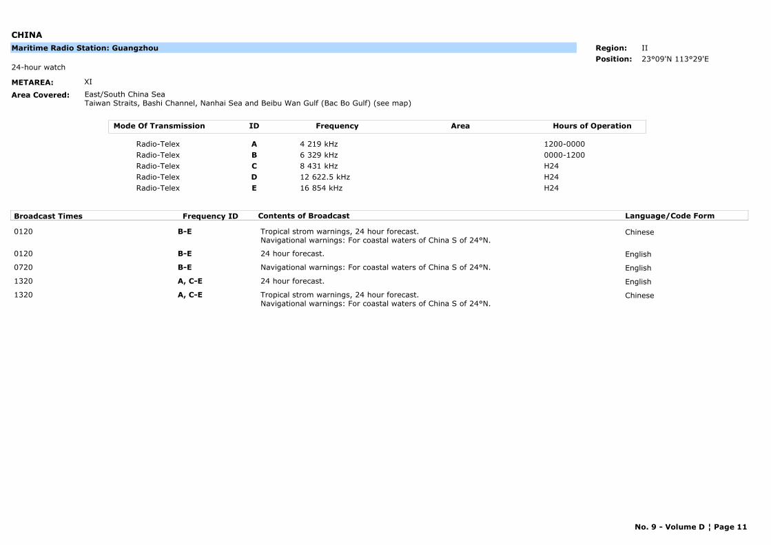
CHINA
METAREA: XI
Area Covered: East/South China SeaTaiwan Straits, Bashi Channel, Nanhai Sea and Beibu Wan Gulf (Bac Bo Gulf) (see map)
24-hour watch
Maritime Radio Station: Guangzhou Region: II
Position: 23°09'N 113°29'E
Mode Of Transmission ID Frequency Area Hours of Operation
Radio-Telex A 4 219 kHz 1200-0000
Radio-Telex B 6 329 kHz 0000-1200
Radio-Telex C 8 431 kHz H24
Radio-Telex D 12 622.5 kHz H24
Radio-Telex E 16 854 kHz H24
Broadcast Times Frequency ID Contents of Broadcast Language/Code Form
0120 B-E Tropical strom warnings, 24 hour forecast.Navigational warnings: For coastal waters of China S of 24°N.
Chinese
0120 B-E 24 hour forecast. English
0720 B-E Navigational warnings: For coastal waters of China S of 24°N. English
1320 A, C-E 24 hour forecast. English
1320 A, C-E Tropical strom warnings, 24 hour forecast.Navigational warnings: For coastal waters of China S of 24°N.
Chinese
No. 9 - Volume D ¦ Page 11
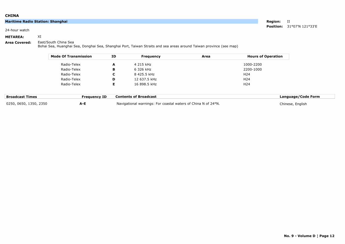
CHINA
METAREA: XI
Area Covered: East/South China SeaBohai Sea, Huanghai Sea, Donghai Sea, Shanghai Port, Taiwan Straits and sea areas around Taiwan province (see map)
24-hour watch
Maritime Radio Station: Shanghai Region: II
Position: 31°07'N 121°33'E
Mode Of Transmission ID Frequency Area Hours of Operation
Radio-Telex A 4 215 kHz 1000-2200
Radio-Telex B 6 326 kHz 2200-1000
Radio-Telex C 8 425.5 kHz H24
Radio-Telex D 12 637.5 kHz H24
Radio-Telex E 16 898.5 kHz H24
Broadcast Times Frequency ID Contents of Broadcast Language/Code Form
0250, 0650, 1350, 2350 A-E Navigational warnings: For coastal waters of China N of 24°N. Chinese, English
No. 9 - Volume D ¦ Page 12
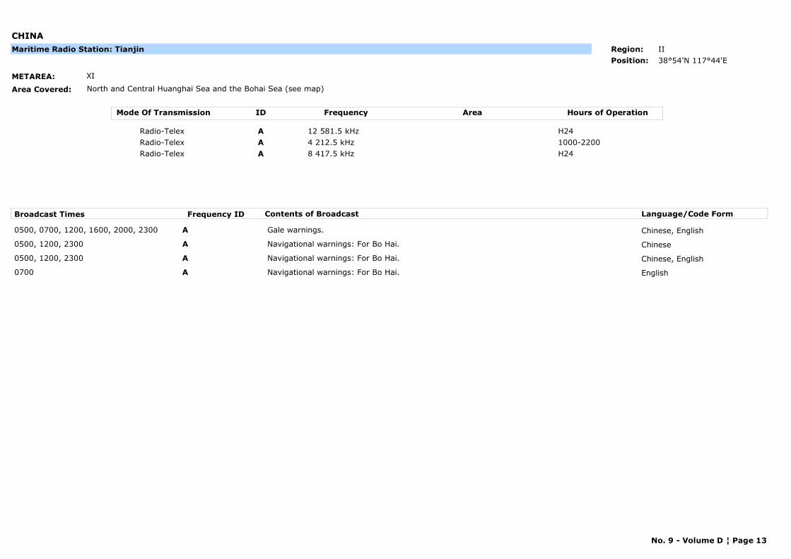
CHINA
METAREA: XI
Area Covered: North and Central Huanghai Sea and the Bohai Sea (see map)
Maritime Radio Station: Tianjin Region: II
Position: 38°54'N 117°44'E
Mode Of Transmission ID Frequency Area Hours of Operation
Radio-Telex A 12 581.5 kHz H24
Radio-Telex A 4 212.5 kHz 1000-2200
Radio-Telex A 8 417.5 kHz H24
Broadcast Times Frequency ID Contents of Broadcast Language/Code Form
0500, 0700, 1200, 1600, 2000, 2300 A Gale warnings. Chinese, English
0500, 1200, 2300 A Navigational warnings: For Bo Hai. Chinese
0500, 1200, 2300 A Navigational warnings: For Bo Hai. Chinese, English
0700 A Navigational warnings: For Bo Hai. English
No. 9 - Volume D ¦ Page 13
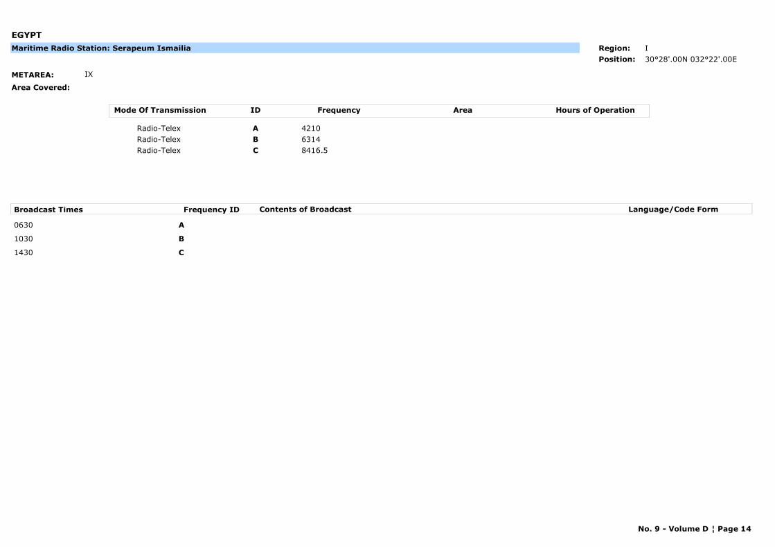
EGYPT
METAREA: IX
Area Covered:
Maritime Radio Station: Serapeum Ismailia Region: I
Position: 30°28'.00N 032°22'.00E
Mode Of Transmission ID Frequency Area Hours of Operation
Radio-Telex A 4210
Radio-Telex B 6314
Radio-Telex C 8416.5
Broadcast Times Frequency ID Contents of Broadcast Language/Code Form
0630 A
1030 B
1430 C
No. 9 - Volume D ¦ Page 14
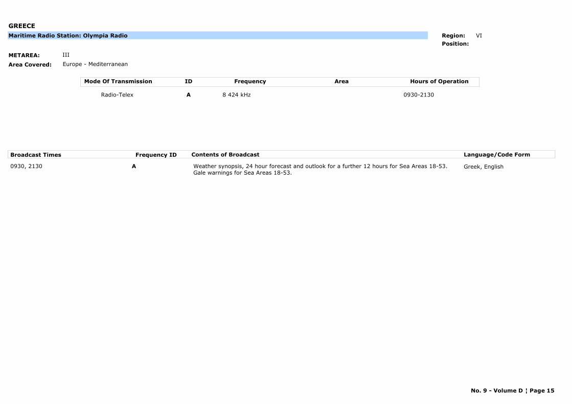
GREECE
METAREA: III
Area Covered: Europe - Mediterranean
Maritime Radio Station: Olympia Radio Region: VI
Position:
Mode Of Transmission ID Frequency Area Hours of Operation
Radio-Telex A 8 424 kHz 0930-2130
Broadcast Times Frequency ID Contents of Broadcast Language/Code Form
0930, 2130 A Weather synopsis, 24 hour forecast and outlook for a further 12 hours for Sea Areas 18-53.Gale warnings for Sea Areas 18-53.
Greek, English
No. 9 - Volume D ¦ Page 15
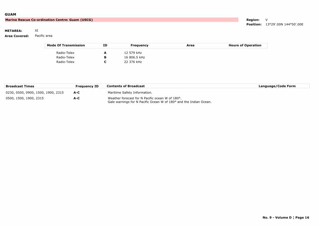
GUAM
METAREA: XI
Area Covered: Pacific area
Marine Rescue Co-ordination Centre: Guam (USCG) Region: V
Position: 13°29'.00N 144°50'.00E
Mode Of Transmission ID Frequency Area Hours of Operation
Radio-Telex A 12 579 kHz
Radio-Telex B 16 806.5 kHz
Radio-Telex C 22 376 kHz
Broadcast Times Frequency ID Contents of Broadcast Language/Code Form
0230, 0500, 0900, 1500, 1900, 2315 A-C Maritime Safety Information.
0500, 1500, 1900, 2315 A-C Weather forecast for N Pacific ocean W of 180°.Gale warnings for N Pacific Ocean W of 180° and the Indian Ocean.
No. 9 - Volume D ¦ Page 16
INDONESIA
METAREA: XI
Area Covered:
24-hour watch
Maritime Radio Station: Jakarta Region: V
Position: 06°07'S 106°51'E
Mode Of Transmission ID Frequency Area Hours of Operation
Radio-Telex A 8 416.5
Radio-Telex B 16 806.5
Broadcast Times Frequency ID Contents of Broadcast Language/Code Form
0000, 1130 B Meteorological and navigational warnings. English
1100 A Storm warnings, 24 hour forecast, synopsis and analysis for Indonesian waters and China Sea, also Indian and Pacific Oceans.Storm warnings for Indonesian waters and China Sea, also Indian and Pacific Oceans if applicable.
English
No. 9 - Volume D ¦ Page 17
IRAN, ISLAMIC REPUBLIC OF
METAREA: IX
Area Covered:
Maritime Radio Station: Abbas Region: II
Position: 27°12'.00N 057°17'.00E
Mode Of Transmission ID Frequency Area Hours of Operation
Radio-Telex A 4 MHz
Radio-Telex B 8 MHz
Radio-Telex C 12 MHz
Broadcast Times Frequency ID Contents of Broadcast Language/Code Form
0530, 1230 B
0830, 1030 C
1430, 1830 A
No. 9 - Volume D ¦ Page 18
PERU
METAREA: XVI
Area Covered:
Maritime Radio Station: Callao Region: III
Position: 12°03'.00S 077°07'.00W
Mode Of Transmission ID Frequency Area Hours of Operation
Radio-Telex A 8 MHz
Broadcast Times Frequency ID Contents of Broadcast Language/Code Form
1600 A
No. 9 - Volume D ¦ Page 19
PERU
METAREA: XVI
Area Covered:
Maritime Radio Station: Mollendo Region: III
Position: 17°01'.00S 072°01'.00W
Mode Of Transmission ID Frequency Area Hours of Operation
Radio-Telex A 8 MHz
Broadcast Times Frequency ID Contents of Broadcast Language/Code Form
2100 A
No. 9 - Volume D ¦ Page 20

PERU
METAREA: XVI
Area Covered:
Maritime Radio Station: Paita Region: III
Position: 05°05'.00S 081°07'.00W
Mode Of Transmission ID Frequency Area Hours of Operation
Radio-Telex A 8 MHz
Broadcast Times Frequency ID Contents of Broadcast Language/Code Form
0200 A
No. 9 - Volume D ¦ Page 21
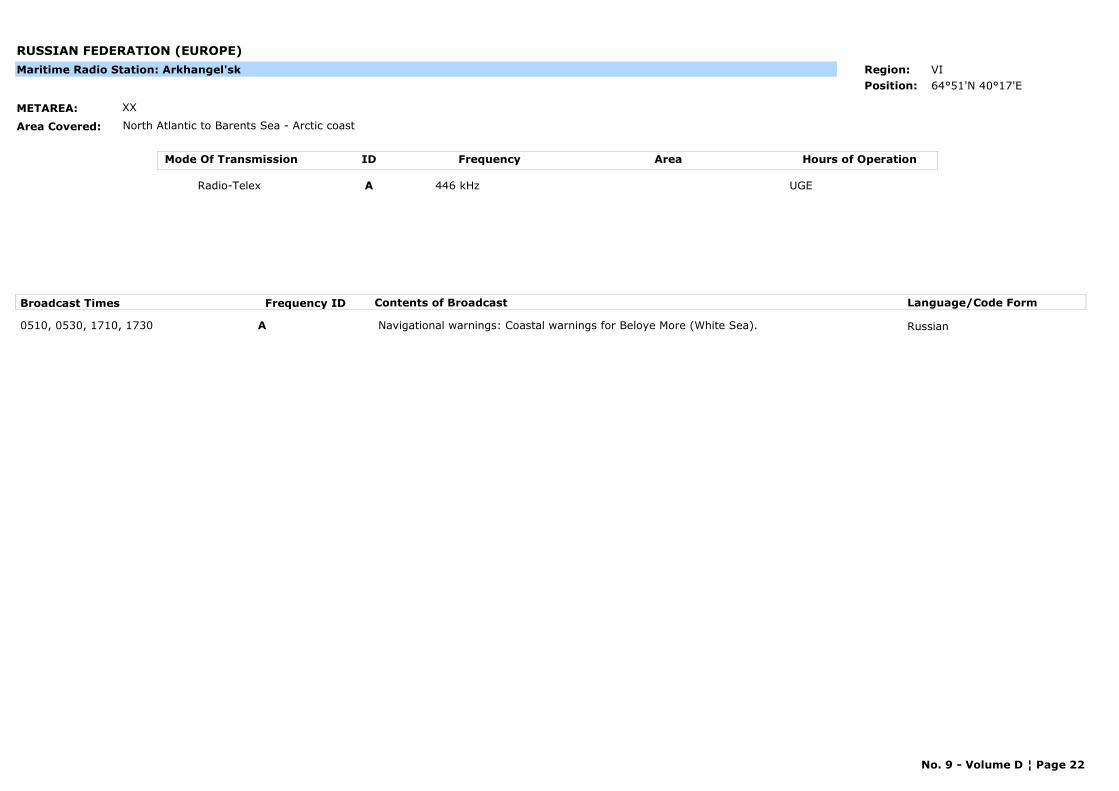
RUSSIAN FEDERATION (EUROPE)
METAREA: XX
Area Covered: North Atlantic to Barents Sea - Arctic coast
Maritime Radio Station: Arkhangel'sk Region: VI
Position: 64°51'N 40°17'E
Mode Of Transmission ID Frequency Area Hours of Operation
Radio-Telex A 446 kHz UGE
Broadcast Times Frequency ID Contents of Broadcast Language/Code Form
0510, 0530, 1710, 1730 A Navigational warnings: Coastal warnings for Beloye More (White Sea). Russian
No. 9 - Volume D ¦ Page 22
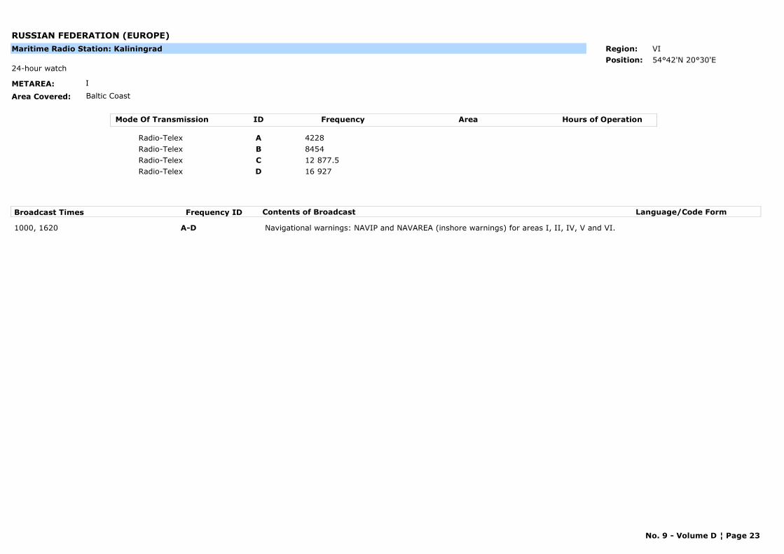
RUSSIAN FEDERATION (EUROPE)
METAREA: I
Area Covered: Baltic Coast
24-hour watch
Maritime Radio Station: Kaliningrad Region: VI
Position: 54°42'N 20°30'E
Mode Of Transmission ID Frequency Area Hours of Operation
Radio-Telex A 4228
Radio-Telex B 8454
Radio-Telex C 12 877.5
Radio-Telex D 16 927
Broadcast Times Frequency ID Contents of Broadcast Language/Code Form
1000, 1620 A-D Navigational warnings: NAVIP and NAVAREA (inshore warnings) for areas I, II, IV, V and VI.
No. 9 - Volume D ¦ Page 23
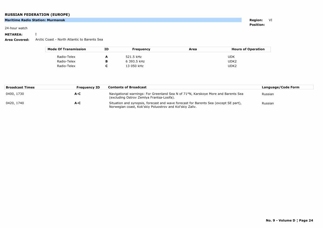
RUSSIAN FEDERATION (EUROPE)
METAREA: I
Area Covered: Arctic Coast - North Atlantic to Barents Sea
24-hour watch
Maritime Radio Station: Murmansk Region: VI
Position:
Mode Of Transmission ID Frequency Area Hours of Operation
Radio-Telex A 521.5 kHz UDK
Radio-Telex B 6 393.5 kHz UDK2
Radio-Telex C 13 050 kHz UDK2
Broadcast Times Frequency ID Contents of Broadcast Language/Code Form
0400, 1730 A-C Navigational warnings: For Greenland Sea N of 71°N, Karskoye More and Barents Sea (excluding Ostrov Zemlya Frantsa-Losifa).
Russian
0420, 1740 A-C Situation and synopsis, forecast and wave forecast for Barents Sea (except SE part), Norwegian coast, Kok'skiy Poluostrov and Kol'skiy Zaliv.
Russian
No. 9 - Volume D ¦ Page 24
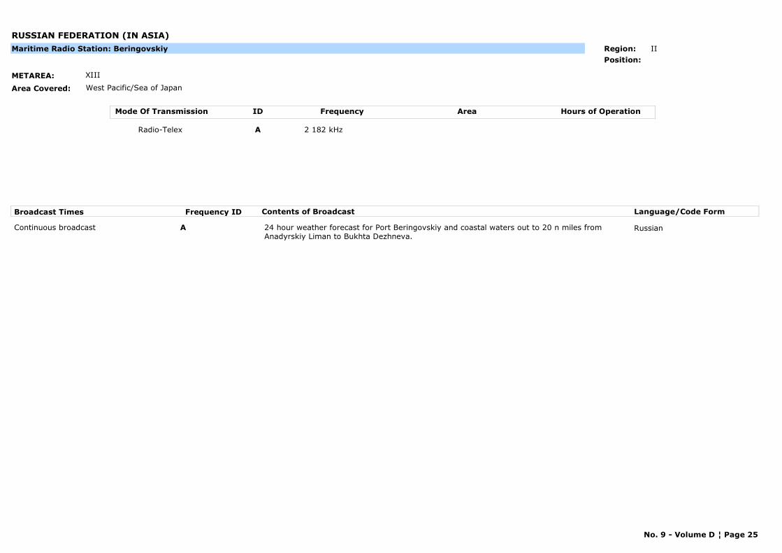
RUSSIAN FEDERATION (IN ASIA)
METAREA: XIII
Area Covered: West Pacific/Sea of Japan
Maritime Radio Station: Beringovskiy Region: II
Position:
Mode Of Transmission ID Frequency Area Hours of Operation
Radio-Telex A 2 182 kHz
Broadcast Times Frequency ID Contents of Broadcast Language/Code Form
Continuous broadcast A 24 hour weather forecast for Port Beringovskiy and coastal waters out to 20 n miles from Anadyrskiy Liman to Bukhta Dezhneva.
Russian
No. 9 - Volume D ¦ Page 25
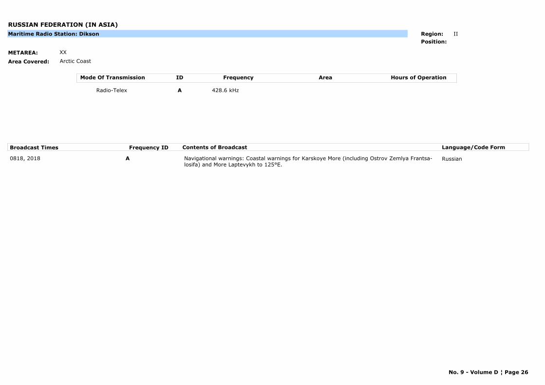
RUSSIAN FEDERATION (IN ASIA)
METAREA: XX
Area Covered: Arctic Coast
Maritime Radio Station: Dikson Region: II
Position:
Mode Of Transmission ID Frequency Area Hours of Operation
Radio-Telex A 428.6 kHz
Broadcast Times Frequency ID Contents of Broadcast Language/Code Form
0818, 2018 A Navigational warnings: Coastal warnings for Karskoye More (including Ostrov Zemlya Frantsa-losifa) and More Laptevykh to 125°E.
Russian
No. 9 - Volume D ¦ Page 26
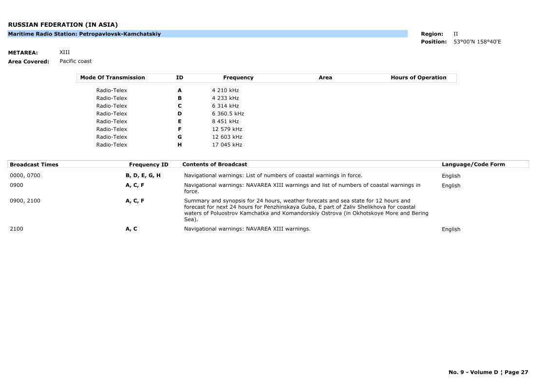
RUSSIAN FEDERATION (IN ASIA)
METAREA: XIII
Area Covered: Pacific coast
Maritime Radio Station: Petropavlovsk-Kamchatskiy Region: II
Position: 53°00'N 158°40'E
Mode Of Transmission ID Frequency Area Hours of Operation
Radio-Telex A 4 210 kHz
Radio-Telex B 4 233 kHz
Radio-Telex C 6 314 kHz
Radio-Telex D 6 360.5 kHz
Radio-Telex E 8 451 kHz
Radio-Telex F 12 579 kHz
Radio-Telex G 12 603 kHz
Radio-Telex H 17 045 kHz
Broadcast Times Frequency ID Contents of Broadcast Language/Code Form
0000, 0700 B, D, E, G, H Navigational warnings: List of numbers of coastal warnings in force. English
0900 A, C, F Navigational warnings: NAVAREA XIII warnings and list of numbers of coastal warnings in force.
English
0900, 2100 A, C, F Summary and synopsis for 24 hours, weather forecats and sea state for 12 hours and forecast for next 24 hours for Penzhinskaya Guba, E part of Zaliv Shelikhova for coastal waters of Poluostrov Kamchatka and Komandorskiy Ostrova (in Okhotskoye More and Bering Sea).
2100 A, C Navigational warnings: NAVAREA XIII warnings. English
No. 9 - Volume D ¦ Page 27
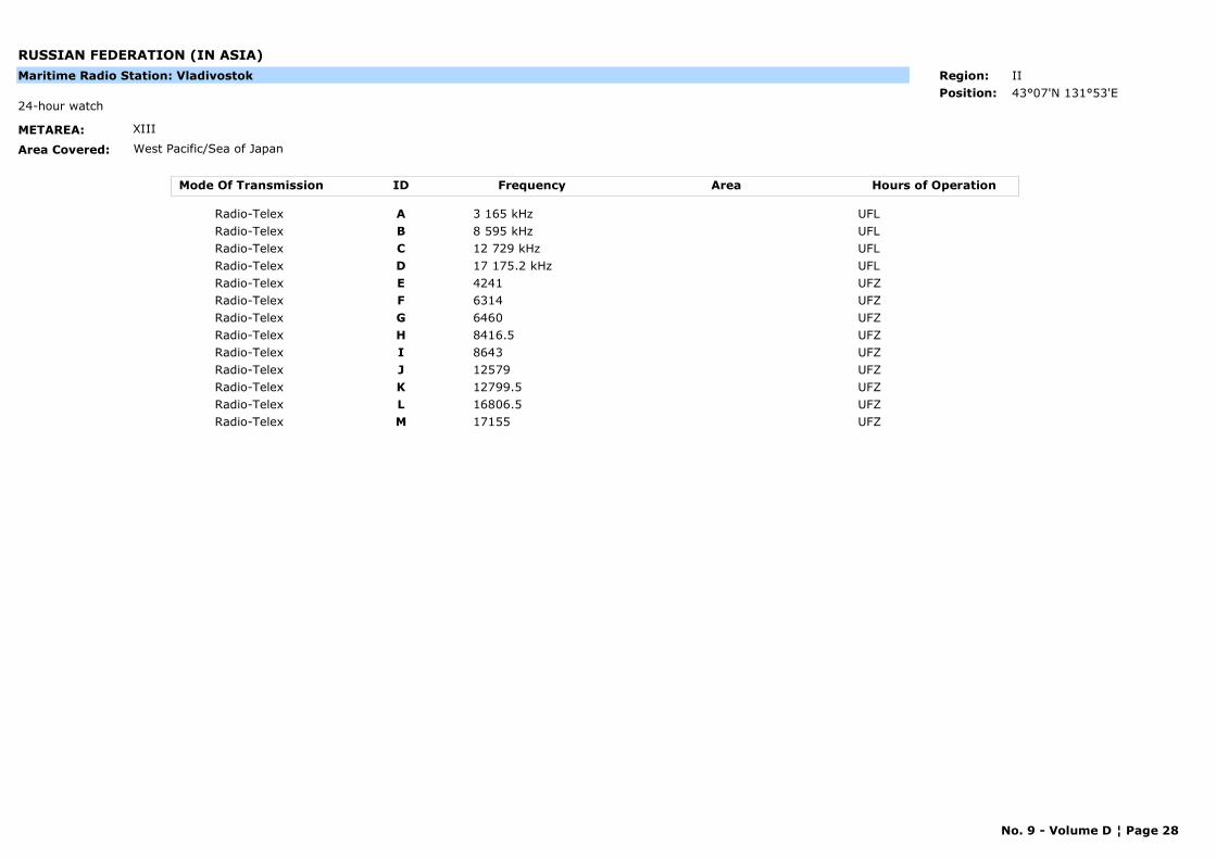
RUSSIAN FEDERATION (IN ASIA)
METAREA: XIII
Area Covered: West Pacific/Sea of Japan
24-hour watch
Maritime Radio Station: Vladivostok Region: II
Position: 43°07'N 131°53'E
Mode Of Transmission ID Frequency Area Hours of Operation
Radio-Telex A 3 165 kHz UFL
Radio-Telex B 8 595 kHz UFL
Radio-Telex C 12 729 kHz UFL
Radio-Telex D 17 175.2 kHz UFL
Radio-Telex E 4241 UFZ
Radio-Telex F 6314 UFZ
Radio-Telex G 6460 UFZ
Radio-Telex H 8416.5 UFZ
Radio-Telex I 8643 UFZ
Radio-Telex J 12579 UFZ
Radio-Telex K 12799.5 UFZ
Radio-Telex L 16806.5 UFZ
Radio-Telex M 17155 UFZ
No. 9 - Volume D ¦ Page 28
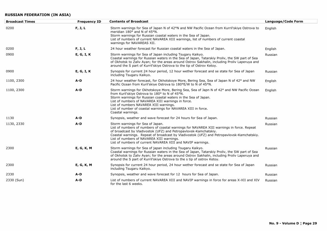
RUSSIAN FEDERATION (IN ASIA)
Broadcast Times Frequency ID Contents of Broadcast Language/Code Form
0200 F, J, L Storm warnings for Sea of Japan N of 42°N and NW Pacific Ocean from Kurril'skiye Ostrova to meridian 180° and N of 45°N.Storm warnings for Russian coastal waters in the Sea of Japan.List of numbers of current NAVAREA XIII warnings, list of numbers of current coastal warnings for NAVAREAS XII.
English
0200 F, J, L 24 hour weather forecast for Russian coastal waters in the Sea of Japan. English
0900 E, G, I, K Storm warnings for Sea of Japan including Tsugaru Kaikyo.Coastal warnings for Russian waters in the Sea of Japan, Tatarskiy Proliv, the SW part of Sea of Okhotsk to Zaliv Ayan; for the areas around Ostrov Sakhalin, including Proliv Laperuya and around the S part of Kurril'skiye Ostrova to the tip of Ostrov Ketoy.
Russian
0900 E, G, I, K Synopsis for current 24 hour period, 12 hour wether forecast and se state for Sea of Japan including Tsugaru Kaikyo.
Russian
1100, 2300 A-D 24 hour weather forecast, for Okhotskoye More, Bering Sea, Sea of Japan N of 42° and NW Pacific Ocean from Kuril'skiye Ostrova to 180°E/W to N of 45°N.
English
1100, 2300 A-D Storm warnings for Okhotskoye More, Bering Sea, Sea of Japn N of 42° and NW Pacific Ocean from Kuril'skiye Ostrova to 180° to N of 45°N.Storm warnings for Russian coastal waters in the Sea of Japan.List of numbers of NAVAREA XIII warnings in force.List of numbers NAVAREA XIII warnings.List of number of coastal warnings for NAVAREA XIII in force.Coastal warnings.
English
1130 A-D Synopsis, weather and wave forecast for 24 hours for Sea of Japan. Russian
1130, 2330 A-D Storm warnings for Sea of Japan.List of numbers of numbers of coastal warnings for NAVAREA XIII warnings in force. Repeat of broadcast by Vladivostok (UFZ) and Petropavlovsk-Kamchatskiy.Coastal warnings. Repeat of broadcast by Vladivostok (UFZ) and Petropavlovsk-Kamchatskiy.List of numbers of NAVAREA XIII warnings.List of numbers of current NAVAREA XIII and NAVIP warnings.
Russian
2300 E, G, K, M Storm warnings for Sea of japan including Tsugaru Kaikyo.Coastal warnings for Russian waters in the Sea of Japan, Tatarskiy Proliv, the SW part of Sea of Okhotsk to Zaliv Ayan; for the areas around Ostrov Sakhalin, including Proliv Laperuya and around the S part of Kurril'skiye Ostrova to the s tip of ostrov Ketoy.
Russian
2300 E, G, K, M Synopsis for current 24 hour period, 24 hour wether forecast and se state for Sea of Japan including Tsugaru Kaikyo.
Russian
2330 A-D Synopsis, weather and wave forecast for 12 hours for Sea of Japan. Russian
2330 (Sun) A-D List of numbers of current NAVAREA XIII and NAVIP warnings in force for areas X-XII and XIV for the last 6 weeks.
Russian
No. 9 - Volume D ¦ Page 29
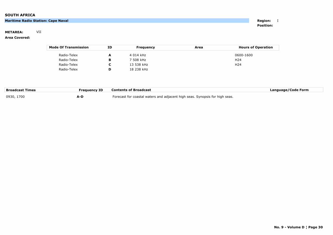
SOUTH AFRICA
METAREA: VII
Area Covered:
Maritime Radio Station: Cape Naval Region: I
Position:
Mode Of Transmission ID Frequency Area Hours of Operation
Radio-Telex A 4 014 kHz 0600-1600
Radio-Telex B 7 508 kHz H24
Radio-Telex C 13 538 kHz H24
Radio-Telex D 18 238 kHz
Broadcast Times Frequency ID Contents of Broadcast Language/Code Form
0930, 1700 A-D Forecast for coastal waters and adjacent high seas. Synopsis for high seas.
No. 9 - Volume D ¦ Page 30
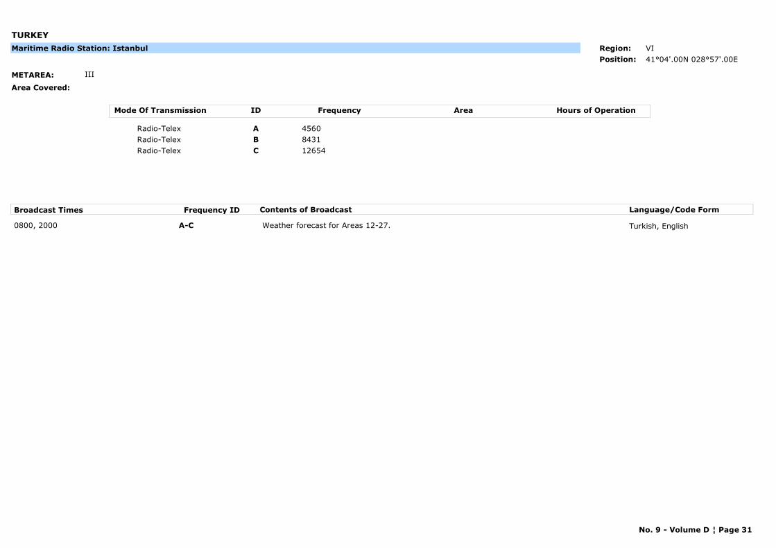
TURKEY
METAREA: III
Area Covered:
Maritime Radio Station: Istanbul Region: VI
Position: 41°04'.00N 028°57'.00E
Mode Of Transmission ID Frequency Area Hours of Operation
Radio-Telex A 4560
Radio-Telex B 8431
Radio-Telex C 12654
Broadcast Times Frequency ID Contents of Broadcast Language/Code Form
0800, 2000 A-C Weather forecast for Areas 12-27. Turkish, English
No. 9 - Volume D ¦ Page 31
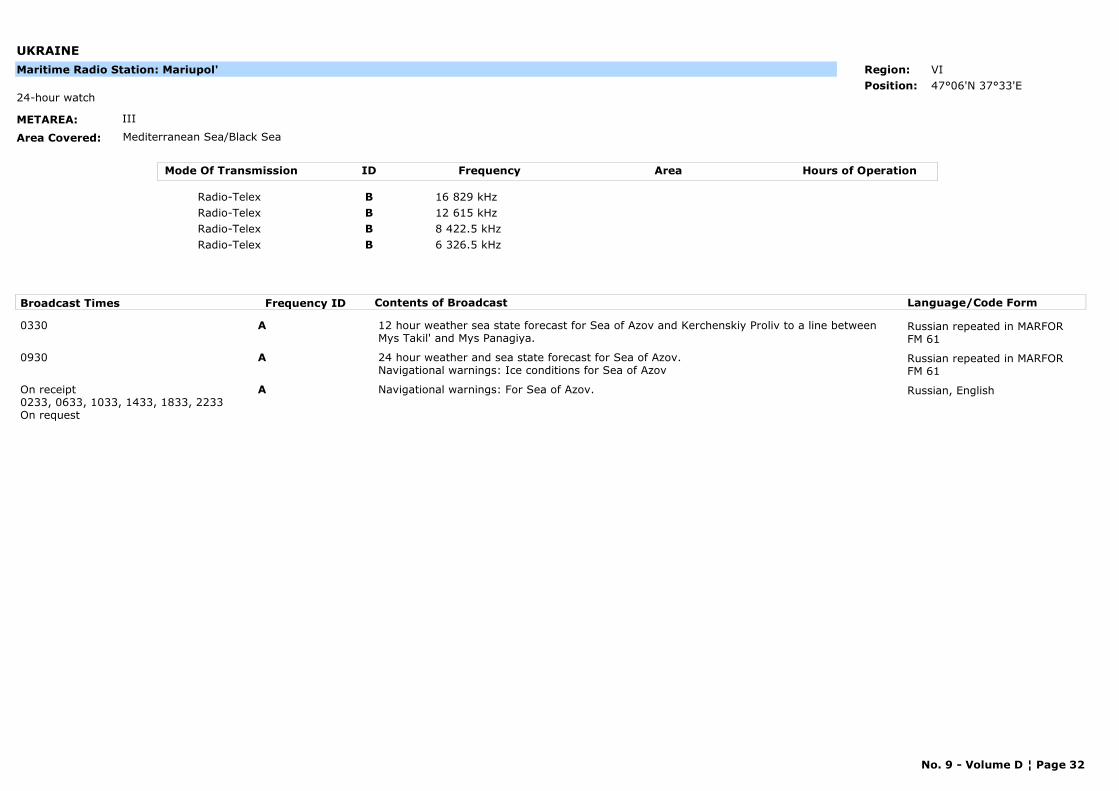
UKRAINE
METAREA: III
Area Covered: Mediterranean Sea/Black Sea
24-hour watch
Maritime Radio Station: Mariupol' Region: VI
Position: 47°06'N 37°33'E
Mode Of Transmission ID Frequency Area Hours of Operation
Radio-Telex B 16 829 kHz
Radio-Telex B 12 615 kHz
Radio-Telex B 8 422.5 kHz
Radio-Telex B 6 326.5 kHz
Broadcast Times Frequency ID Contents of Broadcast Language/Code Form
0330 A 12 hour weather sea state forecast for Sea of Azov and Kerchenskiy Proliv to a line between Mys Takil' and Mys Panagiya.
Russian repeated in MARFOR FM 61
0930 A 24 hour weather and sea state forecast for Sea of Azov. Navigational warnings: Ice conditions for Sea of Azov
Russian repeated in MARFOR FM 61
On receipt0233, 0633, 1033, 1433, 1833, 2233On request
A Navigational warnings: For Sea of Azov. Russian, English
No. 9 - Volume D ¦ Page 32
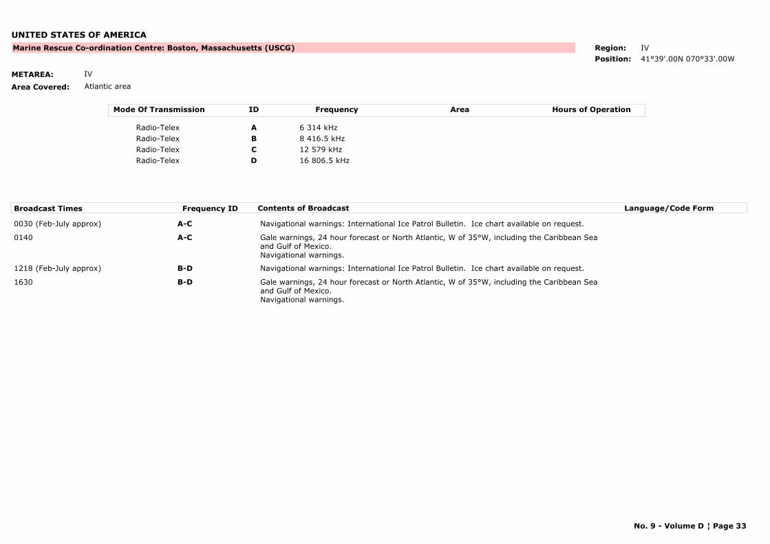
UNITED STATES OF AMERICA
METAREA: IV
Area Covered: Atlantic area
Marine Rescue Co-ordination Centre: Boston, Massachusetts (USCG) Region: IV
Position: 41°39'.00N 070°33'.00W
Mode Of Transmission ID Frequency Area Hours of Operation
Radio-Telex A 6 314 kHz
Radio-Telex B 8 416.5 kHz
Radio-Telex C 12 579 kHz
Radio-Telex D 16 806.5 kHz
Broadcast Times Frequency ID Contents of Broadcast Language/Code Form
0030 (Feb-July approx) A-C Navigational warnings: International Ice Patrol Bulletin. Ice chart available on request.
0140 A-C Gale warnings, 24 hour forecast or North Atlantic, W of 35°W, including the Caribbean Sea and Gulf of Mexico.Navigational warnings.
1218 (Feb-July approx) B-D Navigational warnings: International Ice Patrol Bulletin. Ice chart available on request.
1630 B-D Gale warnings, 24 hour forecast or North Atlantic, W of 35°W, including the Caribbean Sea and Gulf of Mexico.Navigational warnings.
No. 9 - Volume D ¦ Page 33
UNITED STATES OF AMERICA
METAREA: IV
Area Covered: Gulf coast
Marine Rescue Co-ordination Centre: Mobile (USCG) Region: IV
Position: 30°42'N 88°02'W
Mode Of Transmission ID Frequency Area Hours of Operation
Radio-Telex A 4 213 kHz H24
Radio-Telex B 6 317 kHz H24
Radio-Telex C 8 419 kHz H24
Radio-Telex D 8 421 kHz H24
Radio-Telex E 8 423.5 kHz H24
Radio-Telex F 12 581.5 kHz H24
Radio-Telex G 12 584.5 kHz H24
Radio-Telex H 16 809 kHz H24
Radio-Telex I 16 814 kHz H24
Radio-Telex J 19 685.5 kHz H24
Radio-Telex K 22 383.5 kHz H24
Radio-Telex L 26 105.5 kHz H24
Broadcast Times Frequency ID Contents of Broadcast Language/Code Form
0500, 1100, 1700, 2300 A-L Forecast for Gulf of Mexico, Southwest North Atlantic and Caribbean.
No. 9 - Volume D ¦ Page 34
UNITED STATES OF AMERICA
METAREA: ANTARCTICA
Area Covered: Antarctic area and surroundings
Maritime Radio Station: Palmer Station Region: VII
Position:
Mode Of Transmission ID Frequency Area Hours of Operation
Radio-Telex A 4 553 kHz
Radio-Telex B 10 235 kHz
Radio-Telex C 13 553 kHz
Broadcast Times Frequency ID Contents of Broadcast Language/Code Form
0100 A Navigational warnings: Ice reports for 60°W-20°E.
1500 C Navigational warnings: Ice reports for 60°W-20°E.
2000 B Navigational warnings: Ice reports for 60°W-20°E.
No. 9 - Volume D ¦ Page 35
UNITED STATES OF AMERICA
METAREA: XII
Area Covered: Pacific coast
Marine Rescue Co-ordination Centre: Point Reyes, San Francisco (CAMSPAC) Region: IV
Position:
Mode Of Transmission ID Frequency Area Hours of Operation
Radio-Telex A 8 416.5 kHz
Radio-Telex B 16 806.5 kHz
Broadcast Times Frequency ID Contents of Broadcast Language/Code Form
0015, 1730 A, B High Seas forecat for NE Pacific - Equator to 30°N and E of 140°W and mid Pacific.Navigational Warnings.
No. 9 - Volume D ¦ Page 36
UNITED STATES OF AMERICA (HAWAII)
METAREA: XII
Area Covered: Pacific area
Marine Rescue Co-ordination Centre: Honolulu Region: V
Position: 21°26'.00N 158°09'.00W
Mode Of Transmission ID Frequency Area Hours of Operation
Radio-Telex A 8 416.5 kHz
Radio-Telex B 12 579 kHz
Radio-Telex C 22 376 kHz
Broadcast Times Frequency ID Contents of Broadcast Language/Code Form
0130, 2030 A-C High seas forecast for Pacific Ocean.Navigational warnings: Maritime Safety Information.
0730, 1330 A,B High seas forecast for Pacific Ocean.Navigational warnings: Maritime Safety Information.
No. 9 - Volume D ¦ Page 37

PART D
METEOROLOGICAL BROADCASTS BY RADIO-FACSIMILE

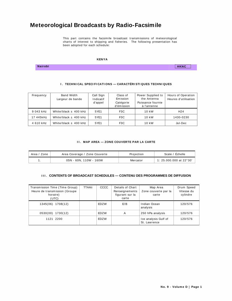
No. 9 - Volume D ¦ Page 1
Meteorological Broadcasts by Radio-Facsimile
This part contains the facsimile broadcast transmissions of meteorological charts of interest to shipping and fisheries. The following presentation has been adopted for each schedule:
KENYA
Nairobi HKNC
I. TECHNICAL SPECIFICATIONS — CARACTÉRISTIQUES TECHNIQUES
Frequency Band Width Largeur de bande
Call Sign Indicatif d'appel
Class of Emission Catégorie d'émission
Power Supplied to the Antenna
Puissance fournie à l'antenne
Hours of Operation Heures d'utilisation
9 043 kHz White/black ± 400 kHz 5YE1 F3C 10 kW H24
17 445kHz White/black ± 400 kHz 5YE1 F3C 10 kW 1430-0230
4 610 kHz White/black ± 400 kHz 5YE1 F3C 10 kW Jul-Dec
II. MAP AREA — ZONE COUVERTE PAR LA CARTE
Area / Zone Area Coverage / Zone Couverte Projection Scale / Échelle
1. 05N - 60N, 110W - 160W Mercator 1: 25.000.000 at 22°30'
III. CONTENTS OF BROADCAST SCHEDULES — CONTENU DES PROGRAMMES DE DIFFUSION
Transmission Time (Time Group) Heure de transmission (Groupe
horaire) (UTC)
TTAAii CCCC Details of Chart Renseignements figurant sur la
carte
Map Area Zone couverte par la
carte
Drum Speed Vitesse du cylindre
1345(06) 1708(12) EDZW E/B Indian Ocean analysis
120/576
0530(00) 1730(12) EDZW A 250 hPa analysis 120/576
1121 2200 EDZW Ice analysis Gulf of St. Lawrence
120/576
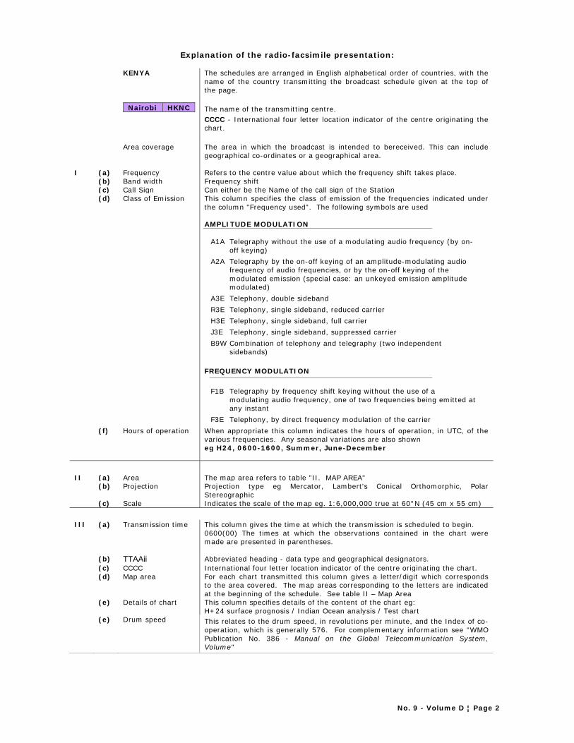
No. 9 - Volume D ¦ Page 2
Explanation of the radio-facsimile presentation:
KENYA The schedules are arranged in English alphabetical order of countries, with the name of the country transmitting the broadcast schedule given at the top of the page.
Nairobi HKNC
The name of the transmitting centre. CCCC - International four letter location indicator of the centre originating the chart.
Area coverage The area in which the broadcast is intended to bereceived. This can include
geographical co-ordinates or a geographical area. I (a) Frequency Refers to the centre value about which the frequency shift takes place. (b) Band width Frequency shift (c) Call Sign Can either be the Name of the call sign of the Station (d) Class of Emission This column specifies the class of emission of the frequencies indicated under
the column "Frequency used". The following symbols are used
AMPLITUDE MODULATION
A1A Telegraphy without the use of a modulating audio frequency (by on-off keying)
A2A Telegraphy by the on-off keying of an amplitude-modulating audio frequency of audio frequencies, or by the on-off keying of the modulated emission (special case: an unkeyed emission amplitude modulated)
A3E Telephony, double sideband R3E Telephony, single sideband, reduced carrier H3E Telephony, single sideband, full carrier J3E Telephony, single sideband, suppressed carrier B9W Combination of telephony and telegraphy (two independent
sidebands)
FREQUENCY MODULATION F1B Telegraphy by frequency shift keying without the use of a
modulating audio frequency, one of two frequencies being emitted at any instant
F3E Telephony, by direct frequency modulation of the carrier (f) Hours of operation When appropriate this column indicates the hours of operation, in UTC, of the
various frequencies. Any seasonal variations are also shown eg H24, 0600-1600, Summer, June-December
II (a) Area The map area refers to table "II. MAP AREA" (b) Projection Projection type eg Mercator, Lambert's Conical Orthomorphic, Polar
Stereographic (c) Scale Indicates the scale of the map eg. 1:6,000,000 true at 60°N (45 cm x 55 cm) III (a) Transmission time This column gives the time at which the transmission is scheduled to begin.
0600(00) The times at which the observations contained in the chart were made are presented in parentheses.
(b) TTAAii Abbreviated heading - data type and geographical designators. (c) CCCC International four letter location indicator of the centre originating the chart. (d) Map area For each chart transmitted this column gives a letter/digit which corresponds
to the area covered. The map areas corresponding to the letters are indicated at the beginning of the schedule. See table II – Map Area
(e) Details of chart This column specifies details of the content of the chart eg: H+24 surface prognosis / Indian Ocean analysis / Test chart
(e) Drum speed This relates to the drum speed, in revolutions per minute, and the Index of co-operation, which is generally 576. For complementary information see "WMO Publication No. 386 - Manual on the Global Telecommunication System, Volume"
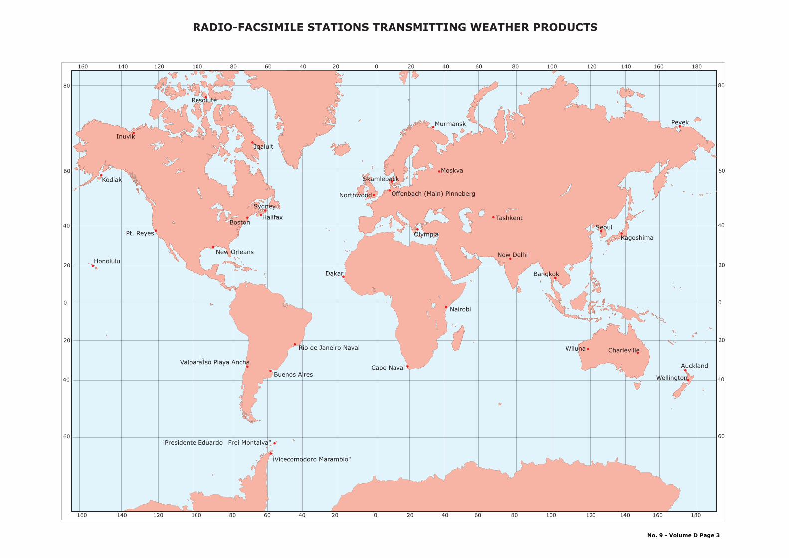
0
20
40
60
80
20
40
60
0
20
40
60
80
20
40
60
Nairobi
Wiluna
Wellington
Cape Naval
Kagoshima
SeoulTashkent
Moskva
Olympia
Northwood Offenbach (Main) Pinneberg
Skamlebaek
Murmansk
Iqaluit
Halifax Boston
Resolute
Kodiak
Inuvik
Buenos Aires
ValparaÌso Playa Ancha
160 140 120 100 80 60 40 20 0 20 40 60 80 100 120 140 160 180
ìPresidente Eduardo Frei Montalva"
ìVicecomodoro Marambio"
Pt. Reyes
Honolulu
Dakar
New Orleans
New Delhi
Bangkok
Rio de Janeiro Naval
Pevek
Sydney
Charleville
Auckland
160 140 120 100 80 60 40 20 0 20 40 60 80 100 120 140 160 180
RADIO-FACSIMILE STATIONS TRANSMITTING WEATHER PRODUCTS
No. 9 - Volume D Page 3

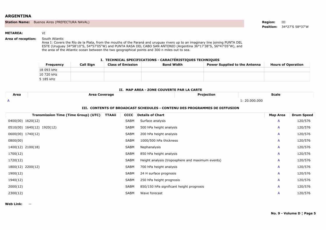
ARGENTINA
I. TECHNICAL SPECIFICATIONS - CARACTÉRISTIQUES TECHNIQUES
II. MAP AREA - ZONE COUVERTE PAR LA CARTE
Station Name: Buenos Aires (PREFECTURA NAVAL)
METAREA: VI
Area of reception: South AtlanticArea I: Covers the Río de la Plata, from the mouths of the Paraná and uruguay rivers up to an imaginary line joining PUNTA DEL ESTE (Uruguay 34°58'10"S, 54°57'05"W) and PUNTA RASA DEL CABO SAN ANTONIO (Argentina 36°17'38"S, 56°47'05"W), and the area of the Atlantic ocean between the two geographical points and 300 n miles out to sea.
Region: IIIPosition: 34°27'S 58°37'W
Call Sign Hours of OperationFrequency Class of Emission Band Width Power Supplied to the Antenna18 093 kHz10 720 kHz5 185 kHz
Area Area Coverage ScaleProjection
A 1: 20.000.000
III. CONTENTS OF BROADCAST SCHEDULES - CONTENU DES PROGRAMMES DE DIFFUSION
Transmission Time (Time Group) (UTC) Map AreaDetails of Chart Drum SpeedTTAAii CCCC
0400(00) 1620(12) ASurface analysis 120/576SABM
0510(00) 1640(12) 1920(12) A500 hPa height analysis 120/576SABM
0600(00) 1740(12) A200 hPa height analysis 120/576SABM
0800(00) A1000/500 hPa thickness 120/576SABM
1400(12) 2100(18) ANephanalysis 120/576SABM
1700(12) A850 hPa height analysis 120/576SABM
1720(12) AHeight analysis (troposphere and maximum events) 120/576SABM
1800(12) 2200(12) A700 hPa height analysis 120/576SABM
1900(12) A24 H surface prognosis 120/576SABM
1940(12) A250 hPa height prognosis 120/576SABM
2000(12) A850/150 hPa significant height prognosis 120/576SABM
2300(12) AWave forecast 120/576SABM
Web Link: --
No. 9 - Volume D ¦ Page 5
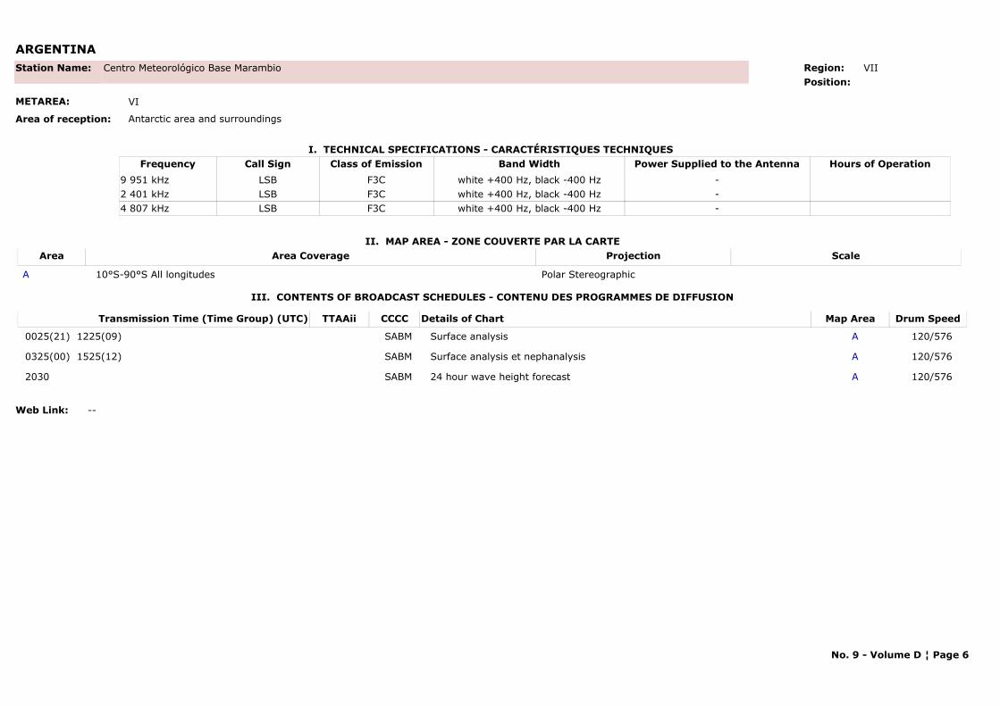
ARGENTINA
I. TECHNICAL SPECIFICATIONS - CARACTÉRISTIQUES TECHNIQUES
II. MAP AREA - ZONE COUVERTE PAR LA CARTE
Station Name: Centro Meteorológico Base Marambio
METAREA: VI
Area of reception: Antarctic area and surroundings
Region: VIIPosition:
Call Sign Hours of OperationFrequency Class of Emission Band Width Power Supplied to the AntennaLSB9 951 kHz F3C white +400 Hz, black -400 Hz -LSB2 401 kHz F3C white +400 Hz, black -400 Hz -LSB4 807 kHz F3C white +400 Hz, black -400 Hz -
Area Area Coverage ScaleProjection
A 10°S-90°S All longitudes Polar Stereographic
III. CONTENTS OF BROADCAST SCHEDULES - CONTENU DES PROGRAMMES DE DIFFUSION
Transmission Time (Time Group) (UTC) Map AreaDetails of Chart Drum SpeedTTAAii CCCC
0025(21) 1225(09) ASurface analysis 120/576SABM
0325(00) 1525(12) ASurface analysis et nephanalysis 120/576SABM
2030 A24 hour wave height forecast 120/576SABM
Web Link: --
No. 9 - Volume D ¦ Page 6
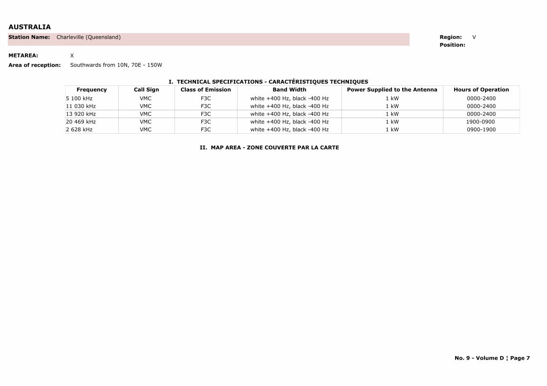
AUSTRALIA
I. TECHNICAL SPECIFICATIONS - CARACTÉRISTIQUES TECHNIQUES
II. MAP AREA - ZONE COUVERTE PAR LA CARTE
Station Name: Charleville (Queensland)
METAREA: X
Area of reception: Southwards from 10N, 70E - 150W
Region: V Position:
Call Sign Hours of OperationFrequency Class of Emission Band Width Power Supplied to the AntennaVMC 0000-24005 100 kHz F3C white +400 Hz, black -400 Hz 1 kWVMC 0000-240011 030 kHz F3C white +400 Hz, black -400 Hz 1 kWVMC 0000-240013 920 kHz F3C white +400 Hz, black -400 Hz 1 kWVMC 1900-0900 20 469 kHz F3C white +400 Hz, black -400 Hz 1 kWVMC 0900-19002 628 kHz F3C white +400 Hz, black -400 Hz 1 kW
No. 9 - Volume D ¦ Page 7

AUSTRALIA
III. CONTENTS OF BROADCAST SCHEDULES - CONTENU DES PROGRAMMES DE DIFFUSION
Transmission Time (Time Group) (UTC) Map AreaDetails of Chart Drum SpeedTTAAii CCCC
0000* -Indian Ocean Mean Sea Level Pressure Analysis Valid 1200 120/576AMMC
0015 -VMC/VMW Schedule – 2 pages 120/576AMMC
0045 -VMC/VMW Broadcast Information 120/576AMMC
0100 -Recommended Frequencies for VMC (Charleville) – 3 pages 120/576AMMC
0131 -Recommended Frequencies for VMW (Wiluna) – 3 pages 120/576AMMC
0203 -Australian Mean Sea Level Pressure Forecast (H+36) Valid 0000 120/576AMMC
0245 -Australian Mean Sea Level Pressure Analysis Valid 0000 120/576AMMC
0300 -Australian Primary Swell Waves Forecast (H+24) Valid 0000 120/576AMMC
0315 -Voice Broadcast Information for VMC and VMW 120/588AMMC
0345* -Australian Mean Sea Level Pressure Analysis Valid 0000 120/576AMMC
0400 -South Pacific Ocean Mean Sea Level Pressure Analysis Valid 0000 120/576AMMC
0430 -Australian Mean Sea Level Pressure 4-day forecast – 2 pages 120/576AMMC
0500* -Australian Mean Sea Level Pressure 4-day forecast – 2 pages 120/576AMMC
0600 -Asian (Area A) Gradient Level Wind Analysis Valid 0000 120/576AMMC
0623 -Asian (Area B) Gradient Level Wind Analysis Valid 0000 120/576AMMC
0645 -Asian Mean Sea Level Pressure Analysis Valid 0000 120/576AMMC
0730 -Indian Ocean Mean Sea Level Pressure Analysis Valid 0000 120/576AMMC
0745 -Australian Total Wave Height and Direction Forecast (H+24) Valid 0000 120/576AMMC
0800 -Australian Primary Swell Waves Forecast (H+24) Valid 0000 120/576AMMC
0830 -South Pacific Ocean Mean Sea Level Pressure Analysis Valid 0000 120/576AMMC
0845 -Australian Mean Sea Level Pressure Analysis Valid 0600 120/576AMMC
0900 -Australian Mean Sea Level Pressure Forecast (H+36) Valid 0000 120/576AMMC
0915 -Australian Mean Sea Level Pressure 4-day forecast – 2 pages 120/576AMMC
1015 -Southern Ocean Total Wave Height and Direction (H+24) valid 0000 120/576AMMC
1030 -Indian Ocean Mean Sea Level Pressure Analysis Valid 0000 120/576AMMC
1045 -Southern Hemisphere Mean Sea Level Pressure Forecast (H+48) Valid 0000 120/576AMMC
No. 9 - Volume D ¦ Page 8
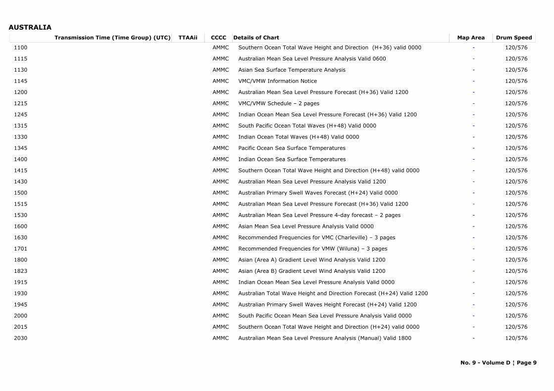
AUSTRALIATransmission Time (Time Group) (UTC) Map AreaDetails of Chart Drum SpeedTTAAii CCCC
1100 -Southern Ocean Total Wave Height and Direction (H+36) valid 0000 120/576AMMC
1115 -Australian Mean Sea Level Pressure Analysis Valid 0600 120/576AMMC
1130 -Asian Sea Surface Temperature Analysis 120/576AMMC
1145 -VMC/VMW Information Notice 120/576AMMC
1200 -Australian Mean Sea Level Pressure Forecast (H+36) Valid 1200 120/576AMMC
1215 -VMC/VMW Schedule – 2 pages 120/576AMMC
1245 -Indian Ocean Mean Sea Level Pressure Forecast (H+36) Valid 1200 120/576AMMC
1315 -South Pacific Ocean Total Waves (H+48) Valid 0000 120/576AMMC
1330 -Indian Ocean Total Waves (H+48) Valid 0000 120/576AMMC
1345 -Pacific Ocean Sea Surface Temperatures 120/576AMMC
1400 -Indian Ocean Sea Surface Temperatures 120/576AMMC
1415 -Southern Ocean Total Wave Height and Direction (H+48) valid 0000 120/576AMMC
1430 -Australian Mean Sea Level Pressure Analysis Valid 1200 120/576AMMC
1500 -Australian Primary Swell Waves Forecast (H+24) Valid 0000 120/576AMMC
1515 -Australian Mean Sea Level Pressure Forecast (H+36) Valid 1200 120/576AMMC
1530 -Australian Mean Sea Level Pressure 4-day forecast – 2 pages 120/576AMMC
1600 -Asian Mean Sea Level Pressure Analysis Valid 0000 120/576AMMC
1630 -Recommended Frequencies for VMC (Charleville) – 3 pages 120/576AMMC
1701 -Recommended Frequencies for VMW (Wiluna) – 3 pages 120/576AMMC
1800 -Asian (Area A) Gradient Level Wind Analysis Valid 1200 120/576AMMC
1823 -Asian (Area B) Gradient Level Wind Analysis Valid 1200 120/576AMMC
1915 -Indian Ocean Mean Sea Level Pressure Analysis Valid 0000 120/576AMMC
1930 -Australian Total Wave Height and Direction Forecast (H+24) Valid 1200 120/576AMMC
1945 -Australian Primary Swell Waves Height Forecast (H+24) Valid 1200 120/576AMMC
2000 -South Pacific Ocean Mean Sea Level Pressure Analysis Valid 0000 120/576AMMC
2015 -Southern Ocean Total Wave Height and Direction (H+24) valid 0000 120/576AMMC
2030 -Australian Mean Sea Level Pressure Analysis (Manual) Valid 1800 120/576AMMC
No. 9 - Volume D ¦ Page 9
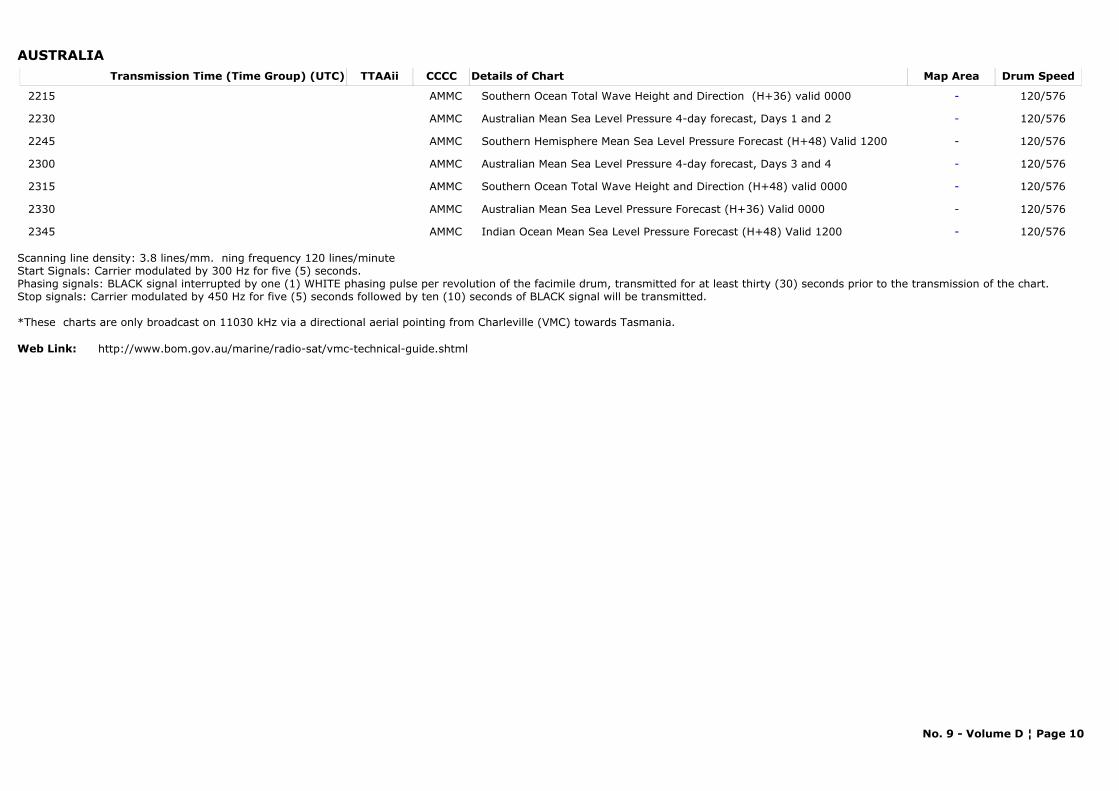
AUSTRALIATransmission Time (Time Group) (UTC) Map AreaDetails of Chart Drum SpeedTTAAii CCCC
2215 -Southern Ocean Total Wave Height and Direction (H+36) valid 0000 120/576AMMC
2230 -Australian Mean Sea Level Pressure 4-day forecast, Days 1 and 2 120/576AMMC
2245 -Southern Hemisphere Mean Sea Level Pressure Forecast (H+48) Valid 1200 120/576AMMC
2300 -Australian Mean Sea Level Pressure 4-day forecast, Days 3 and 4 120/576AMMC
2315 -Southern Ocean Total Wave Height and Direction (H+48) valid 0000 120/576AMMC
2330 -Australian Mean Sea Level Pressure Forecast (H+36) Valid 0000 120/576AMMC
2345 -Indian Ocean Mean Sea Level Pressure Forecast (H+48) Valid 1200 120/576AMMC
Scanning line density: 3.8 lines/mm. ning frequency 120 lines/minute Start Signals: Carrier modulated by 300 Hz for five (5) seconds.Phasing signals: BLACK signal interrupted by one (1) WHITE phasing pulse per revolution of the facimile drum, transmitted for at least thirty (30) seconds prior to the transmission of the chart.Stop signals: Carrier modulated by 450 Hz for five (5) seconds followed by ten (10) seconds of BLACK signal will be transmitted.
*These charts are only broadcast on 11030 kHz via a directional aerial pointing from Charleville (VMC) towards Tasmania.
Web Link: http://www.bom.gov.au/marine/radio-sat/vmc-technical-guide.shtml
No. 9 - Volume D ¦ Page 10

AUSTRALIA
I. TECHNICAL SPECIFICATIONS - CARACTÉRISTIQUES TECHNIQUES
II. MAP AREA - ZONE COUVERTE PAR LA CARTE
Station Name: Wiluna (Western Australia)
METAREA: X
Area of reception: Southwards from 25N -25S, 75E - 180W
Region: V Position:
Call Sign Hours of OperationFrequency Class of Emission Band Width Power Supplied to the AntennaVMW 0000-240015 615 kHz F3C white +400 Hz, black -400 Hz 1 kWVMW 1100-2100 5 755 kHz F3C white +400 Hz, black -400 Hz 1 kWVMW 0000-240010 555 kHz F3C white +400 Hz, black -400 Hz 1 kWVMW 2100-1100 18 060 kHz F3C white +400 Hz, black -400 Hz 1 kWVMW 0000-24007 535 kHz F3C white +400 Hz, black -400 Hz 1 kW
No. 9 - Volume D ¦ Page 11
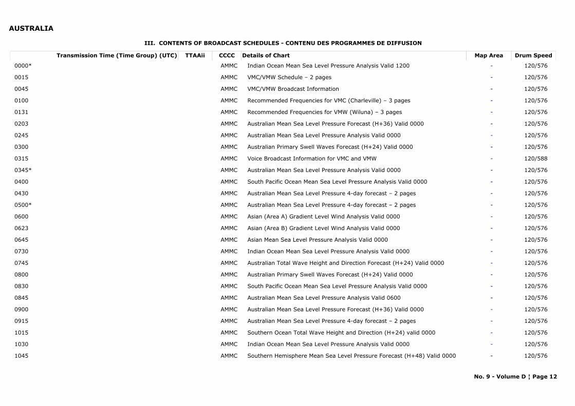
AUSTRALIA
III. CONTENTS OF BROADCAST SCHEDULES - CONTENU DES PROGRAMMES DE DIFFUSION
Transmission Time (Time Group) (UTC) Map AreaDetails of Chart Drum SpeedTTAAii CCCC
0000* -Indian Ocean Mean Sea Level Pressure Analysis Valid 1200 120/576AMMC
0015 -VMC/VMW Schedule – 2 pages 120/576AMMC
0045 -VMC/VMW Broadcast Information 120/576AMMC
0100 -Recommended Frequencies for VMC (Charleville) – 3 pages 120/576AMMC
0131 -Recommended Frequencies for VMW (Wiluna) – 3 pages 120/576AMMC
0203 -Australian Mean Sea Level Pressure Forecast (H+36) Valid 0000 120/576AMMC
0245 -Australian Mean Sea Level Pressure Analysis Valid 0000 120/576AMMC
0300 -Australian Primary Swell Waves Forecast (H+24) Valid 0000 120/576AMMC
0315 -Voice Broadcast Information for VMC and VMW 120/588AMMC
0345* -Australian Mean Sea Level Pressure Analysis Valid 0000 120/576AMMC
0400 -South Pacific Ocean Mean Sea Level Pressure Analysis Valid 0000 120/576AMMC
0430 -Australian Mean Sea Level Pressure 4-day forecast – 2 pages 120/576AMMC
0500* -Australian Mean Sea Level Pressure 4-day forecast – 2 pages 120/576AMMC
0600 -Asian (Area A) Gradient Level Wind Analysis Valid 0000 120/576AMMC
0623 -Asian (Area B) Gradient Level Wind Analysis Valid 0000 120/576AMMC
0645 -Asian Mean Sea Level Pressure Analysis Valid 0000 120/576AMMC
0730 -Indian Ocean Mean Sea Level Pressure Analysis Valid 0000 120/576AMMC
0745 -Australian Total Wave Height and Direction Forecast (H+24) Valid 0000 120/576AMMC
0800 -Australian Primary Swell Waves Forecast (H+24) Valid 0000 120/576AMMC
0830 -South Pacific Ocean Mean Sea Level Pressure Analysis Valid 0000 120/576AMMC
0845 -Australian Mean Sea Level Pressure Analysis Valid 0600 120/576AMMC
0900 -Australian Mean Sea Level Pressure Forecast (H+36) Valid 0000 120/576AMMC
0915 -Australian Mean Sea Level Pressure 4-day forecast – 2 pages 120/576AMMC
1015 -Southern Ocean Total Wave Height and Direction (H+24) valid 0000 120/576AMMC
1030 -Indian Ocean Mean Sea Level Pressure Analysis Valid 0000 120/576AMMC
1045 -Southern Hemisphere Mean Sea Level Pressure Forecast (H+48) Valid 0000 120/576AMMC
No. 9 - Volume D ¦ Page 12
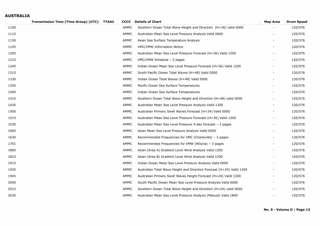
AUSTRALIATransmission Time (Time Group) (UTC) Map AreaDetails of Chart Drum SpeedTTAAii CCCC
1100 -Southern Ocean Total Wave Height and Direction (H+36) valid 0000 120/576AMMC
1115 -Australian Mean Sea Level Pressure Analysis Valid 0600 120/576AMMC
1130 -Asian Sea Surface Temperature Analysis 120/576AMMC
1145 -VMC/VMW Information Notice 120/576AMMC
1200 -Australian Mean Sea Level Pressure Forecast (H+36) Valid 1200 120/576AMMC
1215 -VMC/VMW Schedule – 2 pages 120/576AMMC
1245 -Indian Ocean Mean Sea Level Pressure Forecast (H+36) Valid 1200 120/576AMMC
1315 -South Pacific Ocean Total Waves (H+48) Valid 0000 120/576AMMC
1330 -Indian Ocean Total Waves (H+48) Valid 0000 120/576AMMC
1345 -Pacific Ocean Sea Surface Temperatures 120/576AMMC
1400 -Indian Ocean Sea Surface Temperatures 120/576AMMC
1415 -Southern Ocean Total Wave Height and Direction (H+48) valid 0000 120/576AMMC
1430 -Australian Mean Sea Level Pressure Analysis Valid 1200 120/576AMMC
1500 -Australian Primary Swell Waves Forecast (H+24) Valid 0000 120/576AMMC
1515 -Australian Mean Sea Level Pressure Forecast (H+36) Valid 1200 120/576AMMC
1530 -Australian Mean Sea Level Pressure 4-day forecast – 2 pages 120/576AMMC
1600 -Asian Mean Sea Level Pressure Analysis Valid 0000 120/576AMMC
1630 -Recommended Frequencies for VMC (Charleville) – 3 pages 120/576AMMC
1701 -Recommended Frequencies for VMW (Wiluna) – 3 pages 120/576AMMC
1800 -Asian (Area A) Gradient Level Wind Analysis Valid 1200 120/576AMMC
1823 -Asian (Area B) Gradient Level Wind Analysis Valid 1200 120/576AMMC
1915 -Indian Ocean Mean Sea Level Pressure Analysis Valid 0000 120/576AMMC
1930 -Australian Total Wave Height and Direction Forecast (H+24) Valid 1200 120/576AMMC
1945 -Australian Primary Swell Waves Height Forecast (H+24) Valid 1200 120/576AMMC
2000 -South Pacific Ocean Mean Sea Level Pressure Analysis Valid 0000 120/576AMMC
2015 -Southern Ocean Total Wave Height and Direction (H+24) valid 0000 120/576AMMC
2030 -Australian Mean Sea Level Pressure Analysis (Manual) Valid 1800 120/576AMMC
No. 9 - Volume D ¦ Page 13

AUSTRALIATransmission Time (Time Group) (UTC) Map AreaDetails of Chart Drum SpeedTTAAii CCCC
2215 -Southern Ocean Total Wave Height and Direction (H+36) valid 0000 120/576AMMC
2230 -Australian Mean Sea Level Pressure 4-day forecast, Days 1 and 2 120/576AMMC
2245 -Southern Hemisphere Mean Sea Level Pressure Forecast (H+48) Valid 1200 120/576AMMC
2300 -Australian Mean Sea Level Pressure 4-day forecast, Days 3 and 4 120/576AMMC
2315 -Southern Ocean Total Wave Height and Direction (H+48) valid 0000 120/576AMMC
2330 -Australian Mean Sea Level Pressure Forecast (H+36) Valid 0000 120/576AMMC
2345 -Indian Ocean Mean Sea Level Pressure Forecast (H+48) Valid 1200 120/576AMMC
Scanning line density: 3.8 lines/mm. ning frequency 120 lines/minute Start Signals: Carrier modulated by 300 Hz for five (5) seconds.Phasing signals: BLACK signal interrupted by one (1) WHITE phasing pulse per revolution of the facimile drum, transmitted for at least thirty (30) seconds prior to the transmission of the chart.Stop signals: Carrier modulated by 450 Hz for five (5) seconds followed by ten (10) seconds of BLACK signal will be transmitted.
*These charts are only broadcast on 11030 kHz via a directional aerial pointing from Charleville (VMC) towards Tasmania.
Web Link: http://www.bom.gov.au/marine/radio-sat/vmw-technical-guide.shtml
No. 9 - Volume D ¦ Page 14
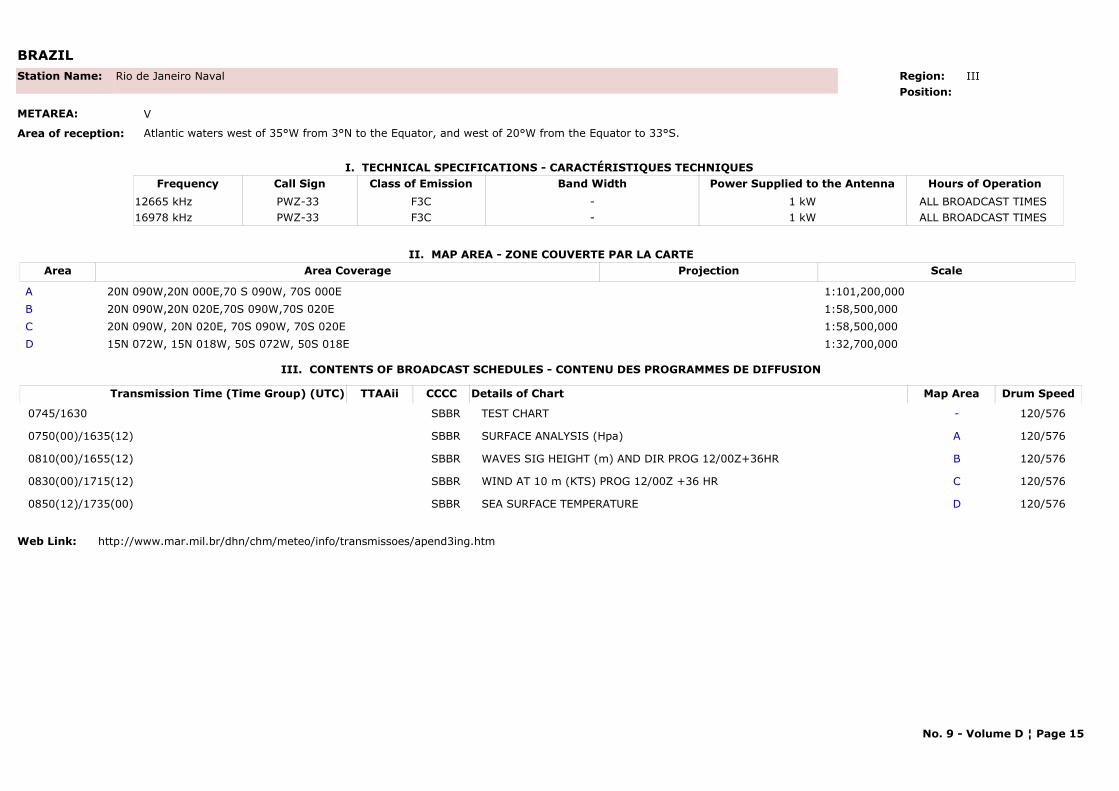
BRAZIL
I. TECHNICAL SPECIFICATIONS - CARACTÉRISTIQUES TECHNIQUES
II. MAP AREA - ZONE COUVERTE PAR LA CARTE
Station Name: Rio de Janeiro Naval
METAREA: V
Area of reception: Atlantic waters west of 35°W from 3°N to the Equator, and west of 20°W from the Equator to 33°S.
Region: IIIPosition:
Call Sign Hours of OperationFrequency Class of Emission Band Width Power Supplied to the AntennaPWZ-33 ALL BROADCAST TIMES 12665 kHz F3C - 1 kWPWZ-33 ALL BROADCAST TIMES 16978 kHz F3C - 1 kW
Area Area Coverage ScaleProjection
A 20N 090W,20N 000E,70 S 090W, 70S 000E 1:101,200,000 B 20N 090W,20N 020E,70S 090W,70S 020E 1:58,500,000 C 20N 090W, 20N 020E, 70S 090W, 70S 020E 1:58,500,000 D 15N 072W, 15N 018W, 50S 072W, 50S 018E 1:32,700,000
III. CONTENTS OF BROADCAST SCHEDULES - CONTENU DES PROGRAMMES DE DIFFUSION
Transmission Time (Time Group) (UTC) Map AreaDetails of Chart Drum SpeedTTAAii CCCC
0745/1630 -TEST CHART 120/576SBBR
0750(00)/1635(12) ASURFACE ANALYSIS (Hpa) 120/576SBBR
0810(00)/1655(12) BWAVES SIG HEIGHT (m) AND DIR PROG 12/00Z+36HR 120/576SBBR
0830(00)/1715(12) CWIND AT 10 m (KTS) PROG 12/00Z +36 HR 120/576SBBR
0850(12)/1735(00) DSEA SURFACE TEMPERATURE 120/576SBBR
Web Link: http://www.mar.mil.br/dhn/chm/meteo/info/transmissoes/apend3ing.htm
No. 9 - Volume D ¦ Page 15
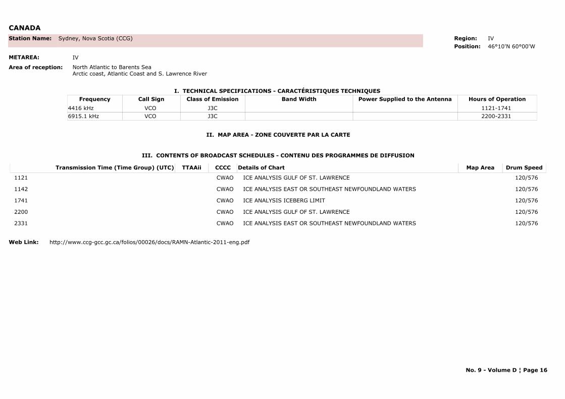
CANADA
I. TECHNICAL SPECIFICATIONS - CARACTÉRISTIQUES TECHNIQUES
II. MAP AREA - ZONE COUVERTE PAR LA CARTE
Station Name: Sydney, Nova Scotia (CCG)
METAREA: IV
Area of reception: North Atlantic to Barents SeaArctic coast, Atlantic Coast and S. Lawrence River
Region: IVPosition: 46°10'N 60°00'W
Call Sign Hours of OperationFrequency Class of Emission Band Width Power Supplied to the AntennaVCO 1121-1741 4416 kHz J3CVCO 2200-2331 6915.1 kHz J3C
III. CONTENTS OF BROADCAST SCHEDULES - CONTENU DES PROGRAMMES DE DIFFUSION
Transmission Time (Time Group) (UTC) Map AreaDetails of Chart Drum SpeedTTAAii CCCC
1121 ICE ANALYSIS GULF OF ST. LAWRENCE 120/576CWAO
1142 ICE ANALYSIS EAST OR SOUTHEAST NEWFOUNDLAND WATERS 120/576CWAO
1741 ICE ANALYSIS ICEBERG LIMIT 120/576CWAO
2200 ICE ANALYSIS GULF OF ST. LAWRENCE 120/576CWAO
2331 ICE ANALYSIS EAST OR SOUTHEAST NEWFOUNDLAND WATERS 120/576CWAO
Web Link: http://www.ccg-gcc.gc.ca/folios/00026/docs/RAMN-Atlantic-2011-eng.pdf
No. 9 - Volume D ¦ Page 16
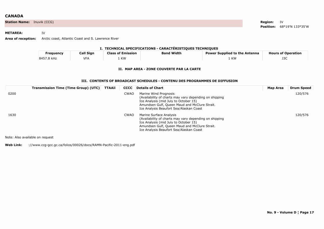
CANADA
I. TECHNICAL SPECIFICATIONS - CARACTÉRISTIQUES TECHNIQUES
II. MAP AREA - ZONE COUVERTE PAR LA CARTE
Station Name: Inuvik (CCG)
METAREA: IV
Area of reception: Arctic coast, Atlantic Coast and S. Lawrence River
Region: IVPosition: 68°19'N 133°35'W
Call Sign Hours of OperationFrequency Class of Emission Band Width Power Supplied to the AntennaVFA J3C 8457.8 kHz 1 KW 1 KW
III. CONTENTS OF BROADCAST SCHEDULES - CONTENU DES PROGRAMMES DE DIFFUSION
Transmission Time (Time Group) (UTC) Map AreaDetails of Chart Drum SpeedTTAAii CCCC
0200 Marine Wind Prognosis (Availability of charts may vary depending on shippingIce Analysis (mid July to October 15)Amundsen Gulf, Queen Maud and McClure Strait.Ice Analysis Beaufort Sea/Alaskan Coast
120/576CWAO
1630 Marine Surface Analysis (Availability of charts may vary depending on shippingIce Analysis (mid July to October 15)Amundsen Gulf, Queen Maud and McClure Strait.Ice Analysis Beaufort Sea/Alaskan Coast
120/576CWAO
Note: Also available on request
Web Link: ://www.ccg-gcc.gc.ca/folios/00026/docs/RAMN-Pacific-2011-eng.pdf
No. 9 - Volume D ¦ Page 17
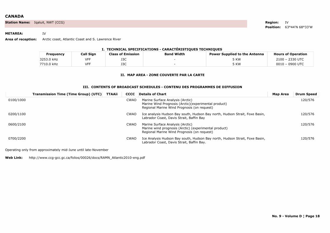
CANADA
I. TECHNICAL SPECIFICATIONS - CARACTÉRISTIQUES TECHNIQUES
II. MAP AREA - ZONE COUVERTE PAR LA CARTE
Station Name: Iqaluit, NWT (CCG)
METAREA: IV
Area of reception: Arctic coast, Atlantic Coast and S. Lawrence River
Region: IVPosition: 63°44'N 68°33'W
Call Sign Hours of OperationFrequency Class of Emission Band Width Power Supplied to the AntennaVFF 2100 – 2330 UTC 3253.0 kHz J3C - 5 KWVFF 0010 – 0900 UTC 7710.0 kHz J3C - 5 KW
III. CONTENTS OF BROADCAST SCHEDULES - CONTENU DES PROGRAMMES DE DIFFUSION
Transmission Time (Time Group) (UTC) Map AreaDetails of Chart Drum SpeedTTAAii CCCC
0100/1000 Marine Surface Analysis (Arctic) Marine Wind Prognosis (Arctic)(experimental product)Regional Marine Wind Prognosis (on request)
120/576CWAO
0200/1100 Ice analysis Hudson Bay south, Hudson Bay north, Hudson Strait, Foxe Basin, Labrador Coast, Davis Strait, Baffin Bay
120/576CWAO
0600/2100 Marine Surface Analysis (Arctic) Marine wind prognosis (Arctic) (experimental product)Regional Marine Wind Prognosis (on request)
120/576CWAO
0700/2200 Ice Analysis Hudson Bay south, Hudson Bay north, Hudson Strait, Foxe Basin, Labrador Coast, Davis Strait, Baffin Bay.
120/576CWAO
Operating only from approximately mid-June until late-November
Web Link: http://www.ccg-gcc.gc.ca/folios/00026/docs/RAMN_Atlantic2010-eng.pdf
No. 9 - Volume D ¦ Page 18
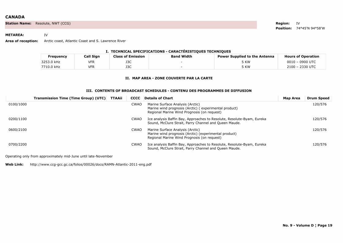
CANADA
I. TECHNICAL SPECIFICATIONS - CARACTÉRISTIQUES TECHNIQUES
II. MAP AREA - ZONE COUVERTE PAR LA CARTE
Station Name: Resolute, NWT (CCG)
METAREA: IV
Area of reception: Arctic coast, Atlantic Coast and S. Lawrence River
Region: IVPosition: 74°45'N 94°58'W
Call Sign Hours of OperationFrequency Class of Emission Band Width Power Supplied to the AntennaVFR 0010 – 0900 UTC 3253.0 kHz J3C - 5 KWVFR 2100 – 2330 UTC 7710.0 kHz J3C - 5 KW
III. CONTENTS OF BROADCAST SCHEDULES - CONTENU DES PROGRAMMES DE DIFFUSION
Transmission Time (Time Group) (UTC) Map AreaDetails of Chart Drum SpeedTTAAii CCCC
0100/1000 Marine Surface Analysis (Arctic) Marine wind prognosis (Arctic) ( experimental product)Regional Marine Wind Prognosis (on request)
120/576CWAO
0200/1100 Ice analysis Baffin Bay, Approaches to Resolute, Resolute-Byam, Eureka Sound, McClure Strait, Parry Channel and Queen Maude.
120/576CWAO
0600/2100 Marine Surface Analysis (Arctic) Marine wind prognosis (Arctic) (experimental product)Regional Marine Wind Prognosis (on request)
120/576CWAO
0700/2200 Ice analysis Baffin Bay, Approaches to Resolute, Resolute-Byam, Eureka Sound, McClure Strait, Parry Channel and Queen Maude.
120/576CWAO
Operating only from approximately mid-June until late-November
Web Link: http://www.ccg-gcc.gc.ca/folios/00026/docs/RAMN-Atlantic-2011-eng.pdf
No. 9 - Volume D ¦ Page 19
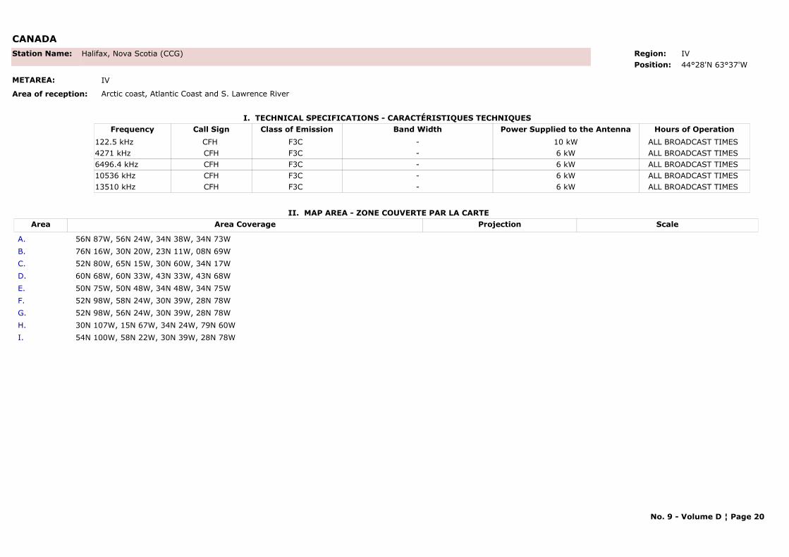
CANADA
I. TECHNICAL SPECIFICATIONS - CARACTÉRISTIQUES TECHNIQUES
II. MAP AREA - ZONE COUVERTE PAR LA CARTE
Station Name: Halifax, Nova Scotia (CCG)
METAREA: IV
Area of reception: Arctic coast, Atlantic Coast and S. Lawrence River
Region: IVPosition: 44°28'N 63°37'W
Call Sign Hours of OperationFrequency Class of Emission Band Width Power Supplied to the AntennaCFH ALL BROADCAST TIMES 122.5 kHz F3C - 10 kWCFH ALL BROADCAST TIMES 4271 kHz F3C - 6 kWCFH ALL BROADCAST TIMES 6496.4 kHz F3C - 6 kWCFH ALL BROADCAST TIMES 10536 kHz F3C - 6 kWCFH ALL BROADCAST TIMES 13510 kHz F3C - 6 kW
Area Area Coverage ScaleProjection
A. 56N 87W, 56N 24W, 34N 38W, 34N 73W B. 76N 16W, 30N 20W, 23N 11W, 08N 69W C. 52N 80W, 65N 15W, 30N 60W, 34N 17W D. 60N 68W, 60N 33W, 43N 33W, 43N 68W E. 50N 75W, 50N 48W, 34N 48W, 34N 75WF. 52N 98W, 58N 24W, 30N 39W, 28N 78WG. 52N 98W, 56N 24W, 30N 39W, 28N 78WH. 30N 107W, 15N 67W, 34N 24W, 79N 60WI. 54N 100W, 58N 22W, 30N 39W, 28N 78W
No. 9 - Volume D ¦ Page 20
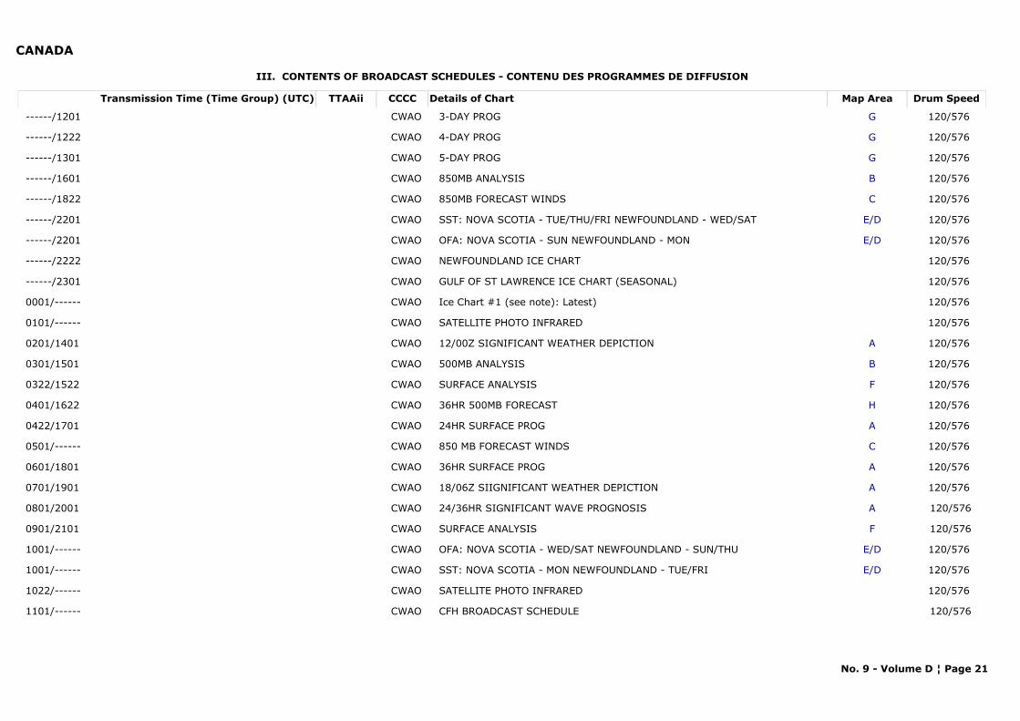
CANADA
III. CONTENTS OF BROADCAST SCHEDULES - CONTENU DES PROGRAMMES DE DIFFUSION
Transmission Time (Time Group) (UTC) Map AreaDetails of Chart Drum SpeedTTAAii CCCC
------/1201 G3-DAY PROG 120/576 CWAO
------/1222 G4-DAY PROG 120/576 CWAO
------/1301 G5-DAY PROG 120/576 CWAO
------/1601 B850MB ANALYSIS 120/576 CWAO
------/1822 C850MB FORECAST WINDS 120/576 CWAO
------/2201 E/DSST: NOVA SCOTIA - TUE/THU/FRI NEWFOUNDLAND - WED/SAT 120/576 CWAO
------/2201 E/DOFA: NOVA SCOTIA - SUN NEWFOUNDLAND - MON 120/576 CWAO
------/2222 NEWFOUNDLAND ICE CHART 120/576 CWAO
------/2301 GULF OF ST LAWRENCE ICE CHART (SEASONAL) 120/576 CWAO
0001/------ Ice Chart #1 (see note): Latest) 120/576 CWAO
0101/------ SATELLITE PHOTO INFRARED 120/576 CWAO
0201/1401 A12/00Z SIGNIFICANT WEATHER DEPICTION 120/576 CWAO
0301/1501 B500MB ANALYSIS 120/576 CWAO
0322/1522 FSURFACE ANALYSIS 120/576 CWAO
0401/1622 H36HR 500MB FORECAST 120/576 CWAO
0422/1701 A24HR SURFACE PROG 120/576 CWAO
0501/------ C850 MB FORECAST WINDS 120/576 CWAO
0601/1801 A36HR SURFACE PROG 120/576 CWAO
0701/1901 A18/06Z SIIGNIFICANT WEATHER DEPICTION 120/576 CWAO
0801/2001 A24/36HR SIGNIFICANT WAVE PROGNOSIS 120/576CWAO
0901/2101 FSURFACE ANALYSIS 120/576CWAO
1001/------ E/DOFA: NOVA SCOTIA - WED/SAT NEWFOUNDLAND - SUN/THU 120/576 CWAO
1001/------ E/DSST: NOVA SCOTIA - MON NEWFOUNDLAND - TUE/FRI 120/576 CWAO
1022/------ SATELLITE PHOTO INFRARED 120/576 CWAO
1101/------ CFH BROADCAST SCHEDULE 120/576CWAO
No. 9 - Volume D ¦ Page 21
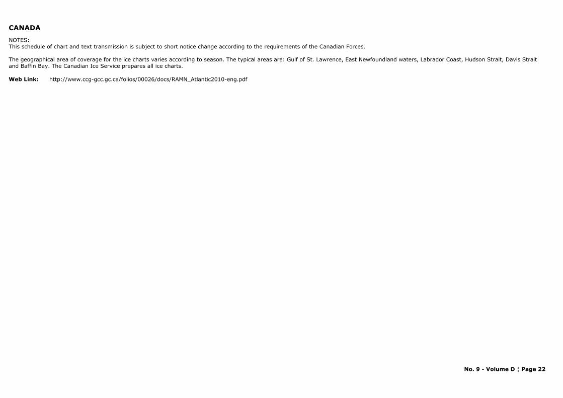
CANADA
NOTES:This schedule of chart and text transmission is subject to short notice change according to the requirements of the Canadian Forces.
The geographical area of coverage for the ice charts varies according to season. The typical areas are: Gulf of St. Lawrence, East Newfoundland waters, Labrador Coast, Hudson Strait, Davis Strait and Baffin Bay. The Canadian Ice Service prepares all ice charts.
Web Link: http://www.ccg-gcc.gc.ca/folios/00026/docs/RAMN_Atlantic2010-eng.pdf
No. 9 - Volume D ¦ Page 22
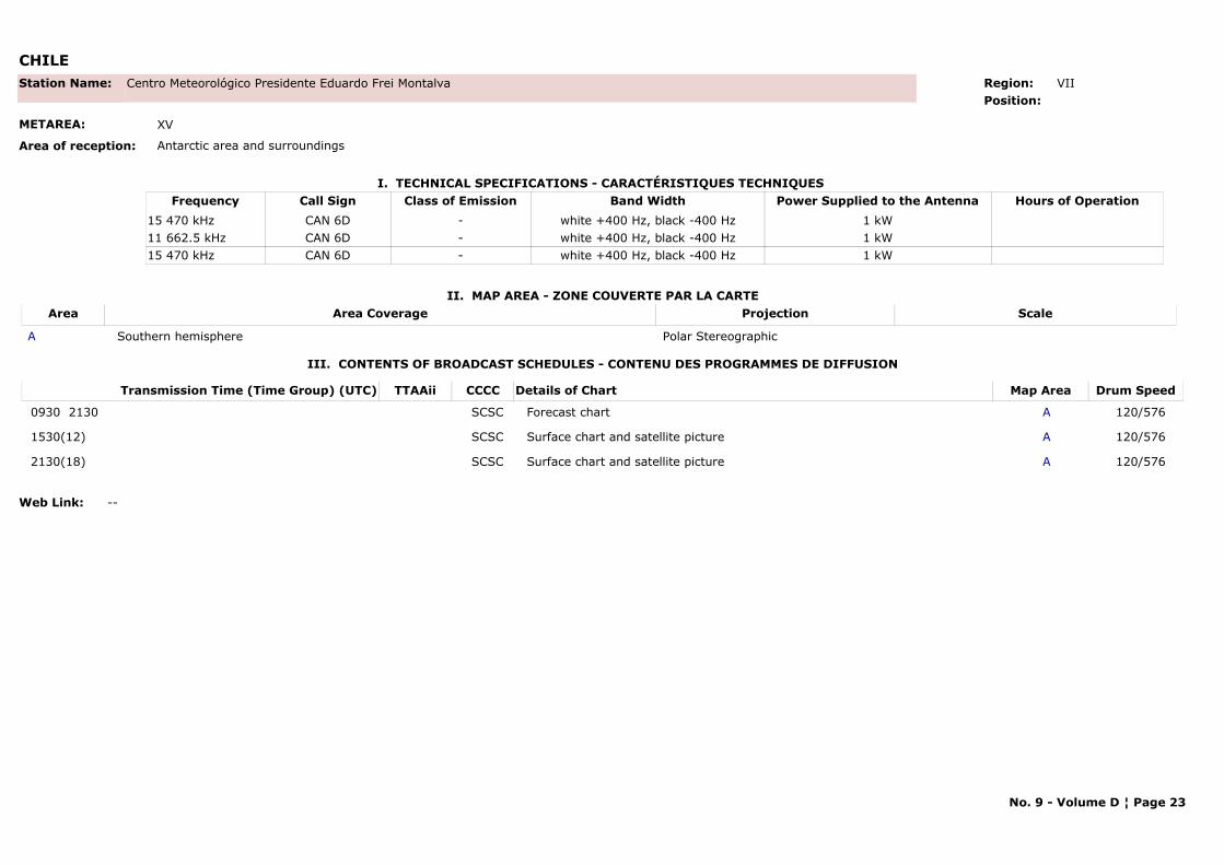
CHILE
I. TECHNICAL SPECIFICATIONS - CARACTÉRISTIQUES TECHNIQUES
II. MAP AREA - ZONE COUVERTE PAR LA CARTE
Station Name: Centro Meteorológico Presidente Eduardo Frei Montalva
METAREA: XV
Area of reception: Antarctic area and surroundings
Region: VIIPosition:
Call Sign Hours of OperationFrequency Class of Emission Band Width Power Supplied to the AntennaCAN 6D15 470 kHz - white +400 Hz, black -400 Hz 1 kWCAN 6D11 662.5 kHz - white +400 Hz, black -400 Hz 1 kWCAN 6D15 470 kHz - white +400 Hz, black -400 Hz 1 kW
Area Area Coverage ScaleProjection
A Southern hemisphere Polar Stereographic
III. CONTENTS OF BROADCAST SCHEDULES - CONTENU DES PROGRAMMES DE DIFFUSION
Transmission Time (Time Group) (UTC) Map AreaDetails of Chart Drum SpeedTTAAii CCCC
0930 2130 AForecast chart 120/576SCSC
1530(12) ASurface chart and satellite picture 120/576SCSC
2130(18) ASurface chart and satellite picture 120/576SCSC
Web Link: --
No. 9 - Volume D ¦ Page 23
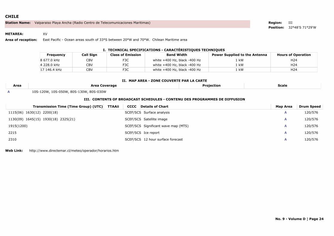
CHILE
I. TECHNICAL SPECIFICATIONS - CARACTÉRISTIQUES TECHNIQUES
II. MAP AREA - ZONE COUVERTE PAR LA CARTE
Station Name: Valparaiso Playa Ancha (Radio Centro de Telecomunicaciones Maritimas)
METAREA: XV
Area of reception: East Pacific - Ocean areas south of 33°S between 20°W and 70°W. Chilean Maritime area
Region: IIIPosition: 32°48'S 71°29'W
Call Sign Hours of OperationFrequency Class of Emission Band Width Power Supplied to the AntennaCBV H248 677.0 kHz F3C white +400 Hz, black -400 Hz 1 kWCBV H244 228.0 kHz F3C white +400 Hz, black -400 Hz 1 kWCBV H2417 146.4 kHz F3C white +400 Hz, black -400 Hz 1 kW
Area Area Coverage ScaleProjection
A 10S-120W, 10S-050W, 80S-130W, 80S-030W
III. CONTENTS OF BROADCAST SCHEDULES - CONTENU DES PROGRAMMES DE DIFFUSION
Transmission Time (Time Group) (UTC) Map AreaDetails of Chart Drum SpeedTTAAii CCCC
1115(06) 1630(12) 2200(18) ASurface analysis 120/576SCEF/SCS
1130(09) 1645(15) 1930(18) 2325(21) ASatellite image 120/576SCEF/SCS
1915(1200) ASignificant wave map (MTS) 120/576SCEF/SCS
2215 AIce report 120/576SCEF/SCS
2310 A12 hour surface forecast 120/576SCEF/SCS
Web Link: http://www.directemar.cl/meteo/operador/horarios.htm
No. 9 - Volume D ¦ Page 24
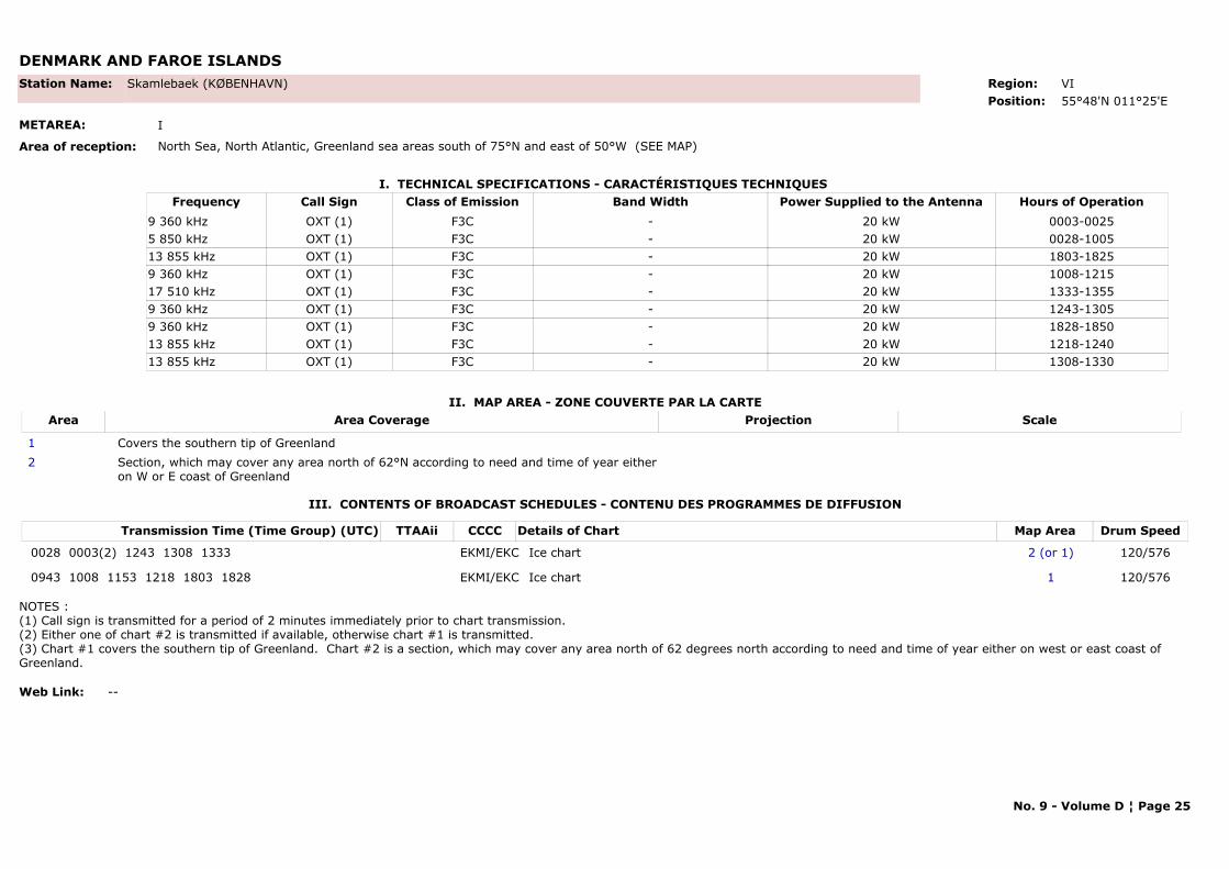
DENMARK AND FAROE ISLANDS
I. TECHNICAL SPECIFICATIONS - CARACTÉRISTIQUES TECHNIQUES
II. MAP AREA - ZONE COUVERTE PAR LA CARTE
Station Name: Skamlebaek (KØBENHAVN)
METAREA: I
Area of reception: North Sea, North Atlantic, Greenland sea areas south of 75°N and east of 50°W (SEE MAP)
Region: VI Position: 55°48'N 011°25'E
Call Sign Hours of OperationFrequency Class of Emission Band Width Power Supplied to the AntennaOXT (1) 0003-00259 360 kHz F3C - 20 kWOXT (1) 0028-10055 850 kHz F3C - 20 kWOXT (1) 1803-182513 855 kHz F3C - 20 kWOXT (1) 1008-12159 360 kHz F3C - 20 kWOXT (1) 1333-135517 510 kHz F3C - 20 kWOXT (1) 1243-13059 360 kHz F3C - 20 kWOXT (1) 1828-18509 360 kHz F3C - 20 kWOXT (1) 1218-124013 855 kHz F3C - 20 kWOXT (1) 1308-133013 855 kHz F3C - 20 kW
Area Area Coverage ScaleProjection
1 Covers the southern tip of Greenland2 Section, which may cover any area north of 62°N according to need and time of year either
on W or E coast of Greenland
III. CONTENTS OF BROADCAST SCHEDULES - CONTENU DES PROGRAMMES DE DIFFUSION
Transmission Time (Time Group) (UTC) Map AreaDetails of Chart Drum SpeedTTAAii CCCC
0028 0003(2) 1243 1308 1333 2 (or 1)Ice chart 120/576EKMI/EKC
0943 1008 1153 1218 1803 1828 1Ice chart 120/576EKMI/EKC
NOTES :(1) Call sign is transmitted for a period of 2 minutes immediately prior to chart transmission.(2) Either one of chart #2 is transmitted if available, otherwise chart #1 is transmitted.(3) Chart #1 covers the southern tip of Greenland. Chart #2 is a section, which may cover any area north of 62 degrees north according to need and time of year either on west or east coast of Greenland.
Web Link: --
No. 9 - Volume D ¦ Page 25
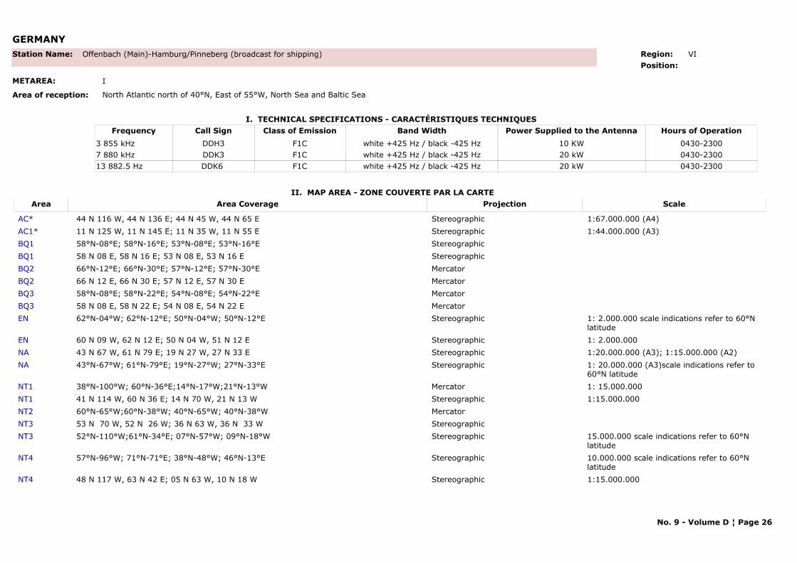
GERMANY
I. TECHNICAL SPECIFICATIONS - CARACTÉRISTIQUES TECHNIQUES
II. MAP AREA - ZONE COUVERTE PAR LA CARTE
Station Name: Offenbach (Main)-Hamburg/Pinneberg (broadcast for shipping)
METAREA: I
Area of reception: North Atlantic north of 40°N, East of 55°W, North Sea and Baltic Sea
Region: VI Position:
Call Sign Hours of OperationFrequency Class of Emission Band Width Power Supplied to the AntennaDDH3 0430-23003 855 kHz F1C white +425 Hz / black -425 Hz 10 KWDDK3 0430-23007 880 kHz F1C white +425 Hz / black -425 Hz 20 kWDDK6 0430-230013 882.5 Hz F1C white +425 Hz / black -425 Hz 20 kW
Area Area Coverage ScaleProjection
AC* 44 N 116 W, 44 N 136 E; 44 N 45 W, 44 N 65 E Stereographic 1:67.000.000 (A4)AC1* 11 N 125 W, 11 N 145 E; 11 N 35 W, 11 N 55 E Stereographic 1:44.000.000 (A3)BQ1 58°N-08°E; 58°N-16°E; 53°N-08°E; 53°N-16°E StereographicBQ1 58 N 08 E, 58 N 16 E; 53 N 08 E, 53 N 16 E StereographicBQ2 66°N-12°E; 66°N-30°E; 57°N-12°E; 57°N-30°E MercatorBQ2 66 N 12 E, 66 N 30 E; 57 N 12 E, 57 N 30 E MercatorBQ3 58°N-08°E; 58°N-22°E; 54°N-08°E; 54°N-22°E MercatorBQ3 58 N 08 E, 58 N 22 E; 54 N 08 E, 54 N 22 E MercatorEN 62°N-04°W; 62°N-12°E; 50°N-04°W; 50°N-12°E Stereographic 1: 2.000.000 scale indications refer to 60°N
latitudeEN 60 N 09 W, 62 N 12 E; 50 N 04 W, 51 N 12 E Stereographic 1: 2.000.000NA 43 N 67 W, 61 N 79 E; 19 N 27 W, 27 N 33 E Stereographic 1:20.000.000 (A3); 1:15.000.000 (A2)NA 43°N-67°W; 61°N-79°E; 19°N-27°W; 27°N-33°E Stereographic 1: 20.000.000 (A3)scale indications refer to
60°N latitudeNT1 38°N-100°W; 60°N-36°E;14°N-17°W;21°N-13°W Mercator 1: 15.000.000NT1 41 N 114 W, 60 N 36 E; 14 N 70 W, 21 N 13 W Stereographic 1:15.000.000NT2 60°N-65°W;60°N-38°W; 40°N-65°W; 40°N-38°W MercatorNT3 53 N 70 W, 52 N 26 W; 36 N 63 W, 36 N 33 W StereographicNT3 52°N-110°W;61°N-34°E; 07°N-57°W; 09°N-18°W Stereographic 15.000.000 scale indications refer to 60°N
latitudeNT4 57°N-96°W; 71°N-71°E; 38°N-48°W; 46°N-13°E Stereographic 10.000.000 scale indications refer to 60°N
latitudeNT4 48 N 117 W, 63 N 42 E; 05 N 63 W, 10 N 18 W Stereographic 1:15.000.000
No. 9 - Volume D ¦ Page 26
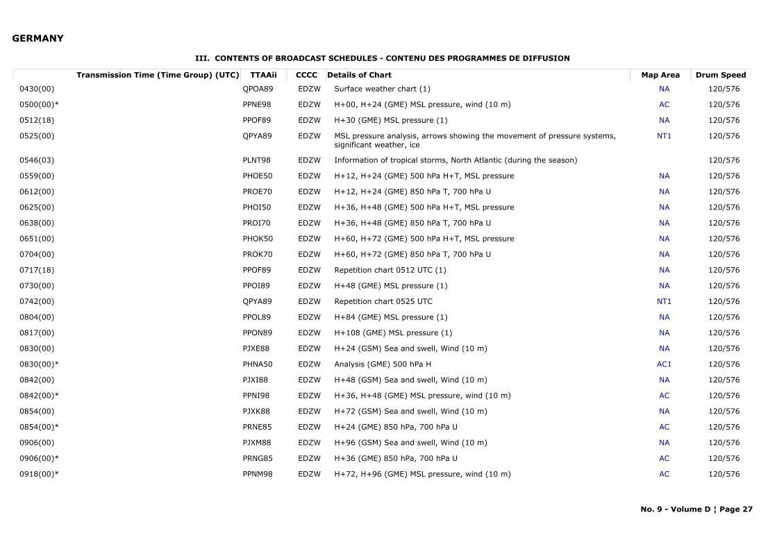
GERMANY
III. CONTENTS OF BROADCAST SCHEDULES - CONTENU DES PROGRAMMES DE DIFFUSION
Transmission Time (Time Group) (UTC) Map AreaDetails of Chart Drum SpeedTTAAii CCCC
0430(00) NASurface weather chart (1) 120/576QPOA89 EDZW
0500(00)* ACH+00, H+24 (GME) MSL pressure, wind (10 m) 120/576PPNE98 EDZW
0512(18) NAH+30 (GME) MSL pressure (1) 120/576PPOF89 EDZW
0525(00) NT1MSL pressure analysis, arrows showing the movement of pressure systems, significant weather, ice
120/576QPYA89 EDZW
0546(03) Information of tropical storms, North Atlantic (during the season) 120/576PLNT98 EDZW
0559(00) NAH+12, H+24 (GME) 500 hPa H+T, MSL pressure 120/576PHOE50 EDZW
0612(00) NAH+12, H+24 (GME) 850 hPa T, 700 hPa U 120/576PROE70 EDZW
0625(00) NAH+36, H+48 (GME) 500 hPa H+T, MSL pressure 120/576PHOI50 EDZW
0638(00) NAH+36, H+48 (GME) 850 hPa T, 700 hPa U 120/576PROI70 EDZW
0651(00) NAH+60, H+72 (GME) 500 hPa H+T, MSL pressure 120/576PHOK50 EDZW
0704(00) NAH+60, H+72 (GME) 850 hPa T, 700 hPa U 120/576PROK70 EDZW
0717(18) NARepetition chart 0512 UTC (1) 120/576PPOF89 EDZW
0730(00) NAH+48 (GME) MSL pressure (1) 120/576PPOI89 EDZW
0742(00) NT1Repetition chart 0525 UTC 120/576QPYA89 EDZW
0804(00) NAH+84 (GME) MSL pressure (1) 120/576PPOL89 EDZW
0817(00) NAH+108 (GME) MSL pressure (1) 120/576PPON89 EDZW
0830(00) NAH+24 (GSM) Sea and swell, Wind (10 m) 120/576PJXE88 EDZW
0830(00)* AC1Analysis (GME) 500 hPa H 120/576PHNA50 EDZW
0842(00) NAH+48 (GSM) Sea and swell, Wind (10 m) 120/576PJXI88 EDZW
0842(00)* ACH+36, H+48 (GME) MSL pressure, wind (10 m) 120/576PPNI98 EDZW
0854(00) NAH+72 (GSM) Sea and swell, Wind (10 m) 120/576PJXK88 EDZW
0854(00)* ACH+24 (GME) 850 hPa, 700 hPa U 120/576PRNE85 EDZW
0906(00) NAH+96 (GSM) Sea and swell, Wind (10 m) 120/576PJXM88 EDZW
0906(00)* ACH+36 (GME) 850 hPa, 700 hPa U 120/576PRNG85 EDZW
0918(00)* ACH+72, H+96 (GME) MSL pressure, wind (10 m) 120/576PPNM98 EDZW
No. 9 - Volume D ¦ Page 27
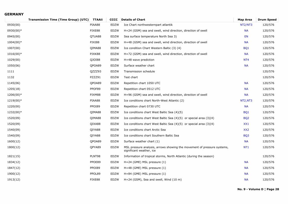
GERMANYTransmission Time (Time Group) (UTC) Map AreaDetails of Chart Drum SpeedTTAAii CCCC
0930(00) NT2/NT3Ice Chart northwesternpart atlantik 120/576PIAA88 EDZW
0930(00)* NAH+24 (GSM) sea and swell, wind direction, direction of swell 120/576PJXE88 EDZW
0945(00) ENSea surface temperature North Sea 3) 120/576QTUA88 EDZW
1004(00)* NAH+48 (GSM) sea and swell, wind direction, direction of swell 120/576PJXI88 EDZW
1007(00) BQ1Ice condition Chart Western Baltic (3) (4) 120/576QIMA88 EDZW
1016(00)* NAH+72 (GSM) sea and swell, wind direction, direction of swell 120/576PJXK88 EDZW
1029(00) NT4H+48 wave prediction 120/576QJOI88 EDZW
1050(06) NASurface weather chart 120/576QPOA89 EDZW
1111 Transmission schedule 120/576QZZZ93 EDZW
1132 Test chart 120/576PZZZ91 EDZW
1145(06) NARepetition chart 1050 UTC 120/576QPOA89 EDZW
1205(18) NARepetition chart 0512 UTC 120/576PPOF89 EDZW
1206(00)* NAH+96 (GSM) sea and swell, wind direction, direction of swell 120/576PJXM88 EDZW
1219(00)* NT2,NT3Ice conditions chart North-West Atlantic (2) 120/576PIAA88 EDZW
1220(00) NARepetition chart 0730 UTC 120/576PPOI89 EDZW
1232(00)* BQ1Ice conditions chart West Baltic Sea (4)(5) 120/576QIMA88 EDZW
1520(09) BQ2Ice conditions chart West Baltic Sea (4)(5) or special area (3)(4) 120/576QIMA88 EDZW
1520(09) XX1Ice conditions chart West Baltic Sea (4)(5) or special area (3)(4) 120/576QIXA88 EDZW
1540(09) XX2Ice conditions chart Arctic Sea 120/576QIYA88 EDZW
1540(09) BQ3Ice conditions chart Southern Baltic Sea 120/576QIYA88 EDZW
1600(12) NASurface weather chart (1) 120/576QPOA89 EDZW
1800(12) NT1MSL pressure analysis, arrows showing the movement of pressure systems, significant weather, ice
120/576QPYA89 EDZW
1821(15) Information of tropical storms, North Atlantic (during the season) 120/576PLNT98 EDZW
1834(12) NAH+24 (GME) MSL pressure (1) 120/576PPOE89 EDZW
1847(12) NAH+48 (GME) MSL pressure (1) 120/576PPOI89 EDZW
1900(12) NAH+84 (GME) MSL pressure (1) 120/576PPOL89 EDZW
1913(12) NAH+24 (GSM), Sea and swell, Wind (10 m) 120/576PJXE88 EDZW
No. 9 - Volume D ¦ Page 28
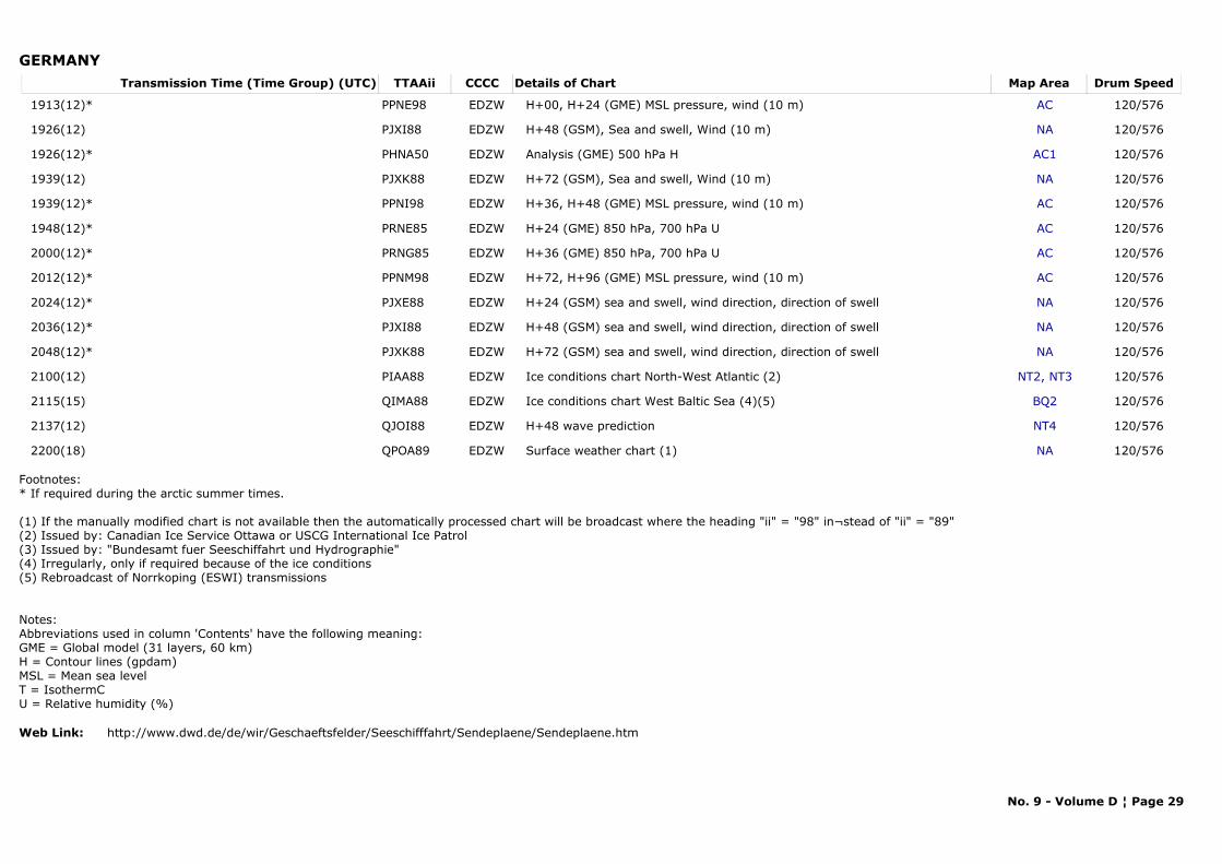
GERMANYTransmission Time (Time Group) (UTC) Map AreaDetails of Chart Drum SpeedTTAAii CCCC
1913(12)* ACH+00, H+24 (GME) MSL pressure, wind (10 m) 120/576PPNE98 EDZW
1926(12) NAH+48 (GSM), Sea and swell, Wind (10 m) 120/576PJXI88 EDZW
1926(12)* AC1Analysis (GME) 500 hPa H 120/576PHNA50 EDZW
1939(12) NAH+72 (GSM), Sea and swell, Wind (10 m) 120/576PJXK88 EDZW
1939(12)* ACH+36, H+48 (GME) MSL pressure, wind (10 m) 120/576PPNI98 EDZW
1948(12)* ACH+24 (GME) 850 hPa, 700 hPa U 120/576PRNE85 EDZW
2000(12)* ACH+36 (GME) 850 hPa, 700 hPa U 120/576PRNG85 EDZW
2012(12)* ACH+72, H+96 (GME) MSL pressure, wind (10 m) 120/576PPNM98 EDZW
2024(12)* NAH+24 (GSM) sea and swell, wind direction, direction of swell 120/576PJXE88 EDZW
2036(12)* NAH+48 (GSM) sea and swell, wind direction, direction of swell 120/576PJXI88 EDZW
2048(12)* NAH+72 (GSM) sea and swell, wind direction, direction of swell 120/576PJXK88 EDZW
2100(12) NT2, NT3Ice conditions chart North-West Atlantic (2) 120/576PIAA88 EDZW
2115(15) BQ2Ice conditions chart West Baltic Sea (4)(5) 120/576QIMA88 EDZW
2137(12) NT4H+48 wave prediction 120/576QJOI88 EDZW
2200(18) NASurface weather chart (1) 120/576QPOA89 EDZW
Footnotes:* If required during the arctic summer times.
(1) If the manually modified chart is not available then the automatically processed chart will be broadcast where the heading "ii" = "98" in¬stead of "ii" = "89" (2) Issued by: Canadian Ice Service Ottawa or USCG International Ice Patrol (3) Issued by: "Bundesamt fuer Seeschiffahrt und Hydrographie" (4) Irregularly, only if required because of the ice conditions (5) Rebroadcast of Norrkoping (ESWI) transmissions
Notes: Abbreviations used in column 'Contents' have the following meaning:
GME = Global model (31 layers, 60 km) H = Contour lines (gpdam)
MSL = Mean sea level T = IsothermC U = Relative humidity (%)
Web Link: http://www.dwd.de/de/wir/Geschaeftsfelder/Seeschifffahrt/Sendeplaene/Sendeplaene.htm
No. 9 - Volume D ¦ Page 29
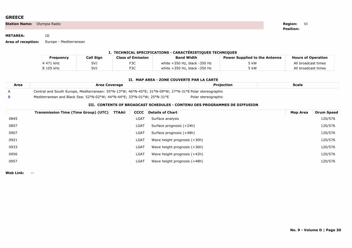
GREECE
I. TECHNICAL SPECIFICATIONS - CARACTÉRISTIQUES TECHNIQUES
II. MAP AREA - ZONE COUVERTE PAR LA CARTE
Station Name: Olympia Radio
METAREA: III
Area of reception: Europe - Mediterranean
Region: VI Position:
Call Sign Hours of OperationFrequency Class of Emission Band Width Power Supplied to the AntennaSVJ All broadcast times4 471 kHz F3C white +350 Hz, black -350 Hz 5 kWSVJ All broadcast times8 105 kHz F3C white +350 Hz, black -350 Hz 5 kW
Area Area Coverage ScaleProjection
A Central and South Europe, Mediterranean: 55°N-13°W; 46°N-45°E; 31°N-09°W; 27°N-31°E Polar stereographicB Mediterranean and Black Sea: 52°N-02°W; 44°N-44°E; 33°N-01°W; 25°N-31°E Polar stereographic
III. CONTENTS OF BROADCAST SCHEDULES - CONTENU DES PROGRAMMES DE DIFFUSION
Transmission Time (Time Group) (UTC) Map AreaDetails of Chart Drum SpeedTTAAii CCCC
0845 Surface analysis 120/576LGAT
0857 Surface prognosis (+24h) 120/576LGAT
0907 Surface prognosis (+48h) 120/576LGAT
0921 Wave height prognosis (+30h) 120/576LGAT
0933 Wave height prognosis (+36h) 120/576LGAT
0956 Wave height prognosis (+42h) 120/576LGAT
0957 Wave height prognosis (+48h) 120/576LGAT
Web Link: --
No. 9 - Volume D ¦ Page 30
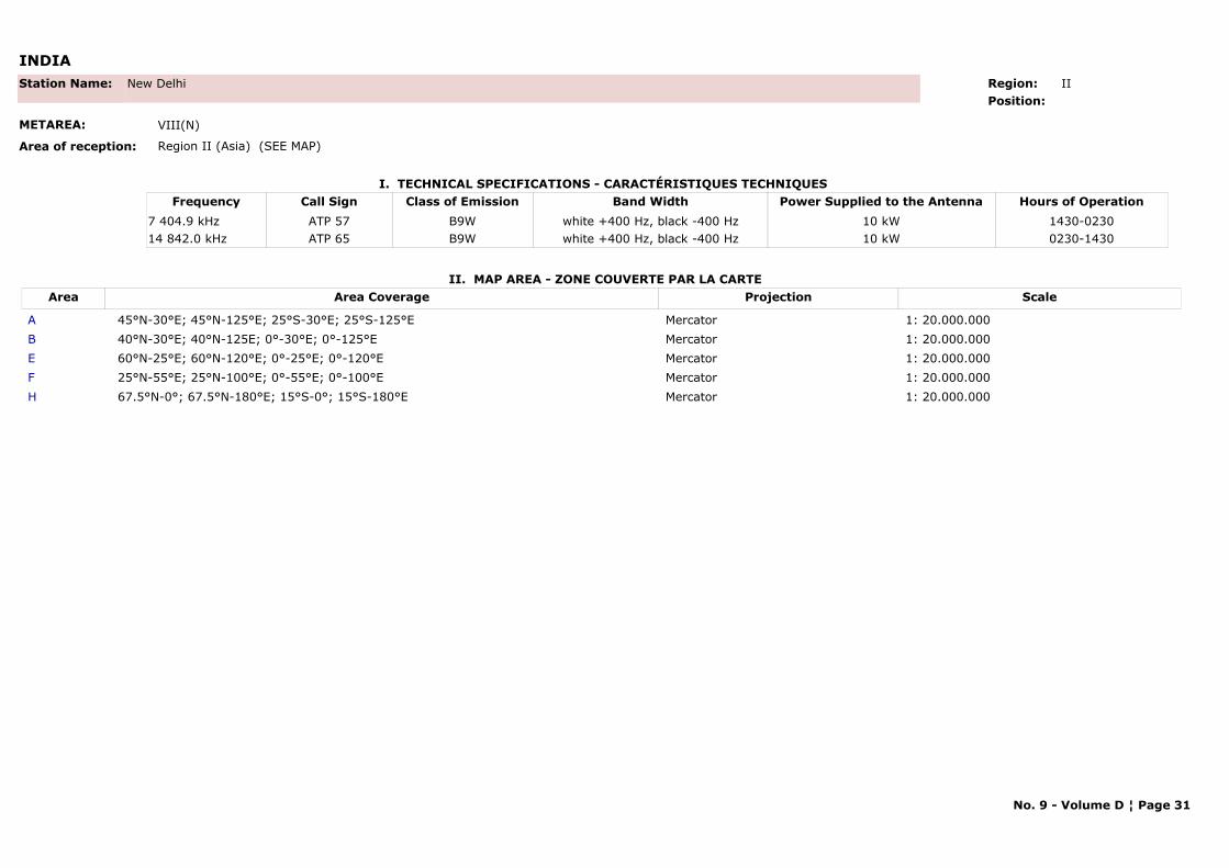
INDIA
I. TECHNICAL SPECIFICATIONS - CARACTÉRISTIQUES TECHNIQUES
II. MAP AREA - ZONE COUVERTE PAR LA CARTE
Station Name: New Delhi
METAREA: VIII(N)
Area of reception: Region II (Asia) (SEE MAP)
Region: II Position:
Call Sign Hours of OperationFrequency Class of Emission Band Width Power Supplied to the AntennaATP 57 1430-02307 404.9 kHz B9W white +400 Hz, black -400 Hz 10 kWATP 65 0230-143014 842.0 kHz B9W white +400 Hz, black -400 Hz 10 kW
Area Area Coverage ScaleProjection
A 45°N-30°E; 45°N-125°E; 25°S-30°E; 25°S-125°E Mercator 1: 20.000.000B 40°N-30°E; 40°N-125E; 0°-30°E; 0°-125°E Mercator 1: 20.000.000E 60°N-25°E; 60°N-120°E; 0°-25°E; 0°-120°E Mercator 1: 20.000.000F 25°N-55°E; 25°N-100°E; 0°-55°E; 0°-100°E Mercator 1: 20.000.000H 67.5°N-0°; 67.5°N-180°E; 15°S-0°; 15°S-180°E Mercator 1: 20.000.000
No. 9 - Volume D ¦ Page 31
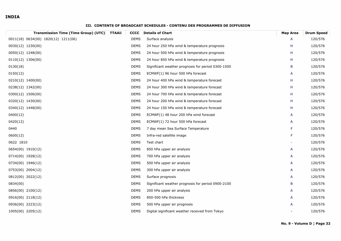
INDIA
III. CONTENTS OF BROADCAST SCHEDULES - CONTENU DES PROGRAMMES DE DIFFUSION
Transmission Time (Time Group) (UTC) Map AreaDetails of Chart Drum SpeedTTAAii CCCC
0011(18) 0634(00) 1820(12) 1211(06) ASurface analysis 120/576DEMS
0030(12) 1230(00) H24 hour 250 hPa wind & temperature prognosis 120/576DEMS
0050(12) 1248(00) H24 hour 500 hPa wind & temperature prognosis 120/576DEMS
0110(12) 1306(00) H24 hour 850 hPa wind & temperature prognosis 120/576DEMS
0130(18) BSignificant weather prognosis for period 0300-1500 120/576DEMS
0150(12) AECMWF(1) 96 hour 500 hPa forecast 120/576DEMS
0210(12) 1400(00) H24 hour 400 hPa wind & temperature forecast 120/576DEMS
0238(12) 1342(00) H24 hour 300 hPa wind & temperature forecast 120/576DEMS
0300(12) 1506(00) H24 hour 700 hPa wind & temperature forecast 120/576DEMS
0320(12) 1430(00) H24 hour 200 hPa wind & temperature forecast 120/576DEMS
0340(12) 1448(00) H24 hour 150 hPa wind & temperature forecast 120/576DEMS
0400(12) AECMWF(1) 48 hour 200 hPa wind forecast 120/576DEMS
0420(12) AECMWF(1) 72 hour 500 hPa forecast 120/576DEMS
0440 F7 day mean Sea Surface Temperature 120/576DEMS
0600(12) FInfra-red satellite image 120/576DEMS
0622 1810 -Test chart 120/576DEMS
0654(00) 1910(12) A850 hPa upper air analysis 120/576DEMS
0714(00) 1928(12) A700 hPa upper air analysis 120/576DEMS
0734(00) 1946(12) A500 hPa upper air analysis 120/576DEMS
0753(00) 2004(12) A300 hPa upper air analysis 120/576DEMS
0812(00) 2022(12) ASurface prognosis 120/576DEMS
0834(00) BSignificant weather prognosis for period 0900-2100 120/576DEMS
0856(00) 2100(12) A200 hPa upper air analysis 120/576DEMS
0916(00) 2118(12) A850-500 hPa thickness 120/576DEMS
0936(00) 2223(12) A500 hPa upper air prognosis 120/576DEMS
1005(00) 2205(12) -Digital significant weather received from Tokyo 120/576DEMS
No. 9 - Volume D ¦ Page 32
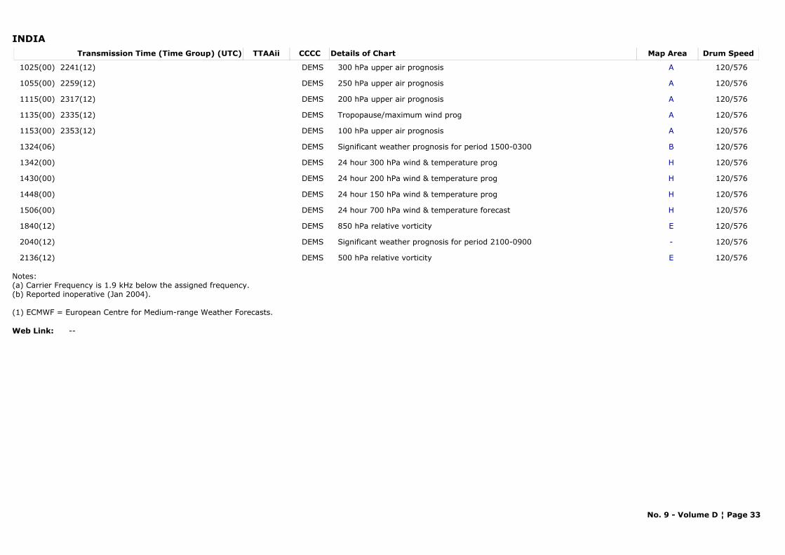
INDIATransmission Time (Time Group) (UTC) Map AreaDetails of Chart Drum SpeedTTAAii CCCC
1025(00) 2241(12) A300 hPa upper air prognosis 120/576DEMS
1055(00) 2259(12) A250 hPa upper air prognosis 120/576DEMS
1115(00) 2317(12) A200 hPa upper air prognosis 120/576DEMS
1135(00) 2335(12) ATropopause/maximum wind prog 120/576DEMS
1153(00) 2353(12) A100 hPa upper air prognosis 120/576DEMS
1324(06) BSignificant weather prognosis for period 1500-0300 120/576DEMS
1342(00) H24 hour 300 hPa wind & temperature prog 120/576DEMS
1430(00) H24 hour 200 hPa wind & temperature prog 120/576DEMS
1448(00) H24 hour 150 hPa wind & temperature prog 120/576DEMS
1506(00) H24 hour 700 hPa wind & temperature forecast 120/576DEMS
1840(12) E850 hPa relative vorticity 120/576DEMS
2040(12) -Significant weather prognosis for period 2100-0900 120/576DEMS
2136(12) E500 hPa relative vorticity 120/576DEMS
Notes:(a) Carrier Frequency is 1.9 kHz below the assigned frequency.(b) Reported inoperative (Jan 2004).
(1) ECMWF = European Centre for Medium-range Weather Forecasts.
Web Link: --
No. 9 - Volume D ¦ Page 33

JAPAN
I. TECHNICAL SPECIFICATIONS - CARACTÉRISTIQUES TECHNIQUES
II. MAP AREA - ZONE COUVERTE PAR LA CARTE
Station Name: Kagoshima
METAREA: XI
Area of reception: 90°N,40°E - 10°S,40°E - 10°S,130°W - 90°N,130°W
Region: II Position:
Call Sign Hours of OperationFrequency Class of Emission Band Width Power Supplied to the AntennaJMH H243 622.5 kHz F3C white +400 Hz, black -400 Hz 5 kW
JMH 2 H247 795 kHz F3C white +400 Hz, black -400 Hz 5 kWJMH 4 H2413 988.5 kHz F3C white +400 Hz, black -400 Hz 5 kW
Area Area Coverage ScaleProjection
A' 38°12'N- 85°54'E; 50°36'N-177°12'E12°24'N-110°42'E; 17°24'N-157°12'E
Polar stereographic 1:25,000,000 true at 60°N (21 cm x 31 cm)
c 26°30'N- 62°00'E; 51°00'N-152°00'W 05°00'S-106°00'E; 02°00'N-160°00'E
Polar stereographic 1:42,000,000 true at 60°N (28cm x 34 cm)
C 26°30'N- 62°00'E; 51°00'N-152°00'W 05°00'S-106°00'E; 02°00'N-160°00'E
Polar stereographic 1:20,000,000 true at 60°N (46 cm x 56 cm)
C' 38°30'N- 65°30'E; 38°30'N-145°30'W 01°00'S-112°30'E; 01°00'S-167°00'E
Polar stereographic 1:20,000,000 true at 60°N (46 cm x 56 cm)
C" 37°30'N- 67°00'E; 39°00'N-147°36'W01°00'S-112°24'E; 00°30'S-166°42'E
Polar stereographic 1:20,000,000 true at 60°N (46 cm x 56 cm)
C'2 22°48'N- 58°42'E; 22°48'N-138°42'W10°42'S-107°12'E; 10°42'S-172°48'E
Polar stereographic 1:28,000,000 true at 60°N (46 cm x 56 cm)
k 60°00'N-100°00'E; 60°00'N-180°00'E00°00'N-100°00'E; 00°00'N-180°00'E
Mercator 1:34,770,000 true at 35°N (46 cm x 49 cm)
L Sea of Okhotsk; northern parts of Sea of Japan; Bo Hai; & adjacent waters of North Pacific
Polar stereographic 1:10,000,000 true at 60°N (46 cm x 28 cm)
L' 48°30'N-151°12'E; 49°12'N-140°00'E 40°24'N-149°12'E; 41°00'N-140°00'E
Polar stereographic 1:5,000,000 true at 60°N (21 cm x 30 cm)
X 47°00'N-116°36'E; 45°42'N-149°24'E22°36'N-122°06'E; 22°00'N-141°36'E
Polar stereographic 1:6,000,000 true at 60°N (45 cm x 55 cm)
No. 9 - Volume D ¦ Page 34
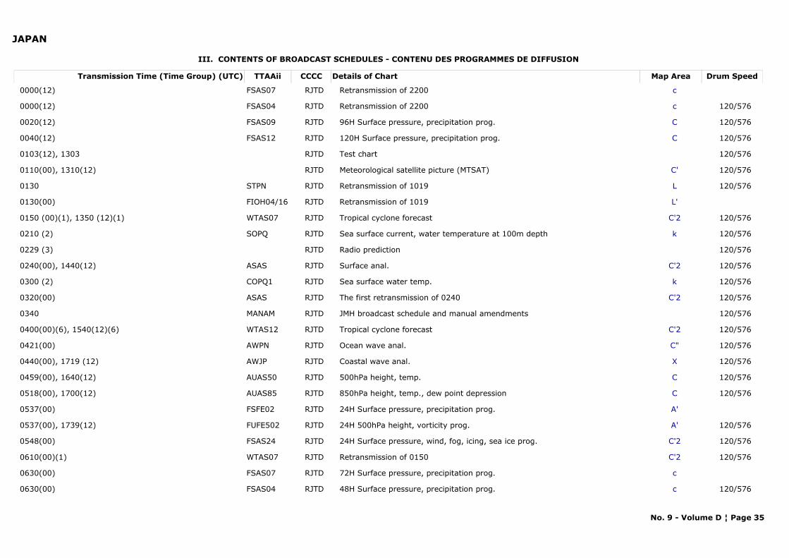
JAPAN
III. CONTENTS OF BROADCAST SCHEDULES - CONTENU DES PROGRAMMES DE DIFFUSION
Transmission Time (Time Group) (UTC) Map AreaDetails of Chart Drum SpeedTTAAii CCCC
0000(12) cRetransmission of 2200FSAS07 RJTD
0000(12) cRetransmission of 2200 120/576FSAS04 RJTD
0020(12) C96H Surface pressure, precipitation prog. 120/576FSAS09 RJTD
0040(12) C120H Surface pressure, precipitation prog. 120/576FSAS12 RJTD
0103(12), 1303 Test chart 120/576RJTD
0110(00), 1310(12) C'Meteorological satellite picture (MTSAT) 120/576RJTD
0130 LRetransmission of 1019 120/576STPN RJTD
0130(00) L'Retransmission of 1019FIOH04/16 RJTD
0150 (00)(1), 1350 (12)(1) C'2Tropical cyclone forecast 120/576WTAS07 RJTD
0210 (2) kSea surface current, water temperature at 100m depth 120/576SOPQ RJTD
0229 (3) Radio prediction 120/576RJTD
0240(00), 1440(12) C'2Surface anal. 120/576ASAS RJTD
0300 (2) kSea surface water temp. 120/576COPQ1 RJTD
0320(00) C'2The first retransmission of 0240 120/576ASAS RJTD
0340 JMH broadcast schedule and manual amendments 120/576MANAM RJTD
0400(00)(6), 1540(12)(6) C'2Tropical cyclone forecast 120/576WTAS12 RJTD
0421(00) C"Ocean wave anal. 120/576AWPN RJTD
0440(00), 1719 (12) XCoastal wave anal. 120/576AWJP RJTD
0459(00), 1640(12) C500hPa height, temp. 120/576AUAS50 RJTD
0518(00), 1700(12) C850hPa height, temp., dew point depression 120/576AUAS85 RJTD
0537(00) A'24H Surface pressure, precipitation prog.FSFE02 RJTD
0537(00), 1739(12) A'24H 500hPa height, vorticity prog. 120/576FUFE502 RJTD
0548(00) C'224H Surface pressure, wind, fog, icing, sea ice prog. 120/576FSAS24 RJTD
0610(00)(1) C'2Retransmission of 0150 120/576WTAS07 RJTD
0630(00) c72H Surface pressure, precipitation prog. FSAS07 RJTD
0630(00) c48H Surface pressure, precipitation prog. 120/576FSAS04 RJTD
No. 9 - Volume D ¦ Page 35
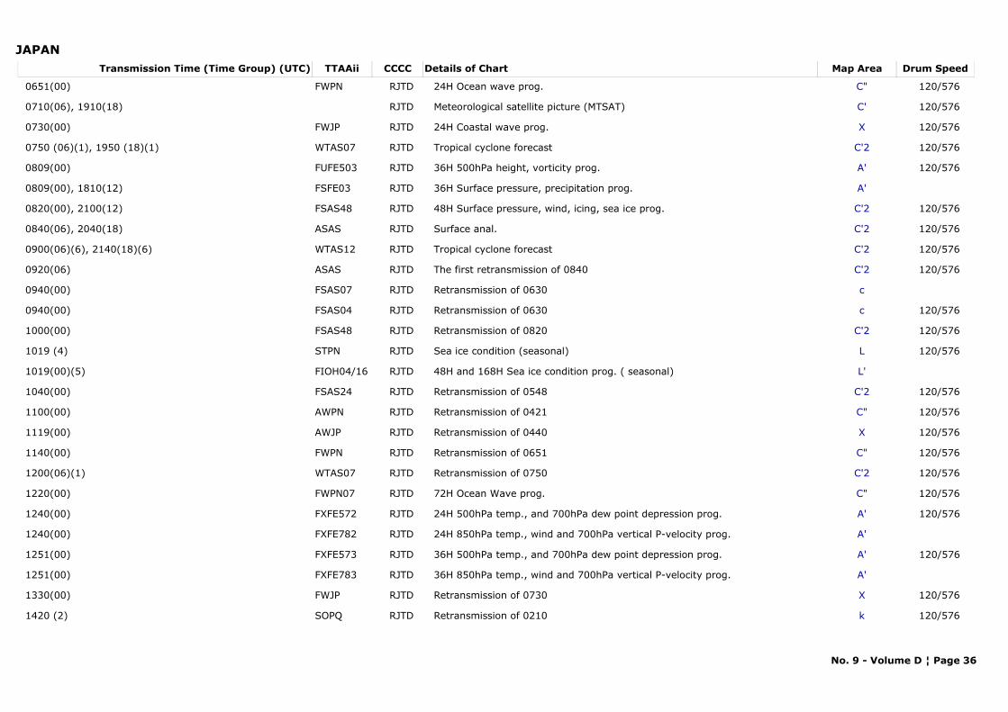
JAPANTransmission Time (Time Group) (UTC) Map AreaDetails of Chart Drum SpeedTTAAii CCCC
0651(00) C"24H Ocean wave prog. 120/576FWPN RJTD
0710(06), 1910(18) C'Meteorological satellite picture (MTSAT) 120/576RJTD
0730(00) X24H Coastal wave prog. 120/576FWJP RJTD
0750 (06)(1), 1950 (18)(1) C'2Tropical cyclone forecast 120/576WTAS07 RJTD
0809(00) A'36H 500hPa height, vorticity prog. 120/576FUFE503 RJTD
0809(00), 1810(12) A'36H Surface pressure, precipitation prog.FSFE03 RJTD
0820(00), 2100(12) C'248H Surface pressure, wind, icing, sea ice prog. 120/576FSAS48 RJTD
0840(06), 2040(18) C'2Surface anal. 120/576ASAS RJTD
0900(06)(6), 2140(18)(6) C'2Tropical cyclone forecast 120/576WTAS12 RJTD
0920(06) C'2The first retransmission of 0840 120/576ASAS RJTD
0940(00) cRetransmission of 0630 FSAS07 RJTD
0940(00) cRetransmission of 0630 120/576FSAS04 RJTD
1000(00) C'2Retransmission of 0820 120/576FSAS48 RJTD
1019 (4) LSea ice condition (seasonal) 120/576STPN RJTD
1019(00)(5) L'48H and 168H Sea ice condition prog. ( seasonal)FIOH04/16 RJTD
1040(00) C'2Retransmission of 0548 120/576FSAS24 RJTD
1100(00) C"Retransmission of 0421 120/576AWPN RJTD
1119(00) XRetransmission of 0440 120/576AWJP RJTD
1140(00) C"Retransmission of 0651 120/576FWPN RJTD
1200(06)(1) C'2Retransmission of 0750 120/576WTAS07 RJTD
1220(00) C"72H Ocean Wave prog. 120/576FWPN07 RJTD
1240(00) A'24H 500hPa temp., and 700hPa dew point depression prog. 120/576FXFE572 RJTD
1240(00) A'24H 850hPa temp., wind and 700hPa vertical P-velocity prog. FXFE782 RJTD
1251(00) A'36H 500hPa temp., and 700hPa dew point depression prog. 120/576FXFE573 RJTD
1251(00) A'36H 850hPa temp., wind and 700hPa vertical P-velocity prog. FXFE783 RJTD
1330(00) XRetransmission of 0730 120/576FWJP RJTD
1420 (2) kRetransmission of 0210 120/576SOPQ RJTD
No. 9 - Volume D ¦ Page 36
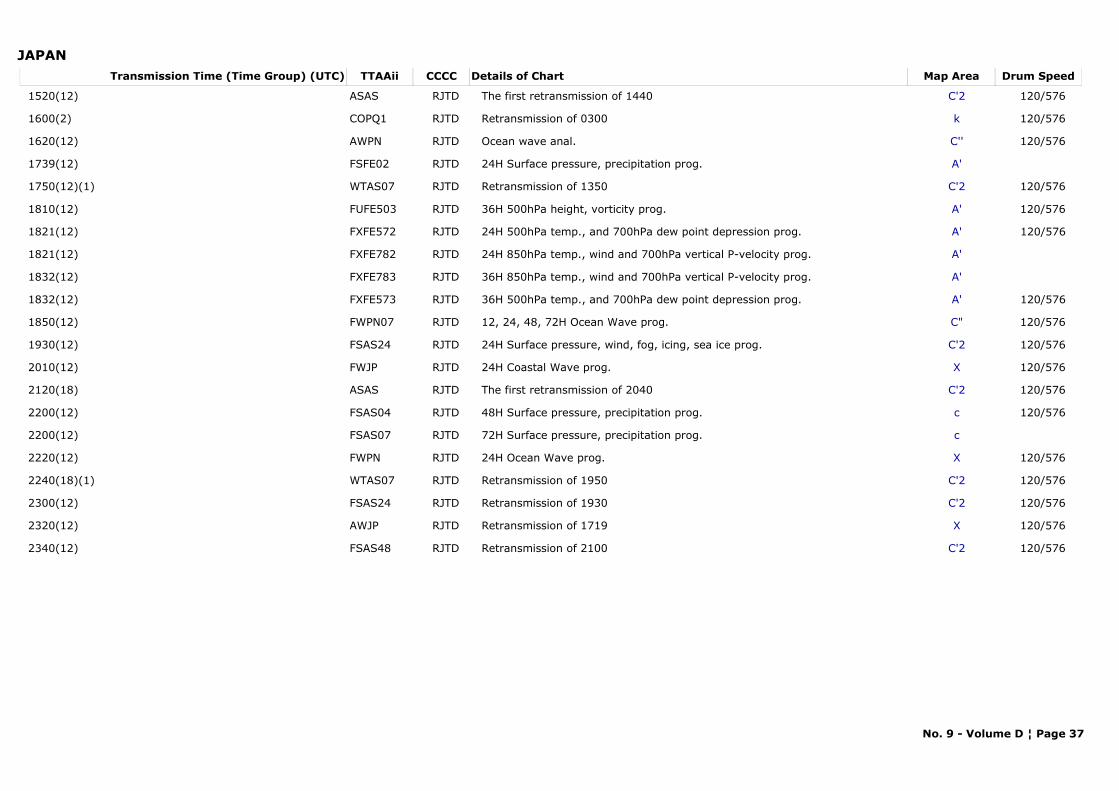
JAPANTransmission Time (Time Group) (UTC) Map AreaDetails of Chart Drum SpeedTTAAii CCCC
1520(12) C'2The first retransmission of 1440 120/576ASAS RJTD
1600(2) kRetransmission of 0300 120/576COPQ1 RJTD
1620(12) C''Ocean wave anal. 120/576AWPN RJTD
1739(12) A'24H Surface pressure, precipitation prog. FSFE02 RJTD
1750(12)(1) C'2Retransmission of 1350 120/576WTAS07 RJTD
1810(12) A'36H 500hPa height, vorticity prog. 120/576FUFE503 RJTD
1821(12) A'24H 500hPa temp., and 700hPa dew point depression prog. 120/576FXFE572 RJTD
1821(12) A'24H 850hPa temp., wind and 700hPa vertical P-velocity prog. FXFE782 RJTD
1832(12) A'36H 850hPa temp., wind and 700hPa vertical P-velocity prog. FXFE783 RJTD
1832(12) A'36H 500hPa temp., and 700hPa dew point depression prog. 120/576FXFE573 RJTD
1850(12) C"12, 24, 48, 72H Ocean Wave prog. 120/576FWPN07 RJTD
1930(12) C'224H Surface pressure, wind, fog, icing, sea ice prog. 120/576FSAS24 RJTD
2010(12) X24H Coastal Wave prog. 120/576FWJP RJTD
2120(18) C'2The first retransmission of 2040 120/576ASAS RJTD
2200(12) c48H Surface pressure, precipitation prog. 120/576FSAS04 RJTD
2200(12) c72H Surface pressure, precipitation prog. FSAS07 RJTD
2220(12) X24H Ocean Wave prog. 120/576FWPN RJTD
2240(18)(1) C'2Retransmission of 1950 120/576WTAS07 RJTD
2300(12) C'2Retransmission of 1930 120/576FSAS24 RJTD
2320(12) XRetransmission of 1719 120/576AWJP RJTD
2340(12) C'2Retransmission of 2100 120/576FSAS48 RJTD
No. 9 - Volume D ¦ Page 37
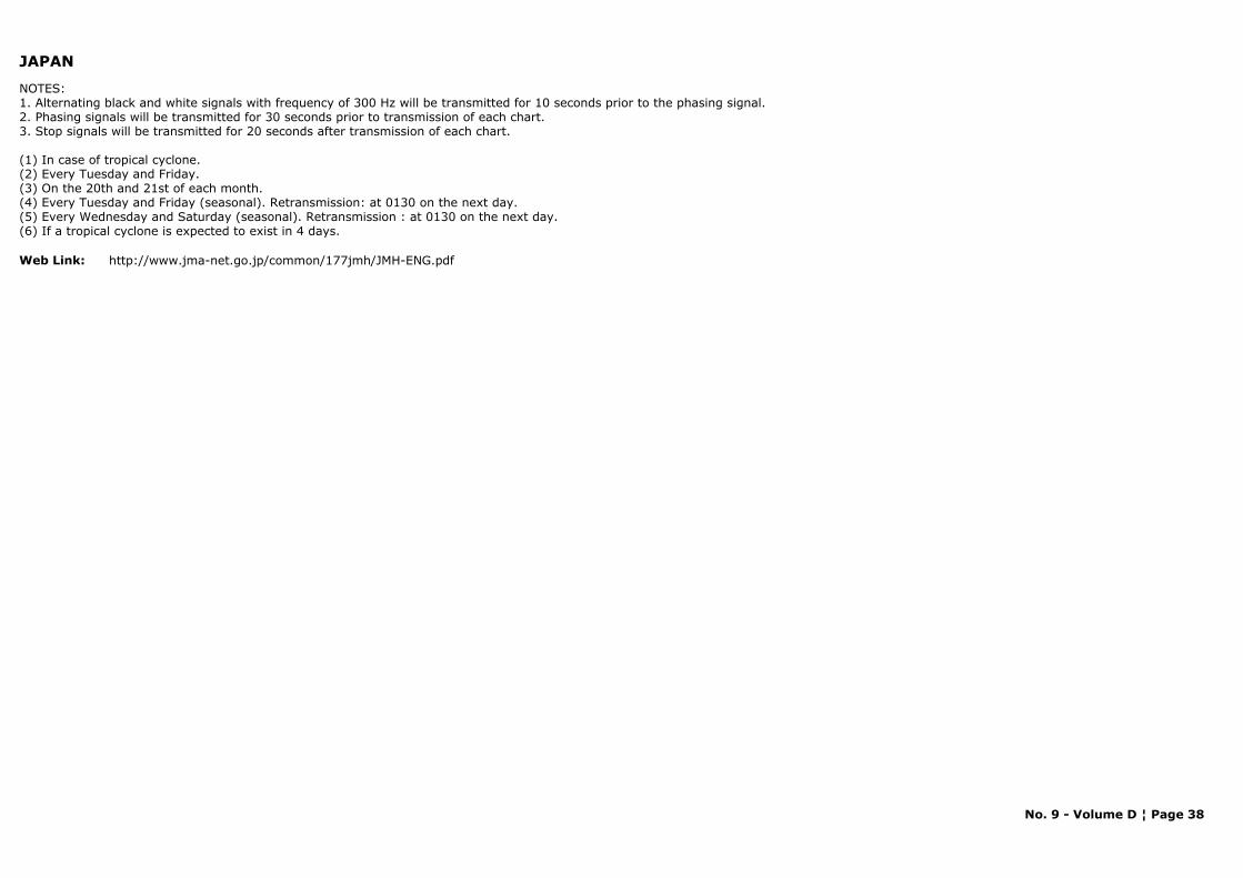
JAPAN
NOTES: 1. Alternating black and white signals with frequency of 300 Hz will be transmitted for 10 seconds prior to the phasing signal.2. Phasing signals will be transmitted for 30 seconds prior to transmission of each chart.3. Stop signals will be transmitted for 20 seconds after transmission of each chart.
(1) In case of tropical cyclone.(2) Every Tuesday and Friday.(3) On the 20th and 21st of each month.(4) Every Tuesday and Friday (seasonal). Retransmission: at 0130 on the next day.(5) Every Wednesday and Saturday (seasonal). Retransmission : at 0130 on the next day.(6) If a tropical cyclone is expected to exist in 4 days.
Web Link: http://www.jma-net.go.jp/common/177jmh/JMH-ENG.pdf
No. 9 - Volume D ¦ Page 38
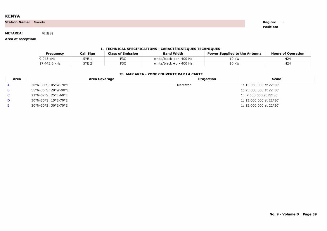
KENYA
I. TECHNICAL SPECIFICATIONS - CARACTÉRISTIQUES TECHNIQUES
II. MAP AREA - ZONE COUVERTE PAR LA CARTE
Station Name: Nairobi
METAREA: VIII(S)
Area of reception:
Region: IPosition:
Call Sign Hours of OperationFrequency Class of Emission Band Width Power Supplied to the Antenna5YE 1 H249 043 kHz F3C white/black +or- 400 Hz 10 kW5YE 2 H2417 445.6 kHz F3C white/black +or- 400 Hz 10 kW
Area Area Coverage ScaleProjection
A 30°N-30°S; 05°W-70°E Mercator 1: 15.000.000 at 22°30'B 55°N-35°S; 20°W-90°E 1: 25.000.000 at 22°30'C 22°N-02°S; 25°E-60°E 1: 7.500.000 at 22°30'D 30°N-30°S; 15°E-70°E 1: 15.000.000 at 22°30'E 20°N-30°S; 30°E-70°E 1: 15.000.000 at 22°30'
No. 9 - Volume D ¦ Page 39
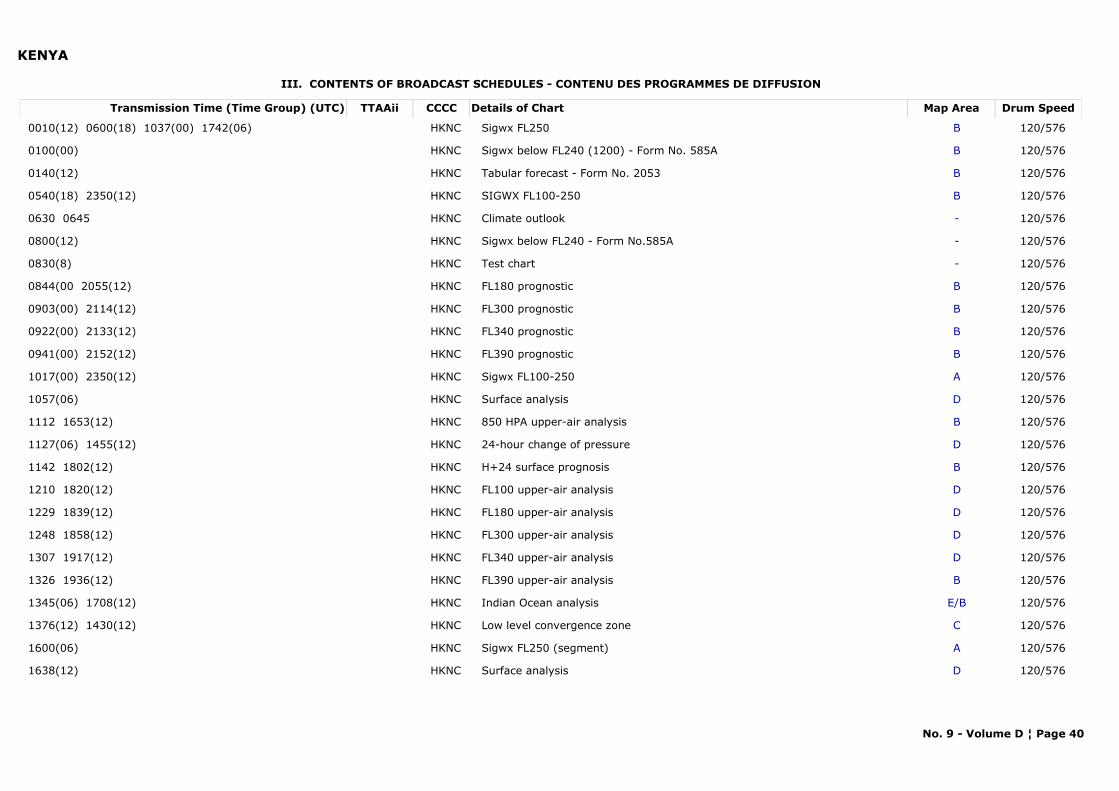
KENYA
III. CONTENTS OF BROADCAST SCHEDULES - CONTENU DES PROGRAMMES DE DIFFUSION
Transmission Time (Time Group) (UTC) Map AreaDetails of Chart Drum SpeedTTAAii CCCC
0010(12) 0600(18) 1037(00) 1742(06) BSigwx FL250 120/576HKNC
0100(00) BSigwx below FL240 (1200) - Form No. 585A 120/576HKNC
0140(12) BTabular forecast - Form No. 2053 120/576HKNC
0540(18) 2350(12) BSIGWX FL100-250 120/576HKNC
0630 0645 -Climate outlook 120/576HKNC
0800(12) -Sigwx below FL240 - Form No.585A 120/576HKNC
0830(8) -Test chart 120/576HKNC
0844(00 2055(12) BFL180 prognostic 120/576HKNC
0903(00) 2114(12) BFL300 prognostic 120/576HKNC
0922(00) 2133(12) BFL340 prognostic 120/576HKNC
0941(00) 2152(12) BFL390 prognostic 120/576HKNC
1017(00) 2350(12) ASigwx FL100-250 120/576HKNC
1057(06) DSurface analysis 120/576HKNC
1112 1653(12) B850 HPA upper-air analysis 120/576HKNC
1127(06) 1455(12) D24-hour change of pressure 120/576HKNC
1142 1802(12) BH+24 surface prognosis 120/576HKNC
1210 1820(12) DFL100 upper-air analysis 120/576HKNC
1229 1839(12) DFL180 upper-air analysis 120/576HKNC
1248 1858(12) DFL300 upper-air analysis 120/576HKNC
1307 1917(12) DFL340 upper-air analysis 120/576HKNC
1326 1936(12) BFL390 upper-air analysis 120/576HKNC
1345(06) 1708(12) E/BIndian Ocean analysis 120/576HKNC
1376(12) 1430(12) CLow level convergence zone 120/576HKNC
1600(06) ASigwx FL250 (segment) 120/576HKNC
1638(12) DSurface analysis 120/576HKNC
No. 9 - Volume D ¦ Page 40
KENYA
NOTE (a) Changes to the schedule will be transmitted at 0830 in place of the normal test chart
Within a radius of 3 000 miles from Nairobi
Web Link: --
No. 9 - Volume D ¦ Page 41
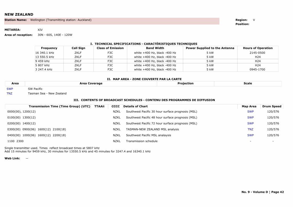
NEW ZEALAND
I. TECHNICAL SPECIFICATIONS - CARACTÉRISTIQUES TECHNIQUES
II. MAP AREA - ZONE COUVERTE PAR LA CARTE
Station Name: Wellington (Transmitting station: Auckland)
METAREA: XIV
Area of reception: 30N - 60S, 140E - 120W
Region: V Position:
Call Sign Hours of OperationFrequency Class of Emission Band Width Power Supplied to the AntennaZKLF 2145-0500 16 340.1 kHz F3C white +400 Hz, black -400 Hz 5 kWZKLF H2413 550.5 kHz F3C white +400 Hz, black -400 Hz 5 kWZKLF H249 459 kHz F3C white +400 Hz, black -400 Hz 5 kWZKLF H245 807 kHz F3C white +400 Hz, black -400 Hz 5 kWZKLF 0945-1700 3 247.4 kHz F3C white +400 Hz, black -400 Hz 5 kW
Area Area Coverage ScaleProjection
SWP SW PacificTNZ Tasman Sea - New Zealand
III. CONTENTS OF BROADCAST SCHEDULES - CONTENU DES PROGRAMMES DE DIFFUSION
Transmission Time (Time Group) (UTC) Map AreaDetails of Chart Drum SpeedTTAAii CCCC
0000(00), 1200(12) SWPSouthwest Pacific 30 hour surface prognosis (MSL) 120/576NZKL
0100(00) 1300(12) SWPSouthwest Pacific 48 hour surface prognosis (MSL) 120/576NZKL
0200(00) 1400(12) SWPSouthwest Pacific 72 hour surface prognosis (MSL) 120/576NZKL
0300(00) 0900(06) 1600(12) 2100(18) TNZTASMAN-NEW ZEALAND MSL analysis 120/576NZKL
0400(00) 1000(06) 1600(12) 2200(18) SWPSouthwest Pacific MSL analaysis 120/576NZKL
1100 2300 -Transmission schedule -NZKL
Single transmitter used. Times reflect broadcast times at 5807 kHzAdd 15 minutes for 9459 kHz, 30 minutes for 13550.5 kHz and 45 minutes for 3247.4 and 16340.1 kHz
Web Link: --
No. 9 - Volume D ¦ Page 42
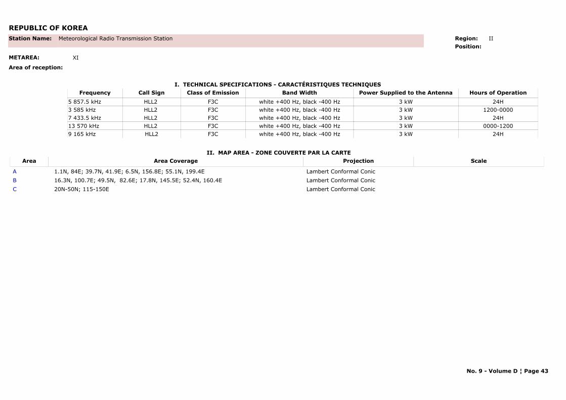
REPUBLIC OF KOREA
I. TECHNICAL SPECIFICATIONS - CARACTÉRISTIQUES TECHNIQUES
II. MAP AREA - ZONE COUVERTE PAR LA CARTE
Station Name: Meteorological Radio Transmission Station
METAREA: XI
Area of reception:
Region: IIPosition:
Call Sign Hours of OperationFrequency Class of Emission Band Width Power Supplied to the AntennaHLL2 24H5 857.5 kHz F3C white +400 Hz, black -400 Hz 3 kWHLL2 1200-00003 585 kHz F3C white +400 Hz, black -400 Hz 3 kWHLL2 24H7 433.5 kHz F3C white +400 Hz, black -400 Hz 3 kWHLL2 0000-120013 570 kHz F3C white +400 Hz, black -400 Hz 3 kWHLL2 24H9 165 kHz F3C white +400 Hz, black -400 Hz 3 kW
Area Area Coverage ScaleProjection
A 1.1N, 84E; 39.7N, 41.9E; 6.5N, 156.8E; 55.1N, 199.4E Lambert Conformal ConicB 16.3N, 100.7E; 49.5N, 82.6E; 17.8N, 145.5E; 52.4N, 160.4E Lambert Conformal ConicC 20N-50N; 115-150E Lambert Conformal Conic
No. 9 - Volume D ¦ Page 43
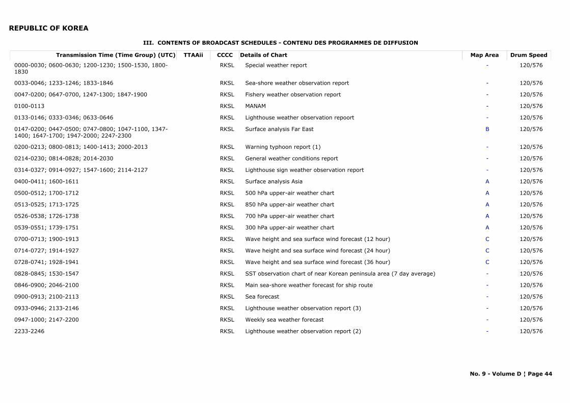
REPUBLIC OF KOREA
III. CONTENTS OF BROADCAST SCHEDULES - CONTENU DES PROGRAMMES DE DIFFUSION
Transmission Time (Time Group) (UTC) Map AreaDetails of Chart Drum SpeedTTAAii CCCC
0000-0030; 0600-0630; 1200-1230; 1500-1530, 1800-1830
-Special weather report 120/576RKSL
0033-0046; 1233-1246; 1833-1846 -Sea-shore weather observation report 120/576RKSL
0047-0200; 0647-0700, 1247-1300; 1847-1900 -Fishery weather observation report 120/576RKSL
0100-0113 -MANAM 120/576RKSL
0133-0146; 0333-0346; 0633-0646 -Lighthouse weather observation repoort 120/576RKSL
0147-0200; 0447-0500; 0747-0800; 1047-1100, 1347-1400; 1647-1700; 1947-2000; 2247-2300
BSurface analysis Far East 120/576RKSL
0200-0213; 0800-0813; 1400-1413; 2000-2013 -Warning typhoon report (1) 120/576RKSL
0214-0230; 0814-0828; 2014-2030 -General weather conditions report 120/576RKSL
0314-0327; 0914-0927; 1547-1600; 2114-2127 -Lighthouse sign weather observation report 120/576RKSL
0400-0411; 1600-1611 ASurface analysis Asia 120/576RKSL
0500-0512; 1700-1712 A500 hPa upper-air weather chart 120/576RKSL
0513-0525; 1713-1725 A850 hPa upper-air weather chart 120/576RKSL
0526-0538; 1726-1738 A700 hPa upper-air weather chart 120/576RKSL
0539-0551; 1739-1751 A300 hPa upper-air weather chart 120/576RKSL
0700-0713; 1900-1913 CWave height and sea surface wind forecast (12 hour) 120/576RKSL
0714-0727; 1914-1927 CWave height and sea surface wind forecast (24 hour) 120/576RKSL
0728-0741; 1928-1941 CWave height and sea surface wind forecast (36 hour) 120/576RKSL
0828-0845; 1530-1547 -SST observation chart of near Korean peninsula area (7 day average) 120/576RKSL
0846-0900; 2046-2100 -Main sea-shore weather forecast for ship route 120/576RKSL
0900-0913; 2100-2113 -Sea forecast 120/576RKSL
0933-0946; 2133-2146 -Lighthouse weather observation report (3) 120/576RKSL
0947-1000; 2147-2200 -Weekly sea weather forecast 120/576RKSL
2233-2246 -Lighthouse weather observation report (2) 120/576RKSL
No. 9 - Volume D ¦ Page 44
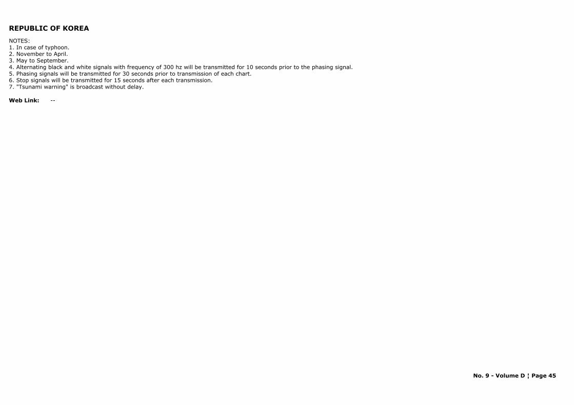
REPUBLIC OF KOREA
NOTES: 1. In case of typhoon.2. November to April.3. May to September.4. Alternating black and white signals with frequency of 300 hz will be transmitted for 10 seconds prior to the phasing signal.5. Phasing signals will be transmitted for 30 seconds prior to transmission of each chart.6. Stop signals will be transmitted for 15 seconds after each transmission.7. "Tsunami warning" is broadcast without delay.
Web Link: --
No. 9 - Volume D ¦ Page 45
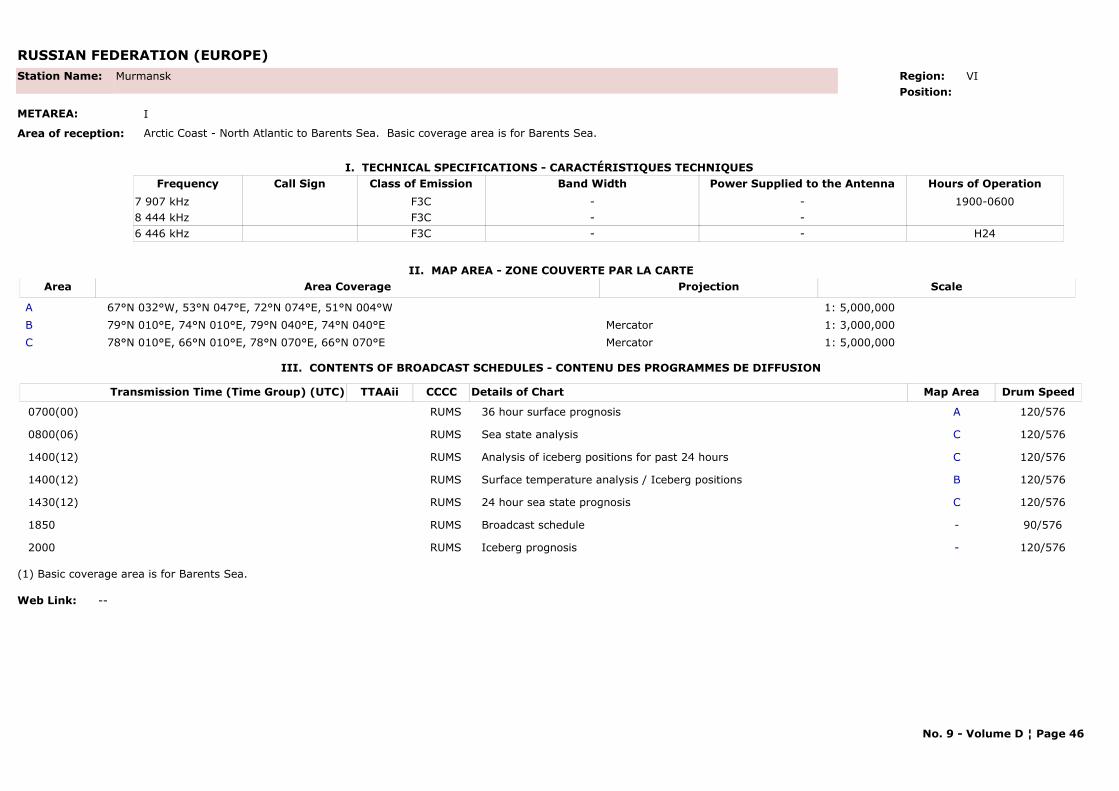
RUSSIAN FEDERATION (EUROPE)
I. TECHNICAL SPECIFICATIONS - CARACTÉRISTIQUES TECHNIQUES
II. MAP AREA - ZONE COUVERTE PAR LA CARTE
Station Name: Murmansk
METAREA: I
Area of reception: Arctic Coast - North Atlantic to Barents Sea. Basic coverage area is for Barents Sea.
Region: VIPosition:
Call Sign Hours of OperationFrequency Class of Emission Band Width Power Supplied to the Antenna1900-06007 907 kHz F3C - -
8 444 kHz F3C - -H246 446 kHz F3C - -
Area Area Coverage ScaleProjection
A 67°N 032°W, 53°N 047°E, 72°N 074°E, 51°N 004°W 1: 5,000,000B 79°N 010°E, 74°N 010°E, 79°N 040°E, 74°N 040°E Mercator 1: 3,000,000C 78°N 010°E, 66°N 010°E, 78°N 070°E, 66°N 070°E Mercator 1: 5,000,000
III. CONTENTS OF BROADCAST SCHEDULES - CONTENU DES PROGRAMMES DE DIFFUSION
Transmission Time (Time Group) (UTC) Map AreaDetails of Chart Drum SpeedTTAAii CCCC
0700(00) A36 hour surface prognosis 120/576RUMS
0800(06) CSea state analysis 120/576RUMS
1400(12) CAnalysis of iceberg positions for past 24 hours 120/576RUMS
1400(12) BSurface temperature analysis / Iceberg positions 120/576RUMS
1430(12) C24 hour sea state prognosis 120/576RUMS
1850 -Broadcast schedule 90/576RUMS
2000 -Iceberg prognosis 120/576RUMS
(1) Basic coverage area is for Barents Sea.
Web Link: --
No. 9 - Volume D ¦ Page 46
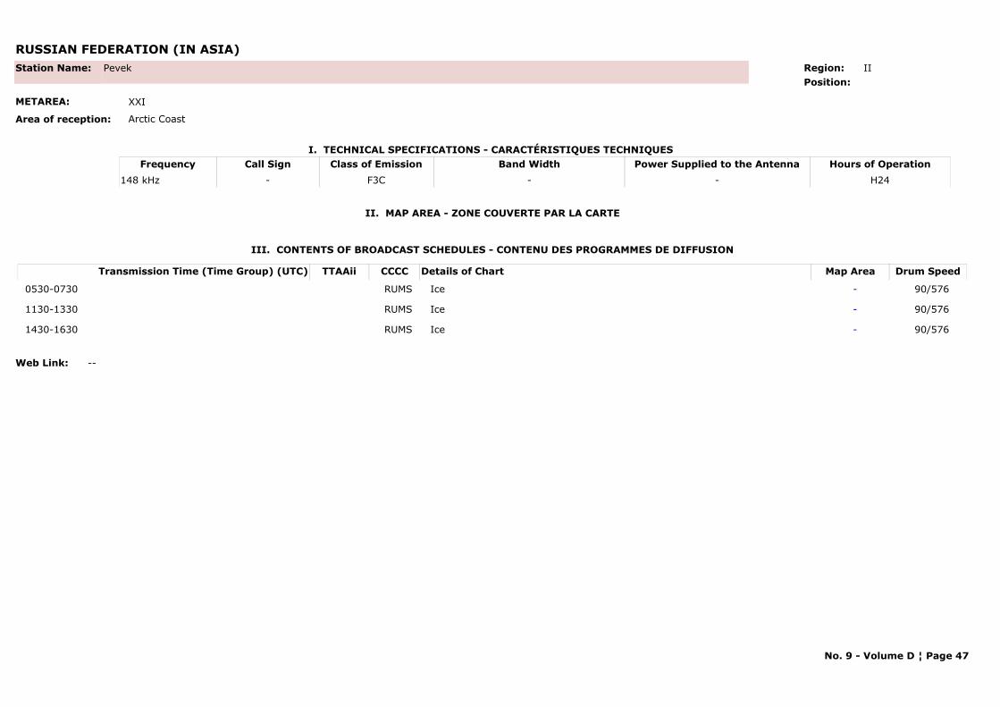
RUSSIAN FEDERATION (IN ASIA)
I. TECHNICAL SPECIFICATIONS - CARACTÉRISTIQUES TECHNIQUES
II. MAP AREA - ZONE COUVERTE PAR LA CARTE
Station Name: Pevek
METAREA: XXI
Area of reception: Arctic Coast
Region: II Position:
Call Sign Hours of OperationFrequency Class of Emission Band Width Power Supplied to the Antenna- H24148 kHz F3C - -
III. CONTENTS OF BROADCAST SCHEDULES - CONTENU DES PROGRAMMES DE DIFFUSION
Transmission Time (Time Group) (UTC) Map AreaDetails of Chart Drum SpeedTTAAii CCCC
0530-0730 -Ice 90/576RUMS
1130-1330 -Ice 90/576RUMS
1430-1630 -Ice 90/576RUMS
Web Link: --
No. 9 - Volume D ¦ Page 47
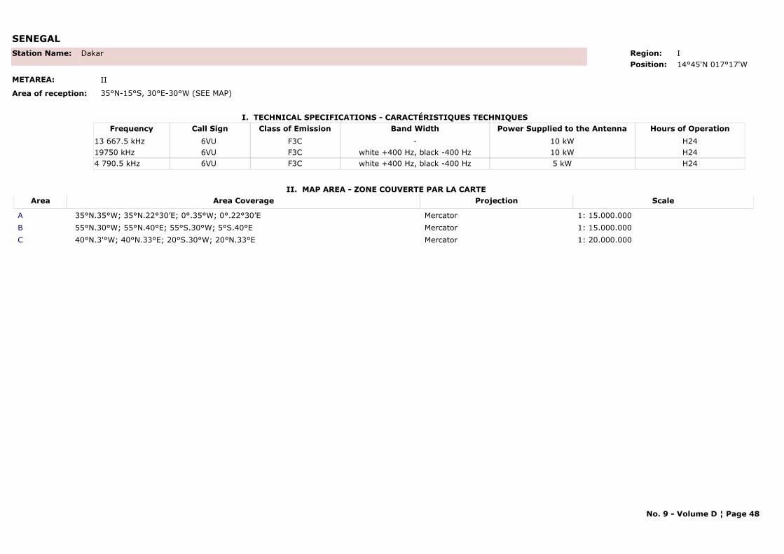
SENEGAL
I. TECHNICAL SPECIFICATIONS - CARACTÉRISTIQUES TECHNIQUES
II. MAP AREA - ZONE COUVERTE PAR LA CARTE
Station Name: Dakar
METAREA: II
Area of reception: 35°N-15°S, 30°E-30°W (SEE MAP)
Region: IPosition: 14°45'N 017°17'W
Call Sign Hours of OperationFrequency Class of Emission Band Width Power Supplied to the Antenna6VU H2413 667.5 kHz F3C - 10 kW6VU H2419750 kHz F3C white +400 Hz, black -400 Hz 10 kW6VU H244 790.5 kHz F3C white +400 Hz, black -400 Hz 5 kW
Area Area Coverage ScaleProjection
A 35°N.35°W; 35°N.22°30’E; 0°.35°W; 0°.22°30’E Mercator 1: 15.000.000B 55°N.30°W; 55°N.40°E; 55°S.30°W; 5°S.40°E Mercator 1: 15.000.000C 40°N.3'°W; 40°N.33°E; 20°S.30°W; 20°N.33°E Mercator 1: 20.000.000
No. 9 - Volume D ¦ Page 48
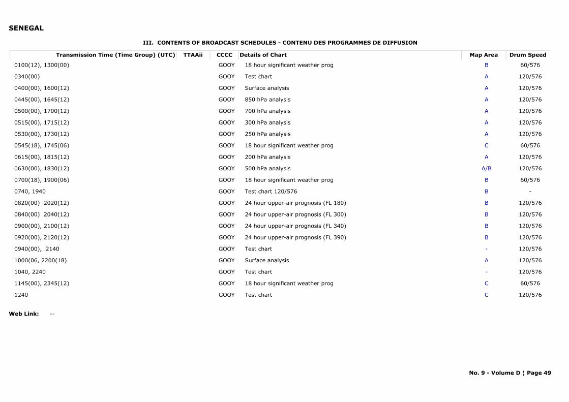
SENEGAL
III. CONTENTS OF BROADCAST SCHEDULES - CONTENU DES PROGRAMMES DE DIFFUSION
Transmission Time (Time Group) (UTC) Map AreaDetails of Chart Drum SpeedTTAAii CCCC
0100(12), 1300(00) B18 hour significant weather prog 60/576GOOY
0340(00) ATest chart 120/576GOOY
0400(00), 1600(12) ASurface analysis 120/576GOOY
0445(00), 1645(12) A850 hPa analysis 120/576GOOY
0500(00), 1700(12) A700 hPa analysis 120/576GOOY
0515(00), 1715(12) A300 hPa analysis 120/576GOOY
0530(00), 1730(12) A250 hPa analysis 120/576GOOY
0545(18), 1745(06) C18 hour significant weather prog 60/576GOOY
0615(00), 1815(12) A200 hPa analysis 120/576GOOY
0630(00), 1830(12) A/B500 hPa analysis 120/576GOOY
0700(18), 1900(06) B18 hour significant weather prog 60/576GOOY
0740, 1940 BTest chart 120/576 -GOOY
0820(00) 2020(12) B24 hour upper-air prognosis (FL 180) 120/576GOOY
0840(00) 2040(12) B24 hour upper-air prognosis (FL 300) 120/576GOOY
0900(00), 2100(12) B24 hour upper-air prognosis (FL 340) 120/576GOOY
0920(00), 2120(12) B24 hour upper-air prognosis (FL 390) 120/576GOOY
0940(00), 2140 -Test chart 120/576GOOY
1000(06, 2200(18) ASurface analysis 120/576GOOY
1040, 2240 -Test chart 120/576GOOY
1145(00), 2345(12) C18 hour significant weather prog 60/576GOOY
1240 CTest chart 120/576GOOY
Web Link: --
No. 9 - Volume D ¦ Page 49
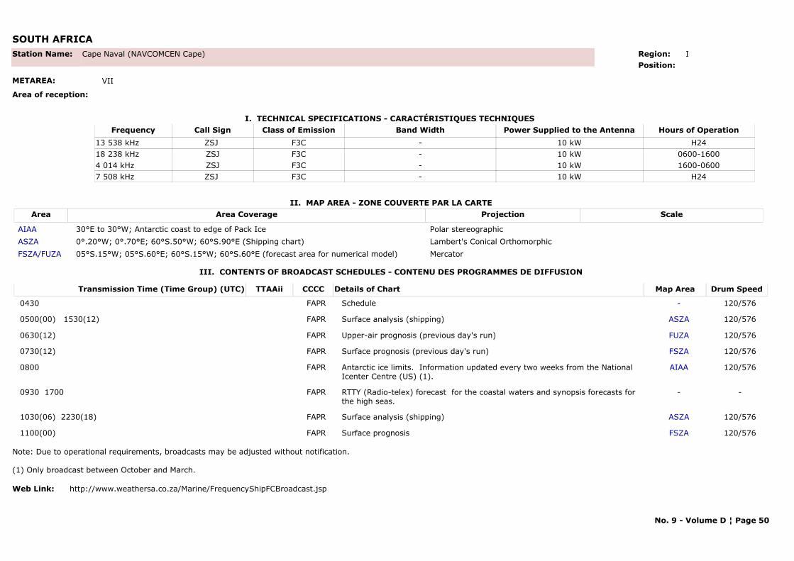
SOUTH AFRICA
I. TECHNICAL SPECIFICATIONS - CARACTÉRISTIQUES TECHNIQUES
II. MAP AREA - ZONE COUVERTE PAR LA CARTE
Station Name: Cape Naval (NAVCOMCEN Cape)
METAREA: VII
Area of reception:
Region: IPosition:
Call Sign Hours of OperationFrequency Class of Emission Band Width Power Supplied to the AntennaZSJ H2413 538 kHz F3C - 10 kWZSJ 0600-160018 238 kHz F3C - 10 kWZSJ 1600-06004 014 kHz F3C - 10 kWZSJ H247 508 kHz F3C - 10 kW
Area Area Coverage ScaleProjection
AIAA 30°E to 30°W; Antarctic coast to edge of Pack Ice Polar stereographicASZA 0°.20°W; 0°.70°E; 60°S.50°W; 60°S.90°E (Shipping chart) Lambert's Conical OrthomorphicFSZA/FUZA 05°S.15°W; 05°S.60°E; 60°S.15°W; 60°S.60°E (forecast area for numerical model) Mercator
III. CONTENTS OF BROADCAST SCHEDULES - CONTENU DES PROGRAMMES DE DIFFUSION
Transmission Time (Time Group) (UTC) Map AreaDetails of Chart Drum SpeedTTAAii CCCC
0430 -Schedule 120/576FAPR
0500(00) 1530(12) ASZASurface analysis (shipping) 120/576FAPR
0630(12) FUZAUpper-air prognosis (previous day's run) 120/576FAPR
0730(12) FSZASurface prognosis (previous day's run) 120/576FAPR
0800 AIAAAntarctic ice limits. Information updated every two weeks from the National Icenter Centre (US) (1).
120/576FAPR
0930 1700 -RTTY (Radio-telex) forecast for the coastal waters and synopsis forecasts for the high seas.
-FAPR
1030(06) 2230(18) ASZASurface analysis (shipping) 120/576FAPR
1100(00) FSZASurface prognosis 120/576FAPR
Note: Due to operational requirements, broadcasts may be adjusted without notification.
(1) Only broadcast between October and March.
Web Link: http://www.weathersa.co.za/Marine/FrequencyShipFCBroadcast.jsp
No. 9 - Volume D ¦ Page 50
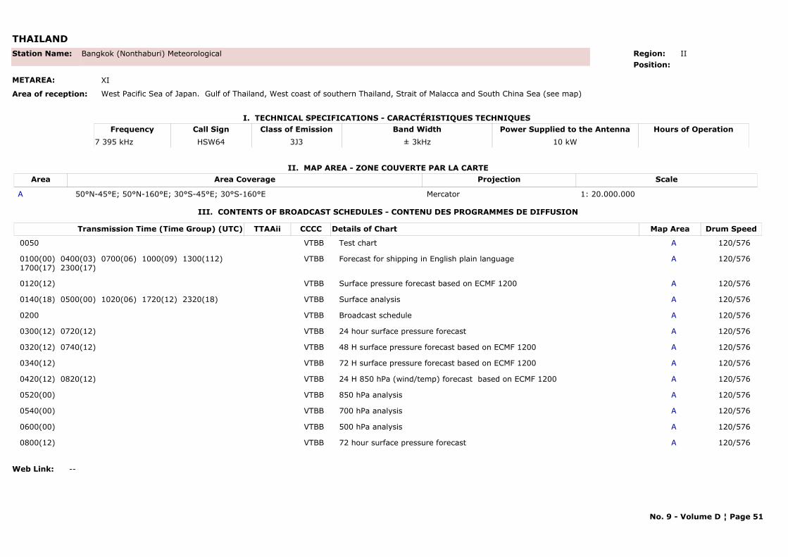
THAILAND
I. TECHNICAL SPECIFICATIONS - CARACTÉRISTIQUES TECHNIQUES
II. MAP AREA - ZONE COUVERTE PAR LA CARTE
Station Name: Bangkok (Nonthaburi) Meteorological
METAREA: XI
Area of reception: West Pacific Sea of Japan. Gulf of Thailand, West coast of southern Thailand, Strait of Malacca and South China Sea (see map)
Region: IIPosition:
Call Sign Hours of OperationFrequency Class of Emission Band Width Power Supplied to the AntennaHSW647 395 kHz 3J3 ± 3kHz 10 kW
Area Area Coverage ScaleProjection
A 50°N-45°E; 50°N-160°E; 30°S-45°E; 30°S-160°E Mercator 1: 20.000.000
III. CONTENTS OF BROADCAST SCHEDULES - CONTENU DES PROGRAMMES DE DIFFUSION
Transmission Time (Time Group) (UTC) Map AreaDetails of Chart Drum SpeedTTAAii CCCC
0050 ATest chart 120/576VTBB
0100(00) 0400(03) 0700(06) 1000(09) 1300(112) 1700(17) 2300(17)
AForecast for shipping in English plain language 120/576VTBB
0120(12) ASurface pressure forecast based on ECMF 1200 120/576VTBB
0140(18) 0500(00) 1020(06) 1720(12) 2320(18) ASurface analysis 120/576VTBB
0200 ABroadcast schedule 120/576VTBB
0300(12) 0720(12) A24 hour surface pressure forecast 120/576VTBB
0320(12) 0740(12) A48 H surface pressure forecast based on ECMF 1200 120/576VTBB
0340(12) A72 H surface pressure forecast based on ECMF 1200 120/576VTBB
0420(12) 0820(12) A24 H 850 hPa (wind/temp) forecast based on ECMF 1200 120/576VTBB
0520(00) A850 hPa analysis 120/576VTBB
0540(00) A700 hPa analysis 120/576VTBB
0600(00) A500 hPa analysis 120/576VTBB
0800(12) A72 hour surface pressure forecast 120/576VTBB
Web Link: --
No. 9 - Volume D ¦ Page 51
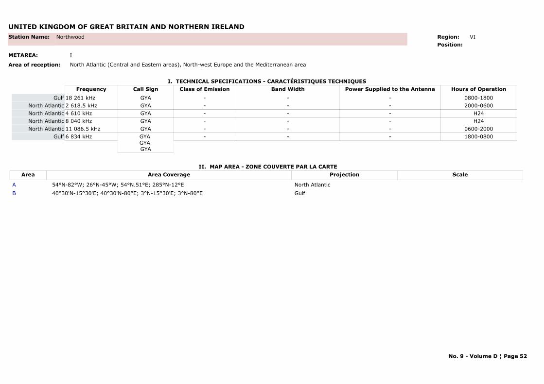
UNITED KINGDOM OF GREAT BRITAIN AND NORTHERN IRELAND
I. TECHNICAL SPECIFICATIONS - CARACTÉRISTIQUES TECHNIQUES
II. MAP AREA - ZONE COUVERTE PAR LA CARTE
Station Name: Northwood
METAREA: I
Area of reception: North Atlantic (Central and Eastern areas), North-west Europe and the Mediterranean area
Region: VI Position:
Call Sign Hours of OperationFrequency Class of Emission Band Width Power Supplied to the AntennaGYA 0800-180018 261 kHz - - -GulfGYA 2000-06002 618.5 kHz - - -North AtlanticGYA H244 610 kHz - - -North AtlanticGYA H248 040 kHz - - -North AtlanticGYA 0600-200011 086.5 kHz - - -North AtlanticGYA GYA GYA
1800-08006 834 kHz - - -Gulf
Area Area Coverage ScaleProjection
A 54°N-82°W; 26°N-45°W; 54°N.51°E; 285°N-12°E North AtlanticB 40°30'N-15°30'E; 40°30'N-80°E; 3°N-15°30'E; 3°N-80°E Gulf
No. 9 - Volume D ¦ Page 52
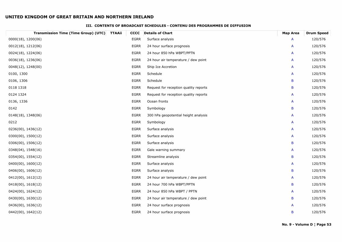
UNITED KINGDOM OF GREAT BRITAIN AND NORTHERN IRELAND
III. CONTENTS OF BROADCAST SCHEDULES - CONTENU DES PROGRAMMES DE DIFFUSION
Transmission Time (Time Group) (UTC) Map AreaDetails of Chart Drum SpeedTTAAii CCCC
0000(18), 1200(06) ASurface analysis 120/576EGRR
0012(18), 1212(06) A24 hour surface prognosis 120/576EGRR
0024(18), 1224(06) A24 hour 850 hPa WBPT/PPTN 120/576EGRR
0036(18), 1236(06) A24 hour air temperature / dew point 120/576EGRR
0048(12), 1248(00) AShip Ice Accretion 120/576EGRR
0100, 1300 ASchedule 120/576EGRR
0106, 1306 BSchedule 120/576EGRR
0118 1318 BRequest for reception quality reports 120/576EGRR
0124 1324 ARequest for reception quality reports 120/576EGRR
0136, 1336 AOcean fronts 120/576EGRR
0142 BSymbology 120/576EGRR
0148(18), 1348(06) A300 hPa geopotential height analysis 120/576EGRR
0212 ASymbology 120/576EGRR
0236(00), 1436(12) ASurface analysis 120/576EGRR
0300(00), 1500(12) ASurface analysis 120/576EGRR
0306(00), 1506(12) BSurface analysis 120/576EGRR
0348(04), 1548(16) AGale warning summary 120/576EGRR
0354(00), 1554(12) BStreamline analysis 120/576EGRR
0400(00), 1600(12) ASurface analysis 120/576EGRR
0406(00), 1606(12) BSurface analysis 120/576EGRR
0412(00), 1612(12) A24 hour air temperature / dew point 120/576EGRR
0418(00), 1618(12) B24 hour 700 hPa WBPT/PPTN 120/576EGRR
0424(00), 1624(12) A24 hour 850 hPa WBPT / PPTN 120/576EGRR
0430(00), 1630(12) B24 hour air temperature / dew point 120/576EGRR
0436(00), 1636(12) A24 hour surface prognosis 120/576EGRR
0442(00), 1642(12) B24 hour surface prognosis 120/576EGRR
No. 9 - Volume D ¦ Page 53
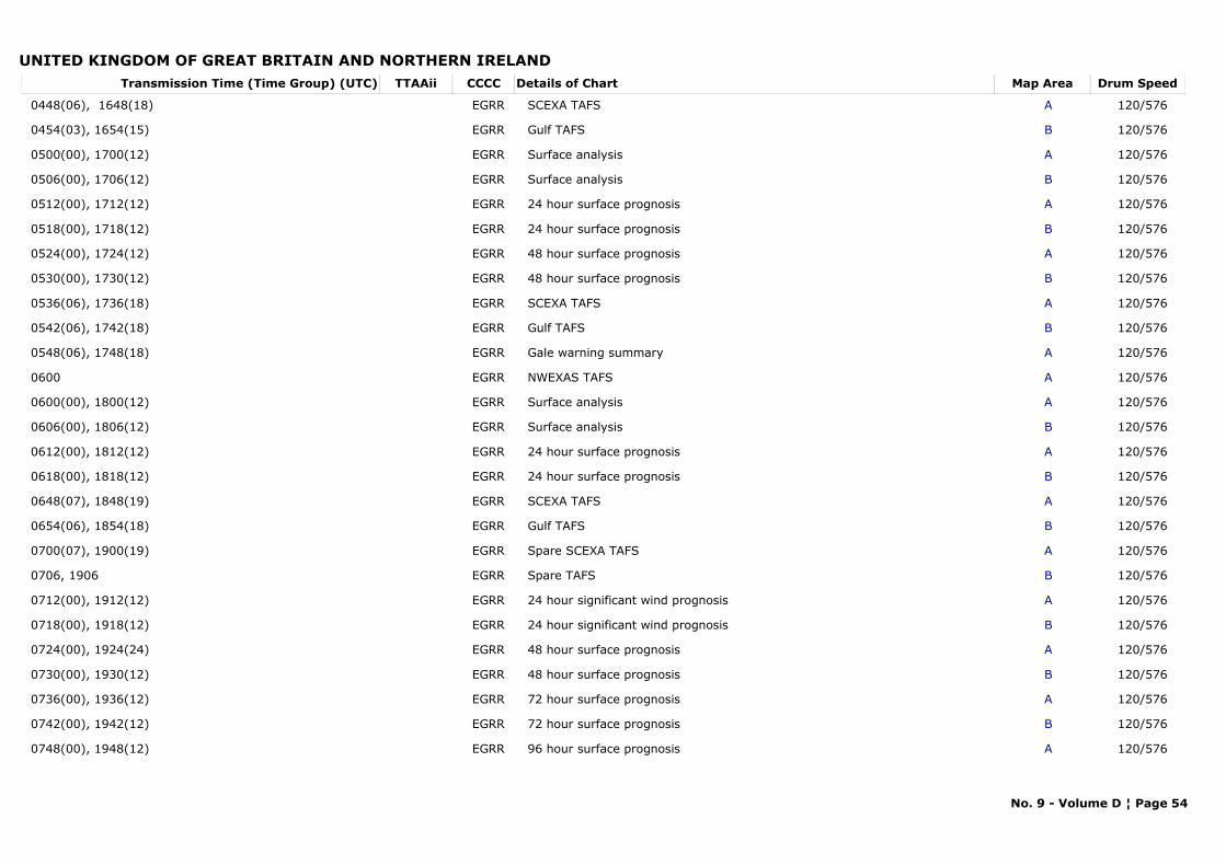
UNITED KINGDOM OF GREAT BRITAIN AND NORTHERN IRELANDTransmission Time (Time Group) (UTC) Map AreaDetails of Chart Drum SpeedTTAAii CCCC
0448(06), 1648(18) ASCEXA TAFS 120/576EGRR
0454(03), 1654(15) BGulf TAFS 120/576EGRR
0500(00), 1700(12) ASurface analysis 120/576EGRR
0506(00), 1706(12) BSurface analysis 120/576EGRR
0512(00), 1712(12) A24 hour surface prognosis 120/576EGRR
0518(00), 1718(12) B24 hour surface prognosis 120/576EGRR
0524(00), 1724(12) A48 hour surface prognosis 120/576EGRR
0530(00), 1730(12) B48 hour surface prognosis 120/576EGRR
0536(06), 1736(18) ASCEXA TAFS 120/576EGRR
0542(06), 1742(18) BGulf TAFS 120/576EGRR
0548(06), 1748(18) AGale warning summary 120/576EGRR
0600 ANWEXAS TAFS 120/576EGRR
0600(00), 1800(12) ASurface analysis 120/576EGRR
0606(00), 1806(12) BSurface analysis 120/576EGRR
0612(00), 1812(12) A24 hour surface prognosis 120/576EGRR
0618(00), 1818(12) B24 hour surface prognosis 120/576EGRR
0648(07), 1848(19) ASCEXA TAFS 120/576EGRR
0654(06), 1854(18) BGulf TAFS 120/576EGRR
0700(07), 1900(19) ASpare SCEXA TAFS 120/576EGRR
0706, 1906 BSpare TAFS 120/576EGRR
0712(00), 1912(12) A24 hour significant wind prognosis 120/576EGRR
0718(00), 1918(12) B24 hour significant wind prognosis 120/576EGRR
0724(00), 1924(24) A48 hour surface prognosis 120/576EGRR
0730(00), 1930(12) B48 hour surface prognosis 120/576EGRR
0736(00), 1936(12) A72 hour surface prognosis 120/576EGRR
0742(00), 1942(12) B72 hour surface prognosis 120/576EGRR
0748(00), 1948(12) A96 hour surface prognosis 120/576EGRR
No. 9 - Volume D ¦ Page 54
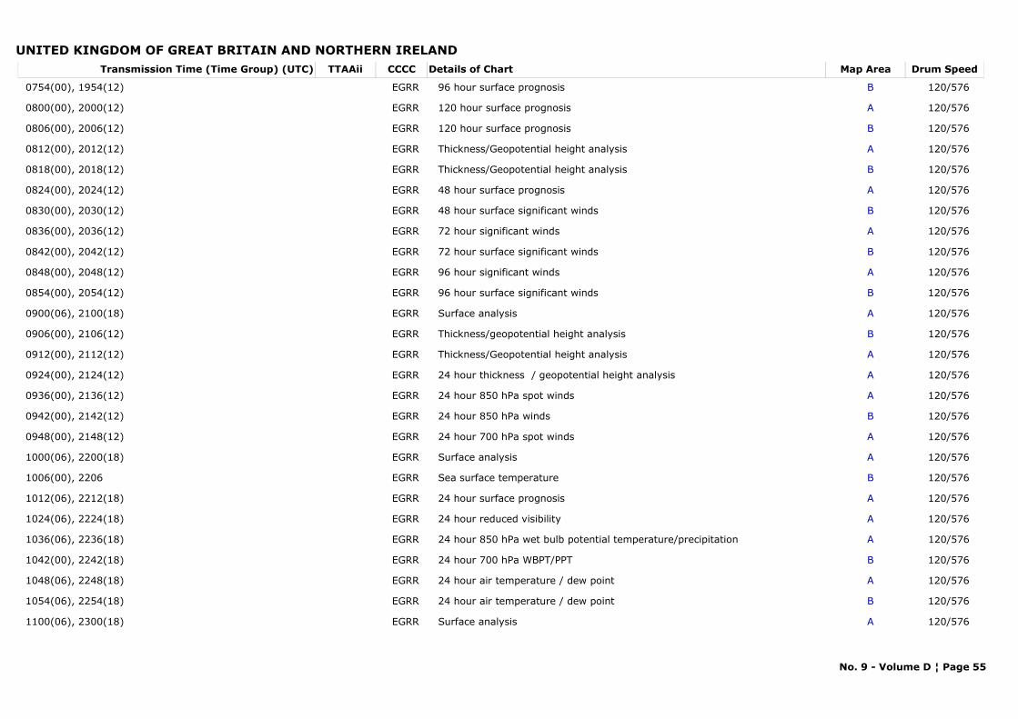
UNITED KINGDOM OF GREAT BRITAIN AND NORTHERN IRELANDTransmission Time (Time Group) (UTC) Map AreaDetails of Chart Drum SpeedTTAAii CCCC
0754(00), 1954(12) B96 hour surface prognosis 120/576EGRR
0800(00), 2000(12) A120 hour surface prognosis 120/576EGRR
0806(00), 2006(12) B120 hour surface prognosis 120/576EGRR
0812(00), 2012(12) AThickness/Geopotential height analysis 120/576EGRR
0818(00), 2018(12) BThickness/Geopotential height analysis 120/576EGRR
0824(00), 2024(12) A48 hour surface prognosis 120/576EGRR
0830(00), 2030(12) B48 hour surface significant winds 120/576EGRR
0836(00), 2036(12) A72 hour significant winds 120/576EGRR
0842(00), 2042(12) B72 hour surface significant winds 120/576EGRR
0848(00), 2048(12) A96 hour significant winds 120/576EGRR
0854(00), 2054(12) B96 hour surface significant winds 120/576EGRR
0900(06), 2100(18) ASurface analysis 120/576EGRR
0906(00), 2106(12) BThickness/geopotential height analysis 120/576EGRR
0912(00), 2112(12) AThickness/Geopotential height analysis 120/576EGRR
0924(00), 2124(12) A24 hour thickness / geopotential height analysis 120/576EGRR
0936(00), 2136(12) A24 hour 850 hPa spot winds 120/576EGRR
0942(00), 2142(12) B24 hour 850 hPa winds 120/576EGRR
0948(00), 2148(12) A24 hour 700 hPa spot winds 120/576EGRR
1000(06), 2200(18) ASurface analysis 120/576EGRR
1006(00), 2206 BSea surface temperature 120/576EGRR
1012(06), 2212(18) A24 hour surface prognosis 120/576EGRR
1024(06), 2224(18) A24 hour reduced visibility 120/576EGRR
1036(06), 2236(18) A24 hour 850 hPa wet bulb potential temperature/precipitation 120/576EGRR
1042(00), 2242(18) B24 hour 700 hPa WBPT/PPT 120/576EGRR
1048(06), 2248(18) A24 hour air temperature / dew point 120/576EGRR
1054(06), 2254(18) B24 hour air temperature / dew point 120/576EGRR
1100(06), 2300(18) ASurface analysis 120/576EGRR
No. 9 - Volume D ¦ Page 55
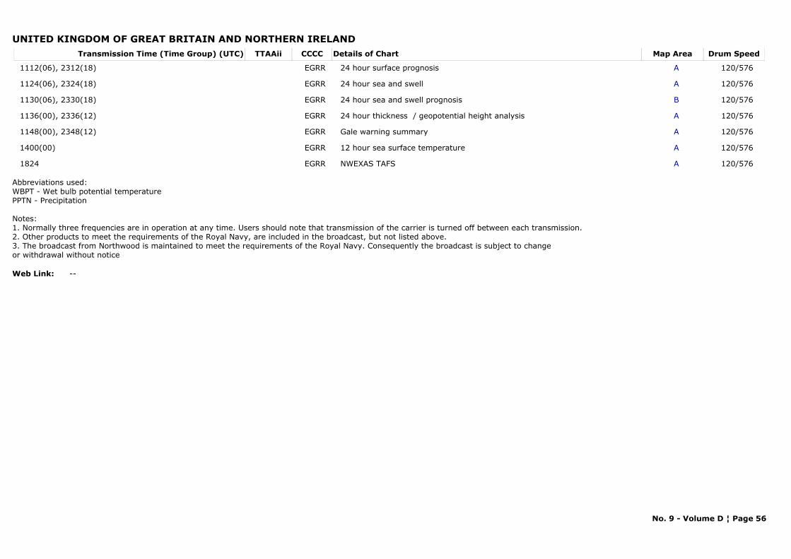
UNITED KINGDOM OF GREAT BRITAIN AND NORTHERN IRELANDTransmission Time (Time Group) (UTC) Map AreaDetails of Chart Drum SpeedTTAAii CCCC
1112(06), 2312(18) A24 hour surface prognosis 120/576EGRR
1124(06), 2324(18) A24 hour sea and swell 120/576EGRR
1130(06), 2330(18) B24 hour sea and swell prognosis 120/576EGRR
1136(00), 2336(12) A24 hour thickness / geopotential height analysis 120/576EGRR
1148(00), 2348(12) AGale warning summary 120/576EGRR
1400(00) A12 hour sea surface temperature 120/576EGRR
1824 ANWEXAS TAFS 120/576EGRR
Abbreviations used:WBPT - Wet bulb potential temperaturePPTN - Precipitation
Notes:1. Normally three frequencies are in operation at any time. Users should note that transmission of the carrier is turned off between each transmission.2. Other products to meet the requirements of the Royal Navy, are included in the broadcast, but not listed above.3. The broadcast from Northwood is maintained to meet the requirements of the Royal Navy. Consequently the broadcast is subject to change or withdrawal without notice
Web Link: --
No. 9 - Volume D ¦ Page 56
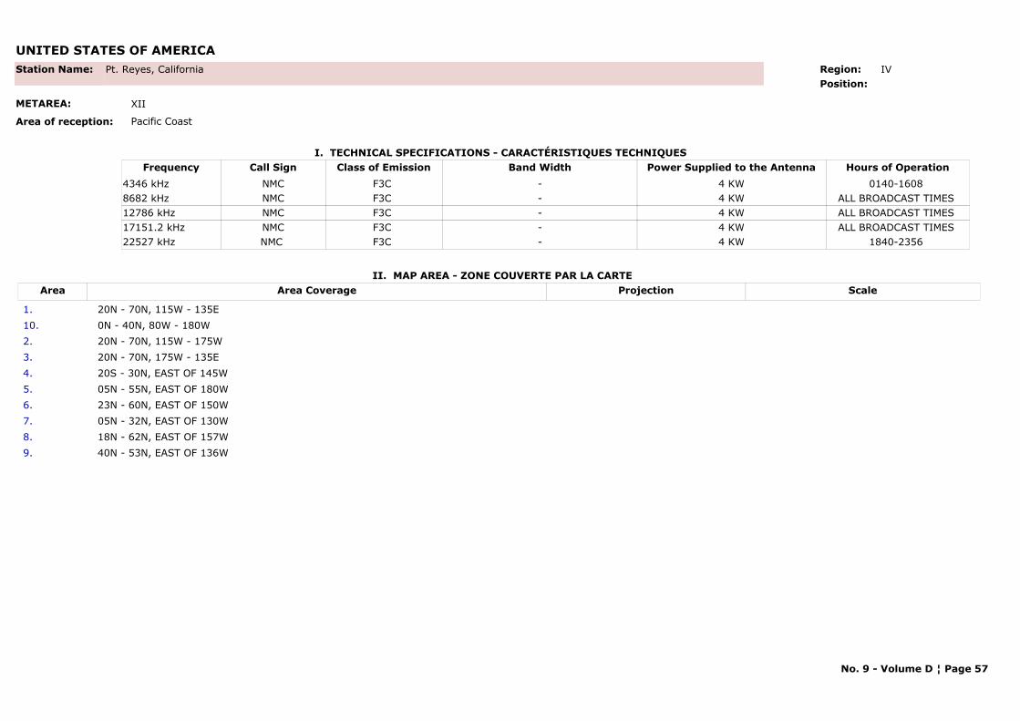
UNITED STATES OF AMERICA
I. TECHNICAL SPECIFICATIONS - CARACTÉRISTIQUES TECHNIQUES
II. MAP AREA - ZONE COUVERTE PAR LA CARTE
Station Name: Pt. Reyes, California
METAREA: XII
Area of reception: Pacific Coast
Region: IV Position:
Call Sign Hours of OperationFrequency Class of Emission Band Width Power Supplied to the AntennaNMC 0140-1608 4346 kHz F3C - 4 KWNMC ALL BROADCAST TIMES 8682 kHz F3C - 4 KWNMC ALL BROADCAST TIMES 12786 kHz F3C - 4 KWNMC ALL BROADCAST TIMES 17151.2 kHz F3C - 4 KWNMC 1840-2356 22527 kHz F3C - 4 KW
Area Area Coverage ScaleProjection
1. 20N - 70N, 115W - 135E10. 0N - 40N, 80W - 180W2. 20N - 70N, 115W - 175W3. 20N - 70N, 175W - 135E 4. 20S - 30N, EAST OF 145W5. 05N - 55N, EAST OF 180W6. 23N - 60N, EAST OF 150W7. 05N - 32N, EAST OF 130W 8. 18N - 62N, EAST OF 157W9. 40N - 53N, EAST OF 136W
No. 9 - Volume D ¦ Page 57
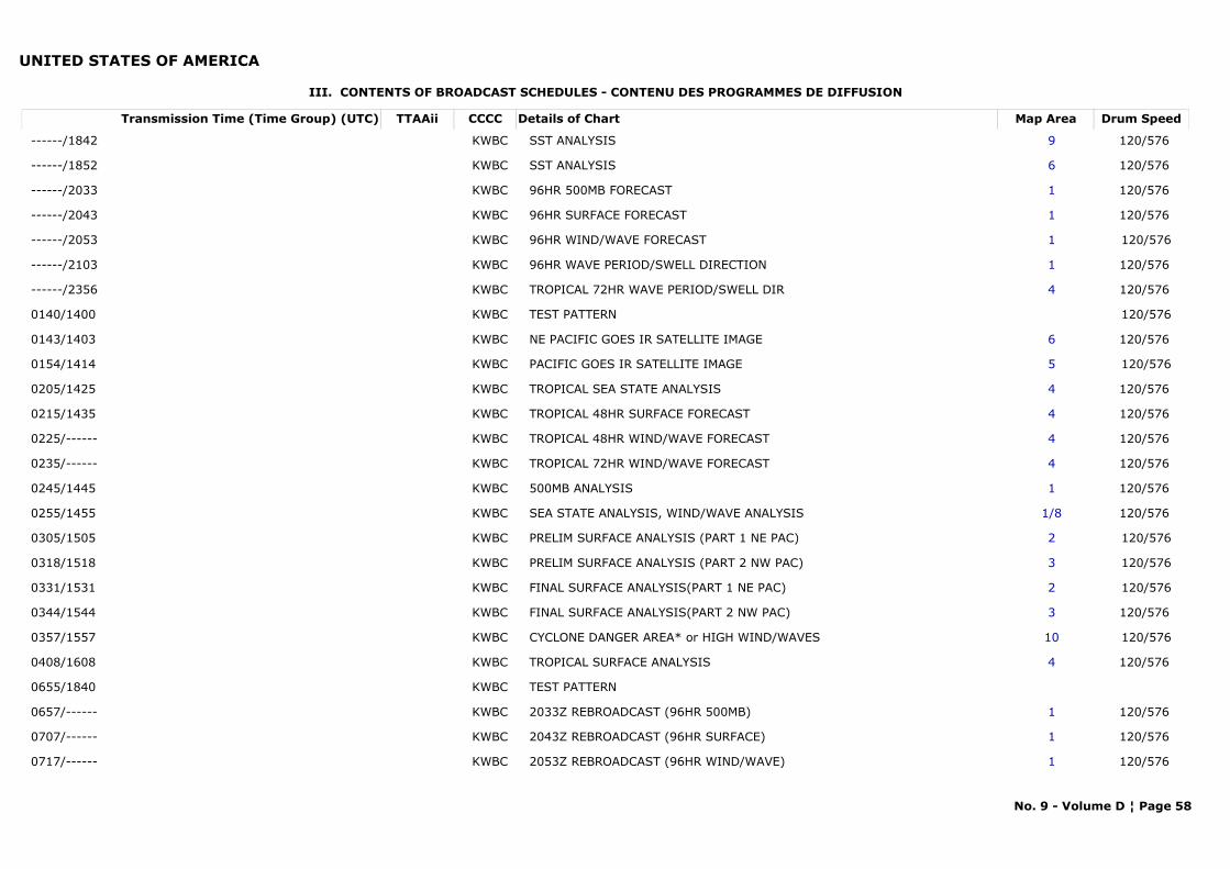
UNITED STATES OF AMERICA
III. CONTENTS OF BROADCAST SCHEDULES - CONTENU DES PROGRAMMES DE DIFFUSION
Transmission Time (Time Group) (UTC) Map AreaDetails of Chart Drum SpeedTTAAii CCCC
------/1842 9SST ANALYSIS 120/576 KWBC
------/1852 6SST ANALYSIS 120/576 KWBC
------/2033 196HR 500MB FORECAST 120/576 KWBC
------/2043 196HR SURFACE FORECAST 120/576 KWBC
------/2053 196HR WIND/WAVE FORECAST 120/576KWBC
------/2103 196HR WAVE PERIOD/SWELL DIRECTION 120/576 KWBC
------/2356 4TROPICAL 72HR WAVE PERIOD/SWELL DIR 120/576 KWBC
0140/1400 TEST PATTERN 120/576KWBC
0143/1403 6NE PACIFIC GOES IR SATELLITE IMAGE 120/576 KWBC
0154/1414 5PACIFIC GOES IR SATELLITE IMAGE 120/576KWBC
0205/1425 4TROPICAL SEA STATE ANALYSIS 120/576 KWBC
0215/1435 4TROPICAL 48HR SURFACE FORECAST 120/576 KWBC
0225/------ 4TROPICAL 48HR WIND/WAVE FORECAST 120/576 KWBC
0235/------ 4TROPICAL 72HR WIND/WAVE FORECAST 120/576 KWBC
0245/1445 1500MB ANALYSIS 120/576 KWBC
0255/1455 1/8SEA STATE ANALYSIS, WIND/WAVE ANALYSIS 120/576 KWBC
0305/1505 2PRELIM SURFACE ANALYSIS (PART 1 NE PAC) 120/576KWBC
0318/1518 3PRELIM SURFACE ANALYSIS (PART 2 NW PAC) 120/576KWBC
0331/1531 2FINAL SURFACE ANALYSIS(PART 1 NE PAC) 120/576KWBC
0344/1544 3FINAL SURFACE ANALYSIS(PART 2 NW PAC) 120/576 KWBC
0357/1557 10CYCLONE DANGER AREA* or HIGH WIND/WAVES 120/576KWBC
0408/1608 4TROPICAL SURFACE ANALYSIS 120/576 KWBC
0655/1840 TEST PATTERNKWBC
0657/------ 12033Z REBROADCAST (96HR 500MB) 120/576 KWBC
0707/------ 12043Z REBROADCAST (96HR SURFACE) 120/576 KWBC
0717/------ 12053Z REBROADCAST (96HR WIND/WAVE) 120/576 KWBC
No. 9 - Volume D ¦ Page 58
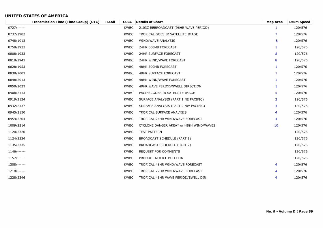
UNITED STATES OF AMERICATransmission Time (Time Group) (UTC) Map AreaDetails of Chart Drum SpeedTTAAii CCCC
0727/------ 12103Z REBROADCAST (96HR WAVE PERIOD) 120/576 KWBC
0737/1902 7TROPICAL GOES IR SATELLITE IMAGE 120/576 KWBC
0748/1913 8WIND/WAVE ANALYSIS 120/576 KWBC
0758/1923 124HR 500MB FORECAST 120/576KWBC
0808/1933 824HR SURFACE FORECAST 120/576KWBC
0818/1943 824HR WIND/WAVE FORECAST 120/576KWBC
0828/1953 148HR 500MB FORECAST 120/576 KWBC
0838/2003 148HR SURFACE FORECAST 120/576 KWBC
0848/2013 148HR WIND/WAVE FORECAST 120/576 KWBC
0858/2023 148HR WAVE PERIOD/SWELL DIRECTION 120/576 KWBC
0908/2113 5PACIFIC GOES IR SATELLITE IMAGE 120/576 KWBC
0919/2124 2SURFACE ANALYSIS (PART 1 NE PACIFIC) 120/576KWBC
0932/2137 3SURFACE ANALYSIS (PART 2 NW PACIFIC) 120/576KWBC
0945/2150 4TROPICAL SURFACE ANALYSIS 120/576 KWBC
0959/2204 4TROPICAL 24HR WIND/WAVE FORECAST 120/576 KWBC
1009/2214 10CYCLONE DANGER AREA* or HIGH WIND/WAVES 120/576 KWBC
1120/2320 TEST PATTERN 120/576KWBC
1124/2324 BROADCAST SCHEDULE (PART 1) 120/576KWBC
1135/2335 BROADCAST SCHEDULE (PART 2) 120/576KWBC
1146/------ REQUEST FOR COMMENTS 120/576KWBC
1157/------ PRODUCT NOTICE BULLETIN 120/576KWBC
1208/------ 4TROPICAL 48HR WIND/WAVE FORECAST 120/576 KWBC
1218/------ 4TROPICAL 72HR WIND/WAVE FORECAST 120/576 KWBC
1228/2346 4TROPICAL 48HR WAVE PERIOD/SWELL DIR 120/576 KWBC
No. 9 - Volume D ¦ Page 59
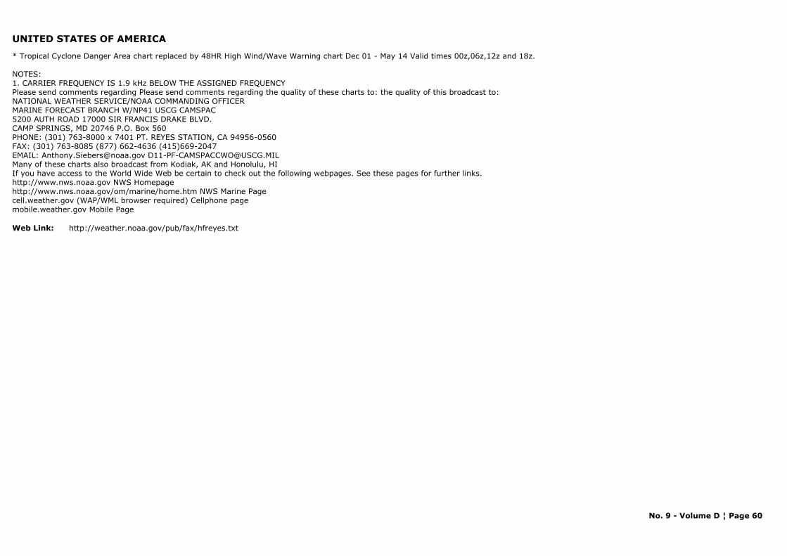
UNITED STATES OF AMERICA
* Tropical Cyclone Danger Area chart replaced by 48HR High Wind/Wave Warning chart Dec 01 - May 14 Valid times 00z,06z,12z and 18z.
NOTES: 1. CARRIER FREQUENCY IS 1.9 kHz BELOW THE ASSIGNED FREQUENCYPlease send comments regarding Please send comments regarding the quality of these charts to: the quality of this broadcast to:NATIONAL WEATHER SERVICE/NOAA COMMANDING OFFICERMARINE FORECAST BRANCH W/NP41 USCG CAMSPAC5200 AUTH ROAD 17000 SIR FRANCIS DRAKE BLVD.CAMP SPRINGS, MD 20746 P.O. Box 560PHONE: (301) 763-8000 x 7401 PT. REYES STATION, CA 94956-0560FAX: (301) 763-8085 (877) 662-4636 (415)669-2047EMAIL: [email protected] [email protected] of these charts also broadcast from Kodiak, AK and Honolulu, HIIf you have access to the World Wide Web be certain to check out the following webpages. See these pages for further links.http://www.nws.noaa.gov NWS Homepagehttp://www.nws.noaa.gov/om/marine/home.htm NWS Marine Pagecell.weather.gov (WAP/WML browser required) Cellphone page mobile.weather.gov Mobile Page
Web Link: http://weather.noaa.gov/pub/fax/hfreyes.txt
No. 9 - Volume D ¦ Page 60
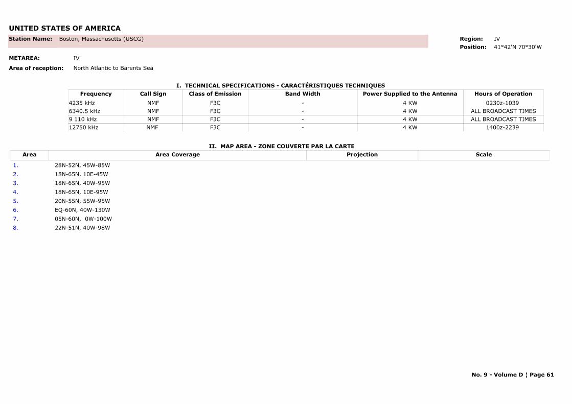
UNITED STATES OF AMERICA
I. TECHNICAL SPECIFICATIONS - CARACTÉRISTIQUES TECHNIQUES
II. MAP AREA - ZONE COUVERTE PAR LA CARTE
Station Name: Boston, Massachusetts (USCG)
METAREA: IV
Area of reception: North Atlantic to Barents Sea
Region: IVPosition: 41°42'N 70°30'W
Call Sign Hours of OperationFrequency Class of Emission Band Width Power Supplied to the AntennaNMF 0230z-1039 4235 kHz F3C - 4 KWNMF ALL BROADCAST TIMES6340.5 kHz F3C - 4 KWNMF ALL BROADCAST TIMES9 110 kHz F3C - 4 KWNMF 1400z-2239 12750 kHz F3C - 4 KW
Area Area Coverage ScaleProjection
1. 28N-52N, 45W-85W2. 18N-65N, 10E-45W3. 18N-65N, 40W-95W4. 18N-65N, 10E-95W5. 20N-55N, 55W-95W6. EQ-60N, 40W-130W7. 05N-60N, 0W-100W 8. 22N-51N, 40W-98W
No. 9 - Volume D ¦ Page 61
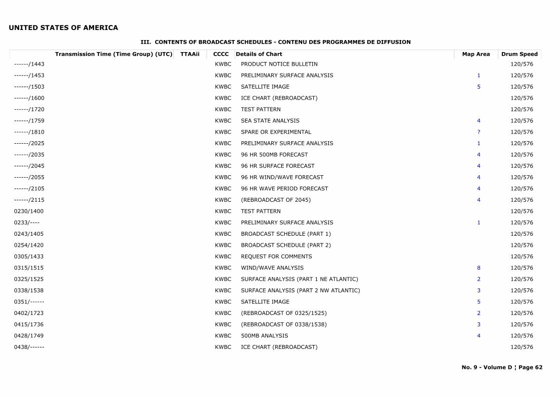
UNITED STATES OF AMERICA
III. CONTENTS OF BROADCAST SCHEDULES - CONTENU DES PROGRAMMES DE DIFFUSION
Transmission Time (Time Group) (UTC) Map AreaDetails of Chart Drum SpeedTTAAii CCCC
------/1443 PRODUCT NOTICE BULLETIN 120/576KWBC
------/1453 1PRELIMINARY SURFACE ANALYSIS 120/576KWBC
------/1503 5SATELLITE IMAGE 120/576KWBC
------/1600 ICE CHART (REBROADCAST) 120/576KWBC
------/1720 TEST PATTERN 120/576KWBC
------/1759 4SEA STATE ANALYSIS 120/576KWBC
------/1810 ?SPARE OR EXPERIMENTAL 120/576KWBC
------/2025 1PRELIMINARY SURFACE ANALYSIS 120/576KWBC
------/2035 496 HR 500MB FORECAST 120/576KWBC
------/2045 496 HR SURFACE FORECAST 120/576KWBC
------/2055 496 HR WIND/WAVE FORECAST 120/576KWBC
------/2105 496 HR WAVE PERIOD FORECAST 120/576KWBC
------/2115 4(REBROADCAST OF 2045) 120/576KWBC
0230/1400 TEST PATTERN 120/576KWBC
0233/---- 1PRELIMINARY SURFACE ANALYSIS 120/576KWBC
0243/1405 BROADCAST SCHEDULE (PART 1) 120/576KWBC
0254/1420 BROADCAST SCHEDULE (PART 2) 120/576KWBC
0305/1433 REQUEST FOR COMMENTS 120/576KWBC
0315/1515 8WIND/WAVE ANALYSIS 120/576KWBC
0325/1525 2SURFACE ANALYSIS (PART 1 NE ATLANTIC) 120/576KWBC
0338/1538 3SURFACE ANALYSIS (PART 2 NW ATLANTIC) 120/576KWBC
0351/------ 5SATELLITE IMAGE 120/576KWBC
0402/1723 2(REBROADCAST OF 0325/1525) 120/576KWBC
0415/1736 3(REBROADCAST OF 0338/1538) 120/576KWBC
0428/1749 4500MB ANALYSIS 120/576KWBC
0438/------ ICE CHART (REBROADCAST) 120/576KWBC
No. 9 - Volume D ¦ Page 62
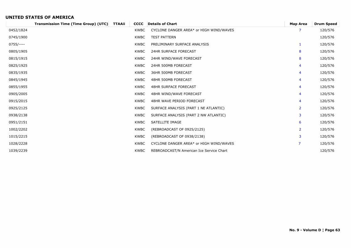
UNITED STATES OF AMERICATransmission Time (Time Group) (UTC) Map AreaDetails of Chart Drum SpeedTTAAii CCCC
0452/1824 7CYCLONE DANGER AREA* or HIGH WIND/WAVES 120/576KWBC
0745/1900 TEST PATTERN 120/576KWBC
0755/---- 1PRELIMINARY SURFACE ANALYSIS 120/576KWBC
0805/1905 824HR SURFACE FORECAST 120/576KWBC
0815/1915 824HR WIND/WAVE FORECAST 120/576KWBC
0825/1925 424HR 500MB FORECAST 120/576KWBC
0835/1935 436HR 500MB FORECAST 120/576KWBC
0845/1945 448HR 500MB FORECAST 120/576KWBC
0855/1955 448HR SURFACE FORECAST 120/576KWBC
0905/2005 448HR WIND/WAVE FORECAST 120/576KWBC
0915/2015 448HR WAVE PERIOD FORECAST 120/576KWBC
0925/2125 2SURFACE ANALYSIS (PART 1 NE ATLANTIC) 120/576KWBC
0938/2138 3SURFACE ANALYSIS (PART 2 NW ATLANTIC) 120/576KWBC
0951/2151 6SATELLITE IMAGE 120/576KWBC
1002/2202 2(REBROADCAST OF 0925/2125) 120/576KWBC
1015/2215 3(REBROADCAST OF 0938/2138) 120/576KWBC
1028/2228 7 CYCLONE DANGER AREA* or HIGH WIND/WAVES 120/576KWBC
1039/2239 REBROADCAST/N American Ice Service Chart 120/576KWBC
No. 9 - Volume D ¦ Page 63
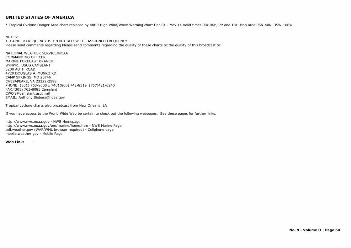
UNITED STATES OF AMERICA
* Tropical Cyclone Danger Area chart replaced by 48HR High Wind/Wave Warning chart Dec 01 - May 14 Valid times 00z,06z,12z and 18z, Map area 05N-40N, 35W-100W.
NOTES: 1. CARRIER FREQUENCY IS 1.9 kHz BELOW THE ASSIGNED FREQUENCY.Please send comments regarding Please send comments regarding the quality of these charts to:the quality of this broadcast to:
NATIONAL WEATHER SERVICE/NOAACOMMANDING OFFICERMARINE FORECAST BRANCH W/NP41 USCG CAMSLANT5200 AUTH ROAD4720 DOUGLAS A. MUNRO RD.CAMP SPRINGS, MD 20746CHESAPEAKE, VA 23322-2598PHONE: (301) 763-8000 x 7401(800) 742-8519 (757)421-6240FAX:(301) 763-8085 CamslantCWO'[email protected]: [email protected]
Tropical cyclone charts also broadcast from New Orleans, LA
If you have access to the World Wide Web be certain to check out the following webpages. See these pages for further links.
http://www.nws.noaa.gov - NWS Homepage http://www.nws.noaa.gov/om/marine/home.htm - NWS Marine Page
cell.weather.gov (WAP/WML browser required) - Cellphone pagemobile.weather.gov - Mobile Page
Web Link: --
No. 9 - Volume D ¦ Page 64
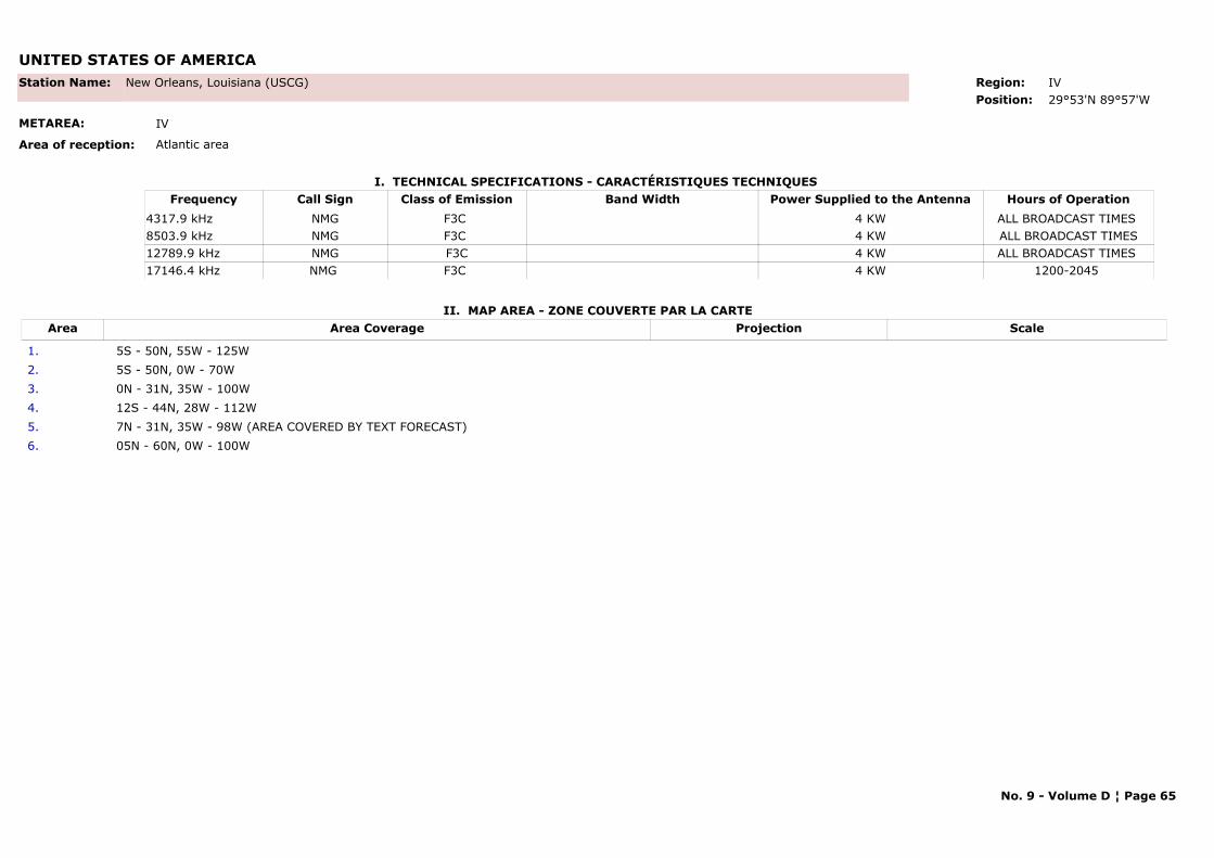
UNITED STATES OF AMERICA
I. TECHNICAL SPECIFICATIONS - CARACTÉRISTIQUES TECHNIQUES
II. MAP AREA - ZONE COUVERTE PAR LA CARTE
Station Name: New Orleans, Louisiana (USCG)
METAREA: IV
Area of reception: Atlantic area
Region: IVPosition: 29°53'N 89°57'W
Call Sign Hours of OperationFrequency Class of Emission Band Width Power Supplied to the AntennaNMG ALL BROADCAST TIMES 4317.9 kHz F3C 4 KWNMG ALL BROADCAST TIMES8503.9 kHz F3C 4 KWNMG ALL BROADCAST TIMES 12789.9 kHz F3C 4 KWNMG 1200-2045 17146.4 kHz F3C 4 KW
Area Area Coverage ScaleProjection
1. 5S - 50N, 55W - 125W2. 5S - 50N, 0W - 70W3. 0N - 31N, 35W - 100W4. 12S - 44N, 28W - 112W5. 7N - 31N, 35W - 98W (AREA COVERED BY TEXT FORECAST)6. 05N - 60N, 0W - 100W
No. 9 - Volume D ¦ Page 65
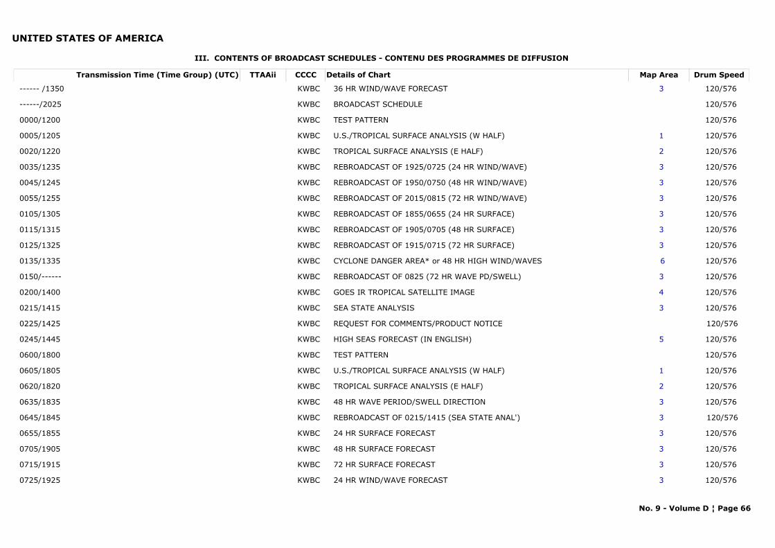
UNITED STATES OF AMERICA
III. CONTENTS OF BROADCAST SCHEDULES - CONTENU DES PROGRAMMES DE DIFFUSION
Transmission Time (Time Group) (UTC) Map AreaDetails of Chart Drum SpeedTTAAii CCCC
------ /1350 3 36 HR WIND/WAVE FORECAST 120/576 KWBC
------/2025 BROADCAST SCHEDULE 120/576 KWBC
0000/1200 TEST PATTERN 120/576 KWBC
0005/1205 1 U.S./TROPICAL SURFACE ANALYSIS (W HALF) 120/576 KWBC
0020/1220 2 TROPICAL SURFACE ANALYSIS (E HALF) 120/576 KWBC
0035/1235 3 REBROADCAST OF 1925/0725 (24 HR WIND/WAVE) 120/576 KWBC
0045/1245 3 REBROADCAST OF 1950/0750 (48 HR WIND/WAVE) 120/576 KWBC
0055/1255 3 REBROADCAST OF 2015/0815 (72 HR WIND/WAVE) 120/576 KWBC
0105/1305 3 REBROADCAST OF 1855/0655 (24 HR SURFACE) 120/576 KWBC
0115/1315 3 REBROADCAST OF 1905/0705 (48 HR SURFACE) 120/576 KWBC
0125/1325 3 REBROADCAST OF 1915/0715 (72 HR SURFACE) 120/576 KWBC
0135/1335 6CYCLONE DANGER AREA* or 48 HR HIGH WIND/WAVES 120/576 KWBC
0150/------ 3 REBROADCAST OF 0825 (72 HR WAVE PD/SWELL) 120/576 KWBC
0200/1400 4 GOES IR TROPICAL SATELLITE IMAGE 120/576 KWBC
0215/1415 3 SEA STATE ANALYSIS 120/576 KWBC
0225/1425 REQUEST FOR COMMENTS/PRODUCT NOTICE 120/576KWBC
0245/1445 5 HIGH SEAS FORECAST (IN ENGLISH) 120/576 KWBC
0600/1800 TEST PATTERN 120/576 KWBC
0605/1805 1 U.S./TROPICAL SURFACE ANALYSIS (W HALF) 120/576 KWBC
0620/1820 2 TROPICAL SURFACE ANALYSIS (E HALF) 120/576 KWBC
0635/1835 3 48 HR WAVE PERIOD/SWELL DIRECTION 120/576 KWBC
0645/1845 3 REBROADCAST OF 0215/1415 (SEA STATE ANAL') 120/576KWBC
0655/1855 3 24 HR SURFACE FORECAST 120/576 KWBC
0705/1905 3 48 HR SURFACE FORECAST 120/576 KWBC
0715/1915 3 72 HR SURFACE FORECAST 120/576 KWBC
0725/1925 3 24 HR WIND/WAVE FORECAST 120/576 KWBC
No. 9 - Volume D ¦ Page 66
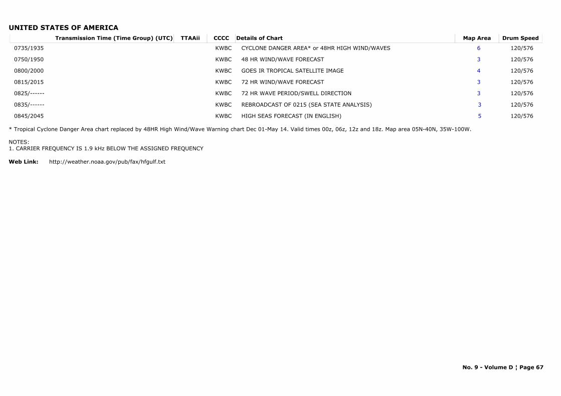
UNITED STATES OF AMERICATransmission Time (Time Group) (UTC) Map AreaDetails of Chart Drum SpeedTTAAii CCCC
0735/1935 6 CYCLONE DANGER AREA* or 48HR HIGH WIND/WAVES 120/576 KWBC
0750/1950 3 48 HR WIND/WAVE FORECAST 120/576 KWBC
0800/2000 4 GOES IR TROPICAL SATELLITE IMAGE 120/576 KWBC
0815/2015 3 72 HR WIND/WAVE FORECAST 120/576 KWBC
0825/------ 3 72 HR WAVE PERIOD/SWELL DIRECTION 120/576 KWBC
0835/------ 3REBROADCAST OF 0215 (SEA STATE ANALYSIS) 120/576 KWBC
0845/2045 5HIGH SEAS FORECAST (IN ENGLISH) 120/576 KWBC
* Tropical Cyclone Danger Area chart replaced by 48HR High Wind/Wave Warning chart Dec 01-May 14. Valid times 00z, 06z, 12z and 18z. Map area 05N-40N, 35W-100W.
NOTES: 1. CARRIER FREQUENCY IS 1.9 kHz BELOW THE ASSIGNED FREQUENCY
Web Link: http://weather.noaa.gov/pub/fax/hfgulf.txt
No. 9 - Volume D ¦ Page 67
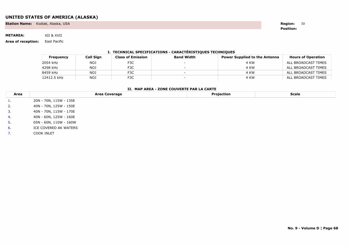
UNITED STATES OF AMERICA (ALASKA)
I. TECHNICAL SPECIFICATIONS - CARACTÉRISTIQUES TECHNIQUES
II. MAP AREA - ZONE COUVERTE PAR LA CARTE
Station Name: Kodiak, Alaska, USA
METAREA: XII & XVII
Area of reception: East Pacific
Region: IV Position:
Call Sign Hours of OperationFrequency Class of Emission Band Width Power Supplied to the AntennaNOJ ALL BROADCAST TIMES 2054 kHz F3C - 4 KWNOJ ALL BROADCAST TIMES 4298 kHz F3C - 4 KWNOJ ALL BROADCAST TIMES 8459 kHz F3C - 4 KWNOJ ALL BROADCAST TIMES 12412.5 kHz F3C - 4 KW
Area Area Coverage ScaleProjection
1. 20N - 70N, 115W - 135E 2. 40N - 70N, 125W - 150E3. 40N - 70N, 115W - 170E 4. 40N - 60N, 125W - 160E5. 05N - 60N, 110W - 160W 6. ICE COVERED AK WATERS7. COOK INLET
No. 9 - Volume D ¦ Page 68
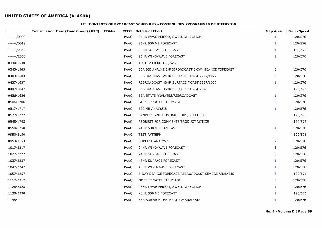
UNITED STATES OF AMERICA (ALASKA)
III. CONTENTS OF BROADCAST SCHEDULES - CONTENU DES PROGRAMMES DE DIFFUSION
Transmission Time (Time Group) (UTC) Map AreaDetails of Chart Drum SpeedTTAAii CCCC
------/0008 196HR WAVE PERIOD, SWELL DIRECTION 120/576 PAAQ
------/0018 196HR 500 MB FORECAST 120/576 PAAQ
------/2348 196HR SURFACE FORECAST 120/576PAAQ
------/2358 196HR WIND/WAVE FORECAST 120/576 PAAQ
0340/1540 TEST PATTERN 120/576PAAQ
0343/1543 6SEA ICE ANALYSIS/REBROADCAST 5-DAY SEA ICE FORECAST 120/576 PAAQ
0403/1603 3REBROADCAST 24HR SURFACE F'CAST 2227/1027 120/576 PAAQ
0437/1637 1REBROADCAST 48HR SURFACE F'CAST 2237/1037 120/576 PAAQ
0447/1647 REBROADCAST 96HR SURFACE F'CAST 2348 120/576PAAQ
0456/1656 1SEA STATE ANALYSIS/REBROADCAST 120/576 PAAQ
0506/1706 5GOES IR SATELLITE IMAGE 120/576 PAAQ
0517/1717 1500 MB ANALYSIS 120/576 PAAQ
0527/1727 SYMBOLS AND CONTRACTIONS/SCHEDULE 120/576PAAQ
0548/1748 REQUEST FOR COMMENTS/PRODUCT NOTICE 120/576PAAQ
0558/1758 124HR 500 MB FORECAST 120/576 PAAQ
0950/2150 TEST PATTERN 120/576PAAQ
0953/2153 2SURFACE ANALYSIS 120/576 PAAQ
1017/2217 324HR WIND/WAVE FORECAST 120/576 PAAQ
1027/2227 324HR SURFACE FORECAST 120/576 PAAQ
1037/2237 148HR SURFACE FORECAST 120/576 PAAQ
1047/2247 148HR WIND/WAVE FORECAST 120/576 PAAQ
1057/2257 65-DAY SEA ICE FORECAST/REBROADCAST SEA ICE ANALYSIS 120/576PAAQ
1117/2317 5GOES IR SATELLITE IMAGE 120/576 PAAQ
1128/2328 148HR WAVE PERIOD, SWELL DIRECTION 120/576 PAAQ
1138/2338 148HR 500 MB FORECAST 120/576PAAQ
1148/------ 4SEA SURFACE TEMPERATURE ANALYSIS 120/576 PAAQ
No. 9 - Volume D ¦ Page 69
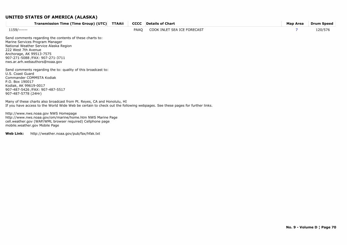
UNITED STATES OF AMERICA (ALASKA)Transmission Time (Time Group) (UTC) Map AreaDetails of Chart Drum SpeedTTAAii CCCC
1159/------ 7COOK INLET SEA ICE FORECAST 120/576 PAAQ
Send comments regarding the contents of these charts to:Marine Services Program Manager National Weather Service Alaska Region
222 West 7th AvenueAnchorage, AK 99513-7575907-271-5088 /FAX: [email protected]
Send comments regarding the to: quality of this broadcast to:U.S. Coast GuardCommander COMMSTA KodiakP.O. Box 190017Kodiak, AK 99619-0017907-487-5426 /FAX: 907-487-5517907-487-5778 (24Hr)
Many of these charts also broadcast from Pt. Reyes, CA and Honolulu, HIIf you have access to the World Wide Web be certain to check out the following webpages. See these pages for further links.
http://www.nws.noaa.gov NWS Homepagehttp://www.nws.noaa.gov/om/marine/home.htm NWS Marine Pagecell.weather.gov (WAP/WML browser required) Cellphone pagemobile.weather.gov Mobile Page
Web Link: http://weather.noaa.gov/pub/fax/hfak.txt
No. 9 - Volume D ¦ Page 70
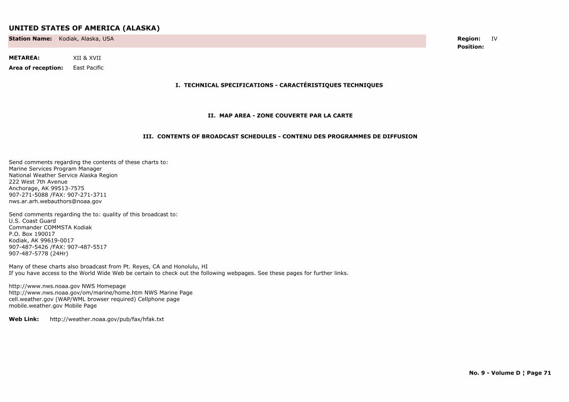
UNITED STATES OF AMERICA (ALASKA)
I. TECHNICAL SPECIFICATIONS - CARACTÉRISTIQUES TECHNIQUES
II. MAP AREA - ZONE COUVERTE PAR LA CARTE
Station Name: Kodiak, Alaska, USA
METAREA: XII & XVII
Area of reception: East Pacific
Region: IV Position:
III. CONTENTS OF BROADCAST SCHEDULES - CONTENU DES PROGRAMMES DE DIFFUSION
Send comments regarding the contents of these charts to:Marine Services Program Manager National Weather Service Alaska Region
222 West 7th AvenueAnchorage, AK 99513-7575907-271-5088 /FAX: [email protected]
Send comments regarding the to: quality of this broadcast to:U.S. Coast GuardCommander COMMSTA KodiakP.O. Box 190017Kodiak, AK 99619-0017907-487-5426 /FAX: 907-487-5517907-487-5778 (24Hr)
Many of these charts also broadcast from Pt. Reyes, CA and Honolulu, HIIf you have access to the World Wide Web be certain to check out the following webpages. See these pages for further links.
http://www.nws.noaa.gov NWS Homepagehttp://www.nws.noaa.gov/om/marine/home.htm NWS Marine Pagecell.weather.gov (WAP/WML browser required) Cellphone pagemobile.weather.gov Mobile Page
Web Link: http://weather.noaa.gov/pub/fax/hfak.txt
No. 9 - Volume D ¦ Page 71
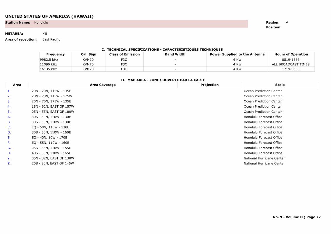
UNITED STATES OF AMERICA (HAWAII)
I. TECHNICAL SPECIFICATIONS - CARACTÉRISTIQUES TECHNIQUES
II. MAP AREA - ZONE COUVERTE PAR LA CARTE
Station Name: Honolulu
METAREA: XII
Area of reception: East Pacific
Region: V Position:
Call Sign Hours of OperationFrequency Class of Emission Band Width Power Supplied to the AntennaKVM70 0519-1556 9982.5 kHz F3C - 4 KWKVM70 ALL BROADCAST TIMES 11090 kHz F3C - 4 KWKVM70 1719-0356 16135 kHz F3C - 4 KW
Area Area Coverage ScaleProjection
1. 20N - 70N, 115W - 135E Ocean Prediction Center2. 20N - 70N, 115W - 175W Ocean Prediction Center3. 20N - 70N, 175W - 135E Ocean Prediction Center4. 18N - 62N, EAST OF 157W Ocean Prediction Center5. 05N - 55N, EAST OF 180W Ocean Prediction CenterA. 30S - 50N, 110W - 130E Honolulu Forecast OfficeB. 30S - 30N, 110W - 130E Honolulu Forecast OfficeC. EQ - 50N, 110W - 130E Honolulu Forecast OfficeD. 30S - 50N, 110W - 160E Honolulu Forecast OfficeE. EQ - 40N, 80W - 170E Honolulu Forecast OfficeF. EQ - 55N, 110W - 160E Honolulu Forecast OfficeG. 05S - 55N, 110W - 155E Honolulu Forecast OfficeH. 40S - 05N, 130W - 165E Honolulu Forecast OfficeY. 05N - 32N, EAST OF 130W National Hurricane CenterZ. 20S - 30N, EAST OF 145W National Hurricane Center
No. 9 - Volume D ¦ Page 72
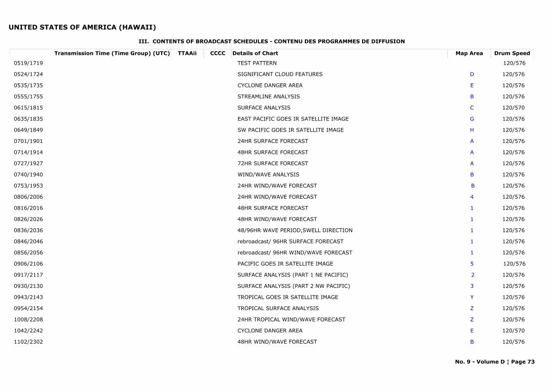
UNITED STATES OF AMERICA (HAWAII)
III. CONTENTS OF BROADCAST SCHEDULES - CONTENU DES PROGRAMMES DE DIFFUSION
Transmission Time (Time Group) (UTC) Map AreaDetails of Chart Drum SpeedTTAAii CCCC
0519/1719 TEST PATTERN 120/576
0524/1724 DSIGNIFICANT CLOUD FEATURES 120/576
0535/1735 ECYCLONE DANGER AREA 120/576
0555/1755 BSTREAMLINE ANALYSIS 120/576
0615/1815 CSURFACE ANALYSIS 120/570
0635/1835 GEAST PACIFIC GOES IR SATELLITE IMAGE 120/576
0649/1849 HSW PACIFIC GOES IR SATELLITE IMAGE 120/576
0701/1901 A24HR SURFACE FORECAST 120/576
0714/1914 A48HR SURFACE FORECAST 120/576
0727/1927 A72HR SURFACE FORECAST 120/576
0740/1940 BWIND/WAVE ANALYSIS 120/576
0753/1953 B24HR WIND/WAVE FORECAST 120/576
0806/2006 424HR WIND/WAVE FORECAST 120/576
0816/2016 148HR SURFACE FORECAST 120/576
0826/2026 148HR WIND/WAVE FORECAST 120/576
0836/2036 148/96HR WAVE PERIOD,SWELL DIRECTION 120/576
0846/2046 1rebroadcast/ 96HR SURFACE FORECAST 120/576
0856/2056 1rebroadcast/ 96HR WIND/WAVE FORECAST 120/576
0906/2106 5PACIFIC GOES IR SATELLITE IMAGE 120/576
0917/2117 2SURFACE ANALYSIS (PART 1 NE PACIFIC) 120/576
0930/2130 3SURFACE ANALYSIS (PART 2 NW PACIFIC) 120/576
0943/2143 YTROPICAL GOES IR SATELLITE IMAGE 120/576
0954/2154 ZTROPICAL SURFACE ANALYSIS 120/576
1008/2208 Z24HR TROPICAL WIND/WAVE FORECAST 120/576
1042/2242 ECYCLONE DANGER AREA 120/570
1102/2302 B48HR WIND/WAVE FORECAST 120/576
No. 9 - Volume D ¦ Page 73
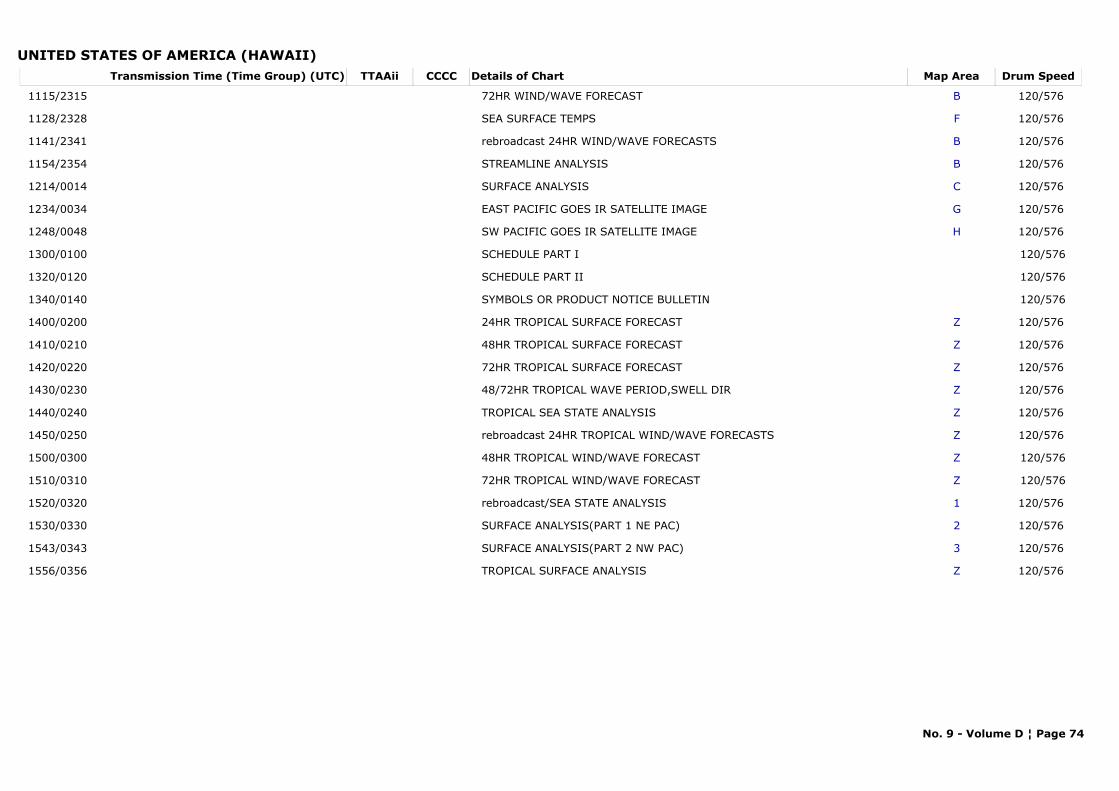
UNITED STATES OF AMERICA (HAWAII)Transmission Time (Time Group) (UTC) Map AreaDetails of Chart Drum SpeedTTAAii CCCC
1115/2315 B72HR WIND/WAVE FORECAST 120/576
1128/2328 FSEA SURFACE TEMPS 120/576
1141/2341 Brebroadcast 24HR WIND/WAVE FORECASTS 120/576
1154/2354 BSTREAMLINE ANALYSIS 120/576
1214/0014 CSURFACE ANALYSIS 120/576
1234/0034 GEAST PACIFIC GOES IR SATELLITE IMAGE 120/576
1248/0048 HSW PACIFIC GOES IR SATELLITE IMAGE 120/576
1300/0100 SCHEDULE PART I 120/576
1320/0120 SCHEDULE PART II 120/576
1340/0140 SYMBOLS OR PRODUCT NOTICE BULLETIN 120/576
1400/0200 Z24HR TROPICAL SURFACE FORECAST 120/576
1410/0210 Z48HR TROPICAL SURFACE FORECAST 120/576
1420/0220 Z72HR TROPICAL SURFACE FORECAST 120/576
1430/0230 Z48/72HR TROPICAL WAVE PERIOD,SWELL DIR 120/576
1440/0240 ZTROPICAL SEA STATE ANALYSIS 120/576
1450/0250 Zrebroadcast 24HR TROPICAL WIND/WAVE FORECASTS 120/576
1500/0300 Z48HR TROPICAL WIND/WAVE FORECAST 120/576
1510/0310 Z72HR TROPICAL WIND/WAVE FORECAST 120/576
1520/0320 1rebroadcast/SEA STATE ANALYSIS 120/576
1530/0330 2SURFACE ANALYSIS(PART 1 NE PAC) 120/576
1543/0343 3SURFACE ANALYSIS(PART 2 NW PAC) 120/576
1556/0356 ZTROPICAL SURFACE ANALYSIS 120/576
No. 9 - Volume D ¦ Page 74
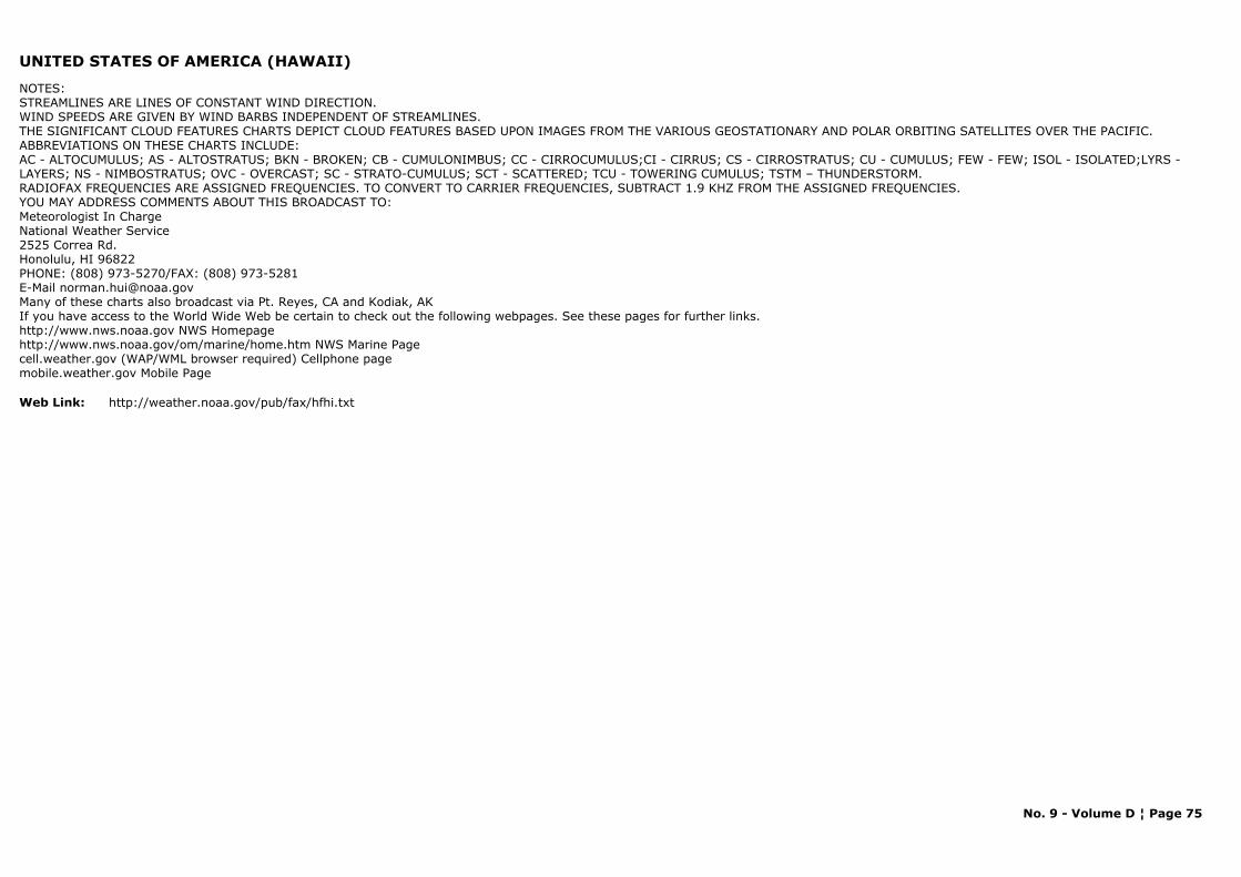
UNITED STATES OF AMERICA (HAWAII)
NOTES:STREAMLINES ARE LINES OF CONSTANT WIND DIRECTION.WIND SPEEDS ARE GIVEN BY WIND BARBS INDEPENDENT OF STREAMLINES.THE SIGNIFICANT CLOUD FEATURES CHARTS DEPICT CLOUD FEATURES BASED UPON IMAGES FROM THE VARIOUS GEOSTATIONARY AND POLAR ORBITING SATELLITES OVER THE PACIFIC. ABBREVIATIONS ON THESE CHARTS INCLUDE:AC - ALTOCUMULUS; AS - ALTOSTRATUS; BKN - BROKEN; CB - CUMULONIMBUS; CC - CIRROCUMULUS;CI - CIRRUS; CS - CIRROSTRATUS; CU - CUMULUS; FEW - FEW; ISOL - ISOLATED;LYRS - LAYERS; NS - NIMBOSTRATUS; OVC - OVERCAST; SC - STRATO-CUMULUS; SCT - SCATTERED; TCU - TOWERING CUMULUS; TSTM – THUNDERSTORM.RADIOFAX FREQUENCIES ARE ASSIGNED FREQUENCIES. TO CONVERT TO CARRIER FREQUENCIES, SUBTRACT 1.9 KHZ FROM THE ASSIGNED FREQUENCIES.YOU MAY ADDRESS COMMENTS ABOUT THIS BROADCAST TO:Meteorologist In ChargeNational Weather Service2525 Correa Rd.Honolulu, HI 96822PHONE: (808) 973-5270/FAX: (808) 973-5281E-Mail [email protected] of these charts also broadcast via Pt. Reyes, CA and Kodiak, AKIf you have access to the World Wide Web be certain to check out the following webpages. See these pages for further links.http://www.nws.noaa.gov NWS Homepagehttp://www.nws.noaa.gov/om/marine/home.htm NWS Marine Pagecell.weather.gov (WAP/WML browser required) Cellphone pagemobile.weather.gov Mobile Page
Web Link: http://weather.noaa.gov/pub/fax/hfhi.txt
No. 9 - Volume D ¦ Page 75
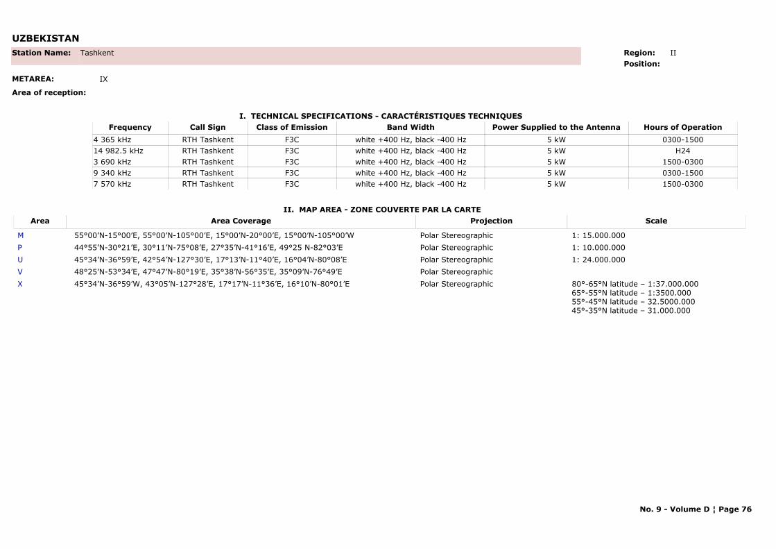
UZBEKISTAN
I. TECHNICAL SPECIFICATIONS - CARACTÉRISTIQUES TECHNIQUES
II. MAP AREA - ZONE COUVERTE PAR LA CARTE
Station Name: Tashkent
METAREA: IX
Area of reception:
Region: II Position:
Call Sign Hours of OperationFrequency Class of Emission Band Width Power Supplied to the AntennaRTH Tashkent 0300-15004 365 kHz F3C white +400 Hz, black -400 Hz 5 kWRTH Tashkent H2414 982.5 kHz F3C white +400 Hz, black -400 Hz 5 kWRTH Tashkent 1500-03003 690 kHz F3C white +400 Hz, black -400 Hz 5 kWRTH Tashkent 0300-15009 340 kHz F3C white +400 Hz, black -400 Hz 5 kWRTH Tashkent 1500-03007 570 kHz F3C white +400 Hz, black -400 Hz 5 kW
Area Area Coverage ScaleProjection
M 55°00’N-15°00’E, 55°00’N-105°00’E, 15°00’N-20°00’E, 15°00’N-105°00’W Polar Stereographic 1: 15.000.000P 44°55’N-30°21’E, 30°11’N-75°08’E, 27°35’N-41°16’E, 49°25 N-82°03’E Polar Stereographic 1: 10.000.000U 45°34’N-36°59’E, 42°54’N-127°30’E, 17°13’N-11°40’E, 16°04’N-80°08’E Polar Stereographic 1: 24.000.000V 48°25’N-53°34’E, 47°47’N-80°19’E, 35°38’N-56°35’E, 35°09’N-76°49’E Polar StereographicX 45°34’N-36°59’W, 43°05’N-127°28’E, 17°17’N-11°36’E, 16°10’N-80°01’E Polar Stereographic 80°-65°N latitude – 1:37.000.000
65°-55°N latitude – 1:3500.00055°-45°N latitude – 32.5000.00045°-35°N latitude – 31.000.000
No. 9 - Volume D ¦ Page 76
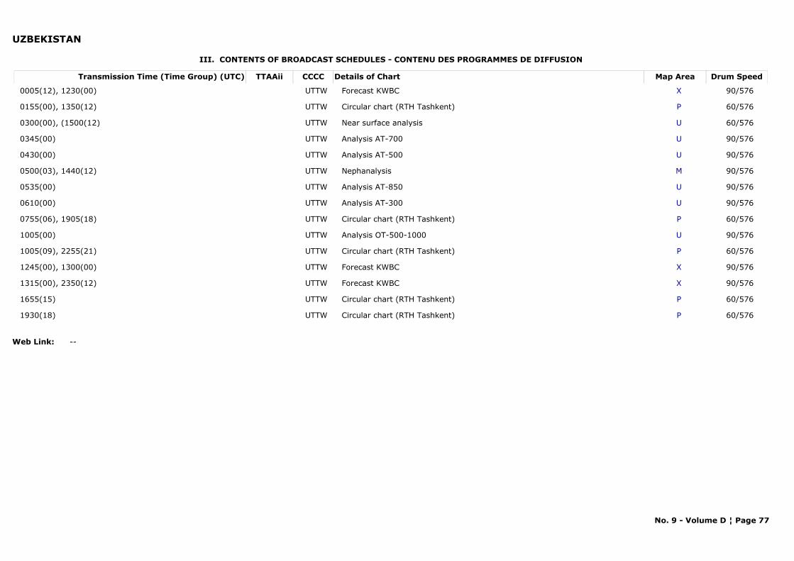
UZBEKISTAN
III. CONTENTS OF BROADCAST SCHEDULES - CONTENU DES PROGRAMMES DE DIFFUSION
Transmission Time (Time Group) (UTC) Map AreaDetails of Chart Drum SpeedTTAAii CCCC
0005(12), 1230(00) XForecast KWBC 90/576UTTW
0155(00), 1350(12) PCircular chart (RTH Tashkent) 60/576UTTW
0300(00), (1500(12) UNear surface analysis 60/576UTTW
0345(00) UAnalysis AT-700 90/576UTTW
0430(00) UAnalysis AT-500 90/576UTTW
0500(03), 1440(12) MNephanalysis 90/576UTTW
0535(00) UAnalysis AT-850 90/576UTTW
0610(00) UAnalysis AT-300 90/576UTTW
0755(06), 1905(18) PCircular chart (RTH Tashkent) 60/576UTTW
1005(00) UAnalysis OT-500-1000 90/576UTTW
1005(09), 2255(21) PCircular chart (RTH Tashkent) 60/576UTTW
1245(00), 1300(00) XForecast KWBC 90/576UTTW
1315(00), 2350(12) XForecast KWBC 90/576UTTW
1655(15) PCircular chart (RTH Tashkent) 60/576UTTW
1930(18) PCircular chart (RTH Tashkent) 60/576UTTW
Web Link: --
No. 9 - Volume D ¦ Page 77

CHAPTER 3
VISUAL STORM WARNING SIGNALS

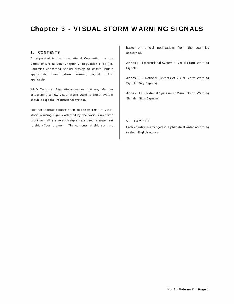
No. 9 - Volume D ¦ Page 1
Chapter 3 - VISUAL STORM WARNING SIGNALS
1. CONTENTS As stipulated in the International Convention for the
Safety of Life at Sea (Chapter V, Regulation 4 (b) (i)),
Countries concerned should display at coastal points
appropriate visual storm warning signals when
applicable.
WMO Technical Regulationsspecifies that any Member
establishing a new visual storm warning signal system
should adopt the international system.
This part contains information on the systems of visual
storm warning signals adopted by the various maritime
countries. Where no such signals are used, a statement
to this effect is given. The contents of this part are
based on official notifications from the countries
concerned.
Annex I - International System of Visual Storm Warning
Signals
Annex II - National Systems of Visual Storm Warning
Signals (Day Signals)
Annex III - National Systems of Visual Storm Warning
Signals (NightSignals)
2. LAYOUT Each country is arranged in alphabetical order according
to their English names.

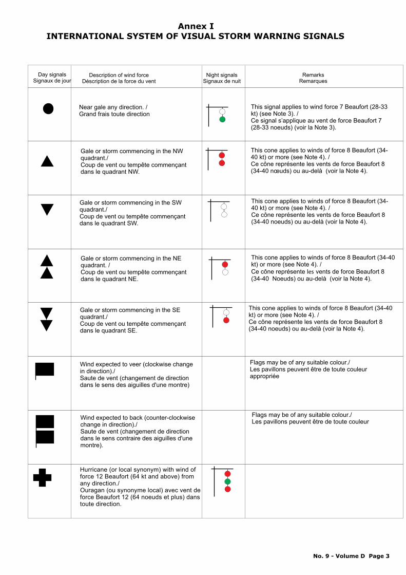
Near gale any direction. / Grand frais toute direction
This signal applies to wind force 7 Beaufort (28-33 kt) (see Note 3). /Ce signal s’applique au vent de force Beaufort 7 (28-33 noeuds) (voir la Note 3).
Gale or storm commencing in the NW
quadrant./Coup de vent ou tempête commençant dans le quadrant NW.
This cone applies to winds of force 8 Beaufort (34-40 kt) or more (see Note 4). /
nœuds) ou au-delà (voir la Note 4).Ce cône représente les vents de force Beaufort 8 (34-40
Gale or storm commencing in the SW quadrant./ Coup de vent ou tempête commençant dans le quadrant SW.
This cone applies to winds of force 8 Beaufort (34-40 kt) or Ce cône représente les vents de force Beaufort 8 (34-40 noeuds) ou au-delà (voir la Note 4).
more (see Note 4). /
Gale or storm commencing in the NE
quadrant. /Coup de vent ou tempête commençant dans le quadrant NE.
This cone applies to winds of force 8 Beaufort (34-40 kt) or more (see Note 4). / Ce cône représente vents de force Beaufort 8 (34-40 Noeuds) ou au-delà (voir la Note 4).
les
Wind expected to veer (clockwise change in
direction)./Saute de vent (changement de direction dans le sens des aiguilles d'une montre)
Flags may be of any suitable colour./ Les pavillons peuvent être de toute couleur appropriée
Wind expected to back (counter-clockwise change in direction)./ Saute de vent (changement de direction dans le sens contraire des aiguilles d'une montre).
Flags may be of any suitable colour./ Les pavillons peuvent être de toute couleur
Day signalsSignaux de jour
Description of wind force Déscription de la force du vent
Night signalsSignaux de nuit
Remarks Remarques
Gale or storm commencing in the SE quadrant./Coup de vent ou tempête commençant dans le quadrant SE.
This cone applies to winds of force 8 Beaufort (34-40 kt) or more (see Note 4). / Ce cône représente les vents de force Beaufort 8 (34-40 noeuds) ou au-delà (voir la Note 4).
Hurricane (or local synonym) with wind of force 12 Beaufort (64 kt and above) from any direction./ Ouragan (ou synonyme local) avec vent de force Beaufort 12 (64 noeuds et plus) dans toute direction.
Annex IINTERNATIONAL SYSTEM OF VISUAL STORM WARNING SIGNALS
No. 9 - Volume D Page 3
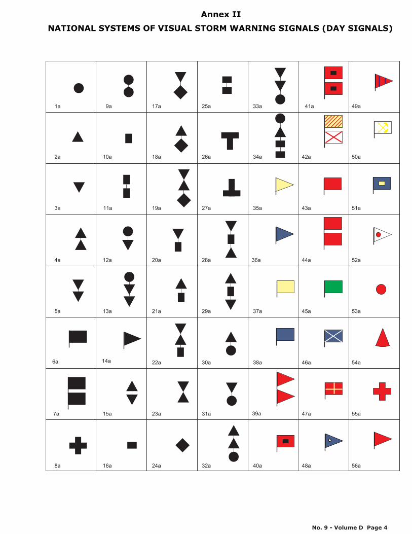
1a
2a
3a
4a
5a
6a
7a
8a
9a
10a
11a
12a
13a
14a
15a
16a
17a
18a
19a
20a
21a
22a
23a
24a
25a
26a
27a
28a
29a
30a
31a
32a
33a
34a
35a
36a
37a
38a
39a
40a
41a
43a
44a
45a
46a
47a
42a
48a
49a
51a
53a
54a
55a
56a
50a
52a
Annex II
NATIONAL SYSTEMS OF VISUAL STORM WARNING SIGNALS (DAY SIGNALS)
No. 9 - Volume D Page 4
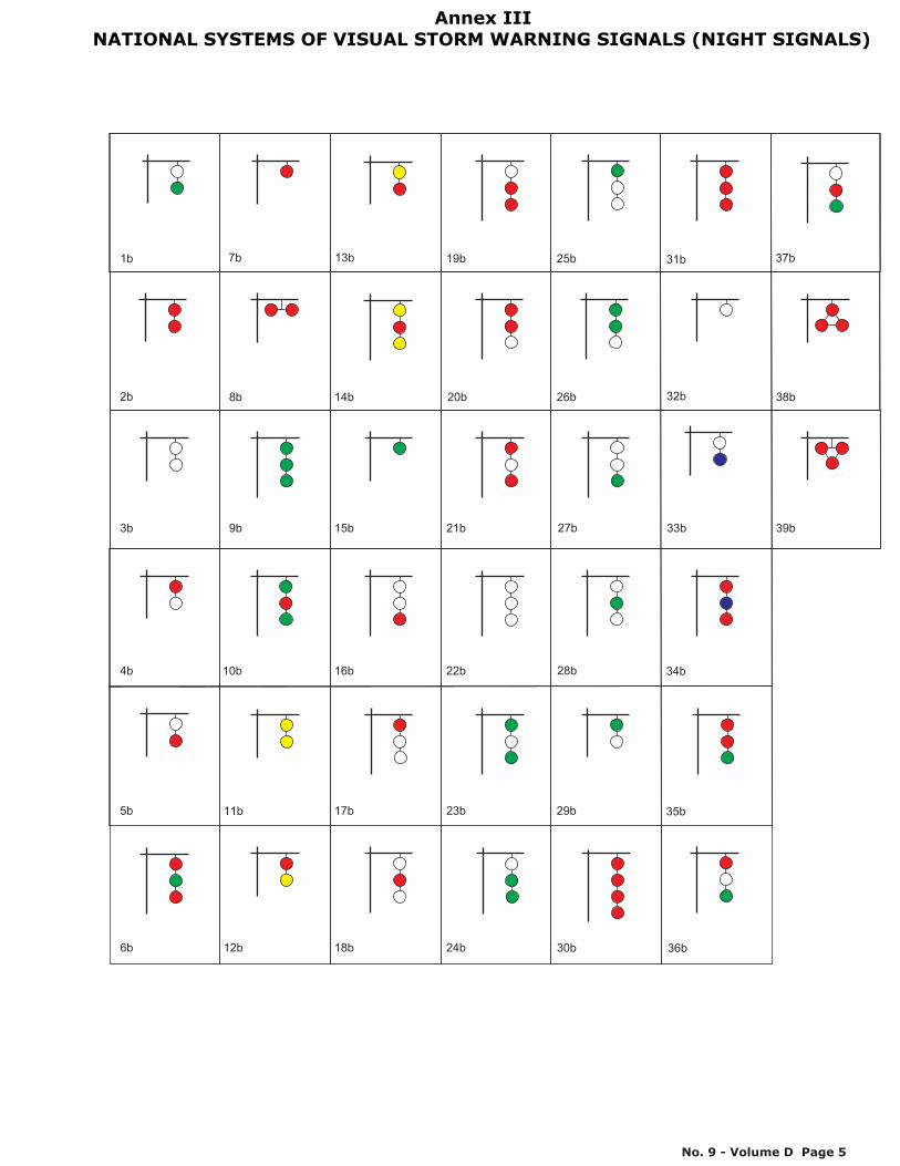
10b
9b
8b
7b
6b
5b
4b
3b
2b
1b
20b
19b
18b
17b
16b
15b
14b
13b
12b
11b 29b
28b
27b
26b
25b
24b
23b
22b
21b 39b
38b
37b
36b
35b
34b
33b
32b
31b
30b
Annex III
NATIONAL SYSTEMS OF VISUAL STORM WARNING SIGNALS (NIGHT SIGNALS)
No. 9 - Volume D Page 5

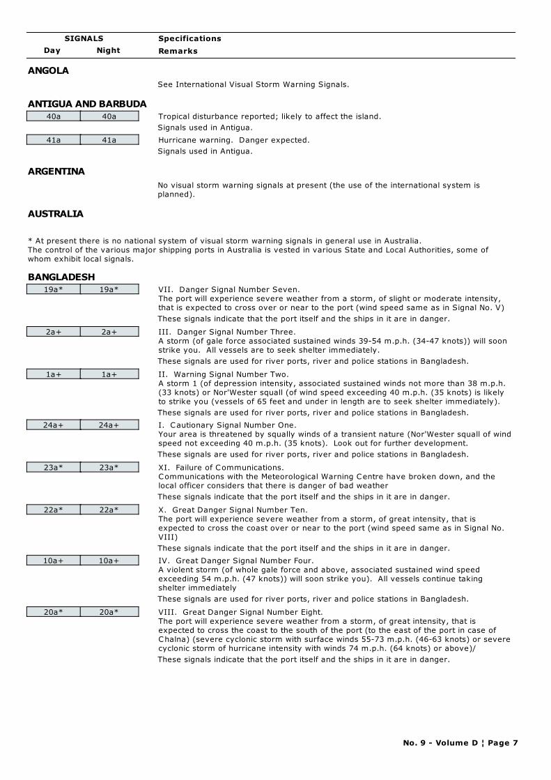
Day Night
Specifications
Remarks
SIGNALS
ANGOLA
See International Visual Storm Warning Signals.
ANTIGUA AND BARBUDA
40a 40a Tropical disturbance reported; likely to affect the island.
Signals used in Antigua.
41a 41a Hurricane warning. Danger expected.
Signals used in Antigua.
ARGENTINA
No visual storm warning signals at present (the use of the international system is
planned).
AUSTRALIA
* At present there is no national system of visual storm warning signals in general use in Australia.
The control of the various major shipping ports in Australia is vested in various State and Local Authorities, some of
whom exhibit local signals.
BANGLADESH
19a* 19a* VII. Danger Signal Number Seven.
The port will experience severe weather from a storm, of slight or moderate intensity,
that is expected to cross over or near to the port (wind speed same as in Signal No. V)
These signals indicate that the port itself and the ships in it are in danger.
2a+ 2a+ III. Danger Signal Number Three.
A storm (of gale force associated sustained winds 39-54 m.p.h. (34-47 knots)) will soon
strike you. All vessels are to seek shelter immediately.
These signals are used for river ports, river and police stations in Bangladesh.
1a+ 1a+ II. Warning Signal Number Two.
A storm 1 (of depression intensity, associated sustained winds not more than 38 m.p.h.
(33 knots) or Nor'Wester squall (of wind speed exceeding 40 m.p.h. (35 knots) is likely
to strike you (vessels of 65 feet and under in length are to seek shelter immediately).
These signals are used for river ports, river and police stations in Bangladesh.
24a+ 24a+ I. Cautionary Signal Number One.
Your area is threatened by squally winds of a transient nature (Nor'Wester squall of wind
speed not exceeding 40 m.p.h. (35 knots). Look out for further development.
These signals are used for river ports, river and police stations in Bangladesh.
23a* 23a* XI. Failure of Communications.
Communications with the Meteorological Warning Centre have broken down, and the
local officer considers that there is danger of bad weather
These signals indicate that the port itself and the ships in it are in danger.
22a* 22a* X. Great Danger Signal Number Ten.
The port will experience severe weather from a storm, of great intensity, that is
expected to cross the coast over or near to the port (wind speed same as in Signal No.
VIII)
These signals indicate that the port itself and the ships in it are in danger.
10a+ 10a+ IV. Great Danger Signal Number Four.
A violent storm (of whole gale force and above, associated sustained wind speed
exceeding 54 m.p.h. (47 knots)) will soon strike you). All vessels continue taking
shelter immediately
These signals are used for river ports, river and police stations in Bangladesh.
20a* 20a* VIII. Great Danger Signal Number Eight.
The port will experience severe weather from a storm, of great intensity, that is
expected to cross the coast to the south of the port (to the east of the port in case of
Chalna) (severe cyclonic storm with surface winds 55-73 m.p.h. (46-63 knots) or severe
cyclonic storm of hurricane intensity with winds 74 m.p.h. (64 knots) or above)/
These signals indicate that the port itself and the ships in it are in danger.
No. 9 - Volume D ¦ Page 7
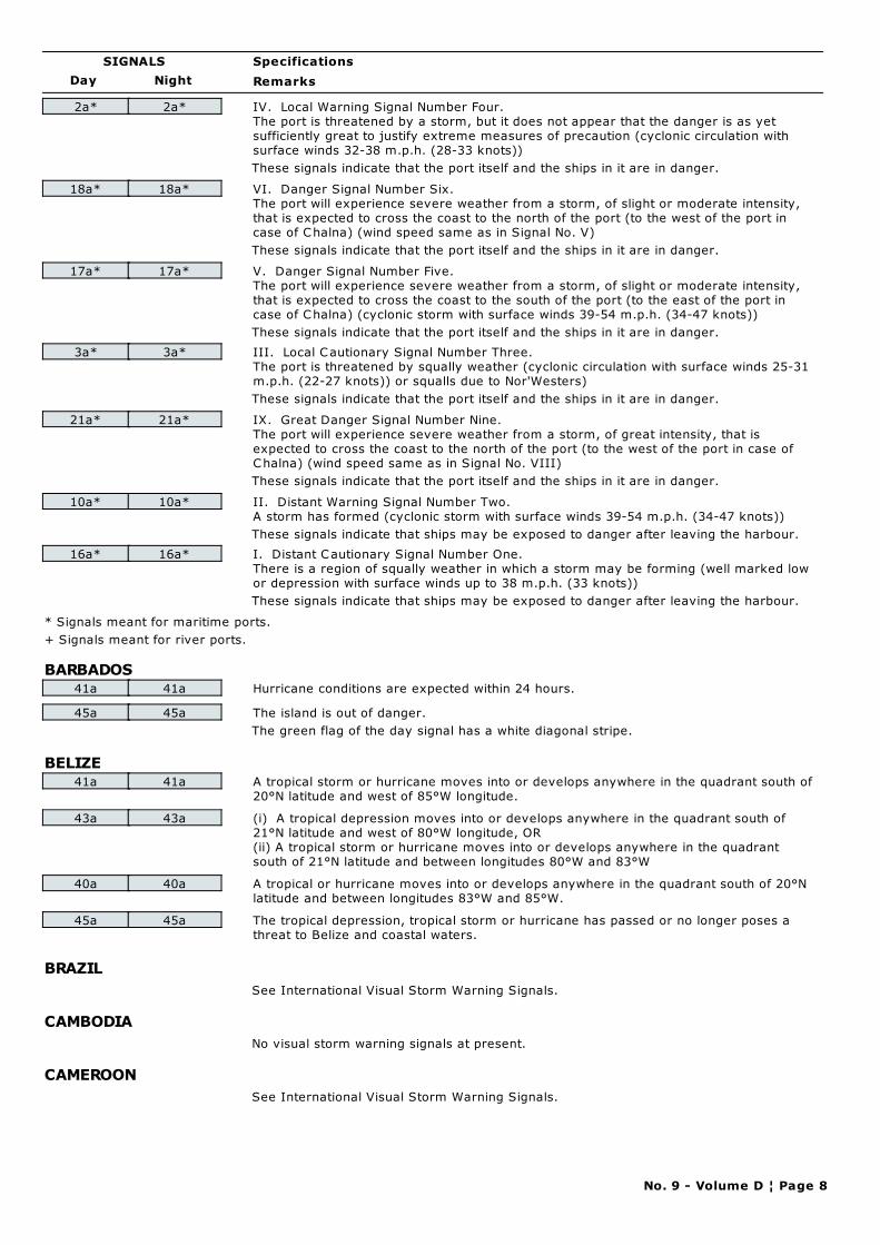
Day Night
Specifications
Remarks
SIGNALS
2a* 2a* IV. Local Warning Signal Number Four.
The port is threatened by a storm, but it does not appear that the danger is as yet
sufficiently great to justify extreme measures of precaution (cyclonic circulation with
surface winds 32-38 m.p.h. (28-33 knots))
These signals indicate that the port itself and the ships in it are in danger.
18a* 18a* VI. Danger Signal Number Six.
The port will experience severe weather from a storm, of slight or moderate intensity,
that is expected to cross the coast to the north of the port (to the west of the port in
case of Chalna) (wind speed same as in Signal No. V)
These signals indicate that the port itself and the ships in it are in danger.
17a* 17a* V. Danger Signal Number Five.
The port will experience severe weather from a storm, of slight or moderate intensity,
that is expected to cross the coast to the south of the port (to the east of the port in
case of Chalna) (cyclonic storm with surface winds 39-54 m.p.h. (34-47 knots))
These signals indicate that the port itself and the ships in it are in danger.
3a* 3a* III. Local Cautionary Signal Number Three.
The port is threatened by squally weather (cyclonic circulation with surface winds 25-31
m.p.h. (22-27 knots)) or squalls due to Nor'Westers)
These signals indicate that the port itself and the ships in it are in danger.
21a* 21a* IX. Great Danger Signal Number Nine.
The port will experience severe weather from a storm, of great intensity, that is
expected to cross the coast to the north of the port (to the west of the port in case of
Chalna) (wind speed same as in Signal No. VIII)
These signals indicate that the port itself and the ships in it are in danger.
10a* 10a* II. Distant Warning Signal Number Two.
A storm has formed (cyclonic storm with surface winds 39-54 m.p.h. (34-47 knots))
These signals indicate that ships may be exposed to danger after leaving the harbour.
16a* 16a* I. Distant Cautionary Signal Number One.
There is a region of squally weather in which a storm may be forming (well marked low
or depression with surface winds up to 38 m.p.h. (33 knots))
These signals indicate that ships may be exposed to danger after leaving the harbour.
* Signals meant for maritime ports.
+ Signals meant for river ports.
BARBADOS41a 41a Hurricane conditions are expected within 24 hours.
45a 45a The island is out of danger.
The green flag of the day signal has a white diagonal stripe.
BELIZE41a 41a A tropical storm or hurricane moves into or develops anywhere in the quadrant south of
20°N latitude and west of 85°W longitude.
43a 43a (i) A tropical depression moves into or develops anywhere in the quadrant south of
21°N latitude and west of 80°W longitude, OR
(ii) A tropical storm or hurricane moves into or develops anywhere in the quadrant
south of 21°N latitude and between longitudes 80°W and 83°W
40a 40a A tropical or hurricane moves into or develops anywhere in the quadrant south of 20°N
latitude and between longitudes 83°W and 85°W.
45a 45a The tropical depression, tropical storm or hurricane has passed or no longer poses a
threat to Belize and coastal waters.
BRAZIL
See International Visual Storm Warning Signals.
CAMBODIA
No visual storm warning signals at present.
CAMEROON
See International Visual Storm Warning Signals.
No. 9 - Volume D ¦ Page 8
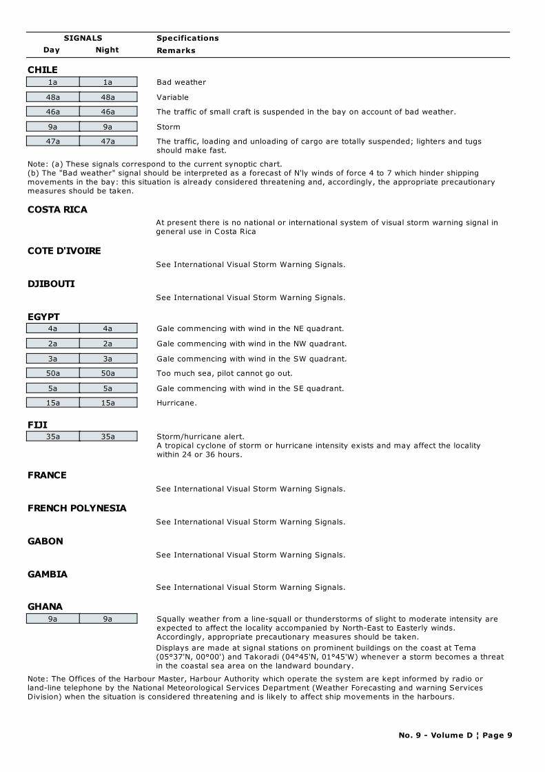
Day Night
Specifications
Remarks
SIGNALS
CHILE
1a 1a Bad weather
48a 48a Variable
46a 46a The traffic of small craft is suspended in the bay on account of bad weather.
9a 9a Storm
47a 47a The traffic, loading and unloading of cargo are totally suspended; lighters and tugs
should make fast.
Note: (a) These signals correspond to the current synoptic chart.
(b) The "Bad weather" signal should be interpreted as a forecast of N'ly winds of force 4 to 7 which hinder shipping
movements in the bay: this situation is already considered threatening and, accordingly, the appropriate precautionary
measures should be taken.
COSTA RICA
At present there is no national or international system of visual storm warning signal in
general use in Costa Rica
COTE D'IVOIRE
See International Visual Storm Warning Signals.
DJIBOUTI
See International Visual Storm Warning Signals.
EGYPT4a 4a Gale commencing with wind in the NE quadrant.
2a 2a Gale commencing with wind in the NW quadrant.
3a 3a Gale commencing with wind in the SW quadrant.
50a 50a Too much sea, pilot cannot go out.
5a 5a Gale commencing with wind in the SE quadrant.
15a 15a Hurricane.
FIJI35a 35a Storm/hurricane alert.
A tropical cyclone of storm or hurricane intensity exists and may affect the locality
within 24 or 36 hours.
FRANCE
See International Visual Storm Warning Signals.
FRENCH POLYNESIA
See International Visual Storm Warning Signals.
GABON
See International Visual Storm Warning Signals.
GAMBIA
See International Visual Storm Warning Signals.
GHANA
9a 9a Squally weather from a line-squall or thunderstorms of slight to moderate intensity are
expected to affect the locality accompanied by North-East to Easterly winds.
Accordingly, appropriate precautionary measures should be taken.
Displays are made at signal stations on prominent buildings on the coast at Tema
(05°37'N, 00°00') and Takoradi (04°45'N, 01°45'W) whenever a storm becomes a threat
in the coastal sea area on the landward boundary.
Note: The Offices of the Harbour Master, Harbour Authority which operate the system are kept informed by radio or
land-line telephone by the National Meteorological Services Department (Weather Forecasting and warning Services
Division) when the situation is considered threatening and is likely to affect ship movements in the harbours.
No. 9 - Volume D ¦ Page 9
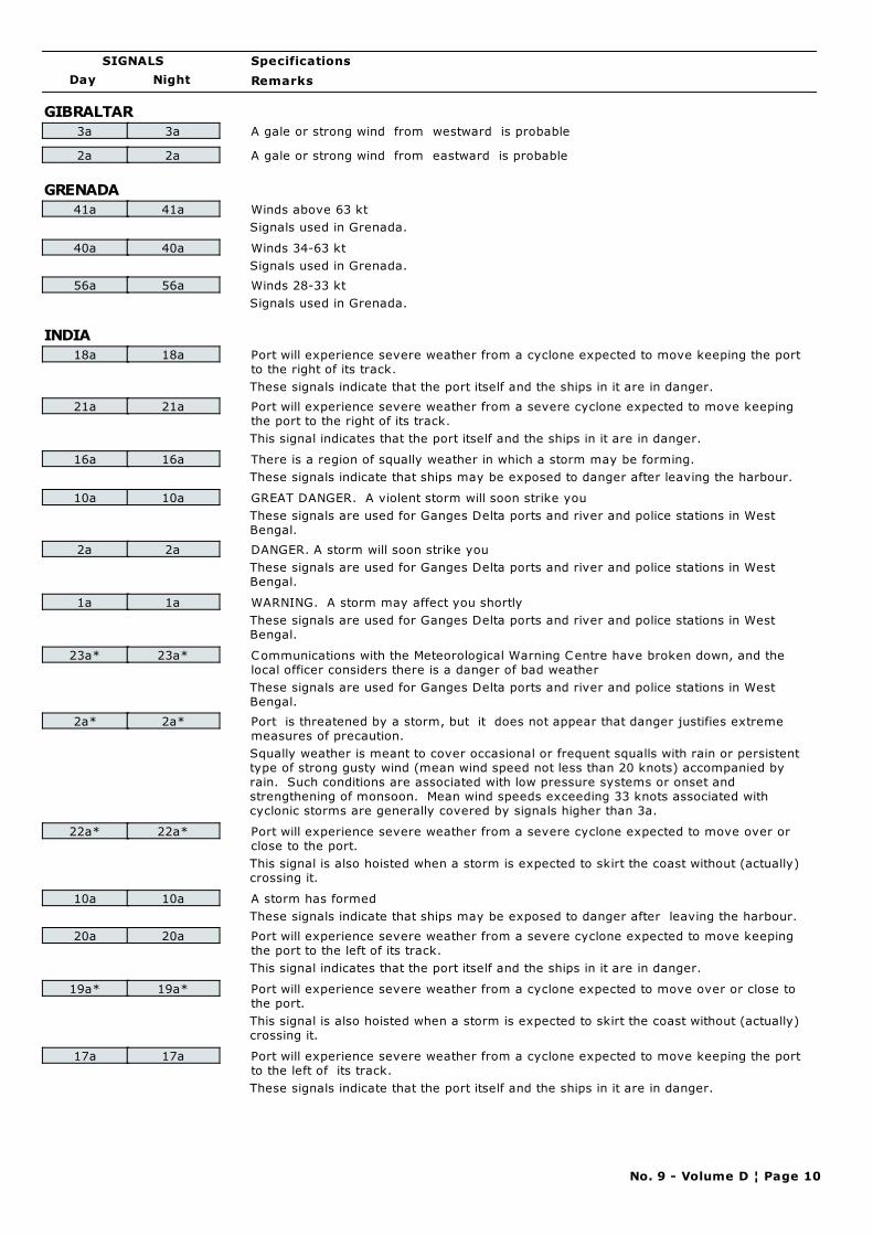
Day Night
Specifications
Remarks
SIGNALS
GIBRALTAR
3a 3a A gale or strong wind from westward is probable
2a 2a A gale or strong wind from eastward is probable
GRENADA
41a 41a Winds above 63 kt
Signals used in Grenada.
40a 40a Winds 34-63 kt
Signals used in Grenada.
56a 56a Winds 28-33 kt
Signals used in Grenada.
INDIA
18a 18a Port will experience severe weather from a cyclone expected to move keeping the port
to the right of its track.
These signals indicate that the port itself and the ships in it are in danger.
21a 21a Port will experience severe weather from a severe cyclone expected to move keeping
the port to the right of its track.
This signal indicates that the port itself and the ships in it are in danger.
16a 16a There is a region of squally weather in which a storm may be forming.
These signals indicate that ships may be exposed to danger after leaving the harbour.
10a 10a GREAT DANGER. A violent storm will soon strike you
These signals are used for Ganges Delta ports and river and police stations in West
Bengal.
2a 2a DANGER. A storm will soon strike you
These signals are used for Ganges Delta ports and river and police stations in West
Bengal.
1a 1a WARNING. A storm may affect you shortly
These signals are used for Ganges Delta ports and river and police stations in West
Bengal.
23a* 23a* Communications with the Meteorological Warning Centre have broken down, and the
local officer considers there is a danger of bad weather
These signals are used for Ganges Delta ports and river and police stations in West
Bengal.
2a* 2a* Port is threatened by a storm, but it does not appear that danger justifies extreme
measures of precaution.
Squally weather is meant to cover occasional or frequent squalls with rain or persistent
type of strong gusty wind (mean wind speed not less than 20 knots) accompanied by
rain. Such conditions are associated with low pressure systems or onset and
strengthening of monsoon. Mean wind speeds exceeding 33 knots associated with
cyclonic storms are generally covered by signals higher than 3a.
22a* 22a* Port will experience severe weather from a severe cyclone expected to move over or
close to the port.
This signal is also hoisted when a storm is expected to skirt the coast without (actually)
crossing it.
10a 10a A storm has formed
These signals indicate that ships may be exposed to danger after leaving the harbour.
20a 20a Port will experience severe weather from a severe cyclone expected to move keeping
the port to the left of its track.
This signal indicates that the port itself and the ships in it are in danger.
19a* 19a* Port will experience severe weather from a cyclone expected to move over or close to
the port.
This signal is also hoisted when a storm is expected to skirt the coast without (actually)
crossing it.
17a 17a Port will experience severe weather from a cyclone expected to move keeping the port
to the left of its track.
These signals indicate that the port itself and the ships in it are in danger.
No. 9 - Volume D ¦ Page 10
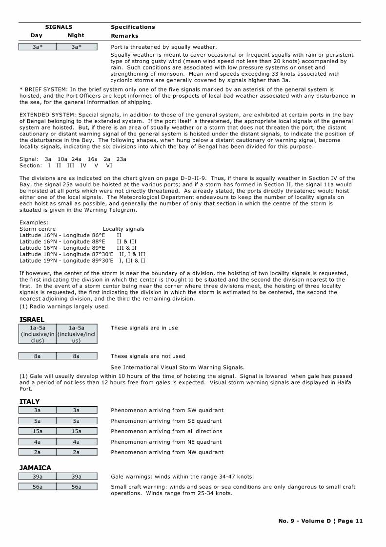
Day Night
Specifications
Remarks
SIGNALS
3a* 3a* Port is threatened by squally weather.
Squally weather is meant to cover occasional or frequent squalls with rain or persistent
type of strong gusty wind (mean wind speed not less than 20 knots) accompanied by
rain. Such conditions are associated with low pressure systems or onset and
strengthening of monsoon. Mean wind speeds exceeding 33 knots associated with
cyclonic storms are generally covered by signals higher than 3a.
* BRIEF SYSTEM: In the brief system only one of the five signals marked by an asterisk of the general system is
hoisted, and the Port Officers are kept informed of the prospects of local bad weather associated with any disturbance in
the sea, for the general information of shipping.
EXTENDED SYSTEM: Special signals, in addition to those of the general system, are exhibited at certain ports in the bay
of Bengal belonging to the extended system. If the port itself is threatened, the appropriate local signals of the general
system are hoisted. But, if there is an area of squally weather or a storm that does not threaten the port, the distant
cautionary or distant warning signal of the general system is hoisted under the distant signals, to indicate the position of
the disturbance in the Bay. The following shapes, when hung below a distant cautionary or warning signal, become
locality signals, indicating the six divisions into which the bay of Bengal has been divided for this purpose.
Signal: 3a 10a 24a 16a 2a 23a
Section: I II III IV V VI
The divisions are as indicated on the chart given on page D-D-II-9. Thus, if there is squally weather in Section IV of the
Bay, the signal 25a would be hoisted at the various ports; and if a storm has formed in Section II, the signal 11a would
be hoisted at all ports which were not directly threatened. As already stated, the ports directly threatened would hoist
either one of the local signals. The Meteorological Department endeavours to keep the number of locality signals on
each hoist as small as possible, and generally the number of only that section in which the centre of the storm is
situated is given in the Warning Telegram.
Examples:
Storm centre Locality signals
Latitude 16°N - Longitude 86°E II
Latitude 16°N - Longitude 88°E II & III
Latitude 16°N - Longitude 89°E III & II
Latitude 18°N - Longitude 87°30'E II, I & III
Latitude 19°N - Longitude 89°30'E I, III & II
If however, the center of the storm is near the boundary of a division, the hoisting of two locality signals is requested,
the first indicating the division in which the center is thought to be situated and the second the division nearest to the
first. In the event of a storm center being near the corner where three divisions meet, the hoisting of three locality
signals is requested, the first indicating the division in which the storm is estimated to be centered, the second the
nearest adjoining division, and the third the remaining division.
(1) Radio warnings largely used.
ISRAEL1a-5a
(inclusive/in
clus)
1a-5a
(inclusive/incl
us)
These signals are in use
8a 8a These signals are not used
See International Visual Storm Warning Signals.
(1) Gale will usually develop within 10 hours of the time of hoisting the signal. Signal is lowered when gale has passed
and a period of not less than 12 hours free from gales is expected. Visual storm warning signals are displayed in Haifa
Port.
ITALY
3a 3a Phenomenon arriving from SW quadrant
5a 5a Phenomenon arriving from SE quadrant
15a 15a Phenomenon arriving from all directions
4a 4a Phenomenon arriving from NE quadrant
2a 2a Phenomenon arriving from NW quadrant
JAMAICA
39a 39a Gale warnings: winds within the range 34-47 knots.
56a 56a Small craft warning: winds and seas or sea conditions are only dangerous to small craft
operations. Winds range from 25-34 knots.
No. 9 - Volume D ¦ Page 11
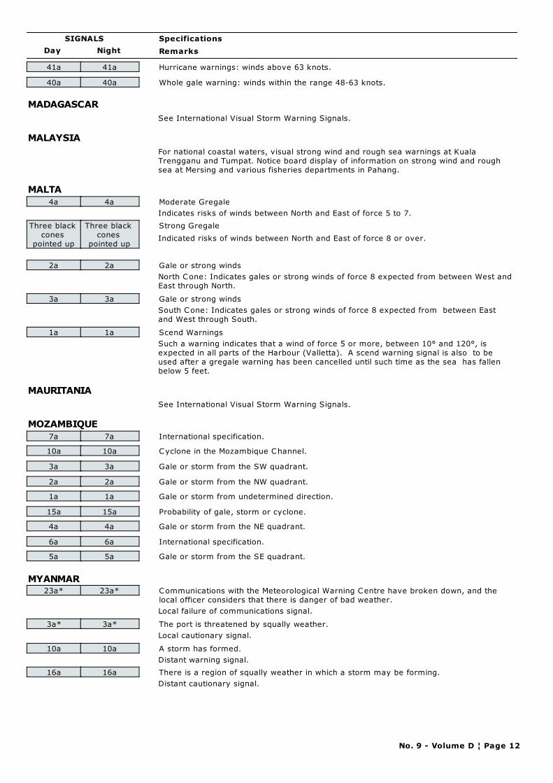
Day Night
Specifications
Remarks
SIGNALS
41a 41a Hurricane warnings: winds above 63 knots.
40a 40a Whole gale warning: winds within the range 48-63 knots.
MADAGASCAR
See International Visual Storm Warning Signals.
MALAYSIA
For national coastal waters, visual strong wind and rough sea warnings at Kuala
Trengganu and Tumpat. Notice board display of information on strong wind and rough
sea at Mersing and various fisheries departments in Pahang.
MALTA
4a 4a Moderate Gregale
Indicates risks of winds between North and East of force 5 to 7.
Three black
cones
pointed up
Three black
cones
pointed up
Strong Gregale
Indicated risks of winds between North and East of force 8 or over.
2a 2a Gale or strong winds
North Cone: Indicates gales or strong winds of force 8 expected from between West and
East through North.
3a 3a Gale or strong winds
South Cone: Indicates gales or strong winds of force 8 expected from between East
and West through South.
1a 1a Scend Warnings
Such a warning indicates that a wind of force 5 or more, between 10° and 120°, is
expected in all parts of the Harbour (Valletta). A scend warning signal is also to be
used after a gregale warning has been cancelled until such time as the sea has fallen
below 5 feet.
MAURITANIA
See International Visual Storm Warning Signals.
MOZAMBIQUE
7a 7a International specification.
10a 10a Cyclone in the Mozambique Channel.
3a 3a Gale or storm from the SW quadrant.
2a 2a Gale or storm from the NW quadrant.
1a 1a Gale or storm from undetermined direction.
15a 15a Probability of gale, storm or cyclone.
4a 4a Gale or storm from the NE quadrant.
6a 6a International specification.
5a 5a Gale or storm from the SE quadrant.
MYANMAR23a* 23a* Communications with the Meteorological Warning Centre have broken down, and the
local officer considers that there is danger of bad weather.
Local failure of communications signal.
3a* 3a* The port is threatened by squally weather.
Local cautionary signal.
10a 10a A storm has formed.
Distant warning signal.
16a 16a There is a region of squally weather in which a storm may be forming.
Distant cautionary signal.
No. 9 - Volume D ¦ Page 12
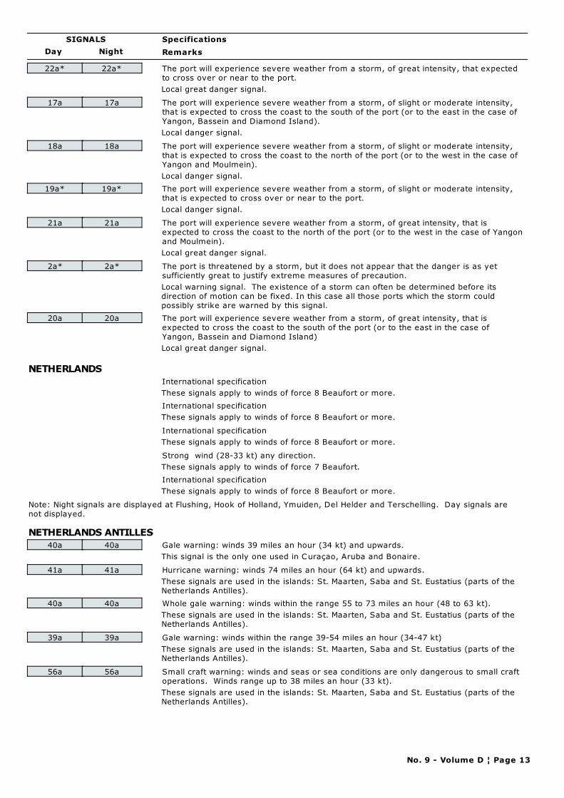
Day Night
Specifications
Remarks
SIGNALS
22a* 22a* The port will experience severe weather from a storm, of great intensity, that expected
to cross over or near to the port.
Local great danger signal.
17a 17a The port will experience severe weather from a storm, of slight or moderate intensity,
that is expected to cross the coast to the south of the port (or to the east in the case of
Yangon, Bassein and Diamond Island).
Local danger signal.
18a 18a The port will experience severe weather from a storm, of slight or moderate intensity,
that is expected to cross the coast to the north of the port (or to the west in the case of
Yangon and Moulmein).
Local danger signal.
19a* 19a* The port will experience severe weather from a storm, of slight or moderate intensity,
that is expected to cross over or near to the port.
Local danger signal.
21a 21a The port will experience severe weather from a storm, of great intensity, that is
expected to cross the coast to the north of the port (or to the west in the case of Yangon
and Moulmein).
Local great danger signal.
2a* 2a* The port is threatened by a storm, but it does not appear that the danger is as yet
sufficiently great to justify extreme measures of precaution.
Local warning signal. The existence of a storm can often be determined before its
direction of motion can be fixed. In this case all those ports which the storm could
possibly strike are warned by this signal.
20a 20a The port will experience severe weather from a storm, of great intensity, that is
expected to cross the coast to the south of the port (or to the east in the case of
Yangon, Bassein and Diamond Island)
Local great danger signal.
NETHERLANDS
International specification
These signals apply to winds of force 8 Beaufort or more.
International specification
These signals apply to winds of force 8 Beaufort or more.
International specification
These signals apply to winds of force 8 Beaufort or more.
Strong wind (28-33 kt) any direction.
These signals apply to winds of force 7 Beaufort.
International specification
These signals apply to winds of force 8 Beaufort or more.
Note: Night signals are displayed at Flushing, Hook of Holland, Ymuiden, Del Helder and Terschelling. Day signals are
not displayed.
NETHERLANDS ANTILLES
40a 40a Gale warning: winds 39 miles an hour (34 kt) and upwards.
This signal is the only one used in Curaçao, Aruba and Bonaire.
41a 41a Hurricane warning: winds 74 miles an hour (64 kt) and upwards.
These signals are used in the islands: St. Maarten, Saba and St. Eustatius (parts of the
Netherlands Antilles).
40a 40a Whole gale warning: winds within the range 55 to 73 miles an hour (48 to 63 kt).
These signals are used in the islands: St. Maarten, Saba and St. Eustatius (parts of the
Netherlands Antilles).
39a 39a Gale warning: winds within the range 39-54 miles an hour (34-47 kt)
These signals are used in the islands: St. Maarten, Saba and St. Eustatius (parts of the
Netherlands Antilles).
56a 56a Small craft warning: winds and seas or sea conditions are only dangerous to small craft
operations. Winds range up to 38 miles an hour (33 kt).
These signals are used in the islands: St. Maarten, Saba and St. Eustatius (parts of the
Netherlands Antilles).
No. 9 - Volume D ¦ Page 13
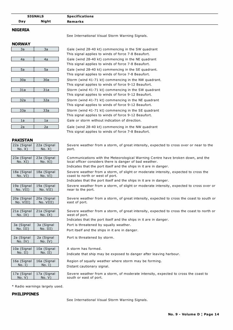
Day Night
Specifications
Remarks
SIGNALS
NIGERIA
See International Visual Storm Warning Signals.
NORWAY
3a 3a Gale (wind 28-40 kt) commencing in the SW quadrant
This signal applies to winds of force 7-8 Beaufort.
4a 4a Gale (wind 28-40 kt) commencing in the NE quadrant
This signal applies to winds of force 7-8 Beaufort.
5a 5a Gale (wind 28-40 kt) commencing in the SE quadrant.
This signal applies to winds of force 7-8 Beaufort.
30a 30a Storm (wind 41-71 kt) commencing in the NW quadrant.
This signal applies to winds of force 9-12 Beaufort.
31a 31a Storm (wind 41-71 kt) commencing in the SW quadrant
This signal applies to winds of force 9-12 Beaufort.
32a 32a Storm (wind 41-71 kt) commencing in the NE quadrant
This signal applies to winds of force 9-12 Beaufort.
33a 33a Storm (wind 41-71 kt) commencing in the SE quadrant
This signal applies to winds of force 9-12 Beaufort.
1a 1a Gale or storm without indication of direction.
2a 2a Gale (wind 28-40 kt) commencing in the NW quadrant
This signal applies to winds of force 7-8 Beaufort.
PAKISTAN22a (Signal
No. X)
22a (Signal
No. X)
Severe weather from a storm, of great intensity, expected to cross over or near to the
port.
23a (Signal
No. XI)
23a (Signal
No. XI)
Communications with the Meteorological Warning Centre have broken down, and the
local officer considers there is danger of bad weather.
Indicates that the port itself and the ships in it are in danger.
18a (Signal
No. VI)
18a (Signal
No. VI)
Severe weather from a storm, of slight or moderate intensity, expected to cross the
coast to north or west of port.
Indicates that the port itself and the ships in it are in danger.
19a (Signal
No. VII)
19a (Signal
No. VII)
Severe weather from a storm, of slight or moderate intensity, expected to cross over or
near to the port.
20a (Signal
No. VIII)
20a (Signal
No. VIII)
Severe weather from a storm, of great intensity, expected to cross the coast to south or
east of port.
21a (Signal
No. IX)
21a (Signal
No. IX)
Severe weather from a storm, of great intensity, expected to cross the coast to north or
west of port.
Indicates that the port itself and the ships in it are in danger.
3a (Signal
No. III)
3a (Signal
No. III)
Port is threatened by squally weather.
Port itself and the ships in it are in danger.
2a (Signal
No. IV)
2a (Signal
No. IV)
Port is threatened by storm.
10a (Signal
No. II)
10a (Signal
No. II)
A storm has formed.
Indicate that ship may be exposed to danger after leaving harbour.
16a (Signal
No. I)
16a (Signal
No. I)
Region of squally weather where storm may be forming.
Distant cautionary signal.
17a (Signal
No. V)
17a (Signal
No. V)
Severe weather from a storm, of moderate intensity, expected to cross the coast to
south or east of port.
* Radio warnings largely used.
PHILIPPINES
See International Visual Storm Warning Signals.
No. 9 - Volume D ¦ Page 14
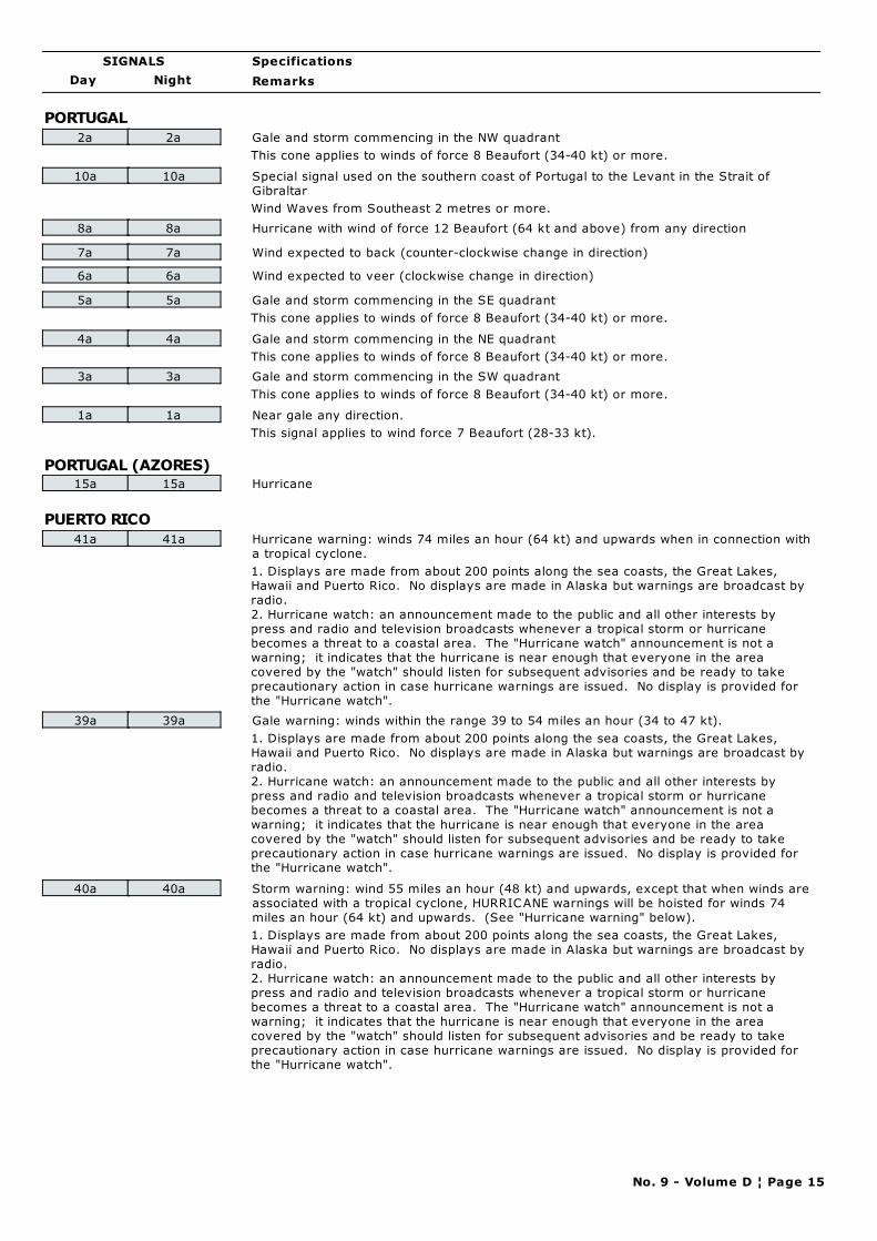
Day Night
Specifications
Remarks
SIGNALS
PORTUGAL
2a 2a Gale and storm commencing in the NW quadrant
This cone applies to winds of force 8 Beaufort (34-40 kt) or more.
10a 10a Special signal used on the southern coast of Portugal to the Levant in the Strait of
Gibraltar
Wind Waves from Southeast 2 metres or more.
8a 8a Hurricane with wind of force 12 Beaufort (64 kt and above) from any direction
7a 7a Wind expected to back (counter-clockwise change in direction)
6a 6a Wind expected to veer (clockwise change in direction)
5a 5a Gale and storm commencing in the SE quadrant
This cone applies to winds of force 8 Beaufort (34-40 kt) or more.
4a 4a Gale and storm commencing in the NE quadrant
This cone applies to winds of force 8 Beaufort (34-40 kt) or more.
3a 3a Gale and storm commencing in the SW quadrant
This cone applies to winds of force 8 Beaufort (34-40 kt) or more.
1a 1a Near gale any direction.
This signal applies to wind force 7 Beaufort (28-33 kt).
PORTUGAL (AZORES)15a 15a Hurricane
PUERTO RICO
41a 41a Hurricane warning: winds 74 miles an hour (64 kt) and upwards when in connection with
a tropical cyclone.
1. Displays are made from about 200 points along the sea coasts, the Great Lakes,
Hawaii and Puerto Rico. No displays are made in Alaska but warnings are broadcast by
radio.
2. Hurricane watch: an announcement made to the public and all other interests by
press and radio and television broadcasts whenever a tropical storm or hurricane
becomes a threat to a coastal area. The "Hurricane watch" announcement is not a
warning; it indicates that the hurricane is near enough that everyone in the area
covered by the "watch" should listen for subsequent advisories and be ready to take
precautionary action in case hurricane warnings are issued. No display is provided for
the "Hurricane watch".
39a 39a Gale warning: winds within the range 39 to 54 miles an hour (34 to 47 kt).
1. Displays are made from about 200 points along the sea coasts, the Great Lakes,
Hawaii and Puerto Rico. No displays are made in Alaska but warnings are broadcast by
radio.
2. Hurricane watch: an announcement made to the public and all other interests by
press and radio and television broadcasts whenever a tropical storm or hurricane
becomes a threat to a coastal area. The "Hurricane watch" announcement is not a
warning; it indicates that the hurricane is near enough that everyone in the area
covered by the "watch" should listen for subsequent advisories and be ready to take
precautionary action in case hurricane warnings are issued. No display is provided for
the "Hurricane watch".
40a 40a Storm warning: wind 55 miles an hour (48 kt) and upwards, except that when winds are
associated with a tropical cyclone, HURRICANE warnings will be hoisted for winds 74
miles an hour (64 kt) and upwards. (See "Hurricane warning" below).
1. Displays are made from about 200 points along the sea coasts, the Great Lakes,
Hawaii and Puerto Rico. No displays are made in Alaska but warnings are broadcast by
radio.
2. Hurricane watch: an announcement made to the public and all other interests by
press and radio and television broadcasts whenever a tropical storm or hurricane
becomes a threat to a coastal area. The "Hurricane watch" announcement is not a
warning; it indicates that the hurricane is near enough that everyone in the area
covered by the "watch" should listen for subsequent advisories and be ready to take
precautionary action in case hurricane warnings are issued. No display is provided for
the "Hurricane watch".
No. 9 - Volume D ¦ Page 15
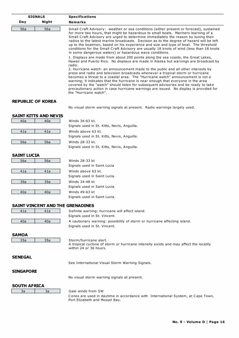
Day Night
Specifications
Remarks
SIGNALS
56a 56a Small C raft Advisory: weather or sea conditions (either present or forecast), sustained
for more two hours, that might be hazardous to small boats. Mariners learning of a
Small C raft Advisory are urged to determine immediately the reason by tuning their
radios to the latest marine broadcasts. Decision as to the degree of hazard will be left
up to the boatmen, based on his experience and size and type of boat. The threshold
conditions for the Small C raft Advisory are usually 18 knots of wind (less than 18 knots
in some dangerous waters) or hazardous wave conditions.
1. Displays are made from about 200 points along the sea coasts, the Great Lakes,
Hawaii and Puerto Rico. No displays are made in Alaska but warnings are broadcast by
radio.
2. Hurricane watch: an announcement made to the public and all other interests by
press and radio and television broadcasts whenever a tropical storm or hurricane
becomes a threat to a coastal area. The "Hurricane watch" announcement is not a
warning; it indicates that the hurricane is near enough that everyone in the area
covered by the "watch" should listen for subsequent advisories and be ready to take
precautionary action in case hurricane warnings are issued. No display is provided for
the "Hurricane watch".
REPUBLIC OF KOREA
No visual storm warning signals at present. Radio warnings largely used.
SAINT KITTS AND NEVIS40a 40a Winds 34-63 kt.
Signals used in St. Kitts, Nevis, Anguilla.
41a 41a Winds above 63 kt.
Signals used in St. Kitts, Nevis, Anguilla.
56a 56a Winds 28-33 kt.
Signals used in St. Kitts, Nevis, Anguilla.
SAINT LUCIA
56a 56a Winds 28-33 kt
Signals used in Saint Lucia
41a 41a Winds above 63 kt.
Signals used in Saint Lucia.
39a 39a Winds 34-48 kt
Signals used in Saint Lucia.
40a 40a Winds 49-63 kt
Signals used in Saint Lucia.
SAINT VINCENT AND THE GRENADINES
41a 41a Definite warning: hurricane will affect island.
Signals used in St. Vincent.
40a 40a A cautionary warning: possibility of storm or hurricane affecting island.
Signals used in St. Vincent.
SAMOA
35a 35a Storm/hurricane alert.
A tropical cyclone of storm or hurricane intensity exists and may affect the locality
within 24 or 36 hours.
SENEGAL
See International Visual Storm Warning Signals.
SINGAPORE
No visual storm warning signals at present.
SOUTH AFRICA
3a 3a Gale winds from SW
Cones are used in daytime in accordance with International System, at Cape Town,
Port Elizabeth and Mossel Bay.
No. 9 - Volume D ¦ Page 16
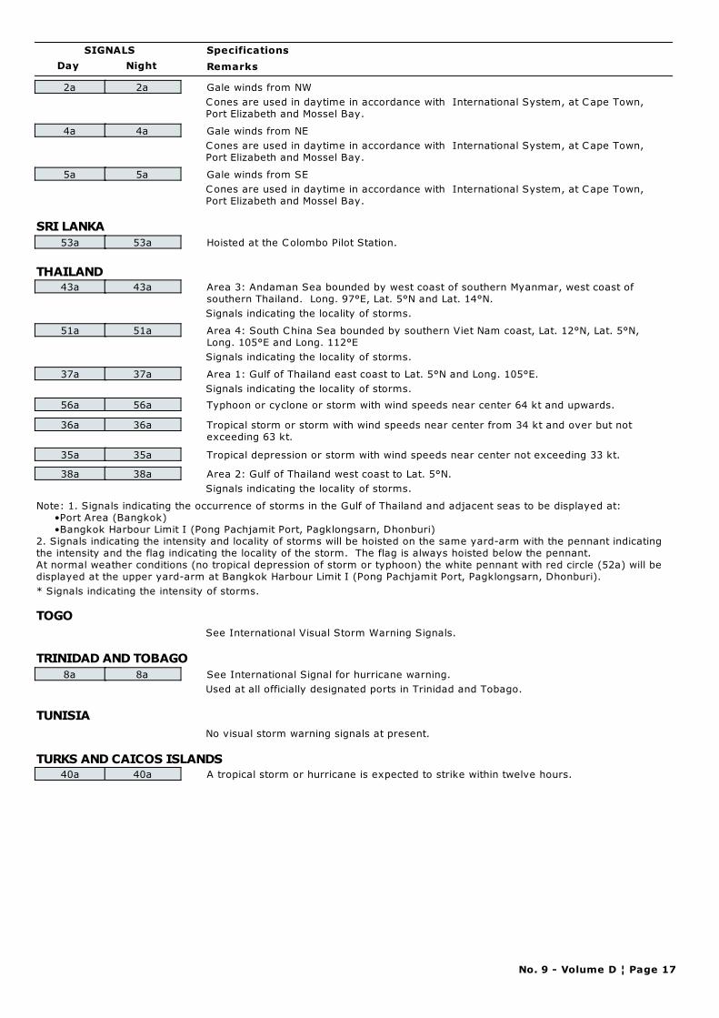
Day Night
Specifications
Remarks
SIGNALS
2a 2a Gale winds from NW
Cones are used in daytime in accordance with International System, at Cape Town,
Port Elizabeth and Mossel Bay.
4a 4a Gale winds from NE
Cones are used in daytime in accordance with International System, at Cape Town,
Port Elizabeth and Mossel Bay.
5a 5a Gale winds from SE
Cones are used in daytime in accordance with International System, at Cape Town,
Port Elizabeth and Mossel Bay.
SRI LANKA
53a 53a Hoisted at the Colombo Pilot Station.
THAILAND43a 43a Area 3: Andaman Sea bounded by west coast of southern Myanmar, west coast of
southern Thailand. Long. 97°E, Lat. 5°N and Lat. 14°N.
Signals indicating the locality of storms.
51a 51a Area 4: South China Sea bounded by southern Viet Nam coast, Lat. 12°N, Lat. 5°N,
Long. 105°E and Long. 112°E
Signals indicating the locality of storms.
37a 37a Area 1: Gulf of Thailand east coast to Lat. 5°N and Long. 105°E.
Signals indicating the locality of storms.
56a 56a Typhoon or cyclone or storm with wind speeds near center 64 kt and upwards.
36a 36a Tropical storm or storm with wind speeds near center from 34 kt and over but not
exceeding 63 kt.
35a 35a Tropical depression or storm with wind speeds near center not exceeding 33 kt.
38a 38a Area 2: Gulf of Thailand west coast to Lat. 5°N.
Signals indicating the locality of storms.
Note: 1. Signals indicating the occurrence of storms in the Gulf of Thailand and adjacent seas to be displayed at:
•Port Area (Bangkok)
•Bangkok Harbour Limit I (Pong Pachjamit Port, Pagklongsarn, Dhonburi)
2. Signals indicating the intensity and locality of storms will be hoisted on the same yard-arm with the pennant indicating
the intensity and the flag indicating the locality of the storm. The flag is always hoisted below the pennant.
At normal weather conditions (no tropical depression of storm or typhoon) the white pennant with red circle (52a) will be
displayed at the upper yard-arm at Bangkok Harbour Limit I (Pong Pachjamit Port, Pagklongsarn, Dhonburi).
* Signals indicating the intensity of storms.
TOGO
See International Visual Storm Warning Signals.
TRINIDAD AND TOBAGO
8a 8a See International Signal for hurricane warning.
Used at all officially designated ports in Trinidad and Tobago.
TUNISIA
No visual storm warning signals at present.
TURKS AND CAICOS ISLANDS40a 40a A tropical storm or hurricane is expected to strike within twelve hours.
No. 9 - Volume D ¦ Page 17
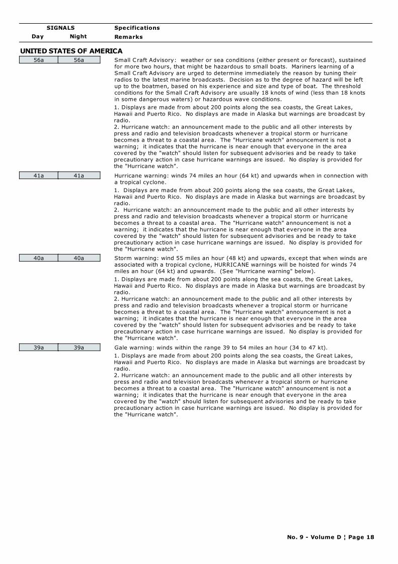
Day Night
Specifications
Remarks
SIGNALS
UNITED STATES OF AMERICA
56a 56a Small C raft Advisory: weather or sea conditions (either present or forecast), sustained
for more two hours, that might be hazardous to small boats. Mariners learning of a
Small C raft Advisory are urged to determine immediately the reason by tuning their
radios to the latest marine broadcasts. Decision as to the degree of hazard will be left
up to the boatmen, based on his experience and size and type of boat. The threshold
conditions for the Small C raft Advisory are usually 18 knots of wind (less than 18 knots
in some dangerous waters) or hazardous wave conditions.
1. Displays are made from about 200 points along the sea coasts, the Great Lakes,
Hawaii and Puerto Rico. No displays are made in Alaska but warnings are broadcast by
radio.
2. Hurricane watch: an announcement made to the public and all other interests by
press and radio and television broadcasts whenever a tropical storm or hurricane
becomes a threat to a coastal area. The "Hurricane watch" announcement is not a
warning; it indicates that the hurricane is near enough that everyone in the area
covered by the "watch" should listen for subsequent advisories and be ready to take
precautionary action in case hurricane warnings are issued. No display is provided for
the "Hurricane watch".
41a 41a Hurricane warning: winds 74 miles an hour (64 kt) and upwards when in connection with
a tropical cyclone.
1. Displays are made from about 200 points along the sea coasts, the Great Lakes,
Hawaii and Puerto Rico. No displays are made in Alaska but warnings are broadcast by
radio.
2. Hurricane watch: an announcement made to the public and all other interests by
press and radio and television broadcasts whenever a tropical storm or hurricane
becomes a threat to a coastal area. The "Hurricane watch" announcement is not a
warning; it indicates that the hurricane is near enough that everyone in the area
covered by the "watch" should listen for subsequent advisories and be ready to take
precautionary action in case hurricane warnings are issued. No display is provided for
the "Hurricane watch".
40a 40a Storm warning: wind 55 miles an hour (48 kt) and upwards, except that when winds are
associated with a tropical cyclone, HURRICANE warnings will be hoisted for winds 74
miles an hour (64 kt) and upwards. (See "Hurricane warning" below).
1. Displays are made from about 200 points along the sea coasts, the Great Lakes,
Hawaii and Puerto Rico. No displays are made in Alaska but warnings are broadcast by
radio.
2. Hurricane watch: an announcement made to the public and all other interests by
press and radio and television broadcasts whenever a tropical storm or hurricane
becomes a threat to a coastal area. The "Hurricane watch" announcement is not a
warning; it indicates that the hurricane is near enough that everyone in the area
covered by the "watch" should listen for subsequent advisories and be ready to take
precautionary action in case hurricane warnings are issued. No display is provided for
the "Hurricane watch".
39a 39a Gale warning: winds within the range 39 to 54 miles an hour (34 to 47 kt).
1. Displays are made from about 200 points along the sea coasts, the Great Lakes,
Hawaii and Puerto Rico. No displays are made in Alaska but warnings are broadcast by
radio.
2. Hurricane watch: an announcement made to the public and all other interests by
press and radio and television broadcasts whenever a tropical storm or hurricane
becomes a threat to a coastal area. The "Hurricane watch" announcement is not a
warning; it indicates that the hurricane is near enough that everyone in the area
covered by the "watch" should listen for subsequent advisories and be ready to take
precautionary action in case hurricane warnings are issued. No display is provided for
the "Hurricane watch".
No. 9 - Volume D ¦ Page 18
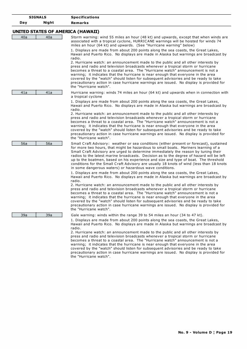
Day Night
Specifications
Remarks
SIGNALS
UNITED STATES OF AMERICA (HAWAII)
40a 40a Storm warning: wind 55 miles an hour (48 kt) and upwards, except that when winds are
associated with a tropical cyclone, HURRICANE warnings will be hoisted for winds 74
miles an hour (64 kt) and upwards. (See "Hurricane warning" below)
1. Displays are made from about 200 points along the sea coasts, the Great Lakes,
Hawaii and Puerto Rico. No displays are made in Alaska but warnings are broadcast by
radio.
2. Hurricane watch: an announcement made to the public and all other interests by
press and radio and television broadcasts whenever a tropical storm or hurricane
becomes a threat to a coastal area. The "Hurricane watch" announcement is not a
warning; it indicates that the hurricane is near enough that everyone in the area
covered by the "watch" should listen for subsequent advisories and be ready to take
precautionary action in case hurricane warnings are issued. No display is provided for
the "Hurricane watch".
41a 41a Hurricane warning: winds 74 miles an hour (64 kt) and upwards when in connection with
a tropical cyclone
1. Displays are made from about 200 points along the sea coasts, the Great Lakes,
Hawaii and Puerto Rico. No displays are made in Alaska but warnings are broadcast by
radio.
2. Hurricane watch: an announcement made to the public and all other interests by
press and radio and television broadcasts whenever a tropical storm or hurricane
becomes a threat to a coastal area. The "Hurricane watch" announcement is not a
warning; it indicates that the hurricane is near enough that everyone in the area
covered by the "watch" should listen for subsequent advisories and be ready to take
precautionary action in case hurricane warnings are issued. No display is provided for
the "Hurricane watch".
56a 56a Small C raft Advisory: weather or sea conditions (either present or forecast), sustained
for more two hours, that might be hazardous to small boats. Mariners learning of a
Small C raft Advisory are urged to determine immediately the reason by tuning their
radios to the latest marine broadcasts. Decision as to the degree of hazard will be left
up to the boatmen, based on his experience and size and type of boat. The threshold
conditions for the Small C raft Advisory are usually 18 knots of wind (less than 18 knots
in some dangerous waters) or hazardous wave conditions.
1. Displays are made from about 200 points along the sea coasts, the Great Lakes,
Hawaii and Puerto Rico. No displays are made in Alaska but warnings are broadcast by
radio.
2. Hurricane watch: an announcement made to the public and all other interests by
press and radio and television broadcasts whenever a tropical storm or hurricane
becomes a threat to a coastal area. The "Hurricane watch" announcement is not a
warning; it indicates that the hurricane is near enough that everyone in the area
covered by the "watch" should listen for subsequent advisories and be ready to take
precautionary action in case hurricane warnings are issued. No display is provided for
the "Hurricane watch".
39a 39a Gale warning: winds within the range 39 to 54 miles an hour (34 to 47 kt).
1. Displays are made from about 200 points along the sea coasts, the Great Lakes,
Hawaii and Puerto Rico. No displays are made in Alaska but warnings are broadcast by
radio.
2. Hurricane watch: an announcement made to the public and all other interests by
press and radio and television broadcasts whenever a tropical storm or hurricane
becomes a threat to a coastal area. The "Hurricane watch" announcement is not a
warning; it indicates that the hurricane is near enough that everyone in the area
covered by the "watch" should listen for subsequent advisories and be ready to take
precautionary action in case hurricane warnings are issued. No display is provided for
the "Hurricane watch".
No. 9 - Volume D ¦ Page 19

CHAPTER 4
FOCAL POINT CONTACT INFORMATION:

PART A
METAREA COORDINATOR CONTACTS FOR
WMO WORLDWIDE MET-OCEAN
INFORMATION AND WARNING SERVICE

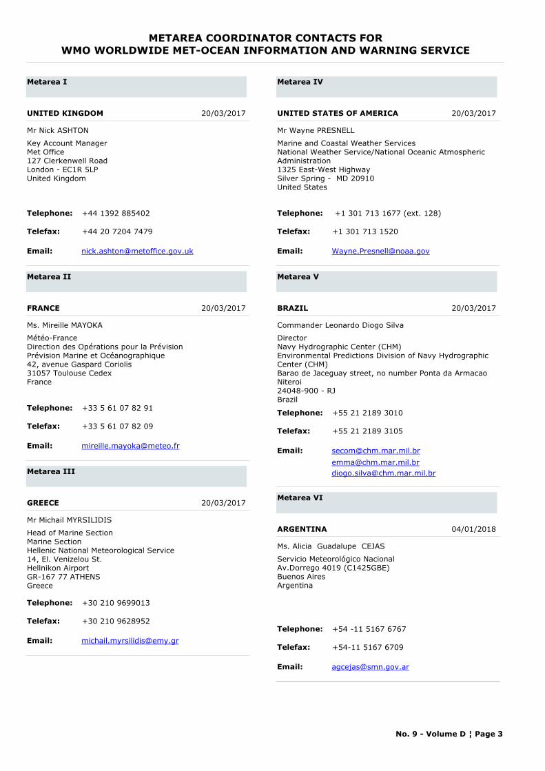
METAREA COORDINATOR CONTACTS FORWMO WORLDWIDE MET-OCEAN INFORMATION AND WARNING SERVICE
Metarea I
UNITED KINGDOM 20/03/2017
Mr Nick ASHTON
Telephone: +44 1392 885402
Telefax: +44 20 7204 7479
Email: [email protected]
Key Account ManagerMet Office127 Clerkenwell RoadLondon - EC1R 5LPUnited Kingdom
Metarea II
FRANCE 20/03/2017
Ms. Mireille MAYOKA
Telephone: +33 5 61 07 82 91
Telefax: +33 5 61 07 82 09
Email: [email protected]
Météo-FranceDirection des Opérations pour la PrévisionPrévision Marine et Océanographique42, avenue Gaspard Coriolis31057 Toulouse CedexFrance
Metarea III
GREECE 20/03/2017
Mr Michail MYRSILIDIS
Telephone: +30 210 9699013
Telefax: +30 210 9628952
Email: [email protected]
Head of Marine SectionMarine SectionHellenic National Meteorological Service14, El. Venizelou St.Hellnikon AirportGR-167 77 ATHENSGreece
Metarea IV
UNITED STATES OF AMERICA 20/03/2017
Mr Wayne PRESNELL
Telephone: +1 301 713 1677 (ext. 128)
Telefax: +1 301 713 1520
Email: [email protected]
Marine and Coastal Weather ServicesNational Weather Service/National Oceanic Atmospheric Administration1325 East-West HighwaySilver Spring - MD 20910United States
Metarea V
BRAZIL 20/03/2017
Commander Leonardo Diogo Silva
Telephone: +55 21 2189 3010
Telefax: +55 21 2189 3105
Email: [email protected]
DirectorNavy Hydrographic Center (CHM)Environmental Predictions Division of Navy Hydrographic Center (CHM)Barao de Jaceguay street, no number Ponta da ArmacaoNiteroi24048-900 - RJBrazil
[email protected]@chm.mar.mil.br
Metarea VI
ARGENTINA 04/01/2018
Ms. Alicia Guadalupe CEJAS
Telephone: +54 -11 5167 6767
Telefax: +54-11 5167 6709
Email: [email protected]
Servicio Meteorológico NacionalAv.Dorrego 4019 (C1425GBE)Buenos AiresArgentina
No. 9 - Volume D ¦ Page 3
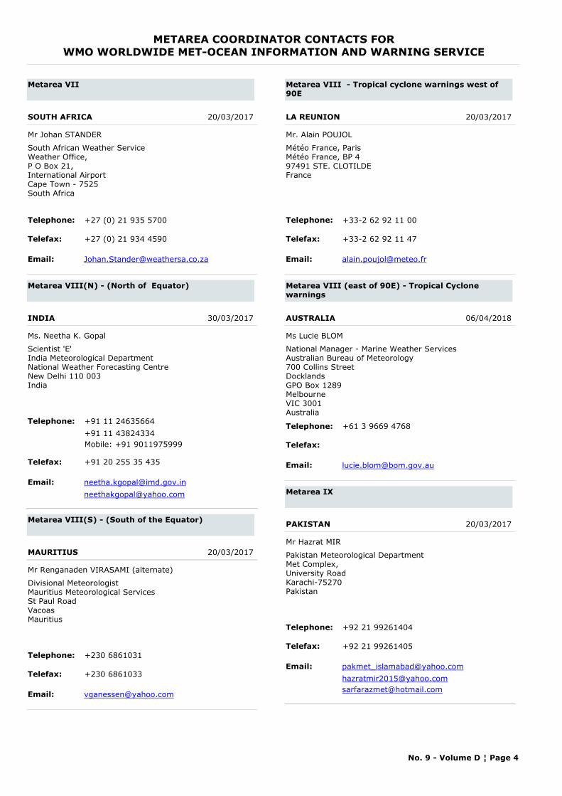
METAREA COORDINATOR CONTACTS FORWMO WORLDWIDE MET-OCEAN INFORMATION AND WARNING SERVICE
Metarea VII
SOUTH AFRICA 20/03/2017
Mr Johan STANDER
Telephone: +27 (0) 21 935 5700
Telefax: +27 (0) 21 934 4590
Email: [email protected]
South African Weather ServiceWeather Office,P O Box 21,International AirportCape Town - 7525South Africa
Metarea VIII(N) - (North of Equator)
INDIA 30/03/2017
Ms. Neetha K. Gopal
Telephone: +91 11 24635664
Telefax: +91 20 255 35 435
Email: [email protected]
Scientist 'E'India Meteorological DepartmentNational Weather Forecasting CentreNew Delhi 110 003India
+91 11 43824334Mobile: +91 9011975999
Metarea VIII(S) - (South of the Equator)
MAURITIUS 20/03/2017
Mr Renganaden VIRASAMI (alternate)
Telephone: +230 6861031
Telefax: +230 6861033
Email: [email protected]
Divisional MeteorologistMauritius Meteorological ServicesSt Paul RoadVacoasMauritius
Metarea VIII - Tropical cyclone warnings west of 90E
LA REUNION 20/03/2017
Mr. Alain POUJOL
Telephone: +33-2 62 92 11 00
Telefax: +33-2 62 92 11 47
Email: [email protected]
Météo France, ParisMétéo France, BP 497491 STE. CLOTILDEFrance
Metarea VIII (east of 90E) - Tropical Cyclone warnings
AUSTRALIA 06/04/2018
Ms Lucie BLOM
Telephone: +61 3 9669 4768
Telefax:
Email: [email protected]
National Manager - Marine Weather ServicesAustralian Bureau of Meteorology700 Collins StreetDocklandsGPO Box 1289Melbourne VIC 3001Australia
Metarea IX
PAKISTAN 20/03/2017
Mr Hazrat MIR
Telephone: +92 21 99261404
Telefax: +92 21 99261405
Email: [email protected]
Pakistan Meteorological DepartmentMet Complex,University RoadKarachi-75270Pakistan
[email protected]@hotmail.com
No. 9 - Volume D ¦ Page 4
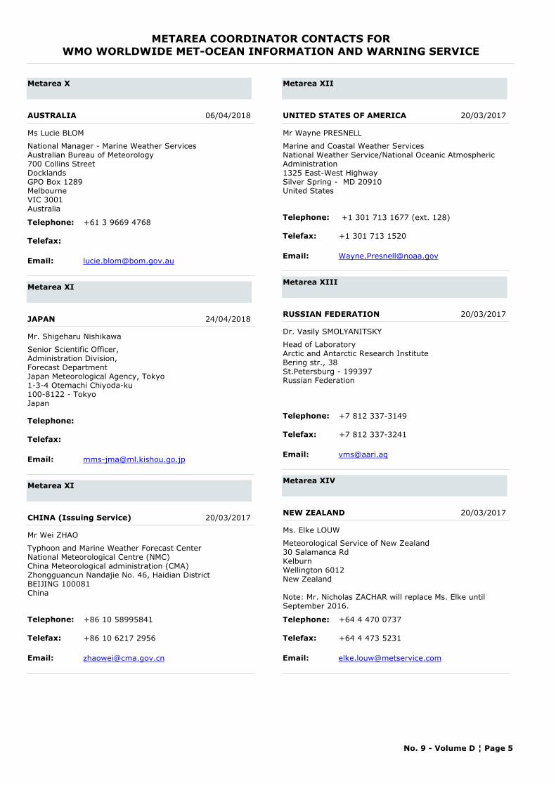
METAREA COORDINATOR CONTACTS FORWMO WORLDWIDE MET-OCEAN INFORMATION AND WARNING SERVICE
Metarea X
AUSTRALIA 06/04/2018
Ms Lucie BLOM
Telephone: +61 3 9669 4768
Telefax:
Email: [email protected]
National Manager - Marine Weather ServicesAustralian Bureau of Meteorology700 Collins StreetDocklandsGPO Box 1289Melbourne VIC 3001Australia
Metarea XI
JAPAN 24/04/2018
Mr. Shigeharu Nishikawa
Telephone:
Telefax:
Email: [email protected]
Senior Scientific Officer,Administration Division, Forecast DepartmentJapan Meteorological Agency, Tokyo1-3-4 Otemachi Chiyoda-ku100-8122 - TokyoJapan
Metarea XI
CHINA (Issuing Service) 20/03/2017
Mr Wei ZHAO
Telephone: +86 10 58995841
Telefax: +86 10 6217 2956
Email: [email protected]
Typhoon and Marine Weather Forecast CenterNational Meteorological Centre (NMC)China Meteorological administration (CMA)Zhongguancun Nandajie No. 46, Haidian District BEIJING 100081China
Metarea XII
UNITED STATES OF AMERICA 20/03/2017
Mr Wayne PRESNELL
Telephone: +1 301 713 1677 (ext. 128)
Telefax: +1 301 713 1520
Email: [email protected]
Marine and Coastal Weather ServicesNational Weather Service/National Oceanic Atmospheric Administration1325 East-West HighwaySilver Spring - MD 20910United States
Metarea XIII
RUSSIAN FEDERATION 20/03/2017
Dr. Vasily SMOLYANITSKY
Telephone: +7 812 337-3149
Telefax: +7 812 337-3241
Email: [email protected]
Head of LaboratoryArctic and Antarctic Research InstituteBering str., 38St.Petersburg - 199397Russian Federation
Metarea XIV
NEW ZEALAND 20/03/2017
Ms. Elke LOUW
Telephone: +64 4 470 0737
Telefax: +64 4 473 5231
Email: [email protected]
Meteorological Service of New Zealand30 Salamanca RdKelburnWellington 6012New Zealand
Note: Mr. Nicholas ZACHAR will replace Ms. Elke until September 2016.
No. 9 - Volume D ¦ Page 5
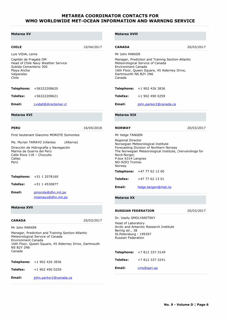
METAREA COORDINATOR CONTACTS FORWMO WORLDWIDE MET-OCEAN INFORMATION AND WARNING SERVICE
Metarea XV
CHILE 10/04/2017
Luis VIDAL Lema
Telephone: +56322208620
Telefax: +56322208621
Email: [email protected]
Capitán de Fragata OMHead of Chile Navy Weather ServiceSubida Cementerio 300Playa AnchaValparaísoChile
Metarea XVI
PERU 16/04/2018
First lieutenant Giacomo MOROTE Somontes
Ms. Myrian TAMAYO Infantes (Alterna)
Telephone: +51 1 2078160
Telefax: +51 1 4530877
Email: [email protected]
Dirección de Hidrografía y NavegaciónMarina de Guerra del PerúCalle Roca 118 – ChucuitoCallaoPerú
Metarea XVll
CANADA 20/03/2017
Mr John PARKER
Telephone: +1 902 426 3836
Telefax: +1 902 490 0259
Email: [email protected]
Manager, Prediction and Training Section-AtlanticMeteorological Service of CanadaEnvironment Canada16th Floor, Queen Square, 45 Alderney Drive, Dartmouth NS B2Y 2N6Canada
Metarea XVlll
CANADA 20/03/2017
Mr John PARKER
Telephone: +1 902 426 3836
Telefax: +1 902 490 0259
Email: [email protected]
Manager, Prediction and Training Section-AtlanticMeteorological Service of CanadaEnvironment Canada16th Floor, Queen Square, 45 Alderney Drive, Dartmounth NS B2Y 2N6Canada
Metarea XIX
NORWAY 20/03/2017
Mr Helge TANGEN
Telephone: +47 77 62 13 00
Telefax: +47 77 62 13 01
Email: [email protected]
Regional DirectorNorwegian Meteorological InstituteForecasting Division of Northern NorwayThe Norwegian Meteorological Institute, (Vervarslinga for Nord-Norge)P.box 6314 LangnesNO-9293 TromsoNorway
Metarea XX
RUSSIAN FEDERATION 20/03/2017
Dr. Vasily SMOLYANITSKY
Telephone: +7 812 337-3149
Telefax: +7 812 337-3241
Email: [email protected]
Head of LaboratoryArctic and Antarctic Research InstituteBering str., 38St.Petersburg - 199397Russian Federation
No. 9 - Volume D ¦ Page 6
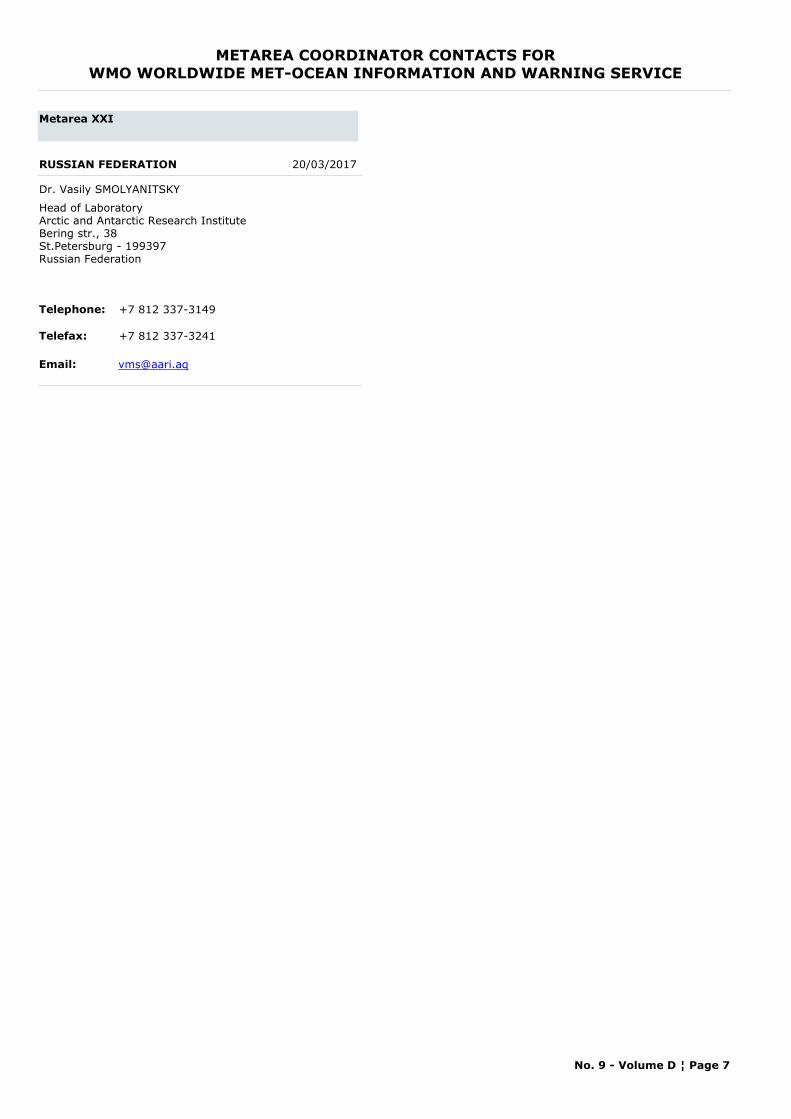
METAREA COORDINATOR CONTACTS FORWMO WORLDWIDE MET-OCEAN INFORMATION AND WARNING SERVICE
Metarea XXI
RUSSIAN FEDERATION 20/03/2017
Dr. Vasily SMOLYANITSKY
Telephone: +7 812 337-3149
Telefax: +7 812 337-3241
Email: [email protected]
Head of LaboratoryArctic and Antarctic Research InstituteBering str., 38St.Petersburg - 199397Russian Federation
No. 9 - Volume D ¦ Page 7

PART B
CONTACT POINTS FOR
SHIP WEATHER ROUTEING SERVICES
&
PORT METEOROLOGICAL OFFICERS

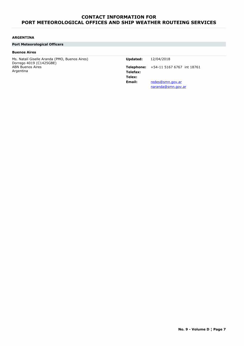
CONTACT INFORMATION FORPORT METEOROLOGICAL OFFICES AND SHIP WEATHER ROUTEING SERVICES
ARGENTINA
Port Meteorological Officers
Buenos Aires
Ms. Natalí Giselle Aranda (PMO, Buenos Aires) Dorrego 4019 (C1425GBE) ABN Buenos AiresArgentina
Telephone: +54-11 5167 6767 int 18761Telefax:Telex:Email: [email protected]
Updated: 12/04/2018
No. 9 - Volume D ¦ Page 7
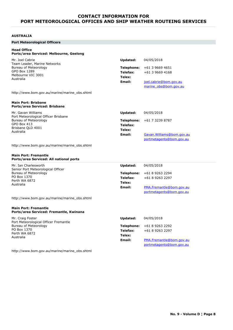
CONTACT INFORMATION FORPORT METEOROLOGICAL OFFICES AND SHIP WEATHER ROUTEING SERVICES
AUSTRALIA
Port Meteorological Officers
Head OfficePorts/area Serviced: Melbourne, Geelong
Mr. Joel CabrieTeam Leader, Marine NetworksBureau of MeteorologyGPO Box 1289Melbourne VIC 3001Australia
Telephone: +61 3 9669 4651Telefax: +61 3 9669 4168Telex:Email: [email protected]
http://www.bom.gov.au/marine/marine_obs.shtml
Updated: 04/05/2018
Main Port: BrisbanePorts/area Serviced: Brisbane
Mr. Gavan WilliamsPort Meteorological Officer BrisbaneBureau of MeteorologyGPO Box 413Brisbane QLD 4001Australia
Telephone: +61 7 3239 8787Telefax:Telex:Email: [email protected]
http://www.bom.gov.au/marine/marine_obs.shtml
Updated: 04/05/2018
Main Port: FremantlePorts/area Serviced: All national ports
Mr. Ian CharlesworthSenior Port Meteorological Officer Bureau of MeteorologyPO Box 1370Perth WA 6872Australia
Telephone: +61 8 9263 2294Telefax: +61 8 9263 2297Telex:Email: [email protected]
http://www.bom.gov.au/marine/marine_obs.shtml
Updated: 04/05/2018
Main Port: FremantlePorts/area Serviced: Fremantle, Kwinana
Mr. Craig FosterPort Meteorological Officer FremantleBureau of MeteorologyPO Box 1370Perth WA 6872Australia
Telephone: +61 8 9263 2292Telefax: +61 8 9263 2297Telex:Email: [email protected]
http://www.bom.gov.au/marine/marine_obs.shtml
Updated: 04/05/2018
No. 9 - Volume D ¦ Page 8
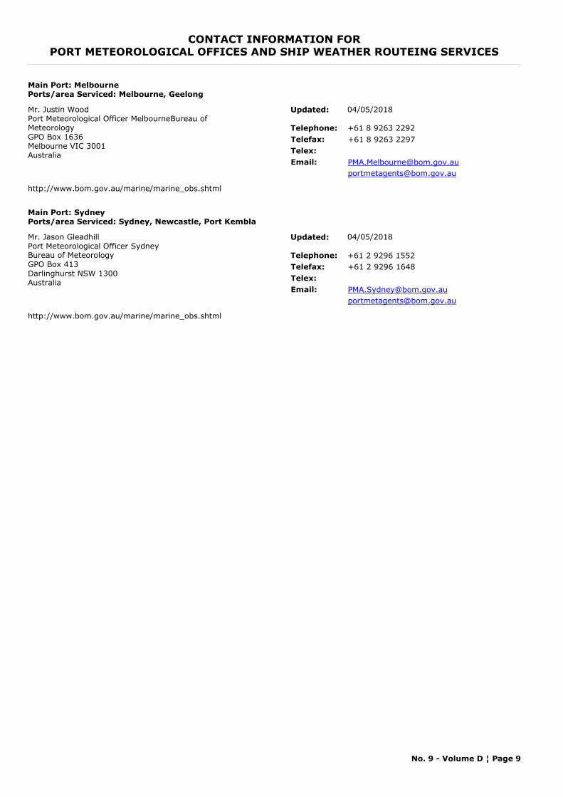
CONTACT INFORMATION FORPORT METEOROLOGICAL OFFICES AND SHIP WEATHER ROUTEING SERVICES
Main Port: MelbournePorts/area Serviced: Melbourne, Geelong
Mr. Justin WoodPort Meteorological Officer MelbourneBureau of MeteorologyGPO Box 1636Melbourne VIC 3001Australia
Telephone: +61 8 9263 2292Telefax: +61 8 9263 2297Telex:Email: [email protected]
http://www.bom.gov.au/marine/marine_obs.shtml
Updated: 04/05/2018
Main Port: SydneyPorts/area Serviced: Sydney, Newcastle, Port Kembla
Mr. Jason GleadhillPort Meteorological Officer SydneyBureau of MeteorologyGPO Box 413Darlinghurst NSW 1300Australia
Telephone: +61 2 9296 1552Telefax: +61 2 9296 1648Telex:Email: [email protected]
http://www.bom.gov.au/marine/marine_obs.shtml
Updated: 04/05/2018
No. 9 - Volume D ¦ Page 9
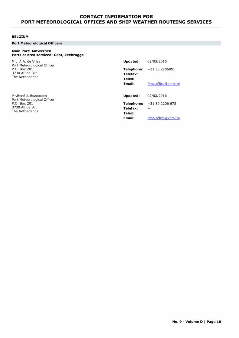
CONTACT INFORMATION FORPORT METEOROLOGICAL OFFICES AND SHIP WEATHER ROUTEING SERVICES
BELGIUM
Port Meteorological Officers
Main Port: AntwerpenPorts or area serviced: Gent, Zeebrugge
Mr. A.A. de VriesPort Meteorological OfficerP.O. Box 201 3730 AE de Bilt The Netherlands
Telephone: +31 30 2206851Telefax:Telex:Email: [email protected]
Updated: 02/03/2016
Mr.René J. RozeboomPort Meteorological OfficerP.O. Box 201 3730 AE de Bilt The Netherlands
Telephone: +31 30 2206 678Telefax: --Telex:Email: [email protected]
Updated: 02/03/2016
No. 9 - Volume D ¦ Page 10
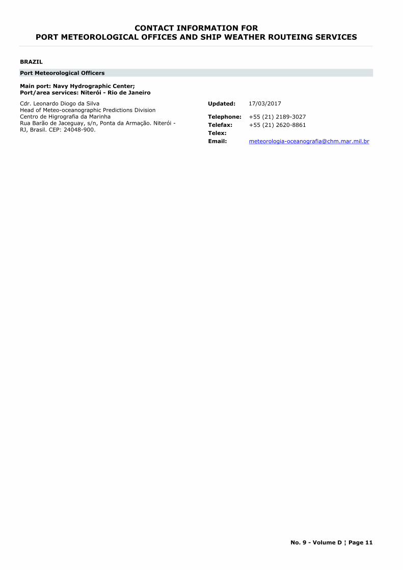
CONTACT INFORMATION FORPORT METEOROLOGICAL OFFICES AND SHIP WEATHER ROUTEING SERVICES
BRAZIL
Port Meteorological Officers
Main port: Navy Hydrographic Center;Port/area services: Niterói - Rio de Janeiro
Cdr. Leonardo Diogo da SilvaHead of Meteo-oceanographic Predictions DivisionCentro de Higrografia da MarinhaRua Barão de Jaceguay, s/n, Ponta da Armação. Niterói - RJ, Brasil. CEP: 24048-900.
Telephone: +55 (21) 2189-3027Telefax: +55 (21) 2620-8861Telex:Email: [email protected]
Updated: 17/03/2017
No. 9 - Volume D ¦ Page 11
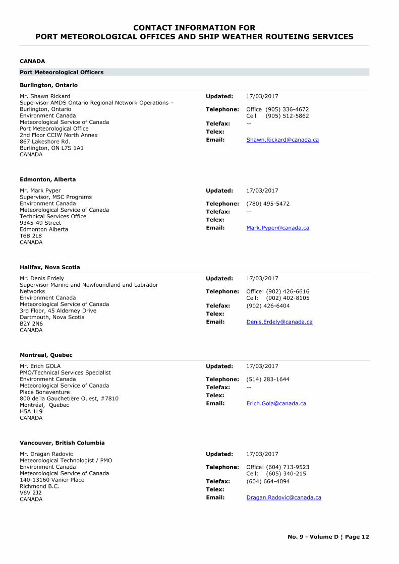
CONTACT INFORMATION FORPORT METEOROLOGICAL OFFICES AND SHIP WEATHER ROUTEING SERVICES
CANADA
Port Meteorological Officers
Burlington, Ontario
Mr. Shawn RickardSupervisor AMDS Ontario Regional Network Operations – Burlington, OntarioEnvironment Canada Meteorological Service of CanadaPort Meteorological Office2nd Floor CCIW North Annex867 Lakeshore Rd.Burlington, ON L7S 1A1CANADA
Telephone: Office (905) 336-4672Cell (905) 512-5862
Telefax: --Telex:Email: [email protected]
Updated: 17/03/2017
Edmonton, Alberta
Mr. Mark PyperSupervisor, MSC ProgramsEnvironment Canada Meteorological Service of Canada Technical Services Office
9345-49 StreetEdmonton AlbertaT6B 2L8CANADA
Telephone: (780) 495-5472Telefax: --Telex:Email: [email protected]
Updated: 17/03/2017
Halifax, Nova Scotia
Mr. Denis Erdely Supervisor Marine and Newfoundland and Labrador NetworksEnvironment Canada Meteorological Service of Canada3rd Floor, 45 Alderney DriveDartmouth, Nova ScotiaB2Y 2N6CANADA
Telephone: Office: (902) 426-6616Cell: (902) 402-8105
Telefax: (902) 426-6404Telex:Email: [email protected]
Updated: 17/03/2017
Montreal, Quebec
Mr. Erich GOLAPMO/Technical Services SpecialistEnvironment Canada Meteorological Service of CanadaPlace Bonaventure800 de la Gauchetière Ouest, #7810Montréal, QuebecH5A 1L9CANADA
Telephone: (514) 283-1644Telefax: --Telex:Email: [email protected]
Updated: 17/03/2017
Vancouver, British Columbia
Mr. Dragan RadovicMeteorological Technologist / PMOEnvironment CanadaMeteorological Service of Canada140-13160 Vanier PlaceRichmond B.C.V6V 2J2CANADA
Telephone: Office: (604) 713-9523Cell: (605) 340-215
Telefax: (604) 664-4094Telex:Email: [email protected]
Updated: 17/03/2017
No. 9 - Volume D ¦ Page 12
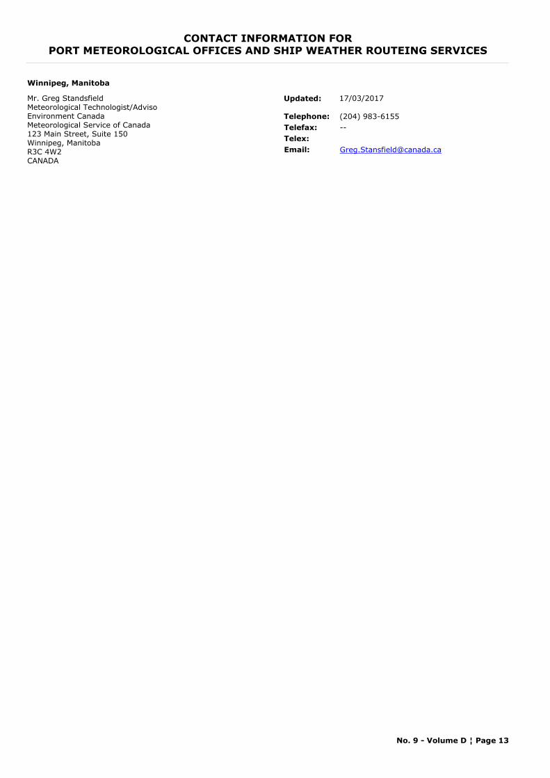
CONTACT INFORMATION FORPORT METEOROLOGICAL OFFICES AND SHIP WEATHER ROUTEING SERVICES
Winnipeg, Manitoba
Mr. Greg StandsfieldMeteorological Technologist/AdvisoEnvironment Canada Meteorological Service of Canada 123 Main Street, Suite 150Winnipeg, ManitobaR3C 4W2CANADA
Telephone: (204) 983-6155Telefax: --Telex:Email: [email protected]
Updated: 17/03/2017
No. 9 - Volume D ¦ Page 13
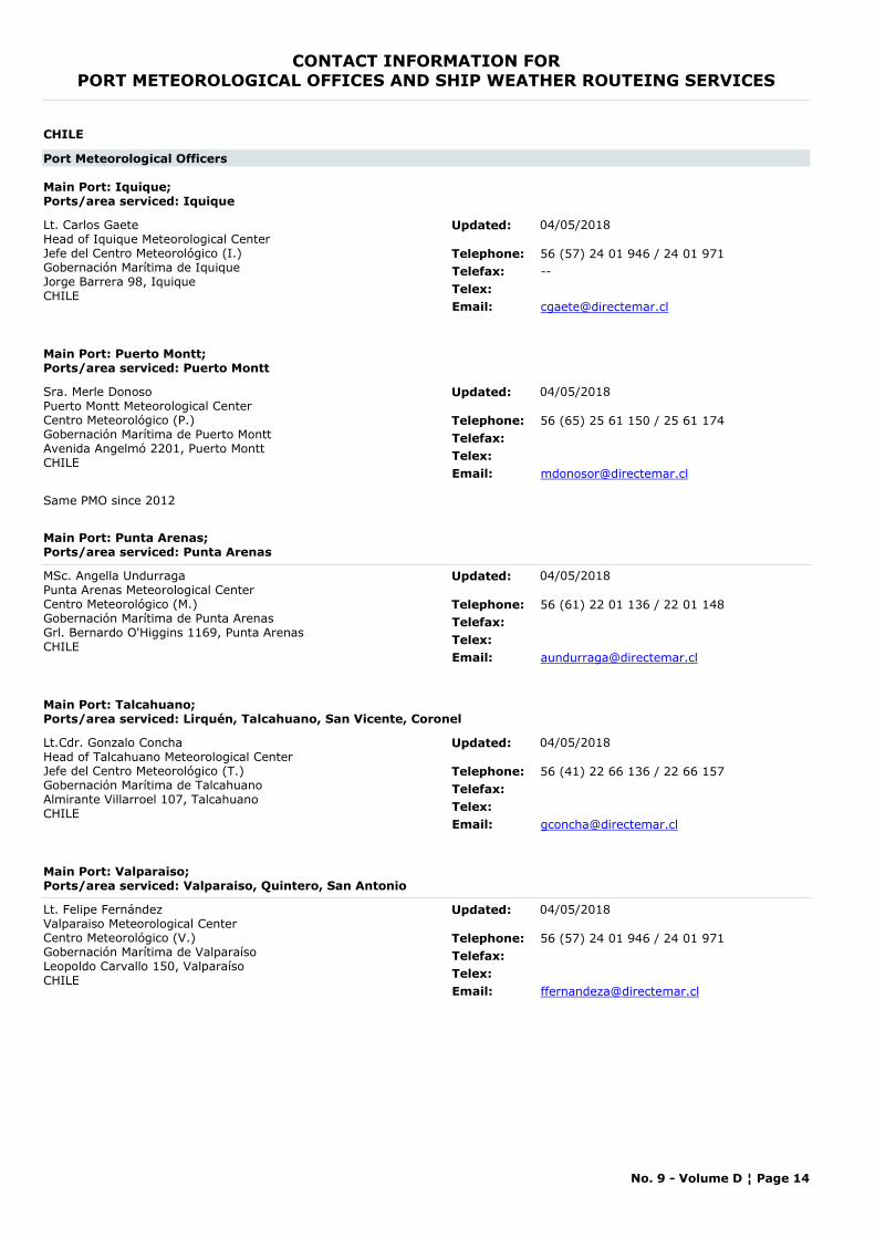
CONTACT INFORMATION FORPORT METEOROLOGICAL OFFICES AND SHIP WEATHER ROUTEING SERVICES
CHILE
Port Meteorological Officers
Main Port: Iquique; Ports/area serviced: Iquique
Lt. Carlos GaeteHead of Iquique Meteorological CenterJefe del Centro Meteorológico (I.)Gobernación Marítima de IquiqueJorge Barrera 98, IquiqueCHILE
Telephone: 56 (57) 24 01 946 / 24 01 971Telefax: --Telex:Email: [email protected]
Updated: 04/05/2018
Main Port: Puerto Montt; Ports/area serviced: Puerto Montt
Sra. Merle DonosoPuerto Montt Meteorological CenterCentro Meteorológico (P.)Gobernación Marítima de Puerto MonttAvenida Angelmó 2201, Puerto MonttCHILE
Telephone: 56 (65) 25 61 150 / 25 61 174Telefax:Telex:Email: [email protected]
Same PMO since 2012
Updated: 04/05/2018
Main Port: Punta Arenas; Ports/area serviced: Punta Arenas
MSc. Angella UndurragaPunta Arenas Meteorological CenterCentro Meteorológico (M.)Gobernación Marítima de Punta ArenasGrl. Bernardo O'Higgins 1169, Punta ArenasCHILE
Telephone: 56 (61) 22 01 136 / 22 01 148Telefax:Telex:Email: [email protected]
Updated: 04/05/2018
Main Port: Talcahuano; Ports/area serviced: Lirquén, Talcahuano, San Vicente, Coronel
Lt.Cdr. Gonzalo ConchaHead of Talcahuano Meteorological CenterJefe del Centro Meteorológico (T.)Gobernación Marítima de TalcahuanoAlmirante Villarroel 107, TalcahuanoCHILE
Telephone: 56 (41) 22 66 136 / 22 66 157Telefax:Telex:Email: [email protected]
Updated: 04/05/2018
Main Port: Valparaiso; Ports/area serviced: Valparaiso, Quintero, San Antonio
Lt. Felipe FernándezValparaiso Meteorological CenterCentro Meteorológico (V.)Gobernación Marítima de ValparaísoLeopoldo Carvallo 150, ValparaísoCHILE
Telephone: 56 (57) 24 01 946 / 24 01 971Telefax:Telex:Email: [email protected]
Updated: 04/05/2018
No. 9 - Volume D ¦ Page 14
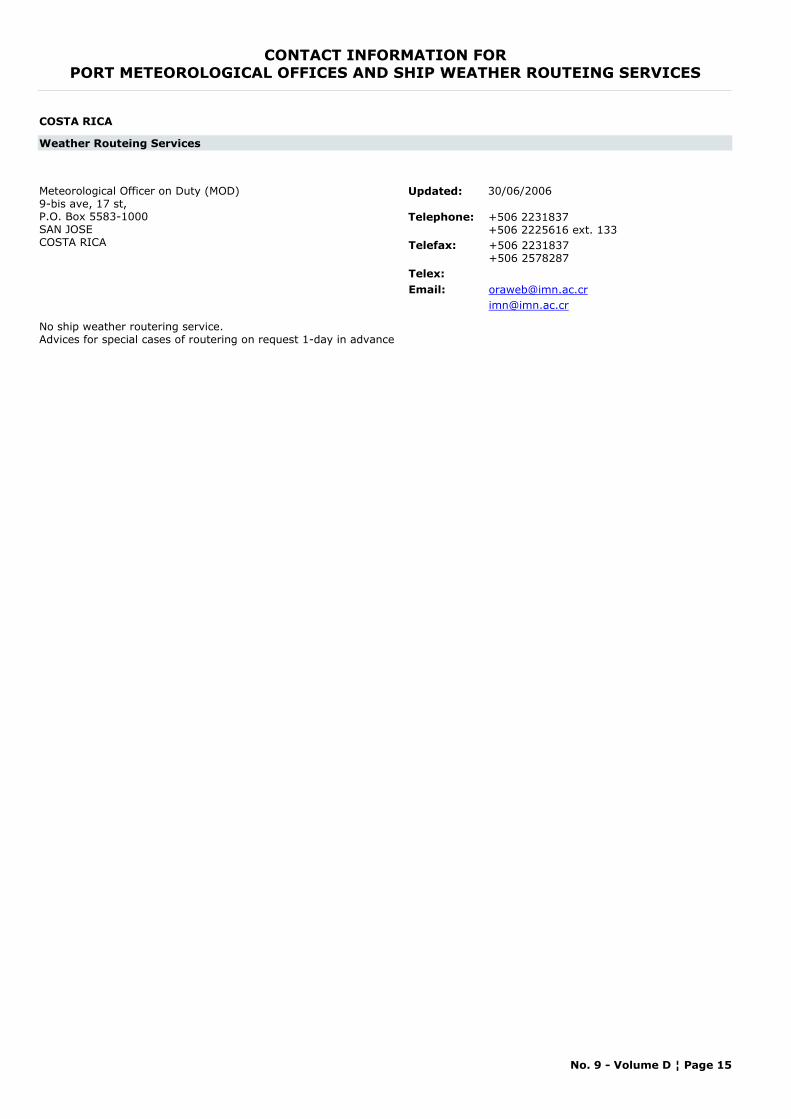
CONTACT INFORMATION FORPORT METEOROLOGICAL OFFICES AND SHIP WEATHER ROUTEING SERVICES
COSTA RICA
Weather Routeing Services
Meteorological Officer on Duty (MOD)9-bis ave, 17 st, P.O. Box 5583-1000SAN JOSECOSTA RICA
Telephone: +506 2231837+506 2225616 ext. 133
Telefax: +506 2231837+506 2578287
Telex:Email: [email protected]
No ship weather routering service. Advices for special cases of routering on request 1-day in advance
Updated: 30/06/2006
No. 9 - Volume D ¦ Page 15
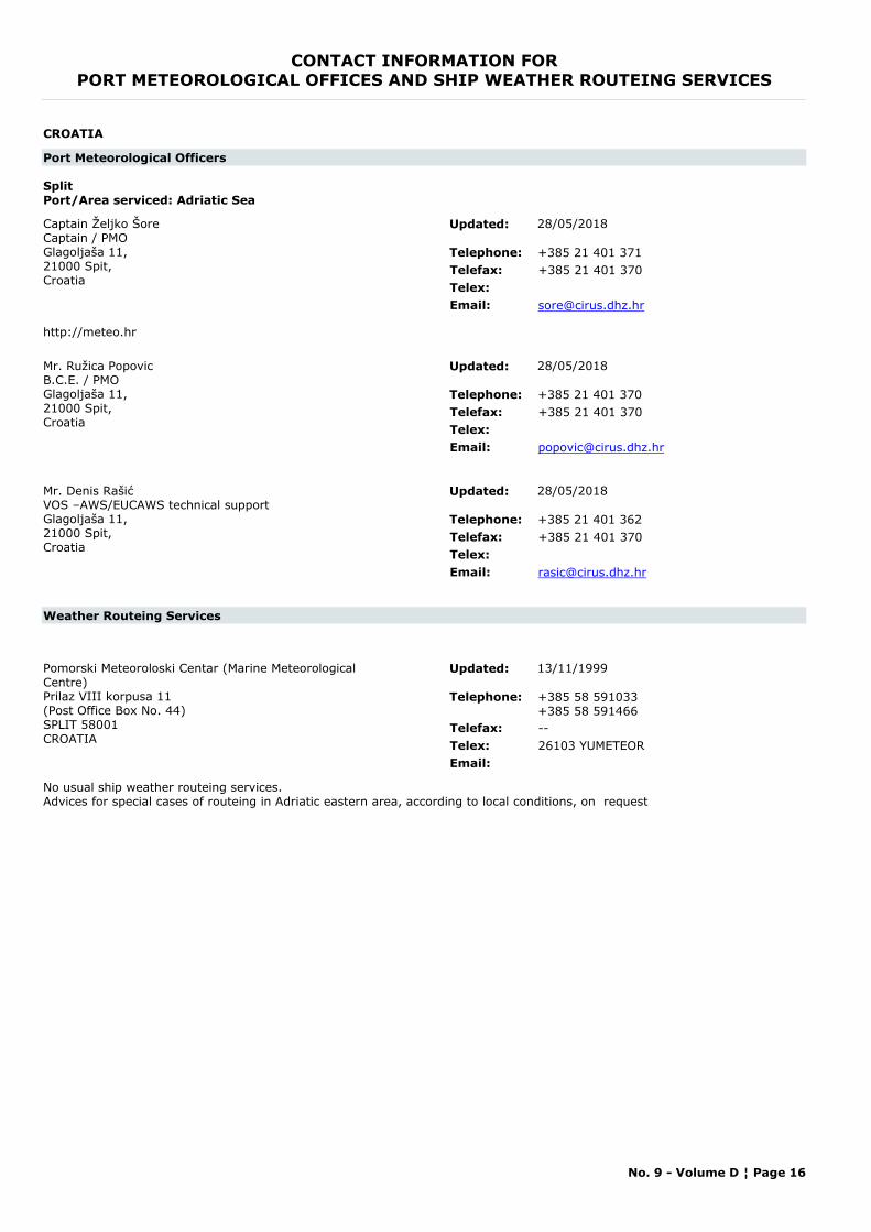
CONTACT INFORMATION FORPORT METEOROLOGICAL OFFICES AND SHIP WEATHER ROUTEING SERVICES
CROATIA
Port Meteorological Officers
SplitPort/Area serviced: Adriatic Sea
Captain Željko ŠoreCaptain / PMOGlagoljaša 11,21000 Spit,Croatia
Telephone: +385 21 401 371Telefax: +385 21 401 370Telex:Email: [email protected]
http://meteo.hr
Updated: 28/05/2018
Mr. Ružica PopovicB.C.E. / PMOGlagoljaša 11,21000 Spit,Croatia
Telephone: +385 21 401 370Telefax: +385 21 401 370Telex:Email: [email protected]
Updated: 28/05/2018
Mr. Denis RašićVOS –AWS/EUCAWS technical supportGlagoljaša 11,21000 Spit,Croatia
Telephone: +385 21 401 362Telefax: +385 21 401 370Telex:Email: [email protected]
Updated: 28/05/2018
Weather Routeing Services
Pomorski Meteoroloski Centar (Marine Meteorological Centre)Prilaz VIII korpusa 11(Post Office Box No. 44)SPLIT 58001CROATIA
Telephone: +385 58 591033+385 58 591466
Telefax: --Telex: 26103 YUMETEOREmail:
No usual ship weather routeing services. Advices for special cases of routeing in Adriatic eastern area, according to local conditions, on request
Updated: 13/11/1999
No. 9 - Volume D ¦ Page 16
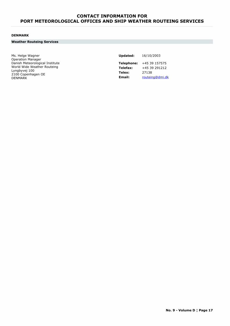
CONTACT INFORMATION FORPORT METEOROLOGICAL OFFICES AND SHIP WEATHER ROUTEING SERVICES
DENMARK
Weather Routeing Services
Ms. Helge WagnerOperation ManagerDanish Meteorological InstituteWorld Wide Weather RouteingLyngbyvej 1002100 Copenhagen OEDENMARK
Telephone: +45 39 157575Telefax: +45 39 291212Telex: 27138Email: [email protected]
Updated: 16/10/2003
No. 9 - Volume D ¦ Page 17
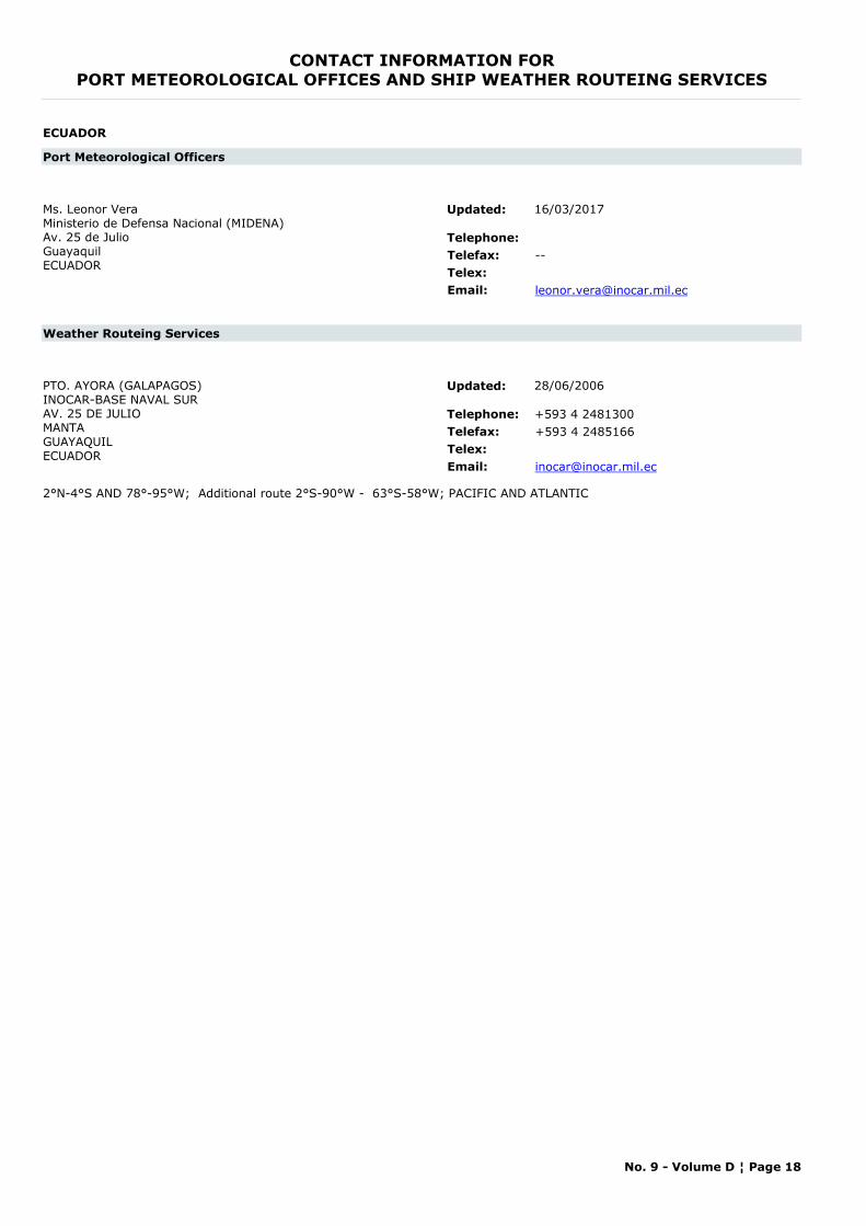
CONTACT INFORMATION FORPORT METEOROLOGICAL OFFICES AND SHIP WEATHER ROUTEING SERVICES
ECUADOR
Port Meteorological Officers
Ms. Leonor Vera Ministerio de Defensa Nacional (MIDENA)Av. 25 de JulioGuayaquil ECUADOR
Telephone:Telefax: --Telex:Email: [email protected]
Updated: 16/03/2017
Weather Routeing Services
PTO. AYORA (GALAPAGOS)INOCAR-BASE NAVAL SURAV. 25 DE JULIOMANTAGUAYAQUILECUADOR
Telephone: +593 4 2481300Telefax: +593 4 2485166Telex:Email: [email protected]
2°N-4°S AND 78°-95°W; Additional route 2°S-90°W - 63°S-58°W; PACIFIC AND ATLANTIC
Updated: 28/06/2006
No. 9 - Volume D ¦ Page 18
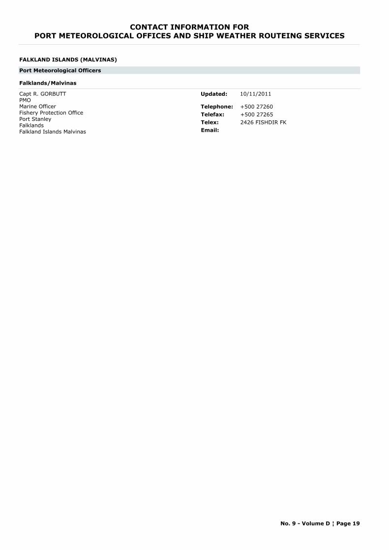
CONTACT INFORMATION FORPORT METEOROLOGICAL OFFICES AND SHIP WEATHER ROUTEING SERVICES
FALKLAND ISLANDS (MALVINAS)
Port Meteorological Officers
Falklands/Malvinas
Capt R. GORBUTTPMOMarine OfficerFishery Protection OfficePort StanleyFalklandsFalkland Islands Malvinas
Telephone: +500 27260Telefax: +500 27265Telex: 2426 FISHDIR FKEmail:
Updated: 10/11/2011
No. 9 - Volume D ¦ Page 19

CONTACT INFORMATION FORPORT METEOROLOGICAL OFFICES AND SHIP WEATHER ROUTEING SERVICES
FINLAND
Port Meteorological Officers
Helsinki
Ms Marja AARNIO-FRISKHead of GroupFinnish Meteorological InstitutePort Meteorological OfficesP.O. Box 503Fl00101 HELSINKIFinland
Telephone: +358 295391000Telefax: +358 295393303Telex:Email: [email protected]
Updated: 29/01/2015
No. 9 - Volume D ¦ Page 20
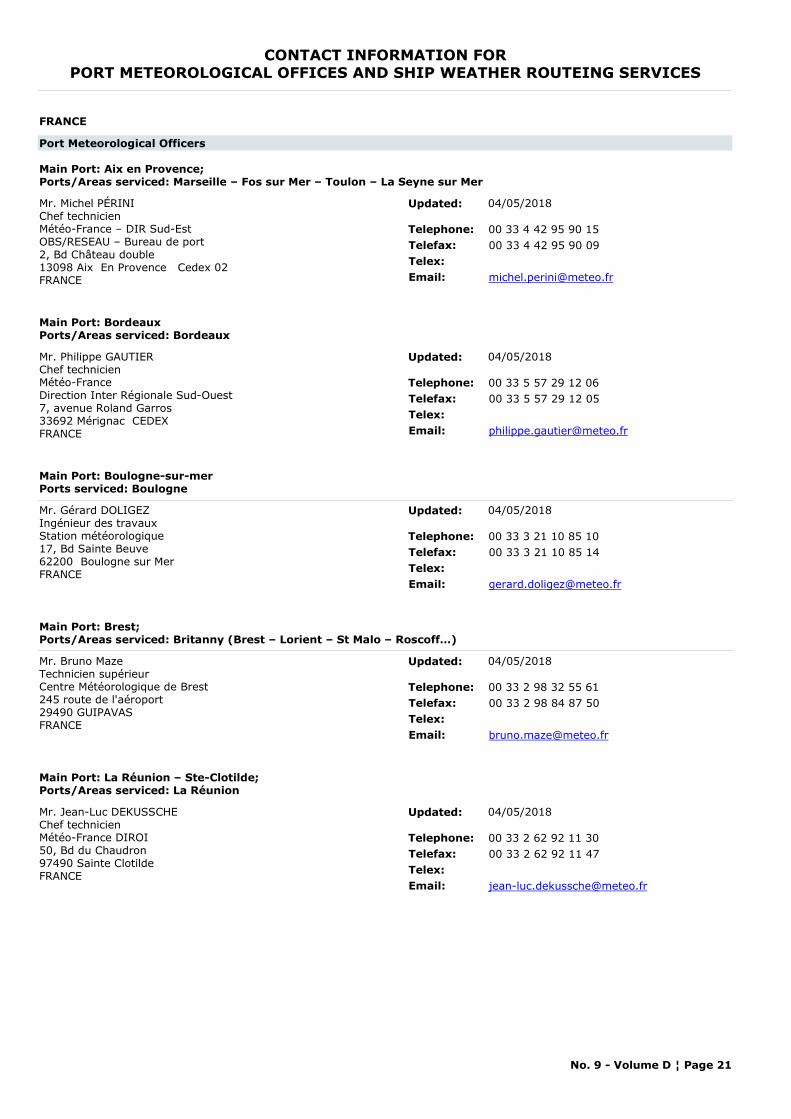
CONTACT INFORMATION FORPORT METEOROLOGICAL OFFICES AND SHIP WEATHER ROUTEING SERVICES
FRANCE
Port Meteorological Officers
Main Port: Aix en Provence; Ports/Areas serviced: Marseille – Fos sur Mer – Toulon – La Seyne sur Mer
Mr. Michel PÉRINIChef technicienMétéo-France – DIR Sud-EstOBS/RESEAU – Bureau de port2, Bd Château double 13098 Aix En Provence Cedex 02FRANCE
Telephone: 00 33 4 42 95 90 15Telefax: 00 33 4 42 95 90 09Telex:Email: [email protected]
Updated: 04/05/2018
Main Port: BordeauxPorts/Areas serviced: Bordeaux
Mr. Philippe GAUTIERChef technicienMétéo-France Direction Inter Régionale Sud-Ouest7, avenue Roland Garros33692 Mérignac CEDEXFRANCE
Telephone: 00 33 5 57 29 12 06Telefax: 00 33 5 57 29 12 05Telex:Email: [email protected]
Updated: 04/05/2018
Main Port: Boulogne-sur-merPorts serviced: Boulogne
Mr. Gérard DOLIGEZ Ingénieur des travauxStation météorologique 17, Bd Sainte Beuve 62200 Boulogne sur Mer FRANCE
Telephone: 00 33 3 21 10 85 10Telefax: 00 33 3 21 10 85 14Telex:Email: [email protected]
Updated: 04/05/2018
Main Port: Brest;Ports/Areas serviced: Britanny (Brest – Lorient – St Malo – Roscoff…)
Mr. Bruno MazeTechnicien supérieurCentre Météorologique de Brest245 route de l'aéroport29490 GUIPAVASFRANCE
Telephone: 00 33 2 98 32 55 61Telefax: 00 33 2 98 84 87 50Telex:Email: [email protected]
Updated: 04/05/2018
Main Port: La Réunion – Ste-Clotilde; Ports/Areas serviced: La Réunion
Mr. Jean-Luc DEKUSSCHEChef technicienMétéo-France DIROI50, Bd du Chaudron 97490 Sainte Clotilde FRANCE
Telephone: 00 33 2 62 92 11 30Telefax: 00 33 2 62 92 11 47Telex:Email: [email protected]
Updated: 04/05/2018
No. 9 - Volume D ¦ Page 21
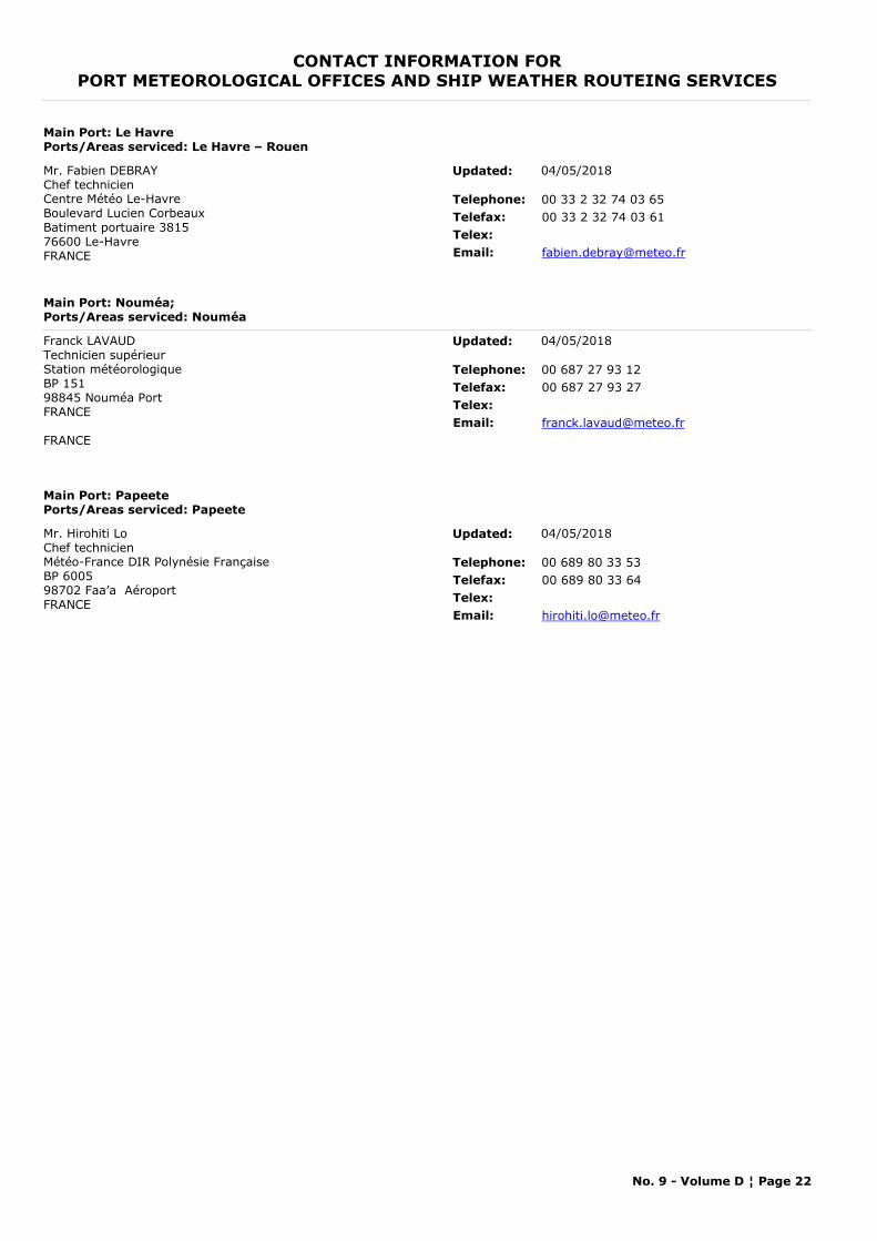
CONTACT INFORMATION FORPORT METEOROLOGICAL OFFICES AND SHIP WEATHER ROUTEING SERVICES
Main Port: Le HavrePorts/Areas serviced: Le Havre – Rouen
Mr. Fabien DEBRAYChef technicienCentre Météo Le-HavreBoulevard Lucien CorbeauxBatiment portuaire 381576600 Le-HavreFRANCE
Telephone: 00 33 2 32 74 03 65Telefax: 00 33 2 32 74 03 61Telex:Email: [email protected]
Updated: 04/05/2018
Main Port: Nouméa; Ports/Areas serviced: Nouméa
Franck LAVAUDTechnicien supérieurStation météorologique BP 151 98845 Nouméa PortFRANCE
FRANCE
Telephone: 00 687 27 93 12Telefax: 00 687 27 93 27Telex:Email: [email protected]
Updated: 04/05/2018
Main Port: PapeetePorts/Areas serviced: Papeete
Mr. Hirohiti LoChef technicienMétéo-France DIR Polynésie FrançaiseBP 6005 98702 Faa’a AéroportFRANCE
Telephone: 00 689 80 33 53Telefax: 00 689 80 33 64Telex:Email: [email protected]
Updated: 04/05/2018
No. 9 - Volume D ¦ Page 22
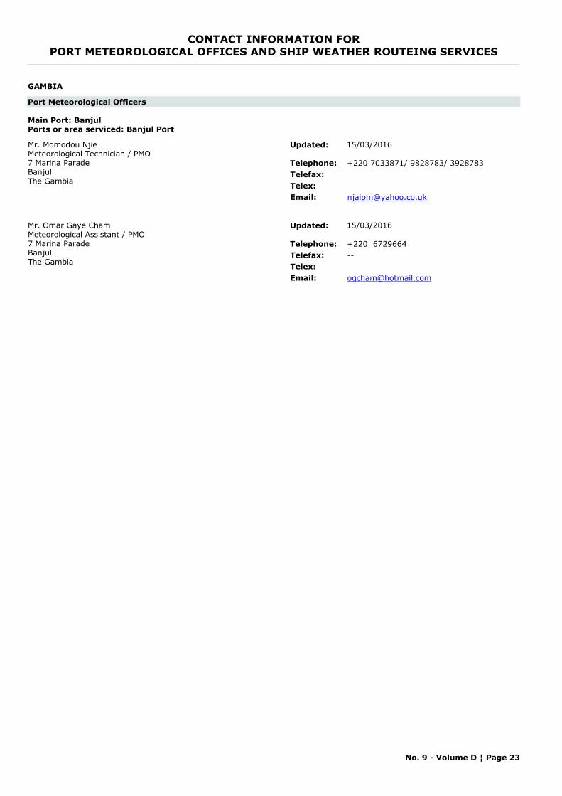
CONTACT INFORMATION FORPORT METEOROLOGICAL OFFICES AND SHIP WEATHER ROUTEING SERVICES
GAMBIA
Port Meteorological Officers
Main Port: BanjulPorts or area serviced: Banjul Port
Mr. Momodou NjieMeteorological Technician / PMO7 Marina ParadeBanjulThe Gambia
Telephone: +220 7033871/ 9828783/ 3928783Telefax:Telex:Email: [email protected]
Updated: 15/03/2016
Mr. Omar Gaye ChamMeteorological Assistant / PMO7 Marina ParadeBanjulThe Gambia
Telephone: +220 6729664Telefax: --Telex:Email: [email protected]
Updated: 15/03/2016
No. 9 - Volume D ¦ Page 23
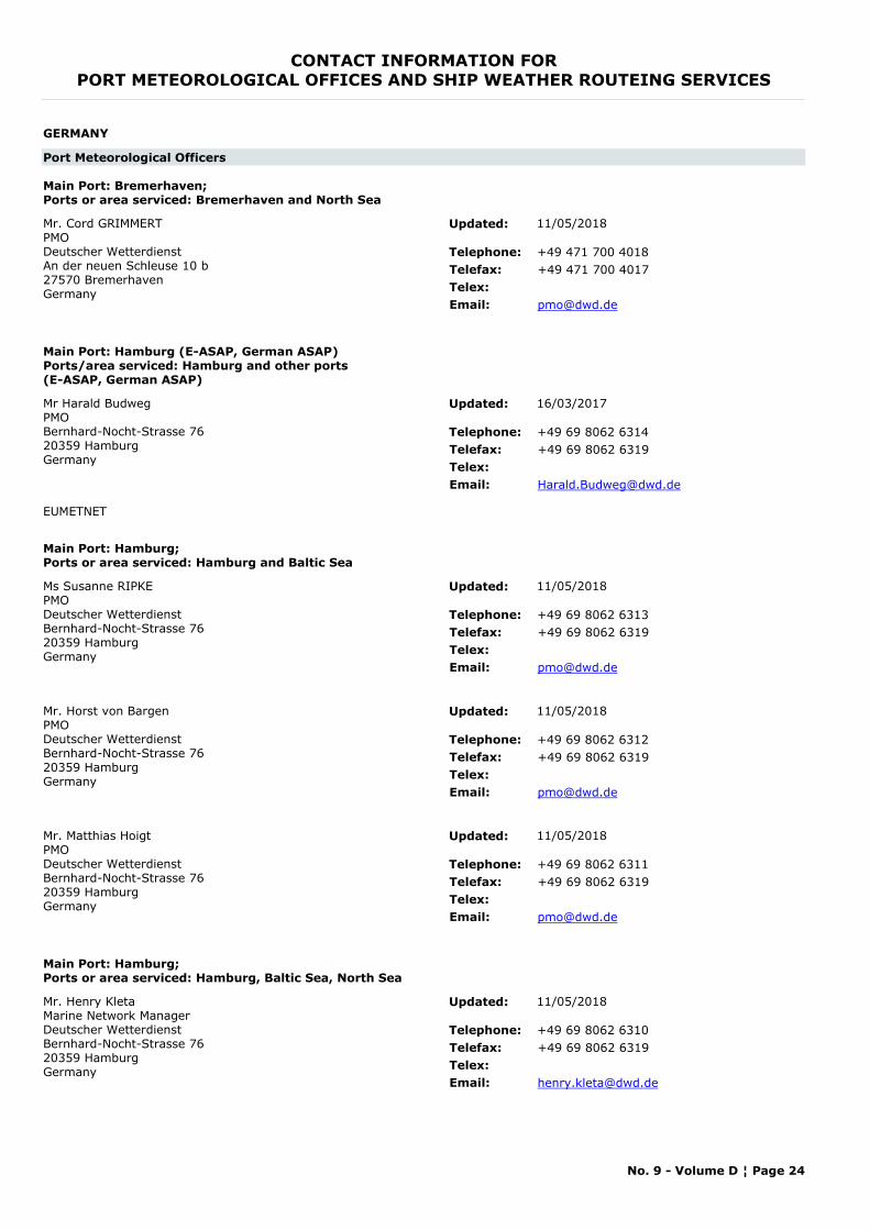
CONTACT INFORMATION FORPORT METEOROLOGICAL OFFICES AND SHIP WEATHER ROUTEING SERVICES
GERMANY
Port Meteorological Officers
Main Port: Bremerhaven; Ports or area serviced: Bremerhaven and North Sea
Mr. Cord GRIMMERTPMODeutscher Wetterdienst An der neuen Schleuse 10 b 27570 Bremerhaven Germany
Telephone: +49 471 700 4018Telefax: +49 471 700 4017Telex:Email: [email protected]
Updated: 11/05/2018
Main Port: Hamburg (E-ASAP, German ASAP)Ports/area serviced: Hamburg and other ports (E-ASAP, German ASAP)
Mr Harald BudwegPMOBernhard-Nocht-Strasse 7620359 HamburgGermany
Telephone: +49 69 8062 6314Telefax: +49 69 8062 6319Telex:Email: [email protected]
EUMETNET
Updated: 16/03/2017
Main Port: Hamburg; Ports or area serviced: Hamburg and Baltic Sea
Ms Susanne RIPKEPMODeutscher Wetterdienst Bernhard-Nocht-Strasse 76 20359 Hamburg Germany
Telephone: +49 69 8062 6313Telefax: +49 69 8062 6319Telex:Email: [email protected]
Updated: 11/05/2018
Mr. Horst von BargenPMODeutscher Wetterdienst Bernhard-Nocht-Strasse 76 20359 Hamburg Germany
Telephone: +49 69 8062 6312Telefax: +49 69 8062 6319Telex:Email: [email protected]
Updated: 11/05/2018
Mr. Matthias HoigtPMODeutscher Wetterdienst Bernhard-Nocht-Strasse 76 20359 Hamburg Germany
Telephone: +49 69 8062 6311Telefax: +49 69 8062 6319Telex:Email: [email protected]
Updated: 11/05/2018
Main Port: Hamburg; Ports or area serviced: Hamburg, Baltic Sea, North Sea
Mr. Henry KletaMarine Network ManagerDeutscher Wetterdienst Bernhard-Nocht-Strasse 76 20359 Hamburg Germany
Telephone: +49 69 8062 6310Telefax: +49 69 8062 6319Telex:Email: [email protected]
Updated: 11/05/2018
No. 9 - Volume D ¦ Page 24
CONTACT INFORMATION FORPORT METEOROLOGICAL OFFICES AND SHIP WEATHER ROUTEING SERVICES
Weather Routeing Services
Deutscher WetterdienstBernhard-Nocht-Straße 76Postfach 30 11 90HAMBURG 20304GERMANY
Telephone: +4940 66901811Telefax: +49 40 6690 1947Telex: 211 291 hadw dEmail: [email protected]
The German Weather Service in Hamburg offers ship weather routeing for all oceans.
Updated: 28/06/2006
No. 9 - Volume D ¦ Page 25
CONTACT INFORMATION FORPORT METEOROLOGICAL OFFICES AND SHIP WEATHER ROUTEING SERVICES
GHANA
Weather Routeing Services
Principal Meteorological OfficerGhana Meteorological Services DepartmentP.O. Box 87LegonGHANA
Telephone: +233 2276381Telefax: --Telex: DIRMETEOEmail:
No ship weather routeing services
Updated: 13/11/1999
No. 9 - Volume D ¦ Page 26
CONTACT INFORMATION FORPORT METEOROLOGICAL OFFICES AND SHIP WEATHER ROUTEING SERVICES
GIBRALTAR
Port Meteorological Officers
Gibraltar
PMO GIBRALTARMeteorological OfficeRAF Gibraltar, BFPO 52Gibraltar
Telephone: +350 53419Telefax: +350 53474Telex:Email:
Updated: 10/11/2011
No. 9 - Volume D ¦ Page 27
CONTACT INFORMATION FORPORT METEOROLOGICAL OFFICES AND SHIP WEATHER ROUTEING SERVICES
GREECE
Port Meteorological Officers
Main Port: Piraeus; Area serviced: All ports within radius 60km from Piraeus
Mr Michael MYRSILIDISHead of Marine Section / PMO SupervisorEl.Venizelou 14, Hellinikon16777 ATHENSGreece
Telephone: +30 2109699013Telefax: +30 2109628952Telex:Email: [email protected]
www.hnms.gr or www.emy.gr
Updated: 11/05/2018
Ms Dionysia KOTTAMarine Section Officer / PMOEl.Venizelou 14, Hellinikon16777 ATHENSGreece
Telephone: +30 2109699113Telefax: +30 2109628952Telex:Email: [email protected]
Updated: 11/05/2018
No. 9 - Volume D ¦ Page 28

CONTACT INFORMATION FORPORT METEOROLOGICAL OFFICES AND SHIP WEATHER ROUTEING SERVICES
GUADELOUPE, ST. MARTIN, ST. BARTHELEMY
Port Meteorological Officers
Main Port: Guadeloupe – Pointe à PitrePorts/Areas serviced: Pointe à Pitre
Mr. Antoine MOUNAYARChef technicienMétéo-France Service Régional Météorologique de la GuadeloupeAéroport du Raizet - BP 45197183 Les Abymes Cedex
Telephone: 00 33 590 89 60 86Telefax: 00 33 590 89 60 75Telex:Email: [email protected]
Updated: 04/05/2018
No. 9 - Volume D ¦ Page 29
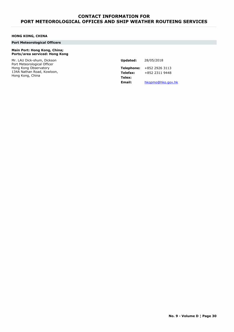
CONTACT INFORMATION FORPORT METEOROLOGICAL OFFICES AND SHIP WEATHER ROUTEING SERVICES
HONG KONG, CHINA
Port Meteorological Officers
Main Port: Hong Kong, China;Ports/area serviced: Hong Kong
Mr. LAU Dick-shum, DicksonPort Meteorological OfficerHong Kong Observatory 134A Nathan Road, Kowloon, Hong Kong, China
Telephone: +852 2926 3113Telefax: +852 2311 9448Telex:Email: [email protected]
Updated: 28/05/2018
No. 9 - Volume D ¦ Page 30
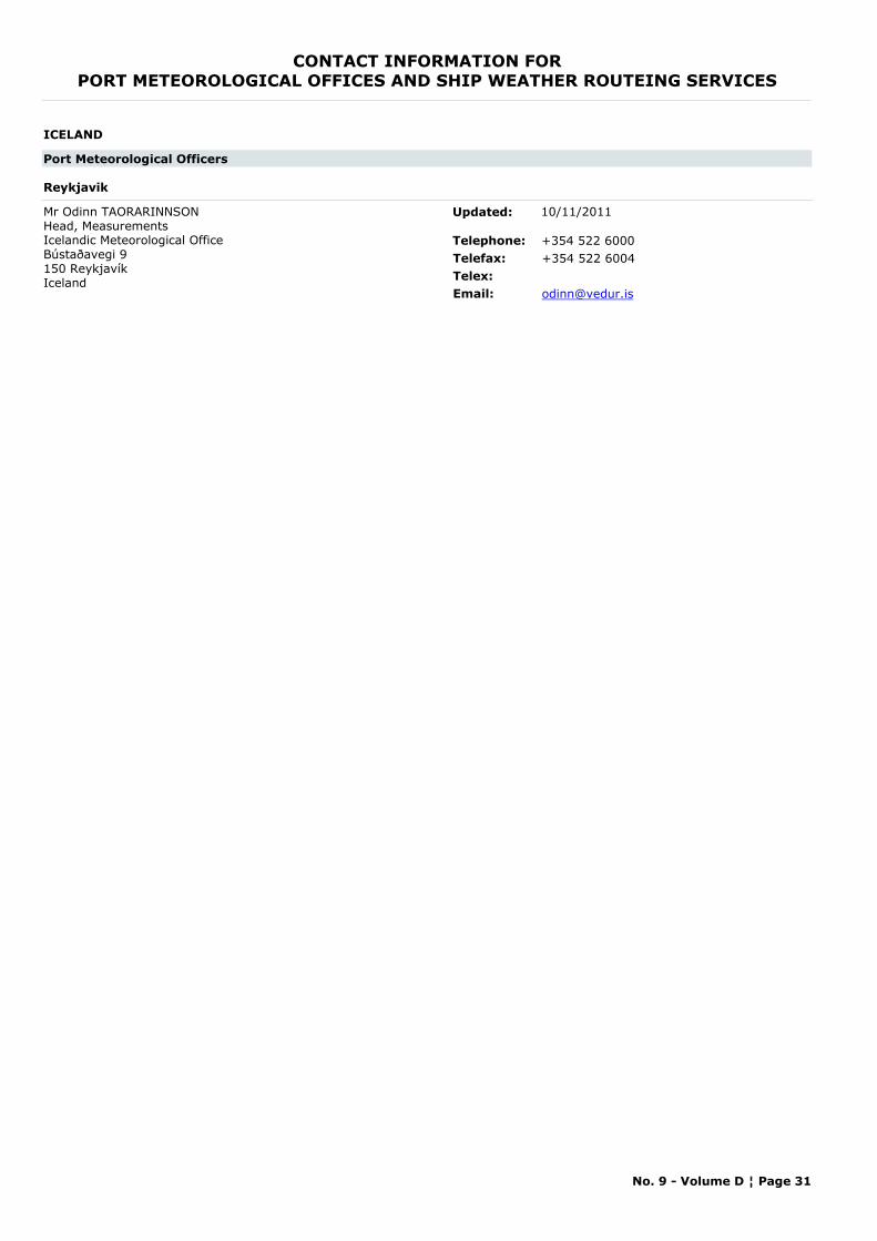
CONTACT INFORMATION FORPORT METEOROLOGICAL OFFICES AND SHIP WEATHER ROUTEING SERVICES
ICELAND
Port Meteorological Officers
Reykjavik
Mr Odinn TAORARINNSONHead, MeasurementsIcelandic Meteorological OfficeBústaðavegi 9150 ReykjavíkIceland
Telephone: +354 522 6000Telefax: +354 522 6004Telex:Email: [email protected]
Updated: 10/11/2011
No. 9 - Volume D ¦ Page 31
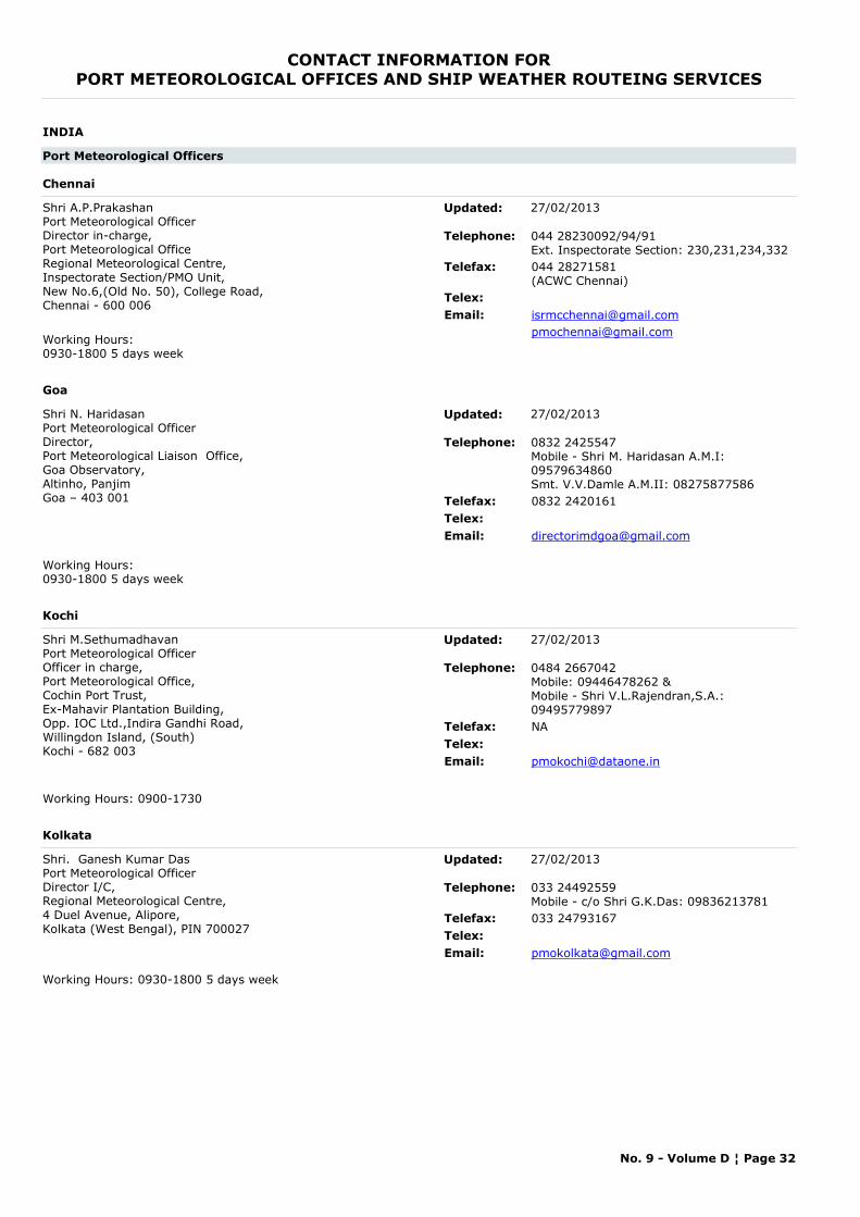
CONTACT INFORMATION FORPORT METEOROLOGICAL OFFICES AND SHIP WEATHER ROUTEING SERVICES
INDIA
Port Meteorological Officers
Chennai
Shri A.P.PrakashanPort Meteorological OfficerDirector in-charge,Port Meteorological OfficeRegional Meteorological Centre,Inspectorate Section/PMO Unit,New No.6,(Old No. 50), College Road,Chennai - 600 006
Telephone: 044 28230092/94/91Ext. Inspectorate Section: 230,231,234,332
Telefax: 044 28271581(ACWC Chennai)
Telex:Email: [email protected]
[email protected] Hours:0930-1800 5 days week
Updated: 27/02/2013
Goa
Shri N. HaridasanPort Meteorological OfficerDirector,Port Meteorological Liaison Office,Goa Observatory,Altinho, PanjimGoa – 403 001
Telephone: 0832 2425547Mobile - Shri M. Haridasan A.M.I: 09579634860Smt. V.V.Damle A.M.II: 08275877586
Telefax: 0832 2420161Telex:Email: [email protected]
Working Hours: 0930-1800 5 days week
Updated: 27/02/2013
Kochi
Shri M.SethumadhavanPort Meteorological OfficerOfficer in charge,Port Meteorological Office,Cochin Port Trust,Ex-Mahavir Plantation Building,Opp. IOC Ltd.,Indira Gandhi Road,Willingdon Island, (South)Kochi - 682 003
Telephone: 0484 2667042Mobile: 09446478262 &Mobile - Shri V.L.Rajendran,S.A.: 09495779897
Telefax: NATelex:Email: [email protected]
Working Hours: 0900-1730
Updated: 27/02/2013
Kolkata
Shri. Ganesh Kumar DasPort Meteorological OfficerDirector I/C,Regional Meteorological Centre,4 Duel Avenue, Alipore,Kolkata (West Bengal), PIN 700027
Telephone: 033 24492559Mobile - c/o Shri G.K.Das: 09836213781
Telefax: 033 24793167Telex:Email: [email protected]
Working Hours: 0930-1800 5 days week
Updated: 27/02/2013
No. 9 - Volume D ¦ Page 32
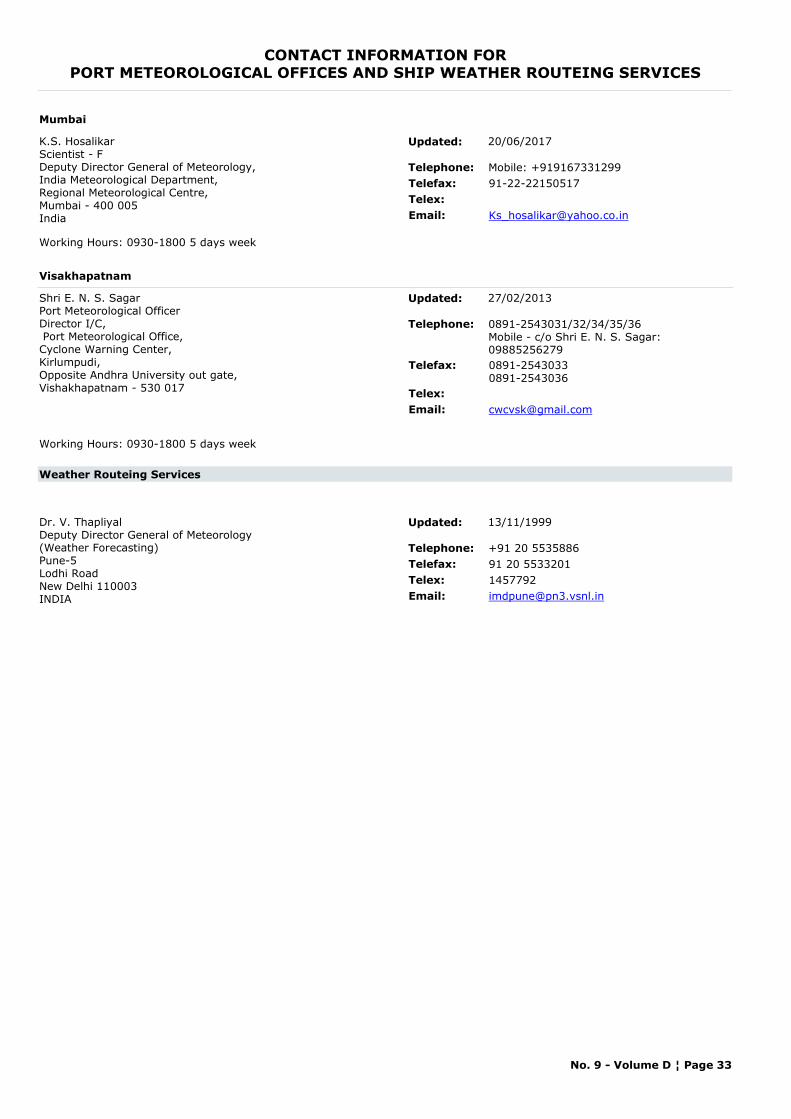
CONTACT INFORMATION FORPORT METEOROLOGICAL OFFICES AND SHIP WEATHER ROUTEING SERVICES
Mumbai
K.S. HosalikarScientist - FDeputy Director General of Meteorology,India Meteorological Department, Regional Meteorological Centre,Mumbai - 400 005India
Telephone: Mobile: +919167331299Telefax: 91-22-22150517Telex:Email: [email protected]
Working Hours: 0930-1800 5 days week
Updated: 20/06/2017
Visakhapatnam
Shri E. N. S. SagarPort Meteorological OfficerDirector I/C, Port Meteorological Office,Cyclone Warning Center,Kirlumpudi,Opposite Andhra University out gate,Vishakhapatnam - 530 017
Telephone: 0891-2543031/32/34/35/36 Mobile - c/o Shri E. N. S. Sagar: 09885256279
Telefax: 0891-25430330891-2543036
Telex:Email: [email protected]
Working Hours: 0930-1800 5 days week
Updated: 27/02/2013
Weather Routeing Services
Dr. V. ThapliyalDeputy Director General of Meteorology(Weather Forecasting)Pune-5Lodhi RoadNew Delhi 110003INDIA
Telephone: +91 20 5535886Telefax: 91 20 5533201Telex: 1457792Email: [email protected]
Updated: 13/11/1999
No. 9 - Volume D ¦ Page 33
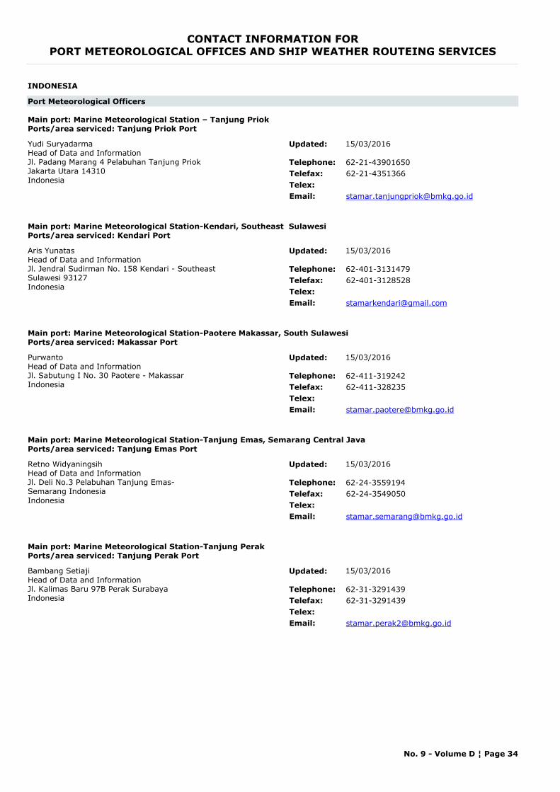
CONTACT INFORMATION FORPORT METEOROLOGICAL OFFICES AND SHIP WEATHER ROUTEING SERVICES
INDONESIA
Port Meteorological Officers
Main port: Marine Meteorological Station – Tanjung PriokPorts/area serviced: Tanjung Priok Port
Yudi SuryadarmaHead of Data and InformationJl. Padang Marang 4 Pelabuhan Tanjung Priok Jakarta Utara 14310Indonesia
Telephone: 62-21-43901650Telefax: 62-21-4351366Telex:Email: [email protected]
Updated: 15/03/2016
Main port: Marine Meteorological Station-Kendari, Southeast SulawesiPorts/area serviced: Kendari Port
Aris YunatasHead of Data and Information Jl. Jendral Sudirman No. 158 Kendari - Southeast Sulawesi 93127Indonesia
Telephone: 62-401-3131479Telefax: 62-401-3128528Telex:Email: [email protected]
Updated: 15/03/2016
Main port: Marine Meteorological Station-Paotere Makassar, South SulawesiPorts/area serviced: Makassar Port
PurwantoHead of Data and Information Jl. Sabutung I No. 30 Paotere - MakassarIndonesia
Telephone: 62-411-319242Telefax: 62-411-328235Telex:Email: [email protected]
Updated: 15/03/2016
Main port: Marine Meteorological Station-Tanjung Emas, Semarang Central JavaPorts/area serviced: Tanjung Emas Port
Retno WidyaningsihHead of Data and InformationJl. Deli No.3 Pelabuhan Tanjung Emas- Semarang IndonesiaIndonesia
Telephone: 62-24-3559194Telefax: 62-24-3549050Telex:Email: [email protected]
Updated: 15/03/2016
Main port: Marine Meteorological Station-Tanjung PerakPorts/area serviced: Tanjung Perak Port
Bambang SetiajiHead of Data and InformationJl. Kalimas Baru 97B Perak SurabayaIndonesia
Telephone: 62-31-3291439Telefax: 62-31-3291439Telex:Email: [email protected]
Updated: 15/03/2016
No. 9 - Volume D ¦ Page 34
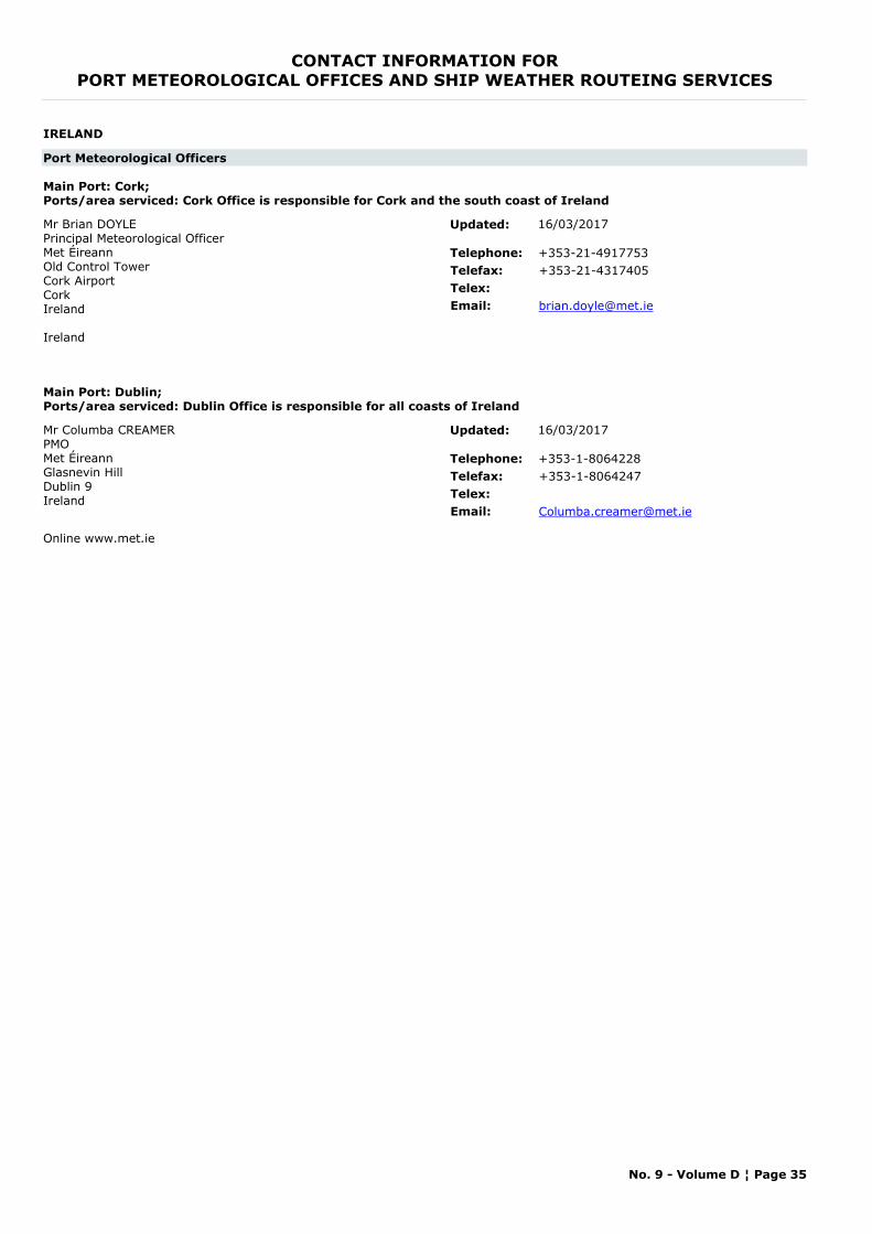
CONTACT INFORMATION FORPORT METEOROLOGICAL OFFICES AND SHIP WEATHER ROUTEING SERVICES
IRELAND
Port Meteorological Officers
Main Port: Cork;Ports/area serviced: Cork Office is responsible for Cork and the south coast of Ireland
Mr Brian DOYLEPrincipal Meteorological Officer Met Éireann Old Control Tower Cork Airport Cork Ireland
Ireland
Telephone: +353-21-4917753Telefax: +353-21-4317405Telex:Email: [email protected]
Updated: 16/03/2017
Main Port: Dublin;Ports/area serviced: Dublin Office is responsible for all coasts of Ireland
Mr Columba CREAMERPMOMet Éireann Glasnevin Hill Dublin 9 Ireland
Telephone: +353-1-8064228Telefax: +353-1-8064247Telex:Email: [email protected]
Online www.met.ie
Updated: 16/03/2017
No. 9 - Volume D ¦ Page 35

CONTACT INFORMATION FORPORT METEOROLOGICAL OFFICES AND SHIP WEATHER ROUTEING SERVICES
ISRAEL
Port Meteorological Officers
Main Port: Haifa, Ashdod
Ms Lilach LEVPort Meteorological OfficerIsrael Meteorological ServiceP.O. Box 25Bet Dagan 5025001Israel
Telephone: +972-3-9403117Telefax: +972-3-9604065Telex:Email: [email protected]
www.ims.gov.il
Updated: 16/03/2017
No. 9 - Volume D ¦ Page 36
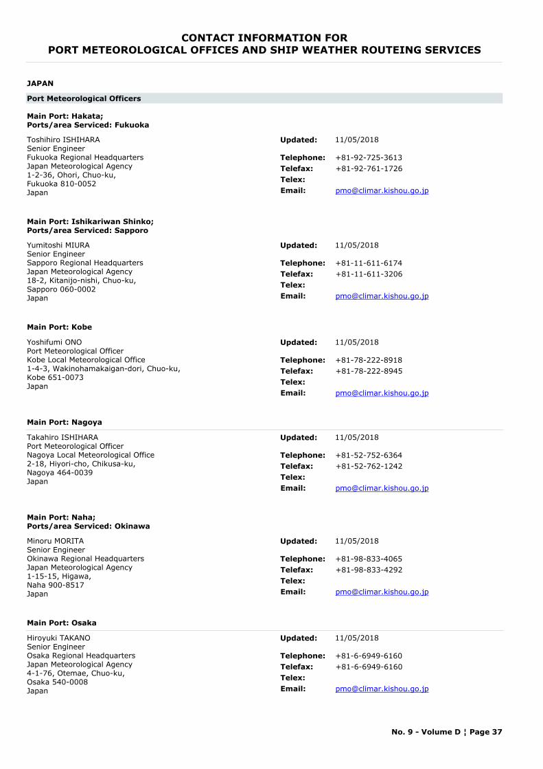
CONTACT INFORMATION FORPORT METEOROLOGICAL OFFICES AND SHIP WEATHER ROUTEING SERVICES
JAPAN
Port Meteorological Officers
Main Port: Hakata;Ports/area Serviced: Fukuoka
Toshihiro ISHIHARASenior EngineerFukuoka Regional HeadquartersJapan Meteorological Agency1-2-36, Ohori, Chuo-ku,Fukuoka 810-0052 Japan
Telephone: +81-92-725-3613Telefax: +81-92-761-1726Telex:Email: [email protected]
Updated: 11/05/2018
Main Port: Ishikariwan Shinko;Ports/area Serviced: Sapporo
Yumitoshi MIURASenior EngineerSapporo Regional HeadquartersJapan Meteorological Agency18-2, Kitanijo-nishi, Chuo-ku,Sapporo 060-0002 Japan
Telephone: +81-11-611-6174Telefax: +81-11-611-3206Telex:Email: [email protected]
Updated: 11/05/2018
Main Port: Kobe
Yoshifumi ONOPort Meteorological OfficerKobe Local Meteorological Office1-4-3, Wakinohamakaigan-dori, Chuo-ku,Kobe 651-0073 Japan
Telephone: +81-78-222-8918Telefax: +81-78-222-8945Telex:Email: [email protected]
Updated: 11/05/2018
Main Port: Nagoya
Takahiro ISHIHARAPort Meteorological OfficerNagoya Local Meteorological Office2-18, Hiyori-cho, Chikusa-ku,Nagoya 464-0039 Japan
Telephone: +81-52-752-6364Telefax: +81-52-762-1242Telex:Email: [email protected]
Updated: 11/05/2018
Main Port: Naha;Ports/area Serviced: Okinawa
Minoru MORITASenior EngineerOkinawa Regional HeadquartersJapan Meteorological Agency1-15-15, Higawa,Naha 900-8517 Japan
Telephone: +81-98-833-4065Telefax: +81-98-833-4292Telex:Email: [email protected]
Updated: 11/05/2018
Main Port: Osaka
Hiroyuki TAKANOSenior EngineerOsaka Regional HeadquartersJapan Meteorological Agency4-1-76, Otemae, Chuo-ku,Osaka 540-0008Japan
Telephone: +81-6-6949-6160Telefax: +81-6-6949-6160Telex:Email: [email protected]
Updated: 11/05/2018
No. 9 - Volume D ¦ Page 37
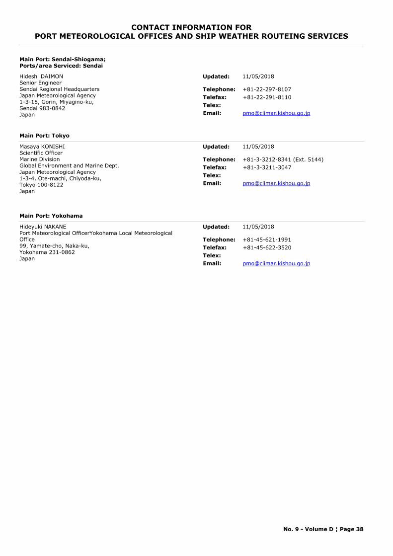
CONTACT INFORMATION FORPORT METEOROLOGICAL OFFICES AND SHIP WEATHER ROUTEING SERVICES
Main Port: Sendai-Shiogama;Ports/area Serviced: Sendai
Hideshi DAIMONSenior EngineerSendai Regional HeadquartersJapan Meteorological Agency1-3-15, Gorin, Miyagino-ku,Sendai 983-0842 Japan
Telephone: +81-22-297-8107Telefax: +81-22-291-8110Telex:Email: [email protected]
Updated: 11/05/2018
Main Port: Tokyo
Masaya KONISHIScientific OfficerMarine DivisionGlobal Environment and Marine Dept.Japan Meteorological Agency1-3-4, Ote-machi, Chiyoda-ku,Tokyo 100-8122 Japan
Telephone: +81-3-3212-8341 (Ext. 5144)Telefax: +81-3-3211-3047Telex:Email: [email protected]
Updated: 11/05/2018
Main Port: Yokohama
Hideyuki NAKANEPort Meteorological OfficerYokohama Local Meteorological Office99, Yamate-cho, Naka-ku,Yokohama 231-0862 Japan
Telephone: +81-45-621-1991Telefax: +81-45-622-3520Telex:Email: [email protected]
Updated: 11/05/2018
No. 9 - Volume D ¦ Page 38
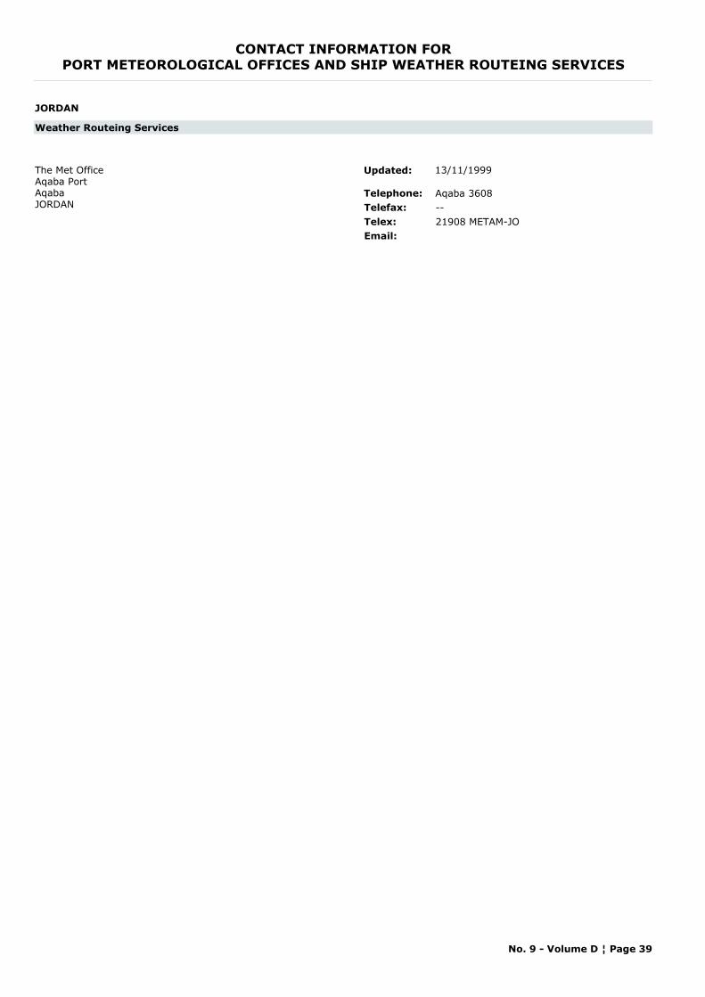
CONTACT INFORMATION FORPORT METEOROLOGICAL OFFICES AND SHIP WEATHER ROUTEING SERVICES
JORDAN
Weather Routeing Services
The Met OfficeAqaba PortAqabaJORDAN
Telephone: Aqaba 3608Telefax: --Telex: 21908 METAM-JOEmail:
Updated: 13/11/1999
No. 9 - Volume D ¦ Page 39

CONTACT INFORMATION FORPORT METEOROLOGICAL OFFICES AND SHIP WEATHER ROUTEING SERVICES
KENYA
Port Meteorological Officers
Main Port: Mombasa
Mr. Joseph Odhiambo AmolloPort MeteorologistKilindini Harbor, Kenya Meteorological ServicesMombasaKENYA
Telephone: +254 721 390 697Telefax: --Telex:Email: [email protected]
Updated: 16/03/2017
No. 9 - Volume D ¦ Page 40
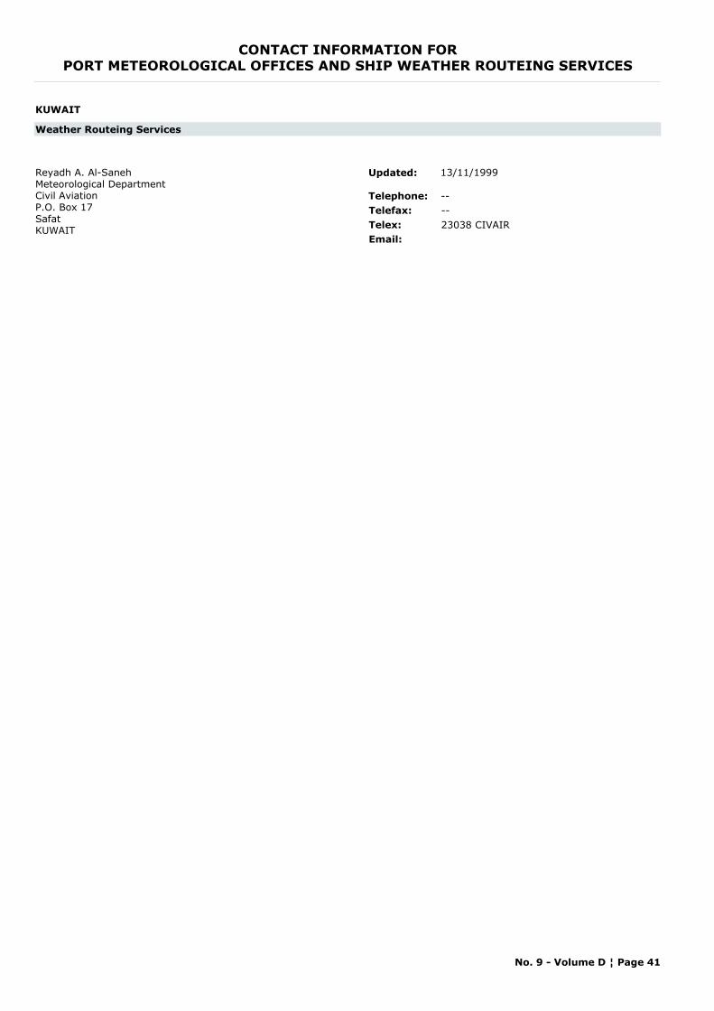
CONTACT INFORMATION FORPORT METEOROLOGICAL OFFICES AND SHIP WEATHER ROUTEING SERVICES
KUWAIT
Weather Routeing Services
Reyadh A. Al-SanehMeteorological DepartmentCivil AviationP.O. Box 17SafatKUWAIT
Telephone: --Telefax: --Telex: 23038 CIVAIREmail:
Updated: 13/11/1999
No. 9 - Volume D ¦ Page 41
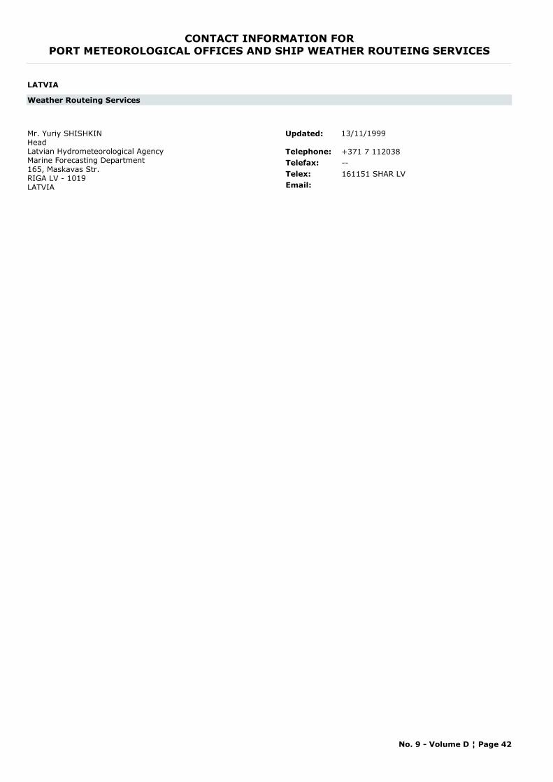
CONTACT INFORMATION FORPORT METEOROLOGICAL OFFICES AND SHIP WEATHER ROUTEING SERVICES
LATVIA
Weather Routeing Services
Mr. Yuriy SHISHKINHeadLatvian Hydrometeorological AgencyMarine Forecasting Department165, Maskavas Str.RIGA LV - 1019LATVIA
Telephone: +371 7 112038Telefax: --Telex: 161151 SHAR LVEmail:
Updated: 13/11/1999
No. 9 - Volume D ¦ Page 42
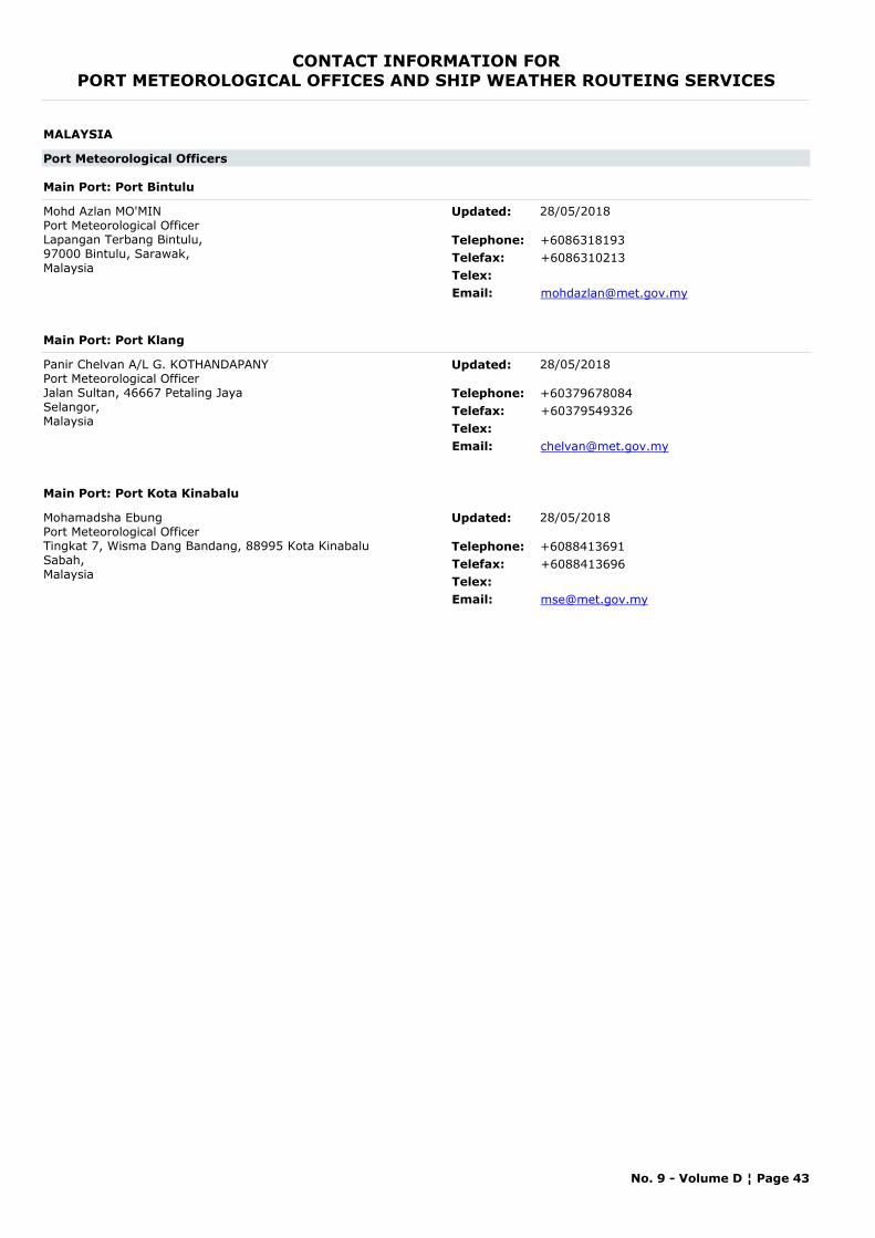
CONTACT INFORMATION FORPORT METEOROLOGICAL OFFICES AND SHIP WEATHER ROUTEING SERVICES
MALAYSIA
Port Meteorological Officers
Main Port: Port Bintulu
Mohd Azlan MO'MINPort Meteorological OfficerLapangan Terbang Bintulu, 97000 Bintulu, Sarawak,Malaysia
Telephone: +6086318193Telefax: +6086310213Telex:Email: [email protected]
Updated: 28/05/2018
Main Port: Port Klang
Panir Chelvan A/L G. KOTHANDAPANYPort Meteorological OfficerJalan Sultan, 46667 Petaling JayaSelangor, Malaysia
Telephone: +60379678084Telefax: +60379549326Telex:Email: [email protected]
Updated: 28/05/2018
Main Port: Port Kota Kinabalu
Mohamadsha EbungPort Meteorological OfficerTingkat 7, Wisma Dang Bandang, 88995 Kota Kinabalu Sabah, Malaysia
Telephone: +6088413691Telefax: +6088413696Telex:Email: [email protected]
Updated: 28/05/2018
No. 9 - Volume D ¦ Page 43
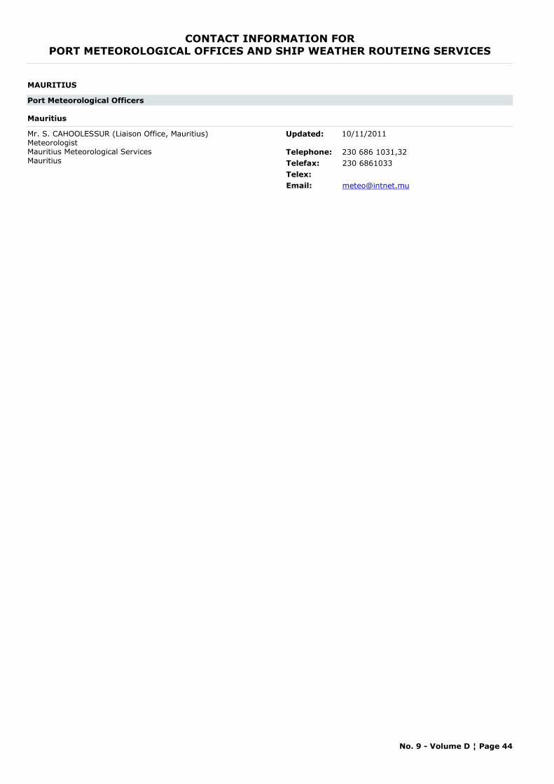
CONTACT INFORMATION FORPORT METEOROLOGICAL OFFICES AND SHIP WEATHER ROUTEING SERVICES
MAURITIUS
Port Meteorological Officers
Mauritius
Mr. S. CAHOOLESSUR (Liaison Office, Mauritius) MeteorologistMauritius Meteorological Services Mauritius
Telephone: 230 686 1031,32Telefax: 230 6861033Telex:Email: [email protected]
Updated: 10/11/2011
No. 9 - Volume D ¦ Page 44
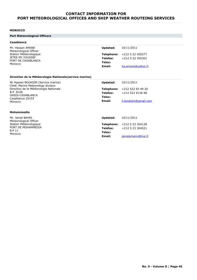
CONTACT INFORMATION FORPORT METEOROLOGICAL OFFICES AND SHIP WEATHER ROUTEING SERVICES
MOROCCO
Port Meteorological Officers
Casablanca
Mr. Hassan AMANE Meteorological OfficerStation MétéorologiqueJETEE MY.YOUSSEFPORT DE CASABLANCAMorocco
Telephone: +212 5 22 450277Telefax: +212 5 22 450301Telex:Email: [email protected]
Updated: 10/11/2011
Direction de la Météorologie Nationale(service marine)
Mr Hassan BOUKSIM (Service marine) Chief, Marine Meteorology divisionDirection de la Météorologie Nationale B.P. 8106 OASIS-CASABLANCACasablanca 20103Morocco
Telephone: +212 522 65 49 20Telefax: +212 522 9136 98Telex:Email: [email protected]
Updated: 10/11/2011
Mohammedia
Mr. Jamal BAHRI Meteorological OfficerStation Météorologique PORT DE MOHAMMEDIA B.P 11Morocco
Telephone: +212 5 23 304128Telefax: +212 5 23 304521Telex:Email: [email protected]
Updated: 10/11/2011
No. 9 - Volume D ¦ Page 45
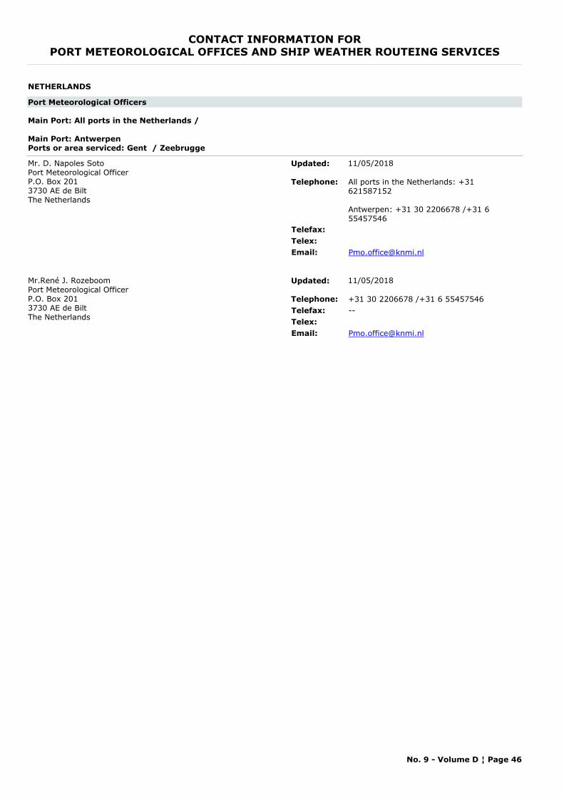
CONTACT INFORMATION FORPORT METEOROLOGICAL OFFICES AND SHIP WEATHER ROUTEING SERVICES
NETHERLANDS
Port Meteorological Officers
Main Port: All ports in the Netherlands /
Main Port: AntwerpenPorts or area serviced: Gent / Zeebrugge
Mr. D. Napoles SotoPort Meteorological OfficerP.O. Box 2013730 AE de BiltThe Netherlands
Telephone: All ports in the Netherlands: +31 621587152
Antwerpen: +31 30 2206678 /+31 6 55457546
Telefax:Telex:Email: [email protected]
Updated: 11/05/2018
Mr.René J. RozeboomPort Meteorological OfficerP.O. Box 2013730 AE de BiltThe Netherlands
Telephone: +31 30 2206678 /+31 6 55457546Telefax: --Telex:Email: [email protected]
Updated: 11/05/2018
No. 9 - Volume D ¦ Page 46
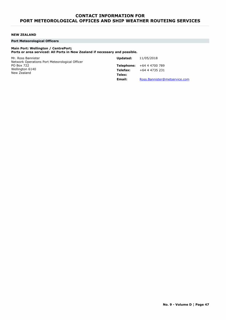
CONTACT INFORMATION FORPORT METEOROLOGICAL OFFICES AND SHIP WEATHER ROUTEING SERVICES
NEW ZEALAND
Port Meteorological Officers
Main Port: Wellington / CentrePort; Ports or area serviced: All Ports in New Zealand if necessary and possible.
Mr. Ross BannisterNetwork Operations Port Meteorological OfficerPO Box 722Wellington 6140New Zealand
Telephone: +64 4 4700 789Telefax: +64 4 4735 231Telex:Email: [email protected]
Updated: 11/05/2018
No. 9 - Volume D ¦ Page 47
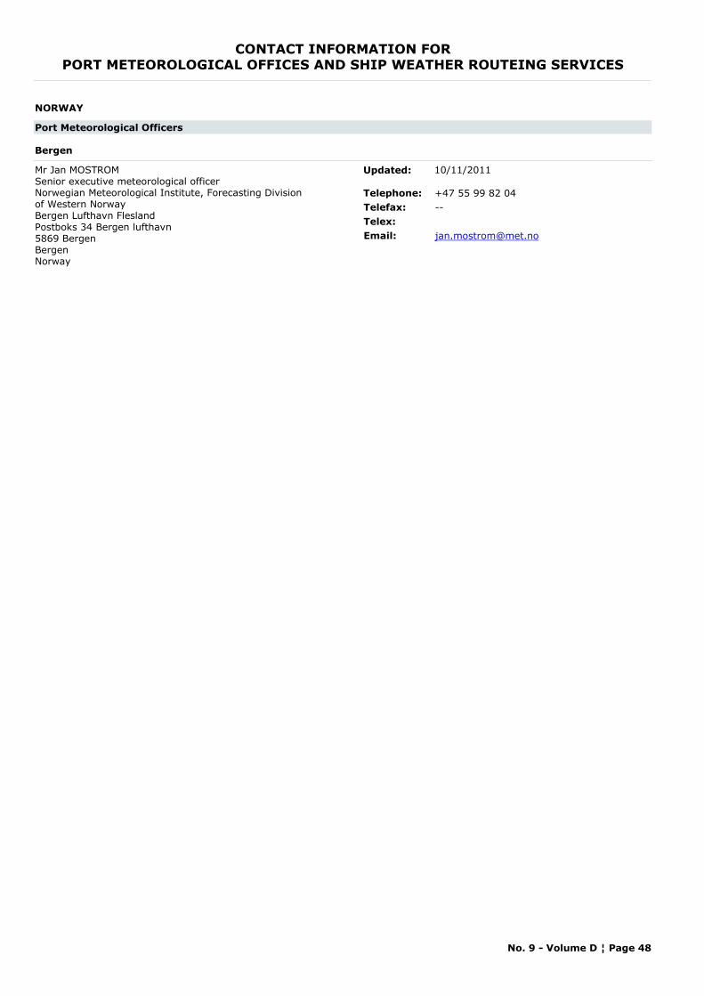
CONTACT INFORMATION FORPORT METEOROLOGICAL OFFICES AND SHIP WEATHER ROUTEING SERVICES
NORWAY
Port Meteorological Officers
Bergen
Mr Jan MOSTROM Senior executive meteorological officerNorwegian Meteorological Institute, Forecasting Division of Western NorwayBergen Lufthavn FleslandPostboks 34 Bergen lufthavn5869 BergenBergenNorway
Telephone: +47 55 99 82 04Telefax: --Telex:Email: [email protected]
Updated: 10/11/2011
No. 9 - Volume D ¦ Page 48
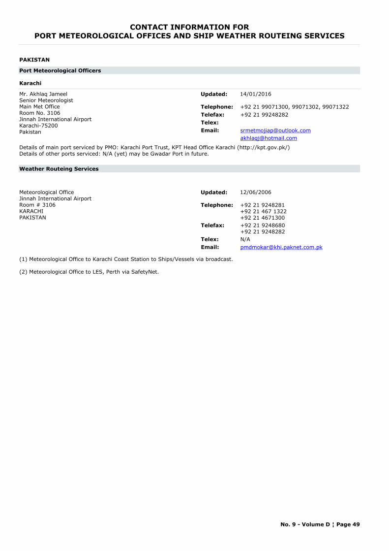
CONTACT INFORMATION FORPORT METEOROLOGICAL OFFICES AND SHIP WEATHER ROUTEING SERVICES
PAKISTAN
Port Meteorological Officers
Karachi
Mr. Akhlaq JameelSenior MeteorologistMain Met OfficeRoom No. 3106Jinnah International AirportKarachi-75200Pakistan
Telephone: +92 21 99071300, 99071302, 99071322Telefax: +92 21 99248282Telex:Email: [email protected]
Details of main port serviced by PMO: Karachi Port Trust, KPT Head Office Karachi (http://kpt.gov.pk/)Details of other ports serviced: N/A (yet) may be Gwadar Port in future.
Updated: 14/01/2016
Weather Routeing Services
Meteorological OfficeJinnah International AirportRoom # 3106KARACHIPAKISTAN
Telephone: +92 21 9248281+92 21 467 1322+92 21 4671300
Telefax: +92 21 9248680+92 21 9248282
Telex: N/AEmail: [email protected]
(1) Meteorological Office to Karachi Coast Station to Ships/Vessels via broadcast.
(2) Meteorological Office to LES, Perth via SafetyNet.
Updated: 12/06/2006
No. 9 - Volume D ¦ Page 49
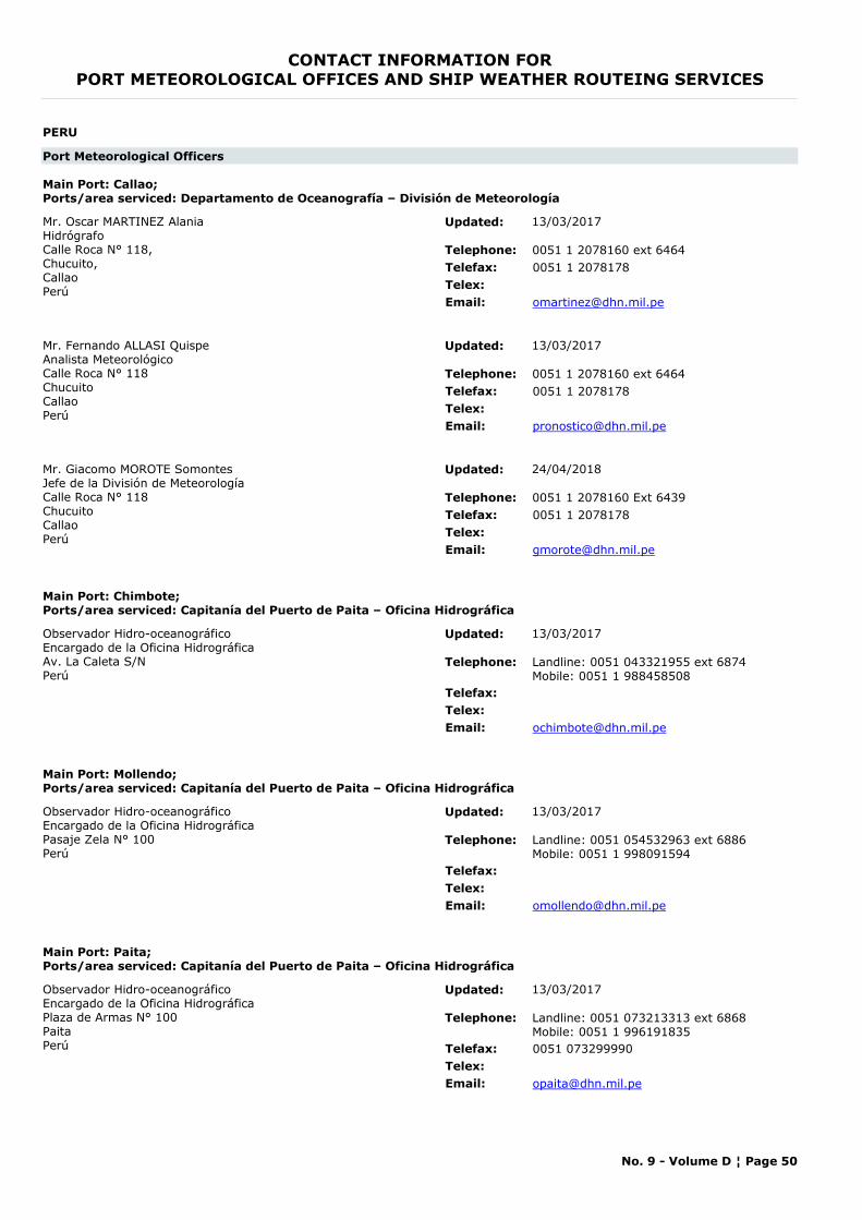
CONTACT INFORMATION FORPORT METEOROLOGICAL OFFICES AND SHIP WEATHER ROUTEING SERVICES
PERU
Port Meteorological Officers
Main Port: Callao;Ports/area serviced: Departamento de Oceanografía – División de Meteorología
Mr. Oscar MARTINEZ AlaniaHidrógrafoCalle Roca N° 118, Chucuito,CallaoPerú
Telephone: 0051 1 2078160 ext 6464Telefax: 0051 1 2078178Telex:Email: [email protected]
Updated: 13/03/2017
Mr. Fernando ALLASI QuispeAnalista MeteorológicoCalle Roca N° 118ChucuitoCallaoPerú
Telephone: 0051 1 2078160 ext 6464Telefax: 0051 1 2078178Telex:Email: [email protected]
Updated: 13/03/2017
Mr. Giacomo MOROTE SomontesJefe de la División de MeteorologíaCalle Roca N° 118ChucuitoCallaoPerú
Telephone: 0051 1 2078160 Ext 6439Telefax: 0051 1 2078178Telex:Email: [email protected]
Updated: 24/04/2018
Main Port: Chimbote;Ports/area serviced: Capitanía del Puerto de Paita – Oficina Hidrográfica
Observador Hidro-oceanográfico Encargado de la Oficina HidrográficaAv. La Caleta S/NPerú
Telephone: Landline: 0051 043321955 ext 6874Mobile: 0051 1 988458508
Telefax:Telex:Email: [email protected]
Updated: 13/03/2017
Main Port: Mollendo;Ports/area serviced: Capitanía del Puerto de Paita – Oficina Hidrográfica
Observador Hidro-oceanográfico Encargado de la Oficina HidrográficaPasaje Zela N° 100Perú
Telephone: Landline: 0051 054532963 ext 6886Mobile: 0051 1 998091594
Telefax:Telex:Email: [email protected]
Updated: 13/03/2017
Main Port: Paita;Ports/area serviced: Capitanía del Puerto de Paita – Oficina Hidrográfica
Observador Hidro-oceanográfico Encargado de la Oficina HidrográficaPlaza de Armas N° 100 PaitaPerú
Telephone: Landline: 0051 073213313 ext 6868Mobile: 0051 1 996191835
Telefax: 0051 073299990Telex:Email: [email protected]
Updated: 13/03/2017
No. 9 - Volume D ¦ Page 50
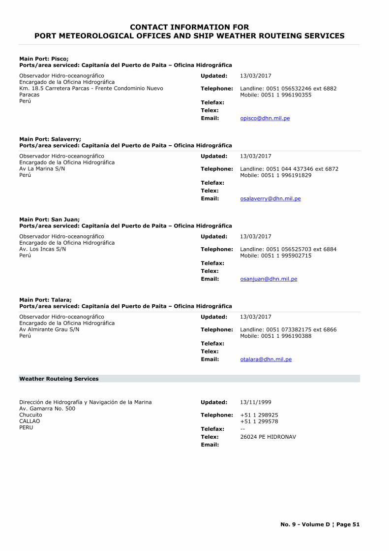
CONTACT INFORMATION FORPORT METEOROLOGICAL OFFICES AND SHIP WEATHER ROUTEING SERVICES
Main Port: Pisco;Ports/area serviced: Capitanía del Puerto de Paita – Oficina Hidrográfica
Observador Hidro-oceanográficoEncargado de la Oficina HidrográficaKm. 18.5 Carretera Parcas - Frente Condominio Nuevo ParacasPerú
Telephone: Landline: 0051 056532246 ext 6882Mobile: 0051 1 996190355
Telefax:Telex:Email: [email protected]
Updated: 13/03/2017
Main Port: Salaverry;Ports/area serviced: Capitanía del Puerto de Paita – Oficina Hidrográfica
Observador Hidro-oceanográfico Encargado de la Oficina HidrográficaAv La Marina S/NPerú
Telephone: Landline: 0051 044 437346 ext 6872Mobile: 0051 1 996191829
Telefax:Telex:Email: [email protected]
Updated: 13/03/2017
Main Port: San Juan;Ports/area serviced: Capitanía del Puerto de Paita – Oficina Hidrográfica
Observador Hidro-oceanográfico Encargado de la Oficina HidrográficaAv. Los Incas S/NPerú
Telephone: Landline: 0051 056525703 ext 6884Mobile: 0051 1 995902715
Telefax:Telex:Email: [email protected]
Updated: 13/03/2017
Main Port: Talara;Ports/area serviced: Capitanía del Puerto de Paita – Oficina Hidrográfica
Observador Hidro-oceanográfico Encargado de la Oficina HidrográficaAv Almirante Grau S/NPerú
Telephone: Landline: 0051 073382175 ext 6866Mobile: 0051 1 996190388
Telefax:Telex:Email: [email protected]
Updated: 13/03/2017
Weather Routeing Services
Dirección de Hidrografía y Navigación de la MarinaAv. Gamarra No. 500ChucuitoCALLAOPERU
Telephone: +51 1 298925+51 1 299578
Telefax: --Telex: 26024 PE HIDRONAVEmail:
Updated: 13/11/1999
No. 9 - Volume D ¦ Page 51
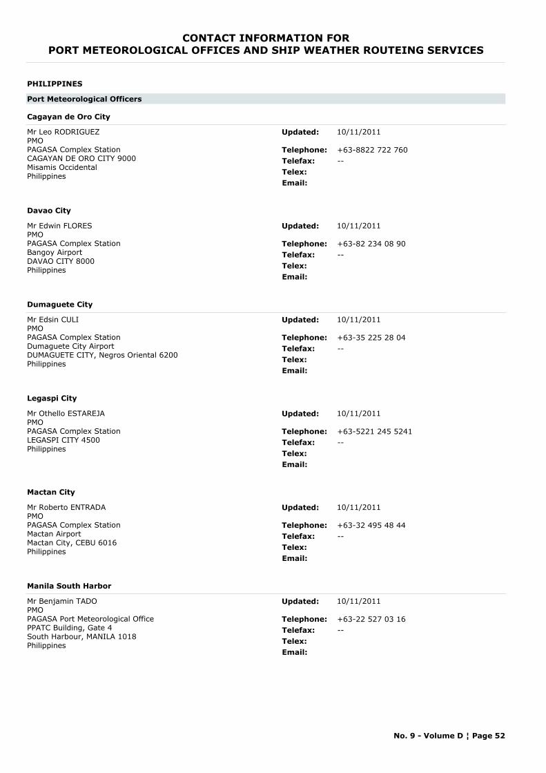
CONTACT INFORMATION FORPORT METEOROLOGICAL OFFICES AND SHIP WEATHER ROUTEING SERVICES
PHILIPPINES
Port Meteorological Officers
Cagayan de Oro City
Mr Leo RODRIGUEZPMOPAGASA Complex StationCAGAYAN DE ORO CITY 9000Misamis OccidentalPhilippines
Telephone: +63-8822 722 760Telefax: --Telex:Email:
Updated: 10/11/2011
Davao City
Mr Edwin FLORESPMOPAGASA Complex StationBangoy AirportDAVAO CITY 8000Philippines
Telephone: +63-82 234 08 90Telefax: --Telex:Email:
Updated: 10/11/2011
Dumaguete City
Mr Edsin CULIPMOPAGASA Complex StationDumaguete City AirportDUMAGUETE CITY, Negros Oriental 6200Philippines
Telephone: +63-35 225 28 04Telefax: --Telex:Email:
Updated: 10/11/2011
Legaspi City
Mr Othello ESTAREJAPMOPAGASA Complex StationLEGASPI CITY 4500Philippines
Telephone: +63-5221 245 5241Telefax: --Telex:Email:
Updated: 10/11/2011
Mactan City
Mr Roberto ENTRADAPMOPAGASA Complex StationMactan AirportMactan City, CEBU 6016Philippines
Telephone: +63-32 495 48 44Telefax: --Telex:Email:
Updated: 10/11/2011
Manila South Harbor
Mr Benjamin TADO PMOPAGASA Port Meteorological OfficePPATC Building, Gate 4South Harbour, MANILA 1018Philippines
Telephone: +63-22 527 03 16Telefax: --Telex:Email:
Updated: 10/11/2011
No. 9 - Volume D ¦ Page 52
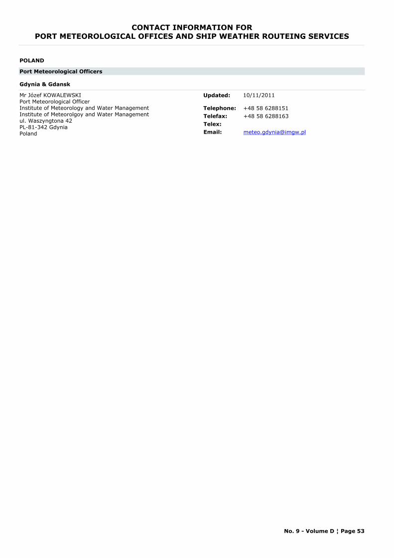
CONTACT INFORMATION FORPORT METEOROLOGICAL OFFICES AND SHIP WEATHER ROUTEING SERVICES
POLAND
Port Meteorological Officers
Gdynia & Gdansk
Mr Józef KOWALEWSKI Port Meteorological OfficerInstitute of Meteorology and Water Management Institute of Meteorolgoy and Water Managementul. Waszyngtona 42PL-81-342 GdyniaPoland
Telephone: +48 58 6288151Telefax: +48 58 6288163Telex:Email: [email protected]
Updated: 10/11/2011
No. 9 - Volume D ¦ Page 53
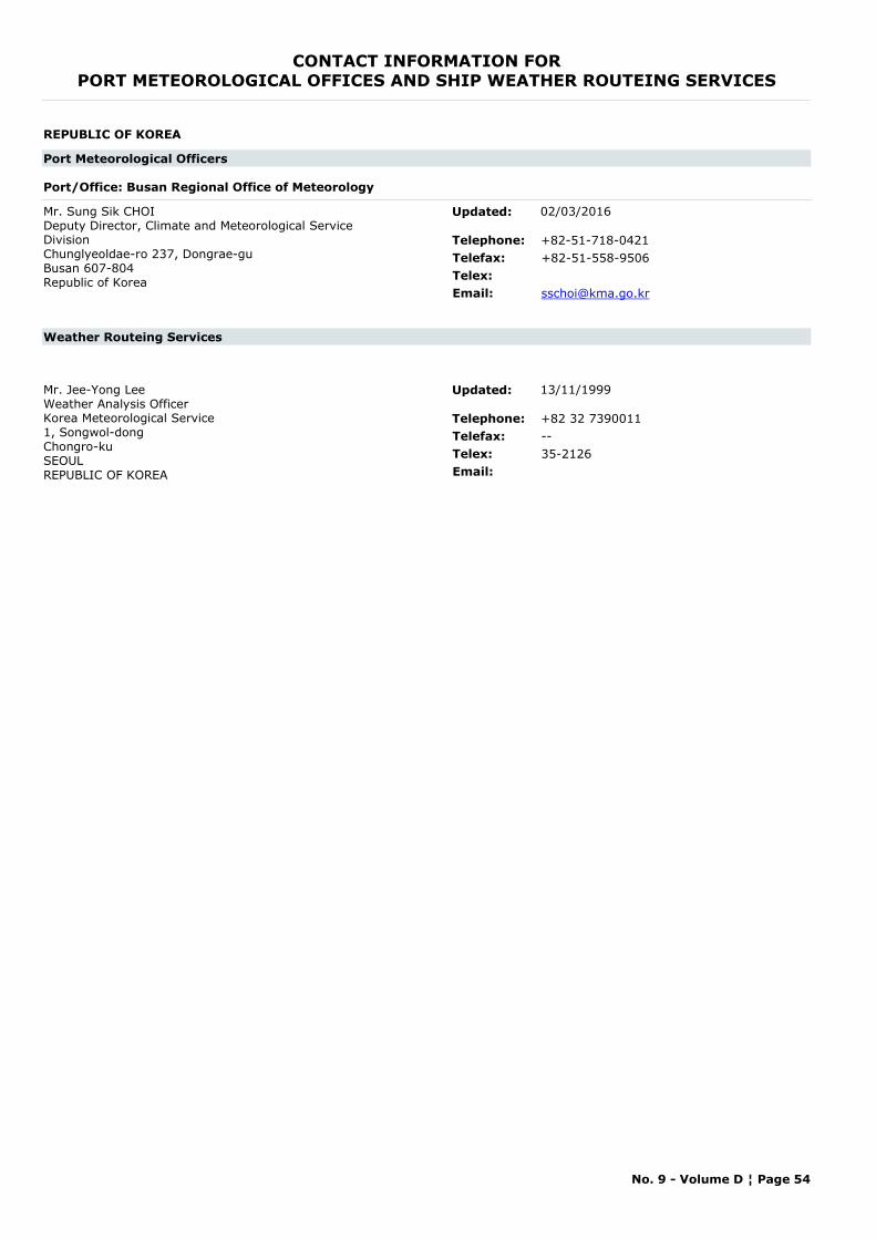
CONTACT INFORMATION FORPORT METEOROLOGICAL OFFICES AND SHIP WEATHER ROUTEING SERVICES
REPUBLIC OF KOREA
Port Meteorological Officers
Port/Office: Busan Regional Office of Meteorology
Mr. Sung Sik CHOIDeputy Director, Climate and Meteorological Service DivisionChunglyeoldae-ro 237, Dongrae-guBusan 607-804Republic of Korea
Telephone: +82-51-718-0421Telefax: +82-51-558-9506Telex:Email: [email protected]
Updated: 02/03/2016
Weather Routeing Services
Mr. Jee-Yong LeeWeather Analysis OfficerKorea Meteorological Service1, Songwol-dongChongro-kuSEOULREPUBLIC OF KOREA
Telephone: +82 32 7390011Telefax: --Telex: 35-2126Email:
Updated: 13/11/1999
No. 9 - Volume D ¦ Page 54

CONTACT INFORMATION FORPORT METEOROLOGICAL OFFICES AND SHIP WEATHER ROUTEING SERVICES
ROMANIA
Port Meteorological Officers
Constantza
Mrs. Mariana FRATILAHead of Forecast Division DobrogeaDobrogea Regional Meteorological CentreNational Meteorological Administration of RomaniaBlvd. Mamaia, nr. 300900851, ConstantaRomania
Telephone: +40 727 328 125Telefax: --Telex:Email: [email protected]
Updated: 04/04/2013
No. 9 - Volume D ¦ Page 55
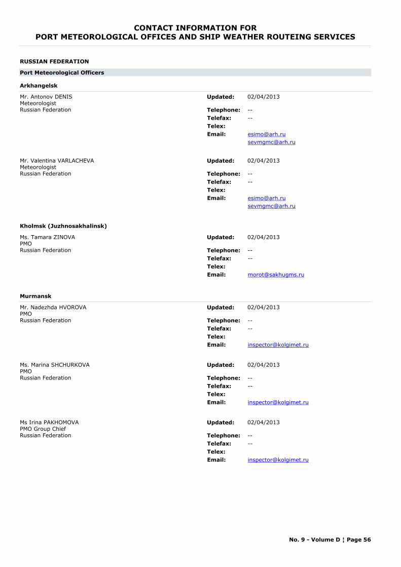
CONTACT INFORMATION FORPORT METEOROLOGICAL OFFICES AND SHIP WEATHER ROUTEING SERVICES
RUSSIAN FEDERATION
Port Meteorological Officers
Arkhangelsk
Mr. Antonov DENIS MeteorologistRussian Federation Telephone: --
Telefax: --Telex:Email: [email protected]
Updated: 02/04/2013
Mr. Valentina VARLACHEVAMeteorologistRussian Federation Telephone: --
Telefax: --Telex:Email: [email protected]
Updated: 02/04/2013
Kholmsk (Juzhnosakhalinsk)
Ms. Tamara ZINOVAPMORussian Federation Telephone: --
Telefax: --Telex:Email: [email protected]
Updated: 02/04/2013
Murmansk
Mr. Nadezhda HVOROVAPMORussian Federation Telephone: --
Telefax: --Telex:Email: [email protected]
Updated: 02/04/2013
Ms. Marina SHCHURKOVAPMORussian Federation Telephone: --
Telefax: --Telex:Email: [email protected]
Updated: 02/04/2013
Ms Irina PAKHOMOVAPMO Group ChiefRussian Federation Telephone: --
Telefax: --Telex:Email: [email protected]
Updated: 02/04/2013
No. 9 - Volume D ¦ Page 56
CONTACT INFORMATION FORPORT METEOROLOGICAL OFFICES AND SHIP WEATHER ROUTEING SERVICES
Ms. Mary CHEMOGANSKAYAPMORussian Federation Telephone: --
Telefax: --Telex:Email: [email protected]
Updated: 02/04/2013
Petropavlovsk-Kamchatsky
Ms. Elena KRASNOSHTANOVA PMORussian Federation Telephone: --
Telefax: --Telex:Email: [email protected]
Updated: 02/04/2013
Saint-Petersburg
Ms. Elena ParikovaPMORussian Federation Telephone: --
Telefax: --Telex:Email: [email protected]
Updated: 02/04/2013
Vladivostok
Ms. Ludmila DEGAPMORussian Federation Telephone: --
Telefax: --Telex:Email: [email protected]
Updated: 02/04/2013
Ms. Irina MudrakovaPMORussian Federation Telephone: --
Telefax: --Telex:Email: [email protected]
Updated: 02/04/2013
No. 9 - Volume D ¦ Page 57
CONTACT INFORMATION FORPORT METEOROLOGICAL OFFICES AND SHIP WEATHER ROUTEING SERVICES
RUSSIAN FEDERATION (EUROPE)
Weather Routeing Services
Prof. K.P. VasilievChiefHydrometeorological Research Centre of the Former USSRMarine Hydrological Forecasting Division9-13 BolshevistskayaMOSCOW 123376RUSSIAN FEDERATION
Telephone: +7 495 2551774Telefax: --Telex: 411117Email:
Updated: 13/11/1999
No. 9 - Volume D ¦ Page 58
CONTACT INFORMATION FORPORT METEOROLOGICAL OFFICES AND SHIP WEATHER ROUTEING SERVICES
SAMOA
Weather Routeing Services
Samoa Ports AuthorityPrivate BagMATAUTUSAMOA
Telephone: +685 20855+685 20856
Telefax: +685 20857Telex:Email: [email protected]
To GTS using: FZZM50 NSAP bulletin header.
Updated: 23/08/2006
No. 9 - Volume D ¦ Page 59

CONTACT INFORMATION FORPORT METEOROLOGICAL OFFICES AND SHIP WEATHER ROUTEING SERVICES
SAUDI ARABIA
Port Meteorological Officers
Jeddah
Mr Badee KhayyatPresidency of Meteorology and EnvironmentP.O. Box 1358JEDDAH 21431Saudi Arabia
Telephone: +96626536276Telefax: --Telex:Email: [email protected]
Updated: 23/04/2013
No. 9 - Volume D ¦ Page 60
CONTACT INFORMATION FORPORT METEOROLOGICAL OFFICES AND SHIP WEATHER ROUTEING SERVICES
SINGAPORE
Port Meteorological Officers
Singapore
Ong Chin HONGPort Meteorological OfficerPO Box 8Singapore Changi Airport Post OfficeSingapore 918141
Telephone: +65 6488 1843Telefax: +65 6289 9381Telex:Email: [email protected]
Updated: 16/03/2017
No. 9 - Volume D ¦ Page 61
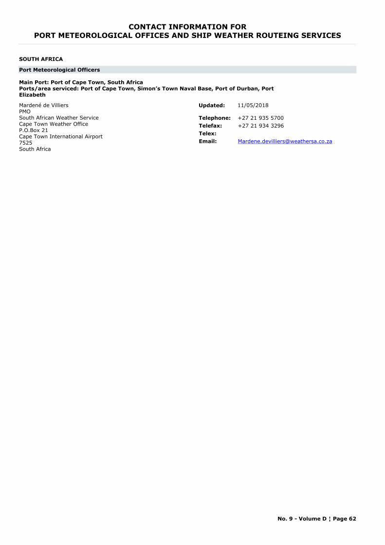
CONTACT INFORMATION FORPORT METEOROLOGICAL OFFICES AND SHIP WEATHER ROUTEING SERVICES
SOUTH AFRICA
Port Meteorological Officers
Main Port: Port of Cape Town, South AfricaPorts/area serviced: Port of Cape Town, Simon’s Town Naval Base, Port of Durban, Port Elizabeth
Mardené de VilliersPMOSouth African Weather ServiceCape Town Weather OfficeP.O.Box 21Cape Town International Airport7525South Africa
Telephone: +27 21 935 5700Telefax: +27 21 934 3296Telex:Email: [email protected]
Updated: 11/05/2018
No. 9 - Volume D ¦ Page 62

CONTACT INFORMATION FORPORT METEOROLOGICAL OFFICES AND SHIP WEATHER ROUTEING SERVICES
SRI LANKA
Port Meteorological Officers
Colombo
Mr Ajith WEERAWARDENA Meteorologist in ChargeDepartment of Meteorology Sri Lanka83, BauddhalokaMawathaColombo 07Sri Lanka
Telephone: +94-1 1268 2661Telefax: --Telex:Email: [email protected]
Updated: 10/11/2011
No. 9 - Volume D ¦ Page 63
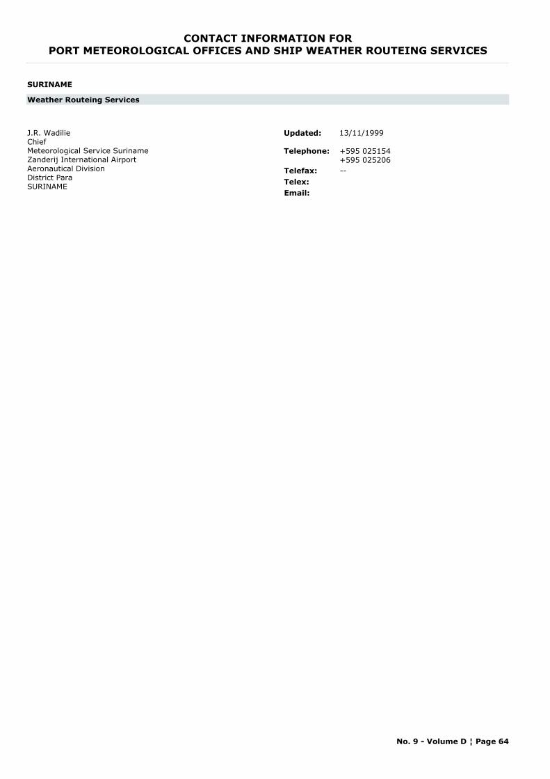
CONTACT INFORMATION FORPORT METEOROLOGICAL OFFICES AND SHIP WEATHER ROUTEING SERVICES
SURINAME
Weather Routeing Services
J.R. WadilieChiefMeteorological Service SurinameZanderij International AirportAeronautical DivisionDistrict ParaSURINAME
Telephone: +595 025154+595 025206
Telefax: --Telex:Email:
Updated: 13/11/1999
No. 9 - Volume D ¦ Page 64
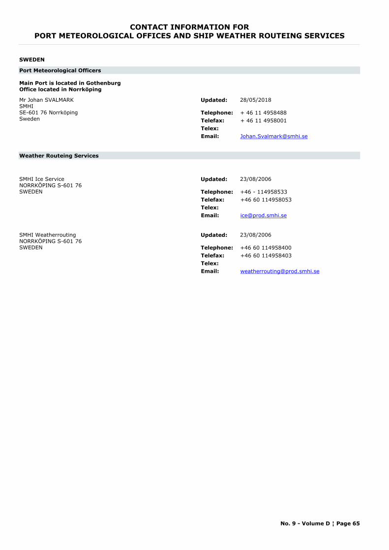
CONTACT INFORMATION FORPORT METEOROLOGICAL OFFICES AND SHIP WEATHER ROUTEING SERVICES
SWEDEN
Port Meteorological Officers
Main Port is located in GothenburgOffice located in Norrköping
Mr Johan SVALMARKSMHI SE-601 76 NorrköpingSweden
Telephone: + 46 11 4958488Telefax: + 46 11 4958001Telex:Email: [email protected]
Updated: 28/05/2018
Weather Routeing Services
SMHI Ice ServiceNORRKÖPING S-601 76SWEDEN Telephone: +46 - 114958533
Telefax: +46 60 114958053Telex:Email: [email protected]
Updated: 23/08/2006
SMHI WeatherroutingNORRKÖPING S-601 76SWEDEN Telephone: +46 60 114958400
Telefax: +46 60 114958403Telex:Email: [email protected]
Updated: 23/08/2006
No. 9 - Volume D ¦ Page 65
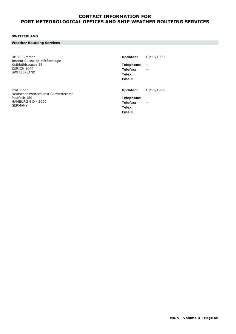
CONTACT INFORMATION FORPORT METEOROLOGICAL OFFICES AND SHIP WEATHER ROUTEING SERVICES
SWITZERLAND
Weather Routeing Services
Dr. G. SimmenInstitut Suisse de MétéorologieKrähbühlstrasse 58ZURICH 8044SWITZERLAND
Telephone: --Telefax: --Telex:Email:
Updated: 13/11/1999
Prof. HöhnDeutscher Wetterdienst SeewetteramtPostfach 180HAMBURG 4 D - 2000GERMANY
Telephone: --Telefax: --Telex:Email:
Updated: 13/11/1999
No. 9 - Volume D ¦ Page 66
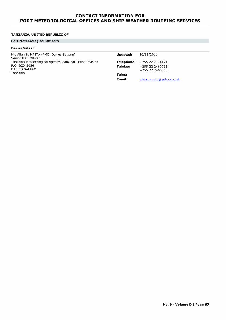
CONTACT INFORMATION FORPORT METEOROLOGICAL OFFICES AND SHIP WEATHER ROUTEING SERVICES
TANZANIA, UNITED REPUBLIC OF
Port Meteorological Officers
Dar es Salaam
Mr. Allen B. MPETA (PMO, Dar es Salaam) Senior Met. OfficerTanzania Meteorological Agency, Zanzibar Office DivisionP.O. BOX 3056DAR ES SALAAMTanzania
Telephone: +255 22 2134471Telefax: +255 22 2460735
+255 22 24607600Telex:Email: [email protected]
Updated: 10/11/2011
No. 9 - Volume D ¦ Page 67
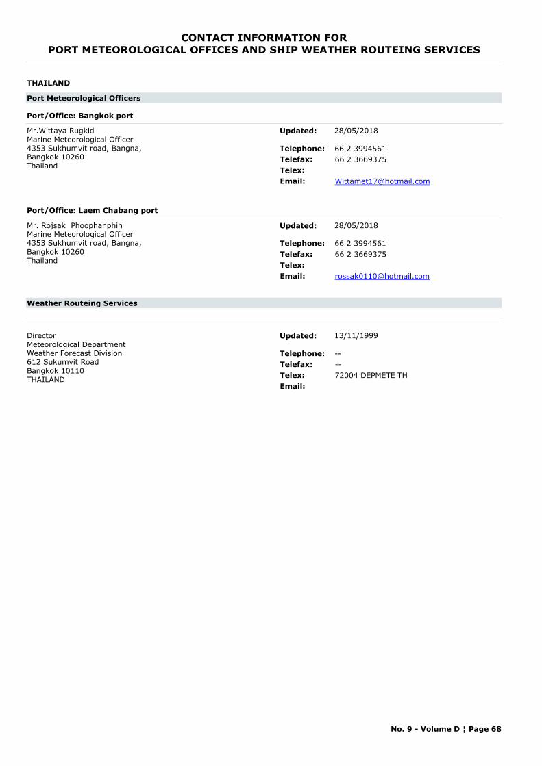
CONTACT INFORMATION FORPORT METEOROLOGICAL OFFICES AND SHIP WEATHER ROUTEING SERVICES
THAILAND
Port Meteorological Officers
Port/Office: Bangkok port
Mr.Wittaya RugkidMarine Meteorological Officer4353 Sukhumvit road, Bangna, Bangkok 10260 Thailand
Telephone: 66 2 3994561Telefax: 66 2 3669375Telex:Email: [email protected]
Updated: 28/05/2018
Port/Office: Laem Chabang port
Mr. Rojsak PhoophanphinMarine Meteorological Officer4353 Sukhumvit road, Bangna, Bangkok 10260 Thailand
Telephone: 66 2 3994561Telefax: 66 2 3669375Telex:Email: [email protected]
Updated: 28/05/2018
Weather Routeing Services
DirectorMeteorological DepartmentWeather Forecast Division612 Sukumvit RoadBangkok 10110THAILAND
Telephone: --Telefax: --Telex: 72004 DEPMETE THEmail:
Updated: 13/11/1999
No. 9 - Volume D ¦ Page 68
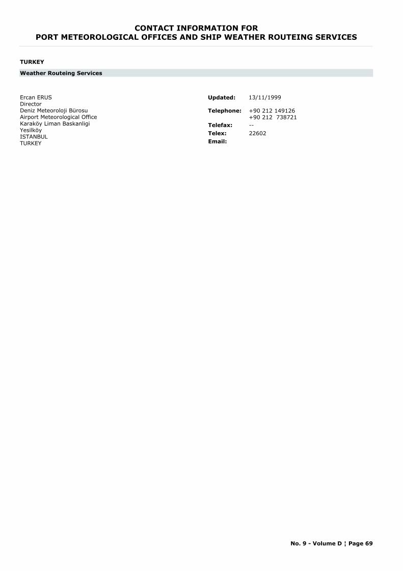
CONTACT INFORMATION FORPORT METEOROLOGICAL OFFICES AND SHIP WEATHER ROUTEING SERVICES
TURKEY
Weather Routeing Services
Ercan ERUSDirectorDeniz Meteoroloji BürosuAirport Meteorological OfficeKaraköy Liman BaskanligiYesilköyISTANBULTURKEY
Telephone: +90 212 149126+90 212 738721
Telefax: --Telex: 22602Email:
Updated: 13/11/1999
No. 9 - Volume D ¦ Page 69
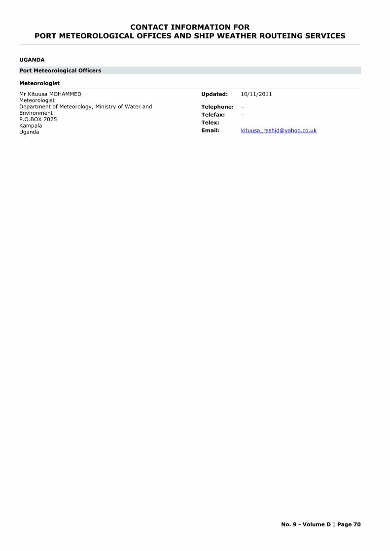
CONTACT INFORMATION FORPORT METEOROLOGICAL OFFICES AND SHIP WEATHER ROUTEING SERVICES
UGANDA
Port Meteorological Officers
Meteorologist
Mr Kituusa MOHAMMED MeteorologistDepartment of Meteorology, Ministry of Water and EnvironmentP.O.BOX 7025KampalaUganda
Telephone: --Telefax: --Telex:Email: [email protected]
Updated: 10/11/2011
No. 9 - Volume D ¦ Page 70
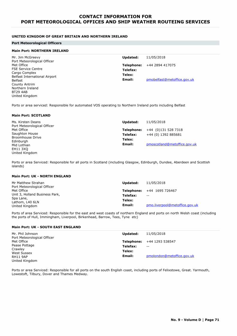
CONTACT INFORMATION FORPORT METEOROLOGICAL OFFICES AND SHIP WEATHER ROUTEING SERVICES
UNITED KINGDOM OF GREAT BRITAIN AND NORTHERN IRELAND
Port Meteorological Officers
Main Port: NORTHERN IRELAND
Mr. Jim McGreevyPort Meteorological OfficerMet Office FSE Service CentreCargo ComplexBelfast International AirportBelfastCounty AntrimNorthern IrelandBT29 4ABUnited Kingdom
Telephone: +44 2894 417075Telefax:Telex:Email: [email protected]
Ports or area serviced: Responsible for automated VOS operating to Northern Ireland ports including Belfast
Updated: 11/05/2018
Main Port: SCOTLAND
Ms. Kirsten DeansPort Meteorological OfficerMet OfficeSaughton HouseBroomhouse DriveEdinburghMid LothianEH11 3XQUnited Kingdom
Telephone: +44 (0)131 528 7318Telefax: +44 (0) 1392 885681Telex:Email: [email protected]
Ports or area Serviced: Responsible for all ports in Scotland (including Glasgow, Edinburgh, Dundee, Aberdeen and Scottish islands)
Updated: 11/05/2018
Main Port: UK - NORTH ENGLAND
Mr Matthew StrahanPort Meteorological OfficerMet Office Unit 3, Holland Business Park, Spa Lane, Lathom, L40 6LNUnited Kingdom
Telephone: +44 1695 726467Telefax: --Telex:Email: [email protected]
Ports of area Serviced: Responsible for the east and west coasts of northern England and ports on north Welsh coast (including the ports of Hull, Immingham, Liverpool, Birkenhead, Barrow, Tees, Tyne etc)
Updated: 11/05/2018
Main Port: UK - SOUTH EAST ENGLAND
Mr. Phil JohnsonPort Meteorological OfficerMet Office Pease PottageCrawleyWest SussexRH11 9AP United Kingdom
Telephone: +44 1293 538547Telefax: --Telex:Email: [email protected]
Ports or area Serviced: Responsible for all ports on the south English coast, including ports of Felixstowe, Great. Yarmouth, Lowestoft, Tilbury, Dover and Thames Medway.
Updated: 11/05/2018
No. 9 - Volume D ¦ Page 71
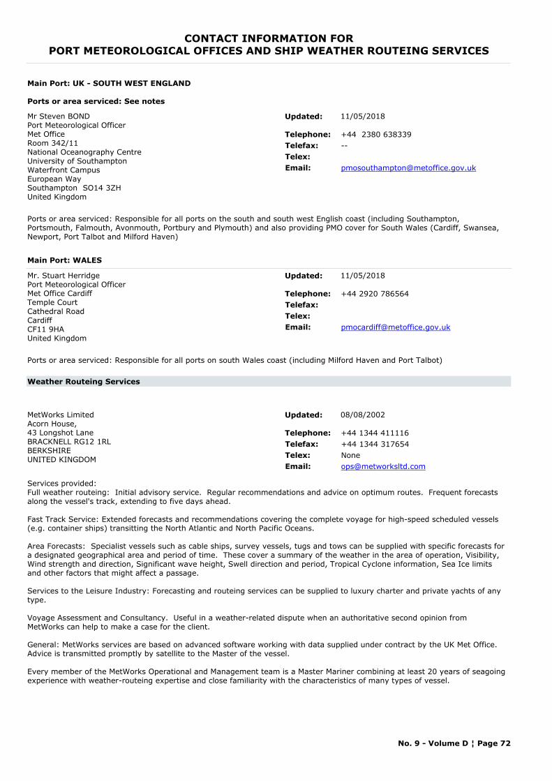
CONTACT INFORMATION FORPORT METEOROLOGICAL OFFICES AND SHIP WEATHER ROUTEING SERVICES
Main Port: UK - SOUTH WEST ENGLAND
Ports or area serviced: See notes
Mr Steven BONDPort Meteorological OfficerMet Office Room 342/11National Oceanography CentreUniversity of Southampton Waterfront CampusEuropean WaySouthampton SO14 3ZHUnited Kingdom
Telephone: +44 2380 638339Telefax: --Telex:Email: [email protected]
Ports or area serviced: Responsible for all ports on the south and south west English coast (including Southampton, Portsmouth, Falmouth, Avonmouth, Portbury and Plymouth) and also providing PMO cover for South Wales (Cardiff, Swansea, Newport, Port Talbot and Milford Haven)
Updated: 11/05/2018
Main Port: WALES
Mr. Stuart HerridgePort Meteorological OfficerMet Office CardiffTemple CourtCathedral RoadCardiffCF11 9HAUnited Kingdom
Telephone: +44 2920 786564Telefax:Telex:Email: [email protected]
Ports or area serviced: Responsible for all ports on south Wales coast (including Milford Haven and Port Talbot)
Updated: 11/05/2018
Weather Routeing Services
MetWorks LimitedAcorn House, 43 Longshot LaneBRACKNELL RG12 1RLBERKSHIREUNITED KINGDOM
Telephone: +44 1344 411116Telefax: +44 1344 317654Telex: NoneEmail: [email protected]
Services provided: Full weather routeing: Initial advisory service. Regular recommendations and advice on optimum routes. Frequent forecasts along the vessel's track, extending to five days ahead.
Fast Track Service: Extended forecasts and recommendations covering the complete voyage for high-speed scheduled vessels (e.g. container ships) transitting the North Atlantic and North Pacific Oceans.
Area Forecasts: Specialist vessels such as cable ships, survey vessels, tugs and tows can be supplied with specific forecasts for a designated geographical area and period of time. These cover a summary of the weather in the area of operation, Visibility, Wind strength and direction, Significant wave height, Swell direction and period, Tropical Cyclone information, Sea Ice limits and other factors that might affect a passage.
Services to the Leisure Industry: Forecasting and routeing services can be supplied to luxury charter and private yachts of any type.
Voyage Assessment and Consultancy. Useful in a weather-related dispute when an authoritative second opinion from MetWorks can help to make a case for the client.
General: MetWorks services are based on advanced software working with data supplied under contract by the UK Met Office. Advice is transmitted promptly by satellite to the Master of the vessel.
Every member of the MetWorks Operational and Management team is a Master Mariner combining at least 20 years of seagoing experience with weather-routeing expertise and close familiarity with the characteristics of many types of vessel.
Updated: 08/08/2002
No. 9 - Volume D ¦ Page 72
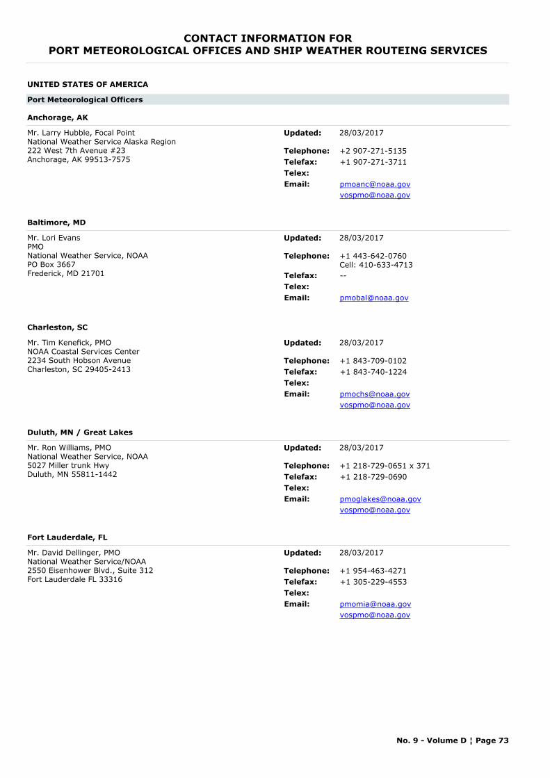
CONTACT INFORMATION FORPORT METEOROLOGICAL OFFICES AND SHIP WEATHER ROUTEING SERVICES
UNITED STATES OF AMERICA
Port Meteorological Officers
Anchorage, AK
Mr. Larry Hubble, Focal PointNational Weather Service Alaska Region 222 West 7th Avenue #23 Anchorage, AK 99513-7575
Telephone: +2 907-271-5135Telefax: +1 907-271-3711Telex:Email: [email protected]
Updated: 28/03/2017
Baltimore, MD
Mr. Lori EvansPMONational Weather Service, NOAA PO Box 3667 Frederick, MD 21701
Telephone: +1 443-642-0760Cell: 410-633-4713
Telefax: --Telex:Email: [email protected]
Updated: 28/03/2017
Charleston, SC
Mr. Tim Kenefick, PMO NOAA Coastal Services Center 2234 South Hobson Avenue Charleston, SC 29405-2413
Telephone: +1 843-709-0102Telefax: +1 843-740-1224Telex:Email: [email protected]
Updated: 28/03/2017
Duluth, MN / Great Lakes
Mr. Ron Williams, PMONational Weather Service, NOAA 5027 Miller trunk HwyDuluth, MN 55811-1442
Telephone: +1 218-729-0651 x 371Telefax: +1 218-729-0690Telex:Email: [email protected]
Updated: 28/03/2017
Fort Lauderdale, FL
Mr. David Dellinger, PMONational Weather Service/NOAA2550 Eisenhower Blvd., Suite 312Fort Lauderdale FL 33316
Telephone: +1 954-463-4271Telefax: +1 305-229-4553Telex:Email: [email protected]
Updated: 28/03/2017
No. 9 - Volume D ¦ Page 73
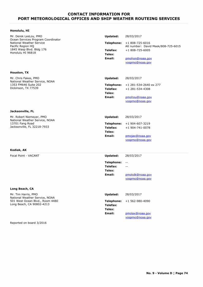
CONTACT INFORMATION FORPORT METEOROLOGICAL OFFICES AND SHIP WEATHER ROUTEING SERVICES
Honolulu, HI
Mr. Derek LeeLoy, PMOOcean Services Program CoordinatorNational Weather Service Pacific Region HQ 1845 Wasp Blvd. Bldg 176Honolulu HI 96818
Telephone: +1 808-725-6016Alt number: David Meek/808-725-6015
Telefax: +1 808-725-6005Telex:Email: [email protected]
Updated: 28/03/2017
Houston, TX
Mr. Chris Fakes, PMONational Weather Service, NOAA 1353 FM646 Suite 202Dickinson, TX 77539
Telephone: +1 281-534-2640 ex 277Telefax: +1 281-534-4308Telex:Email: [email protected]
Updated: 28/03/2017
Jacksonville, FL
Mr. Robert Niemeyer, PMONational Weather Service, NOAA 13701 Fang Road Jacksonville, FL 32218-7933
Telephone: +1 904-607-3219Telefax: +1 904-741-0078Telex:Email: [email protected]
Updated: 28/03/2017
Kodiak, AK
Focal Point - VACANT
Telephone: --Telefax: --Telex:Email: [email protected]
Updated: 28/03/2017
Long Beach, CA
Mr. Tim Harris, PMONational Weather Service, NOAA 501 West Ocean Blvd., Room 4480 Long Beach, CA 90802-4213
Telephone: +1 562-980-4090Telefax:Telex:Email: [email protected]
Reported on board 3/2016
Updated: 28/03/2017
No. 9 - Volume D ¦ Page 74
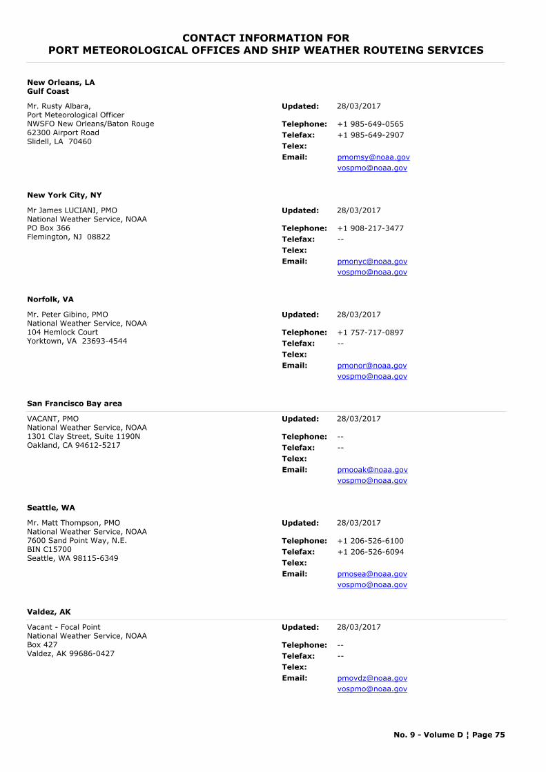
CONTACT INFORMATION FORPORT METEOROLOGICAL OFFICES AND SHIP WEATHER ROUTEING SERVICES
New Orleans, LAGulf Coast
Mr. Rusty Albara, Port Meteorological Officer NWSFO New Orleans/Baton Rouge 62300 Airport Road Slidell, LA 70460
Telephone: +1 985-649-0565Telefax: +1 985-649-2907Telex:Email: [email protected]
Updated: 28/03/2017
New York City, NY
Mr James LUCIANI, PMONational Weather Service, NOAA PO Box 366Flemington, NJ 08822
Telephone: +1 908-217-3477Telefax: --Telex:Email: [email protected]
Updated: 28/03/2017
Norfolk, VA
Mr. Peter Gibino, PMONational Weather Service, NOAA 104 Hemlock CourtYorktown, VA 23693-4544
Telephone: +1 757-717-0897Telefax: --Telex:Email: [email protected]
Updated: 28/03/2017
San Francisco Bay area
VACANT, PMONational Weather Service, NOAA 1301 Clay Street, Suite 1190N Oakland, CA 94612-5217
Telephone: --Telefax: --Telex:Email: [email protected]
Updated: 28/03/2017
Seattle, WA
Mr. Matt Thompson, PMONational Weather Service, NOAA 7600 Sand Point Way, N.E. BIN C15700 Seattle, WA 98115-6349
Telephone: +1 206-526-6100Telefax: +1 206-526-6094Telex:Email: [email protected]
Updated: 28/03/2017
Valdez, AK
Vacant - Focal PointNational Weather Service, NOAA Box 427 Valdez, AK 99686-0427
Telephone: --Telefax: --Telex:Email: [email protected]
Updated: 28/03/2017
No. 9 - Volume D ¦ Page 75

2015 Edition WMO No. 9, Volume D – Information for Shipping Page i
FORM FOR NEW OR UPDATED MATERIAL In order to maintain and improve the accuracy of the information in this publication please inform the WMO Secretariat of any amendments relating to Volume D.
DSC – NAVTEX – HF NBDP – RADIO-FACSIMILE
Use the following colour scheme to indicate whether text is to be deleted/added/replaced
Replace.....................................................................................................
Delete .......................................................................................................
Add ...........................................................................................................
Region: _____________ Country: ___________________________________________________________________________________ METAREA: ____________ Date: ______________________ Station Name: ________________________________________________________________________________________________________________________________
Area Covered: ________________________________________________________________________________________________________________________________
Please provide map of area coverage
Type of Station: Marine Rescue Co-ordination Centre ................
Maritime Radio Station ......................................
Mode of Transmission: NAVTEX ...........................................................
DSC (VHF/MF/HF) ............................................
HF NBDP ..........................................................
RADIO-FACSIMILE ..........................................
Web link: ________________________________________________________________________________________________________________________________
2015 Edition WMO No. 9, Volume D – Information for Shipping Page ii
COMPLETE FOR DSC, HF NBDP STATIONS AND NAVTEX
Main station name Monitor station name MMSI Area Position of Antenna Hours of operation
Range (nm) RCC Associated
Broadcast Times Frequency Contents of Broadcast Language/Code Form
2015 Edition WMO No. 9, Volume D – Information for Shipping Page iii
COMPLETE FOR RADIO-FACSIMILE
I. TECHNICAL SPECIFICATIONS Frequency Call Sign Class of
Emission Band Width Power Supplied to the
Antenna Hours of
Operation
II. MAP AREA Area Area Coverage Projection Scale
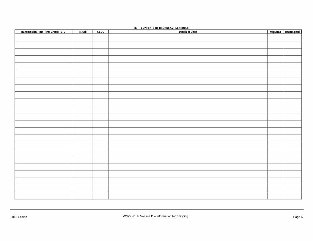
2015 Edition WMO No. 9, Volume D – Information for Shipping Page iv
III. CONTENTS OF BROADCAST SCHEDULE Transmission Time (Time Group) (UTC) TTAAii CCCC Details of Chart Map Area Drum Speed
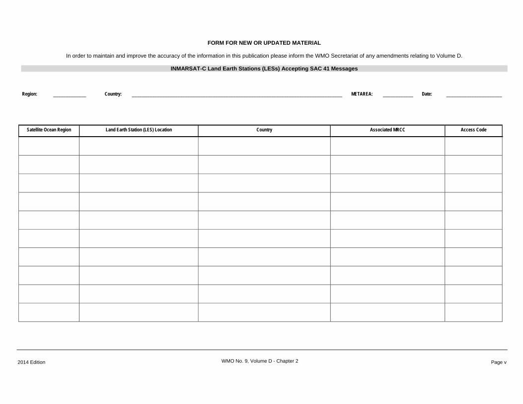
FORM FOR NEW OR UPDATED MATERIAL
2014 Edition WMO No. 9, Volume D - Chapter 2 Page v
In order to maintain and improve the accuracy of the information in this publication please inform the WMO Secretariat of any amendments relating to Volume D.
INMARSAT-C Land Earth Stations (LESs) Accepting SAC 41 Messages
Region: _____________ Country: ___________________________________________________________________________________ METAREA: ____________ Date: ______________________
Satellite Ocean Region Land Earth Station (LES) Location Country Associated MRCC Access Code
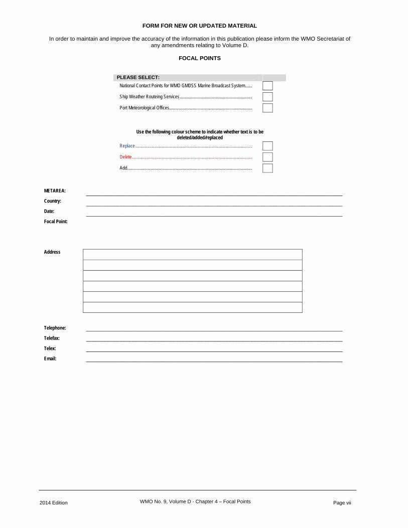
FORM FOR NEW OR UPDATED MATERIAL
2014 Edition WMO No. 9, Volume D - Chapter 4 – Focal Points Page vii
In order to maintain and improve the accuracy of the information in this publication please inform the WMO Secretariat of any amendments relating to Volume D.
FOCAL POINTS
PLEASE SELECT: National Contact Points for WMO GMDSS Marine Broadcast System ......
Ship Weather Routeing Services ..............................................................
Port Meteorological Offices .......................................................................
Use the following colour scheme to indicate whether text is to be deleted/added/replaced
Replace ....................................................................................................
Delete .......................................................................................................
Add ...........................................................................................................
METAREA: __________________________________________________________________________________ Country: __________________________________________________________________________________ Date: __________________________________________________________________________________ Focal Point:
Address
Telephone: __________________________________________________________________________________
Telefax: __________________________________________________________________________________
Telex: __________________________________________________________________________________
Email: __________________________________________________________________________________