Embed Size (px)
Citation preview
1
Vermont Transportation Resilience Planning Tool (TRPT)
Presented by Roger Branon Rodriguez [email protected] Padilla [email protected] Conference 2018
2
Acknowledgements
VERMONT AGENCY OF TRANSPORTATION
Joe Segale
PROJECT PARTNERS
Vermont Agency of Natural Resources
Vermont Emergency Management
Vermont Agency of Commerce and Community
Development
Two Rivers-Ottauquechee Regional Commission,
Windham Regional Commission
White River Partnership
CONSULTANTS
Roy Schiff, Jessica Louisos, James MacBroom, Tony Ciriello, Brian Cote, Lauren Weston, and Doug Osborne Milone & MacBroom
Evan Fitzgerald, Evelyn Boardman, Joe BartlettFitzgerald Environmental Associates
Lucy Gibson, Chris Sargent DuBois & King
Norman MarshallSmart Mobility
Lauren E. Padilla, Barb Patterson, David Healy, Roger Branon RodriguezStone Environmental
3
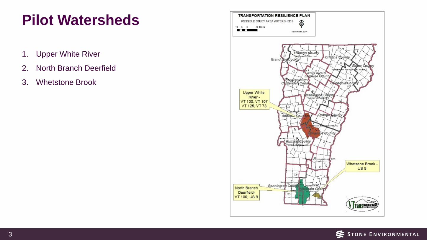
Pilot Watersheds
1. Upper White River
2. North Branch Deerfield
3. Whetstone Brook
4
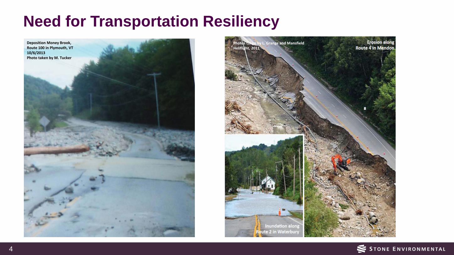
Need for Transportation ResiliencyPhotos taken by L. Grange and Mansfield Heliflight, 2011
Deposition Money Brook,Route 100 in Plymouth, VT10/6/2013Photo taken by M. Tucker
5
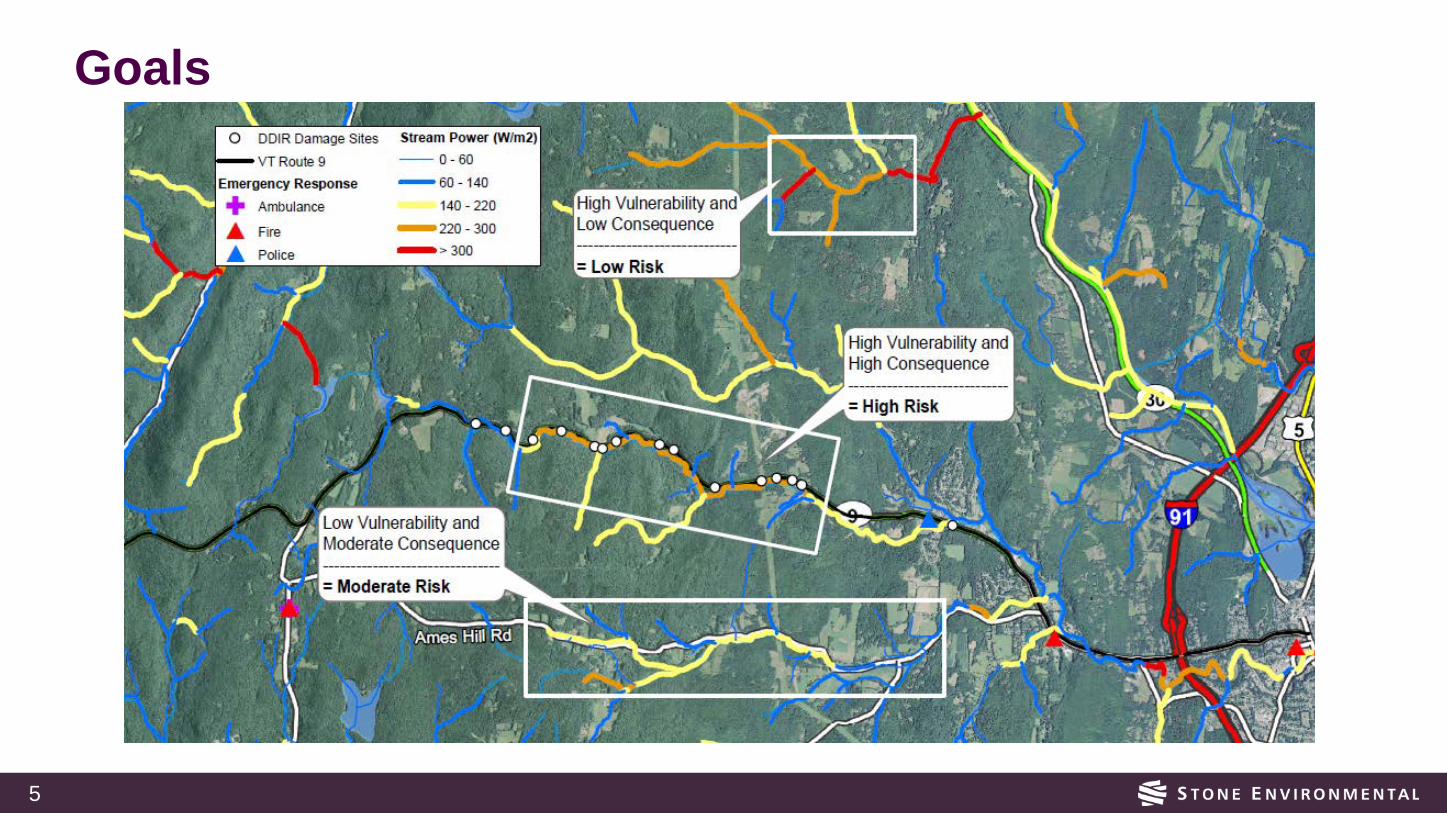
Goals
6
Who are the intended users?
Primary Users VTrans (Planner, Engineer, Asset Manager) Vermont Department of Environmental Conservation (Engineer, Floodplain Manager, Scientist ) Regional Planning Commissions(Regional Planner, Transportation Planner, Other Staff) Vermont Emergency Management (Planner, Project Coordinator, Emergency Operation Center Watchstander)
7
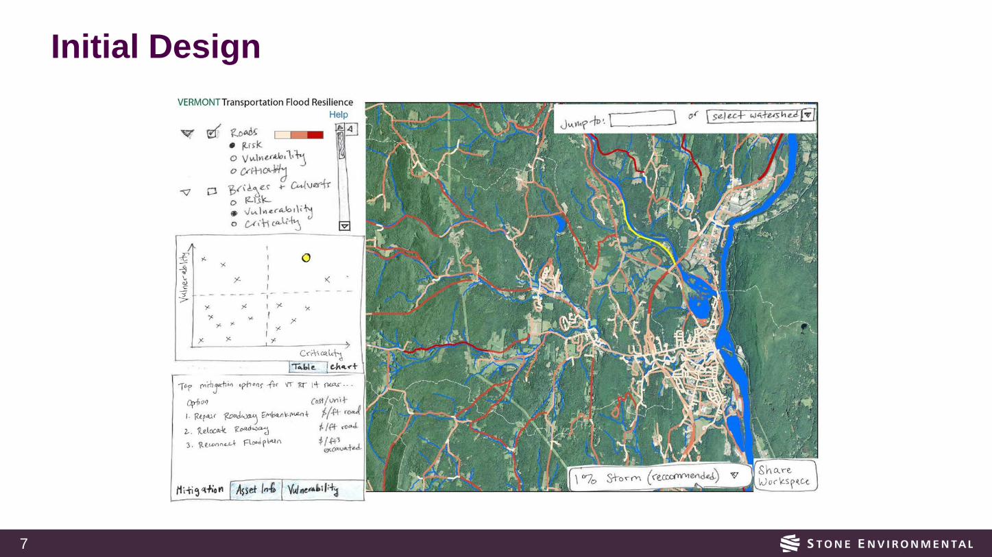
Initial Design
8
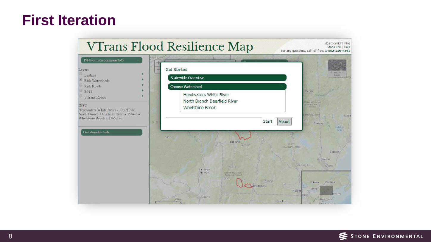
First Iteration

9
One of the key rules of user interface design is that users need to be in control.

10

11

12
First Iteration
14
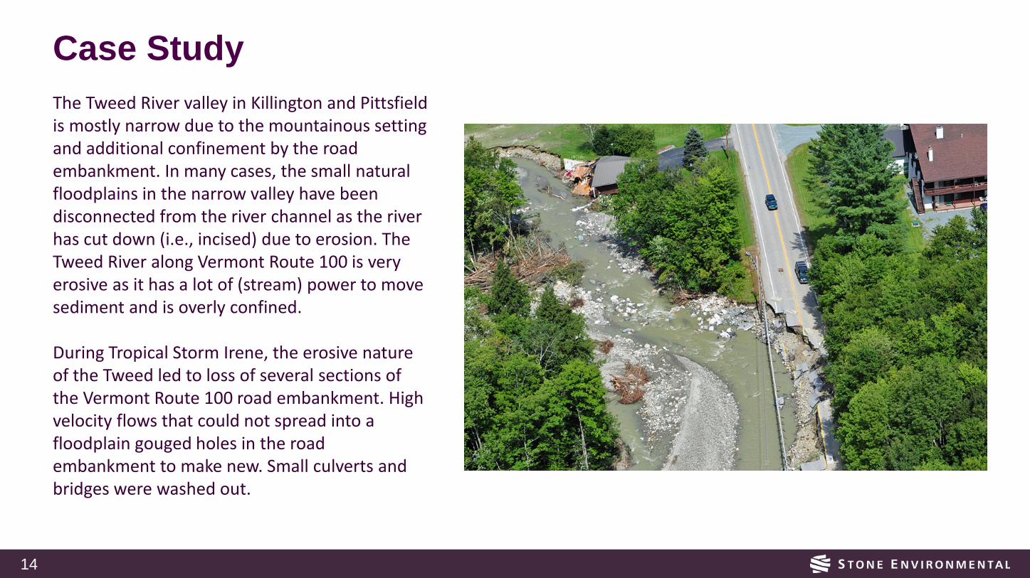
Case StudyThe Tweed River valley in Killington and Pittsfield is mostly narrow due to the mountainous setting and additional confinement by the road embankment. In many cases, the small natural floodplains in the narrow valley have been disconnected from the river channel as the river has cut down (i.e., incised) due to erosion. The Tweed River along Vermont Route 100 is very erosive as it has a lot of (stream) power to move sediment and is overly confined.
During Tropical Storm Irene, the erosive nature of the Tweed led to loss of several sections of the Vermont Route 100 road embankment. High velocity flows that could not spread into a floodplain gouged holes in the road embankment to make new. Small culverts and bridges were washed out.
15
Case Study
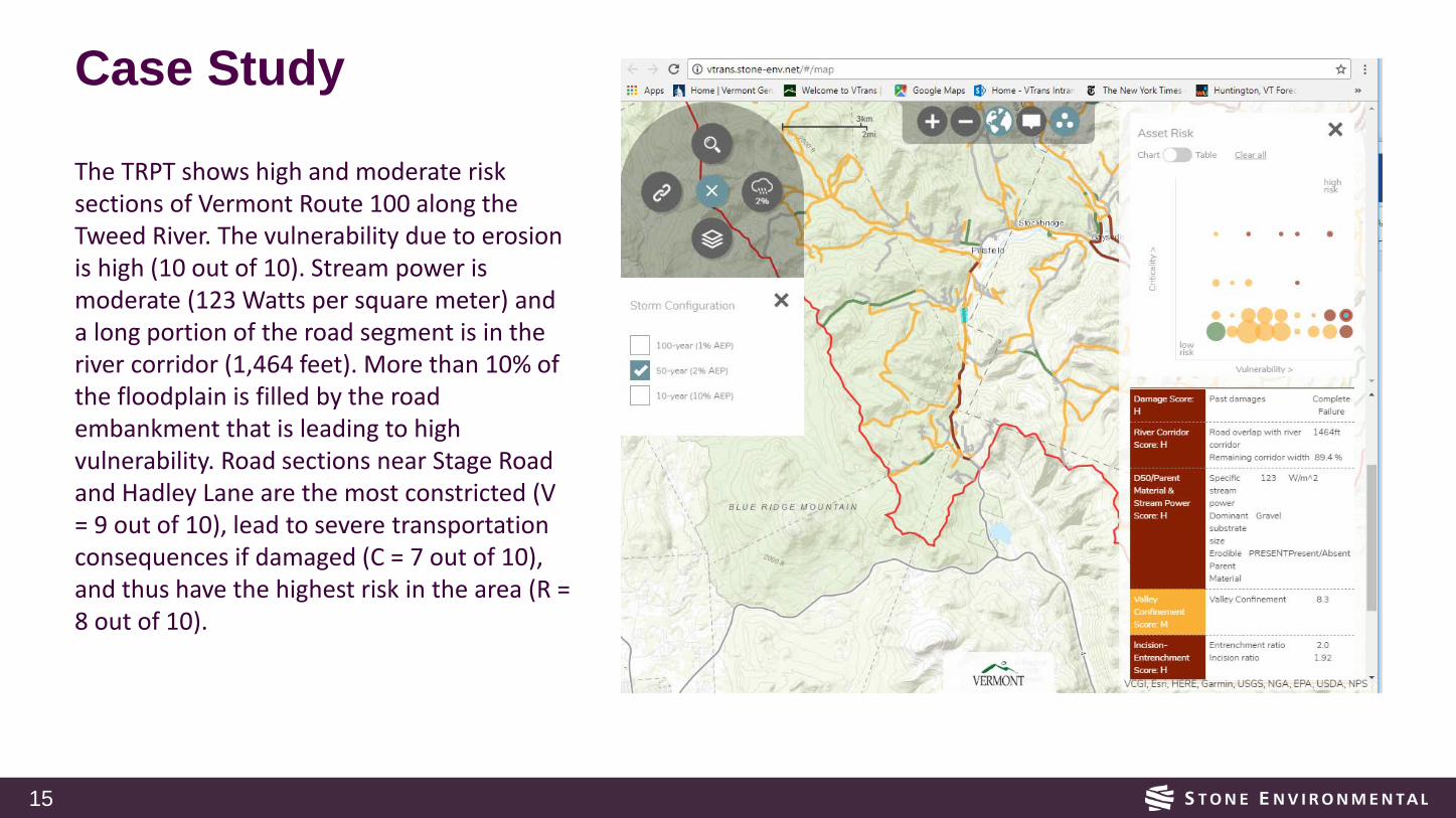
The TRPT shows high and moderate risk sections of Vermont Route 100 along the Tweed River. The vulnerability due to erosion is high (10 out of 10). Stream power is moderate (123 Watts per square meter) and a long portion of the road segment is in the river corridor (1,464 feet). More than 10% of the floodplain is filled by the road embankment that is leading to high vulnerability. Road sections near Stage Road and Hadley Lane are the most constricted (V = 9 out of 10), lead to severe transportation consequences if damaged (C = 7 out of 10), and thus have the highest risk in the area (R = 8 out of 10).
16
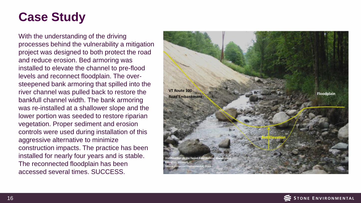
Case StudyWith the understanding of the driving processes behind the vulnerability a mitigation project was designed to both protect the road and reduce erosion. Bed armoring was installed to elevate the channel to pre-flood levels and reconnect floodplain. The over-steepened bank armoring that spilled into the river channel was pulled back to restore the bankfull channel width. The bank armoring was re-installed at a shallower slope and the lower portion was seeded to restore riparian vegetation. Proper sediment and erosion controls were used during installation of this aggressive alternative to minimize construction impacts. The practice has been installed for nearly four years and is stable. The reconnected floodplain has been accessed several times. SUCCESS.