Embed Size (px)
Citation preview
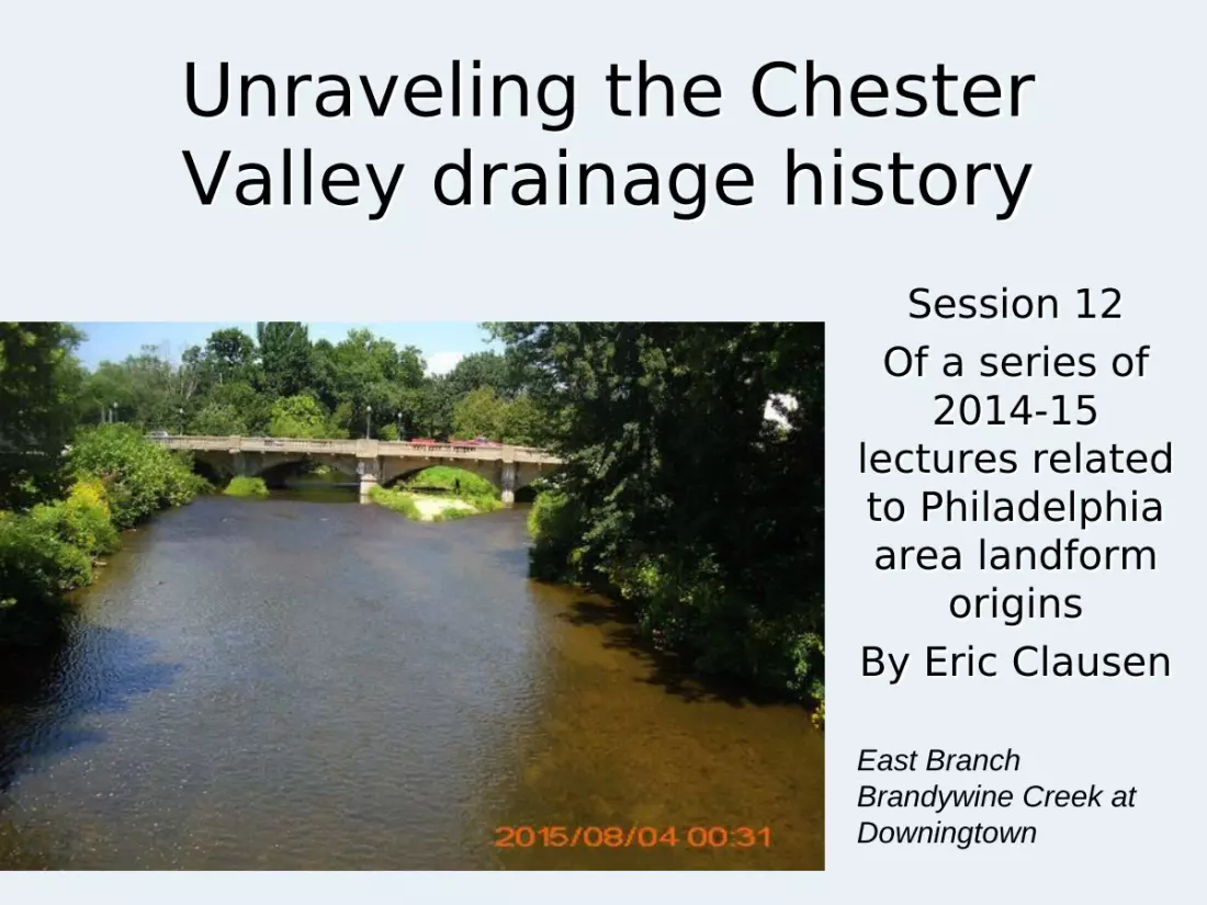
Unraveling the Chester Valley drainage history
Session 12Of a series of
2014-15 lectures related to Philadelphia area landform
originsBy Eric Clausen
East Branch Brandywine Creek at Downingtown
We will begin with a review of a geological controversy that began in the early 20th century related to diverging
and converging channels found in the eastern half of Washington State
J Harlan Bretz who began his career as a high school science teacher in the Seattle area became interested in the geology of Washington State and went on to the University of Chicago where he obtained his PhD and began work on the faculty.
Bretz was fascinated by complexes of diverging and converging channels and related evidence found in eastern Washington State and published several papers in which he described the evidence as having been formed during an immense flood.
When Bretz presented his findings to geologists in Washington, DC he was severely criticized by everyone in attendance including by W.C. Alden, who directed the USGS geomorphology division and who had recently completely a major USGS study of Montana where he claimed no such evidence was found. Eastern geologists rejected Bretz’s interpretation.
While eastern geologists rejected Bretz’s interpretation they needed a geologist, trained at the University of
Chicago, who would study the evidence and propose an acceptable alternative.
The eastern geologists’ opportunity came in the early 1930s when Richard Foster Flint, a University of Chicago graduate who had taken a few courses from Bretz, was hired by Yale University and published his first major geological report in which he revised the glacial history of a New England region, which had previously been interpreted by W.C. Alden.
At that time there was no National Science Foundation and almost all geomorphology research grant funds were controlled by W.C. Alden and as a young faculty member Flint needed to do research to keep his Yale University faculty position.
The eastern geologists arranged for Douglas Johnson (a student of W.M. Davis who was promoting the Davis interpretations) to spend a weekend with Flint in an effort to convince Flint that his 80-page long publication was in error and needed to be retracted.
How Richard Foster Flint got started on his career as one of the nation’s leading glacial geologists and geology
textbook writers. Tucked away in a geology journal is a short article written by Flint
in which he thanks Johnson for showing him the light and then goes on to retract his previous revision of the New England glacial evidence that W.C. Alden had previously interpreted.
One year later Flint received his first research grant to map the eastern Washington State glacial geology, which became a multi year project and which resulted in several major publications explaining the evidence that Bretz had previously interpreted as evidence of an immense flood as having been formed along continental ice sheet margins without the aid of large floods.
After finishing his Washington State research Flint received USGS grants to map large areas in the Dakotas and was also designated by the GSA to prepare the Glacial Map of the United States.
While other geologists got involved Flint’s interpretation was cited as the more recent interpretation and consequently the better explanation.
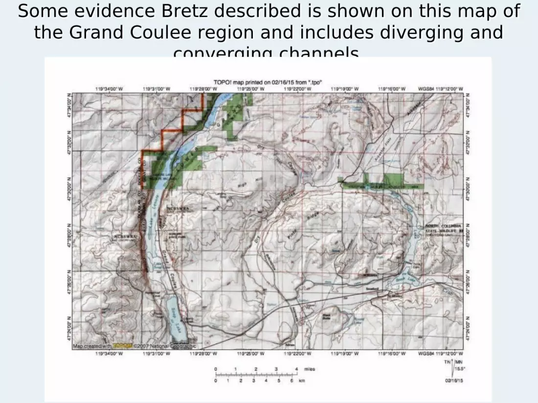
Some evidence Bretz described is shown on this map of the Grand Coulee region and includes diverging and
converging channels
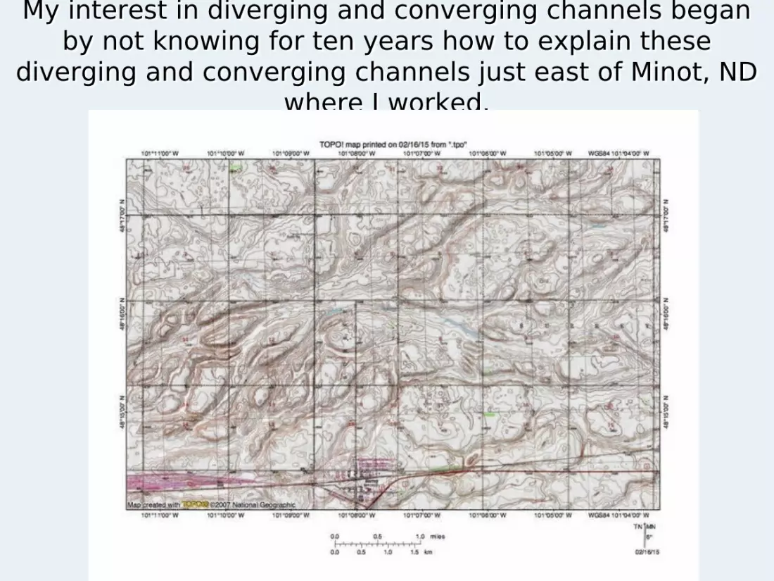
My interest in diverging and converging channels began by not knowing for ten years how to explain these
diverging and converging channels just east of Minot, ND where I worked.
The diverging and converging channels east of Minot had been explained by USGS geologists as melt water
channels along a retreating and advancing ice sheet and while I did not like that interpretation for ten years that
is what I taught in my classes. I had been trained by geomorphologists who had been trained
by students of W.M. Morris Davis and had never been exposed to any evidence like that present east of Minot.
After I had been teaching at Minot for ten years another North Dakota university hired a geologist who had previously mapped the path of flood waters from the Teton Dam collapse. He took one look at the Minot evidence and said “I know what that is—it is an anastomosing channel complex formed by an immense flood.” He then looked upstream and found evidence for a large glacial lake that he interpreted to have rapidly drained.
By that time other geomorphologists had reworked the Eastern Washington evidence and decided Bretz had been correct about immense floods from a large glacial lake crossing the area and were using the anastomosing channels as evidence of those floods

Moving from Washington State and North Dakota to the Chester Valley in southeast Pennsylvania
Nevin Fenneman in his 1938 volume Physiography of the Eastern United States, states the Chester Valley “begins at Quarryville, south of Mine Ridge, and extends 55 miles east-northeast in a strikingly straight course to a point north of Philadelphia. Throughout its length it constitutes a trench 1 to 3 miles wide, and several hundred feet below the nearby uplands. As this area has been repeatedly peneplaned, the synclinal structure of the valley can only affect its form indirectly, by causing a zone of soluble limestone to be preserved between slates, quartzites, and schists on either side. Its present surface is part of the youngest peneplain. There is no evidence that this valley was ever followed by a stream. Not only the Schuylkill River, but smaller creeks cross its course with no regard for its presence, their courses conforming to the general slope of the province and perhaps determined by superposition.”
In 1965 Thornbury in his classic textbook related the Chester Valley origin to a hypothesized thrust
fault Twenty-seven years later Thornbury in his Regional
Geomorphology of the United States describes the Chester Valley as being “a remarkable limestone valley that lies along the north edge of the Piedmont Upland in southeastern Pennsylvania and extends from Quarryville northward for 55 miles to the Schuylkill River north of Philadelphia. The valley is coextensive with the outcrop area of the Ordovician Conestoga limestone. It is from 1 to 3 miles wide, is unusually straight, and lies several hundred feet below the uplands to either side. The south side of the valley is formed by the Wissahickon schist member of the Glenarm series, and the north wall of the valley by the Lower Cambrian Chickies quartzite. There is no evidence to suggest that a stream ever followed the valley; in fact, all streams that enter it the valley cross it rather than flow along it. Explanation of this unusual valley is linked with whatever interpretation is given to the so-called “Marctic Overthrust.”
But that thrust fault may or may not exist!
Thornbury goes on to discuss the Marctic overthrust problem. “In 1929, Knopf and Jonas described what they considered a thrust that was supposed to have carried the Wissahickon schist of presumed Precambrian age northwestward for a distance of 20 miles onto the Conestoga limestone of Ordovician age. Thus the Chester Valley south wall was considered the eroded front of the low-angle Marctic overthrust sheet. Some geologists deny the existence of the Marctic overthrust. Those who do contend that the Glenarm series, of which the Wissahickon schist is a member, rests upon a Cambro-Ordovician sequence in normal stratigraphic succession.”
Whether the Martic overthrust exists or not the regional drainage developed much more recently and the purpose of this lecture is to explain how that drainage system developed.
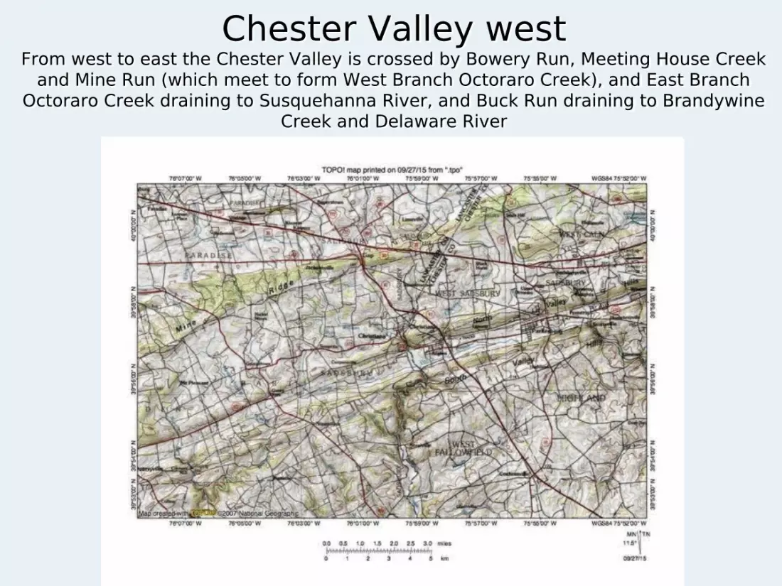
Chester Valley westFrom west to east the Chester Valley is crossed by Bowery Run, Meeting House Creek
and Mine Run (which meet to form West Branch Octoraro Creek), and East Branch Octoraro Creek draining to Susquehanna River, and Buck Run draining to Brandywine
Creek and Delaware River
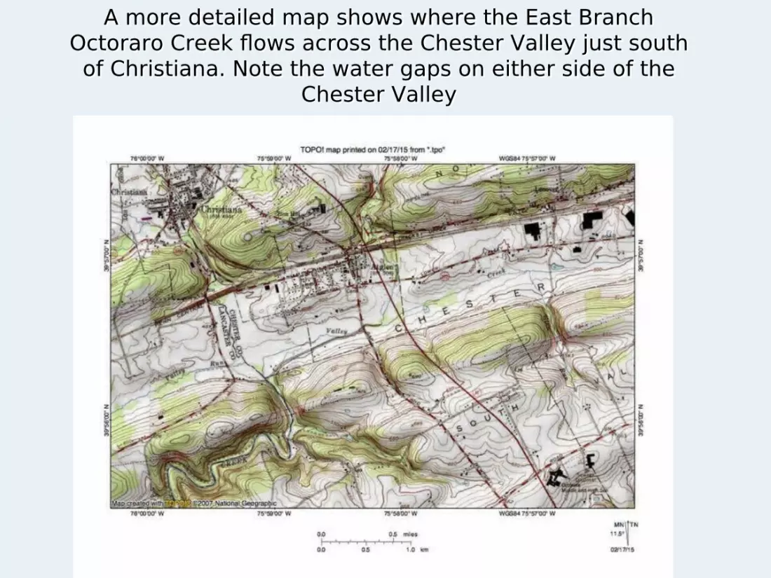
A more detailed map shows where the East Branch Octoraro Creek flows across the Chester Valley just south of Christiana. Note the water gaps on either side of the
Chester Valley

Chester Valley west centerCrossed from west to east by West Branch Brandywine
Creek and East Branch Brandywine Creek flowing to Delaware River
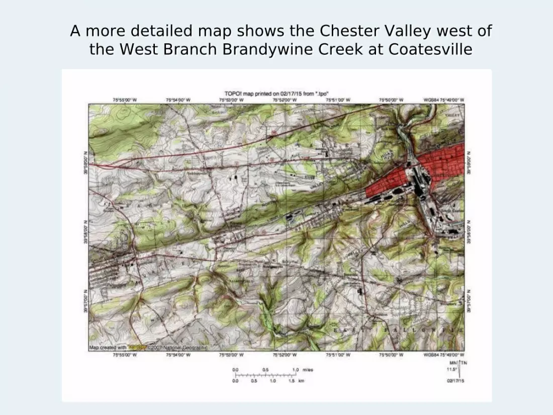
A more detailed map shows the Chester Valley west of the West Branch Brandywine Creek at Coatesville
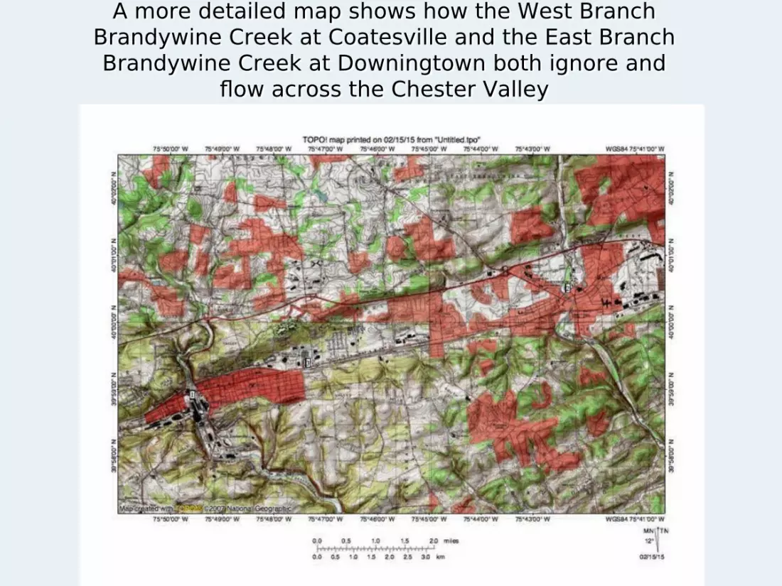
A more detailed map shows how the West Branch Brandywine Creek at Coatesville and the East Branch Brandywine Creek at Downingtown both ignore and
flow across the Chester Valley
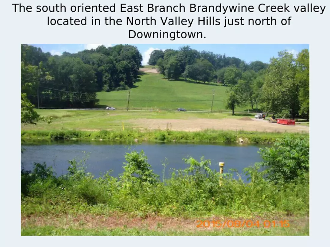
The south oriented East Branch Brandywine Creek valley located in the North Valley Hills just north of
Downingtown.

The East Branch Brandywine Creek flows in a south direction across the Chester Valley floor at
Downingtown.
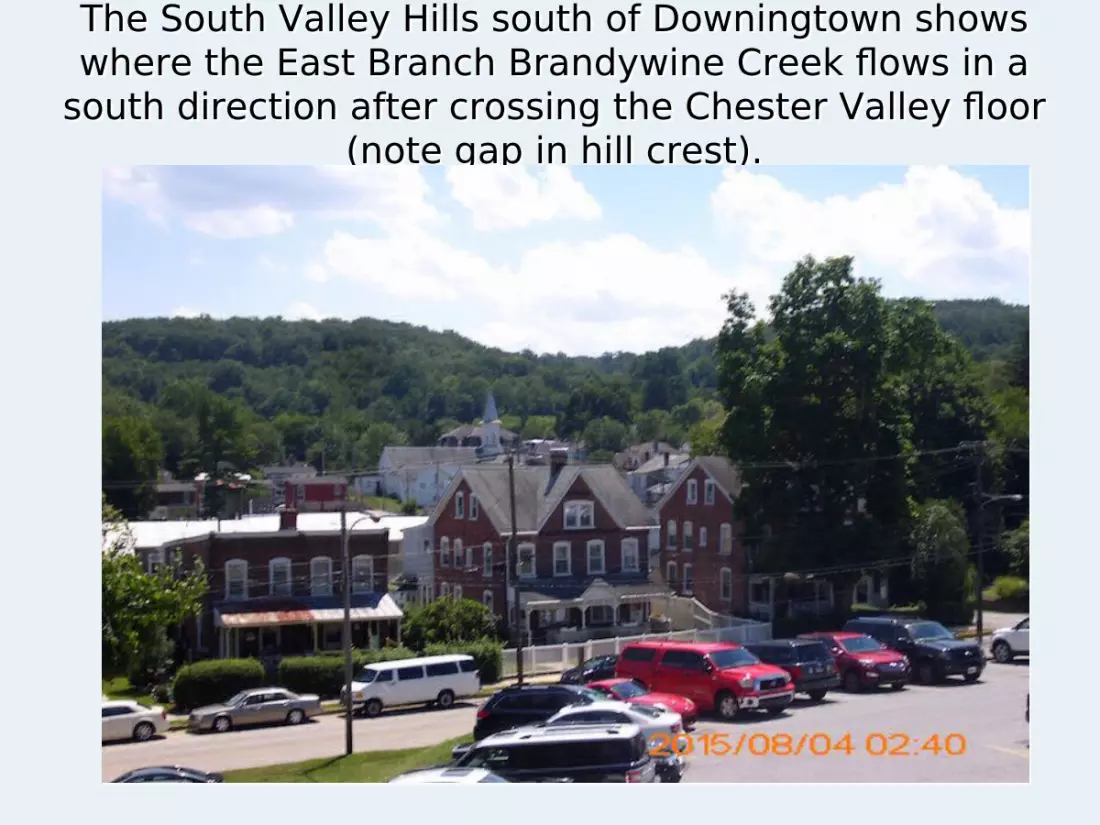
The South Valley Hills south of Downingtown shows where the East Branch Brandywine Creek flows in a
south direction after crossing the Chester Valley floor (note gap in hill crest).

Chester Valley east centercrossed by Schuylkill River (also by Wissahickon Creek along
east edge)
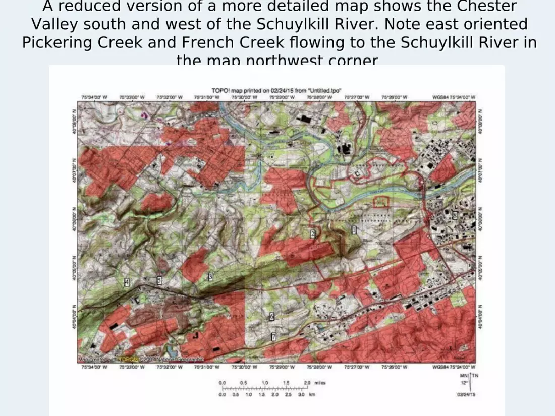
A reduced version of a more detailed map shows the Chester Valley south and west of the Schuylkill River. Note east oriented
Pickering Creek and French Creek flowing to the Schuylkill River in the map northwest corner

The reduced version of the more detailed map shows the Chester Valley extending east and north of the Schuylkill River and also how both the Schuylkill River and Wissahickon Creek
flow across the valley.

Continuing eastward the Chester Valley east end is near Willow Grove. Camp Hill forms the Chester Valley north margin and is a
quartzite ridge.
The Chester Valley drainage history problem that has plagued geomorphologists 1. Fenneman and Thornbury both claim a stream never flowed along the length of Chester Valley, although several streams obviously drain the Chester Valley floor between the nine different south oriented drainage routes that cross the Chester Valley floor. 2. The thrust fault hypothesis maybe explains why the Chester Valley exists, but if so it does not explain how nine different drainage routes were able to cross the Chester Valley without significantly changing their courses. 3. Something eroded the Chester Valley between the various south oriented stream and river valleys that cross the Chester Valley floor and and the only clue Fenneman and Thornbury offer is the Chester Valley floor is made up of soluble Conestoga Limestone bedrock. 4. But, while karst features (e.g. sinkholes) do exist on the Chester Valley floor, surface streams drain the Chester Valley floor to the nine different south oriented drainage routes that cross the Chester Valley floor. 5. Could Fenneman and Thornbury be mistaken and did flood water once flow along the Chester Valley floor. If so which direction did the water flow?
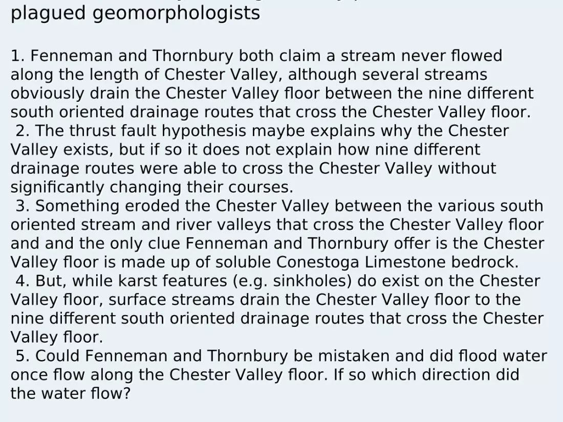
The Schuylkill-Delaware drainage divide crosses the Chester Valley near Immaculata University and Valley Creek [1] flows to the
Schuylkill River and Valley Creek [2] flows to Brandywine Creek and the Delaware River. The number 3 identifies Ridley Creek
headwaters that flow to the Delaware.

Valley Creek [east] flows in an east-northeast direction along the the Chester Valley and when it gets near the Schuylkill River valley it turns abruptly to the north and then flows through a water gap
between Mount Misery (2) and Mount Joy(1) to join the Schuylkill River as a barbed tributary and is much easier to explain if it once
flowed in a south and then west-southwest direction.
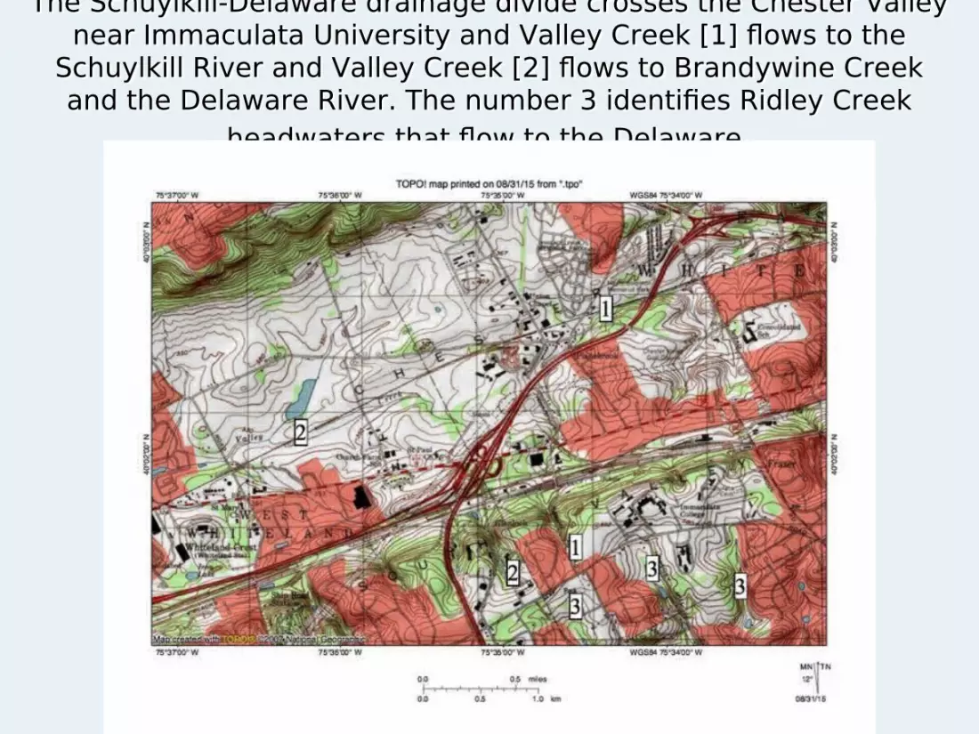
Valley Creek [west] flows in a west-southwest direction along the Chester Valley floor and then as it gets near the East Branch
Brandywine Creek valley it turns abruptly to the south and flows in a narrow valley through the South Valley Hills to join the East Branch Brandywine Creek and is easier to explain if it always
flowed in a west-southwest and south direction
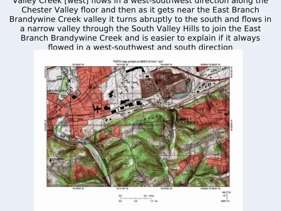
Next let us look at Sandy Run, which flows in a west-southwest direction along the Chester Valley east end before flowing in a north
direction through a water gap (1) to reach south oriented Wissahickon Creek. The water gap is easier to explain if Sandy Run
always flowed in a west-southwest direction.
Did the southwest oriented flow in the Chester Valley continue west of the East Branch
Brandywine Creek? At first glance an observer is tempted to say “no”
because the Chester Valley floor and the elevations of valleys of streams crossing the Chester Valley and the drainage divides between those stream valleys gradually rise in a west-southwest direction from the East Branch.
But, could the Chester Valley and adjacent region drainage routes be recording the capture of a west-southwest oriented anastomosing channel complex by headward erosion of south oriented anastomosing channel complexes, if so the captures could have occurred progressively in an east-northeast direction by progressively deeper channels. To test this hypothesis we need to look at where the East and West Branches of Brandywine Creek originate
How could headward erosion of deeper and deeper south oriented valleys across a west-southwest oriented flood flow channel create a valley with rising elevations to the
west? A shallow west-southwest oriented flood flow channel forms
along the Chester Valley alignment and is first captured by south oriented West Branch Brandywine Creek valley headward erosion.
The west-southwest oriented flood flow then ceases further west in the Chester Valley channel, but instead turns to flow in a south direction along the West Branch Brandywine Creek valley.
East of the West Branch the west-southwest oriented flood flow continues to erode the Chester Valley floor deeper.
A deeper south oriented East Branch Brandywine Creek valley next erodes headward and captures the west-southwest oriented flood flow, ending flood flow to the West Branch Brandywine Creek valley and leaving the Chester Valley segment between the West Branch and the East Branch deeper than the Chester Valley segment west of the West Branch Brandywine Creek.
Such a sequence can explain why the Chester Valley rises west of the East Branch Brandywine Creek.
To better understand the East and West Branches of Brandywine Creek we need to look
at the regions where they originate and also where they join.
Is there evidence of other shallow west-southwest oriented flood flow channels that were captured in sequence from west to east by headward erosion of the deeper West Branch and East Branch Brandywine Creek valleys?
If so, could the Chester Valley have been eroded as a channel in a large scale west-southwest oriented anastomosing channel complex?
Did the south oriented West and East Branch Brandywine Creek valleys erode headward independent of each other or did they erode headward as two diverging and converging channels in what was a south oriented anastomosing channel complex?
If so, could the Chester Valley be showing evidence of the capture of a west-southwest oriented anastomosing channel complex flowing to the Susquehanna River by headward erosion of a south and south-southeast oriented anastomosing channel complex draining to an actively eroding southwest oriented Delaware River valley?
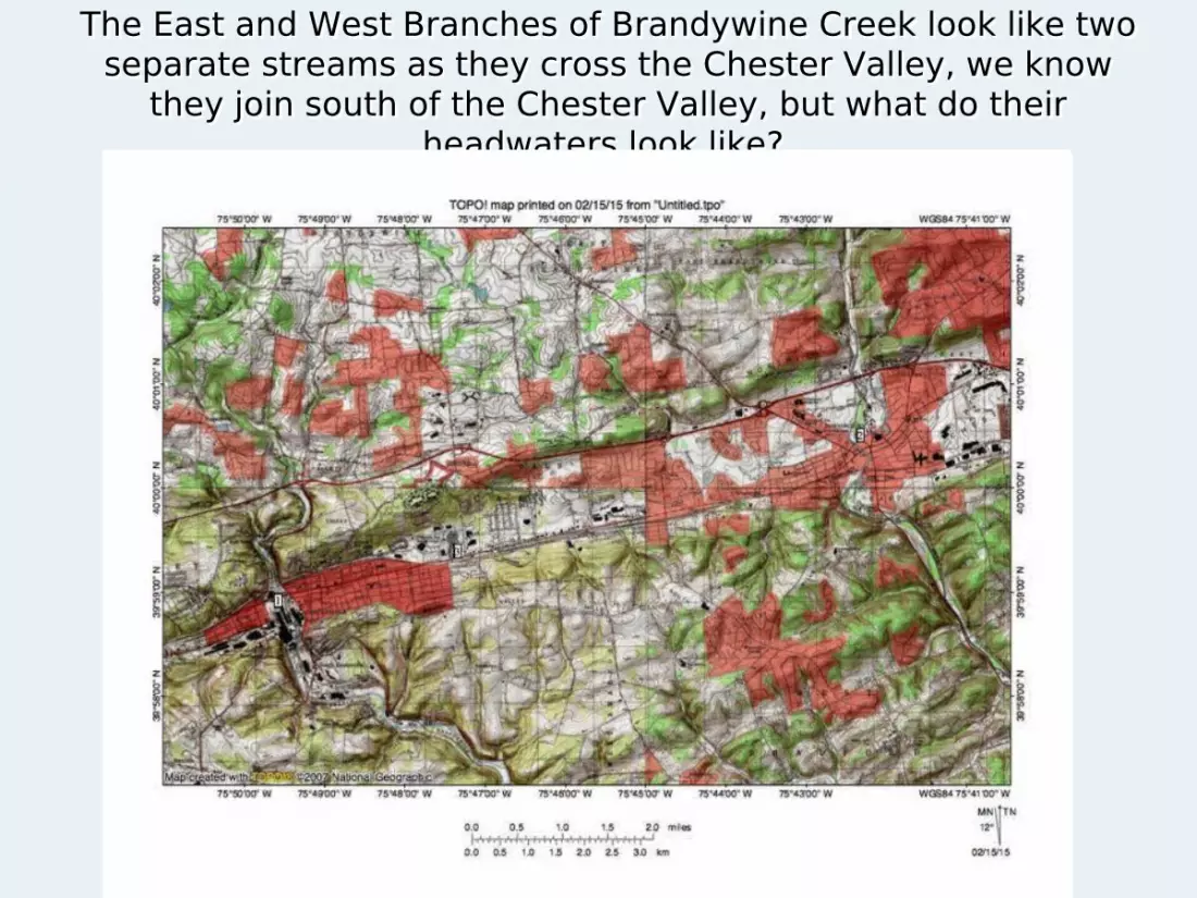
The East and West Branches of Brandywine Creek look like two separate streams as they cross the Chester Valley, we know
they join south of the Chester Valley, but what do their headwaters look like?
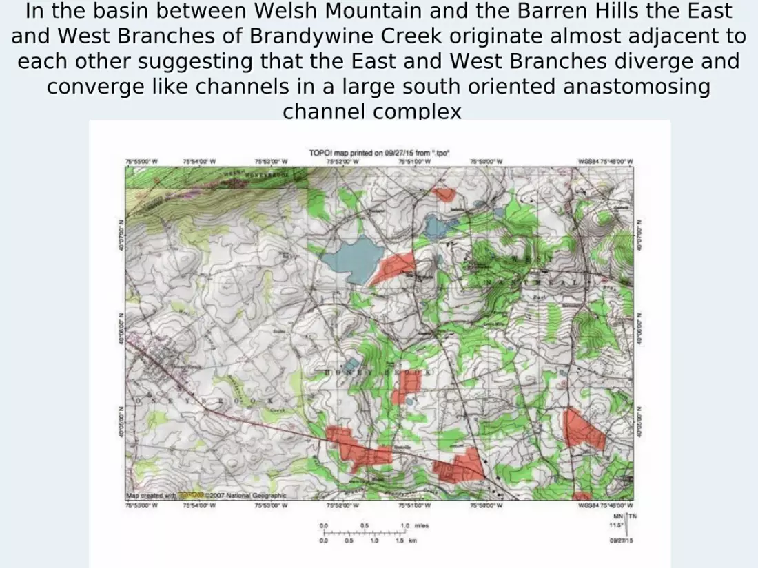
In the basin between Welsh Mountain and the Barren Hills the East and West Branches of Brandywine Creek originate almost adjacent to each other suggesting that the East and West Branches diverge and
converge like channels in a large south oriented anastomosing channel complex
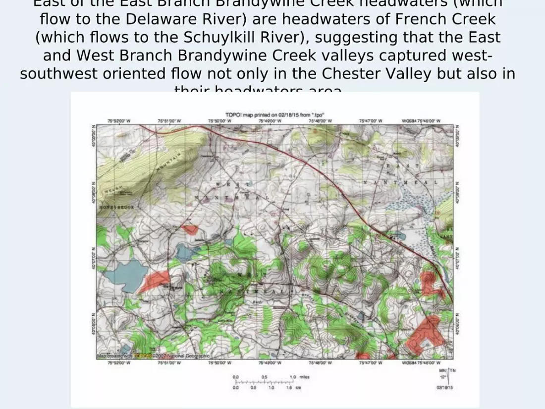
East of the East Branch Brandywine Creek headwaters (which flow to the Delaware River) are headwaters of French Creek (which flows to the Schuylkill River), suggesting that the East and West Branch Brandywine Creek valleys captured west-
southwest oriented flow not only in the Chester Valley but also in their headwaters area.
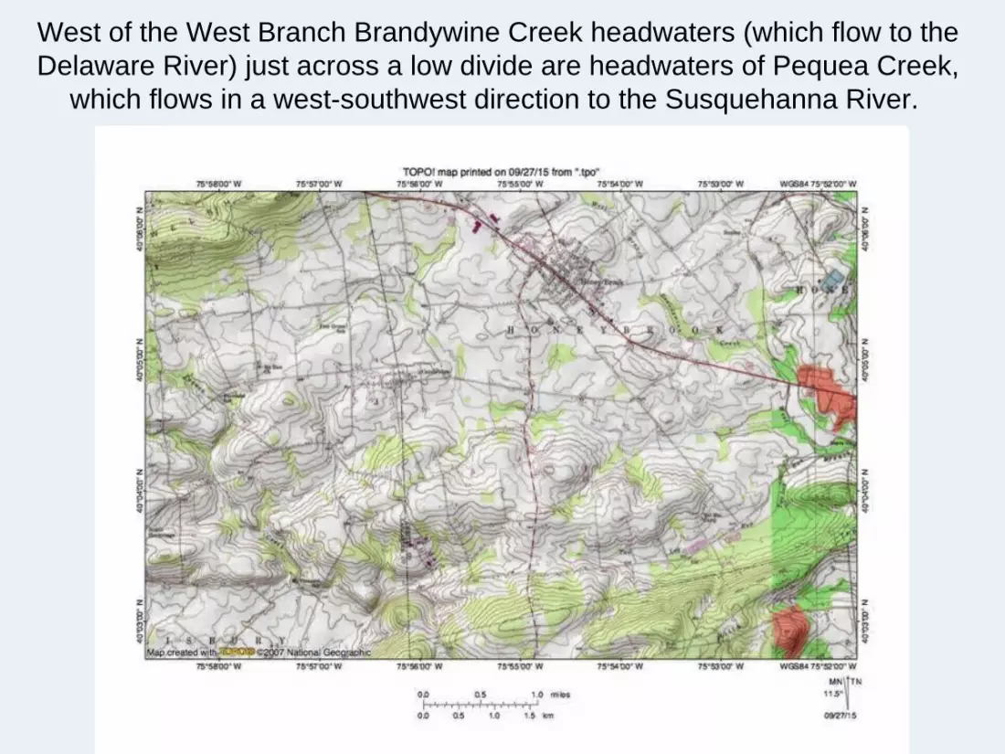
West of the West Branch Brandywine Creek headwaters (which flow to the Delaware River) just across a low divide are headwaters of Pequea Creek,
which flows in a west-southwest direction to the Susquehanna River.
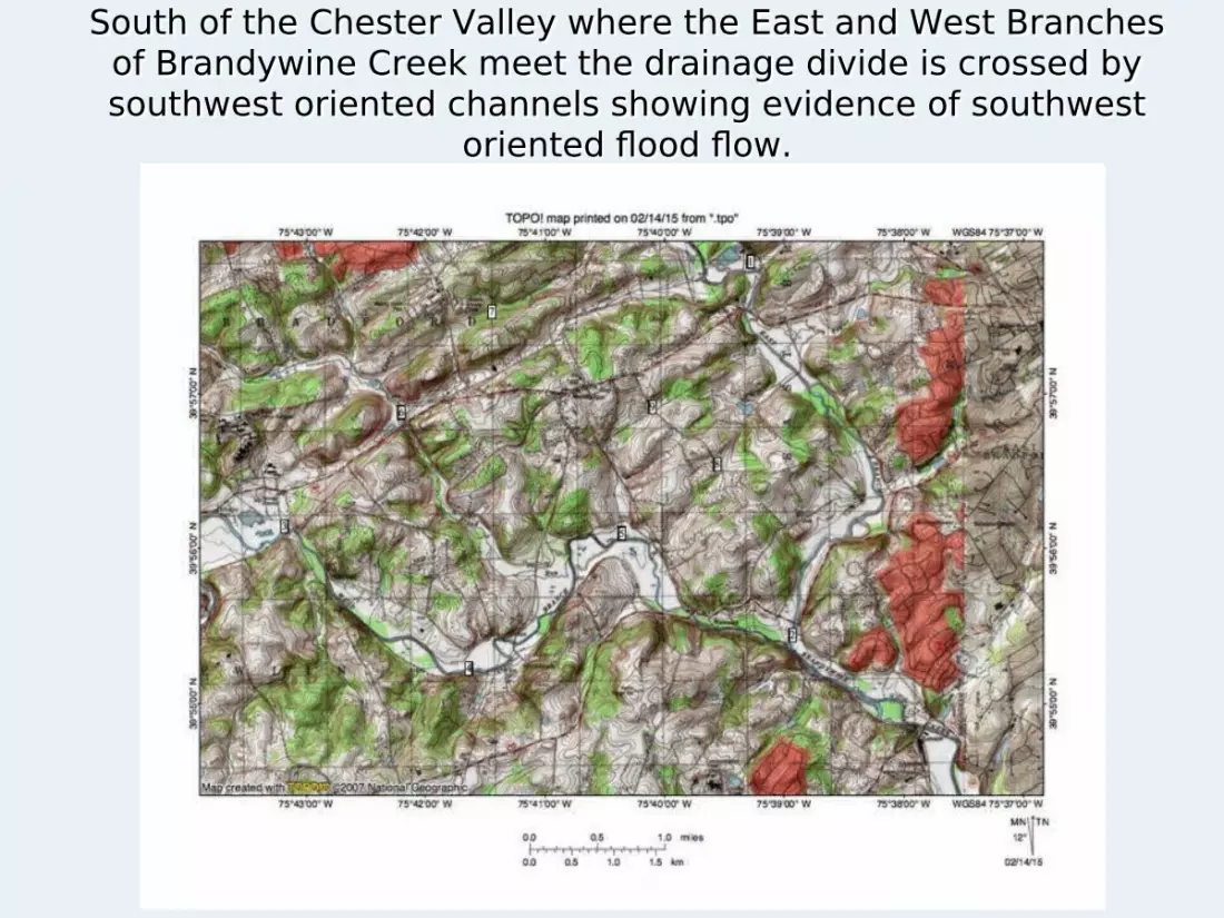
South of the Chester Valley where the East and West Branches of Brandywine Creek meet the drainage divide is crossed by southwest oriented channels showing evidence of southwest
oriented flood flow.

Summary Evidence for southwest oriented flow is not only found in the
Chester Valley, but also between Welsh Mountain and the Barren Hills, and also south of the Chester Valley suggesting that a west-southwest oriented anastomosing channel complex drained flood waters across the region prior to headward erosion of the present day West and East Branch Brandywine Creek valleys.
The East and West Branches Brandywine Creek diverge and converge in a manner typical of how anastomosing channel complex channels diverge and converge suggesting they originated as components of a south oriented anastomosing channel complex eroding headward from an actively eroding southwest oriented Delaware River valley that captured the west-southwest oriented anastomosing channel complex (moving water to what may have been a newly eroded Susquehanna River valley) in a progressive sequence from west to east.