Embed Size (px)
Citation preview
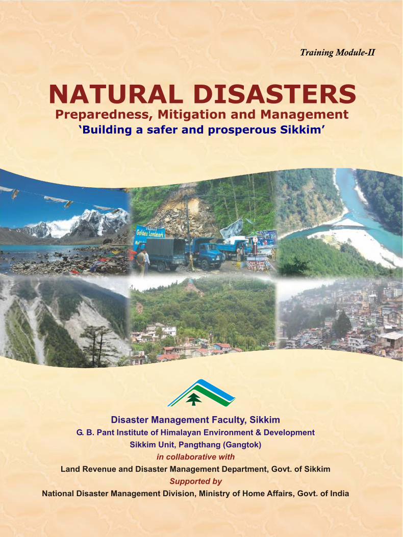
Training Module-II
NATURAL DISASTERS Preparedness, Mitigation and Management
‘Building a safer and prosperous Sikkim’
Disaster Management Faculty, Sikkim
G. B. Pant Institute of Himalayan Environment & Development
Sikkim Unit, Pangthang (Gangtok)
in collaborative with
Supported by
Land Revenue and Disaster Management Department, Govt. of Sikkim
National Disaster Management Division, Ministry of Home Affairs, Govt. of India
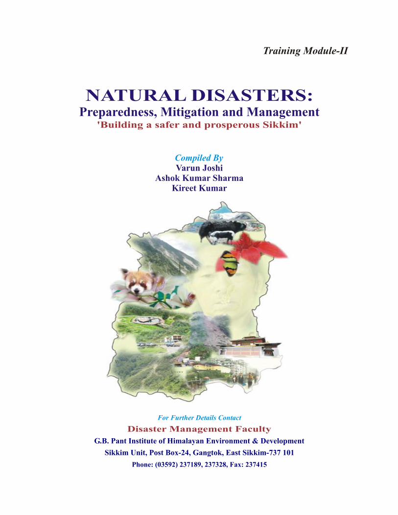
Training Module-II
NATURAL DISASTERS: Preparedness, Mitigation and Management
'Building a safer and prosperous Sikkim'
Compiled ByVarun Joshi
Ashok Kumar SharmaKireet Kumar
For Further Details Contact
Disaster Management Faculty
G.B. Pant Institute of Himalayan Environment & Development
Sikkim Unit, Post Box-24, Gangtok, East Sikkim-737 101
Phone: (03592) 237189, 237328, Fax: 237415

Published byG.B. Pant Institute of Himalayan Environment & DevelopmentKosi-Katarmal, Almora - 263 643, UA, INDIAPhone : 05962-241041/ 241154, Fax : 05952-241150/ 241014
Natural Disasters: Preparedness, Mitigation and Management© G.B. Pant Institute of Himalayan Environment & Development, 2007
Designed and Printed at:Venus Printers and PublishersB-62/8, Naraina Industrial Area, Phase-II, New Delhi-110 028Tel. : 91-11-25891449, 25815063, Mob. : 9810089097, 20274098E-mail : [email protected]; [email protected]
Foreword
The dwellers of the Himalayan region are encountering many natural hazards. Earthquake,
landslide, cloud burst, flash floods, high intensity rainfall, floods, forest fire and avalanches are
the common natural disasters that have been occurring and causing tragedies, specially in
populated areas of the Himalayan region. In order to minimize losses through concerted
international actions, the United Nations observed the last decade of the Millennium i.e. 1990-
2000 as the International Decade of Natural Disaster Reduction (IDNDR). Formulation of
natural disaster mitigation programme, optimal land use and provision of insurance for disaster
integrated with developmental programme of all the nations, particularly the developing
countries, are some of the major thrust areas spelled out in IDNDR. A switch from post-disaster
life management programme to preparedness, mitigation and management has become the new
focus. Awareness generation through training, mass media, education, strengthening the
government support and early warning system are the key areas of the programme.
In a populous country like ours, people will have to live in disaster prone areas, therefore
ways and means need to be evolved to protect their lives to ensure that their social and economic
activities are not adversely affected. While making efforts to further strengthen the disaster
preparedness, the disaster management strategy should focus on building mitigation content into
the overall development plans for minimization of the impact of disasters. Knowledge on
construction of earthquake resistant buildings, landslide stabilization, appropriate planning of
transport network, fire control systems and proper land use methods can also reduce the physical
vulnerability to a great extent.
As elsewhere in the Himalayan region, Sikkim state is also highly vulnerable to mountain
specific disasters like earthquakes, landslides, cloud burst and flash flood, etc. Preparation for
any form of natural disaster is the foremost need of the region. This publication is a compilation
of information related to natural disaster preparedness and mitigation. It is hoped that, with due
reasoning and application, this training module will be very helpful to a range of stakeholders
working at various levels in the management of the natural calamities in Sikkim state and other
parts of the Himalaya.
I wish to place on record deep sense of appreciation to my colleagues who have compiled
this publication.
(Uppeandra Dhar)Director
Acknowledgements
This training module is the outcome of compilation of Resource Material for Natural Disaster
Mitigation and Preparedness by Ministry of Home Affairs (Govt. of India), other
agencies/organizations working on same line and the experience and informations gained during the
trainings/field work carried out in different phases in the state also incorporated. We gratefully
acknowledge the support, encouragement and guidance of Dr. Uppeandra Dhar, Director, G.B. Pant
Institute of Himalayan Environment and Development, Kosi-Katarmal, Almora in preparing this
training modules. Thanks are also due to Drs. A. P. Krishna, H. K. Badola, K. K. Singh, Y.K. Rai, Shri
R.Joshi, L.K. Rai, R. K. Das, J.N. Dhakal, P.K. Tamang and other staff member of Sikkim Unit for
their scientific and technical help at various levels. Disaster Management Division, Ministry of
Home Affairs (Govt. of India) is acknowledged for financial support to Disaster Management
Faculty Sikkim and Land Revenue and Disaster Management Department, Govt. of Sikkim to
facilitate the programmes in the state.
Foreword i
Acknowledgments iii
Introduction 1
Earthquake: Mitigation and Preparedness 7
Landslide: Mitigation and Preparedness 23
Flood: Mitigation and Preparedness 35
Forest Fire: Mitigation and Preparedness 47
Avalanche: Mitigation and Preparedness 56
Bibliography 63
Contents
1
2
3
4
5
6
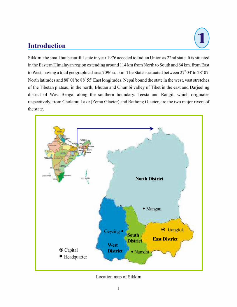
Introduction
Sikkim, the small but beautiful state in year 1976 acceded to Indian Union as 22nd state. It is situated
in the Eastern Himalayan region extending around 114 km from North to South and 64 km. from East 0 0
to West, having a total geographical area 7096 sq. km. The State is situated between 27 04' to 28 07' 0 0
North latitudes and 88 01'to 88 55' East longitudes. Nepal bound the state in the west, vast stretches
of the Tibetan plateau, in the north, Bhutan and Chumbi valley of Tibet in the east and Darjeeling
district of West Bengal along the southern boundary. Teesta and Rangit, which originates
respectively, from Cholamu Lake (Zemu Glacier) and Rathong Glacier, are the two major rivers of
the state.
Location map of Sikkim
1
11
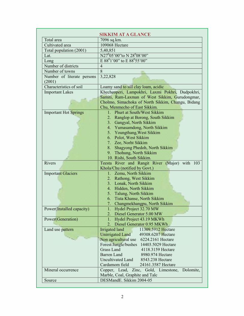
SIKKIM AT A GLANCE Total area 7096 sq.km.
2
Khangchendzonga/Kangchenjunga is the third highest mountain in the world with an altitude of
8,586 / 8,598 metres is located in the Sikkim - Nepal border as part of the Himalayan mountain
range. The huge third highest mountain in the world derived its name from the Tibetan words'
Kanchen' and 'Dzonga' mean “five treasuries of the great snow”. The five peaks of Kangchenjunga
are the five Treasures of the Eternal Snow, a belief beautifully interpreted by the great Lama Lhatsun
Chenpo: “The peak most conspicuously gilded by the rising sun is the treasury of gold, the peak that
remains in cold grey shade is the storehouse for silver and other peaks are vaults for gems, grains and
the holy books”. The people of Sikkim regard “Kanchenjunga as their Gardien Deity”. Glimpse of
the peak from various locations is the main attraction of tourist in the state.
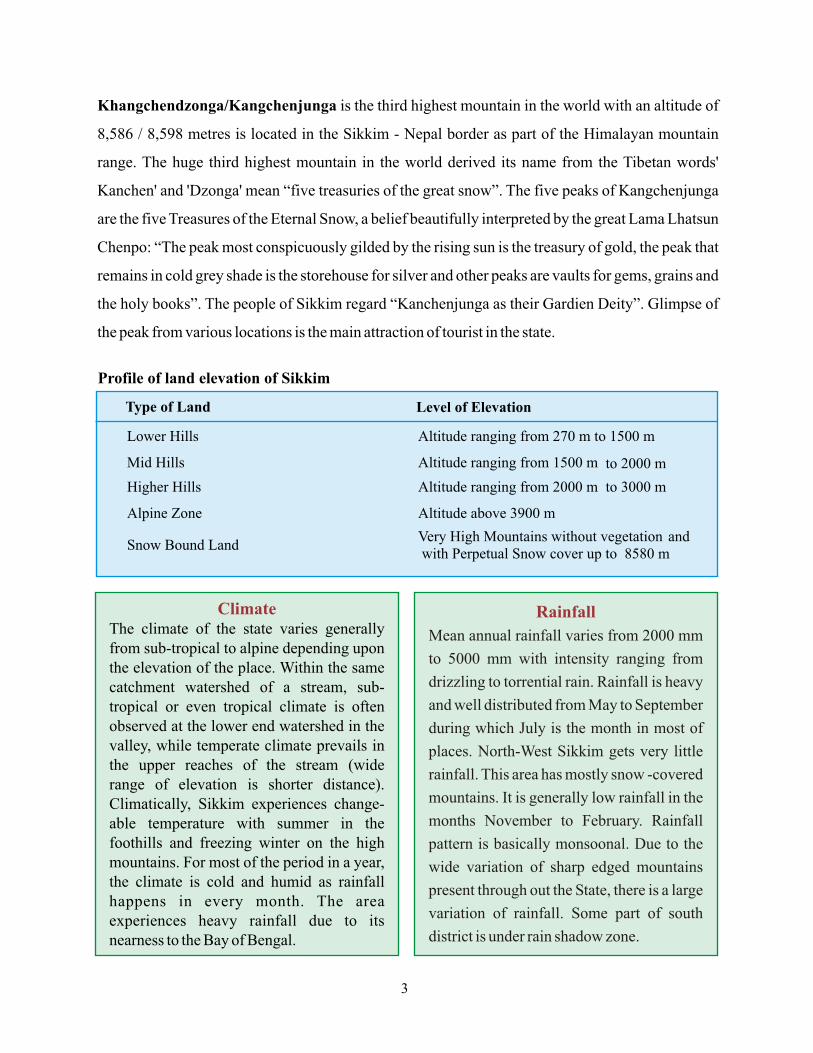
Profile of land elevation of Sikkim
Rainfall
Mean annual rainfall varies from 2000 mm
to 5000 mm with intensity ranging from
drizzling to torrential rain. Rainfall is heavy
and well distributed from May to September
during which July is the month in most of
places. North-West Sikkim gets very little
rainfall. This area has mostly snow -covered
mountains. It is generally low rainfall in the
months November to February. Rainfall
pattern is basically monsoonal. Due to the
wide variation of sharp edged mountains
present through out the State, there is a large
variation of rainfall. Some part of south
district is under rain shadow zone.
ClimateThe climate of the state varies generally from sub-tropical to alpine depending upon the elevation of the place. Within the same catchment watershed of a stream, sub-tropical or even tropical climate is often observed at the lower end watershed in the valley, while temperate climate prevails in the upper reaches of the stream (widerange of elevation is shorter distance). Climatically, Sikkim experiences change-able temperature with summer in the foothills and freezing winter on the high mountains. For most of the period in a year, the climate is cold and humid as rainfall happens in every month. The area experiences heavy rainfall due to its nearness to the Bay of Bengal.
Type of Land Level of Elevation
Lower Hills Altitude ranging from 270 m to 1500 m
Mid Hills Altitude ranging from 1500 m to 2000 m
Higher Hills Altitude ranging from 2000 m to 3000 m
Alpine Zone Altitude above 3900 m
Snow Bound LandVery High Mountains without vegetation and with Perpetual Snow cover up to 8580 m
3
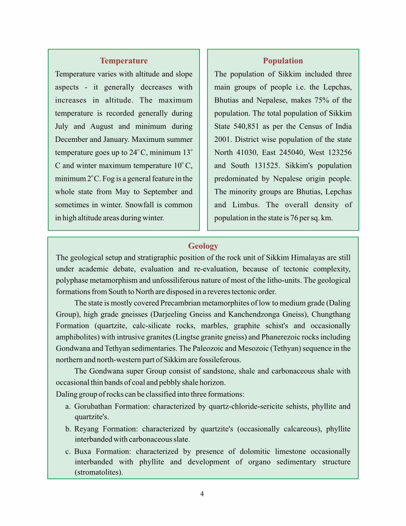
Temperature
Temperature varies with altitude and slope
aspects - it generally decreases with
increases in altitude. The maximum
temperature is recorded generally during
July and August and minimum during
December and January. Maximum summer o o
temperature goes up to 24 C, minimum 13o
C and winter maximum temperature 10 C, o
minimum 2 C. Fog is a general feature in the
whole state from May to September and
sometimes in winter. Snowfall is common
in high altitude areas during winter.
Population
The population of Sikkim included three
main groups of people i.e. the Lepchas,
Bhutias and Nepalese, makes 75% of the
population. The total population of Sikkim
State 540,851 as per the Census of India
2001. District wise population of the state
North 41030, East 245040, West 123256
and South 131525. Sikkim's population
predominated by Nepalese origin people.
The minority groups are Bhutias, Lepchas
and Limbus. The overall density of
population in the state is 76 per sq. km.
Geology
The geological setup and stratigraphic position of the rock unit of Sikkim Himalayas are still
under academic debate, evaluation and re-evaluation, because of tectonic complexity,
polyphase metamorphism and unfossiliferous nature of most of the litho-units. The geological
formations from South to North are disposed in a reveres tectonic order.
The state is mostly covered Precambrian metamorphites of low to medium grade (Daling
Group), high grade gneisses (Darjeeling Gneiss and Kanchendzonga Gneiss), Chungthang
Formation (quartzite, calc-silicate rocks, marbles, graphite schist's and occasionally
amphibolites) with intrusive granites (Lingtse granite gneiss) and Phanerezoic rocks including
Gondwana and Tethyan sedimentaries. The Paleozoic and Mesozoic (Tethyan) sequence in the
northern and north-western part of Sikkim are fossileferous.
The Gondwana super Group consist of sandstone, shale and carbonaceous shale with
occasional thin bands of coal and pebbly shale horizon.
Daling group of rocks can be classified into three formations:
a. Gorubathan Formation: characterized by quartz-chloride-sericite sehists, phyllite and
quartzite's.
b. Reyang Formation: characterized by quartzite's (occasionally calcareous), phyllite
interbanded with carbonaceous slate.
c. Buxa Formation: characterized by presence of dolomitic limestone occasionally
interbanded with phyllite and development of organo sedimentary structure
(stromatolites).
4
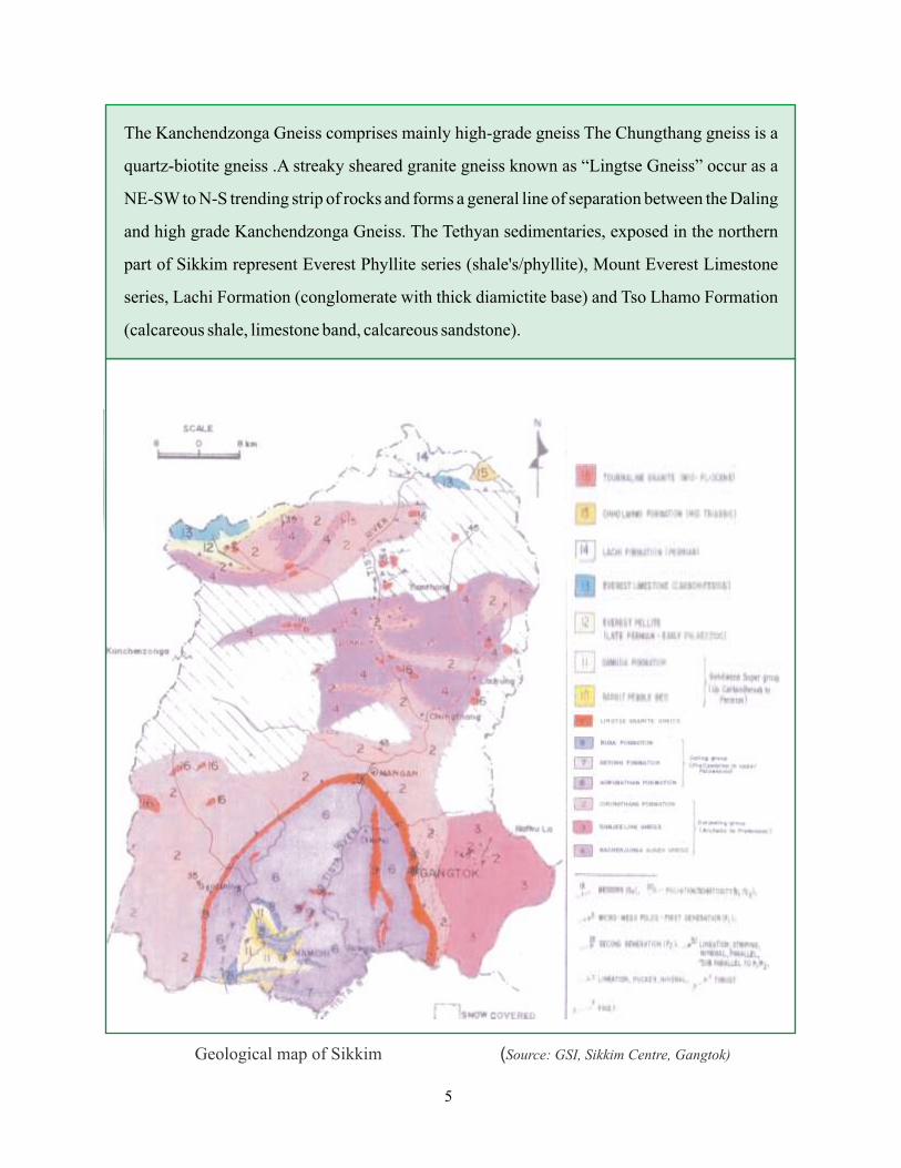
The Kanchendzonga Gneiss comprises mainly high-grade gneiss The Chungthang gneiss is a
quartz-biotite gneiss .A streaky sheared granite gneiss known as “Lingtse Gneiss” occur as a
NE-SW to N-S trending strip of rocks and forms a general line of separation between the Daling
and high grade Kanchendzonga Gneiss. The Tethyan sedimentaries, exposed in the northern
part of Sikkim represent Everest Phyllite series (shale's/phyllite), Mount Everest Limestone
series, Lachi Formation (conglomerate with thick diamictite base) and Tso Lhamo Formation
(calcareous shale, limestone band, calcareous sandstone).
Geological map of Sikkim (Source: GSI, Sikkim Centre, Gangtok)
5
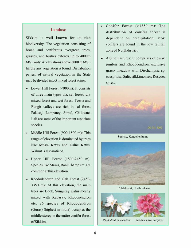
Landuse
Sikkim is well known for its rich
biodiversity. The vegetation consisting of
broad and coniferous evergreen trees,
grasses, and bushes extends up to 4000m
MSL only. At elevations above 5000 m MSL
hardly any vegetation is found. Distribution
pattern of natural vegetation in the State
may be divided into 5 mixed forest zones.
F Lower Hill Forest (<900m): It consists
of three main types viz. sal forest, dry
mixed forest and wet forest. Teesta and
Rangit valleys are rich in sal forest
Pakasaj, Lampatey, Simul, Chilawne,
Lali are some of the important associate
species.
F Middle Hill Forest (900-1800 m): This
range of elevation is dominated by trees
like Musre Katus and Dalne Katus.
Walnut is also noticed.
F Upper Hill Forest (1800-2450 m):
Species like Mawa, Rani Champ etc. are
common at this elevation.
F Rhododendron and Oak Forest (2450-
3350 m): At this elevation, the main
trees are Book, Sunguray Katus mostly
mixed with Kapasay, Rhodonendron
etc. 36 species of Rhododendron
(Guras) (highest in India) occupies the
middle storey in the entire conifer forest
of Sikkim.
F Conifer Forest (>3350 m): The
distribution of conifer forest is
dependent on precipitation. Most
conifers are found in the low rainfall
zone of North district.
F Alpine Pastures: It comprises of dwarf
junifers and Rhododendron, exclusive
grassy meadow with Dischampsia sp.
caespitosa, Salix silkkimonses, Roscoea
sp. etc.
Sunrise, Kangchenjunga
Cold desert, North Sikkim
Rhododendron maddeni Rhododendron decipiens
6
2Earthquake: Earthquakes are considered to be one of the most disastrous natural hazards
causing colossal loss of life and property within fraction of time. The beginning of this
occurrence is usually sudden with little or no warning. It is a sudden shift of the earth's crust blow
or at the surface that results in ground vibration and the potential collapse of buildings and
possible destruction of life and property, if the quake is of sufficient magnitude. Earthquakes are
considered to be one of the most disastrous phenomenon. It is not yet possible to predict
earthquakes and to make preparation against damages, collapse of buildings and other man
made structures.
Earthquake: Mitigation and Preparedness
Causes of Earthquake: Earthquakes are
caused by natural tectonic interactions
within the earth's crust and it is a global
phenomena. May arise either due to the
release of energy from strained rock inside
the Earth or tectonic movements or volcanic
activity. The sudden release of accumulated
energy or stresses inside the earth or sudden
movement of massive land areas on the
earth's surface cause tremors, commonly
called earthquakes.
Earthquake Hazards in India
History of earthquake in India is since time immorial. About 80% of the population and 56% of
the total area (Zone-V- 12%,-IV-18%, III-25%, II-45%) of our country is in the high or moderate
seismic risk zone. The country is divided into five zones on the basis of seismicity. About half of
India's total area of 3.3 million sq. km falls in the seismic zone. This is even higher than the
seismic areas of Japan and California (USA) put together. The most earthquake prone areas
belong to the Himalayan belt in the northern region from Kashmir to Arunachal Pradesh in the
east, the earthquake prone areas are all eight state on NE region, Uttarakhand, Gujrat, H.P, J&K,
part of Bihar-Nepal border and Kutch region.
7

Main Seismic Regions of India
D Kashmir and Western Himalayas
D Central Himalayas
D Northeast India including Sikkim
D Indo Gangetic Basin and Rajasthan
D Cambay and Rann of Kutch
D Peninsular India including Islands of
Lakshadweep
D The Andaman and Nicobar Islands
Impact and Effects of Earthquake
Disasters
F Loss of Life
F Injury
F Damage to and Devastation of Property
F Damage to and Devastation of Sub-
sistence and Cash Crops
F Devastation of Production
F Devastation of Lifestyle
F Loss of Livelihood
F Disruption to Essential Services
F Damage to National Infrastructure and
Disruption to Administrative and
Organization Systems
F National Economic Loss
F Sociological and Psychological after-
effects
F Liquefaction failures and Landslides
F Spread of Epidemics
Earthquake Hazard Zoning Map of IndiaSource: BMTPC
House Census of India, 1991
20 May 2007 Earthquake damage TashidingMonastery, Sikkim
14 February 2006 Earthquake - Sikkim
State
Andman and NicobarMizoramArunachal PradeshMeghalayaNagalandAssamSikkimManipurTripura
House (in %)Earthquake Safe
97.4 97.0 93.8 91.7 86.7 84.1 78.7 66.6 50.5
8
Earthquake Disaster Mitigation in India
Ministry of Home Affairs, Government of India, is responsible for providing help at the time
of emergency. The Government helps the population in distress due to any natural calamity
through relief and rehabilitation programs, loans and subsidies. The respective state
government coordinates the Disaster Management programme. A number of Voluntary
Agencies also come forward in a big way during emergency situations in a district. The District
Collector coordinates their efforts in a most suitable manner.
Earthquake Mitigation
F Follow Building codes.
F Enforcement of Compliance with codes Requirements and Encouragement of Higher
Standards of Construction quality.
F More Emphasis should be given to Engineering of Structures to withstand vibration forces.
High Standard of Engineering design of all Public Buildings (Hotels, Schools and Hospitals
etc.).
F Reduce Population/Construction Densities in High Seismic Zones.
F Strengthening of Existing Buildings, Monuments in the vulnerable areas.
F Encouraging Insurance.
F Community Participation in Constructing Safe Houses from Seismic forces, Creating
Awareness of What to do and What not to do at the time of Earthquake.
F Community Action Groups in Fire-Fighting, First-Aid and Rescue Operation, and Regular
Earthquake Mock Drills in the area.
Measures for Earthquake Risk Reduction
Earthquakes strike without warning and cause widespread damage to various man-made
structures and systems. These can neither be prevented in terms of their magnitude, place and
time of occurrence. Therefore, the most effective measures of risk reduction are pre-disaster
mitigation, preparedness and preventive measures for reducing the vulnerability of the built
environment and expeditious effective rescue and relief actions immediately after the
occurrence of an earthquake. The main purpose of earthquake disaster management is to
mitigate sufferer as well as to find out their causes and solutions.
9
Earthquake in Sikkim
All districts of the state of Sikkim lies in
Zone- IV. The earthquake happenings in this
region are due to the movement of Indian
plate pitching (thrusting) under the Eurasian
plate. The state is mountainous and
underlain by some major thrust/ regional
faults. Most important are the Main
Boundary Thrust (MBT), the Main Central
Thrust (MCT) and the Himalayan Frontal
Thrust (HFT).
- Indo-Nepal Border
region, Moment Magnitude-8.0, time -
14:21:25 IST / 08:43:25 UTC, 26.50
North, 86.50 East Nearly 10,500 people
were killed in Bihar and Nepal. Damage
was also reported from many places in
Sikkim.
- West of Gangtok
(Indo-Nepal Border region), 6.1 (TS)
time-13:32:24 UTC, 27.60 North- 88.00
East.
- Near Gangtok
(Sikkim-West Bengal Border region),
6.1 Surface Wave Magnitude, time-
19:00:46.9 UTC, 27.39 North-88.75 East
17 kms depth. Eight people were injured
in Gangtok and minor damage also
reported from the city. The quake was
also felt in eastern and north-eastern
India, Bangladesh, Bhutan and Nepal.
Major Earthquakes in Sikkim
G 15 January 1934
G 12 January 1965
G November 1980
G 21 August 1988
G 14 February 2006
G 31 December 2006
G 20 May 2007
- Udaipur Gahri, Nepal
(Indo-Nepal Border region), Moment
M a g n i t u d e - 6 . 8 ( N E I C ) t i m e -
23:09:09 UTC / 04:39:09 IST, 26.755
North - 86.616 East. Nearly 900 people
were killed in the border districts of
Nepal and Bihar, India. Damage was also
reported from Kathmandu and Sikkim.
Felt in Northern and Eastern State of
India and most of the part of Nepal.
North Sikkim,
Moment Magnitude-5.3, 27.377 North -
88.362 East, Depth: 20.1 kms, Origin
Time - 00:55:23 UTC, 06:25 IST. mode-
rate earthquake hit Sikkim Himalayas
ensuing two deaths and minor damage to
property in Sikkim. Two Indian Army
soldiers were killed, when traveling a
vehicle hited by a rock fall at Sherathang
near the border outpost at Nathu-La. Two
people were injured in East Sikkim by
this earthquake.
An earthquake of low
moderate intensity 2.1, local time- 12.49
P.M.
- Moderate intensity 5.0,
West Sikkim, 17:48 hrs (IST). Damage to
Tashiding Monastery. Two more tremours
thmeasuring 4 and 4.6 recorded on 16 and
th18 May 2007, respectively. No causality
reported.
-
-
10
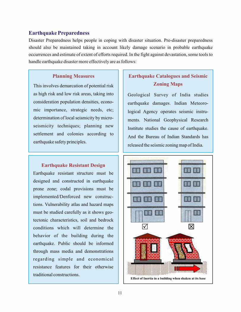
Earthquake Preparedness
Disaster Preparedness helps people in coping with disaster situation. Pre-disaster preparedness
should also be maintained taking in account likely damage scenario in probable earthquake
occurrences and estimate of extent of efforts required. In the fight against devastation, some tools to
handle earthquake disaster more effectively are as follows:
Planning Measures
This involves demarcation of potential risk
as high risk and low risk areas, taking into
consideration population densities, econo-
mic importance, strategic needs, etc;
determination of local seismicity by micro-
seismicity techniques; planning new
settlement and colonies according to
earthquake safety principles.
Earthquake Catalogues and Seismic
Zoning Maps
Geological Survey of India studies
earthquake damages. Indian Meteoro-
logical Agency operates seismic instru-
ments. National Geophysical Research
Institute studies the cause of earthquake.
And the Bureau of Indian Standards has
released the seismic zoning map of India.
Earthquake Resistant Design
Earthquake resistant structure must be
designed and constructed in earthquake
prone zone; codal provisions must be
implemented/Denforced new construc-
tions. Vulnerability atlas and hazard maps
must be studied carefully as it shows geo-
tectonic characteristics, soil and bedrock
conditions which will determine the
behavior of the building during the
earthquake. Public should be informed
through mass media and demonstrations
regarding simple and economical
resistance features for their otherwise
traditional constructions.
11
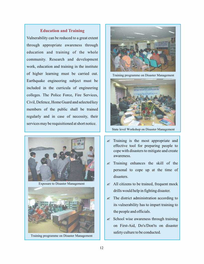
Education and Training
Vulnerability can be reduced to a great extent
through appropriate awareness through
education and training of the whole
community. Research and development
work, education and training in the institute
of higher learning must be carried out.
Earthquake engineering subject must be
included in the curricula of engineering
colleges. The Police Force, Fire Services,
Civil, Defence, Home Guard and selected key
members of the public shall be trained
regularly and in case of necessity, their
services may be requisitioned at short notice.
? Training is the most appropriate and
effective tool for preparing people to
cope with disasters to mitigate and create
awareness.
? Training enhances the skill of the
personal to cope up at the time of
disasters.
? All citizens to be trained, frequent mock
drills would help in fighting disaster.
? The district administration according to
its vulnerability has to impart training to
the people and officials.
? School wise awareness through training
on First-Aid, Do's/Don'ts on disaster
safety culture to be conducted.
12

Research
Research work is to be carried out for
developing and implementing engineering
intervention and improving regulatory
mechanism, developing instrumentation
for hazard monitoring, forecasting, early
warning, etc. Research must be carried out
for sesmic micro-zonation and to develop
measures for the assessment, prediction,
prevention and mitigation of earthquake
disaster.
Insurance
The State Governments should make life
and property insurance mandatory for the
persons residing in the recurrent earthquake
prone zone. Insurance is a very effective
risk-mitigating instrument as it not only
helps to mitigate the economic effects but
also works to affect market forces, which
eventually improve the quality of
Management of Rescue and Relief
Search and rescue of people who are
trapped and injured is the first and foremost
task after the disaster. This is a highly
specialized task, which requires specially
trained and equipped teams. The teams
should be equipped with elements of
rescue, first aid, fire fighting, communi-
cation and administration. Mobile first-aid,
surgical trauma and evacuation teams have
to be deployed in the area to provide first-
aid treatment to the casualties and to
arrange for immediate evacuation of the
seriously injured, old and infant.
Arrangement should also be made for
mobile surgical teams along the mobile
operation van for major injury cases that
may require immediate life saving surgery.
Along with the search and rescue teams,
specially trained dogs also supplement
detection human causalities where search
and recovery operations are hampered.
Rehabilitation
The rehabilitation process requires a lot of
emotional and psychological support in
addition to physical and material
assistance. Thus Psychologists and
Psychiatrists play a very important role in
the post disaster scenario. The effort should
be to make the people self-reliant,
optimistic and confident to face the future.
At the same time, restoration of essential
services such as communication, water and
power supply should be made as early as
possible. There are many role players in the
rehabilitation period, the universities,
colleges and schools possess vast
potentiality and with some training to
students, a lot of rehabilitation work can be
done after earthquake. NGOs also play a
very important role in rehabilitation period
due to their linkages with the community
and flexibility in procedural matters.
13
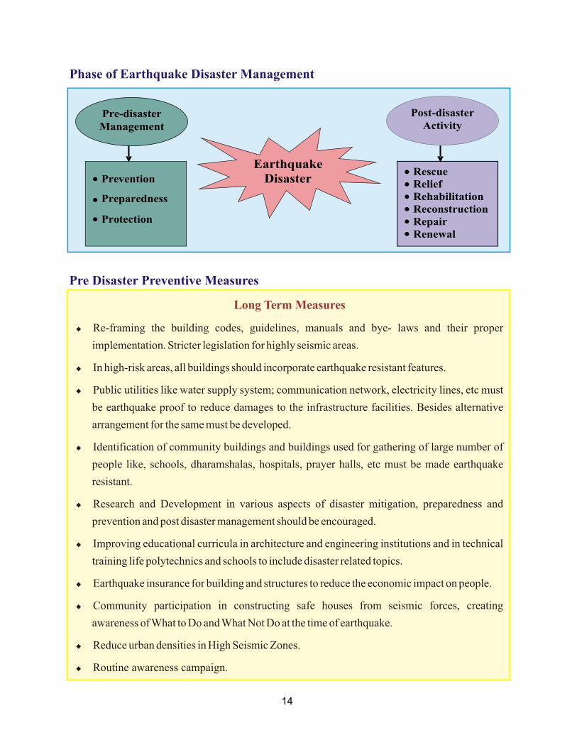
Phase of Earthquake Disaster Management
Earthquake Disaster
Pre-disaster Management
Post-disaster Activity
l
l
l
Prevention
Preparedness
Protection
l Rescue Relief Rehabilitation Reconstruction Repair Renewal
Pre Disaster Preventive Measures
Long Term Measures
u Re-framing the building codes, guidelines, manuals and bye- laws and their proper
implementation. Stricter legislation for highly seismic areas.
u In high-risk areas, all buildings should incorporate earthquake resistant features.
u Public utilities like water supply system; communication network, electricity lines, etc must
be earthquake proof to reduce damages to the infrastructure facilities. Besides alternative
arrangement for the same must be developed.
u Identification of community buildings and buildings used for gathering of large number of
people like, schools, dharamshalas, hospitals, prayer halls, etc must be made earthquake
resistant.
u Research and Development in various aspects of disaster mitigation, preparedness and
prevention and post disaster management should be encouraged.
u Improving educational curricula in architecture and engineering institutions and in technical
training life polytechnics and schools to include disaster related topics.
u Earthquake insurance for building and structures to reduce the economic impact on people.
u Community participation in constructing safe houses from seismic forces, creating
awareness of What to Do and What Not Do at the time of earthquake.
u Reduce urban densities in High Seismic Zones.
u Routine awareness campaign.
l
l
l
l
l
14
Medium Term Measures
u Retrofitting of the weak structures in the highly seismic zones.
u Preparation of a list of Do's and Don'ts in local languages for the building constructions and
earthquake safety.
u Prepare a family Disaster Mitigation Plan, indicating whom to contact and where to go.
u Getting the community involved in the process of disaster mitigation by providing them
proper education and awareness.
u Supporting local technical institutions/colleges/schools to conduct research, training and to
organize exhibitions, etc for public awareness.
u Networking of local NGOs working in the area of disaster management.
u Maintenance of law and order, prevention of trespassing and looting.
u Evacuation of people
u Recovery of dead bodies and their disposal.
u Medical care for the injured.
u Supply of food and drinking water.
u Provision of temporary shelters like, tents and metal sheds.
u Restoring lines of communication and information.
u Restoring transport routes.
u Quick assessment of damage and demarcation of damaged areas according to grade of
damage.
u Cordoning of severely damaged structures that are liable to collapse during after shocks.
u Temporary shoring of certain precariously standing building to avoid collapses and damage
to other adjoining buildings.
u Immediate action to prevent chain- reaction from developing, such as release of water from
the reservoir behind a damaged dam to avoid flooding of the area if the dam fails. Also
emptying of containers of toxic or inflammable liquid and gases, treatment of environment
for preventing spread of epidemics, etc.
Post Disaster - Preventive Measures
15
Consolidation and Reconstruction Phase
Guidelines for Reduction of Seismic Vulnerability
l Detailed damage assessment of building and decision regarding repair, restoration,
retrofitting and strengthening or demolition;
l Repair, restoration and seismic strengthening or demolition;
l Selection of sites for new settlements;
l Adoption of strategy for new construction such as, through contractors, self help,
construction of core-houses or supply of construction materials, etc;
l Execution of the reconstruction programme;
l Review of existing seismic zoning maps and risk maps;
l Review of seismic codes and norms of construction;
l Training of personnel, engineers, architects, builders and artisans;
l Statistical studies regarding earthquake.
l To ensure that the structure possesses at least the minimum strength to withstand minor
earthquakes.
l To resist moderate earthquakes, with an once-in-a-lifetime occurrence probability, without
significant damage, although some minor structural damage may occur.
l To enable the structure to withstand without collapse, a major earthquake having Maximum
Potential in that area.
Site Selection
l Stability of the slope: In general, level sites are preferable to those on slopes or hillsides.
Stable slopes should be chosen to locate the buildings.
l Rock falls: Sites prone to rock falls are to be avoided as they as dangerous for human
settlement.
l Reclaimed or filled sites: Such sites should be avoided, particularly in seismic prone areas.
l Soil Testing and Microzonation: Where available, microzonation information should be
obtained to ascertain the probable maximum intensities, which could be experienced
during an earthquake.
16

Materials and Quality of Construction
Construction material and technology affect the seismic performance of a building. A building
constructed of brick in cement mortar will behave much better than brick in mud mortar,
provided all other parameters remain the same. The suitability of materials for construction is
dependent on the characteristics of the materials themselves as well as their combination with
other materials. From earthquake safety view point, the suitability of materials for construction
could be classified as follows:
u
u
u
u
Highly suitable: Steel, Wood and RCC.
Moderately suitable: Brick, block, dressed stone masonry with good mortar, compacted
abode construction if appropriately reinforced.
Slightly suitable: Un- reinforced brick, block, stone masonry with good mortar.
Unsuitable: Un-reinforced masonry with mud mortar, earthen walls without reinforcement.
In all seismic zones, the following measures should be adopted as per IS-4326 (revised in 1993)
for walls built using rectangular units in cement mortar and as per IS-13828 (subjected-1993)
for walls of coarsed rubble masonry or other masonry built using mud mortar.
u
u
u
u
u
u
u
u
u
u
Control on length, height and thickness of wall in a room.
Control on size and location of openings.
Control on material strength and quality of construction.
Seismic band at plinth level (maybe omitted if founded on rock or hard soil).
Seismic band at ceiling level of floors or roofs consisting of jointed prefab elements.
Seismic band at door-window lintel level in all cases.
Seismic band at eave level of sloping roofs.
Seismic band at the top of gable wall and ridge wall top.
Bracing in roof structure of trussed as well as rafted roofs.
Stiffening of prefab elements in roofs/floor where used.
17
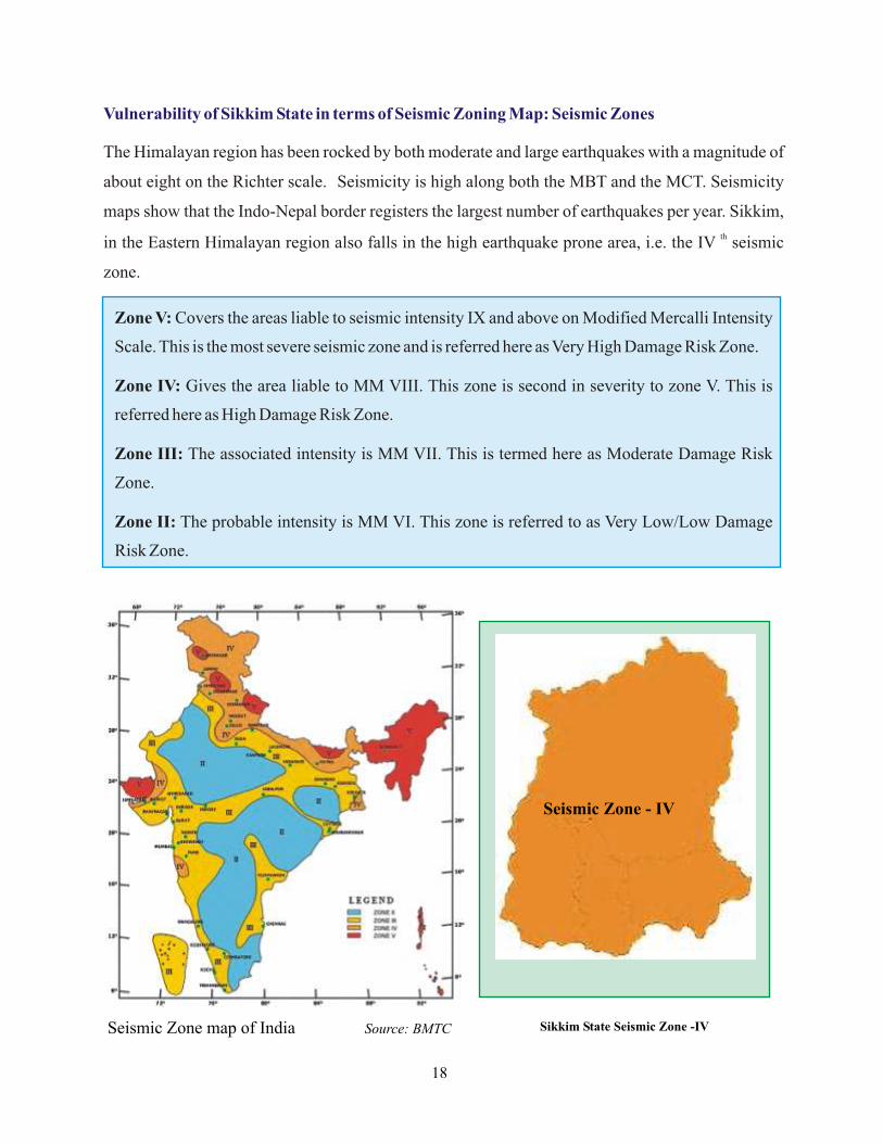
Vulnerability of Sikkim State in terms of Seismic Zoning Map: Seismic Zones
The Himalayan region has been rocked by both moderate and large earthquakes with a magnitude of
about eight on the Richter scale. Seismicity is high along both the MBT and the MCT. Seismicity
maps show that the Indo-Nepal border registers the largest number of earthquakes per year. Sikkim,
thin the Eastern Himalayan region also falls in the high earthquake prone area, i.e. the IV seismic
zone.
Seismic Zone - IV
Sikkim State Seismic Zone -IVSeismic Zone map of India Source: BMTC
Zone V: Covers the areas liable to seismic intensity IX and above on Modified Mercalli Intensity
Scale. This is the most severe seismic zone and is referred here as Very High Damage Risk Zone.
Zone IV: Gives the area liable to MM VIII. This zone is second in severity to zone V. This is
referred here as High Damage Risk Zone.
Zone III: The associated intensity is MM VII. This is termed here as Moderate Damage Risk
Zone.
Zone II: The probable intensity is MM VI. This zone is referred to as Very Low/Low Damage
Risk Zone.
18
Do's and Don'ts in Earthquake Disaster Situation
19
Before the Earthquake Disaster
l Firstly learn about the causes and effects of the earthquake.
l Prepare a family Disaster Mitigation Plan indicating whom to contact and where to go.
l Prepare an Emergency kit and place it in a safe place. Kit should contain-dry food and water
adequate for a day, battery operated radio, torch or match stick and candles, bandages and
basic medicines, directory and telephone numbers to be called during emergency, etc.
l Keep a handy torch and a portable transistor radio.
l Identify safe places in the house that can provide cover during an earthquake like inner
corner, doorway, etc.
l Arrange your home in such a way that it is possible to move more easily, keeping corridors
clear of furniture, sleeper, shoes and toys.
l Shelves for bookcase, etc., should firmly fixed to the walls. Remove heavy objects from
shelves above head level. Do not hang plants in heavy pots that could swing free of hooks.
Bookcases, cabinets or wall decorations can topple over and fall.
l Place heavy and bulky objects on the floor or on the lowest shelves.
l Consider retrofitting your house with earthquake safety measures. Reinforcing the
foundation and frame could make your house earthquake resistant.
l Teach all members of your family how to turn off the electricity, water and gas supply.
l Prepare special plan for children, physically handicapped and aged persons.
l Locate beds away from the windows and heavy objects that could fall. Don't hang mirrors or
picture frames directs over beds.
l Secure applications that could move break of gas or electrical lines. Know location of master
switch and shut-off valve.
l Make sure that overhead lighting fixture are well secured to the ceiling and move heavy
unstable objects away from exit routes.
l Knowledge of seismicity of area. Must know you are residing in an earthquake prone area, if
so what is the Seismic Zone: Zone-II, Zone-III, Zone-IV or Zone-V.
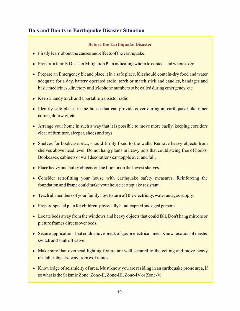
During an Earthquake
If In-Door
l Keep calm and keep others calm.
l Be ready to face the situation and over
come.
l Drop, cover and hold on.
l Do not rush to the doors or exits; never
use the lifts; keep away from windows,
mirrors, chimneys and furniture.
l Stand in the doorway, under doorjambs
or in the corner of the room.
l Go under a table or other sturdy
furniture; kneel, sit or stay close to the
floor. Hold on to furniture legs for
balance.
l Protect yourself by standing under the
lintel of an inner door, in the corner of a
room, under a table or even under a bed.
l If on the upper floor of the building,
don't jump from windows or balcony.
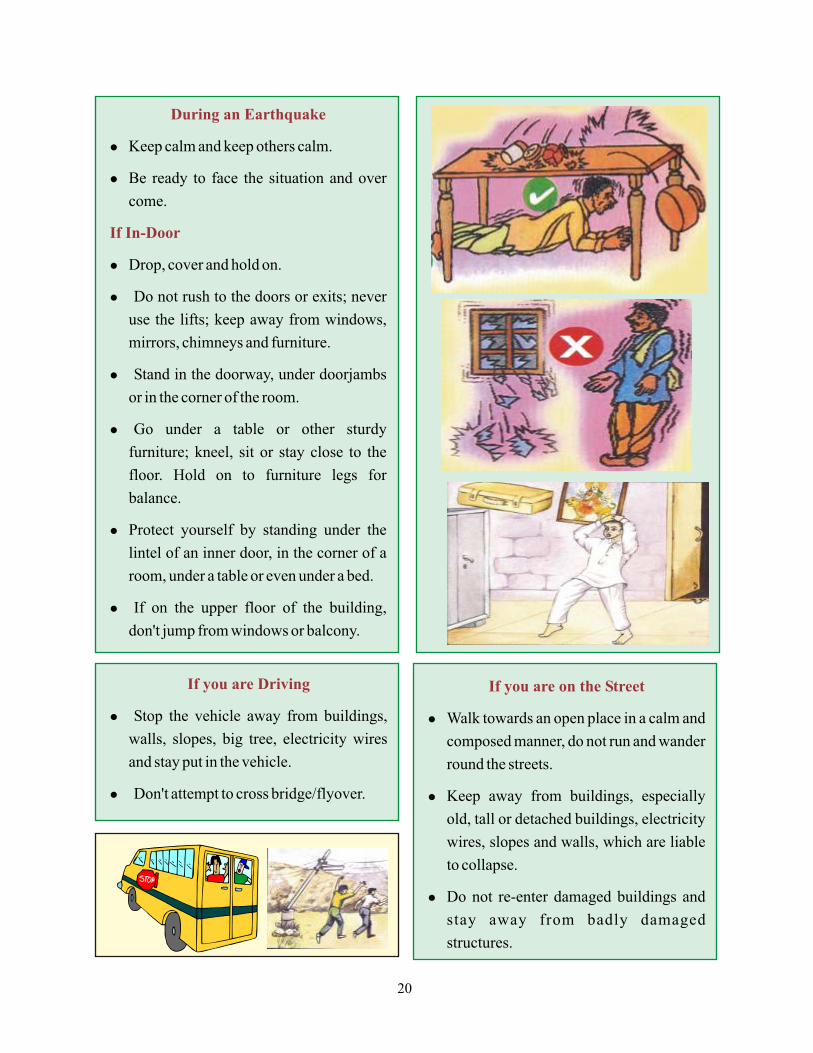
If you are Driving
l Stop the vehicle away from buildings,
walls, slopes, big tree, electricity wires
and stay put in the vehicle.
l Don't attempt to cross bridge/flyover.
If you are on the Street
l Walk towards an open place in a calm and
composed manner, do not run and wander
round the streets.
l Keep away from buildings, especially
old, tall or detached buildings, electricity
wires, slopes and walls, which are liable
to collapse.
l Do not re-enter damaged buildings and
stay away from badly damaged
structures.
20

After an Earthquake
t Check yourself for injuries first before attending to
others.
t Keep calm, switch on the transistor radio and obey any
instructions you hear from the radio.
t Don't create panic or rumors.
t Keep away from beaches and low banks of rivers.
t Expect aftershocks.
t Turn off the water, gas and electricity.
t Do not smoke and do not light matches or use a cigarette
lighter.
t Use a torch.
t If people are seriously injured, do not move them unless
they are in danger.
t Immediately clean up any inflammable products that
may have spilled.
t If you know that people have been buried, tell the rescue
teams. Do not rush and worsen the situation of injured
persons or your own situation.
t Avoid places where there are loose electric wires and do
not touch any metal object contact with them.
t Do not drink water from open containers without
treatment.
t Do not re-enter badly damaged buildings and do not go
near damaged structures.
t Do not walk around the streets to see what has happened
and cause congestion. Keep clear of the streets to enable
rescue vehicles to pass.
t Examine walls, floors, doors, staircases and windows to
make sure that the building is not in danger of collapsing.
t Check for sewage and water line damage.
t Use telephone only to report life-threatening
emergencies. They need to be clear for emergency calls to
get through.
Emergency Phone No.
(Toll Free)
Police : 100
Fire : 101
Ambulance : 102
21
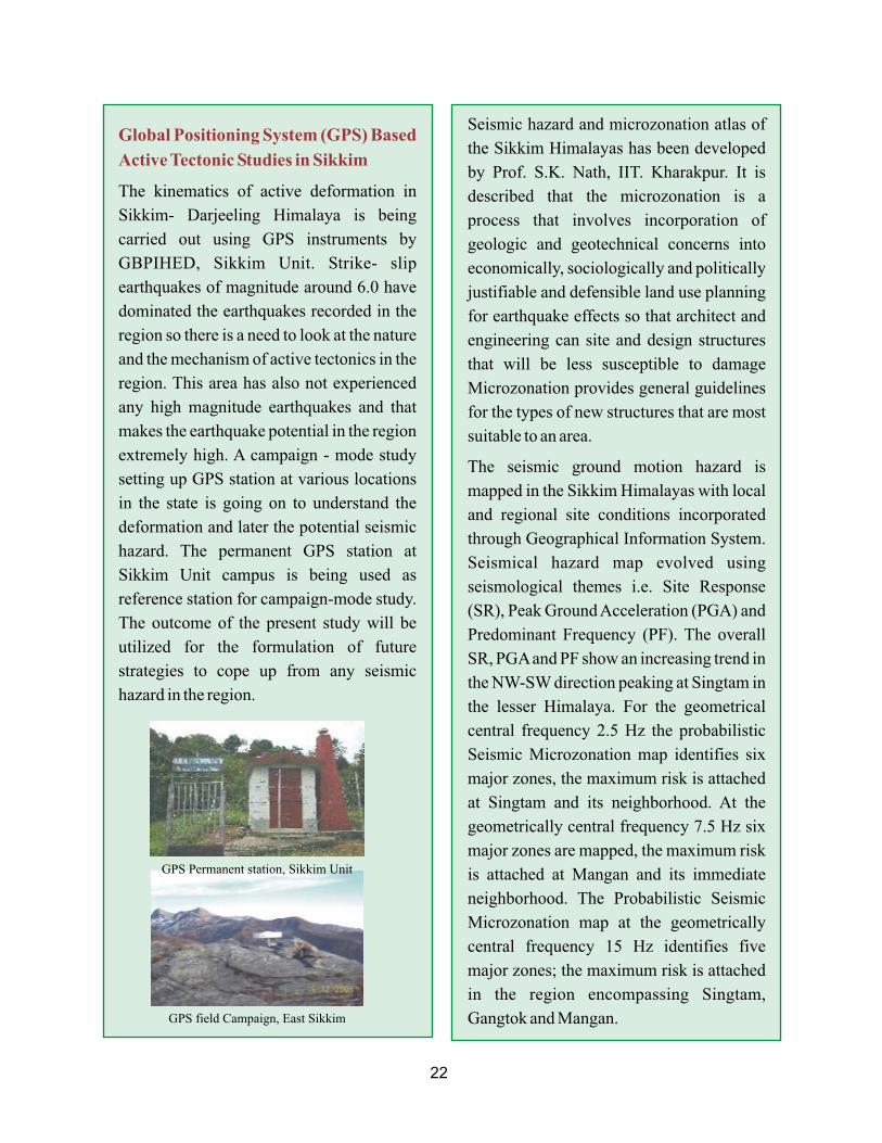
Global Positioning System (GPS) Based
Active Tectonic Studies in Sikkim
The kinematics of active deformation in
Sikkim- Darjeeling Himalaya is being
carried out using GPS instruments by
GBPIHED, Sikkim Unit. Strike- slip
earthquakes of magnitude around 6.0 have
dominated the earthquakes recorded in the
region so there is a need to look at the nature
and the mechanism of active tectonics in the
region. This area has also not experienced
any high magnitude earthquakes and that
makes the earthquake potential in the region
extremely high. A campaign - mode study
setting up GPS station at various locations
in the state is going on to understand the
deformation and later the potential seismic
hazard. The permanent GPS station at
Sikkim Unit campus is being used as
reference station for campaign-mode study.
The outcome of the present study will be
utilized for the formulation of future
strategies to cope up from any seismic
hazard in the region.
Seismic hazard and microzonation atlas of
the Sikkim Himalayas has been developed
by Prof. S.K. Nath, IIT. Kharakpur. It is
described that the microzonation is a
process that involves incorporation of
geologic and geotechnical concerns into
economically, sociologically and politically
justifiable and defensible land use planning
for earthquake effects so that architect and
engineering can site and design structures
that will be less susceptible to damage
Microzonation provides general guidelines
for the types of new structures that are most
suitable to an area.
The seismic ground motion hazard is
mapped in the Sikkim Himalayas with local
and regional site conditions incorporated
through Geographical Information System.
Seismical hazard map evolved using
seismological themes i.e. Site Response
(SR), Peak Ground Acceleration (PGA) and
Predominant Frequency (PF). The overall
SR, PGA and PF show an increasing trend in
the NW-SW direction peaking at Singtam in
the lesser Himalaya. For the geometrical
central frequency 2.5 Hz the probabilistic
Seismic Microzonation map identifies six
major zones, the maximum risk is attached
at Singtam and its neighborhood. At the
geometrically central frequency 7.5 Hz six
major zones are mapped, the maximum risk
is attached at Mangan and its immediate
neighborhood. The Probabilistic Seismic
Microzonation map at the geometrically
central frequency 15 Hz identifies five
major zones; the maximum risk is attached
in the region encompassing Singtam,
Gangtok and Mangan.
GPS Permanent station, Sikkim Unit
GPS field Campaign, East Sikkim
22
3
Landslide: Landslide is simply defined as the mass movement of rock, debris or earth in down
slope and have come to include a broad range of motions whereby falling, sliding and flowing
under the influence of gravity dislodges earth material. A landslide is a result of shear failure
along the boundary of moving soil or rock mass. A shear failure occurs when average shear stress
along a potential sliding surface becomes equal to the shear strength of soil or rock.
Landslide: Mitigation and Preparedness
Causes of Landslides:
Causes for Landslides are Natural or Manmade
Natural
Manmade
Himalaya, the youngest mountain range in the world, is highly erosion
prone. It is brutally lashed by intense rainstorms and thus constitutes an ecosystem primed for
disaster. Landslides are common all over the Himalayan ranges and Sikkim is no exception. The
region is highly susceptible to these calamities. The state experiences the ever-perennial
problem of landslides and other mass movements at various locations. These are further
compounded by increasing population and the developmental needs of the dwellers. The rugged
mountain topography of Sikkim has an altitude range of 300 to 8500 masl. The average annual
rainfall varies from 2000mm to 5000mm. High rainfall and flashes of cloudburst are the frequent
trigging factor for new slides and re-activators of old landslides in the Sikkim Himalayas.
n Increase in the mass of weak rocks, clay and other debris likely to slide.
n Loosening or breaking of rocks and soil by wetting due to rainfall, weathering, erosion,
deforestation, earthquake, tremors and similar other events.
n High intensity precipitation and steep slopes - coincidence of dip direction of steeply
dipping bedding plane of strata with slope direction.
n Denudation of natural vegetation.
n Agricultural operations/slope modifications.
n Infrastructural development like roads, dam, irrigation channels, hydroelectric power
channels, etc
23
Landslide Prone areas in India
Landslide causes extensive damage to roads, bridge, human dwellings, electricity, telephone,
agricultural lands, orchards, forest etc., resulting in loss of property as well as life. Degradation of
hill areas has also been on the increase due to greater frequency of occurrence of landslides.
Landslides incidences in India and proximate causes
Landslide Disasters Mitigation and
Preparedness
§ Identification of Active Landslide spots.
§ Avoid commercial and residential
constructions in hazard prone areas.
§ Making strong foundations of structures.
§ Contribution in slope stabilization
through terracing and engineering/
bioengineering.
§ Making rock-fall barriers.
§ Preparing Landslide Hazard Zonation
Maps.
§ Creating sufficient drainage system.
§ Monitoring and warning.
§ Community education, training and
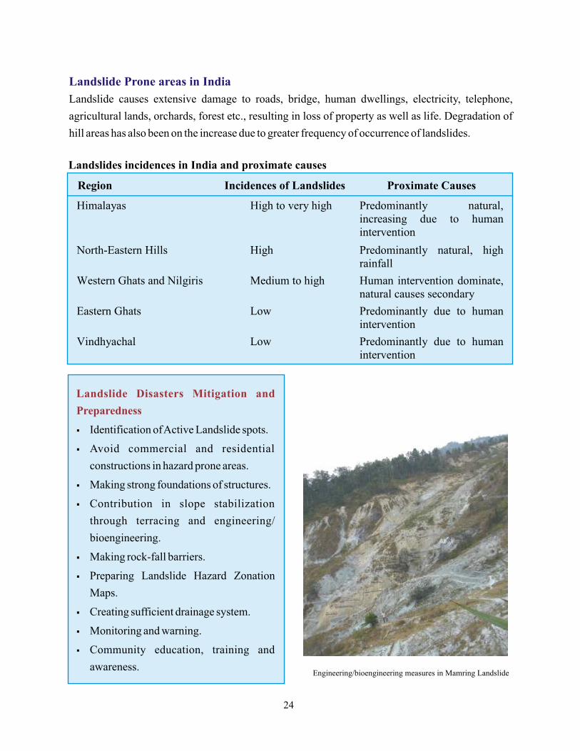
awareness. Engineering/bioengineering measures in Mamring Landslide
24
Potential causes for Landslides in Sikkim
s Heavy and incessant rains on geologically fragile formation with steep topography leading
to over saturation of the slopes. The soil cover in most areas is shallow and lies over soft,
quick weathering rock thus leading to slope failures as well as landslides
s Toe-cutting and erosion- by the over swollen Teesta and other rivers.
s Many locations on major roads are subjected to hill cutting and blasting for widening of the
road. But work remains unfinished due to early monsoons and this contributes in increased
road blockages on the highway.
s Further aggravation in already sinking and subsiding zones due to unchecked plying of
heavy vehicles.
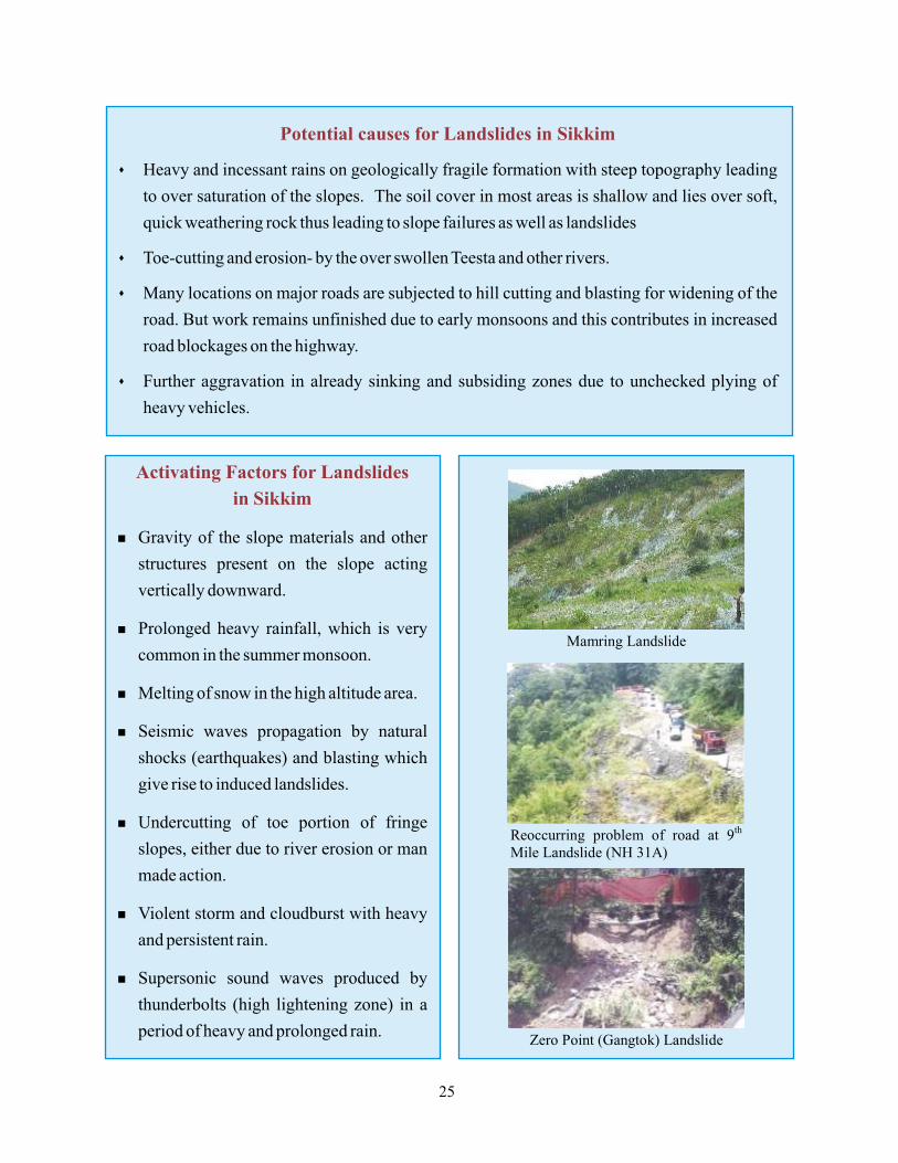
Activating Factors for Landslides
in Sikkim
n Gravity of the slope materials and other
structures present on the slope acting
vertically downward.
n Prolonged heavy rainfall, which is very
common in the summer monsoon.
n Melting of snow in the high altitude area.
n Seismic waves propagation by natural
shocks (earthquakes) and blasting which
give rise to induced landslides.
n Undercutting of toe portion of fringe
slopes, either due to river erosion or man
made action.
n Violent storm and cloudburst with heavy
and persistent rain.
n Supersonic sound waves produced by
thunderbolts (high lightening zone) in a
period of heavy and prolonged rain.
25
Impacts of Landslides in Sikkim State
Highways in Sikkim bristle with landslides
causing extensive damage to roads in the
region and throwing the normal activities of
the inhabitants out of gear. Numerous
landslides continue to occur every year
dislocating the communication system and
blocking the road network. The roads remain
closed for long periods causing hardships to
the villagers who get their basic supplies and
provisions from the neighboring areas
through road transport.
Landslides very often disrupt water source
and cause disruption in the water supply
system. Water sources are breached from
several places and are choked by debris, thus
resulting in water shortages in the region.
The water channels being affected results in
no water for irrigation purposes and hence
agriculture suffers. Telephone and electric
cables are often disrupted by frequent
sliding, causing great inconvenience to the
inhabitants.
Landslides are a great hindrance/setback to
the Tourism Industry of the State. The
snapping of road network adversely affects
the commercial activities of the state as
travelers experience great difficulties in
commuting to their destinations during
landslides.
This leads to a dip in tourist inflows and
consequently a drop in the government
treasury and the businesses of the people
specially during monsoon period.
Landslides contribute to soil erosion in the in
the state and wash away the rich topsoil of
the slopes. The fertility of the soil is washed
away leaving the land unproductive and
barren. They destroy terraced agricultural
fields, which cannot be easily renovated or
made productive again. Deforestation is
often blamed for landslides, but forests can
only inhibit shallow landslides, they have
little effect on deep landslides. Contrary to
the belief that the conservation of forest can
act as both prevention and protection against
landslides, there are instances in Sikkim to
show that landslides occur even in very
dense forests. Thus in a geologically fragile
state like Sikkim, an integrated approach to
landslide prevention is required.
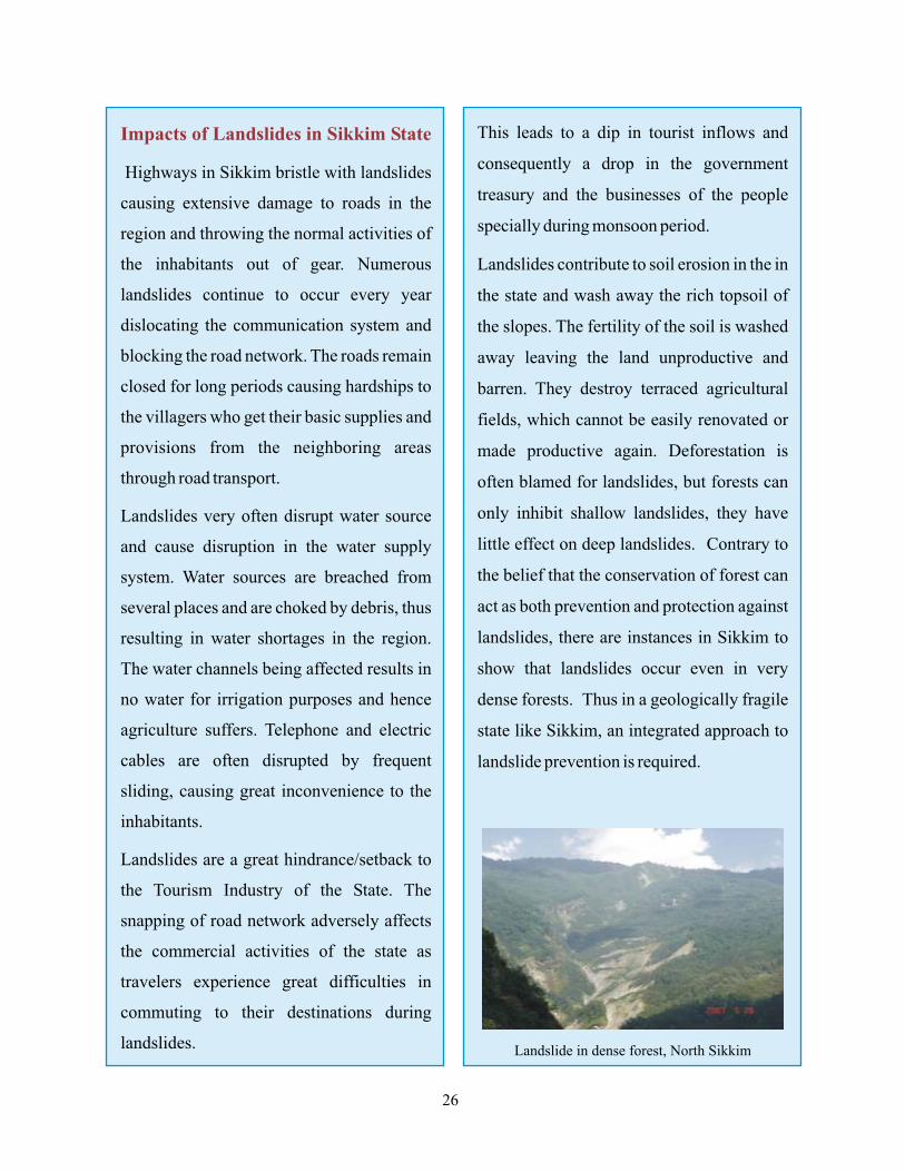
Landslide in dense forest, North Sikkim
26
Recent Landslide Disaster in
Sikkim Himalaya
In the recent past, the people of Sikkim faced
such kind of natural disaster, which still
haunts the minds of the effected people even
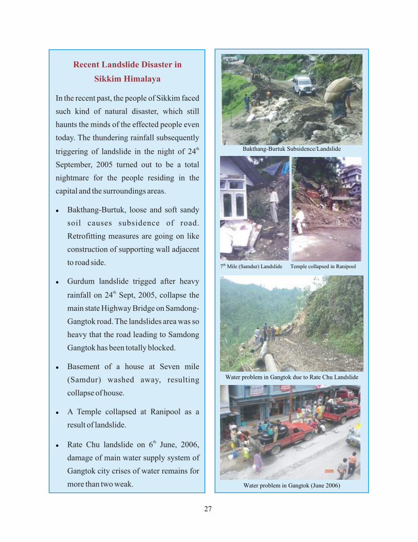
today. The thundering rainfall subsequently thtriggering of landslide in the night of 24
September, 2005 turned out to be a total
nightmare for the people residing in the
capital and the surroundings areas.
Bakthang-Burtuk, loose and soft sandy
soil causes subsidence of road.
Retrofitting measures are going on like
construction of supporting wall adjacent
to road side.
Gurdum landslide trigged after heavy thrainfall on 24 Sept, 2005, collapse the
main state Highway Bridge on Samdong-
Gangtok road. The landslides area was so
heavy that the road leading to Samdong
Gangtok has been totally blocked.
Basement of a house at Seven mile
(Samdur) washed away, resulting
collapse of house.
A Temple collapsed at Ranipool as a
result of landslide.
thRate Chu landslide on 6 June, 2006,
damage of main water supply system of
Gangtok city crises of water remains for
more than two weak.
l
l
l
l
l
27
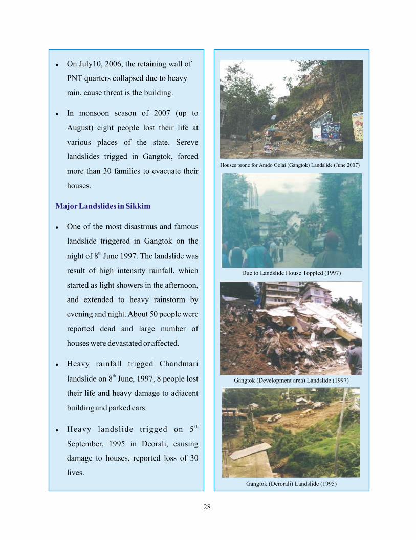
l On July10, 2006, the retaining wall of
PNT quarters collapsed due to heavy
rain, cause threat is the building.
l In monsoon season of 2007 (up to
August) eight people lost their life at
various places of the state. Sereve
landslides trigged in Gangtok, forced
more than 30 families to evacuate their
houses.
l One of the most disastrous and famous
landslide triggered in Gangtok on the
thnight of 8 June 1997. The landslide was
result of high intensity rainfall, which
started as light showers in the afternoon,
and extended to heavy rainstorm by
evening and night. About 50 people were
reported dead and large number of
houses were devastated or affected.
l Heavy rainfall trigged Chandmari
thlandslide on 8 June, 1997, 8 people lost
their life and heavy damage to adjacent
building and parked cars.
t hl Heavy landslide trigged on 5
September, 1995 in Deorali, causing
damage to houses, reported loss of 30
lives.
Major Landslides in Sikkim
28
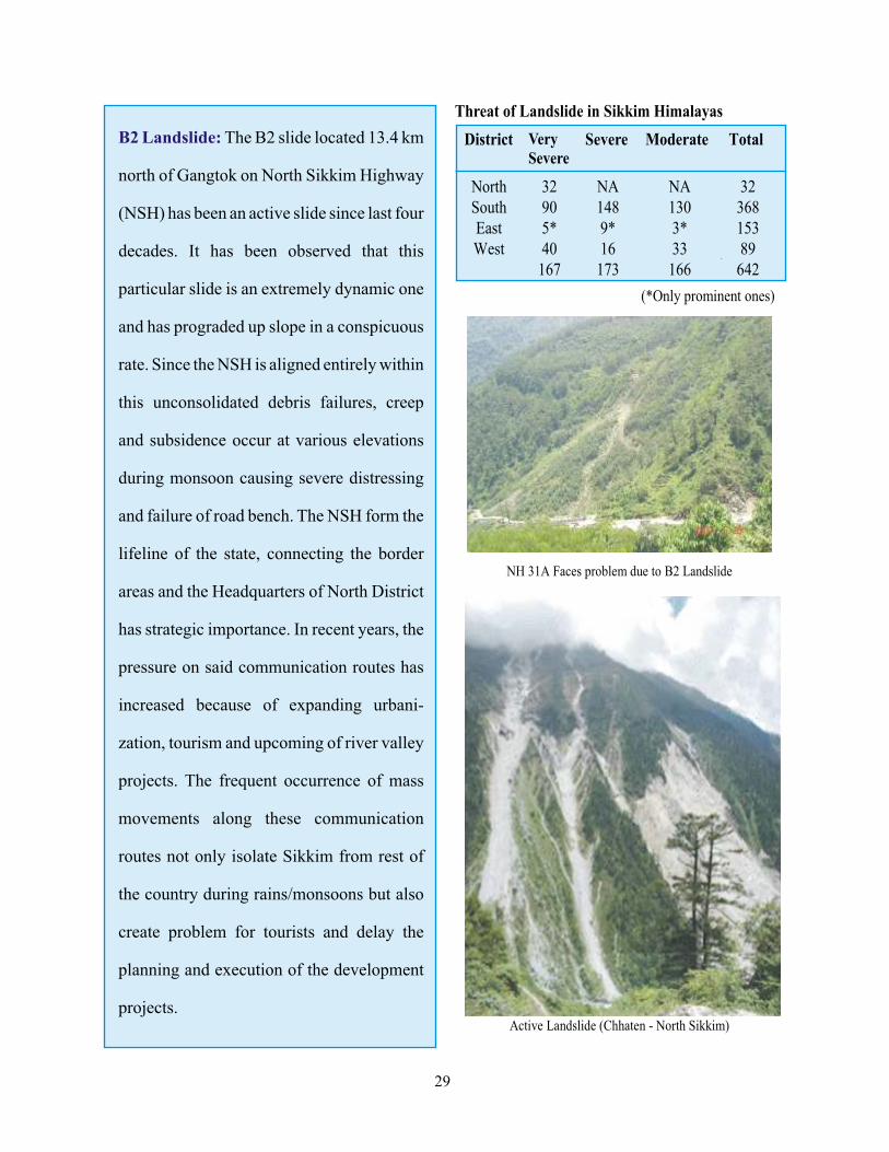
B2 Landslide: The B2 slide located 13.4 km
north of Gangtok on North Sikkim Highway
(NSH) has been an active slide since last four
decades. It has been observed that this
particular slide is an extremely dynamic one
and has prograded up slope in a conspicuous
rate. Since the NSH is aligned entirely within
this unconsolidated debris failures, creep
and subsidence occur at various elevations
during monsoon causing severe distressing
and failure of road bench. The NSH form the
lifeline of the state, connecting the border
areas and the Headquarters of North District
has strategic importance. In recent years, the
pressure on said communication routes has
increased because of expanding urbani-
zation, tourism and upcoming of river valley
projects. The frequent occurrence of mass
movements along these communication
routes not only isolate Sikkim from rest of
the country during rains/monsoons but also
create problem for tourists and delay the
planning and execution of the development
projects.
Threat of Landslide in Sikkim Himalayas
District Very Severe
Severe Moderate Total
29
Risk Reduction Methods
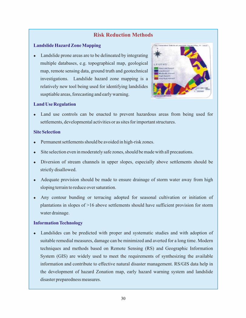
Landslide Hazard Zone Mapping
Land Use Regulation
Site Selection
Information Technology
u Landslide prone areas are to be delineated by integrating
multiple databases, e.g. topographical map, geological
map, remote sensing data, ground truth and geotechnical
investigations. Landslide hazard zone mapping is a
relatively new tool being used for identifying landslides
susptiable areas, forecasting and early warning.
u Land use controls can be enacted to prevent hazardous areas from being used for
settlements, developmental activities or as sites for important structures.
u Permanent settlements should be avoided in high-risk zones.
u Site selection even in moderately safe zones, should be made with all precautions.
u Diversion of stream channels in upper slopes, especially above settlements should be
strictly disallowed.
u Adequate provision should be made to ensure drainage of storm water away from high
sloping terrain to reduce over saturation.
u Any contour bunding or terracing adopted for seasonal cultivation or initiation of
plantations in slopes of >16 above settlements should have sufficient provision for storm
water drainage.
u Landslides can be predicted with proper and systematic studies and with adoption of
suitable remedial measures, damage can be minimized and averted for a long time. Modern
techniques and methods based on Remote Sensing (RS) and Geographic Information
System (GIS) are widely used to meet the requirements of synthesizing the available
information and contribute to effective natural disaster management. RS/GIS data help in
the development of hazard Zonation map, early hazard warning system and landslide
disaster preparedness measures.
30
Insurance
Community-Based Risk Reduction Measures
o Insurance programs may reduce losses related to landslides by spreading the expenses over a
larger base and including standards for site selection and construction techniques.
o The most damaging landslides often occur as a result of anthropogenic activities. Thus prior
to the disaster, public education awareness programmes should be initiated to the people
which will make them understand the causes and consequences of landslides in addition
helping them to identify unstable areas and avoid construction of house there. Communities
should be trained to recognize potential land instabilities, identify active landslide areas and
avoid hazardous locations for settlements.
Landslide Control Techniques
Shallow Erosional Slides
Check dams, bally benching
Asphalt mulch
Use of natural fibre gride (such as juite or
coir)
Bio-engineerings
Use of synthetic grids
Surface Drainage
Catch-water drains
Road side drains
Chutes
Sub-Surface Drainage
Horizontal drains
Sub-surface trench drains
Restraining Systems
Retaining walls
Rock bolts
Prestressed anchors
Grouting
w
w
w
w
w
w
w
w
w
w
w
w
w
w
Other Control Measures
w Re-grading of slope
w Benching of slope
w Provision of fill at the toe
w Relocating or changing the location of
facility to avoid landslide prone areas.
w Revetment, spurs, dykes, groins to
protect slopes against river and stream
erosion.
w Display Boards for public awareness that
areas prone for landslides to avoid
accidents.
w Plan barren and sloppy areas in hills with
suitable bio-engineering measures.
w Conducting a skill development
programmes for persons engaged in the
construction sector.
w District Administration should study the
vulnerable areas and take appropriate
preventive steps.
31
Before the Landslide Disaster
l Do not construct houses near steep slopes,
close to mountain edges, near drainage
ways, or natural erosion valleys.
l Get a ground assessment of your property.
l Be particularly observant of your
surrounding area before or during intense
storms that could heighten the possibility
of landslide or debris flow.
l If you are at risk from a landslide talk to
your insurance agent, get insurance on
your land.
l Contact with Local Authority working on
Earth Movement to assist you for take
precautionary measures for your home.
Contacting persons should be Geotech-
nical, Structural or Civil Engineer.
l Learn to recognize landslide-warning
signs
u Doors or windows stick or jam for the
first time.
u Outside walls, walks or stairs begin
pulling away from the building.
u New cracks appear in plaster, tile,
brick or foundations.
u Underground utility lines break.
u Bulging ground appears at base of the
slope.
u Water breaks through the ground
surface in new locations.
u Fences, retaining walls, utility poles,
or trees tilt or move.
u The ground slopes descending in one
direction and may begin shifting in
that direction under your feet.
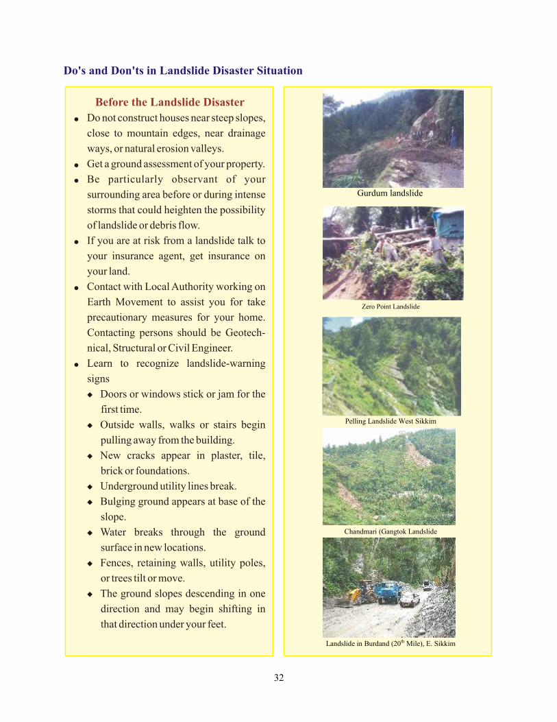
Do's and Don'ts in Landslide Disaster Situation
Pelling Town
32

During a Heightened Threat of Landslide
During Landslide Disaster
u Listen to radio or television for warning of intense rainfall.
v Be prepared to evacuate if instructed by local authorities or if you feel threatened.
v If possible distance yourself from the direct path of the debris flow and landslide debris.
u Be alert when intense short bursts of rain follow prolonged heavy rains or damp weather,
which increase risks of debris flows.
u Listen for any unusual sounds that might indicate moving debris, such as trees cracking or
boulders knocking together.
u If you are near a stream or channel, be alert for sudden increases or decreases in water flow and
for a change from muddy to clear water. Such changes may indicate landslide activity
upstream.
u Be especially alert when driving. Embankments along roadsides are particularly susceptible to
landslides.
u Quickly move away from the path of a landslide or debris flow.
u Areas generally considered safe include:
v Areas that has not moved in the past.
v Relatively flat-lying areas, away from drastic changes in slope.
u If escape is not possible, curl into a tight ball and protect your head.
u Quickly switch of the electricity and gas, etc. if possible.
u Contact your local fire, police, or public works department. Local officials are the best persons
able to assess potential danger.
u Inform affected neighbors. Your neighbors may not be aware of potential hazards. Advising
them of a potential threat, may help in saving lives. Help neighbors who may need assistance
to evacuate.
u If at home, move to a second story if possible to distance yourself from the direct path of the
landslide or debris flow.
33
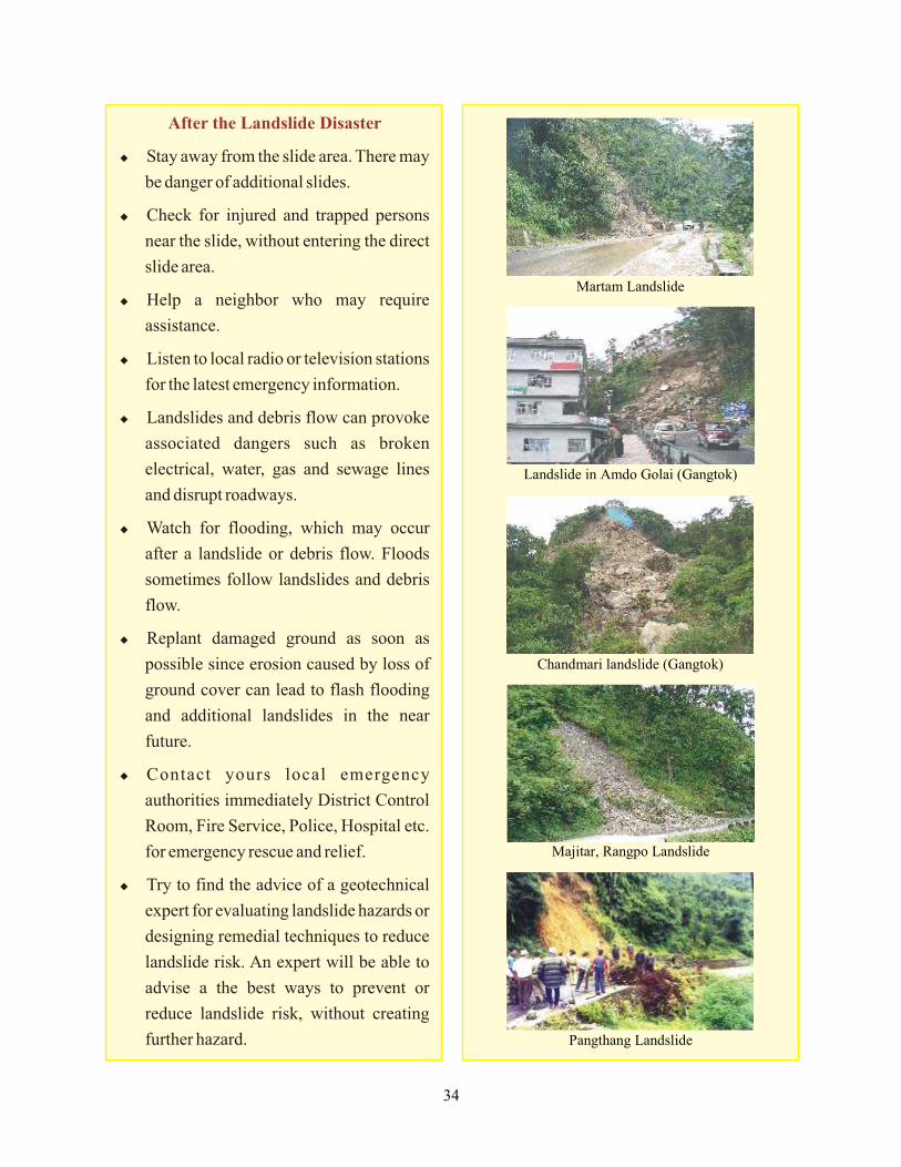
After the Landslide Disaster
u Stay away from the slide area. There may
be danger of additional slides.
u Check for injured and trapped persons
near the slide, without entering the direct
slide area.
u Help a neighbor who may require
assistance.
u Listen to local radio or television stations
for the latest emergency information.
u Landslides and debris flow can provoke
associated dangers such as broken
electrical, water, gas and sewage lines
and disrupt roadways.
u Watch for flooding, which may occur
after a landslide or debris flow. Floods
sometimes follow landslides and debris
flow.
u Replant damaged ground as soon as
possible since erosion caused by loss of
ground cover can lead to flash flooding
and additional landslides in the near
future.
u Contact yours local emergency
authorities immediately District Control
Room, Fire Service, Police, Hospital etc.
for emergency rescue and relief.
u Try to find the advice of a geotechnical
expert for evaluating landslide hazards or
designing remedial techniques to reduce
landslide risk. An expert will be able to
advise a the best ways to prevent or
reduce landslide risk, without creating
further hazard.
34
4Flood:
Types of Floods
Flood occurs when surface water covers land that is normally dry or when water
overflows normal confinements. It can arise from abnormally heavy precipitation, dam failures,
rapid snow melts, river blockages and other related causes.
v Flash Floods
v River Floods
v Coastal Floods
Flood: Mitigation and Preparedness
Causes of Flood Disaster
Floods are excessive accumulation or flow of water which results from heavy rainfall, cloud
burst, snow melt, glacier lake outburst or high tides and causes such as dam burst, embankment
failure etc. They include flash floods which are rapidly rising and falling of river level and
overland flows resulting from the rapid run off of rainfall from upland areas. River floods in
which river water spills over adjoining areas, tidal flooding usually saline from the backflow of
sea into coastal rivers at high and tides storm surge floods associated with the passage of tropical
cyclones. Normally floods are caused by high rainfall or more snow melt on the higher altitude
of mountains. This raises the level of rivers than its normal level, leading to floods.
Impact and Effects of Flood Disaster
v Loss of life, settlements and property.
v Damage to and devastation of subsistence and cash crops.
v Devastation of production.
v Devastation of lifestyle.
v Loss of livelihood.
v Disruption to essential services.
v Damage to national infrastructure.
v National economic loss.
v Damage to roads, electric and communication lines.
35
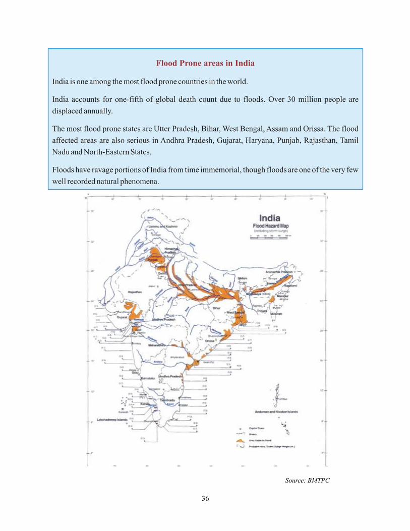
Flood Prone areas in India
India is one among the most flood prone countries in the world.
India accounts for one-fifth of global death count due to floods. Over 30 million people are
displaced annually.
The most flood prone states are Utter Pradesh, Bihar, West Bengal, Assam and Orissa. The flood
affected areas are also serious in Andhra Pradesh, Gujarat, Haryana, Punjab, Rajasthan, Tamil
Nadu and North-Eastern States.
Floods have ravage portions of India from time immemorial, though floods are one of the very few
well recorded natural phenomena.
Source: BMTPC
36
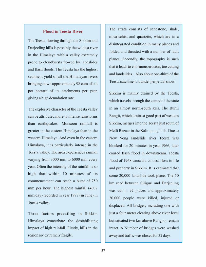
Flood in Teesta River
The Teesta flowing through the Sikkim and
Darjeeling hills is possibly the wildest river
in the Himalaya with a valley extremely
prone to cloudbursts flowed by landslides
and flash floods. The Teesta has the highest
sediment yield of all the Himalayan rivers
bringing down approximately 98 cum of silt
per hectare of its catchments per year,
giving a high denudation rate.
The explosive character of the Teesta valley
can be attributed more to intense rainstorms
than earthquakes. Monsoon rainfall is
greater in the eastern Himalaya than in the
western Himalaya. And even in the eastern
Himalaya, it is particularly intense in the
Teesta valley. The area experiences rainfall
varying from 3000 mm to 6000 mm every
year. Often the intensity of the rainfall is so
high that within 10 minutes of its
commencement can reach a burst of 750
mm per hour. The highest rainfall (4032
mm/day) recorded in year 1977 (in June) in
Teesta valley.
Three factors prevailing in Sikkim
Himalaya exacerbate the destabilizing
impact of high rainfall. Firstly, hills in the
region are extremely fragile.
The strata consists of sandstone, shale,
mica-schist and quartzite, which are in a
disintegrated condition in many places and
folded and thrusted with a number of fault
planes. Secondly, the topography is such
that it leads to enormous erosion, toe cutting
and landslides. Also about one-third of the
Teesta catchment is under perpetual snow.
Sikkim is mainly drained by the Teesta,
which travels through the centre of the state
in an almost north-south axis. The Burhi
Rangit, which drains a good part of western
Sikkim, merges into the Teesta just south of
Melli Bazaar in the Kalimpong hills. Due to
New Vong landslide river Teesta was
blocked for 20 minutes in year 1966, later
caused flash flood in downstream. Teesta
flood of 1968 caused a colossal loss to life
and property in Sikkim. It is estimated that
some 20,000 landslide took place. The 50
km road between Siliguri and Darjeeling
was cut in 92 places and approximately
20,000 people were killed, injured or
displaced. All bridges, including one with
just a four meter clearing above river level
but situated two km above Rangpo, remain
intact. A Number of bridges were washed
away and traffic was closed for 32 days.
37
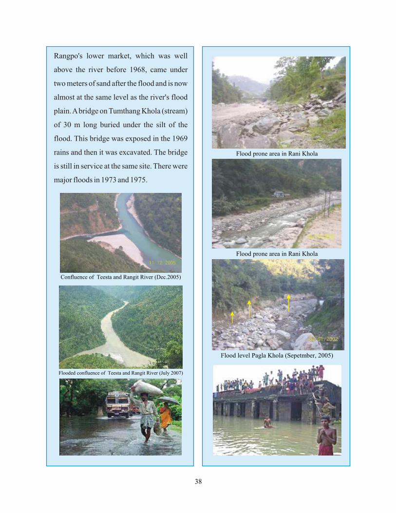
Rangpo's lower market, which was well
above the river before 1968, came under
two meters of sand after the flood and is now
almost at the same level as the river's flood
plain. A bridge on Tumthang Khola (stream)
of 30 m long buried under the silt of the
flood. This bridge was exposed in the 1969
rains and then it was excavated. The bridge
is still in service at the same site. There were
major floods in 1973 and 1975.
38
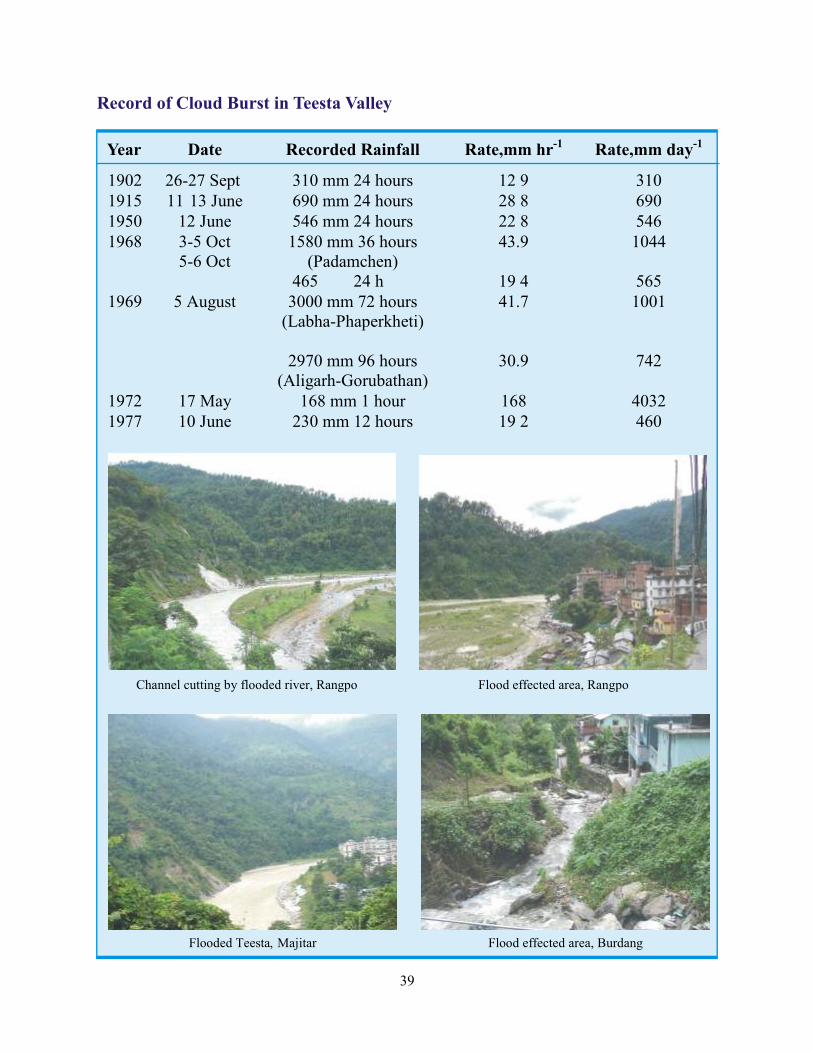
Record of Cloud Burst in Teesta Valley
Year Date Recorded Rainfall Rate,mm hr-1 Rate,mm day-1
39
Flood Reduction Measures
Structural Measures
Land use controls will be of limited use in
already developed floodplains. Therefore,
structural measures must be implemented to
reduce a community's vulnerability to flood
damage. The most commonly used options
involve measures for flood reduction and
diversion and flood proofing and may be
used in combination with land use controls.
In short term,
on an annual basis timely cleaning,
distilling or deepening of natural water
reservoirs and drainage channels must be
taken up. Well designed watershed
development planning to reduce runoff
and silt load.
- aims to decrease the
amount of runoffs, usually by altering the
watershed. Typical treatments include
reforestation or reseeding, contour
ploughing or terracing and protection of
vegetation from fire, overgrazing and
clear-cutting.
- include levee and dam
construction and channel improvements.
Levees, embankments and dykes restrict
floodwaters to low value and on the flood
plain and are relatively cheap to
construct.
? Watershed Management:
? Flood Reduction
? Flood Diversion
? Flood Proofing:
? Natural Water Retention Basins:
Temporary measures
include blocking or sealing entrances or
windows and the use of sandbags to keep
floodwaters away. Permanent measures
include use of hazard resistant design
such as raising living and working spaces
high above the possible flood levels.
Houses may be elevated by structural
means (stilts) or by raising the land using
landfill. Buildings should be set back
from water bodies. Land surrounding
buildings and infrastructure should be
protected against erosion. Streambeds
should be stabilized with stone masonry
or vegetation especially near bridges and
erosion prone areas.
Inspect and strengthen where necessary
all flood protection embankments, ring
bounds and other bounds.
? All engineering structures to withstand
flood forces and design for elevated floor
level and construction over stilts.
Construction of reservoirs, dams, dykes,
retaining walls, constructing alternate
drainage courses are structural methods
of flood mitigation.
40
Non-Structural Measures
The non-structural measures aim at
modifying the susceptibility to flood
damage as well as modifying the loss
burden.
Flood plain
management is achieved by flood plain
zoning and regulation. The basic map is
combined with other maps and data to
form a complete picture of the
floodplain. Other inputs include
frequency analysis, inundation maps,
flood frequency and damage reports,
slope maps and other related maps such
as land use, vegetation, population
density and infrastructural maps. Remote
sensing techniques provide an alternative
to traditional techniques of floodplain
mapping and can be equally or more cost
effective as they allow estimates of data
otherwise requiring labor intensive
collection methods.
- Floods
often cause or occur in conjunction with
or result from other hazards. A multiple
hazard map serves to highlight areas
vulnerable to more than one hazard. It is
an excellent tool for designing a multiple
hazard mitigation and emergency plan.
v Mapping of Floodplain:
v Multiple Hazards Mapping
v Land Use Control:
v Drainage Management:
Land-use control
planning to avoid use of injudicious
f lood plains for residential or
commercial purpose.
Ø Reduction of densities
Ø Prohibiting specific functions
Ø Relocation of elements that block the
flood way
Ø Regulation of building materials
Ø Flood forecasting and warning systems
Ø Provision of escape route
Ø Community preparedness
l Issuing warnings at the local level
l Participating in flood fighting by
organizing work parties to repair
embankments or clear debris from
drainage areas, stockpile needed
materials, etc
l Facilitating agricultural recovery
l Planning emergency supplies of flood
and clean drinking water
l Identifying traditional mitigation and
preparedness measures
At many
places drainage overloading in the
aftermath of flooding is major hazard.
Drainage control development can help
in prevention of water from entering in a
level site from either rainfall or runoff
from upstream watersheds.
41
Flood Preparedness
Flood Preparedness of the Department Concerned:
By the State and District Administration
ö Pre Monsoon Inspection of all roads, canals, drains by respective departments.
ö Regular clearance of the drains from silt and weeds to make the drainage system fully
functional and restoration of natural drainage blocked by roads, debris and garbage etc.
ö Regular maintenance of embankments of rivers, canals, distributors, etc and regular checks of
the canals and clearing of silt.
ö Clearing of storm water and sewage drains in towns before monsoon.
ö Constitution of committees comprising of heads of all emergencies services, medical, police,
transportation and the district administration to ensure proper coordination during the crisis.
ö Convening a meeting of the District Level Committee on natural calamities.
ö Functioning of the control rooms.
ö Review of contingency plan.
ö Contingency plan can be modified/ updated if necessary.
ö Co-ordinate with NGOs/CBOs.
ö Review and visit to likely places for evacuation to ensure their functional availability.
ö Make people aware of the warning dissemination mechanism.
ö Do's and Don'ts.
Response Mechanism
Pre-Disaster
On receipt of a warning of an impending disaster, the people have to be immediately warned.
Dissemination through print and electronic media as well as informing the authorities concerned
is very essential. The District Administration is responsible in informing to the masses those have
no access to mass media modes. This could be by beat of drums, sounding of sirens, village gongs
or by rumor.
42
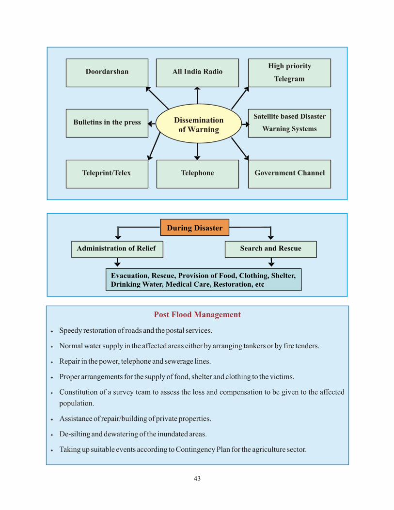
Dissemination of Warning
Doordarshan
All India Radio
High priority
Telegram
Bulletins in the press
Satellite based Disaster
Warning Systems
Telephone
Government Channel
Teleprint/Telex
During Disaster
Administration of Relief Search and Rescue
Evacuation, Rescue, Provision of Food, Clothing, Shelter, Drinking Water, Medical Care, Restoration, etc
Post Flood Management
ö Speedy restoration of roads and the postal services.
ö Normal water supply in the affected areas either by arranging tankers or by fire tenders.
ö Repair in the power, telephone and sewerage lines.
ö Proper arrangements for the supply of food, shelter and clothing to the victims.
ö Constitution of a survey team to assess the loss and compensation to be given to the affected
population.
ö Assistance of repair/building of private properties.
ö De-silting and dewatering of the inundated areas.
ö Taking up suitable events according to Contingency Plan for the agriculture sector.
43
Before a Flood: Individual Preparedness
E Insure crops and household.
E Plan and practice evacuation routes.
E Reinforce your house and make it flood proof by filling sand bags and putting them around the
house.
E Identification of safer shelter places.
E Move to safer places and highlands with food provisions and potable water on receipt of
warning at least for a week.
E Keep drinking water in covered vessels and jugs.
E Listen to radio/TV to get updated information.
E Emergency telephone numbers like, Fire, Police, and Hospital should be known to all family
members.
E Build of stock of emergency provision i.e. medicines, torches, spare battery cells, plastic
sheets, sand bags, hammer, saw, etc before a disaster.
E Teach all family members how to turn off gas, electricity and water.
E Construct barriers to stop flood waters from entering the building like sand bags, bamboo
weaves, etc.
E Seal basement walls with water proof compounds to avoid seepage.
E Ask an out of the - state friend or relative to be in your contact. Make sure that everyone in
your family has the emergency number.
_ Update the entire resource inventory.
_ Control Room should be functional for round the clock.
_ Identify all the shelter places where people could be evacuated.
_ Activate all the First Aid and Rescue and Evacuation team.
_ Ascertain the availability of dry food, drinking water and medicines.
_ Identify all the Relief Centres.
_ Inspect, strengthen and repair all the approach roads and culverts.
_ Prepare maps of alternate route, resources available.
Government Preparedness
Do's and Don'ts in Flood Disaster Situation
44
During Flood
E If indoors, stay inside. Don't move out.
E If outdoors, climb to higher ground and stay there. Don't attempt to wade through floodwaters,
as it could be dangerous.
E If you are in a vehicle and come to a flooded area, turn around and go another way. If your car
stalls in floodwaters abandon it immediately and climb to high ground. Don't attempt to take
vehicles through flooded areas as you could be swept away and get drowned.
E Listen to radio to get the updated information.
E Follow the instructions of the local authorities and follow the recommended evacuation route
and if needed, do so immediately.
E Wear a life jacket if you have one. If not, you can use other things that float like inner tubes, big
empty plastic containers, wood log or banana trees as buoys, if you have to move into a flooded
area.
E Turn off utilities at the main switches. Disconnect electrical appliances. Do not touch electrical
equipment if you are wet or standing in water.
E Be alert of streams, drainage channels and other areas known to flood suddenly. Flash floods
can happen in hill areas with or without such typical warnings as a result of cloudburst or
heavy rain.
E Get your emergency supplies ready to take with you if you have to evacuate.
E Drink boiled water. Use halogen tablets to purify water before drinking.
E Keep your food covered, don't eat heavy meals.
E Move furniture, clothing and appliances, where possible, to high shelves or to second stories if
time permits.
E Be careful of snakes. Snakebites are common during floods.
_ Carry out rescue and evacuation.
_ Operation of control room and provide warning update.
_ Coordination at various levels and agencies.
_ Mobile health units to be made available.
Government
45
After Flood
E Continue to listen to radio/TV and return to shelter only when the authorities indicate that it is
safe to do so. Always remember, flood danger does not end when the floodwater recedes.
E Be ready to volunteer help, particularly to infants, women and the aged. Ask the Red Cross
Volunteers or health workers to check the water quality and to clean your wells before you use
it again.
E Seek necessary medical attention if injured.
E Inspect your house to check the cracks for damages. Make sure that the house is not in the
danger of collapsing.
E Throw away food that has come into contact with flood water.
E Disinfect drinking water before use and keep the food covered always.
E Don't drink floodwater, instead collect rainwater to drink and boil it before drinking.
E Pump out water from the basement to avoid structural damage.
E Use mosquito nets while sleeping.
E Plant bamboos or appropriate trees around your house to protect it against floods.
E Return home only when authorities indicate it is safe.
E Use intense care when entering buildings; there may be hidden damage, particularly in
foundations.
_ Rescue people who are stranded.
_ Restore road and power supply.
_ Provide safe drinking water.
_ Check outbreak of any epidemics.
_ Take help of NGOs.
_ Carry out damage assessment.
_ Ensure that adequate, timely and speedy credit is available to the farmers for purchasing
agricultural inputs and cattle.
Government
46
Forest Fire : Forest Fire constitutes typical disaster phenomena, origin of which can be either
natural or manmade. In their ferocity and destructive potential, these are notoriously dangerous.
Forest Fire which may caused by natural processes sometimes but most of the time, these occur
and spread due to human negligence. Fire can be classified into two types:
� Natural Fire (Wild/Forest Fire)
� Man-made Fire
Forest Fire: Mitigation and Preparedness
Causes of Forest Fire
The amount of vegetation cover and other combustible material such as dead wood, dry leaves,
determine the nature and extent of forest fire. High atmospheric temperatures, dryness (low
humidity), the strength of the prevailing wind and the slope of the ground are important factors
in the spread of forest fire. Forest fire could be both natural and manmade.
l Sparks produced on account of fiction of Rolling Stones.
Lighting during Thundering Storms.l
During the Volcanic Irruptions.l
l Careless throwing of cigarette, bidi stubs, match sticks by travelers.
l Carelessness in extraction of honey and other forest product, using lighted torches.
l Negligence in camp and cooking operation near camping ground and fairs.
l Negligence in protecting the crops from the wild animals.
l Negligence during the construction of the roads/resurfacing or repairs.
l For clearing the forest paths by the villagers.
l Negligence in extracting resin from the chir pine tree.
l For obtaining green flush of grass for grazing the animals.
l For burring the pine needles to clear the ground from carpet of needles.
l For concealing the illegal felling.
Sifting cultivation.l
Natural Forest Fire
Manmade Forest Fire
47
5
Types of Forest Fire
Forest fires are basically of four types depending upon their nature and size:
This is the most common type of forest fire. It burns undergrowth and dead
material along the floor of the forest and is useful to the vegetation and help more than harm.
This fire burns roots and other material on or beneath the surface. This is more
damaging than surface fire because it can destroy vegetation completely.
This is most unpredictable fire and burns the tops of trees and are spread rapidly
by wind.
A fire storm is the most damaging to the forest cover. It is basically an intense fire
over a large area. As the fire burns, heat rise and the cold wind from outside rushes in, causing
the fire to grow rapidly. More wind inflow makes the fire spin very violently like a storm.
Temperatures inside this type of forest fire can reach up to 2,000 degrees Fahrenheit.
ö Surface Fire:
ö Ground Fire:
ö Crown Fire:
ö Fire Storm:
Impacts of Forest Fire Disaster
n Loss of valuable timber and minor forest produce resources.
n Degradation of water catchments areas resulting in loss of water.
n Loss of biodiversity and extinction of plants and animals.
n Loss of wild life habitat and depletion of wild life.
n Loss of natural regeneration and reduction in forest cover and production.
n Global warming resulting in rising temperature.
n Soil erosion affecting productivity of soils and production.
n Ozone layer depletion.
n Indirect effect on agricultural production.
n Health problems leading to diseases.
n Degradation of microclimate of the area making unhealthy living conditions.
n Increase in percentage of carbon dioxide in the atmosphere.
48
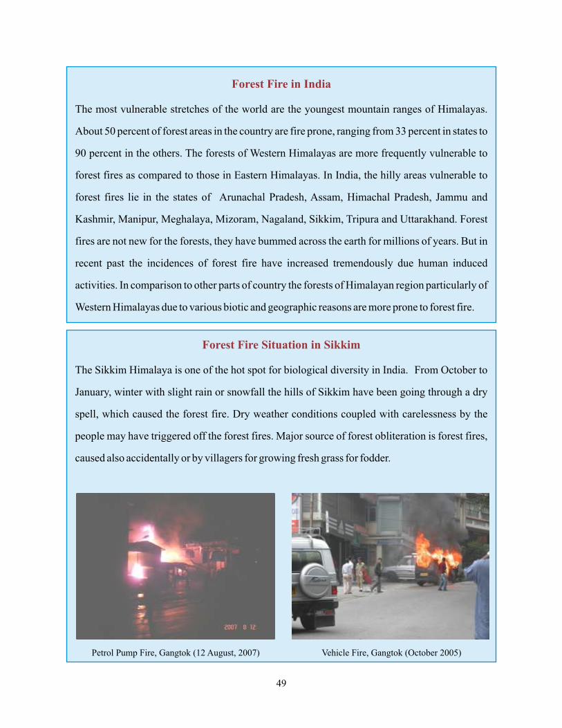
Forest Fire in India
The most vulnerable stretches of the world are the youngest mountain ranges of Himalayas.
About 50 percent of forest areas in the country are fire prone, ranging from 33 percent in states to
90 percent in the others. The forests of Western Himalayas are more frequently vulnerable to
forest fires as compared to those in Eastern Himalayas. In India, the hilly areas vulnerable to
forest fires lie in the states of Arunachal Pradesh, Assam, Himachal Pradesh, Jammu and
Kashmir, Manipur, Meghalaya, Mizoram, Nagaland, Sikkim, Tripura and Uttarakhand. Forest
fires are not new for the forests, they have bummed across the earth for millions of years. But in
recent past the incidences of forest fire have increased tremendously due human induced
activities. In comparison to other parts of country the forests of Himalayan region particularly of
Western Himalayas due to various biotic and geographic reasons are more prone to forest fire.
Forest Fire Situation in Sikkim
The Sikkim Himalaya is one of the hot spot for biological diversity in India. From October to
January, winter with slight rain or snowfall the hills of Sikkim have been going through a dry
spell, which caused the forest fire. Dry weather conditions coupled with carelessness by the
people may have triggered off the forest fires. Major source of forest obliteration is forest fires,
caused also accidentally or by villagers for growing fresh grass for fodder.
Petrol Pump Fire, Gangtok (12 August, 2007) Vehicle Fire, Gangtok (October 2005)
49
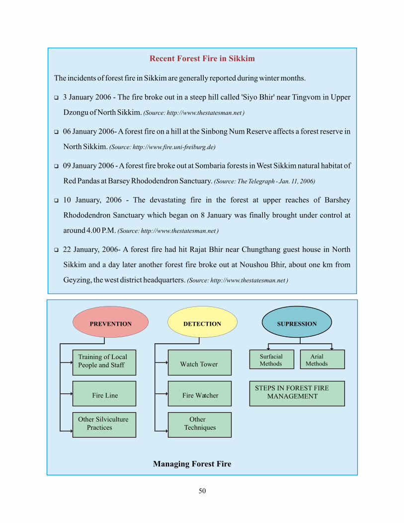
Recent Forest Fire in Sikkim
The incidents of forest fire in Sikkim are generally reported during winter months.
q 3 January 2006 - The fire broke out in a steep hill called 'Siyo Bhir' near Tingvom in Upper
Dzongu of North Sikkim. (Source: http://www.thestatesman.net )
q 06 January 2006- A forest fire on a hill at the Sinbong Num Reserve affects a forest reserve in
North Sikkim. (Source: http://www.fire.uni-freiburg.de)
q 09 January 2006 - A forest fire broke out at Sombaria forests in West Sikkim natural habitat of
Red Pandas at Barsey Rhododendron Sanctuary. (Source: The Telegraph - Jan. 11, 2006)
q 10 January, 2006 - The devastating fire in the forest at upper reaches of Barshey
Rhododendron Sanctuary which began on 8 January was finally brought under control at
around 4.00 P.M. (Source: http://www.thestatesman.net )
q 22 January, 2006- A forest fire had hit Rajat Bhir near Chungthang guest house in North
Sikkim and a day later another forest fire broke out at Noushou Bhir, about one km from
Geyzing, the west district headquarters. (Source: http://www.thestatesman.net )
PREVENTION
DETECTION
SUPRESSION
Training of Local People and Staff
Fire Line
Other Silviculture Practices
Watch Tower
Fire Watcher
Other Techniques
Surfacial Methods
Arial Methods
STEPS IN FOREST FIRE MANAGEMENT
Managing Forest Fire
50
Forest Fire Risk Management
Prevention Planning and Management
Incident Management Technique
Prevention
As prevention is better than cure. It is of
utmost significance that necessary
preventive measures are taken to manage the
forest fire in an area.
ÄCutting of forest fire line is the traditional
and old method which is very successfull
in preventing the forest fire.
ÄAgricultural tradit ional shift ing
cultivation in which a part of land is
cleared by fire in order to use it for the
agricultural purpose.
ÄAttitude of the people towards
environment in particulararly those
people who whichever live in these
forests or these forms the means of
livelihood for them.
ÄEducating the people about the do's and
don't to prevent forest fire is very
important. They must be made aware of
damages by fire to environment.
ÄAwareness Programmes should be
conducted for the villagers at Panchayat
and Block level.
Planning and Management
It is a focal point in developing plans to react
to a disaster once it threatens or has occurred.
With proper planning and management, the
impact of the forest fires could be reduced to
a great extent.
The areas prone to forest fire
disaster should be identified.
A complete
assessment with the help of volunteer
force and available technology.
l Direct Method - Where the effort is
put directly on or immediately
neighboring to the limit of fire.
l Indirect Method Where the control
line is located along favorable
topographic breaks or natural breaks
and area between the fire limit and
control line is burned off (control
fire).
ÄZoning and Mapping of Vulnerable
areas:
ÄAssessment of Fire Hazard:
ÄFire Fighting
51
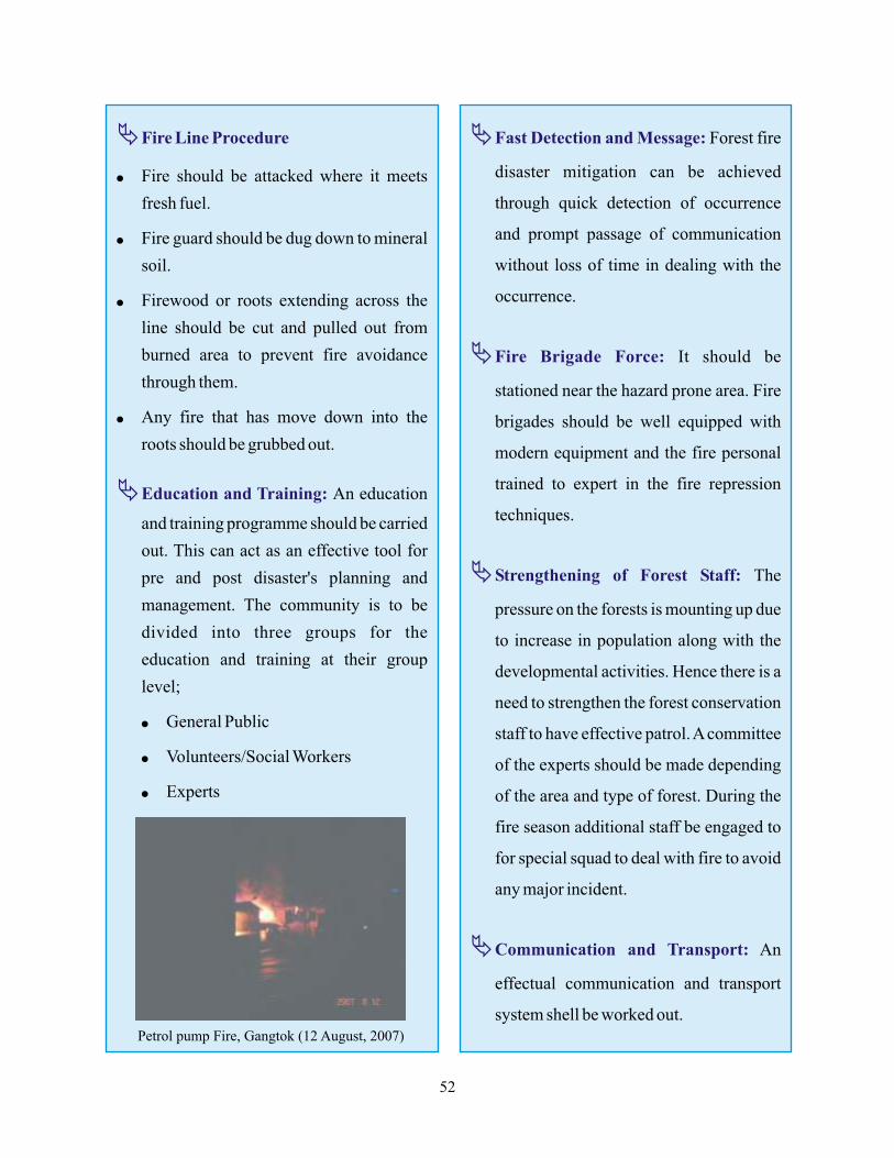
ÄFire Line Procedure
ÄEducation and Training:
l Fire should be attacked where it meets
fresh fuel.
l Fire guard should be dug down to mineral
soil.
l Firewood or roots extending across the
line should be cut and pulled out from
burned area to prevent fire avoidance
through them.
l Any fire that has move down into the
roots should be grubbed out.
An education
and training programme should be carried
out. This can act as an effective tool for
pre and post disaster's planning and
management. The community is to be
divided into three groups for the
education and training at their group
level;
l General Public
l Volunteers/Social Workers
l Experts
ÄFast Detection and Message:
ÄFire Brigade Force:
ÄStrengthening of Forest Staff:
ÄCommunication and Transport:
Forest fire
disaster mitigation can be achieved
through quick detection of occurrence
and prompt passage of communication
without loss of time in dealing with the
occurrence.
It should be
stationed near the hazard prone area. Fire
brigades should be well equipped with
modern equipment and the fire personal
trained to expert in the fire repression
techniques.
The
pressure on the forests is mounting up due
to increase in population along with the
developmental activities. Hence there is a
need to strengthen the forest conservation
staff to have effective patrol. A committee
of the experts should be made depending
of the area and type of forest. During the
fire season additional staff be engaged to
for special squad to deal with fire to avoid
any major incident.
An
effectual communication and transport
system shell be worked out.
52
Petrol pump Fire, Gangtok (12 August, 2007)
Incident Management Techniques
ÄNodal Agency:
ÄHigh Power Committee at State Level:
ÄCoordination Action Committee at
District Level:
A nodal agency
constituting of District Commissioner/
District Magistrate should be formed to
coordinate the activities of the various
departments in case of forest fire disaster.
As soon as any information is received by
the District Magistrate, the same shall be
passed on to Fire Officer/ Divisional Fire
Officer as well as District Police Officer.
A high power committee should be
constituted at the state level of the
concerned departments, under the
chairmanship of the Chief Secretary to
review the situation and make policy
decisions.
An action committee
should be formed at the district level to
take immediate actions against the
disaster hit areas. This committee should
be formated under the chairmanship of
the District Commissioner/District
Magistrate.
ÄStage of Action:
ÄWarning Systems:
ÄSetting up of Control Rooms:
Action Committee
normally forms three stages; (i) Alert
(ii) Preparatory (iii) Operational
A proper warning
system should operate to give warning
and information to public. This would
help in avoiding panic and ensure that the
public is aware of the situation and take
the necessary safety actions.
For better
coordination and controlling the situation
control rooms shall be set up;
l District Control Room
l Police Control Room and Fire Control
Room
l Departmental Control Room
53
Do's and Don'ts in Fire and Forest Fire Disaster
Before a Fire and Forest Fire
E Remove inflammables, clear items that
will burn around the house including
wood masses, lawn furniture, barbecue
grills, oilcloth coverings, etc.
E Check the electrical wiring in yours
residence. Install electrical lines
underground, if possible.
E Water attaches garden hoses; fill any
ponds, hot tubs, garbage cans, tubs or
other large containers with water.
E Ask fire authorities for information about
forest fires in your area. Request that they
inspect yours residence and property for
hazards.
E Evacuate your pets and all family
members who are not essential to
preparing the home. Anybody with
medical or physical limits, children and
the aged should be evacuated right away.
E Take away combustibles. Clear items that
will burn around the house, including
wood piles, grass furniture, barbecue
grills, tarp cover, etc.
E Make sure all of the family members
know what to do in case of a fire. Have
everybody learn the emergency phone
number of the fire department. (101 toll
free and common for whole country).
E Install smoke detectors on every level of
your home. Test your detectors one time
every month, replace the batteries once
a year and replace the detector every ten
years.
E Make and practice Fire Exit Drills;
everybody from adults to children needs
to know what to do in a fire. Remember
to meet outside at a selected spot; do not
reenter the home for any reason.
E Many renters do not have insurance,
renters insurance is relatively cheep and
we advise having some. Know how to
contact your landlord and keep the phone
numbers with your residence inventory.
E Keep all trees and hedge plant branches
trimmed so they do not come into contact
with electrical wires house or hang over
your chimney.
E Keep trees neighboring to buildings free
of dead or dying branches.
E Keep battery operated radios and
flashlights with extra batteries.
E Cut back all lower branches eight feet
from the ground.
E Keep rain sewer clear of garbage at all
times.
54

During a Fire and Forest Fire
E If you have a step, support it against the
house so you and firefighters have access
to roof.
E If hoses and sufficient water are available
set them up. Fill buckets with water.
E Move upholstered furniture away from
windows and sliding glass doors.
E Be ready to evacuate all family members
and pets when requested to do so.
E Use water or a fire extinguisher to put out
small fires. Do not try to put out a fire that
is getting out of control. If you're not sure
that you can control it, get everyone out of
the residence and call the fire department
from a neighbor's residence.
E Never use water on an electrical fire. Use
only a fire extinguisher approved for
electrical fires.
E Stay out formerly you are safely out. Do
not reenter. Call 101 (Fire service).
E If advised to evacuate, do so immediately.
Choose a route away from the fire
hazards. Watch for changes in the speed
and direction of fire and smoke.
After a Fire and Forest Fire
E Check with fire officer before attempting
to return to your home.
E Use caution when reentering a burned
area flare-ups can happen.
E Check grounds for “hot spots” on fire
stumps and vegetation. Use your buckets
of water.
E Consult local experts on the best way to
restore and replant your land with fire
safe landscaping.
E If you are with burn injured, or are a burn
casualty, yourself give first aid where
needed and after that call Ambulance 102
or your local emergency number; cool
and cover burns to reduce chance of
further injury.
E Take photographs of the damage. You
may need these to verify insurance claims
afterward.
E Check your household electric wiring
before the current is turned on.
E Normally, the fire department will see
that utilities are either safe to use or are
disconnected before they leave the site.
Do not attempt to turn on utilities
yourself.
55
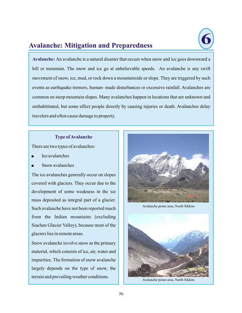
6Avalanche: Mitigation and Preparedness
Avalanche prone area, North Sikkim
Avalanche prone area, North Sikkim
56
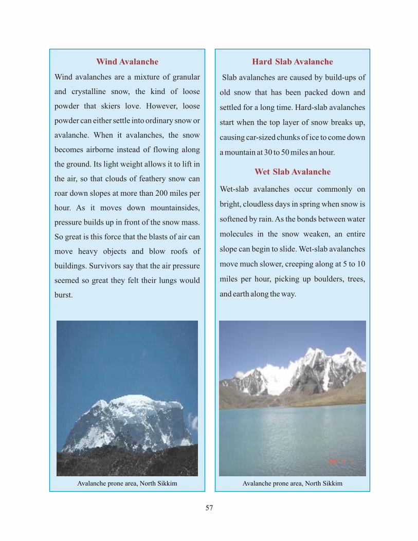
Avalanche prone area, North Sikkim Avalanche prone area, North Sikkim
57
Causes of Avalanche
Terrain
Slope angle
Slope direction
- Generally avalanches occur on
slopes between 30 and 45 degrees, but can
happen on any slope angles given the proper
situation. Extremely soggy snow will be well
lubricating with water, meaning it might
avalanche on a slope of only 10 to 25 degrees.
Very dry or granular snow will most likely
avalanche on a slope close to the 22 degree
angle of repose.
- However avalanches will
sprint on slopes opposite any direction,
mainly avalanches run on slopes opposite
north, east, and northeast. As the sun is at
such a low angle, mostly during winter, a
colder and deeper snow pack increases.
Slopes that are under shadow all through
most of the day are suspect because the snow
pack remains cooler, without much of the
melting and bonding that can make the snow
layers stronger.
Snowfall
Temperature
Rain
- Fresh snowfall puts extra stress on
the existing snow pack, especially if it does
not sufficiently bond to the pre-existing
surface layer. The extra weight of new snow
alone can reason a block to break rotten and
fall down the slope, particularly in storm-
induced avalanches.
-As snow is a good insulator,
slight temperature changes do not have much
effect on snow pack as bigger or longer
changes perform. For example, shadows
from the sun crossing the snow surface
during the day will not considerably vary
snow pack stability. Changes that last several
hours or days, such as a warm front moving
through, can slowly increase temperatures
that cause melting within the snow pack. This
can critically weaken some of the upper
layers of snow, creating increased avalanche
potential, particularly in combination with
other factors.
- In the short-term causes instability
through additional load and possible
lubrication of lower layers. Avalanche also
occurs if the upper snow layer is moved. Rain
reduces friction in the snowpack.
Weather
- Avalanches are probably to run either
during or immediately after a storm where
there has been significant snowfall. The 24
hours following a heavy snowfall are the
most dangerous.
58
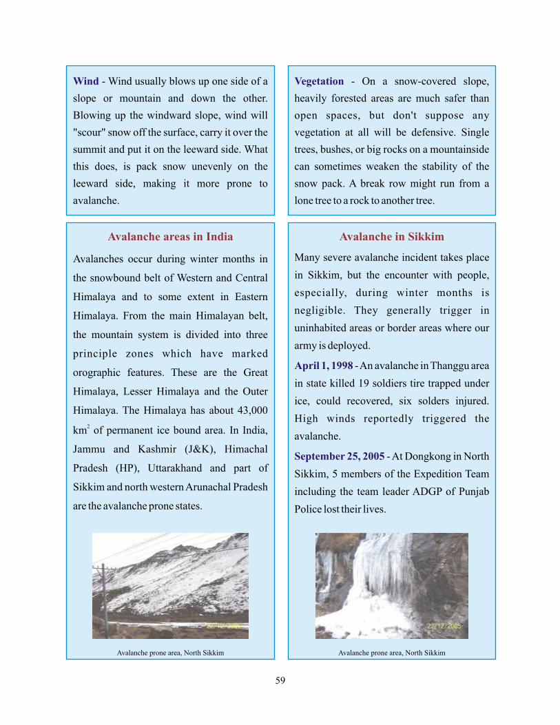
Wind - Wind usually blows up one side of a
slope or mountain and down the other.
Blowing up the windward slope, wind will
"scour" snow off the surface, carry it over the
summit and put it on the leeward side. What
this does, is pack snow unevenly on the
leeward side, making it more prone to
avalanche.
Vegetation - On a snow-covered slope,
heavily forested areas are much safer than
open spaces, but don't suppose any
vegetation at all will be defensive. Single
trees, bushes, or big rocks on a mountainside
can sometimes weaken the stability of the
snow pack. A break row might run from a
lone tree to a rock to another tree.
Avalanche areas in India
Avalanches occur during winter months in
the snowbound belt of Western and Central
Himalaya and to some extent in Eastern
Himalaya. From the main Himalayan belt,
the mountain system is divided into three
principle zones which have marked
orographic features. These are the Great
Himalaya, Lesser Himalaya and the Outer
Himalaya. The Himalaya has about 43,000
2km of permanent ice bound area. In India,
Jammu and Kashmir (J&K), Himachal
Pradesh (HP), Uttarakhand and part of
Sikkim and north western Arunachal Pradesh
are the avalanche prone states.
Avalanche in Sikkim
Many severe avalanche incident takes place
in Sikkim, but the encounter with people,
especially, during winter months is
negligible. They generally trigger in
uninhabited areas or border areas where our
army is deployed.
- An avalanche in Thanggu area
in state killed 19 soldiers tire trapped under
ice, could recovered, six solders injured.
High winds reportedly triggered the
avalanche.
- At Dongkong in North
Sikkim, 5 members of the Expedition Team
including the team leader ADGP of Punjab
Police lost their lives.
April 1, 1998
September 25, 2005
Avalanche prone area, North Sikkim Avalanche prone area, North Sikkim
59

Avalanche Safety: What you should do to prepare yourself
_ What was the weather conditions been over the past few days? Recent heavy snows?
_ Can you observe any wind loading on the slopes?
_ Do you have a good sense of the snow pack? Have you performed any snow pit or shear tests?
_ Have you noticed many fracture lines, heard "humping" or cracking sounds, or hollow
noises in the snow pack?
_ Are you keeping an eye on the orientation and steepness of the slopes as you cross them?
_ Are you lingering in gullies, bowls, or valleys?
_ Noticed any recent avalanche activity on other slopes similar to the one you are on?
_ If a slope looks suspect, are there any alternative routes?
Hazard Specific Preparedness Steps
ö Check out area avalanche conditions before you venture out.
ö Tell family/friends where you are going, what route you will be taking and when you expect
to return.
ö Complete a Wild Trip Plan and give it to a family member or friend before you leave.
ö Bring along the appropriate equipment and supplies for winter conditions and the activity
you're involved in. Be prepared in the event you get lost or separated, including a method for
communication such as a two-wave radio. Pack dry clothing, waterproof matches and
paraffin fire starters with you.
ö Pay attention to and abide by posted signs and regulations.
ö Stay aware of your surroundings. Learn the indicators and signs for avalanche and know
what to do if you're caught in.
ö Be prepared to take emergency shelter.
ö Keep an updated disaster supply kit in your vehicle.
ö Establish meeting places and phone numbers in case family members are separated and your
home is impacted.
ö Be sure to keep at least a half-tank of gas in your vehicle at all times. Someone may need it to
get help, or you could be delayed for long periods of time or have to reroute, if a pass is
temporarily closed for avalanche control.
60
Preparedness Steps
ö Have and practice a family disaster plan.
ö Establish meeting places and phone numbers in case family members are separated.
ö Identify an out-of-state contact to call during a major disaster or emergency; it will be easier
to call out of the area if local lines are tied up.
ö Keep your disaster kits up to date. Make sure you have kits for your home, vehicle, work and
school.
ö Teach all family members when, where and how turn of utilities. Make sure you have the
appropriate equipment, such as a wrench, etc.
ö Preplan alternate transportation routes to and fro and for other important destinations.
ö Know ahead of time what you should do to help family, friends or neighbors who are elderly
or have special needs.
ö Know what kinds of weather and snow conditions are likely to cause avalanches.
ö If you have to cross a slope that appears unsafe, close your jackets tightly and put on hats and
mittens.
ö If you have a rucksack, carry it in your hands and hold it in front of your face to get some
breathing space under the snow.
During an Avalanche
_ Try to take hold of a tree or stone.
_ If there is nothing to hang on to, swim! Swimming motions usually keep the body to the top
of the snow.
_ Don't panic!
_ Push one arm as high as possible overhead. This might alert rescuers to your position if
you're buried.
_ Cover your mouth and nose with your other hand.
61
Avalanche Hazard Mitigation and Management Plans
Avalanche Hazard are a recurring phenomenon. The complete control of avalanches is possible
only through active methods comprising essentially of the erection of suitable structures,
afforestation and by artificially-controlled triggering. However, these methods, besides being
expensive, are very difficult to execute. At some places, these methods cannot be implemented
at all because of the logistic problems.
Structural Control
The structural control method
provides a very high degree of
protection from avalanche danger.
The structural control can be carried
out in the formation zone by
buildings retaining barriers and drift
control, in middle zone by diversion
walls, wedges and galleries and in
the runout zone by catch dams and
mounds.
Afforestation
Forest arrest the formation of avalanches in a number
of ways. A forest with a thick growth of high trees in
the starting zone inhibits the formation of avalanches.
The trees provides anchor to the potential slab
avalanches. This eliminates the snow drift and retains
the snow on tree canopies and releases it more
gradually.
Control Artificial Triggering
This method attempts at triggering
of descent of an avalanche by
explosive, or by controlled skiing
before it occurs naturally. This pre-
emptive method inhibits the build-
up of snow cover on slopes to
disastrous proportions. This method
is generally adopted in conjunction
with avalanche forecasting. Though
this techniques is simple and
economical, it requires great amount
of planning, co-ordination and
training for successful execution.
The another method for avalanche mitigation is
awareness, timely forecasting of the danger of
avalanches and imparting training on safety and
rescue methods.
There is a general lack of awareness among
backcountry travelers about the avalanche
phenomenon and safety and rescue measures to be
followed against. Due to avalanche hazard there is
adverse effect on winter tourism, sports and other
commercial activity. Therefore, there is a need of
awareness campaign about various aspects of the
avalanche disasters. Following maybe the awareness
programmes:
Ø Pre-Winter avalanche awareness programme
Ø Mid-Winter appraisal report
Ø Post-Winter appraisal report
Ø Publication of hazard maps and avalanche atlases
Ø Multimedia and user's guide
Awareness
62
Bibliography
Agarwal and Narain, S. (1991): Floods, flood plains and environmental myths, Centre for Science and Environment, New Delhi.
Barthwal, B and Sadhna (2006): How safe are houses in the Earthquake-Prone zone of India? : Geol. Soc. India. Volume 67-IV.
Bhandari,R.K. and Gupta, C. (1985): Problems of landslides in Himalaya and future directions, In J.S. Singh (ed.), Environmental Regeneration in Himalaya: Concepts and strategies. The Central Himalayan Environment Association and Gyanodaya Prakashan, Nainital.
Bhasin Rajinder, Grimstad Eystein, Otto Larsen Jan, Dhawan Ashok K., Singh Rajbal, Verma S.K, Venkatachalam K. (2002): Landslide Hazards and Mitigation Measures at Gangtok, Sikkim Himalaya: Engineering Geology 64 351-368.
Central Building Research Institute Roorkee (1992): A document prepared under DST coordination programme on the Study of Landslide areas in Sikkim District North East Himalaya.
Department of Earthquake Engineering, University of Roorkee (1994): Earthquake Problem Do's and Don'ts for Protection.
Disaster Management Institute, Bhopal (1992): Community Emergency Planning Guide: Australian Emergency Manual, Natural Disaster Organisation.
Disaster Management Institute, Bhopal (2004): Hand Book Earthquake Resistant Construction.
Disaster Mitigation and Management Centre, Govt. of Uttaranchal, Dehradun (2001): Natural Disasters.
Federal Emergency Management Agency (1993): Are You Ready? Guide to Disaster Preparedness.
Federal Emergency Management Agency, American Red Cross (2004): Preparing for Disaster.
FEMA (1997): Urban Search and rescue response system-Field Operation Guide.
Ganju Ashwagosha, Thakur Naresh K, Rana Vijay (2002): Characteristics of Avalanche Accidents in Western Himalayan Region, India: International Snow Science Workshop.
Geological Survey of India, Sikkim Unit: Silver Jubilee Celebration: Published by Dy. Director General,
Eastern Region, GSI, Bhu Bijnan Bhawan, DK-6, Sector-II, Salt Lake, Kolkata.
Gupta L.C., Gupta M.C. and Gupta Anil (2002): Gujarat Earthquake: National Centre for Disaster Management, Indian Institute of Public Administration, New Delhi.
Govt. of India, Department of Science & Technology (Natural Resources Data Management System), New Delhi, (1994): Methodology for Landslide Hazard Zonation, A Report Prepared under Coordinated programme on the Study of Landslides.
Govt. of India, Ministry of Home Affairs, National Disaster management Division: Incident Command System.
Govt. of India, Ministry of Home Affairs, National Disaster management Division (2004): Disaster management in India, A Status Report.
63
Hazard Zonation Studies for Urban Planning around Gangtok, Sikkim (2001): Nat. Symp. Role of E Sci. Integrated Development and Related Issues GSI Spl. Pub. No. 65(I).
Indira Gandhi National Open University, New Delhi, (1998): Disaster Management, Methods and Techniques.
Nath S.K. (2006): Seismic Hazard and Microzonation Atlas of the Sikkim Himalaya: Seismology Division, Department of Science and Technology, Govt. of India.
National Bureau of Soil Survey and Land Use Planning, Indian Council of Agricultural Research, Nagpur in co-operation with Department of Agriculture and Department of Forest Govt. of Sikkim, (1996): Soil of Sikkim for Optimizing Land Use: NBSS Publ.60: Soil of India Series.
National Disaster Management Division, Ministry of Home Affairs, Govt. of India: An Earthquake Preparedness Guide.
National Disaster Management Division, Ministry of Home Affairs, Govt. of India: Sample Resource Material for Natural Disaster Mitigation and PreparednessPart 1: Planning to Cope with Disasters, Volume -I and IIPart 2: Education and Training, Volume -I and IIPart 3: Construction Toolkit, Volume -I and II Part 4: IEC Toolkit
National Disaster Response Plan (2001): Prepared by - High Powered Committee on Disaster Management:
Department of Agricultural and Cooperation, Ministry of Agricultural, Govt. of India
Roy P.S., Western C.J. Van, Jha V.K., Lakhera R.C. and Chamati Ray P.K. (2000): Natural Disaster and their Mitigation, Indian Remote Sensing, National Remote Sensing Agency, Dehradun.
Sharma S.S., (2006): Mitigation avalanche disaster in Indian Himalaya: In K.S.Valdiya (ed.), Coping with Natural Hazards: Indian context: Orient Longman, National Academy of Science, Allahabad.
Sharma V.K., (1994): Disaster management: National Centre for Disaster management, Indian Institute of Public Administration, New Delhi.
Shekhar Madhu, R., (2005): Status Report for Initiating Landslide Studies in Sikkim, Report Submitted to DST, New Delhi, Govt. of India.
Singh L.P., Ghoshal T.B., Fahim Md., Kandpal G.C., Dutta A. and Roy R.K. (2001): Micro-Landslide Hazard
Zonation Studies for Urban Planning around Gangtok, Sikkim: Nat. Symp. Role of E Sci. Integrated Development and Related Issues GSI Spl. Pub. No. 65(I).
Singh Shailendra, Kundu, S.C. and Singh, S., (1998): Handbook of Modern Management Series-5: Disaster Management: Mittal Publications, New Delhi.
Srinivasan K., Ganju A. and Sharma S. S., (2005): Snow and Avalanche Study Establishment, Research and Development Centre, Chandigarh, India: Current Science, Vol. 88, No. 6.
Siromony P. Michael Vetha, (2005): Source Books on District Disaster Management: Ministry of Home Affairs Govt. of India and Lal Bahadur Shastri National Academy of Administration, Mussoorie.
64

University of Wisconsin Cooperative Extension, Federal Emergency Management Agency, Wisconsin Division of Emergency Government, (1991): Flood Preparedness and Response.
Valdiya, K.S. (1985): Accelerated erosion and landslide prone zones in the central Himalayan region: In J.S.
Singh (ed.), Environmental Regeneration in Himalaya: Concepts and Strategies: The Central Himalayan Environment Association and Gyanodaya Prakashan, Nainital.
VANI-Voluntary Action Network India, New Delhi, (2002): Community Based Disaster Management, An Information Guide.
Yudhbir and Gergan, J.T. (2004): Status Report for Initiating Landslide Studies in Sikkim, Report Submitted to DST, New Delhi, Govt. of India: Wadia Institute of Himalayan Geology, Dehradun.
Amateur Seismic Centre (ASC), Pune.
Ecosystem of Sikkim (www.sikkimipr.org).
Website of the Government of Sikkim (www.sikkim.gov.in).
Himalayan Asia Group (www.himalayanasia.com).
http://www.tqnyc.org
http://www.weathernotebook.org
http://en.wikipedia.org
http://nsidc.org
http://www.avalanche-center.org
www.ndmindia.nic.in
www.disasterpreparedness.icimod.org
www.nidm.net
65
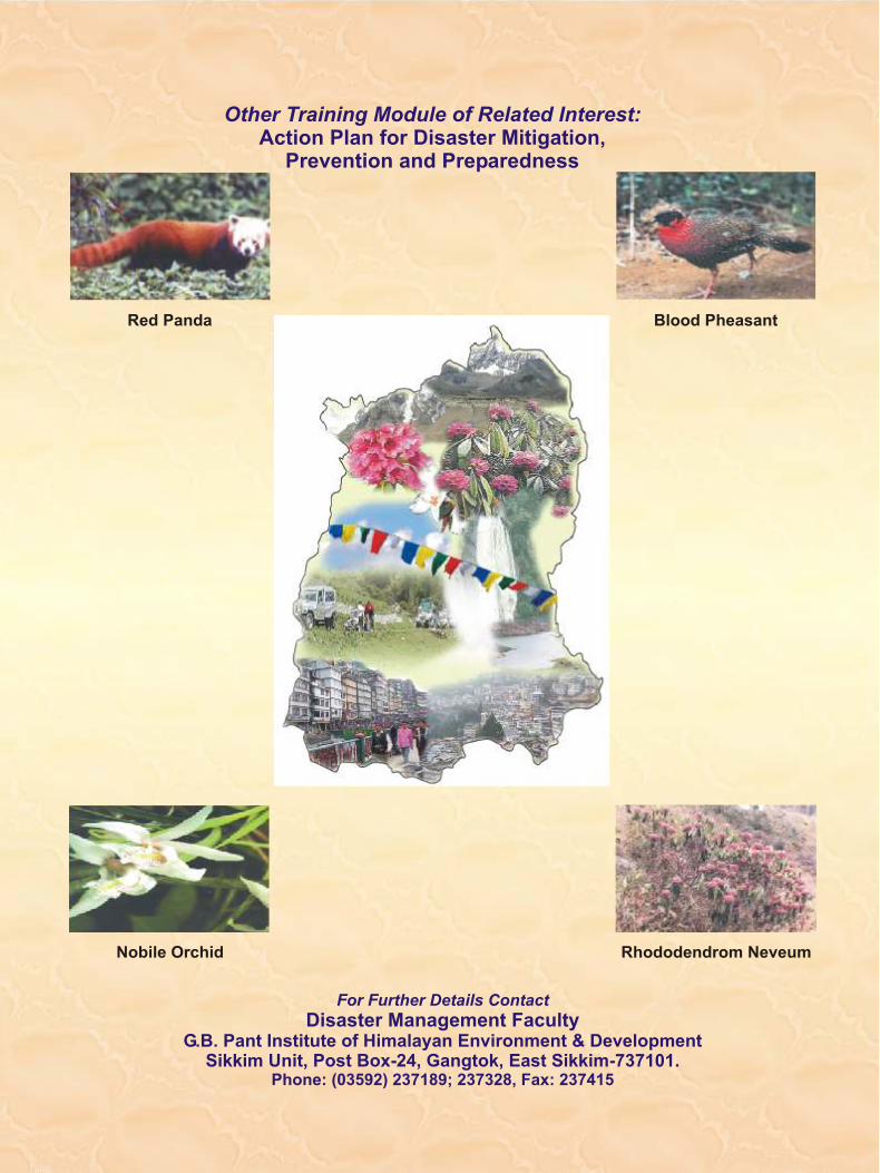
Nobile Orchid Rhododendrom Neveum
Red Panda Blood Pheasant
Other Training Module of Related Interest:Action Plan for Disaster Mitigation,
Prevention and Preparedness
For Further Details Contact
Disaster Management FacultyG.B. Pant Institute of Himalayan Environment & Development
Sikkim Unit, Post Box-24, Gangtok, East Sikkim-737101.Phone: (03592) 237189; 237328, Fax: 237415