Embed Size (px)
Citation preview
Initial Environment Examination
This Addendum to Initial Environment Examination(IEE) has been submitted to ADB by Rajasthan Rajya Vidyut Prasaran Nigam Limited, Jaipur and is made publicly available in accordance with ADB’s Public Communications Policy (2011). It does not necessarily reflect the views of ADB. This is an addendum to IEE posted in June 2012 available on https://www.adb.org/projects/documents/mff-rajasthan-renewable-energy-transmission-investment-program-facility-concept-iee.
This Addendum to Initial Environment Examination Report is a document of the borrower. The views expressed herein do not necessarily represent those of ADB's Board of Directors, Management, or staff, and may be preliminary in nature. In preparing any country program or strategy, financing any project, or by making any designation of or reference to a particular territory or geographic area in this document, the Asian Development Bank does not intend to make any judgments as to the legal or other status of any territory or area.
Project Number: 45224-003 January 2018 (Addendum) Part A: Main Report (Pages 1- 45) and Annexures
IND: Rajasthan Renewable Energy Transmission Investment Program - Tranche 1
Submitted by
Rajasthan Rajya Vidyut Prasaran Nigam Limited, Jaipur
i Addendum to Initial Environmental Examination for RRVPNL RREITP Tranche 1
Addendum to Initial Environment Examination Document Stage: Draft Document for Disclosure Project Number: 45224 (IND) January 2018
India: Rajasthan Renewable Energy Transmission Investment Program (Tranche -1) An update on changes to IEE as per Actual Construction Prepared for Rajasthan Rajya Vidyut Prasaran Nigam Limited (RRVPNL), Government of Rajasthan. This addendum to the Initial Environment Examination report is a document of the borrower. The views expressed herein do not necessarily represent those of ADB's Board of Directors, Management, or staff, and may be preliminary in nature.
i Addendum to Initial Environmental Examination for RRVPNL RREITP Tranche 1
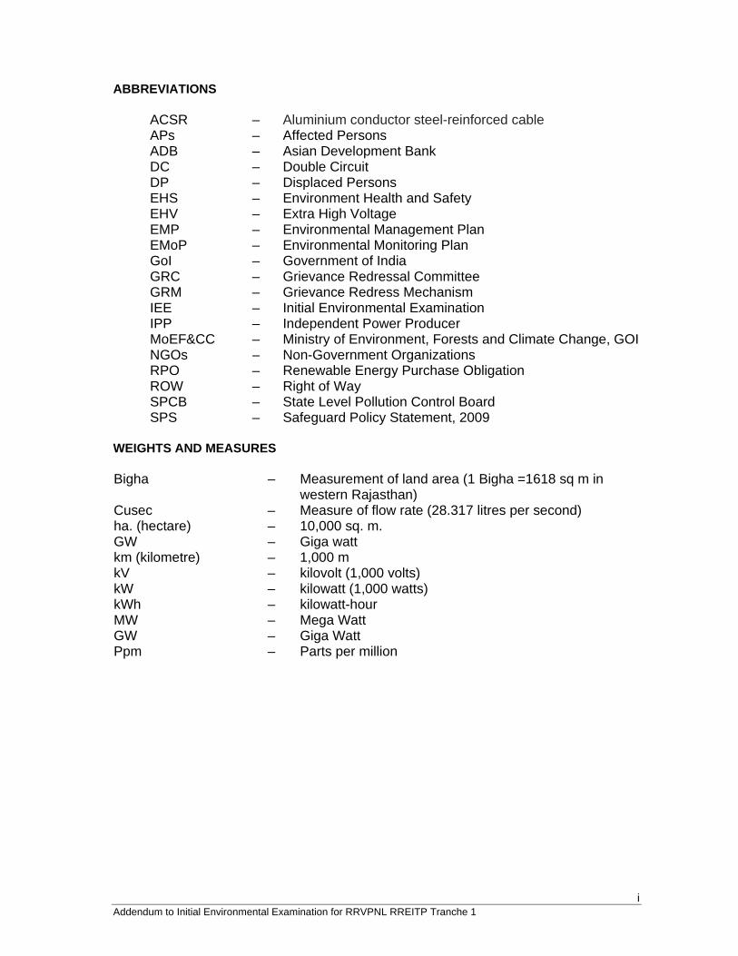
ABBREVIATIONS
ACSR – Aluminium conductor steel-reinforced cable APs – Affected Persons ADB – Asian Development Bank DC – Double Circuit DP – Displaced Persons EHS – Environment Health and Safety EHV – Extra High Voltage EMP – Environmental Management Plan EMoP – Environmental Monitoring Plan GoI – Government of India GRC – Grievance Redressal Committee GRM – Grievance Redress Mechanism IEE – Initial Environmental Examination IPP – Independent Power Producer MoEF&CC – Ministry of Environment, Forests and Climate Change, GOI NGOs – Non-Government Organizations RPO – Renewable Energy Purchase Obligation ROW – Right of Way SPCB – State Level Pollution Control Board SPS – Safeguard Policy Statement, 2009 WEIGHTS AND MEASURES Bigha – Measurement of land area (1 Bigha =1618 sq m in
western Rajasthan) Cusec – Measure of flow rate (28.317 litres per second) ha. (hectare) – 10,000 sq. m. GW – Giga watt km (kilometre) – 1,000 m kV – kilovolt (1,000 volts) kW – kilowatt (1,000 watts) kWh – kilowatt-hour MW – Mega Watt GW – Giga Watt Ppm – Parts per million
ii Addendum to Initial Environmental Examination for RRVPNL RREITP Tranche 1
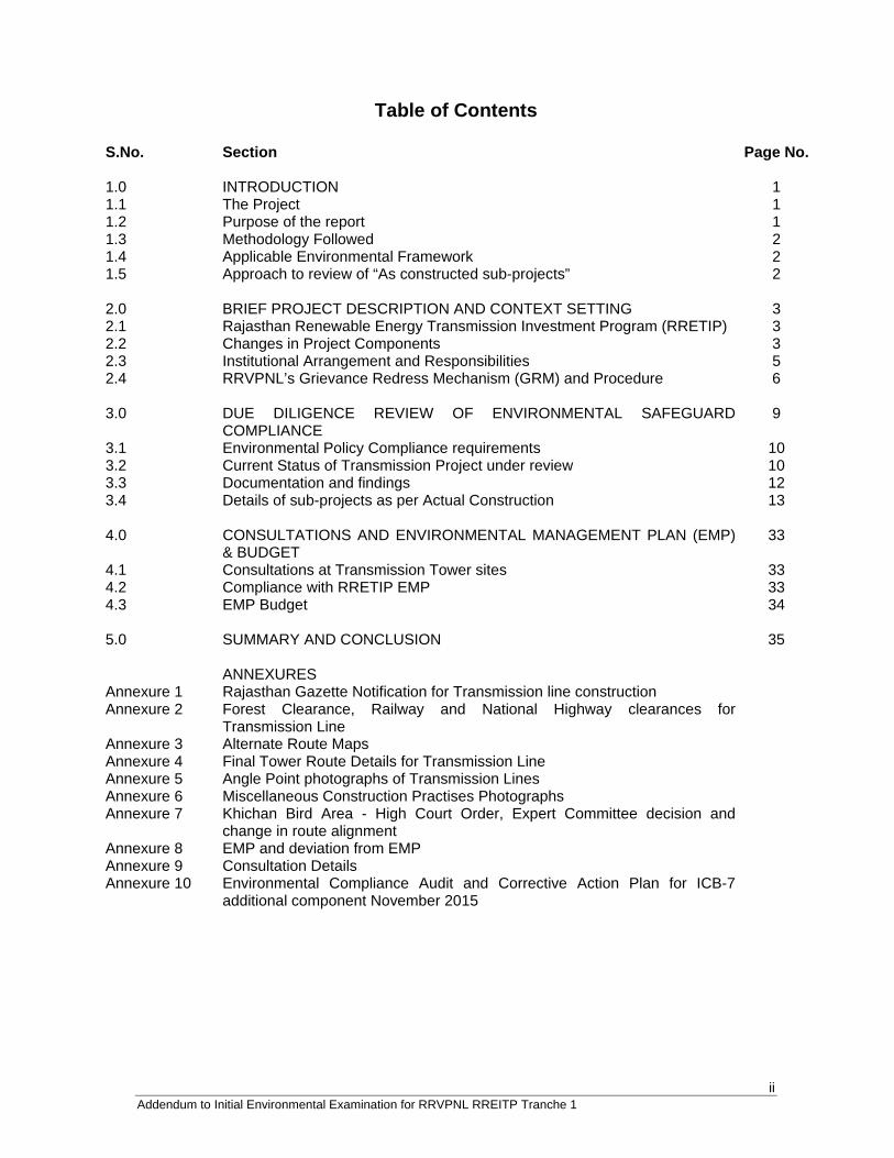
Table of Contents
S.No. Section Page No. 1.0 INTRODUCTION 1 1.1 The Project 1 1.2 Purpose of the report 1 1.3 Methodology Followed 2 1.4 Applicable Environmental Framework 2 1.5 Approach to review of “As constructed sub-projects” 2 2.0 BRIEF PROJECT DESCRIPTION AND CONTEXT SETTING 3 2.1 Rajasthan Renewable Energy Transmission Investment Program (RRETIP) 3 2.2 Changes in Project Components 3 2.3 Institutional Arrangement and Responsibilities 5 2.4 RRVPNL’s Grievance Redress Mechanism (GRM) and Procedure 6 3.0 DUE DILIGENCE REVIEW OF ENVIRONMENTAL SAFEGUARD
COMPLIANCE 9
3.1 Environmental Policy Compliance requirements 10 3.2 Current Status of Transmission Project under review 10 3.3 Documentation and findings 12 3.4 Details of sub-projects as per Actual Construction 13 4.0 CONSULTATIONS AND ENVIRONMENTAL MANAGEMENT PLAN (EMP)
& BUDGET 33
4.1 Consultations at Transmission Tower sites 33 4.2 Compliance with RRETIP EMP 33 4.3 EMP Budget 34 5.0 SUMMARY AND CONCLUSION 35 ANNEXURES Annexure 1 Rajasthan Gazette Notification for Transmission line construction Annexure 2 Forest Clearance, Railway and National Highway clearances for
Transmission Line
Annexure 3 Alternate Route Maps Annexure 4 Final Tower Route Details for Transmission Line Annexure 5 Angle Point photographs of Transmission Lines Annexure 6 Miscellaneous Construction Practises Photographs Annexure 7 Khichan Bird Area - High Court Order, Expert Committee decision and
change in route alignment
Annexure 8 EMP and deviation from EMP Annexure 9 Consultation Details Annexure 10 Environmental Compliance Audit and Corrective Action Plan for ICB-7
additional component November 2015
1 Addendum to Initial Environmental Examination for RRVPNL RREITP Tranche 1
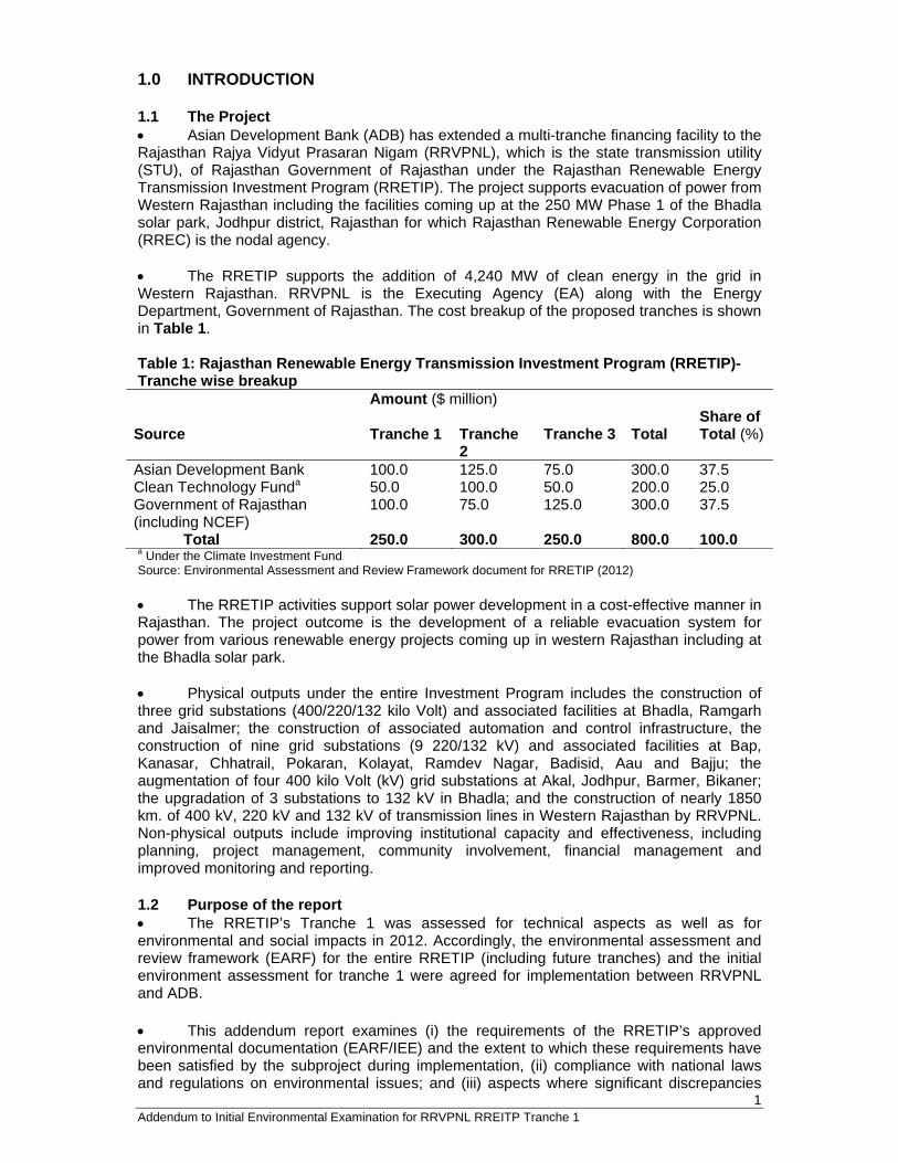
1.0 INTRODUCTION 1.1 The Project Asian Development Bank (ADB) has extended a multi-tranche financing facility to the Rajasthan Rajya Vidyut Prasaran Nigam (RRVPNL), which is the state transmission utility (STU), of Rajasthan Government of Rajasthan under the Rajasthan Renewable Energy Transmission Investment Program (RRETIP). The project supports evacuation of power from Western Rajasthan including the facilities coming up at the 250 MW Phase 1 of the Bhadla solar park, Jodhpur district, Rajasthan for which Rajasthan Renewable Energy Corporation (RREC) is the nodal agency. The RRETIP supports the addition of 4,240 MW of clean energy in the grid in Western Rajasthan. RRVPNL is the Executing Agency (EA) along with the Energy Department, Government of Rajasthan. The cost breakup of the proposed tranches is shown in Table 1. Table 1: Rajasthan Renewable Energy Transmission Investment Program (RRETIP)-Tranche wise breakup Amount ($ million) Source
Tranche 1
Tranche 2
Tranche 3
Total
Share of Total (%)
Asian Development Bank 100.0 125.0 75.0 300.0 37.5 Clean Technology Funda 50.0 100.0 50.0 200.0 25.0 Government of Rajasthan (including NCEF)
100.0 75.0 125.0 300.0 37.5
Total 250.0 300.0 250.0 800.0 100.0 a Under the Climate Investment Fund Source: Environmental Assessment and Review Framework document for RRETIP (2012) The RRETIP activities support solar power development in a cost-effective manner in Rajasthan. The project outcome is the development of a reliable evacuation system for power from various renewable energy projects coming up in western Rajasthan including at the Bhadla solar park. Physical outputs under the entire Investment Program includes the construction of three grid substations (400/220/132 kilo Volt) and associated facilities at Bhadla, Ramgarh and Jaisalmer; the construction of associated automation and control infrastructure, the construction of nine grid substations (9 220/132 kV) and associated facilities at Bap, Kanasar, Chhatrail, Pokaran, Kolayat, Ramdev Nagar, Badisid, Aau and Bajju; the augmentation of four 400 kilo Volt (kV) grid substations at Akal, Jodhpur, Barmer, Bikaner; the upgradation of 3 substations to 132 kV in Bhadla; and the construction of nearly 1850 km. of 400 kV, 220 kV and 132 kV of transmission lines in Western Rajasthan by RRVPNL. Non-physical outputs include improving institutional capacity and effectiveness, including planning, project management, community involvement, financial management and improved monitoring and reporting. 1.2 Purpose of the report The RRETIP’s Tranche 1 was assessed for technical aspects as well as for environmental and social impacts in 2012. Accordingly, the environmental assessment and review framework (EARF) for the entire RRETIP (including future tranches) and the initial environment assessment for tranche 1 were agreed for implementation between RRVPNL and ADB. This addendum report examines (i) the requirements of the RRETIP’s approved environmental documentation (EARF/IEE) and the extent to which these requirements have been satisfied by the subproject during implementation, (ii) compliance with national laws and regulations on environmental issues; and (iii) aspects where significant discrepancies
2 Addendum to Initial Environmental Examination for RRVPNL RREITP Tranche 1
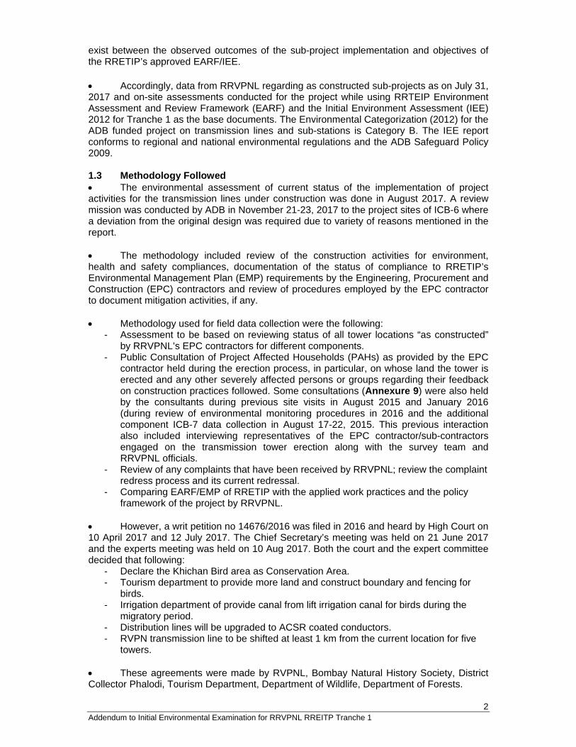
exist between the observed outcomes of the sub-project implementation and objectives of the RRETIP’s approved EARF/IEE. Accordingly, data from RRVPNL regarding as constructed sub-projects as on July 31, 2017 and on-site assessments conducted for the project while using RRTEIP Environment Assessment and Review Framework (EARF) and the Initial Environment Assessment (IEE) 2012 for Tranche 1 as the base documents. The Environmental Categorization (2012) for the ADB funded project on transmission lines and sub-stations is Category B. The IEE report conforms to regional and national environmental regulations and the ADB Safeguard Policy 2009. 1.3 Methodology Followed The environmental assessment of current status of the implementation of project activities for the transmission lines under construction was done in August 2017. A review mission was conducted by ADB in November 21-23, 2017 to the project sites of ICB-6 where a deviation from the original design was required due to variety of reasons mentioned in the report. The methodology included review of the construction activities for environment, health and safety compliances, documentation of the status of compliance to RRETIP’s Environmental Management Plan (EMP) requirements by the Engineering, Procurement and Construction (EPC) contractors and review of procedures employed by the EPC contractor to document mitigation activities, if any. Methodology used for field data collection were the following:
- Assessment to be based on reviewing status of all tower locations “as constructed” by RRVPNL’s EPC contractors for different components.
- Public Consultation of Project Affected Households (PAHs) as provided by the EPC contractor held during the erection process, in particular, on whose land the tower is erected and any other severely affected persons or groups regarding their feedback on construction practices followed. Some consultations (Annexure 9) were also held by the consultants during previous site visits in August 2015 and January 2016 (during review of environmental monitoring procedures in 2016 and the additional component ICB-7 data collection in August 17-22, 2015. This previous interaction also included interviewing representatives of the EPC contractor/sub-contractors engaged on the transmission tower erection along with the survey team and RRVPNL officials.
- Review of any complaints that have been received by RRVPNL; review the complaint redress process and its current redressal.
- Comparing EARF/EMP of RRETIP with the applied work practices and the policy framework of the project by RRVPNL.
However, a writ petition no 14676/2016 was filed in 2016 and heard by High Court on 10 April 2017 and 12 July 2017. The Chief Secretary’s meeting was held on 21 June 2017 and the experts meeting was held on 10 Aug 2017. Both the court and the expert committee decided that following:
- Declare the Khichan Bird area as Conservation Area. - Tourism department to provide more land and construct boundary and fencing for
birds. - Irrigation department of provide canal from lift irrigation canal for birds during the
migratory period. - Distribution lines will be upgraded to ACSR coated conductors. - RVPN transmission line to be shifted at least 1 km from the current location for five
towers. These agreements were made by RVPNL, Bombay Natural History Society, District Collector Phalodi, Tourism Department, Department of Wildlife, Department of Forests.
3 Addendum to Initial Environmental Examination for RRVPNL RREITP Tranche 1
1.4 Applicable Environmental Framework An update of the Initial Environmental examination report that has been conducted has been evaluated against the following criteria:
Applicable Local and National environment, occupational safety, health and social legislations;
ADB Safeguard Policy Statement (2009); All requirements and mitigating or monitoring measures specified in the
Environmental Assessment and Review Framework (EARF) for RREIP 2012 as well as the IEE for Tranche 1.
1.5 Approach to review of “As constructed sub-projects” This Environmental update exercise has been broadly divided into four tasks:
Document review; Data collected by EPC contractor during construction on community, project affected
people (PAPs) and worker’s consultations, and some during previous site visits (ICB-7);
Assessment of work practises followed, gaps and compliance analysis based on previous site visits in August 2015 and January 2016 (during review of environmental monitoring procedures in 2016 and ICB-7 data collection in 2015, final site visits to Bhadla substation and the Jodhpur-Merta line LILO point to Bhadla substation transmission line (ICB-6 project components) between November 21-23, 2017;
Review the High court orders for shifting of towers near the vicinity of Khichan Bird Area at Phalodi and Expert Committee’s request to declare the area as Conservation Reserve in future.
Survey of the rerouted component if ICB-6 along with the consultations held on January 9, 2018 with affected persons.
Reporting. All the dates of the High Court and Expert committee recommendations are dated before the final field visit cum assessment during November 21-23, 2017 but after August 2017 meetings with RVPNL at ADB office. Hence, the final IEE can only be completed after all information is complete and until confirmed to ADB by competent authorities in this case. EPC contractor has been advised to conduct a revised survey in RVPNL letter dated Dec 12, 2017 (Annexure 7) for this revised transmission line route alignment. The data regarding soil, topography, contour, land cutting and filling required, electrical clearances, distance from water body and distance from major roads, details of forest/non-forest, fruit/non-fruit trees being affected, forest clearances, land details will be collected by RVPNL/EPC contractor. This supplementary information will be supplied for each of this subproject by RVPNL to ADB for prior approval before contract award.
4 Addendum to Initial Environmental Examination for RRVPNL RREITP Tranche 1
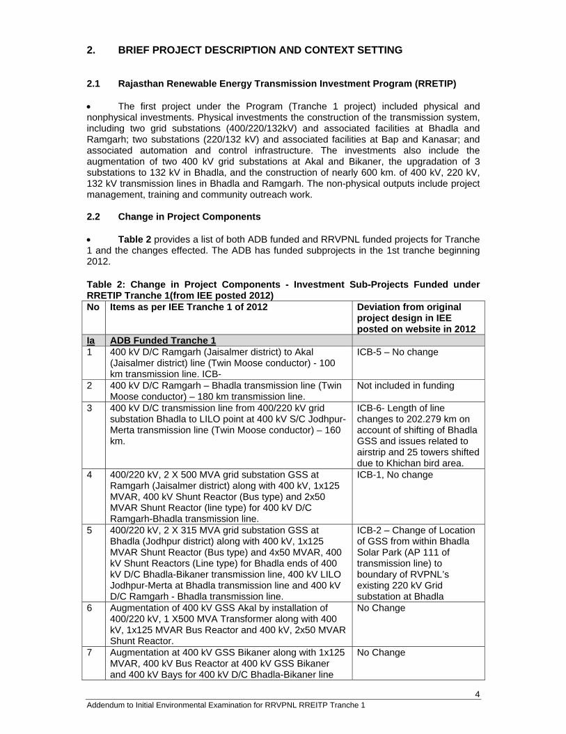
2. BRIEF PROJECT DESCRIPTION AND CONTEXT SETTING 2.1 Rajasthan Renewable Energy Transmission Investment Program (RRETIP) The first project under the Program (Tranche 1 project) included physical and nonphysical investments. Physical investments the construction of the transmission system, including two grid substations (400/220/132kV) and associated facilities at Bhadla and Ramgarh; two substations (220/132 kV) and associated facilities at Bap and Kanasar; and associated automation and control infrastructure. The investments also include the augmentation of two 400 kV grid substations at Akal and Bikaner, the upgradation of 3 substations to 132 kV in Bhadla, and the construction of nearly 600 km. of 400 kV, 220 kV, 132 kV transmission lines in Bhadla and Ramgarh. The non-physical outputs include project management, training and community outreach work. 2.2 Change in Project Components Table 2 provides a list of both ADB funded and RRVPNL funded projects for Tranche 1 and the changes effected. The ADB has funded subprojects in the 1st tranche beginning 2012. Table 2: Change in Project Components - Investment Sub-Projects Funded under RRETIP Tranche 1(from IEE posted 2012) No Items as per IEE Tranche 1 of 2012 Deviation from original
project design in IEE posted on website in 2012
Ia ADB Funded Tranche 1 1 400 kV D/C Ramgarh (Jaisalmer district) to Akal
(Jaisalmer district) line (Twin Moose conductor) - 100 km transmission line. ICB-
ICB-5 – No change
2 400 kV D/C Ramgarh – Bhadla transmission line (Twin Moose conductor) – 180 km transmission line.
Not included in funding
3 400 kV D/C transmission line from 400/220 kV grid substation Bhadla to LILO point at 400 kV S/C Jodhpur-Merta transmission line (Twin Moose conductor) – 160 km.
ICB-6- Length of line changes to 202.279 km on account of shifting of Bhadla GSS and issues related to airstrip and 25 towers shifted due to Khichan bird area.
4 400/220 kV, 2 X 500 MVA grid substation GSS at Ramgarh (Jaisalmer district) along with 400 kV, 1x125 MVAR, 400 kV Shunt Reactor (Bus type) and 2x50 MVAR Shunt Reactor (line type) for 400 kV D/C Ramgarh-Bhadla transmission line.
ICB-1, No change
5 400/220 kV, 2 X 315 MVA grid substation GSS at Bhadla (Jodhpur district) along with 400 kV, 1x125 MVAR Shunt Reactor (Bus type) and 4x50 MVAR, 400 kV Shunt Reactors (Line type) for Bhadla ends of 400 kV D/C Bhadla-Bikaner transmission line, 400 kV LILO Jodhpur-Merta at Bhadla transmission line and 400 kV D/C Ramgarh - Bhadla transmission line.
ICB-2 – Change of Location of GSS from within Bhadla Solar Park (AP 111 of transmission line) to boundary of RVPNL’s existing 220 kV Grid substation at Bhadla
6 Augmentation of 400 kV GSS Akal by installation of 400/220 kV, 1 X500 MVA Transformer along with 400 kV, 1x125 MVAR Bus Reactor and 400 kV, 2x50 MVAR Shunt Reactor.
No Change
7 Augmentation at 400 kV GSS Bikaner along with 1x125 MVAR, 400 kV Bus Reactor at 400 kV GSS Bikaner and 400 kV Bays for 400 kV D/C Bhadla-Bikaner line
No Change
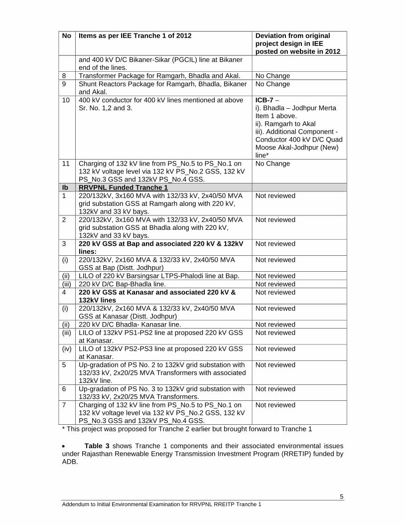
5 Addendum to Initial Environmental Examination for RRVPNL RREITP Tranche 1
No Items as per IEE Tranche 1 of 2012 Deviation from original project design in IEE posted on website in 2012
and 400 kV D/C Bikaner-Sikar (PGCIL) line at Bikaner end of the lines.
8 Transformer Package for Ramgarh, Bhadla and Akal. No Change 9 Shunt Reactors Package for Ramgarh, Bhadla, Bikaner
and Akal. No Change
10 400 kV conductor for 400 kV lines mentioned at above Sr. No. 1,2 and 3.
ICB-7 – i). Bhadla – Jodhpur Merta Item 1 above. ii). Ramgarh to Akal iii). Additional Component - Conductor 400 kV D/C Quad Moose Akal-Jodhpur (New) line*
11 Charging of 132 kV line from PS_No.5 to PS_No.1 on 132 kV voltage level via 132 kV PS_No.2 GSS, 132 kV PS_No.3 GSS and 132kV PS_No.4 GSS.
No Change
Ib RRVPNL Funded Tranche 1 1 220/132kV, 3x160 MVA with 132/33 kV, 2x40/50 MVA
grid substation GSS at Ramgarh along with 220 kV, 132kV and 33 kV bays.
Not reviewed
2 220/132kV, 3x160 MVA with 132/33 kV, 2x40/50 MVA grid substation GSS at Bhadla along with 220 kV, 132kV and 33 kV bays.
Not reviewed
3 220 kV GSS at Bap and associated 220 kV & 132kV lines:
Not reviewed
(i) 220/132kV, 2x160 MVA & 132/33 kV, 2x40/50 MVA GSS at Bap (Distt. Jodhpur)
Not reviewed
(ii) LILO of 220 kV Barsingsar LTPS-Phalodi line at Bap. Not reviewed (iii) 220 kV D/C Bap-Bhadla line. Not reviewed 4 220 kV GSS at Kanasar and associated 220 kV &
132kV lines Not reviewed
(i) 220/132kV, 2x160 MVA & 132/33 kV, 2x40/50 MVA GSS at Kanasar (Distt. Jodhpur)
Not reviewed
(ii) 220 kV D/C Bhadla- Kanasar line. Not reviewed (iii) LILO of 132kV PS1-PS2 line at proposed 220 kV GSS
at Kanasar. Not reviewed
(iv) LILO of 132kV PS2-PS3 line at proposed 220 kV GSS at Kanasar.
Not reviewed
5 Up-gradation of PS No. 2 to 132kV grid substation with 132/33 kV, 2x20/25 MVA Transformers with associated 132kV line.
Not reviewed
6 Up-gradation of PS No. 3 to 132kV grid substation with 132/33 kV, 2x20/25 MVA Transformers.
Not reviewed
7 Charging of 132 kV line from PS_No.5 to PS_No.1 on 132 kV voltage level via 132 kV PS_No.2 GSS, 132 kV PS_No.3 GSS and 132kV PS_No.4 GSS.
Not reviewed
* This project was proposed for Tranche 2 earlier but brought forward to Tranche 1 Table 3 shows Tranche 1 components and their associated environmental issues under Rajasthan Renewable Energy Transmission Investment Program (RRETIP) funded by ADB.
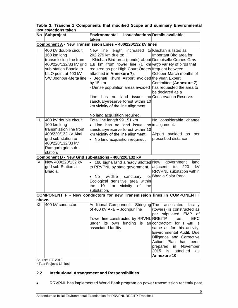
6 Addendum to Initial Environmental Examination for RRVPNL RREITP Tranche 1
Table 3: Tranche 1 Components that modified Scope and summary Environmental Issues/actions taken No Subproject Environmental Issues/actions
takenDetails available
Component A - New Transmission Lines – 400/220/132 kV lines I 400 kV double circuit
160 km long transmission line from 400/220/132/33 kV grid sub-station Bhadla to LILO point at 400 kV S/C Jodhpur-Merta line.
New line length increased to 202.279 km due to: - Khichan Bird area (ponds) about 1.8 km from tower line (1 km required as per High Court Orders attached in Annexure 7). - Beghati Khurd Airport avoided by 15 km - Dense population areas avoided Line has no land issue, no sanctuary/reserve forest within 10 km vicinity of the line alignment. No land acquisition required.
Khichan is listed as Important Bird area for Demoiselle Cranes Grus virgo variety of birds that frequent between October-March months of the year. Expert Committee (Annexure 7) has requested the area to be declared as a Conservation Reserve.
III. 400 kV double circuit 100 km long transmission line from 400/220/132 kV Akal grid sub-station to 400/220/132/33 kV Ramgarh grid sub-station.
Total line length 99.151 km Line has no land issue, no sanctuary/reserve forest within 10 km vicinity of the line alignment. No land acquisition required.
No considerable change in alignment. Airport avoided as per prescribed distance
Component B - New Grid sub-stations - 400/220/132 kV IV New 400/220/132 kV
grid sub-Station at Bhadla.
160 bigha land already allotted to RRVPNL by state government. No wildlife sanctuary or Ecological sensitive area within the 10 km vicinity of the substation.
New government land adjacent to 220 kV RRVPNL substation within Bhadla Solar Park.
COMPONENT F - New conductors for new Transmission lines in COMPONENT I above. XII 400 kV conductor Additional Component – Stringing
of 400 kV Akal – Jodhpur line Tower line constructed by RRVNL under its own funding is an associated facility
The associated facility (towers) is constructed as per stipulated EMP of RREITP as EPC contractor* for I &III is same as for this activity.Environmental Audit, Due Diligence and Corrective Action Plan has been prepared in November2015 is attached as Annexure 10
Source: IEE 2012 * Tata Projects Limited. 2.2 Institutional Arrangement and Responsibilities RRVPNL has implemented World Bank program on power transmission recently past
7 Addendum to Initial Environmental Examination for RRVPNL RREITP Tranche 1
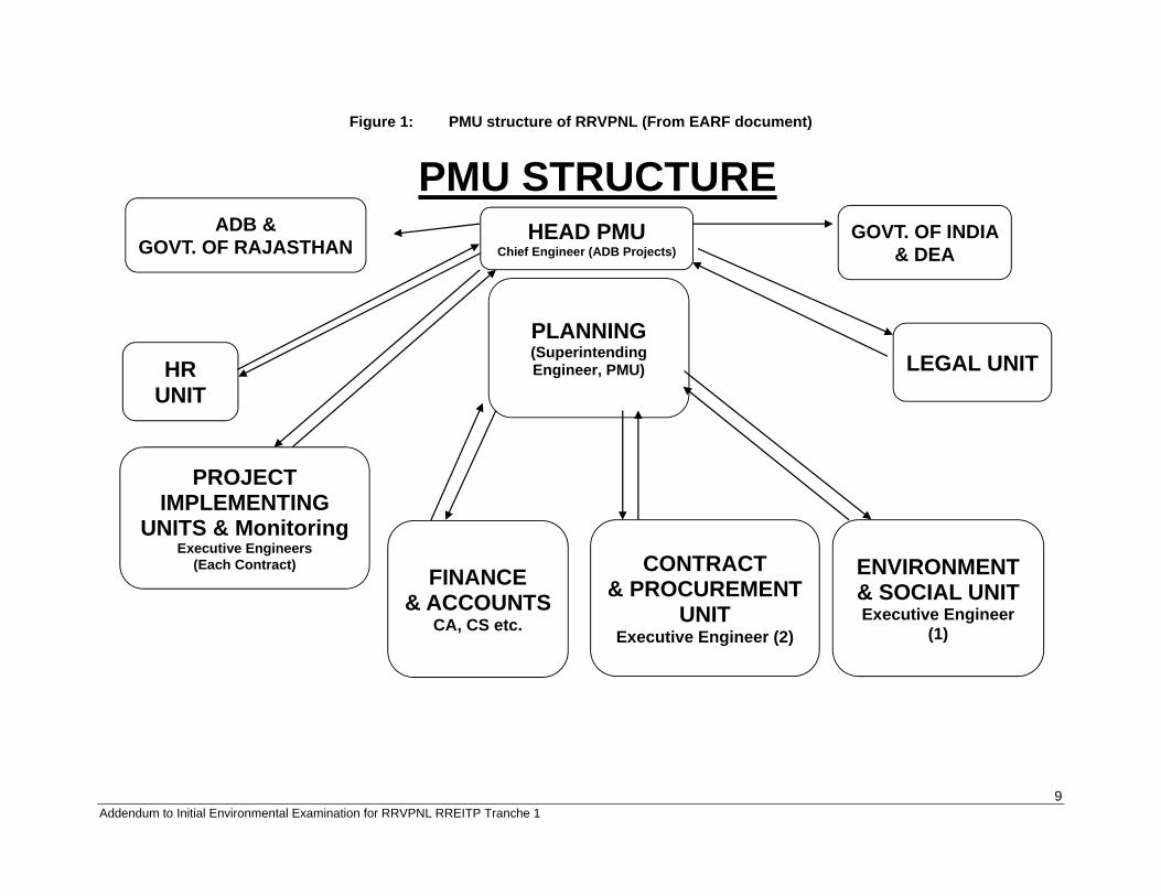
and implemented programs followed an Environmental Social Management Framework (ESMF). The normal work practise of RRVPNL involves following all GOI and donor norms on environment and social safeguards compliances. The borrower has adequate in-house institutional capacity in implementing national laws and Asian Development Bank (ADB) requirements. The capacity development needs were identified and included in tranche 1. Some of the nonphysical investment include: Non-physical outputs includes improving institutional capacity and effectiveness, including planning, project management, community involvement, financial management and improved monitoring and reporting. The RRVPNL is the Executing Agency (EA) along with the Energy Department, Government of Rajasthan for the project. RRVPNL has three divisions: i) Engineering and Projects Division (responsible for project design and implementation) ii) Accounts and Finance Division (responsible for accounts, funding arrangements) and iii) Development Division (responsible for energy sales, land identification and development). The RRVPNL has constituted a Project Management Unit (PMU) shown in Figure 1 for implementing the ADB loan at the corporate level and the PMU will be supported for implementation activities through the RRVPNL field/zonal offices. The PMU is headed by the Chief Engineer (T&C) and the Superintending Engineer (Planning) is responsible for coordinating all external functions with ADB, GoI, DEA, GoR as well as the internal functions such as Environment and Social/R&R reporting, Legal, Finance and Accounts, Field Project offices, Procurement and Contracts etc. and other functions from within RRVPNL. The field office of RRVPNL (Zonal office at Jodhpur for this project) has the overall responsibility to manage the site activities. The RRVPNL ensures that EPC contractor engaged for each project is involved in EMP monitoring and implementation. Further details on agencies responsible for EMP activities are in Table 4. Table 4: Institutional Roles and Responsibilities for EMP Implementation Activities Activity Responsible Agency Project Initiation Stage Clearances/approvals from relevant GOI/GoR agencies- forest, roads, rivers, railways, telecom etc.
Field Office
Project Implementation Stage Meetings at community/household level with Aps Field Office/Contractor Implementation of proposed EMP mitigation measures Field Office/Contractor Consultations with APs during EMP mitigation measures implementation
Field Office/Contractor
Grievances Redressal* Field Office /Sub-Divisional Administration/PMU
Internal monitoring PMU ADB-Asian Development Bank; AP-Affected Persons; EA-Executing Agency; EMP-Environmental Management Plan; PMU- Project Management Unit * Legal case was filed by petitioners against RVPNL regarding the 400 kV transmission line near Khichan Bird Area. Consequently, D.B. Civil Writ Petition No. 14676/2016 was decided at High Court level and recommendations made by Expert Committee at the level of Chief Secretary Government of Rajasthan, District Administration, Tourism Department, Chief Forest Conservators – forest, and wildlife, Wildlife Institute of India, Bombay Natural History Society to resolve grievances of local public of the area (Annexure 7). 2.3 RRVPNL’s Grievance Redress Mechanism (GRM) and Procedure RRVPNL does not have any specific Environment or Social Safeguards Policy currently. However, RRVPNL has agreed to follow the environmental principals listed in the EARF document of the RRETIP project. RRVPNL has established a Grievance Redressal Mechanism1 (GRM) that has suitable grievance redress procedure for the project affected
1 ADB requires that the borrower/client establish and maintain a grievance redress mechanism to receive and facilitate resolution of affected peoples’ concerns and grievances about the borrower's/client's social and environmental performance at project level. The grievance redress mechanism should be scaled to the risks and impacts of the project. It should address affected people's concerns and complaints promptly, using an
8 Addendum to Initial Environmental Examination for RRVPNL RREITP Tranche 1
persons. This GRM addresses affected persons’ concerns and complaints promptly, using an understandable and transparent process that is gender responsive, culturally appropriate, and readily accessible to the affected persons at no costs. This GRM consist of a Grievance Redress Committee (GRC) headed by the Project Head. The committee consists of the following constitution as listed in Table 5:
Table 5: Constitution of Grievance Redress Committee 1 Project Head / CE (ADB Projects), RRVPNL 2 Sub District Magistrate or nominee of SDM 3 Land acquisition officer / Secretary 4 Head of Finance wing at the project level 5 Representative of local Panchayat/ NGO 6 Representative of contractor 7 Executive Engineer, RRVPNL
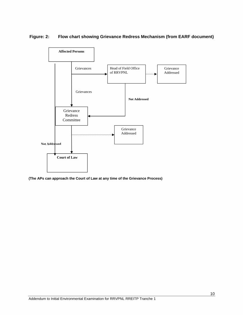
Source: EARF document 2012 This Grievance Redress Mechanism (GRM) provides an effective approach for resolution of complaints and issues of the affected person/community. Project Management Unit (PMU) shall formulate procedures for implementing the GRM. The Project Implementing Unit (PIU), which is the Zonal Office, Jodhpur undertakes GRM’s initiatives that includes procedures of taking/recording complaints, handling of on-the-spot resolution of minor problems, taking care of complainants and provisions of responses to distressed stakeholders etc. paying particular attention to the impacts on vulnerable groups. Grievances of APs are first brought to the attention of the Project head of the Project Implementing Unit. Grievances not redressed by the PIU are brought to the Grievance Redress Committee (GRC) set up to monitor project Implementation for each project area. The GRC, if convened, determines the merit of each grievance, and resolve grievances within three months of receiving the complaint. The complainant has the right to seek grievances redressal directly through the appropriate courts of law. The field office keeps records of all grievances received including: contact details of complainant, date that the complaint was received, nature of grievance, agreed corrective actions and the date these were effected, and final outcome. The flow chart showing Grievance Redress Mechanism is presented in Figure 2. Following the normal grievance procedure as per Indian law, the aggrieved petitioners went to High Court against erection by RVPNL of the 400 kV line within 700m -1200 m of the Khichan Bird Area. Accordingly, D.B. Civil Writ Petition No. 14676/2016 was decided at High Court level that mandates shifting the line by at least 1 km in designated area. Following the order, recommendations made by Expert Committee at the level of Chief Secretary Government of Rajasthan, District Administration, Tourism Department, Chief Forest Conservators – forest, and wildlife, Wildlife Institute of India, Bombay Natural History Society to resolve grievance, declare the area as a conservation reserve and also provide infrastructure upgrade to the area (Annexure 7).
understandable and transparent process that is gender responsive, culturally appropriate, and readily accessible to all segments of the affected people.
9 Addendum to Initial Environmental Examination for RRVPNL RREITP Tranche 1
Figure 1: PMU structure of RRVPNL (From EARF document)
PMU STRUCTURE
PLANNING (Superintending Engineer, PMU)
GOVT. OF INDIA & DEA
FINANCE & ACCOUNTS
CA, CS etc.
CONTRACT & PROCUREMENT
UNIT Executive Engineer (2)
ADB & GOVT. OF RAJASTHAN
PROJECT IMPLEMENTING
UNITS & Monitoring Executive Engineers
(Each Contract) ENVIRONMENT & SOCIAL UNIT Executive Engineer
(1)
LEGAL UNITHR UNIT
HEAD PMU Chief Engineer (ADB Projects)
10 Addendum to Initial Environmental Examination for RRVPNL RREITP Tranche 1
Figure: 2: Flow chart showing Grievance Redress Mechanism (from EARF document) (The APs can approach the Court of Law at any time of the Grievance Process)
Head of Field Office of RRVPNL
Grievances
Not Addressed
Grievances
Grievance Addressed
Grievance Redress
Committee
Grievance Addressed
Court of Law
Affected Persons
Not Addressed
11 Addendum to Initial Environmental Examination for RRVPNL RREITP Tranche 1
3.0 DUE DILIGENCE REVIEW OF ENVIRONMENTAL SAFEGUARD COMPLIANCE 3.1 Environmental Policy Compliance requirements As per Government of India’s (GoI) Environment Impact Assessment (EIA) Notification 2009, Power transmission projects are not listed as environmental sensitive projects and hence no clearance is required from Rajasthan State Pollution Control Board (RSPCB) or Ministry of Environment, Forests and Climate Change (MoEF&CC), GoI. Clearance from Rajasthan Forest Department is required only in cases where subproject is constructed on forest land or requires cutting of forest trees. The National Environmental Policy 2006 of Government of India (GoI) and Safeguard Policy Statement 2009 of ADB and other state level guidelines that apply to all subprojects funded by ADB. In addition, projects should comply with relevant international treaties to which India is a signatory such as the UN Declaration on the Rights of Indigenous Peoples, International Covenant on Economic, Cultural and Social Rights and International Labor Organisation (ILO) Core Conventions, and all other ILO Conventions ratified by the country. For any unanticipated impacts noticed during implementation at project funded facilities, ADB’s SPS 2009 Appendix 1 under clause 7 below: “7. Unanticipated Environmental Impacts 23. Where unanticipated environmental impacts become apparent during project implementation, the borrower/client will update the environmental assessment and EMP or prepare a new environmental assessment and EMP to assess the potential impacts, evaluate the alternatives, and outline mitigation measures and resources to address those impacts.” RRVPNL projects are expected to comply with ADB’s Safeguard Policy Statement (SPS, 2009), Social Protection Strategy (2001), ADB Gender and Development Policy (1998), Public Communication Policy (2011), and other social requirements as well as with that of the Government of India and make it ready for possible financing by the ADB. The EARF for RRETIP was developed and agreed between RRVPNL and ADB to ensure that the Program complies with the provisions of ADB's SPS 2009 and Indian laws. The EARF provisions guide RRVPNL in the selection, screening and categorization, environmental assessment, and preparation and implementation of safeguard plans (such as an environmental management plan or EMP) of all Tranche funded projects. It was agreed that preparation of any environmental assessment documents by RRVPNL for funding of next Tranches or sub-projects in future must follow the procedures outlined in the EARF. Since the environmental assessment reports and environmental management plans to be prepared for any revisions are the Borrower's documents, these documents are officially endorsed by RRVPNL and submitted to ADB. 3.2 Current Status of Transmission Project under review Table 6 list the schemes as proposed in Tranche 1 were awarded to the following EPC contractors:
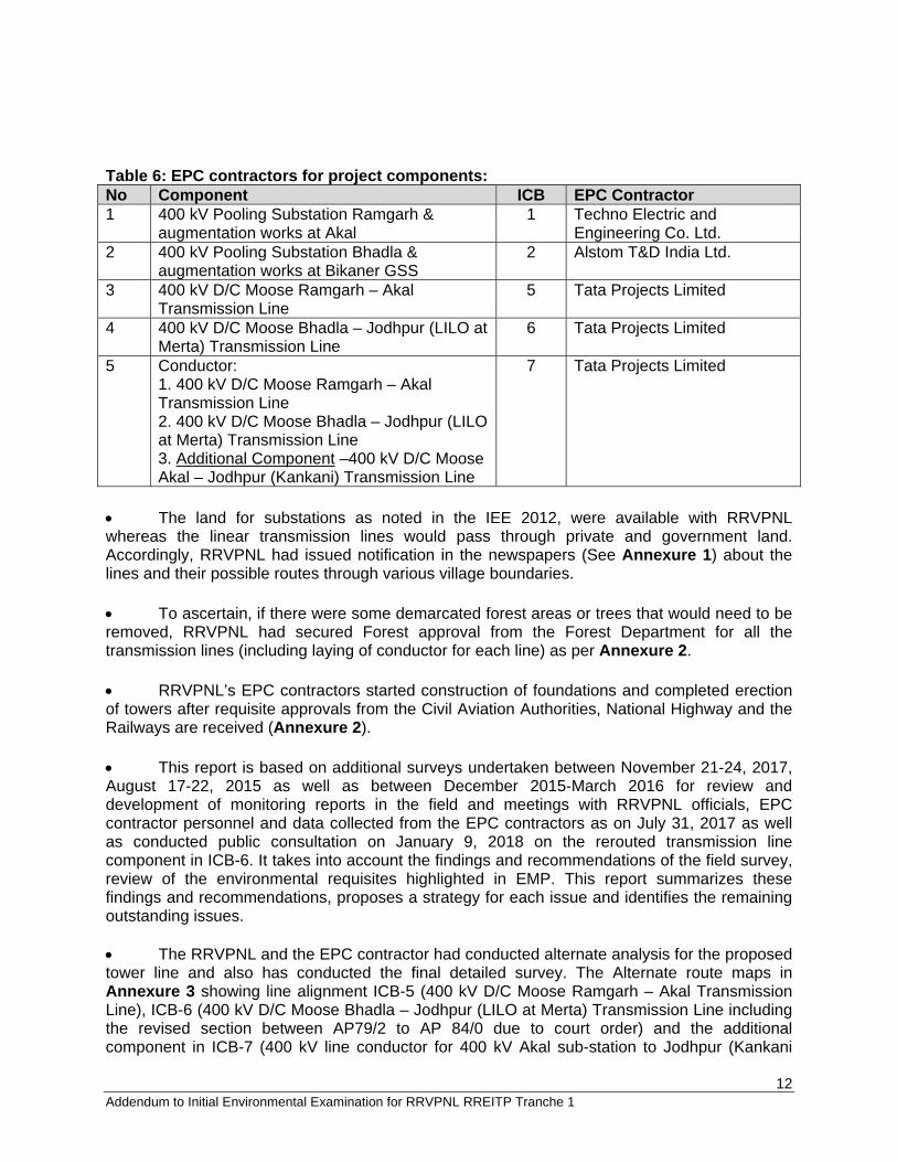
12 Addendum to Initial Environmental Examination for RRVPNL RREITP Tranche 1
Table 6: EPC contractors for project components: No Component ICB EPC Contractor 1 400 kV Pooling Substation Ramgarh &
augmentation works at Akal 1 Techno Electric and
Engineering Co. Ltd. 2 400 kV Pooling Substation Bhadla &
augmentation works at Bikaner GSS 2 Alstom T&D India Ltd.
3 400 kV D/C Moose Ramgarh – Akal Transmission Line
5 Tata Projects Limited
4 400 kV D/C Moose Bhadla – Jodhpur (LILO at Merta) Transmission Line
6 Tata Projects Limited
5 Conductor: 1. 400 kV D/C Moose Ramgarh – Akal Transmission Line 2. 400 kV D/C Moose Bhadla – Jodhpur (LILO at Merta) Transmission Line 3. Additional Component –400 kV D/C Moose Akal – Jodhpur (Kankani) Transmission Line
7 Tata Projects Limited
The land for substations as noted in the IEE 2012, were available with RRVPNL whereas the linear transmission lines would pass through private and government land. Accordingly, RRVPNL had issued notification in the newspapers (See Annexure 1) about the lines and their possible routes through various village boundaries. To ascertain, if there were some demarcated forest areas or trees that would need to be removed, RRVPNL had secured Forest approval from the Forest Department for all the transmission lines (including laying of conductor for each line) as per Annexure 2. RRVPNL’s EPC contractors started construction of foundations and completed erection of towers after requisite approvals from the Civil Aviation Authorities, National Highway and the Railways are received (Annexure 2). This report is based on additional surveys undertaken between November 21-24, 2017, August 17-22, 2015 as well as between December 2015-March 2016 for review and development of monitoring reports in the field and meetings with RRVPNL officials, EPC contractor personnel and data collected from the EPC contractors as on July 31, 2017 as well as conducted public consultation on January 9, 2018 on the rerouted transmission line component in ICB-6. It takes into account the findings and recommendations of the field survey, review of the environmental requisites highlighted in EMP. This report summarizes these findings and recommendations, proposes a strategy for each issue and identifies the remaining outstanding issues. The RRVPNL and the EPC contractor had conducted alternate analysis for the proposed tower line and also has conducted the final detailed survey. The Alternate route maps in Annexure 3 showing line alignment ICB-5 (400 kV D/C Moose Ramgarh – Akal Transmission Line), ICB-6 (400 kV D/C Moose Bhadla – Jodhpur (LILO at Merta) Transmission Line including the revised section between AP79/2 to AP 84/0 due to court order) and the additional component in ICB-7 (400 kV line conductor for 400 kV Akal sub-station to Jodhpur (Kankani
13 Addendum to Initial Environmental Examination for RRVPNL RREITP Tranche 1
sub-station). Annexure 4 consists of transmission line details showing all Angle points and the tower profile with geographical coordinates. Details for ICB-6 rerouting of the transmission line between AP79/2 to AP 84/0 due to High Court order has also been appended where the route survey has been completed by the EPC contractor and the land blocks for tower construction are identified and pegged. Pictures of all angle points for these lines is attached in Annexure 5. This also contains details about angle points between AP 79/2 to AP 84/0 in ICB-6 to be shifted as per court order. These angle points and towers locations will be finalised by the EPC contractor based on detailed survey and direction of the RVPN (Annexure 7) and inform ADB before start of construction. Annexure 6 depicts several pictures from the EPC’s work sites of various sound construction practices followed. For ICB-7 additional sub-project for conductor erection for under construction 400 KV (Quad Moose) double circuit Akal-Jodhpur (new) transmission line funded under Tranche 1, an environmental compliance audit report (ECAR) an environmental due diligence and corrective assessment was conducted through site visits in August 17-22, 2015 and final report submitted in November 2015. Given the exigencies of the power evacuation needs in the state of Rajasthan, the transmission towers are being constructed using RRVPNL funds while the conductor (400 kV Moose Conductor) will be procured using RRETIP funds. Accordingly, for this compliance audit purposes, the transmission line towers have been considered as an associate facility while the conductor is the sub-project funded component. Annexure 10 depicts Environment Safeguards Compliance Audit Report including Corrective Action Plan conducted in November 2015 for this component. 3.3 Documents and “Findings Reference Documents The documentation was reviewed to evaluate the extent to which the potential environmental impacts of the Project have been assessed and the consistency of these assessments with the guidance prescribed in the ADS’s SPS 2009. This included the following key documents: 1. RREIT IEE Tranche 1 2012. 2. RREIP Environmental Assessment and Reporting Framework (EARF). 3. Notification of Transmission line. 4. Forest Clearance letter, approvals from Railways and National Highway. 5. Bhadla 400 kV substation details. 6. Topographical Maps prepared by Tata Projects Limited for ICB-5, 6, and 7. 7. Transmission Line Tower as constructed profile for ICB-5, 6 and 7. 8. Environment Safeguards Compliance Audit Report including Corrective Action Plan
prepared in November 2015 for additional component in ICB-7. 9. High Court Order dated October 5, 2017 and Expert Committee minutes dated August
10, 2017 for ICB -6 sub-project (attached in Annexure 7). Followup survey was conducted by the EPC contractor to identify and finalise the new rerouting of the transmission line and conduct public consultations between December 2017--January 2018.
Project sites Details Site visits to sub-project sites were held in 17-22, August 2015 for ICB-7 (additional
14 Addendum to Initial Environmental Examination for RRVPNL RREITP Tranche 1
component), and between December 2015-March 2016 for review of monitoring procedures being implemented in RRVPNL sub-projects and preparation of first and second Environmental Monitoring reports for ICB-1, 2, 5, 6 and 7. During these visits, the following activities were undertaken: - Meet site in-charge and discuss the environmental and social issues at time of
construction. - Meet EPC contractors to discuss the monitoring systems at site. - Observe the site for physical attributes – distance from road, power evacuation point,
potential for dust, violations of any habitat/protected area, encroachments into village lands etc.
- Observe the site for dust, violations from consents to establish or any normal practise. - Observe normal constriction processes for dust generation, spillage of any construction
related raw material, disposal of construction waste. - Observe conditions of worker amenities, health and safety issues, physical installations
for any environmental issues. - Observe availability of drinking water and disposal of waste-water, waste at site, disposal
of scrap procedures. - Observe labour camps and notice living conditions for hygiene, and safe disposal of
toilets and kitchen waste etc. - Observe the workshop, storage of oil, spare parts, etc. - Discuss the constitution of the worker group – labour, technical etc. and their native
places. - Discuss if any violations regarding labour laws etc. have occurred or any accidents/near
accidents have happened in the past. - Observe the work performed at site by local labour contracts – tower foundations,
construction material, vehicles, etc. - Procedure followed for cutting of trees in the right of way of under-construction site
tower-line. - Meet local village representatives to ascertain the environmental and social issues being
faced daily, - Discuss the grievance procedure used by EPC contractor/RRVPNL representatives with
affected persons. - Inquire about water availability and usage of water boring systems, construction power
availability, labour, housing etc. for technical/labour staff in the general area. - Discuss the land availability issue and if there are any grievances from the villages in the
vicinity of the tower line. - Discuss procedure followed by RRVPNL with State Forest Department for forest
area/cutting of trees under tower construction sites. - Visit the Khichan Bird area and review the route alignment as suggested by court and
proposed by RVPN (Attached in Annexure 7). Assist the EPC contractor in finalise the final route survey through conduct of public consultations etc.
3.4 Details of Sub-projects as per Actual Construction This section elaborates only those components where has been a significant deviation from initial parameters of design, location or scope. Accordingly, only ICB-2, ICB-5, ICB-6 and additional component of ICB-7 have been elaborated. ICB-2: 400 kV Pooling Substation Bhadla & augmentation works at Bikaner GSS.
15 Addendum to Initial Environmental Examination for RRVPNL RREITP Tranche 1
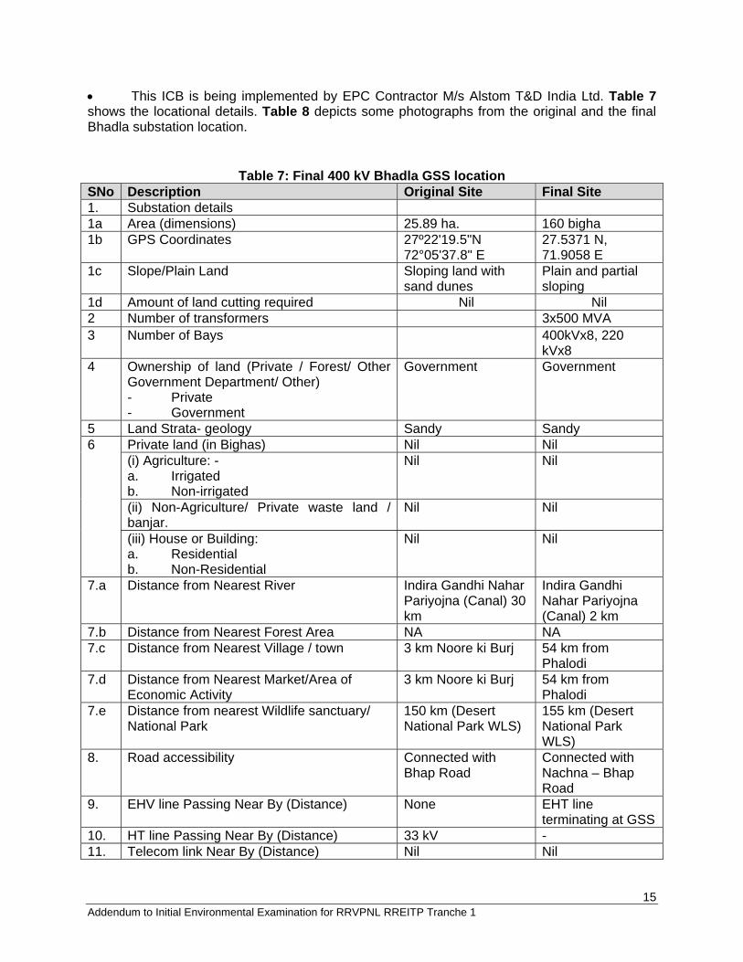
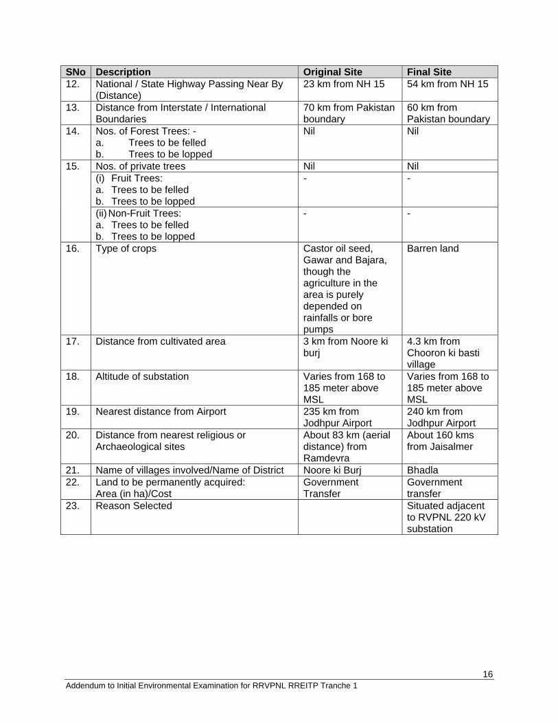
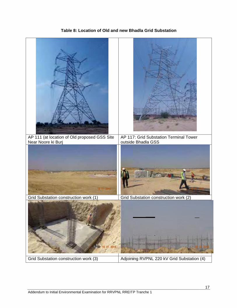
This ICB is being implemented by EPC Contractor M/s Alstom T&D India Ltd. Table 7 shows the locational details. Table 8 depicts some photographs from the original and the final Bhadla substation location.
Table 7: Final 400 kV Bhadla GSS location SNo Description Original Site Final Site 1. Substation details 1a Area (dimensions) 25.89 ha. 160 bigha 1b GPS Coordinates 27º22'19.5"N
72°05'37.8" E 27.5371 N, 71.9058 E
1c Slope/Plain Land Sloping land with sand dunes
Plain and partial sloping
1d Amount of land cutting required Nil Nil 2 Number of transformers 3x500 MVA 3 Number of Bays 400kVx8, 220
kVx8 4 Ownership of land (Private / Forest/ Other
Government Department/ Other) - Private - Government
Government Government
5 Land Strata- geology Sandy Sandy 6 Private land (in Bighas) Nil Nil
(i) Agriculture: - a. Irrigated b. Non-irrigated
Nil Nil
(ii) Non-Agriculture/ Private waste land / banjar.
Nil Nil
(iii) House or Building: a. Residential b. Non-Residential
Nil Nil
7.a Distance from Nearest River Indira Gandhi Nahar Pariyojna (Canal) 30 km
Indira Gandhi Nahar Pariyojna (Canal) 2 km
7.b Distance from Nearest Forest Area NA NA 7.c Distance from Nearest Village / town 3 km Noore ki Burj 54 km from
Phalodi 7.d Distance from Nearest Market/Area of
Economic Activity 3 km Noore ki Burj 54 km from
Phalodi 7.e Distance from nearest Wildlife sanctuary/
National Park 150 km (Desert National Park WLS)
155 km (Desert National Park WLS)
8. Road accessibility Connected with Bhap Road
Connected with Nachna – Bhap Road
9. EHV line Passing Near By (Distance) None EHT line terminating at GSS
10. HT line Passing Near By (Distance) 33 kV - 11. Telecom link Near By (Distance) Nil Nil
16 Addendum to Initial Environmental Examination for RRVPNL RREITP Tranche 1
SNo Description Original Site Final Site 12. National / State Highway Passing Near By
(Distance) 23 km from NH 15 54 km from NH 15
13. Distance from Interstate / International Boundaries
70 km from Pakistan boundary
60 km from Pakistan boundary
14. Nos. of Forest Trees: - a. Trees to be felled b. Trees to be lopped
Nil Nil
15. Nos. of private trees Nil Nil (i) Fruit Trees: a. Trees to be felled b. Trees to be lopped
- -
(ii) Non-Fruit Trees: a. Trees to be felled b. Trees to be lopped
- -
16. Type of crops Castor oil seed, Gawar and Bajara, though the agriculture in the area is purely depended on rainfalls or bore pumps
Barren land
17. Distance from cultivated area 3 km from Noore ki burj
4.3 km from Chooron ki basti village
18. Altitude of substation Varies from 168 to 185 meter above MSL
Varies from 168 to 185 meter above MSL
19. Nearest distance from Airport 235 km from Jodhpur Airport
240 km from Jodhpur Airport
20. Distance from nearest religious or Archaeological sites
About 83 km (aerial distance) from Ramdevra
About 160 kms from Jaisalmer
21. Name of villages involved/Name of District Noore ki Burj Bhadla 22. Land to be permanently acquired:
Area (in ha)/Cost Government Transfer
Government transfer
23. Reason Selected Situated adjacent to RVPNL 220 kV substation
Addendum
AP 111 (Near Noo
Grid Sub
Grid Sub
m to Initial Envir
Tab
(at location oore ki Burj
bstation cons
bstation cons
ronmental Exam
ble 8: Locat
of Old propo
struction wor
struction wor
mination for RR
tion of Old a
sed GSS Sit
rk (1)
rk (3)
RVPNL RREIT
and new Bh
te AP 117outside
Grid Su
Adjoini
P Tranche 1
hadla Grid S
7: Grid Subse Bhadla GS
ubstation co
ing RVPNL 2
Substation
station TermSS
onstruction w
220 kV Grid
minal Tower
work (2)
Substation
17
(4)
Addendum
400 kV G
Erected E
m to Initial Envir
GSS switchy
Equipment a
ronmental Exam
ard (after co
at GSS (afte
mination for RR
onstruction)
r constructio
RVPNL RREIT
Firefigh
on) Substa
P Tranche 1
hting facilitie
ation building
es (after con
g & Control
struction)
Room
18
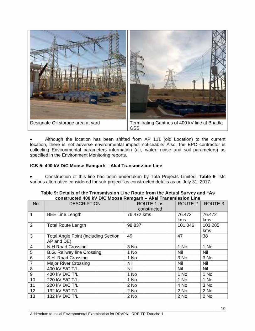
Addendum
Designat
Alocation, collectingspecified ICB-5: 40 Cvarious a
Tab
No.
1 B
2 T
3 TA
4 N5 B6 S7 M8 49 410 211 212 113 1
m to Initial Envir
te Oil storag
Although thethere is no
g Environmed in the Envir
00 kV D/C M
Construction alternative co
ble 9: Detailconstru
D
BEE Line Le
Total Route
Total Angle AP and DE) N.H Road CB.G. RailwayS.H. Road CMajor River 400 kV S/C 400 kV D/C 220 kV S/C 220 kV D/C 132 kV S/C 132 kV D/C
ronmental Exam
e area at ya
e location hot adverse eental paramronment Mo
Moose Ram
of this line onsidered fo
s of the Traucted 400 kVDESCRIPTIO
ength
Length
Point (includ
rossing y line Cross
Crossing Crossing T/L T/L T/L T/L T/L T/L
mination for RR
ard
has been shenvironment
meters informnitoring repo
garh – Aka
has been uor sub-projec
ansmission V D/C MoosON
ding Section
ing
RVPNL RREIT
TerminGSS
hifted fromtal impact nmation (air, orts.
l Transmiss
undertaken ct “as constr
Line Routese Ramgarh
ROco
76.472 k
98.837
49
3 No 1 No 1 No Nil Nil 1 No 1 No 2 No 2 No 2 No
P Tranche 1
nating Gantr
AP 111 (onoticeable. A
water, nois
sion Line
by Tata Proructed details
e from the Ah – Akal TraOUTE-1 as
nstructed kms
ries of 400 kV
old LocationAlso, the Ese and soil
ojects Limites as on July
Actual Survnsmission
ROUT
76.472kms 101.04
47
1 No. Nil 3 No. Nil Nil 1 No 1 No 4 No 2 No 2 No
V line at Bha
n) to the cuPC contract parameters
ed. Table 9y 31, 2017.
ey and “AsLine E-2 ROUT
2 76.472kms
46 103.20kms 38
1 NoNil 3 NoNil Nil 1 No1 No3 No2 No2 No
19
adla
urrent tor is s) as
9 lists
TE-3
2
05
Addendum
No.
14 515 816 P17 R18 M19 T
s20 P
21 E
22 D Final Line T31, 2017 Table 10RamgarhS. No P
1 T2 T3 T
c4 T
A5 T
G6 N
c7 N
c8 N
c9 N
c10 D11 P
m to Initial Envir
D
500 kV HVD800kV S/C TProtected FoReserved FoMarshy/MudThe Archaeostructure croPresence of
Expected RO
Distance fro
e ParticularsTable 10 pro
.
0: Summaryh – Akal TraParticulars
Total LengthTotal NumbeTotal Lengthcompleted (KTotal numbeAgricultural Total numbeGovernmentNumber of Tcompleted Number of Tcompleted Number of Tcompleted Number of TcompensatioDate of awaProposed da
ronmental Exam
DESCRIPTIO
DC T/L T/L orest orest d land area ological/ Hisossings f 33 KV/11 K
OW
m Jaisalmer
s vides the su
y of Final Transmission
h (Kilometreser of Angle Ph for which fiKilometres)*er of TowersLand
er of Towerst land
Towers for w
Towers for w
Towers for w
Towers for won has beenrd order to Eate of closur
mination for RR
ON
torical
KV/LT Line
r Airport
ummary feat
ransmissionn Line (ICB-5
s) Points/Toweinal survey h* s being or to
s being or to
which survey
which founda
which erectio
which Assessn made EPC re of EPC aw
RVPNL RREIT
ROco
Nil Nil Nil Nil Nil Nil
Minimum
Less RO
20 kms
tures of the
n Line (as c5)
ers has been
be placed o
be placed o
has been
ation has bee
on has been
sment of Cro
ward
P Tranche 1
OUTE-1 as nstructed
m
OW
line as finall
constructed
Qua(Cu99.55 99.
on 58
on 220
278
en 278
277
op 52
30-30-0
ROUT
Nil Nil Nil Nil Nil Nil
Maximdue to presenof the wind marea SevereRow dto presenof windmill are9 kms
ly as constru
) for 400 kV
antity ut of date 31 151 Nos 151 kms
Nos
0 Nos
8 Nos
8 Nos
7 Nos
Nos
1-2015 09-2017
E-2 ROUT
Nil Nil Nil Nil Nil Nil
um
nce
mill
Maximdue topresenof the mill ar
e ue
nce d ea
SeverRow dto presenof winarea 10 km
ucted as per
V D/C Moose
July 2017)
20
TE-3
mum o nce wind
rea
re due
nce d mill
ms
r July
e
21 Addendum to Initial Environmental Examination for RRVPNL RREITP Tranche 1
S. No Particulars Quantity (Cut of date 31 July 2017)
12 Name of the EPC contractor Tata Projects Limited 13 Width of the Right of Way (Row) 45 Meters 14 Cut-off Date The notification as part of joint
measurement survey for each tower.
15 Amount paid against Crop Compensation Rs. 12,40,415 16 Amount paid against Tree Cutting Compensation Nil B. ICB-6: 400 kV D/C Moose Bhadla – Jodhpur (LILO at Merta) Transmission Line Construction of this line has been undertaken by Tata Projects Limited. Table 11 lists various alternative considered for sub-project “as constructed details as on July 31, 2017. However, a writ petition no 14676/2016 was filed in 2016 and heard by High Court on 10 April 2017 and 12 July 2017. The Chief Secretary’s meeting was held on 21 June 2017 and the experts meeting was held on 10 Aug 2017. Both the court and the expert committee decided that following:
- Declare the Khichan Bird area as Conservation Area - Tourism department to provide more land and construct boundary and fencing for birds - Irrigation department of provide canal from lift irrigation canal for birds during the
migratory period. - Distribution lines will be removed from overhead and replaced by underground
conductors. - RVPNL transmission line to be shifted at least 1 km from the current location for five
towers.
These agreements were made by RVPN, Bombay Natural History Society, District Collector Falodi, Tourism Department, Department of Wildlife, Department of Forests.
Table 11: Details of the Transmission Line Route from the Actual Survey and “As
constructed” 400 kV D/C Moose Bhadla-Jodhpur Transmission Line (ICB-6)
S.No. Description Final approved line route after HC order (Annexure 7) *
Alternative-I (final route as constructed)
Alternative-II Alternative-III
1. Route Particulars i) Length(km) 202.279 199.221 195.205 209.222 ii) Terrain 90 % Plain
10 % Undulations
90 % Plain 10 % Undulations
85 % Plain 15 % Undulations
80 % Plain 20 % Undulations
2 Environment Details
i) Name of District/District Detail (through
Jodhpur Jodhpur Jodhpur Jodhpur
22 Addendum to Initial Environmental Examination for RRVPNL RREITP Tranche 1
which line passes)
ii) Town in alignment (nearby)
Bhadla, Shekhasar, Phalodi, Lohawat, Osian, Jodhpur
Bhadla, Shekhasar, Phalodi, Lohawat, Osian, Jodhpur
Bhadla, Shekhasar, Phalodi, Lohawat, Osian, Jodhpur
Bhadla, Shekhasar, Phalodi, Lohawat, Osian, Jodhpur
iii) Forest Involvement in Ha/kms
Nil Nil Nil Nil
iv) Type of forest Nil Nil Nil Nil v) Density of forest Nil Nil Nil Nil vi) Type of Flora Nil Nil Nil Nil vii) Type of fauna Camel, Cat,
Dog, Cow, Demoiselles cranes (near Khichan bird area) etc.
Camel, Cat, Dog, Cow, Demoiselles cranes (near Khichan bird area) etc.
Camel, Cat, Dog, Cow, etc.
Camel, Cat, Dog, Cow, etc.
viii) Endangered species (if any)
Nil Nil Nil Nil
ix) Historical/Cultural Monument
Nil Nil Nil Nil
x) Any other relevant information
Nil Nil Nil Nil
3. Compensation Cost (in Rs lakhs)
i) Crop (Non-Forest) 260 approx. 250 350 400 ii) Forest (CA+NPV) Nil Nil Nil Nil 4. No. of Crossing
(Nos.)
i) Railway line 1 1 2 2 ii) Power Line (132
kv and above) 10 10 2 2
iii) River Crossing etc.
0 0 0 0
iv) Highway Crossing (NH/SH)
4 3 4 4
5. Construction Problem
Easy approach. No forest Involvement. Less ROW Problems
Easy approach. No forest Involvement. Less ROW Problems
Moderate Approach. More forest involvement. Moderate ROW problems. More Railway crossing involved
Maximum forest Involvement. Moderate ROW problem. Railway crossing involved
6. O&M Problem O & M shall be O & M shall be O & M shall be O & M shall
23 Addendum to Initial Environmental Examination for RRVPNL RREITP Tranche 1
* For this revised transmission line route alignment, the route survey works have been completed as intimated by RVPNL. However, the data regarding soil, topography, contour, land cutting and filling required, distance from water body and distance from major roads, details of forest/non-forest, fruit/non-fruit trees being affected, land details will be collected by RVPNL/EPC contractor during construction. Any supplementary information, if required by ADB, will be supplied for this subproject by RVPNL to ADB for prior approval before contract award as well as during monitoring period. Final Line Particulars for ICB-6 Table 12 provides the summary features of the line as finally as constructed as per July 31, 2017 and then will be filled by the EPC contractor once the detailed survey is completed. Table 12: Summary of Final Transmission Line (as constructed) for 400 kV D/C Moose Bhadla-Jodhpur Transmission Line (ICB-6) # Particulars Quantity
(Cut of date 31 July 2017) After High Court Order Dated October 5, 2017 (new alignment for AP79/2 to AP 84/0
1 Total Length (Kilometers) 199.221 kms 202.279 kms 2 Total Number of Angle
Points/Towers 155 163
3 Total Length for which final survey has been completed (Kilometers)*
199.221 kms 202.277 km
4 Total number of Towers being or to be placed on Agricultural Land
431 Nos (Approximate) 431 Nos (Approximate)
5 Total number of Towers being or to be placed on Government land
116 Nos (Approximate) 126 Nos. (Approximate)
6 Number of Towers for which survey has been completed
547 Nos 557
7 Number of Towers for which 547 547 (Dismantled 15 nos.
relatively easier due to better approaches.
relatively easier due to better approaches.
difficult due to more undulations.
be difficult due to more undulations.
7. Overall Remarks At Khichan, Easy accessibility less ROW problems & Nil forest involvement, Minimum Crossings.
Easy accessibility less ROW problems & Nil forest involvement, Minimum Crossings.
More forest involvement & moderate ROW problems, More Crossings.
Comparatively more forest involvement & moderate ROW problems, Maximum Crossings.
8. Number of towers planned
560 550 500 650
9. Will private land be required for tower footing? If yes, how much?
No No No No
24 Addendum to Initial Environmental Examination for RRVPNL RREITP Tranche 1
# Particulars Quantity (Cut of date 31 July 2017)
After High Court Order Dated October 5, 2017 (new alignment for AP79/2 to AP 84/0
foundation has been completed
And new foundation to be done – 25 nos.)
8 Number of Towers for which erection has been completed
547 547 (Dismantled 15 nos. And new foundation to be done – 25 nos.)
9 Number of Towers for which Assessment of Crop compensation has been made
431 Nos 431
10 Date of award order to EPC 30.01.2015 30.01.2015 11 Proposed date of closure of
EPC award 15.10.2017 15.10.2017
12 Name of the EPC contractor Tata Projects Limited Tata Projects Limited 13 Width of the Right of Way
(RoW) 46 meters 46 meters
14 Cut-off Date The notification as part of joint measurement survey for each tower.
The notification as part of joint measurement survey for each tower.
15 Stringing details: a AP 1/0 to AP 3B/0 9.246 kms Stringing
completed Total 26 towers strung.
9.246 kms Stringing completed Total 26 towers strung.
b AP 19/0 to AP 24/0 8.469 kms Stringing completed Total 24 towers strung.
8.469 kms Stringing completed Total 24 towers strung.
c AP 38/0 to AP 53/0 36.444 kms Stringing completed Total 98 towers strung.
36.444 kms Stringing completed Total 98 towers strung.
d AP 59A/0 to AP 76/0 18.881 kms Stringing completed Total 51 towers strung.
18.881 kms Stringing completed Total 51 towers strung.
e AP 84/0 TO AP 87/0 1.827 kms Stringing completed Total 06 towers strung.
AP 79/2 to AP 84/0 Stringing Pending
f AP 117/0 to AP 89/0 66.191 kms stringing completed Total 188 towers strung.
66.191 kms stringing completed Total 188 towers strung.
16 Total Amount of Crop Compensation paid till 31.07.2017
Rs. 1.20 Crores (INR) Rs. 1.20 Crores (INR)
17 Amount deposited to Forest Department for Tree cutting/Tree Trimming
Rs. 95,318/- Rs. 95,318/-
* For this revised transmission line route alignment, the route survey works have been completed as intimated by RVPNL. However, the data regarding soil, topography, contour, land cutting and filling required, distance from water body and distance from major roads, details of forest/non-forest, fruit/non-fruit trees being affected, land details will be collected by RVPNL/EPC contractor during construction. Any supplementary information if required by ADB, will be supplied for this subproject by RVPNL to ADB for prior approval before contract award as well as during monitoring
Addendum
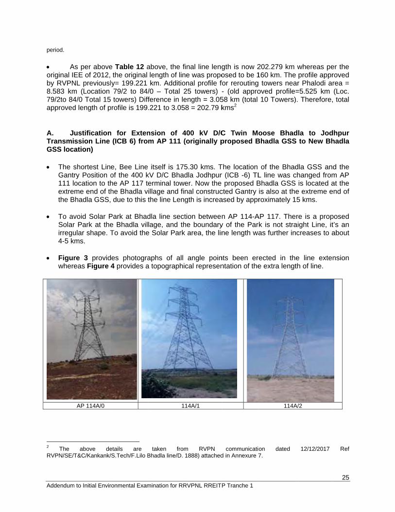
period. Aoriginal Iby RVPN8.583 km79/2to 84approved A. JTransmiGSS loc The s
Gant111 lextrethe B
To av
Solarirregu4-5 k
Figur
where
2 The RVPN/SE/T
m to Initial Envir
As per aboveEE of 2012,
NL previouslm (Location 4/0 Total 15d length of p
ustificationssion Line ation)
shortest Linry Position oocation to thme end of th
Bhadla GSS,
void Solar Pr Park at theular shape. T
kms.
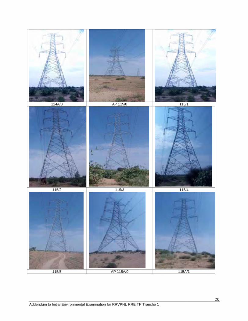
re 3 provideas Figure 4
AP 114A/0
above de
T&C/Kankank/
ronmental Exam
e Table 12 athe original y= 199.221 79/2 to 84/
towers) Diffprofile is 199
n for Exten(ICB 6) fro
e, Bee Lineof the 400 khe AP 117 the Bhadla v due to this
Park at Bhade Bhadla vilTo avoid the
es photogra4 provides a
etails are /S.Tech/F.Lilo B
mination for RR
above, the flength of linkm. Additio
/0 – Total 2fference in le.221 to 3.05
nsion of 4m AP 111 (
itself is 175kV D/C Bhaderminal towe
village and fithe line Leng
dla line sectlage, and th
e Solar Park
aphs of all a topographi
1
taken fromBhadla line/D.
RVPNL RREIT
final line lengne was propoonal profile f25 towers) -ength = 3.05
58 = 202.79 k
400 kV D/C(originally p
5.30 kms. Tdla Jodhpurer. Now the nal construcgth is increa
tion betweenhe boundaryk area, the lin
angle poincal represen
14A/1
m RVPN 1888) attached
P Tranche 1
gth is now 2osed to be 1for rerouting- (old appro58 km (total kms2
C Twin Moproposed B
The location r (ICB -6) TL proposed B
cted Gantry ased by appr
n AP 114-Ay of the Parne length wa
nts been erntation of the
communicatiod in Annexure 7
202.279 km 160 km. The towers neaoved profile10 Towers)
oose BhadBhadla GSS
of the BhadL line was cBhadla GSSis also at theroximately 1
AP 117. Thek is not straas further in
rected in the extra lengt
114A
on dated 7.
whereas pee profile apprar Phalodi a=5.525 km ). Therefore,
dla to JodS to New Bh
dla GSS anchanged from is located ae extreme e5 kms.
re is a propaight Line, itncreases to a
e line exteth of line.
A/2
12/12/2017
25
er the roved rea = (Loc.
, total
dhpur hadla
d the m AP at the end of
posed t’s an about
nsion
Ref
Addendumm to Initial Envir
114A/3
115/2
115/5
ronmental Exam
mination for RR
AP
1
AP
RVPNL RREIT
P 115/0
115/3
115A/0
P Tranche 1
115/
115/
115A
/1
/4
A/1
26

Addendum
m to Initial Envir
115A/2
115A/5
AP 117/0 Figu
ronmental Exam
ure 3: Pho
mination for RR
1
1
tographs o
RVPNL RREIT
15A/3
15A/6
of Angle po
P Tranche 1
oints in Bh
115A
AP 11
hadla area
A/4
16/0
.
27
Addendum
m to Initial Environm
Figure 4: E
mental Examination
Extension by
n for RRVPNL RRE
28 km of Bha
EITP Tranche 1
adla – Jodhpu(Marked
ur (Merta LILOd in Green co
O) line betweelor)
en AP 111 andd Final Bhadlaa GSS
28
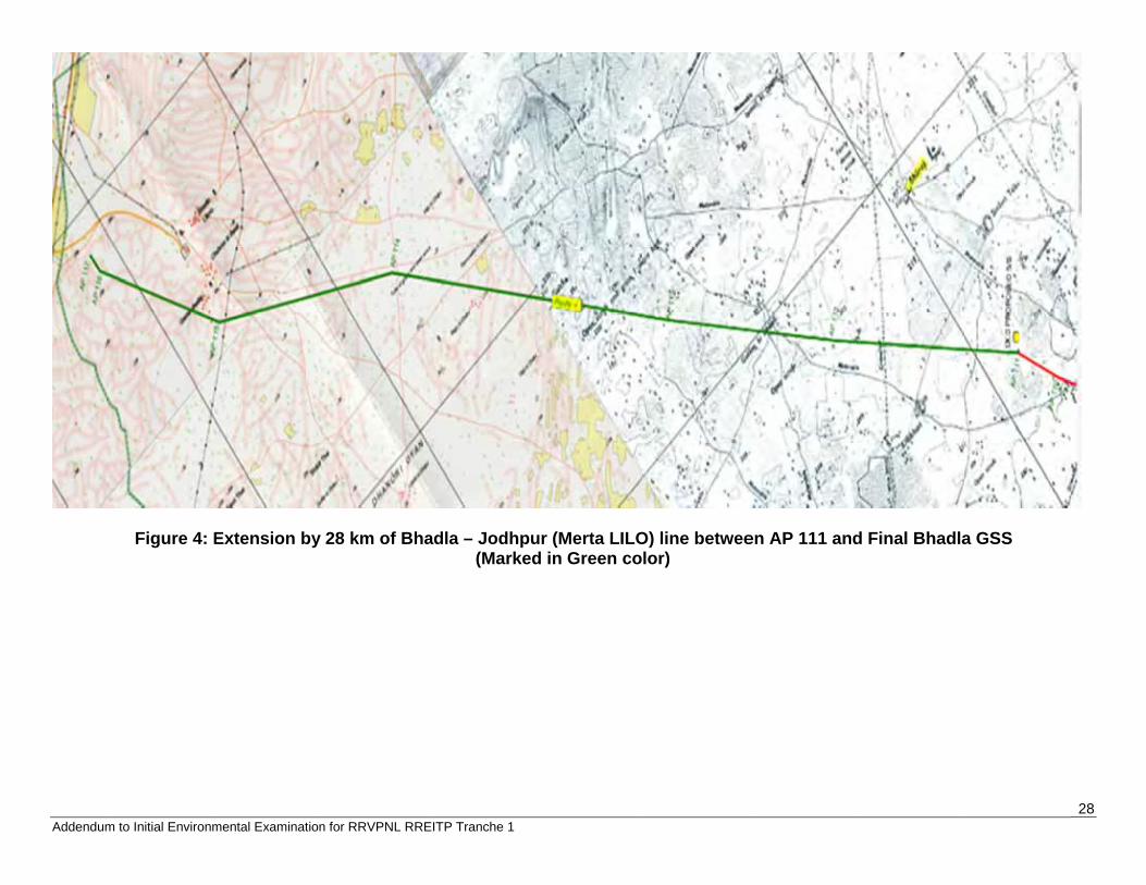
29 Addendum to Initial Environmental Examination for RRVPNL RREITP Tranche 1
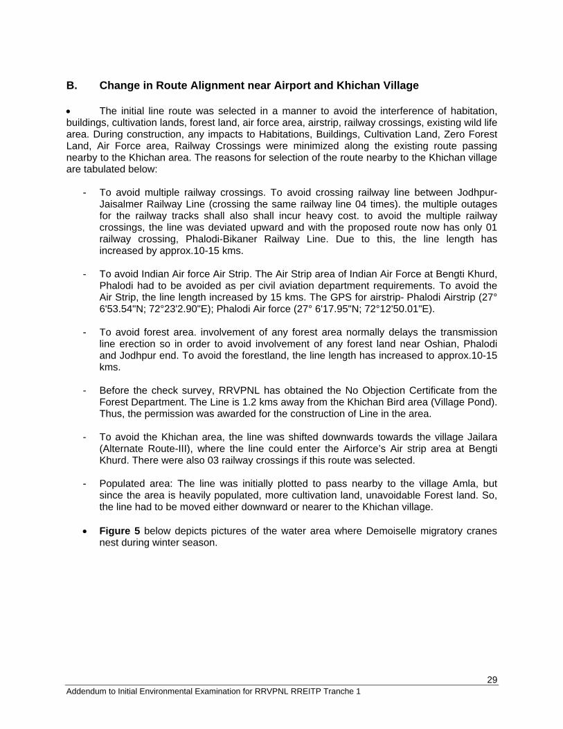
B. Change in Route Alignment near Airport and Khichan Village The initial line route was selected in a manner to avoid the interference of habitation, buildings, cultivation lands, forest land, air force area, airstrip, railway crossings, existing wild life area. During construction, any impacts to Habitations, Buildings, Cultivation Land, Zero Forest Land, Air Force area, Railway Crossings were minimized along the existing route passing nearby to the Khichan area. The reasons for selection of the route nearby to the Khichan village are tabulated below:
- To avoid multiple railway crossings. To avoid crossing railway line between Jodhpur-Jaisalmer Railway Line (crossing the same railway line 04 times). the multiple outages for the railway tracks shall also shall incur heavy cost. to avoid the multiple railway crossings, the line was deviated upward and with the proposed route now has only 01 railway crossing, Phalodi-Bikaner Railway Line. Due to this, the line length has increased by approx.10-15 kms.
- To avoid Indian Air force Air Strip. The Air Strip area of Indian Air Force at Bengti Khurd,
Phalodi had to be avoided as per civil aviation department requirements. To avoid the Air Strip, the line length increased by 15 kms. The GPS for airstrip- Phalodi Airstrip (27° 6'53.54"N; 72°23'2.90"E); Phalodi Air force (27° 6'17.95"N; 72°12'50.01"E).
- To avoid forest area. involvement of any forest area normally delays the transmission
line erection so in order to avoid involvement of any forest land near Oshian, Phalodi and Jodhpur end. To avoid the forestland, the line length has increased to approx.10-15 kms.
- Before the check survey, RRVPNL has obtained the No Objection Certificate from the
Forest Department. The Line is 1.2 kms away from the Khichan Bird area (Village Pond). Thus, the permission was awarded for the construction of Line in the area.
- To avoid the Khichan area, the line was shifted downwards towards the village Jailara
(Alternate Route-III), where the line could enter the Airforce’s Air strip area at Bengti Khurd. There were also 03 railway crossings if this route was selected.
- Populated area: The line was initially plotted to pass nearby to the village Amla, but
since the area is heavily populated, more cultivation land, unavoidable Forest land. So, the line had to be moved either downward or nearer to the Khichan village.
Figure 5 below depicts pictures of the water area where Demoiselle migratory cranes
nest during winter season.
Addendum
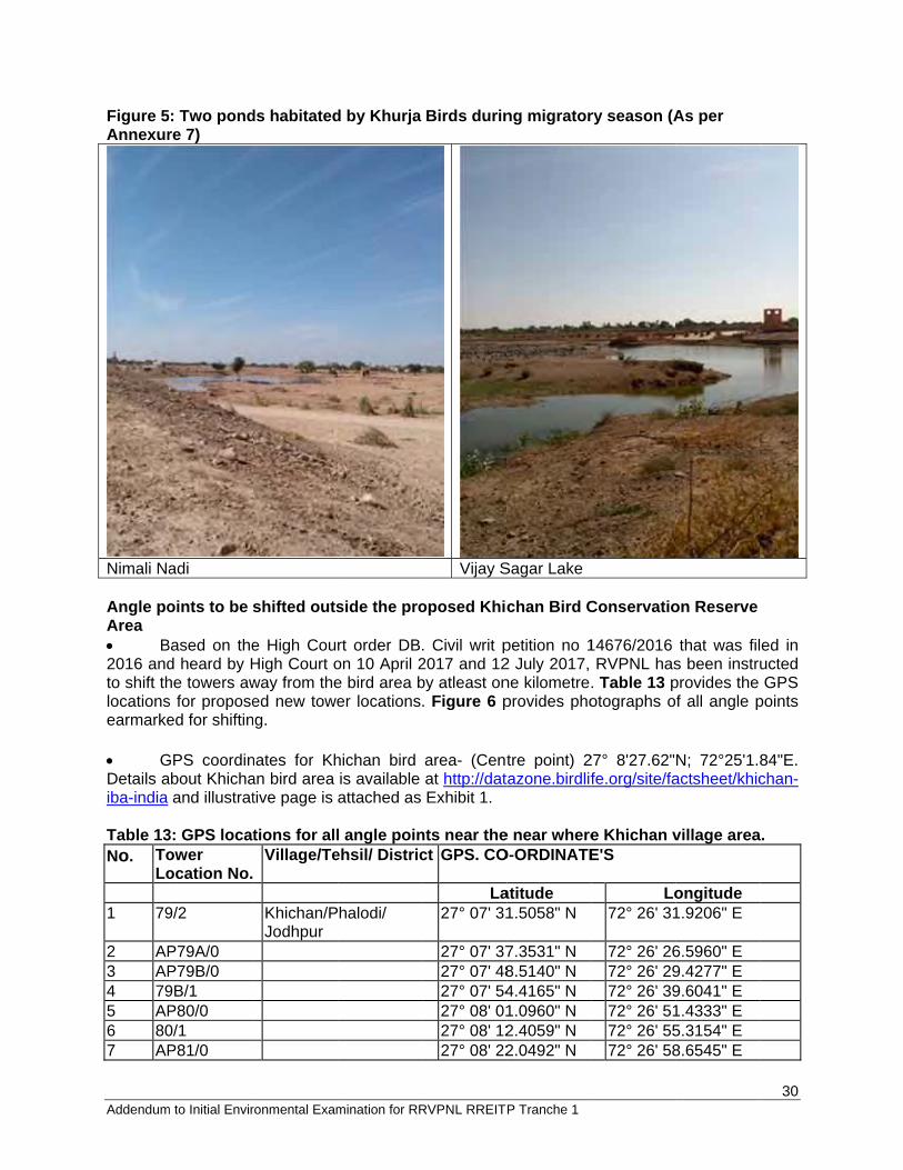
Figure 5Annexur
Nimali Na Angle poArea B2016 andto shift thlocationsearmarke GDetails aiba-india Table 13No. To
Lo 1 79
2 AP3 AP4 795 AP6 807 AP
m to Initial Envir
5: Two pondre 7)
adi
oints to be s
Based on thed heard by Hhe towers aws for proposeed for shiftin
GPS coordinabout Khicha
and illustrat
3: GPS locatower ocation No.
9/2
P79A/0 P79B/0 9B/1 P80/0 0/1 P81/0
ronmental Exam
ds habitated
shifted outs
e High CourHigh Court oway from theed new toweg.
nates for Khan bird area tive page is
tions for allVillage/Te
Khichan/PJodhpur
mination for RR
d by Khurja
side the pro
rt order DB.on 10 April 2e bird area ber locations
hichan bird is available attached as
l angle poinehsil/ Distric
halodi/
RVPNL RREIT
Birds durin
Vijay S
oposed Khic
. Civil writ p2017 and 12by atleast on. Figure 6 p
area- (Centat http://datExhibit 1.
nts near thect GPS. CO
La27° 07' 31
27° 07' 3727° 07' 4827° 07' 5427° 08' 0127° 08' 1227° 08' 22
P Tranche 1
ng migrator
Sagar Lake
chan Bird C
petition no 12 July 2017, ne kilometre.provides pho
tre point) 2tazone.birdlif
e near whereO-ORDINATE
atitude 1.5058" N
7.3531" N 8.5140" N 4.4165" N 1.0960" N 2.4059" N 2.0492" N
ry season (A
Conservatio
14676/2016 RVPNL has
. Table 13 potographs o
27° 8'27.62"fe.org/site/fa
e Khichan vE'S
Lo72° 26' 31
72° 26' 2672° 26' 2972° 26' 3972° 26' 5172° 26' 5572° 26' 58
As per
on Reserve
that was fils been instruprovides the f all angle p
N; 72°25'1.8actsheet/khic
village area
ongitude 1.9206" E
6.5960" E 9.4277" E 9.6041" E 1.4333" E 5.3154" E 8.6545" E
30
ed in ucted GPS
points
84"E. chan-
.
Addendum
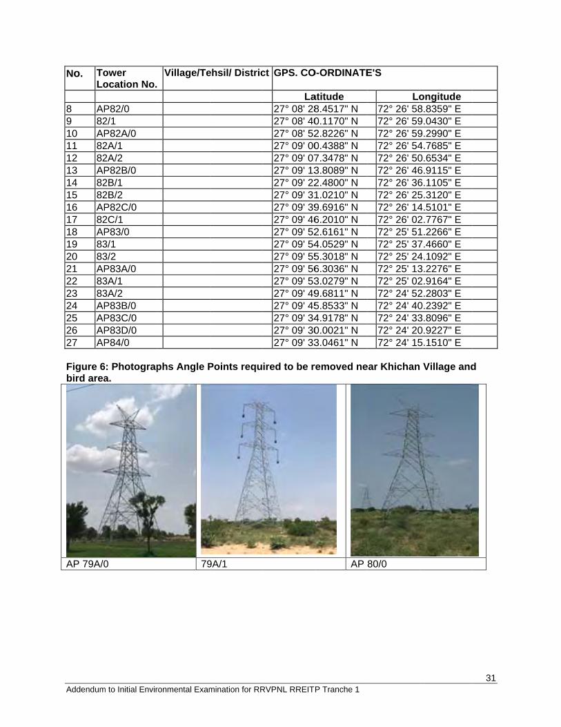
No. ToLo
8 AP9 8210 AP11 8212 8213 AP14 8215 8216 AP17 8218 AP19 8320 8321 AP22 8323 8324 AP25 AP26 AP27 AP Figure 6bird area
AP 79A/0
m to Initial Envir
ower ocation No.
P82/0 2/1 P82A/0 2A/1 2A/2 P82B/0 2B/1 2B/2 P82C/0 2C/1 P83/0 3/1 3/2 P83A/0 3A/1 3A/2 P83B/0 P83C/0 P83D/0 P84/0
6: Photograpa.
0
ronmental Exam
Village/Te
phs Angle P
79
mination for RR
ehsil/ Distric
Points requ
9A/1
RVPNL RREIT
ct GPS. CO
La27° 08' 2827° 08' 4027° 08' 5227° 09' 0027° 09' 0727° 09' 1327° 09' 2227° 09' 3127° 09' 3927° 09' 4627° 09' 5227° 09' 5427° 09' 5527° 09' 5627° 09' 5327° 09' 4927° 09' 4527° 09' 3427° 09' 3027° 09' 33
ired to be r
P Tranche 1
O-ORDINATE
atitude 8.4517" N 0.1170" N 2.8226" N 0.4388" N 7.3478" N 3.8089" N 2.4800" N 1.0210" N 9.6916" N 6.2010" N 2.6161" N 4.0529" N 5.3018" N 6.3036" N 3.0279" N 9.6811" N 5.8533" N 4.9178" N 0.0021" N 3.0461" N
removed ne
AP
E'S
Lo72° 26' 5872° 26' 5972° 26' 5972° 26' 5472° 26' 5072° 26' 4672° 26' 3672° 26' 2572° 26' 1472° 26' 0272° 25' 5172° 25' 3772° 25' 2472° 25' 1372° 25' 0272° 24' 5272° 24' 4072° 24' 3372° 24' 2072° 24' 15
ear Khichan
80/0
ongitude 8.8359" E 9.0430" E 9.2990" E 4.7685" E 0.6534" E 6.9115" E 6.1105" E 5.3120" E 4.5101" E 2.7767" E 1.2266" E 7.4660" E 4.1092" E 3.2276" E 2.9164" E 2.2803" E 0.2392" E 3.8096" E 0.9227" E 5.1510" E
Village and
31
d
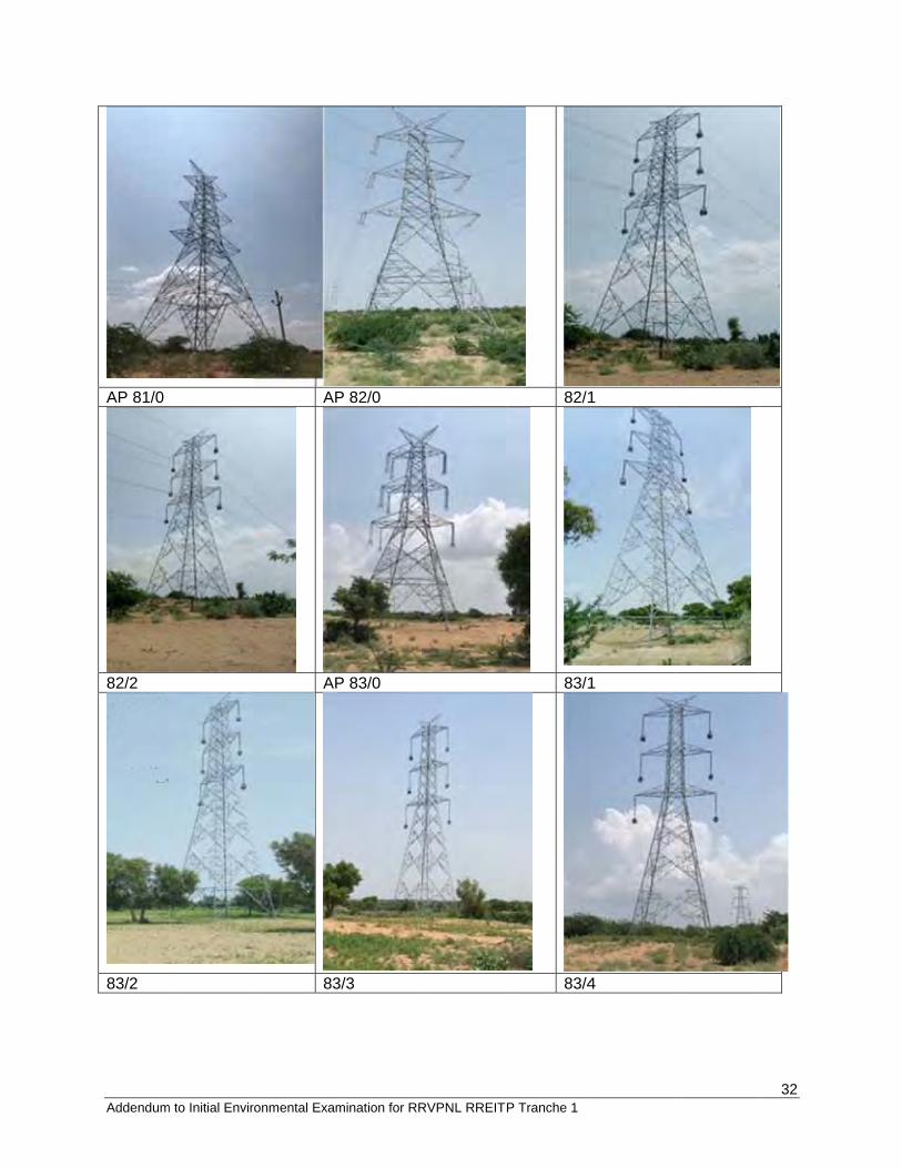
Addendum
AP 81/0
82/2
83/2
m to Initial Envirronmental Exam
AP
AP
83
mination for RR
P 82/0
P 83/0
3/3
RVPNL RREITP Tranche 1
82/1
83/1
83/4
1
1
4
32
Addendum
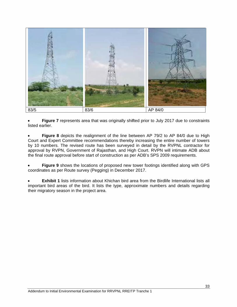
83/5 Flisted ear FCourt anby 10 nuapproval the final Fcoordina Eimportantheir mig
m to Initial Envir
igure 7 reprrlier.
igure 8 depd Expert Co
umbers. Theby RVPN,
route approv
igure 9 shotes as per R
Exhibit 1 listt bird areasratory seaso
ronmental Exam
83
resents area
picts the reaommittee rece revised roGovernmenval before st
ows the locaRoute survey
s informatios of the birdon in the pro
mination for RR
3/6
a that was o
alignment ofcommendati
oute has beet of Rajasthtart of constr
tions of propy (Pegging) i
n about Khicd. It lists theoject area.
RVPNL RREIT
riginally shif
f the line beions therebyen surveyedan, and Higruction as pe
posed new tn Decembe
chan bird are type, appr
P Tranche 1
AP
fted prior to
etween AP 7y increasing d in detail bgh Court. RVer ADB’s SP
tower footinr 2017.
rea from theroximate num
84/0
July 2017 d
79/2 to AP 8the entire n
by the RVPNVPN will intiPS 2009 requ
gs identified
e Birdlife Intembers and
due to constr
84/0 due to number of toNL contractomate ADB auirements.
d along with
ernational lisdetails rega
33
raints
High owers or for about
GPS
sts all arding
Addendum
Figur
m to Initial Environm
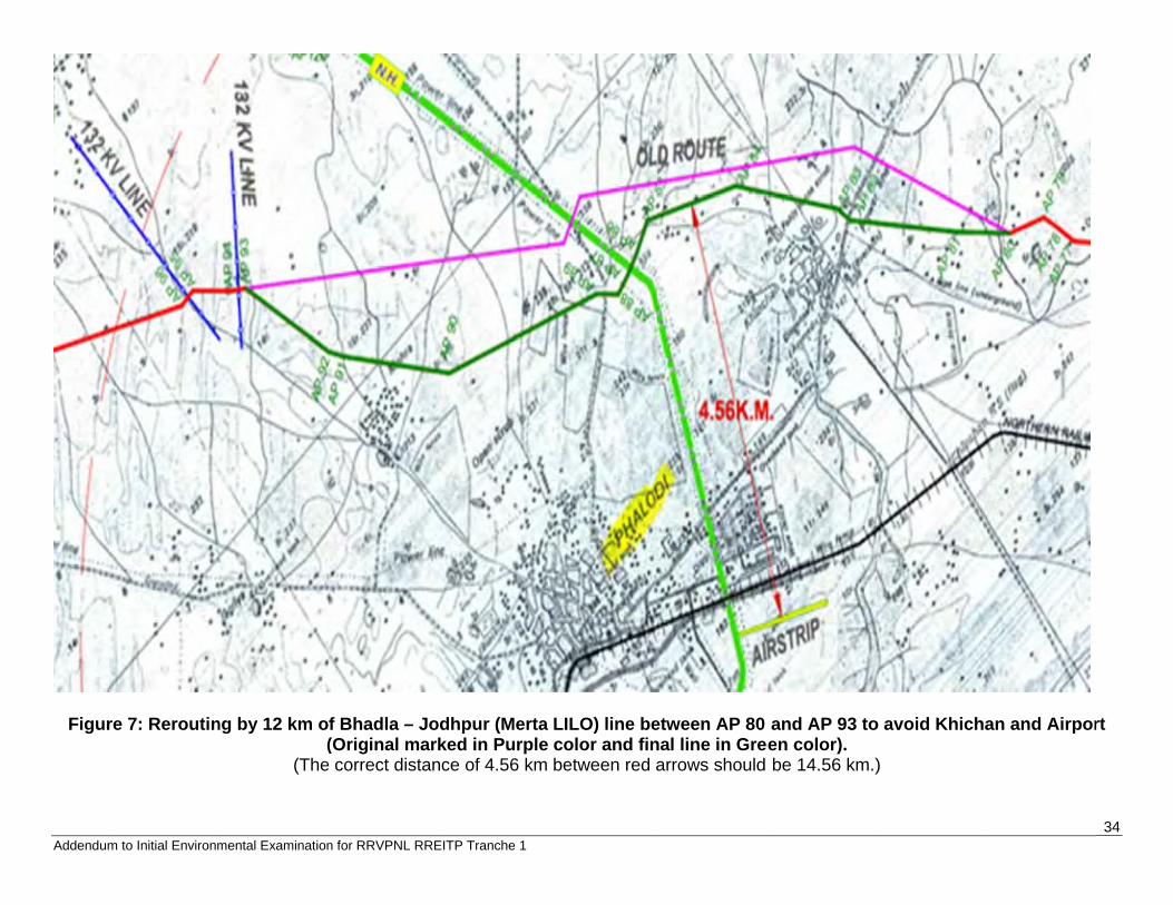
re 7: Reroutin
mental Examination
ng by 12 km o(
(The
n for RRVPNL RRE
f Bhadla – Jo(Original mark
e correct distan
EITP Tranche 1
odhpur (Merta ked in Purple
nce of 4.56 km
LILO) line be color and finbetween red a
etween AP 80nal line in Greearrows should
and AP 93 toen color). be 14.56 km.)
o avoid Khicha
)
an and Airpor
34
rt
Adde
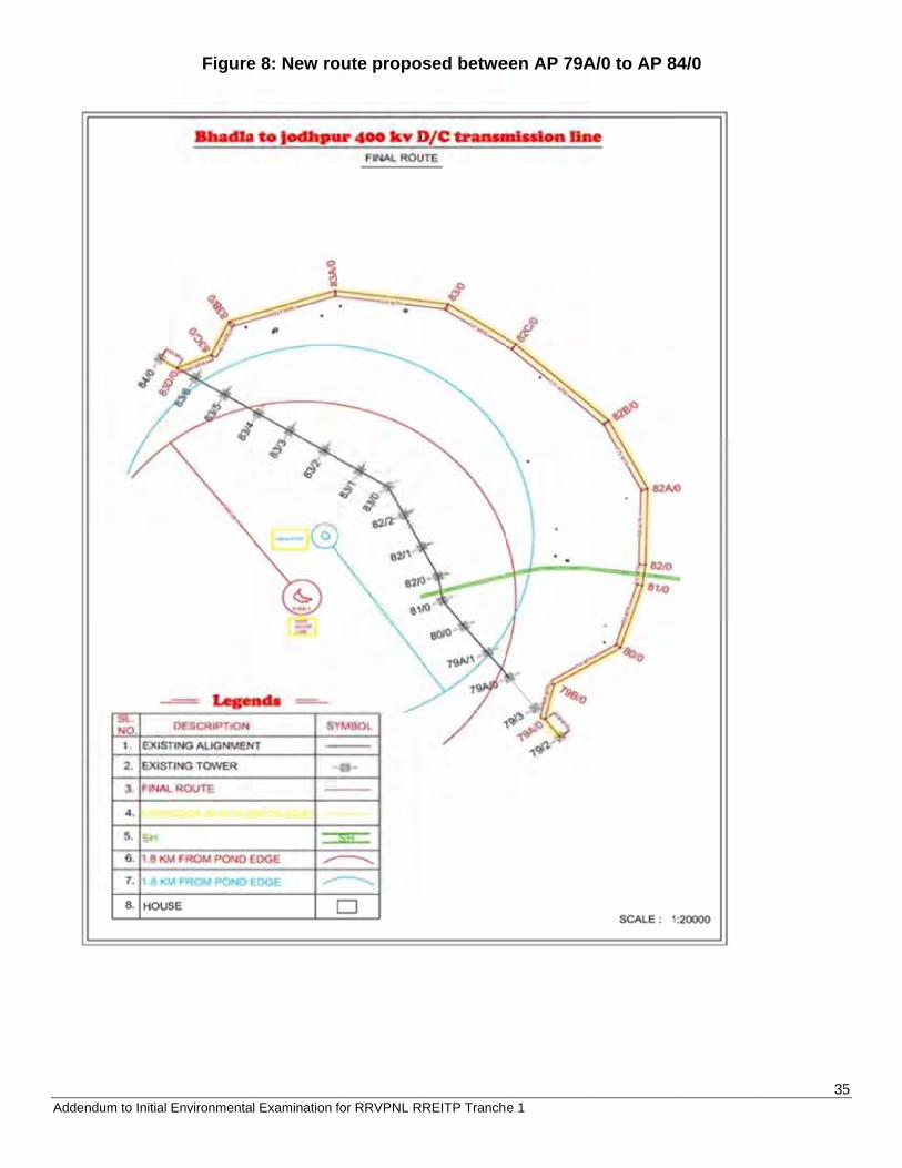
ndum to Initial Environmenta
Figure
l Examination f
e 8: New ro
for RRVPNL R
oute propo
REITP Tranch
sed betwe
e 1
een AP 79AA/0 to AP 884/0
355
Adde
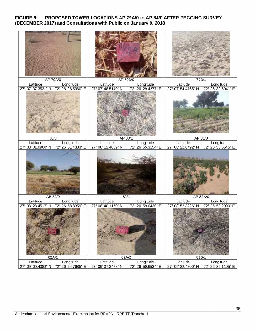
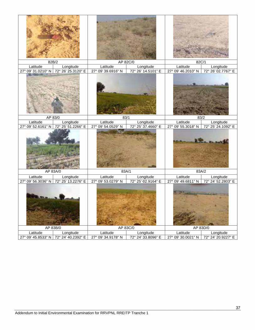
FIGU(DEC
27
27
27
27
ndum to Initial
URE 9: PCEMBER 20
ALatitude
7° 07' 37.3531"
Latitude 7° 08' 01.0960"
ALatitude
7° 08' 28.4517"
Latitude 7° 09' 00.4388"
Environmenta
PROPOSED 017) and Co
P 79A/0 Longit
N 72° 26' 26
80/0 Longit
N 72° 26' 51
AP 82/0 Longit
N 72° 26' 58
82A/1 Longit
N 72° 26' 54
l Examination f
TOWER LOonsultations
tude .5960" E 27
tude .4333" E 27
tude .8359" E 27
tude .7685" E 27
for RRVPNL R
OCATIONS As with Publi
ALatitude
° 07' 48.5140"
Latitude ° 08' 12.4059"
Latitude ° 08' 40.1170"
Latitude ° 09' 07.3478"
REITP Tranch
AP 79A/0 toic on Janua
AP 79B/0 Lon
N 72° 26' 2
AP 80/1 Lon
N 72° 26' 5
82/1 Lon
N 72° 26' 5
82A/2 Lon
N 72° 26' 5
e 1
o AP 84/0 Aary 9, 2018
ngitude 29.4277" E
ngitude 55.3154" E
ngitude 59.0430" E
ngitude 50.6534" E
AFTER PEGG
Latitude 27° 07' 54.416
Latitude 27° 08' 22.049
Latitude 27° 08' 52.822
Latitude 27° 09' 22.480
GING SURV
79B/1 Lo
65" N 72° 26
AP 81/0 Lo
92" N 72° 26
AP 82A/0 Lo
26" N 72° 26
82B/1 Lo
00" N 72° 26
36
VEY
ongitude ' 39.6041" E
ongitude ' 58.6545" E
ongitude ' 59.2990" E
ongitude ' 36.1105" E
6
Adde
27
27
27
27
ndum to Initial
Latitude 7° 09' 31.0210"
ALatitude
7° 09' 52.6161"
ALatitude
7° 09' 56.3036"
ALatitude
7° 09' 45.8533"
Environmenta
82B/2 Longit
N 72° 26' 25
AP 83/0 Longit
N 72° 25' 51
P 83A/0 Longit
N 72° 25' 13
P 83B/0 Longit
N 72° 24' 40
l Examination f
tude .3120" E 27
tude .2266" E 27
tude .2276" E 27
tude .2392" E 27
for RRVPNL R
ALatitude
° 09' 39.6916"
Latitude ° 09' 54.0529"
Latitude ° 09' 53.0279"
ALatitude
° 09' 34.9178"
REITP Tranch
AP 82C/0 Lon
N 72° 26' 1
83/1 Lon
N 72° 25' 3
83A/1 Lon
N 72° 25' 0
AP 83C/0 Lon
N 72° 24' 3
e 1
ngitude 14.5101" E
ngitude 37.4660" E
ngitude 02.9164" E
ngitude 33.8096" E
Latitude 27° 09' 46.201
Latitude 27° 09' 55.301
Latitude 27° 09' 49.681
Latitude 27° 09' 30.002
82C/1 Lo
10" N 72° 26
83/2 Lo
18" N 72° 25
83A/2 Lo
11" N 72° 24
AP 83D/0 Lo
21" N 72° 24
37
ongitude ' 02.7767" E
ongitude ' 24.1092" E
ongitude ' 52.2803" E
ongitude ' 20.9227" E
7
Adde
Exhi
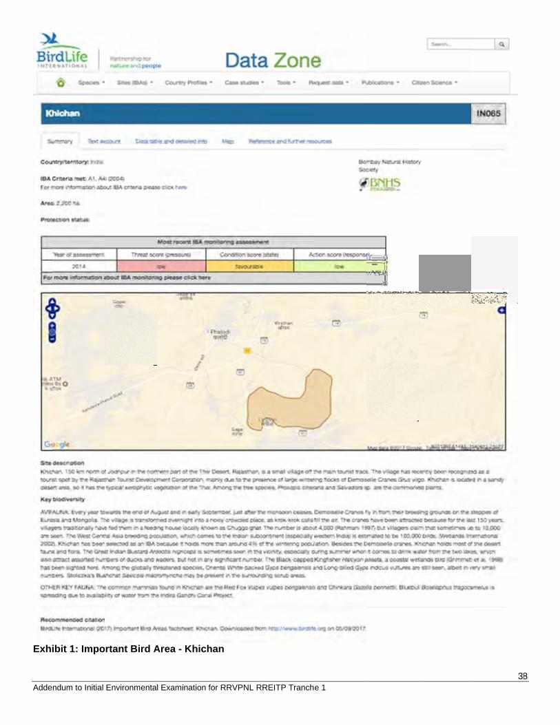
ndum to Initial
ibit 1: Impo
Environmenta
ortant Bird A
l Examination f
Area - Khich
for RRVPNL R
han
REITP Tranche 1 388
39 Addendum to Initial Environmental Examination for RRVPNL RREITP Tranche 1
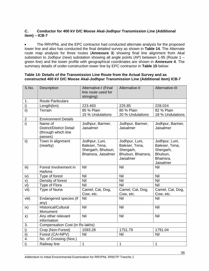
C. Conductor for 400 kV D/C Moose Akal-Jodhpur Transmission Line (Additional item) – ICB-7 The RRVPNL and the EPC contractor had conducted alternate analysis for the proposed tower line and also has conducted the final detailed survey as shown in Table 14. The Alternate route map analysis for three routes (Annexure 3) showing final line alignment from Akal substation to Jodhpur (new) substation showing all angle points (AP) between 1-95 (Route 1 – green line) and the tower profile with geographical coordinates are shown in Annexure 4. The summary details of under-construction tower line by EPC contractor in Table 15 below: Table 14: Details of the Transmission Line Route from the Actual Survey and as constructed 400 kV D/C Moose Akal-Jodhpur Transmission Line (Additional item) ICB-7 S.No. Description Alternative-I (Final
line route used for stringing)
Alternative-II Alternative-III
1. Route Particulars i) Length(km) 223.493 225.85 228.024 ii) Terrain 85 % Plain
15 % Undulations 80 % Plain 20 % Undulations
82 % Plain 18 % Undulations
2 Environment Details i) Name of
District/District Detail (through which line passes)
Jodhpur, Barmer, Jaisalmer
Jodhpur, Barmer, Jaisalmer
Jodhpur, Barmer, Jaisalmer
ii) Town in alignment (nearby)
Jodhpur, Luni, Baleser, Tena, Shergarh, Bhulsun, Bhainsra, Jaisalmer
Jodhpur, Luni, Baleser, Tena, Shergarh, Bhulsun, Bhainsra, Jaisalmer
Jodhpur, Luni, Baleser, Tena, Shergarh, Bhulsun, Bhainsra, Jaisalmer
iii) Forest Involvement in Ha/kms
Nil Nil Nil
iv) Type of forest Nil Nil Nil v) Density of forest Nil Nil Nil vi) Type of Flora Nil Nil Nil vii) Type of fauna Camel, Cat, Dog,
Cow, etc. Camel, Cat, Dog, Cow, etc.
Camel, Cat, Dog, Cow, etc.
viii) Endangered species (if any)
Nil Nil Nil
ix) Historical/Cultural Monument
Nil Nil Nil
x) Any other relevant information
Nil Nil Nil
3. Compensation Cost (in Rs lakhs) i) Crop (Non-Forest) 1593.28 1751.79 1791.04 ii) Forest (CA+NPV) Nil Nil Nil 4. No. of Crossing (Nos.) i) Railway line 1 1 1
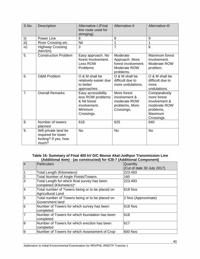
40 Addendum to Initial Environmental Examination for RRVPNL RREITP Tranche 1
S.No. Description Alternative-I (Final line route used for stringing)
Alternative-II Alternative-III
ii) Power Line 8 9 9 iii) River Crossing etc. Nil 1 1 iv) Highway Crossing
(NH/SH) 3 7 6
5. Construction Problem Easy approach. No forest Involvement. Less ROW Problems
Moderate Approach. More forest involvement. Moderate ROW problems.
Maximum forest Involvement. Moderate ROW problem.
6. O&M Problem O & M shall be relatively easier due to better approaches.
O & M shall be difficult due to more undulations.
O & M shall be difficult due to more undulations.
7. Overall Remarks Easy accessibility less ROW problems & Nil forest involvement, Minimum Crossings.
More forest involvement & moderate ROW problems, More Crossings.
Comparatively more forest involvement & moderate ROW problems, Maximum Crossings.
8. Number of towers planned
618 625 640
9. Will private land be required for tower footing? If yes, how much?
No No No
Table 15: Summary of Final 400 kV D/C Moose Akal-Jodhpur Transmission Line (Additional item) - (as constructed) for ICB-7 (Additional Component)
# Particulars Quantity (Cut of date 30 July 2017)
1 Total Length (Kilometers) 223.493 2 Total Number of Angle Points/Towers 160 3 Total Length for which final survey has been
completed (Kilometers)* 223.493
4 Total number of Towers being or to be placed on Agricultural Land
618 Nos
5 Total number of Towers being or to be placed on Government land
2 Nos (Approximate)
6 Number of Towers for which survey has been completed
618 Nos
7 Number of Towers for which foundation has been completed
618
8 Number of Towers for which erection has been completed
617
9 Number of Towers for which Assessment of Crop 600 Nos
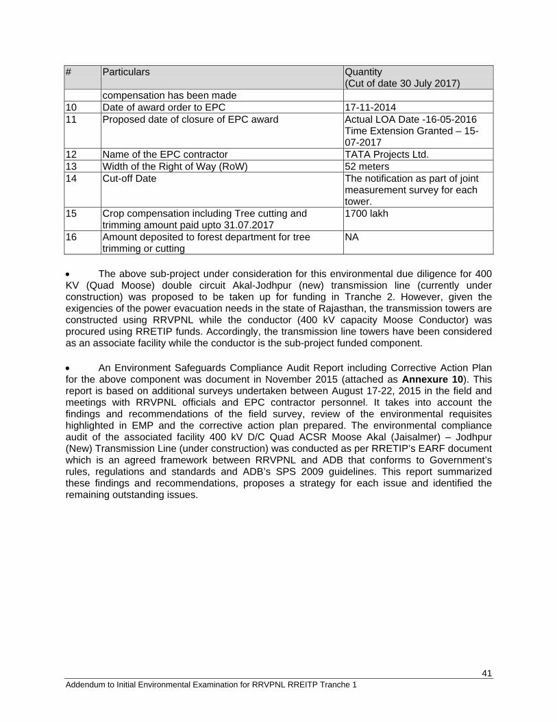
41 Addendum to Initial Environmental Examination for RRVPNL RREITP Tranche 1
# Particulars Quantity (Cut of date 30 July 2017)
compensation has been made 10 Date of award order to EPC 17-11-2014 11 Proposed date of closure of EPC award Actual LOA Date -16-05-2016
Time Extension Granted – 15-07-2017
12 Name of the EPC contractor TATA Projects Ltd. 13 Width of the Right of Way (RoW) 52 meters 14 Cut-off Date The notification as part of joint
measurement survey for each tower.
15 Crop compensation including Tree cutting and trimming amount paid upto 31.07.2017
1700 lakh
16 Amount deposited to forest department for tree trimming or cutting
NA
The above sub-project under consideration for this environmental due diligence for 400 KV (Quad Moose) double circuit Akal-Jodhpur (new) transmission line (currently under construction) was proposed to be taken up for funding in Tranche 2. However, given the exigencies of the power evacuation needs in the state of Rajasthan, the transmission towers are constructed using RRVPNL while the conductor (400 kV capacity Moose Conductor) was procured using RRETIP funds. Accordingly, the transmission line towers have been considered as an associate facility while the conductor is the sub-project funded component. An Environment Safeguards Compliance Audit Report including Corrective Action Plan for the above component was document in November 2015 (attached as Annexure 10). This report is based on additional surveys undertaken between August 17-22, 2015 in the field and meetings with RRVPNL officials and EPC contractor personnel. It takes into account the findings and recommendations of the field survey, review of the environmental requisites highlighted in EMP and the corrective action plan prepared. The environmental compliance audit of the associated facility 400 kV D/C Quad ACSR Moose Akal (Jaisalmer) – Jodhpur (New) Transmission Line (under construction) was conducted as per RRETIP’s EARF document which is an agreed framework between RRVPNL and ADB that conforms to Government’s rules, regulations and standards and ADB’s SPS 2009 guidelines. This report summarized these findings and recommendations, proposes a strategy for each issue and identified the remaining outstanding issues.
42 Addendum to Initial Environmental Examination for RRVPNL RREITP Tranche 1
4.0 CONSULTATIONS AND ENVIRONMENTAL MANAGEMENT PLAN (EMP) & BUDGET 4.1 Consultations at Transmission Tower sites Consultation at tower locations between 400 kV D/C Moose Ramgarh – Akal Transmission Line (ICB-5), 400 kV D/C Moose Bhadla – Jodhpur (LILO at Merta) Transmission Line (ICB-6), and 400 kV D/C Moose Akal – Jodhpur (Kankani) Transmission Line (ICB-7) in the state of Rajasthan was conducted. The details are listed in Annexure 9. Any queries and grievance of the project affected persons have been documented by the EPC contractors for each line. Consultation at tower locations between AP 79A/0 to AP 84/0 for 400 kV D/C Moose Jodhpur Merta LILO point – Bhadla Transmission Line adjoining the Khichan bird area have been done separately by the EPC contractor and are also listed in Annexure 9. 4.2 Compliance with RRETIP EMP RRVPNL has followed the standard GoI procedure for notifying the public about the erection of the tower line between substations by publishing Rajasthan state’s Gazette Notification for Transmission Line Construction in Annexure 1 and also procuring Forest clearances for the three transmission lines as attached in Annexure 2. Tata Projects Limited, the EPC contractors have Corporate Environment Health and Safety (EHS) policies that is followed by all its division for all of its projects. Similarly, Alstom, the EPC for substations, also has its own corporate environment policy. Following the Rajasthan state/GoI established procedure, RRVPNL has calculated and disbursed the Crop Compensation directly to the affected persons has been documented in the RP. The EARF agreed between RRVPNL and ADB which specifies the compliance process with applicable national and local laws and ADB’s SPS 2009 (SR1 for Environment) including avoiding and mitigating the environmental impacts of their existing operations as listed in RRETIP tranche 1 EMP. This EMP includes mitigation measures related to impacts on solid waste management plan, wastewater management plan, pollution prevention and abatement plan, emergency management plan, waste management plan, storm water management plan, occupation health and safety management plan, and wildlife management. The EMP and its environmental monitoring plan is then monitored by RRVPNL and the EPC contractor. Annexure 3 provides alternate routes analysis between difference feasible options. Annexures 4 and 5 shows profiles and photographs from each angle point of the transmission line. Aspects such as transmission line construction stages, EPC store, sub-contractor camp, right of way (ROW) - general crops and terrain in area, trees etc. are shown in various photographs in Annexure 6. Annexure 7 details the deviation in the route between AP 79/2 to AP 84/0 in ICB-6 transmission line required due to court orders. The RRETIP Tranche 1 (from IEE document) has been used to compare all aspects assessed for the review. Annexure 8 shows only the “transmission line construction aspects” from RRETIP EMP as a baseline to review any compliance related issues with this under construction project. The various EMP measures that were undertaken by EPC contractor to

43 Addendum to Initial Environmental Examination for RRVPNL RREITP Tranche 1
adhere to the EMP as per IEE. Also listed are the deviations from the Environment Monitoring plan and its implementation in view of the Environment monitoring reports being submitted by RVPNL to ADB every 6 months. For ICB -6 section AP 79/0 to AP 84/0, the tower locations that will be dismantled and removed will be done with utmost care towards workers and local public health and safety. The tower legs (comprising of concrete and iron bar) of the dismantled towers will be removed from the surface so as to make the land available for the farmer for cultivation. For ICB-7, the transmission line towers have been considered as an associate facility on which the RRETIP funded conductor will be strung. Since the ICB-7 work was started already before an EMP was prepared, an Environmental Audit, Due diligence and Corrective Action Plan for ICB-7 completed in November 2015 when the stringing was underway has been attached as Annexure 10. Associated facilities, as defined by ADB's SPS 2009 (Appendix 1, para. 6, p.31), "are not funded as part of the project (funding may be provided separately by the borrower/client or by third parties), and whose viability and existence depend exclusively on the project and whose goods or service are essential for successful operation of the project…" 4.3 EMP Budget According to the RRETIP EARF, the following costs towards environmental mitigation which are incurred by RRVPNL mainly constitutes of: Tree compensation: The project lines pass through desert area where loss of trees is not significant. It is assessed that a total of 18 trees will be trimmed but not cut. Details on trees affected are provided in Table 16.
Table 16: Trees Affected/Cut Particulars Quantity of trees Total
400 kV D/C Line from Ramgarh to Akal
400 kV D/C line from Bhadla to Jodhpur
Trees Cut 0 0 0 Trees – Trimmed 0 18 18 Total Trees affected 0 18 Source: RRVPNL Implementation of EMP by EPC contractor for all construction related activities; the cost
of which is included in the construction contracts award. The crop compensation for temporary damages by contractors to the affected farmers
has been documented in the updated Resettlement Plan. Shifting of Towers near the Khichan Bird area as specified by the High Court and Expert
committee recommendations. Appropriate budget shall be allocated by RVPN and EPC contractor to ensure complete removal of the underground concrete tower legs sections.
44 Addendum to Initial Environmental Examination for RRVPNL RREITP Tranche 1
5.0 SUMMARY AND CONCLUSION The review of the environmental compliance of as constructed facilities as on July 31, 2017 of the various components of the Tranche 1 is as follows:
Shifting of Bhadla substation to a new location – the land belongs the Rajasthan government and adjacent to the existing RRVPNL 220 kV substation in Bhadla Solar Park. There are no adverse environmental issues pertaining to shifting of the substation to the new area.
The length of the ICB-6 Transmission line (ICB-6) has increased to 199.221 km instead
of 160 km as proposed due to reasons mentioned in Section 4. The airstrip has been avoided as requested by the aviation authorities. However, the Khichan bird area has been avoided by 1.2 km. This is not a declared bird sanctuary as per Indian Gazette however, as precautionary measure, the EPC contractor has installed Bird divertors or spheres on the lines to highlight the wires in this area. This is also required as civil aviation authorities.
An Environment audit, due diligence and correction plan was prepared in November
2015 due to due an additional component in ICB-7 - stringing of conductor on an under construction 400 kV ICB-7. As per the audit report (attached as Annexure 10), this associated facility 400 kV D/C Quad ACSR Moose Akal (Jaisalmer) – Jodhpur (New) Transmission Line (under construction) was conducted as per RRETIP’s EARF document which is an agreed framework between RRVPNL and ADB that conforms to Government’s rules, regulations and standards and ADB’s SPS 2009 guidelines.
All other components funded in Tranche -1 have been found to have no significant deviations as per 2012 initial environment examination document. For the entire implementation, RRVPNL has taken suitable steps for meeting environmental and social compliance as per Government of India, state government through their respective forest departments and the district revenue officials. It is therefore felt that ADB’s SPS 2009 requirements can be fully met by the borrower. Engagement of RRVPNL and EPC contractors/sub-contractors with local community and affected persons in the immediate project area related to environmental aspects is satisfactory. RRVPNL has an operational contracting system with its EPC contractor. Responsibilities of the EPC contractor/sub-contractors with regards the mandatory EHS compliance requirements in their contracts with RRVPNL are in order. Furthermore, RRVPNL keeps sufficient monetary (fiscal) incentives/dis-incentives to ensure compliance with RRETIP’s EMP. RRVPNL needs to hire trained Environment and Social professional or consultants at PMU to assist in safeguard monitoring as per ADB requirements including monitoring and reporting regarding environmental compliance with applicable national laws. Documentation at the field office regarding compliances required for environmental monitoring of EMP activities needs to be maintained. Environment: The proposed scope change in RRETIP Tranche 1 of RRVPNL will remain
45 Addendum to Initial Environmental Examination for RRVPNL RREITP Tranche 1
to be classified as environment category B under the ADB’s SPS 2009. Land-use: There are neither forestlands nor private lands that have been procured by the government within the identified tower sites. The land is mostly agricultural in nature that is not irrigated from canals; but rather based on rains in the area. The single season crops are mostly Bajra, Moong, Gwar, etc. During the due-diligence, it was confirmed with village representatives were involved with RRVPNL, EPC contractor and the District revenue officials during the measurements and payments being made. The substation lands used are entirely owned by the Government of Rajasthan. Health and Safety: Proper health and safety systems are being followed by the EPC contractor(s) which are documented in their corporate declarations in the Environment Monitoring Reports. ADB’s Review Mission of November 21-23, 2017, Intermediate route survey December 2018 Annexure 7 has documents provided by RVPN during ADBs joint review mission cum site visit during Nov 21-24. The mission was informed that a writ petition no 14676/2016 was filed in 2016 and heard by High Court on 10 April 2017 and 12 July 2017. The Government Rajasthan Chief Secretary’s meeting was held on 21 June 2017 and the experts meeting was held on 10 Aug 2017. Both the court and the expert committee decided that following:
- Declare the Khichan Bird area as Conservation Area - Tourism department to provide more land and construct boundary and fencing for birds - Irrigation department of provide canal from lift irrigation canal for birds during the
migratory period. - Distribution lines overhead lines to be replaced by the underground distribution lines in
the area. - RVPN transmission line to be shifted at least 1 km from the current location for five
towers. These agreements were made by RVPN, Bombay Natural History Society, District Collector Phalodi, Tourism Department, Department of Wildlife, Department of Forests. Based on the decision by court and experts, RVPNL the EPC contractor have conducted intermediate survey and submitted the final route alignment after pegging of the diverted route to the Government and ADB. This information containing the intermediate route survey of December 2017 and the public consultations held on January 9, 2018 submitted by the EPC Contractor has been appended to this IEE. However, as per provisions of the project, if this alignment is further changed at a later date, the same will be finalised, approved by competent authorities in this case and confirmed to ADB by RVPNL.
Annexure-1
Rajasthan Gazette Notification
for Transmission Line Construction
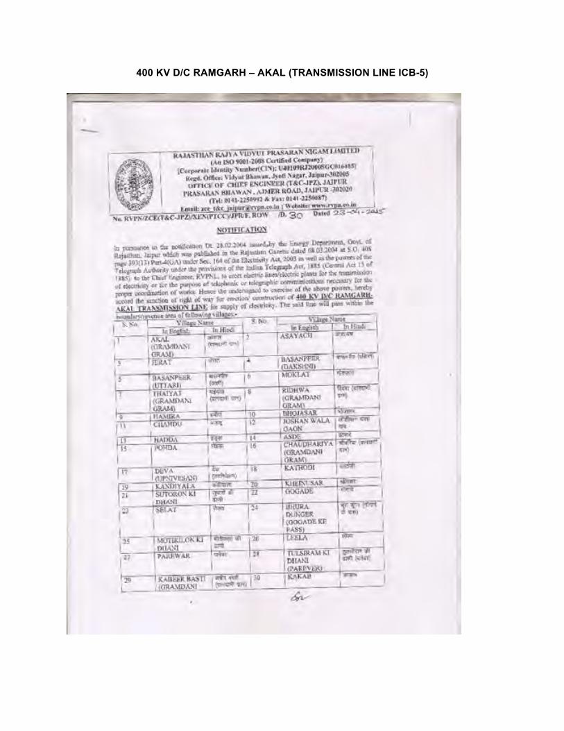
400 KV D/C RAMGARH – AKAL (TRANSMISSION LINE ICB-5)
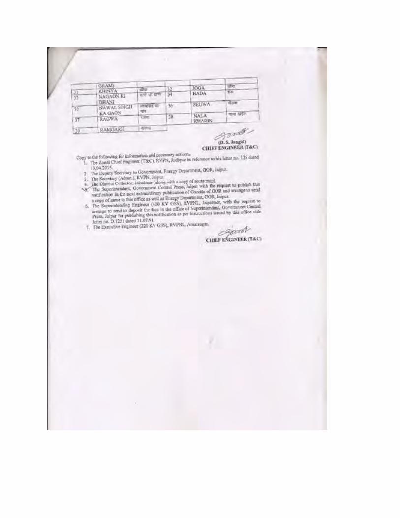
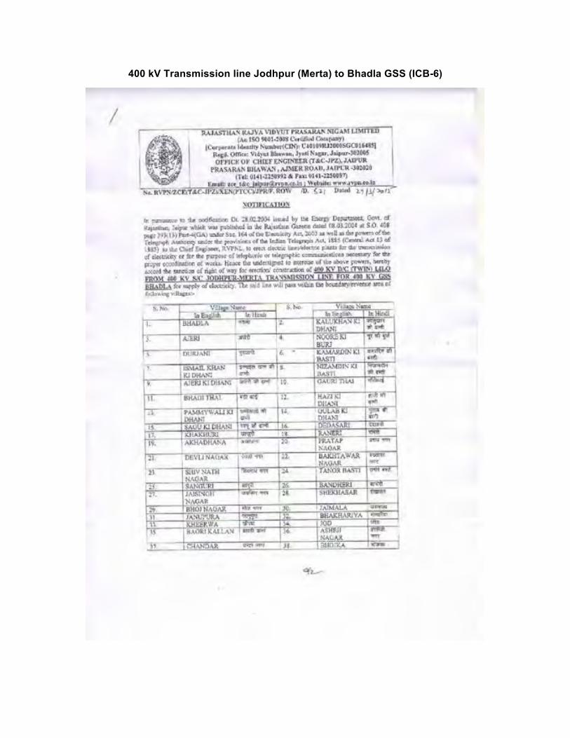
400 kV Transmission line Jodhpur (Merta) to Bhadla GSS (ICB-6)
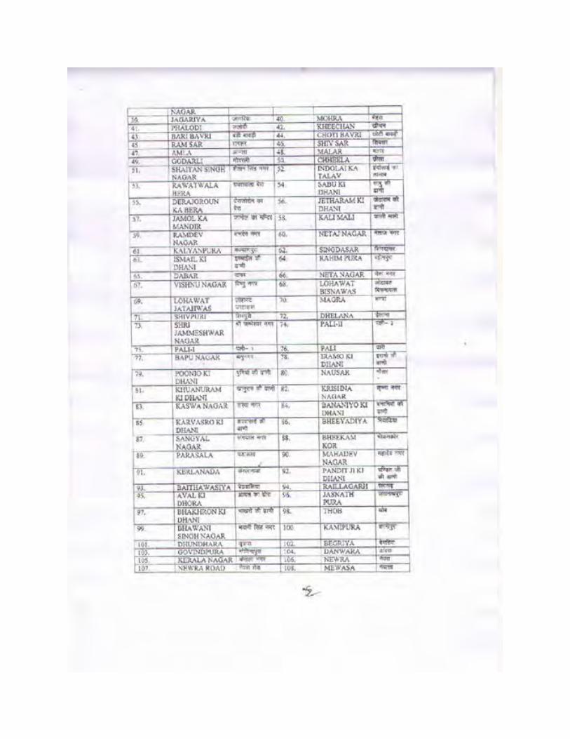
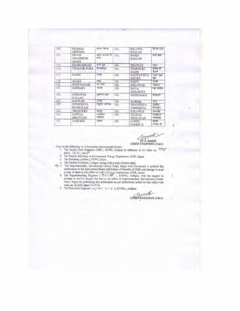
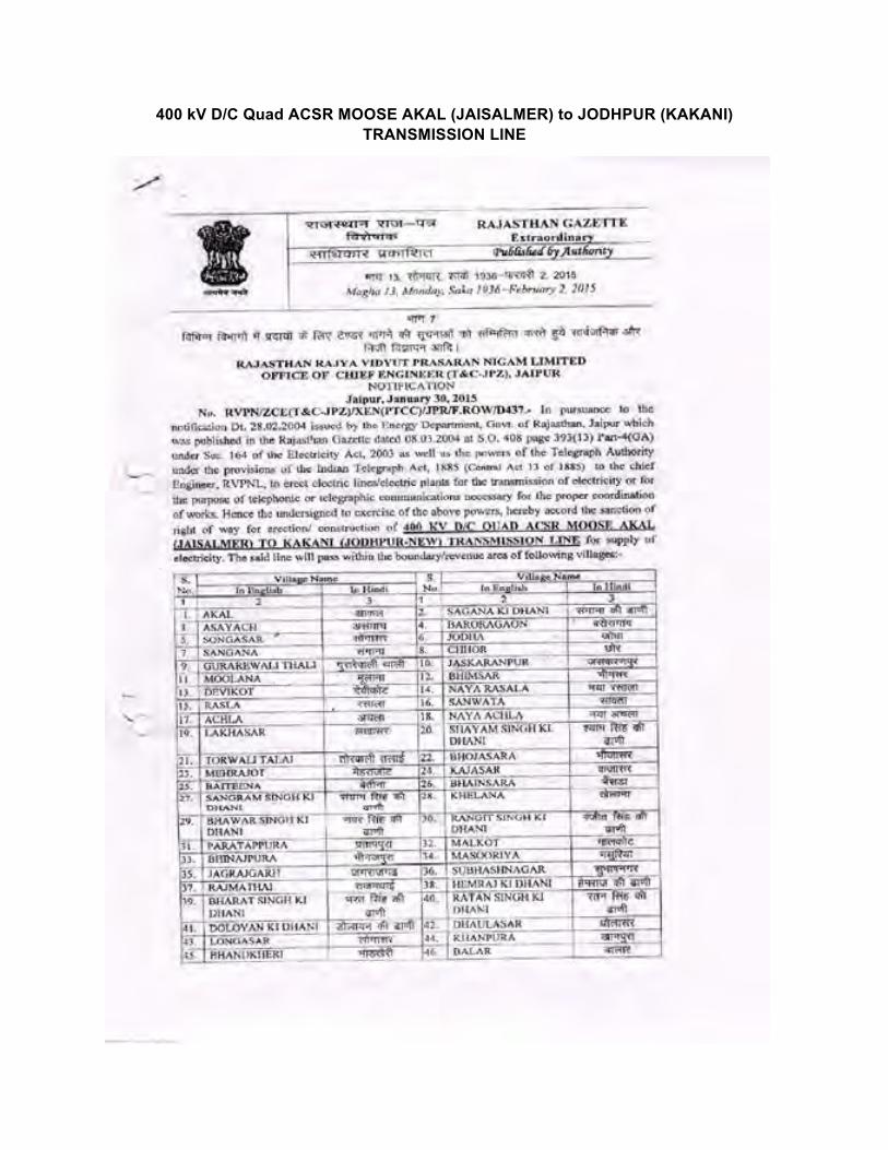
400 kV D/C Quad ACSR MOOSE AKAL (JAISALMER) to JODHPUR (KAKANI) TRANSMISSION LINE
Annexure-2
Forest Clearances & Air Port /Other Civil Clearances
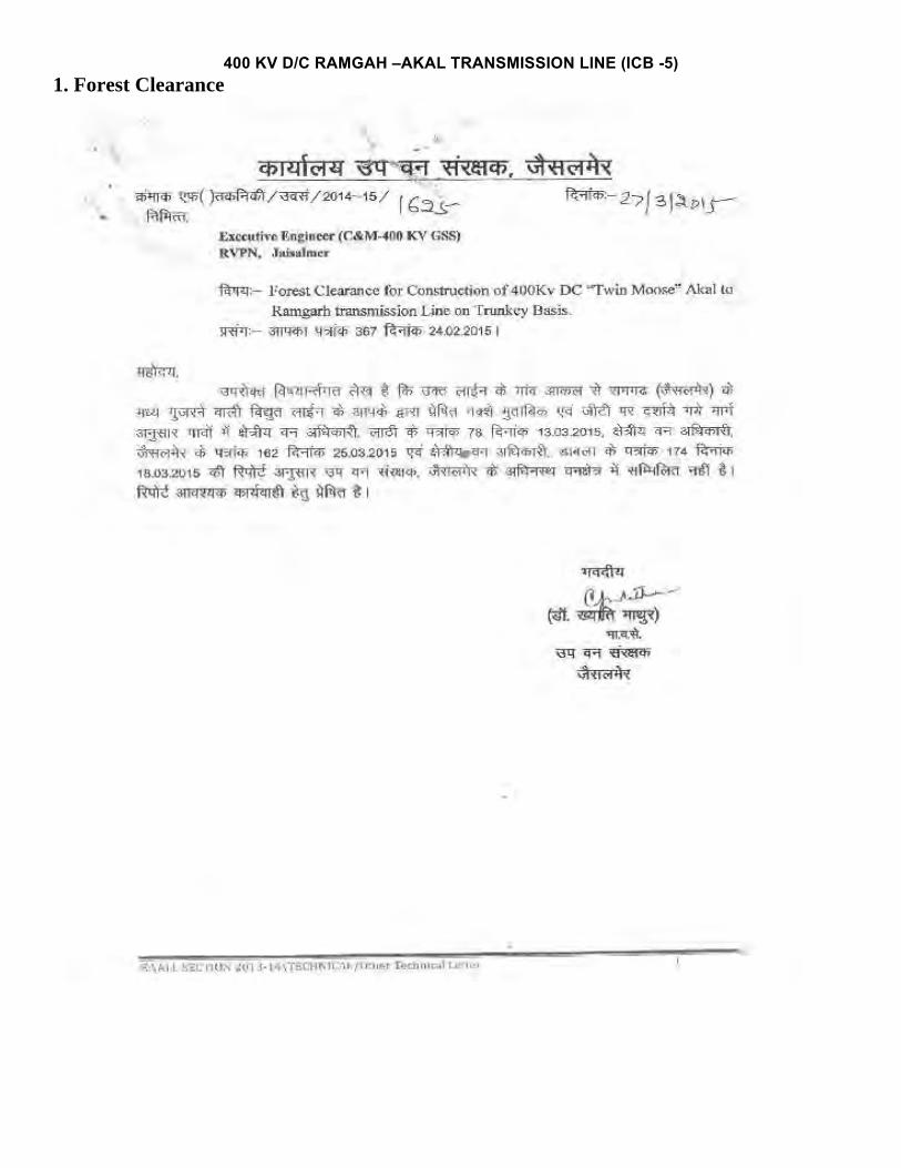
400 KV D/C RAMGAH –AKAL TRANSMISSION LINE (ICB -5) 1. Forest Clearance
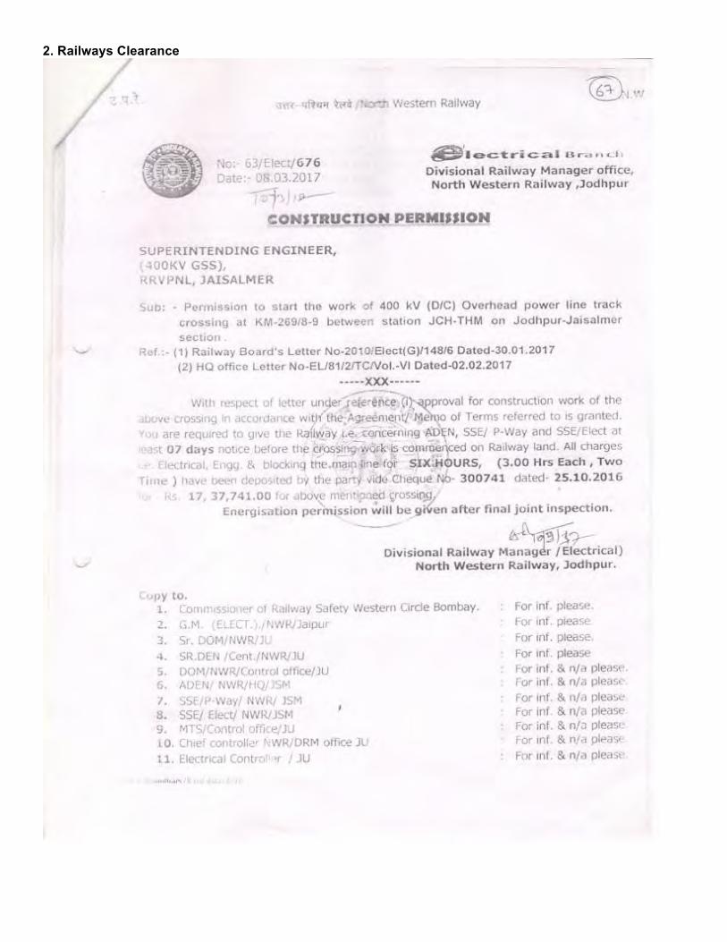
2. Railways Clearance
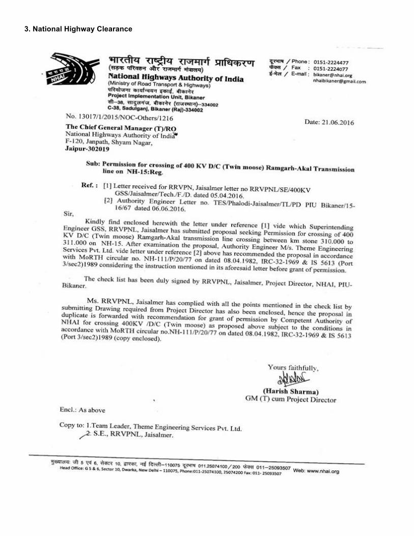
3. National Highway Clearance
4. Civil Aviation Authority Clearance
400 kV D/C Twin ACSR Moose Transmission line from Bhadla to LILO point on Jodhpur – Merta Lines (ICB-6) 1. Forest Clearance
2. Railway Clearance
3. Civil Aviation Authority Clearance
400 kV D/C ACSR MOOSE AKAL –JODHPUR (KAKANI) TRANSMISSION LINE (ICB-7) 1. Forest Clearances
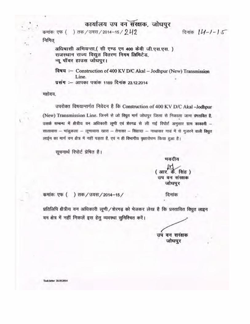
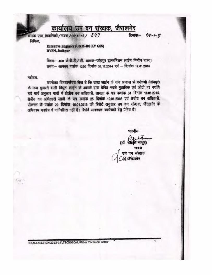
Annexure-3
Alternate Routes Considered and
Final Transmission Line Route “As Constructed”
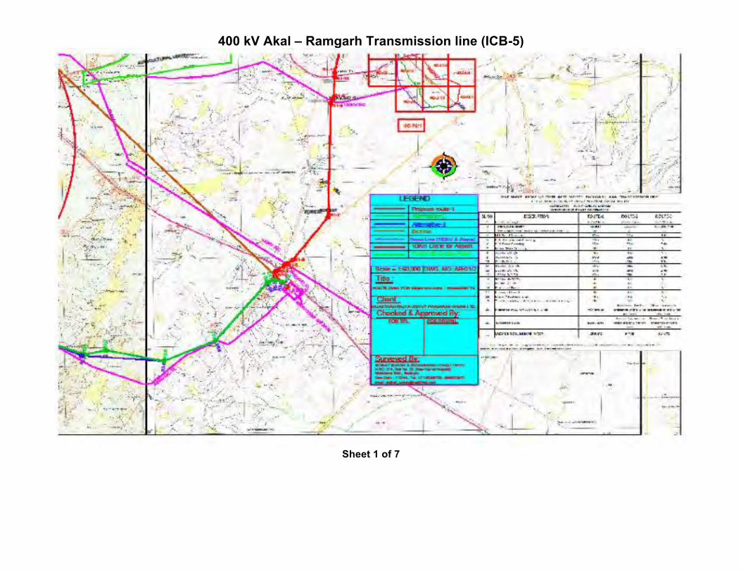
400 kV Akal – Ramgarh Transmission line (ICB-5)
Sheet 1 of 7
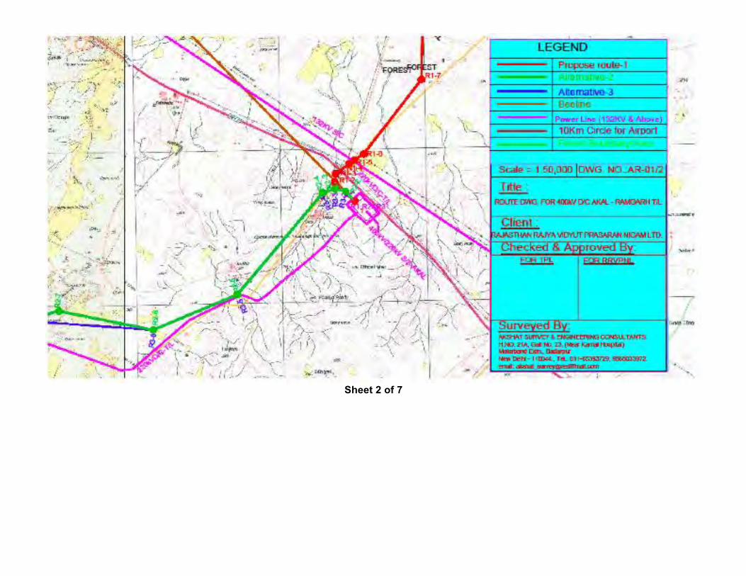
Sheet 2 of 7
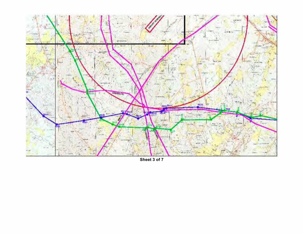
Sheet 3 of 7
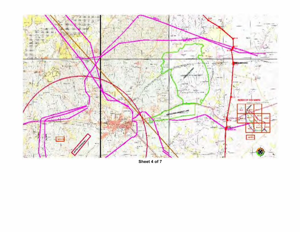
Sheet 4 of 7
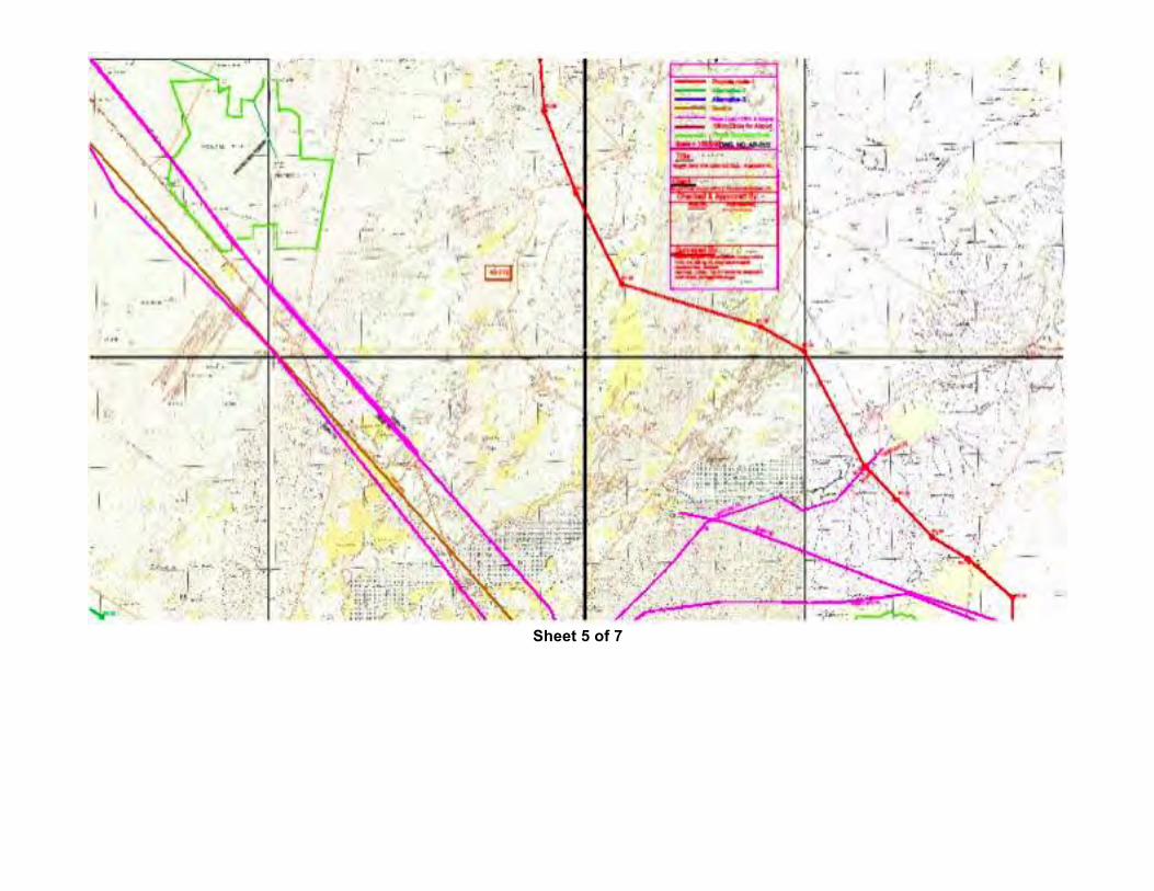
Sheet 5 of 7
Sheet 6 of 7
Sheet 7 of 7
400 kV D/C Moose Bhadla – Jodhpur (LILO at Merta) Transmission Line
Sheet 1 of 19
Sheet 2 of 19
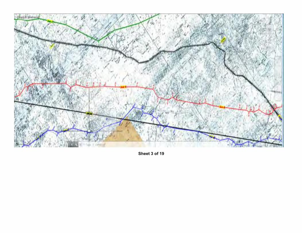
Sheet 3 of 19
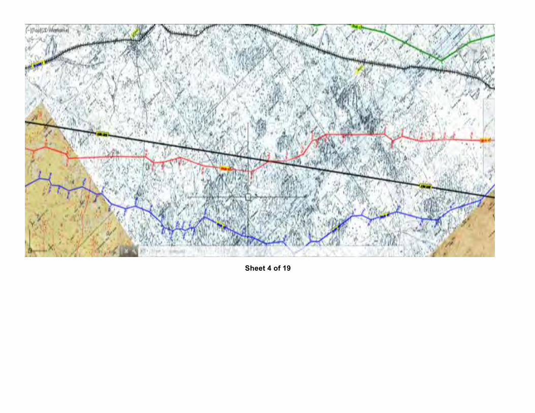
Sheet 4 of 19
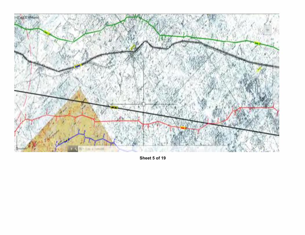
Sheet 5 of 19
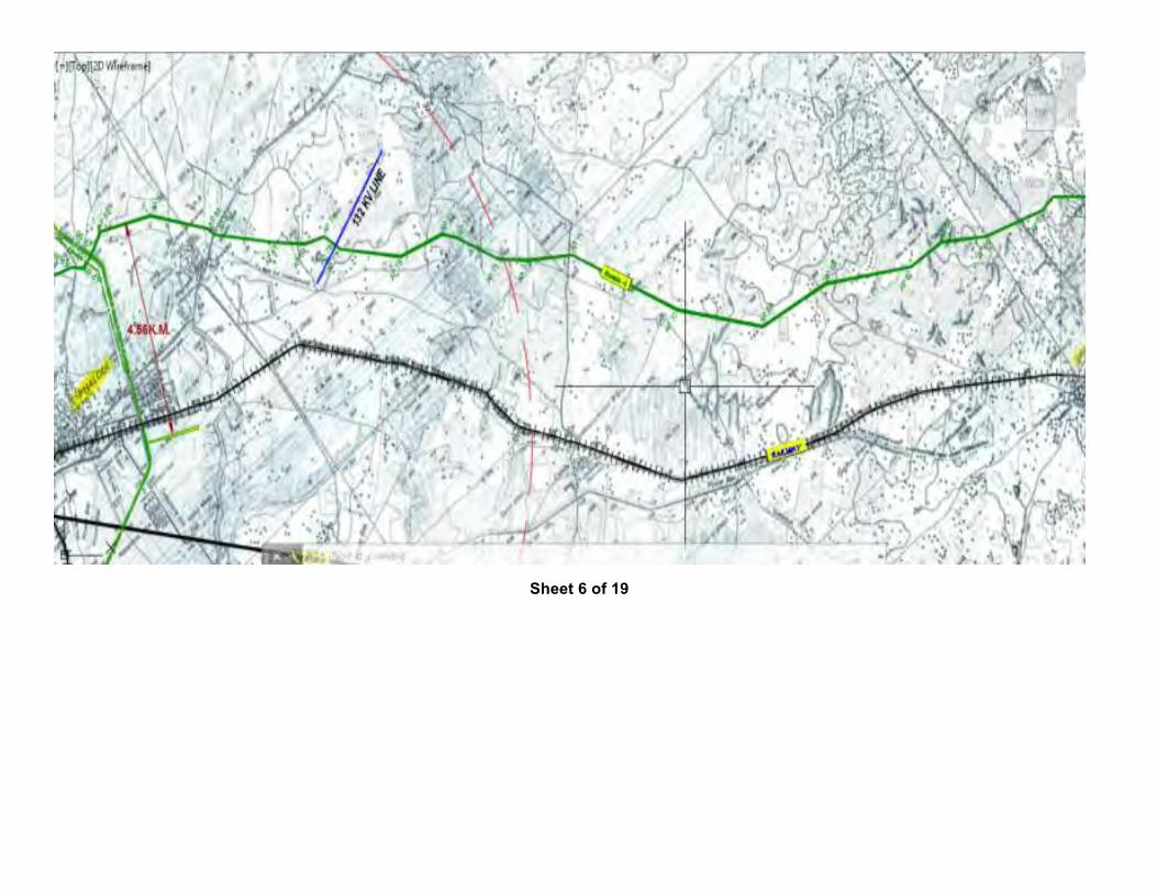
Sheet 6 of 19
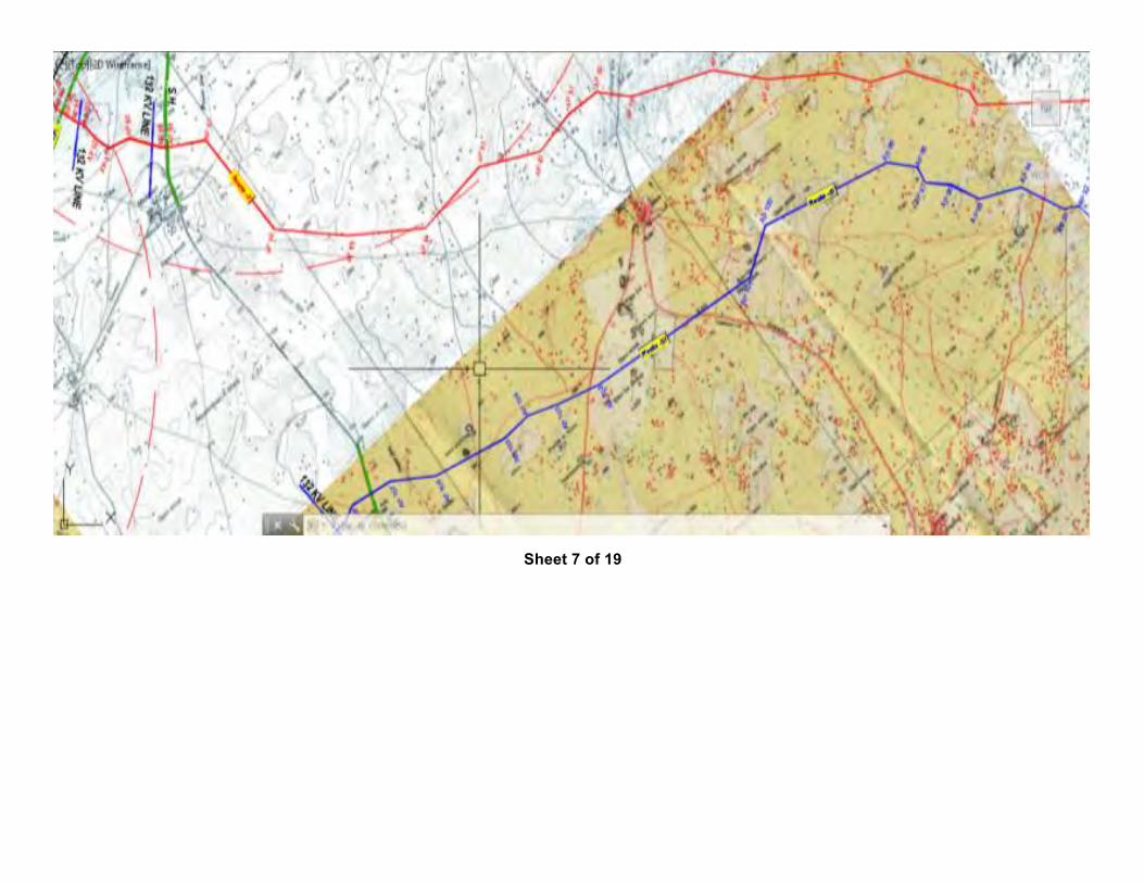
Sheet 7 of 19
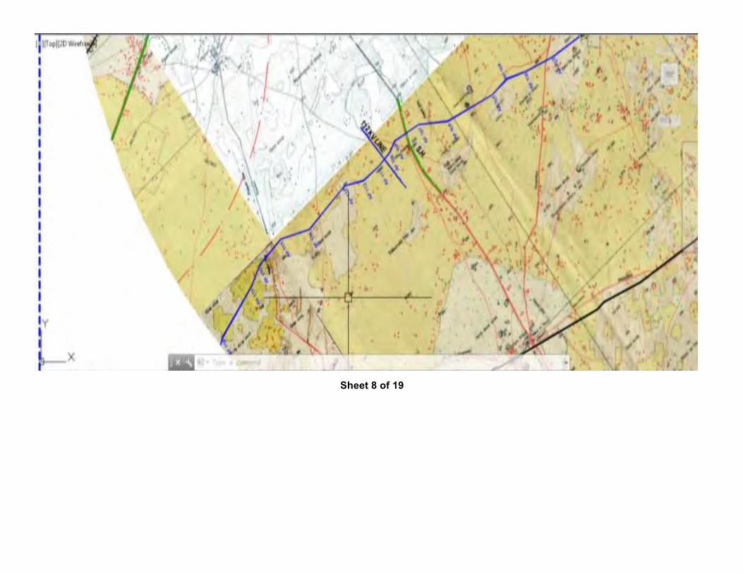
Sheet 8 of 19
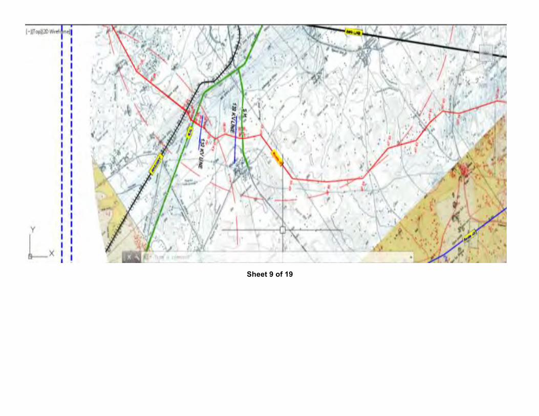
Sheet 9 of 19
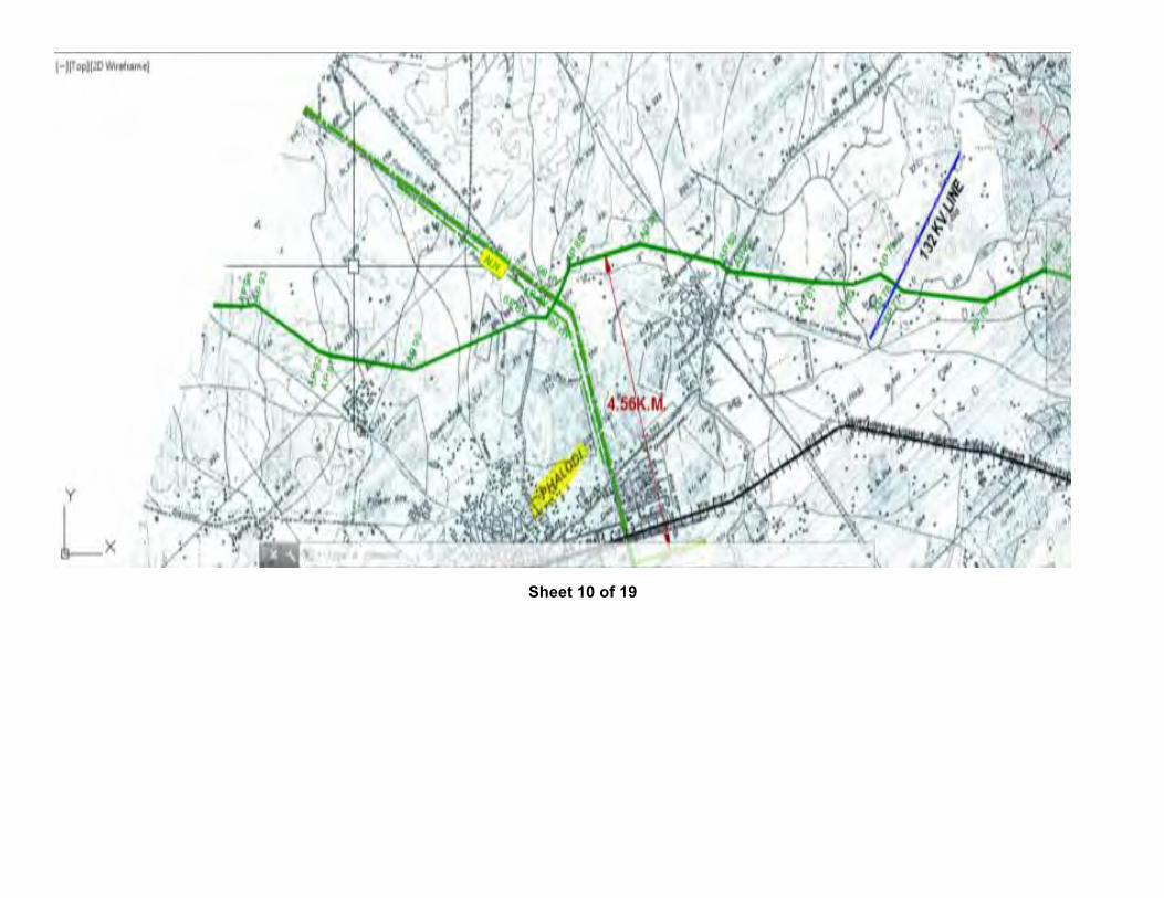
Sheet 10 of 19
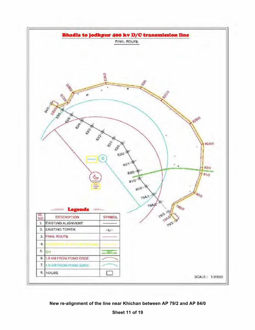
New re-alignment of the line near Khichan between AP 79/2 and AP 84/0
Sheet 11 of 19
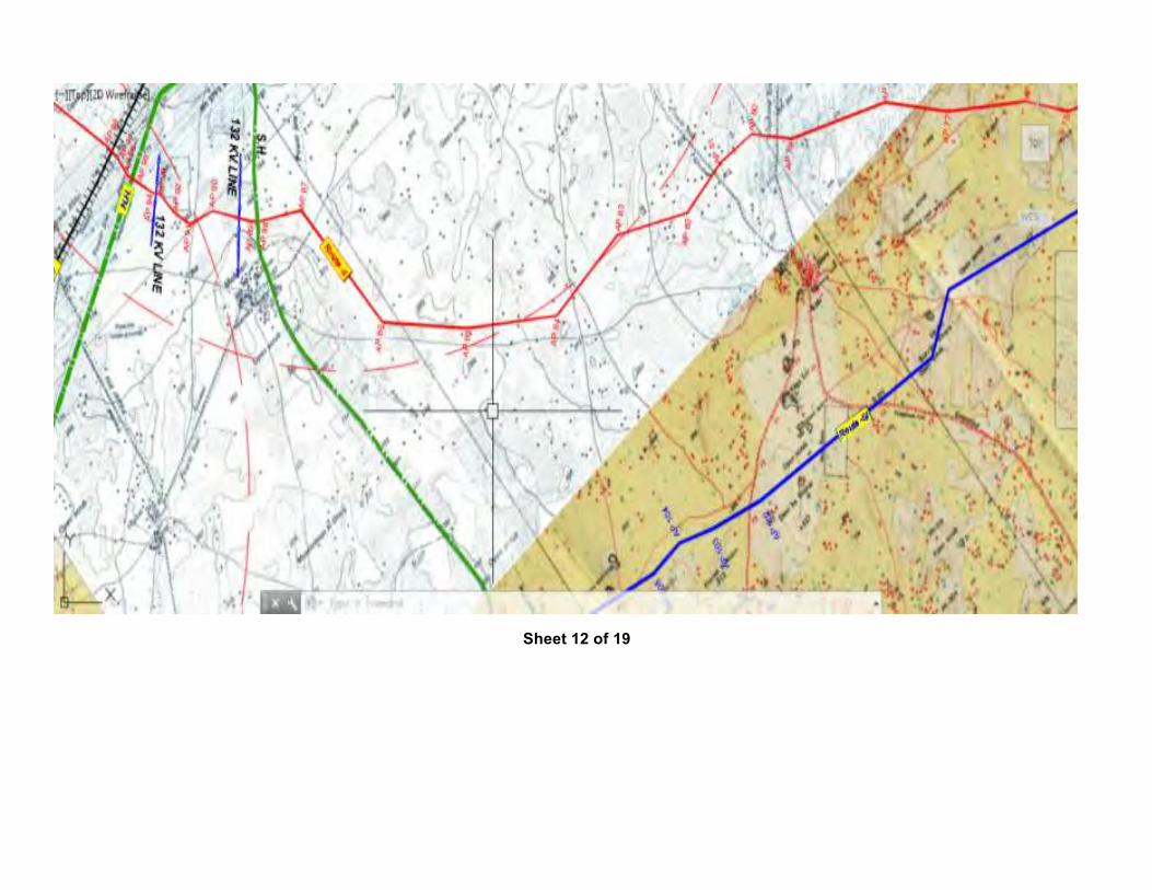
Sheet 12 of 19
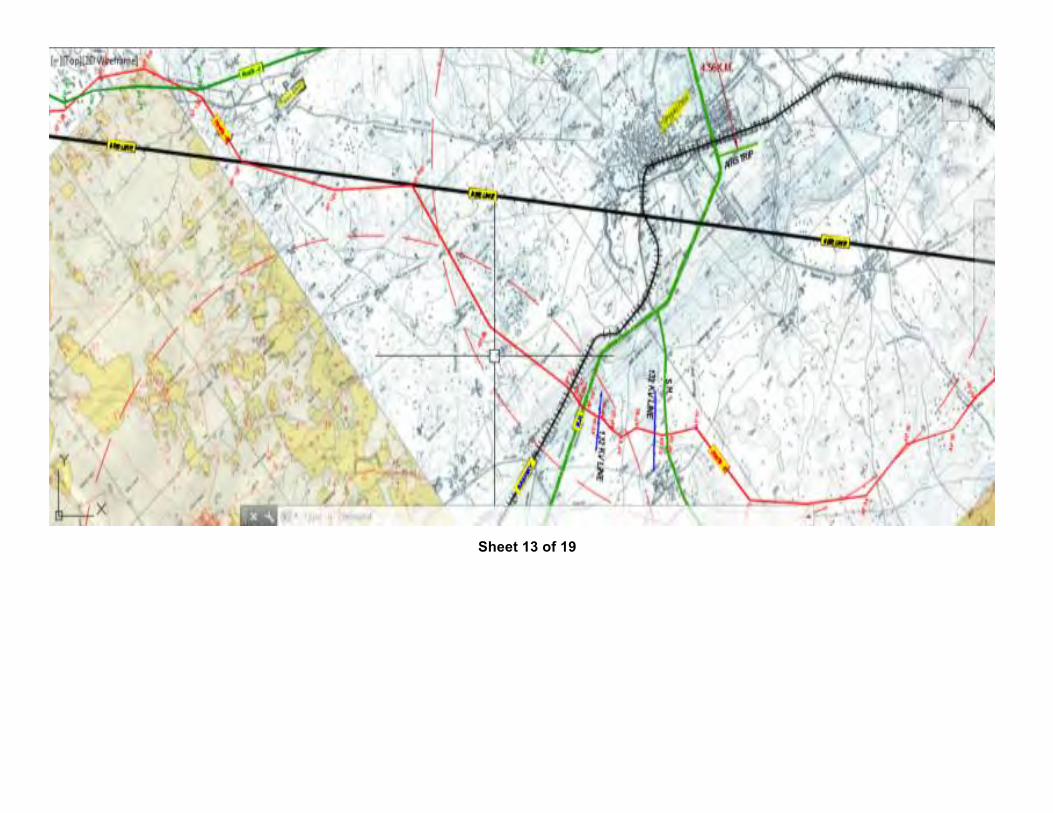
Sheet 13 of 19
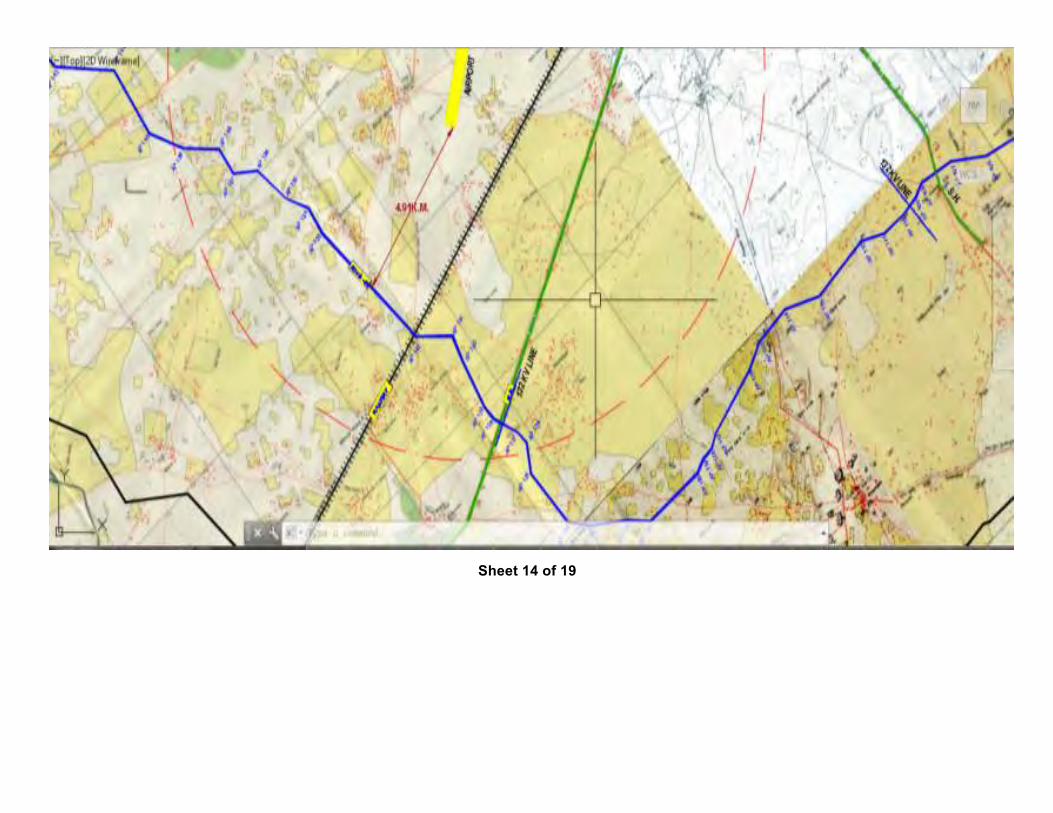
Sheet 14 of 19
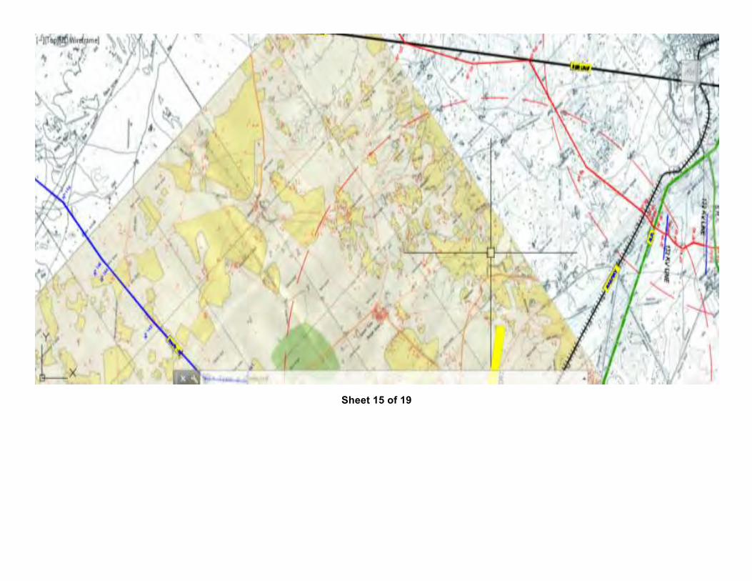
Sheet 15 of 19
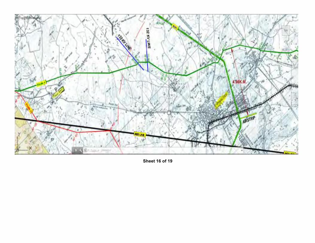
Sheet 16 of 19
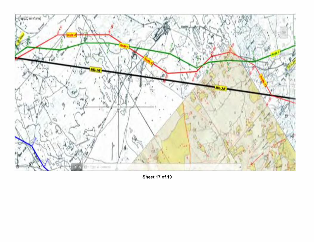
Sheet 17 of 19
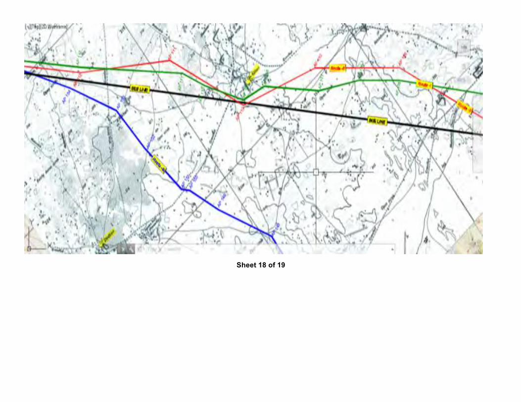
Sheet 18 of 19
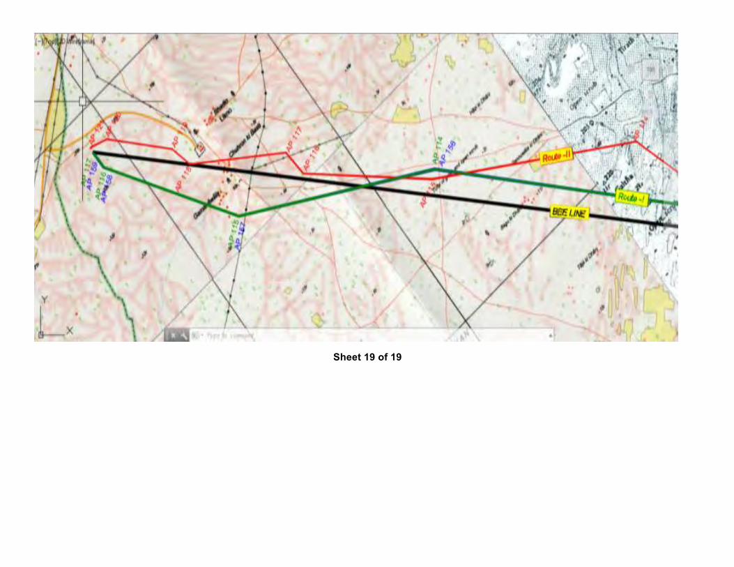
Sheet 19 of 19
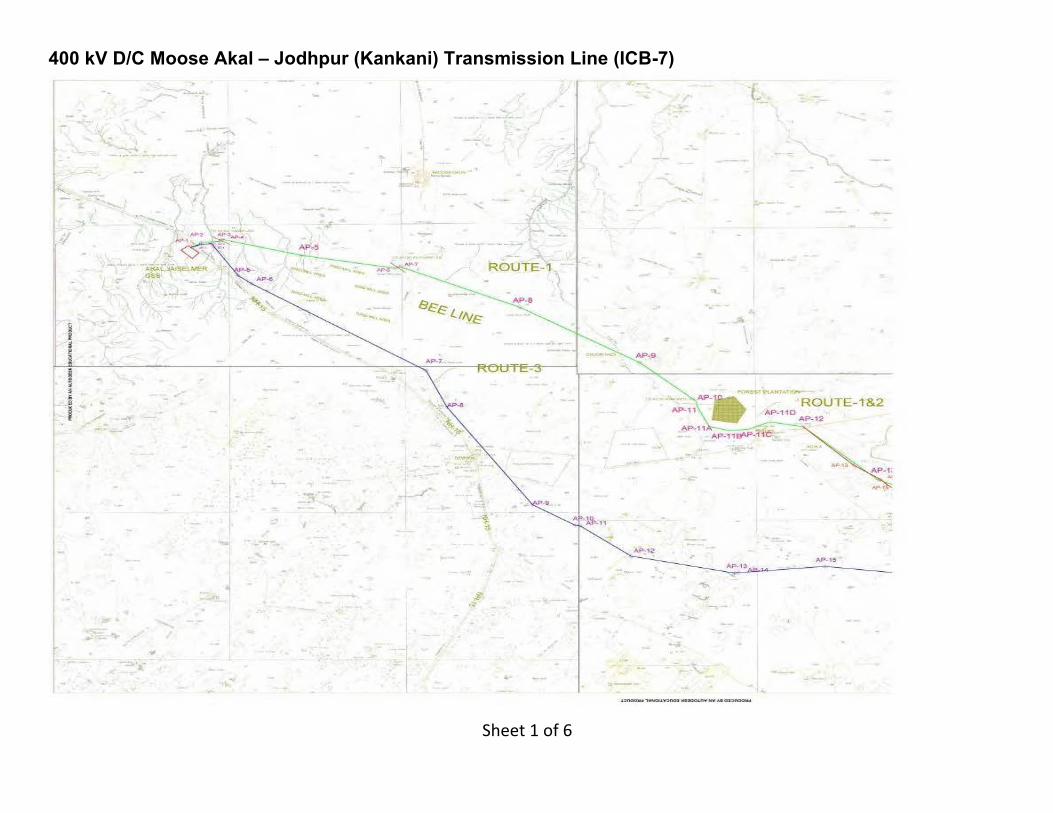
400 kV D/C Moose Akal – Jodhpur (Kankani) Transmission Line (ICB-7)
Sheet1of6
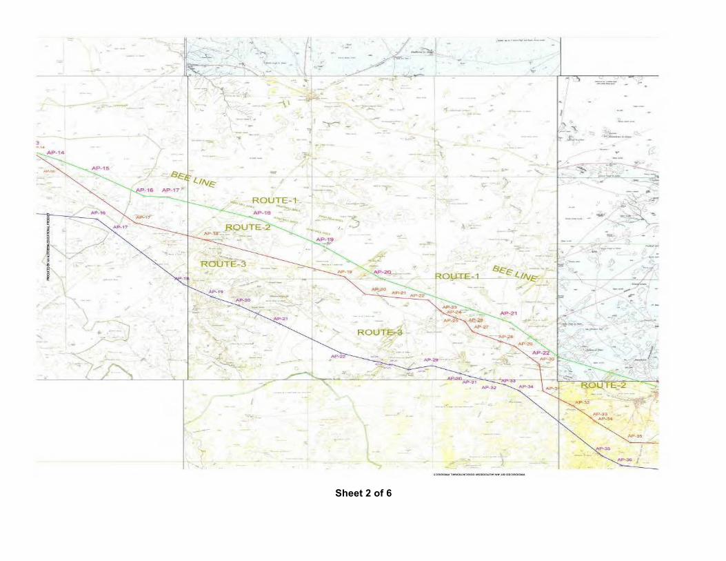
Sheet 2 of 6
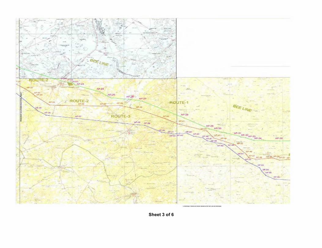
Sheet 3 of 6
Sheet 4 of 6
Sheet 5 of 6
Sheet 6 of 6
1
Annexure-4
Final Tower Schedule of “As constructed” Transmission line
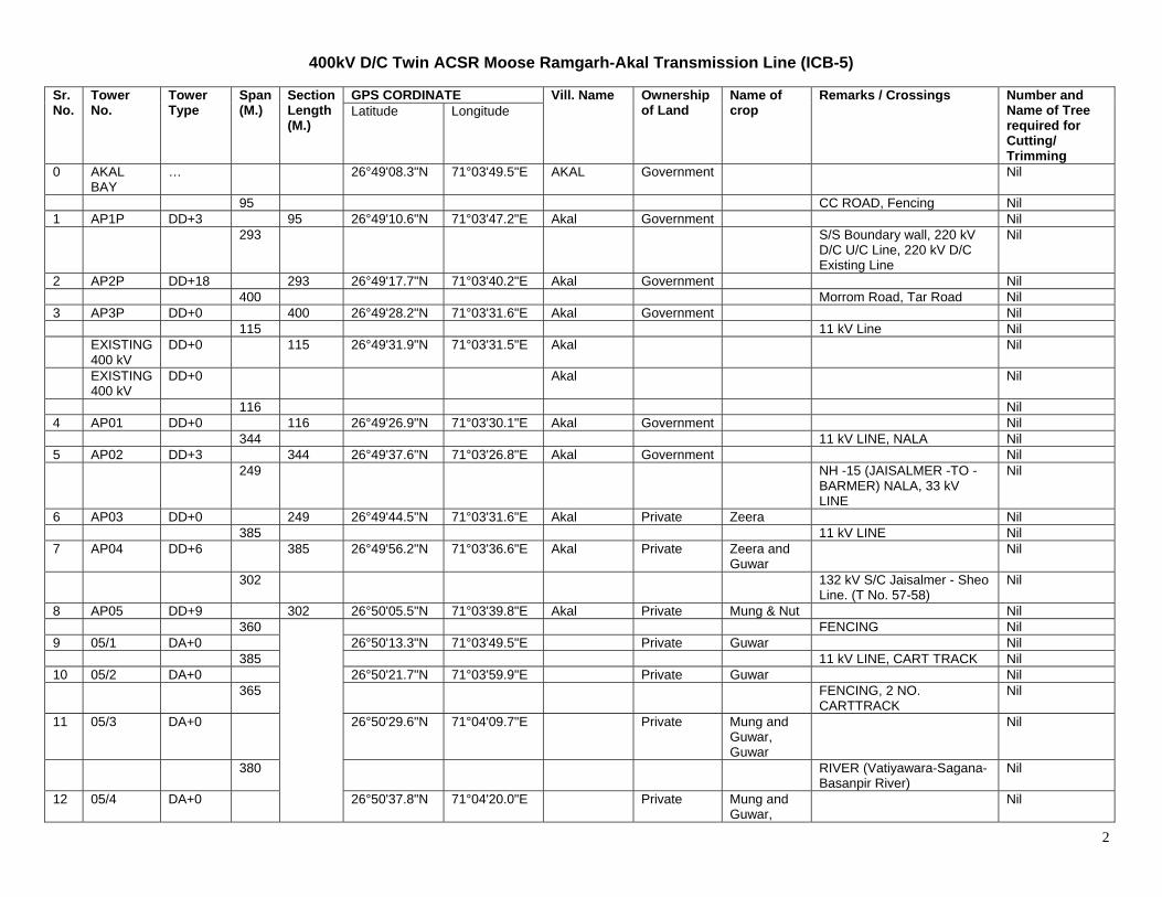
2
400kV D/C Twin ACSR Moose Ramgarh-Akal Transmission Line (ICB-5) Sr. No.
Tower No.
Tower Type
Span (M.)
Section Length (M.)
GPS CORDINATE Vill. Name Ownership of Land
Name of crop
Remarks / Crossings Number and Name of Tree required for Cutting/ Trimming
Latitude Longitude
0 AKAL BAY
… 26°49'08.3"N 71°03'49.5"E AKAL Government Nil
95 CC ROAD, Fencing Nil 1 AP1P DD+3 95 26°49'10.6"N 71°03'47.2"E Akal Government Nil 293 S/S Boundary wall, 220 kV
D/C U/C Line, 220 kV D/C Existing Line
Nil
2 AP2P DD+18 293 26°49'17.7"N 71°03'40.2"E Akal Government Nil 400 Morrom Road, Tar Road Nil 3 AP3P DD+0 400 26°49'28.2"N 71°03'31.6"E Akal Government Nil 115 11 kV Line Nil EXISTING
400 kV DD+0 115 26°49'31.9"N 71°03'31.5"E Akal Nil
EXISTING 400 kV
DD+0 Akal Nil
116 Nil 4 AP01 DD+0 116 26°49'26.9"N 71°03'30.1"E Akal Government Nil 344 11 kV LINE, NALA Nil 5 AP02 DD+3 344 26°49'37.6"N 71°03'26.8"E Akal Government Nil 249 NH -15 (JAISALMER -TO -
BARMER) NALA, 33 kV LINE
Nil
6 AP03 DD+0 249 26°49'44.5"N 71°03'31.6"E Akal Private Zeera Nil 385 11 kV LINE Nil 7 AP04 DD+6 385 26°49'56.2"N 71°03'36.6"E Akal Private Zeera and
Guwar Nil
302 132 kV S/C Jaisalmer - Sheo Line. (T No. 57-58)
Nil
8 AP05 DD+9 302 26°50'05.5"N 71°03'39.8"E Akal Private Mung & Nut Nil 360 FENCING Nil 9 05/1 DA+0 26°50'13.3"N 71°03'49.5"E Private Guwar Nil 385 11 kV LINE, CART TRACK Nil 10 05/2 DA+0 26°50'21.7"N 71°03'59.9"E Private Guwar Nil 365 FENCING, 2 NO.
CARTTRACK Nil
11 05/3 DA+0 26°50'29.6"N 71°04'09.7"E Private Mung and Guwar, Guwar
Nil
380 RIVER (Vatiyawara-Sagana-Basanpir River)
Nil
12 05/4 DA+0 26°50'37.8"N 71°04'20.0"E Private Mung and Guwar,
Nil
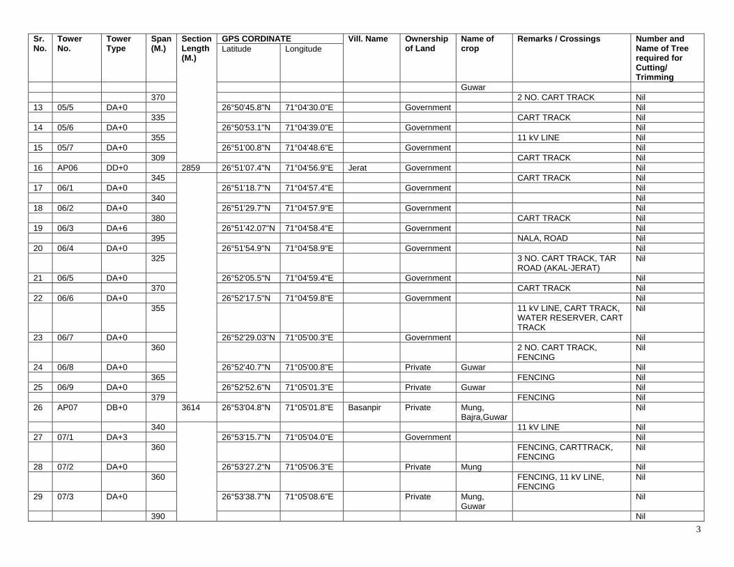
3
Sr. No.
Tower No.
Tower Type
Span (M.)
Section Length (M.)
GPS CORDINATE Vill. Name Ownership of Land
Name of crop
Remarks / Crossings Number and Name of Tree required for Cutting/ Trimming
Latitude Longitude
Guwar 370 2 NO. CART TRACK Nil 13 05/5 DA+0 26°50'45.8"N 71°04'30.0"E Government Nil 335 CART TRACK Nil 14 05/6 DA+0 26°50'53.1"N 71°04'39.0"E Government Nil 355 11 kV LINE Nil 15 05/7 DA+0 26°51'00.8"N 71°04'48.6"E Government Nil 309 CART TRACK Nil 16 AP06 DD+0 2859 26°51'07.4"N 71°04'56.9"E Jerat Government Nil 345 CART TRACK Nil 17 06/1 DA+0 26°51'18.7"N 71°04'57.4"E Government Nil 340 Nil 18 06/2 DA+0 26°51'29.7"N 71°04'57.9"E Government Nil 380 CART TRACK Nil 19 06/3 DA+6 26°51'42.07"N 71°04'58.4"E Government Nil 395 NALA, ROAD Nil 20 06/4 DA+0 26°51'54.9"N 71°04'58.9"E Government Nil 325 3 NO. CART TRACK, TAR
ROAD (AKAL-JERAT) Nil
21 06/5 DA+0 26°52'05.5"N 71°04'59.4"E Government Nil 370 CART TRACK Nil 22 06/6 DA+0 26°52'17.5"N 71°04'59.8"E Government Nil 355 11 kV LINE, CART TRACK,
WATER RESERVER, CART TRACK
Nil
23 06/7 DA+0 26°52'29.03"N 71°05'00.3"E Government Nil 360 2 NO. CART TRACK,
FENCING Nil
24 06/8 DA+0 26°52'40.7"N 71°05'00.8"E Private Guwar Nil 365 FENCING Nil 25 06/9 DA+0 26°52'52.6"N 71°05'01.3"E Private Guwar Nil 379 FENCING Nil 26 AP07 DB+0 3614 26°53'04.8"N 71°05'01.8"E Basanpir Private Mung,
Bajra,Guwar Nil
340 11 kV LINE Nil 27 07/1 DA+3 26°53'15.7"N 71°05'04.0"E Government Nil 360 FENCING, CARTTRACK,
FENCING Nil
28 07/2 DA+0 26°53'27.2"N 71°05'06.3"E Private Mung Nil 360 FENCING, 11 kV LINE,
FENCING Nil
29 07/3 DA+0 26°53'38.7"N 71°05'08.6"E Private Mung, Guwar
Nil
390 Nil
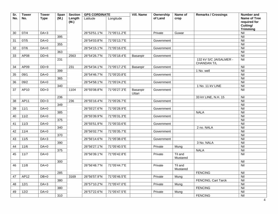
4
Sr. No.
Tower No.
Tower Type
Span (M.)
Section Length (M.)
GPS CORDINATE Vill. Name Ownership of Land
Name of crop
Remarks / Crossings Number and Name of Tree required for Cutting/ Trimming
Latitude Longitude
30 07/4 DA+3 26°53'51.1"N 71°05'11.2"E Private Guwar Nil 395 Nil 31 07/5 DA+0 26°54'03.8"N 71°05'13.7"E Government Nil 355 Nil 32 07/6 DA+0 26°54'15.1"N 71°05'16.0"E Government Nil 363 Nil 33 AP08 DD+6 2563 26°54'26.7"N 71°05'18.4"E Basanpir Government Nil 231 132 kV S/C JAISALMER -
CHANDAN T/L Nil
34 AP09 DD+9 231 26°54'34.1"N 71°05'17.2"E Basanpir Government Nil 399 1 No. well Nil 35 09/1 DA+0 26°54'46.7"N 71°05'20.8"E Government Nil 365 Nil 36 09/2 DA+0 26°54'58.1"N 71°05'24.2"E Government Nil 340 1 No. 11 kV LINE Nil 37 AP10 DD+3 1104 26°55'08.8"N 71°05'27.3"E Basanpir
Uttari Government Nil
236 33 kV LINE, N.H. 15 Nil 38 AP11 DD+3 236 26°55'16.4"N 71°05'26.7"E Government Nil 349 Nil 39 11/1 DA+0 26°55'27.6"N 71°05'28.9"E Government Nil 385 NALA Nil 40 11/2 DA+0 26°55'39.9"N 71°05'31.3"E Government Nil 375 Nil 41 11/3 DA+0 26°55'51.9"N 71°05'33.6"E Government Nil 340 2 no. NALA Nil 42 11/4 DA+0 26°56'02.7"N 71°05'35.7"E Government Nil 370 Nil 43 11/5 DA+3 26°56'14.6"N 71°05'38.0"E Government Nil 390 3 No. NALA Nil 44 11/6 DA+0 26°56'27.1"N 71°05'40.5"E Private Mung Nil 375 NALA Nil 45 11/7 DA+0 26°56'39.1"N 71°05'42.8"E Private Til and
Mustared Nil
300 Nil 46 11/8 DA+0 26°56'48.7"N 71°05'44.7"E Private Til and
Mustared Nil
285 FENCING Nil 47 AP12 DB+0 3169 26°56'57.9"N 71°05'46.5"E Private Mung Nil 380 FENCING, Cart Tarck Nil 48 12/1 DA+3 26°57'10.2"N 71°05'47.0"E Private Mung Nil 380 FENCING Nil 49 12/2 DA+0 26°57'22.6"N 71°05'47.5"E Private Mung Nil 310 FENCING Nil
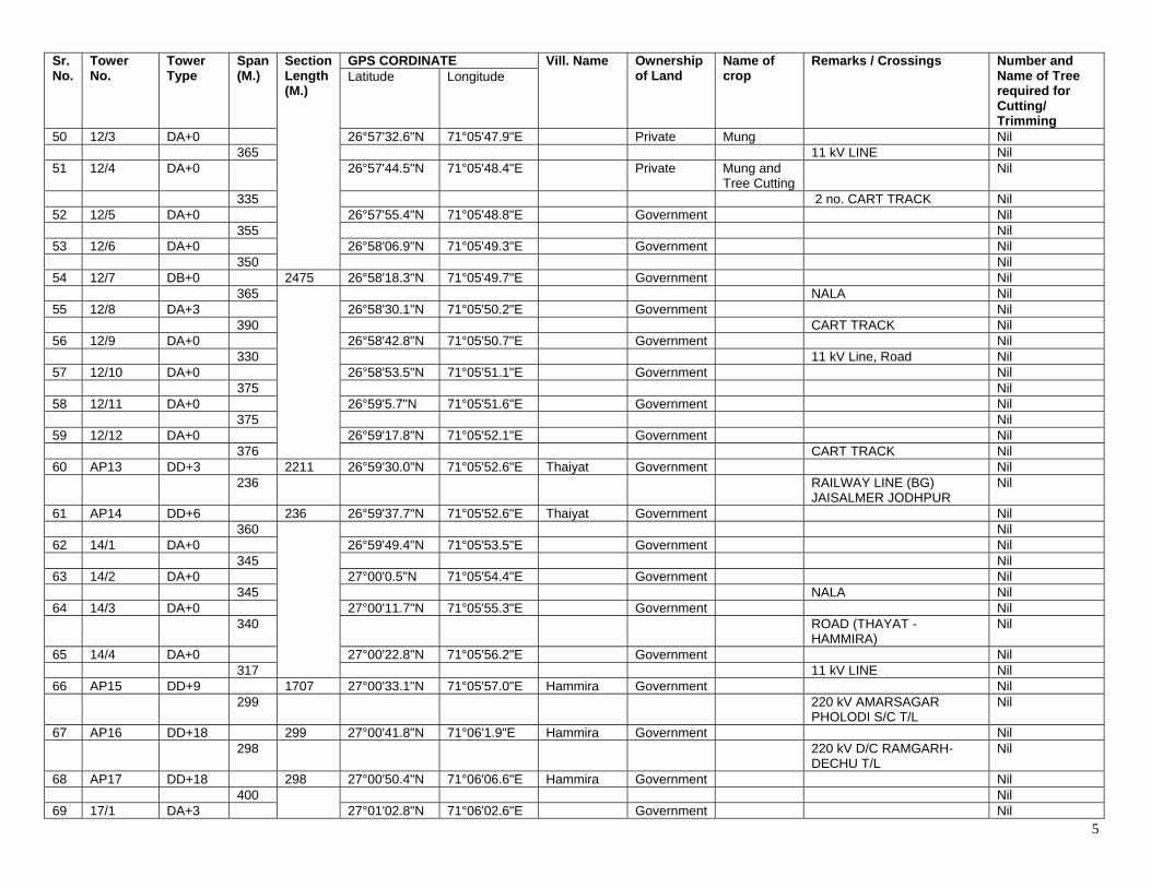
5
Sr. No.
Tower No.
Tower Type
Span (M.)
Section Length (M.)
GPS CORDINATE Vill. Name Ownership of Land
Name of crop
Remarks / Crossings Number and Name of Tree required for Cutting/ Trimming
Latitude Longitude
50 12/3 DA+0 26°57'32.6"N 71°05'47.9"E Private Mung Nil 365 11 kV LINE Nil 51 12/4 DA+0 26°57'44.5"N 71°05'48.4"E Private Mung and
Tree Cutting Nil
335 2 no. CART TRACK Nil 52 12/5 DA+0 26°57'55.4"N 71°05'48.8"E Government Nil 355 Nil 53 12/6 DA+0 26°58'06.9"N 71°05'49.3"E Government Nil 350 Nil 54 12/7 DB+0 2475 26°58'18.3"N 71°05'49.7"E Government Nil 365 NALA Nil 55 12/8 DA+3 26°58'30.1"N 71°05'50.2"E Government Nil 390 CART TRACK Nil 56 12/9 DA+0 26°58'42.8"N 71°05'50.7"E Government Nil 330 11 kV Line, Road Nil 57 12/10 DA+0 26°58'53.5"N 71°05'51.1"E Government Nil 375 Nil 58 12/11 DA+0 26°59'5.7"N 71°05'51.6"E Government Nil 375 Nil 59 12/12 DA+0 26°59'17.8"N 71°05'52.1"E Government Nil 376 CART TRACK Nil 60 AP13 DD+3 2211 26°59'30.0"N 71°05'52.6"E Thaiyat Government Nil 236 RAILWAY LINE (BG)
JAISALMER JODHPUR Nil
61 AP14 DD+6 236 26°59'37.7"N 71°05'52.6"E Thaiyat Government Nil 360 Nil 62 14/1 DA+0 26°59'49.4"N 71°05'53.5"E Government Nil 345 Nil 63 14/2 DA+0 27°00'0.5"N 71°05'54.4"E Government Nil 345 NALA Nil 64 14/3 DA+0 27°00'11.7"N 71°05'55.3"E Government Nil 340 ROAD (THAYAT -
HAMMIRA) Nil
65 14/4 DA+0 27°00'22.8"N 71°05'56.2"E Government Nil 317 11 kV LINE Nil 66 AP15 DD+9 1707 27°00'33.1"N 71°05'57.0"E Hammira Government Nil 299 220 kV AMARSAGAR
PHOLODI S/C T/L Nil
67 AP16 DD+18 299 27°00'41.8"N 71°06'1.9"E Hammira Government Nil 298 220 kV D/C RAMGARH-
DECHU T/L Nil
68 AP17 DD+18 298 27°00'50.4"N 71°06'06.6"E Hammira Government Nil 400 Nil 69 17/1 DA+3 27°01'02.8"N 71°06'02.6"E Government Nil
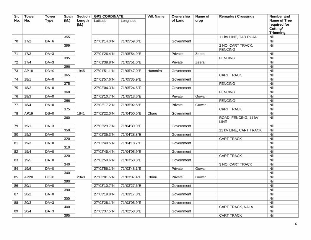
6
Sr. No.
Tower No.
Tower Type
Span (M.)
Section Length (M.)
GPS CORDINATE Vill. Name Ownership of Land
Name of crop
Remarks / Crossings Number and Name of Tree required for Cutting/ Trimming
Latitude Longitude
355 11 kV LINE, TAR ROAD Nil 70 17/2 DA+6 27°01'14.0"N 71°05'59.0"E Government Nil 399 2 NO. CART TRACK,
FENCING Nil
71 17/3 DA+3 27°01'26.4"N 71°05'54.9"E Private Zeera Nil 395 FENCING Nil 72 17/4 DA+3 27°01'38.8"N 71°05'51.0"E Private Zeera Nil 396 Nil 73 AP18 DD+0 1945 27°01'51.1"N 71°05'47.0"E Hammira Government Nil 365 CART TRACK Nil 74 18/1 DA+0 27°01'57.6"N 71°05'35.9"E Government Nil 375 FENCING Nil 75 18/2 DA+0 27°02'04.3"N 71°05'24.5"E Government Nil 360 FENCING Nil 76 18/3 DA+0 27°02'10.7"N 71°05'13.6"E Private Guwar Nil 366 FENCING Nil 77 18/4 DA+0 27°02'17.2"N 71°05'02.5"E Private Guwar Nil 375 CART TRACK Nil 78 AP19 DB+0 1841 27°02'22.0"N 71°04'50.5"E Charu Government Nil 360 ROAD, FENCING, 11 kV
LINE Nil
79 19/1 DA+3 27°02'29.7"N 71°04'39.9"E Government Nil 350 11 kV LINE, CART TRACK Nil 80 19/2 DA+0 27°02'35.3"N 71°04'28.8"E Government Nil 320 CART TRACK Nil 81 19/3 DA+0 27°02'40.5"N 71°04'18.7"E Government Nil 310 Nil 82 19/4 DA+0 27°02'45.4"N 71°04'08.9"E Government Nil 320 CART TRACK Nil 83 19/5 DA+0 27°02'50.6"N 71°03'58.8"E Government Nil 340 3 NO. CART TRACK Nil 84 19/6 DA+0 27°02'56.1"N 71°03'48.1"E Private Guwar Nil 340 Nil 85 AP20 DC+0 2340 27°03'01.5"N 71°03'37.4"E Charu Private Guwar Nil 390 Nil 86 20/1 DA+0 27°03'10.7"N 71°03'27.6"E Government Nil 390 Nil 87 20/2 DA+0 27°03'19.8"N 71°03'17.8"E Government Nil 355 Nil 88 20/3 DA+3 27°03'28.1"N 71°03'08.9"E Government Nil 400 CART TRACK, NALA Nil 89 20/4 DA+3 27°03'37.5"N 71°02'58.8"E Government Nil 395 CART TRACK Nil
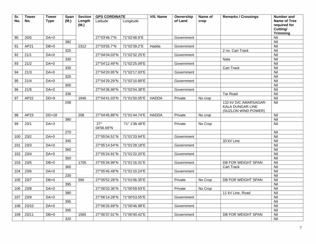
7
Sr. No.
Tower No.
Tower Type
Span (M.)
Section Length (M.)
GPS CORDINATE Vill. Name Ownership of Land
Name of crop
Remarks / Crossings Number and Name of Tree required for Cutting/ Trimming
Latitude Longitude
90 20/5 DA+0 27°03'46.7"N 71°02'48.9"E Government Nil 382 Nil 91 AP21 DB+0 2312 27°03'55.7"N 71°02'39.2"E Hadda Government Nil 325 2 no. Cart Track Nil 92 21/1 DA+0 27°04'04.03"N 71°02'32.25"E Government Nil 330 Nala Nil 93 21/2 DA+0 27°04'12.49"N 71°02'25.09"E Government Nil 330 Cart Track Nil 94 21/3 DA+0 27°04'20.95"N 71°02'17.93"E Government Nil 325 Nil 95 21/4 DA+0 27°04'29.29"N 71°02'10.89"E Government Nil 300 Nil 96 21/5 DA+0 27°04'36.98"N 71°02'04.38"E Government Nil 336 Tar Road Nil 97 AP22 DD+9 1946 27°04'41.03"N 71°01'50.05"E HADDA Private No crop Nil 208 132 kV D/C AMARSAGAR-
KALA DUNGAR LINE (SUZLON WIND POWER)
Nil
98 AP23 DD+18 208 27°04'45.88"N 71°01'44.74"E HADDA Private No crop Nil 380 Nil 99 23/1 DA+3 27°
04'56.69"N 71° 1'38.48"E Private No Crop Nil
270 Nil 100 23/2 DA+0 27°05'04.51"N 71°01'33.94"E Government Nil 345 33 kV Line Nil 101 23/3 DA+0 27°05'14.54"N 71°01'28.18"E Government Nil 360 Nil 102 23/4 DA+0 27°05'24.91"N 71°01'22.20"E Government Nil 350 Nil 103 23/5 DB+0 1705 27°05'34.99"N 71°01'16.31"E Government DB FOR WEIGHT SPAN Nil 360 Cart Track Nil 104 23/6 DA+0 27°05'45.48"N 71°01'10.24"E Government Nil 230 Nil 105 23/7 DB+0 590 27°05'52.28"N 71°01'06.35"E Private No Crop DB FOR WEIGHT SPAN Nil 395 Nil 106 23/8 DA+0 27°06'03.36"N 71°00'59.93"E Private No Crop Nil 380 11 kV Line, Road Nil 107 23/9 DA+0 27°06'14.28"N 71°00'53.55"E Government Nil 395 Nil 108 23/10 DA+0 27°06'25.69"N 71°00'46.98"E Government Nil 395 Nil 109 23/11 DB+0 1565 27°06'37.01"N 71°00'40.42"E Government DB FOR WEIGHT SPAN Nil 320 Nil
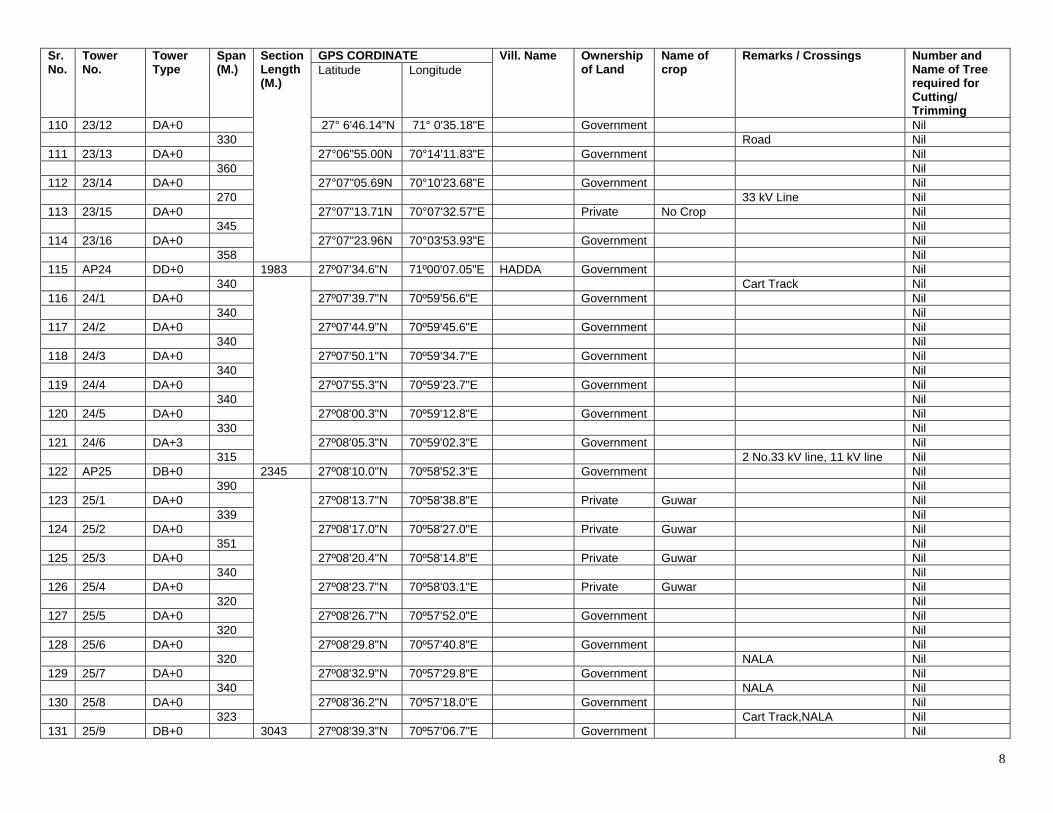
8
Sr. No.
Tower No.
Tower Type
Span (M.)
Section Length (M.)
GPS CORDINATE Vill. Name Ownership of Land
Name of crop
Remarks / Crossings Number and Name of Tree required for Cutting/ Trimming
Latitude Longitude
110 23/12 DA+0 27° 6'46.14"N 71° 0'35.18"E Government Nil 330 Road Nil 111 23/13 DA+0 27°06"55.00N 70°14'11.83"E Government Nil 360 Nil 112 23/14 DA+0 27°07"05.69N 70°10'23.68"E Government Nil 270 33 kV Line Nil 113 23/15 DA+0 27°07"13.71N 70°07'32.57"E Private No Crop Nil 345 Nil 114 23/16 DA+0 27°07"23.96N 70°03'53.93"E Government Nil 358 Nil 115 AP24 DD+0 1983 27º07'34.6"N 71º00'07.05"E HADDA Government Nil 340 Cart Track Nil 116 24/1 DA+0 27º07'39.7"N 70º59'56.6"E Government Nil 340 Nil 117 24/2 DA+0 27º07'44.9"N 70º59'45.6"E Government Nil 340 Nil 118 24/3 DA+0 27º07'50.1"N 70º59'34.7"E Government Nil 340 Nil 119 24/4 DA+0 27º07'55.3"N 70º59'23.7"E Government Nil 340 Nil 120 24/5 DA+0 27º08'00.3"N 70º59'12.8"E Government Nil 330 Nil 121 24/6 DA+3 27º08'05.3"N 70º59'02.3"E Government Nil 315 2 No.33 kV line, 11 kV line Nil 122 AP25 DB+0 2345 27º08'10.0"N 70º58'52.3"E Government Nil 390 Nil 123 25/1 DA+0 27º08'13.7"N 70º58'38.8"E Private Guwar Nil 339 Nil 124 25/2 DA+0 27º08'17.0"N 70º58'27.0"E Private Guwar Nil 351 Nil 125 25/3 DA+0 27º08'20.4"N 70º58'14.8"E Private Guwar Nil 340 Nil 126 25/4 DA+0 27º08'23.7"N 70º58'03.1"E Private Guwar Nil 320 Nil 127 25/5 DA+0 27º08'26.7"N 70º57'52.0"E Government Nil 320 Nil 128 25/6 DA+0 27º08'29.8"N 70º57'40.8"E Government Nil 320 NALA Nil 129 25/7 DA+0 27º08'32.9"N 70º57'29.8"E Government Nil 340 NALA Nil 130 25/8 DA+0 27º08'36.2"N 70º57'18.0"E Government Nil 323 Cart Track,NALA Nil 131 25/9 DB+0 3043 27º08'39.3"N 70º57'06.7"E Government Nil
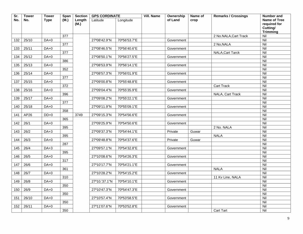
9
Sr. No.
Tower No.
Tower Type
Span (M.)
Section Length (M.)
GPS CORDINATE Vill. Name Ownership of Land
Name of crop
Remarks / Crossings Number and Name of Tree required for Cutting/ Trimming
Latitude Longitude
377 2 No.NALA,Cart Track Nil 132 25/10 DA+0 27º08'42.9"N 70º56'53.7"E Government Nil 377 2 No,NALA Nil 133 25/11 DA+0 27º08'46.5"N 70º56'40.6"E Government Nil 377 NALA,Cart Tarck Nil 134 25/12 DA+0 27º08'50.1"N 70º56'27.5"E Government Nil 386 Nil 135 25/13 DA+0 27º08'53.9"N 70º56'14.1"E Government Nil 352 Nil 136 25/14 DA+0 27º08'57.3"N 70º56'01.9"E Government Nil 377 Nil 137 25/15 DA+0 27º09'00.8"N 70º55'48.8"E Government Nil 372 Cart Track Nil 138 25/16 DA+0 27º09'04.4"N 70º55'35.9"E Government Nil 396 NALA, Cart Track Nil 139 25/17 DA+0 27º09'08.2"N 70º55'22.1"E Government Nil 377 Nil 140 25/18 DA+0 27º09'11.9"N 70º55'09.1"E Government Nil 358 Nil 141 AP26 DD+0 3749 27º09'15.3"N 70º54'56.6"E Government Nil 365 Nil 142 26/1 DA+0 27º09'25.9"N 70º54'50.6"E Government Nil 395 2 No. NALA Nil 143 26/2 DA+3 27º09'37.3"N 70º54'44.1"E Private Guwar Nil 395 NALA Nil 144 26/3 DA+0 27º09'48.8"N 70º54'37.6"E Private Guwar Nil 287 Nil 145 26/4 DA+3 27º09'57.1"N 70º54'32.8"E Government Nil 395 Nil 146 26/5 DA+0 27º10'08.6"N 70º54'26.3"E Government Nil 317 Nil 147 26/6 DA+0 27º10'17.7"N 70º54'21.1"E Government Nil 361 NALA Nil 148 26/7 DA+0 27º10'28.2"N 70º54'15.2"E Government Nil 310 11 Kv Line, NALA Nil 149 26/8 DA+0 27º10.'37.1"N 70º54'10.1"E Government Nil 350 Nil 150 26/9 DA+0 27º10'47.3"N 70º54'47.3"E Government Nil 350 Nil 151 26/10 DA+0 27º10'57.4"N 70º53'58.5"E Government Nil 350 Nil 152 26/11 DA+0 27º11'07.6"N 70º53'52.8"E Government Nil 350 Cart Tart Nil
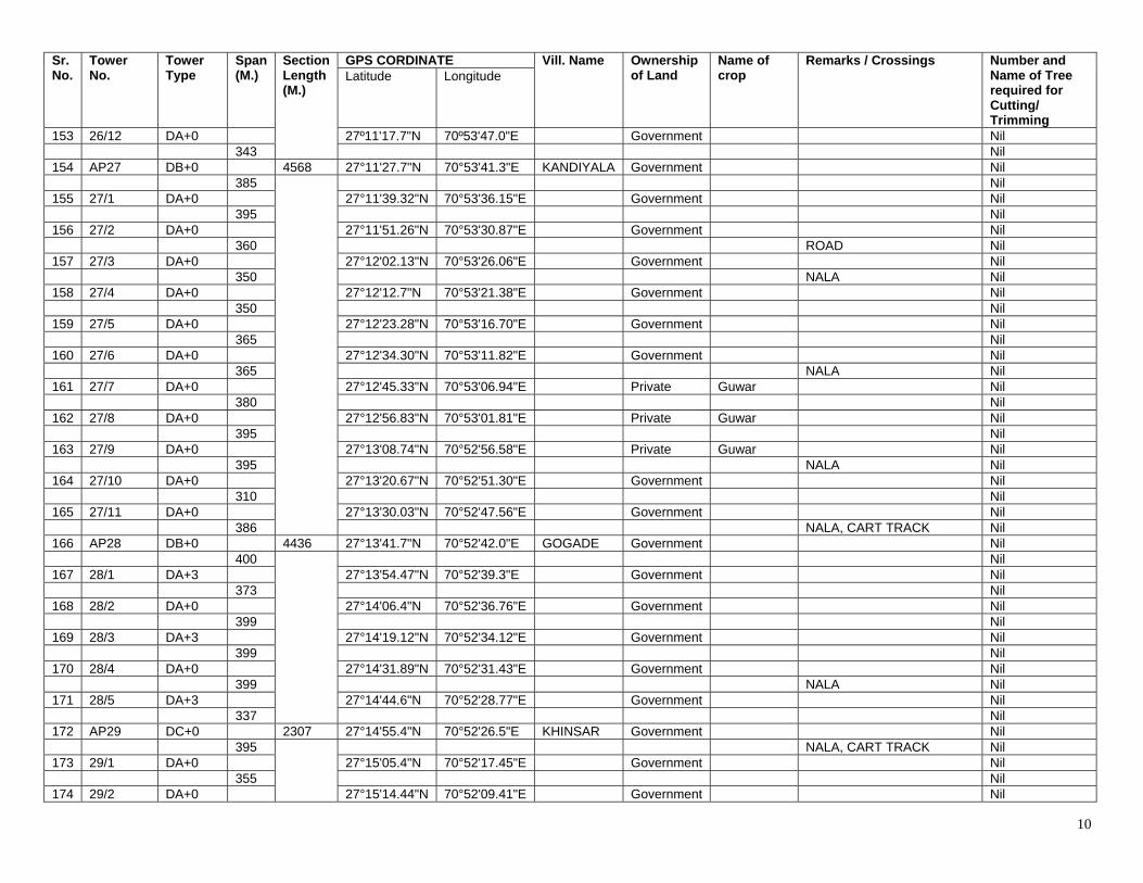
10
Sr. No.
Tower No.
Tower Type
Span (M.)
Section Length (M.)
GPS CORDINATE Vill. Name Ownership of Land
Name of crop
Remarks / Crossings Number and Name of Tree required for Cutting/ Trimming
Latitude Longitude
153 26/12 DA+0 27º11'17.7"N 70º53'47.0"E Government Nil 343 Nil 154 AP27 DB+0 4568 27°11'27.7"N 70°53'41.3"E KANDIYALA Government Nil 385 Nil 155 27/1 DA+0 27°11'39.32"N 70°53'36.15"E Government Nil 395 Nil 156 27/2 DA+0 27°11'51.26"N 70°53'30.87"E Government Nil 360 ROAD Nil 157 27/3 DA+0 27°12'02.13"N 70°53'26.06"E Government Nil 350 NALA Nil 158 27/4 DA+0 27°12'12.7"N 70°53'21.38"E Government Nil 350 Nil 159 27/5 DA+0 27°12'23.28"N 70°53'16.70"E Government Nil 365 Nil 160 27/6 DA+0 27°12'34.30"N 70°53'11.82"E Government Nil 365 NALA Nil 161 27/7 DA+0 27°12'45.33"N 70°53'06.94"E Private Guwar Nil 380 Nil 162 27/8 DA+0 27°12'56.83"N 70°53'01.81"E Private Guwar Nil 395 Nil 163 27/9 DA+0 27°13'08.74"N 70°52'56.58"E Private Guwar Nil 395 NALA Nil 164 27/10 DA+0 27°13'20.67"N 70°52'51.30"E Government Nil 310 Nil 165 27/11 DA+0 27°13'30.03"N 70°52'47.56"E Government Nil 386 NALA, CART TRACK Nil 166 AP28 DB+0 4436 27°13'41.7"N 70°52'42.0"E GOGADE Government Nil 400 Nil 167 28/1 DA+3 27°13'54.47"N 70°52'39.3"E Government Nil 373 Nil 168 28/2 DA+0 27°14'06.4"N 70°52'36.76"E Government Nil 399 Nil 169 28/3 DA+3 27°14'19.12"N 70°52'34.12"E Government Nil 399 Nil 170 28/4 DA+0 27°14'31.89"N 70°52'31.43"E Government Nil 399 NALA Nil 171 28/5 DA+3 27°14'44.6"N 70°52'28.77"E Government Nil 337 Nil 172 AP29 DC+0 2307 27°14'55.4"N 70°52'26.5"E KHINSAR Government Nil 395 NALA, CART TRACK Nil 173 29/1 DA+0 27°15'05.4"N 70°52'17.45"E Government Nil 355 Nil 174 29/2 DA+0 27°15'14.44"N 70°52'09.41"E Government Nil
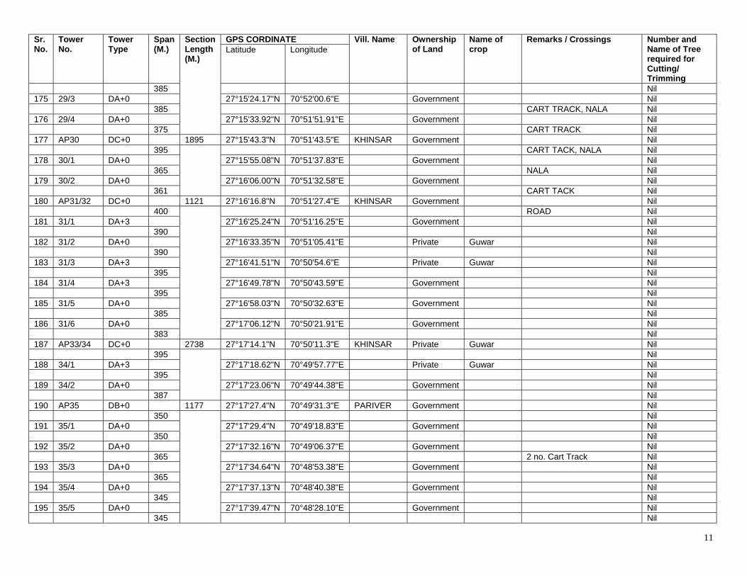
11
Sr. No.
Tower No.
Tower Type
Span (M.)
Section Length (M.)
GPS CORDINATE Vill. Name Ownership of Land
Name of crop
Remarks / Crossings Number and Name of Tree required for Cutting/ Trimming
Latitude Longitude
385 Nil 175 29/3 DA+0 27°15'24.17"N 70°52'00.6"E Government Nil 385 CART TRACK, NALA Nil 176 29/4 DA+0 27°15'33.92"N 70°51'51.91"E Government Nil 375 CART TRACK Nil 177 AP30 DC+0 1895 27°15'43.3"N 70°51'43.5"E KHINSAR Government Nil 395 CART TACK, NALA Nil 178 30/1 DA+0 27°15'55.08"N 70°51'37.83"E Government Nil 365 NALA Nil 179 30/2 DA+0 27°16'06.00"N 70°51'32.58"E Government Nil 361 CART TACK Nil 180 AP31/32 DC+0 1121 27°16'16.8"N 70°51'27.4"E KHINSAR Government Nil 400 ROAD Nil 181 31/1 DA+3 27°16'25.24"N 70°51'16.25"E Government Nil 390 Nil 182 31/2 DA+0 27°16'33.35"N 70°51'05.41"E Private Guwar Nil 390 Nil 183 31/3 DA+3 27°16'41.51"N 70°50'54.6"E Private Guwar Nil 395 Nil 184 31/4 DA+3 27°16'49.78"N 70°50'43.59"E Government Nil 395 Nil 185 31/5 DA+0 27°16'58.03"N 70°50'32.63"E Government Nil 385 Nil 186 31/6 DA+0 27°17'06.12"N 70°50'21.91"E Government Nil 383 Nil 187 AP33/34 DC+0 2738 27°17'14.1"N 70°50'11.3"E KHINSAR Private Guwar Nil 395 Nil 188 34/1 DA+3 27°17'18.62"N 70°49'57.77"E Private Guwar Nil 395 Nil 189 34/2 DA+0 27°17'23.06"N 70°49'44.38"E Government Nil 387 Nil 190 AP35 DB+0 1177 27°17'27.4"N 70°49'31.3"E PARIVER Government Nil 350 Nil 191 35/1 DA+0 27°17'29.4"N 70°49'18.83"E Government Nil 350 Nil 192 35/2 DA+0 27°17'32.16"N 70°49'06.37"E Government Nil 365 2 no. Cart Track Nil 193 35/3 DA+0 27°17'34.64"N 70°48'53.38"E Government Nil 365 Nil 194 35/4 DA+0 27°17'37.13"N 70°48'40.38"E Government Nil 345 Nil 195 35/5 DA+0 27°17'39.47"N 70°48'28.10"E Government Nil 345 Nil
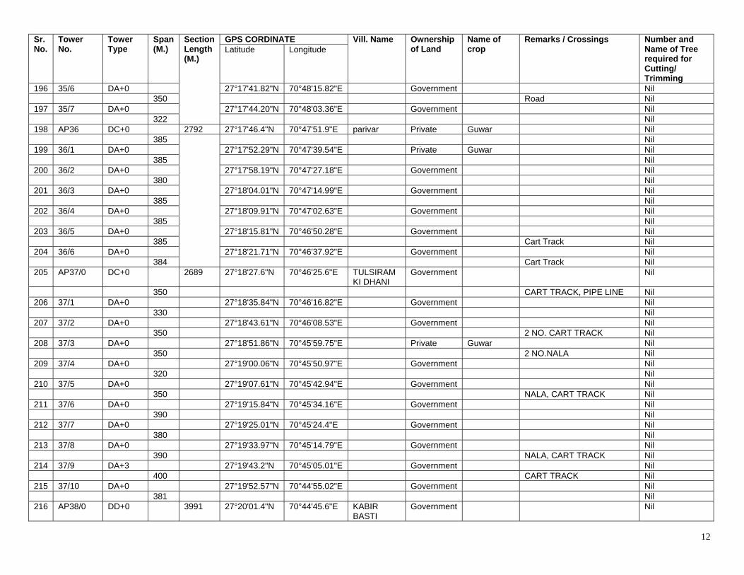
12
Sr. No.
Tower No.
Tower Type
Span (M.)
Section Length (M.)
GPS CORDINATE Vill. Name Ownership of Land
Name of crop
Remarks / Crossings Number and Name of Tree required for Cutting/ Trimming
Latitude Longitude
196 35/6 DA+0 27°17'41.82"N 70°48'15.82"E Government Nil 350 Road Nil 197 35/7 DA+0 27°17'44.20"N 70°48'03.36"E Government Nil 322 Nil 198 AP36 DC+0 2792 27°17'46.4"N 70°47'51.9"E parivar Private Guwar Nil 385 Nil 199 36/1 DA+0 27°17'52.29"N 70°47'39.54"E Private Guwar Nil 385 Nil 200 36/2 DA+0 27°17'58.19"N 70°47'27.18"E Government Nil 380 Nil 201 36/3 DA+0 27°18'04.01"N 70°47'14.99"E Government Nil 385 Nil 202 36/4 DA+0 27°18'09.91"N 70°47'02.63"E Government Nil 385 Nil 203 36/5 DA+0 27°18'15.81"N 70°46'50.28"E Government Nil 385 Cart Track Nil 204 36/6 DA+0 27°18'21.71"N 70°46'37.92"E Government Nil 384 Cart Track Nil 205 AP37/0 DC+0 2689 27°18'27.6"N 70°46'25.6"E TULSIRAM
KI DHANI Government Nil
350 CART TRACK, PIPE LINE Nil 206 37/1 DA+0 27°18'35.84"N 70°46'16.82"E Government Nil 330 Nil 207 37/2 DA+0 27°18'43.61"N 70°46'08.53"E Government Nil 350 2 NO. CART TRACK Nil 208 37/3 DA+0 27°18'51.86"N 70°45'59.75"E Private Guwar Nil 350 2 NO.NALA Nil 209 37/4 DA+0 27°19'00.06"N 70°45'50.97"E Government Nil 320 Nil 210 37/5 DA+0 27°19'07.61"N 70°45'42.94"E Government Nil 350 NALA, CART TRACK Nil 211 37/6 DA+0 27°19'15.84"N 70°45'34.16"E Government Nil 390 Nil 212 37/7 DA+0 27°19'25.01"N 70°45'24.4"E Government Nil 380 Nil 213 37/8 DA+0 27°19'33.97"N 70°45'14.79"E Government Nil 390 NALA, CART TRACK Nil 214 37/9 DA+3 27°19'43.2"N 70°45'05.01"E Government Nil 400 CART TRACK Nil 215 37/10 DA+0 27°19'52.57"N 70°44'55.02"E Government Nil 381 Nil 216 AP38/0 DD+0 3991 27°20'01.4"N 70°44'45.6"E KABIR
BASTI Government Nil

13
Sr. No.
Tower No.
Tower Type
Span (M.)
Section Length (M.)
GPS CORDINATE Vill. Name Ownership of Land
Name of crop
Remarks / Crossings Number and Name of Tree required for Cutting/ Trimming
Latitude Longitude
Nil TAPPING
POINT DA+0 27°20'02.05"N 70°44'39.72"E KABIR
BASTI Loc No 6/3 ( SEW Tower)
Suspension Tower of 400kV Ramgarh -Badla T/L
Nil
Nil TAPPING
POINT DA+0 ……. …… 27°20'00.6"N 70°44'53.3"E KABIR
BASTI Loc No 6/3 ( SEW Tower)
Suspension Tower of 400kV Ramgarh -Badla T/L
Nil
Nil 217 AP39 DD+0 0 27°20'01.09"N 70°44'47.76"E KABIR
BASTI Government Nil
300 Nil 218 39/1 DA+0 27°20'09.28"N 70°44'41.68"E Government Nil 263 Nil 219 AP40 DD+0 563 27°20'16.33"N 70°44'36.48"E KABIR
BASTI Government Nil
395 Nil 220 40/1 DA+0 27°20'21.54"N 70°44'23.37"E Government Nil 375 Nil 221 40/2 DA+0 27°20'26.54"N 70°44'10.92"E Government Nil 380 Nil 222 40/3 DA+0 27°20'31.57"N 70°43'58.29"E Private Guwar Nil 380 Nil 223 40/4 DA+0 27°20'36.63"N 70°43'45.67"E Private Guwar Nil 375 Nil 224 40/5 DA+0 27°20'41.63"N 70°43'33.24"E Private Guwar Nil 377 Nil 225 AP41 DC+0 2282 27°20'46.66"N 70°43'20.69"E Government Nil 399 Nil 226 41/1 DA+3 27°20'55.56"N 70°43'10.16"E Private Guwar Nil 399 Nil 227 41/2 DA+0 27°21'04.5"N 70°42'59.64"E Government Nil 382 Nil 228 41/3 DA+0 27°21'13.07"N 70°42'49.58"E Government Nil 399 CART TRACK Nil 229 41/4 DA+3 27°21'22.00"N 70°42'39.06"E Government Nil 399 CART TRACK Nil 230 AP42 DD+0 1978 27°21'30.86"N 70°42'28.68"E NAGAOAN
KI DHANI Government Nil
380 CART TRACK Nil
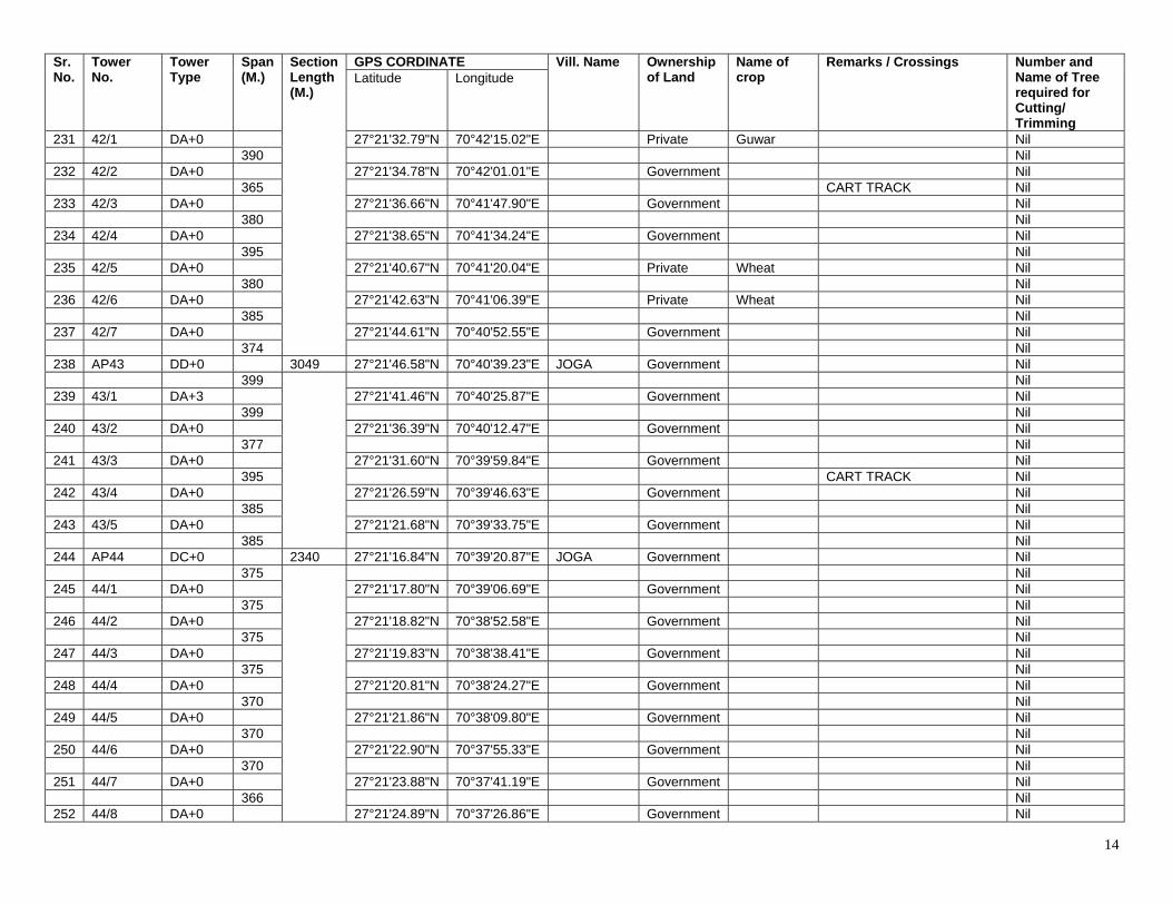
14
Sr. No.
Tower No.
Tower Type
Span (M.)
Section Length (M.)
GPS CORDINATE Vill. Name Ownership of Land
Name of crop
Remarks / Crossings Number and Name of Tree required for Cutting/ Trimming
Latitude Longitude
231 42/1 DA+0 27°21'32.79"N 70°42'15.02"E Private Guwar Nil 390 Nil 232 42/2 DA+0 27°21'34.78"N 70°42'01.01"E Government Nil 365 CART TRACK Nil 233 42/3 DA+0 27°21'36.66"N 70°41'47.90"E Government Nil 380 Nil 234 42/4 DA+0 27°21'38.65"N 70°41'34.24"E Government Nil 395 Nil 235 42/5 DA+0 27°21'40.67"N 70°41'20.04"E Private Wheat Nil 380 Nil 236 42/6 DA+0 27°21'42.63"N 70°41'06.39"E Private Wheat Nil 385 Nil 237 42/7 DA+0 27°21'44.61"N 70°40'52.55"E Government Nil 374 Nil 238 AP43 DD+0 3049 27°21'46.58"N 70°40'39.23"E JOGA Government Nil 399 Nil 239 43/1 DA+3 27°21'41.46"N 70°40'25.87"E Government Nil 399 Nil 240 43/2 DA+0 27°21'36.39"N 70°40'12.47"E Government Nil 377 Nil 241 43/3 DA+0 27°21'31.60"N 70°39'59.84"E Government Nil 395 CART TRACK Nil 242 43/4 DA+0 27°21'26.59"N 70°39'46.63"E Government Nil 385 Nil 243 43/5 DA+0 27°21'21.68"N 70°39'33.75"E Government Nil 385 Nil 244 AP44 DC+0 2340 27°21'16.84"N 70°39'20.87"E JOGA Government Nil 375 Nil 245 44/1 DA+0 27°21'17.80"N 70°39'06.69"E Government Nil 375 Nil 246 44/2 DA+0 27°21'18.82"N 70°38'52.58"E Government Nil 375 Nil 247 44/3 DA+0 27°21'19.83"N 70°38'38.41"E Government Nil 375 Nil 248 44/4 DA+0 27°21'20.81"N 70°38'24.27"E Government Nil 370 Nil 249 44/5 DA+0 27°21'21.86"N 70°38'09.80"E Government Nil 370 Nil 250 44/6 DA+0 27°21'22.90"N 70°37'55.33"E Government Nil 370 Nil 251 44/7 DA+0 27°21'23.88"N 70°37'41.19"E Government Nil 366 Nil 252 44/8 DA+0 27°21'24.89"N 70°37'26.86"E Government Nil
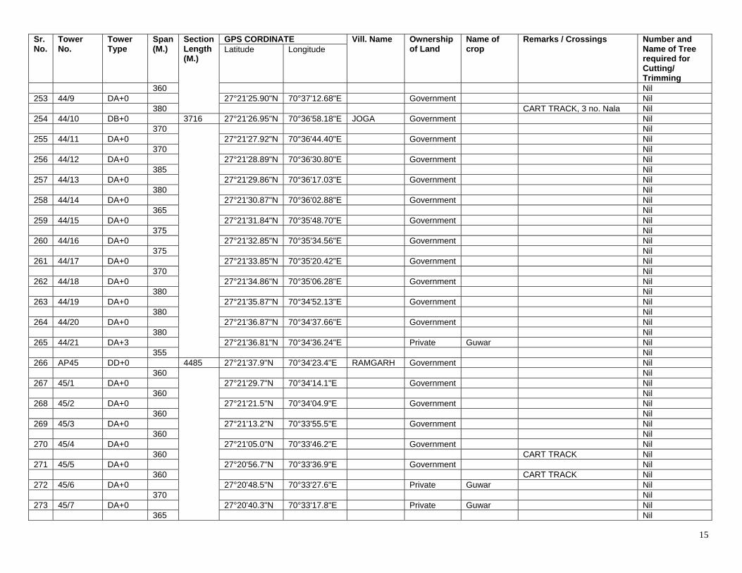
15
Sr. No.
Tower No.
Tower Type
Span (M.)
Section Length (M.)
GPS CORDINATE Vill. Name Ownership of Land
Name of crop
Remarks / Crossings Number and Name of Tree required for Cutting/ Trimming
Latitude Longitude
360 Nil 253 44/9 DA+0 27°21'25.90"N 70°37'12.68"E Government Nil 380 CART TRACK, 3 no. Nala Nil 254 44/10 DB+0 3716 27°21'26.95"N 70°36'58.18"E JOGA Government Nil 370 Nil 255 44/11 DA+0 27°21'27.92"N 70°36'44.40"E Government Nil 370 Nil 256 44/12 DA+0 27°21'28.89"N 70°36'30.80"E Government Nil 385 Nil 257 44/13 DA+0 27°21'29.86"N 70°36'17.03"E Government Nil 380 Nil 258 44/14 DA+0 27°21'30.87"N 70°36'02.88"E Government Nil 365 Nil 259 44/15 DA+0 27°21'31.84"N 70°35'48.70"E Government Nil 375 Nil 260 44/16 DA+0 27°21'32.85"N 70°35'34.56"E Government Nil 375 Nil 261 44/17 DA+0 27°21'33.85"N 70°35'20.42"E Government Nil 370 Nil 262 44/18 DA+0 27°21'34.86"N 70°35'06.28"E Government Nil 380 Nil 263 44/19 DA+0 27°21'35.87"N 70°34'52.13"E Government Nil 380 Nil 264 44/20 DA+0 27°21'36.87"N 70°34'37.66"E Government Nil 380 Nil 265 44/21 DA+3 27°21'36.81"N 70°34'36.24"E Private Guwar Nil 355 Nil 266 AP45 DD+0 4485 27°21'37.9"N 70°34'23.4"E RAMGARH Government Nil 360 Nil 267 45/1 DA+0 27°21'29.7"N 70°34'14.1"E Government Nil 360 Nil 268 45/2 DA+0 27°21'21.5"N 70°34'04.9"E Government Nil 360 Nil 269 45/3 DA+0 27°21'13.2"N 70°33'55.5"E Government Nil 360 Nil 270 45/4 DA+0 27°21'05.0"N 70°33'46.2"E Government Nil 360 CART TRACK Nil 271 45/5 DA+0 27°20'56.7"N 70°33'36.9"E Government Nil 360 CART TRACK Nil 272 45/6 DA+0 27°20'48.5"N 70°33'27.6"E Private Guwar Nil 370 Nil 273 45/7 DA+0 27°20'40.3"N 70°33'17.8"E Private Guwar Nil 365 Nil
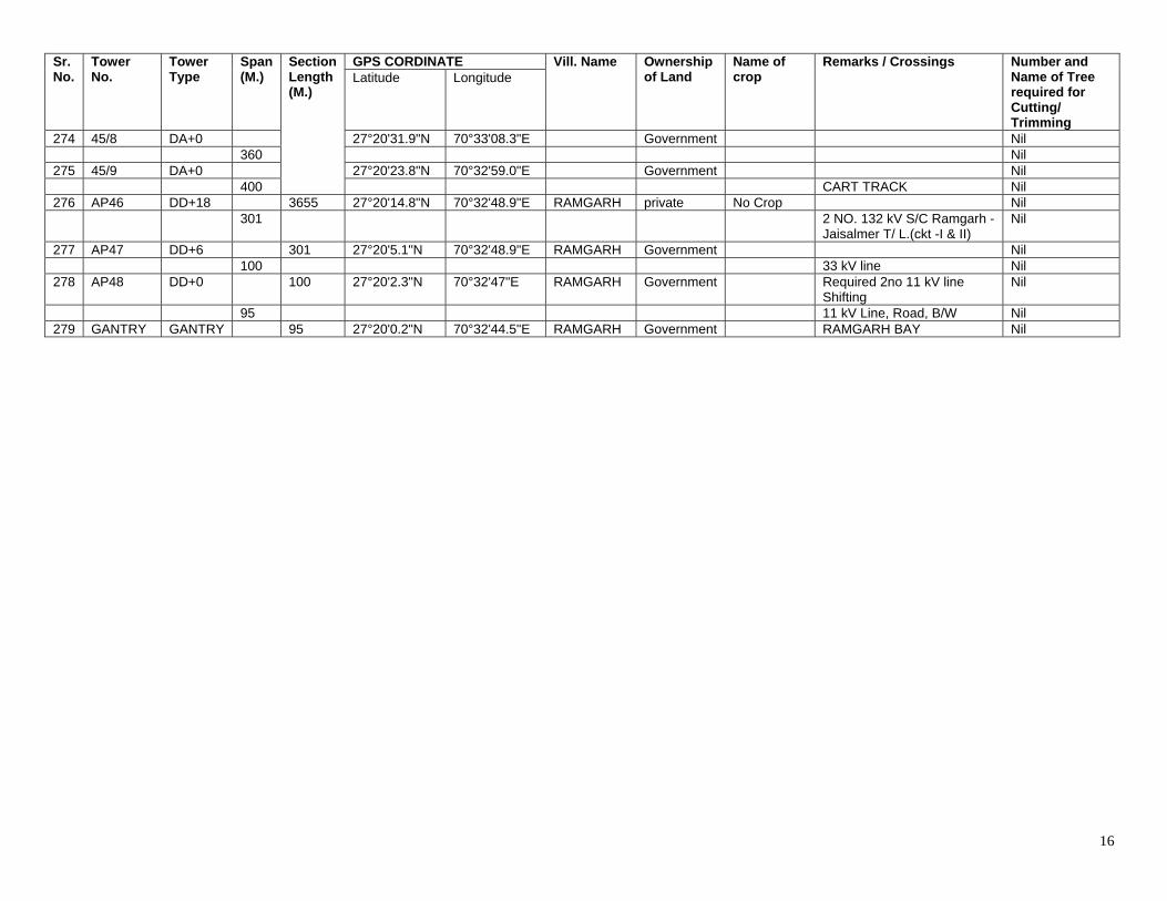
16
Sr. No.
Tower No.
Tower Type
Span (M.)
Section Length (M.)
GPS CORDINATE Vill. Name Ownership of Land
Name of crop
Remarks / Crossings Number and Name of Tree required for Cutting/ Trimming
Latitude Longitude
274 45/8 DA+0 27°20'31.9"N 70°33'08.3"E Government Nil 360 Nil 275 45/9 DA+0 27°20'23.8"N 70°32'59.0"E Government Nil 400 CART TRACK Nil 276 AP46 DD+18 3655 27°20'14.8"N 70°32'48.9"E RAMGARH private No Crop Nil 301 2 NO. 132 kV S/C Ramgarh -
Jaisalmer T/ L.(ckt -I & II) Nil
277 AP47 DD+6 301 27°20'5.1"N 70°32'48.9"E RAMGARH Government Nil 100 33 kV line Nil 278 AP48 DD+0 100 27°20'2.3"N 70°32'47"E RAMGARH Government Required 2no 11 kV line
Shifting Nil
95 11 kV Line, Road, B/W Nil 279 GANTRY GANTRY 95 27°20'0.2"N 70°32'44.5"E RAMGARH Government RAMGARH BAY Nil
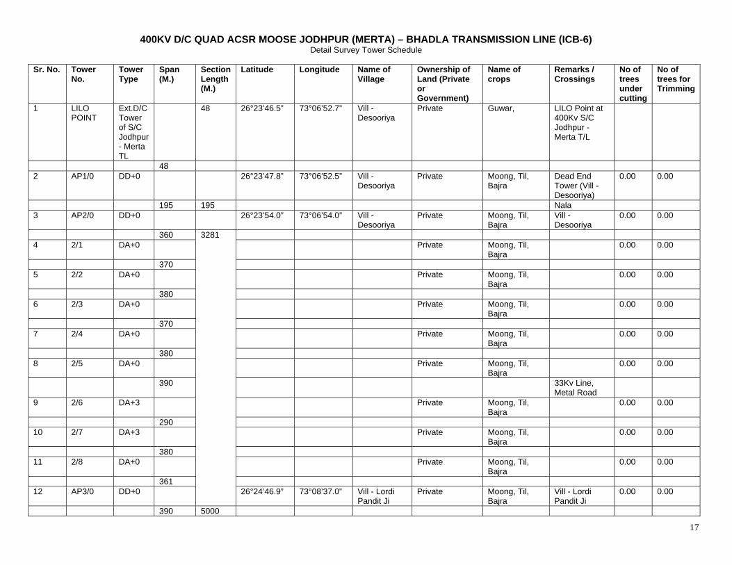
17
400KV D/C QUAD ACSR MOOSE JODHPUR (MERTA) – BHADLA TRANSMISSION LINE (ICB-6) Detail Survey Tower Schedule
Sr. No. Tower
No. Tower Type
Span (M.)
Section Length (M.)
Latitude Longitude Name of Village
Ownership of Land (Private or Government)
Name of crops
Remarks / Crossings
No of trees under cutting
No of trees for Trimming
1 LILO POINT
Ext.D/C Tower of S/C Jodhpur - Merta TL
48 26°23’46.5” 73°06’52.7” Vill - Desooriya
Private Guwar, LILO Point at 400Kv S/C Jodhpur - Merta T/L
48 2 AP1/0 DD+0 26°23’47.8” 73°06’52.5” Vill -
Desooriya Private Moong, Til,
Bajra Dead End Tower (Vill - Desooriya)
0.00 0.00
195 195 Nala 3 AP2/0 DD+0 26°23’54.0” 73°06’54.0” Vill -
Desooriya Private Moong, Til,
Bajra Vill - Desooriya
0.00 0.00
360 3281 4 2/1 DA+0 Private Moong, Til,
Bajra 0.00 0.00
370 5 2/2 DA+0 Private Moong, Til,
Bajra 0.00 0.00
380 6 2/3 DA+0 Private Moong, Til,
Bajra 0.00 0.00
370 7 2/4 DA+0 Private Moong, Til,
Bajra 0.00 0.00
380 8 2/5 DA+0 Private Moong, Til,
Bajra 0.00 0.00
390 33Kv Line, Metal Road
9 2/6 DA+3 Private Moong, Til, Bajra
0.00 0.00
290 10 2/7 DA+3 Private Moong, Til,
Bajra 0.00 0.00
380 11 2/8 DA+0 Private Moong, Til,
Bajra 0.00 0.00
361 12 AP3/0 DD+0 26°24’46.9” 73°08’37.0” Vill - Lordi
Pandit Ji Private Moong, Til,
Bajra Vill - Lordi Pandit Ji
0.00 0.00
390 5000
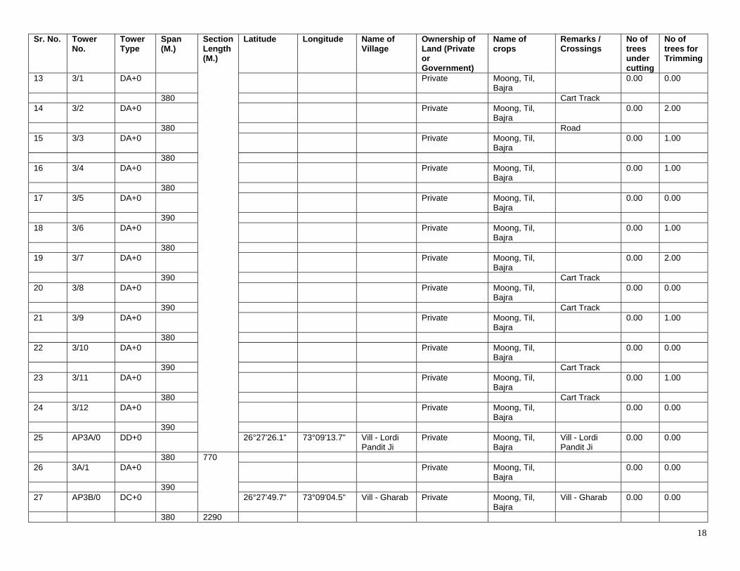
18
Sr. No. Tower No.
Tower Type
Span (M.)
Section Length (M.)
Latitude Longitude Name of Village
Ownership of Land (Private or Government)
Name of crops
Remarks / Crossings
No of trees under cutting
No of trees for Trimming
13 3/1 DA+0 Private Moong, Til, Bajra
0.00 0.00
380 Cart Track 14 3/2 DA+0 Private Moong, Til,
Bajra 0.00 2.00
380 Road 15 3/3 DA+0 Private Moong, Til,
Bajra 0.00 1.00
380 16 3/4 DA+0 Private Moong, Til,
Bajra 0.00 1.00
380 17 3/5 DA+0 Private Moong, Til,
Bajra 0.00 0.00
390 18 3/6 DA+0 Private Moong, Til,
Bajra 0.00 1.00
380 19 3/7 DA+0 Private Moong, Til,
Bajra 0.00 2.00
390 Cart Track 20 3/8 DA+0 Private Moong, Til,
Bajra 0.00 0.00
390 Cart Track 21 3/9 DA+0 Private Moong, Til,
Bajra 0.00 1.00
380 22 3/10 DA+0 Private Moong, Til,
Bajra 0.00 0.00
390 Cart Track 23 3/11 DA+0 Private Moong, Til,
Bajra 0.00 1.00
380 Cart Track 24 3/12 DA+0 Private Moong, Til,
Bajra 0.00 0.00
390 25 AP3A/0 DD+0 26°27'26.1" 73°09'13.7" Vill - Lordi
Pandit Ji Private Moong, Til,
Bajra Vill - Lordi Pandit Ji
0.00 0.00
380 770 26 3A/1 DA+0 Private Moong, Til,
Bajra 0.00 0.00
390 27 AP3B/0 DC+0 26°27'49.7" 73°09'04.5" Vill - Gharab Private Moong, Til,
Bajra Vill - Gharab 0.00 0.00
380 2290
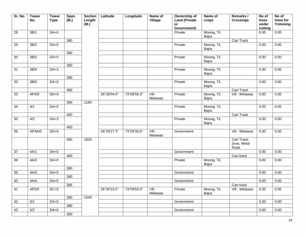
19
Sr. No. Tower No.
Tower Type
Span (M.)
Section Length (M.)
Latitude Longitude Name of Village
Ownership of Land (Private or Government)
Name of crops
Remarks / Crossings
No of trees under cutting
No of trees for Trimming
28 3B/1 DA+0 Private Moong, Til, Bajra
0.00 0.00
380 Cart Track 29 3B/2 DA+0 Private Moong, Til,
Bajra 0.00 0.00
380 30 3B/3 DA+0 Private Moong, Til,
Bajra 0.00 0.00
390 31 3B/4 DA+3 Private Moong, Til,
Bajra 0.00 0.00
380 32 3B/5 DA+0 Private Moong, Til,
Bajra 0.00 0.00
380 Cart Track 33 AP4/0 DD+0 26°29'04.0" 73°08'59.3" Vill -
Melawas Private Moong, Til,
Bajra Vill - Melawas 0.00 0.00
390 1190 34 4/1 DA+0 Private Moong, Til,
Bajra 0.00 0.00
400 Cart Track 35 4/2 DA+3 Private Moong, Til,
Bajra 0.00 0.00
400 36 AP4A/0 DD+0 26°29'27.3" 73°09'33.6" Vill -
Melawas Government Vill - Melawas 0.00 0.00
360 1825 Cart Track, 2nos. Metal Road
37 4A/1 DA+0 Government 0.00 0.00 360 Cart track 38 4A/2 DA+0 Private Moong, Til,
Bajra 0.00 0.00
360 39 4A/3 DA+0 Government 0.00 0.00 360 40 4A/4 DA+0 Government 0.00 0.00 385 Cart track 41 AP5/0 DC+0 26°30'23.5" 73°09'53.0" Vill -
Melawas Private Moong, Til,
Bajra Vill - Melawas 0.00 0.00
390 1540 42 5/1 DA+0 Government 0.00 0.00 380 43 5/2 DA+0 Government 0.00 0.00 390
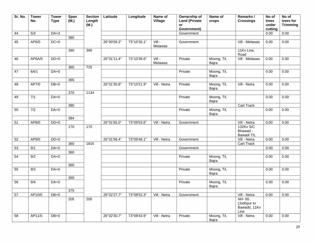
20
Sr. No. Tower No.
Tower Type
Span (M.)
Section Length (M.)
Latitude Longitude Name of Village
Ownership of Land (Private or Government)
Name of crops
Remarks / Crossings
No of trees under cutting
No of trees for Trimming
44 5/3 DA+3 Government 0.00 0.00 380 45 AP6/0 DC+0 26°30'59.2" 73°10'32.1" Vill -
Melawas Government Vill - Melawas 0.00 0.00
390 390 11Kv Line, Road
46 AP6A/0 DD+0 26°31'11.4" 73°10'36.6" Vill - Melawas
Private Moong, Til, Bajra
Vill - Melawas 0.00 0.00
360 725 47 6A/1 DA+0 Private Moong, Til,
Bajra 0.00 0.00
365 48 AP7/0 DB+0 26°31'30.8" 73°10'21.9" Vill - Netra Private Moong, Til,
Bajra Vill - Netra 0.00 0.00
370 1134 49 7/1 DA+0 Private Moong, Til,
Bajra 0.00 0.00
380 Cart Track 50 7/2 DA+0 Private Moong, Til,
Bajra 0.00 0.00
384 51 AP8/0 DD+0 26°31'55.0" 73°09'53.6" Vill - Netra Government Vill - Netra 0.00 0.00 170 170 132Kv S/C
Bhawad - Bawadi T/L
52 AP9/0 DD+0 26°31'58.4" 73°09'46.1" Vill - Netra Government Vill - Netra 0.00 0.00 360 1815 Cart Track 53 9/1 DA+0 Government 0.00 0.00 360 54 9/2 DA+0 Private Moong, Til,
Bajra 0.00 0.00
360 55 9/3 DA+0 Private Moong, Til,
Bajra 0.00 0.00
360 56 9/4 DA+0 Private Moong, Til,
Bajra 0.00 0.00
375 57 AP10/0 DB+0 26°32'27.7" 73°08'52.3" Vill - Netra Government Vill - Netra 0.00 0.00 205 205 NH- 65
(Jodhpur to Bawadi), 11Kv Line
58 AP11/0 DB+0 26°32'30.7" 73°08'43.9" Vill - Netra Private Moong, Til, Bajra
Vill - Netra 0.00 0.00
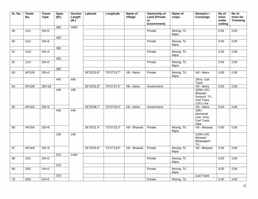
21
Sr. No. Tower No.
Tower Type
Span (M.)
Section Length (M.)
Latitude Longitude Name of Village
Ownership of Land (Private or Government)
Name of crops
Remarks / Crossings
No of trees under cutting
No of trees for Trimming
380 1960 59 11/1 DA+0 Private Moong, Til,
Bajra 0.00 0.00
400 60 11/2 DA+6 Private Moong, Til,
Bajra 0.00 0.00
390 61 11/3 DA+3 Private Moong, Til,
Bajra 0.00 0.00
400 62 11/4 DA+0 Private Moong, Til,
Bajra 0.00 0.00
390 63 AP12/0 DD+0 26°32'53.8" 73°07'33.7" Vill - Netra Private Moong, Til,
Bajra Vill - Netra 0.00 0.00
445 445 2Nos. Cart Track
64 AP13/0 DD+18 26°33'02.9" 73°07'27.4" Vill - Netra Government Vill - Netra 0.00 0.00 185 185 220Kv D/C
Bhawad - Surpura T/L, Cart Track, 11Kv Line
65 AP14/0 DD+9 26°33'08.7" 73°07'29.0" Vill - Netra Government Vill - Netra 0.00 0.00 440 440 33Kv
dismental Line, 2nos. Cart Track, Nala
66 AP15/0 DD+6 26°33'21.4" 73°07'22.3" Vill - Bhawad Private Moong, Til, Bajra
Vill - Bhawad 0.00 0.00
156 156 220Kv D/C Bhawad - Bhopalgarh T/L
67 AP16/0 DD+9 26°33'25.9" 73°07'19.6" Vill - Bhawad Private Moong, Til, Bajra
Vill - Bhawad 0.00 0.00
370 1490 68 16/1 DA+0 Private Moong, Til,
Bajra 0.00 0.00
370 69 16/2 DA+0 Private Moong, Til,
Bajra 0.00 0.00
370 Cart Track 70 16/3 DA+0 Private Moong, Til, 0.00 0.00
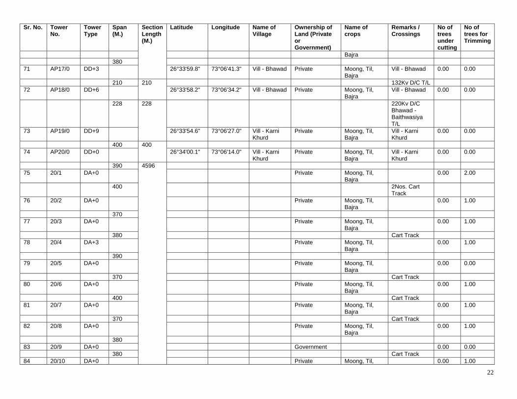
22
Sr. No. Tower No.
Tower Type
Span (M.)
Section Length (M.)
Latitude Longitude Name of Village
Ownership of Land (Private or Government)
Name of crops
Remarks / Crossings
No of trees under cutting
No of trees for Trimming
Bajra 380 71 AP17/0 DD+3 26°33'59.8" 73°06'41.3" Vill - Bhawad Private Moong, Til,
Bajra Vill - Bhawad 0.00 0.00
210 210 132Kv D/C T/L 72 AP18/0 DD+6 26°33'58.2" 73°06'34.2" Vill - Bhawad Private Moong, Til,
Bajra Vill - Bhawad 0.00 0.00
228 228 220Kv D/C Bhawad - Baithwasiya T/L
73 AP19/0 DD+9 26°33'54.6" 73°06'27.0" Vill - Karni Khurd
Private Moong, Til, Bajra
Vill - Karni Khurd
0.00 0.00
400 400 74 AP20/0 DD+0 26°34'00.1" 73°06'14.0" Vill - Karni
Khurd Private Moong, Til,
Bajra Vill - Karni Khurd
0.00 0.00
390 4596 75 20/1 DA+0 Private Moong, Til,
Bajra 0.00 2.00
400 2Nos. Cart Track
76 20/2 DA+0 Private Moong, Til, Bajra
0.00 1.00
370 77 20/3 DA+0 Private Moong, Til,
Bajra 0.00 1.00
380 Cart Track 78 20/4 DA+3 Private Moong, Til,
Bajra 0.00 1.00
390 79 20/5 DA+0 Private Moong, Til,
Bajra 0.00 0.00
370 Cart Track 80 20/6 DA+0 Private Moong, Til,
Bajra 0.00 1.00
400 Cart Track 81 20/7 DA+0 Private Moong, Til,
Bajra 0.00 1.00
370 Cart Track 82 20/8 DA+0 Private Moong, Til,
Bajra 0.00 1.00
380 83 20/9 DA+0 Government 0.00 0.00 380 Cart Track 84 20/10 DA+0 Private Moong, Til, 0.00 1.00
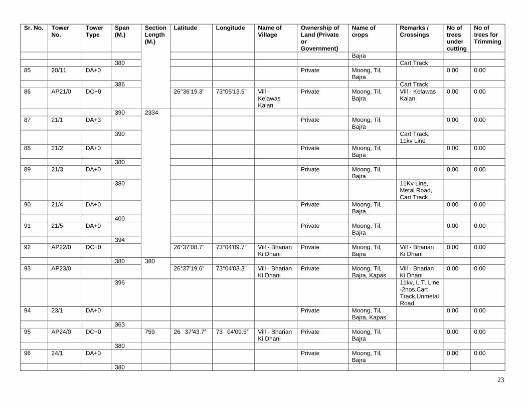
23
Sr. No. Tower No.
Tower Type
Span (M.)
Section Length (M.)
Latitude Longitude Name of Village
Ownership of Land (Private or Government)
Name of crops
Remarks / Crossings
No of trees under cutting
No of trees for Trimming
Bajra 380 Cart Track 85 20/11 DA+0 Private Moong, Til,
Bajra 0.00 0.00
386 Cart Track 86 AP21/0 DC+0 26°36'19.3" 73°05'13.5" Vill -
Kelawas Kalan
Private Moong, Til, Bajra
Vill - Kelawas Kalan
0.00 0.00
390 2334 87 21/1 DA+3 Private Moong, Til,
Bajra 0.00 0.00
390 Cart Track, 11kv Line
88 21/2 DA+0 Private Moong, Til, Bajra
0.00 0.00
380 89 21/3 DA+0 Private Moong, Til,
Bajra 0.00 0.00
380 11Kv Line, Metal Road, Cart Track
90 21/4 DA+0 Private Moong, Til, Bajra
0.00 0.00
400 91 21/5 DA+0 Private Moong, Til,
Bajra 0.00 0.00
394 92 AP22/0 DC+0 26°37'08.7" 73°04'09.7" Vill - Bharian
Ki Dhani Private Moong, Til,
Bajra Vill - Bharian Ki Dhani
0.00 0.00
380 380 93 AP23/0 26°37'19.6" 73°04'03.3" Vill - Bharian
Ki Dhani Private Moong, Til,
Bajra, Kapas Vill - Bharian Ki Dhani
0.00 0.00
396 11kv, L.T. Line -2nos,Cart Track,Unmetal Road
94 23/1 DA+0 Private Moong, Til, Bajra, Kapas
0.00 0.00
363 95 AP24/0 DC+0 759 26�37′43.7″ 73�04′09.5″ Vill - Bharian
Ki Dhani Private Moong, Til,
Bajra 0.00 0.00
380 96 24/1 DA+0 Private Moong, Til,
Bajra 0.00 0.00
380
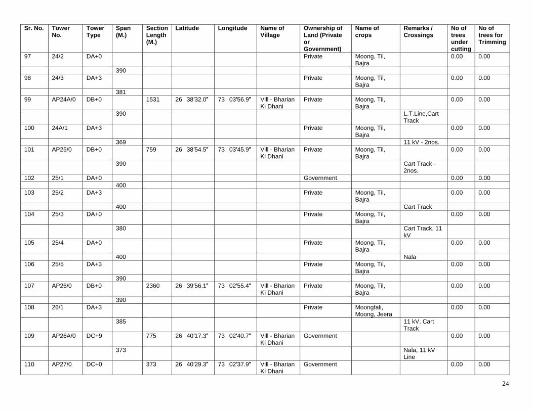
24
Sr. No. Tower No.
Tower Type
Span (M.)
Section Length (M.)
Latitude Longitude Name of Village
Ownership of Land (Private or Government)
Name of crops
Remarks / Crossings
No of trees under cutting
No of trees for Trimming
97 24/2 DA+0 Private Moong, Til, Bajra
0.00 0.00
390 98 24/3 DA+3 Private Moong, Til,
Bajra 0.00 0.00
381 99 AP24A/0 DB+0 1531 26�38′32.0″ 73�03′56.9″ Vill - Bharian
Ki Dhani Private Moong, Til,
Bajra 0.00 0.00
390 L.T.Line,Cart Track
100 24A/1 DA+3 Private Moong, Til, Bajra
0.00 0.00
369 11 kV - 2nos. 101 AP25/0 DB+0 759 26�38′54.5″ 73�03′45.9″ Vill - Bharian
Ki Dhani Private Moong, Til,
Bajra 0.00 0.00
390 Cart Track - 2nos.
102 25/1 DA+0 Government 0.00 0.00 400 103 25/2 DA+3 Private Moong, Til,
Bajra 0.00 0.00
400 Cart Track 104 25/3 DA+0 Private Moong, Til,
Bajra 0.00 0.00
380 Cart Track, 11 kV
105 25/4 DA+0 Private Moong, Til, Bajra
0.00 0.00
400 Nala 106 25/5 DA+3 Private Moong, Til,
Bajra 0.00 0.00
390 107 AP26/0 DB+0 2360 26�39′56.1″ 73�02′55.4″ Vill - Bharian
Ki Dhani Private Moong, Til,
Bajra 0.00 0.00
390 108 26/1 DA+3 Private Moongfali,
Moong, Jeera 0.00 0.00
385 11 kV, Cart Track
109 AP26A/0 DC+9 775 26�40′17.3″ 73�02′40.7″ Vill - Bharian Ki Dhani
Government 0.00 0.00
373 Nala, 11 kV Line
110 AP27/0 DC+0 373 26�40′29.3″ 73�02′37.9″ Vill - Bharian Ki Dhani
Government 0.00 0.00
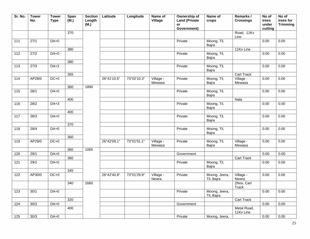
25
Sr. No. Tower No.
Tower Type
Span (M.)
Section Length (M.)
Latitude Longitude Name of Village
Ownership of Land (Private or Government)
Name of crops
Remarks / Crossings
No of trees under cutting
No of trees for Trimming
370 Road, 11Kv Line
111 27/1 DA+0 Private Moong, Til, Bajra
0.00 0.00
380 11Kv Line 112 27/2 DA+0 Private Moong, Til,
Bajra 0.00 0.00
380 113 27/3 DA+3 Private Moong, Til,
Bajra 0.00 0.00
355 Cart Track 114 AP28/0 DC+0 26°41'10.5" 73°02'10.3" Village -
Mewasa Private Moong, Til,
Bajra Village - Mewasa
0.00 0.00
360 1890 115 28/1 DA+0 Private Moong, Til,
Bajra 0.00 0.00
400 Nala 116 28/2 DA+3 Private Moong, Til,
Bajra 0.00 0.00
400 117 28/3 DA+0 Private Moong, Til,
Bajra 0.00 0.00
370 118 28/4 DA+0 Private Moong, Til,
Bajra 0.00 0.00
360 119 AP29/0 DC+0 26°42'09.1" 73°01'51.1" Village -
Mewasa Private Moong, Til,
Bajra Village - Mewasa
0.00 0.00
360 1065 120 29/1 DA+0 Government 0.00 0.00 360 Cart Track 121 29/2 DA+0 Private Moong, Til,
Bajra 0.00 0.00
345 122 AP30/0 DC+0 26°42'40.8" 73°01'29.9" Village -
Newra Private Moong, Jeera,
Til, Bajra Village - Newra
0.00 0.00
340 1660 2Nos. Cart Track
123 30/1 DA+0 Private Moong, Jeera, Til, Bajra
0.00 0.00
320 Cart Track 124 30/2 DA+0 Government 0.00 0.00 400 Metal Road,
11Kv Line
125 30/3 DA+0 Private Moong, Jeera, 0.00 0.00
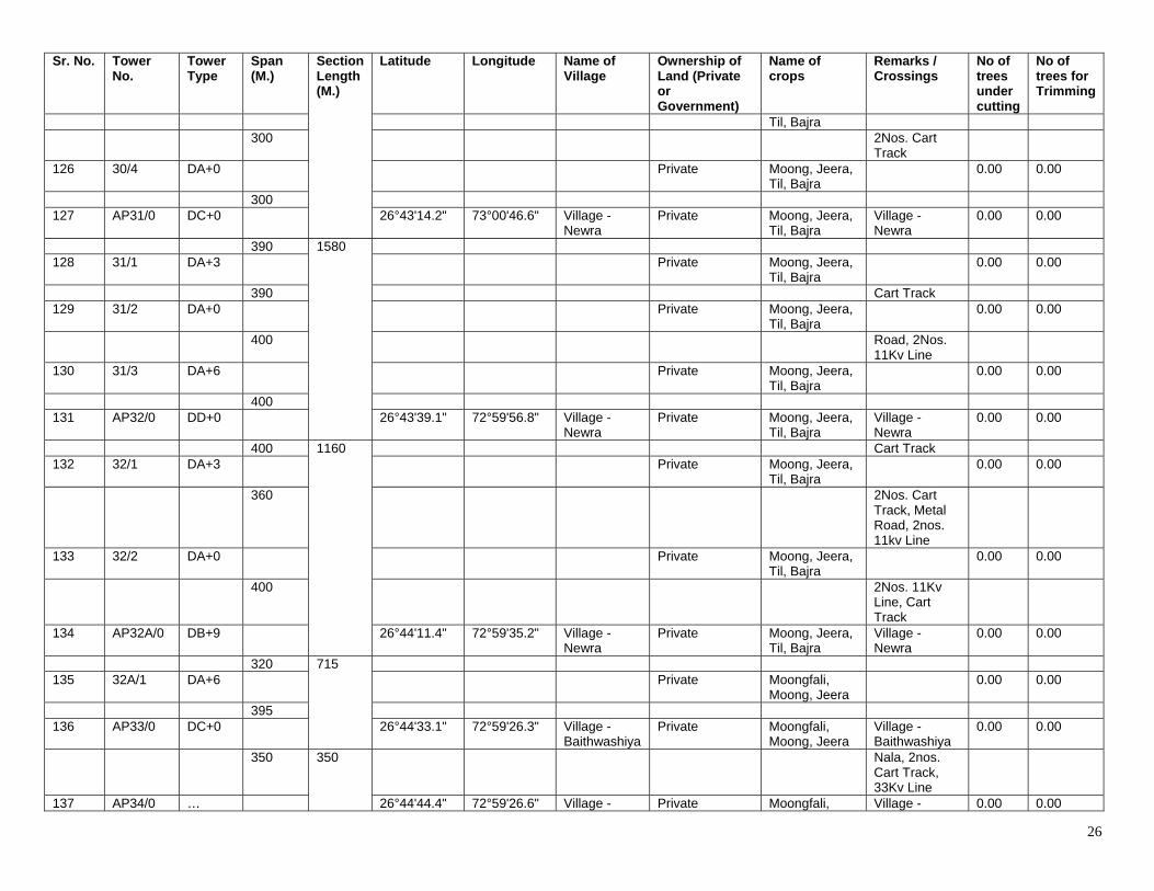
26
Sr. No. Tower No.
Tower Type
Span (M.)
Section Length (M.)
Latitude Longitude Name of Village
Ownership of Land (Private or Government)
Name of crops
Remarks / Crossings
No of trees under cutting
No of trees for Trimming
Til, Bajra 300 2Nos. Cart
Track
126 30/4 DA+0 Private Moong, Jeera, Til, Bajra
0.00 0.00
300 127 AP31/0 DC+0 26°43'14.2" 73°00'46.6" Village -
Newra Private Moong, Jeera,
Til, Bajra Village - Newra
0.00 0.00
390 1580 128 31/1 DA+3 Private Moong, Jeera,
Til, Bajra 0.00 0.00
390 Cart Track 129 31/2 DA+0 Private Moong, Jeera,
Til, Bajra 0.00 0.00
400 Road, 2Nos. 11Kv Line
130 31/3 DA+6 Private Moong, Jeera, Til, Bajra
0.00 0.00
400 131 AP32/0 DD+0 26°43'39.1" 72°59'56.8" Village -
Newra Private Moong, Jeera,
Til, Bajra Village - Newra
0.00 0.00
400 1160 Cart Track 132 32/1 DA+3 Private Moong, Jeera,
Til, Bajra 0.00 0.00
360 2Nos. Cart Track, Metal Road, 2nos. 11kv Line
133 32/2 DA+0 Private Moong, Jeera, Til, Bajra
0.00 0.00
400 2Nos. 11Kv Line, Cart Track
134 AP32A/0 DB+9 26°44'11.4" 72°59'35.2" Village - Newra
Private Moong, Jeera, Til, Bajra
Village - Newra
0.00 0.00
320 715 135 32A/1 DA+6 Private Moongfali,
Moong, Jeera 0.00 0.00
395 136 AP33/0 DC+0 26°44'33.1" 72°59'26.3" Village -
Baithwashiya Private Moongfali,
Moong, Jeera Village - Baithwashiya
0.00 0.00
350 350 Nala, 2nos. Cart Track, 33Kv Line
137 AP34/0 … 26°44'44.4" 72°59'26.6" Village - Private Moongfali, Village - 0.00 0.00
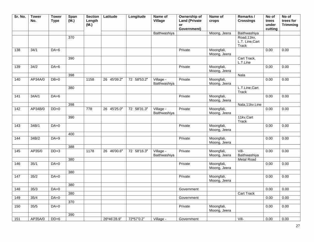
27
Sr. No. Tower No.
Tower Type
Span (M.)
Section Length (M.)
Latitude Longitude Name of Village
Ownership of Land (Private or Government)
Name of crops
Remarks / Crossings
No of trees under cutting
No of trees for Trimming
Baithwashiya Moong, Jeera Baithwashiya 370 Road,11kv,
L.T. Line,Cart Track
138 34/1 DA+6 Private Moongfali, Moong, Jeera
0.00 0.00
390 Cart Track, L.T.Line
139 34/2 DA+6 Private Moongfali, Moong, Jeera
0.00 0.00
398 Nala 140 AP34A/0 DB+0 1158 26�45′09.2″ 72�58′53.2″ Village -
Baithwashiya Private Moongfali,
Moong, Jeera 0.00 0.00
380 L.T.Line,Cart Track
141 34A/1 DA+6 Private Moongfali, Moong, Jeera
0.00 0.00
398 Nala,11kv.Line 142 AP34B/0 DD+0 778 26�45′25.0″ 72�58′31.3″ Village -
Baithwashiya Private Moongfali,
Moong, Jeera 0.00 0.00
390 11kv,Cart Track
143 34B/1 DA+0 Private Moongfali, Moong, Jeera
0.00 0.00
400 144 34B/2 DA+9 Private Moongfali,
Moong, Jeera 0.00 0.00
388 145 AP35/0 DD+3 1178 26�46′00.6″ 72�58′16.3″ Village -
Baithwashiya Private Moongfali,
Moong, Jeera Vill- Baithwashiya
0.00 0.00
380 Metal Road 146 35/1 DA+0 Private Moongfali,
Moong, Jeera 0.00 0.00
380 147 35/2 DA+0 Private Moongfali,
Moong, Jeera 0.00 0.00
380 148 35/3 DA+0 Government 0.00 0.00 380 Cart Track 149 35/4 DA+0 Government 0.00 0.00 370 150 35/5 DA+0 Private Moongfali,
Moong, Jeera 0.00 0.00
390 151 AP35A/0 DD+6 26º46ʼ28.9ˮ 72º57ʼ0.2ˮ Village - Government Vill- 0.00 0.00
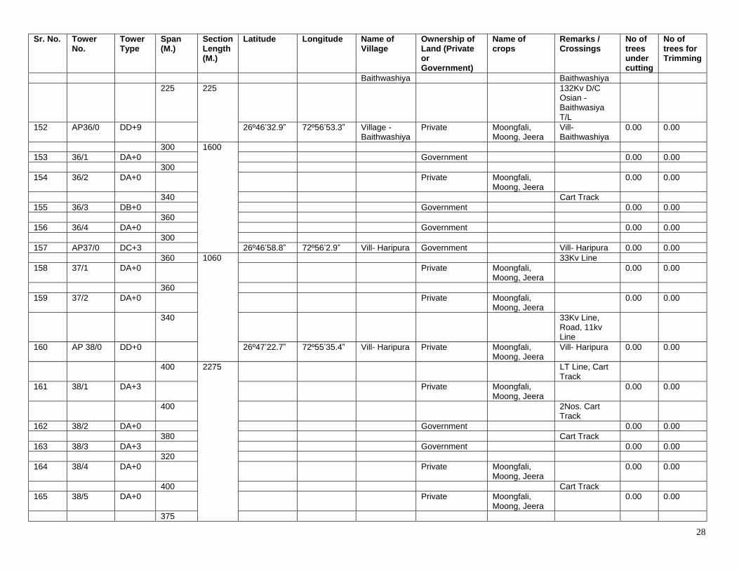
28
Sr. No. Tower No.
Tower Type
Span (M.)
Section Length (M.)
Latitude Longitude Name of Village
Ownership of Land (Private or Government)
Name of crops
Remarks / Crossings
No of trees under cutting
No of trees for Trimming
Baithwashiya Baithwashiya 225 225 132Kv D/C
Osian - Baithwasiya T/L
152 AP36/0 DD+9 26º46ʼ32.9ˮ 72º56ʼ53.3ˮ Village - Baithwashiya
Private Moongfali, Moong, Jeera
Vill- Baithwashiya
0.00 0.00
300 1600 153 36/1 DA+0 Government 0.00 0.00 300 154 36/2 DA+0 Private Moongfali,
Moong, Jeera 0.00 0.00
340 Cart Track 155 36/3 DB+0 Government 0.00 0.00 360 156 36/4 DA+0 Government 0.00 0.00 300 157 AP37/0 DC+3 26º46ʼ58.8ˮ 72º56ʼ2.9ˮ Vill- Haripura Government Vill- Haripura 0.00 0.00 360 1060 33Kv Line 158 37/1 DA+0 Private Moongfali,
Moong, Jeera 0.00 0.00
360 159 37/2 DA+0 Private Moongfali,
Moong, Jeera 0.00 0.00
340 33Kv Line, Road, 11kv Line
160 AP 38/0 DD+0 26º47ʼ22.7ˮ 72º55ʼ35.4ˮ Vill- Haripura Private Moongfali, Moong, Jeera
Vill- Haripura 0.00 0.00
400 2275 LT Line, Cart Track
161 38/1 DA+3 Private Moongfali, Moong, Jeera
0.00 0.00
400 2Nos. Cart Track
162 38/2 DA+0 Government 0.00 0.00 380 Cart Track 163 38/3 DA+3 Government 0.00 0.00 320 164 38/4 DA+0 Private Moongfali,
Moong, Jeera 0.00 0.00
400 Cart Track 165 38/5 DA+0 Private Moongfali,
Moong, Jeera 0.00 0.00
375
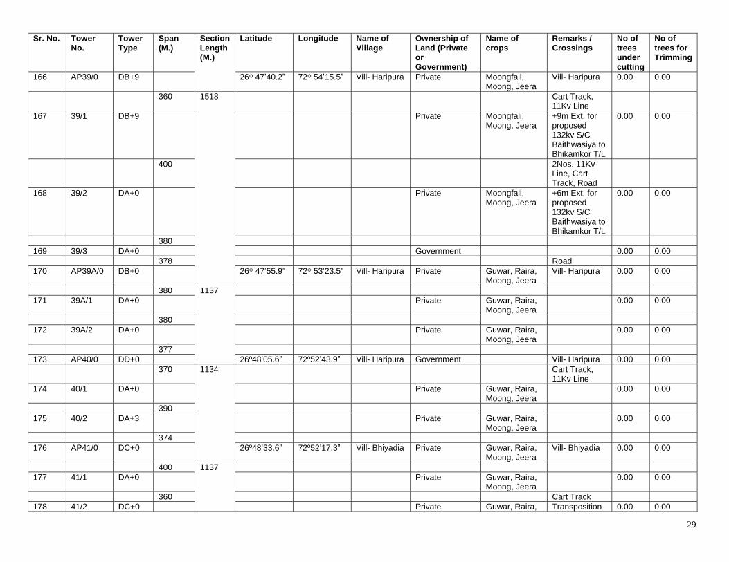
29
Sr. No. Tower No.
Tower Type
Span (M.)
Section Length (M.)
Latitude Longitude Name of Village
Ownership of Land (Private or Government)
Name of crops
Remarks / Crossings
No of trees under cutting
No of trees for Trimming
166 AP39/0 DB+9 26⁰ 47ʼ40.2ˮ 72⁰ 54ʼ15.5ˮ Vill- Haripura Private Moongfali, Moong, Jeera
Vill- Haripura 0.00 0.00
360 1518 Cart Track, 11Kv Line
167 39/1 DB+9 Private Moongfali, Moong, Jeera
+9m Ext. for proposed 132kv S/C Baithwasiya to Bhikamkor T/L
0.00 0.00
400 2Nos. 11Kv Line, Cart Track, Road
168 39/2 DA+0 Private Moongfali, Moong, Jeera
+6m Ext. for proposed 132kv S/C Baithwasiya to Bhikamkor T/L
0.00 0.00
380 169 39/3 DA+0 Government 0.00 0.00 378 Road 170 AP39A/0 DB+0 26⁰ 47ʼ55.9ˮ 72⁰ 53ʼ23.5ˮ Vill- Haripura Private Guwar, Raira,
Moong, Jeera Vill- Haripura 0.00 0.00
380 1137 171 39A/1 DA+0 Private Guwar, Raira,
Moong, Jeera 0.00 0.00
380 172 39A/2 DA+0 Private Guwar, Raira,
Moong, Jeera 0.00 0.00
377 173 AP40/0 DD+0 26º48ʼ05.6ˮ 72º52ʼ43.9ˮ Vill- Haripura Government Vill- Haripura 0.00 0.00 370 1134 Cart Track,
11Kv Line
174 40/1 DA+0 Private Guwar, Raira, Moong, Jeera
0.00 0.00
390 175 40/2 DA+3 Private Guwar, Raira,
Moong, Jeera 0.00 0.00
374 176 AP41/0 DC+0 26º48ʼ33.6ˮ 72º52ʼ17.3ˮ Vill- Bhiyadia Private Guwar, Raira,
Moong, Jeera Vill- Bhiyadia 0.00 0.00
400 1137 177 41/1 DA+0 Private Guwar, Raira,
Moong, Jeera 0.00 0.00
360 Cart Track 178 41/2 DC+0 Private Guwar, Raira, Transposition 0.00 0.00
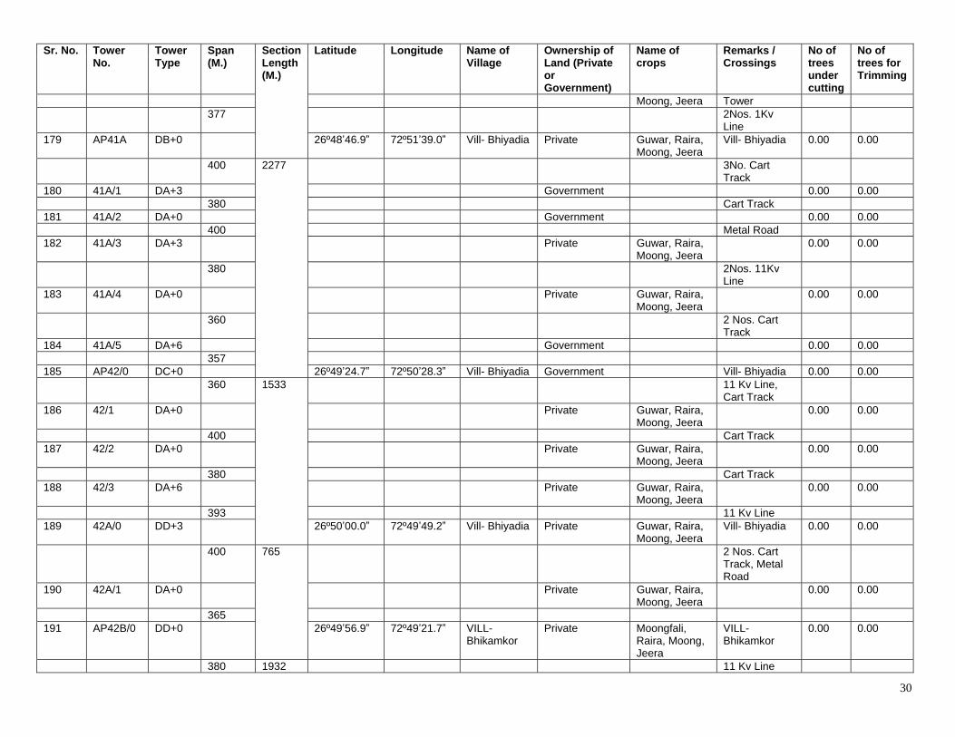
30
Sr. No. Tower No.
Tower Type
Span (M.)
Section Length (M.)
Latitude Longitude Name of Village
Ownership of Land (Private or Government)
Name of crops
Remarks / Crossings
No of trees under cutting
No of trees for Trimming
Moong, Jeera Tower 377 2Nos. 1Kv
Line
179 AP41A DB+0 26º48ʼ46.9ˮ 72º51ʼ39.0ˮ Vill- Bhiyadia Private Guwar, Raira, Moong, Jeera
Vill- Bhiyadia 0.00 0.00
400 2277 3No. Cart Track
180 41A/1 DA+3 Government 0.00 0.00 380 Cart Track 181 41A/2 DA+0 Government 0.00 0.00 400 Metal Road 182 41A/3 DA+3 Private Guwar, Raira,
Moong, Jeera 0.00 0.00
380 2Nos. 11Kv Line
183 41A/4 DA+0 Private Guwar, Raira, Moong, Jeera
0.00 0.00
360 2 Nos. Cart Track
184 41A/5 DA+6 Government 0.00 0.00 357 185 AP42/0 DC+0 26º49ʼ24.7ˮ 72º50ʼ28.3ˮ Vill- Bhiyadia Government Vill- Bhiyadia 0.00 0.00 360 1533 11 Kv Line,
Cart Track
186 42/1 DA+0 Private Guwar, Raira, Moong, Jeera
0.00 0.00
400 Cart Track 187 42/2 DA+0 Private Guwar, Raira,
Moong, Jeera 0.00 0.00
380 Cart Track 188 42/3 DA+6 Private Guwar, Raira,
Moong, Jeera 0.00 0.00
393 11 Kv Line 189 42A/0 DD+3 26º50ʼ00.0ˮ 72º49ʼ49.2ˮ Vill- Bhiyadia Private Guwar, Raira,
Moong, Jeera Vill- Bhiyadia 0.00 0.00
400 765 2 Nos. Cart Track, Metal Road
190 42A/1 DA+0 Private Guwar, Raira, Moong, Jeera
0.00 0.00
365 191 AP42B/0 DD+0 26º49ʼ56.9ˮ 72º49ʼ21.7ˮ VILL-
Bhikamkor Private Moongfali,
Raira, Moong, Jeera
VILL- Bhikamkor
0.00 0.00
380 1932 11 Kv Line
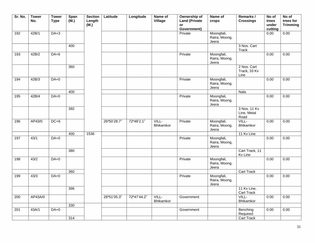
31
Sr. No. Tower No.
Tower Type
Span (M.)
Section Length (M.)
Latitude Longitude Name of Village
Ownership of Land (Private or Government)
Name of crops
Remarks / Crossings
No of trees under cutting
No of trees for Trimming
192 42B/1 DA+3 Private Moongfali, Raira, Moong, Jeera
0.00 0.00
400 3 Nos. Cart Track
193 42B/2 DA+6 Private Moongfali, Raira, Moong, Jeera
0.00 0.00
360 2 Nos. Cart Track, 33 Kv Line
194 42B/3 DA+0 Private Moongfali, Raira, Moong, Jeera
0.00 0.00
400 Nala 195 42B/4 DA+0 Private Moongfali,
Raira, Moong, Jeera
0.00 0.00
392 3 Nos. 11 Kv Line, Metal Road
196 AP43/0 DC+6 26º50ʼ28.7ˮ 72º48ʼ2.1ˮ VILL- Bhikamkor
Private Moongfali, Raira, Moong, Jeera
VILL- Bhikamkor
0.00 0.00
400 1536 11 Kv Line 197 43/1 DA+0 Private Moongfali,
Raira, Moong, Jeera
0.00 0.00
380 Cart Track, 11 Kv Line
198 43/2 DA+0 Private Moongfali, Raira, Moong, Jeera
0.00 0.00
360 Cart Track 199 43/3 DA+0 Private Moongfali,
Raira, Moong, Jeera
0.00 0.00
396 11 Kv Line, Cart Track
200 AP43A/0 26º51ʼ05.3ˮ 72º47ʼ44.2ˮ VILL- Bhikamkor
Government VILL- Bhikamkor
0.00 0.00
330 201 43A/1 DA+0 Government Benching
Required 0.00 0.00
314 Cart Track
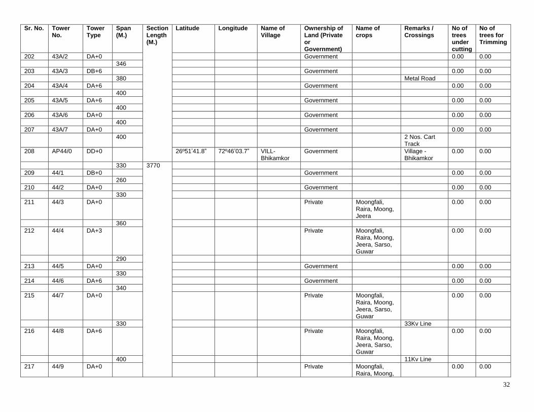
32
Sr. No. Tower No.
Tower Type
Span (M.)
Section Length (M.)
Latitude Longitude Name of Village
Ownership of Land (Private or Government)
Name of crops
Remarks / Crossings
No of trees under cutting
No of trees for Trimming
202 43A/2 DA+0 Government 0.00 0.00 346 203 43A/3 DB+6 Government 0.00 0.00 380 Metal Road 204 43A/4 DA+6 Government 0.00 0.00 400 205 43A/5 DA+6 Government 0.00 0.00 400 206 43A/6 DA+0 Government 0.00 0.00 400 207 43A/7 DA+0 Government 0.00 0.00 400 2 Nos. Cart
Track
208 AP44/0 DD+0 26º51ʼ41.8ˮ 72º46ʼ03.7ˮ VILL- Bhikamkor
Government Village - Bhikamkor
0.00 0.00
330 3770 209 44/1 DB+0 Government 0.00 0.00 260 210 44/2 DA+0 Government 0.00 0.00 330 211 44/3 DA+0 Private Moongfali,
Raira, Moong, Jeera
0.00 0.00
360 212 44/4 DA+3 Private Moongfali,
Raira, Moong, Jeera, Sarso, Guwar
0.00 0.00
290 213 44/5 DA+0 Government 0.00 0.00 330 214 44/6 DA+6 Government 0.00 0.00 340 215 44/7 DA+0 Private Moongfali,
Raira, Moong, Jeera, Sarso, Guwar
0.00 0.00
330 33Kv Line 216 44/8 DA+6 Private Moongfali,
Raira, Moong, Jeera, Sarso, Guwar
0.00 0.00
400 11Kv Line 217 44/9 DA+0 Private Moongfali,
Raira, Moong, 0.00 0.00
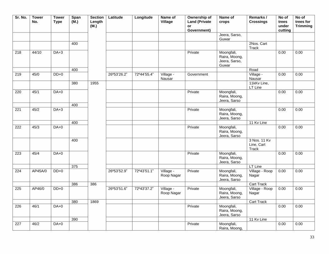
33
Sr. No. Tower No.
Tower Type
Span (M.)
Section Length (M.)
Latitude Longitude Name of Village
Ownership of Land (Private or Government)
Name of crops
Remarks / Crossings
No of trees under cutting
No of trees for Trimming
Jeera, Sarso, Guwar
400 2Nos. Cart Track
218 44/10 DA+3 Private Moongfali, Raira, Moong, Jeera, Sarso, Guwar
0.00 0.00
400 Road 219 45/0 DD+0 26º53ʼ26.2ˮ 72º44ʼ55.4ˮ Village -
Nausar Government Village -
Nausar 0.00 0.00
380 1955 11kKv Line, LT Line
220 45/1 DA+0 Private Moongfali, Raira, Moong, Jeera, Sarso
0.00 0.00
400 221 45/2 DA+3 Private Moongfali,
Raira, Moong, Jeera, Sarso
0.00 0.00
400 11 Kv Line 222 45/3 DA+0 Private Moongfali,
Raira, Moong, Jeera, Sarso
0.00 0.00
400 3 Nos. 11 Kv Line, Cart Track
223 45/4 DA+0 Private Moongfali, Raira, Moong, Jeera, Sarso
0.00 0.00
375 LT Line 224 AP45A/0 DD+0 26º53ʼ52.9ˮ 72º43ʼ51.1ˮ Village -
Roop Nagar Private Moongfali,
Raira, Moong, Jeera, Sarso
Village - Roop Nagar
0.00 0.00
386 386 Cart Track 225 AP46/0 DD+0 26º53ʼ51.6ˮ 72º43'37.2ˮ Village -
Roop Nagar Private Moongfali,
Raira, Moong, Jeera, Sarso
Village - Roop Nagar
0.00 0.00
380 1869 Cart Track 226 46/1 DA+0 Private Moongfali,
Raira, Moong, Jeera, Sarso
0.00 0.00
390 11 Kv Line 227 46/2 DA+0 Private Moongfali,
Raira, Moong, 0.00 0.00
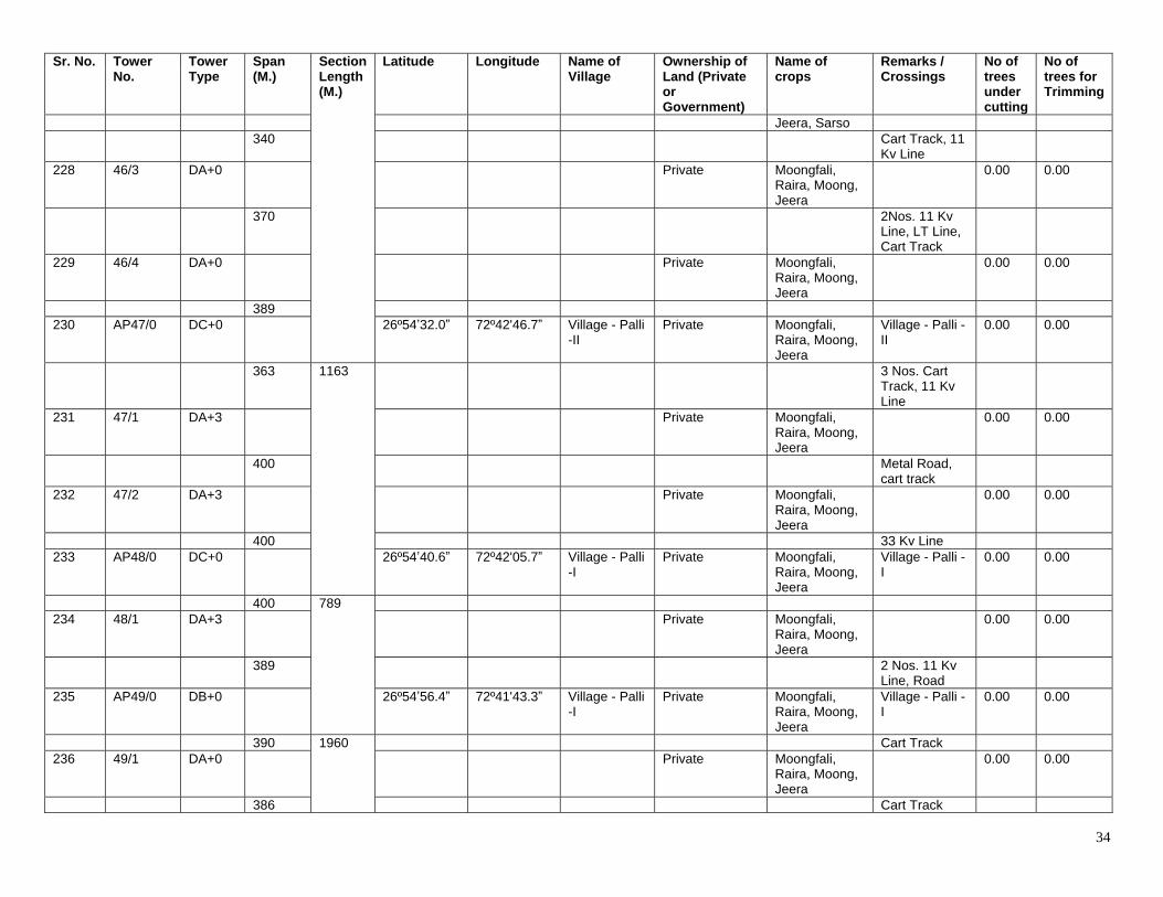
34
Sr. No. Tower No.
Tower Type
Span (M.)
Section Length (M.)
Latitude Longitude Name of Village
Ownership of Land (Private or Government)
Name of crops
Remarks / Crossings
No of trees under cutting
No of trees for Trimming
Jeera, Sarso 340 Cart Track, 11
Kv Line
228 46/3 DA+0 Private Moongfali, Raira, Moong, Jeera
0.00 0.00
370 2Nos. 11 Kv Line, LT Line, Cart Track
229 46/4 DA+0 Private Moongfali, Raira, Moong, Jeera
0.00 0.00
389 230 AP47/0 DC+0 26º54ʼ32.0ˮ 72º42'46.7ˮ Village - Palli
-II Private Moongfali,
Raira, Moong, Jeera
Village - Palli -II
0.00 0.00
363 1163 3 Nos. Cart Track, 11 Kv Line
231 47/1 DA+3 Private Moongfali, Raira, Moong, Jeera
0.00 0.00
400 Metal Road, cart track
232 47/2 DA+3 Private Moongfali, Raira, Moong, Jeera
0.00 0.00
400 33 Kv Line 233 AP48/0 DC+0 26º54ʼ40.6ˮ 72º42'05.7ˮ Village - Palli
-I Private Moongfali,
Raira, Moong, Jeera
Village - Palli -I
0.00 0.00
400 789 234 48/1 DA+3 Private Moongfali,
Raira, Moong, Jeera
0.00 0.00
389 2 Nos. 11 Kv Line, Road
235 AP49/0 DB+0 26º54ʼ56.4ˮ 72º41'43.3ˮ Village - Palli -I
Private Moongfali, Raira, Moong, Jeera
Village - Palli -I
0.00 0.00
390 1960 Cart Track 236 49/1 DA+0 Private Moongfali,
Raira, Moong, Jeera
0.00 0.00
386 Cart Track
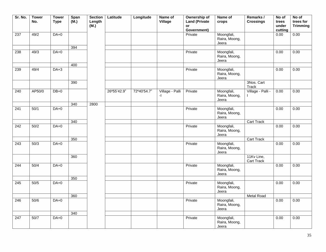
35
Sr. No. Tower No.
Tower Type
Span (M.)
Section Length (M.)
Latitude Longitude Name of Village
Ownership of Land (Private or Government)
Name of crops
Remarks / Crossings
No of trees under cutting
No of trees for Trimming
237 49/2 DA+0 Private Moongfali, Raira, Moong, Jeera
0.00 0.00
394 238 49/3 DA+0 Private Moongfali,
Raira, Moong, Jeera
0.00 0.00
400 239 49/4 DA+3 Private Moongfali,
Raira, Moong, Jeera
0.00 0.00
390 3Nos. Cart Track
240 AP50/0 DB+0 26º55ʼ42.9ˮ 72º40'54.7ˮ Village - Palli -I
Private Moongfali, Raira, Moong, Jeera
Village - Palli -I
0.00 0.00
340 2800 241 50/1 DA+0 Private Moongfali,
Raira, Moong, Jeera
0.00 0.00
340 Cart Track 242 50/2 DA+0 Private Moongfali,
Raira, Moong, Jeera
0.00 0.00
350 Cart Track 243 50/3 DA+0 Private Moongfali,
Raira, Moong, Jeera
0.00 0.00
360 11Kv Line, Cart Track
244 50/4 DA+0 Private Moongfali, Raira, Moong, Jeera
0.00 0.00
350 245 50/5 DA+0 Private Moongfali,
Raira, Moong, Jeera
0.00 0.00
360 Metal Road 246 50/6 DA+0 Private Moongfali,
Raira, Moong, Jeera
0.00 0.00
340 247 50/7 DA+0 Private Moongfali,
Raira, Moong, Jeera
0.00 0.00
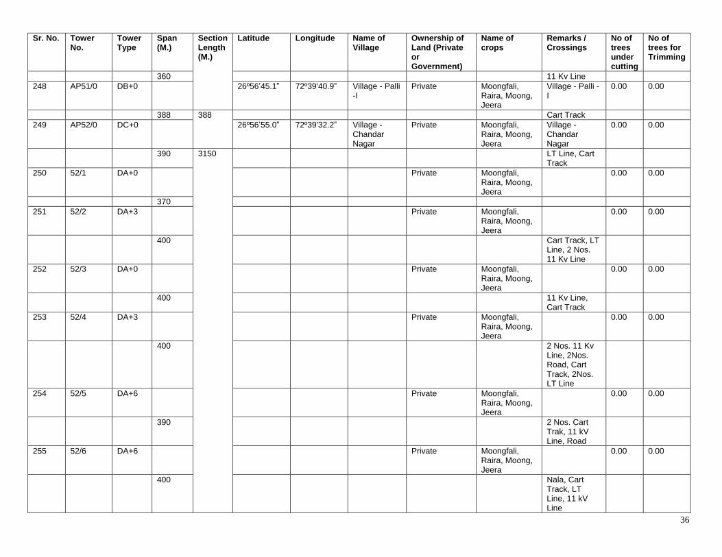
36
Sr. No. Tower No.
Tower Type
Span (M.)
Section Length (M.)
Latitude Longitude Name of Village
Ownership of Land (Private or Government)
Name of crops
Remarks / Crossings
No of trees under cutting
No of trees for Trimming
360 11 Kv Line 248 AP51/0 DB+0 26º56ʼ45.1ˮ 72º39'40.9ˮ Village - Palli
-I Private Moongfali,
Raira, Moong, Jeera
Village - Palli -I
0.00 0.00
388 388 Cart Track 249 AP52/0 DC+0 26º56ʼ55.0ˮ 72º39'32.2ˮ Village -
Chandar Nagar
Private Moongfali, Raira, Moong, Jeera
Village - Chandar Nagar
0.00 0.00
390 3150 LT Line, Cart Track
250 52/1 DA+0 Private Moongfali, Raira, Moong, Jeera
0.00 0.00
370 251 52/2 DA+3 Private Moongfali,
Raira, Moong, Jeera
0.00 0.00
400 Cart Track, LT Line, 2 Nos. 11 Kv Line
252 52/3 DA+0 Private Moongfali, Raira, Moong, Jeera
0.00 0.00
400 11 Kv Line, Cart Track
253 52/4 DA+3 Private Moongfali, Raira, Moong, Jeera
0.00 0.00
400 2 Nos. 11 Kv Line, 2Nos. Road, Cart Track, 2Nos. LT Line
254 52/5 DA+6 Private Moongfali, Raira, Moong, Jeera
0.00 0.00
390 2 Nos. Cart Trak, 11 kV Line, Road
255 52/6 DA+6 Private Moongfali, Raira, Moong, Jeera
0.00 0.00
400 Nala, Cart Track, LT Line, 11 kV Line
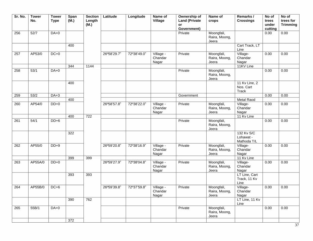
37
Sr. No. Tower No.
Tower Type
Span (M.)
Section Length (M.)
Latitude Longitude Name of Village
Ownership of Land (Private or Government)
Name of crops
Remarks / Crossings
No of trees under cutting
No of trees for Trimming
256 52/7 DA+0 Private Moongfali, Raira, Moong, Jeera
0.00 0.00
400 Cart Track, LT Line
257 AP53/0 DC+0 26º58ʼ29.7ˮ 72º38ʼ49.0ˮ Village - Chandar Nagar
Private Moongfali, Raira, Moong, Jeera
Village- Chandar Nagar
0.00 0.00
344 1144 11KV Line 258 53/1 DA+0 Private Moongfali,
Raira, Moong, Jeera
0.00 0.00
400 11 Kv Line, 2 Nos. Cart Track
259 53/2 DA+3 Government 0.00 0.00 400 Metal Raod 260 AP54/0 DD+0 26º58ʼ57.8ˮ 72º38ʼ22.0ˮ Village -
Chandar Nagar
Private Moongfali, Raira, Moong, Jeera
Village- Chandar Nagar
0.00 0.00
400 722 11 Kv Line 261 54/1 DD+6 Private Moongfali,
Raira, Moong, Jeera
0.00 0.00
322 132 Kv S/C Lohawat - Mathoda T/L
262 AP55/0 DD+9 26º59ʼ20.8ˮ 72º38'16.9ˮ Village - Chandar Nagar
Private Moongfali, Raira, Moong, Jeera
Village- Chandar Nagar
0.00 0.00
399 399 11 Kv Line 263 AP55A/0 DD+0 26º59ʼ27.9ˮ 72º38'04.8ˮ Village -
Chandar Nagar
Private Moongfali, Raira, Moong, Jeera
Village- Chandar Nagar
0.00 0.00
393 393 LT Line, Cart Track, 11 Kv Line
264 AP55B/0 DC+6 26º59ʼ39.8ˮ 72º37ʼ59.8ˮ Village - Chandar Nagar
Private Moongfali, Raira, Moong, Jeera
Village- Chandar Nagar
0.00 0.00
390 762 LT Line, 11 Kv Line
265 55B/1 DA+0 Private Moongfali, Raira, Moong, Jeera
0.00 0.00
372
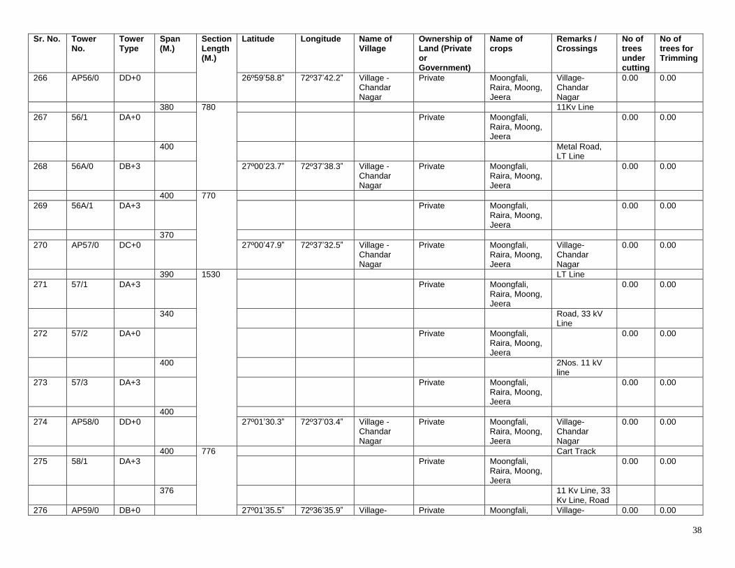
38
Sr. No. Tower No.
Tower Type
Span (M.)
Section Length (M.)
Latitude Longitude Name of Village
Ownership of Land (Private or Government)
Name of crops
Remarks / Crossings
No of trees under cutting
No of trees for Trimming
266 AP56/0 DD+0 26º59ʼ58.8ˮ 72º37ʼ42.2ˮ Village - Chandar Nagar
Private Moongfali, Raira, Moong, Jeera
Village- Chandar Nagar
0.00 0.00
380 780 11Kv Line 267 56/1 DA+0 Private Moongfali,
Raira, Moong, Jeera
0.00 0.00
400 Metal Road, LT Line
268 56A/0 DB+3 27º00ʼ23.7ˮ 72º37ʼ38.3ˮ Village - Chandar Nagar
Private Moongfali, Raira, Moong, Jeera
0.00 0.00
400 770 269 56A/1 DA+3 Private Moongfali,
Raira, Moong, Jeera
0.00 0.00
370 270 AP57/0 DC+0 27º00ʼ47.9ˮ 72º37ʼ32.5ˮ Village -
Chandar Nagar
Private Moongfali, Raira, Moong, Jeera
Village- Chandar Nagar
0.00 0.00
390 1530 LT Line 271 57/1 DA+3 Private Moongfali,
Raira, Moong, Jeera
0.00 0.00
340 Road, 33 kV Line
272 57/2 DA+0 Private Moongfali, Raira, Moong, Jeera
0.00 0.00
400 2Nos. 11 kV line
273 57/3 DA+3 Private Moongfali, Raira, Moong, Jeera
0.00 0.00
400 274 AP58/0 DD+0 27º01ʼ30.3ˮ 72º37ʼ03.4ˮ Village -
Chandar Nagar
Private Moongfali, Raira, Moong, Jeera
Village- Chandar Nagar
0.00 0.00
400 776 Cart Track 275 58/1 DA+3 Private Moongfali,
Raira, Moong, Jeera
0.00 0.00
376 11 Kv Line, 33 Kv Line, Road
276 AP59/0 DB+0 27º01ʼ35.5ˮ 72º36ʼ35.9ˮ Village- Private Moongfali, Village- 0.00 0.00
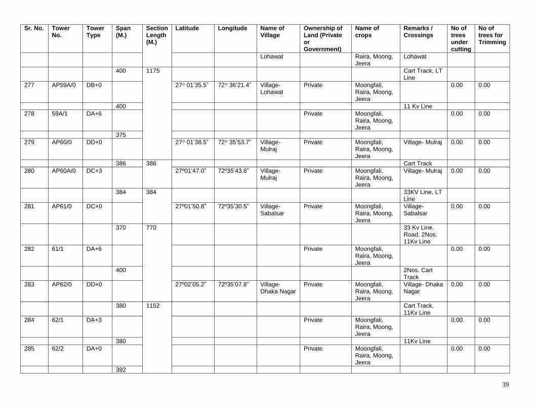
39
Sr. No. Tower No.
Tower Type
Span (M.)
Section Length (M.)
Latitude Longitude Name of Village
Ownership of Land (Private or Government)
Name of crops
Remarks / Crossings
No of trees under cutting
No of trees for Trimming
Lohawat Raira, Moong, Jeera
Lohawat
400 1175 Cart Track, LT Line
277 AP59A/0 DB+0 27⁰ 01ʼ35.5ˮ 72⁰ 36ʼ21.4ˮ Village- Lohawat
Private Moongfali, Raira, Moong, Jeera
0.00 0.00
400 11 Kv Line 278 59A/1 DA+6 Private Moongfali,
Raira, Moong, Jeera
0.00 0.00
375 279 AP60/0 DD+0 27⁰ 01ʼ38.5ˮ 72⁰ 35ʼ53.7ˮ Village-
Mulraj Private Moongfali,
Raira, Moong, Jeera
Village- Mulraj 0.00 0.00
386 386 Cart Track 280 AP60A/0 DC+3 27º01ʼ47.0ˮ 72º35ʼ43.6ˮ Village-
Mulraj Private Moongfali,
Raira, Moong, Jeera
Village- Mulraj 0.00 0.00
384 384 33KV Line, LT Line
281 AP61/0 DC+0 27º01ʼ50.8ˮ 72º35ʼ30.5ˮ Village- Sabalsar
Private Moongfali, Raira, Moong, Jeera
Village- Sabalsar
0.00 0.00
370 770 33 Kv Line, Road, 2Nos. 11Kv Line
282 61/1 DA+6 Private Moongfali, Raira, Moong, Jeera
0.00 0.00
400 2Nos. Cart Track
283 AP62/0 DD+0 27º02ʼ05.2ˮ 72º35ʼ07.8ˮ Village- Dhaka Nagar
Private Moongfali, Raira, Moong, Jeera
Village- Dhaka Nagar
0.00 0.00
380 1152 Cart Track, 11Kv Line
284 62/1 DA+3 Private Moongfali, Raira, Moong, Jeera
0.00 0.00
380 11Kv Line 285 62/2 DA+0 Private Moongfali,
Raira, Moong, Jeera
0.00 0.00
392
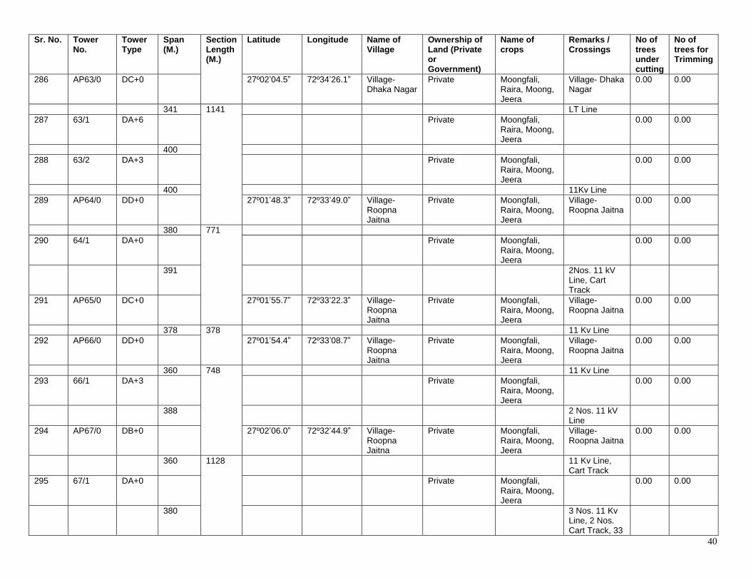
40
Sr. No. Tower No.
Tower Type
Span (M.)
Section Length (M.)
Latitude Longitude Name of Village
Ownership of Land (Private or Government)
Name of crops
Remarks / Crossings
No of trees under cutting
No of trees for Trimming
286 AP63/0 DC+0 27º02ʼ04.5ˮ 72º34ʼ26.1ˮ Village- Dhaka Nagar
Private Moongfali, Raira, Moong, Jeera
Village- Dhaka Nagar
0.00 0.00
341 1141 LT Line 287 63/1 DA+6 Private Moongfali,
Raira, Moong, Jeera
0.00 0.00
400 288 63/2 DA+3 Private Moongfali,
Raira, Moong, Jeera
0.00 0.00
400 11Kv Line 289 AP64/0 DD+0 27º01ʼ48.3ˮ 72º33ʼ49.0ˮ Village-
Roopna Jaitna
Private Moongfali, Raira, Moong, Jeera
Village- Roopna Jaitna
0.00 0.00
380 771 290 64/1 DA+0 Private Moongfali,
Raira, Moong, Jeera
0.00 0.00
391 2Nos. 11 kV Line, Cart Track
291 AP65/0 DC+0 27º01ʼ55.7ˮ 72º33ʼ22.3ˮ Village- Roopna Jaitna
Private Moongfali, Raira, Moong, Jeera
Village- Roopna Jaitna
0.00 0.00
378 378 11 Kv Line 292 AP66/0 DD+0 27º01ʼ54.4ˮ 72º33ʼ08.7ˮ Village-
Roopna Jaitna
Private Moongfali, Raira, Moong, Jeera
Village- Roopna Jaitna
0.00 0.00
360 748 11 Kv Line 293 66/1 DA+3 Private Moongfali,
Raira, Moong, Jeera
0.00 0.00
388 2 Nos. 11 kV Line
294 AP67/0 DB+0 27º02ʼ06.0ˮ 72º32ʼ44.9ˮ Village- Roopna Jaitna
Private Moongfali, Raira, Moong, Jeera
Village- Roopna Jaitna
0.00 0.00
360 1128 11 Kv Line, Cart Track
295 67/1 DA+0 Private Moongfali, Raira, Moong, Jeera
0.00 0.00
380 3 Nos. 11 Kv Line, 2 Nos. Cart Track, 33
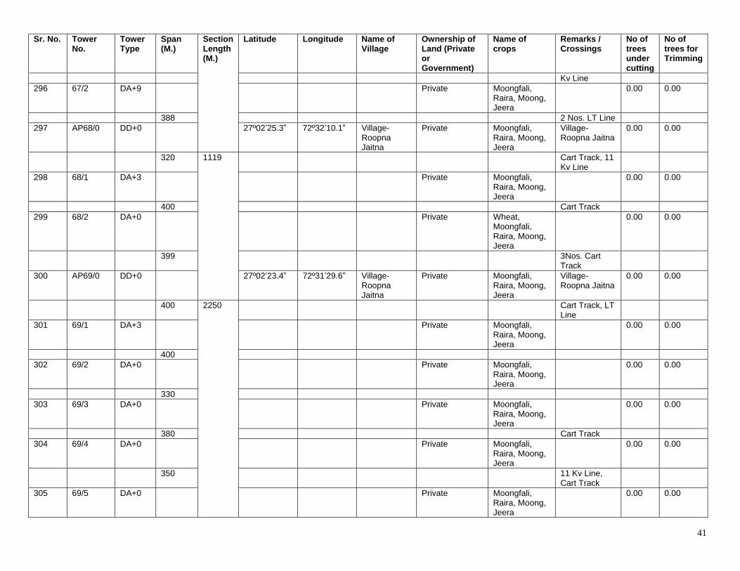
41
Sr. No. Tower No.
Tower Type
Span (M.)
Section Length (M.)
Latitude Longitude Name of Village
Ownership of Land (Private or Government)
Name of crops
Remarks / Crossings
No of trees under cutting
No of trees for Trimming
Kv Line 296 67/2 DA+9 Private Moongfali,
Raira, Moong, Jeera
0.00 0.00
388 2 Nos. LT Line 297 AP68/0 DD+0 27º02ʼ25.3ˮ 72º32ʼ10.1ˮ Village-
Roopna Jaitna
Private Moongfali, Raira, Moong, Jeera
Village- Roopna Jaitna
0.00 0.00
320 1119 Cart Track, 11 Kv Line
298 68/1 DA+3 Private Moongfali, Raira, Moong, Jeera
0.00 0.00
400 Cart Track 299 68/2 DA+0 Private Wheat,
Moongfali, Raira, Moong, Jeera
0.00 0.00
399 3Nos. Cart Track
300 AP69/0 DD+0 27º02ʼ23.4ˮ 72º31ʼ29.6ˮ Village- Roopna Jaitna
Private Moongfali, Raira, Moong, Jeera
Village- Roopna Jaitna
0.00 0.00
400 2250 Cart Track, LT Line
301 69/1 DA+3 Private Moongfali, Raira, Moong, Jeera
0.00 0.00
400 302 69/2 DA+0 Private Moongfali,
Raira, Moong, Jeera
0.00 0.00
330 303 69/3 DA+0 Private Moongfali,
Raira, Moong, Jeera
0.00 0.00
380 Cart Track 304 69/4 DA+0 Private Moongfali,
Raira, Moong, Jeera
0.00 0.00
350 11 Kv Line, Cart Track
305 69/5 DA+0 Private Moongfali, Raira, Moong, Jeera
0.00 0.00
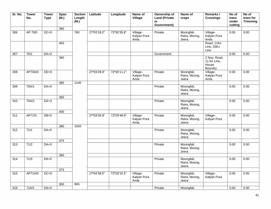
42
Sr. No. Tower No.
Tower Type
Span (M.)
Section Length (M.)
Latitude Longitude Name of Village
Ownership of Land (Private or Government)
Name of crops
Remarks / Crossings
No of trees under cutting
No of trees for Trimming
390 306 AP 70/0 DC+0 760 27º03ʼ18.2ˮ 72º30ʼ35.8ˮ Village-
Kalyan Pura Amla
Private Moongfali, Raira, Moong, Jeera
Village- Kalyan Pura Amla
0.00 0.00
400 Road, 11Kv Line, 33Kv Line
307 70/1 DA+3 Government 0.00 0.00 360 2 Nos. Road,
11 kV Line, House Boundry
308 AP70A/0 DD+0 27º03ʼ28.9ˮ 72º30ʼ11.2ˮ Village- Kalyan Pura Amla
Private Moongfali, Raira, Moong, Jeera
Village- Kalyan Pura Amla
0.00 0.00
380 1140 309 70A/1 DA+0 Private Moongfali,
Raira, Moong, Jeera
0.00 0.00
360 310 70A/2 DA+3 Private Moongfali,
Raira, Moong, Jeera
0.00 0.00
400 311 AP71/0 DB+0 27º03ʼ59.9ˮ 72º29ʼ48.9ˮ Village-
Kalyan Pura Amla
Private Moongfali, Raira, Moong, Jeera
Village- Kalyan Pura
0.00 0.00
380 1520 312 71/1 DA+0 Private Moongfali,
Raira, Moong, Jeera
0.00 0.00
375 313 71/2 DA+0 Private Moongfali,
Raira, Moong, Jeera
0.00 0.00
390 314 71/3 DA+0 Private Moongfali,
Raira, Moong, Jeera
0.00 0.00
375 315 AP71A/0 DC+0 27º04ʼ38.5ˮ 72º29ʼ15.5ˮ Village-
Kalyan Pura Amla
Private Moongfali, Raira, Moong, Jeera
Village- Kalyan Pura
0.00 0.00
300 905 316 71A/1 DA+0 Private Moongfali, 0.00 0.00
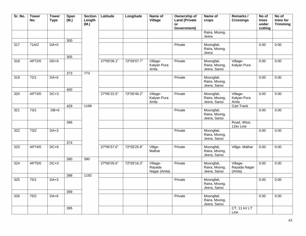
43
Sr. No. Tower No.
Tower Type
Span (M.)
Section Length (M.)
Latitude Longitude Name of Village
Ownership of Land (Private or Government)
Name of crops
Remarks / Crossings
No of trees under cutting
No of trees for Trimming
Raira, Moong, Jeera
300 317 71A/2 DA+0 Private Moongfali,
Raira, Moong, Jeera
0.00 0.00
305 318 AP72/0 DD+6 27º05ʼ06.1ˮ 72º29ʼ07.7ˮ Village-
Kalyan Pura Amla
Private Moongfali, Raira, Moong, Jeera, Sarso
Village- Kalyan Pura
0.00 0.00
373 773 319 72/1 DA+6 Private Moongfali,
Raira, Moong, Jeera, Sarso
0.00 0.00
400 320 AP73/0 DC+3 27º05ʼ22.5ˮ 72º28ʼ46.2ˮ Village-
Kalyan Pura Amla
Private Moongfali, Raira, Moong, Jeera, Sarso
Village- Kalyan Pura Amla
0.00 0.00
429 1199 Cart Track 321 73/1 DB+6 Private Moongfali,
Raira, Moong, Jeera, Sarso
0.00 0.00
396 Road, 4Nos. 11kv Line
322 73/2 DA+3 Private Moongfali, Raira, Moong, Jeera, Sarso
0.00 0.00
374 323 AP74/0 DC+6 27º05ʼ57.0ˮ 72º28ʼ25.9ˮ Villge-
Malhar Private Moongfali,
Raira, Moong, Jeera, Sarso
Villge- Malhar 0.00 0.00
390 390 324 AP75/0 DC+3 27º06ʼ05.6ˮ 72º28ʼ16.3ˮ Village-
Rayada Nagar (Amla)
Private Moongfali, Raira, Moong, Jeera, Sarso
Village- Rayada Nagar (Amla)
0.00 0.00
398 1192 325 75/1 DA+3 Private Moongfali,
Raira, Moong, Jeera, Sarso
0.00 0.00
399 326 75/2 DA+6 Private Moongfali,
Raira, Moong, Jeera, Sarso
0.00 0.00
395 CT, 11 kV LT Line
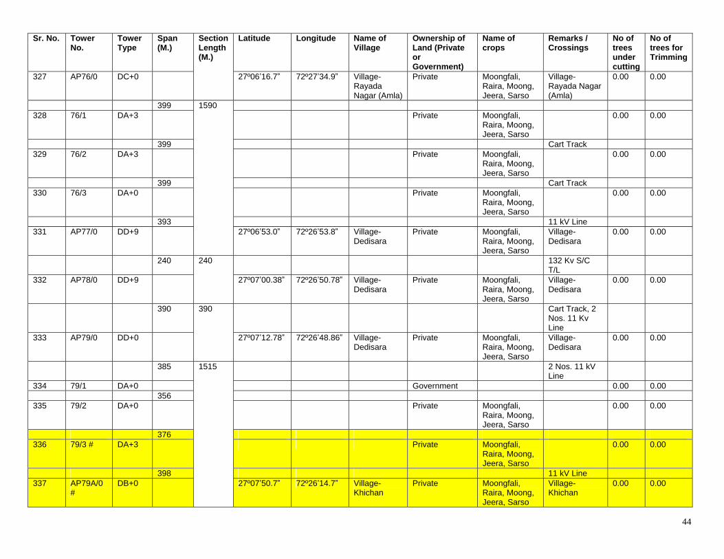
44
Sr. No. Tower No.
Tower Type
Span (M.)
Section Length (M.)
Latitude Longitude Name of Village
Ownership of Land (Private or Government)
Name of crops
Remarks / Crossings
No of trees under cutting
No of trees for Trimming
327 AP76/0 DC+0 27º06ʼ16.7ˮ 72º27ʼ34.9ˮ Village- Rayada Nagar (Amla)
Private Moongfali, Raira, Moong, Jeera, Sarso
Village- Rayada Nagar (Amla)
0.00 0.00
399 1590 328 76/1 DA+3 Private Moongfali,
Raira, Moong, Jeera, Sarso
0.00 0.00
399 Cart Track 329 76/2 DA+3 Private Moongfali,
Raira, Moong, Jeera, Sarso
0.00 0.00
399 Cart Track 330 76/3 DA+0 Private Moongfali,
Raira, Moong, Jeera, Sarso
0.00 0.00
393 11 kV Line 331 AP77/0 DD+9 27º06ʼ53.0ˮ 72º26ʼ53.8ˮ Village-
Dedisara Private Moongfali,
Raira, Moong, Jeera, Sarso
Village- Dedisara
0.00 0.00
240 240 132 Kv S/C T/L
332 AP78/0 DD+9 27º07ʼ00.38ˮ 72º26ʼ50.78ˮ Village- Dedisara
Private Moongfali, Raira, Moong, Jeera, Sarso
Village- Dedisara
0.00 0.00
390 390 Cart Track, 2 Nos. 11 Kv Line
333 AP79/0 DD+0 27º07ʼ12.78ˮ 72º26ʼ48.86ˮ Village- Dedisara
Private Moongfali, Raira, Moong, Jeera, Sarso
Village- Dedisara
0.00 0.00
385 1515 2 Nos. 11 kV Line
334 79/1 DA+0 Government 0.00 0.00 356 335 79/2 DA+0 Private Moongfali,
Raira, Moong, Jeera, Sarso
0.00 0.00
376 336 79/3 # DA+3 Private Moongfali,
Raira, Moong, Jeera, Sarso
0.00 0.00
398 11 kV Line 337 AP79A/0
# DB+0 27º07ʼ50.7ˮ 72º26ʼ14.7ˮ Village-
Khichan Private Moongfali,
Raira, Moong, Jeera, Sarso
Village- Khichan
0.00 0.00
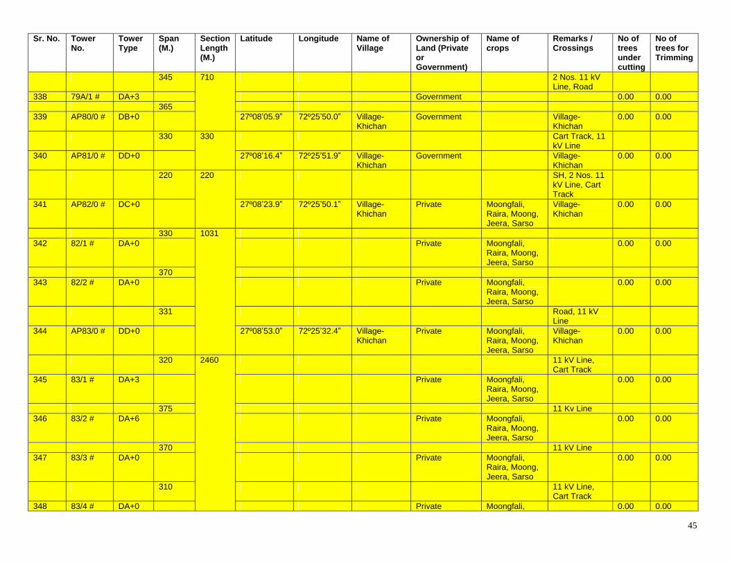
45
Sr. No. Tower No.
Tower Type
Span (M.)
Section Length (M.)
Latitude Longitude Name of Village
Ownership of Land (Private or Government)
Name of crops
Remarks / Crossings
No of trees under cutting
No of trees for Trimming
345 710 2 Nos. 11 kV Line, Road
338 79A/1 # DA+3 Government 0.00 0.00 365 339 AP80/0 # DB+0 27º08ʼ05.9ˮ 72º25ʼ50.0ˮ Village-
Khichan Government Village-
Khichan 0.00 0.00
330 330 Cart Track, 11 kV Line
340 AP81/0 # DD+0 27º08ʼ16.4ˮ 72º25ʼ51.9ˮ Village- Khichan
Government Village- Khichan
0.00 0.00
220 220 SH, 2 Nos. 11 kV Line, Cart Track
341 AP82/0 # DC+0 27º08ʼ23.9ˮ 72º25ʼ50.1ˮ Village- Khichan
Private Moongfali, Raira, Moong, Jeera, Sarso
Village- Khichan
0.00 0.00
330 1031 342 82/1 # DA+0 Private Moongfali,
Raira, Moong, Jeera, Sarso
0.00 0.00
370 343 82/2 # DA+0 Private Moongfali,
Raira, Moong, Jeera, Sarso
0.00 0.00
331 Road, 11 kV Line
344 AP83/0 # DD+0 27º08ʼ53.0ˮ 72º25ʼ32.4ˮ Village- Khichan
Private Moongfali, Raira, Moong, Jeera, Sarso
Village- Khichan
0.00 0.00
320 2460 11 kV Line, Cart Track
345 83/1 # DA+3 Private Moongfali, Raira, Moong, Jeera, Sarso
0.00 0.00
375 11 Kv Line 346 83/2 # DA+6 Private Moongfali,
Raira, Moong, Jeera, Sarso
0.00 0.00
370 11 kV Line 347 83/3 # DA+0 Private Moongfali,
Raira, Moong, Jeera, Sarso
0.00 0.00
310 11 kV Line, Cart Track
348 83/4 # DA+0 Private Moongfali, 0.00 0.00
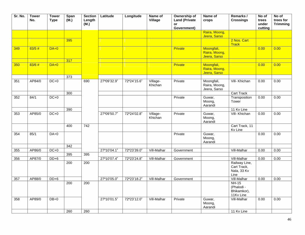
46
Sr. No. Tower No.
Tower Type
Span (M.)
Section Length (M.)
Latitude Longitude Name of Village
Ownership of Land (Private or Government)
Name of crops
Remarks / Crossings
No of trees under cutting
No of trees for Trimming
Raira, Moong, Jeera, Sarso
395 2 Nos. Cart Track
349 83/5 # DA+0 Private Moongfali, Raira, Moong, Jeera, Sarso
0.00 0.00
317 350 83/6 # DA+0 Private Moongfali,
Raira, Moong, Jeera, Sarso
0.00 0.00
373 351 AP84/0 DC+0 690 27º09ʼ32.9ˮ 72º24ʼ15.6ˮ Village-
Khichan Private Moongfali,
Raira, Moong, Jeera, Sarso
Vill- Khichan 0.00 0.00
300 Cart Track 352 84/1 DC+0 Private Guwar,
Moong, Aarandi
Transposition Tower
0.00 0.00
390 11 Kv Line 353 AP85/0 DC+0 27º09ʼ50.7ˮ 72º24ʼ02.8ˮ Village-
Khichan Private Guwar,
Moong, Aarandi
Vill- Khichan 0.00 0.00
400 742 Cart Track, 11 Kv Line
354 85/1 DA+0 Private Guwar, Moong, Aarandi
0.00 0.00
342 355 AP86/0 DC+0 27º10ʼ04.1ˮ 72º23ʼ39.0ˮ Vill-Malhar Government Vill-Malhar 0.00 0.00 395 395 356 AP87/0 DD+6 27º10ʼ07.4ˮ 72º23ʼ24.8ˮ Vill-Malhar Government Vill-Malhar 0.00 0.00 200 200 Railway Line,
Cart Track, Nala, 33 Kv Line
357 AP88/0 DD+6 27º10ʼ05.0ˮ 72º23ʼ18.2ˮ Vill-Malhar Government Vill-Malhar 0.00 0.00 200 200 NH-15
(Phalodi - Bhikamkor), 11Kv Line
358 AP89/0 DB+0 27º10ʼ01.5ˮ 72º23ʼ12.0ˮ Vill-Malhar Private Guwar, Moong, Aarandi
Vill-Malhar 0.00 0.00
260 260 11 Kv Line
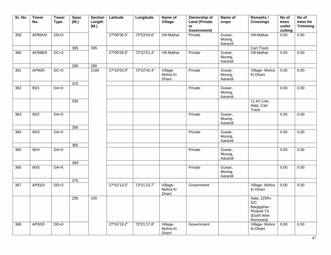
47
Sr. No. Tower No.
Tower Type
Span (M.)
Section Length (M.)
Latitude Longitude Name of Village
Ownership of Land (Private or Government)
Name of crops
Remarks / Crossings
No of trees under cutting
No of trees for Trimming
359 AP89A/0 DD+0 27º09ʼ56.5ˮ 72º23ʼ04.6ˮ Vill-Malhar Private Guwar, Moong, Aarandi
Vill-Malhar 0.00 0.00
395 395 Cart Track 360 AP89B/0 DC+3 27º09ʼ59.8ˮ 72º22ʼ51.4ˮ Vill-Malhar Private Guwar,
Moong, Aarandi
Vill-Malhar 0.00 0.00
280 280 361 AP90/0 DC+0 2185 27º10ʼ03.9ˮ 72º22ʼ42.4ˮ Village-
Mohra Ki Dhani
Private Guwar, Moong, Aarandi
Village- Mohra Ki Dhani
0.00 0.00
315 362 90/1 DA+0 Private Guwar,
Moong, Aarandi
0.00 0.00
335 11 kV Line, Nala, Cart Track
363 90/2 DA+0 Private Guwar, Moong, Aarandi
0.00 0.00
395 364 90/3 DA+0 Private Guwar,
Moong, Aarandi
0.00 0.00
365 365 90/4 DA+0 Private Guwar,
Moong, Aarandi
0.00 0.00
399 366 90/5 DA+6 Private Guwar,
Moong, Aarandi
0.00 0.00
376 367 AP91/0 DD+3 27º10ʼ13.5ˮ 72º21ʼ23.7ˮ Village-
Mohra Ki Dhani
Government Village- Mohra Ki Dhani
0.00 0.00
235 235 Nala, 220Kv S/C Bargigshar - Phalodi T/L (Earth Wire Removed)
368 AP92/0 DD+0 27º10ʼ19.2ˮ 72º21ʼ17.8ˮ Village- Mohra Ki Dhani
Government Village- Mohra Ki Dhani
0.00 0.00
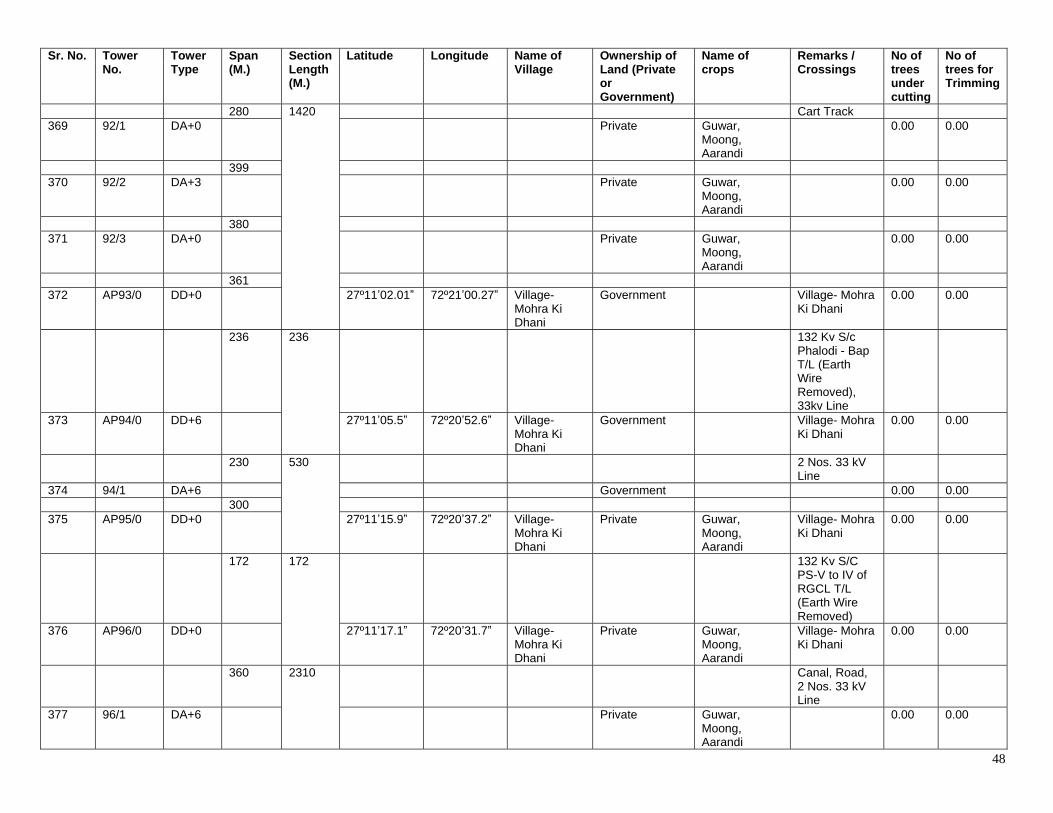
48
Sr. No. Tower No.
Tower Type
Span (M.)
Section Length (M.)
Latitude Longitude Name of Village
Ownership of Land (Private or Government)
Name of crops
Remarks / Crossings
No of trees under cutting
No of trees for Trimming
280 1420 Cart Track 369 92/1 DA+0 Private Guwar,
Moong, Aarandi
0.00 0.00
399 370 92/2 DA+3 Private Guwar,
Moong, Aarandi
0.00 0.00
380 371 92/3 DA+0 Private Guwar,
Moong, Aarandi
0.00 0.00
361 372 AP93/0 DD+0 27º11ʼ02.01ˮ 72º21ʼ00.27ˮ Village-
Mohra Ki Dhani
Government Village- Mohra Ki Dhani
0.00 0.00
236 236 132 Kv S/c Phalodi - Bap T/L (Earth Wire Removed), 33kv Line
373 AP94/0 DD+6 27º11ʼ05.5ˮ 72º20ʼ52.6ˮ Village- Mohra Ki Dhani
Government Village- Mohra Ki Dhani
0.00 0.00
230 530 2 Nos. 33 kV Line
374 94/1 DA+6 Government 0.00 0.00 300 375 AP95/0 DD+0 27º11ʼ15.9ˮ 72º20ʼ37.2ˮ Village-
Mohra Ki Dhani
Private Guwar, Moong, Aarandi
Village- Mohra Ki Dhani
0.00 0.00
172 172 132 Kv S/C PS-V to IV of RGCL T/L (Earth Wire Removed)
376 AP96/0 DD+0 27º11ʼ17.1ˮ 72º20ʼ31.7ˮ Village- Mohra Ki Dhani
Private Guwar, Moong, Aarandi
Village- Mohra Ki Dhani
0.00 0.00
360 2310 Canal, Road, 2 Nos. 33 kV Line
377 96/1 DA+6 Private Guwar, Moong, Aarandi
0.00 0.00
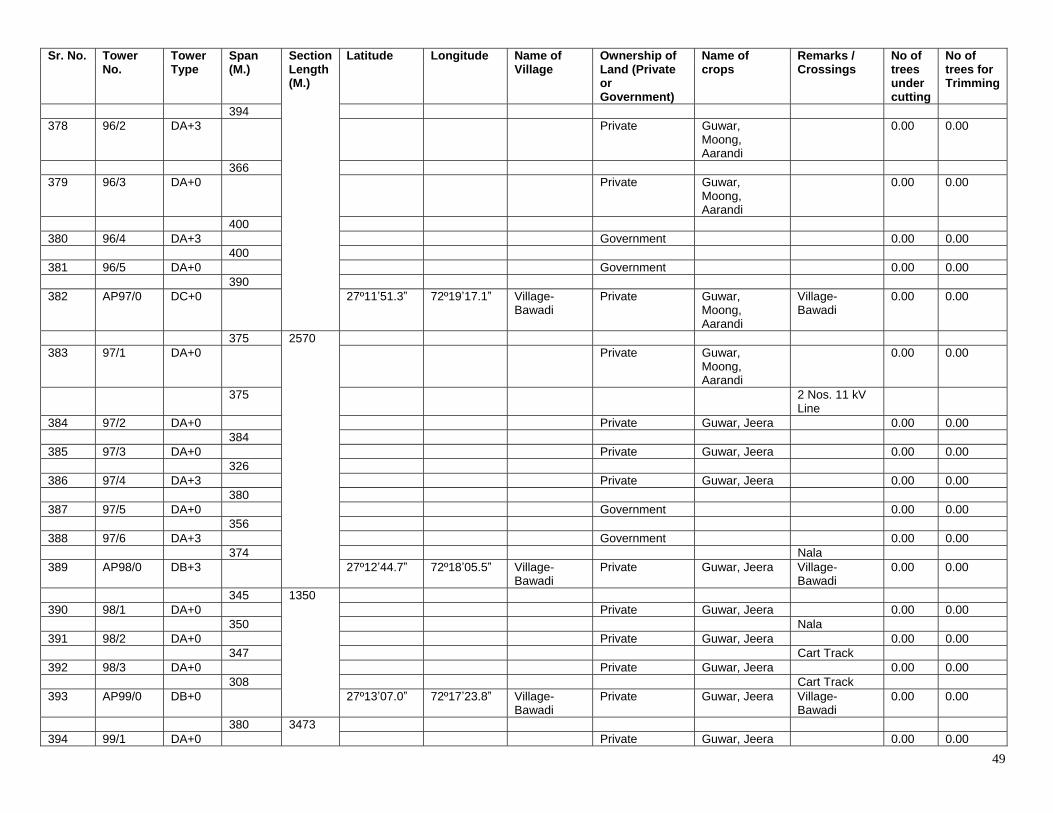
49
Sr. No. Tower No.
Tower Type
Span (M.)
Section Length (M.)
Latitude Longitude Name of Village
Ownership of Land (Private or Government)
Name of crops
Remarks / Crossings
No of trees under cutting
No of trees for Trimming
394 378 96/2 DA+3 Private Guwar,
Moong, Aarandi
0.00 0.00
366 379 96/3 DA+0 Private Guwar,
Moong, Aarandi
0.00 0.00
400 380 96/4 DA+3 Government 0.00 0.00 400 381 96/5 DA+0 Government 0.00 0.00 390 382 AP97/0 DC+0 27º11ʼ51.3ˮ 72º19ʼ17.1ˮ Village-
Bawadi Private Guwar,
Moong, Aarandi
Village- Bawadi
0.00 0.00
375 2570 383 97/1 DA+0 Private Guwar,
Moong, Aarandi
0.00 0.00
375 2 Nos. 11 kV Line
384 97/2 DA+0 Private Guwar, Jeera 0.00 0.00 384 385 97/3 DA+0 Private Guwar, Jeera 0.00 0.00 326 386 97/4 DA+3 Private Guwar, Jeera 0.00 0.00 380 387 97/5 DA+0 Government 0.00 0.00 356 388 97/6 DA+3 Government 0.00 0.00 374 Nala 389 AP98/0 DB+3 27º12ʼ44.7ˮ 72º18ʼ05.5ˮ Village-
Bawadi Private Guwar, Jeera Village-
Bawadi 0.00 0.00
345 1350 390 98/1 DA+0 Private Guwar, Jeera 0.00 0.00 350 Nala 391 98/2 DA+0 Private Guwar, Jeera 0.00 0.00 347 Cart Track 392 98/3 DA+0 Private Guwar, Jeera 0.00 0.00 308 Cart Track 393 AP99/0 DB+0 27º13ʼ07.0ˮ 72º17ʼ23.8ˮ Village-
Bawadi Private Guwar, Jeera Village-
Bawadi 0.00 0.00
380 3473 394 99/1 DA+0 Private Guwar, Jeera 0.00 0.00
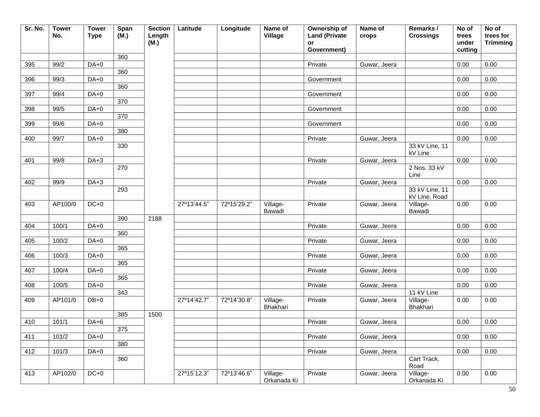
50
Sr. No. Tower No.
Tower Type
Span (M.)
Section Length (M.)
Latitude Longitude Name of Village
Ownership of Land (Private or Government)
Name of crops
Remarks / Crossings
No of trees under cutting
No of trees for Trimming
360 395 99/2 DA+0 Private Guwar, Jeera 0.00 0.00 360 396 99/3 DA+0 Government 0.00 0.00 360 397 99/4 DA+0 Government 0.00 0.00 370 398 99/5 DA+0 Government 0.00 0.00 370 399 99/6 DA+0 Government 0.00 0.00 380 400 99/7 DA+0 Private Guwar, Jeera 0.00 0.00 330 33 kV Line, 11
kV Line
401 99/8 DA+3 Private Guwar, Jeera 0.00 0.00 270 2 Nos. 33 kV
Line
402 99/9 DA+3 Private Guwar, Jeera 0.00 0.00 293 33 kV Line, 11
kV Line, Road
403 AP100/0 DC+0 27º13ʼ44.5ˮ 72º15ʼ29.2ˮ Village- Bawadi
Private Guwar, Jeera Village- Bawadi
0.00 0.00
390 2188 404 100/1 DA+0 Private Guwar, Jeera 0.00 0.00 360 405 100/2 DA+0 Private Guwar, Jeera 0.00 0.00 365 406 100/3 DA+0 Private Guwar, Jeera 0.00 0.00 365 407 100/4 DA+0 Private Guwar, Jeera 0.00 0.00 365 408 100/5 DA+0 Private Guwar, Jeera 0.00 0.00 343 11 kV Line 409 AP101/0 DB+0 27º14ʼ42.7ˮ 72º14ʼ30.8ˮ Village-
Bhakhari Private Guwar, Jeera Village-
Bhakhari 0.00 0.00
385 1500 410 101/1 DA+6 Private Guwar, Jeera 0.00 0.00 375 411 101/2 DA+0 Private Guwar, Jeera 0.00 0.00 380 412 101/3 DA+0 Private Guwar, Jeera 0.00 0.00 360 Cart Track,
Road
413 AP102/0 DC+0 27º15ʼ12.3ˮ 72º13ʼ46.6ˮ Village- Orkanada Ki
Private Guwar, Jeera Village- Orkanada Ki
0.00 0.00
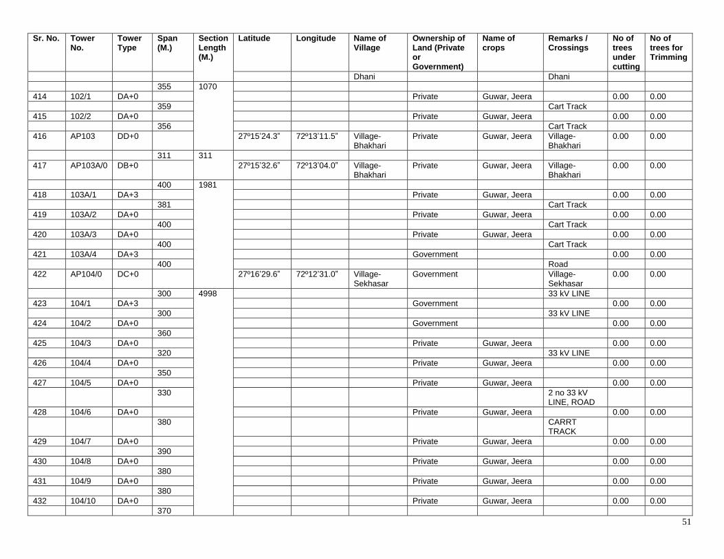
51
Sr. No. Tower No.
Tower Type
Span (M.)
Section Length (M.)
Latitude Longitude Name of Village
Ownership of Land (Private or Government)
Name of crops
Remarks / Crossings
No of trees under cutting
No of trees for Trimming
Dhani Dhani 355 1070 414 102/1 DA+0 Private Guwar, Jeera 0.00 0.00 359 Cart Track 415 102/2 DA+0 Private Guwar, Jeera 0.00 0.00 356 Cart Track 416 AP103 DD+0 27º15ʼ24.3ˮ 72º13ʼ11.5ˮ Village-
Bhakhari Private Guwar, Jeera Village-
Bhakhari 0.00 0.00
311 311 417 AP103A/0 DB+0 27º15ʼ32.6ˮ 72º13ʼ04.0ˮ Village-
Bhakhari Private Guwar, Jeera Village-
Bhakhari 0.00 0.00
400 1981 418 103A/1 DA+3 Private Guwar, Jeera 0.00 0.00 381 Cart Track 419 103A/2 DA+0 Private Guwar, Jeera 0.00 0.00 400 Cart Track 420 103A/3 DA+0 Private Guwar, Jeera 0.00 0.00 400 Cart Track 421 103A/4 DA+3 Government 0.00 0.00 400 Road 422 AP104/0 DC+0 27º16ʼ29.6ˮ 72º12ʼ31.0ˮ Village-
Sekhasar Government Village-
Sekhasar 0.00 0.00
300 4998 33 kV LINE 423 104/1 DA+3 Government 0.00 0.00 300 33 kV LINE 424 104/2 DA+0 Government 0.00 0.00 360 425 104/3 DA+0 Private Guwar, Jeera 0.00 0.00 320 33 kV LINE 426 104/4 DA+0 Private Guwar, Jeera 0.00 0.00 350 427 104/5 DA+0 Private Guwar, Jeera 0.00 0.00 330 2 no 33 kV
LINE, ROAD
428 104/6 DA+0 Private Guwar, Jeera 0.00 0.00 380 CARRT
TRACK
429 104/7 DA+0 Private Guwar, Jeera 0.00 0.00 390 430 104/8 DA+0 Private Guwar, Jeera 0.00 0.00 380 431 104/9 DA+0 Private Guwar, Jeera 0.00 0.00 380 432 104/10 DA+0 Private Guwar, Jeera 0.00 0.00 370
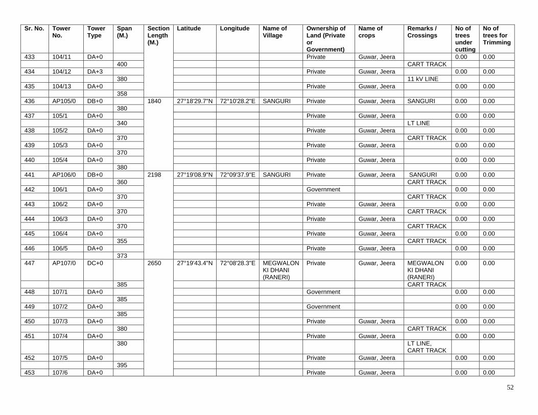
52
Sr. No. Tower No.
Tower Type
Span (M.)
Section Length (M.)
Latitude Longitude Name of Village
Ownership of Land (Private or Government)
Name of crops
Remarks / Crossings
No of trees under cutting
No of trees for Trimming
433 104/11 DA+0 Private Guwar, Jeera 0.00 0.00 400 CART TRACK 434 104/12 DA+3 Private Guwar, Jeera 0.00 0.00 380 11 kV LINE 435 104/13 DA+0 Private Guwar, Jeera 0.00 0.00 358 436 AP105/0 DB+0 1840 27°18'29.7"N 72°10'28.2"E SANGURI Private Guwar, Jeera SANGURI 0.00 0.00 380 437 105/1 DA+0 Private Guwar, Jeera 0.00 0.00 340 LT LINE 438 105/2 DA+0 Private Guwar, Jeera 0.00 0.00 370 CART TRACK 439 105/3 DA+0 Private Guwar, Jeera 0.00 0.00 370 440 105/4 DA+0 Private Guwar, Jeera 0.00 0.00 380 441 AP106/0 DB+0 2198 27°19'08.9"N 72°09'37.9"E SANGURI Private Guwar, Jeera SANGURI 0.00 0.00 360 CART TRACK 442 106/1 DA+0 Government 0.00 0.00 370 CART TRACK 443 106/2 DA+0 Private Guwar, Jeera 0.00 0.00 370 CART TRACK 444 106/3 DA+0 Private Guwar, Jeera 0.00 0.00 370 CART TRACK 445 106/4 DA+0 Private Guwar, Jeera 0.00 0.00 355 CART TRACK 446 106/5 DA+0 Private Guwar, Jeera 0.00 0.00 373 447 AP107/0 DC+0 2650 27°19'43.4"N 72°08'28.3"E MEGWALON
KI DHANI (RANERI)
Private Guwar, Jeera MEGWALON KI DHANI (RANERI)
0.00 0.00
385 CART TRACK 448 107/1 DA+0 Government 0.00 0.00 385 449 107/2 DA+0 Government 0.00 0.00 385 450 107/3 DA+0 Private Guwar, Jeera 0.00 0.00 380 CART TRACK 451 107/4 DA+0 Private Guwar, Jeera 0.00 0.00 380 LT LINE,
CART TRACK
452 107/5 DA+0 Private Guwar, Jeera 0.00 0.00 395 453 107/6 DA+0 Private Guwar, Jeera 0.00 0.00
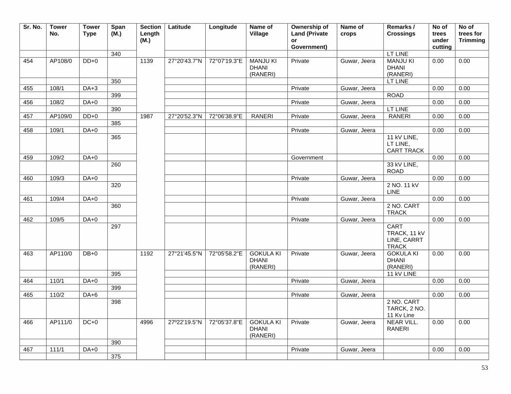
53
Sr. No. Tower No.
Tower Type
Span (M.)
Section Length (M.)
Latitude Longitude Name of Village
Ownership of Land (Private or Government)
Name of crops
Remarks / Crossings
No of trees under cutting
No of trees for Trimming
340 LT LINE 454 AP108/0 DD+0 1139 27°20'43.7"N 72°07'19.3"E MANJU KI
DHANI (RANERI)
Private Guwar, Jeera MANJU KI DHANI (RANERI)
0.00 0.00
350 LT LINE 455 108/1 DA+3 Private Guwar, Jeera 0.00 0.00 399 ROAD 456 108/2 DA+0 Private Guwar, Jeera 0.00 0.00 390 LT LINE 457 AP109/0 DD+0 1987 27°20'52.3"N 72°06'38.9"E RANERI Private Guwar, Jeera RANERI 0.00 0.00 385 458 109/1 DA+0 Private Guwar, Jeera 0.00 0.00 365 11 kV LINE,
LT LINE, CART TRACK
459 109/2 DA+0 Government 0.00 0.00 260 33 kV LINE,
ROAD
460 109/3 DA+0 Private Guwar, Jeera 0.00 0.00 320 2 NO. 11 kV
LINE
461 109/4 DA+0 Private Guwar, Jeera 0.00 0.00 360 2 NO. CART
TRACK
462 109/5 DA+0 Private Guwar, Jeera 0.00 0.00 297 CART
TRACK, 11 kV LINE, CARRT TRACK
463 AP110/0 DB+0 1192 27°21'45.5"N 72°05'58.2"E GOKULA KI DHANI (RANERI)
Private Guwar, Jeera GOKULA KI DHANI (RANERI)
0.00 0.00
395 11 kV LINE 464 110/1 DA+0 Private Guwar, Jeera 0.00 0.00 399 465 110/2 DA+6 Private Guwar, Jeera 0.00 0.00 398 2 NO. CART
TARCK, 2 NO. 11 Kv Line
466 AP111/0 DC+0 4996 27º22'19.5"N 72°05'37.8"E GOKULA KI DHANI (RANERI)
Private Guwar, Jeera NEAR VILL. RANERI
0.00 0.00
390 467 111/1 DA+0 Private Guwar, Jeera 0.00 0.00 375
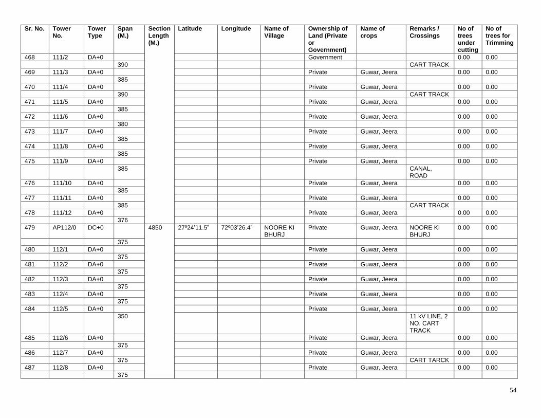
54
Sr. No. Tower No.
Tower Type
Span (M.)
Section Length (M.)
Latitude Longitude Name of Village
Ownership of Land (Private or Government)
Name of crops
Remarks / Crossings
No of trees under cutting
No of trees for Trimming
468 111/2 DA+0 Government 0.00 0.00 390 CART TRACK 469 111/3 DA+0 Private Guwar, Jeera 0.00 0.00 385 470 111/4 DA+0 Private Guwar, Jeera 0.00 0.00 390 CART TRACK 471 111/5 DA+0 Private Guwar, Jeera 0.00 0.00 385 472 111/6 DA+0 Private Guwar, Jeera 0.00 0.00 380 473 111/7 DA+0 Private Guwar, Jeera 0.00 0.00 385 474 111/8 DA+0 Private Guwar, Jeera 0.00 0.00 385 475 111/9 DA+0 Private Guwar, Jeera 0.00 0.00 385 CANAL,
ROAD
476 111/10 DA+0 Private Guwar, Jeera 0.00 0.00 385 477 111/11 DA+0 Private Guwar, Jeera 0.00 0.00 385 CART TRACK 478 111/12 DA+0 Private Guwar, Jeera 0.00 0.00 376 479 AP112/0 DC+0 4850 27º24ʼ11.5ˮ 72º03ʼ26.4ˮ NOORE KI
BHURJ Private Guwar, Jeera NOORE KI
BHURJ 0.00 0.00
375 480 112/1 DA+0 Private Guwar, Jeera 0.00 0.00 375 481 112/2 DA+0 Private Guwar, Jeera 0.00 0.00 375 482 112/3 DA+0 Private Guwar, Jeera 0.00 0.00 375 483 112/4 DA+0 Private Guwar, Jeera 0.00 0.00 375 484 112/5 DA+0 Private Guwar, Jeera 0.00 0.00 350 11 kV LINE, 2
NO. CART TRACK
485 112/6 DA+0 Private Guwar, Jeera 0.00 0.00 375 486 112/7 DA+0 Private Guwar, Jeera 0.00 0.00 375 CART TARCK 487 112/8 DA+0 Private Guwar, Jeera 0.00 0.00 375
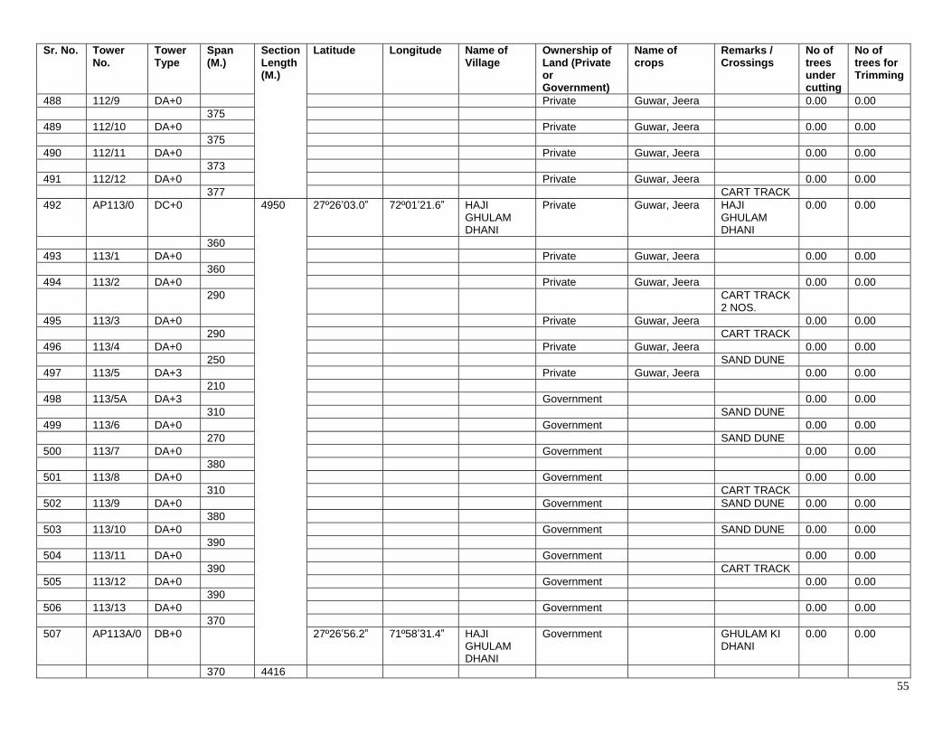
55
Sr. No. Tower No.
Tower Type
Span (M.)
Section Length (M.)
Latitude Longitude Name of Village
Ownership of Land (Private or Government)
Name of crops
Remarks / Crossings
No of trees under cutting
No of trees for Trimming
488 112/9 DA+0 Private Guwar, Jeera 0.00 0.00 375 489 112/10 DA+0 Private Guwar, Jeera 0.00 0.00 375 490 112/11 DA+0 Private Guwar, Jeera 0.00 0.00 373 491 112/12 DA+0 Private Guwar, Jeera 0.00 0.00 377 CART TRACK 492 AP113/0 DC+0 4950 27º26ʼ03.0ˮ 72º01ʼ21.6ˮ HAJI
GHULAM DHANI
Private Guwar, Jeera HAJI GHULAM DHANI
0.00 0.00
360 493 113/1 DA+0 Private Guwar, Jeera 0.00 0.00 360 494 113/2 DA+0 Private Guwar, Jeera 0.00 0.00 290 CART TRACK
2 NOS.
495 113/3 DA+0 Private Guwar, Jeera 0.00 0.00 290 CART TRACK 496 113/4 DA+0 Private Guwar, Jeera 0.00 0.00 250 SAND DUNE 497 113/5 DA+3 Private Guwar, Jeera 0.00 0.00 210 498 113/5A DA+3 Government 0.00 0.00 310 SAND DUNE 499 113/6 DA+0 Government 0.00 0.00 270 SAND DUNE 500 113/7 DA+0 Government 0.00 0.00 380 501 113/8 DA+0 Government 0.00 0.00 310 CART TRACK 502 113/9 DA+0 Government SAND DUNE 0.00 0.00 380 503 113/10 DA+0 Government SAND DUNE 0.00 0.00 390 504 113/11 DA+0 Government 0.00 0.00 390 CART TRACK 505 113/12 DA+0 Government 0.00 0.00 390 506 113/13 DA+0 Government 0.00 0.00 370 507 AP113A/0 DB+0 27º26ʼ56.2ˮ 71º58ʼ31.4ˮ HAJI
GHULAM DHANI
Government GHULAM KI DHANI
0.00 0.00
370 4416
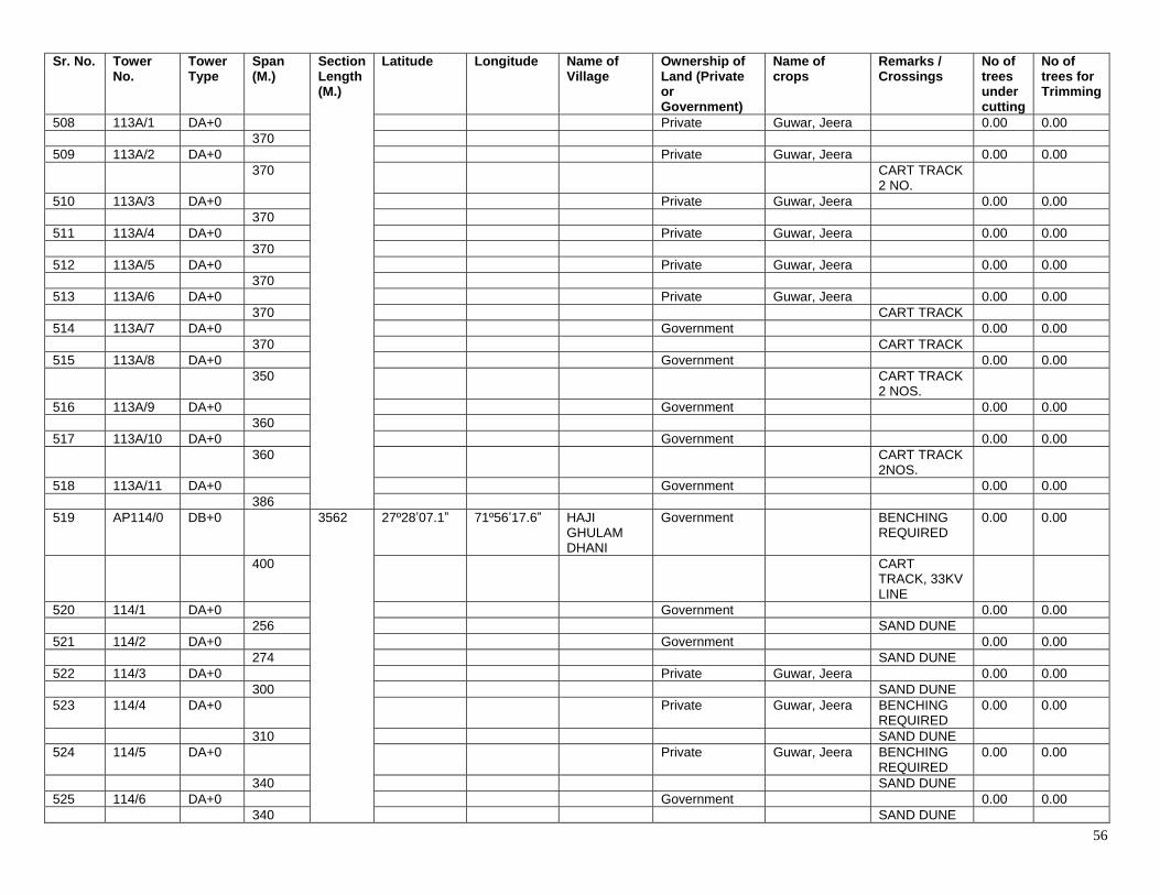
56
Sr. No. Tower No.
Tower Type
Span (M.)
Section Length (M.)
Latitude Longitude Name of Village
Ownership of Land (Private or Government)
Name of crops
Remarks / Crossings
No of trees under cutting
No of trees for Trimming
508 113A/1 DA+0 Private Guwar, Jeera 0.00 0.00 370 509 113A/2 DA+0 Private Guwar, Jeera 0.00 0.00 370 CART TRACK
2 NO.
510 113A/3 DA+0 Private Guwar, Jeera 0.00 0.00 370 511 113A/4 DA+0 Private Guwar, Jeera 0.00 0.00 370 512 113A/5 DA+0 Private Guwar, Jeera 0.00 0.00 370 513 113A/6 DA+0 Private Guwar, Jeera 0.00 0.00 370 CART TRACK 514 113A/7 DA+0 Government 0.00 0.00 370 CART TRACK 515 113A/8 DA+0 Government 0.00 0.00 350 CART TRACK
2 NOS.
516 113A/9 DA+0 Government 0.00 0.00 360 517 113A/10 DA+0 Government 0.00 0.00 360 CART TRACK
2NOS.
518 113A/11 DA+0 Government 0.00 0.00 386 519 AP114/0 DB+0 3562 27º28ʼ07.1ˮ 71º56ʼ17.6ˮ HAJI
GHULAM DHANI
Government BENCHING REQUIRED
0.00 0.00
400 CART TRACK, 33KV LINE
520 114/1 DA+0 Government 0.00 0.00 256 SAND DUNE 521 114/2 DA+0 Government 0.00 0.00 274 SAND DUNE 522 114/3 DA+0 Private Guwar, Jeera 0.00 0.00 300 SAND DUNE 523 114/4 DA+0 Private Guwar, Jeera BENCHING
REQUIRED 0.00 0.00
310 SAND DUNE 524 114/5 DA+0 Private Guwar, Jeera BENCHING
REQUIRED 0.00 0.00
340 SAND DUNE 525 114/6 DA+0 Government 0.00 0.00 340 SAND DUNE
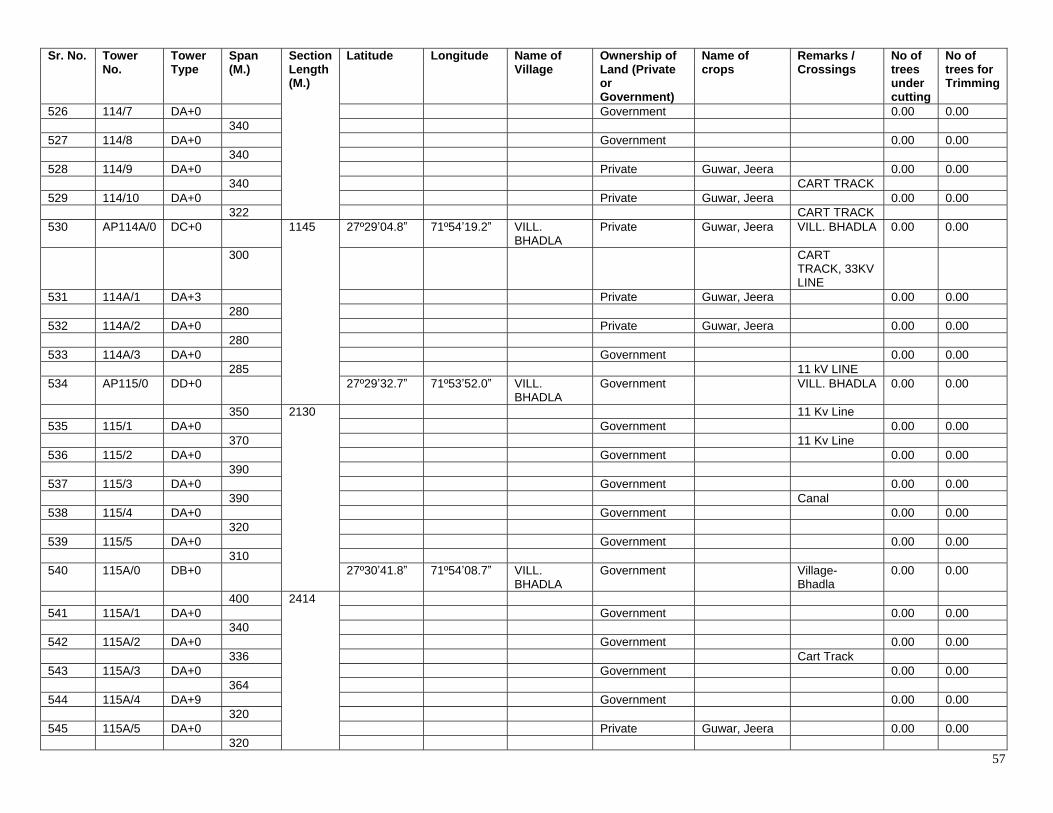
57
Sr. No. Tower No.
Tower Type
Span (M.)
Section Length (M.)
Latitude Longitude Name of Village
Ownership of Land (Private or Government)
Name of crops
Remarks / Crossings
No of trees under cutting
No of trees for Trimming
526 114/7 DA+0 Government 0.00 0.00 340 527 114/8 DA+0 Government 0.00 0.00 340 528 114/9 DA+0 Private Guwar, Jeera 0.00 0.00 340 CART TRACK 529 114/10 DA+0 Private Guwar, Jeera 0.00 0.00 322 CART TRACK 530 AP114A/0 DC+0 1145 27º29ʼ04.8ˮ 71º54ʼ19.2ˮ VILL.
BHADLA Private Guwar, Jeera VILL. BHADLA 0.00 0.00
300 CART TRACK, 33KV LINE
531 114A/1 DA+3 Private Guwar, Jeera 0.00 0.00 280 532 114A/2 DA+0 Private Guwar, Jeera 0.00 0.00 280 533 114A/3 DA+0 Government 0.00 0.00 285 11 kV LINE 534 AP115/0 DD+0 27º29ʼ32.7ˮ 71º53ʼ52.0ˮ VILL.
BHADLA Government VILL. BHADLA 0.00 0.00
350 2130 11 Kv Line 535 115/1 DA+0 Government 0.00 0.00 370 11 Kv Line 536 115/2 DA+0 Government 0.00 0.00 390 537 115/3 DA+0 Government 0.00 0.00 390 Canal 538 115/4 DA+0 Government 0.00 0.00 320 539 115/5 DA+0 Government 0.00 0.00 310 540 115A/0 DB+0 27º30ʼ41.8ˮ 71º54ʼ08.7ˮ VILL.
BHADLA Government Village-
Bhadla 0.00 0.00
400 2414 541 115A/1 DA+0 Government 0.00 0.00 340 542 115A/2 DA+0 Government 0.00 0.00 336 Cart Track 543 115A/3 DA+0 Government 0.00 0.00 364 544 115A/4 DA+9 Government 0.00 0.00 320 545 115A/5 DA+0 Private Guwar, Jeera 0.00 0.00 320
58
Sr. No. Tower No.
Tower Type
Span (M.)
Section Length (M.)
Latitude Longitude Name of Village
Ownership of Land (Private or Government)
Name of crops
Remarks / Crossings
No of trees under cutting
No of trees for Trimming
546 115A/6 DA+9 Government 0.00 0.00 334 547 116/0 DC+0 27º31ʼ54.4ˮ 71º54ʼ35.5ˮ Village-
Bhadla Government Village-
Bhadla 0.00 0.00
311 311 548 117/0 DD+0 27º32ʼ4.4ˮ 71º54ʼ35.6ˮ Village-
Bhadla Government DEAD END
TOWER, Village- Bhadla
0.00 0.00
120 120 549 GANTRY … 27º32ʼ09.3ˮ 71º54ʼ35.7ˮ Village-
Bhadla 400 kV GSS
BHADLA
# Alignment between AP 79/2 to AP 84/0 to be dismantled and re-erected as per High Court Orders of October 5, 2017.
Detailed Survey Tower Schedule (AP 79/2 to AP 84 (Based on detailed survey by EPC Contractor)
Sr. No. Tower
No. Tower Type
Span (M.)
Section Length (M.)
Latitude Longitude Name of Village
Ownership of Land (Private or Government)
Name of crops
Remarks / Crossings
No of trees under cutting
No of trees for Trimming
1 AP 79/2 DA+O 27° 07' 31.5058" N
72° 26' 31.9206" E
Khichan Existing Tower Existing Tower 0 0
232 2 AP 79/0 DD+0 27° 07'
37.3531" N 72° 26' 26.5960" E
Khichan Mohan Ram S/o Jeevan Ram
Jowar, bajra, moong
0 0
353 353 Cart Track 3 AP
79B/0 DD+0 27° 07'
48.5140" N 72° 26' 29.4277" E
Khichan Government 0 0
325
717
11kV line, Road
4 79B/1 DA+3 27° 07' 54.4165" N
72° 26' 39.6041" E
Khichan Government 0 0
392 5 AP80/0 DD+0
675
27° 08' 01.0960" N
72° 26' 51.4333" E
Khichan Government 0 0
370 6 80/1 DA+0 27° 08'
12.4059" N 72° 26' 55.3154" E
Khichan Hukuma Ram s/o Kola Ram
Jowar, bajra, moong
0 0
305 7 AP81/0 DD+0
195
27° 08' 22.0492" N
72° 26' 58.6545" E
Khichan Kanha Ram Katariya
Jowar, bajra, moong
0 0
195 State Highway 8 AP 82/0 DD+0
27° 08' 28.4517" N
72° 26' 58.8359" E
Khichan Panna Lal Ranga
Jowar, bajra, moong
0 0
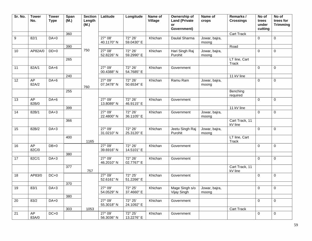
59
Sr. No. Tower No.
Tower Type
Span (M.)
Section Length (M.)
Latitude Longitude Name of Village
Ownership of Land (Private or Government)
Name of crops
Remarks / Crossings
No of trees under cutting
No of trees for Trimming
360 750 760
Cart Track 9 82/1 DA+0 27° 08'
40.1170" N 72° 26' 59.0430" E
Khichan Daulal Sharma Jowar, bajra, moong
0 0
390 Road 10 AP82A/0 DD+0 27° 08'
52.8226" N 72° 26' 59.2990" E
Khichan Hari Singh Raj Purohit
Jowar, bajra, moong
0 0
265 LT line, Cart Track
11 82A/1 DA+6 27° 09' 00.4388" N
72° 26' 54.7685" E
Khichan Government 0 0
240 11 kV line 12 AP
82A/2 DA+6 27° 09'
07.3478" N 72° 26' 50.6534" E
Khichan Ramu Ram Jowar, bajra, moong
0 0
255
1165
Benching required
13 AP 82B/0
DA+6 27° 09' 13.8089" N
72° 26' 46.9115" E
Khichan Government 0 0
399 11 kV line 14 82B/1 DA+3 27° 09'
22.4800" N 72° 26' 36.1105" E
Khichan Government Jowar, bajra, moong
0 0
366 Cart Track, 11 kV line
15 82B/2 DA+3 27° 09' 31.0210" N
72° 26' 25.3120" E
Khichan Jeetu Singh Raj Purohit
Jowar, bajra, moong
0 0
400 LT line, Cart Track
16 AP 82C/0
DB+0
757
27° 09' 39.6916" N
72° 26' 14.5101" E
Khichan Government 0 0
380 17 82C/1 DA+3 27° 09'
46.2010" N 72° 26' 02.7767" E
Khichan Government 0 0
377 Cart Track, 11 kV line
18 AP83/0 DC+0
1053
27° 09' 52.6161" N
72° 25' 51.2266" E
Khichan Government 0 0
370 19 83/1 DA+3 27° 09'
54.0529" N 72° 25' 37.4660" E
Khichan Mage Singh s/o Vijay Singh
Jowar, bajra, moong
0 0
380 20 83/2 DA+0 27° 09'
55.3018" N 72° 25' 24.1092" E
Khichan Government 0 0
303 Cart Track 21 AP
83A/0 DC+0
27° 09' 56.3036" N
72° 25' 13.2276" E
Khichan Government 0 0
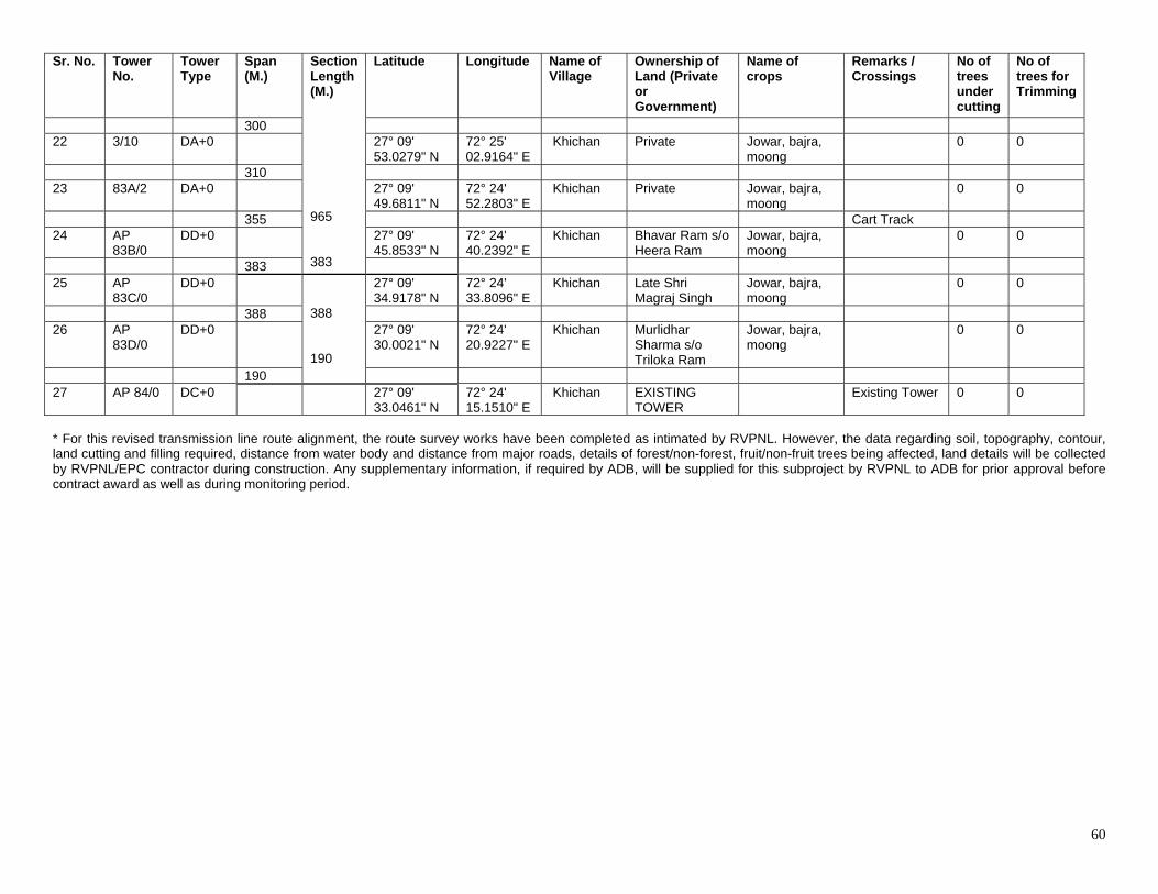
60
Sr. No. Tower No.
Tower Type
Span (M.)
Section Length (M.)
Latitude Longitude Name of Village
Ownership of Land (Private or Government)
Name of crops
Remarks / Crossings
No of trees under cutting
No of trees for Trimming
300 965 383
22 3/10 DA+0 27° 09'
53.0279" N 72° 25' 02.9164" E
Khichan Private Jowar, bajra, moong
0 0
310 23 83A/2 DA+0 27° 09'
49.6811" N 72° 24' 52.2803" E
Khichan Private Jowar, bajra, moong
0 0
355 Cart Track 24 AP
83B/0 DD+0 27° 09'
45.8533" N 72° 24' 40.2392" E
Khichan Bhavar Ram s/o Heera Ram
Jowar, bajra, moong
0 0
383 25 AP
83C/0 DD+0
388 190
27° 09' 34.9178" N
72° 24' 33.8096" E
Khichan Late Shri Magraj Singh
Jowar, bajra, moong
0 0
388 26 AP
83D/0 DD+0 27° 09'
30.0021" N 72° 24' 20.9227" E
Khichan Murlidhar Sharma s/o Triloka Ram
Jowar, bajra, moong
0 0
190 27 AP 84/0 DC+0 27° 09'
33.0461" N 72° 24' 15.1510" E
Khichan EXISTING TOWER
Existing Tower 0 0
* For this revised transmission line route alignment, the route survey works have been completed as intimated by RVPNL. However, the data regarding soil, topography, contour, land cutting and filling required, distance from water body and distance from major roads, details of forest/non-forest, fruit/non-fruit trees being affected, land details will be collected by RVPNL/EPC contractor during construction. Any supplementary information, if required by ADB, will be supplied for this subproject by RVPNL to ADB for prior approval before contract award as well as during monitoring period.
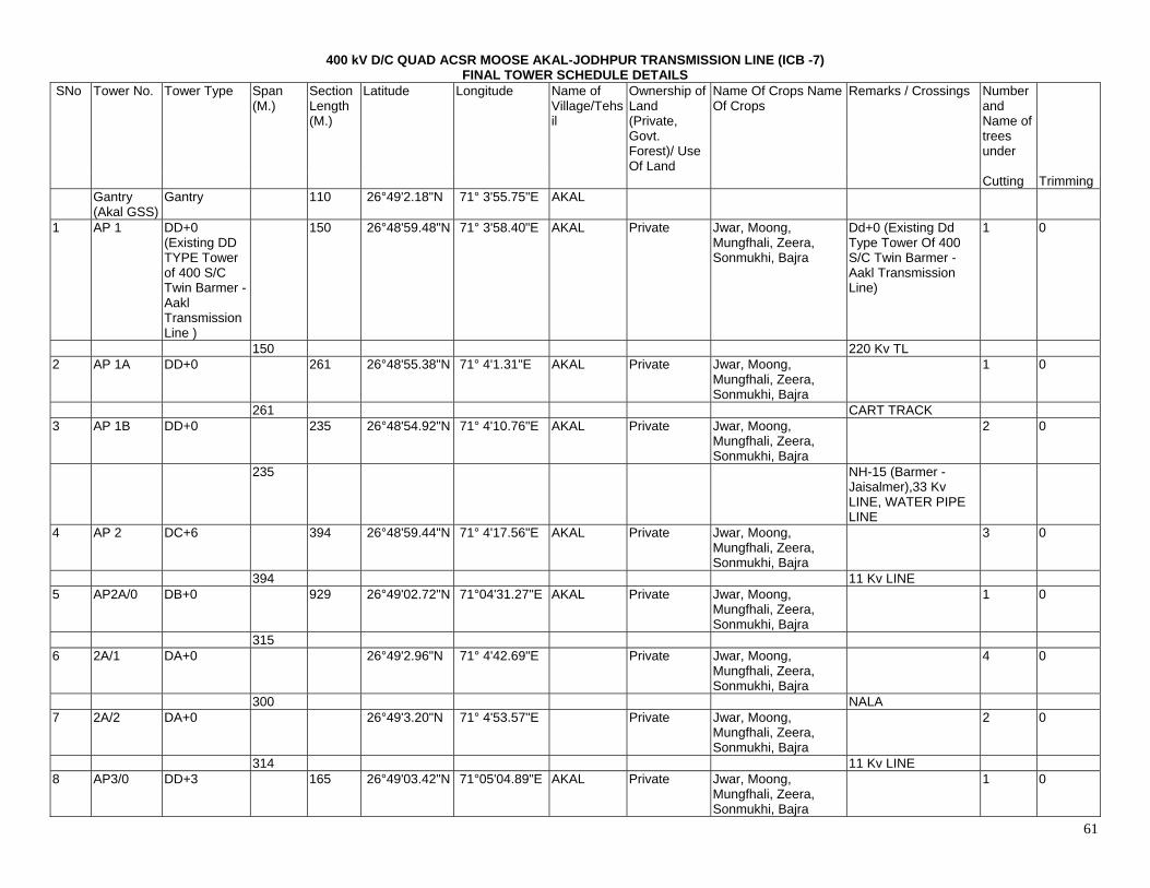
61
400 kV D/C QUAD ACSR MOOSE AKAL-JODHPUR TRANSMISSION LINE (ICB -7) FINAL TOWER SCHEDULE DETAILS
SNo Tower No. Tower Type Span (M.)
Section Length (M.)
Latitude Longitude Name of Village/Tehsil
Ownership of Land (Private, Govt. Forest)/ Use Of Land
Name Of Crops Name Of Crops
Remarks / Crossings Number and Name of trees under
Cutting Trimming Gantry
(Akal GSS) Gantry 110 26°49'2.18"N 71° 3'55.75"E AKAL
1 AP 1 DD+0 (Existing DD TYPE Tower of 400 S/C Twin Barmer - Aakl Transmission Line )
150 26°48'59.48"N 71° 3'58.40"E AKAL Private Jwar, Moong, Mungfhali, Zeera, Sonmukhi, Bajra
Dd+0 (Existing Dd Type Tower Of 400 S/C Twin Barmer - Aakl Transmission Line)
1 0
150 220 Kv TL 2 AP 1A DD+0 261 26°48'55.38"N 71° 4'1.31"E AKAL Private Jwar, Moong,
Mungfhali, Zeera, Sonmukhi, Bajra
1 0
261 CART TRACK 3 AP 1B DD+0 235 26°48'54.92"N 71° 4'10.76"E AKAL Private Jwar, Moong,
Mungfhali, Zeera, Sonmukhi, Bajra
2 0
235 NH-15 (Barmer - Jaisalmer),33 Kv LINE, WATER PIPE LINE
4 AP 2 DC+6 394 26°48'59.44"N 71° 4'17.56"E AKAL Private Jwar, Moong, Mungfhali, Zeera, Sonmukhi, Bajra
3 0
394 11 Kv LINE 5 AP2A/0 DB+0 929 26°49'02.72"N 71°04'31.27"E AKAL Private Jwar, Moong,
Mungfhali, Zeera, Sonmukhi, Bajra
1 0
315 6 2A/1 DA+0 26°49'2.96"N 71° 4'42.69"E Private Jwar, Moong,
Mungfhali, Zeera, Sonmukhi, Bajra
4 0
300 NALA 7 2A/2 DA+0 26°49'3.20"N 71° 4'53.57"E Private Jwar, Moong,
Mungfhali, Zeera, Sonmukhi, Bajra
2 0
314 11 Kv LINE 8 AP3/0 DD+3 165 26°49'03.42"N 71°05'04.89"E AKAL Private Jwar, Moong,
Mungfhali, Zeera, Sonmukhi, Bajra
1 0
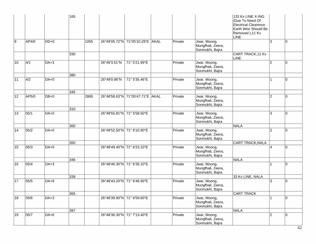
62
165 132 Kv LINE X-ING (Due To Need Of Electrical Clearence Earth Wire Should Be Removed ),11 Kv LINE
9 AP4/0 DD+0 1055 26°49'05.72"N 71°05'10.29"E AKAL Private Jwar, Moong, Mungfhali, Zeera, Sonmukhi, Bajra
3 0
330 CART TRACK,11 Kv LINE
10 4/1 DA+3 26°49'3.51"N 71° 5'21.99"E Private Jwar, Moong, Mungfhali, Zeera, Sonmukhi, Bajra
2 0
380 11 4/2 DA+0 26°49'0.96"N 71° 5'35.46"E Private Jwar, Moong,
Mungfhali, Zeera, Sonmukhi, Bajra
1 0
345 12 AP5/0 DB+0 2865 26°48'58.63"N 71°05'47.71"E AKAL Private Jwar, Moong,
Mungfhali, Zeera, Sonmukhi, Bajra
2 0
310 13 05/1 DA+0 26°48'55.81"N 71° 5'58.50"E Private Jwar, Moong,
Mungfhali, Zeera, Sonmukhi, Bajra
3 0
360 NALA 14 05/2 DA+0 26°48'52.50"N 71° 6'10.90"E Private Jwar, Moong,
Mungfhali, Zeera, Sonmukhi, Bajra
2 0
350 CART TRACK,NALA 15 05/3 DA+0 26°48'49.40"N 71° 6'23.10"E Private Jwar, Moong,
Mungfhali, Zeera, Sonmukhi, Bajra
4 0
346 NALA 16 05/4 DA+3 26°48'46.30"N 71° 6'35.10"E Private Jwar, Moong,
Mungfhali, Zeera, Sonmukhi, Bajra
1 0
339 33 Kv LINE, NALA 17 05/5 DA+9 26°48'43.20"N 71° 6'46.90"E Private Jwar, Moong,
Mungfhali, Zeera, Sonmukhi, Bajra
3 0
365 CART TRACK 18 05/6 DA+3 26°48'39.90"N 71° 6'59.60"E Private Jwar, Moong,
Mungfhali, Zeera, Sonmukhi, Bajra
1 0
397 NALA 19 05/7 DA+6 26°48'36.30"N 71° 7'13.40"E Private Jwar, Moong,
Mungfhali, Zeera, Sonmukhi, Bajra
2 0
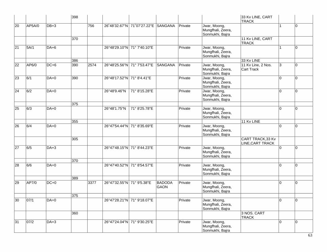
63
398 33 Kv LINE, CART TRACK
20 AP5A/0 DB+3 756 26˚48’32.67"N 71˚07’27.22"E SANGANA Private Jwar, Moong, Mungfhali, Zeera, Sonmukhi, Bajra
1 0
370 11 Kv LINE, CART TRACK
21 5A/1 DA+6 26°48'29.10"N 71° 7'40.10"E Private Jwar, Moong, Mungfhali, Zeera, Sonmukhi, Bajra
1 0
386 33 Kv LINE 22 AP6/0 DC+6 390 2574 26°48'25.56"N 71° 7'53.47"E SANGANA Private Jwar, Moong,
Mungfhali, Zeera, Sonmukhi, Bajra
11 Kv Line, 2 Nos. Cart Track
3 0
23 6/1 DA+0 390 26°48'17.52"N 71° 8'4.41"E Private Jwar, Moong, Mungfhali, Zeera, Sonmukhi, Bajra
0 0
24 6/2 DA+0 26°48'9.46"N 71° 8'15.28"E Private Jwar, Moong, Mungfhali, Zeera, Sonmukhi, Bajra
0 0
375 25 6/3 DA+0 26°48'1.75"N 71° 8'25.78"E Private Jwar, Moong,
Mungfhali, Zeera, Sonmukhi, Bajra
0 0
355 11 Kv LINE 26 6/4 DA+0 26°47'54.44"N 71° 8'35.69"E Private Jwar, Moong,
Mungfhali, Zeera, Sonmukhi, Bajra
0 0
305 CART TRACK,33 Kv LINE,CART TRACK
27 6/5 DA+3 26°47'48.15"N 71° 8'44.23"E Private Jwar, Moong, Mungfhali, Zeera, Sonmukhi, Bajra
0 0
370 28 6/6 DA+0 26°47'40.52"N 71° 8'54.57"E Private Jwar, Moong,
Mungfhali, Zeera, Sonmukhi, Bajra
0 0
389 29 AP7/0 DC+0 3377 26°47'32.55"N 71° 9'5.38"E BADODA
GAON Private Jwar, Moong,
Mungfhali, Zeera, Sonmukhi, Bajra
0 0
375 30 07/1 DA+0 26°47'28.21"N 71° 9'18.07"E Private Jwar, Moong,
Mungfhali, Zeera, Sonmukhi, Bajra
0 0
360 3 NOS. CART TRACK
31 07/2 DA+3 26°47'24.04"N 71° 9'30.25"E Private Jwar, Moong, Mungfhali, Zeera, Sonmukhi, Bajra
0 0
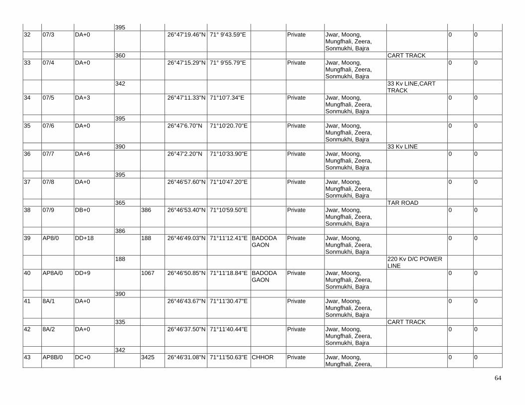
64
395 32 07/3 DA+0 26°47'19.46"N 71° 9'43.59"E Private Jwar, Moong,
Mungfhali, Zeera, Sonmukhi, Bajra
0 0
360 CART TRACK 33 07/4 DA+0 26°47'15.29"N 71° 9'55.79"E Private Jwar, Moong,
Mungfhali, Zeera, Sonmukhi, Bajra
0 0
342 33 Kv LINE,CART TRACK
34 07/5 DA+3 26°47'11.33"N 71°10'7.34"E Private Jwar, Moong, Mungfhali, Zeera, Sonmukhi, Bajra
0 0
395 35 07/6 DA+0 26°47'6.70"N 71°10'20.70"E Private Jwar, Moong,
Mungfhali, Zeera, Sonmukhi, Bajra
0 0
390 33 Kv LINE 36 07/7 DA+6 26°47'2.20"N 71°10'33.90"E Private Jwar, Moong,
Mungfhali, Zeera, Sonmukhi, Bajra
0 0
395 37 07/8 DA+0 26°46'57.60"N 71°10'47.20"E Private Jwar, Moong,
Mungfhali, Zeera, Sonmukhi, Bajra
0 0
365 TAR ROAD 38 07/9 DB+0 386 26°46'53.40"N 71°10'59.50"E Private Jwar, Moong,
Mungfhali, Zeera, Sonmukhi, Bajra
0 0
386 39 AP8/0 DD+18 188 26°46'49.03"N 71°11'12.41"E BADODA
GAON Private Jwar, Moong,
Mungfhali, Zeera, Sonmukhi, Bajra
0 0
188 220 Kv D/C POWER LINE
40 AP8A/0 DD+9 1067 26°46'50.85"N 71°11'18.84"E BADODA GAON
Private Jwar, Moong, Mungfhali, Zeera, Sonmukhi, Bajra
0 0
390 41 8A/1 DA+0 26°46'43.67"N 71°11'30.47"E Private Jwar, Moong,
Mungfhali, Zeera, Sonmukhi, Bajra
0 0
335 CART TRACK 42 8A/2 DA+0 26°46'37.50"N 71°11'40.44"E Private Jwar, Moong,
Mungfhali, Zeera, Sonmukhi, Bajra
0 0
342 43 AP8B/0 DC+0 3425 26°46'31.08"N 71°11'50.63"E CHHOR Private Jwar, Moong,
Mungfhali, Zeera, 0 0
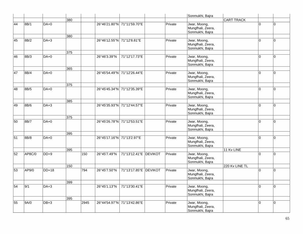
65
Sonmukhi, Bajra 380 CART TRACK 44 8B/1 DA+0 26°46'21.80"N 71°11'59.70"E Private Jwar, Moong,
Mungfhali, Zeera, Sonmukhi, Bajra
0 0
380 45 8B/2 DA+3 26°46'12.55"N 71°12'8.81"E Private Jwar, Moong,
Mungfhali, Zeera, Sonmukhi, Bajra
0 0
375 46 8B/3 DA+0 26°46'3.39"N 71°12'17.73"E Private Jwar, Moong,
Mungfhali, Zeera, Sonmukhi, Bajra
0 0
365 47 8B/4 DA+0 26°45'54.49"N 71°12'26.44"E Private Jwar, Moong,
Mungfhali, Zeera, Sonmukhi, Bajra
0 0
375 48 8B/5 DA+0 26°45'45.34"N 71°12'35.39"E Private Jwar, Moong,
Mungfhali, Zeera, Sonmukhi, Bajra
0 0
385 49 8B/6 DA+3 26°45'35.93"N 71°12'44.57"E Private Jwar, Moong,
Mungfhali, Zeera, Sonmukhi, Bajra
0 0
375 50 8B/7 DA+0 26°45'26.78"N 71°12'53.51"E Private Jwar, Moong,
Mungfhali, Zeera, Sonmukhi, Bajra
0 0
395 51 8B/8 DA+0 26°45'17.16"N 71°13'2.97"E Private Jwar, Moong,
Mungfhali, Zeera, Sonmukhi, Bajra
0 0
395 11 Kv LINE 52 AP8C/0 DD+9 150 26°45'7.49"N 71°13'12.41"E DEVIKOT Private Jwar, Moong,
Mungfhali, Zeera, Sonmukhi, Bajra
0 0
150 220 Kv LINE TL 53 AP9/0 DD+18 794 26°45'7.50"N 71°13'17.85"E DEVIKOT Private Jwar, Moong,
Mungfhali, Zeera, Sonmukhi, Bajra
0 0
399 54 9/1 DA+3 26°45'1.13"N 71°13'30.41"E Private Jwar, Moong,
Mungfhali, Zeera, Sonmukhi, Bajra
0 0
395 55 9A/0 DB+3 2945 26°44'54.97"N 71°13'42.86"E Private Jwar, Moong,
Mungfhali, Zeera, Sonmukhi, Bajra
0 0
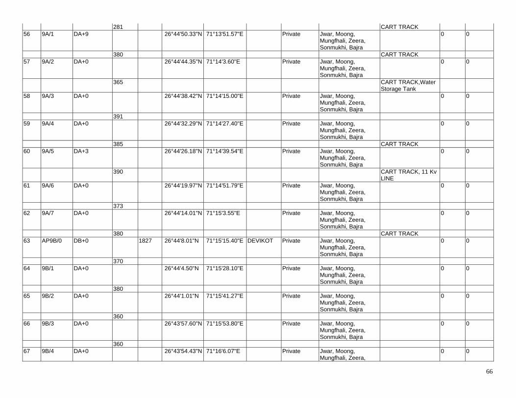
66
281 CART TRACK 56 9A/1 DA+9 26°44'50.33"N 71°13'51.57"E Private Jwar, Moong,
Mungfhali, Zeera, Sonmukhi, Bajra
0 0
380 CART TRACK 57 9A/2 DA+0 26°44'44.35"N 71°14'3.60"E Private Jwar, Moong,
Mungfhali, Zeera, Sonmukhi, Bajra
0 0
365 CART TRACK,Water Storage Tank
58 9A/3 DA+0 26°44'38.42"N 71°14'15.00"E Private Jwar, Moong, Mungfhali, Zeera, Sonmukhi, Bajra
0 0
391 59 9A/4 DA+0 26°44'32.29"N 71°14'27.40"E Private Jwar, Moong,
Mungfhali, Zeera, Sonmukhi, Bajra
0 0
385 CART TRACK 60 9A/5 DA+3 26°44'26.18"N 71°14'39.54"E Private Jwar, Moong,
Mungfhali, Zeera, Sonmukhi, Bajra
0 0
390 CART TRACK, 11 Kv LINE
61 9A/6 DA+0 26°44'19.97"N 71°14'51.79"E Private Jwar, Moong, Mungfhali, Zeera, Sonmukhi, Bajra
0 0
373 62 9A/7 DA+0 26°44'14.01"N 71°15'3.55"E Private Jwar, Moong,
Mungfhali, Zeera, Sonmukhi, Bajra
0 0
380 CART TRACK 63 AP9B/0 DB+0 1827 26°44'8.01"N 71°15'15.40"E DEVIKOT Private Jwar, Moong,
Mungfhali, Zeera, Sonmukhi, Bajra
0 0
370 64 9B/1 DA+0 26°44'4.50"N 71°15'28.10"E Private Jwar, Moong,
Mungfhali, Zeera, Sonmukhi, Bajra
0 0
380 65 9B/2 DA+0 26°44'1.01"N 71°15'41.27"E Private Jwar, Moong,
Mungfhali, Zeera, Sonmukhi, Bajra
0 0
360 66 9B/3 DA+0 26°43'57.60"N 71°15'53.80"E Private Jwar, Moong,
Mungfhali, Zeera, Sonmukhi, Bajra
0 0
360 67 9B/4 DA+0 26°43'54.43"N 71°16'6.07"E Private Jwar, Moong,
Mungfhali, Zeera, 0 0
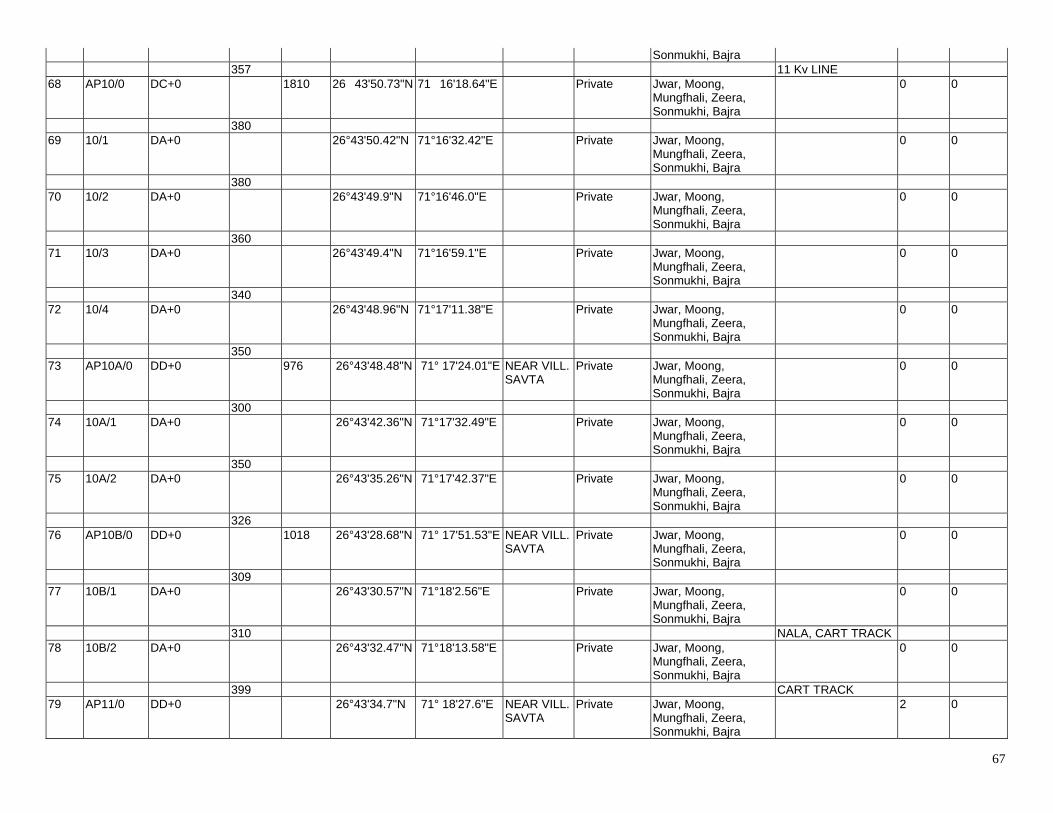
67
Sonmukhi, Bajra 357 11 Kv LINE 68 AP10/0 DC+0 1810 26�43'50.73"N 71�16'18.64"E Private Jwar, Moong,
Mungfhali, Zeera, Sonmukhi, Bajra
0 0
380 69 10/1 DA+0 26°43'50.42"N 71°16'32.42"E Private Jwar, Moong,
Mungfhali, Zeera, Sonmukhi, Bajra
0 0
380 70 10/2 DA+0 26°43'49.9"N 71°16'46.0"E Private Jwar, Moong,
Mungfhali, Zeera, Sonmukhi, Bajra
0 0
360 71 10/3 DA+0 26°43'49.4"N 71°16'59.1"E Private Jwar, Moong,
Mungfhali, Zeera, Sonmukhi, Bajra
0 0
340 72 10/4 DA+0 26°43'48.96"N 71°17'11.38"E Private Jwar, Moong,
Mungfhali, Zeera, Sonmukhi, Bajra
0 0
350 73 AP10A/0 DD+0 976 26°43'48.48"N 71° 17'24.01"E NEAR VILL.
SAVTA Private Jwar, Moong,
Mungfhali, Zeera, Sonmukhi, Bajra
0 0
300 74 10A/1 DA+0 26°43'42.36"N 71°17'32.49"E Private Jwar, Moong,
Mungfhali, Zeera, Sonmukhi, Bajra
0 0
350 75 10A/2 DA+0 26°43'35.26"N 71°17'42.37"E Private Jwar, Moong,
Mungfhali, Zeera, Sonmukhi, Bajra
0 0
326 76 AP10B/0 DD+0 1018 26°43'28.68"N 71° 17'51.53"E NEAR VILL.
SAVTA Private Jwar, Moong,
Mungfhali, Zeera, Sonmukhi, Bajra
0 0
309 77 10B/1 DA+0 26°43'30.57"N 71°18'2.56"E Private Jwar, Moong,
Mungfhali, Zeera, Sonmukhi, Bajra
0 0
310 NALA, CART TRACK 78 10B/2 DA+0 26°43'32.47"N 71°18'13.58"E Private Jwar, Moong,
Mungfhali, Zeera, Sonmukhi, Bajra
0 0
399 CART TRACK 79 AP11/0 DD+0 26°43'34.7"N 71° 18'27.6"E NEAR VILL.
SAVTA Private Jwar, Moong,
Mungfhali, Zeera, Sonmukhi, Bajra
2 0
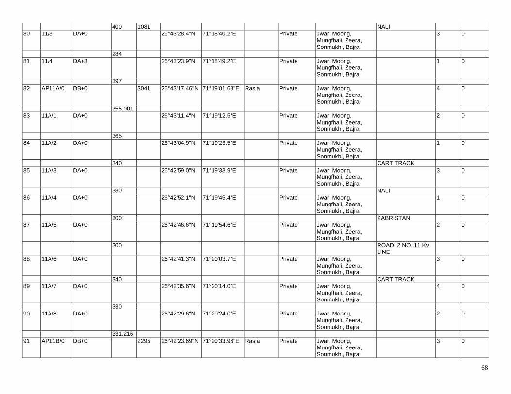
68
400 1081 NALI 80 11/3 DA+0 26°43'28.4"N 71°18'40.2"E Private Jwar, Moong,
Mungfhali, Zeera, Sonmukhi, Bajra
3 0
284 81 11/4 DA+3 26°43'23.9"N 71°18'49.2"E Private Jwar, Moong,
Mungfhali, Zeera, Sonmukhi, Bajra
1 0
397 82 AP11A/0 DB+0 3041 26°43'17.46"N 71°19'01.68"E Rasla Private Jwar, Moong,
Mungfhali, Zeera, Sonmukhi, Bajra
4 0
355.001 83 11A/1 DA+0 26°43'11.4"N 71°19'12.5"E Private Jwar, Moong,
Mungfhali, Zeera, Sonmukhi, Bajra
2 0
365 84 11A/2 DA+0 26°43'04.9"N 71°19'23.5"E Private Jwar, Moong,
Mungfhali, Zeera, Sonmukhi, Bajra
1 0
340 CART TRACK 85 11A/3 DA+0 26°42'59.0"N 71°19'33.9"E Private Jwar, Moong,
Mungfhali, Zeera, Sonmukhi, Bajra
3 0
380 NALI 86 11A/4 DA+0 26°42'52.1"N 71°19'45.4"E Private Jwar, Moong,
Mungfhali, Zeera, Sonmukhi, Bajra
1 0
300 KABRISTAN 87 11A/5 DA+0 26°42'46.6"N 71°19'54.6"E Private Jwar, Moong,
Mungfhali, Zeera, Sonmukhi, Bajra
2 0
300 ROAD, 2 NO. 11 Kv LINE
88 11A/6 DA+0 26°42'41.3"N 71°20'03.7"E Private Jwar, Moong, Mungfhali, Zeera, Sonmukhi, Bajra
3 0
340 CART TRACK 89 11A/7 DA+0 26°42'35.6"N 71°20'14.0"E Private Jwar, Moong,
Mungfhali, Zeera, Sonmukhi, Bajra
4 0
330 90 11A/8 DA+0 26°42'29.6"N 71°20'24.0"E Private Jwar, Moong,
Mungfhali, Zeera, Sonmukhi, Bajra
2 0
331.216 91 AP11B/0 DB+0 2295 26°42'23.69"N 71°20'33.96"E Rasla Private Jwar, Moong,
Mungfhali, Zeera, Sonmukhi, Bajra
3 0
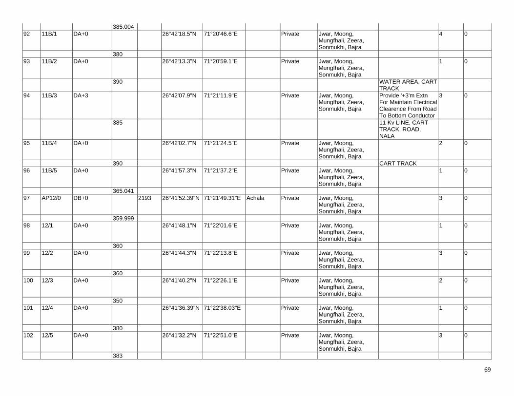
69
385.004 92 11B/1 DA+0 26°42'18.5"N 71°20'46.6"E Private Jwar, Moong,
Mungfhali, Zeera, Sonmukhi, Bajra
4 0
380 93 11B/2 DA+0 26°42'13.3"N 71°20'59.1"E Private Jwar, Moong,
Mungfhali, Zeera, Sonmukhi, Bajra
1 0
390 WATER AREA, CART TRACK
94 11B/3 DA+3 26°42'07.9"N 71°21'11.9"E Private Jwar, Moong, Mungfhali, Zeera, Sonmukhi, Bajra
Provide '+3'm Extn For Maintain Electrical Clearence From Road To Bottom Conductor
3 0
385 11 Kv LINE, CART TRACK, ROAD, NALA
95 11B/4 DA+0 26°42'02.7"N 71°21'24.5"E Private Jwar, Moong, Mungfhali, Zeera, Sonmukhi, Bajra
2 0
390 CART TRACK 96 11B/5 DA+0 26°41'57.3"N 71°21'37.2"E Private Jwar, Moong,
Mungfhali, Zeera, Sonmukhi, Bajra
1 0
365.041 97 AP12/0 DB+0 2193 26°41'52.39"N 71°21'49.31"E Achala Private Jwar, Moong,
Mungfhali, Zeera, Sonmukhi, Bajra
3 0
359.999 98 12/1 DA+0 26°41'48.1"N 71°22'01.6"E Private Jwar, Moong,
Mungfhali, Zeera, Sonmukhi, Bajra
1 0
360 99 12/2 DA+0 26°41'44.3"N 71°22'13.8"E Private Jwar, Moong,
Mungfhali, Zeera, Sonmukhi, Bajra
3 0
360 100 12/3 DA+0 26°41'40.2"N 71°22'26.1"E Private Jwar, Moong,
Mungfhali, Zeera, Sonmukhi, Bajra
2 0
350 101 12/4 DA+0 26°41'36.39"N 71°22'38.03"E Private Jwar, Moong,
Mungfhali, Zeera, Sonmukhi, Bajra
1 0
380 102 12/5 DA+0 26°41'32.2"N 71°22'51.0"E Private Jwar, Moong,
Mungfhali, Zeera, Sonmukhi, Bajra
3 0
383
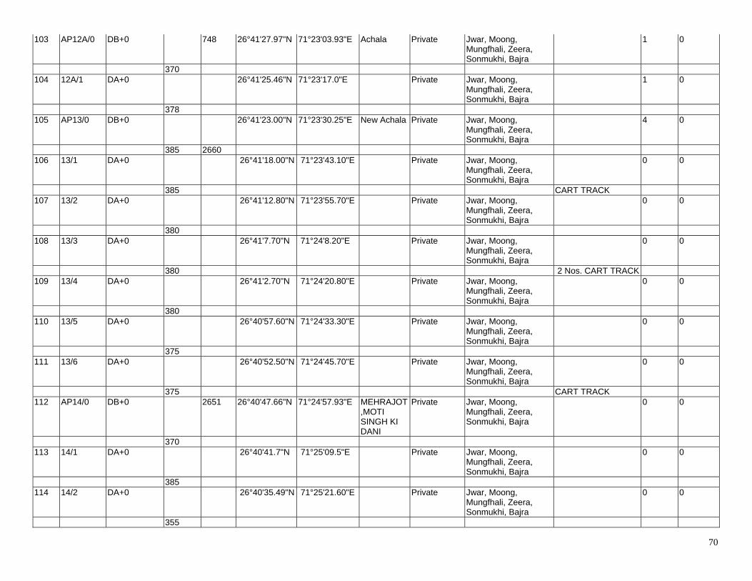
70
103 AP12A/0 DB+0 748 26°41'27.97"N 71°23'03.93"E Achala Private Jwar, Moong, Mungfhali, Zeera, Sonmukhi, Bajra
1 0
370 104 12A/1 DA+0 26°41'25.46"N 71°23'17.0"E Private Jwar, Moong,
Mungfhali, Zeera, Sonmukhi, Bajra
1 0
378 105 AP13/0 DB+0 26°41'23.00"N 71°23'30.25"E New Achala Private Jwar, Moong,
Mungfhali, Zeera, Sonmukhi, Bajra
4 0
385 2660 106 13/1 DA+0 26°41'18.00"N 71°23'43.10"E Private Jwar, Moong,
Mungfhali, Zeera, Sonmukhi, Bajra
0 0
385 CART TRACK 107 13/2 DA+0 26°41'12.80"N 71°23'55.70"E Private Jwar, Moong,
Mungfhali, Zeera, Sonmukhi, Bajra
0 0
380 108 13/3 DA+0 26°41'7.70"N 71°24'8.20"E Private Jwar, Moong,
Mungfhali, Zeera, Sonmukhi, Bajra
0 0
380 2 Nos. CART TRACK 109 13/4 DA+0 26°41'2.70"N 71°24'20.80"E Private Jwar, Moong,
Mungfhali, Zeera, Sonmukhi, Bajra
0 0
380 110 13/5 DA+0 26°40'57.60"N 71°24'33.30"E Private Jwar, Moong,
Mungfhali, Zeera, Sonmukhi, Bajra
0 0
375 111 13/6 DA+0 26°40'52.50"N 71°24'45.70"E Private Jwar, Moong,
Mungfhali, Zeera, Sonmukhi, Bajra
0 0
375 CART TRACK 112 AP14/0 DB+0 2651 26°40'47.66"N 71°24'57.93"E MEHRAJOT
,MOTI SINGH KI DANI
Private Jwar, Moong, Mungfhali, Zeera, Sonmukhi, Bajra
0 0
370 113 14/1 DA+0 26°40'41.7"N 71°25'09.5"E Private Jwar, Moong,
Mungfhali, Zeera, Sonmukhi, Bajra
0 0
385 114 14/2 DA+0 26°40'35.49"N 71°25'21.60"E Private Jwar, Moong,
Mungfhali, Zeera, Sonmukhi, Bajra
0 0
355
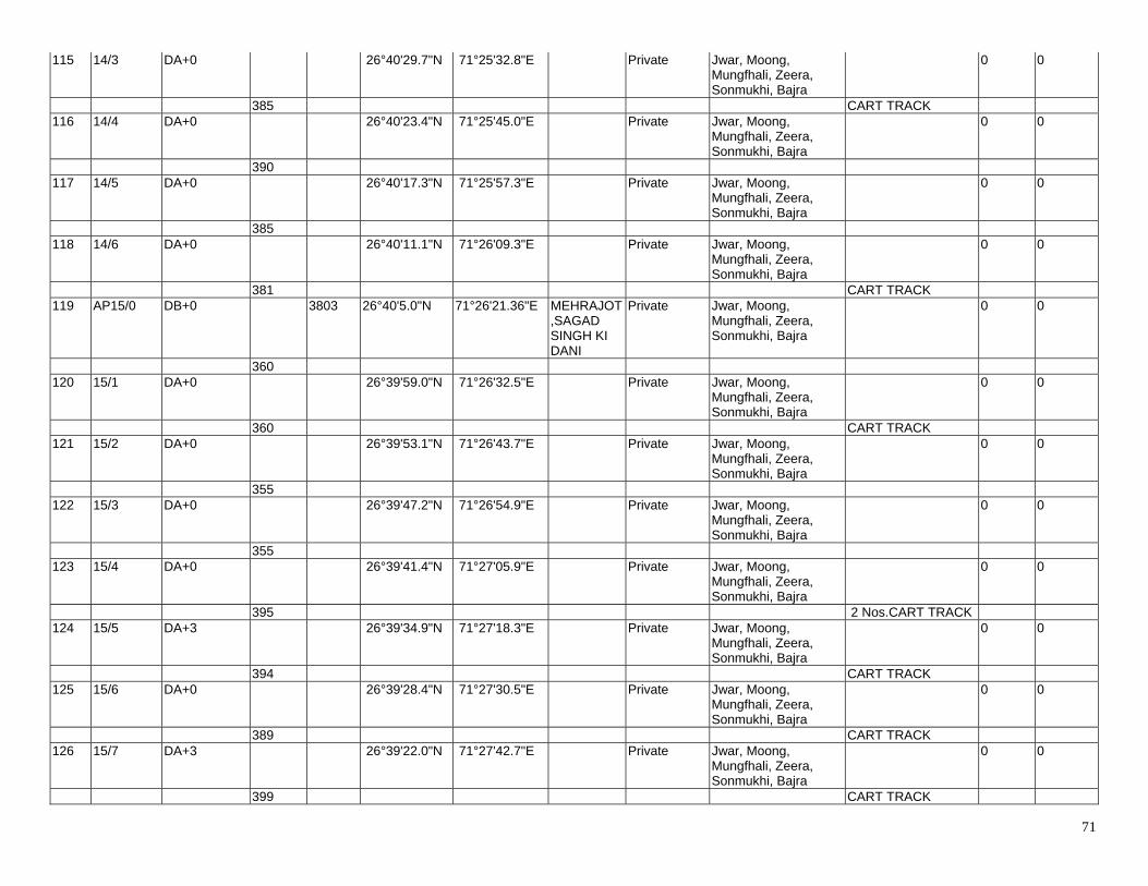
71
115 14/3 DA+0 26°40'29.7"N 71°25'32.8"E Private Jwar, Moong, Mungfhali, Zeera, Sonmukhi, Bajra
0 0
385 CART TRACK 116 14/4 DA+0 26°40'23.4"N 71°25'45.0"E Private Jwar, Moong,
Mungfhali, Zeera, Sonmukhi, Bajra
0 0
390 117 14/5 DA+0 26°40'17.3"N 71°25'57.3"E Private Jwar, Moong,
Mungfhali, Zeera, Sonmukhi, Bajra
0 0
385 118 14/6 DA+0 26°40'11.1"N 71°26'09.3"E Private Jwar, Moong,
Mungfhali, Zeera, Sonmukhi, Bajra
0 0
381 CART TRACK 119 AP15/0 DB+0 3803 26°40'5.0"N 71°26'21.36"E MEHRAJOT
,SAGAD SINGH KI DANI
Private Jwar, Moong, Mungfhali, Zeera, Sonmukhi, Bajra
0 0
360 120 15/1 DA+0 26°39'59.0"N 71°26'32.5"E Private Jwar, Moong,
Mungfhali, Zeera, Sonmukhi, Bajra
0 0
360 CART TRACK 121 15/2 DA+0 26°39'53.1"N 71°26'43.7"E Private Jwar, Moong,
Mungfhali, Zeera, Sonmukhi, Bajra
0 0
355 122 15/3 DA+0 26°39'47.2"N 71°26'54.9"E Private Jwar, Moong,
Mungfhali, Zeera, Sonmukhi, Bajra
0 0
355 123 15/4 DA+0 26°39'41.4"N 71°27'05.9"E Private Jwar, Moong,
Mungfhali, Zeera, Sonmukhi, Bajra
0 0
395 2 Nos.CART TRACK 124 15/5 DA+3 26°39'34.9"N 71°27'18.3"E Private Jwar, Moong,
Mungfhali, Zeera, Sonmukhi, Bajra
0 0
394 CART TRACK 125 15/6 DA+0 26°39'28.4"N 71°27'30.5"E Private Jwar, Moong,
Mungfhali, Zeera, Sonmukhi, Bajra
0 0
389 CART TRACK 126 15/7 DA+3 26°39'22.0"N 71°27'42.7"E Private Jwar, Moong,
Mungfhali, Zeera, Sonmukhi, Bajra
0 0
399 CART TRACK
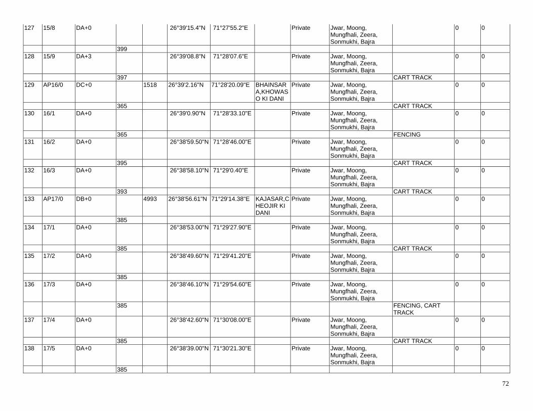
72
127 15/8 DA+0 26°39'15.4"N 71°27'55.2"E Private Jwar, Moong, Mungfhali, Zeera, Sonmukhi, Bajra
0 0
399 128 15/9 DA+3 26°39'08.8"N 71°28'07.6"E Private Jwar, Moong,
Mungfhali, Zeera, Sonmukhi, Bajra
0 0
397 CART TRACK 129 AP16/0 DC+0 1518 26°39'2.16"N 71°28'20.09"E BHAINSAR
A,KHOWASO KI DANI
Private Jwar, Moong, Mungfhali, Zeera, Sonmukhi, Bajra
0 0
365 CART TRACK 130 16/1 DA+0 26°39'0.90"N 71°28'33.10"E Private Jwar, Moong,
Mungfhali, Zeera, Sonmukhi, Bajra
0 0
365 FENCING 131 16/2 DA+0 26°38'59.50"N 71°28'46.00"E Private Jwar, Moong,
Mungfhali, Zeera, Sonmukhi, Bajra
0 0
395 CART TRACK 132 16/3 DA+0 26°38'58.10"N 71°29'0.40"E Private Jwar, Moong,
Mungfhali, Zeera, Sonmukhi, Bajra
0 0
393 CART TRACK 133 AP17/0 DB+0 4993 26°38'56.61"N 71°29'14.38"E KAJASAR,C
HEOJIR KI DANI
Private Jwar, Moong, Mungfhali, Zeera, Sonmukhi, Bajra
0 0
385 134 17/1 DA+0 26°38'53.00"N 71°29'27.90"E Private Jwar, Moong,
Mungfhali, Zeera, Sonmukhi, Bajra
0 0
385 CART TRACK 135 17/2 DA+0 26°38'49.60"N 71°29'41.20"E Private Jwar, Moong,
Mungfhali, Zeera, Sonmukhi, Bajra
0 0
385 136 17/3 DA+0 26°38'46.10"N 71°29'54.60"E Private Jwar, Moong,
Mungfhali, Zeera, Sonmukhi, Bajra
0 0
385 FENCING, CART TRACK
137 17/4 DA+0 26°38'42.60"N 71°30'08.00"E Private Jwar, Moong, Mungfhali, Zeera, Sonmukhi, Bajra
0 0
385 CART TRACK 138 17/5 DA+0 26°38'39.00"N 71°30'21.30"E Private Jwar, Moong,
Mungfhali, Zeera, Sonmukhi, Bajra
0 0
385
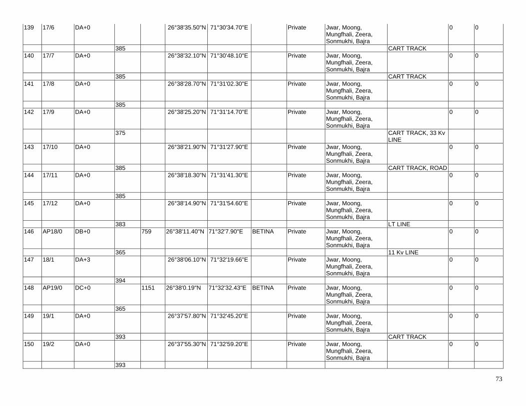
73
139 17/6 DA+0 26°38'35.50"N 71°30'34.70"E Private Jwar, Moong, Mungfhali, Zeera, Sonmukhi, Bajra
0 0
385 CART TRACK 140 17/7 DA+0 26°38'32.10"N 71°30'48.10"E Private Jwar, Moong,
Mungfhali, Zeera, Sonmukhi, Bajra
0 0
385 CART TRACK 141 17/8 DA+0 26°38'28.70"N 71°31'02.30"E Private Jwar, Moong,
Mungfhali, Zeera, Sonmukhi, Bajra
0 0
385 142 17/9 DA+0 26°38'25.20"N 71°31'14.70"E Private Jwar, Moong,
Mungfhali, Zeera, Sonmukhi, Bajra
0 0
375 CART TRACK, 33 Kv LINE
143 17/10 DA+0 26°38'21.90"N 71°31'27.90"E Private Jwar, Moong, Mungfhali, Zeera, Sonmukhi, Bajra
0 0
385 CART TRACK, ROAD 144 17/11 DA+0 26°38'18.30"N 71°31'41.30"E Private Jwar, Moong,
Mungfhali, Zeera, Sonmukhi, Bajra
0 0
385 145 17/12 DA+0 26°38'14.90"N 71°31'54.60"E Private Jwar, Moong,
Mungfhali, Zeera, Sonmukhi, Bajra
0 0
383 LT LINE 146 AP18/0 DB+0 759 26°38'11.40"N 71°32'7.90"E BETINA Private Jwar, Moong,
Mungfhali, Zeera, Sonmukhi, Bajra
0 0
365 11 Kv LINE 147 18/1 DA+3 26°38'06.10"N 71°32'19.66"E Private Jwar, Moong,
Mungfhali, Zeera, Sonmukhi, Bajra
0 0
394 148 AP19/0 DC+0 1151 26°38'0.19"N 71°32'32.43"E BETINA Private Jwar, Moong,
Mungfhali, Zeera, Sonmukhi, Bajra
0 0
365 149 19/1 DA+0 26°37'57.80"N 71°32'45.20"E Private Jwar, Moong,
Mungfhali, Zeera, Sonmukhi, Bajra
0 0
393 CART TRACK 150 19/2 DA+0 26°37'55.30"N 71°32'59.20"E Private Jwar, Moong,
Mungfhali, Zeera, Sonmukhi, Bajra
0 0
393
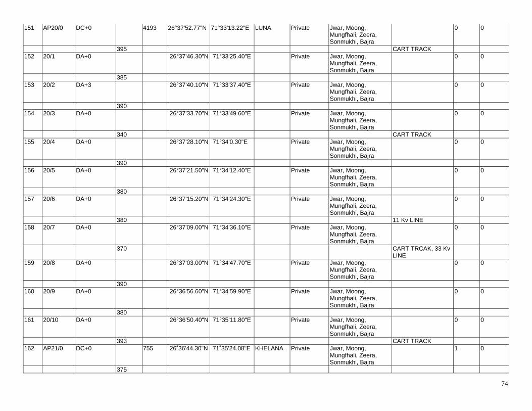
74
151 AP20/0 DC+0 4193 26°37'52.77"N 71°33'13.22"E LUNA Private Jwar, Moong, Mungfhali, Zeera, Sonmukhi, Bajra
0 0
395 CART TRACK 152 20/1 DA+0 26°37'46.30"N 71°33'25.40"E Private Jwar, Moong,
Mungfhali, Zeera, Sonmukhi, Bajra
0 0
385 153 20/2 DA+3 26°37'40.10"N 71°33'37.40"E Private Jwar, Moong,
Mungfhali, Zeera, Sonmukhi, Bajra
0 0
390 154 20/3 DA+0 26°37'33.70"N 71°33'49.60"E Private Jwar, Moong,
Mungfhali, Zeera, Sonmukhi, Bajra
0 0
340 CART TRACK 155 20/4 DA+0 26°37'28.10"N 71°34'0.30"E Private Jwar, Moong,
Mungfhali, Zeera, Sonmukhi, Bajra
0 0
390 156 20/5 DA+0 26°37'21.50"N 71°34'12.40"E Private Jwar, Moong,
Mungfhali, Zeera, Sonmukhi, Bajra
0 0
380 157 20/6 DA+0 26°37'15.20"N 71°34'24.30"E Private Jwar, Moong,
Mungfhali, Zeera, Sonmukhi, Bajra
0 0
380 11 Kv LINE 158 20/7 DA+0 26°37'09.00"N 71°34'36.10"E Private Jwar, Moong,
Mungfhali, Zeera, Sonmukhi, Bajra
0 0
370 CART TRCAK, 33 Kv LINE
159 20/8 DA+0 26°37'03.00"N 71°34'47.70"E Private Jwar, Moong, Mungfhali, Zeera, Sonmukhi, Bajra
0 0
390 160 20/9 DA+0 26°36'56.60"N 71°34'59.90"E Private Jwar, Moong,
Mungfhali, Zeera, Sonmukhi, Bajra
0 0
380 161 20/10 DA+0 26°36'50.40"N 71°35'11.80"E Private Jwar, Moong,
Mungfhali, Zeera, Sonmukhi, Bajra
0 0
393 CART TRACK 162 AP21/0 DC+0 755 26˚36'44.30"N 71˚35'24.08"E KHELANA Private Jwar, Moong,
Mungfhali, Zeera, Sonmukhi, Bajra
1 0
375
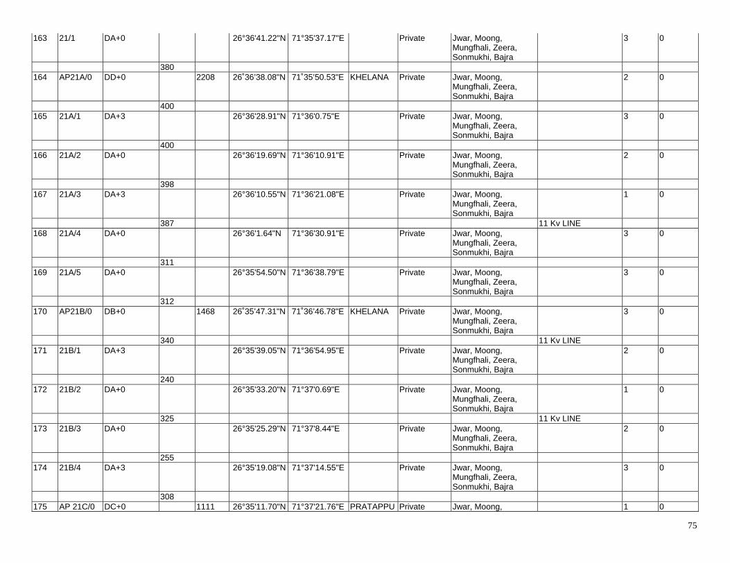
75
163 21/1 DA+0 26°36'41.22"N 71°35'37.17"E Private Jwar, Moong, Mungfhali, Zeera, Sonmukhi, Bajra
3 0
380 164 AP21A/0 DD+0 2208 26˚36’38.08"N 71˚35’50.53"E KHELANA Private Jwar, Moong,
Mungfhali, Zeera, Sonmukhi, Bajra
2 0
400 165 21A/1 DA+3 26°36'28.91"N 71°36'0.75"E Private Jwar, Moong,
Mungfhali, Zeera, Sonmukhi, Bajra
3 0
400 166 21A/2 DA+0 26°36'19.69"N 71°36'10.91"E Private Jwar, Moong,
Mungfhali, Zeera, Sonmukhi, Bajra
2 0
398 167 21A/3 DA+3 26°36'10.55"N 71°36'21.08"E Private Jwar, Moong,
Mungfhali, Zeera, Sonmukhi, Bajra
1 0
387 11 Kv LINE 168 21A/4 DA+0 26°36'1.64"N 71°36'30.91"E Private Jwar, Moong,
Mungfhali, Zeera, Sonmukhi, Bajra
3 0
311 169 21A/5 DA+0 26°35'54.50"N 71°36'38.79"E Private Jwar, Moong,
Mungfhali, Zeera, Sonmukhi, Bajra
3 0
312 170 AP21B/0 DB+0 1468 26˚35’47.31"N 71˚36’46.78"E KHELANA Private Jwar, Moong,
Mungfhali, Zeera, Sonmukhi, Bajra
3 0
340 11 Kv LINE 171 21B/1 DA+3 26°35'39.05"N 71°36'54.95"E Private Jwar, Moong,
Mungfhali, Zeera, Sonmukhi, Bajra
2 0
240 172 21B/2 DA+0 26°35'33.20"N 71°37'0.69"E Private Jwar, Moong,
Mungfhali, Zeera, Sonmukhi, Bajra
1 0
325 11 Kv LINE 173 21B/3 DA+0 26°35'25.29"N 71°37'8.44"E Private Jwar, Moong,
Mungfhali, Zeera, Sonmukhi, Bajra
2 0
255 174 21B/4 DA+3 26°35'19.08"N 71°37'14.55"E Private Jwar, Moong,
Mungfhali, Zeera, Sonmukhi, Bajra
3 0
308 175 AP 21C/0 DC+0 1111 26°35'11.70"N 71°37'21.76"E PRATAPPU Private Jwar, Moong, 1 0
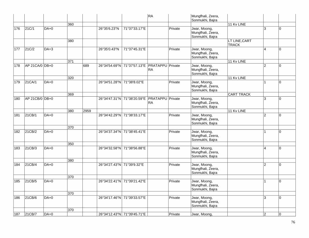
76
RA Mungfhali, Zeera, Sonmukhi, Bajra
360 11 Kv LINE 176 21C/1 DA+0 26°35'6.23"N 71°37'33.17"E Private Jwar, Moong,
Mungfhali, Zeera, Sonmukhi, Bajra
3 0
380 LT LINE,CART TRACK
177 21C/2 DA+3 26°35'0.43"N 71°37'45.31"E Private Jwar, Moong, Mungfhali, Zeera, Sonmukhi, Bajra
4 0
371 11 Kv LINE 178 AP 21CA/0 DB+0 689 26°34'54.69"N 71°37'57.13"E PRATAPPU
RA Private Jwar, Moong,
Mungfhali, Zeera, Sonmukhi, Bajra
2 0
320 11 Kv LINE 179 21CA/1 DA+0 26°34'51.28"N 71°38'8.02"E Private Jwar, Moong,
Mungfhali, Zeera, Sonmukhi, Bajra
1 0
369 CART TRACK 180 AP 21CB/0 DB+0 26°34'47.31"N 71°38'20.59"E PRATAPPU
RA Private Jwar, Moong,
Mungfhali, Zeera, Sonmukhi, Bajra
3 0
380 2959 11 Kv LINE 181 21CB/1 DA+0 26°34'42.29"N 71°38'33.17"E Private Jwar, Moong,
Mungfhali, Zeera, Sonmukhi, Bajra
2 0
370 182 21CB/2 DA+0 26°34'37.34"N 71°38'45.41"E Private Jwar, Moong,
Mungfhali, Zeera, Sonmukhi, Bajra
1 0
350 183 21CB/3 DA+0 26°34'32.58"N 71°38'56.88"E Private Jwar, Moong,
Mungfhali, Zeera, Sonmukhi, Bajra
4 0
380 184 21CB/4 DA+0 26°34'27.43"N 71°39'9.32"E Private Jwar, Moong,
Mungfhali, Zeera, Sonmukhi, Bajra
2 0
370 185 21CB/5 DA+0 26°34'22.41"N 71°39'21.42"E Private Jwar, Moong,
Mungfhali, Zeera, Sonmukhi, Bajra
1 0
370 186 21CB/6 DA+0 26°34'17.46"N 71°39'33.57"E Private Jwar, Moong,
Mungfhali, Zeera, Sonmukhi, Bajra
3 0
370 187 21CB/7 DA+0 26°34'12.43"N 71°39'45.71"E Private Jwar, Moong, 2 0
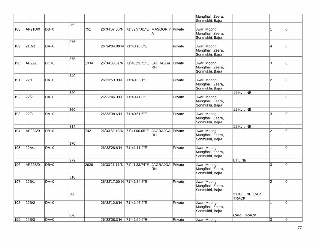
77
Mungfhali, Zeera, Sonmukhi, Bajra
369 188 AP21D/0 DB+0 751 26˚34'07.50"N 71˚39'57.81"E MASOORIY
A Private Jwar, Moong,
Mungfhali, Zeera, Sonmukhi, Bajra
1 0
376 189 21D/1 DA+0 26°34'04.00"N 71°40'10.8"E Private Jwar, Moong,
Mungfhali, Zeera, Sonmukhi, Bajra
4 0
375 190 AP22/0 DC+0 1334 26˚34'00.51"N 71˚40'23.71"E JAGRAJGA
RH Private Jwar, Moong,
Mungfhali, Zeera, Sonmukhi, Bajra
3 0
340 191 22/1 DA+0 26°33'53.3"N 71°40'33.1"E Private Jwar, Moong,
Mungfhali, Zeera, Sonmukhi, Bajra
2 0
320 11 Kv LINE 192 22/2 DA+0 26°33'46.3"N 71°40'41.8"E Private Jwar, Moong,
Mungfhali, Zeera, Sonmukhi, Bajra
1 0
360 11 Kv LINE 193 22/3 DA+0 26°33'38.6"N 71°40'51.6"E Private Jwar, Moong,
Mungfhali, Zeera, Sonmukhi, Bajra
3 0
314 11 Kv LINE 194 AP22A/0 DB+0 742 26˚33'32.13"N 71˚41'00.05"E JAGRAJGA
RH Private Jwar, Moong,
Mungfhali, Zeera, Sonmukhi, Bajra
2 0
370 195 22A/1 DA+0 26°33'26.6"N 71°41'11.9"E Private Jwar, Moong,
Mungfhali, Zeera, Sonmukhi, Bajra
1 0
372 LT LINE 196 AP22B/0 DB+0 2628 26˚33'21.11"N 71˚41'23.74"E JAGRAJGA
RH Private Jwar, Moong,
Mungfhali, Zeera, Sonmukhi, Bajra
3 0
318 197 22B/1 DA+0 26°33'17.00"N 71°41'34.3"E Private Jwar, Moong,
Mungfhali, Zeera, Sonmukhi, Bajra
2 0
380 11 Kv LINE, CART TRACK
198 22B/2 DA+0 26°33'12.6"N 71°41'47.2"E Private Jwar, Moong, Mungfhali, Zeera, Sonmukhi, Bajra
1 0
370 CART TRACK 199 22B/3 DA+0 26°33'08.3"N 71°41'59.6"E Private Jwar, Moong, 3 0

78
Mungfhali, Zeera, Sonmukhi, Bajra
390 200 22B/4 DA+0 26°33'03.9"N 71°42'12.5"E Private Jwar, Moong,
Mungfhali, Zeera, Sonmukhi, Bajra
2 0
400 11 Kv LINE 201 22B/5 DA+3 26°32'58.70"N 71°42'26.15"E Private Jwar, Moong,
Mungfhali, Zeera, Sonmukhi, Bajra
2 0
400 CART TRACK 202 22B/6 DA+3 26°32'53.88"N 71°42'39.54"E Private Jwar, Moong,
Mungfhali, Zeera, Sonmukhi, Bajra
3 0
370 2 NO. 11 Kv LINE 203 AP22C/0 DC+0 1837 26˚32'49.40"N 71˚42'51.90"E RAJMATHA
I,DHAULASAR
Private Jwar, Moong, Mungfhali, Zeera, Sonmukhi, Bajra
1 0
380 204 22C/1 DA+0 26°32'40.40"N 71°43'01.40"E Private Jwar, Moong,
Mungfhali, Zeera, Sonmukhi, Bajra
3 0
335 205 22C/2 DA+0 26°32'32.70"N 71°43'09.80"E Private Jwar, Moong,
Mungfhali, Zeera, Sonmukhi, Bajra
2 0
385 CART TRACK 206 22C/3 DC+0
(Transposition Tower)
26°32'23.60"N 71°43'19.40"E Private Jwar, Moong, Mungfhali, Zeera, Sonmukhi, Bajra
Transposition Tower 3 0
380 CART TRACK 207 22C/4 DA+0 26°32'14.70"N 71°43'29.00"E Private Jwar, Moong,
Mungfhali, Zeera, Sonmukhi, Bajra
1 0
357 11 Kv LINE, CART TRACK
208 AP22D/0 DB+0 2930 26°32'06.35"N 71°43'37.84"E RAJMATHAI
Private Jwar, Moong, Mungfhali, Zeera, Sonmukhi, Bajra
3 0
330 TAR ROAD, 33 Kv LINE, CART TRACK
209 22D/1 DA+0 26°31'59.50"N 71°43'47.10"E Private Jwar, Moong, Mungfhali, Zeera, Sonmukhi, Bajra
2 0
380 210 22D/2 DA+0 26°31'51.70"N 71°43'57.70"E Private Jwar, Moong,
Mungfhali, Zeera, Sonmukhi, Bajra
3 0
340 LT LINE
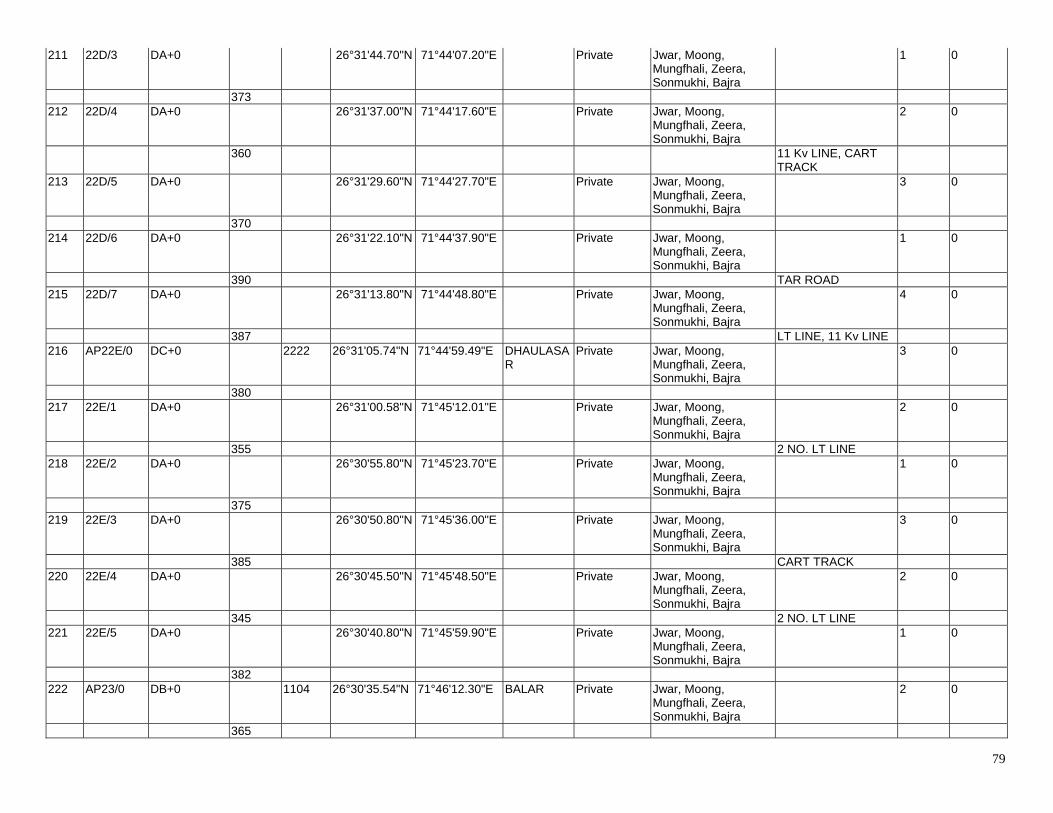
79
211 22D/3 DA+0 26°31'44.70"N 71°44'07.20"E Private Jwar, Moong, Mungfhali, Zeera, Sonmukhi, Bajra
1 0
373 212 22D/4 DA+0 26°31'37.00"N 71°44'17.60"E Private Jwar, Moong,
Mungfhali, Zeera, Sonmukhi, Bajra
2 0
360 11 Kv LINE, CART TRACK
213 22D/5 DA+0 26°31'29.60"N 71°44'27.70"E Private Jwar, Moong, Mungfhali, Zeera, Sonmukhi, Bajra
3 0
370 214 22D/6 DA+0 26°31'22.10"N 71°44'37.90"E Private Jwar, Moong,
Mungfhali, Zeera, Sonmukhi, Bajra
1 0
390 TAR ROAD 215 22D/7 DA+0 26°31'13.80"N 71°44'48.80"E Private Jwar, Moong,
Mungfhali, Zeera, Sonmukhi, Bajra
4 0
387 LT LINE, 11 Kv LINE 216 AP22E/0 DC+0 2222 26°31'05.74"N 71°44'59.49"E DHAULASA
R Private Jwar, Moong,
Mungfhali, Zeera, Sonmukhi, Bajra
3 0
380 217 22E/1 DA+0 26°31'00.58"N 71°45'12.01"E Private Jwar, Moong,
Mungfhali, Zeera, Sonmukhi, Bajra
2 0
355 2 NO. LT LINE 218 22E/2 DA+0 26°30'55.80"N 71°45'23.70"E Private Jwar, Moong,
Mungfhali, Zeera, Sonmukhi, Bajra
1 0
375 219 22E/3 DA+0 26°30'50.80"N 71°45'36.00"E Private Jwar, Moong,
Mungfhali, Zeera, Sonmukhi, Bajra
3 0
385 CART TRACK 220 22E/4 DA+0 26°30'45.50"N 71°45'48.50"E Private Jwar, Moong,
Mungfhali, Zeera, Sonmukhi, Bajra
2 0
345 2 NO. LT LINE 221 22E/5 DA+0 26°30'40.80"N 71°45'59.90"E Private Jwar, Moong,
Mungfhali, Zeera, Sonmukhi, Bajra
1 0
382 222 AP23/0 DB+0 1104 26°30'35.54"N 71°46'12.30"E BALAR Private Jwar, Moong,
Mungfhali, Zeera, Sonmukhi, Bajra
2 0
365
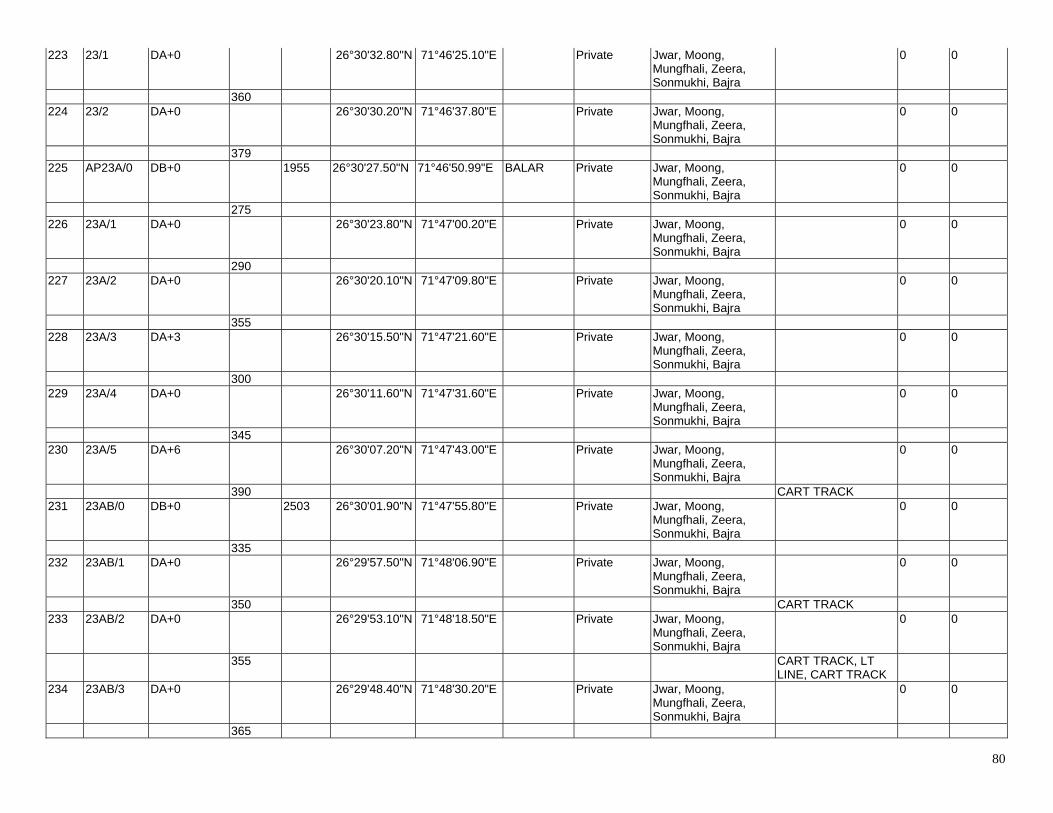
80
223 23/1 DA+0 26°30'32.80"N 71°46'25.10"E Private Jwar, Moong, Mungfhali, Zeera, Sonmukhi, Bajra
0 0
360 224 23/2 DA+0 26°30'30.20"N 71°46'37.80"E Private Jwar, Moong,
Mungfhali, Zeera, Sonmukhi, Bajra
0 0
379 225 AP23A/0 DB+0 1955 26°30'27.50"N 71°46'50.99"E BALAR Private Jwar, Moong,
Mungfhali, Zeera, Sonmukhi, Bajra
0 0
275 226 23A/1 DA+0 26°30'23.80"N 71°47'00.20"E Private Jwar, Moong,
Mungfhali, Zeera, Sonmukhi, Bajra
0 0
290 227 23A/2 DA+0 26°30'20.10"N 71°47'09.80"E Private Jwar, Moong,
Mungfhali, Zeera, Sonmukhi, Bajra
0 0
355 228 23A/3 DA+3 26°30'15.50"N 71°47'21.60"E Private Jwar, Moong,
Mungfhali, Zeera, Sonmukhi, Bajra
0 0
300 229 23A/4 DA+0 26°30'11.60"N 71°47'31.60"E Private Jwar, Moong,
Mungfhali, Zeera, Sonmukhi, Bajra
0 0
345 230 23A/5 DA+6 26°30'07.20"N 71°47'43.00"E Private Jwar, Moong,
Mungfhali, Zeera, Sonmukhi, Bajra
0 0
390 CART TRACK 231 23AB/0 DB+0 2503 26°30'01.90"N 71°47'55.80"E Private Jwar, Moong,
Mungfhali, Zeera, Sonmukhi, Bajra
0 0
335 232 23AB/1 DA+0 26°29'57.50"N 71°48'06.90"E Private Jwar, Moong,
Mungfhali, Zeera, Sonmukhi, Bajra
0 0
350 CART TRACK 233 23AB/2 DA+0 26°29'53.10"N 71°48'18.50"E Private Jwar, Moong,
Mungfhali, Zeera, Sonmukhi, Bajra
0 0
355 CART TRACK, LT LINE, CART TRACK
234 23AB/3 DA+0 26°29'48.40"N 71°48'30.20"E Private Jwar, Moong, Mungfhali, Zeera, Sonmukhi, Bajra
0 0
365
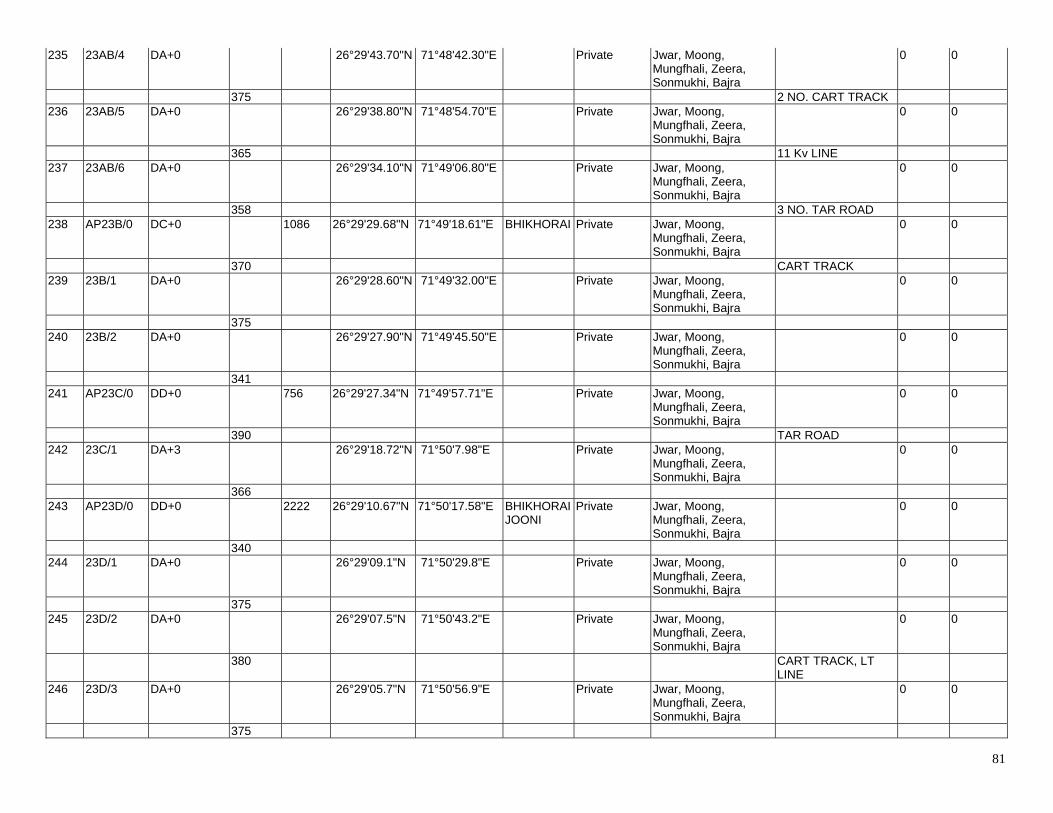
81
235 23AB/4 DA+0 26°29'43.70"N 71°48'42.30"E Private Jwar, Moong, Mungfhali, Zeera, Sonmukhi, Bajra
0 0
375 2 NO. CART TRACK 236 23AB/5 DA+0 26°29'38.80"N 71°48'54.70"E Private Jwar, Moong,
Mungfhali, Zeera, Sonmukhi, Bajra
0 0
365 11 Kv LINE 237 23AB/6 DA+0 26°29'34.10"N 71°49'06.80"E Private Jwar, Moong,
Mungfhali, Zeera, Sonmukhi, Bajra
0 0
358 3 NO. TAR ROAD 238 AP23B/0 DC+0 1086 26°29'29.68"N 71°49'18.61"E BHIKHORAI Private Jwar, Moong,
Mungfhali, Zeera, Sonmukhi, Bajra
0 0
370 CART TRACK 239 23B/1 DA+0 26°29'28.60"N 71°49'32.00"E Private Jwar, Moong,
Mungfhali, Zeera, Sonmukhi, Bajra
0 0
375 240 23B/2 DA+0 26°29'27.90"N 71°49'45.50"E Private Jwar, Moong,
Mungfhali, Zeera, Sonmukhi, Bajra
0 0
341 241 AP23C/0 DD+0 756 26°29'27.34"N 71°49'57.71"E Private Jwar, Moong,
Mungfhali, Zeera, Sonmukhi, Bajra
0 0
390 TAR ROAD 242 23C/1 DA+3 26°29'18.72"N 71°50'7.98"E Private Jwar, Moong,
Mungfhali, Zeera, Sonmukhi, Bajra
0 0
366 243 AP23D/0 DD+0 2222 26°29'10.67"N 71°50'17.58"E BHIKHORAI
JOONI Private Jwar, Moong,
Mungfhali, Zeera, Sonmukhi, Bajra
0 0
340 244 23D/1 DA+0 26°29'09.1"N 71°50'29.8"E Private Jwar, Moong,
Mungfhali, Zeera, Sonmukhi, Bajra
0 0
375 245 23D/2 DA+0 26°29'07.5"N 71°50'43.2"E Private Jwar, Moong,
Mungfhali, Zeera, Sonmukhi, Bajra
0 0
380 CART TRACK, LT LINE
246 23D/3 DA+0 26°29'05.7"N 71°50'56.9"E Private Jwar, Moong, Mungfhali, Zeera, Sonmukhi, Bajra
0 0
375
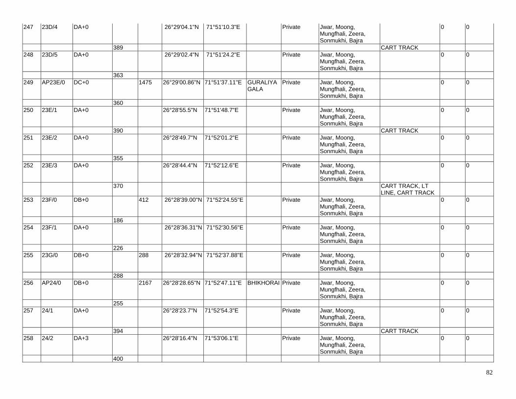
82
247 23D/4 DA+0 26°29'04.1"N 71°51'10.3"E Private Jwar, Moong, Mungfhali, Zeera, Sonmukhi, Bajra
0 0
389 CART TRACK 248 23D/5 DA+0 26°29'02.4"N 71°51'24.2"E Private Jwar, Moong,
Mungfhali, Zeera, Sonmukhi, Bajra
0 0
363 249 AP23E/0 DC+0 1475 26°29'00.86"N 71°51'37.11"E GURALIYA
GALA Private Jwar, Moong,
Mungfhali, Zeera, Sonmukhi, Bajra
0 0
360 250 23E/1 DA+0 26°28'55.5"N 71°51'48.7"E Private Jwar, Moong,
Mungfhali, Zeera, Sonmukhi, Bajra
0 0
390 CART TRACK 251 23E/2 DA+0 26°28'49.7"N 71°52'01.2"E Private Jwar, Moong,
Mungfhali, Zeera, Sonmukhi, Bajra
0 0
355 252 23E/3 DA+0 26°28'44.4"N 71°52'12.6"E Private Jwar, Moong,
Mungfhali, Zeera, Sonmukhi, Bajra
0 0
370 CART TRACK, LT LINE, CART TRACK
253 23F/0 DB+0 412 26°28'39.00"N 71°52'24.55"E Private Jwar, Moong, Mungfhali, Zeera, Sonmukhi, Bajra
0 0
186 254 23F/1 DA+0 26°28'36.31"N 71°52'30.56"E Private Jwar, Moong,
Mungfhali, Zeera, Sonmukhi, Bajra
0 0
226 255 23G/0 DB+0 288 26°28'32.94"N 71°52'37.88"E Private Jwar, Moong,
Mungfhali, Zeera, Sonmukhi, Bajra
0 0
288 256 AP24/0 DB+0 2167 26°28'28.65"N 71°52'47.11"E BHIKHORAI Private Jwar, Moong,
Mungfhali, Zeera, Sonmukhi, Bajra
0 0
255 257 24/1 DA+0 26°28'23.7"N 71°52'54.3"E Private Jwar, Moong,
Mungfhali, Zeera, Sonmukhi, Bajra
0 0
394 CART TRACK 258 24/2 DA+3 26°28'16.4"N 71°53'06.1"E Private Jwar, Moong,
Mungfhali, Zeera, Sonmukhi, Bajra
0 0
400
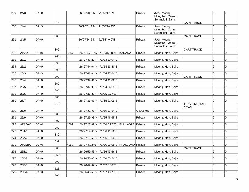
83
259 24/3 DA+0 26°28'08.8"N 71°53'17.8"E Private Jwar, Moong, Mungfhali, Zeera, Sonmukhi, Bajra
0 0
376 CART TARCK 260 24/4 DA+3 26°28'01.7"N 71°53'28.9"E Private Jwar, Moong,
Mungfhali, Zeera, Sonmukhi, Bajra
0 0
380 CART TRACK 261 24/5 DA+0 26°27'54.5"N 71°53'40.0"E Private Jwar, Moong,
Mungfhali, Zeera, Sonmukhi, Bajra
0 0
362 CART TRACK 262 AP25/0 DC+0 3657 26˚27'47.73"N 71˚53'50.01"E KARADA Private Moong, Mott, Bajra 0 0 260 263 25/1 DA+0 26°27'46.23"N 71°53'59.94"E Private Moong, Mott, Bajra 0 0 390 264 25/2 DA+0 26°27'44.04"N 71°54'13.80"E Private Moong, Mott, Bajra 0 0 395 265 25/3 DA+3 26°27'42.04"N 71°54'27.84"E Private Moong, Mott, Bajra 0 0 395 CART TRACK 266 25/4 DA+0 26°27'39.81"N 71°54'41.86"E Private Moong, Mott, Bajra 0 0 360 267 25/5 DA+0 26°27'37.95"N 71°54'54.69"E Private Moong, Mott, Bajra 0 0 385 268 25/6 DA+0 26°27'35.83"N 71°55'8.77"E Private Moong, Mott, Bajra 0 0 385 269 25/7 DA+0 26°27'33.61"N 71°55'22.09"E Private Moong, Mott, Bajra 0 0 310 11 Kv LINE, TAR
ROAD
270 25/8 DA+0 26°27'31.88"N 71°55'33.14"E Govt.Land Moong, Mott, Bajra 0 0 380 271 25/9 DA+0 26°27'29.93"N 71°55'46.65"E Private Moong, Mott, Bajra 0 0 397 272 AP25A/0 DD+0 1092 26°27'27.62"N 71°56'0.77"E PHULASAR Private Moong, Mott, Bajra 0 0 380 273 25A/1 DA+0 26°27'19.66"N 71°56'11.16"E Private Moong, Mott, Bajra 0 0 380 274 25A/2 DA+0 26°27'11.56"N 71°56'21.60"E Private Moong, Mott, Bajra 0 0 332 275 AP25B/0 DC+0 4058 26°27'4.32"N 71°56'30.98"E PHALSUND Private Moong, Mott, Bajra 0 0 386 CART TRACK 276 25B/1 DA+0 26°26'59.53"N 71°56'43.66"E Private Moong, Mott, Bajra 0 0 356 277 25B/2 DA+0 26°26'55.03"N 71°56'55.24"E Private Moong, Mott, Bajra 0 0 390 278 25B/3 DA+0 26°26'49.89"N 71°57'8.08"E Private Moong, Mott, Bajra 0 0 325 279 25B/4 DA+3 26°26'45.55"N 71°57'18.77"E Private Moong, Mott, Bajra 0 0 305

84
280 25B/5 DA+6 26°26'41.48"N 71°57'28.90"E Private Moong, Mott, Bajra 0 0 370 281 25B/6 DA+0 26°26'36.85"N 71°57'41.09"E Private Moong, Mott, Bajra 0 0 300 282 25B/7 DA+0 26°26'32.89"N 71°57'50.97"E Private Moong, Mott, Bajra 0 0 340 LT LINE, TAR ROAD 283 25B/8 DA+0 26°26'28.50"N 71°58'2.32"E Private Moong, Mott, Bajra 0 0 295 284 25B/9 DA+0 26°26'24.54"N 71°58'12.05"E Private Moong, Mott, Bajra 0 0 365 WATER STORAGE
TANK
285 25B/10 DA+0 26°26'19.91"N 71°58'24.20"E Private Moong, Mott, Bajra 0 0 370 286 25B/11 DA+0 26°26'15.12"N 71°58'36.44"E Private Moong, Mott, Bajra 0 0 256 287 AP26/0 DB+0 756 26°26'11.63"N 71°58'44.84"E PADAMPU
RA Private Moong, Mott, Bajra 0 0
375 288 26/1 DA+0 26°26'8.14"N 71°58'57.74"E Private Moong, Mott, Bajra 0 0 381 289 AP26A/0 DC+3 383 26°26'4.41"N 71°59'10.85"E PADAMPU
RA Private Moong, Mott, Bajra 0 0
383 290 AP27/0 DC+3 370 26°25'56.28"N 71°59'21.29"E BHURAJGA
RH Private Moong, Mott, Bajra 0 0
370 291 AP28/0 DB+0 1115 26°25'53.40"N 71°59'34.31"E MANGALIY
O KI DHANI Private Moong, Mott, Bajra 0 0
365 292 28/1 DA+0 26°25'48.57"N 71°59'46.35"E Private Moong, Mott, Bajra 0 0 360 293 28/2 DA+0 26°25'43.98"N 71°59'58.26"E Private Moong, Mott, Bajra 0 0 390 TAR ROAD 294 AP29/0 DB+0 399 26˚25’39.01"N 72˚00’11.16"E ISLAMPUR
A Private Moong, Mott, Bajra 0 0
399 2 NO. Cart Track 295 AP30/0 DB+6 347 26˚25'31.60"N 72˚00'22.87"E ISLAMPUR
A Private Moong, Mott, Bajra 0 0
347 296 AP30A/0 DB+6 299 26˚25'25.47"N 72˚00'33.45"E ISLAMPUR
A Private Moong, Mott, Bajra 0 0
299 297 30B/0 DB+0 800 26°25'22.02"N 72° 0'43.61"E Private Moong, Mott, Bajra 0 0 400 11 Kv Line, Road,Cart
Track
298 30B/1 DA+3 26°25'17.53"N 72° 0'57.13"E Private Moong, Mott, Bajra 0 0 400 Cart Track 299 AP31/0 DB+3 1469 26˚25'13.20"N 72˚01'10.50"E PHALSUND Private Moong, Mott, Bajra Provide '+3 M' Body
Extension For 0 0
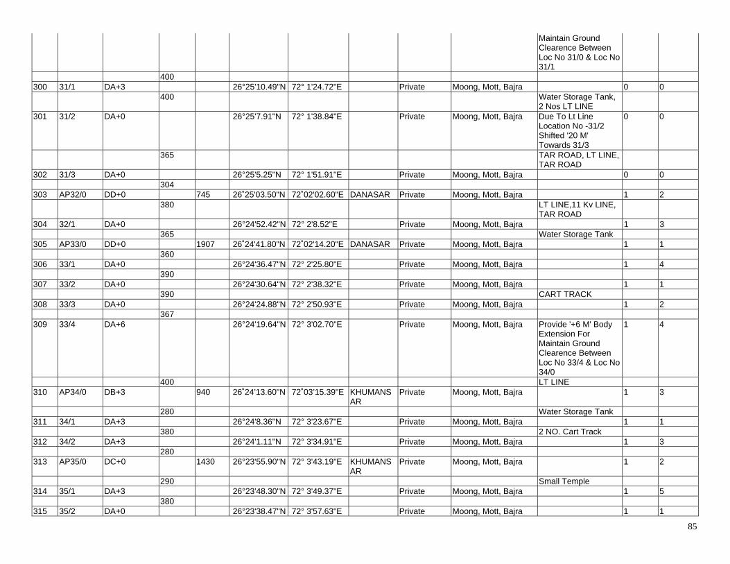
85
Maintain Ground Clearence Between Loc No 31/0 & Loc No 31/1
400 300 31/1 DA+3 26°25'10.49"N 72° 1'24.72"E Private Moong, Mott, Bajra 0 0 400 Water Storage Tank,
2 Nos LT LINE
301 31/2 DA+0 26°25'7.91"N 72° 1'38.84"E Private Moong, Mott, Bajra Due To Lt Line Location No -31/2 Shifted '20 M' Towards 31/3
0 0
365 TAR ROAD, LT LINE, TAR ROAD
302 31/3 DA+0 26°25'5.25"N 72° 1'51.91"E Private Moong, Mott, Bajra 0 0 304 303 AP32/0 DD+0 745 26˚25'03.50"N 72˚02'02.60"E DANASAR Private Moong, Mott, Bajra 1 2 380 LT LINE,11 Kv LINE,
TAR ROAD
304 32/1 DA+0 26°24'52.42"N 72° 2'8.52"E Private Moong, Mott, Bajra 1 3 365 Water Storage Tank 305 AP33/0 DD+0 1907 26˚24'41.80"N 72˚02'14.20"E DANASAR Private Moong, Mott, Bajra 1 1 360 306 33/1 DA+0 26°24'36.47"N 72° 2'25.80"E Private Moong, Mott, Bajra 1 4 390 307 33/2 DA+0 26°24'30.64"N 72° 2'38.32"E Private Moong, Mott, Bajra 1 1 390 CART TRACK 308 33/3 DA+0 26°24'24.88"N 72° 2'50.93"E Private Moong, Mott, Bajra 1 2 367 309 33/4 DA+6 26°24'19.64"N 72° 3'02.70"E Private Moong, Mott, Bajra Provide '+6 M' Body
Extension For Maintain Ground Clearence Between Loc No 33/4 & Loc No 34/0
1 4
400 LT LINE 310 AP34/0 DB+3 940 26˚24’13.60"N 72˚03’15.39"E KHUMANS
AR Private Moong, Mott, Bajra 1 3
280 Water Storage Tank 311 34/1 DA+3 26°24'8.36"N 72° 3'23.67"E Private Moong, Mott, Bajra 1 1 380 2 NO. Cart Track 312 34/2 DA+3 26°24'1.11"N 72° 3'34.91"E Private Moong, Mott, Bajra 1 3 280 313 AP35/0 DC+0 1430 26°23'55.90"N 72° 3'43.19"E KHUMANS
AR Private Moong, Mott, Bajra 1 2
290 Small Temple 314 35/1 DA+3 26°23'48.30"N 72° 3'49.37"E Private Moong, Mott, Bajra 1 5 380 315 35/2 DA+0 26°23'38.47"N 72° 3'57.63"E Private Moong, Mott, Bajra 1 1
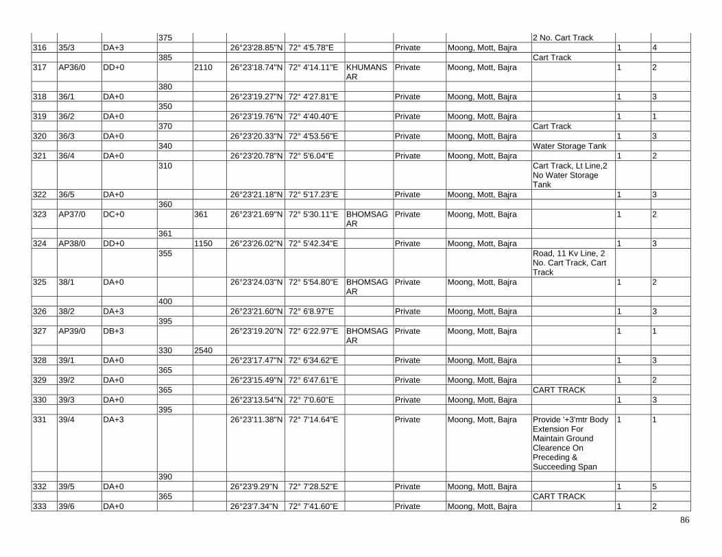
86
375 2 No. Cart Track 316 35/3 DA+3 26°23'28.85"N 72° 4'5.78"E Private Moong, Mott, Bajra 1 4 385 Cart Track 317 AP36/0 DD+0 2110 26°23'18.74"N 72° 4'14.11"E KHUMANS
AR Private Moong, Mott, Bajra 1 2
380 318 36/1 DA+0 26°23'19.27"N 72° 4'27.81"E Private Moong, Mott, Bajra 1 3 350 319 36/2 DA+0 26°23'19.76"N 72° 4'40.40"E Private Moong, Mott, Bajra 1 1 370 Cart Track 320 36/3 DA+0 26°23'20.33"N 72° 4'53.56"E Private Moong, Mott, Bajra 1 3 340 Water Storage Tank 321 36/4 DA+0 26°23'20.78"N 72° 5'6.04"E Private Moong, Mott, Bajra 1 2 310 Cart Track, Lt Line,2
No Water Storage Tank
322 36/5 DA+0 26°23'21.18"N 72° 5'17.23"E Private Moong, Mott, Bajra 1 3 360 323 AP37/0 DC+0 361 26°23'21.69"N 72° 5'30.11"E BHOMSAG
AR Private Moong, Mott, Bajra 1 2
361 324 AP38/0 DD+0 1150 26°23'26.02"N 72° 5'42.34"E Private Moong, Mott, Bajra 1 3 355 Road, 11 Kv Line, 2
No. Cart Track, Cart Track
325 38/1 DA+0 26°23'24.03"N 72° 5'54.80"E BHOMSAGAR
Private Moong, Mott, Bajra 1 2
400 326 38/2 DA+3 26°23'21.60"N 72° 6'8.97"E Private Moong, Mott, Bajra 1 3 395 327 AP39/0 DB+3 26°23'19.20"N 72° 6'22.97"E BHOMSAG
AR Private Moong, Mott, Bajra 1 1
330 2540 328 39/1 DA+0 26°23'17.47"N 72° 6'34.62"E Private Moong, Mott, Bajra 1 3 365 329 39/2 DA+0 26°23'15.49"N 72° 6'47.61"E Private Moong, Mott, Bajra 1 2 365 CART TRACK 330 39/3 DA+0 26°23'13.54"N 72° 7'0.60"E Private Moong, Mott, Bajra 1 3 395 331 39/4 DA+3 26°23'11.38"N 72° 7'14.64"E Private Moong, Mott, Bajra Provide '+3'mtr Body
Extension For Maintain Ground Clearence On Preceding & Succeeding Span
1 1
390 332 39/5 DA+0 26°23'9.29"N 72° 7'28.52"E Private Moong, Mott, Bajra 1 5 365 CART TRACK 333 39/6 DA+0 26°23'7.34"N 72° 7'41.60"E Private Moong, Mott, Bajra 1 2
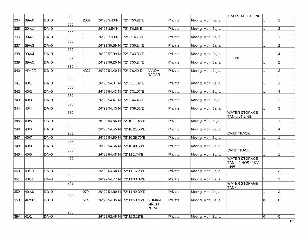
87
330 TRA ROAD, LT LINE 334 39A/0 DB+0 2062 26°23'5.46"N 72° 7'53.22"E Private Moong, Mott, Bajra 1 1 380 335 39A/1 DA+0 26°23'3.54"N 72° 8'6.68"E Private Moong, Mott, Bajra 1 3 280 336 39A/2 DA+0 26°23'2.00"N 72° 8'16.73"E Private Moong, Mott, Bajra 1 1 380 337 39A/3 DA+0 26°22'59.89"N 72° 8'30.24"E Private Moong, Mott, Bajra 1 2 380 338 39A/4 DA+0 26°22'57.99"N 72° 8'43.80"E Private Moong, Mott, Bajra 1 4 322 LT LINE 339 39A/5 DA+0 26°22'56.20"N 72° 8'55.24"E Private Moong, Mott, Bajra 1 2 320 340 AP40/0 DB+0 4327 26°22'54.40"N 72° 9'6.40"E JANDA
NAGAR Private Moong, Mott, Bajra 1 3
300 341 40/1 DA+0 26°22'54.37"N 72° 9'17.32"E Private Moong, Mott, Bajra 1 1 380 342 40/2 DA+0 26°22'54.43"N 72° 9'31.07"E Private Moong, Mott, Bajra 1 4 370 343 40/3 DA+0 26°22'54.47"N 72° 9'44.43"E Private Moong, Mott, Bajra 1 2 390 344 40/4 DA+0 26°22'54.43"N 72° 9'58.51"E Private Moong, Mott, Bajra 1 3 360 WATER STORAGE
TANK, LT LINE
345 40/5 DA+0 26°22'54.56"N 72°10'11.43"E Private Moong, Mott, Bajra 1 1 280 346 40/6 DA+3 26°22'54.55"N 72°10'21.56"E Private Moong, Mott, Bajra 1 4 395 CART TRACK 347 40/7 DA+0 26°22'54.50"N 72°10'35.79"E Private Moong, Mott, Bajra 1 1 355 348 40/8 DA+3 26°22'54.56"N 72°10'48.69"E Private Moong, Mott, Bajra 1 2 365 CART TRACK 349 40/9 DA+0 26°22'54.48"N 72°11'1.74"E Private Moong, Mott, Bajra 1 1 400 WATER STORAGE
TANK, 2 NOS 11KV LINE
350 40/10 DA+3 26°22'54.68"N 72°11'16.28"E Private Moong, Mott, Bajra 1 3 385 351 40/11 DA+3 26°22'54.77"N 72°11'30.08"E Private Moong, Mott, Bajra 1 1 347 WATER STORAGE
TANK
352 40A/0 DB+0 279 26°22'54.80"N 72°11'42.30"E Private Moong, Mott, Bajra 1 2 279 353 AP41/0 DB+0 614 26°22'54.85"N 72°11'53.45"E GUMAN
SINGH PURA
Private Moong, Mott, Bajra 0 0
300 354 41/1 DA+0 26°22'52.45"N 72°12'3.18"E Private Moong, Mott, Bajra 0 0
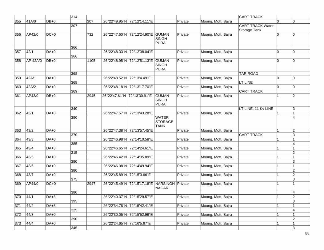
88
314 CART TRACK 355 41A/0 DB+0 307 26°22'49.95"N 72°12'14.11"E Private Moong, Mott, Bajra 0 0 307 CART TRACK,Water
Storage Tank
356 AP42/0 DC+0 732 26°22'47.60"N 72°12'24.90"E GUMAN SINGH PURA
Private Moong, Mott, Bajra 0 0
366 357 42/1 DA+0 26°22'48.33"N 72°12'38.04"E Private Moong, Mott, Bajra 0 0 366 358 AP 42A/0 DB+0 1105 26°22'48.95"N 72°12'51.13"E GUMAN
SINGH PURA
Private Moong, Mott, Bajra 0 0
368 TAR ROAD 359 42A/1 DA+0 26°22'48.52"N 72°13'4.49"E Private Moong, Mott, Bajra 0 0 368 LT LINE 360 42A/2 DA+0 26°22'48.18"N 72°13'17.70"E Private Moong, Mott, Bajra 0 0 369 CART TRACK 361 AP43/0 DB+0 2945 26°22'47.61"N 72°13'30.91"E GUMAN
SINGH PURA
Private Moong, Mott, Bajra 1 2
340 LT LINE, 11 Kv LINE 3 362 43/1 DA+0 26°22'47.57"N 72°13'43.28"E Private Moong, Mott, Bajra 1 1 390 WATER
STORAGE TANK
4
363 43/2 DA+0 26°22'47.38"N 72°13'57.45"E Private Moong, Mott, Bajra 1 2 370 CART TRACK 3 364 43/3 DA+0 26°22'46.98"N 72°14'10.58"E Private Moong, Mott, Bajra 1 1 385 4 365 43/4 DA+3 26°22'46.65"N 72°14'24.61"E Private Moong, Mott, Bajra 1 1 315 2 366 43/5 DA+0 26°22'46.42"N 72°14'35.89"E Private Moong, Mott, Bajra 1 1 390 3 367 43/6 DA+0 26°22'46.08"N 72°14'49.94"E Private Moong, Mott, Bajra 1 1 380 2 368 43/7 DA+0 26°22'45.89"N 72°15'3.66"E Private Moong, Mott, Bajra 1 2 375 3 369 AP44/0 DC+0 2947 26°22'45.49"N 72°15'17.18"E NARSINGH
NAGAR Private Moong, Mott, Bajra 1 1
380 4 370 44/1 DA+3 26°22'40.37"N 72°15'29.57"E Private Moong, Mott, Bajra 1 2 395 3 371 44/2 DA+3 26°22'34.78"N 72°15'42.41"E Private Moong, Mott, Bajra 1 1 325 4 372 44/3 DA+0 26°22'30.05"N 72°15'52.96"E Private Moong, Mott, Bajra 1 1 390 2 373 44/4 DA+0 26°22'24.65"N 72°16'5.67"E Private Moong, Mott, Bajra 1 1 345 3
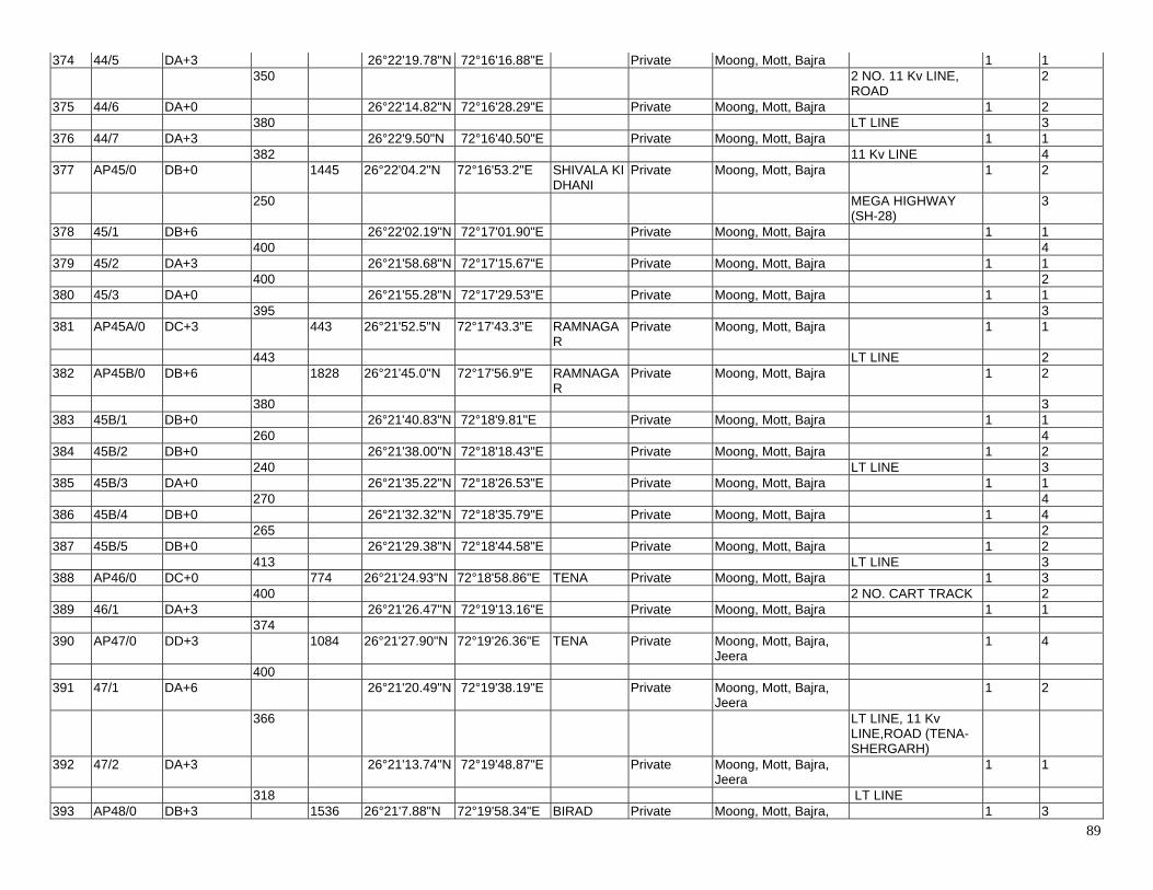
89
374 44/5 DA+3 26°22'19.78"N 72°16'16.88"E Private Moong, Mott, Bajra 1 1 350 2 NO. 11 Kv LINE,
ROAD 2
375 44/6 DA+0 26°22'14.82"N 72°16'28.29"E Private Moong, Mott, Bajra 1 2 380 LT LINE 3 376 44/7 DA+3 26°22'9.50"N 72°16'40.50"E Private Moong, Mott, Bajra 1 1 382 11 Kv LINE 4 377 AP45/0 DB+0 1445 26°22'04.2"N 72°16'53.2"E SHIVALA KI
DHANI Private Moong, Mott, Bajra 1 2
250 MEGA HIGHWAY (SH-28)
3
378 45/1 DB+6 26°22'02.19"N 72°17'01.90"E Private Moong, Mott, Bajra 1 1 400 4 379 45/2 DA+3 26°21'58.68"N 72°17'15.67"E Private Moong, Mott, Bajra 1 1 400 2 380 45/3 DA+0 26°21'55.28"N 72°17'29.53"E Private Moong, Mott, Bajra 1 1 395 3 381 AP45A/0 DC+3 443 26°21'52.5"N 72°17'43.3"E RAMNAGA
R Private Moong, Mott, Bajra 1 1
443 LT LINE 2 382 AP45B/0 DB+6 1828 26°21'45.0"N 72°17'56.9"E RAMNAGA
R Private Moong, Mott, Bajra 1 2
380 3 383 45B/1 DB+0 26°21'40.83"N 72°18'9.81"E Private Moong, Mott, Bajra 1 1 260 4 384 45B/2 DB+0 26°21'38.00"N 72°18'18.43"E Private Moong, Mott, Bajra 1 2 240 LT LINE 3 385 45B/3 DA+0 26°21'35.22"N 72°18'26.53"E Private Moong, Mott, Bajra 1 1 270 4 386 45B/4 DB+0 26°21'32.32"N 72°18'35.79"E Private Moong, Mott, Bajra 1 4 265 2 387 45B/5 DB+0 26°21'29.38"N 72°18'44.58"E Private Moong, Mott, Bajra 1 2 413 LT LINE 3 388 AP46/0 DC+0 774 26°21'24.93"N 72°18'58.86"E TENA Private Moong, Mott, Bajra 1 3 400 2 NO. CART TRACK 2 389 46/1 DA+3 26°21'26.47"N 72°19'13.16"E Private Moong, Mott, Bajra 1 1 374 390 AP47/0 DD+3 1084 26°21'27.90"N 72°19'26.36"E TENA Private Moong, Mott, Bajra,
Jeera 1 4
400 391 47/1 DA+6 26°21'20.49"N 72°19'38.19"E Private Moong, Mott, Bajra,
Jeera 1 2
366 LT LINE, 11 Kv LINE,ROAD (TENA-SHERGARH)
392 47/2 DA+3 26°21'13.74"N 72°19'48.87"E Private Moong, Mott, Bajra, Jeera
1 1
318 LT LINE 393 AP48/0 DB+3 1536 26°21'7.88"N 72°19'58.34"E BIRAD Private Moong, Mott, Bajra, 1 3
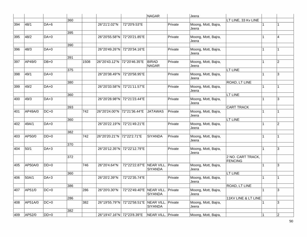
90
NAGAR Jeera 360 LT LINE, 33 Kv LINE 394 48/1 DA+6 26°21'2.02"N 72°20'9.53"E Private Moong, Mott, Bajra,
Jeera 1 1
395 395 48/2 DA+0 26°20'55.58"N 72°20'21.85"E Private Moong, Mott, Bajra,
Jeera 1 4
390 396 48/3 DA+0 26°20'49.26"N 72°20'34.16"E Private Moong, Mott, Bajra,
Jeera 1 1
391 397 AP49/0 DB+0 1508 26°20'43.12"N 72°20'46.35"E BIRAD
NAGAR Private Moong, Mott, Bajra,
Jeera 1 2
375 LT LINE 398 49/1 DA+0 26°20'38.49"N 72°20'58.95"E Private Moong, Mott, Bajra,
Jeera 1 3
380 ROAD, LT LINE 399 49/2 DA+0 26°20'33.58"N 72°21'11.57"E Private Moong, Mott, Bajra,
Jeera 1 1
360 LT LINE 400 49/3 DA+3 26°20'28.98"N 72°21'23.44"E Private Moong, Mott, Bajra,
Jeera 1 3
393 CART TRACK 401 AP49A/0 DC+0 742 26°20'24.00"N 72°21'36.44"E JATAWAS Private Moong, Mott, Bajra,
Jeera 1 1
360 LT LINE 402 49A/1 DA+0 26°20'22.19"N 72°21'49.21"E Private Moong, Mott, Bajra,
Jeera 1 2
382 403 AP50/0 DD+0 742 26°20'20.21"N 72°22'2.71"E SIYANDA Private Moong, Mott, Bajra,
Jeera 1 1
370 404 50/1 DA+3 26°20'12.35"N 72°22'12.79"E Private Moong, Mott, Bajra,
Jeera 1 3
372 2 NO. CART TRACK, FENCING
405 AP50A/0 DD+0 746 26°20'4.64"N 72°22'22.87"E NEAR VILL. SIYANDA
Private Moong, Mott, Bajra, Jeera
1 3
360 LT LINE 406 50A/1 DA+3 26°20'2.39"N 72°22'35.74"E Private Moong, Mott, Bajra,
Jeera 1 1
386 ROAD, LT LINE 407 AP51/0 DC+0 286 26°20'0.30"N 72°22'49.40"E NEAR VILL.
SIYANDA Private Moong, Mott, Bajra,
Jeera 1 3
286 11KV LINE & LT LINE 408 AP51A/0 DC+0 382 26°19'55.79"N 72°22'58.51"E NEAR VILL.
SIYANDA Private Moong, Mott, Bajra,
Jeera 1 3
382 409 AP52/0 DD+0 26°19'47.16"N 72°23'8.39"E NEAR VILL. Private Moong, Mott, Bajra, 1 2
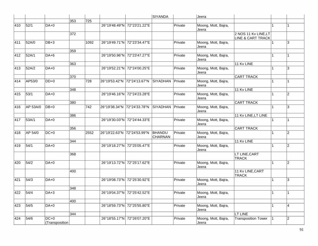
91
SIYANDA Jeera 353 725 410 52/1 DA+0 26°19'48.49"N 72°23'21.22"E Private Moong, Mott, Bajra,
Jeera 1 1
372 2 NOS 11 Kv LINE,LT LINE & CART TRACK
411 52A/0 DB+3 1092 26°19'49.71"N 72°23'34.47"E Private Moong, Mott, Bajra, Jeera
1 3
359 412 52A/1 DA+6 26°19'50.96"N 72°23'47.27"E Private Moong, Mott, Bajra,
Jeera 1 1
363 11 Kv LINE 413 52A/2 DA+0 26°19'52.21"N 72°24'00.25"E Private Moong, Mott, Bajra,
Jeera 1 3
370 CART TRACK 414 AP53/0 DD+0 728 26°19'53.42"N 72°24'13.67"N SIYADHAN Private Moong, Mott, Bajra,
Jeera 1 1
348 11 Kv LINE 415 53/1 DA+0 26°19'46.16"N 72°24'23.28"E Private Moong, Mott, Bajra,
Jeera 1 2
380 CART TRACK 416 AP 53A/0 DB+0 742 26°19'38.34"N 72°24'33.78"N SIYADHAN Private Moong, Mott, Bajra,
Jeera 1 3
386 11 Kv LINE,LT LINE 417 53A/1 DA+0 26°19'30.03"N 72°24'44.33"E Private Moong, Mott, Bajra,
Jeera 1 1
356 CART TRACK 418 AP 54/0 DC+0 2552 26°19'22.63"N 72°24'53.99"N BHANDU
CHARNAN Private Moong, Mott, Bajra,
Jeera 1 2
344 11 Kv LINE 419 54/1 DA+0 26°19'18.27"N 72°25'05.47"E Private Moong, Mott, Bajra,
Jeera 1 2
368 LT LINE,CART TRACK
420 54/2 DA+0 26°19'13.72"N 72°25'17.62"E Private Moong, Mott, Bajra, Jeera
1 2
400 11 Kv LINE,CART TRACK
421 54/3 DA+0 26°19'08.73"N 72°25'30.92"E Private Moong, Mott, Bajra, Jeera
1 3
348 422 54/4 DA+3 26°19'04.37"N 72°25'42.52"E Private Moong, Mott, Bajra,
Jeera 1 1
400 423 54/5 DA+0 26°18'59.73"N 72°25'55.80"E Private Moong, Mott, Bajra,
Jeera 1 4
344 LT LINE 424 54/6 DC+0
(Transposition 26°18'55.17"N 72°26'07.20"E Private Moong, Mott, Bajra,
Jeera Transposition Tower 1 2
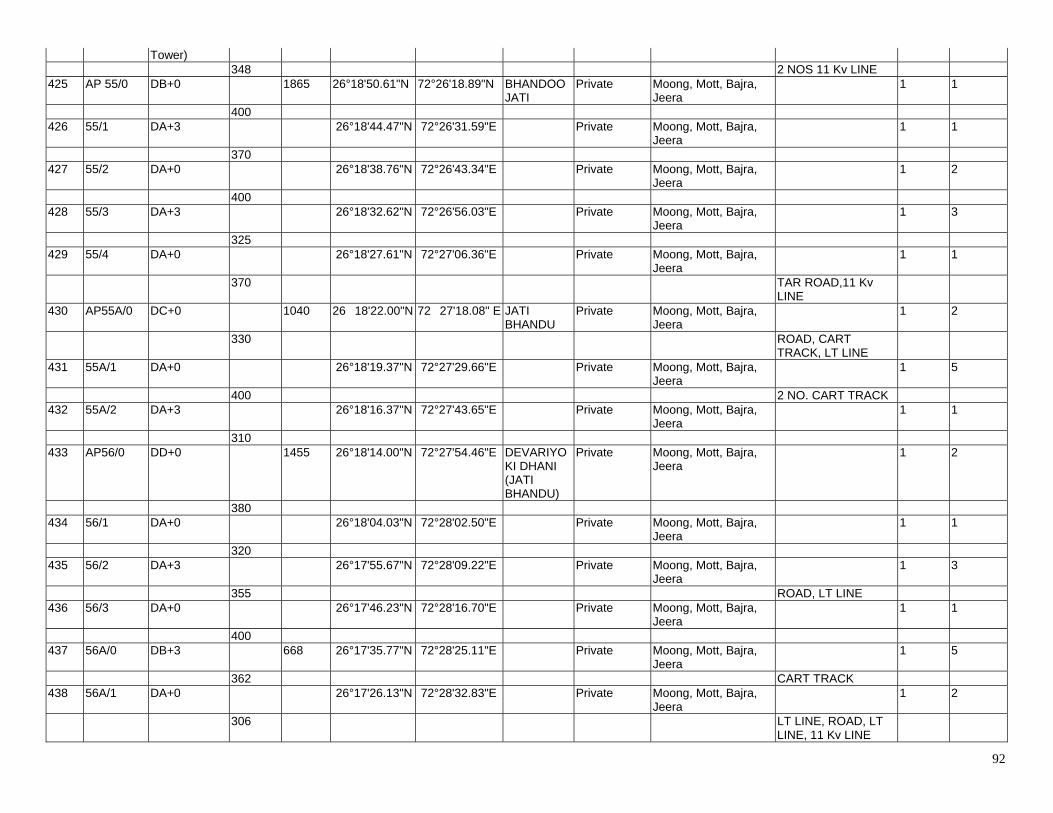
92
Tower) 348 2 NOS 11 Kv LINE 425 AP 55/0 DB+0 1865 26°18'50.61"N 72°26'18.89"N BHANDOO
JATI Private Moong, Mott, Bajra,
Jeera 1 1
400 426 55/1 DA+3 26°18'44.47"N 72°26'31.59"E Private Moong, Mott, Bajra,
Jeera 1 1
370 427 55/2 DA+0 26°18'38.76"N 72°26'43.34"E Private Moong, Mott, Bajra,
Jeera 1 2
400 428 55/3 DA+3 26°18'32.62"N 72°26'56.03"E Private Moong, Mott, Bajra,
Jeera 1 3
325 429 55/4 DA+0 26°18'27.61"N 72°27'06.36"E Private Moong, Mott, Bajra,
Jeera 1 1
370 TAR ROAD,11 Kv LINE
430 AP55A/0 DC+0 1040 26�18'22.00"N 72�27'18.08" E JATI BHANDU
Private Moong, Mott, Bajra, Jeera
1 2
330 ROAD, CART TRACK, LT LINE
431 55A/1 DA+0 26°18'19.37"N 72°27'29.66"E Private Moong, Mott, Bajra, Jeera
1 5
400 2 NO. CART TRACK 432 55A/2 DA+3 26°18'16.37"N 72°27'43.65"E Private Moong, Mott, Bajra,
Jeera 1 1
310 433 AP56/0 DD+0 1455 26°18'14.00"N 72°27'54.46"E DEVARIYO
KI DHANI (JATI BHANDU)
Private Moong, Mott, Bajra, Jeera
1 2
380 434 56/1 DA+0 26°18'04.03"N 72°28'02.50"E Private Moong, Mott, Bajra,
Jeera 1 1
320 435 56/2 DA+3 26°17'55.67"N 72°28'09.22"E Private Moong, Mott, Bajra,
Jeera 1 3
355 ROAD, LT LINE 436 56/3 DA+0 26°17'46.23"N 72°28'16.70"E Private Moong, Mott, Bajra,
Jeera 1 1
400 437 56A/0 DB+3 668 26°17'35.77"N 72°28'25.11"E Private Moong, Mott, Bajra,
Jeera 1 5
362 CART TRACK 438 56A/1 DA+0 26°17'26.13"N 72°28'32.83"E Private Moong, Mott, Bajra,
Jeera 1 2
306 LT LINE, ROAD, LT LINE, 11 Kv LINE
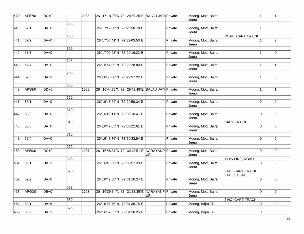
93
439 AP57/0 DC+0 2185 26�17'18.28"N 72�28'39.25"E BALAU JATI Private Moong, Mott, Bajra, Jeera
1 1
365 440 57/1 DA+0 26°17'12.58"N 72°28'50.78"E Private Moong, Mott, Bajra,
Jeera 1 3
400 ROAD, CART TRACK 441 57/2 DA+0 26°17'06.41"N 72°29'03.53"E Private Moong, Mott, Bajra,
Jeera 1 2
399 442 57/3 DA+0 26°17'00.23"N 72°29'16.22"E Private Moong, Mott, Bajra,
Jeera 1 0
396 443 57/4 DA+0 26°16'54.09"N 72°29'28.80"E Private Moong, Mott, Bajra,
Jeera 1 1
265 444 57/5 DA+3 26°16'50.00"N 72°29'37.22"E Private Moong, Mott, Bajra,
Jeera 1 3
360 445 AP58/0 DD+0 1529 26�16'44.36"N 72�29'48.48"E BALAU JATI Private Moong, Mott, Bajra,
Jeera 1 1
300 446 58/1 DA+0 26°16'45.29"N 72°29'59.34"E Private Moong, Mott, Bajra,
Jeera 0 0
310 447 58/2 DA+0 26°16'46.11"N 72°30'10.41"E Private Moong, Mott, Bajra,
Jeera 0 0
340 CART TRACK 448 58/3 DA+0 26°16'47.03"N 72°30'22.61"E Private Moong, Mott, Bajra,
Jeera 0 0
310 449 58/4 DA+0 26°16'47.76"N 72°30'33.84"E Private Moong, Mott, Bajra,
Jeera 0 0
269 450 AP59/0 DC+0 1137 26�16'48.61"N 72�30'43.51"E NARAYANP
UR Private Moong, Mott, Bajra,
Jeera 0 0
395 11 Kv LINE, ROAD 451 59/1 DA+3 26°16'45.36"N 72°30'57.29"E Private Moong, Mott, Bajra,
Jeera 0 0
370 2 NO. CART TRACK, 2 NO. LT LINE
452 59/2 DA+0 26°16'42.58"N 72°31'10.24"E Private Moong, Mott, Bajra, Jeera
0 0
372 453 AP60/0 DB+0 1123 26�16'39.84"N 72�31'23.35"E NARAYANP
UR Private Moong, Mott, Bajra,
Jeera 0 0
380 2 NO. CART TRACK 454 60/1 DA+6 26°16'38.76"N 72°31'36.75"E Private Moong, Bajra Till 0 0 375 455 60/2 DA+3 26°16'37.85"N 72°31'50.25"E Private Moong, Bajra Till 0 0
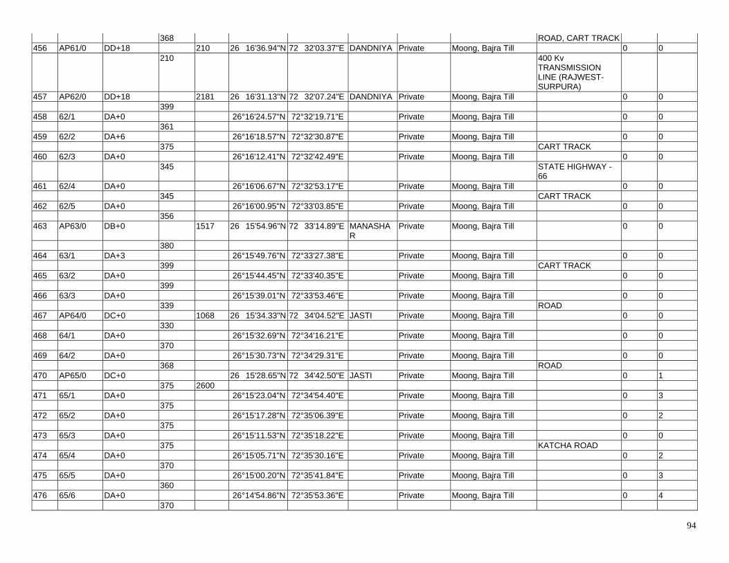
94
368 ROAD, CART TRACK 456 AP61/0 DD+18 210 26�16'36.94"N 72�32'03.37"E DANDNIYA Private Moong, Bajra Till 0 0 210 400 Kv
TRANSMISSION LINE (RAJWEST-SURPURA)
457 AP62/0 DD+18 2181 26�16'31.13"N 72�32'07.24"E DANDNIYA Private Moong, Bajra Till 0 0 399 458 62/1 DA+0 26°16'24.57"N 72°32'19.71"E Private Moong, Bajra Till 0 0 361 459 62/2 DA+6 26°16'18.57"N 72°32'30.87"E Private Moong, Bajra Till 0 0 375 CART TRACK 460 62/3 DA+0 26°16'12.41"N 72°32'42.49"E Private Moong, Bajra Till 0 0 345 STATE HIGHWAY -
66
461 62/4 DA+0 26°16'06.67"N 72°32'53.17"E Private Moong, Bajra Till 0 0 345 CART TRACK 462 62/5 DA+0 26°16'00.95"N 72°33'03.85"E Private Moong, Bajra Till 0 0 356 463 AP63/0 DB+0 1517 26�15'54.96"N 72�33'14.89"E MANASHA
R Private Moong, Bajra Till 0 0
380 464 63/1 DA+3 26°15'49.76"N 72°33'27.38"E Private Moong, Bajra Till 0 0 399 CART TRACK 465 63/2 DA+0 26°15'44.45"N 72°33'40.35"E Private Moong, Bajra Till 0 0 399 466 63/3 DA+0 26°15'39.01"N 72°33'53.46"E Private Moong, Bajra Till 0 0 339 ROAD 467 AP64/0 DC+0 1068 26�15'34.33"N 72�34'04.52"E JASTI Private Moong, Bajra Till 0 0 330 468 64/1 DA+0 26°15'32.69"N 72°34'16.21"E Private Moong, Bajra Till 0 0 370 469 64/2 DA+0 26°15'30.73"N 72°34'29.31"E Private Moong, Bajra Till 0 0 368 ROAD 470 AP65/0 DC+0 26�15'28.65"N 72�34'42.50"E JASTI Private Moong, Bajra Till 0 1 375 2600 471 65/1 DA+0 26°15'23.04"N 72°34'54.40"E Private Moong, Bajra Till 0 3 375 472 65/2 DA+0 26°15'17.28"N 72°35'06.39"E Private Moong, Bajra Till 0 2 375 473 65/3 DA+0 26°15'11.53"N 72°35'18.22"E Private Moong, Bajra Till 0 0 375 KATCHA ROAD 474 65/4 DA+0 26°15'05.71"N 72°35'30.16"E Private Moong, Bajra Till 0 2 370 475 65/5 DA+0 26°15'00.20"N 72°35'41.84"E Private Moong, Bajra Till 0 3 360 476 65/6 DA+0 26°14'54.86"N 72°35'53.36"E Private Moong, Bajra Till 0 4 370
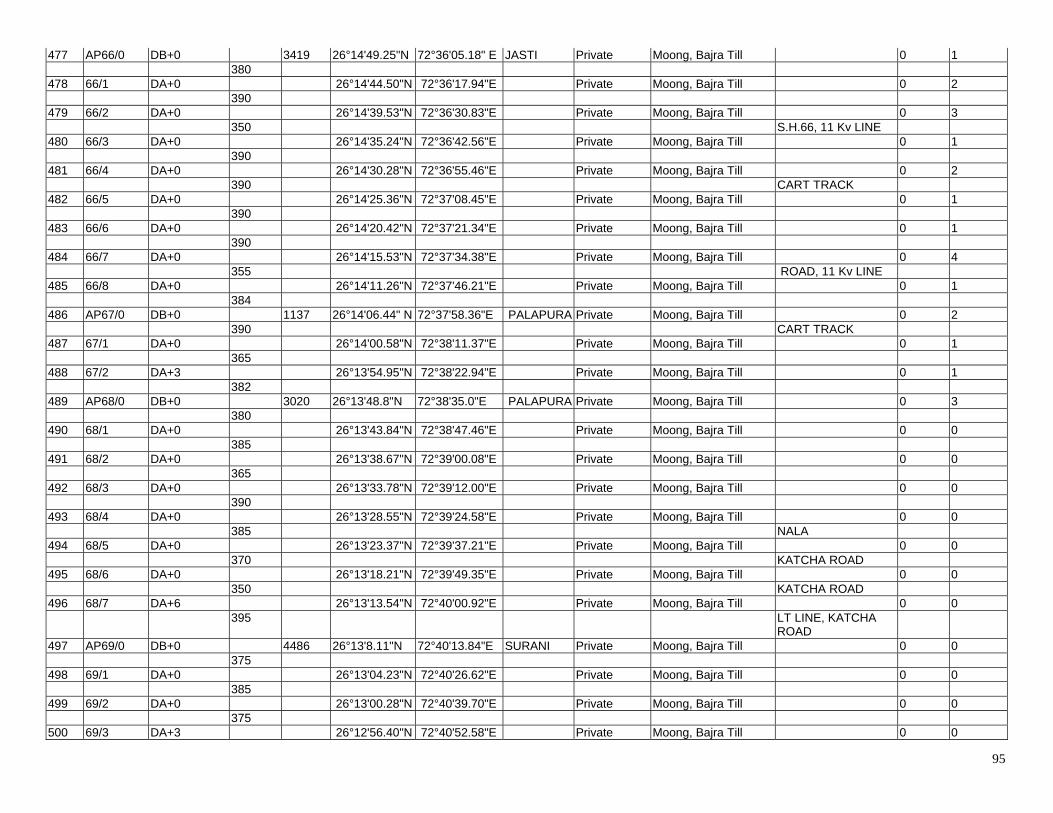
95
477 AP66/0 DB+0 3419 26°14'49.25"N 72°36'05.18" E JASTI Private Moong, Bajra Till 0 1 380 478 66/1 DA+0 26°14'44.50"N 72°36'17.94"E Private Moong, Bajra Till 0 2 390 479 66/2 DA+0 26°14'39.53"N 72°36'30.83"E Private Moong, Bajra Till 0 3 350 S.H.66, 11 Kv LINE 480 66/3 DA+0 26°14'35.24"N 72°36'42.56"E Private Moong, Bajra Till 0 1 390 481 66/4 DA+0 26°14'30.28"N 72°36'55.46"E Private Moong, Bajra Till 0 2 390 CART TRACK 482 66/5 DA+0 26°14'25.36"N 72°37'08.45"E Private Moong, Bajra Till 0 1 390 483 66/6 DA+0 26°14'20.42"N 72°37'21.34"E Private Moong, Bajra Till 0 1 390 484 66/7 DA+0 26°14'15.53"N 72°37'34.38"E Private Moong, Bajra Till 0 4 355 ROAD, 11 Kv LINE 485 66/8 DA+0 26°14'11.26"N 72°37'46.21"E Private Moong, Bajra Till 0 1 384 486 AP67/0 DB+0 1137 26°14'06.44" N 72°37'58.36"E PALAPURA Private Moong, Bajra Till 0 2 390 CART TRACK 487 67/1 DA+0 26°14'00.58"N 72°38'11.37"E Private Moong, Bajra Till 0 1 365 488 67/2 DA+3 26°13'54.95"N 72°38'22.94"E Private Moong, Bajra Till 0 1 382 489 AP68/0 DB+0 3020 26°13'48.8"N 72°38'35.0"E PALAPURA Private Moong, Bajra Till 0 3 380 490 68/1 DA+0 26°13'43.84"N 72°38'47.46"E Private Moong, Bajra Till 0 0 385 491 68/2 DA+0 26°13'38.67"N 72°39'00.08"E Private Moong, Bajra Till 0 0 365 492 68/3 DA+0 26°13'33.78"N 72°39'12.00"E Private Moong, Bajra Till 0 0 390 493 68/4 DA+0 26°13'28.55"N 72°39'24.58"E Private Moong, Bajra Till 0 0 385 NALA 494 68/5 DA+0 26°13'23.37"N 72°39'37.21"E Private Moong, Bajra Till 0 0 370 KATCHA ROAD 495 68/6 DA+0 26°13'18.21"N 72°39'49.35"E Private Moong, Bajra Till 0 0 350 KATCHA ROAD 496 68/7 DA+6 26°13'13.54"N 72°40'00.92"E Private Moong, Bajra Till 0 0 395 LT LINE, KATCHA
ROAD
497 AP69/0 DB+0 4486 26°13'8.11"N 72°40'13.84"E SURANI Private Moong, Bajra Till 0 0 375 498 69/1 DA+0 26°13'04.23"N 72°40'26.62"E Private Moong, Bajra Till 0 0 385 499 69/2 DA+0 26°13'00.28"N 72°40'39.70"E Private Moong, Bajra Till 0 0 375 500 69/3 DA+3 26°12'56.40"N 72°40'52.58"E Private Moong, Bajra Till 0 0
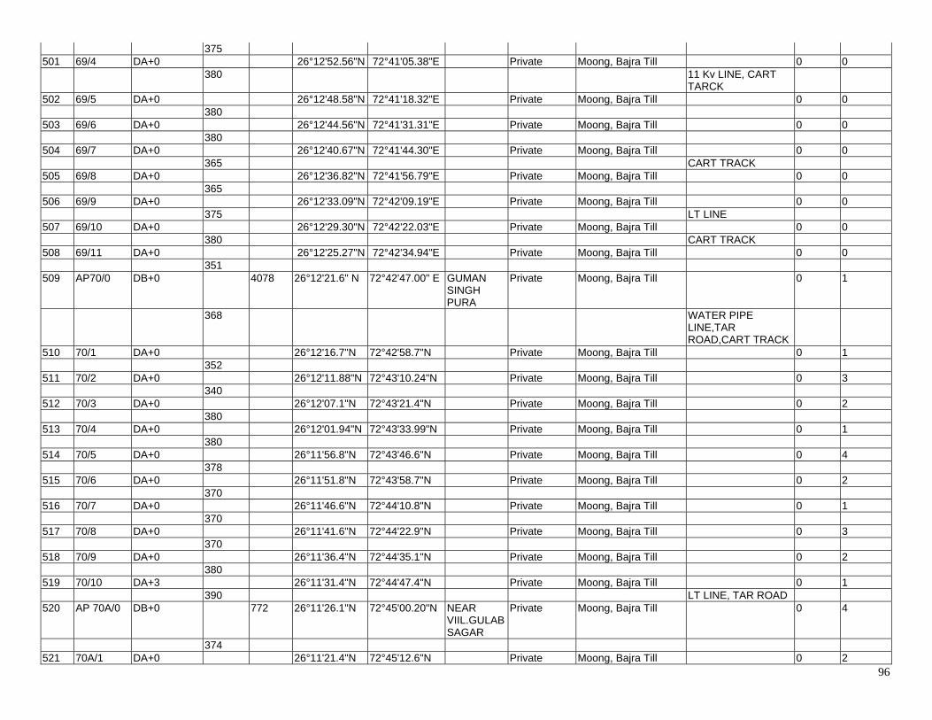
96
375 501 69/4 DA+0 26°12'52.56"N 72°41'05.38"E Private Moong, Bajra Till 0 0 380 11 Kv LINE, CART
TARCK
502 69/5 DA+0 26°12'48.58"N 72°41'18.32"E Private Moong, Bajra Till 0 0 380 503 69/6 DA+0 26°12'44.56"N 72°41'31.31"E Private Moong, Bajra Till 0 0 380 504 69/7 DA+0 26°12'40.67"N 72°41'44.30"E Private Moong, Bajra Till 0 0 365 CART TRACK 505 69/8 DA+0 26°12'36.82"N 72°41'56.79"E Private Moong, Bajra Till 0 0 365 506 69/9 DA+0 26°12'33.09"N 72°42'09.19"E Private Moong, Bajra Till 0 0 375 LT LINE 507 69/10 DA+0 26°12'29.30"N 72°42'22.03"E Private Moong, Bajra Till 0 0 380 CART TRACK 508 69/11 DA+0 26°12'25.27"N 72°42'34.94"E Private Moong, Bajra Till 0 0 351 509 AP70/0 DB+0 4078 26°12'21.6" N 72°42'47.00" E GUMAN
SINGH PURA
Private Moong, Bajra Till 0 1
368 WATER PIPE LINE,TAR ROAD,CART TRACK
510 70/1 DA+0 26°12'16.7"N 72°42'58.7"N Private Moong, Bajra Till 0 1 352 511 70/2 DA+0 26°12'11.88"N 72°43'10.24"N Private Moong, Bajra Till 0 3 340 512 70/3 DA+0 26°12'07.1"N 72°43'21.4"N Private Moong, Bajra Till 0 2 380 513 70/4 DA+0 26°12'01.94"N 72°43'33.99"N Private Moong, Bajra Till 0 1 380 514 70/5 DA+0 26°11'56.8"N 72°43'46.6"N Private Moong, Bajra Till 0 4 378 515 70/6 DA+0 26°11'51.8"N 72°43'58.7"N Private Moong, Bajra Till 0 2 370 516 70/7 DA+0 26°11'46.6"N 72°44'10.8"N Private Moong, Bajra Till 0 1 370 517 70/8 DA+0 26°11'41.6"N 72°44'22.9"N Private Moong, Bajra Till 0 3 370 518 70/9 DA+0 26°11'36.4"N 72°44'35.1"N Private Moong, Bajra Till 0 2 380 519 70/10 DA+3 26°11'31.4"N 72°44'47.4"N Private Moong, Bajra Till 0 1 390 LT LINE, TAR ROAD 520 AP 70A/0 DB+0 772 26°11'26.1"N 72°45'00.20"N NEAR
VIIL.GULAB SAGAR
Private Moong, Bajra Till 0 4
374 521 70A/1 DA+0 26°11'21.4"N 72°45'12.6"N Private Moong, Bajra Till 0 2
97
398 522 AP 71/0 DB+0 3012 26°11'16.22"N 72°45'26.36"N NEAR
VIIL.GULAB SAGAR
Private Moong, Bajra Till 0 3
380 523 71/1 DA+0 26°11'13.2"N 72°45'39.1"N Private Moong, Bajra Till 0 1 350 524 71/2 DA+0 26°11'10.1"N 72°45'51.1"N Private Moong, Bajra Till 0 2 400 2 NOS ROAD & LT
LINE
525 71/3 DA+3 26°11'06.6"N 72°46'05.2"N Private Moong, Bajra Till 0 1 380 526 71/4 DA+0 26°11'03.2"N 72°46'18.3"N Private Moong, Bajra Till 0 3 372 LT LINE 527 71/5 DA+0 26°11'00.0"N 72°46'31.1"N Private Moong, Bajra Till 0 2 374 528 71/6 DA+3 26°10'56.8"N 72°46'44.2"N Private Moong, Bajra Till 0 1 386 ROAD 529 71/7 DA+0 26°10'53.5"N 72°46'57.5"N Private Moong, Bajra Till 0 2 370 530 AP 72/0 DB+0 2180 26°10'50.4"N 72°47'10.4"N NEAR
VILL.LUNAWAS KHARA
Private Moong, Bajra Till 0 3
373 531 72/1 DA+0 26°10'47.1"N 72°47'23.3"N Private Moong, Bajra Till 0 0 363 532 72/2 DA+0 26°10'43.8"N 72°47'35.81"N Private Moong, Bajra Till 0 0 363 CART TRACK 533 72/3 DA+0 26°10'40.5"N 72°47'48.3"N Private Moong, Bajra Till 0 0 363 534 72/4 DA+0 26°10'37.4"N 72°48'00.9"N Private Moong, Bajra Till 0 0 383 535 72/5 DA+0 26°10'33.9"N 72°48'14.2"N Private Moong, Bajra Till 0 0 335 TAR ROAD, 11 Kv
LINE,LT LINE
536 AP 73/0 DC+0 710 26°10'31.0"N 72°48'25.9"N NEAR VILL.LUNAWAS KHARA
Private Moong, Bajra Till 0 0
355 TAR ROAD,CART TRACK
537 73/1 DA+0 26°10'32.4"N 72°48'38.5"N Private Moong, Bajra Till 0 0 355 LT LINE 538 AP 74/0 DD+0 2660 26°10'34.13"N 72°48'51.06"N NEAR
VILL.LUNAWAS KHARA
Private Moong, Bajra Till 0 0
380
98
539 74/1 DA+0 26°10'25.6"N 72°49'01.0"N Private Moong, Bajra Till 0 0 380 2 NOS LT LINE,
CART TRACK
540 74/2 DA+0 26°10'16.94"N 72°49'10.76"N Private Moong, Bajra Till 0 0 380 541 74/3 DA+0 26°10'08.4"N 72°49'20.5"N Private Moong, Bajra Till 0 0 380 542 74/4 DA+0 26°09'59.77"N 72°49'30.23"N Private Moong, Bajra Till 0 0 380 CART TRACK 543 74/5 DA+0 26°09'51.1"N 72°49'40.5"N Private Moong, Bajra Till 0 0 380 11 Kv LINE 544 74/6 DA+0 26°09'42.5"N 72°49'50.2"N Private Moong, Bajra Till 0 0 380 CART TRACK 545 AP 75/0 DC+0 1820 26°09'33.84"N 72°49'59.90"N NEAR
VILL.JHANWAR
Private Moong, Bajra Till 0 1
370 546 75/1 DA+0 26°09'29.0"N 72°50'12.0"N Private Moong, Bajra Till 0 1 370 547 75/2 DA+0 26°09'23.92"N 72°50'24.12"N Private Moong, Bajra Till 0 2 380 11 Kv LINE 548 75/3 DA+0 26°09'18.85"N 72°50'36.62"N Private Moong, Bajra Till 0 1 380 ROAD 549 75/4 DA+0 26°09'13.75"N 72°50'49.08"N Private Moong, Bajra Till 0 3 320 33 Kv LINE 550 AP 76/0 DC+0 26°09'09.5"N 72°50'59.5"N NEAR
VIIL.KHUDALA
Private Moong, Bajra Till 0 1
360 1958 11 Kv LINE, LT LINE 551 76/1 DA+3 26°09'01.5"N 72°51'08.9"E Private Moong, Bajra Till 0 1 400 CART TRACK 552 76/2 DA+0 26°08'52.7"N 72°51'19.4"E Private Moong, Bajra Till 0 1 400 ROAD 553 76/3 DA+3 26°08'43.8"N 72°51'30.1"E Private Moong, Bajra Till 0 2 398 554 76/4 DA+0 26°08'34.8"N 72°51'40.5"E Private Moong, Bajra Till 0 1 400 11 Kv LINE 555 AP77/0 DD+3 189 26°08'26.0"N 72°51'51.1"E NEAR VILL.
KHUDALA Private Moong, Bajra Till 0 4
189 220 Kv POWER LINE (Due To Need Of Electrical Clearence Earth Wire Should Be Removed)
556 AP78/0 DD+0 3800 26°08'20.78"N 72°51'54.81"E NEAR VILL. KHUDALA
Private Moong, Bajra Till 0 1
375 557 78/1 DA+0 26°08'12.85"N 72°52'4.9"E Private Moong, Bajra Till 0 3 390
99
558 78/2 DA+0 26°08'04.4"N 72°52'15.1"E Private Moong, Bajra Till 0 1 390 11 Kv LINE 559 78/3 DA+0 26°07'55.8"N 72°52'25.5"E Private Moong, Bajra Till 0 1 360 560 78/4 DA+0 26°07'48.1"N 72°52'35.1"E Private Moong, Bajra Till 0 2 380 11 Kv LINE, CART
TRACK
561 78/5 DA+0 26°07'39.6"N 72°52'45.2"E Private Moong, Bajra Till 0 3 385 562 78/6 DA+0 26°07'31.3"N 72°52'55.6"E Private Moong, Bajra Till 0 1 375 CART TRACK 563 78/7 DA+0 26°07'23.1"N 72°53'05.6"E Private Moong, Bajra Till 0 1 380 564 78/8 DA+0 26°07'14.7"N 72°53'15.7"E Private Moong, Bajra Till 0 1 385 565 78/9 DA+0 26°07'06.4"N 72°53'26.0"E Private Moong, Bajra Till 0 2 380 CART TRACK 566 AP79/0 DC+0 221 26°06'58.06"N 72°53'36.11"E NEAR VILL.
BHANDU KALLAN
Private Moong, Bajra Till 0 1
221 N.H.112 (JODHPUR-BARMER), 11 Kv LINE
567 AP80/0 DC+0 1163 26°06'54.6"N 72°53'42.6"E NEAR VILL. BHANDU KALLAN
Private Moong, Bajra Till 0 3
400 NALA 568 80/1 DA+3 26°06'50.2"N 72°53'56.3"E Private Moong, Bajra Till 0 0 384 NALA 569 80/2 DA+0 26°06'45.9"N 72°54'09.3"E Private Moong, Bajra Till 0 0 379 CART TRACK 570 AP80A/0 DC+0 780 26°06'42.0"N 72°54'22.3"E NEAR VILL.
BHANDU KALLAN
Private Moong, Bajra Till 0 0
380 571 80A/1 DA+3 26°06'33.4"N 72°54'32.0"E Private Moong, Bajra Till 0 0 400 572 AP80B/0 DC+0 4166 26°06'24.1"N 72°54'42.1"E NEAR VILL.
BHANDU KALLAN
Private Moong, Bajra Till 0 0
375 573 80B/1 DA+0 26°06'18.2"N 72°54'53.8"E Private Moong, Bajra Till 0 0 395 574 80B/2 DA+0 26°06'11.9"N 72°55'06.2"E Private Moong, Bajra Till 0 0 380 575 80B/3 DA+0 26°06'06.0"N 72°55'18.1"E Private Moong, Bajra Till 0 0 385 576 80B/4 DA+0 26°05'59.9"N 72°55'30.2"E Private Moong, Bajra Till 0 0 385
100
577 80B/5 DA+0 26°05'53.6"N 72°55'42.2"E Private Moong, Bajra Till 0 0 365 LT LINE, CART
TRACK
578 80B/6 DA+0 26°05'47.8"N 72°55'53.5"E Private Moong, Bajra Till 0 0 375 579 80B/7 DA+0 26°05'41.8"N 72°56'05.3"E Private Moong, Bajra Till 0 0 400 ROAD 580 80B/8 DA+0 26°05'35.4"N 72°56'17.9"E Private Moong, Bajra Till 0 0 356 LT LINE 581 80B/9 DA+3 26°05'29.9"N 72°56'29.1"E Private Moong, Bajra Till 0 0 398 ROAD, 11 Kv LINE 582 80B/10 DA+3 26°05'23.5"N 72°56'41.4"E Private Moong, Bajra Till 0 0 352 33 Kv LINE 583 AP81/0 DC+0 2370 26°05'17.9"N 72°56'52.52"E NEAR VILL.
BHANDU KALLAN
Private Moong, Bajra Till 0 0
395 584 81/1 DA+3 26°05'16.4"N 72°57'06.7"E Private Moong, Bajra Till 0 0 395 ROAD 585 81/2 DA+0 26°05'14.8"N 72°57'20.8"E Private Moong, Bajra Till 0 0 390 586 81/3 DA+0 26°05'13.3"N 72°57'34.8"E Private Moong, Bajra Till 0 0 398 587 81/4 DA+3 26°05'11.7"N 72°57'48.9"E Private Moong, Bajra Till 0 0 399 588 81/5 DA+3 26°05'10.3"N 72°58'03.1"E Private Moong, Bajra Till 0 0 393 CART TRACK, 11 Kv
LINE, S.H. LT LINE
589 AP82/0 DB+3 1158 26°05'8.70"N 72°58'17.30"E Near Village Shivala Ki Dhani
Private Moong, Bajra Till 0 1
398 590 82/1 DA+0 26°05'8.80"N 72°58'31.40"E Private Moong, Bajra Till 0 1 364 LT Line 591 82/2 DA+0 26°05'9.10"N 72°58'44.60"E Private Moong, Bajra Till 0 3 396 ROAD 592 AP82A/0 DC+0 387 26°05'9.17"N 72°58'58.95"E Near Village
Shivala Ki Dhani
Private Moong, Bajra Till 0 1
387 593 AP83/0 DD+18 202 26°05'14.74"N 72°59'10.85"E Near Village
Shivala Ki Dhani
Private Moong, Bajra Till 0 2
202 UNDER CONSTRUCTION 400KV D/C TWIN LINE (AGOLAI TO KANKANI)(Due To Need Of Electrical
101
Clearence Earth Wire Should Be Removed)
594 AP84/0 DD+18 800 26°05'20.84"N 72°59'14.9"E Near Village Shivala Ki Dhani
Private Moong, Bajra Till 0 1
400 595 84A/0 DB+0 26°05'20.76"N 72°59'29.33"E Private Moong, Bajra Till 0 1 400 596 AP85/0 DD+9 200 26°05'20.66"N 72°59'43.79"E Private Moong, Bajra Till 0 1 200 220 Kv D/C BARLI-
JODHPUR UNDER CONSTRUCTION TL LINE(Due To Need Of Electrical Clearence Earth Wire Should Be Removed)`
597 AP86/0 DD+9 1057 26°05'24.28"N 72°59'49.90"E Near Village Shivala Ki Dhani
Private Moong, Bajra Till 0 2
334 598 86/1 DA+0 26°05'22.08"N 73°00'1.65"E Private Moong, Bajra Till 0 0 350 LT LINE, ROAD 599 86/2 DA+0 26°05'19.65"N 73°00'13.93"E Private Moong, Bajra Till 0 0 373 600 AP87/0 DD+6 197 26°05'16.77"N 73°00'26.93"E Near Village
Shivala Ki Dhani
Private Moong, Bajra Till 0 0
197 RAILWAY LINE 601 AP88/0 DD+6 1953 26°05'16.23"N 73°00'34.09"E Near Village
Shivala Ki Dhani
Private Moong, Bajra Till 0 0
400 602 88/1 DA+0 26°05'14.90"N 73°00'48.30"E NEAR
VIIL.GULAB SAGAR
Private Moong, Bajra Till 0 0
359 2 NO. CART TRACK 603 88/2 DA+3 26°05'13.80"N 73°01'01.10"E Private Moong, Bajra Till 0 0 395 LT LINE 604 88/3 DA+0 26°05'12.60"N 73°01'15.20"E Private Moong, Bajra Till 0 0 399 PIPE LINE
(IOCKBPL) AJMER-SALAWAS
605 88/4 DA+3 26°05'11.30"N 73°01'29.40"E Private Moong, Bajra Till 0 0 400 2 NOS .CART
TRACK
606 AP89/0 DD+0 180 26°05'09.91"N 73°01'43.86"E Private Moong, Bajra Till 0 0 180 132 Kv S/C LINE 607 AP90/0 DD+6 777 26°05'12.71"N 73°01'49.66"E Private Moong, Bajra Till 0 0 393 11 Kv LINE
102
608 90/1 DA+0 26°05'15.70"N 73°02'03.20"E Private Moong, Bajra Till 0 0 384 ROAD,LT LINE 609 AP91/0 DD+0 1140 26°05'18.30"N 73°02'16.80"E Private Moong, Bajra Till 0 0 375 610 91/1 DA+0 26°05'13.90"N 73°02'29.30"E Private Moong, Bajra Till 0 0 365 11 Kv LINE,CART
TRACK
611 91/2 DA+0 26°05'09.70"N 73°02'41.70"E Private Moong, Bajra Till 0 0 400 FENCING 612 AP92/0 DD+9 175 26° 5'5.03"N 73° 2'55.10"E KANKANI Private Moong, Bajra Till 0 1 175 UNDER
CONSTRUCTION 220 Kv JHALAMAND - KANKANI TRANSMISSION LINE (DUE TO NEED OF ELECTRICAL CLEARENCE EARTH WIRE SHOULD BE REMOVED )
613 AP 93/0 DD+9 711 26° 5'5.70"N 73° 3'1.30"E KANKANI Private Moong, Bajra Till 0 1 380 3 NOS BUND 614 93/1 DA+0 26° 4'58.64"N 73° 3'12.51"E Private Moong, Bajra Till 0 2 331 2 NOS BUND 615 AP 94/0 DD+0 726 26° 4'52.44"N 73° 3'22.34"E KANKANI Private Moong, Bajra Till 0 1 364 2 NOS BUND 616 94/1 DA+0 26° 4'41.34"N 73° 3'26.83"E Private Moong, Bajra Till 0 2 362 BUND 617 AP 95/0 DD+0 370 26° 4'30.28"N 73° 3'31.30"E KANKANI Private Moong, Bajra Till 0 1 370 LT LINE (CABLE),
ROAD & BUND
618 AP 96/0 DD+0 96 26° 4'27.53"N 73° 3'44.22"E KANKANI Private Moong, Bajra Till 0 1 96 619 AP 97/0 DD+0 74 26° 4'25.94"N 73° 3'47.23"E KANKANI Private Moong, Bajra Till Dead End Tower
(Due To Need Of Body Clearence Bisection Should Be Required)
0 1
74 Kankani
GSS (GANTRY)
Gantry 26° 4'26.43"N 73° 3'49.77"E KANKANI Private Moong, Bajra Till

ANNEXURE-5
ANGLE POINT IMAGES
400 kV D/C Moose Ramgarh – Akal Transmission Line (ICB 5) S.NO -1 S. No -2 Location No Latitude Longitude Location No Latitude Longitude AP1P 26°49'10.6"N 71°03'47.2"E AP2P 26°49'17.7"N 71°03'40.2"E
S. No -3 S. No -4 Location No Latitude Longitude Location No Latitude Longitude AP3P 26°49'28.2"N 71°03'31.6"E AP01 26°49'26.9"N 71°03'30.1"E Erection Not Completed
S.NO -5 S. No - 6 Location No Latitude Longitude Location No Latitude Longitude AP02 26°49'37.6"N 71°03'26.8"E AP03 26°49'44.5"N 71°03'31.6"E
S. No -7 S. No -8 Location No Latitude Longitude Location No Latitude Longitude AP04 26°49'56.2"N 71°03'36.6"E AP05 26°50'05.5"N 71°03'39.8"E
S.NO -9 S. No -10 Location No Latitude Longitude Location No Latitude Longitude AP 6 26°51'07.4"N 71°04'56.9"E AP 7 26°53'04.8"N 71°05'01.8"E
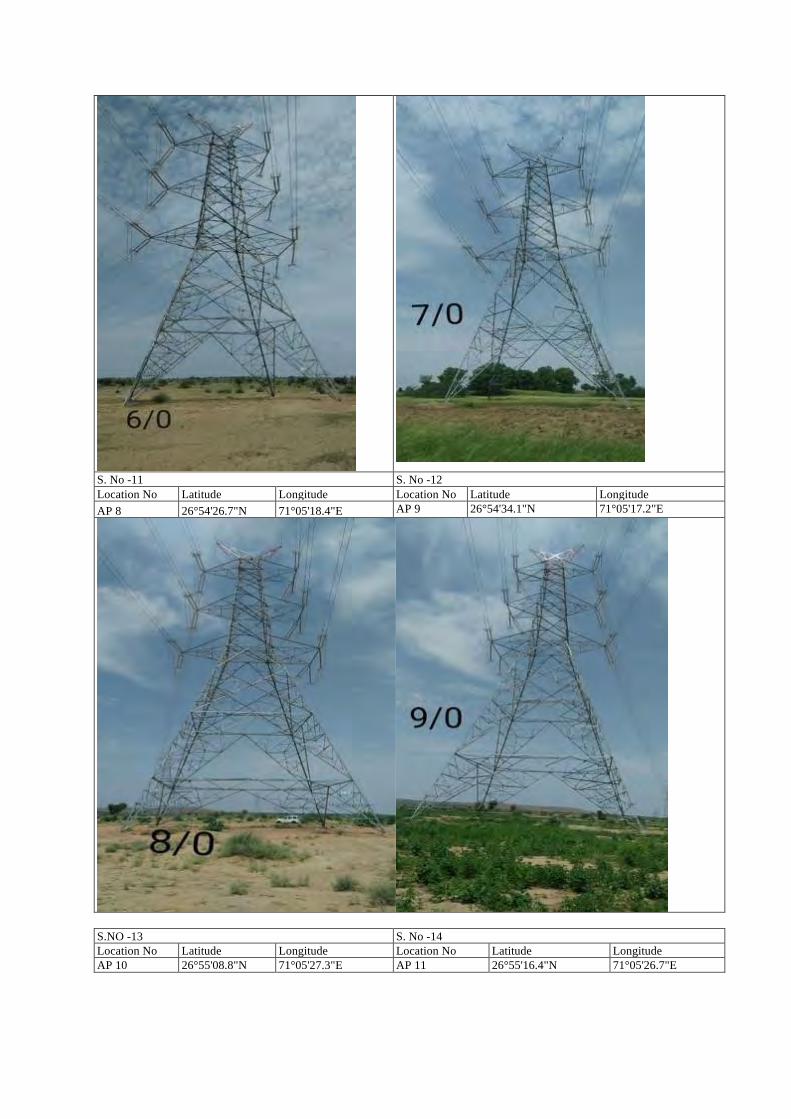
S. No -11 S. No -12 Location No Latitude Longitude Location No Latitude Longitude AP 8 26°54'26.7"N 71°05'18.4"E AP 9 26°54'34.1"N 71°05'17.2"E
S.NO -13 S. No -14 Location No Latitude Longitude Location No Latitude Longitude AP 10 26°55'08.8"N 71°05'27.3"E AP 11 26°55'16.4"N 71°05'26.7"E
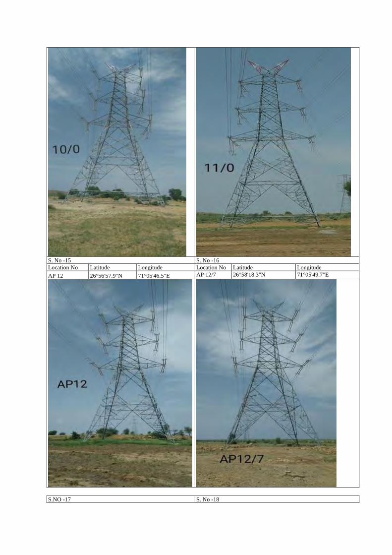
S. No -15 S. No -16 Location No Latitude Longitude Location No Latitude Longitude AP 12 26°56'57.9"N 71°05'46.5"E AP 12/7 26°58'18.3"N 71°05'49.7"E
S.NO -17 S. No -18
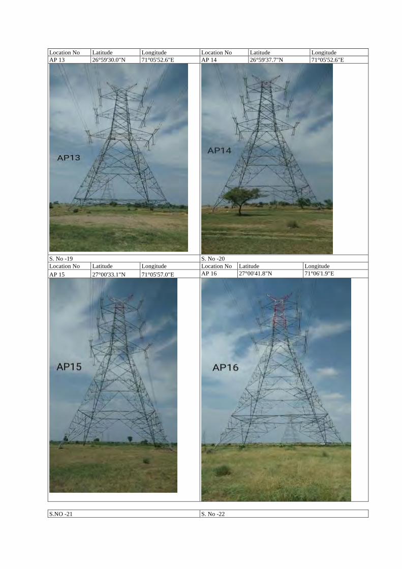
Location No Latitude Longitude Location No Latitude Longitude AP 13 26°59'30.0"N 71°05'52.6"E AP 14 26°59'37.7"N 71°05'52.6"E
S. No -19 S. No -20 Location No Latitude Longitude Location No Latitude Longitude AP 15 27°00'33.1"N 71°05'57.0"E AP 16 27°00'41.8"N 71°06'1.9"E
S.NO -21 S. No -22
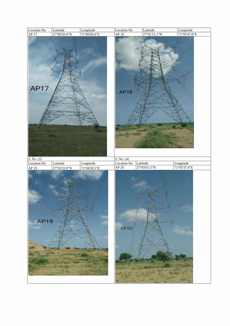
Location No Latitude Longitude Location No Latitude Longitude AP 17 27°00'50.4"N 71°06'06.6"E AP 18 27°01'51.1"N 71°05'47.0"E
S. No -23 S. No -24 Location No Latitude Longitude Location No Latitude Longitude AP 19 27°02'22.0"N 71°04'50.5"E AP 20 27°03'01.5"N 71°03'37.4"E
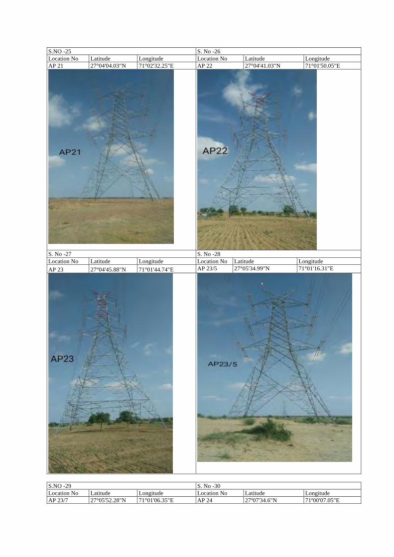
S.NO -25 S. No -26 Location No Latitude Longitude Location No Latitude Longitude AP 21 27°04'04.03"N 71°02'32.25"E AP 22 27°04'41.03"N 71°01'50.05"E
S. No -27 S. No -28 Location No Latitude Longitude Location No Latitude Longitude AP 23 27°04'45.88"N 71°01'44.74"E AP 23/5 27°05'34.99"N 71°01'16.31"E
S.NO -29 S. No -30 Location No Latitude Longitude Location No Latitude Longitude AP 23/7 27°05'52.28"N 71°01'06.35"E AP 24 27º07'34.6"N 71º00'07.05"E
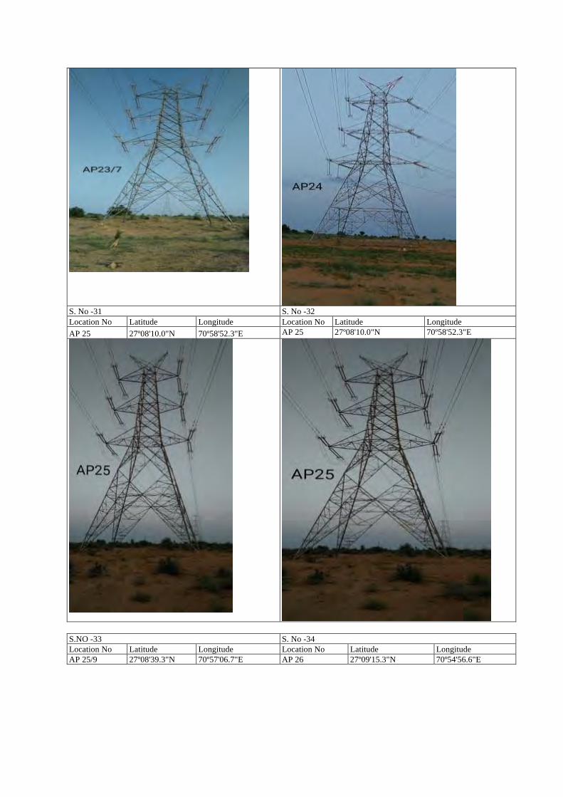
S. No -31 S. No -32 Location No Latitude Longitude Location No Latitude Longitude AP 25 27º08'10.0"N 70º58'52.3"E AP 25 27º08'10.0"N 70º58'52.3"E
S.NO -33 S. No -34 Location No Latitude Longitude Location No Latitude Longitude AP 25/9 27º08'39.3"N 70º57'06.7"E AP 26 27º09'15.3"N 70º54'56.6"E
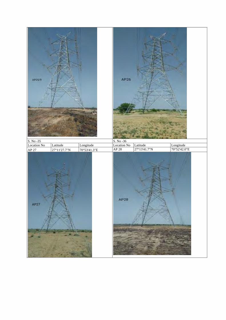
S. No -35 S. No -36 Location No Latitude Longitude Location No Latitude Longitude AP 27 27°11'27.7"N 70°53'41.3"E AP 28 27°13'41.7"N 70°52'42.0"E
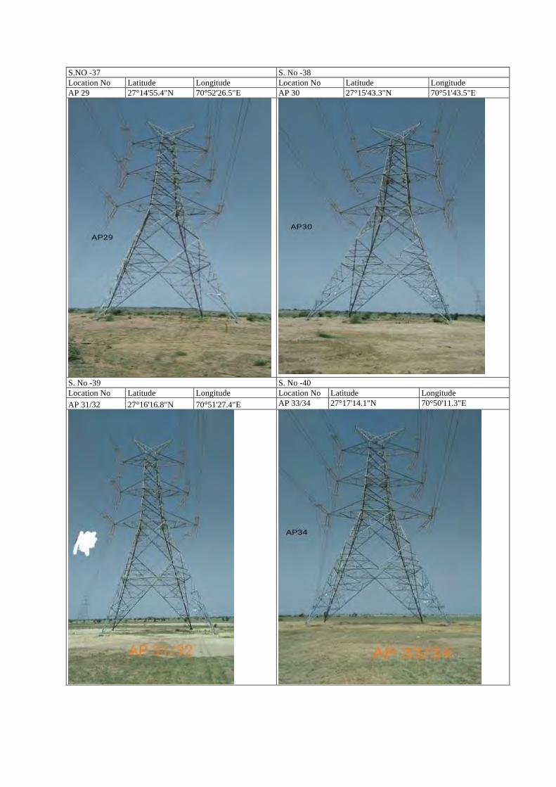
S.NO -37 S. No -38 Location No Latitude Longitude Location No Latitude Longitude AP 29 27°14'55.4"N 70°52'26.5"E AP 30 27°15'43.3"N 70°51'43.5"E
S. No -39 S. No -40 Location No Latitude Longitude Location No Latitude Longitude AP 31/32 27°16'16.8"N 70°51'27.4"E AP 33/34 27°17'14.1"N 70°50'11.3"E
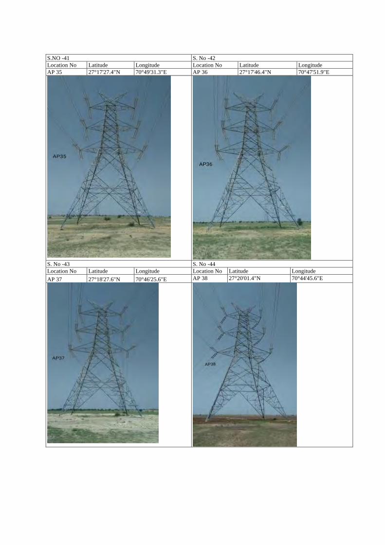
S.NO -41 S. No -42 Location No Latitude Longitude Location No Latitude Longitude AP 35 27°17'27.4"N 70°49'31.3"E AP 36 27°17'46.4"N 70°47'51.9"E
S. No -43 S. No -44 Location No Latitude Longitude Location No Latitude Longitude AP 37 27°18'27.6"N 70°46'25.6"E AP 38 27°20'01.4"N 70°44'45.6"E
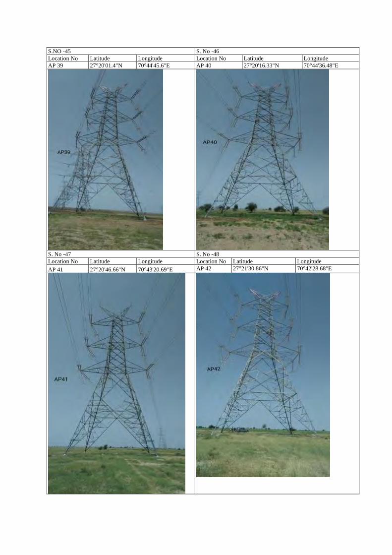
S.NO -45 S. No -46 Location No Latitude Longitude Location No Latitude Longitude AP 39 27°20'01.4"N 70°44'45.6"E AP 40 27°20'16.33"N 70°44'36.48"E
S. No -47 S. No -48 Location No Latitude Longitude Location No Latitude Longitude AP 41 27°20'46.66"N 70°43'20.69"E AP 42 27°21'30.86"N 70°42'28.68"E
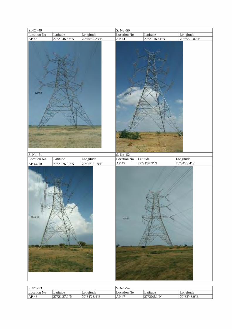
S.NO -49 S. No -50 Location No Latitude Longitude Location No Latitude Longitude AP 43 27°21'46.58"N 70°40'39.23"E AP 44 27°21'16.84"N 70°39'20.87"E
S. No -51 S. No -52 Location No Latitude Longitude Location No Latitude Longitude AP 44/10 27°21'26.95"N 70°36'58.18"E AP 45 27°21'37.9"N 70°34'23.4"E
S.NO -53 S. No -54 Location No Latitude Longitude Location No Latitude Longitude AP 46 27°21'37.9"N 70°34'23.4"E AP 47 27°20'5.1"N 70°32'48.9"E
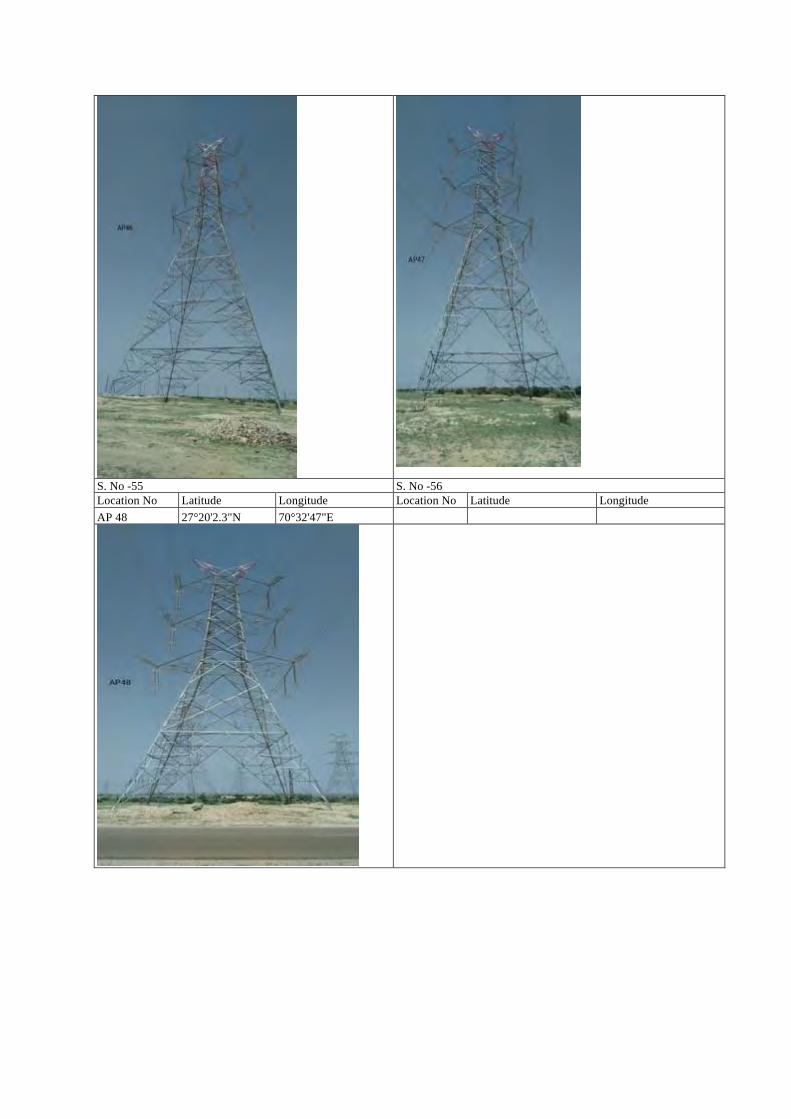
S. No -55 S. No -56 Location No Latitude Longitude Location No Latitude Longitude AP 48 27°20'2.3"N 70°32'47"E
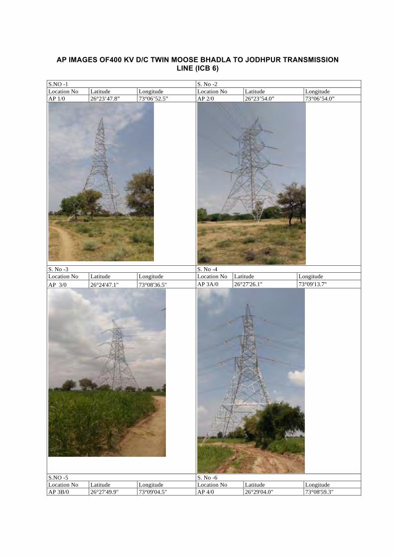
AP IMAGES OF400 KV D/C TWIN MOOSE BHADLA TO JODHPUR TRANSMISSION
LINE (ICB 6) S.NO -1 S. No -2 Location No Latitude Longitude Location No Latitude Longitude AP 1/0 26°23’47.8” 73°06’52.5” AP 2/0 26°23’54.0” 73°06’54.0”
S. No -3 S. No -4 Location No Latitude Longitude Location No Latitude Longitude AP 3/0 26°24'47.1" 73°08'36.5" AP 3A/0 26°27'26.1" 73°09'13.7"
S.NO -5 S. No -6 Location No Latitude Longitude Location No Latitude Longitude AP 3B/0 26°27'49.9" 73°09'04.5" AP 4/0 26°29'04.0" 73°08'59.3"
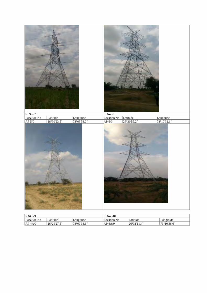
S. No -7 S. No -8 Location No Latitude Longitude Location No Latitude Longitude AP 5/0 26°30'23.5" 73°09'53.0" AP 6/0 26°30'59.2" 73°10'32.1"
S.NO -9 S. No -10 Location No Latitude Longitude Location No Latitude Longitude AP 4A/0 26°29'27.5" 73°09'33.6" AP 6A/0 26°31'11.4" 73°10'36.6"
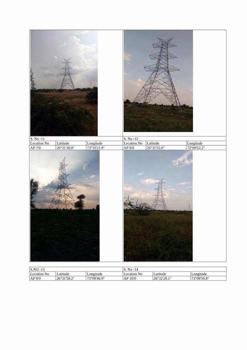
S. No -11 S. No -12 Location No Latitude Longitude Location No Latitude Longitude AP 7/0 26°31'30.8" 73°10'21.9" AP 8/0 26°31'55.0" 73°09'52.2"
S.NO -13 S. No -14 Location No Latitude Longitude Location No Latitude Longitude AP 9/0 26°31'58.2" 73°09'46.9" AP 10/0 26°32'28.1" 73°08'50.8"
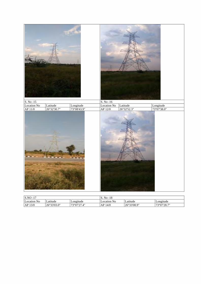
S. No -15 S. No -16 Location No Latitude Longitude Location No Latitude Longitude AP 11/0 26°32'30.7" 73°08'43.9" AP 12/0 26°32'52.3" 73°07'38.0"
S.NO -17 S. No -18 Location No Latitude Longitude Location No Latitude Longitude AP 13/0 26°33'03.0" 73°07'27.4" AP 14/0 26°33'08.9" 73°07'28.7"
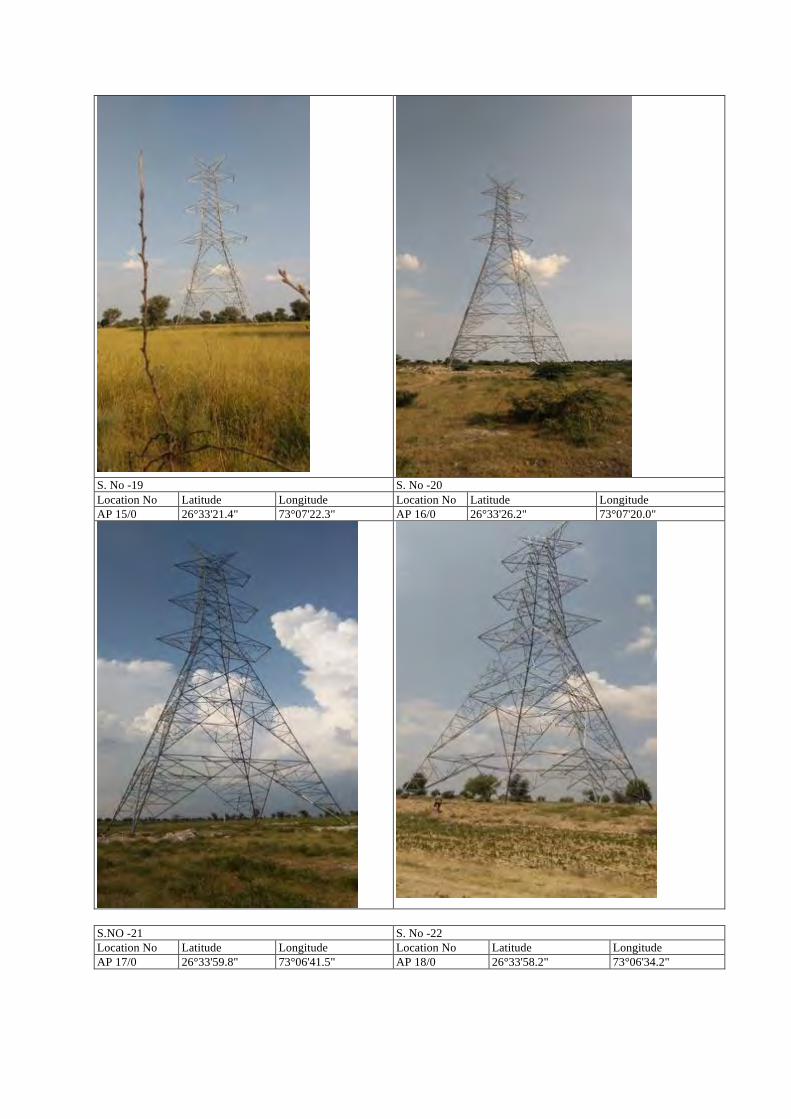
S. No -19 S. No -20 Location No Latitude Longitude Location No Latitude Longitude AP 15/0 26°33'21.4" 73°07'22.3" AP 16/0 26°33'26.2" 73°07'20.0"
S.NO -21 S. No -22 Location No Latitude Longitude Location No Latitude Longitude AP 17/0 26°33'59.8" 73°06'41.5" AP 18/0 26°33'58.2" 73°06'34.2"
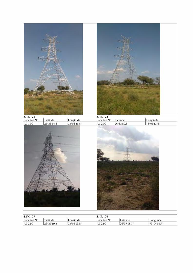
S. No -23 S. No -24 Location No Latitude Longitude Location No Latitude Longitude AP 19/0 26°33'54.6" 73°06'26.8" AP 20/0 26°33'59.8" 73°06'13.6"
S.NO -25 S. No -26 Location No Latitude Longitude Location No Latitude Longitude AP 21/0 26°36'19.3" 73°05'13.5" AP 22/0 26°37'08.7" 73°04'09.7"
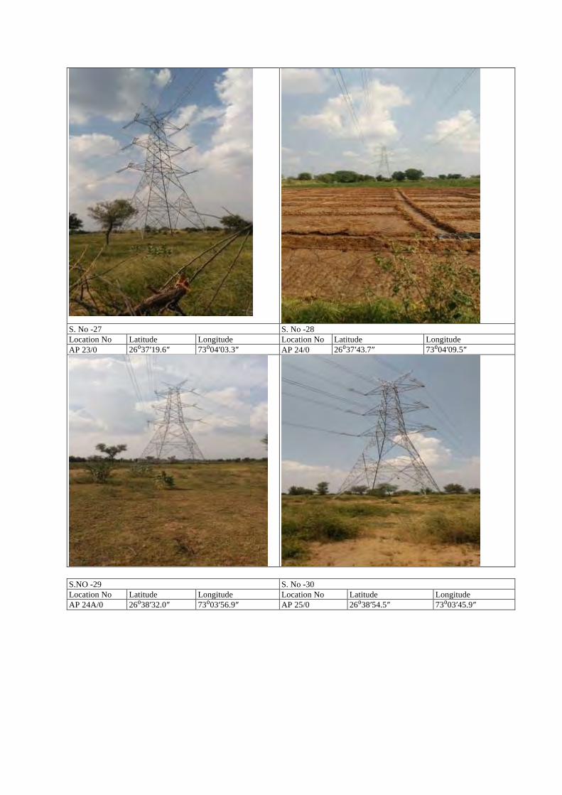
S. No -27 S. No -28 Location No Latitude Longitude Location No Latitude Longitude AP 23/0 26⁰37′19.6″ 73⁰04′03.3″ AP 24/0 26⁰37′43.7″ 73⁰04′09.5″
S.NO -29 S. No -30 Location No Latitude Longitude Location No Latitude Longitude AP 24A/0 26⁰38′32.0″ 73⁰03′56.9″ AP 25/0 26⁰38′54.5″ 73⁰03′45.9″
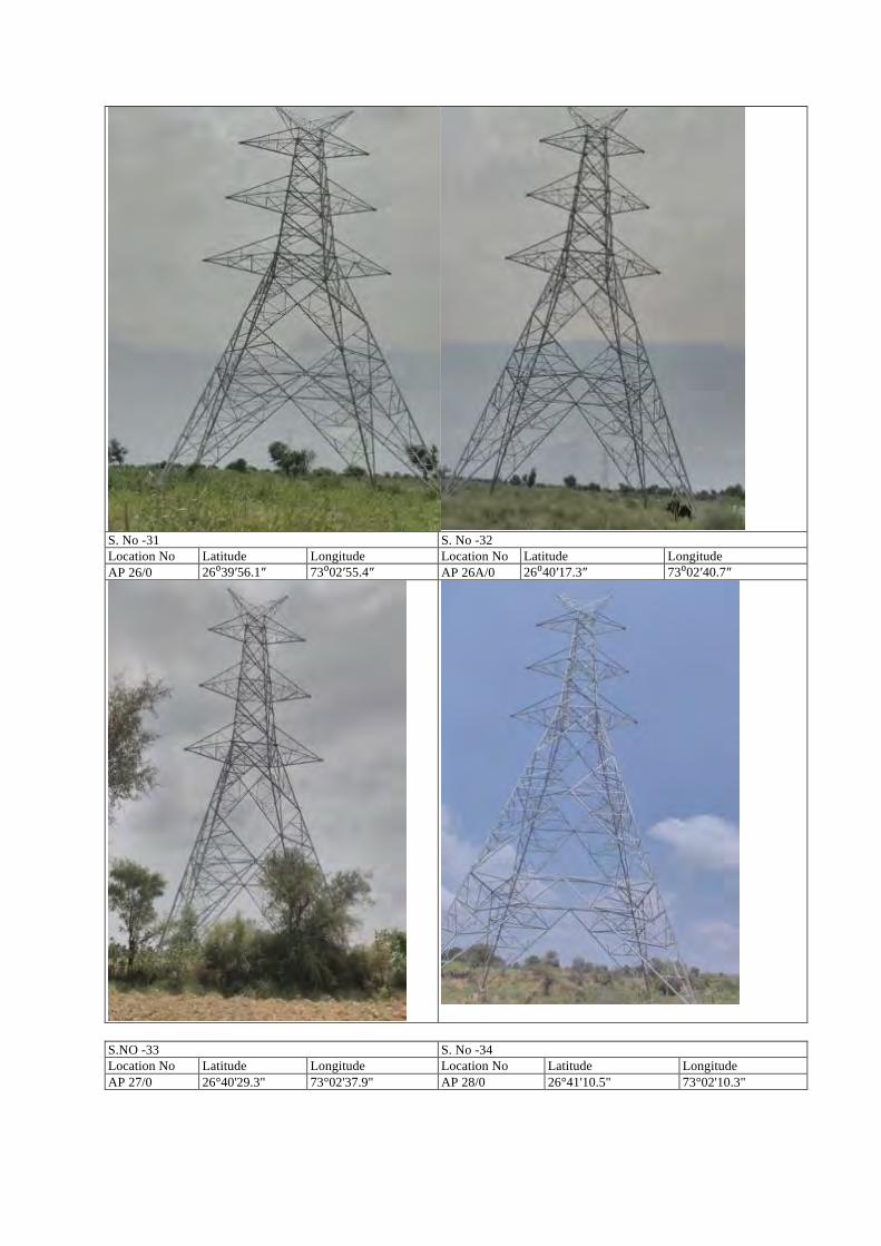
S. No -31 S. No -32 Location No Latitude Longitude Location No Latitude Longitude AP 26/0 26⁰39′56.1″ 73⁰02′55.4″ AP 26A/0 26⁰40′17.3″ 73⁰02′40.7″
S.NO -33 S. No -34 Location No Latitude Longitude Location No Latitude Longitude AP 27/0 26°40'29.3" 73°02'37.9" AP 28/0 26°41'10.5" 73°02'10.3"
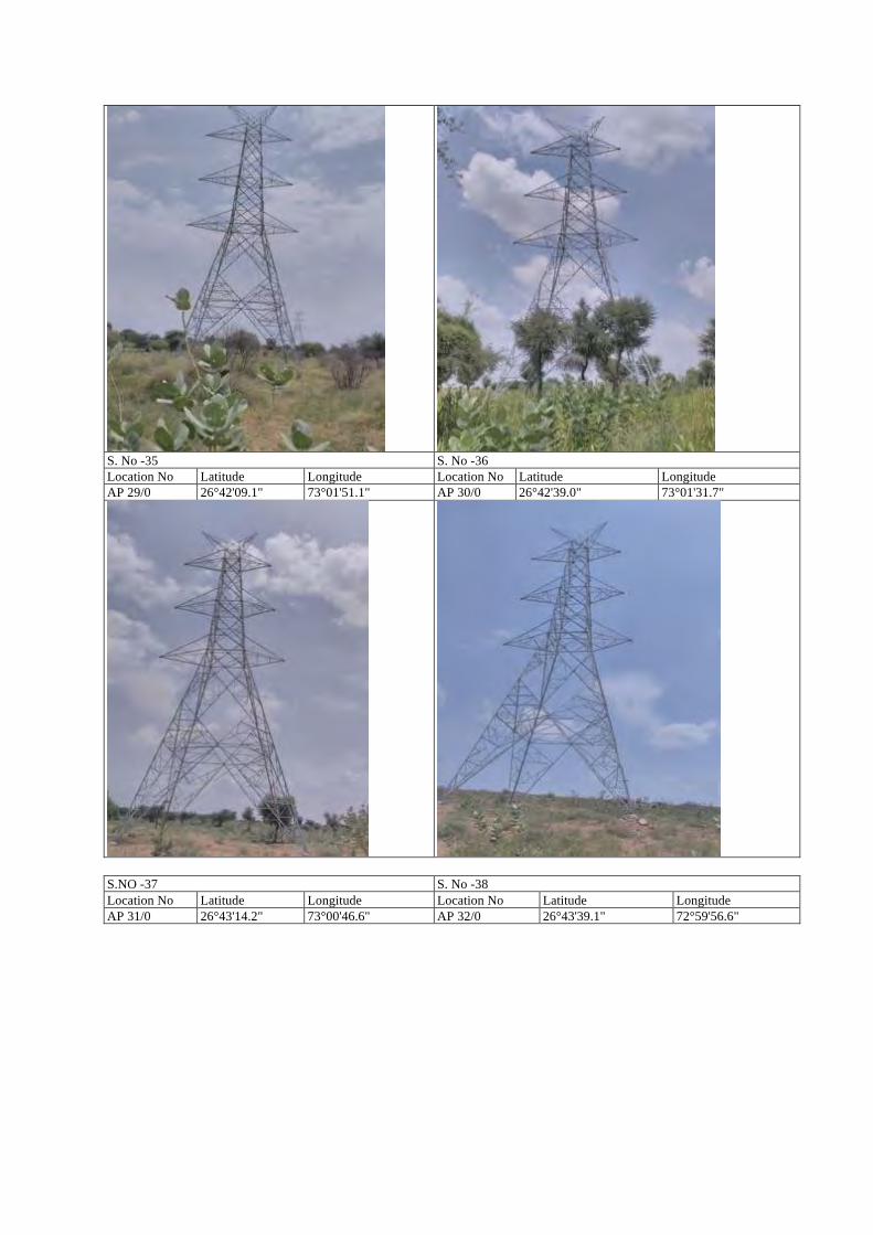
S. No -35 S. No -36 Location No Latitude Longitude Location No Latitude Longitude AP 29/0 26°42'09.1" 73°01'51.1" AP 30/0 26°42'39.0" 73°01'31.7"
S.NO -37 S. No -38 Location No Latitude Longitude Location No Latitude Longitude AP 31/0 26°43'14.2" 73°00'46.6" AP 32/0 26°43'39.1" 72°59'56.6"
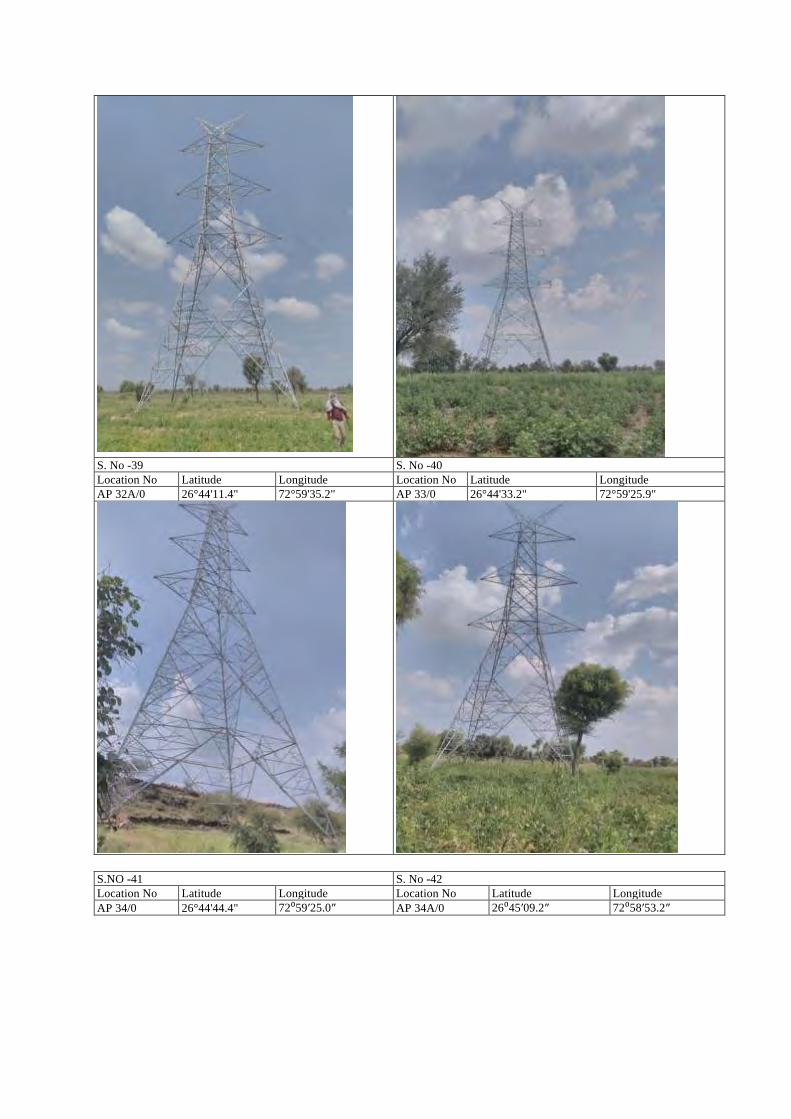
S. No -39 S. No -40 Location No Latitude Longitude Location No Latitude Longitude AP 32A/0 26°44'11.4" 72°59'35.2" AP 33/0 26°44'33.2" 72°59'25.9"
S.NO -41 S. No -42 Location No Latitude Longitude Location No Latitude Longitude AP 34/0 26°44'44.4" 72⁰59′25.0″ AP 34A/0 26⁰45′09.2″ 72⁰58′53.2″
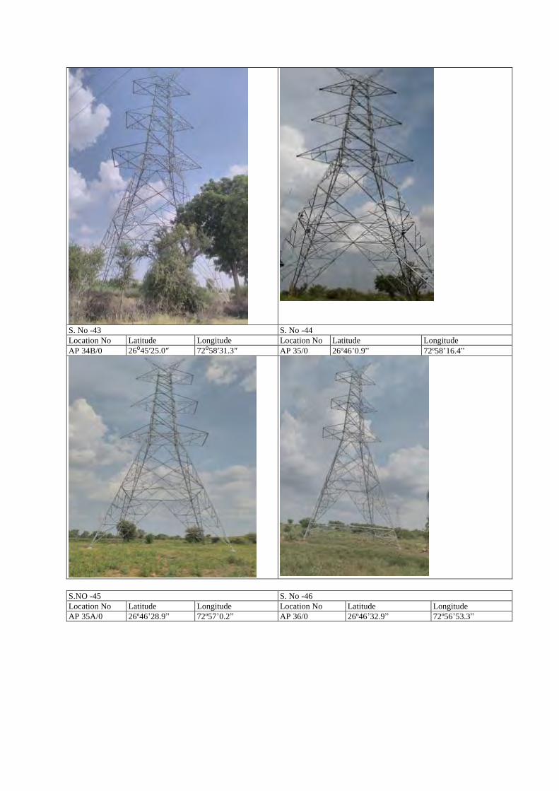
S. No -43 S. No -44 Location No Latitude Longitude Location No Latitude Longitude AP 34B/0 26⁰45′25.0″ 72⁰58′31.3″ AP 35/0 26º46ʼ0.9ˮ 72º58ʼ16.4ˮ
S.NO -45 S. No -46 Location No Latitude Longitude Location No Latitude Longitude AP 35A/0 26º46ʼ28.9ˮ 72º57ʼ0.2ˮ AP 36/0 26º46ʼ32.9ˮ 72º56ʼ53.3ˮ
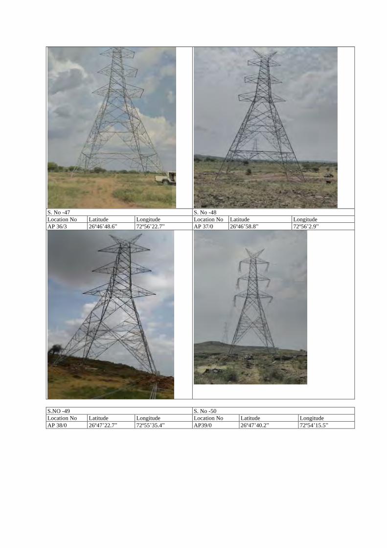
S. No -47 S. No -48 Location No Latitude Longitude Location No Latitude Longitude AP 36/3 26º46ʼ48.6ˮ 72º56ʼ22.7ˮ AP 37/0 26º46ʼ58.8ˮ 72º56ʼ2.9ˮ
S.NO -49 S. No -50 Location No Latitude Longitude Location No Latitude Longitude AP 38/0 26º47ʼ22.7ˮ 72º55ʼ35.4ˮ AP39/0 26º47ʼ40.2ˮ 72º54ʼ15.5ˮ
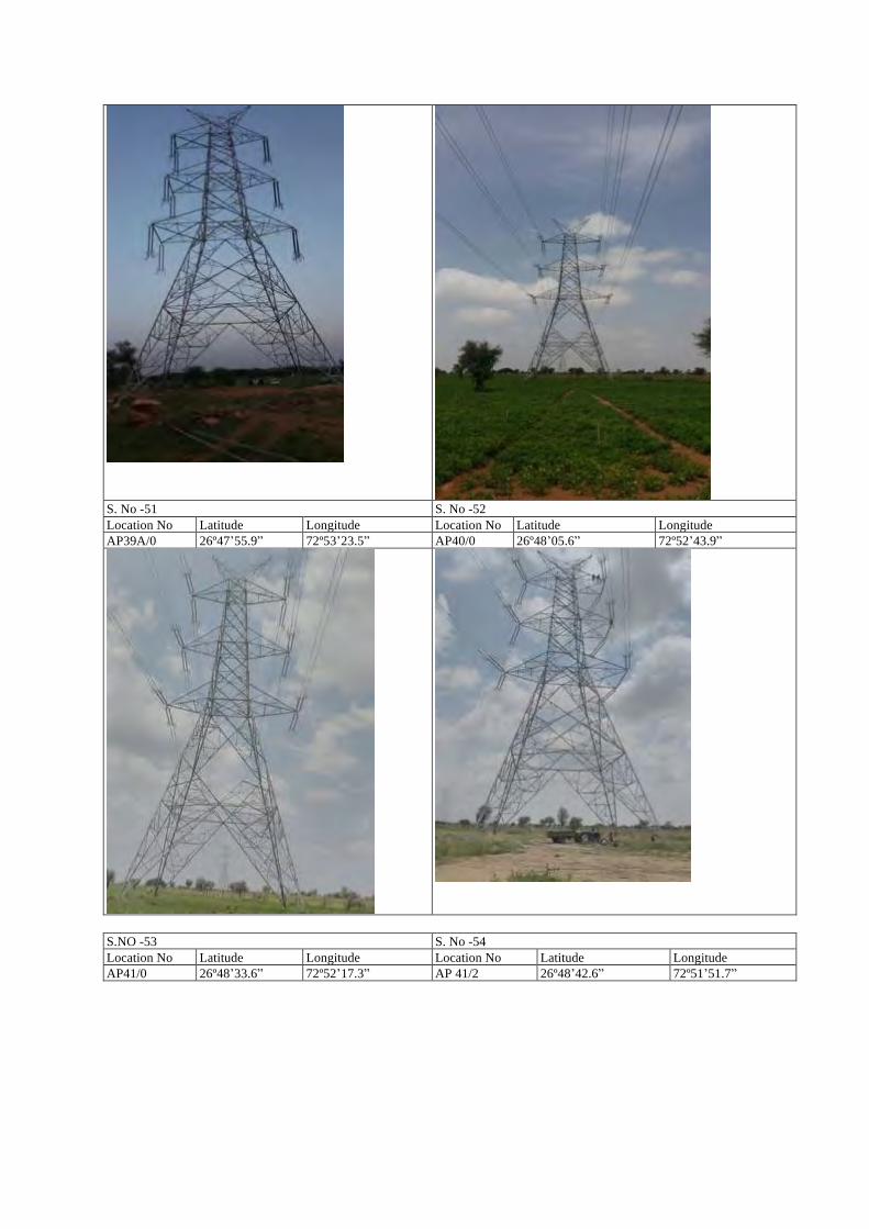
S. No -51 S. No -52 Location No Latitude Longitude Location No Latitude Longitude AP39A/0 26º47ʼ55.9ˮ 72º53ʼ23.5ˮ AP40/0 26º48ʼ05.6ˮ 72º52ʼ43.9ˮ
S.NO -53 S. No -54 Location No Latitude Longitude Location No Latitude Longitude AP41/0 26º48ʼ33.6ˮ 72º52ʼ17.3ˮ AP 41/2 26º48ʼ42.6ˮ 72º51ʼ51.7ˮ
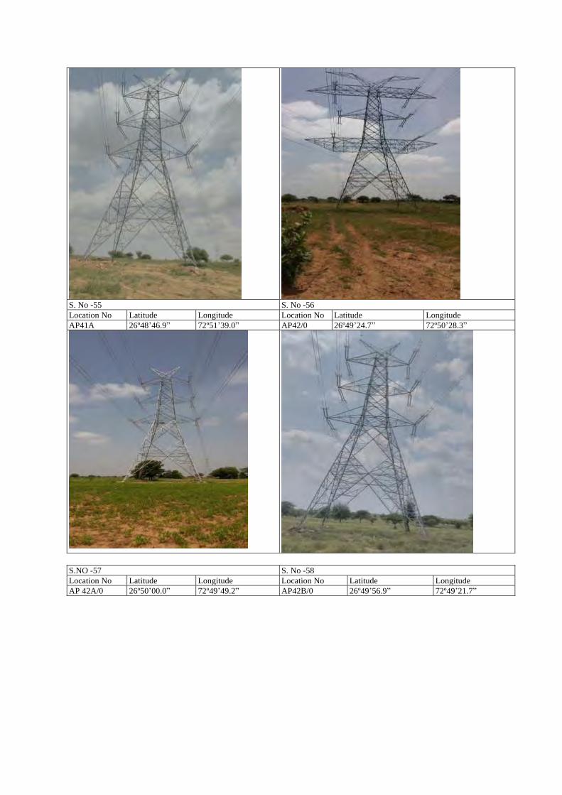
S. No -55 S. No -56 Location No Latitude Longitude Location No Latitude Longitude AP41A 26º48ʼ46.9ˮ 72º51ʼ39.0ˮ AP42/0 26º49ʼ24.7ˮ 72º50ʼ28.3ˮ
S.NO -57 S. No -58 Location No Latitude Longitude Location No Latitude Longitude AP 42A/0 26º50ʼ00.0ˮ 72º49ʼ49.2ˮ AP42B/0 26º49ʼ56.9ˮ 72º49ʼ21.7ˮ
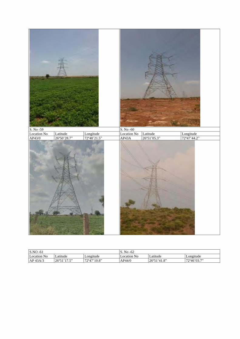
S. No -59 S. No -60 Location No Latitude Longitude Location No Latitude Longitude AP43/0 26º50ʼ28.7ˮ 72º48ʼ21.5ˮ AP43A 26º51ʼ05.3ˮ 72º47ʼ44.2ˮ
S.NO -61 S. No -62 Location No Latitude Longitude Location No Latitude Longitude AP 43A/3 26º51ʼ17.5ˮ 72º47ʼ10.8ˮ AP44/0 26º51ʼ41.8ˮ 72º46ʼ03.7ˮ
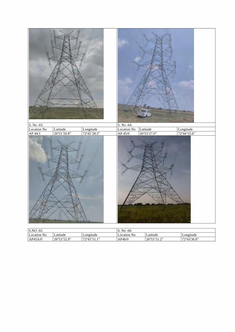
S. No -63 S. No -64 Location No Latitude Longitude Location No Latitude Longitude AP 44/1 26º51ʼ50.8ˮ 72º45ʼ58.5ˮ AP 45/0 26º53ʼ27.0ˮ 72º44ʼ55.6ˮ
S.NO -65 S. No -66 Location No Latitude Longitude Location No Latitude Longitude AP45A/0 26º53ʼ52.9ˮ 72º43ʼ51.1ˮ AP46/0 26º53ʼ51.2ˮ 72º43'36.8ˮ
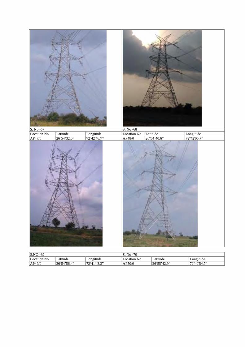
S. No -67 S. No -68 Location No Latitude Longitude Location No Latitude Longitude AP47/0 26º54ʼ32.0ˮ 72º42'46.7ˮ AP48/0 26º54ʼ40.6ˮ 72º42'05.7ˮ
S.NO -69 S. No -70 Location No Latitude Longitude Location No Latitude Longitude AP49/0 26º54ʼ56.4ˮ 72º41'43.3ˮ AP50/0 26º55ʼ42.9ˮ 72º40'54.7ˮ
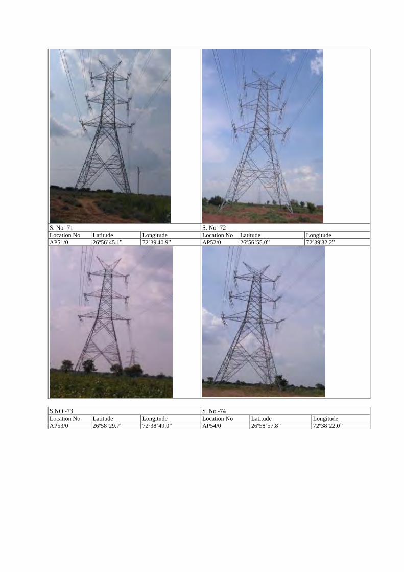
S. No -71 S. No -72 Location No Latitude Longitude Location No Latitude Longitude AP51/0 26º56ʼ45.1ˮ 72º39'40.9ˮ AP52/0 26º56ʼ55.0ˮ 72º39'32.2ˮ
S.NO -73 S. No -74 Location No Latitude Longitude Location No Latitude Longitude AP53/0 26º58ʼ29.7ˮ 72º38ʼ49.0ˮ AP54/0 26º58ʼ57.8ˮ 72º38ʼ22.0ˮ
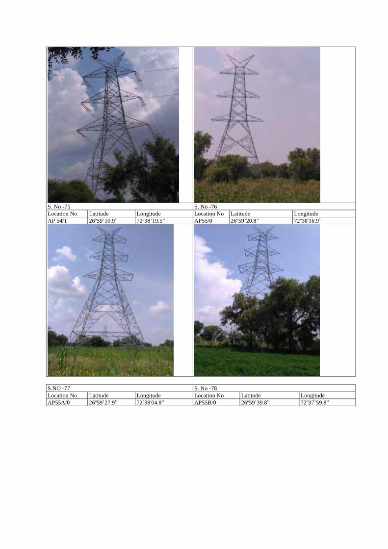
S. No -75 S. No -76 Location No Latitude Longitude Location No Latitude Longitude AP 54/1 26º59ʼ10.9ˮ 72º38ʼ19.5ˮ AP55/0 26º59ʼ20.8ˮ 72º38'16.9ˮ
S.NO -77 S. No -78 Location No Latitude Longitude Location No Latitude Longitude AP55A/0 26º59ʼ27.9ˮ 72º38'04.8ˮ AP55B/0 26º59ʼ39.8ˮ 72º37ʼ59.8ˮ
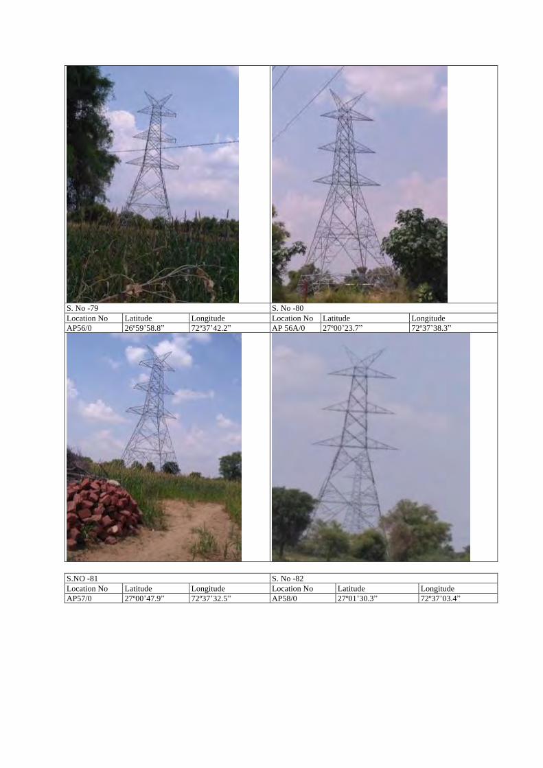
S. No -79 S. No -80 Location No Latitude Longitude Location No Latitude Longitude AP56/0 26º59ʼ58.8ˮ 72º37ʼ42.2ˮ AP 56A/0 27º00ʼ23.7ˮ 72º37ʼ38.3ˮ
S.NO -81 S. No -82 Location No Latitude Longitude Location No Latitude Longitude AP57/0 27º00ʼ47.9ˮ 72º37ʼ32.5ˮ AP58/0 27º01ʼ30.3ˮ 72º37ʼ03.4ˮ
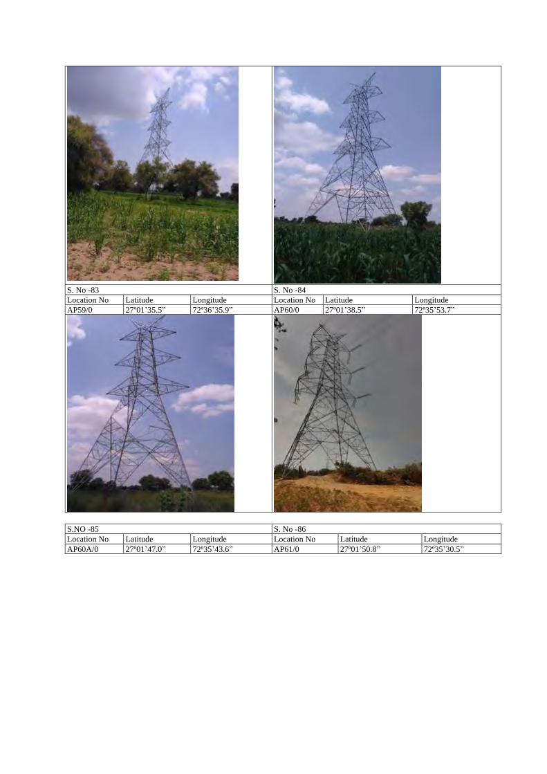
S. No -83 S. No -84 Location No Latitude Longitude Location No Latitude Longitude AP59/0 27º01ʼ35.5ˮ 72º36ʼ35.9ˮ AP60/0 27º01ʼ38.5ˮ 72º35ʼ53.7ˮ
S.NO -85 S. No -86 Location No Latitude Longitude Location No Latitude Longitude AP60A/0 27º01ʼ47.0ˮ 72º35ʼ43.6ˮ AP61/0 27º01ʼ50.8ˮ 72º35ʼ30.5ˮ
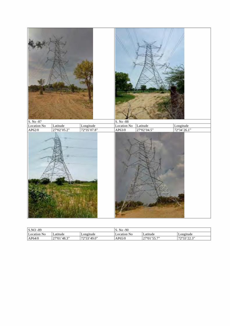
S. No -87 S. No -88 Location No Latitude Longitude Location No Latitude Longitude AP62/0 27º02ʼ05.2ˮ 72º35ʼ07.8ˮ AP63/0 27º02ʼ04.5ˮ 72º34ʼ26.1ˮ
S.NO -89 S. No -90 Location No Latitude Longitude Location No Latitude Longitude AP64/0 27º01ʼ48.3ˮ 72º33ʼ49.0ˮ AP65/0 27º01ʼ55.7ˮ 72º33ʼ22.3ˮ
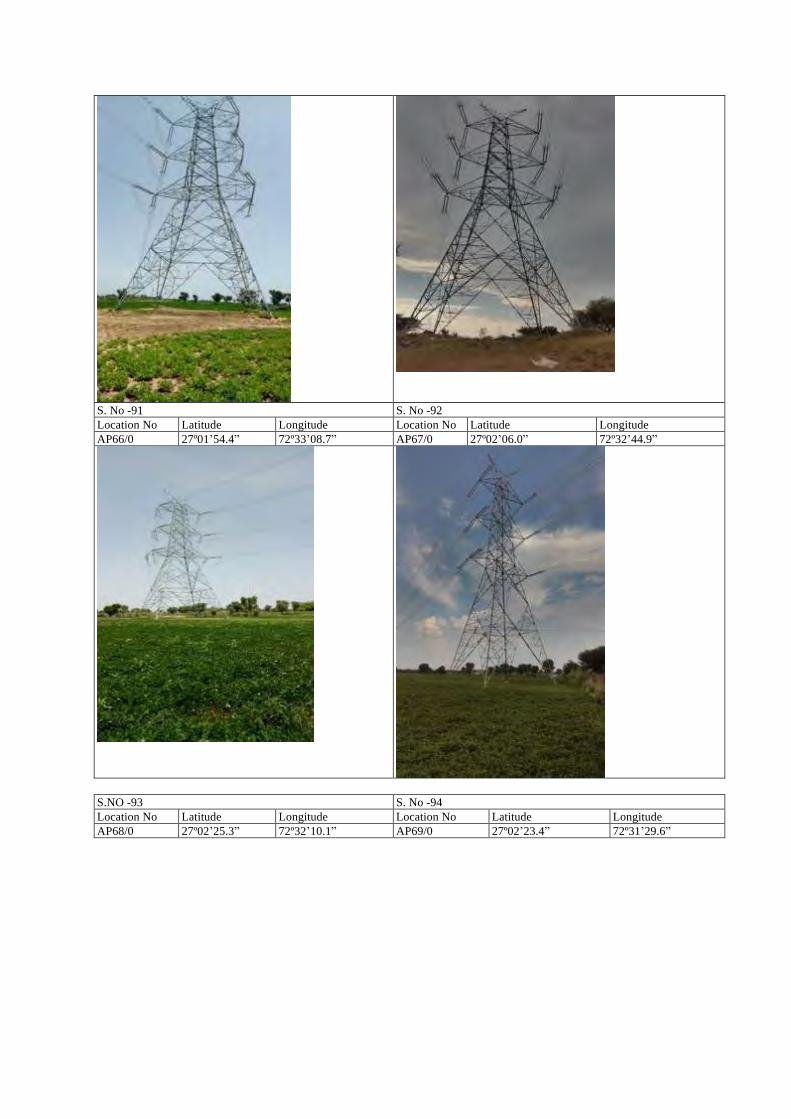
S. No -91 S. No -92 Location No Latitude Longitude Location No Latitude Longitude AP66/0 27º01ʼ54.4ˮ 72º33ʼ08.7ˮ AP67/0 27º02ʼ06.0ˮ 72º32ʼ44.9ˮ
S.NO -93 S. No -94 Location No Latitude Longitude Location No Latitude Longitude AP68/0 27º02ʼ25.3ˮ 72º32ʼ10.1ˮ AP69/0 27º02ʼ23.4ˮ 72º31ʼ29.6ˮ
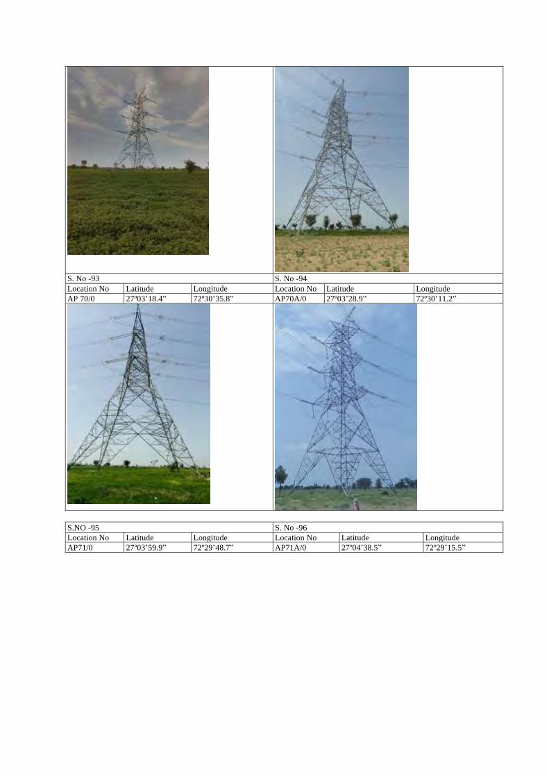
S. No -93 S. No -94 Location No Latitude Longitude Location No Latitude Longitude AP 70/0 27º03ʼ18.4ˮ 72º30ʼ35.8ˮ AP70A/0 27º03ʼ28.9ˮ 72º30ʼ11.2ˮ
S.NO -95 S. No -96 Location No Latitude Longitude Location No Latitude Longitude AP71/0 27º03ʼ59.9ˮ 72º29ʼ48.7ˮ AP71A/0 27º04ʼ38.5ˮ 72º29ʼ15.5ˮ
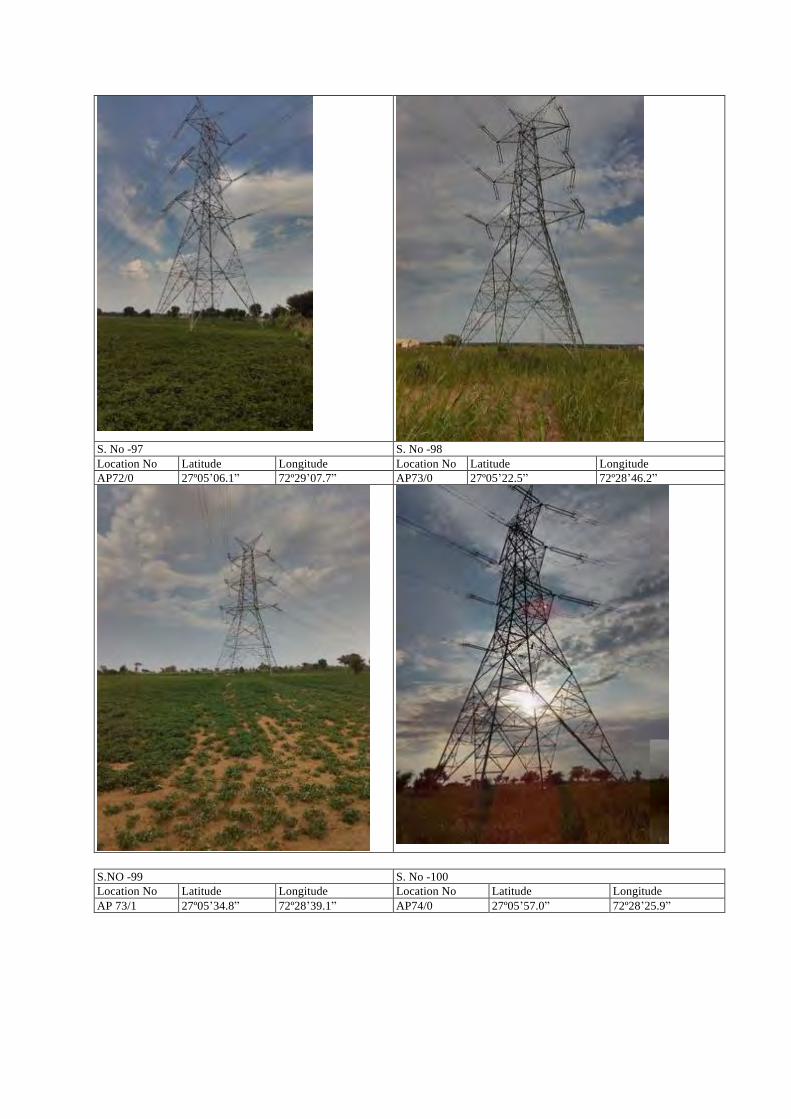
S. No -97 S. No -98 Location No Latitude Longitude Location No Latitude Longitude AP72/0 27º05ʼ06.1ˮ 72º29ʼ07.7ˮ AP73/0 27º05ʼ22.5ˮ 72º28ʼ46.2ˮ
S.NO -99 S. No -100 Location No Latitude Longitude Location No Latitude Longitude AP 73/1 27º05ʼ34.8ˮ 72º28ʼ39.1ˮ AP74/0 27º05ʼ57.0ˮ 72º28ʼ25.9ˮ
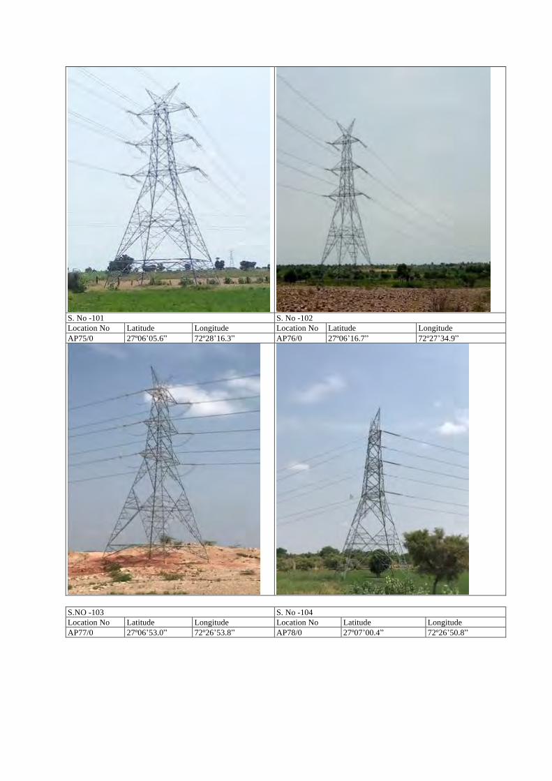
S. No -101 S. No -102 Location No Latitude Longitude Location No Latitude Longitude AP75/0 27º06ʼ05.6ˮ 72º28ʼ16.3ˮ AP76/0 27º06ʼ16.7ˮ 72º27ʼ34.9ˮ
S.NO -103 S. No -104 Location No Latitude Longitude Location No Latitude Longitude AP77/0 27º06ʼ53.0ˮ 72º26ʼ53.8ˮ AP78/0 27º07ʼ00.4ˮ 72º26ʼ50.8ˮ
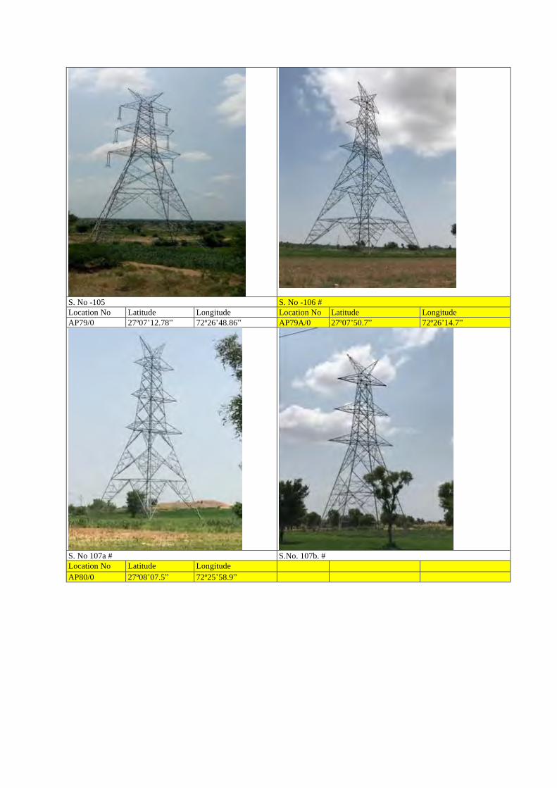
S. No -105 S. No -106 # Location No Latitude Longitude Location No Latitude Longitude AP79/0 27º07ʼ12.78ˮ 72º26ʼ48.86ˮ AP79A/0 27º07ʼ50.7ˮ 72º26ʼ14.7ˮ
S. No 107a # S.No. 107b. # Location No Latitude Longitude AP80/0 27º08ʼ07.5ˮ 72º25ʼ58.9ˮ
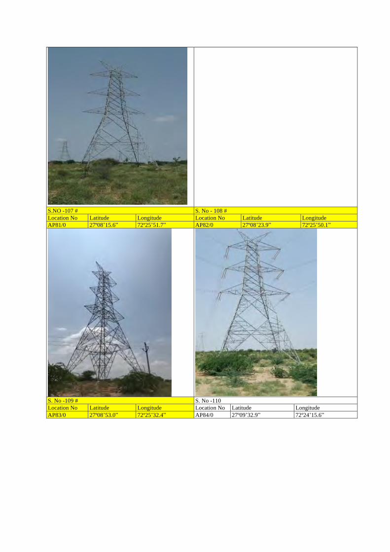
S.NO -107 # S. No - 108 # Location No Latitude Longitude Location No Latitude Longitude AP81/0 27º08ʼ15.6ˮ 72º25ʼ51.7ˮ AP82/0 27º08ʼ23.9ˮ 72º25ʼ50.1ˮ
S. No -109 # S. No -110 Location No Latitude Longitude Location No Latitude Longitude AP83/0 27º08ʼ53.0ˮ 72º25ʼ32.4ˮ AP84/0 27º09ʼ32.9ˮ 72º24ʼ15.6ˮ