Embed Size (px)
Citation preview
Data
• Precipitation
• Livestock demographic and distribution
• Geology
• Water points
• Status of the existing infrastructure
• Salinity of boreholes
• …
2
Information
• shallow and deep groundwater potential,
• identification of drought-prone areas,
• drought and flood intensities in the current situation and under climate change
• 3R/MUS possibilities
• 3R/MUS analysis for determining the gap between demand and supply;
• short- and long-term effects of different uses on the water availability and quality
3

Role of Acacia
• Making information out of data
• Support in CIDP / sector plan development
• Support in community consulting (Water User Masterplan)
• Wamasp
– Provide access to data AND information
• Technical backstopping
4
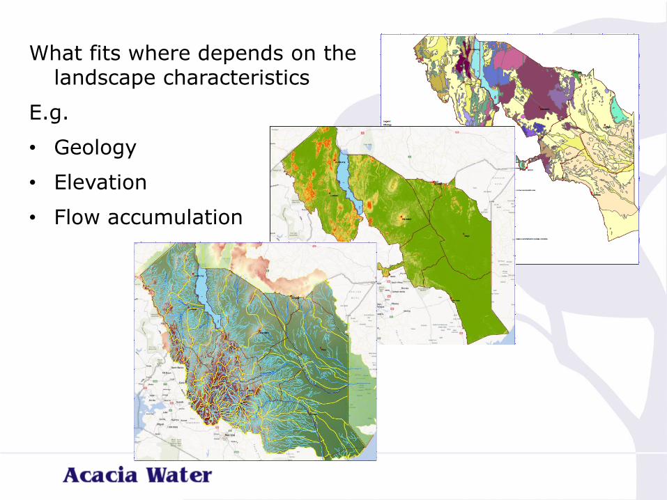
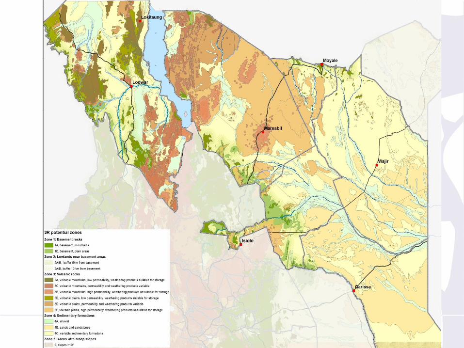
What fits where depends on the landscape characteristics
E.g.
• Geology
• Elevation
• Flow accumulation
6
7
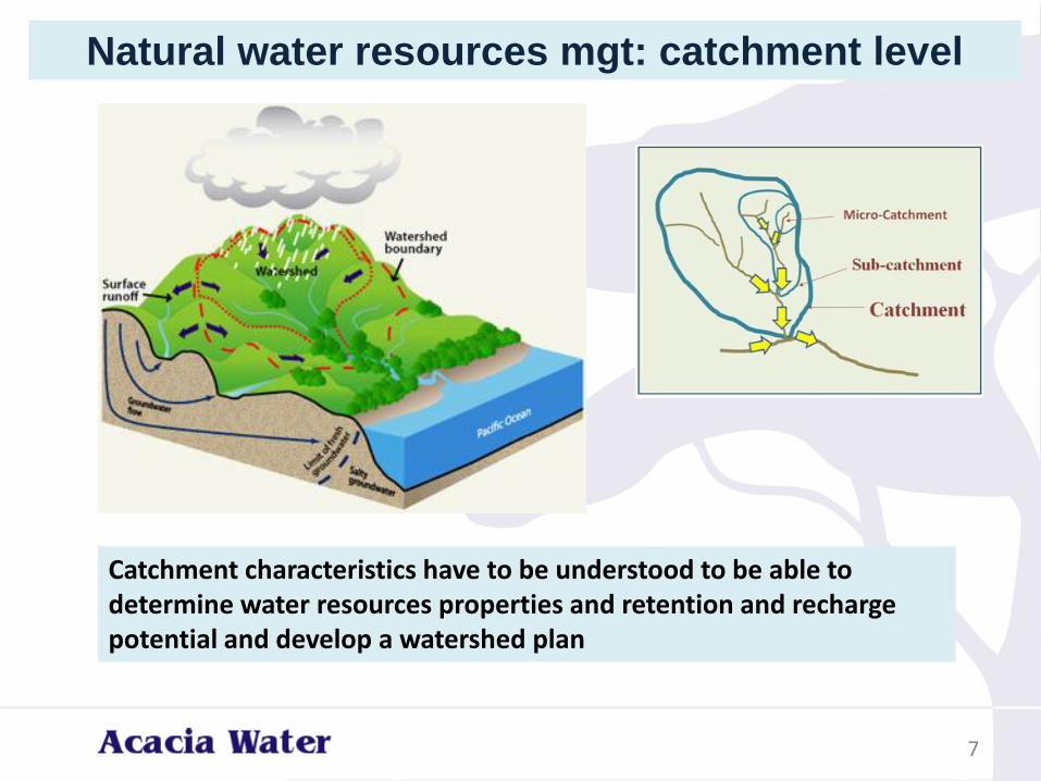
Natural water resources mgt: catchment level
Catchment characteristics have to be understood to be able to determine water resources properties and retention and recharge potential and develop a watershed plan
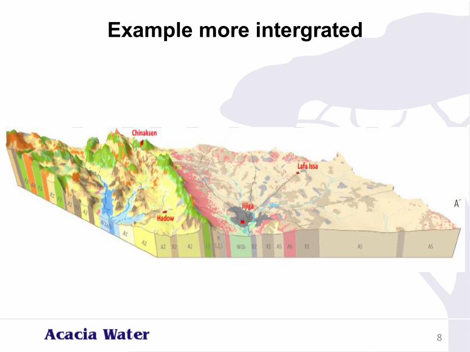
Example more intergrated
8
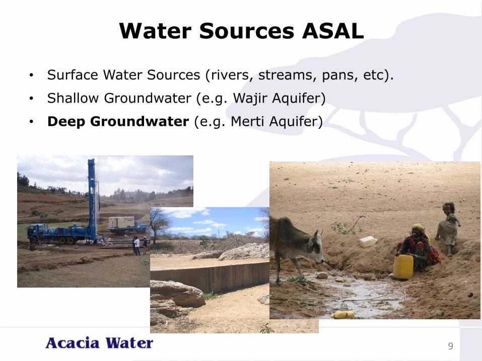
Water Sources ASAL
• Surface Water Sources (rivers, streams, pans, etc).
• Shallow Groundwater (e.g. Wajir Aquifer)
• Deep Groundwater (e.g. Merti Aquifer)
9
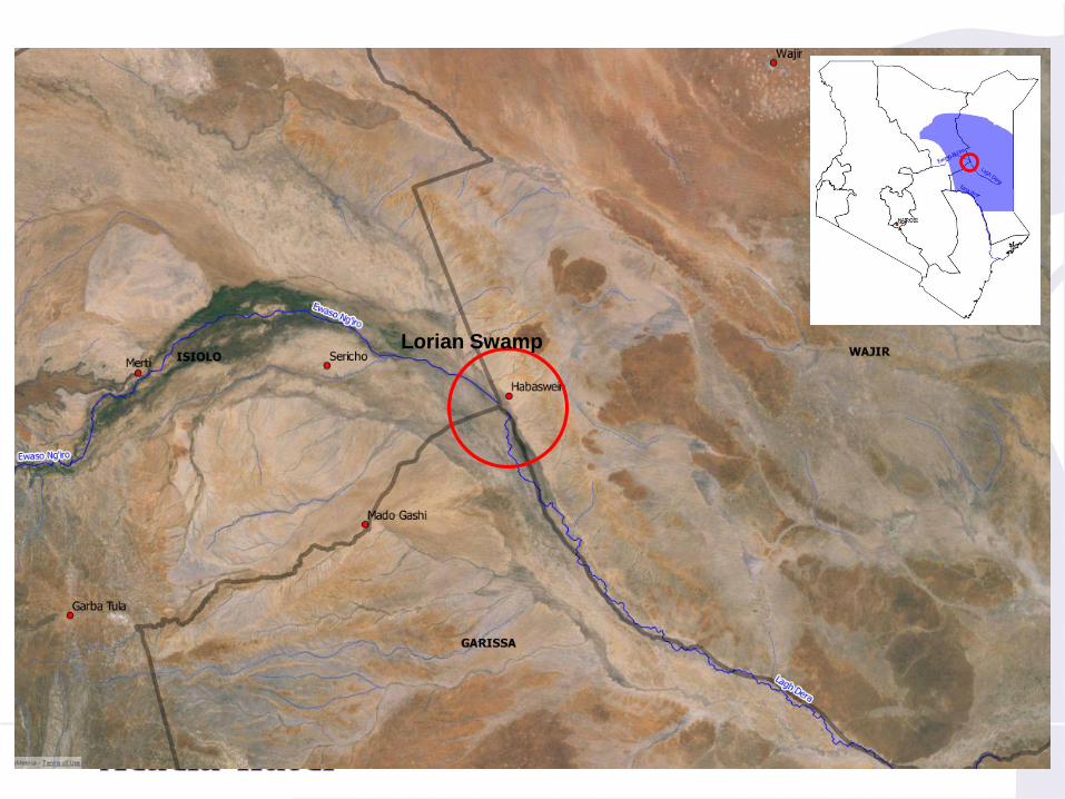
Lorian Swamp
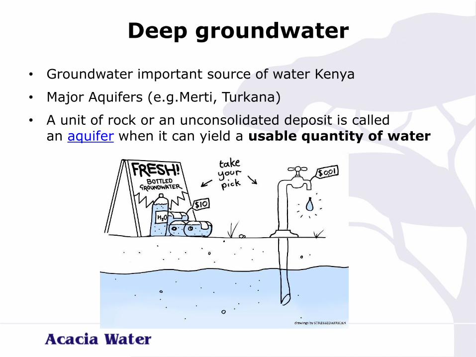
Deep groundwater
• Groundwater important source of water Kenya
• Major Aquifers (e.g.Merti, Turkana)
• A unit of rock or an unconsolidated deposit is called an aquifer when it can yield a usable quantity of water
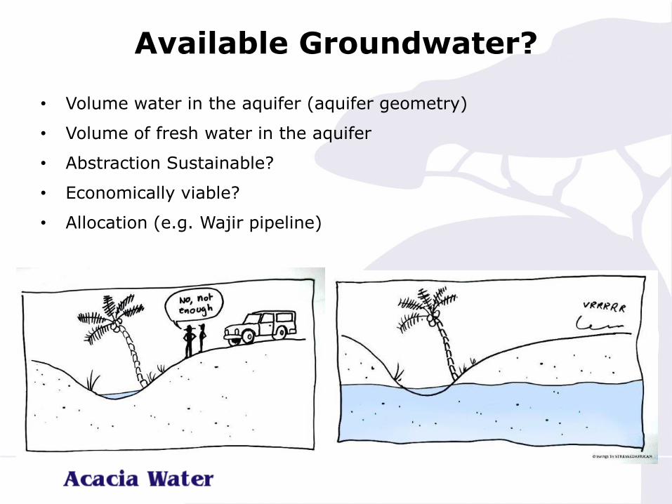
Available Groundwater?
• Volume water in the aquifer (aquifer geometry)
• Volume of fresh water in the aquifer
• Abstraction Sustainable?
• Economically viable?
• Allocation (e.g. Wajir pipeline)
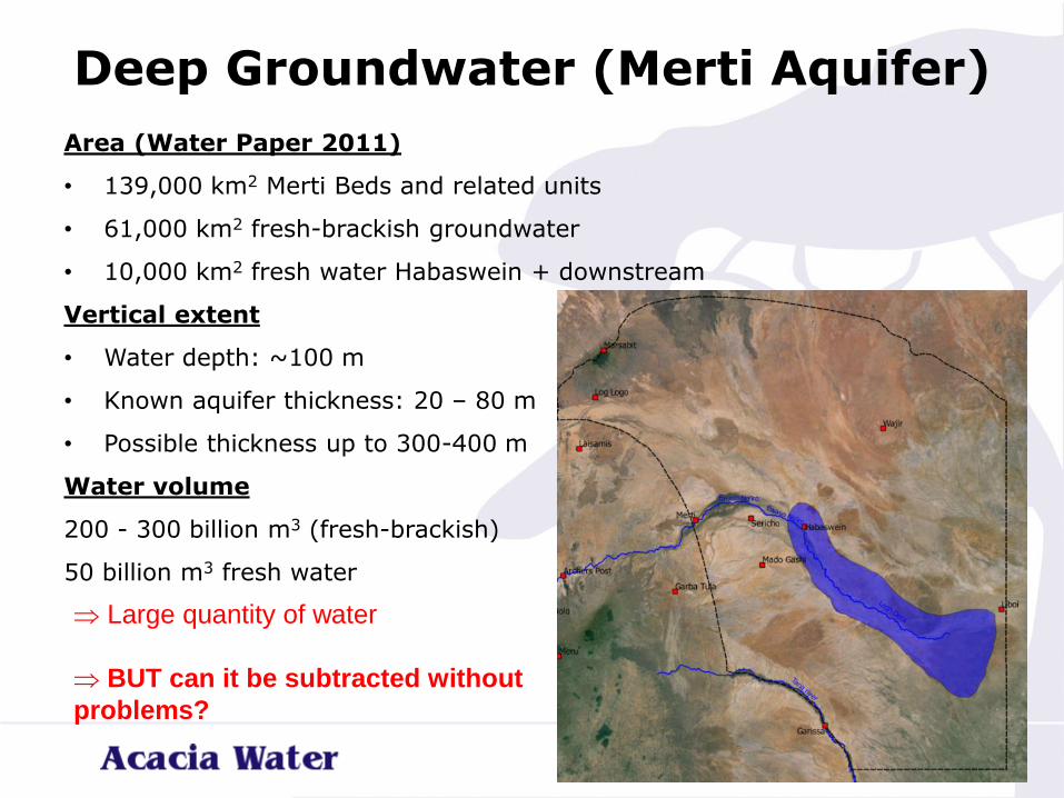
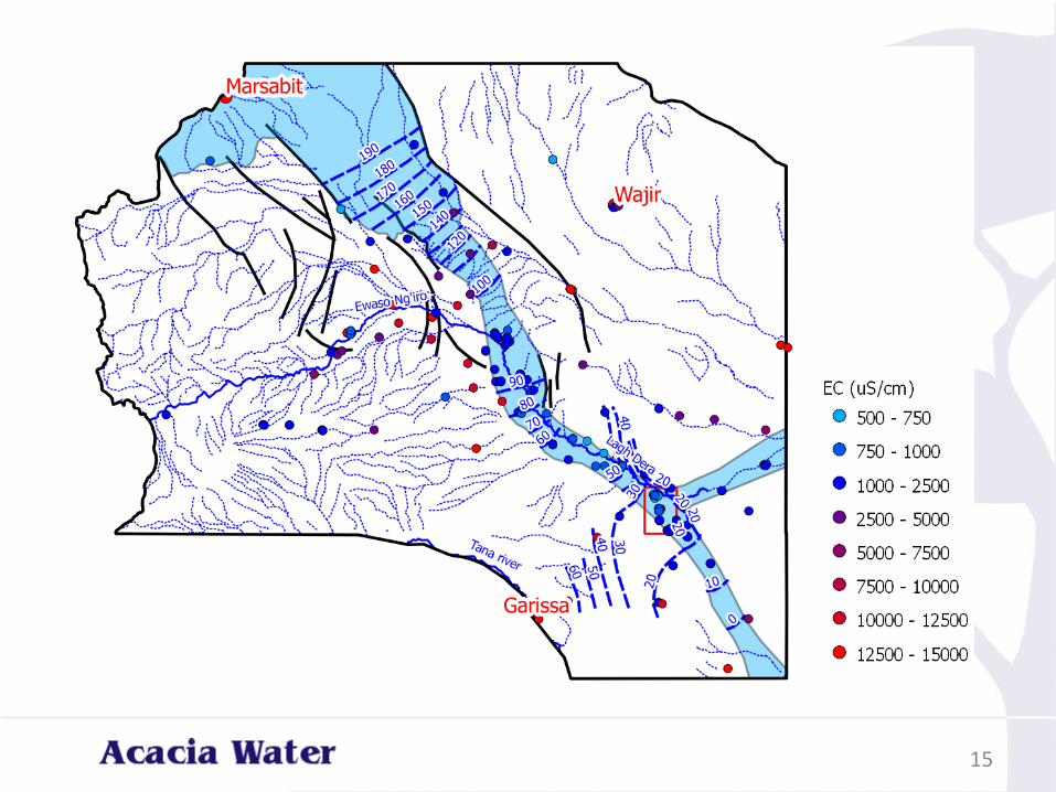
Deep Groundwater (Merti Aquifer)
Area (Water Paper 2011)
• 139,000 km2 Merti Beds and related units
• 61,000 km2 fresh-brackish groundwater
• 10,000 km2 fresh water Habaswein + downstream
Vertical extent
• Water depth: ~100 m
• Known aquifer thickness: 20 – 80 m
• Possible thickness up to 300-400 m
Water volume
200 - 300 billion m3 (fresh-brackish)
50 billion m3 fresh water
Large quantity of water
BUT can it be subtracted without
problems?
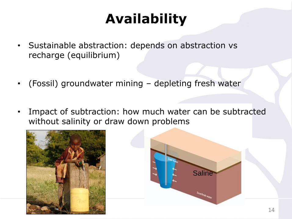
Availability
14
Saline
• Sustainable abstraction: depends on abstraction vsrecharge (equilibrium)
• (Fossil) groundwater mining – depleting fresh water
• Impact of subtraction: how much water can be subtracted without salinity or draw down problems
15
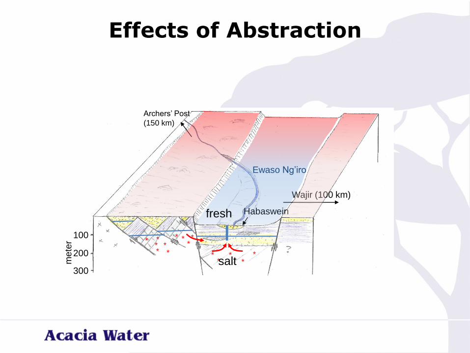
Effects of Abstraction
100
200
300
me
ter
Archers’ Post
(150 km)
Habaswein
Wajir (100 km)
*
**
**
* **
*
** *
***
Ewaso Ng’iro
fresh
salt
Outputs of the Hydrogeological Study
• How will the Habaswein-Wajir well field perform 2014 –2050:
• Chance of drying boreholes due to drawdown?
• Chance of failure due to decreasing quality (salt water)?
17
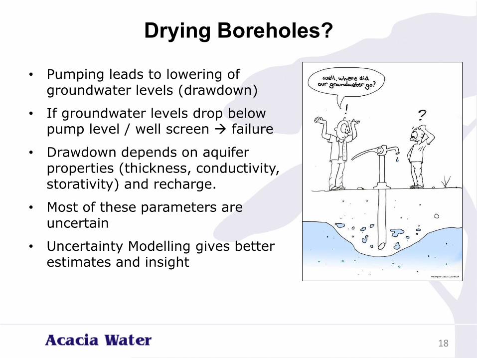
Drying Boreholes?
• Pumping leads to lowering of groundwater levels (drawdown)
• If groundwater levels drop below pump level / well screen → failure
• Drawdown depends on aquifer properties (thickness, conductivity, storativity) and recharge.
• Most of these parameters are uncertain
• Uncertainty Modelling gives better estimates and insight
18
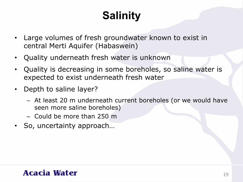
Salinity
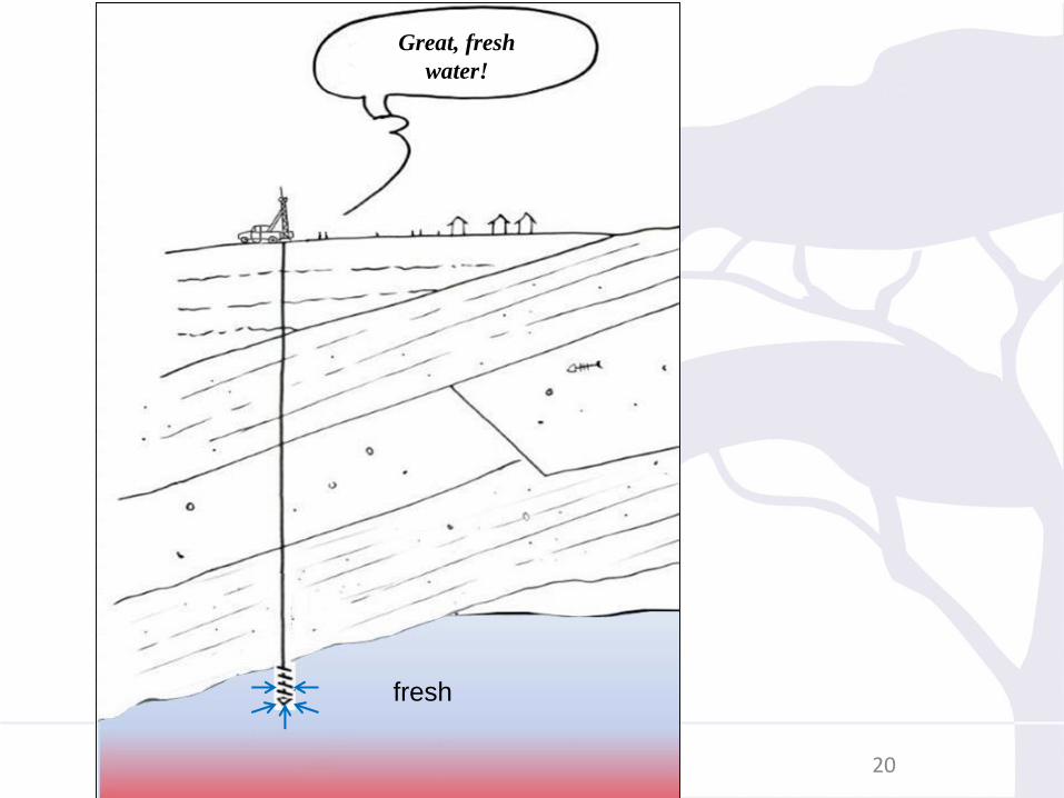
• Large volumes of fresh groundwater known to exist in central Merti Aquifer (Habaswein)
• Quality underneath fresh water is unknown
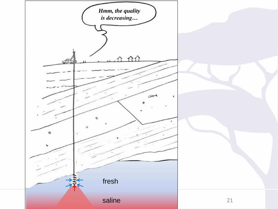
• Quality is decreasing in some boreholes, so saline water is expected to exist underneath fresh water
• Depth to saline layer?
– At least 20 m underneath current boreholes (or we would have seen more saline boreholes)
– Could be more than 250 m
• So, uncertainty approach…
19
20
Salinity
fresh
Great, fresh
water!
fresh
21saline
Hmm, the quality
is decreasing…
fresh
22saline
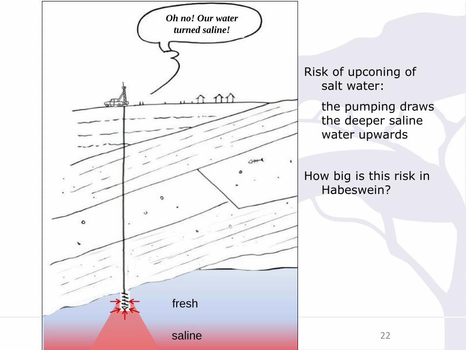
Oh no! Our water
turned saline!
Risk of upconing of salt water:
the pumping draws the deeper saline water upwards
How big is this risk in Habeswein?
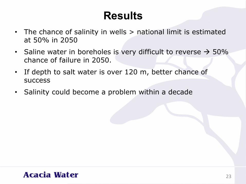
Results
• The chance of salinity in wells > national limit is estimated at 50% in 2050
• Saline water in boreholes is very difficult to reverse → 50% chance of failure in 2050.
• If depth to salt water is over 120 m, better chance of success
• Salinity could become a problem within a decade
23
Conclusions
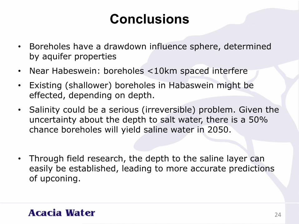
• Boreholes have a drawdown influence sphere, determined by aquifer properties
• Near Habeswein: boreholes <10km spaced interfere
• Existing (shallower) boreholes in Habaswein might be effected, depending on depth.
• Salinity could be a serious (irreversible) problem. Given the uncertainty about the depth to salt water, there is a 50% chance boreholes will yield saline water in 2050.
• Through field research, the depth to the saline layer can easily be established, leading to more accurate predictions of upconing.
24
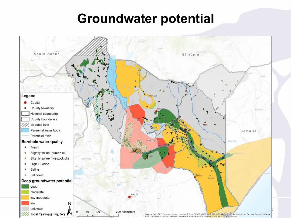
Groundwater potential
25
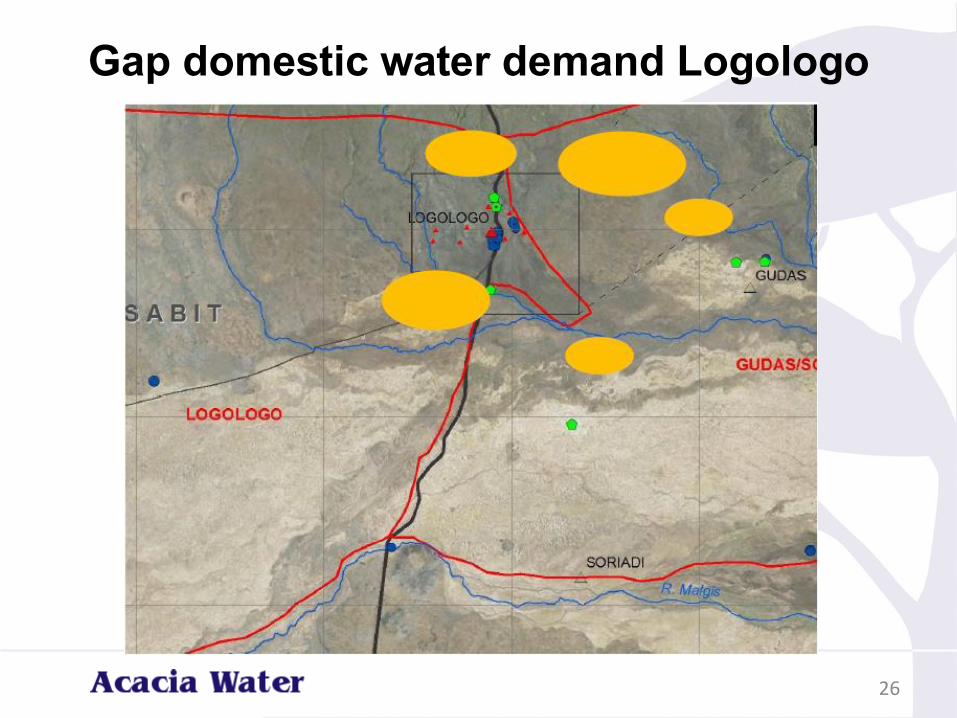
Gap domestic water demand Logologo
26
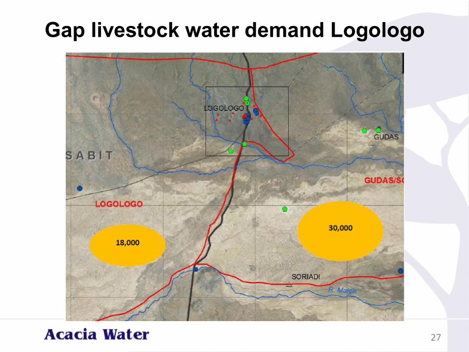
Gap livestock water demand Logologo
27
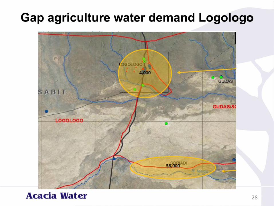
Gap agriculture water demand Logologo
28
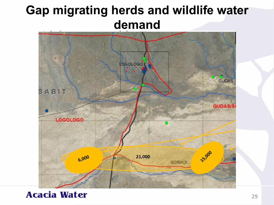
Gap migrating herds and wildlife water
demand
29
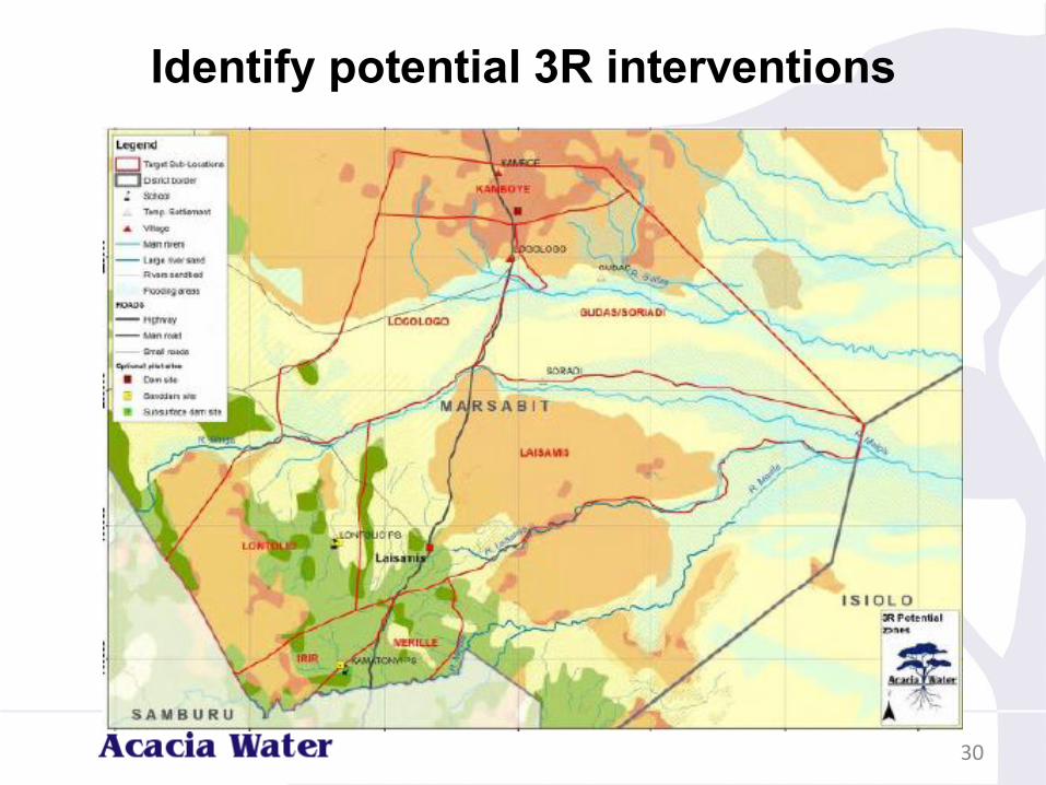
Identify potential 3R interventions
30
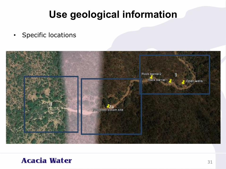
Use geological information
• Specific locations
31
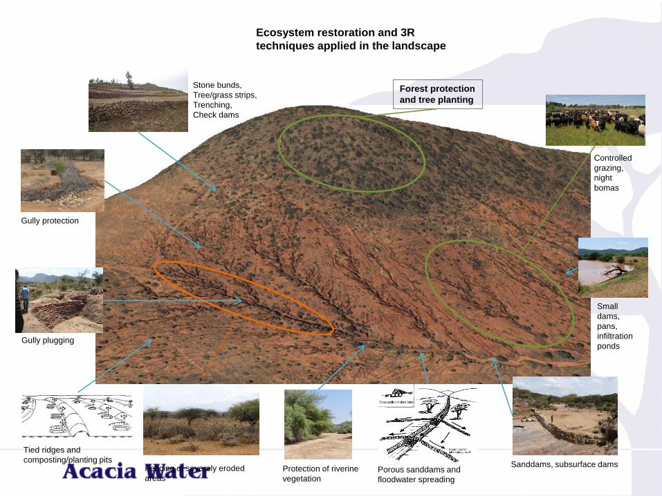
Ecosystem restoration and 3R
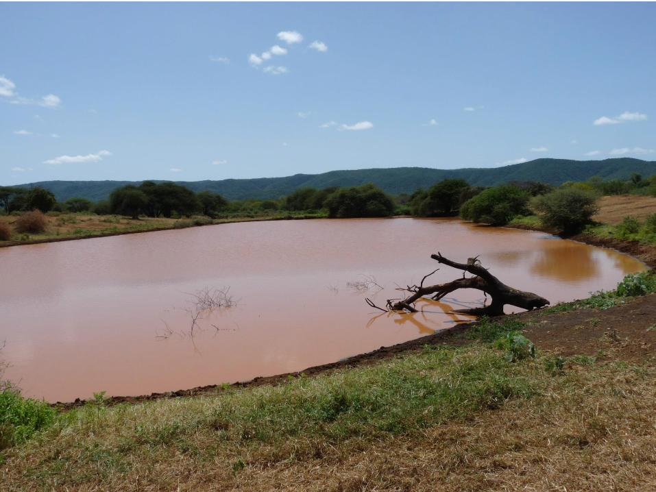
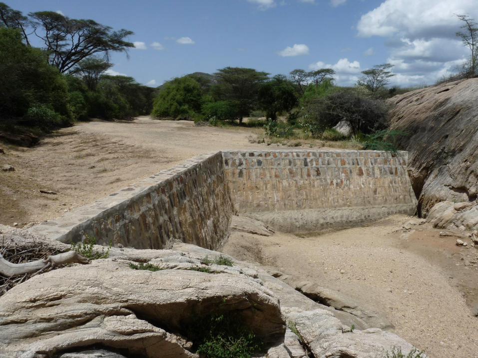
techniques applied in the landscape
Gully plugging
Fencing of severely eroded
areasProtection of riverine
vegetationPorous sanddams and
floodwater spreading
Sanddams, subsurface dams
Gully protection
Tied ridges and
composting/planting pits
Stone bunds,
Tree/grass strips,
Trenching,
Check dams
Controlled
grazing,
night
bomas
Small
dams,
pans,
infiltration
ponds
Forest protection
and tree planting
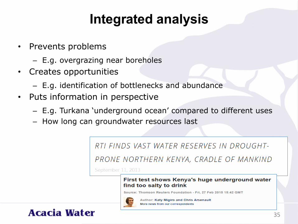
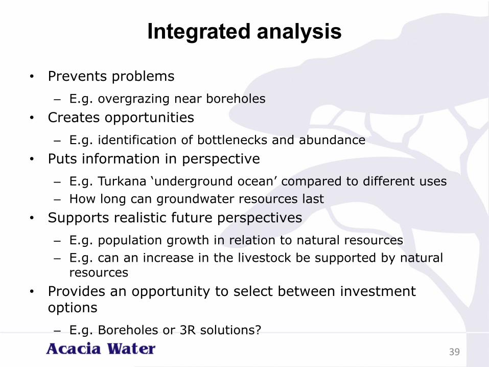
Integrated analysis
• Prevents problems
– E.g. overgrazing near boreholes
• Creates opportunities
– E.g. identification of bottlenecks and abundance
• Puts information in perspective
– E.g. Turkana ‘underground ocean’ compared to different uses
– How long can groundwater resources last
35
Integrated analysis
• Prevents problems
– E.g. overgrazing near boreholes
• Creates opportunities
– E.g. identification of bottlenecks and abundance
• Puts information in perspective
– E.g. Turkana ‘underground ocean’ compared to different uses
– How long can groundwater resources last
• Supports realistic future perspectives
– E.g. population growth in relation to natural resources
– E.g. can an increase in the livestock be supported by natural resources
36
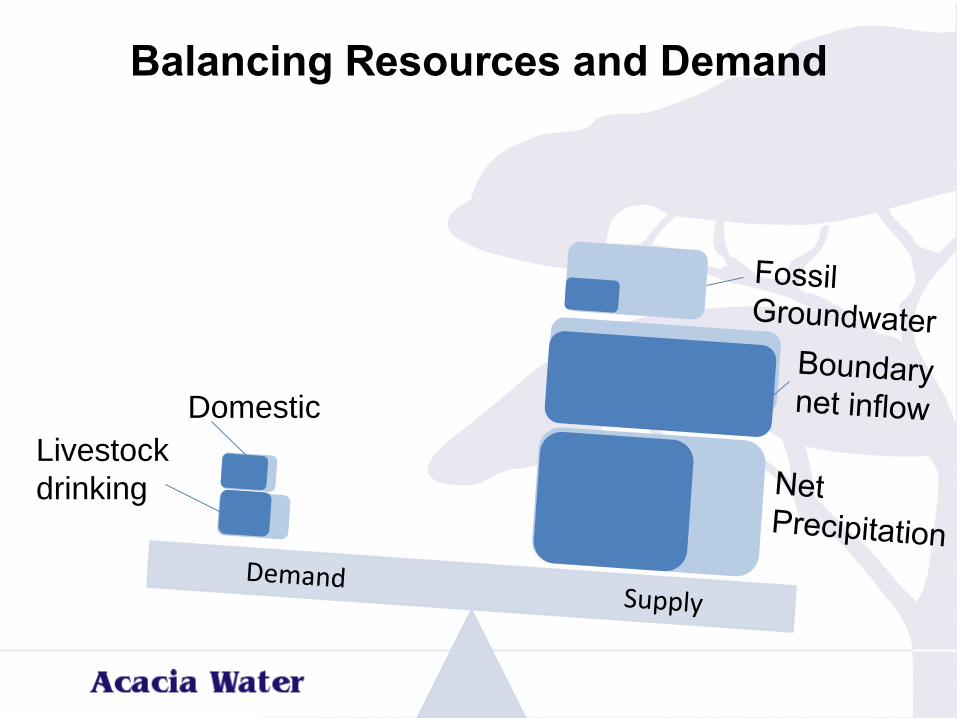
Domestic
Livestock
drinking
Balancing Resources and Demand
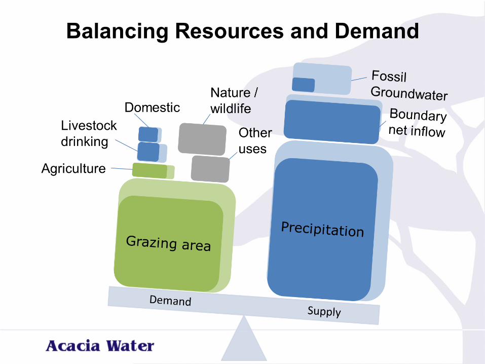
Balancing Resources and Demand
Integrated analysis
• Prevents problems
– E.g. overgrazing near boreholes
• Creates opportunities
– E.g. identification of bottlenecks and abundance
• Puts information in perspective
– E.g. Turkana ‘underground ocean’ compared to different uses
– How long can groundwater resources last
• Supports realistic future perspectives
– E.g. population growth in relation to natural resources
– E.g. can an increase in the livestock be supported by natural resources
• Provides an opportunity to select between investment options
– E.g. Boreholes or 3R solutions?
39
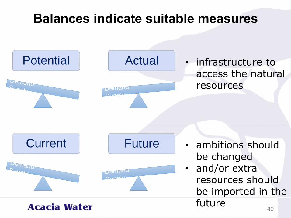
Balances indicate suitable measures
40
Potential Actual • infrastructure to access the natural resources
Current Future • ambitions should be changed
• and/or extra resources should be imported in the future
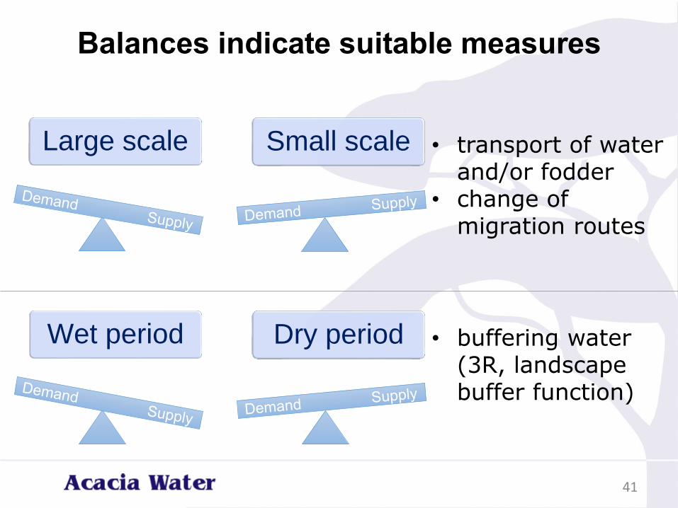
Balances indicate suitable measures
41
Large scale Small scale • transport of water and/or fodder
• change of migration routes
Wet period Dry period • buffering water (3R, landscape buffer function)
Information
• shallow and deep groundwater potential,
• identification of drought-prone areas,
• drought and flood intensities in the current situation and under climate change
• 3R/MUS possibilities
• 3R/MUS analysis for determining the gap between demand and supply;
• short- and long-term effects of different uses on the water availability and quality
• Catchment / integrated approach
42
Role of Acacia
• Technical backstopping
• Support in CIDP / sector plan development
• Water Use Masterplan in community consulting
• Wamasp
– Selecting most relevant data
– Interpret
– Provide platform for centralizing data
43