Embed Size (px)
Citation preview

ELSEVIER Ecological Economics 14 (1995) 143-159
ECOLOGICAL ECONOMICS
Analysis
Ecological economic modeling and valuation of ecosystems
N. Bockstael a,b,* R. Costanza b,c, I. Strand a,b, W. Boynton b,c, K. Bell a, L. Wainger b,c
a Department of Agricultural and Resource Economics, University of Maryland, College Park, MD 20742, USA b Maryland International Institute for Ecological Economics, Center for Environmental and Estuarine Studies, University of Maryland,
Box 38, Solomons, MD 20688-0038, USA c Chesapeake Biological Laboratory, Center for Environmental and Estuarine Studies, University of Maryland, Box 38, Solomons, AID
20688-0038, USA
Received 6 April 1994; accepted 10 August 1994
Abstract
We are attempting to integrate ecological and economic modeling and analysis in order to improve our understanding of regional systems, assess potential future impacts of various land-use, development, and agricultural policy options, and to better assess the value of ecological systems. Starting with an existing spatially articulated ecosystem model of the Patuxent River drainage basin in Maryland, we are adding modules to endogenize the agricultural components of the system (especially the impacts of agricultural practices and crop choice) and the process of land-use decision making. The integrated model will allow us to evaluate the indirect effects over long time horizons of current policy options. These effects are almost always ignored in partial analyses, although they may be very significant and may reverse many long-held assumptions and policy predictions. This paper is a progress report on this modeling effort, indicating our motivations, ideas, and plans for completion.
Keywords: Ecological-economic modeling; Ecosystem models; Patuxent River basin; Spatial modeling; Land use
I. Introduct ion
In its report, Reducing Risk: Setting Priorities and Strategies for Environmental Protection (September 1990), the U.S. Environmental Pro- tection Agency (EPA)'s Science Advisory Board recommended that " E P A should develop im- proved methods to value natural resources and to account for long-term environmental effects in its economic analysis" (EPA, 1990). In spring 1991, EPA convened a group of ecologists, economists,
* Corresponding author
Elsevier Science B.V. SSDI 0921-8009(95)00026-7
and other social scientists at an "Ecosystem Val- uation Forum" for the purpose of advancing the state of the art in ecosystem valuation methods. The Forum's report on the concepts and prob- lems in ecosystem valuation (Bingham, 1994) identified two broad areas of research in need of improvement: 1. Understanding how ecosystems function and
how they are affected by human activity--for example, what determines human uses and human intervention into ecosystems, and how is this affected, among other things, by the ecosystem's characteristics and regulatory paradigms?

144 N. Bockstael et al. / Ecological Economics 14 (1995) 143-159
2. Improving methods for ecosystem va lua t ion - - for example, what services provided by an ecosystem are of value to society, what meth- ods should be used to measure this value, and in what terms should it be expressed? One of the outcomes of the forum was to
commission case studies to begin to address these research needs. We have begun a project to model the interactions of ecological and economic sys- tems to address the above questions. This paper represents a preliminary report on our progress in this project. The project team consists of two economists and two ecologists who are interested in breaking down barriers to communication and developing integrated ecological economic mod- els to address the issues of human interactions with ecosystems and ecosystem valuation.
2. Ecological economic modeling
Ecosystems are extremely complex systems whose functions and processes are not easily characterized. A particularly t roublesome issue involves the description of factors affecting the reaction of ecosystems to natural and human stresses. There is some agreement regarding which ecosystem characteristics can be used to evaluate stress, such as food web structures, com- plexity, and densities. However, there is consider- able uncertainty regarding their relative signifi- cance. The importance of various attributes and measures of system stocks and flows in conveying the fitness of an ecosystem is poorly understood, and existing knowledge o f ten limits the scope of analysis to a few species and resources, as only a few functional relationships have been quantified. Equally t roublesome is our lack of understanding of the effects of ecosystems' states on human well-being. Some characteristics of ecosystems have obvious and immediate economic a n d / o r human significance, while others appear impor- tant in a longer term or more global sense. There is considerable uncertainty surrounding the ef- fects of human decisions on natural systems, and vice versa, as well as what features of one prompt responses from the other.
Considerable work over the past decades has
a t tempted to address aspects of the first of these issues, but for the most part this work has con- centrated on either ecological or economic mod- eling approaches to the problem. The tradition of independent research has resulted in a body of environmental work completed by both sciences that overlooks the fundamental problems associ- ated with their interactions. Namely, the studies are completed using different terms and units of measurement , and the studies neglect to account for the interaction between the processes and populations each seeks to model. For the most part, the ecological models have tended to ignore humans, except to the extent that they introduce apparently exogenous shocks into the ecological system, and economic models have taken stylized versions of "ecological facts" or relationships to connect human actions with the state of the ecosystem.
Both sciences recognize the problematic na- ture of these tendencies, and there have been some efforts to revise tradition. The literature contains some at tempts to grapple with the inter- actions between ecological functions and eco- nomic actions (e.g., Tschirhart and Crocker, 1987; Costanza et al., 1993), but these are largely con- ceptual papers. In addition to early work such as that reported by Russell (1993), a recent Re- source Policy Symposium noted only four inte- grated ecological economic models developed for analyzing agriculture (Bouzaher, 1993; Hooger- vorst, 1993) and natural resource-based tourism (Dixon and Scura, 1993; van den Bergh, 1993). At tempts at interdisciplinary modeling have often produced larger and larger "black boxes", where the level of resolution is reduced to the lowest common denominator and the integrity of each component of the model is lost. This project will take a parallel modeling approach and will utilize advances in computer modeling and spatial data availability to address the transdisciplinary mod- eling task in new ways.
3. Ecosystem valuation
The second recommendat ion of the Forum reflects concerns with current ecosystem valua-

N. Bockstael et al. /Ecological Economics 14 (1995) 143-159 145
tion methods. These concerns include the narrow focus on tangible, on-site resource commodities and the disregard for ecosystem functioning. By evaluating only those components of the ecosys- tem that have immediate value to individuals, and focusing on short- term changes in the ecosystem, this practice ignores the fact that changes in ecosystems play out over time and space and may indeed be irreversible.
Much of the ecosystem valuation work has focused on wetlands because of current regula- tory interest in these ecosystems. This literature illustrates the above problems. Recognizing the difficulty of identifying and measuring the contri- butions of wetlands, the majority of valuation papers focus on specific well-defined services wetlands provide, such as storm protection, recre- ation, fisheries, timber, or water purification (Gupta and Foster, 1975; Lynne et al., 1981; Farber, 1988; Costanza et al., 1989; Bergstrom et al., 1990). At tempts have been made to finesse the problem (Shabman et al., 1979; Shabman, 1987) by valuing the resource at its alleged upper bound: the cost of providing substitute services. But this approach begs the fundamental question of definition and measurement of those services: i.e., what is it about wetlands that really matters? (Scodari, 1992).
Another drawback of the existing at tempts to value ecosystems is that they tend to be spatially either too general or too specific. Studies either examine aggregate national data or they pursue site-specific case studies, such as those refer- enced above. Of course the ecology will differ from prairie potholes to the everglades to the tundra to the coastal zone, but the economics will vary as well. Even the " same" wetland in differ- ent locations will have different value. And the alternative uses of the wetland will vary with location. For example, two lakes differing only by spatial location (i.e., near an airport versus near a national forest) will provide entirely different vec- tors of ecosystem services. Conversely, the value of a wetland cannot adequately be captured by local analyses whose scale diminishes the impor- tance of spatial location. H u m a n intervention may set in motion both ecological and economic pro- cesses that have far-reaching consequences.
The ultimate purpose of this project is to shed light on ecosystem valuation, but as is clear from the above, this result depends on good ecological and economic modeling that allows for feedback between the human and natural systems as well as spatial and temporal disaggregation. Interest- ingly, part of that feedback comes in the form of changing private market values of land in differ- ent uses. Human decisions invoke changes in ecosystems that play out over time and space and may result in a reconfiguration of the landscape. Reconfiguration results in a new array of market values for land parcels within the landscape and a new array of non-market values emanating from public good amenities of the landscape. The change in private land values signals a new round of human land-use decisions. As has long been recognized, however, the predominance of exter- nalities in land use prevents even the effect of human decisions on market values from being internalized into individuals' decisions. For this reason, as well as the obvious effect of land use on public goods such as recreation, the public sector has imposed an imperfect and ever-shifting pat tern of land-use regulations.
In this project, we will model economic and ecological dynamics in a landscape framework which incorporates regulations and human deci- sion-making processes so that more can be learned about the ultimate consequences for ecosystem and land use configuration. The analy- sis will reveal how market land values are recon- figured and it should shed light on the effects of landscape reconfiguration on non-marketed val- ues, including those that take time to emerge.
4. Conflicts inherent in ecological economic mod- eling
While the ultimate intent of this project may be to gain insight into the di lemma of valuing ecosystem configurations and the services from those configurations, the more immediate objec- tive is to model the interaction of the ecosystem and human activity, illustrating how humans in- tervene in the ecosystem and how different ecosystem configurations contribute to human

146 N. Bockstael et aL / Ecological Economics 14 (1995) 143-159
welfare. It is at least conceivable that what ap- pear to be deep-rooted ethical differences be- tween ecologists and economists with regard to the more general goal can be reconciled if we understand more fully the specific nature of hu- mans ' interactions with ecosystems and how these interactions induce subsequent reactions as they unfold spatially and temporally. A major criticism by ecologists is that economists are too narrow and anthropocentr ic in viewing the role, func- tions, and indeed, importance of ecological sys- tems, since they tend to focus on immediate and on-site impacts ra ther than including future and indirect implications to humans and ecosystem integrity. Economists are impatient with ecolo- gists for their unwillingness to evaluate the rela- tive contributions of various characteristics of ecosystems to values and their disregard of some human preferences when considering value. Economists are presumably taking the pragma- tist's view, disregarding those things that they don' t understand or can' t measure, no matter how important. Ecologists are taking the purist 's view: any valuation scheme that fails to take into account the most important aspects of a problem is unacceptable.
Structurally, the disciplines of economics and ecology have much in common. Both analyze and predict the behavior of complex, interrelated sys- tems in which the behavior of individual agents and flows of energy and mat ter are central, and its dynamics are governed by the allocation of scarce resources among compe t ing agents (Bernstein, 1981). However, despite these basic similarities, there are significant distinctions in modeling practices. Broad explanations of such differences include the distinctions in their units of measurement , populations of interest, han- dling of risk and uncertainty, and paradigms of analysis (Bernstein, 1981; Norgaard, 1989).
The dynamics of ecosystems and markets are extremely different, and these differences are re- fleeted in the time steps and time horizons com- monly employed in models of ecological and eco- nomic systems. Many of the distinctions in timing follow directly from the availability of data em- ployed to model the economic and ecological systems. Data on economic decisions is rarely
available for a periodicity any less than one month, and generally only available annually. In contrast, because scientists have studied the growth and development of organisms, hydrologi- cal dynamics, etc., ecosystems functions can fre- quently be modeled at a very high level of tempo- ral and spatial resolution.
While ecologists frequently adopt high time resolution models, they also are interested in long-time horizons, and it is with regard to long- term implications of human actions that ecolo- gists are frequently concerned. Economists have tended to ignore the very long run, believing that future perturbations to the system are virtually impossible to predict.
Other types of boundary conditions differ as well. When faced with limiting the amount of activity to be modeled, ecologists employ geo- graphical or physical bounds, and economists rely on the extent of markets to define their study areas. There is no reason for ecosystem and mar- ket boundaries to coincide. As a rule, neither definition nor bounding mechanism subsumes the other. Ecologists think in terms of physical flows such as water, biomass, and energy. Many of these connections have spatial characteristics, and in recent years ecologists have made great ad- vances in the development of spatial modeling techniques (Costanza et al., 1990). For example, the Patuxent Landscape Model (PLM) (DeBe- l levue et al., 1993), adapted for this project, uti- lizes significant spatial dynamics and in so doing can model the succession of complex ecosystems over long periods of time. In contrast, economists tend to think in terms of informational flows such as money and prices and use these informational flows as the basis of changes when modeling human behavior. Economists have much experi- ence with time dynamics, but little with spatial considerations, as markets are not typically spa- tially defined and may have little to do with geographical dimensions. One significant excep- tion is the land market. Although a considerable amount of research has been completed on the land market, economists have struggled some- what unsuccessfully to fully model its spatial com- ponent.
Many differences in the approaches of ecolo-
Mount Airy •
N. Bockstael et al. / Ecological Economics 14 (1995) 143-159
The Patuxent Watershed I 7 0 Roads and Towns ~ , West Friendship
147
~ - E l l i c o t t City
100
97
Laurel i I95
295
175
• Odenton
Washington, D. C. US50
~214
N
© Hu
Scale New Market
0 10 20 Kilometres 1:601,000 I I I i I
= One Cell = 0.4046 km 2 (100 acres) 5896 cells total
Map prepared by: E. DeBellevue, M. Jacobsen and R. Costanza University of Maryland, Solomons, MD.
23i~ Hollywood
Prince Frederick
~ 2 - 4

148 N. Bockstael et aL / Ecological Economics 14 (1995) 143-159
gists and economists occur because the factors in the environment that are the focus of detail for one discipline are often hopelessly aggregated or abstracted from by the other. For example, the ecological model might not distinguish between agricultural crops such as soybeans and wheat, or among wildlife species on recreational lands, for this distinction may not be important in modeling the ecosystem. Yet, in addressing human behav- ior and assessing values to humans, these distinc- tions are significant.
An aim of this research will be to acknowledge and reconcile these conflicts in the context of an integrated modeling effort. Both the process and the modeling exercise will be valuable and will serve an important role in furthering the objec- tives of the Ecosystem Valuation Forum (Bi- ngham, 1994).
5. An overview of the modeling project
Recognizing the need for improvements in un- derstanding how ecosystems function, how hu- mans interact with ecosystems, and how ecosys- tems are valued, the following objectives were identified for this project: 1. to increase our understanding of and our abil-
ity to model the interactions between human behavior and ecological processes;
2. to increase our understanding of and our ability to model the effect of the regulatory environment on human behavior; and
3. to develop through the above exercises a bet- ter understanding of the role of ecological processes in society's well-being, thus improv- ing our methods for valuing ecosystem config- urations and our ability to assess the benefits and costs of regulatory consequences. To fulfill these three objectives, a pilot ecologi-
cal-economic model is being developed to exam- ine functions and processes of ecosystems, clarify relationships between human actions and ecosys- tems, and provide detailed information that will enable improved ecosystem valuation.
The model consists of interrelated ecological and economic models that employ a landscape perspective because this perspective captures the
spatial and temporal distributions of the services and functions of the natural system and human- related phenomena, such as surrounding land-use patterns and population distributions. Configura- tion and reconfiguration of the landscape occurs as a result of ecological and economic factors, and these factors are closely intertwined.
The ecological part of the model is based on the Patuxent Landscape Model (PLM), one of several landscape-level spatial simulation models currently under development by Costanza and others at the University of Maryland (Costanza et al., 1990; Fitz et al., 1993; Fitz et al., 1995). The PLM is capable of simulating the succession of complex ecological systems using a landscape per- spective. Economic models are being developed to reflect human behavior and economic influ- ences. The effects of human intervention result directly from the conversion of land from one use to another (e.g., wetlands conversion, residential development, power plant siting) or from changes in the practices that take place within specific land uses (e.g., adoption of agricultural best man- agement practices, intensification of congestion and automobile emissions, change in urban water and sewer use, and storm run-off).
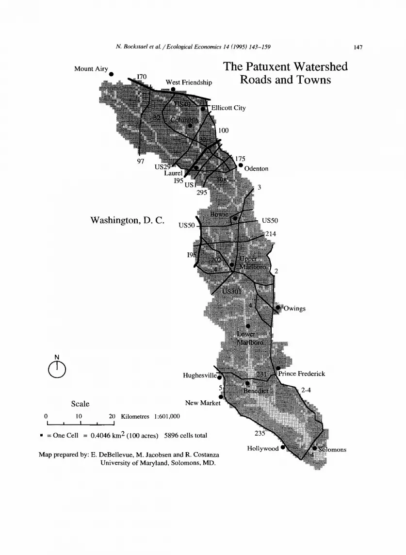
The Maryland Patuxent River Watershed, which includes portions of Anne Arundel, Calvert, Charles, Howard, Montgomery, Prince George 's , and St. Mary's counties, will serve as the study area (Fig. 1). The ecological model is currently being calibrated for this area. In this phase of the project the economic models will characterize land use and agricultural decisions, and capture the effects on these decisions of institutional in- fluences such as environmental, zoning, trans- portation, and agricultural policies. The integra- tion of the two models provides a framework for regulatory analysis in the context of risk assess- ment, non-point source pollution control, wet- lands mit igat ion/restorat ion, etc.
As part of this exercise, the ease (and cost-ef- fectiveness) of generalizing the model to other regions will be assessed. It is expected that the modeling approaches will remain fairly constant over applications, although the particular behav- ioral models and ecological processes empha- sized, as well as the actual parameters of the

N. Bockstael et al. / E c o l o g i c a l Economics 14 (1995) 143-159 149
models, would differ. Because the models are designed to depict specific processes and ecosys- tems and to evaluate specific management strate- gies, they require a significant amount of site- specific data. However, the integrated model will illustrate the circumstances under which human actions set in motion processes that can have far-reaching effects that play out over a broad geographical range and over time. These illustra- tions will help policymakers define the relevant questions to be asked and effects to be antici- pated in other regional settings.
An overview of the components of the inte- grated modeling system is depicted in Fig. 2. The major components of the system are the spatially explicit, dynamic models for the ecological system and the economic decisions, and the mechanism for exchange of information between the two. The results of the interrelated processes produce a new landscape and a new array of values associ- ated with the landscape. Some of these become
signals to private individuals and public agents in future decisions.
6. The ecosystem model
The starting point of the modeling effort, the Patuxent Landscape Model (PLM), is an out- growth of the coastal ecological landscape spatial simulation (CELSS) model developed by Costanza et al. (1990). This modeling approach has been applied in two previous studies. The model was first implemented in the Atchafalaya Delta Area of coastal Louisiana, where it was developed to model spatial ecosystem processes, succession, and land loss problems, and was used to evaluate the impacts of management strategies and spe- cific projects designed to alleviate coastal erosion problems (Costanza et al., 1990). A more sophis- ticated version of the model is currently being implemented in the Water Conservation Areas
-Regional Boundary "n
Rest of the World
Global and Regional Climate
Transboundary Pollutants
Regional and National Economic Activity
Regional and National Regulatory/ Governance/ Policy Sys t em
iq
4
Process Model(i spatial
ecosystem modules
-'I spatial
v
ecological succession module
economic land use transition module (including local land
Land Use Transition Model(s)
6 [
economic activity module (including local markets)
markets) - - - - ~ Value of
_
Ecosystems to Society
--'-7 / I /
/
Regulatory [ Environment [
, J
Fig. 2. Integrated ecological economic modeling and valuation framework. Modules in bold are already included in the Patuxent Landscape Model (PLM). Modules in italics are to be added as part of our ongoing project.

150 N. Bockstael et al. / Ecological Economics 14 (1995) 143-159
and Everglades National Park in Florida to exam- ine the repercussions of management strategies on elements of the ecosystem such as water lev- els, nutrients, and plant successional patterns (Fitz et al., 1993).
The PLM uses an integrated, spatial simula- tion approach to model ecological processes. Central to the PLM is a General Ecosystem Model (GEM) (Fitz et al., 1995; see Fig. 3) that is replicated in each of the grid cells that compose the study area (Fig. 4). The GEM unit models are linked together and to spatial Geographical In- formation System (GIS) data using the Spatial Modeling Workstation (SMW) (Maxwell and Costanza, 1994; see Fig. 5). In addition to linking flows between cells, the spatial configuration su- perimposes the river network on the grid of ceils allowing better simulation of river flow processes across the landscape.
The GEM unit model simulates fundamental ecological processes with hydrology as its core. The hydrologic sector of the model simulates the availability of water and its vertical and horizon- tal movements based on topography, geology, land use, and other characteristics within each cell. Characteristics of each cell's habitat type trans-
late to parameters of physical, chemical, and bio- logical equations which are used to simulate such processes as primary production, nutrient fluxes, organic/inorganic sediment suspension and de- position, basic "consumer" dynamics, and decom- position. The dynamics of various ecological pro- cesses are expressed as the interaction between state variables (stocks) and flows of material, energy, and information. After the vertical or within-cell dynamics have been simulated, the results of the unit model are processed by the spatial modeling program. In linking the stocks and flows, the model predicts the exchange of matter between cells (horizontal fluxes) and simu- lates the resulting temporal changes in water availability, water quality, and habitat /ecosystem type. The landscape model employs an algorithm for determining the habitat type of each cell at all times during the simulation. The habitat switch- ing algorithm redefines the habitat /ecosystem type of cells as conditions change, and selects parameter sets as necessary.
Data is collected to calibrate or initialize the model for a given set of ecosystems and a particu- lar landscape. Effort is then devoted to simulat- ing past behavior of the landscape. This allows
¢D
v
Cgl t~
Fig. 3. Summary diagram of the Patuxent Landscape Model's (PLM) unit model (GEM). The state variables and mass fluxes of the unit model, excluding hydrology. The model is run within one cell and parameterized for the cell's habitat. Hydrology is important in the vertical fluxes shown and the unshown horizontal fluxes of materials from cell to cell. State variables are enclosed within rectangles, and those that can flux vertically and horizontally with water movement are shown in outline type.

N. Bockstael et aL / Ecological Economics 14 (1995) 143-159 151
for calibration of the functions of the model against actual historical data. For the Patuxent project, historical land use and geographic data (GIS) have been acquired from the Maryland Depar tment of Natural Resources (DNR), Mary- land Depar tment of Environment (MDE), and the U.S. Geological Survey (USGS). Maps indi- cating land use estimates for 1973, 1981, and 1985 (with 1991 now available), as well as mappings of the watershed, streams, soils, slopes, contami- nants, highways, marinas, railroads, water quality, and wetlands have been acquired. The PLM con- tains about 6000 spatial cells each of about 100 acres and each containing a G E M with 21 state variables (see Table 1 for a list of these). The model will be calibrated with land use, s tream
Portion of Landscape
m u m m m m m m nmmmm n m mm
m n mm mmmmn • B E E B B •
B U m • • m E N
mmm•
} 1 km 2 cell
Legend
] Habitat 1
] Habitat 2
] Habitat 3
] Habitat 4
] Habitat 5
/ Canal
Unit Model J J Unit Model J Par °ter 4 I I P smetorsot 3 I
~1~ ~ t O n ~a I~AFs isUoX~e ~
Materials (Spatial Model Domain)
Fig. 4. The cellular structure of the PLM. Each cell has a (variable) habitat type which is used to parameterize the unit model for that cell. The unit model simulates ecosystem dynamics for that cell in the above-sediment and below-sedi- ment subsystems. Nutrients and suspended materials in the surface water and saturated sediment water are fluxed be- tween cells in the domain of the spatial model.
flow, water quality, and other data from 1973 and 1985. The intent is to run scenarios to the year 2020.
The spatial resolution of the PLM allows eval- uation of impacts from changes in land use type or practices for particular groups of cells in the watershed. Our aim is to be able to estimate selected indicator variables which will describe processes of interest in the Patuxent River water- shed. For example, fertilizer applications and me- chanical soil manipulation (e.g., tillage) influence the total loadings of nutrients and sediment which are carried by surface and sub-surface waterflow off a given land parcel. The flow path of that water over various land types will determine its nutrient and sediment load when it reaches a wetland or stream. The combined effect of multi- ple land parcels then influences vegetative growth processes in wetlands within the Patuxent estu- ary. As plant biomass changes, nutrient uptake, evapotranspiration, and sediment retention rates change. The simulation of these multiple interre- lated processes allows the PLM to estimate gen- eral effects of such practices as vegetative buffers and retention ponds on urban and agriculture lands on total loadings to the estuary and ecosys- tem types of undeveloped land.
Future additions to the ecological model in- clude adding estimates of fish and wildlife popu- lations based on the pat tern and productivity of the landscape elements. At this stage these esti- mates will not feed back to affect the ecosystem dynamics. Rather, they will be more on the order of "habi tat suitability", indicating the type and quantity of various species that could be expected in a given landscape rather than modeling the populations endogenously.
7. Economic models of human decisions
The two notable aspects of the ecological mod- eling approach- - i t s dynamic nature and its abil- ity to spatially d i saggrega te - -a re also important dimensions for the economic sectors that interact with the ecosystem. The human activities of im- portance form an interrelated, dynamic, spatially distributed system in their own right. Economic

152 N. Bockstael et al. /Ecological Economics 14 (1995) 143-159
models that reflect these dimensions are being conceptualized and estimated. Ensuring the nec- essary feedback between the two systems will require an integration characterized by exchange of information between the models at an appro- priate time and space scale.
Human decisions that determine land-use des- ignation, as well as those that affect f lows/extrac- tions from the system conditioned on the land-use
designation, will affect the configuration of the landscape. The existing PLM, like other ecologi- cal models, ignores the effect of the landscape on humans. In addition, human effects on the land- scape, whether through changes in the land use of the cells or through the emissions assumed for any land use, are imposed exogenously rather than modeled as part of the process. The eco- nomic considerations are important because hu-
ExtendTM & STELLA TM
Models
Export
Import
.LA TM
dels
_/. translator~w TM
Processing
Macintosh Computer Hypercard TM Navigator
Configure variables
I Input or configur~ tabular data /
Define space, time, [ I run specs
Define output
Define habitat switching
User Transparent
SMP MPwTM I Spatial Modeling Program
Includes platform drivers (C code)
OUTPUT Files Movies,
TabLes, Code, Maps, Graphs Equations Matrices
Export
r Import
MAP II TM
GIS files
Export C code / ~lS-xport results Use the Mac as a teminal for to other platforms running SMP on other platforms
Via Ethernet or [ot h eViat rEatnhsprori~t m°re an s 1
Fig. 5. Diagram of the Patuxent Landscape Model (PLM) implementation architecture. The PLM is programmed and simulated in the Spatial Modeling Workstation (SMW). The SMW consists of: STELLA unit models for execution of ecosystem dynamics; MAP II GIS program for storage and manipulation of GIS data files; the Spatial Modeling Program (SMP) that executes the interchange of flows among unit models on the computers, and imports and exports spatial (GIS) data; the Hypercard Navigator (under development) that is used to guide the user through configuration of models, data sets, execution platforms, and output files; and an Apple Macintosh computer with transputers installed for simulation or as a user terminal interface to other computer platforms.

N. Bockstael et al. /Ecological Economics 14 (1995) 143-159 153
Table 1 Sectors and state variables in the General Ecosystem Model (GEM) (sectors are in italics, state variables are in uppercase)
Sector and STATE VARIABLE names Number
Hydrology sector SURFACE WATER 1 UNSATURATED WATER 2 SATURATED WATER 3 Hydrodynamic sector Horizontal flow, vertical flow, and waves Inorganic sediments sector SUSPENDED INORGANIC SEDIMENTS 4 DEPOSITED INORGANIC SEDIMENTS 5 PORE SPACE 6 Salt (NaCI) sector (conductit~ity) SALT in SURFACE WATER 7 SALT in SEDIMENT WATER 8 SALT CRYSTALS 9 Dissolved phosphorus sector PO 4 in SURFACE WATER 10 PO 4 in SEDIMENT WATER 11 Dissolved nitrogen sector (NO2, N O 3, NH4 + ) DIN in SURFACE WATER 12 DIN in SEDIMENT WATER 13 Dissolved Oxygen Sector DISSOLVED OXYGEN in SURFACE 14 WATER Non-macrophyte sector ALGAE (phytoplankton a n d / o r periphyton) 15 Macrophyte sector MACROPHYTE PHOTOSYNTHETIC 16 BIOMASS MACROPHYTE NON-PHOTOSYNTHETIC 17 BIOMASS Above-sediment organic matter and detritus sector STANDING DETRITUS 18 ABOVE-SOIL ORGANIC MATTER 19 AND DETRITUS (Transportable by surface water flow. Includes weight of microscopic decomposers. Includes suspended POC and DOC when systems are wet.) Organic sediments / Soil sector S E D I M E N T / S O I L ORGANIC MATTER 20 Consumer sector CONSUMERS (All fauna except microscopic 21 decomposers) Fire sector Fire ignition, fire propagation Global inputs sector Atmospheric inputs, geographical information, etc.
man decisions are influenced by the characteris- tics of the ecosystem landscape, and the land- scape changes as a result of the decisions. For
ecological reasons, the effects of a single action taken at a given point in time will continue to play out over time and will affect more than just
Table 2 The habitat or land-use designation types relative the Patuxent watershed for 1973 and 1985
land use for
Land use description % 1973 % 1985 % change area area
Urban 10.7 14.9 4.2 Low density residential 3.7 6.2 2.5 Medium density residential 2.9 3.5 0.6 High density residential 0.7 1.0 0.3 Commercial 1.1 1.5 0.4 Industrial 0.2 0.2 0.0 Institutional 1.2 1.2 0.0 Extractive 0.3 0.3 0.0 Open urban land 0.6 1.0 0.4
Agricultural 34.2 31.6 - 2.6 Cropland 29.6 26.6 - 3.0 Pasture 4.6 4.5 - 0.1 Orchard 0.2 0.1 - 0.1 Feeding operations 0.0 0.1 0.1 Row and garden crops 0.2 0.3 0.1
Forest 48.1 46.0 - 2.1 Deciduous forest 31.4 27.6 - 3.8 Evergreen forest 1.4 1.6 0.2 Mixed forest 14.3 14.8 0.5 Brush 1.0 2.0 1.0
Water Fresh open water (plankton) Fresh open water (benthic) Brackish open water (Plankton) Brackish open water (benthic)
Wetlands Salt marsh Fresh marsh Swamp
Barren land Beaches Bare exposed rock Bare ground
Total
5.3 5.5 0.2
1.2 1.4 0.2
0.1 1.2 1.1 0.0 0.4 0.4 0.0 0.0 0.0 0.1 0.8 0.7
100.0 100.0 0.0

154 N. Bockstael et al. / Ecological Economics 14 (1995) 143-159
the cell where the action took place. Additionally, that action will have been influenced by the char- acteristics of the given cell, the characteristics of surrounding cells, and the expectations of changes in those cells.
Perhaps the most important type of economic behavior that requires modeling is land conver- sion. Since the ecological processes that are mod- eled in the generic ecosystem model are condi- tioned on land use, scenarios are driven by the land-use designation of the cells in the landscape at each period of time. The land use conversion model will endogenize those human decisions.
Conditioned on a cell's land-use designation, the cell is programmed to undergo certain pro- cesses. But human decisions will affect these pro-
cesses and may not be predetermined. In fact, they may be affected by feedback from the eco- logical system, and most surely will be affected by changing policy environments. In the first phase of this project one such behavioral model condi- tioned on land use will be d e v e l o p e d I a model of agricultural practices. Additional behavioral mod- els conditioned on land use will be added in the future. An obvious candidate is a transportation model.
8. Land-use conversion
Economists have tried to explain land values and land-use decisions for some time, but gener- ally in a static context and rarely incorporating
~!iiiiiiiiiiiiii~iiiiii~!ii~| i ~i!i!iiiiiiiiiiiiii!ii%iii!!!
~,i,iiiiiiiiiiiiiiiiiii~iiiiii!i~iiii~i~i!:
Figure 6 GIS Mapping af Land Use Conversi~m
Calvert Cotm~, Maryland
Land Use Catgeories
Agricultural land
Forest Land
m Built Land Up
[ ] Water
Type of New Development
• Residential/C o m m e r c i . . • L ~ J
New Development Timing
• 1990 to Present
• 198(t to 1!,)89
O 197(I to t979
MII~
0 .5 1
Fig. 6. GIS Mapping of Land Use Conversion, Calvert County, MD.

N. Bockstael et al. /Ecological Economics 14 (1995) 143-159 155
features of the local ecosystems. Most frequent in this literature are hedonic models of residential transactions prices as functions of local amenities and housing characteristics (e.g., Diamond, 1980; Beaton, 1991). Additionally, some models seek to explain conversion of agricultural land to residen- tial and urban use as functions of profitability of alternative land uses(e.g., Alig and Healy, 1987; Fischel, 1982; McMillan, 1989). Data limitations have restricted these applications to cross-sec- tional analysis at one point in time.
Our proposed approach relies on spatially dis- aggregated data from digitized maps and allows dynamic analysis of micro-level changes that can be observed over time. Because the data reside in a geographical information system, it is easy to relate activities on individual parcels of land with local ecological and economic features of the landscape that might be driving these activities.
The land-use conversion decision is modeled probabilistically. This involves estimating the transition probabilities that a given parcel of land, set in a landscape configuration of given ecologi- ca l /economic description, will be converted from its current state to any other state (including no change). As surrounding landscape conversions take place, the probability of conversion of a given parcel changes.
Here we are interested in considering the dis- crete and finite set of alternative land uses. The set of uses in the Patuxent watershed for which we have data are listed in Table 2. Depending on the state of the parcel at the time of the decision, some uses may be precluded, at least for realiza- tion within a limited time period (of a year or shorter). For example, if the land is already in residential development, it is probably infeasible to return it to forest in one year. Federal laws, such as wetland and coastal zone management, will also affect the likelihood that land parcels switch uses since legislation often prohibits cer- tain land uses a n d / o r makes these uses signifi- cantly more costly. Again, the GIS system is use- ful because many of the land-use restrictions and potential scenarios have been digitized in GIS maps and can be merged with the ecological and economic digitized geographic information (Fig. 6).
This type of probabilistic model is appealing because it allows for variations over individual decision makers facing the same factors, and vari- ation of the factors affecting the decision with spatial location and proximity to centers of eco- nomic activity, transportation networks, and eco- logical features. Thus it predicts the likelihood of each type of transition rather than predicting deterministically one type of conversion for all land of a certain ecological /economic descrip- tion. These transition probabilities can be inter- preted as the percentage of land of a given type that is converted to each alternative land use (including the percentage that remains uncon- verted) and are functionally equivalent to the transition probabilities in a Markov analysis.
Because the differential in economic returns among commercial, residential, agricultural, and open land uses differs depending on the state of the regional economy, the explanatory model will reflect these exogenous forces and the scenarios will incorporate predictions of these cycles. An existing county-based regional model for Mary- land will provide predictions of the "macro-eco- nomic" exogenous factors to be used in the simu- lations.
9. Agricultural practices
The first step of the PLM modeling dynamics is to designate a cell as a given land use. To- gether with prior information, the economic land- use conversion model and the ecosystem succes- sion model, these designations are made for each " round" of the model's calibrations. However, the land-use designations are broad categories with agricultural uses specified as either crop- land, pasture or orchards. It is important to know more about the agricultural land use in order to understand the impact this land use has on the ecosystem. The agricultural practices model at- tempts this, and in so doing serves as an example of micro-level economic behavior models which capture human decisions that influence the envi- ronment, conditioned on a given land use. This economic model will accept information from the "outside world" (including existing policy) and

156 N. Bockstael et aL / Ecological Economics 14 (1995) 143-159
the ecological world (such as topographical infor- mat ion) and will a t tempt to predict the cropping/l ivestock patterns, as well as the farm- ing practices that serve as parameters in the model for the subsequent cropping season.
As with the land-use conversion model, the economic model of farming behavior will be probabilistic. That is, it is the probabilities of various alternative decisions that will be gener- ated by the model. These probabilities will need to be interpreted as predicted proportions of similar farming land that is used for given crops/l ivestock and, conditioned on that choice, is subject to different BMP's.
Models of agricultural crop/l ivestock choice are numerous, but few are conceived at as "mi- cro" a scale as this project should be able to achieve. Profitability from different farming choices will drive the decisions, but profitability is conditioned, not only on relative output and in- put prices, but factors of the landscape that affect the production function for different crops (e.g., hydrology, slopes, soil types, etc.). In the Patuxent watershed there is an interesting added consider- ation. In Maryland, farmers often sell hunting rights on their lands. These rents can be a major source of income for farmers and affect not only how much land stays in agriculture, but also crop and livestock decisions. Depending both on farm- ers' decisions and the ecological characteristics of the land, the amount and composition of wildlife will differ, endowing the land with differing hunt- ing value.
The choice by farmers among farming prac- tices that could alter their pollution emissions, conditioned on crop/l ivestock choice, is a diffi- cult one to model, but one that has considerable importance for policy formation. Through provi- sion of technical and financial (cost-sharing) as- sistance, federal and state agencies have at- tempted to address these problems by subsidizing the use of "best management practices" (BMPs), defined as farming practices that reduce soil and nutrient losses at reasonable cost (U.S. Depart- ment of Agriculture). Adoption of new agricul- tural technologies depends on a variety of eco- nomic and behavioral factors, including scale and scope of operations, topography and other natu-
ral factors, human capital or skill considerations, relative prices, attitudes toward risk, and percep- tions about the extent of erosion or leaching problems and about returns to adoption (for a survey, see Feder et al., 1985). These factors will be pursued in the agricultural decision model.
In addition to models of crop choice, numer- ous behavioral studies of best management prac- tice (BMP) adoption in the United States have examined the influence of factors ranging from topography and erodibility to human capital fac- tors (e.g., age and experience) to farm operation characteristics (e.g., cropping patterns, scale and scope and tenure status). A few generalizations can be drawn from the findings of these empirical studies. Adoption is more likely and expenditures on BMPs are greater on more erodible land and on larger operations. Older, more educated and more experienced farmers are more likely to adopt BMPs. Farmers with more off-farm income and greater risk aversion are less likely to adopt. Farmers are more likely to adopt if they perceive erosion to be more of a problem, attach greater importance to conservation and environmental quality or have conservation plans. Cash grain farmers are less likely to adopt BMPs. (Ervin and Ervin, 1982; Lee and Stewart, 1983; Saliba and Bromley, 1986; Shortle and Miranowski, 1986; Norris and Batie, 1987; Lynne et al., 1988; Nielsen et al., 1989). Although these generalizations are revealing, there is no study that comprehensively examines the adoption of numerous, but specific BMPs in a spatially explicit context linked to ecosystem characteristics.
10. Integration of components and resolution of modeling inconsistencies
At present, the ecological model runs fourteen sectors, tracks twenty-one state variables, esti- mates horizontal and vertical fluxes of water, nutrients, sediments, and biomass, and simulates ecological succession over the landscape. For the purposes of the economic model, two types of interactions between humans and natural re- sources will be of significance: (1) decisions that determine land-use designation of a cell, and (2)

N. Bockstael et aL / Ecological Economics 14 (1995) 143-159 157
decisions that affect flows/extractions from the system conditioned on the land use type of the cell.
An interrelated model would capture how the distribution of human activities (farming, electric power generation, commercial and residential de- velopment, recreation, wastewater treatment, highway construction, fishing) affect the ecosys- tem. Such a model would also capture the effect of the ecosystem landscape on the quality and value of goods and services (e.g., recreation, wildlife enjoyment, water quantity and quality, housing, environmental aesthetics, etc.) and therefore, on human decisions. The model must also be able to reflect how human activity and its impact on the ecosystem may differ under differ- ent regulatory regimes and under alternative reg- ulations.
Our approach will n o t be to meld both ecolog- ical and economic models into one "supermodel" because this approach would force each model to adopt the lowest level of resolution in the other. Instead, the two types of models will exist in parallel and will proceed at their own levels of specificity, but will exchange information on eco- logical and economic elements generated by the other. Because appropriate choices on time step, geographical scale, and level of aggregation differ in the ecological and economic models, there are several potential inconsistencies that may arise in this information exchange.
By design, the PLM model establishes physical boundaries. Activity is modeled in the area bounded by the top of the trees, the drainage basin boundaries, and the bottom of the ground- water. The choice of physical boundaries encom- passes the dynamics of the ecosystem. The physi- cal definition of the boundary of the Patuxent River Basin region will coincide with relevant economic boundaries, if the region is a price-taker in markets that extend beyond the boundaries of the region. That is, for markets that extend be- yond the Patuxent River Basin Region, the region must not significantly influence the actions of others (i.e., it does not produce or demand a significant amount relative to other trading part- ners). For the Patuxent watershed, this is likely to be approximately correct and thus no serious
inconsistencies with respect to "boundar ies" are likely to arise. However, in other applications of this modeling approach, the definition of bound- aries could well be conflicting.
The model is structured to simulate a desired level of ecological complexity and resolution. Modeling with greater levels of disaggregation is possible, but this would be costly and require a significant amount of additional research, data, and programming. The behavioral interactions will largely involve the water, nutrients, macro- phyte, and consumer sectors. Although these state variables are linked with habitat types, much finer distinctions of the landscape will be necessary for the economic model, as human behavior is likely to depend on more detailed information. In our approach, the details will be introduced exoge- nously by distinguishing different subgroups of macrophytes and consumers and associating these different subgroups with different land uses. The model will include markers and detailed rules for species loss, treating habitat evaluation as a side calculation. Clearly, there are qualitative distinc- tions between different composition and phyla. A function will be developed that will indicate the likelihood of game species and other forms of wildlife in particular habitat types. This function allows for the provision of additional complemen- tary information without increasing the level of disaggregation of the unit model.
The ecosystem model operates on a time scale of a day or less. Yet, given data availability, the economic models are most easily estimated on an annual basis. The intra-year timing of the agricul- tural decisions will be easy to predict since these are governed by seasons. Land conversions pose a different problem, however. They can be pre- dicted only on an annual basis, but their timing is important because construction costs can have different immediate ecosystem impacts depend- ing on the season. Independent data on building starts and construction durations will be used to forecast seasonal impacts of construction.
The geographical scale of resolution between the two models will also differ. Land parcels modeled in the land-use conversion model will not correspond to cell boundaries in the ecosys- tem model. The latter divides the study area into

158 N. Bockstael et al. / Ecological Economics 14 (1995) 143-159
5,896 cells with each cell representing approxi- mately 0.364 km 2 or 90 acres. The cell size in the ecological model was selected to balance the de- sired complexity and resolution of the ecological landscape. The fact that the economic model will produce probabilistic estimates may actually help to resolve the differences in geographical scale, as the probabilities can be interpreted as percent- ages of land of a given description that is put to a given land use. However, the transition probabili- ties may still " f racture" cells. The PLM model has the ability to assign to cells split land-use designations, allowing heterogeneity within a cell. Devising weights to monitor what is happening in cells, thresholds can be set so that cells could go from homogeneous to heterogeneous units and vice versa. This additional detail will also allow the model to make inferences on a wider variety of land use restrictions (i.e., agricultural policies,. zoning policies, and environmental protection policies).
In resolving this array of modeling inconsisten- cies, sensitivity tests will be used to assess the importance of level of detail in both models. Sensitivity games are used now to accommodate uncertainty over elements such as rainfall pat- terns over time. By generating several patterns for the future and running these different pat- terns as distinct scenarios, the significance of the uncertainty can be revealed.
Acknowledgements
This project was supported by a cooperative agreement with the USEPA, No. 07-5-25196- 3734 titled: Ecological Economic Modelling and Valuation of Ecosystems. Cooperative Agree- ment with EPA. Michael Brody and MaryJo Kealy were the project officers and provided valuable input on the project direction and scope. The project is a direct spin-off of the "Ecosystem Valuation Forum" sponsored by EPA, which is described in the introductory paper in this special issue. We thank Ed DeBellevue, Carl Fitz, Maria Markowski, and Enrique Reyes for their contri- butions to the research effort, and Marjan van den Belt for helpful comments on earlier drafts.
References
Alig, R.J. and Healy, R.G., 1987. Urban and built-up land area changes in the United States: an empirical investiga- tion of determinants. Land Econ., 63(3): 216-226.
Beaton, W.P., 1991. The impact of regional land-use controls on property values: the case of the New Jersey Pinelands. Land Econ., 67(2): 172-194.
Bergstrom, J.C., Stoll, J.R., Titre, J.P. and Wright, V.L, 1990. Economic value of wetlands-based recreation. Ecol. Econ., 2: 129-147.
Bernstein, B.B., 1981. Ecology and economics: complex sys- tems in changing environments. Annu. Rev. Ecol. System., 12: 309-330.
Bouzaher, A. et al., 1993. CEEPES: an evolving system for agroenvironmental policy. Paper presented at: The Inte- grating Economic and Ecological Indicators Symposium, Resource Policy Consortium, World Bank, Washington, DC, May.
Bingham, G., 1994. Issues in ecosystem valuation: improving information for decision making. Ecol. Econ., in press.
Costanza, R., Farber, S.C. and Maxwell, J., 1989. The valua- tion and management of wetland ecosystems. Ecol. Econ., 1: 335-361.
Costanza, R., Sklar, F.H. and White, M.L., 1990. Modeling coastal landscape dynamics. BioScience, 40(2): 91-107.
Costanza, R., Wainger, L., Folke, C. and Maler, K.-G., 1993. Modeling complex ecological economic systems: toward an evolutionary, dynamic understanding of people and na- ture. BioScience, 43: 545-555.
DeBellevue, E.B., Maxwell, T., Costanza, R. and Jacobsen, M., 1993. Development of a landscape model for the Patuxent River watershed. Discussion paper #10, Mary- land International Institute for Ecol. Econ., Solomons, MD.
Diamond, D.B., 1980. The relationship between amenities and urban land prices. Land Econ., 56(1): 21-32.
Dixon, J.A. and Scura, L.F., 1993. Ecology and economics as joint products: marine parks in the Caribbean. Paper pre- sented at: The Integrating Economic and Ecological Indi- cators Symposium, Resource Policy Consortium, World Bank, Washington, DC, May.
EPA Science Advisory Board (SAB), 1990. Reducing risk: setting priorities and strategies for environmental protec- tion. SAB-EC-90-021. Washington, DC: EPA.
Ervin C.A. and Ervin, D.E., 1982. Factors affecting the use of soil conservation practices: hypotheses, evidence and im- plications. Land Econ., 58: 277-292.
Farber, S. 1988. The value of coastal wetlands for recreation: an application of travel cost and contingent valuation methodologies. J. Environ. Manage., 26: 299-312.
Feder, G., Just, R.E. and Zilberman. D., 1985. Adoption of agricultural innovations in developing countries: a survey. Econ. Dev. Cult. Change, 33: 255-298.
Fischel, W.A., 1982. The urbanization of agricultural land: a review of the National Agricultural Land Study. Land Econ., 58(2): 236-259.

N. Bockstael et aL /Ecological Economics 14 (1995) 143-159 159
Fitz, H.C., Costanza, R. and Reyes, E., 1993. The Everglades Landscape Model (ELM): Summary Report of Task 2, Model Development. Report to the South Florida Water Management District, Everglades Research Division.
Fitz, H.C., DeBellevue, E.B., Costanza, R., Boumans, R., Maxwell, T., Wainger, L. and Sklar, F., 1995 Development of a general ecosystem model (GEM) for a range of scales and ecosystems. Ecol. Model. (in press).
Gupta, T.R. and Foster, J.H., 1975. Economic criteria for freshwater wetland policy in Massachusetts. Am. J. Agric. Econ., 57: 40-45.
Hoogervorst, N.J.P., 1993. Integration of economic and eco- logical modeling for agriculture in the Netherlands. Paper presented at: The Integrating Economic and Ecological Indicators Symposium, Resource Policy Consortium, World Bank, Washington, DC, May.
Lee, L.K. and Stewart, W.H., 1983. Landownership and the adoption of minimum tillage. Am. J. Agric. Econ., 65: 256-264.
Lynne, G.D., Shonkwiler, J.S. and Rola, L.R., 1988. Attitudes and farmer conservation behavior. Am. J. Agric. Econ., 70: 12-19.
Lynne, G.D., Conroy, P. and Prochaska, F.J., 1981. Economic valuation of marsh areas for marine production processes. J. Environ. Econ. Manage., 8: 175-186.
Maxwell, T. and Costanza, R., 1994. Distributed modular spatial ecosystem modeling. Int. J. Computer Simul., (in press).
McMillan, D.P., 1989. An empirical model of urban fringe land use. Land Econ., 65(2): 138-145.
Nielsen, E.G., Miranowski, J.A. and Morehart, M.J., 1989. Investments in soil conservation and land improvements: factors explaining farmers' decisions. Agric. Econ. Rep., 601, Economic Research Service, U.S. Department of Agriculture, Washington, DC.
Norgaard, R.B., 1989. The case for methodological pluralism. Ecol. Econ., 1: 37-57.
Norris, P.E. and Batie, S.S., 1987. Virginia farmers' soil con- servation decisions: an application of Tobit analysis. South. J. Agric. Econ., 19: 79-90.
Russell, C.S., 1993. Old lessons and new contexts in eco- nomic-ecological modeling. Resource Policy Consortium, World Bank, Washington, DC.
Saliba, C., Bromley, B. and Bromley, D.W., 1986. Soil man- agement decisions--how they should be compared and what factors influence them. North Central J. Agric. Econ., 8: 305-317.
Scodari, P.F., 1992. Wetlands management benefits. Report prepared under Cooperative Agreement CR 817553, for Economic Analysis and Research Branch, OPPE, EPA, Washington, DC.
Shabman, L.A., 1987. Mitigating damages from coastal wet- lands development: policy, economics and financing. Mar. Resource Econ., 4: 248-277.
Shabman, L.A., Batie, S.S. and Mabbs-Zeno, C.C., 1979. The economics of wetlands preservation in Virginia. J. North- eastern Agric. Econ. Council, 8: 101-115.
Shortle, J.S. and Miranowski, J.A., 1986. Effects of risk per- ception and other characteristics of farmers and farm operations on the adoption of conservation tillage. Appl. Agric. Res., 1: 85-90.
Tschirhart, J. and Crocker, T.D., 1987. Economic valuation of ecosystems. Trans. Am. Fish. Soc., 116: 469-478.
van den Bergh, J., 1993. Dynamic analysis of economic devel- opment and natural environment on the Greek Sporades Islands. Paper presented at: The Integrating Economic and Ecological Indicators Symposium, Resource Policy Consortium, World Bank, Washington, DC, May.