Embed Size (px)
Citation preview

UNIVERSITY OF ZULULAND
ACW 40P
Community profile of Duncan Community for Higher diploma in Community Work
Faculty of Art
Candidate: Unuofin Funmilayo
Candidate No: 201633192
TABLE OF CONTENT
TABLE OF CONTENT……………………………………………………………………. 2
INTRODUCTION…………………………………………………………………………. 3
DEFINITION OF CONCEPTS……………………………………………………………. 3
HISTORY OF DUNCAN VILLAGE……………………………………………………… 6
PHYSICAL SETTING OF THE COMMUNITY………………………………………….. 7
POPULATION OF DUNCAN VILLAGE……………………………………………….... 8
INFRASTRUCTURE………………………………………………………………………..10
1

HEALTH CARE SERVICE ………………………………………………………………...15
PUBLIC SEFTY AND SECURITY …………………………………………………………16
HOUSEHOLD INCOME…………………………………………………………………….17
HIERARCHY OF LEADER ………………………………………………………………..18
HUMAN SERVICES………………………………………………………………………..
ECONOMIC SYSTEM………………………………………………………………………
BUSINESS AND INDUSTRIES AVAILABLE……………………………………………
WATER AND SANITATION…………………………………………………………………….
POLITICAL SYSTEM………………………………………………………………………...
SOCIAL CULTURAL SYSTEM……………………………………………………………..
LIMITATION………………………………………………………………………………….
RECOMMENDATION………………………………………………………………………..
REFERENCE………………………………………………………………………………….
2

INTRODUCTION
Community profiles are a useful way of developing an understanding of the people in a
geographical area or a specific community of interest. This understanding can assist in
the development of a community engagement plan and influence who the key
stakeholder groups are and how a project develops. Profiles can illustrate the make-up
of a community and could include information about the diversity within the community,
their history, social and economic characteristics, how active people are (i.e. the groups
and networks used) and what social and infrastructure services are provided. A
community profile can also provide information on the level of interest community
members may have in being actively involved in a project and their preferred method of
engagement
DEFINITION OF CONCEPT
What is a community?
Community is a social unit of any size that shares common values, or that is
situated in a given geographical area (e.g. a village or town). It is a group of
people who are connected by durable relations that extend beyond immediate
genealogical ties, and who usually define that relationship as important to their
social identity and practice. Although communities are usually small,
"community" may also refer to large groups, such as national
communities, international communities, and virtual communities. The word
"community" derives from the Old French comuneté which comes from
the Latin communitas (from Latin communis, things held in common).
Community is a self-organized network of people with common agenda, cause,
or interest, who collaborate by sharing ideas, information, and
other resources. Virtual communities consist of participants in online discussions
on topics of mutual concern, or of those who frequent certain websites.
Community is a Cluster of common interests that arise from association
3

What is Community Development?
Community development is a structured intervention that gives communities
greater control over the conditions that affect their lives. This does not solve all
the problems faced by a local community, but it does build up confidence to
tackle such problems as effectively as any local action can. Community
development works at the level of local groups and organizations rather than
with individuals or families. The range of local groups and organizations
representing communities at local level constitutes the community sector.
Community development is a skilled process and part of its approach is the
belief that communities cannot be helped unless they themselves agree to this
process. Community development has to look both ways: not only at how the
community is working at the grass roots, but also at how responsive key
institutions are to the needs of local communities.
The United Nations defines community development as a process where
community members come together to take collective action and generate
solutions to common problems. It is a broad term given to the practices of civic
leaders, activists, involved citizens and professionals to improve various aspects
of communities, typically aiming to build stronger and more resilient local
communities.
Community development seeks to empower individuals and groups of people
with the skills they need to effect change within their communities. These skills
are often created through the formation of large social groups working for a
common agenda. Community developers must understand both how to work with
individuals and how to affect communities' positions within the context of larger
social institutions.
What is community profile?
4
Community profile is a summary of baseline conditions and trends in a community and
study area. It establishes the context for assessing potential impacts and for project
decision-making. Developing a community profile involves identifying community issues
and attitudes, locating notable features in the study area, and assessing social and
economic conditions and trends in the community and region that have a bearing on the
project. Preparing a community profile is often an iterative process. Although some
information can be collected early project development, other important information
about the community may not be uncovered until later in project development or
production. Information can be collected both from primary sources, such as interviews
or field surveys, and secondary sources, such as comprehensive plans or newspaper
articles. The nature of the data collection effort and the level of documentation required
will vary according to the project. For major or controversial projects, information on the
community might feed into the Baseline Conditions section of the CIA technical report.
For other less extensive projects, a brief summary of key issues and baseline data
could be included in the project files.
A community profile is a data sheet that records information on a broad range of
factors (such as environmental/natural features and management, sociodemographic
characteristics, political and economic structures, local institutions, economic activities
and livelihoods, basic household and community facilities, and social organization).
The components of this definition are explained further below;
Summarily, Christakopoulou et al. (2001) suggest that a comprehensive community
profile ought to address the following aspects of people’s lives
o The area as a place to live – including the quality of the physical environment
and people’s attitudes to living there; the extent to which needs are matched with
resources; and the extent to which local facilities meet people’s goals and
aspirations;
o The area as a social community – including residents’ involvement in the social
life of the community; the extent to which the community is supportive; formal
and informal networks;
5

o The area as an economic community – including income levels and employment
prospects of local residents; prosperity and viability of local shops;
o The area as a political community – including systems and structures of political
representation and local area management; the extent to which local people can
influence decisions that affect them; the degree of involvement in local decision
making; participation in community organizations;
o The area as a personal space – the degree of attachment that people have to
the local area; memories and life experiences of local people;
o The area as part of its city – infrastructural, economic and social linkages
between the local area and the city or district of which it is a part; the specific
local identity that differentiates the community from the rest of the area/district.
HISTORY OF DUNCAN VILLAGE
History of Duncan Village shows a strong, self-determining community which has
resisted the apartheid government. The village was the densest informal settlement in
Buffalo City. In the 1960’s, - forced removal of the entire community to township of
Mdantsane – 25 km’s away from city Centre was successfully resisted through strong
mobilization of Duncan Village community. Massive new influx into Duncan Village to
gain foothold in local economy began during the Post 1994 freedom charter. Duncan
Village was identified as a Presidential Priority for the Reconstruction and Development
Programme, Pre-schools, classrooms, roads, electrical infrastructure, sewage systems,
water reticulation and clinics were built or upgraded. However, influx into Duncan
Village has continued and development efforts have created tensions and impatience.
On 11 August 1985, Duncan Village was the scene of violence, following the funeral of
murdered UDF leader Victoria Mxenge in Rayi village. Returning mourners carried out
arson attacks, and violence continued on the following days, ultimately leaving 19
people dead and 138 injured.
PHYSICAL SETTING OF DUNCAN COMMUNITY
6

Duncan is a village situated in Centani, under Buffalo city municipality, Amathole District
in Eastern Cape, South Africa, its geographical coordinates are 33° 1' 0" South, 27° 51'
0" East and its original name (with diacritics) is Duncan Village.
Amathole District Municipality is situated in the central part of the Eastern Cape
stretching along the Sunshine Coast from the Fish River Mouth, along the Eastern
Seaboard to just south of Hole in the Wall along the Wild Coast. It is bordered to the
north by the Amathole Mountain Range. The municipality is comprised of seven local
municipalities: Mbhashe, Mnquma, Great Kei, Amahlathi, Ngqushwa, Nkonkobe and
Nxuba. Four heritage routes have been developed that are named after Xhosa kings
and heroes. They are the Maqoma Route, the Makana Route, the Sandile Route and
the Phalo Route. These intertwine with the other tourism routes located within the
district, namely the Sunshine Coast Route, the Wild Coast Route, the Amathole
Mountain Escape Route and the Friendly N6 Route.
Cities/Towns: Adelaide, Alice, Amatola Coastal, Bedford, Butterworth, Cathcart,
Dutywa, Elliotdale, Fort Beaufort, Hamburg, Hogsback, Kei Mouth, Kei Road,
Keiskammahoek, Kentani, Komga, Middeldrift, Morgan Bay, Ngqamakhwe, Peddie,
Seymore, Stutterheim, Willowvale Main Economic Sectors: Community services (44%),
finance (19%), manufacturing (14%), trade (13%), transport (4%), agriculture (3%),
construction (2%)
7

Figure 1: Google map showing Duncan village in East London, South Africa.
POPULATION OF DUNCAN VILLAGE
Population (2011)
Total 16380
Area 0.94km2
Density 17,000/km2(45,000 sqm)
Households 5376(5714.29 per km2)
Gender People Percentage
Female 8495 51.86%Male 7885 48.14%
8

GENDER
FemaleMale
Figure 2: Shows the percentage distribution of gender in Duncan Village.
RACE
Population group People Percentage
Black African 12245 74.76%Coloured 4029 24.60%Other 57 0.35%Indian or Asian 39 0.24%White 10 0.06%
9

Racial Distribution
Black AfricanColouredIndian or AsianWhiteOther
Figure 3: Racial distribution of the population in Duncan Village
ETHNIC GROUP
First language People Percentage
isiXhosa 11442 70.37%Afrikaans 4063 24.99%English 436 2.68%Sign language 101 0.62%Other 51 0.31%Sesotho 41 0.25%Sepedi 39 0.24%isiZulu 31 0.19%Setswana 21 0.13%isiNdebele 18 0.11%Xitsonga 9 0.06%SiSwati 6 0.04%Tshivenda 3 0.02%Not applicable 120
10

LanguagesisiXhosaAfrikaansEnglishSign languageOtherSesothoSepediisiZuluSetswanaisiNdebeleXitsongaSiSwatiTshivenda
Figure 4: Shows percentage distribution of ethnic group in Duncan village.
INFRASTRUCTURE
Type of House
Duncan Village is a township near East London where 80.000 people live permanently
in a horrific situation as 50% of the core city’s population is crammed onto just 2% of the
land. There are 3,500 formal dwellings and 14,000 shacks, while densities exceed
2,500 people per hectare in some areas. Duncan Village has the highest unemployment
rate in Buffalo City. Many young people are involved in crime and substance abuse.
There are many child headed households in Duncan Village: their situation is extremely
difficult, but also dangerous because rapes and violence are of the order of the day.
There are no official child care programmes in Duncan Village. Early sexual debuts and
unprotected sexual activities result in high teenage HIV prevalence rates. The number
of HIV infected people is enormous where many may not even know their status. A
social aid programme in combination with a safe place where children can go daily will
be an enormous support for children who otherwise are not able to stand up to the
danger of their living conditions. The whole community of the township will be
empowered by the project, because of the creation of employment, which will have a
11

multiplier effect. The orphans, who otherwise would have had no care or support, will be
able by the project to build a future.
Figure 5a and b: Shows Typical shacks houses in Duncan village
12

Figure 6a and b: Showing modern RDP houses in Duncan village
13

Type of Schools in Duncan Village
The South African province of EAST LONDON has 282 schools all suburbs and
townships. However, Duncan village is home to about five public and one
comprehensive school which are as follows:
(1) Mbulelo Public School
(2) Nompumelelo Public School
(3) Masakhe Public School
(4) Makinana Public School
(5) Ujiza Public School
(6) Kusile Comprehensive School.
Kusile Comprehensive School is a Secondary School specializing in Comprehensive.
The school is based in Duncan Village, East London.
Lujiza Public P School is a Primary School specializing in Ordinary. The school is based
in Duncan Village, East London.
Mbulelo Public P School is a Primary School specializing in Ordinary. The school is
based in Duncan Village, East London.
Makinana Public P School is a Primary School specializing in Ordinary. The school is
based in Duncan Village, East London.
Masakhe Public P School is a Primary School specializing in Ordinary. The school is
based in Duncan Village, East London.
Nompumelelo Public P School is a Primary School specializing in Ordinary. The school
is based in Duncan Village, East London.
14

Songeze daycare centre
It is a registered ECD under social development; they enroll children from one year six
months to five year of age. It is a private owned ECD. It has 90 pupils, 43boys and
47girls and their teachers have ECD grade level 4.
Figure 7: Songeze daycare centre showing classroom and play ground
15

Water and Sanitation
C-section or C-block as it is commonly known is one of the oldest informal settlements
in Duncan Village. As with other informal settlements, C-section is extremely
overcrowded, have bad housing conditions and a lack of basic services. The settlement
is made of one-roomed brick council houses that are crammed by shacks all over the
place extending onto streets pavements.
In C section access to sanitation and water is of communal nature where a large
number of people share a tap and toilet. There are flushing toilets block erected in
different areas that are servicing thousands of residents. Although these new toilets
have been welcomed by the community, there remain serious challenges relating to
access, hygiene and maintenance. n this area the toilets open at 7am and close at 6pm.
People who might need to use a toilet facility beyond this schedule do not have options
but to use their own buckets or to turn to other areas where toilets might be open at
night. The closure of toilets at night is one of the frustrations of the residents in the area
because going to other areas could be dangerous.
Safety of the communal toilets cannot be guaranteed, especially for children because
there is no security and municipal workers are not always available at the site. There
are only two municipal workers at the toilet site, male and female, and both of them stay
outside the area. Sbongile’s sister Siyaxolisa who is doing grade 11 at John Bisseker
High in Parkside reported that another toilet in the nearby Area 17 was closed down
after a woman was raped there. Since other toilets are not working and closed there is
an overuse of the functioning ones. At Area 15 there could be more than five hundred
people using only five toilets. This obviously leads to more toilet breakdowns, blockages
and overflows in the informal settlement. The municipalities also do not provide cleaning
chemicals, soap or toilet paper for the toilets and workers are left on their own with no
support. People are forced to use newspaper because they cannot afford toilet paper.
The workers were also frustrated that their salaries are far below those of other
municipal workers in town even though their work in C Section is much more
demanding. The appalling conditions of communal toilets together with huge piles of
16

uncollected dirt can give rise to ill health especially amongst children. Despite being a
vast area with more than five thousand households, C Section has virtually no
healthcare facilities. People are forced to look for health services in the nearby areas of
Parkside, Braelyn and Gompo.
The health committee in Ziphunzana Jabavu clinic told us that sicknesses such as TB,
HIV&AIDS, Hepatitis, and Chickenpox are common in the township. The huge piles of
rubbish, dirty toilets, water pollution, violence, poverty and high levels of alcohol and
drug abuse are all part the causes of ill-health. In terms of the Constitution the people of
C Section like any other community deserves development, dignity and a better life. C
section is facing huge sanitation problems and these are linked to inadequate housing,
over-crowdedness, and poverty, decaying infrastructure, poor maintenance and dirt.
The people in the area need to start organizing for development from below to ensure
that all the promises and socio economic rights in the constitution are realized.
Figure 8: A typical poor sanitation hazard scene in Duncan village
17

Figure 9: Resident of C-Section collects water from a communal tap. Behind her are the communal toilets
Infrastructural Development
Duncan village has access to electricity, however, since most of the residents are very
poor, cooking is done with woods, paraffin and broken planks. The few who are rich
afford using electric cookers and gases.
Roads in Duncan Village
Duncan village is typically made up of both Tarred and dirt roads. Most of the major
roads that connect the village to the provincial and national road freeways are tarred,
while within streets roads are either tared or dirt. Light and heavy vehicles plays the
road since the village is an ancient township in the Eastern cape, during apartheid ,
therefore, it is conventional and connected to provincial and national roads.
18

Figure 10a and b: A typical dirt roads in Duncan village
19
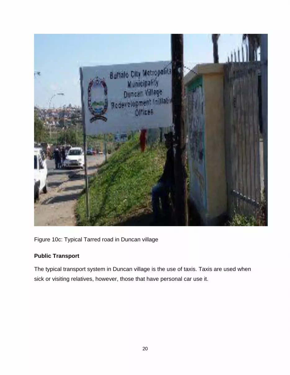
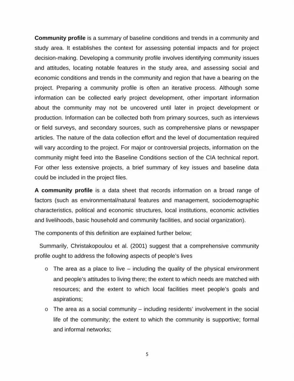
Figure 10c: Typical Tarred road in Duncan village
Public Transport
The typical transport system in Duncan village is the use of taxis. Taxis are used when
sick or visiting relatives, however, those that have personal car use it.
20

Isibindi Safe Park in Duncan Village
Figure 11: "Safe park.
Isibindi Safe Park finally launched in Duncan Village on April 10, 2014. The project is a
result of the Buffalo City - Leiden twinning and is an intervention aimed at addressing
orphaned and vulnerable children within Duncan Village. The Isibindi Model is a
NACCW initiative which seeks to harness local solutions by capacitating community
members as Child Care Workers. Buffalo City provided the land, levelled, grassed and
fenced the property and assisted with installing water, sanitation and electricity. Leiden
provided for the playground equipment, the office containers and funds for training and
stipends for the Child Care Workers. Leiden will continue to sustain the project for two
more years for € 63.579.
21

CEMENTERY
Duncan community has three cemeteries and is located in three areas namely: Buffalo
flat, Cambridge and Haven Hills as shown in the pictures below
Figure 12a: Buffalo flat Cemetery in Duncan Village
Figure 12b: Cambridge Cemetery in Duncan Village
22

Figures 12c: Haven Hills cemetery in Duncan Village
Community Support Centre
Duncan Village community support centre provides skills and capacity development for
young people with skills that would help them sustain themselves, thus serving as a
measure for combating unemployment. The initiative was organized by the Duncan
Village Youth Advisory Centre partnering with the Eastern Cape Development
Corporation (ECDC) to train 30 SMME’s from Duncan Village and the surrounding
areas. Participants were skilled on business profiling, how to source funding for their
businesses, how to come up with ideas that are needed to run an effective and viable
business. The programme was designed to help potential entrepreneurs intending to
start a business and who need the skills to manage their small businesses effectively as
well as those who are already operating their businesses. The training will help the
entrepreneurs acquire basic small business management skills and knowledge that will
contribute to the survival and growth of their businesses. This will help existing small
business owners enhance their management skills in preparation for business growth.
23

Figure 13: Duncan village community support centre
There are other different skill development sections in this centre. Some of these are as
follows:
Leather: making of bags and shoes
Music: Musical skill development
Film and video: acting and theatre
Dance: learning different
Visual art: performing arts and sound
Ceramics: making of plates and cups
Craft: sewing, kneading and making of beads.
24

Figure 14a: showing Craft (sewing, kneading and making of beads)
25
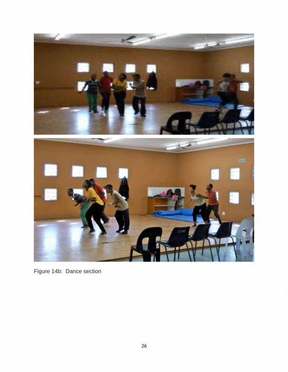
Figure 14b: Dance section
26

Figure 14c: Musical section
27

Figure 14d: Computer training section
28

.HEALTH CARE SERVICES
Duncan Village Health Care
Duncan Village Day Hospital is a public healthcare facility situated in Duncan Village, East London. Patients are attended to by registered nurse practitioners and doctors. The facility attends to minor emergency cases, but patients with major emergencies are referred to Frere Hospital.
Getting there
The hospital is located in Douglas Smith Highway in Duncan Village, East London. The nearest main road is the R72. Duncan Village is surrounded by Pefferville, Bebelele, Braelyn 10, Amalinda and Stoneydrift suburbs in East London.
Payment
Duncan Village Hospital is a public healthcare facility, and services are free to pregnant and breastfeeding women as well as children under the age of six years old. Other citizens are charged according to a sliding scale depending on their income.
Specialist services
Anti-Retroviral Treatment Services (ARVs)
Tuberculosis (TB) clinic
Basic gynaecology services
Family planning services
Pharmacy Services
X-Ray Services
HLUMANI- HIV/AIDS CENTRE- NGOThis is a home based health care and door-to-door community health service. It
comprises of 24 trained care giver, who goes from door to door to trace defaulters and
bring them to the clinic for their check-up and medication. They go on behalf of the
elderly people who cannot go to the clinic for their medication, as well as assist the
disabled to the clinic for their check up and medication
29

Figure 15: Showing a typical HIV and AIDS Centre in Duncan village.
PUBLIC SAFETY AND SECURITY
More than 50 Duncan Village residents in 2015 have been arrested for their alleged
involvement in serious crimes. The arrests come as a breakthrough for the Duncan
Village police and the East London crime intelligence unit. Duncan Village police have
arrested more than 50 people for their alleged involment in serious crimes.
The crime prevention operations saw six men arrested for allegedly being in possession
of unlicensed firearms and live ammunition; eight arrested for dealing in dagga and
mandrax, while other suspects were arrested for housebreaking, armed robberies and
theft among other crimes.
30

Figure 16a and b: Typical police and station
Table 1: showing 2015 statistics of different crime rates in Duncan Village
Total 1395
39 81 29
507
82 45
310
22128 38 12 21 12 1
Crime rate in Duncan Village Crime rate in Duncan Village
Figure 17: Showing percentage of crime rate in Duncan village (2015).
31
Precinct percentageMurder 39Total Sexual Offences 81Attempted murder 29Assault with the intent to inflict grievous bodily harm
507
Robbery with aggravating circumstances 181Burglary at non-residential premises 20Burglary at residential premises 310

HOUSEHOLD INCOME
In Duncan Village, most households no longer have the dignity of having family
members with permanent factory jobs, but depend on a precarious combination of odd
jobs and social welfare grants for survival. Locals say even casual work is disappearing.
With poor education and the difficulty of meaningful participation in the urban economy,
the poor have relied very heavily on the state and the city for support to upgrade the
schools, infrastructure and residential areas. But the state and the city have done little,
despite the area receiving presidential priority for redevelopment in 2001. Census 2001
indicates: 75.5% (15,855 households) report No Regular Income 21.1% (4,431
households) earn from R1 to R1,600 p/m, 2.2% (462 households) earn from R1,601 to
R3,200 p/m , 1.3% (273 households) earn > R3,200 p/m.
SOURCE OF INCOME OF DUNCAN VILLAGE RESIDENT
Most of the people who live in Duncan Village are very poor and they depend on small
hold businesses like: Vegetable production, wood work, auto mechanics /bush
mechanics, teaching profession, while others depend on their pension.
Home Affairs
The nearest home affair to Duncan village is in Fleet Street East London. Those who
are having problems with their permits and other issues relating to Department of home
affair from this community come to East London centre for assistance.
32

HIERARCHY OF DUNCAN COMMUNITY LEADERSHIP
LIMITATION EXPERIENCED BY THE COMMUNITY
In the course of compiling this profile, the researcher noticed that most dwellers live in
shacks built with cardboards, planks, sink and other waste materials. This poses a
serious fire threat in the area that could cause loss of properties and lives. To bring
hope and livelihood to the dwellers, repositioning from shacks to RDP houses will be a
leeway to good life. Furthermore, the dwellers are entrenched in an unsafe environment
full of disgusting odor as kitchen waste, plastic waste, paper waste and effluents from
toilets and bathrooms flows and collects in open spaces as well as other solid waste
littered all around. Besides, the horror of congestions as shacks are built very close to
33
Traditional Ruler
Inkosi
Isibonda
Counsillor
Local Municipality
Mayor
Ward Councillor
Ward Committees

each other without space for proper ventilation could also cause disease build up in the
area since personal hygiene and sanitation is at zero level.
The community is also denied access to good road as most roads within the streets are
bad, this make transportation difficult for commuters and fare hike in that place.
Distances that should not take more than 10minutes by taxi goes beyond 20 minutes;
the only good road around the place is the R72 bypass to East London. The community
have good water source as most shacks home have tape water fixed and also central
water service for everyone. However, most people living there have no jobs and they
loaf around hijacking and stealing others properties, making the place to be a high crime
zone in Buffalo city municipality.
Limitation to medical care and treatment in the area is very high because the community
of about one hundred thousand populations has only one health care center and few
nurses and in some cases, no medication for patients. Also, there are fewer schools in
the area; the community has five public primary schools and one comprehensive
school. Most of the children go far as 20km away to schools in East London. This make
life difficult for both pupils and parents in terms of transport, finance, risks of children life
to attacks and cold during winter. The community only has one Hall which is not
sufficient to accommodate the need of everyone who has one function or the other to do
within the vicinity. These will indeed gender or crop corruption as people will bribe their
ways to getting the place for use at the expense of the poor.
RECOMMENDATION
The Government should build RDP houses for those in this community to alleviate the
problem of poverty and low level income class.
More schools should be built to accommodate the ever rising population of the youth in
the area.
Job creation through developmental programmes for the youth and well able body
people living in the areas should be introduce to reduce high level of crime.
34

Proper sanitation and safety waste management system for refuse collection should be
created in the area and waste collectors should regularly in weekly bases collect and
dispose off the waste to avoid both air, water and land pollution.
Government should upgrade the roads in the areas to tarred one for easy accessibility.
More recreational facilities and towns hall be built for social activities. The need of more
Health care centres should also be provided to meet the needs of the citizens in the
area
REFERENCE
James, Paul; Nadarajah, Yaso; Haive, Karen; Stead, Victoria (2012). Sustainable
Communities, Sustainable Development: Other Paths for Papua New Guinea . Honolulu:
University of Hawaii Press. p. 14.
Community Development as a Process", Edited by Lee J Cary, University of Missouri
Press, Columbia USA. 1970.
http://www.cutr.usf.edu/oldpubs/CIA/Chapter_4.pdf
http; en.wikipedia.org/wiki/Duncan_Village
Christakopoulou, S. Dawson, J Gari, A, (2001). The Community. Well-Being
Questionnaire: Theoretical Context and Initial Assessment of. Its Reliability and
Validity, Social Indicators Research, Vol. 56, No . 3 (Dec.,. 2001), PP.
35


