Embed Size (px)
Citation preview
PHASE I ENVIRONMENTAL SITE ASSESSMENT ASSESSOR’S PARCEL NUMBER (APN) 479-140-022
MORENO VALLEY, RIVERSIDE COUNTY, CALIFORNIA 92553
December 23, 2020
Project No. 2597-CR
Prepared For:
Citivest Commercial Investments, LLC 4340 Von Karman Avenue, Suite 110
Newport Beach, California 92660
December 23, 2020
Project No. 2597-CR
Citivest Commercial Investments, LLC
4340 Von Karman Avenue, Suite 110
Newport Beach, California 92660
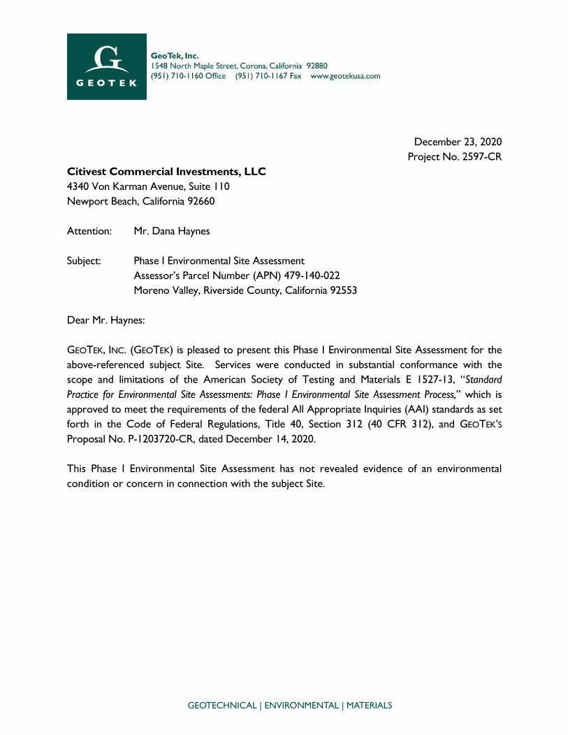
Attention: Mr. Dana Haynes
Subject: Phase I Environmental Site Assessment
Assessor’s Parcel Number (APN) 479-140-022
Moreno Valley, Riverside County, California 92553
Dear Mr. Haynes:
GEOTEK, INC. (GEOTEK) is pleased to present this Phase I Environmental Site Assessment for the
above-referenced subject Site. Services were conducted in substantial conformance with the
scope and limitations of the American Society of Testing and Materials E 1527-13, “Standard
Practice for Environmental Site Assessments: Phase I Environmental Site Assessment Process,” which is
approved to meet the requirements of the federal All Appropriate Inquiries (AAI) standards as set
forth in the Code of Federal Regulations, Title 40, Section 312 (40 CFR 312), and GEOTEK’S
Proposal No. P-1203720-CR, dated December 14, 2020.
This Phase I Environmental Site Assessment has not revealed evidence of an environmental
condition or concern in connection with the subject Site.
GEOTECHNICAL | ENVIRONMENTAL | MATERIALS
Citivest Commercial Investments, LLC Project No. 2597-CR APN 479-140-022 December 23, 2020 Moreno Valley, Riverside County, California Page 2
We appreciate this opportunity to be of service. If you have any questions, or if we can be of
further service, please contact us at (951) 710-1160. Sincerely, GEOTEK, INC.
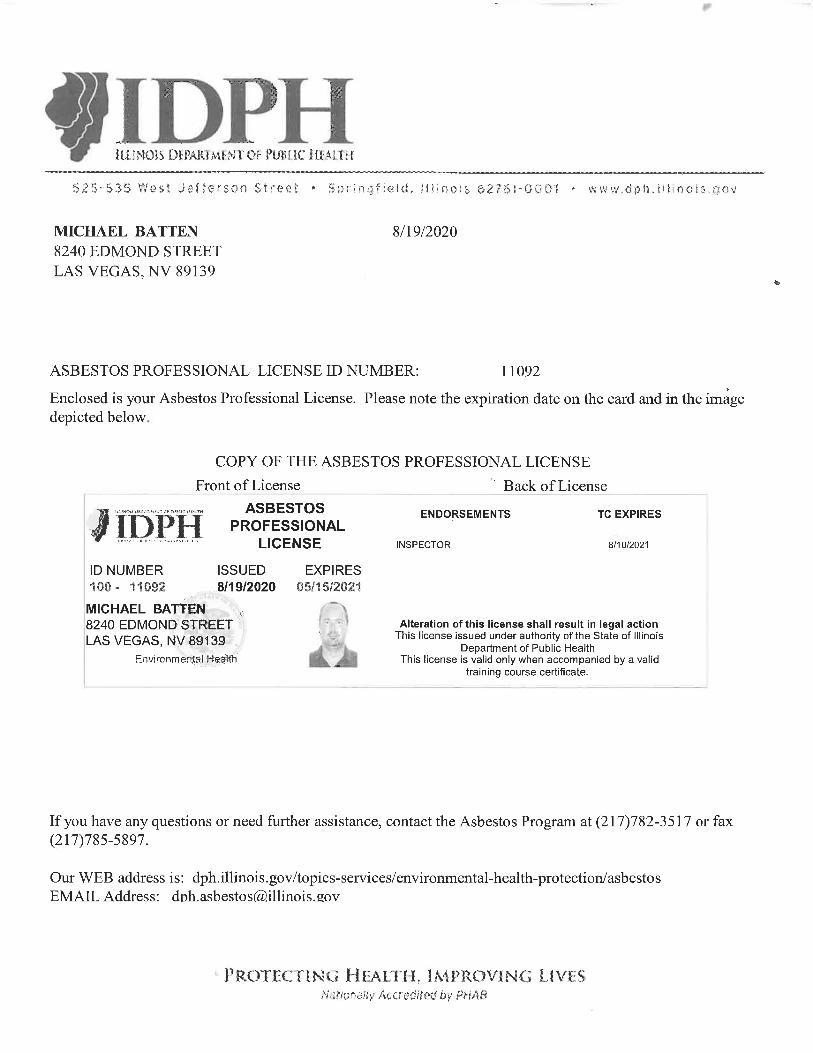
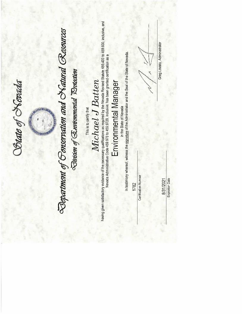
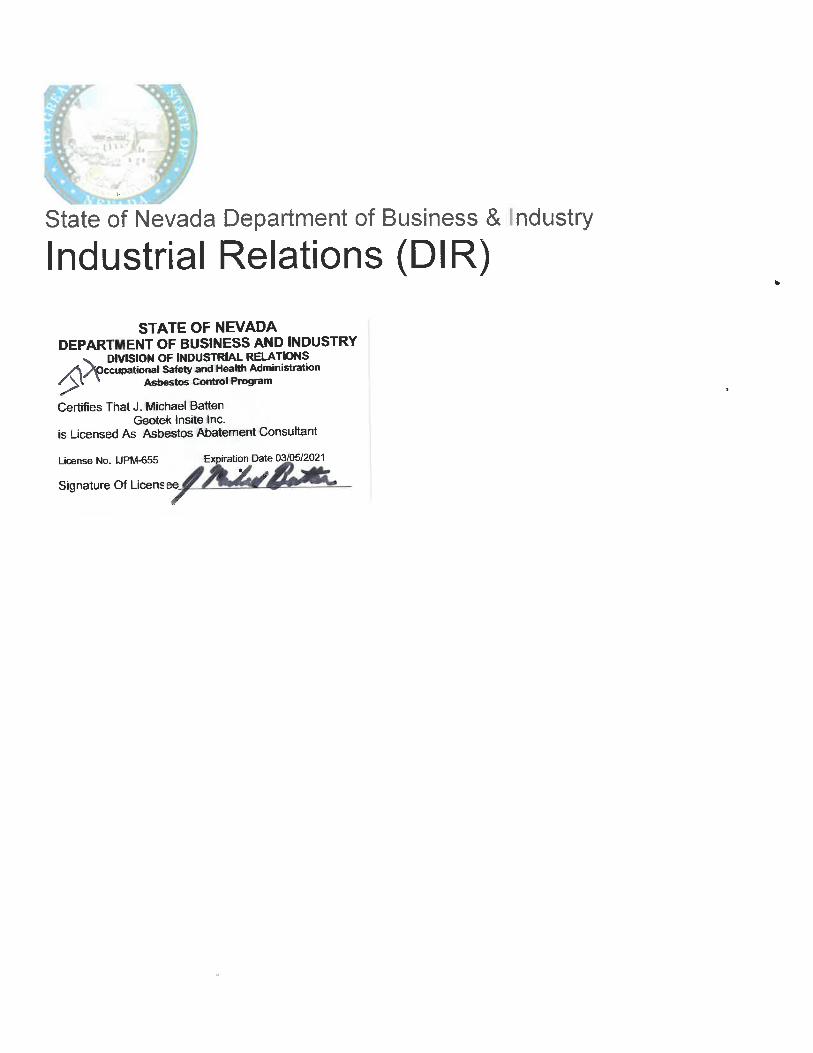
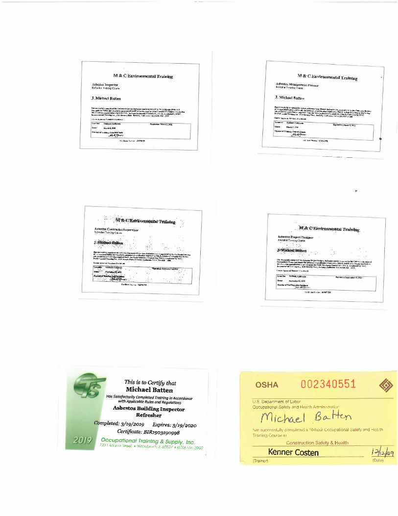
Edward H. LaMont J. Michael Batten, CEM, REPA Principal Geologist, CEG 1892 Environmental Services Manager Expires 07/31/2022 Registered Environmental Property Assessor No. 113162 Expires 06/15/2021
Anna M. Scott Project Geologist
Citivest Commercial Investments, LLC Project No. 2597-CR APN 479-140-022 December 23, 2020 Moreno Valley, Riverside County, California Page i
TABLE OF CONTENTS
1.0 EXECUTIVE SUMMARY ....................................................................................................................................1
2.0 INTRODUCTION ..............................................................................................................................................3
2.1 PURPOSE .............................................................................................................................................3
2.2 SCOPE OF WORK...............................................................................................................................3
2.3 SIGNIFICANT ASSUMPTIONS ..............................................................................................................4
2.4 LIMITATIONS AND EXCEPTIONS .......................................................................................................4
2.5 SPECIAL TERMS AND CONDITIONS ..................................................................................................5
2.6 RELIANCE ............................................................................................................................................5
3.0 DESCRIPTION OF SITE AND SURROUNDING AREA ..........................................................................6
3.1 SITE LOCATION AND LEGAL DESCRIPTION .....................................................................................6
3.2 SITE AND VICINITY GENERAL CHARACTERISTICS ...........................................................................6
3.3 CURRENT PROPERTY USE .................................................................................................................6
3.4 SITE IMPROVEMENTS...........................................................................................................................6
3.4.1 HAZARDOUS SUBSTANCES ......................................................................................................6
3.4.2 STORAGE TANKS ......................................................................................................................7
3.4.3 POLY-CHLORINATED BIPHENYLS (PCBS)...............................................................................7
3.4.4 CONTROLLED SUBSTANCES.....................................................................................................7
3.4.5 INDICATIONS OF SOLID WASTE DISPOSAL ............................................................................7
3.4.6 UTILITY SUPPLY .........................................................................................................................7
3.4.7 DRAINAGE .................................................................................................................................7
3.4.8 OTHER CONDITIONS OF CONCERN ......................................................................................7
3.4.9 INTERVIEWS ...............................................................................................................................8
3.5 CURRENT ADJOINING PROPERTY USE .............................................................................................8
4.0 CLIENT PROVIDED INFORMATION ..........................................................................................................9
4.1 ENVIRONMENTAL CLEAN UP LIENS .................................................................................................9
4.2 ACTIVITY AND USE LIMITATIONS .....................................................................................................9
4.3 SPECIALIZED KNOWLEDGE ...............................................................................................................9
4.4 PURCHASE PRICE ................................................................................................................................9
4.5 COMMONLY KNOWN INFORMATION .............................................................................................9
4.6 OBVIOUS INDICATORS OF CONTAMINATION ................................................................................9
4.7 OWNER, PROPERTY MANAGER AND OCCUPANT INFORMATION ................................................9
4.8 REASON FOR PERFORMING PHASE I ESA ...................................................................................... 10
4.9 OTHER USER PROVIDED INFORMATION ....................................................................................... 10
5.0 PROPERTY PHYSICAL SETTING ................................................................................................................ 11
5.1 REGIONAL GEOLOGY ..................................................................................................................... 11
5.2 LOCAL GEOLOGIC SETTING AND TOPOGRAPHY ........................................................................ 11
5.3 VICINITY SURFACE DRAINAGE ....................................................................................................... 11
Citivest Commercial Investments, LLC Project No. 2597-CR APN 479-140-022 December 23, 2020 Moreno Valley, Riverside County, California Page ii
TABLE OF CONTENTS
5.4 HYDROGEOLOGY ........................................................................................................................... 12
6.0 ENVIRONMENTAL REGULATORY RECORDS REVIEW .................................................................... 13
6.1 ENVIRONMENTAL DATABASE RECORDS SEARCH ........................................................................ 13
6.2 DISCUSSION OF REGULATORY RECORDS ..................................................................................... 14
6.2.1 NATIONAL PRIORITY LIST ..................................................................................................... 14
6.2.2 SUPERFUND ENTERPRISE MANAGEMENT SYSTEM ................................................................ 15
6.2.3 RESOURCE CONSERVATION AND RECOVERY ACT ............................................................ 15
6.2.4 EMERGENCY RESPONSE NOTIFICATION SYSTEM ................................................................. 16
6.2.5 FEDERAL INSTITUTIONAL CONTROL/ENGINEERING CONTROL REGISTRIES .................... 16
6.2.6 STATE RESPONSE SITES .......................................................................................................... 16
6.2.7 ENVIROSTOR DATABASE ....................................................................................................... 16
6.2.8 CALIFORNIA HAZARDOUS MATERIAL INCIDENT REPORT SYSTEM ................................... 17
6.2.9 SOLID WASTE FACILITIES LIST .............................................................................................. 17
6.2.10 LEAKING UNDERGROUND STORAGE TANKS LIST .............................................................. 17
6.2.11 UNDERGROUND STORAGE TANKS LIST .............................................................................. 18
6.2.12 SPILLS, LEAKS, INVESTIGATION AND CLEANUP COST RECOVERY LISTING (SLIC) .......... 19
6.2.13 STATE INSTITUTIONAL CONTROL/ENGINEERING CONTROL REGISTRIES ........................ 19
6.2.14 TRIBAL DATABASES ................................................................................................................ 20
6.2.15 OTHER DATABASES ............................................................................................................... 20
6.2.16 DRY CLEANERS ...................................................................................................................... 21
6.2.17 UNMAPPABLE FACILITIES ....................................................................................................... 21
6.3 LOCAL REGULATORY AGENCY RECORDS .................................................................................... 21
7.0 VAPOR ENCROACHMENT SCREEN ....................................................................................................... 22
8.0 SITE AND SURROUNDING AREA HISTORY ........................................................................................ 23
8.1 HISTORICAL SITE USAGE ................................................................................................................ 23
8.1.1 AERIAL PHOTOGRAPH REVIEW ............................................................................................. 23
8.1.2 TOPOGRAPHIC MAP REVIEW ................................................................................................ 23
8.1.3 BUILDING DEPARTMENT RECORDS ...................................................................................... 23
8.1.4 CITY DIRECTORY REVIEW ..................................................................................................... 24
8.1.5 SANBORN MAP REVIEW ........................................................................................................ 24
8.1.6 CHAIN OF TITLE..................................................................................................................... 24
8.2 HISTORICAL IMMEDIATELY SURROUNDING PROPERTY USAGE ................................................... 24
8.2.1 AERIAL PHOTOGRAPH REVIEW ............................................................................................. 24
8.2.2 TOPOGRAPHIC MAP REVIEW ................................................................................................ 25
8.2.3 CITY DIRECTORIES ................................................................................................................. 25
8.2.4 SANBORN MAP REVIEW ........................................................................................................ 25
8.3 HISTORICAL USE SUMMARY ........................................................................................................... 26
Citivest Commercial Investments, LLC Project No. 2597-CR APN 479-140-022 December 23, 2020 Moreno Valley, Riverside County, California Page iii
TABLE OF CONTENTS
9.0 SIGNIFICANT DATA GAPS ......................................................................................................................... 27
10.0 CONCLUSIONS AND RECOMMENDATIONS ..................................................................................... 28
11.0 CERTIFICATIONS ........................................................................................................................................... 29
12.0 REFERENCES ..................................................................................................................................................... 30
LIST OF APPENDICES
Appendix A: Figures
Appendix B: Supporting Documents
Appendix C: Photographs
Appendix D: Vapor Encroachment Screen
Appendix E: Environmental Database Report
Appendix F: Project Team Qualifications
Citivest Commercial Investments, LLC Project No. 2597-CR APN 479-140-022 December 23, 2020 Moreno Valley, Riverside County, California Page 1
1.0 EXECUTIVE SUMMARY
GEOTEK, INC. (GEOTEK) has performed a Phase I Environmental Site Assessment (ESA) for the -
subject property: APN 479-140-022 (the “Site”), located in the City of Moreno Valley, Riverside
County, California. Our services were conducted in substantial conformance with the scope
and limitations of the American Society of Testing and Materials (ASTM) E 1527-13, “Standard
Practice for Environmental Site Assessments: Phase I Environmental Site Assessment Process”, which is
approved to meet the requirements of the federal All Appropriate Inquiries (AAI) standards as
set forth in the Code of Federal Regulations, Title 40, Section 312 (40 CFR 312), and GEOTEK
Proposal No. P-1203720-CR, dated December 14, 2020. Any additions or deletions from our
scope of services are discussed in the appropriate sections of this assessment.
A representative of GEOTEK conducted a Site reconnaissance on December 17, 2020. The
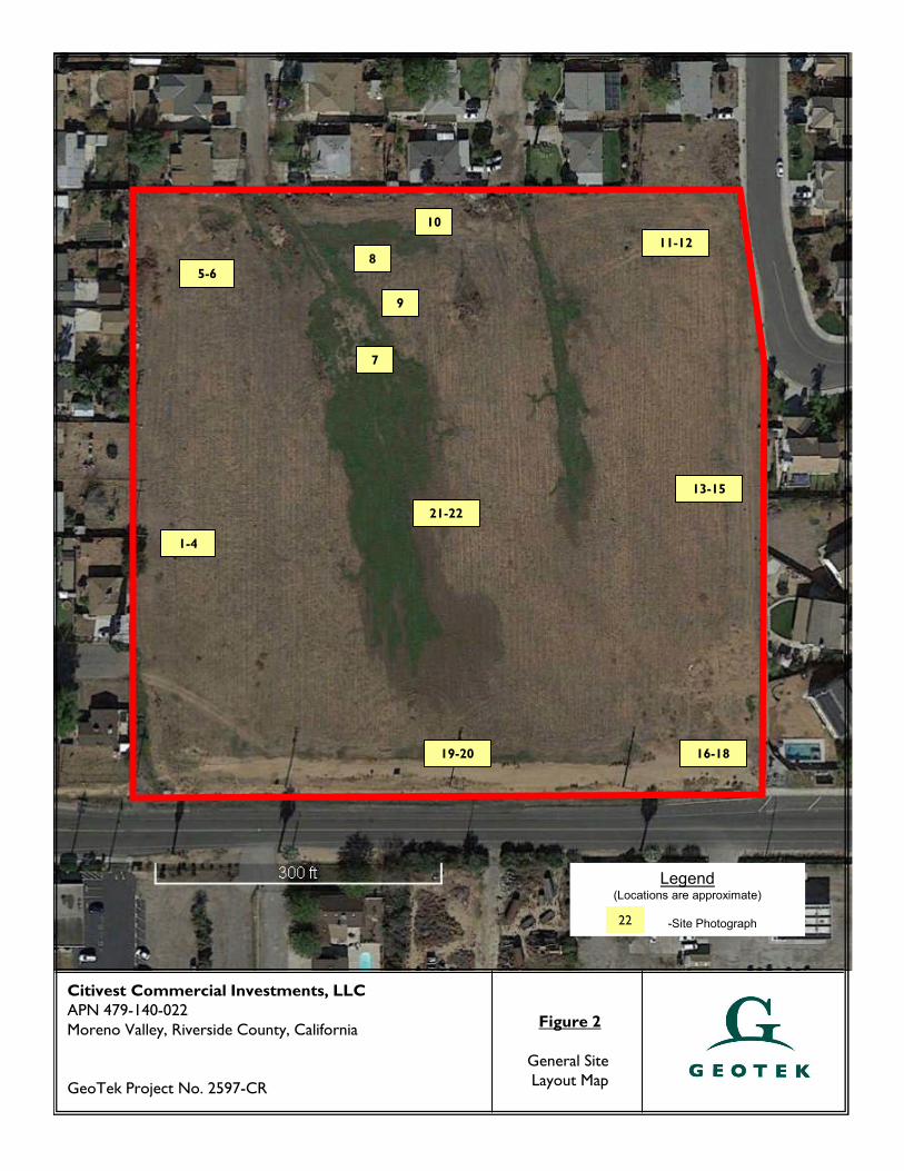
weather was slightly cool and the sky was clear. The square shaped Site is currently comprised
of one (1) parcel of land and encompasses a total of approximately 9.39 acres. The Site can
generally be accessed from Patricia Lane.
The Site is vacant and undeveloped. Visual evidence of hazardous substances and wastes was
not observed during our Site reconnaissance. Visual indication of spills, leaks and stains was not
observed. No pungent or acrid odors were observed emanating from the Site.
The Site is in an area largely characterized by residential development. The Site is bounded by
a residential development to the west and north; the Site is bounded by Cottonwood Avenue,
followed by a residence and commercial properties to the south. The Site is bounded by a
Patricia Lane, followed by residential development and residential development to the east.
Based on readily available historic information, the Site has been vacant and undeveloped land
since at least 1938. The surrounding properties appear to historically have been vacant land or
utilized for residential development since at least 1938. The residential development to the
west and north of the Site can be observed in an aerial photograph dated 1959.
The Site does not appear on the environmental database report obtained for this assessment.
There is one (1) facility located just south of Cottonwood Avenue listed on the database
report. There are 12 additional facilities listed on the database report within the various search
distances specified by ASTM E 1527-13. Due to their listings or locations, these facilities do not
represent an environmental concern to the Site.
This Phase I Environmental Site Assessment has not revealed evidence of an environmental
condition or concern in connection with the subject Site.
Citivest Commercial Investments, LLC Project No. 2597-CR APN 479-140-022 December 23, 2020 Moreno Valley, Riverside County, California Page 2
This executive summary does not contain all the information that is found in the full report.
The report should be read in its entirety to obtain a more complete understanding of the
information provided and to aid in any decisions made or actions taken based on this
information.
Citivest Commercial Investments, LLC Project No. 2597-CR APN 479-140-022 December 23, 2020 Moreno Valley, Riverside County, California Page 3
2.0 INTRODUCTION
GEOTEK, INC. (GEOTEK) has performed a Phase I Environmental Site Assessment (ESA) for APN
479-140-022 (the “Site”), located in the City of Moreno Valley, Riverside County, California.
2.1 PURPOSE
The purpose of this Phase I ESA was to identify and evaluate actual and potential environmental
conditions involving the subject Site. It was not the purpose of this assessment to determine
the degree or extent of contamination, if any, but rather the potential for contamination.
2.2 SCOPE OF WORK
The Phase I ESA is a general characterization of environmental concerns based on reasonably
ascertainable information and observations. GEOTEK performed the Phase I ESA in substantial
accordance with ASTM E 1527-13. The following services were provided for the assessment:
� A reconnaissance of the Site and surrounding properties to visually assess current
utilization and indications of potential surface contamination. This was accomplished by
driving the Site boundaries, and then traversing the Site until the entire Site had been
surveyed.
� A reconnaissance of the surrounding area for approximately one-half mile was
conducted, without entering the properties, making observations concerning property
uses, conditions, and housekeeping.
� A review of the geologic and hydro-geologic settings was conducted using reasonably
ascertainable public records and documents.
� An environmental database report was obtained from a data service provider. This
database report compiles and locates documented “hazardous waste” facilities within
specific minimum search distances as defined by ASTM E 1527-13. If necessary,
additional information on identified facilities was gathered by a file review at the
appropriate federal, state, local, and/or tribal regulatory agency.
� A review of reasonably ascertainable historical records (including aerial photographs,
topographic maps, building records, and city directories) was conducted to assess the
historical land utilization and indications of potential contamination or sources of
contamination for the Site.
Citivest Commercial Investments, LLC Project No. 2597-CR APN 479-140-022 December 23, 2020 Moreno Valley, Riverside County, California Page 4
� This report was prepared, which relates the findings of this study and presents our
conclusions and recommendations.
Specific items not included in this Scope of Services are water analysis, asbestos containing
materials analysis, radon analysis, lead-based paint analysis, lead in drinking water, wetlands,
regulatory compliance, cultural and historic resources, industrial hygiene, health and safety,
ecological resources, endangered species, indoor air quality, vapor intrusion testing, high
voltage power lines, and other items not within the scope of ASTM E 1527-13.
2.3 SIGNIFICANT ASSUMPTIONS
Specific assumptions by GEOTEK for this assessment include:
� GEOTEK had permission to access the Site grounds;
� The client has provided GEOTEK with available geotechnical or environmental reports for
the Site;
� The client has provided GEOTEK with known current or historic uses of hazardous
materials at the Site, or with other specialized knowledge of the environmental history
of the Site and surrounding area;
� The client is not the sole and absolute source of information;
� Seller has provided proper and complete access to their knowledge, both written and
verbal, and GEOTEK can rely on the information.
2.4 LIMITATIONS AND EXCEPTIONS
GEOTEK conducted a Phase I Environmental Site Assessment in substantial accordance with
ASTM E 1527-13 and as authorized by Citivest Commercial Investments, LLC. This study does
not include sampling of groundwater and/or materials on-site for environmental testing. This
report is intended for the use of Citivest Commercial Investments, LLC. The contents should
not be relied upon by any party other than the aforementioned without the express written
consent of GEOTEK.
The findings, conclusions, and recommendations made in this report are based on the
information that was made available to GEOTEK, in most instances from public records. The
Citivest Commercial Investments, LLC Project No. 2597-CR APN 479-140-022 December 23, 2020 Moreno Valley, Riverside County, California Page 5
information is relevant to the date of our site work and should not be relied on to represent
conditions at any later date. The opinions and conclusions expressed herein are based on
information obtained during our assessment and on our experience and current standards of
technical practice. GEOTEK makes no other warranties, either express or implied, concerning
the completeness of the data furnished to us. GEOTEK cannot be responsible for conditions or
consequences arising from relevant facts that were concealed, withheld, or not fully disclosed at
the time our assessment was undertaken. GEOTEK is not responsible, nor liable for work,
testing or recommendations performed or provided by others. This Phase I Environmental Site
Assessment is not and should not be construed as a warranty or guarantee about the presence
or absence of environmental hazards or contaminants, which may affect the subject site. Facts,
conditions, and acceptable risk factors change with time; accordingly, this report should be
viewed within this context.
Specific limitations to the scope of ASTM E 1527-13 due to contract limitations, availability of
resources, and/or encountered Site conditions are discussed in the appropriate section(s) of
this report.
2.5 SPECIAL TERMS AND CONDITIONS
This assessment report is presented as fulfilling the standard requirements of most financial
institutions, governmental regulatory agencies, ASTM, and generally accepted industry standards
and practices. Please refer to GEOTEK Proposal No. P-1203720-CR for complete terms and
conditions for this assessment.
2.6 RELIANCE
This assessment has been prepared for the exclusive use and may be relied upon Citivest
Commercial Investments, LLC and their successors and assignees. Third party reliance letters
may be issued upon request and upon the payment of the, then current, fee for such letters.
All third parties relying on this report, by such reliance, agree to be bound by the General
Conditions and Limitations agreed to Citivest Commercial Investments, LLC. No reliance by
any party is permitted without such agreement, regardless of the content of the reliance letter
itself.
Citivest Commercial Investments, LLC Project No. 2597-CR APN 479-140-022 December 23, 2020 Moreno Valley, Riverside County, California Page 6
3.0 DESCRIPTION OF SITE AND SURROUNDING AREA
The objective of describing the Site and surrounding area is to document current conditions as
observed and to obtain information which would indicate the likelihood of a recognized
environmental condition in connection with the Site. A representative of GEOTEK conducted a
Site reconnaissance on December 17, 2020. The weather was slightly cool and the sky was
clear. The Site can generally be accessed from Patricia Lane.
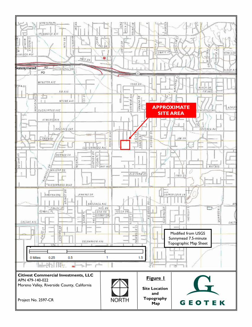
3.1 SITE LOCATION AND LEGAL DESCRIPTION
The Site is located north of Cottonwood Avenue and west of Patricia Lane in the City of
Moreno Valley, Riverside County, California. According to the U.S. Geological Survey (USGS)
Sunnymead Quadrangle topographic map sheet (7.5-minute series), the Site is located in Section
8, Township 3 South, Range 3 West, San Bernardino Baseline and Meridian (see Figure 1 in
Appendix A and documents in Appendix B). The Site is also known as Riverside County
Assessor’s Parcel Number 479-140-022. Additional legal descriptions for the Site are provided
in Appendix B (Pacific Coast Title Company, 2019).
3.2 SITE AND VICINITY GENERAL CHARACTERISTICS
The Site is vacant and undeveloped. The Site is in an area largely characterized by residential
development.
3.3 CURRENT PROPERTY USE
The Site is vacant and undeveloped.
3.4 SITE IMPROVEMENTS
The Site is vacant and undeveloped. Photographs of the Site are included in Appendix C.
3.4.1 HAZARDOUS SUBSTANCES
Visual evidence of hazardous substances and wastes was not observed during our Site
reconnaissance. Visual indication of spills, leaks and stains was not observed. No pungent or
acrid odors were observed emanating from the Site.
Citivest Commercial Investments, LLC Project No. 2597-CR APN 479-140-022 December 23, 2020 Moreno Valley, Riverside County, California Page 7
3.4.2 STORAGE TANKS
GEOTEK did not observe evidence of underground storage tanks (such as vent pipes, fill pipes,
regular-shaped depressions, etc.) on the Site.
3.4.3 POLY-CHLORINATED BIPHENYLS (PCBS)
GEOTEK did not observe suspect equipment (transformers, elevators, hydraulic lift mechanisms,
trash compactors, etc.) which may contain PCBs on the Site.
3.4.4 CONTROLLED SUBSTANCES
GEOTEK consulted the U.S. Drug Enforcement Agency (DEA) website to cross-check the Site
address against published facilities subject to DEA enforcement. The Site did not appear on the
list of published facilities. A copy of the DEA printout is included in Appendix B.
GEOTEK did not observe evidence of illegal or controlled substances being used or
manufactured at the Site.
3.4.5 INDICATIONS OF SOLID WASTE DISPOSAL
Waste disposal for the Site and Site area is provided by Waste Management.
3.4.6 UTILITY SUPPLY
Water and sewer services for the Site and area are provided by Eastern Municipal Water
District. Electric service for the Site and area are provided by Southern California Edison.
Natural gas services for the Site and area are provided by Southern California Gas.
3.4.7 DRAINAGE
Natural drainage at the Site is generally to the south, conforming to the natural topography in the
area. Ponded water was not observed during our Site reconnaissance.
3.4.8 OTHER CONDITIONS OF CONCERN
No visual indication of conditions of concern (water wells, drywells, cesspools, etc.) that would
indicate a recognized environmental condition was observed during the Site reconnaissance.
Citivest Commercial Investments, LLC Project No. 2597-CR APN 479-140-022 December 23, 2020 Moreno Valley, Riverside County, California Page 8
3.4.9 INTERVIEWS
GEOTEK interviewed the following individual while performing this assessment, in the form of
completing a User Questionnaire:
� Mr. Al Marshall (a representative of the current Site owner) completed a User
Questionnaire.
Information from this interview is incorporated into the appropriate sections of this report.
3.5 CURRENT ADJOINING PROPERTY USE
The Site is in an area largely characterized by residential development. The Site is bounded by
a residential development to the west and north; the Site is bounded by Cottonwood Avenue,
followed by a residence and commercial properties to the south. The Site is bounded by a
Patricia Lane, followed by residential development and residential development to the east.
Citivest Commercial Investments, LLC Project No. 2597-CR APN 479-140-022 December 23, 2020 Moreno Valley, Riverside County, California Page 9
4.0 CLIENT PROVIDED INFORMATION
As a form of interview, a representative of the current Site owner completed a “User
Questionnaire” for the Site in accordance with ASTM E 1527-13. A copy of the completed
questionnaire is included in Appendix B.
4.1 ENVIRONMENTAL CLEAN UP LIENS
Mr. Al Marshall is not aware of any environmental clean-up liens at the Site.
4.2 ACTIVITY AND USE LIMITATIONS
Mr. Al Marshall is not aware of any activity use limitations at the Site.
4.3 SPECIALIZED KNOWLEDGE
Mr. Al Marshall is not aware of any specialized knowledge of the Site or nearby properties.
4.4 PURCHASE PRICE
Mr. Al Marshall states that the purchase price being paid for the Site reasonably reflects the fair
market value of the property.
4.5 COMMONLY KNOWN INFORMATION
Mr. Al Marshall states that he is not aware of commonly known or reasonably ascertainable
information for the Site.
4.6 OBVIOUS INDICATORS OF CONTAMINATION
Mr. Al Marshall states that he is not aware of obvious indicators of a likely environmental
impact at the Site.
4.7 OWNER, PROPERTY MANAGER AND OCCUPANT INFORMATION
It is our understanding that Cottonwood 939 LLC, a Limited Liability Company currently owns
and manages the Site. The Site is currently unoccupied.
Citivest Commercial Investments, LLC Project No. 2597-CR APN 479-140-022 December 23, 2020 Moreno Valley, Riverside County, California Page 10
4.8 REASON FOR PERFORMING PHASE I ESA
This Phase I ESA was performed at the request of Citivest Commercial Investments, LLC as part
of their due diligence for possible future improvements on the Site.
4.9 OTHER USER PROVIDED INFORMATION
GEOTEK was not provided with any other information for the Site by Citivest Commercial
Investments, LLC.
Citivest Commercial Investments, LLC Project No. 2597-CR APN 479-140-022 December 23, 2020 Moreno Valley, Riverside County, California Page 11
5.0 PROPERTY PHYSICAL SETTING
Surface and subsurface environments are of interest because they control the movement of
water-born contaminants, which could be transported to and from the subject Site. GEOTEK
reviewed information regarding the physical setting of the subject Site and immediately
surrounding area.
5.1 REGIONAL GEOLOGY
The subject property is situated in the Peninsular Ranges geomorphic province. The Peninsular
Ranges province is one of the largest geomorphic units in western North America. Basically, it
extends roughly 975 miles from the north and northeasterly adjacent the Transverse Ranges
geomorphic province to the tip of Baja California. This province varies in width from about 30
to 100 miles. It is bounded on the west by the Pacific Ocean, on the south by the Gulf of
California and on the east by the Colorado Desert Province.
The Peninsular Ranges are essentially a series of northwest-southeast oriented fault blocks.
Three major fault zones are found in this province. The Elsinore Fault zone and the San Jacinto
Fault zones trend northwest-southeast and are found in the near the middle of the province.
The San Andreas Fault zone borders the northeasterly margin of the province.
5.2 LOCAL GEOLOGIC SETTING AND TOPOGRAPHY
The Site and Site area are understood to be underlain by alluvium. Additional data regarding
soil survey information for the Site and Site area is also included in Appendix B.
The Site and Site area can be considered as having relatively flat terrain. Based on the USGS
topographic map for the area and other documents reviewed for this report, the elevation of
the subject Site is approximately 1,585 feet above mean sea level.
5.3 VICINITY SURFACE DRAINAGE
Natural drainage at the Site is interpreted to be to the south following the natural topography in
the area. Storm water does not appear to drain towards the Site from the adjacent properties
due to existing streets and/or improvements.
According to the Federal Emergency Management Agency (FEMA), the Site is not located within
special flood hazard zone (see Appendix D).
Citivest Commercial Investments, LLC Project No. 2597-CR APN 479-140-022 December 23, 2020 Moreno Valley, Riverside County, California Page 12
5.4 HYDROGEOLOGY
According to a review of historical groundwater data (California Department of Water
Resources and California State Water Resources Control Board groundwater well data
[http://wdl.water.ca.gov and http://geotracker.waterboards.ca.gov]) and in-house information,
depth to groundwater is greater than 50 feet below ground surface (bgs) in the general site
area, with a flow direction to the south.
Citivest Commercial Investments, LLC Project No. 2597-CR APN 479-140-022 December 23, 2020 Moreno Valley, Riverside County, California Page 13
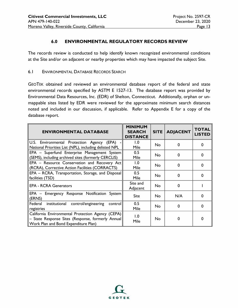
6.0 ENVIRONMENTAL REGULATORY RECORDS REVIEW
The records review is conducted to help identify known recognized environmental conditions
at the Site and/or on adjacent or nearby properties which may have impacted the subject Site.
6.1 ENVIRONMENTAL DATABASE RECORDS SEARCH
GEOTEK obtained and reviewed an environmental database report of the federal and state
environmental records specified by ASTM E 1527-13. The database report was provided by
Environmental Data Resources, Inc. (EDR) of Shelton, Connecticut. Additionally, orphan or un-
mappable sites listed by EDR were reviewed for the approximate minimum search distances
noted and included in our discussion, if applicable. Refer to Appendix E for a copy of the
database report.
ENVIRONMENTAL DATABASE MINIMUM SEARCH
DISTANCE SITE ADJACENT
TOTAL LISTED
U.S. Environmental Protection Agency (EPA) - National Priorities List (NPL), including delisted NPL
1.0 Mile
No 0 0
EPA – Superfund Enterprise Management System (SEMS), including archived sites (formerly CERCLIS)
0.5 Mile
No 0 0
EPA – Resource Conservation and Recovery Act (RCRA), Corrective Action Facilities (CORRACTS)
1.0 Mile
No 0 0
EPA – RCRA, Transportation, Storage, and Disposal facilities (TSD)
0.5 Mile
No 0 0
EPA - RCRA Generators Site and Adjacent
No 0 1
EPA – Emergency Response Notification System (ERNS)
Site No N/A 0
Federal institutional control/engineering control registries
0.5 Mile
No 0 0
California Environmental Protection Agency (CEPA) – State Response Sites (Response, formerly Annual Work Plan and Bond Expenditure Plan)
1.0 Mile
No 0 0
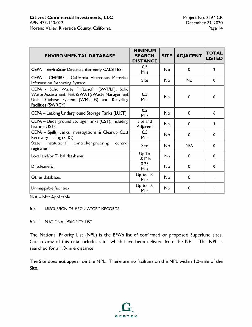
Citivest Commercial Investments, LLC Project No. 2597-CR APN 479-140-022 December 23, 2020 Moreno Valley, Riverside County, California Page 14
ENVIRONMENTAL DATABASE MINIMUM SEARCH
DISTANCE SITE ADJACENT
TOTAL LISTED
CEPA – EnviroStor Database (formerly CALSITES) 0.5 Mile
No 0 2
CEPA – CHMIRS - California Hazardous Materials Information Reporting System
Site No No 0
CEPA - Solid Waste Fill/Landfill (SWF/LF), Solid Waste Assessment Test (SWAT)/Waste Management Unit Database System (WMUDS) and Recycling Facilities (SWRCY)
0.5 Mile
No 0 0
CEPA – Leaking Underground Storage Tanks (LUST) 0.5 Mile
No 0 6
CEPA – Underground Storage Tanks (UST), including historic USTs
Site and Adjacent
No 0 3
CEPA – Spills, Leaks, Investigations & Cleanup Cost Recovery Listing (SLIC)
0.5 Mile
No 0 0
State institutional control/engineering control registries
Site No N/A 0
Local and/or Tribal databases Up To 1.0 Mile
No 0 0
Drycleaners 0.25 Mile
No 0 0
Other databases Up to 1.0
Mile No 0 1
Unmappable facilities Up to 1.0
Mile No 0 1
N/A – Not Applicable
6.2 DISCUSSION OF REGULATORY RECORDS
6.2.1 NATIONAL PRIORITY LIST
The National Priority List (NPL) is the EPA's list of confirmed or proposed Superfund sites.
Our review of this data includes sites which have been delisted from the NPL. The NPL is
searched for a 1.0-mile distance.
The Site does not appear on the NPL. There are no facilities on the NPL within 1.0-mile of the
Site.

Citivest Commercial Investments, LLC Project No. 2597-CR APN 479-140-022 December 23, 2020 Moreno Valley, Riverside County, California Page 15
6.2.2 SUPERFUND ENTERPRISE MANAGEMENT SYSTEM
The Superfund Enterprise Management System (SEMS, formerly CERCLIS) is a compilation of
sites that the EPA has investigated or is currently investigating for a release or threatened
release of hazardous substances. Our review of SEMS sites includes archive (no further
remedial action planned) facilities. The SEMS list is searched for a 0.5-mile distance.
The Site does not appear on the SEMS list. The Site does appear on the SEMS-ARCHIVE list.
There are no facilities on the SEMS list within 0.5-mile of the Site. There are no facilities on the
SEMS-ARCHIVE list within 0.5-mile of the Site.
6.2.3 RESOURCE CONSERVATION AND RECOVERY ACT
The Resource Conservation and Recovery Act compile selective information on facilities which
generate, transport, store, treat and or dispose of hazardous waste. RCRA facilities can be
listed on one of three databases:
� Corrective Action Facilities (CORRACTS) are facilities undergoing corrective action. A
corrective action order is issued pursuant to RCRA Section 3008(h) when there has
been a release of hazardous waste or constituents into the environment from a RCRA
facility. The CORRACTS list is searched for a 1.0-mile distance.
The Site does not appear on the CORRACTS list. There are no facilities on the
CORRACTS list within 1.0-mile of the Site.
� Transportation, Storage, and Disposal Facilities (TSD) includes facilities that transport, store
or dispose of hazardous waste and are not listed on the RCRA Generators list. The
TSD is searched for a 0.5-mile distance.
The Site does not appear on the RCRA TSD list. There are no facilities on the RCRA
TSD list within 0.5-mile of the Site.
� Generators List identifies and tracks hazardous waste from the point of generation to the
point of disposal. The RCRA Generators database is a compilation by the EPA of
reporting facilities that generate hazardous waste. The RCRA generators list is
searched for the Site and adjacent properties.
Citivest Commercial Investments, LLC Project No. 2597-CR APN 479-140-022 December 23, 2020 Moreno Valley, Riverside County, California Page 16
The Site does not appear on the RCRA Generators list.
There is one (1) RCRA Generator facility listed within 0.25 mile of the Site. The facility
is not located immediately adjacent the Site; hence, this facility is not considered an
environmental concern to the Site.
6.2.4 EMERGENCY RESPONSE NOTIFICATION SYSTEM
The Emergency Response Notification System (ERNS) is a national database used to collect
information on reported releases of oil or hazardous substances. The ERNS list is searched for
the Site. The Site does not appear on the ERNS list.
6.2.5 FEDERAL INSTITUTIONAL CONTROL/ENGINEERING CONTROL REGISTRIES
The EPA maintains three (3) databases which list sites that have institutional and/or engineering
controls in place as part of their operations. These databases are searched for a 0.5-mile
distance.
The Site does not appear on these databases. There are no facilities on these databases within
0.5-mile of the Site.
6.2.6 STATE RESPONSE SITES
The State Response Sites (RESPONSE) records are the state equivalent to the federal National
Priorities List (NPL) database. The RESPONSE is searched for a 1.0-mile distance.
The Site does not appear on the on the RESPONSE. There are no RESPONSE facilities listed
within a 1.0-mile distance of the Site.
6.2.7 ENVIROSTOR DATABASE
The EnviroStor Database (EnviroStor, formerly CALSITES) records are the state equivalent to
the federal SEMS database. EnviroStor is searched for a 0.5-mile distance.
The Site does not appear on the EnviroStor database.
There are two (2) EnviroStor facilities within 0.5 mile of the Site. The first facility is listed as
Moreno Valley Regional Learning Center, located at NEC Perris Boulevard & Bay Avenue. The
Citivest Commercial Investments, LLC Project No. 2597-CR APN 479-140-022 December 23, 2020 Moreno Valley, Riverside County, California Page 17
facility is listed as being located 0.125 to 0.25 (0.241) mile south-southwest of the Site. The
facility status is listed as “no further action”.
The second facility is listed as Bay Avenue Elementary School, located at 24801 Bay Avenue.
The facility is listed as being located 0.25 to 0.5 (0.411) mile southwest of the Site. The facility
status is listed as “no further action”.
Due to the facility locations (hydro-geologically down-gradient) and status listings, these
facilities do not represent an environmental concern to the Site.
6.2.8 CALIFORNIA HAZARDOUS MATERIAL INCIDENT REPORT SYSTEM
The California Hazardous Material Incident Report Systems (CHMIRS) is a state database used to
collect information on reported hazardous materials incidents (accidental leaks and spills). The
CHMIRS list is searched for a 0.25-mile distance.
The Site does not appear on the CHMIRS list. There are no CHMIRS facilities located within
0.25 mile of the Site.
6.2.9 SOLID WASTE FACILITIES LIST
The Solid Waste Fill/Landfill (SWF/LF), Waste Management Unit Database System
(WMUDS)/Solid Waste Assessment Test (SWAT), and Solid Waste Recycling Facilities
(SWRCY) databases includes information pertaining to closed and open solid waste facilities
operating in the state of California. The SWF/LF, WMUDS/SWAT and SWRCY databases are
searched for a 0.5-mile distance.
The Site does not appear on the SWF/LF, WMUDS/SWAT or SWRCY lists.
There are no facilities on the SWF/LF, WMUDS/SWAT or SWRCY lists within 0.5-mile of the
Site.
6.2.10 LEAKING UNDERGROUND STORAGE TANKS LIST
The California Leaking Underground Storage Tanks (LUST) list is a compilation of petroleum
storage tank sites that have reported a release. The LUST list is searched for a 0.5-mile
distance.
Citivest Commercial Investments, LLC Project No. 2597-CR APN 479-140-022 December 23, 2020 Moreno Valley, Riverside County, California Page 18
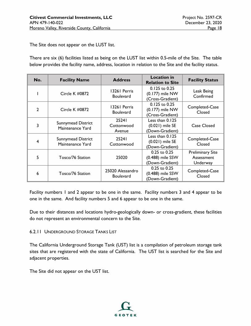
The Site does not appear on the LUST list.
There are six (6) facilities listed as being on the LUST list within 0.5-mile of the Site. The table
below provides the facility name, address, location in relation to the Site and the facility status.
No. Facility Name Address Location in
Relation to Site Facility Status
1 Circle K #0872 13261 Perris Boulevard
0.125 to 0.25 (0.177) mile NW (Cross-Gradient)
Leak Being Confirmed
2 Circle K #0872 13261 Perris Boulevard
0.125 to 0.25 (0.177) mile NW (Cross-Gradient)
Completed-Case Closed
3 Sunnymead District Maintenance Yard
25241 Cottonwood
Avenue
Less than 0.125 (0.021) mile SE
(Down-Gradient) Case Closed
4 Sunnymead District Maintenance Yard
25241 Cottonwood
Less than 0.125 (0.021) mile SE
(Down-Gradient)
Completed-Case Closed
5 Tosco/76 Station 25020 0.25 to 0.25
(0.488) mile SSW (Down-Gradient)
Preliminary Site Assessment Underway
6 Tosco/76 Station 25020 Alessandro
Boulevard
0.25 to 0.25 (0.488) mile SSW (Down-Gradient)
Completed-Case Closed
Facility numbers 1 and 2 appear to be one in the same. Facility numbers 3 and 4 appear to be
one in the same. And facility numbers 5 and 6 appear to be one in the same.
Due to their distances and locations hydro-geologically down- or cross-gradient, these facilities
do not represent an environmental concern to the Site.
6.2.11 UNDERGROUND STORAGE TANKS LIST
The California Underground Storage Tank (UST) list is a compilation of petroleum storage tank
sites that are registered with the state of California. The UST list is searched for the Site and
adjacent properties.
The Site did not appear on the UST list.
Citivest Commercial Investments, LLC Project No. 2597-CR APN 479-140-022 December 23, 2020 Moreno Valley, Riverside County, California Page 19
There are two (2) facilities listed on the UST list. The first facility is listed as Circle K
#2700872, located at 13261 Perris Boulevard. The facility is listed as being located 0.125 to
0.25 (0.177) mile northwest of the Site.
The second facility is listed as County of Riverside Fleet Services, located at 25241
Cottonwood Avenue. The facility is listed as being located less than 0.125 (0.021) mile
southeast of the Site.
The Site does not appear on the HIST UST list.
There is one (1) facility listed on the HIST UST list. The facility is listed as Sunnymead Road
Yard, located at 24241 Cottonwood Avenue. The facility is listed as being located less than
0.125 (0.021) mile southeast of the Site.
None of the facilities are considered an environmental concern to the Site due to their
distances and no reported leaks.
6.2.12 SPILLS, LEAKS, INVESTIGATION AND CLEANUP COST RECOVERY LISTING (SLIC)
The SLIC database is compiled by the CEPA California Regional Water Quality Control Board,
San Ana Region. It is designed to protect and restore water quality from spills, leaks, and
similar discharges. The SLIC is searched for a 0.5-mile distance.
The Site does not appear on the SLIC. There are no SLIC facilities listed within a 0.5-mile
distance of the Site.
6.2.13 STATE INSTITUTIONAL CONTROL/ENGINEERING CONTROL REGISTRIES
The State of California maintains institutional and engineering control databases or registries.
This lists sites with engineering or institutional controls in place. Institutional controls include
administrative measures intended to prevent exposure to contaminants remaining on site.
Engineering controls include various forms of caps, building foundations, liners, and treatment
methods. The State Institutional Control/Engineering Control Registries is searched for the
Site.
The subject Site does not appear on the State Institutional Control/Engineering Control
Registries.
Citivest Commercial Investments, LLC Project No. 2597-CR APN 479-140-022 December 23, 2020 Moreno Valley, Riverside County, California Page 20
6.2.14 TRIBAL DATABASES
Tribal governments are under the jurisdiction of the EPA for environmental concerns.
Currently, the EPA Region 9 publishes LUST and UST information for tribes in Arizona,
California, Hawaii, Nevada, and the Pacific Territories. The LUST database is searched for 0.5
mile, and the UST database is searched for 0.25 mile.
The Site does not appear on the Tribal LUST or UST databases. No facilities were identified on
the Tribal LUST or UST databases within 0.5 mile of the Site.
6.2.15 OTHER DATABASES
EDR compiles information from multiple federal, state, local, and proprietary databases. Most
are secondary or tertiary or redundant. Facilities compiled on these other databases are
evaluated based on the severity of the listing, distance, and location.
The Site does not appear on the environmental database report obtained for this assessment.
One (1) facility located greater than 0.5-mile from the Site appears on the ENVIROSTOR list.
The facility status is listed as “no further action”.
One (1) facility appears on the AST list.
One (1) facility appears on the SCH list.
Four (4) facilities appear on the CERS HAZ WASTE list.
Two (2) facilities appear on the SWEEPS UST list.
Two (2) facilities appear on the CA FID UST list.
Two (2) facilities appear on the CERS TANKS list.
Seven (7) facilities appear on the RCRA NonGen/NLR list.
Three (3) facilities appear on the Cortese list. All three facilities are listed with a status of
“completed-case closed”.
Citivest Commercial Investments, LLC Project No. 2597-CR APN 479-140-022 December 23, 2020 Moreno Valley, Riverside County, California Page 21
Two (2) facilities appear on the HIST CORTESE list.
Based on our review of these listings, these facilities do not represent an environmental
concern to the Site.
6.2.16 DRY CLEANERS
The DRYCLEANERS list is compiled and provided by EDR. The DRYCLEANER database is
searched for a 0.25-mile distance.
The Site does not appear on the DRYCLEANER list.
There is one (1) DRYCLEANER facility listed within 0.25-mile of the Site. The facility is listed
as Dryclean West, Inc., located at 13373 Perris Boulevard. The facility is listed as being located
0.125 to 0.25 (0.131) mile west-northwest of the Site. It is listed as “inactive.” Due to the
facility location and status, this facility is not considered an environmental concern to the Site.
6.2.17 UNMAPPABLE FACILITIES
GEOTEK reviewed the listing of “orphan” or unmappable facilities in the database report.
There is one (1) unmapped facility in the report. Based on the listings provided for the orphan
facility, this facility does not represent a concern to the Site.
6.3 LOCAL REGULATORY AGENCY RECORDS
GEOTEK contacted the City of Moreno Valley Police and Fire Departments regarding
underground or above ground storage tanks, hazardous material permits or business plans,
emergency responses, spills, inspections, or other information of an environmental or
hazardous nature.
Neither of these agencies had any information for the Site.
Citivest Commercial Investments, LLC Project No. 2597-CR APN 479-140-022 December 23, 2020 Moreno Valley, Riverside County, California Page 22
7.0 VAPOR ENCROACHMENT SCREEN
The purpose of a Vapor Encroachment Screen (VES) is to identify, to the extent feasible, if a
Vapor Encroachment Condition (VEC) exists at the Site.
A Vapor Encroachment Screen Report was generated for the Site and Site area utilizing EDR’s
Vapor Encroachment Worksheet. It was determined that there are no historical dry cleaners
or auto stations within 600 feet and/or up gradient from the Site.
It is our opinion that a VEC in not likely to exist at the subject Site. The Vapor Encroachment
Screen report is included in Appendix D.
Citivest Commercial Investments, LLC Project No. 2597-CR APN 479-140-022 December 23, 2020 Moreno Valley, Riverside County, California Page 23
8.0 SITE AND SURROUNDING AREA HISTORY
In order to construct the history of the Site and the surrounding area, GEOTEK reviewed
reasonably ascertainable public documents, including aerial photographs, topographic maps,
building records, city directories, fire insurance maps, and county assessor history records.
8.1 HISTORICAL SITE USAGE
8.1.1 AERIAL PHOTOGRAPH REVIEW
GEOTEK reviewed aerial photographs dated 1938, 1949, 1953, 1959, 1967, 1978, 1985, 1989,
1997, 2002, 2006, 2009, 2012, 2016 and 2018 (see Appendix B).
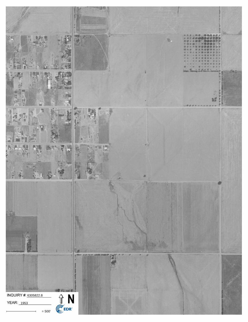
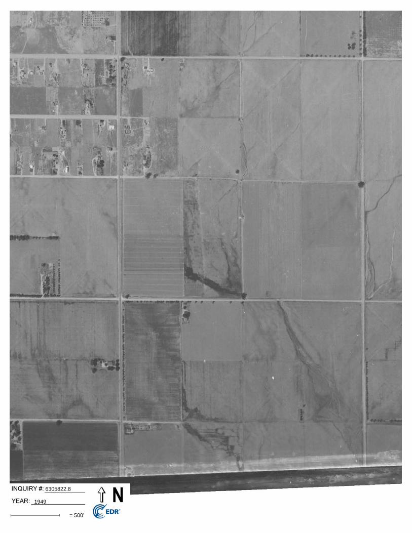
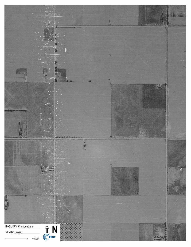
The Site appears to be vacant and undeveloped land in the 1938, 1949, 1953, 1959, 1967, 1978,
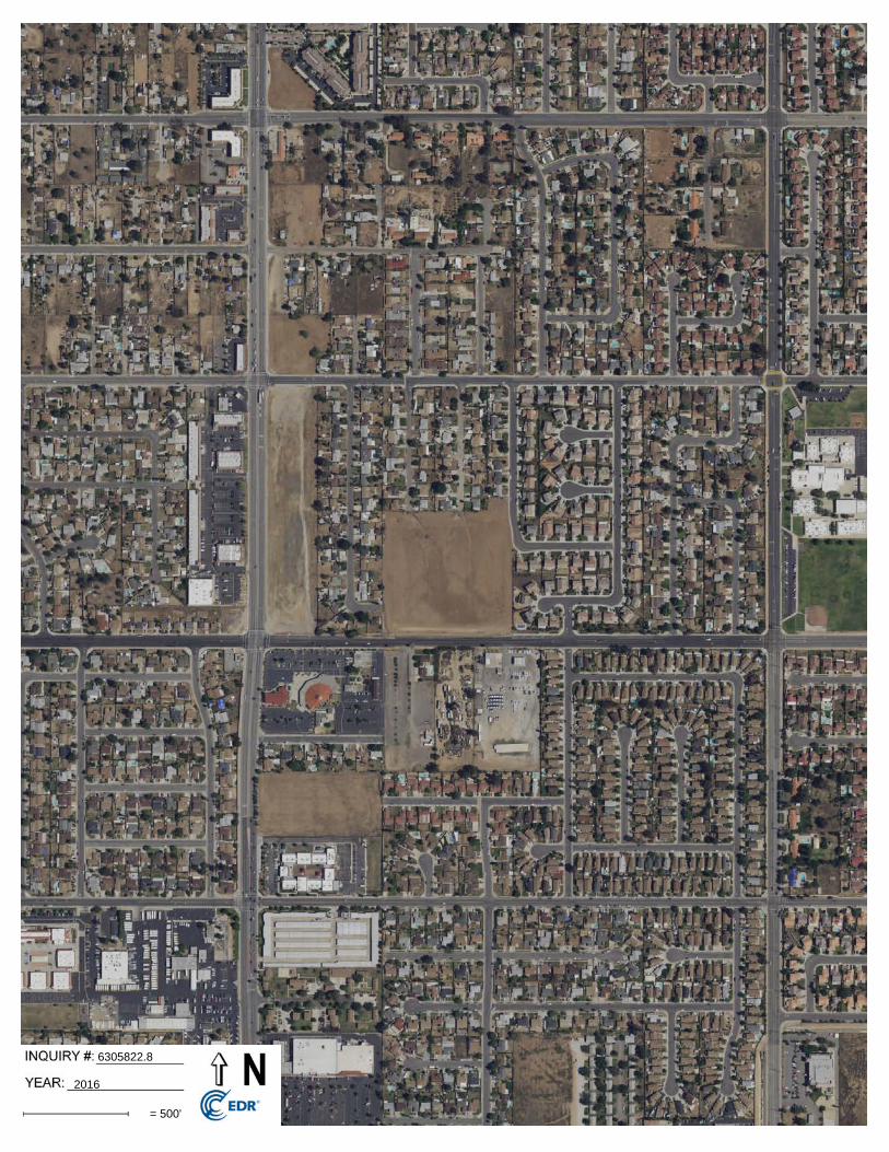
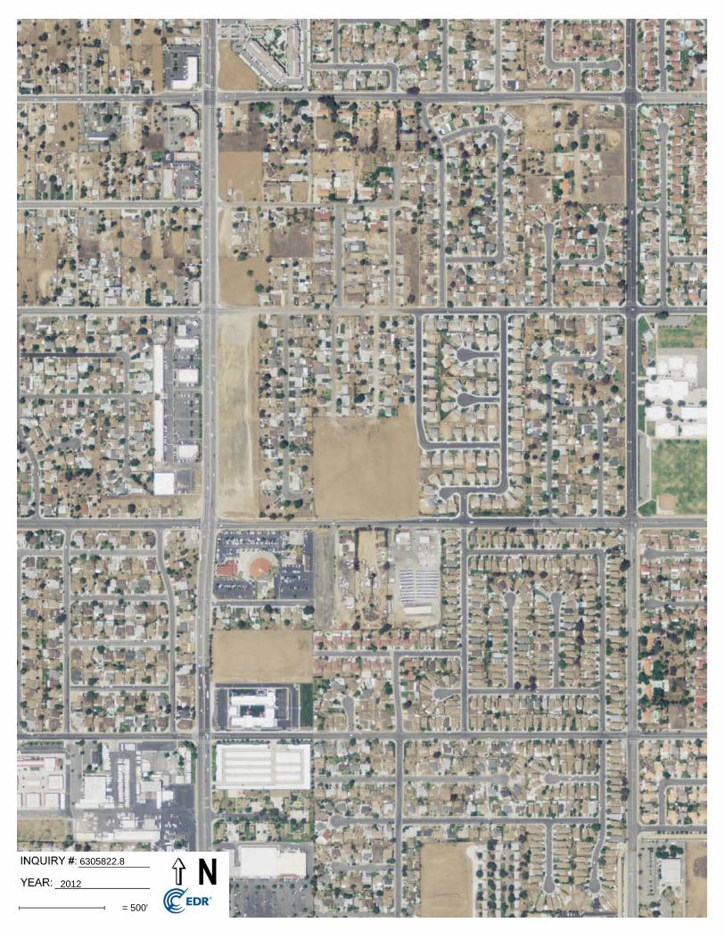
1985, 1989, 1997, 2002, 2006, 2009, 2012, 2016 and 2018 aerial photographs.
A 2018 aerial photograph is utilized for Figure 2 (Appendix A).
8.1.2 TOPOGRAPHIC MAP REVIEW
GEOTEK reviewed the Elsinore Quadrangle (30-minute series), dated 1901; the Perris
Quadrangle (15-minute series), dated 1942; the Perris Quadrangle (15-minute series), dated
1943; the Sunnymead Quadrangle (7.5-minute series), dated 1953; the Sunnymead Quadrangle
(7.5-minute series), dated 1967; the Sunnymead Quadrangle (7.5-minute series), dated 1973;
the Sunnymead Quadrangle (7.5-minute series), dated 1980; and the Sunnymead Quadrangle
(7.5-minute series), dated 2012 (see Appendix B).
The Site appears to be vacant land on the 1901, 1942, 1943, 1953, 1967, 1973 and 1980
topographic map sheets.
The 2012 topographic map sheet shows little detail other than streets in the vicinity.
A 2012 topographic map sheet is utilized for Figure 1 (Appendix A).
8.1.3 BUILDING DEPARTMENT RECORDS
Building department records were not readily obtainable for the Site as no address was
provided; hence, records were not reviewed as part of this assessment.
Citivest Commercial Investments, LLC Project No. 2597-CR APN 479-140-022 December 23, 2020 Moreno Valley, Riverside County, California Page 24
8.1.4 CITY DIRECTORY REVIEW
GEOTEK obtained The EDR – City Directory Image Report, as obtained from and provided by
EDR, and included in Appendix B. A Site address was not provided for this assessment.
8.1.5 SANBORN MAP REVIEW
Sanborn Fire Insurance Maps for the parcel were requested from EDR-Sanborn, which owns
and maintains the largest and most complete collection of the maps. Source sheets were not
available for the Site. The Sanborn Map Report is included in Appendix B.
8.1.6 CHAIN OF TITLE
GEOTEK has not received, nor was authorized to obtain Chain-of-Title documents for the Site. A
preliminary title report was provided but does not include chain of title information.
8.2 HISTORICAL IMMEDIATELY SURROUNDING PROPERTY USAGE
8.2.1 AERIAL PHOTOGRAPH REVIEW
GEOTEK reviewed aerial photographs dated 1938, 1949, 1953, 1959, 1967, 1978, 1985, 1989,
1997, 2002, 2006, 2009, 2012, 2016 and 2018 (see Appendix B).
The surrounding properties to the west, north and east appear to be vacant land in the 1938
and 1949 aerial photographs. A residential structure can be observed to the south of the Site.
The surrounding properties to the north, east and south appear to be vacant land in the 1953
aerial photograph. A few residences can be observed to the west of the Site.
The property to the east of the Site appears to be vacant land in the 1959, 1967, 1978, 1985,
1989, 1997 and 2002 aerial photographs. Residential structures can be observed to the north
and west. Scattered structures can be observed to the south.
Residential structures can be observed to the east of the Site in the 2006 aerial photograph.
The surrounding properties appear similar to the current conditions in the 2009, 2012, 2016
and 2018 aerial photographs.
Citivest Commercial Investments, LLC Project No. 2597-CR APN 479-140-022 December 23, 2020 Moreno Valley, Riverside County, California Page 25
8.2.2 TOPOGRAPHIC MAP REVIEW
GEOTEK reviewed the Elsinore Quadrangle (30-minute series), dated 1901; the Perris
Quadrangle (15-minute series), dated 1942; the Perris Quadrangle (15-minute series), dated
1943; the Sunnymead Quadrangle (7.5-minute series), dated 1953; the Sunnymead Quadrangle
(7.5-minute series), dated 1967; the Sunnymead Quadrangle (7.5-minute series), dated 1973;
the Sunnymead Quadrangle (7.5-minute series), dated 1980; and the Sunnymead Quadrangle
(7.5-minute series), dated 2012 (see Appendix B).
The surrounding properties appear to be vacant land on the 1901 topographic map sheet.
A structure can be observed to the south of the Site on the 1942, 1943 and 1953 topographic
map sheets. The remaining properties appear to be vacant land.
Residential structures can be observed to the north and west of the Site on the 1967, 1973 and
1980 topographic map sheets. The property to the east appears to be vacant land. Two
structures can be observed to the south.
The 2012 maps show little detail other than streets in the vicinity.
The 2012 map is presented as Figure 1 in Appendix A.
8.2.3 CITY DIRECTORIES
GEOTEK has reviewed a City Directory Image report obtained from and provided by EDR for
the Site and surrounding property addresses. The City Directory Image report provides
information on several nearby property addresses. These listings do not appear to be an
environmental concern to the Site. A copy of the City Directory Image report is included in
Appendix B.
8.2.4 SANBORN MAP REVIEW
Sanborn Maps for the Site were requested from EDR-Sanborn, which owns and maintains the
largest and most complete collection of the maps. According to EDR, source sheets were not
available for the property; therefore, it is not likely that source sheets would be available for
the adjoining properties. The Sanborn Map Report is included in Appendix B.
Citivest Commercial Investments, LLC Project No. 2597-CR APN 479-140-022 December 23, 2020 Moreno Valley, Riverside County, California Page 26
8.3 HISTORICAL USE SUMMARY
Based on readily available historic information, the Site has been vacant and undeveloped land
since at least 1938. The surrounding properties appear to historically have been vacant land or
utilized for residential development since at least 1938. The residential development to the
west and north of the Site can be observed in an aerial photograph dated 1959.
Data gaps exist from 1901 to 1938, 1959 to 1967 and 1989 to 1997 due to the limited records
which are reasonably ascertainable in the local area. However, it is our opinion that additional
historic information, if it were to become available, is not likely to change the conclusions or
recommendations of this assessment.
Citivest Commercial Investments, LLC Project No. 2597-CR APN 479-140-022 December 23, 2020 Moreno Valley, Riverside County, California Page 27
9.0 SIGNIFICANT DATA GAPS
No significant data gaps were discovered while performing this Phase I Environmental Site
Assessment. Therefore, it is our opinion that sufficient information was obtained to identify
current Site conditions and past Site usage.
Minor data gaps include:
� Gaps in the historic records from 1901 to 1938, 1959 to 1967 and 1989 to 1997;
� GEOTEK has not received nor reviewed Chain-of-Title documents for the Site.
It is our opinion that additional information, if it were to become available, is not likely to
change the conclusions or recommendations of this assessment.
Citivest Commercial Investments, LLC Project No. 2597-CR APN 479-140-022 December 23, 2020 Moreno Valley, Riverside County, California Page 28
10.0 CONCLUSIONS AND RECOMMENDATIONS
GEOTEK has performed a Phase I Environmental Site Assessment (ESA) for the subject Site in
substantial conformance with the scope and limitations of ASTM E 1527-13 and GEOTEK
Proposal No. P-1203720-CR, dated December 14, 2020. Any exceptions to, or deletions from,
this practice are described in the appropriate sections of this report.
This Phase I Environmental Site Assessment has not revealed evidence of an environmental
condition or concern in connection with the subject Site.
Citivest Commercial Investments, LLC Project No. 2597-CR APN 479-140-022 December 23, 2020 Moreno Valley, Riverside County, California Page 29
11.0 CERTIFICATIONS
I declare that, to the best of my professional knowledge and belief, I meet the definition of
Environmental Professional as defined in 40 CFR 312. I have the specific qualifications based on
education, training, and experience to assess a property of the nature, history, and setting of the
subject Site. I have developed and performed the all appropriate inquiries in conformance with the
standards and practices set forth in 40 CFR 312.
The qualifications of the Project Team are included in Appendix F.
We appreciate this opportunity to be of service. If you have any questions, or if we can be of
further service, please contact us at (951) 710-1160. Sincerely, GEOTEK, INC.
Edward H. LaMont J. Michael Batten, CEM, REPA Principal Geologist, CEG 1892 Environmental Services Manager Exp. 07/31/2022 Registered Environmental Property Assessor No. 113162 Expires 06/15/2021 Anna M. Scott Project Geologist G:\Projects\2551 to 2600\2597CR Citivest Commercial Investments, LLC APNs 479-140-022 Moreno Valley\Phase I ESA\2597CR Phase I Environmental Site Assessment APN 479-140-022.DOC
Citivest Commercial Investments, LLC Project No. 2597-CR APN 479-140-022 December 23, 2020 Moreno Valley, Riverside County, California Page 30
12.0 REFERENCES
CALIFORNIA, STATE OF
� Dibblee, T.W. and Minch, J.A., 2003, “Geologic of the Sunnymead/South ½ of Redlands
Quadrangles, San Bernardino and Riverside Counties, California,” Dibblee Geological
Foundation, Dibblee Foundation Map DF-110, scale 1:24,000
� Water Resources, Department of Hydrologic Data
ENVIRONMENTAL DATA RESOURCES, INC.
� Aerial Photo Decade Package, Inquiry No. 6305822.8 dated December 17, 2020
� Certified Sanborn Map Report, Inquiry No. 6305822.3, dated December 17, 2020
� City Directory Image Report, Inquiry No. 6305822.5, dated December 21, 2020
� Historical Topo Map Report, Inquiry No. 6305822.4, dated December 17, 2020
� Radius Map Report, Inquiry No. 6305822.2s, dated December 17, 2020
� Vapor Encroachment Screen Report, Inquiry No. 6305822.2s, dated December 22, 2020
MORENO VALLEY, CITY OF
� Fire Department, Records Inquiry
� Police Department, Records Inquiry
PACIFIC COAST TITLE COMPANY
� Preliminary Report, Order No. 10126057, dated September 12, 2019
RIVERSIDE, COUNTY OF
� Assessor’s Office, Records Inquiry
U.S. GOVERNMENT
� Drug Enforcement Agency
� Records inquiry, http://www.dea.gov/seizures
� Federal Emergency Management, Agency (FEMA)
CITIVEST COMMERCIAL INVESTMENTS, LLC PROJECT NO. 2597-CR APN 479-140-022 DECEMBER 23, 2020 MORENO VALLEY, RIVERSIDE COUNTY, CALIFORNIA APPENDIX A
APPENDIX A
FIGURES
Citivest Commercial Investments, LLCAPN 479-140-022Moreno Valley, Riverside County, California
Project No. 2597-CR
Figure 1
Site Location and
Topography Map
APPROXIMATE SITE AREA
Modified from USGS Sunnymead 7.5-minute Topographic Map Sheet
Citivest Commercial Investments, LLC APN 479-140-022Moreno Valley, Riverside County, California
GeoTek Project No. 2597-CR
Figure 2
General Site Layout Map
Legend(Locations are approximate)
-Site Photograph22
1-4
5-6
7
8
9
10
11-12
13-15
16-1819-20
21-22
CITIVEST COMMERCIAL INVESTMENTS, LLC PROJECT NO. 2597-CR APN 479-140-022 DECEMBER 23, 2020 MORENO VALLEY, RIVERSIDE COUNTY, CALIFORNIA APPENDIX B
APPENDIX B
SUPPORTING DOCUMENTS
The EDR Aerial Photo Decade Package
APN 479-140-022
Corttonwood Avenue/Perris Boulevard
Moreno Valley, CA 92553
Inquiry Number:
December 17, 2020
6305822.8
6 Armstrong Road, 4th floorShelton, CT 06484Toll Free: 800.352.0050www.edrnet.com
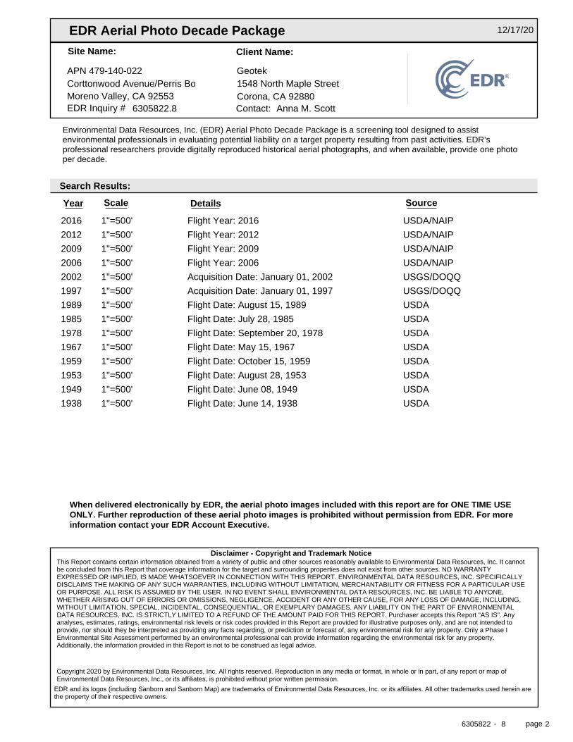
2016 1"=500' Flight Year: 2016 USDA/NAIP
2012 1"=500' Flight Year: 2012 USDA/NAIP
2009 1"=500' Flight Year: 2009 USDA/NAIP
2006 1"=500' Flight Year: 2006 USDA/NAIP
2002 1"=500' Acquisition Date: January 01, 2002 USGS/DOQQ
1997 1"=500' Acquisition Date: January 01, 1997 USGS/DOQQ
1989 1"=500' Flight Date: August 15, 1989 USDA
1985 1"=500' Flight Date: July 28, 1985 USDA
1978 1"=500' Flight Date: September 20, 1978 USDA
1967 1"=500' Flight Date: May 15, 1967 USDA
1959 1"=500' Flight Date: October 15, 1959 USDA
1953 1"=500' Flight Date: August 28, 1953 USDA
1949 1"=500' Flight Date: June 08, 1949 USDA
1938 1"=500' Flight Date: June 14, 1938 USDA
EDR Aerial Photo Decade Package 12/17/20
APN 479-140-022
Site Name: Client Name:
GeotekCorttonwood Avenue/Perris Boulevard 1548 North Maple StreetMoreno Valley, CA 92553 Corona, CA 92880EDR Inquiry # 6305822.8 Contact: Anna M. Scott
Environmental Data Resources, Inc. (EDR) Aerial Photo Decade Package is a screening tool designed to assistenvironmental professionals in evaluating potential liability on a target property resulting from past activities. EDR’sprofessional researchers provide digitally reproduced historical aerial photographs, and when available, provide one photoper decade.
Search Results:
Year Scale Details Source
When delivered electronically by EDR, the aerial photo images included with this report are for ONE TIME USEONLY. Further reproduction of these aerial photo images is prohibited without permission from EDR. For moreinformation contact your EDR Account Executive.
Disclaimer - Copyright and Trademark NoticeThis Report contains certain information obtained from a variety of public and other sources reasonably available to Environmental Data Resources, Inc. It cannotbe concluded from this Report that coverage information for the target and surrounding properties does not exist from other sources. NO WARRANTYEXPRESSED OR IMPLIED, IS MADE WHATSOEVER IN CONNECTION WITH THIS REPORT. ENVIRONMENTAL DATA RESOURCES, INC. SPECIFICALLYDISCLAIMS THE MAKING OF ANY SUCH WARRANTIES, INCLUDING WITHOUT LIMITATION, MERCHANTABILITY OR FITNESS FOR A PARTICULAR USEOR PURPOSE. ALL RISK IS ASSUMED BY THE USER. IN NO EVENT SHALL ENVIRONMENTAL DATA RESOURCES, INC. BE LIABLE TO ANYONE,WHETHER ARISING OUT OF ERRORS OR OMISSIONS, NEGLIGENCE, ACCIDENT OR ANY OTHER CAUSE, FOR ANY LOSS OF DAMAGE, INCLUDING,WITHOUT LIMITATION, SPECIAL, INCIDENTAL, CONSEQUENTIAL, OR EXEMPLARY DAMAGES. ANY LIABILITY ON THE PART OF ENVIRONMENTALDATA RESOURCES, INC. IS STRICTLY LIMITED TO A REFUND OF THE AMOUNT PAID FOR THIS REPORT. Purchaser accepts this Report "AS IS". Anyanalyses, estimates, ratings, environmental risk levels or risk codes provided in this Report are provided for illustrative purposes only, and are not intended toprovide, nor should they be interpreted as providing any facts regarding, or prediction or forecast of, any environmental risk for any property. Only a Phase IEnvironmental Site Assessment performed by an environmental professional can provide information regarding the environmental risk for any property.Additionally, the information provided in this Report is not to be construed as legal advice.
Copyright 2020 by Environmental Data Resources, Inc. All rights reserved. Reproduction in any media or format, in whole or in part, of any report or map ofEnvironmental Data Resources, Inc., or its affiliates, is prohibited without prior written permission.
EDR and its logos (including Sanborn and Sanborn Map) are trademarks of Environmental Data Resources, Inc. or its affiliates. All other trademarks used herein arethe property of their respective owners.
6305822 8- page 2
6305822.8
2016
= 500'
6305822.8
2012
= 500'
6305822.8
2009
= 500'
6305822.8
2006
= 500'
6305822.8
2002
= 500'
6305822.8
1997
= 500'
6305822.8
1989
= 500'
6305822.8
1985
= 500'
6305822.8
1978
= 500'
6305822.8
1967
= 500'
6305822.8
1959
= 500'
6305822.8
1953
= 500'
6305822.8
1949
= 500'
6305822.8
1938
= 500'
Certified Sanborn® Map Report
Inquiry Number:
6 Armstrong Road, 4th floor Shelton, CT 06484Toll Free: 800.352.0050 www.edrnet.com
APN 479-140-022
Corttonwood Avenue/Perris Boulevard
Moreno Valley, CA 92553
December 17, 2020
6305822.3
Certified Sanborn® Map Report
Certified Sanborn Results:
Disclaimer - Copyright and Trademark Notice
EDR and its logos (including Sanborn and Sanborn Map) are trademarks of Environmental Data Resources, Inc. or its affiliates. All other trademarks used herein are the property of their respective owners.
page-
The Sanborn Library includes more than 1.2 millionfire insurance maps from Sanborn, Bromley, Perris &Browne, Hopkins, Barlow and others which trackhistorical property usage in approximately 12,000American cities and towns. Collections searched:
Library of Congress
University Publications of America
EDR Private Collection
The Sanborn Library LLC Since 1866™
Limited Permission To Make Copies
Sanborn® Library search results
Contact:EDR Inquiry #
Site Name: Client Name:
Certification #
PO #
Project
12/17/20
Corttonwood Avenue/Perris BoulevardAPN 479-140-022 Geotek
1548 North Maple StreetMoreno Valley, CA 92553
6305822.3Corona, CA 92880
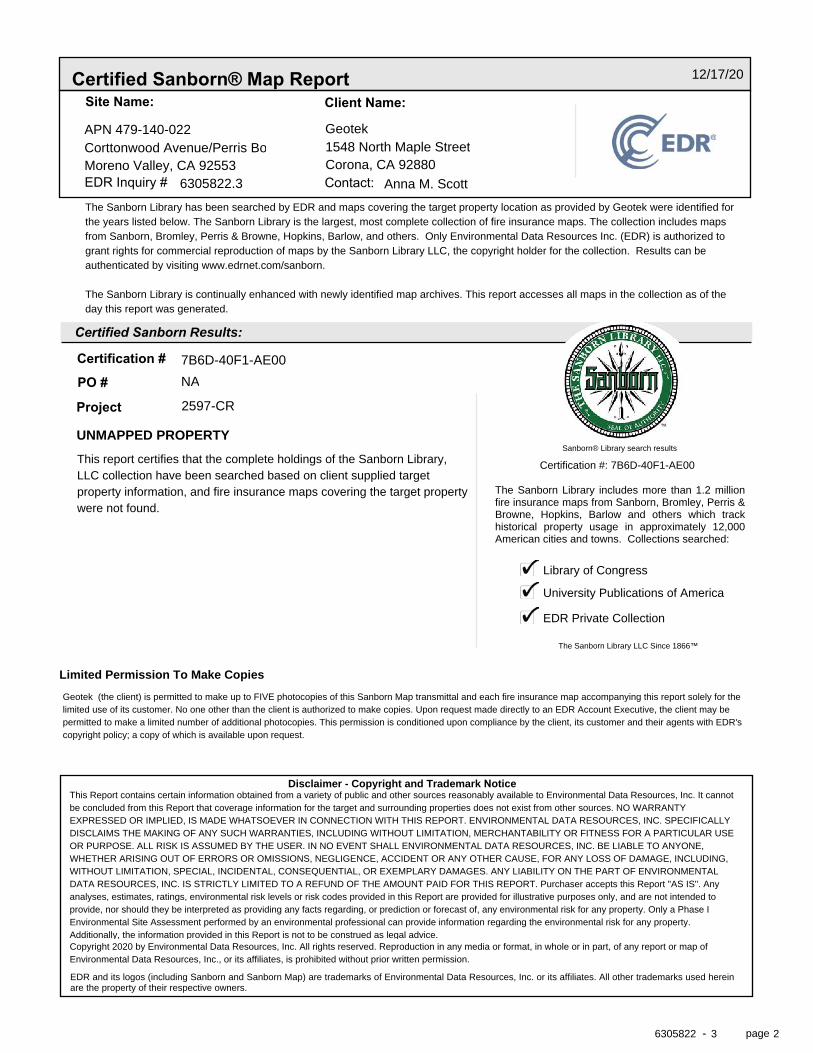
Anna M. ScottThe Sanborn Library has been searched by EDR and maps covering the target property location as provided by Geotek were identified forthe years listed below. The Sanborn Library is the largest, most complete collection of fire insurance maps. The collection includes mapsfrom Sanborn, Bromley, Perris & Browne, Hopkins, Barlow, and others. Only Environmental Data Resources Inc. (EDR) is authorized togrant rights for commercial reproduction of maps by the Sanborn Library LLC, the copyright holder for the collection. Results can beauthenticated by visiting www.edrnet.com/sanborn.
The Sanborn Library is continually enhanced with newly identified map archives. This report accesses all maps in the collection as of theday this report was generated.
7B6D-40F1-AE00NA
UNMAPPED PROPERTY
2597-CR
This report certifies that the complete holdings of the Sanborn Library,LLC collection have been searched based on client supplied targetproperty information, and fire insurance maps covering the target propertywere not found.
Certification #: 7B6D-40F1-AE00
Geotek (the client) is permitted to make up to FIVE photocopies of this Sanborn Map transmittal and each fire insurance map accompanying this report solely for thelimited use of its customer. No one other than the client is authorized to make copies. Upon request made directly to an EDR Account Executive, the client may bepermitted to make a limited number of additional photocopies. This permission is conditioned upon compliance by the client, its customer and their agents with EDR'scopyright policy; a copy of which is available upon request.
This Report contains certain information obtained from a variety of public and other sources reasonably available to Environmental Data Resources, Inc. It cannotbe concluded from this Report that coverage information for the target and surrounding properties does not exist from other sources. NO WARRANTYEXPRESSED OR IMPLIED, IS MADE WHATSOEVER IN CONNECTION WITH THIS REPORT. ENVIRONMENTAL DATA RESOURCES, INC. SPECIFICALLYDISCLAIMS THE MAKING OF ANY SUCH WARRANTIES, INCLUDING WITHOUT LIMITATION, MERCHANTABILITY OR FITNESS FOR A PARTICULAR USEOR PURPOSE. ALL RISK IS ASSUMED BY THE USER. IN NO EVENT SHALL ENVIRONMENTAL DATA RESOURCES, INC. BE LIABLE TO ANYONE,WHETHER ARISING OUT OF ERRORS OR OMISSIONS, NEGLIGENCE, ACCIDENT OR ANY OTHER CAUSE, FOR ANY LOSS OF DAMAGE, INCLUDING,WITHOUT LIMITATION, SPECIAL, INCIDENTAL, CONSEQUENTIAL, OR EXEMPLARY DAMAGES. ANY LIABILITY ON THE PART OF ENVIRONMENTALDATA RESOURCES, INC. IS STRICTLY LIMITED TO A REFUND OF THE AMOUNT PAID FOR THIS REPORT. Purchaser accepts this Report "AS IS". Anyanalyses, estimates, ratings, environmental risk levels or risk codes provided in this Report are provided for illustrative purposes only, and are not intended toprovide, nor should they be interpreted as providing any facts regarding, or prediction or forecast of, any environmental risk for any property. Only a Phase IEnvironmental Site Assessment performed by an environmental professional can provide information regarding the environmental risk for any property.Additionally, the information provided in this Report is not to be construed as legal advice.Copyright 2020 by Environmental Data Resources, Inc. All rights reserved. Reproduction in any media or format, in whole or in part, of any report or map ofEnvironmental Data Resources, Inc., or its affiliates, is prohibited without prior written permission.
6305822 3 2
APN 479-140-022
Corttonwood Avenue-Perris BoulevardMoreno Valley, CA 92553
Inquiry Number: 6305822.5December 21, 2020
The EDR-City Directory Image Report
6 Armstrong RoadShelton, CT 06484800.352.0050www.edrnet.comEnvironmental Data Resources IncEnvironmental Data Resources IncEnvironmental Data Resources IncEnvironmental Data Resources Inc
TABLE OF CONTENTS
SECTION
Executive Summary
Findings
City Directory Images
Thank you for your business. Please contact EDR at 1-800-352-0050
with any questions or comments.
Disclaimer - Copyright and Trademark Notice
This Report contains certain information obtained from a variety of public and other sources reasonably available to Environmental Data Resources, Inc. It cannot be concluded from this Report that coverage information for the target and surrounding properties does not exist from other sources. NO WARRANTY EXPRESSED OR IMPLIED, IS MADE WHATSOEVER IN CONNECTION WITH THIS REPORT. ENVIRONMENTAL DATA RESOURCES, INC. SPECIFICALLY DISCLAIMS THE MAKING OF ANY SUCH WARRANTIES, INCLUDING WITHOUT LIMITATION, MERCHANTABILITY OR FITNESS FOR A PARTICULAR USE OR PURPOSE. ALL RISK IS ASSUMED BY THE USER. IN NO EVENT SHALL ENVIRONMENTAL DATA RESOURCES, INC. BE LIABLE TO ANYONE, WHETHER ARISING OUT OF ERRORS OR OMISSIONS, NEGLIGENCE, ACCIDENT OR ANY OTHER CAUSE, FOR ANY LOSS OR DAMAGE, INCLUDING, WITHOUT LIMITATION, SPECIAL, INCIDENTAL, CONSEQUENTIAL, OR EXEMPLARY DAMAGES. ANY LIABILITY ON THE PART OF ENVIRONMENTAL DATA RESOURCES, INC. IS STRICTLY LIMITED TO A REFUND OF THE AMOUNT PAID FOR THIS REPORT. Purchaser accepts this Report "AS IS". Any analyses, estimates, ratings, environmental risk levels or risk codes provided in this Report are provided for illustrative purposes only, and are not intended to provide, nor should they be interpreted as providing any facts regarding, or prediction orforecast of, any environmental risk for any property. Only a Phase I Environmental Site Assessment performed by an environmental professional can provide information regarding the environmental risk for any property. Additionally, the information provided in this Report is not to be construed as legal advice.
Copyright 2020 by Environmental Data Resources, Inc. All rights reserved. Reproduction in any media or format, in whole or in part, of any report or map of Environmental Data Resources, Inc. or its affiliates is prohibited without prior written permission.
EDR and its logos (including Sanborn and Sanborn Map) are trademarks of Environmental Data Resources, Inc. or its affiliates. All other trademarks used herein are the property of their respective owners.
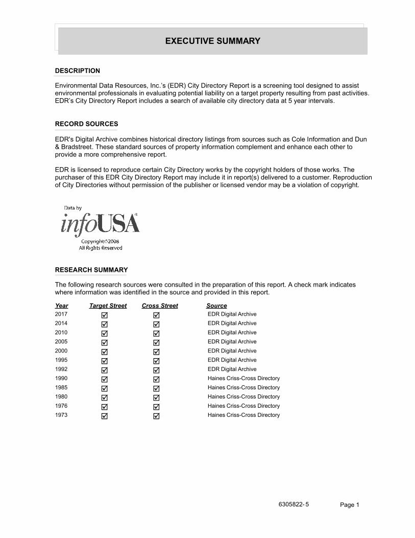
EXECUTIVE SUMMARY
DESCRIPTION
Environmental Data Resources, Inc.’s (EDR) City Directory Report is a screening tool designed to assist environmental professionals in evaluating potential liability on a target property resulting from past activities. EDR’s City Directory Report includes a search of available city directory data at 5 year intervals.
RECORD SOURCES
EDR's Digital Archive combines historical directory listings from sources such as Cole Information and Dun & Bradstreet. These standard sources of property information complement and enhance each other to provide a more comprehensive report.
EDR is licensed to reproduce certain City Directory works by the copyright holders of those works. The purchaser of this EDR City Directory Report may include it in report(s) delivered to a customer. Reproduction of City Directories without permission of the publisher or licensed vendor may be a violation of copyright.
RESEARCH SUMMARY
The following research sources were consulted in the preparation of this report. A check mark indicates where information was identified in the source and provided in this report.
Year Target Street Cross Street Source
2017 EDR Digital Archive
2014 EDR Digital Archive
2010 EDR Digital Archive
2005 EDR Digital Archive
2000 EDR Digital Archive
1995 EDR Digital Archive
1992 EDR Digital Archive
1990 Haines Criss-Cross Directory
1985 Haines Criss-Cross Directory
1980 Haines Criss-Cross Directory
1976 Haines Criss-Cross Directory
1973 Haines Criss-Cross Directory
6305822- 5 Page 1
FINDINGS
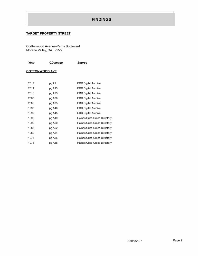
TARGET PROPERTY STREET
Corttonwood Avenue-Perris BoulevardMoreno Valley, CA 92553
Year CD Image Source
COTTONWOOD AVE
2017 pg A2 EDR Digital Archive
2014 pg A13 EDR Digital Archive
2010 pg A23 EDR Digital Archive
2005 pg A30 EDR Digital Archive
2000 pg A35 EDR Digital Archive
1995 pg A40 EDR Digital Archive
1992 pg A45 EDR Digital Archive
1990 pg A49 Haines Criss-Cross Directory
1990 pg A50 Haines Criss-Cross Directory
1985 pg A52 Haines Criss-Cross Directory
1980 pg A54 Haines Criss-Cross Directory
1976 pg A56 Haines Criss-Cross Directory
1973 pg A58 Haines Criss-Cross Directory
6305822- 5 Page 2
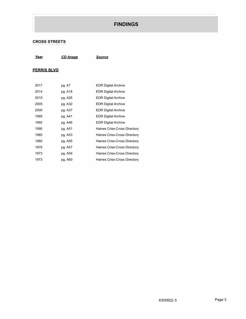
FINDINGS
CROSS STREETS
Year CD Image Source
PERRIS BLVD
2017 pg. A7 EDR Digital Archive
2014 pg. A18 EDR Digital Archive
2010 pg. A26 EDR Digital Archive
2005 pg. A32 EDR Digital Archive
2000 pg. A37 EDR Digital Archive
1995 pg. A41 EDR Digital Archive
1992 pg. A46 EDR Digital Archive
1990 pg. A51 Haines Criss-Cross Directory
1985 pg. A53 Haines Criss-Cross Directory
1980 pg. A55 Haines Criss-Cross Directory
1976 pg. A57 Haines Criss-Cross Directory
1973 pg. A59 Haines Criss-Cross Directory
1973 pg. A60 Haines Criss-Cross Directory
6305822- 5 Page 3
City Directory Images
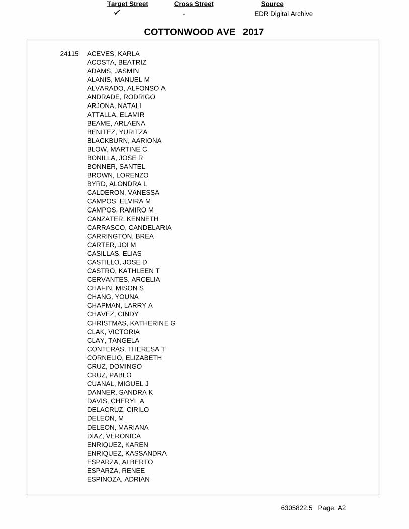
-
COTTONWOOD AVE
EDR Digital Archive
6305822.5 Page: A2
SourceTarget Street Cross Street
2017
24115 ACEVES, KARLAACOSTA, BEATRIZADAMS, JASMINALANIS, MANUEL MALVARADO, ALFONSO AANDRADE, RODRIGOARJONA, NATALIATTALLA, ELAMIRBEAME, ARLAENABENITEZ, YURITZABLACKBURN, AARIONABLOW, MARTINE CBONILLA, JOSE RBONNER, SANTELBROWN, LORENZOBYRD, ALONDRA LCALDERON, VANESSACAMPOS, ELVIRA MCAMPOS, RAMIRO MCANZATER, KENNETHCARRASCO, CANDELARIACARRINGTON, BREACARTER, JOI MCASILLAS, ELIASCASTILLO, JOSE DCASTRO, KATHLEEN TCERVANTES, ARCELIACHAFIN, MISON SCHANG, YOUNACHAPMAN, LARRY ACHAVEZ, CINDYCHRISTMAS, KATHERINE GCLAK, VICTORIACLAY, TANGELACONTERAS, THERESA TCORNELIO, ELIZABETHCRUZ, DOMINGOCRUZ, PABLOCUANAL, MIGUEL JDANNER, SANDRA KDAVIS, CHERYL ADELACRUZ, CIRILODELEON, MDELEON, MARIANADIAZ, VERONICAENRIQUEZ, KARENENRIQUEZ, KASSANDRAESPARZA, ALBERTOESPARZA, RENEEESPINOZA, ADRIAN
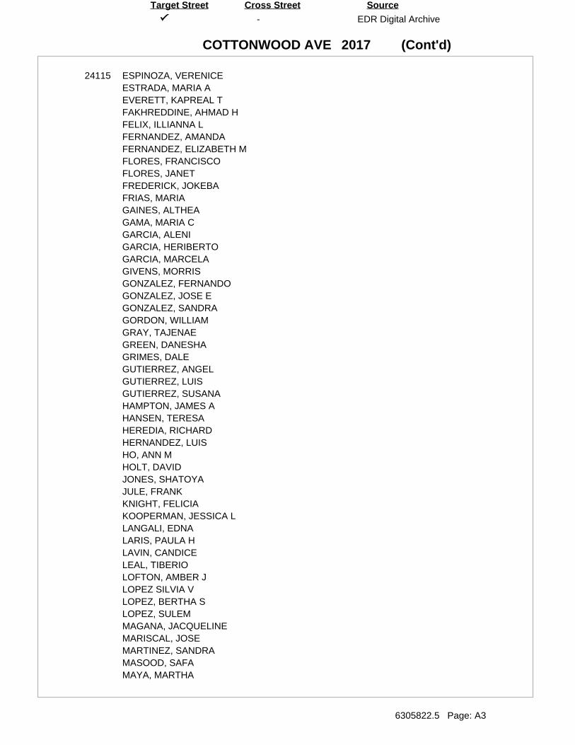
(Cont'd)
-
COTTONWOOD AVE
EDR Digital Archive
6305822.5 Page: A3
SourceTarget Street Cross Street
2017
24115 ESPINOZA, VERENICEESTRADA, MARIA AEVERETT, KAPREAL TFAKHREDDINE, AHMAD HFELIX, ILLIANNA LFERNANDEZ, AMANDAFERNANDEZ, ELIZABETH MFLORES, FRANCISCOFLORES, JANETFREDERICK, JOKEBAFRIAS, MARIAGAINES, ALTHEAGAMA, MARIA CGARCIA, ALENIGARCIA, HERIBERTOGARCIA, MARCELAGIVENS, MORRISGONZALEZ, FERNANDOGONZALEZ, JOSE EGONZALEZ, SANDRAGORDON, WILLIAMGRAY, TAJENAEGREEN, DANESHAGRIMES, DALEGUTIERREZ, ANGELGUTIERREZ, LUISGUTIERREZ, SUSANAHAMPTON, JAMES AHANSEN, TERESAHEREDIA, RICHARDHERNANDEZ, LUISHO, ANN MHOLT, DAVIDJONES, SHATOYAJULE, FRANKKNIGHT, FELICIAKOOPERMAN, JESSICA LLANGALI, EDNALARIS, PAULA HLAVIN, CANDICELEAL, TIBERIOLOFTON, AMBER JLOPEZ SILVIA VLOPEZ, BERTHA SLOPEZ, SULEMMAGANA, JACQUELINEMARISCAL, JOSEMARTINEZ, SANDRAMASOOD, SAFAMAYA, MARTHA
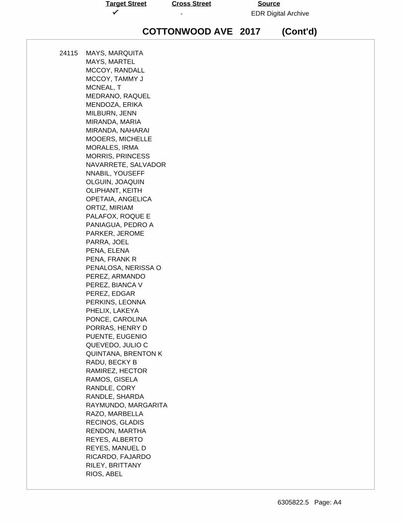
(Cont'd)
-
COTTONWOOD AVE
EDR Digital Archive
6305822.5 Page: A4
SourceTarget Street Cross Street
2017
24115 MAYS, MARQUITAMAYS, MARTELMCCOY, RANDALLMCCOY, TAMMY JMCNEAL, TMEDRANO, RAQUELMENDOZA, ERIKAMILBURN, JENNMIRANDA, MARIAMIRANDA, NAHARAIMOOERS, MICHELLEMORALES, IRMAMORRIS, PRINCESSNAVARRETE, SALVADORNNABIL, YOUSEFFOLGUIN, JOAQUINOLIPHANT, KEITHOPETAIA, ANGELICAORTIZ, MIRIAMPALAFOX, ROQUE EPANIAGUA, PEDRO APARKER, JEROMEPARRA, JOELPENA, ELENAPENA, FRANK RPENALOSA, NERISSA OPEREZ, ARMANDOPEREZ, BIANCA VPEREZ, EDGARPERKINS, LEONNAPHELIX, LAKEYAPONCE, CAROLINAPORRAS, HENRY DPUENTE, EUGENIOQUEVEDO, JULIO CQUINTANA, BRENTON KRADU, BECKY BRAMIREZ, HECTORRAMOS, GISELARANDLE, CORYRANDLE, SHARDARAYMUNDO, MARGARITARAZO, MARBELLARECINOS, GLADISRENDON, MARTHAREYES, ALBERTOREYES, MANUEL DRICARDO, FAJARDORILEY, BRITTANYRIOS, ABEL
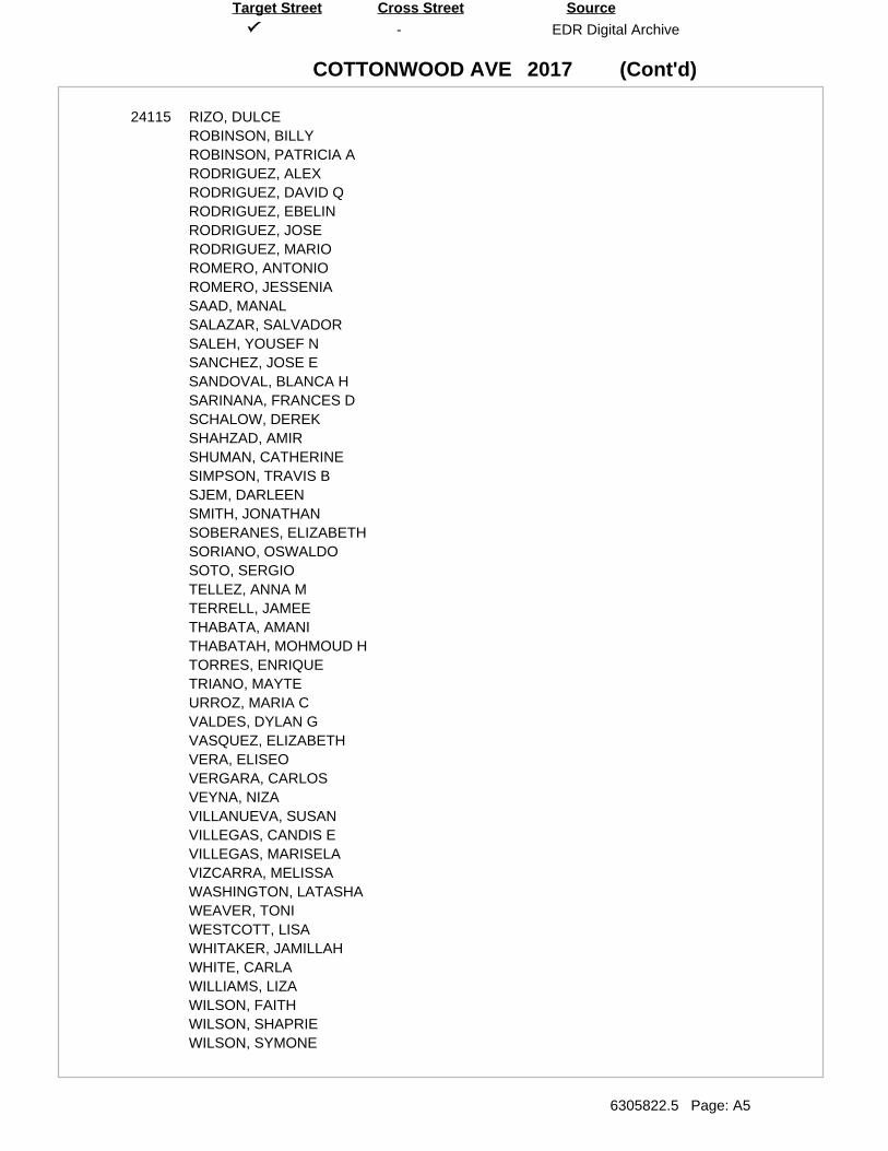
(Cont'd)
-
COTTONWOOD AVE
EDR Digital Archive
6305822.5 Page: A5
SourceTarget Street Cross Street
2017
24115 RIZO, DULCEROBINSON, BILLYROBINSON, PATRICIA ARODRIGUEZ, ALEXRODRIGUEZ, DAVID QRODRIGUEZ, EBELINRODRIGUEZ, JOSERODRIGUEZ, MARIOROMERO, ANTONIOROMERO, JESSENIASAAD, MANALSALAZAR, SALVADORSALEH, YOUSEF NSANCHEZ, JOSE ESANDOVAL, BLANCA HSARINANA, FRANCES DSCHALOW, DEREKSHAHZAD, AMIRSHUMAN, CATHERINESIMPSON, TRAVIS BSJEM, DARLEENSMITH, JONATHANSOBERANES, ELIZABETHSORIANO, OSWALDOSOTO, SERGIOTELLEZ, ANNA MTERRELL, JAMEETHABATA, AMANITHABATAH, MOHMOUD HTORRES, ENRIQUETRIANO, MAYTEURROZ, MARIA CVALDES, DYLAN GVASQUEZ, ELIZABETHVERA, ELISEOVERGARA, CARLOSVEYNA, NIZAVILLANUEVA, SUSANVILLEGAS, CANDIS EVILLEGAS, MARISELAVIZCARRA, MELISSAWASHINGTON, LATASHAWEAVER, TONIWESTCOTT, LISAWHITAKER, JAMILLAHWHITE, CARLAWILLIAMS, LIZAWILSON, FAITHWILSON, SHAPRIEWILSON, SYMONE
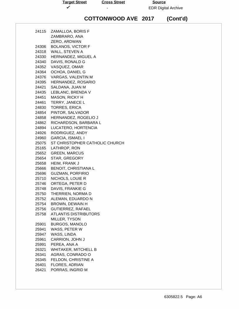
(Cont'd)
-
COTTONWOOD AVE
EDR Digital Archive
6305822.5 Page: A6
SourceTarget Street Cross Street
2017
24115 ZAMALLOA, BORIS FZAMBRARO, ANAZERO, ARDWAN
24306 BOLANOS, VICTOR F24318 WALL, STEVEN A24330 HERNANDEZ, MIGUEL A24340 DAVIS, RONALD G24352 VASQUEZ, OMAR24364 OCHOA, DANIEL G24376 VARGAS, VALENTIN M24395 HERNANDEZ, ROSARIO24421 SALDANA, JUAN M24435 LEBLANC, BRENDA V24451 MASON, RICKY H24461 TERRY, JANECE L24830 TORRES, ERICA24854 PINTOR, SALVADOR24858 HERNANDEZ, ROGELIO J24862 RICHARDSON, BARBARA L24894 LUCATERO, HORTENCIA24926 RODRIGUEZ, ANDY24960 GARCIA, ISMAEL I25075 ST CHRISTOPHER CATHOLIC CHURCH25165 LATHROP, RON25652 GREEN, MARCUS25654 STAR, GREGORY25658 HEIM, FRANK J25666 BENOIT, CHRISTIANA L25696 GUZMAN, PORFIRIO25710 NICHOLS, LOUIE R25746 ORTEGA, PETER D25748 DAVIS, FRANKIE G25750 THERRIEN, NORMA D25752 ALEMAN, EDUARDO N25754 BROWN, DEWAIN H25756 GUTIERREZ, RAFAEL25758 ATLANTIS DISTRIBUTORS
MILLER, TYSON25901 BURGOS, MANOLO25941 WASS, PETER W25947 WASS, LINDA25961 CARRION, JOHN J25991 PEREA, ANA A26321 WHITAKER, MITCHELL B26341 AGRAS, CONRADO O26345 FELDON, CHRISTINE A26401 FLORES, ADRIAN26421 PORRAS, INGRID M
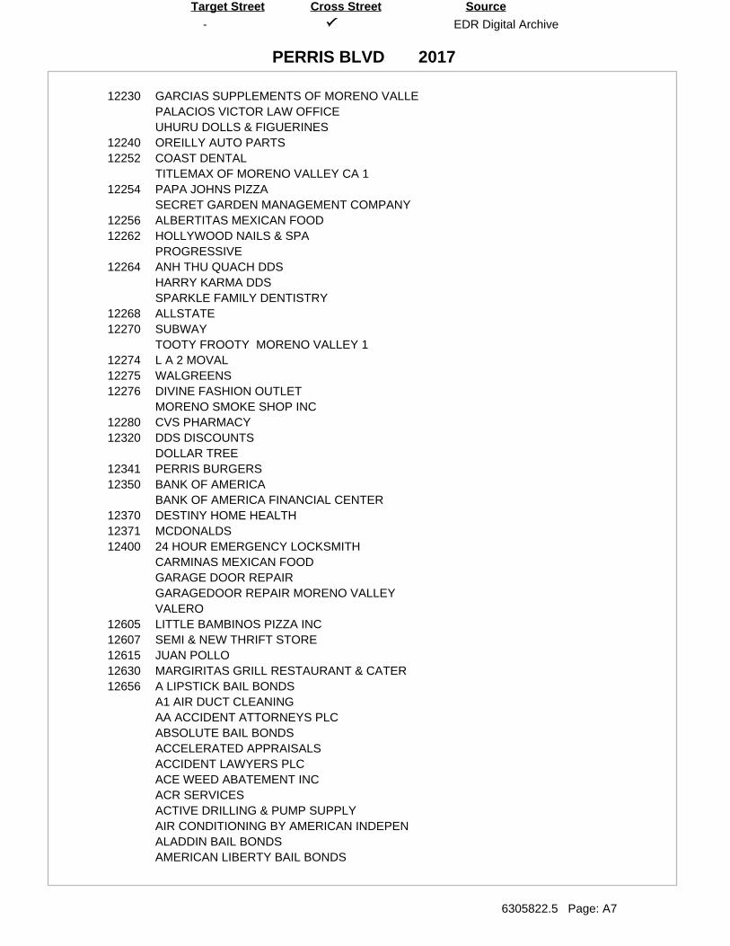
-
PERRIS BLVD
EDR Digital Archive
6305822.5 Page: A7
SourceTarget Street Cross Street
2017
12230 GARCIAS SUPPLEMENTS OF MORENO VALLEPALACIOS VICTOR LAW OFFICEUHURU DOLLS & FIGUERINES
12240 OREILLY AUTO PARTS12252 COAST DENTAL
TITLEMAX OF MORENO VALLEY CA 112254 PAPA JOHNS PIZZA
SECRET GARDEN MANAGEMENT COMPANY12256 ALBERTITAS MEXICAN FOOD12262 HOLLYWOOD NAILS & SPA
PROGRESSIVE12264 ANH THU QUACH DDS
HARRY KARMA DDSSPARKLE FAMILY DENTISTRY
12268 ALLSTATE12270 SUBWAY
TOOTY FROOTY MORENO VALLEY 112274 L A 2 MOVAL12275 WALGREENS12276 DIVINE FASHION OUTLET
MORENO SMOKE SHOP INC12280 CVS PHARMACY12320 DDS DISCOUNTS
DOLLAR TREE12341 PERRIS BURGERS12350 BANK OF AMERICA
BANK OF AMERICA FINANCIAL CENTER12370 DESTINY HOME HEALTH12371 MCDONALDS12400 24 HOUR EMERGENCY LOCKSMITH
CARMINAS MEXICAN FOODGARAGE DOOR REPAIRGARAGEDOOR REPAIR MORENO VALLEYVALERO
12605 LITTLE BAMBINOS PIZZA INC12607 SEMI & NEW THRIFT STORE12615 JUAN POLLO12630 MARGIRITAS GRILL RESTAURANT & CATER12656 A LIPSTICK BAIL BONDS
A1 AIR DUCT CLEANINGAA ACCIDENT ATTORNEYS PLCABSOLUTE BAIL BONDSACCELERATED APPRAISALSACCIDENT LAWYERS PLCACE WEED ABATEMENT INCACR SERVICESACTIVE DRILLING & PUMP SUPPLYAIR CONDITIONING BY AMERICAN INDEPENALADDIN BAIL BONDSAMERICAN LIBERTY BAIL BONDS
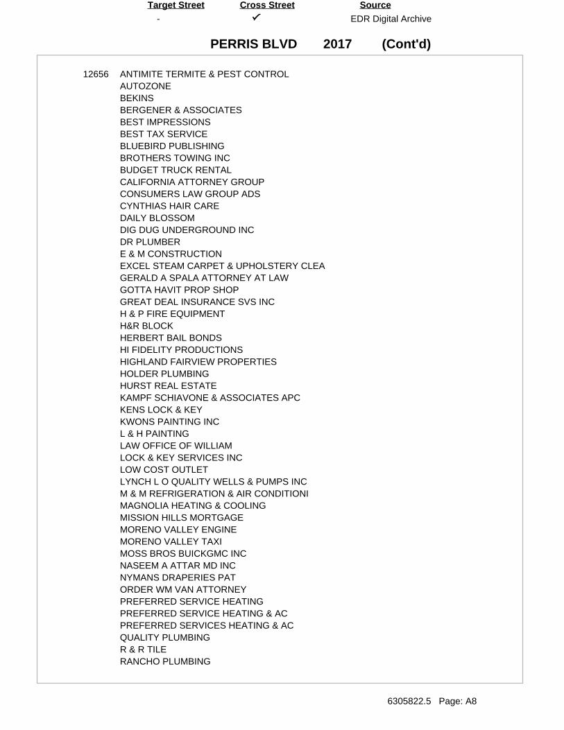
(Cont'd)
-
PERRIS BLVD
EDR Digital Archive
6305822.5 Page: A8
SourceTarget Street Cross Street
2017
12656 ANTIMITE TERMITE & PEST CONTROLAUTOZONEBEKINSBERGENER & ASSOCIATESBEST IMPRESSIONSBEST TAX SERVICEBLUEBIRD PUBLISHINGBROTHERS TOWING INCBUDGET TRUCK RENTALCALIFORNIA ATTORNEY GROUPCONSUMERS LAW GROUP ADSCYNTHIAS HAIR CAREDAILY BLOSSOMDIG DUG UNDERGROUND INCDR PLUMBERE & M CONSTRUCTIONEXCEL STEAM CARPET & UPHOLSTERY CLEAGERALD A SPALA ATTORNEY AT LAWGOTTA HAVIT PROP SHOPGREAT DEAL INSURANCE SVS INCH & P FIRE EQUIPMENTH&R BLOCKHERBERT BAIL BONDSHI FIDELITY PRODUCTIONSHIGHLAND FAIRVIEW PROPERTIESHOLDER PLUMBINGHURST REAL ESTATEKAMPF SCHIAVONE & ASSOCIATES APCKENS LOCK & KEYKWONS PAINTING INCL & H PAINTINGLAW OFFICE OF WILLIAMLOCK & KEY SERVICES INCLOW COST OUTLETLYNCH L O QUALITY WELLS & PUMPS INCM & M REFRIGERATION & AIR CONDITIONIMAGNOLIA HEATING & COOLINGMISSION HILLS MORTGAGEMORENO VALLEY ENGINEMORENO VALLEY TAXIMOSS BROS BUICKGMC INCNASEEM A ATTAR MD INCNYMANS DRAPERIES PATORDER WM VAN ATTORNEYPREFERRED SERVICE HEATINGPREFERRED SERVICE HEATING & ACPREFERRED SERVICES HEATING & ACQUALITY PLUMBINGR & R TILERANCHO PLUMBING
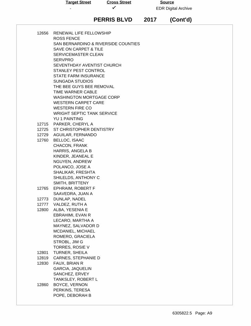
(Cont'd)
-
PERRIS BLVD
EDR Digital Archive
6305822.5 Page: A9
SourceTarget Street Cross Street
2017
12656 RENEWAL LIFE FELLOWSHIPROSS FENCESAN BERNARDINO & RIVERSIDE COUNTIESSAVE ON CARPET & TILESERVICEMASTER CLEANSERVPROSEVENTHDAY AVENTIST CHURCHSTANLEY PEST CONTROLSTATE FARM INSURANCESUNGADA STUDIOSTHE BEE GUYS BEE REMOVALTIME WARNER CABLEWASHINGTON MORTGAGE CORPWESTERN CARPET CAREWESTERN FIRE COWRIGHT SEPTIC TANK SERVICEYU 1 PAINTING
12715 PARKER, CHERYL A12725 ST CHRISTOPHER DENTISTRY12729 AGUILAR, FERNANDO12760 BELLOC, ISAAC
CHACON, FRANKHARRIS, ANGELA BKINDER, JEANEAL ENGUYEN, ANDREWPOLANCO, JOSE ASHALIKAR, FRESHTASHILELDS, ANTHONY CSMITH, BRITTENY
12765 EPHRAIM, ROBERT FSAAVEDRA, JUAN A
12773 DUNLAP, NADEL12777 VALDEZ, RUTH A12800 ALBA, YESENIA E
EBRAHIMI, EVAN RLECARO, MARTHA AMAYNEZ, SALVADOR DMCDANIEL, MICHAELROMERO, GRACIELASTROBL, JIM GTORRES, ROSIE V
12801 TURNER, SHEILA12819 CARNES, STEPHANIE D12830 FAUX, BRIAN R
GARCIA, JAQUELINSANCHEZ, ERVEYTANKSLEY, ROBERT L
12860 BOYCE, VERNONPERKINS, TERESAPOPE, DEBORAH B
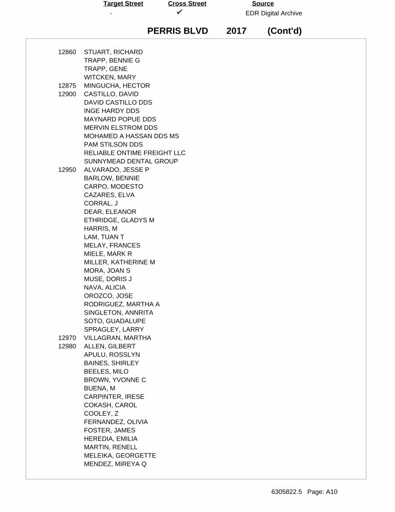
(Cont'd)
-
PERRIS BLVD
EDR Digital Archive
6305822.5 Page: A10
SourceTarget Street Cross Street
2017
12860 STUART, RICHARDTRAPP, BENNIE GTRAPP, GENEWITCKEN, MARY
12875 MINGUCHA, HECTOR12900 CASTILLO, DAVID
DAVID CASTILLO DDSINGE HARDY DDSMAYNARD POPUE DDSMERVIN ELSTROM DDSMOHAMED A HASSAN DDS MSPAM STILSON DDSRELIABLE ONTIME FREIGHT LLCSUNNYMEAD DENTAL GROUP
12950 ALVARADO, JESSE PBARLOW, BENNIECARPO, MODESTOCAZARES, ELVACORRAL, JDEAR, ELEANORETHRIDGE, GLADYS MHARRIS, MLAM, TUAN TMELAY, FRANCESMIELE, MARK RMILLER, KATHERINE MMORA, JOAN SMUSE, DORIS JNAVA, ALICIAOROZCO, JOSERODRIGUEZ, MARTHA ASINGLETON, ANNRITASOTO, GUADALUPESPRAGLEY, LARRY
12970 VILLAGRAN, MARTHA12980 ALLEN, GILBERT
APULU, ROSSLYNBAINES, SHIRLEYBEELES, MILOBROWN, YVONNE CBUENA, MCARPINTER, IRESECOKASH, CAROLCOOLEY, ZFERNANDEZ, OLIVIAFOSTER, JAMESHEREDIA, EMILIAMARTIN, RENELLMELEIKA, GEORGETTEMENDEZ, MIREYA Q
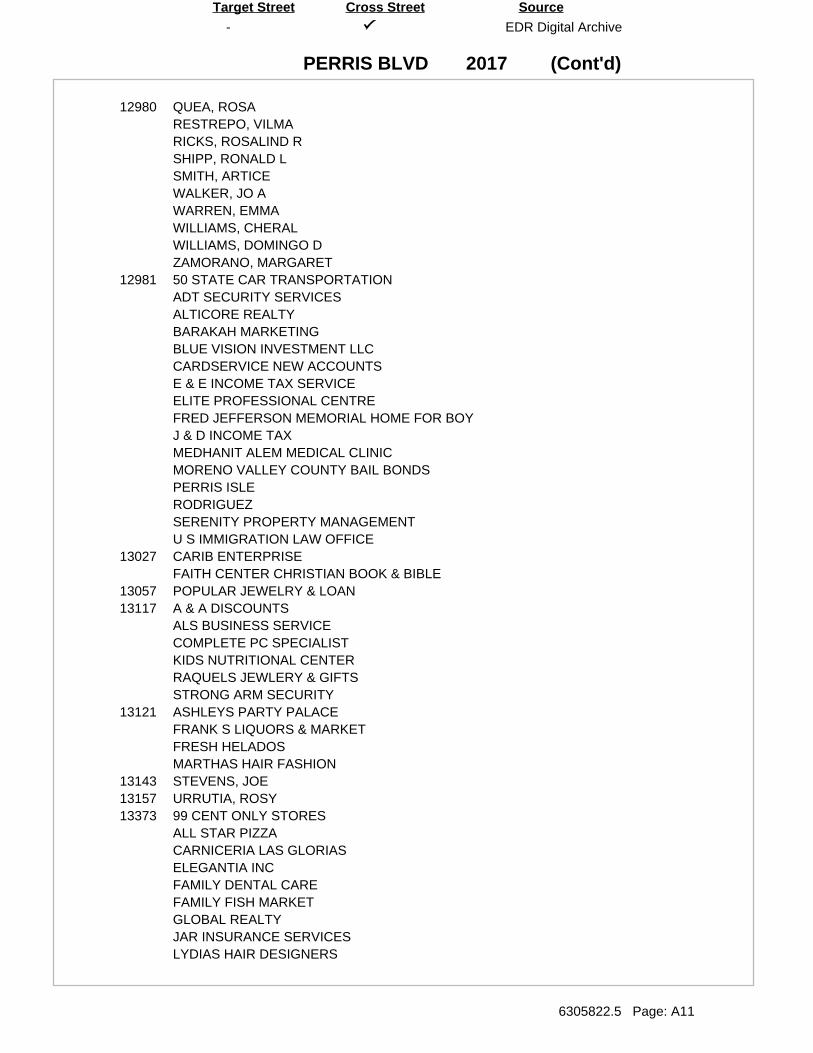
(Cont'd)
-
PERRIS BLVD
EDR Digital Archive
6305822.5 Page: A11
SourceTarget Street Cross Street
2017
12980 QUEA, ROSARESTREPO, VILMARICKS, ROSALIND RSHIPP, RONALD LSMITH, ARTICEWALKER, JO AWARREN, EMMAWILLIAMS, CHERALWILLIAMS, DOMINGO DZAMORANO, MARGARET
12981 50 STATE CAR TRANSPORTATIONADT SECURITY SERVICESALTICORE REALTYBARAKAH MARKETINGBLUE VISION INVESTMENT LLCCARDSERVICE NEW ACCOUNTSE & E INCOME TAX SERVICEELITE PROFESSIONAL CENTREFRED JEFFERSON MEMORIAL HOME FOR BOYJ & D INCOME TAXMEDHANIT ALEM MEDICAL CLINICMORENO VALLEY COUNTY BAIL BONDSPERRIS ISLERODRIGUEZSERENITY PROPERTY MANAGEMENTU S IMMIGRATION LAW OFFICE
13027 CARIB ENTERPRISEFAITH CENTER CHRISTIAN BOOK & BIBLE
13057 POPULAR JEWELRY & LOAN13117 A & A DISCOUNTS
ALS BUSINESS SERVICECOMPLETE PC SPECIALISTKIDS NUTRITIONAL CENTERRAQUELS JEWLERY & GIFTSSTRONG ARM SECURITY
13121 ASHLEYS PARTY PALACEFRANK S LIQUORS & MARKETFRESH HELADOSMARTHAS HAIR FASHION
13143 STEVENS, JOE13157 URRUTIA, ROSY13373 99 CENT ONLY STORES
ALL STAR PIZZACARNICERIA LAS GLORIASELEGANTIA INCFAMILY DENTAL CAREFAMILY FISH MARKETGLOBAL REALTYJAR INSURANCE SERVICESLYDIAS HAIR DESIGNERS
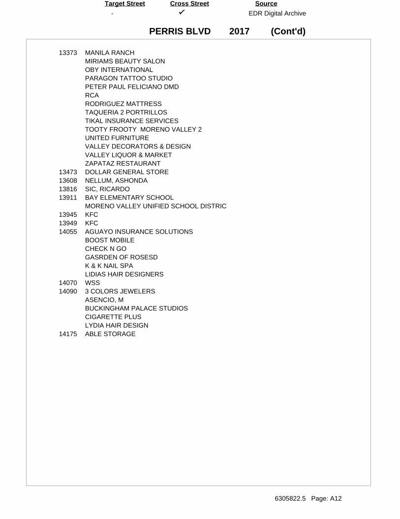
(Cont'd)
-
PERRIS BLVD
EDR Digital Archive
6305822.5 Page: A12
SourceTarget Street Cross Street
2017
13373 MANILA RANCHMIRIAMS BEAUTY SALONOBY INTERNATIONALPARAGON TATTOO STUDIOPETER PAUL FELICIANO DMDRCARODRIGUEZ MATTRESSTAQUERIA 2 PORTRILLOSTIKAL INSURANCE SERVICESTOOTY FROOTY MORENO VALLEY 2UNITED FURNITUREVALLEY DECORATORS & DESIGNVALLEY LIQUOR & MARKETZAPATAZ RESTAURANT
13473 DOLLAR GENERAL STORE13608 NELLUM, ASHONDA13816 SIC, RICARDO13911 BAY ELEMENTARY SCHOOL
MORENO VALLEY UNIFIED SCHOOL DISTRIC13945 KFC13949 KFC14055 AGUAYO INSURANCE SOLUTIONS
BOOST MOBILECHECK N GOGASRDEN OF ROSESDK & K NAIL SPALIDIAS HAIR DESIGNERS
14070 WSS14090 3 COLORS JEWELERS
ASENCIO, MBUCKINGHAM PALACE STUDIOSCIGARETTE PLUSLYDIA HAIR DESIGN
14175 ABLE STORAGE
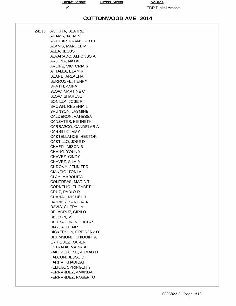
-
COTTONWOOD AVE
EDR Digital Archive
6305822.5 Page: A13
SourceTarget Street Cross Street
2014
24115 ACOSTA, BEATRIZADAMS, JASMINAGUILAR, FRANCISCO JALANIS, MANUEL MALBA, JESUSALVARADO, ALFONSO AARJONA, NATALIARLINE, VICTORIA SATTALLA, ELAMIRBEANE, ARLAENABERROSPE, HENRYBHATTI, AMNABLOW, MARTINE CBLOW, SHARESEBONILLA, JOSE RBROWN, REGENIA LBRUNSON, JASMINECALDERON, VANESSACANZATER, KENNETHCARRASCO, CANDELARIACARRILLO, AMYCASTELLANOS, HECTORCASTILLO, JOSE DCHAFIN, MISON SCHANG, YOUNACHAVEZ, CINDYCHAVEZ, SILVIACHROMY, JENNIFERCIANCIO, TONI ACLAY, MARQUITACONTREAS, MARIA TCORNELIO, ELIZABETHCRUZ, PABLO RCUANAL, MIGUEL JDANNER, SANDRA KDAVIS, CHERYL ADELACRUZ, CIRILODELEON, MDERRAGON, NICHOLASDIAZ, ALDHAIRDICKERSON, GREGORY ODRUMMOND, SHIQUINTAENRIQUEZ, KARENESTRADA, MARIA AFAKHREDDINE, AHMAD HFALCON, JESSE CFARHA, KHADIGAHFELICIA, SPRINGER YFERNANDEZ, AMANDAFERNANDEZ, ROBERTO
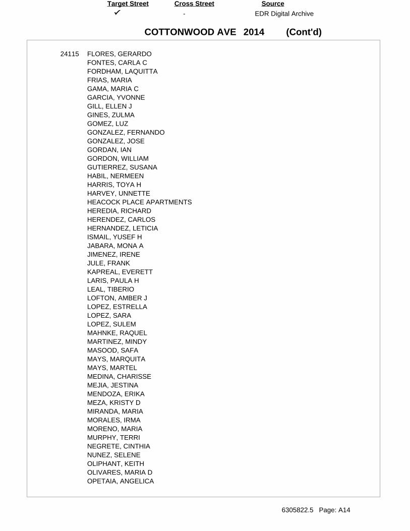
(Cont'd)
-
COTTONWOOD AVE
EDR Digital Archive
6305822.5 Page: A14
SourceTarget Street Cross Street
2014
24115 FLORES, GERARDOFONTES, CARLA CFORDHAM, LAQUITTAFRIAS, MARIAGAMA, MARIA CGARCIA, YVONNEGILL, ELLEN JGINES, ZULMAGOMEZ, LUZGONZALEZ, FERNANDOGONZALEZ, JOSEGORDAN, IANGORDON, WILLIAMGUTIERREZ, SUSANAHABIL, NERMEENHARRIS, TOYA HHARVEY, UNNETTEHEACOCK PLACE APARTMENTSHEREDIA, RICHARDHERENDEZ, CARLOSHERNANDEZ, LETICIAISMAIL, YUSEF HJABARA, MONA AJIMENEZ, IRENEJULE, FRANKKAPREAL, EVERETTLARIS, PAULA HLEAL, TIBERIOLOFTON, AMBER JLOPEZ, ESTRELLALOPEZ, SARALOPEZ, SULEMMAHNKE, RAQUELMARTINEZ, MINDYMASOOD, SAFAMAYS, MARQUITAMAYS, MARTELMEDINA, CHARISSEMEJIA, JESTINAMENDOZA, ERIKAMEZA, KRISTY DMIRANDA, MARIAMORALES, IRMAMORENO, MARIAMURPHY, TERRINEGRETE, CINTHIANUNEZ, SELENEOLIPHANT, KEITHOLIVARES, MARIA DOPETAIA, ANGELICA
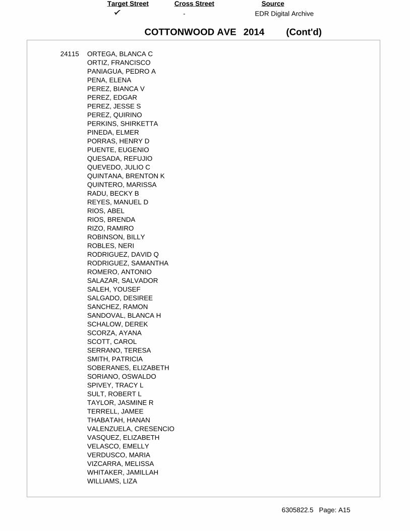
(Cont'd)
-
COTTONWOOD AVE
EDR Digital Archive
6305822.5 Page: A15
SourceTarget Street Cross Street
2014
24115 ORTEGA, BLANCA CORTIZ, FRANCISCOPANIAGUA, PEDRO APENA, ELENAPEREZ, BIANCA VPEREZ, EDGARPEREZ, JESSE SPEREZ, QUIRINOPERKINS, SHIRKETTAPINEDA, ELMERPORRAS, HENRY DPUENTE, EUGENIOQUESADA, REFUJIOQUEVEDO, JULIO CQUINTANA, BRENTON KQUINTERO, MARISSARADU, BECKY BREYES, MANUEL DRIOS, ABELRIOS, BRENDARIZO, RAMIROROBINSON, BILLYROBLES, NERIRODRIGUEZ, DAVID QRODRIGUEZ, SAMANTHAROMERO, ANTONIOSALAZAR, SALVADORSALEH, YOUSEFSALGADO, DESIREESANCHEZ, RAMONSANDOVAL, BLANCA HSCHALOW, DEREKSCORZA, AYANASCOTT, CAROLSERRANO, TERESASMITH, PATRICIASOBERANES, ELIZABETHSORIANO, OSWALDOSPIVEY, TRACY LSULT, ROBERT LTAYLOR, JASMINE RTERRELL, JAMEETHABATAH, HANANVALENZUELA, CRESENCIOVASQUEZ, ELIZABETHVELASCO, EMELLYVERDUSCO, MARIAVIZCARRA, MELISSAWHITAKER, JAMILLAHWILLIAMS, LIZA
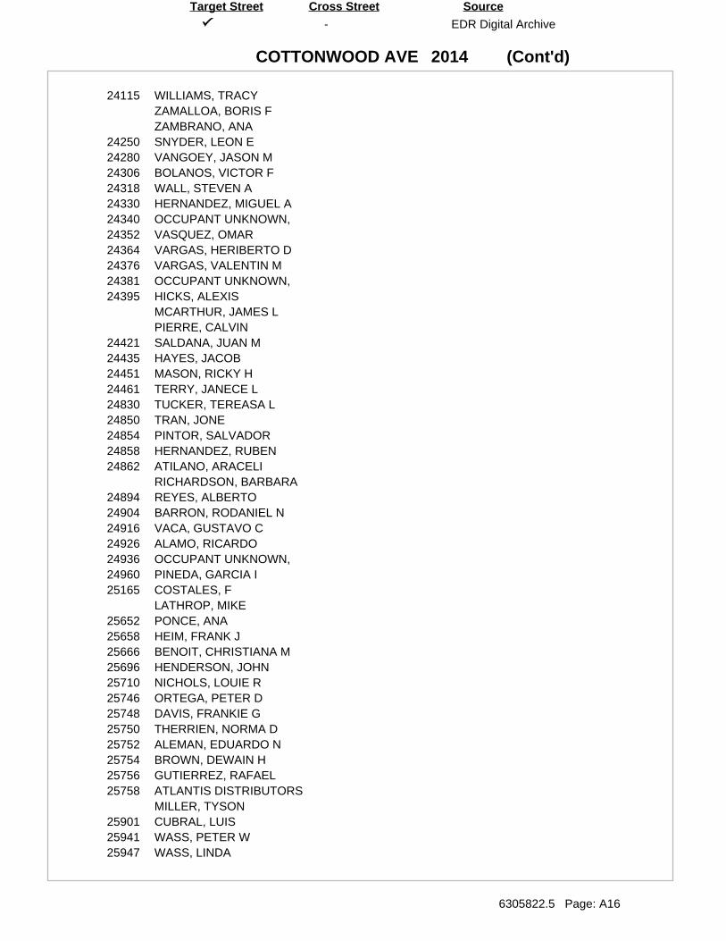
(Cont'd)
-
COTTONWOOD AVE
EDR Digital Archive
6305822.5 Page: A16
SourceTarget Street Cross Street
2014
24115 WILLIAMS, TRACYZAMALLOA, BORIS FZAMBRANO, ANA
24250 SNYDER, LEON E24280 VANGOEY, JASON M24306 BOLANOS, VICTOR F24318 WALL, STEVEN A24330 HERNANDEZ, MIGUEL A24340 OCCUPANT UNKNOWN,24352 VASQUEZ, OMAR24364 VARGAS, HERIBERTO D24376 VARGAS, VALENTIN M24381 OCCUPANT UNKNOWN,24395 HICKS, ALEXIS
MCARTHUR, JAMES LPIERRE, CALVIN
24421 SALDANA, JUAN M24435 HAYES, JACOB24451 MASON, RICKY H24461 TERRY, JANECE L24830 TUCKER, TEREASA L24850 TRAN, JONE24854 PINTOR, SALVADOR24858 HERNANDEZ, RUBEN24862 ATILANO, ARACELI
RICHARDSON, BARBARA24894 REYES, ALBERTO24904 BARRON, RODANIEL N24916 VACA, GUSTAVO C24926 ALAMO, RICARDO24936 OCCUPANT UNKNOWN,24960 PINEDA, GARCIA I25165 COSTALES, F
LATHROP, MIKE25652 PONCE, ANA25658 HEIM, FRANK J25666 BENOIT, CHRISTIANA M25696 HENDERSON, JOHN25710 NICHOLS, LOUIE R25746 ORTEGA, PETER D25748 DAVIS, FRANKIE G25750 THERRIEN, NORMA D25752 ALEMAN, EDUARDO N25754 BROWN, DEWAIN H25756 GUTIERREZ, RAFAEL25758 ATLANTIS DISTRIBUTORS
MILLER, TYSON25901 CUBRAL, LUIS25941 WASS, PETER W25947 WASS, LINDA
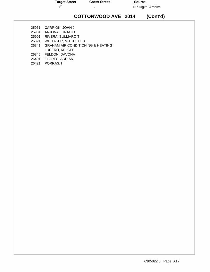
(Cont'd)
-
COTTONWOOD AVE
EDR Digital Archive
6305822.5 Page: A17
SourceTarget Street Cross Street
2014
25961 CARRION, JOHN J25981 ARJONA, IGNACIO25991 RIVERA, BULMARO T26321 WHITAKER, MITCHELL B26341 GRAHAM AIR CONDITIONING & HEATING
LUCERO, KELCEE26345 FELDON, DAVONA26401 FLORES, ADRIAN26421 PORRAS, I
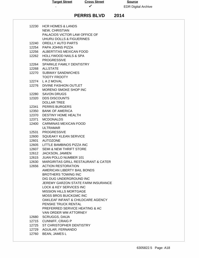
-
PERRIS BLVD
EDR Digital Archive
6305822.5 Page: A18
SourceTarget Street Cross Street
2014
12230 HCR HOMES & LANDSNEW, CHRISTIANPALACIOS VICTOR LAW OFFICE OFUHURU DOLLS & FIGUERINES
12240 OREILLY AUTO PARTS12254 PAPA JOHNS PIZZA12256 ALBERTITAS MEXICAN FOOD12262 HOLLYWOOD NAILS & SPA
PROGRESSIVE12264 SPARKLE FAMILY DENTISTRY12268 ALLSTATE12270 SUBWAY SANDWICHES
TOOTY FROOTY12274 L A 2 MOVAL12276 DIVINE FASHION OUTLET
MORENO SMOKE SHOP INC12280 SAVON DRUGS12320 DDS DISCOUNTS
DOLLAR TREE12341 PERRIS BURGERS12350 BANK OF AMERICA12370 DESTINY HOME HEALTH12371 MCDONALDS12400 CARMINAS MEXICAN FOOD
ULTRAMAR12531 PROGRESSIVE12600 SQUEAKY KLEAN SERVICE12601 AUTOZONE12605 LITTLE BAMBINOS PIZZA INC12607 SEMI & NEW THRIFT STORE12612 JACKSON, JAMIEN12615 JUAN POLLO NUMBER 10112630 MARGIRITAS GRILL RESTAURANT & CATER12656 ACTION RESTORATION
AMERICAN LIBERTY BAIL BONDSBROTHERS TOWING INCDIG DUG UNDERGROUND INCJEREMY GARZON STATE FARM INSURANCELOCK & KEY SERVICES INCMISSION HILLS MORTGAGEMOSS BROS BUICKGMC INCOAKLEAF INFANT & CHILDCARE AGENCYPENSKE TRUCK RENTALPREFERRED SERVICE HEATING & ACVAN ORDER WM ATTORNEY
12680 SCRUGGS, DAIJA12715 CUNNIFF, CRAIG P12725 ST CHRISTOPHER DENTISTRY12729 AGUILAR, FERNANDO12760 BEAN, JAMES L
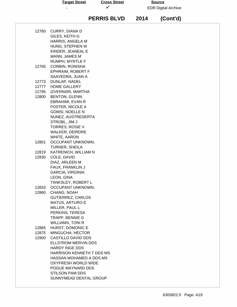
(Cont'd)
-
PERRIS BLVD
EDR Digital Archive
6305822.5 Page: A19
SourceTarget Street Cross Street
2014
12760 CURRY, DIANA DGILES, KEITH GHARRIS, ANGELA MHUNG, STEPHEN WKINDER, JEANEAL EMANN, JAMES MRUMPH, MYRTLE F
12765 CORBIN, RONISHAEPHRAIM, ROBERT FSAAVEDRA, JUAN A
12773 DUNLAP, NADEL12777 HOME GALLERY12795 IZVERNARI, MARTHA12800 BENTON, GLENN
EBRAHIMI, EVAN RFOSTER, NICOLE AGOMSI, NOELLE NNUNEZ, AUSTREDERTASTROBL, JIM JTORRES, ROSIE VWALKER, DEIRDREWHITE, AARON
12801 OCCUPANT UNKNOWN,TURNER, SHEILA
12819 KATRENICH, WILLIAM N12830 COLE, DAVID
DIAZ, ARLEEN MFAUX, FRANKLIN JGARCIA, VIRGINIALEON, GINATANKSLEY, ROBERT L
12833 OCCUPANT UNKNOWN,12860 CHANG, NOAH
GUTIERREZ, CARLOSMATUS, ARTURO EMILLER, PAUL LPERKINS, TERESATRAPP, BENNIE GWILLIAMS, TONI R
12865 HURST, DOMONIC E12875 MINGUCHA, HECTOR12900 CASTILLO DAVID DDS
ELLSTROM MERVIN DDSHARDY INGE DDSHARRISON KENNETH T DDS MSHASSAN MOHAMED A DDS MSOXYFRESH WORLD WIDEPOGUE MAYNARD DDSSTILSON PAM DDSSUNNYMEAD DENTAL GROUP
(Cont'd)
-
PERRIS BLVD
EDR Digital Archive
6305822.5 Page: A20
SourceTarget Street Cross Street
2014
12950 BARLOW, BENNIECASPER, REBECCADEAREVALO, MARGARITA SGOODRICH, ROBERTGRAY, ESTELLAKHALIL, LATIFLAM, TUAN TMCMILLAN, CMEDINA, DANIELMELAY, FRANCESMILLER, BOBBIEMORALES, ROSALIAOROZCO, JOSERIVERA, JOSEROBERSON, JOESADIE, KERRSILVA, DEAREVALO MSIMMONS, JEAN FSINGLETON, ANNRITASMITH, MSOTO, GUADALUPETORRES, AIDA M
12960 ANDERSON, DORIS G12970 ANDERSON, VERNELLE
CHAFIN, LLOYDCHAPRON, CLEVELANDCISNEROS, JUANCORDAZ, HIRMAGASCA, RAFAELGOMEZ, ALBERTOHENDERSON, WILDAJAMES, CAROLYNMOORE, ARLEANA ARUIZ, ROSASIMMONS, JAMESSIMS, SHIRLEYVALENCIA, JAIME OVALENZUELA, ALICIA CVILLAGRAN, MARTHA
12980 ALLEN, GILBERTBEELES, MILOBUENA, LEOCOKASH, CAROLCONLEY, WINIFREDEDDY, VIRGINIAFERNANDEZ, OLIVIAFLORES, ARMANDOFOLKES, ANNIEHERMOSILLO, MAGDLENAHIMES, TANIYSHA
(Cont'd)
-
PERRIS BLVD
EDR Digital Archive
6305822.5 Page: A21
SourceTarget Street Cross Street
2014
12980 LEVIN, SHELDONLOPEZ, CRISTOBALMELEIKA, GEORGETTEMILTON, BERTHAPASKINS, LEANDRAPIERCE, LAKISHAQUEA, ROSARICKS, ROSALINDSERNA, RSHIPP, RONALD LSMITH, ARTICESTOKLEY, WENLIEWARREN, EMMAWILLIAMS, DOMINGO DWILLIAMS, JOHNNIEWINSTON, H
12981 50 STATE CAR TRANSPORTATIONALTICORE REALTYDISCOUNT LEGAL SERVICESE & E INCOME TAX SERVICEFARMERS INSURANCE GROUPFRED JEFFERSON MEMORIAL HOME FOR BOYINLAND EMPIRE TRANSPORTJ & D INCOME TAXLEONHARD MARIA FARMERS INSURANCEMEDHANIT ALEM MEDICAL CLINICREGIONAL SECURITY PATROLRODRIGUEZSERENITY PROPERTY MANAGEMENTUSIMMIGRATION LAW OFFICE
13027 CARIB ENTERPRISEFAITH CENTER CHRISTIAN BOOK & BIBLE
13117 A & A DISCOUNTSCOMPLETE PC SPECIALISTSKIDS NUTRITIONAL CENTERRAQUELS JEWLERY & GIFTSSUN VALLEY REAL ESTATEVANCE, WARREN L
13121 ASHLEYS PARTY PALACECASILLAS, NELIDAFRANK S LIQUORS & MARKETMARTHAS HAIR FASHIONPERRIS INTERNET CAFE
13141 OCCUPANT UNKNOWN,13143 ESCOBEDO, BEATRICE L13151 GOLTRY, A13153 OCCUPANT UNKNOWN,13157 OCCUPANT UNKNOWN,13161 OCCUPANT UNKNOWN,13231 GOODYEAR
(Cont'd)
-
PERRIS BLVD
EDR Digital Archive
6305822.5 Page: A22
SourceTarget Street Cross Street
2014
13373 99 BARGIN MARTA CENTER FOR FAMILY DENTAL CAREALL STAR PIZZACARNICERIA LAS GLORIASCLINICA MEDICA PARA TODOSFAMILY DENTAL CAREFAMILY FISH MARKETFELICIANO PETER PAUL DMDFORMOSA RENTALS LLCGLOBAL REALTYJAR INSURANCE SERVICESLYDIAS HAIR DESIGNERSMANILA RANCHMIRIAMS BEAUTY SALONOBY INTERNATIONALPARAGON TATTOO STUDIORODRIGUEZ MATTRESSTECHTREND INCTIKAL INSURANCE SERVICESTOOTY FROOTYVALLEY DECORATORS & DESIGNVALLEY LIQUOR & MARKETZAPATAZ RESTAURANT
13473 DOLLAR GENERAL STORE13608 BANDA, MAURICIO13620 CASTILLO, ELI13816 SIC, RICARDO13836 OROSZO, JOSE13911 BAY ELEMENTARY
MORENO VALLEY UNIFIED SCHOOL DISTRIC13945 KFC MORENO VALLEY14055 AGUAYO INSURANCE SOLUTIONS
GARDEN OF ROSESGASRDEN OF ROSESDLIDIAS HAIR DESIGNERSLOS AMAYA ELECTRONICA YLOS AMAYA ELECTRONICA Y DISCOT
14070 W S S 5614090 3 COLORS JEWELERS
CIGARETTE PLUS14175 ABLE STORAGE
BUDGET TRUCK RENTAL
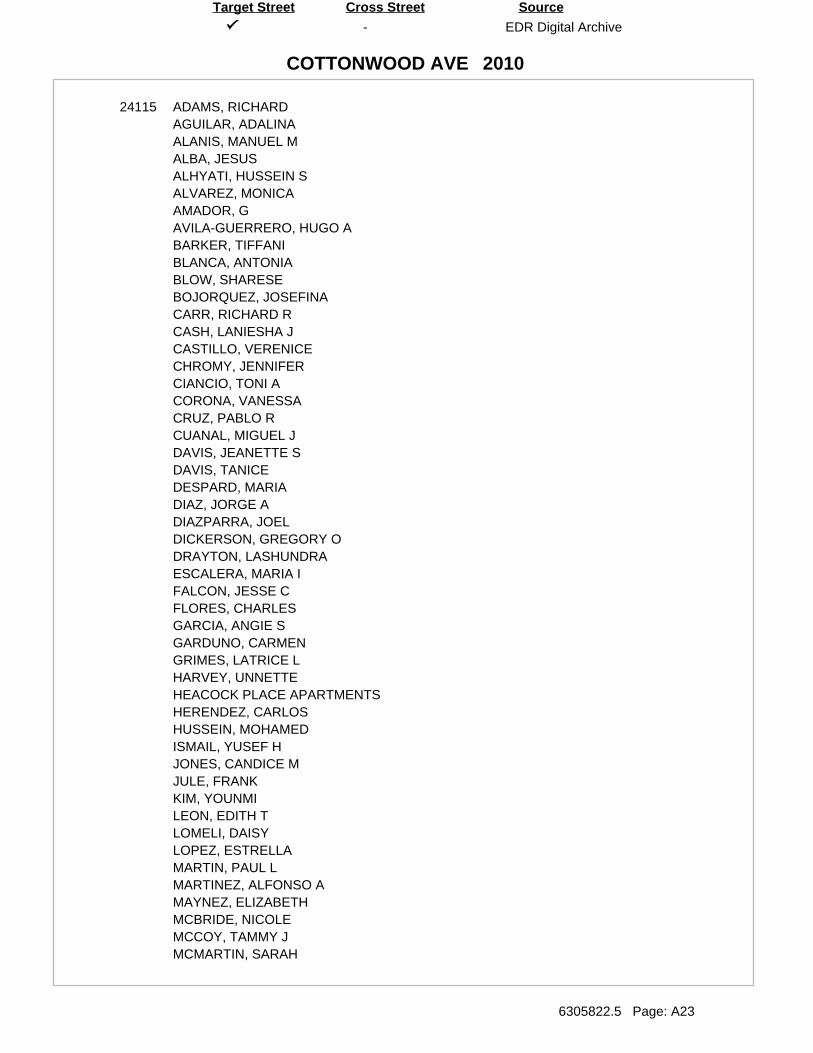
-
COTTONWOOD AVE
EDR Digital Archive
6305822.5 Page: A23
SourceTarget Street Cross Street
2010
24115 ADAMS, RICHARDAGUILAR, ADALINAALANIS, MANUEL MALBA, JESUSALHYATI, HUSSEIN SALVAREZ, MONICAAMADOR, GAVILA-GUERRERO, HUGO ABARKER, TIFFANIBLANCA, ANTONIABLOW, SHARESEBOJORQUEZ, JOSEFINACARR, RICHARD RCASH, LANIESHA JCASTILLO, VERENICECHROMY, JENNIFERCIANCIO, TONI ACORONA, VANESSACRUZ, PABLO RCUANAL, MIGUEL JDAVIS, JEANETTE SDAVIS, TANICEDESPARD, MARIADIAZ, JORGE ADIAZPARRA, JOELDICKERSON, GREGORY ODRAYTON, LASHUNDRAESCALERA, MARIA IFALCON, JESSE CFLORES, CHARLESGARCIA, ANGIE SGARDUNO, CARMENGRIMES, LATRICE LHARVEY, UNNETTEHEACOCK PLACE APARTMENTSHERENDEZ, CARLOSHUSSEIN, MOHAMEDISMAIL, YUSEF HJONES, CANDICE MJULE, FRANKKIM, YOUNMILEON, EDITH TLOMELI, DAISYLOPEZ, ESTRELLAMARTIN, PAUL LMARTINEZ, ALFONSO AMAYNEZ, ELIZABETHMCBRIDE, NICOLEMCCOY, TAMMY JMCMARTIN, SARAH
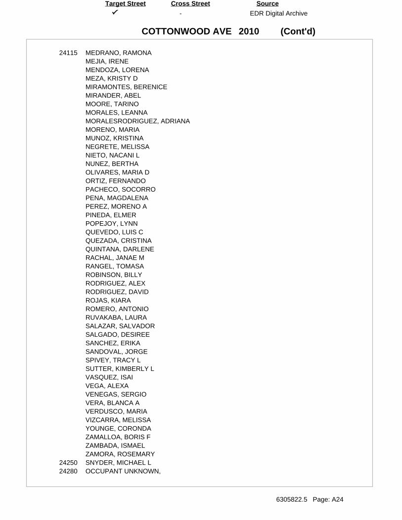
(Cont'd)
-
COTTONWOOD AVE
EDR Digital Archive
6305822.5 Page: A24
SourceTarget Street Cross Street
2010
24115 MEDRANO, RAMONAMEJIA, IRENEMENDOZA, LORENAMEZA, KRISTY DMIRAMONTES, BERENICEMIRANDER, ABELMOORE, TARINOMORALES, LEANNAMORALESRODRIGUEZ, ADRIANAMORENO, MARIAMUNOZ, KRISTINANEGRETE, MELISSANIETO, NACANI LNUNEZ, BERTHAOLIVARES, MARIA DORTIZ, FERNANDOPACHECO, SOCORROPENA, MAGDALENAPEREZ, MORENO APINEDA, ELMERPOPEJOY, LYNNQUEVEDO, LUIS CQUEZADA, CRISTINAQUINTANA, DARLENERACHAL, JANAE MRANGEL, TOMASAROBINSON, BILLYRODRIGUEZ, ALEXRODRIGUEZ, DAVIDROJAS, KIARAROMERO, ANTONIORUVAKABA, LAURASALAZAR, SALVADORSALGADO, DESIREESANCHEZ, ERIKASANDOVAL, JORGESPIVEY, TRACY LSUTTER, KIMBERLY LVASQUEZ, ISAIVEGA, ALEXAVENEGAS, SERGIOVERA, BLANCA AVERDUSCO, MARIAVIZCARRA, MELISSAYOUNGE, CORONDAZAMALLOA, BORIS FZAMBADA, ISMAELZAMORA, ROSEMARY
24250 SNYDER, MICHAEL L24280 OCCUPANT UNKNOWN,
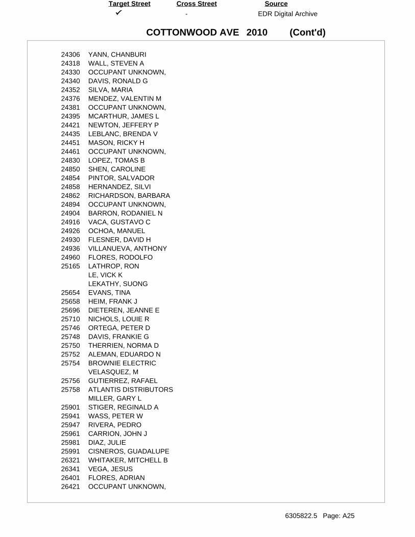
(Cont'd)
-
COTTONWOOD AVE
EDR Digital Archive
6305822.5 Page: A25
SourceTarget Street Cross Street
2010
24306 YANN, CHANBURI24318 WALL, STEVEN A24330 OCCUPANT UNKNOWN,24340 DAVIS, RONALD G24352 SILVA, MARIA24376 MENDEZ, VALENTIN M24381 OCCUPANT UNKNOWN,24395 MCARTHUR, JAMES L24421 NEWTON, JEFFERY P24435 LEBLANC, BRENDA V24451 MASON, RICKY H24461 OCCUPANT UNKNOWN,24830 LOPEZ, TOMAS B24850 SHEN, CAROLINE24854 PINTOR, SALVADOR24858 HERNANDEZ, SILVI24862 RICHARDSON, BARBARA24894 OCCUPANT UNKNOWN,24904 BARRON, RODANIEL N24916 VACA, GUSTAVO C24926 OCHOA, MANUEL24930 FLESNER, DAVID H24936 VILLANUEVA, ANTHONY24960 FLORES, RODOLFO25165 LATHROP, RON
LE, VICK KLEKATHY, SUONG
25654 EVANS, TINA25658 HEIM, FRANK J25696 DIETEREN, JEANNE E25710 NICHOLS, LOUIE R25746 ORTEGA, PETER D25748 DAVIS, FRANKIE G25750 THERRIEN, NORMA D25752 ALEMAN, EDUARDO N25754 BROWNIE ELECTRIC
VELASQUEZ, M25756 GUTIERREZ, RAFAEL25758 ATLANTIS DISTRIBUTORS
MILLER, GARY L25901 STIGER, REGINALD A25941 WASS, PETER W25947 RIVERA, PEDRO25961 CARRION, JOHN J25981 DIAZ, JULIE25991 CISNEROS, GUADALUPE26321 WHITAKER, MITCHELL B26341 VEGA, JESUS26401 FLORES, ADRIAN26421 OCCUPANT UNKNOWN,
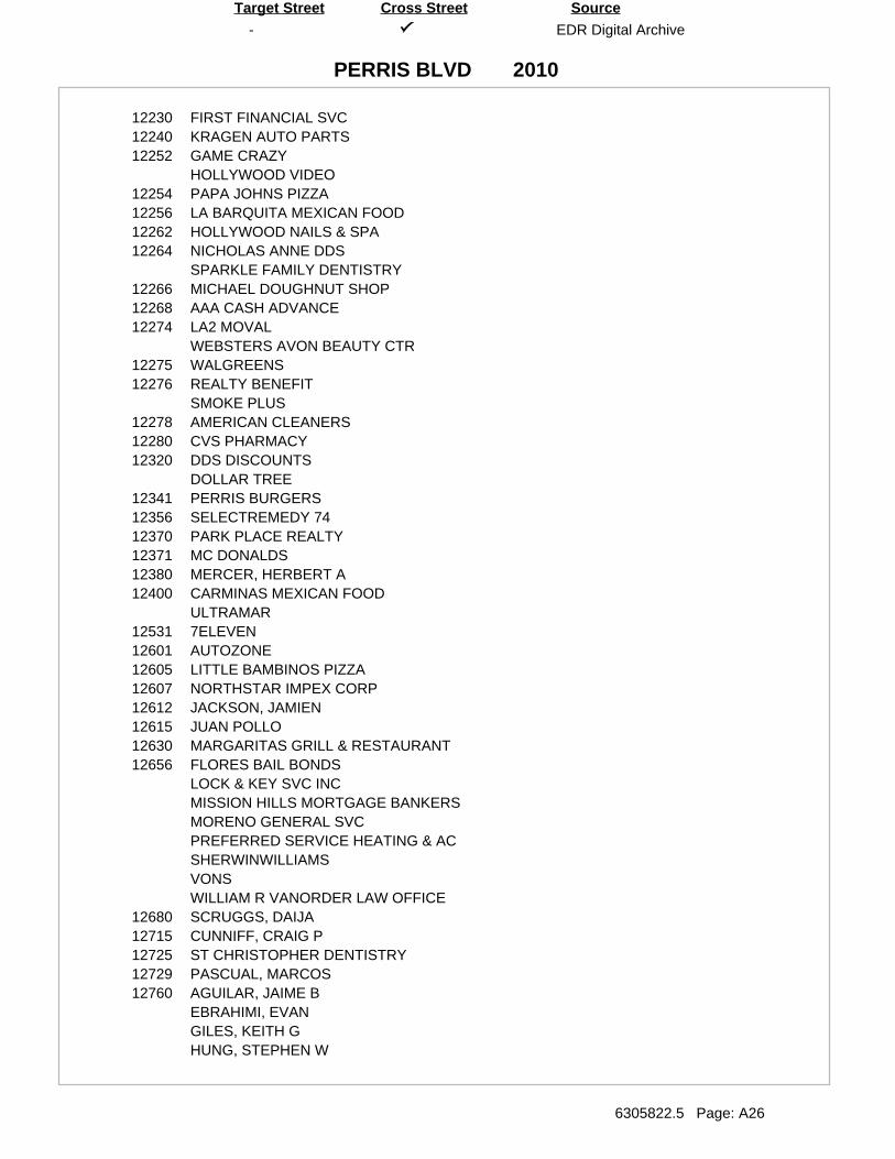
-
PERRIS BLVD
EDR Digital Archive
6305822.5 Page: A26
SourceTarget Street Cross Street
2010
12230 FIRST FINANCIAL SVC12240 KRAGEN AUTO PARTS12252 GAME CRAZY
HOLLYWOOD VIDEO12254 PAPA JOHNS PIZZA12256 LA BARQUITA MEXICAN FOOD12262 HOLLYWOOD NAILS & SPA12264 NICHOLAS ANNE DDS
SPARKLE FAMILY DENTISTRY12266 MICHAEL DOUGHNUT SHOP12268 AAA CASH ADVANCE12274 LA2 MOVAL
WEBSTERS AVON BEAUTY CTR12275 WALGREENS12276 REALTY BENEFIT
SMOKE PLUS12278 AMERICAN CLEANERS12280 CVS PHARMACY12320 DDS DISCOUNTS
DOLLAR TREE12341 PERRIS BURGERS12356 SELECTREMEDY 7412370 PARK PLACE REALTY12371 MC DONALDS12380 MERCER, HERBERT A12400 CARMINAS MEXICAN FOOD
ULTRAMAR12531 7ELEVEN12601 AUTOZONE12605 LITTLE BAMBINOS PIZZA12607 NORTHSTAR IMPEX CORP12612 JACKSON, JAMIEN12615 JUAN POLLO12630 MARGARITAS GRILL & RESTAURANT12656 FLORES BAIL BONDS
LOCK & KEY SVC INCMISSION HILLS MORTGAGE BANKERSMORENO GENERAL SVCPREFERRED SERVICE HEATING & ACSHERWINWILLIAMSVONSWILLIAM R VANORDER LAW OFFICE
12680 SCRUGGS, DAIJA12715 CUNNIFF, CRAIG P12725 ST CHRISTOPHER DENTISTRY12729 PASCUAL, MARCOS12760 AGUILAR, JAIME B
EBRAHIMI, EVANGILES, KEITH GHUNG, STEPHEN W
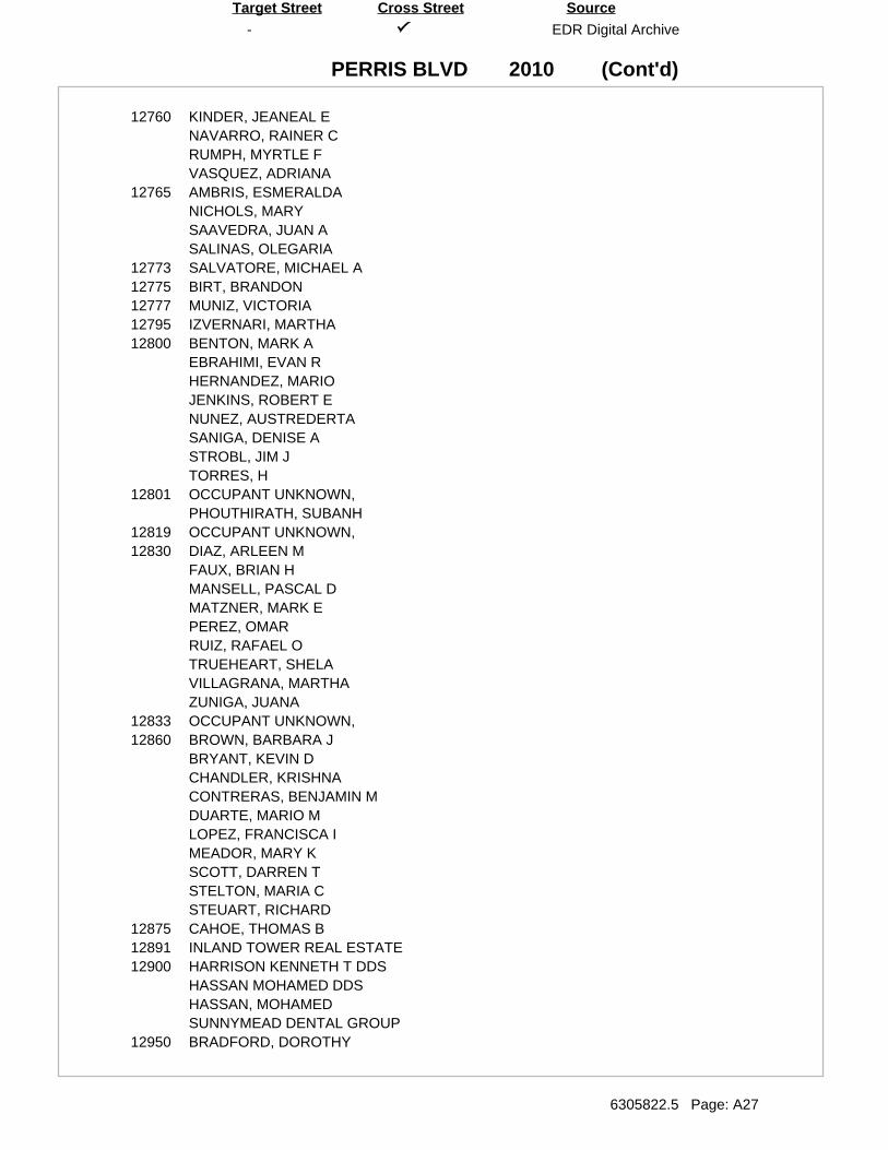
(Cont'd)
-
PERRIS BLVD
EDR Digital Archive
6305822.5 Page: A27
SourceTarget Street Cross Street
2010
12760 KINDER, JEANEAL ENAVARRO, RAINER CRUMPH, MYRTLE FVASQUEZ, ADRIANA
12765 AMBRIS, ESMERALDANICHOLS, MARYSAAVEDRA, JUAN ASALINAS, OLEGARIA
12773 SALVATORE, MICHAEL A12775 BIRT, BRANDON12777 MUNIZ, VICTORIA12795 IZVERNARI, MARTHA12800 BENTON, MARK A
EBRAHIMI, EVAN RHERNANDEZ, MARIOJENKINS, ROBERT ENUNEZ, AUSTREDERTASANIGA, DENISE ASTROBL, JIM JTORRES, H
12801 OCCUPANT UNKNOWN,PHOUTHIRATH, SUBANH
12819 OCCUPANT UNKNOWN,12830 DIAZ, ARLEEN M
FAUX, BRIAN HMANSELL, PASCAL DMATZNER, MARK EPEREZ, OMARRUIZ, RAFAEL OTRUEHEART, SHELAVILLAGRANA, MARTHAZUNIGA, JUANA
12833 OCCUPANT UNKNOWN,12860 BROWN, BARBARA J
BRYANT, KEVIN DCHANDLER, KRISHNACONTRERAS, BENJAMIN MDUARTE, MARIO MLOPEZ, FRANCISCA IMEADOR, MARY KSCOTT, DARREN TSTELTON, MARIA CSTEUART, RICHARD
12875 CAHOE, THOMAS B12891 INLAND TOWER REAL ESTATE12900 HARRISON KENNETH T DDS
HASSAN MOHAMED DDSHASSAN, MOHAMEDSUNNYMEAD DENTAL GROUP
12950 BRADFORD, DOROTHY
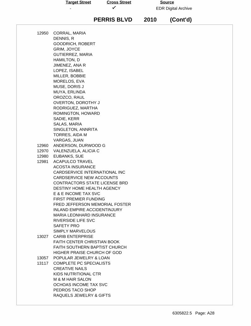
(Cont'd)
-
PERRIS BLVD
EDR Digital Archive
6305822.5 Page: A28
SourceTarget Street Cross Street
2010
12950 CORRAL, MARIADENNIS, RGOODRICH, ROBERTGRIM, JOYCEGUTIERREZ, MARIAHAMILTON, DJIMENEZ, ANA RLOPEZ, ISABELMILLER, BOBBIEMORELOS, EVAMUSE, DORIS JMUYA, ERLINDAOROZCO, RAULOVERTON, DOROTHY JRODRIGUEZ, MARTHAROMINGTON, HOWARDSADIE, KERRSALAS, MARIASINGLETON, ANNRITATORRES, AIDA MVARGAS, JUAN
12960 ANDERSON, DURWOOD G12970 VALENZUELA, ALICIA C12980 EUBANKS, SUE12981 ACAPULCO TRAVEL
ACOSTA INSURANCECARDSERVICE INTERNATIONAL INCCARDSERVICE NEW ACCOUNTSCONTRACTORS STATE LICENSE BRDDESTINY HOME HEALTH AGENCYE & E INCOME TAX SVCFIRST PREMIER FUNDINGFRED JEFFERSON MEMORIAL FOSTERINLAND EMPIRE ACCIDENTINJURYMARIA LEONHARD INSURANCERIVERSIDE LIFE SVCSAFETY PROSIMPLY MARVELOUS
13027 CARIB ENTERPRISEFAITH CENTER CHRISTIAN BOOKFAITH SOUTHERN BAPTIST CHURCHHIGHER PRAISE CHURCH OF GOD
13057 POPULAR JEWELRY & LOAN13117 COMPLETE PC SPECIALISTS
CREATIVE NAILSKIDS NUTRITIONAL CTRM & M HAIR SALONOCHOAS INCOME TAX SVCPEDROS TACO SHOPRAQUELS JEWELRY & GIFTS
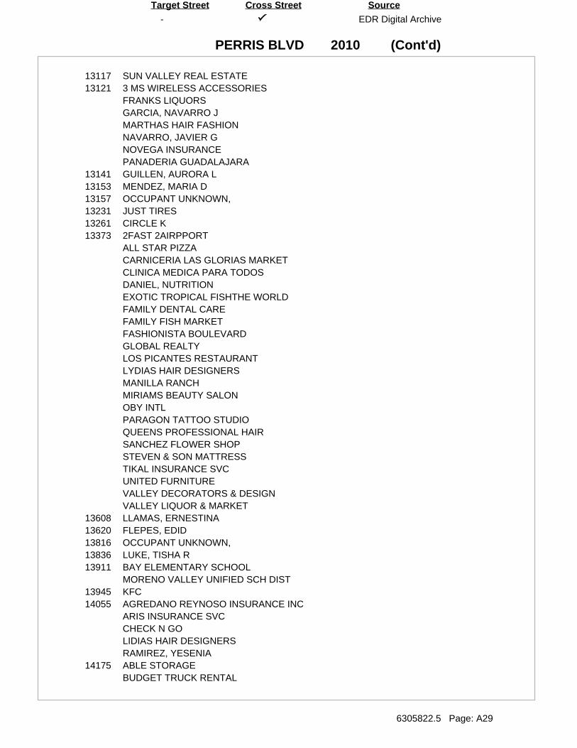
(Cont'd)
-
PERRIS BLVD
EDR Digital Archive
6305822.5 Page: A29
SourceTarget Street Cross Street
2010
13117 SUN VALLEY REAL ESTATE13121 3 MS WIRELESS ACCESSORIES
FRANKS LIQUORSGARCIA, NAVARRO JMARTHAS HAIR FASHIONNAVARRO, JAVIER GNOVEGA INSURANCEPANADERIA GUADALAJARA
13141 GUILLEN, AURORA L13153 MENDEZ, MARIA D13157 OCCUPANT UNKNOWN,13231 JUST TIRES13261 CIRCLE K13373 2FAST 2AIRPPORT
ALL STAR PIZZACARNICERIA LAS GLORIAS MARKETCLINICA MEDICA PARA TODOSDANIEL, NUTRITIONEXOTIC TROPICAL FISHTHE WORLDFAMILY DENTAL CAREFAMILY FISH MARKETFASHIONISTA BOULEVARDGLOBAL REALTYLOS PICANTES RESTAURANTLYDIAS HAIR DESIGNERSMANILLA RANCHMIRIAMS BEAUTY SALONOBY INTLPARAGON TATTOO STUDIOQUEENS PROFESSIONAL HAIRSANCHEZ FLOWER SHOPSTEVEN & SON MATTRESSTIKAL INSURANCE SVCUNITED FURNITUREVALLEY DECORATORS & DESIGNVALLEY LIQUOR & MARKET
13608 LLAMAS, ERNESTINA13620 FLEPES, EDID13816 OCCUPANT UNKNOWN,13836 LUKE, TISHA R13911 BAY ELEMENTARY SCHOOL
MORENO VALLEY UNIFIED SCH DIST13945 KFC14055 AGREDANO REYNOSO INSURANCE INC
ARIS INSURANCE SVCCHECK N GOLIDIAS HAIR DESIGNERSRAMIREZ, YESENIA
14175 ABLE STORAGEBUDGET TRUCK RENTAL
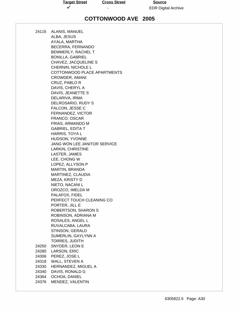
-
COTTONWOOD AVE
EDR Digital Archive
6305822.5 Page: A30
SourceTarget Street Cross Street
2005
24115 ALANIS, MANUELALBA, JESUSAYALA, MARTHABECERRA, FERNANDOBEMMERLY, RACHEL TBONILLA, GABRIELCHAVEZ, JACQUELINE SCHERNIN, NICHOLE LCOTTONWOOD PLACE APARTMENTSCROWDER, AMANICRUZ, PABLO RDAVIS, CHERYL ADAVIS, JEANETTE SDELARIVA, IRMADELROSARIO, RUDY SFALCON, JESSE CFERNANDEZ, VICTORFRANCO, OSCARFRIAS, ARMANDO MGABRIEL, EDITA THARRIS, TOYA LHUDSON, YVONNEJANG WON LEE JANITOR SERVICELARKIN, CHRISTINELASTER, JAMESLEE, CHONG WLOPEZ, ALLYSON PMARTIN, BRANDAMARTINEZ, CLAUDIAMEZA, KRISTY DNIETO, NACANI LOROZCO, IMELDA MPALAFOX, FIDELPERFECT TOUCH CLEANING COPORTER, JILL EROBERTSON, SHARON SROBINSON, ADRIANA MROSALES, ANGEL LRUVALCABA, LAURASTINSON, GERALDSUMERLIN, GAYLYNN ATORRES, JUDITH
24250 SNYDER, LEON E24280 LARSON, ERIC24306 PEREZ, JOSE L24318 WALL, STEVEN A24330 HERNANDEZ, MIGUEL A24340 DAVIS, RONALD G24364 OCHOA, DANIEL24376 MENDEZ, VALENTIN
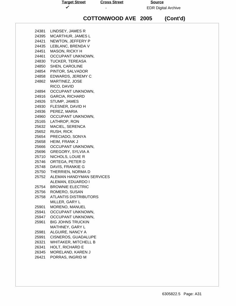
(Cont'd)
-
COTTONWOOD AVE
EDR Digital Archive
6305822.5 Page: A31
SourceTarget Street Cross Street
2005
24381 LINDSEY, JAMES R24395 MCARTHUR, JAMES L24421 NEWTON, JEFFERY P24435 LEBLANC, BRENDA V24451 MASON, RICKY H24461 OCCUPANT UNKNOWN,24830 TUCKER, TEREASA24850 SHEN, CAROLINE24854 PINTOR, SALVADOR24858 EDWARDS, JEREMY C24862 MARTINEZ, JOSE
RICO, DAVID24894 OCCUPANT UNKNOWN,24916 GARCIA, RICHARD24926 STUMP, JAMES24930 FLESNER, DAVID H24936 PEREZ, MARIA24960 OCCUPANT UNKNOWN,25165 LATHROP, RON25632 MACIEL, SERENCA25652 RUSH, RICK25654 PRECIADO, SONYA25658 HEIM, FRANK J25666 OCCUPANT UNKNOWN,25696 GREGORY, SYLVIA A25710 NICHOLS, LOUIE R25746 ORTEGA, PETER D25748 DAVIS, FRANKIE G25750 THERRIEN, NORMA D25752 ALEMAN HANDYMAN SERVICES
ALEMAN, EDUARDO I25754 BROWNIE ELECTRIC25756 ROMERO, SUSAN25758 ATLANTIS DISTRIBUTORS
MILLER, GARY L25901 MORENO, MANUEL25941 OCCUPANT UNKNOWN,25947 OCCUPANT UNKNOWN,25961 BIG JOHNS TRUCKIN
MATHNEY, GARY L25981 ALGUIRE, NANCY A25991 CISNEROS, GUADALUPE26321 WHITAKER, MITCHELL B26341 HOLT, RICHARD E26345 MORELAND, KAREN J26421 PORRAS, INGRID M
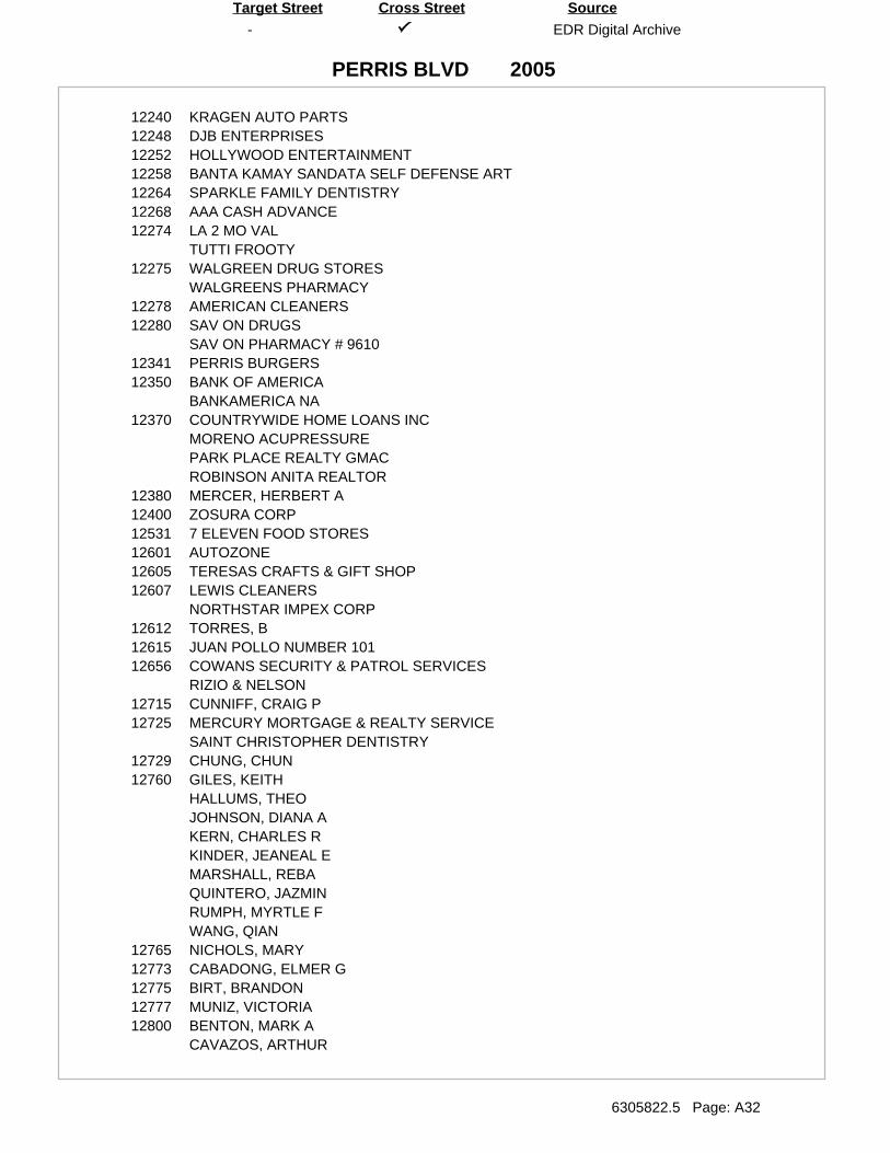
-
PERRIS BLVD
EDR Digital Archive
6305822.5 Page: A32
SourceTarget Street Cross Street
2005
12240 KRAGEN AUTO PARTS12248 DJB ENTERPRISES12252 HOLLYWOOD ENTERTAINMENT12258 BANTA KAMAY SANDATA SELF DEFENSE ART12264 SPARKLE FAMILY DENTISTRY12268 AAA CASH ADVANCE12274 LA 2 MO VAL
TUTTI FROOTY12275 WALGREEN DRUG STORES
WALGREENS PHARMACY12278 AMERICAN CLEANERS12280 SAV ON DRUGS
SAV ON PHARMACY # 961012341 PERRIS BURGERS12350 BANK OF AMERICA
BANKAMERICA NA12370 COUNTRYWIDE HOME LOANS INC
MORENO ACUPRESSUREPARK PLACE REALTY GMACROBINSON ANITA REALTOR
12380 MERCER, HERBERT A12400 ZOSURA CORP12531 7 ELEVEN FOOD STORES12601 AUTOZONE12605 TERESAS CRAFTS & GIFT SHOP12607 LEWIS CLEANERS
NORTHSTAR IMPEX CORP12612 TORRES, B12615 JUAN POLLO NUMBER 10112656 COWANS SECURITY & PATROL SERVICES
RIZIO & NELSON12715 CUNNIFF, CRAIG P12725 MERCURY MORTGAGE & REALTY SERVICE
SAINT CHRISTOPHER DENTISTRY12729 CHUNG, CHUN12760 GILES, KEITH
HALLUMS, THEOJOHNSON, DIANA AKERN, CHARLES RKINDER, JEANEAL EMARSHALL, REBAQUINTERO, JAZMINRUMPH, MYRTLE FWANG, QIAN
12765 NICHOLS, MARY12773 CABADONG, ELMER G12775 BIRT, BRANDON12777 MUNIZ, VICTORIA12800 BENTON, MARK A
CAVAZOS, ARTHUR
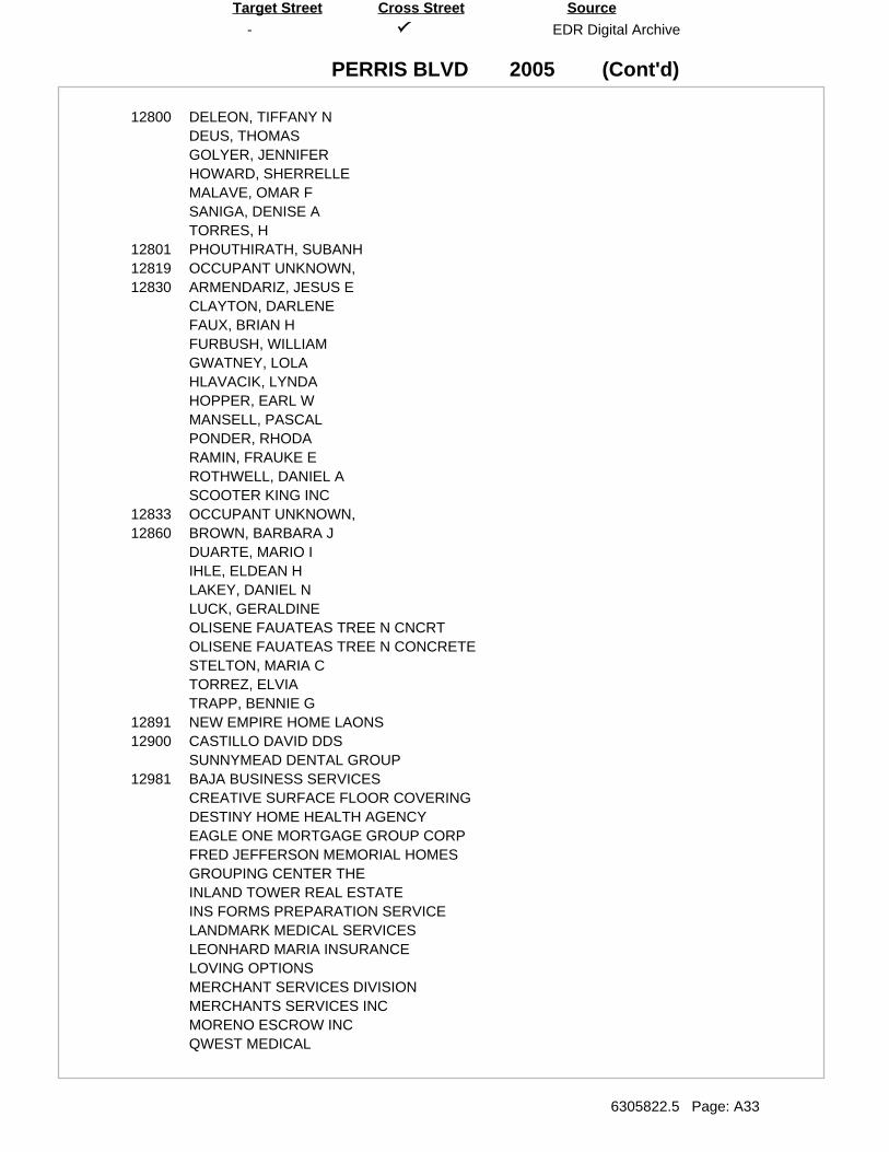
(Cont'd)
-
PERRIS BLVD
EDR Digital Archive
6305822.5 Page: A33
SourceTarget Street Cross Street
2005
12800 DELEON, TIFFANY NDEUS, THOMASGOLYER, JENNIFERHOWARD, SHERRELLEMALAVE, OMAR FSANIGA, DENISE ATORRES, H
12801 PHOUTHIRATH, SUBANH12819 OCCUPANT UNKNOWN,12830 ARMENDARIZ, JESUS E
CLAYTON, DARLENEFAUX, BRIAN HFURBUSH, WILLIAMGWATNEY, LOLAHLAVACIK, LYNDAHOPPER, EARL WMANSELL, PASCALPONDER, RHODARAMIN, FRAUKE EROTHWELL, DANIEL ASCOOTER KING INC
12833 OCCUPANT UNKNOWN,12860 BROWN, BARBARA J
DUARTE, MARIO IIHLE, ELDEAN HLAKEY, DANIEL NLUCK, GERALDINEOLISENE FAUATEAS TREE N CNCRTOLISENE FAUATEAS TREE N CONCRETESTELTON, MARIA CTORREZ, ELVIATRAPP, BENNIE G
12891 NEW EMPIRE HOME LAONS12900 CASTILLO DAVID DDS
SUNNYMEAD DENTAL GROUP12981 BAJA BUSINESS SERVICES
CREATIVE SURFACE FLOOR COVERINGDESTINY HOME HEALTH AGENCYEAGLE ONE MORTGAGE GROUP CORPFRED JEFFERSON MEMORIAL HOMESGROUPING CENTER THEINLAND TOWER REAL ESTATEINS FORMS PREPARATION SERVICELANDMARK MEDICAL SERVICESLEONHARD MARIA INSURANCELOVING OPTIONSMERCHANT SERVICES DIVISIONMERCHANTS SERVICES INCMORENO ESCROW INCQWEST MEDICAL
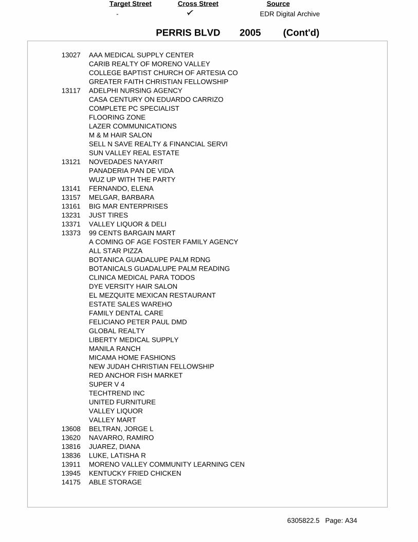
(Cont'd)
-
PERRIS BLVD
EDR Digital Archive
6305822.5 Page: A34
SourceTarget Street Cross Street
2005
13027 AAA MEDICAL SUPPLY CENTERCARIB REALTY OF MORENO VALLEYCOLLEGE BAPTIST CHURCH OF ARTESIA COGREATER FAITH CHRISTIAN FELLOWSHIP
13117 ADELPHI NURSING AGENCYCASA CENTURY ON EDUARDO CARRIZOCOMPLETE PC SPECIALISTFLOORING ZONELAZER COMMUNICATIONSM & M HAIR SALONSELL N SAVE REALTY & FINANCIAL SERVISUN VALLEY REAL ESTATE
13121 NOVEDADES NAYARITPANADERIA PAN DE VIDAWUZ UP WITH THE PARTY
13141 FERNANDO, ELENA13157 MELGAR, BARBARA13161 BIG MAR ENTERPRISES13231 JUST TIRES13371 VALLEY LIQUOR & DELI13373 99 CENTS BARGAIN MART
A COMING OF AGE FOSTER FAMILY AGENCYALL STAR PIZZABOTANICA GUADALUPE PALM RDNGBOTANICALS GUADALUPE PALM READINGCLINICA MEDICAL PARA TODOSDYE VERSITY HAIR SALONEL MEZQUITE MEXICAN RESTAURANTESTATE SALES WAREHOFAMILY DENTAL CAREFELICIANO PETER PAUL DMDGLOBAL REALTYLIBERTY MEDICAL SUPPLYMANILA RANCHMICAMA HOME FASHIONSNEW JUDAH CHRISTIAN FELLOWSHIPRED ANCHOR FISH MARKETSUPER V 4TECHTREND INCUNITED FURNITUREVALLEY LIQUORVALLEY MART
13608 BELTRAN, JORGE L13620 NAVARRO, RAMIRO13816 JUAREZ, DIANA13836 LUKE, LATISHA R13911 MORENO VALLEY COMMUNITY LEARNING CEN13945 KENTUCKY FRIED CHICKEN14175 ABLE STORAGE
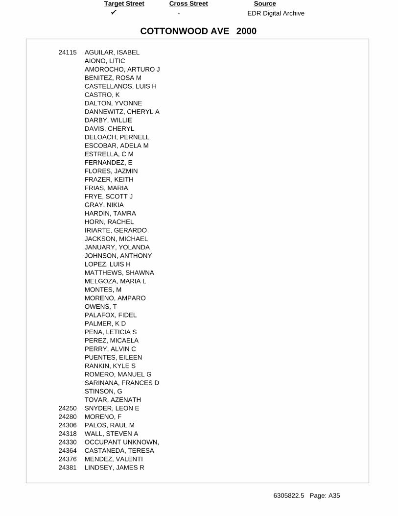
-
COTTONWOOD AVE
EDR Digital Archive
6305822.5 Page: A35
SourceTarget Street Cross Street
2000
24115 AGUILAR, ISABELAIONO, LITICAMOROCHO, ARTURO JBENITEZ, ROSA MCASTELLANOS, LUIS HCASTRO, KDALTON, YVONNEDANNEWITZ, CHERYL ADARBY, WILLIEDAVIS, CHERYLDELOACH, PERNELLESCOBAR, ADELA MESTRELLA, C MFERNANDEZ, EFLORES, JAZMINFRAZER, KEITHFRIAS, MARIAFRYE, SCOTT JGRAY, NIKIAHARDIN, TAMRAHORN, RACHELIRIARTE, GERARDOJACKSON, MICHAELJANUARY, YOLANDAJOHNSON, ANTHONYLOPEZ, LUIS HMATTHEWS, SHAWNAMELGOZA, MARIA LMONTES, MMORENO, AMPAROOWENS, TPALAFOX, FIDELPALMER, K DPENA, LETICIA SPEREZ, MICAELAPERRY, ALVIN CPUENTES, EILEENRANKIN, KYLE SROMERO, MANUEL GSARINANA, FRANCES DSTINSON, GTOVAR, AZENATH
24250 SNYDER, LEON E24280 MORENO, F24306 PALOS, RAUL M24318 WALL, STEVEN A24330 OCCUPANT UNKNOWN,24364 CASTANEDA, TERESA24376 MENDEZ, VALENTI24381 LINDSEY, JAMES R
(Cont'd)
-
COTTONWOOD AVE
EDR Digital Archive
6305822.5 Page: A36
SourceTarget Street Cross Street
2000
24395 FARIAS, JANETTE E24415 SOUKSANTI, RISS24421 OCCUPANT UNKNOWN,24435 LEBLANC, BRENDA V24451 BARNETT, ROBERT E24830 TUCKER, MICHAEL24850 SHEN, C24854 TEMORES, JOSE24862 OCCUPANT UNKNOWN,24916 GRCIA, RICHARD24926 MERCADO, PAULA24930 UY, SAY25165 LATHROP, RON
MCCALLUM, MARY25652 STEVENSON, JEAN25658 OCCUPANT UNKNOWN,25666 BENOIT, ALLEN W25696 OCCUPANT UNKNOWN,25710 NICHOLS, LOUIE R25746 ORTEGA, PETER D25752 ALEMAN, EDUARDO25754 BROWN, DEWAIN H25758 ATLANTIS DISTRIBUTORS
MILLER, GARY25961 MATHNEY, GARY25981 ALGUIRE, NANCY A25991 LINDSEY, K26321 WHITAKER, M26341 GREEN, NANCY
HOLT, RICHARD26345 OCCUPANT UNKNOWN,26401 CEASER, J J26421 ALLEN, JOSEPH K
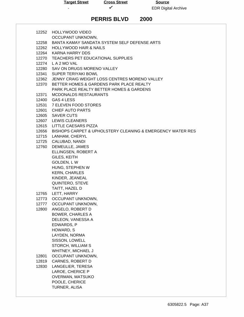
-
PERRIS BLVD
EDR Digital Archive
6305822.5 Page: A37
SourceTarget Street Cross Street
2000
12252 HOLLYWOOD VIDEOOCCUPANT UNKNOWN,
12258 BANTA KAMAY SANDATA SYSTEM SELF DEFENSE ARTS12262 HOLLYWOOD HAIR & NAILS12264 KARNA HARRY DDS12270 TEACHERS PET EDUCATIONAL SUPPLIES12274 L A 2 MO VAL12280 SAV ON DRUGS MORENO VALLEY12341 SUPER TERIYAKI BOWL12362 JENNY CRAIG WEIGHT LOSS CENTRES MORENO VALLEY12370 BETTER HOMES & GARDENS PARK PLACE REALTY
PARK PLACE REALTY BETTER HOMES & GARDENS12371 MCDONALDS RESTAURANTS12400 GAS 4 LESS12531 7 ELEVEN FOOD STORES12601 CHIEF AUTO PARTS12605 SAVER CUTS12607 LEWIS CLEANERS12615 LITTLE CAESARS PIZZA12656 BISHOPS CARPET & UPHOLSTERY CLEANING & EMERGENCY WATER RES12715 LANHAM, CHERYL12725 CALUBAD, NANDI12760 DEMEULLE, JAMES
ELLINGSEN, ROBERT AGILES, KEITHGOLDEN, L WHUNG, STEPHEN WKERN, CHARLESKINDER, JEANEALQUINTERO, STEVETAITT, HAZEL D
12765 LETT, HARRY12773 OCCUPANT UNKNOWN,12777 OCCUPANT UNKNOWN,12800 ANGELO, ROBERT D
BOWER, CHARLES ADELEON, VANESSA AEDWARDS, PHOWARD, SLAYDEN, NORMASISSON, LOWELLSTORCH, WILLIAM SWHITNEY, MICHAEL J
12801 OCCUPANT UNKNOWN,12819 CARNES, ROBERT D12830 LANGELIER, TERESA
LAROE, CHERICE POVERMAN, MATSUKOPOOLE, CHERICETURNER, ALISA
(Cont'd)
-
PERRIS BLVD
EDR Digital Archive
6305822.5 Page: A38
SourceTarget Street Cross Street
2000
12830 WIEBE, BARRY12833 OCCUPANT UNKNOWN,12860 BROWN, BARBARA J
IHLE, ELDEAN HOLIVER, ROBERTPHILLIPS, EXA LSTELTON, MARIA CTRAPP, BENNIE G
12865 SPARKS, E D12900 HARDY INGE DDS
KUNIHIRA DANL M DDS12981 BEAMANS RADIOGRAPHIC LABORATORY
CALIFORNIA STAT OF CONTRACTORS STAT LICENSE BDMORENO ESCROWSMILE & LEARN AT LOW COST TRAFFIC SCHOOL
13027 CALIFORNIA STATE OF ASSEMBLYFAITH BAPTIST CHURCHFAITH SOUTHERN BAPTIST CHURCHGRANLUND BRETT ASSEMBLYMAN 65TH DISTRICTMCCOY ENGINEERING
13057 ABORTION SERVICES13117 COMONT EVICTION SERVICE
CREATIVE NAILSHARDY LARRYSUPER TACOTRAVIS & TRAVIS ATTORNEYS AT LAWVALLEY HEIGHTS MORTGAGE
13121 BESSIES BESTNEW LIFE CHRUCH
13141 RUNDELL, BRANDI13143 WADE, CONNERY M13161 BIG MAR ENTERPRISES13231 WINSTON TIRE COMPANY13261 CIRCLE K FOOD STORES13373 99 CENTS BARGAIN MART
A & S FAMILY PAGINGA CENTER FOR FAMILY DENTAL CAREALL STAR PIZZACHECKS CASHED MONEY ORDERS EAGLESDEBBIE DS INSPIRATIONAL AFRO AMERICAN GIFTS VIDEOS MUSIC BEAGLES CHECK CASHINGEL MEZQUITE MARISCOS & TACOSFAMILY DENTAL CAREFOOD STAMP ISSUING CENTERFORD THOMAS DRMANILA RANCHMATEO CARPETMORENO VALLEY CHECK CASHINGPROFESSIONAL WEIGHT LOSS CLINICQUALITY STATIONERS
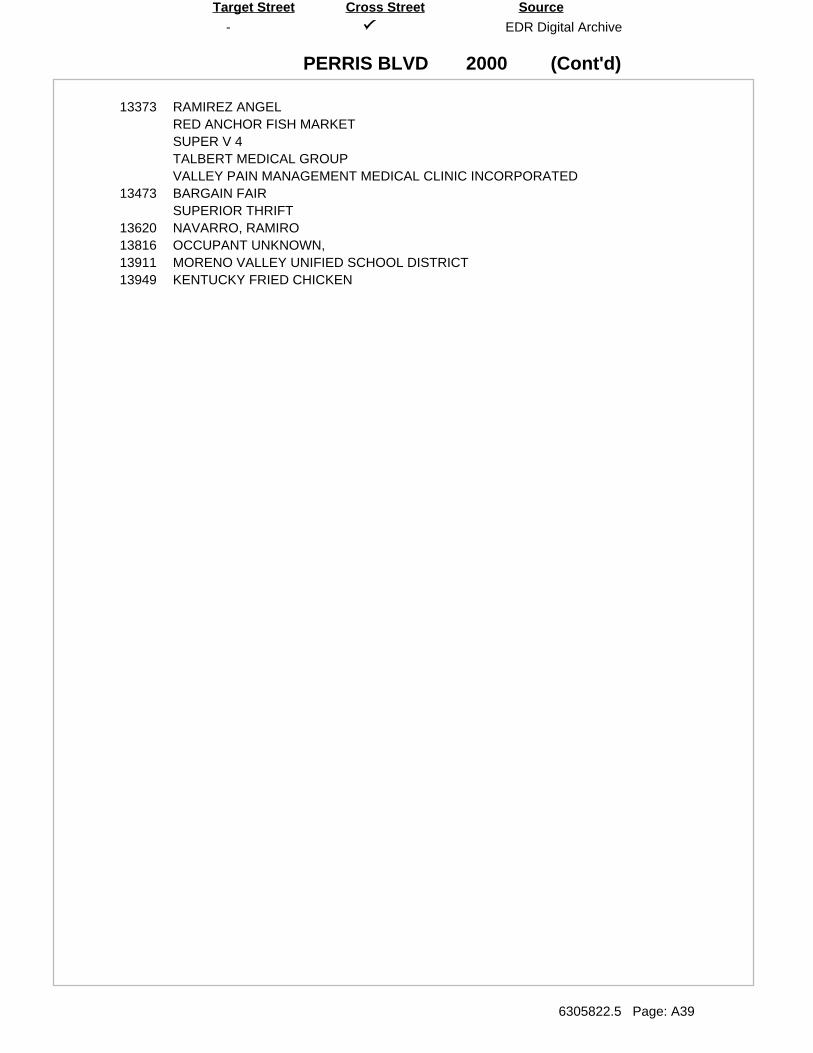
(Cont'd)
-
PERRIS BLVD
EDR Digital Archive
6305822.5 Page: A39
SourceTarget Street Cross Street
2000
13373 RAMIREZ ANGELRED ANCHOR FISH MARKETSUPER V 4TALBERT MEDICAL GROUPVALLEY PAIN MANAGEMENT MEDICAL CLINIC INCORPORATED
13473 BARGAIN FAIRSUPERIOR THRIFT
13620 NAVARRO, RAMIRO13816 OCCUPANT UNKNOWN,13911 MORENO VALLEY UNIFIED SCHOOL DISTRICT13949 KENTUCKY FRIED CHICKEN
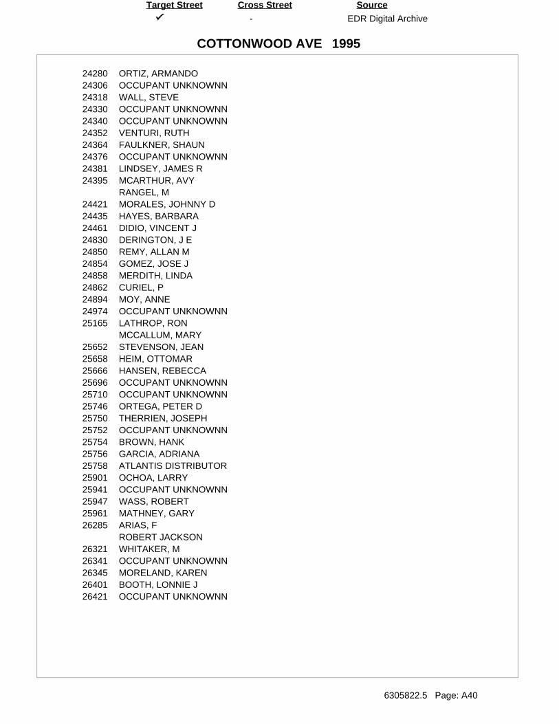
-
COTTONWOOD AVE
EDR Digital Archive
6305822.5 Page: A40
SourceTarget Street Cross Street
1995
24280 ORTIZ, ARMANDO24306 OCCUPANT UNKNOWNN24318 WALL, STEVE24330 OCCUPANT UNKNOWNN24340 OCCUPANT UNKNOWNN24352 VENTURI, RUTH24364 FAULKNER, SHAUN24376 OCCUPANT UNKNOWNN24381 LINDSEY, JAMES R24395 MCARTHUR, AVY
RANGEL, M24421 MORALES, JOHNNY D24435 HAYES, BARBARA24461 DIDIO, VINCENT J24830 DERINGTON, J E24850 REMY, ALLAN M24854 GOMEZ, JOSE J24858 MERDITH, LINDA24862 CURIEL, P24894 MOY, ANNE24974 OCCUPANT UNKNOWNN25165 LATHROP, RON
MCCALLUM, MARY25652 STEVENSON, JEAN25658 HEIM, OTTOMAR25666 HANSEN, REBECCA25696 OCCUPANT UNKNOWNN25710 OCCUPANT UNKNOWNN25746 ORTEGA, PETER D25750 THERRIEN, JOSEPH25752 OCCUPANT UNKNOWNN25754 BROWN, HANK25756 GARCIA, ADRIANA25758 ATLANTIS DISTRIBUTOR25901 OCHOA, LARRY25941 OCCUPANT UNKNOWNN25947 WASS, ROBERT25961 MATHNEY, GARY26285 ARIAS, F
ROBERT JACKSON26321 WHITAKER, M26341 OCCUPANT UNKNOWNN26345 MORELAND, KAREN26401 BOOTH, LONNIE J26421 OCCUPANT UNKNOWNN
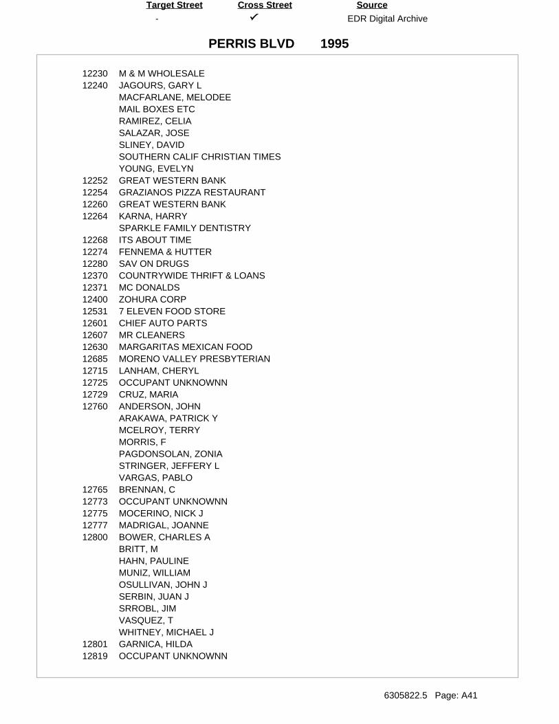
-
PERRIS BLVD
EDR Digital Archive
6305822.5 Page: A41
SourceTarget Street Cross Street
1995
12230 M & M WHOLESALE12240 JAGOURS, GARY L
MACFARLANE, MELODEEMAIL BOXES ETCRAMIREZ, CELIASALAZAR, JOSESLINEY, DAVIDSOUTHERN CALIF CHRISTIAN TIMESYOUNG, EVELYN
12252 GREAT WESTERN BANK12254 GRAZIANOS PIZZA RESTAURANT12260 GREAT WESTERN BANK12264 KARNA, HARRY
SPARKLE FAMILY DENTISTRY12268 ITS ABOUT TIME12274 FENNEMA & HUTTER12280 SAV ON DRUGS12370 COUNTRYWIDE THRIFT & LOANS12371 MC DONALDS12400 ZOHURA CORP12531 7 ELEVEN FOOD STORE12601 CHIEF AUTO PARTS12607 MR CLEANERS12630 MARGARITAS MEXICAN FOOD12685 MORENO VALLEY PRESBYTERIAN12715 LANHAM, CHERYL12725 OCCUPANT UNKNOWNN12729 CRUZ, MARIA12760 ANDERSON, JOHN
ARAKAWA, PATRICK YMCELROY, TERRYMORRIS, FPAGDONSOLAN, ZONIASTRINGER, JEFFERY LVARGAS, PABLO
12765 BRENNAN, C12773 OCCUPANT UNKNOWNN12775 MOCERINO, NICK J12777 MADRIGAL, JOANNE12800 BOWER, CHARLES A
BRITT, MHAHN, PAULINEMUNIZ, WILLIAMOSULLIVAN, JOHN JSERBIN, JUAN JSRROBL, JIMVASQUEZ, TWHITNEY, MICHAEL J
12801 GARNICA, HILDA12819 OCCUPANT UNKNOWNN
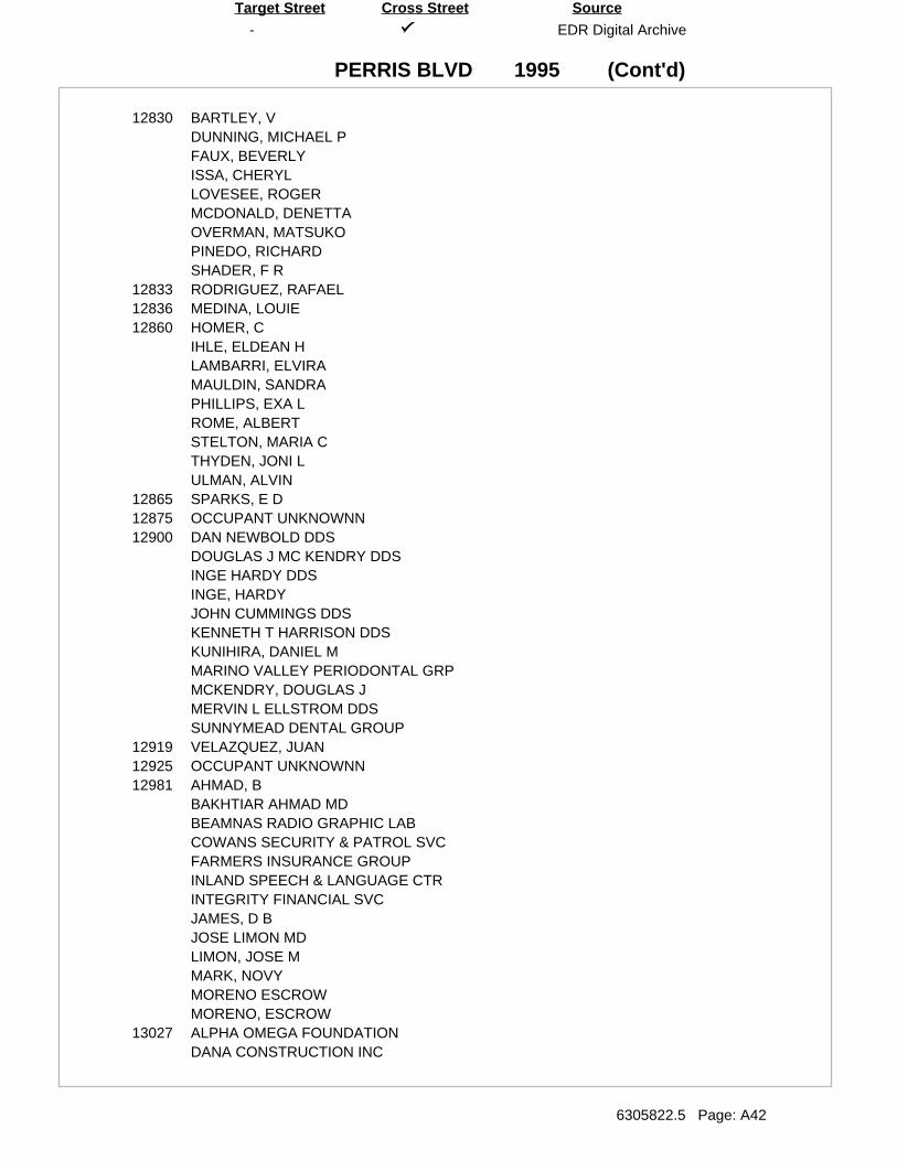
(Cont'd)
-
PERRIS BLVD
EDR Digital Archive
6305822.5 Page: A42
SourceTarget Street Cross Street
1995
12830 BARTLEY, VDUNNING, MICHAEL PFAUX, BEVERLYISSA, CHERYLLOVESEE, ROGERMCDONALD, DENETTAOVERMAN, MATSUKOPINEDO, RICHARDSHADER, F R
12833 RODRIGUEZ, RAFAEL12836 MEDINA, LOUIE12860 HOMER, C
IHLE, ELDEAN HLAMBARRI, ELVIRAMAULDIN, SANDRAPHILLIPS, EXA LROME, ALBERTSTELTON, MARIA CTHYDEN, JONI LULMAN, ALVIN
12865 SPARKS, E D12875 OCCUPANT UNKNOWNN12900 DAN NEWBOLD DDS
DOUGLAS J MC KENDRY DDSINGE HARDY DDSINGE, HARDYJOHN CUMMINGS DDSKENNETH T HARRISON DDSKUNIHIRA, DANIEL MMARINO VALLEY PERIODONTAL GRPMCKENDRY, DOUGLAS JMERVIN L ELLSTROM DDSSUNNYMEAD DENTAL GROUP
12919 VELAZQUEZ, JUAN12925 OCCUPANT UNKNOWNN12981 AHMAD, B
BAKHTIAR AHMAD MDBEAMNAS RADIO GRAPHIC LABCOWANS SECURITY & PATROL SVCFARMERS INSURANCE GROUPINLAND SPEECH & LANGUAGE CTRINTEGRITY FINANCIAL SVCJAMES, D BJOSE LIMON MDLIMON, JOSE MMARK, NOVYMORENO ESCROWMORENO, ESCROW
13027 ALPHA OMEGA FOUNDATIONDANA CONSTRUCTION INC
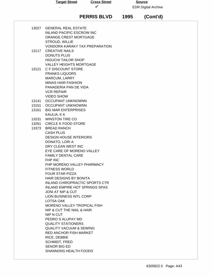
(Cont'd)
-
PERRIS BLVD
EDR Digital Archive
6305822.5 Page: A43
SourceTarget Street Cross Street
1995
13027 GENERAL REAL ESTATEINLAND PACIFIC ESCROW INCORANGE CREST MORTGAGESTROUD, WILLIEVONDORA KARAKY TAX PREPARATION
13117 CREATIVE NAILSDONUTS PLUSHIGUCHI TAILOR SHOPVALLEY HEIGHTS MORTGAGE
13121 C F DISCOUNT STOREFRANKS LIQUORSMARCUM, LARRYMINAS HAIR FASHIONPANADERIA PAN DE VIDAVCR REPAIRVIDEO SHOW
13141 OCCUPANT UNKNOWNN13151 OCCUPANT UNKNOWNN13161 BIG MAR ENTERPRISES
KAULIA, K K13231 WINSTON TIRE CO13261 CIRCLE K FOOD STORE13373 BREAD RANCH
CASH PLUSDESIGN HOUSE INTERIORSDONATO, LORI ADRY CLEAN WEST INCEYE CARE OF MORENO VALLEYFAMILY DENTAL CAREFHP INCFHP MORENO VALLEY PHARMACYFITNESS WORLDFOUR STAR PIZZAHAIR DESIGNS BY BONITAINLAND CHIROPRACTIC SPORTS CTRINLAND EMPIRE HOT SPRINGS SPASJONI AT NIP & CUTLION BUSINESS INTL CORPLOTSA OAKMORENO VALLEY TROPICAL FISHNIP & CUT THE NAIL & HAIRNIP N CUTPEDRO S ALUPAY MDQUALITY STATIONERSQUALITY VACUUM & SEWINGRED ANCHOR FISH MARKETRICE, DEBBIESCHMIDT, FREDSENOR BIG EDSHANNONS HEALTH FOODS
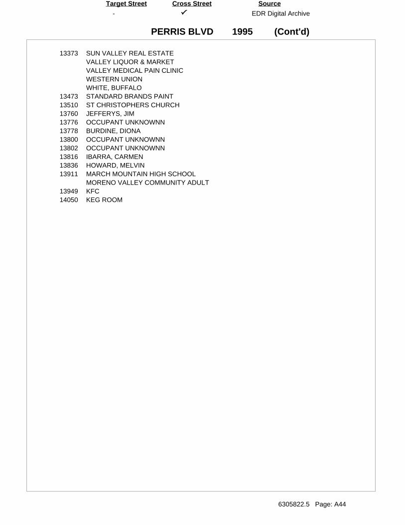
(Cont'd)
-
PERRIS BLVD
EDR Digital Archive
6305822.5 Page: A44
SourceTarget Street Cross Street
1995
13373 SUN VALLEY REAL ESTATEVALLEY LIQUOR & MARKETVALLEY MEDICAL PAIN CLINICWESTERN UNIONWHITE, BUFFALO
13473 STANDARD BRANDS PAINT13510 ST CHRISTOPHERS CHURCH13760 JEFFERYS, JIM13776 OCCUPANT UNKNOWNN13778 BURDINE, DIONA13800 OCCUPANT UNKNOWNN13802 OCCUPANT UNKNOWNN13816 IBARRA, CARMEN13836 HOWARD, MELVIN13911 MARCH MOUNTAIN HIGH SCHOOL
MORENO VALLEY COMMUNITY ADULT13949 KFC14050 KEG ROOM
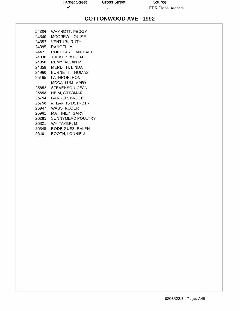
-
COTTONWOOD AVE
EDR Digital Archive
6305822.5 Page: A45
SourceTarget Street Cross Street
1992
24306 WHYNOTT, PEGGY24340 MCGREW, LOUISE24352 VENTURI, RUTH24395 RANGEL, M24421 ROBILLARD, MICHAEL24830 TUCKER, MICHAEL24850 REMY, ALLAN M24858 MERDITH, LINDA24960 BURNETT, THOMAS25165 LATHROP, RON
MCCALLUM, MARY25652 STEVENSON, JEAN25658 HEIM, OTTOMAR25754 GARNER, BRUCE25758 ATLANTIS DSTRBTR25947 WASS, ROBERT25961 MATHNEY, GARY26285 SUNNYMEAD POULTRY26321 WHITAKER, M26345 RODRIGUEZ, RALPH26401 BOOTH, LONNIE J
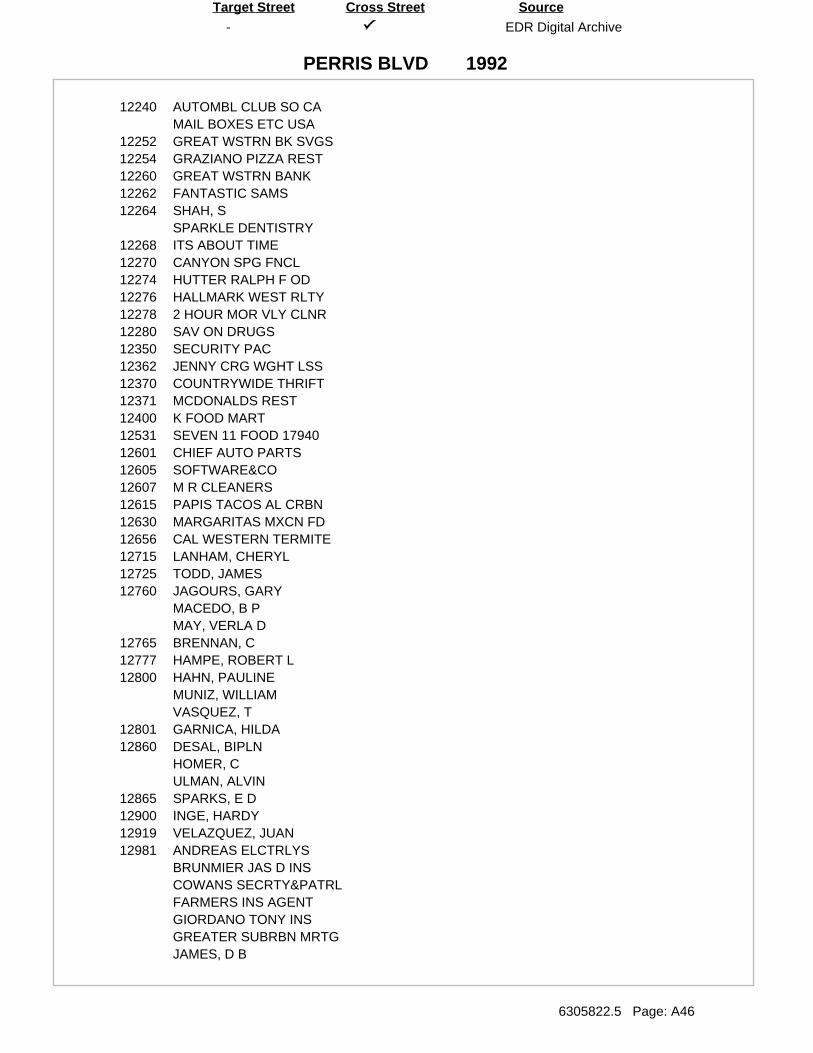
-
PERRIS BLVD
EDR Digital Archive
6305822.5 Page: A46
SourceTarget Street Cross Street
1992
12240 AUTOMBL CLUB SO CAMAIL BOXES ETC USA
12252 GREAT WSTRN BK SVGS12254 GRAZIANO PIZZA REST12260 GREAT WSTRN BANK12262 FANTASTIC SAMS12264 SHAH, S
SPARKLE DENTISTRY12268 ITS ABOUT TIME12270 CANYON SPG FNCL12274 HUTTER RALPH F OD12276 HALLMARK WEST RLTY12278 2 HOUR MOR VLY CLNR12280 SAV ON DRUGS12350 SECURITY PAC12362 JENNY CRG WGHT LSS12370 COUNTRYWIDE THRIFT12371 MCDONALDS REST12400 K FOOD MART12531 SEVEN 11 FOOD 1794012601 CHIEF AUTO PARTS12605 SOFTWARE&CO12607 M R CLEANERS12615 PAPIS TACOS AL CRBN12630 MARGARITAS MXCN FD12656 CAL WESTERN TERMITE12715 LANHAM, CHERYL12725 TODD, JAMES12760 JAGOURS, GARY
MACEDO, B PMAY, VERLA D
12765 BRENNAN, C12777 HAMPE, ROBERT L12800 HAHN, PAULINE
MUNIZ, WILLIAMVASQUEZ, T
12801 GARNICA, HILDA12860 DESAL, BIPLN
HOMER, CULMAN, ALVIN
12865 SPARKS, E D12900 INGE, HARDY12919 VELAZQUEZ, JUAN12981 ANDREAS ELCTRLYS
BRUNMIER JAS D INSCOWANS SECRTY&PATRLFARMERS INS AGENTGIORDANO TONY INSGREATER SUBRBN MRTGJAMES, D B
(Cont'd)
-
PERRIS BLVD
EDR Digital Archive
6305822.5 Page: A47
SourceTarget Street Cross Street
1992
12981 LIMON JOSE M MDMARK, NOVYMORENO ESCROWMORENO, ESCROW
13027 ALLSTATE INS SALESCENTURY 21 GEN REDANA CONSTRUCTIONEDUCATNL PRTNRSHPINLAND PAC ESCROWORANGE CREST MRTGSEA PAC MORTGAGE
13117 A M DONUTSA&L JANITORIAL SERVCOMPUTER BALANCE SHCREATIVE NAILSEMPIRE CONSULTINGVALLEY HEIGHTS MRTG
13121 CANDY&FUNFRANKS LIQUORSLEES BASEBALL CARDSMINAS HAIR FASHIONPANADERIA PANDEVIDAV C R REPAIRVIDEO SHOW
13153 PRIESTLEY, STACEY13161 BIG MAR ENTERPRISES13231 WINSTON TIRE CO13261 CIRCLE K FOOD 87213373 BREAD RANCH
BROWN, KARENCASH PLUSDONATO LORI ANNDONATO, LORI ADRYCLEAN WEST INCEMYSEYE CARE MORENO VLYF H P INCFELICIANO PETER DMDFITNESS WORLDFOUR STAR PIZZAHAIR DESIGNS BONITAHOT SPRING SPASINLAND CHIROPRTC CTLEVYS MRNO VLY FLWRLOTSA OAKMORENO VLY FISHPETKIN ROBT LAND COQUALITY STATIONERSRED ANCHOR FISH MKTRICE DEBBIE
(Cont'd)
-
PERRIS BLVD
EDR Digital Archive
6305822.5 Page: A48
SourceTarget Street Cross Street
1992
13373 RICE, DEBBIESENOR BIG EDSHANNONS HEALTH FDSSUN VLY REAL ESTATETRAVEL STATIONVALLEY LIQUOR&MKTVIDEO, RAYWALKER CHAS E INTRSWESTRN UNION PCK UPWHITE BUFFALOWHITE, BUFFALO
13473 STANDRD BRAND PAINT13510 ST CHRISTOPHERS CH
TEMPLE OF PRAISE CH13620 FISHER, LEONARD13776 VARGAS, ANGEL13778 WASHINGTON, C13802 GARCIA, C13911 MORENO VLY MARCH HI13949 KENTUCKY FRIED CHKN14050 KEG ROOM14360 BAUTISTA, ANITA128602 MAULDIN, S
-
COTTONWOOD AVE
Haines Criss-Cross Directory
6305822.5 Page: A49
SourceTarget Street Cross Street
1990
-
COTTONWOOD AVE
Haines Criss-Cross Directory
6305822.5 Page: A50
SourceTarget Street Cross Street
1990
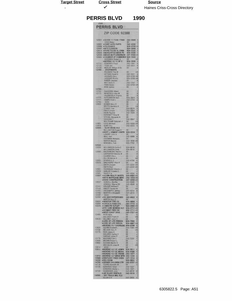
-
PERRIS BLVD
Haines Criss-Cross Directory
6305822.5 Page: A51
SourceTarget Street Cross Street
1990
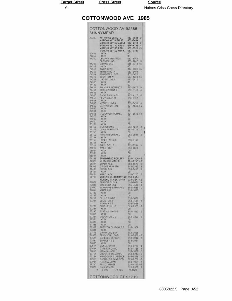
-
COTTONWOOD AVE
Haines Criss-Cross Directory
6305822.5 Page: A52
SourceTarget Street Cross Street
1985
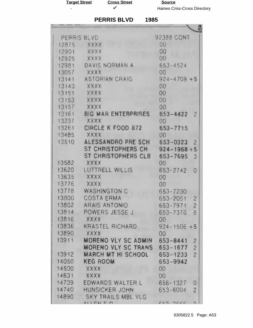
-
PERRIS BLVD
Haines Criss-Cross Directory
6305822.5 Page: A53
SourceTarget Street Cross Street
1985
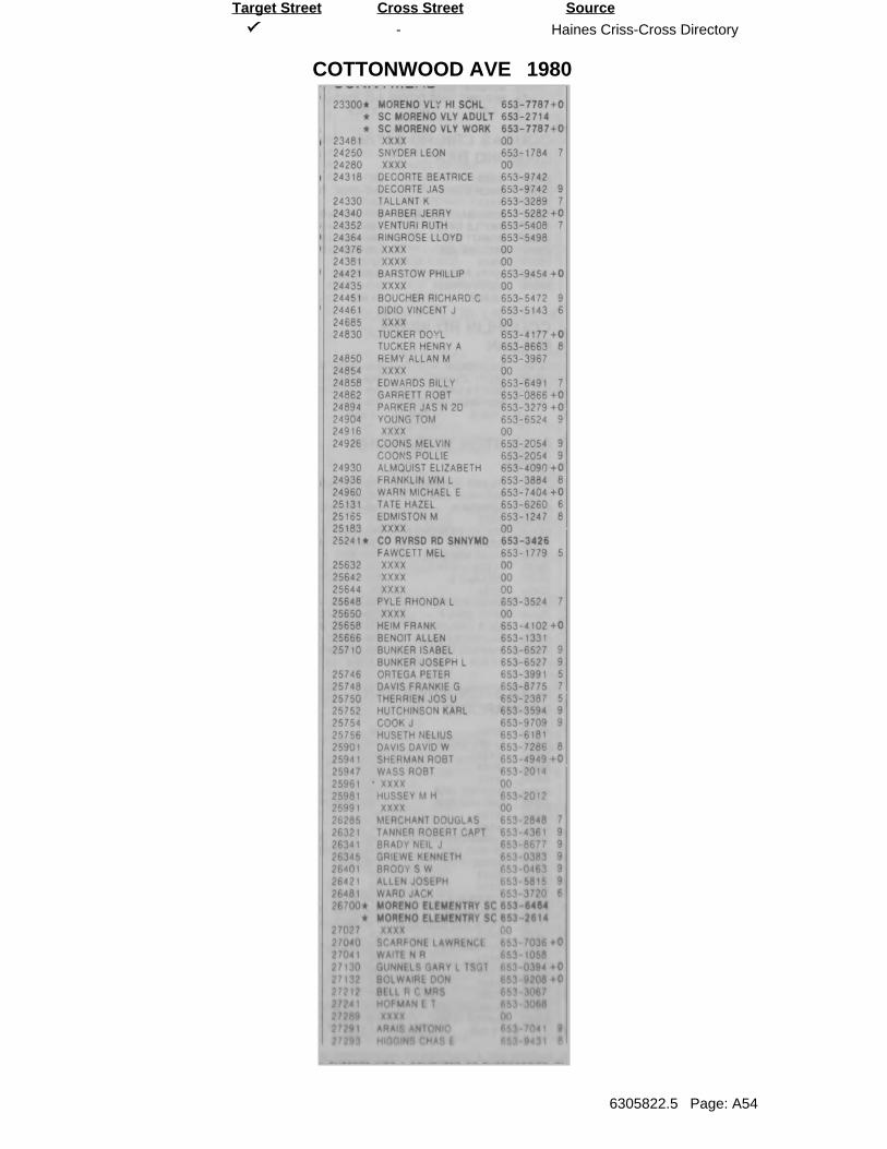
-
COTTONWOOD AVE
Haines Criss-Cross Directory
6305822.5 Page: A54
SourceTarget Street Cross Street
1980
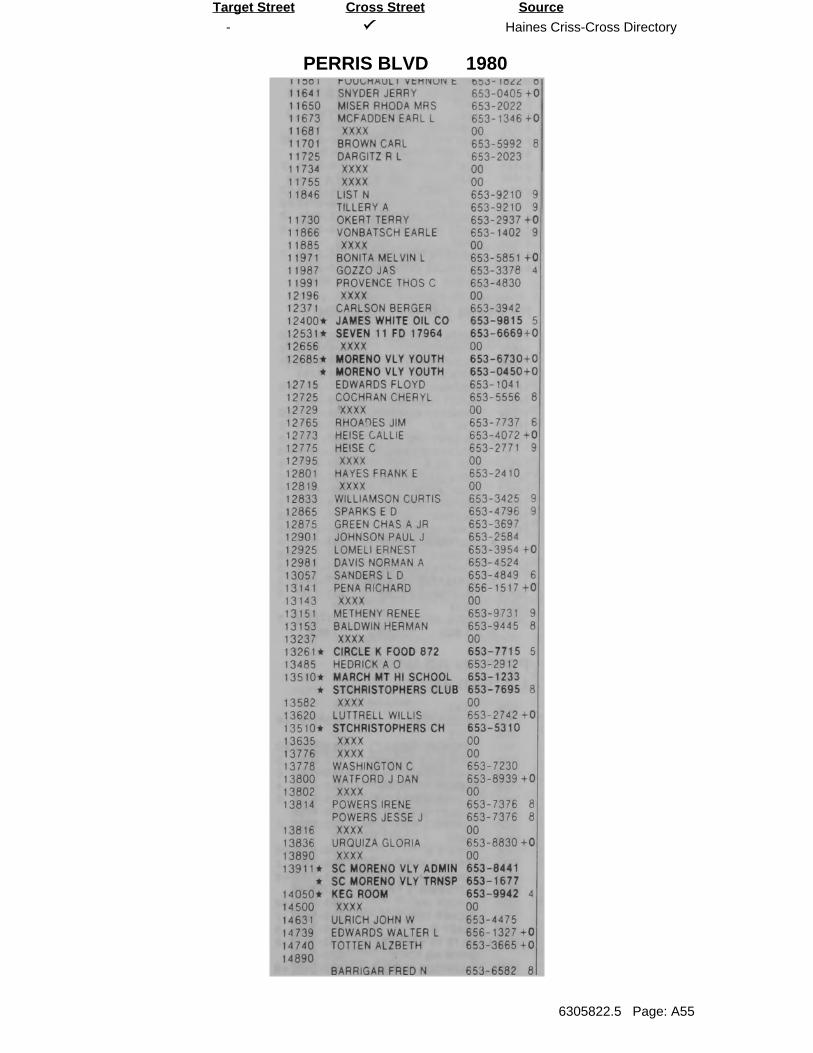
-
PERRIS BLVD
Haines Criss-Cross Directory
6305822.5 Page: A55
SourceTarget Street Cross Street
1980
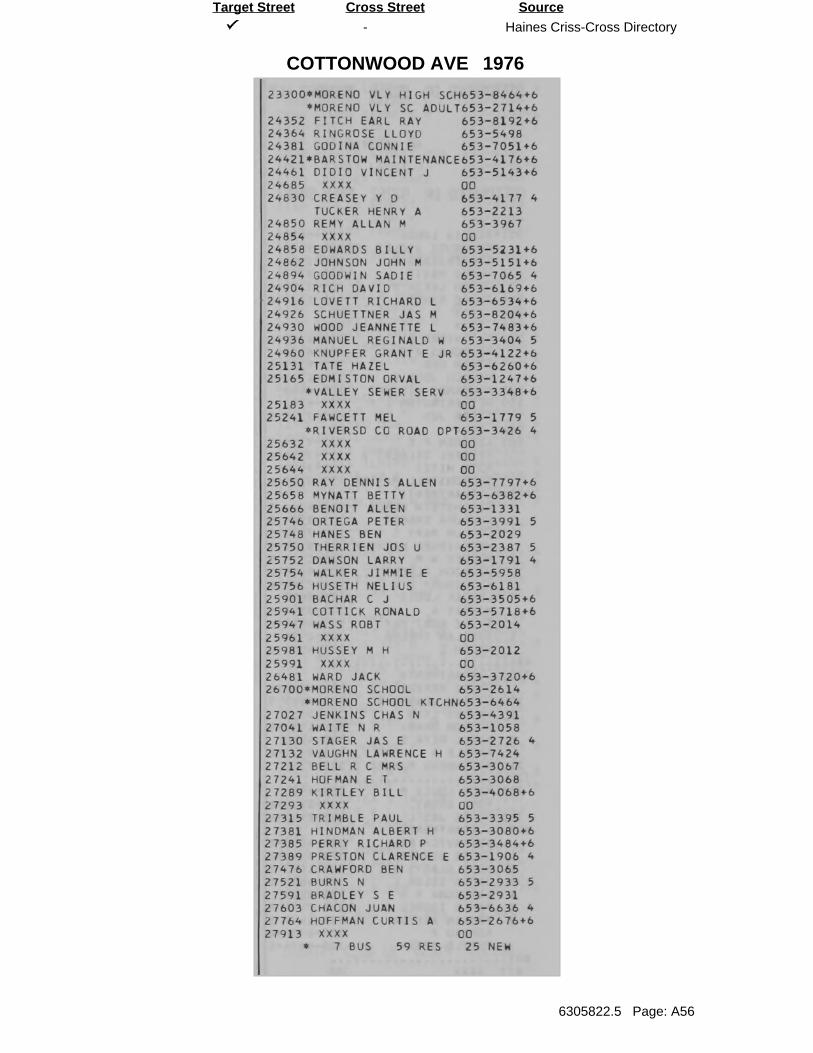
-
COTTONWOOD AVE
Haines Criss-Cross Directory
6305822.5 Page: A56
SourceTarget Street Cross Street
1976
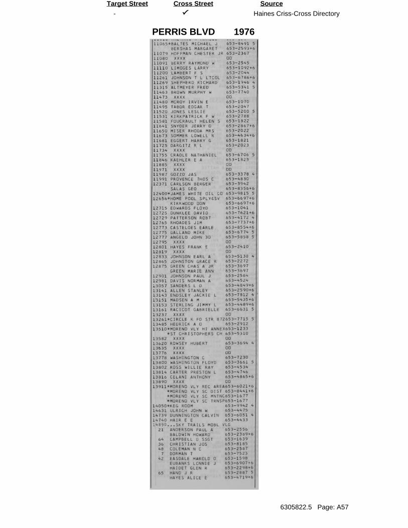
-
PERRIS BLVD
Haines Criss-Cross Directory
6305822.5 Page: A57
SourceTarget Street Cross Street
1976
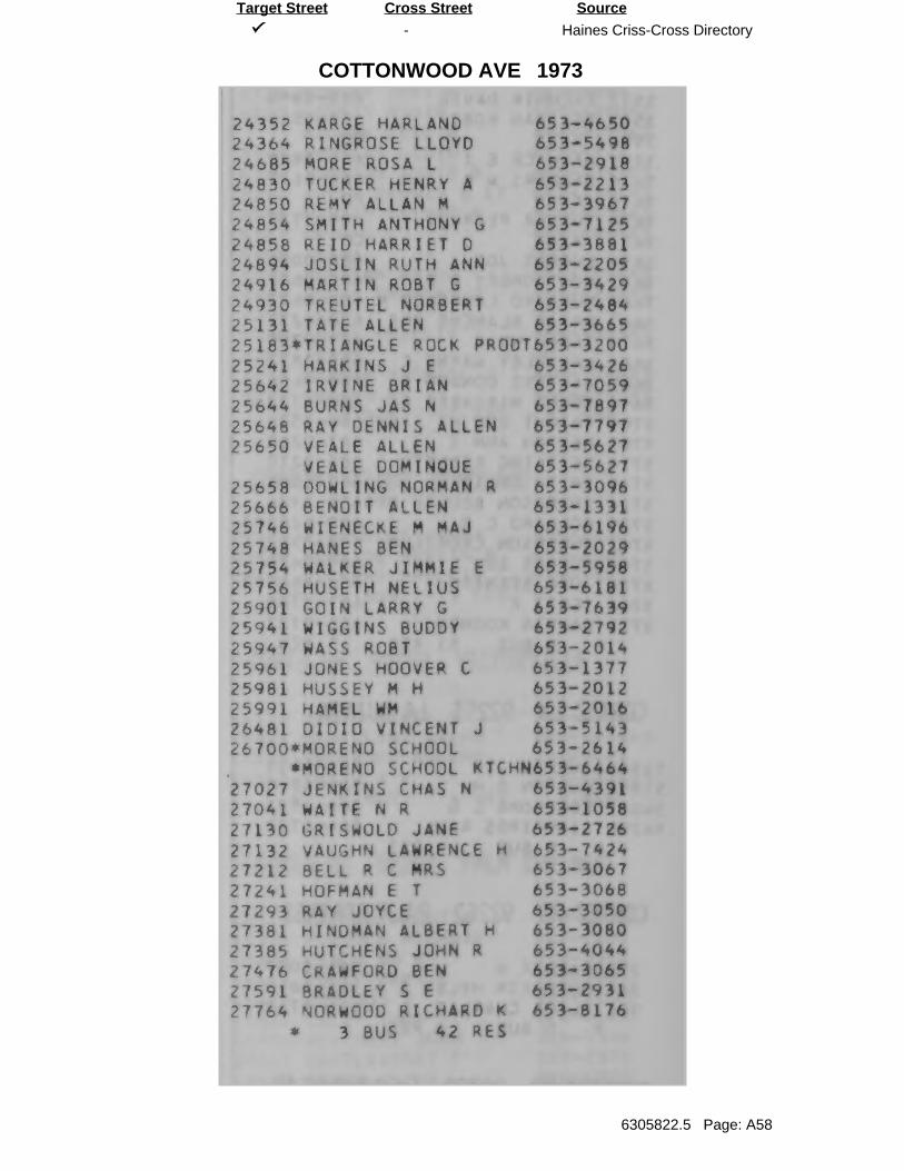
-
COTTONWOOD AVE
Haines Criss-Cross Directory
6305822.5 Page: A58
SourceTarget Street Cross Street
1973
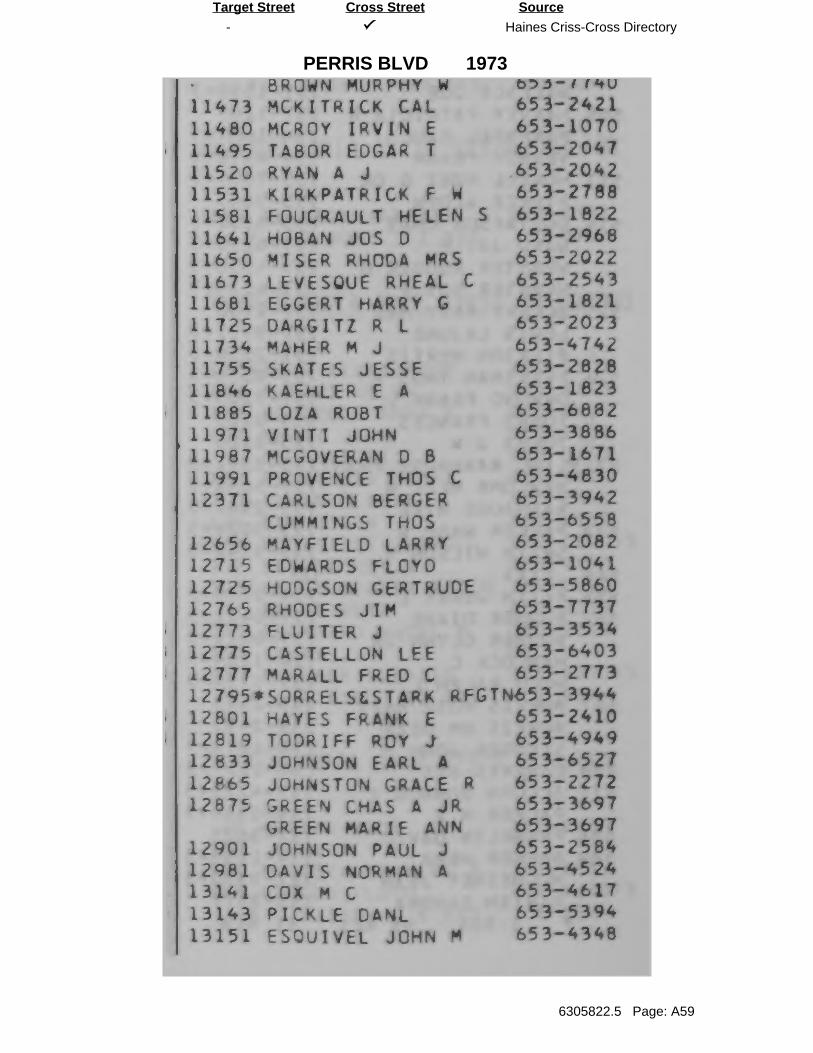
-
PERRIS BLVD
Haines Criss-Cross Directory
6305822.5 Page: A59
SourceTarget Street Cross Street
1973
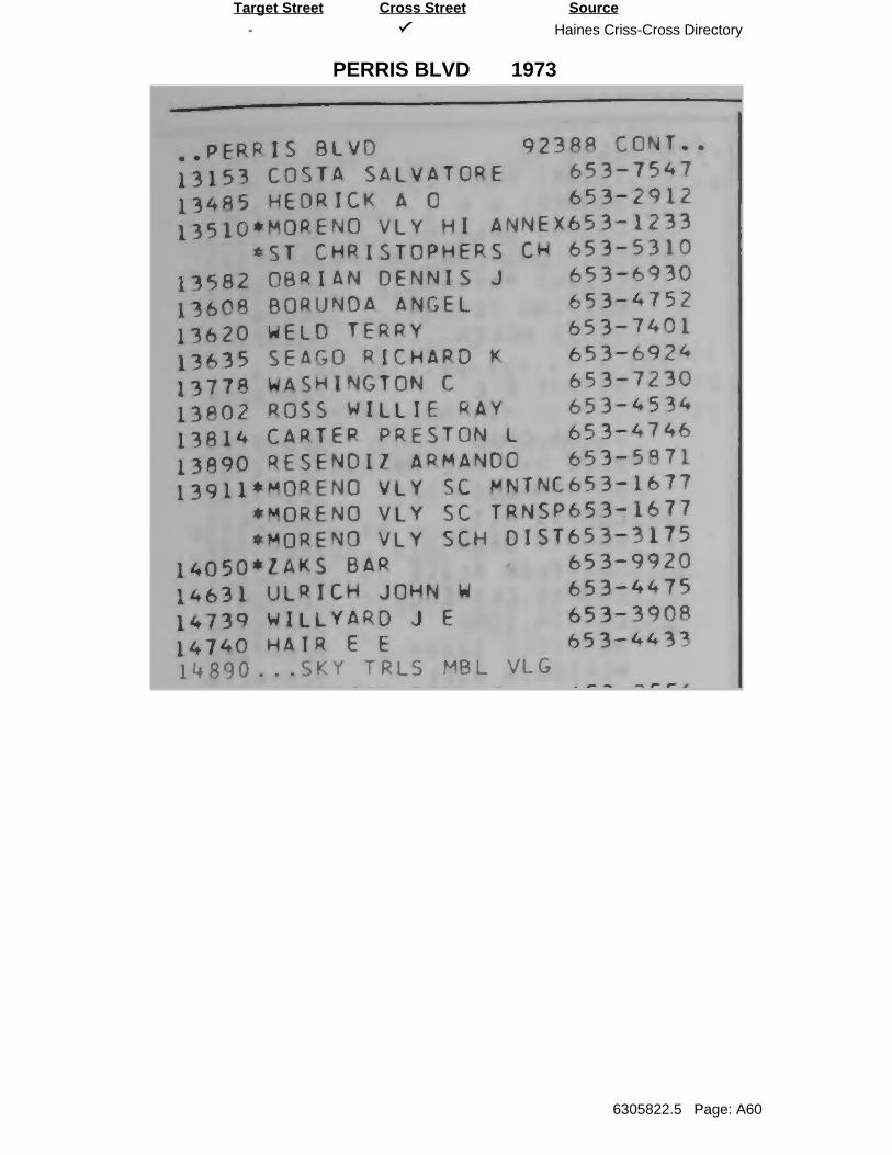
-
PERRIS BLVD
Haines Criss-Cross Directory
6305822.5 Page: A60
SourceTarget Street Cross Street
1973
EDR Historical Topo Map Report
Inquiry Number:
6 Armstrong Road, 4th floor Shelton, CT 06484Toll Free: 800.352.0050 www.edrnet.com
with QuadMatch™
APN 479-140-022
Corttonwood Avenue/Perris Boulevard
Moreno Valley, CA 92553
December 17, 2020
6305822.4
EDR Historical Topo Map Report
EDR Inquiry #
Search Results:
P.O.# Project:
Maps Provided:
Disclaimer - Copyright and Trademark Notice
EDR and its logos (including Sanborn and Sanborn Map) are trademarks of Environmental Data Resources, Inc. or its affiliates. All other trademarks used herein are the property of their respective owners.
page-
Coordinates:
Latitude: Longitude: UTM Zone: UTM X Meters: UTM Y Meters: Elevation:
Contact:
Site Name: Client Name:
2012
1980
1973
1967
1953
1943
1942
1901
12/17/20
APN 479-140-022 GeotekCorttonwood Avenue/Perris Boulevard 1548 North Maple StreetMoreno Valley, CA 92553 Corona, CA 92880
6305822.4 Anna M. Scott
EDR Topographic Map Library has been searched by EDR and maps covering the target property location as provided byGeotek were identified for the years listed below. EDR’s Historical Topo Map Report is designed to assist professionals inevaluating potential liability on a target property resulting from past activities. EDRs Historical Topo Map Report includes asearch of a collection of public and private color historical topographic maps, dating back to the late 1800s.
NA 33.925507 33° 55' 32" North
2597-CR -117.223156 -117° 13' 23" WestZone 11 North479374.043753918.811589.56' above sea level
This Report contains certain information obtained from a variety of public and other sources reasonably available to Environmental Data Resources, Inc. It cannotbe concluded from this Report that coverage information for the target and surrounding properties does not exist from other sources. NO WARRANTYEXPRESSED OR IMPLIED, IS MADE WHATSOEVER IN CONNECTION WITH THIS REPORT. ENVIRONMENTAL DATA RESOURCES, INC. SPECIFICALLYDISCLAIMS THE MAKING OF ANY SUCH WARRANTIES, INCLUDING WITHOUT LIMITATION, MERCHANTABILITY OR FITNESS FOR A PARTICULAR USEOR PURPOSE. ALL RISK IS ASSUMED BY THE USER. IN NO EVENT SHALL ENVIRONMENTAL DATA RESOURCES, INC. BE LIABLE TO ANYONE,WHETHER ARISING OUT OF ERRORS OR OMISSIONS, NEGLIGENCE, ACCIDENT OR ANY OTHER CAUSE, FOR ANY LOSS OF DAMAGE, INCLUDING,WITHOUT LIMITATION, SPECIAL, INCIDENTAL, CONSEQUENTIAL, OR EXEMPLARY DAMAGES. ANY LIABILITY ON THE PART OF ENVIRONMENTALDATA RESOURCES, INC. IS STRICTLY LIMITED TO A REFUND OF THE AMOUNT PAID FOR THIS REPORT. Purchaser accepts this Report "AS IS". Anyanalyses, estimates, ratings, environmental risk levels or risk codes provided in this Report are provided for illustrative purposes only, and are not intended toprovide, nor should they be interpreted as providing any facts regarding, or prediction or forecast of, any environmental risk for any property. Only a Phase IEnvironmental Site Assessment performed by an environmental professional can provide information regarding the environmental risk for any property.Additionally, the information provided in this Report is not to be construed as legal advice.Copyright 2020 by Environmental Data Resources, Inc. All rights reserved. Reproduction in any media or format, in whole or in part, of any report or map ofEnvironmental Data Resources, Inc., or its affiliates, is prohibited without prior written permission.
6305822 4 2
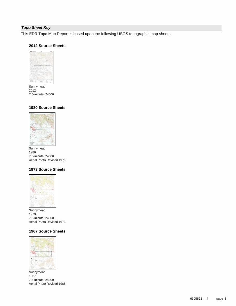
page
Topo Sheet KeyThis EDR Topo Map Report is based upon the following USGS topographic map sheets.
-
2012 Source Sheets
2012Sunnymead
7.5-minute, 24000
1980 Source Sheets
1980Sunnymead
7.5-minute, 24000Aerial Photo Revised 1978
1973 Source Sheets
1973Sunnymead
7.5-minute, 24000Aerial Photo Revised 1973
1967 Source Sheets
1967Sunnymead
7.5-minute, 24000Aerial Photo Revised 1966
6305822 4 3
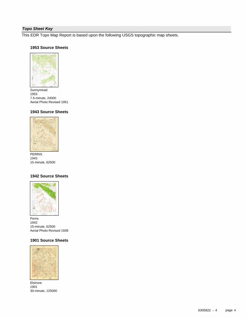
page
Topo Sheet KeyThis EDR Topo Map Report is based upon the following USGS topographic map sheets.
-
1953 Source Sheets
1953Sunnymead
7.5-minute, 24000Aerial Photo Revised 1951
1943 Source Sheets
1943PERRIS
15-minute, 62500
1942 Source Sheets
1942Perris
15-minute, 62500Aerial Photo Revised 1939
1901 Source Sheets
1901Elsinore
30-minute, 125000
6305822 4 4
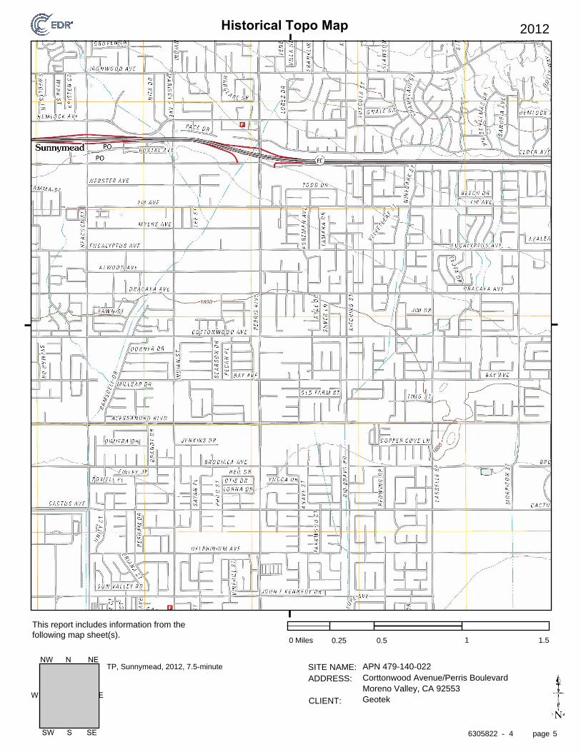
Historical Topo Map
page
SITE NAME: ADDRESS:
CLIENT:
This report includes information from the following map sheet(s).
-
EW
SW S SE
NW N NE
2012
0 Miles 0.25 0.5 1 1.5
APN 479-140-022Corttonwood Avenue/Perris BoulevardMoreno Valley, CA 92553Geotek
TP, Sunnymead, 2012, 7.5-minute
6305822 4 5
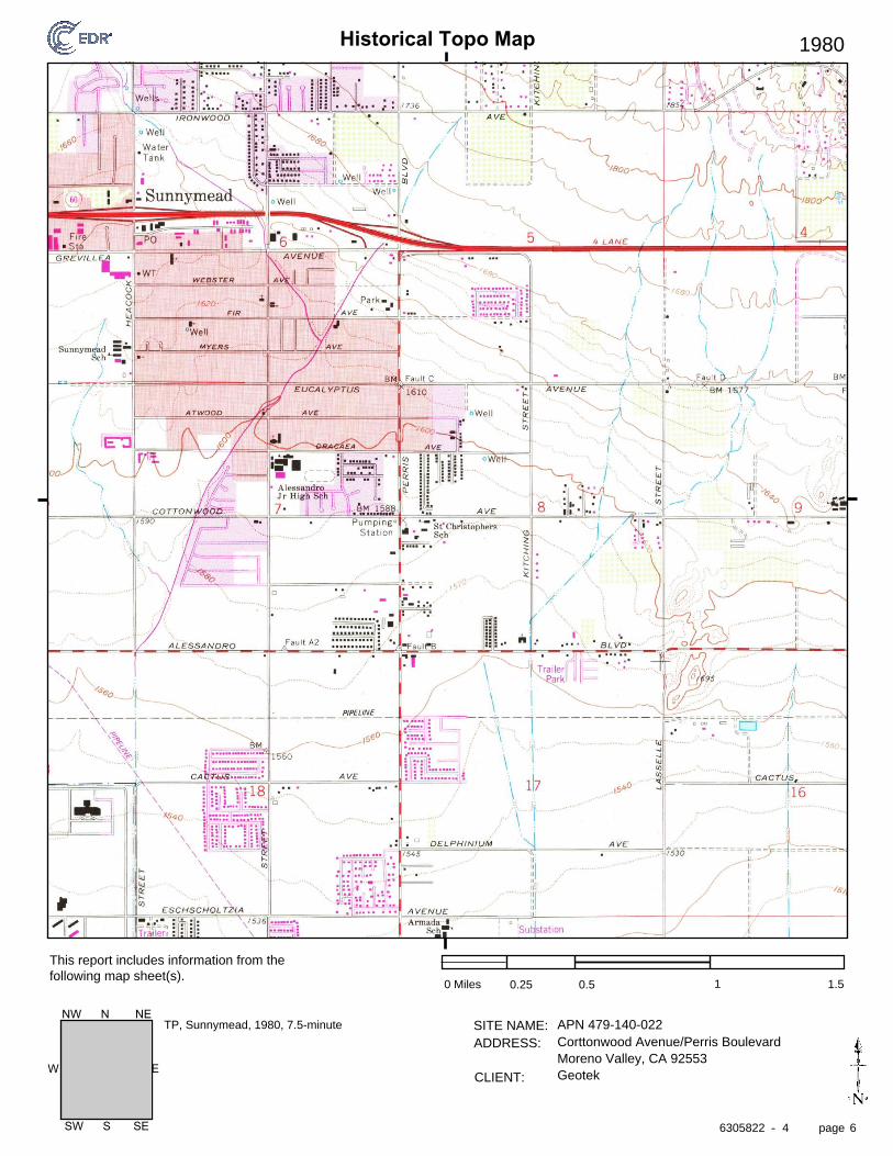
Historical Topo Map
page
SITE NAME: ADDRESS:
CLIENT:
This report includes information from the following map sheet(s).
-
EW
SW S SE
NW N NE
1980
0 Miles 0.25 0.5 1 1.5
APN 479-140-022Corttonwood Avenue/Perris BoulevardMoreno Valley, CA 92553Geotek
TP, Sunnymead, 1980, 7.5-minute
6305822 4 6
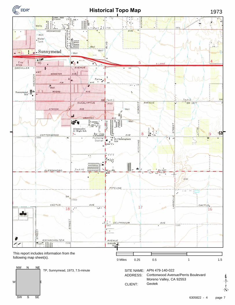
Historical Topo Map
page
SITE NAME: ADDRESS:
CLIENT:
This report includes information from the following map sheet(s).
-
EW
SW S SE
NW N NE
1973
0 Miles 0.25 0.5 1 1.5
APN 479-140-022Corttonwood Avenue/Perris BoulevardMoreno Valley, CA 92553Geotek
TP, Sunnymead, 1973, 7.5-minute
6305822 4 7
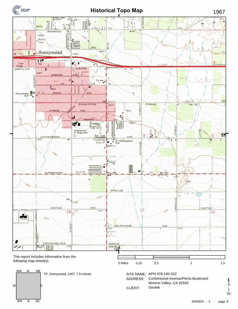
Historical Topo Map
page
SITE NAME: ADDRESS:
CLIENT:
This report includes information from the following map sheet(s).
-
EW
SW S SE
NW N NE
1967
0 Miles 0.25 0.5 1 1.5
APN 479-140-022Corttonwood Avenue/Perris BoulevardMoreno Valley, CA 92553Geotek
TP, Sunnymead, 1967, 7.5-minute
6305822 4 8
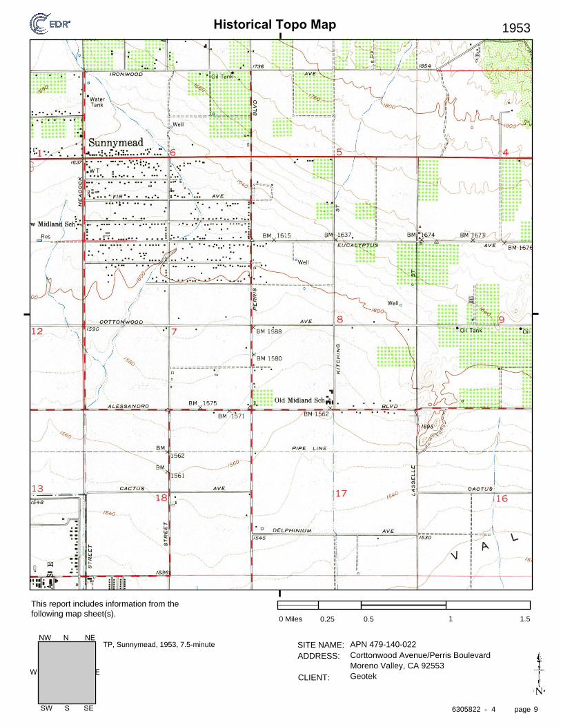
Historical Topo Map
page
SITE NAME: ADDRESS:
CLIENT:
This report includes information from the following map sheet(s).
-
EW
SW S SE
NW N NE
1953
0 Miles 0.25 0.5 1 1.5
APN 479-140-022Corttonwood Avenue/Perris BoulevardMoreno Valley, CA 92553Geotek
TP, Sunnymead, 1953, 7.5-minute
6305822 4 9
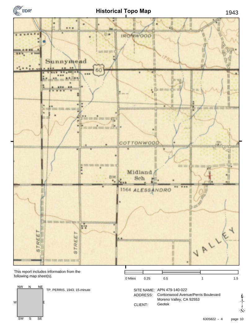
Historical Topo Map
page
SITE NAME: ADDRESS:
CLIENT:
This report includes information from the following map sheet(s).
-
EW
SW S SE
NW N NE
1943
0 Miles 0.25 0.5 1 1.5
APN 479-140-022Corttonwood Avenue/Perris BoulevardMoreno Valley, CA 92553Geotek
TP, PERRIS, 1943, 15-minute
6305822 4 10
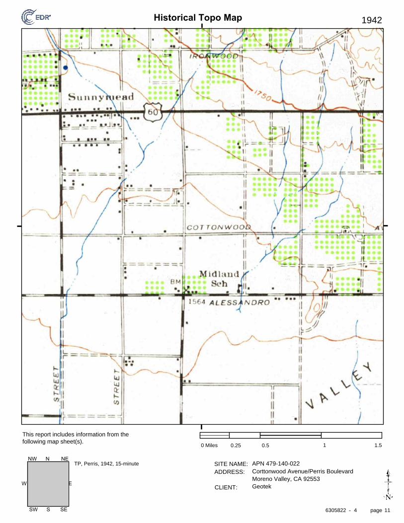
Historical Topo Map
page
SITE NAME: ADDRESS:
CLIENT:
This report includes information from the following map sheet(s).
-
EW
SW S SE
NW N NE
1942
0 Miles 0.25 0.5 1 1.5
APN 479-140-022Corttonwood Avenue/Perris BoulevardMoreno Valley, CA 92553Geotek
TP, Perris, 1942, 15-minute
6305822 4 11
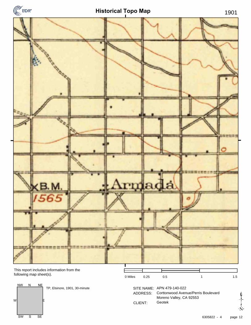
Historical Topo Map
page
SITE NAME: ADDRESS:
CLIENT:
This report includes information from the following map sheet(s).
-
EW
SW S SE
NW N NE
1901
0 Miles 0.25 0.5 1 1.5
APN 479-140-022Corttonwood Avenue/Perris BoulevardMoreno Valley, CA 92553Geotek
TP, Elsinore, 1901, 30-minute
6305822 4 12
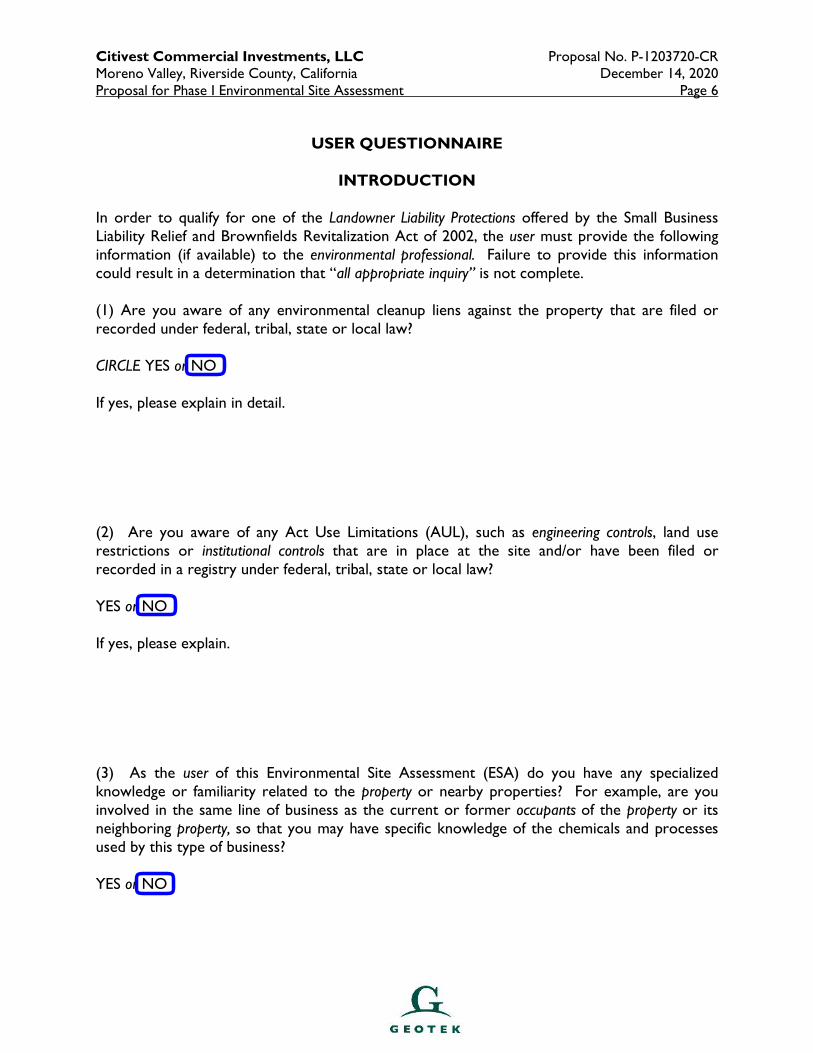
Citivest Commercial Investments, LLC Proposal No. P-1203720-CR Moreno Valley, Riverside County, California December 14, 2020 Proposal for Phase I Environmental Site Assessment Page 6
USER QUESTIONNAIRE
INTRODUCTION
In order to qualify for one of the Landowner Liability Protections offered by the Small Business Liability Relief and Brownfields Revitalization Act of 2002, the user must provide the following information (if available) to the environmental professional. Failure to provide this information could result in a determination that “all appropriate inquiry” is not complete. (1) Are you aware of any environmental cleanup liens against the property that are filed or recorded under federal, tribal, state or local law? CIRCLE YES or NO If yes, please explain in detail. (2) Are you aware of any Act Use Limitations (AUL), such as engineering controls, land use restrictions or institutional controls that are in place at the site and/or have been filed or recorded in a registry under federal, tribal, state or local law? YES or NO If yes, please explain. (3) As the user of this Environmental Site Assessment (ESA) do you have any specialized knowledge or familiarity related to the property or nearby properties? For example, are you involved in the same line of business as the current or former occupants of the property or its neighboring property, so that you may have specific knowledge of the chemicals and processes used by this type of business? YES or NO
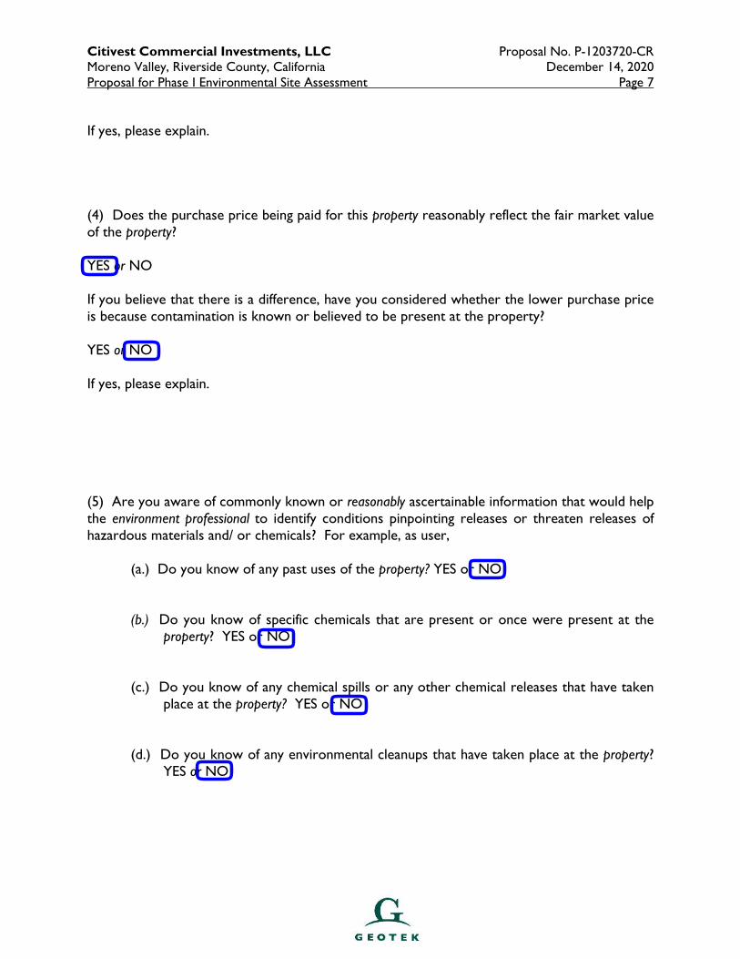
Citivest Commercial Investments, LLC Proposal No. P-1203720-CR Moreno Valley, Riverside County, California December 14, 2020 Proposal for Phase I Environmental Site Assessment Page 7
If yes, please explain. (4) Does the purchase price being paid for this property reasonably reflect the fair market value of the property? YES or NO If you believe that there is a difference, have you considered whether the lower purchase price is because contamination is known or believed to be present at the property? YES or NO If yes, please explain. (5) Are you aware of commonly known or reasonably ascertainable information that would help the environment professional to identify conditions pinpointing releases or threaten releases of hazardous materials and/ or chemicals? For example, as user, (a.) Do you know of any past uses of the property? YES or NO
(b.) Do you know of specific chemicals that are present or once were present at the property? YES or NO
(c.) Do you know of any chemical spills or any other chemical releases that have taken
place at the property? YES or NO (d.) Do you know of any environmental cleanups that have taken place at the property?
YES or NO
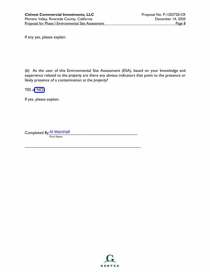
Citivest Commercial Investments, LLC Proposal No. P-1203720-CR Moreno Valley, Riverside County, California December 14, 2020 Proposal for Phase I Environmental Site Assessment Page 8
If any yes, please explain. (6) As the user of this Environmental Site Assessment (ESA), based on your knowledge and experience related to the property are there any obvious indicators that point to the presence or likely presence of a contamination at the property? YES or NO If yes, please explain. Completed By_______________________________________
Print Name
___________________________________________________
Al Marshall
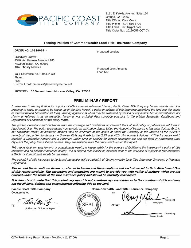
CLTA Preliminary Report Form – Modified (11/17/06) Page 1
1111 E. Katella Avenue, Suite 120Orange, CA 92867Title Officer: Clive VirataTitle Phone: (714) 516-6700Title Email: [email protected] Order No.: 10126057-OCT-CV
Issuing Policies of Commonwealth Land Title Insurance Company
ORDER NO: 10126057--
Broadway Escrow4340 Von Karman Avenue #285Newport Beach, CA 92660Attn: Chrissy Morales
Your Reference No.: 004402-CMPhone: Fax: Escrow Email: [email protected]
Proposed Lender:
Proposed Loan Amount: Loan No.:
PROPERTY: 00 Vacant Land, Moreno Valley, CA 92553
PRELIMINARY REPORTIn response to the application for a policy of title insurance referenced herein, Pacific Coast Title Company hereby reports that it is prepared to issue, or cause to be issued, as of the date hereof, a policy or policies of title insurance describing the land and the estate or interest therein hereinafter set forth, insuring against loss which may be sustained by reason of any defect, lien or encumbrance not shown or referred to as an exception herein or not excluded from coverage pursuant to the printed Schedules, Conditions and Stipulations or Conditions of said policy forms.The printed Exceptions and Exclusions from the coverage and Limitations on Covered Risks of said policy or policies are set forth in Attachment One. The policy to be issued may contain an arbitration clause. When the Amount of Insurance is less than that set forth in the arbitration clause, all arbitrable matters shall be arbitrated at the option of either the Company or the Insured as the exclusive remedy of the parties. Limitations on Covered Risks applicable to the CLTA and ALTA Homeowner’s Policies of Title Insurance which establish a Deductible Amount and a Maximum Dollar Limit of Liability for certain coverages are also set forth in Attachment One. Copies of the policy forms should be read. They are available from the office which issued this report.This report (and any supplements or amendments hereto) is issued solely for the purpose of facilitating the issuance of a policy of title insurance and no liability is assumed hereby. If it is desired that liability be assumed prior to the issuance of a policy of title insurance, a Binder or Commitment should be requested. The policy(s) of title insurance to be issued hereunder will be policy(s) of Commonwealth Land Title Insurance Company, a Nebraska Corporation.Please read the exceptions shown or referred to herein and the exceptions and exclusions set forth in Attachment One of this report carefully. The exceptions and exclusions are meant to provide you with notice of matters which are not covered under the terms of the title insurance policy and should be carefully considered.It is important to note that this preliminary report is not a written representation as to the condition of title and may not list all liens, defects and encumbrances affecting title to the land.Pacific Coast Title Company Commonwealth Land Title Insurance CompanyCountersigned:
By: Authorized Officer or Agent
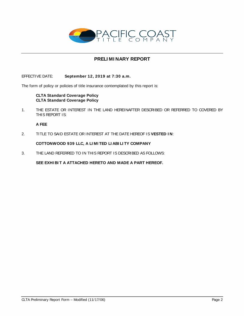
CLTA Preliminary Report Form – Modified (11/17/06) Page 2
PRELIMINARY REPORT
EFFECTIVE DATE: September 12, 2019 at 7:30 a.m.
The form of policy or policies of title insurance contemplated by this report is:
CLTA Standard Coverage PolicyCLTA Standard Coverage Policy
1. THE ESTATE OR INTEREST IN THE LAND HEREINAFTER DESCRIBED OR REFERRED TO COVERED BY THIS REPORT IS:
A FEE
2. TITLE TO SAID ESTATE OR INTEREST AT THE DATE HEREOF IS VESTED IN:
COTTONWOOD 939 LLC, A LIMITED LIABILITY COMPANY
3. THE LAND REFERRED TO IN THIS REPORT IS DESCRIBED AS FOLLOWS:
SEE EXHIBIT A ATTACHED HERETO AND MADE A PART HEREOF.
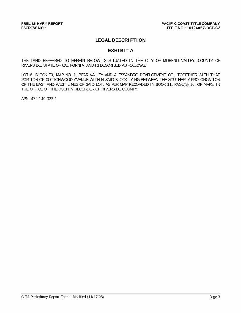
CLTA Preliminary Report Form – Modified (11/17/06) Page 3
PRELIMINARY REPORT PACIFIC COAST TITLE COMPANYESCROW NO.: TITLE NO.: 10126057-OCT-CV
LEGAL DESCRIPTION
EXHIBIT A
THE LAND REFERRED TO HEREIN BELOW IS SITUATED IN THE CITY OF MORENO VALLEY, COUNTY OF RIVERSIDE, STATE OF CALIFORNIA, AND IS DESCRIBED AS FOLLOWS:
LOT 6, BLOCK 73, MAP NO. 1, BEAR VALLEY AND ALESSANDRO DEVELOPMENT CO., TOGETHER WITH THAT PORTION OF COTTONWOOD AVENUE WITHIN SAID BLOCK LYING BETWEEN THE SOUTHERLY PROLONGATION OF THE EAST AND WEST LINES OF SAID LOT, AS PER MAP RECORDED IN BOOK 11, PAGE(S) 10, OF MAPS, IN THE OFFICE OF THE COUNTY RECORDER OF RIVERSIDE COUNTY.
APN: 479-140-022-1
PRELIMINARY REPORTESCROW NO.: TITLE NO.: 10126057-OCT-CV
CLTA Preliminary Report Form – Modified (11/17/06) Page 4
AT THE DATE HEREOF, ITEMS TO BE CONSIDERED AND EXCEPTIONS TO COVERAGE IN ADDITION TO THE PRINTED EXCEPTIONS AND EXCLUSIONS IN SAID POLICY FORM WOULD BE AS FOLLOWS:
1. Property taxes, which are a lien not yet due and payable, including any assessments collected with taxes to be levied for the fiscal year 2019-2020.
2. Note: Property taxes for the fiscal year shown below are PAID. For proration purposes the amounts were:
Tax Identification No.: 479-140-022-1Fiscal Year: 2018-20191st Installment: $4,001.032nd Installment: $4,001.03Exemption: $0.00Land: $687,255.00Improvements: $0.00Personal Property: $0.00Code Area: 021-330
3. The lien of supplemental taxes, if any, assessed pursuant to the provisions of Chapter 3.5 (Commencing with Section 75) of the Revenue and Taxation Code of the State of California.
4. Water rights, claims or title to water, whether or not disclosed by the public records.
5. An easement over said land for pipelines, ditches flumes, and rights incidental thereto, as shown by Map Book 11, Page 10, records of San Bernardino County, as reserved,
To: The Bear Valley and Alessandro Development Company
6. Easement(s) for the purpose(s) shown below and rights incidental thereto, as granted in a document:
Granted to: Southern California Gas Company, a CorporationPurpose: Pipe linesRecording Date: July 10, 1953Recording No.: in Book 1490, Page 177, Official RecordsAffects: The land
No representation is made as to the present ownership of said easement
7. Easement(s) for the purpose(s) shown below and rights incidental thereto, as granted in a document:
Granted to: Eastern Municipal Water DistrictPurpose: ConduitRecording Date: March 4, 1955Recording No.: in Book 1702, Page 559, Official RecordsAffects: Said land
No representation is made as to the present ownership of said easement
And as set out in Memo of Agreement and in Supplemental Agreement recorded March 4, 1955 in Book 1702, Pages 467 and 552, respectively, Official Records, and by deed recorded November 12, 1969 Instrument No. 115832, Official Records
PRELIMINARY REPORTESCROW NO.: TITLE NO.: 10126057-OCT-CV
CLTA Preliminary Report Form – Modified (11/17/06) Page 5
8. Easement(s) for the purpose(s) shown below and rights incidental thereto, as granted in a document:
Granted to: Eastern Municipal Water DistrictPurpose: Sewage transmission and collection facilitiesRecording Date: February 6, 1967Recording No.: 9879, Official RecordsAffects: Said land
No representation is made as to the present ownership of said easement
9. Covenants, conditions and restrictions but omitting any covenants or restrictions, if any, including but not limited to those based upon race, color, religion, sex, sexual orientation, familial status, marital status, disability, handicap, national origin, ancestry, or source of income, as set forth in applicable state or federal laws, except to the extent that said covenant or restriction is permitted by applicable law, as set forth in the document
Recording Date: September 24, 1969Recording No: 98071, Official Records
Modification(s) of said covenants, conditions and restrictions
Recording Date: April 5, 1972Recording No.: 44054, Official Records
10. Easement(s) for the purpose(s) shown below and rights incidental thereto, as granted in a document:
Granted to: Ronald E. Tendler and Carrie J. Tendler, Trustees of the Tendler Trust dated May 14, 1990 as amended and restated December 29th, 1998Purpose: Road, utility, drainage and construction purposesRecording Date: October 1, 2004Recording No.: 2004-0783790, Official RecordsAffects: The land
No representation is made as to the present ownership of said easement
PRELIMINARY REPORTESCROW NO.: TITLE NO.: 10126057-OCT-CV
CLTA Preliminary Report Form – Modified (11/17/06) Page 6
11. A deed of trust to secure an indebtedness in the amount shown below,
Amount: $500,000.00Dated: July 6, 2016Trustor/Grantor: Cottonwood 939, LLC, a California Limited Liability CompanyTrustee: Worldwide Lenders, Inc., a Delaware CorporationBeneficiary: Val-Chris Investments, Inc., a California CorporationLoan No.: 11266Recording Date: July 19, 2016Recording No.: 2016-0301060, Official Records
This Company will require that the original note, the original deed of trust and a properly executed request for full reconveyance together with appropriate documentation (i.e., copy of trust, partnership agreement or corporate resolution) be in this office prior to the close of this transaction if the above-mentioned item is to be paid through this transaction or deleted from a policy of title insurance.
Any demands submitted to us for payoff must be signed by all beneficiaries as shown on said deed of trust, and/or any assignments thereto. In the event said demand is submitted by an agent of the beneficiary(s), we will require the written approval of the demand by the beneficiary(s). Servicing agreements do not constitute approval for the purposes of this requirement.
If no amounts remain due under the obligation a zero balance demand will be required along with the reconveyance documents.
In addition, we require the written approval of said demand by the trustor(s) on said deed of trust or the current owners if applicable.
An assignment of the beneficial interest under said deed of trust which names:
Assignee: Avalon, LP, a California Limited PartnershipLoan No.: 11266Recording Date: July 19, 2016Recording No.: 2016-0301061, Official Records
PRELIMINARY REPORTESCROW NO.: TITLE NO.: 10126057-OCT-CV
CLTA Preliminary Report Form – Modified (11/17/06) Page 7
12. The Company will require the following documents for review prior to the issuance of any title assurance predicated upon a conveyance or encumbrance from the entity named below:
Limited Liability Company: Cottonwood 939 LLC, a Limited Liability Company
a) A copy of its operating agreement, if any, and any and all amendments, supplements and/or modifications thereto, certified by the appropriate manager or member
b) If a domestic Limited Liability Company, a copy of its Articles of Organization and all amendments thereto with the appropriate filing stamps
c) If the Limited Liability Company is member-managed, a full and complete current list of members certified by the appropriate manager or member
d) If the Limited Liability Company was formed in a foreign jurisdiction, evidence, satisfactory to the Company, that it was validly formed, is in good standing and authorized to do business in the state of origin
e) If less than all members, or managers, as appropriate, will be executing the closing documents, furnish evidence of the authority of those signing.
The Company reserves the right to add additional items or make further requirements after review of the requested documentation.
13. Matters which may be disclosed by an inspection and/or by a correct ALTA/ACSM Land Title Survey of said Land that is satisfactory to the Company, and/or by inquiry of the parties in possession thereof.
14. An inspection of said Land has been ordered; upon its completion the Company reserves the right to except additional items and/or make additional requirements.
END OF ITEMS
PRELIMINARY REPORTESCROW NO.: TITLE NO.: 10126057-OCT-CV
CLTA Preliminary Report Form – Modified (11/17/06) Page 8
NOTES
1. Note: None of the items shown in this report will cause the Company to decline to attach CLTA Endorsement Form 100 to an Extended Coverage Loan Policy, when issued.
2. Note: There are NO conveyances affecting said Land recorded within 24 months of the date of this report.
3. Note: The policy of title insurance will include an arbitration provision. The Company or the insured may demand arbitration. Arbitrable matters may include, but are not limited to, any controversy or claim between the Company and the insured arising out of or relating to this policy, any service of the Company in connection with its issuance or the breach of a policy provision or other obligation. Please ask your escrow or title officer for a sample copy of the policy to be issued if you wish to review the arbitration provisions and any other provisions pertaining to your Title Insurance coverage.
4. Note: Amended Civil Code Section 2941, which becomes effective on January 1, 2002, sets the fee for the processing and recordation of the reconveyance of each Deed of Trust being paid off through this transaction at $45.00. The reconveyance fee must be clearly set forth in the Beneficiary's Payoff Demand Statement (''Demand''). In addition, an assignment or authorized release of that fee, from the Beneficiary to the Trustee of record, must be included. An example of the required language is as follows:
''The Beneficiary identified above hereby assigns, releases or transfers to the Trustee of record, the sum of $45.00, included herein as 'Reconveyance Fees', for the processing and recordation of the Reconveyance of the Deed of Trust securing the indebtedness covered hereby, and the escrow company or title company processing this pay-off is authorized to deduct the Reconveyance Fee from this Demand and forward said fee to the Trustee of record or the successor Trustee under the Trust Deed to be paid off in full.''
In the event that the reconveyance fee and the assignment, release or transfer thereof are not included within the demand statement, then Pacific Coast Title Company may decline to process the reconveyance and will be forced to return all documentation directly to the Beneficiary for compliance with the requirements of the revised statute.
5. If a county recorder, title insurance company, escrow company, real estate broker, real estate agent or association provides a copy of a declaration, governing document or deed to any person, California law requires that the document provided shall include a statement regarding any unlawful restrictions. Said statement is to be in at least 14-point bold face type and may be stamped on the first page of any document provided or included as a cover page attached to the requested document. Should a party to this transaction request a copy of any document reported herein that fits this category, the statement is to be included in the manner described.
6. Notice: Please be aware that due to the conflict between federal and state laws concerning the cultivation, distribution, manufacture or sale of marijuana, the Company is not able to close or insure any transaction involving Land that is associated with these activities.
PRELIMINARY REPORTESCROW NO.: TITLE NO.: 10126057-OCT-CV
CLTA Preliminary Report Form – Modified (11/17/06) Page 9
WIRE INSTRUCTIONS
When funds are wired to Pacific Coast Title Company, please use the instructions below:
Bank Name & Address Wire Routing Information
Nano Banc, 7700 Irvine Center Drive, Suite 700, Irvine, CA 92618
ABA (Routing) Number: 122245251Account Number: 6100101033Account Name: Pacific Coast Title CompanyCredit: Pacific Coast Title Company - OCTReference: 10126057
The policy(s) of title insurance to be issued hereunder will be policy(s) of Commonwealth Land Title Insurance Company, a Nebraska corporation.
Funds received by this Company via wire transfer may be disbursed upon receipt. Funds received by this company via cashier’s check or tellers check may be disbursed on the next business day after the day of deposit. If escrow funds (including shortage checks) are disbursed to this company other than by wire transfer, cashier’s check or teller’s check, disbursement and/or closing will be delayed 3 to 7 business days. Questions concerning deposit and/or disbursement of escrow and sub-escrow funds and recording should be directed to your title officer, escrow officer or loan payoff officer.
Outgoing wire transfers will not be authorized until we have confirmation of our recording and one (1) of the following:A We have received confirmation of the respective incoming wire.B. Collection of a deposited check.
PAYOFF INFORMATION
NOTE: This Company DOES require current beneficiary demands prior to closing. If the demand is expired and a current demand cannot be obtained, our requirements will be as follows:
If this Company accepts a verbal update on the demand, we may hold an amount equal to one monthly mortgage payment. This hold will be over and above the verbal hold the lender may have stipulated.
If this Company cannot obtain a verbal update on the demand, we will either pay off of the expired demand, or wait for the amended demand, at the discretion of the escrow.
NOTE: to avoid delays at the time of closing, if the above deed of trust is an Equity Line/Line of Credit, it will be necessary that all checks, passbooks, credit cards together with instructions to close the account be submitted to the Company prior to the close of this transaction.
In order to expedite compliance with the above, please do the following:
Borrower(s):a) Sign and return the Equity Line/Credit Line Affidavit provided with the report,b) Request that the account be frozen.
Settlement:a) Obtain a statement from the lender that no advances have been made after the issuance
of the demand for payoff, and b) Upon delivery of the payoff check, a full reconveyance must be obtained.
Please be advised that the difference between the principal balance on an issued demand and the maximum principal allowed may be held for up to 10 working days if the above requirements are not met.
END OF NOTES
Clive Virata / SE
CLTA Preliminary Report Form – Modified (11/17/06) Page 10
PACIFIC COAST TITLE COMPANYPRIVACY NOTICE
Pacific Coast Title Company, (“PCT”) respect and are committed to protecting your privacy. This Privacy Notice lets you know how and for what purposes your Personal Information (as defined herein) is being collected, processed and used by PCT. We pledge that we will take reasonable steps to ensure that your Personal Information will only be used in ways that are in compliance with this Privacy Notice. The provision of this Privacy Notice to you does not create any express or implied relationship, or create any express or implied duty or other obligation, between Pacific Coast Title Company and you. See also No Representations or Warranties below.
This Privacy Notice is only in effect for any generic information and Personal Information collected and/or owned by PCT, including collection through any PCT website and any online features, services and/or programs offered by PCT (collectively, the “Website”). This Privacy Notice is not applicable to any other web pages, mobile applications, social media sites, email lists, generic information or Personal Information collected and/or owned by any entity other than PCT.
How Information is CollectedThe types of personal information PCT collects may include, among other things (collectively, “Personal Information”): (1) contact information (e.g., name, address, phone number, email address); (2) demographic information (e.g., date of birth, gender marital status); (3) Internet protocol (or IP) address or device ID/UDID; (4) social security number (SSN), student ID (SIN), driver’s license, passport, and other government ID numbers; (5) financial account information; and (6) information related to offenses or criminal convictions.In the course of our business, we may collect Personal Information about you from the following sources:
Applications or other forms we receive from you or your authorized representative;
Information we receive from you through the Website; Information about your transactions with or services
performed by us, our affiliates, or others; and From consumer or other reporting agencies and public
records maintained by governmental entities that we either obtain directly from those entities, or from our affiliates or others.
Additional Ways Information is Collected Through the WebsiteBrowser Log Files. Our servers automatically log each visitor to the
Website and collect and record certain information about each visitor. This information may include IP address, browser language, browser type, operating system, domain names, browsing history (including time spent at a domain, time and date of your visit), referring/exit web pages and URLs, and number of clicks. The domain name and IP address reveal nothing personal about the user other than the IP address from which the user has accessed the Website.
Cookies. From time to time, PCT or other third parties may send a “cookie” to your computer. A cookie is a small piece of data that is sent to your Internet browser from a web server and stored on your computer’s hard drive and that can be re-sent to the serving website on subsequent visits. A cookie, by itself, cannot read other data from your hard disk or read other cookie files already on your computer. A cookie, by itself, does not damage your system. We, our advertisers and other third parties may use cookies to identify and keep track of, among other things, those areas of the Website and third party websites that you have visited in the past in order to enhance your next visit to the Website. You can choose whether or not to accept cookies by changing the settings of your Internet browser, but some functionality of the Website may be impaired or not function as intended. See the Third Party Opt Out section below.
Web Beacons. Some of our web pages and electronic communications may contain images, which may or may not be visible to you, known as Web Beacons (sometimes referred to as “clear gifs”). Web Beacons collect only limited information that includes a cookie number; time and date of a page view; and a description of the page on which the Web Beacon resides. We may also carry Web Beacons placed by third
party advertisers. These Web Beacons do not carry any Personal Information and are only used to track usage of the Website and activities associated with the Website. See the Third Party Opt Out section below.
Unique Identifier. We may assign you a unique internal identifier to help keep track of your future visits. We may use this information to gather aggregate demographic information about our visitors, and we may use it to personalize the information you see on the Website and some of the electronic communications you receive from us. We keep this information for our internal use, and this information is not shared with others.
Third Party Opt Out. Although we do not presently, in the future we may allow third-party companies to serve advertisements and/or collect certain anonymous information when you visit the Website. These companies may use non-personally identifiable information (e.g., click stream information, browser type, time and date, subject of advertisements clicked or scrolled over) during your visits to the Website in order to provide advertisements about products and services likely to be of greater interest to you. These companies typically use a cookie or third party Web Beacon to collect this information, as further described above. Through these technologies, the third party may have access to and use non-personalized information about your online usage activity.
You can opt-out of certain online behavioral services through any one of the ways described below. After you opt-out, you may continue to receive advertisements, but those advertisements will no longer be as relevant to you.
You can opt-out via the Network Advertising Initiative industry opt-out at http://www.networkadvertising.org/.
You can opt-out via the Consumer Choice Page at www.aboutads.info.
For those in the U.K., you can opt-out via the IAB UK's industry opt-out at www.youronlinechoices.com.
You can configure your web browser (Chrome, Firefox, Internet Explorer, Safari, etc.) to delete and/or control the use of cookies.
More information can be found in the Help system of your browser. Note: If you opt-out as described above, you should not delete your cookies. If you delete your cookies, you will need to opt-out again.
Use of Personal InformationInformation collected by PCT is used for three main purposes:
To provide products and services to you or one or more third party service providers (collectively, “Third Parties”) who are obtaining services on your behalf or in connection with a transaction involving you.
To improve our products and services that we perform for you or for Third Parties.
To communicate with you and to inform you about PCT’s, PCT’s affiliates and third parties’ products and services.
When Information Is Disclosed By PCTWe may provide your Personal Information (excluding information we receive from consumer or other credit reporting agencies) to various individuals and companies, as permitted by law, without obtaining your prior authorization. Such laws do not allow consumers to restrict these disclosures. Disclosures may include, without limitation, the following:
To agents, brokers, representatives, or others to provide you with services you have requested, and to enable us to detect or prevent criminal activity, fraud, material misrepresentation, or nondisclosure in connection with an insurance transaction;
CLTA Preliminary Report Form – Modified (11/17/06) Page 11
To third-party contractors or service providers who provide services or perform marketing services or other functions on our behalf;
To law enforcement or other governmental authority in connection with an investigation, or civil or criminal subpoenas or court orders; and/or
To lenders, lien holders, judgment creditors, or other parties claiming an encumbrance or an interest in title whose claim or interest must be determined, settled, paid or released prior to a title or escrow closing.
In addition to the other times when we might disclose information about you, we might also disclose information when required by law or in the good-faith belief that such disclosure is necessary to: (1) comply with a legal process or applicable laws; (2) enforce this Privacy Notice; (3) respond to claims that any materials, documents, images, graphics, logos, designs, audio, video and any other information provided by you violates the rights of third parties; or (4) protect the rights, property or personal safety of PCT, its users or the public.
We maintain reasonable safeguards to keep the Personal Information that is disclosed to us secure. We provide Personal Information and non-Personal Information to our subsidiaries, affiliated companies, and other businesses or persons for the purposes of processing such information on our behalf and promoting the services of our trusted business partners, some or all of which may store your information on servers outside of the United States. We require that these parties agree to process such information in compliance with our Privacy Notice or in a similar, industry-standard manner, and we use reasonable efforts to limit their use of such information and to use other appropriate confidentiality and security measures. The use of your information by one of our trusted business partners may be subject to that party’s own Privacy Notice. We do not, however, disclose information we collect from consumer or credit reporting agencies with our affiliates or others without your consent, in conformity with applicable law, unless such disclosure is otherwise permitted by law.
We also reserve the right to disclose Personal Information and/or non-Personal Information to take precautions against liability, investigate and defend against any third-party claims or allegations, assist government enforcement agencies, protect the security or integrity of the Website, and protect the rights, property, or personal safety of PCT, our users or others.
We reserve the right to transfer your Personal Information, as well as any other information, in connection with the sale or other disposition of all or part of the PCT business and/or assets. We also cannot make any representations regarding the use or transfer of your Personal Information or other information that we may have in the event of our bankruptcy, reorganization, insolvency, receivership or an assignment for the benefit of creditors, and you expressly agree and consent to the use and/or transfer of your Personal Information or other information in connection with a sale or transfer of some or all of our assets in any of the above described proceedings. Furthermore, we cannot and will not be responsible for any breach of security by any third parties or for any actions of any third parties that receive any of the information that is disclosed to us.
Information From ChildrenWe do not collect Personal Information from any person that we know to be under the age of thirteen (13). Specifically, the Website is not intended or designed to attract children under the age of thirteen (13). You affirm that you are either more than 18 years of age, or an emancipated minor, or possess legal parental or guardian consent, and are fully able and competent to enter into the terms, conditions, obligations, affirmations, representations, and warranties set forth in this Privacy Notice, and to abide by and comply with this Privacy Notice. In any case, you affirm that you are over the age of 13, as THE WEBSITE IS NOT INTENDED FOR CHILDREN UNDER 13 THAT ARE UNACCOMPANIED BY HIS OR HER PARENT OR LEGAL GUARDIAN.
Parents should be aware that PCT’s Privacy Notice will govern our use of Personal Information, but also that information that is voluntarily given by children – or others – in email exchanges, bulletin boards or the like may be used by other parties to generate unsolicited communications. PCT
encourages all parents to instruct their children in the safe and responsible use of their Personal Information while using the Internet.
Privacy Outside the WebsiteThe Website may contain various links to other websites, including links to various third party service providers. PCT is not and cannot be responsible for the privacy practices or the content of any of those other websites. Other than under agreements with certain reputable organizations and companies, and except for third party service providers whose services either we use or you voluntarily elect to utilize, we do not share any of the Personal Information that you provide to us with any of the websites to which the Website links, although we may share aggregate, non-Personal Information with those other third parties. Please check with those websites in order to determine their privacy policies and your rights under them.
European Union UsersIf you are a citizen of the European Union, please note that we may transfer your Personal Information outside the European Union for use for any of the purposes described in this Privacy Notice. By providing PCT with your Personal Information, you consent to both our collection and such transfer of your Personal Information in accordance with this Privacy Notice.
Choices With Your Personal InformationWhether you submit Personal Information to PCT is entirely up to you. You may decide not to submit Personal Information, in which case PCT may not be able to provide certain services or products to you.
You may choose to prevent PCT from disclosing or using your Personal Information under certain circumstances (“opt out”). You may opt out of any disclosure or use of your Personal Information for purposes that are incompatible with the purpose(s) for which it was originally collected or for which you subsequently gave authorization by notifying us by one of the methods at the end of this Privacy Notice. Furthermore, even where your Personal Information is to be disclosed and used in accordance with the stated purposes in this Privacy Notice, you may elect to opt out of such disclosure to and use by a third party that is not acting as an agent of PCT. As described above, there are some uses from which you cannot opt-out.
Please note that opting out of the disclosure and use of your Personal Information as a prospective employee may prevent you from being hired as an employee by PCT to the extent that provision of your Personal Information is required to apply for an open position.
If PCT collects Personal Information from you, such information will not be disclosed or used by PCT for purposes that are incompatible with the purpose(s) for which it was originally collected or for which you subsequently gave authorization unless you affirmatively consent to such disclosure and use.
You may opt out of online behavioral advertising by following the instructions set forth above under the above section “Additional Ways That Information Is Collected Through the Website,” subsection “Third Party Opt Out.”
Access and CorrectionTo access your Personal Information in the possession of PCT and correct inaccuracies of that information in our records, please contact us in the manner specified at the end of this Privacy Notice. We ask individuals to identify themselves and the information requested to be accessed and amended before processing such requests, and we may decline to process requests in limited circumstances as permitted by applicable privacy legislation.
Your California Privacy RightsUnder California’s “Shine the Light” law, California residents who provide certain personally identifiable information in connection with obtaining products or services for personal, family or household use are entitled to
CLTA Preliminary Report Form – Modified (11/17/06) Page 12
request and obtain from us once a calendar year information about the customer information we shared, if any, with other businesses for their own direct marketing uses. If applicable, this information would include the categories of customer information and the names and addresses of those businesses with which we shared customer information for the immediately prior calendar year (e.g., requests made in 2015 will receive information regarding 2014 sharing activities).
To obtain this information on behalf of PCT, please send an email message to [email protected] with “Request for California Privacy Information” in the subject line and in the body of your message. We will provide the requested information to you at your email address in response.
Please be aware that not all information sharing is covered by the “Shine the Light” requirements and only information on covered sharing will be included in our response.
Additionally, because we may collect your Personal Information from time to time, California’s Online Privacy Protection Act requires us to disclose how we respond to “do not track” requests and other similar mechanisms. Currently, our policy is that we do not recognize “do not track” requests from Internet browsers and similar devices.
PCT Compliance with California Online Privacy Protection ActFor some websites which PCT or one of its companies owns, such as the Customer CareNet (“CCN”), PCT is acting as a third party service provider to a mortgage loan servicer. In those instances, we may collect certain information on behalf of that mortgage loan servicer for fulfilling a service to that mortgage loan servicer. For example, you may access CCN to complete a transaction with your mortgage loan servicer. During this transaction, the information which we may collect on behalf of the mortgage loan servicer is as follows:
First and Last Name Property Address User Name Password Loan Number Social Security Number - masked upon entry Email Address Three Security Questions and Answers IP Address
The information you submit is then transferred to your mortgage loan servicer by way of CCN.
The mortgage loan servicer is responsible for taking action or making changes to any consumer information submitted through this website. For example, if you believe that your payment or user information is incorrect, you must contact your mortgage loan servicer.
CCN does not share consumer information with third parties, other than those with which the mortgage loan servicer has contracted to interface with the CCN application.
All sections of the PCT Privacy Notice apply to your interaction with CCN, except for the sections titled Choices with Your Personal Information and Access and Correction. If you have questions regarding the choices you have with regard to your personal information or how to access or correct your personal information, you should contact your mortgage loan servicer.
No Representations or WarrantiesBy providing this Privacy Notice, Pacific Coast Title Company does not make any representations or warranties whatsoever concerning any products or services provided to you by its majority-owned subsidiaries. In addition, you also expressly agree that your use of the Website is at your
own risk. Any services provided to you by Pacific Coast Title Company and/or the Website are provided “as is” and “as available” for your use, without representations or warranties of any kind, either express or implied, unless such warranties are legally incapable of exclusion. Pacific Coast Title Company makes no representations or warranties that any services provided to you by it or the Website, or any services offered in connection with the Website are or will remain uninterrupted or error-free, that defects will be corrected, or that the web pages on or accessed through the Website, or the servers used in connection with the Website, are or will remain free from any viruses, worms, time bombs, drop dead devices, Trojan horses or other harmful components. Any liability of Pacific Coast Title Companyand your exclusive remedy with respect to the use of any product or service provided by Pacific Coast Title Company including on or accessed through the Website, will be the re-performance of such service found to be inadequate.
Your Consent To This Privacy NoticeBy submitting Personal Information to PCT, you consent to the collection and use of information by us as specified above or as we otherwise see fit, in compliance with this Privacy Notice, unless you inform us otherwise by means of the procedure identified below. If we decide to change this Privacy Notice, we will make an effort to post those changes on the Website. Each time we collect information from you following any amendment of this Privacy Notice will signify your assent to and acceptance of its revised terms for all previously collected information and information collected from you in the future. We may use comments, information or feedback that you may submit in any manner that we may choose without notice or compensation to you.
If you have additional questions or comments, please let us know by sending your comments or requests to:
Pacific Coast Title Company1111 East Katella Avenue, #120
Orange, CA 92620Attn.: Executive Vice President
Copyright © 2015. Pacific Coast Title Company All Rights Reserved.
EFFECTIVE AS OF: MAY 1, 2015
PRELIMINARY REPORTESCROW NO.: TITLE NO.: 10126057-OCT-CV
CLTA Preliminary Report Form – Modified (11/17/06) Page 13
Notice of Available Discounts
Pursuant to Section 2355.3 in Title 10 of the California Code of Regulations Fidelity National Financial, Inc. and its subsidiaries ("FNF") must deliver a notice of each discount available under our current rate filing along with the delivery of escrow instructions, a preliminary report or commitment. Please be aware that the provision of this notice does not constitute a waiver of the consumer’s right to be charged the filed rate. As such, your transaction may not qualify for the below discounts.
You are encouraged to discuss the applicability of one or more of the below discounts with a Company representative. These discounts are generally described below; consult the rate manual for a full description of the terms, conditions and requirements for such discount. These discounts only apply to transactions involving services rendered by the FNF Family of Companies. This notice only applies to transactions involving property improved with a one-to-four family residential dwelling.
Not all discounts are offered by every FNF Company. The discount will only be applicable to the FNF Company as indicated by the named discount.
FNF Underwritten Title Companies Underwritten by FNF UnderwritersCTC – Chicago Title Company CTIC – Chicago Title Insurance CompanyCLTC – Commonwealth Land Title Company CLTIC – Commonwealth Land Title Insurance CompanyFNTC – Fidelity National Title Company FNTIC – Fidelity National Title Insurance CompanyFNTCCA – Fidelity National Title Company of California FNTIC – Fidelity National Title Insurance CompanyTICOR – Ticor Title Company of California CTIC – Chicago Title Insurance CompanyLTC – Lawyer’s Title Company CLTIC – Commonwealth Land Title Insurance Company
DISASTER LOANS (CTIC)The charge for a Lender's Policy (Standard or Extended coverage) covering the financing or refinancing by an owner of record, within twenty-four (24) months of the date of a declaration of a disaster area by the government of the United States or the State of California on any land located in said area, which was partially or totally destroyed in the disaster, will be fifty percent (50%) of the appropriate title insurance rate.
CHURCHES OR CHARITABLE NON-PROFITABLE ORGANIZATIONS (CTIC, FNTIC)On properties used as a church or for charitable purposes within the scope of the normal activities of such entities, provided said charge is normally the church’s obligation the charge for an owner’s policy shall be fifty percent (50%) to seventy percent (70%) of the appropriate title insurance rate, depending on the type of coverage selected. The charge for a lender’s policy shall be thirty-two percent (32%) to fifty percent (50%) of the appropriate title insurance rate, depending on the type of coverage selected.
Attachment One (06-05-14)CLTA Preliminary Report Form – Modified (11/17/06) Page 14
ATTACHMENT ONECALIFORNIA LAND TITLE ASSOCIATIONSTANDARD COVERAGE POLICY – 1990
EXCLUSIONS FROM COVERAGE
The following matters are expressly excluded from the coverage of this policy and the Company will not pay loss or damage, costs, attorneys' fees or expenses which arise by reason of:
1. (a) Any law, ordinance or governmental regulation (including but not limited to building or zoning laws, ordinances, or regulations) restricting, regulating, prohibiting or relating (i) the occupancy, use, or enjoyment of the land; (ii) the character, dimensions or location of any improvement now or hereafter erected on the land; (iii) a separation in ownership or a change in the dimensions or area of the land or any parcel of which the land is or was a part; or (iv) environmental protection, or the effect of any violation of these laws, ordinances or governmental regulations, except to the extent that a notice of the enforcement thereof or a notice of a defect, lien, or encumbrance resulting from a violation or alleged violation affecting the land has been recorded in the public records at Date of Policy.
(b) Any governmental police power not excluded by (a) above, except to the extent that a notice of the exercise thereof or notice of a defect, lien or encumbrance resulting from a violation or alleged violation affecting the land has been recorded in the public records at Date of Policy.
2. Rights of eminent domain unless notice of the exercise thereof has been recorded in the public records at Date of Policy, but not excluding from coverage any taking which has occurred prior to Date of Policy which would be binding on the rights of a purchaser for value without knowledge.
3. Defects, liens, encumbrances, adverse claims or other matters:(a) whether or not recorded in the public records at Date
of Policy, but created, suffered, assumed or agreed to by the insured claimant;
(b) not known to the Company, not recorded in the public records at Date of Policy, but known to the insured claimant and not disclosed in writing to the Company by the insured claimant prior to the date the insured claimant became an insured under this policy;
(c) resulting in no loss or damage to the insured claimant;
(d) attaching or created subsequent to Date of Policy; or(e) resulting in loss or damage which would not have
been sustained if the insured claimant had paid value for the insured mortgage or for the estate or interest insured by this policy.
4. Unenforceability of the lien of the insured mortgage because of the inability or failure of the insured at Date of Policy, or the inability or failure of any subsequent owner of the indebtedness, to comply with the applicable doing business laws of the state in which the land is situated.
5. Invalidity or unenforceability of the lien of the insured mortgage, or claim thereof, which arises out of the transaction evidenced by the insured mortgage and is based upon usury or any consumer credit protection or truth in lending law.
6. Any claim, which arises out of the transaction vesting in the insured the estate of interest insured by this policy or the transaction creating the interest of the insured lender, by reason of the operation of federal bankruptcy, state insolvency or similar creditors' rights laws.
EXCEPTIONS FROM COVERAGE - SCHEDULE B, PART I
This policy does not insure against loss or damage (and the Company will not pay costs, attorneys' fees or expenses) which arise by reason of:
1. Taxes or assessments which are not shown as existing liens by the records of any taxing authority that levies taxes or assessments on real property or by the public records. Proceedings by a public agency which may result in taxes or assessments, or notices of such proceedings, whether or not shown by the records of such agency or by the public records.
2. Any facts, rights, interests, or claims which are not shown by the public records but which could be ascertained by an inspection of the land or which may be asserted by persons in possession thereof.
3. Easements, liens or encumbrances, or claims thereof, not
shown by the public records.4. Discrepancies, conflicts in boundary lines, shortage in area,
encroachments, or any other facts which a correct survey would disclose, and which are not shown by the public records.
5. (a) Unpatented mining claims; (b) reservations or exceptions in patents or in Acts authorizing the issuance thereof; (c) water rights, claims or title to water, whether or not the matters excepted under (a), (b) or (c) are shown by the public records.
6. Any lien or right to a lien for services, labor or material not shown by the public records.
ATTACHMENT ONE(CONTINUED)
Attachment One (06-05-14)CLTA Preliminary Report Form – Modified (11/17/06) Page 15
CLTA HOMEOWNER'S POLICY OF TITLE INSURANCE (12-02-13)ALTA HOMEOWNER'S POLICY OF TITLE INSURANCE
EXCLUSIONS In addition to the Exceptions in Schedule B, You are not insured against loss, costs, attorneys' fees, and expenses resulting from:
1. Governmental police power, and the existence or violation of those portions of any law or government regulation concerning:
a. building; b. zoning; c. land use; d. improvements on the Land; e. land division; and f. environmental protection. This Exclusion does not limit the coverage described in
Covered Risk 8.a., 14, 15, 16, 18, 19, 20, 23 or 27. 2. The failure of Your existing structures, or any part of them,
to be constructed in accordance with applicable building codes. This Exclusion does not limit the coverage described in Covered Risk 14 or 15.
3. The right to take the Land by condemning it. This Exclusion does not limit the coverage described in Covered Risk 17.
4. Risks: a. that are created, allowed, or agreed to by You, whether
or not they are recorded in the Public Records; b. that are Known to You at the Policy Date, but not to
Us, unless they are recorded in the Public Records at the Policy Date;
c. that result in no loss to You; or d. that first occur after the Policy Date - this does not limit
the coverage described in Covered Risk 7, 8.e., 25, 26, 27 or 28.
5. Failure to pay value for Your Title. 6. Lack of a right:
a. to any land outside the area specifically described and referred to in paragraph 3 of Schedule A; and
b. in streets, alleys, or waterways that touch the Land. This Exclusion does not limit the coverage described in Covered Risk 11 or 21.
7. The transfer of the Title to You is invalid as a preferential transfer or as a fraudulent transfer or conveyance under federal bankruptcy, state insolvency, or similar creditors’ rights laws.
8. Contamination, explosion, fire, flooding, vibration, fracturing, earthquake, or subsidence.
9. Negligence by a person or an Entity exercising a right to extract or develop minerals, water, or any other substances.
LIMITATIONS ON COVERED RISKSYour insurance for the following Covered Risks is limited on the Owner’s Coverage Statement as follows:
For Covered Risk 16, 18, 19, and 21 Your Deductible Amount and Our Maximum Dollar Limit of Liability shown in Schedule A.The deductible amounts and maximum dollar limits shown on Schedule A are as follows:
Your Deductible AmountOur Maximum DollarLimit of Liability
Covered Risk 16: 1% of Policy Amount Shown in Schedule A or $2,500.00 $10,000.00(whichever is less)
Covered Risk 18: 1% of Policy Amount Shown in Schedule A or $5,000.00 $25,000.00(whichever is less)
Covered Risk 19: 1% of Policy Amount Shown in Schedule A or $5,000.00 $25,000.00(whichever is less)
Covered Risk 21: 1% of Policy Amount Shown in Schedule A or $2,500.00 $5,000.00(whichever is less)
ATTACHMENT ONE(CONTINUED)
Attachment One (06-05-14)CLTA Preliminary Report Form – Modified (11/17/06) Page 16
2006 ALTA LOAN POLICY (06-17-06)EXCLUSIONS FROM COVERAGE
The following matters are expressly excluded from the coverage of this policy, and the Company will not pay loss or damage, costs, attorneys' fees, or expenses that arise by reason of:
1. (a) Any law, ordinance, permit, or governmental regulation (including those relating to building and zoning) restricting, regulating, prohibiting, or relating to(i) the occupancy, use, or enjoyment of the Land; (ii) the character, dimensions, or location of any
improvement erected on the Land; (iii) the subdivision of land; or(iv) environmental protection; or the effect of any violation of these laws, ordinances, or governmental regulations. This Exclusion 1(a) does not modify or limit the coverage provided under Covered Risk 5.
(b) Any governmental police power. This Exclusion 1(b) does not modify or limit the coverage provided under Covered Risk 6.
2. Rights of eminent domain. This Exclusion does not modify or limit the coverage provided under Covered Risk 7 or 8.
3. Defects, liens, encumbrances, adverse claims, or other matters(a) created, suffered, assumed, or agreed to by the
Insured Claimant;(b) not Known to the Company, not recorded in the
Public Records at Date of Policy, but Known to the Insured Claimant and not disclosed in writing to the Company by the Insured Claimant prior to the date the Insured Claimant became an Insured under this policy;
(c) resulting in no loss or damage to the Insured Claimant;
(d) attaching or created subsequent to Date of Policy (however, this does not modify or limit the coverage provided under Covered Risk 11, 13 or 14); or
(e) resulting in loss or damage that would not have been sustained if the Insured Claimant had paid value for the Insured Mortgage.
4. Unenforceability of the lien of the Insured Mortgage because of the inability or failure of an Insured to comply with applicable doing-business laws of the state where the Land is situated.
5. Invalidity or unenforceability in whole or in part of the lien of the Insured Mortgage that arises out of the transaction evidenced by the Insured Mortgage and is based upon usury or any consumer credit protection or truth-in-lending law.
6. Any claim, by reason of the operation of federal bankruptcy, state insolvency, or similar creditors’ rights laws, that the transaction creating the lien of the Insured Mortgage, is(a) a fraudulent conveyance or fraudulent transfer, or(b) a preferential transfer for any reason not stated in
Covered Risk 13(b) of this policy. 7. Any lien on the Title for real estate taxes or assessments
imposed by governmental authority and created or attaching between Date of Policy and the date of recording of the Insured Mortgage in the Public Records. This Exclusion does not modify or limit the coverage provided under Covered Risk 11(b).
The above policy form may be issued to afford either Standard Coverage or Extended Coverage. In addition to the above Exclusions from Coverage, the Exceptions from Coverage in a Standard Coverage policy will also include the following Exceptions from Coverage:
EXCEPTIONS FROM COVERAGEExcept as provided in Schedule B - Part II, this policy does not insure against loss or damage, and the Company will not pay costs, attorneys’ fees or expenses, that arise by reason of:
PART I
The above policy form may be issued to afford either Standard Coverage or Extended Coverage. In addition to the above Exclusions from Coverage, the Exceptions from Coverage in a Standard Coverage policy will also include the following Exceptions from Coverage:
1. (a) Taxes or assessments that are not shown as existing liens by the records of any taxing authority that levies taxes or assessments on real property or by the Public Records; (b) proceedings by a public agency that may result in taxes or assessments, or notices of such proceedings, whether or not shown by the records of such agency or by the Public Records.
2. Any facts, rights, interests, or claims that are not shown by the Public Records but that could be ascertained by an inspection of the Land or that may be asserted by persons in possession of the Land.
3. Easements, liens or encumbrances, or claims thereof, not shown by the Public Records.
4. Any encroachment, encumbrance, violation, variation, or adverse circumstance affecting the Title that would be disclosed by an accurate and complete land survey of the Land and not shown by the Public Records.
5. (a) Unpatented mining claims; (b) reservations or exceptions in patents or in Acts authorizing the issuance thereof; (c) water rights, claims or title to water, whether or not the matters excepted under (a), (b), or (c) are shown by the Public Records.
6. Any lien or right to a lien for services, labor or material not shown by the Public Records.
ATTACHMENT ONE(CONTINUED)
Attachment One (06-05-14)CLTA Preliminary Report Form – Modified (11/17/06) Page 17
2006 ALTA OWNER’S POLICY (06-17-06)
EXCLUSIONS FROM COVERAGEThe following matters are expressly excluded from the coverage of this policy, and the Company will not pay loss or damage, costs, attorneys' fees, or expenses that arise by reason of:
1. (a) Any law, ordinance, permit, or governmental regulation (including those relating to building and zoning) restricting, regulating, prohibiting, or relating to(i) the occupancy, use, or enjoyment of the Land; (ii) the character, dimensions, or location of any
improvement erected on the Land; (iii) the subdivision of land; or (iv) environmental protection; or the effect of any violation of these laws, ordinances, or governmental regulations. This Exclusion 1(a) does not modify or limit the coverage provided under Covered Risk 5.
(b) Any governmental police power. This Exclusion 1(b) does not modify or limit the coverage provided under Covered Risk 6.
2. Rights of eminent domain. This Exclusion does not modify or limit the coverage provided under Covered Risk 7 or 8.
3. Defects, liens, encumbrances, adverse claims, or other matters (a) created, suffered, assumed, or agreed to by the
Insured Claimant; (b) not Known to the Company, not recorded in the
Public Records at Date of Policy, but Known to the
Insured Claimant and not disclosed in writing to the Company by the Insured Claimant prior to the date the Insured Claimant became an Insured under this policy;
(c) resulting in no loss or damage to the Insured Claimant;
(d) attaching or created subsequent to Date of Policy (however, this does not modify or limit the coverage provided under Covered Risk 9 and 10); or
(e) resulting in loss or damage that would not have been sustained if the Insured Claimant had paid value for the Title.
4. Any claim, by reason of the operation of federal bankruptcy, state insolvency, or similar creditors’ rights laws, that the transaction vesting the Title as shown in Schedule A, is(a) a fraudulent conveyance or fraudulent transfer; or(b) a preferential transfer for any reason not stated in
Covered Risk 9 of this policy. 5. Any lien on the Title for real estate taxes or assessments
imposed by governmental authority and created or attaching between Date of Policy and the date of recording of the deed or other instrument of transfer in the Public Records that vests Title as shown in Schedule A.
The above policy form may be issued to afford either Standard Coverage or Extended Coverage. In addition to the above Exclusions from Coverage, the Exceptions from Coverage in a Standard Coverage policy will also include the following Exceptions from Coverage:
EXCEPTIONS FROM COVERAGEThis policy does not insure against loss or damage, and the Company will not pay costs, attorneys’ fees or expenses, that arise by reason of:
The above policy form may be issued to afford either Standard Coverage or Extended Coverage. In addition to the above Exclusions from Coverage, the Exceptions from Coverage in a Standard Coverage policy will also include the following Exceptions from Coverage:
1. (a) Taxes or assessments that are not shown as existing liens by the records of any taxing authority that levies taxes or assessments on real property or by the Public Records; (b) proceedings by a public agency that may result in taxes or assessments, or notices of such proceedings, whether or not shown by the records of such agency or by the Public Records.
2. Any facts, rights, interests, or claims that are not shown in the Public Records but that could be ascertained by an inspection of the Land or that may be asserted by persons in possession of the Land.
3. Easements, liens or encumbrances, or claims thereof, not shown by the Public Records.
4. Any encroachment, encumbrance, violation, variation, or adverse circumstance affecting the Title that would be disclosed by an accurate and complete land survey of the Land and that are not shown by the Public Records.
5. (a) Unpatented mining claims; (b) reservations or exceptions in patents or in Acts authorizing the issuance thereof; (c) water rights, claims or title to water, whether or not the matters excepted under (a), (b), or (c) are shown by the Public Records.
6. Any lien or right to a lien for services, labor or material not shown by the Public Records.
ATTACHMENT ONE(CONTINUED)
Attachment One (06-05-14)CLTA Preliminary Report Form – Modified (11/17/06) Page 18
ALTA EXPANDED COVERAGE RESIDENTIAL LOAN POLICY (12-02-13)
EXCLUSIONS FROM COVERAGEThe following matters are expressly excluded from the coverage of this policy and the Company will not pay loss or damage, costs, attorneys’ fees or expenses which arise by reason of:
1. (a) Any law, ordinance, permit, or governmental regulation (including those relating to building and zoning) restricting, regulating, prohibiting, or relating to (i) the occupancy, use, or enjoyment of the Land; (ii) the character, dimensions, or location of any
improvement erected on the Land; (iii) the subdivision of land; or (iv) environmental protection; or the effect of any violation of these laws, ordinances, or governmental regulations. This Exclusion 1(a) does not modify or limit the coverage provided under Covered Risk 5, 6, 13(c), 13(d), 14 or 16.
(b) Any governmental police power. This Exclusion 1(b) does not modify or limit the coverage provided under Covered Risk 5, 6, 13(c), 13(d), 14 or 16.
2. Rights of eminent domain. This Exclusion does not modify or limit the coverage provided under Covered Risk 7 or 8.
3. Defects, liens, encumbrances, adverse claims, or other matters (a) created, suffered, assumed, or agreed to by the
Insured Claimant; (b) not Known to the Company, not recorded in the Public
Records at Date of Policy, but Known to the Insured Claimant and not disclosed in writing to the Company by the Insured Claimant prior to the date the Insured Claimant became an Insured under this policy;
(c) resulting in no loss or damage to the Insured Claimant; (d) attaching or created subsequent to Date of Policy
(however, this does not modify or limit the coverage provided under Covered Risk 11, 16, 17, 18, 19, 20, 21, 22, 23, 24, 27 or 28); or
(e) resulting in loss or damage that would not have been sustained if the Insured Claimant had paid value for the Insured Mortgage.
4. Unenforceability of the lien of the Insured Mortgage because of the inability or failure of an Insured to comply with
applicable doing-business laws of the state where the Land is situated.
5. Invalidity or unenforceability in whole or in part of the lien of the Insured Mortgage that arises out of the transaction evidenced by the Insured Mortgage and is based upon usury, or any consumer credit protection or truth-in-lending law. This Exclusion does not modify or limit the coverage provided in Covered Risk 26.
6. Any claim of invalidity, unenforceability or lack of priority of the lien of the Insured Mortgage as to Advances or modifications made after the Insured has Knowledge that the vestee shown in Schedule A is no longer the owner of the estate or interest covered by this policy. This Exclusion does not modify or limit the coverage provided in Covered Risk 11.
7. Any lien on the Title for real estate taxes or assessments imposed by governmental authority and created or attaching subsequent to Date of Policy. This Exclusion does not modify or limit the coverage provided in Covered Risk 11(b) or 25.
8. The failure of the residential structure, or any portion of it, to have been constructed before, on or after Date of Policy in accordance with applicable building codes. This Exclusion does not modify or limit the coverage provided in Covered Risk 5 or 6.
9. Any claim, by reason of the operation of federal bankruptcy, state insolvency, or similar creditors’ rights laws, that the transaction creating the lien of the Insured Mortgage, is(a) a fraudulent conveyance or fraudulent transfer, or(b) a preferential transfer for any reason not stated in
Covered Risk 27(b) of this policy. 10. Contamination, explosion, fire, flooding, vibration, fracturing,
earthquake, or subsidence. 11. Negligence by a person or an Entity exercising a right to
extract or develop minerals, water, or any other substances
STATEMENT OF INFORMATIONCONFIDENTIAL INFORMATION FOR YOUR PROTECTION
Completion of this statement expedites your application for title insurance, as it assists in establishing identity, eliminating matters affecting persons with similar names and avoiding the use of fraudulent or forged documents. Complete all blanks (please print) or indicate “none” or “N/A.” If more space is needed for any item(s), use the reverse side of the form. Each party (and spouse/domestic partner, if applicable) to the transaction should personally sign this form.
ORDER NO: 004402-CM TITLE NO.: 10126057-OCT-CVNAME AND PERSONAL INFORMATION
Date of Birth:First Name Middle Name Last Name Maiden Name
(if none, indicate)
Home Phone Business Phone Birthplace
Social Security No. Driver’s License No.
List any other name you have used or been known by
State of residence I have lived continuously in the U.S.A. since
Are you currently married? If yes, complete the following:Date and place of marriageSpouse: Date of Birth:
First Name Middle Name Last Name Maiden Name(if none, indicate)
Home Phone Business Phone Birthplace
Social Security No. Driver’s License No.
List any other name you have used or been known by
State of residence I have lived continuously in the U.S.A. since
Are you currently a registered domestic partner? If yes, complete the following:Domestic Partner: Date of Birth:
First Name Middle Name Last Name Maiden Name(if none, indicate)
Home Phone Business Phone Birthplace
Social Security No. Driver’s License No.
List any other name you have used or been known by
State of residence I have lived continuously in the U.S.A. since
CHILDRENChild Name: Date of Birth: Child Name: Date of Birth:Child Name: Date of Birth: Child Name: Date of Birth:
(If more space is required, use reverse side of form)
RESIDENCES (LAST 10 YEARS)
Number & Street, City, State, Zip From (date) to (date)
Number & Street, City, State, Zip From (date) to (date)(If more space is required, use reverse side of form)
OCCUPATIONS/BUSINESSES (LAST 10 YEARS)
Firm or Business name Address From (date) to (date)
Firm or Business name Address From (date) to (date)(If more space is required, use reverse side of form)

STATEMENT OF INFORMATION (Continued)
ORDER NO: 004402-CM TITLE NO.: 10126057-OCT-CVSPOUSE’S/DOMESTIC PARTNER’S OCCUPATIONS/BUSINESSES (LAST 10 YEARS)
Firm or Business name Address From (date) to (date)
Firm or Business name Address From (date) to (date)(If more space is required, use reverse side of form)
PRIOR MARRIAGE(S)
Any prior marriages for either spouse? If yes, complete the following:Prior spouse’s (Party A) name: Prior Spouse of Party A: Marriage ended by: Death Divorce Date of Death/Divorce Prior spouse’s (Party B) name: Prior Spouse of Party B: Spouse Marriage ended by: Death Divorce Date of Death/Divorce
(If more space is required, use reverse side of form)
PRIOR DOMESTIC PARTNERSHIP(S)
Any prior domestic partnerships for either person? If yes, complete the following:Prior partner’s name: Prior Partner: Partnership ended by: Death Dissolution Nullification Termination Date of Death/Dissolution/etc. Prior partner’s name: Prior Partner: Partnership ended by: Death Dissolution Nullification Termination Date of Death/Dissolution/etc.
(If more space is required, use reverse side of form)
INFORMATION ABOUT THE PROPERTY
Buyer intends to reside on the property in this transaction: Yes No
Owner to complete the following items
Street Address of Property in this transaction: 00 Vacant Land, Moreno Valley, CA 92553The land is unimproved ____; or improved with a structure of the following type: A Single or 1-4 Family ____ Condo Unit ____ Other ____Improvements, remodeling or repairs to this property have been made within the past six months: Yes _____ No _____If yes, have all costs for labor and materials arising in connection therewith been paid in full? Yes _____ No _____Any current loans on property? If yes, complete the following:Lender Loan Amount Loan Account # Lender Loan Amount Loan Account # ********************************************************************************************************************The undersigned declare, under penalty of perjury, that the foregoing is true and correct.Executed on , at
Signature Signature
(Note: If applicable, both spouses/domestic partners must sign.)THANK YOU
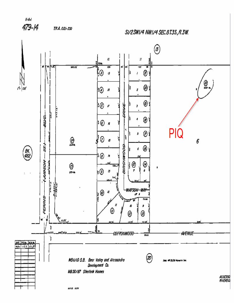
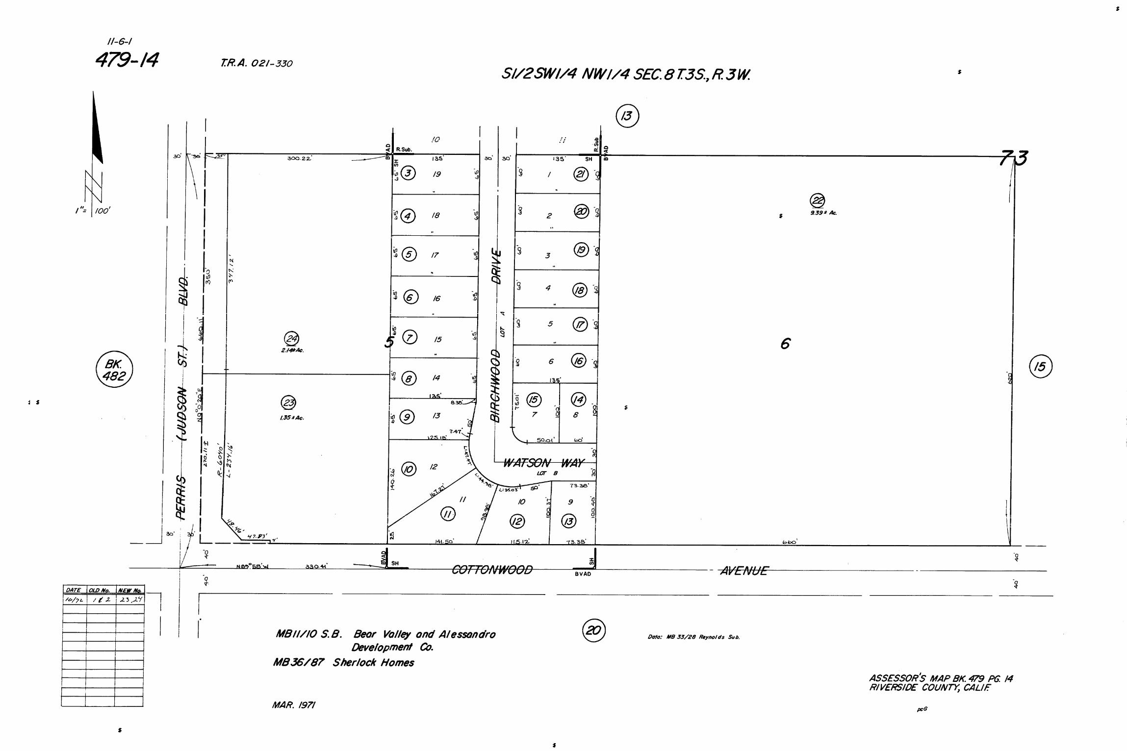
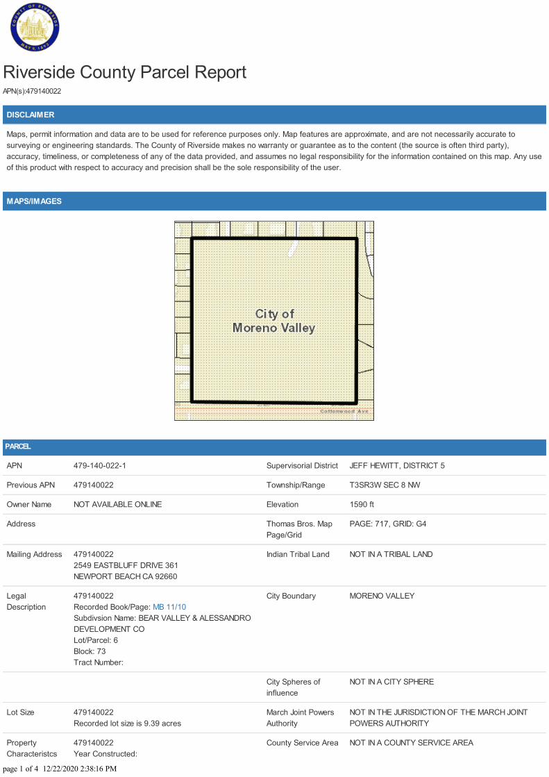
Riverside County Parcel ReportAPN(s):479140022
DISCLAIMER
Maps, permit information and data are to be used for reference purposes only. Map features are approximate, and are not necessarily accurate tosurveying or engineering standards. The County of Riverside makes no warranty or guarantee as to the content (the source is often third party),accuracy, timeliness, or completeness of any of the data provided, and assumes no legal responsibility for the information contained on this map. Any useof this product with respect to accuracy and precision shall be the sole responsibility of the user.
MAPS/IMAGES
PARCEL
APN 479-140-022-1 Supervisorial District JEFF HEWITT, DISTRICT 5
Previous APN 479140022 Township/Range T3SR3W SEC 8 NW
Owner Name NOT AVAILABLE ONLINE Elevation 1590 ft
Address Thomas Bros. MapPage/Grid
PAGE: 717, GRID: G4
Mailing Address 4791400222549 EASTBLUFF DRIVE 361NEWPORT BEACH CA 92660
Indian Tribal Land NOT IN A TRIBAL LAND
LegalDescription
479140022Recorded Book/Page: MB 11/10Subdivsion Name: BEAR VALLEY & ALESSANDRODEVELOPMENT COLot/Parcel: 6Block: 73Tract Number:
City Boundary MORENO VALLEY
City Spheres ofinfluence
NOT IN A CITY SPHERE
Lot Size 479140022Recorded lot size is 9.39 acres
March Joint PowersAuthority
NOT IN THE JURISDICTION OF THE MARCH JOINTPOWERS AUTHORITY
PropertyCharacteristcs
479140022Year Constructed:
County Service Area NOT IN A COUNTY SERVICE AREA
page 1 of 4 12/22/2020 2:38:16 PM
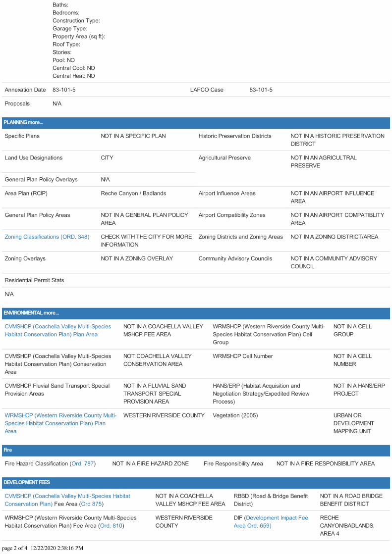
Baths: Bedrooms: Construction Type: Garage Type: Property Area (sq ft): Roof Type: Stories: Pool: NOCentral Cool: NOCentral Heat: NO
Annexation Date 83-101-5 LAFCO Case 83-101-5
Proposals N/A
PLANNING more...
Specific Plans NOT IN A SPECIFIC PLAN Historic Preservation Districts NOT IN A HISTORIC PRESERVATIONDISTRICT
Land Use Designations CITY Agricultural Preserve NOT IN AN AGRICULTRALPRESERVE
General Plan Policy Overlays N/A
Area Plan (RCIP) Reche Canyon / Badlands Airport Influence Areas NOT IN AN AIRPORT INFLUENCEAREA
General Plan Policy Areas NOT IN A GENERAL PLAN POLICYAREA
Airport Compatibility Zones NOT IN AN AIRPORT COMPATIBLITYAREA
Zoning Classifications (ORD. 348) CHECK WITH THE CITY FOR MOREINFORMATION
Zoning Districts and Zoning Areas NOT IN A ZONING DISTRICT/AREA
Zoning Overlays NOT IN A ZONING OVERLAY Community Advisory Councils NOT IN A COMMUNITY ADVISORYCOUNCIL
Residential Permit Stats
N/A
ENVIRONMENTAL more...
CVMSHCP (Coachella Valley Multi-SpeciesHabitat Conservation Plan) Plan Area
NOT IN A COACHELLA VALLEYMSHCP FEE AREA
WRMSHCP (Western Riverside County Multi-Species Habitat Conservation Plan) CellGroup
NOT IN A CELLGROUP
CVMSHCP (Coachella Valley Multi-SpeciesHabitat Conservation Plan) ConservationArea
NOT COACHELLA VALLEYCONSERVATION AREA
WRMSHCP Cell Number NOT IN A CELLNUMBER
CVMSHCP Fluvial Sand Transport SpecialProvision Areas
NOT IN A FLUVIAL SANDTRANSPORT SPECIALPROVISION AREA
HANS/ERP (Habitat Acquisition andNegotiation Strategy/Expedited ReviewProcess)
NOT IN A HANS/ERPPROJECT
WRMSHCP (Western Riverside County Multi-Species Habitat Conservation Plan) PlanArea
WESTERN RIVERSIDE COUNTY Vegetation (2005) URBAN ORDEVELOPMENTMAPPING UNIT
Fire
Fire Hazard Classification (Ord. 787) NOT IN A FIRE HAZARD ZONE Fire Responsibility Area NOT IN A FIRE RESPONSIBILITY AREA
DEVELOPMENT FEES
CVMSHCP (Coachella Valley Multi-Species HabitatConservation Plan) Fee Area (Ord 875)
NOT IN A COACHELLAVALLEY MSHCP FEE AREA
RBBD (Road & Bridge BenefitDistrict)
NOT IN A ROAD BRIDGEBENEFIT DISTRICT
WRMSHCP (Western Riverside County Multi-SpeciesHabitat Conservation Plan) Fee Area (Ord. 810)
WESTERN RIVERSIDECOUNTY
DIF (Development Impact FeeArea Ord. 659)
RECHECANYON/BADLANDS,AREA 4
page 2 of 4 12/22/2020 2:38:16 PM
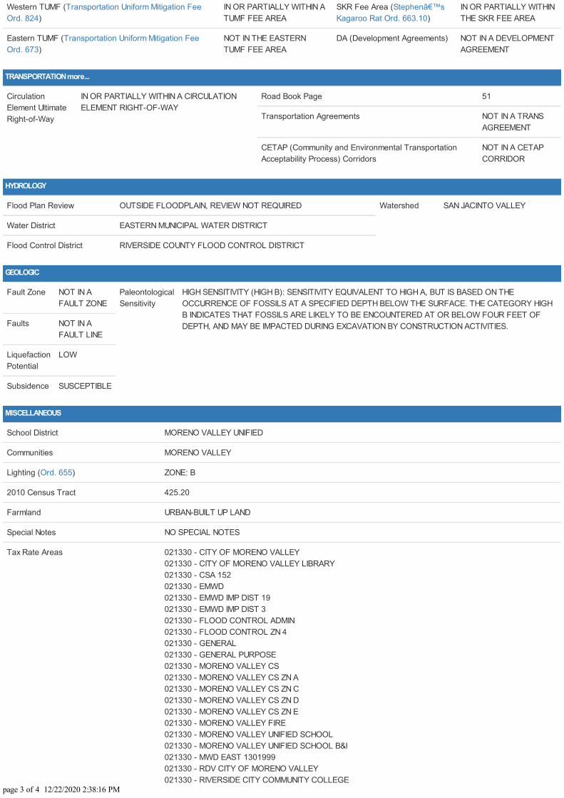
Western TUMF (Transportation Uniform Mitigation FeeOrd. 824)
IN OR PARTIALLY WITHIN ATUMF FEE AREA
SKR Fee Area (Stephen’sKagaroo Rat Ord. 663.10)
IN OR PARTIALLY WITHINTHE SKR FEE AREA
Eastern TUMF (Transportation Uniform Mitigation FeeOrd. 673)
NOT IN THE EASTERNTUMF FEE AREA
DA (Development Agreements) NOT IN A DEVELOPMENTAGREEMENT
TRANSPORTATION more...
CirculationElement UltimateRight-of-Way
IN OR PARTIALLY WITHIN A CIRCULATIONELEMENT RIGHT-OF-WAY
Road Book Page 51
Transportation Agreements NOT IN A TRANSAGREEMENT
CETAP (Community and Environmental TransportationAcceptability Process) Corridors
NOT IN A CETAPCORRIDOR
HYDROLOGY
Flood Plan Review OUTSIDE FLOODPLAIN, REVIEW NOT REQUIRED Watershed SAN JACINTO VALLEY
Water District EASTERN MUNICIPAL WATER DISTRICT
Flood Control District RIVERSIDE COUNTY FLOOD CONTROL DISTRICT
GEOLOGIC
Fault Zone NOT IN AFAULT ZONE
PaleontologicalSensitivity
HIGH SENSITIVITY (HIGH B): SENSITIVITY EQUIVALENT TO HIGH A, BUT IS BASED ON THEOCCURRENCE OF FOSSILS AT A SPECIFIED DEPTH BELOW THE SURFACE. THE CATEGORY HIGHB INDICATES THAT FOSSILS ARE LIKELY TO BE ENCOUNTERED AT OR BELOW FOUR FEET OFDEPTH, AND MAY BE IMPACTED DURING EXCAVATION BY CONSTRUCTION ACTIVITIES.Faults NOT IN A
FAULT LINE
LiquefactionPotential
LOW
Subsidence SUSCEPTIBLE
MISCELLANEOUS
School District MORENO VALLEY UNIFIED
Communities MORENO VALLEY
Lighting (Ord. 655) ZONE: B
2010 Census Tract 425.20
Farmland URBAN-BUILT UP LAND
Special Notes NO SPECIAL NOTES
Tax Rate Areas 021330 - CITY OF MORENO VALLEY 021330 - CITY OF MORENO VALLEY LIBRARY 021330 - CSA 152 021330 - EMWD 021330 - EMWD IMP DIST 19 021330 - EMWD IMP DIST 3 021330 - FLOOD CONTROL ADMIN 021330 - FLOOD CONTROL ZN 4 021330 - GENERAL 021330 - GENERAL PURPOSE 021330 - MORENO VALLEY CS 021330 - MORENO VALLEY CS ZN A 021330 - MORENO VALLEY CS ZN C 021330 - MORENO VALLEY CS ZN D 021330 - MORENO VALLEY CS ZN E 021330 - MORENO VALLEY FIRE 021330 - MORENO VALLEY UNIFIED SCHOOL 021330 - MORENO VALLEY UNIFIED SCHOOL B&I 021330 - MWD EAST 1301999 021330 - RDV CITY OF MORENO VALLEY 021330 - RIVERSIDE CITY COMMUNITY COLLEGE
page 3 of 4 12/22/2020 2:38:16 PM
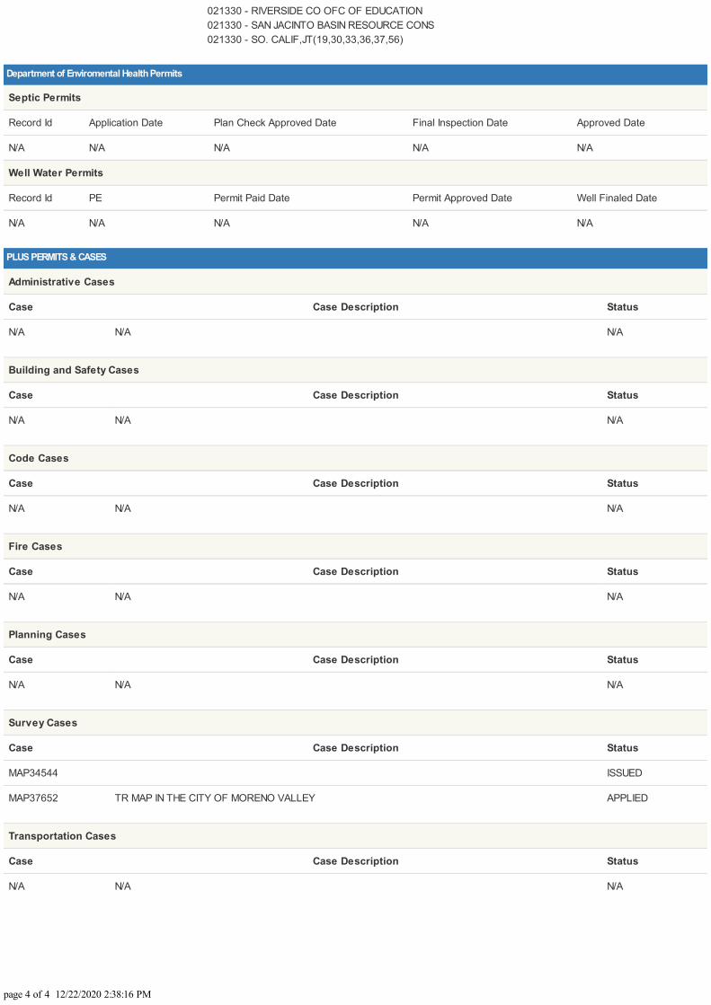
021330 - RIVERSIDE CO OFC OF EDUCATION 021330 - SAN JACINTO BASIN RESOURCE CONS 021330 - SO. CALIF,JT(19,30,33,36,37,56)
Department of Enviromental Health Permits
Septic Permits
Record Id Application Date Plan Check Approved Date Final Inspection Date Approved Date
N/A N/A N/A N/A N/A
Well Water Permits
Record Id PE Permit Paid Date Permit Approved Date Well Finaled Date
N/A N/A N/A N/A N/A
PLUS PERMITS & CASES
Administrative Cases
Case Case Description Status
N/A N/A N/A
Building and Safety Cases
Case Case Description Status
N/A N/A N/A
Code Cases
Case Case Description Status
N/A N/A N/A
Fire Cases
Case Case Description Status
N/A N/A N/A
Planning Cases
Case Case Description Status
N/A N/A N/A
Survey Cases
Case Case Description Status
MAP34544 ISSUED
MAP37652 TR MAP IN THE CITY OF MORENO VALLEY APPLIED
Transportation Cases
Case Case Description Status
N/A N/A N/A
page 4 of 4 12/22/2020 2:38:16 PM
state county city address1 address2 date
California 95126 San Jose 478 Stockton Avenue 1/1/1970
California Alameda San Lorenzo 17283 Via Annette Dr 2/6/2004
California Alameda San Lorenzo 17283 Via Annette Dr 2/6/2004
California Alameda San Leandro 1735 138th Ave 2/18/2004
California Alameda San Leandro 1735 138th Ave 2/18/2004
California Alameda Newark 37120 Spruce St G 2/29/2004
California Alameda Hayward 333 Jackson St 219 3/12/2004
California Alameda Hayward 333 Jackson St 219 3/12/2004
California Alameda Hayward 1032 Central Blvd 6/9/2004
California Alameda Hayward 1032 Central Blvd 6/9/2004
California Alameda Hayward 231 Culp Ave 8/29/2004
California Alameda Hayward 231 Culp Ave 8/29/2004
California Alameda Union City 32673 Brenda Way 3 9/28/2004
California Alameda Union City 32673 Brenda Way 3 9/28/2004
California Alameda Pleasanton 6443 Alisal St 1/19/2005
California Alameda San Leandro 872 Donovan Dr 5/4/2005
California Alameda San Leandro 14446 Elm St 5/31/2005
California Alameda Hayward 27948 Pueblo Serena Way 1/9/2006
California Alameda Union City 2351 Hartford Drive 4/7/2006
California Alameda Union City 2351 Hartford Drive 4/7/2006
California Alameda Fremont 35856 Toledo Court 7/28/2006
California Alameda San Lorenzo 1302 Via San Juan Street 10/25/2007
California Alameda San Leandro 1553 Santa Maria Road 11/28/2007
California Alameda San Leandro 1553 Santa Maria Road 11/28/2007
California Alameda Hayward 698 Overhill Drive 5/16/2008
California Alameda Hayward 698 Overhill Drive 5/16/2008
California Alameda Berkeley 2240 9th Street 7/19/2008
California Alameda Oakland 923 39th Street 11/25/2008
California Alameda San Lorenzo 16150 Arriba Viaduct 4/8/2009
California Alameda Pleasanton 818 Angela Street 3/10/2010
California Alameda Pleasanton 818 Angela Street 3/10/2010
California Alameda Castro Valley 19127 Santa Maria Avenue 3/24/2010
California Alameda Castro Valley 19127 Santa Maria Avenue 3/24/2010
California Alameda Oakland 1950 86th Avenue 12/7/2015
California Alameda Oakland 1950 86th Avenue 12/7/2015
California Butte Oroville 1940 Helman St 2/4/2004
California Butte Oroville 1940 Helman St 2/4/2004
California Butte Oroville 110 Greenback Dr 2/5/2004
California Butte Oroville 110 Greenback Dr 2/5/2004
California Butte Oroville 2437 Oro Quincy Hwy 3/17/2004
California Butte Oroville 2437 Oro Quincy Hwy 3/17/2004
California Butte Paradise 6441 Moss Ln 3/31/2004
California Butte Paradise 6441 Moss Ln 3/31/2004
California Butte Magalia 3 Jordan Hill Rd 3/31/2004
California Butte Biggs 2164 Larkin 4/9/2004
California Butte Biggs 2164 Larkin 4/9/2004
California Butte Chico 939 W East Ave 4 4/19/2004
California Butte Chico 939 W East Ave 4 4/19/2004
California Butte Oroville 126 Canyon Highlands Dr 5/5/2004
California Butte Oroville 126 Canyon Highlands Dr 5/5/2004
California Butte Oroville 208 Misty View Ln 5/10/2004
California Butte Oroville 208 Misty View Ln 5/10/2004
California Butte Chico 853 E 7th St 7/14/2004
California Butte Oroville 2750 De Bangar Hwy 7/21/2004
California Butte Paradise 538 Castle 7/23/2004
California Butte Paradise 538 Castle 7/23/2004
California Butte Oroville 2720 Oro Dam Blvd 6a 8/3/2004
California Butte Oroville 2720 Oro Dam Blvd 6a 8/3/2004
California Butte Chico 453 Posada Way 12 8/4/2004
California Butte Chico 453 Posada Way 12 8/4/2004
California Butte Magalia 14723 Gold Cone Dr 9/21/2004
California Butte Biggs 488 G St 10/26/2004
California Butte Biggs 488 G St 10/26/2004
California Butte Oroville 1130 Tehama St 1/12/2005
California Butte Oroville 1130 Tehama St 1/12/2005
California Butte Chico 1056 E 8th St 3/18/2005
California Butte Chico 1056 E 8th St 3/18/2005
California Butte Oroville 1915 Plumas St 6/9/2005
California Butte Durham 9606 Fimple Rd 7/15/2005
California Butte Chico 696 7th E St 10/19/2005
California Butte Chico 1402 Pomona Ln 11/17/2005
California Butte Oroville 2794 Oak Knoll Way 11/30/2005
California Butte Chico 997 E 16th St 12/15/2005
California Butte Chico 997 E 16th St 12/15/2005
California Butte Gridley 233 Kentucky Street 2/21/2006
California Butte Gridley 233 Kentucky Street 2/21/2006
California Butte Gridley 275 Kentucky St 2/21/2006
California Butte Gridley 275 Kentucky St 2/21/2006
California Butte Paradise 5955 Hazel Way 5/25/2006
California Butte Oroville 91 Toyon Hills Drive 2/23/2007
California Butte Chico 1735 Magnolia Avenue 2/26/2007
California Butte Chico 1735 Magnolia Avenue 2/26/2007
California Butte Oroville 165 Hurles Circle 3/18/2007
California Butte Oroville 165 Hurles Circle 3/18/2007
California Butte Oroville 4210 Oro Bangor Highway 6/1/2007
California Butte Oroville 4210 Oro Bangor Highway 6/1/2007
California Butte Palermo 2398 Louis Avenue 8/27/2007
California Butte Palermo 2398 Louis Avenue 8/27/2007
California Butte Oroville 2349 Via Madero 9/11/2007
California Butte Oroville 1616 Oro Dam Boulevard 10/29/2007
California Butte Oroville 1616 Oro Dam Boulevard 10/29/2007
California Butte Oroville 1660 20th Street 1/31/2008
California Butte Oroville 1660 20th Street 1/31/2008
California Butte Oroville 3 Alverda Drive 5/13/2008
California Butte Oroville 3 Alverda Drive 5/13/2008
California Butte Chico 1024 Neal Dow Avenue 6/7/2008
California Butte Honcut 16 Truxton Court 9/2/2008
California Butte Honcut 16 Truxton Court 9/2/2008
California Butte Oroville 1840 7th Street 9/17/2008
California Butte Oroville 1840 7th Street 9/17/2008
California Butte Chico 729 Nord Avenue 9/30/2008
California Butte Chico 729 Nord Avenue 9/30/2008
California Butte Oroville 5075 Lower Wyandotte Avenue 4/7/2009
California Butte Oroville 1960 Rose Street 4/7/2009
California Butte Oroville 1960 Rose Street 4/7/2009
California Butte Oroville 5075 Lower Wyandotte Avenue 4/7/2009
California Butte Gridley 124 East Gridley Road 5/14/2010
California Butte Gridley 124 East Gridley Road 5/14/2010
California Butte Durham 8200 Durnel Drive 5/22/2010
California Butte Durham 8200 Durnel Drive 5/22/2010
California Calaveras Mountain Ranch 5645 Doster Rd 12/20/2004
California Calaveras Mountain Ranch 5645 Doster Rd 12/20/2004
California Contra Costa Rodeo 1120 4th St 7/8/2004
California Contra Costa Rodeo 1120 4th St 7/8/2004
California Contra Costa Antioch 1927 Birch Ave 12/12/2004
California Contra Costa Martinez 625 Marina Vista St 3/22/2005
California Contra Costa Martinez 625 Marina Vista St 3/22/2005
California Contra Costa Richmond 2420 Esmond Avenue 12/5/2006
California Contra Costa El Sobrante 2211 Rancho Road 9/20/2007
California Contra Costa El Sobrante 2211 Rancho Road 9/20/2007
California Contra Costa Richmond 712 Bradford Drive 7/29/2008
California Contra Costa Richmond 712 Bradford Drive 7/29/2008
California Contra Costa Brentwood 638 Summerwood Drive 2/11/2010
California Contra Costa Brentwood 638 Summerwood Drive 2/11/2010
California Contra Costa Crockett 815 1st Avenue 12/9/2010
California Contra Costa Crockett 815 1st Avenue 12/9/2010
California Contra Costa Bay Point 71 Mountain View Avenue 3/22/2011
California Contra Costa Bay Point 71 Mountain View Avenue 3/22/2011
California Contra Costa Brentwood 1880 East Eden Plains Street 10/2/2014
California Contra Costa Brentwood 1880 East Eden Plains Street 10/2/2014
California Contra Costa Concord 5075 Commerical Circle 5/14/2020
California Del Norte Crescent City 1733 Wildwood Ln 4/14/2004
California Del Norte Crescent City 1733 Wildwood Ln 4/14/2004
California El Dorado El Dorado 6841 Union Mine Rd 4/29/2004
California El Dorado El Dorado 6841 Union Mine Rd 4/29/2004
California Fresno Reedley 22134 E Hogan Ave 1/15/2004
California Fresno Reedley 22134 E Hogan Ave 1/15/2004
California Fresno Fresno 12884 S Elm Ave 7/15/2004
California Fresno Fresno 12884 S Elm Ave 7/15/2004
California Fresno Fresno 1315 E Cornell 7/15/2004
California Fresno Fresno 1315 E Cornell 7/15/2004
California Fresno Fresno 7090 N Fruit Ave 140 7/29/2004
California Fresno Coalinga 47932 Lost Hills Rd 8/30/2004
California Fresno Fresno 4822 E Mono St 6/9/2005
California Fresno Fresno 4822 E Mono St 6/9/2005
California Fresno San Joaquin 2243 Eldorado S B 3/10/2006
California Fresno Fresno 2540 North Floyd Avenue 11/24/2006
California Fresno Fresno 2540 North Floyd Avenue 11/24/2006
California Fresno Caruthers 14594 South Elm Avenue 11/28/2006
California Fresno Caruthers 14594 South Elm Avenue 11/28/2006
California Fresno Fresno 8971 Mountain View 12/13/2006
California Fresno Fresno 8971 Mountain View 12/13/2006
California Fresno Fowler 6424 South Fowler Avenue 8/21/2007
California Fresno Reedley 20069 Clayton Avenue 12/8/2007
California Fresno Reedley 20069 Clayton Avenue 12/8/2007
California Fresno Fresno 4409 East Hedges Avenue A 12/16/2008
California Fresno Dos Palos 43186 Merrill Avenue 4/15/2010
California Fresno Dos Palos 43186 Merrill Avenue 4/15/2010
California Fresno Clovis 287 West Barstow Avenue 125b 10/26/2012
California Fresno Fresno 3001 West Swift Ave Avenue 104 8/6/2013
California Fresno Fresno 3001 West Swift Ave Avenue 104 8/6/2013
California Fresno Squaw Valley 46992 Creekside Road 11/18/2013
California Fresno Fresno 4851 North N Cedar Ave Avenue 117 1/6/2014
California Fresno Fresno 3852 East E Olive Ave Avenue 201 1/14/2014
California Fresno Fresno 3852 East E Olive Ave Avenue 201 1/14/2014
California Fresno Fresno 3025 East E Gettysburg Ave Avenue 1021/21/2014
California Fresno Fresno 3025 East E Gettysburg Ave Avenue 1021/21/2014
California Fresno Fresno 7675 N First Street Box 203 9/6/2015
California Fresno Fresno 4102 E North Avenue 12/24/2015
California Fresno Fresno 2715 N Millbrook Avenue 2/3/2016
California Fresno Fresno 2715 N Millbrook Avenue 2/3/2016
California Glenn Willows 5627 County Road 69 5/12/2004
California Glenn Willows 5627 County Road 69 5/12/2004
California Humboldt Fortuna 1788 Penn Ave 3/2/2004
California Humboldt Fortuna 1788 Penn Ave 3/2/2004
California Humboldt Mckinleyville 2331 Central Ave 4 3/25/2004
California Humboldt Eureka 1984 Gage Ln 4/27/2004
California Humboldt Blue Lake 113 Raymar Ave 5/9/2005
California Humboldt Eureka 1034 14th St 6/6/2005
California Humboldt Eureka 1034 14th St 6/6/2005
California Humboldt Eureka 1323 Summer Street 6/15/2006
California Humboldt Arcata 258 Lupin Avenue 8/30/2006
California Humboldt Arcata 258 Lupin Avenue 8/30/2006
California Imperial Holtville 819 1/2 Fern St 1/28/2004
California Imperial Holtville 819 1/2 Fern St 1/28/2004
California Imperial Holtville 2300 Slayton Rd 2/5/2004
California Imperial Seeley 2205 Haskell Rd 7/20/2004

California Imperial Holtville 819 1/2 Fern Ave 3/20/2006
California Imperial Holtville 819 1/2 Fern Ave 3/20/2006
California Kern Shafter 18478 S Shafter Ave 1/23/2004
California Kern Shafter 18478 S Shafter Ave 1/23/2004
California Kern Delano 1305 20th Ave 2/4/2004
California Kern Delano 1305 20th Ave 2/4/2004
California Kern Bakersfield 8614 Fuller 2/22/2004
California Kern Bakersfield 2600 Norman Ave 5/26/2004
California Kern Bakersfield 2600 Norman Ave 5/26/2004
California Kern Shafter 31396 Burbank Ave 6/12/2004
California Kern Taft 412 Kern St 8/26/2004
California Kern Lake Isabella 3105 Wenyor 9/21/2004
California Kern Lake Isabella 3105 Wenyor 9/21/2004
California Kern Ridgecrest 709 W Atkins Ave 12/9/2004
California Kern Bakersfield 321 Oakdale Dr 3/15/2005
California Kern Bakersfield 2714 Allen Rd 3/22/2005
California Kern Bakersfield 2714 Allen Rd 3/22/2005
California Kern Taft 217 Lierly St 6/20/2005
California Kern Bakersfield 2314 Center St 10/19/2005
California Kern Bakersfield 200 Miraflores 2/28/2006
California Kern Bakersfield 200 Miraflores 2/28/2006
California Kern Bakersfield 101 Agarnsey Ln 3/20/2006
California Kern Bakersfield 101 Agarnsey Ln 3/20/2006
California Kern Bakersfield 109 Clyde Street 4/26/2006
California Kern Bakersfield 109 Clyde Street 4/26/2006
California Kern Bakersfield 200 Miraflores Avenue 3/18/2007
California Kern Bakersfield 200 Miraflores Avenue 3/18/2007
California Kern Ridgecrest 345 West Moyer Avenue 6/4/2007
California Kern Ridgecrest 345 West Moyer Avenue 6/4/2007
California Kern Lamont 10224 San Emidio Street 7/11/2007
California Kern Lamont 10224 San Emidio Street 7/11/2007
California Kern Lamont 8008 Middleton Lane 5/19/2008
California Kern Lamont 8008 Middleton Lane 5/19/2008
California Kern Johannesburg 405 Broadway Avenue 10/9/2008
California Kern Johannesburg 405 Broadway Avenue 10/9/2008
California Kern Bakersfield 8th Street 6/22/2009
California Kern Bakersfield 3801 Newcombe Court 3/3/2011
California Kern Bakersfield 3801 Newcombe Court 3/3/2011
California Kern Bakersfield 3804 La Tonia Court 3/3/2011
California Kern Bakersfield 3804 La Tonia Court 3/3/2011
California Kern Bakersfield 218 El Tejon Avenue 7/8/2011
California Kern Bakersfield 218 El Tejon Avenue 7/8/2011
California Kern Bakersfield 7601 Redbank 12/13/2011
California Kern Bakersfield 7601 Redbank 12/13/2011
California Kings Unincorporated City6260 Barstow Ave 5/21/2004
California Kings Unincorporated City6260 Barstow Ave 5/21/2004
California Kings Hanford 11111 9 3/4 Avenue 4/16/2007
California Kings Hanford 11111 9 3/4 Avenue 4/16/2007
California Lake Lakeport 525 Esplanade St 1/27/2004
California Lake Clearlake 13660 East Lake Dr 4/19/2004
California Lake Clearlake 13660 East Lake Dr 4/19/2004
California Lake Clearlake 15888 19th St 4/28/2004
California Lake Clearlake 15888 19th St 4/28/2004
California Lake Finley 3424 Stone Dr 9/15/2004
California Lake Finley 3424 Stone Dr 9/15/2004
California Lake Lower Lake 10243 Siegler Canyon Rd 11/17/2004
California Lake Lower Lake 10243 Siegler Canyon Rd 11/17/2004
California Lake Clearlake 16537 35th Ave 6/18/2005
California Lake Nice 6643 Collier 2/15/2006
California Lake Clearlake 13820 Manakee Drive 1/20/2010
California Lake Clearlake 13820 Manakee Drive 1/20/2010
California Los Angeles Redondo Beach 208 B Ave 1/4/2004
California Los Angeles Los Angeles 2742 Lanfranco St 7 1/7/2004
California Los Angeles Covina 444 Citrus N Ave 1/13/2004
California Los Angeles Santa Fe Springs 11462 Telegraph Rd 1/14/2004
California Los Angeles Littlerock 8632 Avenue U E 1/21/2004
California Los Angeles Long Beach 2520 Pacific Coast E Hwy 221 1/27/2004
California Los Angeles Lancaster 3995 Avenue H W 3/3/2004
California Los Angeles East Los Angeles 4135 Floral Ave 3/5/2004
California Los Angeles Compton 1016 Poinsettia S Ave 3/10/2004
California Los Angeles Llano 25757 V E Ave 3/24/2004
California Los Angeles Palmdale 38233 Hendon Dr 4/3/2004
California Los Angeles Torrance 4111 Pacific Coast Highway 308 4/11/2004
California Los Angeles Norwalk 11026 Imperial E Hwy 10 4/21/2004
California Los Angeles Los Angeles 560 Keenan Ave 5/12/2004
California Los Angeles La Canada Flintridge5016 Angeles Crest Hwy 5/25/2004
California Los Angeles Los Angeles 5320 1/2 Ithaca Ave 6/22/2004
California Los Angeles Whittier 8171 Washington Ave 6/24/2004
California Los Angeles Long Beach 1401 11 E St 7/1/2004
California Los Angeles Signal Hill 2210 Gaviota N Ave C 7/6/2004
California Los Angeles Glendora 19104 Manua Loa 7/21/2004
California Los Angeles Los Angeles 21150 Hobart 8/18/2004
California Los Angeles La Puente 410 Evanwood Ave 9/22/2004
California Los Angeles Baldwin Park 3109 Robinette Ave 9/28/2004
California Los Angeles San Dimas 1717 Monte Vista Dr 10/7/2004
California Los Angeles Pomona 320 Jefferson W Ave 10/19/2004
California Los Angeles Lynwood 10868 Drury Ln 10/29/2004
California Los Angeles El Monte 11828 Emery St 11/18/2004
California Los Angeles El Monte 4350 Ranger Ave 11/29/2004
California Los Angeles La Puente 18631 Altario St 1/13/2005
California Los Angeles Lancaster 42705 6th E St 2/3/2005
California Los Angeles Downey 9322 Stamps Ave 2/18/2005
California Los Angeles City Of Commerce5820 Ramon Ct 4/14/2005
California Los Angeles San Pedro 975 5th W St 8/3/2005
California Los Angeles Winnetka 8474 Quartz Ave 9/28/2005
California Los Angeles Van Nuys 15149 Domino St 11/8/2005
California Los Angeles Whittier 6133 Mcnees Ave 1/14/2006
California Los Angeles Panorama City 8154 Allott 1/19/2006
California Los Angeles Wilmington 1724 Fries Ave 2/17/2006
California Los Angeles Gardena 14903 Chadron Ave 1 3/1/2006
California Los Angeles Los Angeles 1406 Gordon Street 3/26/2006
California Los Angeles Long Beach 2124 Mc Kenzie Avenue 4/25/2006
California Los Angeles Lancaster 44634 Date Avenue 6/2/2006
California Los Angeles Shadow Hills 10339 Johanna Avenue 6/22/2006
California Los Angeles Los Angeles 123 S Lake Street 7/14/2006
California Los Angeles Sylmar 12600 Bradley Street 7/19/2006
California Los Angeles Diamond Bar 2620 Castlerock Road 8/1/2006
California Los Angeles Covina 19850 Arrow Highway 8/6/2006
California Los Angeles Los Angeles 3015 Sunnynook Drive 8/11/2006
California Los Angeles Palmdale 38566 East 35th Street 10/3/2006
California Los Angeles Los Angeles 244 47th Place 10/12/2006
California Los Angeles Los Angeles 244 West 47th Place 10/12/2006
California Los Angeles Pomona 1347 Cambrin Road 12/7/2006
California Los Angeles Los Angeles 11630 West 207th Street 12/7/2006
California Los Angeles Cerritos 12513 Sandy Creek Lane 3/9/2007
California Los Angeles Long Beach 1624 Junipero Avenue 4/4/2007
California Los Angeles Whittier 10816 Townley Drive 5/11/2007
California Los Angeles Huntington Park 2505 Olive Street 5/15/2007
California Los Angeles South Gate 2634 Palm Place 5/29/2007
California Los Angeles Pomona 260 La Verne Avenue 7/12/2007
California Los Angeles Lancaster 45448 Elm 7/14/2007
California Los Angeles Wilmington 1630 Sandison Street 7/20/2007
California Los Angeles Los Angeles 321 Westminster Avenue 8/9/2007
California Los Angeles Los Angeles 1216 Hanover Avenue 8/12/2007
California Los Angeles Huntington Park 6418 Seville 9/18/2007
California Los Angeles Los Angeles 359 71st Street 10/10/2007
California Los Angeles Diamond Bar 749 Featherwood Drive 11/1/2007
California Los Angeles Long Beach 3613 La Jara Street 11/14/2007
California Los Angeles Los Angeles 3744 59th Street 12/20/2007
California Los Angeles Van Nuys 7400 Sepulveda Boulevard 2/12/2008
California Los Angeles Los Angeles 218 1/2 54th Street 3/14/2008
California Los Angeles Los Angeles 4154 Compton Avenue 4/17/2008
California Los Angeles Downey 10350 Haledon Avenue 5/21/2008
California Los Angeles Baldwin Park 4442 Edra Avenue 6/16/2008
California Los Angeles Encino 17448 Ventura Boulevard 8/11/2008
California Los Angeles Bellflower 17122 Downey Avenue 11/2/2008
California Los Angeles Huntington Park 2409 Olive Street 11/18/2008
California Los Angeles Long Beach 1875 Lime Avenue 12/22/2008
California Los Angeles Los Angeles 6118 Hooper Street 4/24/2009
California Los Angeles Bell 3717 Bell Avenue 6/6/2009
California Los Angeles Los Angeles 5170 South Normandie Avenue 1/3/2010
California Los Angeles Los Angeles 2109 Estrella Avenue 2/2/2010
California Los Angeles Long Beach 2345 East Harding Street 2/4/2010
California Los Angeles Long Beach 2454 Easy Avenue 2/10/2010
California Los Angeles Santa Fe Springs 13310 Telegraph Road 4/14/2010
California Los Angeles Bell Gardens 7534 Purdy Street 5/1/2010
California Los Angeles Inglewood 8815 South Van Ness Avenue 5/4/2010
California Los Angeles Los Angeles 6516 South Main Street 6/2/2010
California Los Angeles Norwalk 12618 Studebaker Road 6/14/2010
California Los Angeles Hawthorne 12600 Prairie Avenue 7/19/2010
California Los Angeles Hawthorne 2851 West 120th Street 7/22/2010
California Los Angeles Los Angeles 213 1/2 West 66 Street 9/21/2010
California Los Angeles Hawthorne 13611 Doty Avenue 2/3/2011
California Los Angeles Los Angeles 1564 East 117th Street 4/4/2013
California Los Angeles Artesia 11635 Artesia Boulevard 5/1/2013
California Los Angeles Beverly Hills 712 North Rexford Drive 6/1/2013
California Los Angeles Covina 771 Rancho Simi Drive 6/1/2016
California Los Angeles Compton 14502 S Keene Ave 8/14/2016
California Los Angeles Gardena 1218 W 134th St 9/25/2016
California Los Angeles North Hollywood7829 Nagle Av 12/10/2017
California Los Angeles Lancaster 42835 San Francisco Av 12/10/2017
California Madera Chowchilla 18899 Road 16 4/28/2004
California Madera Chowchilla 1304 Colusa Ave A 1/25/2005
California Madera Madera 21442 Avenue 19 Ave 2/10/2005
California Madera Madera 815 East Clinton Avenue 8/29/2006
California Madera Madera 18697 Avenue Pass 8/21/2007
California Madera Madera 512 Fein Street 8/25/2007
California Madera Madera 35626 14 1/2 Avenue 2/1/2008
California Madera Madera 13577 20th Avenue 9/4/2008
California Madera Madera 19184 Ave 18 5/15/2014
California Madera Madera 25816 Avenue 18 1/2 6/14/2016
California Madera Madera 11265 Iowa Av 12/27/2017
California Mendocino Fort Bragg 16900 Franklin Road 5/9/2006
California Mendocino Willits 65000 Sherwood Ridge Road 2/20/2008
California Mendocino Redwood Valley 9800 West Road 4/9/2009
California Mendocino Philo 3500 Little Mill Creek Road 5/6/2010
California Mendocino Fort Bragg 621 West St 9/16/2016
California Mendocino Hopland 14410 Mountain House Rd 9/21/2016
California Merced Merced 2536 Lobo 2/4/2004
California Merced Stevinson 18910 W 6th St 2/10/2004
California Merced Merced 3613 N Garner Rd 2/27/2004
California Merced Livingston 5679 Arena Way 4/6/2004
California Merced Hilmar 20295 August Rd 4/15/2004
California Merced Cressey 9835 Cressey 6/3/2004
California Merced Delhi 16235 Redbud Ct 6/29/2004
California Merced South Dos Palos 8827 W K St 7/23/2004
California Merced Winton 9605 Eucalyptus Ave 8/8/2004
California Merced Winton 6280 Central Ave 8/8/2004
California Merced Hilmar 19511 Williams Ave 10/13/2004
California Merced Merced 321 S 59 S Hwy 1/3/2005
California Merced Gustine 8450 Highway 33 S Hwy 3/2/2005
California Merced Atwater 9000 Moran Ave 5/11/2005
California Merced Atwater 1236 Hull Rd 9/23/2005
California Merced Stevinson 23875 Second Avenue 3/27/2006
California Merced Los Banos 313 J Street 8/11/2006
California Merced Atwater 1001 Sandpiper Way 11/15/2006
California Merced Delhi 8620 Hinton 11/15/2006
California Merced Merced 824 S Freya 1/25/2007
California Merced Winton 7409 Amanda Drive 3/13/2007
California Merced Merced 2499 East Gerard Avenue 3/21/2007
California Merced Merced 14717 East 272nd 9/6/2007
California Merced Hilmar 250 N Union 10/12/2007
California Merced Merced 5 West 25th Street 2 1/16/2008
California Merced Stevinson 2917 Cemetery Road 2/20/2008
California Merced Stevinson 2991 Cemetery 2/20/2008
California Merced Winton 6814 Arlene Way 3/12/2008
California Merced Atwater 4146 South Elliott Road 8/11/2008
California Merced Delhi 15575 August Avenue 9/8/2008
California Merced Ballico 11368 North Santa Fe Avenue 1/10/2010
California Merced Hilmar 19542 East First Street 4/1/2010
California Merced Winton 7125 North Vine Avenue 4/21/2010
California Merced Stevinson 2228 Nelander Avenue 4/27/2010
California Merced Livingston 15290 Sunset Drive 5/22/2010
California Merced Delhi 9640 Sands Road 6/6/2010
California Merced Winton 7040 Myrtle Avenue 2/8/2016
California Merced Atwater 2521 Boulder Dr 9/21/2016
California Monterey Salinas 1769 Yosemite Cir 5/21/2004
California Monterey Pacific Grove 316 Prescott Ln 7/16/2004
California Monterey Salinas 1233 East Polk Street 6/20/2007
California Monterey Salinas 18840 Northeast Eisenhowere Drive6/20/2007
California Monterey Greenfield 424 7th Avenue 9/19/2010
California Nevada Grass Valley 439 Neal St 1 7/30/2004
California Orange Laguna Beach 985 Pacific Coast N Hwy 2/1/2004
California Orange Buena Park 7555 Beach Blvd 128 2/10/2004
California Orange Irvine 173 Topeka 2/11/2004
California Orange Tustin 13624 Estero Cir 4/24/2004
California Orange Santa Ana 1137 Mcfadden W 7/7/2004
California Orange Westminster 7681 Baylor Dr 7/15/2004
California Orange La Habra 2320 Story Ave 7/16/2004
California Orange Garden Grove 8062 Garden Grove Blvd 241 9/21/2004
California Orange Orange 2135 Almond W St 10/15/2004
California Orange Santa Ana 1233 Genoa S Dr 11/30/2004
California Orange Cypress 4812 Grace Avenue 4/10/2006
California Orange Westminster 9851 Bolsa Avenue 5/5/2006
California Orange Westminster 5051 Princeton Avenue 5/17/2006
California Orange La Palma 4761 Sharon Drive A 7/17/2006
California Orange Stanton 10698 Court Street 9/15/2006
California Orange Stanton 7701 Westbrook Way 4/19/2007
California Orange Yorba Linda 5471 Jefferson Street 11/13/2007
California Orange Fullerton 641 Commonwealth Avenue 12/7/2007
California Orange Anaheim 131 Magnolia Avenue 3/21/2008
California Orange Anaheim 3554 West Cornelia Circle 3/24/2008
California Orange Anaheim 1819 Cris 3/27/2008
California Orange Anaheim 1261 Placentia Street 3/29/2008
California Orange Anaheim 2500 East Terrace Street 4/8/2008
California Orange Santa Ana 1314 Harbor Boulevard 4/9/2008
California Orange Garden Grove 9755 Bixby Avenue 4/11/2008
California Orange Costa Mesa 929 Joann Street 5/13/2008
California Orange Santa Ana 3012 Halladay 5/19/2008
California Orange Santa Ana 412 Baker Street 5/21/2008
California Orange Orange 207 Esplande Street 5/30/2008
California Orange Santa Ana 702 Santa Ana Boulevard 7/14/2008
California Orange Anaheim 622 Velare Avenue 9/16/2008
California Orange Westminster 13100 Goldenwest Street 4/28/2009
California Orange Santa Ana 1450 Auto Drive 5/11/2009
California Orange Garden Grove 10042 Lampson Avenue 5/13/2009
California Orange Westminster 6942 Garden Grove Boulevard 5/21/2009
California Orange Buena Park 7111 Beach Boulevard 2/10/2010
California Orange Garden Grove 13691 Barnett Way 2/13/2010
California Orange Anaheim 1303 West Marlboro Avenue 2/22/2010
California Orange Placentia 745 Dunn 3/16/2010
California Orange Irvine 87 Pinestone 3/23/2010
California Orange Orange 2300 North Tustin Avenue 3/29/2010
California Orange Huntington Beach8230 Talbert 4/7/2010
California Orange Santa Ana 4417 Morningside 4/28/2010
California Orange Brea 2595 Imperial Highway 5/20/2010
California Orange Santa Ana 800 South Sullivan Street D3 12/23/2011
California Orange Anaheim 10141 Gravier St 12/8/2017
California Plumas Portola 5630 Casey Jones Road 4/14/2006
California Plumas Chester 460 Melissa Avenue 10/11/2007
California Plumas Quincy Junction 1426 Butterfly Valley Road 2/17/2010
California Plumas Portola 324 Bella Vista 3/9/2010
California Riverside Desert Hot Springs66366 6th St 1/20/2004
California Riverside Riverside 344 N State 148 1/28/2004
California Riverside Hemet 531 Cedar Ln 2 2/7/2004
California Riverside Perris 332 W 11th St 2/8/2004
California Riverside Hemet 1675 Cobble Ln 2/11/2004
California Riverside Cathedral City 68557 C Street 2/16/2004
California Riverside Hemet 1097 N State St 2 2/18/2004
California Riverside Glen Avon Heights4080 Conning 2/29/2004
California Riverside Corona 734 Viewtop Ln 3/12/2004
California Riverside El Cerrito 19078 Rising Sun Rd 3/12/2004
California Riverside Norco 2574 Ridgecrest 3/16/2004
California Riverside Hemet 772 N State 3/24/2004
California Riverside Hemet 225 S Elk St 36 3/30/2004
California Riverside Riverside 5861 Mitchell 3/31/2004
California Riverside Corona 995 Pomona Rd 17 4/2/2004
California Riverside Beaumont 34250 San Timiteo Canyon Rd 4/15/2004
California Riverside Beaumont 1016 Palm Ave 4/19/2004
California Riverside Lake Elsinore 17911 Thoreson 4/29/2004
California Riverside Hemet 43939 Florida Ave 5/4/2004
California Riverside Hemet 585 S Santa Fe 5/15/2004
California Riverside Winchester 33091 Willard 5/20/2004
California Riverside Hemet 2688 E Florida Ave 18 6/4/2004
California Riverside Indio 46540 Padua Cir 6/9/2004
California Riverside Anza 57310 Valley Vista 6/11/2004
California Riverside Perris 143 Perou St 6/27/2004
California Riverside Victorville 20197 Nandina Ave 7/9/2004
California Riverside Corona 1330 W 8th St 18 7/21/2004
California Riverside Perris 618 Bond Dr 7/29/2004
California Riverside San Jacinto 437 Mead 8/2/2004
California Riverside Moreno Valley 25204 Bridle Trail 8/29/2004
California Riverside Indio 47800 Madison St 169 9/21/2004
California Riverside Lake Matthews 17224 Cajon Dr 9/28/2004
California Riverside Banning 1007 Linda Vista Rd 10/26/2004
California Riverside Victorville 22875 Rios 11/16/2004
California Riverside Menifee 26814 Madera Ct 12/6/2004
California Riverside Hemet 4400 Florida W Ave 117 12/8/2004
California Riverside Hemet 41251 Rope Rd 1/29/2005
California Riverside Perris 4715 Wade Ave 3/3/2005
California Riverside San Jacinto 344 N State St Sp 196 6/15/2005
California Riverside Perris 19881 Gustin Rd 12/12/2005
California Riverside Hemet 525 Gilbert N 49 1/20/2006
California Riverside Lake Elsinore 34323 Sunrise Drive 1/27/2006
California Riverside Corona 446 Francis E St 2/2/2006
California Riverside San Jacinto 610 Washington E Ave 2/22/2006
California Riverside Hemet 25873 Riverview Lane 3/15/2006
California Riverside Desert Hot Springs13255 Mexquite Avenue 3/23/2006
California Riverside San Jacinto 182 De Anza 4/20/2006
California Riverside Nuevo 22788 Via Santana 4/21/2006
California Riverside Calimesa 9453 Sharondale Road 6/8/2006
California Riverside Riverside 11235 Cypress 6/27/2006
California Riverside Mountain Center63137 Jeraboa Road 4/12/2007
California Riverside Corona 379 East Rancho Road 1/2/2008
California Riverside Norco 3117 Shadow Canyon Circle 1/31/2008
California Riverside Hemet 32809 Red Mountain Road 2/18/2008
California Riverside Palm Springs 383 Vereda Norte 6/20/2008
California Riverside Perris 21747 Webster Avenue 8/7/2008
California Riverside Perris 21881 Oleander Avenue 8/29/2008
California Riverside Mira Loma 10351 Oak Bark Lane 11/12/2008
California Riverside Desert Hot Springs12155 Ocotillo Road 4/29/2009
California Riverside Hemet 871 San Mateo Circle 5/21/2009
California Riverside Temecula 29774 Calle Pantano 2/2/2010
California Riverside Riverside 4080 Pedley Road 2/5/2010
California Riverside Banning 514 East Victory Avenue 3/21/2010
California Riverside Riverside 11744 Hazeldell Drive 4/2/2010
California Riverside Riverside 12172 Severn Way 4/2/2010
California Riverside Perris 644 Primrose Place 4/8/2011
California Riverside Perris 2520 Spectacular Bid Street 7/29/2014
California Riverside Moreno Valley 16329 Saddleback Lane 2/3/2015
California Riverside Moreno Valley 25399 Todd Drive 8/15/2015
California Riverside Moreno Valley 16329 Saddlebrook Lane 2/9/2016
California Riverside Hemet 1610 Bluejay Way 3/2/2016
California Riverside Indio 43430 Monroe St 9/3/2016
California Riverside Coachella 731 Orchard St 10/4/2016
California Riverside Mira Loma 12332 Kern River Dr 12/6/2017
California Riverside Temecula 30984 Lolita Rd 12/7/2017
California Sacramento Sacramento 4405 23rd St 2/4/2004
California Sacramento Sacramento 4719 Hayford Way 2/24/2004
California Sacramento Sacramento 7624 Birdie Ct 3/23/2004
California Sacramento Sacramento 1536 Strader Ave 3/26/2004
California Sacramento Sacramento 5867 Auburn Blvd 30 3/30/2004
California Sacramento Sacramento 2530 Street S 8 4/1/2004
California Sacramento Rancho Cordova 10892 Walnutwood Way 4/4/2004
California Sacramento Elverta 2495 Rhine Way 8/5/2004
California Sacramento Sacramento 3534 Summer Park Dr 354 10/8/2004
California Sacramento Elk Grove 5354 Jade Creek 2/23/2005
California Sacramento Elverta 2110 Quail Ranch Court 2/28/2006
California Sacramento Sacramento 4144 Cabinet Circle 3/6/2006
California Sacramento 5140 W Sherman Island Road 5/13/2006
California Sacramento Sacramento 7662 Country Park Drive 6/6/2006
California Sacramento Sacramento 5230 Palm 1/30/2007
California Sacramento Sacramento 2681 Fairfield Street 2/13/2007
California Sacramento Citrus Heights 7401 Lovato 6/23/2007
California Sacramento Sacramento 6316 Welty Way 12/3/2008
California Sacramento Galt 132 4th 4/20/2010
California San Bernardino Fontana 14430 Santa Ana 1/15/2004
California San Bernardino Ontario 844 Wysteria E Ct 1/21/2004
California San Bernardino Redlands 1034 Alta St 1/28/2004
California San Bernardino Victorville 16717 C St 1/30/2004
California San Bernardino Chino 11838 Central Ave 93 2/11/2004
California San Bernardino Rialto 349 N Lilac 2/17/2004
California San Bernardino Apple Valley 21845 Arapahoe St 1 2/17/2004
California San Bernardino Victorville 16868 Stoddard Wells Rd 2/19/2004
California San Bernardino Twentynine Palms4828 Lear Ave 2/22/2004
California San Bernardino Hesperia 14926 Fir St 2/25/2004
California San Bernardino San Bernardino 1443 Cedar 23 3/9/2004
California San Bernardino Victorville 15330 Condor Rd 3/9/2004
California San Bernardino Newberry Springs52875 Bedford Rd 3/25/2004
California San Bernardino Fontana 13519 Arrow Rt 3/30/2004
California San Bernardino Twentynine Palms7580 Mac Rd 3/31/2004
California San Bernardino San Bernardino 1443 Cedar St 1 4/9/2004
California San Bernardino Twentynine Palms5665 Aeronia 4/15/2004
California San Bernardino Baker 71759 Baker Blvd 4/16/2004
California San Bernardino Highland 7409 Los Feliz Dr 4/23/2004
California San Bernardino San Bernardino 3160 N State St 4/23/2004
California San Bernardino Phelan 8135 Joshua St 4/27/2004
California San Bernardino Chino 12018 Central Ave 5/13/2004
California San Bernardino Highland 25715 Lime St 5/18/2004
California San Bernardino Apple Valley 10620 Matilija 5/21/2004
California San Bernardino Highland 28457 Merrion Ave 5/21/2004
California San Bernardino San Bernardino 2176 Amanda St 5/21/2004
California San Bernardino Joshua Tree 62475 Cove Ln 5/27/2004
California San Bernardino Apple Valley 10808 Mills Rd 6/2/2004
California San Bernardino Barstow 24966 Camino Del Sol St 6/7/2004
California San Bernardino Hesperia 15356 Pendleton 6/16/2004
California San Bernardino Twentynine Palms68077 Indian Trail 6/16/2004
California San Bernardino Muscoy 2544 3rd St 6/23/2004
California San Bernardino Newberry Springs47962 Horner Rd 6/24/2004
California San Bernardino Hesperia 11976 Mariposa Rd 7/3/2004
California San Bernardino Ontario 1506 E Highland Ct 7/26/2004
California San Bernardino Fontana 7642 Kempster Ave 9/7/2004
California San Bernardino Phelan 6721 Nielson Rd 9/17/2004
California San Bernardino Barstow 2577 Community Blvd 9/18/2004
California San Bernardino Joshua Tree 3255 Sunset Rd 9/26/2004
California San Bernardino Rancho Cucamonga7651 Effen 10/1/2004
California San Bernardino Hesperia 7892 Alston 10/1/2004
California San Bernardino Newberry Springs35377 Newberry Rd 10/11/2004
California San Bernardino Phelan 11480 Macron 10/19/2004
California San Bernardino Victorville 17053 B St 10/19/2004
California San Bernardino Victorville 16688 Hughes 10/21/2004
California San Bernardino Redlands 28565 San Timoteo Canyon 10/25/2004
California San Bernardino San Bernardino 1162 E 2nd 11/16/2004
California San Bernardino Bloomington 16742 14th St 11/17/2004
California San Bernardino Barstow 29779 N 1st 11/18/2004
California San Bernardino Chino Hills 15553 Esther St 12/13/2004
California San Bernardino San Bernardino 2547 3rd Ave 12/28/2004
California San Bernardino Trona 13860 Fremont St 2 12/30/2004
California San Bernardino Barstow 434 S Second St 1 1/1/2005
California San Bernardino Upland 359 Seventh St 1/5/2005
California San Bernardino San Bernardino 123 E 11th St 1/19/2005
California San Bernardino San Bernardino 1318 E Gould St 1/22/2005
California San Bernardino Redlands 2155 Citrus Ave 112 2/14/2005
California San Bernardino Yucaipa 12470 15th St 5/25/2005
California San Bernardino Hesperia 10721 Maple St 7/29/2005
California San Bernardino Victorville 16262 Yucca Ave 8/1/2005
California San Bernardino San Bernardino 11571 5th St 8/29/2005
California San Bernardino Victorville 11550 White Rd 10/17/2005
California San Bernardino Hesperia 9553 Los Banos Ave 1/12/2006
California San Bernardino Victorville 13126 Mesa 2/7/2006
California San Bernardino Ontario 956 Princeton W St 2/10/2006
California San Bernardino Victorville 16755 Union St B 2/24/2006
California San Bernardino Victorville 15618 Topango Road 3/2/2006
California San Bernardino San Bernardino 2131 Genevieve Street 3/10/2006
California San Bernardino Victorville 13602 Nassau Drive 3/15/2006
California San Bernardino San Bernardino 756 W 19 St 3/16/2006
California San Bernardino Fontana 17265 Lurelane Street 3/20/2006
California San Bernardino Redlands 828 6th Street 3/23/2006
California San Bernardino Hesperia 11516 Hawthorne 3/25/2006
California San Bernardino Newberry Springs42378 Silver Valley Road 4/21/2006
California San Bernardino Hesperia 9393 Hickory 6/8/2006
California San Bernardino Hesperia 10983 4th Avenue 6/9/2006
California San Bernardino Oro Grande 21451 National Trails Highway 6/13/2006
California San Bernardino Fontana 13449 Ivy 6/15/2006
California San Bernardino Loma Linda 26232 Newport Avenue 8/1/2006
California San Bernardino Yermo 37933 Grandview Avenue 8/10/2006
California San Bernardino Yucca Valley 58620 San Marino Drive 9/6/2006
California San Bernardino San Bernardino 19829 Kendall Drive 9/12/2006
California San Bernardino San Bernardino 2292 Portola Street 10/13/2006
California San Bernardino Apple Valley 12618 Pocono Road 10/15/2006
California San Bernardino Fontana 14349 Figwood Drive 12/13/2006
California San Bernardino Victorville 14349 Hesperia Road 12/21/2006
California San Bernardino Apple Valley 20024 Happy Trails Highway 1/4/2007
California San Bernardino Hesperia 13010 Prairie Trail 2/22/2007
California San Bernardino Pinon Hills 11475 Prado Road 3/27/2007
California San Bernardino Victorville 13852 Burning Tree Lane 5/3/2007
California San Bernardino Redlands 511 Redlands Boulevard 5/16/2007
California San Bernardino Colton 1822 Admiralty Street 6/15/2007
California San Bernardino San Bernardino 243 Meridian Avenue 7/18/2007
California San Bernardino Victorville 16753 Zenda Street 8/6/2007
California San Bernardino Ontario 740 Camalot 9/10/2007
California San Bernardino San Bernardino 223 49th 11/7/2007
California San Bernardino San Bernardino 1431 7th Street 11/26/2007
California San Bernardino Adelanto 17526 Keats Road 11/29/2007
California San Bernardino Rialto 624 Etiwanda Avenue 12/22/2007
California San Bernardino Joshua Tree 8997 Tortuga Road 1/14/2008
California San Bernardino San Bernardino 6317 Bonnie Street 4/3/2008
California San Bernardino Fontana 16411 Athol Street 4/17/2008
California San Bernardino San Bernardino 7234 Dwight Way 7/1/2008
California San Bernardino Landers 57646 Linn Road 10/14/2008
California San Bernardino Hesperia 9519 Maple Avenue 10/18/2008
California San Bernardino Hinkley 23572 State Highway 58 4/5/2009
California San Bernardino Apple Valley 9611 Navajo Road 5/5/2009
California San Bernardino Victorville 13143 Sleepy Ridge Lane 3/5/2010
California San Bernardino San Bernardino 205 West Benedict Road 4/2/2010
California San Diego Boulevard 2605 Paseo Alta Ct 1/7/2004
California San Diego San Ysidro 905 Hwy Caliente Rd 1/16/2004
California San Diego San Diego 875 Hotel S Cir 1/30/2004
California San Diego Santee 8593 Magnolia Ave 1/30/2004
California San Diego Escondido 1306 Ronda Ave 3/23/2004
California San Diego Fallbrook 422 Catalpa Ln 5/19/2004
California San Diego San Diego 6173 Fauna Drive 5/21/2004
California San Diego Lakeside 11441 El Nopal 8/12/2004
California San Diego Escondido 431 4th E Ave 1b 8/31/2004
California San Diego San Diego 4242 34th St D 9/16/2004
California San Diego Vista 1280 Hacienda Dr G6 11/24/2004
California San Diego Escondido 16975 Guejito Rd 3/3/2005
California San Diego Escondido 1825 East Valley Way 6/6/2006
California San Diego Vista 1710 Avocado Drive 9/14/2006
California San Diego Oceanside 3965 Brown Street 9/20/2006
California San Diego Vista 663 Eucalyptus 4/3/2007
California San Diego La Puente 1254 Bannon 5/10/2007
California San Diego San Diego 3835 Midway #203 Drive 6/20/2007
California San Diego Vista 526 Mar Vista Drive 11/29/2007
California San Diego Vista 1610 N Santa Fe 4/9/2008
California San Diego Valley Center 30118 Miller Road 11/7/2008
California San Diego San Diego 9777 De La Amistad Viaduct 6/12/2009
California San Diego Escondido Junction1531 Montiel 1/20/2010
California San Diego Carlsbad 847 Laguna 8/8/2010
California San Diego Carlsbad 382 Acacia 8/8/2010
California San Diego Alpine 404 Summerhill Terrace 12/2/2013
California San Francisco San Francisco 35 Belvedere St 5 3/29/2006
California San Joaquin Stockton 7790 N Ashley Ln 1/20/2004
California San Joaquin Stockton 9800 E Eight Mile Rd 4/16/2004
California San Joaquin Stockton 5708 N Highway 99 4/18/2004
California San Joaquin Stockton 1560 Silver Creek 4/22/2004
California San Joaquin Stockton 10285 Hildreth Ln 6/30/2004
California San Joaquin Stockton 2717 W March Ln 7/31/2004
California San Joaquin Stockton 2654 W March Ln 304 8/4/2004
California San Joaquin Stockton 3416 Farmington E Rd 2 8/26/2004
California San Joaquin Stockton 2274 E Fremont 9/25/2004
California San Joaquin Stockton 2071 La Jolla Dr 4/25/2005
California San Joaquin Stockton 2553 Michaelangelo Drive 6/1/2006
California San Joaquin Tracy 14703 Finck Road 8/3/2006
California San Joaquin Stockton 301 Morada 4/19/2007
California San Joaquin Manteca 481 South Union Road 4/20/2007
California San Joaquin Lathrop 15523 Sixth Street 10/11/2007
California San Joaquin Tracy 11422 West Larch Road 3/14/2008
California San Luis Obispo Atascadero 1400 San Ramon 1/5/2004
California San Luis Obispo Atascadero 4080 Dolores Avenue 3/14/2006
California San Luis Obispo Grover Beach 448 North 9th Street 3/30/2006
California San Luis Obispo Morro Bay 525 Atascadero Road 7/12/2006
California San Luis Obispo San Luis Obispo 3500 Bullock 8/29/2006
California San Luis Obispo Paso Robles 749 Orchard 9/5/2006
California San Luis Obispo Templeton 30 Danelion Road 1/15/2007
California San Luis Obispo Nipomo 155 East Price Street 4/29/2008
California San Luis Obispo San Luis Obispo 1771 Cordova 12/7/2011
California San Mateo East Palo Alto 1894 Bay Road 6/4/2006
California San Mateo Belmont 926 South Road 6/21/2006
California San Mateo Daly City 439 Bonnie Street 1/14/2010
California Santa Clara San Jose 3570 Columbine Dr 1/15/2004
California Santa Clara San Jose 110 Roundtable Dr 1 2/8/2004
California Santa Clara Gilroy 7860 Driftwood Ter A 4/3/2004
California Santa Clara San Jose 1374 Randol Ave 5/5/2004
California Santa Clara Santa Clara 1232 Warburton Ave 6/8/2004
California Santa Clara San Jose 90 Saddlebrook Dr 6/22/2004
California Santa Clara San Jose 935 Foxchase Dr 413 9/21/2004
California Santa Clara Morgan Hill 6760 Croy Rd 9/29/2004
California Santa Clara Los Altos 25562 Fernhill Dr 10/26/2004
California Santa Clara San Jose 2251 Lansford Ave 11/15/2004
California Santa Clara San Jose 1425 Stahl St 10/16/2005
California Santa Clara San Jose 1560 Darlene Ave 1/24/2006
California Santa Clara San Jose 1919 Fruitdale Avenue 5/11/2006
California Santa Clara San Jose 4075 Hobart Avenue 4/27/2007
California Santa Clara Campbell 768 Nevins Street 7/11/2007
California Santa Clara San Jose 2475 Glen Angus Way 2/21/2008
California Santa Clara Santa Clara 2597 Borax Drive 2/22/2008
California Santa Clara San Jose 843 Spindrift Way 3/18/2008
California Santa Clara San Jose 1480 Douglas Street 3/20/2008
California Santa Clara San Jose 71 Avenida Espana 5/29/2008
California Santa Clara San Jose 973 Idlewood Drive 8/31/2008
California Santa Clara San Jose 800 Saratoga Avenue A308 6/10/2010
California Santa Clara Gilroy 2250 Roop Rd Road 8/19/2010
California Santa Clara San Jose 5674 San Felipe Road 8/26/2010
California Santa Clara Santa Clara 2147 Newhall Street 3/9/2011
California Santa Clara San Jose 315 N 21st Street 9/18/2015
California Santa Clara Santa Clara 930 El Camino Real 5/19/2016
California Santa Cruz Soquel 2600 41st St 8/12/2004
California Santa Cruz Santa Cruz 911 Soquel Ave 3/18/2005
California Santa Cruz Santa Cruz 231 Felix Street 5/2/2006
California Santa Cruz Santa Cruz 870 17th Avenue 9/29/2006
California Santa Cruz Watsonville 216 Silverleaf Drive 10/17/2007
California Santa Cruz Santa Cruz 15769 Comstock Mill Road 3/13/2008
California Santa Cruz Capitola 1066 41st Avenue 9/12/2010
California Shasta Redding 1420 Arizona Street 2/2/2004
California Shasta Redding 781 S Street 3/21/2004
California Shasta Redding 12691 Williamson Rd 3/30/2004
California Shasta Anderson 6465 Saddle Trail Rd 7/29/2004
California Shasta Redding 80 Churn Creek Rd 7/18/2005
California Shasta Igo 14463 Windwalker Ln 3/27/2006
California Shasta Shingletown 7498 Hilda Rd 4/13/2006
California Shasta Redding 3115 Stratford Avenue 9/19/2006
California Shasta Redding 1571 College View Drive 8/29/2007
California Shasta Redding 13922a Sundust Road 3/11/2010
California Siskiyou Weed 208 Jackson St 2/21/2004
California Siskiyou Dorris 2100 Sheepy Island Rd 437 3/3/2004
California Solano Vallejo 1130 Monterey St 2/12/2004
California Solano Dixon 805 N Adams St 110 3/23/2004
California Solano Vallejo 1163 Lewis Ave 3/30/2004
California Solano Vallejo 618 Main St 4/20/2004
California Solano Vallejo 136 Hogan St 5/14/2004
California Solano Suisun City 515 Crested Dr 3/9/2005
California Solano Vacaville 7234 Shelton Ln 9/29/2005
California Solano Dixon 9155 Olmo Rd 3/3/2006
California Solano Vallejo 318 Taper Avenue 1/31/2008
California Solano Vacaville 148 Lomita Avenue 3/5/2008
California Solano Vallejo 264 Flyingcloud Court 4/30/2010
California Stanislaus Ceres 4837 Faith Home Rd 119 1/1/2004
California Stanislaus Oakdale 143 N 6th St 1/5/2004
California Stanislaus Modesto 3356 Maze W Blvd 1/17/2004
California Stanislaus Hickman 948 Hickman Rd 1/20/2004
California Stanislaus Modesto 1520 Prospect Ln 1/24/2004
California Stanislaus Stanislaus 13660 Carpenter Rd 2/7/2004
California Stanislaus Waterford 575 E St 3/5/2004
California Stanislaus Turlock 6407 Mitchell Rd 4/12/2004
California Stanislaus Turlock 1625 Larkspur St 6/29/2004
California Stanislaus Ceres 4022 Esmail Keyes 7/2/2004
California Stanislaus Modesto 1312 Mchenry 111 7/13/2004
California Stanislaus Modesto 2009 Monticello Ave 7/13/2004
California Stanislaus Modesto 1516 Bollinger Ct 9/1/2004
California Stanislaus Modesto 1240 N 9th St 10 9/5/2004
California Stanislaus Denair 5319 Berkeley Ave 9/19/2004
California Stanislaus Modesto 8100 Yosemite Blvd 10/3/2004
California Stanislaus Oakdale 13537 Orange Blossom Rd 10/22/2004
California Stanislaus Oakdale 410 Arboles Way 10/26/2004
California Stanislaus Turlock 265 Ironwood 10/30/2004
California Stanislaus Turlock 357 E Olive Ave 11/4/2004
California Stanislaus Oakdale 755 River Ave 11/29/2004
California Stanislaus Oakdale 445 N Fifth 12/6/2004
California Stanislaus Modesto 3708 Almeria Dr 12/11/2004
California Stanislaus Ceres 2033 Hackett Rd 1/18/2005
California Stanislaus Denair 4540 Arnold Rd 2/2/2005
California Stanislaus Modesto 400 Algen Ave 2/2/2005
California Stanislaus Modesto 1022 Calder Ct 3/26/2005
California Stanislaus Grayson 1705 Hito Dr 4/7/2005
California Stanislaus Modesto 205 Glacier Ave 1/18/2006
California Stanislaus Riverbank 3939 Minniear Ave 1/31/2006
California Stanislaus Modesto 3500 Plain View Road 3/7/2006
California Stanislaus Ceres 527 Mitchell Rd 3/22/2006
California Stanislaus Ceres 3707 Monte Vista E Ave 3/24/2006
California Stanislaus Modesto 1411 Scenic Drive 4/24/2006
California Stanislaus Modesto 110 Wisenor 5/18/2006
California Stanislaus Modesto 2008 Stracker Way 6/8/2006
California Stanislaus Modesto 620 Paradise Road 9/13/2006
California Stanislaus Modesto 306 Locust Street 9/14/2006
California Stanislaus Ceres 1743 Central 10/20/2006
California Stanislaus Modesto 665 7th Street 12/4/2006
California Stanislaus Modesto 1331 Paradise Road 6/3/2007
California Stanislaus Turlock 201 G Street 6/26/2007
California Stanislaus Turlock 1105 Berea 9/15/2007
California Stanislaus Turlock 1090 Denair Avenue 1/6/2008
California Stanislaus Newman 531 Lady Slipper 1/15/2008
California Stanislaus Turlock 1125 South Tegner Road A 2/16/2008
California Stanislaus Turlock 3800 Crowell Road 4/18/2008
California Stanislaus Modesto 1016 East Marlow 6/19/2008
California Stanislaus Hickman 861 Meier Road 6/19/2008
California Stanislaus Modesto 1016 Marlow 6/19/2008
California Stanislaus Turlock 590 Minaret Avenue 8/5/2008
California Stanislaus Ceres 112 Taylor Road 8/25/2008
California Stanislaus Ceres 1948 Evans Road 11/16/2008
California Stanislaus Ceres 1528 Evans Road 11/18/2008
California Stanislaus Turlock 677 North Soderquist Road 12/15/2008
California Stanislaus Denair 18000 Keyes Road 4/14/2009
California Stanislaus Turlock 4519 Moffett Road 4/22/2009
California Stanislaus Patterson 1830 Orange Avenue 5/3/2009
California Stanislaus Ceres 3107 East Taylor Road 5/19/2009
California Stanislaus Turlock 6107 Mountain View Road 5/19/2009
California Stanislaus Ceres 3107 Taylor Road 5/19/2009
California Stanislaus Modesto 1898 Skylane Way 5/21/2009
California Stanislaus Oakdale 20601 Warnerville Road 5/28/2009
California Stanislaus Turlock 460 Moffet Road 5/29/2009
California Stanislaus Riverbank 2924 Stanislaus Street 6/18/2009
California Stanislaus Oakdale 10742 Pioneer Avenue 6/30/2009
California Stanislaus Ceres 2329 6th Street 2/5/2010
California Stanislaus Turlock 1180 West Linwood Avenue 2/9/2010
California Stanislaus Riverbank 3238 Pocket Avenue 5/22/2010
California Stanislaus Newman 1200 Main Street 7/26/2010
California Stanislaus Modesto 1600 French 8/11/2011
California Stanislaus Hughson 1828 White Birtch Drive 8/28/2011
California Stanislaus Modesto 1749 Poland 2/9/2012
California Sutter Yuba City 2898 Mckenly Rd 1/11/2004
California Sutter Yuba City 1400 Lytle Rd 2/17/2004
California Sutter Yuba City 1718 Elmer Rd 3/10/2004
California Sutter Yuba City 1292 Harter Rd 5/11/2004
California Sutter Sutter 2235 Madrone St 5/17/2004
California Sutter Yuba City 1619 Franklin Rd K 6/7/2004
California Sutter Yuba City 1081 Northridge Dr 9/1/2004
California Sutter Yuba City 400 Walton N Ave 3 9/2/2004
California Sutter Yuba City 761 Chestnut St 10/18/2004
California Sutter Yuba City 413 Pine St 10/30/2004
California Sutter Yuba City 1368 Hutchinson A 11/5/2004
California Sutter Live Oak 2691 Stafford Dr 11/10/2004
California Sutter Yuba City 24 Central Ave 12/11/2004
California Sutter Yuba City 132 S Walton Ave A 12/22/2004
California Sutter Yuba City 1587 Gray Ave 2/15/2005
California Sutter Live Oak 9755 O St 4/7/2005
California Sutter Yuba City 1341 Dustin Dr 39 9/1/2005
California Sutter Yuba City 4098 Marlette Rd 1/23/2006
California Sutter Yuba City 1115 Marcia Avenue 2/18/2006
California Sutter Yuba City 1250 Kenny Drive 5/19/2006
California Sutter Yuba City 617 Forbes Avenue 1/2/2007
California Tehama Corning 6330 Piedmont Rd 9/27/2004
California Tehama Corning 323 Rio Del Rey Court 7/31/2006
California Tehama Red Bluff 19932 Sawtooth Drive 8/1/2006
California Tehama Los Molinos 24881 68th 4/28/2010
California Trinity Trinity Center 360 Maude Avenue 3/11/2007
California Tulare Woodville 16477 Hudson Ave 1/29/2004
California Tulare Porterville 27003 Avenue 120 2/7/2004
California Tulare Lindsay 1445 E Honolulu 3/24/2004
California Tulare Dinuba 39780 Road 56 3/31/2004
California Tulare Tulare 26442 99 Hwy 210 5/26/2004
California Tulare Porterville 670 E Poplar 1/7/2006
California Tulare Porterville 1611 E Success Drive 1/7/2006
California Tulare Cutler 39500 Road 136 4/28/2006
California Tulare Tipton 14144 Road 152 8/9/2006
California Tulare Dinuba 38929 Road 84 8/17/2006
California Ventura N/a 5892 Santa Clara Rd 2/22/2006
California Ventura Ventura 1300 Saratoga Street 5/4/2006
California Ventura Fillmore 2989 West W Telegraph Road Highway6/14/2006
California Ventura Oxnard 765 Kohala Street 11/9/2006
California Ventura Thousand Oaks 982 East Janas Road 3/20/2007
California Yolo West Sacramento1155 Linden Rd 1/13/2004
California Yolo Woodland 1730 Donner Way 3/10/2004
California Yolo West Sacramento1900 Evergreen Avenue 3/30/2007
California Yuba Marysville 1118 I St 4/6/2004
California Yuba Marysville 1205 E 22nd St 4/12/2004
California Yuba Marysville 222 H St 4/14/2004
California Yuba Marysville 1804 Hile Ave C 5/12/2004
California Yuba Marysville 1505 Ramirez Rd 5/20/2004
California Yuba Arboga 13814 Charlies Ln 5/27/2004
California Yuba Marysville 5956 Park Ave O 7/18/2004
California Yuba Marysville 5818 Park Ave 8/3/2004
California Yuba Marysville 5931 Redburn Ave 8/8/2004
California Yuba Marysville 1735 N Beale Rd 9/10/2004
California Yuba Olivehurst 3735 Arboga Rd 9/27/2004
California Yuba Olivehurst 4456 College 9/28/2004
California Yuba Marysville 2209 Boulton Way 10/18/2004
California Yuba Marysville 976 Kay St 10/25/2004
California Yuba Olivehurst 1941 14th St 11/3/2004
California Yuba Olivehurst 4461 College Way 11/17/2004
California Yuba Marysville 5395 Feather River Blvd 12/21/2004
California Yuba Olivehurst 1696 10th Ave 1/27/2005
California Yuba Marysville 5528 Alicia Ave 2/22/2005
California Yuba Marysville 5696 Arboga Rd 3/9/2005
California Yuba Marysville 1100 E 17th St 36 5/18/2005
California Yuba Marysville 885 Grand Ave 5/24/2005
California Yuba Marysville 209 E St 12/13/2005
California Yuba Marysville 1097 Vine Ave 1/12/2006
California Yuba Olivehurst 1440 Broadway Rd 1/17/2006
California Yuba Loma Rica 5124 Wolf Trail 1/25/2006
California Yuba Olivehurst 3948 Shimer Rd 1/31/2006
California Yuba Olivehurst 4605 Summers Ln 1/31/2006
California Yuba Marysville 647 Ramirez Rd B 2/16/2006
California Yuba Marysville 714 Boyer Road 3/30/2006
California Yuba Marysville 5514 Feather River Boulevard 7/13/2006
California Yuba Marysville 8369 Hwy 70 10/3/2006
California Yuba Marysville 7340 Doc Adams Road 10/9/2006
California Yuba Marysville 1164 Redwood Avenue 6/11/2007
California Yuba Marysville 4499 East Erle Road 7/7/2007
CITIVEST COMMERCIAL INVESTMENTS, LLC PROJECT NO. 2597-CR APN 479-140-022 DECEMBER 23, 2020 MORENO VALLEY, RIVERSIDE COUNTY, CALIFORNIA APPENDIX C
APPENDIX C
PHOTOGRAPHS
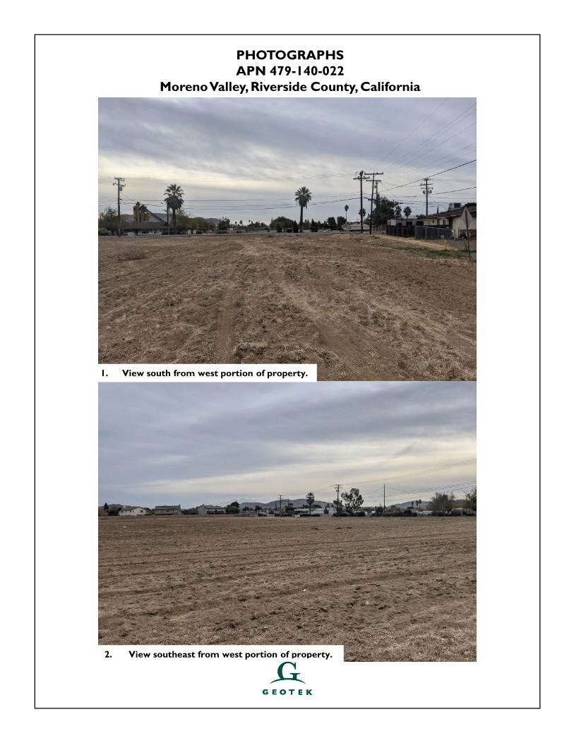
PHOTOGRAPHSAPN 479-140-022
Moreno Valley, Riverside County, California
2. View southeast from west portion of property.
1. View south from west portion of property.
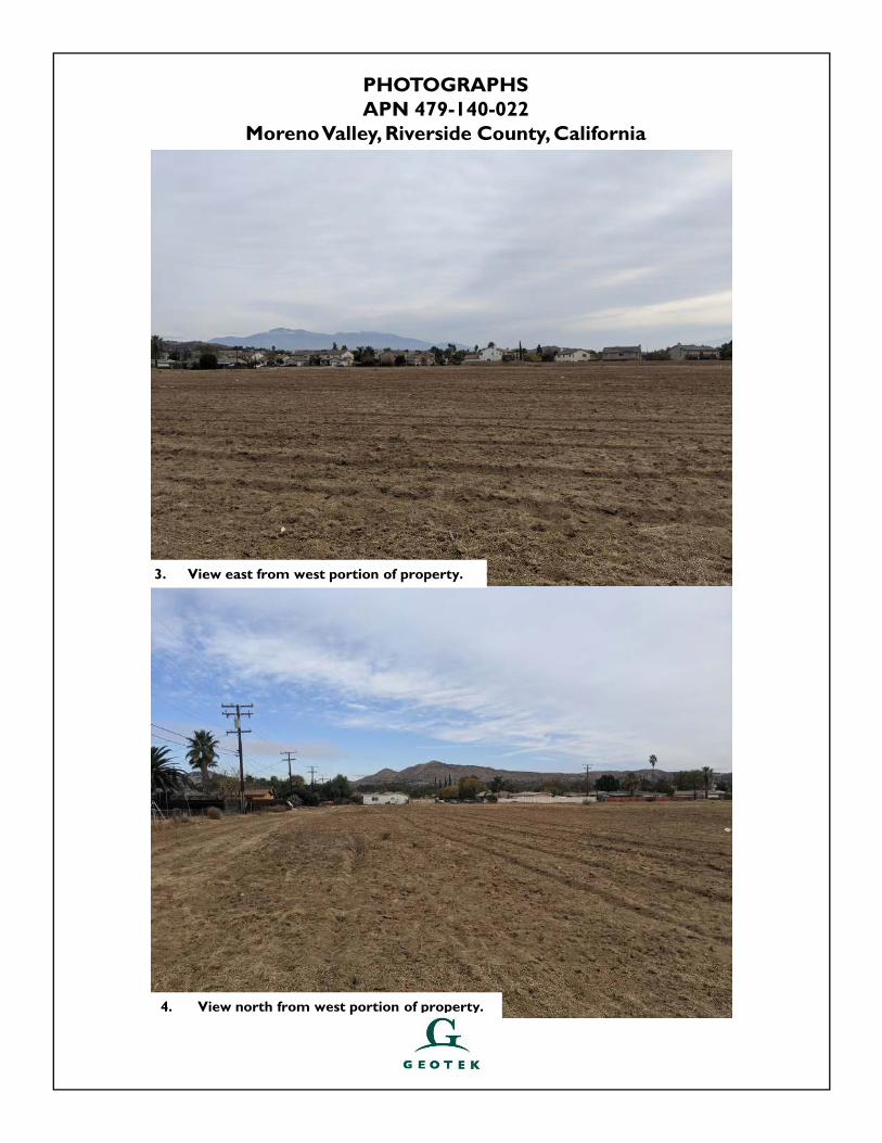
PHOTOGRAPHSAPN 479-140-022
Moreno Valley, Riverside County, California
4. View north from west portion of property.
3. View east from west portion of property.
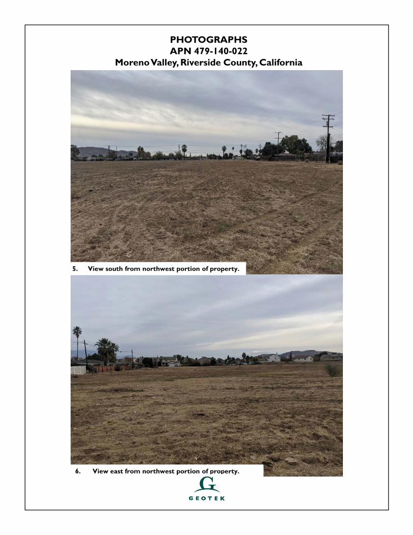
PHOTOGRAPHSAPN 479-140-022
Moreno Valley, Riverside County, California
6. View east from northwest portion of property.
5. View south from northwest portion of property.
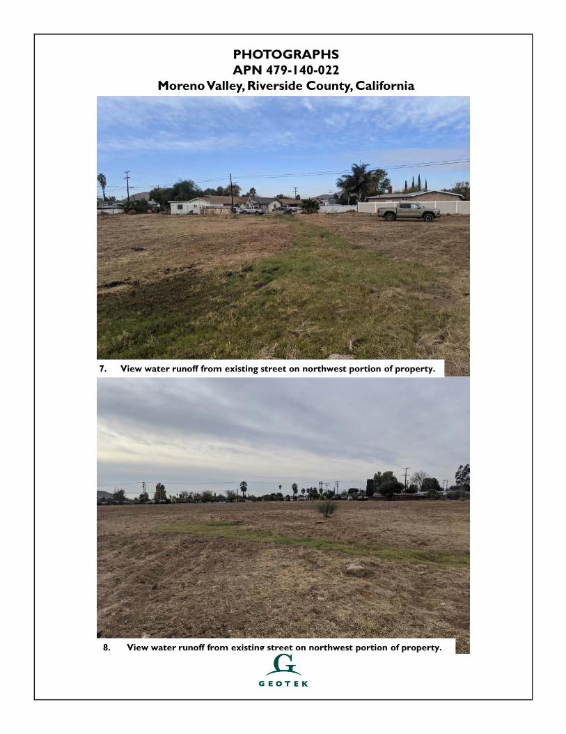
PHOTOGRAPHSAPN 479-140-022
Moreno Valley, Riverside County, California
8. View water runoff from existing street on northwest portion of property.
7. View water runoff from existing street on northwest portion of property.
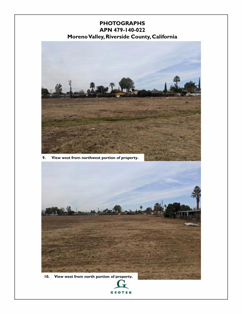
PHOTOGRAPHSAPN 479-140-022
Moreno Valley, Riverside County, California
10. View west from north portion of property.
9. View west from northwest portion of property.
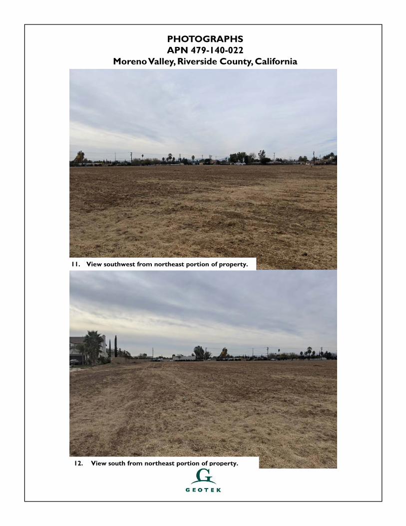
PHOTOGRAPHSAPN 479-140-022
Moreno Valley, Riverside County, California
12. View south from northeast portion of property.
11. View southwest from northeast portion of property.
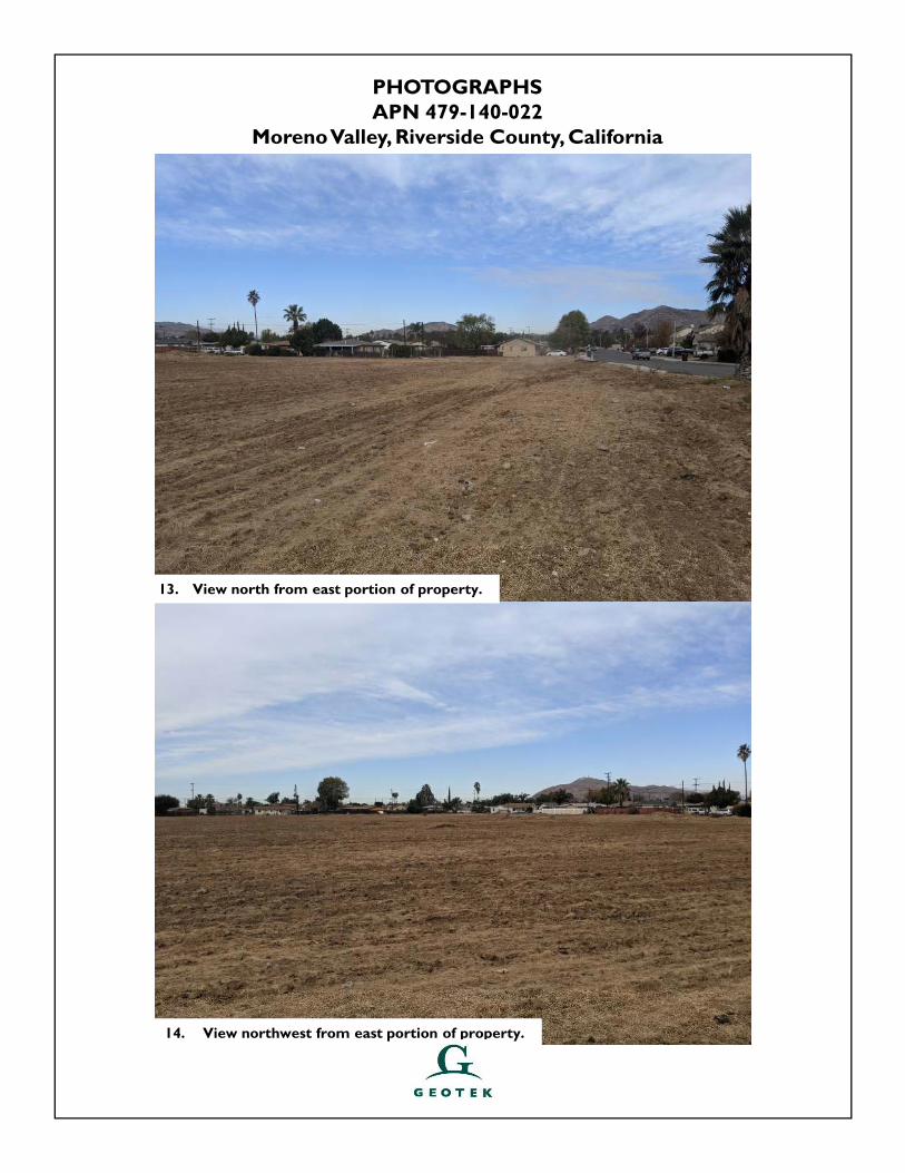
PHOTOGRAPHSAPN 479-140-022
Moreno Valley, Riverside County, California
14. View northwest from east portion of property.
13. View north from east portion of property.
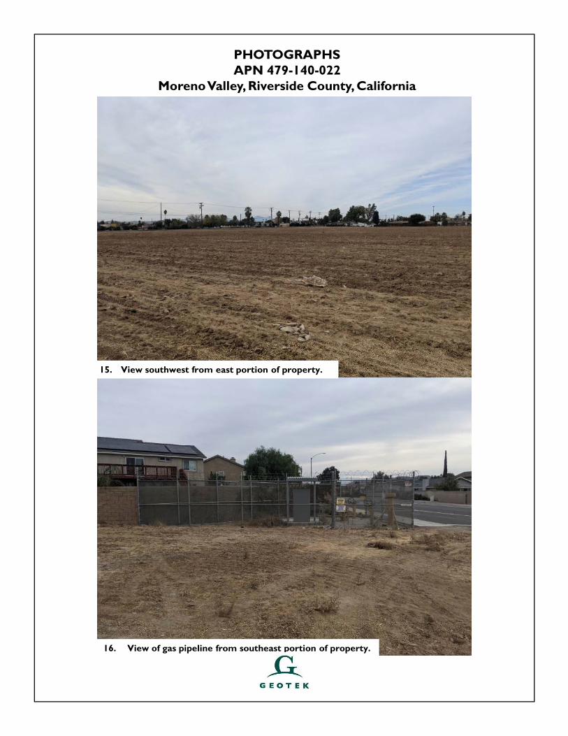
PHOTOGRAPHSAPN 479-140-022
Moreno Valley, Riverside County, California
16. View of gas pipeline from southeast portion of property.
15. View southwest from east portion of property.
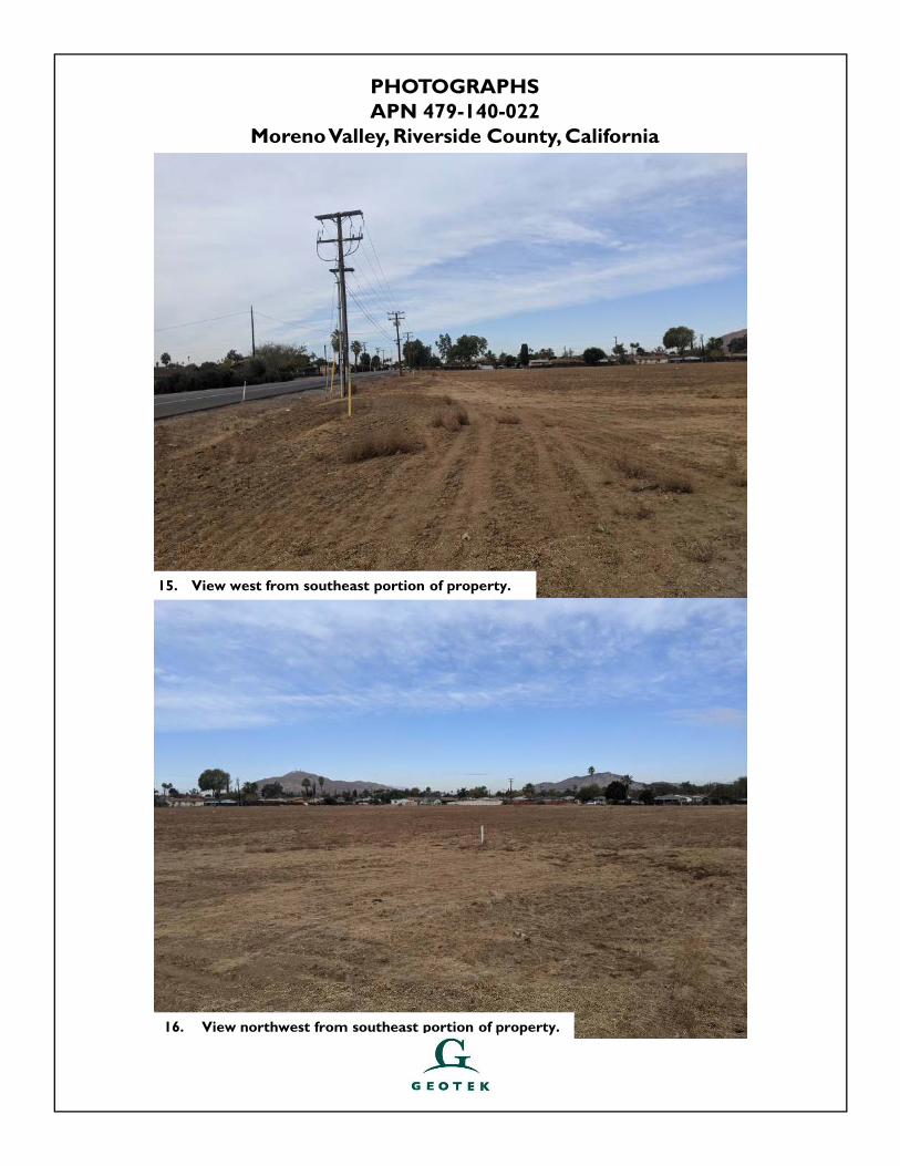
PHOTOGRAPHSAPN 479-140-022
Moreno Valley, Riverside County, California
16. View northwest from southeast portion of property.
15. View west from southeast portion of property.
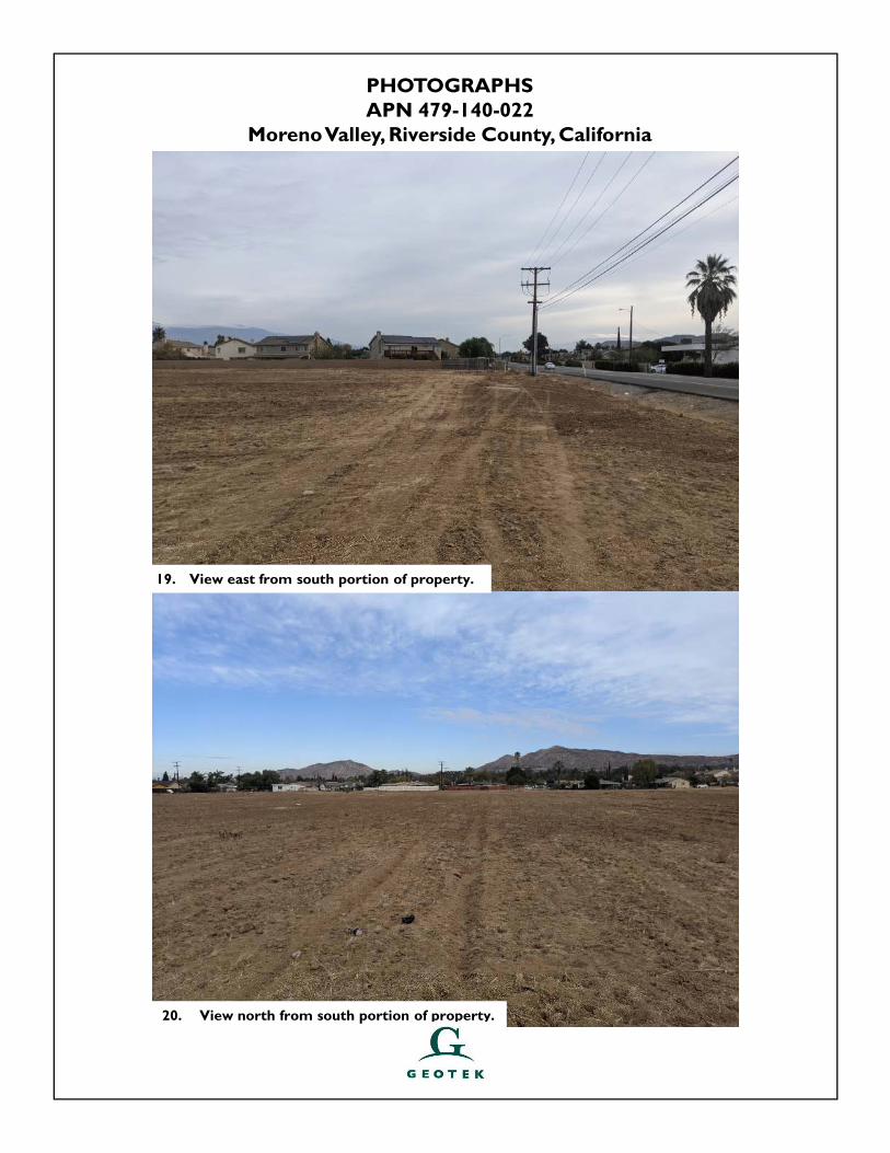
PHOTOGRAPHSAPN 479-140-022
Moreno Valley, Riverside County, California
20. View north from south portion of property.
19. View east from south portion of property.
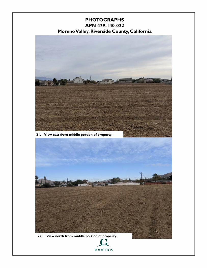
PHOTOGRAPHSAPN 479-140-022
Moreno Valley, Riverside County, California
22. View north from middle portion of property.
21. View east from middle portion of property.
CITIVEST COMMERCIAL INVESTMENTS, LLC PROJECT NO. 2597-CR APN 479-140-022 DECEMBER 23, 2020 MORENO VALLEY, RIVERSIDE COUNTY, CALIFORNIA APPENDIX D
APPENDIX D
VAPOR ENCROACHMENT SCREEN
neercS tnemhcaorcnE ropaV RDEteehskroW tnemhcaorcnE ropaV s’RDE gnisu deraperP
6 Armstrong Road, 4th floorShelton, CT 06484Toll Free: 800.352.0050www.edrnet.com
APN 479-140-022Corttonwood Avenue/Perris BoulevardMoreno Valley, CA 92553
Inquiry Number: 6305822.2sDecember 22, 2020
Thank you for your business.Please contact EDR at 1-800-352-0050
with any questions or comments.
SECTION PAGE
Executive Summary ES1
Primary Map 2
Secondary Map 3
Map Findings 4
Record Sources and Currency GR-1
Disclaimer - Copyright and Trademark Notice
The EDR Vapor Encroachment Worksheet enables EDR's customers to make certain online modifications that effects maps, textand calculations contained in this Report. As a result, maps, text and calculations contained in this Report may have been somodified. EDR has not taken any action to verify any such modifications, and this report and the findings set forth herein must beread in light of this fact. Environmental Data Resources shall not be responsible for any customer's decision to include or notinclude in any final report any records determined to be within the relevant minimum search distances.
This report contains information obtained from a variety of public and other sources reasonably available to Environmental DataResources, Inc. It cannot be concluded from this Report that coverage information for the target and surrounding properties doesnot exist from other sources. NO WARRANTY EXPRESSED OR IMPLIED, IS MADE WHATSOEVER IN CONNECTION WITHTHIS REPORT. ENVIRONMENTAL DATA RESOURCES, INC. SPECIFICALLY DISCLAIMS THE MAKING OF ANYSUCHWARRANTIES, INCLUDING WITHOUT LIMITATION, MERCHANTABILITY OR FITNESS FOR A PARTICULAR USE ORPURPOSE. ALL RISK IS ASSUMED BY THE USER. IN NO EVENT SHALL ENVIRONMENTAL DATA RESOURCES, INC.BE LIABLE TO ANYONE, WHETHER ARISING OUT OF ERRORS OR OMISSIONS, NEGLIGENCE, ACCIDENT OR ANYOTHER CAUSE, FOR ANY LOSS OR DAMAGE, INCLUDING, WITHOUT LIMITATION, SPECIAL, INCIDENTAL,CONSEQUENTIAL, OR EXEMPLARY DAMAGES.ANY LIABILITY ON THE PART OF ENVIRONMENTAL DATARESOURCES, INC. IS STRICTLY LIMITED TO A REFUND OF THE AMOUNT PAID FOR THIS REPORT.Purchaser accepts this report "AS IS". Any analyses, estimates, ratings, or risk codes provided in this report are provided forillustrative purposes only, and are not intended to provide, nor should they be interpreted as providing any facts regarding, orprediction or forecast of, any environmental risk for any property. Only a Phase I Environmental Site Assessment performed byan environmental professional can produce information regarding the environmental risk for any property. Additionally, theinformation provided in this Report is not to be construed as legal advice.
Copyright 2020 by Environmental Data Resources, Inc. All rights reserved. Reproduction in any media or format, in whole or inpart, of any report or map of Environmental Data Resources, Inc., or its affiliates, is prohibited without prior written permission.
EDR and its logos (including Sanborn and Sanborn Map) are trademarks of Environmental Data Resources, Inc. or its affiliates.All other trademarks used herein are the property of their respective owners.
TABLE OF CONTENTS
TC Page 1
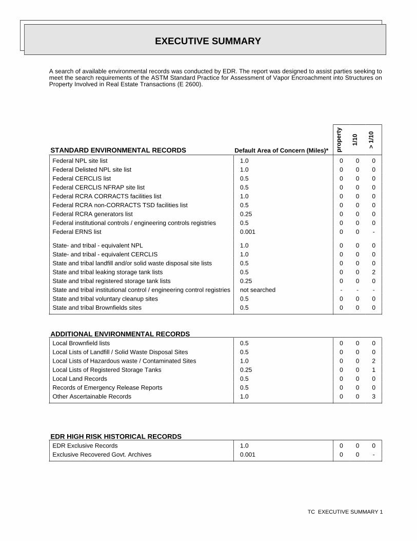
A search of available environmental records was conducted by EDR. The report was designed to assist parties seeking tomeet the search requirements of the ASTM Standard Practice for Assessment of Vapor Encroachment into Structures onProperty Involved in Real Estate Transactions (E 2600).
STANDARD ENVIRONMENTAL RECORDS Default Area of Concern (Miles)* pro
per
ty
1/10
> 1/
10
Federal NPL site list 1.0 0 0 0Federal Delisted NPL site list 1.0 0 0 0Federal CERCLIS list 0.5 0 0 0Federal CERCLIS NFRAP site list 0.5 0 0 0Federal RCRA CORRACTS facilities list 1.0 0 0 0Federal RCRA non-CORRACTS TSD facilities list 0.5 0 0 0Federal RCRA generators list 0.25 0 0 0Federal institutional controls / engineering controls registries 0.5 0 0 0Federal ERNS list 0.001 0 0 -
State- and tribal - equivalent NPL 1.0 0 0 0State- and tribal - equivalent CERCLIS 1.0 0 0 0State and tribal landfill and/or solid waste disposal site lists 0.5 0 0 0State and tribal leaking storage tank lists 0.5 0 0 2State and tribal registered storage tank lists 0.25 0 0 0State and tribal institutional control / engineering control registries not searched - - -State and tribal voluntary cleanup sites 0.5 0 0 0State and tribal Brownfields sites 0.5 0 0 0
ADDITIONAL ENVIRONMENTAL RECORDSLocal Brownfield lists 0.5 0 0 0Local Lists of Landfill / Solid Waste Disposal Sites 0.5 0 0 0Local Lists of Hazardous waste / Contaminated Sites 1.0 0 0 2Local Lists of Registered Storage Tanks 0.25 0 0 1Local Land Records 0.5 0 0 0Records of Emergency Release Reports 0.5 0 0 0Other Ascertainable Records 1.0 0 0 3
EDR HIGH RISK HISTORICAL RECORDSEDR Exclusive Records 1.0 0 0 0Exclusive Recovered Govt. Archives 0.001 0 0 -
EXECUTIVE SUMMARY
TC EXECUTIVE SUMMARY 1
*The Default Area of Concern may be adjusted by the environmental professional using experience and professionaljudgement. Each category may include several databases, and each database may have a different distance. A list ofindividual databases is provided at the back of this report.
EDR RECOVERED GOVERNMENT ARCHIVESEDR Exclusive Records 1.0 0 0 0Exclusive Recovered Govt. Archives 0.001 0 0 -
EXECUTIVE SUMMARY
TC EXECUTIVE SUMMARY 2

TARGET PROPERTY INFORMATION
ADDRESS
APN 479-140-022CORTTONWOOD AVENUE/PERRIS BOULEVARDMORENO VALLEY, CA 92553
COORDINATES
Latitude (North): 33.925507 - 33° 55′ 31.82373″
Longitude (West): 117.223156 - 117° 13′ 23.375244″
Elevation: 1590 ft. above sea level
EXECUTIVE SUMMARY
TC EXECUTIVE SUMMARY 3
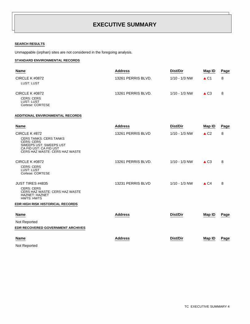
8
8
8
8
8
SEARCH RESULTS
Unmappable (orphan) sites are not considered in the foregoing analysis.
STANDARD ENVIRONMENTAL RECORDS
ADDITIONAL ENVIRONMENTAL RECORDS
EDR HIGH RISK HISTORICAL RECORDS
EDR RECOVERED GOVERNMENT ARCHIVES
Name Address Dist/Dir Map ID Page
CIRCLE K #0872 13261 PERRIS BLVD. 1/10 - 1/3 NW ▲ C1LUST: LUST
CIRCLE K #0872 13261 PERRIS BLVD. 1/10 - 1/3 NW ▲ C3CERS: CERSLUST: LUSTCortese: CORTESE
Name Address Dist/Dir Map ID Page
CIRCLE K #872 13261 PERRIS BLVD 1/10 - 1/3 NW ▲ C2CERS TANKS: CERS TANKSCERS: CERSSWEEPS UST: SWEEPS USTCA FID UST: CA FID USTCERS HAZ WASTE: CERS HAZ WASTE
CIRCLE K #0872 13261 PERRIS BLVD. 1/10 - 1/3 NW ▲ C3CERS: CERSLUST: LUSTCortese: CORTESE
JUST TIRES #4835 13231 PERRIS BLVD 1/10 - 1/3 NW ▲ C4CERS: CERSCERS HAZ WASTE: CERS HAZ WASTEHAZNET: HAZNETHWTS: HWTS
Name Address Dist/Dir Map ID Page
Not Reported
Name Address Dist/Dir Map ID Page
Not Reported
EXECUTIVE SUMMARY
TC EXECUTIVE SUMMARY 4
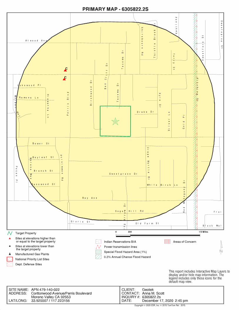
.
BeginOC−start−Wetlands−BeginOC−startBeginOC−start−− State Wetlands−BeginOC−startBeginOC−end−BeginOC−end−− State WetlandsBeginOC−start−− National Wetlands Inventory−BeginOC−startBeginOC−end−BeginOC−end−− National Wetlands InventoryBeginOC−end−BeginOC−end−WetlandsBeginOC−start−Water−BeginOC−startBeginOC−end−BeginOC−end−WaterBeginOC−start−Areas of Concern−BeginOC−startBeginOC−end−BeginOC−end−Areas of ConcernBeginOC−start−Power Transmission Lines / Oil & Gas Pipelines−BeginOC−startBeginOC−end−BeginOC−end−Power Transmission Lines / Oil & Gas PipelinesBeginOC−start−Flood Zones−BeginOC−startBeginOC−start−− 500 Year Zone−BeginOC−startBeginOC−end−BeginOC−end−− 500 Year ZoneBeginOC−start−− 100 Year Zone−BeginOC−startBeginOC−end−BeginOC−end−− 100 Year ZoneBeginOC−end−BeginOC−end−Flood ZonesBeginOC−start−Streets−BeginOC−startBeginOC−end−BeginOC−end−StreetsBeginOC−start−Railroads−BeginOC−startBeginOC−end−BeginOC−end−RailroadsBeginOC−start−Target Property Location−BeginOC−startBeginOC−end−BeginOC−end−Target Property LocationBeginOC−start−Federal DOD Records−BeginOC−startBeginOC−end−BeginOC−end−Federal DOD RecordsBeginOC−start−Indian Reservations BIA−BeginOC−startBeginOC−end−BeginOC−end−Indian Reservations BIABeginOC−start−National Priority List Records−BeginOC−startBeginOC−end−BeginOC−end−National Priority List RecordsBeginOC−start−Search Rings−BeginOC−startBeginOC−end−BeginOC−end−Search Rings
C
C
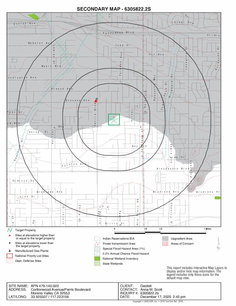
.
BeginOC−start−Wetlands−BeginOC−startBeginOC−start−− State Wetlands−BeginOC−startBeginOC−end−BeginOC−end−− State WetlandsBeginOC−start−− National Wetlands Inventory−BeginOC−startBeginOC−end−BeginOC−end−− National Wetlands InventoryBeginOC−end−BeginOC−end−WetlandsBeginOC−start−Water−BeginOC−startBeginOC−end−BeginOC−end−WaterBeginOC−start−Areas of Concern−BeginOC−startBeginOC−end−BeginOC−end−Areas of ConcernBeginOC−start−Power Transmission Lines / Oil & Gas Pipelines−BeginOC−startBeginOC−end−BeginOC−end−Power Transmission Lines / Oil & Gas PipelinesBeginOC−start−Flood Zones−BeginOC−startBeginOC−start−− 500 Year Zone−BeginOC−startBeginOC−end−BeginOC−end−− 500 Year ZoneBeginOC−start−− 100 Year Zone−BeginOC−startBeginOC−end−BeginOC−end−− 100 Year ZoneBeginOC−end−BeginOC−end−Flood ZonesBeginOC−start−Streets−BeginOC−startBeginOC−end−BeginOC−end−StreetsBeginOC−start−Railroads−BeginOC−startBeginOC−end−BeginOC−end−RailroadsBeginOC−start−Contour Lines−BeginOC−start BeginOC−start−Contour Lines−OffBeginOC−start
1 7 60
1 7 2 0
1 7 2 0
1 6 8 0
1 6 8 0
1 6 8 0
16
40
1 6 4 0 1 6 4 0
1 6 4 0
1 6 4 0
16
40
1 6 0 0
1 6 00
16
00
1 5 6 0
1 5 6 0
1 5 6 01 5 6 0
BeginOC−end−BeginOC−end−Contour LinesBeginOC−start−Target Property Location−BeginOC−startBeginOC−end−BeginOC−end−Target Property LocationBeginOC−start−Federal DOD Records−BeginOC−startBeginOC−end−BeginOC−end−Federal DOD RecordsBeginOC−start−Indian Reservations BIA−BeginOC−startBeginOC−end−BeginOC−end−Indian Reservations BIABeginOC−start−National Priority List Records−BeginOC−startBeginOC−end−BeginOC−end−National Priority List RecordsBeginOC−start−Search Rings−BeginOC−startBeginOC−end−BeginOC−end−Search Rings
C
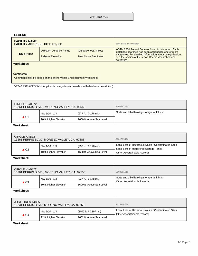
LEGEND
DATABASE ACRONYM: Applicable categories (A hoverbox with database description).
FACILITY NAMEFACILITY ADDRESS, CITY, ST, ZIP EDR SITE ID NUMBER
◆ MAP ID#Direction Distance Range (Distance feet / miles)
Relative Elevation Feet Above Sea Level
ASTM 2600 Record Sources found in this report. Eachdatabase searched has been assigned to one or morecategories. For detailed information about categorization,see the section of the report Records Searched andCurrency.
Worksheet:
Comments:
Comments may be added on the online Vapor Encroachment Worksheet.
CIRCLE K #087213261 PERRIS BLVD., MORENO VALLEY, CA, 92553 S106567753
▲ C1NW 1/10 - 1/3 (937 ft. / 0.178 mi.)
10 ft. Higher Elevation 1600 ft. Above Sea Level
State and tribal leaking storage tank lists
Worksheet:
CIRCLE K #87213261 PERRIS BLVD, MORENO VALLEY, CA, 92388 S101619424
▲ C2NW 1/10 - 1/3 (937 ft. / 0.178 mi.)
10 ft. Higher Elevation 1600 ft. Above Sea Level
Local Lists of Hazardous waste / Contaminated Sites
Local Lists of Registered Storage Tanks
Other Ascertainable Records
Worksheet:
CIRCLE K #087213261 PERRIS BLVD., MORENO VALLEY, CA, 92553 S108201615
▲ C3NW 1/10 - 1/3 (937 ft. / 0.178 mi.)
10 ft. Higher Elevation 1600 ft. Above Sea Level
State and tribal leaking storage tank lists
Other Ascertainable Records
Worksheet:
JUST TIRES #483513231 PERRIS BLVD, MORENO VALLEY, CA, 92553 S113124758
▲ C4NW 1/10 - 1/3 (1042 ft. / 0.197 mi.)
12 ft. Higher Elevation 1602 ft. Above Sea Level
Local Lists of Hazardous waste / Contaminated Sites
Other Ascertainable Records
Worksheet:
MAP FINDINGS
TC Page 8

MAP FINDINGS
TC Page 9
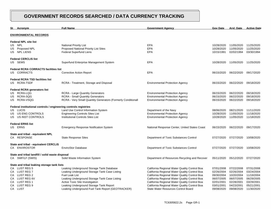
ENVIRONMENTAL RECORDS
Federal NPL site listUS NPL National Priority List EPA 10/28/2020 11/05/2020 11/25/2020US Proposed NPL Proposed National Priority List Sites EPA 10/28/2020 11/05/2020 11/25/2020US NPL LIENS Federal Superfund Liens EPA 10/15/1991 02/02/1994 03/30/1994
Federal CERCLIS listUS SEMS Superfund Enterprise Management System EPA 10/28/2020 11/05/2020 11/25/2020
Federal RCRA CORRACTS facilities listUS CORRACTS Corrective Action Report EPA 06/15/2020 06/22/2020 09/17/2020
Federal RCRA TSD facilities listUS RCRA-TSDF RCRA - Treatment, Storage and Disposal Environmental Protection Agency 06/15/2020 06/22/2020 09/18/2020
Federal RCRA generators listUS RCRA-LQG RCRA - Large Quantity Generators Environmental Protection Agency 06/15/2020 06/22/2020 09/18/2020US RCRA-SQG RCRA - Small Quantity Generators Environmental Protection Agency 06/15/2020 06/22/2020 09/18/2020US RCRA-VSQG RCRA - Very Small Quantity Generators (Formerly Conditionall Environmental Protection Agency 06/15/2020 06/22/2020 09/18/2020
Federal institutional controls / engineering controls registriesUS LUCIS Land Use Control Information System Department of the Navy 08/06/2020 08/21/2020 11/11/2020US US ENG CONTROLS Engineering Controls Sites List Environmental Protection Agency 10/28/2020 11/05/2020 11/18/2020US US INST CONTROLS Institutional Controls Sites List Environmental Protection Agency 10/28/2020 11/05/2020 11/18/2020
Federal ERNS listUS ERNS Emergency Response Notification System National Response Center, United States Coast 06/15/2020 06/22/2020 09/17/2020
State and tribal - equivalent NPLCA RESPONSE State Response Sites Department of Toxic Substances Control 07/27/2020 07/27/2020 10/08/2020
State and tribal - equivalent CERCLISCA ENVIROSTOR EnviroStor Database Department of Toxic Substances Control 07/27/2020 07/27/2020 10/08/2020
State and tribal landfill / solid waste disposalCA SWF/LF (SWIS) Solid Waste Information System Department of Resources Recycling and Recover 05/11/2020 05/12/2020 07/27/2020
State and tribal leaking storage tank listsCA LUST REG 5 Leaking Underground Storage Tank Database California Regional Water Quality Control Boa 07/01/2008 07/22/2008 07/31/2008CA LUST REG 7 Leaking Underground Storage Tank Case Listing California Regional Water Quality Control Boa 02/26/2004 02/26/2004 03/24/2004CA LUST REG 2 Fuel Leak List California Regional Water Quality Control Boa 09/30/2004 10/20/2004 11/19/2004CA LUST REG 6V Leaking Underground Storage Tank Case Listing California Regional Water Quality Control Boa 06/07/2005 06/07/2005 06/29/2005CA LUST REG 1 Active Toxic Site Investigation California Regional Water Quality Control Boa 02/01/2001 02/28/2001 03/29/2001CA LUST REG 9 Leaking Underground Storage Tank Report California Regional Water Quality Control Boa 03/01/2001 04/23/2001 05/21/2001CA LUST Leaking Underground Fuel Tank Report (GEOTRACKER) State Water Resources Control Board 09/08/2020 09/08/2020 11/30/2020
TC6305822.2s Page GR-1
GOVERNMENT RECORDS SEARCHED / DATA CURRENCY TRACKING
St Acronym Full Name Government Agency Gov Date Arvl. Date Active Date
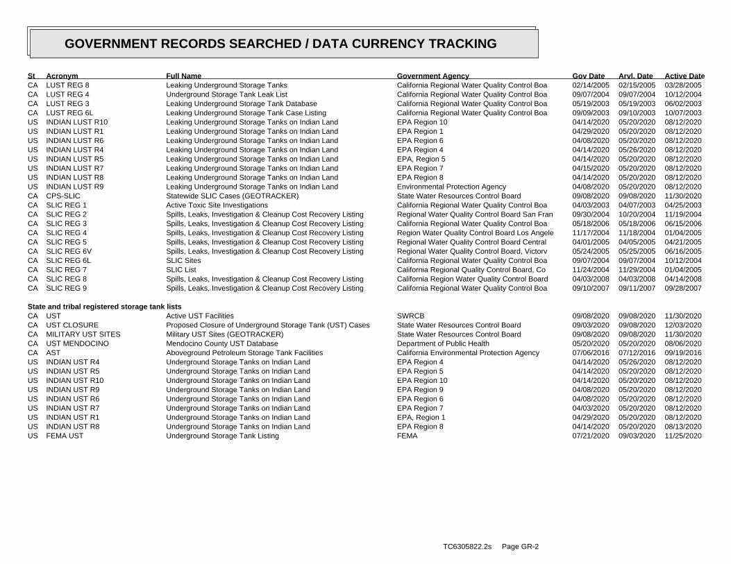
CA LUST REG 8 Leaking Underground Storage Tanks California Regional Water Quality Control Boa 02/14/2005 02/15/2005 03/28/2005CA LUST REG 4 Underground Storage Tank Leak List California Regional Water Quality Control Boa 09/07/2004 09/07/2004 10/12/2004CA LUST REG 3 Leaking Underground Storage Tank Database California Regional Water Quality Control Boa 05/19/2003 05/19/2003 06/02/2003CA LUST REG 6L Leaking Underground Storage Tank Case Listing California Regional Water Quality Control Boa 09/09/2003 09/10/2003 10/07/2003US INDIAN LUST R10 Leaking Underground Storage Tanks on Indian Land EPA Region 10 04/14/2020 05/20/2020 08/12/2020US INDIAN LUST R1 Leaking Underground Storage Tanks on Indian Land EPA Region 1 04/29/2020 05/20/2020 08/12/2020US INDIAN LUST R6 Leaking Underground Storage Tanks on Indian Land EPA Region 6 04/08/2020 05/20/2020 08/12/2020US INDIAN LUST R4 Leaking Underground Storage Tanks on Indian Land EPA Region 4 04/14/2020 05/26/2020 08/12/2020US INDIAN LUST R5 Leaking Underground Storage Tanks on Indian Land EPA, Region 5 04/14/2020 05/20/2020 08/12/2020US INDIAN LUST R7 Leaking Underground Storage Tanks on Indian Land EPA Region 7 04/15/2020 05/20/2020 08/12/2020US INDIAN LUST R8 Leaking Underground Storage Tanks on Indian Land EPA Region 8 04/14/2020 05/20/2020 08/12/2020US INDIAN LUST R9 Leaking Underground Storage Tanks on Indian Land Environmental Protection Agency 04/08/2020 05/20/2020 08/12/2020CA CPS-SLIC Statewide SLIC Cases (GEOTRACKER) State Water Resources Control Board 09/08/2020 09/08/2020 11/30/2020CA SLIC REG 1 Active Toxic Site Investigations California Regional Water Quality Control Boa 04/03/2003 04/07/2003 04/25/2003CA SLIC REG 2 Spills, Leaks, Investigation & Cleanup Cost Recovery Listing Regional Water Quality Control Board San Fran 09/30/2004 10/20/2004 11/19/2004CA SLIC REG 3 Spills, Leaks, Investigation & Cleanup Cost Recovery Listing California Regional Water Quality Control Boa 05/18/2006 05/18/2006 06/15/2006CA SLIC REG 4 Spills, Leaks, Investigation & Cleanup Cost Recovery Listing Region Water Quality Control Board Los Angele 11/17/2004 11/18/2004 01/04/2005CA SLIC REG 5 Spills, Leaks, Investigation & Cleanup Cost Recovery Listing Regional Water Quality Control Board Central 04/01/2005 04/05/2005 04/21/2005CA SLIC REG 6V Spills, Leaks, Investigation & Cleanup Cost Recovery Listing Regional Water Quality Control Board, Victorv 05/24/2005 05/25/2005 06/16/2005CA SLIC REG 6L SLIC Sites California Regional Water Quality Control Boa 09/07/2004 09/07/2004 10/12/2004CA SLIC REG 7 SLIC List California Regional Quality Control Board, Co 11/24/2004 11/29/2004 01/04/2005CA SLIC REG 8 Spills, Leaks, Investigation & Cleanup Cost Recovery Listing California Region Water Quality Control Board 04/03/2008 04/03/2008 04/14/2008CA SLIC REG 9 Spills, Leaks, Investigation & Cleanup Cost Recovery Listing California Regional Water Quality Control Boa 09/10/2007 09/11/2007 09/28/2007
State and tribal registered storage tank listsCA UST Active UST Facilities SWRCB 09/08/2020 09/08/2020 11/30/2020CA UST CLOSURE Proposed Closure of Underground Storage Tank (UST) Cases State Water Resources Control Board 09/03/2020 09/08/2020 12/03/2020CA MILITARY UST SITES Military UST Sites (GEOTRACKER) State Water Resources Control Board 09/08/2020 09/08/2020 11/30/2020CA UST MENDOCINO Mendocino County UST Database Department of Public Health 05/20/2020 05/20/2020 08/06/2020CA AST Aboveground Petroleum Storage Tank Facilities California Environmental Protection Agency 07/06/2016 07/12/2016 09/19/2016US INDIAN UST R4 Underground Storage Tanks on Indian Land EPA Region 4 04/14/2020 05/26/2020 08/12/2020US INDIAN UST R5 Underground Storage Tanks on Indian Land EPA Region 5 04/14/2020 05/20/2020 08/12/2020US INDIAN UST R10 Underground Storage Tanks on Indian Land EPA Region 10 04/14/2020 05/20/2020 08/12/2020US INDIAN UST R9 Underground Storage Tanks on Indian Land EPA Region 9 04/08/2020 05/20/2020 08/12/2020US INDIAN UST R6 Underground Storage Tanks on Indian Land EPA Region 6 04/08/2020 05/20/2020 08/12/2020US INDIAN UST R7 Underground Storage Tanks on Indian Land EPA Region 7 04/03/2020 05/20/2020 08/12/2020US INDIAN UST R1 Underground Storage Tanks on Indian Land EPA, Region 1 04/29/2020 05/20/2020 08/12/2020US INDIAN UST R8 Underground Storage Tanks on Indian Land EPA Region 8 04/14/2020 05/20/2020 08/13/2020US FEMA UST Underground Storage Tank Listing FEMA 07/21/2020 09/03/2020 11/25/2020
TC6305822.2s Page GR-2
GOVERNMENT RECORDS SEARCHED / DATA CURRENCY TRACKING
St Acronym Full Name Government Agency Gov Date Arvl. Date Active Date
State and tribal voluntary cleanup sitesUS INDIAN VCP R7 Voluntary Cleanup Priority Lisitng EPA, Region 7 03/20/2008 04/22/2008 05/19/2008US INDIAN VCP R1 Voluntary Cleanup Priority Listing EPA, Region 1 07/27/2015 09/29/2015 02/18/2016CA VCP Voluntary Cleanup Program Properties Department of Toxic Substances Control 07/27/2020 07/27/2020 10/08/2020
State and tribal Brownfields sitesCA BROWNFIELDS Considered Brownfieds Sites Listing State Water Resources Control Board 09/21/2020 09/22/2020 12/11/2020
Other RecordsUS CONSENT Superfund (CERCLA) Consent Decrees Department of Justice, Consent Decree Library 06/30/2020 07/15/2020 07/21/2020US ROD Records Of Decision EPA 10/28/2020 11/05/2020 11/25/2020US LIENS 2 CERCLA Lien Information Environmental Protection Agency 10/28/2020 11/05/2020 11/25/2020CA HIST CAL-SITES Calsites Database Department of Toxic Substance Control 08/08/2005 08/03/2006 08/24/2006US DEBRIS REGION 9 Torres Martinez Reservation Illegal Dump Site Locations EPA, Region 9 01/12/2009 05/07/2009 09/21/2009CA SWRCY Recycler Database Department of Conservation 09/08/2020 09/08/2020 11/30/2020CA CA FID UST Facility Inventory Database California Environmental Protection Agency 10/31/1994 09/05/1995 09/29/1995CA HIST UST Hazardous Substance Storage Container Database State Water Resources Control Board 10/15/1990 01/25/1991 02/12/1991CA SAN FRANCISCO AST Aboveground Storage Tank Site Listing San Francisco County Department of Public Hea 08/03/2020 08/05/2020 10/22/2020CA SWEEPS UST SWEEPS UST Listing State Water Resources Control Board 06/01/1994 07/07/2005 08/11/2005US COAL ASH DOE Steam-Electric Plant Operation Data Department of Energy 12/31/2018 12/04/2019 01/15/2020US 2020 COR ACTION 2020 Corrective Action Program List Environmental Protection Agency 09/30/2017 05/08/2018 07/20/2018US LEAD SMELTER 2 Lead Smelter Sites American Journal of Public Health 04/05/2001 10/27/2010 12/02/2010US LEAD SMELTER 1 Lead Smelter Sites Environmental Protection Agency 10/28/2020 11/05/2020 11/25/2020US PCB TRANSFORMER PCB Transformer Registration Database Environmental Protection Agency 09/13/2019 11/06/2019 02/10/2020US COAL ASH EPA Coal Combustion Residues Surface Impoundments List Environmental Protection Agency 01/12/2017 03/05/2019 11/11/2019US US FIN ASSUR Financial Assurance Information Environmental Protection Agency 09/21/2020 09/22/2020 12/14/2020US SCRD DRYCLEANERS State Coalition for Remediation of Drycleaners Listing Environmental Protection Agency 01/01/2017 02/03/2017 04/07/2017US US AIRS (AFS) Aerometric Information Retrieval System Facility Subsystem ( EPA 10/12/2016 10/26/2016 02/03/2017US US AIRS MINOR Air Facility System Data EPA 10/12/2016 10/26/2016 02/03/2017US EPA WATCH LIST EPA WATCH LIST Environmental Protection Agency 08/30/2013 03/21/2014 06/17/2014US FUSRAP Formerly Utilized Sites Remedial Action Program Department of Energy 08/08/2017 09/11/2018 09/14/2018US US HIST CDL National Clandestine Laboratory Register Drug Enforcement Administration 03/18/2020 03/19/2020 06/09/2020US Delisted NPL National Priority List Deletions EPA 10/28/2020 11/05/2020 11/25/2020US SEMS-ARCHIVE Superfund Enterprise Management System Archive EPA 10/28/2020 11/05/2020 11/25/2020US RCRA NonGen / NLR RCRA - Non Generators / No Longer Regulated Environmental Protection Agency 06/15/2020 06/22/2020 09/18/2020US HMIRS Hazardous Materials Information Reporting System U.S. Department of Transportation 09/20/2020 09/22/2020 12/14/2020US DOT OPS Incident and Accident Data Department of Transporation, Office of Pipeli 01/02/2020 01/28/2020 04/17/2020US US CDL Clandestine Drug Labs Drug Enforcement Administration 03/18/2020 03/19/2020 06/09/2020US US BROWNFIELDS A Listing of Brownfields Sites Environmental Protection Agency 09/14/2020 09/15/2020 12/10/2020US DOD Department of Defense Sites USGS 12/31/2005 11/10/2006 01/11/2007US FEDLAND Federal and Indian Lands U.S. Geological Survey 04/02/2018 04/11/2018 11/06/2019US FUDS Formerly Used Defense Sites U.S. Army Corps of Engineers 08/05/2020 08/13/2020 10/21/2020US UMTRA Uranium Mill Tailings Sites Department of Energy 08/30/2019 11/15/2019 01/28/2020US ODI Open Dump Inventory Environmental Protection Agency 06/30/1985 08/09/2004 09/17/2004US MINES VIOLATIONS MSHA Violation Assessment Data DOL, Mine Safety & Health Admi 09/10/2020 09/15/2020 11/20/2020US US MINES Mines Master Index File Department of Labor, Mine Safety and Health A 08/04/2020 08/25/2020 11/18/2020
TC6305822.2s Page GR-3
GOVERNMENT RECORDS SEARCHED / DATA CURRENCY TRACKING
St Acronym Full Name Government Agency Gov Date Arvl. Date Active Date
US US MINES 2 Ferrous and Nonferrous Metal Mines Database Listing USGS 05/06/2020 05/27/2020 08/13/2020US US MINES 3 Active Mines & Mineral Plants Database Listing USGS 04/14/2011 06/08/2011 09/13/2011US PRP Potentially Responsible Parties EPA 04/27/2020 05/06/2020 06/09/2020US TRIS Toxic Chemical Release Inventory System EPA 12/31/2018 08/14/2020 11/04/2020US TSCA Toxic Substances Control Act EPA 12/31/2016 06/17/2020 09/10/2020US FTTS FIFRA/ TSCA Tracking System - FIFRA (Federal Insecticide, Fu EPA/Office of Prevention, Pesticides and Toxi 04/09/2009 04/16/2009 05/11/2009US FTTS INSP FIFRA/ TSCA Tracking System - FIFRA (Federal Insecticide, Fu EPA 04/09/2009 04/16/2009 05/11/2009US HIST FTTS FIFRA/TSCA Tracking System Administrative Case Listing Environmental Protection Agency 10/19/2006 03/01/2007 04/10/2007US HIST FTTS INSP FIFRA/TSCA Tracking System Inspection & Enforcement Case Lis Environmental Protection Agency 10/19/2006 03/01/2007 04/10/2007US SSTS Section 7 Tracking Systems EPA 07/20/2020 07/21/2020 10/08/2020US ICIS Integrated Compliance Information System Environmental Protection Agency 11/18/2016 11/23/2016 02/10/2017US PADS PCB Activity Database System EPA 10/09/2019 10/11/2019 12/20/2019US MLTS Material Licensing Tracking System Nuclear Regulatory Commission 08/05/2020 08/10/2020 10/08/2020US RADINFO Radiation Information Database Environmental Protection Agency 07/01/2019 07/01/2019 09/23/2019US FINDS Facility Index System/Facility Registry System EPA 09/04/2020 09/15/2020 11/20/2020US RAATS RCRA Administrative Action Tracking System EPA 04/17/1995 07/03/1995 08/07/1995US RMP Risk Management Plans Environmental Protection Agency 07/24/2020 08/03/2020 10/21/2020US BRS Biennial Reporting System EPA/NTIS 12/31/2017 06/22/2020 11/20/2020US PWS Public Water System Data EPA 12/17/2013 01/09/2014 10/15/2014US INDIAN RESERV Indian Reservations USGS 12/31/2014 07/14/2015 01/10/2017US INDIAN ODI Report on the Status of Open Dumps on Indian Lands Environmental Protection Agency 12/31/1998 12/03/2007 01/24/2008US IHS OPEN DUMPS Open Dumps on Indian Land Department of Health & Human Serivces, Indian 04/01/2014 08/06/2014 01/29/2015US ABANDONED MINES Abandoned Mines Department of Interior 09/16/2020 09/17/2020 12/10/2020CA CA BOND EXP. PLAN Bond Expenditure Plan Department of Health Services 01/01/1989 07/27/1994 08/02/1994CA CDL Clandestine Drug Labs Department of Toxic Substances Control 06/30/2019 05/28/2020 08/12/2020CA CHMIRS California Hazardous Material Incident Report System Office of Emergency Services 06/30/2020 07/21/2020 10/07/2020CA CORTESE "Cortese" Hazardous Waste & Substances Sites List CAL EPA/Office of Emergency Information 06/22/2020 06/22/2020 09/04/2020CA CUPA LIVERMORE-PLEASANTON CUPA Facility Listing Livermore-Pleasanton Fire Department 05/01/2019 05/14/2019 07/17/2019CA DEED Deed Restriction Listing DTSC and SWRCB 08/31/2020 08/31/2020 11/20/2020CA DRYCLEAN SOUTH COAST South Coast Air Quality Management District Drycleaner Listi South Coast Air Quality Management District 08/19/2020 08/21/2020 09/04/2020CA DRYCLEANERS Cleaner Facilities Department of Toxic Substance Control 08/06/2020 08/28/2020 11/17/2020CA DRYCLEAN AVAQMD Antelope Valley Air Quality Management District Drycleaner L Antelope Valley Air Quality Management Distri 08/25/2020 08/26/2020 11/13/2020CA EMI Emissions Inventory Data California Air Resources Board 12/31/2018 06/16/2020 08/28/2020CA ENF Enforcement Action Listing State Water Resoruces Control Board 07/20/2020 07/21/2020 10/07/2020CA Financial Assurance 1 Financial Assurance Information Listing Department of Toxic Substances Control 07/13/2020 07/16/2020 09/29/2020CA Financial Assurance 2 Financial Assurance Information Listing California Integrated Waste Management Board 08/05/2020 08/05/2020 10/23/2020CA HAULERS Registered Waste Tire Haulers Listing Integrated Waste Management Board 05/28/2020 05/29/2020 08/12/2020CA HAZNET Facility and Manifest Data California Environmental Protection Agency 12/31/2019 04/15/2020 07/02/2020CA HIST CORTESE Hazardous Waste & Substance Site List Department of Toxic Substances Control 04/01/2001 01/22/2009 04/08/2009CA HWP EnviroStor Permitted Facilities Listing Department of Toxic Substances Control 08/17/2020 08/17/2020 11/05/2020CA HWT Registered Hazardous Waste Transporter Database Department of Toxic Substances Control 07/06/2020 07/07/2020 09/17/2020CA ICE ICE Department of Toxic Subsances Control 08/17/2020 08/17/2020 11/05/2020CA LDS Land Disposal Sites Listing (GEOTRACKER) State Water Qualilty Control Board 09/08/2020 09/08/2020 11/30/2020CA LIENS Environmental Liens Listing Department of Toxic Substances Control 08/26/2020 08/28/2020 11/17/2020CA MCS Military Cleanup Sites Listing (GEOTRACKER) State Water Resources Control Board 09/08/2020 09/08/2020 11/30/2020CA MINES Mines Site Location Listing Department of Conservation 09/08/2020 09/08/2020 11/30/2020CA MWMP Medical Waste Management Program Listing Department of Public Health 08/31/2020 08/31/2020 11/20/2020
TC6305822.2s Page GR-4
GOVERNMENT RECORDS SEARCHED / DATA CURRENCY TRACKING
St Acronym Full Name Government Agency Gov Date Arvl. Date Active Date
CA NPDES NPDES Permits Listing State Water Resources Control Board 08/10/2020 08/10/2020 10/29/2020CA PEST LIC Pesticide Regulation Licenses Listing Department of Pesticide Regulation 08/31/2020 08/31/2020 11/20/2020CA PROC Certified Processors Database Department of Conservation 09/08/2020 09/08/2020 12/01/2020CA NOTIFY 65 Proposition 65 Records State Water Resources Control Board 12/07/2020 12/09/2020 12/10/2020CA SCH School Property Evaluation Program Department of Toxic Substances Control 07/27/2020 07/27/2020 10/08/2020CA SPILLS 90 SPILLS90 data from FirstSearch FirstSearch 06/06/2012 01/03/2013 02/22/2013CA TOXIC PITS Toxic Pits Cleanup Act Sites State Water Resources Control Board 07/01/1995 08/30/1995 09/26/1995CA UIC UIC Listing Deaprtment of Conservation 09/08/2020 09/08/2020 12/01/2020CA WASTEWATER PITS Oil Wastewater Pits Listing RWQCB, Central Valley Region 11/19/2019 01/07/2020 03/09/2020CA WDS Waste Discharge System State Water Resources Control Board 06/19/2007 06/20/2007 06/29/2007CA WIP Well Investigation Program Case List Los Angeles Water Quality Control Board 07/03/2009 07/21/2009 08/03/2009CA WMUDS/SWAT Waste Management Unit Database State Water Resources Control Board 04/01/2000 04/10/2000 05/10/2000CA CERS CalEPA Regulated Site Portal Data California Environmental Protection Agency 07/20/2020 07/21/2020 10/07/2020US DOCKET HWC Hazardous Waste Compliance Docket Listing Environmental Protection Agency 05/31/2018 07/26/2018 10/05/2018CA HWTS Hazardous Waste Tracking System Department of Toxic Substances Control 10/13/2020 10/14/2020 11/03/2020CA PROJECT Project Sites (GEOTRACKER) State Water Resources Control Board 09/08/2020 09/08/2020 11/30/2020CA SAMPLING POINT Sampling Point ? Public Sites (GEOTRACKER) State Water Resources Control Board 09/08/2020 09/08/2020 11/30/2020CA MILITARY PRIV SITES Military Privatized Sites (GEOTRACKER) State Water Resources Control Board 09/08/2020 09/08/2020 11/30/2020CA NON-CASE INFO Non-Case Information Sites (GEOTRACKER) State Water Resources Control Board 09/08/2020 09/08/2020 11/30/2020CA OTHER OIL GAS Other Oil & Gas Projects Sites (GEOTRACKER) State Water Resources Control Board 09/08/2020 09/08/2020 11/30/2020CA PROD WATER PONDS Produced Water Ponds Sites (GEOTRACKER) State Water Resources Control Board 09/08/2020 09/08/2020 11/30/2020CA UIC GEO Underground Injection Control Sites (GEOTRACKER) State Water Resource Control Board 09/08/2020 09/08/2020 11/30/2020CA WELL STIM PROJ Well Stimulation Project (GEOTRACKER) State Water Resources Control Board 09/08/2020 09/08/2020 11/30/2020US ECHO Enforcement & Compliance History Information Environmental Protection Agency 06/27/2020 07/02/2020 09/28/2020CA PFAS PFAS Contamination Site Location Listing State Water Resources Control Board 09/08/2020 09/08/2020 12/01/2020US FUELS PROGRAM EPA Fuels Program Registered Listing EPA 08/17/2020 08/17/2020 10/21/2020CA CERS HAZ WASTE CERS HAZ WASTE CalEPA 07/20/2020 07/21/2020 10/07/2020CA CIWQS California Integrated Water Quality System State Water Resources Control Board 08/31/2020 08/31/2020 11/20/2020CA CERS TANKS California Environmental Reporting System (CERS) Tanks California Environmental Protection Agency 07/20/2020 07/21/2020 10/07/2020CA WDR Waste Discharge Requirements Listing State Water Resources Control Board 09/08/2020 09/08/2020 12/01/2020US UXO Unexploded Ordnance Sites Department of Defense 12/31/2018 07/02/2020 09/17/2020US MINES MRDS Mineral Resources Data System USGS 04/06/2018 10/21/2019 10/24/2019
HISTORICAL USE RECORDSUS EDR MGP EDR Proprietary Manufactured Gas Plants EDR, Inc.US EDR Hist Auto EDR Exclusive Historical Auto Stations EDR, Inc.US EDR Hist Cleaner EDR Exclusive Historical Cleaners EDR, Inc.CA RGA LF Recovered Government Archive Solid Waste Facilities List Department of Resources Recycling and Recover 07/01/2013 01/13/2014CA RGA LUST Recovered Government Archive Leaking Underground Storage Tan State Water Resources Control Board 07/01/2013 12/30/2013
TC6305822.2s Page GR-5
GOVERNMENT RECORDS SEARCHED / DATA CURRENCY TRACKING
St Acronym Full Name Government Agency Gov Date Arvl. Date Active Date
COUNTY RECORDSCA CS ALAMEDA Contaminated Sites Alameda County Environmental Health Services 01/09/2019 01/11/2019 03/05/2019CA UST ALAMEDA Underground Tanks Alameda County Environmental Health Services 06/30/2020 07/01/2020 07/17/2020CA CUPA AMADOR CUPA Facility List Amador County Environmental Health 05/18/2020 05/19/2020 06/01/2020CA CUPA BUTTE CUPA Facility Listing Public Health Department 04/21/2017 04/25/2017 08/09/2017CA CUPA CALVERAS CUPA Facility Listing Calveras County Environmental Health 06/17/2020 06/18/2020 09/02/2020CA CUPA COLUSA CUPA Facility List Health & Human Services 04/06/2020 04/23/2020 07/10/2020CA SL CONTRA COSTA Site List Contra Costa Health Services Department 07/16/2020 07/22/2020 10/08/2020CA CUPA DEL NORTE CUPA Facility List Del Norte County Environmental Health Divisio 06/08/2020 08/13/2020 10/22/2020CA CUPA EL DORADO CUPA Facility List El Dorado County Environmental Management Dep 08/13/2020 08/13/2020 10/22/2020CA CUPA FRESNO CUPA Resources List Dept. of Community Health 06/30/2020 07/01/2020 09/17/2020CA CUPA GLENN CUPA Facility List Glenn County Air Pollution Control District 01/22/2018 01/24/2018 03/14/2018CA CUPA HUMBOLDT CUPA Facility List Humboldt County Environmental Health 08/13/2020 08/17/2020 11/05/2020CA CUPA IMPERIAL CUPA Facility List San Diego Border Field Office 07/14/2020 07/16/2020 09/29/2020CA CUPA INYO CUPA Facility List Inyo County Environmental Health Services 04/02/2018 04/03/2018 06/14/2018CA CUPA KERN CUPA Facility List Kern County Public Health 07/28/2020 07/30/2020 10/13/2020CA UST KERN Underground Storage Tank Sites & Tank Listing Kern County Environment Health Services Depar 07/28/2020 07/30/2020 10/14/2020CA CUPA KINGS CUPA Facility List Kings County Department of Public Health 05/11/2020 05/12/2020 07/27/2020CA CUPA LAKE CUPA Facility List Lake County Environmental Health 08/13/2020 08/13/2020 10/23/2020CA CUPA LASSEN CUPA Facility List Lassen County Environmental Health 07/31/2020 08/21/2020 11/09/2020CA AOCONCERN Key Areas of Concerns in Los Angeles County 03/30/2009 03/31/2009 10/23/2009CA HMS LOS ANGELES HMS: Street Number List Department of Public Works 07/06/2020 07/10/2020 09/28/2020CA LF LOS ANGELES List of Solid Waste Facilities La County Department of Public Works 07/13/2020 07/13/2020 09/29/2020CA LF LOS ANGELES CITY City of Los Angeles Landfills Engineering & Construction Division 12/31/2019 08/17/2020 11/05/2020CA LOS ANGELES AST Active & Inactive AST Inventory Los Angeles Fire Department 06/01/2019 06/25/2019 08/22/2019CA LOS ANGELES CO LF METHANE Methane Producing Landfills Los Angeles County Department of Public Works 04/30/2012 04/17/2019 05/29/2019CA LOS ANGELES HM Active & Inactive Hazardous Materials Inventory Los Angeles Fire Department 06/01/2019 06/25/2019 08/22/2019CA LOS ANGELES UST Active & Inactive UST Inventory Los Angeles Fire Department 06/01/2019 06/25/2019 08/22/2019CA SITE MIT LOS ANGELES Site Mitigation List Community Health Services 03/25/2020 04/14/2020 07/01/2020CA UST EL SEGUNDO City of El Segundo Underground Storage Tank City of El Segundo Fire Department 01/21/2017 04/19/2017 05/10/2017CA UST LONG BEACH City of Long Beach Underground Storage Tank City of Long Beach Fire Department 04/22/2019 04/23/2019 06/27/2019CA UST TORRANCE City of Torrance Underground Storage Tank City of Torrance Fire Department 06/27/2019 07/30/2019 10/02/2019CA CUPA MADERA CUPA Facility List Madera County Environmental Health 08/10/2020 08/12/2020 10/23/2020CA UST MARIN Underground Storage Tank Sites Public Works Department Waste Management 09/26/2018 10/04/2018 11/02/2018CA CUPA MERCED CUPA Facility List Merced County Environmental Health 07/28/2020 07/30/2020 07/31/2020CA CUPA MONO CUPA Facility List Mono County Health Department 08/20/2020 08/24/2020 11/09/2020CA CUPA MONTEREY CUPA Facility Listing Monterey County Health Department 07/13/2020 07/15/2020 07/31/2020CA LUST NAPA Sites With Reported Contamination Napa County Department of Environmental Manag 01/09/2017 01/11/2017 03/02/2017CA UST NAPA Closed and Operating Underground Storage Tank Sites Napa County Department of Environmental Manag 09/05/2019 09/09/2019 10/31/2019CA CUPA NEVADA CUPA Facility List Community Development Agency 07/29/2020 07/30/2020 10/13/2020CA IND_SITE ORANGE List of Industrial Site Cleanups Health Care Agency 06/10/2020 08/03/2020 10/19/2020CA LUST ORANGE List of Underground Storage Tank Cleanups Health Care Agency 07/02/2020 08/05/2020 10/23/2020CA UST ORANGE List of Underground Storage Tank Facilities Health Care Agency 07/01/2020 08/03/2020 10/19/2020CA MS PLACER Master List of Facilities Placer County Health and Human Services 11/24/2020 11/24/2020 11/25/2020CA CUPA PLUMAS CUPA Facility List Plumas County Environmental Health 03/31/2019 04/23/2019 06/26/2019CA LUST RIVERSIDE Listing of Underground Tank Cleanup Sites Department of Environmental Health 10/06/2020 10/07/2020 11/03/2020
TC6305822.2s Page GR-6
GOVERNMENT RECORDS SEARCHED / DATA CURRENCY TRACKING
St Acronym Full Name Government Agency Gov Date Arvl. Date Active Date
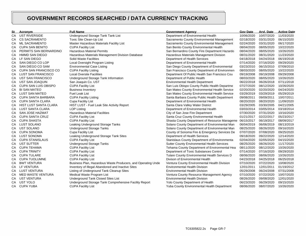
CA UST RIVERSIDE Underground Storage Tank Tank List Department of Environmental Health 10/06/2020 10/07/2020 11/03/2020CA CS SACRAMENTO Toxic Site Clean-Up List Sacramento County Environmental Management 02/18/2020 03/31/2020 06/15/2020CA ML SACRAMENTO Master Hazardous Materials Facility List Sacramento County Environmental Management 02/24/2020 03/31/2020 06/17/2020CA CUPA SAN BENITO CUPA Facility List San Benito County Environmental Health 08/04/2020 08/05/2020 10/22/2020CA PERMITS SAN BERNARDINO Hazardous Material Permits San Bernardino County Fire Department Hazardo 08/04/2020 08/05/2020 10/26/2020CA HMMD SAN DIEGO Hazardous Materials Management Division Database Hazardous Materials Management Division 08/31/2020 08/31/2020 11/23/2020CA LF SAN DIEGO Solid Waste Facilities Department of Health Services 04/18/2018 04/24/2018 06/19/2018CA SAN DIEGO CO LOP Local Oversight Program Listing Department of Environmental Health 07/14/2020 07/16/2020 09/29/2020CA SAN DIEGO CO SAM Environmental Case Listing San Diego County Department of Environmental 03/23/2010 06/15/2010 07/09/2010CA CUPA SAN FRANCISCO CO CUPA Facility Listing San Francisco County Department of Environmen 08/03/2020 08/05/2020 10/22/2020CA LUST SAN FRANCISCO Local Oversite Facilities Department Of Public Health San Francisco Cou 09/19/2008 09/19/2008 09/29/2008CA UST SAN FRANCISCO Underground Storage Tank Information Department of Public Health 08/03/2020 08/05/2020 10/26/2020CA UST SAN JOAQUIN San Joaquin Co. UST Environmental Health Department 06/22/2018 06/26/2018 07/11/2018CA CUPA SAN LUIS OBISPO CUPA Facility List San Luis Obispo County Public Health Departme 07/27/2020 08/12/2020 10/26/2020CA BI SAN MATEO Business Inventory San Mateo County Environmental Health Service 02/20/2020 02/20/2020 04/24/2020CA LUST SAN MATEO Fuel Leak List San Mateo County Environmental Health Service 03/29/2019 03/29/2019 05/29/2019CA CUPA SANTA BARBARA CUPA Facility Listing Santa Barbara County Public Health Department 09/08/2011 09/09/2011 10/07/2011CA CUPA SANTA CLARA Cupa Facility List Department of Environmental Health 08/20/2020 08/20/2020 11/09/2020CA HIST LUST SANTA CLARA HIST LUST - Fuel Leak Site Activity Report Santa Clara Valley Water District 03/29/2005 03/30/2005 04/21/2005CA LUST SANTA CLARA LOP Listing Department of Environmental Health 03/03/2014 03/05/2014 03/18/2014CA SAN JOSE HAZMAT Hazardous Material Facilities City of San Jose Fire Department 07/30/2020 07/31/2020 10/16/2020CA CUPA SANTA CRUZ CUPA Facility List Santa Cruz County Environmental Health 01/21/2017 02/22/2017 05/23/2017CA CUPA SHASTA CUPA Facility List Shasta County Department of Resource Manageme 06/15/2017 06/19/2017 08/09/2017CA LUST SOLANO Leaking Underground Storage Tanks Solano County Department of Environmental Man 06/04/2019 06/06/2019 08/13/2019CA UST SOLANO Underground Storage Tanks Solano County Department of Environmental Man 08/25/2020 08/26/2020 09/16/2020CA CUPA SONOMA Cupa Facility List County of Sonoma Fire & Emergency Services De 07/07/2020 07/08/2020 09/25/2020CA LUST SONOMA Leaking Underground Storage Tank Sites Department of Health Services 09/18/2020 09/22/2020 12/14/2020CA CUPA STANISLAUS CUPA Facility List Stanislaus County Department of Ennvironmenta 02/04/2020 02/05/2020 04/15/2020CA UST SUTTER Underground Storage Tanks Sutter County Environmental Health Services 08/25/2020 08/26/2020 11/17/2020CA CUPA TEHAMA CUPA Facility List Tehama County Department of Environmental Hea 08/11/2020 08/12/2020 10/26/2020CA CUPA TRINITY CUPA Facility List Department of Toxic Substances Control 07/14/2020 07/16/2020 09/29/2020CA CUPA TULARE CUPA Facility List Tulare County Environmental Health Services D 08/06/2020 08/06/2020 10/26/2020CA CUPA TUOLUMNE CUPA Facility List Divison of Environmental Health 04/23/2018 04/25/2018 06/25/2018CA BWT VENTURA Business Plan, Hazardous Waste Producers, and Operating Unde Ventura County Environmental Health Division 07/10/2020 07/22/2020 10/08/2020CA LF VENTURA Inventory of Illegal Abandoned and Inactive Sites Environmental Health Division 12/01/2011 12/01/2011 01/19/2012CA LUST VENTURA Listing of Underground Tank Cleanup Sites Environmental Health Division 05/29/2008 06/24/2008 07/31/2008CA MED WASTE VENTURA Medical Waste Program List Ventura County Resource Management Agency 07/10/2020 07/22/2020 10/07/2020CA UST VENTURA Underground Tank Closed Sites List Environmental Health Division 08/26/2020 09/08/2020 12/01/2020CA UST YOLO Underground Storage Tank Comprehensive Facility Report Yolo County Department of Health 06/23/2020 06/29/2020 09/15/2020CA CUPA YUBA CUPA Facility List Yuba County Environmental Health Department 08/06/2020 08/07/2020 10/26/2020
TC6305822.2s Page GR-7
GOVERNMENT RECORDS SEARCHED / DATA CURRENCY TRACKING
St Acronym Full Name Government Agency Gov Date Arvl. Date Active Date
STREET AND ADDRESS INFORMATION
© 2015 TomTom North America, Inc. All rights reserved. This material is proprietary and the subject of copyright protectionand other intellectual property rights owned by or licensed to Tele Atlas North America, Inc. The use of this material is subjectto the terms of a license agreement. You will be held liable for any unauthorized copying or disclosure of this material.
TC6305822.2s Page GR−8
GOVERNMENT RECORDS SEARCHED / DATA CURRENCY TRACKING
St Acronym Full Name Government Agency Gov Date Arvl. Date Active Date
CITIVEST COMMERCIAL INVESTMENTS, LLC PROJECT NO. 2597-CR APN 479-140-022 DECEMBER 23, 2020 MORENO VALLEY, RIVERSIDE COUNTY, CALIFORNIA APPENDIX E
APPENDIX E
ENVIRONMENTAL DATABASE REPORT
FORM-LBC-KKT
®kcehCoeG htiw tropeR ™paM suidaR RDE ehT
6 Armstrong Road, 4th floorShelton, CT 06484Toll Free: 800.352.0050www.edrnet.com
APN 479-140-022Corttonwood Avenue/Perris BoulevardMoreno Valley, CA 92553
Inquiry Number: 6305822.2sDecember 17, 2020
SECTION PAGE
Executive Summary ES1
Overview Map 2
Detail Map 3
Map Findings Summary 4
Map Findings 9
Orphan Summary 117
Government Records Searched/Data Currency Tracking GR-1
GEOCHECK ADDENDUM
Physical Setting Source Addendum A-1
Physical Setting Source Summary A-2
Physical Setting SSURGO Soil Map A-5
Physical Setting Source Map A-15
Physical Setting Source Map Findings A-17
Physical Setting Source Records Searched PSGR-1
TC6305822.2s Page 1
Thank you for your business.Please contact EDR at 1-800-352-0050
with any questions or comments.
Disclaimer - Copyright and Trademark Notice
This Report contains certain information obtained from a variety of public and other sources reasonably available to Environmental DataResources, Inc. It cannot be concluded from this Report that coverage information for the target and surrounding properties does not exist fromother sources. NO WARRANTY EXPRESSED OR IMPLIED, IS MADE WHATSOEVER IN CONNECTION WITH THIS REPORT. ENVIRONMENTALDATA RESOURCES, INC. SPECIFICALLY DISCLAIMS THE MAKING OF ANY SUCH WARRANTIES, INCLUDING WITHOUT LIMITATION,MERCHANTABILITY OR FITNESS FOR A PARTICULAR USE OR PURPOSE. ALL RISK IS ASSUMED BY THE USER. IN NO EVENT SHALLENVIRONMENTAL DATA RESOURCES, INC. BE LIABLE TO ANYONE, WHETHER ARISING OUT OF ERRORS OR OMISSIONS, NEGLIGENCE,ACCIDENT OR ANY OTHER CAUSE, FOR ANY LOSS OF DAMAGE, INCLUDING, WITHOUT LIMITATION, SPECIAL, INCIDENTAL,CONSEQUENTIAL, OR EXEMPLARY DAMAGES. ANY LIABILITY ON THE PART OF ENVIRONMENTAL DATA RESOURCES, INC. IS STRICTLYLIMITED TO A REFUND OF THE AMOUNT PAID FOR THIS REPORT. Purchaser accepts this Report "AS IS". Any analyses, estimates, ratings,environmental risk levels or risk codes provided in this Report are provided for illustrative purposes only, and are not intended to provide, norshould they be interpreted as providing any facts regarding, or prediction or forecast of, any environmental risk for any property. Only a Phase IEnvironmental Site Assessment performed by an environmental professional can provide information regarding the environmental risk for anyproperty. Additionally, the information provided in this Report is not to be construed as legal advice.
Copyright 2020 by Environmental Data Resources, Inc. All rights reserved. Reproduction in any media or format, in wholeor in part, of any report or map of Environmental Data Resources, Inc., or its affiliates, is prohibited without prior written permission.
EDR and its logos (including Sanborn and Sanborn Map) are trademarks of Environmental Data Resources, Inc. or its affiliates. All othertrademarks used herein are the property of their respective owners.
TABLE OF CONTENTS
EXECUTIVE SUMMARY
TC6305822.2s EXECUTIVE SUMMARY 1
A search of available environmental records was conducted by Environmental Data Resources, Inc (EDR).The report was designed to assist parties seeking to meet the search requirements of EPA’s Standardsand Practices for All Appropriate Inquiries (40 CFR Part 312), the ASTM Standard Practice forEnvironmental Site Assessments (E 1527-13), the ASTM Standard Practice for Environmental SiteAssessments for Forestland or Rural Property (E 2247-16), the ASTM Standard Practice for LimitedEnvironmental Due Diligence: Transaction Screen Process (E 1528-14) or custom requirements developedfor the evaluation of environmental risk associated with a parcel of real estate.
TARGET PROPERTY INFORMATION
ADDRESS
CORTTONWOOD AVENUE/PERRIS BOULEVARDMORENO VALLEY, CA 92553
COORDINATES
33.9255070 - 33˚ 55’ 31.82’’Latitude (North): 117.2231560 - 117˚ 13’ 23.36’’Longitude (West): Zone 11Universal Tranverse Mercator: 479373.6UTM X (Meters): 3753724.5UTM Y (Meters): 1590 ft. above sea levelElevation:
USGS TOPOGRAPHIC MAP ASSOCIATED WITH TARGET PROPERTY
5641326 SUNNYMEAD, CATarget Property Map:2012Version Date:
AERIAL PHOTOGRAPHY IN THIS REPORT
20140603Portions of Photo from:USDASource:
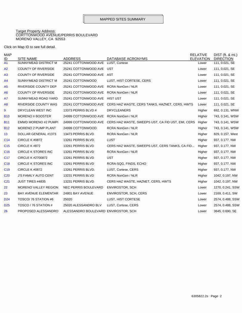
6305822.2s Page 2
26 PROPOSED ALESSANDRO ALESSANDRO BOULEVARD ENVIROSTOR, SCH Lower 3645, 0.690, SE
D25 TOSCO / 76 STATION # 25020 ALESSANDRO BLV LUST, Cortese, CERS Lower 2574, 0.488, SSW
D24 TOSCO/ 76 STATION #6 25020 LUST, HIST CORTESE Lower 2574, 0.488, SSW
23 BAY AVENUE ELEMENTAR 24801 BAY AVENUE ENVIROSTOR, SCH, CERS Lower 2169, 0.411, SW
22 MORENO VALLEY REGION NEC PERRIS BOULEVARD ENVIROSTOR, SCH Lower 1270, 0.241, SSW
C21 JUST TIRES #4835 13231 PERRIS BLVD CERS HAZ WASTE, HAZNET, CERS, HWTS Higher 1042, 0.197, NW
C20 J’S FAMILY AUTO CENT 13231 PERRIS BLVD RCRA NonGen / NLR Higher 1042, 0.197, NW
C19 CIRCLE K #0872 13261 PERRIS BLVD. LUST, Cortese, CERS Higher 937, 0.177, NW
C18 CIRCLE K STORES INC 13261 PERRIS BLVD RCRA-SQG, FINDS, ECHO Higher 937, 0.177, NW
C17 CIRCLE K #2700872 13261 PERRIS BLVD UST Higher 937, 0.177, NW
C16 CIRCLE K STORES INC 13261 PERRIS BLVD RCRA NonGen / NLR Higher 937, 0.177, NW
C15 CIRCLE K #872 13261 PERRIS BLVD CERS HAZ WASTE, SWEEPS UST, CERS TANKS, CA FID... Higher 937, 0.177, NW
C14 CIRCLE K #0872 13261 PERRIS BLVD. LUST Higher 937, 0.177, NW
13 DOLLAR GENERAL #1373 13473 PERRIS BLVD RCRA NonGen / NLR Higher 829, 0.157, West
B12 MORENO 2 PUMP PLANT 24999 COTTONWOOD RCRA NonGen / NLR Higher 743, 0.141, WSW
B11 EMWD MORENO #2 PUMPI 24999 COTTONWOOD AVE CERS HAZ WASTE, SWEEPS UST, CA FID UST, EMI, CERS Higher 743, 0.141, WSW
B10 MORENO II BOOSTER 24999 COTTONWOOD AVE RCRA NonGen / NLR Higher 743, 0.141, WSW
9 DRYCLEAN WEST INC 13373 PERRIS BLVD # DRYCLEANERS Higher 692, 0.131, WNW
A8 RIVERSIDE COUNTY WAS 25241 COTTONWOOD AVE CERS HAZ WASTE, CERS TANKS, HAZNET, CERS, HWTS Lower 111, 0.021, SE
A7 SUNNYMEAD ROAD YARD 25241 COTTONWOOD AVE HIST UST Lower 111, 0.021, SE
A6 COUNTY OF RIVERSIDE 25241 COTTONWOOD AVE RCRA NonGen / NLR Lower 111, 0.021, SE
A5 RIVERSIDE COUNTY DEP 25241 COTTONWOOD AVE RCRA NonGen / NLR Lower 111, 0.021, SE
A4 SUNNYMEAD DISTRICT M 25241 COTTONWOOD LUST, HIST CORTESE, CERS Lower 111, 0.021, SE
A3 COUNTY OF RIVERSIDE 25241 COTTONWOOD AVE AST Lower 111, 0.021, SE
A2 COUNTY OF RIVERSIDE 25241 COTTONWOOD AVE UST Lower 111, 0.021, SE
A1 SUNNYMEAD DISTRICT M 25241 COTTONWOOD AVE LUST, Cortese Lower 111, 0.021, SE
MAPPED SITES SUMMARY
Target Property Address:CORTTONWOOD AVENUE/PERRIS BOULEVARDMORENO VALLEY, CA 92553
Click on Map ID to see full detail.
MAP RELATIVE DIST (ft. & mi.)ID DATABASE ACRONYMS ELEVATION DIRECTIONSITE NAME ADDRESS
EXECUTIVE SUMMARY
TC6305822.2s EXECUTIVE SUMMARY 3
TARGET PROPERTY SEARCH RESULTS
The target property was not listed in any of the databases searched by EDR.
DATABASES WITH NO MAPPED SITES
No mapped sites were found in EDR’s search of available ("reasonably ascertainable ") governmentrecords either on the target property or within the search radius around the target property for thefollowing databases:
STANDARD ENVIRONMENTAL RECORDS
Federal NPL site list
NPL National Priority ListProposed NPL Proposed National Priority List SitesNPL LIENS Federal Superfund Liens
Federal Delisted NPL site list
Delisted NPL National Priority List Deletions
Federal CERCLIS list
FEDERAL FACILITY Federal Facility Site Information listingSEMS Superfund Enterprise Management System
Federal CERCLIS NFRAP site list
SEMS-ARCHIVE Superfund Enterprise Management System Archive
Federal RCRA CORRACTS facilities list
CORRACTS Corrective Action Report
Federal RCRA non-CORRACTS TSD facilities list
RCRA-TSDF RCRA - Treatment, Storage and Disposal
Federal RCRA generators list
RCRA-LQG RCRA - Large Quantity GeneratorsRCRA-VSQG RCRA - Very Small Quantity Generators (Formerly Conditionally Exempt Small Quantity Generators)
Federal institutional controls / engineering controls registries
LUCIS Land Use Control Information SystemUS ENG CONTROLS Engineering Controls Sites List
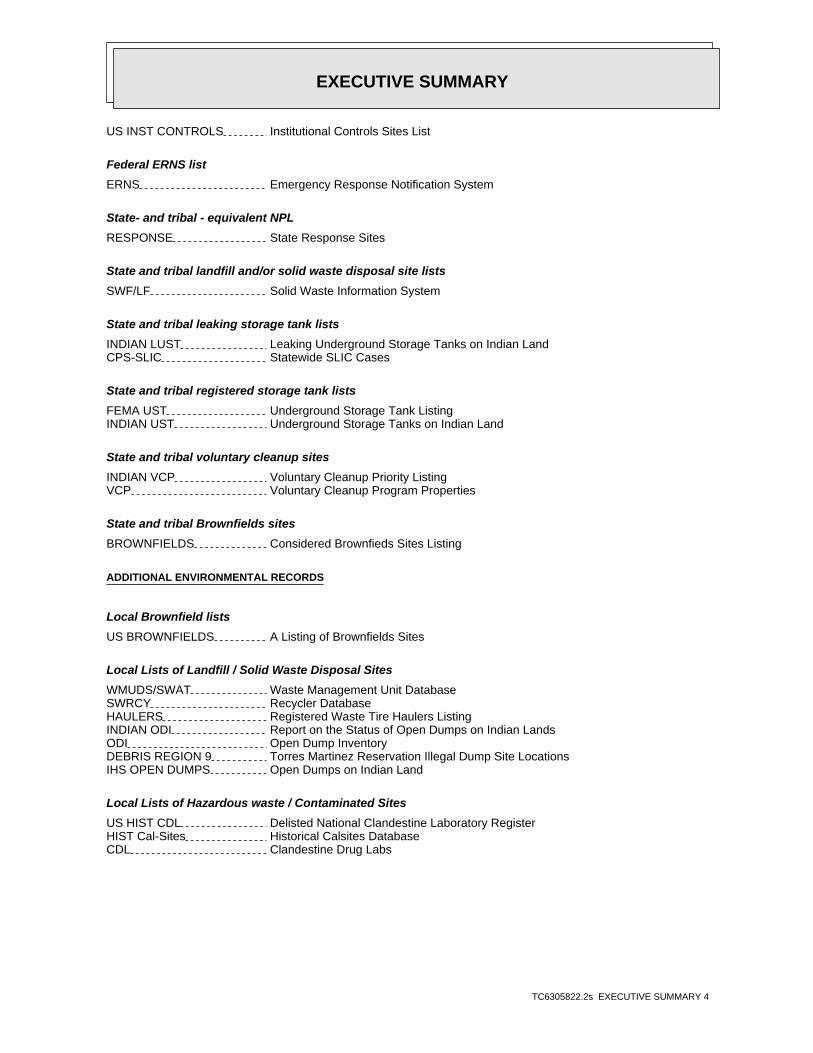
EXECUTIVE SUMMARY
TC6305822.2s EXECUTIVE SUMMARY 4
US INST CONTROLS Institutional Controls Sites List
Federal ERNS list
ERNS Emergency Response Notification System
State- and tribal - equivalent NPL
RESPONSE State Response Sites
State and tribal landfill and/or solid waste disposal site lists
SWF/LF Solid Waste Information System
State and tribal leaking storage tank lists
INDIAN LUST Leaking Underground Storage Tanks on Indian LandCPS-SLIC Statewide SLIC Cases
State and tribal registered storage tank lists
FEMA UST Underground Storage Tank ListingINDIAN UST Underground Storage Tanks on Indian Land
State and tribal voluntary cleanup sites
INDIAN VCP Voluntary Cleanup Priority ListingVCP Voluntary Cleanup Program Properties
State and tribal Brownfields sites
BROWNFIELDS Considered Brownfieds Sites Listing
ADDITIONAL ENVIRONMENTAL RECORDS
Local Brownfield lists
US BROWNFIELDS A Listing of Brownfields Sites
Local Lists of Landfill / Solid Waste Disposal Sites
WMUDS/SWAT Waste Management Unit DatabaseSWRCY Recycler DatabaseHAULERS Registered Waste Tire Haulers ListingINDIAN ODI Report on the Status of Open Dumps on Indian LandsODI Open Dump InventoryDEBRIS REGION 9 Torres Martinez Reservation Illegal Dump Site LocationsIHS OPEN DUMPS Open Dumps on Indian Land
Local Lists of Hazardous waste / Contaminated Sites
US HIST CDL Delisted National Clandestine Laboratory RegisterHIST Cal-Sites Historical Calsites DatabaseCDL Clandestine Drug Labs
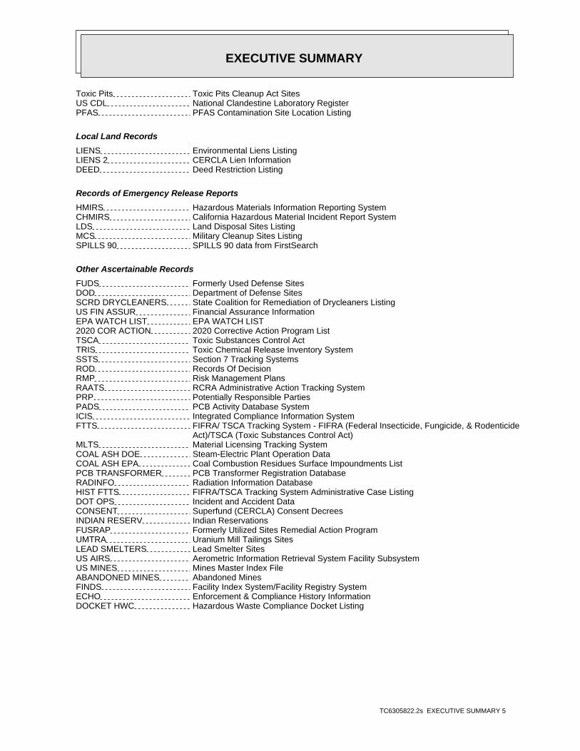
EXECUTIVE SUMMARY
TC6305822.2s EXECUTIVE SUMMARY 5
Toxic Pits Toxic Pits Cleanup Act SitesUS CDL National Clandestine Laboratory RegisterPFAS PFAS Contamination Site Location Listing
Local Land Records
LIENS Environmental Liens ListingLIENS 2 CERCLA Lien InformationDEED Deed Restriction Listing
Records of Emergency Release Reports
HMIRS Hazardous Materials Information Reporting SystemCHMIRS California Hazardous Material Incident Report SystemLDS Land Disposal Sites ListingMCS Military Cleanup Sites ListingSPILLS 90 SPILLS 90 data from FirstSearch
Other Ascertainable Records
FUDS Formerly Used Defense SitesDOD Department of Defense SitesSCRD DRYCLEANERS State Coalition for Remediation of Drycleaners ListingUS FIN ASSUR Financial Assurance InformationEPA WATCH LIST EPA WATCH LIST2020 COR ACTION 2020 Corrective Action Program ListTSCA Toxic Substances Control ActTRIS Toxic Chemical Release Inventory SystemSSTS Section 7 Tracking SystemsROD Records Of DecisionRMP Risk Management PlansRAATS RCRA Administrative Action Tracking SystemPRP Potentially Responsible PartiesPADS PCB Activity Database SystemICIS Integrated Compliance Information SystemFTTS FIFRA/ TSCA Tracking System - FIFRA (Federal Insecticide, Fungicide, & Rodenticide Act)/TSCA (Toxic Substances Control Act)MLTS Material Licensing Tracking SystemCOAL ASH DOE Steam-Electric Plant Operation DataCOAL ASH EPA Coal Combustion Residues Surface Impoundments ListPCB TRANSFORMER PCB Transformer Registration DatabaseRADINFO Radiation Information DatabaseHIST FTTS FIFRA/TSCA Tracking System Administrative Case ListingDOT OPS Incident and Accident DataCONSENT Superfund (CERCLA) Consent DecreesINDIAN RESERV Indian ReservationsFUSRAP Formerly Utilized Sites Remedial Action ProgramUMTRA Uranium Mill Tailings SitesLEAD SMELTERS Lead Smelter SitesUS AIRS Aerometric Information Retrieval System Facility SubsystemUS MINES Mines Master Index FileABANDONED MINES Abandoned MinesFINDS Facility Index System/Facility Registry SystemECHO Enforcement & Compliance History InformationDOCKET HWC Hazardous Waste Compliance Docket Listing
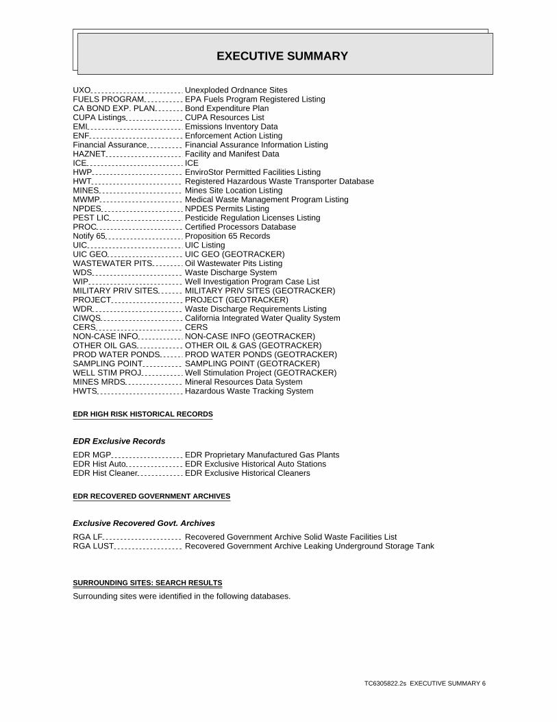
EXECUTIVE SUMMARY
TC6305822.2s EXECUTIVE SUMMARY 6
UXO Unexploded Ordnance SitesFUELS PROGRAM EPA Fuels Program Registered ListingCA BOND EXP. PLAN Bond Expenditure PlanCUPA Listings CUPA Resources ListEMI Emissions Inventory DataENF Enforcement Action ListingFinancial Assurance Financial Assurance Information ListingHAZNET Facility and Manifest DataICE ICEHWP EnviroStor Permitted Facilities ListingHWT Registered Hazardous Waste Transporter DatabaseMINES Mines Site Location ListingMWMP Medical Waste Management Program ListingNPDES NPDES Permits ListingPEST LIC Pesticide Regulation Licenses ListingPROC Certified Processors DatabaseNotify 65 Proposition 65 RecordsUIC UIC ListingUIC GEO UIC GEO (GEOTRACKER)WASTEWATER PITS Oil Wastewater Pits ListingWDS Waste Discharge SystemWIP Well Investigation Program Case ListMILITARY PRIV SITES MILITARY PRIV SITES (GEOTRACKER)PROJECT PROJECT (GEOTRACKER)WDR Waste Discharge Requirements ListingCIWQS California Integrated Water Quality SystemCERS CERSNON-CASE INFO NON-CASE INFO (GEOTRACKER)OTHER OIL GAS OTHER OIL & GAS (GEOTRACKER)PROD WATER PONDS PROD WATER PONDS (GEOTRACKER)SAMPLING POINT SAMPLING POINT (GEOTRACKER)WELL STIM PROJ Well Stimulation Project (GEOTRACKER)MINES MRDS Mineral Resources Data SystemHWTS Hazardous Waste Tracking System
EDR HIGH RISK HISTORICAL RECORDS
EDR Exclusive Records
EDR MGP EDR Proprietary Manufactured Gas PlantsEDR Hist Auto EDR Exclusive Historical Auto StationsEDR Hist Cleaner EDR Exclusive Historical Cleaners
EDR RECOVERED GOVERNMENT ARCHIVES
Exclusive Recovered Govt. Archives
RGA LF Recovered Government Archive Solid Waste Facilities ListRGA LUST Recovered Government Archive Leaking Underground Storage Tank
SURROUNDING SITES: SEARCH RESULTS
Surrounding sites were identified in the following databases.
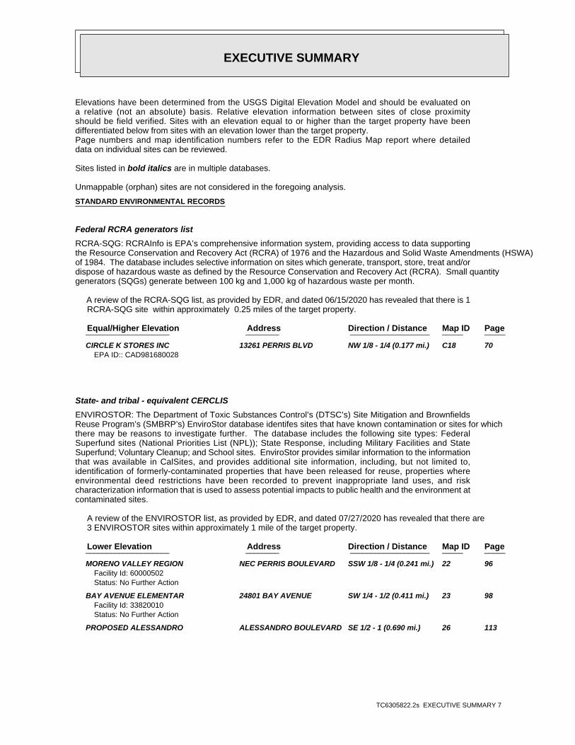
EXECUTIVE SUMMARY
TC6305822.2s EXECUTIVE SUMMARY 7
Elevations have been determined from the USGS Digital Elevation Model and should be evaluated ona relative (not an absolute) basis. Relative elevation information between sites of close proximityshould be field verified. Sites with an elevation equal to or higher than the target property have beendifferentiated below from sites with an elevation lower than the target property.Page numbers and map identification numbers refer to the EDR Radius Map report where detaileddata on individual sites can be reviewed.
Sites listed in bold italics are in multiple databases.
Unmappable (orphan) sites are not considered in the foregoing analysis.
STANDARD ENVIRONMENTAL RECORDS
Federal RCRA generators list
RCRA-SQG: RCRAInfo is EPA’s comprehensive information system, providing access to data supportingthe Resource Conservation and Recovery Act (RCRA) of 1976 and the Hazardous and Solid Waste Amendments (HSWA)of 1984. The database includes selective information on sites which generate, transport, store, treat and/ordispose of hazardous waste as defined by the Resource Conservation and Recovery Act (RCRA). Small quantitygenerators (SQGs) generate between 100 kg and 1,000 kg of hazardous waste per month.
A review of the RCRA-SQG list, as provided by EDR, and dated 06/15/2020 has revealed that there is 1 RCRA-SQG site within approximately 0.25 miles of the target property.
PageMap IDDirection / Distance Address Equal/Higher Elevation ____________________ ________ ___________________ _____ _____
CIRCLE K STORES INC 13261 PERRIS BLVD NW 1/8 - 1/4 (0.177 mi.) C18 70EPA ID:: CAD981680028
State- and tribal - equivalent CERCLIS
ENVIROSTOR: The Department of Toxic Substances Control’s (DTSC’s) Site Mitigation and BrownfieldsReuse Program’s (SMBRP’s) EnviroStor database identifes sites that have known contamination or sites for whichthere may be reasons to investigate further. The database includes the following site types: FederalSuperfund sites (National Priorities List (NPL)); State Response, including Military Facilities and StateSuperfund; Voluntary Cleanup; and School sites. EnviroStor provides similar information to the informationthat was available in CalSites, and provides additional site information, including, but not limited to,identification of formerly-contaminated properties that have been released for reuse, properties whereenvironmental deed restrictions have been recorded to prevent inappropriate land uses, and riskcharacterization information that is used to assess potential impacts to public health and the environment atcontaminated sites.
A review of the ENVIROSTOR list, as provided by EDR, and dated 07/27/2020 has revealed that there are 3 ENVIROSTOR sites within approximately 1 mile of the target property.
PageMap IDDirection / Distance Address Lower Elevation ____________________ ________ ___________________ _____ _____
MORENO VALLEY REGION NEC PERRIS BOULEVARD SSW 1/8 - 1/4 (0.241 mi.) 22 96Facility Id: 60000502Status: No Further Action
BAY AVENUE ELEMENTAR 24801 BAY AVENUE SW 1/4 - 1/2 (0.411 mi.) 23 98Facility Id: 33820010Status: No Further Action
PROPOSED ALESSANDRO ALESSANDRO BOULEVARD SE 1/2 - 1 (0.690 mi.) 26 113
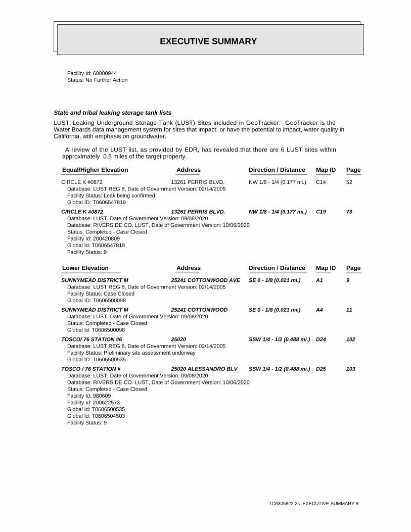
EXECUTIVE SUMMARY
TC6305822.2s EXECUTIVE SUMMARY 8
Facility Id: 60000944Status: No Further Action
State and tribal leaking storage tank lists
LUST: Leaking Underground Storage Tank (LUST) Sites included in GeoTracker. GeoTracker is theWater Boards data management system for sites that impact, or have the potential to impact, water quality inCalifornia, with emphasis on groundwater.
A review of the LUST list, as provided by EDR, has revealed that there are 6 LUST sites within approximately 0.5 miles of the target property.
PageMap IDDirection / Distance Address Equal/Higher Elevation ____________________ ________ ___________________ _____ _____
CIRCLE K #0872 13261 PERRIS BLVD. NW 1/8 - 1/4 (0.177 mi.) C14 52Database: LUST REG 8, Date of Government Version: 02/14/2005Facility Status: Leak being confirmedGlobal ID: T0606547819
CIRCLE K #0872 13261 PERRIS BLVD. NW 1/8 - 1/4 (0.177 mi.) C19 73Database: LUST, Date of Government Version: 09/08/2020Database: RIVERSIDE CO. LUST, Date of Government Version: 10/06/2020Status: Completed - Case ClosedFacility Id: 200420809Global Id: T0606547819Facility Status: 9
PageMap IDDirection / Distance Address Lower Elevation ____________________ ________ ___________________ _____ _____
SUNNYMEAD DISTRICT M 25241 COTTONWOOD AVE SE 0 - 1/8 (0.021 mi.) A1 9Database: LUST REG 8, Date of Government Version: 02/14/2005Facility Status: Case ClosedGlobal ID: T0606500098
SUNNYMEAD DISTRICT M 25241 COTTONWOOD SE 0 - 1/8 (0.021 mi.) A4 11Database: LUST, Date of Government Version: 09/08/2020Status: Completed - Case ClosedGlobal Id: T0606500098
TOSCO/ 76 STATION #6 25020 SSW 1/4 - 1/2 (0.488 mi.) D24 102Database: LUST REG 8, Date of Government Version: 02/14/2005Facility Status: Preliminary site assessment underwayGlobal ID: T0606500535
TOSCO / 76 STATION # 25020 ALESSANDRO BLV SSW 1/4 - 1/2 (0.488 mi.) D25 103Database: LUST, Date of Government Version: 09/08/2020Database: RIVERSIDE CO. LUST, Date of Government Version: 10/06/2020Status: Completed - Case ClosedFacility Id: 980609Facility Id: 200622573Global Id: T0606500535Global Id: T0606504503Facility Status: 9
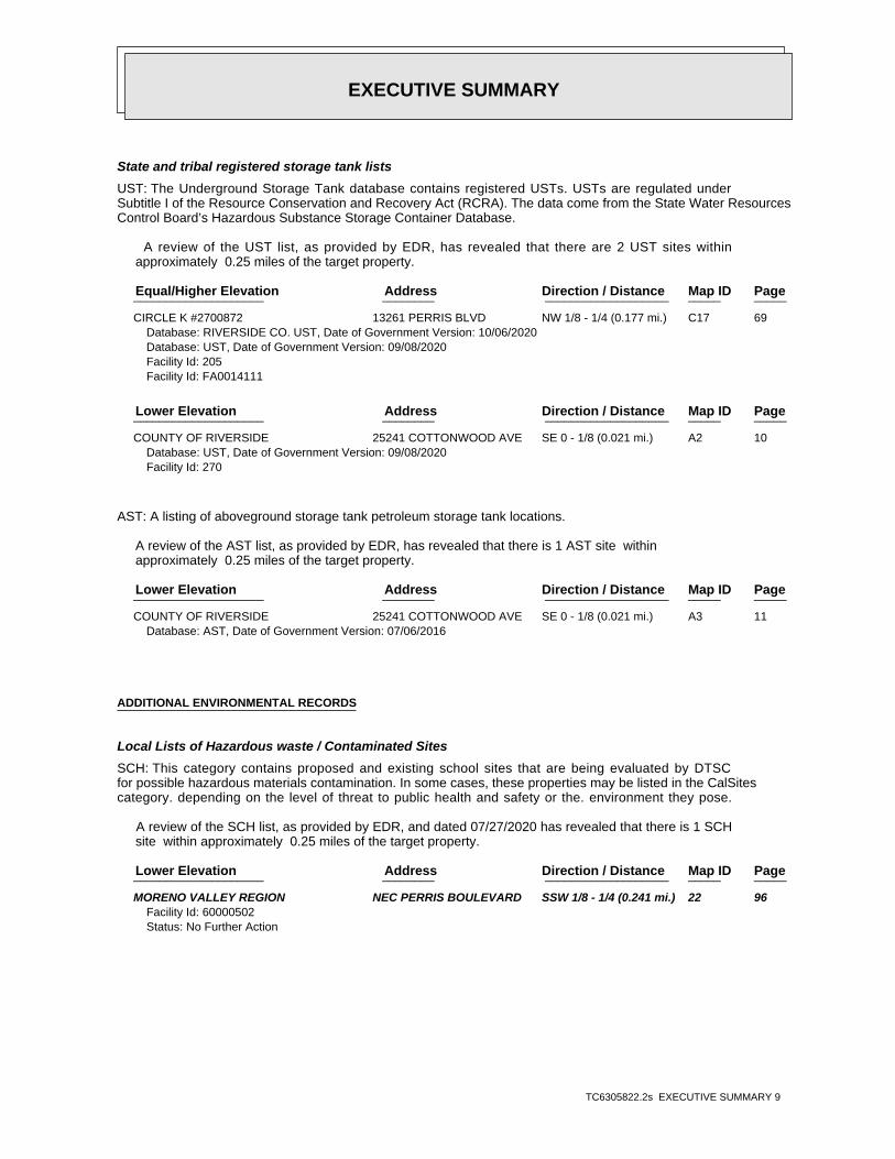
EXECUTIVE SUMMARY
TC6305822.2s EXECUTIVE SUMMARY 9
State and tribal registered storage tank lists
UST: The Underground Storage Tank database contains registered USTs. USTs are regulated underSubtitle I of the Resource Conservation and Recovery Act (RCRA). The data come from the State Water ResourcesControl Board’s Hazardous Substance Storage Container Database.
A review of the UST list, as provided by EDR, has revealed that there are 2 UST sites within approximately 0.25 miles of the target property.
PageMap IDDirection / Distance Address Equal/Higher Elevation ____________________ ________ ___________________ _____ _____
CIRCLE K #2700872 13261 PERRIS BLVD NW 1/8 - 1/4 (0.177 mi.) C17 69Database: RIVERSIDE CO. UST, Date of Government Version: 10/06/2020Database: UST, Date of Government Version: 09/08/2020Facility Id: 205Facility Id: FA0014111
PageMap IDDirection / Distance Address Lower Elevation ____________________ ________ ___________________ _____ _____
COUNTY OF RIVERSIDE 25241 COTTONWOOD AVE SE 0 - 1/8 (0.021 mi.) A2 10Database: UST, Date of Government Version: 09/08/2020Facility Id: 270
AST: A listing of aboveground storage tank petroleum storage tank locations.
A review of the AST list, as provided by EDR, has revealed that there is 1 AST site within approximately 0.25 miles of the target property.
PageMap IDDirection / Distance Address Lower Elevation ____________________ ________ ___________________ _____ _____
COUNTY OF RIVERSIDE 25241 COTTONWOOD AVE SE 0 - 1/8 (0.021 mi.) A3 11Database: AST, Date of Government Version: 07/06/2016
ADDITIONAL ENVIRONMENTAL RECORDS
Local Lists of Hazardous waste / Contaminated Sites
SCH: This category contains proposed and existing school sites that are being evaluated by DTSCfor possible hazardous materials contamination. In some cases, these properties may be listed in the CalSitescategory. depending on the level of threat to public health and safety or the. environment they pose.
A review of the SCH list, as provided by EDR, and dated 07/27/2020 has revealed that there is 1 SCH site within approximately 0.25 miles of the target property.
PageMap IDDirection / Distance Address Lower Elevation ____________________ ________ ___________________ _____ _____
MORENO VALLEY REGION NEC PERRIS BOULEVARD SSW 1/8 - 1/4 (0.241 mi.) 22 96Facility Id: 60000502Status: No Further Action
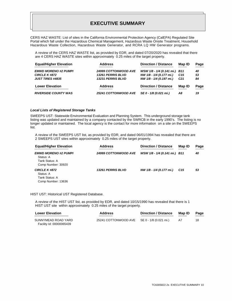
EXECUTIVE SUMMARY
TC6305822.2s EXECUTIVE SUMMARY 10
CERS HAZ WASTE: List of sites in the California Environmental Protection Agency (CalEPA) Regulated SitePortal which fall under the Hazardous Chemical Management, Hazardous Waste Onsite Treatment, HouseholdHazardous Waste Collection, Hazardous Waste Generator, and RCRA LQ HW Generator programs.
A review of the CERS HAZ WASTE list, as provided by EDR, and dated 07/20/2020 has revealed that there are 4 CERS HAZ WASTE sites within approximately 0.25 miles of the target property.
PageMap IDDirection / Distance Address Equal/Higher Elevation ____________________ ________ ___________________ _____ _____
EMWD MORENO #2 PUMPI 24999 COTTONWOOD AVE WSW 1/8 - 1/4 (0.141 mi.) B11 40 CIRCLE K #872 13261 PERRIS BLVD NW 1/8 - 1/4 (0.177 mi.) C15 53 JUST TIRES #4835 13231 PERRIS BLVD NW 1/8 - 1/4 (0.197 mi.) C21 84
PageMap IDDirection / Distance Address Lower Elevation ____________________ ________ ___________________ _____ _____
RIVERSIDE COUNTY WAS 25241 COTTONWOOD AVE SE 0 - 1/8 (0.021 mi.) A8 19
Local Lists of Registered Storage Tanks
SWEEPS UST: Statewide Environmental Evaluation and Planning System. This underground storage tanklisting was updated and maintained by a company contacted by the SWRCB in the early 1990’s. The listing is nolonger updated or maintained. The local agency is the contact for more information on a site on the SWEEPSlist.
A review of the SWEEPS UST list, as provided by EDR, and dated 06/01/1994 has revealed that there are 2 SWEEPS UST sites within approximately 0.25 miles of the target property.
PageMap IDDirection / Distance Address Equal/Higher Elevation ____________________ ________ ___________________ _____ _____
EMWD MORENO #2 PUMPI 24999 COTTONWOOD AVE WSW 1/8 - 1/4 (0.141 mi.) B11 40Status: ATank Status: AComp Number: 30920
CIRCLE K #872 13261 PERRIS BLVD NW 1/8 - 1/4 (0.177 mi.) C15 53Status: ATank Status: AComp Number: 13636
HIST UST: Historical UST Registered Database.
A review of the HIST UST list, as provided by EDR, and dated 10/15/1990 has revealed that there is 1 HIST UST site within approximately 0.25 miles of the target property.
PageMap IDDirection / Distance Address Lower Elevation ____________________ ________ ___________________ _____ _____
SUNNYMEAD ROAD YARD 25241 COTTONWOOD AVE SE 0 - 1/8 (0.021 mi.) A7 18Facility Id: 00000065439
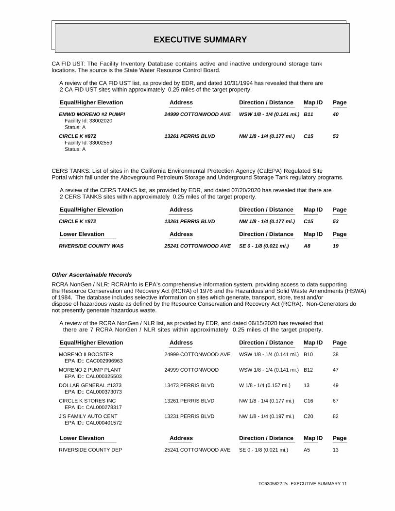
EXECUTIVE SUMMARY
TC6305822.2s EXECUTIVE SUMMARY 11
CA FID UST: The Facility Inventory Database contains active and inactive underground storage tanklocations. The source is the State Water Resource Control Board.
A review of the CA FID UST list, as provided by EDR, and dated 10/31/1994 has revealed that there are 2 CA FID UST sites within approximately 0.25 miles of the target property.
PageMap IDDirection / Distance Address Equal/Higher Elevation ____________________ ________ ___________________ _____ _____
EMWD MORENO #2 PUMPI 24999 COTTONWOOD AVE WSW 1/8 - 1/4 (0.141 mi.) B11 40Facility Id: 33002020Status: A
CIRCLE K #872 13261 PERRIS BLVD NW 1/8 - 1/4 (0.177 mi.) C15 53Facility Id: 33002559Status: A
CERS TANKS: List of sites in the California Environmental Protection Agency (CalEPA) Regulated SitePortal which fall under the Aboveground Petroleum Storage and Underground Storage Tank regulatory programs.
A review of the CERS TANKS list, as provided by EDR, and dated 07/20/2020 has revealed that there are 2 CERS TANKS sites within approximately 0.25 miles of the target property.
PageMap IDDirection / Distance Address Equal/Higher Elevation ____________________ ________ ___________________ _____ _____
CIRCLE K #872 13261 PERRIS BLVD NW 1/8 - 1/4 (0.177 mi.) C15 53
PageMap IDDirection / Distance Address Lower Elevation ____________________ ________ ___________________ _____ _____
RIVERSIDE COUNTY WAS 25241 COTTONWOOD AVE SE 0 - 1/8 (0.021 mi.) A8 19
Other Ascertainable Records
RCRA NonGen / NLR: RCRAInfo is EPA’s comprehensive information system, providing access to data supportingthe Resource Conservation and Recovery Act (RCRA) of 1976 and the Hazardous and Solid Waste Amendments (HSWA)of 1984. The database includes selective information on sites which generate, transport, store, treat and/ordispose of hazardous waste as defined by the Resource Conservation and Recovery Act (RCRA). Non-Generators donot presently generate hazardous waste.
A review of the RCRA NonGen / NLR list, as provided by EDR, and dated 06/15/2020 has revealed that there are 7 RCRA NonGen / NLR sites within approximately 0.25 miles of the target property.
PageMap IDDirection / Distance Address Equal/Higher Elevation ____________________ ________ ___________________ _____ _____
MORENO II BOOSTER 24999 COTTONWOOD AVE WSW 1/8 - 1/4 (0.141 mi.) B10 38EPA ID:: CAC002996963
MORENO 2 PUMP PLANT 24999 COTTONWOOD WSW 1/8 - 1/4 (0.141 mi.) B12 47EPA ID:: CAL000325503
DOLLAR GENERAL #1373 13473 PERRIS BLVD W 1/8 - 1/4 (0.157 mi.) 13 49EPA ID:: CAL000373073
CIRCLE K STORES INC 13261 PERRIS BLVD NW 1/8 - 1/4 (0.177 mi.) C16 67EPA ID:: CAL000278317
J’S FAMILY AUTO CENT 13231 PERRIS BLVD NW 1/8 - 1/4 (0.197 mi.) C20 82EPA ID:: CAL000401572
PageMap IDDirection / Distance Address Lower Elevation ____________________ ________ ___________________ _____ _____
RIVERSIDE COUNTY DEP 25241 COTTONWOOD AVE SE 0 - 1/8 (0.021 mi.) A5 13
EXECUTIVE SUMMARY
TC6305822.2s EXECUTIVE SUMMARY 12
EPA ID:: CAL000381515
COUNTY OF RIVERSIDE 25241 COTTONWOOD AVE SE 0 - 1/8 (0.021 mi.) A6 16EPA ID:: CAL000262150
Cortese: The sites for the list are designated by the State Water Resource Control Board (LUST),the Integrated Waste Board (SWF/LS), and the Department of Toxic Substances Control (Cal-Sites).
A review of the Cortese list, as provided by EDR, and dated 06/22/2020 has revealed that there are 3 Cortese sites within approximately 0.5 miles of the target property.
PageMap IDDirection / Distance Address Equal/Higher Elevation ____________________ ________ ___________________ _____ _____
CIRCLE K #0872 13261 PERRIS BLVD. NW 1/8 - 1/4 (0.177 mi.) C19 73Cleanup Status: COMPLETED - CASE CLOSED
PageMap IDDirection / Distance Address Lower Elevation ____________________ ________ ___________________ _____ _____
SUNNYMEAD DISTRICT M 25241 COTTONWOOD AVE SE 0 - 1/8 (0.021 mi.) A1 9Cleanup Status: COMPLETED - CASE CLOSED
TOSCO / 76 STATION # 25020 ALESSANDRO BLV SSW 1/4 - 1/2 (0.488 mi.) D25 103Cleanup Status: COMPLETED - CASE CLOSED
DRYCLEANERS: A list of drycleaner related facilities that have EPA ID numbers. These are facilitieswith certain SIC codes: power laundries, family and commercial; garment pressing and cleaners’ agents; linensupply; coin-operated laundries and cleaning; drycleaning plants except rugs; carpet and upholster cleaning;industrial launderers; laundry and garment services.
A review of the DRYCLEANERS list, as provided by EDR, has revealed that there is 1 DRYCLEANERS site within approximately 0.25 miles of the target property.
PageMap IDDirection / Distance Address Equal/Higher Elevation ____________________ ________ ___________________ _____ _____
DRYCLEAN WEST INC 13373 PERRIS BLVD # WNW 1/8 - 1/4 (0.131 mi.) 9 37Database: DRYCLEAN SOUTH COAST, Date of Government Version: 08/19/2020
HIST CORTESE: The sites for the list are designated by the State Water Resource Control Board [LUST],the Integrated Waste Board [SWF/LS], and the Department of Toxic Substances Control [CALSITES]. Thislisting is no longer updated by the state agency.
A review of the HIST CORTESE list, as provided by EDR, and dated 04/01/2001 has revealed that there are 2 HIST CORTESE sites within approximately 0.5 miles of the target property.
PageMap IDDirection / Distance Address Lower Elevation ____________________ ________ ___________________ _____ _____
SUNNYMEAD DISTRICT M 25241 COTTONWOOD SE 0 - 1/8 (0.021 mi.) A4 11Reg Id: 083300979T
TOSCO/ 76 STATION #6 25020 SSW 1/4 - 1/2 (0.488 mi.) D24 102Reg Id: 083303232T
EXECUTIVE SUMMARY
TC6305822.2s EXECUTIVE SUMMARY 13
Due to poor or inadequate address information, the following sites were not mapped. Count: 1 records.
Site Name Database(s)____________ ____________
ALESSANDRO PROPERTIES ENVIROSTOR, VCP
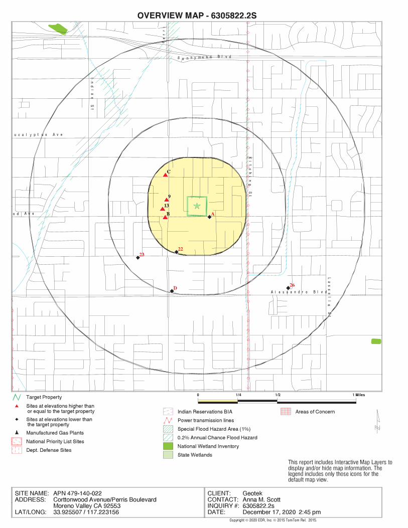
EDR Inc.EDR Inc.EDR Inc.EDR Inc.EDR Inc.EDR Inc.EDR Inc.EDR Inc.EDR Inc.EDR Inc.EDR Inc.EDR Inc.EDR Inc.EDR Inc.EDR Inc.EDR Inc.EDR Inc.EDR Inc.EDR Inc.EDR Inc.EDR Inc.EDR Inc.EDR Inc.EDR Inc.EDR Inc.EDR Inc.EDR Inc.EDR Inc.EDR Inc.EDR Inc.EDR Inc.EDR Inc.EDR Inc.EDR Inc.EDR Inc.EDR Inc.EDR Inc.EDR Inc.EDR Inc.EDR Inc.
1 7 60
1 7 2 0
1 7 2 0
1 6 8 0
1 6 8 0
1 6 8 0
16
40
1 6 4 0 1 6 4 0
1 6 4 0
1 6 4 0
16
40
1 6 0 0
1 6 00
16
00
1 5 6 0
1 5 6 0
1 5 6 01 5 6 0
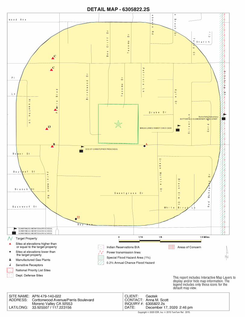
EDR Inc.EDR Inc.EDR Inc.EDR Inc.EDR Inc.EDR Inc.EDR Inc.EDR Inc.EDR Inc.EDR Inc.EDR Inc.EDR Inc.EDR Inc.EDR Inc.EDR Inc.EDR Inc.EDR Inc.EDR Inc.EDR Inc.EDR Inc.EDR Inc.EDR Inc.EDR Inc.EDR Inc.EDR Inc.EDR Inc.EDR Inc.EDR Inc.EDR Inc.EDR Inc.EDR Inc.EDR Inc.EDR Inc.EDR Inc.EDR Inc.EDR Inc.EDR Inc.EDR Inc.EDR Inc.EDR Inc.
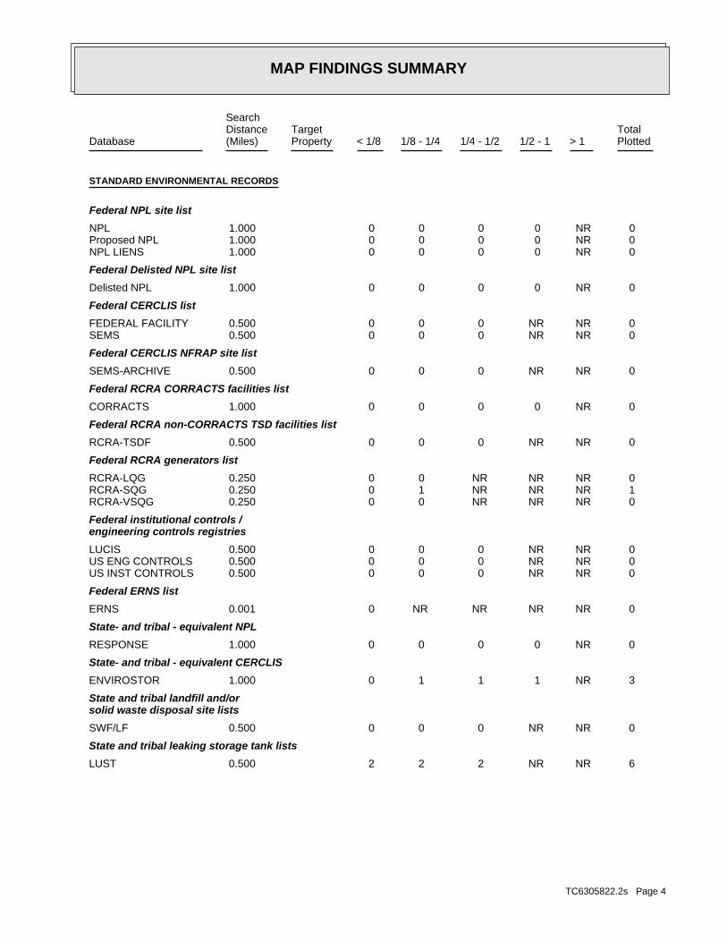
MAP FINDINGS SUMMARY
SearchTargetDistance Total
Database Property(Miles) < 1/8 1/8 - 1/4 1/4 - 1/2 1/2 - 1 > 1 Plotted
STANDARD ENVIRONMENTAL RECORDS
Federal NPL site list
0 NR 0 0 0 0 1.000NPL 0 NR 0 0 0 0 1.000Proposed NPL 0 NR 0 0 0 0 1.000NPL LIENS
Federal Delisted NPL site list
0 NR 0 0 0 0 1.000Delisted NPL
Federal CERCLIS list
0 NR NR 0 0 0 0.500FEDERAL FACILITY 0 NR NR 0 0 0 0.500SEMS
Federal CERCLIS NFRAP site list
0 NR NR 0 0 0 0.500SEMS-ARCHIVE
Federal RCRA CORRACTS facilities list
0 NR 0 0 0 0 1.000CORRACTS
Federal RCRA non-CORRACTS TSD facilities list
0 NR NR 0 0 0 0.500RCRA-TSDF
Federal RCRA generators list
0 NR NR NR 0 0 0.250RCRA-LQG 1 NR NR NR 1 0 0.250RCRA-SQG 0 NR NR NR 0 0 0.250RCRA-VSQG
Federal institutional controls /engineering controls registries
0 NR NR 0 0 0 0.500LUCIS 0 NR NR 0 0 0 0.500US ENG CONTROLS 0 NR NR 0 0 0 0.500US INST CONTROLS
Federal ERNS list
0 NR NR NR NR 0 0.001ERNS
State- and tribal - equivalent NPL
0 NR 0 0 0 0 1.000RESPONSE
State- and tribal - equivalent CERCLIS
3 NR 1 1 1 0 1.000ENVIROSTOR
State and tribal landfill and/orsolid waste disposal site lists
0 NR NR 0 0 0 0.500SWF/LF
State and tribal leaking storage tank lists
6 NR NR 2 2 2 0.500LUST
TC6305822.2s Page 4

MAP FINDINGS SUMMARY
SearchTargetDistance Total
Database Property(Miles) < 1/8 1/8 - 1/4 1/4 - 1/2 1/2 - 1 > 1 Plotted
0 NR NR 0 0 0 0.500INDIAN LUST 0 NR NR 0 0 0 0.500CPS-SLIC
State and tribal registered storage tank lists
0 NR NR NR 0 0 0.250FEMA UST 2 NR NR NR 1 1 0.250UST 1 NR NR NR 0 1 0.250AST 0 NR NR NR 0 0 0.250INDIAN UST
State and tribal voluntary cleanup sites
0 NR NR 0 0 0 0.500INDIAN VCP 0 NR NR 0 0 0 0.500VCP
State and tribal Brownfields sites
0 NR NR 0 0 0 0.500BROWNFIELDS
ADDITIONAL ENVIRONMENTAL RECORDS
Local Brownfield lists
0 NR NR 0 0 0 0.500US BROWNFIELDS
Local Lists of Landfill / SolidWaste Disposal Sites
0 NR NR 0 0 0 0.500WMUDS/SWAT 0 NR NR 0 0 0 0.500SWRCY 0 NR NR NR NR 0 0.001HAULERS 0 NR NR 0 0 0 0.500INDIAN ODI 0 NR NR 0 0 0 0.500ODI 0 NR NR 0 0 0 0.500DEBRIS REGION 9 0 NR NR 0 0 0 0.500IHS OPEN DUMPS
Local Lists of Hazardous waste /Contaminated Sites
0 NR NR NR NR 0 0.001US HIST CDL 0 NR 0 0 0 0 1.000HIST Cal-Sites 1 NR NR NR 1 0 0.250SCH 0 NR NR NR NR 0 0.001CDL 0 NR 0 0 0 0 1.000Toxic Pits 4 NR NR NR 3 1 0.250CERS HAZ WASTE 0 NR NR NR NR 0 0.001US CDL 0 NR NR 0 0 0 0.500PFAS
Local Lists of Registered Storage Tanks
2 NR NR NR 2 0 0.250SWEEPS UST 1 NR NR NR 0 1 0.250HIST UST 2 NR NR NR 2 0 0.250CA FID UST 2 NR NR NR 1 1 0.250CERS TANKS
Local Land Records
0 NR NR NR NR 0 0.001LIENS
TC6305822.2s Page 5
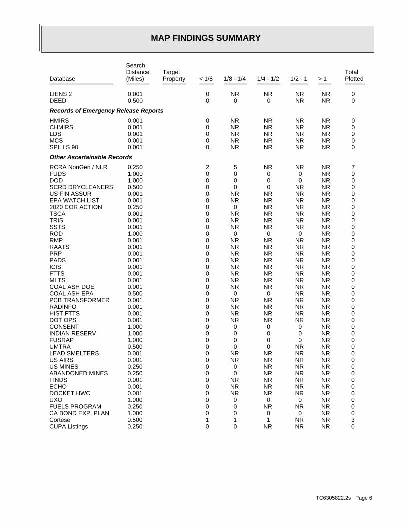
MAP FINDINGS SUMMARY
SearchTargetDistance Total
Database Property(Miles) < 1/8 1/8 - 1/4 1/4 - 1/2 1/2 - 1 > 1 Plotted
0 NR NR NR NR 0 0.001LIENS 2 0 NR NR 0 0 0 0.500DEED
Records of Emergency Release Reports
0 NR NR NR NR 0 0.001HMIRS 0 NR NR NR NR 0 0.001CHMIRS 0 NR NR NR NR 0 0.001LDS 0 NR NR NR NR 0 0.001MCS 0 NR NR NR NR 0 0.001SPILLS 90
Other Ascertainable Records
7 NR NR NR 5 2 0.250RCRA NonGen / NLR 0 NR 0 0 0 0 1.000FUDS 0 NR 0 0 0 0 1.000DOD 0 NR NR 0 0 0 0.500SCRD DRYCLEANERS 0 NR NR NR NR 0 0.001US FIN ASSUR 0 NR NR NR NR 0 0.001EPA WATCH LIST 0 NR NR NR 0 0 0.2502020 COR ACTION 0 NR NR NR NR 0 0.001TSCA 0 NR NR NR NR 0 0.001TRIS 0 NR NR NR NR 0 0.001SSTS 0 NR 0 0 0 0 1.000ROD 0 NR NR NR NR 0 0.001RMP 0 NR NR NR NR 0 0.001RAATS 0 NR NR NR NR 0 0.001PRP 0 NR NR NR NR 0 0.001PADS 0 NR NR NR NR 0 0.001ICIS 0 NR NR NR NR 0 0.001FTTS 0 NR NR NR NR 0 0.001MLTS 0 NR NR NR NR 0 0.001COAL ASH DOE 0 NR NR 0 0 0 0.500COAL ASH EPA 0 NR NR NR NR 0 0.001PCB TRANSFORMER 0 NR NR NR NR 0 0.001RADINFO 0 NR NR NR NR 0 0.001HIST FTTS 0 NR NR NR NR 0 0.001DOT OPS 0 NR 0 0 0 0 1.000CONSENT 0 NR 0 0 0 0 1.000INDIAN RESERV 0 NR 0 0 0 0 1.000FUSRAP 0 NR NR 0 0 0 0.500UMTRA 0 NR NR NR NR 0 0.001LEAD SMELTERS 0 NR NR NR NR 0 0.001US AIRS 0 NR NR NR 0 0 0.250US MINES 0 NR NR NR 0 0 0.250ABANDONED MINES 0 NR NR NR NR 0 0.001FINDS 0 NR NR NR NR 0 0.001ECHO 0 NR NR NR NR 0 0.001DOCKET HWC 0 NR 0 0 0 0 1.000UXO 0 NR NR NR 0 0 0.250FUELS PROGRAM 0 NR 0 0 0 0 1.000CA BOND EXP. PLAN 3 NR NR 1 1 1 0.500Cortese 0 NR NR NR 0 0 0.250CUPA Listings
TC6305822.2s Page 6
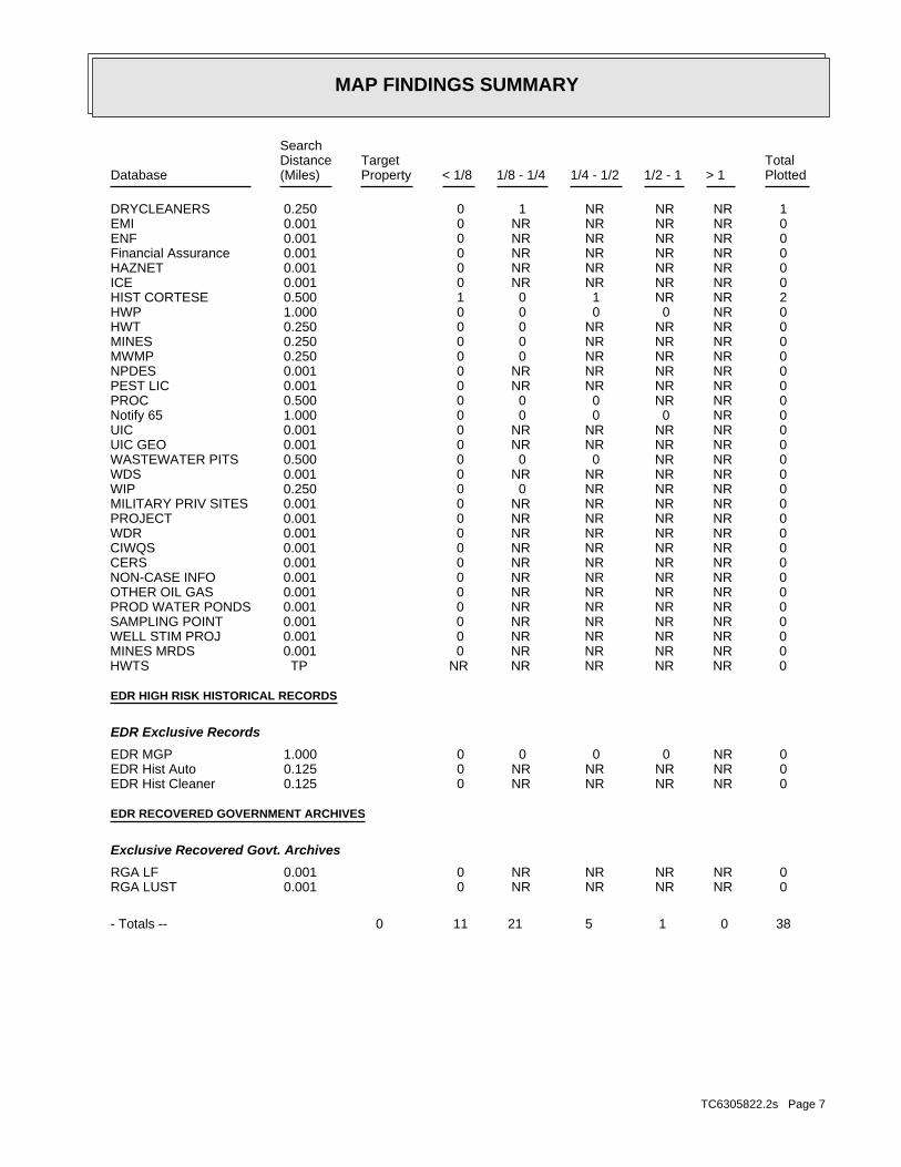
MAP FINDINGS SUMMARY
SearchTargetDistance Total
Database Property(Miles) < 1/8 1/8 - 1/4 1/4 - 1/2 1/2 - 1 > 1 Plotted
1 NR NR NR 1 0 0.250DRYCLEANERS 0 NR NR NR NR 0 0.001EMI 0 NR NR NR NR 0 0.001ENF 0 NR NR NR NR 0 0.001Financial Assurance 0 NR NR NR NR 0 0.001HAZNET 0 NR NR NR NR 0 0.001ICE 2 NR NR 1 0 1 0.500HIST CORTESE 0 NR 0 0 0 0 1.000HWP 0 NR NR NR 0 0 0.250HWT 0 NR NR NR 0 0 0.250MINES 0 NR NR NR 0 0 0.250MWMP 0 NR NR NR NR 0 0.001NPDES 0 NR NR NR NR 0 0.001PEST LIC 0 NR NR 0 0 0 0.500PROC 0 NR 0 0 0 0 1.000Notify 65 0 NR NR NR NR 0 0.001UIC 0 NR NR NR NR 0 0.001UIC GEO 0 NR NR 0 0 0 0.500WASTEWATER PITS 0 NR NR NR NR 0 0.001WDS 0 NR NR NR 0 0 0.250WIP 0 NR NR NR NR 0 0.001MILITARY PRIV SITES 0 NR NR NR NR 0 0.001PROJECT 0 NR NR NR NR 0 0.001WDR 0 NR NR NR NR 0 0.001CIWQS 0 NR NR NR NR 0 0.001CERS 0 NR NR NR NR 0 0.001NON-CASE INFO 0 NR NR NR NR 0 0.001OTHER OIL GAS 0 NR NR NR NR 0 0.001PROD WATER PONDS 0 NR NR NR NR 0 0.001SAMPLING POINT 0 NR NR NR NR 0 0.001WELL STIM PROJ 0 NR NR NR NR 0 0.001MINES MRDS 0 NR NR NR NR NR TPHWTS
EDR HIGH RISK HISTORICAL RECORDS
EDR Exclusive Records
0 NR 0 0 0 0 1.000EDR MGP 0 NR NR NR NR 0 0.125EDR Hist Auto 0 NR NR NR NR 0 0.125EDR Hist Cleaner
EDR RECOVERED GOVERNMENT ARCHIVES
Exclusive Recovered Govt. Archives
0 NR NR NR NR 0 0.001RGA LF 0 NR NR NR NR 0 0.001RGA LUST
38 0 1 5 21 11 0- Totals --
TC6305822.2s Page 7
MAP FINDINGS SUMMARY
SearchTargetDistance Total
Database Property(Miles) < 1/8 1/8 - 1/4 1/4 - 1/2 1/2 - 1 > 1 Plotted
NOTES:
TP = Target Property
NR = Not Requested at this Search Distance
Sites may be listed in more than one database
TC6305822.2s Page 8
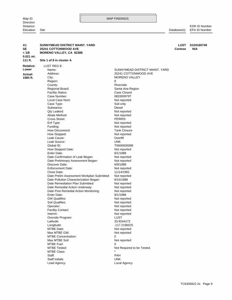
MAP FINDINGSMap IDDirection
EDR ID NumberDistanceEPA ID NumberDatabase(s)SiteElevation
Local AgencyLead Agency: UNKStaff Initials: PAHStaff: *MTBE Class: Not Required to be Tested.MTBE Tested: 0MTBE Fuel: Not reportedMax MTBE Soil: 0MTBE Concentration: Not reportedMax MTBE GW: Not reportedMTBE Date: -117.2196525Longitude: 33.9244172Latitude: LUSTOversite Program: Not reportedInterim: Not reportedFacility Contact: Not reportedOperator: Not reportedSoil Qualifies: Not reportedGW Qualifies: 8/1/1988Enter Date: Not reportedDate Post Remedial Action Monitoring: Not reportedDate Remedial Action Underway: Not reportedDate Remediation Plan Submitted: 8/15/1988Date Pollution Characterization Began: Not reportedDate Prelim Assessment Workplan Submitted: 11/14/1991Close Date: Not reportedEnforcement Date: 6/9/1988Discover Date: Not reportedDate Preliminary Assessment Began: Not reportedDate Confirmation of Leak Began: 8/1/1988Enter Date: Not reportedHow Stopped Date: T0606500098Global ID: UNKLeak Source: OverfillLeak Cause: Not reportedHow Stopped: Tank ClosureHow Discovered: Not reportedFunding: Not reportedEnf Type: PERRISCross Street: Not reportedAbate Method: Not reportedQty Leaked: DieselSubstance: Soil onlyCase Type: Not reportedLocal Case Num: 083300979TCase Number: Case ClosedFacility Status: Santa Ana RegionRegional Board: RiversideCounty: 8Region: MORENO VALLEYCity: 25241 COTTONWOOD AVEAddress: SUNNYMEAD DISTRICT MAINT. YARDName:
LUST REG 8:
111 ft. Site 1 of 8 in cluster A0.021 mi.
Relative:Lower
Actual:1584 ft.
< 1/8 MORENO VALLEY, CA 92388SE Cortese25241 COTTONWOOD AVE N/AA1 LUSTSUNNYMEAD DISTRICT MAINT. YARD S104160749
TC6305822.2s Page 9
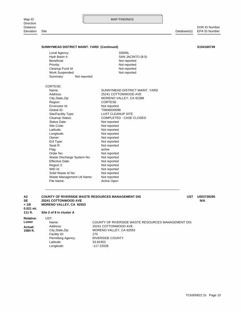
MAP FINDINGSMap IDDirection
EDR ID NumberDistanceEPA ID NumberDatabase(s)SiteElevation
Active OpenFile Name: Not reportedWaste Management Uit Name: Not reportedSolid Waste Id No: Not reportedWID Id: Not reportedRegion 2: Not reportedEffective Date: Not reportedWaste Discharge System No: Not reportedOrder No: activeFlag: Not reportedSwat R: Not reportedEnf Type: Not reportedOwner: Not reportedLongitude: Not reportedLatitude: Not reportedSite Code: Not reportedStatus Date: COMPLETED - CASE CLOSEDCleanup Status: LUST CLEANUP SITESite/Facility Type: T0606500098Global ID: Not reportedEnvirostor Id: CORTESERegion: MORENO VALLEY, CA 92388City,State,Zip: 25241 COTTONWOOD AVEAddress: SUNNYMEAD DISTRICT MAINT. YARDName:
CORTESE:
Not reportedSummary: Not reportedWork Suspended: Not reportedCleanup Fund Id: Not reportedPriority: Not reportedBeneficial: SAN JACINTO (8-5)Hydr Basin #: 33000LLocal Agency:
SUNNYMEAD DISTRICT MAINT. YARD (Continued) S104160749
-117.22028Longitude: 33.92453Latitude: RIVERSIDE COUNTYPermitting Agency: 270Facility ID: MORENO VALLEY, CA 92553City,State,Zip: 25241 COTTONWOOD AVEAddress: COUNTY OF RIVERSIDE WASTE RESOURCES MANAGEMENT DISName:
UST:
111 ft. Site 2 of 8 in cluster A0.021 mi.
Relative:Lower
Actual:1584 ft.
< 1/8 MORENO VALLEY, CA 92553SE 25241 COTTONWOOD AVE N/AA2 USTCOUNTY OF RIVERSIDE WASTE RESOURCES MANAGEMENT DIS U003739295
TC6305822.2s Page 10
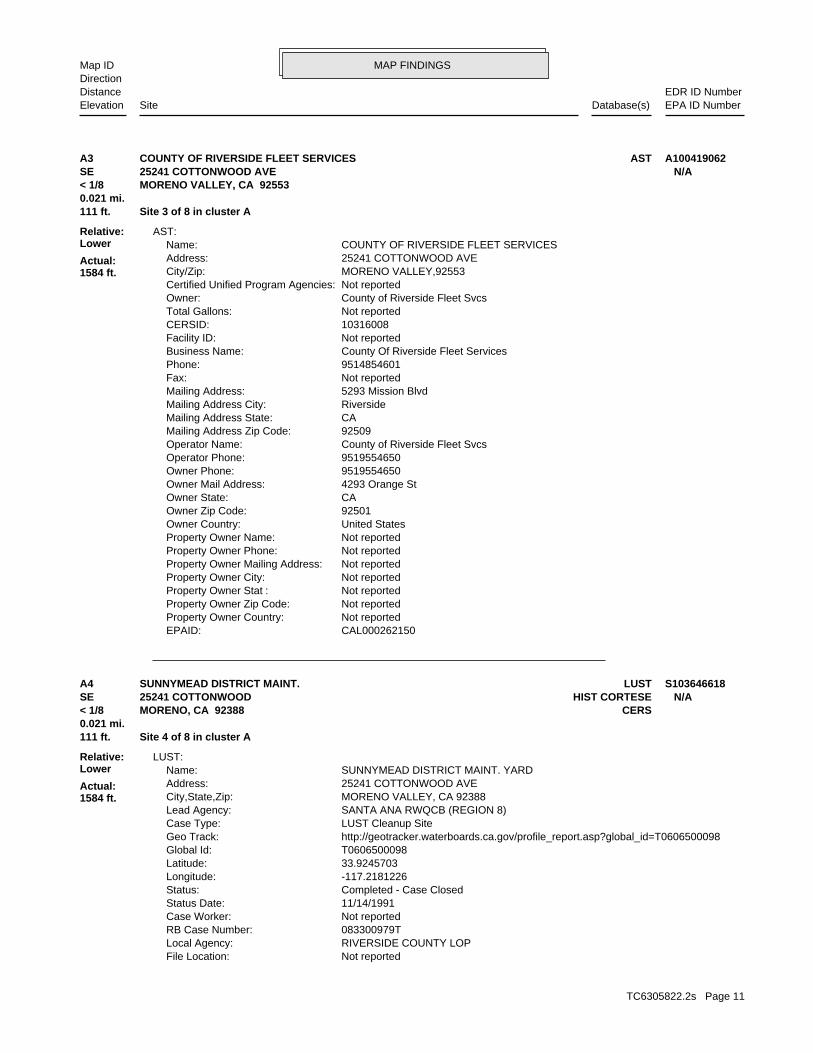
MAP FINDINGSMap IDDirection
EDR ID NumberDistanceEPA ID NumberDatabase(s)SiteElevation
CAL000262150EPAID: Not reportedProperty Owner Country: Not reportedProperty Owner Zip Code: Not reportedProperty Owner Stat : Not reportedProperty Owner City: Not reportedProperty Owner Mailing Address: Not reportedProperty Owner Phone: Not reportedProperty Owner Name: United StatesOwner Country: 92501Owner Zip Code: CAOwner State: 4293 Orange StOwner Mail Address: 9519554650Owner Phone: 9519554650Operator Phone: County of Riverside Fleet SvcsOperator Name: 92509Mailing Address Zip Code: CAMailing Address State: RiversideMailing Address City: 5293 Mission BlvdMailing Address: Not reportedFax: 9514854601Phone: County Of Riverside Fleet ServicesBusiness Name: Not reportedFacility ID: 10316008CERSID: Not reportedTotal Gallons: County of Riverside Fleet SvcsOwner: Not reportedCertified Unified Program Agencies: MORENO VALLEY,92553City/Zip: 25241 COTTONWOOD AVEAddress: COUNTY OF RIVERSIDE FLEET SERVICESName:
AST:
111 ft. Site 3 of 8 in cluster A0.021 mi.
Relative:Lower
Actual:1584 ft.
< 1/8 MORENO VALLEY, CA 92553SE 25241 COTTONWOOD AVE N/AA3 ASTCOUNTY OF RIVERSIDE FLEET SERVICES A100419062
Not reportedFile Location: RIVERSIDE COUNTY LOPLocal Agency: 083300979TRB Case Number: Not reportedCase Worker: 11/14/1991Status Date: Completed - Case ClosedStatus: -117.2181226Longitude: 33.9245703Latitude: T0606500098Global Id: http://geotracker.waterboards.ca.gov/profile_report.asp?global_id=T0606500098Geo Track: LUST Cleanup SiteCase Type: SANTA ANA RWQCB (REGION 8)Lead Agency: MORENO VALLEY, CA 92388City,State,Zip: 25241 COTTONWOOD AVEAddress: SUNNYMEAD DISTRICT MAINT. YARDName:
LUST:
111 ft. Site 4 of 8 in cluster A0.021 mi.
Relative:Lower
Actual:1584 ft.
< 1/8 CERSMORENO, CA 92388SE HIST CORTESE25241 COTTONWOOD N/AA4 LUSTSUNNYMEAD DISTRICT MAINT. S103646618
TC6305822.2s Page 11
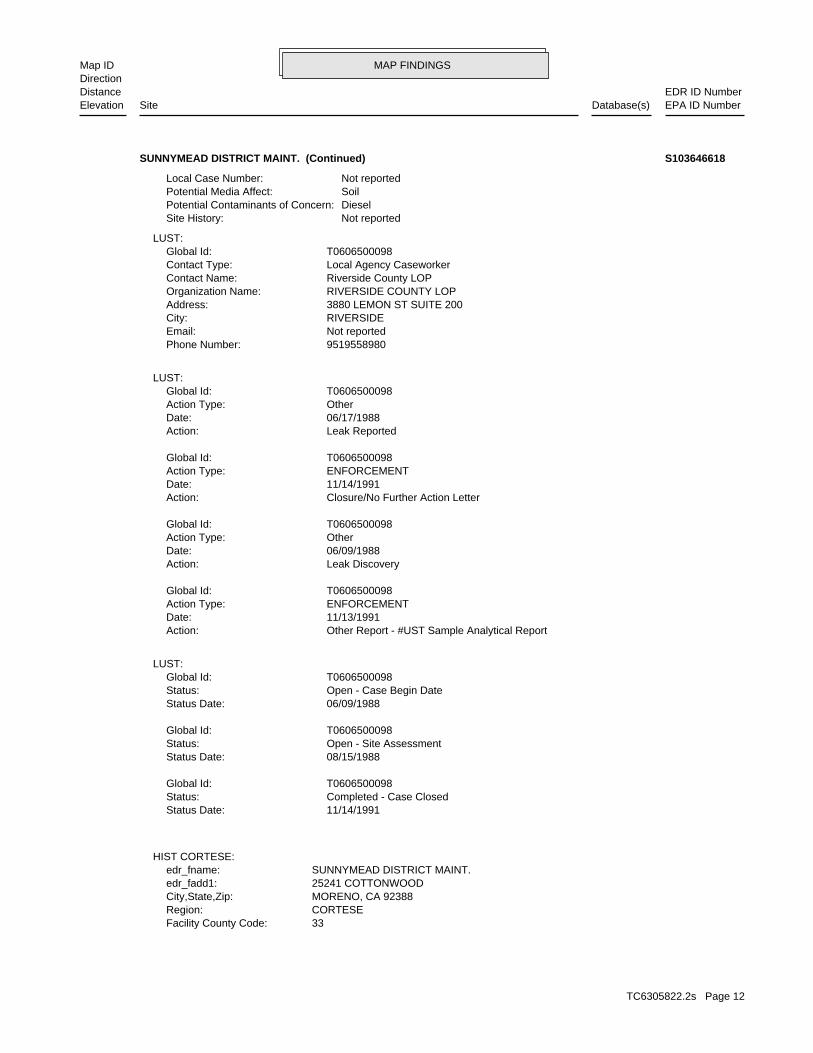
MAP FINDINGSMap IDDirection
EDR ID NumberDistanceEPA ID NumberDatabase(s)SiteElevation
33Facility County Code: CORTESERegion: MORENO, CA 92388City,State,Zip: 25241 COTTONWOODedr_fadd1: SUNNYMEAD DISTRICT MAINT.edr_fname:
HIST CORTESE:
11/14/1991Status Date: Completed - Case ClosedStatus: T0606500098Global Id:
08/15/1988Status Date: Open - Site AssessmentStatus: T0606500098Global Id:
06/09/1988Status Date: Open - Case Begin DateStatus: T0606500098Global Id:
LUST:
Other Report - #UST Sample Analytical ReportAction: 11/13/1991Date: ENFORCEMENTAction Type: T0606500098Global Id:
Leak DiscoveryAction: 06/09/1988Date: OtherAction Type: T0606500098Global Id:
Closure/No Further Action LetterAction: 11/14/1991Date: ENFORCEMENTAction Type: T0606500098Global Id:
Leak ReportedAction: 06/17/1988Date: OtherAction Type: T0606500098Global Id:
LUST:
9519558980Phone Number: Not reportedEmail: RIVERSIDECity: 3880 LEMON ST SUITE 200Address: RIVERSIDE COUNTY LOPOrganization Name: Riverside County LOPContact Name: Local Agency CaseworkerContact Type: T0606500098Global Id:
LUST:
Not reportedSite History: DieselPotential Contaminants of Concern: SoilPotential Media Affect: Not reportedLocal Case Number:
SUNNYMEAD DISTRICT MAINT. (Continued) S103646618
TC6305822.2s Page 12
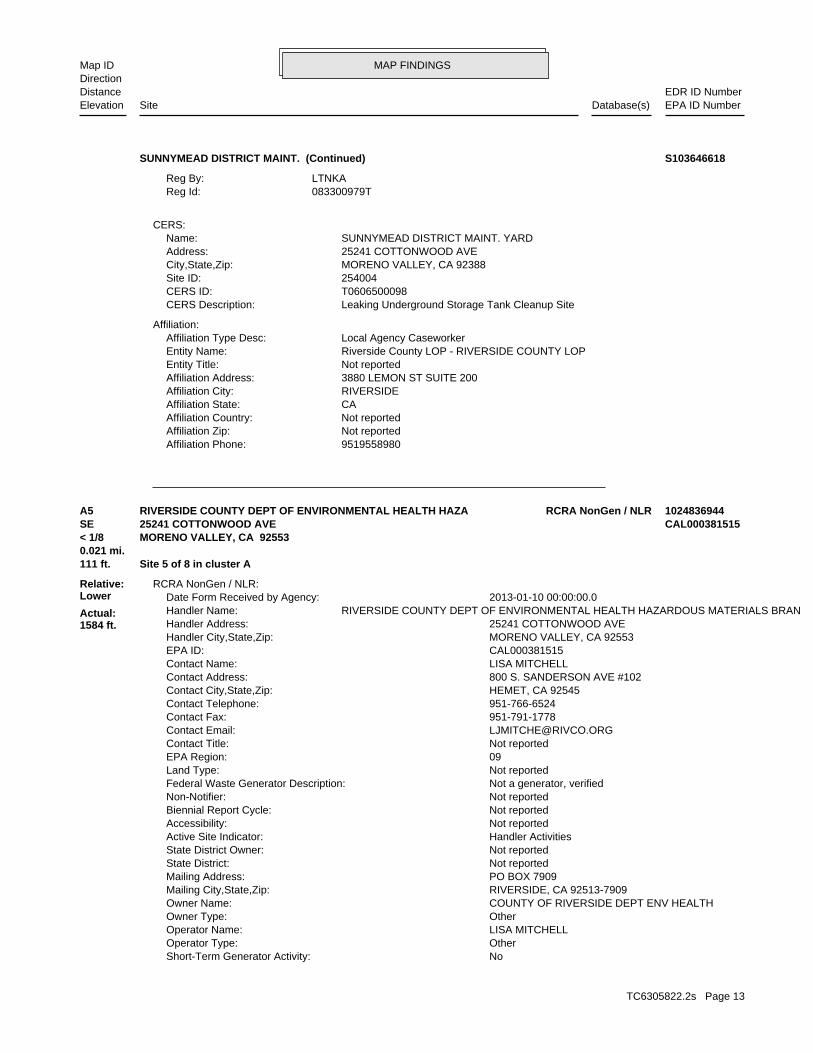
MAP FINDINGSMap IDDirection
EDR ID NumberDistanceEPA ID NumberDatabase(s)SiteElevation
9519558980Affiliation Phone: Not reportedAffiliation Zip: Not reportedAffiliation Country: CAAffiliation State: RIVERSIDEAffiliation City: 3880 LEMON ST SUITE 200Affiliation Address: Not reportedEntity Title: Riverside County LOP - RIVERSIDE COUNTY LOPEntity Name: Local Agency CaseworkerAffiliation Type Desc:
Affiliation:
Leaking Underground Storage Tank Cleanup SiteCERS Description: T0606500098CERS ID: 254004Site ID: MORENO VALLEY, CA 92388City,State,Zip: 25241 COTTONWOOD AVEAddress: SUNNYMEAD DISTRICT MAINT. YARDName:
CERS:
083300979TReg Id: LTNKAReg By:
SUNNYMEAD DISTRICT MAINT. (Continued) S103646618
NoShort-Term Generator Activity: OtherOperator Type: LISA MITCHELLOperator Name: OtherOwner Type: COUNTY OF RIVERSIDE DEPT ENV HEALTHOwner Name: RIVERSIDE, CA 92513-7909Mailing City,State,Zip: PO BOX 7909Mailing Address: Not reportedState District: Not reportedState District Owner: Handler ActivitiesActive Site Indicator: Not reportedAccessibility: Not reportedBiennial Report Cycle: Not reportedNon-Notifier: Not a generator, verifiedFederal Waste Generator Description: Not reportedLand Type: 09EPA Region: Not reportedContact Title: [email protected] Email: 951-791-1778Contact Fax: 951-766-6524Contact Telephone: HEMET, CA 92545Contact City,State,Zip: 800 S. SANDERSON AVE #102Contact Address: LISA MITCHELLContact Name: CAL000381515EPA ID: MORENO VALLEY, CA 92553Handler City,State,Zip: 25241 COTTONWOOD AVEHandler Address: RIVERSIDE COUNTY DEPT OF ENVIRONMENTAL HEALTH HAZARDOUS MATERIALS BRANHandler Name: 2013-01-10 00:00:00.0Date Form Received by Agency:
RCRA NonGen / NLR:
111 ft. Site 5 of 8 in cluster A0.021 mi.
Relative:Lower
Actual:1584 ft.
< 1/8 MORENO VALLEY, CA 92553SE 25241 COTTONWOOD AVE CAL000381515A5 RCRA NonGen / NLRRIVERSIDE COUNTY DEPT OF ENVIRONMENTAL HEALTH HAZA 1024836944
TC6305822.2s Page 13
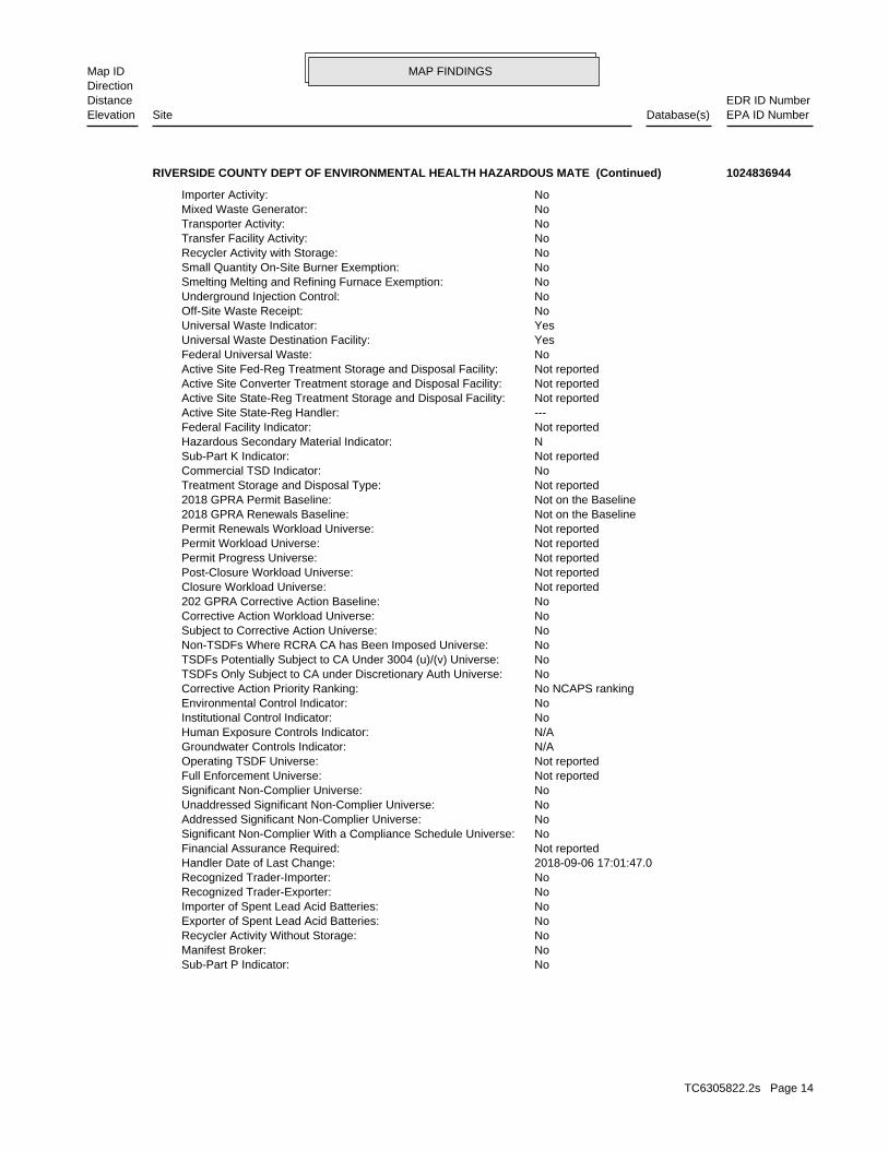
MAP FINDINGSMap IDDirection
EDR ID NumberDistanceEPA ID NumberDatabase(s)SiteElevation
NoSub-Part P Indicator: NoManifest Broker: NoRecycler Activity Without Storage: NoExporter of Spent Lead Acid Batteries: NoImporter of Spent Lead Acid Batteries: NoRecognized Trader-Exporter: NoRecognized Trader-Importer: 2018-09-06 17:01:47.0Handler Date of Last Change: Not reportedFinancial Assurance Required: NoSignificant Non-Complier With a Compliance Schedule Universe: NoAddressed Significant Non-Complier Universe: NoUnaddressed Significant Non-Complier Universe: NoSignificant Non-Complier Universe: Not reportedFull Enforcement Universe: Not reportedOperating TSDF Universe: N/AGroundwater Controls Indicator: N/AHuman Exposure Controls Indicator: NoInstitutional Control Indicator: NoEnvironmental Control Indicator: No NCAPS rankingCorrective Action Priority Ranking: NoTSDFs Only Subject to CA under Discretionary Auth Universe: NoTSDFs Potentially Subject to CA Under 3004 (u)/(v) Universe: NoNon-TSDFs Where RCRA CA has Been Imposed Universe: NoSubject to Corrective Action Universe: NoCorrective Action Workload Universe: No202 GPRA Corrective Action Baseline: Not reportedClosure Workload Universe: Not reportedPost-Closure Workload Universe: Not reportedPermit Progress Universe: Not reportedPermit Workload Universe: Not reportedPermit Renewals Workload Universe: Not on the Baseline2018 GPRA Renewals Baseline: Not on the Baseline2018 GPRA Permit Baseline: Not reportedTreatment Storage and Disposal Type: NoCommercial TSD Indicator: Not reportedSub-Part K Indicator: NHazardous Secondary Material Indicator: Not reportedFederal Facility Indicator: ---Active Site State-Reg Handler: Not reportedActive Site State-Reg Treatment Storage and Disposal Facility: Not reportedActive Site Converter Treatment storage and Disposal Facility: Not reportedActive Site Fed-Reg Treatment Storage and Disposal Facility: NoFederal Universal Waste: YesUniversal Waste Destination Facility: YesUniversal Waste Indicator: NoOff-Site Waste Receipt: NoUnderground Injection Control: NoSmelting Melting and Refining Furnace Exemption: NoSmall Quantity On-Site Burner Exemption: NoRecycler Activity with Storage: NoTransfer Facility Activity: NoTransporter Activity: NoMixed Waste Generator: NoImporter Activity:
RIVERSIDE COUNTY DEPT OF ENVIRONMENTAL HEALTH HAZARDOUS MATE (Continued) 1024836944
TC6305822.2s Page 14
MAP FINDINGSMap IDDirection
EDR ID NumberDistanceEPA ID NumberDatabase(s)SiteElevation
No Evaluations FoundEvaluations:Evaluation Action Summary:
No Violations FoundViolations:Facility Has Received Notices of Violations:
ADMINISTRATION OF PUBLIC HEALTH PROGRAMSNAICS Description: 92312NAICS Code:
List of NAICS Codes and Descriptions:
Not reportedElectronic Manifest Broker: Not reportedNon Storage Recycler Activity: YesCurrent Record: NoSpent Lead Acid Battery Exporter: NoSpent Lead Acid Battery Importer: NoRecognized Trader Exporter: NoRecognized Trader Importer: NoLarge Quantity Handler of Universal Waste: Not reportedState District Owner: Not a generator, verifiedFederal Waste Generator Description: RIVERSIDE COUNTY DEPT OF ENVIRONMENTAL HEALTH HAZARDOUS MATERIALS BRANHandler Name: 2013-01-10 00:00:00.0Receive Date:
Historic Generators:
Not reportedOwner/Operator Email: Not reportedOwner/Operator Fax: Not reportedOwner/Operator Telephone Ext: 951-358-5055Owner/Operator Telephone: RIVERSIDE, CA 92503-3410Owner/Operator City,State,Zip: 4065 COUNTY CIRCLE DROwner/Operator Address: Not reportedDate Ended Current: Not reportedDate Became Current: OtherLegal Status: COUNTY OF RIVERSIDE DEPT ENV HEALTHOwner/Operator Name: OwnerOwner/Operator Indicator:
Not reportedOwner/Operator Email: Not reportedOwner/Operator Fax: Not reportedOwner/Operator Telephone Ext: 951-766-6524Owner/Operator Telephone: HEMET, CA 92545Owner/Operator City,State,Zip: 800 S. SANDERSON AVE #102Owner/Operator Address: Not reportedDate Ended Current: Not reportedDate Became Current: OtherLegal Status: LISA MITCHELLOwner/Operator Name: OperatorOwner/Operator Indicator:
Handler - Owner Operator:
RIVERSIDE COUNTY DEPT OF ENVIRONMENTAL HEALTH HAZARDOUS MATE (Continued) 1024836944
TC6305822.2s Page 15
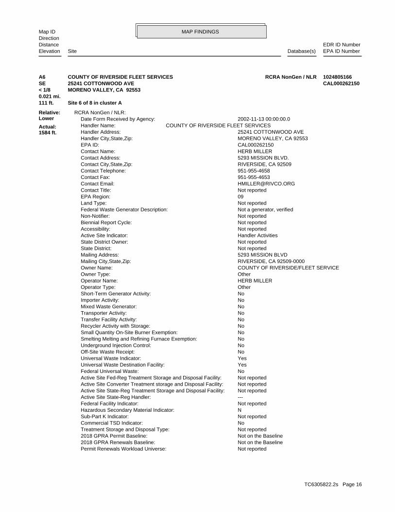
MAP FINDINGSMap IDDirection
EDR ID NumberDistanceEPA ID NumberDatabase(s)SiteElevation
Not reportedPermit Renewals Workload Universe: Not on the Baseline2018 GPRA Renewals Baseline: Not on the Baseline2018 GPRA Permit Baseline: Not reportedTreatment Storage and Disposal Type: NoCommercial TSD Indicator: Not reportedSub-Part K Indicator: NHazardous Secondary Material Indicator: Not reportedFederal Facility Indicator: ---Active Site State-Reg Handler: Not reportedActive Site State-Reg Treatment Storage and Disposal Facility: Not reportedActive Site Converter Treatment storage and Disposal Facility: Not reportedActive Site Fed-Reg Treatment Storage and Disposal Facility: NoFederal Universal Waste: YesUniversal Waste Destination Facility: YesUniversal Waste Indicator: NoOff-Site Waste Receipt: NoUnderground Injection Control: NoSmelting Melting and Refining Furnace Exemption: NoSmall Quantity On-Site Burner Exemption: NoRecycler Activity with Storage: NoTransfer Facility Activity: NoTransporter Activity: NoMixed Waste Generator: NoImporter Activity: NoShort-Term Generator Activity: OtherOperator Type: HERB MILLEROperator Name: OtherOwner Type: COUNTY OF RIVERSIDE/FLEET SERVICEOwner Name: RIVERSIDE, CA 92509-0000Mailing City,State,Zip: 5293 MISSION BLVDMailing Address: Not reportedState District: Not reportedState District Owner: Handler ActivitiesActive Site Indicator: Not reportedAccessibility: Not reportedBiennial Report Cycle: Not reportedNon-Notifier: Not a generator, verifiedFederal Waste Generator Description: Not reportedLand Type: 09EPA Region: Not reportedContact Title: [email protected] Email: 951-955-4653Contact Fax: 951-955-4658Contact Telephone: RIVERSIDE, CA 92509Contact City,State,Zip: 5293 MISSION BLVD.Contact Address: HERB MILLERContact Name: CAL000262150EPA ID: MORENO VALLEY, CA 92553Handler City,State,Zip: 25241 COTTONWOOD AVEHandler Address: COUNTY OF RIVERSIDE FLEET SERVICESHandler Name: 2002-11-13 00:00:00.0Date Form Received by Agency:
RCRA NonGen / NLR:
111 ft. Site 6 of 8 in cluster A0.021 mi.
Relative:Lower
Actual:1584 ft.
< 1/8 MORENO VALLEY, CA 92553SE 25241 COTTONWOOD AVE CAL000262150A6 RCRA NonGen / NLRCOUNTY OF RIVERSIDE FLEET SERVICES 1024805166
TC6305822.2s Page 16
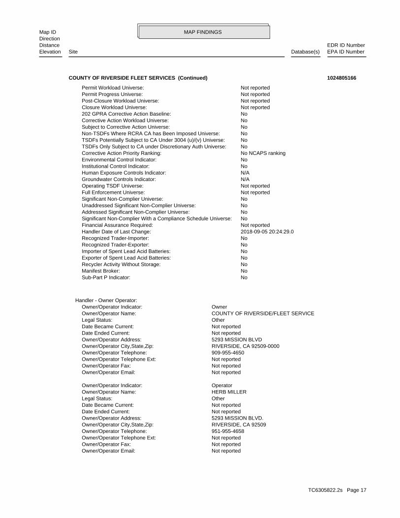
MAP FINDINGSMap IDDirection
EDR ID NumberDistanceEPA ID NumberDatabase(s)SiteElevation
Not reportedOwner/Operator Email: Not reportedOwner/Operator Fax: Not reportedOwner/Operator Telephone Ext: 951-955-4658Owner/Operator Telephone: RIVERSIDE, CA 92509Owner/Operator City,State,Zip: 5293 MISSION BLVD.Owner/Operator Address: Not reportedDate Ended Current: Not reportedDate Became Current: OtherLegal Status: HERB MILLEROwner/Operator Name: OperatorOwner/Operator Indicator:
Not reportedOwner/Operator Email: Not reportedOwner/Operator Fax: Not reportedOwner/Operator Telephone Ext: 909-955-4650Owner/Operator Telephone: RIVERSIDE, CA 92509-0000Owner/Operator City,State,Zip: 5293 MISSION BLVDOwner/Operator Address: Not reportedDate Ended Current: Not reportedDate Became Current: OtherLegal Status: COUNTY OF RIVERSIDE/FLEET SERVICEOwner/Operator Name: OwnerOwner/Operator Indicator:
Handler - Owner Operator:
NoSub-Part P Indicator: NoManifest Broker: NoRecycler Activity Without Storage: NoExporter of Spent Lead Acid Batteries: NoImporter of Spent Lead Acid Batteries: NoRecognized Trader-Exporter: NoRecognized Trader-Importer: 2018-09-05 20:24:29.0Handler Date of Last Change: Not reportedFinancial Assurance Required: NoSignificant Non-Complier With a Compliance Schedule Universe: NoAddressed Significant Non-Complier Universe: NoUnaddressed Significant Non-Complier Universe: NoSignificant Non-Complier Universe: Not reportedFull Enforcement Universe: Not reportedOperating TSDF Universe: N/AGroundwater Controls Indicator: N/AHuman Exposure Controls Indicator: NoInstitutional Control Indicator: NoEnvironmental Control Indicator: No NCAPS rankingCorrective Action Priority Ranking: NoTSDFs Only Subject to CA under Discretionary Auth Universe: NoTSDFs Potentially Subject to CA Under 3004 (u)/(v) Universe: NoNon-TSDFs Where RCRA CA has Been Imposed Universe: NoSubject to Corrective Action Universe: NoCorrective Action Workload Universe: No202 GPRA Corrective Action Baseline: Not reportedClosure Workload Universe: Not reportedPost-Closure Workload Universe: Not reportedPermit Progress Universe: Not reportedPermit Workload Universe:
COUNTY OF RIVERSIDE FLEET SERVICES (Continued) 1024805166
TC6305822.2s Page 17
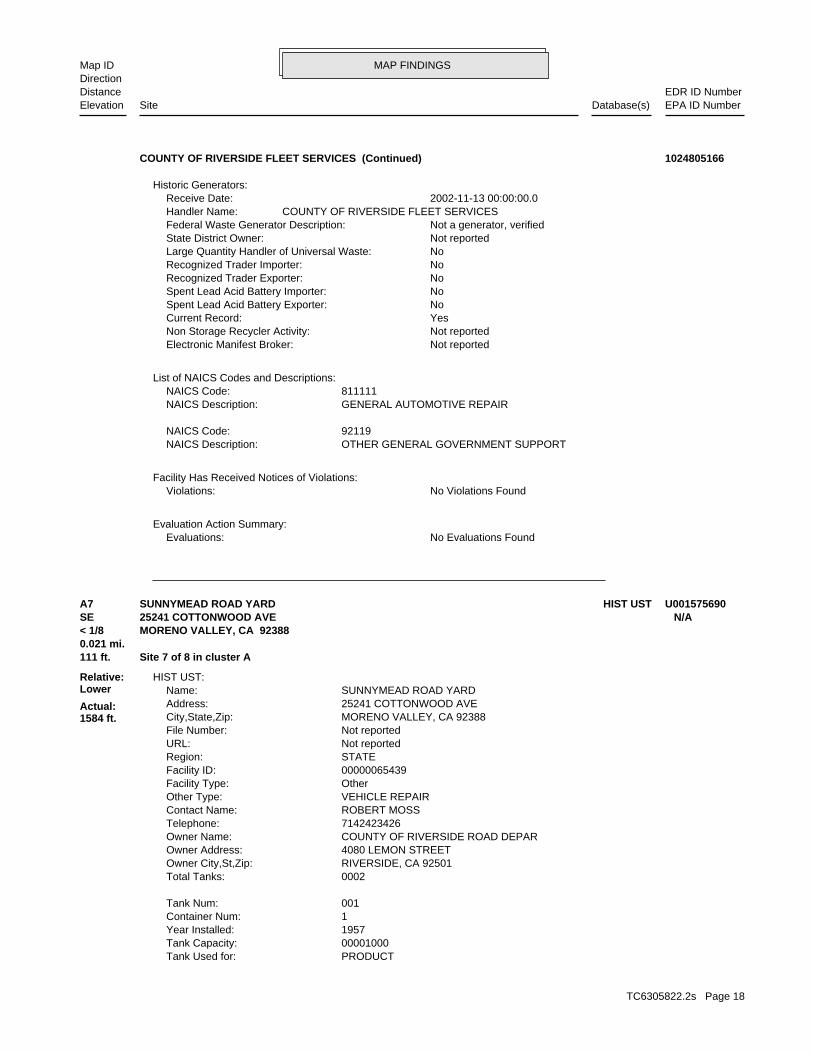
MAP FINDINGSMap IDDirection
EDR ID NumberDistanceEPA ID NumberDatabase(s)SiteElevation
No Evaluations FoundEvaluations:Evaluation Action Summary:
No Violations FoundViolations:Facility Has Received Notices of Violations:
OTHER GENERAL GOVERNMENT SUPPORTNAICS Description: 92119NAICS Code:
GENERAL AUTOMOTIVE REPAIRNAICS Description: 811111NAICS Code:
List of NAICS Codes and Descriptions:
Not reportedElectronic Manifest Broker: Not reportedNon Storage Recycler Activity: YesCurrent Record: NoSpent Lead Acid Battery Exporter: NoSpent Lead Acid Battery Importer: NoRecognized Trader Exporter: NoRecognized Trader Importer: NoLarge Quantity Handler of Universal Waste: Not reportedState District Owner: Not a generator, verifiedFederal Waste Generator Description: COUNTY OF RIVERSIDE FLEET SERVICESHandler Name: 2002-11-13 00:00:00.0Receive Date:
Historic Generators:
COUNTY OF RIVERSIDE FLEET SERVICES (Continued) 1024805166
PRODUCTTank Used for: 00001000Tank Capacity: 1957Year Installed: 1Container Num: 001Tank Num:
0002Total Tanks: RIVERSIDE, CA 92501Owner City,St,Zip: 4080 LEMON STREETOwner Address: COUNTY OF RIVERSIDE ROAD DEPAROwner Name: 7142423426Telephone: ROBERT MOSSContact Name: VEHICLE REPAIROther Type: OtherFacility Type: 00000065439Facility ID: STATERegion: Not reportedURL: Not reportedFile Number: MORENO VALLEY, CA 92388City,State,Zip: 25241 COTTONWOOD AVEAddress: SUNNYMEAD ROAD YARDName:
HIST UST:
111 ft. Site 7 of 8 in cluster A0.021 mi.
Relative:Lower
Actual:1584 ft.
< 1/8 MORENO VALLEY, CA 92388SE 25241 COTTONWOOD AVE N/AA7 HIST USTSUNNYMEAD ROAD YARD U001575690
TC6305822.2s Page 18
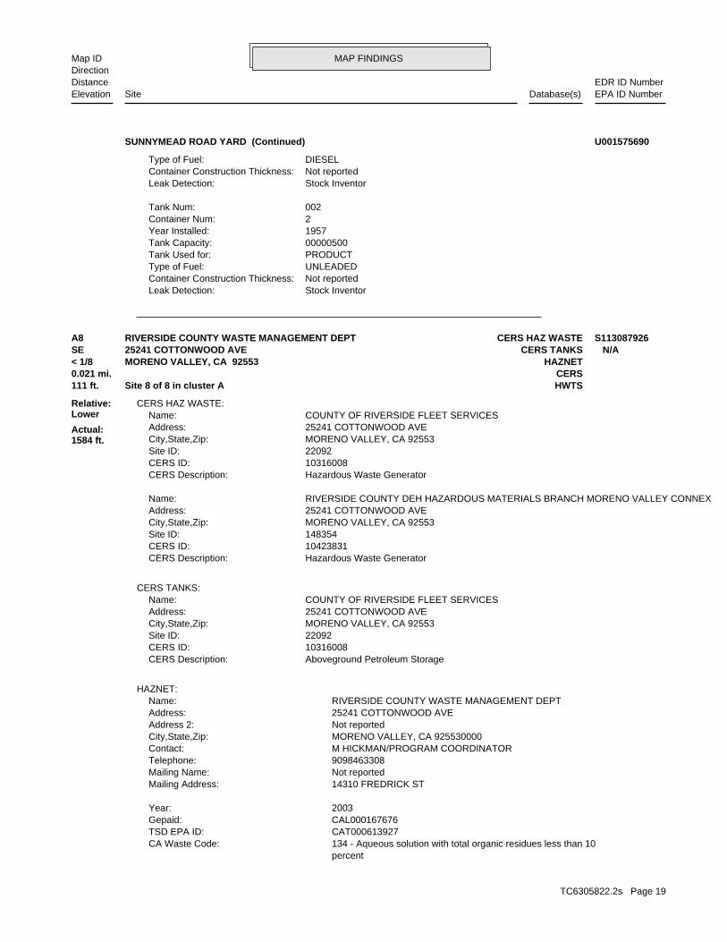
MAP FINDINGSMap IDDirection
EDR ID NumberDistanceEPA ID NumberDatabase(s)SiteElevation
Stock InventorLeak Detection: Not reportedContainer Construction Thickness: UNLEADEDType of Fuel: PRODUCTTank Used for: 00000500Tank Capacity: 1957Year Installed: 2Container Num: 002Tank Num:
Stock InventorLeak Detection: Not reportedContainer Construction Thickness: DIESELType of Fuel:
SUNNYMEAD ROAD YARD (Continued) U001575690
percent 134 - Aqueous solution with total organic residues less than 10CA Waste Code: CAT000613927TSD EPA ID: CAL000167676Gepaid: 2003Year:
14310 FREDRICK STMailing Address: Not reportedMailing Name: 9098463308Telephone: M HICKMAN/PROGRAM COORDINATORContact: MORENO VALLEY, CA 925530000City,State,Zip: Not reportedAddress 2: 25241 COTTONWOOD AVEAddress: RIVERSIDE COUNTY WASTE MANAGEMENT DEPTName:
HAZNET:
Aboveground Petroleum StorageCERS Description: 10316008CERS ID: 22092Site ID: MORENO VALLEY, CA 92553City,State,Zip: 25241 COTTONWOOD AVEAddress: COUNTY OF RIVERSIDE FLEET SERVICESName:
CERS TANKS:
Hazardous Waste GeneratorCERS Description: 10423831CERS ID: 148354Site ID: MORENO VALLEY, CA 92553City,State,Zip: 25241 COTTONWOOD AVEAddress: RIVERSIDE COUNTY DEH HAZARDOUS MATERIALS BRANCH MORENO VALLEY CONNEXName:
Hazardous Waste GeneratorCERS Description: 10316008CERS ID: 22092Site ID: MORENO VALLEY, CA 92553City,State,Zip: 25241 COTTONWOOD AVEAddress: COUNTY OF RIVERSIDE FLEET SERVICESName:
CERS HAZ WASTE:
111 ft. HWTSSite 8 of 8 in cluster A0.021 mi. CERS
Relative:Lower
Actual:1584 ft.
< 1/8 HAZNETMORENO VALLEY, CA 92553SE CERS TANKS25241 COTTONWOOD AVE N/AA8 CERS HAZ WASTERIVERSIDE COUNTY WASTE MANAGEMENT DEPT S113087926
TC6305822.2s Page 19
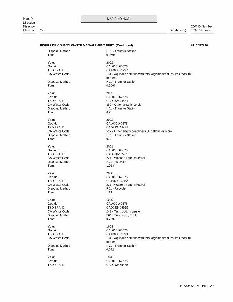
MAP FINDINGSMap IDDirection
EDR ID NumberDistanceEPA ID NumberDatabase(s)SiteElevation
CAD093459485TSD EPA ID: CAL000167676Gepaid: 1998Year:
0.042Tons: H01 - Transfer StationDisposal Method: percent 134 - Aqueous solution with total organic residues less than 10CA Waste Code: CAT000613893TSD EPA ID: CAL000167676Gepaid: 1998Year:
0.7297Tons: T01 - Treatment, TankDisposal Method: 241 - Tank bottom wasteCA Waste Code: CAD028409019TSD EPA ID: CAL000167676Gepaid: 1999Year:
1.14Tons: R01 - RecyclerDisposal Method: 221 - Waste oil and mixed oilCA Waste Code: CAT080013352TSD EPA ID: CAL000167676Gepaid: 2000Year:
1.083Tons: R01 - RecyclerDisposal Method: 221 - Waste oil and mixed oilCA Waste Code: CAD008252405TSD EPA ID: CAL000167676Gepaid: 2001Year:
0.3Tons: H01 - Transfer StationDisposal Method: 512 - Other empty containers 30 gallons or moreCA Waste Code: CAD982444481TSD EPA ID: CAL000167676Gepaid: 2002Year:
0.7Tons: H01 - Transfer StationDisposal Method: 352 - Other organic solidsCA Waste Code: CAD982444481TSD EPA ID: CAL000167676Gepaid: 2002Year:
0.3066Tons: H01 - Transfer StationDisposal Method: percent 134 - Aqueous solution with total organic residues less than 10CA Waste Code: CAT000613927TSD EPA ID: CAL000167676Gepaid: 2002Year:
0.0798Tons: H01 - Transfer StationDisposal Method:
RIVERSIDE COUNTY WASTE MANAGEMENT DEPT (Continued) S113087926
TC6305822.2s Page 20
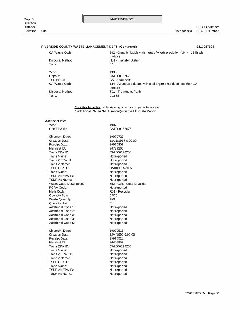
MAP FINDINGSMap IDDirection
EDR ID NumberDistanceEPA ID NumberDatabase(s)SiteElevation
Not reportedTSDF Alt Name: Not reportedTSDF Alt EPA ID: Not reportedTrans Name: Not reportedTSDF EPA ID: Not reportedTrans 2 Name: Not reportedTrans 2 EPA ID: Not reportedTrans Name: CAL000126258Trans EPA ID: 96407958Manifest ID: 19970521Receipt Date: 12/4/1997 0:00:00Creation Date: 19970515Shipment Date:
Not reportedAdditional Code 5: Not reportedAdditional Code 4: Not reportedAdditional Code 3: Not reportedAdditional Code 2: Not reportedAdditional Code 1: PQuantity Unit: 150Waste Quantity: 0.075Quantity Tons: R01 - RecyclerMeth Code: Not reportedRCRA Code: 352 - Other organic solidsWaste Code Description: Not reportedTSDF Alt Name: Not reportedTSDF Alt EPA ID: Not reportedTrans Name: CAD008252405TSDF EPA ID: Not reportedTrans 2 Name: Not reportedTrans 2 EPA ID: Not reportedTrans Name: CAL000126258Trans EPA ID: 96739265Manifest ID: 19970806Receipt Date: 12/11/1997 0:00:00Creation Date: 19970729Shipment Date:
CAL000167676Gen EPA ID: 1997Year:
Additional Info:
4 additional CA HAZNET: record(s) in the EDR Site Report.Click this hyperlink while viewing on your computer to access
0.1638Tons: T01 - Treatment, TankDisposal Method: percent 134 - Aqueous solution with total organic residues less than 10CA Waste Code: CAT000613893TSD EPA ID: CAL000167676Gepaid: 1998Year:
0.1Tons: H01 - Transfer StationDisposal Method: metals) 342 - Organic liquids with metals (Alkaline solution (pH >= 12.5) withCA Waste Code:
RIVERSIDE COUNTY WASTE MANAGEMENT DEPT (Continued) S113087926
TC6305822.2s Page 21
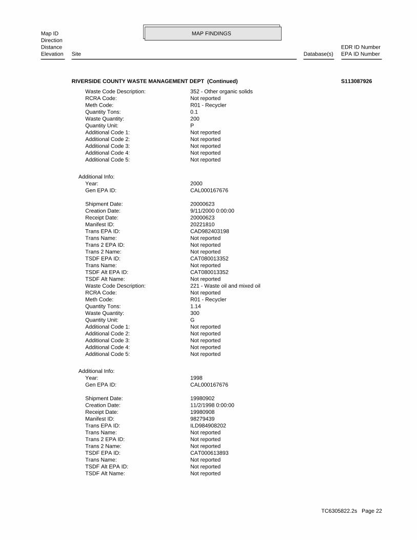
MAP FINDINGSMap IDDirection
EDR ID NumberDistanceEPA ID NumberDatabase(s)SiteElevation
Not reportedTSDF Alt Name: Not reportedTSDF Alt EPA ID: Not reportedTrans Name: CAT000613893TSDF EPA ID: Not reportedTrans 2 Name: Not reportedTrans 2 EPA ID: Not reportedTrans Name: ILD984908202Trans EPA ID: 98279439Manifest ID: 19980908Receipt Date: 11/2/1998 0:00:00Creation Date: 19980902Shipment Date:
CAL000167676Gen EPA ID: 1998Year:
Additional Info:
Not reportedAdditional Code 5: Not reportedAdditional Code 4: Not reportedAdditional Code 3: Not reportedAdditional Code 2: Not reportedAdditional Code 1: GQuantity Unit: 300Waste Quantity: 1.14Quantity Tons: R01 - RecyclerMeth Code: Not reportedRCRA Code: 221 - Waste oil and mixed oilWaste Code Description: Not reportedTSDF Alt Name: CAT080013352TSDF Alt EPA ID: Not reportedTrans Name: CAT080013352TSDF EPA ID: Not reportedTrans 2 Name: Not reportedTrans 2 EPA ID: Not reportedTrans Name: CAD982403198Trans EPA ID: 20221810Manifest ID: 20000623Receipt Date: 9/11/2000 0:00:00Creation Date: 20000623Shipment Date:
CAL000167676Gen EPA ID: 2000Year:
Additional Info:
Not reportedAdditional Code 5: Not reportedAdditional Code 4: Not reportedAdditional Code 3: Not reportedAdditional Code 2: Not reportedAdditional Code 1: PQuantity Unit: 200Waste Quantity: 0.1Quantity Tons: R01 - RecyclerMeth Code: Not reportedRCRA Code: 352 - Other organic solidsWaste Code Description:
RIVERSIDE COUNTY WASTE MANAGEMENT DEPT (Continued) S113087926
TC6305822.2s Page 22
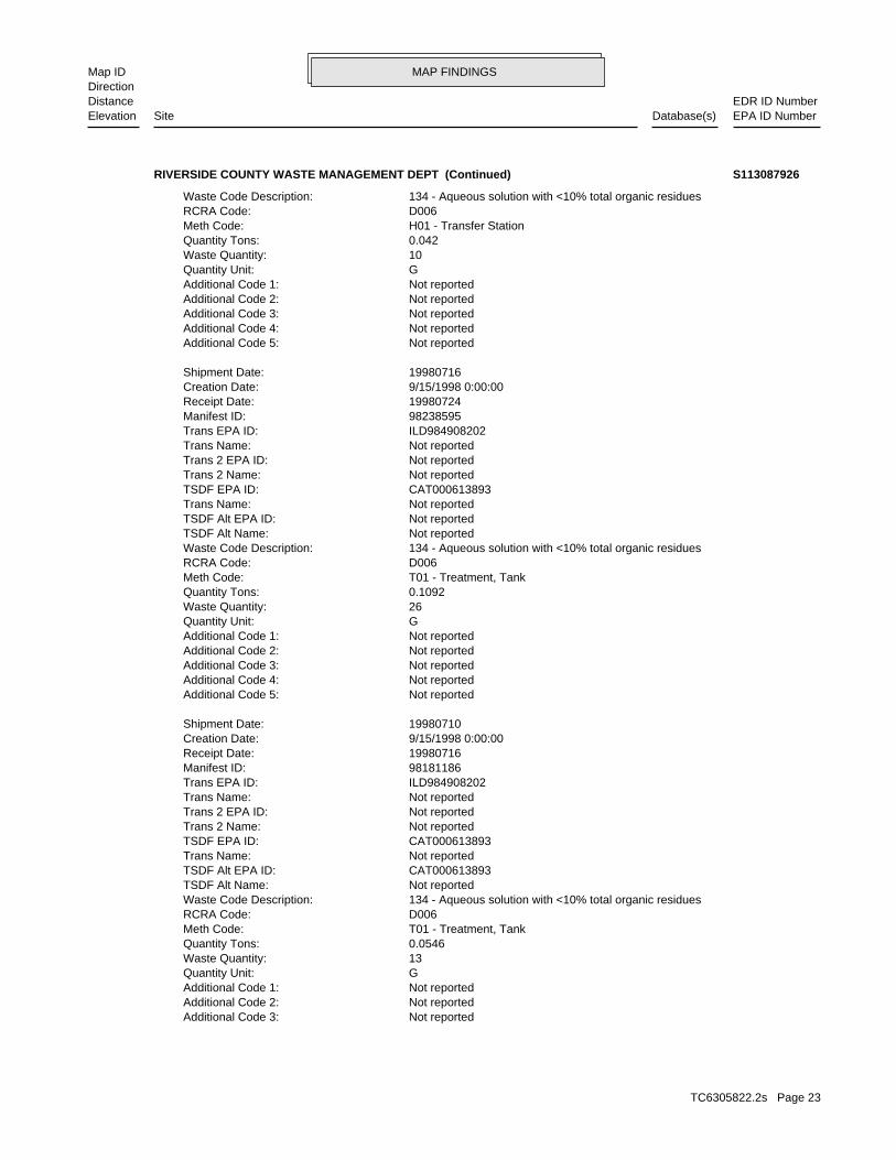
MAP FINDINGSMap IDDirection
EDR ID NumberDistanceEPA ID NumberDatabase(s)SiteElevation
Not reportedAdditional Code 3: Not reportedAdditional Code 2: Not reportedAdditional Code 1: GQuantity Unit: 13Waste Quantity: 0.0546Quantity Tons: T01 - Treatment, TankMeth Code: D006RCRA Code: 134 - Aqueous solution with <10% total organic residuesWaste Code Description: Not reportedTSDF Alt Name: CAT000613893TSDF Alt EPA ID: Not reportedTrans Name: CAT000613893TSDF EPA ID: Not reportedTrans 2 Name: Not reportedTrans 2 EPA ID: Not reportedTrans Name: ILD984908202Trans EPA ID: 98181186Manifest ID: 19980716Receipt Date: 9/15/1998 0:00:00Creation Date: 19980710Shipment Date:
Not reportedAdditional Code 5: Not reportedAdditional Code 4: Not reportedAdditional Code 3: Not reportedAdditional Code 2: Not reportedAdditional Code 1: GQuantity Unit: 26Waste Quantity: 0.1092Quantity Tons: T01 - Treatment, TankMeth Code: D006RCRA Code: 134 - Aqueous solution with <10% total organic residuesWaste Code Description: Not reportedTSDF Alt Name: Not reportedTSDF Alt EPA ID: Not reportedTrans Name: CAT000613893TSDF EPA ID: Not reportedTrans 2 Name: Not reportedTrans 2 EPA ID: Not reportedTrans Name: ILD984908202Trans EPA ID: 98238595Manifest ID: 19980724Receipt Date: 9/15/1998 0:00:00Creation Date: 19980716Shipment Date:
Not reportedAdditional Code 5: Not reportedAdditional Code 4: Not reportedAdditional Code 3: Not reportedAdditional Code 2: Not reportedAdditional Code 1: GQuantity Unit: 10Waste Quantity: 0.042Quantity Tons: H01 - Transfer StationMeth Code: D006RCRA Code: 134 - Aqueous solution with <10% total organic residuesWaste Code Description:
RIVERSIDE COUNTY WASTE MANAGEMENT DEPT (Continued) S113087926
TC6305822.2s Page 23
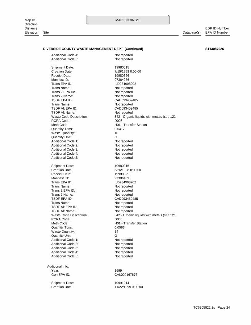
MAP FINDINGSMap IDDirection
EDR ID NumberDistanceEPA ID NumberDatabase(s)SiteElevation
11/22/1999 0:00:00Creation Date: 19991014Shipment Date:
CAL000167676Gen EPA ID: 1999Year:
Additional Info:
Not reportedAdditional Code 5: Not reportedAdditional Code 4: Not reportedAdditional Code 3: Not reportedAdditional Code 2: Not reportedAdditional Code 1: GQuantity Unit: 14Waste Quantity: 0.0583Quantity Tons: H01 - Transfer StationMeth Code: D006RCRA Code: 342 - Organic liquids with metals (see 121Waste Code Description: Not reportedTSDF Alt Name: Not reportedTSDF Alt EPA ID: Not reportedTrans Name: CAD093459485TSDF EPA ID: Not reportedTrans 2 Name: Not reportedTrans 2 EPA ID: Not reportedTrans Name: ILD984908202Trans EPA ID: 97386489Manifest ID: 19980325Receipt Date: 5/26/1998 0:00:00Creation Date: 19980316Shipment Date:
Not reportedAdditional Code 5: Not reportedAdditional Code 4: Not reportedAdditional Code 3: Not reportedAdditional Code 2: Not reportedAdditional Code 1: GQuantity Unit: 10Waste Quantity: 0.0417Quantity Tons: H01 - Transfer StationMeth Code: D006RCRA Code: 342 - Organic liquids with metals (see 121Waste Code Description: Not reportedTSDF Alt Name: CAD093459485TSDF Alt EPA ID: Not reportedTrans Name: CAD093459485TSDF EPA ID: Not reportedTrans 2 Name: Not reportedTrans 2 EPA ID: Not reportedTrans Name: ILD984908202Trans EPA ID: 97364276Manifest ID: 19980526Receipt Date: 7/15/1998 0:00:00Creation Date: 19980515Shipment Date:
Not reportedAdditional Code 5: Not reportedAdditional Code 4:
RIVERSIDE COUNTY WASTE MANAGEMENT DEPT (Continued) S113087926
TC6305822.2s Page 24
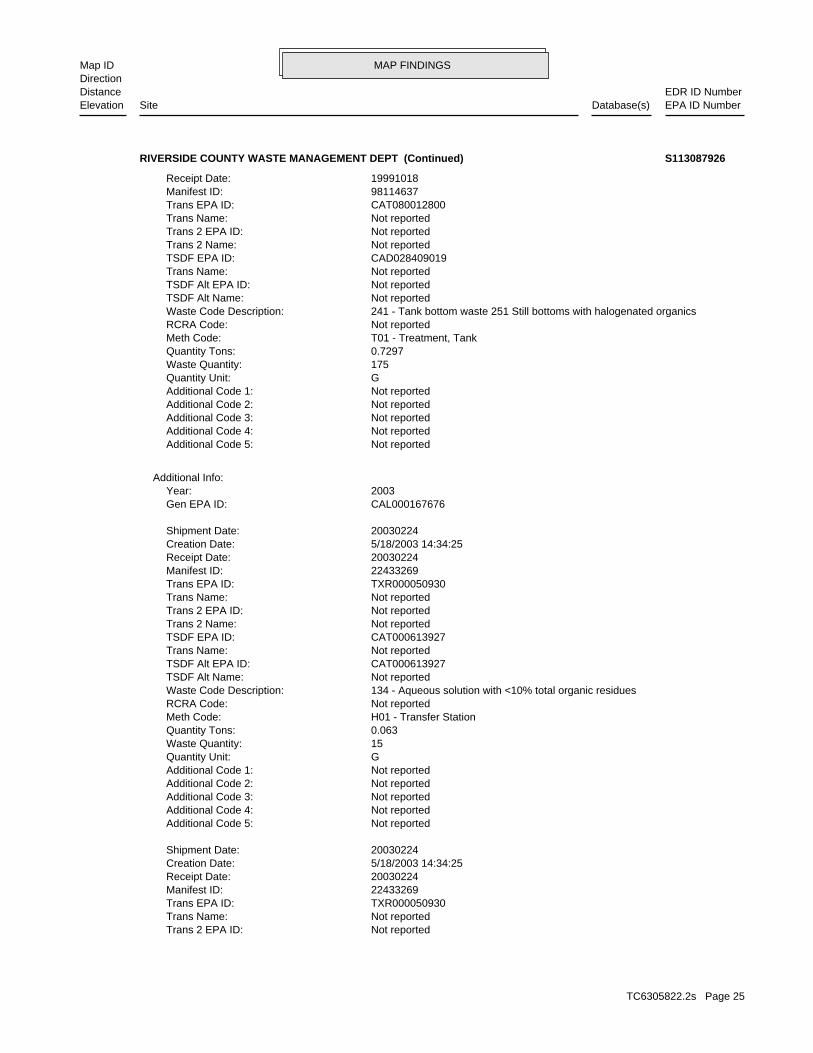
MAP FINDINGSMap IDDirection
EDR ID NumberDistanceEPA ID NumberDatabase(s)SiteElevation
Not reportedTrans 2 EPA ID: Not reportedTrans Name: TXR000050930Trans EPA ID: 22433269Manifest ID: 20030224Receipt Date: 5/18/2003 14:34:25Creation Date: 20030224Shipment Date:
Not reportedAdditional Code 5: Not reportedAdditional Code 4: Not reportedAdditional Code 3: Not reportedAdditional Code 2: Not reportedAdditional Code 1: GQuantity Unit: 15Waste Quantity: 0.063Quantity Tons: H01 - Transfer StationMeth Code: Not reportedRCRA Code: 134 - Aqueous solution with <10% total organic residuesWaste Code Description: Not reportedTSDF Alt Name: CAT000613927TSDF Alt EPA ID: Not reportedTrans Name: CAT000613927TSDF EPA ID: Not reportedTrans 2 Name: Not reportedTrans 2 EPA ID: Not reportedTrans Name: TXR000050930Trans EPA ID: 22433269Manifest ID: 20030224Receipt Date: 5/18/2003 14:34:25Creation Date: 20030224Shipment Date:
CAL000167676Gen EPA ID: 2003Year:
Additional Info:
Not reportedAdditional Code 5: Not reportedAdditional Code 4: Not reportedAdditional Code 3: Not reportedAdditional Code 2: Not reportedAdditional Code 1: GQuantity Unit: 175Waste Quantity: 0.7297Quantity Tons: T01 - Treatment, TankMeth Code: Not reportedRCRA Code: 241 - Tank bottom waste 251 Still bottoms with halogenated organicsWaste Code Description: Not reportedTSDF Alt Name: Not reportedTSDF Alt EPA ID: Not reportedTrans Name: CAD028409019TSDF EPA ID: Not reportedTrans 2 Name: Not reportedTrans 2 EPA ID: Not reportedTrans Name: CAT080012800Trans EPA ID: 98114637Manifest ID: 19991018Receipt Date:
RIVERSIDE COUNTY WASTE MANAGEMENT DEPT (Continued) S113087926
TC6305822.2s Page 25
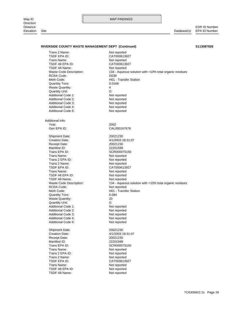
MAP FINDINGSMap IDDirection
EDR ID NumberDistanceEPA ID NumberDatabase(s)SiteElevation
Not reportedTSDF Alt Name: Not reportedTSDF Alt EPA ID: Not reportedTrans Name: CAT000613927TSDF EPA ID: Not reportedTrans 2 Name: Not reportedTrans 2 EPA ID: Not reportedTrans Name: SCR000075150Trans EPA ID: 22201599Manifest ID: 20021230Receipt Date: 4/1/2003 18:31:07Creation Date: 20021230Shipment Date:
Not reportedAdditional Code 5: Not reportedAdditional Code 4: Not reportedAdditional Code 3: Not reportedAdditional Code 2: Not reportedAdditional Code 1: GQuantity Unit: 20Waste Quantity: 0.084Quantity Tons: H01 - Transfer StationMeth Code: Not reportedRCRA Code: 134 - Aqueous solution with <10% total organic residuesWaste Code Description: Not reportedTSDF Alt Name: Not reportedTSDF Alt EPA ID: Not reportedTrans Name: CAT000613927TSDF EPA ID: Not reportedTrans 2 Name: Not reportedTrans 2 EPA ID: Not reportedTrans Name: SCR000075150Trans EPA ID: 22201599Manifest ID: 20021230Receipt Date: 4/1/2003 18:31:07Creation Date: 20021230Shipment Date:
CAL000167676Gen EPA ID: 2002Year:
Additional Info:
Not reportedAdditional Code 5: Not reportedAdditional Code 4: Not reportedAdditional Code 3: Not reportedAdditional Code 2: Not reportedAdditional Code 1: GQuantity Unit: 4Waste Quantity: 0.0168Quantity Tons: H01 - Transfer StationMeth Code: D039RCRA Code: 134 - Aqueous solution with <10% total organic residuesWaste Code Description: Not reportedTSDF Alt Name: CAT000613927TSDF Alt EPA ID: Not reportedTrans Name: CAT000613927TSDF EPA ID: Not reportedTrans 2 Name:
RIVERSIDE COUNTY WASTE MANAGEMENT DEPT (Continued) S113087926
TC6305822.2s Page 26

MAP FINDINGSMap IDDirection
EDR ID NumberDistanceEPA ID NumberDatabase(s)SiteElevation
Not reportedAdditional Code 3: Not reportedAdditional Code 2: Not reportedAdditional Code 1: GQuantity Unit: 20Waste Quantity: 0.084Quantity Tons: H01 - Transfer StationMeth Code: Not reportedRCRA Code: 134 - Aqueous solution with <10% total organic residuesWaste Code Description: Not reportedTSDF Alt Name: Not reportedTSDF Alt EPA ID: Not reportedTrans Name: CAT000613927TSDF EPA ID: Not reportedTrans 2 Name: Not reportedTrans 2 EPA ID: Not reportedTrans Name: SCR000075150Trans EPA ID: 21939136Manifest ID: 20021106Receipt Date: 2/7/2003 18:31:45Creation Date: 20021106Shipment Date:
Not reportedAdditional Code 5: Not reportedAdditional Code 4: Not reportedAdditional Code 3: Not reportedAdditional Code 2: Not reportedAdditional Code 1: GQuantity Unit: 4Waste Quantity: 0.0168Quantity Tons: H01 - Transfer StationMeth Code: D039RCRA Code: 134 - Aqueous solution with <10% total organic residuesWaste Code Description: Not reportedTSDF Alt Name: Not reportedTSDF Alt EPA ID: Not reportedTrans Name: CAT000613927TSDF EPA ID: Not reportedTrans 2 Name: Not reportedTrans 2 EPA ID: Not reportedTrans Name: SCR000075150Trans EPA ID: 21939136Manifest ID: 20021106Receipt Date: 2/7/2003 18:31:45Creation Date: 20021106Shipment Date:
Not reportedAdditional Code 5: Not reportedAdditional Code 4: Not reportedAdditional Code 3: Not reportedAdditional Code 2: Not reportedAdditional Code 1: GQuantity Unit: 4Waste Quantity: 0.0168Quantity Tons: H01 - Transfer StationMeth Code: D039RCRA Code: 134 - Aqueous solution with <10% total organic residuesWaste Code Description:
RIVERSIDE COUNTY WASTE MANAGEMENT DEPT (Continued) S113087926
TC6305822.2s Page 27
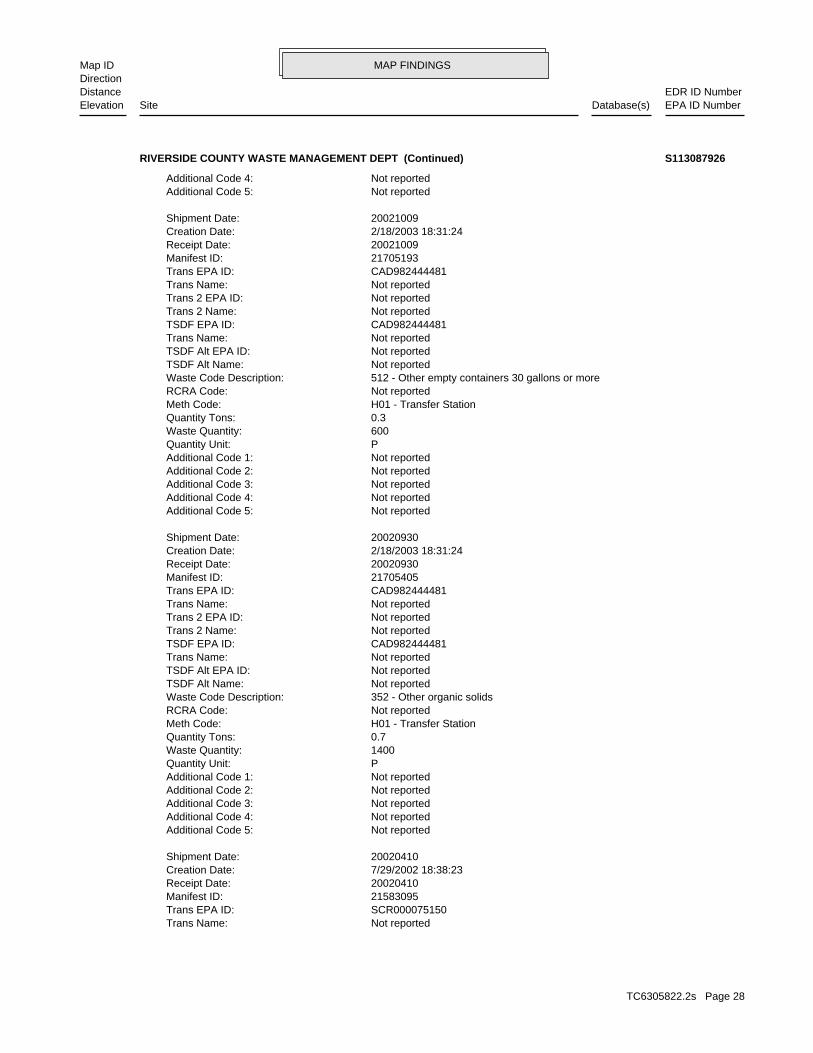
MAP FINDINGSMap IDDirection
EDR ID NumberDistanceEPA ID NumberDatabase(s)SiteElevation
Not reportedTrans Name: SCR000075150Trans EPA ID: 21583095Manifest ID: 20020410Receipt Date: 7/29/2002 18:38:23Creation Date: 20020410Shipment Date:
Not reportedAdditional Code 5: Not reportedAdditional Code 4: Not reportedAdditional Code 3: Not reportedAdditional Code 2: Not reportedAdditional Code 1: PQuantity Unit: 1400Waste Quantity: 0.7Quantity Tons: H01 - Transfer StationMeth Code: Not reportedRCRA Code: 352 - Other organic solidsWaste Code Description: Not reportedTSDF Alt Name: Not reportedTSDF Alt EPA ID: Not reportedTrans Name: CAD982444481TSDF EPA ID: Not reportedTrans 2 Name: Not reportedTrans 2 EPA ID: Not reportedTrans Name: CAD982444481Trans EPA ID: 21705405Manifest ID: 20020930Receipt Date: 2/18/2003 18:31:24Creation Date: 20020930Shipment Date:
Not reportedAdditional Code 5: Not reportedAdditional Code 4: Not reportedAdditional Code 3: Not reportedAdditional Code 2: Not reportedAdditional Code 1: PQuantity Unit: 600Waste Quantity: 0.3Quantity Tons: H01 - Transfer StationMeth Code: Not reportedRCRA Code: 512 - Other empty containers 30 gallons or moreWaste Code Description: Not reportedTSDF Alt Name: Not reportedTSDF Alt EPA ID: Not reportedTrans Name: CAD982444481TSDF EPA ID: Not reportedTrans 2 Name: Not reportedTrans 2 EPA ID: Not reportedTrans Name: CAD982444481Trans EPA ID: 21705193Manifest ID: 20021009Receipt Date: 2/18/2003 18:31:24Creation Date: 20021009Shipment Date:
Not reportedAdditional Code 5: Not reportedAdditional Code 4:
RIVERSIDE COUNTY WASTE MANAGEMENT DEPT (Continued) S113087926
TC6305822.2s Page 28
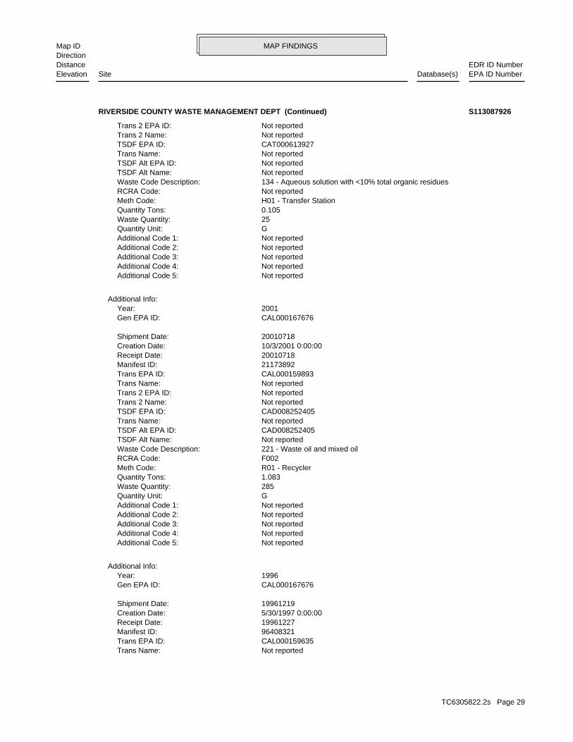
MAP FINDINGSMap IDDirection
EDR ID NumberDistanceEPA ID NumberDatabase(s)SiteElevation
Not reportedTrans Name: CAL000159635Trans EPA ID: 96408321Manifest ID: 19961227Receipt Date: 5/30/1997 0:00:00Creation Date: 19961219Shipment Date:
CAL000167676Gen EPA ID: 1996Year:
Additional Info:
Not reportedAdditional Code 5: Not reportedAdditional Code 4: Not reportedAdditional Code 3: Not reportedAdditional Code 2: Not reportedAdditional Code 1: GQuantity Unit: 285Waste Quantity: 1.083Quantity Tons: R01 - RecyclerMeth Code: F002RCRA Code: 221 - Waste oil and mixed oilWaste Code Description: Not reportedTSDF Alt Name: CAD008252405TSDF Alt EPA ID: Not reportedTrans Name: CAD008252405TSDF EPA ID: Not reportedTrans 2 Name: Not reportedTrans 2 EPA ID: Not reportedTrans Name: CAL000159893Trans EPA ID: 21173892Manifest ID: 20010718Receipt Date: 10/3/2001 0:00:00Creation Date: 20010718Shipment Date:
CAL000167676Gen EPA ID: 2001Year:
Additional Info:
Not reportedAdditional Code 5: Not reportedAdditional Code 4: Not reportedAdditional Code 3: Not reportedAdditional Code 2: Not reportedAdditional Code 1: GQuantity Unit: 25Waste Quantity: 0.105Quantity Tons: H01 - Transfer StationMeth Code: Not reportedRCRA Code: 134 - Aqueous solution with <10% total organic residuesWaste Code Description: Not reportedTSDF Alt Name: Not reportedTSDF Alt EPA ID: Not reportedTrans Name: CAT000613927TSDF EPA ID: Not reportedTrans 2 Name: Not reportedTrans 2 EPA ID:
RIVERSIDE COUNTY WASTE MANAGEMENT DEPT (Continued) S113087926
TC6305822.2s Page 29
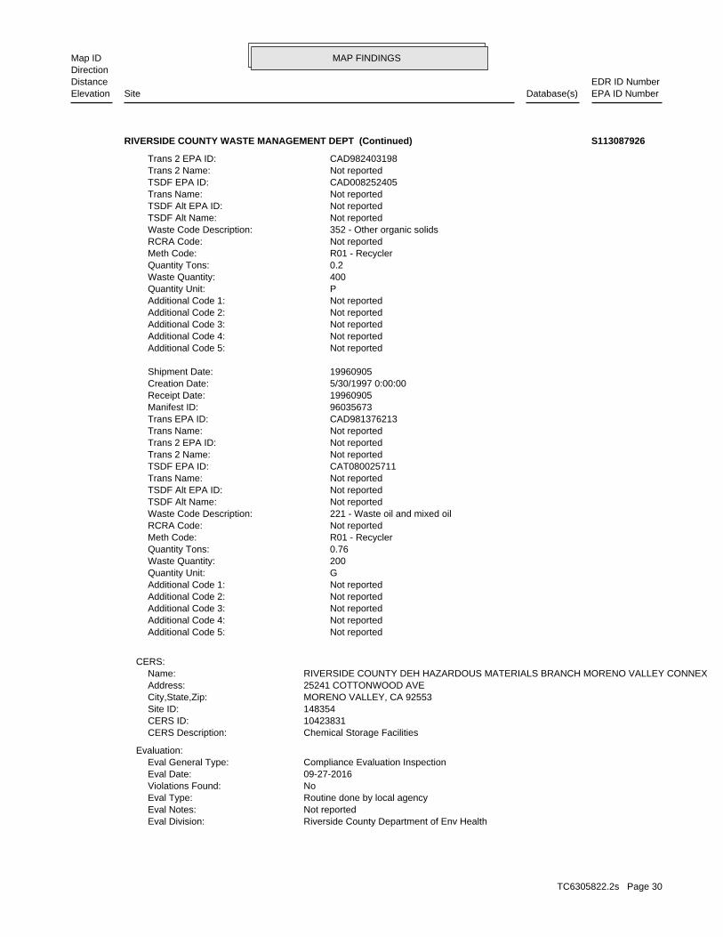
MAP FINDINGSMap IDDirection
EDR ID NumberDistanceEPA ID NumberDatabase(s)SiteElevation
Riverside County Department of Env HealthEval Division: Not reportedEval Notes: Routine done by local agencyEval Type: NoViolations Found: 09-27-2016Eval Date: Compliance Evaluation InspectionEval General Type:
Evaluation:
Chemical Storage FacilitiesCERS Description: 10423831CERS ID: 148354Site ID: MORENO VALLEY, CA 92553City,State,Zip: 25241 COTTONWOOD AVEAddress: RIVERSIDE COUNTY DEH HAZARDOUS MATERIALS BRANCH MORENO VALLEY CONNEXName:
CERS:
Not reportedAdditional Code 5: Not reportedAdditional Code 4: Not reportedAdditional Code 3: Not reportedAdditional Code 2: Not reportedAdditional Code 1: GQuantity Unit: 200Waste Quantity: 0.76Quantity Tons: R01 - RecyclerMeth Code: Not reportedRCRA Code: 221 - Waste oil and mixed oilWaste Code Description: Not reportedTSDF Alt Name: Not reportedTSDF Alt EPA ID: Not reportedTrans Name: CAT080025711TSDF EPA ID: Not reportedTrans 2 Name: Not reportedTrans 2 EPA ID: Not reportedTrans Name: CAD981376213Trans EPA ID: 96035673Manifest ID: 19960905Receipt Date: 5/30/1997 0:00:00Creation Date: 19960905Shipment Date:
Not reportedAdditional Code 5: Not reportedAdditional Code 4: Not reportedAdditional Code 3: Not reportedAdditional Code 2: Not reportedAdditional Code 1: PQuantity Unit: 400Waste Quantity: 0.2Quantity Tons: R01 - RecyclerMeth Code: Not reportedRCRA Code: 352 - Other organic solidsWaste Code Description: Not reportedTSDF Alt Name: Not reportedTSDF Alt EPA ID: Not reportedTrans Name: CAD008252405TSDF EPA ID: Not reportedTrans 2 Name: CAD982403198Trans 2 EPA ID:
RIVERSIDE COUNTY WASTE MANAGEMENT DEPT (Continued) S113087926
TC6305822.2s Page 30
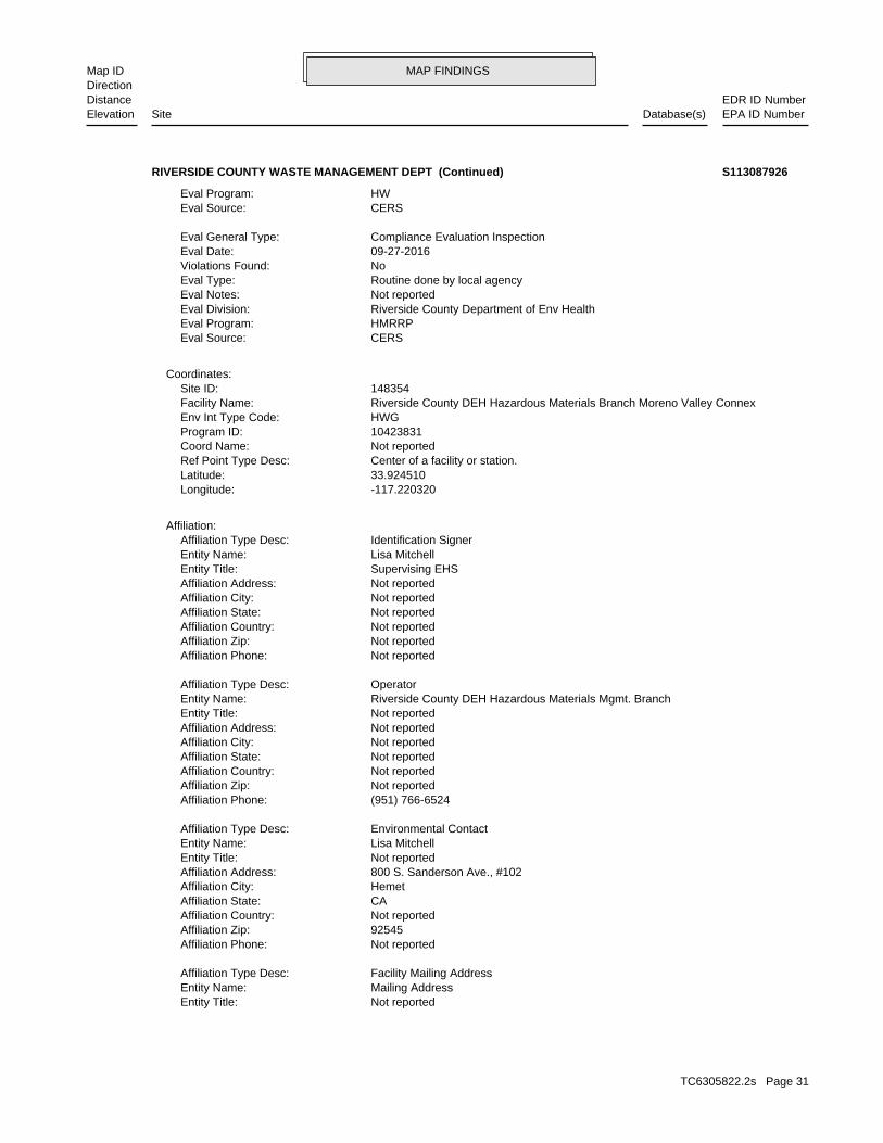
MAP FINDINGSMap IDDirection
EDR ID NumberDistanceEPA ID NumberDatabase(s)SiteElevation
Not reportedEntity Title: Mailing AddressEntity Name: Facility Mailing AddressAffiliation Type Desc:
Not reportedAffiliation Phone: 92545Affiliation Zip: Not reportedAffiliation Country: CAAffiliation State: HemetAffiliation City: 800 S. Sanderson Ave., #102Affiliation Address: Not reportedEntity Title: Lisa MitchellEntity Name: Environmental ContactAffiliation Type Desc:
(951) 766-6524Affiliation Phone: Not reportedAffiliation Zip: Not reportedAffiliation Country: Not reportedAffiliation State: Not reportedAffiliation City: Not reportedAffiliation Address: Not reportedEntity Title: Riverside County DEH Hazardous Materials Mgmt. BranchEntity Name: OperatorAffiliation Type Desc:
Not reportedAffiliation Phone: Not reportedAffiliation Zip: Not reportedAffiliation Country: Not reportedAffiliation State: Not reportedAffiliation City: Not reportedAffiliation Address: Supervising EHSEntity Title: Lisa MitchellEntity Name: Identification SignerAffiliation Type Desc:
Affiliation:
-117.220320Longitude: 33.924510Latitude: Center of a facility or station.Ref Point Type Desc: Not reportedCoord Name: 10423831Program ID: HWGEnv Int Type Code: Riverside County DEH Hazardous Materials Branch Moreno Valley ConnexFacility Name: 148354Site ID:
Coordinates:
CERSEval Source: HMRRPEval Program: Riverside County Department of Env HealthEval Division: Not reportedEval Notes: Routine done by local agencyEval Type: NoViolations Found: 09-27-2016Eval Date: Compliance Evaluation InspectionEval General Type:
CERSEval Source: HWEval Program:
RIVERSIDE COUNTY WASTE MANAGEMENT DEPT (Continued) S113087926
TC6305822.2s Page 31
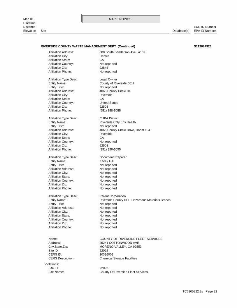
MAP FINDINGSMap IDDirection
EDR ID NumberDistanceEPA ID NumberDatabase(s)SiteElevation
County Of Riverside Fleet ServicesSite Name: 22092Site ID:
Violations:
Chemical Storage FacilitiesCERS Description: 10316008CERS ID: 22092Site ID: MORENO VALLEY, CA 92553City,State,Zip: 25241 COTTONWOOD AVEAddress: COUNTY OF RIVERSIDE FLEET SERVICESName:
Not reportedAffiliation Phone: Not reportedAffiliation Zip: Not reportedAffiliation Country: Not reportedAffiliation State: Not reportedAffiliation City: Not reportedAffiliation Address: Not reportedEntity Title: Riverside County DEH Hazardous Materials BranchEntity Name: Parent CorporationAffiliation Type Desc:
Not reportedAffiliation Phone: Not reportedAffiliation Zip: Not reportedAffiliation Country: Not reportedAffiliation State: Not reportedAffiliation City: Not reportedAffiliation Address: Not reportedEntity Title: Kacey GillEntity Name: Document PreparerAffiliation Type Desc:
(951) 358-5055Affiliation Phone: 92503Affiliation Zip: Not reportedAffiliation Country: CAAffiliation State: RiversideAffiliation City: 4065 County Circle Drive, Room 104Affiliation Address: Not reportedEntity Title: Riverside Cnty Env HealthEntity Name: CUPA DistrictAffiliation Type Desc:
(951) 358-5055Affiliation Phone: 92503Affiliation Zip: United StatesAffiliation Country: CAAffiliation State: RiversideAffiliation City: 4065 County Circle Dr.Affiliation Address: Not reportedEntity Title: County of Riverside DEHEntity Name: Legal OwnerAffiliation Type Desc:
Not reportedAffiliation Phone: 92545Affiliation Zip: Not reportedAffiliation Country: CAAffiliation State: HemetAffiliation City: 800 South Sanderson Ave., #102Affiliation Address:
RIVERSIDE COUNTY WASTE MANAGEMENT DEPT (Continued) S113087926
TC6305822.2s Page 32
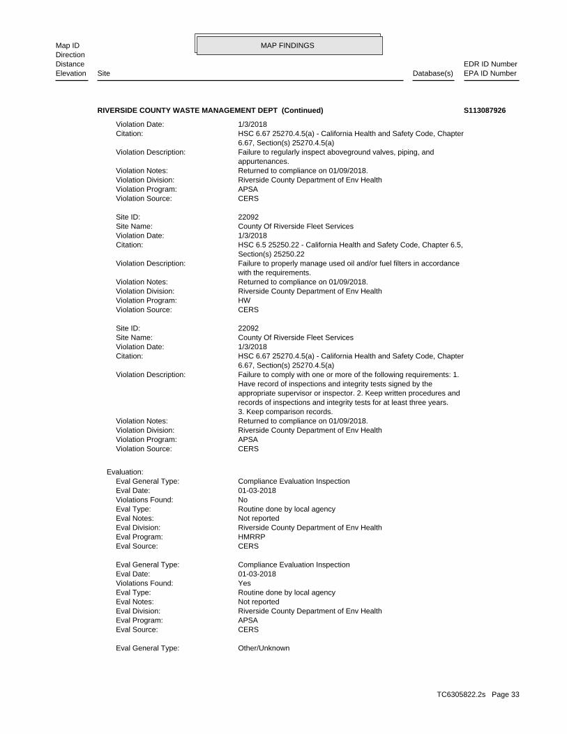
MAP FINDINGSMap IDDirection
EDR ID NumberDistanceEPA ID NumberDatabase(s)SiteElevation
Other/UnknownEval General Type:
CERSEval Source: APSAEval Program: Riverside County Department of Env HealthEval Division: Not reportedEval Notes: Routine done by local agencyEval Type: YesViolations Found: 01-03-2018Eval Date: Compliance Evaluation InspectionEval General Type:
CERSEval Source: HMRRPEval Program: Riverside County Department of Env HealthEval Division: Not reportedEval Notes: Routine done by local agencyEval Type: NoViolations Found: 01-03-2018Eval Date: Compliance Evaluation InspectionEval General Type:
Evaluation:
CERSViolation Source: APSAViolation Program: Riverside County Department of Env HealthViolation Division: Returned to compliance on 01/09/2018.Violation Notes: 3. Keep comparison records. records of inspections and integrity tests for at least three years. appropriate supervisor or inspector. 2. Keep written procedures and Have record of inspections and integrity tests signed by the Failure to comply with one or more of the following requirements: 1.Violation Description: 6.67, Section(s) 25270.4.5(a) HSC 6.67 25270.4.5(a) - California Health and Safety Code, ChapterCitation: 1/3/2018Violation Date: County Of Riverside Fleet ServicesSite Name: 22092Site ID:
CERSViolation Source: HWViolation Program: Riverside County Department of Env HealthViolation Division: Returned to compliance on 01/09/2018.Violation Notes: with the requirements. Failure to properly manage used oil and/or fuel filters in accordanceViolation Description: Section(s) 25250.22 HSC 6.5 25250.22 - California Health and Safety Code, Chapter 6.5,Citation: 1/3/2018Violation Date: County Of Riverside Fleet ServicesSite Name: 22092Site ID:
CERSViolation Source: APSAViolation Program: Riverside County Department of Env HealthViolation Division: Returned to compliance on 01/09/2018.Violation Notes: appurtenances. Failure to regularly inspect aboveground valves, piping, andViolation Description: 6.67, Section(s) 25270.4.5(a) HSC 6.67 25270.4.5(a) - California Health and Safety Code, ChapterCitation: 1/3/2018Violation Date:
RIVERSIDE COUNTY WASTE MANAGEMENT DEPT (Continued) S113087926
TC6305822.2s Page 33
MAP FINDINGSMap IDDirection
EDR ID NumberDistanceEPA ID NumberDatabase(s)SiteElevation
HWGEnv Int Type Code: County Of Riverside Fleet ServicesFacility Name: 22092Site ID:
Coordinates:
CERSEval Source: HWEval Program: Riverside County Department of Env HealthEval Division: Not reportedEval Notes: Routine done by local agencyEval Type: NoViolations Found: 09-11-2014Eval Date: Compliance Evaluation InspectionEval General Type:
CERSEval Source: HWEval Program: Riverside County Department of Env HealthEval Division: Not reportedEval Notes: Other, not routine, done by local agencyEval Type: NoViolations Found: 01-09-2018Eval Date: Other/UnknownEval General Type:
CERSEval Source: HWEval Program: Riverside County Department of Env HealthEval Division: Not reportedEval Notes: Routine done by local agencyEval Type: YesViolations Found: 01-03-2018Eval Date: Compliance Evaluation InspectionEval General Type:
CERSEval Source: HMRRPEval Program: Riverside County Department of Env HealthEval Division: Not reportedEval Notes: Routine done by local agencyEval Type: NoViolations Found: 09-11-2014Eval Date: Compliance Evaluation InspectionEval General Type:
CERSEval Source: APSAEval Program: Riverside County Department of Env HealthEval Division: Not reportedEval Notes: Routine done by local agencyEval Type: NoViolations Found: 08-08-2013Eval Date: Compliance Evaluation InspectionEval General Type:
CERSEval Source: APSAEval Program: Riverside County Department of Env HealthEval Division: Not reportedEval Notes: Other, not routine, done by local agencyEval Type: NoViolations Found: 01-09-2018Eval Date:
RIVERSIDE COUNTY WASTE MANAGEMENT DEPT (Continued) S113087926
TC6305822.2s Page 34
MAP FINDINGSMap IDDirection
EDR ID NumberDistanceEPA ID NumberDatabase(s)SiteElevation
(951) 413-2782Affiliation Phone: Not reportedAffiliation Zip: Not reportedAffiliation Country: Not reportedAffiliation State: Not reportedAffiliation City: Not reportedAffiliation Address: Not reportedEntity Title: Jason LawsonEntity Name: OperatorAffiliation Type Desc:
Not reportedAffiliation Phone: 92501Affiliation Zip: Not reportedAffiliation Country: CAAffiliation State: RiversideAffiliation City: 4293 Orange St.Affiliation Address: Not reportedEntity Title: Alex BoyajianEntity Name: Environmental ContactAffiliation Type Desc:
Not reportedAffiliation Phone: Not reportedAffiliation Zip: Not reportedAffiliation Country: Not reportedAffiliation State: Not reportedAffiliation City: Not reportedAffiliation Address: Not reportedEntity Title: County of Riverside Fleet ServicesEntity Name: Parent CorporationAffiliation Type Desc:
(951) 955-4650Affiliation Phone: 92501Affiliation Zip: United StatesAffiliation Country: CAAffiliation State: RiversideAffiliation City: 4293 Orange St.Affiliation Address: Not reportedEntity Title: County of RiversideEntity Name: Legal OwnerAffiliation Type Desc:
Not reportedAffiliation Phone: Not reportedAffiliation Zip: Not reportedAffiliation Country: Not reportedAffiliation State: Not reportedAffiliation City: Not reportedAffiliation Address: Not reportedEntity Title: Alex BoyajianEntity Name: Document PreparerAffiliation Type Desc:
Affiliation:
-117.220320Longitude: 33.924510Latitude: Center of a facility or station.Ref Point Type Desc: Not reportedCoord Name: 10316008Program ID:
RIVERSIDE COUNTY WASTE MANAGEMENT DEPT (Continued) S113087926
TC6305822.2s Page 35
MAP FINDINGSMap IDDirection
EDR ID NumberDistanceEPA ID NumberDatabase(s)SiteElevation
Not reportedOwner Address 2: 14310 FREDERICKOwner Address: RIVERSIDE COUNTY WASTE MGMTOwner Name: MORENO VALLEY, CA 92553Mailing City,State,Zip: Not reportedMailing Address 2: 14310 FREDRICK STMailing Address: MICHAEL HARRISONMailing Name: 10/22/2003Last Act Date: 06/21/1995Create Date: 11/18/2002Inactive Date: CAL000167676EPA ID: MORENO VALLEY, CA 925530000City,State,Zip: Not reportedAddress 2: 25241 COTTONWOOD AVEAddress: RIVERSIDE COUNTY WASTE MANAGEMENT DEPTName:
HWTS:
(951) 955-4650Affiliation Phone: 92501Affiliation Zip: United StatesAffiliation Country: CAAffiliation State: riversideAffiliation City: 4293 Orange St.Affiliation Address: Not reportedEntity Title: County of RiversideEntity Name: Property OwnerAffiliation Type Desc:
Not reportedAffiliation Phone: Not reportedAffiliation Zip: Not reportedAffiliation Country: Not reportedAffiliation State: Not reportedAffiliation City: Not reportedAffiliation Address: Fleet Operations ManagerEntity Title: Alex BoyajianEntity Name: Identification SignerAffiliation Type Desc:
Not reportedAffiliation Phone: 925p1Affiliation Zip: Not reportedAffiliation Country: CAAffiliation State: RiversideAffiliation City: 4293 Orange St.Affiliation Address: Not reportedEntity Title: Mailing AddressEntity Name: Facility Mailing AddressAffiliation Type Desc:
(951) 358-5055Affiliation Phone: 92503Affiliation Zip: Not reportedAffiliation Country: CAAffiliation State: RiversideAffiliation City: 4065 County Circle Drive, Room 104Affiliation Address: Not reportedEntity Title: Riverside Cnty Env HealthEntity Name: CUPA DistrictAffiliation Type Desc:
RIVERSIDE COUNTY WASTE MANAGEMENT DEPT (Continued) S113087926
TC6305822.2s Page 36
MAP FINDINGSMap IDDirection
EDR ID NumberDistanceEPA ID NumberDatabase(s)SiteElevation
925530000Facility Zip: CAFacility State: Not reportedFacility County: MORENO VALLEYFacility City: Not reportedFacility Address 2: 25241 COTTONWOOD AVEFacility Address: RIVERSIDE COUNTY WASTE MANAGEMENT DEPTFacility Name: 2002-11-18 00:00:00Inactive Date: 1995-06-21 00:00:00Issued EPA ID Date: Other General Government SupportNAICS Description: 92119NAICS Code: 2003-10-23 15:27:19.000Create Date: CAL000167676EPA ID:
925530000Facility Zip: CAFacility State: Not reportedFacility County: MORENO VALLEYFacility City: Not reportedFacility Address 2: 25241 COTTONWOOD AVEFacility Address: RIVERSIDE COUNTY WASTE MANAGEMENT DEPTFacility Name: 2002-11-18 00:00:00Inactive Date: 1995-06-21 00:00:00Issued EPA ID Date: Waste Treatment and DisposalNAICS Description: 5622NAICS Code: 2002-03-14 16:36:28.000Create Date: CAL000167676EPA ID:
NAICS:
MORENO VALLEY, CA 925530000City,State,Zip: Not reportedContact Address 2: 14310 FREDERICKContact Address: M HICKMAN/PROGRAM COORDINATORContact Name: MORENO VALLEY, CA 925530000Owner City,State,Zip:
RIVERSIDE COUNTY WASTE MANAGEMENT DEPT (Continued) S113087926
479.1000061UTM East: VAPOR RECOVERY UNIT COMPRESS & CONDENSECCAT Description: 04CCAT Number: DRY CLEANING EQUIP PERCHLOROETHYLENEBCAT Description: 000234BCAT Number: INACT_NRPermit Status: 714 2477181Representative Telephone: STEVEN MATEORepresentative Name: OStatus: D36972Permit Number: 243792Application Number: 83708Facility ID: MORENO VALLEY, CA 92553City,State,Zip: 13373 PERRIS BLVD # E-406Address: DRYCLEAN WEST INCName:
DRYCLEAN SOUTH COAST:
692 ft.0.131 mi.
Relative:Higher
Actual:1594 ft.
1/8-1/4 MORENO VALLEY, CA 92553WNW 13373 PERRIS BLVD # E-406 N/A9 DRYCLEANERSDRYCLEAN WEST INC S121699855
TC6305822.2s Page 37
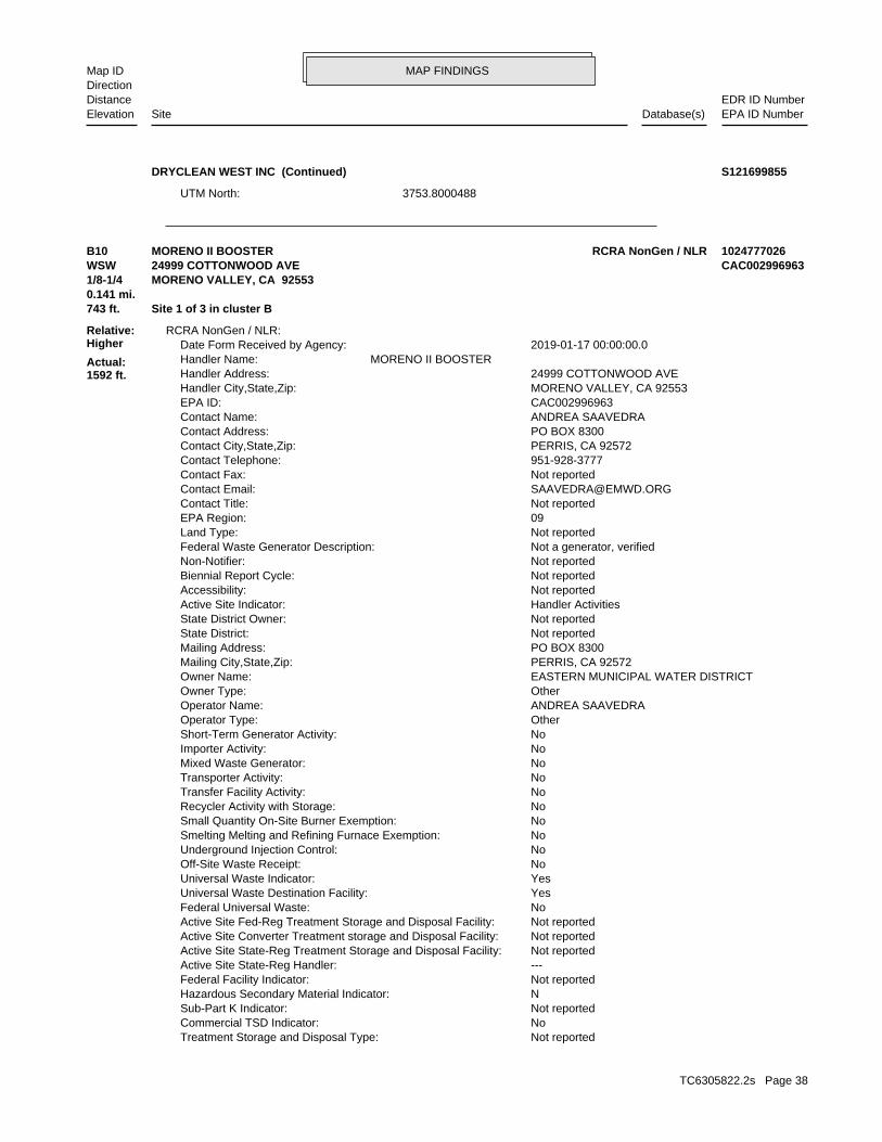
MAP FINDINGSMap IDDirection
EDR ID NumberDistanceEPA ID NumberDatabase(s)SiteElevation
3753.8000488UTM North:
DRYCLEAN WEST INC (Continued) S121699855
Not reportedTreatment Storage and Disposal Type: NoCommercial TSD Indicator: Not reportedSub-Part K Indicator: NHazardous Secondary Material Indicator: Not reportedFederal Facility Indicator: ---Active Site State-Reg Handler: Not reportedActive Site State-Reg Treatment Storage and Disposal Facility: Not reportedActive Site Converter Treatment storage and Disposal Facility: Not reportedActive Site Fed-Reg Treatment Storage and Disposal Facility: NoFederal Universal Waste: YesUniversal Waste Destination Facility: YesUniversal Waste Indicator: NoOff-Site Waste Receipt: NoUnderground Injection Control: NoSmelting Melting and Refining Furnace Exemption: NoSmall Quantity On-Site Burner Exemption: NoRecycler Activity with Storage: NoTransfer Facility Activity: NoTransporter Activity: NoMixed Waste Generator: NoImporter Activity: NoShort-Term Generator Activity: OtherOperator Type: ANDREA SAAVEDRAOperator Name: OtherOwner Type: EASTERN MUNICIPAL WATER DISTRICTOwner Name: PERRIS, CA 92572Mailing City,State,Zip: PO BOX 8300Mailing Address: Not reportedState District: Not reportedState District Owner: Handler ActivitiesActive Site Indicator: Not reportedAccessibility: Not reportedBiennial Report Cycle: Not reportedNon-Notifier: Not a generator, verifiedFederal Waste Generator Description: Not reportedLand Type: 09EPA Region: Not reportedContact Title: [email protected] Email: Not reportedContact Fax: 951-928-3777Contact Telephone: PERRIS, CA 92572Contact City,State,Zip: PO BOX 8300Contact Address: ANDREA SAAVEDRAContact Name: CAC002996963EPA ID: MORENO VALLEY, CA 92553Handler City,State,Zip: 24999 COTTONWOOD AVEHandler Address: MORENO II BOOSTERHandler Name: 2019-01-17 00:00:00.0Date Form Received by Agency:
RCRA NonGen / NLR:
743 ft. Site 1 of 3 in cluster B0.141 mi.
Relative:Higher
Actual:1592 ft.
1/8-1/4 MORENO VALLEY, CA 92553WSW 24999 COTTONWOOD AVE CAC002996963B10 RCRA NonGen / NLRMORENO II BOOSTER 1024777026
TC6305822.2s Page 38

MAP FINDINGSMap IDDirection
EDR ID NumberDistanceEPA ID NumberDatabase(s)SiteElevation
Not reportedOwner/Operator Telephone Ext: 951-928-3777Owner/Operator Telephone: PERRIS, CA 92572Owner/Operator City,State,Zip: PO BOX 8300Owner/Operator Address: Not reportedDate Ended Current: Not reportedDate Became Current: OtherLegal Status: ANDREA SAAVEDRAOwner/Operator Name: OperatorOwner/Operator Indicator:
Not reportedOwner/Operator Email: Not reportedOwner/Operator Fax: Not reportedOwner/Operator Telephone Ext: 951-928-3777Owner/Operator Telephone: PERRIS, CA 92572Owner/Operator City,State,Zip: PO BOX 8300Owner/Operator Address: Not reportedDate Ended Current: Not reportedDate Became Current: OtherLegal Status: EASTERN MUNICIPAL WATER DISTRICTOwner/Operator Name: OwnerOwner/Operator Indicator:
Handler - Owner Operator:
NoSub-Part P Indicator: NoManifest Broker: NoRecycler Activity Without Storage: NoExporter of Spent Lead Acid Batteries: NoImporter of Spent Lead Acid Batteries: NoRecognized Trader-Exporter: NoRecognized Trader-Importer: 2019-02-22 19:40:09.0Handler Date of Last Change: Not reportedFinancial Assurance Required: NoSignificant Non-Complier With a Compliance Schedule Universe: NoAddressed Significant Non-Complier Universe: NoUnaddressed Significant Non-Complier Universe: NoSignificant Non-Complier Universe: Not reportedFull Enforcement Universe: Not reportedOperating TSDF Universe: N/AGroundwater Controls Indicator: N/AHuman Exposure Controls Indicator: NoInstitutional Control Indicator: NoEnvironmental Control Indicator: No NCAPS rankingCorrective Action Priority Ranking: NoTSDFs Only Subject to CA under Discretionary Auth Universe: NoTSDFs Potentially Subject to CA Under 3004 (u)/(v) Universe: NoNon-TSDFs Where RCRA CA has Been Imposed Universe: NoSubject to Corrective Action Universe: NoCorrective Action Workload Universe: No202 GPRA Corrective Action Baseline: Not reportedClosure Workload Universe: Not reportedPost-Closure Workload Universe: Not reportedPermit Progress Universe: Not reportedPermit Workload Universe: Not reportedPermit Renewals Workload Universe: Not on the Baseline2018 GPRA Renewals Baseline: Not on the Baseline2018 GPRA Permit Baseline:
MORENO II BOOSTER (Continued) 1024777026
TC6305822.2s Page 39
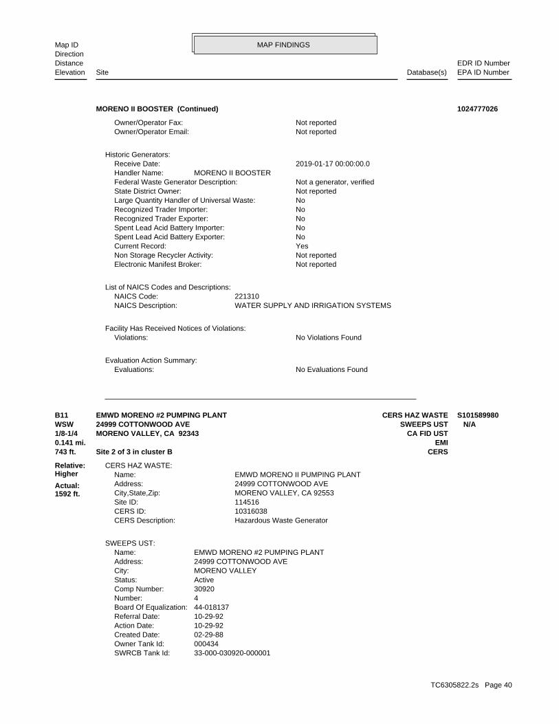
MAP FINDINGSMap IDDirection
EDR ID NumberDistanceEPA ID NumberDatabase(s)SiteElevation
No Evaluations FoundEvaluations:Evaluation Action Summary:
No Violations FoundViolations:Facility Has Received Notices of Violations:
WATER SUPPLY AND IRRIGATION SYSTEMSNAICS Description: 221310NAICS Code:
List of NAICS Codes and Descriptions:
Not reportedElectronic Manifest Broker: Not reportedNon Storage Recycler Activity: YesCurrent Record: NoSpent Lead Acid Battery Exporter: NoSpent Lead Acid Battery Importer: NoRecognized Trader Exporter: NoRecognized Trader Importer: NoLarge Quantity Handler of Universal Waste: Not reportedState District Owner: Not a generator, verifiedFederal Waste Generator Description: MORENO II BOOSTERHandler Name: 2019-01-17 00:00:00.0Receive Date:
Historic Generators:
Not reportedOwner/Operator Email: Not reportedOwner/Operator Fax:
MORENO II BOOSTER (Continued) 1024777026
33-000-030920-000001SWRCB Tank Id: 000434Owner Tank Id: 02-29-88Created Date: 10-29-92Action Date: 10-29-92Referral Date: 44-018137Board Of Equalization: 4Number: 30920Comp Number: ActiveStatus: MORENO VALLEYCity: 24999 COTTONWOOD AVEAddress: EMWD MORENO #2 PUMPING PLANTName:
SWEEPS UST:
Hazardous Waste GeneratorCERS Description: 10316038CERS ID: 114516Site ID: MORENO VALLEY, CA 92553City,State,Zip: 24999 COTTONWOOD AVEAddress: EMWD MORENO II PUMPING PLANTName:
CERS HAZ WASTE:
743 ft. CERSSite 2 of 3 in cluster B0.141 mi. EMI
Relative:Higher
Actual:1592 ft.
1/8-1/4 CA FID USTMORENO VALLEY, CA 92343WSW SWEEPS UST24999 COTTONWOOD AVE N/AB11 CERS HAZ WASTEEMWD MORENO #2 PUMPING PLANT S101589980
TC6305822.2s Page 40
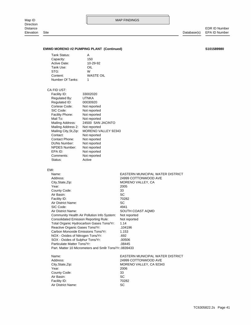
MAP FINDINGSMap IDDirection
EDR ID NumberDistanceEPA ID NumberDatabase(s)SiteElevation
SCAir District Name: 70282Facility ID: SCAir Basin: 33County Code: 2006Year: MORENO VALLEY, CA 92343City,State,Zip: 24999 COTTONWOOD AVEAddress: EASTERN MUNICIPAL WATER DISTRICTName:
.0839433Part. Matter 10 Micrometers and Smllr Tons/Yr: .08445Particulate Matter Tons/Yr: .00506SOX - Oxides of Sulphur Tons/Yr: .692NOX - Oxides of Nitrogen Tons/Yr: 1.153Carbon Monoxide Emissions Tons/Yr: .104196Reactive Organic Gases Tons/Yr: 1.14Total Organic Hydrocarbon Gases Tons/Yr: Not reportedConsolidated Emission Reporting Rule: Not reportedCommunity Health Air Pollution Info System: SOUTH COAST AQMDAir District Name: 4941SIC Code: SCAir District Name: 70282Facility ID: SCAir Basin: 33County Code: 2005Year: MORENO VALLEY, CACity,State,Zip: 24999 COTTONWOOD AVEAddress: EASTERN MUNICIPAL WATER DISTRICTName:
EMI:
ActiveStatus: Not reportedComments: Not reportedEPA ID: Not reportedNPDES Number: Not reportedDUNs Number: Not reportedContact Phone: Not reportedContact: MORENO VALLEY 92343Mailing City,St,Zip: Not reportedMailing Address 2: 24500 SAN JACINTOMailing Address: Not reportedMail To: Not reportedFacility Phone: Not reportedSIC Code: Not reportedCortese Code: 00030920Regulated ID: UTNKARegulated By: 33002020Facility ID:
CA FID UST:
1Number Of Tanks: WASTE OILContent: WSTG: OILTank Use: 10-29-92Active Date: 150Capacity: ATank Status:
EMWD MORENO #2 PUMPING PLANT (Continued) S101589980
TC6305822.2s Page 41
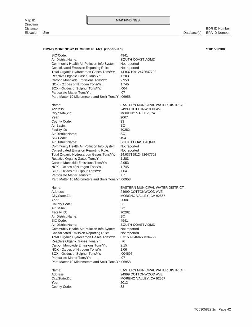
MAP FINDINGSMap IDDirection
EDR ID NumberDistanceEPA ID NumberDatabase(s)SiteElevation
33County Code: 2012Year: MORENO VALLEY, CA 92557City,State,Zip: 24999 COTTONWOOD AVEAddress: EASTERN MUNICIPAL WATER DISTRICTName:
.06958Part. Matter 10 Micrometers and Smllr Tons/Yr: .07Particulate Matter Tons/Yr: .004695SOX - Oxides of Sulphur Tons/Yr: 1.06NOX - Oxides of Nitrogen Tons/Yr: 2.15Carbon Monoxide Emissions Tons/Yr: .76Reactive Organic Gases Tons/Yr: 8.315098468271334792Total Organic Hydrocarbon Gases Tons/Yr: Not reportedConsolidated Emission Reporting Rule: Not reportedCommunity Health Air Pollution Info System: SOUTH COAST AQMDAir District Name: 4941SIC Code: SCAir District Name: 70282Facility ID: SCAir Basin: 33County Code: 2008Year: MORENO VALLEY, CA 92557City,State,Zip: 24999 COTTONWOOD AVEAddress: EASTERN MUNICIPAL WATER DISTRICTName:
.06958Part. Matter 10 Micrometers and Smllr Tons/Yr: .07Particulate Matter Tons/Yr: .004SOX - Oxides of Sulphur Tons/Yr: 1.745NOX - Oxides of Nitrogen Tons/Yr: 2.953Carbon Monoxide Emissions Tons/Yr: 1.283Reactive Organic Gases Tons/Yr: 14.03719912472647702Total Organic Hydrocarbon Gases Tons/Yr: Not reportedConsolidated Emission Reporting Rule: Not reportedCommunity Health Air Pollution Info System: SOUTH COAST AQMDAir District Name: 4941SIC Code: SCAir District Name: 70282Facility ID: SCAir Basin: 33County Code: 2007Year: MORENO VALLEY, CACity,State,Zip: 24999 COTTONWOOD AVEAddress: EASTERN MUNICIPAL WATER DISTRICTName:
.06958Part. Matter 10 Micrometers and Smllr Tons/Yr: .07Particulate Matter Tons/Yr: .004SOX - Oxides of Sulphur Tons/Yr: 1.745NOX - Oxides of Nitrogen Tons/Yr: 2.953Carbon Monoxide Emissions Tons/Yr: 1.283Reactive Organic Gases Tons/Yr: 14.03719912472647702Total Organic Hydrocarbon Gases Tons/Yr: Not reportedConsolidated Emission Reporting Rule: Not reportedCommunity Health Air Pollution Info System: SOUTH COAST AQMDAir District Name: 4941SIC Code:
EMWD MORENO #2 PUMPING PLANT (Continued) S101589980
TC6305822.2s Page 42
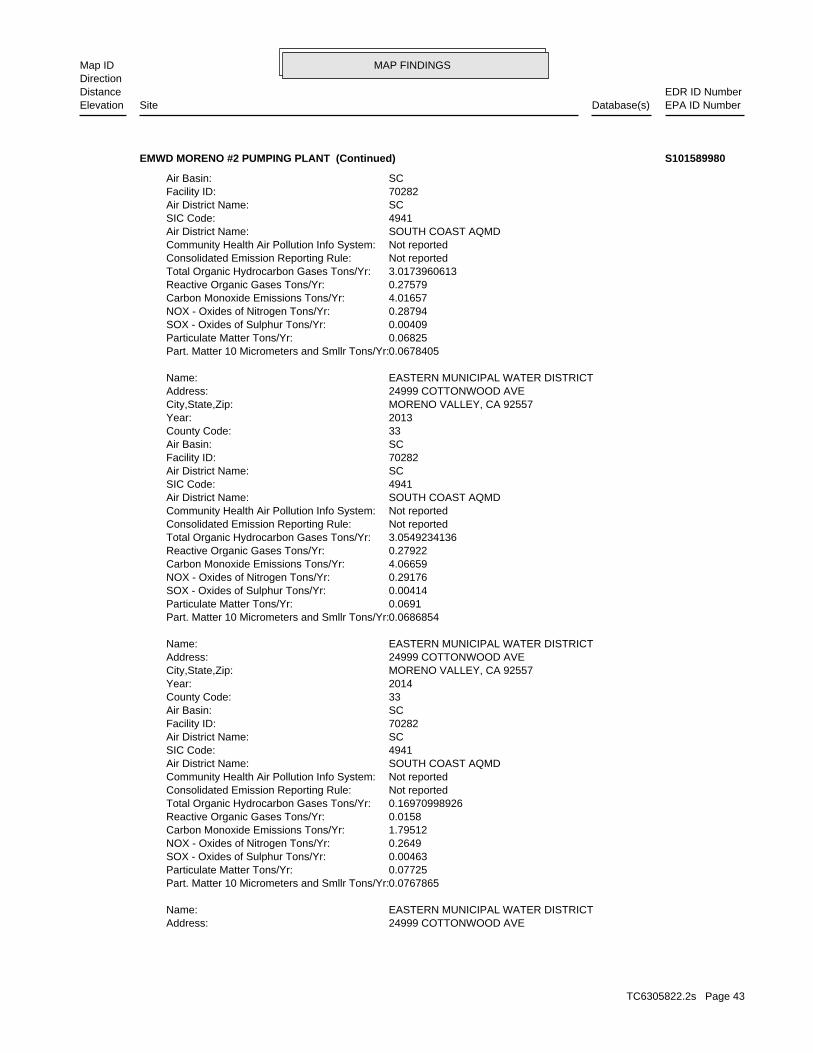
MAP FINDINGSMap IDDirection
EDR ID NumberDistanceEPA ID NumberDatabase(s)SiteElevation
24999 COTTONWOOD AVEAddress: EASTERN MUNICIPAL WATER DISTRICTName:
0.0767865Part. Matter 10 Micrometers and Smllr Tons/Yr: 0.07725Particulate Matter Tons/Yr: 0.00463SOX - Oxides of Sulphur Tons/Yr: 0.2649NOX - Oxides of Nitrogen Tons/Yr: 1.79512Carbon Monoxide Emissions Tons/Yr: 0.0158Reactive Organic Gases Tons/Yr: 0.16970998926Total Organic Hydrocarbon Gases Tons/Yr: Not reportedConsolidated Emission Reporting Rule: Not reportedCommunity Health Air Pollution Info System: SOUTH COAST AQMDAir District Name: 4941SIC Code: SCAir District Name: 70282Facility ID: SCAir Basin: 33County Code: 2014Year: MORENO VALLEY, CA 92557City,State,Zip: 24999 COTTONWOOD AVEAddress: EASTERN MUNICIPAL WATER DISTRICTName:
0.0686854Part. Matter 10 Micrometers and Smllr Tons/Yr: 0.0691Particulate Matter Tons/Yr: 0.00414SOX - Oxides of Sulphur Tons/Yr: 0.29176NOX - Oxides of Nitrogen Tons/Yr: 4.06659Carbon Monoxide Emissions Tons/Yr: 0.27922Reactive Organic Gases Tons/Yr: 3.0549234136Total Organic Hydrocarbon Gases Tons/Yr: Not reportedConsolidated Emission Reporting Rule: Not reportedCommunity Health Air Pollution Info System: SOUTH COAST AQMDAir District Name: 4941SIC Code: SCAir District Name: 70282Facility ID: SCAir Basin: 33County Code: 2013Year: MORENO VALLEY, CA 92557City,State,Zip: 24999 COTTONWOOD AVEAddress: EASTERN MUNICIPAL WATER DISTRICTName:
0.0678405Part. Matter 10 Micrometers and Smllr Tons/Yr: 0.06825Particulate Matter Tons/Yr: 0.00409SOX - Oxides of Sulphur Tons/Yr: 0.28794NOX - Oxides of Nitrogen Tons/Yr: 4.01657Carbon Monoxide Emissions Tons/Yr: 0.27579Reactive Organic Gases Tons/Yr: 3.0173960613Total Organic Hydrocarbon Gases Tons/Yr: Not reportedConsolidated Emission Reporting Rule: Not reportedCommunity Health Air Pollution Info System: SOUTH COAST AQMDAir District Name: 4941SIC Code: SCAir District Name: 70282Facility ID: SCAir Basin:
EMWD MORENO #2 PUMPING PLANT (Continued) S101589980
TC6305822.2s Page 43
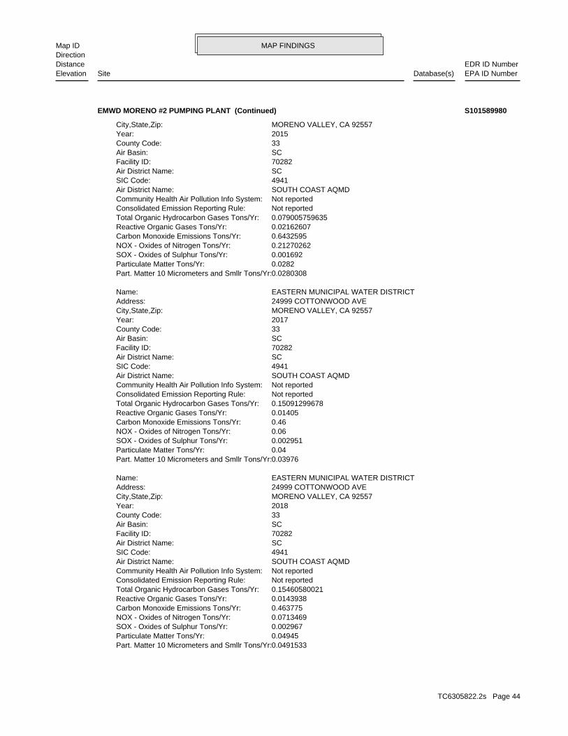
MAP FINDINGSMap IDDirection
EDR ID NumberDistanceEPA ID NumberDatabase(s)SiteElevation
0.0491533Part. Matter 10 Micrometers and Smllr Tons/Yr: 0.04945Particulate Matter Tons/Yr: 0.002967SOX - Oxides of Sulphur Tons/Yr: 0.0713469NOX - Oxides of Nitrogen Tons/Yr: 0.463775Carbon Monoxide Emissions Tons/Yr: 0.0143938Reactive Organic Gases Tons/Yr: 0.15460580021Total Organic Hydrocarbon Gases Tons/Yr: Not reportedConsolidated Emission Reporting Rule: Not reportedCommunity Health Air Pollution Info System: SOUTH COAST AQMDAir District Name: 4941SIC Code: SCAir District Name: 70282Facility ID: SCAir Basin: 33County Code: 2018Year: MORENO VALLEY, CA 92557City,State,Zip: 24999 COTTONWOOD AVEAddress: EASTERN MUNICIPAL WATER DISTRICTName:
0.03976Part. Matter 10 Micrometers and Smllr Tons/Yr: 0.04Particulate Matter Tons/Yr: 0.002951SOX - Oxides of Sulphur Tons/Yr: 0.06NOX - Oxides of Nitrogen Tons/Yr: 0.46Carbon Monoxide Emissions Tons/Yr: 0.01405Reactive Organic Gases Tons/Yr: 0.15091299678Total Organic Hydrocarbon Gases Tons/Yr: Not reportedConsolidated Emission Reporting Rule: Not reportedCommunity Health Air Pollution Info System: SOUTH COAST AQMDAir District Name: 4941SIC Code: SCAir District Name: 70282Facility ID: SCAir Basin: 33County Code: 2017Year: MORENO VALLEY, CA 92557City,State,Zip: 24999 COTTONWOOD AVEAddress: EASTERN MUNICIPAL WATER DISTRICTName:
0.0280308Part. Matter 10 Micrometers and Smllr Tons/Yr: 0.0282Particulate Matter Tons/Yr: 0.001692SOX - Oxides of Sulphur Tons/Yr: 0.21270262NOX - Oxides of Nitrogen Tons/Yr: 0.6432595Carbon Monoxide Emissions Tons/Yr: 0.02162607Reactive Organic Gases Tons/Yr: 0.079005759635Total Organic Hydrocarbon Gases Tons/Yr: Not reportedConsolidated Emission Reporting Rule: Not reportedCommunity Health Air Pollution Info System: SOUTH COAST AQMDAir District Name: 4941SIC Code: SCAir District Name: 70282Facility ID: SCAir Basin: 33County Code: 2015Year: MORENO VALLEY, CA 92557City,State,Zip:
EMWD MORENO #2 PUMPING PLANT (Continued) S101589980
TC6305822.2s Page 44
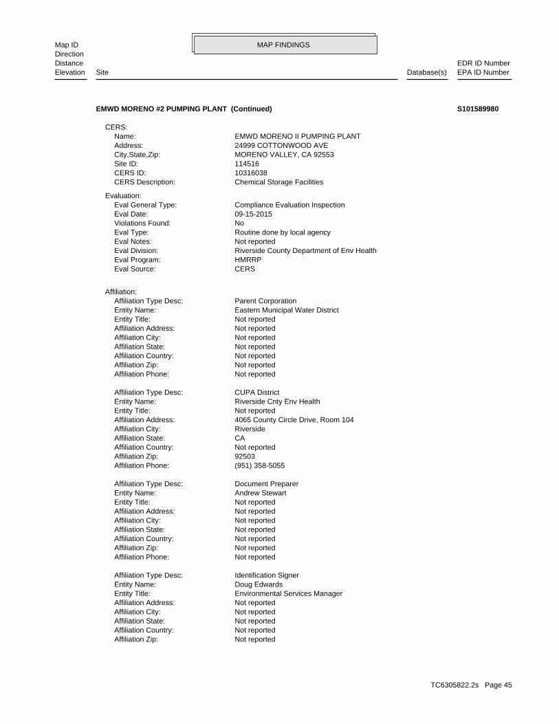
MAP FINDINGSMap IDDirection
EDR ID NumberDistanceEPA ID NumberDatabase(s)SiteElevation
Not reportedAffiliation Zip: Not reportedAffiliation Country: Not reportedAffiliation State: Not reportedAffiliation City: Not reportedAffiliation Address: Environmental Services ManagerEntity Title: Doug EdwardsEntity Name: Identification SignerAffiliation Type Desc:
Not reportedAffiliation Phone: Not reportedAffiliation Zip: Not reportedAffiliation Country: Not reportedAffiliation State: Not reportedAffiliation City: Not reportedAffiliation Address: Not reportedEntity Title: Andrew StewartEntity Name: Document PreparerAffiliation Type Desc:
(951) 358-5055Affiliation Phone: 92503Affiliation Zip: Not reportedAffiliation Country: CAAffiliation State: RiversideAffiliation City: 4065 County Circle Drive, Room 104Affiliation Address: Not reportedEntity Title: Riverside Cnty Env HealthEntity Name: CUPA DistrictAffiliation Type Desc:
Not reportedAffiliation Phone: Not reportedAffiliation Zip: Not reportedAffiliation Country: Not reportedAffiliation State: Not reportedAffiliation City: Not reportedAffiliation Address: Not reportedEntity Title: Eastern Municipal Water DistrictEntity Name: Parent CorporationAffiliation Type Desc:
Affiliation:
CERSEval Source: HMRRPEval Program: Riverside County Department of Env HealthEval Division: Not reportedEval Notes: Routine done by local agencyEval Type: NoViolations Found: 09-15-2015Eval Date: Compliance Evaluation InspectionEval General Type:
Evaluation:
Chemical Storage FacilitiesCERS Description: 10316038CERS ID: 114516Site ID: MORENO VALLEY, CA 92553City,State,Zip: 24999 COTTONWOOD AVEAddress: EMWD MORENO II PUMPING PLANTName:
CERS:
EMWD MORENO #2 PUMPING PLANT (Continued) S101589980
TC6305822.2s Page 45
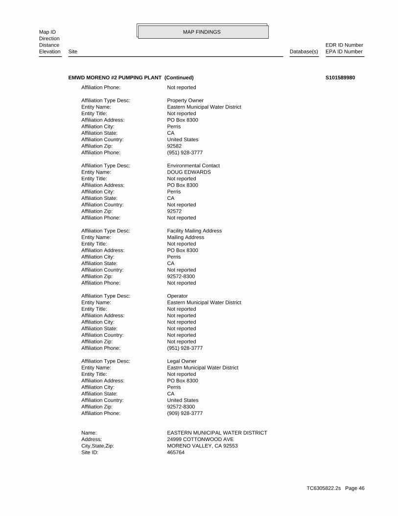
MAP FINDINGSMap IDDirection
EDR ID NumberDistanceEPA ID NumberDatabase(s)SiteElevation
465764Site ID: MORENO VALLEY, CA 92553City,State,Zip: 24999 COTTONWOOD AVEAddress: EASTERN MUNICIPAL WATER DISTRICTName:
(909) 928-3777Affiliation Phone: 92572-8300Affiliation Zip: United StatesAffiliation Country: CAAffiliation State: PerrisAffiliation City: PO Box 8300Affiliation Address: Not reportedEntity Title: Eastrn Municipal Water DistrictEntity Name: Legal OwnerAffiliation Type Desc:
(951) 928-3777Affiliation Phone: Not reportedAffiliation Zip: Not reportedAffiliation Country: Not reportedAffiliation State: Not reportedAffiliation City: Not reportedAffiliation Address: Not reportedEntity Title: Eastern Municipal Water DistrictEntity Name: OperatorAffiliation Type Desc:
Not reportedAffiliation Phone: 92572-8300Affiliation Zip: Not reportedAffiliation Country: CAAffiliation State: PerrisAffiliation City: PO Box 8300Affiliation Address: Not reportedEntity Title: Mailing AddressEntity Name: Facility Mailing AddressAffiliation Type Desc:
Not reportedAffiliation Phone: 92572Affiliation Zip: Not reportedAffiliation Country: CAAffiliation State: PerrisAffiliation City: PO Box 8300Affiliation Address: Not reportedEntity Title: DOUG EDWARDSEntity Name: Environmental ContactAffiliation Type Desc:
(951) 928-3777Affiliation Phone: 92582Affiliation Zip: United StatesAffiliation Country: CAAffiliation State: PerrisAffiliation City: PO Box 8300Affiliation Address: Not reportedEntity Title: Eastern Municipal Water DistrictEntity Name: Property OwnerAffiliation Type Desc:
Not reportedAffiliation Phone:
EMWD MORENO #2 PUMPING PLANT (Continued) S101589980
TC6305822.2s Page 46
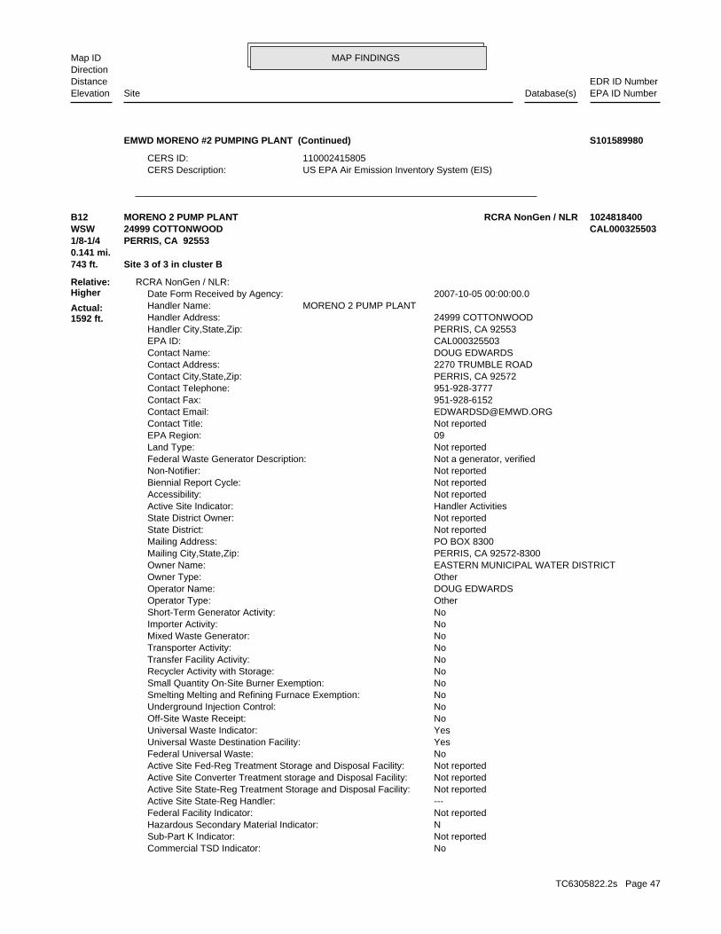
MAP FINDINGSMap IDDirection
EDR ID NumberDistanceEPA ID NumberDatabase(s)SiteElevation
US EPA Air Emission Inventory System (EIS)CERS Description: 110002415805CERS ID:
EMWD MORENO #2 PUMPING PLANT (Continued) S101589980
NoCommercial TSD Indicator: Not reportedSub-Part K Indicator: NHazardous Secondary Material Indicator: Not reportedFederal Facility Indicator: ---Active Site State-Reg Handler: Not reportedActive Site State-Reg Treatment Storage and Disposal Facility: Not reportedActive Site Converter Treatment storage and Disposal Facility: Not reportedActive Site Fed-Reg Treatment Storage and Disposal Facility: NoFederal Universal Waste: YesUniversal Waste Destination Facility: YesUniversal Waste Indicator: NoOff-Site Waste Receipt: NoUnderground Injection Control: NoSmelting Melting and Refining Furnace Exemption: NoSmall Quantity On-Site Burner Exemption: NoRecycler Activity with Storage: NoTransfer Facility Activity: NoTransporter Activity: NoMixed Waste Generator: NoImporter Activity: NoShort-Term Generator Activity: OtherOperator Type: DOUG EDWARDSOperator Name: OtherOwner Type: EASTERN MUNICIPAL WATER DISTRICTOwner Name: PERRIS, CA 92572-8300Mailing City,State,Zip: PO BOX 8300Mailing Address: Not reportedState District: Not reportedState District Owner: Handler ActivitiesActive Site Indicator: Not reportedAccessibility: Not reportedBiennial Report Cycle: Not reportedNon-Notifier: Not a generator, verifiedFederal Waste Generator Description: Not reportedLand Type: 09EPA Region: Not reportedContact Title: [email protected] Email: 951-928-6152Contact Fax: 951-928-3777Contact Telephone: PERRIS, CA 92572Contact City,State,Zip: 2270 TRUMBLE ROADContact Address: DOUG EDWARDSContact Name: CAL000325503EPA ID: PERRIS, CA 92553Handler City,State,Zip: 24999 COTTONWOODHandler Address: MORENO 2 PUMP PLANTHandler Name: 2007-10-05 00:00:00.0Date Form Received by Agency:
RCRA NonGen / NLR:
743 ft. Site 3 of 3 in cluster B0.141 mi.
Relative:Higher
Actual:1592 ft.
1/8-1/4 PERRIS, CA 92553WSW 24999 COTTONWOOD CAL000325503B12 RCRA NonGen / NLRMORENO 2 PUMP PLANT 1024818400
TC6305822.2s Page 47
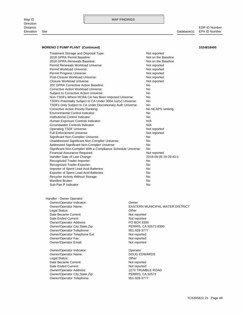
MAP FINDINGSMap IDDirection
EDR ID NumberDistanceEPA ID NumberDatabase(s)SiteElevation
951-928-3777Owner/Operator Telephone: PERRIS, CA 92572Owner/Operator City,State,Zip: 2270 TRUMBLE ROADOwner/Operator Address: Not reportedDate Ended Current: Not reportedDate Became Current: OtherLegal Status: DOUG EDWARDSOwner/Operator Name: OperatorOwner/Operator Indicator:
Not reportedOwner/Operator Email: Not reportedOwner/Operator Fax: Not reportedOwner/Operator Telephone Ext: 951-928-3777Owner/Operator Telephone: PERRIS, CA 92572-8300Owner/Operator City,State,Zip: PO BOX 8300Owner/Operator Address: Not reportedDate Ended Current: Not reportedDate Became Current: OtherLegal Status: EASTERN MUNICIPAL WATER DISTRICTOwner/Operator Name: OwnerOwner/Operator Indicator:
Handler - Owner Operator:
NoSub-Part P Indicator: NoManifest Broker: NoRecycler Activity Without Storage: NoExporter of Spent Lead Acid Batteries: NoImporter of Spent Lead Acid Batteries: NoRecognized Trader-Exporter: NoRecognized Trader-Importer: 2018-09-05 20:29:43.0Handler Date of Last Change: Not reportedFinancial Assurance Required: NoSignificant Non-Complier With a Compliance Schedule Universe: NoAddressed Significant Non-Complier Universe: NoUnaddressed Significant Non-Complier Universe: NoSignificant Non-Complier Universe: Not reportedFull Enforcement Universe: Not reportedOperating TSDF Universe: N/AGroundwater Controls Indicator: N/AHuman Exposure Controls Indicator: NoInstitutional Control Indicator: NoEnvironmental Control Indicator: No NCAPS rankingCorrective Action Priority Ranking: NoTSDFs Only Subject to CA under Discretionary Auth Universe: NoTSDFs Potentially Subject to CA Under 3004 (u)/(v) Universe: NoNon-TSDFs Where RCRA CA has Been Imposed Universe: NoSubject to Corrective Action Universe: NoCorrective Action Workload Universe: No202 GPRA Corrective Action Baseline: Not reportedClosure Workload Universe: Not reportedPost-Closure Workload Universe: Not reportedPermit Progress Universe: Not reportedPermit Workload Universe: Not reportedPermit Renewals Workload Universe: Not on the Baseline2018 GPRA Renewals Baseline: Not on the Baseline2018 GPRA Permit Baseline: Not reportedTreatment Storage and Disposal Type:
MORENO 2 PUMP PLANT (Continued) 1024818400
TC6305822.2s Page 48
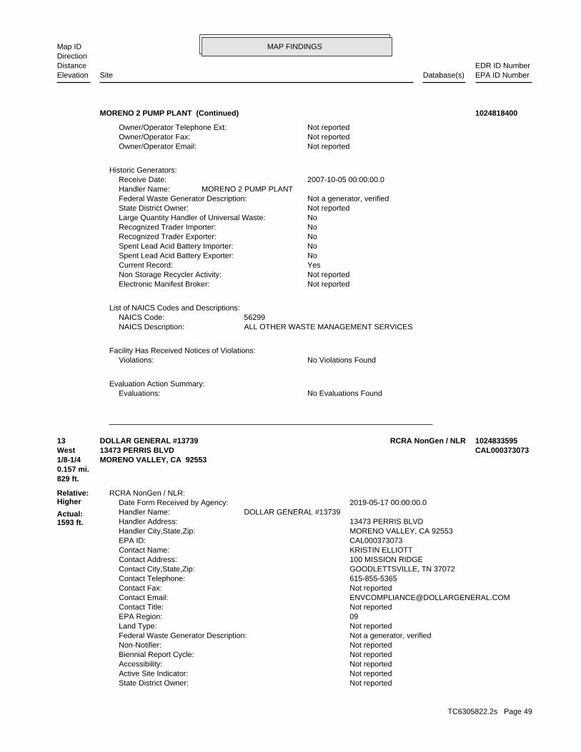
MAP FINDINGSMap IDDirection
EDR ID NumberDistanceEPA ID NumberDatabase(s)SiteElevation
No Evaluations FoundEvaluations:Evaluation Action Summary:
No Violations FoundViolations:Facility Has Received Notices of Violations:
ALL OTHER WASTE MANAGEMENT SERVICESNAICS Description: 56299NAICS Code:
List of NAICS Codes and Descriptions:
Not reportedElectronic Manifest Broker: Not reportedNon Storage Recycler Activity: YesCurrent Record: NoSpent Lead Acid Battery Exporter: NoSpent Lead Acid Battery Importer: NoRecognized Trader Exporter: NoRecognized Trader Importer: NoLarge Quantity Handler of Universal Waste: Not reportedState District Owner: Not a generator, verifiedFederal Waste Generator Description: MORENO 2 PUMP PLANTHandler Name: 2007-10-05 00:00:00.0Receive Date:
Historic Generators:
Not reportedOwner/Operator Email: Not reportedOwner/Operator Fax: Not reportedOwner/Operator Telephone Ext:
MORENO 2 PUMP PLANT (Continued) 1024818400
Not reportedState District Owner: Not reportedActive Site Indicator: Not reportedAccessibility: Not reportedBiennial Report Cycle: Not reportedNon-Notifier: Not a generator, verifiedFederal Waste Generator Description: Not reportedLand Type: 09EPA Region: Not reportedContact Title: [email protected] Email: Not reportedContact Fax: 615-855-5365Contact Telephone: GOODLETTSVILLE, TN 37072Contact City,State,Zip: 100 MISSION RIDGEContact Address: KRISTIN ELLIOTTContact Name: CAL000373073EPA ID: MORENO VALLEY, CA 92553Handler City,State,Zip: 13473 PERRIS BLVDHandler Address: DOLLAR GENERAL #13739Handler Name: 2019-05-17 00:00:00.0Date Form Received by Agency:
RCRA NonGen / NLR:
829 ft.0.157 mi.
Relative:Higher
Actual:1593 ft.
1/8-1/4 MORENO VALLEY, CA 92553West 13473 PERRIS BLVD CAL00037307313 RCRA NonGen / NLRDOLLAR GENERAL #13739 1024833595
TC6305822.2s Page 49
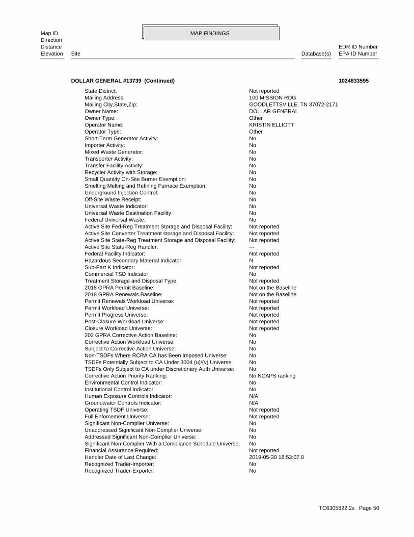
MAP FINDINGSMap IDDirection
EDR ID NumberDistanceEPA ID NumberDatabase(s)SiteElevation
NoRecognized Trader-Exporter: NoRecognized Trader-Importer: 2019-05-30 18:53:07.0Handler Date of Last Change: Not reportedFinancial Assurance Required: NoSignificant Non-Complier With a Compliance Schedule Universe: NoAddressed Significant Non-Complier Universe: NoUnaddressed Significant Non-Complier Universe: NoSignificant Non-Complier Universe: Not reportedFull Enforcement Universe: Not reportedOperating TSDF Universe: N/AGroundwater Controls Indicator: N/AHuman Exposure Controls Indicator: NoInstitutional Control Indicator: NoEnvironmental Control Indicator: No NCAPS rankingCorrective Action Priority Ranking: NoTSDFs Only Subject to CA under Discretionary Auth Universe: NoTSDFs Potentially Subject to CA Under 3004 (u)/(v) Universe: NoNon-TSDFs Where RCRA CA has Been Imposed Universe: NoSubject to Corrective Action Universe: NoCorrective Action Workload Universe: No202 GPRA Corrective Action Baseline: Not reportedClosure Workload Universe: Not reportedPost-Closure Workload Universe: Not reportedPermit Progress Universe: Not reportedPermit Workload Universe: Not reportedPermit Renewals Workload Universe: Not on the Baseline2018 GPRA Renewals Baseline: Not on the Baseline2018 GPRA Permit Baseline: Not reportedTreatment Storage and Disposal Type: NoCommercial TSD Indicator: Not reportedSub-Part K Indicator: NHazardous Secondary Material Indicator: Not reportedFederal Facility Indicator: ---Active Site State-Reg Handler: Not reportedActive Site State-Reg Treatment Storage and Disposal Facility: Not reportedActive Site Converter Treatment storage and Disposal Facility: Not reportedActive Site Fed-Reg Treatment Storage and Disposal Facility: NoFederal Universal Waste: NoUniversal Waste Destination Facility: NoUniversal Waste Indicator: NoOff-Site Waste Receipt: NoUnderground Injection Control: NoSmelting Melting and Refining Furnace Exemption: NoSmall Quantity On-Site Burner Exemption: NoRecycler Activity with Storage: NoTransfer Facility Activity: NoTransporter Activity: NoMixed Waste Generator: NoImporter Activity: NoShort-Term Generator Activity: OtherOperator Type: KRISTIN ELLIOTTOperator Name: OtherOwner Type: DOLLAR GENERALOwner Name: GOODLETTSVILLE, TN 37072-2171Mailing City,State,Zip: 100 MISSION RDGMailing Address: Not reportedState District:
DOLLAR GENERAL #13739 (Continued) 1024833595
TC6305822.2s Page 50
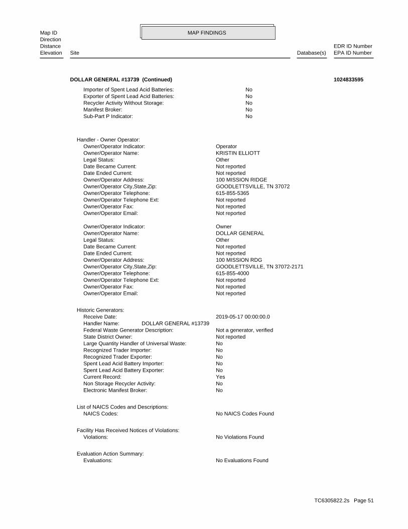
MAP FINDINGSMap IDDirection
EDR ID NumberDistanceEPA ID NumberDatabase(s)SiteElevation
No Evaluations FoundEvaluations:Evaluation Action Summary:
No Violations FoundViolations:Facility Has Received Notices of Violations:
No NAICS Codes FoundNAICS Codes:List of NAICS Codes and Descriptions:
NoElectronic Manifest Broker: NoNon Storage Recycler Activity: YesCurrent Record: NoSpent Lead Acid Battery Exporter: NoSpent Lead Acid Battery Importer: NoRecognized Trader Exporter: NoRecognized Trader Importer: NoLarge Quantity Handler of Universal Waste: Not reportedState District Owner: Not a generator, verifiedFederal Waste Generator Description: DOLLAR GENERAL #13739Handler Name: 2019-05-17 00:00:00.0Receive Date:
Historic Generators:
Not reportedOwner/Operator Email: Not reportedOwner/Operator Fax: Not reportedOwner/Operator Telephone Ext: 615-855-4000Owner/Operator Telephone: GOODLETTSVILLE, TN 37072-2171Owner/Operator City,State,Zip: 100 MISSION RDGOwner/Operator Address: Not reportedDate Ended Current: Not reportedDate Became Current: OtherLegal Status: DOLLAR GENERALOwner/Operator Name: OwnerOwner/Operator Indicator:
Not reportedOwner/Operator Email: Not reportedOwner/Operator Fax: Not reportedOwner/Operator Telephone Ext: 615-855-5365Owner/Operator Telephone: GOODLETTSVILLE, TN 37072Owner/Operator City,State,Zip: 100 MISSION RIDGEOwner/Operator Address: Not reportedDate Ended Current: Not reportedDate Became Current: OtherLegal Status: KRISTIN ELLIOTTOwner/Operator Name: OperatorOwner/Operator Indicator:
Handler - Owner Operator:
NoSub-Part P Indicator: NoManifest Broker: NoRecycler Activity Without Storage: NoExporter of Spent Lead Acid Batteries: NoImporter of Spent Lead Acid Batteries:
DOLLAR GENERAL #13739 (Continued) 1024833595
TC6305822.2s Page 51
MAP FINDINGSMap IDDirection
EDR ID NumberDistanceEPA ID NumberDatabase(s)SiteElevation
Local AgencyLead Agency: SCBStaff Initials: NOMStaff: *MTBE Class: Site NOT Tested for MTBE.Includes Unknown and Not Analyzed.MTBE Tested: 1MTBE Fuel: Not reportedMax MTBE Soil: 0MTBE Concentration: Not reportedMax MTBE GW: Not reportedMTBE Date: 0Longitude: 0Latitude: LUSTOversite Program: Not reportedInterim: Not reportedFacility Contact: Not reportedOperator: Not reportedSoil Qualifies: Not reportedGW Qualifies: Not reportedEnter Date: Not reportedDate Post Remedial Action Monitoring: Not reportedDate Remedial Action Underway: Not reportedDate Remediation Plan Submitted: Not reportedDate Pollution Characterization Began: Not reportedDate Prelim Assessment Workplan Submitted: Not reportedClose Date: Not reportedEnforcement Date: 6/10/2004Discover Date: Not reportedDate Preliminary Assessment Began: 8/3/2004Date Confirmation of Leak Began: Not reportedEnter Date: Not reportedHow Stopped Date: T0606547819Global ID: UNKLeak Source: UNKLeak Cause: Other MeansHow Stopped: Subsurface MonitoringHow Discovered: LOPSFunding: Not reportedEnf Type: DRACEA AVE.Cross Street: Not reportedAbate Method: Not reportedQty Leaked: GasolineSubstance: UndefinedCase Type: 200420809Local Case Num: Not reportedCase Number: Leak being confirmedFacility Status: Santa Ana RegionRegional Board: RiversideCounty: 8Region: MORENO VALLEYCity: 13261 PERRIS BLVD.Address: CIRCLE K #0872Name:
LUST REG 8:
937 ft. Site 1 of 8 in cluster C0.177 mi.
Relative:Higher
Actual:1600 ft.
1/8-1/4 MORENO VALLEY, CA 92553NW 13261 PERRIS BLVD. N/AC14 LUSTCIRCLE K #0872 S106567753
TC6305822.2s Page 52
MAP FINDINGSMap IDDirection
EDR ID NumberDistanceEPA ID NumberDatabase(s)SiteElevation
Not reportedSummary: Not reportedWork Suspended: Not reportedCleanup Fund Id: Not reportedPriority: Not reportedBeneficial: Not reportedHydr Basin #: 33000LLocal Agency:
CIRCLE K #0872 (Continued) S106567753
9940Capacity: ATank Status: 33-000-013636-000002SWRCB Tank Id: 000317Owner Tank Id: 02-29-88Created Date: 10-28-92Action Date: 10-28-92Referral Date: 44-017978Board Of Equalization: 1Number: 13636Comp Number: ActiveStatus: MORENO VALLEYCity: 13261 PERRIS BLVDAddress: CIRCLE K #872Name:
2Number Of Tanks: LEADEDContent: PSTG: M.V. FUELTank Use: 10-28-92Active Date: 9940Capacity: ATank Status: 33-000-013636-000001SWRCB Tank Id: 000317Owner Tank Id: 02-29-88Created Date: 10-28-92Action Date: 10-28-92Referral Date: 44-017978Board Of Equalization: 1Number: 13636Comp Number: ActiveStatus: MORENO VALLEYCity: 13261 PERRIS BLVDAddress: CIRCLE K #872Name:
SWEEPS UST:
Hazardous Waste GeneratorCERS Description: 10175927CERS ID: 105568Site ID: MORENO VALLEY, CA 92553City,State,Zip: 13261 PERRIS BLVDAddress: CIRCLE K STORE #2700872Name:
CERS HAZ WASTE:
937 ft. CERSSite 2 of 8 in cluster C0.177 mi. CA FID UST
Relative:Higher
Actual:1600 ft.
1/8-1/4 CERS TANKSMORENO VALLEY, CA 92388NW SWEEPS UST13261 PERRIS BLVD N/AC15 CERS HAZ WASTECIRCLE K #872 S101619424
TC6305822.2s Page 53
MAP FINDINGSMap IDDirection
EDR ID NumberDistanceEPA ID NumberDatabase(s)SiteElevation
flow to the tank when the tank is filled to no more than 95 percent of minutes before the tank overfills; or Provide positive shut-off of percent of capacity; and activate an audible alarm at least five the restriction occurs when the tank is filled to no more than 95 to the tank at least 30 minutes before the tank overfills, provided triggering an audible and visual alarm; or Restrict delivery of flow the tank is 90 percent full by restricting the flow into the tank or prevention equipment requirements: Alert the transfer operator when Failure to comply with one or more of the following overfillViolation Description: Chapter 16, Section(s) 2712(b)(1)(G) 23 CCR 16 2712(b)(1)(G) - California Code of Regulations, Title 23,Citation: 11/13/2018Violation Date: Circle K Store #2700872Site Name: 105568Site ID:
Violations:
Chemical Storage FacilitiesCERS Description: 10175927CERS ID: 105568Site ID: MORENO VALLEY, CA 92553City,State,Zip: 13261 PERRIS BLVDAddress: CIRCLE K STORE #2700872Name:
CERS:
ActiveStatus: Not reportedComments: Not reportedEPA ID: Not reportedNPDES Number: Not reportedDUNs Number: Not reportedContact Phone: Not reportedContact: MORENO VALLEY 92388Mailing City,St,Zip: Not reportedMailing Address 2: P O BOX 52084Mailing Address: Not reportedMail To: 7146537715Facility Phone: Not reportedSIC Code: Not reportedCortese Code: 00013636Regulated ID: UTNKARegulated By: 33002559Facility ID:
CA FID UST:
Underground Storage TankCERS Description: 10175927CERS ID: 105568Site ID: MORENO VALLEY, CA 92553City,State,Zip: 13261 PERRIS BLVDAddress: CIRCLE K STORE #2700872Name:
CERS TANKS:
Not reportedNumber Of Tanks: REG UNLEADEDContent: PSTG: M.V. FUELTank Use: 10-28-92Active Date:
CIRCLE K #872 (Continued) S101619424
TC6305822.2s Page 54
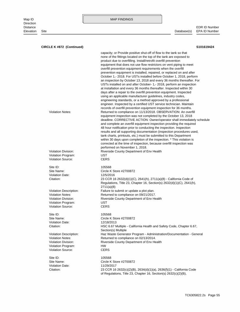
MAP FINDINGSMap IDDirection
EDR ID NumberDistanceEPA ID NumberDatabase(s)SiteElevation
of Regulations, Title 23, Chapter 16, Section(s) 2632(c)(2)(B), 23 CCR 16 2632(c)(2)(B), 2634(d)(1)(a), 2636(f)(1) - California CodeCitation: 11/29/2017Violation Date: Circle K Store #2700872Site Name: 105568Site ID:
CERSViolation Source: HWViolation Program: Riverside County Department of Env HealthViolation Division: Returned to compliance on 02/13/2014.Violation Notes: Haz Waste Generator Program - Administration/Documentation - GeneralViolation Description: Section(s) Multiple HSC 6.67 Multiple - California Health and Safety Code, Chapter 6.67,Citation: 12/18/2013Violation Date: Circle K Store #2700872Site Name: 105568Site ID:
CERSViolation Source: USTViolation Program: Riverside County Department of Env HealthViolation Division: Returned to compliance on 09/21/2017.Violation Notes: Failure to submit or update a plot plan.Violation Description: 2711(a)(8) Regulations, Title 23, Chapter 16, Section(s) 2632(d)(1)(C), 2641(h), 23 CCR 16 2632(d)(1)(C), 2641(h), 2711(a)(8) - California Code ofCitation: 12/5/2016Violation Date: Circle K Store #2700872Site Name: 105568Site ID:
CERSViolation Source: USTViolation Program: Riverside County Department of Env HealthViolation Division: performed on November 1, 2018. corrected at the time of inspection, because overfill inspection was within 30 days upon completion of the inspection. * This violation is tank charts, printouts, etc.) must be submitted to this Department results and all supporting documentation (inspection procedures used, 48 hour notification prior to conducting the inspection. Inspection and complete an overfill equipment inspection providing the required deadline. CORRECTIVE ACTION: Owner/operator shall immediately schedule equipment inspection was not completed by the October 13, 2018 Returned to compliance on 11/13/2018. OBSERVATION: An overfillViolation Notes: records of overfill prevention equipment inspection for 36 months. engineer. Inspected by a certified UST service technician. Maintain engineering standards, or a method approved by a professional using an applicable manufacturer guidelines, industry codes, days after a repair to the overfill prevention equipment. Inspected at installation and every 36 months thereafter. Inspected within 30 USTs installed on and after October- 1,- 2018, perform an inspection an inspection by October 13, 2018 and every 36 months thereafter. For October 1,- 2018. For USTs installed before October 1, 2018, perform prevention equipment is installed, repaired, or replaced on and after overfill prevention equipment requirements when the overfill equipment that does not use flow restrictors on vent piping to meet product due to overfilling. Install/retrofit overfill prevention none of the fittings located on the top of the tank are exposed to capacity; or Provide positive shut-off of flow to the tank so that
CIRCLE K #872 (Continued) S101619424
TC6305822.2s Page 55
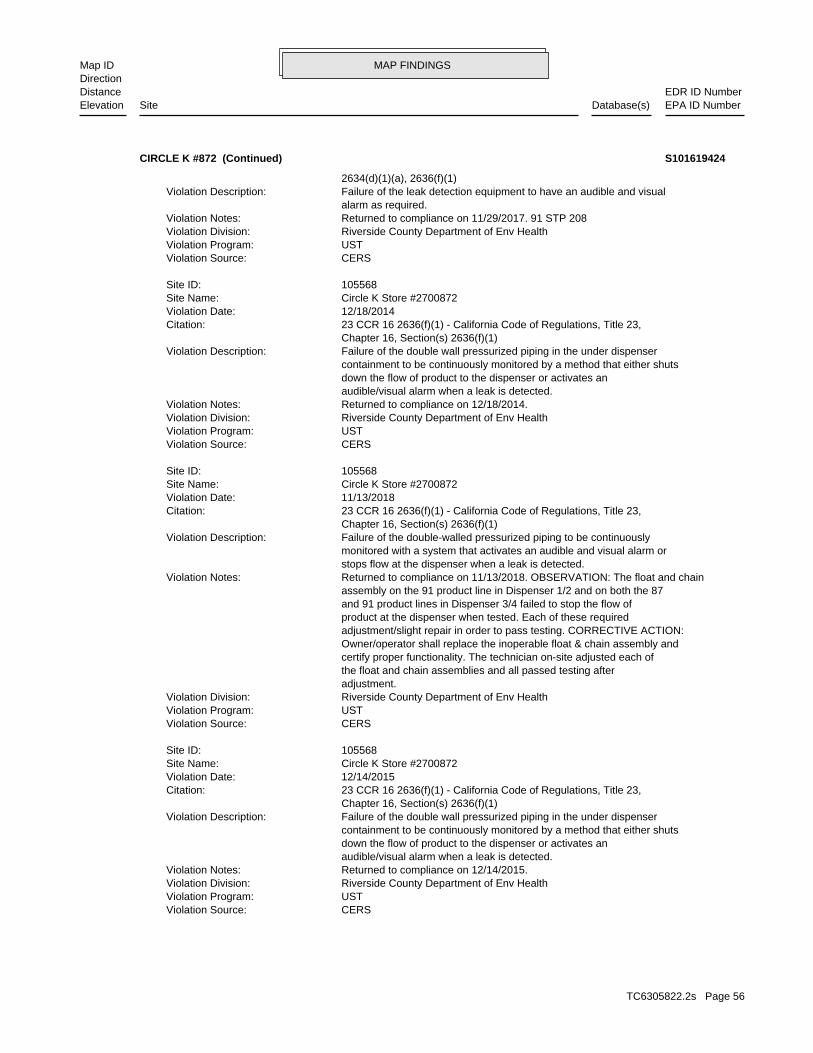
MAP FINDINGSMap IDDirection
EDR ID NumberDistanceEPA ID NumberDatabase(s)SiteElevation
CERSViolation Source: USTViolation Program: Riverside County Department of Env HealthViolation Division: Returned to compliance on 12/14/2015.Violation Notes: audible/visual alarm when a leak is detected. down the flow of product to the dispenser or activates an containment to be continuously monitored by a method that either shuts Failure of the double wall pressurized piping in the under dispenserViolation Description: Chapter 16, Section(s) 2636(f)(1) 23 CCR 16 2636(f)(1) - California Code of Regulations, Title 23,Citation: 12/14/2015Violation Date: Circle K Store #2700872Site Name: 105568Site ID:
CERSViolation Source: USTViolation Program: Riverside County Department of Env HealthViolation Division: adjustment. the float and chain assemblies and all passed testing after certify proper functionality. The technician on-site adjusted each of Owner/operator shall replace the inoperable float & chain assembly and adjustment/slight repair in order to pass testing. CORRECTIVE ACTION: product at the dispenser when tested. Each of these required and 91 product lines in Dispenser 3/4 failed to stop the flow of assembly on the 91 product line in Dispenser 1/2 and on both the 87 Returned to compliance on 11/13/2018. OBSERVATION: The float and chainViolation Notes: stops flow at the dispenser when a leak is detected. monitored with a system that activates an audible and visual alarm or Failure of the double-walled pressurized piping to be continuouslyViolation Description: Chapter 16, Section(s) 2636(f)(1) 23 CCR 16 2636(f)(1) - California Code of Regulations, Title 23,Citation: 11/13/2018Violation Date: Circle K Store #2700872Site Name: 105568Site ID:
CERSViolation Source: USTViolation Program: Riverside County Department of Env HealthViolation Division: Returned to compliance on 12/18/2014.Violation Notes: audible/visual alarm when a leak is detected. down the flow of product to the dispenser or activates an containment to be continuously monitored by a method that either shuts Failure of the double wall pressurized piping in the under dispenserViolation Description: Chapter 16, Section(s) 2636(f)(1) 23 CCR 16 2636(f)(1) - California Code of Regulations, Title 23,Citation: 12/18/2014Violation Date: Circle K Store #2700872Site Name: 105568Site ID:
CERSViolation Source: USTViolation Program: Riverside County Department of Env HealthViolation Division: Returned to compliance on 11/29/2017. 91 STP 208Violation Notes: alarm as required. Failure of the leak detection equipment to have an audible and visualViolation Description: 2634(d)(1)(a), 2636(f)(1)
CIRCLE K #872 (Continued) S101619424
TC6305822.2s Page 56
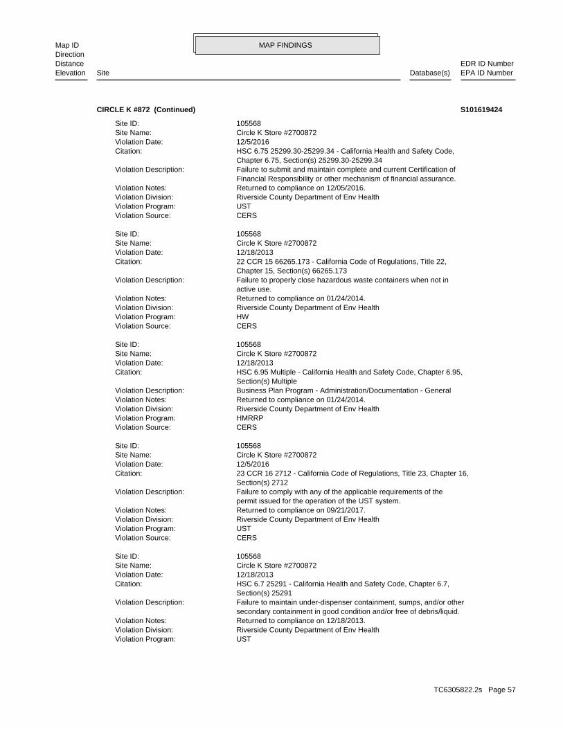
MAP FINDINGSMap IDDirection
EDR ID NumberDistanceEPA ID NumberDatabase(s)SiteElevation
USTViolation Program: Riverside County Department of Env HealthViolation Division: Returned to compliance on 12/18/2013.Violation Notes: secondary containment in good condition and/or free of debris/liquid. Failure to maintain under-dispenser containment, sumps, and/or otherViolation Description: Section(s) 25291 HSC 6.7 25291 - California Health and Safety Code, Chapter 6.7,Citation: 12/18/2013Violation Date: Circle K Store #2700872Site Name: 105568Site ID:
CERSViolation Source: USTViolation Program: Riverside County Department of Env HealthViolation Division: Returned to compliance on 09/21/2017.Violation Notes: permit issued for the operation of the UST system. Failure to comply with any of the applicable requirements of theViolation Description: Section(s) 2712 23 CCR 16 2712 - California Code of Regulations, Title 23, Chapter 16,Citation: 12/5/2016Violation Date: Circle K Store #2700872Site Name: 105568Site ID:
CERSViolation Source: HMRRPViolation Program: Riverside County Department of Env HealthViolation Division: Returned to compliance on 01/24/2014.Violation Notes: Business Plan Program - Administration/Documentation - GeneralViolation Description: Section(s) Multiple HSC 6.95 Multiple - California Health and Safety Code, Chapter 6.95,Citation: 12/18/2013Violation Date: Circle K Store #2700872Site Name: 105568Site ID:
CERSViolation Source: HWViolation Program: Riverside County Department of Env HealthViolation Division: Returned to compliance on 01/24/2014.Violation Notes: active use. Failure to properly close hazardous waste containers when not inViolation Description: Chapter 15, Section(s) 66265.173 22 CCR 15 66265.173 - California Code of Regulations, Title 22,Citation: 12/18/2013Violation Date: Circle K Store #2700872Site Name: 105568Site ID:
CERSViolation Source: USTViolation Program: Riverside County Department of Env HealthViolation Division: Returned to compliance on 12/05/2016.Violation Notes: Financial Responsibility or other mechanism of financial assurance. Failure to submit and maintain complete and current Certification ofViolation Description: Chapter 6.75, Section(s) 25299.30-25299.34 HSC 6.75 25299.30-25299.34 - California Health and Safety Code,Citation: 12/5/2016Violation Date: Circle K Store #2700872Site Name: 105568Site ID:
CIRCLE K #872 (Continued) S101619424
TC6305822.2s Page 57
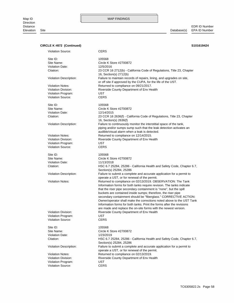
MAP FINDINGSMap IDDirection
EDR ID NumberDistanceEPA ID NumberDatabase(s)SiteElevation
CERSViolation Source: USTViolation Program: Riverside County Department of Env HealthViolation Division: Returned to compliance on 02/13/2019.Violation Notes: operate a UST, or for renewal of the permit. Failure to submit a complete and accurate application for a permit toViolation Description: Section(s) 25284, 25286 HSC 6.7 25284, 25286 - California Health and Safety Code, Chapter 6.7,Citation: 1/23/2019Violation Date: Circle K Store #2700872Site Name: 105568Site ID:
CERSViolation Source: USTViolation Program: Riverside County Department of Env HealthViolation Division: are made and replace the on-site forms with the newest version. Information forms for both tanks. Print the forms after the revisions Owner/operator shall make the corrections noted above to the UST Tank secondary containment should be "fiberglass." CORRECTIVE ACTION: buckets are contained inside sumps; therefore, the riser pipe that the riser pipe secondary containment is "none", but the spill Information forms for both tanks require revision. The tanks indicate Returned to compliance on 02/13/2019. OBSERVATION: The TankViolation Notes: operate a UST, or for renewal of the permit. Failure to submit a complete and accurate application for a permit toViolation Description: Section(s) 25284, 25286 HSC 6.7 25284, 25286 - California Health and Safety Code, Chapter 6.7,Citation: 11/13/2018Violation Date: Circle K Store #2700872Site Name: 105568Site ID:
CERSViolation Source: USTViolation Program: Riverside County Department of Env HealthViolation Division: Returned to compliance on 12/14/2015.Violation Notes: audible/visual alarm when a leak is detected. piping and/or sumps sump such that the leak detection activates an Failure to continuously monitor the interstitial space of the tank,Violation Description: 16, Section(s) 2636(f) 23 CCR 16 2636(f) - California Code of Regulations, Title 23, ChapterCitation: 12/14/2015Violation Date: Circle K Store #2700872Site Name: 105568Site ID:
CERSViolation Source: USTViolation Program: Riverside County Department of Env HealthViolation Division: Returned to compliance on 09/21/2017.Violation Notes: or off site if approved by the CUPA, for the life of the UST. Failure to maintain records of repairs, lining, and upgrades on site,Violation Description: 16, Section(s) 2712(b) 23 CCR 16 2712(b) - California Code of Regulations, Title 23, ChapterCitation: 12/5/2016Violation Date: Circle K Store #2700872Site Name: 105568Site ID:
CERSViolation Source:
CIRCLE K #872 (Continued) S101619424
TC6305822.2s Page 58
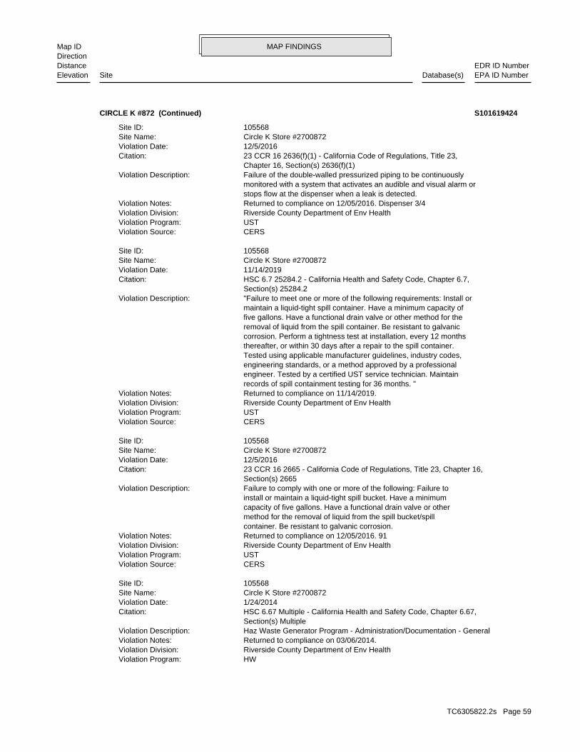
MAP FINDINGSMap IDDirection
EDR ID NumberDistanceEPA ID NumberDatabase(s)SiteElevation
HWViolation Program: Riverside County Department of Env HealthViolation Division: Returned to compliance on 03/06/2014.Violation Notes: Haz Waste Generator Program - Administration/Documentation - GeneralViolation Description: Section(s) Multiple HSC 6.67 Multiple - California Health and Safety Code, Chapter 6.67,Citation: 1/24/2014Violation Date: Circle K Store #2700872Site Name: 105568Site ID:
CERSViolation Source: USTViolation Program: Riverside County Department of Env HealthViolation Division: Returned to compliance on 12/05/2016. 91Violation Notes: container. Be resistant to galvanic corrosion. method for the removal of liquid from the spill bucket/spill capacity of five gallons. Have a functional drain valve or other install or maintain a liquid-tight spill bucket. Have a minimum Failure to comply with one or more of the following: Failure toViolation Description: Section(s) 2665 23 CCR 16 2665 - California Code of Regulations, Title 23, Chapter 16,Citation: 12/5/2016Violation Date: Circle K Store #2700872Site Name: 105568Site ID:
CERSViolation Source: USTViolation Program: Riverside County Department of Env HealthViolation Division: Returned to compliance on 11/14/2019.Violation Notes: records of spill containment testing for 36 months. " engineer. Tested by a certified UST service technician. Maintain engineering standards, or a method approved by a professional Tested using applicable manufacturer guidelines, industry codes, thereafter, or within 30 days after a repair to the spill container. corrosion. Perform a tightness test at installation, every 12 months removal of liquid from the spill container. Be resistant to galvanic five gallons. Have a functional drain valve or other method for the maintain a liquid-tight spill container. Have a minimum capacity of "Failure to meet one or more of the following requirements: Install orViolation Description: Section(s) 25284.2 HSC 6.7 25284.2 - California Health and Safety Code, Chapter 6.7,Citation: 11/14/2019Violation Date: Circle K Store #2700872Site Name: 105568Site ID:
CERSViolation Source: USTViolation Program: Riverside County Department of Env HealthViolation Division: Returned to compliance on 12/05/2016. Dispenser 3/4Violation Notes: stops flow at the dispenser when a leak is detected. monitored with a system that activates an audible and visual alarm or Failure of the double-walled pressurized piping to be continuouslyViolation Description: Chapter 16, Section(s) 2636(f)(1) 23 CCR 16 2636(f)(1) - California Code of Regulations, Title 23,Citation: 12/5/2016Violation Date: Circle K Store #2700872Site Name: 105568Site ID:
CIRCLE K #872 (Continued) S101619424
TC6305822.2s Page 59
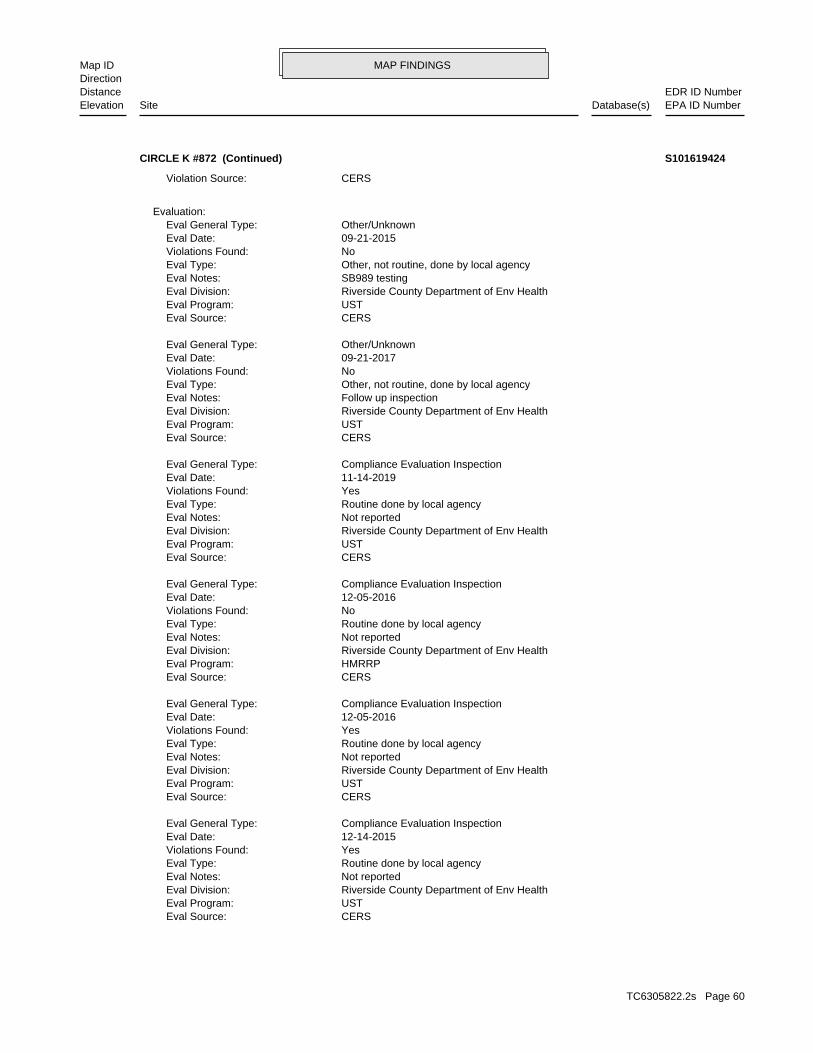
MAP FINDINGSMap IDDirection
EDR ID NumberDistanceEPA ID NumberDatabase(s)SiteElevation
CERSEval Source: USTEval Program: Riverside County Department of Env HealthEval Division: Not reportedEval Notes: Routine done by local agencyEval Type: YesViolations Found: 12-14-2015Eval Date: Compliance Evaluation InspectionEval General Type:
CERSEval Source: USTEval Program: Riverside County Department of Env HealthEval Division: Not reportedEval Notes: Routine done by local agencyEval Type: YesViolations Found: 12-05-2016Eval Date: Compliance Evaluation InspectionEval General Type:
CERSEval Source: HMRRPEval Program: Riverside County Department of Env HealthEval Division: Not reportedEval Notes: Routine done by local agencyEval Type: NoViolations Found: 12-05-2016Eval Date: Compliance Evaluation InspectionEval General Type:
CERSEval Source: USTEval Program: Riverside County Department of Env HealthEval Division: Not reportedEval Notes: Routine done by local agencyEval Type: YesViolations Found: 11-14-2019Eval Date: Compliance Evaluation InspectionEval General Type:
CERSEval Source: USTEval Program: Riverside County Department of Env HealthEval Division: Follow up inspectionEval Notes: Other, not routine, done by local agencyEval Type: NoViolations Found: 09-21-2017Eval Date: Other/UnknownEval General Type:
CERSEval Source: USTEval Program: Riverside County Department of Env HealthEval Division: SB989 testingEval Notes: Other, not routine, done by local agencyEval Type: NoViolations Found: 09-21-2015Eval Date: Other/UnknownEval General Type:
Evaluation:
CERSViolation Source:
CIRCLE K #872 (Continued) S101619424
TC6305822.2s Page 60
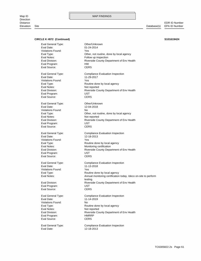
MAP FINDINGSMap IDDirection
EDR ID NumberDistanceEPA ID NumberDatabase(s)SiteElevation
12-18-2013Eval Date: Compliance Evaluation InspectionEval General Type:
CERSEval Source: HMRRPEval Program: Riverside County Department of Env HealthEval Division: Not reportedEval Notes: Routine done by local agencyEval Type: NoViolations Found: 11-14-2019Eval Date: Compliance Evaluation InspectionEval General Type:
CERSEval Source: USTEval Program: Riverside County Department of Env HealthEval Division: testing. Annual monitoring certification today. Ideco on-site to performEval Notes: Routine done by local agencyEval Type: YesViolations Found: 11-13-2018Eval Date: Compliance Evaluation InspectionEval General Type:
CERSEval Source: USTEval Program: Riverside County Department of Env HealthEval Division: Monitoring certificationEval Notes: Routine done by local agencyEval Type: YesViolations Found: 12-18-2013Eval Date: Compliance Evaluation InspectionEval General Type:
CERSEval Source: USTEval Program: Riverside County Department of Env HealthEval Division: Not reportedEval Notes: Other, not routine, done by local agencyEval Type: NoViolations Found: 12-04-2018Eval Date: Other/UnknownEval General Type:
CERSEval Source: USTEval Program: Riverside County Department of Env HealthEval Division: Not reportedEval Notes: Routine done by local agencyEval Type: YesViolations Found: 11-29-2017Eval Date: Compliance Evaluation InspectionEval General Type:
CERSEval Source: HWEval Program: Riverside County Department of Env HealthEval Division: Follow up inspectionEval Notes: Other, not routine, done by local agencyEval Type: YesViolations Found: 01-24-2014Eval Date: Other/UnknownEval General Type:
CIRCLE K #872 (Continued) S101619424
TC6305822.2s Page 61
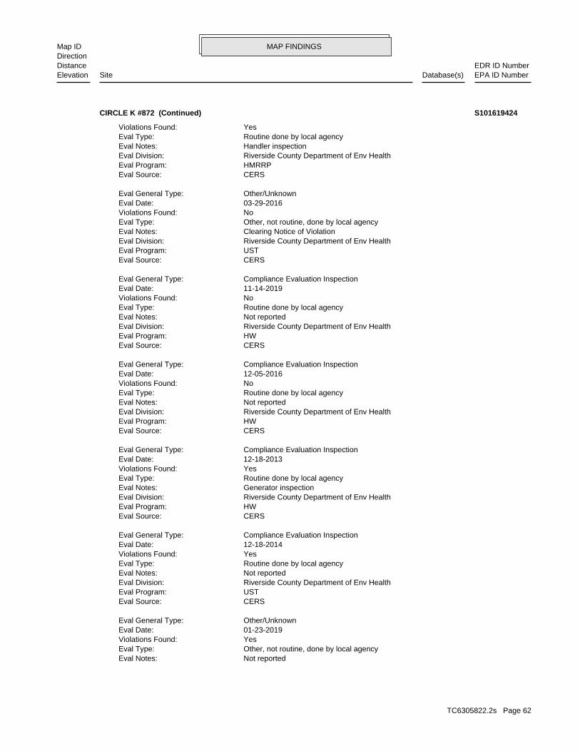
MAP FINDINGSMap IDDirection
EDR ID NumberDistanceEPA ID NumberDatabase(s)SiteElevation
Not reportedEval Notes: Other, not routine, done by local agencyEval Type: YesViolations Found: 01-23-2019Eval Date: Other/UnknownEval General Type:
CERSEval Source: USTEval Program: Riverside County Department of Env HealthEval Division: Not reportedEval Notes: Routine done by local agencyEval Type: YesViolations Found: 12-18-2014Eval Date: Compliance Evaluation InspectionEval General Type:
CERSEval Source: HWEval Program: Riverside County Department of Env HealthEval Division: Generator inspectionEval Notes: Routine done by local agencyEval Type: YesViolations Found: 12-18-2013Eval Date: Compliance Evaluation InspectionEval General Type:
CERSEval Source: HWEval Program: Riverside County Department of Env HealthEval Division: Not reportedEval Notes: Routine done by local agencyEval Type: NoViolations Found: 12-05-2016Eval Date: Compliance Evaluation InspectionEval General Type:
CERSEval Source: HWEval Program: Riverside County Department of Env HealthEval Division: Not reportedEval Notes: Routine done by local agencyEval Type: NoViolations Found: 11-14-2019Eval Date: Compliance Evaluation InspectionEval General Type:
CERSEval Source: USTEval Program: Riverside County Department of Env HealthEval Division: Clearing Notice of ViolationEval Notes: Other, not routine, done by local agencyEval Type: NoViolations Found: 03-29-2016Eval Date: Other/UnknownEval General Type:
CERSEval Source: HMRRPEval Program: Riverside County Department of Env HealthEval Division: Handler inspectionEval Notes: Routine done by local agencyEval Type: YesViolations Found:
CIRCLE K #872 (Continued) S101619424
TC6305822.2s Page 62
MAP FINDINGSMap IDDirection
EDR ID NumberDistanceEPA ID NumberDatabase(s)SiteElevation
CERSEnf Action Source: HWEnf Action Program: Riverside County Department of Env HealthEnf Action Division: Not reportedEnf Action Notes: Notice of Violation Issued by the Inspector at the Time of InspectionEnf Action Description: Notice of Violation (Unified Program)Enf Action Type: 12-18-2013Enf Action Date: 92553Site Zip: MORENO VALLEYSite City: 13261 PERRIS BLVDSite Address: Circle K Store #2700872Site Name: 105568Site ID:
CERSEnf Action Source: HMRRPEnf Action Program: Riverside County Department of Env HealthEnf Action Division: Not reportedEnf Action Notes: Notice of Violation Issued by the Inspector at the Time of InspectionEnf Action Description: Notice of Violation (Unified Program)Enf Action Type: 12-18-2013Enf Action Date: 92553Site Zip: MORENO VALLEYSite City: 13261 PERRIS BLVDSite Address: Circle K Store #2700872Site Name: 105568Site ID:
CERSEnf Action Source: USTEnf Action Program: Riverside County Department of Env HealthEnf Action Division: Not reportedEnf Action Notes: Notice of Violation Issued by the Inspector at the Time of InspectionEnf Action Description: Notice of Violation (Unified Program)Enf Action Type: 12-14-2015Enf Action Date: 92553Site Zip: MORENO VALLEYSite City: 13261 PERRIS BLVDSite Address: Circle K Store #2700872Site Name: 105568Site ID:
CERSEnf Action Source: HWEnf Action Program: Riverside County Department of Env HealthEnf Action Division: Not reportedEnf Action Notes: Notice of Violation Issued by the Inspector at the Time of InspectionEnf Action Description: Notice of Violation (Unified Program)Enf Action Type: 01-24-2014Enf Action Date: 92553Site Zip: MORENO VALLEYSite City: 13261 PERRIS BLVDSite Address: Circle K Store #2700872Site Name: 105568Site ID:
Enforcement Action:
CERSEval Source: USTEval Program: Riverside County Department of Env HealthEval Division:
CIRCLE K #872 (Continued) S101619424
TC6305822.2s Page 63
MAP FINDINGSMap IDDirection
EDR ID NumberDistanceEPA ID NumberDatabase(s)SiteElevation
Not reportedAffiliation Phone: 85072Affiliation Zip: Not reportedAffiliation Country: AZAffiliation State: PhoenixAffiliation City: P.O. Box 52085, Attn: EnvironmentalAffiliation Address: Not reportedEntity Title: Yolanda JonesEntity Name: Environmental ContactAffiliation Type Desc:
Not reportedAffiliation Phone: Not reportedAffiliation Zip: Not reportedAffiliation Country: Not reportedAffiliation State: Not reportedAffiliation City: Not reportedAffiliation Address: Not reportedEntity Title: Robert VelascoEntity Name: Document PreparerAffiliation Type Desc:
Affiliation:
-117.226690Longitude: 33.927910Latitude: Center of a facility or station.Ref Point Type Desc: Not reportedCoord Name: 10175927Program ID: HWGEnv Int Type Code: Circle K Store #2700872Facility Name: 105568Site ID:
Coordinates:
CERSEnf Action Source: USTEnf Action Program: Riverside County Department of Env HealthEnf Action Division: Not reportedEnf Action Notes: Notice of Violation Issued by the Inspector at the Time of InspectionEnf Action Description: Notice of Violation (Unified Program)Enf Action Type: 12-18-2014Enf Action Date: 92553Site Zip: MORENO VALLEYSite City: 13261 PERRIS BLVDSite Address: Circle K Store #2700872Site Name: 105568Site ID:
CERSEnf Action Source: USTEnf Action Program: Riverside County Department of Env HealthEnf Action Division: Not reportedEnf Action Notes: Notice of Violation Issued by the Inspector at the Time of InspectionEnf Action Description: Notice of Violation (Unified Program)Enf Action Type: 12-18-2013Enf Action Date: 92553Site Zip: MORENO VALLEYSite City: 13261 PERRIS BLVDSite Address: Circle K Store #2700872Site Name: 105568Site ID:
CIRCLE K #872 (Continued) S101619424
TC6305822.2s Page 64
MAP FINDINGSMap IDDirection
EDR ID NumberDistanceEPA ID NumberDatabase(s)SiteElevation
United StatesAffiliation Country: AZAffiliation State: PhoenixAffiliation City: P.O. Box 52085, Attn: EnvironmentalAffiliation Address: Not reportedEntity Title: Circle K Stores Inc.Entity Name: UST Tank OperatorAffiliation Type Desc:
Not reportedAffiliation Phone: Not reportedAffiliation Zip: Not reportedAffiliation Country: Not reportedAffiliation State: Not reportedAffiliation City: Not reportedAffiliation Address: Not reportedEntity Title: Circle K Stores Inc.Entity Name: Parent CorporationAffiliation Type Desc:
(980) 875-1745Affiliation Phone: Not reportedAffiliation Zip: Not reportedAffiliation Country: Not reportedAffiliation State: Not reportedAffiliation City: Not reportedAffiliation Address: Not reportedEntity Title: Circle K Stores Inc.Entity Name: OperatorAffiliation Type Desc:
Not reportedAffiliation Phone: Not reportedAffiliation Zip: Not reportedAffiliation Country: Not reportedAffiliation State: Not reportedAffiliation City: Not reportedAffiliation Address: Agent For Circle KEntity Title: Robert VelascoEntity Name: Identification SignerAffiliation Type Desc:
(980) 875-1745Affiliation Phone: 85072Affiliation Zip: United StatesAffiliation Country: AZAffiliation State: PhoenixAffiliation City: P.O. Box 52085, Attn: EnvironmentalAffiliation Address: Not reportedEntity Title: Circle K Stores Inc.Entity Name: UST Tank OwnerAffiliation Type Desc:
Not reportedAffiliation Phone: 85072Affiliation Zip: Not reportedAffiliation Country: AZAffiliation State: PhoenixAffiliation City: P.O. Box 52085, Attn: EnvironmentalAffiliation Address: Not reportedEntity Title: Mailing AddressEntity Name: Facility Mailing AddressAffiliation Type Desc:
CIRCLE K #872 (Continued) S101619424
TC6305822.2s Page 65
MAP FINDINGSMap IDDirection
EDR ID NumberDistanceEPA ID NumberDatabase(s)SiteElevation
(980) 875-1745Affiliation Phone: 85072Affiliation Zip: United StatesAffiliation Country: AZAffiliation State: PhoenixAffiliation City: P.O. Box 52085, Attn: EnvironmentalAffiliation Address: Not reportedEntity Title: Circle K Stores Inc.Entity Name: UST Property Owner NameAffiliation Type Desc:
(661) 250-9300Affiliation Phone: Not reportedAffiliation Zip: Not reportedAffiliation Country: Not reportedAffiliation State: Not reportedAffiliation City: Not reportedAffiliation Address: Agent For Circle KEntity Title: Robert VelascoEntity Name: UST Permit ApplicantAffiliation Type Desc:
(951) 358-5055Affiliation Phone: 92503Affiliation Zip: Not reportedAffiliation Country: CAAffiliation State: RiversideAffiliation City: 4065 County Circle Drive, Room 104Affiliation Address: Not reportedEntity Title: Riverside Cnty Env HealthEntity Name: CUPA DistrictAffiliation Type Desc:
(980) 875-1745Affiliation Phone: 85072Affiliation Zip: United StatesAffiliation Country: AZAffiliation State: PhoenixAffiliation City: P.O. Box 52085, Attn: EnvironmentalAffiliation Address: Not reportedEntity Title: Circle K Stores Inc.Entity Name: Property OwnerAffiliation Type Desc:
(980) 875-1745Affiliation Phone: 85072Affiliation Zip: United StatesAffiliation Country: AZAffiliation State: PhoenixAffiliation City: P.O. Box 52085, Attn: EnvironmentalAffiliation Address: Not reportedEntity Title: Circle K Stores Inc.Entity Name: Legal OwnerAffiliation Type Desc:
(980) 875-1745Affiliation Phone: 85072Affiliation Zip:
CIRCLE K #872 (Continued) S101619424
TC6305822.2s Page 66

MAP FINDINGSMap IDDirection
EDR ID NumberDistanceEPA ID NumberDatabase(s)SiteElevation
Not reportedPermit Renewals Workload Universe: Not on the Baseline2018 GPRA Renewals Baseline: Not on the Baseline2018 GPRA Permit Baseline: Not reportedTreatment Storage and Disposal Type: NoCommercial TSD Indicator: Not reportedSub-Part K Indicator: NHazardous Secondary Material Indicator: Not reportedFederal Facility Indicator: ---Active Site State-Reg Handler: Not reportedActive Site State-Reg Treatment Storage and Disposal Facility: Not reportedActive Site Converter Treatment storage and Disposal Facility: Not reportedActive Site Fed-Reg Treatment Storage and Disposal Facility: NoFederal Universal Waste: YesUniversal Waste Destination Facility: YesUniversal Waste Indicator: NoOff-Site Waste Receipt: NoUnderground Injection Control: NoSmelting Melting and Refining Furnace Exemption: NoSmall Quantity On-Site Burner Exemption: NoRecycler Activity with Storage: NoTransfer Facility Activity: NoTransporter Activity: NoMixed Waste Generator: NoImporter Activity: NoShort-Term Generator Activity: OtherOperator Type: KRISTI HODGEOperator Name: OtherOwner Type: CIRCLE K STORES INCOwner Name: CORONA, CA 92879-0000Mailing City,State,Zip: 255 E RINCON ST STE 100Mailing Address: Not reportedState District: Not reportedState District Owner: Handler ActivitiesActive Site Indicator: Not reportedAccessibility: Not reportedBiennial Report Cycle: Not reportedNon-Notifier: Not a generator, verifiedFederal Waste Generator Description: Not reportedLand Type: 09EPA Region: Not reportedContact Title: [email protected] Email: 951-270-5116Contact Fax: 951-270-5153Contact Telephone: CORONA, CA 92879Contact City,State,Zip: 255 E. RINCON ST. SUITE 100Contact Address: KRISTI HODGEContact Name: CAL000278317EPA ID: MORENO VALLEY, CA 92553Handler City,State,Zip: 13261 PERRIS BLVDHandler Address: CIRCLE K STORES INC 2700872Handler Name: 2004-01-15 00:00:00.0Date Form Received by Agency:
RCRA NonGen / NLR:
937 ft. Site 3 of 8 in cluster C0.177 mi.
Relative:Higher
Actual:1600 ft.
1/8-1/4 MORENO VALLEY, CA 92553NW 13261 PERRIS BLVD CAL000278317C16 RCRA NonGen / NLRCIRCLE K STORES INC 2700872 1024808124
TC6305822.2s Page 67
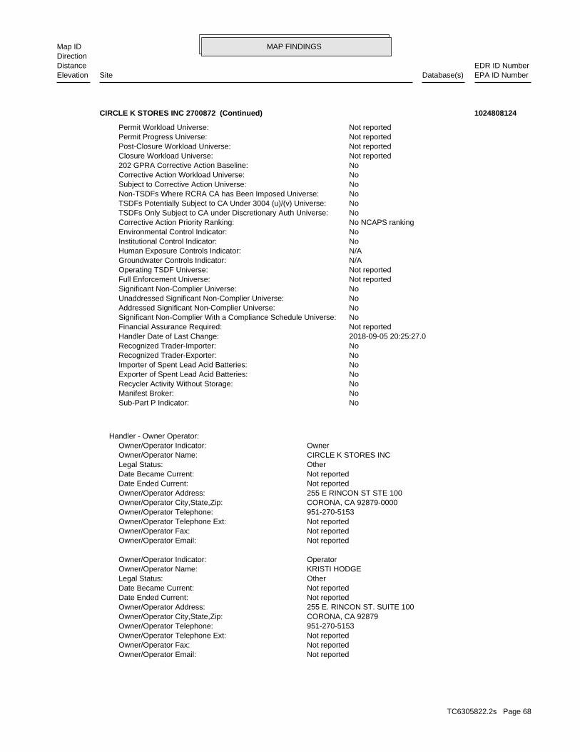
MAP FINDINGSMap IDDirection
EDR ID NumberDistanceEPA ID NumberDatabase(s)SiteElevation
Not reportedOwner/Operator Email: Not reportedOwner/Operator Fax: Not reportedOwner/Operator Telephone Ext: 951-270-5153Owner/Operator Telephone: CORONA, CA 92879Owner/Operator City,State,Zip: 255 E. RINCON ST. SUITE 100Owner/Operator Address: Not reportedDate Ended Current: Not reportedDate Became Current: OtherLegal Status: KRISTI HODGEOwner/Operator Name: OperatorOwner/Operator Indicator:
Not reportedOwner/Operator Email: Not reportedOwner/Operator Fax: Not reportedOwner/Operator Telephone Ext: 951-270-5153Owner/Operator Telephone: CORONA, CA 92879-0000Owner/Operator City,State,Zip: 255 E RINCON ST STE 100Owner/Operator Address: Not reportedDate Ended Current: Not reportedDate Became Current: OtherLegal Status: CIRCLE K STORES INCOwner/Operator Name: OwnerOwner/Operator Indicator:
Handler - Owner Operator:
NoSub-Part P Indicator: NoManifest Broker: NoRecycler Activity Without Storage: NoExporter of Spent Lead Acid Batteries: NoImporter of Spent Lead Acid Batteries: NoRecognized Trader-Exporter: NoRecognized Trader-Importer: 2018-09-05 20:25:27.0Handler Date of Last Change: Not reportedFinancial Assurance Required: NoSignificant Non-Complier With a Compliance Schedule Universe: NoAddressed Significant Non-Complier Universe: NoUnaddressed Significant Non-Complier Universe: NoSignificant Non-Complier Universe: Not reportedFull Enforcement Universe: Not reportedOperating TSDF Universe: N/AGroundwater Controls Indicator: N/AHuman Exposure Controls Indicator: NoInstitutional Control Indicator: NoEnvironmental Control Indicator: No NCAPS rankingCorrective Action Priority Ranking: NoTSDFs Only Subject to CA under Discretionary Auth Universe: NoTSDFs Potentially Subject to CA Under 3004 (u)/(v) Universe: NoNon-TSDFs Where RCRA CA has Been Imposed Universe: NoSubject to Corrective Action Universe: NoCorrective Action Workload Universe: No202 GPRA Corrective Action Baseline: Not reportedClosure Workload Universe: Not reportedPost-Closure Workload Universe: Not reportedPermit Progress Universe: Not reportedPermit Workload Universe:
CIRCLE K STORES INC 2700872 (Continued) 1024808124
TC6305822.2s Page 68

MAP FINDINGSMap IDDirection
EDR ID NumberDistanceEPA ID NumberDatabase(s)SiteElevation
No Evaluations FoundEvaluations:Evaluation Action Summary:
No Violations FoundViolations:Facility Has Received Notices of Violations:
OTHER GASOLINE STATIONSNAICS Description: 44719NAICS Code:
List of NAICS Codes and Descriptions:
Not reportedElectronic Manifest Broker: Not reportedNon Storage Recycler Activity: YesCurrent Record: NoSpent Lead Acid Battery Exporter: NoSpent Lead Acid Battery Importer: NoRecognized Trader Exporter: NoRecognized Trader Importer: NoLarge Quantity Handler of Universal Waste: Not reportedState District Owner: Not a generator, verifiedFederal Waste Generator Description: CIRCLE K STORES INC 2700872Handler Name: 2004-01-15 00:00:00.0Receive Date:
Historic Generators:
CIRCLE K STORES INC 2700872 (Continued) 1024808124
2Total Tanks:RIVERSIDERegion:MORENO VALLEY, CA 92553City,State,Zip:13261 PERRIS BLVDAddress:CIRCLE K #2700872Name:
RIVERSIDE CO. UST:
-117.22669Longitude: 33.92791Latitude: Riverside County Department of Environmental HealthPermitting Agency: FA0014111Facility ID: MORENO VALLEY, CA 92553City,State,Zip: 13261 PERRIS BLVDAddress: CIRCLE K STORE #2700872Name:
-117.2254809Longitude: 33.9292178Latitude: RIVERSIDE COUNTYPermitting Agency: 205Facility ID: MORENO VALLEY, CA 92553City,State,Zip: 13261 PERRIS BLVDAddress: CIRCLE K #2700872Name:
UST:
937 ft. Site 4 of 8 in cluster C0.177 mi.
Relative:Higher
Actual:1600 ft.
1/8-1/4 MORENO VALLEY, CA 92553NW 13261 PERRIS BLVD N/AC17 USTCIRCLE K #2700872 U003948842
TC6305822.2s Page 69
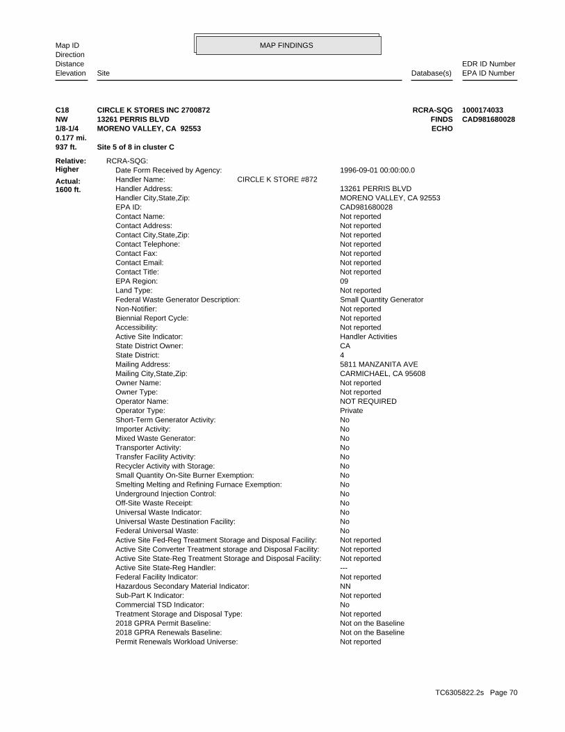
MAP FINDINGSMap IDDirection
EDR ID NumberDistanceEPA ID NumberDatabase(s)SiteElevation
Not reportedPermit Renewals Workload Universe: Not on the Baseline2018 GPRA Renewals Baseline: Not on the Baseline2018 GPRA Permit Baseline: Not reportedTreatment Storage and Disposal Type: NoCommercial TSD Indicator: Not reportedSub-Part K Indicator: NNHazardous Secondary Material Indicator: Not reportedFederal Facility Indicator: ---Active Site State-Reg Handler: Not reportedActive Site State-Reg Treatment Storage and Disposal Facility: Not reportedActive Site Converter Treatment storage and Disposal Facility: Not reportedActive Site Fed-Reg Treatment Storage and Disposal Facility: NoFederal Universal Waste: NoUniversal Waste Destination Facility: NoUniversal Waste Indicator: NoOff-Site Waste Receipt: NoUnderground Injection Control: NoSmelting Melting and Refining Furnace Exemption: NoSmall Quantity On-Site Burner Exemption: NoRecycler Activity with Storage: NoTransfer Facility Activity: NoTransporter Activity: NoMixed Waste Generator: NoImporter Activity: NoShort-Term Generator Activity: PrivateOperator Type: NOT REQUIREDOperator Name: Not reportedOwner Type: Not reportedOwner Name: CARMICHAEL, CA 95608Mailing City,State,Zip: 5811 MANZANITA AVEMailing Address: 4State District: CAState District Owner: Handler ActivitiesActive Site Indicator: Not reportedAccessibility: Not reportedBiennial Report Cycle: Not reportedNon-Notifier: Small Quantity GeneratorFederal Waste Generator Description: Not reportedLand Type: 09EPA Region: Not reportedContact Title: Not reportedContact Email: Not reportedContact Fax: Not reportedContact Telephone: Not reportedContact City,State,Zip: Not reportedContact Address: Not reportedContact Name: CAD981680028EPA ID: MORENO VALLEY, CA 92553Handler City,State,Zip: 13261 PERRIS BLVDHandler Address: CIRCLE K STORE #872Handler Name: 1996-09-01 00:00:00.0Date Form Received by Agency:
RCRA-SQG:
937 ft. Site 5 of 8 in cluster C0.177 mi.
Relative:Higher
Actual:1600 ft.
1/8-1/4 ECHOMORENO VALLEY, CA 92553NW FINDS13261 PERRIS BLVD CAD981680028C18 RCRA-SQGCIRCLE K STORES INC 2700872 1000174033
TC6305822.2s Page 70

MAP FINDINGSMap IDDirection
EDR ID NumberDistanceEPA ID NumberDatabase(s)SiteElevation
Not reportedOwner/Operator Email: Not reportedOwner/Operator Fax: Not reportedOwner/Operator Telephone Ext: 415-555-1212Owner/Operator Telephone: NOT REQUIRED, ME 99999Owner/Operator City,State,Zip: NOT REQUIREDOwner/Operator Address: Not reportedDate Ended Current: Not reportedDate Became Current: PrivateLegal Status: NOT REQUIREDOwner/Operator Name: OperatorOwner/Operator Indicator:
Not reportedOwner/Operator Email: Not reportedOwner/Operator Fax: Not reportedOwner/Operator Telephone Ext: 415-555-1212Owner/Operator Telephone: NOT REQUIRED, ME 99999Owner/Operator City,State,Zip: NOT REQUIREDOwner/Operator Address: Not reportedDate Ended Current: Not reportedDate Became Current: PrivateLegal Status: CIRCLE K CORPOwner/Operator Name: OwnerOwner/Operator Indicator:
Handler - Owner Operator:
Not reportedSub-Part P Indicator: Not reportedManifest Broker: Not reportedRecycler Activity Without Storage: NoExporter of Spent Lead Acid Batteries: NoImporter of Spent Lead Acid Batteries: NoRecognized Trader-Exporter: NoRecognized Trader-Importer: 2002-06-27 03:29:55.0Handler Date of Last Change: Not reportedFinancial Assurance Required: NoSignificant Non-Complier With a Compliance Schedule Universe: NoAddressed Significant Non-Complier Universe: NoUnaddressed Significant Non-Complier Universe: NoSignificant Non-Complier Universe: Not reportedFull Enforcement Universe: Not reportedOperating TSDF Universe: N/AGroundwater Controls Indicator: N/AHuman Exposure Controls Indicator: NoInstitutional Control Indicator: NoEnvironmental Control Indicator: No NCAPS rankingCorrective Action Priority Ranking: NoTSDFs Only Subject to CA under Discretionary Auth Universe: NoTSDFs Potentially Subject to CA Under 3004 (u)/(v) Universe: NoNon-TSDFs Where RCRA CA has Been Imposed Universe: NoSubject to Corrective Action Universe: NoCorrective Action Workload Universe: No202 GPRA Corrective Action Baseline: Not reportedClosure Workload Universe: Not reportedPost-Closure Workload Universe: Not reportedPermit Progress Universe: Not reportedPermit Workload Universe:
CIRCLE K STORES INC 2700872 (Continued) 1000174033
TC6305822.2s Page 71
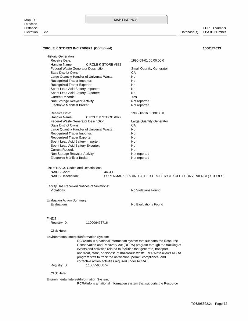
MAP FINDINGSMap IDDirection
EDR ID NumberDistanceEPA ID NumberDatabase(s)SiteElevation
RCRAInfo is a national information system that supports the ResourceEnvironmental Interest/Information System:
Click Here:
110055656874Registry ID:corrective action activities required under RCRA.program staff to track the notification, permit, compliance, andand treat, store, or dispose of hazardous waste. RCRAInfo allows RCRAevents and activities related to facilities that generate, transport,Conservation and Recovery Act (RCRA) program through the tracking ofRCRAInfo is a national information system that supports the Resource
Environmental Interest/Information System:
Click Here:
110006473716Registry ID:FINDS:
No Evaluations FoundEvaluations:Evaluation Action Summary:
No Violations FoundViolations:Facility Has Received Notices of Violations:
SUPERMARKETS AND OTHER GROCERY (EXCEPT CONVENIENCE) STORESNAICS Description: 44511NAICS Code:
List of NAICS Codes and Descriptions:
Not reportedElectronic Manifest Broker: Not reportedNon Storage Recycler Activity: NoCurrent Record: NoSpent Lead Acid Battery Exporter: NoSpent Lead Acid Battery Importer: NoRecognized Trader Exporter: NoRecognized Trader Importer: NoLarge Quantity Handler of Universal Waste: CAState District Owner: Large Quantity GeneratorFederal Waste Generator Description: CIRCLE K STORE #872Handler Name: 1986-10-16 00:00:00.0Receive Date:
Not reportedElectronic Manifest Broker: Not reportedNon Storage Recycler Activity: YesCurrent Record: NoSpent Lead Acid Battery Exporter: NoSpent Lead Acid Battery Importer: NoRecognized Trader Exporter: NoRecognized Trader Importer: NoLarge Quantity Handler of Universal Waste: CAState District Owner: Small Quantity GeneratorFederal Waste Generator Description: CIRCLE K STORE #872Handler Name: 1996-09-01 00:00:00.0Receive Date:
Historic Generators:
CIRCLE K STORES INC 2700872 (Continued) 1000174033
TC6305822.2s Page 72
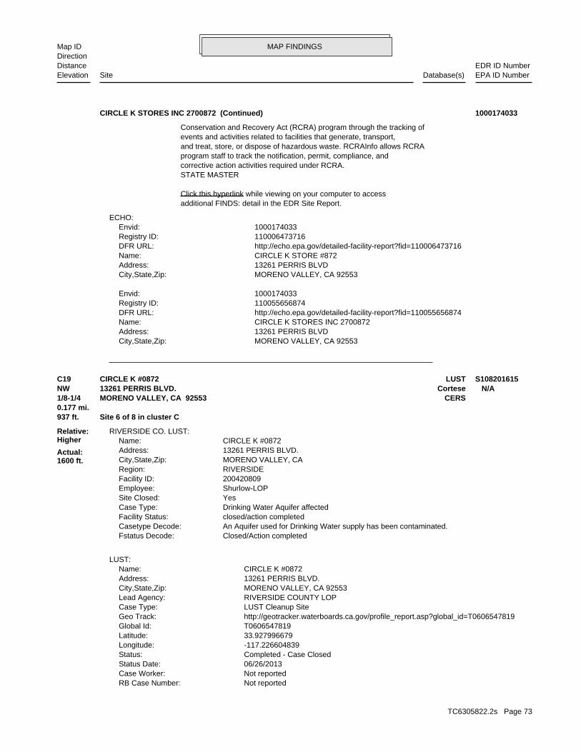
MAP FINDINGSMap IDDirection
EDR ID NumberDistanceEPA ID NumberDatabase(s)SiteElevation
MORENO VALLEY, CA 92553City,State,Zip: 13261 PERRIS BLVDAddress: CIRCLE K STORES INC 2700872Name: http://echo.epa.gov/detailed-facility-report?fid=110055656874DFR URL: 110055656874Registry ID: 1000174033Envid:
MORENO VALLEY, CA 92553City,State,Zip: 13261 PERRIS BLVDAddress: CIRCLE K STORE #872Name: http://echo.epa.gov/detailed-facility-report?fid=110006473716DFR URL: 110006473716Registry ID: 1000174033Envid:
ECHO:
additional FINDS: detail in the EDR Site Report.Click this hyperlink while viewing on your computer to access
STATE MASTERcorrective action activities required under RCRA.program staff to track the notification, permit, compliance, andand treat, store, or dispose of hazardous waste. RCRAInfo allows RCRAevents and activities related to facilities that generate, transport,Conservation and Recovery Act (RCRA) program through the tracking of
CIRCLE K STORES INC 2700872 (Continued) 1000174033
Not reportedRB Case Number: Not reportedCase Worker: 06/26/2013Status Date: Completed - Case ClosedStatus: -117.226604839Longitude: 33.927996679Latitude: T0606547819Global Id: http://geotracker.waterboards.ca.gov/profile_report.asp?global_id=T0606547819Geo Track: LUST Cleanup SiteCase Type: RIVERSIDE COUNTY LOPLead Agency: MORENO VALLEY, CA 92553City,State,Zip: 13261 PERRIS BLVD.Address: CIRCLE K #0872Name:
LUST:
Closed/Action completedFstatus Decode: An Aquifer used for Drinking Water supply has been contaminated.Casetype Decode: closed/action completedFacility Status: Drinking Water Aquifer affectedCase Type: YesSite Closed: Shurlow-LOPEmployee: 200420809Facility ID: RIVERSIDERegion: MORENO VALLEY, CACity,State,Zip: 13261 PERRIS BLVD.Address: CIRCLE K #0872Name:
RIVERSIDE CO. LUST:
937 ft. Site 6 of 8 in cluster C0.177 mi.
Relative:Higher
Actual:1600 ft.
1/8-1/4 CERSMORENO VALLEY, CA 92553NW Cortese13261 PERRIS BLVD. N/AC19 LUSTCIRCLE K #0872 S108201615
TC6305822.2s Page 73
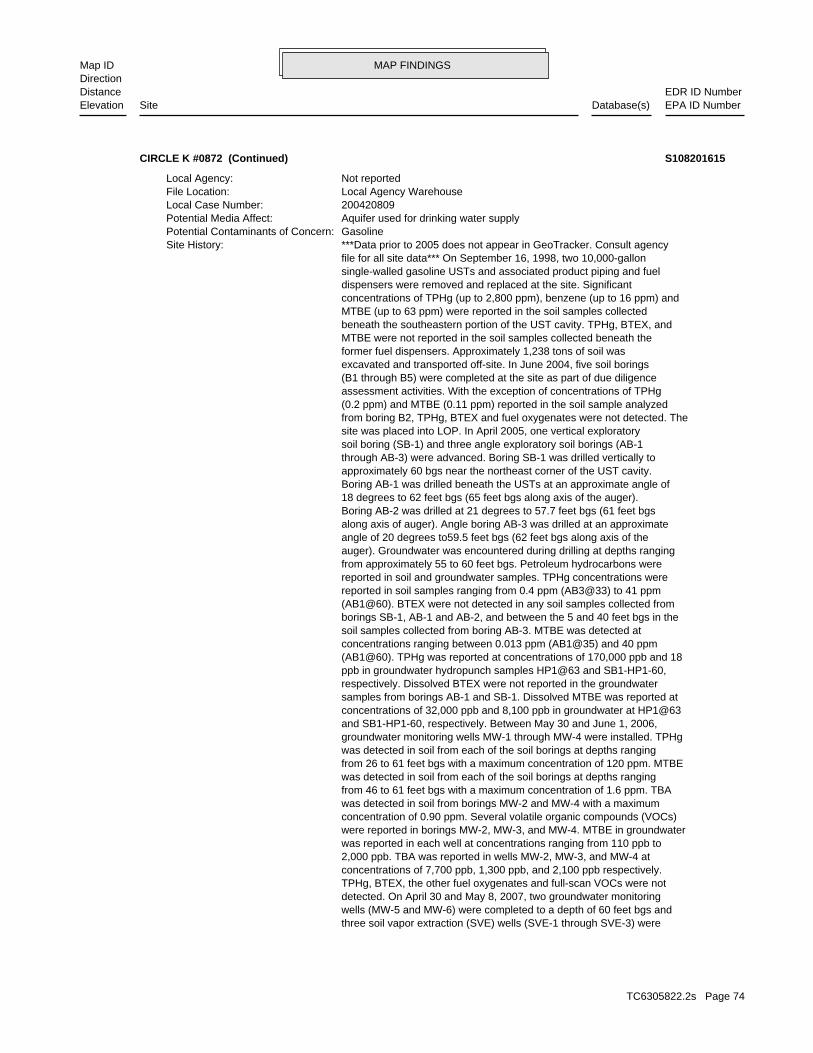
MAP FINDINGSMap IDDirection
EDR ID NumberDistanceEPA ID NumberDatabase(s)SiteElevation
three soil vapor extraction (SVE) wells (SVE-1 through SVE-3) were wells (MW-5 and MW-6) were completed to a depth of 60 feet bgs and detected. On April 30 and May 8, 2007, two groundwater monitoring TPHg, BTEX, the other fuel oxygenates and full-scan VOCs were not concentrations of 7,700 ppb, 1,300 ppb, and 2,100 ppb respectively. 2,000 ppb. TBA was reported in wells MW-2, MW-3, and MW-4 at was reported in each well at concentrations ranging from 110 ppb to were reported in borings MW-2, MW-3, and MW-4. MTBE in groundwater concentration of 0.90 ppm. Several volatile organic compounds (VOCs) was detected in soil from borings MW-2 and MW-4 with a maximum from 46 to 61 feet bgs with a maximum concentration of 1.6 ppm. TBA was detected in soil from each of the soil borings at depths ranging from 26 to 61 feet bgs with a maximum concentration of 120 ppm. MTBE was detected in soil from each of the soil borings at depths ranging groundwater monitoring wells MW-1 through MW-4 were installed. TPHg and SB1-HP1-60, respectively. Between May 30 and June 1, 2006, concentrations of 32,000 ppb and 8,100 ppb in groundwater at HP1@63 samples from borings AB-1 and SB-1. Dissolved MTBE was reported at respectively. Dissolved BTEX were not reported in the groundwater ppb in groundwater hydropunch samples HP1@63 and SB1-HP1-60, (AB1@60). TPHg was reported at concentrations of 170,000 ppb and 18 concentrations ranging between 0.013 ppm (AB1@35) and 40 ppm soil samples collected from boring AB-3. MTBE was detected at borings SB-1, AB-1 and AB-2, and between the 5 and 40 feet bgs in the (AB1@60). BTEX were not detected in any soil samples collected from reported in soil samples ranging from 0.4 ppm (AB3@33) to 41 ppm reported in soil and groundwater samples. TPHg concentrations were from approximately 55 to 60 feet bgs. Petroleum hydrocarbons were auger). Groundwater was encountered during drilling at depths ranging angle of 20 degrees to59.5 feet bgs (62 feet bgs along axis of the along axis of auger). Angle boring AB-3 was drilled at an approximate Boring AB-2 was drilled at 21 degrees to 57.7 feet bgs (61 feet bgs 18 degrees to 62 feet bgs (65 feet bgs along axis of the auger). Boring AB-1 was drilled beneath the USTs at an approximate angle of approximately 60 bgs near the northeast corner of the UST cavity. through AB-3) were advanced. Boring SB-1 was drilled vertically to soil boring (SB-1) and three angle exploratory soil borings (AB-1 site was placed into LOP. In April 2005, one vertical exploratory from boring B2, TPHg, BTEX and fuel oxygenates were not detected. The (0.2 ppm) and MTBE (0.11 ppm) reported in the soil sample analyzed assessment activities. With the exception of concentrations of TPHg (B1 through B5) were completed at the site as part of due diligence excavated and transported off-site. In June 2004, five soil borings former fuel dispensers. Approximately 1,238 tons of soil was MTBE were not reported in the soil samples collected beneath the beneath the southeastern portion of the UST cavity. TPHg, BTEX, and MTBE (up to 63 ppm) were reported in the soil samples collected concentrations of TPHg (up to 2,800 ppm), benzene (up to 16 ppm) and dispensers were removed and replaced at the site. Significant single-walled gasoline USTs and associated product piping and fuel file for all site data*** On September 16, 1998, two 10,000-gallon ***Data prior to 2005 does not appear in GeoTracker. Consult agencySite History: GasolinePotential Contaminants of Concern: Aquifer used for drinking water supplyPotential Media Affect: 200420809Local Case Number: Local Agency WarehouseFile Location: Not reportedLocal Agency:
CIRCLE K #0872 (Continued) S108201615
TC6305822.2s Page 74

MAP FINDINGSMap IDDirection
EDR ID NumberDistanceEPA ID NumberDatabase(s)SiteElevation
Corrective Action Plan / Remedial Action PlanAction: 12/21/2007Date: RESPONSEAction Type: T0606547819Global Id:
MeetingAction: 06/08/2010Date: ENFORCEMENTAction Type: T0606547819Global Id:
File reviewAction: 07/16/2008Date: ENFORCEMENTAction Type: T0606547819Global Id:
LUST:
2013. June 26, 2013 - Closure documents issued by RCDEH. CASE CLOSED. for closure proposal was started March 19, 2013 through April 20, a%g/L MTBE by the third quarter 2012. 60 day public comment period decay rate calculations, well MW-2 will reach the clean-up goal of 5 were performed for MTBE concentration reported in MW-2. Based on the warranted. Contaminant decay rate calculations for the groundwater Associates, Inc. determined that active remediation no longer appears the rate of natural attenuation occurring at the site, ATC concentrations in the groundwater have declined since 2006. Based on and was 7 ppb during the first quarter 2012. Petroleum hydrocarbon TPHg, BTEX, and TBA since January 2010. MTBE is only detected in MW-2 groundwater and have decreased to non-detectable concentrations of ethylbenzene, 2900 ppb MTBE and 7700 ppb TBA has been detected in the to 1400 ppb TPHg, 3.2 ppb benzene, 0.73 ppb xylenes, 2.5 ppb The groundwater has been monitored since the third quarter 2006. Up of MTBE were removed at a rate of approximately 8.5 pounds per day at 15 ppmV. 254 pounds of TPHg, 3.4 pounds of benzene, and 25 pounds at 2.2 ppmV. MTBE started at <0.5 ppmV, peaked at 48 ppmV and ended 200 ppmV. Benzene started at 1.3 ppmV, peaked at 6.6 ppmV and ended thereafter. TPHg started at 190 ppmV, peaked at 430 ppmV and ended at Vapor samples were taken at 2 hours, 8 hours, 24 hours, and weekly only SVE-1 remaining until the system was shut down April 15, 2012. off line March 30 due to low influent hydrocarbon concentrations with the end of the 5-day SVE pilot test. Wells SVE-2 and SVE-3 were taken the request of RCDEH based on the increasing vapor concentrations at started March 16, 2012 using vapor wells SVE-1, SVE-2, and SVE-3 at 0.064 ppm TBA was detected in the soil. A 30-day SVE event was though OS-10) were installed. Up to 0.91 ppm TPHg, 1.3 ppm MTBE and detected in the soil. In June 2008, ten ozone sparge (OS) wells (OS-1 complete down-gradient assessment. No TPHg, BTEX or oxygenates were technology. In November 2007, wells MW-7 and MW-8 were installed to effective at removing hydrocarbons and would be a feasible remedial SVE-3 to 11 ppmv. 44 pounds of hydrocarbons was extracted. SVE was concentrations in SVE-1 decreased to 23 ppmv, while increasing in and 2.0 ppmv for wells SVE-1 and SVE-3, and influent MTBE 120 ppmv for wells SVE-1 and SVE-3, benzene concentrations were 4.1 5-day event, influent TPHg concentrations were reported as 240 and 2007, a five day SVE pilot test was conducted. At the end of the (SVE-1 through SVE-3) were installed in May, 2007. From May 14 to 19, samples and groundwater samples were non-detect. Three SVE wells respectively. Groundwater was encountered at approximately Soil completed to depths of 45 feet, 30 feet, and 45 feet bgs,
CIRCLE K #0872 (Continued) S108201615
TC6305822.2s Page 75
MAP FINDINGSMap IDDirection
EDR ID NumberDistanceEPA ID NumberDatabase(s)SiteElevation
ENFORCEMENTAction Type: T0606547819Global Id:
Respond to PetitionAction: 05/20/2013Date: RESPONSEAction Type: T0606547819Global Id:
Other Report / DocumentAction: 03/25/2013Date: RESPONSEAction Type: T0606547819Global Id:
Monitoring Report - QuarterlyAction: 01/15/2013Date: RESPONSEAction Type: T0606547819Global Id:
Monitoring Report - QuarterlyAction: 10/15/2007Date: RESPONSEAction Type: T0606547819Global Id:
Monitoring Report - QuarterlyAction: 04/15/2007Date: RESPONSEAction Type: T0606547819Global Id:
Leak ReportedAction: 08/03/2004Date: OtherAction Type: T0606547819Global Id:
Notification - Public Notice of Case Closure - #RCDEH 030413Action: 03/04/2013Date: ENFORCEMENTAction Type: T0606547819Global Id:
File reviewAction: 03/09/2009Date: ENFORCEMENTAction Type: T0606547819Global Id:
File reviewAction: 09/09/2008Date: ENFORCEMENTAction Type: T0606547819Global Id:
Monitoring Report - QuarterlyAction: 10/15/2012Date: RESPONSEAction Type: T0606547819Global Id:
Monitoring Report - QuarterlyAction: 01/15/2008Date: RESPONSEAction Type: T0606547819Global Id:
CIRCLE K #0872 (Continued) S108201615
TC6305822.2s Page 76
MAP FINDINGSMap IDDirection
EDR ID NumberDistanceEPA ID NumberDatabase(s)SiteElevation
Staff Letter - #RCDEH 120710Action: 12/07/2010Date: ENFORCEMENTAction Type: T0606547819Global Id:
Monitoring Report - QuarterlyAction: 07/15/2007Date: RESPONSEAction Type: T0606547819Global Id:
Monitoring Report - QuarterlyAction: 07/15/2010Date: RESPONSEAction Type: T0606547819Global Id:
Monitoring Report - AnnuallyAction: 04/15/2010Date: RESPONSEAction Type: T0606547819Global Id:
Monitoring Report - QuarterlyAction: 01/15/2010Date: RESPONSEAction Type: T0606547819Global Id:
Monitoring Report - QuarterlyAction: 10/15/2009Date: RESPONSEAction Type: T0606547819Global Id:
Monitoring Report - QuarterlyAction: 10/15/2010Date: RESPONSEAction Type: T0606547819Global Id:
Monitoring Report - QuarterlyAction: 09/02/2008Date: RESPONSEAction Type: T0606547819Global Id:
Staff Letter - #RCDEH073109Action: 07/31/2009Date: ENFORCEMENTAction Type: T0606547819Global Id:
Monitoring Report - QuarterlyAction: 12/15/2008Date: RESPONSEAction Type: T0606547819Global Id:
Monitoring Report - QuarterlyAction: 04/15/2009Date: RESPONSEAction Type: T0606547819Global Id:
Staff Letter - #Riv Co 062209Action: 06/22/2009Date:
CIRCLE K #0872 (Continued) S108201615
TC6305822.2s Page 77
MAP FINDINGSMap IDDirection
EDR ID NumberDistanceEPA ID NumberDatabase(s)SiteElevation
ENFORCEMENTAction Type: T0606547819Global Id:
Staff Letter - #022808Action: 02/28/2008Date: ENFORCEMENTAction Type: T0606547819Global Id:
Staff Letter - #RCDEH 091807Action: 09/18/2007Date: ENFORCEMENTAction Type: T0606547819Global Id:
Well Destruction Report - Regulator RespondedAction: 07/08/2013Date: RESPONSEAction Type: T0606547819Global Id:
Monitoring Report - QuarterlyAction: 01/15/2011Date: RESPONSEAction Type: T0606547819Global Id:
Pilot Study / Treatability WorkplanAction: 02/01/2011Date: RESPONSEAction Type: T0606547819Global Id:
Leak DiscoveryAction: 06/10/2004Date: OtherAction Type: T0606547819Global Id:
File reviewAction: 05/23/2007Date: ENFORCEMENTAction Type: T0606547819Global Id:
File reviewAction: 04/03/2008Date: ENFORCEMENTAction Type: T0606547819Global Id:
Technical Correspondence / Assistance / Other - #021908Action: 02/19/2008Date: ENFORCEMENTAction Type: T0606547819Global Id:
Staff Letter - #RCDEH 070711Action: 07/07/2011Date: ENFORCEMENTAction Type: T0606547819Global Id:
Monitoring Report - QuarterlyAction: 07/15/2009Date: RESPONSEAction Type: T0606547819Global Id:
CIRCLE K #0872 (Continued) S108201615
TC6305822.2s Page 78
MAP FINDINGSMap IDDirection
EDR ID NumberDistanceEPA ID NumberDatabase(s)SiteElevation
Staff Letter - #032408Action: 03/24/2008Date: ENFORCEMENTAction Type: T0606547819Global Id:
Soil Vapor Extraction (SVE)Action: 03/16/2012Date: REMEDIATIONAction Type: T0606547819Global Id:
Soil Vapor Extraction (SVE)Action: 05/14/2007Date: REMEDIATIONAction Type: T0606547819Global Id:
ExcavationAction: 09/16/1998Date: REMEDIATIONAction Type: T0606547819Global Id:
Other WorkplanAction: 08/26/2011Date: RESPONSEAction Type: T0606547819Global Id:
Monitoring Report - QuarterlyAction: 10/15/2011Date: RESPONSEAction Type: T0606547819Global Id:
Monitoring Report - QuarterlyAction: 07/15/2011Date: RESPONSEAction Type: T0606547819Global Id:
Monitoring Report - AnnuallyAction: 04/15/2011Date: RESPONSEAction Type: T0606547819Global Id:
CAP/RAP - Final Remediation / Design PlanAction: 04/15/2008Date: RESPONSEAction Type: T0606547819Global Id:
Staff Letter - #RCDEH 030413Action: 03/04/2013Date: ENFORCEMENTAction Type: T0606547819Global Id:
Closure/No Further Action Letter - #RCDEH Closure DocumentsAction: 06/26/2013Date: ENFORCEMENTAction Type: T0606547819Global Id:
Staff Letter - #RCDEH 012512Action: 01/25/2012Date:
CIRCLE K #0872 (Continued) S108201615
TC6305822.2s Page 79
MAP FINDINGSMap IDDirection
EDR ID NumberDistanceEPA ID NumberDatabase(s)SiteElevation
05/14/2007Status Date: Open - RemediationStatus: T0606547819Global Id:
08/04/2004Status Date: Open - Site AssessmentStatus: T0606547819Global Id:
07/01/2004Status Date: Open - Site AssessmentStatus: T0606547819Global Id:
06/10/2004Status Date: Open - Case Begin DateStatus: T0606547819Global Id:
LUST:
Monitoring Report - AnnuallyAction: 04/15/2012Date: RESPONSEAction Type: T0606547819Global Id:
Verbal CommunicationAction: 03/16/2012Date: RESPONSEAction Type: T0606547819Global Id:
Monitoring Report - QuarterlyAction: 01/15/2012Date: RESPONSEAction Type: T0606547819Global Id:
Leak StoppedAction: 08/30/2004Date: OtherAction Type: T0606547819Global Id:
MeetingAction: 09/30/2009Date: ENFORCEMENTAction Type: T0606547819Global Id:
MeetingAction: 03/01/2012Date: ENFORCEMENTAction Type: T0606547819Global Id:
LOP Case Closure Summary to RB - #RCDEH 021413Action: 02/14/2013Date: ENFORCEMENTAction Type: T0606547819Global Id:
MeetingAction: 06/27/2011Date: ENFORCEMENTAction Type: T0606547819Global Id:
CIRCLE K #0872 (Continued) S108201615
TC6305822.2s Page 80
MAP FINDINGSMap IDDirection
EDR ID NumberDistanceEPA ID NumberDatabase(s)SiteElevation
CERS:
Active OpenFile Name: Not reportedWaste Management Uit Name: Not reportedSolid Waste Id No: Not reportedWID Id: Not reportedRegion 2: Not reportedEffective Date: Not reportedWaste Discharge System No: Not reportedOrder No: activeFlag: Not reportedSwat R: Not reportedEnf Type: Not reportedOwner: Not reportedLongitude: Not reportedLatitude: Not reportedSite Code: Not reportedStatus Date: COMPLETED - CASE CLOSEDCleanup Status: LUST CLEANUP SITESite/Facility Type: T0606547819Global ID: Not reportedEnvirostor Id: CORTESERegion: MORENO VALLEY, CA 92553City,State,Zip: 13261 PERRIS BLVD.Address: CIRCLE K #0872Name:
CORTESE:
06/26/2013Status Date: Completed - Case ClosedStatus: T0606547819Global Id:
03/04/2013Status Date: Open - Eligible for ClosureStatus: T0606547819Global Id:
05/12/2010Status Date: Open - Site AssessmentStatus: T0606547819Global Id:
05/12/2010Status Date: Open - RemediationStatus: T0606547819Global Id:
03/24/2008Status Date: Open - RemediationStatus: T0606547819Global Id:
02/28/2008Status Date: Open - RemediationStatus: T0606547819Global Id:
01/02/2008Status Date: Open - RemediationStatus: T0606547819Global Id:
CIRCLE K #0872 (Continued) S108201615
TC6305822.2s Page 81
MAP FINDINGSMap IDDirection
EDR ID NumberDistanceEPA ID NumberDatabase(s)SiteElevation
Leaking Underground Storage Tank Cleanup SiteCERS Description: T0606547819CERS ID: 187602Site ID: MORENO VALLEY, CA 92553City,State,Zip: 13261 PERRIS BLVD.Address: CIRCLE K #0872Name:
CIRCLE K #0872 (Continued) S108201615
---Active Site State-Reg Handler: Not reportedActive Site State-Reg Treatment Storage and Disposal Facility: Not reportedActive Site Converter Treatment storage and Disposal Facility: Not reportedActive Site Fed-Reg Treatment Storage and Disposal Facility: NoFederal Universal Waste: NoUniversal Waste Destination Facility: NoUniversal Waste Indicator: NoOff-Site Waste Receipt: NoUnderground Injection Control: NoSmelting Melting and Refining Furnace Exemption: NoSmall Quantity On-Site Burner Exemption: NoRecycler Activity with Storage: NoTransfer Facility Activity: NoTransporter Activity: NoMixed Waste Generator: NoImporter Activity: NoShort-Term Generator Activity: OtherOperator Type: JUAN MADRIGALOperator Name: OtherOwner Type: J’S FAMILY AUTO CENTER INCOwner Name: MORENO VALLEY, CA 92553Mailing City,State,Zip: 13231 PERRIS BLVDMailing Address: Not reportedState District: Not reportedState District Owner: Not reportedActive Site Indicator: Not reportedAccessibility: Not reportedBiennial Report Cycle: Not reportedNon-Notifier: Not a generator, verifiedFederal Waste Generator Description: Not reportedLand Type: 09EPA Region: Not reportedContact Title: [email protected] Email: 951-242-4734Contact Fax: 951-391-9844Contact Telephone: SAN JACINTO, CA 92582Contact City,State,Zip: 656 BAILEY LNContact Address: JUAN MADRIGALContact Name: CAL000401572EPA ID: MORENO VALLEY, CA 92553Handler City,State,Zip: 13231 PERRIS BLVDHandler Address: J’S FAMILY AUTO CENTER INCHandler Name: 2014-10-24 00:00:00.0Date Form Received by Agency:
RCRA NonGen / NLR:
1042 ft. Site 7 of 8 in cluster C0.197 mi.
Relative:Higher
Actual:1602 ft.
1/8-1/4 MORENO VALLEY, CA 92553NW 13231 PERRIS BLVD CAL000401572C20 RCRA NonGen / NLRJ’S FAMILY AUTO CENTER INC 1025869202
TC6305822.2s Page 82
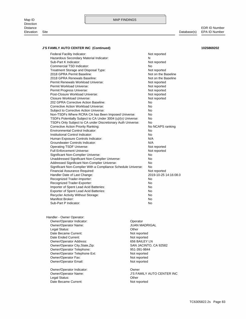
MAP FINDINGSMap IDDirection
EDR ID NumberDistanceEPA ID NumberDatabase(s)SiteElevation
Not reportedDate Became Current: OtherLegal Status: J’S FAMILY AUTO CENTER INCOwner/Operator Name: OwnerOwner/Operator Indicator:
Not reportedOwner/Operator Email: Not reportedOwner/Operator Fax: Not reportedOwner/Operator Telephone Ext: 951-391-9844Owner/Operator Telephone: SAN JACINTO, CA 92582Owner/Operator City,State,Zip: 656 BAILEY LNOwner/Operator Address: Not reportedDate Ended Current: Not reportedDate Became Current: OtherLegal Status: JUAN MADRIGALOwner/Operator Name: OperatorOwner/Operator Indicator:
Handler - Owner Operator:
NoSub-Part P Indicator: NoManifest Broker: NoRecycler Activity Without Storage: NoExporter of Spent Lead Acid Batteries: NoImporter of Spent Lead Acid Batteries: NoRecognized Trader-Exporter: NoRecognized Trader-Importer: 2019-10-25 14:16:08.0Handler Date of Last Change: Not reportedFinancial Assurance Required: NoSignificant Non-Complier With a Compliance Schedule Universe: NoAddressed Significant Non-Complier Universe: NoUnaddressed Significant Non-Complier Universe: NoSignificant Non-Complier Universe: Not reportedFull Enforcement Universe: Not reportedOperating TSDF Universe: N/AGroundwater Controls Indicator: N/AHuman Exposure Controls Indicator: NoInstitutional Control Indicator: NoEnvironmental Control Indicator: No NCAPS rankingCorrective Action Priority Ranking: NoTSDFs Only Subject to CA under Discretionary Auth Universe: NoTSDFs Potentially Subject to CA Under 3004 (u)/(v) Universe: NoNon-TSDFs Where RCRA CA has Been Imposed Universe: NoSubject to Corrective Action Universe: NoCorrective Action Workload Universe: No202 GPRA Corrective Action Baseline: Not reportedClosure Workload Universe: Not reportedPost-Closure Workload Universe: Not reportedPermit Progress Universe: Not reportedPermit Workload Universe: Not reportedPermit Renewals Workload Universe: Not on the Baseline2018 GPRA Renewals Baseline: Not on the Baseline2018 GPRA Permit Baseline: Not reportedTreatment Storage and Disposal Type: NoCommercial TSD Indicator: Not reportedSub-Part K Indicator: NHazardous Secondary Material Indicator: Not reportedFederal Facility Indicator:
J’S FAMILY AUTO CENTER INC (Continued) 1025869202
TC6305822.2s Page 83
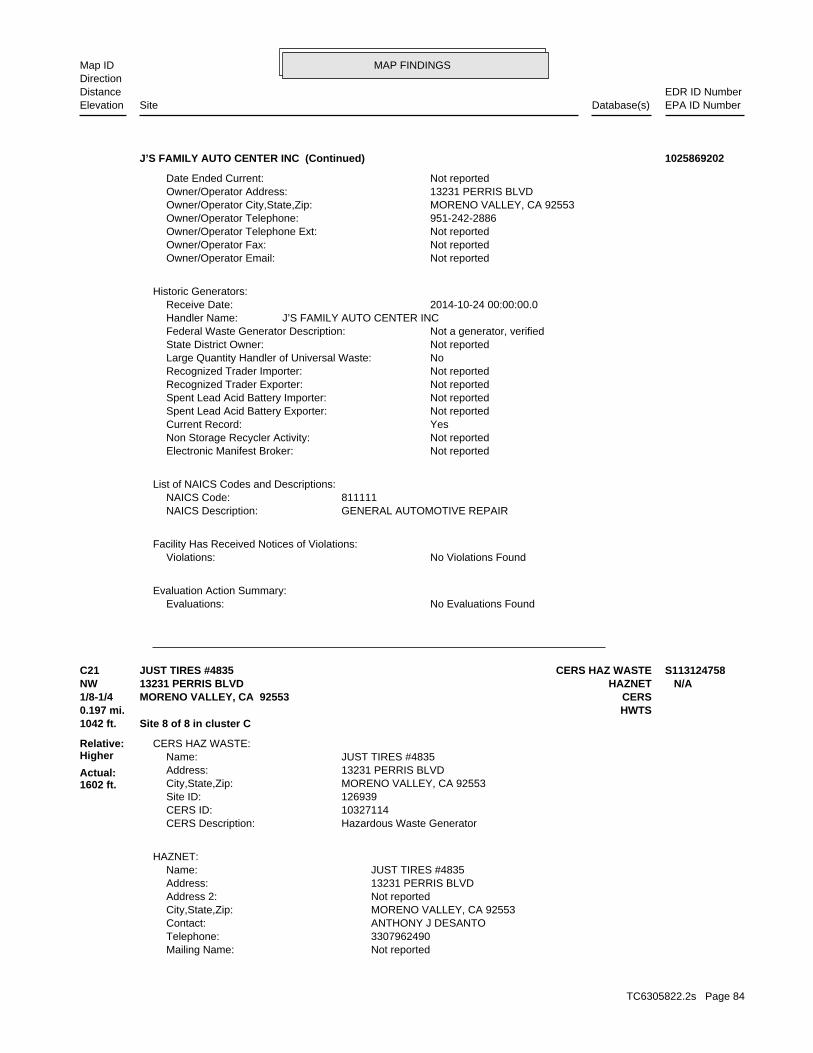
MAP FINDINGSMap IDDirection
EDR ID NumberDistanceEPA ID NumberDatabase(s)SiteElevation
No Evaluations FoundEvaluations:Evaluation Action Summary:
No Violations FoundViolations:Facility Has Received Notices of Violations:
GENERAL AUTOMOTIVE REPAIRNAICS Description: 811111NAICS Code:
List of NAICS Codes and Descriptions:
Not reportedElectronic Manifest Broker: Not reportedNon Storage Recycler Activity: YesCurrent Record: Not reportedSpent Lead Acid Battery Exporter: Not reportedSpent Lead Acid Battery Importer: Not reportedRecognized Trader Exporter: Not reportedRecognized Trader Importer: NoLarge Quantity Handler of Universal Waste: Not reportedState District Owner: Not a generator, verifiedFederal Waste Generator Description: J’S FAMILY AUTO CENTER INCHandler Name: 2014-10-24 00:00:00.0Receive Date:
Historic Generators:
Not reportedOwner/Operator Email: Not reportedOwner/Operator Fax: Not reportedOwner/Operator Telephone Ext: 951-242-2886Owner/Operator Telephone: MORENO VALLEY, CA 92553Owner/Operator City,State,Zip: 13231 PERRIS BLVDOwner/Operator Address: Not reportedDate Ended Current:
J’S FAMILY AUTO CENTER INC (Continued) 1025869202
Not reportedMailing Name: 3307962490Telephone: ANTHONY J DESANTOContact: MORENO VALLEY, CA 92553City,State,Zip: Not reportedAddress 2: 13231 PERRIS BLVDAddress: JUST TIRES #4835Name:
HAZNET:
Hazardous Waste GeneratorCERS Description: 10327114CERS ID: 126939Site ID: MORENO VALLEY, CA 92553City,State,Zip: 13231 PERRIS BLVDAddress: JUST TIRES #4835Name:
CERS HAZ WASTE:
1042 ft. Site 8 of 8 in cluster C0.197 mi. HWTS
Relative:Higher
Actual:1602 ft.
1/8-1/4 CERSMORENO VALLEY, CA 92553NW HAZNET13231 PERRIS BLVD N/AC21 CERS HAZ WASTEJUST TIRES #4835 S113124758
TC6305822.2s Page 84
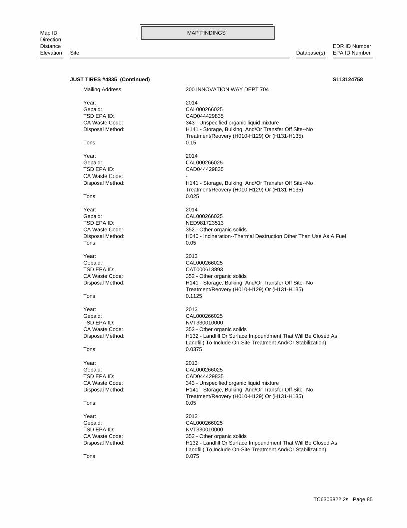
MAP FINDINGSMap IDDirection
EDR ID NumberDistanceEPA ID NumberDatabase(s)SiteElevation
0.075Tons: Landfill( To Include On-Site Treatment And/Or Stabilization) H132 - Landfill Or Surface Impoundment That Will Be Closed AsDisposal Method: 352 - Other organic solidsCA Waste Code: NVT330010000TSD EPA ID: CAL000266025Gepaid: 2012Year:
0.05Tons: Treatment/Reovery (H010-H129) Or (H131-H135) H141 - Storage, Bulking, And/Or Transfer Off Site--NoDisposal Method: 343 - Unspecified organic liquid mixtureCA Waste Code: CAD044429835TSD EPA ID: CAL000266025Gepaid: 2013Year:
0.0375Tons: Landfill( To Include On-Site Treatment And/Or Stabilization) H132 - Landfill Or Surface Impoundment That Will Be Closed AsDisposal Method: 352 - Other organic solidsCA Waste Code: NVT330010000TSD EPA ID: CAL000266025Gepaid: 2013Year:
0.1125Tons: Treatment/Reovery (H010-H129) Or (H131-H135) H141 - Storage, Bulking, And/Or Transfer Off Site--NoDisposal Method: 352 - Other organic solidsCA Waste Code: CAT000613893TSD EPA ID: CAL000266025Gepaid: 2013Year:
0.05Tons: H040 - Incineration--Thermal Destruction Other Than Use As A FuelDisposal Method: 352 - Other organic solidsCA Waste Code: NED981723513TSD EPA ID: CAL000266025Gepaid: 2014Year:
0.025Tons: Treatment/Reovery (H010-H129) Or (H131-H135) H141 - Storage, Bulking, And/Or Transfer Off Site--NoDisposal Method: -CA Waste Code: CAD044429835TSD EPA ID: CAL000266025Gepaid: 2014Year:
0.15Tons: Treatment/Reovery (H010-H129) Or (H131-H135) H141 - Storage, Bulking, And/Or Transfer Off Site--NoDisposal Method: 343 - Unspecified organic liquid mixtureCA Waste Code: CAD044429835TSD EPA ID: CAL000266025Gepaid: 2014Year:
200 INNOVATION WAY DEPT 704Mailing Address:
JUST TIRES #4835 (Continued) S113124758
TC6305822.2s Page 85
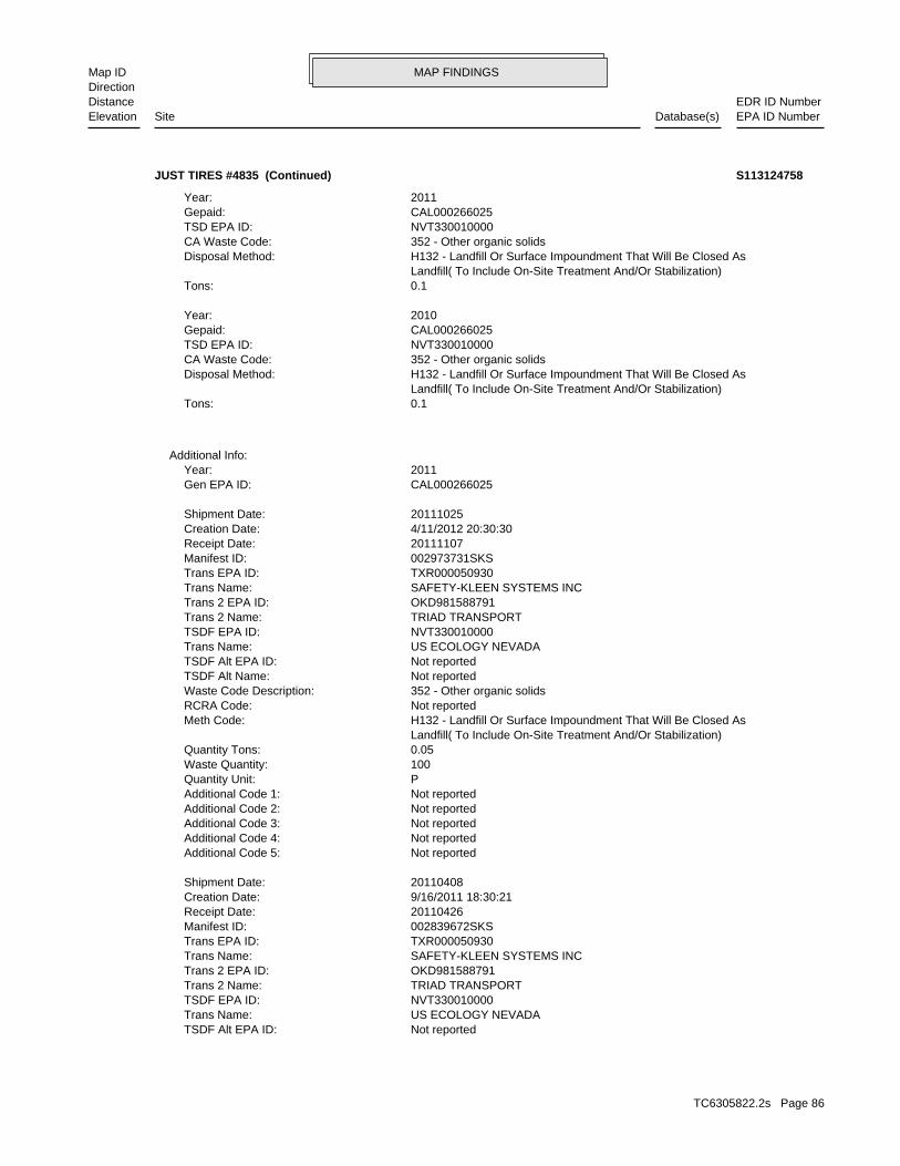
MAP FINDINGSMap IDDirection
EDR ID NumberDistanceEPA ID NumberDatabase(s)SiteElevation
Not reportedTSDF Alt EPA ID: US ECOLOGY NEVADATrans Name: NVT330010000TSDF EPA ID: TRIAD TRANSPORTTrans 2 Name: OKD981588791Trans 2 EPA ID: SAFETY-KLEEN SYSTEMS INCTrans Name: TXR000050930Trans EPA ID: 002839672SKSManifest ID: 20110426Receipt Date: 9/16/2011 18:30:21Creation Date: 20110408Shipment Date:
Not reportedAdditional Code 5: Not reportedAdditional Code 4: Not reportedAdditional Code 3: Not reportedAdditional Code 2: Not reportedAdditional Code 1: PQuantity Unit: 100Waste Quantity: 0.05Quantity Tons: Landfill( To Include On-Site Treatment And/Or Stabilization) H132 - Landfill Or Surface Impoundment That Will Be Closed AsMeth Code: Not reportedRCRA Code: 352 - Other organic solidsWaste Code Description: Not reportedTSDF Alt Name: Not reportedTSDF Alt EPA ID: US ECOLOGY NEVADATrans Name: NVT330010000TSDF EPA ID: TRIAD TRANSPORTTrans 2 Name: OKD981588791Trans 2 EPA ID: SAFETY-KLEEN SYSTEMS INCTrans Name: TXR000050930Trans EPA ID: 002973731SKSManifest ID: 20111107Receipt Date: 4/11/2012 20:30:30Creation Date: 20111025Shipment Date:
CAL000266025Gen EPA ID: 2011Year:
Additional Info:
0.1Tons: Landfill( To Include On-Site Treatment And/Or Stabilization) H132 - Landfill Or Surface Impoundment That Will Be Closed AsDisposal Method: 352 - Other organic solidsCA Waste Code: NVT330010000TSD EPA ID: CAL000266025Gepaid: 2010Year:
0.1Tons: Landfill( To Include On-Site Treatment And/Or Stabilization) H132 - Landfill Or Surface Impoundment That Will Be Closed AsDisposal Method: 352 - Other organic solidsCA Waste Code: NVT330010000TSD EPA ID: CAL000266025Gepaid: 2011Year:
JUST TIRES #4835 (Continued) S113124758
TC6305822.2s Page 86
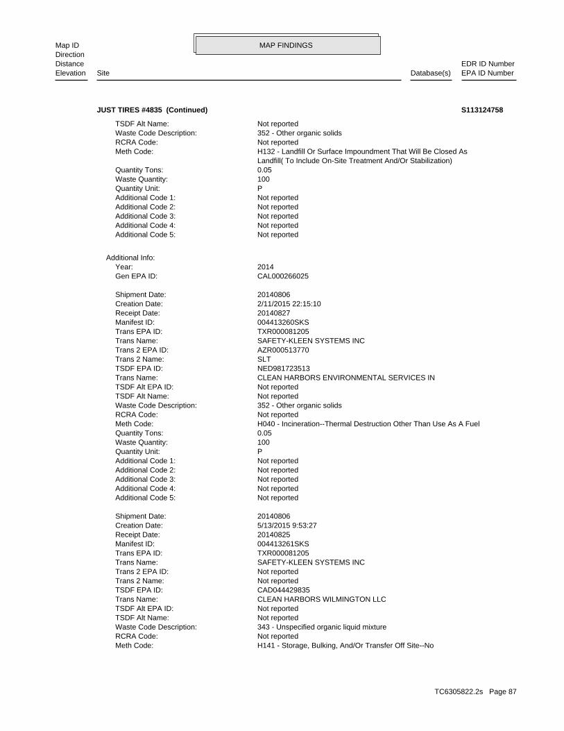
MAP FINDINGSMap IDDirection
EDR ID NumberDistanceEPA ID NumberDatabase(s)SiteElevation
H141 - Storage, Bulking, And/Or Transfer Off Site--NoMeth Code: Not reportedRCRA Code: 343 - Unspecified organic liquid mixtureWaste Code Description: Not reportedTSDF Alt Name: Not reportedTSDF Alt EPA ID: CLEAN HARBORS WILMINGTON LLCTrans Name: CAD044429835TSDF EPA ID: Not reportedTrans 2 Name: Not reportedTrans 2 EPA ID: SAFETY-KLEEN SYSTEMS INCTrans Name: TXR000081205Trans EPA ID: 004413261SKSManifest ID: 20140825Receipt Date: 5/13/2015 9:53:27Creation Date: 20140806Shipment Date:
Not reportedAdditional Code 5: Not reportedAdditional Code 4: Not reportedAdditional Code 3: Not reportedAdditional Code 2: Not reportedAdditional Code 1: PQuantity Unit: 100Waste Quantity: 0.05Quantity Tons: H040 - Incineration--Thermal Destruction Other Than Use As A FuelMeth Code: Not reportedRCRA Code: 352 - Other organic solidsWaste Code Description: Not reportedTSDF Alt Name: Not reportedTSDF Alt EPA ID: CLEAN HARBORS ENVIRONMENTAL SERVICES INTrans Name: NED981723513TSDF EPA ID: SLTTrans 2 Name: AZR000513770Trans 2 EPA ID: SAFETY-KLEEN SYSTEMS INCTrans Name: TXR000081205Trans EPA ID: 004413260SKSManifest ID: 20140827Receipt Date: 2/11/2015 22:15:10Creation Date: 20140806Shipment Date:
CAL000266025Gen EPA ID: 2014Year:
Additional Info:
Not reportedAdditional Code 5: Not reportedAdditional Code 4: Not reportedAdditional Code 3: Not reportedAdditional Code 2: Not reportedAdditional Code 1: PQuantity Unit: 100Waste Quantity: 0.05Quantity Tons: Landfill( To Include On-Site Treatment And/Or Stabilization) H132 - Landfill Or Surface Impoundment That Will Be Closed AsMeth Code: Not reportedRCRA Code: 352 - Other organic solidsWaste Code Description: Not reportedTSDF Alt Name:
JUST TIRES #4835 (Continued) S113124758
TC6305822.2s Page 87
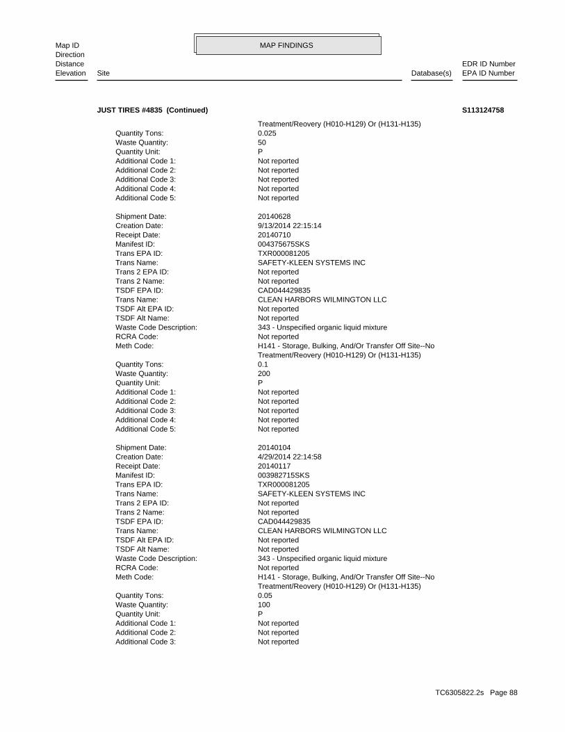
MAP FINDINGSMap IDDirection
EDR ID NumberDistanceEPA ID NumberDatabase(s)SiteElevation
Not reportedAdditional Code 3: Not reportedAdditional Code 2: Not reportedAdditional Code 1: PQuantity Unit: 100Waste Quantity: 0.05Quantity Tons: Treatment/Reovery (H010-H129) Or (H131-H135) H141 - Storage, Bulking, And/Or Transfer Off Site--NoMeth Code: Not reportedRCRA Code: 343 - Unspecified organic liquid mixtureWaste Code Description: Not reportedTSDF Alt Name: Not reportedTSDF Alt EPA ID: CLEAN HARBORS WILMINGTON LLCTrans Name: CAD044429835TSDF EPA ID: Not reportedTrans 2 Name: Not reportedTrans 2 EPA ID: SAFETY-KLEEN SYSTEMS INCTrans Name: TXR000081205Trans EPA ID: 003982715SKSManifest ID: 20140117Receipt Date: 4/29/2014 22:14:58Creation Date: 20140104Shipment Date:
Not reportedAdditional Code 5: Not reportedAdditional Code 4: Not reportedAdditional Code 3: Not reportedAdditional Code 2: Not reportedAdditional Code 1: PQuantity Unit: 200Waste Quantity: 0.1Quantity Tons: Treatment/Reovery (H010-H129) Or (H131-H135) H141 - Storage, Bulking, And/Or Transfer Off Site--NoMeth Code: Not reportedRCRA Code: 343 - Unspecified organic liquid mixtureWaste Code Description: Not reportedTSDF Alt Name: Not reportedTSDF Alt EPA ID: CLEAN HARBORS WILMINGTON LLCTrans Name: CAD044429835TSDF EPA ID: Not reportedTrans 2 Name: Not reportedTrans 2 EPA ID: SAFETY-KLEEN SYSTEMS INCTrans Name: TXR000081205Trans EPA ID: 004375675SKSManifest ID: 20140710Receipt Date: 9/13/2014 22:15:14Creation Date: 20140628Shipment Date:
Not reportedAdditional Code 5: Not reportedAdditional Code 4: Not reportedAdditional Code 3: Not reportedAdditional Code 2: Not reportedAdditional Code 1: PQuantity Unit: 50Waste Quantity: 0.025Quantity Tons: Treatment/Reovery (H010-H129) Or (H131-H135)
JUST TIRES #4835 (Continued) S113124758
TC6305822.2s Page 88
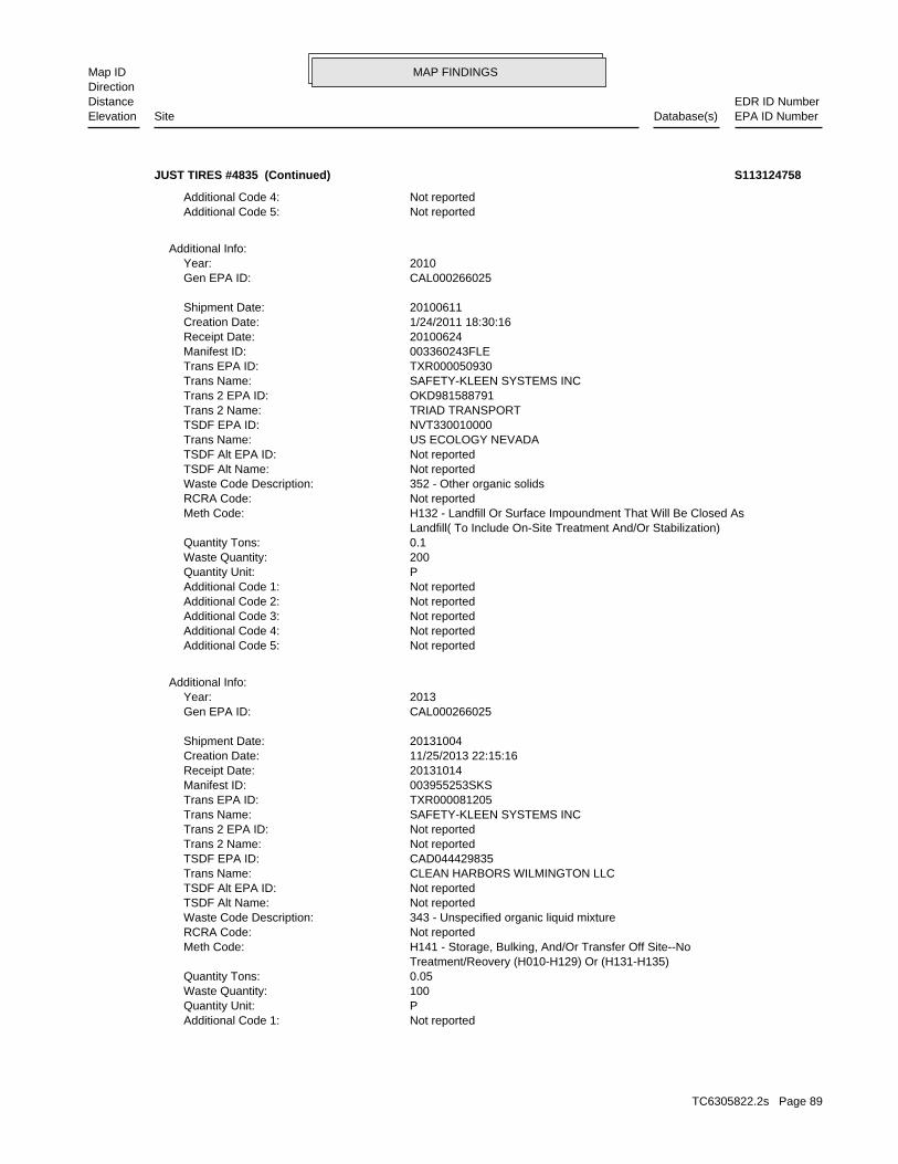
MAP FINDINGSMap IDDirection
EDR ID NumberDistanceEPA ID NumberDatabase(s)SiteElevation
Not reportedAdditional Code 1: PQuantity Unit: 100Waste Quantity: 0.05Quantity Tons: Treatment/Reovery (H010-H129) Or (H131-H135) H141 - Storage, Bulking, And/Or Transfer Off Site--NoMeth Code: Not reportedRCRA Code: 343 - Unspecified organic liquid mixtureWaste Code Description: Not reportedTSDF Alt Name: Not reportedTSDF Alt EPA ID: CLEAN HARBORS WILMINGTON LLCTrans Name: CAD044429835TSDF EPA ID: Not reportedTrans 2 Name: Not reportedTrans 2 EPA ID: SAFETY-KLEEN SYSTEMS INCTrans Name: TXR000081205Trans EPA ID: 003955253SKSManifest ID: 20131014Receipt Date: 11/25/2013 22:15:16Creation Date: 20131004Shipment Date:
CAL000266025Gen EPA ID: 2013Year:
Additional Info:
Not reportedAdditional Code 5: Not reportedAdditional Code 4: Not reportedAdditional Code 3: Not reportedAdditional Code 2: Not reportedAdditional Code 1: PQuantity Unit: 200Waste Quantity: 0.1Quantity Tons: Landfill( To Include On-Site Treatment And/Or Stabilization) H132 - Landfill Or Surface Impoundment That Will Be Closed AsMeth Code: Not reportedRCRA Code: 352 - Other organic solidsWaste Code Description: Not reportedTSDF Alt Name: Not reportedTSDF Alt EPA ID: US ECOLOGY NEVADATrans Name: NVT330010000TSDF EPA ID: TRIAD TRANSPORTTrans 2 Name: OKD981588791Trans 2 EPA ID: SAFETY-KLEEN SYSTEMS INCTrans Name: TXR000050930Trans EPA ID: 003360243FLEManifest ID: 20100624Receipt Date: 1/24/2011 18:30:16Creation Date: 20100611Shipment Date:
CAL000266025Gen EPA ID: 2010Year:
Additional Info:
Not reportedAdditional Code 5: Not reportedAdditional Code 4:
JUST TIRES #4835 (Continued) S113124758
TC6305822.2s Page 89
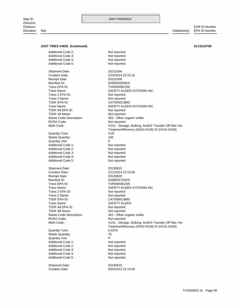
MAP FINDINGSMap IDDirection
EDR ID NumberDistanceEPA ID NumberDatabase(s)SiteElevation
8/25/2013 22:15:09Creation Date: 20130415Shipment Date:
Not reportedAdditional Code 5: Not reportedAdditional Code 4: Not reportedAdditional Code 3: Not reportedAdditional Code 2: Not reportedAdditional Code 1: PQuantity Unit: 75Waste Quantity: 0.0375Quantity Tons: Treatment/Reovery (H010-H129) Or (H131-H135) H141 - Storage, Bulking, And/Or Transfer Off Site--NoMeth Code: Not reportedRCRA Code: 352 - Other organic solidsWaste Code Description: Not reportedTSDF Alt Name: Not reportedTSDF Alt EPA ID: SAFETY KLEENTrans Name: CAT000613893TSDF EPA ID: Not reportedTrans 2 Name: Not reportedTrans 2 EPA ID: SAFETY-KLEEN SYSTEMS INCTrans Name: TXR000081205Trans EPA ID: 003850470SKSManifest ID: 20130820Receipt Date: 2/12/2014 22:15:06Creation Date: 20130815Shipment Date:
Not reportedAdditional Code 5: Not reportedAdditional Code 4: Not reportedAdditional Code 3: Not reportedAdditional Code 2: Not reportedAdditional Code 1: PQuantity Unit: 100Waste Quantity: 0.05Quantity Tons: Treatment/Reovery (H010-H129) Or (H131-H135) H141 - Storage, Bulking, And/Or Transfer Off Site--NoMeth Code: Not reportedRCRA Code: 352 - Other organic solidsWaste Code Description: Not reportedTSDF Alt Name: Not reportedTSDF Alt EPA ID: SAFETY-KLEEN SYSTEMS INCTrans Name: CAT000613893TSDF EPA ID: Not reportedTrans 2 Name: Not reportedTrans 2 EPA ID: SAFETY-KLEEN SYSTEMS INCTrans Name: TXR000081205Trans EPA ID: 003955305SKSManifest ID: 20131009Receipt Date: 2/24/2014 22:15:16Creation Date: 20131004Shipment Date:
Not reportedAdditional Code 5: Not reportedAdditional Code 4: Not reportedAdditional Code 3: Not reportedAdditional Code 2:
JUST TIRES #4835 (Continued) S113124758
TC6305822.2s Page 90
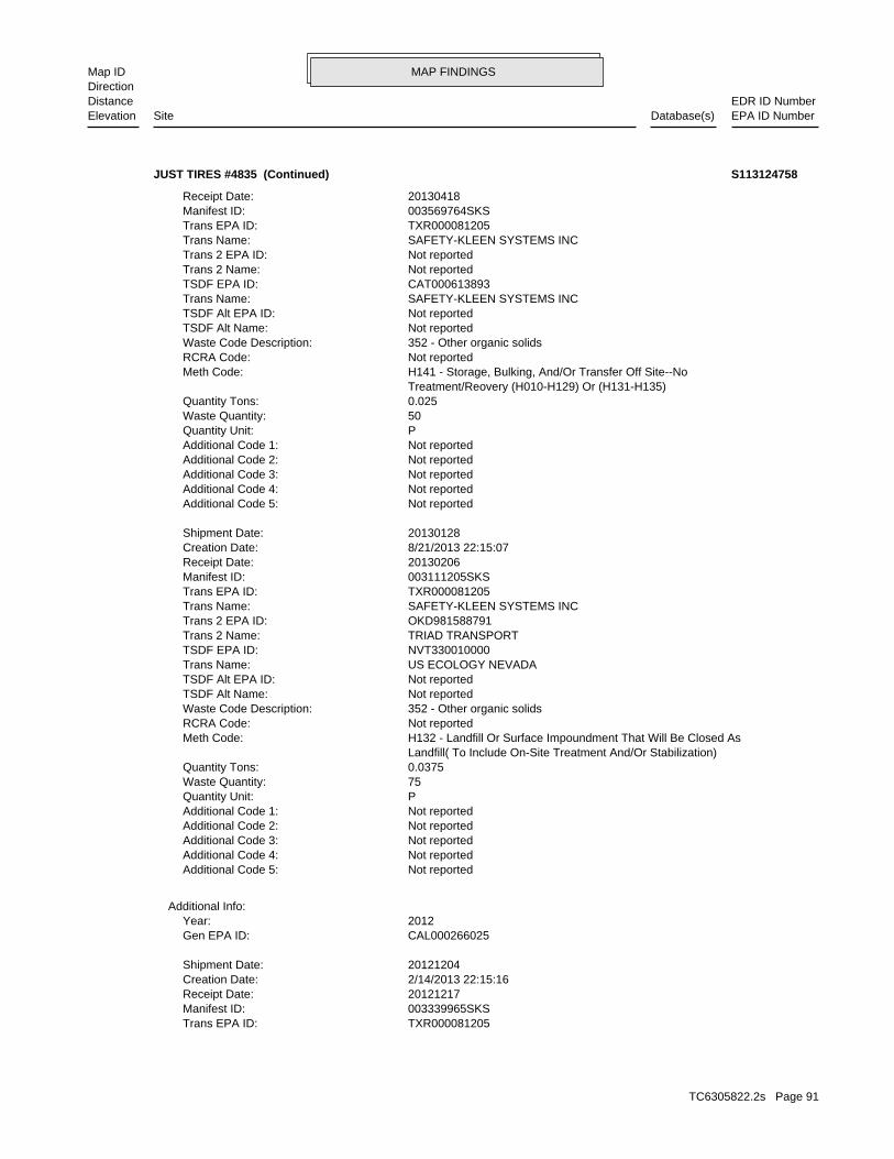
MAP FINDINGSMap IDDirection
EDR ID NumberDistanceEPA ID NumberDatabase(s)SiteElevation
TXR000081205Trans EPA ID: 003339965SKSManifest ID: 20121217Receipt Date: 2/14/2013 22:15:16Creation Date: 20121204Shipment Date:
CAL000266025Gen EPA ID: 2012Year:
Additional Info:
Not reportedAdditional Code 5: Not reportedAdditional Code 4: Not reportedAdditional Code 3: Not reportedAdditional Code 2: Not reportedAdditional Code 1: PQuantity Unit: 75Waste Quantity: 0.0375Quantity Tons: Landfill( To Include On-Site Treatment And/Or Stabilization) H132 - Landfill Or Surface Impoundment That Will Be Closed AsMeth Code: Not reportedRCRA Code: 352 - Other organic solidsWaste Code Description: Not reportedTSDF Alt Name: Not reportedTSDF Alt EPA ID: US ECOLOGY NEVADATrans Name: NVT330010000TSDF EPA ID: TRIAD TRANSPORTTrans 2 Name: OKD981588791Trans 2 EPA ID: SAFETY-KLEEN SYSTEMS INCTrans Name: TXR000081205Trans EPA ID: 003111205SKSManifest ID: 20130206Receipt Date: 8/21/2013 22:15:07Creation Date: 20130128Shipment Date:
Not reportedAdditional Code 5: Not reportedAdditional Code 4: Not reportedAdditional Code 3: Not reportedAdditional Code 2: Not reportedAdditional Code 1: PQuantity Unit: 50Waste Quantity: 0.025Quantity Tons: Treatment/Reovery (H010-H129) Or (H131-H135) H141 - Storage, Bulking, And/Or Transfer Off Site--NoMeth Code: Not reportedRCRA Code: 352 - Other organic solidsWaste Code Description: Not reportedTSDF Alt Name: Not reportedTSDF Alt EPA ID: SAFETY-KLEEN SYSTEMS INCTrans Name: CAT000613893TSDF EPA ID: Not reportedTrans 2 Name: Not reportedTrans 2 EPA ID: SAFETY-KLEEN SYSTEMS INCTrans Name: TXR000081205Trans EPA ID: 003569764SKSManifest ID: 20130418Receipt Date:
JUST TIRES #4835 (Continued) S113124758
TC6305822.2s Page 91
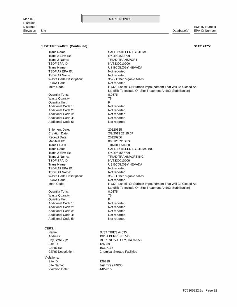
MAP FINDINGSMap IDDirection
EDR ID NumberDistanceEPA ID NumberDatabase(s)SiteElevation
4/8/2015Violation Date: Just Tires #4835Site Name: 126939Site ID:
Violations:
Chemical Storage FacilitiesCERS Description: 10327114CERS ID: 126939Site ID: MORENO VALLEY, CA 92553City,State,Zip: 13231 PERRIS BLVDAddress: JUST TIRES #4835Name:
CERS:
Not reportedAdditional Code 5: Not reportedAdditional Code 4: Not reportedAdditional Code 3: Not reportedAdditional Code 2: Not reportedAdditional Code 1: PQuantity Unit: 75Waste Quantity: 0.0375Quantity Tons: Landfill( To Include On-Site Treatment And/Or Stabilization) H132 - Landfill Or Surface Impoundment That Will Be Closed AsMeth Code: Not reportedRCRA Code: 352 - Other organic solidsWaste Code Description: Not reportedTSDF Alt Name: Not reportedTSDF Alt EPA ID: US ECOLOGY NEVADATrans Name: NVT330010000TSDF EPA ID: TRIAD TRANSPORT INCTrans 2 Name: OKD981588791Trans 2 EPA ID: SAFETY-KLEEN SYSTEMS INCTrans Name: TXR000050930Trans EPA ID: 003120891SKSManifest ID: 20120906Receipt Date: 2/3/2013 22:15:07Creation Date: 20120825Shipment Date:
Not reportedAdditional Code 5: Not reportedAdditional Code 4: Not reportedAdditional Code 3: Not reportedAdditional Code 2: Not reportedAdditional Code 1: PQuantity Unit: 75Waste Quantity: 0.0375Quantity Tons: Landfill( To Include On-Site Treatment And/Or Stabilization) H132 - Landfill Or Surface Impoundment That Will Be Closed AsMeth Code: Not reportedRCRA Code: 352 - Other organic solidsWaste Code Description: Not reportedTSDF Alt Name: Not reportedTSDF Alt EPA ID: US ECOLOGY NEVADATrans Name: NVT330010000TSDF EPA ID: TRIAD TRANSPORTTrans 2 Name: OKD981588791Trans 2 EPA ID: SAFETY-KLEEN SYSTEMSTrans Name:
JUST TIRES #4835 (Continued) S113124758
TC6305822.2s Page 92
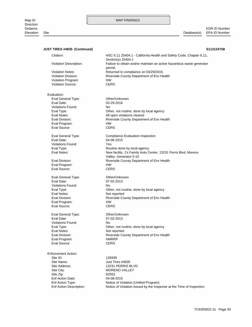
MAP FINDINGSMap IDDirection
EDR ID NumberDistanceEPA ID NumberDatabase(s)SiteElevation
Notice of Violation Issued by the Inspector at the Time of InspectionEnf Action Description: Notice of Violation (Unified Program)Enf Action Type: 04-08-2015Enf Action Date: 92553Site Zip: MORENO VALLEYSite City: 13231 PERRIS BLVDSite Address: Just Tires #4835Site Name: 126939Site ID:
Enforcement Action:
CERSEval Source: HMRRPEval Program: Riverside County Department of Env HealthEval Division: Not reportedEval Notes: Other, not routine, done by local agencyEval Type: NoViolations Found: 07-02-2013Eval Date: Other/UnknownEval General Type:
CERSEval Source: HWEval Program: Riverside County Department of Env HealthEval Division: Not reportedEval Notes: Other, not routine, done by local agencyEval Type: NoViolations Found: 07-02-2013Eval Date: Other/UnknownEval General Type:
CERSEval Source: HWEval Program: Riverside County Department of Env HealthEval Division: Valley. Generator 0-10 New facility. J’s Family Auto Center, 13231 Perris Blvd, MorenoEval Notes: Routine done by local agencyEval Type: YesViolations Found: 04-08-2015Eval Date: Compliance Evaluation InspectionEval General Type:
CERSEval Source: HWEval Program: Riverside County Department of Env HealthEval Division: All open violations clearedEval Notes: Other, not routine, done by local agencyEval Type: NoViolations Found: 03-29-2016Eval Date: Other/UnknownEval General Type:
Evaluation:
CERSViolation Source: HWViolation Program: Riverside County Department of Env HealthViolation Division: Returned to compliance on 03/29/2016.Violation Notes: permit. Failure to obtain and/or maintain an active hazardous waste generatorViolation Description: Section(s) 25404.1 HSC 6.11 25404.1 - California Health and Safety Code, Chapter 6.11,Citation:
JUST TIRES #4835 (Continued) S113124758
TC6305822.2s Page 93
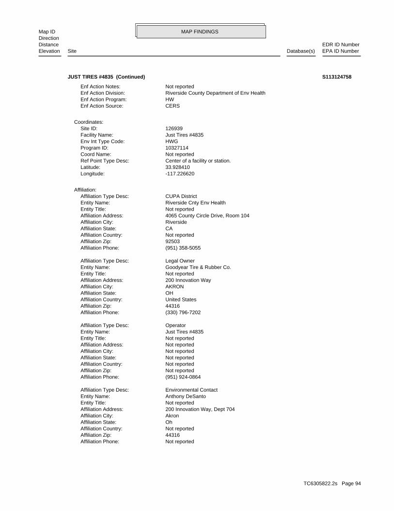
MAP FINDINGSMap IDDirection
EDR ID NumberDistanceEPA ID NumberDatabase(s)SiteElevation
Not reportedAffiliation Phone: 44316Affiliation Zip: Not reportedAffiliation Country: OhAffiliation State: AkronAffiliation City: 200 Innovation Way, Dept 704Affiliation Address: Not reportedEntity Title: Anthony DeSantoEntity Name: Environmental ContactAffiliation Type Desc:
(951) 924-0864Affiliation Phone: Not reportedAffiliation Zip: Not reportedAffiliation Country: Not reportedAffiliation State: Not reportedAffiliation City: Not reportedAffiliation Address: Not reportedEntity Title: Just Tires #4835Entity Name: OperatorAffiliation Type Desc:
(330) 796-7202Affiliation Phone: 44316Affiliation Zip: United StatesAffiliation Country: OHAffiliation State: AKRONAffiliation City: 200 Innovation WayAffiliation Address: Not reportedEntity Title: Goodyear Tire & Rubber Co.Entity Name: Legal OwnerAffiliation Type Desc:
(951) 358-5055Affiliation Phone: 92503Affiliation Zip: Not reportedAffiliation Country: CAAffiliation State: RiversideAffiliation City: 4065 County Circle Drive, Room 104Affiliation Address: Not reportedEntity Title: Riverside Cnty Env HealthEntity Name: CUPA DistrictAffiliation Type Desc:
Affiliation:
-117.226620Longitude: 33.928410Latitude: Center of a facility or station.Ref Point Type Desc: Not reportedCoord Name: 10327114Program ID: HWGEnv Int Type Code: Just Tires #4835Facility Name: 126939Site ID:
Coordinates:
CERSEnf Action Source: HWEnf Action Program: Riverside County Department of Env HealthEnf Action Division: Not reportedEnf Action Notes:
JUST TIRES #4835 (Continued) S113124758
TC6305822.2s Page 94
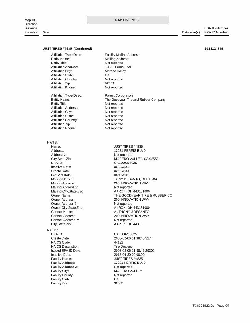
MAP FINDINGSMap IDDirection
EDR ID NumberDistanceEPA ID NumberDatabase(s)SiteElevation
92553Facility Zip: CAFacility State: Not reportedFacility County: MORENO VALLEYFacility City: Not reportedFacility Address 2: 13231 PERRIS BLVDFacility Address: JUST TIRES #4835Facility Name: 2015-06-30 00:00:00Inactive Date: 2003-02-06 11:38:46.29300Issued EPA ID Date: Tire DealersNAICS Description: 44132NAICS Code: 2003-02-06 11:38:46.327Create Date: CAL000266025EPA ID:
NAICS:
AKRON, OH 44316City,State,Zip: Not reportedContact Address 2: 200 INNOVATION WAYContact Address: ANTHONY J DESANTOContact Name: AKRON, OH 443161000Owner City,State,Zip: Not reportedOwner Address 2: 200 INNOVATION WAYOwner Address: THE GOODYEAR TIRE & RUBBER COOwner Name: AKRON, OH 443161000Mailing City,State,Zip: Not reportedMailing Address 2: 200 INNOVATION WAYMailing Address: TONY DESANTO, DEPT 704Mailing Name: 06/19/2015Last Act Date: 02/06/2003Create Date: 06/30/2015Inactive Date: CAL000266025EPA ID: MORENO VALLEY, CA 92553City,State,Zip: Not reportedAddress 2: 13231 PERRIS BLVDAddress: JUST TIRES #4835Name:
HWTS:
Not reportedAffiliation Phone: Not reportedAffiliation Zip: Not reportedAffiliation Country: Not reportedAffiliation State: Not reportedAffiliation City: Not reportedAffiliation Address: Not reportedEntity Title: The Goodyear Tire and Rubber CompanyEntity Name: Parent CorporationAffiliation Type Desc:
Not reportedAffiliation Phone: 92553Affiliation Zip: Not reportedAffiliation Country: CAAffiliation State: Moreno ValleyAffiliation City: 13231 Perris BlvdAffiliation Address: Not reportedEntity Title: Mailing AddressEntity Name: Facility Mailing AddressAffiliation Type Desc:
JUST TIRES #4835 (Continued) S113124758
TC6305822.2s Page 95
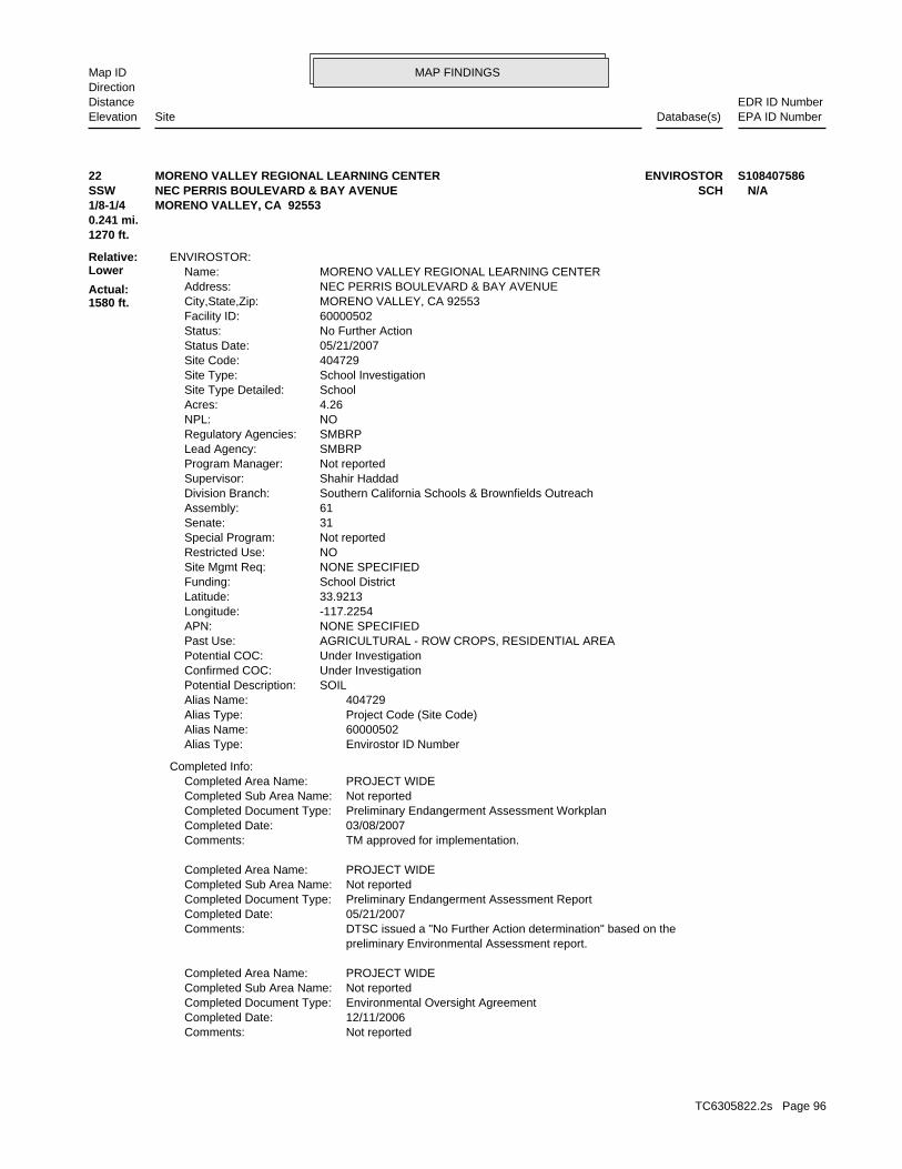
MAP FINDINGSMap IDDirection
EDR ID NumberDistanceEPA ID NumberDatabase(s)SiteElevation
Not reportedComments: 12/11/2006Completed Date: Environmental Oversight AgreementCompleted Document Type: Not reportedCompleted Sub Area Name: PROJECT WIDECompleted Area Name:
preliminary Environmental Assessment report. DTSC issued a "No Further Action determination" based on theComments: 05/21/2007Completed Date: Preliminary Endangerment Assessment ReportCompleted Document Type: Not reportedCompleted Sub Area Name: PROJECT WIDECompleted Area Name:
TM approved for implementation.Comments: 03/08/2007Completed Date: Preliminary Endangerment Assessment WorkplanCompleted Document Type: Not reportedCompleted Sub Area Name: PROJECT WIDECompleted Area Name:
Completed Info:
Envirostor ID NumberAlias Type: 60000502Alias Name: Project Code (Site Code)Alias Type: 404729Alias Name: SOILPotential Description: Under InvestigationConfirmed COC: Under InvestigationPotential COC: AGRICULTURAL - ROW CROPS, RESIDENTIAL AREAPast Use: NONE SPECIFIEDAPN: -117.2254Longitude: 33.9213Latitude: School DistrictFunding: NONE SPECIFIEDSite Mgmt Req: NORestricted Use: Not reportedSpecial Program: 31Senate: 61Assembly: Southern California Schools & Brownfields OutreachDivision Branch: Shahir HaddadSupervisor: Not reportedProgram Manager: SMBRPLead Agency: SMBRPRegulatory Agencies: NONPL: 4.26Acres: SchoolSite Type Detailed: School InvestigationSite Type: 404729Site Code: 05/21/2007Status Date: No Further ActionStatus: 60000502Facility ID: MORENO VALLEY, CA 92553City,State,Zip: NEC PERRIS BOULEVARD & BAY AVENUEAddress: MORENO VALLEY REGIONAL LEARNING CENTERName:
ENVIROSTOR:
1270 ft.0.241 mi.
Relative:Lower
Actual:1580 ft.
1/8-1/4 MORENO VALLEY, CA 92553SSW SCHNEC PERRIS BOULEVARD & BAY AVENUE N/A22 ENVIROSTORMORENO VALLEY REGIONAL LEARNING CENTER S108407586
TC6305822.2s Page 96
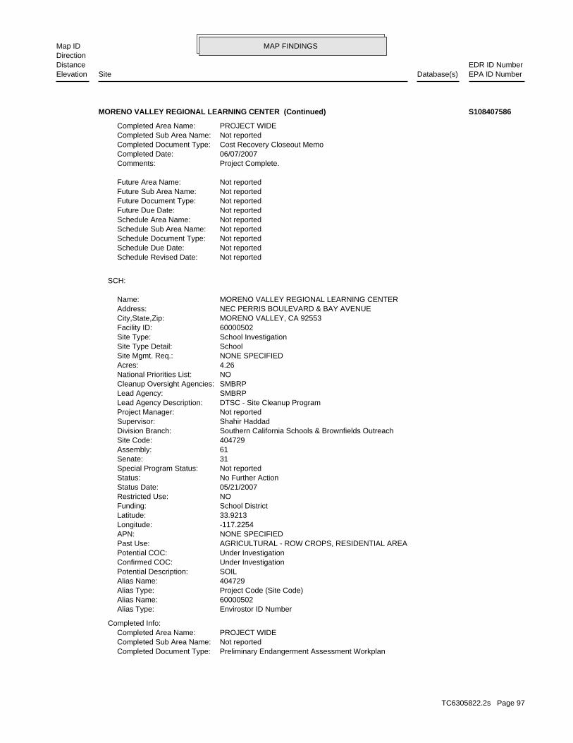
MAP FINDINGSMap IDDirection
EDR ID NumberDistanceEPA ID NumberDatabase(s)SiteElevation
Preliminary Endangerment Assessment WorkplanCompleted Document Type: Not reportedCompleted Sub Area Name: PROJECT WIDECompleted Area Name:
Completed Info:
Envirostor ID NumberAlias Type: 60000502Alias Name: Project Code (Site Code)Alias Type: 404729Alias Name: SOILPotential Description: Under InvestigationConfirmed COC: Under InvestigationPotential COC: AGRICULTURAL - ROW CROPS, RESIDENTIAL AREAPast Use: NONE SPECIFIEDAPN: -117.2254Longitude: 33.9213Latitude: School DistrictFunding: NORestricted Use: 05/21/2007Status Date: No Further ActionStatus: Not reportedSpecial Program Status: 31Senate: 61Assembly: 404729Site Code: Southern California Schools & Brownfields OutreachDivision Branch: Shahir HaddadSupervisor: Not reportedProject Manager: DTSC - Site Cleanup ProgramLead Agency Description: SMBRPLead Agency: SMBRPCleanup Oversight Agencies: NONational Priorities List: 4.26Acres: NONE SPECIFIEDSite Mgmt. Req.: SchoolSite Type Detail: School InvestigationSite Type: 60000502Facility ID: MORENO VALLEY, CA 92553City,State,Zip: NEC PERRIS BOULEVARD & BAY AVENUEAddress: MORENO VALLEY REGIONAL LEARNING CENTERName:
SCH:
Not reportedSchedule Revised Date: Not reportedSchedule Due Date: Not reportedSchedule Document Type: Not reportedSchedule Sub Area Name: Not reportedSchedule Area Name: Not reportedFuture Due Date: Not reportedFuture Document Type: Not reportedFuture Sub Area Name: Not reportedFuture Area Name:
Project Complete.Comments: 06/07/2007Completed Date: Cost Recovery Closeout MemoCompleted Document Type: Not reportedCompleted Sub Area Name: PROJECT WIDECompleted Area Name:
MORENO VALLEY REGIONAL LEARNING CENTER (Continued) S108407586
TC6305822.2s Page 97
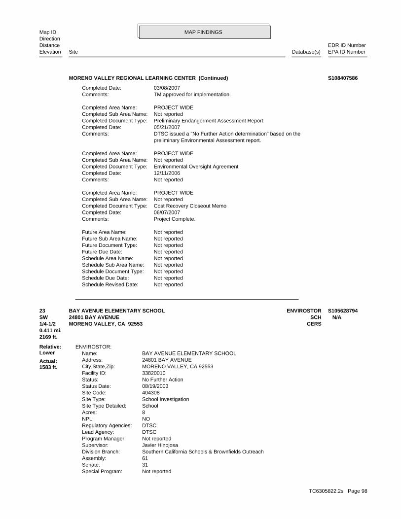
MAP FINDINGSMap IDDirection
EDR ID NumberDistanceEPA ID NumberDatabase(s)SiteElevation
Not reportedSchedule Revised Date: Not reportedSchedule Due Date: Not reportedSchedule Document Type: Not reportedSchedule Sub Area Name: Not reportedSchedule Area Name: Not reportedFuture Due Date: Not reportedFuture Document Type: Not reportedFuture Sub Area Name: Not reportedFuture Area Name:
Project Complete.Comments: 06/07/2007Completed Date: Cost Recovery Closeout MemoCompleted Document Type: Not reportedCompleted Sub Area Name: PROJECT WIDECompleted Area Name:
Not reportedComments: 12/11/2006Completed Date: Environmental Oversight AgreementCompleted Document Type: Not reportedCompleted Sub Area Name: PROJECT WIDECompleted Area Name:
preliminary Environmental Assessment report. DTSC issued a "No Further Action determination" based on theComments: 05/21/2007Completed Date: Preliminary Endangerment Assessment ReportCompleted Document Type: Not reportedCompleted Sub Area Name: PROJECT WIDECompleted Area Name:
TM approved for implementation.Comments: 03/08/2007Completed Date:
MORENO VALLEY REGIONAL LEARNING CENTER (Continued) S108407586
Not reportedSpecial Program: 31Senate: 61Assembly: Southern California Schools & Brownfields OutreachDivision Branch: Javier HinojosaSupervisor: Not reportedProgram Manager: DTSCLead Agency: DTSCRegulatory Agencies: NONPL: 8Acres: SchoolSite Type Detailed: School InvestigationSite Type: 404308Site Code: 08/19/2003Status Date: No Further ActionStatus: 33820010Facility ID: MORENO VALLEY, CA 92553City,State,Zip: 24801 BAY AVENUEAddress: BAY AVENUE ELEMENTARY SCHOOLName:
ENVIROSTOR:
2169 ft.0.411 mi.
Relative:Lower
Actual:1583 ft.
1/4-1/2 CERSMORENO VALLEY, CA 92553SW SCH24801 BAY AVENUE N/A23 ENVIROSTORBAY AVENUE ELEMENTARY SCHOOL S105628794
TC6305822.2s Page 98
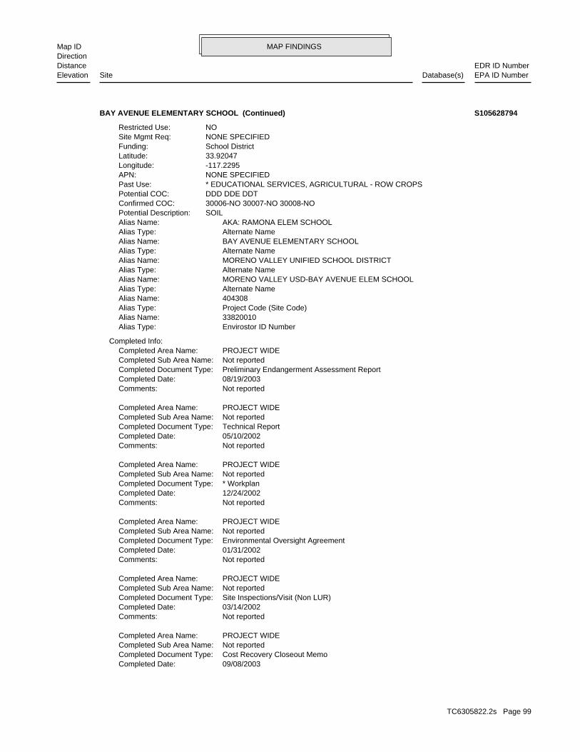
MAP FINDINGSMap IDDirection
EDR ID NumberDistanceEPA ID NumberDatabase(s)SiteElevation
09/08/2003Completed Date: Cost Recovery Closeout MemoCompleted Document Type: Not reportedCompleted Sub Area Name: PROJECT WIDECompleted Area Name:
Not reportedComments: 03/14/2002Completed Date: Site Inspections/Visit (Non LUR)Completed Document Type: Not reportedCompleted Sub Area Name: PROJECT WIDECompleted Area Name:
Not reportedComments: 01/31/2002Completed Date: Environmental Oversight AgreementCompleted Document Type: Not reportedCompleted Sub Area Name: PROJECT WIDECompleted Area Name:
Not reportedComments: 12/24/2002Completed Date: * WorkplanCompleted Document Type: Not reportedCompleted Sub Area Name: PROJECT WIDECompleted Area Name:
Not reportedComments: 05/10/2002Completed Date: Technical ReportCompleted Document Type: Not reportedCompleted Sub Area Name: PROJECT WIDECompleted Area Name:
Not reportedComments: 08/19/2003Completed Date: Preliminary Endangerment Assessment ReportCompleted Document Type: Not reportedCompleted Sub Area Name: PROJECT WIDECompleted Area Name:
Completed Info:
Envirostor ID NumberAlias Type: 33820010Alias Name: Project Code (Site Code)Alias Type: 404308Alias Name: Alternate NameAlias Type: MORENO VALLEY USD-BAY AVENUE ELEM SCHOOLAlias Name: Alternate NameAlias Type: MORENO VALLEY UNIFIED SCHOOL DISTRICTAlias Name: Alternate NameAlias Type: BAY AVENUE ELEMENTARY SCHOOLAlias Name: Alternate NameAlias Type: AKA: RAMONA ELEM SCHOOLAlias Name: SOILPotential Description: 30006-NO 30007-NO 30008-NOConfirmed COC: DDD DDE DDTPotential COC: * EDUCATIONAL SERVICES, AGRICULTURAL - ROW CROPSPast Use: NONE SPECIFIEDAPN: -117.2295Longitude: 33.92047Latitude: School DistrictFunding: NONE SPECIFIEDSite Mgmt Req: NORestricted Use:
BAY AVENUE ELEMENTARY SCHOOL (Continued) S105628794
TC6305822.2s Page 99
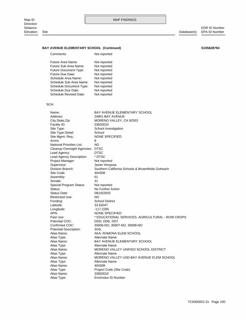
MAP FINDINGSMap IDDirection
EDR ID NumberDistanceEPA ID NumberDatabase(s)SiteElevation
Envirostor ID NumberAlias Type: 33820010Alias Name: Project Code (Site Code)Alias Type: 404308Alias Name: Alternate NameAlias Type: MORENO VALLEY USD-BAY AVENUE ELEM SCHOOLAlias Name: Alternate NameAlias Type: MORENO VALLEY UNIFIED SCHOOL DISTRICTAlias Name: Alternate NameAlias Type: BAY AVENUE ELEMENTARY SCHOOLAlias Name: Alternate NameAlias Type: AKA: RAMONA ELEM SCHOOLAlias Name: SOILPotential Description: 30006-NO, 30007-NO, 30008-NOConfirmed COC: DDD, DDE, DDTPotential COC: * EDUCATIONAL SERVICES, AGRICULTURAL - ROW CROPSPast Use: NONE SPECIFIEDAPN: -117.2295Longitude: 33.92047Latitude: School DistrictFunding: NORestricted Use: 08/19/2003Status Date: No Further ActionStatus: Not reportedSpecial Program Status: 31Senate: 61Assembly: 404308Site Code: Southern California Schools & Brownfields OutreachDivision Branch: Javier HinojosaSupervisor: Not reportedProject Manager: * DTSCLead Agency Description: DTSCLead Agency: DTSCCleanup Oversight Agencies: NONational Priorities List: 8Acres: NONE SPECIFIEDSite Mgmt. Req.: SchoolSite Type Detail: School InvestigationSite Type: 33820010Facility ID: MORENO VALLEY, CA 92553City,State,Zip: 24801 BAY AVENUEAddress: BAY AVENUE ELEMENTARY SCHOOLName:
SCH:
Not reportedSchedule Revised Date: Not reportedSchedule Due Date: Not reportedSchedule Document Type: Not reportedSchedule Sub Area Name: Not reportedSchedule Area Name: Not reportedFuture Due Date: Not reportedFuture Document Type: Not reportedFuture Sub Area Name: Not reportedFuture Area Name:
Not reportedComments:
BAY AVENUE ELEMENTARY SCHOOL (Continued) S105628794
TC6305822.2s Page 100
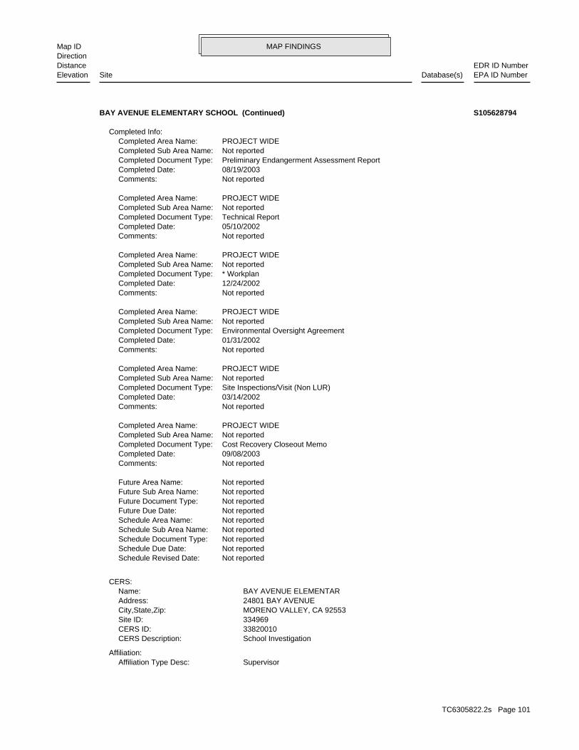
MAP FINDINGSMap IDDirection
EDR ID NumberDistanceEPA ID NumberDatabase(s)SiteElevation
SupervisorAffiliation Type Desc:Affiliation:
School InvestigationCERS Description: 33820010CERS ID: 334969Site ID: MORENO VALLEY, CA 92553City,State,Zip: 24801 BAY AVENUEAddress: BAY AVENUE ELEMENTARName:
CERS:
Not reportedSchedule Revised Date: Not reportedSchedule Due Date: Not reportedSchedule Document Type: Not reportedSchedule Sub Area Name: Not reportedSchedule Area Name: Not reportedFuture Due Date: Not reportedFuture Document Type: Not reportedFuture Sub Area Name: Not reportedFuture Area Name:
Not reportedComments: 09/08/2003Completed Date: Cost Recovery Closeout MemoCompleted Document Type: Not reportedCompleted Sub Area Name: PROJECT WIDECompleted Area Name:
Not reportedComments: 03/14/2002Completed Date: Site Inspections/Visit (Non LUR)Completed Document Type: Not reportedCompleted Sub Area Name: PROJECT WIDECompleted Area Name:
Not reportedComments: 01/31/2002Completed Date: Environmental Oversight AgreementCompleted Document Type: Not reportedCompleted Sub Area Name: PROJECT WIDECompleted Area Name:
Not reportedComments: 12/24/2002Completed Date: * WorkplanCompleted Document Type: Not reportedCompleted Sub Area Name: PROJECT WIDECompleted Area Name:
Not reportedComments: 05/10/2002Completed Date: Technical ReportCompleted Document Type: Not reportedCompleted Sub Area Name: PROJECT WIDECompleted Area Name:
Not reportedComments: 08/19/2003Completed Date: Preliminary Endangerment Assessment ReportCompleted Document Type: Not reportedCompleted Sub Area Name: PROJECT WIDECompleted Area Name:
Completed Info:
BAY AVENUE ELEMENTARY SCHOOL (Continued) S105628794
TC6305822.2s Page 101
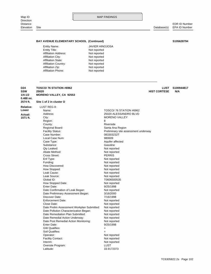
MAP FINDINGSMap IDDirection
EDR ID NumberDistanceEPA ID NumberDatabase(s)SiteElevation
Not reportedAffiliation Phone: Not reportedAffiliation Zip: Not reportedAffiliation Country: Not reportedAffiliation State: Not reportedAffiliation City: Not reportedAffiliation Address: Not reportedEntity Title: JAVIER HINOJOSAEntity Name:
BAY AVENUE ELEMENTARY SCHOOL (Continued) S105628794
33.9172373Latitude: LUSTOversite Program: Not reportedInterim: Not reportedFacility Contact: Not reportedOperator: =Soil Qualifies: =GW Qualifies: 9/25/1998Enter Date: Not reportedDate Post Remedial Action Monitoring: Not reportedDate Remedial Action Underway: Not reportedDate Remediation Plan Submitted: Not reportedDate Pollution Characterization Began: Not reportedDate Prelim Assessment Workplan Submitted: Not reportedClose Date: Not reportedEnforcement Date: 7/16/1998Discover Date: 3/16/2000Date Preliminary Assessment Began: Not reportedDate Confirmation of Leak Began: 9/25/1998Enter Date: Not reportedHow Stopped Date: T0606500535Global ID: Not reportedLeak Source: Not reportedLeak Cause: Not reportedHow Stopped: Not reportedHow Discovered: Not reportedFunding: Not reportedEnf Type: PERRISCross Street: Not reportedAbate Method: Not reportedQty Leaked: GasolineSubstance: Aquifer affectedCase Type: 980609Local Case Num: 083303232TCase Number: Preliminary site assessment underwayFacility Status: Santa Ana RegionRegional Board: RiversideCounty: 8Region: MORENO VALLEYCity: 25020 ALESSANDRO BLVDAddress: TOSCO/ 76 STATION #6962Name:
LUST REG 8:
2574 ft. Site 1 of 2 in cluster D0.488 mi.
Relative:Lower
Actual:1571 ft.
1/4-1/2 MORENO VALLEY, CA 92553SSW HIST CORTESE25020 N/AD24 LUSTTOSCO/ 76 STATION #6962 S100944817
TC6305822.2s Page 102
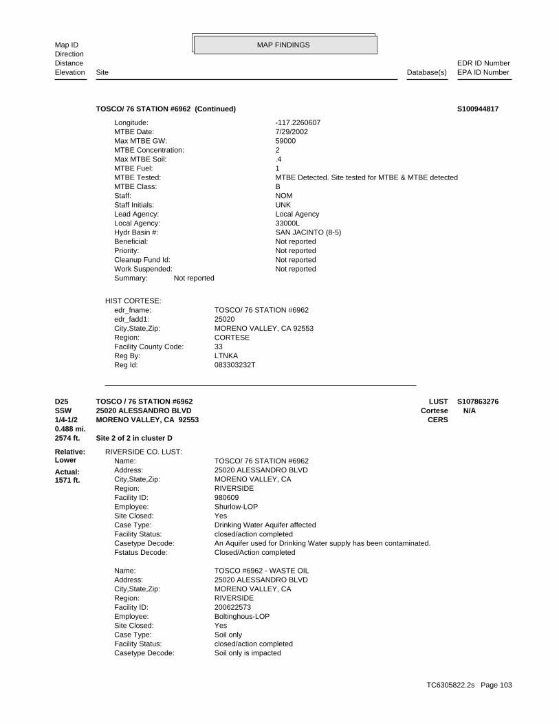
MAP FINDINGSMap IDDirection
EDR ID NumberDistanceEPA ID NumberDatabase(s)SiteElevation
083303232TReg Id: LTNKAReg By: 33Facility County Code: CORTESERegion: MORENO VALLEY, CA 92553City,State,Zip: 25020edr_fadd1: TOSCO/ 76 STATION #6962edr_fname:
HIST CORTESE:
Not reportedSummary: Not reportedWork Suspended: Not reportedCleanup Fund Id: Not reportedPriority: Not reportedBeneficial: SAN JACINTO (8-5)Hydr Basin #: 33000LLocal Agency: Local AgencyLead Agency: UNKStaff Initials: NOMStaff: BMTBE Class: MTBE Detected. Site tested for MTBE & MTBE detectedMTBE Tested: 1MTBE Fuel: .4Max MTBE Soil: 2MTBE Concentration: 59000Max MTBE GW: 7/29/2002MTBE Date: -117.2260607Longitude:
TOSCO/ 76 STATION #6962 (Continued) S100944817
Soil only is impactedCasetype Decode: closed/action completedFacility Status: Soil onlyCase Type: YesSite Closed: Boltinghous-LOPEmployee: 200622573Facility ID: RIVERSIDERegion: MORENO VALLEY, CACity,State,Zip: 25020 ALESSANDRO BLVDAddress: TOSCO #6962 - WASTE OILName:
Closed/Action completedFstatus Decode: An Aquifer used for Drinking Water supply has been contaminated.Casetype Decode: closed/action completedFacility Status: Drinking Water Aquifer affectedCase Type: YesSite Closed: Shurlow-LOPEmployee: 980609Facility ID: RIVERSIDERegion: MORENO VALLEY, CACity,State,Zip: 25020 ALESSANDRO BLVDAddress: TOSCO/ 76 STATION #6962Name:
RIVERSIDE CO. LUST:
2574 ft. Site 2 of 2 in cluster D0.488 mi.
Relative:Lower
Actual:1571 ft.
1/4-1/2 CERSMORENO VALLEY, CA 92553SSW Cortese25020 ALESSANDRO BLVD N/AD25 LUSTTOSCO / 76 STATION #6962 S107863276
TC6305822.2s Page 103
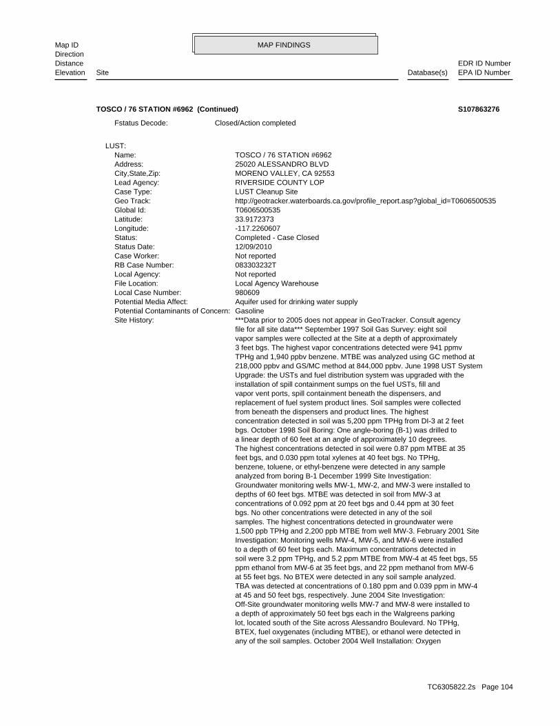
MAP FINDINGSMap IDDirection
EDR ID NumberDistanceEPA ID NumberDatabase(s)SiteElevation
any of the soil samples. October 2004 Well Installation: Oxygen BTEX, fuel oxygenates (including MTBE), or ethanol were detected in lot, located south of the Site across Alessandro Boulevard. No TPHg, a depth of approximately 50 feet bgs each in the Walgreens parking Off-Site groundwater monitoring wells MW-7 and MW-8 were installed to at 45 and 50 feet bgs, respectively. June 2004 Site Investigation: TBA was detected at concentrations of 0.180 ppm and 0.039 ppm in MW-4 at 55 feet bgs. No BTEX were detected in any soil sample analyzed. ppm ethanol from MW-6 at 35 feet bgs, and 22 ppm methanol from MW-6 soil were 3.2 ppm TPHg, and 5.2 ppm MTBE from MW-4 at 45 feet bgs, 55 to a depth of 60 feet bgs each. Maximum concentrations detected in Investigation: Monitoring wells MW-4, MW-5, and MW-6 were installed 1,500 ppb TPHg and 2,200 ppb MTBE from well MW-3. February 2001 Site samples. The highest concentrations detected in groundwater were bgs. No other concentrations were detected in any of the soil concentrations of 0.092 ppm at 20 feet bgs and 0.44 ppm at 30 feet depths of 60 feet bgs. MTBE was detected in soil from MW-3 at Groundwater monitoring wells MW-1, MW-2, and MW-3 were installed to analyzed from boring B-1 December 1999 Site Investigation: benzene, toluene, or ethyl-benzene were detected in any sample feet bgs, and 0.030 ppm total xylenes at 40 feet bgs. No TPHg, The highest concentrations detected in soil were 0.87 ppm MTBE at 35 a linear depth of 60 feet at an angle of approximately 10 degrees. bgs. October 1998 Soil Boring: One angle-boring (B-1) was drilled to concentration detected in soil was 5,200 ppm TPHg from DI-3 at 2 feet from beneath the dispensers and product lines. The highest replacement of fuel system product lines. Soil samples were collected vapor vent ports, spill containment beneath the dispensers, and installation of spill containment sumps on the fuel USTs, fill and Upgrade: the USTs and fuel distribution system was upgraded with the 218,000 ppbv and GS/MC method at 844,000 ppbv. June 1998 UST System TPHg and 1,940 ppbv benzene. MTBE was analyzed using GC method at 3 feet bgs. The highest vapor concentrations detected were 941 ppmv vapor samples were collected at the Site at a depth of approximately file for all site data*** September 1997 Soil Gas Survey: eight soil ***Data prior to 2005 does not appear in GeoTracker. Consult agencySite History: GasolinePotential Contaminants of Concern: Aquifer used for drinking water supplyPotential Media Affect: 980609Local Case Number: Local Agency WarehouseFile Location: Not reportedLocal Agency: 083303232TRB Case Number: Not reportedCase Worker: 12/09/2010Status Date: Completed - Case ClosedStatus: -117.2260607Longitude: 33.9172373Latitude: T0606500535Global Id: http://geotracker.waterboards.ca.gov/profile_report.asp?global_id=T0606500535Geo Track: LUST Cleanup SiteCase Type: RIVERSIDE COUNTY LOPLead Agency: MORENO VALLEY, CA 92553City,State,Zip: 25020 ALESSANDRO BLVDAddress: TOSCO / 76 STATION #6962Name:
LUST:
Closed/Action completedFstatus Decode:
TOSCO / 76 STATION #6962 (Continued) S107863276
TC6305822.2s Page 104
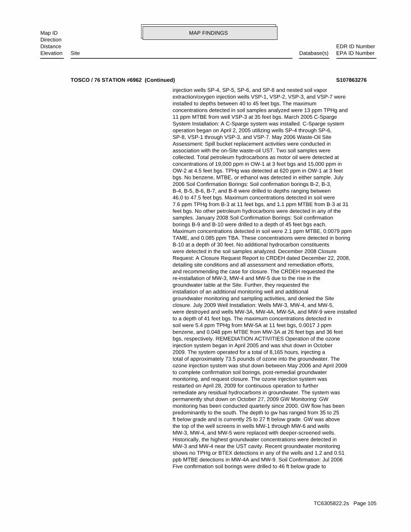
MAP FINDINGSMap IDDirection
EDR ID NumberDistanceEPA ID NumberDatabase(s)SiteElevation
Five confirmation soil borings were drilled to 46 ft below grade to ppb MTBE detections in MW-4A and MW-9. Soil Confirmation: Jul 2006 shows no TPHg or BTEX detections in any of the wells and 1.2 and 0.51 MW-3 and MW-4 near the UST cavity. Recent groundwater monitoring Historically, the highest groundwater concentrations were detected in MW-3, MW-4, and MW-5 were replaced with deeper-screened wells. the top of the well screens in wells MW-1 through MW-6 and wells ft below grade and is currently 25 to 27 ft below grade. GW was above predominantly to the south. The depth to gw has ranged from 35 to 25 monitoring has been conducted quarterly since 2000. GW flow has been permanently shut down on October 27, 2009 GW Monitoring: GW remediate any residual hydrocarbons in groundwater. The system was restarted on April 28, 2009 for continuous operation to further monitoring, and request closure. The ozone injection system was to complete confirmation soil borings, post-remedial groundwater ozone injection system was shut down between May 2006 and April 2009 total of approximately 73.5 pounds of ozone into the groundwater. The 2009. The system operated for a total of 8,165 hours, injecting a injection system began in April 2005 and was shut down in October bgs, respectively. REMEDIATION ACTIVITIES Operation of the ozone benzene, and 0.048 ppm MTBE from MW-3A at 26 feet bgs and 36 feet soil were 5.4 ppm TPHg from MW-5A at 11 feet bgs, 0.0017 J ppm to a depth of 41 feet bgs. The maximum concentrations detected in were destroyed and wells MW-3A, MW-4A, MW-5A, and MW-9 were installed closure. July 2009 Well Installation: Wells MW-3, MW-4, and MW-5, groundwater monitoring and sampling activities, and denied the Site installation of an additional monitoring well and additional groundwater table at the Site. Further, they requested the re-installation of MW-3, MW-4 and MW-5 due to the rise in the and recommending the case for closure. The CRDEH requested the detailing site conditions and all assessment and remediation efforts, Request: A Closure Request Report to CRDEH dated December 22, 2008, were detected in the soil samples analyzed. December 2008 Closure B-10 at a depth of 30 feet. No additional hydrocarbon constituents TAME, and 0.085 ppm TBA. These concentrations were detected in boring Maximum concentrations detected in soil were 2.1 ppm MTBE, 0.0079 ppm borings B-9 and B-10 were drilled to a depth of 45 feet bgs each. samples. January 2008 Soil Confirmation Borings: Soil confirmation feet bgs. No other petroleum hydrocarbons were detected in any of the 7.6 ppm TPHg from B-3 at 11 feet bgs, and 1.1 ppm MTBE from B-3 at 31 46.0 to 47.5 feet bgs. Maximum concentrations detected in soil were B-4, B-5, B-6, B-7, and B-8 were drilled to depths ranging between 2006 Soil Confirmation Borings: Soil confirmation borings B-2, B-3, bgs. No benzene, MTBE, or ethanol was detected in either sample. July OW-2 at 4.5 feet bgs. TPHg was detected at 620 ppm in OW-1 at 3 feet concentrations of 19,000 ppm in OW-1 at 3 feet bgs and 15,000 ppm in collected. Total petroleum hydrocarbons as motor oil were detected at association with the on-Site waste-oil UST. Two soil samples were Assessment: Spill bucket replacement activities were conducted in SP-8, VSP-1 through VSP-3, and VSP-7. May 2006 Waste-Oil Site operation began on April 2, 2005 utilizing wells SP-4 through SP-6, System Installation: A C-Sparge system was installed. C-Sparge system 11 ppm MTBE from well VSP-3 at 35 feet bgs. March 2005 C-Sparge concentrations detected in soil samples analyzed were 13 ppm TPHg and installed to depths between 40 to 45 feet bgs. The maximum extraction/oxygen injection wells VSP-1, VSP-2, VSP-3, and VSP-7 were injection wells SP-4, SP-5, SP-6, and SP-8 and nested soil vapor
TOSCO / 76 STATION #6962 (Continued) S107863276
TC6305822.2s Page 105
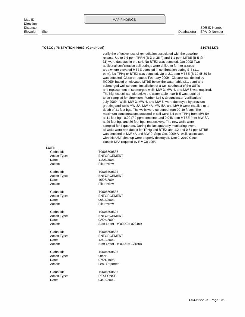
MAP FINDINGSMap IDDirection
EDR ID NumberDistanceEPA ID NumberDatabase(s)SiteElevation
04/15/2008Date: RESPONSEAction Type: T0606500535Global Id:
Leak ReportedAction: 07/21/1998Date: OtherAction Type: T0606500535Global Id:
Staff Letter - #RCDEH 121808Action: 12/18/2008Date: ENFORCEMENTAction Type: T0606500535Global Id:
Staff Letter - #RCDEH 022409Action: 02/24/2009Date: ENFORCEMENTAction Type: T0606500535Global Id:
File reviewAction: 09/16/2008Date: ENFORCEMENTAction Type: T0606500535Global Id:
File reviewAction: 10/26/2004Date: ENFORCEMENTAction Type: T0606500535Global Id:
File reviewAction: 11/06/2008Date: ENFORCEMENTAction Type: T0606500535Global Id:
LUST:
closed/ NFA required by Riv Co LOP. with this UST cleanup were properly destroyed. Dec 9, 2010 Case was detected in MW-4A and MW-9. Sept-Oct. 2009 All wells associated all wells were non-detect for TPHg and BTEX and 1.2 and 0.51 ppb MTBE sampled for 3 quarters. During the last quarterly monitoring event, at 26 feet bgs and 36 feet bgs, respectively. The new wells were at 11 feet bgs, 0.0017 J ppm benzene, and 0.048 ppm MTBE from MW-3A maximum concentrations detected in soil were 5.4 ppm TPHg from MW-5A depth of 41 feet bgs. The wells were screened from 20-40 ft bgs. The grouting and wells MW-3A, MW-4A, MW-5A, and MW-9 were installed to a July 2009 - Wells MW-3, MW-4, and MW-5, were destroyed by pressure to be sampled for chromium. Further Soil & Groundwater Verification: The highest soil sample below the water table near B-5 was required and replacement of submerged wells MW-3, MW-4, and MW-5 was required. submerged well screens. Installation of a well southeast of the USTs RCDEH based on elevated MTBE below the water table (2.1 ppm) and was detected. Closure request: February 2009 - Closure was denied by ppm). No TPHg or BTEX was detected. Up to 2.1 ppm MTBE (B-10 @ 30 ft) area where elevated MTBE detected in confirmation boring B-5 (1.1 additional confirmation soil borings were drilled to further assess 31) were detected in the soil. No BTEX was detected. Jan 2008 Two release. Up to 7.6 ppm TPPH (B-3 at 36 ft) and 1.1 ppm MTBE (B-5 @ verify the effectiveness of remediation associated with the gasoline
TOSCO / 76 STATION #6962 (Continued) S107863276
TC6305822.2s Page 106
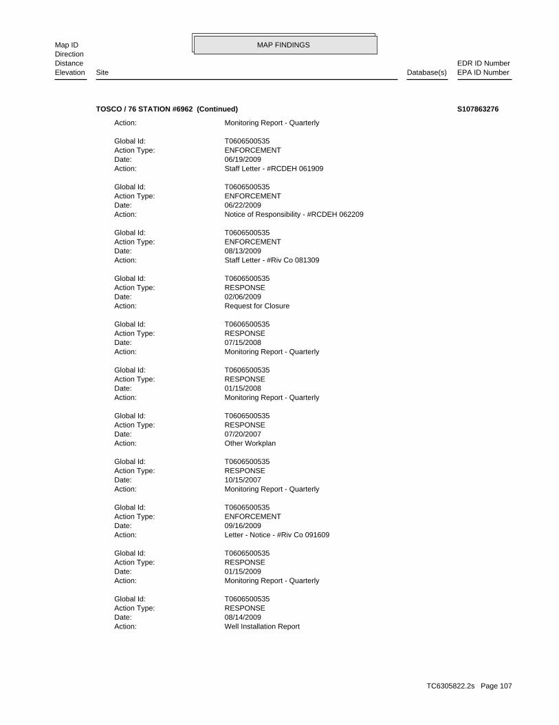
MAP FINDINGSMap IDDirection
EDR ID NumberDistanceEPA ID NumberDatabase(s)SiteElevation
Well Installation ReportAction: 08/14/2009Date: RESPONSEAction Type: T0606500535Global Id:
Monitoring Report - QuarterlyAction: 01/15/2009Date: RESPONSEAction Type: T0606500535Global Id:
Letter - Notice - #Riv Co 091609Action: 09/16/2009Date: ENFORCEMENTAction Type: T0606500535Global Id:
Monitoring Report - QuarterlyAction: 10/15/2007Date: RESPONSEAction Type: T0606500535Global Id:
Other WorkplanAction: 07/20/2007Date: RESPONSEAction Type: T0606500535Global Id:
Monitoring Report - QuarterlyAction: 01/15/2008Date: RESPONSEAction Type: T0606500535Global Id:
Monitoring Report - QuarterlyAction: 07/15/2008Date: RESPONSEAction Type: T0606500535Global Id:
Request for ClosureAction: 02/06/2009Date: RESPONSEAction Type: T0606500535Global Id:
Staff Letter - #Riv Co 081309Action: 08/13/2009Date: ENFORCEMENTAction Type: T0606500535Global Id:
Notice of Responsibility - #RCDEH 062209Action: 06/22/2009Date: ENFORCEMENTAction Type: T0606500535Global Id:
Staff Letter - #RCDEH 061909Action: 06/19/2009Date: ENFORCEMENTAction Type: T0606500535Global Id:
Monitoring Report - QuarterlyAction:
TOSCO / 76 STATION #6962 (Continued) S107863276
TC6305822.2s Page 107
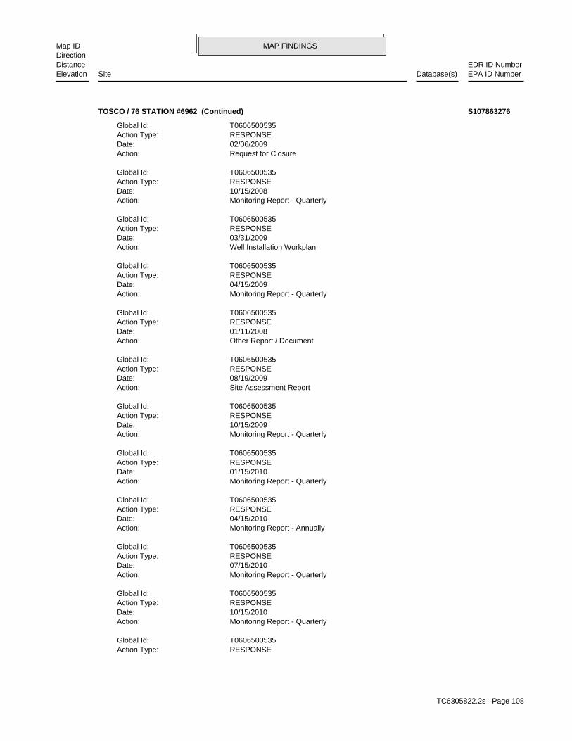
MAP FINDINGSMap IDDirection
EDR ID NumberDistanceEPA ID NumberDatabase(s)SiteElevation
RESPONSEAction Type: T0606500535Global Id:
Monitoring Report - QuarterlyAction: 10/15/2010Date: RESPONSEAction Type: T0606500535Global Id:
Monitoring Report - QuarterlyAction: 07/15/2010Date: RESPONSEAction Type: T0606500535Global Id:
Monitoring Report - AnnuallyAction: 04/15/2010Date: RESPONSEAction Type: T0606500535Global Id:
Monitoring Report - QuarterlyAction: 01/15/2010Date: RESPONSEAction Type: T0606500535Global Id:
Monitoring Report - QuarterlyAction: 10/15/2009Date: RESPONSEAction Type: T0606500535Global Id:
Site Assessment ReportAction: 08/19/2009Date: RESPONSEAction Type: T0606500535Global Id:
Other Report / DocumentAction: 01/11/2008Date: RESPONSEAction Type: T0606500535Global Id:
Monitoring Report - QuarterlyAction: 04/15/2009Date: RESPONSEAction Type: T0606500535Global Id:
Well Installation WorkplanAction: 03/31/2009Date: RESPONSEAction Type: T0606500535Global Id:
Monitoring Report - QuarterlyAction: 10/15/2008Date: RESPONSEAction Type: T0606500535Global Id:
Request for ClosureAction: 02/06/2009Date: RESPONSEAction Type: T0606500535Global Id:
TOSCO / 76 STATION #6962 (Continued) S107863276
TC6305822.2s Page 108
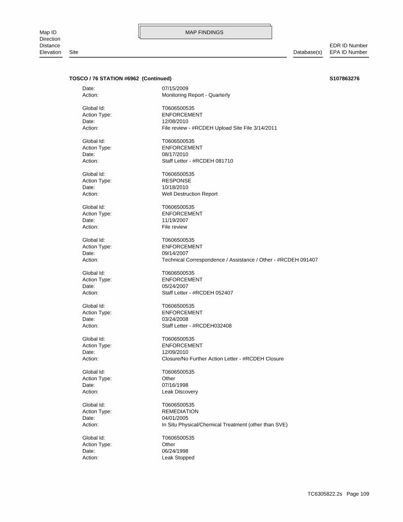
MAP FINDINGSMap IDDirection
EDR ID NumberDistanceEPA ID NumberDatabase(s)SiteElevation
Leak StoppedAction: 06/24/1998Date: OtherAction Type: T0606500535Global Id:
In Situ Physical/Chemical Treatment (other than SVE)Action: 04/01/2005Date: REMEDIATIONAction Type: T0606500535Global Id:
Leak DiscoveryAction: 07/16/1998Date: OtherAction Type: T0606500535Global Id:
Closure/No Further Action Letter - #RCDEH ClosureAction: 12/09/2010Date: ENFORCEMENTAction Type: T0606500535Global Id:
Staff Letter - #RCDEH032408Action: 03/24/2008Date: ENFORCEMENTAction Type: T0606500535Global Id:
Staff Letter - #RCDEH 052407Action: 05/24/2007Date: ENFORCEMENTAction Type: T0606500535Global Id:
Technical Correspondence / Assistance / Other - #RCDEH 091407Action: 09/14/2007Date: ENFORCEMENTAction Type: T0606500535Global Id:
File reviewAction: 11/19/2007Date: ENFORCEMENTAction Type: T0606500535Global Id:
Well Destruction ReportAction: 10/18/2010Date: RESPONSEAction Type: T0606500535Global Id:
Staff Letter - #RCDEH 081710Action: 08/17/2010Date: ENFORCEMENTAction Type: T0606500535Global Id:
File review - #RCDEH Upload Site File 3/14/2011Action: 12/08/2010Date: ENFORCEMENTAction Type: T0606500535Global Id:
Monitoring Report - QuarterlyAction: 07/15/2009Date:
TOSCO / 76 STATION #6962 (Continued) S107863276
TC6305822.2s Page 109
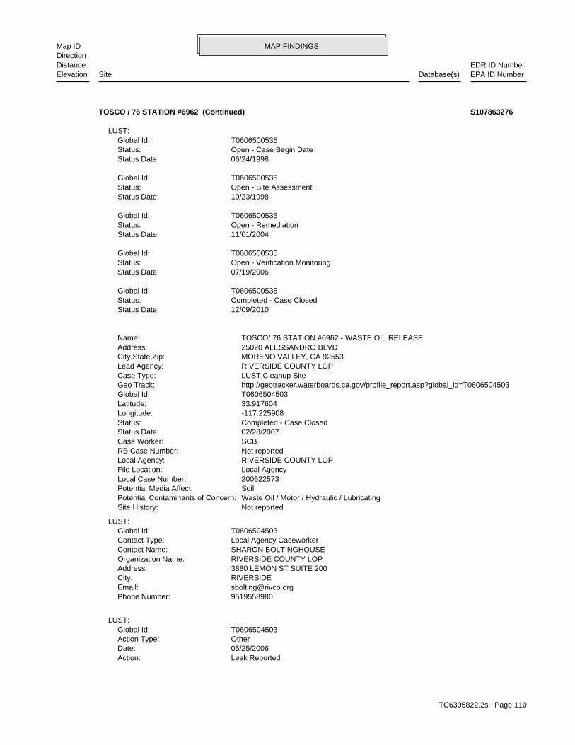
MAP FINDINGSMap IDDirection
EDR ID NumberDistanceEPA ID NumberDatabase(s)SiteElevation
Leak ReportedAction: 05/25/2006Date: OtherAction Type: T0606504503Global Id:
LUST:
9519558980Phone Number: [email protected]: RIVERSIDECity: 3880 LEMON ST SUITE 200Address: RIVERSIDE COUNTY LOPOrganization Name: SHARON BOLTINGHOUSEContact Name: Local Agency CaseworkerContact Type: T0606504503Global Id:
LUST:
Not reportedSite History: Waste Oil / Motor / Hydraulic / LubricatingPotential Contaminants of Concern: SoilPotential Media Affect: 200622573Local Case Number: Local AgencyFile Location: RIVERSIDE COUNTY LOPLocal Agency: Not reportedRB Case Number: SCBCase Worker: 02/28/2007Status Date: Completed - Case ClosedStatus: -117.225908Longitude: 33.917604Latitude: T0606504503Global Id: http://geotracker.waterboards.ca.gov/profile_report.asp?global_id=T0606504503Geo Track: LUST Cleanup SiteCase Type: RIVERSIDE COUNTY LOPLead Agency: MORENO VALLEY, CA 92553City,State,Zip: 25020 ALESSANDRO BLVDAddress: TOSCO/ 76 STATION #6962 - WASTE OIL RELEASEName:
12/09/2010Status Date: Completed - Case ClosedStatus: T0606500535Global Id:
07/19/2006Status Date: Open - Verification MonitoringStatus: T0606500535Global Id:
11/01/2004Status Date: Open - RemediationStatus: T0606500535Global Id:
10/23/1998Status Date: Open - Site AssessmentStatus: T0606500535Global Id:
06/24/1998Status Date: Open - Case Begin DateStatus: T0606500535Global Id:
LUST:
TOSCO / 76 STATION #6962 (Continued) S107863276
TC6305822.2s Page 110
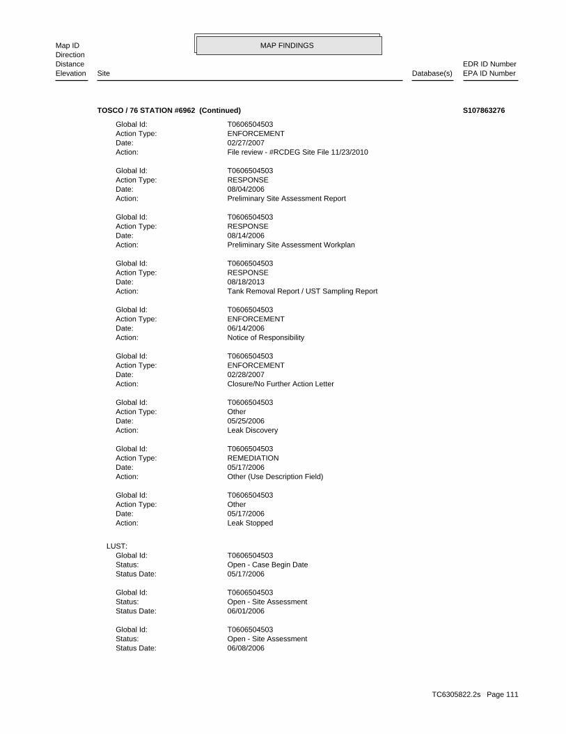
MAP FINDINGSMap IDDirection
EDR ID NumberDistanceEPA ID NumberDatabase(s)SiteElevation
06/08/2006Status Date: Open - Site AssessmentStatus: T0606504503Global Id:
06/01/2006Status Date: Open - Site AssessmentStatus: T0606504503Global Id:
05/17/2006Status Date: Open - Case Begin DateStatus: T0606504503Global Id:
LUST:
Leak StoppedAction: 05/17/2006Date: OtherAction Type: T0606504503Global Id:
Other (Use Description Field)Action: 05/17/2006Date: REMEDIATIONAction Type: T0606504503Global Id:
Leak DiscoveryAction: 05/25/2006Date: OtherAction Type: T0606504503Global Id:
Closure/No Further Action LetterAction: 02/28/2007Date: ENFORCEMENTAction Type: T0606504503Global Id:
Notice of ResponsibilityAction: 06/14/2006Date: ENFORCEMENTAction Type: T0606504503Global Id:
Tank Removal Report / UST Sampling ReportAction: 08/18/2013Date: RESPONSEAction Type: T0606504503Global Id:
Preliminary Site Assessment WorkplanAction: 08/14/2006Date: RESPONSEAction Type: T0606504503Global Id:
Preliminary Site Assessment ReportAction: 08/04/2006Date: RESPONSEAction Type: T0606504503Global Id:
File review - #RCDEG Site File 11/23/2010Action: 02/27/2007Date: ENFORCEMENTAction Type: T0606504503Global Id:
TOSCO / 76 STATION #6962 (Continued) S107863276
TC6305822.2s Page 111
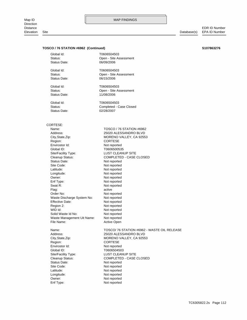
MAP FINDINGSMap IDDirection
EDR ID NumberDistanceEPA ID NumberDatabase(s)SiteElevation
Not reportedEnf Type: Not reportedOwner: Not reportedLongitude: Not reportedLatitude: Not reportedSite Code: Not reportedStatus Date: COMPLETED - CASE CLOSEDCleanup Status: LUST CLEANUP SITESite/Facility Type: T0606504503Global ID: Not reportedEnvirostor Id: CORTESERegion: MORENO VALLEY, CA 92553City,State,Zip: 25020 ALESSANDRO BLVDAddress: TOSCO/ 76 STATION #6962 - WASTE OIL RELEASEName:
Active OpenFile Name: Not reportedWaste Management Uit Name: Not reportedSolid Waste Id No: Not reportedWID Id: Not reportedRegion 2: Not reportedEffective Date: Not reportedWaste Discharge System No: Not reportedOrder No: activeFlag: Not reportedSwat R: Not reportedEnf Type: Not reportedOwner: Not reportedLongitude: Not reportedLatitude: Not reportedSite Code: Not reportedStatus Date: COMPLETED - CASE CLOSEDCleanup Status: LUST CLEANUP SITESite/Facility Type: T0606500535Global ID: Not reportedEnvirostor Id: CORTESERegion: MORENO VALLEY, CA 92553City,State,Zip: 25020 ALESSANDRO BLVDAddress: TOSCO / 76 STATION #6962Name:
CORTESE:
02/28/2007Status Date: Completed - Case ClosedStatus: T0606504503Global Id:
11/08/2006Status Date: Open - Site AssessmentStatus: T0606504503Global Id:
06/15/2006Status Date: Open - Site AssessmentStatus: T0606504503Global Id:
06/09/2006Status Date: Open - Site AssessmentStatus: T0606504503Global Id:
TOSCO / 76 STATION #6962 (Continued) S107863276
TC6305822.2s Page 112
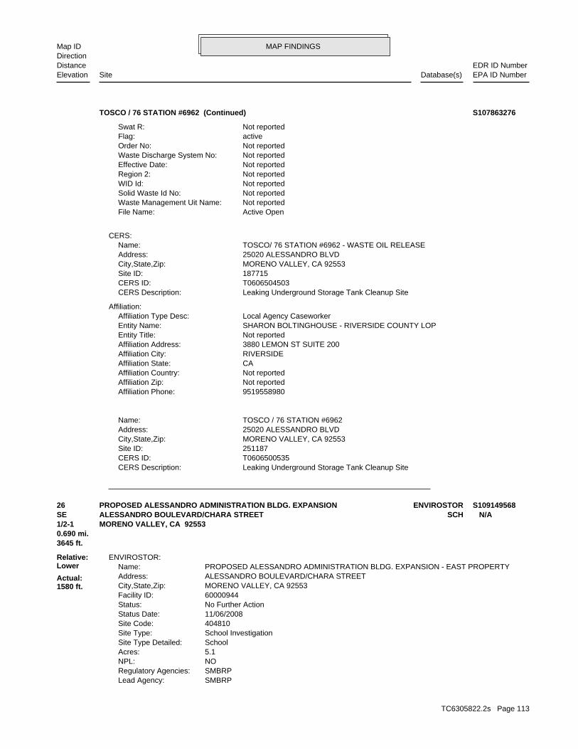
MAP FINDINGSMap IDDirection
EDR ID NumberDistanceEPA ID NumberDatabase(s)SiteElevation
Leaking Underground Storage Tank Cleanup SiteCERS Description: T0606500535CERS ID: 251187Site ID: MORENO VALLEY, CA 92553City,State,Zip: 25020 ALESSANDRO BLVDAddress: TOSCO / 76 STATION #6962Name:
9519558980Affiliation Phone: Not reportedAffiliation Zip: Not reportedAffiliation Country: CAAffiliation State: RIVERSIDEAffiliation City: 3880 LEMON ST SUITE 200Affiliation Address: Not reportedEntity Title: SHARON BOLTINGHOUSE - RIVERSIDE COUNTY LOPEntity Name: Local Agency CaseworkerAffiliation Type Desc:
Affiliation:
Leaking Underground Storage Tank Cleanup SiteCERS Description: T0606504503CERS ID: 187715Site ID: MORENO VALLEY, CA 92553City,State,Zip: 25020 ALESSANDRO BLVDAddress: TOSCO/ 76 STATION #6962 - WASTE OIL RELEASEName:
CERS:
Active OpenFile Name: Not reportedWaste Management Uit Name: Not reportedSolid Waste Id No: Not reportedWID Id: Not reportedRegion 2: Not reportedEffective Date: Not reportedWaste Discharge System No: Not reportedOrder No: activeFlag: Not reportedSwat R:
TOSCO / 76 STATION #6962 (Continued) S107863276
SMBRPLead Agency: SMBRPRegulatory Agencies: NONPL: 5.1Acres: SchoolSite Type Detailed: School InvestigationSite Type: 404810Site Code: 11/06/2008Status Date: No Further ActionStatus: 60000944Facility ID: MORENO VALLEY, CA 92553City,State,Zip: ALESSANDRO BOULEVARD/CHARA STREETAddress: PROPOSED ALESSANDRO ADMINISTRATION BLDG. EXPANSION - EAST PROPERTYName:
ENVIROSTOR:
3645 ft.0.690 mi.
Relative:Lower
Actual:1580 ft.
1/2-1 MORENO VALLEY, CA 92553SE SCHALESSANDRO BOULEVARD/CHARA STREET N/A26 ENVIROSTORPROPOSED ALESSANDRO ADMINISTRATION BLDG. EXPANSION S109149568
TC6305822.2s Page 113
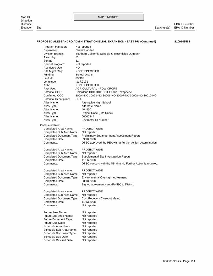
MAP FINDINGSMap IDDirection
EDR ID NumberDistanceEPA ID NumberDatabase(s)SiteElevation
Not reportedSchedule Revised Date: Not reportedSchedule Due Date: Not reportedSchedule Document Type: Not reportedSchedule Sub Area Name: Not reportedSchedule Area Name: Not reportedFuture Due Date: Not reportedFuture Document Type: Not reportedFuture Sub Area Name: Not reportedFuture Area Name:
Not reportedComments: 11/13/2008Completed Date: Cost Recovery Closeout MemoCompleted Document Type: Not reportedCompleted Sub Area Name: PROJECT WIDECompleted Area Name:
Signed agreement sent (FedEx) to District.Comments: 08/18/2008Completed Date: Environmental Oversight AgreementCompleted Document Type: Not reportedCompleted Sub Area Name: PROJECT WIDECompleted Area Name:
DTSC concurs with the SSI that No Further Action is required.Comments: 11/06/2008Completed Date: Supplemental Site Investigation ReportCompleted Document Type: Not reportedCompleted Sub Area Name: PROJECT WIDECompleted Area Name:
DTSC approved the PEA with a Further Action determinationComments: 09/10/2008Completed Date: Preliminary Endangerment Assessment ReportCompleted Document Type: Not reportedCompleted Sub Area Name: PROJECT WIDECompleted Area Name:
Completed Info:
Envirostor ID NumberAlias Type: 60000944Alias Name: Project Code (Site Code)Alias Type: 404810Alias Name: Alternate NameAlias Type: Alternative High SchoolAlias Name: SOILPotential Description: 30004-NO 30023-NO 30006-NO 30007-NO 30008-NO 30010-NOConfirmed COC: Chlordane DDD DDE DDT Endrin ToxaphenePotential COC: AGRICULTURAL - ROW CROPSPast Use: NONE SPECIFIEDAPN: -117.2131Longitude: 33.918Latitude: School DistrictFunding: NONE SPECIFIEDSite Mgmt Req: NORestricted Use: Not reportedSpecial Program: 31Senate: 61Assembly: Southern California Schools & Brownfields OutreachDivision Branch: Shahir HaddadSupervisor: Not reportedProgram Manager:
PROPOSED ALESSANDRO ADMINISTRATION BLDG. EXPANSION - EAST PR (Continued) S109149568
TC6305822.2s Page 114
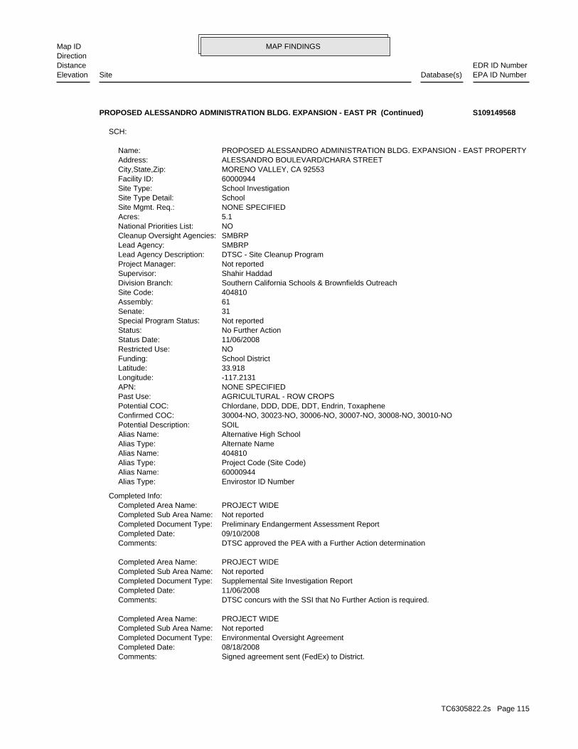
MAP FINDINGSMap IDDirection
EDR ID NumberDistanceEPA ID NumberDatabase(s)SiteElevation
Signed agreement sent (FedEx) to District.Comments: 08/18/2008Completed Date: Environmental Oversight AgreementCompleted Document Type: Not reportedCompleted Sub Area Name: PROJECT WIDECompleted Area Name:
DTSC concurs with the SSI that No Further Action is required.Comments: 11/06/2008Completed Date: Supplemental Site Investigation ReportCompleted Document Type: Not reportedCompleted Sub Area Name: PROJECT WIDECompleted Area Name:
DTSC approved the PEA with a Further Action determinationComments: 09/10/2008Completed Date: Preliminary Endangerment Assessment ReportCompleted Document Type: Not reportedCompleted Sub Area Name: PROJECT WIDECompleted Area Name:
Completed Info:
Envirostor ID NumberAlias Type: 60000944Alias Name: Project Code (Site Code)Alias Type: 404810Alias Name: Alternate NameAlias Type: Alternative High SchoolAlias Name: SOILPotential Description: 30004-NO, 30023-NO, 30006-NO, 30007-NO, 30008-NO, 30010-NOConfirmed COC: Chlordane, DDD, DDE, DDT, Endrin, ToxaphenePotential COC: AGRICULTURAL - ROW CROPSPast Use: NONE SPECIFIEDAPN: -117.2131Longitude: 33.918Latitude: School DistrictFunding: NORestricted Use: 11/06/2008Status Date: No Further ActionStatus: Not reportedSpecial Program Status: 31Senate: 61Assembly: 404810Site Code: Southern California Schools & Brownfields OutreachDivision Branch: Shahir HaddadSupervisor: Not reportedProject Manager: DTSC - Site Cleanup ProgramLead Agency Description: SMBRPLead Agency: SMBRPCleanup Oversight Agencies: NONational Priorities List: 5.1Acres: NONE SPECIFIEDSite Mgmt. Req.: SchoolSite Type Detail: School InvestigationSite Type: 60000944Facility ID: MORENO VALLEY, CA 92553City,State,Zip: ALESSANDRO BOULEVARD/CHARA STREETAddress: PROPOSED ALESSANDRO ADMINISTRATION BLDG. EXPANSION - EAST PROPERTYName:
SCH:
PROPOSED ALESSANDRO ADMINISTRATION BLDG. EXPANSION - EAST PR (Continued) S109149568
TC6305822.2s Page 115
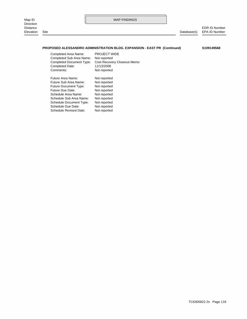
MAP FINDINGSMap IDDirection
EDR ID NumberDistanceEPA ID NumberDatabase(s)SiteElevation
Not reportedSchedule Revised Date: Not reportedSchedule Due Date: Not reportedSchedule Document Type: Not reportedSchedule Sub Area Name: Not reportedSchedule Area Name: Not reportedFuture Due Date: Not reportedFuture Document Type: Not reportedFuture Sub Area Name: Not reportedFuture Area Name:
Not reportedComments: 11/13/2008Completed Date: Cost Recovery Closeout MemoCompleted Document Type: Not reportedCompleted Sub Area Name: PROJECT WIDECompleted Area Name:
PROPOSED ALESSANDRO ADMINISTRATION BLDG. EXPANSION - EAST PR (Continued) S109149568
TC6305822.2s Page 116
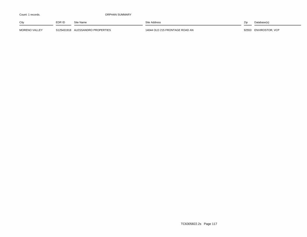
ORPHAN SUMMARY
City EDR ID Site Name Site Address Zip Database(s)
Count: 1 records.
MORENO VALLEY S125431918 ALESSANDRO PROPERTIES 14044 OLD 215 FRONTAGE ROAD AN 92553 ENVIROSTOR, VCP
TC6305822.2s Page 117
To maintain currency of the following federal and state databases, EDR contacts the appropriate governmental agencyon a monthly or quarterly basis, as required.
Number of Days to Update: Provides confirmation that EDR is reporting records that have been updated within 90 daysfrom the date the government agency made the information available to the public.
STANDARD ENVIRONMENTAL RECORDS
Federal NPL site list
NPL: National Priority ListNational Priorities List (Superfund). The NPL is a subset of CERCLIS and identifies over 1,200 sites for prioritycleanup under the Superfund Program. NPL sites may encompass relatively large areas. As such, EDR provides polygoncoverage for over 1,000 NPL site boundaries produced by EPA’s Environmental Photographic Interpretation Center(EPIC) and regional EPA offices.
Date of Government Version: 10/28/2020Date Data Arrived at EDR: 11/05/2020Date Made Active in Reports: 11/25/2020Number of Days to Update: 20
Source: EPATelephone: N/ALast EDR Contact: 12/02/2020Next Scheduled EDR Contact: 01/11/2021Data Release Frequency: Quarterly
NPL Site Boundaries
Sources:
EPA’s Environmental Photographic Interpretation Center (EPIC)Telephone: 202-564-7333
EPA Region 1 EPA Region 6Telephone 617-918-1143 Telephone: 214-655-6659
EPA Region 3 EPA Region 7Telephone 215-814-5418 Telephone: 913-551-7247
EPA Region 4 EPA Region 8Telephone 404-562-8033 Telephone: 303-312-6774
EPA Region 5 EPA Region 9Telephone 312-886-6686 Telephone: 415-947-4246
EPA Region 10Telephone 206-553-8665
Proposed NPL: Proposed National Priority List SitesA site that has been proposed for listing on the National Priorities List through the issuance of a proposed rulein the Federal Register. EPA then accepts public comments on the site, responds to the comments, and places onthe NPL those sites that continue to meet the requirements for listing.
Date of Government Version: 10/28/2020Date Data Arrived at EDR: 11/05/2020Date Made Active in Reports: 11/25/2020Number of Days to Update: 20
Source: EPATelephone: N/ALast EDR Contact: 12/02/2020Next Scheduled EDR Contact: 01/11/2021Data Release Frequency: Quarterly
NPL LIENS: Federal Superfund LiensFederal Superfund Liens. Under the authority granted the USEPA by CERCLA of 1980, the USEPA has the authorityto file liens against real property in order to recover remedial action expenditures or when the property ownerreceived notification of potential liability. USEPA compiles a listing of filed notices of Superfund Liens.
TC6305822.2s Page GR-1
GOVERNMENT RECORDS SEARCHED / DATA CURRENCY TRACKING
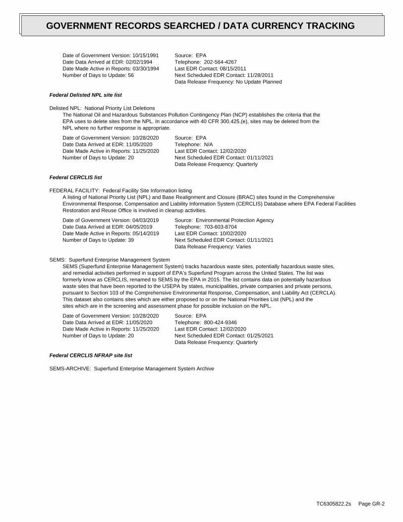
Date of Government Version: 10/15/1991Date Data Arrived at EDR: 02/02/1994Date Made Active in Reports: 03/30/1994Number of Days to Update: 56
Source: EPATelephone: 202-564-4267Last EDR Contact: 08/15/2011Next Scheduled EDR Contact: 11/28/2011Data Release Frequency: No Update Planned
Federal Delisted NPL site list
Delisted NPL: National Priority List DeletionsThe National Oil and Hazardous Substances Pollution Contingency Plan (NCP) establishes the criteria that theEPA uses to delete sites from the NPL. In accordance with 40 CFR 300.425.(e), sites may be deleted from theNPL where no further response is appropriate.
Date of Government Version: 10/28/2020Date Data Arrived at EDR: 11/05/2020Date Made Active in Reports: 11/25/2020Number of Days to Update: 20
Source: EPATelephone: N/ALast EDR Contact: 12/02/2020Next Scheduled EDR Contact: 01/11/2021Data Release Frequency: Quarterly
Federal CERCLIS list
FEDERAL FACILITY: Federal Facility Site Information listingA listing of National Priority List (NPL) and Base Realignment and Closure (BRAC) sites found in the ComprehensiveEnvironmental Response, Compensation and Liability Information System (CERCLIS) Database where EPA Federal FacilitiesRestoration and Reuse Office is involved in cleanup activities.
Date of Government Version: 04/03/2019Date Data Arrived at EDR: 04/05/2019Date Made Active in Reports: 05/14/2019Number of Days to Update: 39
Source: Environmental Protection AgencyTelephone: 703-603-8704Last EDR Contact: 10/02/2020Next Scheduled EDR Contact: 01/11/2021Data Release Frequency: Varies
SEMS: Superfund Enterprise Management SystemSEMS (Superfund Enterprise Management System) tracks hazardous waste sites, potentially hazardous waste sites,and remedial activities performed in support of EPA’s Superfund Program across the United States. The list wasformerly know as CERCLIS, renamed to SEMS by the EPA in 2015. The list contains data on potentially hazardouswaste sites that have been reported to the USEPA by states, municipalities, private companies and private persons,pursuant to Section 103 of the Comprehensive Environmental Response, Compensation, and Liability Act (CERCLA).This dataset also contains sites which are either proposed to or on the National Priorities List (NPL) and thesites which are in the screening and assessment phase for possible inclusion on the NPL.
Date of Government Version: 10/28/2020Date Data Arrived at EDR: 11/05/2020Date Made Active in Reports: 11/25/2020Number of Days to Update: 20
Source: EPATelephone: 800-424-9346Last EDR Contact: 12/02/2020Next Scheduled EDR Contact: 01/25/2021Data Release Frequency: Quarterly
Federal CERCLIS NFRAP site list
SEMS-ARCHIVE: Superfund Enterprise Management System Archive
TC6305822.2s Page GR-2
GOVERNMENT RECORDS SEARCHED / DATA CURRENCY TRACKING
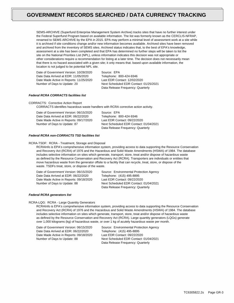
SEMS-ARCHIVE (Superfund Enterprise Management System Archive) tracks sites that have no further interest underthe Federal Superfund Program based on available information. The list was formerly known as the CERCLIS-NFRAP,renamed to SEMS ARCHIVE by the EPA in 2015. EPA may perform a minimal level of assessment work at a site whileit is archived if site conditions change and/or new information becomes available. Archived sites have been removedand archived from the inventory of SEMS sites. Archived status indicates that, to the best of EPA’s knowledge,assessment at a site has been completed and that EPA has determined no further steps will be taken to list thesite on the National Priorities List (NPL), unless information indicates this decision was not appropriate orother considerations require a recommendation for listing at a later time. The decision does not necessarily meanthat there is no hazard associated with a given site; it only means that. based upon available information, thelocation is not judged to be potential NPL site.
Date of Government Version: 10/28/2020Date Data Arrived at EDR: 11/05/2020Date Made Active in Reports: 11/25/2020Number of Days to Update: 20
Source: EPATelephone: 800-424-9346Last EDR Contact: 12/02/2020Next Scheduled EDR Contact: 01/25/2021Data Release Frequency: Quarterly
Federal RCRA CORRACTS facilities list
CORRACTS: Corrective Action ReportCORRACTS identifies hazardous waste handlers with RCRA corrective action activity.
Date of Government Version: 06/15/2020Date Data Arrived at EDR: 06/22/2020Date Made Active in Reports: 09/17/2020Number of Days to Update: 87
Source: EPATelephone: 800-424-9346Last EDR Contact: 09/22/2020Next Scheduled EDR Contact: 01/04/2021Data Release Frequency: Quarterly
Federal RCRA non-CORRACTS TSD facilities list
RCRA-TSDF: RCRA - Treatment, Storage and DisposalRCRAInfo is EPA’s comprehensive information system, providing access to data supporting the Resource Conservationand Recovery Act (RCRA) of 1976 and the Hazardous and Solid Waste Amendments (HSWA) of 1984. The databaseincludes selective information on sites which generate, transport, store, treat and/or dispose of hazardous wasteas defined by the Resource Conservation and Recovery Act (RCRA). Transporters are individuals or entities thatmove hazardous waste from the generator offsite to a facility that can recycle, treat, store, or dispose of thewaste. TSDFs treat, store, or dispose of the waste.
Date of Government Version: 06/15/2020Date Data Arrived at EDR: 06/22/2020Date Made Active in Reports: 09/18/2020Number of Days to Update: 88
Source: Environmental Protection AgencyTelephone: (415) 495-8895Last EDR Contact: 09/22/2020Next Scheduled EDR Contact: 01/04/2021Data Release Frequency: Quarterly
Federal RCRA generators list
RCRA-LQG: RCRA - Large Quantity GeneratorsRCRAInfo is EPA’s comprehensive information system, providing access to data supporting the Resource Conservationand Recovery Act (RCRA) of 1976 and the Hazardous and Solid Waste Amendments (HSWA) of 1984. The databaseincludes selective information on sites which generate, transport, store, treat and/or dispose of hazardous wasteas defined by the Resource Conservation and Recovery Act (RCRA). Large quantity generators (LQGs) generateover 1,000 kilograms (kg) of hazardous waste, or over 1 kg of acutely hazardous waste per month.
Date of Government Version: 06/15/2020Date Data Arrived at EDR: 06/22/2020Date Made Active in Reports: 09/18/2020Number of Days to Update: 88
Source: Environmental Protection AgencyTelephone: (415) 495-8895Last EDR Contact: 09/22/2020Next Scheduled EDR Contact: 01/04/2021Data Release Frequency: Quarterly
TC6305822.2s Page GR-3
GOVERNMENT RECORDS SEARCHED / DATA CURRENCY TRACKING
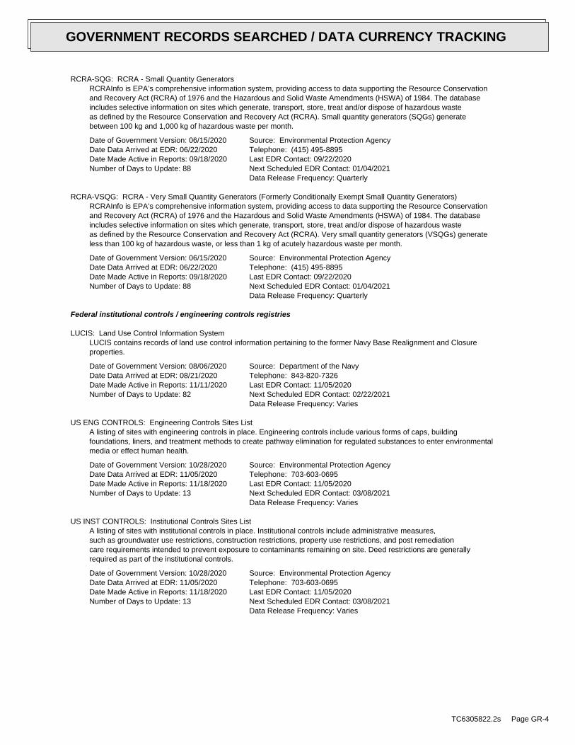
RCRA-SQG: RCRA - Small Quantity GeneratorsRCRAInfo is EPA’s comprehensive information system, providing access to data supporting the Resource Conservationand Recovery Act (RCRA) of 1976 and the Hazardous and Solid Waste Amendments (HSWA) of 1984. The databaseincludes selective information on sites which generate, transport, store, treat and/or dispose of hazardous wasteas defined by the Resource Conservation and Recovery Act (RCRA). Small quantity generators (SQGs) generatebetween 100 kg and 1,000 kg of hazardous waste per month.
Date of Government Version: 06/15/2020Date Data Arrived at EDR: 06/22/2020Date Made Active in Reports: 09/18/2020Number of Days to Update: 88
Source: Environmental Protection AgencyTelephone: (415) 495-8895Last EDR Contact: 09/22/2020Next Scheduled EDR Contact: 01/04/2021Data Release Frequency: Quarterly
RCRA-VSQG: RCRA - Very Small Quantity Generators (Formerly Conditionally Exempt Small Quantity Generators)RCRAInfo is EPA’s comprehensive information system, providing access to data supporting the Resource Conservationand Recovery Act (RCRA) of 1976 and the Hazardous and Solid Waste Amendments (HSWA) of 1984. The databaseincludes selective information on sites which generate, transport, store, treat and/or dispose of hazardous wasteas defined by the Resource Conservation and Recovery Act (RCRA). Very small quantity generators (VSQGs) generateless than 100 kg of hazardous waste, or less than 1 kg of acutely hazardous waste per month.
Date of Government Version: 06/15/2020Date Data Arrived at EDR: 06/22/2020Date Made Active in Reports: 09/18/2020Number of Days to Update: 88
Source: Environmental Protection AgencyTelephone: (415) 495-8895Last EDR Contact: 09/22/2020Next Scheduled EDR Contact: 01/04/2021Data Release Frequency: Quarterly
Federal institutional controls / engineering controls registries
LUCIS: Land Use Control Information SystemLUCIS contains records of land use control information pertaining to the former Navy Base Realignment and Closureproperties.
Date of Government Version: 08/06/2020Date Data Arrived at EDR: 08/21/2020Date Made Active in Reports: 11/11/2020Number of Days to Update: 82
Source: Department of the NavyTelephone: 843-820-7326Last EDR Contact: 11/05/2020Next Scheduled EDR Contact: 02/22/2021Data Release Frequency: Varies
US ENG CONTROLS: Engineering Controls Sites ListA listing of sites with engineering controls in place. Engineering controls include various forms of caps, buildingfoundations, liners, and treatment methods to create pathway elimination for regulated substances to enter environmentalmedia or effect human health.
Date of Government Version: 10/28/2020Date Data Arrived at EDR: 11/05/2020Date Made Active in Reports: 11/18/2020Number of Days to Update: 13
Source: Environmental Protection AgencyTelephone: 703-603-0695Last EDR Contact: 11/05/2020Next Scheduled EDR Contact: 03/08/2021Data Release Frequency: Varies
US INST CONTROLS: Institutional Controls Sites ListA listing of sites with institutional controls in place. Institutional controls include administrative measures,such as groundwater use restrictions, construction restrictions, property use restrictions, and post remediationcare requirements intended to prevent exposure to contaminants remaining on site. Deed restrictions are generallyrequired as part of the institutional controls.
Date of Government Version: 10/28/2020Date Data Arrived at EDR: 11/05/2020Date Made Active in Reports: 11/18/2020Number of Days to Update: 13
Source: Environmental Protection AgencyTelephone: 703-603-0695Last EDR Contact: 11/05/2020Next Scheduled EDR Contact: 03/08/2021Data Release Frequency: Varies
TC6305822.2s Page GR-4
GOVERNMENT RECORDS SEARCHED / DATA CURRENCY TRACKING
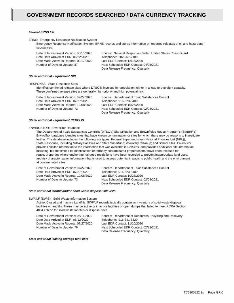
Federal ERNS list
ERNS: Emergency Response Notification SystemEmergency Response Notification System. ERNS records and stores information on reported releases of oil and hazardoussubstances.
Date of Government Version: 06/15/2020Date Data Arrived at EDR: 06/22/2020Date Made Active in Reports: 09/17/2020Number of Days to Update: 87
Source: National Response Center, United States Coast GuardTelephone: 202-267-2180Last EDR Contact: 12/15/2020Next Scheduled EDR Contact: 04/05/2021Data Release Frequency: Quarterly
State- and tribal - equivalent NPL
RESPONSE: State Response SitesIdentifies confirmed release sites where DTSC is involved in remediation, either in a lead or oversight capacity.These confirmed release sites are generally high-priority and high potential risk.
Date of Government Version: 07/27/2020Date Data Arrived at EDR: 07/27/2020Date Made Active in Reports: 10/08/2020Number of Days to Update: 73
Source: Department of Toxic Substances ControlTelephone: 916-323-3400Last EDR Contact: 10/26/2020Next Scheduled EDR Contact: 02/08/2021Data Release Frequency: Quarterly
State- and tribal - equivalent CERCLIS
ENVIROSTOR: EnviroStor DatabaseThe Department of Toxic Substances Control’s (DTSC’s) Site Mitigation and Brownfields Reuse Program’s (SMBRP’s)EnviroStor database identifes sites that have known contamination or sites for which there may be reasons to investigatefurther. The database includes the following site types: Federal Superfund sites (National Priorities List (NPL));State Response, including Military Facilities and State Superfund; Voluntary Cleanup; and School sites. EnviroStorprovides similar information to the information that was available in CalSites, and provides additional site information,including, but not limited to, identification of formerly-contaminated properties that have been released forreuse, properties where environmental deed restrictions have been recorded to prevent inappropriate land uses,and risk characterization information that is used to assess potential impacts to public health and the environmentat contaminated sites.
Date of Government Version: 07/27/2020Date Data Arrived at EDR: 07/27/2020Date Made Active in Reports: 10/08/2020Number of Days to Update: 73
Source: Department of Toxic Substances ControlTelephone: 916-323-3400Last EDR Contact: 10/26/2020Next Scheduled EDR Contact: 02/08/2021Data Release Frequency: Quarterly
State and tribal landfill and/or solid waste disposal site lists
SWF/LF (SWIS): Solid Waste Information SystemActive, Closed and Inactive Landfills. SWF/LF records typically contain an inve ntory of solid waste disposalfacilities or landfills. These may be active or i nactive facilities or open dumps that failed to meet RCRA Section4004 criteria for solid waste landfills or disposal sites.
Date of Government Version: 05/11/2020Date Data Arrived at EDR: 05/12/2020Date Made Active in Reports: 07/27/2020Number of Days to Update: 76
Source: Department of Resources Recycling and RecoveryTelephone: 916-341-6320Last EDR Contact: 11/10/2020Next Scheduled EDR Contact: 02/22/2021Data Release Frequency: Quarterly
State and tribal leaking storage tank lists
TC6305822.2s Page GR-5
GOVERNMENT RECORDS SEARCHED / DATA CURRENCY TRACKING
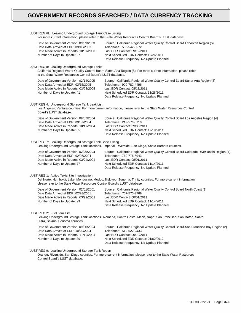
LUST REG 6L: Leaking Underground Storage Tank Case ListingFor more current information, please refer to the State Water Resources Control Board’s LUST database.
Date of Government Version: 09/09/2003Date Data Arrived at EDR: 09/10/2003Date Made Active in Reports: 10/07/2003Number of Days to Update: 27
Source: California Regional Water Quality Control Board Lahontan Region (6)Telephone: 530-542-5572Last EDR Contact: 09/12/2011Next Scheduled EDR Contact: 12/26/2011Data Release Frequency: No Update Planned
LUST REG 8: Leaking Underground Storage TanksCalifornia Regional Water Quality Control Board Santa Ana Region (8). For more current information, please referto the State Water Resources Control Board’s LUST database.
Date of Government Version: 02/14/2005Date Data Arrived at EDR: 02/15/2005Date Made Active in Reports: 03/28/2005Number of Days to Update: 41
Source: California Regional Water Quality Control Board Santa Ana Region (8)Telephone: 909-782-4496Last EDR Contact: 08/15/2011Next Scheduled EDR Contact: 11/28/2011Data Release Frequency: No Update Planned
LUST REG 4: Underground Storage Tank Leak ListLos Angeles, Ventura counties. For more current information, please refer to the State Water Resources ControlBoard’s LUST database.
Date of Government Version: 09/07/2004Date Data Arrived at EDR: 09/07/2004Date Made Active in Reports: 10/12/2004Number of Days to Update: 35
Source: California Regional Water Quality Control Board Los Angeles Region (4)Telephone: 213-576-6710Last EDR Contact: 09/06/2011Next Scheduled EDR Contact: 12/19/2011Data Release Frequency: No Update Planned
LUST REG 7: Leaking Underground Storage Tank Case ListingLeaking Underground Storage Tank locations. Imperial, Riverside, San Diego, Santa Barbara counties.
Date of Government Version: 02/26/2004Date Data Arrived at EDR: 02/26/2004Date Made Active in Reports: 03/24/2004Number of Days to Update: 27
Source: California Regional Water Quality Control Board Colorado River Basin Region (7)Telephone: 760-776-8943Last EDR Contact: 08/01/2011Next Scheduled EDR Contact: 11/14/2011Data Release Frequency: No Update Planned
LUST REG 1: Active Toxic Site InvestigationDel Norte, Humboldt, Lake, Mendocino, Modoc, Siskiyou, Sonoma, Trinity counties. For more current information,please refer to the State Water Resources Control Board’s LUST database.
Date of Government Version: 02/01/2001Date Data Arrived at EDR: 02/28/2001Date Made Active in Reports: 03/29/2001Number of Days to Update: 29
Source: California Regional Water Quality Control Board North Coast (1)Telephone: 707-570-3769Last EDR Contact: 08/01/2011Next Scheduled EDR Contact: 11/14/2011Data Release Frequency: No Update Planned
LUST REG 2: Fuel Leak ListLeaking Underground Storage Tank locations. Alameda, Contra Costa, Marin, Napa, San Francisco, San Mateo, SantaClara, Solano, Sonoma counties.
Date of Government Version: 09/30/2004Date Data Arrived at EDR: 10/20/2004Date Made Active in Reports: 11/19/2004Number of Days to Update: 30
Source: California Regional Water Quality Control Board San Francisco Bay Region (2)Telephone: 510-622-2433Last EDR Contact: 09/19/2011Next Scheduled EDR Contact: 01/02/2012Data Release Frequency: No Update Planned
LUST REG 9: Leaking Underground Storage Tank ReportOrange, Riverside, San Diego counties. For more current information, please refer to the State Water ResourcesControl Board’s LUST database.
TC6305822.2s Page GR-6
GOVERNMENT RECORDS SEARCHED / DATA CURRENCY TRACKING
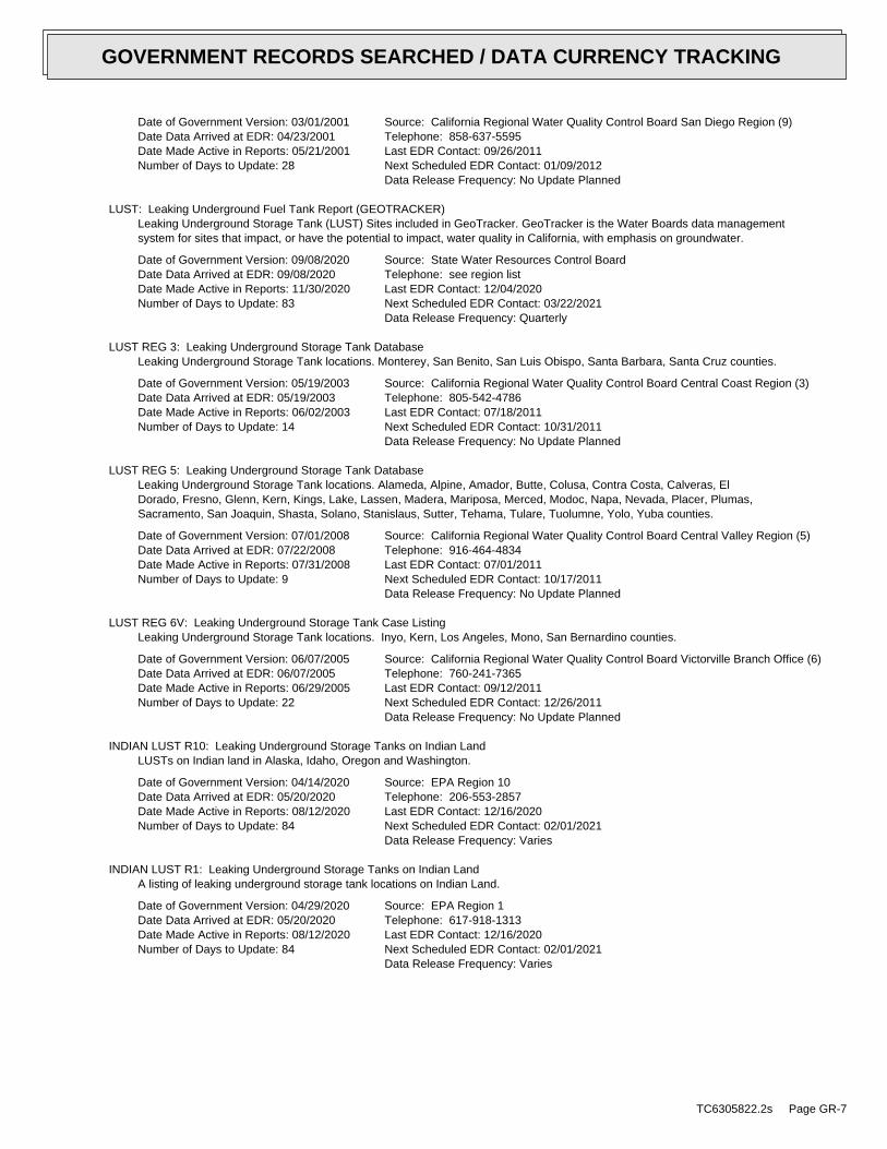
Date of Government Version: 03/01/2001Date Data Arrived at EDR: 04/23/2001Date Made Active in Reports: 05/21/2001Number of Days to Update: 28
Source: California Regional Water Quality Control Board San Diego Region (9)Telephone: 858-637-5595Last EDR Contact: 09/26/2011Next Scheduled EDR Contact: 01/09/2012Data Release Frequency: No Update Planned
LUST: Leaking Underground Fuel Tank Report (GEOTRACKER)Leaking Underground Storage Tank (LUST) Sites included in GeoTracker. GeoTracker is the Water Boards data managementsystem for sites that impact, or have the potential to impact, water quality in California, with emphasis on groundwater.
Date of Government Version: 09/08/2020Date Data Arrived at EDR: 09/08/2020Date Made Active in Reports: 11/30/2020Number of Days to Update: 83
Source: State Water Resources Control BoardTelephone: see region listLast EDR Contact: 12/04/2020Next Scheduled EDR Contact: 03/22/2021Data Release Frequency: Quarterly
LUST REG 3: Leaking Underground Storage Tank DatabaseLeaking Underground Storage Tank locations. Monterey, San Benito, San Luis Obispo, Santa Barbara, Santa Cruz counties.
Date of Government Version: 05/19/2003Date Data Arrived at EDR: 05/19/2003Date Made Active in Reports: 06/02/2003Number of Days to Update: 14
Source: California Regional Water Quality Control Board Central Coast Region (3)Telephone: 805-542-4786Last EDR Contact: 07/18/2011Next Scheduled EDR Contact: 10/31/2011Data Release Frequency: No Update Planned
LUST REG 5: Leaking Underground Storage Tank DatabaseLeaking Underground Storage Tank locations. Alameda, Alpine, Amador, Butte, Colusa, Contra Costa, Calveras, ElDorado, Fresno, Glenn, Kern, Kings, Lake, Lassen, Madera, Mariposa, Merced, Modoc, Napa, Nevada, Placer, Plumas,Sacramento, San Joaquin, Shasta, Solano, Stanislaus, Sutter, Tehama, Tulare, Tuolumne, Yolo, Yuba counties.
Date of Government Version: 07/01/2008Date Data Arrived at EDR: 07/22/2008Date Made Active in Reports: 07/31/2008Number of Days to Update: 9
Source: California Regional Water Quality Control Board Central Valley Region (5)Telephone: 916-464-4834Last EDR Contact: 07/01/2011Next Scheduled EDR Contact: 10/17/2011Data Release Frequency: No Update Planned
LUST REG 6V: Leaking Underground Storage Tank Case ListingLeaking Underground Storage Tank locations. Inyo, Kern, Los Angeles, Mono, San Bernardino counties.
Date of Government Version: 06/07/2005Date Data Arrived at EDR: 06/07/2005Date Made Active in Reports: 06/29/2005Number of Days to Update: 22
Source: California Regional Water Quality Control Board Victorville Branch Office (6)Telephone: 760-241-7365Last EDR Contact: 09/12/2011Next Scheduled EDR Contact: 12/26/2011Data Release Frequency: No Update Planned
INDIAN LUST R10: Leaking Underground Storage Tanks on Indian LandLUSTs on Indian land in Alaska, Idaho, Oregon and Washington.
Date of Government Version: 04/14/2020Date Data Arrived at EDR: 05/20/2020Date Made Active in Reports: 08/12/2020Number of Days to Update: 84
Source: EPA Region 10Telephone: 206-553-2857Last EDR Contact: 12/16/2020Next Scheduled EDR Contact: 02/01/2021Data Release Frequency: Varies
INDIAN LUST R1: Leaking Underground Storage Tanks on Indian LandA listing of leaking underground storage tank locations on Indian Land.
Date of Government Version: 04/29/2020Date Data Arrived at EDR: 05/20/2020Date Made Active in Reports: 08/12/2020Number of Days to Update: 84
Source: EPA Region 1Telephone: 617-918-1313Last EDR Contact: 12/16/2020Next Scheduled EDR Contact: 02/01/2021Data Release Frequency: Varies
TC6305822.2s Page GR-7
GOVERNMENT RECORDS SEARCHED / DATA CURRENCY TRACKING
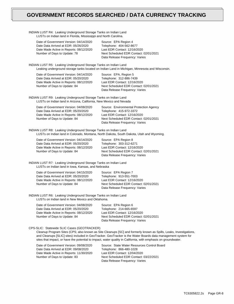
INDIAN LUST R4: Leaking Underground Storage Tanks on Indian LandLUSTs on Indian land in Florida, Mississippi and North Carolina.
Date of Government Version: 04/14/2020Date Data Arrived at EDR: 05/26/2020Date Made Active in Reports: 08/12/2020Number of Days to Update: 78
Source: EPA Region 4Telephone: 404-562-8677Last EDR Contact: 12/16/2020Next Scheduled EDR Contact: 02/01/2021Data Release Frequency: Varies
INDIAN LUST R5: Leaking Underground Storage Tanks on Indian LandLeaking underground storage tanks located on Indian Land in Michigan, Minnesota and Wisconsin.
Date of Government Version: 04/14/2020Date Data Arrived at EDR: 05/20/2020Date Made Active in Reports: 08/12/2020Number of Days to Update: 84
Source: EPA, Region 5Telephone: 312-886-7439Last EDR Contact: 12/16/2020Next Scheduled EDR Contact: 02/01/2021Data Release Frequency: Varies
INDIAN LUST R9: Leaking Underground Storage Tanks on Indian LandLUSTs on Indian land in Arizona, California, New Mexico and Nevada
Date of Government Version: 04/08/2020Date Data Arrived at EDR: 05/20/2020Date Made Active in Reports: 08/12/2020Number of Days to Update: 84
Source: Environmental Protection AgencyTelephone: 415-972-3372Last EDR Contact: 12/16/2020Next Scheduled EDR Contact: 02/01/2021Data Release Frequency: Varies
INDIAN LUST R8: Leaking Underground Storage Tanks on Indian LandLUSTs on Indian land in Colorado, Montana, North Dakota, South Dakota, Utah and Wyoming.
Date of Government Version: 04/14/2020Date Data Arrived at EDR: 05/20/2020Date Made Active in Reports: 08/12/2020Number of Days to Update: 84
Source: EPA Region 8Telephone: 303-312-6271Last EDR Contact: 12/16/2020Next Scheduled EDR Contact: 02/01/2021Data Release Frequency: Varies
INDIAN LUST R7: Leaking Underground Storage Tanks on Indian LandLUSTs on Indian land in Iowa, Kansas, and Nebraska
Date of Government Version: 04/15/2020Date Data Arrived at EDR: 05/20/2020Date Made Active in Reports: 08/12/2020Number of Days to Update: 84
Source: EPA Region 7Telephone: 913-551-7003Last EDR Contact: 12/16/2020Next Scheduled EDR Contact: 02/01/2021Data Release Frequency: Varies
INDIAN LUST R6: Leaking Underground Storage Tanks on Indian LandLUSTs on Indian land in New Mexico and Oklahoma.
Date of Government Version: 04/08/2020Date Data Arrived at EDR: 05/20/2020Date Made Active in Reports: 08/12/2020Number of Days to Update: 84
Source: EPA Region 6Telephone: 214-665-6597Last EDR Contact: 12/16/2020Next Scheduled EDR Contact: 02/01/2021Data Release Frequency: Varies
CPS-SLIC: Statewide SLIC Cases (GEOTRACKER)Cleanup Program Sites (CPS; also known as Site Cleanups [SC] and formerly known as Spills, Leaks, Investigations,and Cleanups [SLIC] sites) included in GeoTracker. GeoTracker is the Water Boards data management system forsites that impact, or have the potential to impact, water quality in California, with emphasis on groundwater.
Date of Government Version: 09/08/2020Date Data Arrived at EDR: 09/08/2020Date Made Active in Reports: 11/30/2020Number of Days to Update: 83
Source: State Water Resources Control BoardTelephone: 866-480-1028Last EDR Contact: 12/04/2020Next Scheduled EDR Contact: 03/22/2021Data Release Frequency: Varies
TC6305822.2s Page GR-8
GOVERNMENT RECORDS SEARCHED / DATA CURRENCY TRACKING
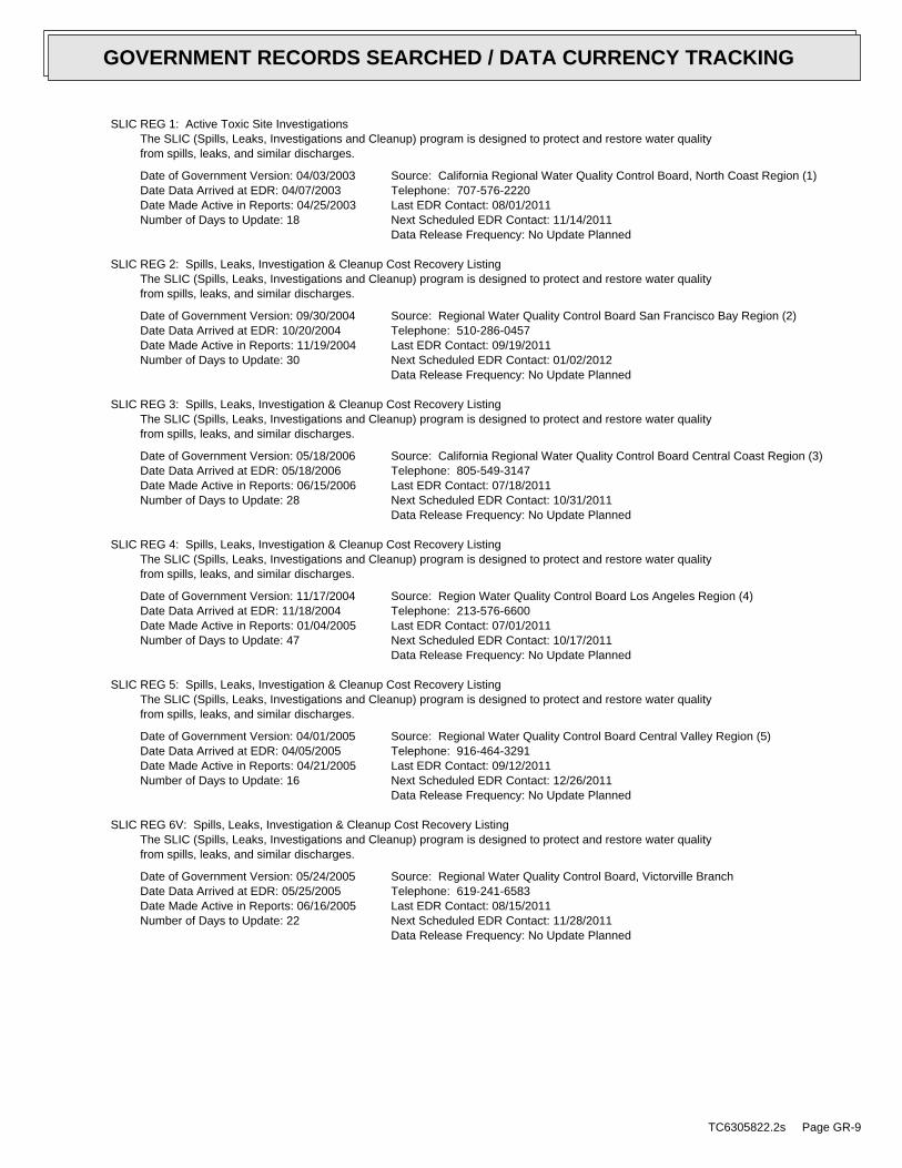
SLIC REG 1: Active Toxic Site InvestigationsThe SLIC (Spills, Leaks, Investigations and Cleanup) program is designed to protect and restore water qualityfrom spills, leaks, and similar discharges.
Date of Government Version: 04/03/2003Date Data Arrived at EDR: 04/07/2003Date Made Active in Reports: 04/25/2003Number of Days to Update: 18
Source: California Regional Water Quality Control Board, North Coast Region (1)Telephone: 707-576-2220Last EDR Contact: 08/01/2011Next Scheduled EDR Contact: 11/14/2011Data Release Frequency: No Update Planned
SLIC REG 2: Spills, Leaks, Investigation & Cleanup Cost Recovery ListingThe SLIC (Spills, Leaks, Investigations and Cleanup) program is designed to protect and restore water qualityfrom spills, leaks, and similar discharges.
Date of Government Version: 09/30/2004Date Data Arrived at EDR: 10/20/2004Date Made Active in Reports: 11/19/2004Number of Days to Update: 30
Source: Regional Water Quality Control Board San Francisco Bay Region (2)Telephone: 510-286-0457Last EDR Contact: 09/19/2011Next Scheduled EDR Contact: 01/02/2012Data Release Frequency: No Update Planned
SLIC REG 3: Spills, Leaks, Investigation & Cleanup Cost Recovery ListingThe SLIC (Spills, Leaks, Investigations and Cleanup) program is designed to protect and restore water qualityfrom spills, leaks, and similar discharges.
Date of Government Version: 05/18/2006Date Data Arrived at EDR: 05/18/2006Date Made Active in Reports: 06/15/2006Number of Days to Update: 28
Source: California Regional Water Quality Control Board Central Coast Region (3)Telephone: 805-549-3147Last EDR Contact: 07/18/2011Next Scheduled EDR Contact: 10/31/2011Data Release Frequency: No Update Planned
SLIC REG 4: Spills, Leaks, Investigation & Cleanup Cost Recovery ListingThe SLIC (Spills, Leaks, Investigations and Cleanup) program is designed to protect and restore water qualityfrom spills, leaks, and similar discharges.
Date of Government Version: 11/17/2004Date Data Arrived at EDR: 11/18/2004Date Made Active in Reports: 01/04/2005Number of Days to Update: 47
Source: Region Water Quality Control Board Los Angeles Region (4)Telephone: 213-576-6600Last EDR Contact: 07/01/2011Next Scheduled EDR Contact: 10/17/2011Data Release Frequency: No Update Planned
SLIC REG 5: Spills, Leaks, Investigation & Cleanup Cost Recovery ListingThe SLIC (Spills, Leaks, Investigations and Cleanup) program is designed to protect and restore water qualityfrom spills, leaks, and similar discharges.
Date of Government Version: 04/01/2005Date Data Arrived at EDR: 04/05/2005Date Made Active in Reports: 04/21/2005Number of Days to Update: 16
Source: Regional Water Quality Control Board Central Valley Region (5)Telephone: 916-464-3291Last EDR Contact: 09/12/2011Next Scheduled EDR Contact: 12/26/2011Data Release Frequency: No Update Planned
SLIC REG 6V: Spills, Leaks, Investigation & Cleanup Cost Recovery ListingThe SLIC (Spills, Leaks, Investigations and Cleanup) program is designed to protect and restore water qualityfrom spills, leaks, and similar discharges.
Date of Government Version: 05/24/2005Date Data Arrived at EDR: 05/25/2005Date Made Active in Reports: 06/16/2005Number of Days to Update: 22
Source: Regional Water Quality Control Board, Victorville BranchTelephone: 619-241-6583Last EDR Contact: 08/15/2011Next Scheduled EDR Contact: 11/28/2011Data Release Frequency: No Update Planned
TC6305822.2s Page GR-9
GOVERNMENT RECORDS SEARCHED / DATA CURRENCY TRACKING
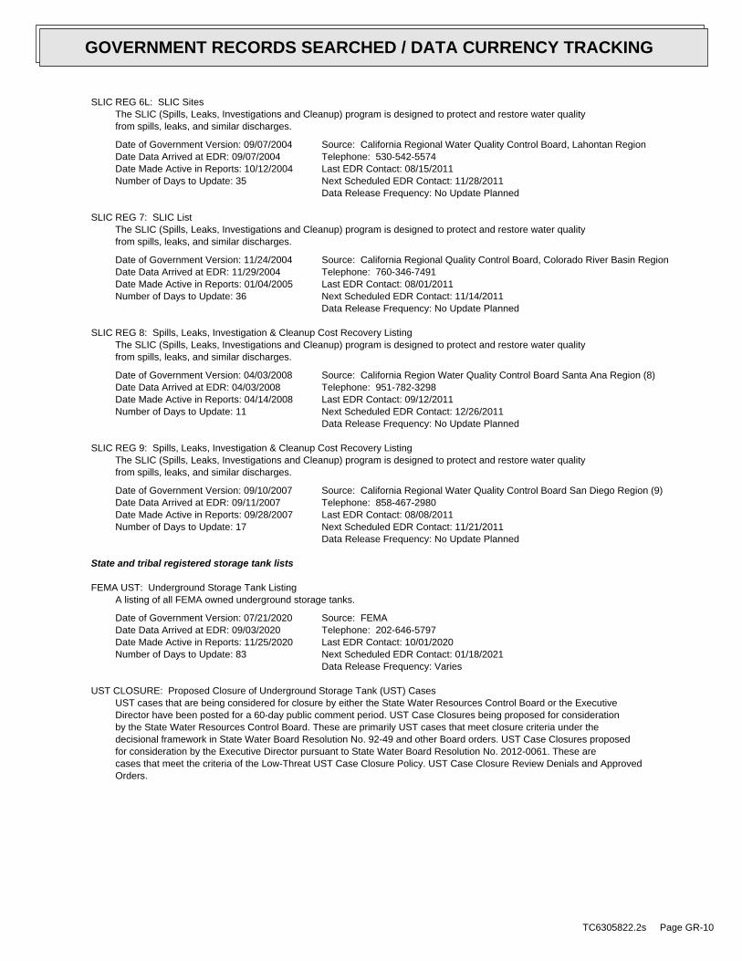
SLIC REG 6L: SLIC SitesThe SLIC (Spills, Leaks, Investigations and Cleanup) program is designed to protect and restore water qualityfrom spills, leaks, and similar discharges.
Date of Government Version: 09/07/2004Date Data Arrived at EDR: 09/07/2004Date Made Active in Reports: 10/12/2004Number of Days to Update: 35
Source: California Regional Water Quality Control Board, Lahontan RegionTelephone: 530-542-5574Last EDR Contact: 08/15/2011Next Scheduled EDR Contact: 11/28/2011Data Release Frequency: No Update Planned
SLIC REG 7: SLIC ListThe SLIC (Spills, Leaks, Investigations and Cleanup) program is designed to protect and restore water qualityfrom spills, leaks, and similar discharges.
Date of Government Version: 11/24/2004Date Data Arrived at EDR: 11/29/2004Date Made Active in Reports: 01/04/2005Number of Days to Update: 36
Source: California Regional Quality Control Board, Colorado River Basin RegionTelephone: 760-346-7491Last EDR Contact: 08/01/2011Next Scheduled EDR Contact: 11/14/2011Data Release Frequency: No Update Planned
SLIC REG 8: Spills, Leaks, Investigation & Cleanup Cost Recovery ListingThe SLIC (Spills, Leaks, Investigations and Cleanup) program is designed to protect and restore water qualityfrom spills, leaks, and similar discharges.
Date of Government Version: 04/03/2008Date Data Arrived at EDR: 04/03/2008Date Made Active in Reports: 04/14/2008Number of Days to Update: 11
Source: California Region Water Quality Control Board Santa Ana Region (8)Telephone: 951-782-3298Last EDR Contact: 09/12/2011Next Scheduled EDR Contact: 12/26/2011Data Release Frequency: No Update Planned
SLIC REG 9: Spills, Leaks, Investigation & Cleanup Cost Recovery ListingThe SLIC (Spills, Leaks, Investigations and Cleanup) program is designed to protect and restore water qualityfrom spills, leaks, and similar discharges.
Date of Government Version: 09/10/2007Date Data Arrived at EDR: 09/11/2007Date Made Active in Reports: 09/28/2007Number of Days to Update: 17
Source: California Regional Water Quality Control Board San Diego Region (9)Telephone: 858-467-2980Last EDR Contact: 08/08/2011Next Scheduled EDR Contact: 11/21/2011Data Release Frequency: No Update Planned
State and tribal registered storage tank lists
FEMA UST: Underground Storage Tank ListingA listing of all FEMA owned underground storage tanks.
Date of Government Version: 07/21/2020Date Data Arrived at EDR: 09/03/2020Date Made Active in Reports: 11/25/2020Number of Days to Update: 83
Source: FEMATelephone: 202-646-5797Last EDR Contact: 10/01/2020Next Scheduled EDR Contact: 01/18/2021Data Release Frequency: Varies
UST CLOSURE: Proposed Closure of Underground Storage Tank (UST) CasesUST cases that are being considered for closure by either the State Water Resources Control Board or the ExecutiveDirector have been posted for a 60-day public comment period. UST Case Closures being proposed for considerationby the State Water Resources Control Board. These are primarily UST cases that meet closure criteria under thedecisional framework in State Water Board Resolution No. 92-49 and other Board orders. UST Case Closures proposedfor consideration by the Executive Director pursuant to State Water Board Resolution No. 2012-0061. These arecases that meet the criteria of the Low-Threat UST Case Closure Policy. UST Case Closure Review Denials and ApprovedOrders.
TC6305822.2s Page GR-10
GOVERNMENT RECORDS SEARCHED / DATA CURRENCY TRACKING
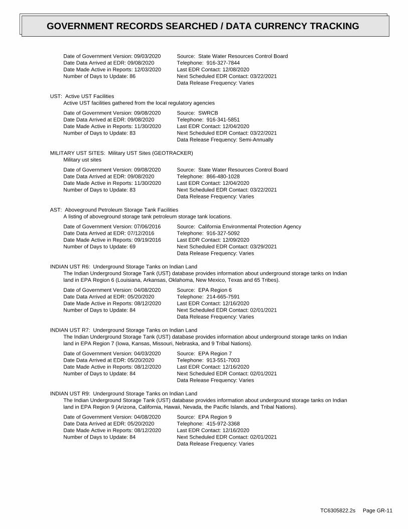
Date of Government Version: 09/03/2020Date Data Arrived at EDR: 09/08/2020Date Made Active in Reports: 12/03/2020Number of Days to Update: 86
Source: State Water Resources Control BoardTelephone: 916-327-7844Last EDR Contact: 12/08/2020Next Scheduled EDR Contact: 03/22/2021Data Release Frequency: Varies
UST: Active UST FacilitiesActive UST facilities gathered from the local regulatory agencies
Date of Government Version: 09/08/2020Date Data Arrived at EDR: 09/08/2020Date Made Active in Reports: 11/30/2020Number of Days to Update: 83
Source: SWRCBTelephone: 916-341-5851Last EDR Contact: 12/04/2020Next Scheduled EDR Contact: 03/22/2021Data Release Frequency: Semi-Annually
MILITARY UST SITES: Military UST Sites (GEOTRACKER)Military ust sites
Date of Government Version: 09/08/2020Date Data Arrived at EDR: 09/08/2020Date Made Active in Reports: 11/30/2020Number of Days to Update: 83
Source: State Water Resources Control BoardTelephone: 866-480-1028Last EDR Contact: 12/04/2020Next Scheduled EDR Contact: 03/22/2021Data Release Frequency: Varies
AST: Aboveground Petroleum Storage Tank FacilitiesA listing of aboveground storage tank petroleum storage tank locations.
Date of Government Version: 07/06/2016Date Data Arrived at EDR: 07/12/2016Date Made Active in Reports: 09/19/2016Number of Days to Update: 69
Source: California Environmental Protection AgencyTelephone: 916-327-5092Last EDR Contact: 12/09/2020Next Scheduled EDR Contact: 03/29/2021Data Release Frequency: Varies
INDIAN UST R6: Underground Storage Tanks on Indian LandThe Indian Underground Storage Tank (UST) database provides information about underground storage tanks on Indianland in EPA Region 6 (Louisiana, Arkansas, Oklahoma, New Mexico, Texas and 65 Tribes).
Date of Government Version: 04/08/2020Date Data Arrived at EDR: 05/20/2020Date Made Active in Reports: 08/12/2020Number of Days to Update: 84
Source: EPA Region 6Telephone: 214-665-7591Last EDR Contact: 12/16/2020Next Scheduled EDR Contact: 02/01/2021Data Release Frequency: Varies
INDIAN UST R7: Underground Storage Tanks on Indian LandThe Indian Underground Storage Tank (UST) database provides information about underground storage tanks on Indianland in EPA Region 7 (Iowa, Kansas, Missouri, Nebraska, and 9 Tribal Nations).
Date of Government Version: 04/03/2020Date Data Arrived at EDR: 05/20/2020Date Made Active in Reports: 08/12/2020Number of Days to Update: 84
Source: EPA Region 7Telephone: 913-551-7003Last EDR Contact: 12/16/2020Next Scheduled EDR Contact: 02/01/2021Data Release Frequency: Varies
INDIAN UST R9: Underground Storage Tanks on Indian LandThe Indian Underground Storage Tank (UST) database provides information about underground storage tanks on Indianland in EPA Region 9 (Arizona, California, Hawaii, Nevada, the Pacific Islands, and Tribal Nations).
Date of Government Version: 04/08/2020Date Data Arrived at EDR: 05/20/2020Date Made Active in Reports: 08/12/2020Number of Days to Update: 84
Source: EPA Region 9Telephone: 415-972-3368Last EDR Contact: 12/16/2020Next Scheduled EDR Contact: 02/01/2021Data Release Frequency: Varies
TC6305822.2s Page GR-11
GOVERNMENT RECORDS SEARCHED / DATA CURRENCY TRACKING
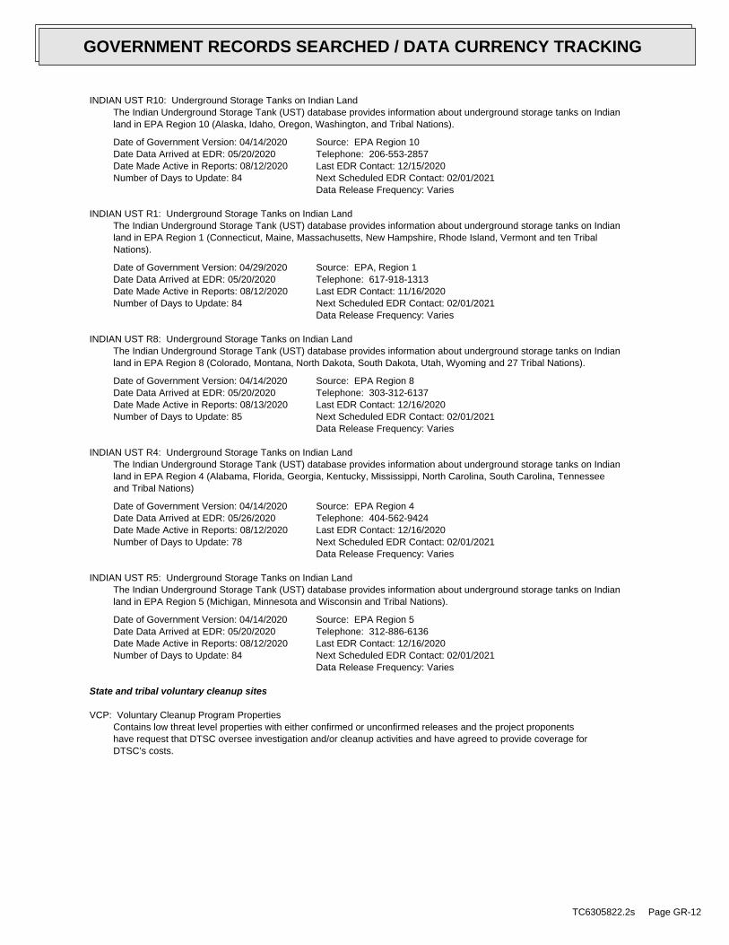
INDIAN UST R10: Underground Storage Tanks on Indian LandThe Indian Underground Storage Tank (UST) database provides information about underground storage tanks on Indianland in EPA Region 10 (Alaska, Idaho, Oregon, Washington, and Tribal Nations).
Date of Government Version: 04/14/2020Date Data Arrived at EDR: 05/20/2020Date Made Active in Reports: 08/12/2020Number of Days to Update: 84
Source: EPA Region 10Telephone: 206-553-2857Last EDR Contact: 12/15/2020Next Scheduled EDR Contact: 02/01/2021Data Release Frequency: Varies
INDIAN UST R1: Underground Storage Tanks on Indian LandThe Indian Underground Storage Tank (UST) database provides information about underground storage tanks on Indianland in EPA Region 1 (Connecticut, Maine, Massachusetts, New Hampshire, Rhode Island, Vermont and ten TribalNations).
Date of Government Version: 04/29/2020Date Data Arrived at EDR: 05/20/2020Date Made Active in Reports: 08/12/2020Number of Days to Update: 84
Source: EPA, Region 1Telephone: 617-918-1313Last EDR Contact: 11/16/2020Next Scheduled EDR Contact: 02/01/2021Data Release Frequency: Varies
INDIAN UST R8: Underground Storage Tanks on Indian LandThe Indian Underground Storage Tank (UST) database provides information about underground storage tanks on Indianland in EPA Region 8 (Colorado, Montana, North Dakota, South Dakota, Utah, Wyoming and 27 Tribal Nations).
Date of Government Version: 04/14/2020Date Data Arrived at EDR: 05/20/2020Date Made Active in Reports: 08/13/2020Number of Days to Update: 85
Source: EPA Region 8Telephone: 303-312-6137Last EDR Contact: 12/16/2020Next Scheduled EDR Contact: 02/01/2021Data Release Frequency: Varies
INDIAN UST R4: Underground Storage Tanks on Indian LandThe Indian Underground Storage Tank (UST) database provides information about underground storage tanks on Indianland in EPA Region 4 (Alabama, Florida, Georgia, Kentucky, Mississippi, North Carolina, South Carolina, Tennesseeand Tribal Nations)
Date of Government Version: 04/14/2020Date Data Arrived at EDR: 05/26/2020Date Made Active in Reports: 08/12/2020Number of Days to Update: 78
Source: EPA Region 4Telephone: 404-562-9424Last EDR Contact: 12/16/2020Next Scheduled EDR Contact: 02/01/2021Data Release Frequency: Varies
INDIAN UST R5: Underground Storage Tanks on Indian LandThe Indian Underground Storage Tank (UST) database provides information about underground storage tanks on Indianland in EPA Region 5 (Michigan, Minnesota and Wisconsin and Tribal Nations).
Date of Government Version: 04/14/2020Date Data Arrived at EDR: 05/20/2020Date Made Active in Reports: 08/12/2020Number of Days to Update: 84
Source: EPA Region 5Telephone: 312-886-6136Last EDR Contact: 12/16/2020Next Scheduled EDR Contact: 02/01/2021Data Release Frequency: Varies
State and tribal voluntary cleanup sites
VCP: Voluntary Cleanup Program PropertiesContains low threat level properties with either confirmed or unconfirmed releases and the project proponentshave request that DTSC oversee investigation and/or cleanup activities and have agreed to provide coverage forDTSC’s costs.
TC6305822.2s Page GR-12
GOVERNMENT RECORDS SEARCHED / DATA CURRENCY TRACKING
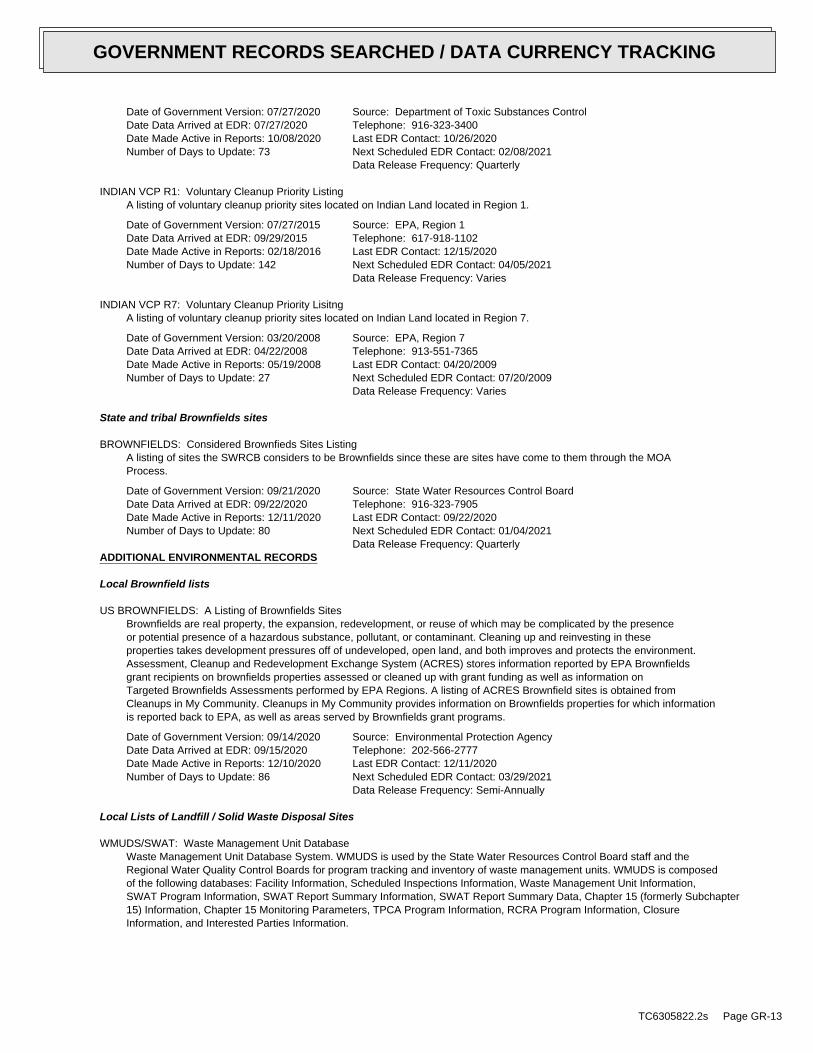
Date of Government Version: 07/27/2020Date Data Arrived at EDR: 07/27/2020Date Made Active in Reports: 10/08/2020Number of Days to Update: 73
Source: Department of Toxic Substances ControlTelephone: 916-323-3400Last EDR Contact: 10/26/2020Next Scheduled EDR Contact: 02/08/2021Data Release Frequency: Quarterly
INDIAN VCP R1: Voluntary Cleanup Priority ListingA listing of voluntary cleanup priority sites located on Indian Land located in Region 1.
Date of Government Version: 07/27/2015Date Data Arrived at EDR: 09/29/2015Date Made Active in Reports: 02/18/2016Number of Days to Update: 142
Source: EPA, Region 1Telephone: 617-918-1102Last EDR Contact: 12/15/2020Next Scheduled EDR Contact: 04/05/2021Data Release Frequency: Varies
INDIAN VCP R7: Voluntary Cleanup Priority LisitngA listing of voluntary cleanup priority sites located on Indian Land located in Region 7.
Date of Government Version: 03/20/2008Date Data Arrived at EDR: 04/22/2008Date Made Active in Reports: 05/19/2008Number of Days to Update: 27
Source: EPA, Region 7Telephone: 913-551-7365Last EDR Contact: 04/20/2009Next Scheduled EDR Contact: 07/20/2009Data Release Frequency: Varies
State and tribal Brownfields sites
BROWNFIELDS: Considered Brownfieds Sites ListingA listing of sites the SWRCB considers to be Brownfields since these are sites have come to them through the MOAProcess.
Date of Government Version: 09/21/2020Date Data Arrived at EDR: 09/22/2020Date Made Active in Reports: 12/11/2020Number of Days to Update: 80
Source: State Water Resources Control BoardTelephone: 916-323-7905Last EDR Contact: 09/22/2020Next Scheduled EDR Contact: 01/04/2021Data Release Frequency: Quarterly
ADDITIONAL ENVIRONMENTAL RECORDS
Local Brownfield lists
US BROWNFIELDS: A Listing of Brownfields SitesBrownfields are real property, the expansion, redevelopment, or reuse of which may be complicated by the presenceor potential presence of a hazardous substance, pollutant, or contaminant. Cleaning up and reinvesting in theseproperties takes development pressures off of undeveloped, open land, and both improves and protects the environment.Assessment, Cleanup and Redevelopment Exchange System (ACRES) stores information reported by EPA Brownfieldsgrant recipients on brownfields properties assessed or cleaned up with grant funding as well as information onTargeted Brownfields Assessments performed by EPA Regions. A listing of ACRES Brownfield sites is obtained fromCleanups in My Community. Cleanups in My Community provides information on Brownfields properties for which informationis reported back to EPA, as well as areas served by Brownfields grant programs.
Date of Government Version: 09/14/2020Date Data Arrived at EDR: 09/15/2020Date Made Active in Reports: 12/10/2020Number of Days to Update: 86
Source: Environmental Protection AgencyTelephone: 202-566-2777Last EDR Contact: 12/11/2020Next Scheduled EDR Contact: 03/29/2021Data Release Frequency: Semi-Annually
Local Lists of Landfill / Solid Waste Disposal Sites
WMUDS/SWAT: Waste Management Unit DatabaseWaste Management Unit Database System. WMUDS is used by the State Water Resources Control Board staff and theRegional Water Quality Control Boards for program tracking and inventory of waste management units. WMUDS is composedof the following databases: Facility Information, Scheduled Inspections Information, Waste Management Unit Information,SWAT Program Information, SWAT Report Summary Information, SWAT Report Summary Data, Chapter 15 (formerly Subchapter15) Information, Chapter 15 Monitoring Parameters, TPCA Program Information, RCRA Program Information, ClosureInformation, and Interested Parties Information.
TC6305822.2s Page GR-13
GOVERNMENT RECORDS SEARCHED / DATA CURRENCY TRACKING
Date of Government Version: 04/01/2000Date Data Arrived at EDR: 04/10/2000Date Made Active in Reports: 05/10/2000Number of Days to Update: 30
Source: State Water Resources Control BoardTelephone: 916-227-4448Last EDR Contact: 10/20/2020Next Scheduled EDR Contact: 02/08/2021Data Release Frequency: No Update Planned
SWRCY: Recycler DatabaseA listing of recycling facilities in California.
Date of Government Version: 09/08/2020Date Data Arrived at EDR: 09/08/2020Date Made Active in Reports: 11/30/2020Number of Days to Update: 83
Source: Department of ConservationTelephone: 916-323-3836Last EDR Contact: 12/08/2020Next Scheduled EDR Contact: 03/22/2021Data Release Frequency: Quarterly
HAULERS: Registered Waste Tire Haulers ListingA listing of registered waste tire haulers.
Date of Government Version: 05/28/2020Date Data Arrived at EDR: 05/29/2020Date Made Active in Reports: 08/12/2020Number of Days to Update: 75
Source: Integrated Waste Management BoardTelephone: 916-341-6422Last EDR Contact: 11/05/2020Next Scheduled EDR Contact: 02/22/2021Data Release Frequency: Varies
INDIAN ODI: Report on the Status of Open Dumps on Indian LandsLocation of open dumps on Indian land.
Date of Government Version: 12/31/1998Date Data Arrived at EDR: 12/03/2007Date Made Active in Reports: 01/24/2008Number of Days to Update: 52
Source: Environmental Protection AgencyTelephone: 703-308-8245Last EDR Contact: 10/20/2020Next Scheduled EDR Contact: 02/08/2021Data Release Frequency: Varies
DEBRIS REGION 9: Torres Martinez Reservation Illegal Dump Site LocationsA listing of illegal dump sites location on the Torres Martinez Indian Reservation located in eastern RiversideCounty and northern Imperial County, California.
Date of Government Version: 01/12/2009Date Data Arrived at EDR: 05/07/2009Date Made Active in Reports: 09/21/2009Number of Days to Update: 137
Source: EPA, Region 9Telephone: 415-947-4219Last EDR Contact: 10/13/2020Next Scheduled EDR Contact: 02/01/2021Data Release Frequency: No Update Planned
ODI: Open Dump InventoryAn open dump is defined as a disposal facility that does not comply with one or more of the Part 257 or Part 258Subtitle D Criteria.
Date of Government Version: 06/30/1985Date Data Arrived at EDR: 08/09/2004Date Made Active in Reports: 09/17/2004Number of Days to Update: 39
Source: Environmental Protection AgencyTelephone: 800-424-9346Last EDR Contact: 06/09/2004Next Scheduled EDR Contact: N/AData Release Frequency: No Update Planned
IHS OPEN DUMPS: Open Dumps on Indian LandA listing of all open dumps located on Indian Land in the United States.
Date of Government Version: 04/01/2014Date Data Arrived at EDR: 08/06/2014Date Made Active in Reports: 01/29/2015Number of Days to Update: 176
Source: Department of Health & Human Serivces, Indian Health ServiceTelephone: 301-443-1452Last EDR Contact: 10/30/2020Next Scheduled EDR Contact: 02/08/2021Data Release Frequency: Varies
TC6305822.2s Page GR-14
GOVERNMENT RECORDS SEARCHED / DATA CURRENCY TRACKING
Local Lists of Hazardous waste / Contaminated Sites
US HIST CDL: National Clandestine Laboratory RegisterA listing of clandestine drug lab locations that have been removed from the DEAs National Clandestine LaboratoryRegister.
Date of Government Version: 03/18/2020Date Data Arrived at EDR: 03/19/2020Date Made Active in Reports: 06/09/2020Number of Days to Update: 82
Source: Drug Enforcement AdministrationTelephone: 202-307-1000Last EDR Contact: 11/16/2020Next Scheduled EDR Contact: 03/08/2021Data Release Frequency: No Update Planned
HIST CAL-SITES: Calsites DatabaseThe Calsites database contains potential or confirmed hazardous substance release properties. In 1996, CaliforniaEPA reevaluated and significantly reduced the number of sites in the Calsites database. No longer updated by thestate agency. It has been replaced by ENVIROSTOR.
Date of Government Version: 08/08/2005Date Data Arrived at EDR: 08/03/2006Date Made Active in Reports: 08/24/2006Number of Days to Update: 21
Source: Department of Toxic Substance ControlTelephone: 916-323-3400Last EDR Contact: 02/23/2009Next Scheduled EDR Contact: 05/25/2009Data Release Frequency: No Update Planned
SCH: School Property Evaluation ProgramThis category contains proposed and existing school sites that are being evaluated by DTSC for possible hazardousmaterials contamination. In some cases, these properties may be listed in the CalSites category depending on thelevel of threat to public health and safety or the environment they pose.
Date of Government Version: 07/27/2020Date Data Arrived at EDR: 07/27/2020Date Made Active in Reports: 10/08/2020Number of Days to Update: 73
Source: Department of Toxic Substances ControlTelephone: 916-323-3400Last EDR Contact: 10/26/2020Next Scheduled EDR Contact: 02/08/2021Data Release Frequency: Quarterly
CDL: Clandestine Drug LabsA listing of drug lab locations. Listing of a location in this database does not indicate that any illegal druglab materials were or were not present there, and does not constitute a determination that the location eitherrequires or does not require additional cleanup work.
Date of Government Version: 06/30/2019Date Data Arrived at EDR: 05/28/2020Date Made Active in Reports: 08/12/2020Number of Days to Update: 76
Source: Department of Toxic Substances ControlTelephone: 916-255-6504Last EDR Contact: 11/11/2020Next Scheduled EDR Contact: 01/18/2021Data Release Frequency: Varies
TOXIC PITS: Toxic Pits Cleanup Act SitesToxic PITS Cleanup Act Sites. TOXIC PITS identifies sites suspected of containing hazardous substances where cleanuphas not yet been completed.
Date of Government Version: 07/01/1995Date Data Arrived at EDR: 08/30/1995Date Made Active in Reports: 09/26/1995Number of Days to Update: 27
Source: State Water Resources Control BoardTelephone: 916-227-4364Last EDR Contact: 01/26/2009Next Scheduled EDR Contact: 04/27/2009Data Release Frequency: No Update Planned
CERS HAZ WASTE: CERS HAZ WASTEList of sites in the California Environmental Protection Agency (CalEPA) Regulated Site Portal which fall underthe Hazardous Chemical Management, Hazardous Waste Onsite Treatment, Household Hazardous Waste Collection, HazardousWaste Generator, and RCRA LQ HW Generator programs.
TC6305822.2s Page GR-15
GOVERNMENT RECORDS SEARCHED / DATA CURRENCY TRACKING
Date of Government Version: 07/20/2020Date Data Arrived at EDR: 07/21/2020Date Made Active in Reports: 10/07/2020Number of Days to Update: 78
Source: CalEPATelephone: 916-323-2514Last EDR Contact: 10/19/2020Next Scheduled EDR Contact: 02/01/2021Data Release Frequency: Quarterly
US CDL: Clandestine Drug LabsA listing of clandestine drug lab locations. The U.S. Department of Justice ("the Department") provides thisweb site as a public service. It contains addresses of some locations where law enforcement agencies reportedthey found chemicals or other items that indicated the presence of either clandestine drug laboratories or dumpsites.In most cases, the source of the entries is not the Department, and the Department has not verified the entryand does not guarantee its accuracy. Members of the public must verify the accuracy of all entries by, for example,contacting local law enforcement and local health departments.
Date of Government Version: 03/18/2020Date Data Arrived at EDR: 03/19/2020Date Made Active in Reports: 06/09/2020Number of Days to Update: 82
Source: Drug Enforcement AdministrationTelephone: 202-307-1000Last EDR Contact: 11/16/2020Next Scheduled EDR Contact: 03/08/2021Data Release Frequency: Quarterly
PFAS: PFAS Contamination Site Location ListingA listing of PFAS contaminated sites included in the GeoTracker database.
Date of Government Version: 09/08/2020Date Data Arrived at EDR: 09/08/2020Date Made Active in Reports: 12/01/2020Number of Days to Update: 84
Source: State Water Resources Control BoardTelephone: 866-480-1028Last EDR Contact: 12/08/2020Next Scheduled EDR Contact: 03/22/2021Data Release Frequency: Varies
Local Lists of Registered Storage Tanks
SWEEPS UST: SWEEPS UST ListingStatewide Environmental Evaluation and Planning System. This underground storage tank listing was updated andmaintained by a company contacted by the SWRCB in the early 1990’s. The listing is no longer updated or maintained.The local agency is the contact for more information on a site on the SWEEPS list.
Date of Government Version: 06/01/1994Date Data Arrived at EDR: 07/07/2005Date Made Active in Reports: 08/11/2005Number of Days to Update: 35
Source: State Water Resources Control BoardTelephone: N/ALast EDR Contact: 06/03/2005Next Scheduled EDR Contact: N/AData Release Frequency: No Update Planned
UST MENDOCINO: Mendocino County UST DatabaseA listing of underground storage tank locations in Mendocino County.
Date of Government Version: 05/20/2020Date Data Arrived at EDR: 05/20/2020Date Made Active in Reports: 08/06/2020Number of Days to Update: 78
Source: Department of Public HealthTelephone: 707-463-4466Last EDR Contact: 11/16/2020Next Scheduled EDR Contact: 03/08/2021Data Release Frequency: Annually
HIST UST: Hazardous Substance Storage Container DatabaseThe Hazardous Substance Storage Container Database is a historical listing of UST sites. Refer to local/countysource for current data.
Date of Government Version: 10/15/1990Date Data Arrived at EDR: 01/25/1991Date Made Active in Reports: 02/12/1991Number of Days to Update: 18
Source: State Water Resources Control BoardTelephone: 916-341-5851Last EDR Contact: 07/26/2001Next Scheduled EDR Contact: N/AData Release Frequency: No Update Planned
TC6305822.2s Page GR-16
GOVERNMENT RECORDS SEARCHED / DATA CURRENCY TRACKING
SAN FRANCISCO AST: Aboveground Storage Tank Site ListingAboveground storage tank sites
Date of Government Version: 08/03/2020Date Data Arrived at EDR: 08/05/2020Date Made Active in Reports: 10/22/2020Number of Days to Update: 78
Source: San Francisco County Department of Public HealthTelephone: 415-252-3896Last EDR Contact: 10/28/2020Next Scheduled EDR Contact: 02/15/2021Data Release Frequency: Varies
CERS TANKS: California Environmental Reporting System (CERS) TanksList of sites in the California Environmental Protection Agency (CalEPA) Regulated Site Portal which fall underthe Aboveground Petroleum Storage and Underground Storage Tank regulatory programs.
Date of Government Version: 07/20/2020Date Data Arrived at EDR: 07/21/2020Date Made Active in Reports: 10/07/2020Number of Days to Update: 78
Source: California Environmental Protection AgencyTelephone: 916-323-2514Last EDR Contact: 10/19/2020Next Scheduled EDR Contact: 02/01/2021Data Release Frequency: Quarterly
CA FID UST: Facility Inventory DatabaseThe Facility Inventory Database (FID) contains a historical listing of active and inactive underground storagetank locations from the State Water Resource Control Board. Refer to local/county source for current data.
Date of Government Version: 10/31/1994Date Data Arrived at EDR: 09/05/1995Date Made Active in Reports: 09/29/1995Number of Days to Update: 24
Source: California Environmental Protection AgencyTelephone: 916-341-5851Last EDR Contact: 12/28/1998Next Scheduled EDR Contact: N/AData Release Frequency: No Update Planned
Local Land Records
LIENS: Environmental Liens ListingA listing of property locations with environmental liens for California where DTSC is a lien holder.
Date of Government Version: 08/26/2020Date Data Arrived at EDR: 08/28/2020Date Made Active in Reports: 11/17/2020Number of Days to Update: 81
Source: Department of Toxic Substances ControlTelephone: 916-323-3400Last EDR Contact: 11/23/2020Next Scheduled EDR Contact: 03/15/2021Data Release Frequency: Varies
LIENS 2: CERCLA Lien InformationA Federal CERCLA (’Superfund’) lien can exist by operation of law at any site or property at which EPA has spentSuperfund monies. These monies are spent to investigate and address releases and threatened releases of contamination.CERCLIS provides information as to the identity of these sites and properties.
Date of Government Version: 10/28/2020Date Data Arrived at EDR: 11/05/2020Date Made Active in Reports: 11/25/2020Number of Days to Update: 20
Source: Environmental Protection AgencyTelephone: 202-564-6023Last EDR Contact: 12/02/2020Next Scheduled EDR Contact: 01/11/2021Data Release Frequency: Semi-Annually
DEED: Deed Restriction Listing
TC6305822.2s Page GR-17
GOVERNMENT RECORDS SEARCHED / DATA CURRENCY TRACKING
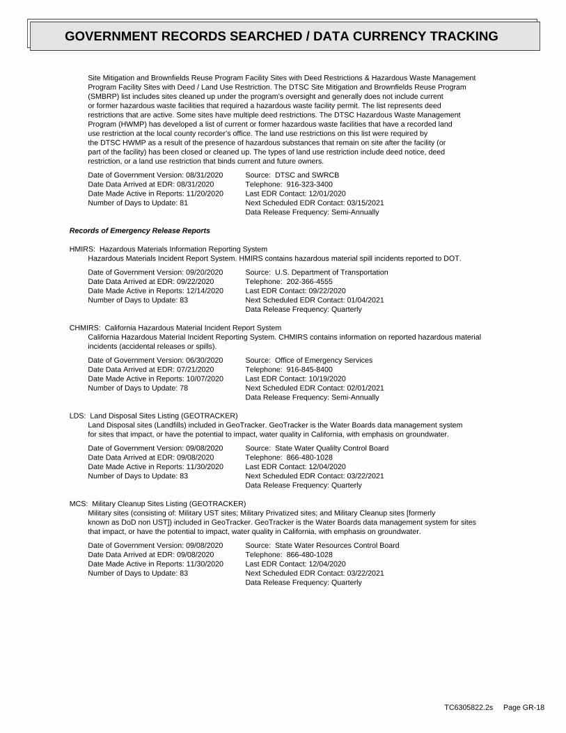
Site Mitigation and Brownfields Reuse Program Facility Sites with Deed Restrictions & Hazardous Waste ManagementProgram Facility Sites with Deed / Land Use Restriction. The DTSC Site Mitigation and Brownfields Reuse Program(SMBRP) list includes sites cleaned up under the program’s oversight and generally does not include currentor former hazardous waste facilities that required a hazardous waste facility permit. The list represents deedrestrictions that are active. Some sites have multiple deed restrictions. The DTSC Hazardous Waste ManagementProgram (HWMP) has developed a list of current or former hazardous waste facilities that have a recorded landuse restriction at the local county recorder’s office. The land use restrictions on this list were required bythe DTSC HWMP as a result of the presence of hazardous substances that remain on site after the facility (orpart of the facility) has been closed or cleaned up. The types of land use restriction include deed notice, deedrestriction, or a land use restriction that binds current and future owners.
Date of Government Version: 08/31/2020Date Data Arrived at EDR: 08/31/2020Date Made Active in Reports: 11/20/2020Number of Days to Update: 81
Source: DTSC and SWRCBTelephone: 916-323-3400Last EDR Contact: 12/01/2020Next Scheduled EDR Contact: 03/15/2021Data Release Frequency: Semi-Annually
Records of Emergency Release Reports
HMIRS: Hazardous Materials Information Reporting SystemHazardous Materials Incident Report System. HMIRS contains hazardous material spill incidents reported to DOT.
Date of Government Version: 09/20/2020Date Data Arrived at EDR: 09/22/2020Date Made Active in Reports: 12/14/2020Number of Days to Update: 83
Source: U.S. Department of TransportationTelephone: 202-366-4555Last EDR Contact: 09/22/2020Next Scheduled EDR Contact: 01/04/2021Data Release Frequency: Quarterly
CHMIRS: California Hazardous Material Incident Report SystemCalifornia Hazardous Material Incident Reporting System. CHMIRS contains information on reported hazardous materialincidents (accidental releases or spills).
Date of Government Version: 06/30/2020Date Data Arrived at EDR: 07/21/2020Date Made Active in Reports: 10/07/2020Number of Days to Update: 78
Source: Office of Emergency ServicesTelephone: 916-845-8400Last EDR Contact: 10/19/2020Next Scheduled EDR Contact: 02/01/2021Data Release Frequency: Semi-Annually
LDS: Land Disposal Sites Listing (GEOTRACKER)Land Disposal sites (Landfills) included in GeoTracker. GeoTracker is the Water Boards data management systemfor sites that impact, or have the potential to impact, water quality in California, with emphasis on groundwater.
Date of Government Version: 09/08/2020Date Data Arrived at EDR: 09/08/2020Date Made Active in Reports: 11/30/2020Number of Days to Update: 83
Source: State Water Qualilty Control BoardTelephone: 866-480-1028Last EDR Contact: 12/04/2020Next Scheduled EDR Contact: 03/22/2021Data Release Frequency: Quarterly
MCS: Military Cleanup Sites Listing (GEOTRACKER)Military sites (consisting of: Military UST sites; Military Privatized sites; and Military Cleanup sites [formerlyknown as DoD non UST]) included in GeoTracker. GeoTracker is the Water Boards data management system for sitesthat impact, or have the potential to impact, water quality in California, with emphasis on groundwater.
Date of Government Version: 09/08/2020Date Data Arrived at EDR: 09/08/2020Date Made Active in Reports: 11/30/2020Number of Days to Update: 83
Source: State Water Resources Control BoardTelephone: 866-480-1028Last EDR Contact: 12/04/2020Next Scheduled EDR Contact: 03/22/2021Data Release Frequency: Quarterly
TC6305822.2s Page GR-18
GOVERNMENT RECORDS SEARCHED / DATA CURRENCY TRACKING
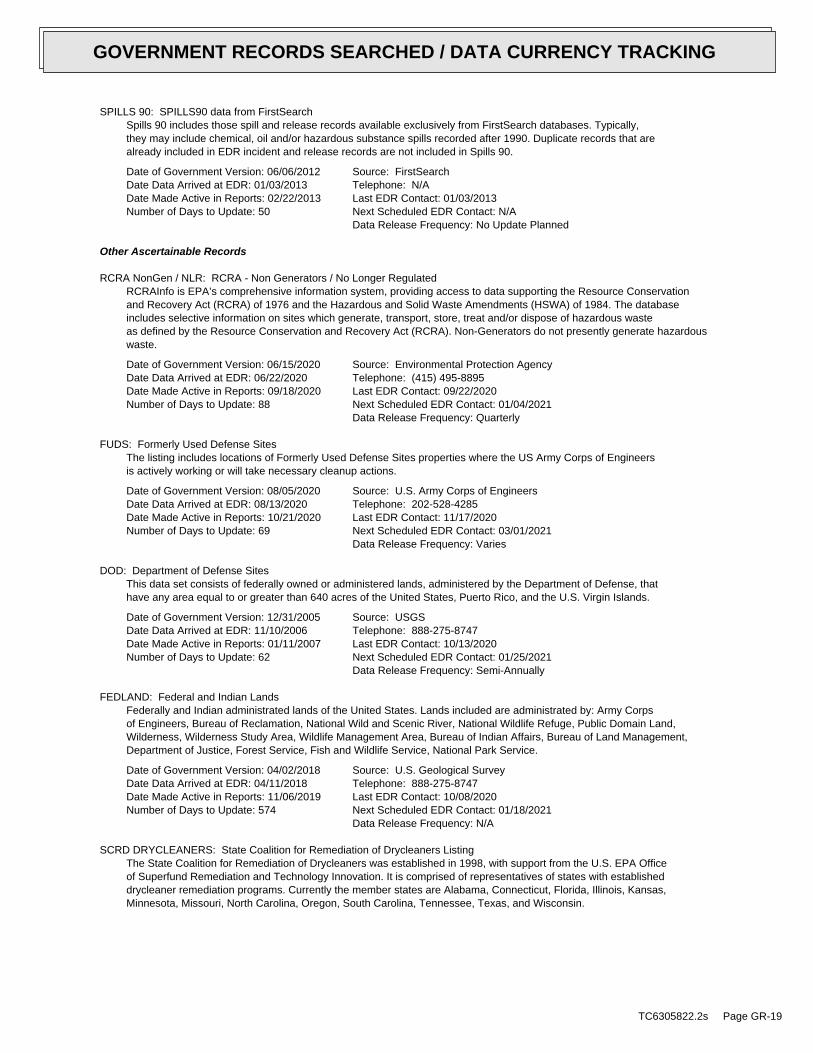
SPILLS 90: SPILLS90 data from FirstSearchSpills 90 includes those spill and release records available exclusively from FirstSearch databases. Typically,they may include chemical, oil and/or hazardous substance spills recorded after 1990. Duplicate records that arealready included in EDR incident and release records are not included in Spills 90.
Date of Government Version: 06/06/2012Date Data Arrived at EDR: 01/03/2013Date Made Active in Reports: 02/22/2013Number of Days to Update: 50
Source: FirstSearchTelephone: N/ALast EDR Contact: 01/03/2013Next Scheduled EDR Contact: N/AData Release Frequency: No Update Planned
Other Ascertainable Records
RCRA NonGen / NLR: RCRA - Non Generators / No Longer RegulatedRCRAInfo is EPA’s comprehensive information system, providing access to data supporting the Resource Conservationand Recovery Act (RCRA) of 1976 and the Hazardous and Solid Waste Amendments (HSWA) of 1984. The databaseincludes selective information on sites which generate, transport, store, treat and/or dispose of hazardous wasteas defined by the Resource Conservation and Recovery Act (RCRA). Non-Generators do not presently generate hazardouswaste.
Date of Government Version: 06/15/2020Date Data Arrived at EDR: 06/22/2020Date Made Active in Reports: 09/18/2020Number of Days to Update: 88
Source: Environmental Protection AgencyTelephone: (415) 495-8895Last EDR Contact: 09/22/2020Next Scheduled EDR Contact: 01/04/2021Data Release Frequency: Quarterly
FUDS: Formerly Used Defense SitesThe listing includes locations of Formerly Used Defense Sites properties where the US Army Corps of Engineersis actively working or will take necessary cleanup actions.
Date of Government Version: 08/05/2020Date Data Arrived at EDR: 08/13/2020Date Made Active in Reports: 10/21/2020Number of Days to Update: 69
Source: U.S. Army Corps of EngineersTelephone: 202-528-4285Last EDR Contact: 11/17/2020Next Scheduled EDR Contact: 03/01/2021Data Release Frequency: Varies
DOD: Department of Defense SitesThis data set consists of federally owned or administered lands, administered by the Department of Defense, thathave any area equal to or greater than 640 acres of the United States, Puerto Rico, and the U.S. Virgin Islands.
Date of Government Version: 12/31/2005Date Data Arrived at EDR: 11/10/2006Date Made Active in Reports: 01/11/2007Number of Days to Update: 62
Source: USGSTelephone: 888-275-8747Last EDR Contact: 10/13/2020Next Scheduled EDR Contact: 01/25/2021Data Release Frequency: Semi-Annually
FEDLAND: Federal and Indian LandsFederally and Indian administrated lands of the United States. Lands included are administrated by: Army Corpsof Engineers, Bureau of Reclamation, National Wild and Scenic River, National Wildlife Refuge, Public Domain Land,Wilderness, Wilderness Study Area, Wildlife Management Area, Bureau of Indian Affairs, Bureau of Land Management,Department of Justice, Forest Service, Fish and Wildlife Service, National Park Service.
Date of Government Version: 04/02/2018Date Data Arrived at EDR: 04/11/2018Date Made Active in Reports: 11/06/2019Number of Days to Update: 574
Source: U.S. Geological SurveyTelephone: 888-275-8747Last EDR Contact: 10/08/2020Next Scheduled EDR Contact: 01/18/2021Data Release Frequency: N/A
SCRD DRYCLEANERS: State Coalition for Remediation of Drycleaners ListingThe State Coalition for Remediation of Drycleaners was established in 1998, with support from the U.S. EPA Officeof Superfund Remediation and Technology Innovation. It is comprised of representatives of states with establisheddrycleaner remediation programs. Currently the member states are Alabama, Connecticut, Florida, Illinois, Kansas,Minnesota, Missouri, North Carolina, Oregon, South Carolina, Tennessee, Texas, and Wisconsin.
TC6305822.2s Page GR-19
GOVERNMENT RECORDS SEARCHED / DATA CURRENCY TRACKING
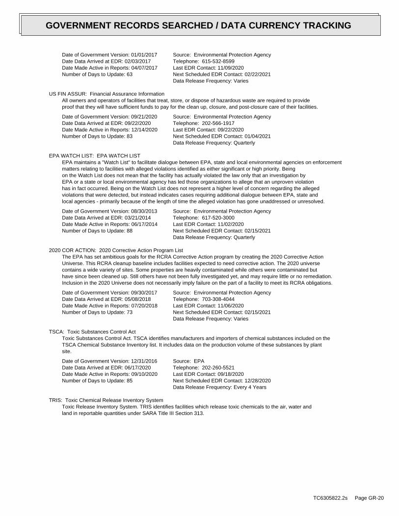
Date of Government Version: 01/01/2017Date Data Arrived at EDR: 02/03/2017Date Made Active in Reports: 04/07/2017Number of Days to Update: 63
Source: Environmental Protection AgencyTelephone: 615-532-8599Last EDR Contact: 11/09/2020Next Scheduled EDR Contact: 02/22/2021Data Release Frequency: Varies
US FIN ASSUR: Financial Assurance InformationAll owners and operators of facilities that treat, store, or dispose of hazardous waste are required to provideproof that they will have sufficient funds to pay for the clean up, closure, and post-closure care of their facilities.
Date of Government Version: 09/21/2020Date Data Arrived at EDR: 09/22/2020Date Made Active in Reports: 12/14/2020Number of Days to Update: 83
Source: Environmental Protection AgencyTelephone: 202-566-1917Last EDR Contact: 09/22/2020Next Scheduled EDR Contact: 01/04/2021Data Release Frequency: Quarterly
EPA WATCH LIST: EPA WATCH LISTEPA maintains a "Watch List" to facilitate dialogue between EPA, state and local environmental agencies on enforcementmatters relating to facilities with alleged violations identified as either significant or high priority. Beingon the Watch List does not mean that the facility has actually violated the law only that an investigation byEPA or a state or local environmental agency has led those organizations to allege that an unproven violationhas in fact occurred. Being on the Watch List does not represent a higher level of concern regarding the allegedviolations that were detected, but instead indicates cases requiring additional dialogue between EPA, state andlocal agencies - primarily because of the length of time the alleged violation has gone unaddressed or unresolved.
Date of Government Version: 08/30/2013Date Data Arrived at EDR: 03/21/2014Date Made Active in Reports: 06/17/2014Number of Days to Update: 88
Source: Environmental Protection AgencyTelephone: 617-520-3000Last EDR Contact: 11/02/2020Next Scheduled EDR Contact: 02/15/2021Data Release Frequency: Quarterly
2020 COR ACTION: 2020 Corrective Action Program ListThe EPA has set ambitious goals for the RCRA Corrective Action program by creating the 2020 Corrective ActionUniverse. This RCRA cleanup baseline includes facilities expected to need corrective action. The 2020 universecontains a wide variety of sites. Some properties are heavily contaminated while others were contaminated buthave since been cleaned up. Still others have not been fully investigated yet, and may require little or no remediation.Inclusion in the 2020 Universe does not necessarily imply failure on the part of a facility to meet its RCRA obligations.
Date of Government Version: 09/30/2017Date Data Arrived at EDR: 05/08/2018Date Made Active in Reports: 07/20/2018Number of Days to Update: 73
Source: Environmental Protection AgencyTelephone: 703-308-4044Last EDR Contact: 11/06/2020Next Scheduled EDR Contact: 02/15/2021Data Release Frequency: Varies
TSCA: Toxic Substances Control ActToxic Substances Control Act. TSCA identifies manufacturers and importers of chemical substances included on theTSCA Chemical Substance Inventory list. It includes data on the production volume of these substances by plantsite.
Date of Government Version: 12/31/2016Date Data Arrived at EDR: 06/17/2020Date Made Active in Reports: 09/10/2020Number of Days to Update: 85
Source: EPATelephone: 202-260-5521Last EDR Contact: 09/18/2020Next Scheduled EDR Contact: 12/28/2020Data Release Frequency: Every 4 Years
TRIS: Toxic Chemical Release Inventory SystemToxic Release Inventory System. TRIS identifies facilities which release toxic chemicals to the air, water andland in reportable quantities under SARA Title III Section 313.
TC6305822.2s Page GR-20
GOVERNMENT RECORDS SEARCHED / DATA CURRENCY TRACKING
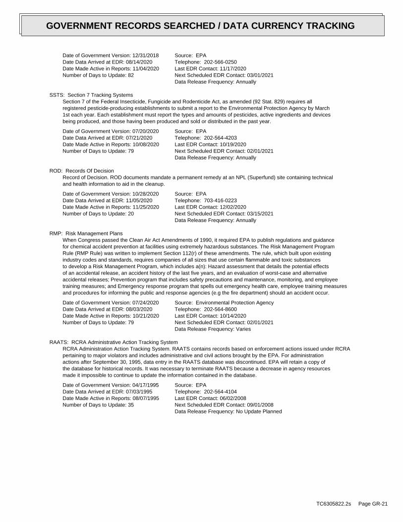
Date of Government Version: 12/31/2018Date Data Arrived at EDR: 08/14/2020Date Made Active in Reports: 11/04/2020Number of Days to Update: 82
Source: EPATelephone: 202-566-0250Last EDR Contact: 11/17/2020Next Scheduled EDR Contact: 03/01/2021Data Release Frequency: Annually
SSTS: Section 7 Tracking SystemsSection 7 of the Federal Insecticide, Fungicide and Rodenticide Act, as amended (92 Stat. 829) requires allregistered pesticide-producing establishments to submit a report to the Environmental Protection Agency by March1st each year. Each establishment must report the types and amounts of pesticides, active ingredients and devicesbeing produced, and those having been produced and sold or distributed in the past year.
Date of Government Version: 07/20/2020Date Data Arrived at EDR: 07/21/2020Date Made Active in Reports: 10/08/2020Number of Days to Update: 79
Source: EPATelephone: 202-564-4203Last EDR Contact: 10/19/2020Next Scheduled EDR Contact: 02/01/2021Data Release Frequency: Annually
ROD: Records Of DecisionRecord of Decision. ROD documents mandate a permanent remedy at an NPL (Superfund) site containing technicaland health information to aid in the cleanup.
Date of Government Version: 10/28/2020Date Data Arrived at EDR: 11/05/2020Date Made Active in Reports: 11/25/2020Number of Days to Update: 20
Source: EPATelephone: 703-416-0223Last EDR Contact: 12/02/2020Next Scheduled EDR Contact: 03/15/2021Data Release Frequency: Annually
RMP: Risk Management PlansWhen Congress passed the Clean Air Act Amendments of 1990, it required EPA to publish regulations and guidancefor chemical accident prevention at facilities using extremely hazardous substances. The Risk Management ProgramRule (RMP Rule) was written to implement Section 112(r) of these amendments. The rule, which built upon existingindustry codes and standards, requires companies of all sizes that use certain flammable and toxic substancesto develop a Risk Management Program, which includes a(n): Hazard assessment that details the potential effectsof an accidental release, an accident history of the last five years, and an evaluation of worst-case and alternativeaccidental releases; Prevention program that includes safety precautions and maintenance, monitoring, and employeetraining measures; and Emergency response program that spells out emergency health care, employee training measuresand procedures for informing the public and response agencies (e.g the fire department) should an accident occur.
Date of Government Version: 07/24/2020Date Data Arrived at EDR: 08/03/2020Date Made Active in Reports: 10/21/2020Number of Days to Update: 79
Source: Environmental Protection AgencyTelephone: 202-564-8600Last EDR Contact: 10/14/2020Next Scheduled EDR Contact: 02/01/2021Data Release Frequency: Varies
RAATS: RCRA Administrative Action Tracking SystemRCRA Administration Action Tracking System. RAATS contains records based on enforcement actions issued under RCRApertaining to major violators and includes administrative and civil actions brought by the EPA. For administrationactions after September 30, 1995, data entry in the RAATS database was discontinued. EPA will retain a copy ofthe database for historical records. It was necessary to terminate RAATS because a decrease in agency resourcesmade it impossible to continue to update the information contained in the database.
Date of Government Version: 04/17/1995Date Data Arrived at EDR: 07/03/1995Date Made Active in Reports: 08/07/1995Number of Days to Update: 35
Source: EPATelephone: 202-564-4104Last EDR Contact: 06/02/2008Next Scheduled EDR Contact: 09/01/2008Data Release Frequency: No Update Planned
TC6305822.2s Page GR-21
GOVERNMENT RECORDS SEARCHED / DATA CURRENCY TRACKING
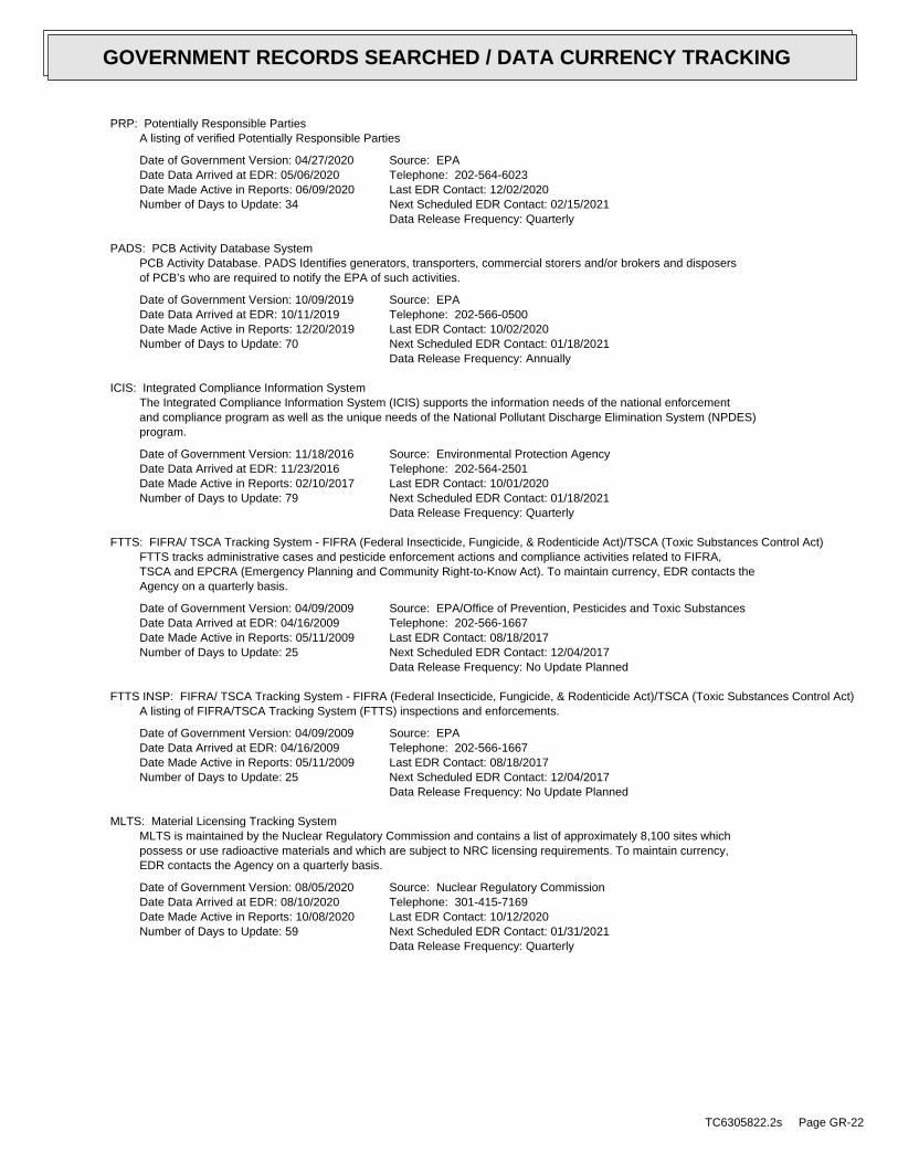
PRP: Potentially Responsible PartiesA listing of verified Potentially Responsible Parties
Date of Government Version: 04/27/2020Date Data Arrived at EDR: 05/06/2020Date Made Active in Reports: 06/09/2020Number of Days to Update: 34
Source: EPATelephone: 202-564-6023Last EDR Contact: 12/02/2020Next Scheduled EDR Contact: 02/15/2021Data Release Frequency: Quarterly
PADS: PCB Activity Database SystemPCB Activity Database. PADS Identifies generators, transporters, commercial storers and/or brokers and disposersof PCB’s who are required to notify the EPA of such activities.
Date of Government Version: 10/09/2019Date Data Arrived at EDR: 10/11/2019Date Made Active in Reports: 12/20/2019Number of Days to Update: 70
Source: EPATelephone: 202-566-0500Last EDR Contact: 10/02/2020Next Scheduled EDR Contact: 01/18/2021Data Release Frequency: Annually
ICIS: Integrated Compliance Information SystemThe Integrated Compliance Information System (ICIS) supports the information needs of the national enforcementand compliance program as well as the unique needs of the National Pollutant Discharge Elimination System (NPDES)program.
Date of Government Version: 11/18/2016Date Data Arrived at EDR: 11/23/2016Date Made Active in Reports: 02/10/2017Number of Days to Update: 79
Source: Environmental Protection AgencyTelephone: 202-564-2501Last EDR Contact: 10/01/2020Next Scheduled EDR Contact: 01/18/2021Data Release Frequency: Quarterly
FTTS: FIFRA/ TSCA Tracking System - FIFRA (Federal Insecticide, Fungicide, & Rodenticide Act)/TSCA (Toxic Substances Control Act)FTTS tracks administrative cases and pesticide enforcement actions and compliance activities related to FIFRA,TSCA and EPCRA (Emergency Planning and Community Right-to-Know Act). To maintain currency, EDR contacts theAgency on a quarterly basis.
Date of Government Version: 04/09/2009Date Data Arrived at EDR: 04/16/2009Date Made Active in Reports: 05/11/2009Number of Days to Update: 25
Source: EPA/Office of Prevention, Pesticides and Toxic SubstancesTelephone: 202-566-1667Last EDR Contact: 08/18/2017Next Scheduled EDR Contact: 12/04/2017Data Release Frequency: No Update Planned
FTTS INSP: FIFRA/ TSCA Tracking System - FIFRA (Federal Insecticide, Fungicide, & Rodenticide Act)/TSCA (Toxic Substances Control Act)A listing of FIFRA/TSCA Tracking System (FTTS) inspections and enforcements.
Date of Government Version: 04/09/2009Date Data Arrived at EDR: 04/16/2009Date Made Active in Reports: 05/11/2009Number of Days to Update: 25
Source: EPATelephone: 202-566-1667Last EDR Contact: 08/18/2017Next Scheduled EDR Contact: 12/04/2017Data Release Frequency: No Update Planned
MLTS: Material Licensing Tracking SystemMLTS is maintained by the Nuclear Regulatory Commission and contains a list of approximately 8,100 sites whichpossess or use radioactive materials and which are subject to NRC licensing requirements. To maintain currency,EDR contacts the Agency on a quarterly basis.
Date of Government Version: 08/05/2020Date Data Arrived at EDR: 08/10/2020Date Made Active in Reports: 10/08/2020Number of Days to Update: 59
Source: Nuclear Regulatory CommissionTelephone: 301-415-7169Last EDR Contact: 10/12/2020Next Scheduled EDR Contact: 01/31/2021Data Release Frequency: Quarterly
TC6305822.2s Page GR-22
GOVERNMENT RECORDS SEARCHED / DATA CURRENCY TRACKING
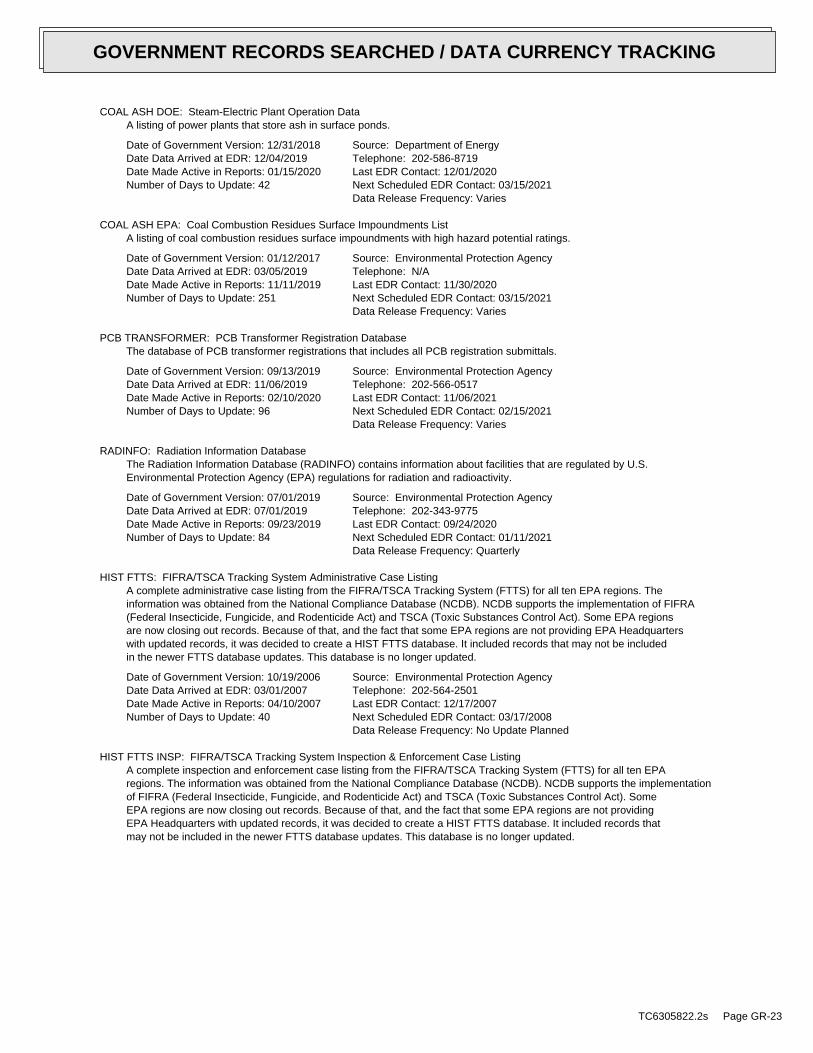
COAL ASH DOE: Steam-Electric Plant Operation DataA listing of power plants that store ash in surface ponds.
Date of Government Version: 12/31/2018Date Data Arrived at EDR: 12/04/2019Date Made Active in Reports: 01/15/2020Number of Days to Update: 42
Source: Department of EnergyTelephone: 202-586-8719Last EDR Contact: 12/01/2020Next Scheduled EDR Contact: 03/15/2021Data Release Frequency: Varies
COAL ASH EPA: Coal Combustion Residues Surface Impoundments ListA listing of coal combustion residues surface impoundments with high hazard potential ratings.
Date of Government Version: 01/12/2017Date Data Arrived at EDR: 03/05/2019Date Made Active in Reports: 11/11/2019Number of Days to Update: 251
Source: Environmental Protection AgencyTelephone: N/ALast EDR Contact: 11/30/2020Next Scheduled EDR Contact: 03/15/2021Data Release Frequency: Varies
PCB TRANSFORMER: PCB Transformer Registration DatabaseThe database of PCB transformer registrations that includes all PCB registration submittals.
Date of Government Version: 09/13/2019Date Data Arrived at EDR: 11/06/2019Date Made Active in Reports: 02/10/2020Number of Days to Update: 96
Source: Environmental Protection AgencyTelephone: 202-566-0517Last EDR Contact: 11/06/2021Next Scheduled EDR Contact: 02/15/2021Data Release Frequency: Varies
RADINFO: Radiation Information DatabaseThe Radiation Information Database (RADINFO) contains information about facilities that are regulated by U.S.Environmental Protection Agency (EPA) regulations for radiation and radioactivity.
Date of Government Version: 07/01/2019Date Data Arrived at EDR: 07/01/2019Date Made Active in Reports: 09/23/2019Number of Days to Update: 84
Source: Environmental Protection AgencyTelephone: 202-343-9775Last EDR Contact: 09/24/2020Next Scheduled EDR Contact: 01/11/2021Data Release Frequency: Quarterly
HIST FTTS: FIFRA/TSCA Tracking System Administrative Case ListingA complete administrative case listing from the FIFRA/TSCA Tracking System (FTTS) for all ten EPA regions. Theinformation was obtained from the National Compliance Database (NCDB). NCDB supports the implementation of FIFRA(Federal Insecticide, Fungicide, and Rodenticide Act) and TSCA (Toxic Substances Control Act). Some EPA regionsare now closing out records. Because of that, and the fact that some EPA regions are not providing EPA Headquarterswith updated records, it was decided to create a HIST FTTS database. It included records that may not be includedin the newer FTTS database updates. This database is no longer updated.
Date of Government Version: 10/19/2006Date Data Arrived at EDR: 03/01/2007Date Made Active in Reports: 04/10/2007Number of Days to Update: 40
Source: Environmental Protection AgencyTelephone: 202-564-2501Last EDR Contact: 12/17/2007Next Scheduled EDR Contact: 03/17/2008Data Release Frequency: No Update Planned
HIST FTTS INSP: FIFRA/TSCA Tracking System Inspection & Enforcement Case ListingA complete inspection and enforcement case listing from the FIFRA/TSCA Tracking System (FTTS) for all ten EPAregions. The information was obtained from the National Compliance Database (NCDB). NCDB supports the implementationof FIFRA (Federal Insecticide, Fungicide, and Rodenticide Act) and TSCA (Toxic Substances Control Act). SomeEPA regions are now closing out records. Because of that, and the fact that some EPA regions are not providingEPA Headquarters with updated records, it was decided to create a HIST FTTS database. It included records thatmay not be included in the newer FTTS database updates. This database is no longer updated.
TC6305822.2s Page GR-23
GOVERNMENT RECORDS SEARCHED / DATA CURRENCY TRACKING
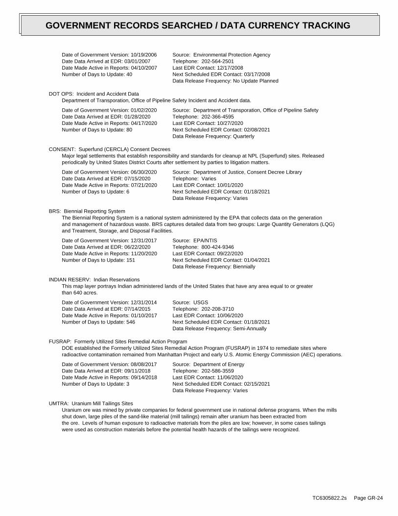
Date of Government Version: 10/19/2006Date Data Arrived at EDR: 03/01/2007Date Made Active in Reports: 04/10/2007Number of Days to Update: 40
Source: Environmental Protection AgencyTelephone: 202-564-2501Last EDR Contact: 12/17/2008Next Scheduled EDR Contact: 03/17/2008Data Release Frequency: No Update Planned
DOT OPS: Incident and Accident DataDepartment of Transporation, Office of Pipeline Safety Incident and Accident data.
Date of Government Version: 01/02/2020Date Data Arrived at EDR: 01/28/2020Date Made Active in Reports: 04/17/2020Number of Days to Update: 80
Source: Department of Transporation, Office of Pipeline SafetyTelephone: 202-366-4595Last EDR Contact: 10/27/2020Next Scheduled EDR Contact: 02/08/2021Data Release Frequency: Quarterly
CONSENT: Superfund (CERCLA) Consent DecreesMajor legal settlements that establish responsibility and standards for cleanup at NPL (Superfund) sites. Releasedperiodically by United States District Courts after settlement by parties to litigation matters.
Date of Government Version: 06/30/2020Date Data Arrived at EDR: 07/15/2020Date Made Active in Reports: 07/21/2020Number of Days to Update: 6
Source: Department of Justice, Consent Decree LibraryTelephone: VariesLast EDR Contact: 10/01/2020Next Scheduled EDR Contact: 01/18/2021Data Release Frequency: Varies
BRS: Biennial Reporting SystemThe Biennial Reporting System is a national system administered by the EPA that collects data on the generationand management of hazardous waste. BRS captures detailed data from two groups: Large Quantity Generators (LQG)and Treatment, Storage, and Disposal Facilities.
Date of Government Version: 12/31/2017Date Data Arrived at EDR: 06/22/2020Date Made Active in Reports: 11/20/2020Number of Days to Update: 151
Source: EPA/NTISTelephone: 800-424-9346Last EDR Contact: 09/22/2020Next Scheduled EDR Contact: 01/04/2021Data Release Frequency: Biennially
INDIAN RESERV: Indian ReservationsThis map layer portrays Indian administered lands of the United States that have any area equal to or greaterthan 640 acres.
Date of Government Version: 12/31/2014Date Data Arrived at EDR: 07/14/2015Date Made Active in Reports: 01/10/2017Number of Days to Update: 546
Source: USGSTelephone: 202-208-3710Last EDR Contact: 10/06/2020Next Scheduled EDR Contact: 01/18/2021Data Release Frequency: Semi-Annually
FUSRAP: Formerly Utilized Sites Remedial Action ProgramDOE established the Formerly Utilized Sites Remedial Action Program (FUSRAP) in 1974 to remediate sites whereradioactive contamination remained from Manhattan Project and early U.S. Atomic Energy Commission (AEC) operations.
Date of Government Version: 08/08/2017Date Data Arrived at EDR: 09/11/2018Date Made Active in Reports: 09/14/2018Number of Days to Update: 3
Source: Department of EnergyTelephone: 202-586-3559Last EDR Contact: 11/06/2020Next Scheduled EDR Contact: 02/15/2021Data Release Frequency: Varies
UMTRA: Uranium Mill Tailings SitesUranium ore was mined by private companies for federal government use in national defense programs. When the millsshut down, large piles of the sand-like material (mill tailings) remain after uranium has been extracted fromthe ore. Levels of human exposure to radioactive materials from the piles are low; however, in some cases tailingswere used as construction materials before the potential health hazards of the tailings were recognized.
TC6305822.2s Page GR-24
GOVERNMENT RECORDS SEARCHED / DATA CURRENCY TRACKING
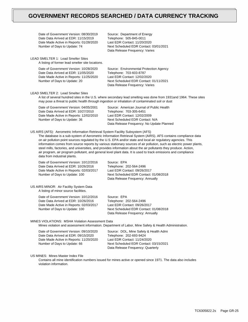
Date of Government Version: 08/30/2019Date Data Arrived at EDR: 11/15/2019Date Made Active in Reports: 01/28/2020Number of Days to Update: 74
Source: Department of EnergyTelephone: 505-845-0011Last EDR Contact: 11/20/2020Next Scheduled EDR Contact: 03/01/2021Data Release Frequency: Varies
LEAD SMELTER 1: Lead Smelter SitesA listing of former lead smelter site locations.
Date of Government Version: 10/28/2020Date Data Arrived at EDR: 11/05/2020Date Made Active in Reports: 11/25/2020Number of Days to Update: 20
Source: Environmental Protection AgencyTelephone: 703-603-8787Last EDR Contact: 12/02/2020Next Scheduled EDR Contact: 01/11/2021Data Release Frequency: Varies
LEAD SMELTER 2: Lead Smelter SitesA list of several hundred sites in the U.S. where secondary lead smelting was done from 1931and 1964. These sitesmay pose a threat to public health through ingestion or inhalation of contaminated soil or dust
Date of Government Version: 04/05/2001Date Data Arrived at EDR: 10/27/2010Date Made Active in Reports: 12/02/2010Number of Days to Update: 36
Source: American Journal of Public HealthTelephone: 703-305-6451Last EDR Contact: 12/02/2009Next Scheduled EDR Contact: N/AData Release Frequency: No Update Planned
US AIRS (AFS): Aerometric Information Retrieval System Facility Subsystem (AFS)The database is a sub-system of Aerometric Information Retrieval System (AIRS). AFS contains compliance dataon air pollution point sources regulated by the U.S. EPA and/or state and local air regulatory agencies. Thisinformation comes from source reports by various stationary sources of air pollution, such as electric power plants,steel mills, factories, and universities, and provides information about the air pollutants they produce. Action,air program, air program pollutant, and general level plant data. It is used to track emissions and compliancedata from industrial plants.
Date of Government Version: 10/12/2016Date Data Arrived at EDR: 10/26/2016Date Made Active in Reports: 02/03/2017Number of Days to Update: 100
Source: EPATelephone: 202-564-2496Last EDR Contact: 09/26/2017Next Scheduled EDR Contact: 01/08/2018Data Release Frequency: Annually
US AIRS MINOR: Air Facility System DataA listing of minor source facilities.
Date of Government Version: 10/12/2016Date Data Arrived at EDR: 10/26/2016Date Made Active in Reports: 02/03/2017Number of Days to Update: 100
Source: EPATelephone: 202-564-2496Last EDR Contact: 09/26/2017Next Scheduled EDR Contact: 01/08/2018Data Release Frequency: Annually
MINES VIOLATIONS: MSHA Violation Assessment DataMines violation and assessment information. Department of Labor, Mine Safety & Health Administration.
Date of Government Version: 09/10/2020Date Data Arrived at EDR: 09/15/2020Date Made Active in Reports: 11/20/2020Number of Days to Update: 66
Source: DOL, Mine Safety & Health AdmiTelephone: 202-693-9424Last EDR Contact: 11/24/2020Next Scheduled EDR Contact: 03/15/2021Data Release Frequency: Quarterly
US MINES: Mines Master Index FileContains all mine identification numbers issued for mines active or opened since 1971. The data also includesviolation information.
TC6305822.2s Page GR-25
GOVERNMENT RECORDS SEARCHED / DATA CURRENCY TRACKING
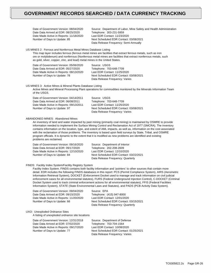
Date of Government Version: 08/04/2020Date Data Arrived at EDR: 08/25/2020Date Made Active in Reports: 11/18/2020Number of Days to Update: 85
Source: Department of Labor, Mine Safety and Health AdministrationTelephone: 303-231-5959Last EDR Contact: 11/23/2020Next Scheduled EDR Contact: 03/08/2021Data Release Frequency: Semi-Annually
US MINES 2: Ferrous and Nonferrous Metal Mines Database ListingThis map layer includes ferrous (ferrous metal mines are facilities that extract ferrous metals, such as ironore or molybdenum) and nonferrous (Nonferrous metal mines are facilities that extract nonferrous metals, suchas gold, silver, copper, zinc, and lead) metal mines in the United States.
Date of Government Version: 05/06/2020Date Data Arrived at EDR: 05/27/2020Date Made Active in Reports: 08/13/2020Number of Days to Update: 78
Source: USGSTelephone: 703-648-7709Last EDR Contact: 11/25/2020Next Scheduled EDR Contact: 03/08/2021Data Release Frequency: Varies
US MINES 3: Active Mines & Mineral Plants Database ListingActive Mines and Mineral Processing Plant operations for commodities monitored by the Minerals Information Teamof the USGS.
Date of Government Version: 04/14/2011Date Data Arrived at EDR: 06/08/2011Date Made Active in Reports: 09/13/2011Number of Days to Update: 97
Source: USGSTelephone: 703-648-7709Last EDR Contact: 11/25/2020Next Scheduled EDR Contact: 03/08/2021Data Release Frequency: Varies
ABANDONED MINES: Abandoned MinesAn inventory of land and water impacted by past mining (primarily coal mining) is maintained by OSMRE to provideinformation needed to implement the Surface Mining Control and Reclamation Act of 1977 (SMCRA). The inventorycontains information on the location, type, and extent of AML impacts, as well as, information on the cost associatedwith the reclamation of those problems. The inventory is based upon field surveys by State, Tribal, and OSMREprogram officials. It is dynamic to the extent that it is modified as new problems are identified and existingproblems are reclaimed.
Date of Government Version: 09/16/2020Date Data Arrived at EDR: 09/17/2020Date Made Active in Reports: 12/10/2020Number of Days to Update: 84
Source: Department of InteriorTelephone: 202-208-2609Last EDR Contact: 12/10/2020Next Scheduled EDR Contact: 03/22/2021Data Release Frequency: Quarterly
FINDS: Facility Index System/Facility Registry SystemFacility Index System. FINDS contains both facility information and ’pointers’ to other sources that contain moredetail. EDR includes the following FINDS databases in this report: PCS (Permit Compliance System), AIRS (AerometricInformation Retrieval System), DOCKET (Enforcement Docket used to manage and track information on civil judicialenforcement cases for all environmental statutes), FURS (Federal Underground Injection Control), C-DOCKET (CriminalDocket System used to track criminal enforcement actions for all environmental statutes), FFIS (Federal FacilitiesInformation System), STATE (State Environmental Laws and Statutes), and PADS (PCB Activity Data System).
Date of Government Version: 09/04/2020Date Data Arrived at EDR: 09/15/2020Date Made Active in Reports: 11/20/2020Number of Days to Update: 66
Source: EPATelephone: (415) 947-8000Last EDR Contact: 12/01/2020Next Scheduled EDR Contact: 03/15/2021Data Release Frequency: Quarterly
UXO: Unexploded Ordnance SitesA listing of unexploded ordnance site locations
Date of Government Version: 12/31/2018Date Data Arrived at EDR: 07/02/2020Date Made Active in Reports: 09/17/2020Number of Days to Update: 77
Source: Department of DefenseTelephone: 703-704-1564Last EDR Contact: 10/08/2020Next Scheduled EDR Contact: 01/25/2021Data Release Frequency: Varies
TC6305822.2s Page GR-26
GOVERNMENT RECORDS SEARCHED / DATA CURRENCY TRACKING
ECHO: Enforcement & Compliance History InformationECHO provides integrated compliance and enforcement information for about 800,000 regulated facilities nationwide.
Date of Government Version: 06/27/2020Date Data Arrived at EDR: 07/02/2020Date Made Active in Reports: 09/28/2020Number of Days to Update: 88
Source: Environmental Protection AgencyTelephone: 202-564-2280Last EDR Contact: 10/06/2020Next Scheduled EDR Contact: 01/18/2021Data Release Frequency: Quarterly
DOCKET HWC: Hazardous Waste Compliance Docket ListingA complete list of the Federal Agency Hazardous Waste Compliance Docket Facilities.
Date of Government Version: 05/31/2018Date Data Arrived at EDR: 07/26/2018Date Made Active in Reports: 10/05/2018Number of Days to Update: 71
Source: Environmental Protection AgencyTelephone: 202-564-0527Last EDR Contact: 11/17/2020Next Scheduled EDR Contact: 03/08/2021Data Release Frequency: Varies
FUELS PROGRAM: EPA Fuels Program Registered ListingThis listing includes facilities that are registered under the Part 80 (Code of Federal Regulations) EPA FuelsPrograms. All companies now are required to submit new and updated registrations.
Date of Government Version: 08/17/2020Date Data Arrived at EDR: 08/17/2020Date Made Active in Reports: 10/21/2020Number of Days to Update: 65
Source: EPATelephone: 800-385-6164Last EDR Contact: 11/13/2020Next Scheduled EDR Contact: 03/01/2021Data Release Frequency: Quarterly
CA BOND EXP. PLAN: Bond Expenditure PlanDepartment of Health Services developed a site-specific expenditure plan as the basis for an appropriation ofHazardous Substance Cleanup Bond Act funds. It is not updated.
Date of Government Version: 01/01/1989Date Data Arrived at EDR: 07/27/1994Date Made Active in Reports: 08/02/1994Number of Days to Update: 6
Source: Department of Health ServicesTelephone: 916-255-2118Last EDR Contact: 05/31/1994Next Scheduled EDR Contact: N/AData Release Frequency: No Update Planned
CORTESE: "Cortese" Hazardous Waste & Substances Sites ListThe sites for the list are designated by the State Water Resource Control Board (LUST), the Integrated WasteBoard (SWF/LS), and the Department of Toxic Substances Control (Cal-Sites).
Date of Government Version: 06/22/2020Date Data Arrived at EDR: 06/22/2020Date Made Active in Reports: 09/04/2020Number of Days to Update: 74
Source: CAL EPA/Office of Emergency InformationTelephone: 916-323-3400Last EDR Contact: 09/23/2020Next Scheduled EDR Contact: 01/04/2021Data Release Frequency: Quarterly
CUPA LIVERMORE-PLEASANTON: CUPA Facility Listinglist of facilities associated with the various CUPA programs in Livermore-Pleasanton
Date of Government Version: 05/01/2019Date Data Arrived at EDR: 05/14/2019Date Made Active in Reports: 07/17/2019Number of Days to Update: 64
Source: Livermore-Pleasanton Fire DepartmentTelephone: 925-454-2361Last EDR Contact: 11/13/2020Next Scheduled EDR Contact: 02/22/2021Data Release Frequency: Varies
DRYCLEAN SOUTH COAST: South Coast Air Quality Management District Drycleaner ListingA listing of dry cleaners in the South Coast Air Quality Management District
TC6305822.2s Page GR-27
GOVERNMENT RECORDS SEARCHED / DATA CURRENCY TRACKING
Date of Government Version: 08/19/2020Date Data Arrived at EDR: 08/21/2020Date Made Active in Reports: 09/04/2020Number of Days to Update: 14
Source: South Coast Air Quality Management DistrictTelephone: 909-396-3211Last EDR Contact: 11/16/2020Next Scheduled EDR Contact: 03/08/2021Data Release Frequency: Varies
DRYCLEAN AVAQMD: Antelope Valley Air Quality Management District Drycleaner ListingA listing of dry cleaners in the Antelope Valley Air Quality Management District.
Date of Government Version: 08/25/2020Date Data Arrived at EDR: 08/26/2020Date Made Active in Reports: 11/13/2020Number of Days to Update: 79
Source: Antelope Valley Air Quality Management DistrictTelephone: 661-723-8070Last EDR Contact: 11/23/2020Next Scheduled EDR Contact: 03/15/2021Data Release Frequency: Varies
DRYCLEANERS: Cleaner FacilitiesA list of drycleaner related facilities that have EPA ID numbers. These are facilities with certain SIC codes:power laundries, family and commercial; garment pressing and cleaner’s agents; linen supply; coin-operated laundriesand cleaning; drycleaning plants, except rugs; carpet and upholster cleaning; industrial launderers; laundry andgarment services.
Date of Government Version: 08/06/2020Date Data Arrived at EDR: 08/28/2020Date Made Active in Reports: 11/17/2020Number of Days to Update: 81
Source: Department of Toxic Substance ControlTelephone: 916-327-4498Last EDR Contact: 11/23/2020Next Scheduled EDR Contact: 03/15/2021Data Release Frequency: Annually
EMI: Emissions Inventory DataToxics and criteria pollutant emissions data collected by the ARB and local air pollution agencies.
Date of Government Version: 12/31/2018Date Data Arrived at EDR: 06/16/2020Date Made Active in Reports: 08/28/2020Number of Days to Update: 73
Source: California Air Resources BoardTelephone: 916-322-2990Last EDR Contact: 09/18/2020Next Scheduled EDR Contact: 12/28/2020Data Release Frequency: Varies
ENF: Enforcement Action ListingA listing of Water Board Enforcement Actions. Formal is everything except Oral/Verbal Communication, Notice ofViolation, Expedited Payment Letter, and Staff Enforcement Letter.
Date of Government Version: 07/20/2020Date Data Arrived at EDR: 07/21/2020Date Made Active in Reports: 10/07/2020Number of Days to Update: 78
Source: State Water Resoruces Control BoardTelephone: 916-445-9379Last EDR Contact: 10/19/2020Next Scheduled EDR Contact: 02/01/2021Data Release Frequency: Varies
Financial Assurance 1: Financial Assurance Information ListingFinancial Assurance information
Date of Government Version: 07/13/2020Date Data Arrived at EDR: 07/16/2020Date Made Active in Reports: 09/29/2020Number of Days to Update: 75
Source: Department of Toxic Substances ControlTelephone: 916-255-3628Last EDR Contact: 10/13/2020Next Scheduled EDR Contact: 02/01/2021Data Release Frequency: Varies
Financial Assurance 2: Financial Assurance Information ListingA listing of financial assurance information for solid waste facilities. Financial assurance is intended to ensurethat resources are available to pay for the cost of closure, post-closure care, and corrective measures if theowner or operator of a regulated facility is unable or unwilling to pay.
TC6305822.2s Page GR-28
GOVERNMENT RECORDS SEARCHED / DATA CURRENCY TRACKING
Date of Government Version: 08/05/2020Date Data Arrived at EDR: 08/05/2020Date Made Active in Reports: 10/23/2020Number of Days to Update: 79
Source: California Integrated Waste Management BoardTelephone: 916-341-6066Last EDR Contact: 11/04/2020Next Scheduled EDR Contact: 02/22/2021Data Release Frequency: Varies
HAZNET: Facility and Manifest DataFacility and Manifest Data. The data is extracted from the copies of hazardous waste manifests received each yearby the DTSC. The annual volume of manifests is typically 700,000 - 1,000,000 annually, representing approximately350,000 - 500,000 shipments. Data are from the manifests submitted without correction, and therefore many containsome invalid values for data elements such as generator ID, TSD ID, waste category, and disposal method. Thisdatabase begins with calendar year 1993.
Date of Government Version: 12/31/2019Date Data Arrived at EDR: 04/15/2020Date Made Active in Reports: 07/02/2020Number of Days to Update: 78
Source: California Environmental Protection AgencyTelephone: 916-255-1136Last EDR Contact: 10/05/2020Next Scheduled EDR Contact: 01/18/2021Data Release Frequency: Annually
ICE: ICEContains data pertaining to the Permitted Facilities with Inspections / Enforcements sites tracked in Envirostor.
Date of Government Version: 08/17/2020Date Data Arrived at EDR: 08/17/2020Date Made Active in Reports: 11/05/2020Number of Days to Update: 80
Source: Department of Toxic Subsances ControlTelephone: 877-786-9427Last EDR Contact: 11/13/2020Next Scheduled EDR Contact: 03/01/2021Data Release Frequency: Quarterly
HIST CORTESE: Hazardous Waste & Substance Site ListThe sites for the list are designated by the State Water Resource Control Board [LUST], the Integrated Waste Board[SWF/LS], and the Department of Toxic Substances Control [CALSITES]. This listing is no longer updated by thestate agency.
Date of Government Version: 04/01/2001Date Data Arrived at EDR: 01/22/2009Date Made Active in Reports: 04/08/2009Number of Days to Update: 76
Source: Department of Toxic Substances ControlTelephone: 916-323-3400Last EDR Contact: 01/22/2009Next Scheduled EDR Contact: N/AData Release Frequency: No Update Planned
HWP: EnviroStor Permitted Facilities ListingDetailed information on permitted hazardous waste facilities and corrective action ("cleanups") tracked in EnviroStor.
Date of Government Version: 08/17/2020Date Data Arrived at EDR: 08/17/2020Date Made Active in Reports: 11/05/2020Number of Days to Update: 80
Source: Department of Toxic Substances ControlTelephone: 916-323-3400Last EDR Contact: 11/13/2020Next Scheduled EDR Contact: 03/01/2021Data Release Frequency: Quarterly
HWT: Registered Hazardous Waste Transporter DatabaseA listing of hazardous waste transporters. In California, unless specifically exempted, it is unlawful for anyperson to transport hazardous wastes unless the person holds a valid registration issued by DTSC. A hazardouswaste transporter registration is valid for one year and is assigned a unique registration number.
Date of Government Version: 07/06/2020Date Data Arrived at EDR: 07/07/2020Date Made Active in Reports: 09/17/2020Number of Days to Update: 72
Source: Department of Toxic Substances ControlTelephone: 916-440-7145Last EDR Contact: 10/06/2020Next Scheduled EDR Contact: 01/18/2021Data Release Frequency: Quarterly
TC6305822.2s Page GR-29
GOVERNMENT RECORDS SEARCHED / DATA CURRENCY TRACKING
MINES: Mines Site Location ListingA listing of mine site locations from the Office of Mine Reclamation.
Date of Government Version: 09/08/2020Date Data Arrived at EDR: 09/08/2020Date Made Active in Reports: 11/30/2020Number of Days to Update: 83
Source: Department of ConservationTelephone: 916-322-1080Last EDR Contact: 12/08/2020Next Scheduled EDR Contact: 03/22/2021Data Release Frequency: Quarterly
MWMP: Medical Waste Management Program ListingThe Medical Waste Management Program (MWMP) ensures the proper handling and disposal of medical waste by permittingand inspecting medical waste Offsite Treatment Facilities (PDF) and Transfer Stations (PDF) throughout thestate. MWMP also oversees all Medical Waste Transporters.
Date of Government Version: 08/31/2020Date Data Arrived at EDR: 08/31/2020Date Made Active in Reports: 11/20/2020Number of Days to Update: 81
Source: Department of Public HealthTelephone: 916-558-1784Last EDR Contact: 12/01/2020Next Scheduled EDR Contact: 03/15/2021Data Release Frequency: Varies
NPDES: NPDES Permits ListingA listing of NPDES permits, including stormwater.
Date of Government Version: 08/10/2020Date Data Arrived at EDR: 08/10/2020Date Made Active in Reports: 10/29/2020Number of Days to Update: 80
Source: State Water Resources Control BoardTelephone: 916-445-9379Last EDR Contact: 11/09/2020Next Scheduled EDR Contact: 02/22/2021Data Release Frequency: Quarterly
PEST LIC: Pesticide Regulation Licenses ListingA listing of licenses and certificates issued by the Department of Pesticide Regulation. The DPR issues licensesand/or certificates to: Persons and businesses that apply or sell pesticides; Pest control dealers and brokers;Persons who advise on agricultural pesticide applications.
Date of Government Version: 08/31/2020Date Data Arrived at EDR: 08/31/2020Date Made Active in Reports: 11/20/2020Number of Days to Update: 81
Source: Department of Pesticide RegulationTelephone: 916-445-4038Last EDR Contact: 12/01/2020Next Scheduled EDR Contact: 03/15/2021Data Release Frequency: Quarterly
PROC: Certified Processors DatabaseA listing of certified processors.
Date of Government Version: 09/08/2020Date Data Arrived at EDR: 09/08/2020Date Made Active in Reports: 12/01/2020Number of Days to Update: 84
Source: Department of ConservationTelephone: 916-323-3836Last EDR Contact: 12/08/2020Next Scheduled EDR Contact: 03/22/2021Data Release Frequency: Quarterly
NOTIFY 65: Proposition 65 RecordsListings of all Proposition 65 incidents reported to counties by the State Water Resources Control Board and theRegional Water Quality Control Board. This database is no longer updated by the reporting agency.
Date of Government Version: 12/07/2020Date Data Arrived at EDR: 12/09/2020Date Made Active in Reports: 12/10/2020Number of Days to Update: 1
Source: State Water Resources Control BoardTelephone: 916-445-3846Last EDR Contact: 12/07/2020Next Scheduled EDR Contact: 03/29/2021Data Release Frequency: No Update Planned
TC6305822.2s Page GR-30
GOVERNMENT RECORDS SEARCHED / DATA CURRENCY TRACKING
UIC: UIC ListingA listing of wells identified as underground injection wells, in the California Oil and Gas Wells database.
Date of Government Version: 09/08/2020Date Data Arrived at EDR: 09/08/2020Date Made Active in Reports: 12/01/2020Number of Days to Update: 84
Source: Deaprtment of ConservationTelephone: 916-445-2408Last EDR Contact: 12/08/2020Next Scheduled EDR Contact: 03/22/2021Data Release Frequency: Varies
UIC GEO: Underground Injection Control Sites (GEOTRACKER)Underground control injection sites
Date of Government Version: 09/08/2020Date Data Arrived at EDR: 09/08/2020Date Made Active in Reports: 11/30/2020Number of Days to Update: 83
Source: State Water Resource Control BoardTelephone: 866-480-1028Last EDR Contact: 12/04/2020Next Scheduled EDR Contact: 03/22/2021Data Release Frequency: Varies
WASTEWATER PITS: Oil Wastewater Pits ListingWater officials discovered that oil producers have been dumping chemical-laden wastewater into hundreds of unlinedpits that are operating without proper permits. Inspections completed by the Central Valley Regional Water QualityControl Board revealed the existence of previously unidentified waste sites. The water boards review found thatmore than one-third of the region’s active disposal pits are operating without permission.
Date of Government Version: 11/19/2019Date Data Arrived at EDR: 01/07/2020Date Made Active in Reports: 03/09/2020Number of Days to Update: 62
Source: RWQCB, Central Valley RegionTelephone: 559-445-5577Last EDR Contact: 10/09/2020Next Scheduled EDR Contact: 01/18/2021Data Release Frequency: Varies
WDS: Waste Discharge SystemSites which have been issued waste discharge requirements.
Date of Government Version: 06/19/2007Date Data Arrived at EDR: 06/20/2007Date Made Active in Reports: 06/29/2007Number of Days to Update: 9
Source: State Water Resources Control BoardTelephone: 916-341-5227Last EDR Contact: 11/13/2020Next Scheduled EDR Contact: 03/01/2021Data Release Frequency: No Update Planned
WIP: Well Investigation Program Case ListWell Investigation Program case in the San Gabriel and San Fernando Valley area.
Date of Government Version: 07/03/2009Date Data Arrived at EDR: 07/21/2009Date Made Active in Reports: 08/03/2009Number of Days to Update: 13
Source: Los Angeles Water Quality Control BoardTelephone: 213-576-6726Last EDR Contact: 12/15/2020Next Scheduled EDR Contact: 04/05/2021Data Release Frequency: No Update Planned
MILITARY PRIV SITES: Military Privatized Sites (GEOTRACKER)Military privatized sites
Date of Government Version: 09/08/2020Date Data Arrived at EDR: 09/08/2020Date Made Active in Reports: 11/30/2020Number of Days to Update: 83
Source: State Water Resources Control BoardTelephone: 866-480-1028Last EDR Contact: 12/04/2020Next Scheduled EDR Contact: 03/22/2021Data Release Frequency: Varies
PROJECT: Project Sites (GEOTRACKER)Projects sites
TC6305822.2s Page GR-31
GOVERNMENT RECORDS SEARCHED / DATA CURRENCY TRACKING
Date of Government Version: 09/08/2020Date Data Arrived at EDR: 09/08/2020Date Made Active in Reports: 11/30/2020Number of Days to Update: 83
Source: State Water Resources Control BoardTelephone: 866-480-1028Last EDR Contact: 12/04/2020Next Scheduled EDR Contact: 03/22/2021Data Release Frequency: Varies
WDR: Waste Discharge Requirements ListingIn general, the Waste Discharge Requirements (WDRs) Program (sometimes also referred to as the "Non Chapter15 (Non 15) Program") regulates point discharges that are exempt pursuant to Subsection 20090 of Title 27 andnot subject to the Federal Water Pollution Control Act. Exemptions from Title 27 may be granted for nine categoriesof discharges (e.g., sewage, wastewater, etc.) that meet, and continue to meet, the preconditions listed foreach specific exemption. The scope of the WDRs Program also includes the discharge of wastes classified as inert,pursuant to section 20230 of Title 27.
Date of Government Version: 09/08/2020Date Data Arrived at EDR: 09/08/2020Date Made Active in Reports: 12/01/2020Number of Days to Update: 84
Source: State Water Resources Control BoardTelephone: 916-341-5810Last EDR Contact: 12/08/2020Next Scheduled EDR Contact: 03/22/2021Data Release Frequency: Quarterly
CIWQS: California Integrated Water Quality SystemThe California Integrated Water Quality System (CIWQS) is a computer system used by the State and Regional WaterQuality Control Boards to track information about places of environmental interest, manage permits and other orders,track inspections, and manage violations and enforcement activities.
Date of Government Version: 08/31/2020Date Data Arrived at EDR: 08/31/2020Date Made Active in Reports: 11/20/2020Number of Days to Update: 81
Source: State Water Resources Control BoardTelephone: 866-794-4977Last EDR Contact: 12/01/2020Next Scheduled EDR Contact: 03/01/2021Data Release Frequency: Varies
CERS: CalEPA Regulated Site Portal DataThe CalEPA Regulated Site Portal database combines data about environmentally regulated sites and facilities inCalifornia into a single database. It combines data from a variety of state and federal databases, and providesan overview of regulated activities across the spectrum of environmental programs for any given location in California.These activities include hazardous materials and waste, state and federal cleanups, impacted ground and surfacewaters, and toxic materials
Date of Government Version: 07/20/2020Date Data Arrived at EDR: 07/21/2020Date Made Active in Reports: 10/07/2020Number of Days to Update: 78
Source: California Environmental Protection AgencyTelephone: 916-323-2514Last EDR Contact: 10/19/2020Next Scheduled EDR Contact: 02/01/2021Data Release Frequency: Varies
NON-CASE INFO: Non-Case Information Sites (GEOTRACKER)Non-Case Information sites
Date of Government Version: 09/08/2020Date Data Arrived at EDR: 09/08/2020Date Made Active in Reports: 11/30/2020Number of Days to Update: 83
Source: State Water Resources Control BoardTelephone: 866-480-1028Last EDR Contact: 12/04/2020Next Scheduled EDR Contact: 03/22/2021Data Release Frequency: Varies
OTHER OIL GAS: Other Oil & Gas Projects Sites (GEOTRACKER)Other Oil & Gas Projects sites
Date of Government Version: 09/08/2020Date Data Arrived at EDR: 09/08/2020Date Made Active in Reports: 11/30/2020Number of Days to Update: 83
Source: State Water Resources Control BoardTelephone: 866-480-1028Last EDR Contact: 12/04/2020Next Scheduled EDR Contact: 03/22/2021Data Release Frequency: Varies
TC6305822.2s Page GR-32
GOVERNMENT RECORDS SEARCHED / DATA CURRENCY TRACKING
PROD WATER PONDS: Produced Water Ponds Sites (GEOTRACKER)Produced water ponds sites
Date of Government Version: 09/08/2020Date Data Arrived at EDR: 09/08/2020Date Made Active in Reports: 11/30/2020Number of Days to Update: 83
Source: State Water Resources Control BoardTelephone: 866-480-1028Last EDR Contact: 12/04/2020Next Scheduled EDR Contact: 03/22/2021Data Release Frequency: Varies
SAMPLING POINT: Sampling Point ? Public Sites (GEOTRACKER)Sampling point - public sites
Date of Government Version: 09/08/2020Date Data Arrived at EDR: 09/08/2020Date Made Active in Reports: 11/30/2020Number of Days to Update: 83
Source: State Water Resources Control BoardTelephone: 866-480-1028Last EDR Contact: 12/04/2020Next Scheduled EDR Contact: 03/22/2021Data Release Frequency: Varies
WELL STIM PROJ: Well Stimulation Project (GEOTRACKER)Includes areas of groundwater monitoring plans, a depiction of the monitoring network, and the facilities, boundaries,and subsurface characteristics of the oilfield and the features (oil and gas wells, produced water ponds, UICwells, water supply wells, etc?) being monitored
Date of Government Version: 09/08/2020Date Data Arrived at EDR: 09/08/2020Date Made Active in Reports: 11/30/2020Number of Days to Update: 83
Source: State Water Resources Control BoardTelephone: 866-480-1028Last EDR Contact: 12/04/2020Next Scheduled EDR Contact: 03/22/2021Data Release Frequency: Varies
PCS: Permit Compliance SystemPCS is a computerized management information system that contains data on National Pollutant Discharge EliminationSystem (NPDES) permit holding facilities. PCS tracks the permit, compliance, and enforcement status of NPDESfacilities.
Date of Government Version: 07/14/2011Date Data Arrived at EDR: 08/05/2011Date Made Active in Reports: 09/29/2011Number of Days to Update: 55
Source: EPA, Office of WaterTelephone: 202-564-2496Last EDR Contact: 10/02/2020Next Scheduled EDR Contact: 01/18/2021Data Release Frequency: Semi-Annually
PCS INACTIVE: Listing of Inactive PCS PermitsAn inactive permit is a facility that has shut down or is no longer discharging.
Date of Government Version: 11/05/2014Date Data Arrived at EDR: 01/06/2015Date Made Active in Reports: 05/06/2015Number of Days to Update: 120
Source: EPATelephone: 202-564-2496Last EDR Contact: 10/02/2020Next Scheduled EDR Contact: 01/18/2021Data Release Frequency: Semi-Annually
PCS ENF: Enforcement dataNo description is available for this data
Date of Government Version: 12/31/2014Date Data Arrived at EDR: 02/05/2015Date Made Active in Reports: 03/06/2015Number of Days to Update: 29
Source: EPATelephone: 202-564-2497Last EDR Contact: 10/02/2020Next Scheduled EDR Contact: 01/18/2021Data Release Frequency: Varies
MINES MRDS: Mineral Resources Data SystemMineral Resources Data System
TC6305822.2s Page GR-33
GOVERNMENT RECORDS SEARCHED / DATA CURRENCY TRACKING
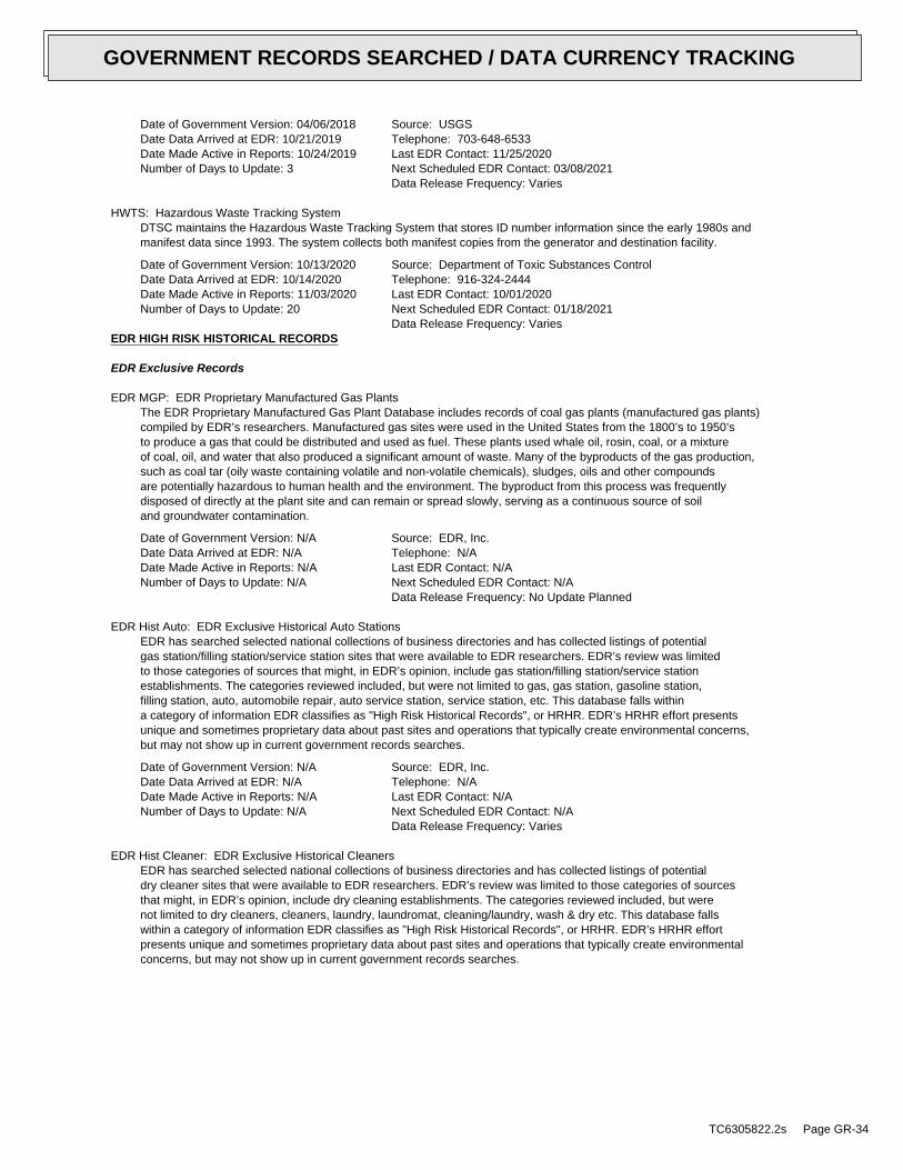
Date of Government Version: 04/06/2018Date Data Arrived at EDR: 10/21/2019Date Made Active in Reports: 10/24/2019Number of Days to Update: 3
Source: USGSTelephone: 703-648-6533Last EDR Contact: 11/25/2020Next Scheduled EDR Contact: 03/08/2021Data Release Frequency: Varies
HWTS: Hazardous Waste Tracking SystemDTSC maintains the Hazardous Waste Tracking System that stores ID number information since the early 1980s andmanifest data since 1993. The system collects both manifest copies from the generator and destination facility.
Date of Government Version: 10/13/2020Date Data Arrived at EDR: 10/14/2020Date Made Active in Reports: 11/03/2020Number of Days to Update: 20
Source: Department of Toxic Substances ControlTelephone: 916-324-2444Last EDR Contact: 10/01/2020Next Scheduled EDR Contact: 01/18/2021Data Release Frequency: Varies
EDR HIGH RISK HISTORICAL RECORDS
EDR Exclusive Records
EDR MGP: EDR Proprietary Manufactured Gas PlantsThe EDR Proprietary Manufactured Gas Plant Database includes records of coal gas plants (manufactured gas plants)compiled by EDR’s researchers. Manufactured gas sites were used in the United States from the 1800’s to 1950’sto produce a gas that could be distributed and used as fuel. These plants used whale oil, rosin, coal, or a mixtureof coal, oil, and water that also produced a significant amount of waste. Many of the byproducts of the gas production,such as coal tar (oily waste containing volatile and non-volatile chemicals), sludges, oils and other compoundsare potentially hazardous to human health and the environment. The byproduct from this process was frequentlydisposed of directly at the plant site and can remain or spread slowly, serving as a continuous source of soiland groundwater contamination.
Date of Government Version: N/ADate Data Arrived at EDR: N/ADate Made Active in Reports: N/ANumber of Days to Update: N/A
Source: EDR, Inc.Telephone: N/ALast EDR Contact: N/ANext Scheduled EDR Contact: N/AData Release Frequency: No Update Planned
EDR Hist Auto: EDR Exclusive Historical Auto StationsEDR has searched selected national collections of business directories and has collected listings of potentialgas station/filling station/service station sites that were available to EDR researchers. EDR’s review was limitedto those categories of sources that might, in EDR’s opinion, include gas station/filling station/service stationestablishments. The categories reviewed included, but were not limited to gas, gas station, gasoline station,filling station, auto, automobile repair, auto service station, service station, etc. This database falls withina category of information EDR classifies as "High Risk Historical Records", or HRHR. EDR’s HRHR effort presentsunique and sometimes proprietary data about past sites and operations that typically create environmental concerns,but may not show up in current government records searches.
Date of Government Version: N/ADate Data Arrived at EDR: N/ADate Made Active in Reports: N/ANumber of Days to Update: N/A
Source: EDR, Inc.Telephone: N/ALast EDR Contact: N/ANext Scheduled EDR Contact: N/AData Release Frequency: Varies
EDR Hist Cleaner: EDR Exclusive Historical CleanersEDR has searched selected national collections of business directories and has collected listings of potentialdry cleaner sites that were available to EDR researchers. EDR’s review was limited to those categories of sourcesthat might, in EDR’s opinion, include dry cleaning establishments. The categories reviewed included, but werenot limited to dry cleaners, cleaners, laundry, laundromat, cleaning/laundry, wash & dry etc. This database fallswithin a category of information EDR classifies as "High Risk Historical Records", or HRHR. EDR’s HRHR effortpresents unique and sometimes proprietary data about past sites and operations that typically create environmentalconcerns, but may not show up in current government records searches.
TC6305822.2s Page GR-34
GOVERNMENT RECORDS SEARCHED / DATA CURRENCY TRACKING
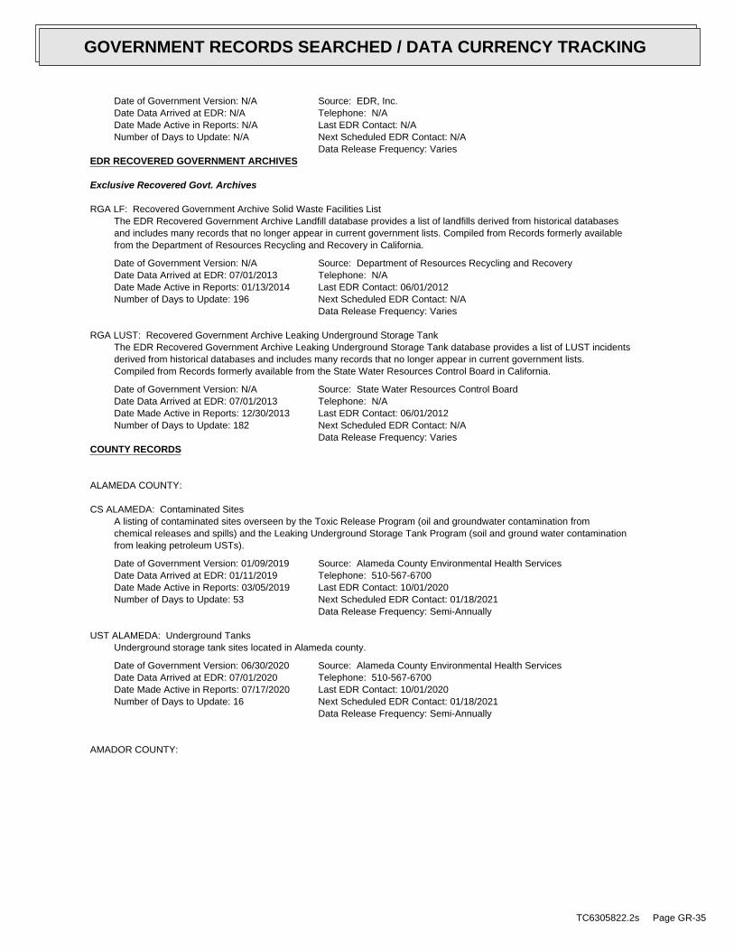
Date of Government Version: N/ADate Data Arrived at EDR: N/ADate Made Active in Reports: N/ANumber of Days to Update: N/A
Source: EDR, Inc.Telephone: N/ALast EDR Contact: N/ANext Scheduled EDR Contact: N/AData Release Frequency: Varies
EDR RECOVERED GOVERNMENT ARCHIVES
Exclusive Recovered Govt. Archives
RGA LF: Recovered Government Archive Solid Waste Facilities ListThe EDR Recovered Government Archive Landfill database provides a list of landfills derived from historical databasesand includes many records that no longer appear in current government lists. Compiled from Records formerly availablefrom the Department of Resources Recycling and Recovery in California.
Date of Government Version: N/ADate Data Arrived at EDR: 07/01/2013Date Made Active in Reports: 01/13/2014Number of Days to Update: 196
Source: Department of Resources Recycling and RecoveryTelephone: N/ALast EDR Contact: 06/01/2012Next Scheduled EDR Contact: N/AData Release Frequency: Varies
RGA LUST: Recovered Government Archive Leaking Underground Storage TankThe EDR Recovered Government Archive Leaking Underground Storage Tank database provides a list of LUST incidentsderived from historical databases and includes many records that no longer appear in current government lists.Compiled from Records formerly available from the State Water Resources Control Board in California.
Date of Government Version: N/ADate Data Arrived at EDR: 07/01/2013Date Made Active in Reports: 12/30/2013Number of Days to Update: 182
Source: State Water Resources Control BoardTelephone: N/ALast EDR Contact: 06/01/2012Next Scheduled EDR Contact: N/AData Release Frequency: Varies
COUNTY RECORDS
ALAMEDA COUNTY:
CS ALAMEDA: Contaminated SitesA listing of contaminated sites overseen by the Toxic Release Program (oil and groundwater contamination fromchemical releases and spills) and the Leaking Underground Storage Tank Program (soil and ground water contaminationfrom leaking petroleum USTs).
Date of Government Version: 01/09/2019Date Data Arrived at EDR: 01/11/2019Date Made Active in Reports: 03/05/2019Number of Days to Update: 53
Source: Alameda County Environmental Health ServicesTelephone: 510-567-6700Last EDR Contact: 10/01/2020Next Scheduled EDR Contact: 01/18/2021Data Release Frequency: Semi-Annually
UST ALAMEDA: Underground TanksUnderground storage tank sites located in Alameda county.
Date of Government Version: 06/30/2020Date Data Arrived at EDR: 07/01/2020Date Made Active in Reports: 07/17/2020Number of Days to Update: 16
Source: Alameda County Environmental Health ServicesTelephone: 510-567-6700Last EDR Contact: 10/01/2020Next Scheduled EDR Contact: 01/18/2021Data Release Frequency: Semi-Annually
AMADOR COUNTY:
TC6305822.2s Page GR-35
GOVERNMENT RECORDS SEARCHED / DATA CURRENCY TRACKING
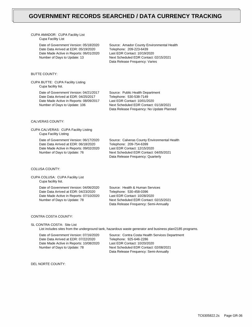
CUPA AMADOR: CUPA Facility ListCupa Facility List
Date of Government Version: 05/18/2020Date Data Arrived at EDR: 05/19/2020Date Made Active in Reports: 06/01/2020Number of Days to Update: 13
Source: Amador County Environmental HealthTelephone: 209-223-6439Last EDR Contact: 10/19/2020Next Scheduled EDR Contact: 02/15/2021Data Release Frequency: Varies
BUTTE COUNTY:
CUPA BUTTE: CUPA Facility ListingCupa facility list.
Date of Government Version: 04/21/2017Date Data Arrived at EDR: 04/25/2017Date Made Active in Reports: 08/09/2017Number of Days to Update: 106
Source: Public Health DepartmentTelephone: 530-538-7149Last EDR Contact: 10/01/2020Next Scheduled EDR Contact: 01/18/2021Data Release Frequency: No Update Planned
CALVERAS COUNTY:
CUPA CALVERAS: CUPA Facility ListingCupa Facility Listing
Date of Government Version: 06/17/2020Date Data Arrived at EDR: 06/18/2020Date Made Active in Reports: 09/02/2020Number of Days to Update: 76
Source: Calveras County Environmental HealthTelephone: 209-754-6399Last EDR Contact: 12/15/2020Next Scheduled EDR Contact: 04/05/2021Data Release Frequency: Quarterly
COLUSA COUNTY:
CUPA COLUSA: CUPA Facility ListCupa facility list.
Date of Government Version: 04/06/2020Date Data Arrived at EDR: 04/23/2020Date Made Active in Reports: 07/10/2020Number of Days to Update: 78
Source: Health & Human ServicesTelephone: 530-458-0396Last EDR Contact: 10/28/2020Next Scheduled EDR Contact: 02/15/2021Data Release Frequency: Semi-Annually
CONTRA COSTA COUNTY:
SL CONTRA COSTA: Site ListList includes sites from the underground tank, hazardous waste generator and business plan/2185 programs.
Date of Government Version: 07/16/2020Date Data Arrived at EDR: 07/22/2020Date Made Active in Reports: 10/08/2020Number of Days to Update: 78
Source: Contra Costa Health Services DepartmentTelephone: 925-646-2286Last EDR Contact: 10/20/2020Next Scheduled EDR Contact: 02/08/2021Data Release Frequency: Semi-Annually
DEL NORTE COUNTY:
TC6305822.2s Page GR-36
GOVERNMENT RECORDS SEARCHED / DATA CURRENCY TRACKING
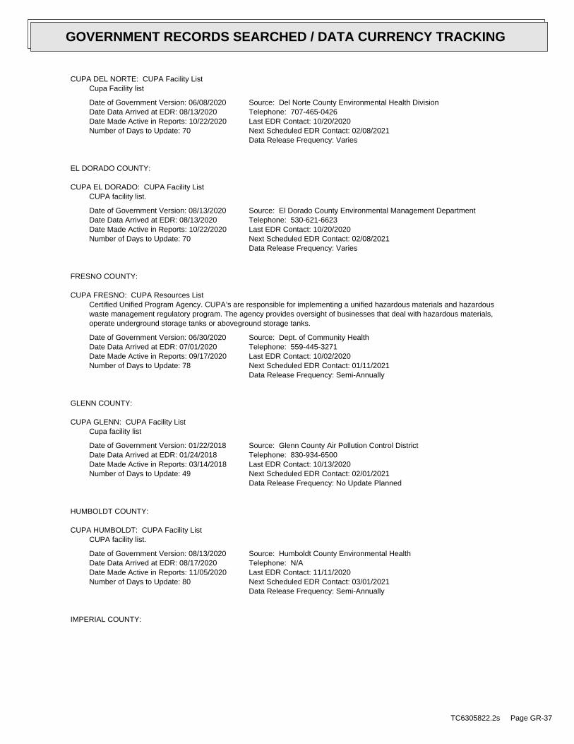
CUPA DEL NORTE: CUPA Facility ListCupa Facility list
Date of Government Version: 06/08/2020Date Data Arrived at EDR: 08/13/2020Date Made Active in Reports: 10/22/2020Number of Days to Update: 70
Source: Del Norte County Environmental Health DivisionTelephone: 707-465-0426Last EDR Contact: 10/20/2020Next Scheduled EDR Contact: 02/08/2021Data Release Frequency: Varies
EL DORADO COUNTY:
CUPA EL DORADO: CUPA Facility ListCUPA facility list.
Date of Government Version: 08/13/2020Date Data Arrived at EDR: 08/13/2020Date Made Active in Reports: 10/22/2020Number of Days to Update: 70
Source: El Dorado County Environmental Management DepartmentTelephone: 530-621-6623Last EDR Contact: 10/20/2020Next Scheduled EDR Contact: 02/08/2021Data Release Frequency: Varies
FRESNO COUNTY:
CUPA FRESNO: CUPA Resources ListCertified Unified Program Agency. CUPA’s are responsible for implementing a unified hazardous materials and hazardouswaste management regulatory program. The agency provides oversight of businesses that deal with hazardous materials,operate underground storage tanks or aboveground storage tanks.
Date of Government Version: 06/30/2020Date Data Arrived at EDR: 07/01/2020Date Made Active in Reports: 09/17/2020Number of Days to Update: 78
Source: Dept. of Community HealthTelephone: 559-445-3271Last EDR Contact: 10/02/2020Next Scheduled EDR Contact: 01/11/2021Data Release Frequency: Semi-Annually
GLENN COUNTY:
CUPA GLENN: CUPA Facility ListCupa facility list
Date of Government Version: 01/22/2018Date Data Arrived at EDR: 01/24/2018Date Made Active in Reports: 03/14/2018Number of Days to Update: 49
Source: Glenn County Air Pollution Control DistrictTelephone: 830-934-6500Last EDR Contact: 10/13/2020Next Scheduled EDR Contact: 02/01/2021Data Release Frequency: No Update Planned
HUMBOLDT COUNTY:
CUPA HUMBOLDT: CUPA Facility ListCUPA facility list.
Date of Government Version: 08/13/2020Date Data Arrived at EDR: 08/17/2020Date Made Active in Reports: 11/05/2020Number of Days to Update: 80
Source: Humboldt County Environmental HealthTelephone: N/ALast EDR Contact: 11/11/2020Next Scheduled EDR Contact: 03/01/2021Data Release Frequency: Semi-Annually
IMPERIAL COUNTY:
TC6305822.2s Page GR-37
GOVERNMENT RECORDS SEARCHED / DATA CURRENCY TRACKING
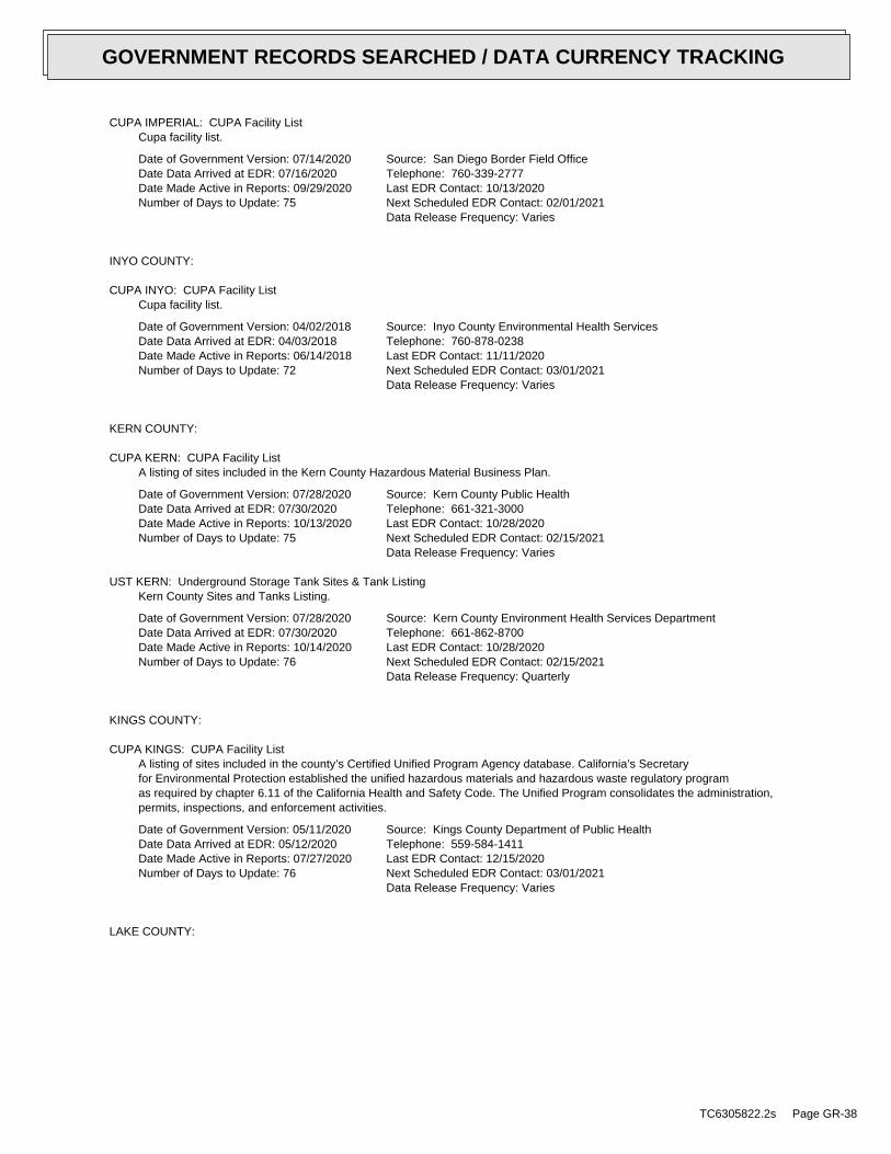
CUPA IMPERIAL: CUPA Facility ListCupa facility list.
Date of Government Version: 07/14/2020Date Data Arrived at EDR: 07/16/2020Date Made Active in Reports: 09/29/2020Number of Days to Update: 75
Source: San Diego Border Field OfficeTelephone: 760-339-2777Last EDR Contact: 10/13/2020Next Scheduled EDR Contact: 02/01/2021Data Release Frequency: Varies
INYO COUNTY:
CUPA INYO: CUPA Facility ListCupa facility list.
Date of Government Version: 04/02/2018Date Data Arrived at EDR: 04/03/2018Date Made Active in Reports: 06/14/2018Number of Days to Update: 72
Source: Inyo County Environmental Health ServicesTelephone: 760-878-0238Last EDR Contact: 11/11/2020Next Scheduled EDR Contact: 03/01/2021Data Release Frequency: Varies
KERN COUNTY:
CUPA KERN: CUPA Facility ListA listing of sites included in the Kern County Hazardous Material Business Plan.
Date of Government Version: 07/28/2020Date Data Arrived at EDR: 07/30/2020Date Made Active in Reports: 10/13/2020Number of Days to Update: 75
Source: Kern County Public HealthTelephone: 661-321-3000Last EDR Contact: 10/28/2020Next Scheduled EDR Contact: 02/15/2021Data Release Frequency: Varies
UST KERN: Underground Storage Tank Sites & Tank ListingKern County Sites and Tanks Listing.
Date of Government Version: 07/28/2020Date Data Arrived at EDR: 07/30/2020Date Made Active in Reports: 10/14/2020Number of Days to Update: 76
Source: Kern County Environment Health Services DepartmentTelephone: 661-862-8700Last EDR Contact: 10/28/2020Next Scheduled EDR Contact: 02/15/2021Data Release Frequency: Quarterly
KINGS COUNTY:
CUPA KINGS: CUPA Facility ListA listing of sites included in the county’s Certified Unified Program Agency database. California’s Secretaryfor Environmental Protection established the unified hazardous materials and hazardous waste regulatory programas required by chapter 6.11 of the California Health and Safety Code. The Unified Program consolidates the administration,permits, inspections, and enforcement activities.
Date of Government Version: 05/11/2020Date Data Arrived at EDR: 05/12/2020Date Made Active in Reports: 07/27/2020Number of Days to Update: 76
Source: Kings County Department of Public HealthTelephone: 559-584-1411Last EDR Contact: 12/15/2020Next Scheduled EDR Contact: 03/01/2021Data Release Frequency: Varies
LAKE COUNTY:
TC6305822.2s Page GR-38
GOVERNMENT RECORDS SEARCHED / DATA CURRENCY TRACKING
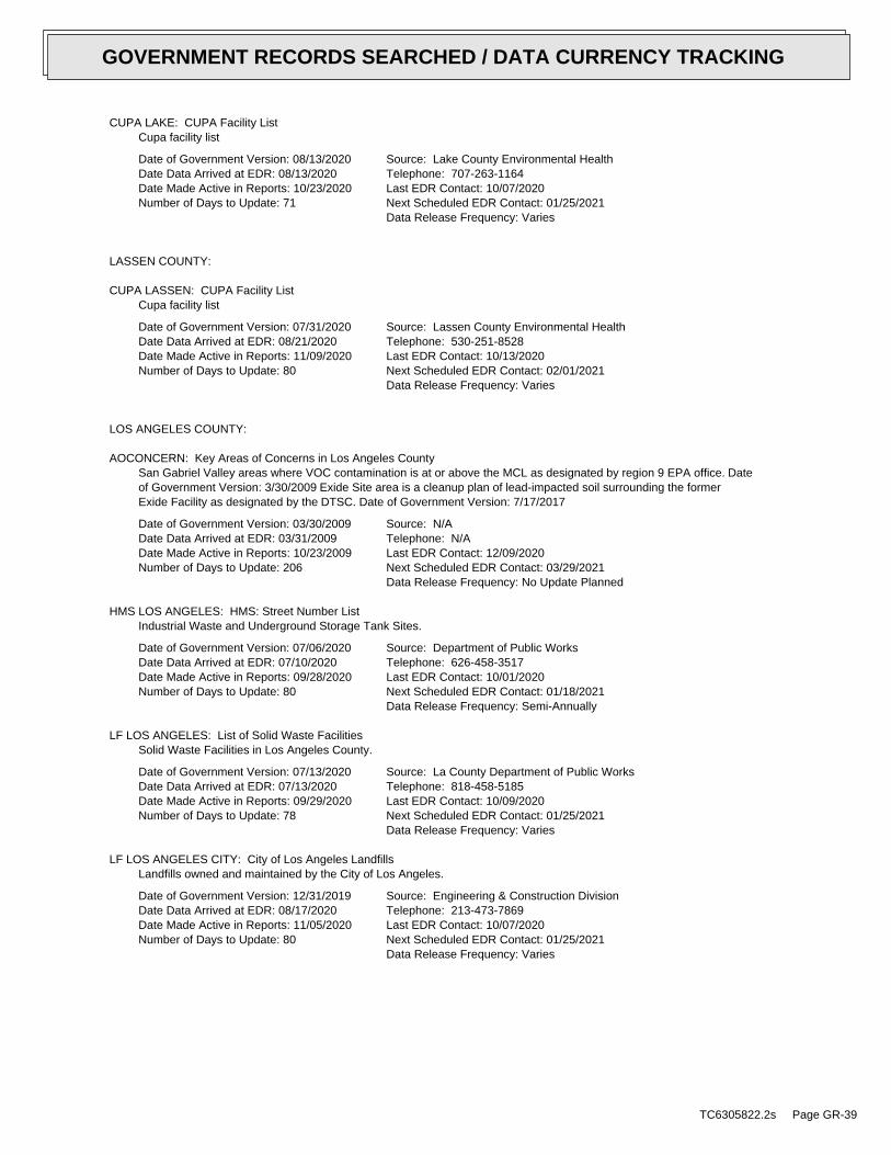
CUPA LAKE: CUPA Facility ListCupa facility list
Date of Government Version: 08/13/2020Date Data Arrived at EDR: 08/13/2020Date Made Active in Reports: 10/23/2020Number of Days to Update: 71
Source: Lake County Environmental HealthTelephone: 707-263-1164Last EDR Contact: 10/07/2020Next Scheduled EDR Contact: 01/25/2021Data Release Frequency: Varies
LASSEN COUNTY:
CUPA LASSEN: CUPA Facility ListCupa facility list
Date of Government Version: 07/31/2020Date Data Arrived at EDR: 08/21/2020Date Made Active in Reports: 11/09/2020Number of Days to Update: 80
Source: Lassen County Environmental HealthTelephone: 530-251-8528Last EDR Contact: 10/13/2020Next Scheduled EDR Contact: 02/01/2021Data Release Frequency: Varies
LOS ANGELES COUNTY:
AOCONCERN: Key Areas of Concerns in Los Angeles CountySan Gabriel Valley areas where VOC contamination is at or above the MCL as designated by region 9 EPA office. Dateof Government Version: 3/30/2009 Exide Site area is a cleanup plan of lead-impacted soil surrounding the formerExide Facility as designated by the DTSC. Date of Government Version: 7/17/2017
Date of Government Version: 03/30/2009Date Data Arrived at EDR: 03/31/2009Date Made Active in Reports: 10/23/2009Number of Days to Update: 206
Source: N/ATelephone: N/ALast EDR Contact: 12/09/2020Next Scheduled EDR Contact: 03/29/2021Data Release Frequency: No Update Planned
HMS LOS ANGELES: HMS: Street Number ListIndustrial Waste and Underground Storage Tank Sites.
Date of Government Version: 07/06/2020Date Data Arrived at EDR: 07/10/2020Date Made Active in Reports: 09/28/2020Number of Days to Update: 80
Source: Department of Public WorksTelephone: 626-458-3517Last EDR Contact: 10/01/2020Next Scheduled EDR Contact: 01/18/2021Data Release Frequency: Semi-Annually
LF LOS ANGELES: List of Solid Waste FacilitiesSolid Waste Facilities in Los Angeles County.
Date of Government Version: 07/13/2020Date Data Arrived at EDR: 07/13/2020Date Made Active in Reports: 09/29/2020Number of Days to Update: 78
Source: La County Department of Public WorksTelephone: 818-458-5185Last EDR Contact: 10/09/2020Next Scheduled EDR Contact: 01/25/2021Data Release Frequency: Varies
LF LOS ANGELES CITY: City of Los Angeles LandfillsLandfills owned and maintained by the City of Los Angeles.
Date of Government Version: 12/31/2019Date Data Arrived at EDR: 08/17/2020Date Made Active in Reports: 11/05/2020Number of Days to Update: 80
Source: Engineering & Construction DivisionTelephone: 213-473-7869Last EDR Contact: 10/07/2020Next Scheduled EDR Contact: 01/25/2021Data Release Frequency: Varies
TC6305822.2s Page GR-39
GOVERNMENT RECORDS SEARCHED / DATA CURRENCY TRACKING
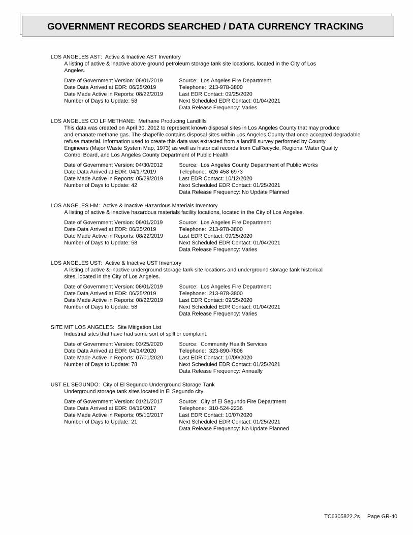
LOS ANGELES AST: Active & Inactive AST InventoryA listing of active & inactive above ground petroleum storage tank site locations, located in the City of LosAngeles.
Date of Government Version: 06/01/2019Date Data Arrived at EDR: 06/25/2019Date Made Active in Reports: 08/22/2019Number of Days to Update: 58
Source: Los Angeles Fire DepartmentTelephone: 213-978-3800Last EDR Contact: 09/25/2020Next Scheduled EDR Contact: 01/04/2021Data Release Frequency: Varies
LOS ANGELES CO LF METHANE: Methane Producing LandfillsThis data was created on April 30, 2012 to represent known disposal sites in Los Angeles County that may produceand emanate methane gas. The shapefile contains disposal sites within Los Angeles County that once accepted degradablerefuse material. Information used to create this data was extracted from a landfill survey performed by CountyEngineers (Major Waste System Map, 1973) as well as historical records from CalRecycle, Regional Water QualityControl Board, and Los Angeles County Department of Public Health
Date of Government Version: 04/30/2012Date Data Arrived at EDR: 04/17/2019Date Made Active in Reports: 05/29/2019Number of Days to Update: 42
Source: Los Angeles County Department of Public WorksTelephone: 626-458-6973Last EDR Contact: 10/12/2020Next Scheduled EDR Contact: 01/25/2021Data Release Frequency: No Update Planned
LOS ANGELES HM: Active & Inactive Hazardous Materials InventoryA listing of active & inactive hazardous materials facility locations, located in the City of Los Angeles.
Date of Government Version: 06/01/2019Date Data Arrived at EDR: 06/25/2019Date Made Active in Reports: 08/22/2019Number of Days to Update: 58
Source: Los Angeles Fire DepartmentTelephone: 213-978-3800Last EDR Contact: 09/25/2020Next Scheduled EDR Contact: 01/04/2021Data Release Frequency: Varies
LOS ANGELES UST: Active & Inactive UST InventoryA listing of active & inactive underground storage tank site locations and underground storage tank historicalsites, located in the City of Los Angeles.
Date of Government Version: 06/01/2019Date Data Arrived at EDR: 06/25/2019Date Made Active in Reports: 08/22/2019Number of Days to Update: 58
Source: Los Angeles Fire DepartmentTelephone: 213-978-3800Last EDR Contact: 09/25/2020Next Scheduled EDR Contact: 01/04/2021Data Release Frequency: Varies
SITE MIT LOS ANGELES: Site Mitigation ListIndustrial sites that have had some sort of spill or complaint.
Date of Government Version: 03/25/2020Date Data Arrived at EDR: 04/14/2020Date Made Active in Reports: 07/01/2020Number of Days to Update: 78
Source: Community Health ServicesTelephone: 323-890-7806Last EDR Contact: 10/09/2020Next Scheduled EDR Contact: 01/25/2021Data Release Frequency: Annually
UST EL SEGUNDO: City of El Segundo Underground Storage TankUnderground storage tank sites located in El Segundo city.
Date of Government Version: 01/21/2017Date Data Arrived at EDR: 04/19/2017Date Made Active in Reports: 05/10/2017Number of Days to Update: 21
Source: City of El Segundo Fire DepartmentTelephone: 310-524-2236Last EDR Contact: 10/07/2020Next Scheduled EDR Contact: 01/25/2021Data Release Frequency: No Update Planned
TC6305822.2s Page GR-40
GOVERNMENT RECORDS SEARCHED / DATA CURRENCY TRACKING
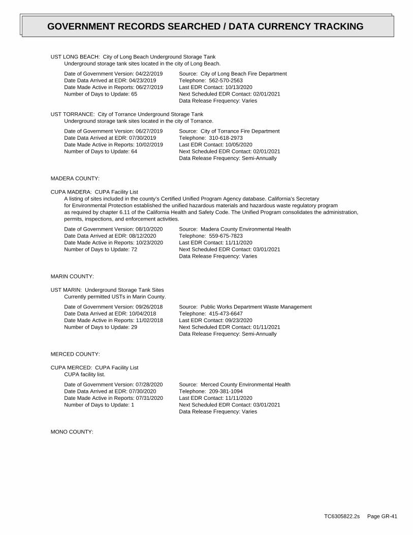
UST LONG BEACH: City of Long Beach Underground Storage TankUnderground storage tank sites located in the city of Long Beach.
Date of Government Version: 04/22/2019Date Data Arrived at EDR: 04/23/2019Date Made Active in Reports: 06/27/2019Number of Days to Update: 65
Source: City of Long Beach Fire DepartmentTelephone: 562-570-2563Last EDR Contact: 10/13/2020Next Scheduled EDR Contact: 02/01/2021Data Release Frequency: Varies
UST TORRANCE: City of Torrance Underground Storage TankUnderground storage tank sites located in the city of Torrance.
Date of Government Version: 06/27/2019Date Data Arrived at EDR: 07/30/2019Date Made Active in Reports: 10/02/2019Number of Days to Update: 64
Source: City of Torrance Fire DepartmentTelephone: 310-618-2973Last EDR Contact: 10/05/2020Next Scheduled EDR Contact: 02/01/2021Data Release Frequency: Semi-Annually
MADERA COUNTY:
CUPA MADERA: CUPA Facility ListA listing of sites included in the county’s Certified Unified Program Agency database. California’s Secretaryfor Environmental Protection established the unified hazardous materials and hazardous waste regulatory programas required by chapter 6.11 of the California Health and Safety Code. The Unified Program consolidates the administration,permits, inspections, and enforcement activities.
Date of Government Version: 08/10/2020Date Data Arrived at EDR: 08/12/2020Date Made Active in Reports: 10/23/2020Number of Days to Update: 72
Source: Madera County Environmental HealthTelephone: 559-675-7823Last EDR Contact: 11/11/2020Next Scheduled EDR Contact: 03/01/2021Data Release Frequency: Varies
MARIN COUNTY:
UST MARIN: Underground Storage Tank SitesCurrently permitted USTs in Marin County.
Date of Government Version: 09/26/2018Date Data Arrived at EDR: 10/04/2018Date Made Active in Reports: 11/02/2018Number of Days to Update: 29
Source: Public Works Department Waste ManagementTelephone: 415-473-6647Last EDR Contact: 09/23/2020Next Scheduled EDR Contact: 01/11/2021Data Release Frequency: Semi-Annually
MERCED COUNTY:
CUPA MERCED: CUPA Facility ListCUPA facility list.
Date of Government Version: 07/28/2020Date Data Arrived at EDR: 07/30/2020Date Made Active in Reports: 07/31/2020Number of Days to Update: 1
Source: Merced County Environmental HealthTelephone: 209-381-1094Last EDR Contact: 11/11/2020Next Scheduled EDR Contact: 03/01/2021Data Release Frequency: Varies
MONO COUNTY:
TC6305822.2s Page GR-41
GOVERNMENT RECORDS SEARCHED / DATA CURRENCY TRACKING
CUPA MONO: CUPA Facility ListCUPA Facility List
Date of Government Version: 08/20/2020Date Data Arrived at EDR: 08/24/2020Date Made Active in Reports: 11/09/2020Number of Days to Update: 77
Source: Mono County Health DepartmentTelephone: 760-932-5580Last EDR Contact: 11/15/2020Next Scheduled EDR Contact: 03/08/3021Data Release Frequency: Varies
MONTEREY COUNTY:
CUPA MONTEREY: CUPA Facility ListingCUPA Program listing from the Environmental Health Division.
Date of Government Version: 07/13/2020Date Data Arrived at EDR: 07/15/2020Date Made Active in Reports: 07/31/2020Number of Days to Update: 16
Source: Monterey County Health DepartmentTelephone: 831-796-1297Last EDR Contact: 09/23/2020Next Scheduled EDR Contact: 01/11/2021Data Release Frequency: Varies
NAPA COUNTY:
LUST NAPA: Sites With Reported ContaminationA listing of leaking underground storage tank sites located in Napa county.
Date of Government Version: 01/09/2017Date Data Arrived at EDR: 01/11/2017Date Made Active in Reports: 03/02/2017Number of Days to Update: 50
Source: Napa County Department of Environmental ManagementTelephone: 707-253-4269Last EDR Contact: 11/16/2020Next Scheduled EDR Contact: 03/08/2021Data Release Frequency: No Update Planned
UST NAPA: Closed and Operating Underground Storage Tank SitesUnderground storage tank sites located in Napa county.
Date of Government Version: 09/05/2019Date Data Arrived at EDR: 09/09/2019Date Made Active in Reports: 10/31/2019Number of Days to Update: 52
Source: Napa County Department of Environmental ManagementTelephone: 707-253-4269Last EDR Contact: 11/16/2020Next Scheduled EDR Contact: 03/08/2021Data Release Frequency: No Update Planned
NEVADA COUNTY:
CUPA NEVADA: CUPA Facility ListCUPA facility list.
Date of Government Version: 07/29/2020Date Data Arrived at EDR: 07/30/2020Date Made Active in Reports: 10/13/2020Number of Days to Update: 75
Source: Community Development AgencyTelephone: 530-265-1467Last EDR Contact: 10/20/2020Next Scheduled EDR Contact: 02/08/2021Data Release Frequency: Varies
ORANGE COUNTY:
IND_SITE ORANGE: List of Industrial Site CleanupsPetroleum and non-petroleum spills.
TC6305822.2s Page GR-42
GOVERNMENT RECORDS SEARCHED / DATA CURRENCY TRACKING
Date of Government Version: 06/10/2020Date Data Arrived at EDR: 08/03/2020Date Made Active in Reports: 10/19/2020Number of Days to Update: 77
Source: Health Care AgencyTelephone: 714-834-3446Last EDR Contact: 11/02/2020Next Scheduled EDR Contact: 02/15/2021Data Release Frequency: Annually
LUST ORANGE: List of Underground Storage Tank CleanupsOrange County Underground Storage Tank Cleanups (LUST).
Date of Government Version: 07/02/2020Date Data Arrived at EDR: 08/05/2020Date Made Active in Reports: 10/23/2020Number of Days to Update: 79
Source: Health Care AgencyTelephone: 714-834-3446Last EDR Contact: 11/02/2020Next Scheduled EDR Contact: 02/15/2021Data Release Frequency: Quarterly
UST ORANGE: List of Underground Storage Tank FacilitiesOrange County Underground Storage Tank Facilities (UST).
Date of Government Version: 07/01/2020Date Data Arrived at EDR: 08/03/2020Date Made Active in Reports: 10/19/2020Number of Days to Update: 77
Source: Health Care AgencyTelephone: 714-834-3446Last EDR Contact: 11/03/2020Next Scheduled EDR Contact: 02/15/2021Data Release Frequency: Quarterly
PLACER COUNTY:
MS PLACER: Master List of FacilitiesList includes aboveground tanks, underground tanks and cleanup sites.
Date of Government Version: 11/24/2020Date Data Arrived at EDR: 11/24/2020Date Made Active in Reports: 11/25/2020Number of Days to Update: 1
Source: Placer County Health and Human ServicesTelephone: 530-745-2363Last EDR Contact: 11/23/2020Next Scheduled EDR Contact: 03/15/2021Data Release Frequency: Semi-Annually
PLUMAS COUNTY:
CUPA PLUMAS: CUPA Facility ListPlumas County CUPA Program facilities.
Date of Government Version: 03/31/2019Date Data Arrived at EDR: 04/23/2019Date Made Active in Reports: 06/26/2019Number of Days to Update: 64
Source: Plumas County Environmental HealthTelephone: 530-283-6355Last EDR Contact: 10/13/2020Next Scheduled EDR Contact: 02/01/2021Data Release Frequency: Varies
RIVERSIDE COUNTY:
LUST RIVERSIDE: Listing of Underground Tank Cleanup SitesRiverside County Underground Storage Tank Cleanup Sites (LUST).
Date of Government Version: 10/06/2020Date Data Arrived at EDR: 10/07/2020Date Made Active in Reports: 11/03/2020Number of Days to Update: 27
Source: Department of Environmental HealthTelephone: 951-358-5055Last EDR Contact: 12/09/2020Next Scheduled EDR Contact: 03/29/2021Data Release Frequency: Quarterly
TC6305822.2s Page GR-43
GOVERNMENT RECORDS SEARCHED / DATA CURRENCY TRACKING
UST RIVERSIDE: Underground Storage Tank Tank ListUnderground storage tank sites located in Riverside county.
Date of Government Version: 10/06/2020Date Data Arrived at EDR: 10/07/2020Date Made Active in Reports: 11/03/2020Number of Days to Update: 27
Source: Department of Environmental HealthTelephone: 951-358-5055Last EDR Contact: 12/09/2020Next Scheduled EDR Contact: 03/29/2021Data Release Frequency: Quarterly
SACRAMENTO COUNTY:
CS SACRAMENTO: Toxic Site Clean-Up ListList of sites where unauthorized releases of potentially hazardous materials have occurred.
Date of Government Version: 02/18/2020Date Data Arrived at EDR: 03/31/2020Date Made Active in Reports: 06/15/2020Number of Days to Update: 76
Source: Sacramento County Environmental ManagementTelephone: 916-875-8406Last EDR Contact: 10/02/2020Next Scheduled EDR Contact: 01/11/2021Data Release Frequency: Quarterly
ML SACRAMENTO: Master Hazardous Materials Facility ListAny business that has hazardous materials on site - hazardous material storage sites, underground storage tanks,waste generators.
Date of Government Version: 02/24/2020Date Data Arrived at EDR: 03/31/2020Date Made Active in Reports: 06/17/2020Number of Days to Update: 78
Source: Sacramento County Environmental ManagementTelephone: 916-875-8406Last EDR Contact: 10/02/2020Next Scheduled EDR Contact: 01/11/2021Data Release Frequency: Quarterly
SAN BENITO COUNTY:
CUPA SAN BENITO: CUPA Facility ListCupa facility list
Date of Government Version: 08/04/2020Date Data Arrived at EDR: 08/05/2020Date Made Active in Reports: 10/22/2020Number of Days to Update: 78
Source: San Benito County Environmental HealthTelephone: N/ALast EDR Contact: 10/28/2020Next Scheduled EDR Contact: 02/15/2021Data Release Frequency: Varies
SAN BERNARDINO COUNTY:
PERMITS SAN BERNARDINO: Hazardous Material PermitsThis listing includes underground storage tanks, medical waste handlers/generators, hazardous materials handlers,hazardous waste generators, and waste oil generators/handlers.
Date of Government Version: 08/04/2020Date Data Arrived at EDR: 08/05/2020Date Made Active in Reports: 10/26/2020Number of Days to Update: 82
Source: San Bernardino County Fire Department Hazardous Materials DivisionTelephone: 909-387-3041Last EDR Contact: 10/28/2020Next Scheduled EDR Contact: 02/15/2021Data Release Frequency: Quarterly
SAN DIEGO COUNTY:
TC6305822.2s Page GR-44
GOVERNMENT RECORDS SEARCHED / DATA CURRENCY TRACKING
HMMD SAN DIEGO: Hazardous Materials Management Division DatabaseThe database includes: HE58 - This report contains the business name, site address, business phone number, establishment’H’ permit number, type of permit, and the business status. HE17 - In addition to providing the same informationprovided in the HE58 listing, HE17 provides inspection dates, violations received by the establishment, hazardouswaste generated, the quantity, method of storage, treatment/disposal of waste and the hauler, and informationon underground storage tanks. Unauthorized Release List - Includes a summary of environmental contamination casesin San Diego County (underground tank cases, non-tank cases, groundwater contamination, and soil contaminationare included.)
Date of Government Version: 08/31/2020Date Data Arrived at EDR: 08/31/2020Date Made Active in Reports: 11/23/2020Number of Days to Update: 84
Source: Hazardous Materials Management DivisionTelephone: 619-338-2268Last EDR Contact: 12/01/2020Next Scheduled EDR Contact: 03/15/2021Data Release Frequency: Quarterly
LF SAN DIEGO: Solid Waste FacilitiesSan Diego County Solid Waste Facilities.
Date of Government Version: 04/18/2018Date Data Arrived at EDR: 04/24/2018Date Made Active in Reports: 06/19/2018Number of Days to Update: 56
Source: Department of Health ServicesTelephone: 619-338-2209Last EDR Contact: 11/16/2020Next Scheduled EDR Contact: 02/01/2021Data Release Frequency: Varies
SAN DIEGO CO LOP: Local Oversight Program ListingA listing of all LOP release sites that are or were under the County of San Diego’s jurisdiction. Included areclosed or transferred cases, open cases, and cases that did not have a case type indicated. The cases withouta case type are mostly complaints; however, some of them could be LOP cases.
Date of Government Version: 07/14/2020Date Data Arrived at EDR: 07/16/2020Date Made Active in Reports: 09/29/2020Number of Days to Update: 75
Source: Department of Environmental HealthTelephone: 858-505-6874Last EDR Contact: 10/13/2020Next Scheduled EDR Contact: 02/01/2021Data Release Frequency: Varies
SAN DIEGO CO SAM: Environmental Case ListingThe listing contains all underground tank release cases and projects pertaining to properties contaminated withhazardous substances that are actively under review by the Site Assessment and Mitigation Program.
Date of Government Version: 03/23/2010Date Data Arrived at EDR: 06/15/2010Date Made Active in Reports: 07/09/2010Number of Days to Update: 24
Source: San Diego County Department of Environmental HealthTelephone: 619-338-2371Last EDR Contact: 11/23/2020Next Scheduled EDR Contact: 03/15/2021Data Release Frequency: No Update Planned
SAN FRANCISCO COUNTY:
CUPA SAN FRANCISCO CO: CUPA Facility ListingCupa facilities
Date of Government Version: 08/03/2020Date Data Arrived at EDR: 08/05/2020Date Made Active in Reports: 10/22/2020Number of Days to Update: 78
Source: San Francisco County Department of Environmental HealthTelephone: 415-252-3896Last EDR Contact: 10/28/2020Next Scheduled EDR Contact: 02/15/2021Data Release Frequency: Varies
LUST SAN FRANCISCO: Local Oversite FacilitiesA listing of leaking underground storage tank sites located in San Francisco county.
TC6305822.2s Page GR-45
GOVERNMENT RECORDS SEARCHED / DATA CURRENCY TRACKING
Date of Government Version: 09/19/2008Date Data Arrived at EDR: 09/19/2008Date Made Active in Reports: 09/29/2008Number of Days to Update: 10
Source: Department Of Public Health San Francisco CountyTelephone: 415-252-3920Last EDR Contact: 10/28/2020Next Scheduled EDR Contact: 02/15/2021Data Release Frequency: No Update Planned
UST SAN FRANCISCO: Underground Storage Tank InformationUnderground storage tank sites located in San Francisco county.
Date of Government Version: 08/03/2020Date Data Arrived at EDR: 08/05/2020Date Made Active in Reports: 10/26/2020Number of Days to Update: 82
Source: Department of Public HealthTelephone: 415-252-3920Last EDR Contact: 10/28/2020Next Scheduled EDR Contact: 02/15/2021Data Release Frequency: Quarterly
SAN JOAQUIN COUNTY:
UST SAN JOAQUIN: San Joaquin Co. USTA listing of underground storage tank locations in San Joaquin county.
Date of Government Version: 06/22/2018Date Data Arrived at EDR: 06/26/2018Date Made Active in Reports: 07/11/2018Number of Days to Update: 15
Source: Environmental Health DepartmentTelephone: N/ALast EDR Contact: 12/09/2020Next Scheduled EDR Contact: 03/29/2021Data Release Frequency: Semi-Annually
SAN LUIS OBISPO COUNTY:
CUPA SAN LUIS OBISPO: CUPA Facility ListCupa Facility List.
Date of Government Version: 07/27/2020Date Data Arrived at EDR: 08/12/2020Date Made Active in Reports: 10/26/2020Number of Days to Update: 75
Source: San Luis Obispo County Public Health DepartmentTelephone: 805-781-5596Last EDR Contact: 11/11/2020Next Scheduled EDR Contact: 03/01/2021Data Release Frequency: Varies
SAN MATEO COUNTY:
BI SAN MATEO: Business InventoryList includes Hazardous Materials Business Plan, hazardous waste generators, and underground storage tanks.
Date of Government Version: 02/20/2020Date Data Arrived at EDR: 02/20/2020Date Made Active in Reports: 04/24/2020Number of Days to Update: 64
Source: San Mateo County Environmental Health Services DivisionTelephone: 650-363-1921Last EDR Contact: 12/11/2020Next Scheduled EDR Contact: 03/22/2021Data Release Frequency: Annually
LUST SAN MATEO: Fuel Leak ListA listing of leaking underground storage tank sites located in San Mateo county.
Date of Government Version: 03/29/2019Date Data Arrived at EDR: 03/29/2019Date Made Active in Reports: 05/29/2019Number of Days to Update: 61
Source: San Mateo County Environmental Health Services DivisionTelephone: 650-363-1921Last EDR Contact: 12/01/2020Next Scheduled EDR Contact: 03/22/2021Data Release Frequency: Semi-Annually
SANTA BARBARA COUNTY:
TC6305822.2s Page GR-46
GOVERNMENT RECORDS SEARCHED / DATA CURRENCY TRACKING
CUPA SANTA BARBARA: CUPA Facility ListingCUPA Program Listing from the Environmental Health Services division.
Date of Government Version: 09/08/2011Date Data Arrived at EDR: 09/09/2011Date Made Active in Reports: 10/07/2011Number of Days to Update: 28
Source: Santa Barbara County Public Health DepartmentTelephone: 805-686-8167Last EDR Contact: 11/11/2020Next Scheduled EDR Contact: 03/01/2021Data Release Frequency: No Update Planned
SANTA CLARA COUNTY:
CUPA SANTA CLARA: Cupa Facility ListCupa facility list
Date of Government Version: 08/20/2020Date Data Arrived at EDR: 08/20/2020Date Made Active in Reports: 11/09/2020Number of Days to Update: 81
Source: Department of Environmental HealthTelephone: 408-918-1973Last EDR Contact: 11/11/2020Next Scheduled EDR Contact: 03/01/2021Data Release Frequency: Varies
HIST LUST SANTA CLARA: HIST LUST - Fuel Leak Site Activity ReportA listing of open and closed leaking underground storage tanks. This listing is no longer updated by the county.Leaking underground storage tanks are now handled by the Department of Environmental Health.
Date of Government Version: 03/29/2005Date Data Arrived at EDR: 03/30/2005Date Made Active in Reports: 04/21/2005Number of Days to Update: 22
Source: Santa Clara Valley Water DistrictTelephone: 408-265-2600Last EDR Contact: 03/23/2009Next Scheduled EDR Contact: 06/22/2009Data Release Frequency: No Update Planned
LUST SANTA CLARA: LOP ListingA listing of leaking underground storage tanks located in Santa Clara county.
Date of Government Version: 03/03/2014Date Data Arrived at EDR: 03/05/2014Date Made Active in Reports: 03/18/2014Number of Days to Update: 13
Source: Department of Environmental HealthTelephone: 408-918-3417Last EDR Contact: 11/16/2020Next Scheduled EDR Contact: 03/08/2021Data Release Frequency: No Update Planned
SAN JOSE HAZMAT: Hazardous Material FacilitiesHazardous material facilities, including underground storage tank sites.
Date of Government Version: 07/30/2020Date Data Arrived at EDR: 07/31/2020Date Made Active in Reports: 10/16/2020Number of Days to Update: 77
Source: City of San Jose Fire DepartmentTelephone: 408-535-7694Last EDR Contact: 10/28/2020Next Scheduled EDR Contact: 02/15/2021Data Release Frequency: Annually
SANTA CRUZ COUNTY:
CUPA SANTA CRUZ: CUPA Facility ListCUPA facility listing.
Date of Government Version: 01/21/2017Date Data Arrived at EDR: 02/22/2017Date Made Active in Reports: 05/23/2017Number of Days to Update: 90
Source: Santa Cruz County Environmental HealthTelephone: 831-464-2761Last EDR Contact: 11/11/2020Next Scheduled EDR Contact: 03/01/2021Data Release Frequency: Varies
SHASTA COUNTY:
TC6305822.2s Page GR-47
GOVERNMENT RECORDS SEARCHED / DATA CURRENCY TRACKING
CUPA SHASTA: CUPA Facility ListCupa Facility List.
Date of Government Version: 06/15/2017Date Data Arrived at EDR: 06/19/2017Date Made Active in Reports: 08/09/2017Number of Days to Update: 51
Source: Shasta County Department of Resource ManagementTelephone: 530-225-5789Last EDR Contact: 11/11/2020Next Scheduled EDR Contact: 03/01/2021Data Release Frequency: Varies
SOLANO COUNTY:
LUST SOLANO: Leaking Underground Storage TanksA listing of leaking underground storage tank sites located in Solano county.
Date of Government Version: 06/04/2019Date Data Arrived at EDR: 06/06/2019Date Made Active in Reports: 08/13/2019Number of Days to Update: 68
Source: Solano County Department of Environmental ManagementTelephone: 707-784-6770Last EDR Contact: 06/03/2019Next Scheduled EDR Contact: 03/15/2021Data Release Frequency: Quarterly
UST SOLANO: Underground Storage TanksUnderground storage tank sites located in Solano county.
Date of Government Version: 08/25/2020Date Data Arrived at EDR: 08/26/2020Date Made Active in Reports: 09/16/2020Number of Days to Update: 21
Source: Solano County Department of Environmental ManagementTelephone: 707-784-6770Last EDR Contact: 12/03/2020Next Scheduled EDR Contact: 03/15/2021Data Release Frequency: Quarterly
SONOMA COUNTY:
CUPA SONOMA: Cupa Facility ListCupa Facility list
Date of Government Version: 07/07/2020Date Data Arrived at EDR: 07/08/2020Date Made Active in Reports: 09/25/2020Number of Days to Update: 79
Source: County of Sonoma Fire & Emergency Services DepartmentTelephone: 707-565-1174Last EDR Contact: 12/15/2020Next Scheduled EDR Contact: 04/05/2021Data Release Frequency: Varies
LUST SONOMA: Leaking Underground Storage Tank SitesA listing of leaking underground storage tank sites located in Sonoma county.
Date of Government Version: 09/18/2020Date Data Arrived at EDR: 09/22/2020Date Made Active in Reports: 12/14/2020Number of Days to Update: 83
Source: Department of Health ServicesTelephone: 707-565-6565Last EDR Contact: 12/15/2020Next Scheduled EDR Contact: 04/05/2021Data Release Frequency: Quarterly
STANISLAUS COUNTY:
CUPA STANISLAUS: CUPA Facility ListCupa facility list
Date of Government Version: 02/04/2020Date Data Arrived at EDR: 02/05/2020Date Made Active in Reports: 04/15/2020Number of Days to Update: 70
Source: Stanislaus County Department of Ennvironmental ProtectionTelephone: 209-525-6751Last EDR Contact: 10/02/2020Next Scheduled EDR Contact: 01/25/2021Data Release Frequency: Varies
SUTTER COUNTY:
TC6305822.2s Page GR-48
GOVERNMENT RECORDS SEARCHED / DATA CURRENCY TRACKING
UST SUTTER: Underground Storage TanksUnderground storage tank sites located in Sutter county.
Date of Government Version: 08/25/2020Date Data Arrived at EDR: 08/26/2020Date Made Active in Reports: 11/17/2020Number of Days to Update: 83
Source: Sutter County Environmental Health ServicesTelephone: 530-822-7500Last EDR Contact: 11/23/2020Next Scheduled EDR Contact: 03/15/2021Data Release Frequency: Semi-Annually
TEHAMA COUNTY:
CUPA TEHAMA: CUPA Facility ListCupa facilities
Date of Government Version: 08/11/2020Date Data Arrived at EDR: 08/12/2020Date Made Active in Reports: 10/26/2020Number of Days to Update: 75
Source: Tehama County Department of Environmental HealthTelephone: 530-527-8020Last EDR Contact: 11/11/2020Next Scheduled EDR Contact: 02/15/2021Data Release Frequency: Varies
TRINITY COUNTY:
CUPA TRINITY: CUPA Facility ListCupa facility list
Date of Government Version: 07/14/2020Date Data Arrived at EDR: 07/16/2020Date Made Active in Reports: 09/29/2020Number of Days to Update: 75
Source: Department of Toxic Substances ControlTelephone: 760-352-0381Last EDR Contact: 10/13/2020Next Scheduled EDR Contact: 02/01/2021Data Release Frequency: Varies
TULARE COUNTY:
CUPA TULARE: CUPA Facility ListCupa program facilities
Date of Government Version: 08/06/2020Date Data Arrived at EDR: 08/06/2020Date Made Active in Reports: 10/26/2020Number of Days to Update: 81
Source: Tulare County Environmental Health Services DivisionTelephone: 559-624-7400Last EDR Contact: 10/28/2020Next Scheduled EDR Contact: 02/15/2021Data Release Frequency: Varies
TUOLUMNE COUNTY:
CUPA TUOLUMNE: CUPA Facility ListCupa facility list
Date of Government Version: 04/23/2018Date Data Arrived at EDR: 04/25/2018Date Made Active in Reports: 06/25/2018Number of Days to Update: 61
Source: Divison of Environmental HealthTelephone: 209-533-5633Last EDR Contact: 10/13/2020Next Scheduled EDR Contact: 02/01/2021Data Release Frequency: Varies
VENTURA COUNTY:
TC6305822.2s Page GR-49
GOVERNMENT RECORDS SEARCHED / DATA CURRENCY TRACKING
BWT VENTURA: Business Plan, Hazardous Waste Producers, and Operating Underground TanksThe BWT list indicates by site address whether the Environmental Health Division has Business Plan (B), WasteProducer (W), and/or Underground Tank (T) information.
Date of Government Version: 07/10/2020Date Data Arrived at EDR: 07/22/2020Date Made Active in Reports: 10/08/2020Number of Days to Update: 78
Source: Ventura County Environmental Health DivisionTelephone: 805-654-2813Last EDR Contact: 10/19/2020Next Scheduled EDR Contact: 02/01/2021Data Release Frequency: Quarterly
LF VENTURA: Inventory of Illegal Abandoned and Inactive SitesVentura County Inventory of Closed, Illegal Abandoned, and Inactive Sites.
Date of Government Version: 12/01/2011Date Data Arrived at EDR: 12/01/2011Date Made Active in Reports: 01/19/2012Number of Days to Update: 49
Source: Environmental Health DivisionTelephone: 805-654-2813Last EDR Contact: 09/23/2020Next Scheduled EDR Contact: 01/11/2021Data Release Frequency: No Update Planned
LUST VENTURA: Listing of Underground Tank Cleanup SitesVentura County Underground Storage Tank Cleanup Sites (LUST).
Date of Government Version: 05/29/2008Date Data Arrived at EDR: 06/24/2008Date Made Active in Reports: 07/31/2008Number of Days to Update: 37
Source: Environmental Health DivisionTelephone: 805-654-2813Last EDR Contact: 11/05/2020Next Scheduled EDR Contact: 02/22/2021Data Release Frequency: No Update Planned
MED WASTE VENTURA: Medical Waste Program ListTo protect public health and safety and the environment from potential exposure to disease causing agents, theEnvironmental Health Division Medical Waste Program regulates the generation, handling, storage, treatment anddisposal of medical waste throughout the County.
Date of Government Version: 07/10/2020Date Data Arrived at EDR: 07/22/2020Date Made Active in Reports: 10/07/2020Number of Days to Update: 77
Source: Ventura County Resource Management AgencyTelephone: 805-654-2813Last EDR Contact: 10/19/2020Next Scheduled EDR Contact: 02/01/2021Data Release Frequency: Quarterly
UST VENTURA: Underground Tank Closed Sites ListVentura County Operating Underground Storage Tank Sites (UST)/Underground Tank Closed Sites List.
Date of Government Version: 08/26/2020Date Data Arrived at EDR: 09/08/2020Date Made Active in Reports: 12/01/2020Number of Days to Update: 84
Source: Environmental Health DivisionTelephone: 805-654-2813Last EDR Contact: 12/08/2020Next Scheduled EDR Contact: 03/22/2021Data Release Frequency: Quarterly
YOLO COUNTY:
UST YOLO: Underground Storage Tank Comprehensive Facility ReportUnderground storage tank sites located in Yolo county.
Date of Government Version: 06/23/2020Date Data Arrived at EDR: 06/29/2020Date Made Active in Reports: 09/15/2020Number of Days to Update: 78
Source: Yolo County Department of HealthTelephone: 530-666-8646Last EDR Contact: 10/07/2020Next Scheduled EDR Contact: 01/11/2021Data Release Frequency: Annually
YUBA COUNTY:
TC6305822.2s Page GR-50
GOVERNMENT RECORDS SEARCHED / DATA CURRENCY TRACKING
CUPA YUBA: CUPA Facility ListCUPA facility listing for Yuba County.
Date of Government Version: 08/06/2020Date Data Arrived at EDR: 08/07/2020Date Made Active in Reports: 10/26/2020Number of Days to Update: 80
Source: Yuba County Environmental Health DepartmentTelephone: 530-749-7523Last EDR Contact: 11/03/2020Next Scheduled EDR Contact: 02/08/2021Data Release Frequency: Varies
OTHER DATABASE(S)
Depending on the geographic area covered by this report, the data provided in these specialty databases may or may not becomplete. For example, the existence of wetlands information data in a specific report does not mean that all wetlands in thearea covered by the report are included. Moreover, the absence of any reported wetlands information does not necessarilymean that wetlands do not exist in the area covered by the report.
CT MANIFEST: Hazardous Waste Manifest DataFacility and manifest data. Manifest is a document that lists and tracks hazardous waste from the generator throughtransporters to a tsd facility.
Date of Government Version: 08/10/2020Date Data Arrived at EDR: 10/20/2020Date Made Active in Reports: 11/02/2020Number of Days to Update: 13
Source: Department of Energy & Environmental ProtectionTelephone: 860-424-3375Last EDR Contact: 11/09/2020Next Scheduled EDR Contact: 02/22/2021Data Release Frequency: No Update Planned
NJ MANIFEST: Manifest InformationHazardous waste manifest information.
Date of Government Version: 12/31/2018Date Data Arrived at EDR: 04/10/2019Date Made Active in Reports: 05/16/2019Number of Days to Update: 36
Source: Department of Environmental ProtectionTelephone: N/ALast EDR Contact: 10/09/2020Next Scheduled EDR Contact: 01/18/2021Data Release Frequency: Annually
NY MANIFEST: Facility and Manifest DataManifest is a document that lists and tracks hazardous waste from the generator through transporters to a TSDfacility.
Date of Government Version: 01/01/2019Date Data Arrived at EDR: 04/29/2020Date Made Active in Reports: 07/10/2020Number of Days to Update: 72
Source: Department of Environmental ConservationTelephone: 518-402-8651Last EDR Contact: 10/30/2020Next Scheduled EDR Contact: 02/08/2021Data Release Frequency: Quarterly
PA MANIFEST: Manifest InformationHazardous waste manifest information.
Date of Government Version: 06/30/2018Date Data Arrived at EDR: 07/19/2019Date Made Active in Reports: 09/10/2019Number of Days to Update: 53
Source: Department of Environmental ProtectionTelephone: 717-783-8990Last EDR Contact: 10/07/2020Next Scheduled EDR Contact: 01/25/2021Data Release Frequency: Annually
RI MANIFEST: Manifest informationHazardous waste manifest information
Date of Government Version: 12/31/2018Date Data Arrived at EDR: 10/02/2019Date Made Active in Reports: 12/10/2019Number of Days to Update: 69
Source: Department of Environmental ManagementTelephone: 401-222-2797Last EDR Contact: 11/11/2020Next Scheduled EDR Contact: 03/01/2021Data Release Frequency: Annually
TC6305822.2s Page GR-51
GOVERNMENT RECORDS SEARCHED / DATA CURRENCY TRACKING
WI MANIFEST: Manifest InformationHazardous waste manifest information.
Date of Government Version: 05/31/2018Date Data Arrived at EDR: 06/19/2019Date Made Active in Reports: 09/03/2019Number of Days to Update: 76
Source: Department of Natural ResourcesTelephone: N/ALast EDR Contact: 12/03/2020Next Scheduled EDR Contact: 03/22/2021Data Release Frequency: Annually
Oil/Gas PipelinesSource: Endeavor Business MediaPetroleum Bundle (Crude Oil, Refined Products, Petrochemicals, Gas Liquids (LPG/NGL), and SpecialtyGases (Miscellaneous)) N = Natural Gas Bundle (Natural Gas, Gas Liquids (LPG/NGL), and Specialty Gases(Miscellaneous)). This map includes information copyrighted by Endeavor Business Media. This informationis provided on a best effort basis and Endeavor Business Media does not guarantee its accuracy nor warrant itsfitness for any particular purpose. Such information has been reprinted with the permission of Endeavor BusinessMedia.
Electric Power Transmission Line DataSource: Endeavor Business MediaThis map includes information copyrighted by Endeavor Business Media. This information is provided on a besteffort basis and Endeavor Business Media does not guarantee its accuracy nor warrant its fitness for anyparticular purpose. Such information has been reprinted with the permission of Endeavor Business Media.
Sensitive Receptors: There are individuals deemed sensitive receptors due to their fragile immune systems and special sensitivityto environmental discharges. These sensitive receptors typically include the elderly, the sick, and children. While the location of allsensitive receptors cannot be determined, EDR indicates those buildings and facilities - schools, daycares, hospitals, medical centers,and nursing homes - where individuals who are sensitive receptors are likely to be located.
AHA Hospitals:Source: American Hospital Association, Inc.Telephone: 312-280-5991The database includes a listing of hospitals based on the American Hospital Association’s annual survey of hospitals.
Medical Centers: Provider of Services ListingSource: Centers for Medicare & Medicaid ServicesTelephone: 410-786-3000A listing of hospitals with Medicare provider number, produced by Centers of Medicare & Medicaid Services,a federal agency within the U.S. Department of Health and Human Services.
Nursing HomesSource: National Institutes of HealthTelephone: 301-594-6248Information on Medicare and Medicaid certified nursing homes in the United States.
Public SchoolsSource: National Center for Education StatisticsTelephone: 202-502-7300The National Center for Education Statistics’ primary database on elementaryand secondary public education in the United States. It is a comprehensive, annual, national statisticaldatabase of all public elementary and secondary schools and school districts, which contains data that arecomparable across all states.
Private SchoolsSource: National Center for Education StatisticsTelephone: 202-502-7300The National Center for Education Statistics’ primary database on private school locations in the United States.
Daycare Centers: Licensed FacilitiesSource: Department of Social ServicesTelephone: 916-657-4041
Flood Zone Data: This data was obtained from the Federal Emergency Management Agency (FEMA). It depicts 100-year and500-year flood zones as defined by FEMA. It includes the National Flood Hazard Layer (NFHL) which incorporates FloodInsurance Rate Map (FIRM) data and Q3 data from FEMA in areas not covered by NFHL.
Source: FEMATelephone: 877-336-2627Date of Government Version: 2003, 2015
TC6305822.2s Page GR-52
GOVERNMENT RECORDS SEARCHED / DATA CURRENCY TRACKING
NWI: National Wetlands Inventory. This data, available in select counties across the country, was obtained by EDRin 2002, 2005 and 2010 from the U.S. Fish and Wildlife Service.
State Wetlands Data: Wetland InventorySource: Department of Fish and WildlifeTelephone: 916-445-0411
Current USGS 7.5 Minute Topographic MapSource: U.S. Geological Survey
STREET AND ADDRESS INFORMATION
© 2015 TomTom North America, Inc. All rights reserved. This material is proprietary and the subject of copyright protectionand other intellectual property rights owned by or licensed to Tele Atlas North America, Inc. The use of this material is subjectto the terms of a license agreement. You will be held liable for any unauthorized copying or disclosure of this material.
TC6305822.2s Page GR-53
GOVERNMENT RECORDS SEARCHED / DATA CURRENCY TRACKING
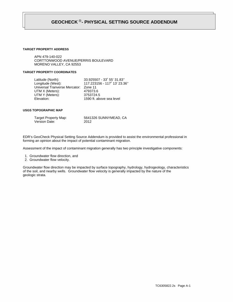
TC6305822.2s Page A-1
geologic strata.of the soil, and nearby wells. Groundwater flow velocity is generally impacted by the nature of theGroundwater flow direction may be impacted by surface topography, hydrology, hydrogeology, characteristics
2. Groundwater flow velocity. 1. Groundwater flow direction, and
Assessment of the impact of contaminant migration generally has two principle investigative components:
forming an opinion about the impact of potential contaminant migration.EDR’s GeoCheck Physical Setting Source Addendum is provided to assist the environmental professional in
2012Version Date:5641326 SUNNYMEAD, CATarget Property Map:
USGS TOPOGRAPHIC MAP
1590 ft. above sea levelElevation:3753724.5UTM Y (Meters): 479373.6UTM X (Meters): Zone 11Universal Tranverse Mercator: 117.223156 - 117˚ 13’ 23.36’’Longitude (West): 33.925507 - 33˚ 55’ 31.83’’Latitude (North):
TARGET PROPERTY COORDINATES
MORENO VALLEY, CA 92553CORTTONWOOD AVENUE/PERRIS BOULEVARDAPN 479-140-022
TARGET PROPERTY ADDRESS
®GEOCHECK - PHYSICAL SETTING SOURCE ADDENDUM®
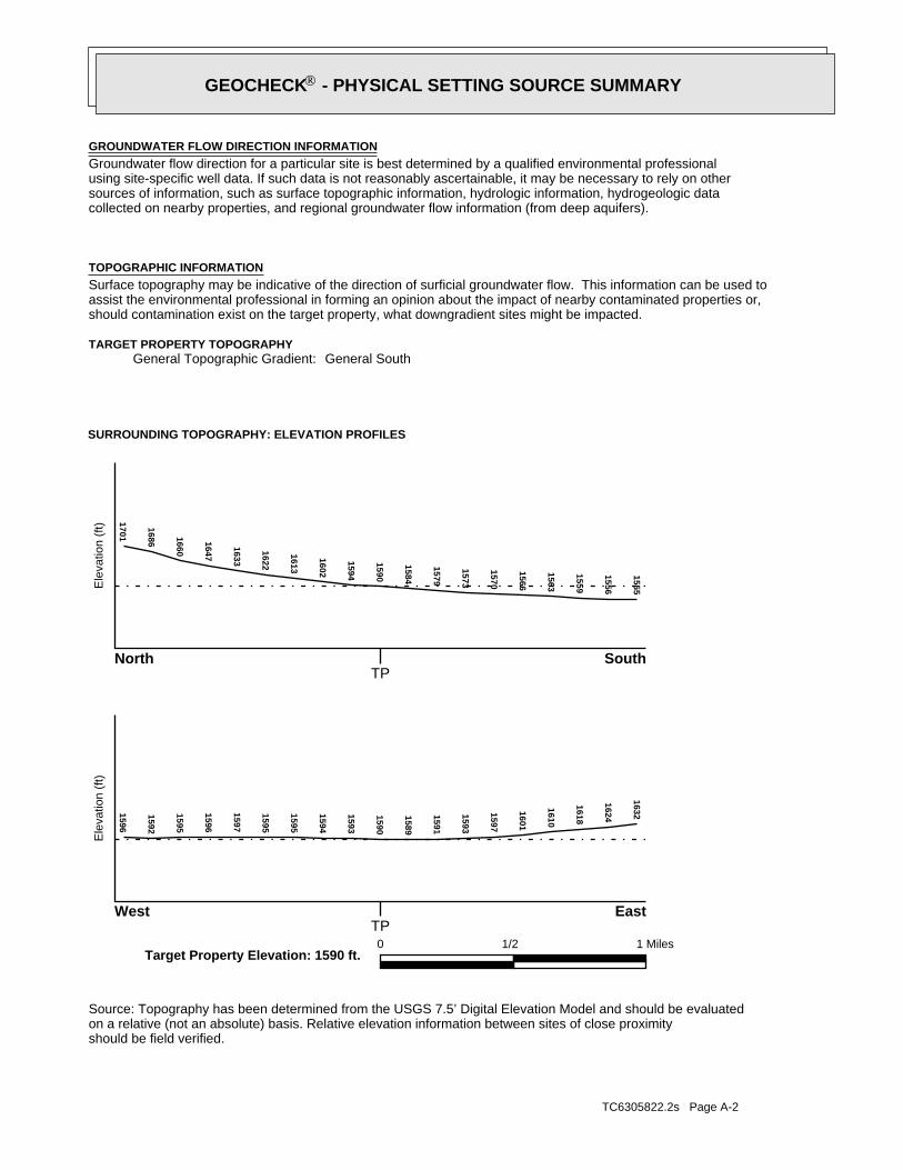
TC6305822.2s Page A-2
should be field verified.on a relative (not an absolute) basis. Relative elevation information between sites of close proximitySource: Topography has been determined from the USGS 7.5’ Digital Elevation Model and should be evaluated
SURROUNDING TOPOGRAPHY: ELEVATION PROFILES
Ele
vatio
n (f
t)E
leva
tion
(ft)
TP
TP0 1/2 1 Miles
✩Target Property Elevation: 1590 ft.
North South
West East
1555
1556
1559
1563
1566
1570
1573
1579
1584
1590
1594
1602
1613
1622
1633
1647
1660
1686
17011596
1592
1595
1596
1597
1595
1595
1594
1593
1590
1589
1591
1593
1597
1601
1610
1618
1624
1632
General SouthGeneral Topographic Gradient:TARGET PROPERTY TOPOGRAPHY
should contamination exist on the target property, what downgradient sites might be impacted.assist the environmental professional in forming an opinion about the impact of nearby contaminated properties or,Surface topography may be indicative of the direction of surficial groundwater flow. This information can be used toTOPOGRAPHIC INFORMATION
collected on nearby properties, and regional groundwater flow information (from deep aquifers).sources of information, such as surface topographic information, hydrologic information, hydrogeologic datausing site-specific well data. If such data is not reasonably ascertainable, it may be necessary to rely on otherGroundwater flow direction for a particular site is best determined by a qualified environmental professionalGROUNDWATER FLOW DIRECTION INFORMATION
®GEOCHECK - PHYSICAL SETTING SOURCE SUMMARY®
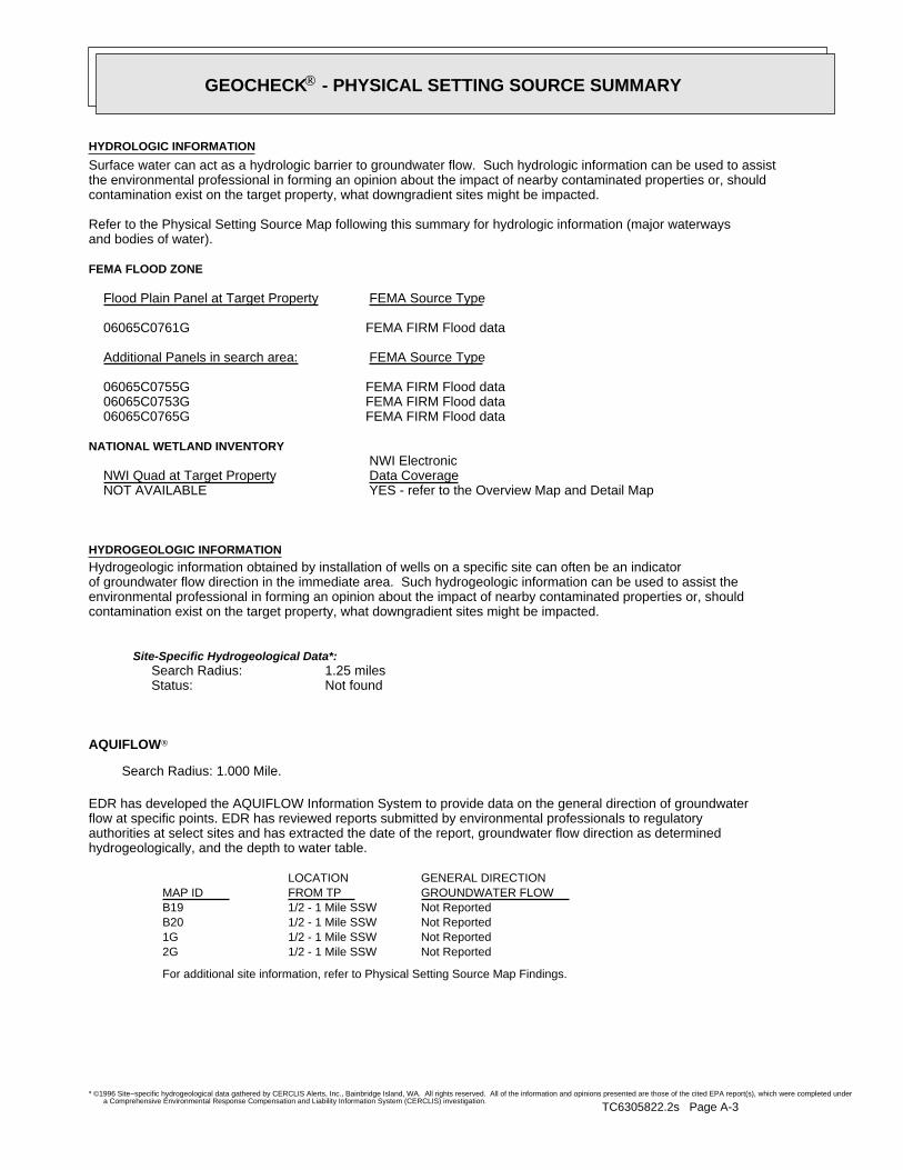
TC6305822.2s Page A-3
For additional site information, refer to Physical Setting Source Map Findings.
Not Reported1/2 - 1 Mile SSW2GNot Reported1/2 - 1 Mile SSW1GNot Reported1/2 - 1 Mile SSWB20Not Reported1/2 - 1 Mile SSWB19
GENERAL DIRECTIONLOCATIONGROUNDWATER FLOWFROM TPMAP ID
hydrogeologically, and the depth to water table.authorities at select sites and has extracted the date of the report, groundwater flow direction as determinedflow at specific points. EDR has reviewed reports submitted by environmental professionals to regulatoryEDR has developed the AQUIFLOW Information System to provide data on the general direction of groundwater
AQUIFLOW®
Search Radius: 1.000 Mile.
Not found Status:1.25 miles Search Radius:
Site-Specific Hydrogeological Data*:
* ©1996 Site−specific hydrogeological data gathered by CERCLIS Alerts, Inc., Bainbridge Island, WA. All rights reserved. All of the information and opinions presented are those of the cited EPA report(s), which were completed undera Comprehensive Environmental Response Compensation and Liability Information System (CERCLIS) investigation.
contamination exist on the target property, what downgradient sites might be impacted.environmental professional in forming an opinion about the impact of nearby contaminated properties or, shouldof groundwater flow direction in the immediate area. Such hydrogeologic information can be used to assist theHydrogeologic information obtained by installation of wells on a specific site can often be an indicatorHYDROGEOLOGIC INFORMATION
YES - refer to the Overview Map and Detail MapNOT AVAILABLE
NATIONAL WETLAND INVENTORYNWI ElectronicData CoverageNWI Quad at Target Property
FEMA FIRM Flood data06065C0765G FEMA FIRM Flood data06065C0753G FEMA FIRM Flood data06065C0755G
Additional Panels in search area: FEMA Source Type
FEMA FIRM Flood data06065C0761G
Flood Plain Panel at Target Property FEMA Source Type
FEMA FLOOD ZONE
and bodies of water).Refer to the Physical Setting Source Map following this summary for hydrologic information (major waterways
contamination exist on the target property, what downgradient sites might be impacted.the environmental professional in forming an opinion about the impact of nearby contaminated properties or, shouldSurface water can act as a hydrologic barrier to groundwater flow. Such hydrologic information can be used to assistHYDROLOGIC INFORMATION
®GEOCHECK - PHYSICAL SETTING SOURCE SUMMARY®
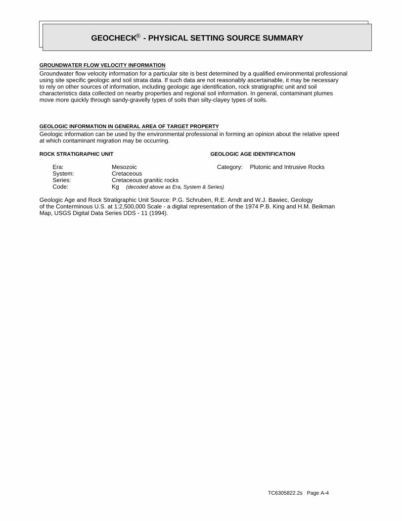
TC6305822.2s Page A-4
Map, USGS Digital Data Series DDS - 11 (1994).of the Conterminous U.S. at 1:2,500,000 Scale - a digital representation of the 1974 P.B. King and H.M. BeikmanGeologic Age and Rock Stratigraphic Unit Source: P.G. Schruben, R.E. Arndt and W.J. Bawiec, Geology
ROCK STRATIGRAPHIC UNIT GEOLOGIC AGE IDENTIFICATION
Plutonic and Intrusive RocksCategory:MesozoicEra:CretaceousSystem:Cretaceous granitic rocksSeries:KgCode: (decoded above as Era, System & Series)
at which contaminant migration may be occurring.Geologic information can be used by the environmental professional in forming an opinion about the relative speedGEOLOGIC INFORMATION IN GENERAL AREA OF TARGET PROPERTY
move more quickly through sandy-gravelly types of soils than silty-clayey types of soils.characteristics data collected on nearby properties and regional soil information. In general, contaminant plumesto rely on other sources of information, including geologic age identification, rock stratigraphic unit and soilusing site specific geologic and soil strata data. If such data are not reasonably ascertainable, it may be necessaryGroundwater flow velocity information for a particular site is best determined by a qualified environmental professionalGROUNDWATER FLOW VELOCITY INFORMATION
®GEOCHECK - PHYSICAL SETTING SOURCE SUMMARY®
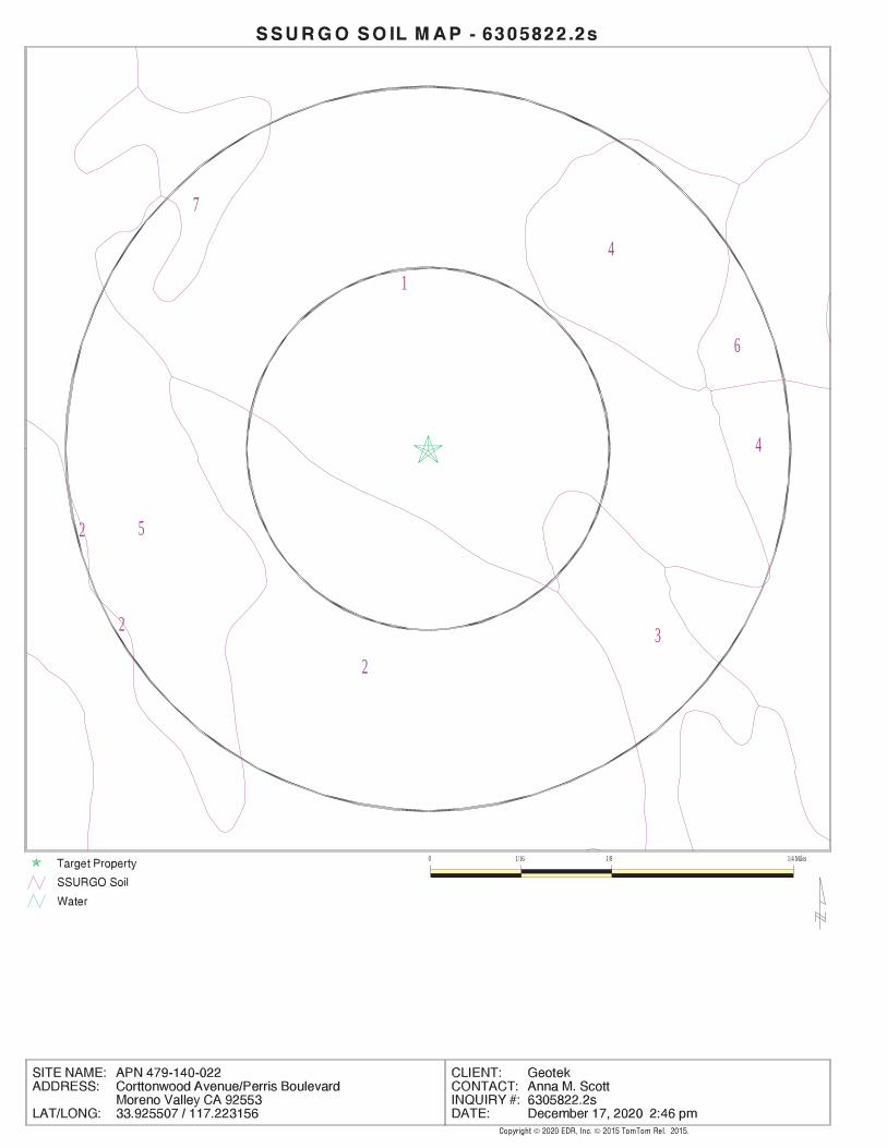
EDR Inc.EDR Inc.EDR Inc.EDR Inc.EDR Inc.EDR Inc.EDR Inc.EDR Inc.EDR Inc.EDR Inc.EDR Inc.EDR Inc.EDR Inc.EDR Inc.EDR Inc.EDR Inc.EDR Inc.EDR Inc.EDR Inc.EDR Inc.EDR Inc.EDR Inc.EDR Inc.EDR Inc.EDR Inc.EDR Inc.EDR Inc.EDR Inc.EDR Inc.EDR Inc.EDR Inc.EDR Inc.EDR Inc.EDR Inc.EDR Inc.EDR Inc.EDR Inc.EDR Inc.EDR Inc.EDR Inc.
1
7
4
6
5
2
4
2
32
0 1/16 1/8 1/4 Miles
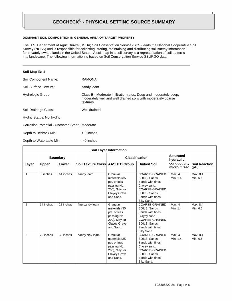
TC6305822.2s Page A-6
Min: 6.6Max: 8.4
Min: 1.4Max: 4
Silty Sand.Sands with fines,SOILS, Sands,COARSE-GRAINEDClayey sand.Sands with fines,SOILS, Sands,COARSE-GRAINED
and Sand.Clayey Gravel200), Silty, orpassing No.pct. or lessmaterials (35Granularsandy clay loam68 inches22 inches 3
Min: 6.6Max: 8.4
Min: 1.4Max: 4
Silty Sand.Sands with fines,SOILS, Sands,COARSE-GRAINEDClayey sand.Sands with fines,SOILS, Sands,COARSE-GRAINED
and Sand.Clayey Gravel200), Silty, orpassing No.pct. or lessmaterials (35Granularfine sandy loam22 inches14 inches 2
Min: 6.6Max: 8.4
Min: 1.4Max: 4
Silty Sand.Sands with fines,SOILS, Sands,COARSE-GRAINEDClayey sand.Sands with fines,SOILS, Sands,COARSE-GRAINED
and Sand.Clayey Gravel200), Silty, orpassing No.pct. or lessmaterials (35Granularsandy loam14 inches 0 inches 1
Soil Layer Information
Boundary Classification Saturatedhydraulicconductivitymicro m/sec
Layer Upper Lower Soil Texture Class AASHTO Group Unified Soil Soil Reaction(pH)
> 0 inchesDepth to Watertable Min:
> 0 inchesDepth to Bedrock Min:
ModerateCorrosion Potential - Uncoated Steel:
Hydric Status: Not hydric
Well drainedSoil Drainage Class:
textures.moderately well and well drained soils with moderately coarseClass B - Moderate infiltration rates. Deep and moderately deep,Hydrologic Group:
sandy loamSoil Surface Texture:
RAMONASoil Component Name:
Soil Map ID: 1
in a landscape. The following information is based on Soil Conservation Service SSURGO data.for privately owned lands in the United States. A soil map in a soil survey is a representation of soil patternsSurvey (NCSS) and is responsible for collecting, storing, maintaining and distributing soil survey informationThe U.S. Department of Agriculture’s (USDA) Soil Conservation Service (SCS) leads the National Cooperative Soil
DOMINANT SOIL COMPOSITION IN GENERAL AREA OF TARGET PROPERTY
®GEOCHECK - PHYSICAL SETTING SOURCE SUMMARY®
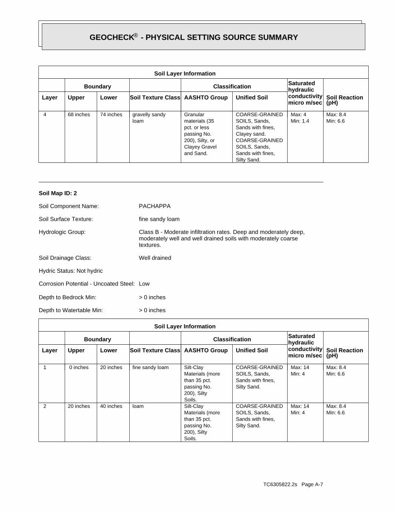
TC6305822.2s Page A-7
Min: 6.6Max: 8.4
Min: 4Max: 14
Silty Sand.Sands with fines,SOILS, Sands,COARSE-GRAINED
Soils.200), Siltypassing No.than 35 pct.Materials (moreSilt-Clayloam40 inches20 inches 2
Min: 6.6Max: 8.4
Min: 4Max: 14
Silty Sand.Sands with fines,SOILS, Sands,COARSE-GRAINED
Soils.200), Siltypassing No.than 35 pct.Materials (moreSilt-Clayfine sandy loam20 inches 0 inches 1
Soil Layer Information
Boundary Classification Saturatedhydraulicconductivitymicro m/sec
Layer Upper Lower Soil Texture Class AASHTO Group Unified Soil Soil Reaction(pH)
> 0 inchesDepth to Watertable Min:
> 0 inchesDepth to Bedrock Min:
LowCorrosion Potential - Uncoated Steel:
Hydric Status: Not hydric
Well drainedSoil Drainage Class:
textures.moderately well and well drained soils with moderately coarseClass B - Moderate infiltration rates. Deep and moderately deep,Hydrologic Group:
fine sandy loamSoil Surface Texture:
PACHAPPASoil Component Name:
Soil Map ID: 2
Min: 6.6Max: 8.4
Min: 1.4Max: 4
Silty Sand.Sands with fines,SOILS, Sands,COARSE-GRAINEDClayey sand.Sands with fines,SOILS, Sands,COARSE-GRAINED
and Sand.Clayey Gravel200), Silty, orpassing No.pct. or lessmaterials (35Granular
loamgravelly sandy74 inches68 inches 4
Soil Layer Information
Boundary Classification Saturatedhydraulicconductivitymicro m/sec
Layer Upper Lower Soil Texture Class AASHTO Group Unified Soil Soil Reaction(pH)
®GEOCHECK - PHYSICAL SETTING SOURCE SUMMARY®
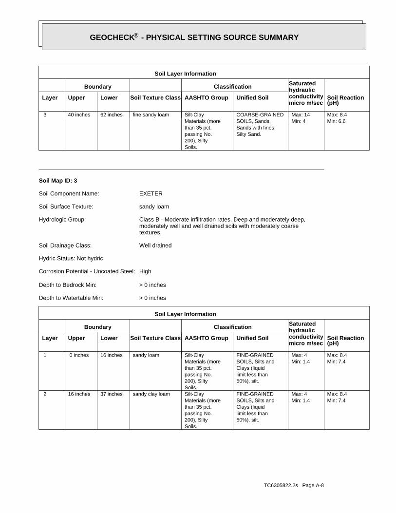
TC6305822.2s Page A-8
Min: 7.4Max: 8.4
Min: 1.4Max: 4
50%), silt.limit less thanClays (liquidSOILS, Silts andFINE-GRAINED
Soils.200), Siltypassing No.than 35 pct.Materials (moreSilt-Claysandy clay loam37 inches16 inches 2
Min: 7.4Max: 8.4
Min: 1.4Max: 4
50%), silt.limit less thanClays (liquidSOILS, Silts andFINE-GRAINED
Soils.200), Siltypassing No.than 35 pct.Materials (moreSilt-Claysandy loam16 inches 0 inches 1
Soil Layer Information
Boundary Classification Saturatedhydraulicconductivitymicro m/sec
Layer Upper Lower Soil Texture Class AASHTO Group Unified Soil Soil Reaction(pH)
> 0 inchesDepth to Watertable Min:
> 0 inchesDepth to Bedrock Min:
HighCorrosion Potential - Uncoated Steel:
Hydric Status: Not hydric
Well drainedSoil Drainage Class:
textures.moderately well and well drained soils with moderately coarseClass B - Moderate infiltration rates. Deep and moderately deep,Hydrologic Group:
sandy loamSoil Surface Texture:
EXETERSoil Component Name:
Soil Map ID: 3
Min: 6.6Max: 8.4
Min: 4Max: 14
Silty Sand.Sands with fines,SOILS, Sands,COARSE-GRAINED
Soils.200), Siltypassing No.than 35 pct.Materials (moreSilt-Clayfine sandy loam62 inches40 inches 3
Soil Layer Information
Boundary Classification Saturatedhydraulicconductivitymicro m/sec
Layer Upper Lower Soil Texture Class AASHTO Group Unified Soil Soil Reaction(pH)
®GEOCHECK - PHYSICAL SETTING SOURCE SUMMARY®
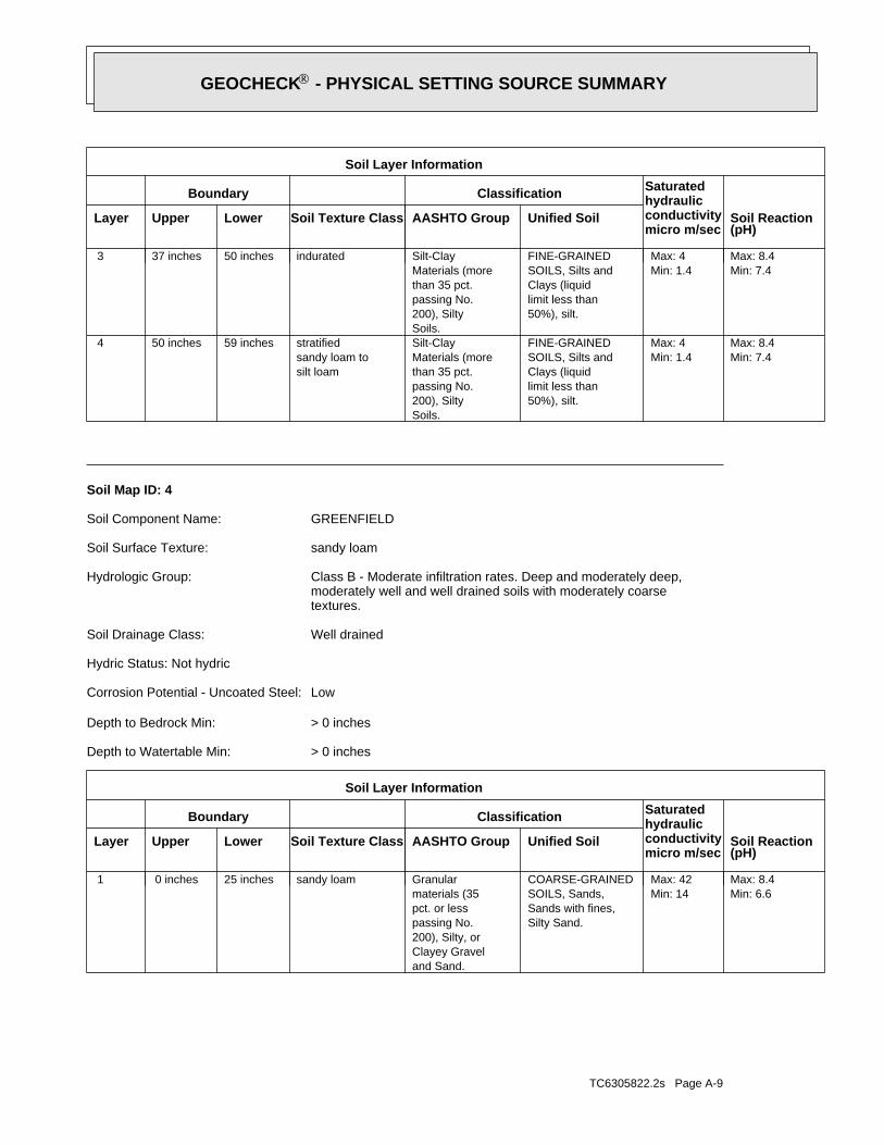
TC6305822.2s Page A-9
Min: 6.6Max: 8.4
Min: 14Max: 42
Silty Sand.Sands with fines,SOILS, Sands,COARSE-GRAINED
and Sand.Clayey Gravel200), Silty, orpassing No.pct. or lessmaterials (35Granularsandy loam25 inches 0 inches 1
Soil Layer Information
Boundary Classification Saturatedhydraulicconductivitymicro m/sec
Layer Upper Lower Soil Texture Class AASHTO Group Unified Soil Soil Reaction(pH)
> 0 inchesDepth to Watertable Min:
> 0 inchesDepth to Bedrock Min:
LowCorrosion Potential - Uncoated Steel:
Hydric Status: Not hydric
Well drainedSoil Drainage Class:
textures.moderately well and well drained soils with moderately coarseClass B - Moderate infiltration rates. Deep and moderately deep,Hydrologic Group:
sandy loamSoil Surface Texture:
GREENFIELDSoil Component Name:
Soil Map ID: 4
Min: 7.4Max: 8.4
Min: 1.4Max: 4
50%), silt.limit less thanClays (liquidSOILS, Silts andFINE-GRAINED
Soils.200), Siltypassing No.than 35 pct.Materials (moreSilt-Clay
silt loamsandy loam tostratified59 inches50 inches 4
Min: 7.4Max: 8.4
Min: 1.4Max: 4
50%), silt.limit less thanClays (liquidSOILS, Silts andFINE-GRAINED
Soils.200), Siltypassing No.than 35 pct.Materials (moreSilt-Clayindurated50 inches37 inches 3
Soil Layer Information
Boundary Classification Saturatedhydraulicconductivitymicro m/sec
Layer Upper Lower Soil Texture Class AASHTO Group Unified Soil Soil Reaction(pH)
®GEOCHECK - PHYSICAL SETTING SOURCE SUMMARY®
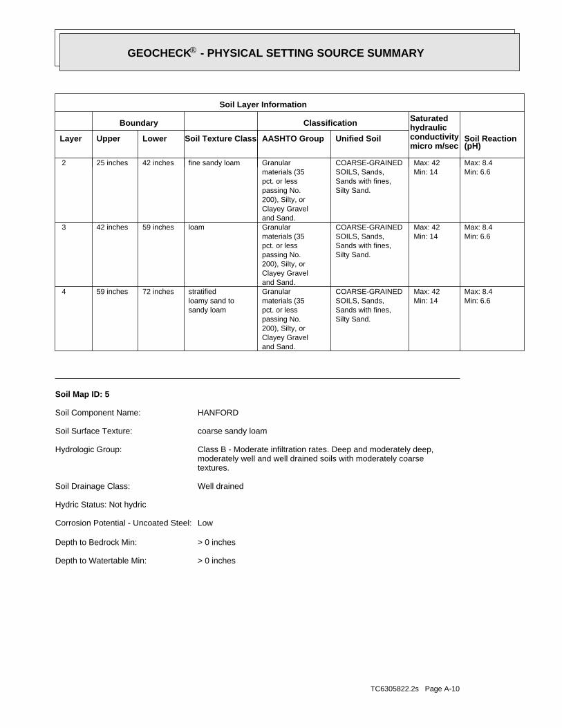
TC6305822.2s Page A-10
> 0 inchesDepth to Watertable Min:
> 0 inchesDepth to Bedrock Min:
LowCorrosion Potential - Uncoated Steel:
Hydric Status: Not hydric
Well drainedSoil Drainage Class:
textures.moderately well and well drained soils with moderately coarseClass B - Moderate infiltration rates. Deep and moderately deep,Hydrologic Group:
coarse sandy loamSoil Surface Texture:
HANFORDSoil Component Name:
Soil Map ID: 5
Min: 6.6Max: 8.4
Min: 14Max: 42
Silty Sand.Sands with fines,SOILS, Sands,COARSE-GRAINED
and Sand.Clayey Gravel200), Silty, orpassing No.pct. or lessmaterials (35Granular
sandy loamloamy sand tostratified72 inches59 inches 4
Min: 6.6Max: 8.4
Min: 14Max: 42
Silty Sand.Sands with fines,SOILS, Sands,COARSE-GRAINED
and Sand.Clayey Gravel200), Silty, orpassing No.pct. or lessmaterials (35Granularloam59 inches42 inches 3
Min: 6.6Max: 8.4
Min: 14Max: 42
Silty Sand.Sands with fines,SOILS, Sands,COARSE-GRAINED
and Sand.Clayey Gravel200), Silty, orpassing No.pct. or lessmaterials (35Granularfine sandy loam42 inches25 inches 2
Soil Layer Information
Boundary Classification Saturatedhydraulicconductivitymicro m/sec
Layer Upper Lower Soil Texture Class AASHTO Group Unified Soil Soil Reaction(pH)
®GEOCHECK - PHYSICAL SETTING SOURCE SUMMARY®
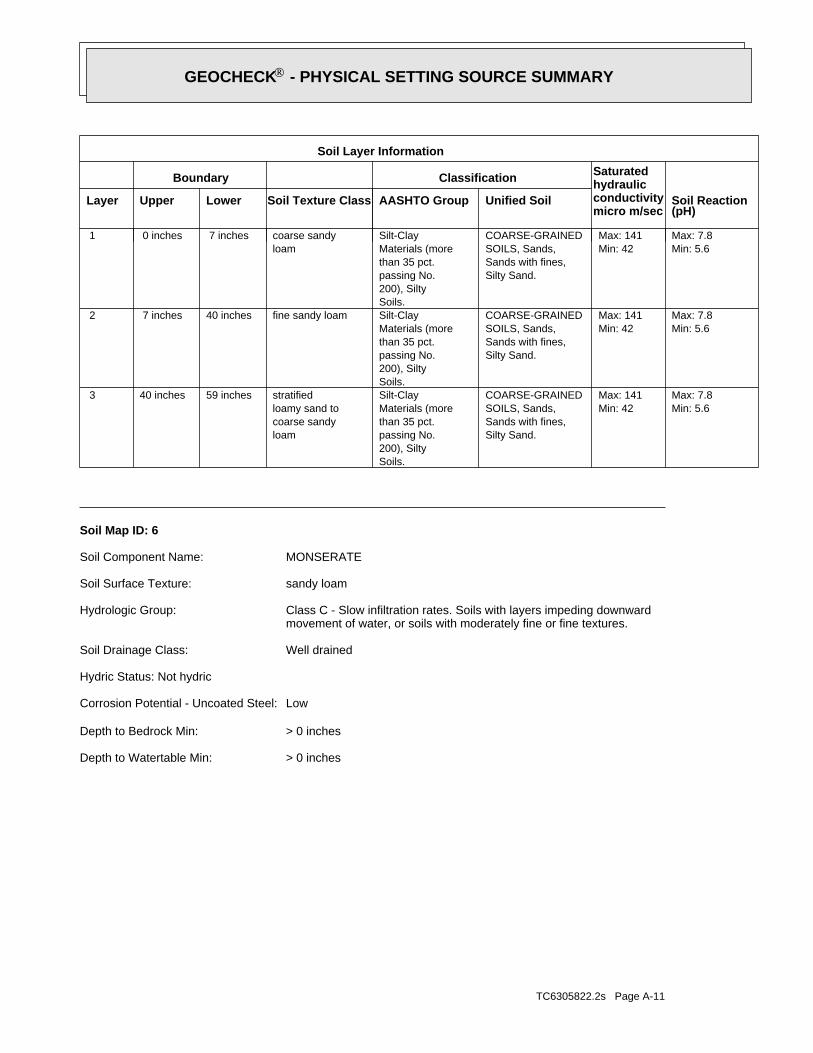
TC6305822.2s Page A-11
> 0 inchesDepth to Watertable Min:
> 0 inchesDepth to Bedrock Min:
LowCorrosion Potential - Uncoated Steel:
Hydric Status: Not hydric
Well drainedSoil Drainage Class:
movement of water, or soils with moderately fine or fine textures.Class C - Slow infiltration rates. Soils with layers impeding downwardHydrologic Group:
sandy loamSoil Surface Texture:
MONSERATESoil Component Name:
Soil Map ID: 6
Min: 5.6Max: 7.8
Min: 42Max: 141
Silty Sand.Sands with fines,SOILS, Sands,COARSE-GRAINED
Soils.200), Siltypassing No.than 35 pct.Materials (moreSilt-Clay
loamcoarse sandyloamy sand tostratified59 inches40 inches 3
Min: 5.6Max: 7.8
Min: 42Max: 141
Silty Sand.Sands with fines,SOILS, Sands,COARSE-GRAINED
Soils.200), Siltypassing No.than 35 pct.Materials (moreSilt-Clayfine sandy loam40 inches 7 inches 2
Min: 5.6Max: 7.8
Min: 42Max: 141
Silty Sand.Sands with fines,SOILS, Sands,COARSE-GRAINED
Soils.200), Siltypassing No.than 35 pct.Materials (moreSilt-Clay
loamcoarse sandy 7 inches 0 inches 1
Soil Layer Information
Boundary Classification Saturatedhydraulicconductivitymicro m/sec
Layer Upper Lower Soil Texture Class AASHTO Group Unified Soil Soil Reaction(pH)
®GEOCHECK - PHYSICAL SETTING SOURCE SUMMARY®
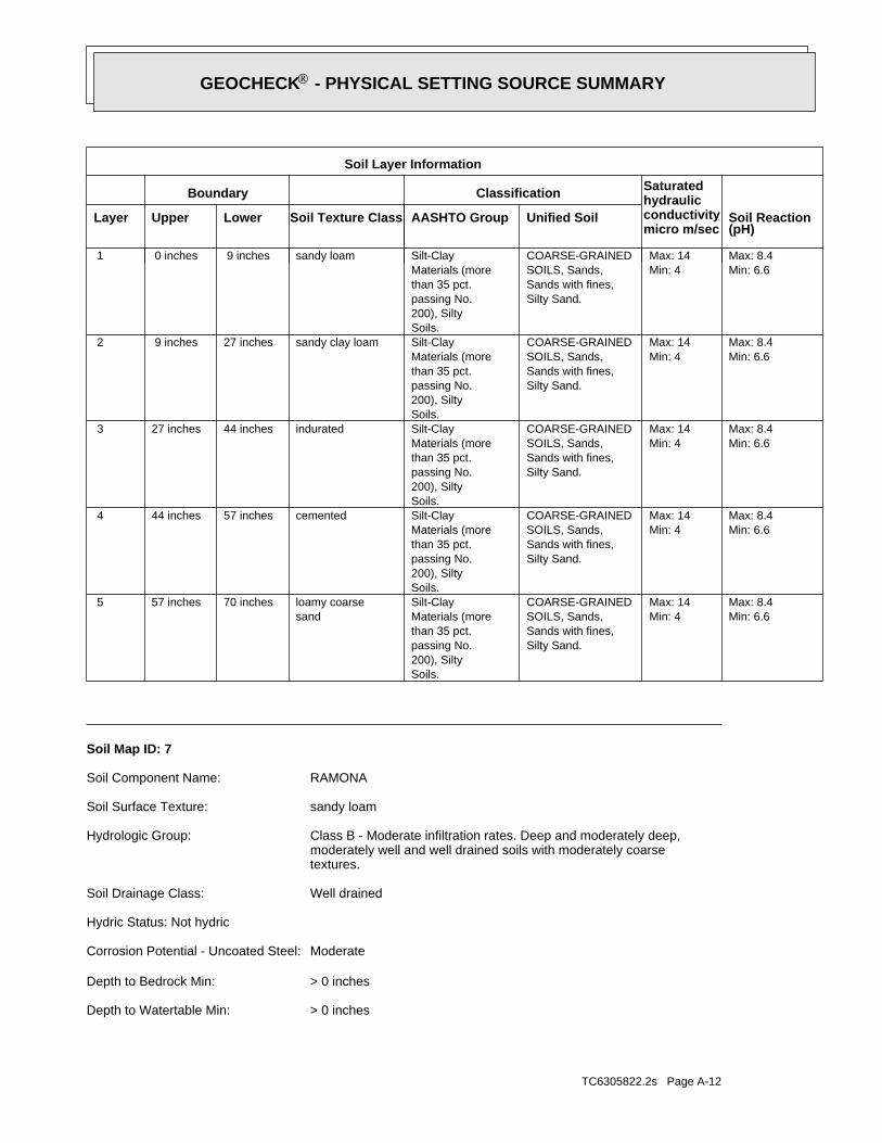
TC6305822.2s Page A-12
> 0 inchesDepth to Watertable Min:
> 0 inchesDepth to Bedrock Min:
ModerateCorrosion Potential - Uncoated Steel:
Hydric Status: Not hydric
Well drainedSoil Drainage Class:
textures.moderately well and well drained soils with moderately coarseClass B - Moderate infiltration rates. Deep and moderately deep,Hydrologic Group:
sandy loamSoil Surface Texture:
RAMONASoil Component Name:
Soil Map ID: 7
Min: 6.6Max: 8.4
Min: 4Max: 14
Silty Sand.Sands with fines,SOILS, Sands,COARSE-GRAINED
Soils.200), Siltypassing No.than 35 pct.Materials (moreSilt-Clay
sandloamy coarse70 inches57 inches 5
Min: 6.6Max: 8.4
Min: 4Max: 14
Silty Sand.Sands with fines,SOILS, Sands,COARSE-GRAINED
Soils.200), Siltypassing No.than 35 pct.Materials (moreSilt-Claycemented57 inches44 inches 4
Min: 6.6Max: 8.4
Min: 4Max: 14
Silty Sand.Sands with fines,SOILS, Sands,COARSE-GRAINED
Soils.200), Siltypassing No.than 35 pct.Materials (moreSilt-Clayindurated44 inches27 inches 3
Min: 6.6Max: 8.4
Min: 4Max: 14
Silty Sand.Sands with fines,SOILS, Sands,COARSE-GRAINED
Soils.200), Siltypassing No.than 35 pct.Materials (moreSilt-Claysandy clay loam27 inches 9 inches 2
Min: 6.6Max: 8.4
Min: 4Max: 14
Silty Sand.Sands with fines,SOILS, Sands,COARSE-GRAINED
Soils.200), Siltypassing No.than 35 pct.Materials (moreSilt-Claysandy loam 9 inches 0 inches 1
Soil Layer Information
Boundary Classification Saturatedhydraulicconductivitymicro m/sec
Layer Upper Lower Soil Texture Class AASHTO Group Unified Soil Soil Reaction(pH)
®GEOCHECK - PHYSICAL SETTING SOURCE SUMMARY®

TC6305822.2s Page A-13
1.000State DatabaseNearest PWS within 1 mileFederal FRDS PWS1.000Federal USGS
WELL SEARCH DISTANCE INFORMATION
SEARCH DISTANCE (miles)DATABASE
opinion about the impact of contaminant migration on nearby drinking water wells.professional in assessing sources that may impact ground water flow direction, and in forming anEDR Local/Regional Water Agency records provide water well information to assist the environmental
LOCAL / REGIONAL WATER AGENCY RECORDS
Min: 6.6Max: 8.4
Min: 1.4Max: 4
Silty Sand.Sands with fines,SOILS, Sands,COARSE-GRAINEDClayey sand.Sands with fines,SOILS, Sands,COARSE-GRAINED
and Sand.Clayey Gravel200), Silty, orpassing No.pct. or lessmaterials (35Granular
loamgravelly sandy74 inches68 inches 4
Min: 6.6Max: 8.4
Min: 1.4Max: 4
Silty Sand.Sands with fines,SOILS, Sands,COARSE-GRAINEDClayey sand.Sands with fines,SOILS, Sands,COARSE-GRAINED
and Sand.Clayey Gravel200), Silty, orpassing No.pct. or lessmaterials (35Granularsandy clay loam68 inches22 inches 3
Min: 6.6Max: 8.4
Min: 1.4Max: 4
Silty Sand.Sands with fines,SOILS, Sands,COARSE-GRAINEDClayey sand.Sands with fines,SOILS, Sands,COARSE-GRAINED
and Sand.Clayey Gravel200), Silty, orpassing No.pct. or lessmaterials (35Granularfine sandy loam22 inches14 inches 2
Min: 6.6Max: 8.4
Min: 1.4Max: 4
Silty Sand.Sands with fines,SOILS, Sands,COARSE-GRAINEDClayey sand.Sands with fines,SOILS, Sands,COARSE-GRAINED
and Sand.Clayey Gravel200), Silty, orpassing No.pct. or lessmaterials (35Granularsandy loam14 inches 0 inches 1
Soil Layer Information
Boundary Classification Saturatedhydraulicconductivitymicro m/sec
Layer Upper Lower Soil Texture Class AASHTO Group Unified Soil Soil Reaction(pH)
®GEOCHECK - PHYSICAL SETTING SOURCE SUMMARY®
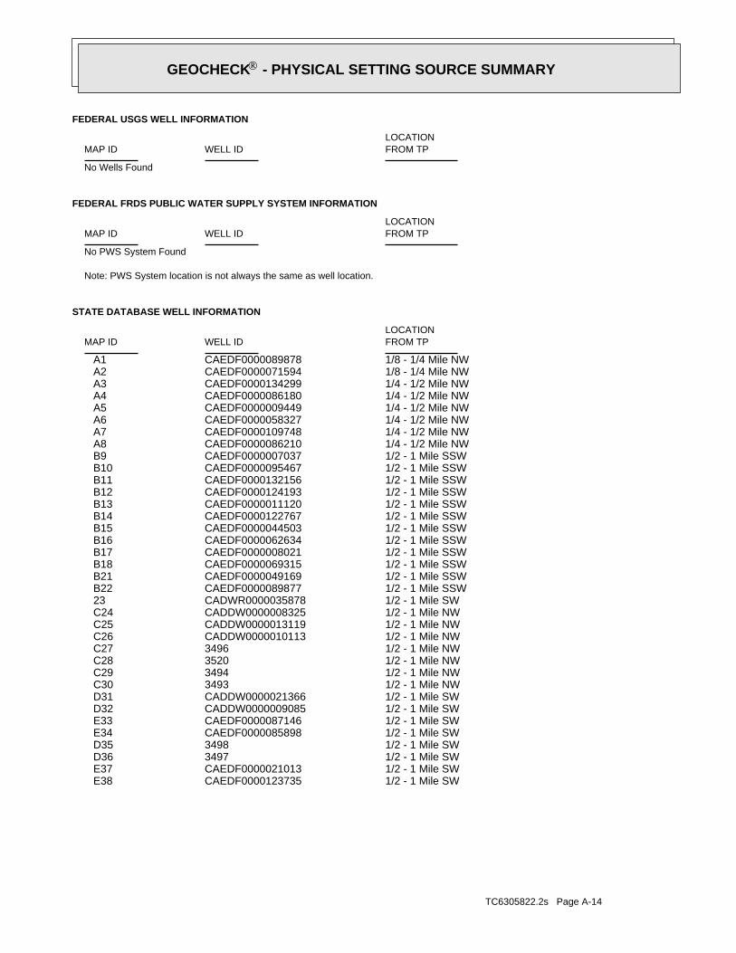
TC6305822.2s Page A-14
1/2 - 1 Mile SWCAEDF0000123735 E381/2 - 1 Mile SWCAEDF0000021013 E371/2 - 1 Mile SW3497 D361/2 - 1 Mile SW3498 D351/2 - 1 Mile SWCAEDF0000085898 E341/2 - 1 Mile SWCAEDF0000087146 E331/2 - 1 Mile SWCADDW0000009085 D321/2 - 1 Mile SWCADDW0000021366 D311/2 - 1 Mile NW3493 C301/2 - 1 Mile NW3494 C291/2 - 1 Mile NW3520 C281/2 - 1 Mile NW3496 C271/2 - 1 Mile NWCADDW0000010113 C261/2 - 1 Mile NWCADDW0000013119 C251/2 - 1 Mile NWCADDW0000008325 C241/2 - 1 Mile SWCADWR0000035878 231/2 - 1 Mile SSWCAEDF0000089877 B221/2 - 1 Mile SSWCAEDF0000049169 B211/2 - 1 Mile SSWCAEDF0000069315 B181/2 - 1 Mile SSWCAEDF0000008021 B171/2 - 1 Mile SSWCAEDF0000062634 B161/2 - 1 Mile SSWCAEDF0000044503 B151/2 - 1 Mile SSWCAEDF0000122767 B141/2 - 1 Mile SSWCAEDF0000011120 B131/2 - 1 Mile SSWCAEDF0000124193 B121/2 - 1 Mile SSWCAEDF0000132156 B111/2 - 1 Mile SSWCAEDF0000095467 B101/2 - 1 Mile SSWCAEDF0000007037 B91/4 - 1/2 Mile NWCAEDF0000086210 A81/4 - 1/2 Mile NWCAEDF0000109748 A71/4 - 1/2 Mile NWCAEDF0000058327 A61/4 - 1/2 Mile NWCAEDF0000009449 A51/4 - 1/2 Mile NWCAEDF0000086180 A41/4 - 1/2 Mile NWCAEDF0000134299 A31/8 - 1/4 Mile NWCAEDF0000071594 A21/8 - 1/4 Mile NWCAEDF0000089878 A1
STATE DATABASE WELL INFORMATION
LOCATIONFROM TPWELL IDMAP ID
Note: PWS System location is not always the same as well location.
No PWS System Found
FEDERAL FRDS PUBLIC WATER SUPPLY SYSTEM INFORMATION
LOCATIONFROM TPWELL IDMAP ID
No Wells Found
FEDERAL USGS WELL INFORMATION
LOCATIONFROM TPWELL IDMAP ID
®GEOCHECK - PHYSICAL SETTING SOURCE SUMMARY®
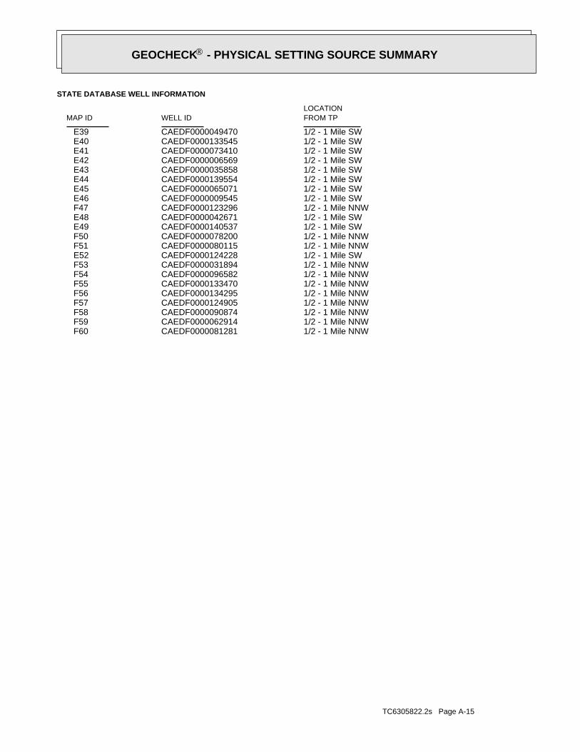
TC6305822.2s Page A-15
1/2 - 1 Mile NNWCAEDF0000081281 F601/2 - 1 Mile NNWCAEDF0000062914 F591/2 - 1 Mile NNWCAEDF0000090874 F581/2 - 1 Mile NNWCAEDF0000124905 F571/2 - 1 Mile NNWCAEDF0000134295 F561/2 - 1 Mile NNWCAEDF0000133470 F551/2 - 1 Mile NNWCAEDF0000096582 F541/2 - 1 Mile NNWCAEDF0000031894 F531/2 - 1 Mile SWCAEDF0000124228 E521/2 - 1 Mile NNWCAEDF0000080115 F511/2 - 1 Mile NNWCAEDF0000078200 F501/2 - 1 Mile SWCAEDF0000140537 E491/2 - 1 Mile SWCAEDF0000042671 E481/2 - 1 Mile NNWCAEDF0000123296 F471/2 - 1 Mile SWCAEDF0000009545 E461/2 - 1 Mile SWCAEDF0000065071 E451/2 - 1 Mile SWCAEDF0000139554 E441/2 - 1 Mile SWCAEDF0000035858 E431/2 - 1 Mile SWCAEDF0000006569 E421/2 - 1 Mile SWCAEDF0000073410 E411/2 - 1 Mile SWCAEDF0000133545 E401/2 - 1 Mile SWCAEDF0000049470 E39
STATE DATABASE WELL INFORMATION
LOCATIONFROM TPWELL IDMAP ID
®GEOCHECK - PHYSICAL SETTING SOURCE SUMMARY®
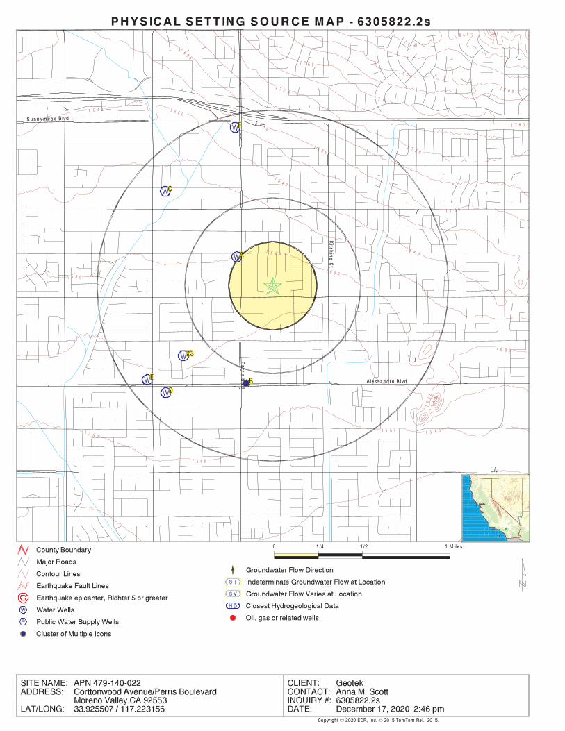
EDR Inc.EDR Inc.EDR Inc.EDR Inc.EDR Inc.EDR Inc.EDR Inc.EDR Inc.EDR Inc.EDR Inc.EDR Inc.EDR Inc.EDR Inc.EDR Inc.EDR Inc.EDR Inc.EDR Inc.EDR Inc.EDR Inc.EDR Inc.EDR Inc.EDR Inc.EDR Inc.EDR Inc.EDR Inc.EDR Inc.EDR Inc.EDR Inc.EDR Inc.EDR Inc.EDR Inc.EDR Inc.EDR Inc.EDR Inc.EDR Inc.EDR Inc.EDR Inc.EDR Inc.EDR Inc.EDR Inc.
20
1
8 40
1 8 4 0
1 8 0 0
1 8 0 0
1 7 6 0
1 7 60
1 7 6 0
1 7 2 0
1 7 2 0
1 6 8 0
1 6 8 0
1 6 8 0
1 6 8 0
1 6 4 0 1 6 4 0
1 6 4 0
1 6 4 0
16
40
1 6 0 0
1 6 0 0
1 6 0 0
16
00
1 6 0 0
1 5 6 0
1 5 6 0
1 5 6 0 1 5 6 0
CA
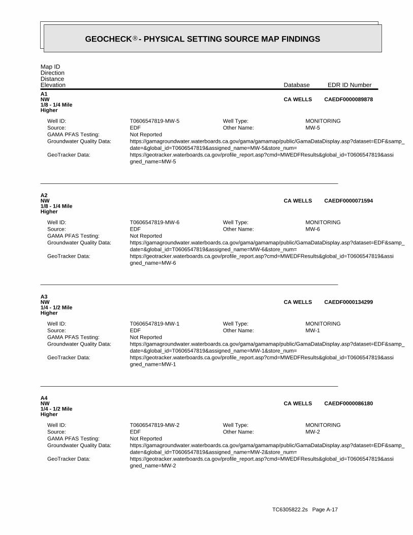
TC6305822.2s Page A-17
gned_name=MW-2 https://geotracker.waterboards.ca.gov/profile_report.asp?cmd=MWEDFResults&global_id=T0606547819&assiGeoTracker Data: date=&global_id=T0606547819&assigned_name=MW-2&store_num= https://gamagroundwater.waterboards.ca.gov/gama/gamamap/public/GamaDataDisplay.asp?dataset=EDF&samp_Groundwater Quality Data: Not ReportedGAMA PFAS Testing:
MW-2Other Name: EDFSource: MONITORINGWell Type: T0606547819-MW-2Well ID:
A4NW1/4 - 1/2 MileHigher
CAEDF0000086180CA WELLS
gned_name=MW-1 https://geotracker.waterboards.ca.gov/profile_report.asp?cmd=MWEDFResults&global_id=T0606547819&assiGeoTracker Data: date=&global_id=T0606547819&assigned_name=MW-1&store_num= https://gamagroundwater.waterboards.ca.gov/gama/gamamap/public/GamaDataDisplay.asp?dataset=EDF&samp_Groundwater Quality Data: Not ReportedGAMA PFAS Testing:
MW-1Other Name: EDFSource: MONITORINGWell Type: T0606547819-MW-1Well ID:
A3NW1/4 - 1/2 MileHigher
CAEDF0000134299CA WELLS
gned_name=MW-6 https://geotracker.waterboards.ca.gov/profile_report.asp?cmd=MWEDFResults&global_id=T0606547819&assiGeoTracker Data: date=&global_id=T0606547819&assigned_name=MW-6&store_num= https://gamagroundwater.waterboards.ca.gov/gama/gamamap/public/GamaDataDisplay.asp?dataset=EDF&samp_Groundwater Quality Data: Not ReportedGAMA PFAS Testing:
MW-6Other Name: EDFSource: MONITORINGWell Type: T0606547819-MW-6Well ID:
A2NW1/8 - 1/4 MileHigher
CAEDF0000071594CA WELLS
gned_name=MW-5 https://geotracker.waterboards.ca.gov/profile_report.asp?cmd=MWEDFResults&global_id=T0606547819&assiGeoTracker Data: date=&global_id=T0606547819&assigned_name=MW-5&store_num= https://gamagroundwater.waterboards.ca.gov/gama/gamamap/public/GamaDataDisplay.asp?dataset=EDF&samp_Groundwater Quality Data: Not ReportedGAMA PFAS Testing:
MW-5Other Name: EDFSource: MONITORINGWell Type: T0606547819-MW-5Well ID:
A1NW1/8 - 1/4 MileHigher
CAEDF0000089878CA WELLS
Map IDDirectionDistanceElevation EDR ID NumberDatabase
®GEOCHECK - PHYSICAL SETTING SOURCE MAP FINDINGS®

TC6305822.2s Page A-18
gned_name=MW-7 https://geotracker.waterboards.ca.gov/profile_report.asp?cmd=MWEDFResults&global_id=T0606547819&assiGeoTracker Data: date=&global_id=T0606547819&assigned_name=MW-7&store_num= https://gamagroundwater.waterboards.ca.gov/gama/gamamap/public/GamaDataDisplay.asp?dataset=EDF&samp_Groundwater Quality Data: Not ReportedGAMA PFAS Testing:
MW-7Other Name: EDFSource: MONITORINGWell Type: T0606547819-MW-7Well ID:
A8NW1/4 - 1/2 MileHigher
CAEDF0000086210CA WELLS
gned_name=MW-3 https://geotracker.waterboards.ca.gov/profile_report.asp?cmd=MWEDFResults&global_id=T0606547819&assiGeoTracker Data: date=&global_id=T0606547819&assigned_name=MW-3&store_num= https://gamagroundwater.waterboards.ca.gov/gama/gamamap/public/GamaDataDisplay.asp?dataset=EDF&samp_Groundwater Quality Data: Not ReportedGAMA PFAS Testing:
MW-3Other Name: EDFSource: MONITORINGWell Type: T0606547819-MW-3Well ID:
A7NW1/4 - 1/2 MileHigher
CAEDF0000109748CA WELLS
gned_name=MW-8 https://geotracker.waterboards.ca.gov/profile_report.asp?cmd=MWEDFResults&global_id=T0606547819&assiGeoTracker Data: date=&global_id=T0606547819&assigned_name=MW-8&store_num= https://gamagroundwater.waterboards.ca.gov/gama/gamamap/public/GamaDataDisplay.asp?dataset=EDF&samp_Groundwater Quality Data: Not ReportedGAMA PFAS Testing:
MW-8Other Name: EDFSource: MONITORINGWell Type: T0606547819-MW-8Well ID:
A6NW1/4 - 1/2 MileHigher
CAEDF0000058327CA WELLS
gned_name=MW-4 https://geotracker.waterboards.ca.gov/profile_report.asp?cmd=MWEDFResults&global_id=T0606547819&assiGeoTracker Data: date=&global_id=T0606547819&assigned_name=MW-4&store_num= https://gamagroundwater.waterboards.ca.gov/gama/gamamap/public/GamaDataDisplay.asp?dataset=EDF&samp_Groundwater Quality Data: Not ReportedGAMA PFAS Testing:
MW-4Other Name: EDFSource: MONITORINGWell Type: T0606547819-MW-4Well ID:
A5NW1/4 - 1/2 MileHigher
CAEDF0000009449CA WELLS
Map IDDirectionDistanceElevation EDR ID NumberDatabase
®GEOCHECK - PHYSICAL SETTING SOURCE MAP FINDINGS®
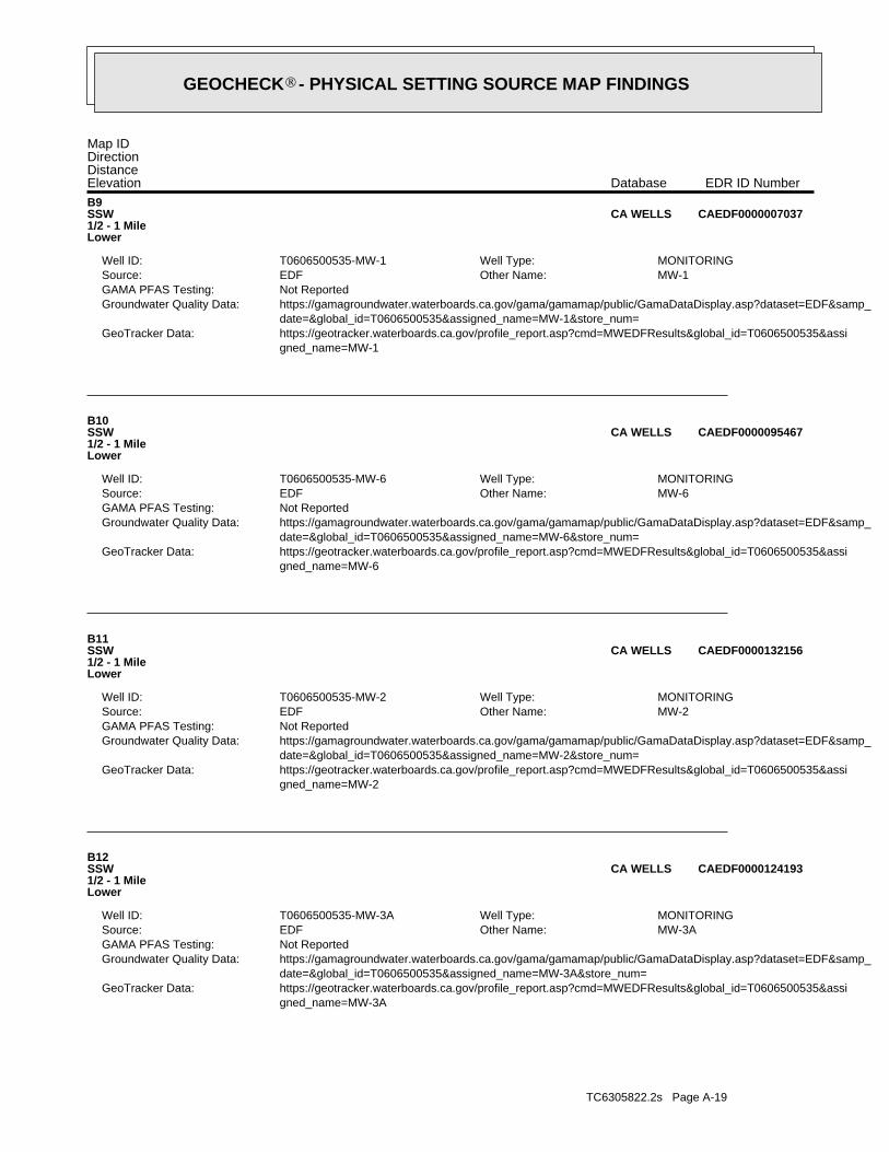
TC6305822.2s Page A-19
gned_name=MW-3A https://geotracker.waterboards.ca.gov/profile_report.asp?cmd=MWEDFResults&global_id=T0606500535&assiGeoTracker Data: date=&global_id=T0606500535&assigned_name=MW-3A&store_num= https://gamagroundwater.waterboards.ca.gov/gama/gamamap/public/GamaDataDisplay.asp?dataset=EDF&samp_Groundwater Quality Data: Not ReportedGAMA PFAS Testing:
MW-3AOther Name: EDFSource: MONITORINGWell Type: T0606500535-MW-3AWell ID:
B12SSW1/2 - 1 MileLower
CAEDF0000124193CA WELLS
gned_name=MW-2 https://geotracker.waterboards.ca.gov/profile_report.asp?cmd=MWEDFResults&global_id=T0606500535&assiGeoTracker Data: date=&global_id=T0606500535&assigned_name=MW-2&store_num= https://gamagroundwater.waterboards.ca.gov/gama/gamamap/public/GamaDataDisplay.asp?dataset=EDF&samp_Groundwater Quality Data: Not ReportedGAMA PFAS Testing:
MW-2Other Name: EDFSource: MONITORINGWell Type: T0606500535-MW-2Well ID:
B11SSW1/2 - 1 MileLower
CAEDF0000132156CA WELLS
gned_name=MW-6 https://geotracker.waterboards.ca.gov/profile_report.asp?cmd=MWEDFResults&global_id=T0606500535&assiGeoTracker Data: date=&global_id=T0606500535&assigned_name=MW-6&store_num= https://gamagroundwater.waterboards.ca.gov/gama/gamamap/public/GamaDataDisplay.asp?dataset=EDF&samp_Groundwater Quality Data: Not ReportedGAMA PFAS Testing:
MW-6Other Name: EDFSource: MONITORINGWell Type: T0606500535-MW-6Well ID:
B10SSW1/2 - 1 MileLower
CAEDF0000095467CA WELLS
gned_name=MW-1 https://geotracker.waterboards.ca.gov/profile_report.asp?cmd=MWEDFResults&global_id=T0606500535&assiGeoTracker Data: date=&global_id=T0606500535&assigned_name=MW-1&store_num= https://gamagroundwater.waterboards.ca.gov/gama/gamamap/public/GamaDataDisplay.asp?dataset=EDF&samp_Groundwater Quality Data: Not ReportedGAMA PFAS Testing:
MW-1Other Name: EDFSource: MONITORINGWell Type: T0606500535-MW-1Well ID:
B9SSW1/2 - 1 MileLower
CAEDF0000007037CA WELLS
Map IDDirectionDistanceElevation EDR ID NumberDatabase
®GEOCHECK - PHYSICAL SETTING SOURCE MAP FINDINGS®

TC6305822.2s Page A-20
gned_name=MW-9 https://geotracker.waterboards.ca.gov/profile_report.asp?cmd=MWEDFResults&global_id=T0606500535&assiGeoTracker Data: date=&global_id=T0606500535&assigned_name=MW-9&store_num= https://gamagroundwater.waterboards.ca.gov/gama/gamamap/public/GamaDataDisplay.asp?dataset=EDF&samp_Groundwater Quality Data: Not ReportedGAMA PFAS Testing:
MW-9Other Name: EDFSource: MONITORINGWell Type: T0606500535-MW-9Well ID:
B16SSW1/2 - 1 MileLower
CAEDF0000062634CA WELLS
gned_name=MW-5A https://geotracker.waterboards.ca.gov/profile_report.asp?cmd=MWEDFResults&global_id=T0606500535&assiGeoTracker Data: date=&global_id=T0606500535&assigned_name=MW-5A&store_num= https://gamagroundwater.waterboards.ca.gov/gama/gamamap/public/GamaDataDisplay.asp?dataset=EDF&samp_Groundwater Quality Data: Not ReportedGAMA PFAS Testing:
MW-5AOther Name: EDFSource: MONITORINGWell Type: T0606500535-MW-5AWell ID:
B15SSW1/2 - 1 MileLower
CAEDF0000044503CA WELLS
gned_name=MW-5 https://geotracker.waterboards.ca.gov/profile_report.asp?cmd=MWEDFResults&global_id=T0606500535&assiGeoTracker Data: date=&global_id=T0606500535&assigned_name=MW-5&store_num= https://gamagroundwater.waterboards.ca.gov/gama/gamamap/public/GamaDataDisplay.asp?dataset=EDF&samp_Groundwater Quality Data: Not ReportedGAMA PFAS Testing:
MW-5Other Name: EDFSource: MONITORINGWell Type: T0606500535-MW-5Well ID:
B14SSW1/2 - 1 MileLower
CAEDF0000122767CA WELLS
gned_name=MW-3 https://geotracker.waterboards.ca.gov/profile_report.asp?cmd=MWEDFResults&global_id=T0606500535&assiGeoTracker Data: date=&global_id=T0606500535&assigned_name=MW-3&store_num= https://gamagroundwater.waterboards.ca.gov/gama/gamamap/public/GamaDataDisplay.asp?dataset=EDF&samp_Groundwater Quality Data: Not ReportedGAMA PFAS Testing:
MW-3Other Name: EDFSource: MONITORINGWell Type: T0606500535-MW-3Well ID:
B13SSW1/2 - 1 MileLower
CAEDF0000011120CA WELLS
Map IDDirectionDistanceElevation EDR ID NumberDatabase
®GEOCHECK - PHYSICAL SETTING SOURCE MAP FINDINGS®
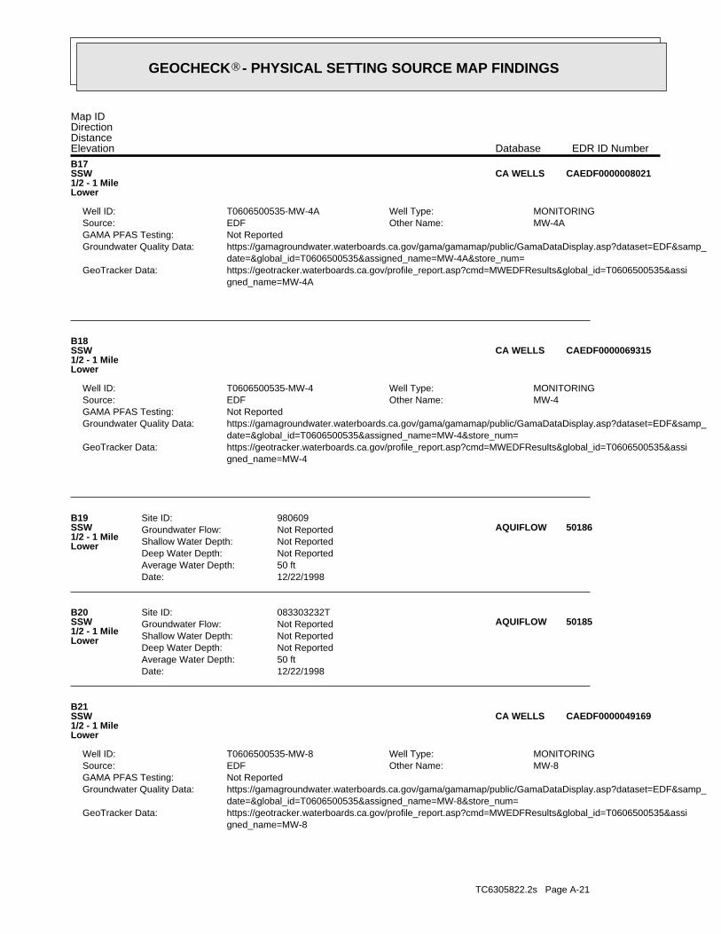
TC6305822.2s Page A-21
gned_name=MW-8 https://geotracker.waterboards.ca.gov/profile_report.asp?cmd=MWEDFResults&global_id=T0606500535&assiGeoTracker Data: date=&global_id=T0606500535&assigned_name=MW-8&store_num= https://gamagroundwater.waterboards.ca.gov/gama/gamamap/public/GamaDataDisplay.asp?dataset=EDF&samp_Groundwater Quality Data: Not ReportedGAMA PFAS Testing:
MW-8Other Name: EDFSource: MONITORINGWell Type: T0606500535-MW-8Well ID:
B21SSW1/2 - 1 MileLower
CAEDF0000049169CA WELLS
Date: 12/22/1998Average Water Depth: 50 ftDeep Water Depth: Not ReportedShallow Water Depth: Not ReportedGroundwater Flow: Not ReportedSite ID: 083303232TB20
SSW1/2 - 1 MileLower
50185AQUIFLOW
Date: 12/22/1998Average Water Depth: 50 ftDeep Water Depth: Not ReportedShallow Water Depth: Not ReportedGroundwater Flow: Not ReportedSite ID: 980609B19
SSW1/2 - 1 MileLower
50186AQUIFLOW
gned_name=MW-4 https://geotracker.waterboards.ca.gov/profile_report.asp?cmd=MWEDFResults&global_id=T0606500535&assiGeoTracker Data: date=&global_id=T0606500535&assigned_name=MW-4&store_num= https://gamagroundwater.waterboards.ca.gov/gama/gamamap/public/GamaDataDisplay.asp?dataset=EDF&samp_Groundwater Quality Data: Not ReportedGAMA PFAS Testing:
MW-4Other Name: EDFSource: MONITORINGWell Type: T0606500535-MW-4Well ID:
B18SSW1/2 - 1 MileLower
CAEDF0000069315CA WELLS
gned_name=MW-4A https://geotracker.waterboards.ca.gov/profile_report.asp?cmd=MWEDFResults&global_id=T0606500535&assiGeoTracker Data: date=&global_id=T0606500535&assigned_name=MW-4A&store_num= https://gamagroundwater.waterboards.ca.gov/gama/gamamap/public/GamaDataDisplay.asp?dataset=EDF&samp_Groundwater Quality Data: Not ReportedGAMA PFAS Testing:
MW-4AOther Name: EDFSource: MONITORINGWell Type: T0606500535-MW-4AWell ID:
B17SSW1/2 - 1 MileLower
CAEDF0000008021CA WELLS
Map IDDirectionDistanceElevation EDR ID NumberDatabase
®GEOCHECK - PHYSICAL SETTING SOURCE MAP FINDINGS®
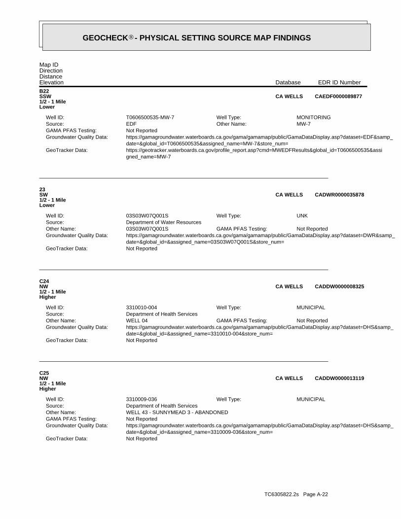
TC6305822.2s Page A-22
Not ReportedGeoTracker Data: date=&global_id=&assigned_name=3310009-036&store_num= https://gamagroundwater.waterboards.ca.gov/gama/gamamap/public/GamaDataDisplay.asp?dataset=DHS&samp_Groundwater Quality Data: Not ReportedGAMA PFAS Testing: WELL 43 - SUNNYMEAD 3 - ABANDONEDOther Name: Department of Health ServicesSource:
MUNICIPALWell Type: 3310009-036Well ID:
C25NW1/2 - 1 MileHigher
CADDW0000013119CA WELLS
Not ReportedGeoTracker Data: date=&global_id=&assigned_name=3310010-004&store_num= https://gamagroundwater.waterboards.ca.gov/gama/gamamap/public/GamaDataDisplay.asp?dataset=DHS&samp_Groundwater Quality Data:
Not ReportedGAMA PFAS Testing: WELL 04Other Name: Department of Health ServicesSource:
MUNICIPALWell Type: 3310010-004Well ID:
C24NW1/2 - 1 MileHigher
CADDW0000008325CA WELLS
Not ReportedGeoTracker Data: date=&global_id=&assigned_name=03S03W07Q001S&store_num= https://gamagroundwater.waterboards.ca.gov/gama/gamamap/public/GamaDataDisplay.asp?dataset=DWR&samp_Groundwater Quality Data:
Not ReportedGAMA PFAS Testing: 03S03W07Q001SOther Name: Department of Water ResourcesSource:
UNKWell Type: 03S03W07Q001SWell ID:
23SW1/2 - 1 MileLower
CADWR0000035878CA WELLS
gned_name=MW-7 https://geotracker.waterboards.ca.gov/profile_report.asp?cmd=MWEDFResults&global_id=T0606500535&assiGeoTracker Data: date=&global_id=T0606500535&assigned_name=MW-7&store_num= https://gamagroundwater.waterboards.ca.gov/gama/gamamap/public/GamaDataDisplay.asp?dataset=EDF&samp_Groundwater Quality Data: Not ReportedGAMA PFAS Testing:
MW-7Other Name: EDFSource: MONITORINGWell Type: T0606500535-MW-7Well ID:
B22SSW1/2 - 1 MileLower
CAEDF0000089877CA WELLS
Map IDDirectionDistanceElevation EDR ID NumberDatabase
®GEOCHECK - PHYSICAL SETTING SOURCE MAP FINDINGS®
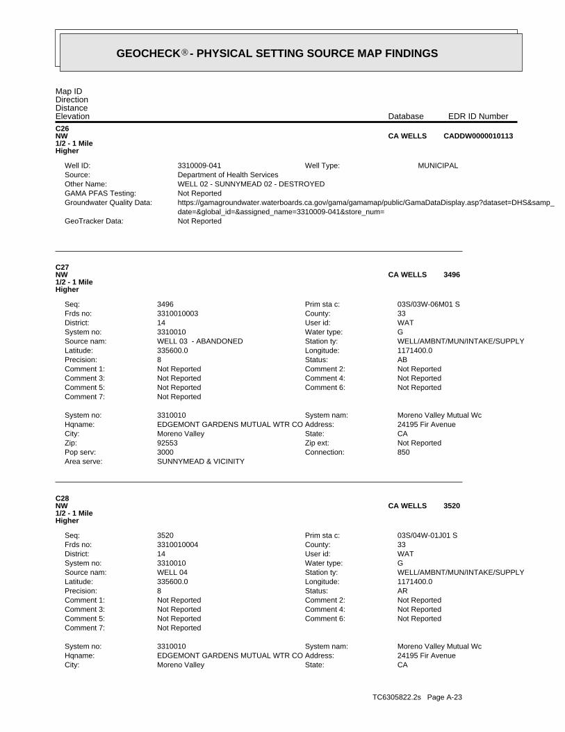
TC6305822.2s Page A-23
CAState:Moreno ValleyCity:24195 Fir AvenueAddress:EDGEMONT GARDENS MUTUAL WTR COHqname:Moreno Valley Mutual WcSystem nam:3310010System no:
Not ReportedComment 7:Not ReportedComment 6:Not ReportedComment 5:Not ReportedComment 4:Not ReportedComment 3:Not ReportedComment 2:Not ReportedComment 1:ARStatus:8Precision:1171400.0Longitude:335600.0Latitude:WELL/AMBNT/MUN/INTAKE/SUPPLYStation ty:WELL 04Source nam:GWater type:3310010System no:WATUser id:14District:33County:3310010004Frds no:03S/04W-01J01 SPrim sta c:3520Seq:
C28NW1/2 - 1 MileHigher
3520CA WELLS
SUNNYMEAD & VICINITYArea serve:850Connection:3000Pop serv:Not ReportedZip ext:92553Zip:CAState:Moreno ValleyCity:24195 Fir AvenueAddress:EDGEMONT GARDENS MUTUAL WTR COHqname:Moreno Valley Mutual WcSystem nam:3310010System no:
Not ReportedComment 7:Not ReportedComment 6:Not ReportedComment 5:Not ReportedComment 4:Not ReportedComment 3:Not ReportedComment 2:Not ReportedComment 1:ABStatus:8Precision:1171400.0Longitude:335600.0Latitude:WELL/AMBNT/MUN/INTAKE/SUPPLYStation ty:WELL 03 - ABANDONEDSource nam:GWater type:3310010System no:WATUser id:14District:33County:3310010003Frds no:03S/03W-06M01 SPrim sta c:3496Seq:
C27NW1/2 - 1 MileHigher
3496CA WELLS
Not ReportedGeoTracker Data: date=&global_id=&assigned_name=3310009-041&store_num= https://gamagroundwater.waterboards.ca.gov/gama/gamamap/public/GamaDataDisplay.asp?dataset=DHS&samp_Groundwater Quality Data: Not ReportedGAMA PFAS Testing: WELL 02 - SUNNYMEAD 02 - DESTROYEDOther Name: Department of Health ServicesSource:
MUNICIPALWell Type: 3310009-041Well ID:
C26NW1/2 - 1 MileHigher
CADDW0000010113CA WELLS
Map IDDirectionDistanceElevation EDR ID NumberDatabase
®GEOCHECK - PHYSICAL SETTING SOURCE MAP FINDINGS®
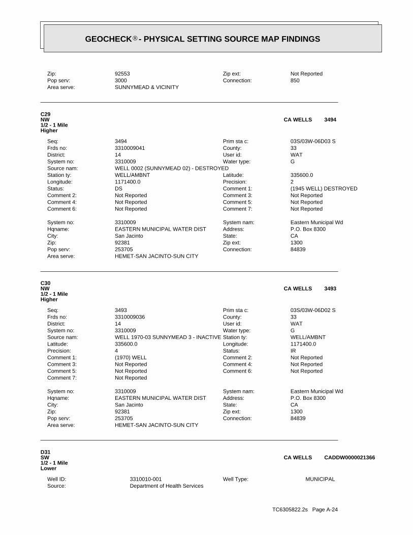
TC6305822.2s Page A-24
Department of Health ServicesSource: MUNICIPALWell Type: 3310010-001Well ID:
D31SW1/2 - 1 MileLower
CADDW0000021366CA WELLS
HEMET-SAN JACINTO-SUN CITYArea serve:84839Connection:253705Pop serv:1300Zip ext:92381Zip:CAState:San JacintoCity:P.O. Box 8300Address:EASTERN MUNICIPAL WATER DISTHqname:Eastern Municipal WdSystem nam:3310009System no:
Not ReportedComment 7:Not ReportedComment 6:Not ReportedComment 5:Not ReportedComment 4:Not ReportedComment 3:Not ReportedComment 2:(1970) WELLComment 1:IRStatus:4Precision:1171400.0Longitude:335600.0Latitude:WELL/AMBNTStation ty:WELL 1970-03 SUNNYMEAD 3 - INACTIVESource nam:GWater type:3310009System no:WATUser id:14District:33County:3310009036Frds no:03S/03W-06D02 SPrim sta c:3493Seq:
C30NW1/2 - 1 MileHigher
3493CA WELLS
HEMET-SAN JACINTO-SUN CITYArea serve:84839Connection:253705Pop serv:1300Zip ext:92381Zip:CAState:San JacintoCity:P.O. Box 8300Address:EASTERN MUNICIPAL WATER DISTHqname:Eastern Municipal WdSystem nam:3310009System no:
Not ReportedComment 7:Not ReportedComment 6:Not ReportedComment 5:Not ReportedComment 4:Not ReportedComment 3:Not ReportedComment 2:(1945 WELL) DESTROYEDComment 1:DSStatus:2Precision:1171400.0Longitude:335600.0Latitude:WELL/AMBNTStation ty:
WELL 0002 (SUNNYMEAD 02) - DESTROYEDSource nam:GWater type:3310009System no:WATUser id:14District:33County:3310009041Frds no:03S/03W-06D03 SPrim sta c:3494Seq:
C29NW1/2 - 1 MileHigher
3494CA WELLS
SUNNYMEAD & VICINITYArea serve:850Connection:3000Pop serv:Not ReportedZip ext:92553Zip:
®GEOCHECK - PHYSICAL SETTING SOURCE MAP FINDINGS®
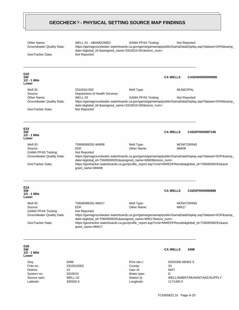
TC6305822.2s Page A-25
1171400.0Longitude:335500.0Latitude:WELL/AMBNT/MUN/INTAKE/SUPPLYStation ty:WELL 02Source nam:GWater type:3310010System no:WATUser id:14District:33County:3310010002Frds no:03S/03W-06N03 SPrim sta c:3498Seq:
D35SW1/2 - 1 MileLower
3498CA WELLS
gned_name=MW17 https://geotracker.waterboards.ca.gov/profile_report.asp?cmd=MWEDFResults&global_id=T0606599291&assiGeoTracker Data: date=&global_id=T0606599291&assigned_name=MW17&store_num= https://gamagroundwater.waterboards.ca.gov/gama/gamamap/public/GamaDataDisplay.asp?dataset=EDF&samp_Groundwater Quality Data: Not ReportedGAMA PFAS Testing:
MW17Other Name: EDFSource: MONITORINGWell Type: T0606599291-MW17Well ID:
E34SW1/2 - 1 MileLower
CAEDF0000085898CA WELLS
gned_name=MW08 https://geotracker.waterboards.ca.gov/profile_report.asp?cmd=MWEDFResults&global_id=T0606599291&assiGeoTracker Data: date=&global_id=T0606599291&assigned_name=MW08&store_num= https://gamagroundwater.waterboards.ca.gov/gama/gamamap/public/GamaDataDisplay.asp?dataset=EDF&samp_Groundwater Quality Data: Not ReportedGAMA PFAS Testing:
MW08Other Name: EDFSource: MONITORINGWell Type: T0606599291-MW08Well ID:
E33SW1/2 - 1 MileLower
CAEDF0000087146CA WELLS
Not ReportedGeoTracker Data: date=&global_id=&assigned_name=3310010-002&store_num= https://gamagroundwater.waterboards.ca.gov/gama/gamamap/public/GamaDataDisplay.asp?dataset=DHS&samp_Groundwater Quality Data:
Not ReportedGAMA PFAS Testing: WELL 02Other Name: Department of Health ServicesSource:
MUNICIPALWell Type: 3310010-002Well ID:
D32SW1/2 - 1 MileLower
CADDW0000009085CA WELLS
Not ReportedGeoTracker Data: date=&global_id=&assigned_name=3310010-001&store_num= https://gamagroundwater.waterboards.ca.gov/gama/gamamap/public/GamaDataDisplay.asp?dataset=DHS&samp_Groundwater Quality Data:
Not ReportedGAMA PFAS Testing: WELL 01 - ABANDONEDOther Name:
®GEOCHECK - PHYSICAL SETTING SOURCE MAP FINDINGS®
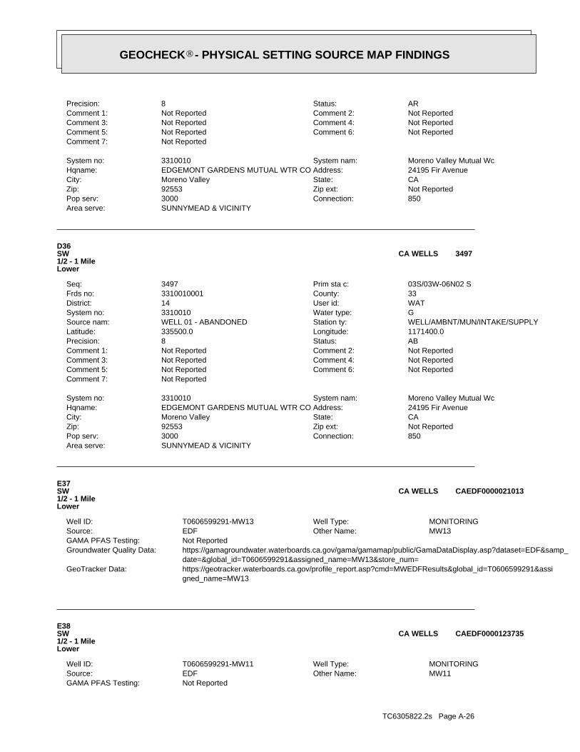
TC6305822.2s Page A-26
Not ReportedGAMA PFAS Testing: MW11Other Name: EDFSource: MONITORINGWell Type: T0606599291-MW11Well ID:
E38SW1/2 - 1 MileLower
CAEDF0000123735CA WELLS
gned_name=MW13 https://geotracker.waterboards.ca.gov/profile_report.asp?cmd=MWEDFResults&global_id=T0606599291&assiGeoTracker Data: date=&global_id=T0606599291&assigned_name=MW13&store_num= https://gamagroundwater.waterboards.ca.gov/gama/gamamap/public/GamaDataDisplay.asp?dataset=EDF&samp_Groundwater Quality Data: Not ReportedGAMA PFAS Testing:
MW13Other Name: EDFSource: MONITORINGWell Type: T0606599291-MW13Well ID:
E37SW1/2 - 1 MileLower
CAEDF0000021013CA WELLS
SUNNYMEAD & VICINITYArea serve:850Connection:3000Pop serv:Not ReportedZip ext:92553Zip:CAState:Moreno ValleyCity:24195 Fir AvenueAddress:EDGEMONT GARDENS MUTUAL WTR COHqname:Moreno Valley Mutual WcSystem nam:3310010System no:
Not ReportedComment 7:Not ReportedComment 6:Not ReportedComment 5:Not ReportedComment 4:Not ReportedComment 3:Not ReportedComment 2:Not ReportedComment 1:ABStatus:8Precision:1171400.0Longitude:335500.0Latitude:WELL/AMBNT/MUN/INTAKE/SUPPLYStation ty:WELL 01 - ABANDONEDSource nam:GWater type:3310010System no:WATUser id:14District:33County:3310010001Frds no:03S/03W-06N02 SPrim sta c:3497Seq:
D36SW1/2 - 1 MileLower
3497CA WELLS
SUNNYMEAD & VICINITYArea serve:850Connection:3000Pop serv:Not ReportedZip ext:92553Zip:CAState:Moreno ValleyCity:24195 Fir AvenueAddress:EDGEMONT GARDENS MUTUAL WTR COHqname:Moreno Valley Mutual WcSystem nam:3310010System no:
Not ReportedComment 7:Not ReportedComment 6:Not ReportedComment 5:Not ReportedComment 4:Not ReportedComment 3:Not ReportedComment 2:Not ReportedComment 1:ARStatus:8Precision:
®GEOCHECK - PHYSICAL SETTING SOURCE MAP FINDINGS®
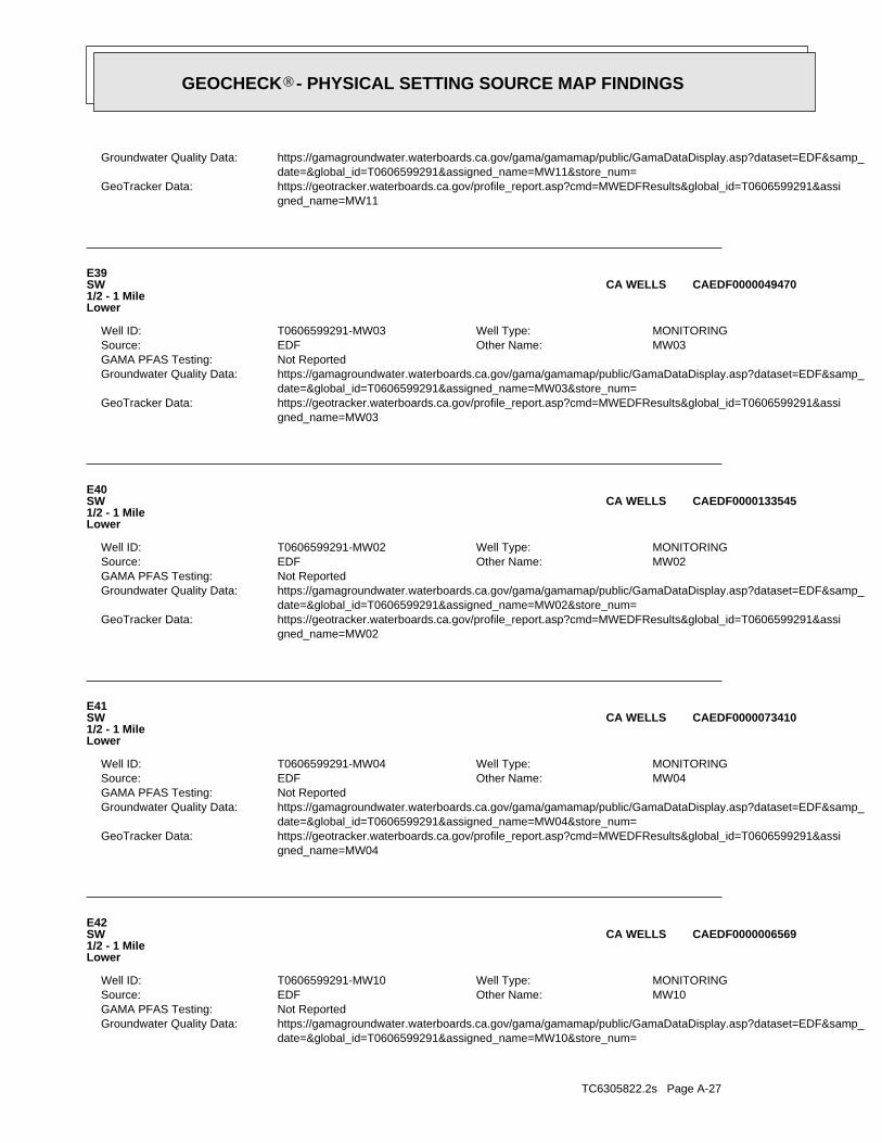
TC6305822.2s Page A-27
date=&global_id=T0606599291&assigned_name=MW10&store_num= https://gamagroundwater.waterboards.ca.gov/gama/gamamap/public/GamaDataDisplay.asp?dataset=EDF&samp_Groundwater Quality Data: Not ReportedGAMA PFAS Testing:
MW10Other Name: EDFSource: MONITORINGWell Type: T0606599291-MW10Well ID:
E42SW1/2 - 1 MileLower
CAEDF0000006569CA WELLS
gned_name=MW04 https://geotracker.waterboards.ca.gov/profile_report.asp?cmd=MWEDFResults&global_id=T0606599291&assiGeoTracker Data: date=&global_id=T0606599291&assigned_name=MW04&store_num= https://gamagroundwater.waterboards.ca.gov/gama/gamamap/public/GamaDataDisplay.asp?dataset=EDF&samp_Groundwater Quality Data: Not ReportedGAMA PFAS Testing:
MW04Other Name: EDFSource: MONITORINGWell Type: T0606599291-MW04Well ID:
E41SW1/2 - 1 MileLower
CAEDF0000073410CA WELLS
gned_name=MW02 https://geotracker.waterboards.ca.gov/profile_report.asp?cmd=MWEDFResults&global_id=T0606599291&assiGeoTracker Data: date=&global_id=T0606599291&assigned_name=MW02&store_num= https://gamagroundwater.waterboards.ca.gov/gama/gamamap/public/GamaDataDisplay.asp?dataset=EDF&samp_Groundwater Quality Data: Not ReportedGAMA PFAS Testing:
MW02Other Name: EDFSource: MONITORINGWell Type: T0606599291-MW02Well ID:
E40SW1/2 - 1 MileLower
CAEDF0000133545CA WELLS
gned_name=MW03 https://geotracker.waterboards.ca.gov/profile_report.asp?cmd=MWEDFResults&global_id=T0606599291&assiGeoTracker Data: date=&global_id=T0606599291&assigned_name=MW03&store_num= https://gamagroundwater.waterboards.ca.gov/gama/gamamap/public/GamaDataDisplay.asp?dataset=EDF&samp_Groundwater Quality Data: Not ReportedGAMA PFAS Testing:
MW03Other Name: EDFSource: MONITORINGWell Type: T0606599291-MW03Well ID:
E39SW1/2 - 1 MileLower
CAEDF0000049470CA WELLS
gned_name=MW11 https://geotracker.waterboards.ca.gov/profile_report.asp?cmd=MWEDFResults&global_id=T0606599291&assiGeoTracker Data: date=&global_id=T0606599291&assigned_name=MW11&store_num= https://gamagroundwater.waterboards.ca.gov/gama/gamamap/public/GamaDataDisplay.asp?dataset=EDF&samp_Groundwater Quality Data:
®GEOCHECK - PHYSICAL SETTING SOURCE MAP FINDINGS®
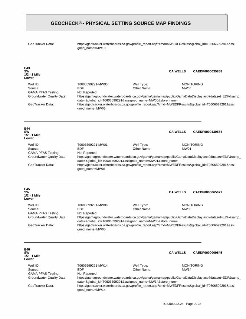
TC6305822.2s Page A-28
gned_name=MW14 https://geotracker.waterboards.ca.gov/profile_report.asp?cmd=MWEDFResults&global_id=T0606599291&assiGeoTracker Data: date=&global_id=T0606599291&assigned_name=MW14&store_num= https://gamagroundwater.waterboards.ca.gov/gama/gamamap/public/GamaDataDisplay.asp?dataset=EDF&samp_Groundwater Quality Data: Not ReportedGAMA PFAS Testing:
MW14Other Name: EDFSource: MONITORINGWell Type: T0606599291-MW14Well ID:
E46SW1/2 - 1 MileLower
CAEDF0000009545CA WELLS
gned_name=MW06 https://geotracker.waterboards.ca.gov/profile_report.asp?cmd=MWEDFResults&global_id=T0606599291&assiGeoTracker Data: date=&global_id=T0606599291&assigned_name=MW06&store_num= https://gamagroundwater.waterboards.ca.gov/gama/gamamap/public/GamaDataDisplay.asp?dataset=EDF&samp_Groundwater Quality Data: Not ReportedGAMA PFAS Testing:
MW06Other Name: EDFSource: MONITORINGWell Type: T0606599291-MW06Well ID:
E45SW1/2 - 1 MileLower
CAEDF0000065071CA WELLS
gned_name=MW01 https://geotracker.waterboards.ca.gov/profile_report.asp?cmd=MWEDFResults&global_id=T0606599291&assiGeoTracker Data: date=&global_id=T0606599291&assigned_name=MW01&store_num= https://gamagroundwater.waterboards.ca.gov/gama/gamamap/public/GamaDataDisplay.asp?dataset=EDF&samp_Groundwater Quality Data: Not ReportedGAMA PFAS Testing:
MW01Other Name: EDFSource: MONITORINGWell Type: T0606599291-MW01Well ID:
E44SW1/2 - 1 MileLower
CAEDF0000139554CA WELLS
gned_name=MW05 https://geotracker.waterboards.ca.gov/profile_report.asp?cmd=MWEDFResults&global_id=T0606599291&assiGeoTracker Data: date=&global_id=T0606599291&assigned_name=MW05&store_num= https://gamagroundwater.waterboards.ca.gov/gama/gamamap/public/GamaDataDisplay.asp?dataset=EDF&samp_Groundwater Quality Data: Not ReportedGAMA PFAS Testing:
MW05Other Name: EDFSource: MONITORINGWell Type: T0606599291-MW05Well ID:
E43SW1/2 - 1 MileLower
CAEDF0000035858CA WELLS
gned_name=MW10 https://geotracker.waterboards.ca.gov/profile_report.asp?cmd=MWEDFResults&global_id=T0606599291&assiGeoTracker Data:
®GEOCHECK - PHYSICAL SETTING SOURCE MAP FINDINGS®

TC6305822.2s Page A-29
gned_name=MW-8 https://geotracker.waterboards.ca.gov/profile_report.asp?cmd=MWEDFResults&global_id=T0606500381&assiGeoTracker Data: date=&global_id=T0606500381&assigned_name=MW-8&store_num= https://gamagroundwater.waterboards.ca.gov/gama/gamamap/public/GamaDataDisplay.asp?dataset=EDF&samp_Groundwater Quality Data: Not ReportedGAMA PFAS Testing:
MW-8Other Name: EDFSource: MONITORINGWell Type: T0606500381-MW-8Well ID:
F50NNW1/2 - 1 MileHigher
CAEDF0000078200CA WELLS
gned_name=MW09 https://geotracker.waterboards.ca.gov/profile_report.asp?cmd=MWEDFResults&global_id=T0606599291&assiGeoTracker Data: date=&global_id=T0606599291&assigned_name=MW09&store_num= https://gamagroundwater.waterboards.ca.gov/gama/gamamap/public/GamaDataDisplay.asp?dataset=EDF&samp_Groundwater Quality Data: Not ReportedGAMA PFAS Testing:
MW09Other Name: EDFSource: MONITORINGWell Type: T0606599291-MW09Well ID:
E49SW1/2 - 1 MileLower
CAEDF0000140537CA WELLS
gned_name=MW07 https://geotracker.waterboards.ca.gov/profile_report.asp?cmd=MWEDFResults&global_id=T0606599291&assiGeoTracker Data: date=&global_id=T0606599291&assigned_name=MW07&store_num= https://gamagroundwater.waterboards.ca.gov/gama/gamamap/public/GamaDataDisplay.asp?dataset=EDF&samp_Groundwater Quality Data: Not ReportedGAMA PFAS Testing:
MW07Other Name: EDFSource: MONITORINGWell Type: T0606599291-MW07Well ID:
E48SW1/2 - 1 MileLower
CAEDF0000042671CA WELLS
gned_name=MW-7 https://geotracker.waterboards.ca.gov/profile_report.asp?cmd=MWEDFResults&global_id=T0606500381&assiGeoTracker Data: date=&global_id=T0606500381&assigned_name=MW-7&store_num= https://gamagroundwater.waterboards.ca.gov/gama/gamamap/public/GamaDataDisplay.asp?dataset=EDF&samp_Groundwater Quality Data: Not ReportedGAMA PFAS Testing:
MW-7Other Name: EDFSource: MONITORINGWell Type: T0606500381-MW-7Well ID:
F47NNW1/2 - 1 MileHigher
CAEDF0000123296CA WELLS
Map IDDirectionDistanceElevation EDR ID NumberDatabase
®GEOCHECK - PHYSICAL SETTING SOURCE MAP FINDINGS®
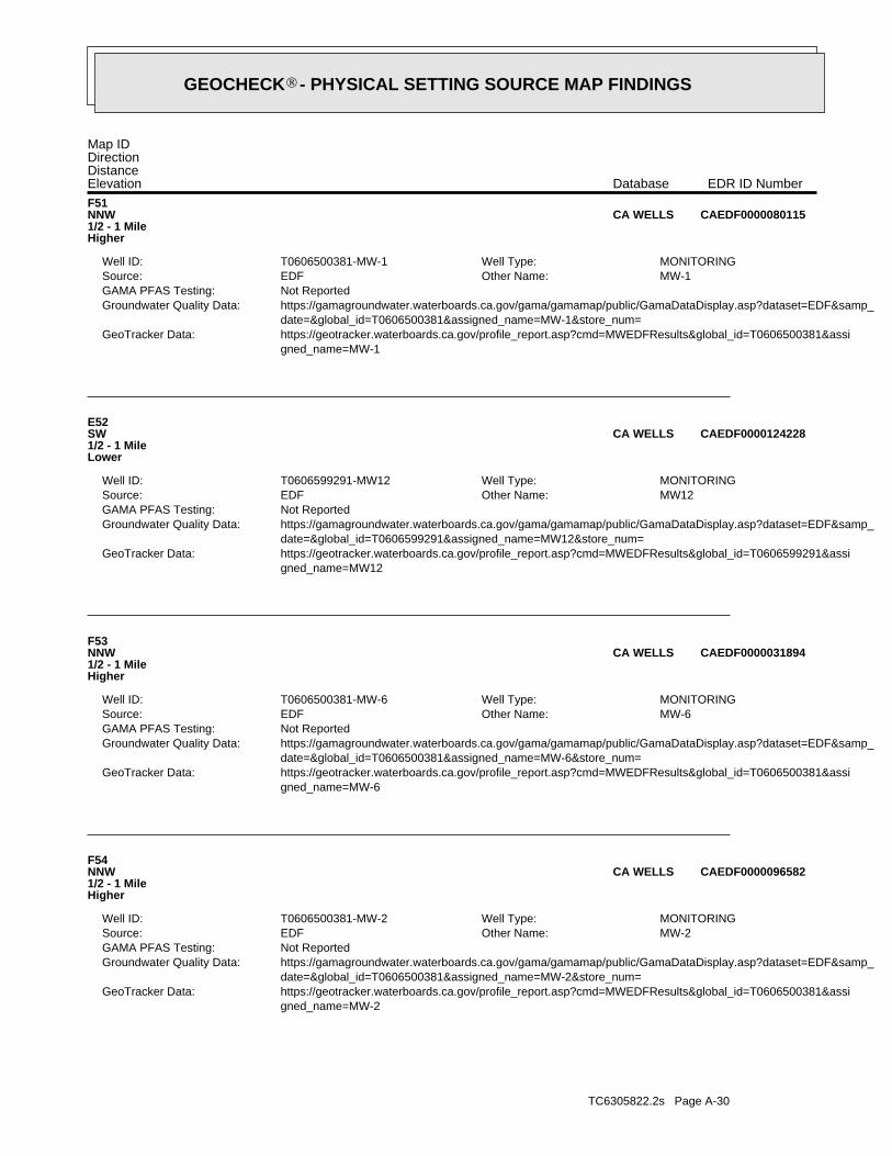
TC6305822.2s Page A-30
gned_name=MW-2 https://geotracker.waterboards.ca.gov/profile_report.asp?cmd=MWEDFResults&global_id=T0606500381&assiGeoTracker Data: date=&global_id=T0606500381&assigned_name=MW-2&store_num= https://gamagroundwater.waterboards.ca.gov/gama/gamamap/public/GamaDataDisplay.asp?dataset=EDF&samp_Groundwater Quality Data: Not ReportedGAMA PFAS Testing:
MW-2Other Name: EDFSource: MONITORINGWell Type: T0606500381-MW-2Well ID:
F54NNW1/2 - 1 MileHigher
CAEDF0000096582CA WELLS
gned_name=MW-6 https://geotracker.waterboards.ca.gov/profile_report.asp?cmd=MWEDFResults&global_id=T0606500381&assiGeoTracker Data: date=&global_id=T0606500381&assigned_name=MW-6&store_num= https://gamagroundwater.waterboards.ca.gov/gama/gamamap/public/GamaDataDisplay.asp?dataset=EDF&samp_Groundwater Quality Data: Not ReportedGAMA PFAS Testing:
MW-6Other Name: EDFSource: MONITORINGWell Type: T0606500381-MW-6Well ID:
F53NNW1/2 - 1 MileHigher
CAEDF0000031894CA WELLS
gned_name=MW12 https://geotracker.waterboards.ca.gov/profile_report.asp?cmd=MWEDFResults&global_id=T0606599291&assiGeoTracker Data: date=&global_id=T0606599291&assigned_name=MW12&store_num= https://gamagroundwater.waterboards.ca.gov/gama/gamamap/public/GamaDataDisplay.asp?dataset=EDF&samp_Groundwater Quality Data: Not ReportedGAMA PFAS Testing:
MW12Other Name: EDFSource: MONITORINGWell Type: T0606599291-MW12Well ID:
E52SW1/2 - 1 MileLower
CAEDF0000124228CA WELLS
gned_name=MW-1 https://geotracker.waterboards.ca.gov/profile_report.asp?cmd=MWEDFResults&global_id=T0606500381&assiGeoTracker Data: date=&global_id=T0606500381&assigned_name=MW-1&store_num= https://gamagroundwater.waterboards.ca.gov/gama/gamamap/public/GamaDataDisplay.asp?dataset=EDF&samp_Groundwater Quality Data: Not ReportedGAMA PFAS Testing:
MW-1Other Name: EDFSource: MONITORINGWell Type: T0606500381-MW-1Well ID:
F51NNW1/2 - 1 MileHigher
CAEDF0000080115CA WELLS
Map IDDirectionDistanceElevation EDR ID NumberDatabase
®GEOCHECK - PHYSICAL SETTING SOURCE MAP FINDINGS®

TC6305822.2s Page A-31
gned_name=MW-3 https://geotracker.waterboards.ca.gov/profile_report.asp?cmd=MWEDFResults&global_id=T0606500381&assiGeoTracker Data: date=&global_id=T0606500381&assigned_name=MW-3&store_num= https://gamagroundwater.waterboards.ca.gov/gama/gamamap/public/GamaDataDisplay.asp?dataset=EDF&samp_Groundwater Quality Data: Not ReportedGAMA PFAS Testing:
MW-3Other Name: EDFSource: MONITORINGWell Type: T0606500381-MW-3Well ID:
F58NNW1/2 - 1 MileHigher
CAEDF0000090874CA WELLS
gned_name=MW-4 https://geotracker.waterboards.ca.gov/profile_report.asp?cmd=MWEDFResults&global_id=T0606500381&assiGeoTracker Data: date=&global_id=T0606500381&assigned_name=MW-4&store_num= https://gamagroundwater.waterboards.ca.gov/gama/gamamap/public/GamaDataDisplay.asp?dataset=EDF&samp_Groundwater Quality Data: Not ReportedGAMA PFAS Testing:
MW-4Other Name: EDFSource: MONITORINGWell Type: T0606500381-MW-4Well ID:
F57NNW1/2 - 1 MileHigher
CAEDF0000124905CA WELLS
gned_name=MW-4R https://geotracker.waterboards.ca.gov/profile_report.asp?cmd=MWEDFResults&global_id=T0606500381&assiGeoTracker Data: date=&global_id=T0606500381&assigned_name=MW-4R&store_num= https://gamagroundwater.waterboards.ca.gov/gama/gamamap/public/GamaDataDisplay.asp?dataset=EDF&samp_Groundwater Quality Data: Not ReportedGAMA PFAS Testing:
MW-4ROther Name: EDFSource: MONITORINGWell Type: T0606500381-MW-4RWell ID:
F56NNW1/2 - 1 MileHigher
CAEDF0000134295CA WELLS
gned_name=TOC-11 https://geotracker.waterboards.ca.gov/profile_report.asp?cmd=MWEDFResults&global_id=T0606500381&assiGeoTracker Data: date=&global_id=T0606500381&assigned_name=TOC-11&store_num= https://gamagroundwater.waterboards.ca.gov/gama/gamamap/public/GamaDataDisplay.asp?dataset=EDF&samp_Groundwater Quality Data: Not ReportedGAMA PFAS Testing:
TOC-11Other Name: EDFSource: MONITORINGWell Type: T0606500381-TOC-11Well ID:
F55NNW1/2 - 1 MileHigher
CAEDF0000133470CA WELLS
Map IDDirectionDistanceElevation EDR ID NumberDatabase
®GEOCHECK - PHYSICAL SETTING SOURCE MAP FINDINGS®
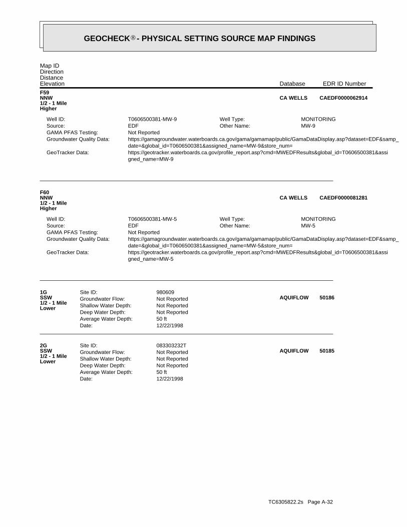
TC6305822.2s Page A-32
Date: 12/22/1998Average Water Depth: 50 ftDeep Water Depth: Not ReportedShallow Water Depth: Not ReportedGroundwater Flow: Not ReportedSite ID: 083303232T2G
SSW1/2 - 1 MileLower
50185AQUIFLOW
Date: 12/22/1998Average Water Depth: 50 ftDeep Water Depth: Not ReportedShallow Water Depth: Not ReportedGroundwater Flow: Not ReportedSite ID: 9806091G
SSW1/2 - 1 MileLower
50186AQUIFLOW
gned_name=MW-5 https://geotracker.waterboards.ca.gov/profile_report.asp?cmd=MWEDFResults&global_id=T0606500381&assiGeoTracker Data: date=&global_id=T0606500381&assigned_name=MW-5&store_num= https://gamagroundwater.waterboards.ca.gov/gama/gamamap/public/GamaDataDisplay.asp?dataset=EDF&samp_Groundwater Quality Data: Not ReportedGAMA PFAS Testing:
MW-5Other Name: EDFSource: MONITORINGWell Type: T0606500381-MW-5Well ID:
F60NNW1/2 - 1 MileHigher
CAEDF0000081281CA WELLS
gned_name=MW-9 https://geotracker.waterboards.ca.gov/profile_report.asp?cmd=MWEDFResults&global_id=T0606500381&assiGeoTracker Data: date=&global_id=T0606500381&assigned_name=MW-9&store_num= https://gamagroundwater.waterboards.ca.gov/gama/gamamap/public/GamaDataDisplay.asp?dataset=EDF&samp_Groundwater Quality Data: Not ReportedGAMA PFAS Testing:
MW-9Other Name: EDFSource: MONITORINGWell Type: T0606500381-MW-9Well ID:
F59NNW1/2 - 1 MileHigher
CAEDF0000062914CA WELLS
Map IDDirectionDistanceElevation EDR ID NumberDatabase
®GEOCHECK - PHYSICAL SETTING SOURCE MAP FINDINGS®
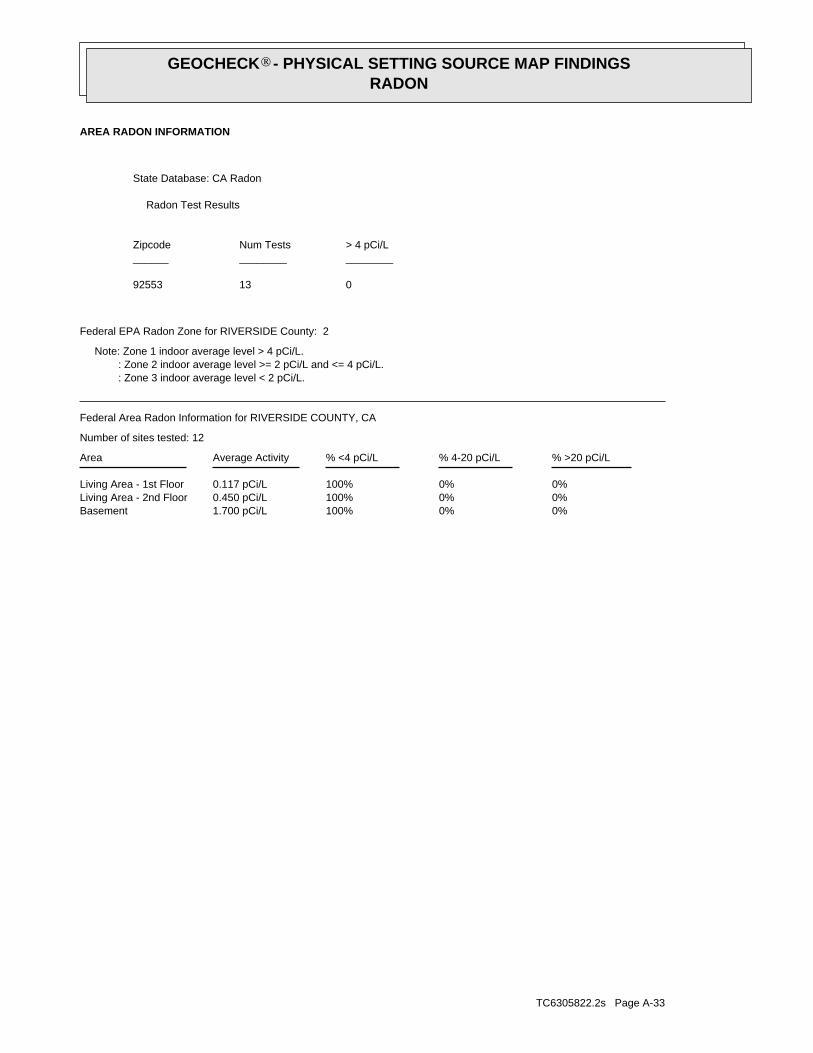
TC6305822.2s Page A-33
0%0%100%1.700 pCi/LBasement0%0%100%0.450 pCi/LLiving Area - 2nd Floor0%0%100%0.117 pCi/LLiving Area - 1st Floor
% >20 pCi/L% 4-20 pCi/L% <4 pCi/LAverage ActivityArea
Number of sites tested: 12
Federal Area Radon Information for RIVERSIDE COUNTY, CA
: Zone 3 indoor average level < 2 pCi/L. : Zone 2 indoor average level >= 2 pCi/L and <= 4 pCi/L. Note: Zone 1 indoor average level > 4 pCi/L.
Federal EPA Radon Zone for RIVERSIDE County: 2
01392553
______________________> 4 pCi/LNum TestsZipcode
Radon Test Results
State Database: CA Radon
AREA RADON INFORMATION
GEOCHECK - PHYSICAL SETTING SOURCE MAP FINDINGSRADON
®
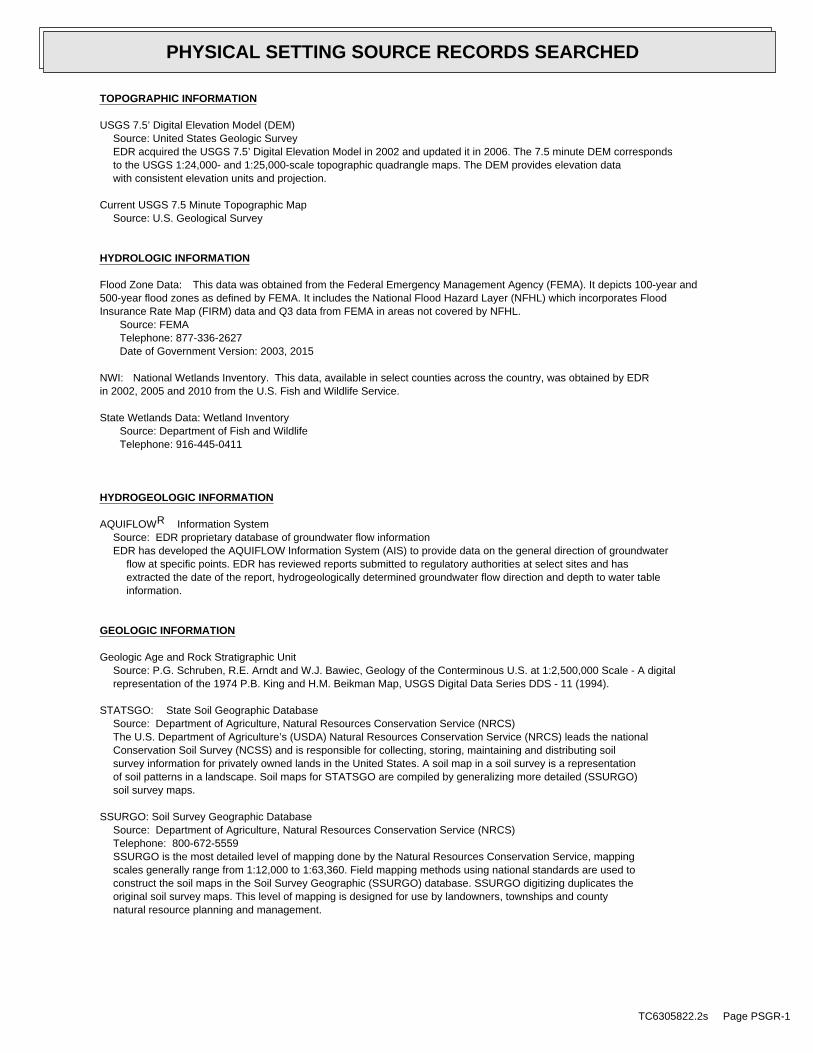
TOPOGRAPHIC INFORMATION
USGS 7.5’ Digital Elevation Model (DEM)Source: United States Geologic SurveyEDR acquired the USGS 7.5’ Digital Elevation Model in 2002 and updated it in 2006. The 7.5 minute DEM correspondsto the USGS 1:24,000- and 1:25,000-scale topographic quadrangle maps. The DEM provides elevation datawith consistent elevation units and projection.
Current USGS 7.5 Minute Topographic MapSource: U.S. Geological Survey
HYDROLOGIC INFORMATION
Flood Zone Data: This data was obtained from the Federal Emergency Management Agency (FEMA). It depicts 100-year and500-year flood zones as defined by FEMA. It includes the National Flood Hazard Layer (NFHL) which incorporates FloodInsurance Rate Map (FIRM) data and Q3 data from FEMA in areas not covered by NFHL.
Source: FEMATelephone: 877-336-2627Date of Government Version: 2003, 2015
NWI: National Wetlands Inventory. This data, available in select counties across the country, was obtained by EDRin 2002, 2005 and 2010 from the U.S. Fish and Wildlife Service.
State Wetlands Data: Wetland InventorySource: Department of Fish and WildlifeTelephone: 916-445-0411
HYDROGEOLOGIC INFORMATION
AQUIFLOW Information SystemR
Source: EDR proprietary database of groundwater flow informationEDR has developed the AQUIFLOW Information System (AIS) to provide data on the general direction of groundwater
flow at specific points. EDR has reviewed reports submitted to regulatory authorities at select sites and hasextracted the date of the report, hydrogeologically determined groundwater flow direction and depth to water tableinformation.
GEOLOGIC INFORMATION
Geologic Age and Rock Stratigraphic UnitSource: P.G. Schruben, R.E. Arndt and W.J. Bawiec, Geology of the Conterminous U.S. at 1:2,500,000 Scale - A digitalrepresentation of the 1974 P.B. King and H.M. Beikman Map, USGS Digital Data Series DDS - 11 (1994).
STATSGO: State Soil Geographic DatabaseSource: Department of Agriculture, Natural Resources Conservation Service (NRCS)The U.S. Department of Agriculture’s (USDA) Natural Resources Conservation Service (NRCS) leads the nationalConservation Soil Survey (NCSS) and is responsible for collecting, storing, maintaining and distributing soilsurvey information for privately owned lands in the United States. A soil map in a soil survey is a representationof soil patterns in a landscape. Soil maps for STATSGO are compiled by generalizing more detailed (SSURGO)soil survey maps.
SSURGO: Soil Survey Geographic DatabaseSource: Department of Agriculture, Natural Resources Conservation Service (NRCS)Telephone: 800-672-5559SSURGO is the most detailed level of mapping done by the Natural Resources Conservation Service, mappingscales generally range from 1:12,000 to 1:63,360. Field mapping methods using national standards are used toconstruct the soil maps in the Soil Survey Geographic (SSURGO) database. SSURGO digitizing duplicates theoriginal soil survey maps. This level of mapping is designed for use by landowners, townships and countynatural resource planning and management.
TC6305822.2s Page PSGR-1
PHYSICAL SETTING SOURCE RECORDS SEARCHED
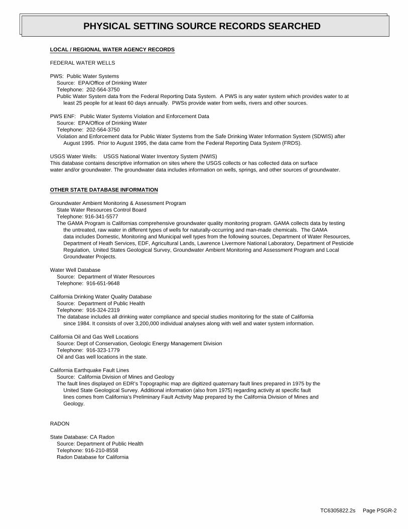
LOCAL / REGIONAL WATER AGENCY RECORDS
FEDERAL WATER WELLS
PWS: Public Water SystemsSource: EPA/Office of Drinking WaterTelephone: 202-564-3750Public Water System data from the Federal Reporting Data System. A PWS is any water system which provides water to at
least 25 people for at least 60 days annually. PWSs provide water from wells, rivers and other sources.
PWS ENF: Public Water Systems Violation and Enforcement DataSource: EPA/Office of Drinking WaterTelephone: 202-564-3750Violation and Enforcement data for Public Water Systems from the Safe Drinking Water Information System (SDWIS) after
August 1995. Prior to August 1995, the data came from the Federal Reporting Data System (FRDS).
USGS Water Wells: USGS National Water Inventory System (NWIS)This database contains descriptive information on sites where the USGS collects or has collected data on surfacewater and/or groundwater. The groundwater data includes information on wells, springs, and other sources of groundwater.
OTHER STATE DATABASE INFORMATION
Groundwater Ambient Monitoring & Assessment ProgramState Water Resources Control BoardTelephone: 916-341-5577The GAMA Program is Californias comprehensive groundwater quality monitoring program. GAMA collects data by testing
the untreated, raw water in different types of wells for naturally-occurring and man-made chemicals. The GAMAdata includes Domestic, Monitoring and Municipal well types from the following sources, Department of Water Resources,Department of Heath Services, EDF, Agricultural Lands, Lawrence Livermore National Laboratory, Department of PesticideRegulation, United States Geological Survey, Groundwater Ambient Monitoring and Assessment Program and LocalGroundwater Projects.
Water Well DatabaseSource: Department of Water ResourcesTelephone: 916-651-9648
California Drinking Water Quality DatabaseSource: Department of Public HealthTelephone: 916-324-2319The database includes all drinking water compliance and special studies monitoring for the state of California
since 1984. It consists of over 3,200,000 individual analyses along with well and water system information.
California Oil and Gas Well LocationsSource: Dept of Conservation, Geologic Energy Management DivisionTelephone: 916-323-1779Oil and Gas well locations in the state.
California Earthquake Fault LinesSource: California Division of Mines and GeologyThe fault lines displayed on EDR’s Topographic map are digitized quaternary fault lines prepared in 1975 by the
United State Geological Survey. Additional information (also from 1975) regarding activity at specific faultlines comes from California’s Preliminary Fault Activity Map prepared by the California Division of Mines andGeology.
RADON
State Database: CA RadonSource: Department of Public HealthTelephone: 916-210-8558Radon Database for California
TC6305822.2s Page PSGR-2
PHYSICAL SETTING SOURCE RECORDS SEARCHED
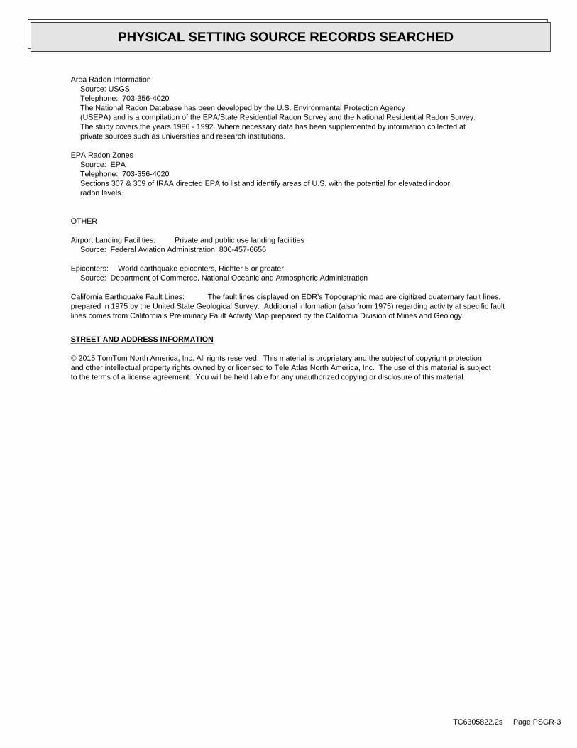
Area Radon InformationSource: USGSTelephone: 703-356-4020The National Radon Database has been developed by the U.S. Environmental Protection Agency(USEPA) and is a compilation of the EPA/State Residential Radon Survey and the National Residential Radon Survey.The study covers the years 1986 - 1992. Where necessary data has been supplemented by information collected atprivate sources such as universities and research institutions.
EPA Radon ZonesSource: EPATelephone: 703-356-4020Sections 307 & 309 of IRAA directed EPA to list and identify areas of U.S. with the potential for elevated indoorradon levels.
OTHER
Airport Landing Facilities: Private and public use landing facilitiesSource: Federal Aviation Administration, 800-457-6656
Epicenters: World earthquake epicenters, Richter 5 or greaterSource: Department of Commerce, National Oceanic and Atmospheric Administration
California Earthquake Fault Lines: The fault lines displayed on EDR’s Topographic map are digitized quaternary fault lines,prepared in 1975 by the United State Geological Survey. Additional information (also from 1975) regarding activity at specific faultlines comes from California’s Preliminary Fault Activity Map prepared by the California Division of Mines and Geology.
STREET AND ADDRESS INFORMATION
© 2015 TomTom North America, Inc. All rights reserved. This material is proprietary and the subject of copyright protectionand other intellectual property rights owned by or licensed to Tele Atlas North America, Inc. The use of this material is subjectto the terms of a license agreement. You will be held liable for any unauthorized copying or disclosure of this material.
TC6305822.2s Page PSGR-3
PHYSICAL SETTING SOURCE RECORDS SEARCHED
CITIVEST COMMERCIAL INVESTMENTS, LLC PROJECT NO. 2597-CR APN 479-140-022 DECEMBER 23, 2020 MORENO VALLEY, RIVERSIDE COUNTY, CALIFORNIA APPENDIX F
APPENDIX F
PROJECT TEAM QUALIFICATIONS
Anna M. ScottProject Geologist
Education
B.S., Geology, University of California,Riverside
Professional ExperienceMs. Anna Scott has over 30 years of geotechnical experience and has
worked on or managed a wide range of geotechnical projects
throughout southern California, including the High Desert, InlandEmpire, Antelope Valley, Coachella Valley, Orange County and Bak-
ersfield area. Her geotechnical experience has ranged from field and
laboratory technician to field, staff and project geologist. Ms. Scott’sresponsibilities include preparation of proposals, preliminary ge-
otechnical investigations, seismic studies, settlement monitor installa-
tion and studies, and field studies as a technician and geologist forlarge grading projects. Ms. Scott has performed Phase I and II ESAs
for various property acquisitions and transfers throughout southern
California.
Representative Project ExperienceMs. Scott has worked on numerous projects throughout southern
California. Her experience includes working with various entities
including the public and private sectors. Her vast knowledge includesgeotechnical, environmental and materials services. This experience
has been attained through small and large projects over the numer-
ous years of her career.
Employment HistoryGeoTek, Inc., Riverside-Project Geologist, February 2005 – Pre-
sent
GeoSoils, Inc., Santa Ana, September 1987 – February 2005

Edward H. LaMont, CEG, PGBranch Manager
Areas of Expertise
Geotechnical Field InvestigationsGrading and Earthwork ConstructionIndustry Standard of CareHillside, Liquefaction, Seismic Hazard,Fault Analyses and Forensic Studies.
Education
Bachelor of Science in Geology, CalState University, Northridge
Registrations
Registered Geologist, PG 6025Certified Engineering Geologist, CEG1892
Certifications
OSHA 40-Hr HAZWOPER TrainingOSHA 8-Hour RefresherFirst Aid/CPR
Professional Affiliations
Association of Engineering GeologistSouth Coast Geological SocietySan Diego Association of GeologistInland Geological SocietyBIA RiversideBIA San Diego
Professional ExperienceMr. LaMont has been involved with numerous public works, residen-tial and commercial earthwork projects across the southern Califor-nia area. Many residential, commercial and public works projectshave been successfully completed across southern and central Cali-fornia. Projects include liquefaction and subsidence studies, fault eval-uations, commercial, residential, federal, FEMA levee certificationsand military construction projects. These projects have generallyincluded preliminary geotechnical evaluations, slope stability studies,review and design recommendations, street improvements construc-tion and testing services, and project management.
In addition, Mr. LaMont has performed governmental review of ge-otechnical reports for the County of Orange. Mr. LaMont has alsocompleted geotechnical studies for the Riverside County Flood Con-trol and Cities of Banning, Chino, Corona, Palm Springs, Lancasterand Victorville, to name a few.
Representative Project ExperienceProject experience has included residential and commercial develop-ments, for various land developers including Melia Homes, MeritageHomes, Frontier Enterprises, D∙R∙Horton, Beazer Homes, KBHome, Integral Communities, IntraCorp, Shopoff, Shea Homes, etc.Mr. LaMont has also completed geotechnical investigations and per-formed project management for numerous residential tracts andcommercial facilities all across Southern California.
Professional HistoryBranch Manager/Principal Geologist - Riverside GeoTek, Inc.,2004 to present
Vice President, Principal Geologist - GeoSoils, Inc., Santa Ana,2003 to 2004
Geotechnical Reviewer, Engineering Geologist - County ofOrange, 2001 to 2003.
Project Geologist - GeoSoils, Inc., Santa Ana, California, 1994 to2001.
Staff/Project Geologist - GeoSoils, Inc., Carlsbad, California, 1988to 1994.
J. MICHAEL BATTEN, CAC, CEM, REPA Principal/Environmental Services Manager
Education BS in Geology, California State University, Fresno 1988 Registrations Certified Asbestos Consultant
(CA #95-1721) Licensed Asbestos Abatement
Consultant (NV #IJPM0655) Certified Environmental Manager
(NV #1782) Asbestos Professional Inspector
(IL #100-11092) Registered Environmental
Property Assessor (#113162))
Certified Lead Inspector Assessor (CA #4358)
Certified Lead Inspector (EPA #LBP-I-I162326-1)
Certified Lead Risk Assessor (EPA #LBP-R-I162326-1)
Certifications AHERA Certified Asbestos
Building Inspector, Management Planner, Project Designer, & Contractor/Supervisor
EPA Accredited Lead-based Paint Inspector & Risk Assessor
OSHA HAZWOPER certified worker & supervisor
OSHA Construction Safety & Health (10-Hour)
Affiliations American Society of Testing and
Materials National Registry of
Environmental Professionals
Professional Experience Mr. Batten has over 30 years of environmental experience, throughout which he has conducted and managed numerous environmental investigations, assessments, and remediations. He has prepared several NEPA assessments, USEPA EIS, and CEQA EIR reports. In addition, Mr. Batten has extensive experience in conducting asbestos and lead-based paint surveys and preparing management plans, including remediation design, for asbestos and lead present in buildings. Project Experience
Phase I Environmental Site Assessments: Mr. Batten has conducted more than 2,000 Phase I Environmental Site Assessments in 27 states, including Brownfield studies under USEPA grants.
Phase II Environmental Site Assessments: Mr. Batten has conducted more than 150 Phase II Environmental Assessments, including Brownfield studies under USEPA grants.
Site Characterizations and Remediations: Mr. Batten has experience conducting numerous site characterizations and remediations, including obtaining regulatory closure.
NEPA Studies: Mr. Batten has conducted more than 200 NEPA studies, including Environmental Assessments, Environmental Impact Reports/Environmental Impact Studies, in eight states. The agencies involved include USEPA, FCC, BLM, National Park Service, and California EPA.
Asbestos Services: Mr. Batten has conducted over 600 asbestos surveys in several states. He has also prepared numerous Asbestos Management Plans, prepared design plans, and monitored numerous abatement projects.
Lead-Based Paint Services: Mr. Batten has conducted numerous Lead-Based Paint surveys.
Landfills: Mr. Batten has conducted investigations and overseen remediations on landfills in Fresno, California and Henderson, Nevada.
Other Services: Mr. Batten has been called upon to conduct less usual services on occasion, including mold consultation and investigation, radon studies, vapor intrusion studies, and indoor air quality studies.
J. MICHAEL BATTEN, continued…
Professional History Environmental Services Manager. GeoTek, Inc., 2001 to present. Director of Environmental Services. ATC Associates, Inc., 1999 to 2001. Director of Operations. Hygienetics Environmental Services, Inc., 1997 to 1999. Project Manager. AllWest Environmental, Inc., 1996 to 1997. Project Manager. Citadel Environmental Services, Inc., 2/1996 to 9/1996. Project Manager. Boelter Environmental consultants, 3/1995 to 9/1995. Senior Staff Geologist. Converse Consultants, 1992 to 1995. Staff Geologist. Converse Environmental West, 1991 to 1992. Project Geologist. Krazan and Associates, 1990 to 1991. Environmental Technician. Krazan and Associates, 1989 to 1990.
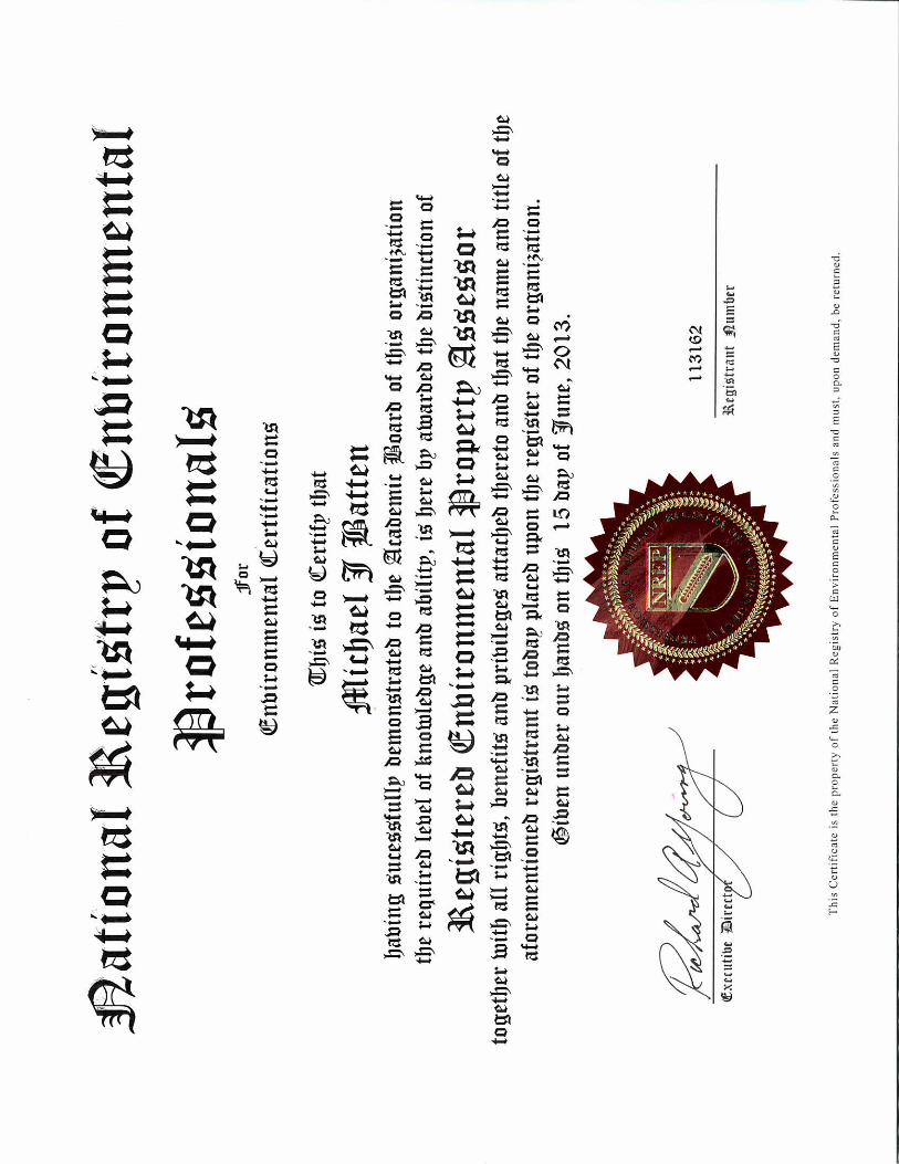
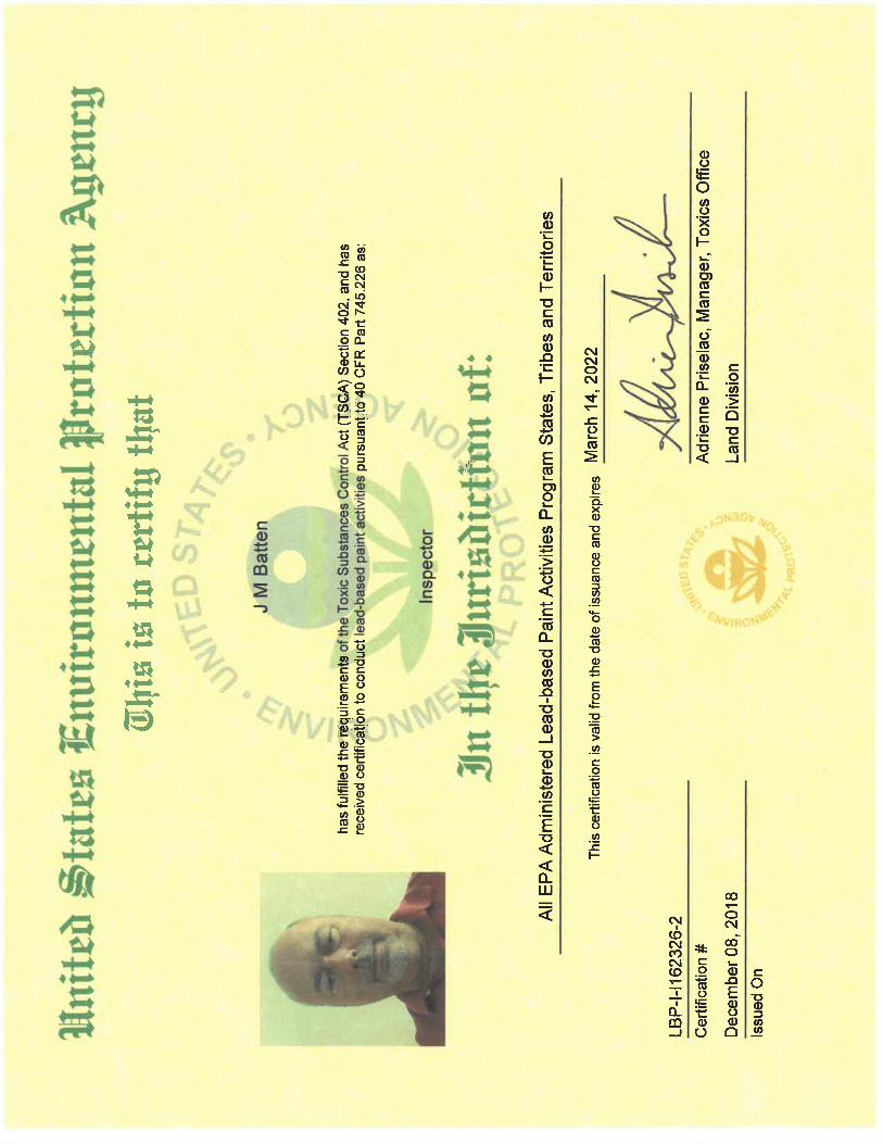
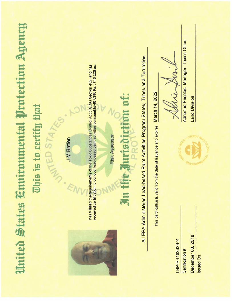
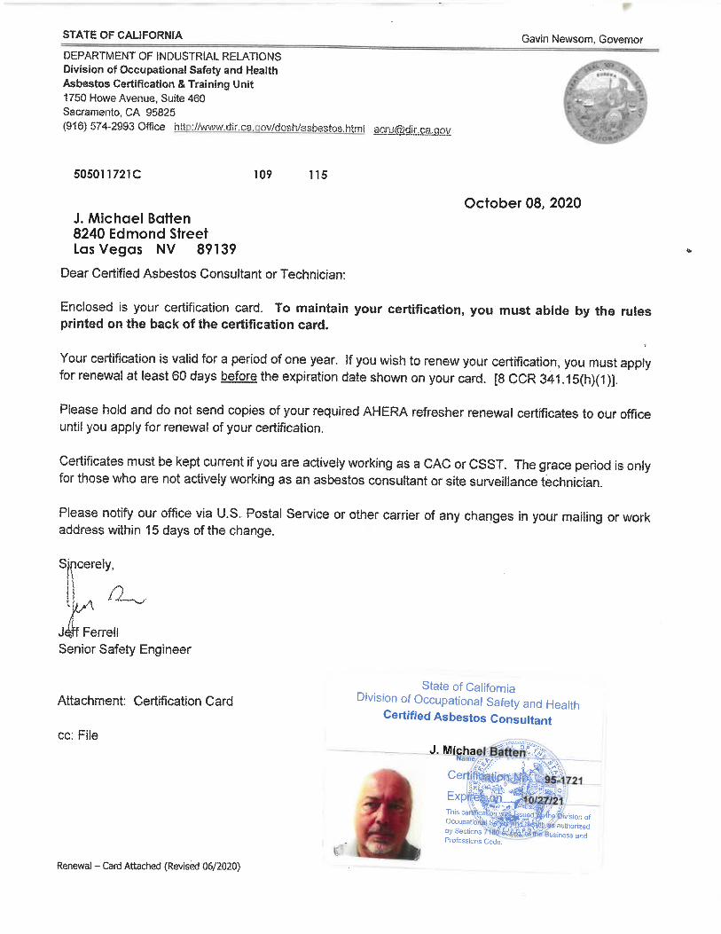
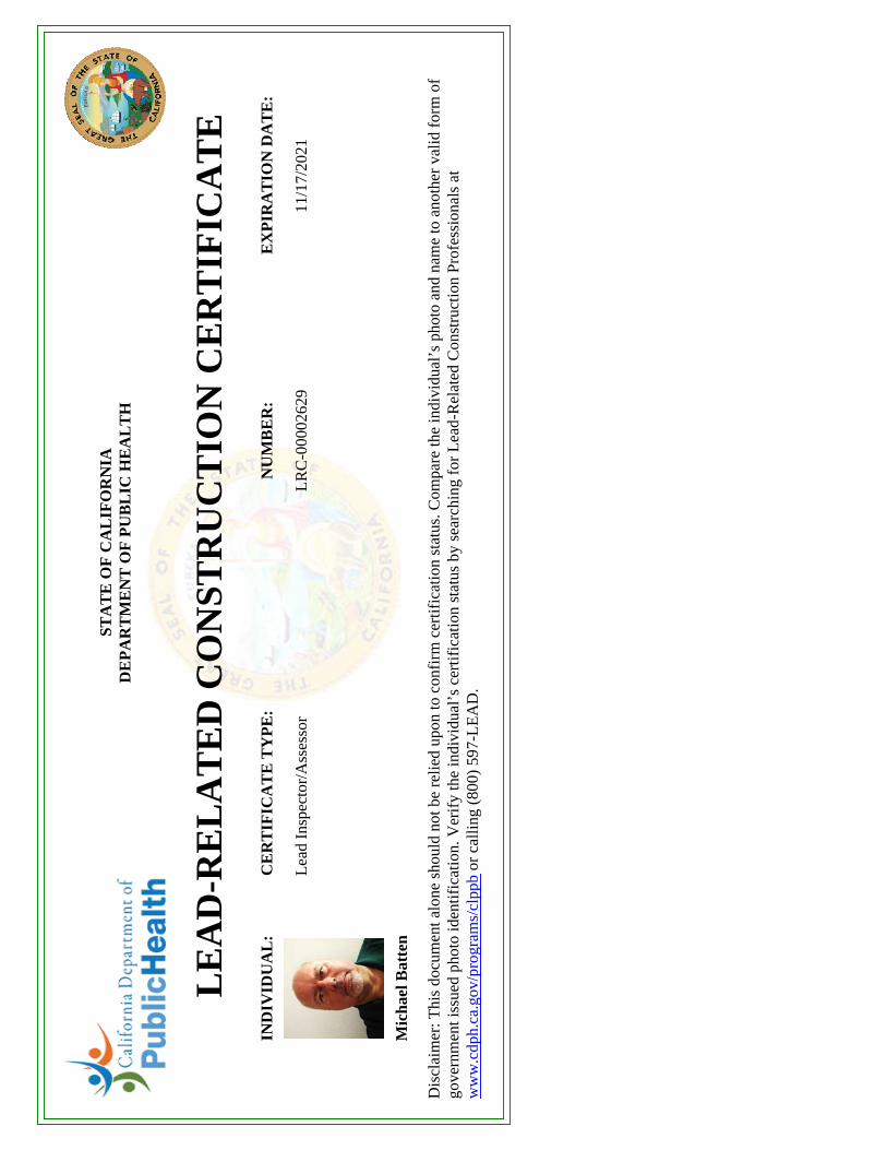
IND
IVID
UA
L:
CE
RT
IFIC
AT
E T
YP
E:
NU
MB
ER
:E
XP
IRA
TIO
N D
AT
E:
Lea
d In
spec
tor/
Ass
esso
rL
RC
-000
0262
911
/17/
2021
Mic
hael
Bat
ten
STA
TE
OF
CA
LIF
OR
NIA
DE
PA
RT
ME
NT
OF
PU
BL
IC H
EA
LT
H
LE
AD
-RE
LA
TE
D C
ON
STR
UC
TIO
N C
ER
TIF
ICA
TE
Dis
clai
mer
: Thi
s do
cum
ent a
lone
sho
uld
not b
e re
lied
upon
to c
onfi
rm c
ertif
icat
ion
stat
us. C
ompa
re th
e in
divi
dual
’s p
hoto
and
nam
e to
ano
ther
val
id f
orm
of
gove
rnm
ent i
ssue
d ph
oto
iden
tific
atio
n. V
erif
y th
e in
divi
dual
’s c
ertif
icat
ion
stat
us b
y se
arch
ing
for
Lea
d-R
elat
ed C
onst
ruct
ion
Prof
essi
onal
s at
ww
w.c
dph.
ca.g
ov/p
rogr
ams/
clpp
b or
cal
ling
(800
) 59
7-L
EA
D.