Embed Size (px)
Citation preview
GOVERNMENTOFTELANGANA DEPARTMENT OF MINES AND GEOLOGY
From To
Sri. K. Laxman Babu, M.Sc., 1) M/s TSMDC Ltd,
Dy. Director of Mines & Geology, W arangal Region:: W arangal.
H.No: 6-2-915, HMWSSB Premises, Rear Block, 4th Floor Khairatabad,
Hyderabad.
Sir,
2) Sri. V. Veera Raghavulu,
~QP/UDP/170/98-A, Sri Sai Manasa Nature Tech Pvt. Ltd, Plot No.74/A, Flat No.l02, Central Bank Building, Kalyan Nagar, Hyderabad- 500 038.
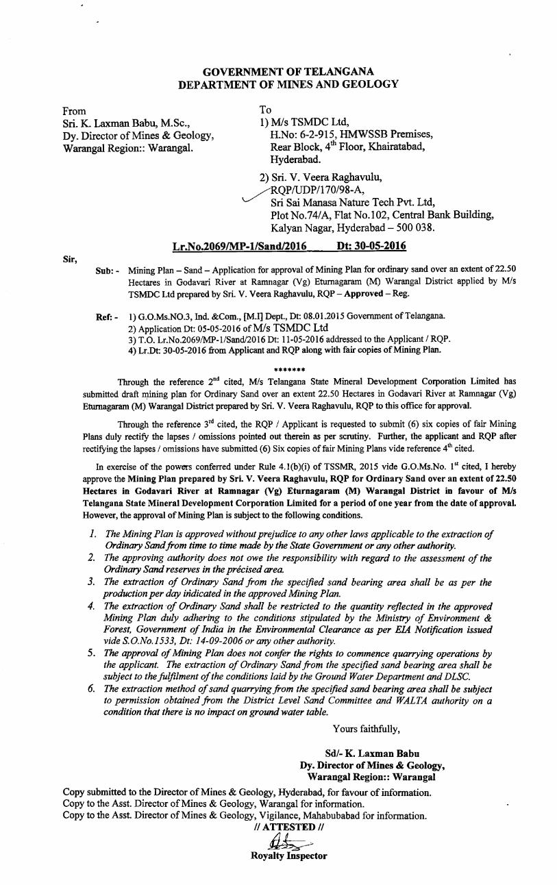
Lr.No.2069/MP-1/Sand/2016 Dt: 30-05-2016
Sub: - Mining Plan - Sand- Application for approval of Mining Plan for ordinary sand over an extent of 22.50 Hectares in Godavari River at Ramnagar (Vg) Eturnagaram (M) Warangal District applied by M/s TSMDC Ltd prepared by Sri. V. Veera Raghavulu, RQP- Approved- Reg.
Ref:- I) G.O.Ms.N0.3, Ind. &Com., [M.I] Dept., Dt: 08.01.2015 Government ofTelangana. 2) Application Dt: 05-05-2016 ofM/s TSMDC Ltd 3) T.O. Lr.No.2069/MP-l/Sand/2016 Dt: 11-05-2016 addressed to the Applicant I RQP. 4) Lr.Dt: 30-05-2016 from Applicant and RQP along with fair copies of Mining Plan.
******* Through the reference 2nd cited, M/s Telangana State Mineral Development Corporation Limited has
submitted draft ~ining plan for Ordinary Sand over an extent 22.50 Hectares in Godavari River at Ramnagar (Vg) Eturnagaram (M) Warangal District prepared by Sri. V. Veera Raghavulu, RQP to this office for approval.
Through the reference 3rd cited, the RQP I Applicant is requested to submit (6) six copies of fair Mining Plans duly rectify the lapses I omissions pointed out therein as per scrutiny. Further, the applicant and RQP after rectifying the lapses I omissions have submitted (6) Six copies of fair Mining Plans vide reference 4th cited.
In exercise of the powers conferred under Rule 4.l(b)(i) of TSSMR, 2015 vide G.O.Ms.No. I st cited, I hereby approve the Mining Plan prepared by Sri. V. Veera Raghavulu, RQP for Ordinary Sand over an extent of22.50 Hectares in Godavari River at Ramnagar (Vg) Eturnagaram (M) Warangal District in favour of M/s Telangana State Mineral Development Corporation Limited for a period of one year from the date of approval. However, the approval of Mining Plan is subject to the following conditions.
1. The Mining Plan is approved without prejudice to any other laws applicable to the extraction of Ordinary Sand from time to time made by the State Government or any other authority.
2. The approving authority does not owe the responsibility with regard to the assessment of the Ordinary Sand reserves in the precised area.
3. The extraction of Ordinary Sand from the specified sand bearing area shall be as per the production per day indicated in the approved Mining Plan.
4. The extraction of Ordinary Sand shall be restricted to the quantity reflected in the approved Mining Plan duly adhering to the conditions stipulated by the Ministry of Environment & Forest, Government of India in the Environmental Clearance as per EIA Notification issued vide S. O.No.J533, Dt: 14-09-2006 or any other authority.
5. The approval of Mining Plan does not confer the rights to commence quarrying operations by the applicant. The extraction of Ordinary Sand from the specified sand bearing area shall be subject to the fulfilment of the conditions laid by the Ground Water Department and DLSC.
6. The extraction method of sand quarrying from the specified sand bearing area shall be subject to permission obtained from the District Level Sand Committee and WALTA authority on a condition that there is no impact on ground water table.
Yours faithfully,
Sdl- K. Laxman Babu Dy. Director of Mines & Geology,
Warangal Region:: Warangal
Copy submitted to the Director of Mines & Geology, Hyderabad, for favour of information. Copy to the Asst. Director of Mines & Geology, Warangal for information. Copy to the Asst. Director of Mines & Geology, Vigilance, Mahabubabad for information.
II ATTESTED II
~ Royalty Inspector
)
)
)
_)
)
.)
_)
. .)
_ _)
:J
~
__ )
~
, .•....•••••••........•••••..........•.••..•.....•.....••••.••.••••••.................•.•........................•...•.•••...... . . . MINING PLAN FOR ORDINARY SAND OVER AN EXTENT OF
22.50 Hects. IN GODAVARI RIVER AT RAMNAGAR VILLAGE, ETURUNAGARAM MANDAL, WARANGAL DISTRICT OF TELANGANA STATE
(Prepared as per MoEF Model Guidelines- March 2010 in compliance with orders of the Hon'ble Supreme Court dated 27-02-2012 & 07-05-2012 and
as per WALTA Rules 2004 and Telangana State Sand Mining Rules 2015)
APPLICANT
TELANGANA STATE MINERAL DEVELOPMENT CORPORATION LTD. (A Government of Telangana undertaking)
H.No.S-2-915, 4th FLOOR, REAR BLOCK,
HMWSSB BUILDING, KHAIRTABAD,
HYDERABAD- 500 004, TELANGANA
Telephone: 040-23393184, 23373155
Prepared by
V. Veera Raghavulu
RQP/UDP/170/98-A
Sri Sai Manasa Nature Tech Pvt. Ltd.,
Plot No. 74/A, Flat No.102,
Central Bank Building,
Kalyan Nagar, Hyderabad- 500 038.
Tel: 040-23816333, Fax: 040-23816222
··········••••••······•·••••••·····••••·················•••••••·••••·•·············•·•••···••··•·•••·•··············•••••·····••
I I
./ )
I I
I i
I )
I J
J)
l )
i.J
I_)
I )
DECLARATION
Declared that the Mining Plan in respect of specified sand bearing area for
Ordinary Sand over an extent of 22.50 hectares in Ramnagar village,
Eturunagaram mandai, Warangal District, Telangana has been prepared in
consultation with the Department. The Telangana State Mineral Development
Corporation Ltd. understood its contents and agrees to implement the same in
accordance with law.
Date:
Place :Hyderabad
/
~ Signature of th~pplicant
K. P.AJASEKHAR REDDY, B.E.(Mining)
General Manager (Mining) TEI.At.'3Ar-'A tTATE MINERAL DEV. CORP. LTD.
(A State Govt. Undertaking) Regd. & Corporate Office
H.M.W.S.S.B. Premises, Rear Block, 4th Floqr, Khalratabad, Hyderabad • 500 004.
)
)
)
)
)
)
)
)
,)
_)
..)
PLATES
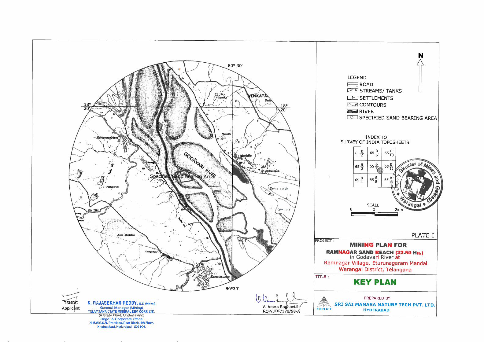
Plate -I Location & Key Plan Scale: 1 :50,000
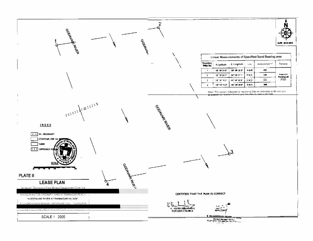
Plate - II Lease Plan Scale: 1: 2,000
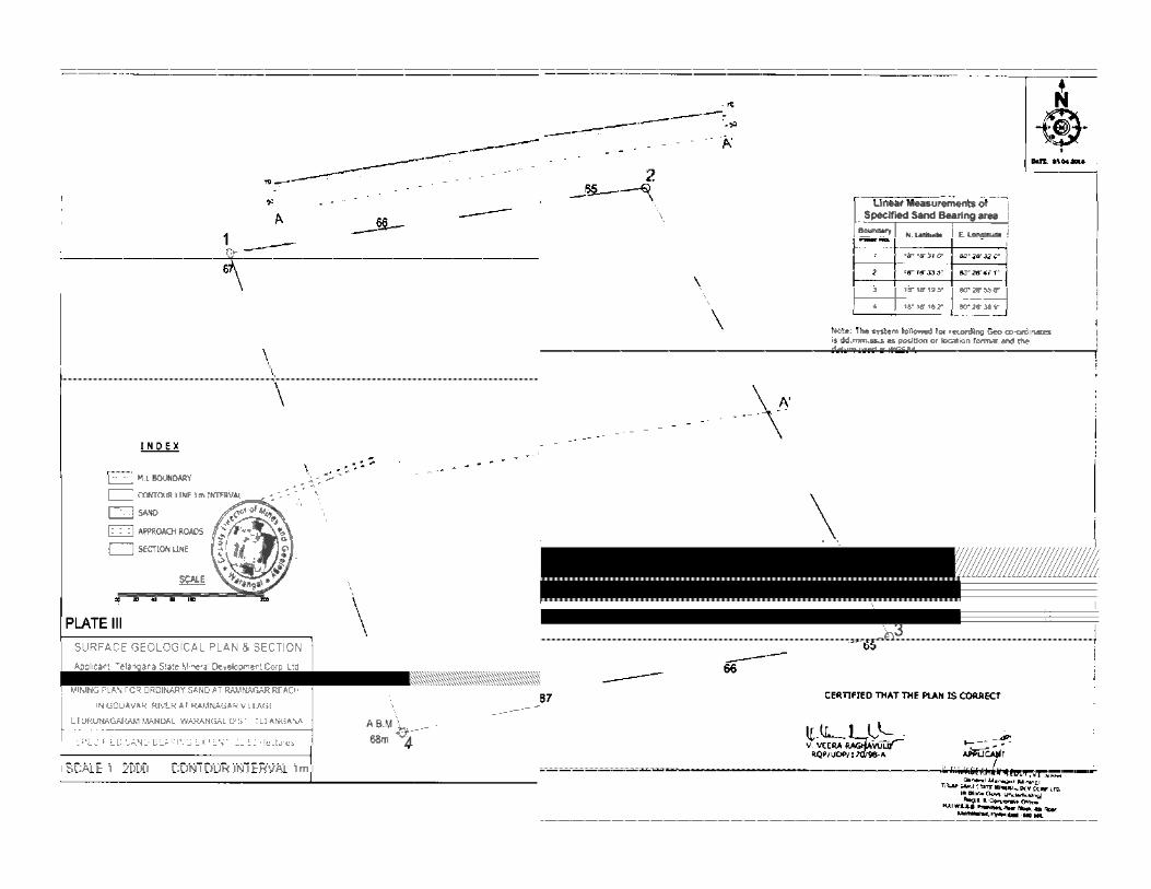
Plate- Ill Surface Geological Plan & Section Scale : 1: 2,000
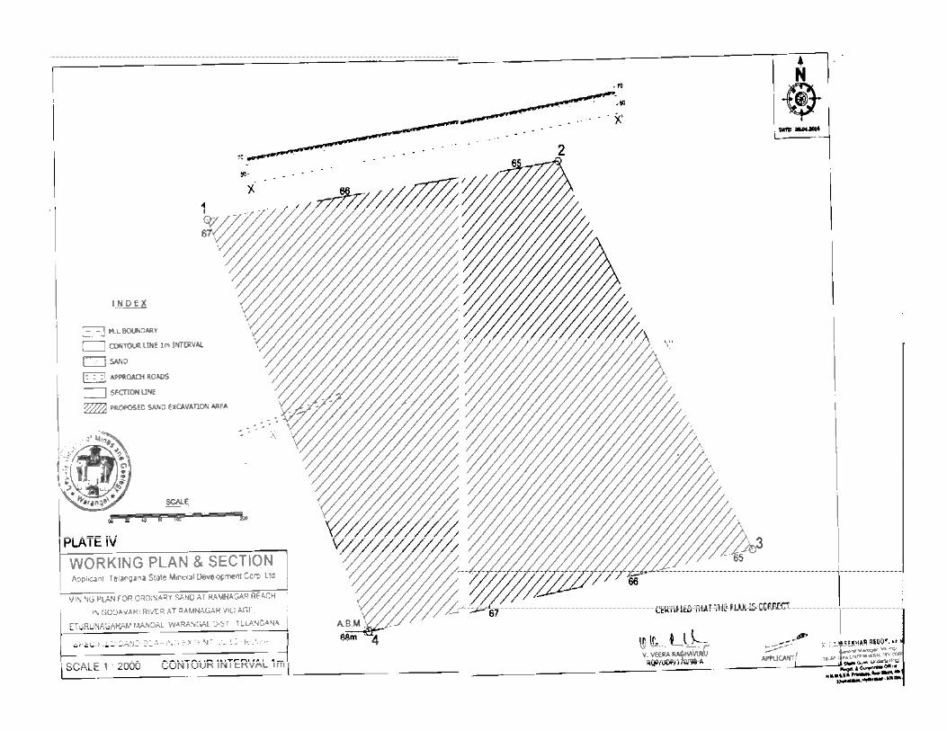
Plate -IV Working Plan & Section Scale : 1: 2,000
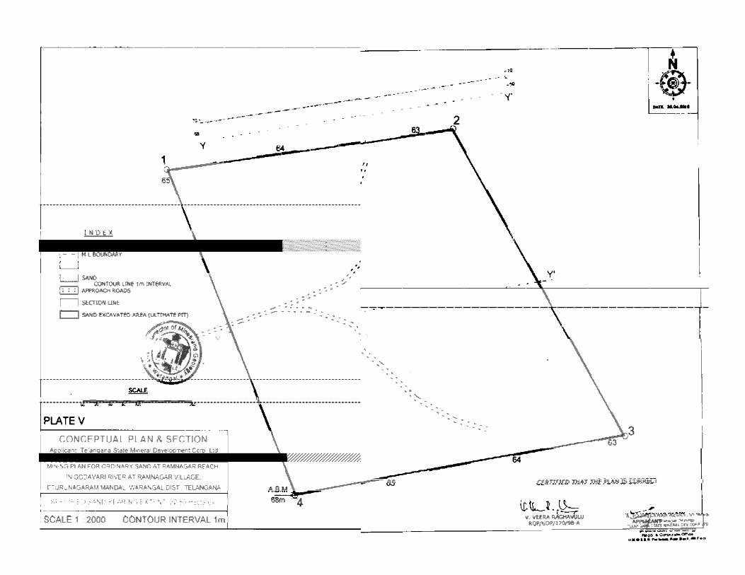
Plate- V Conceptual Plan & Section Scale: 1: 2,000
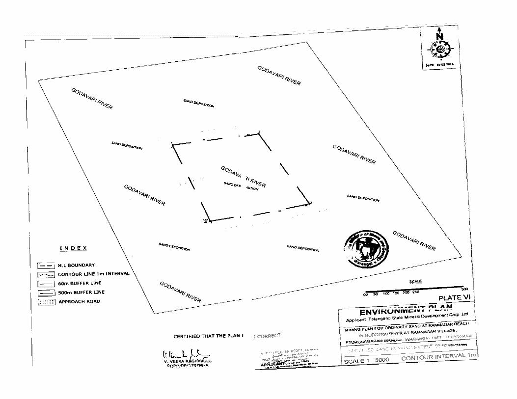
Plate -VI Environment Plan Scale: 1: 5,000
ANNEXURES
Annexure- I Copy of Proceedings of the VCMD, TSMDC, Hyderabad to prepare mining plan for the said area.
Annexure -II Office Memo No.L-11011/47/2011-IA.II(M), dated 18.05.2012 of MoEF, Go I, New Delhi.
Annexure -Ill G.O.Ms.No.38, dated 12.12.2014 and G.O.Ms.No.3, dated 08.01.2015, Industries & Commerce (M .I) Department, Govt. of Telangana.
Annexure- IV Copy of Joint Inspection report of officers.
Annexure- V Copy of RQP Certificate
)
This Mining Plan is Approved subject to the Conditions/Stipulations Indicated in the Mining p a ~)proval letter
' ~~ '1.(, I b 1 o - S' -'1.(>) ~·.!~.~ ... l~~~ .. \ ....... d tea................... ''
MINING PLAN FOR SPECIFIED SAND BEARING AREA OVER AN EXTENT
OF 22.50 HECTARES IN GODAVARI RIVER AT RAMNAGAR VILLAGE, ETURUNAGARAM MANDAL,
WARANGAL DISTRICT, TELANGANA.
1.0 INTRODUCTION:
The Government ofTe!angana proposes to give Specified sand bearing area for Ordinary Sand to
J Telangana State Mineral Development Corporation Ltd. (TSMDC), which in turn allot to
successful raising contractors for undertaking sand quarrying, over an extent of 22.50 Hectares at
Ramnagar Reach in Godavari River at Ramnagar village, Eturunagaram Mandai, Warangal
District for a limited period of one year from the date of commencement of quarrying operations.
The Mining Plan has been prepared as a pre-requisite for obtaining MoEF clearance as per the
instructions issued by the MoEF in compliance with orders of the Hon'ble Supreme Court dated
27-02-2012 & 07-05-2012 and as per WALTA Rules 2004 and as desired by the Telangana State
)
)
)
)
Mineral Development Corporation Ltd., vide Letter No.TSMDC/Sand/Warangal/20 16- J 7/81,
dated 27.04.2016 (Annexure 1).
The Government of Telangana through the Warangal District Collectorate Office while
proposing to issue in principle allotment notice of the specified sand bearing area, instructed the
Telangana State Mineral Development Corporation Ltd., Hyderabad to take necessary action for
obtaining clearances viz., Approved Mining Plan, EC, CFE & CFO and conduct of
Environmental Studies as per MoEF guidelines.
Team of officers from various departments jointly inspected the area on 13.02.2016 and
) recommended for sand excavation (copy of Joint Inspection Report enclosed as Annexure IV) . .
)
.J
J
~)
)
.. )
·.)
._)
The Telangana State Mineral Development Corporation Ltd. (TSMDC), vide Letter
No.TSMDC/Sand/Warangal/2016-17/81, dated 27.04.2016 issued work order to M/s Sri Sai : ' Manasa Nature Tech Pvt. Ltd., Hyderabad to prepare the mining plan by conducting EMP
studies for obtaining clearances from the State Environmental Impact Assessment Authority,
Hyderabad .
APPROVED
K.~BU Dy. Directer of Mines i Geelo!Y
Govt. of Telangana Warangal.
)
)
)
)
.)
)
_)
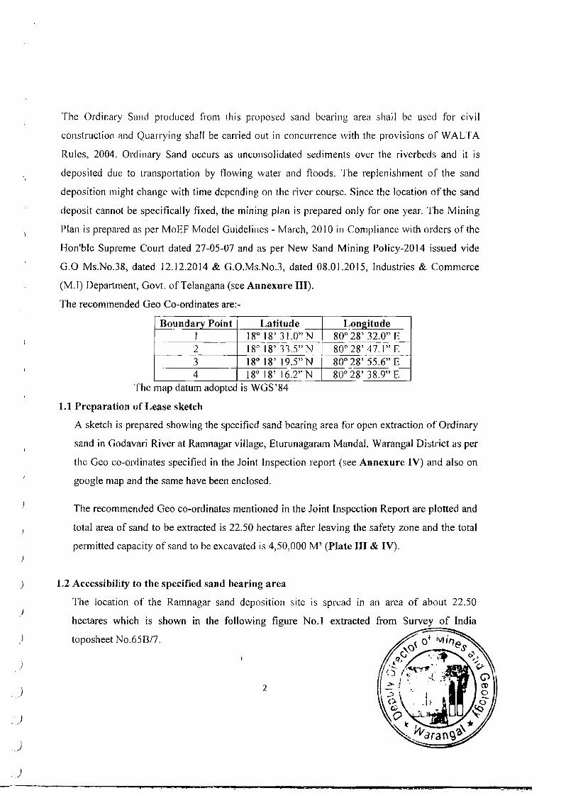
The Ordinary Sand produced from this proposed sand bearing area shall be used for civil
construction ilnd Quarrying shall be carried out in concurrence with the provisions of WALTA
Rules, 2004. Ordinary Sand occurs as unconsolidated sediments over the riverbeds and it is
deposited due to transportation by flowing water and floods. The replenishment of the sand
deposition might change with time depending on the river course. Since the location ofthe sand
deposit cannot be specifically fixed, the mining ple1n is prepared only for one year. The Mining
Plan is prepared as per MoEF Model Guidelines- March, 2010 in Compliance with orders of the
Hon'ble Supreme Court dated 27-05-07 and as per New Sand Mining Policy-20 14 issued vide
G.O Ms.No.38, dated 12.12.2014 & G.O.Ms.No.3, dated 08.01.2015, Industries & Commerce
(M.I) Department, Govt. ofTelangana (see Annexure III).
The recommended Geo Co-ordinates are:-
Boundary Point Latitude Lon2itude I 18° 18' 3l.O"N 80° 28' 32.0" E 2 18° 18' 33.5"N 80° 28' 47.1" E 3 18° 18' 19.5" N 80° 28' 55.6" E 4 18° 18' 16.2" N 80° 28' 38. 9" E
The map datum adopted IS WGS'84
1.1 Preparation of Lease sketch
A sketch is prepared showing the specified sand bearing area for open extraction of Ordinary
sand in Godavari River at Ramnagar village, Eturunagaram Mandai, Warangal District as per
the Geo co-ordinates specified in the Joint Inspection report (see Annexure IV) and also on
google map and the same have been enclosed.
The recommended Geo co-ordinates mentioned in the Joint Inspection Report are plotted and
total area of sand to be extracted is 22.50 hectares after leaving the safety zone and the total
permitted capacity of sand to be excavated is 4,50,000 M3 (Plate III & IV).
1.2 Accessibility to the specified sand bearing area
The location of the Ramnagar sand deposition site is spread in an area of about 22.50
hectares which is shown in the following figure No.I extracted from Survey of India
toposheet No.65B/7.
2
)
)
)
)
)
. )
)
)
~.~
: · ~ .. < • , I • ~
.. ...
~ ~ -.I ' · .. ...t··;· ..
. ·~.
··. ... .... . ······· ··~ .
•
•
... a
•
\..
... ..~ ;
" • .. • • ...
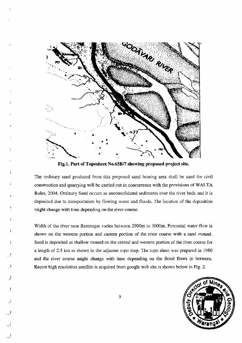
•• .. ~· Fig.l. Part of Toposheet No.65B/7 showing proposed project site.
The ordinary sand produced from this proposed sand bearing area shall be used for civil
construction and quarrying will be carried out in concurrence with the provisions of WALTA
Rules, 2004. Ordinary Sand occurs as unconsolidated sediments over the river beds and it is
deposited due to transportation by flowing water and floods. The location of the deposition
might change with time depending on the river course.
Width of the river near Ramnagar varies between 2900m to 3000m. Perennial water flow is
shown on the western portion and eastern portion of the river course with a sand mound.
Sand is deposited as shallow mound on the central and western portion of the river course for
a length of 2.5 km as shown in the adjacent topo map. The topo sheet was prepared in 1980
and the river course might change with time depending on the flood flows in between.
Recent high resolution satellite is acquired from google web site is shown below in Fig. 2.
3
)
.)
J
.J
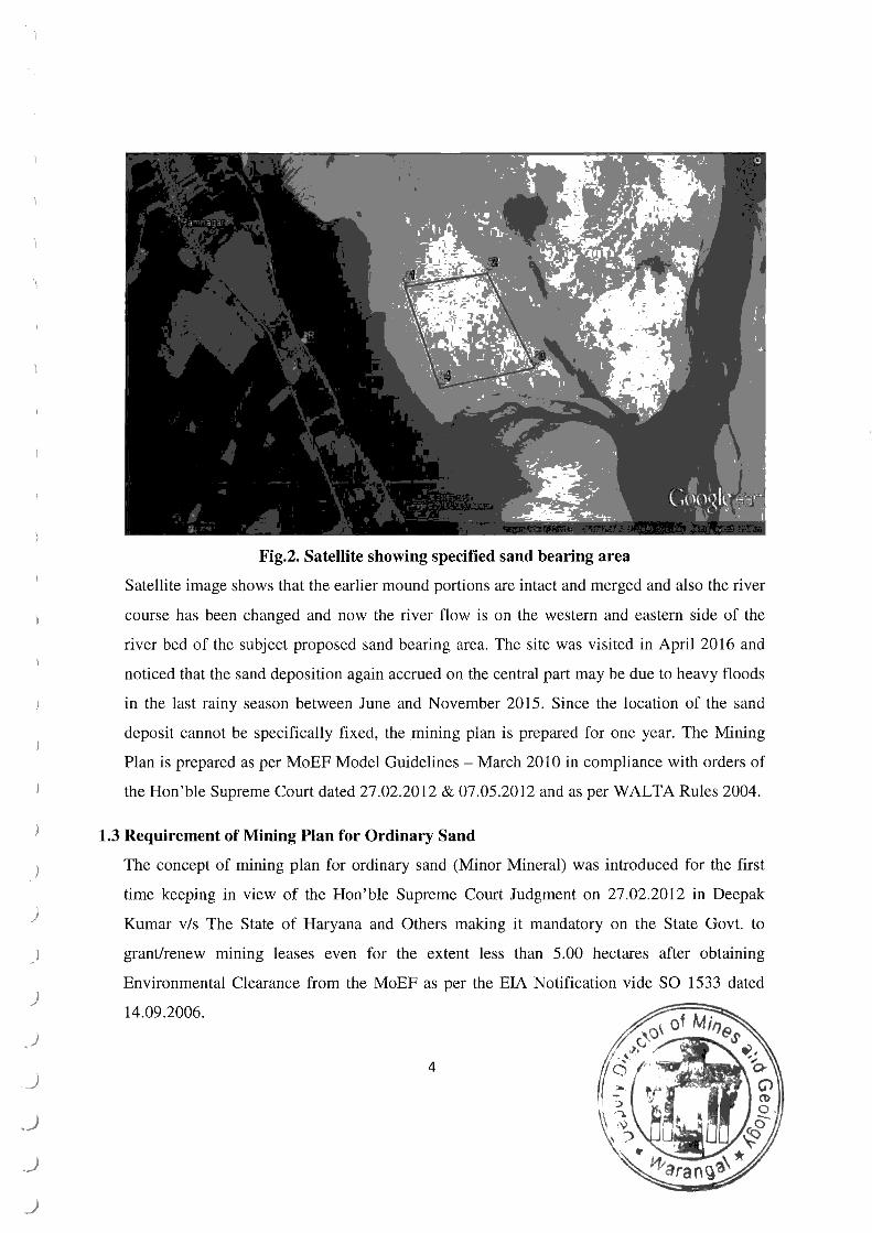
Fig.2. Satellite showing specified sand bearing area
Satellite image shows that the earlier mound portions are intact and merged and also the river
course has been changed and now the river flow is on the western and eastern side of the
river bed of the subject proposed sand bearing area. The site was visited in April 2016 and
noticed that the sand deposition again accrued on the central part may be due to heavy floods
in the last rainy season between June and November 2015. Since the location of the sand
deposit cannot be specifically fixed, the mining plan is prepared for one year. The Mining
Plan is prepared as per MoEF Model Guidelines- March 2010 in compliance with orders of
the Hon'ble Supreme Court dated 27.02.2012 & 07.05 .2012 and as per WALTA Rules 2004.
1.3 Requirement of Mining Plan for Ordinary Sand
The concept of mining plan for ordinary sand (Minor Mineral) was introduced for the first
time keeping in view of the Hon'ble Supreme Court Judgment on 27.02.2012 in Deepak
Kumar v/s The State of Haryana and Others making it mandatory on the State Govt. to
grant/renew mining leases even for the extent less than 5.00 hectares after obtaining
Environmental Clearance from the MoEF as per the EIA Notification vide SO 1533 dated
14.09.2006.
4
)
)
)
'_)
}
J
')
_)
Ordinary sand is a resultant of prolonged weathering and disintegration of the rock formation
due to tlO\v of river. The mineral occurs as unconsolidated sediment. A mining plan is
required for any mineral when the deposition is in fix and consolidated form to be exploited
by forming benches as per the Metalliferrous Mines Regulations, 1961. In fact a mining plan
for ordinary sand transported and deposited due to the flow of river and controlled by rainfall
cannot be prepared .
Thus, the mining plan was prepared for ordinary sand has exclusively to comply as per the
Hon'ble Supreme Court so as to obtain Environmental Clearance as per the norms of the
MoEF.
1.4 Provision as per WALTA Rules, 2004 for Regulation of Sand quarrying:
The State of Telangana enacted Water, Land and Trees Act, 2002 to promote the water
conservation and Tree cover and regulates the exploitation and use of ground and surface
water for protection and conservation of water sources, land & environment and matters
connected therewith or incidental thereto in the entire State of Telangana.
The Water, Land and Trees Act, 2002 was transformed into rules referred to as WALTA
Rules 2004. The operative portion of WALTA Rules, 2004 with regards "Sand Mining" as
per Rule 23 is extracted below:
"In areas where sand mining is affecting ground water regime shall be notified and
mmmg and transportation of sand shall be prohibited in such notified over exploited
ground water micro basins/Mandai and for other areas the following conditions shall apply
for exploitation of sand.
I. a) Sand mining shall not be permitted in notified areas except for local use in the villages
or towns bordering the steams. Transportation of sand from these notified areas through
mechanical means out of the local jurisdiction shall be banned.
b) In lV order streams, sand mining shall be restricted to specified areas.
c) In V order and above rivers, viz. Godavari, Krishna, Penna etc. , sand mining may be
permitted without affecting the existing sources for irrigation for drinking water or
industrial purpose.
5
)
)
2. The sand lease holders shall not carry out quarrymg within 500m of any existing
structure such as bridges, dams, weirs or any other cross drainage structure.
3. Vehicles carrying sand shall not ply over the flood banks except at crossing points or
bridges or on a metal road.
4. Permission to quarry sand shall not be granted within 500m of any ground water
extraction structure(s) either for irrigation or drinking water purposes.
5. The streams/rivers where the thickness of sand is quite good (more than 8.00 meters) the
depth of removal may be extended to 2.00 meters but in no case beyond 2.00 meters.
6. Sand quarrying shall not be permitted in streams within 15 meters or ll51h of the width of
the stream bed from the bank whichever is more.
7. Sand mining shall not be permitted in streams where the thickness of sand deposition is
less than 2.00 meters.
8. The depth of removal of sand shall be restricted to one meter particularly m mmor
streams where the thickness is more than 3.00 meters and less than 8.00 meters.
9. The sand quarrying shall be restricted to depths above the water table recorded during
monsoon and in no case effect/disturb the water lake.
10. The quantity of sand deposited annually in every stream or river shall be monitored by
establishing observation stations along the stream course.
11. The Ground Water Department shalf take up joint inspection along with officials of
Mines and Geology Department or other concerned departments whenever cases are
referred to study the impact of sand mining in an area and shall give recommendations.
) 1.5 Model Guidelines on Environmental Aspects of Quarrying Ordinary San":
)
I ./
)
' j
•\ j
)
)
The MoEF vide order dated 24.03.2009 constituted a group under Chairmanship of Sec:·etary
(E&F) to look into the Environmental aspects associated with mining of minor minerals. The
Group after series of meeting and deliberations prepared "Environmental Aspects of
Quarrying of Minor Minerals'' in March 20 I 0. As per the Group report the subject 'sand
mining' has been covered at 4.9 under title "River Bed Mining". The extract of the Group
report is given below:
6
") I
)
)
) '
)
.)
.)
_)
. ) -._J
·~)
._)
J
._)
Environment damage being caused by un-regulated river bed mining of sand, bazari and
boulders is attracting considerable attention including in the courts.
The following recommendations are therefore made for river bed mining:
(a) In the case of Mining Leases tor river bed sand mining, specific river stretches should
be identified and mining permits/lease should be granted stretch wise, so that the
requisite safeguard measures are duly implemented and are effectively monitored by
the respective Regulatory Authorities.
(b) The depth of mining may be restricted to 3m/water level, whichever is less.
(c) For carrying out mining in proximity to any bridge and/or embankment, appropriate
safety zone should be worked out on case to case basis, taking into account the
structural parameter, location aspects, flow rate etc. and no mining should be carried
out in the safety zone so worked out.
Therefore, the Mining Plan has been prepared based on the provisions as per WALTA Rules
2004 and the model guidelines issued by the MoEF in March 2010 and in strict adherence to
the provision.
Further in keeping view of the New Sand Mining Policy and as per provisions of Rule
4.1.1V(b) I of Telangana State Sand Mining Rules 2015, this Mining Plan is prepared and
submitted to the Dy. Director of Mines & Geology, Warangal for approval ofthe same.
7
-)
)
)
)
)
)
)
)
J
__)
)
_)
,_)
,)
,_)
_)
2.0 GENERAL:
2.1
2.2
2.3.
2.4.
2.5 .
2.6
2.7
a.
b.
Name & Address ofthe Applicant :The Telangana Mineral Development Corporation Ltd. (TSMDC) Hyderabad, Telangana.
Status of Applicant A State Government undertaking
Type of mineral which the applicant :Ordinary Sand intends to mine
Period of Specified sand bearing area proposed :One year
Name & Address of the RQP : V. Veera Raghavulu who prepared the Mining Plan Recognised Geologist,
Sri Sai Manasa Nature Tech Pvt. Ltd. Plot No.74/A, Flat No.102, Kalyan Nagar, Hyderabad - 500 038. Mob: No. 9000777912 Reg.No.RQP/UDP/170/98-A
Validity ofRQP : 19.08.2020 (See Annexure V)
Name & Address of the : The Department of Mines & Geology & the Prospecting Agency Ground Water Department, Govt. ofTelangana.
LOCATION & ACCESSIBILITY:
Location Map : Plate- I
Details of the Area
The specified sand bearing ar~a lies in between Lat: 18° 18' 16.2" N to 18° 18' 33.5" N
& Long: 80° 28' 32.0" E to & 80° 2g' 55.6" E and falls on Survey of India Toposheet
Nos.65B/7. The area is bounded by the following Geographical Co-ordinates with
WGS'g4 as map datum :
Boundary Point Latitude I )go Jg' 3l.O"N 2 18° 18' 33.5" N 3 18° 1g' 19.5"N 4 )go 1g' 16.2" N
See Plate II- Q. L sketch.
8
Longitude goo 2g' 32.0" E goo28' 47.1" E 80° 2g' 55.6" E goo 28' 38.9" E
c. Detail s of the land covered in the precise area :
S.No. District Mandai Village Lease Area Type of Remarks in Hectares Land
J. Warangal Eturunagaram Godavari River 22 .50 Govt. Proposed at Ramnagar Land permission for
extraction of sand
The proposed specified sand bearing sketch is enclosed as Plate II.
2.8 INFRASTRUCTURE AND COMMUNICATION:
. ) The specified sand bearing area is situated at a distance of 6.5 kms from Eturunagaram, the
nearest major town and mandai head quarters. Ramnagar village is situated at a distance of 1.3
km northwest of the specified sand bearing area on the banks of Godavari River, and the district
headquarters Warangal is at a distance of 120 kms via Tadvai &Mulugu.
)
)
. )
Amenities like post & Telegraph office Police station, primary health centre etc are available at
Eturunagaram located at 6.5 km northwest of specified sand bearing area, which is also mandai
head quarters.
Kakinada Port is the nearest port and is about 330 km from specified sand bearing area.
Manuguru is the nearest major railway line of South Central Railway Broad guage line at
Manguru and .a part of the siding taken from Kothagudem to the Manuguru Coal Mine of
Singareni Colleries from the main line Kazipet -Nagpur, and is about 46 kms.
Electricity is not available at the proposed sand bearing area.
The area is having good ground water potential. The ground water level is about 3 to 4 m below
general ground level and the borewells around have good yield.
Agriculture is important occupation of the local people. Further good employment potential
.J exists for the skilled labour in existing major industries near Eturunagaram and also in allied
small scale industries. The climate of Eturunagaram is generally dry and salubrious. April and May are
the hottest months and the hot winds generally last till the end of the June. As the Bay of Bengal is at a
)
)
)
\ I
and in summer. The hottest day falls in May with some shift to June during some years. The coolest day
falls between the months of December and February. The southwest Monsoon is not very important for
this town. Winds are from west and N01th - Wesi during this season. This town and region depends
mainly on the North - East monsoon. The N01th - East monsoon occurs along the East Coast of India
during the month of October and continues till December. The region has a tropical climate similar to
the rest of the Telangana region. The summers (March-June) are very hot and dry while the
winters are fairly pleasant. The temperatures in the summers often rise over 48 degrees during
the day. This period gives about 72% annual rainfall. The average rainfall of the district is 1750 mm.
The southwest monsoon contributes major portion of annual rainfall with 72.00% followed by
the North east Monsoon with 18.32%. The rest 9.68% ofthe rainfall is received during the winter
and summer periods. The local day temperature varies from 19° C in November to 48° C in April
) & May months. The general wind direction reported in SW toNE and SE to NW.
)
)
)
)
)
)
)
)
')
__ )
,_)
. .J
__)
The rainy season (July-December) is often the best time for tourist visits, as fields are brilliantly
green with paddy crops, rivers flowing with monsoon water, and a relatively cool climate. The
region has long been home to the Indian nobles due to its climate and fertile soil, and
several zamindar large mansions are scattered around the Godavari area.
10 ... ,, i:' ~ '/ ~1!~:.
.
3.0 GEOLOGY AND PROSPECTING:
3.1 TOPOGRAPHY:
The specified sand bearing area is a gentle raising plain terrain and is part of Godavari River bed.
It is having topographic relief of 4.0 Mt MSL with slopes due east. A High Flood Level of 12 Mt
and a low Flood level of 0.1 Mt is reported. Either banks of River Godavari slightly elevated by
about 2 Mt to 3 Mt from the base ofthe river bed formed by Flood plain.
The general soil cover in the area comprises of loamy soil. The proposed specified sand bearing
area is devoid of any forest or tree cover and the only vegetation of wild grass is seen.
3.2 REGIONAL GEOLOGY:
The specified sand bearing area is a part of Gondwana Supergroup and are well developed along
) the Godavari Basin/Graben, in the Pranhita-Godavari valley, in the northeastern part of the State.
)
)
)
)
)
)
')
)
)
The belt of rocks encompasses parts of Adilabad, Karimnagar, Warangal, Warangal and West
Godavari districts. In addition to this main Gondwana Basin, rocks belonging to the Supergroup
also occur in isolated patches offluviomarine deposits.
A two fold classification of the Gondwana Supergroup into a Lower and Upper Gondwana, is
currently in vogue. Both lower and upper Gondwana sequences are well developed in the
Godavari valley.
Proterozoic rocks including Quaternary sediments and alluvium. The geological set up, ts as
follows :
Quaternary Permian Proterozoic
3.3 LOCAL GEOLOGY:
: Alluvium & Laterites : Lower Gondwanas - Gondwana sediments : Granites & Metamorphics
The entire area and its environs belong to the Fluvial Recent Alluvium (Sand) belonging to
Quaternary Age.
11
\ I
)
)
)
)
_)
_)
._)
.. )
_)
•._)
3.3.1 THE STRATIGRAPHIC SUCCESSION OF THE AREA IS :
Sand : Quarternary Gondwana sediments : Permian Proterozoic : Granites & Metamorphics
Geological plan of Specified sand bearing area is given as Plate III.
3.3.2 GEOLOGICAL PLAN:
The specified sand bearing area composed of sand deposit of thickness more than 8 mt all over
the river bed.
The specified sand bearing area was jointly surveyed and inspected by the Revenue Department,
Ground water Department and Dept. of Mines and Geology, Warangal District. Subsequently,
the map is prepared for 22.50 hectares based on the geo co-ordinates with WGS'84 as map
datum provided in the Joint Inspection report, is enclosed as proposed Lease sketch as Plate II.
The subject area was surveyed and an assumed bench mark (A.B.M) of 68m is taken at boundary
point No.4 with GPS and accordingly a contour map was prepared on I :2000 scale reflecting the
local geology.
3.3.3 GEOLOGICAL SECTION:
The specified sand bearing area is a gently raising ground plain deposit and 1 Mt contour
traverses the area.
Hence, only one section was taken across the sand deposit. No section influence is taken as the
depositioil of sand is uniform throughout the Specified sand bearing area and sand excavation is
restricted to 1m only as per WALT A Rules 2004.
12
4.0 DETAILS OF PROSPECTING OPERATIONS:
4.1 PROSPECTING OPERATIONS CARRIED O UT:
) The surface prospecting was carried out by the Depa11ment of Mines and Geology. The Ground
Water Department approved the Specified sand bearing area as per the provisions of WALTA
) Rules, 2004. Since Ordinary Sand is deposited on the river bed , no specific prospecting was
carried out.
)
4.2 GEOLOGICAL TRAVERSES AND MAPPING:
The specified sand bearing area was traversed to demarcate the availability and thickness of sand
deposit. The data regarding litho units collected and Surface Geological Map is prepared on the
scale I: 2,000 (Plate III).
4.3 TOPOGRAPHIC SURVEY:
The survey of the area was carried out and the gee-coordinates were taken using a Hand held
) Global Positioning System (GPS) Garmin72 and they are shown in Plate II. Position format
(dd .mm.ss.s), Map Datum WGS'84, Units - Metric, Magnetic North variance 001 o W.
)
)
)
)
)
)
,_)
4.4 FUTURE EXPLORATION PROPOSED:
No further exploration is proposed as the mineral deposition is in the form of unconsolidated
sediments deposited due to change in river course and feasible for exploitation is restricted to 2
meters depth as the thickness of the sand deposition is more than Sm.
4.5 ESTIMATION AND CALCULATION OF GEOLOGICAL RESOURCES:
The total deposition of sand is found to be more than 8m as can be appreciated from the
Specified sand bearing area. Since 2m depth of sand can be quarried as per the WALTA Rules,
2004 the proved average depth ofthe sand deposit can be considered as 2 Mt.
4.5 .1 RESERVE ESTIMATION:
,· . ...
.-·-, .I
·., I
' )
)
)
)
)
)
l _/
'•)
.)
._)
~' ~.J
J
._)
.)
22.50 hectares x 10000 x 2m= 4,50,000 Cu.m
l Total area considered 225000 M~ ·-
2 Thickness considered for mining the ordinary sand 2m 3 Volum t o r ordinary sand that will be mined 450000 M3
4.6 MINEABLE RESERVES AND THE LIFE OF THE MINE:
Total Reserves are 4,50,000 cu.m and the Government is allotting the quantity for a certain
period as the quantities available are very minimum. Therefore, the entire quantities available
have to be mined within that limited period.
Life of the Mine= Total Mineable Reserves= 4,50,000 No. of working days 365
Proposed production per day= 1232 M3
Note: Adjustable with extent to quarrying/extraction of sand keeping in view of the rains and floods.
14
~,
'
' '
)
)
. )
·~
,_)
,__)
___ )
5.0 QUARRYING/METHOD OF MINING:
The mining operation will be carried by open excavation method. However, extraction of sand
from sand bearing area shall be by manual or mechanized means subject to permission from the
District WALTA Authority on a condition that there is no impact on ground water table.
5.1 PRODUCTION PLAN FOR ONE YEAR:
The deposit does not require any development as sand is exposed and can be quarried for 2 Mt
depth. The entire estimated reserves of 4,50,000 Cu.m of sand deposit shall be quarried limiting
to a depth of 2m during the period of one year as permitted in E. C.
5.2 STOCK YARD:
The sand extracted from the specified sand bearing area shall be transported by tractors to the
stockyard specified for stocking of the sand for onward dispatches. Generally the stock yard shall
be maintained by the staff of TSMDC and a:e located, where tippers and trucks are accessible to
the stock yard for their transportation.
5.3 LIST OF MACHINERY:
The sand is excavated in the river bed by engaging excavators. If excavation is allowed by
machinery, excavators of suitable capacities shall be deployed to excavate 2 m thickness of sand
and is loaded into tractors for further transportation to the stock yard.
6.0 DRILLING & BLASTING:
No drilling & blasting is required for extraction of sand .
6.1. Transportation of sand from mine to the destination
Tractors will be deployed to transport the sand from Mine site.
7.0 STORAGE AND HANDLING OF THE EXPLOSIVES:
Since blasting is not required, the storage and handling of explosives does not ari
"' . ~
15 d
8.0 DUMPING YARD:
No waste will be generated as the entire sand mined is marketable and utilized. Hence, dumping
ym'd does not arise. Dumping yard is made for the storage of the sand for onward transportation,
outside the Q.L area on the banks of the river with prior permission.
9.0 WASTE MANAGEMENT PLAN:
Not Applicable
10.0 USE OF THE MINERAL:
The Sand mined will be utilized for construction purpose only.
11.0 MARKET ANALYSIS:
As the demand for sand is weJJ known in these days sand mined is presumed to be marketable
with ease and mining of sand wiJJ be a profitable one.
) 12.0 DESCRIPTION OF PROCESSING PLANT IF ANY:
. )
)
)
.)
J
)
J
.J
.J
J
__)
No processing is required.
13.0 SITE SERVICES:
A make shift quarry office shall be established at the quarry-site. Other statutory constructions
like rest shelter, drinking water supply, and first aid facility may not be required as the laborers
involved in the quarry operation will be from the adjoining villages.
16
)
)
_)
)
)
)
)
)
)
14.0 ENVIRONMENT PLAN:
a) Baseline information:
i) Ex istin g land u e Rattem: The Specified sand bearing area is in the river bed which will be
submerged under water during monsoon and floods. The adjacent areas are classified as River
poramboke by the revenue authorities.
(I) Area to be excavated (2) Site services
Total Specified sand bearing Area
22 .50 Hectares Nil
22.50 Hectares
Hence, the area put to use for quarrying and allied activities comes to 22.50 hectares
ii) Water Regime: Godavari River is a perennial river which flows to the brim during the
monsoon and post monsoon season during the months July to October with the lean flow during
the November to June.
iii) Flora and Fauna: The subject area is devoid of trees and major vegetative cover, excepting
some flora and straw grass. The Specified sand bearing area is over the river bed . There is the
presence of reptiles and other small water creatures and no major wild _life exists in the area.
iv) Qua lity of Air. Water and Ambient Noi e Level: The subject area is away from industries and
Human settlements. The impact of quarrying is not likely to have any adverse impact on the
existing environment. Quarrying even on a small scale causes some environmental impact.
Therefore, efforts are nec~ssary to mitigate the environmental impact created. The management
is well aware of this aspect and will take all precautions to mitigate the impact.
v) C limati c >n lili ns : It is too hot in summer. Warangal District summer highest day
temperature is in between 35° C to 48° C. Average temperatures of January is 26° C, February is
26° C, March is 30° C, April is 33° C, May is 37"' C, June is 32° C. The peak summer will be in
the month of May. Highest temperatures of 42°C are recorded in the area during the month of
May and the lowest temperature of26°C is recorded in the month of January. During 2013-2014
the rainfall of the area was of the order about 1625 mm.
17
)
)
)
)
)
)
)
J
)
vi) I um::~n ~· ul ment: The following villages are located within 5 Kms radius of the specified
sand bearing area. The population. distance and location of these villages with respect to
specified sand bearing area are given in the following table:
S.No. Name of the Village *Population Distance Direction (Km)
1. Ram nagar 1111 1.50 NW 2. Marikala 782 2.40 NE 3. Kamalapuram 11940 4.35 SSE 4. PaokaQ_uram 335 3.45 w 5. Ramannagudem 1909 3.15 NW
(*Source: www.censusindia.gov.in- 2001 data)
There are no Public Buildings, Places of Worship or Historical Monuments in the vicinity of the
Specified sand bearing area. Therefore, no affect due to quarrying.
b) ENVIRONMENTAL MANAGEMENT PLAN:
1) , torage and Utili zation orTopsoi l: No top soil will be generated as the proposed quarrying is
over the river bed. Hence storage and utilization of top soil does not arise.
2) Proposal for Reclamati on of Land Effected by Mining: No reclamation activities are proposed
as sand will be extracted from the river bed and it will be replenished during the subsequent
flood in the ensuing monsoon.
3) ffi restati n Programme: Not Suggested as the quarrying of sand is over river bed is for a
limited period and on a small scale.
4) , 'tab ilizntion and veg Lotion of Dump ·: No dumps will be formed as the entire mineral will be
utilized.
5) Measure to ontrol Erosion I Sedimentation f Watercour es: No erosion is anticipated hence
control measures not suggested.
quarry lease.
18
)
7) Measures fo r Min imizin g
This Mining Plan is Approved subject to the Conditiors/Stipu!ations Indicated in the Mining Plan Aqproval Letter No.tY/.~~~.~:)1~~.\1f~Yed .... 1~..-:£:..~ \{,
suggested as there is no effect on water regime rlue to sand quarrying upto I mas specitied under
WALTA Rules, 2004 which will be strictly adhered to.
und Vi bration: Due to Blastin g: Not applicable as there is no involvement of
blasting.
9) Measure · for Protecti on of llistorical Monuments and Rehabilitation of Human Settlements
likely to be disturbed due to Mining Activity: No historical monuments in the vicinity of the
proposed Specified sand bearing area. Hence, any measures does not arise.
I 0) ··conomic benefits ri. ing out of Mining: Local employment to the labour will be
generated for the proposed quarrying period and the quarrying of sand will ease the gap in supply
of sand to the infrastructure industry which is the need of the hour.
15.0 ANY OTHER INFORMATION:
Ordinary Sand will be quarried strictly adhering to the provisions of WALTA Act 2002 & Rules
2004 respectively, the conditions imposed by SEIAA, Hyderabad. The Government ofTelangana
proposes to issue Specified sand bearing to the Telangana State Mineral Development
) Corporation Ltd. which in turn carry out the quarrying operations 1hrough raising contractors as
per the restrictions, conditions specified by the SEIAA, Hyderabad. Hence, there shall be no
)
)
)
)
)
)
)
deviation from the Statute.
Signature of the A
K. P.AJASEKHA REDDY, B.E.(Minlng)
General Manager (Mining) Ti::LA~.'3M'A STATE MINERAL DEV. CORP. LTD.
(A State Govt. Undertaking) P.egd. & Corporate Office
r'.M.W.S.S.B. PrGmises, Rear Block, 4th Floor, l',:l~irztJb::;d, Hyd9rabad • 500 004.
APPROVED
V. Veera Ragha ulu RQP/UDP/170/98-A
¥' ~ K.LAXM NBA8U
Dy.1Qiredor oi Mines lz Gu1tgy - G•vt. ef Telan!Jana
Warangal.
)
)
)
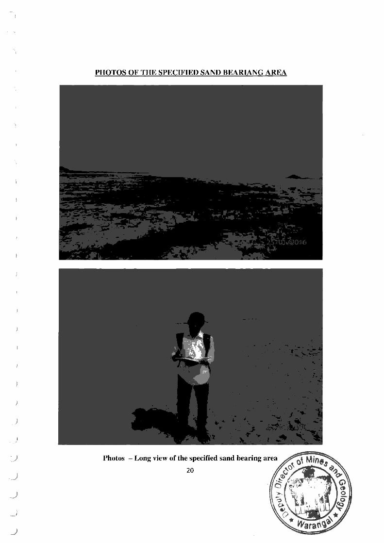
PHOTOS OF THE SPECIFIED SAND BEARIANG AREA
Photos - Long view of the specified sand bearing area
20
Annexure l
\ 'E L A ~"i i. , \ :·! ~ •;,; L\TL ~\ W <~ }, RAL Department of Industries & Comrnerce Government of Telangana
DFV lO;(W\ !Ff\ r CORPOH.\ i ION UMlTED '.A State Government Undertaking)
# 6-2-915, HMWSSB Premises, Rear Block, 4th Floor, Khairatabad, Hyderabad - 500 004. Off: 040-23323150 Fax: 040-23373155 Email: [email protected]
)
)
)
)
)
)
)
)
_)
.)
.)
..)
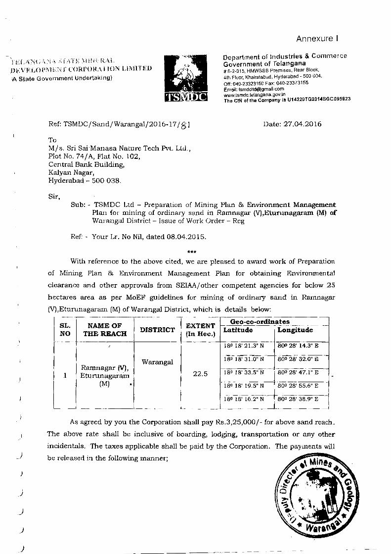
Ref: TSMDC/SmHl/Warangal/2016-17 / 8' I
To Mjs. Sri Sai Manasa Nature Tech Pvt. Ltd ., Plot No. 74/ A, Flat No. 102, Central Bank Building, Kalyan Nagar, Hyderabad - 500 038,
Sir,
www. tsmdc. te!angana . gov. in The C!N of the Company is U14220TG2014SGC095923
Date: 27_04.2016
Sub:- TSMDC Ltd- Preparation of Mining Plan & Environment Management Plan for mining of ordinary sand in Ramnagax (V) ,Eturunagaram (M) of Warangal District- Issue of Work <)rder- Reg
Ref:- Your Lr. No Nil, dated 08.04.2015.
*** With reference to the above cited, we are pleased to award work of Preparation
of Mining Plan & Environment Management Plan for obtaining Environmental
clearance and other approvals from SEIAA/ other competent agencies for below 25
hectares area as per MoEF guidelines for mining of ordinary sand in Rarnnagar
(V),Eturunagaram (M) of Warangal District, which is details below: ~ ------,----- - -
SL. NAME OF EXTENT Geo-co-ordinates
NO THE REACH DISTRICT
(In Hec.) Latitude Longitude
180 18'21.3"N 800 28' 14.3" E
Warangal 180 18' 31.0" N 800 28' 32.0" E
Ramnagar tV), 1 Eturunagai-ain 22.5 180 18' 33.5" N 8oo 28' 47.1" E
(M) • 18o 18' 19.5" N BOO 28' 55.6" E
1 so 18' 16.2" N 800 28' 38.9" E
As agreed by you the Corporation shall pay Rs.3,25,000/- for above sand reach .
The above rate shall be inclusive of boarding, lodging, transportation or any other
incidentals. The taxes applicable shall be paid by the Corporation. The payments will
be released in the following manner;
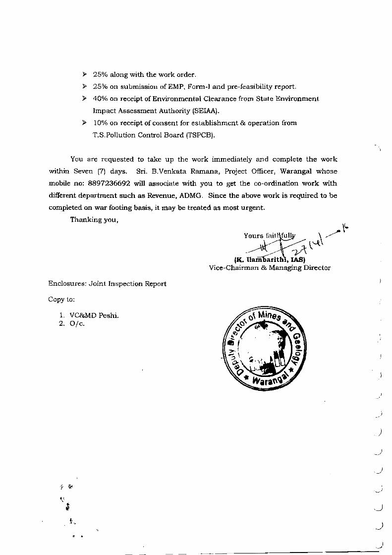
};> 25% along with the work order.
};> 25% on submission of EMP, Form-I and pre-feasibility report.
};> 40% on receipt of Environmental Clearance from State Environment
Impact Assessment Authority (SEIAA).
};> 10% on receipt of consent for establishment & operation from
T.S.Pollution Control Board (TSPCB).
You are requested to take up the work immediately and complete the work
within Seven (7) days. Sri. B.Venkata Ramana, Project Officer, Warangal whose
mobile no: 8897236692 will associate with you to get the co-ordination work with
different department such as Revenue, ADMG. Since the above work is required to be
completed on war footing basis, it may be treated as most urgent.
Thanking you,
Enclosures: Joint Inspection Report
Copy to:
1. VC&MD Peshi. 2. 0/c.
/
...
Y-
' )
)
)
) ,J
) _/
_)
J
._)
~
0
._)
._)
)
)
.J
)
)
_)
\ \
... '
Annexure II
No. L~llOU/47/2011-IA.Il(M) Government of India
Ministry of Environment & Forests Paryavaran Bhavan,
C.G.O. Complex, Lodi Road, New Delhl-110003. T~efax: 24362434
Dated the 18th May, 2012 OFFICE MEMORANDUM
Sub: Order of Hon'ble Supreme Court dated 27.2.2012 In I.A. no. 12-13 of 2011 in SLP (C) no. 19628-19629 of 2009 in the matter of Deepak Kumar etc. Ys State of Haryana and Ors. -Implementation thereof - Regarding.
Reference Is Invited to the above mentioned order of the Hon'ble Supreme Court directing inter-alia as under:
'"'We in the meanwhile, order that leases of minor mineral Including their renewal for an area of less than 5 ha be granted by the States I UTs only after getting environmental dearance from the MoEF."
2. The Environment Impact Assessment (EIA) Notification, 2006, as amended, requires mining projects (new projects, expansion or modernization of existing projects as also at the stage of renewal of mine lease) with lease area of s· ha and above,
· irrespective of the mineral (major or minor~ to obtain prior environment dearance under the provisions thereof. Mining projects with lease area of 5 ha and above and less than 50 ha are categorized as category 'B' whereas projects with lease area of 50 ha and above are categorized as category 'A'. The category 'A' projects are considered at the central level In the Min.lsby of Environment & Forests while category '8' projects are considered by the respective · State/UT Level Environment Impact Assessment Authonly, notified by MoEF under the aA Notification, 2006.
. . 3. In order to ensure compliance·'of the above referred order of the Hon'ble Supreme Court dated 2j .2.2014-; t has now been decided that all mining projects of minor minerals Including thyir renewal, Irrespective of the siz~ of the lease would henceforth require prior environment clearance. Mining projects with lease area up to less than 50 ha Including projects of, minor mineral with lease area less than 5 ha would be treated as category 'B' as defined In the EIA Notification, 2006 and will be considered by the respective SEIAAs notltled by MoEF and following the procedure prescribed under EIA Notfficatlon, 2006.
4. Further, the Hon'ble Supreme Court In Its order dated 16.4.2012 In the above mentioned matt;er and the linked applications has observ~ as under:
"All the same, liberty is granted to the applicants before us to approach t ,o 0' Mint's Ministry of Environment and Forests for permlsslcn to carry on mining below ~v ~., h~res and In the even.t of which Ministry will dispose of all the appli @5 ~ wlthrn ten days from the date of receipt of the applications In accordanc tD lawv." o
"· ...
-2-
Aa:ordlngly, tne respective SBAAs In dealing with the applfcatlons of ttle \ applicants referred to In the above mentioned order shall ensure tllat the directions of
the Hon'ble SUpreme Court are effectively complied with and the applications of such :. applicants are disposed of within the time limit prescribed by the Hon'ble Court In • accordance with law.
To
1. 2. 3. 4. 5.
This Issues with the approval of the Competent Authority.
The Secretary, Ministry of Mines, Shastn Bhawan, New Delhi. The Chief Secretaries of all the States 1 urs Chairpersons I Member Secretaries of all the SEIAAs/SEN:s Chairman, CPCB Chairpersons I Member Secretaries of all SPCBs I lJTPCCs
Copy'to:-
1. PSto MEF 2. PPS to Secretary (E&F)
• 3. PPS to JS(RG) 4. All the Officers of lA Division 5. Website, MoEF 6. Guard File
~~ (Or. S.K. AggarwaJY
Ofrector
' !. I
I
\ .I
)
I -
I !
I __;
_)
)
I
._)
.. )
,)
,.)
J
--==~--------------------~~~~==~======~====~==~)
)
)
)
)
)
)
)
)
)
_)
GOVERNMENT OF TELANGANA ABSTRACT
Annexure Ill
Mines & Minerals - New Sand Mining Polrcy - 2014 for the State of Telangana -Introduced - Orders - Issued. ========================== ======= ==================
G.O.MS.No . 38
INDUSTRIES />.ND COMMERCE (MINES.!) DEPARTMENT
Dated : 12.12.2014. Read the following :
1) G.O.Ms.No.24, Ind. & Com.(M.I) Department, dated 12-02-2007. 2) G.O.Ms.No.84, Ind. & Com.(M.I)Department, dated: 10-04-2007. 3) G.O.Ms. No.142, Ind& Com.( M .I) Department, dated: 13-10-2012. 4) G.O.Ms.No.154, Ind & Com(M.I) Department, dated:15.11.2012. 5) G.O.Ms.No.186, Ind. &Com.(M.I)Department, dated;17.12.2013. 6) G.O.Ms.No.63, Ind. & Com.(M.I) Department, dated:22.02.2014.
***** ORDER:
In the reference 1st read above, the subject matter "auctioning of sand" was tran!':ferred from Panchayat Raj Department to Industries and Commerce Department. Subsequently, suitable amendments to APMMC Rules 1966 were issued in respect of auctioning of sand and for regulation of sand quarrying in the State of Andhra Pradesh vide reference 2"~ read above.
2. As per the orders issued in the reference 2"d read above, sand reaches were auctioned to the highest bidder. Subsequently, in view of the Supreme Court ruling in the case of Deepak Kumar vs State of Haryana and also since under the auction system, Government was not able to control the price or the leakage of revenues, orders were issued in the reference 3'd read above for allotment of sand reaches by draw or lots from eligible applicants, as amended relevant rules from time to time vide references 4th to 6th read above. However, this system also did not work well as there was a lot of leakage of revenue and Government did not get a boost as expected. Therefore, the Government feit that there is every need to review and revise the existing Sand Policy.
3. Accordingly, the Government after careful examination and consideration of the matter in detail, hereby introduces the New Sand Mining Policy-2014 for the State of Telangana. The Salient features of the New Sand Mining Policy-2014 are as follows:-
(i) Sand is available in the State from (3) sources, viz., 1) Rivers and streams, 2) De-silting of Reservoirs and 3) De-casting of Private Patta Lands
(ii) The Sand available from Rivers and streams is categorized into I to V order depending on size and capacity. In !-order streams, the source is small village stream or vagu while V-order would be large rivers like Krishna and the Godavarii ..
I (iii) Sand in I and II O"rder streams will be left to the Local Body and Villagers for
domestic needs, Government sponsored weaker section Housing schemes for which no seigniorage charges are collected. Extraction of sand from said order streams for construction of Local Body buildings like schools, community halls etc., will be allowed subject to payment of Seigniorage Fee by the consuming agency. The excavation and transportation of sand shall be manual and no mechanical means be allowed and no sand be transported outside the toea: jurisdiction.
(iv) Sand in III, IV and V order streams will be allowed for exploitation subject to WALTA Rules and Regulations.
(v) A preliminary identification of sand available in III, IV and V order will be done by the Mines and Geology Department in consultation wi Irrigation, Ground Water and Revenue Departments. These rea ch include left banks of Tungabhadra River, Krishna River including backwa t~l'"' ...'tjle .<SodavaFi r~ver -and ils tributaries ar1d aii project de-sr areas.
l : 2 . :
(vi) Based on preliminary identification, the District Level Committee under the Chairmanship of Joint Collector will meet and cause inspection of all stretches and give a feasible area report based on WALTA criterion. The feasible areas will be allotted to the Telangana State Mineral Development Corporation Limited (TSMDC) for excavation, regulation and supply of sar.d. The TSMDC will then obtain all statutory clearances like EC, Mining Plan, Environment Management Plan, CFE and CFO . Once PCB clearance is obtained extraction of sand can start.
(vii) Sand available by way of de-silting of reservoirs will also be allowed to be exploitation. The same shall be identified in consultation with the Irrigation Department.
(viii) The feasible sand reaches identified in the III, IV and V order streams as well as sand available under de-silting of reservoirs will be handed over to the TSMDC for extraction.
(ix) The TSMDC will appoint raising contractors for the sand reaches identified under a strict competitive bidding process. The sand so excavated will be moved to stockyards managed by the TSMDC. The stockyards can be near the sand reach. Additional stockyards near urban habitations, especially the Municipal Corporations can also be created.
(x) Sale of sand to all consumers, small, medium or large, will be from these ~tockyards. Sale of sand from these stockyards will be controlled by electronic surveillance (CCTVs) and electronic documentation linked to a central documentation monitoring facility . The way-bills for transportation of sand will have the security seal of the TSMDC and will be stamped with date and time. The vehicles will be tracked by way of GPS. Any sand lorry found without TSMDC way-bill will be illegal and the vehicle should be seized.
(xi) The intention of the Government is to ensure adequate quantity of the right quality of sand is available at a reasonable price to the people of the State.
(xii) Sand mining in tribal areas will be governed by the provisions of the Panchayats Extension to Scheduled Areas (PESA) Act of 1996, PESA Rules of 2011 and the WALTA Act Rules of 2004.
(xiii) The present system for sand permits in Patta lands shall continue, but with more rigorous vigilance and inspections. The demarcation of Patta lands has to be done very accurately and further ensured that no mining takes place outside the Patta lands. If ad valorem rate of seigniorage is imposed, the TSM DC rate will be the bench mark for seigniorage charges for Patta lands also.
(xiv) The Government shall fix the rates and revise the rates of Siegn1orage Fee as per the situation/demand warrants.
(xv) Rock sand is a good alternative to natural sand. Availability of rock sand will reduce the pressure on natural sand which is not found abundantly in the State of Telangana. The technical viability of Rock Sand has been established without doubt. In fact L&T has been using rock sand for the Hyderabad Metro-Rail Project.
(xvi) Rock sand manufactured can be accorded industry status as long as the unit manufactures 100% rock sand. Right now only 20% of the capacity is being used for manufacture of Rock Sand. VAT and power subsidy can be extended prospectively . Regular incentives can be given for new units.
(xvii) In addition, preference in quarry lease allotment will be given manufacturing Rock Sand. Existing Stone Crushers caJ~~=Q8ile_d
.. ..: status provided the crusher rock sand is certified ... .
(Xvii) Government Departments shall be manda tecr~o·JI~{Y'Ci
Sand in Government constructions.
I
)
)
J
)
)
.J
)
)
)
)
)
J
) ~~/
)
)
. .J
l .
4. In accordance with the New Sand ~~ming Policy-2014 necessary Rules under Section 15(1) of ~1&M(D&R) Act, 1957 will be issued separately.
5. All notifications/orders issued ea;-lier for allotment of sand reaches, if any shall be reg:..~:ated in accordance with the New Sand Mining Policy-2014.
6. The Government may review the Sand Policy in future as and when required from time to time and issue the Guidelines/amendments accordingly.
7. The policy shall come into force with immediate effect .
8. The Director of Mines and Geology, Hyderabad shall take further necessary action in the matter accordingly and make necessary arrangements for wide publicity of the policy.
[BY ORDER AND IN THE NAME OF THE GOVERNOR OF TELANGANA]
K. PRADEEP CHANDRA SPECIAL CHIEF SECRETARY TO GOVERNMENT AND
COMMISSIONER FOR INDUSTRIAL PROMOTION
To The Director of Mines and Geology, Telangana State, Hyderabad The Vice Chairman & Managing Director,
Telangana State Mineral Development Corporation Ltd., Hyderabad. All the District Collectors/Joint Collectors in the state of Telangana
through Director of Mines and Geology, Hyderabad. The Irrigation & CAD Department. The Panchayat Raj & Rural Development Department The Revenue Department. The Commissioner of Panchayat Raj, Hyderabad All the Departments of Telangana Secretariat. Copy to : P.S. to Principle Secretary to the Hon'ble Chief Minister. P.S to Hon'ble Minister for Mines and Geology. P.S. to Hon'ble Minister for Panchayat Raj & Information Technology. P.S. to Hon'ble Minister for Irrigation. P.S. to Chief Secretary to Government. P.S. to Special Chief Secretary to Government & CIP, Ind & Com Dept. P.S. to Secretary to Government, Ind & Com Dept., The Joint Directors/Deputy Directors/ Assistant Directors of Mines and
Geology Deptt., through the Director of Mines & Geology, Hyderabad . The General Administration (Cabinet) Department. Sf/Sc.
//FORWARDED:: BY ORDER//
SECTION OFFICER
)
.J
J
..)
.)
GOVERNMENT OF TELANGANA ABSTRACT
MINES & MINERALS - REGULATION OF SAND MINING - NEW SAND MINING POLICY, 2014 - FORMULATION OF TELANGANA STATE SAND MINING RULES -2015 (TSSMR-2015) -ORDERS -ISSUED
INDUSTRIES & COMMERCE (MINES-I) DEPARTMENT
G.O.MS.No.3, DATED :08-01-2015. Read
G.O.Ms.No.38, Industries & Commerce (Mines.I) Department, Dated: 12-12-2014.
*****
The following Notification shall be published in an Extraordinary Issue of Telangana State, Gazette dated:OS-01-2015.
NOTIFICATION
In exercise of the powers conferred by Section 15(1) of Mines & Minerals (Development & Regulation) Act, 1957 (Central Act 67 of 1957), the Governor of Telangana, in supersession of all earlier orders issued in the composite State and in accordance with the New Sand Mining Policy-2014 for the State of Telangana as announced in G.O.Ms.No.38, Industries & Commerce (Mines.I) Department, Dated: 12-12-2014, hereby makes the following Rules to regulate the Mining and Transportation of sand in the State of Telangana and for the purposes connected therewith, namely: - .
1. Short title and commencement:-
(i) These Rules may be called the Telangana State Sand Mining Rules, 2015.
(ii) It extends to the entire State of Telangana.
2. Regulation of extraction/disposal of Stream/River Sand
. (i) Sand extraction and sale other than de-casting patta lands and in respect of I and II order streams, in the State shall be through Telangana State Mineral Development Corporation Limited (TSMDC) only.
(ii) Regulation of Stream/River sand extraction/disposal from the areas other than falling in Schedule Areas be done by the authorities specified under Rule 3(6).
(iii) Allocation of specified sand bearing areas located partially/fully in Scheduled Areas shall be as per the Panchayats Extension to Scheduled Areas (PESA) Rules, 2011 or any suitable subsequent rules/amendments to be 1ssued by Government from time to time with Technical and Administra support from Integrated Tribal Development Authorities (IT /Telangana State Mineral Development Corporation Ll (TSMDC Ltd.) under the direct supervision and control o Agency Maqis,t!jiilte/iElistrict Collector concerned. Opera guiclE:lines shalh t3e issued by the DlsfrTciCollector-from ti time. .'i'
. 2 '
3. Sand extraction in I and II order streams:
Sand extraction shall not be permitted in notified over-exploited areas except for local use in villages or towns bordering the Streams for bonafide purposes other than commercial operations/public trading/stocking etc. The Sand extraction:-
(1) Shall be as per Rule 23-(1) (a) of Water Land and Tree Rules, 2004 or any suitable subsequent rules/amendments to be issued by Government from time to time.
(2) Shall be for local use: (a) Free of cost:
(i) For weaker section housing schemes on a certificate issued by the District Collector or any authorized officer;
(ii) For own use basing on the actual requirement to be certified by Panchayath Secretary concerned and
(b) For local use of sand in Government works on payment of seigniorage fee.
(3) The Panchayath Secretary of concerned Gram Panchayath shall issue way bills as prescribed by the Mandai Authority under WALTA, 2002 or any suitable subsequent rules/amendments to be issued by Government from time to time for the purposes mentioned under sub-rule (2) w ithin the jurisdiction.
( 4) Transportation of sand shall be by means of bullock carts/Tractors only within the jurisdiction.
(5) The District shall be treated as a unit for free movement of sand within the jurisdiction.
(6) The District Collector shall put in place proper administrative mechanism for enforcement of extraction and tr·ansportation of sand in I and II order Streams comprising of:
a)
b)
Revenue Divisional Officer concerned.
Tahsildar concerned
c) Representative of Deputy Director, Ground water
Department.
d) Executive Engineer (concerned), RWS/Irrigation Dept.
e)
f)
Sub-Divisional Police Officer.
Motor Vehicle Inspector (concerned) from Transport Dept .
4. Constitution of Sand Monitoring Committee (SMC)
In partial modification to G.O.Ms.No.38, dated 12.12.2014, the District Collector & Magistrate shall be the Chairman of the District Level Sand
,.
••
. . · -. .. 'l
Chief Secretary
)
)
J
)
)
)
)
~)
)
)
)
)
)
)
)
)
j
)
:; 3 ::
(1) Constitution of District Level Sand Committee (DLSC)
The identification of sand bearing areas in III, IV and above order streams/rivers for extraction shall be by the District Level Sand Committee. The District Collector shall be the Chairman of the District Level Sand Committee, other members will consist of the foilowing officers:
(a) District Collector (b) Joint Collector (c)*Project Officer, ITDA concerned. (d) District Panchayat Officer (e) Dy. Director, Ground Water Dept. (f) Executive Engineer, Irrigation/
River Conservator. (g) Executive Engineer, Rural Water Supply (h) Environmental Engineer, Telangana State
Pollution Control Board. (i) Nominee of Telangana State Mineral
Development Corporation Ltd. (TSMDC) (j) Asst. Director of Mines & Geology
concerned.
Chairman Vice-Chairman Member Member fv'iember Member
Member Member
Member
MemberConvenor
*In case of sand reaches falling partly or fully in Scheduled Areas.
(i) The District Collector may invite any other officer like the Superintendent of Police and District Transport Officer as deemed fit.
(ii) The Assistant Director of Mines & Geology concerned shall identify the potential sand bearing areas on regular basis and place proposals before District Level Sand Committee.
(iii) The Chairman, District Level Sand Committee shall order for joint inspection of identified sand bearing areas and obtain reports from the following:
(a) The Ground Water Department shall issue the feasibility report under Water, Land and Tree Rules, 2004 or any suitable subsequent rules/amendments to be issued by Government from time to time with gee-coordinates of the specified sand bearing areas, with specific recommendations on the mode of sand extraction.
(b) The Executive Engineer/River Conservator shall issue clearance for the ramps with Geo-coordinates.
(c)The Revenue Department shall demarcate the specified sand bearing area and furnish plan on village map.
(d) The Assistant Director of Mines & Geology shall arrive at the quantity of sand basing on the Ground Water Dept., feasibility report.
(iv) (a) The Collector & Chairman, District Level Sand Committee finalize the specified sand bearing areas as per sub-rule issue in-principle allotment notice to Telangana Development Corporation callir1g for Approved
- EnV'ironmentai Clearance _•:ond- Col, sent for- -CJpt:ration months. ~ -
\
•
:: 4 ::
On application filed by the Telangana State Mineral Development Corporation, the Cha irman DLSC may give a (3) months extension for submission of Statutory Clearances.
(b) Telangana State Mineral uevelopment Corporation shall obtain the following statutory clearances:
(i) Approved mining plan from the Deputy Director of Mines & Geology of the Region concerned .
(ii) Environmental Clearance (EC) from State Environment Impact Assessment Authority.
(iii) Consent for Establishment (CFE)/Consent for Operation (CFO) from Telangana State Pollution Control Board.
(c) On submission of Statutory Clearances, the Chairman, District Level Sand Committee shall allot the specified sand bearing area to Telangana State Mineral Development Corporation Limited for extraction of sand.
(d) M/s Telangana State Mineral Development Corporation Limited shall execute a lease deed in Form-Sl with Assistant Director of Mines and Geology concerned within (15) days from the date of allotment order.
On application filed by M/s Telangana State Mineral Development Corporation Limited, the Chairman, District Level Sand Committee may condone the delay and extend the time for a period of (15) days for execution of lease deed.
(v) Extraction of sand from specified sand bearing areas :
..
Telangana State Mineral Development Corporation after execution of lease deed shall: (a) Extract sand by engaging a raising contractor from the specified
sand bearing area to an approved stock yard . The raising contractor will be selected under strict competitive bidding process.
(b) The sand extraction shall be under electronic surveillance and electronic documentation linked to a central documentation monitoring facility to be developed by Telangana State Mineral Development Corporation.
(c) The extraction of sand shall be manual or mechanized as per the approved mining plan and Environment Clearance.
(d) The extracted sand shall be moved to stock yards and weighed or by volumetric analysis before unloading at the stockyard.
(e) The purchaser of the sand shall pay the sale price to Telangana State Mineral Development Corporation and obtain transit pass /way bill
(f) Loading of sand from the stockyard shall be as per the approved • capacity of the vehicle through weighment.
(g) The transit pass shall hav ------ JY!iner:aLDev.el-opmeoL
i'ndicate the destinati . ,. ·· to, b'develo~ed .
I of Telangana State _date, time _ _ao_d_
ay of GPS fa cility
)
)
)
)
)
)
) I
)
)
)
)
)
)
.)
)
)
)
,)
)
_)
:: 5 ::
(vi) Telangana State Mineral Development Corporation shall dispose sand from the stockyard as per the sale price fixed by the Government from time to time.
(vii) The Member-Convenor shall convene the District Level Sand Committee (DLSC) meetings freljuently to ensure sand availability in the District.
(viii) The period of allotment for extraction shall be for five (5) years from the date of agreement subject to:
(a) Assessment of annual replenishment of sand to sustain the extraction.
(b) Feasibility report by Ground Water, Irrigation Dept., with Approved Mining Plan and CFO from TSPCB every year.
(c) The period of sand extraction from the allotted area shall be as per the local conditions, reflected in the Approved Mining Plan and CFO.
(d) During the subsistence of allotment, the DLSC shall review the status before (30) days from the date of expiry of first year/subsequent year period or exhaustion of estimated quantity and order for joint inspection to explore continuation of extraction after fulfilment of Rule 4(viii)(b).
(e) If the specified sand bearing area is feasible for saild extraction, the Chairman-DLSC shall call for Mining Plan, CFO and approve for continuation of extraction.
(f) If the specified sand bearing area is not feasible for sand extraction, the Chairman-DLSC shall order for stoppage of sand extraction for a specified period and Telangana State Mineral Development Corporation shall safeguard the area.
(g) Due to any reason, the allottee can surrender the area allotted by making an application to the Chairman, DLSC through the r-1ember-Convenor.
(2) Constitution of State Level Committee (SLC) :
The State Level Committee shall consists of the following Officers:
Chief Secretary Chairman Director General of Police Member
Member Member Member
Director of Mines & Geology .
:: 6 :;
The State Level Committee shall meet periodically to take up review of the performance, the matters referred by District Level Sand Committee for review of any statutory provisions and issue necessary guidelines for proper implementation of the Rules.
5. Responsibility of the M/s Telangana State Mineral Development Corporation ltd:
(1) Telangana State Mineral Development Corporation shall:
(a) Enter into an agreement with Assistant Director of Mines and Geology by furnishing bank guarantee for an amount equivalent to 10% of the total seigniorage fee on assessed quantity as security deposit.
(b) Extract sand as per the Approved Mining Plan and other conditions laid in the clearances issued under the River Conservancy Act, 1884, the Water Land & Trees Act, 2002 and the Environment Protection Act, 1986 and Air & Water Pollution Prevention Act, 1974 and amendments thereon or any suitable subsequent Act/rules/amendments to be issued by Government from time to time.
(c) ~Jo transfer or subletting of the allotted sand bearing area.
(d) Extract and dispatch sand from the allotted sand bearing area to approved stockyard alongwith the way bill in Form-S2 issued by the Asst. Director of Mines and Geology concerned after paying the Seigniorage fee and other taxes as per the prevailing scheduled rate or revised from time to time.
(e) (i) Establish a stockyard near to the lifting point having good road facilities and also additional stockyards near urban habitations, especially the Municipal Corporations.
(ii) Shall obtain Mineral Dealer License for the stockyard under Mineral Dealer Rules, 2000 from the competent authority. The validity of Mineral Dealer License shall coterminous with the period of agreement.
(iii) If any sand stocks leftover after the period of agreement, on representation by the allottee, the validity of Mineral Dealer License may be extended by the Licensing Authority after report by the Asst. Director of Mines & GeologY:
(iv) The period of extension shall be based on verification of stocks and the previous daily dispatches.
(f) Sand from stockyard shall be dispatched by Telangana State Mineral Development Corporation with transit pass (Form-E) issued by Assistant Director of Mines and Geology concerned alongwith the computerized weighment slip.
linked to a
)
)
)
)
_j
)
)
)
)
J
'-)
)
)
)
_)
-: I ..
(h) Use of machinery is permitted for making ramps, pathways and maintenance.
(i) Extraction of sand from sand bearing area shall be by manual or mechanized means subject to permission from the District WALTA Authority on a condition that there is no impact on ground water table.
(j) (i) Maintain daily production and dispatch register at the allotted sand bearing area.
(ii) Maintain daily stock and dispatch register at the mineral Dealer stockyard .
(iii) Shall submit returns under A.P. Minor Mineral Concession Rules, 1966 and A.P. Mineral Dealer Rules, 2000 or any suitable subsequent rules/amendments to be issued by Government from time to time to the Competent Authorities.
(k) Be penalized for any extraction of sand beyond the specified area; beyond the specified thickness and for any other violations.
Penalty of Rs.1,00,000/- or Rs.SOO/- per Cu.Mt. of sand quarried beyond the specified limits or in excess of thickness stipulated, whichever is higher.
(2) In the event of contravention of any of these rules and the conditions specified in Agreement of allotment during extraction of sand, the allotting authority shall after giving an opportunity, impose an appropriate penalty.
6. Regulation of Sand extraction in III and above order streams/ Rivers:
( 1) The transportation of sand extracted from III and above order Streams/Rivers shall be utilized anywhere within the State.
(2) The District Collector shall put in place a proper administrative mechanism for enforcement of extraction and transportation of sand comprising of:
(a)
(b)
(c)
(d)
Joint Collector/Add!. Jt. Collector.
Project Officer, ITDA concerned (in respect of Scheduled areas) .
Deputy Transport Commissioner/RTO
Asst. Director of Mines & Geology.
(e) Executive Engineer, Irrigation/River Conservator.
(f) Any other nominee(s) by the District Collector."
7. De-casting sand from Pattalands:
In case of the sand cast in pattalands, the pattadar shall be to de-cast sand to make the land fit for agriculture.
___ . _ Io _eLiminate__v_ested_LrJter.:ests,_ IJO- _,O.g_ent/-GI'A/-L,;a.o;&- -holds;s o than the pattadar shall be involved in de-casting process .
.. .,
:: 8 ·:
(1) De-casting in pattalands abutting the river course :
(a) The pattadar shall apply to the Asst. Director of Mines & Geology concerned alongwith copy of pattadar pass book and Title deed book and location of the land on village map.
(b) Asst. Director of Mines & Geology concerned shall take up joint inspection of the pattaland with the following: (i) Tahsildar shall identify the pattaland, possessor/
occupier and furnish attested sketch demarcating the area . The boundaries will then be fixed on ground.
(ii) Mandai Agriculture Officer shall certify that without de-casting the pattaland is not fit for agriculture.
(iii)The Ground Water Dept. shall record the geecoordinates of the pattaland as per boundaries fixed by the Tahsildar, assess the thickness, quantify the sand to be de-casted and give specific recommendation on the mode of de-casting i.e. manual or mechanized.
(iv) Asst . Director of Mines & Geology shall certify the suitability of sand for construction.
(v) Executive Engineer, Irrigation Dept., concerned shall report on the location of patta land with reference to river course/bed.
(2) After receipt of joint inspection report, the Asst. Director of Mines & Geology shall submit the proposals duly stipulating the period of de-casting to the District Collector.
(3) District Collector after scrutiny shall submit proposal to the Govt.
(4) After receipt of orders from the Govt. the Asst. Director of Mines & Geology concerned shall collect the seigniorage fee for the entire assessed sand quantity in advance, security deposit in the form of Bank Guarantee in favour of Asst. Director of Mines & Geology equivalent to seigniorage fee on the assessed sand quantity and enter into an agreement in Form-SS before issue of dispatch permits in Form-S3.
If Ad valorem rate of seigniorage fee is imposed, the Telangana State Mineral Development Corporation rate will be the bench mark for payment of seigniorage fee for de-casting sand from pattalands.
(5) Responsibilities of the pattadar:
(a)
(b)
Shall extract sand from the pattaland by manual/mechanized means as recommended by Ground Water Department and transport to the stoc tractors capacity not more than 3 cu. mt. alan .:..!!~~~~ form issued by the Asst. Director of Mines &
Shall establish a stockyard by obtaining MDR, 2000 or any suitable subsequent
·to- oe rs·sued o·y- l';ovemment-f:om time Competent Authority at a location connectivity.
)
J
)
I )
)
)
)
)
_)
)
)
)
_ _)
.: 9
(c) Shall dispatch sand from the stockyard to the consumers with Transit Pass in Form-E issued by Asst. Director of Mines & Geology concerned under MDR, 2000 or any suitable subsequent rules/amendments to be issued by Government from time to t ime .
(d)
(e)
(f)
Shall dispose sand from the stockyard as per the sale price fixed by the Government from time to time.
Loading of sand from the stockyard shall be as per the approved capacity of the vehicle with transit pass duly indicating the destination, date and time.
Any contravention by the pattadar during the de-casting, the Chairman, DLSC may order for collection of:
(i) Rs.l,OO,OOO/- or Rs.SOO/- per cu.mt. whichever is higher shall be collected as penalty on de-casting of sand beyond the specified limits or in excess of permitted depth.
(ii) Repeated violations will result in cancellation of permission and forfeiture of security deposit.
(iii) Penalty of Rs.lO,OOO/- per ton on vehicles carrying more than the permitted capacity from the stockyard
(6) To prevent indiscriminate removal of sand from pattalands abutting the Riverbed, more rigorous vigilance and inspections shall be taken up.
(7)
(8)
The District Level Sand Committee shall issue operational guidelines for de-casting sand from pattalands abutting river bed.
The pattalands located in the midst of the river course/bed:
In case of pattalands located in the midst of the river bed/course, the pattadar snail enter into an agreement fo:- removal of sand by Telangana State Mineral Development Corporation Ltd.
The Chairman, District Level Sand Committee shall allot the pattalands located in the midst of the river course/bed ~o Telangana State Mineral Development Corporation- Limited as per Rule 2(i) readwith Rule 4 (iv) (c).
8. Applicability of these Rules on sand sourced in the process of de-silting:
The Superintending Engineer, Irrigation & Command Area Development Department concerned shall:
(a)
~_,;:: __ _(h) ___ c.Wlth___.ifp_pr_Qy_a l o Distri ct Leve! San d__ CQ~mLtt~~ -sh_g__[l_ notify _the -.. reservo irs _·proposed for de-siltation in March every year.
.....
:: 10 ::
(c) All the notified reservoirs and tanks shall be handed over to the Telangana State Mineral Development Corporation Ltd. for de-siltation.
(i) The disposal of sand out of de-siltation of Reservoirs and Tanks sha!l be in accordance with the procedures under these TSSM Rules, 2015 or any amendments issued from time to time .
( i i) Sand de-silted shall be dispatched to the stock yard registered under A.P. Mineral Dealer Rules, 2000 by competent authority with Form-54 issued by the Asst. Director of Mines & Geology concerned.
(iii) Sand shall be disposed from the stockyard as per the sale price fixed by the Govt. from time to time with Transit Passes in Form-E issued by the Asst. Director of Mines & Geology concerned.
(d) Sand sourced out of de-silting operations shall be utilized from the stock yards for various civil works with preference to Govt. Depts.,
(e) The orders issued earlier for continuation of 2nd or subsequent year if any, after payment of required fees or upset price to Government allotted to any agency on nomination basis or by other means shall be seized aftel- completion of its allotted/to be allotted period .
9. Crushed Stone Sand as alternative to natural sand:
Alternate to River sand in the form of Crushed Stone Sand (Manufactured Sand) shall be encouraged from the conservation point of view to River bed/in-Stream sand quarrying operations at affordable cost be made available to meet the requirement of bulk consumers by following:
(i) By 3ccording industry status as long as the unit manufactures 100% sand for availment of VAT and power subsidy prospectively.
(ii) Regular incentives will be extended for new units.
(iii) Preference in quarry lease allotment
(iv) Existing Stone Crushers will be accorded ancillary status subject to crushed stone sand certif~ed by ISO/NAC/NCCBM
(v) The Government Departments shali be ma-ndated to use at least 50% of manufactured sand in Government constructions.
10. Fixation/Revision of rates of sand and seigniorage fee:
(i) The Government shall fix the rates and revise the rates of seigniorage fee as per the situation/demand warrants.
If ad-valorem rate of seigniorage fee is imposed, Telangana State Mineral Development Corporation rate will be the Bench mark for collection of seigniorage charges on sand from de-casting as we!l as desiltir::Jg.
,I
)
)
. )
)
I
)
. )
)
)
)
I /
)
)
)
· ~--. •'
,.
'
:· t : ·:
11. Apportionment of Seigniorage Fee to Zilla Parishad General Funds:
100% Seigniorage Fee shall be remitted to the General Funds under the Head of Account of Zilla Parishad concerned. The same shall be apportioned in the ratio of 25:50:25 among Zilla P21rishad, Mandai Parishad and Gram Panchayat respectively.
12. Ban on sand transportation across border:
No transportation of sand from the State shall be made across the border to other States.
13. Offences:
Any sand lorry found without valid waybill issued by Telangana State Mineral Development Corporation or by the pattadar (de-casting) will be deemed illegal and the vehicle shall be seized. (1) Any machinery and vehicles used for extraction and transportation
of sand in contravention to these rules shall be seized.
(2) The following officers in the State are authorized under these rules to seize a machinery or vehicle involved in illegal sand extraction and transportation.
a) Sub-Collector/Revenue Divisional Officer (concerned) . b) Tahsildar (concerned) Mandai. c) Sub-Divisional Police Officer (concerned). d) Station House Officer (concerned). e) District/Divisional Panchayat Officer f) Asst. Director of Mines & Geology (concerned). g) Any other officer nominated by the Dist. Collector
(concerned).
(3) An officer authorized to seize any machinery/vehicle as per subrule (1) shall keep machinery/vehicle with Station House Officer concerned or Tahsildar concerned for safe custody and shall submit a report of such seizure to the Competent Court of Law.
( 4) An authorized officer who seizes any machinery/vehicle shall order confiscation of the machinery/vehicle so seized.
(5) No order of confiscation of any machinery/vehicle shall be made under sub-rule ( 4) unless the person from whom the machinery/vehicle is seized is given:-
(a) A notice in writing informing the person of the grounds on which it is proposed to confiscate such property.
(b) An opportunity of making a representation in writing within such time as may be specified in the notice against grounds for confiscation; and
(c) A reasonable opportunity of being heard in the matter.
(6). · ,Qfficers seized the vehicle shall issue order of confi jl.aq, im~ry/vehicle. The confiscated machinery or vehicle s
dispd'&ed in public -c:fuLtltHI~ ---- ---..
,.
'· ... , ..
: 12 ::
14. Disposal of seized sand:
The Tahsildar (or) the officers nominated by Tahsildar at Mandai Level; Sub-Collector/Revenue Divisional Officer (or) the officers nominated by the Sub-Collector/Revenue Divisional Officer at Divisional Level; the Joint Collector/the District Collector (or) the Officers nom1nated by the Joint Collector/the District Collector at District Level shall seize illegal sand stocks. Such seized sand shall be kept under safe custody of concerned Tahsildar and the same shall be disposed through Telangana State Mineral Development Corporation.
15. Appeal and Revision:
(i) In case of I and II order streams:
(a) Any person aggrieved by an order passed by the Mandai Authority/ may prefer the appeal before the Joint Collector within fifteen (15) days from the date of receipt of such order.
(b) Any person aggrieved by an order of the Joint Collector may prefer revision before the District Collector within fifteen (15) days from the date of receipt of such order.
(ii) In case of III and above order streams/rivers.
Any order passed by the Chairman, DLSC, Deputy Director of Mines & Geology or Asst. Director of Mines & Geology, the allottee may prefer an appeal to the Govt. within (30) days from the date of receipt of such order.
16. Restriction on issue of licence for stocking /storing /trading of sand:
No other person or agency other than Telangana State Mineral Development Corporation and a pattadar having permission for de-casting of sand from his /her patta land from the competent authority for the specified <lrea mentioned therein shall be issued lic~nce for stocking /storing /processing /trading of sand including manufactured sand under AP Mineral Dealer Rules, 2000 or under any suitable subsequent rules /amendments to be issued by the Government from time to time.
17. Powers to Issue Orders/Clarifications/Guidelines:
The Government shall be the Authority to issue clarifications; guidelines or relaxation orders from time to time, in implementation of these rules.
18. Saving Clause:
(1) Leases which have not yet started shall be continued by the terms and conditions of the grant until expiry of lease except in those cases wherein the Government in the public interest decides otherwise.
(2) Leases under operation shall be continued by conditions of the grant until expiry of lease ex wherein the Government in the public interest de 'ci.il~il~t;j~
)
)
)
j
)
)
l J
)
)
. )
)
)
)
)
_)
)
)
_)
.)
J
To
: . 3 :.
19. Applicability of General Provisions:
The General provisions of Minor Mineral Concession Rules, 1966 or any suitable subsequent rules/amendments to be issued by Government or the orders, guidelines, clarifications issued by Government in this regard from time to time shall apply for cases which are not explicitly mentioned herein.
[BY ORDER AND IN THE NAME OF THE GOVERNOR OF TELANGANA]
K. PRADEEP CHANDRA SPECIAL CHIEF SECRETARY TO GOVERNME~JT AND
COMMISSIONER FOR INDUSTRIAL PROMOTION
The Commissioner of Printing, Stationary & Stores Purchase (Ptg . Wing) Hyderabad. (He is requested to publish the above Notification in the Extra- Ordinary issue of Telangana Gazette, and arrange to send 2500 copies of the same to Government in Industries & Commerce (M.I) Department)
The Director of Translation, Telangana, Hyderabad. (He is requested to furnish the Telugu version of the Notification direct to the Commissioner, Printing, Stationary & Stores Purchase (Ptg.Wing), Hyderabad)
The Director of Mines and Geology, Telangana State, Hyderabad The Vice Chairman & Managing Director,
Telangana State Mineral Development Corporation Ltd., Hyderabad . All the District Collectors/Joint Collectors in the state of Telangana
through Director of Mines and Geology, Hyderabad. The Irrigation & CAD Department. The Panchayat Raj & Rural Development Department The Revenue Department. The Commissioner of Panchayat Raj, Hyderabad All the Departments of Telangana Secretariat. Cooy to : P.S. to Principle Secretary to the Hon'ble Chief Minister. P.S to Hon'ble Minister for Mines and Geology. P.S. to Hon'ble Minister for Panchayat Raj & Information Technology. P.S. to Hon'ble Minister for Irrigation. P.S. to Chief Secretary to Government. P.S. to Special Chief Secretary to Government & CIP, Ind & Com Dept. P.S. to Secretary to Government, Ind & Com Dept., The Joint Directors/Deputy Directors/Assistant Directors of Mines and
Geology Deptt., through the Director of Mines & Geology, Hyderabad. The Law Department. The General Administration (Cabinet) Department. Sf/Sc. (C.No.9060/M.I(l)/2014)
//FORWARDED:: BY ORDER/ I
. .
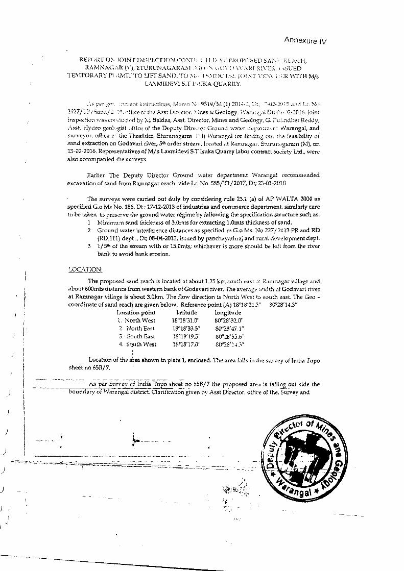
)
)
)
)
)
~
) j !
' ) I
I
) !
_)
Annexure IV
REPOP-T 0 . IOlNT INSPECTION CO: ' l ): C'TrD A r I'IWPOSED SAN! RLA -l, RAl'v! ' A r\R (\1, ET URUNAGA.RA.;.\ ·1 \ i ) t"~" -~C.l'.'D \\ .\l' J l:Zl\Tl\.. i ;,SUED
TEMPORARY PI ,,J\•rrc ro LIFf SAND, TO i\li 1"'.\ ll C.: T td.]O!. 'T \'ENC :ER WITH l\.1/s L:\..XMIOEVl S.'f I ~<JKA QUARRY .
. \s p r ~o· ::•.:~~ '~:1t i.:~stnKtirms, 1\·ieJr:·.J N· 9519/M .(1) 201 .-:. Dl, -~02-2(H5 and Lr . . ! ... l 2527 ;~. I Sand/ _I 1°, o•[f ce of thl! A::sl Di~r?ctor. "li1es & Gt?ology, \· ·o:r.::;~,!l Dt; 0 l· l:-20lu. Jomt
insped :1 was COl 'dt:•: tt>d by :vi. Baldi\S, Asst. Diro;:c tor. Mines and Geology, G. Putu~dher ReJ iy,
.\sf.t. Hydro g~olc.·gi!:t )££ice of the Deputy Dirt!LIOr Grol.lnd '.'.'aler d..:p.,. rt:J~l•:J~' v'/arangal, and surveyor, oUice o' the TI1asild.er, Etumnt~garm ( I} Wnrol'gn.l for (inci!.:·tg out th,; fea sibilil)' of sand extraction on Godavari river, S•h order stream. J oe<~ ted dt Ranmagar, Eturun;•garam (M), on 13-02-2016. Representatives of M/ s Laxmidevi S.T lsuka Quarry labm contract society Ltd., were also accompanied the surveys
Earlier The Deputy Director Ground water depar tment Wara.."tgal recommended excavation of sand from Ra.."J1nagar reach vide Lr. No. 585/Tl/2017, Dt; 23-01-2010
The surveys were ca11:i.ed out duly by considering rule 23.1 (a} of AP WALTA 2004 as specified G. o Ms No. 186, Dt: 17-12-2013 of industries and commerce department, similarly care to be taken to preserve the gyound water r~gjmc by fallowing the specification structure such as.
1 Minimum sr.nd truck ness of 3.ili·~Lts for ~xtracting l.Omts thic'kne.ss of sand. 2 Ground waler int rferencc dis tances as specified m G.o Ms. No 227/201:'1 PR and RD
(RD.lll) dept .. Dt; 08-04-2013, is,>ued by panchay;lthraj and ruri!l d·~vdapm~n dept. 3 1/Sth of the stream with or lS.Omts; whi,c:heve:r is more should b~ left from the river
bank to avoid bank erosion.
LOCATION:
The propo5ed sand reach is located at about 1.15 km s uth easr ot f.'o.mnagar v1llag and about 600mts distance from western ban.'- of Godavari river. The average ·.nd t.~ o.;~f Godavari river a t Ranmagar village is about 3.0km. The flow direc~on is "orU1 West to souU\ casl The Geocoordinate of sand read} are given below. Reference point (A) UM8'21.3" L0"2 '14.3"
Locat1o.n point latitude longitude 1. North West 18"1 '31.0" 80"2S'32.0" 2 J 1orth E;:!st 18°1 '33.5" 80"28' 47.1" 3. Sout.l, East 18"18'19.5'' 80'''28'55.6" 4. Squ th West 180JS'17.0" 80"2 .. '! .3"
Location of the Jea shown in plate 1, enclosed. The • re~ falls in the ·w-vey of tndia Topo sheet no 65B/7. '
·--- .,--_......,_ .. _ rup~-,~~ve)~;:;:~ tOp() sheet no 658/7 the proposed ar~a is falling oul side the
boundar 'of \Varangal district Clariiication given by A sst Din~t l>r, offic' of the,'St;:Ney and
·~ --- " -
0--
. .J I
J ~'·"·
.)
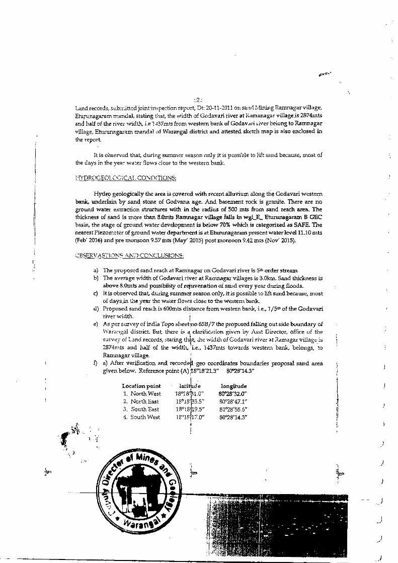
J
t! I
::2::
Land records, submitted jointinspection report, Dt: 20-11-2011 on sand. Mining Rarnnagar villil.ge, Eturunagaram mandal, stating that, the width of Godavari river at i{<lmanag r village .is 2874mts and hall of the river width, i.e 1-~37mts from w estern bank of Godav,ui 1 iver belong to Rarnnagar village, Etunmagaram mandai ,)f Warangal dis tric t and attest.ed sk~tch map is also enclosed in the report.
It is ohserved that, during summer season only it is possible to lift sand because, most o£ the days in the year water flows close to the western bank
HYDROGEOL(•GJC;\L CO 101TIONS:
Hydr? geologically the area is covered with recent alluvium along the Godavari western bank, underlain by sand stone of Godvana age. And basement rock is granite. There are no ground water extraction structures with in the radius of 500 m ts from sand reach area. The thickness of sand is more than B.Omts Ramnagar village 1alls in wgLE_ Etu.nmagaram B GEC basin, the stage of ground water development is below 70% which is categorized .as SAFE. The nearest Piezometer of ground water department is at Eturunagaram present water levell1.10 mts (Feb' 2016) and pre monsoon 9.57 ints (May' 2015) post monsoon 9.42 mts (Nov' 2015).
a) The proposed sand reach at Ramhagar on Godavari river is 5th order stream b) The average width of Godavar~ river at Ranmagar villages is 3.0km. Sand thickness is
above 8.0mts and possibility of rejuvenation of sand every year dm-ing floods. c) lt is observed that,. during summer season orily, it is possible to lift sand because, most
of days_irt the year the water flows close to the western bank d) Proposed sand reach is 600mts distance from western bank, i.e., 1/51h of the Godavari
river width. 1 e) As per survey of india Topo sheet no 65B/7 the proposed fallirtg out side boundary o£
\-\ nrangnl district. But, there is ~ clarification given by 1\ st Din~ lor, office of the survey of Land records, statmg thtt, .:he widthof Godavari river atRamagar villageis 2874mts and half of the v..oidth, i.e., U.37mts towards western bank, belongs, to Rarnnagar village.
i f) a) After verification and recordefl geo coordinates bounda.-ri.es proposal sand area
given below. Reference point (A) ~S"l8'21.3" 80"28'14.3"
latithd-e Location point l ongitude ' 1. North West 18"18pl.O" 80"28'32.0"
2. North East 18°18'63.s" 80°28'47.1" 18°18(~9.5" 3. South East 80"28' 55.6"
4. South West 18"18~17.0" 80°28'14.3"
" • I
) I
)
)
)
f
I I
" i !l !! li
)
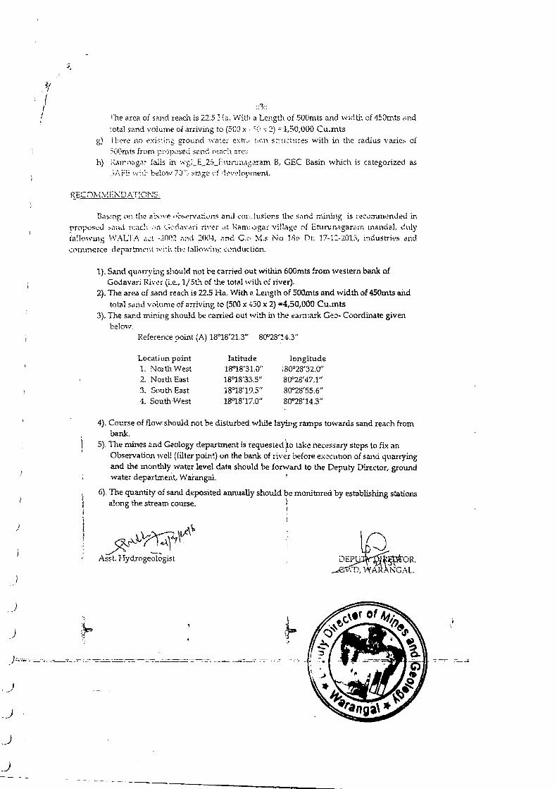
)
)
_)
)
)
)
)
)
l 1 !
::3::
l·he a.rea of sand reach is 22.5 Ha. With a Length of SOOmts and width of 450mts ,;nd \otal S<md volume of arriving to (500 X. ;n . 2) ="-l, ·· o,ooo Cu.mts
g) i b('1·e no t' Xir-:in6 ground \ \'ilt'": .:::d:r .. hem s tnK u:es with in ihe radius varie~ of ~OOtnts from pi·oposed st:1nd r;~c.c:\ are~·.
h) ~\.m•n<:gn: falls in "'&l_E_26_1\ruru n<~garam B, GEC Basin which is categorized as .::~AFE ',\~ iL ... belov ... : 70";; ~t3 ge (".f \1! .. \'(•lopnl.ent.
RECOlvt, !Ei'\0.'\T)ONS
l3a mp: n lhi! a·o' - ~ bserv !:ions «nd ccnKitUoions U\1! 'il !\d mining is rec~m.rnended in
proposed :-notd reach • n ,cd.wari nve:· ,,t Ram:li!V,ilr vi llage f Eh.uu nil garam mandal, \i 11ly fallowD1g WALT.'-\ a::l -1001 n11d 2004, nnd G.c- :-.ts No 1Sii Dt . 17-1:!-201:', md.ustri s ,1nd commerce depar!:nwn t w i•h 'he lnllov:inl5 ..:l.'n<h tction.
1). Sand. quarryi:.ng should not be carried out withiJ1600mts from western bank of Godav ri Rivt!~ (i.e?., 1/Sth of U\e total wilh of 1·iver).
2). The ar •a of sat1d reach is 22.5 Ha. With , Length of SOOmts and width of 450mts and
tom] sand ' htme of arriving to (500 x 430 x 2) =4,50,000 Cu.mts 3). The sand rni..-.ing should be carried out with in the earn1ark Geo- Coordinate given
below. Reference point (A) 18"18'21.3" 80°28'14.3"
Location point latitude longitude 1. North West 1!M8'31.0" ;80"28'32.0" 2. North East 18"18'33.5'' 80"28' 47.1" 3. South East 18"18'19.5" 80°28'55.6" 4. South West l!M8'17.0" 80"28'14.3"
4). Course of flow should not be distUrbed while laying ramps towards sand reach from bank.
5). The mines <lnd Geology d partment is requested\ take necessary steps to fix t~n Observation well (filter point) on the bank ofriver before e;.;ecuhon of sand quarrying and the monthly water level data should be lorwacd Lo the Deputy Dil'Ector, grow1d water department, Warangal. 1
6). The quantity of sand deposited annually should be monitored by establishing stations along the stream course. 1
~\,.~ r'), p r_l~l' . Asst. Hydrogeologist
I i
~.·;:,..----- ========:=.;_;=-=..:--=="' - ·-=·
)
_)
,)
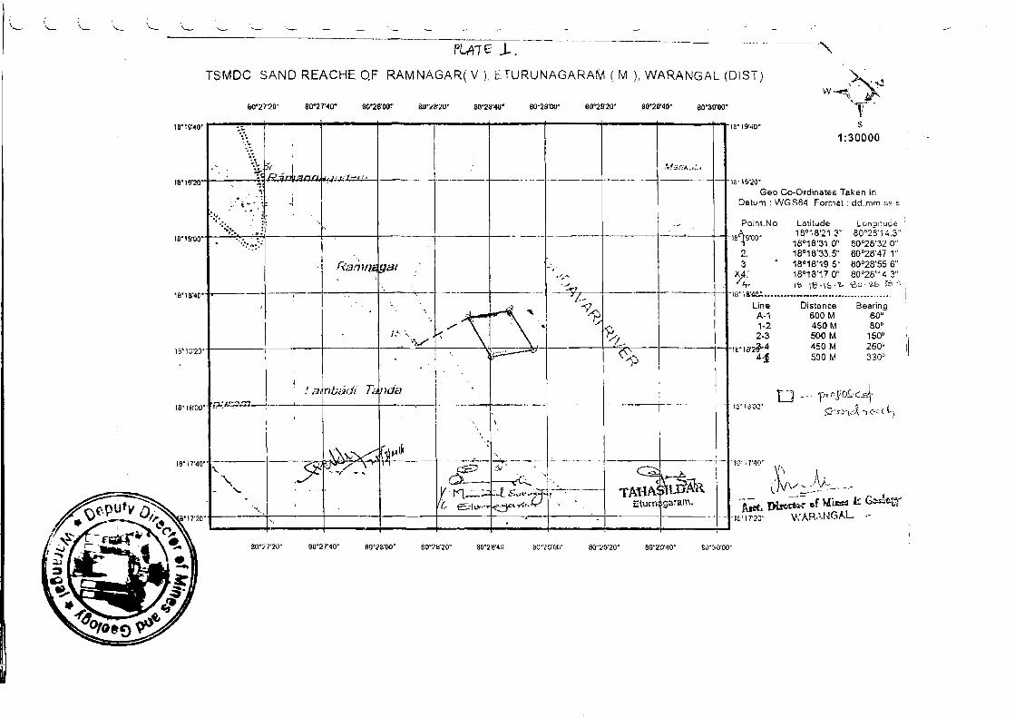
L .'- '-\ \._
( \._ ·-
PLAi£ J.. -
" TSMDC SAND REACHE QF RAMNAGAR( V ). ETURUNAGARAM ( rv1 ), WARANGAL (OIST) "'>' w ..••• i"~~ ., li"
&0'27'20' 80'27'40" 3(,'28'00'' &0'28'20" 80'2~'40' 60'29'00" 80'29'20" 80'29'40" ao·~o·oo·
,. ·-. - .. ' I "{r:.
18 '1 9'~0
~~~ l ! I
~· '!:.\. • "' t)r
·' ~ t;:•:;j J ;;lOCl , 'I.Jl ,_1_-.I:o
,fl..:~ ;;f!A.~.-·.,
. ..:l i ' ~ - T-. , . I
.. - - -: · .j ~- i- ' i
·~::-. . l : ' i ' . ' ·,~:: .. .. .: I '
... · , ~:·: ~~~: ! '
.
18' 19'20
16'1 9'00
' Ra/1111;; wat :
~. . .)( ' • : . -. -0 . - ·, I ' --"" ...-. --- : '-':.:.· .. 'l-_, ·. \ ~ - . .
<"\ r\· "9~ ." ~~ '.-,:,. ·, ~-.. -~ .........
I iF"" =---:.'1 <'/--
I
,,~J I . . 'J
\ l I ' f a . nt;.:;jrJi li. lnda .. . I r-- · ----__ ... ,_- -
1o't 8'40
1 B"' 18'20
IS' HrOO I
. \ \ .,
\ .
18' 17'4 ~~~~ .. -~\~~
. ··l--- - .· ... ' ..
y \, fV' / \ e:c;- ::.li ..... Q ·1-·
'\.. • T( ., .. g_::_ ~:...... ... . . ~~ -- -~ . . . . X n.~.-:..
( utftJR ' ~..ts"""iJ ) . TAHA , ' ' ... l
'· ' L. S t"""· ~t~t-- ·. ' Eturn garam. -
,..._~ -. ., ' --- -- --
80'2 7'20" so··2 r~o· 30'28'00" S0"2ff20'" 30'28'40 ~o~nrol;' S0'2D'20' 80'£0'40' s~1~:{U 'OO'
B'l9"·10'
~ - 1(1'20'
v~-
s 1:30000
Geo Co-Ordinates Taken In Datum · WGS84 Format : dd.mm ss s
I Point.No Latitude, Lonoitudt: '
8A
9.
0• 18°18'21 .3" aoo2ih 4.3"
1 ° 18°18'31 .0" 80°28'32 0" 2. 18'18'33.5" 80°28'47 1" 3 . 18°18'19 5 . 80°28'55 6" ~: 18°18'17 o·: 80°28'14 _3" ·It· t'b·\<l·i(:, · 'L- 'bo·''-b >::1· '' I 8" 1 ~~---- -·c ···--··-----·- · --- · - I
Line Distance Bearing A-1 600 M 60° 1-2 450 M 80'' ' 2-3 500 M 150" II
8"18'2~-4 450 M 260' I 4:f 500 M 330° ·
19' I 3\iO" t -l -- ·1·), eo Ji O~-" .J. ~ ~ ....... 1
5}. ~r,~ ·t .. -:A. ') .(< ( L ,~
13'1 7'·10'
... - l~~-~-~-Ptm. Dl~~ er M~ ~ G=!tt-1
IVI7'20" W!..RANGAL .. -
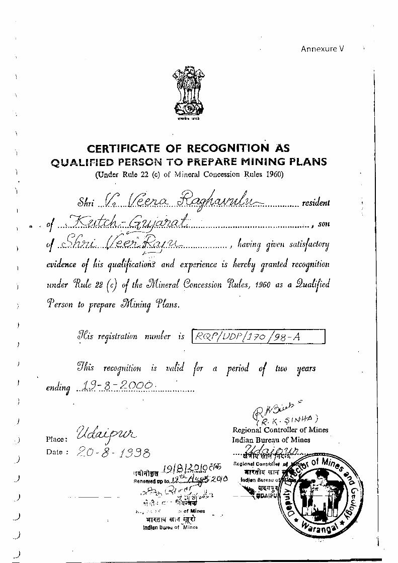
)
)
)
)
)
)
_)
.)
.)
_)
Annexure V
CERTIFICATE OF RECOGNITION AS QUALIFIED PERSON TO PREPARE MINING PLANS
(Under Rule 22 (c) of Mineral Concession Rules 1960)
SAri ... V:. .. {ft.~ ... ~/V.!.u.l.?:tc.-:: ... ........... resiJenl
of ... ,J<;f+.f.c.A-::!i.:!!J~i.-............................... ... .. ............ , ·'o" of .. C:£~ .... (/e..~/RCJ{'?:f.-:-: ......... ......... ) /,aving ?iven satis{actor~
) ·
evidence of ~is 1uali{ications' am! expenence ts Aeret~ ~ranted reco~niliou
under ~ute 22 (c) of tiLe :htineral eoncession GflufesJ 1960 as a f2ualified
T er son to prepare Min in~ P fans.
Place:
Date :
V'Ais recognition 1s vafz·J {or a period of two years
13-8-2006-. . . . . . . . . ~ .................... ................ .... .. .
Z!dcU-rOL 2u -8 - 1338
l o 1· a f.ZO (0 (J'ifJ ;T~"i"ittifef .. .7- . ~ · ·· ~···· ''
l rJ -t.A.f.L(i~f5· ;;_ nJ () Renewelt ap t~;·<- .. . ~ ~·-~ ~t
- Q-, { ~f .r·r! '" ,x /~Ch. ~- . _, .. , ,.;~ ....... ~ ~ ~ ·r _.,._.._ .,; ., '."!-.· r·- rr'
'· . ,, i - · • ~""
f. .• . - ·. ' ,·. ,; r of Mines
~r~c:n-1 ~~ .,. iqp::) Indian Bur&U of -M i~es
~9 ID} ' I
IJt'R- 1\ . ~ u,p ~--~~ } Regional Controller of Mines Indian Bureau of Mines
?/__/r~~ ;... ·-r.~"ftr~~-@~-!1cgion•l Contr~~; ~
m~\11 ~rrr
... ,c-.
---,-.----.
~ . ,.,...---
(.·~:, ot I
. .~ .... -·
~·
)
J